| PalestineRemembered | About Us | Oral History | العربية | |
| Pictures | Zionist FAQs | Haavara | Maps | |
| Search |
| Camps |
| Districts |
| Acre |
| Baysan |
| Beersheba |
| Bethlehem |
| Gaza |
| Haifa |
| Hebron |
| Jaffa |
| Jericho |
| Jerusalem |
| Jinin |
| Nablus |
| Nazareth |
| Ramallah |
| al-Ramla |
| Safad |
| Tiberias |
| Tulkarm |
| Donate |
| Contact |
| Profile |
| Videos |
Welcome To al-'Ulmaniyya - العلمانية (אל-עולמאניה)
|
District of Safad
Ethnically cleansed days ago |
العربية Google Earth |
 |
Gallery (23) |
- Statistics & Facts
-
Before & After

- Satellite View
- Articles 1
- Pictures 23
- Oral History 1
- Members 2
- All That Remains
- Wikipedia
- Videos 1
- Guest Book 1
- Links
| Statistic & Fact | Value | ||||||||||||||
| Occupation Date | April 20, 1948 | ||||||||||||||
| Distance From District | 14.5 (km) North East of Safad | ||||||||||||||
| Elevation | 75 (meters) | ||||||||||||||
| Before & After Nakba, Click Map For Details |
|||||||||||||||
|
|||||||||||||||
| Map Location | See location #37 on the map View from satellite |
||||||||||||||
| Military Operation | Operation Yiftach (commanded by the ethnic cleansing champion Yigal Allon) | ||||||||||||||
| Attacking Units | The Palmach's First Battalion | ||||||||||||||
| Exodus Cause | Military assault by Zionist troops | ||||||||||||||
| Village Temains | The village has been completely destroyed soon after occupation. | ||||||||||||||
| Ethnically Cleansing | The village has been mostly ethnically cleansed and terrorized after the massacre at the nearby village of al-Husayniyya | ||||||||||||||
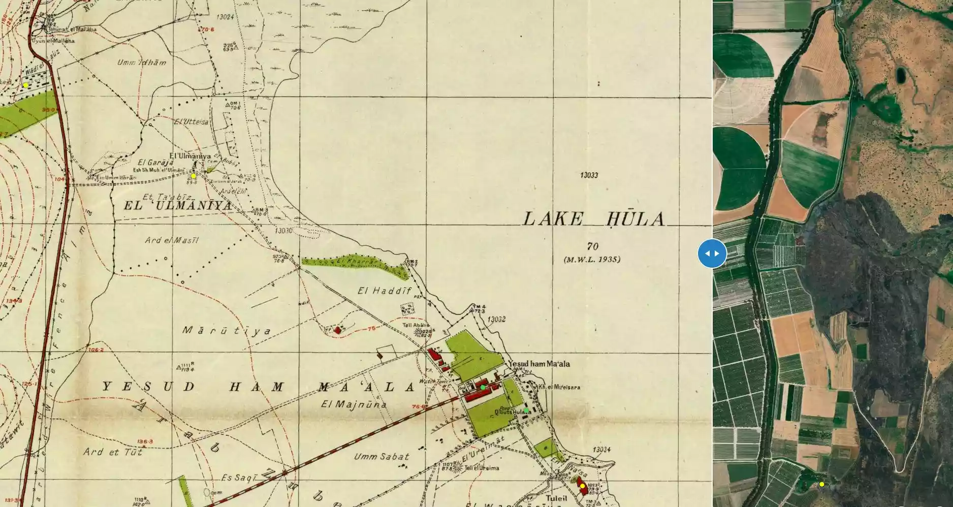
| Pre-Nakba Land Ownership |
**Town Lands' Demarcation Maps |
||||||||||||||
| Land Usage As of 1945 |
|
||||||||||||||
| Population |
|
||||||||||||||
| Number of Houses | In (1931): 100 (includes 'Arab al-Zubayd) | ||||||||||||||
| Near By Towns |
|||||||||||||||
|
|||||||||||||||
| Exculsive Jewish Colonies Who Usurped Village Lands |
Yesud ha-Ma'ala | ||||||||||||||
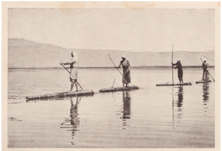
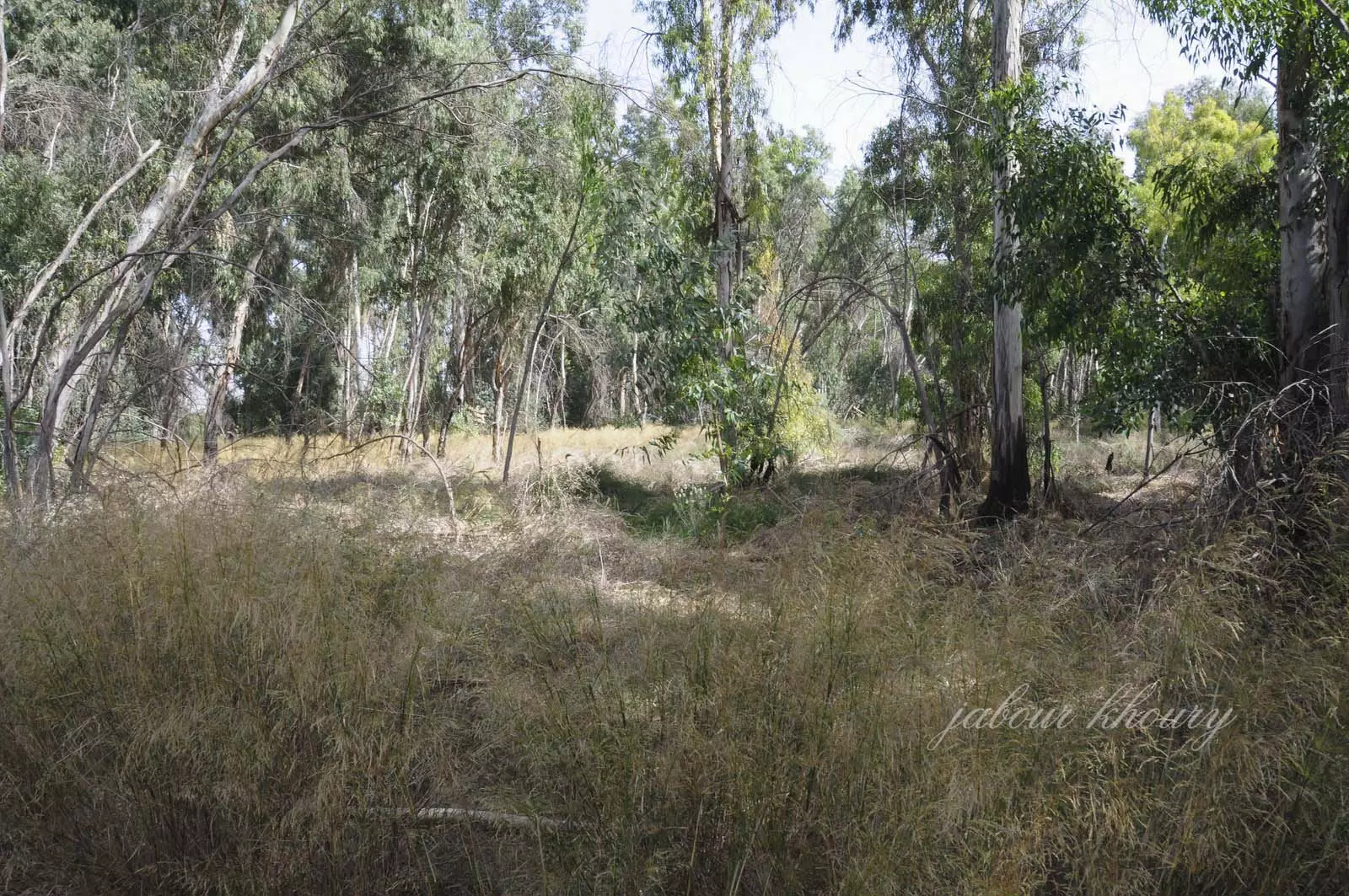
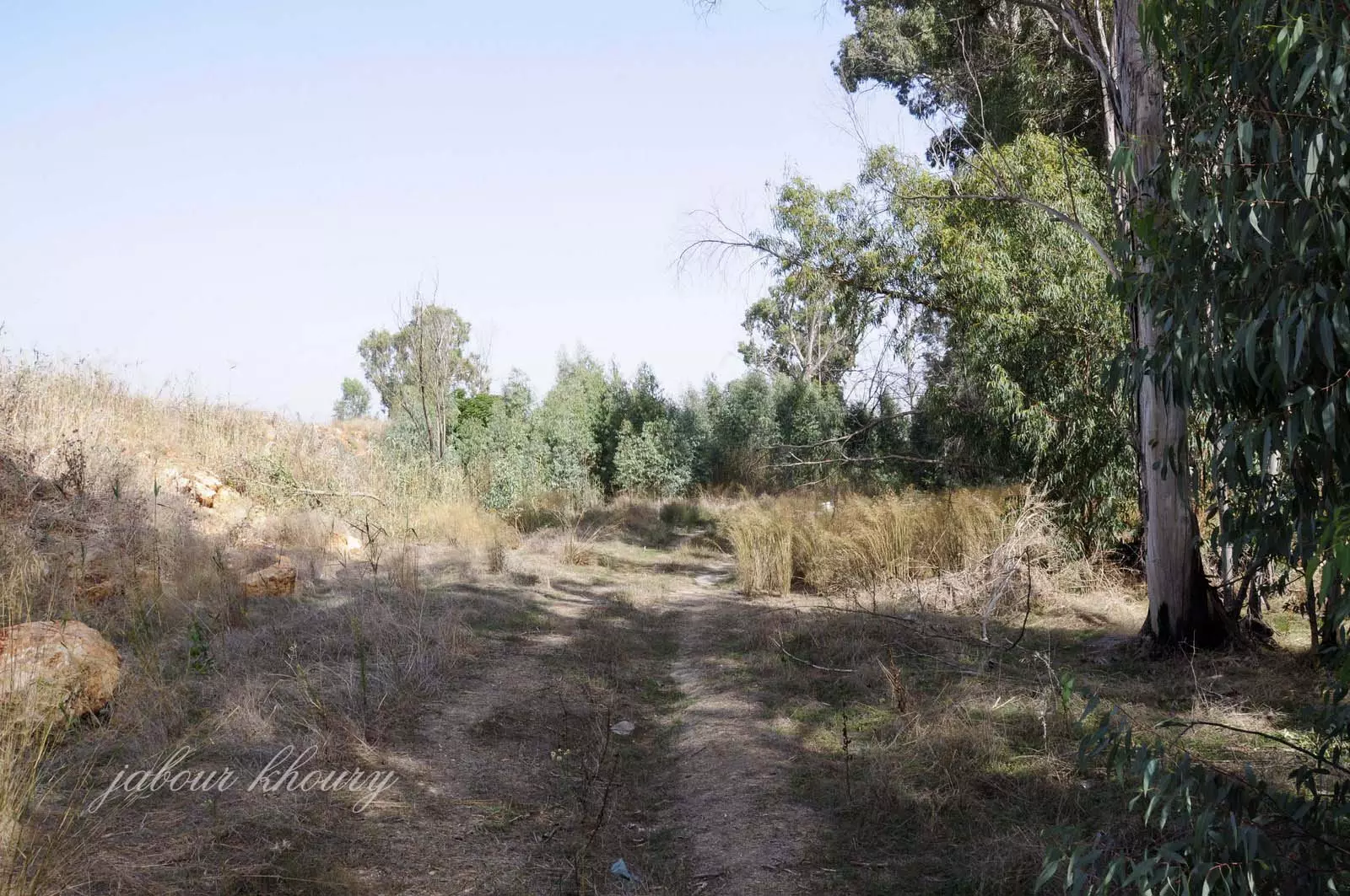
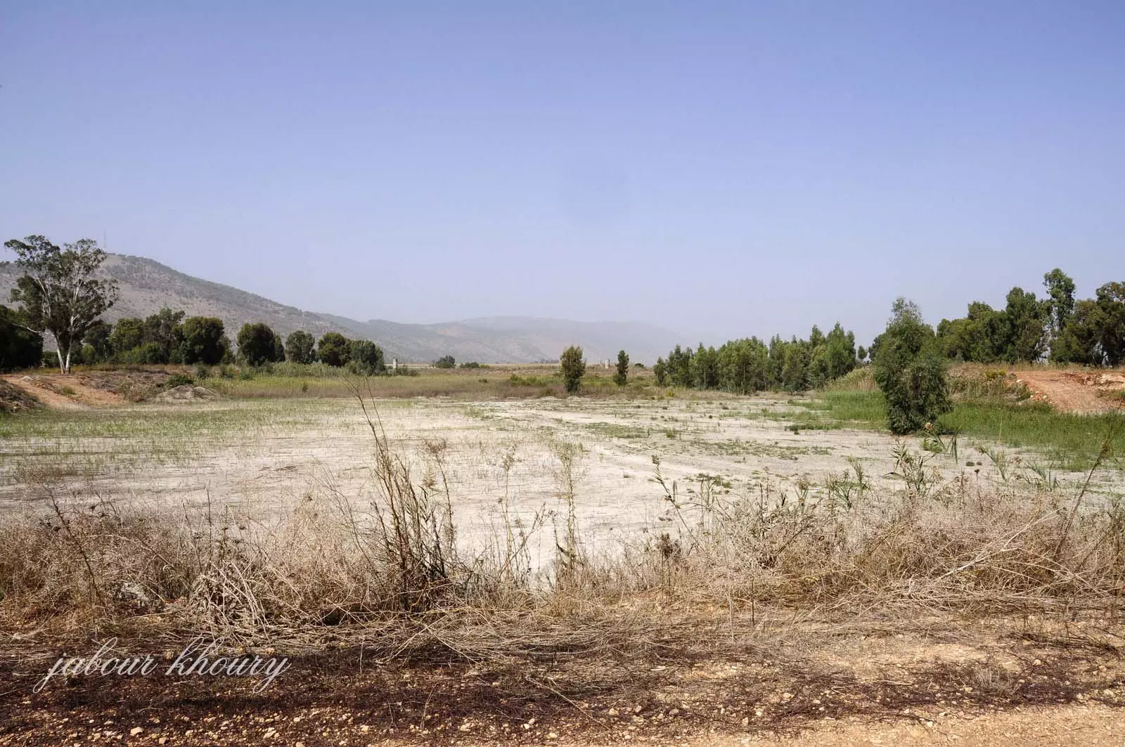
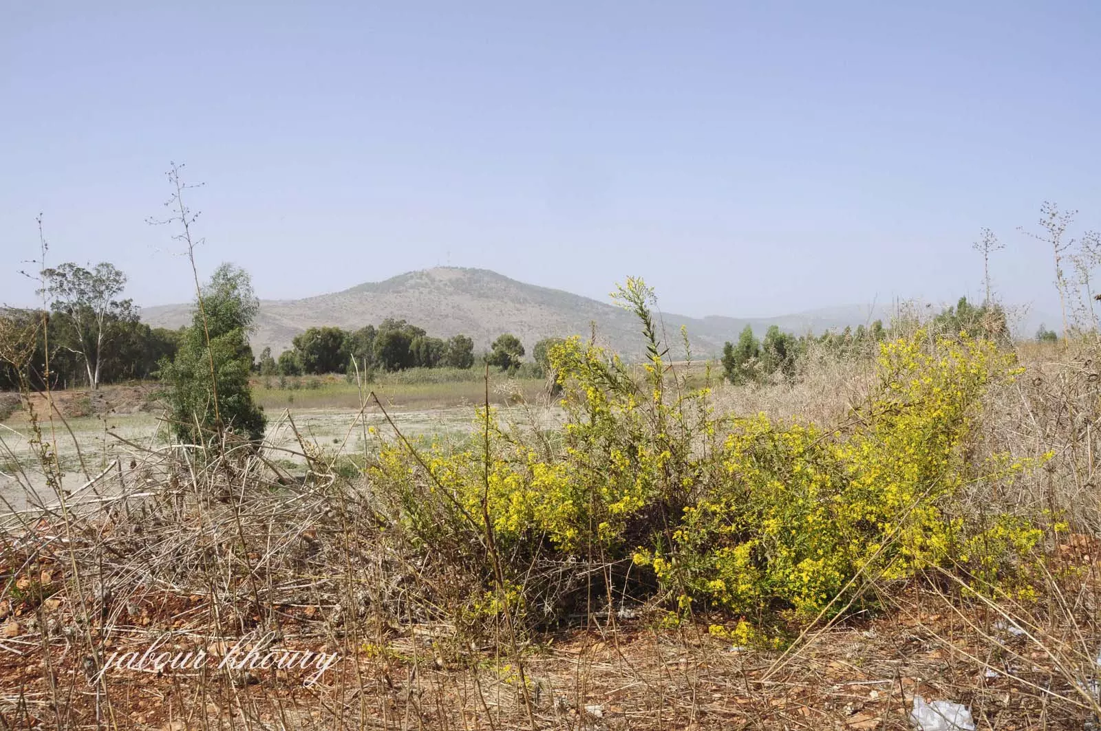
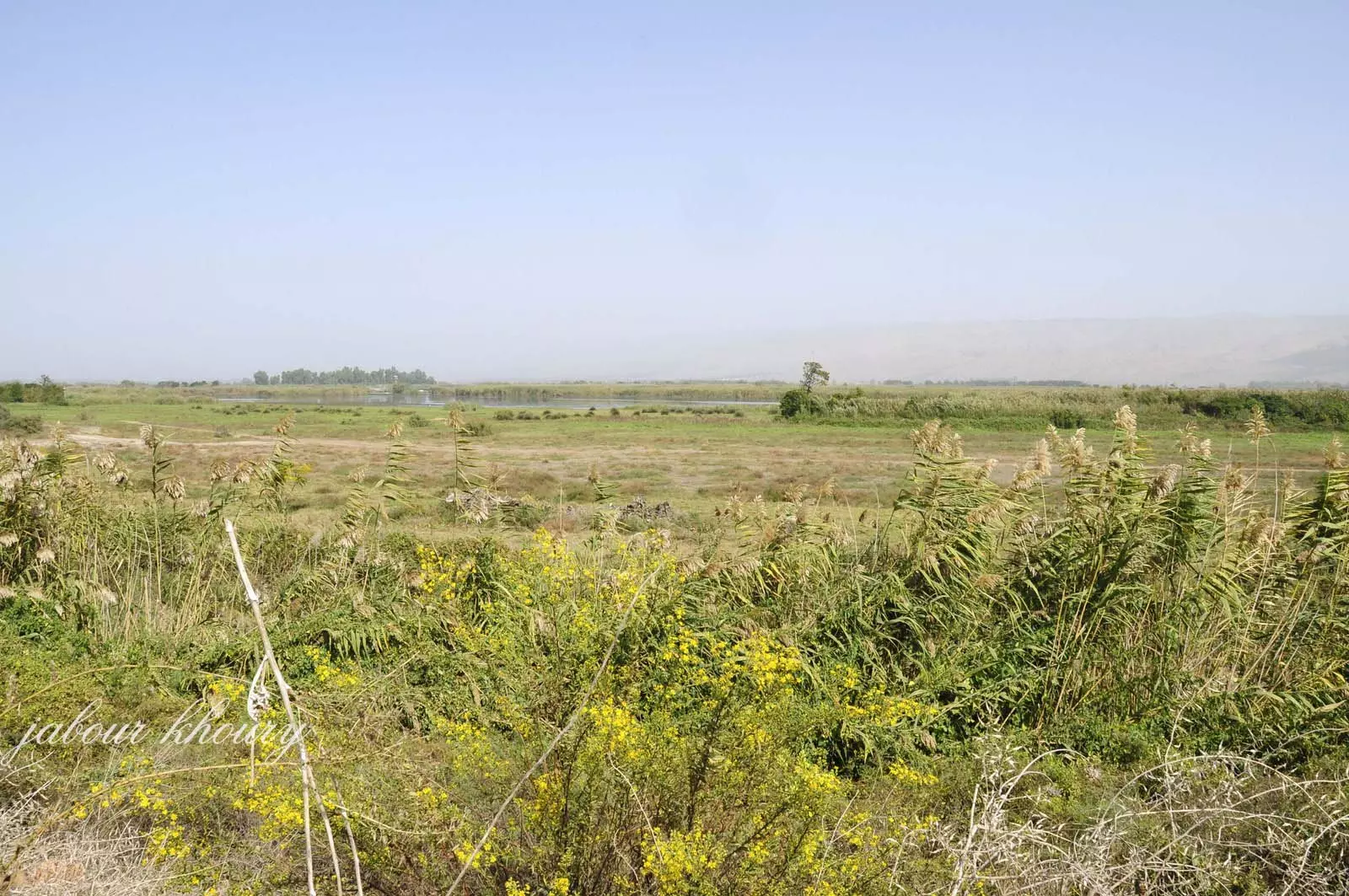
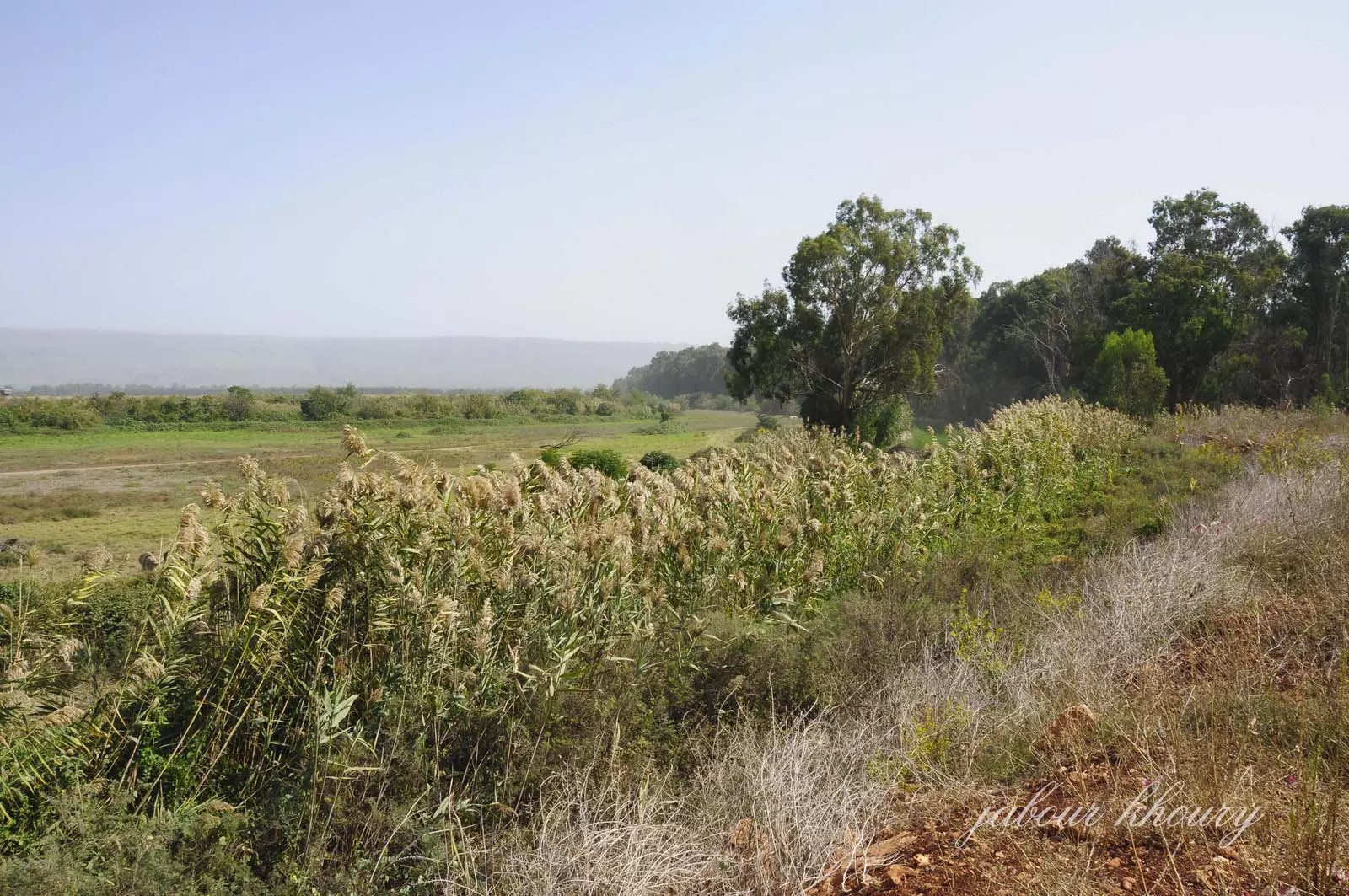
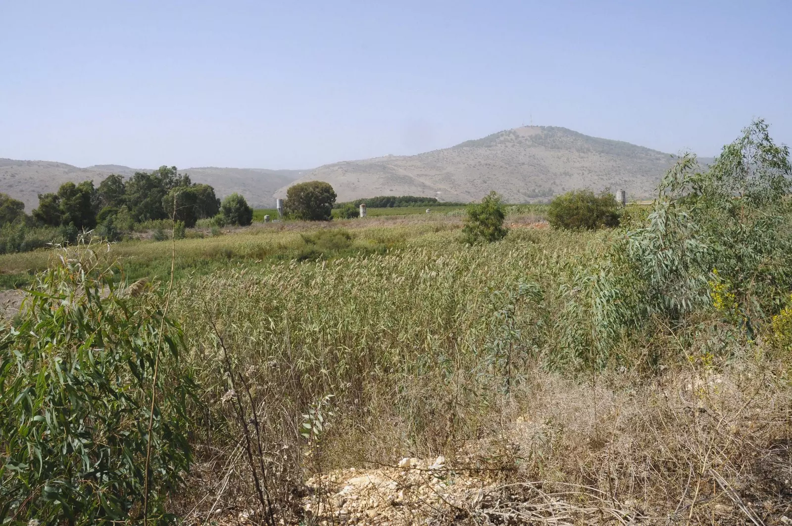
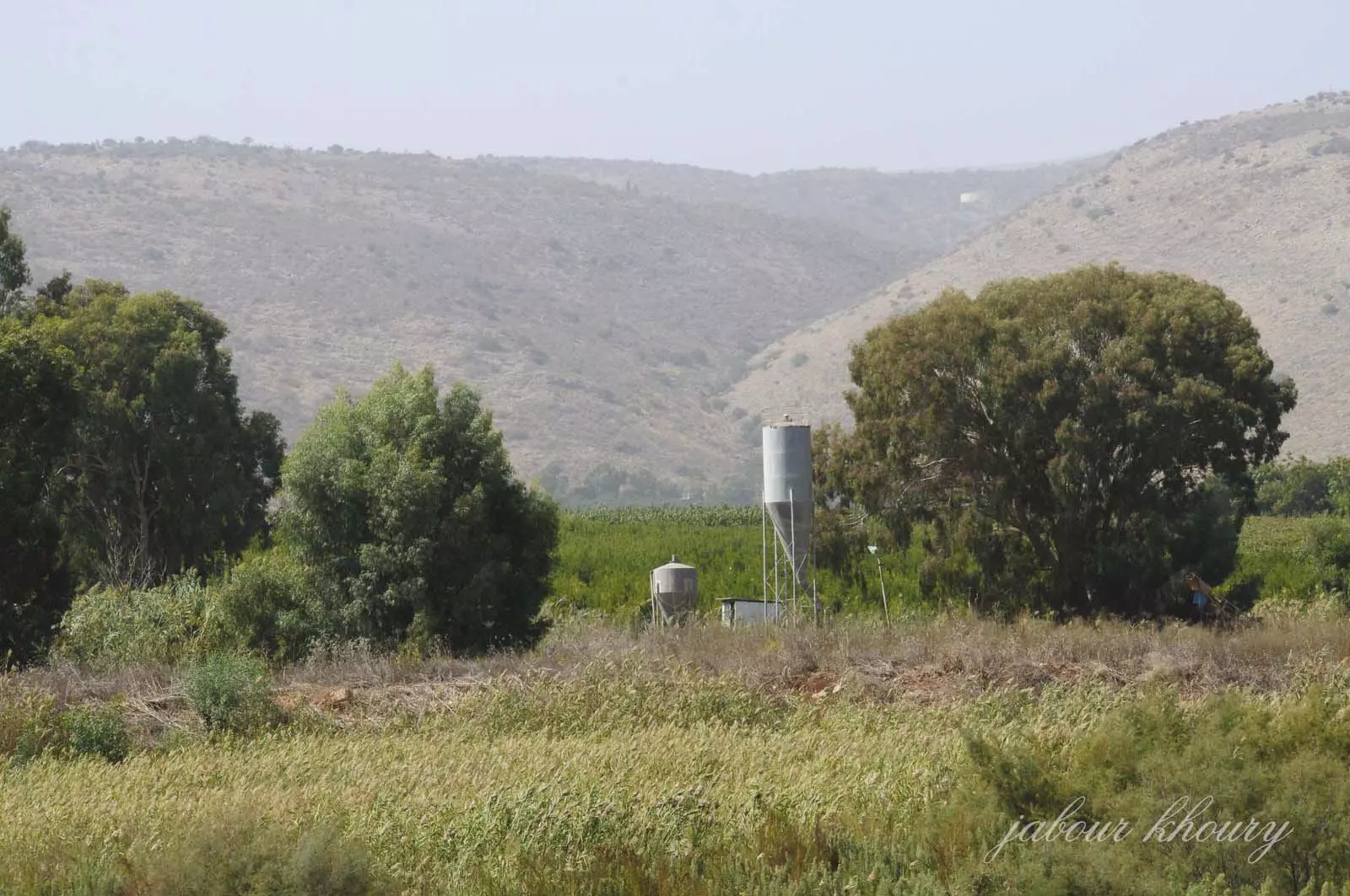
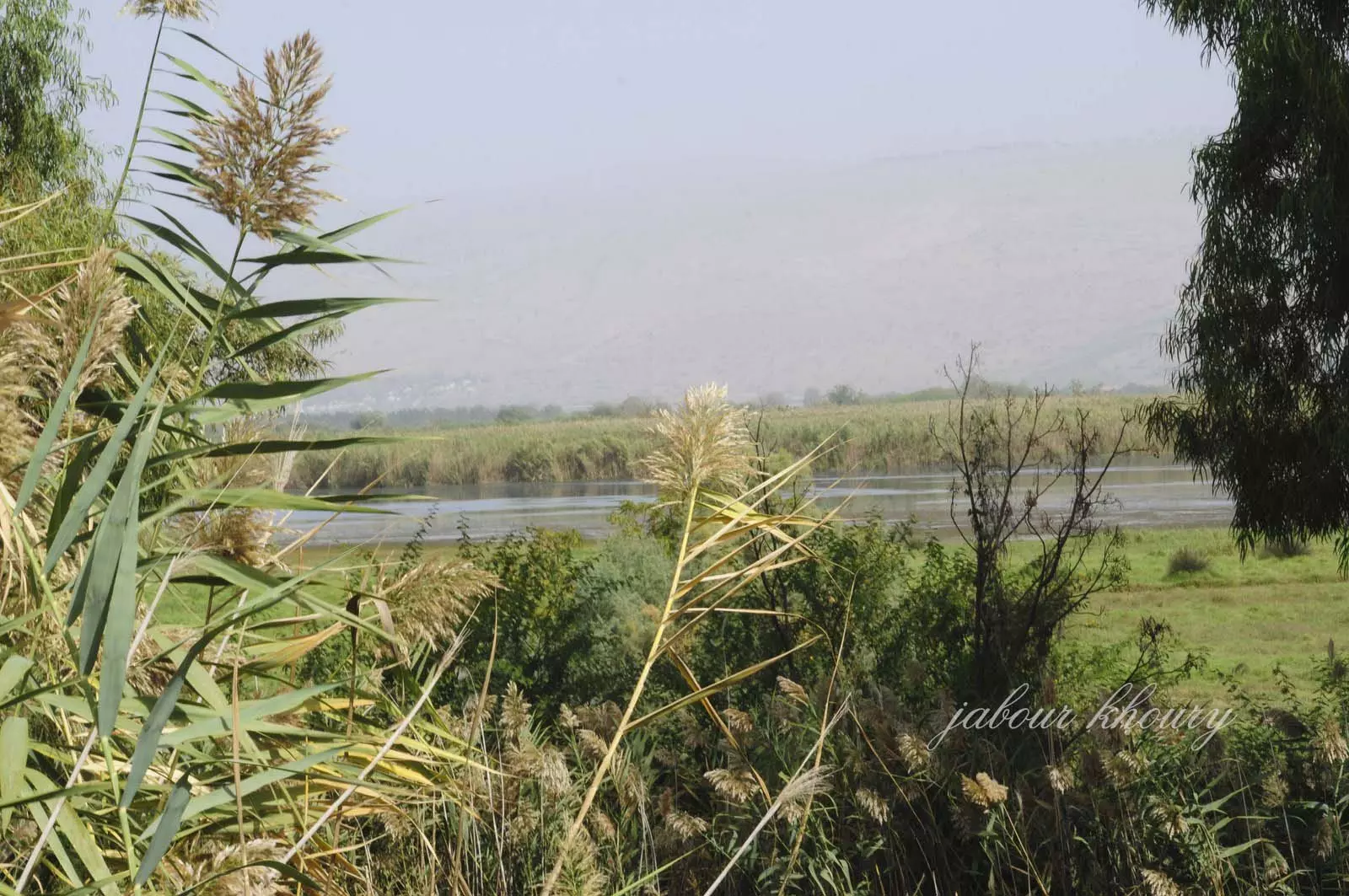
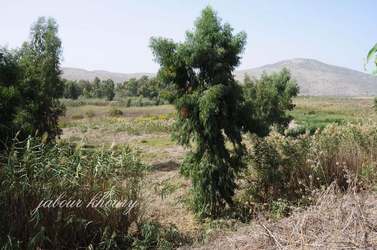
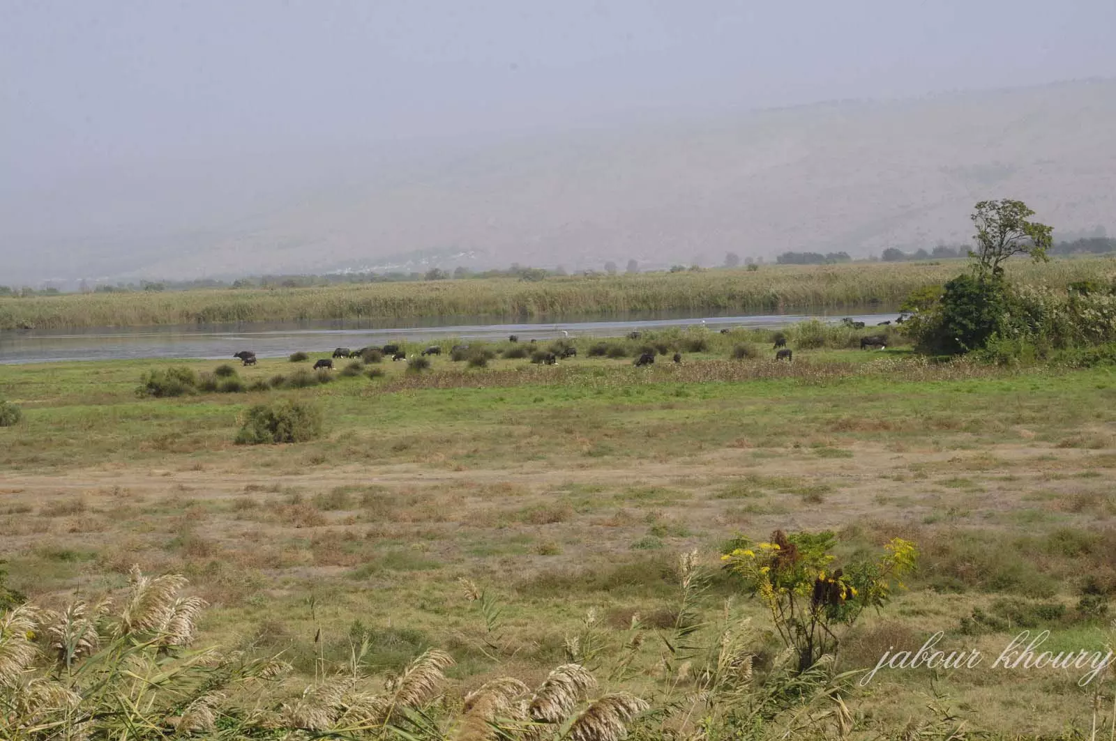
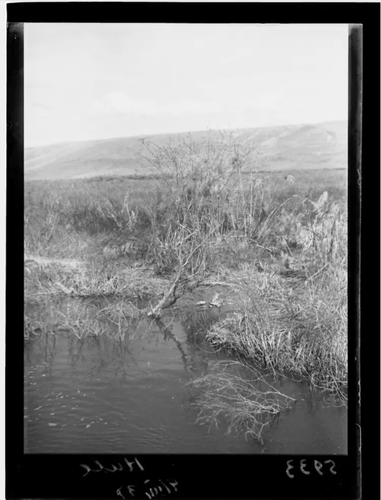
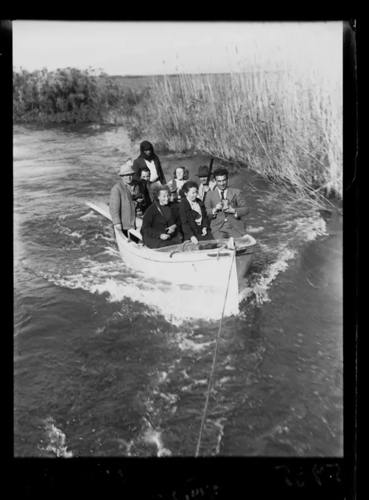
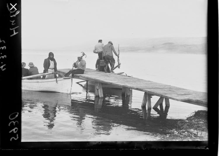
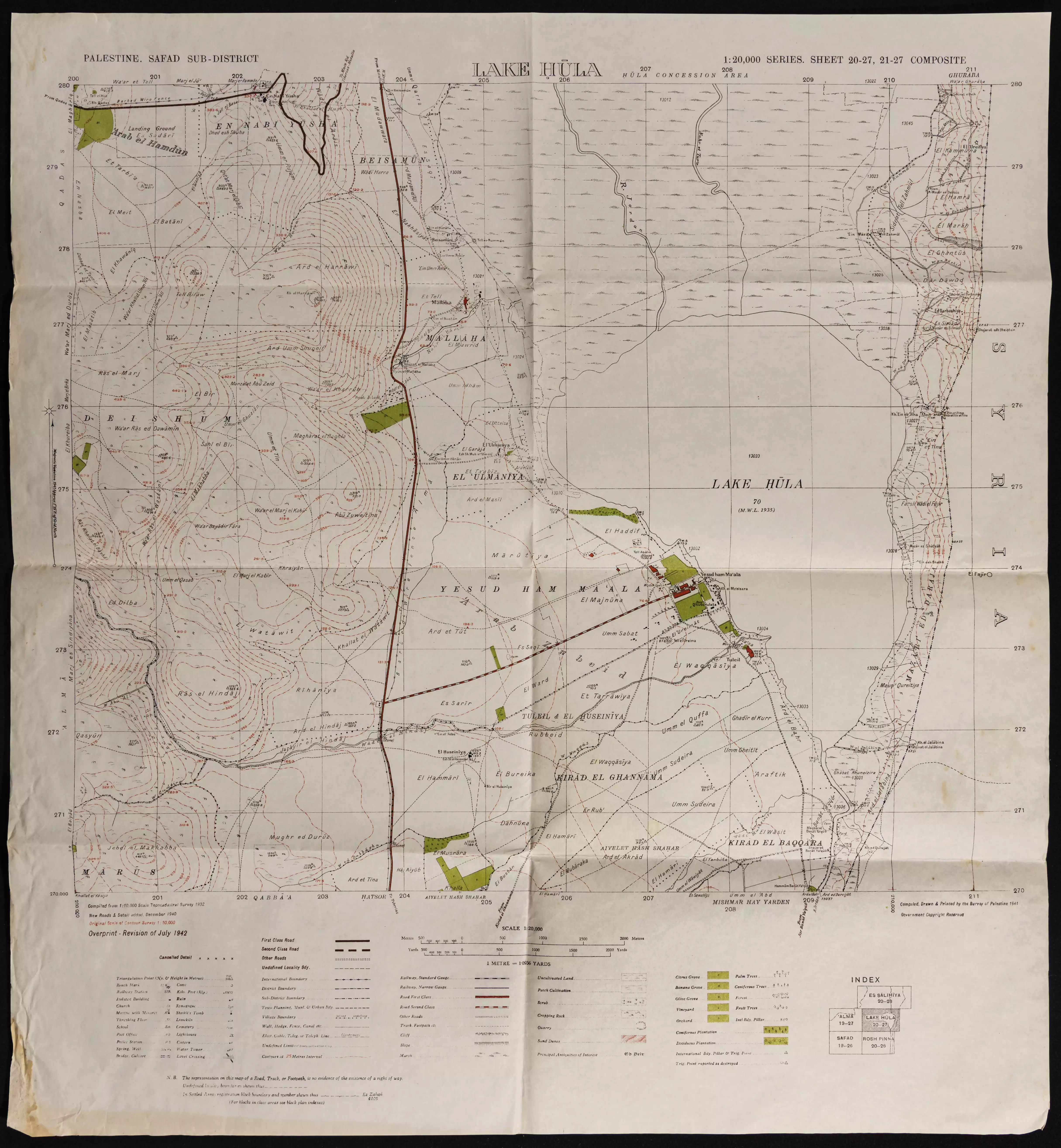
Village Before NakbaThe village was located in the southwestern part of the al-Hula Plain, near the western shore of Lake al-Hula. A secondary road linked it to a highway leading to Safad. In 1596, al-'Ulmaniyya was a village in the nahiya of Jira (liwa' of Safad) with a population of fifty-five. It paid taxes on a number of crops, including wheat and barley. Produce and property such as goats, beehives, water buffalos, and orchards were also taxed. [Hut. and Abd.:178] In modern times al-'Ulmaniyya was oriented north-to-south. Some of its houses belonged to the 'Arab al-Zubayd Bedouin, who lived about 1.5 km from the village center. The population of al-'Ulmaniyya was predominantly Muslim. Water for domestic use was provided by nearby springs. Agriculture, especially grain cultivation, was the mainstay of its economy. In 1944/45 1,135 dunums of their land was allocated to cereals. The villagers also raised livestock. There were traces of earlier habitation in the village, and to the northwest were artificial caves that had been cut into the rock.Village Occupation and Ethnic CleaningIsraeli historian Benny Morris provides two accounts of the depopulation of al-'Ulmaniyya. The first states that the villagers left in the wake of a Haganah 'retaliatory strike' (actually a massacre) on the nearby village of al-Husayniyya on 18 January 1948. The other account, based on Israeli military intelligence, states that they evacuated their village three months later, on 20 April, just after the beginning of Operation Yiftach (see Abil al-Qamh, Safad sub-district). This is said to have occurred either in response to a direct attack or to the threat of an attack. The two reports are not necessarily incompatible, however, and may imply that the first evacuation was partial or temporary. But the second displacement was most likely final, since practically the whole of eastern Galilee was depopulated during Operation Yiftach. [M:56, 123-24]Zionists Colonies on Village LandsThere are no Israeli settlements on village lands. However, the settlement of Yesud ha-Ma'ala (207273), established in 1883, is 2.5 km southeast of the village.Village TodayThe site is thickly wooded with eucalyptus trees, making it difficult to discern any remains ofthe village. Work is proceeding on street construction for Lake aI-Hula's nature preservation area. Some of the surrounding lands are cultivated, but most have either been made part of the preservation area or are marshland.SourceDr. Walid al-Khalidi, 1992: All That Remains. |
|||||||||||||||
| Related Maps | Town Lands' Demarcation Maps خرائط للقضاء توضح حدود القرى والاودية Town's map on MapQuest View from satellite Help us map this town at WikiMapia |
||||||||||||||
| Related Links | Wikipedia's Page Google Search Google For Images Google For Videos |
||||||||||||||
| More Information | في كتاب كي لا ننسى في كتاب بلادنا فلسطين المزيد من موقع هوية |
||||||||||||||
- موقع القريه من الجهه الجنوبيه
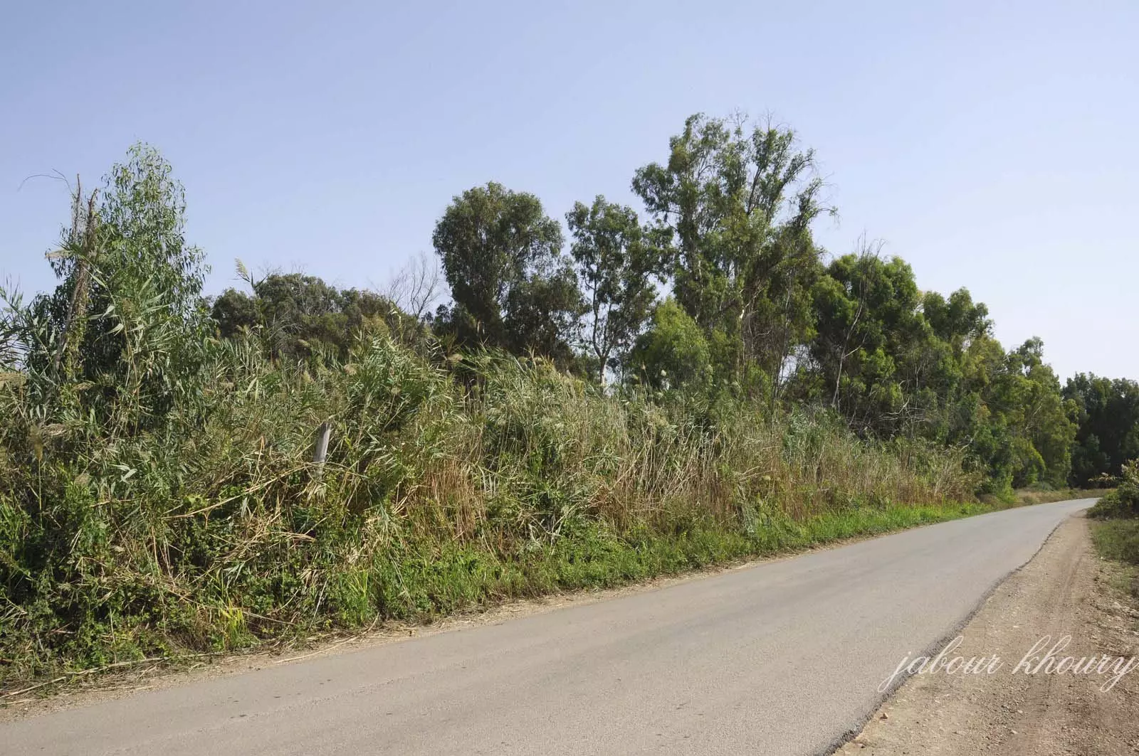
Posted by Jabour Khoury - موقع القريه المغطى بالاعشاب والاشجار
Posted by Jabour Khoury - موقع القريه
Posted by Jabour Khoury - البركه الموجوده في مركز القريه وتستعمل لجمع نفايات بقايا مواد البناء والباطون
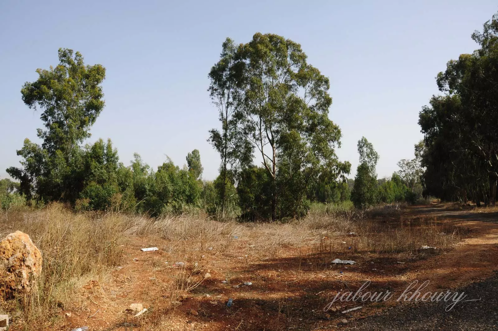
Posted by Jabour Khoury - مركز القريه وفي البعيد يظهر جبل هراوي
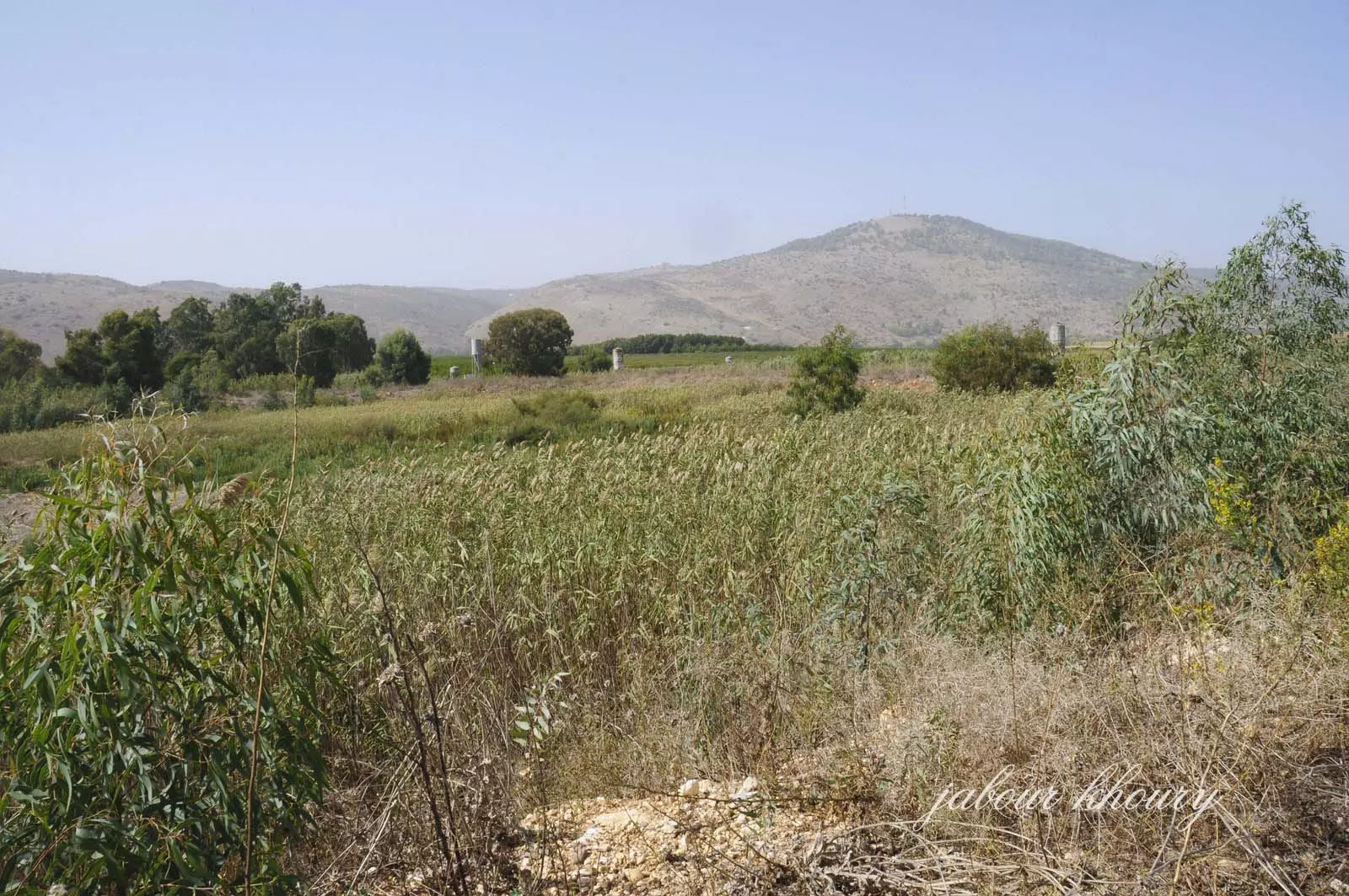
Posted by Jabour Khoury - نظره من موقع القريه باتجاه الشمال وتظهر عين ملاحه
Posted by Jabour Khoury - نظره من مركز القريه باتجاه الشرق وتظهر اراضي القريه المغطاه بالاعشاب والاشجار وهنا كانت حدود بحيره الحوله
Posted by Jabour Khoury - مركز القريه وجبل هراوي في المقابل
Posted by Jabour Khoury - اراضي القريه المزروعه بالبساتين وفي المقابل موقع قريه عرب الزبيد
Posted by Jabour Khoury - محميه الحوله على حدود القريه الشماليه
Posted by Jabour Khoury - موقع القريه
Posted by Jabour Khoury - جزء من محميه الحوله القريبه من موقع القريه
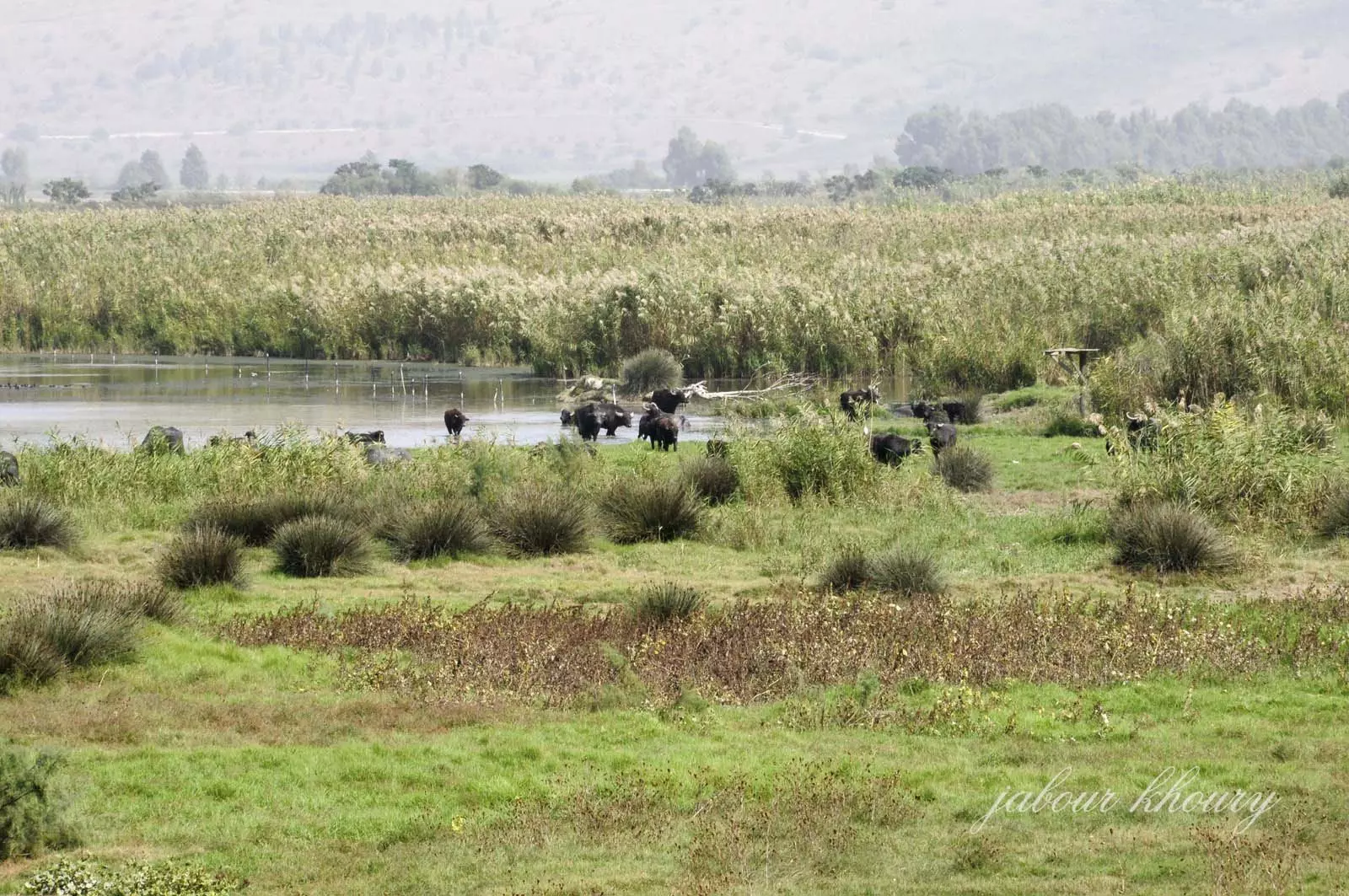
Posted by Jabour Khoury - محميه الحوله
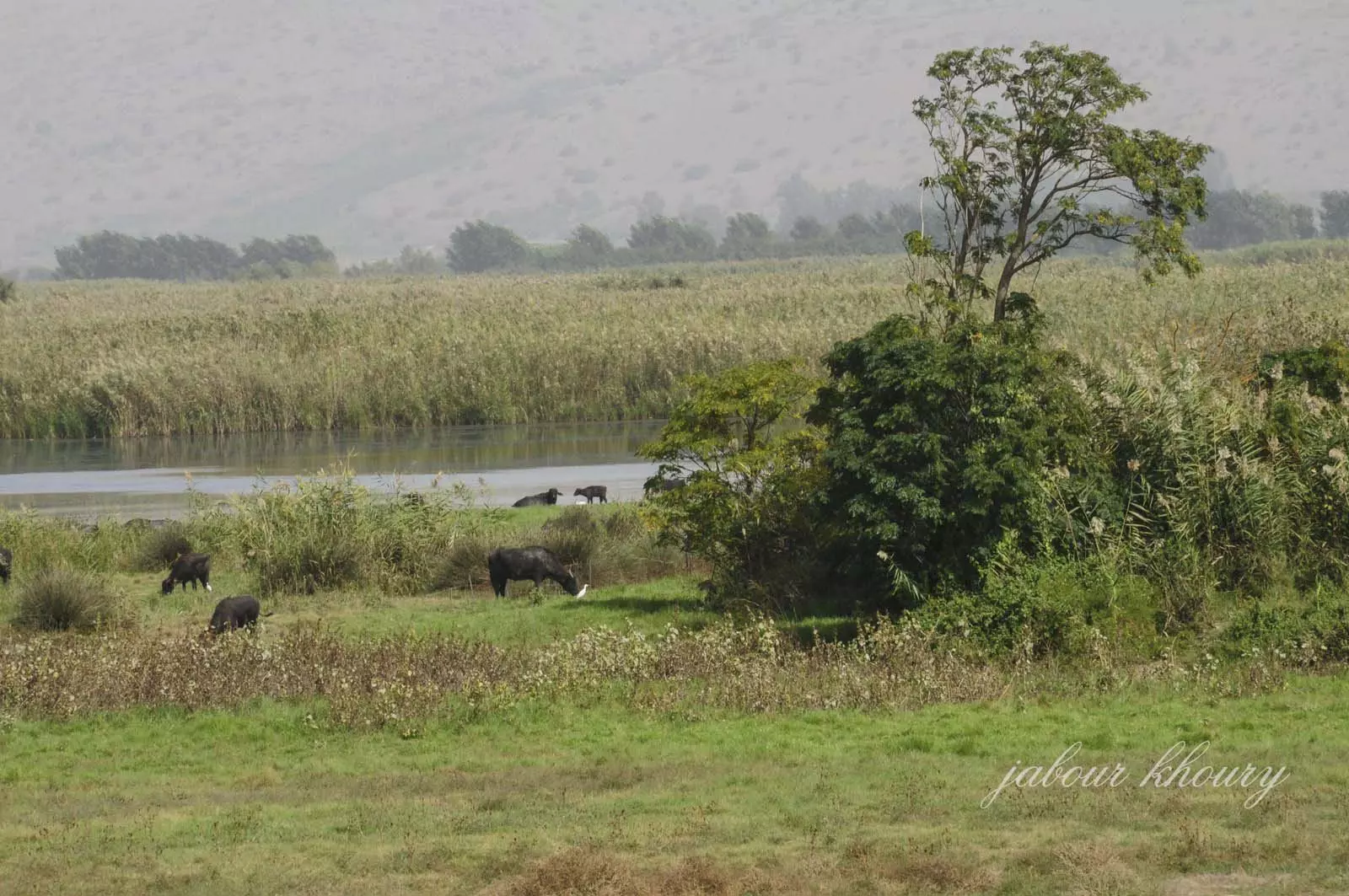
Posted by Jabour Khoury - محميه الحوله
Posted by Jabour Khoury - موقع القريه
Posted by Jabour Khoury - اراضي القريه
Posted by Jabour Khoury - صوره من قريه العلمانيه قبل النكبه
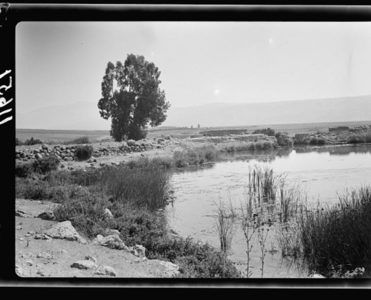
Posted by abu raya - العلمانيه قبل النكبه
Posted by abu raya - العلمانيه قبل النكبه
Posted by abu raya - العلمانيه قبل النكبه
Posted by abu raya - العلمانيه قبل النكبه
Posted by abu raya - العلمانيه قبل النكبه
Posted by abu raya - خارطة تُظهِر الحدود والطرق بأنواعها والأماكن المقدسة والطبيعة الطوبغرافية من تلال وسهول ومنحدرات والتشكيلة الطبيعية للأرض وأنواع المزروعات. نُشرت الخريطة فترة الانتداب البريطاني، تم إضافة تعديلات عليها من قِبَل خدمة الخرائط والصور التابعة للقوات العسكرية الاسرائيلية فترة الأربعينيات.
Want to browse more? 80,000 pictures were grouped in these gallaries:
| Display Name | Clan/Hamolah | Country of Residence |
| علي شمالي | - | بيرون , لبنان |
| Palestinian_Blood | Deeb | Beirut, Lebanon |
- الذاكرة مفتاح العودة-الحلقة 29 - قرية العلمانية Duration: 23 min 22 sec
No links have been shared yet, be free to the first to share the first link.
 Fake Valor: Why Did Zionist Jews Hoist Nazis Flag on Their Ships in the 1930s?
What is new?
-
Facts About Oct. 7th Gaza Raid
-
Remined Us Please:: Who Did Rape Who? Palestinians Raped Israelis? Or, was the other way around?
-
When Prof. Edward Said was invited to debate Bibi Netanyahu in the 1980s, watch what happened!
-
Ezra Klein of the NY Times on the "Jewish Race".
-
Abusing Blood Libel!
-
Did Israeli Soldiers Activate The Hanniba Direective On Oct. 7th? You Be The Judge
-
Zionist FAQ: Isn't it true that Palestinians don't want peace? Palestinians never accepted the two-state solution
- Facts about Haavara (Transfer) Agreement between Ben-Gurion & Hitler
-
Haavara FAQs: Why Did Zionist Jews Hoist Nazis' Flags on Their Ships in the 1930s?
- Haavara FAQs: When Chaim Weizmann met FDR in mid-1943, why was he silent about rescuing European Jewry?
-
Dear ChatGPT: How did Palestinians resist Napoleon's invasion of their country in 1799?
-
Dear ChatGPT: Gaza had a vibrant Jewish community in the mid-17th century. What happened to them?
-
Dear ChatGPT: Why did the Jewish Agency suppress news of the Holocaust during WWII?
-
Video Playlist: Jews share their DNA tests to end the conflict for good.
-
A Tale of Two Conflicts: Examining the Definition of Genocide
-
Prof. Abraham Polak And The Suppressed History of the Khazars and European Jewry
-
How Ronald Reagan would have framed the genocide in Gaza if he were still alive?
-
Haavara FAQs: Let us do the math: how many German Jews did The Haavara Agreement save?
-
Zionist FAQs: The Hebron Massacre of 1929, "clearly proves" that Palestinians are antisemitic, how could you deny it?
-
Zionist FAQs: Why Anti-Zionist Is Not Antisemitism?
-
Zionist FAQs: Isn't it true that the KGB created Palestinian Nationalism in the early 1960s?
- Zionist FAQs: Muslims are killing Muslims all the time; why are Israeli Jews being singled out in the media?
- Zionist FAQs: How is Israel an apartheid state when 20% of its citizens are Arabs who enjoy full rights?
-
Haavara FAQs: Why Did Dorothy Thompson Flip From A Zionist Advocate to A Silenced Dissenter?
-
Haavara FAQs: Analysis of Herzl's Uganda Scheme and how it could have saved millions of Jews.
-
Haavara FAQs: Why did Hayim Greenberg describe American Jewry as "morally bankrupt" in early 1943?
-
Haavara FAQs: What if the Evian Conference was a resounding success? What would have been the impact of saving European Jewry on Zionism?
- Haavara FAQs: What if the six million were saved, how that would have impacted the Zionist project?
-
Haavara FAQs: How did Zionist leaders react when Europe's Jews lingered in the DP camps after WWII ended?
-
Why does the American Jewish community repeat lies that David Ben-Gurion had debunked before he died?
-
Who has the power to rename the Tatar/Khazar Gene Marker to Jewish IV?
-
Zionist FAQs: Why won't Egypt, Syria, and Jordan take their people back? Jews are indigenous to Palestine, and Arabs immigrated after Jews developed the country. Arabs should leave.
-
Haavara FAQs: Did Hitler and the Nazis conflate between Judaism and Zionist? If that wasn't case, then why?
-
Haavara FAQs: Winston Churchill and antisemitism, a collection of articles written Churchill.
-
Haavara FAQs: Broken by country, how many Jews survived vs. killed during the Holocaust?
-
Haavara FAQs: Why did European Jews vote with their feet and to immigrated to the Americas, not Palestine, after WWII?
-
Watch this American Jewish Girl describing Israeli Jews' cognitive dissonance like no other in under two minutes
-
Haavara FAQs: When the Nazis went out of their way to hide the Holocaust, Israeli Jews did the exact opposite by broadcasting their genocide of Gazans. But why?
-
Haavara FAQs: How Zionist Jews went out of their to show their appreciation to Nazism and Fascism?
- Haavara FAQs: Why Zionist leaders were against bombing the death camps & the Railroads leading to them?
-
Haavara FAQs: Hitler's message to the British and American people: If Jews are such noble citizens and you care about them, how come you're not letting them in? I will gladly ship them to you at my expense, even on luxury liners!
-
A shortlist of Zionist and Israeli false flag operations in the name Jews.
-
The Most Moral Army
- The Land of Kapos (Israel): Where the brave are boycotted and Kapos walk free.
- Why did early Zionists often named their communal enterprises "colonial"?
- Zionist Relations with Nazi Germany by Faris Glubb
-
Two NY Times advertisements by Zionists in the early 1943 that exposes Zionists' treason at the height of the calamity
- Facts Not Lies about the Palestinian-Israeli Conflict.
- Site's pictures have been categorized
- Campgain Against Lice
- A Survey of Palestine, the official source about Palestine before Nakba produced by the British Mandate; over 1200 pages.
- Satellite View & Google Earth: Over 6,000 placemarks identifying all destroyed towns, W. Bank & Gaza Strip Towns, & refugee camps.
- PalestineRemembered.com and its Nakba Oral History Project were featured on al-Jazeera Satellite TV.
- Nakba Oral History Video Podcast:
 Over 700 Oral History interviews (including 3,500+ hours of recording) can be viewed online.
 - Palestine Village Statistics Project
- Gaza Jail Break
- النسخة العربية للموقع الان متوفرة
- Videos: Documenting the destroyed villages in video: Tracing all that remains since Nakba.
- Videos: Responding to Zionist Propaganda
- Interview: The ethnic cleansing of Palestine: George Galloway interviews Israeli Historian Ilan Pappe.
- For Palestinians, memory matters. It provides a blueprint for their future By George Bisharat.
- Zionist FAQ now available in Hebrew שאלות שציונים שואלים, עכשיו בעברית
- Video: The Stephen Walt and John Mearsheimer report on the influence of the Israel Lobby on U.S. Foreign Policy
- The Palestinian-Israeli conflict for beginners
