| PalestineRemembered | About Us | Oral History | العربية | |
| Pictures | Zionist FAQs | Haavara | Maps | |
| Search |
| Camps |
| Districts |
| Acre |
| Baysan |
| Beersheba |
| Bethlehem |
| Gaza |
| Haifa |
| Hebron |
| Jaffa |
| Jericho |
| Jerusalem |
| Jinin |
| Nablus |
| Nazareth |
| Ramallah |
| al-Ramla |
| Safad |
| Tiberias |
| Tulkarm |
| Donate |
| Contact |
| Profile |
| Videos |
Welcome To Marus - ماروس (מארוס)
|
District of Safad
Ethnically cleansed days ago |
العربية Google Earth |
 |
Gallery (18) |
- Statistics & Facts
-
Before & After

- Satellite View
- Articles 3
- Pictures 18
- Members 6
- All That Remains
- Wikipedia
- Videos
- Guest Book 2
- Links
| Statistic & Fact | Value | ||||||||||||||
| Occupation Date | May 26, 1948 | ||||||||||||||
| Distance From District | 7 (km) North East of Safad | ||||||||||||||
| Elevation | 450 (meters) | ||||||||||||||
| Before & After Nakba, Click Map For Details |
|||||||||||||||
|
|||||||||||||||
| Map Location | See location #45 on the map View from satellite |
||||||||||||||
| Military Operation | Operation Hiram | ||||||||||||||
| Attacking Units | Sheva' Brigade | ||||||||||||||
| Acts of Terror | Massacre occured by Zionist troops against the town's inhabitants. | ||||||||||||||
| Exodus Cause | Military assault by Zionist troops | ||||||||||||||
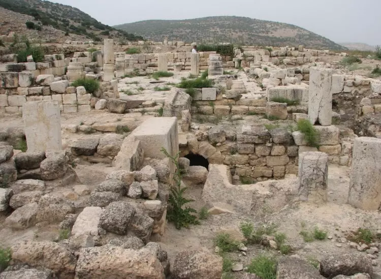
| Village Temains | The village has been completely obliterated | ||||||||||||||
| Ethnically Cleansing | Marus was mostly ethnically cleansed on 28th of May 1948 as a result of psychological warfare. By 30th of October 1948, the village was completely ethnically cleansed. | ||||||||||||||
| Pre-Nakba Land Ownership |
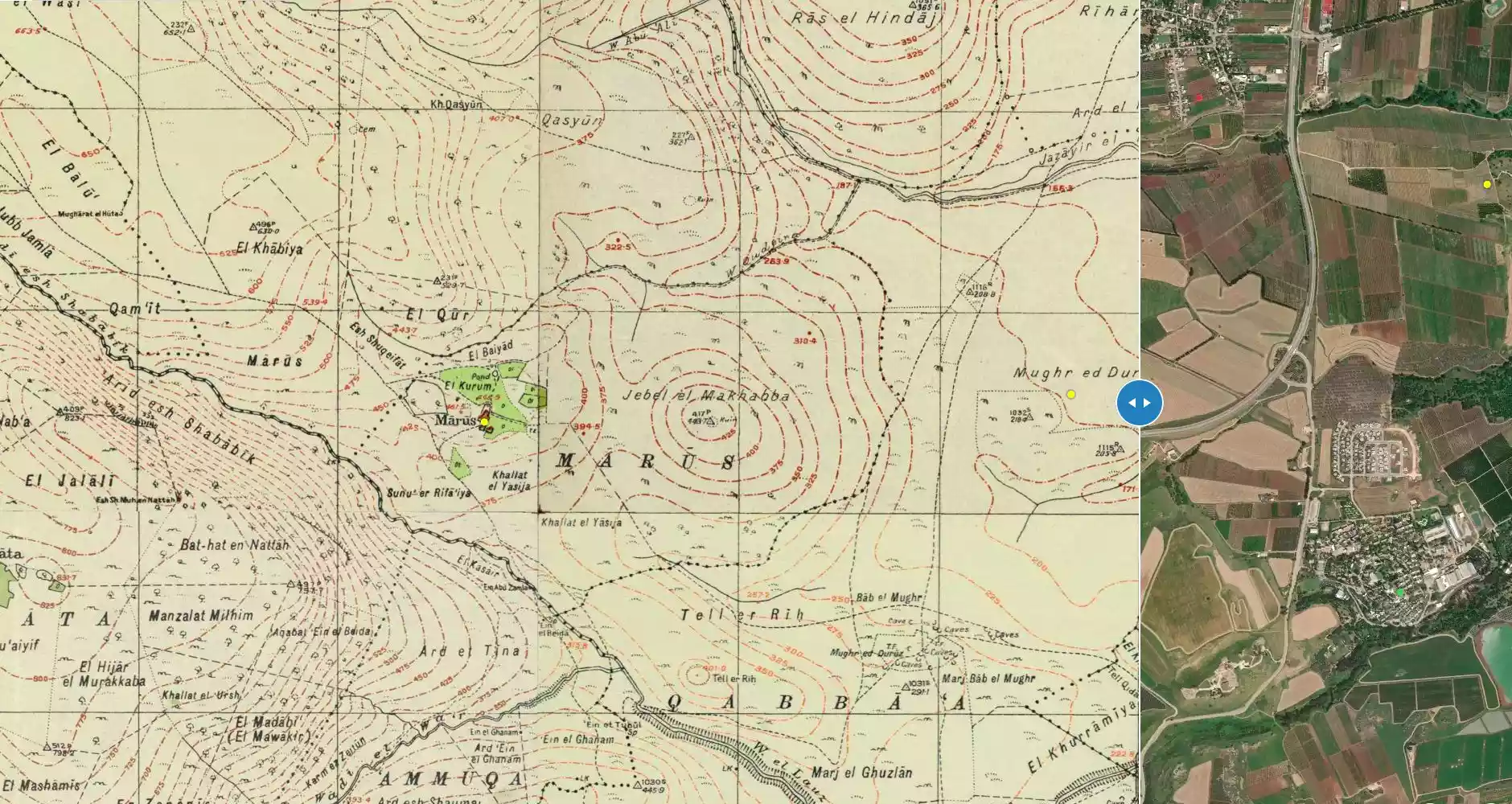
**Town Lands' Demarcation Maps |
||||||||||||||
| Land Usage As of 1945 |
|
||||||||||||||
| Population |
|
||||||||||||||
| Number of Houses |
|
||||||||||||||
| Near By Towns |
|||||||||||||||
|
|||||||||||||||
| Water Supply | The spring of 'Ayn Abu Zamla supplied the village with its water needs. | ||||||||||||||
| Archeological Sites | The village contained a synagogue, which functioned as such from the 7th-12th centuries | ||||||||||||||
| Exculsive Jewish Colonies Who Usurped Village Lands |
No settlements on village lands | ||||||||||||||
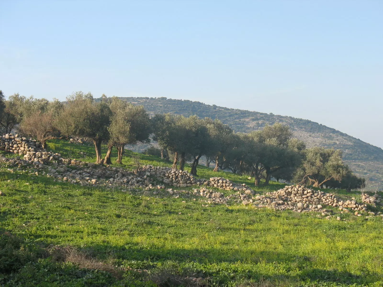
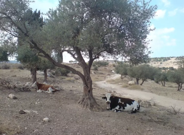
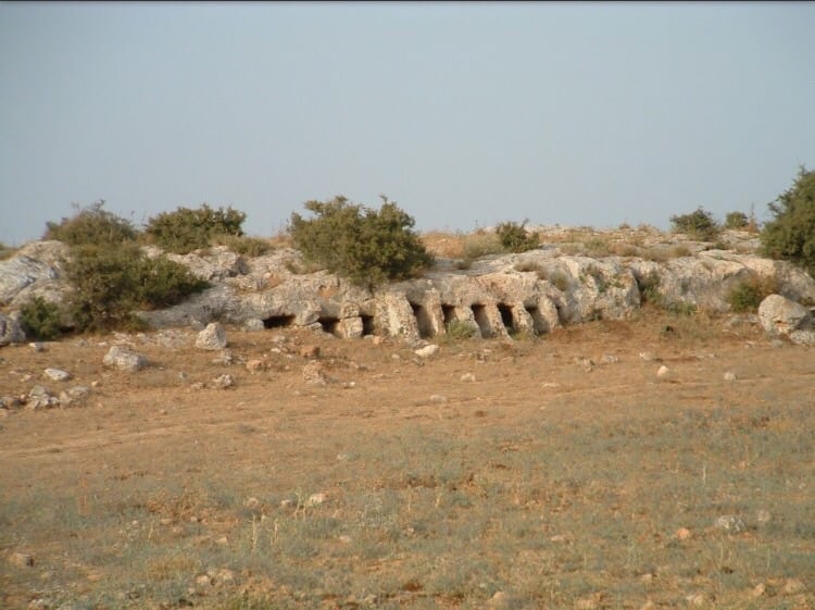
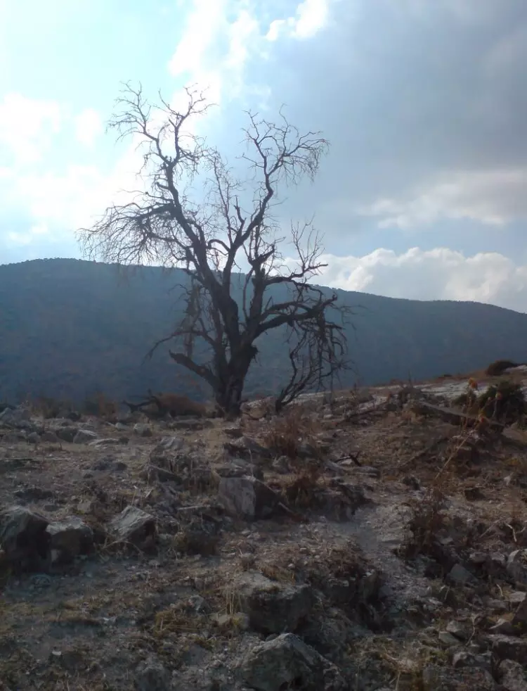
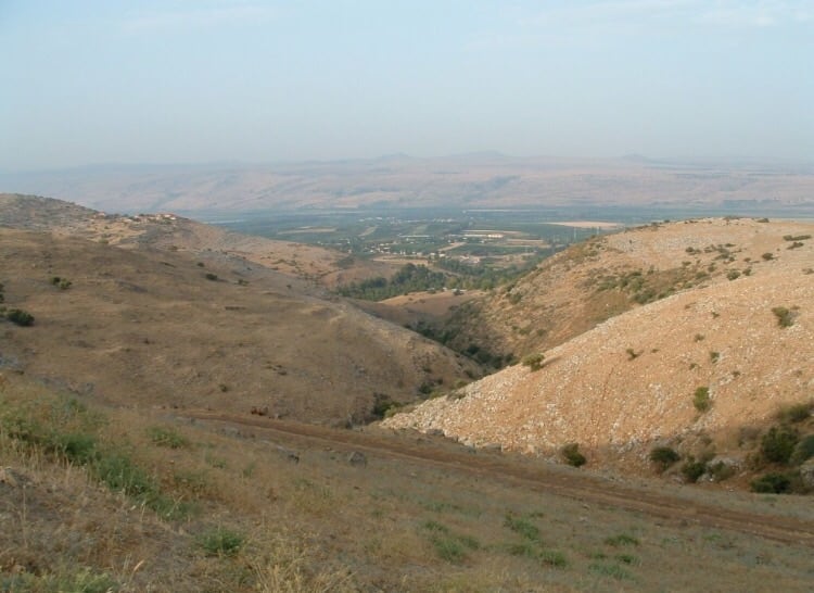
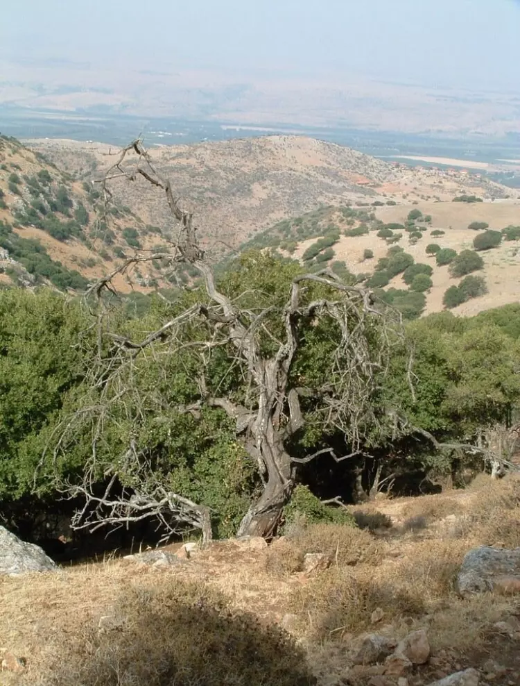
Village Before NakbaThe village was situated on a slope that descended from the eastern Upper Galilee Mountains and overlooked the al-Hula Plain to the east. Two wadis passed near the village, about 0.25 km to the north and approximately 0.5 km to the southwest. A spring, 'Ayn Abu Zamla (200270), flowed about 0.75 km south of it. In 1596, Marus was a village in the nahiya of Jira (liwa' of Safad) with a population of 176. It paid taxes on a number of crops, including wheat, barley, and fruits, as well as on other types of produce, such as goats. [Hut. and Abd.:178] Under the Mandate, Marus was classified as a hamlet (by the Palestine Index Gazetteer) and its entire population was Muslim. Grain cultivation and animal husbandry represented the chief sources of livelihood for the villagers. Figs as well as other fruits were also cultivated mainly to the east, northeast, and north of the site. In 1944/45 a total of 903 dunums was planted in cereals and 108 dunums were irrigated or used for orchards. Recent excavations at Marus have focused on what appears to have been a synagogue, which functioned as such from the seventh through the twelfth centuries, after which it was abandoned. In the fourteenth century the building was redesigned for use as a dwelling. Columns, tombs carved in rock, presses, and a cave with a carved stone entrance have been found at the site.Village Occupation and Ethnic CleaningIsraeli military intelligence reports a flight of villagers from Marus on 28 May 1948. This coincided with the departure of many villagers from the Galilee panhandle, according to Israeli historian Benny Morris, who says that Israeli forces prompted the exodus by carrying out scattered ground and mortar attacks. Palmach commander Yigal Allon had also set in motion a campaign of psychological warfare during the same period to induce the villagers of the entire area to leave. [M:123-24]But the village was not occupied until the last days of the war, during the Israeli army's Operation Hiram (see 'Arab al-Samniyya, Acre sub-district), when the whole of Upper Galilee was seized by Israeli forces. Any villagers remaining in Marus were probably expelled by the Sheva' Brigade on 30 October, towards the end of the operation. [M:xiv; see 224 ff.] Zionists Colonies on Village LandsThere are no Israeli settlements on village land.Village TodayThe site contains some olive and fig trees as well as stones from ruined homes. The surrounding land is used for grazing.SourceDr. Walid al-Khalidi, 1992: All That Remains. |
|||||||||||||||
| Related Maps | Town Lands' Demarcation Maps خرائط للقضاء توضح حدود القرى والاودية Town's map on MapQuest View from satellite Help us map this town at WikiMapia |
||||||||||||||
| Related Links | Wikipedia's Page Google Search Google For Images Google For Videos |
||||||||||||||
| More Information | في كتاب كي لا ننسى في كتاب بلادنا فلسطين المزيد من موقع هوية |
||||||||||||||
- al-Hula Plains In 1987
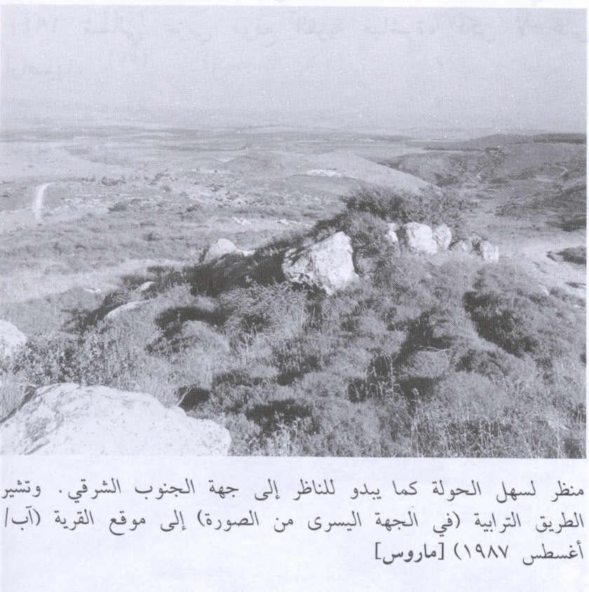
Scanned from "All That Remains" by Dr. Walid Khalidi - The ruins of destroyed Palestinian houses, and in the olive grove in the background
Posted by Noga Kadman 3 - موقع القريه في مركز الصوره - نظره من التله التي تقع الى الجنوب من القريه
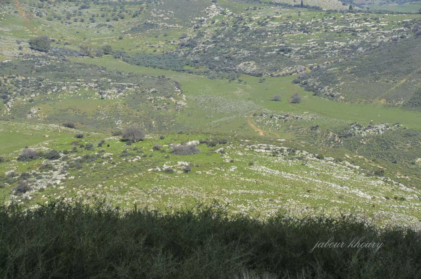
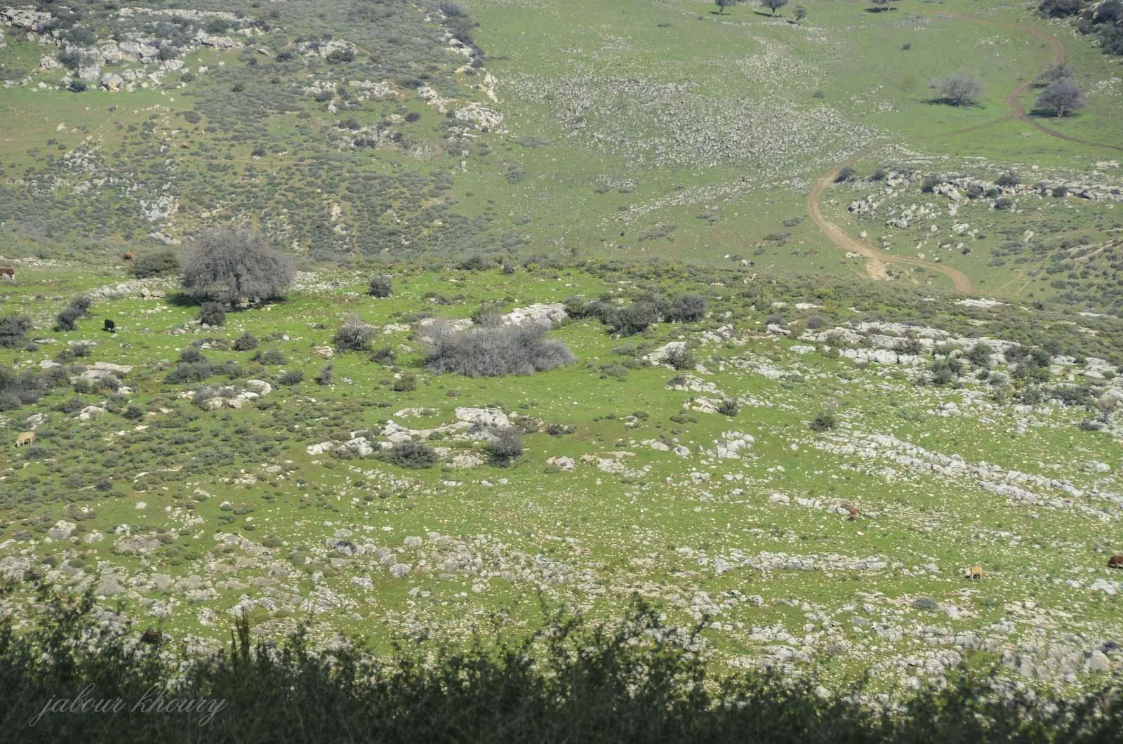
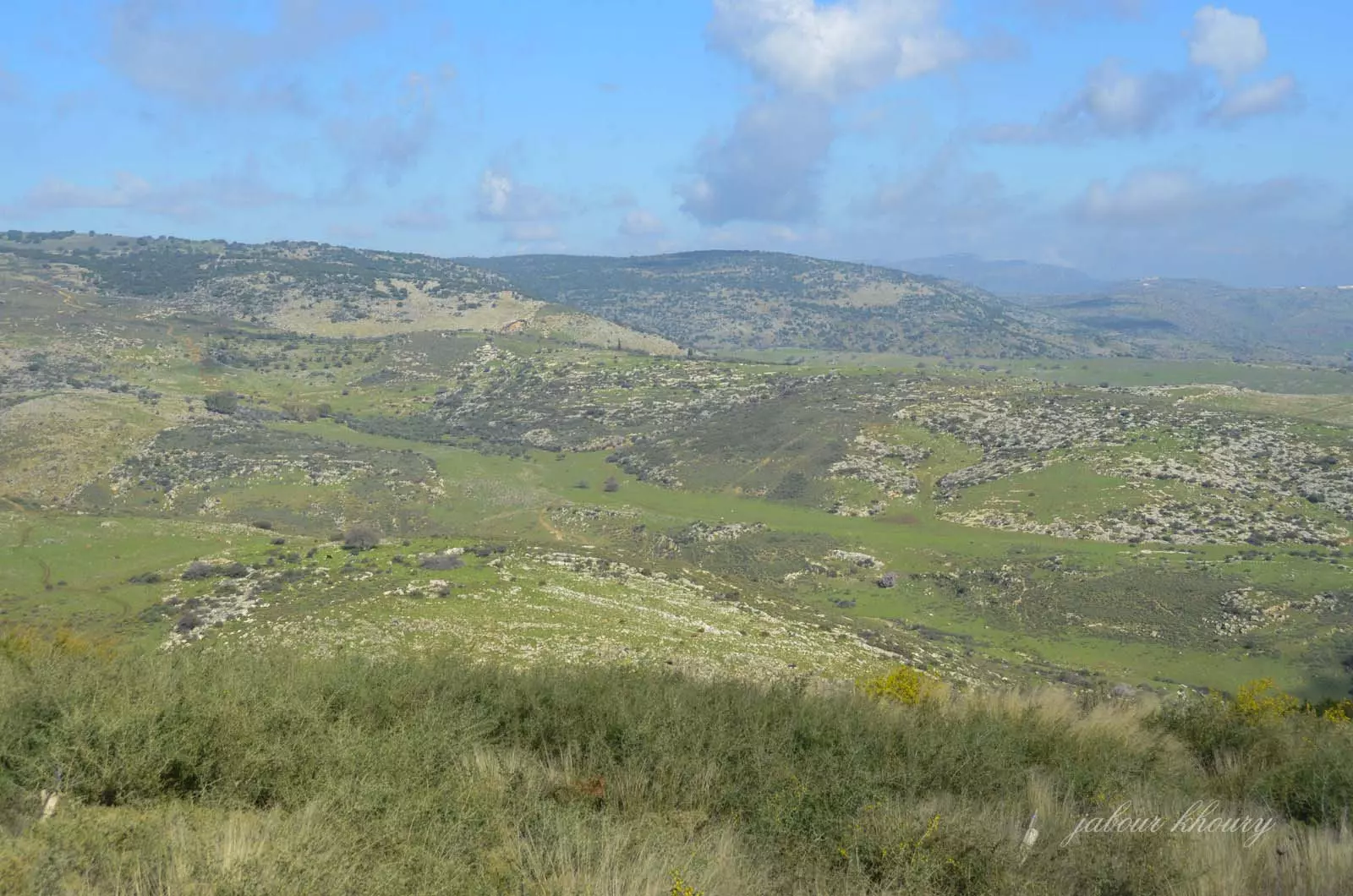
Posted by Jabour Khoury - موقع القريه
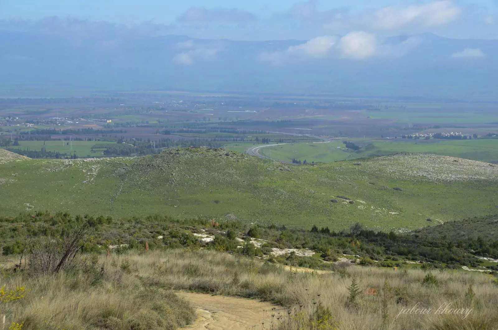
Posted by Jabour Khoury - الاراضي التي تقع الى الشرق من القريه ويظهر سهل الحوله على امتداد النظر
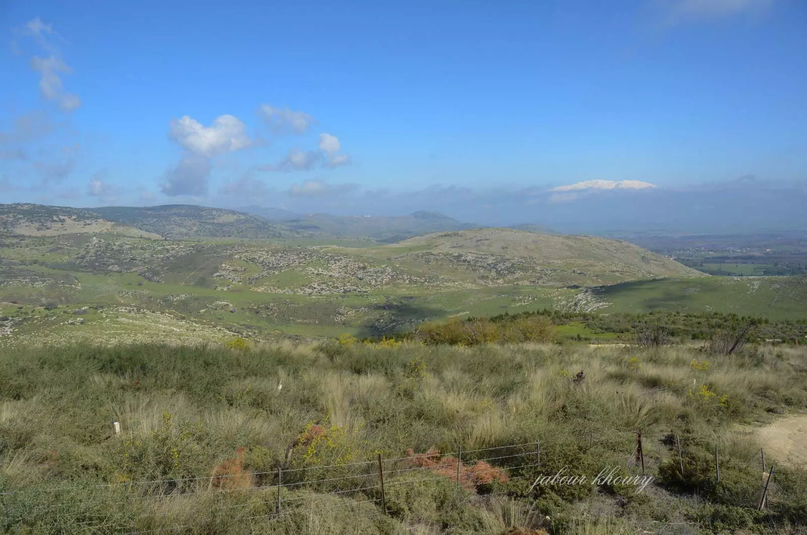
Posted by Jabour Khoury - اراضي القريه وفي الخلفيه تظهر قمه جبل الشيخ المغطاه بالثلوج
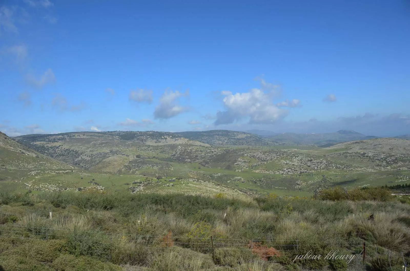
Posted by Jabour Khoury - موقع القريه في وسط الصوره
Posted by Jabour Khoury - موقع القريه في مركز الصوره
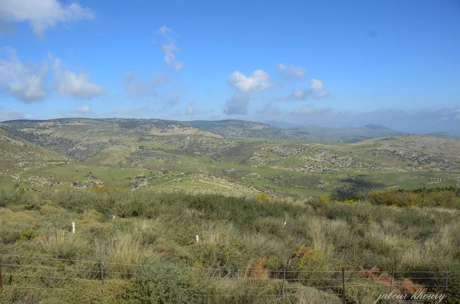
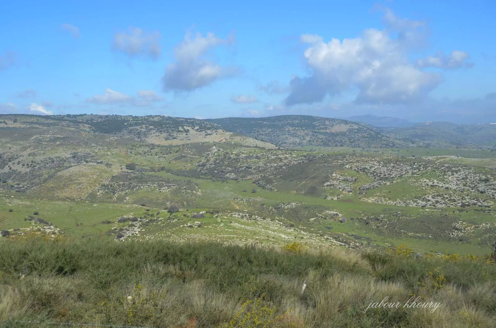
Posted by Jabour Khoury - اراضي القريه -اطلاله من الطريق المؤدي الى قريه عموقه
Posted by Jabour Khoury 1 - اراضي القريه
Posted by Jabour Khoury - حقول الزيتون بالقرب من موقع القريه
Posted by abu raya - اثار المغر بالفرب من القريه
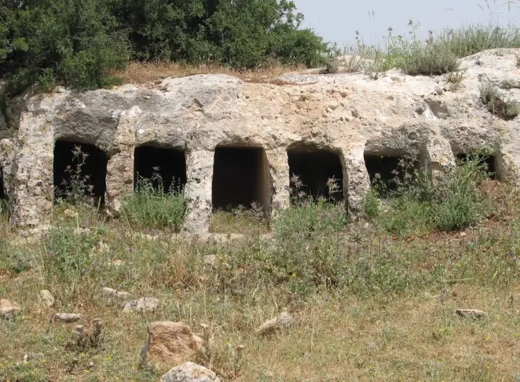
Posted by abu raya - اثار المغر القديمه بالقرب من القريه
Posted by abu raya - ماروس
Posted by abu raya - منظر من جانب القريه
Posted by abu raya - الاثار القديمه بالقرب من القريه
Posted by abu raya - منظر من جوار القريه
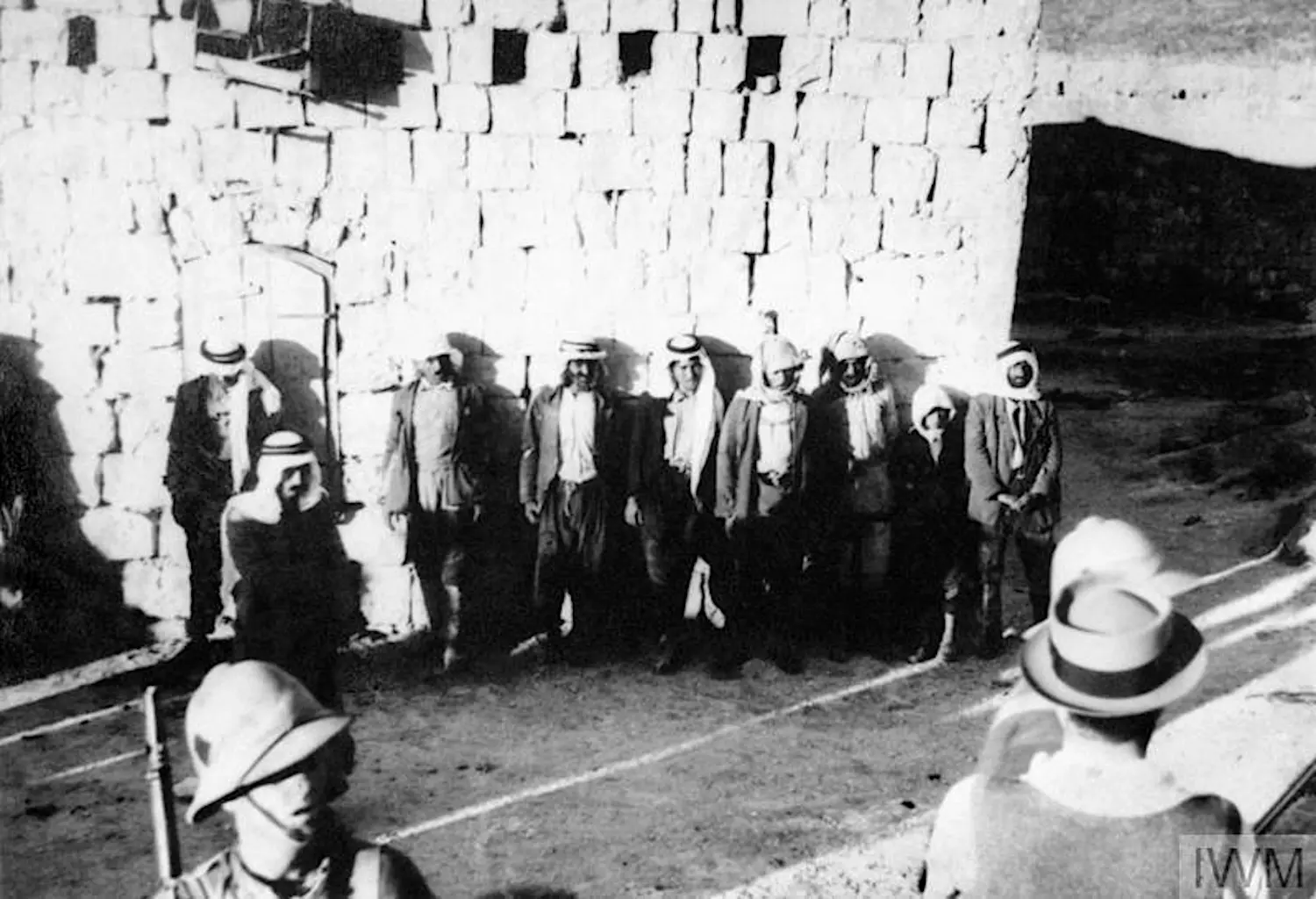
Posted by abu raya - Palestinian men lined up against a wall after a dawn search, probably during the 1936 Palestinian Revolt
Posted by palestinehistory 1
Want to browse more? 80,000 pictures were grouped in these gallaries:
| Display Name | Clan/Hamolah | Country of Residence |
| محمد فريد خالد عمر | عمر | العين, فلسطين |
| ali omar | - | - |
| Bassel | - | - |
| الحنون الوحيد | عمر | 2, 2 |
| mohanad omar | - | - |
| maher saleh | - | - |
No links have been shared yet, be free to the first to share the first link.
 Fake Valor: Why Did Zionist Jews Hoist Nazis Flag on Their Ships in the 1930s?
What is new?
-
Facts About Oct. 7th Gaza Raid
-
Remined Us Please:: Who Did Rape Who? Palestinians Raped Israelis? Or, was the other way around?
-
When Prof. Edward Said was invited to debate Bibi Netanyahu in the 1980s, watch what happened!
-
Ezra Klein of the NY Times on the "Jewish Race".
-
Abusing Blood Libel!
-
Zionist FAQ: Isn't it true that Palestinians don't want peace? Palestinians never accepted the two-state solution
- Facts about Haavara (Transfer) Agreement between Ben-Gurion & Hitler
-
Haavara FAQs: Why Did Zionist Jews Hoist Nazis' Flags on Their Ships in the 1930s?
- Haavara FAQs: When Chaim Weizmann met FDR in mid-1943, why was he silent about rescuing European Jewry?
-
Dear ChatGPT: How did Palestinians resist Napoleon's invasion of their country in 1799?
-
Dear ChatGPT: Gaza had a vibrant Jewish community in the mid-17th century. What happened to them?
-
Dear ChatGPT: Why did the Jewish Agency suppress news of the Holocaust during WWII?
-
Video Playlist: Jews share their DNA tests to end the conflict for good.
-
A Tale of Two Conflicts: Examining the Definition of Genocide
-
Prof. Abraham Polak And The Suppressed History of the Khazars and European Jewry
-
How Ronald Reagan would have framed the genocide in Gaza if he were still alive?
-
Haavara FAQs: Let us do the math: how many German Jews did The Haavara Agreement save?
-
Zionist FAQs: The Hebron Massacre of 1929, "clearly proves" that Palestinians are antisemitic, how could you deny it?
-
Zionist FAQs: Why Anti-Zionist Is Not Antisemitism?
-
Zionist FAQs: Isn't it true that the KGB create Palestinian Nationalism in the early 1960s?
- Zionist FAQs: Muslims are killing Muslims all the time; why are Israeli Jews being singled out in the media?
- Zionist FAQs: How is Israel an apartheid state when 20% of its citizens are Arabs who enjoy full rights?
-
Haavara FAQs: Analysis of Herzl's Uganda Scheme and how it could have saved millions of Jews.
-
Haavara FAQs: Why did Hayim Greenberg describe American Jewry as "morally bankrupt" in early 1943?
-
Haavara FAQs: What if the Evian Conference was a resounding success? What would have been the impact of saving European Jewry on Zionism?
- Haavara FAQs: What if the six million were saved, how that would have impacted the Zionist project?
-
Haavara FAQs: How did Zionist leaders react when Europe's Jews lingered in the DP camps after WWII ended?
-
Why does the American Jewish community repeat lies that David Ben-Gurion had debunked before he died?
-
Who has the power to rename the Tatar/Khazar Gene Marker to Jewish IV?
-
Zionist FAQs: Why won't Egypt, Syria, and Jordan take their people back? Jews are indigenous to Palestine, and Arabs immigrated after Jews developed the country. Arabs should leave.
-
Haavara FAQs: Did Hitler and the Nazis conflate between Judaism and Zionist? If that wasn't case, then why?
-
Haavara FAQs: Winston Churchill and antisemitism, a collection of articles written Churchill.
-
Haavara FAQs: Broken by country, how many Jews survived vs. killed during the Holocaust?
-
Haavara FAQs: Why did European Jews vote with their feet and to immigrated to the Americas, not Palestine, after WWII?
-
Watch this American Jewish Girl describing Israeli Jews' cognitive dissonance like no other in under two minutes
-
Haavara FAQs: When the Nazis went out of their way to hide the Holocaust, Israeli Jews did the exact opposite by broadcasting their genocide of Gazans. But why?
-
Haavara FAQs: How Zionist Jews went out of their to show their appreciation to Nazism and Fascism?
- Haavara FAQs: Why Zionist leaders were against bombing the death camps & the Railroads leading to them?
-
Haavara FAQs: Hitler's message to the British and American people: If Jews are such noble citizens and you care about them, how come you're not letting them in? I will gladly ship them to you at my expense, even on luxury liners!
-
A shortlist of Zionist and Israeli false flag operations in the name Jews.
-
The Most Moral Army
- The Land of Kapos (Israel): Where the brave are boycotted and Kapos walk free.
- Why did early Zionists often named their communal enterprises "colonial"?
- Zionist Relations with Nazi Germany by Faris Glubb
-
Two NY Times advertisements by Zionists in the early 1943 that exposes Zionists' treason at the height of the calamity
- Facts Not Lies about the Palestinian-Israeli Conflict.
- Site's pictures have been categorized
- Campgain Against Lice
- A Survey of Palestine, the official source about Palestine before Nakba produced by the British Mandate; over 1200 pages.
- Satellite View & Google Earth: Over 6,000 placemarks identifying all destroyed towns, W. Bank & Gaza Strip Towns, & refugee camps.
- PalestineRemembered.com and its Nakba Oral History Project were featured on al-Jazeera Satellite TV.
- Nakba Oral History Video Podcast:
 Over 700 Oral History interviews (including 3,500+ hours of recording) can be viewed online.
 - Palestine Village Statistics Project
- Gaza Jail Break
- النسخة العربية للموقع الان متوفرة
- Videos: Documenting the destroyed villages in video: Tracing all that remains since Nakba.
- Videos: Responding to Zionist Propaganda
- Interview: The ethnic cleansing of Palestine: George Galloway interviews Israeli Historian Ilan Pappe.
- For Palestinians, memory matters. It provides a blueprint for their future By George Bisharat.
- Zionist FAQ now available in Hebrew שאלות שציונים שואלים, עכשיו בעברית
- Video: The Stephen Walt and John Mearsheimer report on the influence of the Israel Lobby on U.S. Foreign Policy
- The Palestinian-Israeli conflict for beginners
