| PalestineRemembered | About Us | Oral History | العربية | |
| Pictures | Zionist FAQs | Haavara | Maps | |
| Search |
| Camps |
| Districts |
| Acre |
| Baysan |
| Beersheba |
| Bethlehem |
| Gaza |
| Haifa |
| Hebron |
| Jaffa |
| Jericho |
| Jerusalem |
| Jinin |
| Nablus |
| Nazareth |
| Ramallah |
| al-Ramla |
| Safad |
| Tiberias |
| Tulkarm |
| Donate |
| Contact |
| Profile |
| Videos |
Welcome To Dayshum - ديشوم (דישום)
|
District of Safad
Ethnically cleansed days ago |
العربية Google Earth |
 |
Gallery (57) |
- Statistics & Facts
-
Before & After

- Satellite View
- Articles 3
- Pictures 57
- Oral History 5
- Members 20
- All That Remains
- Wikipedia
- Videos
- Guest Book 15
- Links
| Statistic & Fact | Value | ||||||||||||||
| Occupation Date | October 30, 1948 | ||||||||||||||
| Distance From District | 12.5 (km) North of Safad | ||||||||||||||
| Elevation | 600 (meters) | ||||||||||||||
| Before & After Nakba, Click Map For Details |
|||||||||||||||
|
|||||||||||||||
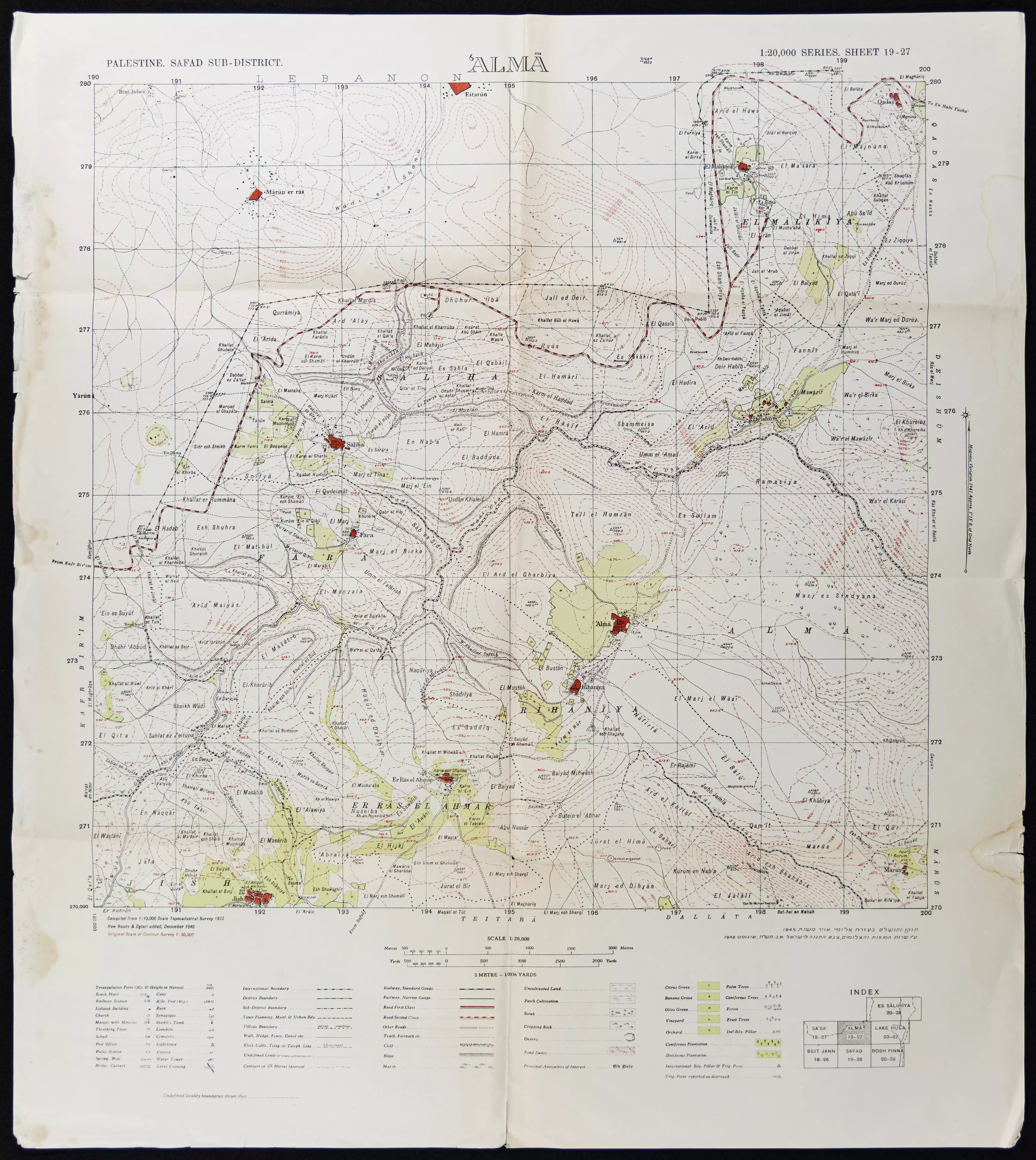
| Map Location | See location #36 on the map View from satellite |
||||||||||||||
| Military Operation | Operation Hiram | ||||||||||||||
| Attacking Units | The terror troops of Sheva' (Seventh) Brigade (committed several massacres) | ||||||||||||||
| Acts of Terror | Mostly terrorized by the news of the massacre committed by the Sheva' (Seventh) Brigade in the nearby villages of Safsaf and Jish | ||||||||||||||
| Refugees' Migration Routes | Villagers probably fled (or were expelled) to Lebanon | ||||||||||||||
| Exodus Cause | Military assault by Zionist troops | ||||||||||||||
| Village Temains | The village has been completely obliterated, and only house rubble left behind. | ||||||||||||||
| Ethnically Cleansing | Dayshum inhabitants were completely ethnically cleansed. | ||||||||||||||
| Pre-Nakba Land Ownership |
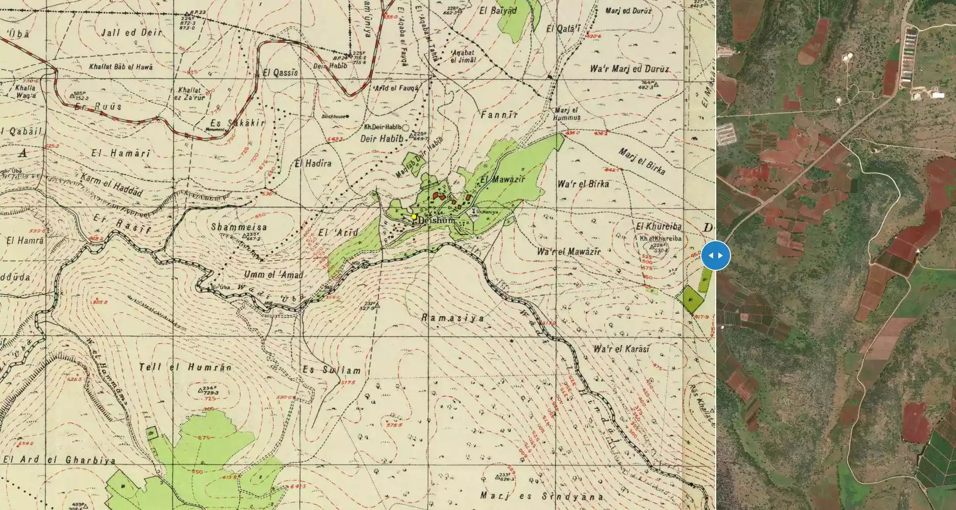
**Town Lands' Demarcation Maps |
||||||||||||||
| Land Usage As of 1945 |
|
||||||||||||||
| Population |
|
||||||||||||||
| Number of Houses |
|
||||||||||||||
| Near By Towns |
|||||||||||||||
|
|||||||||||||||
| Inhabitants Place of Origin | The villagers were descendants of Algerian immigrants who had fought with 'Abd al-Qadir al-Jaza'iri against the French colonialists in the 1830s and 1840s. These people may have with him to the region following his defeat and banishment to Damascus in 1847 | ||||||||||||||
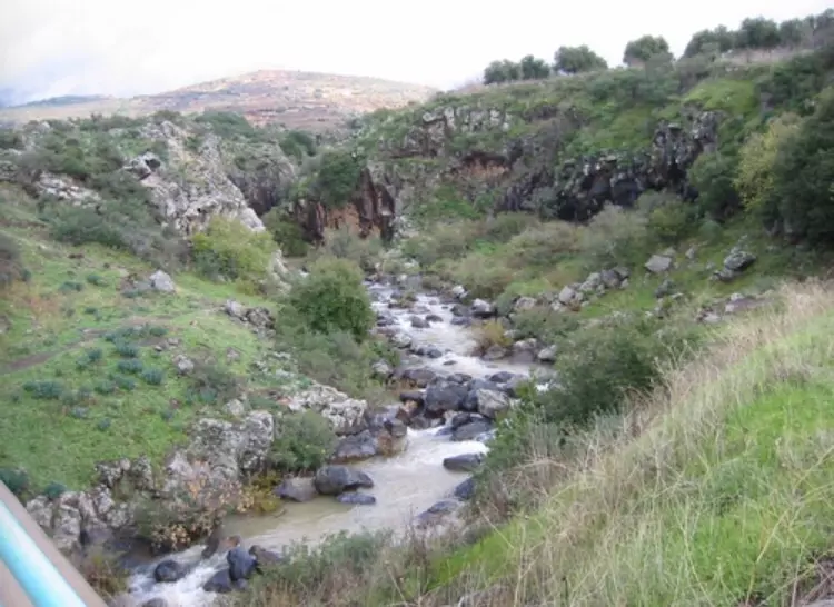
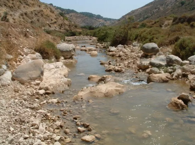
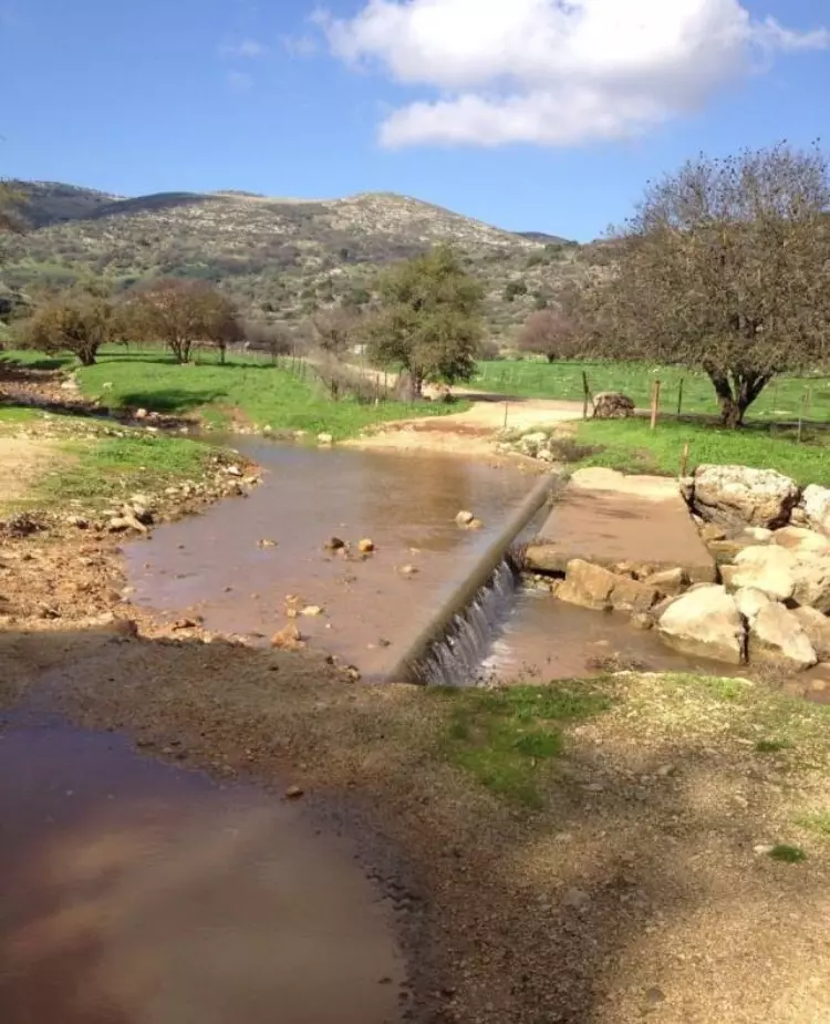
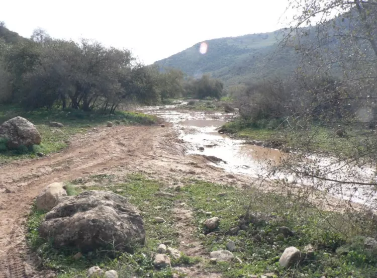
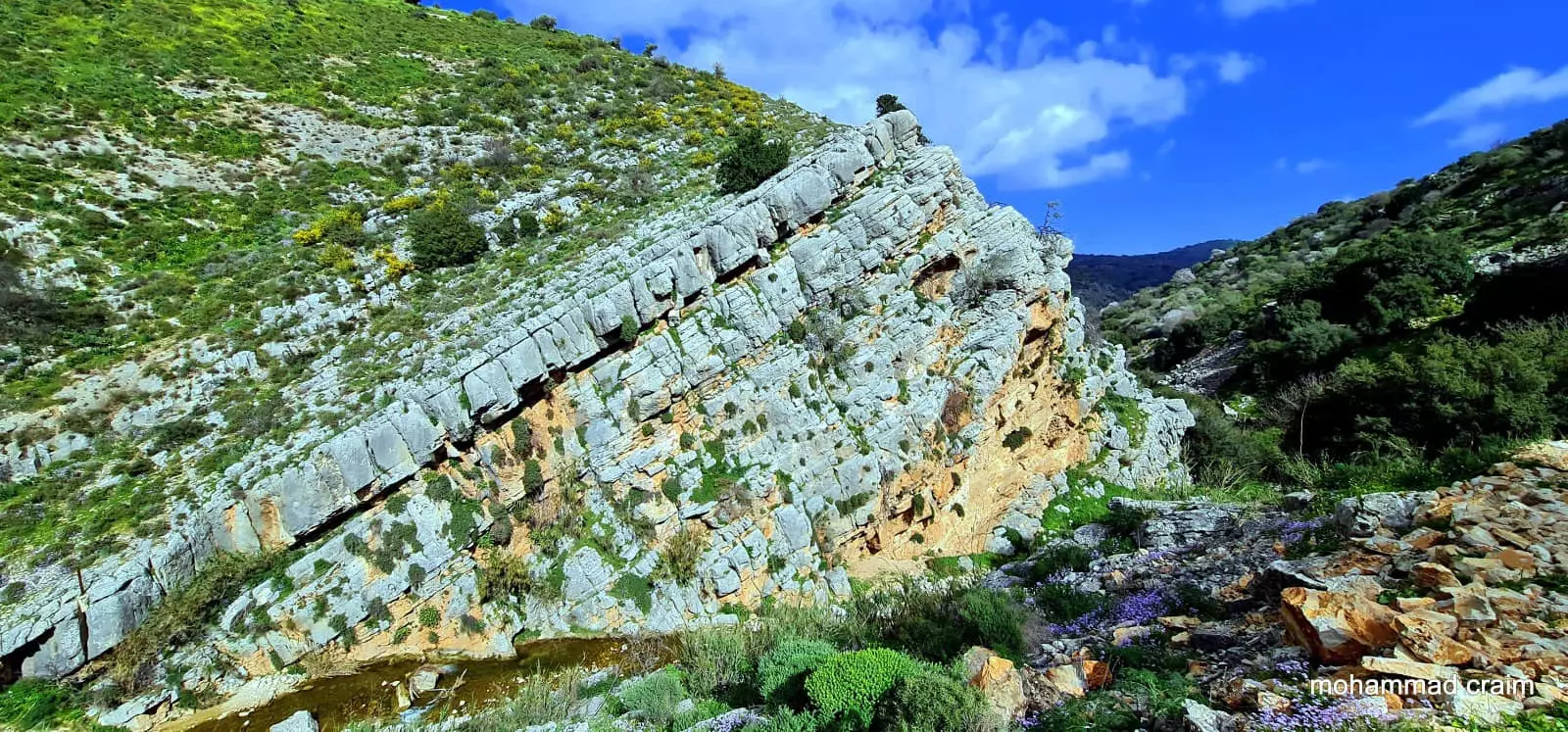
| Nearby Wadies & Rivers | The village was overlooking the ridges along Wadi Fara | ||||||||||||||
| Exculsive Jewish Colonies Who Usurped Village Lands |
Moshav Dishon | ||||||||||||||
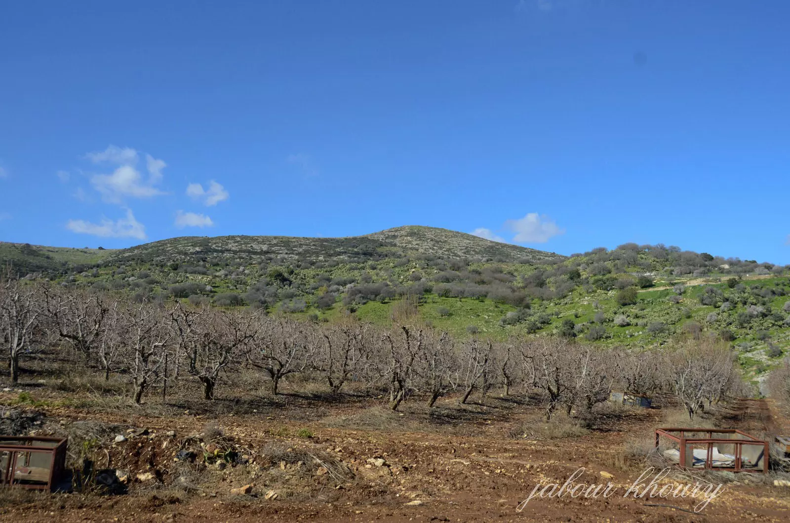
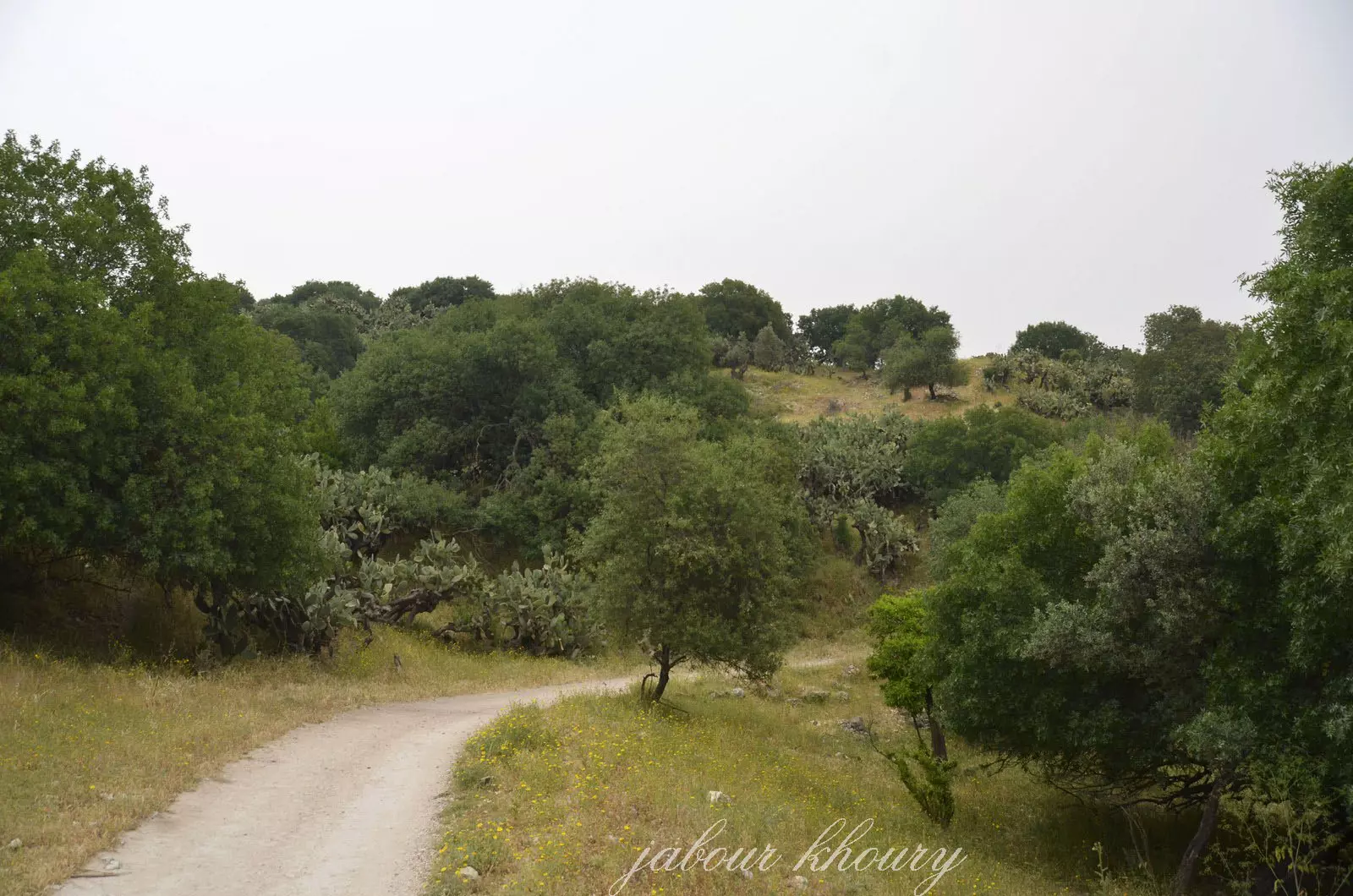
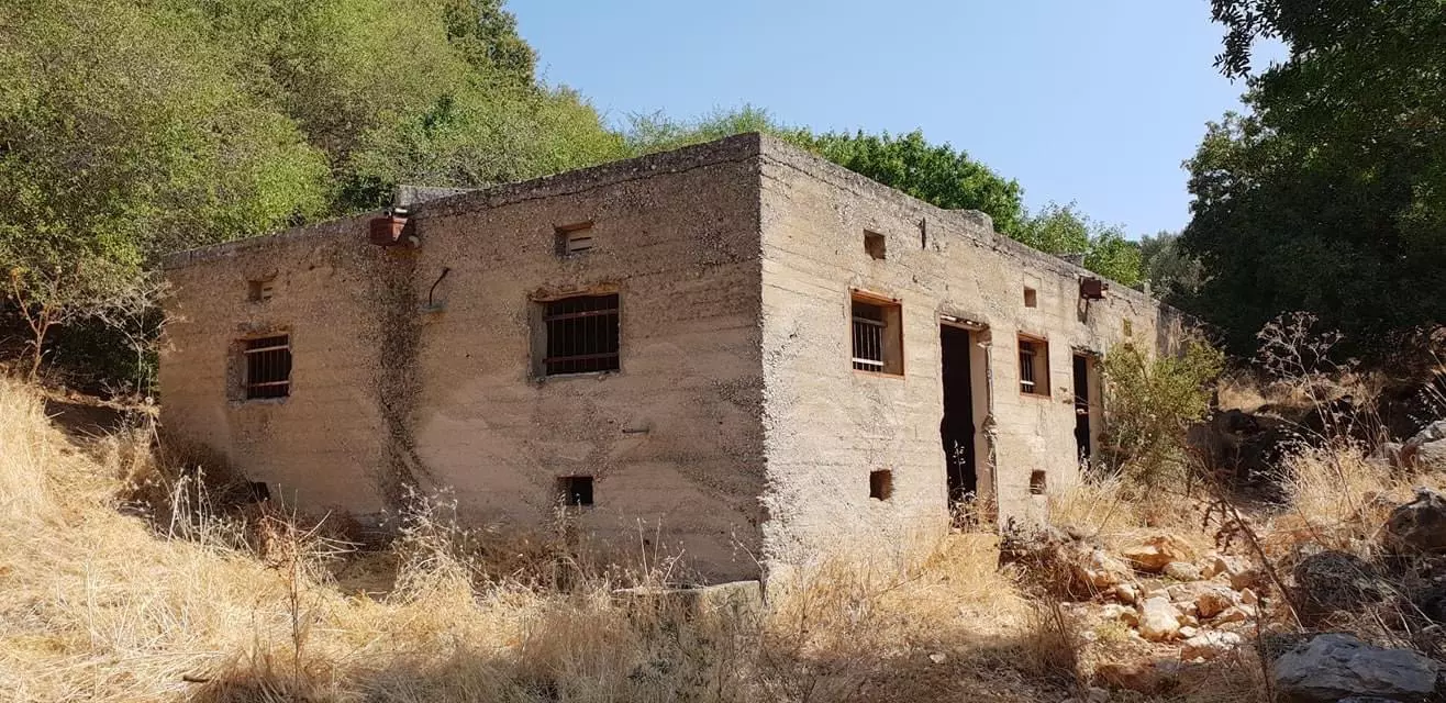
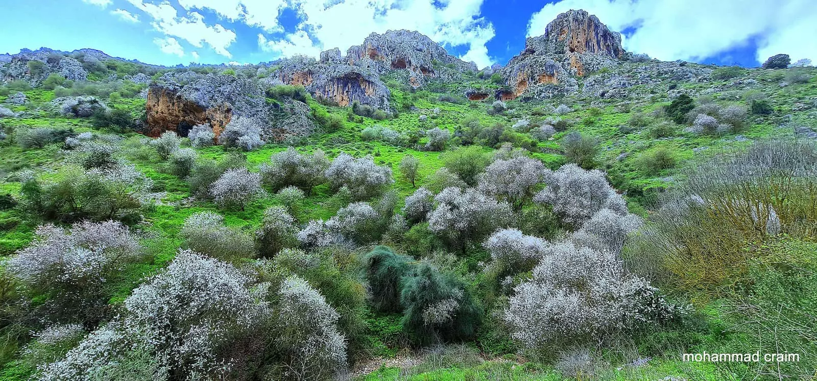
Village Before NakbaThe village stood on rocky but gentle slopes overlooking the ridges along Wadi Fara, which passed to the west. It was near the Lebanese border and was linked via secondary roads to neighboring villages as well as to a highway that led to Safad. In 1596, Dayshum was a village in the nahiya of Jira (liwa' of Safad) with a population of fifty. It paid taxes on a number of crops, including wheat, barley, olives, and fruits, as well as on other types of produce and property, such as goats, beehives, and a press that was used for processing either olives or grapes. [[Hut. and Abd.:177]] In the late nineteenth century, Dayshum was a 'well-built' village with about 400 residents. The village houses were situated on the side of a steep hill near the bottom of a valley and had gabled roofs. The village had three mills and several small gardens. [[SWP(1881) I:201]] The mud and stone homes of the village were built close together. Its entire population was Muslim. Some of these residents were descendants of Algerian immigrants who had fought with 'Abd aI-Qadir al-Jaza'iri against the French colonialists in the 1830s and 1840s; they most likely came with him to the region following his defeat and banishment to Damascus in 1847. As some of their ancestors had been horsemen in Algeria, the villagers of Dayshum took a keen interest in raising horses.Agriculture, in part dependent upon rainfall and in part irrigated from a creek that coursed through the village, constituted the major source of livelihood for the population. The villageThe village stood on rocky but gentle slopes overlooking the ridges along Wadi Fara, which passed to the west. It was near the Lebanese border and was linked via secondary roads to neighboring villages as well as to a highway that led to Safad. In 1596, Dayshum was a village in the nahiya of Jira (liwa' of Safad) with a population of fifty. It paid taxes on a number of crops, including wheat, barley, olives, and fruits, as well as on other types of produce and property, such as goats, beehives, and a press that was used for processing either olives or grapes. [[Hut. and Abd.:177]] In the late nineteenth century, Dayshum was a 'well-built' village with about 400 residents. The village houses were situated on the side of a steep hill near the bottom of a valley and had gabled roofs. The village had three mills and several small gardens. [[SWP(1881) I:201]] The mud and stone homes of the village were built close together. Its entire population was Muslim. Some of these residents were descendants of Algerian immigrants who had fought with 'Abd aI-Qadir al-Jaza'iri against the French colonialists in the 1830s and 1840s; they most likely came with him to the region following his defeat and banishment to Damascus in 1847. As some of their ancestors had been horsemen in Algeria, the villagers of Dayshum took a keen interest in raising horses. Agriculture, in part dependent upon rainfall and in part irrigated from a creek that coursed through the village, constituted the major source of livelihood for the population. The villagers cultivated mainly grain, fruits, and olives. They also raised livestock and engaged in wood cutting. (Trees to the northeast and southwest of the village provided both fruit and lumber.) In 1944/45 a total of 4,701 dunums was allocated to cereals, and 611 dunums were irrigated or used for orchards. Archaeological sites in the vicinity included two khirbas (Khirbat Dayr Habib and Dayshun) that contained the ruins of corrals, piles of building stones, cisterns, buildings, columns, and rock-cut tombs. rs cultivated mainly for grain, fruits, and olives. They also raised livestock and engaged in wood cutting. (Trees to the northeast and southwest of the village provided both fruit and lumber.) In 1944/45 a total of 4,701 dunums was allocated to cereals and 611 dunums were irrigated or used for orchards. Archaeological sites in the vicinity included two khirbas (Khirbat Dayr Habib and Dayshun) that contained the ruins of corrals, piles of building stones, cisterns, buildings, columns, and rock-cut tombs. Village Occupation and Ethnic CleaningIsraeli historian Benny Morris writes that Dayshum was empty when Israeli forces entered it on 30 October 1948, in the early stages of Operation Hiram. He adds that the village was probably evacuated when news reached it of the massacres at nearby Safsaf and Jish, committed by soldiers of the Sheva' (Seventh) Brigade (see 'Arab al-Samniyya, Acre sub-district). Units of the same brigade probably reached Dayshum later in the same operation, as they went on to annex parts of the Galilee panhandle. Given the location of the village, the inhabitants probably fled (or were expelled) to Lebanon.Zionists Colonies on Village LandsIn 1953 the settlement of Dishon (198276) was established just to the east of the village site.Village TodayCactuses and thorns grow on the site. The only indications of the former existence of Dayshum are piles of stones from the destroyed houses and terraces. Moshav Dishon exploits the land around the site for animal grazing and apple cultivation.SourceDr. Walid al-Khalidi, 1992: All That Remains. |
|||||||||||||||
| Related Maps | Town Lands' Demarcation Maps خرائط للقضاء توضح حدود القرى والاودية Town's map on MapQuest View from satellite Help us map this town at WikiMapia |
||||||||||||||
| Related Links | Wikipedia's Page Google Search Google For Images Google For Videos |
||||||||||||||
| More Information | في كتاب كي لا ننسى في كتاب بلادنا فلسطين المزيد من موقع هوية |
||||||||||||||
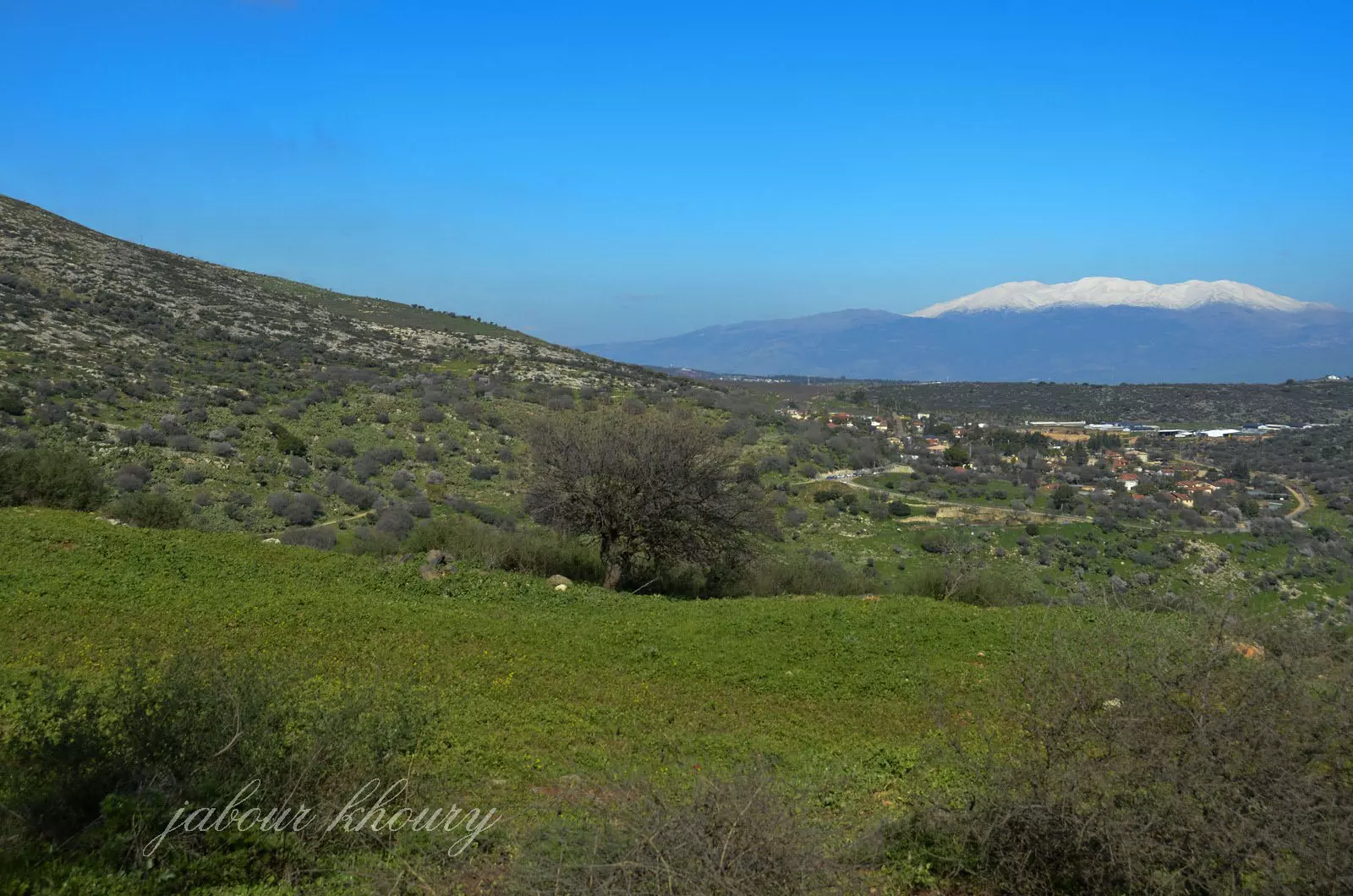
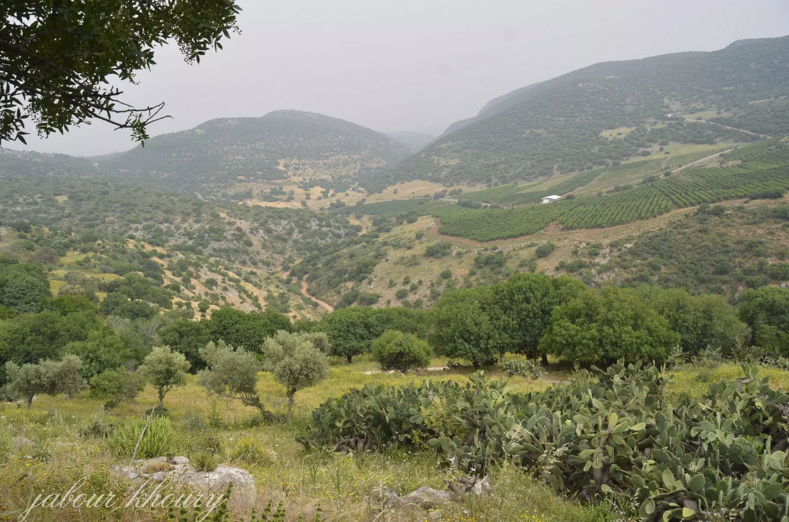
- منظر عام للقريه من الجهه الجنوبيه وفي الخلفيه يظهر جبل الشيخ
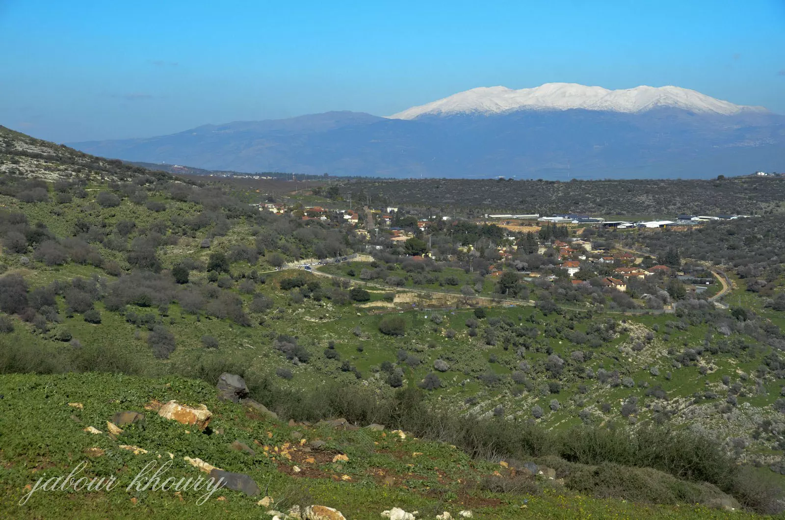
Posted by Jabour Khoury - منظر عام للقريه وتظهر مستوطنه ديشوم التي اقيمت على اراضي القريه
Posted by Jabour Khoury - اراضي القريه في الجهه الجنوبيه وشجر الصبر في كل مكان
Posted by Jabour Khoury - الشارع الموصل لمركز القريه
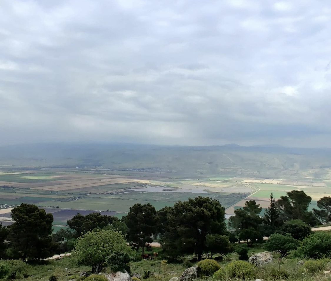
Posted by Jabour Khoury - نظره من مركز القريه الى الجنوب ويظهر جبل الريحان
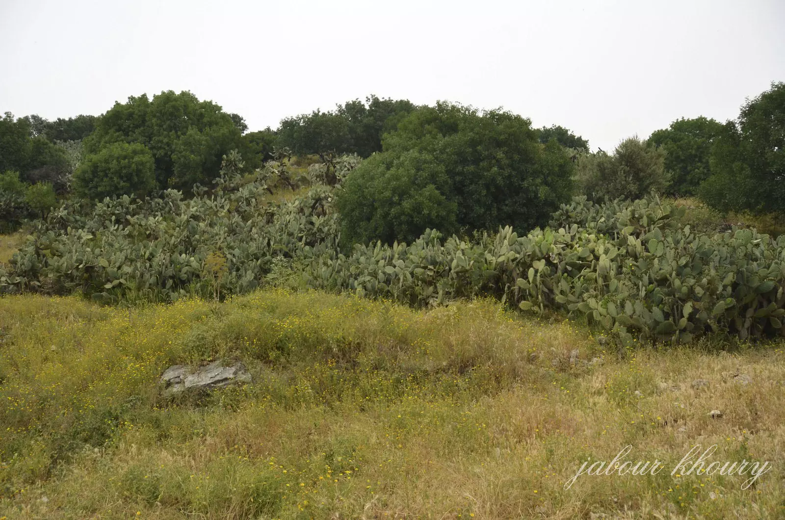
Posted by Jabour Khoury - موقع القريه وشجر الصبر يغطي المكان

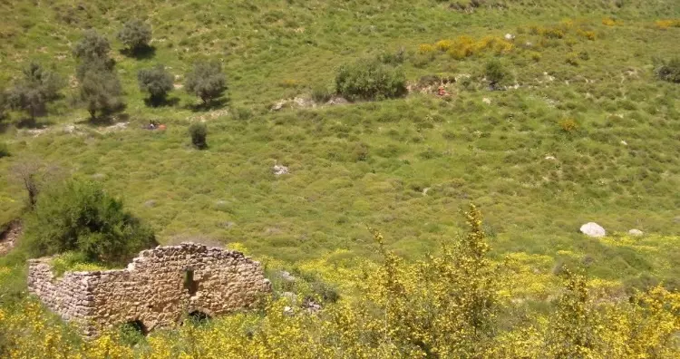
Posted by Jabour Khoury - بقايا احد البيوت المهدمه
Posted by Jabour Khoury - بقايا احد المنازل
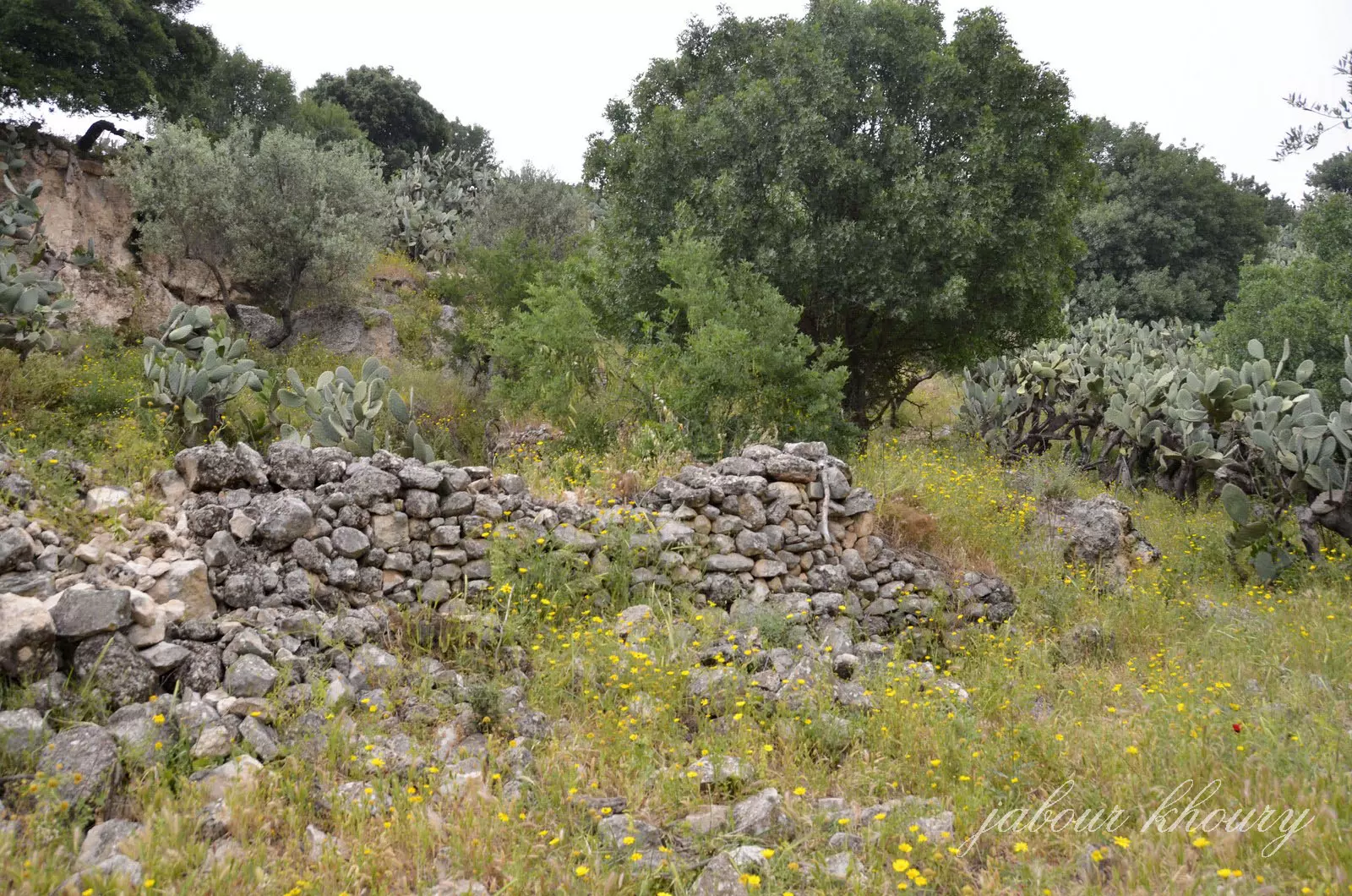
Posted by Jabour Khoury - ردم احد المنازل
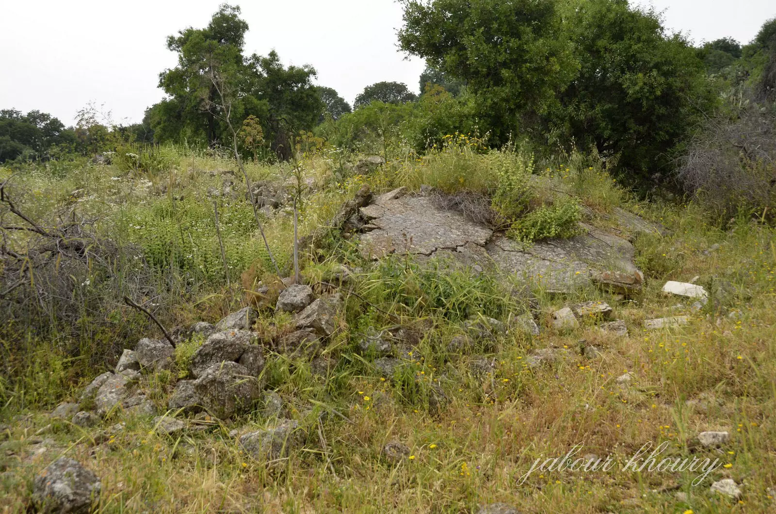
Posted by Jabour Khoury - ردم المنازل
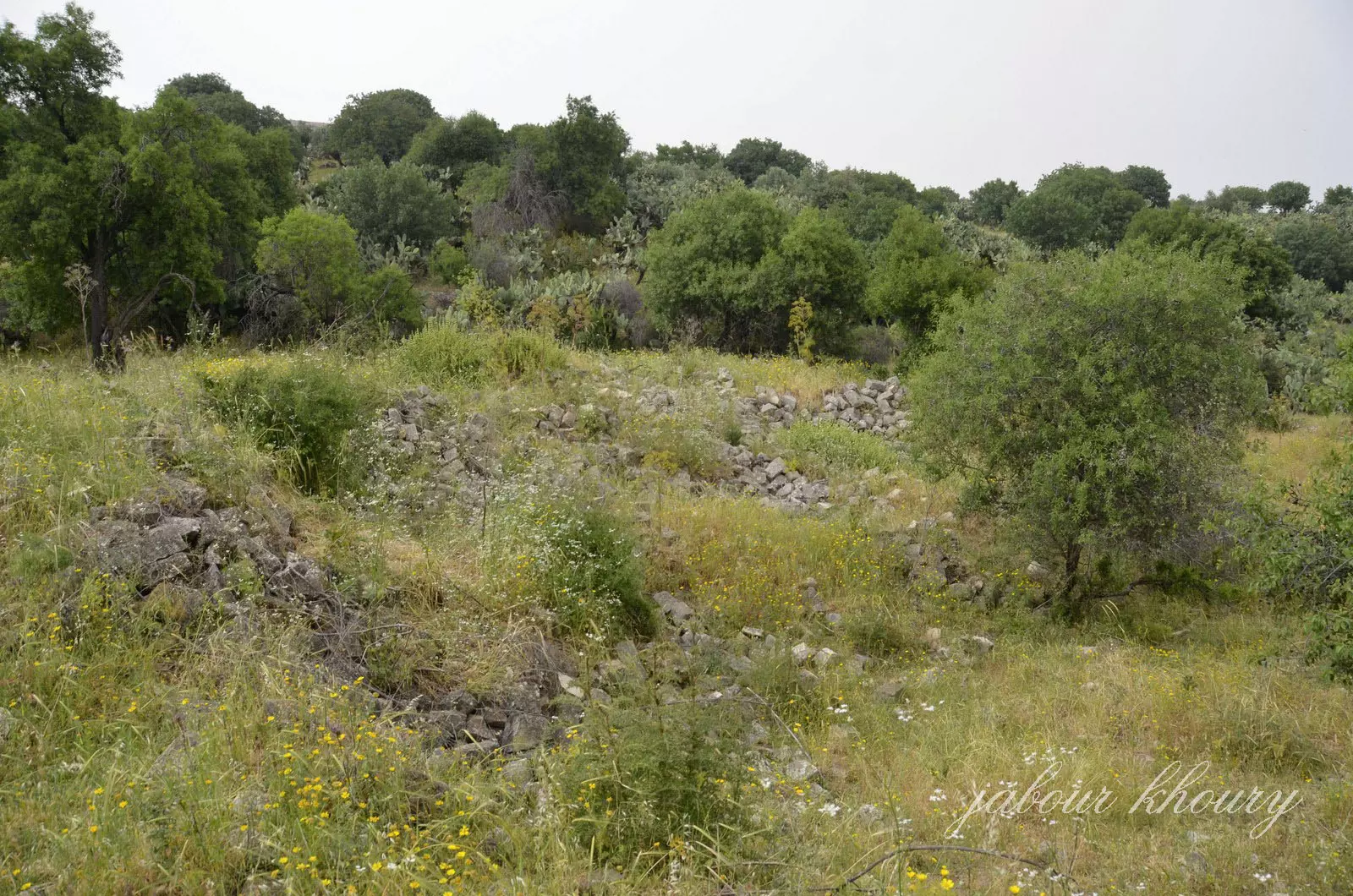
Posted by Jabour Khoury - ردم المنازل
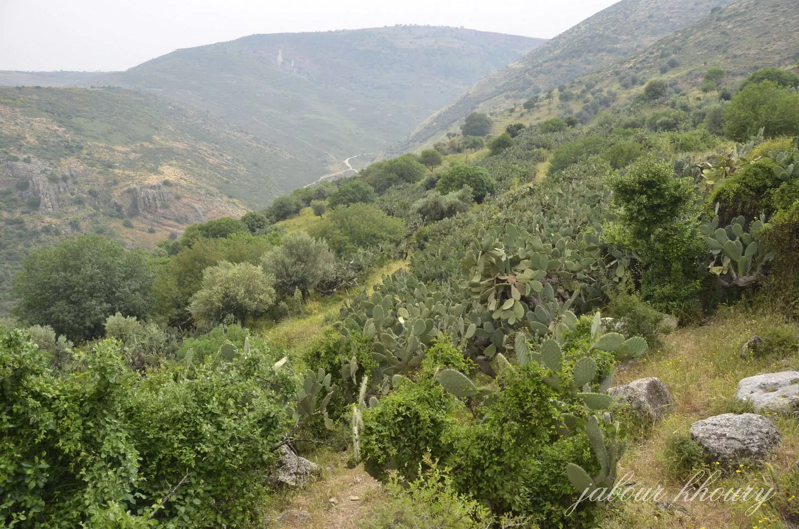
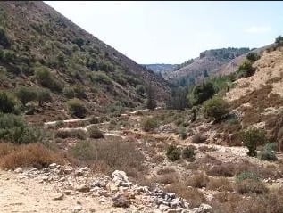
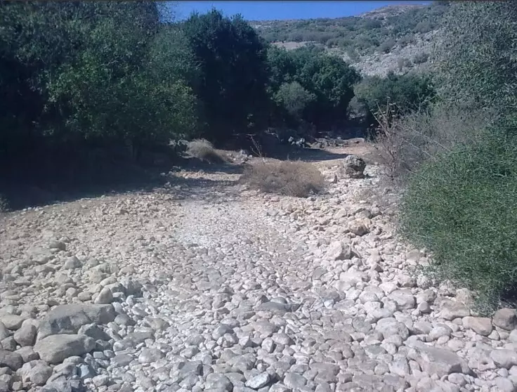
Posted by Jabour Khoury - نظره من موقع القريه الى الشرق ويظهر وادي الحنداج
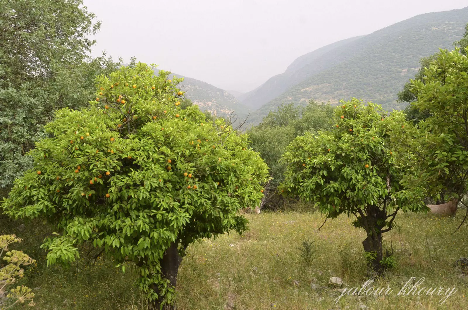
Posted by Jabour Khoury - اشجار اللوز والحمضيات في موقع القريه المهجوره وما زالت تعطي ثمارها
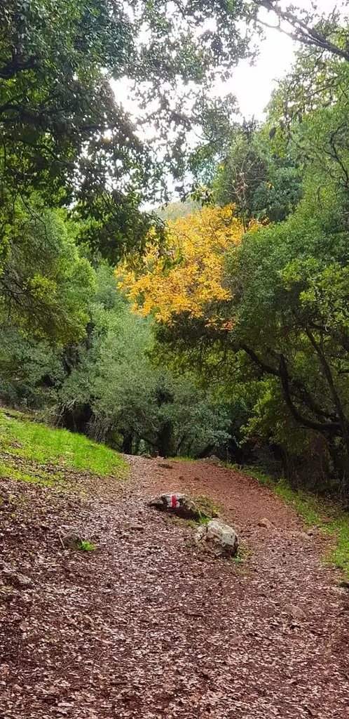
Posted by Jabour Khoury 1 - الطبيعه في ديشوم
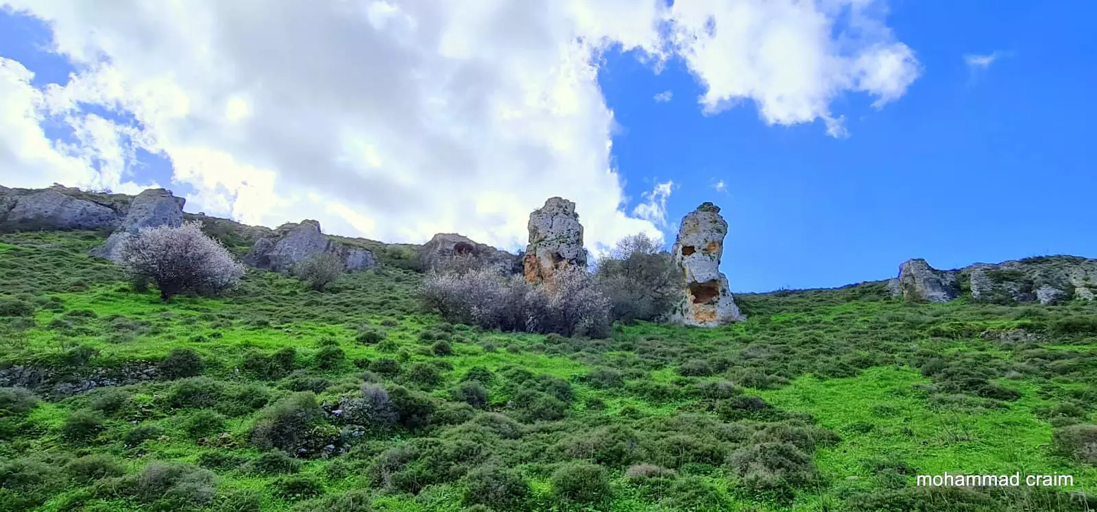
Posted by abu raya - مناظر من الجنوب الشرقي للقريه
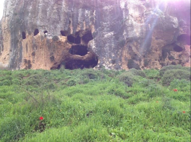
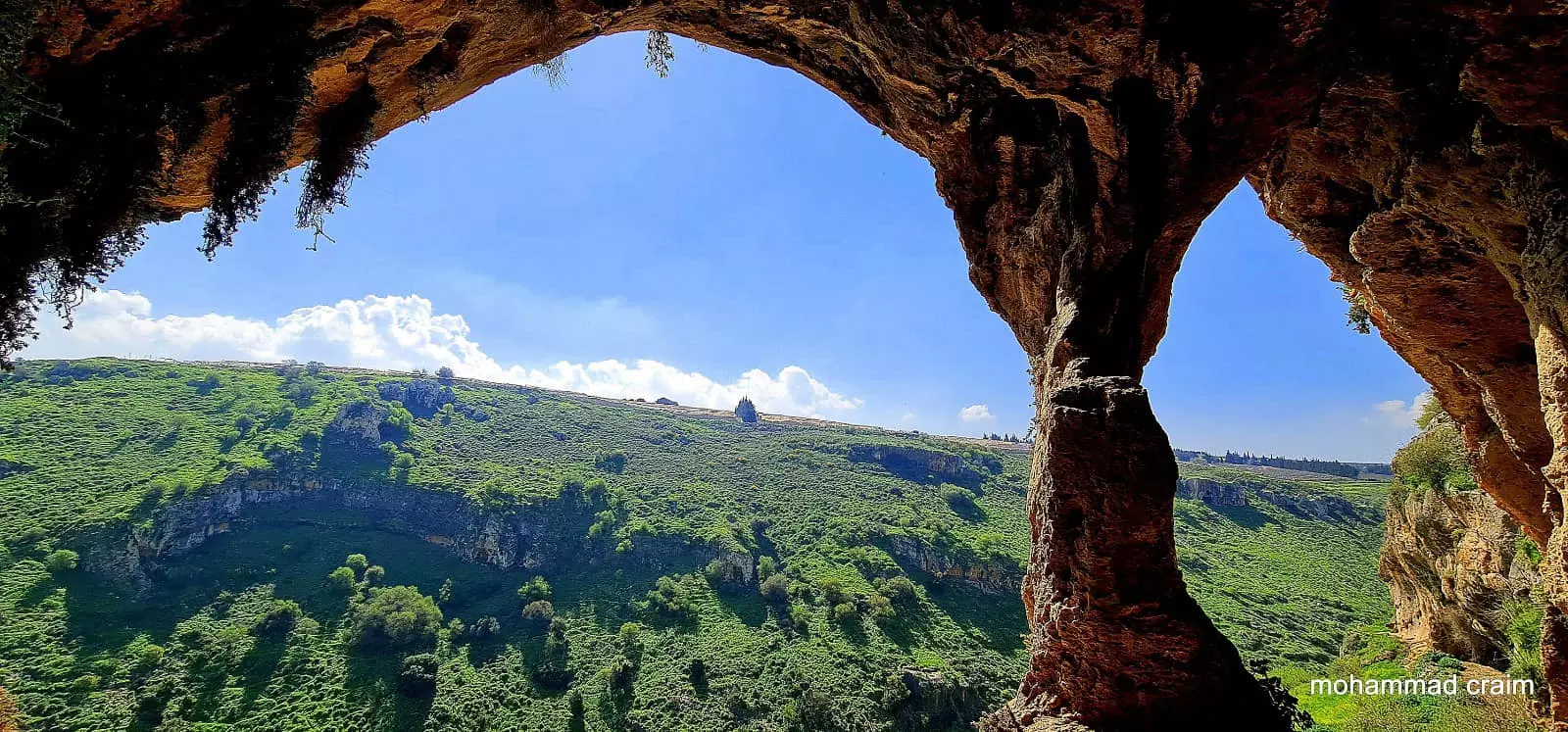
Posted by abu raya - مناظر من المغر الواقعه شرق القريه
Posted by abu raya - الطبيعه من الشرق للقريه
Posted by abu raya - منظر من شرق القريه
Posted by abu raya - الربيع في ديشوم
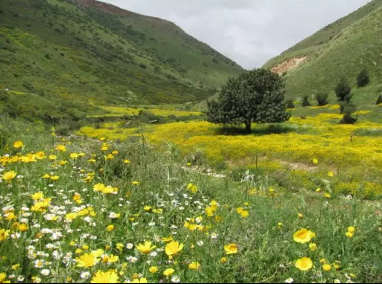
Posted by abu raya - منظر من وديان القريه
Posted by abu raya - منظر من وديان القريه
Posted by abu raya - اراضي ديشوم بالقرب من الوادي
Posted by abu raya - منظر من جانب القريه
Posted by abu raya - موقع القريه
Posted by abu raya - ديشوم
Posted by abu raya - أطلال قرية ديشوم
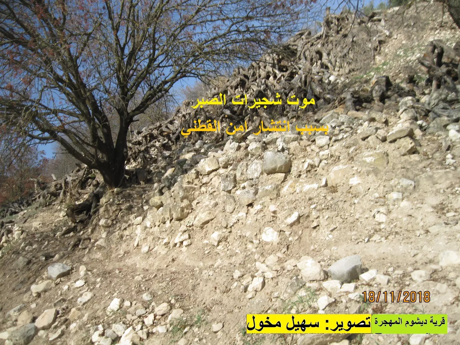
Posted by سهيل مخول - اختفاء شجيرات الصبر من قرية ديشوم
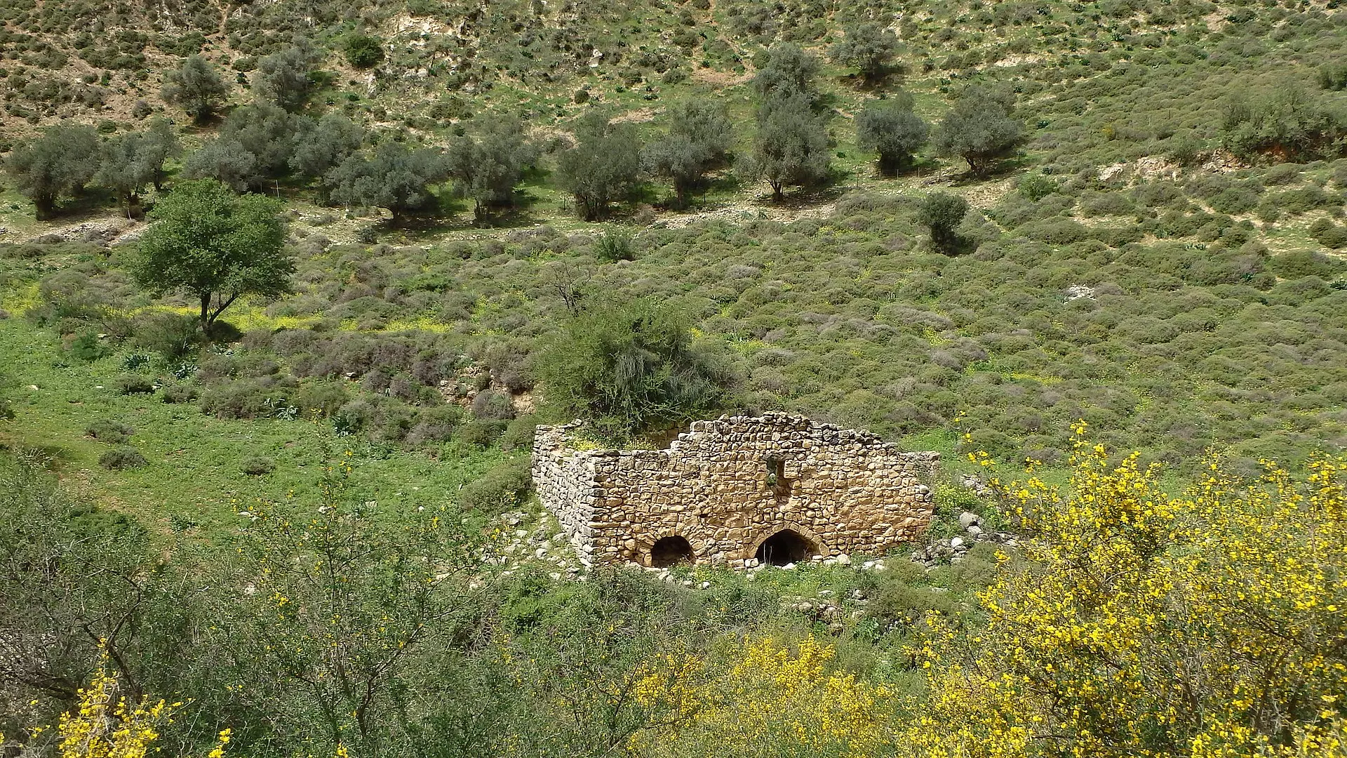
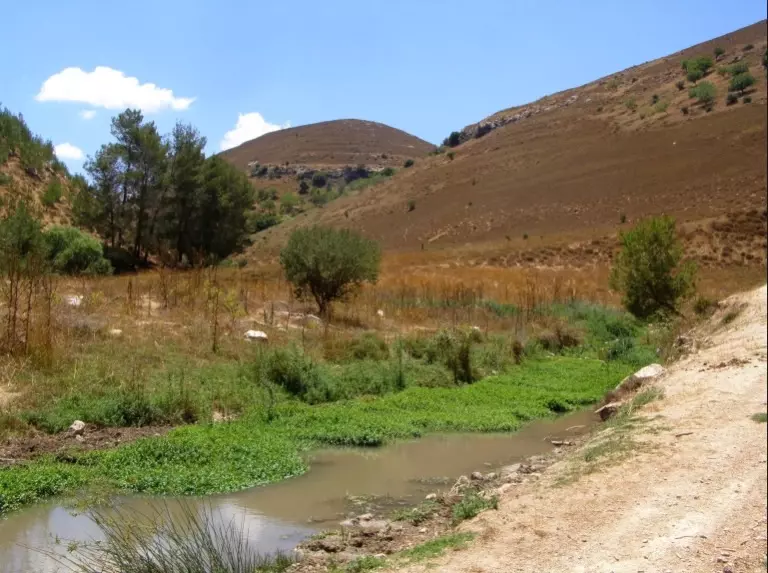
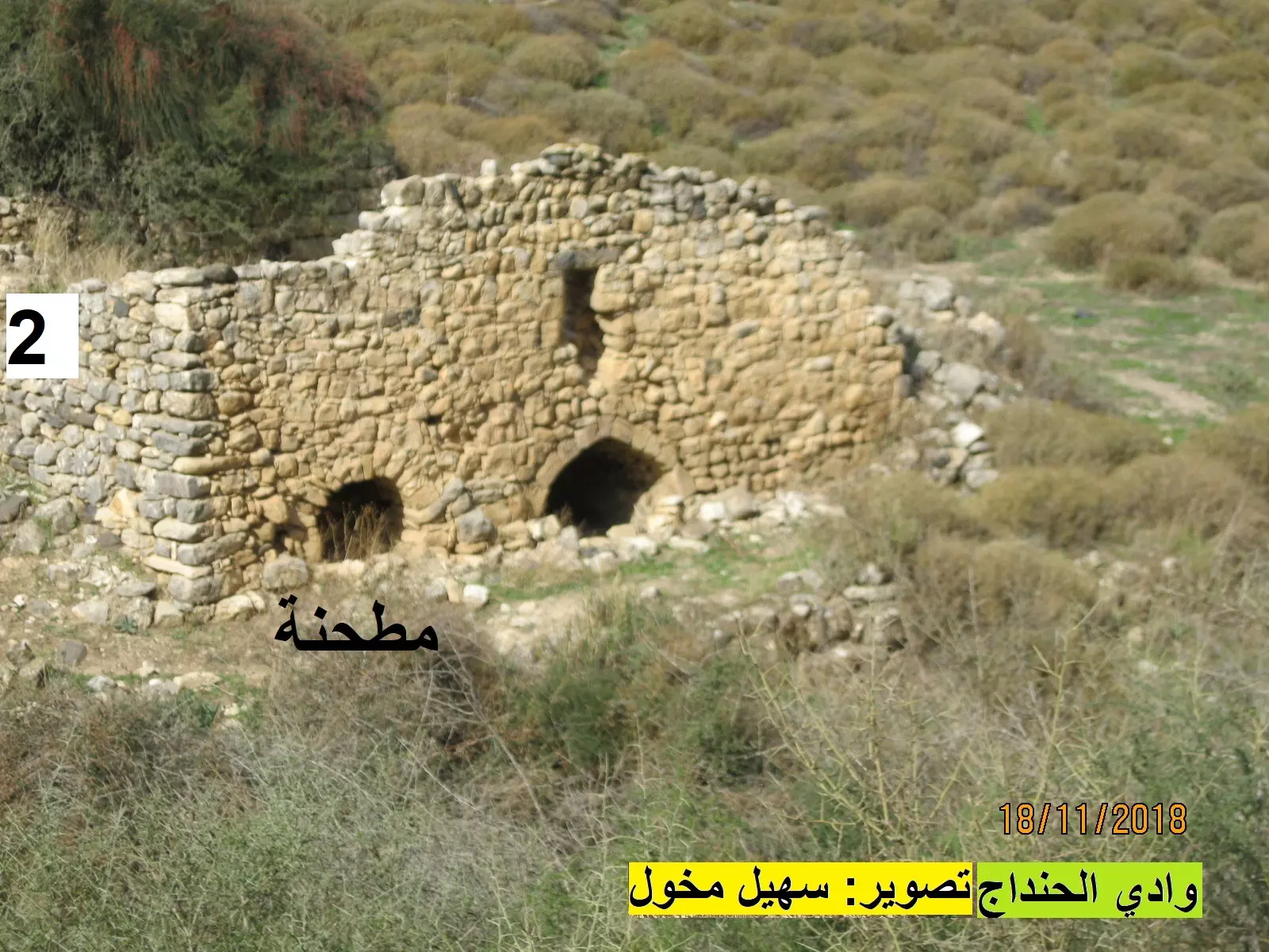
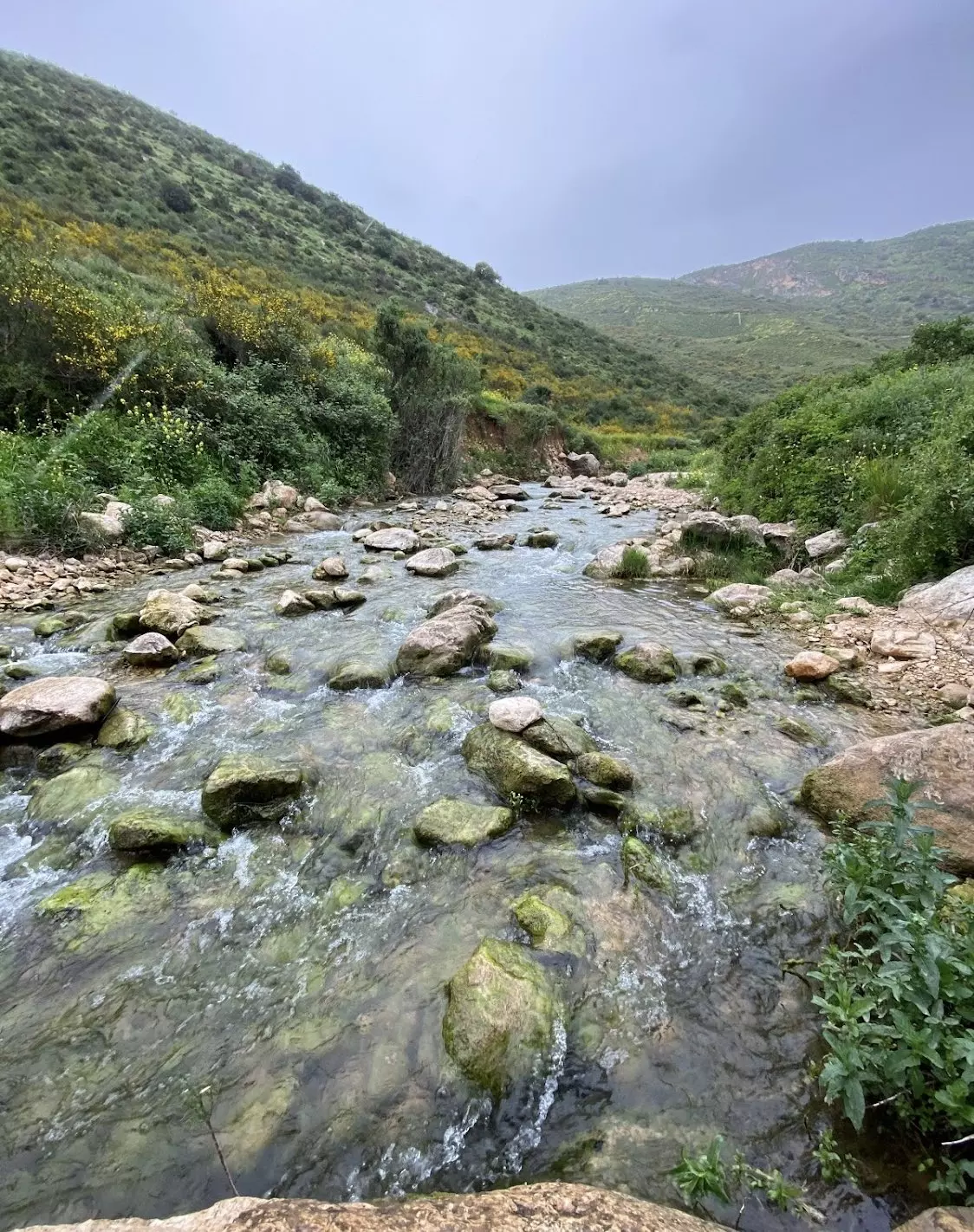
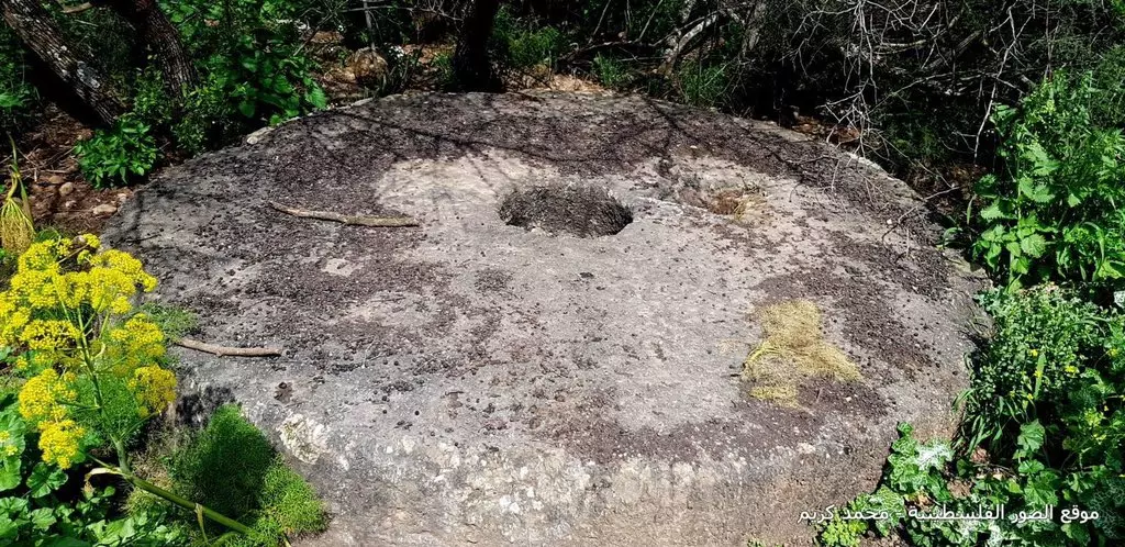
Posted by سهيل مخول - مطحنة للقمح في وادي الحنداج قرب ديشوم
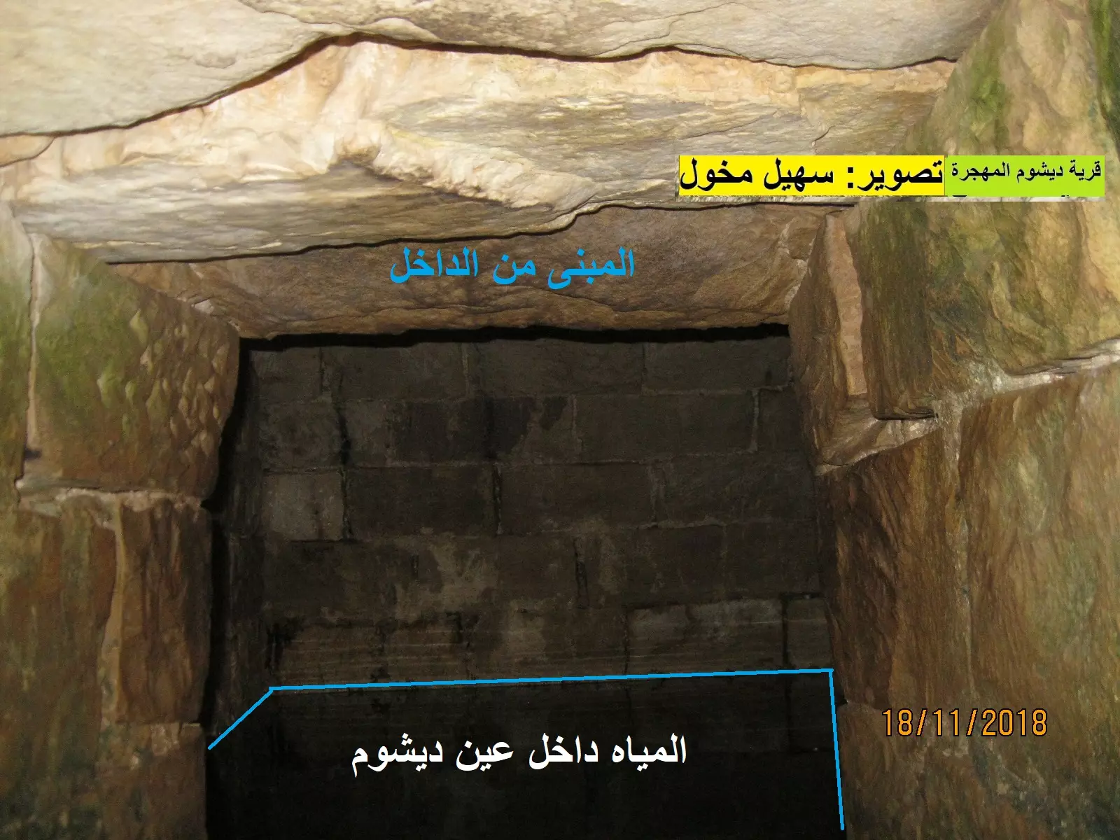
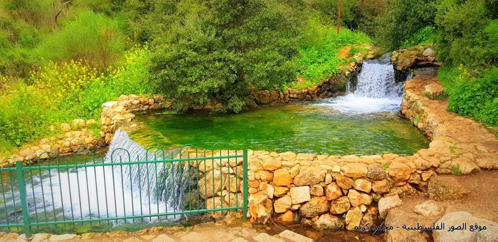
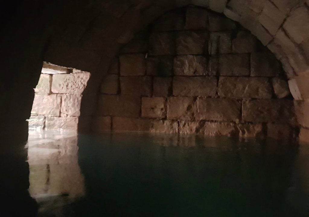
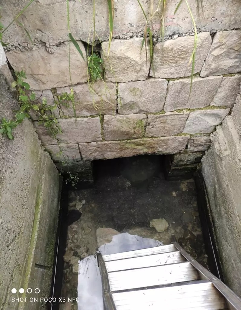
Posted by سهيل مخول - نبع الماء في ديشوم
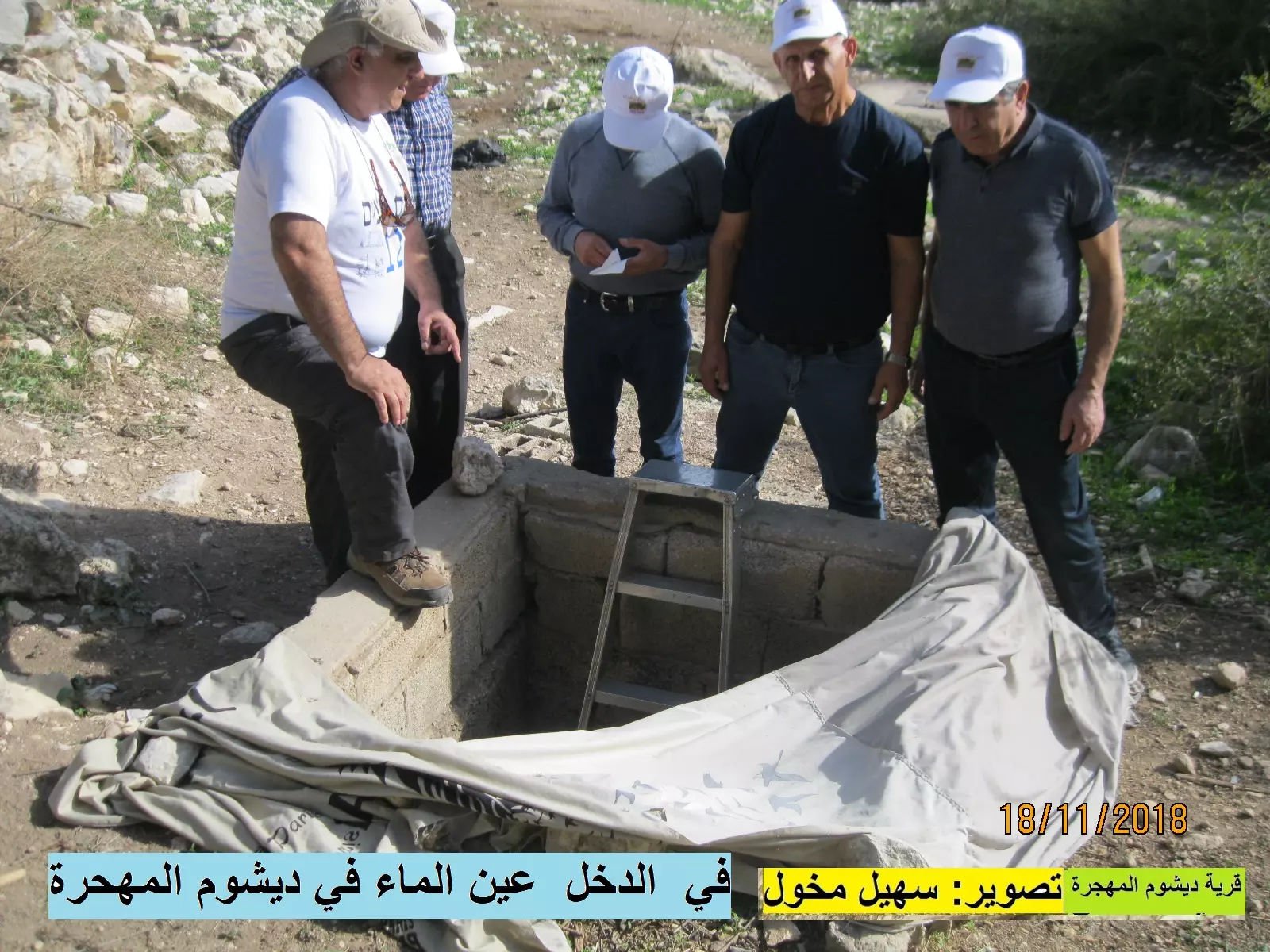
Posted by سهيل مخول - نبع الماء في ديشوم
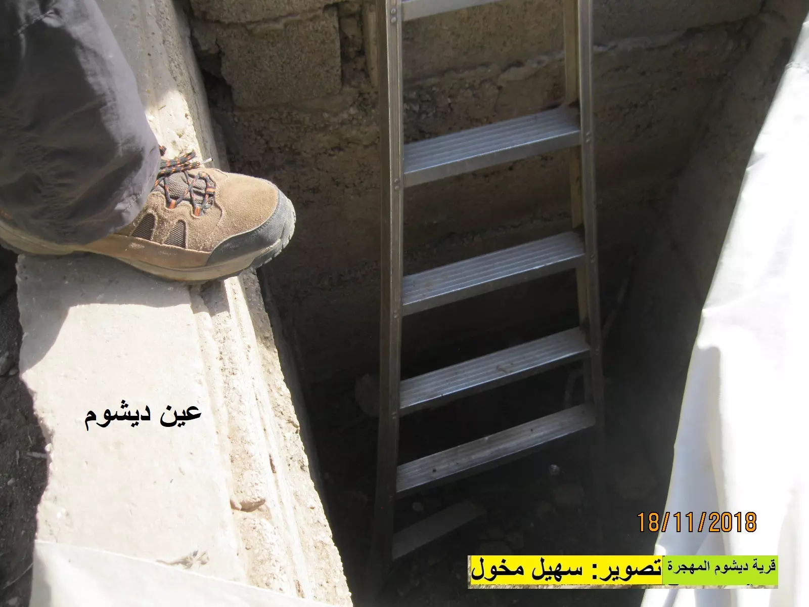
Posted by سهيل مخول - عين الماء في ديشوم
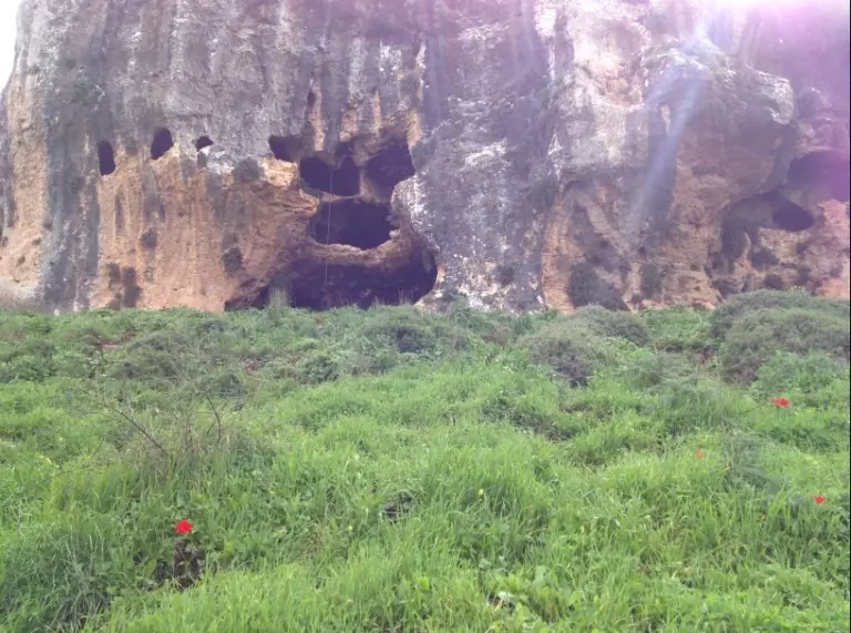
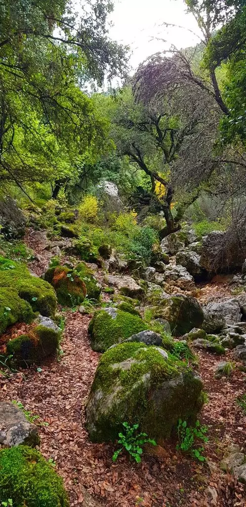
Posted by سهيل مخول - جولة في ربوع وكهوف واودية وينابيع القرية
- جولة في ربوع وكهوف واودية وينابيع القرية #2
- جولة في ربوع وكهوف واودية وينابيع القرية #3
- جولة في ربوع وكهوف واودية وينابيع القرية #4
- جولة في ربوع وكهوف واودية وينابيع القرية #5
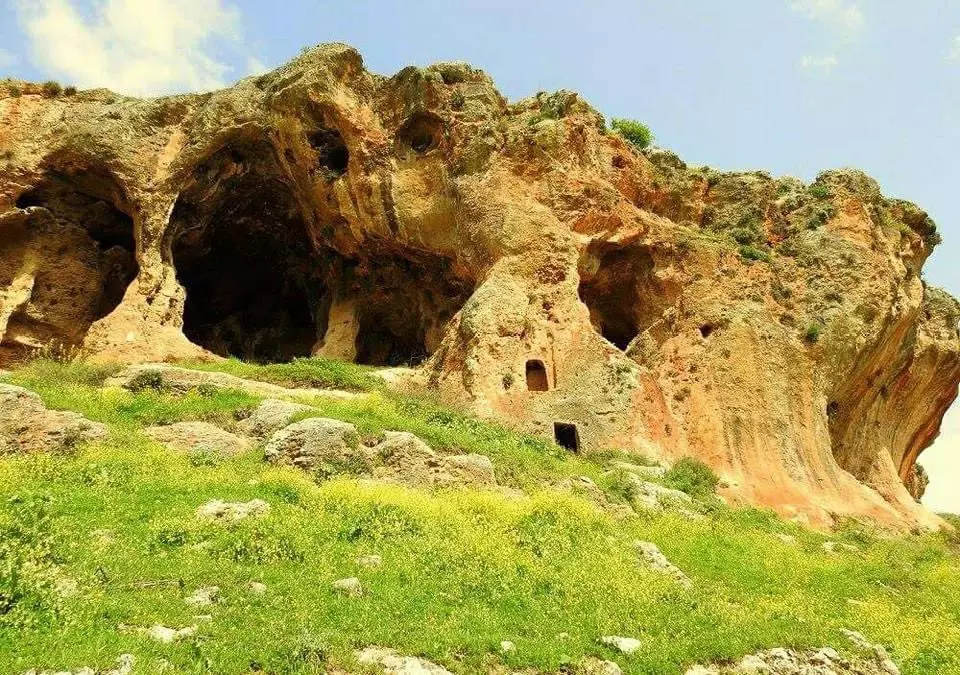
- جولة في ربوع وكهوف واودية وينابيع القرية #6
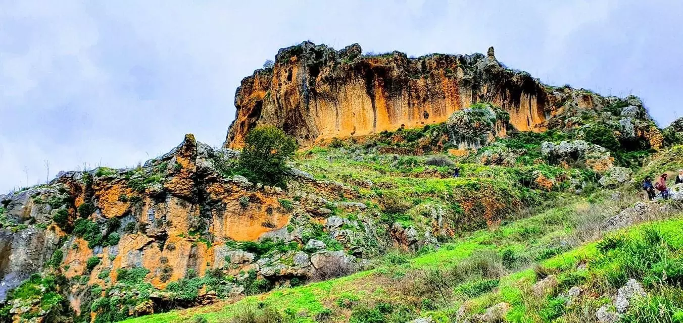
- جولة في ربوع وكهوف واودية وينابيع القرية #7
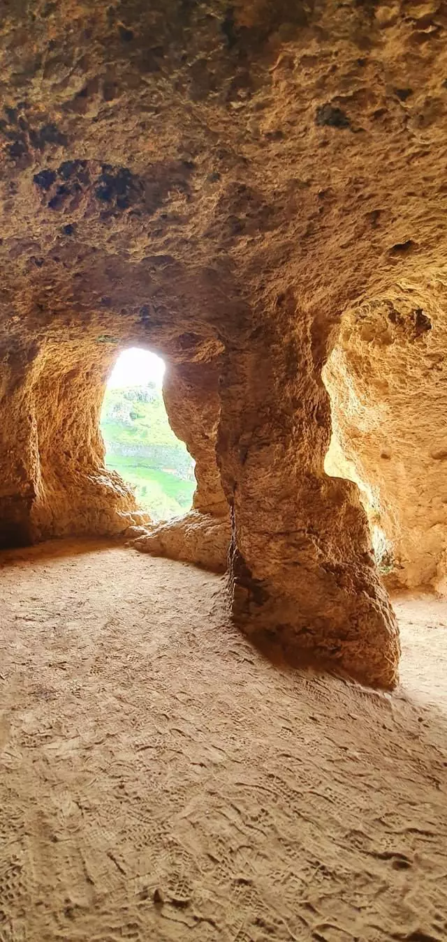
- جولة في ربوع وكهوف واودية وينابيع القرية #8
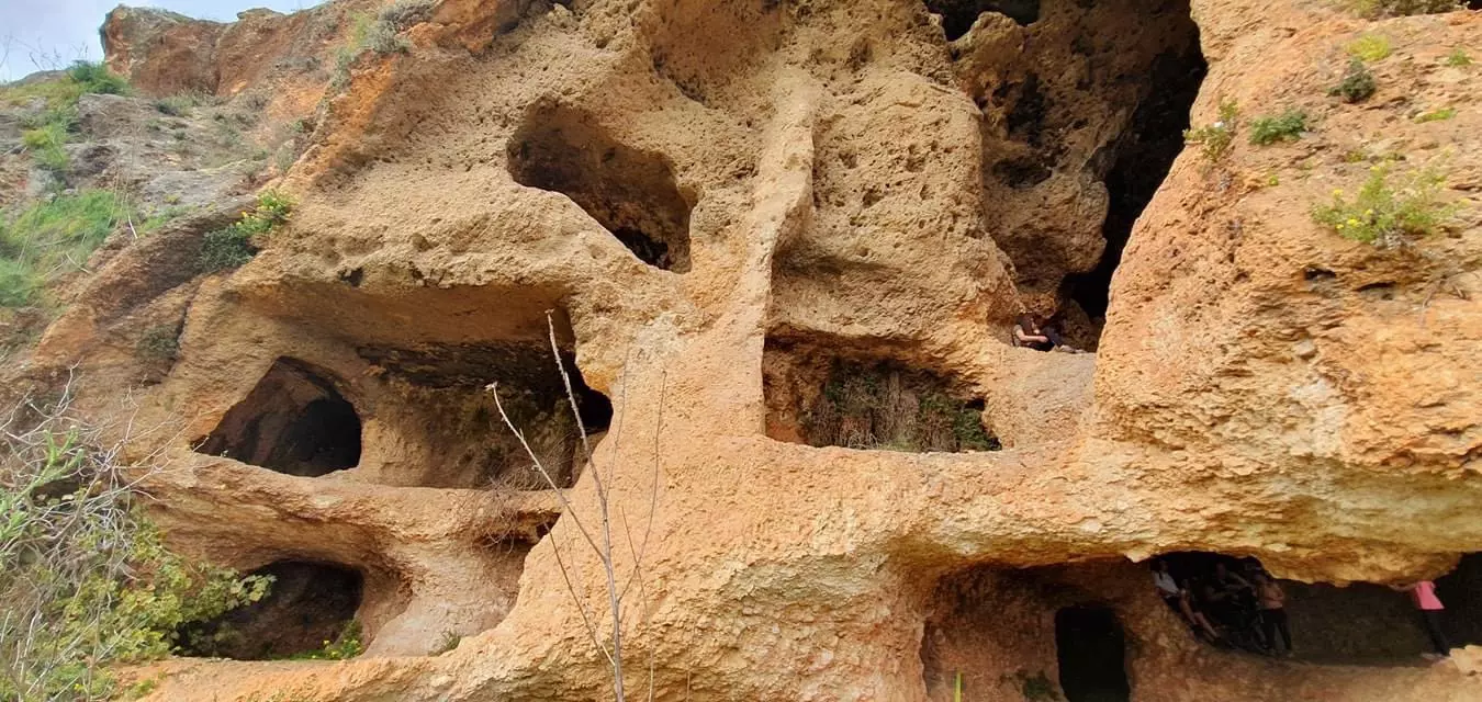
- جولة في ربوع وكهوف واودية وينابيع القرية #9
- جولة في ربوع وكهوف واودية وينابيع القرية #10
- جولة في ربوع وكهوف واودية وينابيع القرية #11
- انقاض القرية المدمرة
- انقاض القرية المدمرة #2
- انقاض القرية المدمرة #3
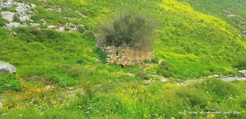
- انقاض القرية المدمرة #4
- انقاض القرية المدمرة #5
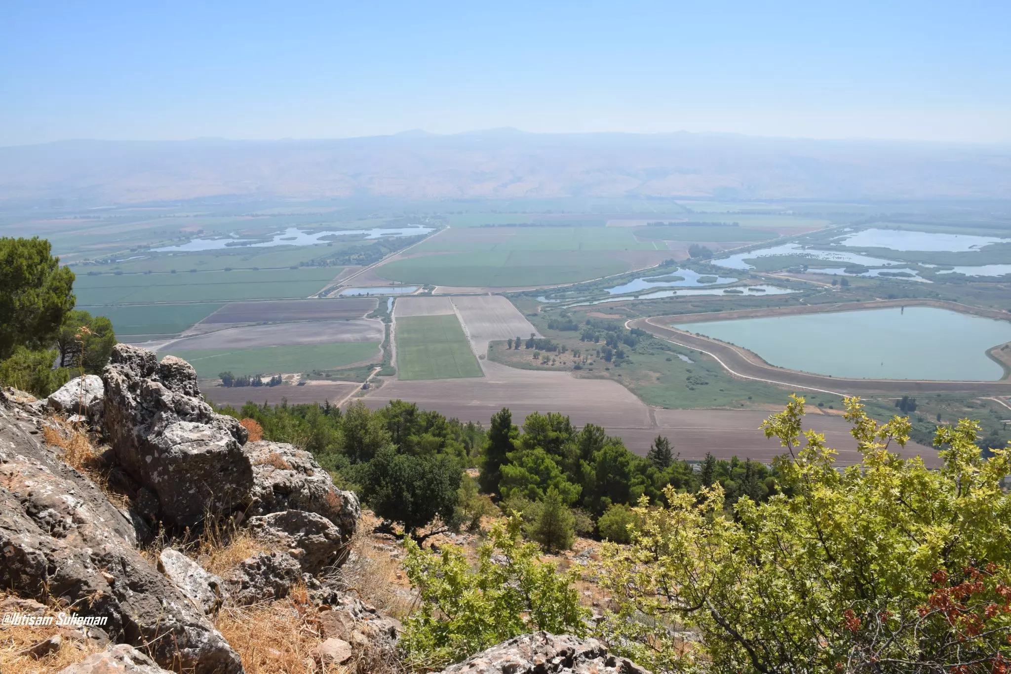
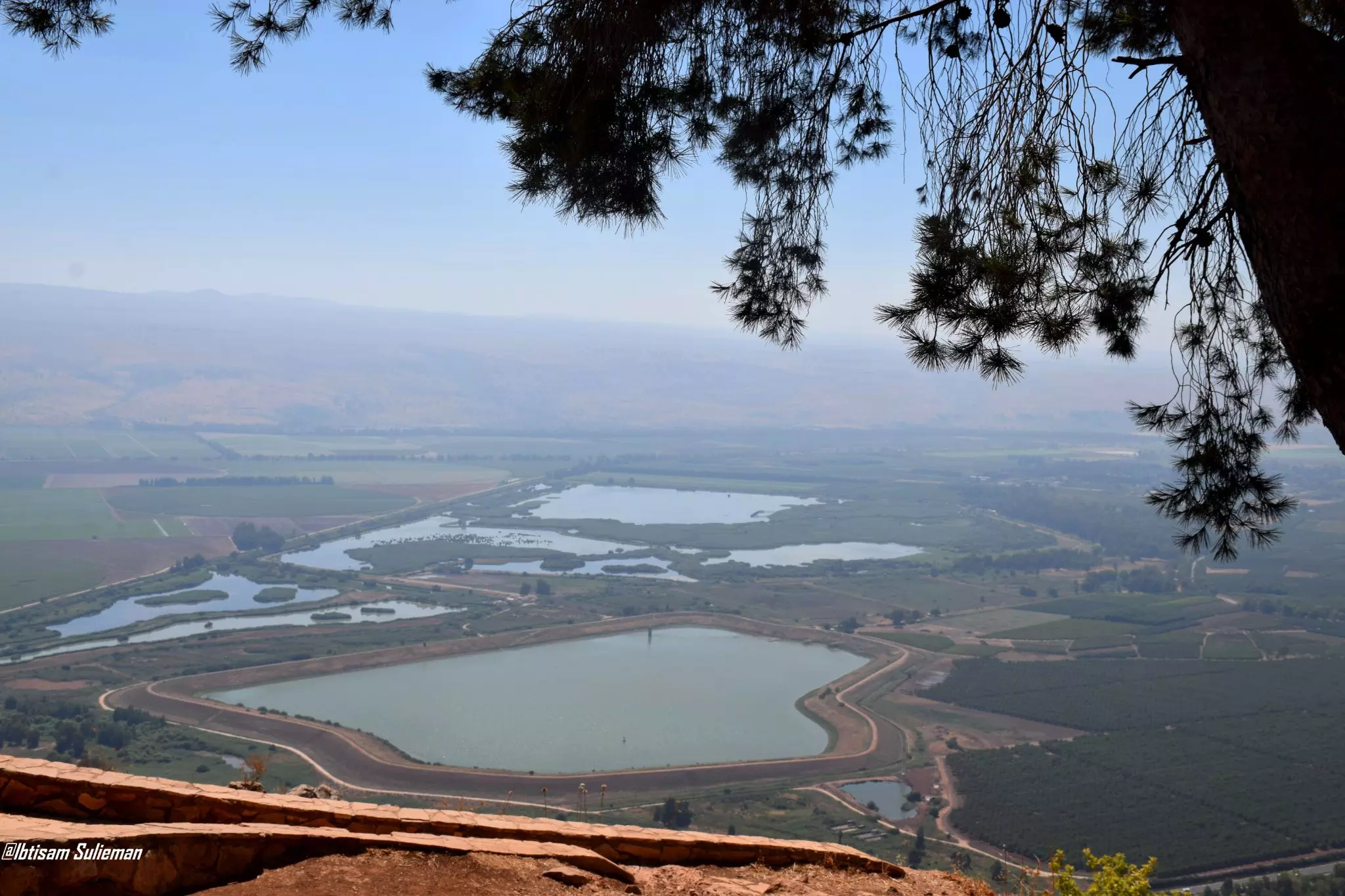
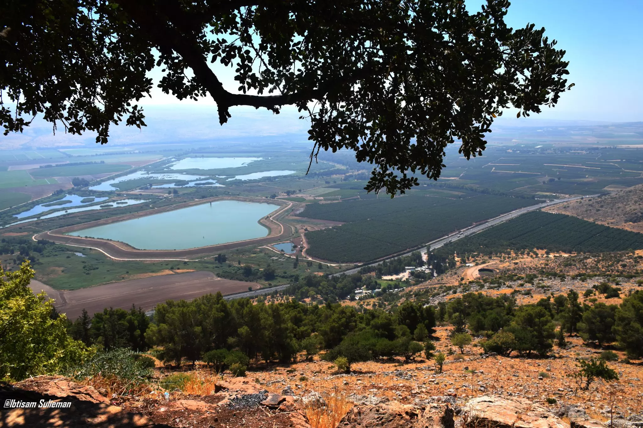
- سهل الحولة يقع في الزاوية الشمالية الشرقية من فلسطين،حيث كانت بحيرة سابقا قبل ان تقوم دولة الكيان بتجفيف البحيرة بدءاً من أبريل 1951 وحتى 30 أكتوبر 1957، وتحويلها إلى أرض زراعية. وتعتبر المنطقة محطة للطيور المهاجرة
- سهل الحولة يقع في الزاوية الشمالية الشرقية من فلسطين،حيث كانت بحيرة سابقا قبل ان تقوم دولة الكيان بتجفيف البحيرة بدءاً من أبريل 1951 وحتى 30 أكتوبر 1957، وتحويلها إلى أرض زراعية. وتعتبر المنطقة محطة للطيور المهاجرة #2
- سهل الحولة يقع في الزاوية الشمالية الشرقية من فلسطين،حيث كانت بحيرة سابقا قبل ان تقوم دولة الكيان بتجفيف البحيرة بدءاً من أبريل 1951 وحتى 30 أكتوبر 1957، وتحويلها إلى أرض زراعية. وتعتبر المنطقة محطة للطيور المهاجرة #3
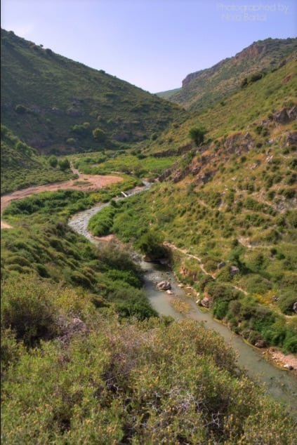
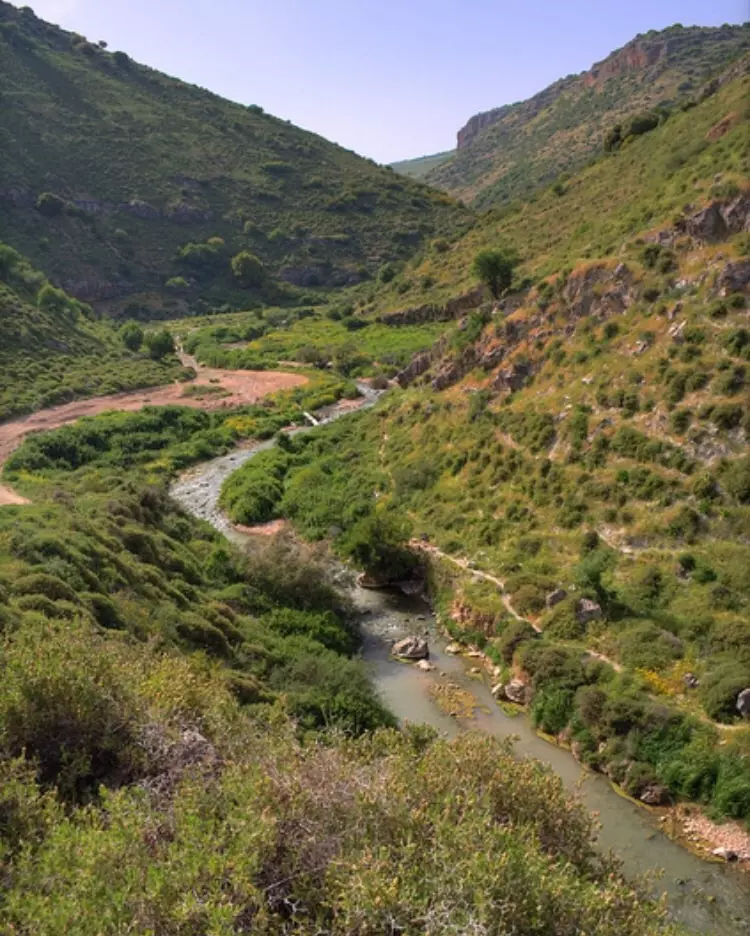
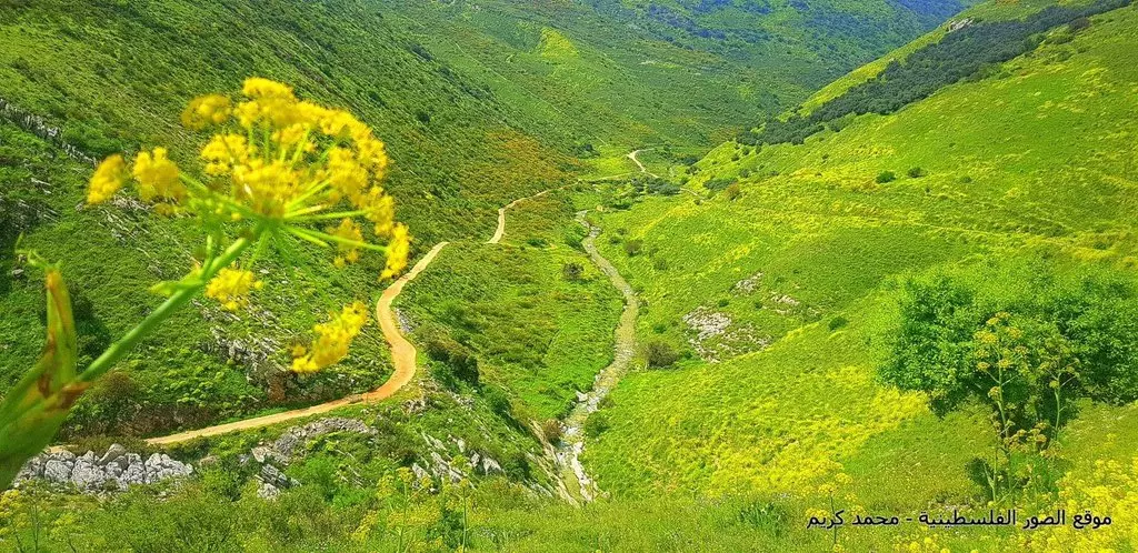
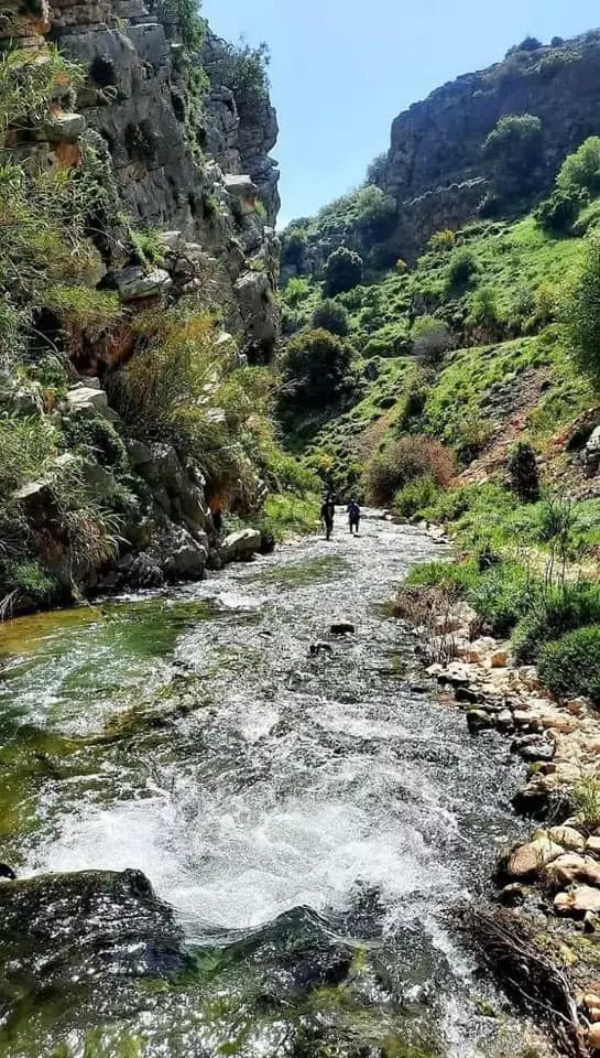
- وادي ديشوم ، بجانب القرية المهجرة -- Daoud Kabha
- That is how the "civilized" erased and replaced us: Dayshum was completely obliterated, as you see -- ديشوم باتت أثر بعد عين. من هنا مر الهمجّ
- وادي الحنداج: سكنه عرب الهيب الرصاطمة وهو واد يقع الى الشمال من مدينة صفد على جبيل الجرمق في الجليل الأعلى بجوار القرى علما وفارة وسبلان والحسينية وديشوم
- وادي الحنداج: سكنه عرب الهيب الرصاطمة وهو واد يقع الى الشمال من مدينة صفد على جبيل الجرمق في الجليل الأعلى بجوار القرى علما وفارة وسبلان والحسينية وديشوم #2
- وادي الحنداج: سكنه عرب الهيب الرصاطمة وهو واد يقع الى الشمال من مدينة صفد على جبيل الجرمق في الجليل الأعلى بجوار القرى علما وفارة وسبلان والحسينية وديشوم #3
- وادي الحنداج: سكنه عرب الهيب الرصاطمة وهو واد يقع الى الشمال من مدينة صفد على جبيل الجرمق في الجليل الأعلى بجوار القرى علما وفارة وسبلان والحسينية وديشوم #4
- خارطة تُظهِر الحدود والطرق بأنواعها والأماكن المقدسة والطبيعة الطوبغرافية من تلال وسهول ومنحدرات والتشكيلة الطبيعية للأرض وأنواع المزروعات. نُشرت الخريطة فترة الانتداب البريطاني، تم إضافة تعديلات عليها من قِبَل خدمة الخرائط والصور التابعة للقوات العسكرية الاسرائيلية فترة الأربعينيات.
Want to browse more? 80,000 pictures were grouped in these gallaries:
| Display Name | Clan/Hamolah | Country of Residence |
| Dayshum | - | - |
| راتب | - | - |
| الحلاق | - | امسترادام, هولندا |
| issam chaaban | palestine | uk, england |
| tahreer | - | -, - |
| شريف | - | - |
| علي الشامي | امازيغ | تيزي وزو, الجزائر |
| docteur kassem | docteur mawloud | bordeaux, france |
| moun elhajj | elhajj | saida, saida |
| Jad Alrabi | - | Abudhabi, United Arab Emirates |
| adnan | suleiman | cobenhagen, danmark |
| khaled | alhaj OMAR | schleswig holstein, deutschland |
| Mohamed Al Hussein | - | Newcastle upon tyne, United kingdom/ England |
| ruba212 | - | - |
| bensaleh1 | mograby | panama, panama |
| amazigh | - | tizi ouzou, algeria |
| Hussein Al Hussein | Al hussein | Copenhagen , Denmark |
| moh al hussein | - | - |
| ayman abdelrahman | - | labenon, labenon |
| Saeed El Hussein | El Husein | Lebanon, Lebanon |
No links have been shared yet, be free to the first to share the first link.
 Fake Valor: Why Did Zionist Jews Hoist Nazis Flag on Their Ships in the 1930s?
What is new?
-
Facts About Oct. 7th Gaza Raid
-
Remined Us Please:: Who Did Rape Who? Palestinians Raped Israelis? Or, was the other way around?
-
When Prof. Edward Said was invited to debate Bibi Netanyahu in the 1980s, watch what happened!
-
Ezra Klein of the NY Times on the "Jewish Race".
-
Abusing Blood Libel!
-
Did Israeli Soldiers Activate The Hanniba Direective On Oct. 7th? You Be The Judge
-
Zionist FAQ: Isn't it true that Palestinians don't want peace? Palestinians never accepted the two-state solution
- Facts about Haavara (Transfer) Agreement between Ben-Gurion & Hitler
-
Haavara FAQs: Why Did Zionist Jews Hoist Nazis' Flags on Their Ships in the 1930s?
- Haavara FAQs: When Chaim Weizmann met FDR in mid-1943, why was he silent about rescuing European Jewry?
-
Dear ChatGPT: How did Palestinians resist Napoleon's invasion of their country in 1799?
-
Dear ChatGPT: Gaza had a vibrant Jewish community in the mid-17th century. What happened to them?
-
Dear ChatGPT: Why did the Jewish Agency suppress news of the Holocaust during WWII?
-
Video Playlist: Jews share their DNA tests to end the conflict for good.
-
A Tale of Two Conflicts: Examining the Definition of Genocide
-
Prof. Abraham Polak And The Suppressed History of the Khazars and European Jewry
-
How Ronald Reagan would have framed the genocide in Gaza if he were still alive?
-
Haavara FAQs: Let us do the math: how many German Jews did The Haavara Agreement save?
-
Zionist FAQs: The Hebron Massacre of 1929, "clearly proves" that Palestinians are antisemitic, how could you deny it?
-
Zionist FAQs: Why Anti-Zionist Is Not Antisemitism?
-
Zionist FAQs: Isn't it true that the KGB created Palestinian Nationalism in the early 1960s?
- Zionist FAQs: Muslims are killing Muslims all the time; why are Israeli Jews being singled out in the media?
- Zionist FAQs: How is Israel an apartheid state when 20% of its citizens are Arabs who enjoy full rights?
-
Haavara FAQs: Why Did Dorothy Thompson Flip From A Zionist Advocate to A Silenced Dissenter?
-
Haavara FAQs: Analysis of Herzl's Uganda Scheme and how it could have saved millions of Jews.
-
Haavara FAQs: Why did Hayim Greenberg describe American Jewry as "morally bankrupt" in early 1943?
-
Haavara FAQs: What if the Evian Conference was a resounding success? What would have been the impact of saving European Jewry on Zionism?
- Haavara FAQs: What if the six million were saved, how that would have impacted the Zionist project?
-
Haavara FAQs: How did Zionist leaders react when Europe's Jews lingered in the DP camps after WWII ended?
-
Why does the American Jewish community repeat lies that David Ben-Gurion had debunked before he died?
-
Who has the power to rename the Tatar/Khazar Gene Marker to Jewish IV?
-
Zionist FAQs: Why won't Egypt, Syria, and Jordan take their people back? Jews are indigenous to Palestine, and Arabs immigrated after Jews developed the country. Arabs should leave.
-
Haavara FAQs: Did Hitler and the Nazis conflate between Judaism and Zionist? If that wasn't case, then why?
-
Haavara FAQs: Winston Churchill and antisemitism, a collection of articles written Churchill.
-
Haavara FAQs: Broken by country, how many Jews survived vs. killed during the Holocaust?
-
Haavara FAQs: Why did European Jews vote with their feet and to immigrated to the Americas, not Palestine, after WWII?
-
Watch this American Jewish Girl describing Israeli Jews' cognitive dissonance like no other in under two minutes
-
Haavara FAQs: When the Nazis went out of their way to hide the Holocaust, Israeli Jews did the exact opposite by broadcasting their genocide of Gazans. But why?
-
Haavara FAQs: How Zionist Jews went out of their to show their appreciation to Nazism and Fascism?
- Haavara FAQs: Why Zionist leaders were against bombing the death camps & the Railroads leading to them?
-
Haavara FAQs: Hitler's message to the British and American people: If Jews are such noble citizens and you care about them, how come you're not letting them in? I will gladly ship them to you at my expense, even on luxury liners!
-
A shortlist of Zionist and Israeli false flag operations in the name Jews.
-
The Most Moral Army
- The Land of Kapos (Israel): Where the brave are boycotted and Kapos walk free.
- Why did early Zionists often named their communal enterprises "colonial"?
- Zionist Relations with Nazi Germany by Faris Glubb
-
Two NY Times advertisements by Zionists in the early 1943 that exposes Zionists' treason at the height of the calamity
- Facts Not Lies about the Palestinian-Israeli Conflict.
- Site's pictures have been categorized
- Campgain Against Lice
- A Survey of Palestine, the official source about Palestine before Nakba produced by the British Mandate; over 1200 pages.
- Satellite View & Google Earth: Over 6,000 placemarks identifying all destroyed towns, W. Bank & Gaza Strip Towns, & refugee camps.
- PalestineRemembered.com and its Nakba Oral History Project were featured on al-Jazeera Satellite TV.
- Nakba Oral History Video Podcast:
 Over 700 Oral History interviews (including 3,500+ hours of recording) can be viewed online.
 - Palestine Village Statistics Project
- Gaza Jail Break
- النسخة العربية للموقع الان متوفرة
- Videos: Documenting the destroyed villages in video: Tracing all that remains since Nakba.
- Videos: Responding to Zionist Propaganda
- Interview: The ethnic cleansing of Palestine: George Galloway interviews Israeli Historian Ilan Pappe.
- For Palestinians, memory matters. It provides a blueprint for their future By George Bisharat.
- Zionist FAQ now available in Hebrew שאלות שציונים שואלים, עכשיו בעברית
- Video: The Stephen Walt and John Mearsheimer report on the influence of the Israel Lobby on U.S. Foreign Policy
- The Palestinian-Israeli conflict for beginners
