| PalestineRemembered | About Us | Oral History | العربية | |
| Pictures | Zionist FAQs | Haavara | Maps | |
| Search |
| Camps |
| Districts |
| Acre |
| Baysan |
| Beersheba |
| Bethlehem |
| Gaza |
| Haifa |
| Hebron |
| Jaffa |
| Jericho |
| Jerusalem |
| Jinin |
| Nablus |
| Nazareth |
| Ramallah |
| al-Ramla |
| Safad |
| Tiberias |
| Tulkarm |
| Donate |
| Contact |
| Profile |
| Videos |
Welcome To Wadi Qabbani - وادي قباني (ואדי קבאני)
|
District of Tulkarm
Ethnically cleansed days ago |
العربية Google Earth |
 |
Gallery (45) |
- Statistics & Facts
-
Before & After

- Satellite View
- Articles 7
- Pictures 45
- Members
- All That Remains
- Wikipedia
- Videos 4
- Guest Book 1
- Links
| Statistic & Fact | Value | |||||||||||||||
| Occupation Date | March 1, 1948 | |||||||||||||||
| Distance From District | 12 (km) Northwest of Tulkarm | |||||||||||||||
| Elevation | 25 (meters) | |||||||||||||||
| Before & After Nakba, Click Map For Details |
||||||||||||||||
|
||||||||||||||||
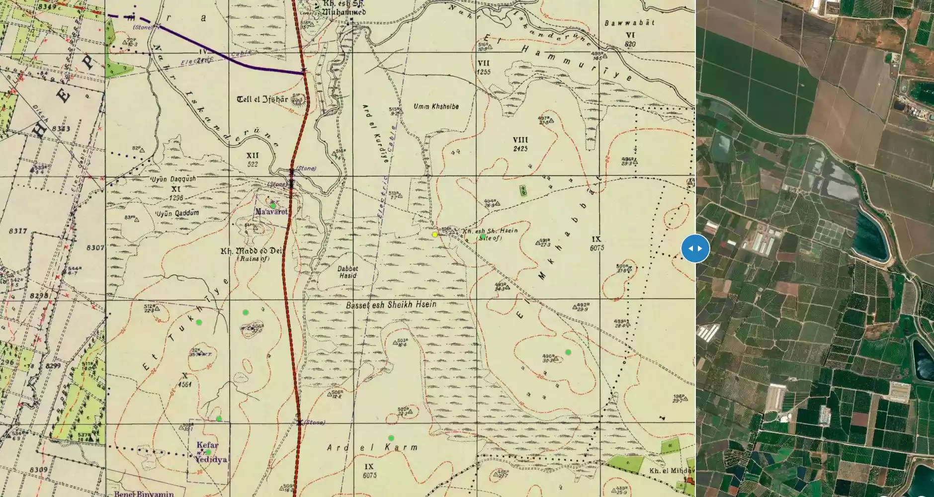
| Map Location | See location #8 on the map View from satellite |
|||||||||||||||
| Military Operation | Coastal Clearing | |||||||||||||||
| Exodus Cause | Expulsion by Zionist troops | |||||||||||||||
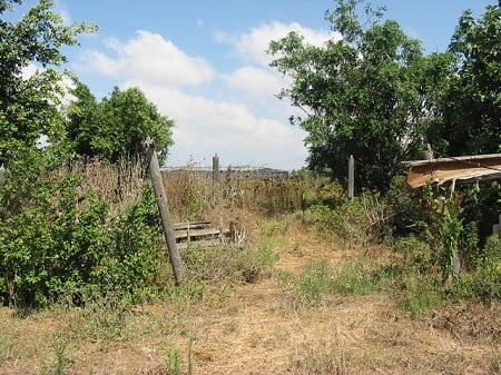
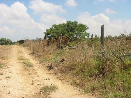
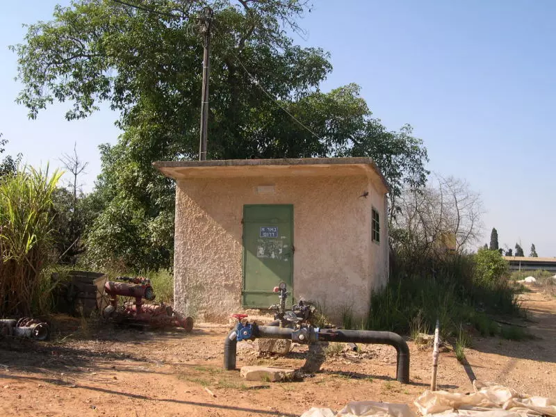
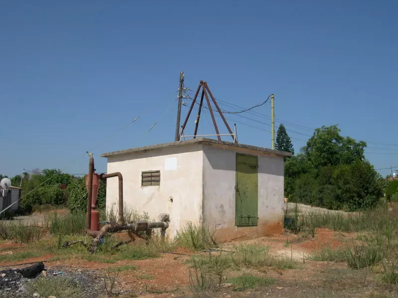
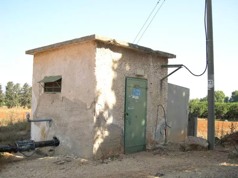
| Village Temains | Wadi Qabbani was completely obliterated. | |||||||||||||||
| Ethnically Cleansing | Wadi Qabbani inhabitants were completely ethnically cleansed. | |||||||||||||||
| Pre-Nakba Land Ownership |
**Town Lands' Demarcation Maps |
|||||||||||||||
| Land Usage As of 1945 |
|
|||||||||||||||
| Population |
|
|||||||||||||||
| Near By Towns |
||||||||||||||||
|
||||||||||||||||
| Archeological Sites | Wadi Qabbani contains Khirbat al-Shaykh Husayn, which had artifacts dating to the Roman period. | |||||||||||||||
| Exculsive Jewish Colonies Who Usurped Village Lands |
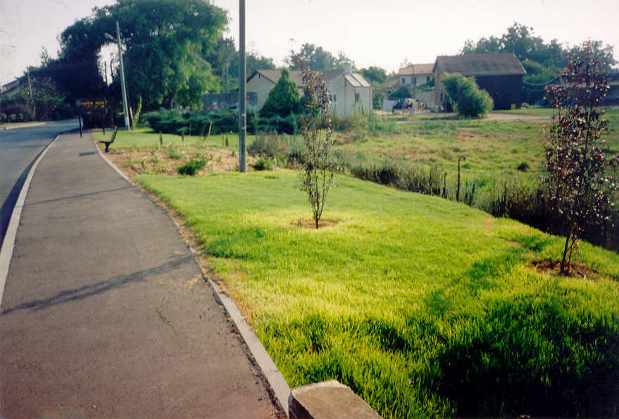
Kibbutz ha-'Ogen | |||||||||||||||
| Featured Video | ||||||||||||||||
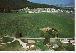
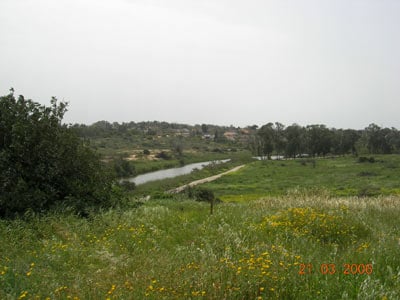
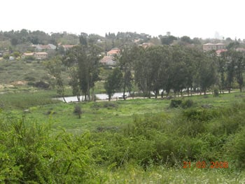
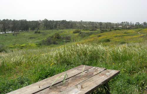
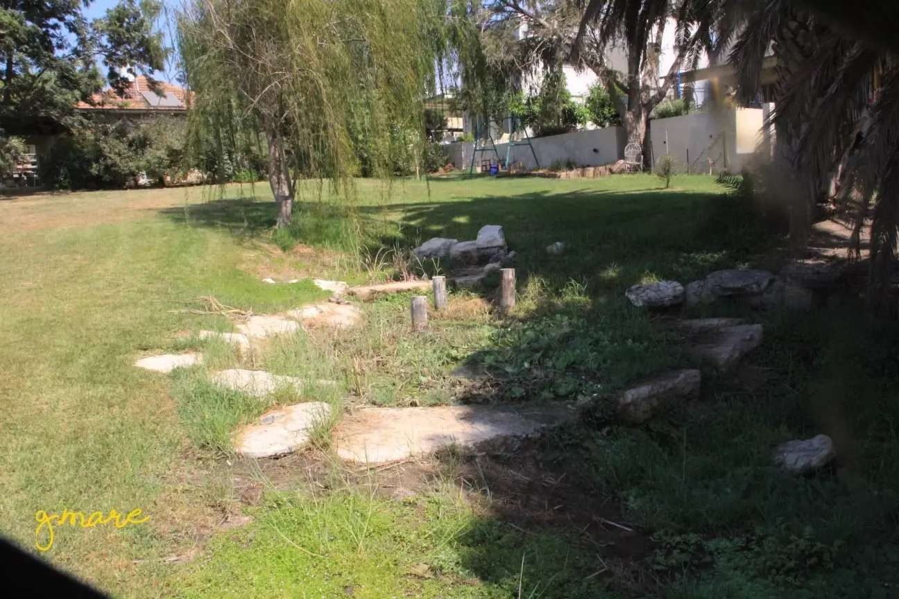
Village Before NakbaWadi Qabbani was located 1.5 km east of the coastal highway and was linked to it by a secondary road that passed through the village. It was named after a Lebanese family who owned most of its lands. The village was built on the archaeological site of Khirbat al-Shaykh Husayn, which contained artifacts that may date to Roman times. This khirba was a high point in the area and was bordered on the west and south by marshland. On the eve of the war, the village had three brick houses. In 1944/45 a total of 408 dunums were allocated to cereals.Village Occupation and Ethnic CleaningJudging from the evidence from surrounding villages, Wadi Qabbani was probably occupied in the early months of the war. In March .and April 1948, the Haganah had a general policy of uprooting coastal communities north of Tel Aviv. Some time during 8-10 April, the Haganah General Staff issued orders to its units to clear away and, if necessary, expel Arab rural communities along the axis between Tel Aviv and Hadera, a large Jewish settlement some 40 km north of it. Since the village of Wadi Qabbani was located approximately halfway between the two points, it probably carne under the scope of those expulsion orders, as did nearby 'Arab al-Nufay'at.Zionists Colonies on Village LandsKibbutz ha-'Ogen (143196) had been built in 1947 on the village site.Village TodayThe village houses are gone. Two Christ's-thorn trees grow next to the former cemetery, which has been converted into a children's playground belonging to the kibbutz. No traces of the cemetery can be discerned.SourceDr. Walid al-Khalidi, 1992: All That Remains. |
||||||||||||||||
| Related Maps | Town Lands' Demarcation Maps خرائط للقضاء توضح حدود القرى والاودية Town's map on MapQuest View from satellite Help us map this town at WikiMapia |
|||||||||||||||
| Related Links | Wikipedia's Page Google Search Google For Images Google For Videos |
|||||||||||||||
| More Information | في كتاب كي لا ننسى في كتاب بلادنا فلسطين المزيد من موقع هوية |
|||||||||||||||
- وادي القباني حسب ما جاء في موقع المجموعة194
- وادي قباني - قرية مغتصبة عام 1948م
- آل قباني... العائلة التي ملكت اراضي وادي القباني
- نبذة تاريخية عن قرية وادي قباني (قضاء طولكرم) من كتاب (كي لا ننسى)
- لمحة عن قرية وادي القباني المهجرة - حسب موقع بلدي - تأريخ وتراث
- شجرة عائلة ابو مريم _ وادي القباني - وادي الحوارث
- الحمايل والعشائر والعائلات التي سكنت وادي القباني والملاحة
- وادي القباني
Posted by Wadina - اراضي وادي القباني
Posted by Wadina - مستعمرة على أرض القباني
Posted by Wadina - أرض وادي القباني مقام عليها مستعمرات مشمار هشارون وكفارحاييم وبيت ليفي و هعوغن وكفار مونش

Posted by Wadina - صورة لمستعمرة مع بدايات إغتصاب أراضي وادي القباني
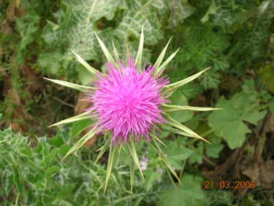
Posted by Wadina - نبات الخرفيش النامي في أرض وادي القباني
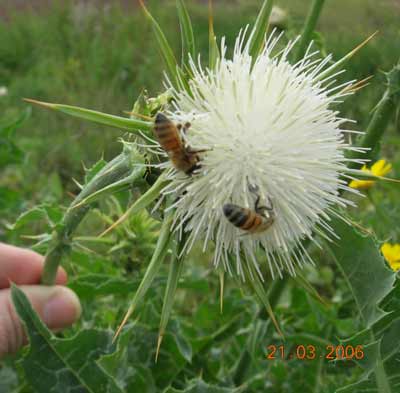
Posted by Wadina - نحل يبحث عن الرحيق المفقود من روائح أهل القباني
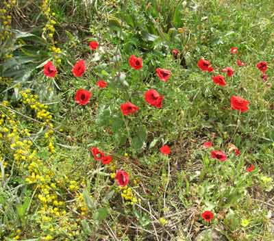
Posted by Wadina - شقائق النعمان وذكريات وادي القباني
Posted by Wadina - ينهبون مافوق الأرض وما تحت الأرض
Posted by Wadina - إغتصاب مافوق الأرض وما تحت الأرض في أرض القباني
Posted by Wadina - سرقة واغتصاب لمافوق الأرض وما تحت الأرض
Posted by Wadina - مستعمرات على أرض القباني
Posted by Wadina - ربيع وادي القباني
Posted by Wadina - مستعمرة تجرح حياء ربيع القباني
Posted by Wadina - جمال الطبيعة في القباني
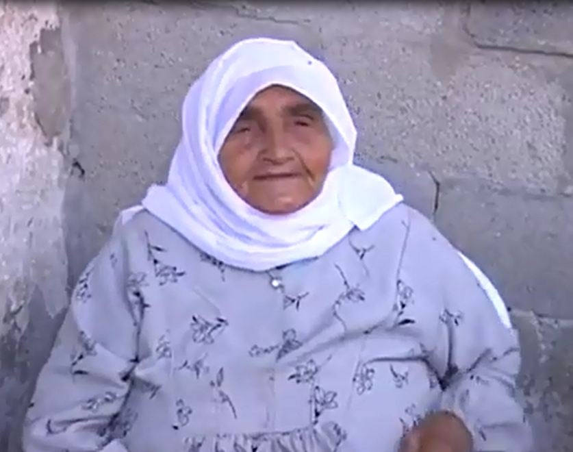
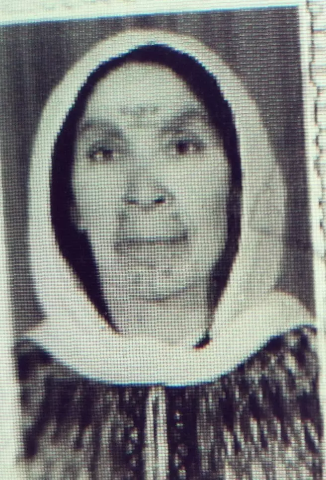
Posted by Wadina - الحاجة فاطمة على موسى مسيمي - ام وجيه - سكان وادي القباني - الاصل من الجماسين
Posted by Harthiah - المرحوم رجا ابو مريم
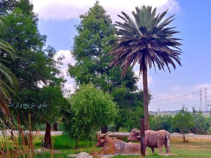
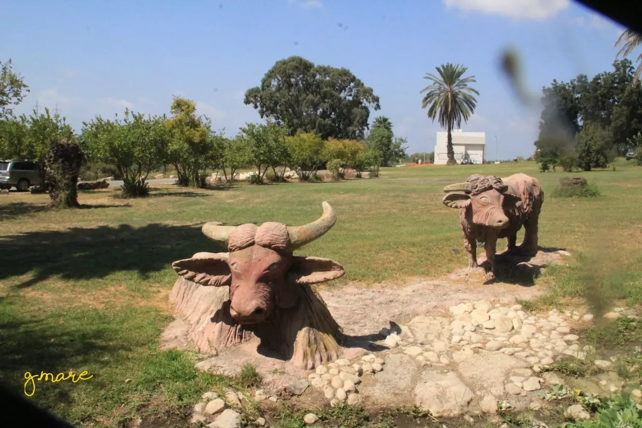
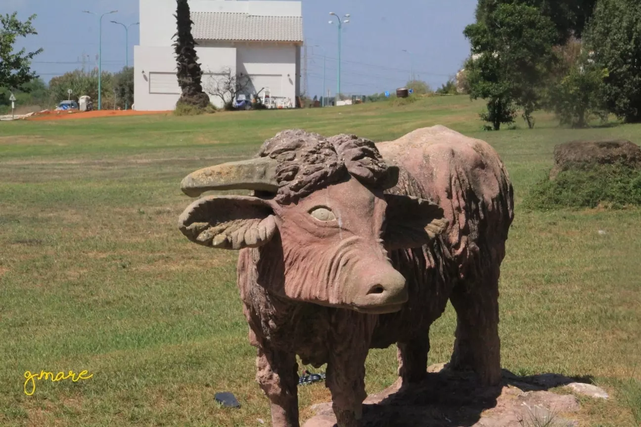
Posted by AbuHsein 1 - عين الجواميس - عين ال ابو مريم _ كل الشكر موقع بلدي - تأريخ وتراث
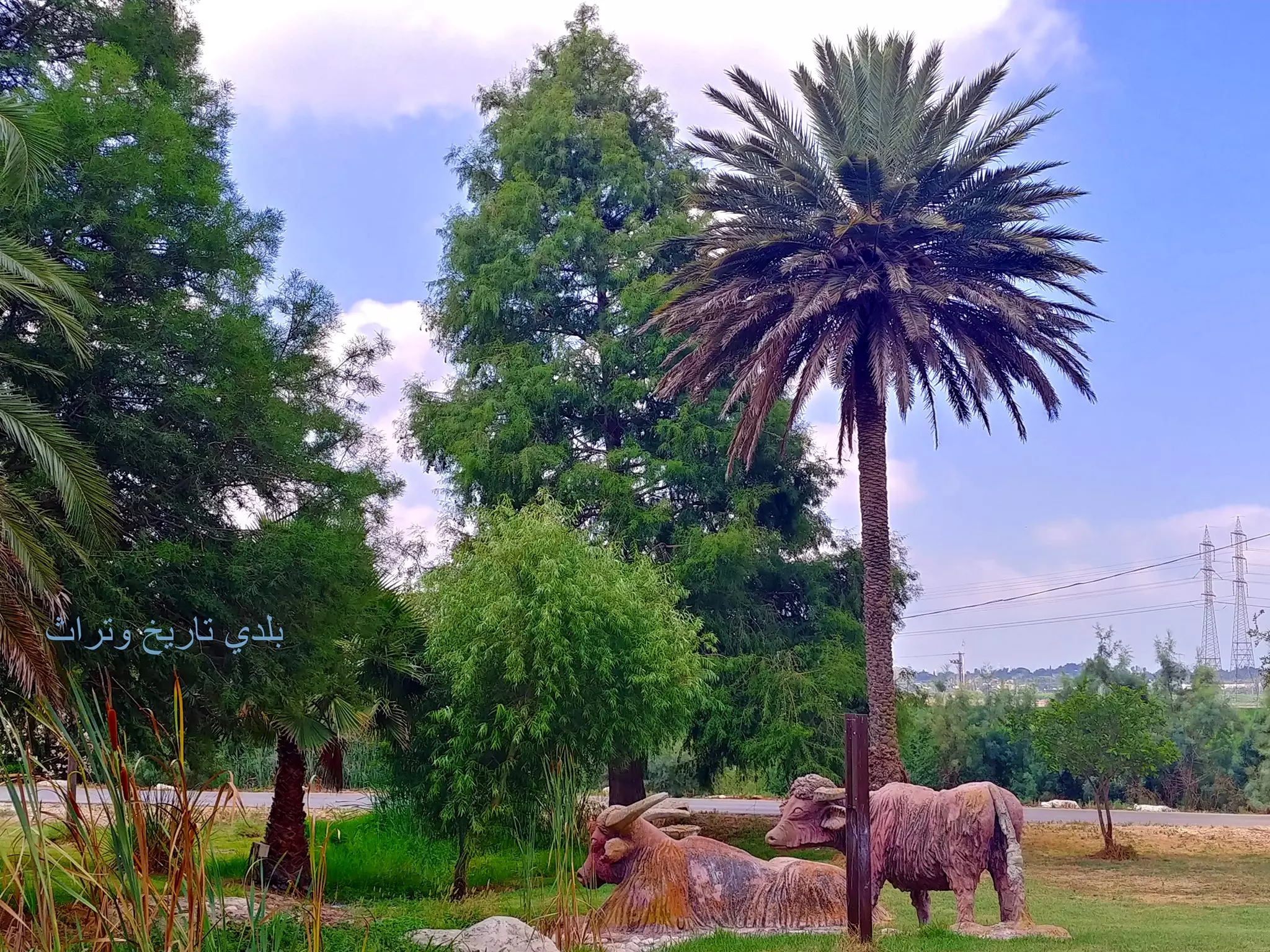
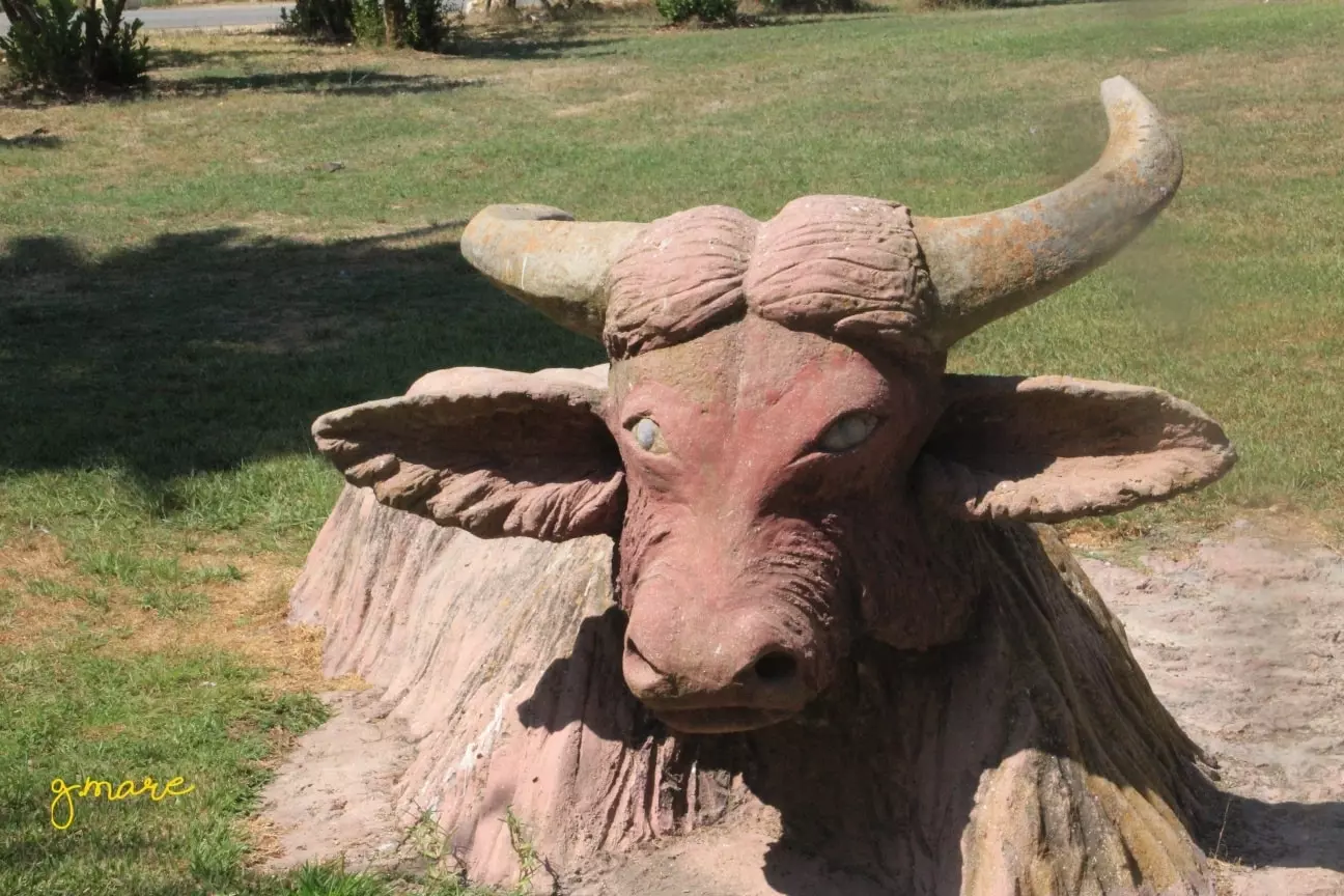
Posted by AbuHsein 1 - تمائيل في مكان عين الجواميس - عين ال ابو مريم
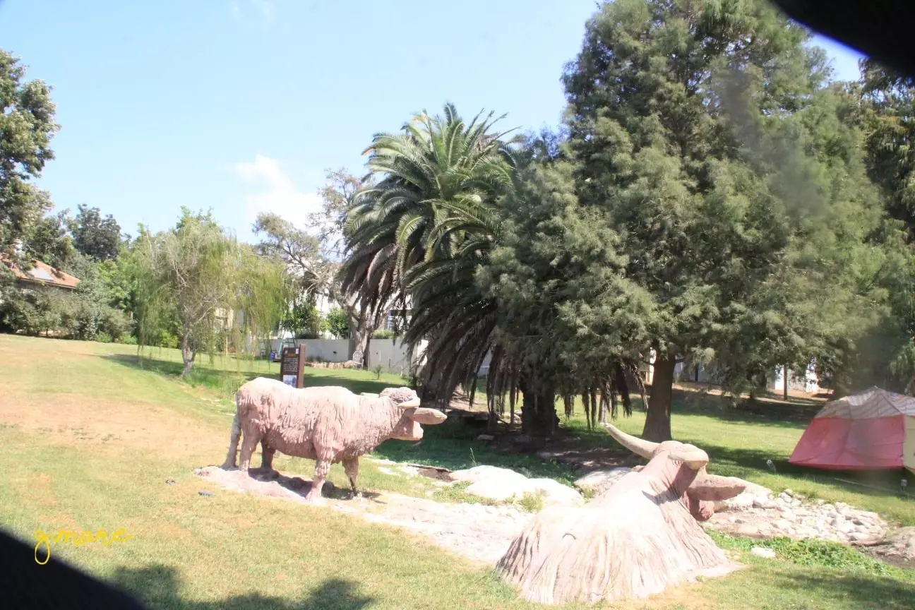
Posted by AbuHsein - تمائيل تحاكي الواقع في مكان عين الجواميس - عين ال ابو مريم - تصوير نائل بيادسة
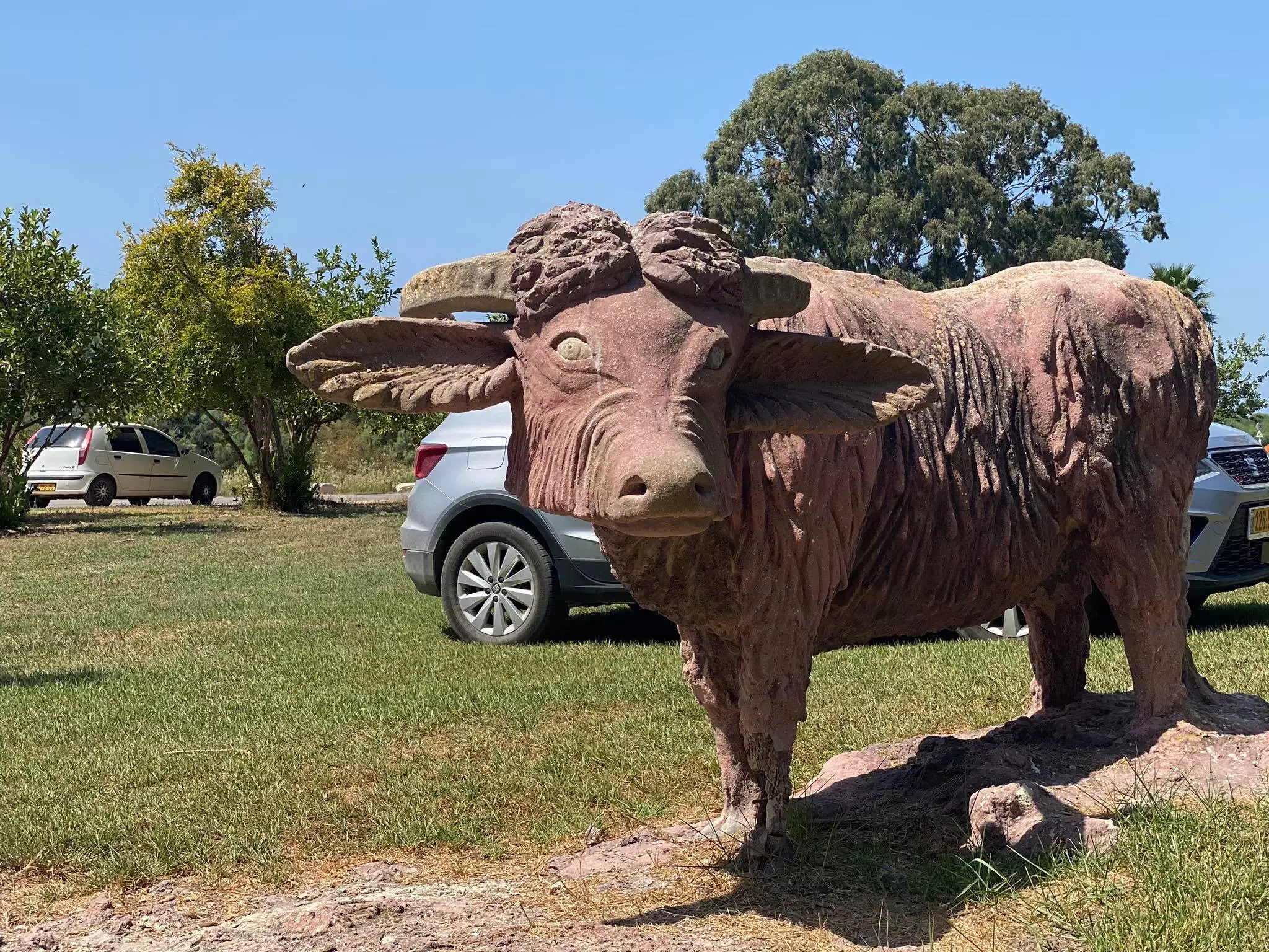
Posted by AbuHsein - تمائيل تحاكي الواقع في مكان عين الجواميس - عين ال ابو مريم - تصوير نائل بيادسة
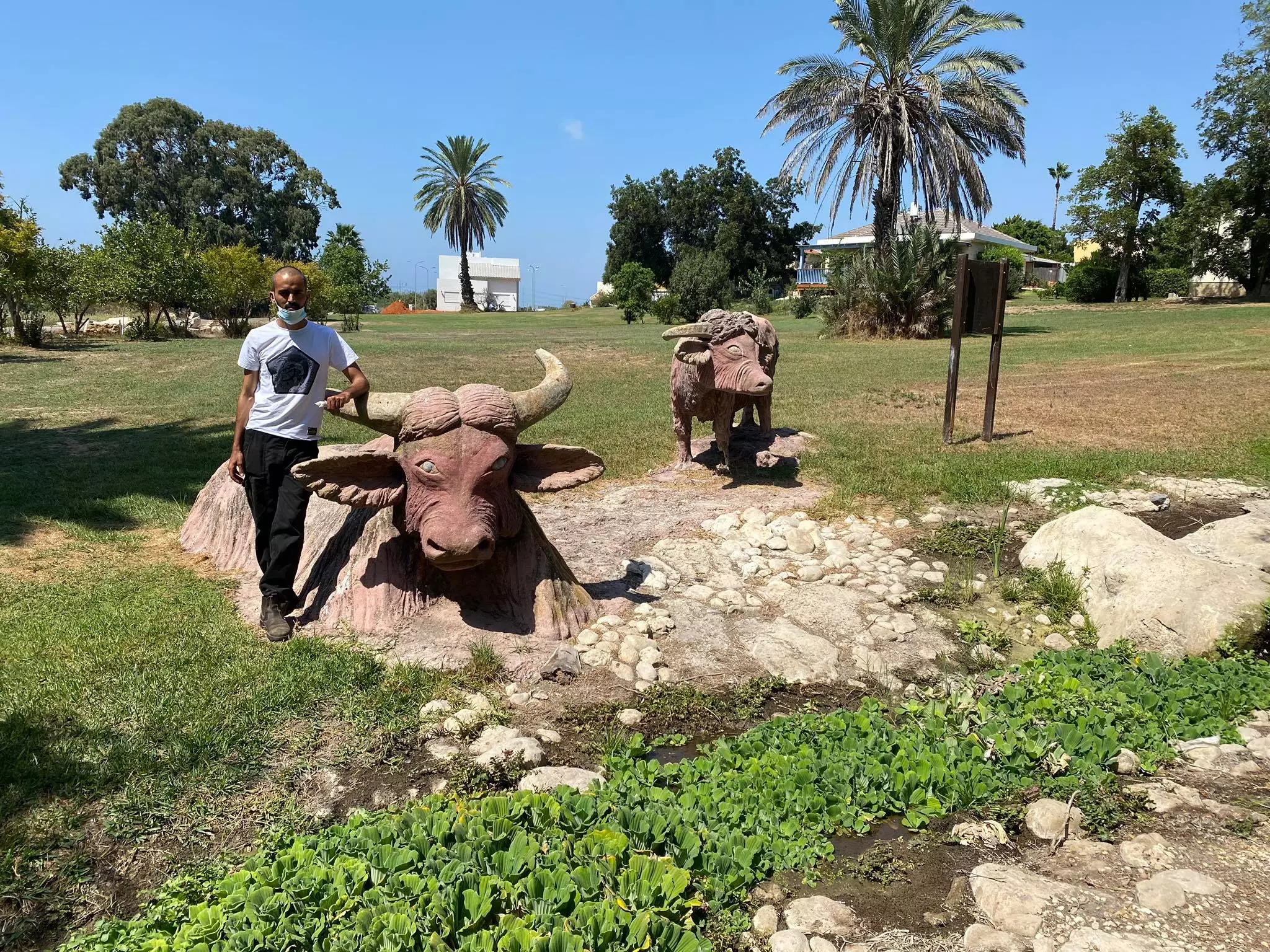
Posted by AbuHsein - تمائيل تحاكي الواقع في مكان عين الجواميس - عين ال ابو مريم - تصوير نائل بيادسة
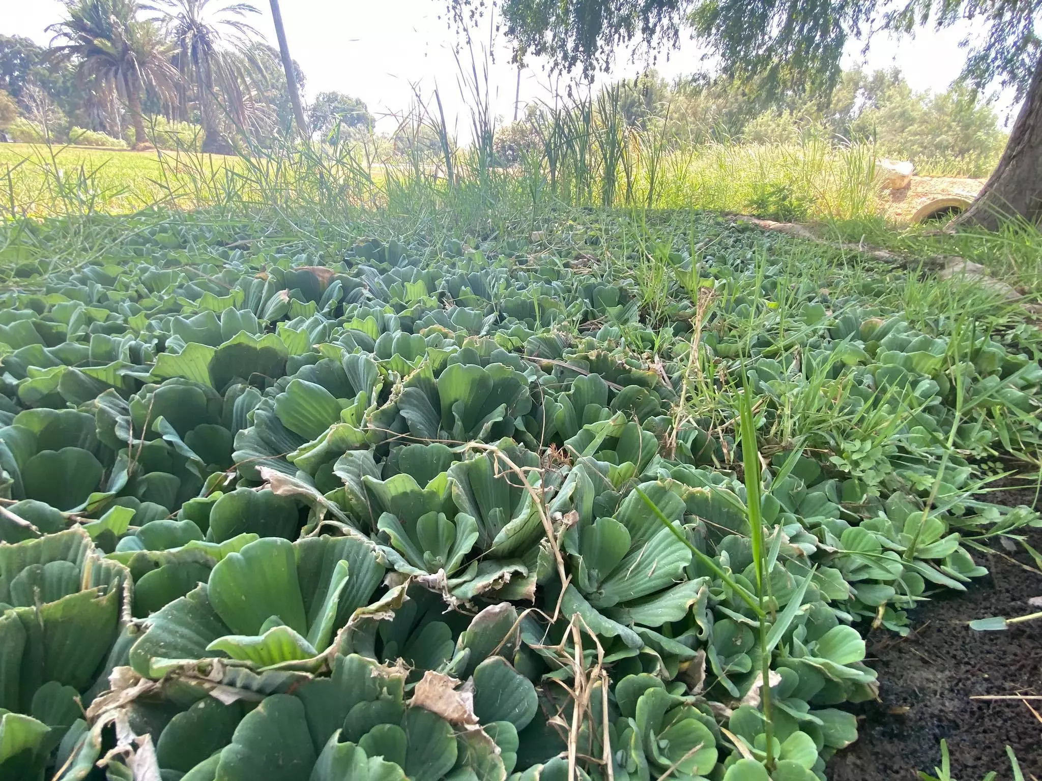
Posted by AbuHsein - نباتات تحاكي الواقع كما كان في عين الجواميس قبل تهجير وادي القباني - معلومات عن النبات يدعى علميا النيلوفر (الاسم العلمي:Nymphaea) ،، نأمل الوصول لمعلومات عن اسمه الشعبي
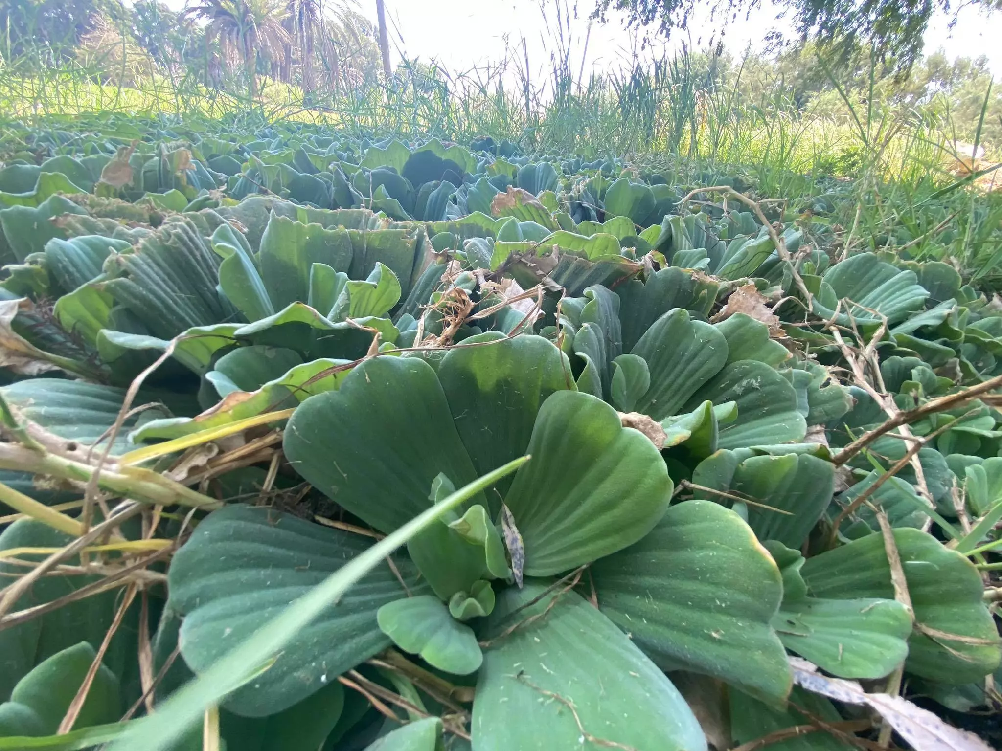
Posted by AbuHsein - نباتات صناعية تحاكي الواقع كما كان في عين الجواميس قبل تهجير وادي القباني - معلومات عن النبات يدعى علميا النيلوفر (الاسم العلمي:Nymphaea) ،، نأمل الوصول لمعلومات عن اسمه الشعبي
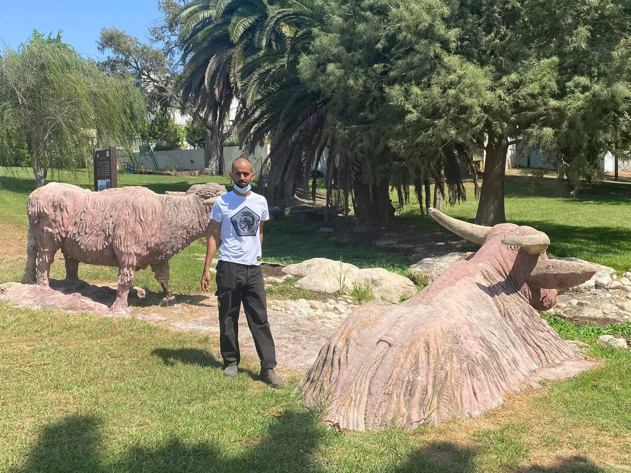
Posted by AbuHsein 1 - مائيل تحاكي الواقع في مكان عين الجواميس - عين ال ابو مريم حيث كانت تسقى الجواميس في وادي القباني - تصوير مرعي جربان
Posted by AbuHsein - مائيل تحاكي الواقع في مكان عين الجواميس - عين ال ابو مريم حيث كانت تسقى الجواميس في وادي القباني - تصوير مرعي جربان

Posted by AbuHsein - مائيل تحاكي الواقع في مكان عين الجواميس - عين ال ابو مريم حيث كانت تسقى الجواميس في وادي القباني - تصوير مرعي جربان
Posted by AbuHsein - مائيل تحاكي الواقع في مكان عين الجواميس - عين ال ابو مريم حيث كانت تسقى الجواميس في وادي القباني - تصوير مرعي جربان
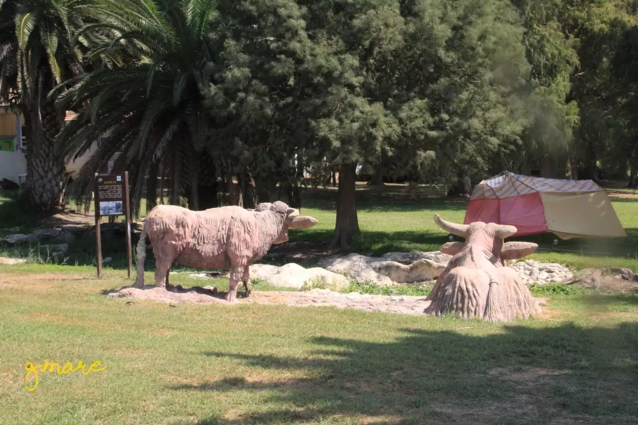
Posted by AbuHsein - مائيل تحاكي الواقع في مكان عين الجواميس - عين ال ابو مريم حيث كانت تسقى الجواميس في وادي القباني - تصوير مرعي جربان
Posted by AbuHsein - تمائيل تحاكي الواقع في مكان عين الجواميس - عين ال ابو مريم حيث كانت تسقى الجواميس في وادي القباني - تصوير مرعي جربان
Posted by AbuHsein - نباتات تحاكي الواقع كما كان في عين الجواميس قبل تهجير وادي القباني - معلومات عن النبات يدعى علميا النيلوفر (الاسم العلمي:Nymphaea) ،، نأمل الوصول لمعلومات عن اسمه الشعبي
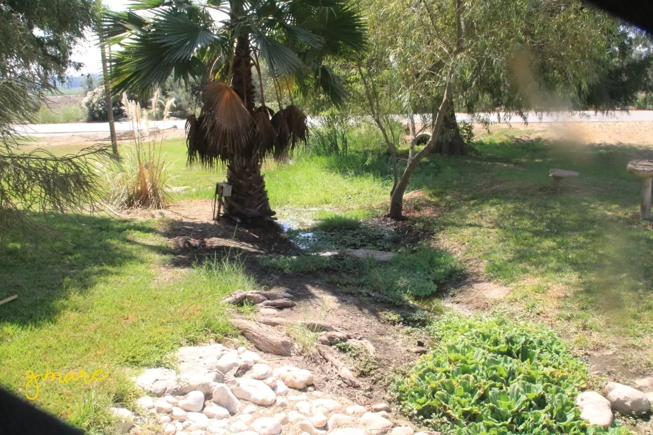
Posted by AbuHsein - متنزه حرشي قرب عين الجواميس - عين ال ابو مريم
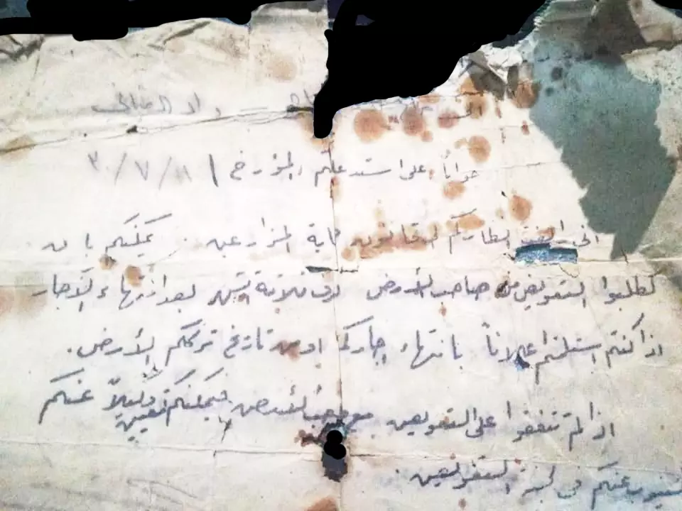
Posted by AbuHsein - جواب على الاستدعاء المقدم من أهل وادي القباني_وادي الحوارث المؤرخ 11\7\1930م بخصوص ايجار الارض
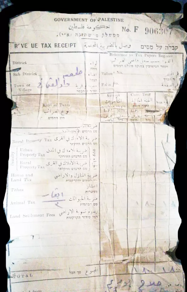
Posted by AbuHsein - وصل ضريبة محصلة عن ملكية ابقار زمن حكومة فلسطين بإسم صلاح ابو مريم من اهالي وادي القباني
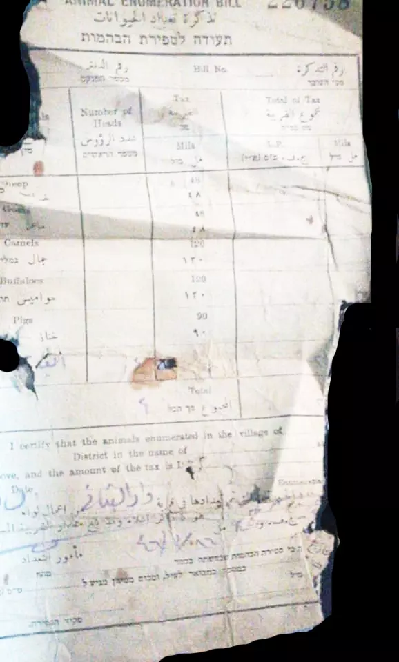
Posted by AbuHsein - تذكرة تعداد حيوانات بإسم صلاح ابو مريم من اهالي وادي القباني
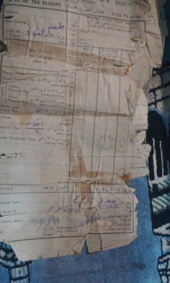
Posted by AbuHsein - وصل ضريبة محصلة عن ملكية ابقار زمن حكومة فلسطين بإسم صلاح ابو مريم من اهالي وادي القباني
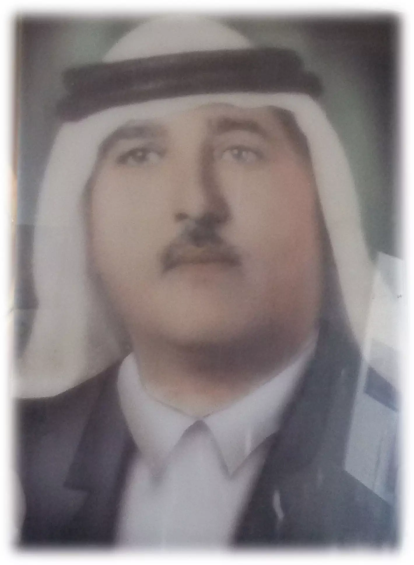
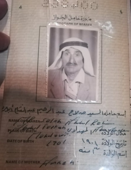
Posted by AbuHsein - المرحوم صلاح عبدالرحيم عبدالفتاح ابومريم من وادي القباني - الحوارث مواليد منطقة المهداوي سنة 1901م
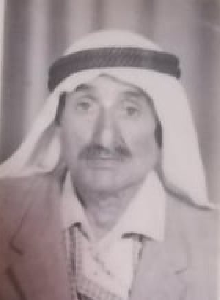
Posted by AbuHsein - جواز سفر قديم المرحوم صلاح عبدالرحيم عبدالفتاح ابومريم من وادي القباني - الحوارث مواليد منطقة المهداوي سنة 1901م
Posted by AbuHsein - عين الجواميس
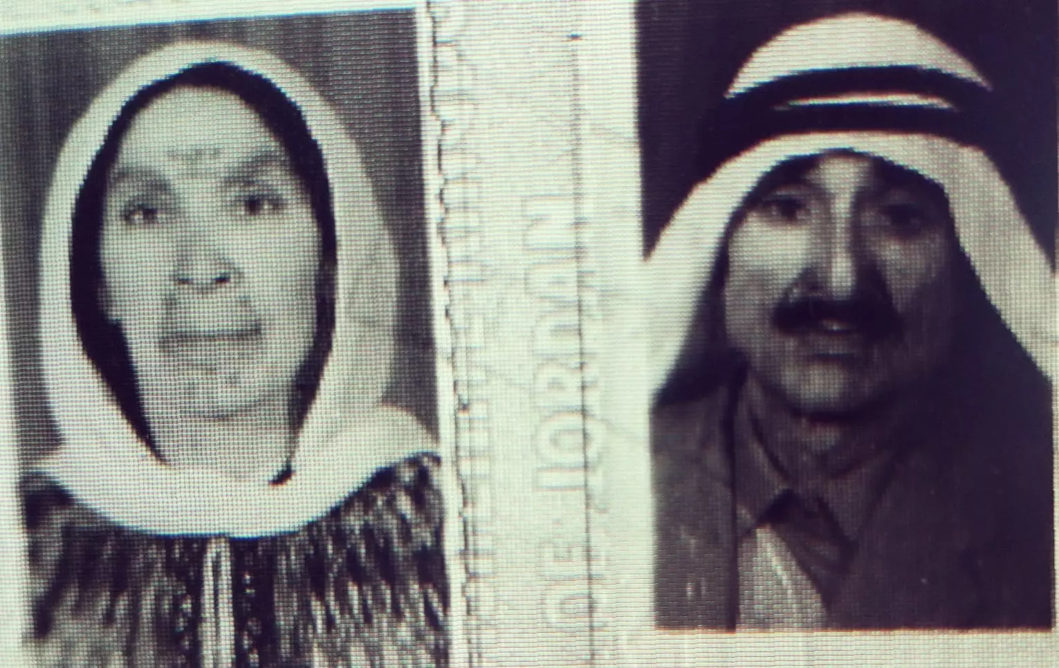
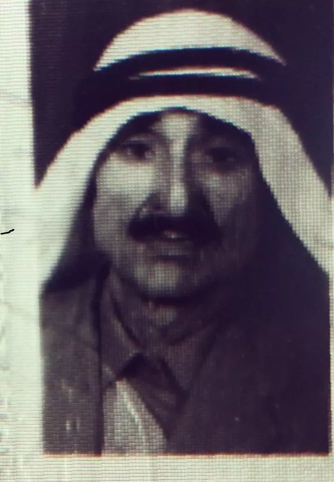
Posted by AbuHsein - المرحوم صلاح ابومريم مواليد ١٩٠٥م خربة المهداوي وهو من قرية وادي القباني وزوجته المرحومه خضرة العجاج مواليد وادي القباني سنة ١٩١٠م
Posted by AbuHsein - المرحوم صلاح ابومريم مواليد ١٩٠٥م خربة المهداوي وهو من قرية وادي القباني
Posted by AbuHsein - المرحومة خضرة العجاج مواليد وادي القباني سنة ١٩١٠م زوجة المرحوم صلاح ابومريم
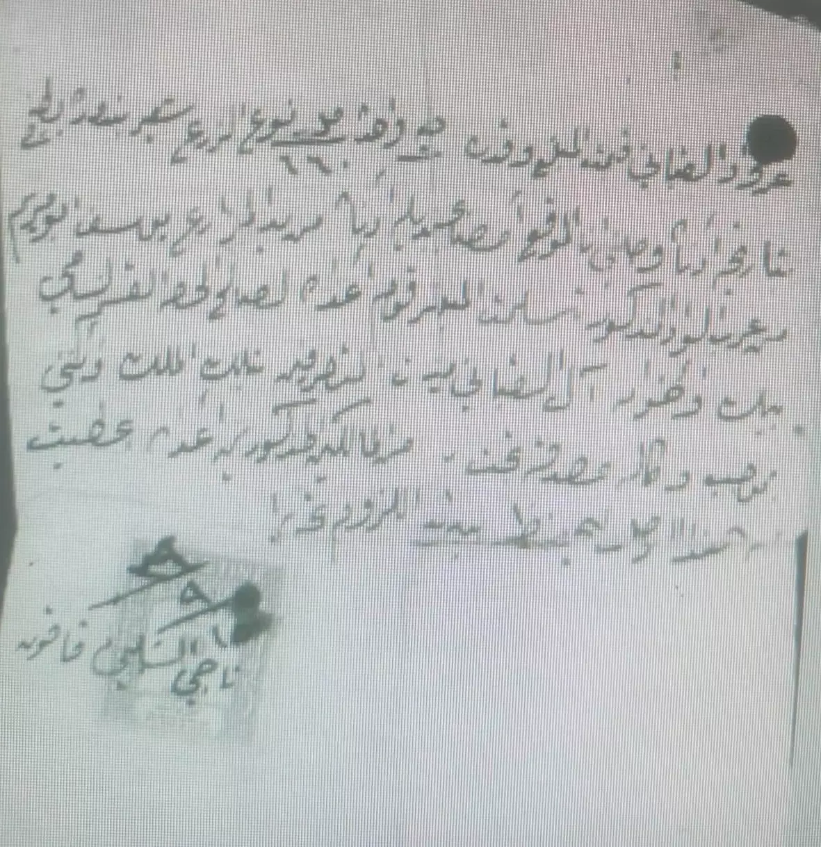
Posted by AbuHsein - ايصال دفع ضمان زراعي من عام 1939م من ال ابو مريم وعنهم يوسف ابو مريم للسيد ناجي الشلبي (من قاقون) ممثلا عن ال قباني كمتصرفين بأراض من وادي القباني
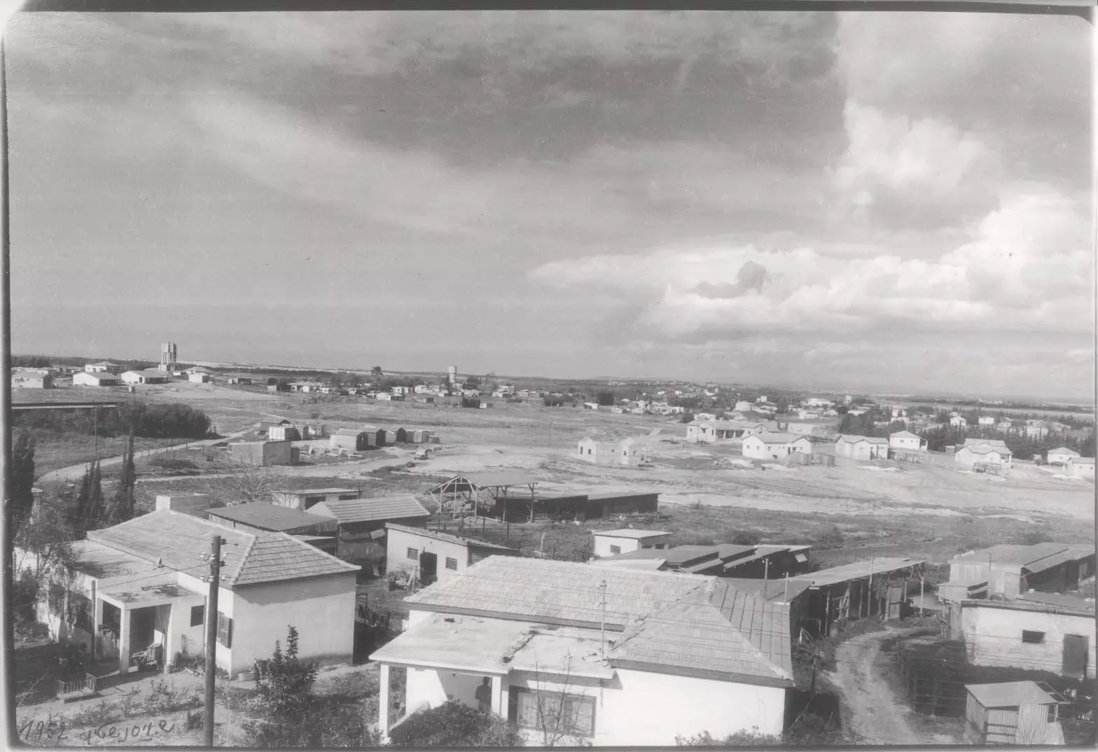
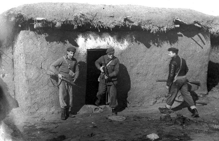
Posted by AbuHsein - وادي القباني اثناء احتلالها عام 1948م
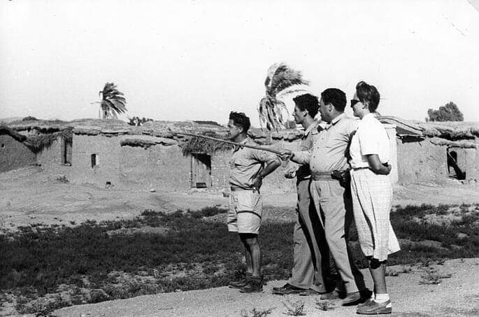
Posted by Wadi Alhawarith - وادي قباني بعد احتلالها عام 1948م
Posted by Wadi Alhawarith
Want to browse more? 80,000 pictures were grouped in these gallaries:
| Display Name | Clan/Hamolah | Country of Residence |
No links have been shared yet, be free to the first to share the first link.
 Fake Valor: Why Did Zionist Jews Hoist Nazis Flag on Their Ships in the 1930s?
What is new?
-
Facts About Oct. 7th Gaza Raid
-
Remined Us Please:: Who Did Rape Who? Palestinians Raped Israelis? Or, was the other way around?
-
When Prof. Edward Said was invited to debate Bibi Netanyahu in the 1980s, watch what happened!
-
Ezra Klein of the NY Times on the "Jewish Race".
-
Abusing Blood Libel!
-
Did Israeli Soldiers Activate The Hanniba Direective On Oct. 7th? You Be The Judge
-
Zionist FAQ: Isn't it true that Palestinians don't want peace? Palestinians never accepted the two-state solution
- Facts about Haavara (Transfer) Agreement between Ben-Gurion & Hitler
-
Haavara FAQs: Why Did Zionist Jews Hoist Nazis' Flags on Their Ships in the 1930s?
- Haavara FAQs: When Chaim Weizmann met FDR in mid-1943, why was he silent about rescuing European Jewry?
-
Dear ChatGPT: How did Palestinians resist Napoleon's invasion of their country in 1799?
-
Dear ChatGPT: Gaza had a vibrant Jewish community in the mid-17th century. What happened to them?
-
Dear ChatGPT: Why did the Jewish Agency suppress news of the Holocaust during WWII?
-
Video Playlist: Jews share their DNA tests to end the conflict for good.
-
A Tale of Two Conflicts: Examining the Definition of Genocide
-
Prof. Abraham Polak And The Suppressed History of the Khazars and European Jewry
-
How Ronald Reagan would have framed the genocide in Gaza if he were still alive?
-
Haavara FAQs: Let us do the math: how many German Jews did The Haavara Agreement save?
-
Zionist FAQs: The Hebron Massacre of 1929, "clearly proves" that Palestinians are antisemitic, how could you deny it?
-
Zionist FAQs: Why Anti-Zionist Is Not Antisemitism?
-
Zionist FAQs: Isn't it true that the KGB created Palestinian Nationalism in the early 1960s?
- Zionist FAQs: Muslims are killing Muslims all the time; why are Israeli Jews being singled out in the media?
- Zionist FAQs: How is Israel an apartheid state when 20% of its citizens are Arabs who enjoy full rights?
-
Haavara FAQs: Why Did Dorothy Thompson Flip From A Zionist Advocate to A Silenced Dissenter?
-
Haavara FAQs: Analysis of Herzl's Uganda Scheme and how it could have saved millions of Jews.
-
Haavara FAQs: Why did Hayim Greenberg describe American Jewry as "morally bankrupt" in early 1943?
-
Haavara FAQs: What if the Evian Conference was a resounding success? What would have been the impact of saving European Jewry on Zionism?
- Haavara FAQs: What if the six million were saved, how that would have impacted the Zionist project?
-
Haavara FAQs: How did Zionist leaders react when Europe's Jews lingered in the DP camps after WWII ended?
-
Why does the American Jewish community repeat lies that David Ben-Gurion had debunked before he died?
-
Who has the power to rename the Tatar/Khazar Gene Marker to Jewish IV?
-
Zionist FAQs: Why won't Egypt, Syria, and Jordan take their people back? Jews are indigenous to Palestine, and Arabs immigrated after Jews developed the country. Arabs should leave.
-
Haavara FAQs: Did Hitler and the Nazis conflate between Judaism and Zionist? If that wasn't case, then why?
-
Haavara FAQs: Winston Churchill and antisemitism, a collection of articles written Churchill.
-
Haavara FAQs: Broken by country, how many Jews survived vs. killed during the Holocaust?
-
Haavara FAQs: Why did European Jews vote with their feet and to immigrated to the Americas, not Palestine, after WWII?
-
Watch this American Jewish Girl describing Israeli Jews' cognitive dissonance like no other in under two minutes
-
Haavara FAQs: When the Nazis went out of their way to hide the Holocaust, Israeli Jews did the exact opposite by broadcasting their genocide of Gazans. But why?
-
Haavara FAQs: How Zionist Jews went out of their to show their appreciation to Nazism and Fascism?
- Haavara FAQs: Why Zionist leaders were against bombing the death camps & the Railroads leading to them?
-
Haavara FAQs: Hitler's message to the British and American people: If Jews are such noble citizens and you care about them, how come you're not letting them in? I will gladly ship them to you at my expense, even on luxury liners!
-
A shortlist of Zionist and Israeli false flag operations in the name Jews.
-
The Most Moral Army
- The Land of Kapos (Israel): Where the brave are boycotted and Kapos walk free.
- Why did early Zionists often named their communal enterprises "colonial"?
- Zionist Relations with Nazi Germany by Faris Glubb
-
Two NY Times advertisements by Zionists in the early 1943 that exposes Zionists' treason at the height of the calamity
- Facts Not Lies about the Palestinian-Israeli Conflict.
- Site's pictures have been categorized
- Campgain Against Lice
- A Survey of Palestine, the official source about Palestine before Nakba produced by the British Mandate; over 1200 pages.
- Satellite View & Google Earth: Over 6,000 placemarks identifying all destroyed towns, W. Bank & Gaza Strip Towns, & refugee camps.
- PalestineRemembered.com and its Nakba Oral History Project were featured on al-Jazeera Satellite TV.
- Nakba Oral History Video Podcast:
 Over 700 Oral History interviews (including 3,500+ hours of recording) can be viewed online.
 - Palestine Village Statistics Project
- Gaza Jail Break
- النسخة العربية للموقع الان متوفرة
- Videos: Documenting the destroyed villages in video: Tracing all that remains since Nakba.
- Videos: Responding to Zionist Propaganda
- Interview: The ethnic cleansing of Palestine: George Galloway interviews Israeli Historian Ilan Pappe.
- For Palestinians, memory matters. It provides a blueprint for their future By George Bisharat.
- Zionist FAQ now available in Hebrew שאלות שציונים שואלים, עכשיו בעברית
- Video: The Stephen Walt and John Mearsheimer report on the influence of the Israel Lobby on U.S. Foreign Policy
- The Palestinian-Israeli conflict for beginners
