| PalestineRemembered | About Us | Oral History | العربية | |
| Pictures | Zionist FAQs | Haavara | Maps | |
| Search |
| Camps |
| Districts |
| Acre |
| Baysan |
| Beersheba |
| Bethlehem |
| Gaza |
| Haifa |
| Hebron |
| Jaffa |
| Jericho |
| Jerusalem |
| Jinin |
| Nablus |
| Nazareth |
| Ramallah |
| al-Ramla |
| Safad |
| Tiberias |
| Tulkarm |
| Donate |
| Contact |
| Profile |
| Videos |
Welcome To al-Zababida, Khirbat - خربة الزبابدة
|
District of Tulkarm
Ethnically cleansed days ago |
العربية Google Earth |
 |
Gallery (32) |
- Statistics & Facts
-
Before & After

- Satellite View
- Articles 1
- Pictures 32
- Members 1
- All That Remains
- Wikipedia
- Videos 3
- Guest Book 1
- Links
| Statistic & Fact | Value | ||||||||||||||||||
| Occupation Date | May 15, 1948 | ||||||||||||||||||
| Distance From District | 20 (km) Southwest of Tulkarm | ||||||||||||||||||
| Elevation | 25 (meters) | ||||||||||||||||||
| Before & After Nakba, Click Map For Details |
|||||||||||||||||||
|
|||||||||||||||||||
| Map Location | See location #14 on the map View from satellite |
||||||||||||||||||
| Military Operation | Coastal Clearing | ||||||||||||||||||
| Exodus Cause | Expulsion by Zionist troops | ||||||||||||||||||
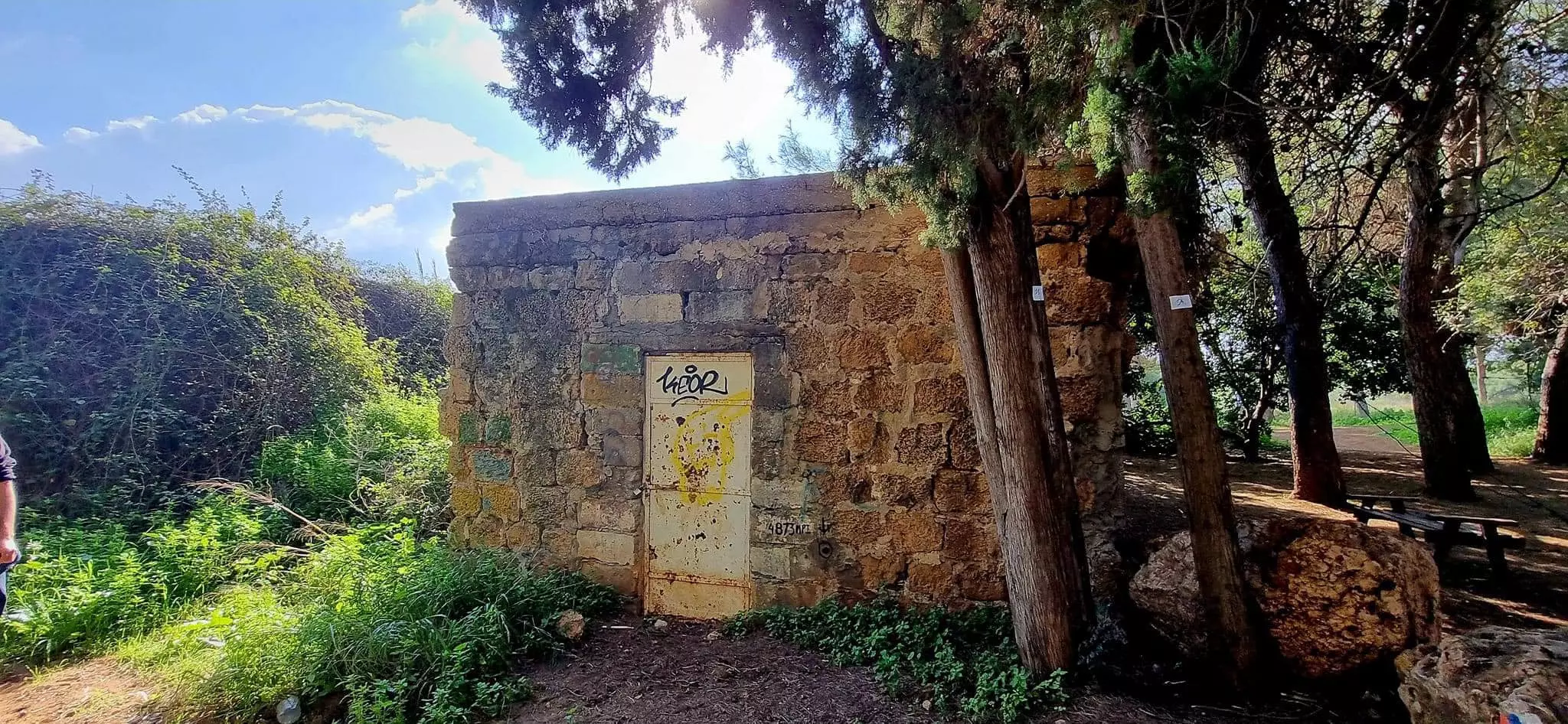
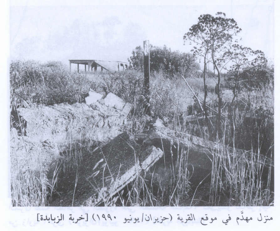
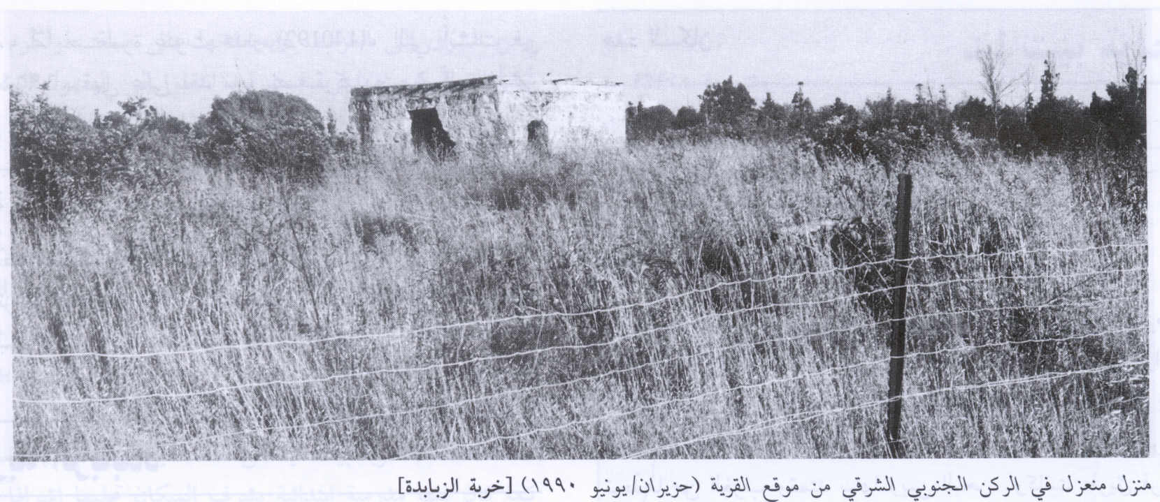
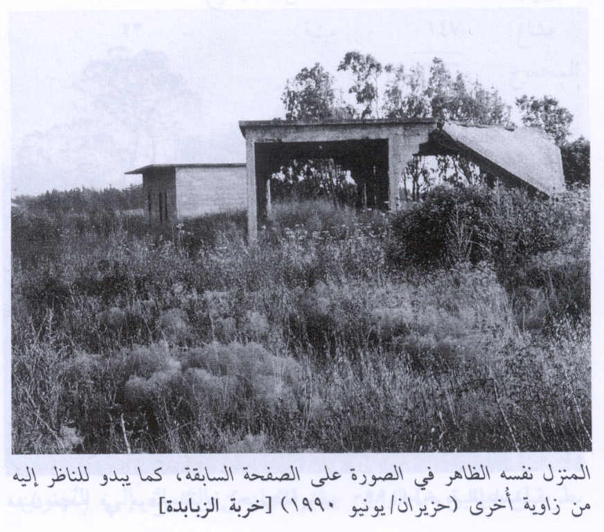
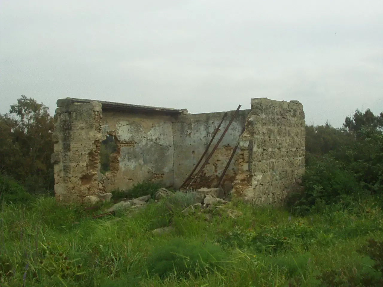
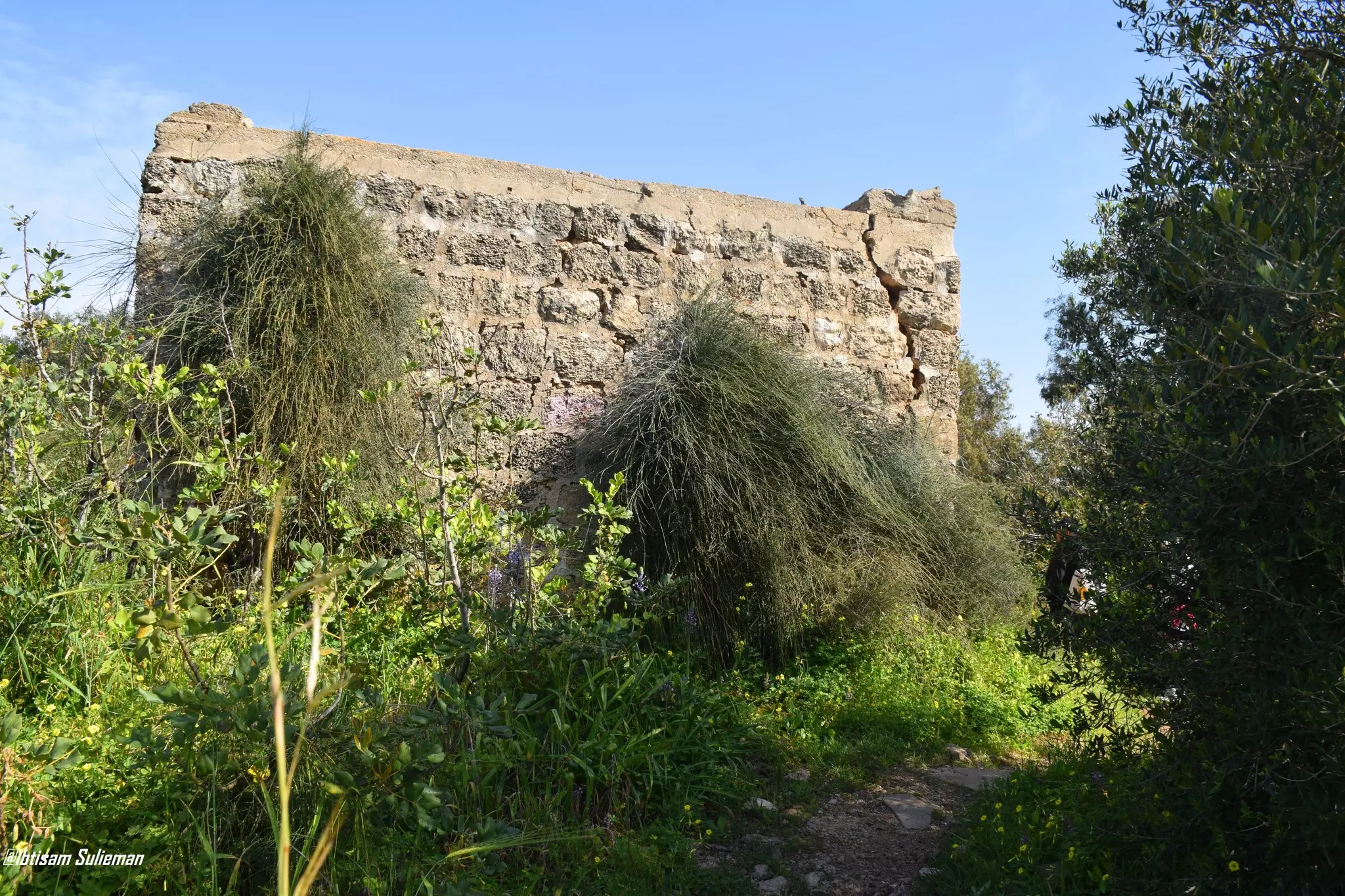
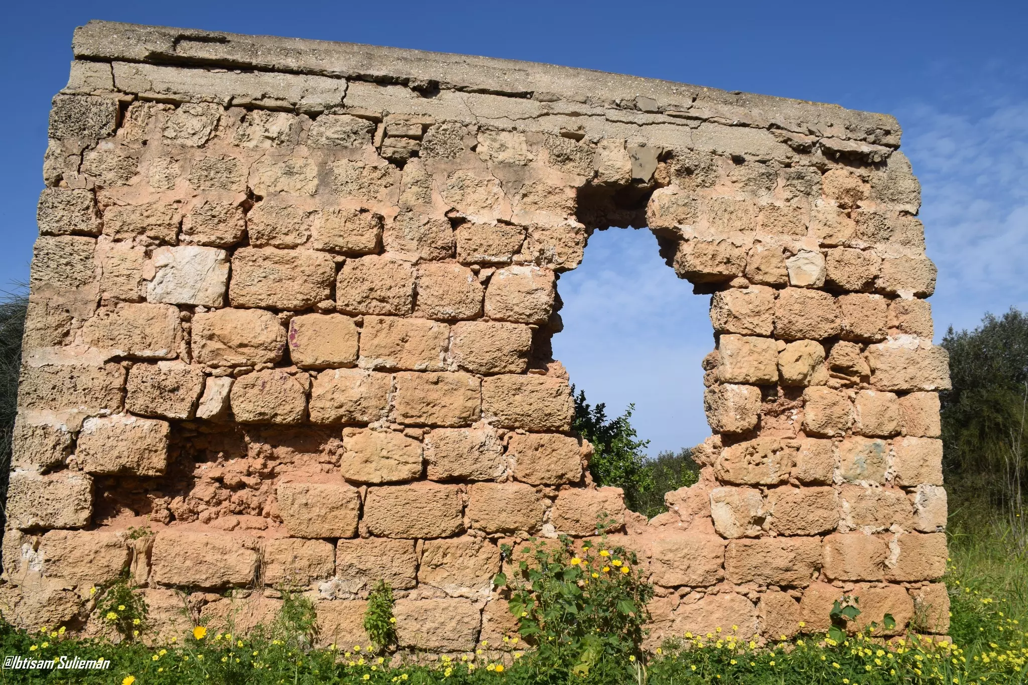
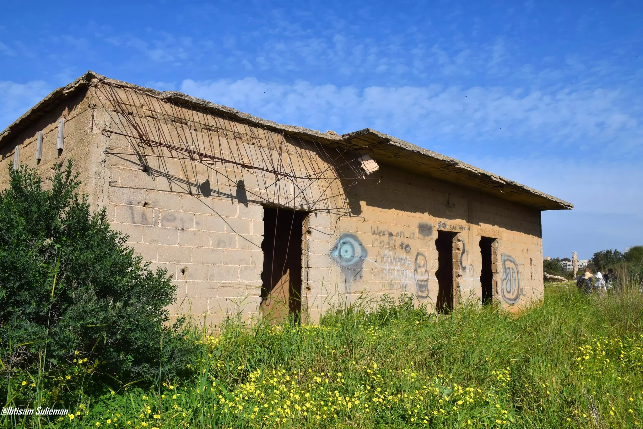
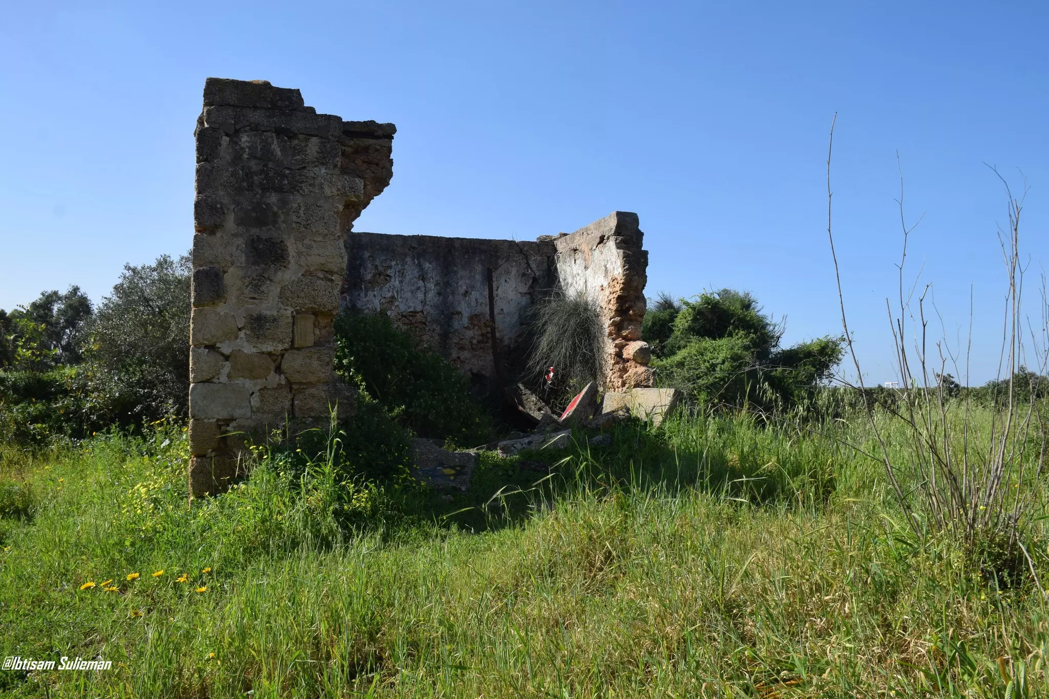
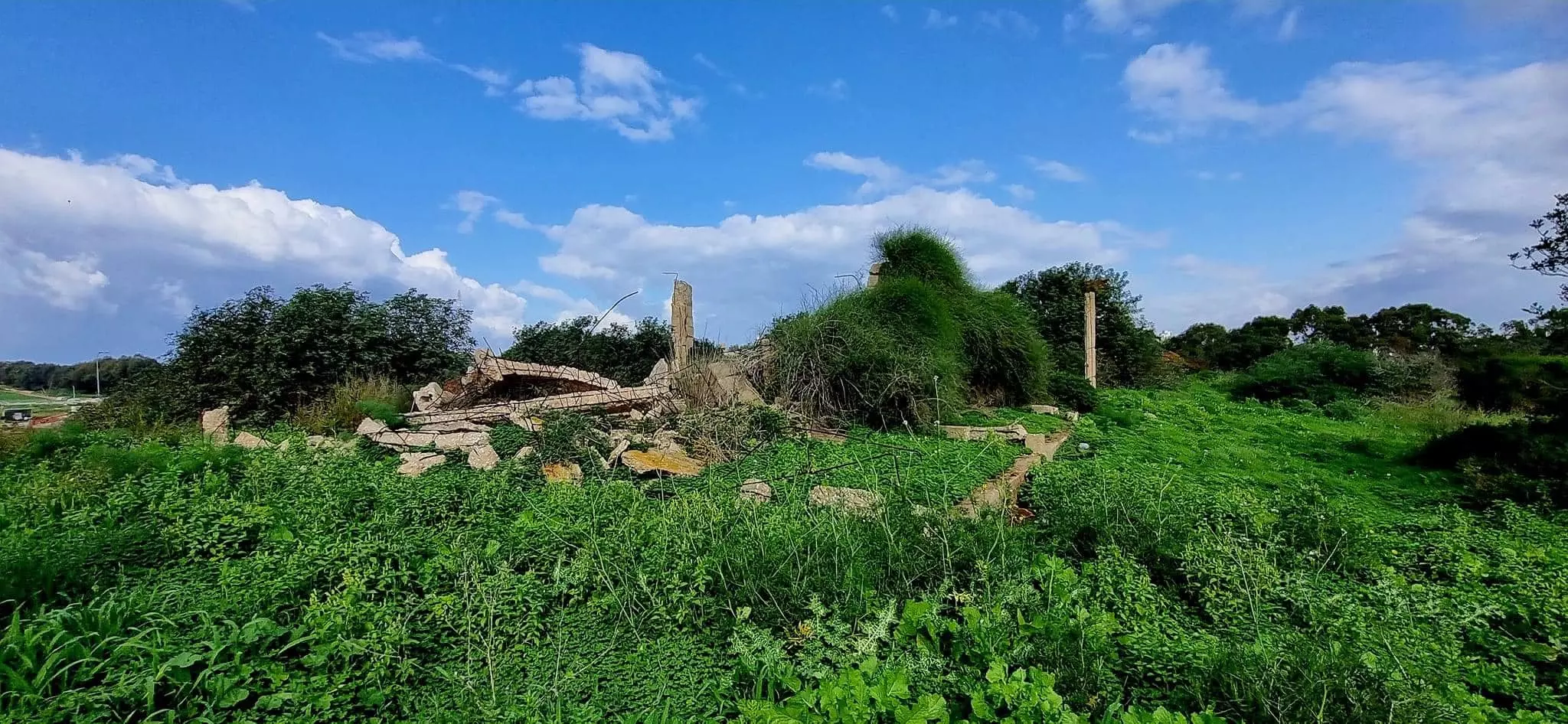
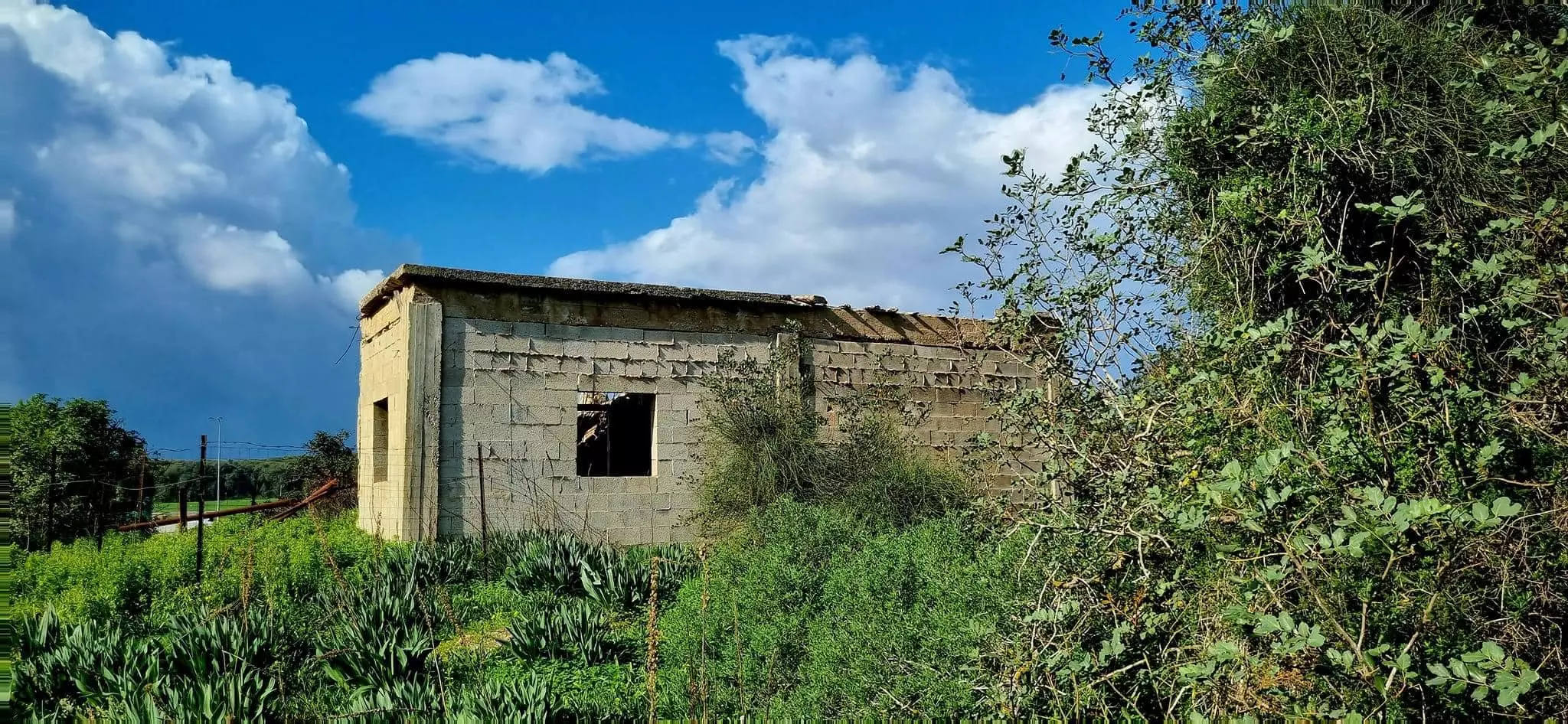
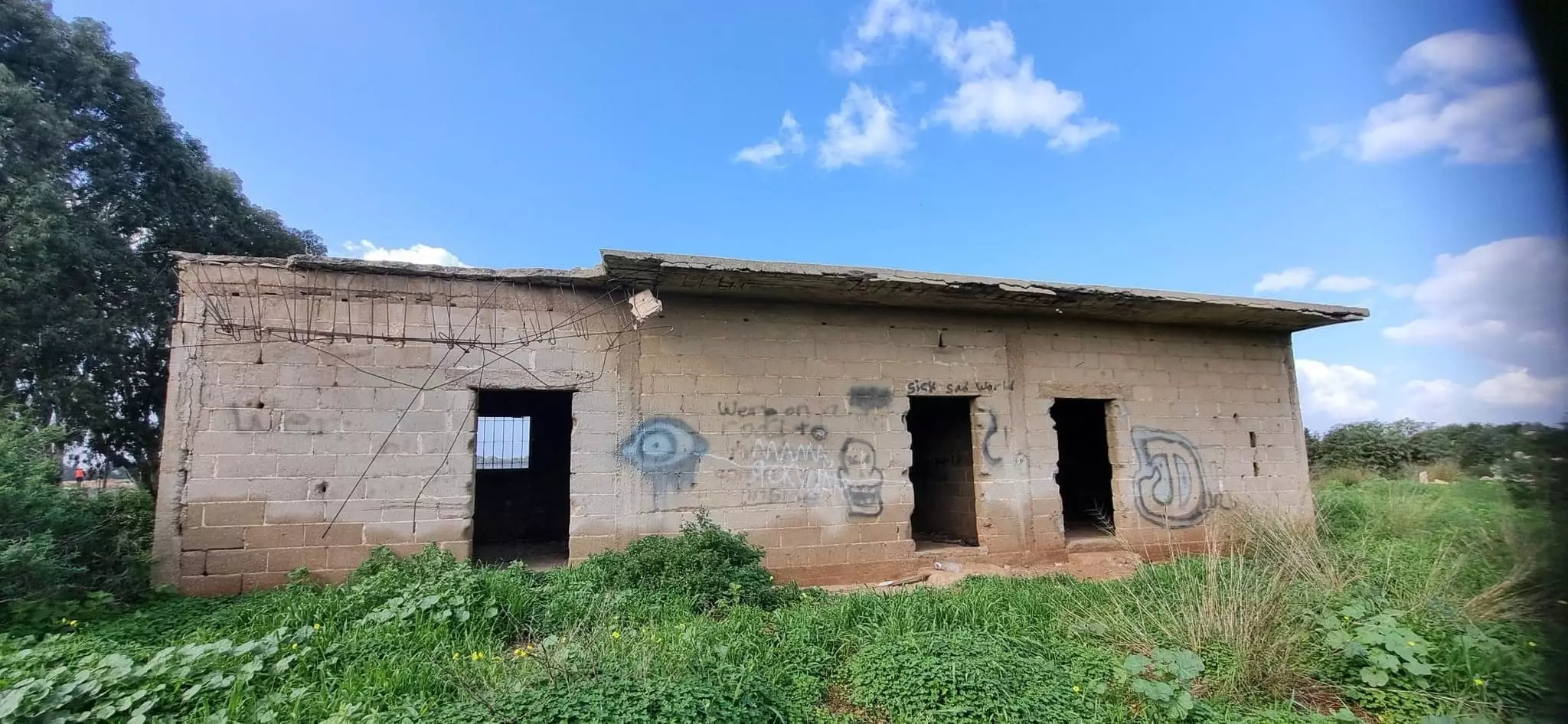
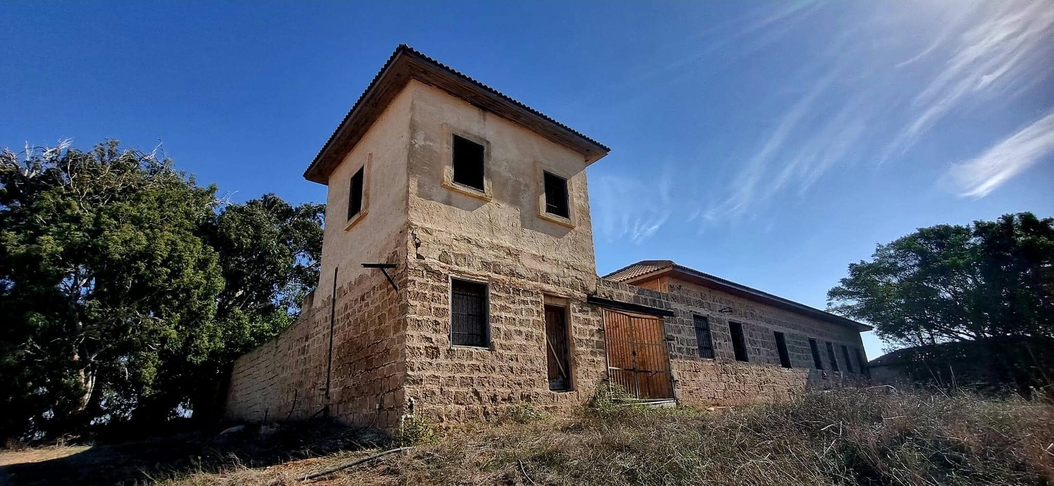
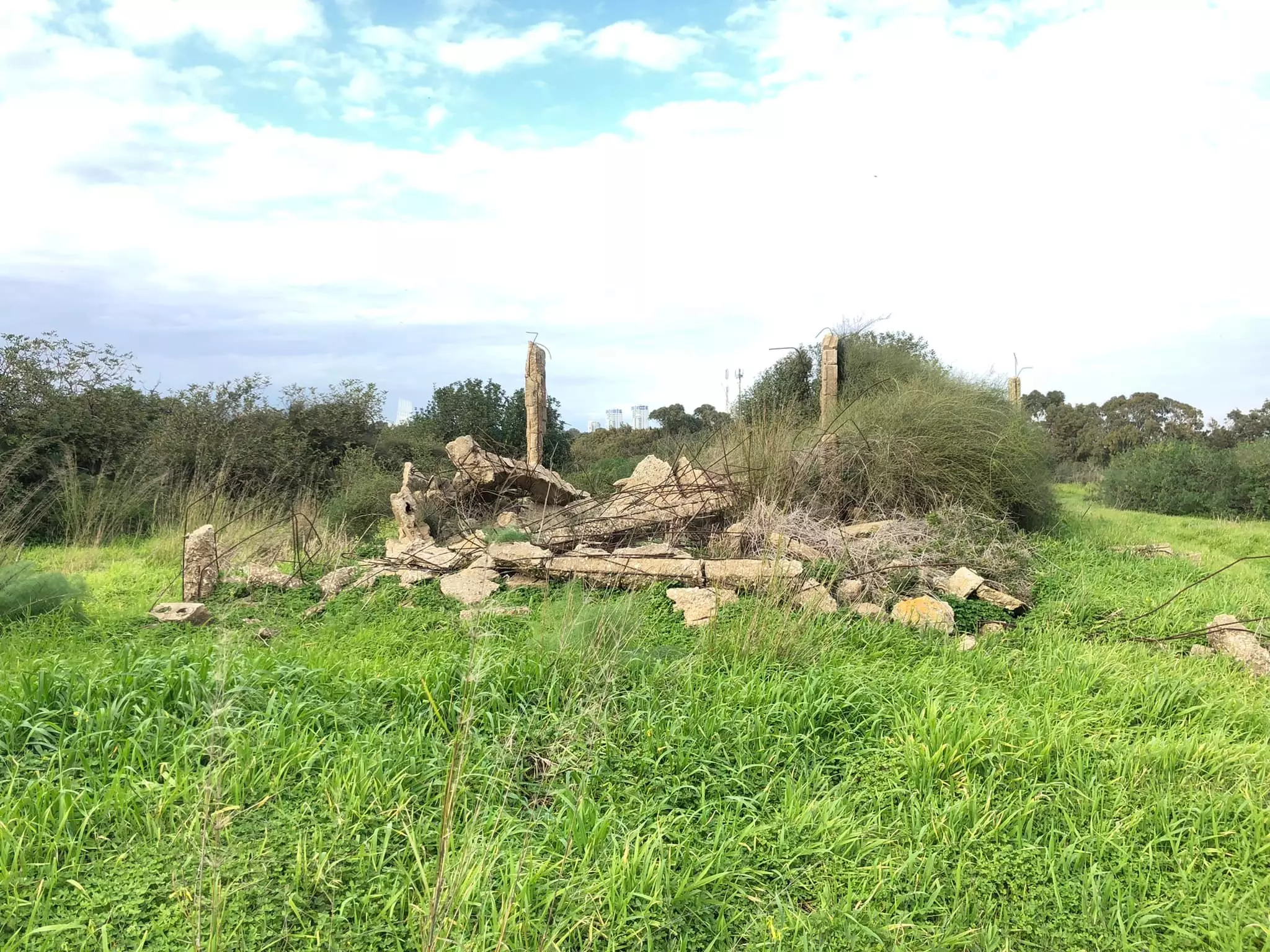
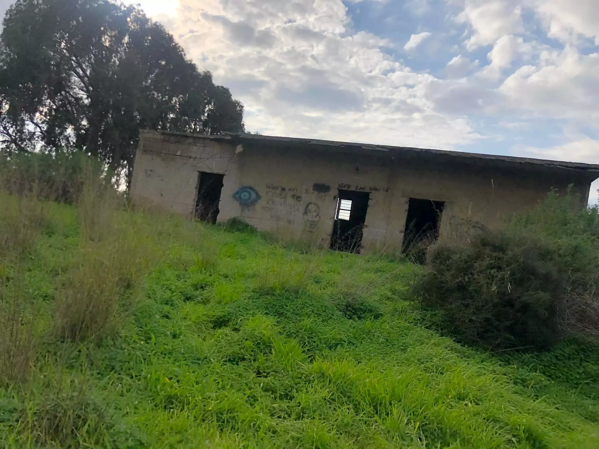
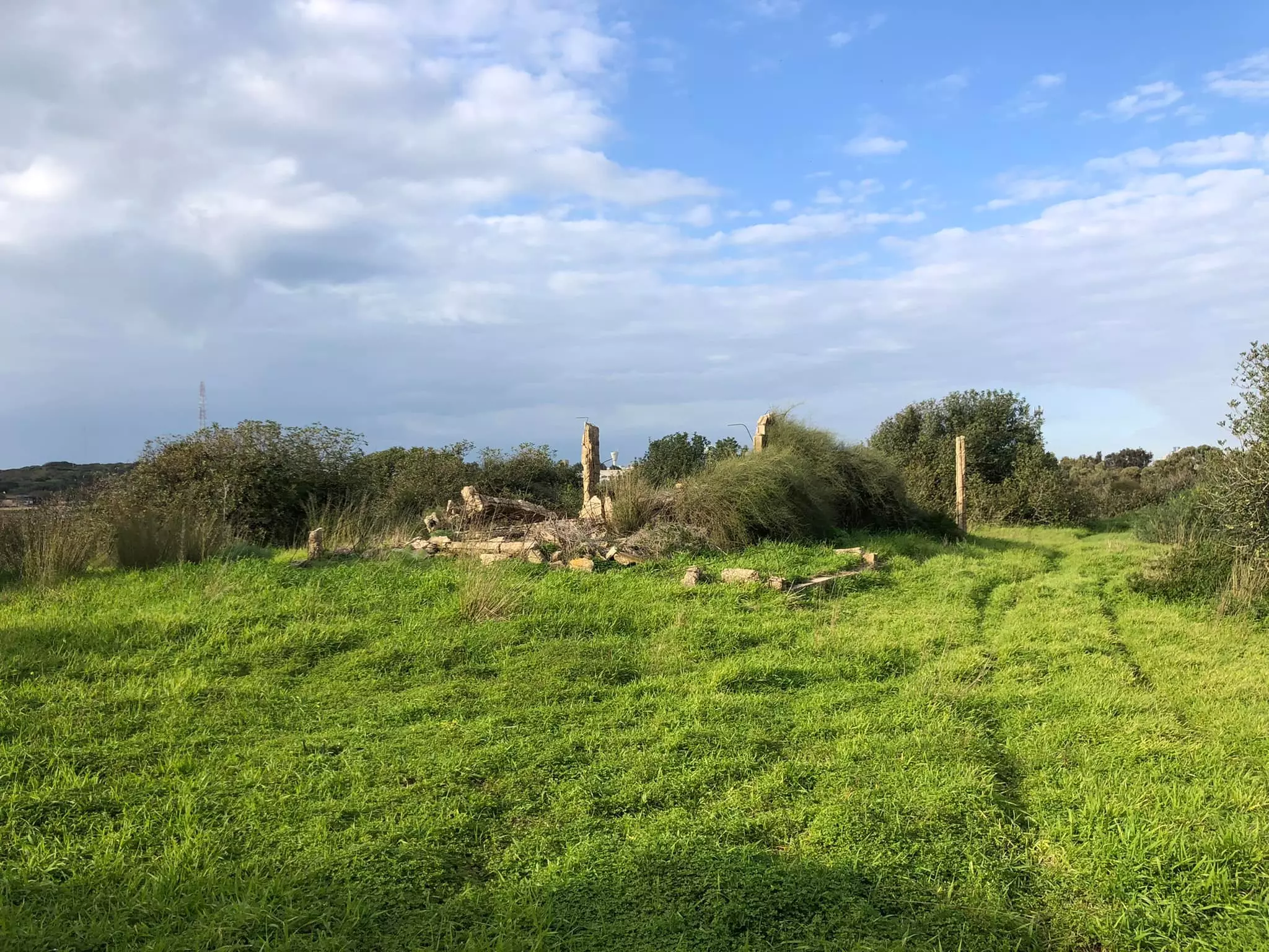
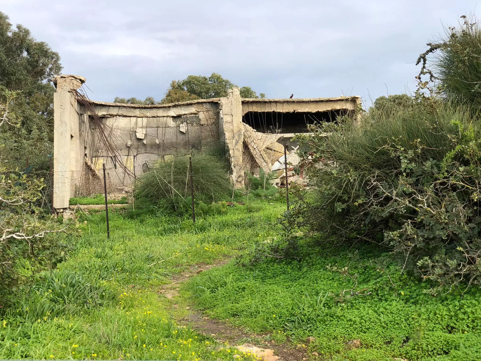
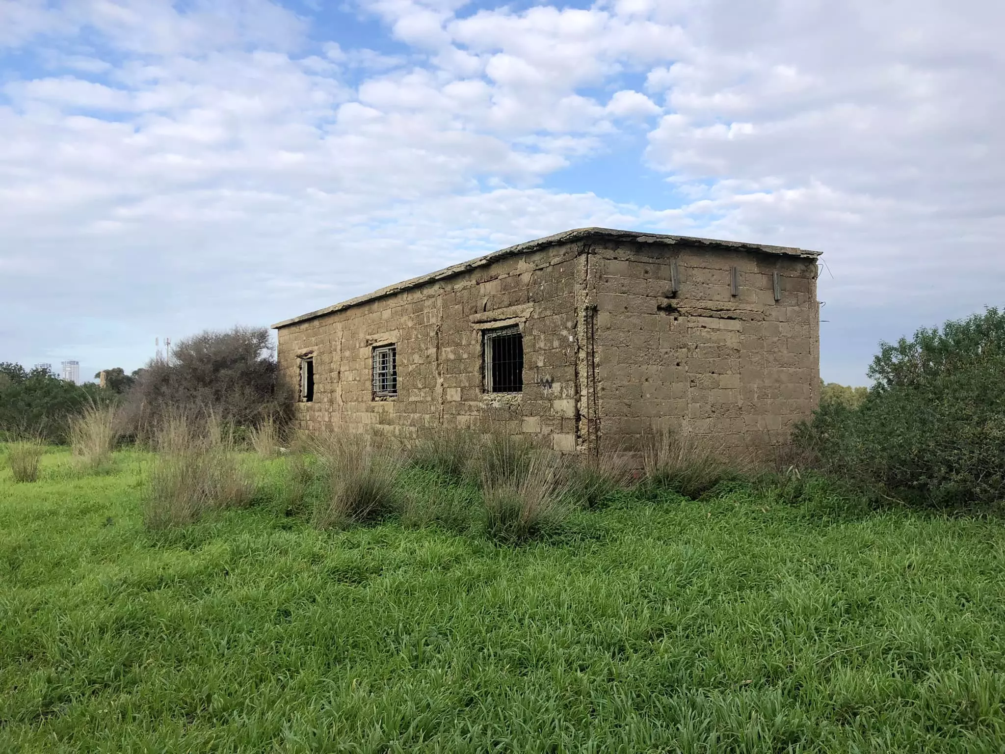
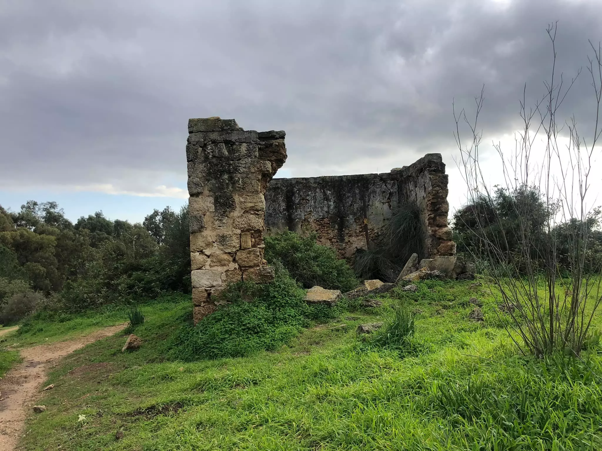
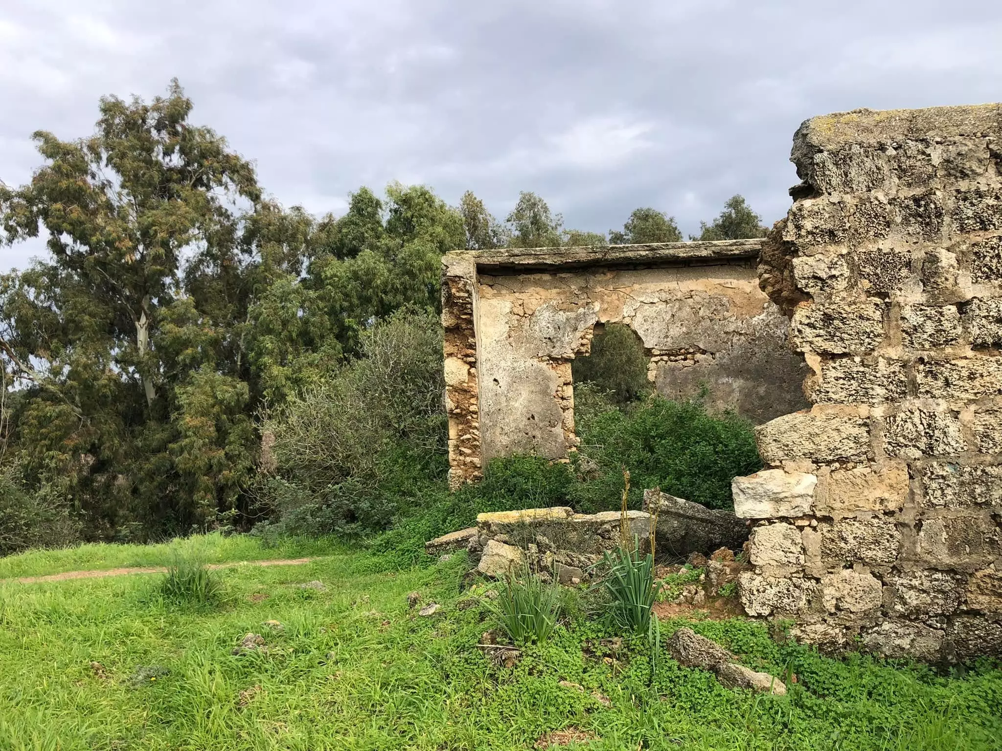
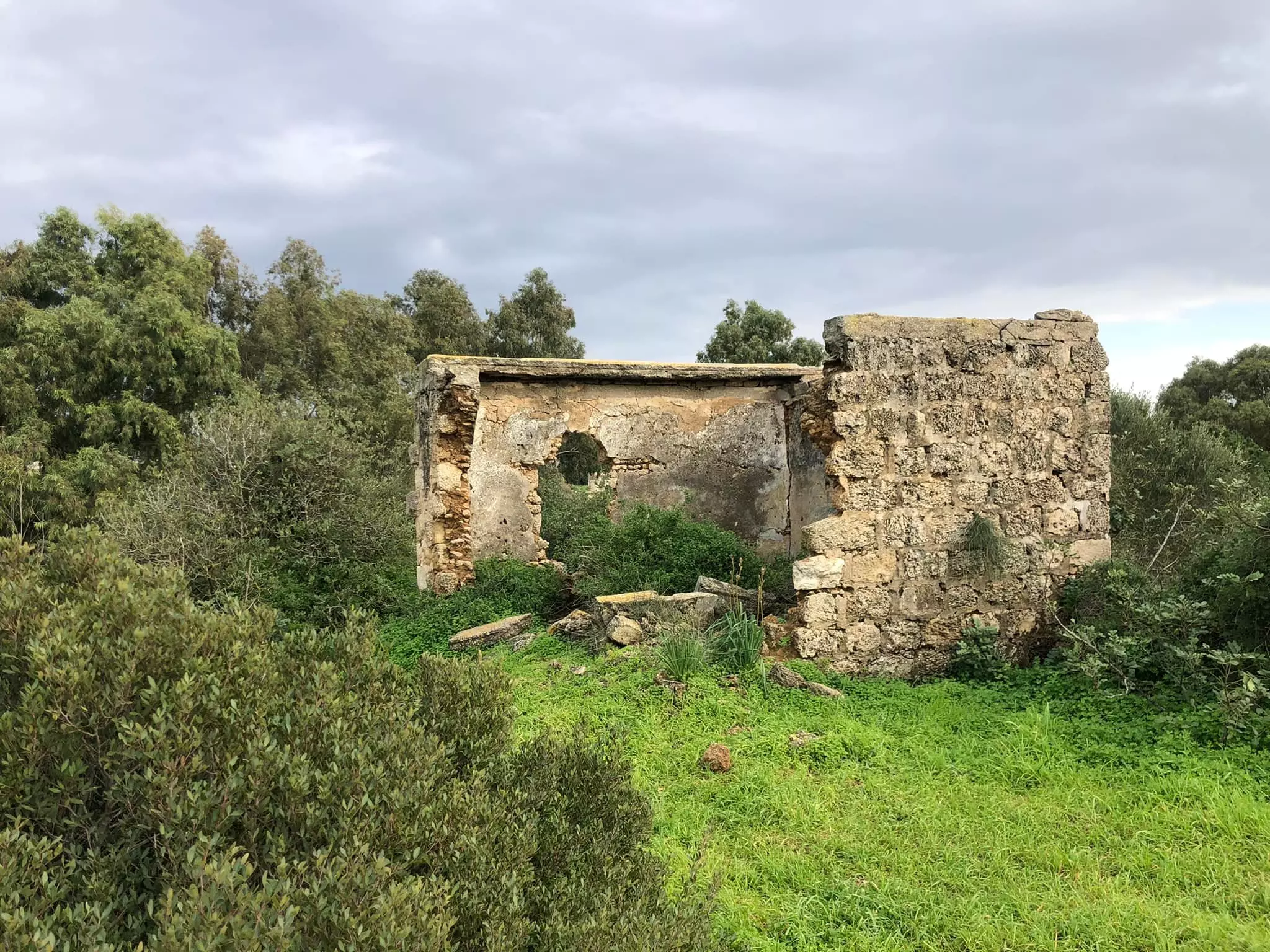
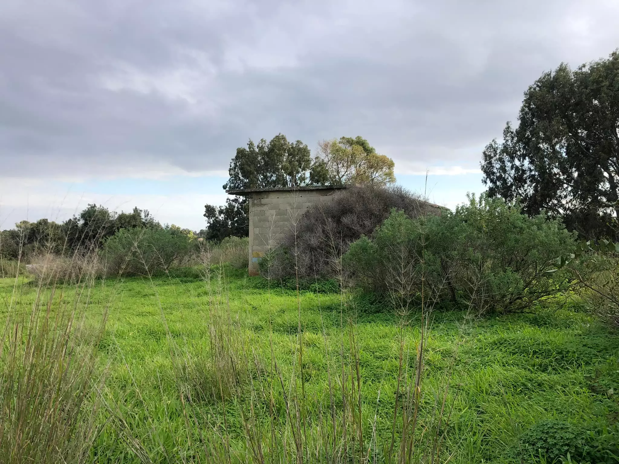
| Village Temains | Khirbat al-Zababida was mostly destroyed with the exception of four deserted houses. | ||||||||||||||||||
| Ethnically Cleansing | al-Zababida, Khirbat inhabitants were completely ethnically cleansed. | ||||||||||||||||||
| Clans | The Bedouin tribe of al-Nusayrat were the ones who first founded and lived in the village. | ||||||||||||||||||
| Pre-Nakba Land Ownership |
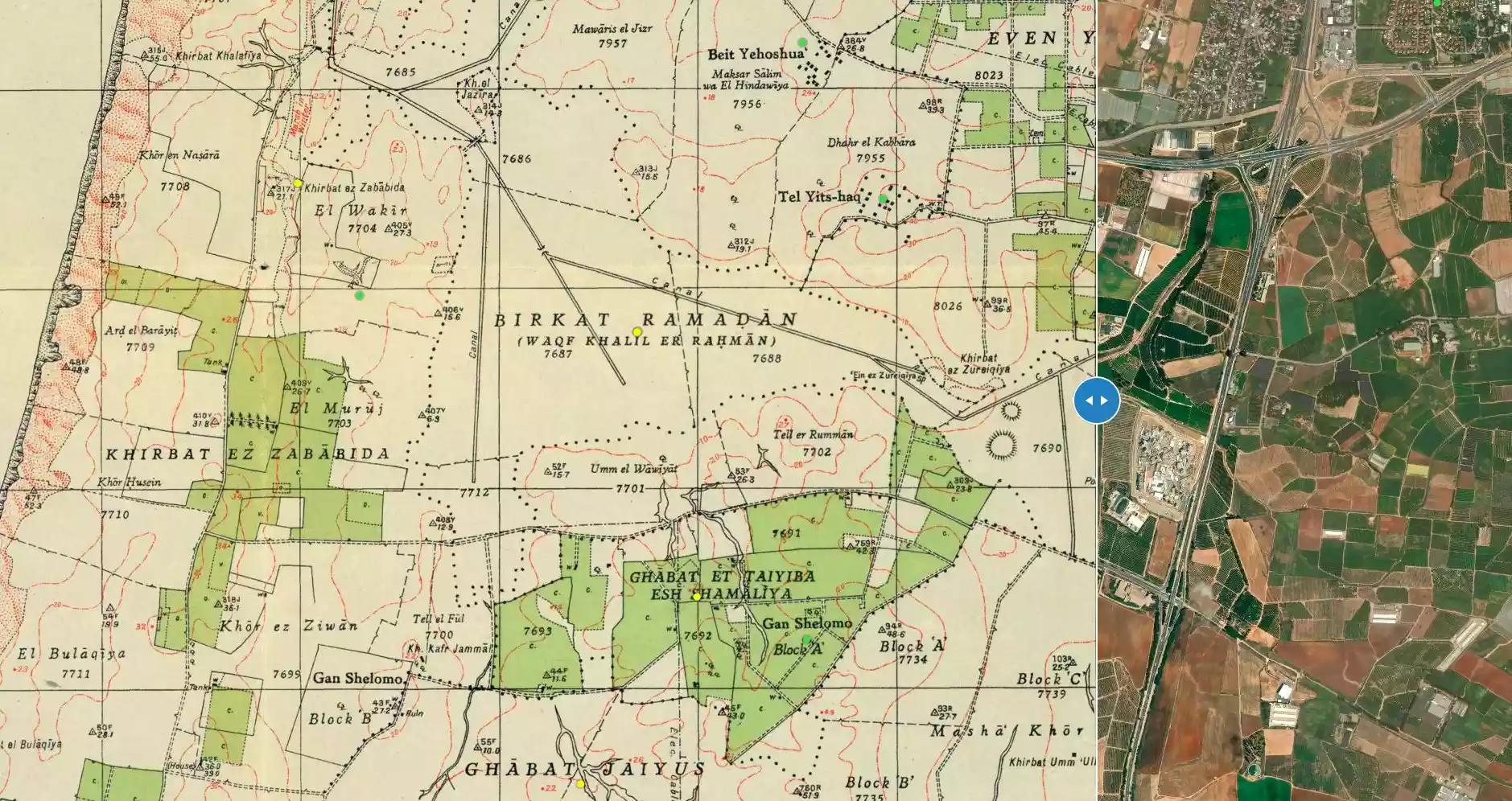
**Town Lands' Demarcation Maps |
||||||||||||||||||
| Land Usage As of 1945 |
|
||||||||||||||||||
| Population |
|
||||||||||||||||||
| Near By Towns |
|||||||||||||||||||
|
|||||||||||||||||||
| Nearby Wadies & Rivers | The village bordered Wadi al-Faliq Basin from the North. | ||||||||||||||||||
| Exculsive Jewish Colonies Who Usurped Village Lands |
Ga'ash and Yaqurn | ||||||||||||||||||
| Featured Video | |||||||||||||||||||
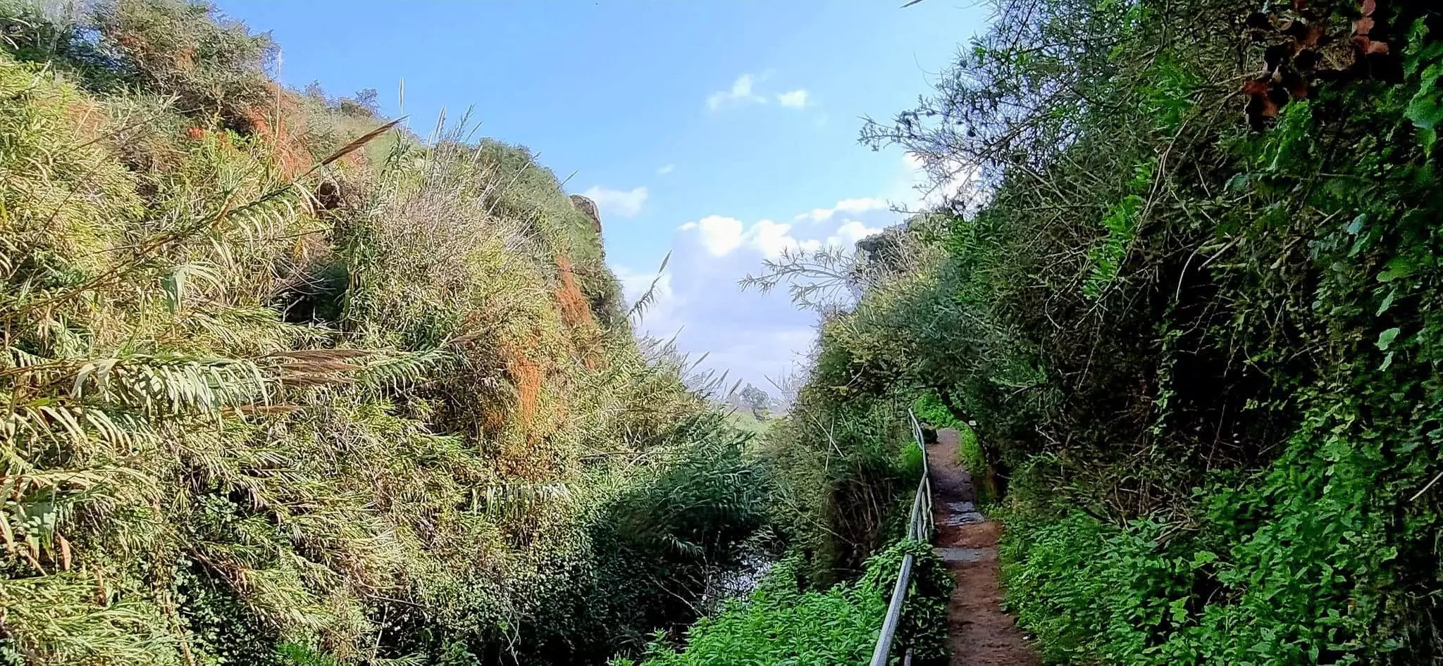
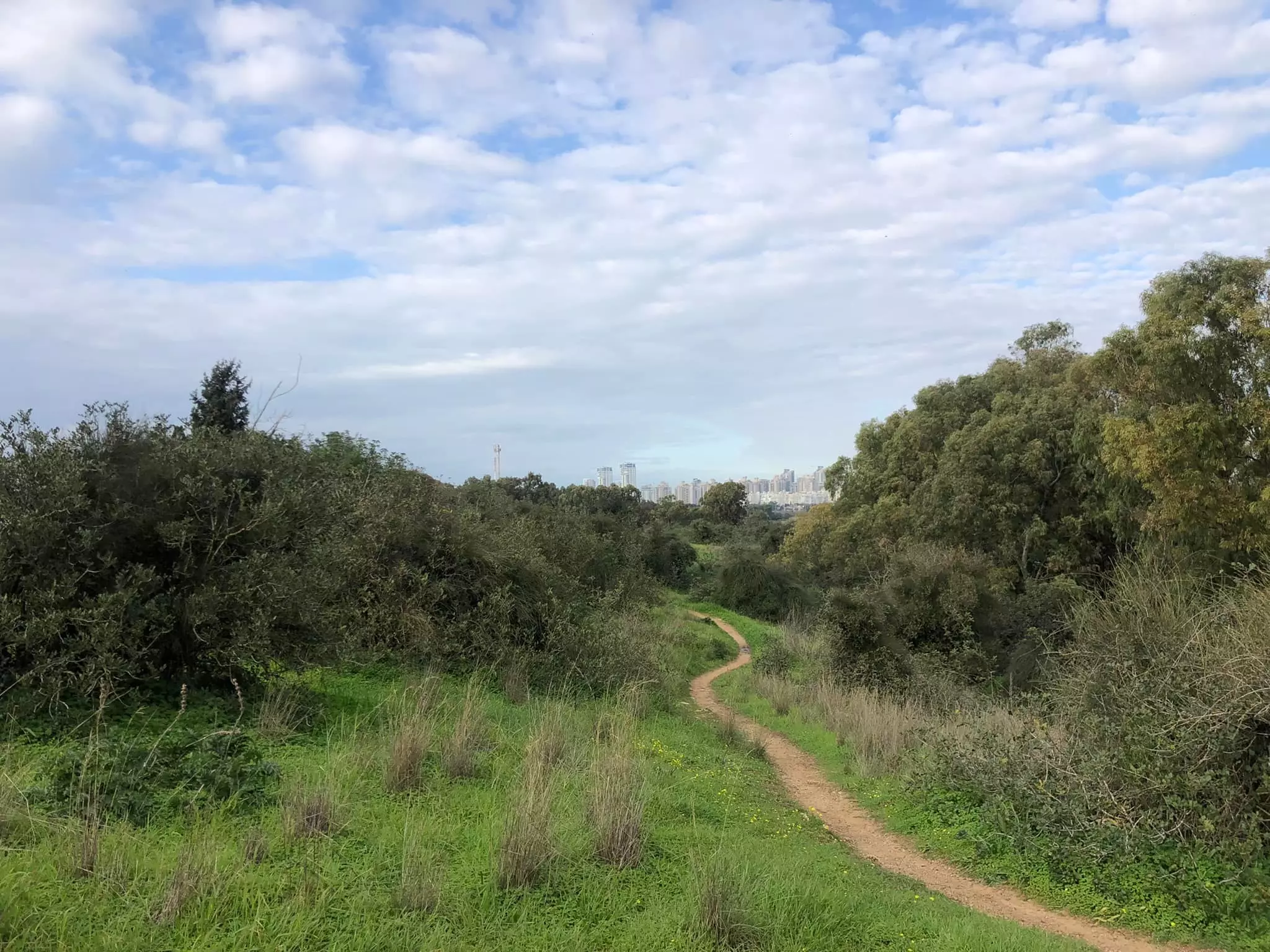
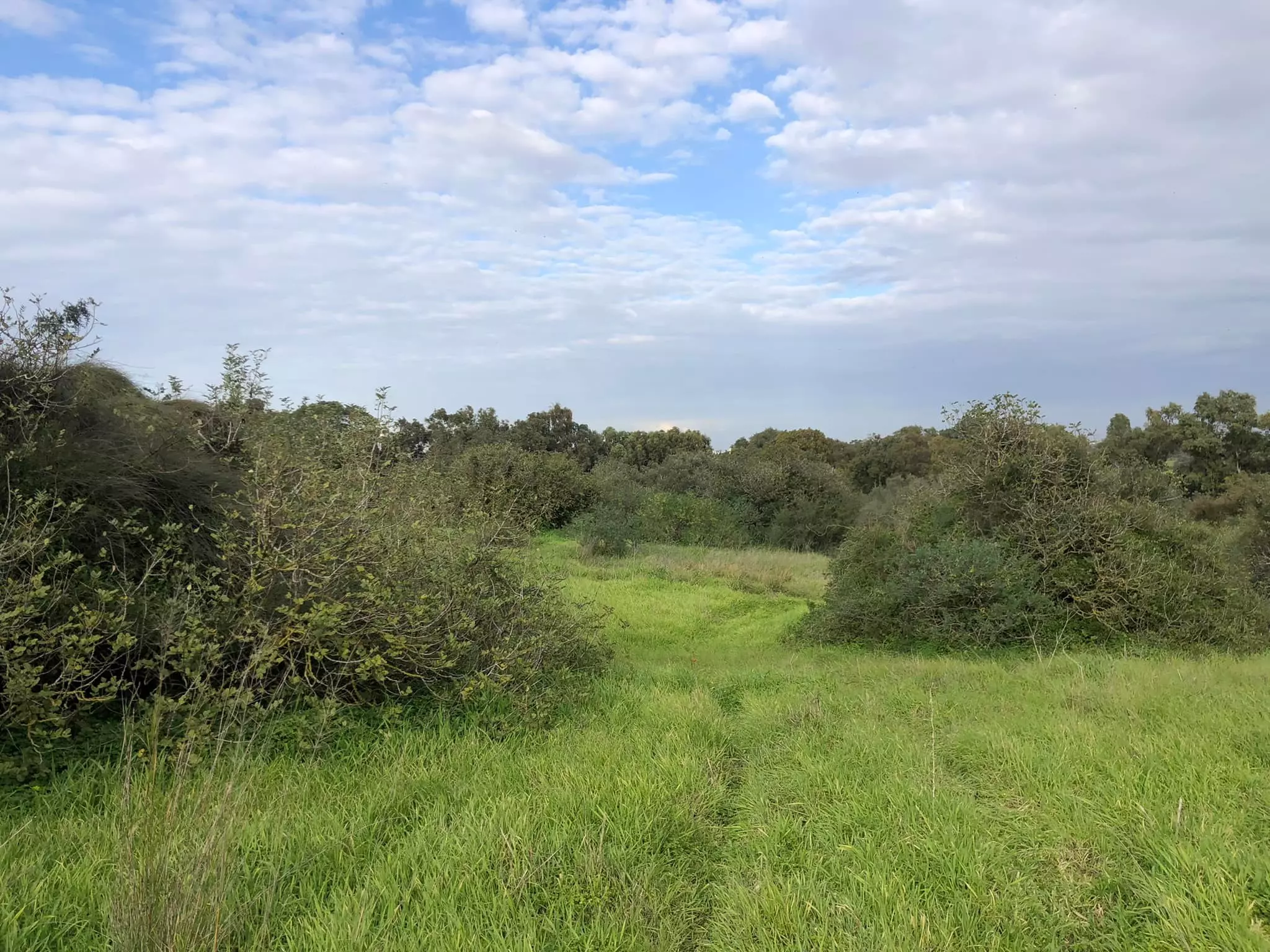
Village Before NakbaThe village stood on a low hill that was 1 km from the seashore. It overlooked the Wadi al-Faliq Basin, to the north, and an artificial canal, to the east, that flowed in a north-south direction and that was designed to drain the nearby marshland. A wide expanse of sand dunes bordered it on the west, and beyond this lay the coast. A secondary road linked Khirbat al-Zababida to the town of Qalqilya to the southeast. It was classified as a hamlet by the Palestine Index Gazetteer, and was inhabited by members of the Bedouin tribe of al-Nusayrat who had settled in this area at an unknown date. In the late nineteenth century, Khirbat al-Zababida was described as a moderate-sized village situated at the south edge of an arable plain. [[SWP (1881) II:229]] In 1944/45 a total of 344 dunums of village land was devoted to citrus and bananas and 3,839 dunums were allocated to cereals; 215 additional dunums were irrigated or used for orchards.Village Occupation and Ethnic CleaningThe village was located in a region that was the focus of Zionist attacks in the early weeks of the war. The coastal stretch north of Tel Aviv was an area of heavy Jewish settlement and it was considered imperative to 'clear' it of its Arab inhabitants by 15 May 1948. The village probably suffered the same fate as nearby Tabsur, whose remaining villagers were expelled by the Haganah on 3 April.Zionists Colonies on Village LandsThe settlements of Yaqum (135184), established in 1947, and Ga'ash (133181), established in 1951, are on village lands.Village TodayThe site is deserted and overgrown with wild vegetation and trees. All but four of the houses have been destroyed. These four houses still have intact roofs. Three of them were made of cement bricks, and one of hard igneous stone. Iron girders from five destroyed houses protrude from piles of stones (see photos). A picnic site has been built for Kibbutz Yaqum on the edge of a natural pond.SourceDr. Walid al-Khalidi, 1992: All That Remains. |
|||||||||||||||||||
| Related Maps | Town Lands' Demarcation Maps خرائط للقضاء توضح حدود القرى والاودية Town's map on MapQuest View from satellite Help us map this town at WikiMapia |
||||||||||||||||||
| Related Links | Wikipedia's Page Google Search Google For Images Google For Videos |
||||||||||||||||||
| More Information | في كتاب كي لا ننسى في كتاب بلادنا فلسطين المزيد من موقع هوية |
||||||||||||||||||
- A destroyed house on the village site, 1990
Scanned from "All That Remains" by Dr. Walid Khalidi 2 - An isolated house on the southeast of the village site, 1990
- The remains of villages house, 1987
- The 'water well house' - used as a cover for the mechanic water pump - picture taken 19-3-2005
Posted by Haled Iskrur - بيت المرحوم الحاج عبد الحميد اللوح في خربة الزبابدة السبت 6/4/2013 الساعة العاشرة صباحا
Posted by farid haj yahya - جولة بين انقاض بيوت الخربة

- جولة بين انقاض بيوت الخربة #2
- جولة بين انقاض بيوت الخربة #3
- جولة بين انقاض بيوت الخربة #4
- جولة بين انقاض بيوت الخربة #5
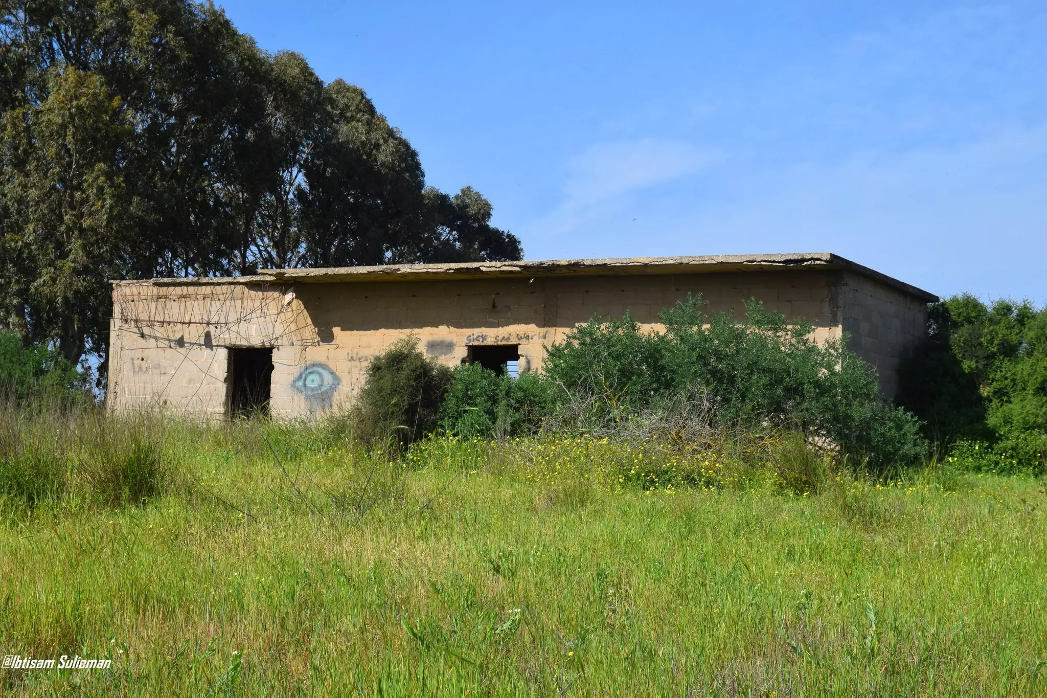
- جولة بين البيوت المدمرة من قبل طاعون العصر--Ibtisam Sulieman
- جولة بين البيوت المدمرة من قبل طاعون العصر--Ibtisam Sulieman #2

- جولة بين البيوت المدمرة من قبل طاعون العصر--Ibtisam Sulieman #3

- جولة بين البيوت المدمرة من قبل طاعون العصر--Ibtisam Sulieman #4

- جولة بين البيوت المدمرة من قبل طاعون العصر--Ibtisam Sulieman #5

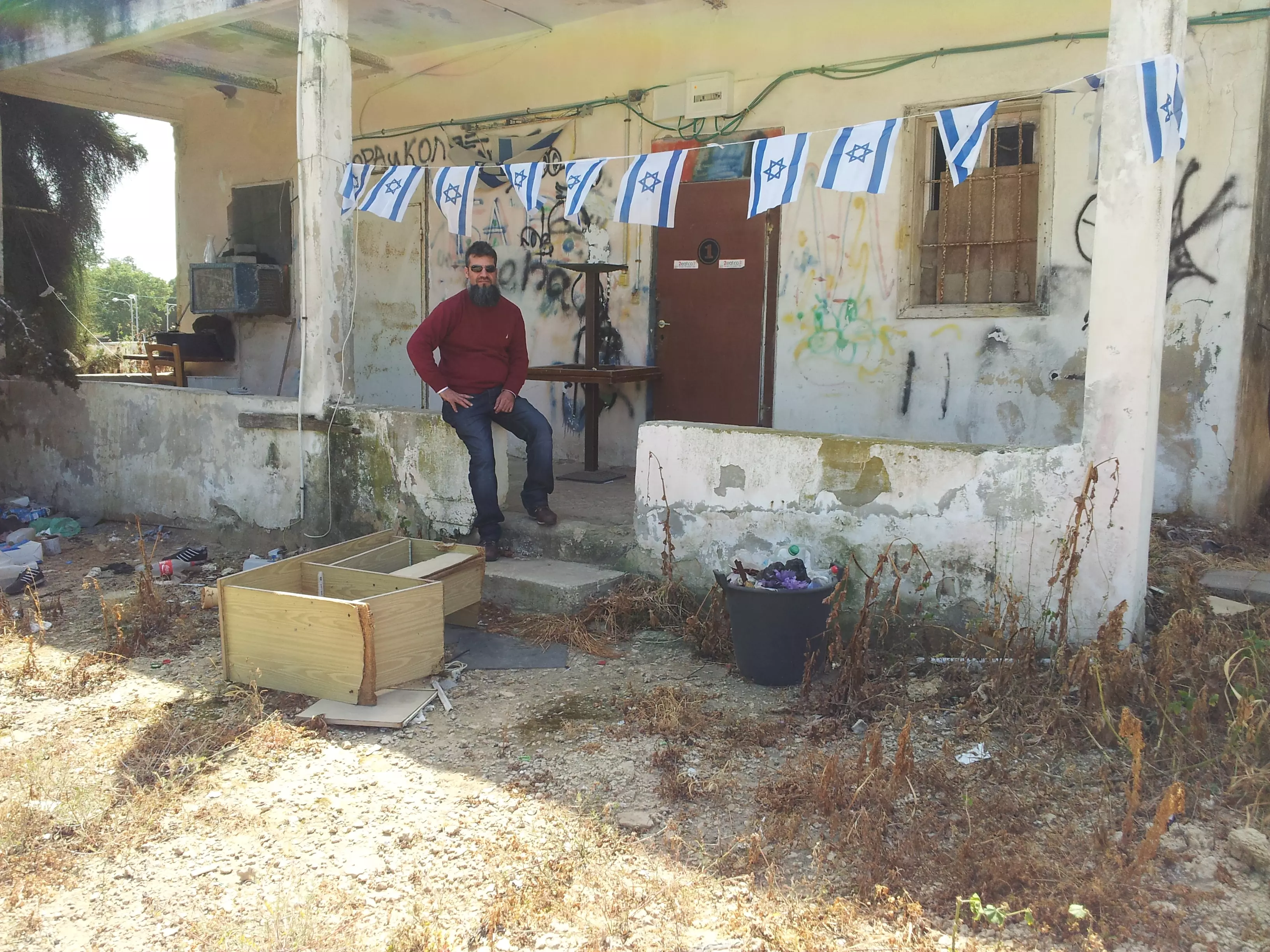
- That is how the "civilized" erased and replaced us: Khirbat al-Zababida was completely obliterated except for a few houses, as you see -- خربة الزبابدة باتت أثر بعد عين. من هنا مر الهمجّ
- That is how the "civilized" erased and replaced us: Khirbat al-Zababida was completely obliterated except for a few houses, as you see -- خربة الزبابدة باتت أثر بعد عين. من هنا مر الهمجّ #2
- That is how the "civilized" erased and replaced us: Khirbat al-Zababida was completely obliterated except for a few houses, as you see -- خربة الزبابدة باتت أثر بعد عين. من هنا مر الهمجّ #3
- That is how the "civilized" erased and replaced us: Khirbat al-Zababida was completely obliterated except for a few houses, as you see -- خربة الزبابدة باتت أثر بعد عين. من هنا مر الهمجّ #4
- That is how the "civilized" erased and replaced us: Khirbat al-Zababida was completely obliterated except for a few houses, as you see -- خربة الزبابدة باتت أثر بعد عين. من هنا مر الهمجّ #5
- A Palestinian building the was looted by the most "civilized" which belongs to al-Jalad family --- من أمام بيت البيارة جنوب خربة الزبابدة قضاء طولكرم
التابع لعائلة الجلاد من يافا.
نقلاً عن الأستاذ أبو النجوان بطاطا
- That is how the "civilized" erased and replaced us: Kh. al-Zababidah was completely obliterated except for a few remaining structures, as you see -- خربة الزبابدة باتت أثر بعد عين بإستثناء بعض المباني. من هنا مر الهمجّ -- Feb 1st, 2022
- That is how the "civilized" erased and replaced us: Kh. al-Zababidah was completely obliterated except for a few remaining structures, as you see -- خربة الزبابدة باتت أثر بعد عين بإستثناء بعض المباني. من هنا مر الهمجّ -- Feb 1st, 2022 #2
- That is how the "civilized" erased and replaced us: Kh. al-Zababidah was completely obliterated except for a few remaining structures, as you see -- خربة الزبابدة باتت أثر بعد عين بإستثناء بعض المباني. من هنا مر الهمجّ -- Feb 1st, 2022 #3
- That is how the "civilized" erased and replaced us: Kh. al-Zababidah was completely obliterated except for a few remaining structures, as you see -- خربة الزبابدة باتت أثر بعد عين بإستثناء بعض المباني. من هنا مر الهمجّ -- Feb 1st, 2022 #4
- That is how the "civilized" erased and replaced us: Kh. al-Zababidah was completely obliterated except for a few remaining structures, as you see -- خربة الزبابدة باتت أثر بعد عين بإستثناء بعض المباني. من هنا مر الهمجّ -- Feb 1st, 2022 #5
- That is how the "civilized" erased and replaced us: Kh. al-Zababidah was completely obliterated except for a few remaining structures, as you see -- خربة الزبابدة باتت أثر بعد عين بإستثناء بعض المباني. من هنا مر الهمجّ -- Feb 1st, 2022 #6
- That is how the "civilized" erased and replaced us: Kh. al-Zababidah was completely obliterated except for a few remaining structures, as you see -- خربة الزبابدة باتت أثر بعد عين بإستثناء بعض المباني. من هنا مر الهمجّ -- Feb 1st, 2022 #7
- That is how the "civilized" erased and replaced us: Kh. al-Zababidah was completely obliterated except for a few remaining structures, as you see -- خربة الزبابدة باتت أثر بعد عين بإستثناء بعض المباني. من هنا مر الهمجّ -- Feb 1st, 2022 #8
- That is how the "civilized" erased and replaced us: Kh. al-Zababidah was completely obliterated except for a few remaining structures, as you see -- خربة الزبابدة باتت أثر بعد عين بإستثناء بعض المباني. من هنا مر الهمجّ -- Feb 1st, 2022 #9
- That is how the "civilized" erased and replaced us: Kh. al-Zababidah was completely obliterated except for a few remaining structures, as you see -- خربة الزبابدة باتت أثر بعد عين بإستثناء بعض المباني. من هنا مر الهمجّ -- Feb 1st, 2022 #10
- That is how the "civilized" erased and replaced us: Kh. al-Zababidah was completely obliterated except for a few remaining structures, as you see -- خربة الزبابدة باتت أثر بعد عين بإستثناء بعض المباني. من هنا مر الهمجّ -- Feb 1st, 2022 #11
Want to browse more? 80,000 pictures were grouped in these gallaries:
| Display Name | Clan/Hamolah | Country of Residence |
| farid al-loh | al-loh | - |
- خربة الزبابدة المهجرة (قضاء طولكرم). البيوت والساحة والبيادر والمصلى وتاريخ سكانها من ابناء كفر زيباد (ال سالم وال صباح وال رشيد غنايم مختار البلدة) وعشيرة دلهوم (عرب الزبيدات) واتباعهم واحلافهم. تحياتنا الحارة لابناء عرب الزبيدات وكفر زيباد اينما يكونون Duration: 7 min 19 sec
- بيت بيارة الجلاد - خربة الزبابدة جنوب أم خالد ونتانيا . Duration: min 2 sec
- تقع في الطرف الغربي لقضاء طولكرم الانتدابي -جنوبي نتانيا -أم خالد وشرقي مصب وادي الفالق . بقايا القرية والبيوت تقع في إطار محمية طبيعية بسبب وجود بعض العيون والبرك والتجمعات المائية التي تجذب اليها الكثير من أصناف الطيور والعصافير الخاصة وكذلك تنمو به أصناف خاصة من النباتات االمحبة للكثير من المياه وعلى رأسها العوسج (العليق ) .القرية تتبع تاريخيا قرية كفر زيباد ومن هنا جاء اسمها . Duration: min 30 sec
No links have been shared yet, be free to the first to share the first link.
 Fake Valor: Why Did Zionist Jews Hoist Nazis Flag on Their Ships in the 1930s?
What is new?
-
Facts About Oct. 7th Gaza Raid
-
Remined Us Please: Who Did Rape Whom? Was it Palestinians who raped Israelis? Or, was the other way around? You'll be the judge
-
When Prof. Edward Said was invited to debate Bibi Netanyahu in the 1980s, watch what happened!
-
Ezra Klein of the NY Times on the "Jewish Race".
-
Abusing Blood Libel!
-
How and why Israeli Jewry has become the most hated cult?
-
Did Israeli Soldiers Activate The Hannibal Direective On Oct. 7th? You Be The Judge
-
Zionist FAQ: Isn't it true that Palestinians don't want peace? Palestinians never accepted the two-state solution
- Facts about Haavara (Transfer) Agreement between Ben-Gurion & Hitler
-
Haavara FAQs: Why Did Zionist Jews Hoist Nazis' Flags on Their Ships in the 1930s?
- Haavara FAQs: When Chaim Weizmann met FDR in mid-1943, why was he silent about rescuing European Jewry?
-
Dear ChatGPT: How did Palestinians resist Napoleon's invasion of their country in 1799?
-
Dear ChatGPT: Gaza had a vibrant Jewish community in the mid-17th century. What happened to them?
-
Dear ChatGPT: Why did the Jewish Agency suppress news of the Holocaust during WWII?
-
Video Playlist: Jews share their DNA tests to end the conflict for good.
-
A Tale of Two Conflicts: Examining the Definition of Genocide
-
Prof. Abraham Polak And The Suppressed History of the Khazars and European Jewry
-
How Ronald Reagan would have framed the genocide in Gaza if he were still alive?
-
Haavara FAQs: Let us do the math: how many German Jews did The Haavara Agreement save?
-
Zionist FAQs: The Hebron Massacre of 1929, "clearly proves" that Palestinians are antisemitic, how could you deny it?
-
Zionist FAQs: Why Anti-Zionist Is Not Antisemitism?
-
Zionist FAQs: Isn't it true that the KGB created Palestinian Nationalism in the early 1960s?
- Zionist FAQs: Muslims are killing Muslims all the time; why are Israeli Jews being singled out in the media?
- Zionist FAQs: How is Israel an apartheid state when 20% of its citizens are Arabs who enjoy full rights?
-
Haavara FAQs: Why Did Dorothy Thompson Flip From A Zionist Advocate to A Silenced Dissenter?
-
Haavara FAQs: Analysis of Herzl's Uganda Scheme and how it could have saved millions of Jews.
-
Haavara FAQs: Why did Hayim Greenberg describe American Jewry as "morally bankrupt" in early 1943?
-
Haavara FAQs: What if the Evian Conference was a resounding success? What would have been the impact of saving European Jewry on Zionism?
- Haavara FAQs: What if the six million were saved, how that would have impacted the Zionist project?
-
Haavara FAQs: How did Zionist leaders react when Europe's Jews lingered in the DP camps after WWII ended?
-
Why does the American Jewish community repeat lies that David Ben-Gurion had debunked before he died?
-
Who has the power to rename the Tatar/Khazar Gene Marker to Jewish IV?
-
Zionist FAQs: Why won't Egypt, Syria, and Jordan take their people back? Jews are indigenous to Palestine, and Arabs immigrated after Jews developed the country. Arabs should leave.
-
Haavara FAQs: Did Hitler and the Nazis conflate between Judaism and Zionist? If that wasn't case, then why?
-
Haavara FAQs: Winston Churchill and antisemitism, a collection of articles written Churchill.
-
Haavara FAQs: Broken by country, how many Jews survived vs. killed during the Holocaust?
-
Haavara FAQs: Why did European Jews vote with their feet and to immigrated to the Americas, not Palestine, after WWII?
-
Watch this American Jewish Girl describing Israeli Jews' cognitive dissonance like no other in under two minutes
-
Haavara FAQs: When the Nazis went out of their way to hide the Holocaust, Israeli Jews did the exact opposite by broadcasting their genocide of Gazans. But why?
-
Haavara FAQs: How Zionist Jews went out of their to show their appreciation to Nazism and Fascism?
- Haavara FAQs: Why Zionist leaders were against bombing the death camps & the Railroads leading to them?
-
Haavara FAQs: Hitler's message to the British and American people: If Jews are such noble citizens and you care about them, how come you're not letting them in? I will gladly ship them to you at my expense, even on luxury liners!
-
A shortlist of Zionist and Israeli false flag operations in the name Jews.
-
The Most Moral Army
- The Land of Kapos (Israel): Where the brave are boycotted and Kapos walk free.
- Why did early Zionists often named their communal enterprises "colonial"?
- Zionist Relations with Nazi Germany by Faris Glubb
-
Two NY Times advertisements by Zionists in the early 1943 that exposes Zionists' treason at the height of the calamity
- Facts Not Lies about the Palestinian-Israeli Conflict.
- Site's pictures have been categorized
- Campgain Against Lice
- A Survey of Palestine, the official source about Palestine before Nakba produced by the British Mandate; over 1200 pages.
- Satellite View & Google Earth: Over 6,000 placemarks identifying all destroyed towns, W. Bank & Gaza Strip Towns, & refugee camps.
- PalestineRemembered.com and its Nakba Oral History Project were featured on al-Jazeera Satellite TV.
- Nakba Oral History Video Podcast:
 Over 700 Oral History interviews (including 3,500+ hours of recording) can be viewed online.
 - Palestine Village Statistics Project
- Gaza Jail Break
- النسخة العربية للموقع الان متوفرة
- Videos: Documenting the destroyed villages in video: Tracing all that remains since Nakba.
- Videos: Responding to Zionist Propaganda
- Interview: The ethnic cleansing of Palestine: George Galloway interviews Israeli Historian Ilan Pappe.
- For Palestinians, memory matters. It provides a blueprint for their future By George Bisharat.
- Zionist FAQ now available in Hebrew שאלות שציונים שואלים, עכשיו בעברית
- Video: The Stephen Walt and John Mearsheimer report on the influence of the Israel Lobby on U.S. Foreign Policy
- The Palestinian-Israeli conflict for beginners
