| PalestineRemembered | About Us | Oral History | العربية | |
| Pictures | Zionist FAQs | Haavara | Maps | |
| Search |
| Camps |
| Districts |
| Acre |
| Baysan |
| Beersheba |
| Bethlehem |
| Gaza |
| Haifa |
| Hebron |
| Jaffa |
| Jericho |
| Jerusalem |
| Jinin |
| Nablus |
| Nazareth |
| Ramallah |
| al-Ramla |
| Safad |
| Tiberias |
| Tulkarm |
| Donate |
| Contact |
| Profile |
| Videos |
Welcome To al-Kunayyisa - الكنيسة (אל-כוניסה)
|
District of al-Ramla
Ethnically cleansed days ago |
العربية Google Earth |
 |
Gallery (86) |
- Statistics & Facts
-
Before & After

- Satellite View
- Articles 4
- Pictures 86
- Members 13
- All That Remains
- Wikipedia
- Videos 5
- Guest Book 3
- Links
| Statistic & Fact | Value | ||||||||||||
| Occupation Date | July 10, 1948 | ||||||||||||
| Distance From District | 12 (km) Southeast of al-Ramla | ||||||||||||
| Elevation | 175 (meters) | ||||||||||||
| Before & After Nakba, Click Map For Details |
|||||||||||||
|
|||||||||||||
| Map Location | See location #26 on the map View from satellite |
||||||||||||
| Military Operation | First stage of Operation Dani | ||||||||||||
| Attacking Units | Possibly Giva'ti Brigade | ||||||||||||
| Exodus Cause | Military assault by Zionist troops | ||||||||||||
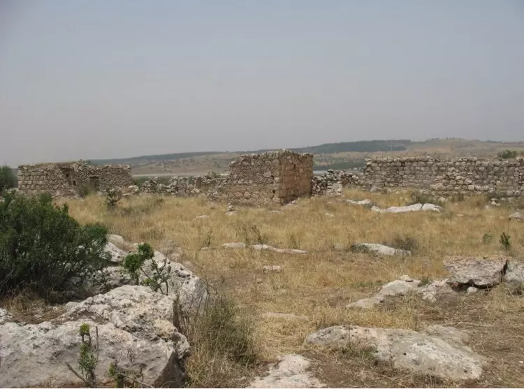
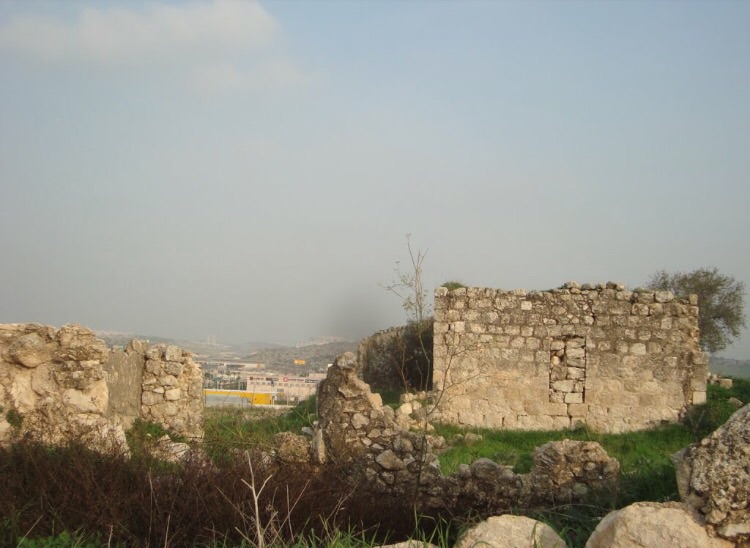
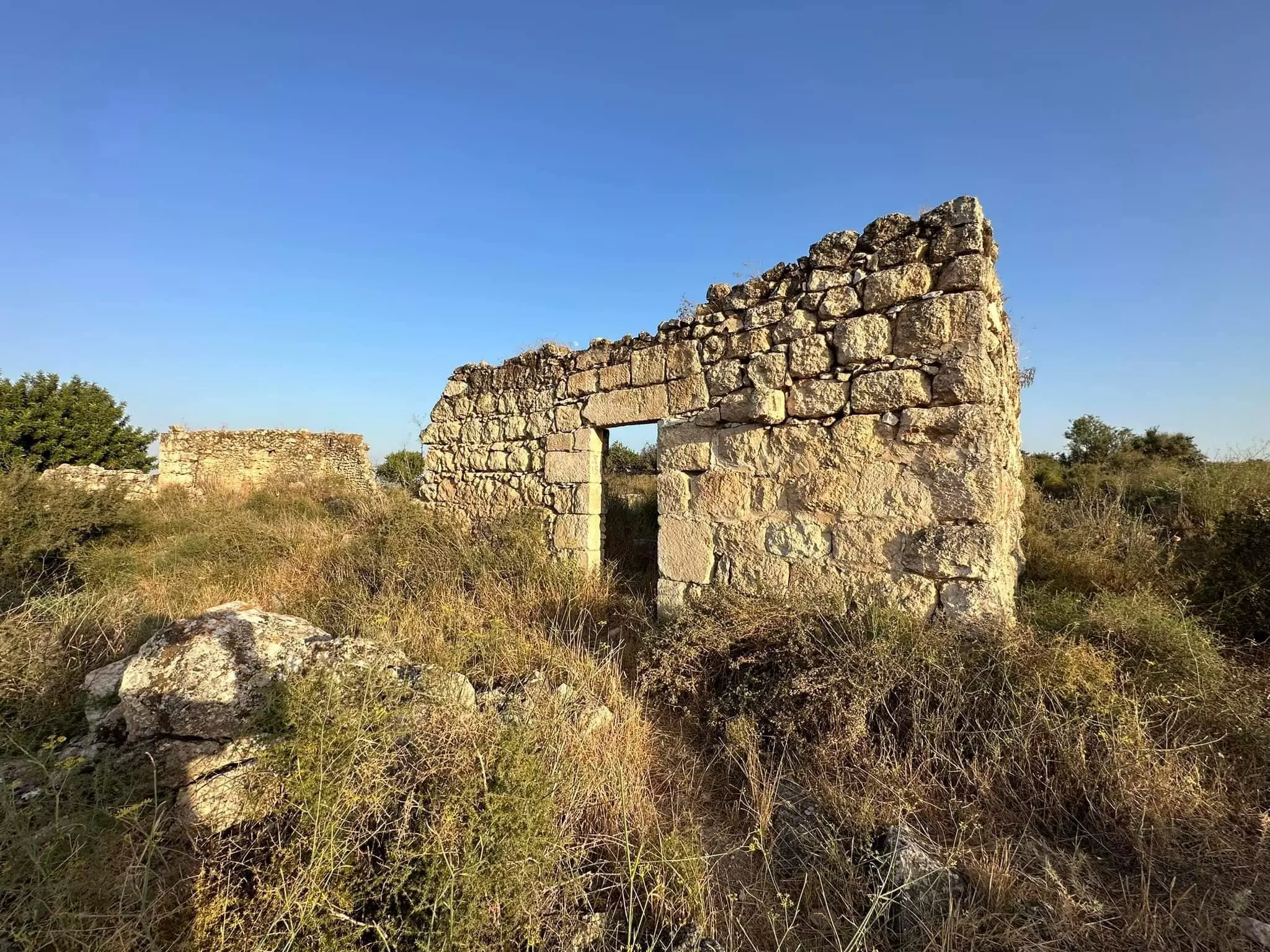
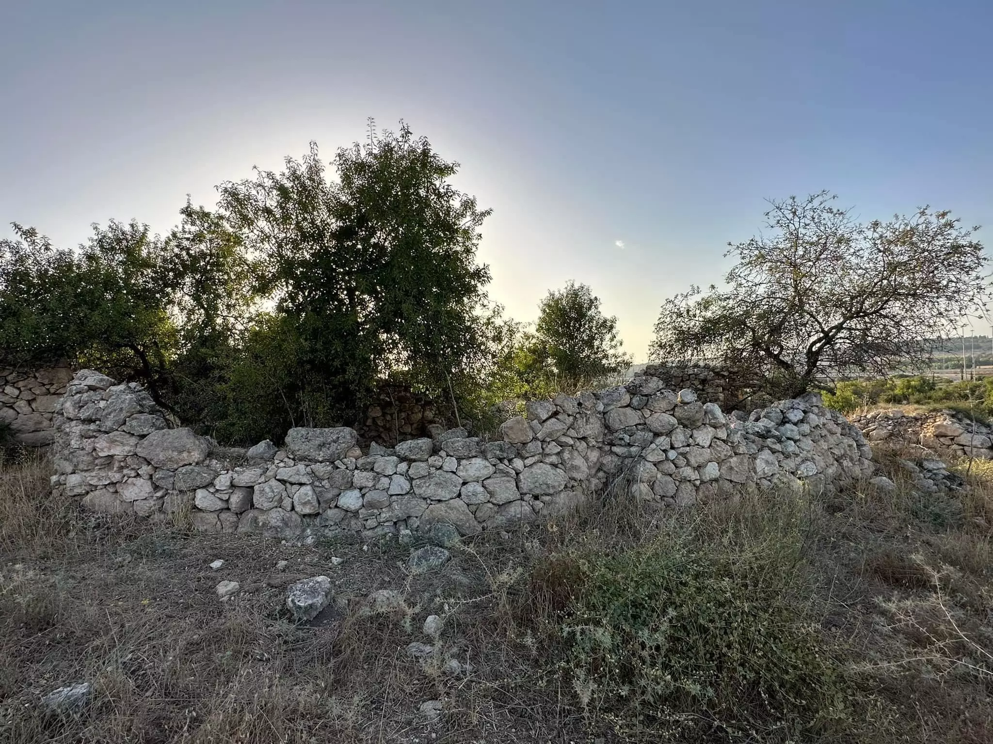
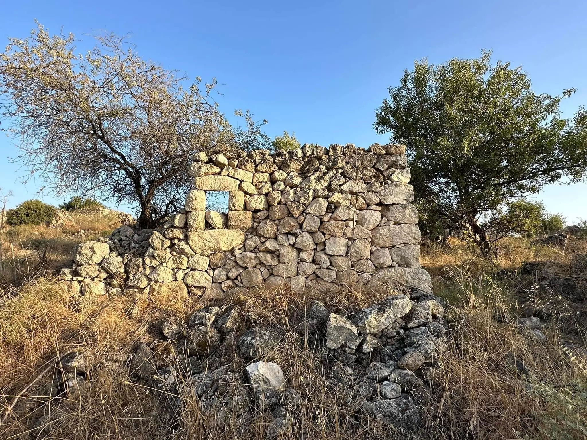
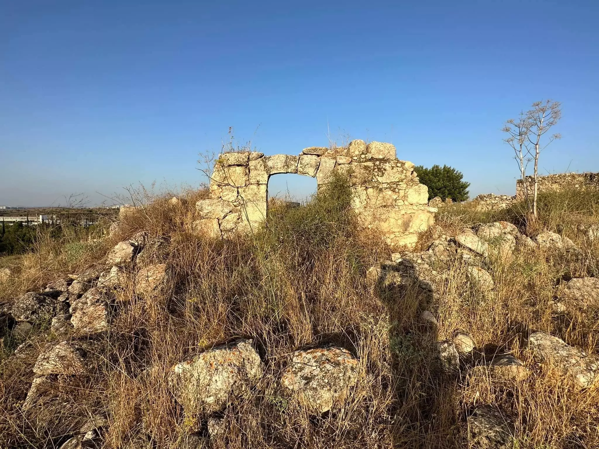
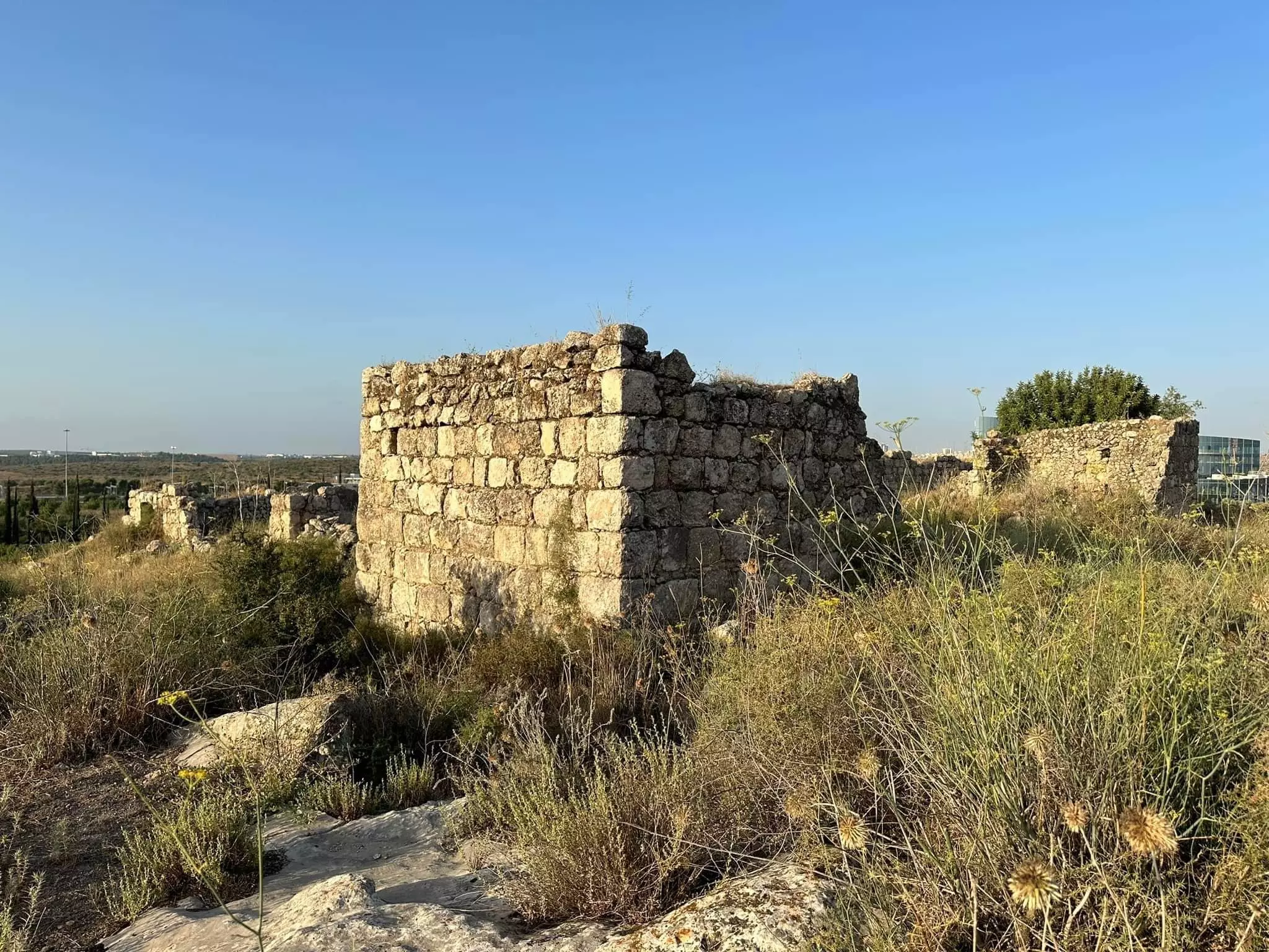
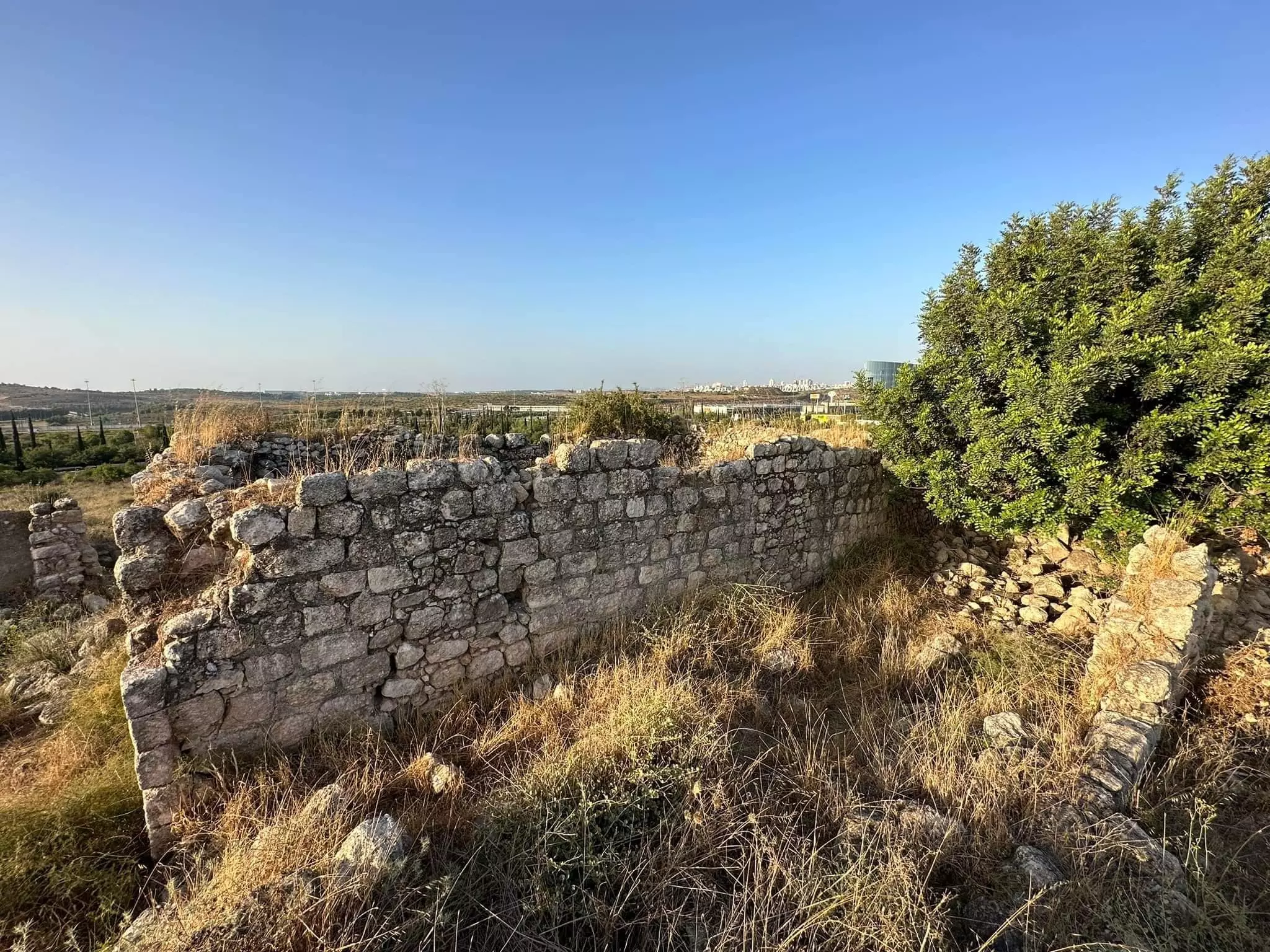
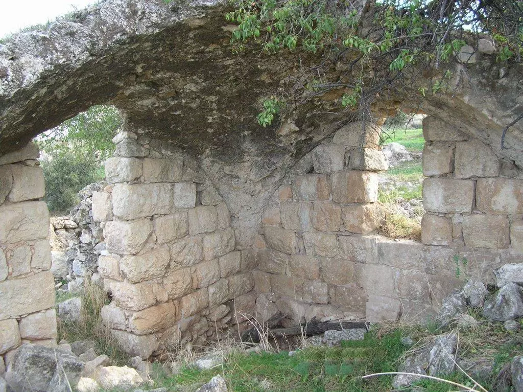
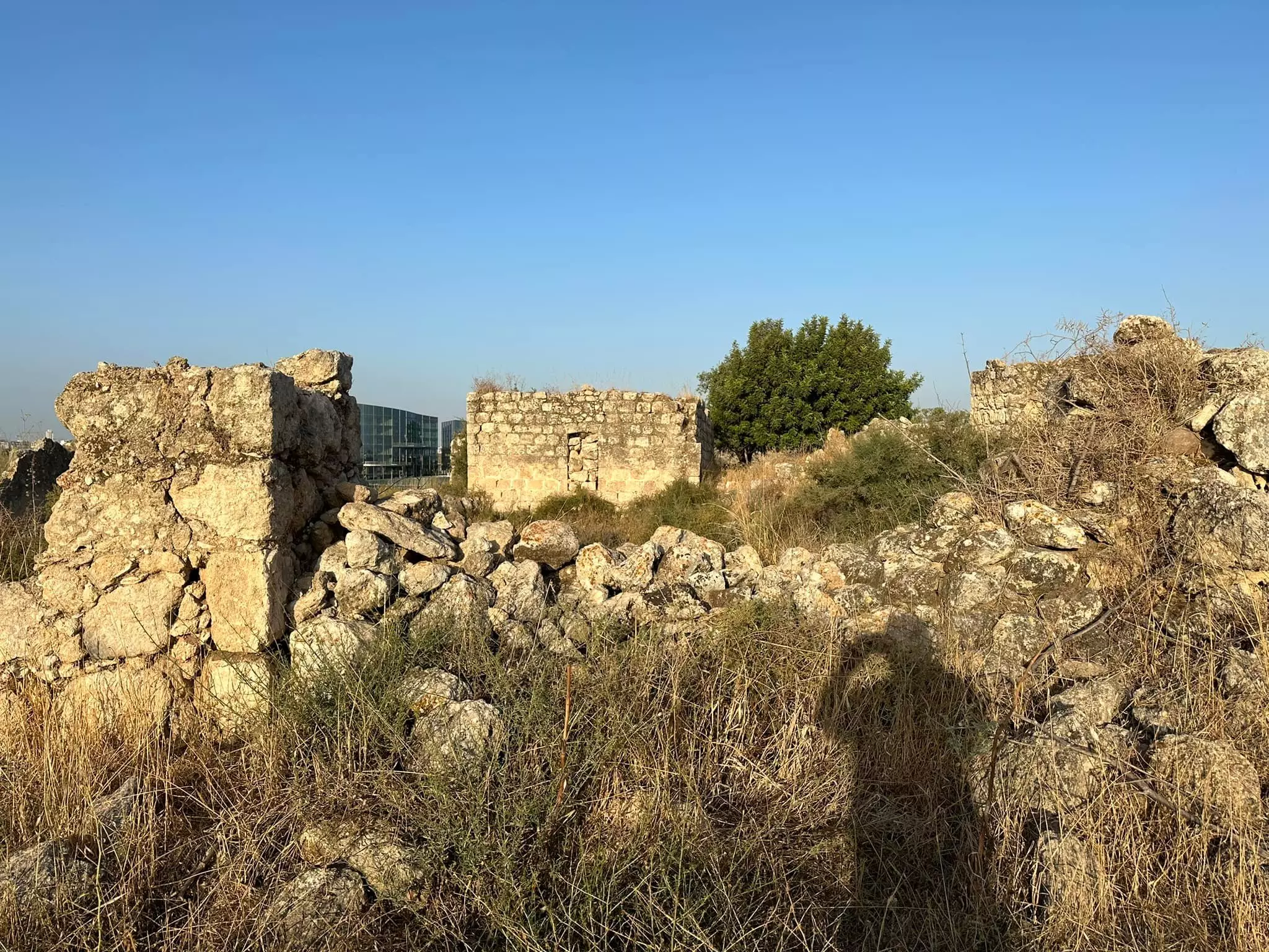
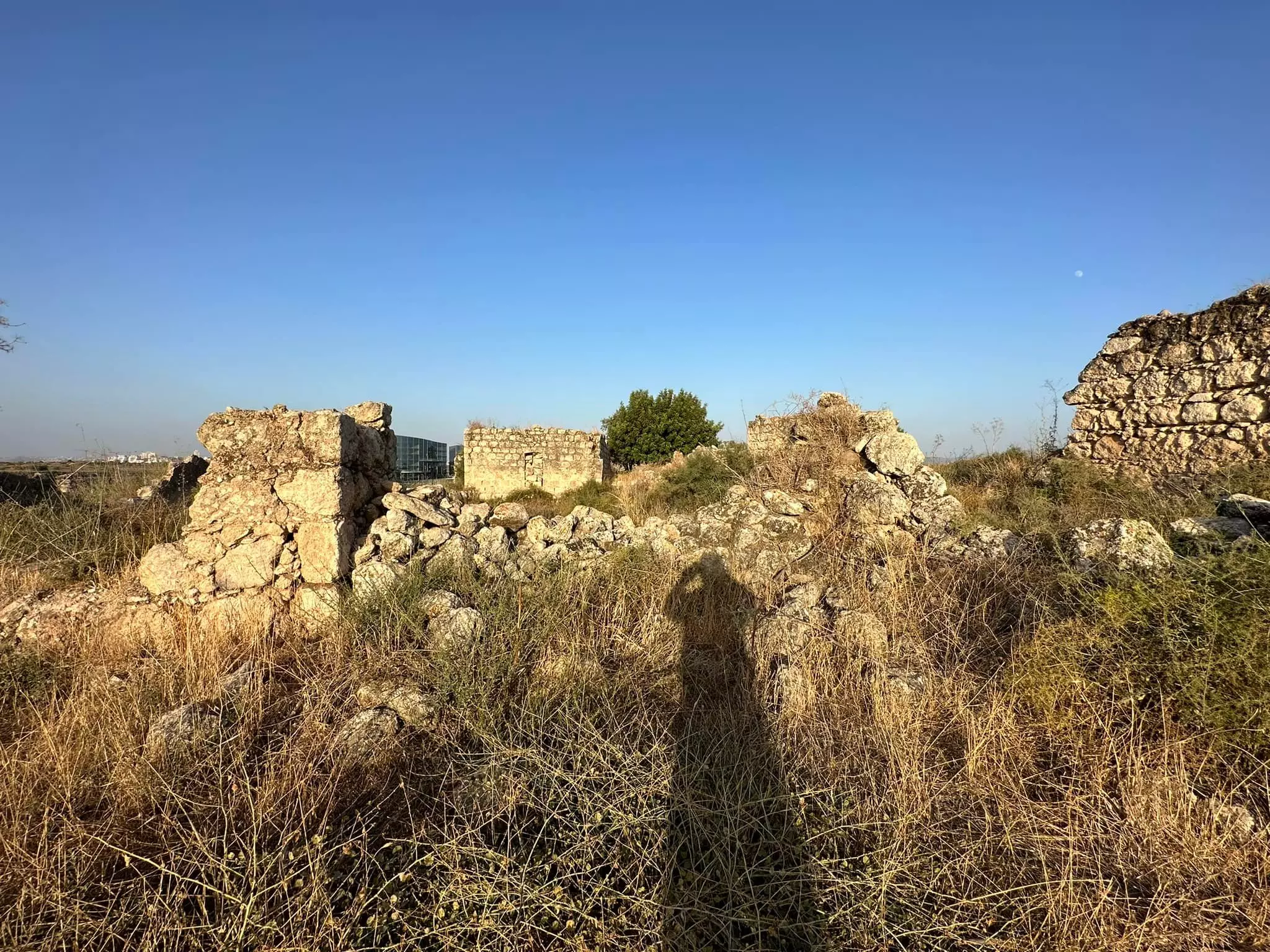
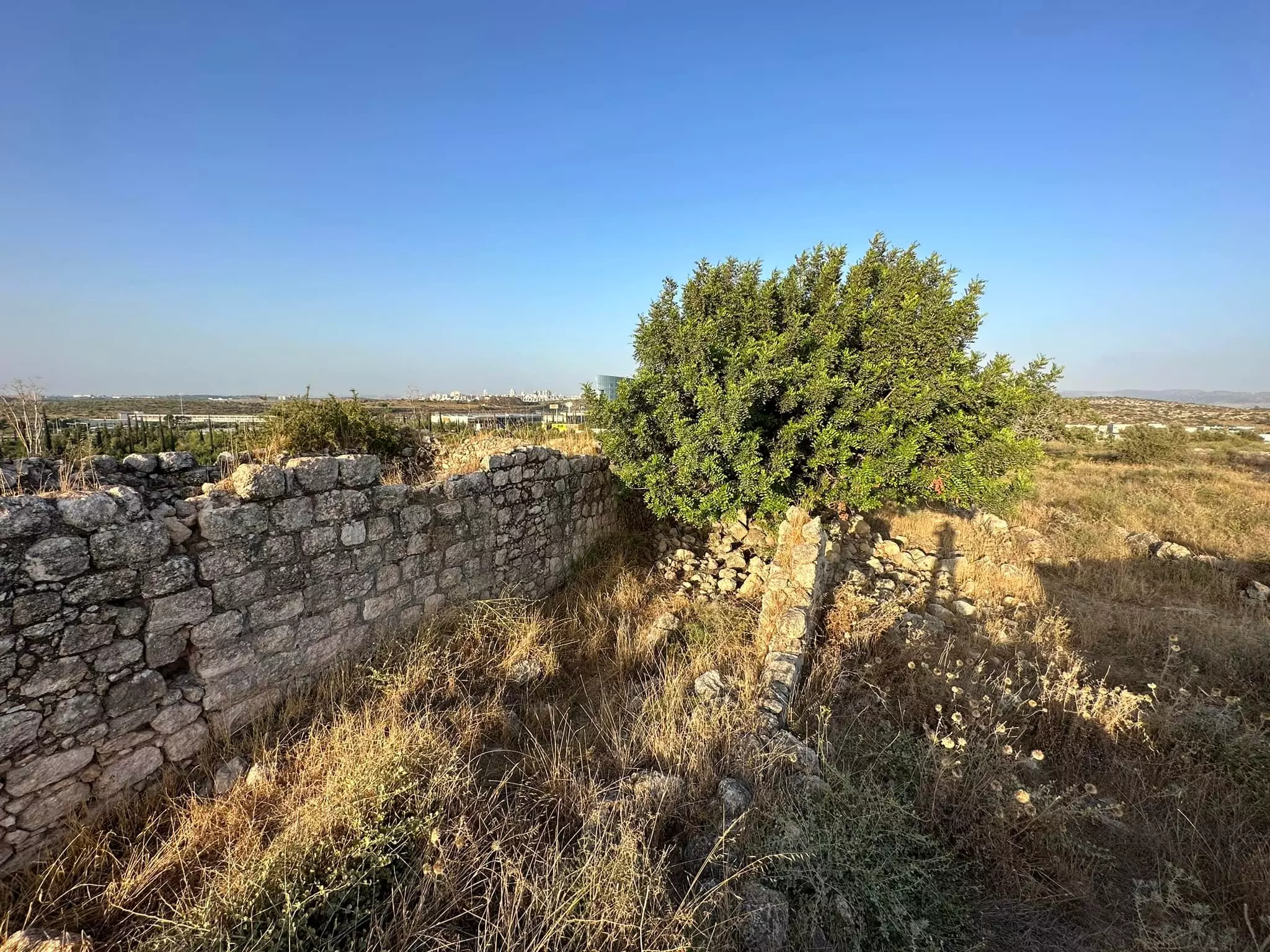
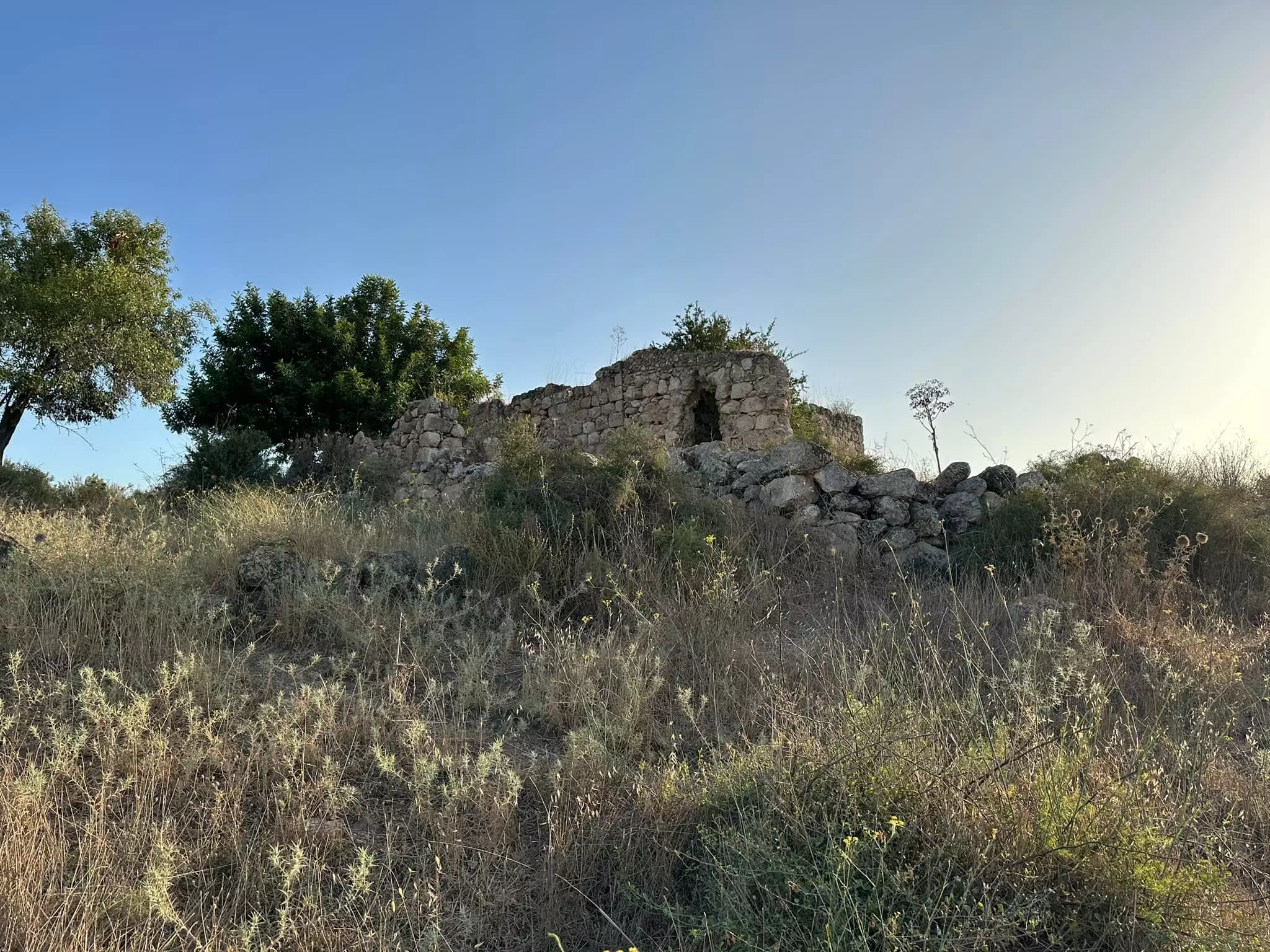
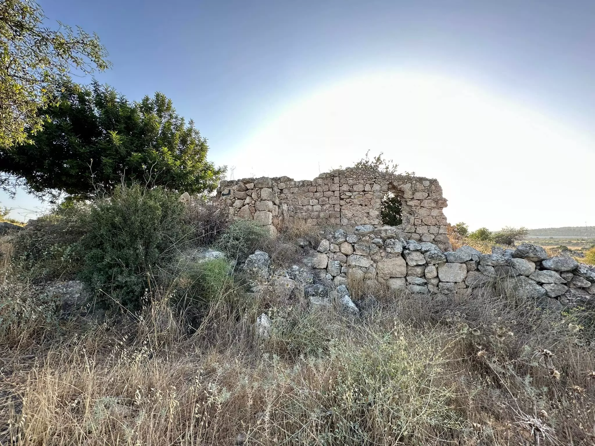
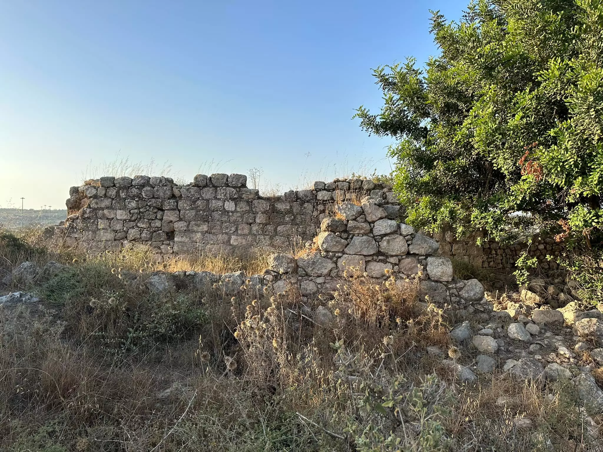
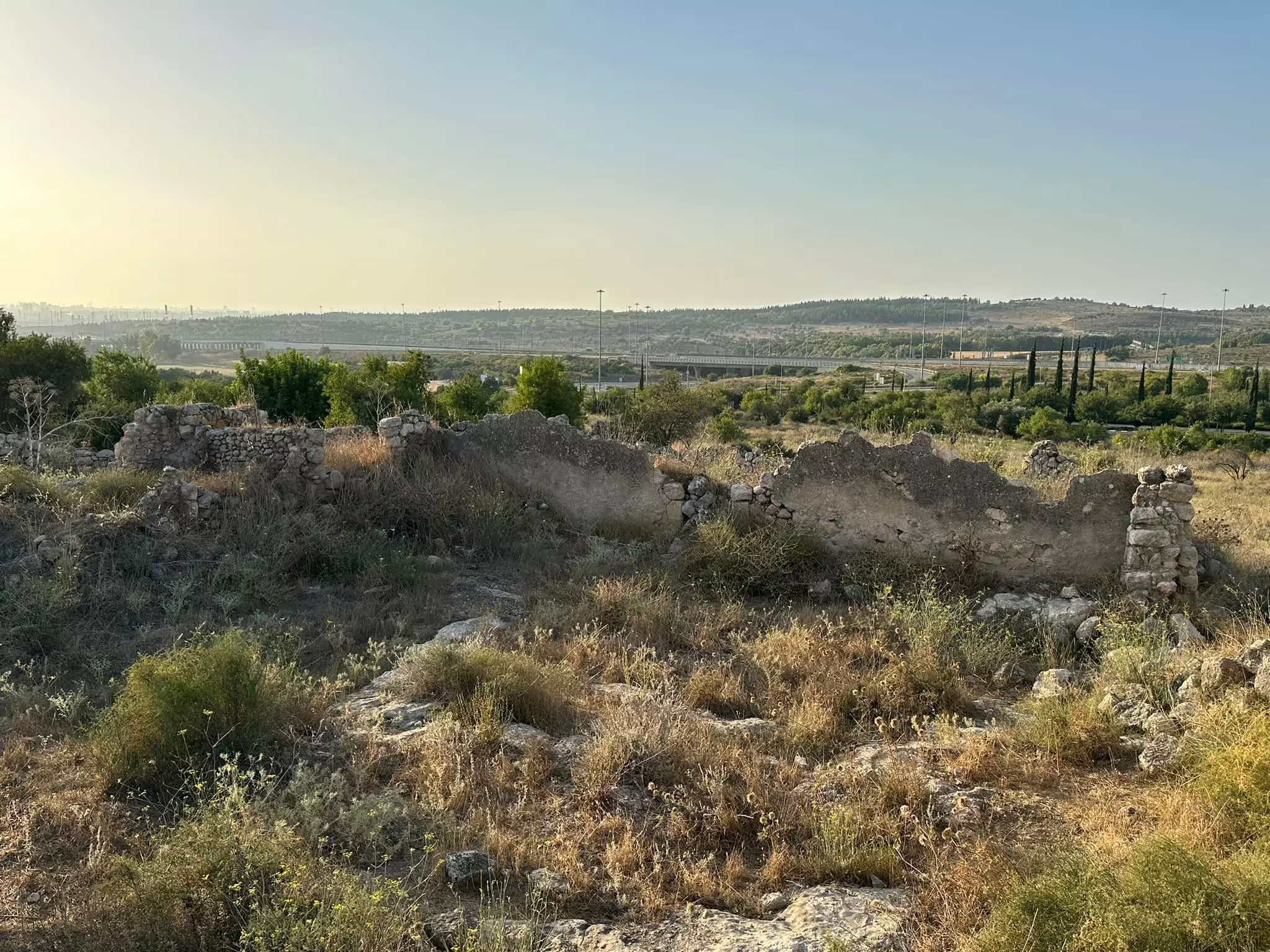
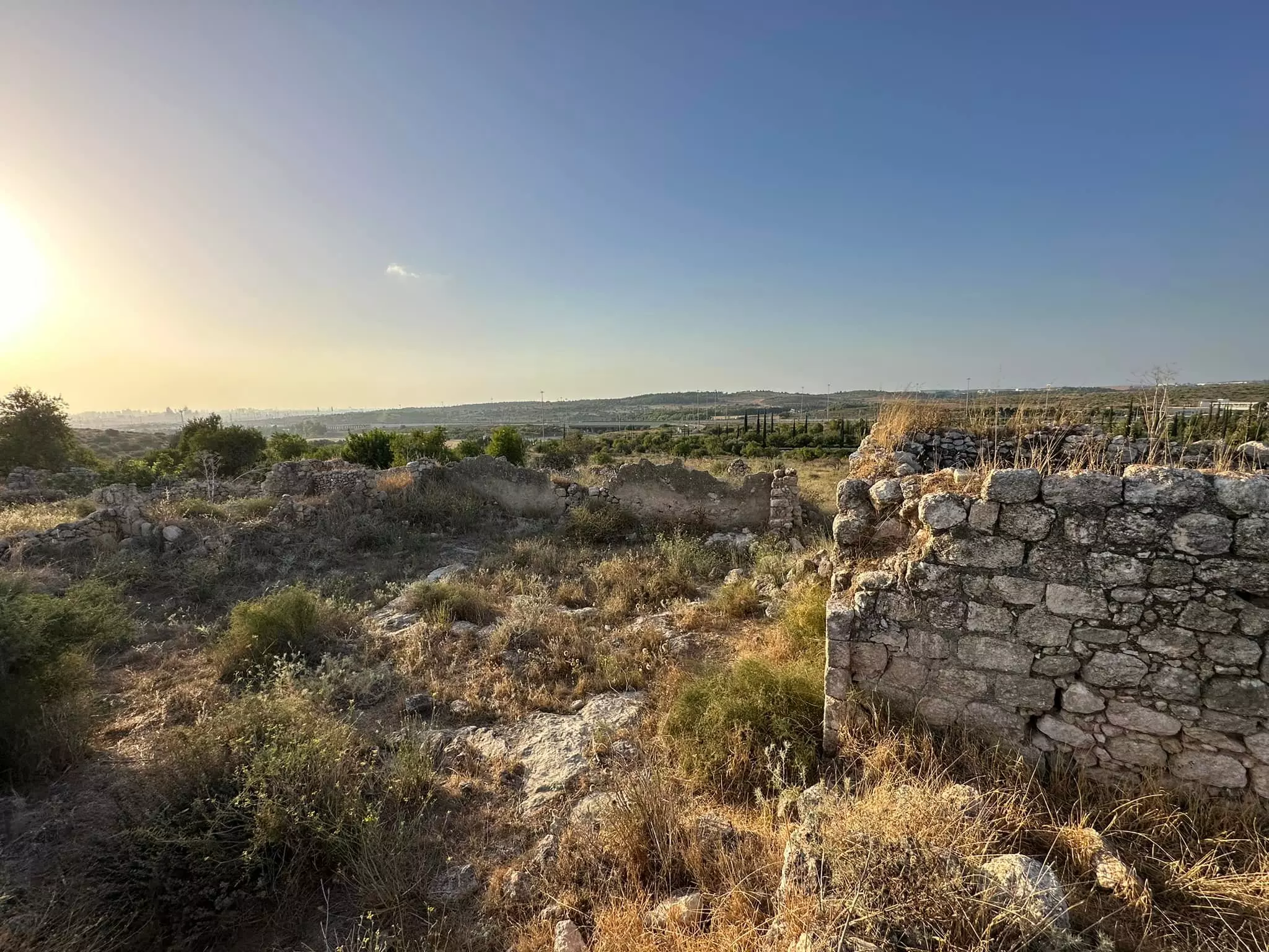
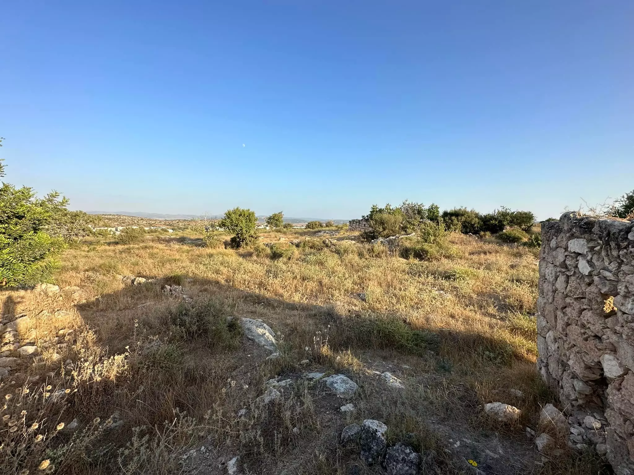
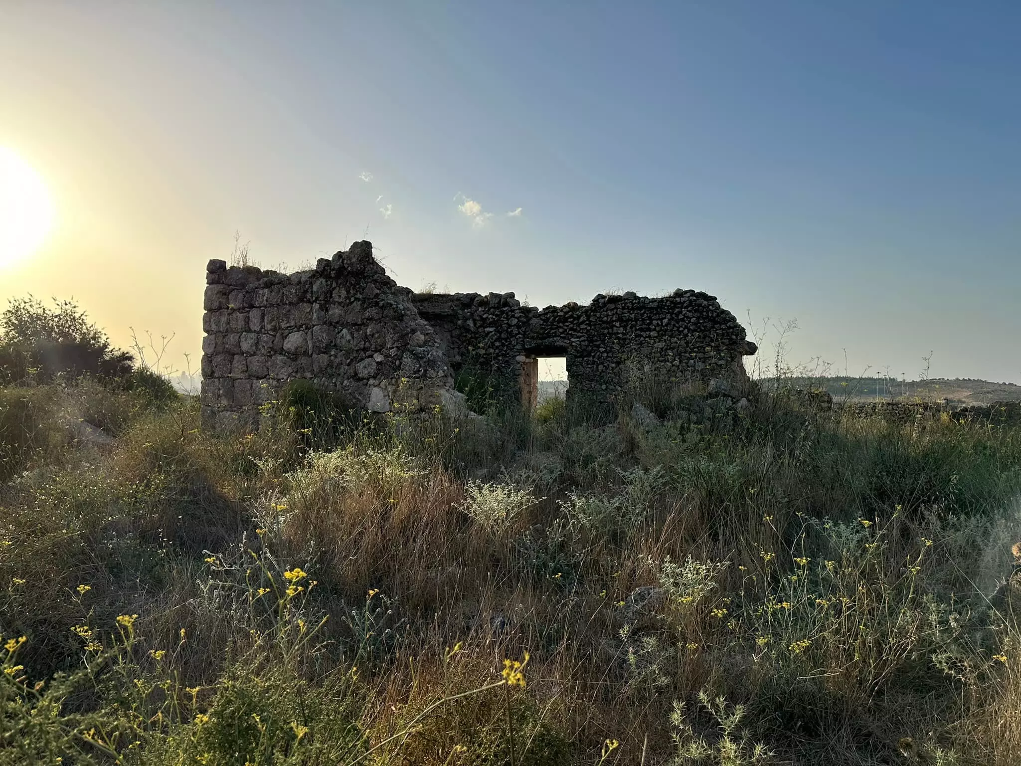
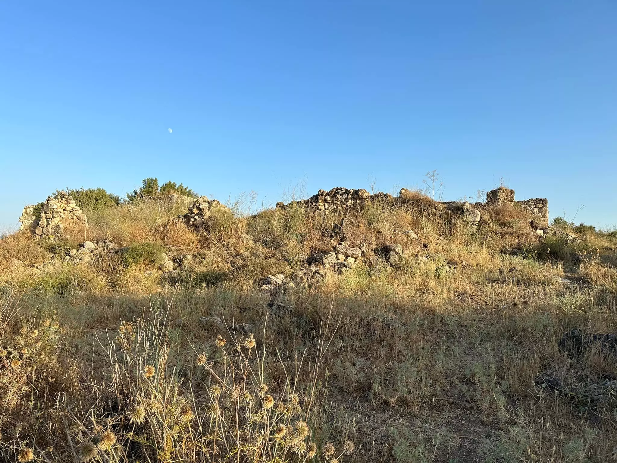
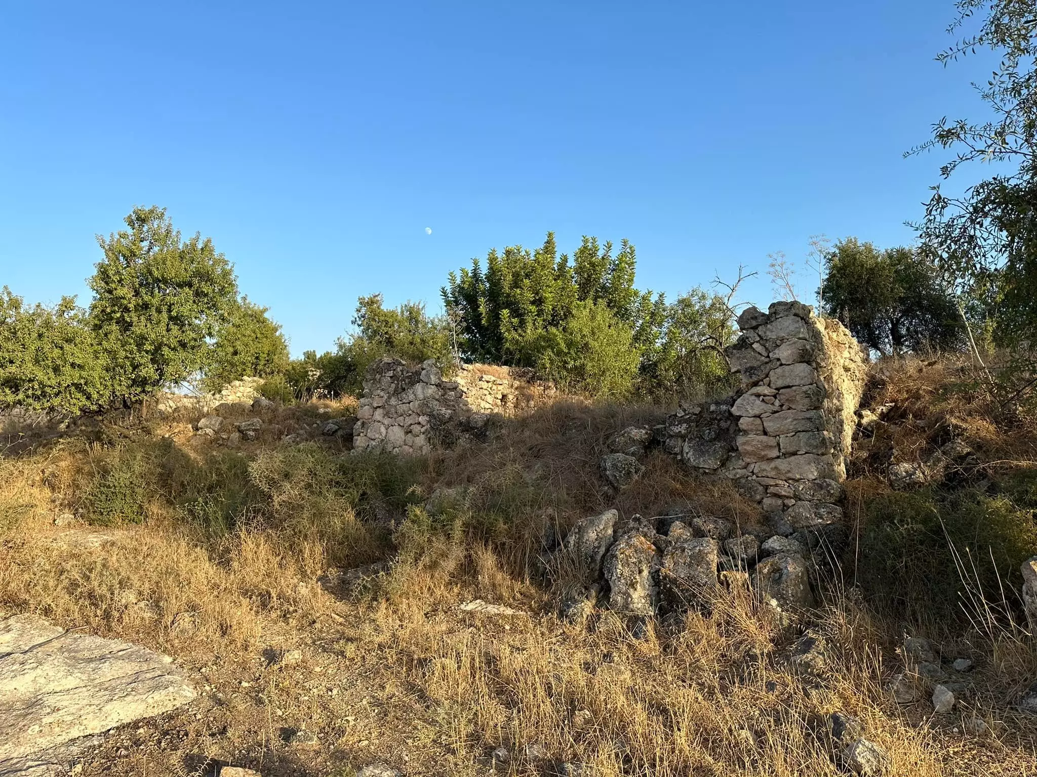
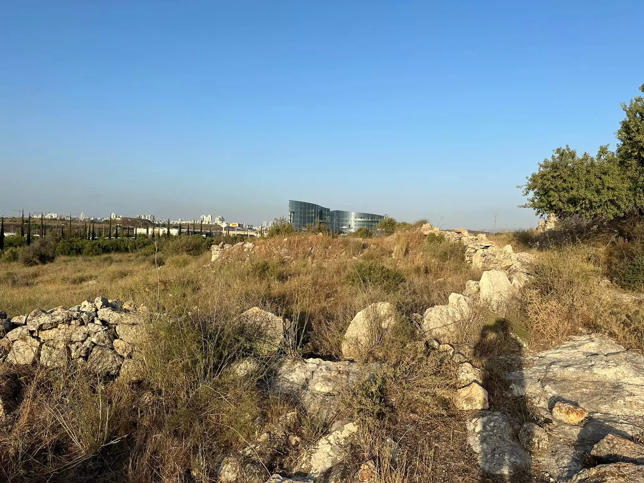
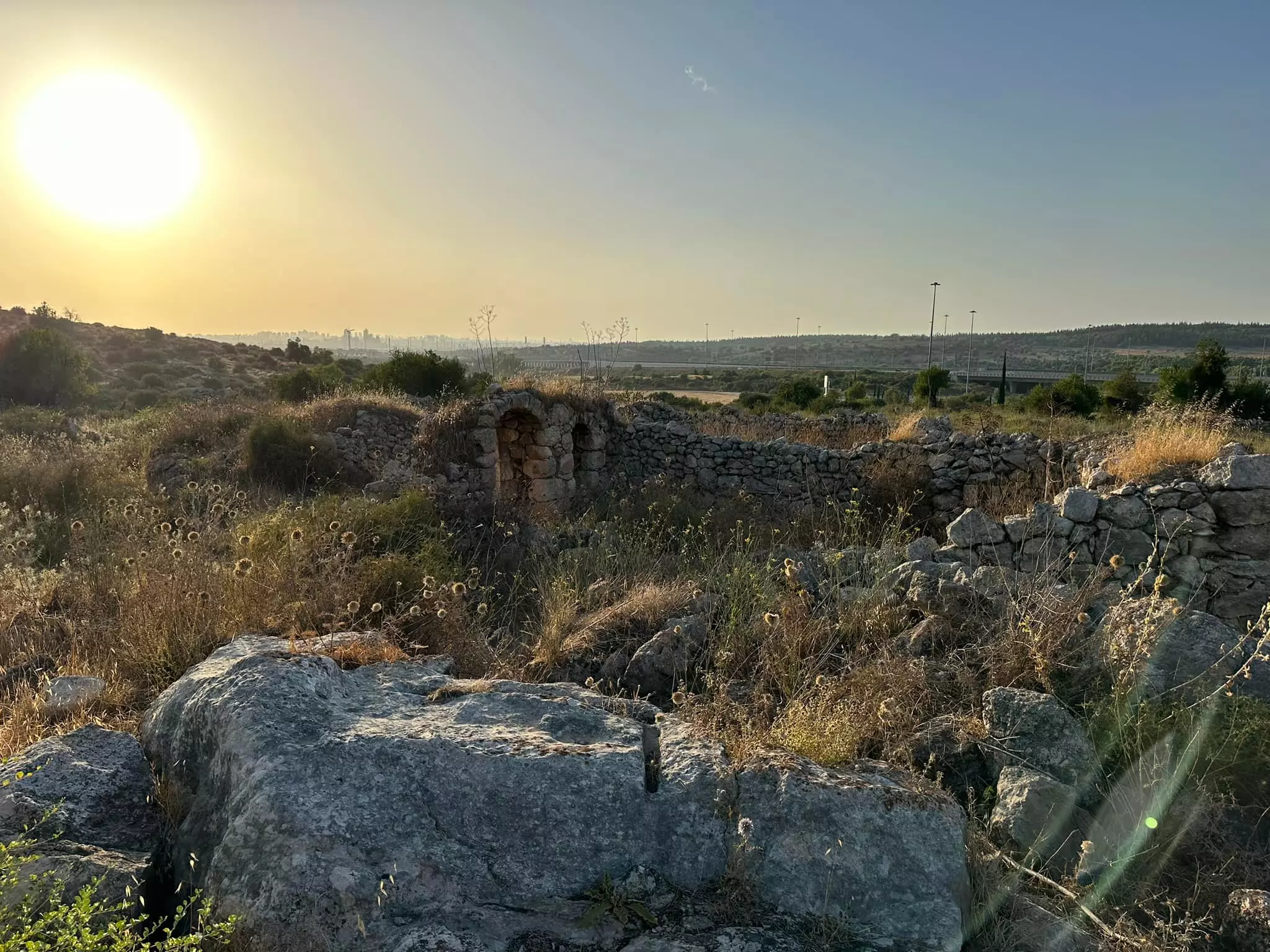
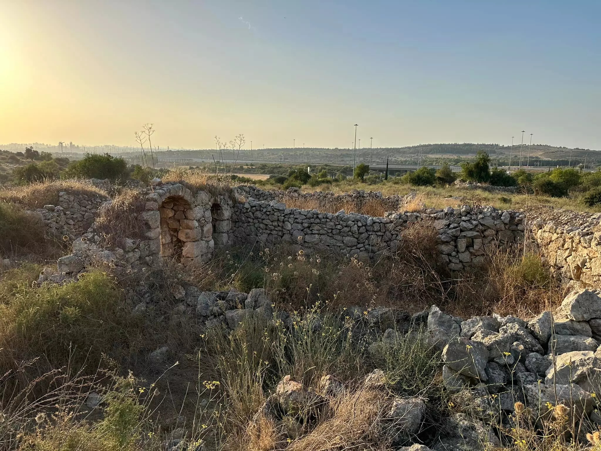
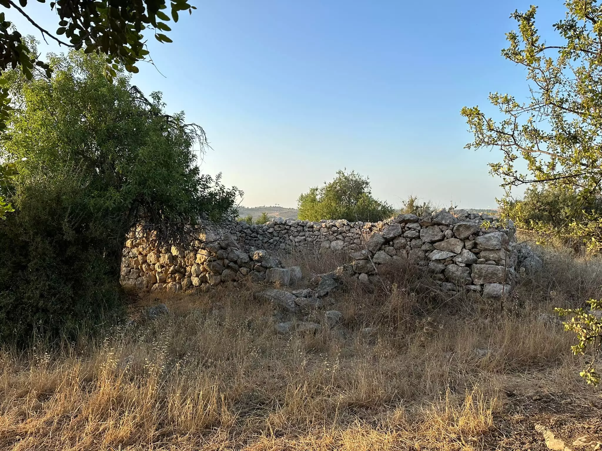
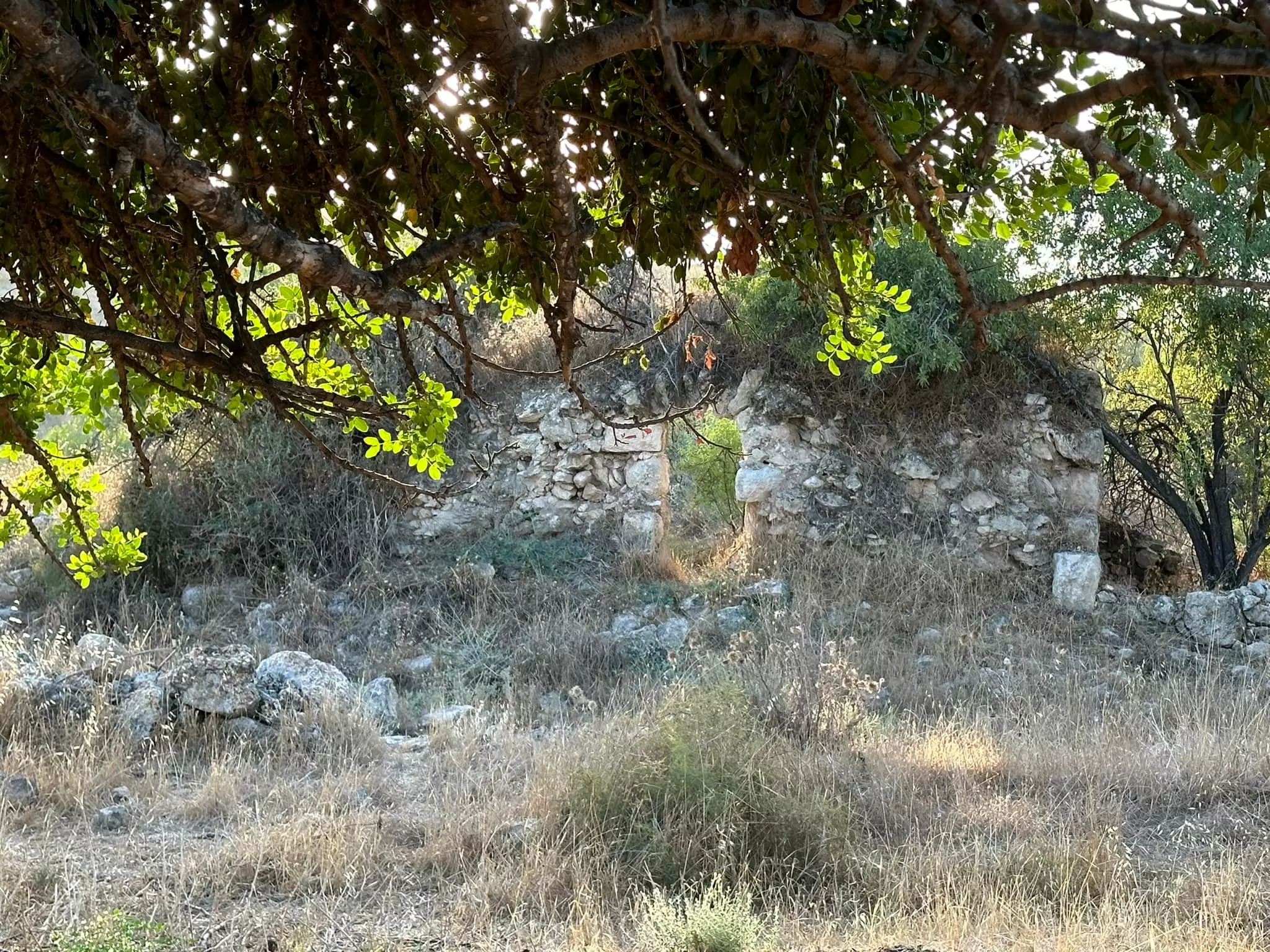
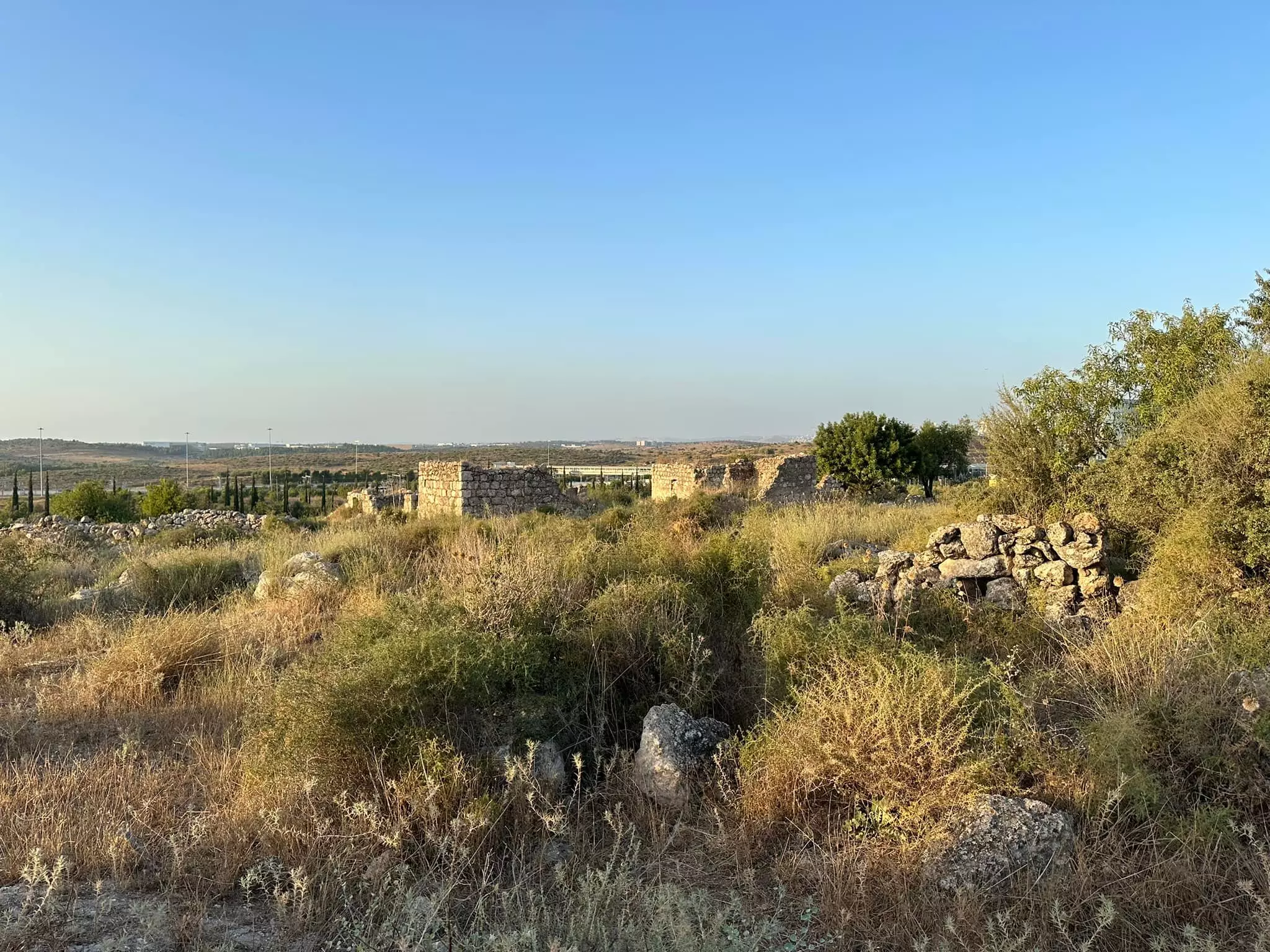
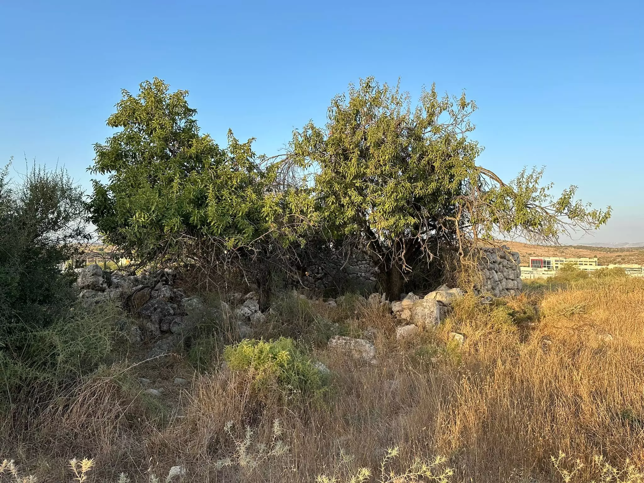
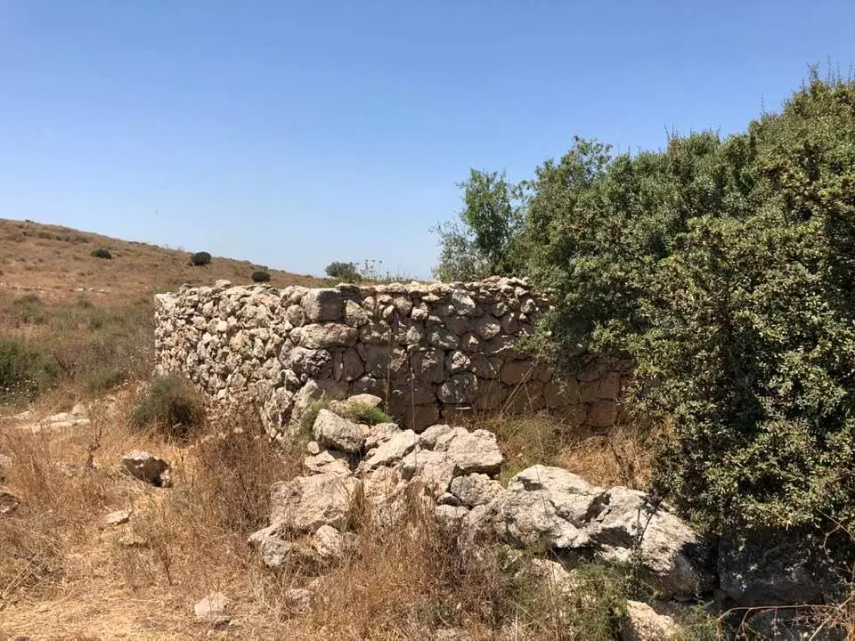
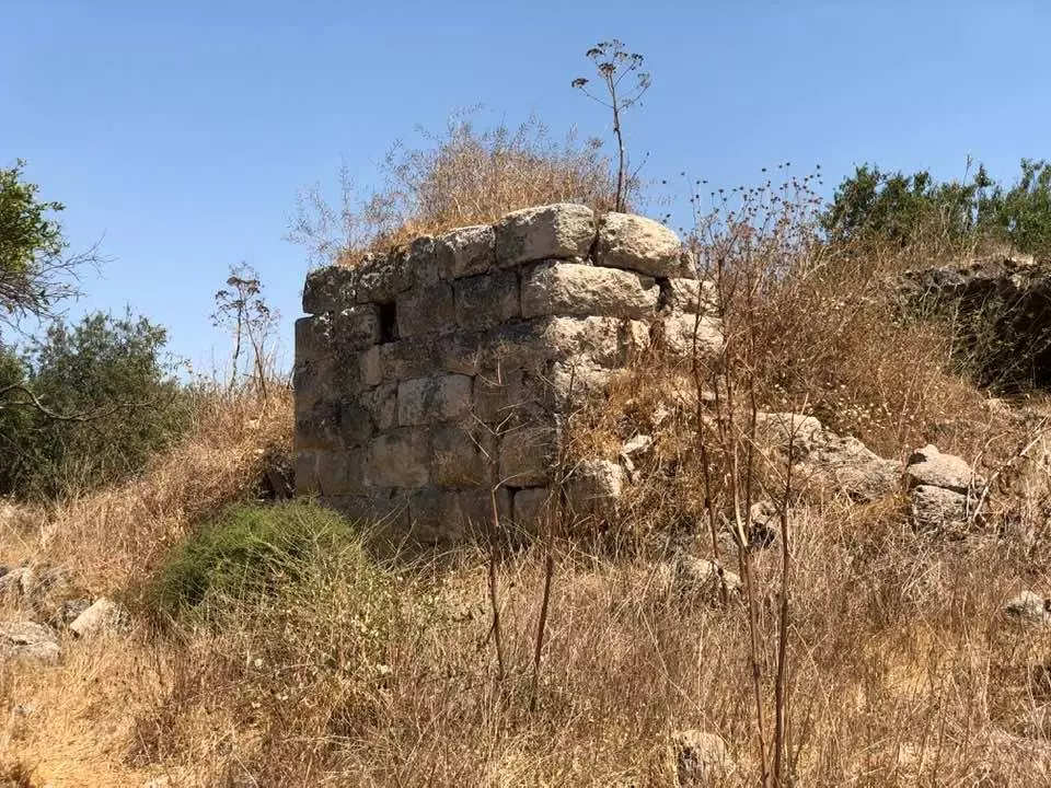
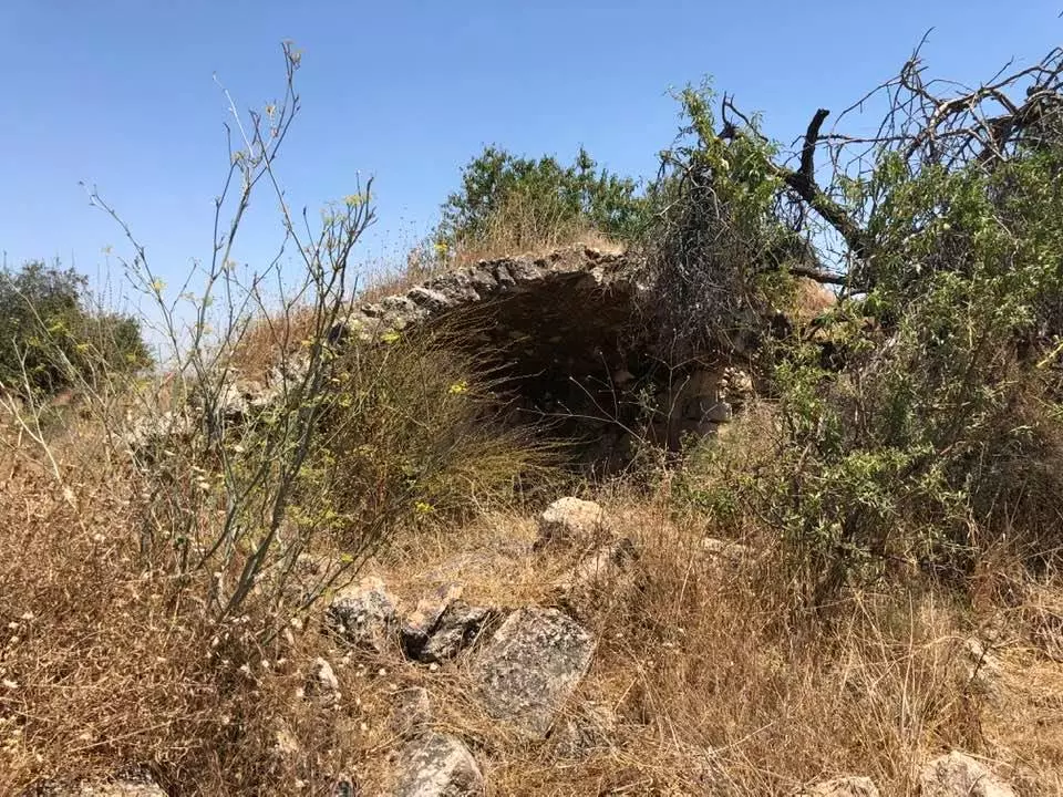
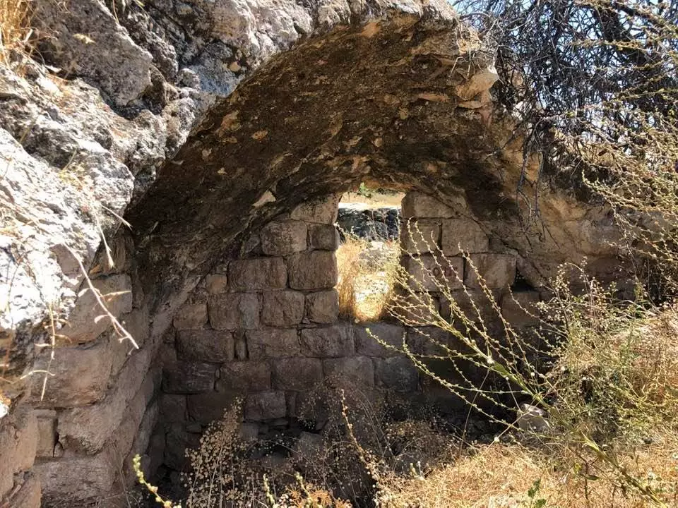
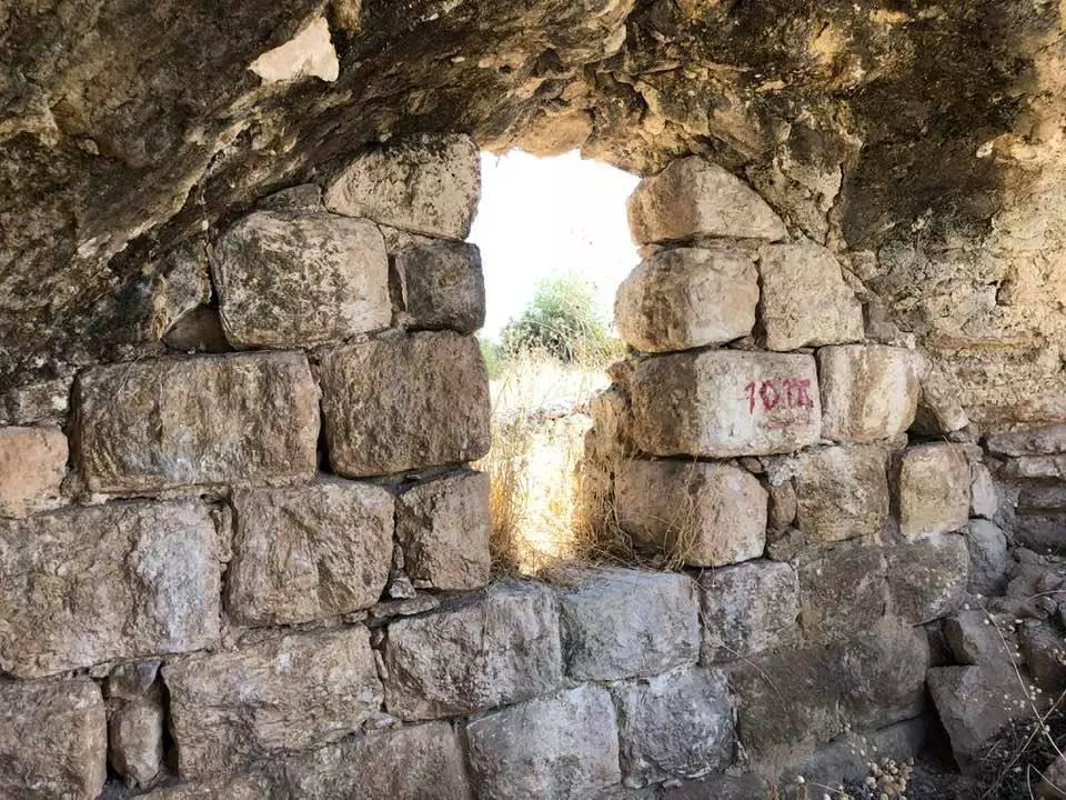
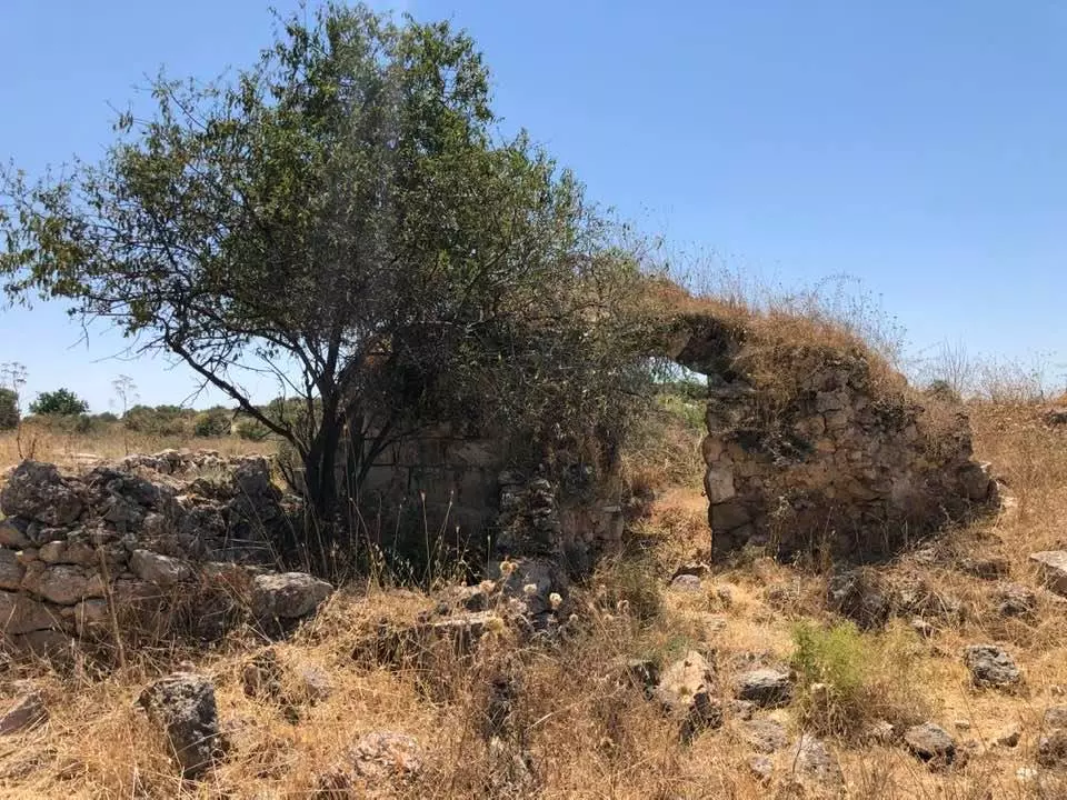
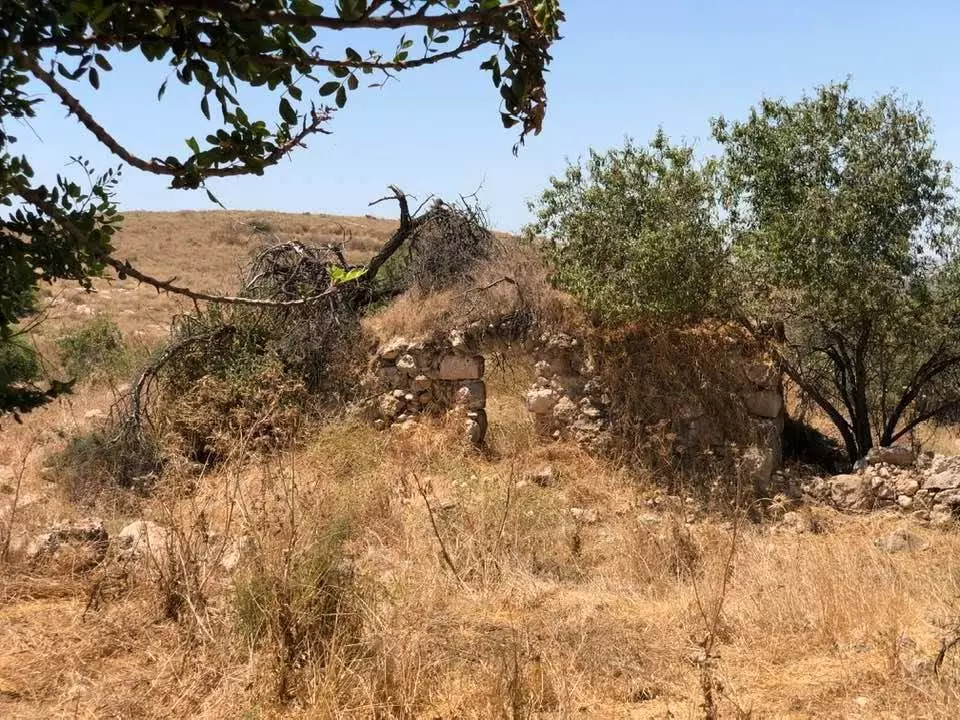
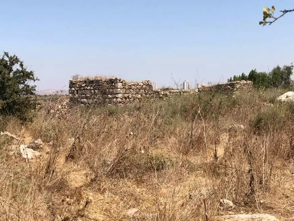
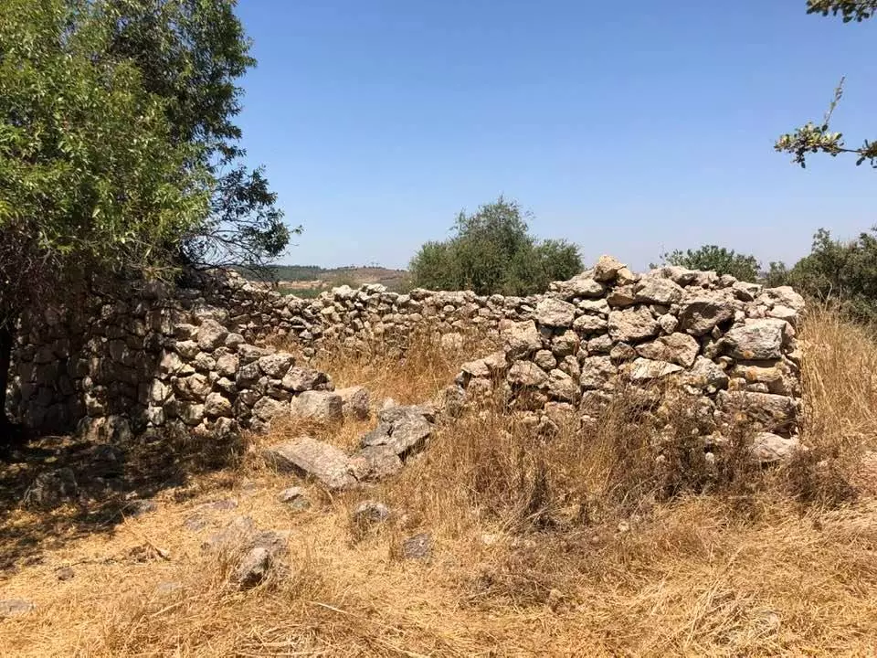
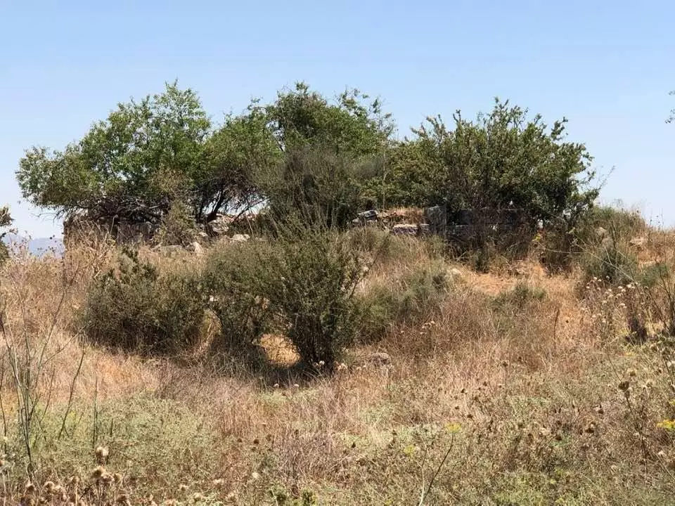
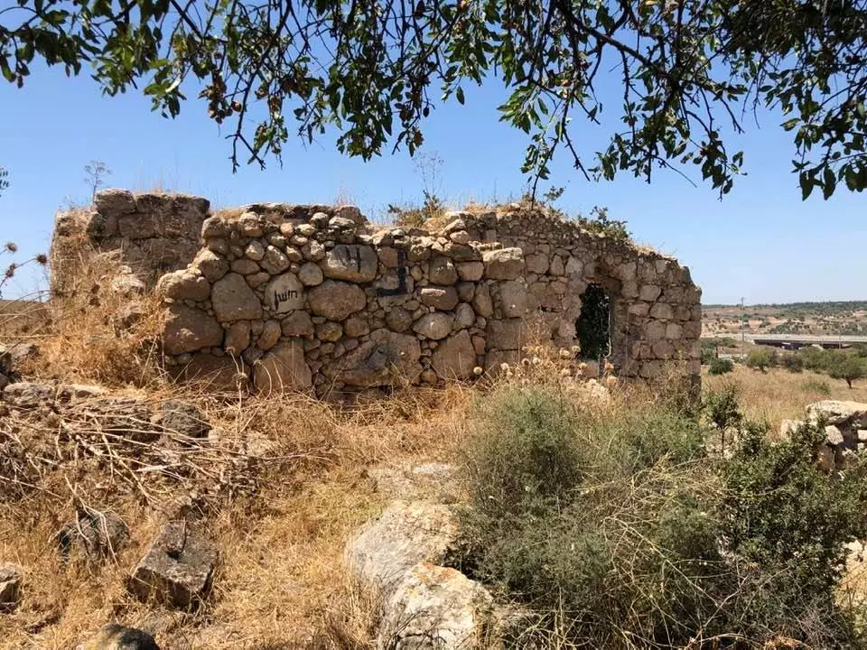
| Village Temains | Soon after occupation, ak-Kunayyisa was completely obliterated, and only house walls and rubble left behind. | ||||||||||||
| Ethnically Cleansing | al-Kunayyisa inhabitants were completely ethnically cleansed. | ||||||||||||
| Pre-Nakba Land Ownership |
**Town Lands' Demarcation Maps |
||||||||||||
| Land Usage As of 1945 |
|
||||||||||||
| Population |
|
||||||||||||
| Number of Houses | In (1931): 288 (includes 'Innaba) | ||||||||||||
| Near By Towns |
|||||||||||||
|
|
|||||||||||||
| Inhabitants Place of Origin | Originally, the village was founded by people from the nearby villages of 'lnnaba and al-Qubab. | ||||||||||||
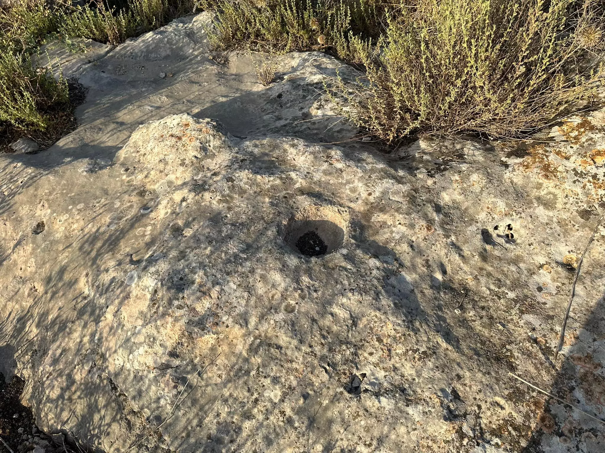
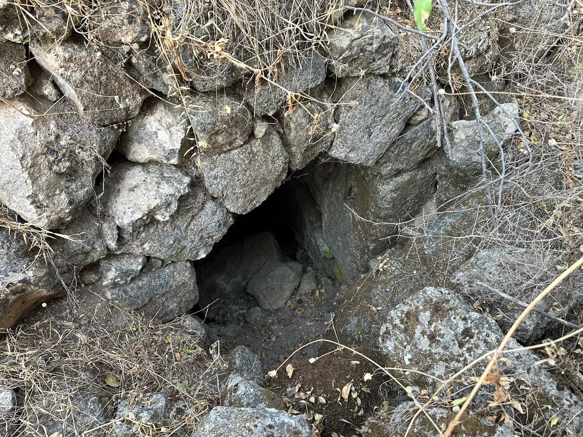
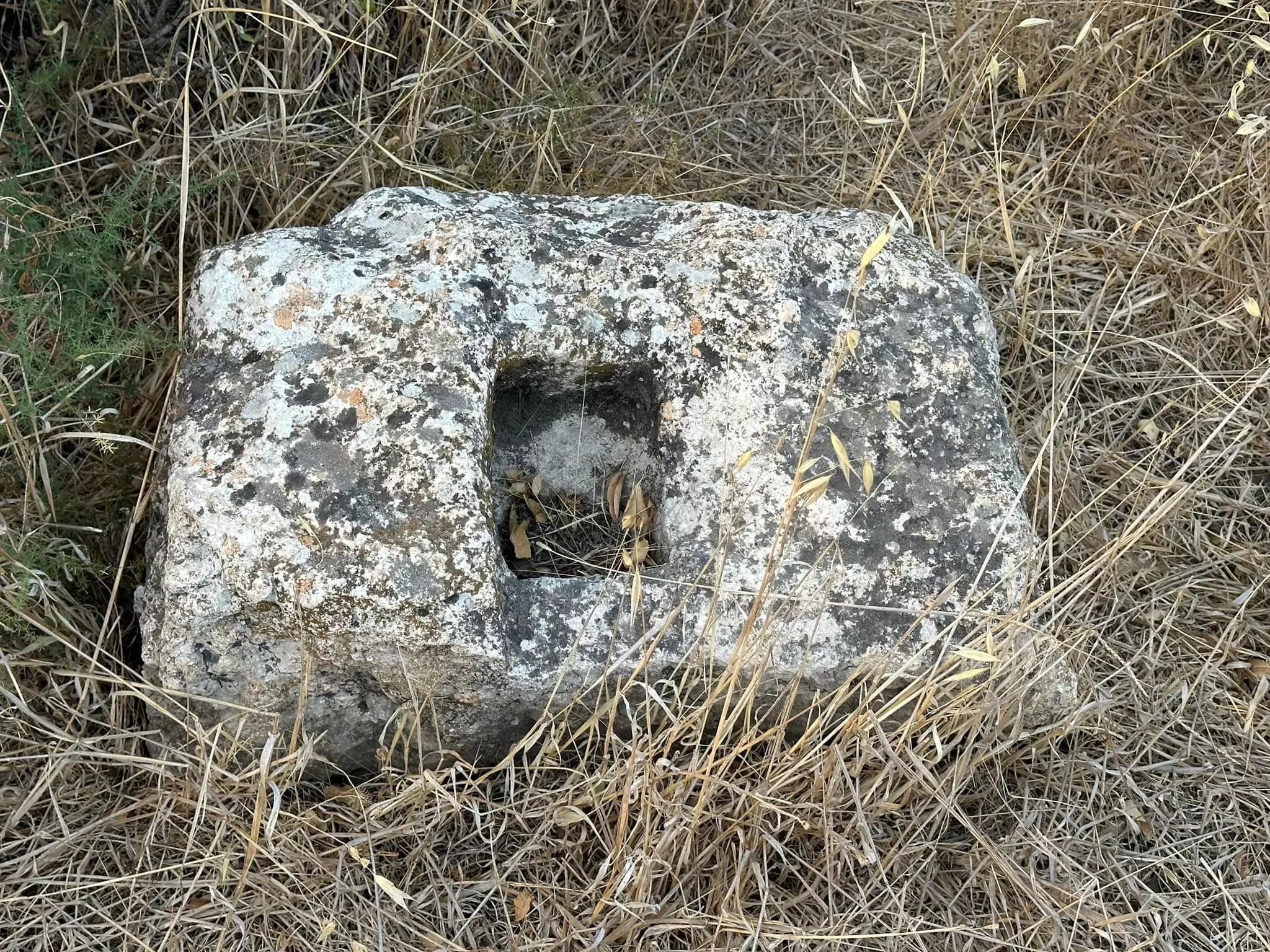
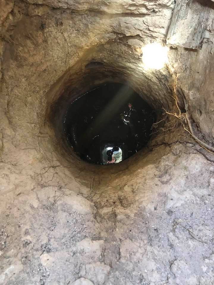
| Archeological Sites | A khirba to the east contains rough stone walls, building foundations, and rock-hewn cisterns. | ||||||||||||
| Exculsive Jewish Colonies Who Usurped Village Lands |
No Israeli settlements on village lands. | ||||||||||||
| Featured Video | |||||||||||||
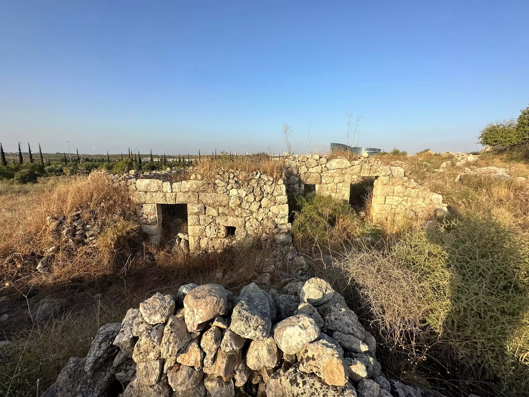
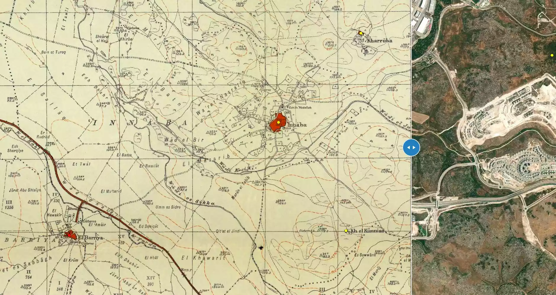
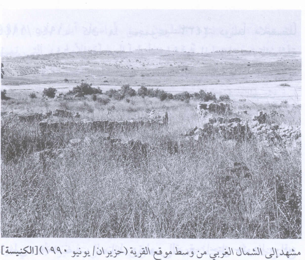
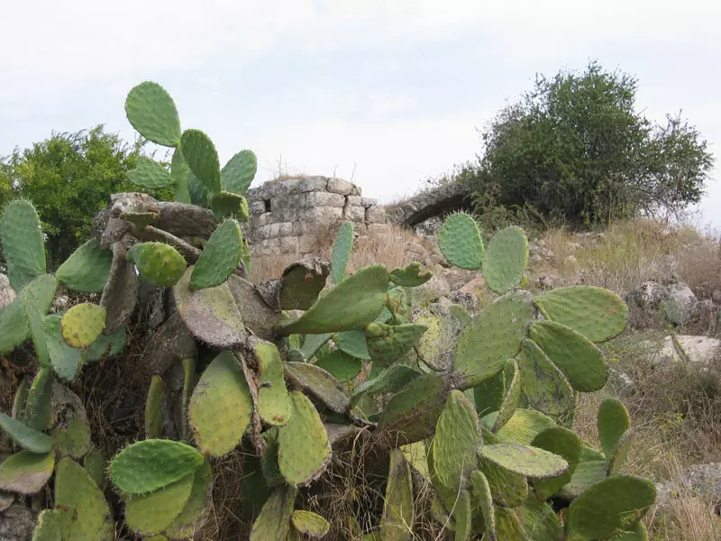
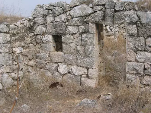
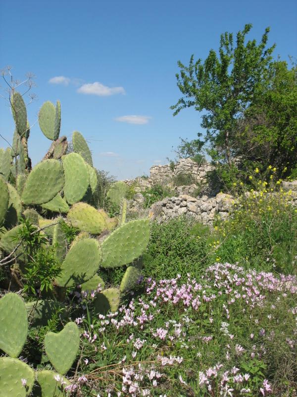
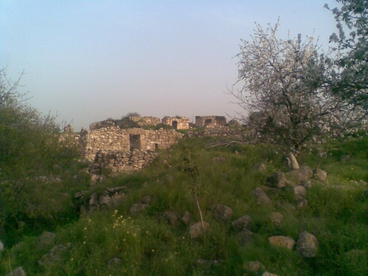
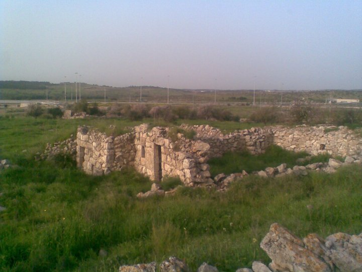
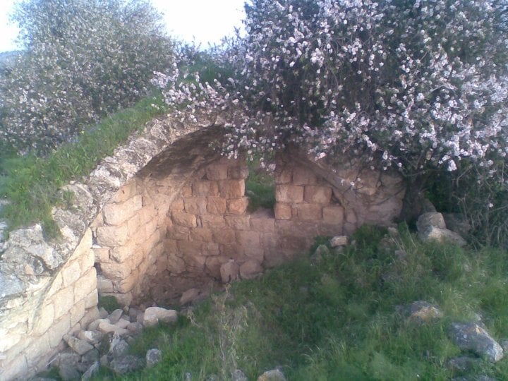
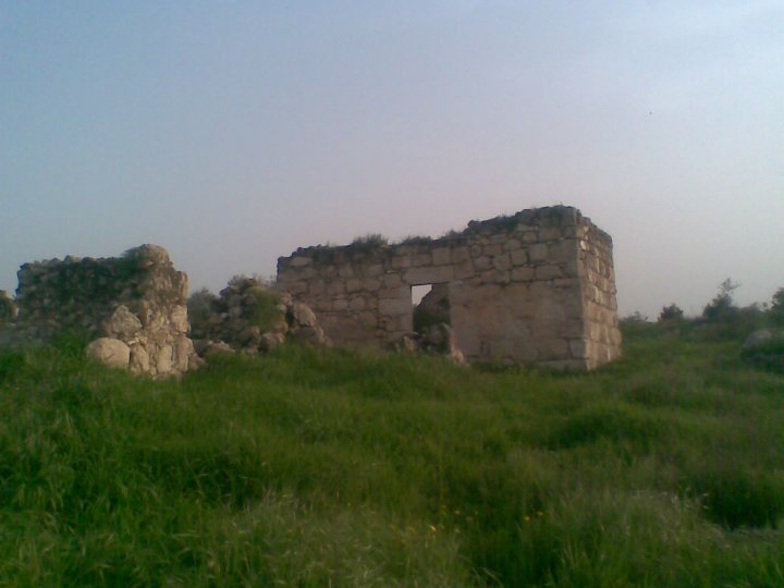
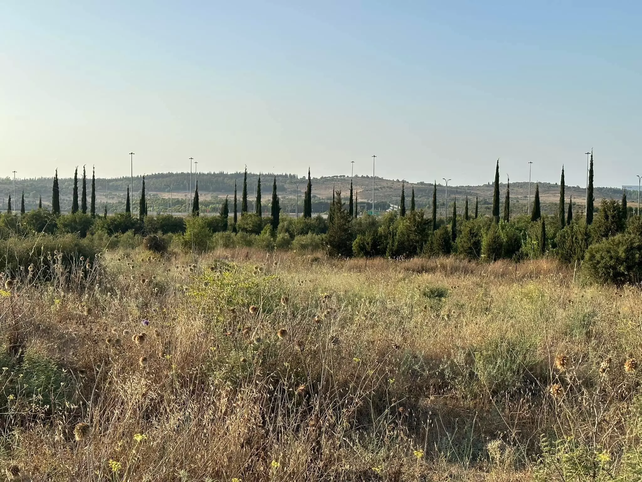
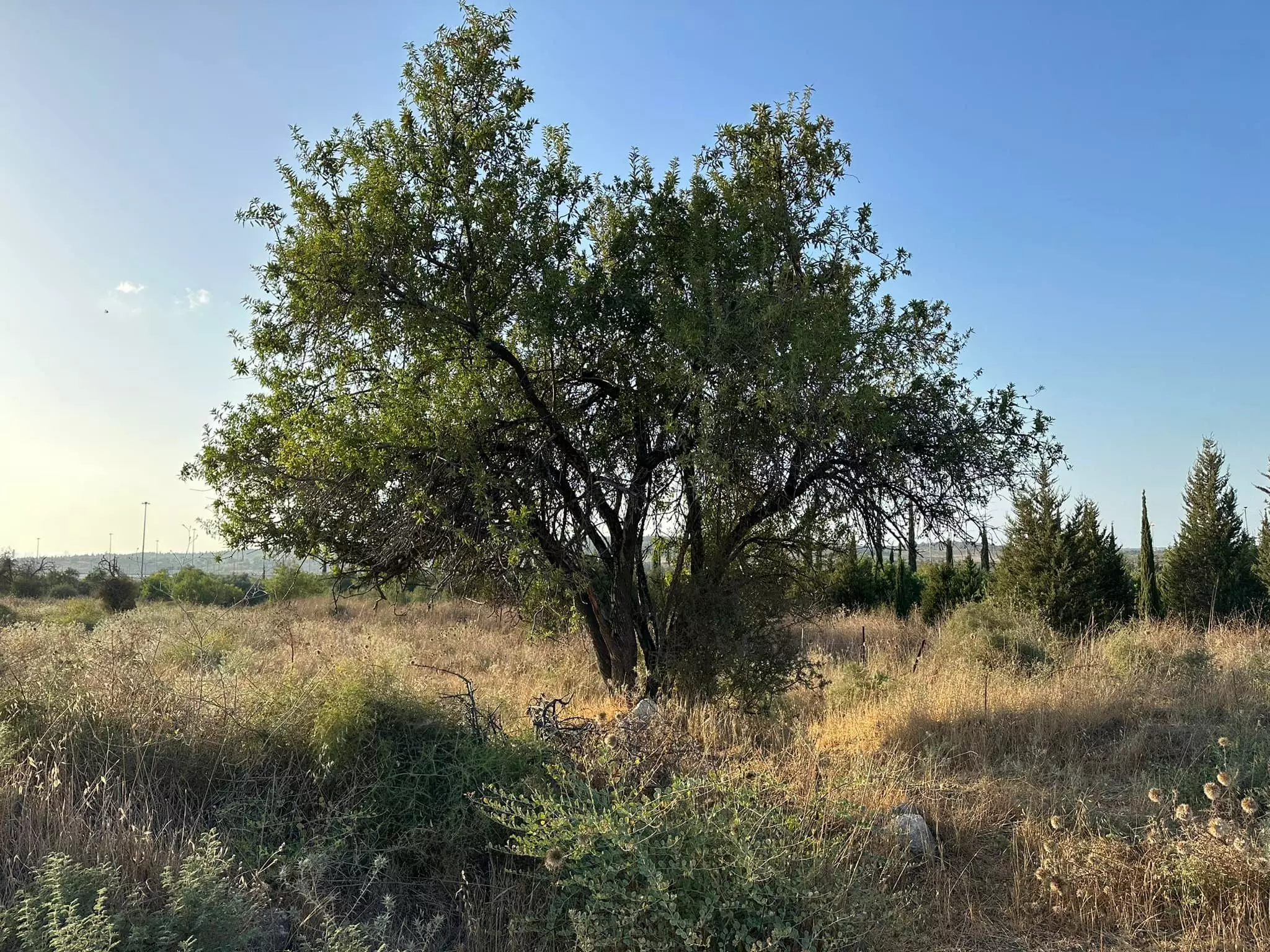
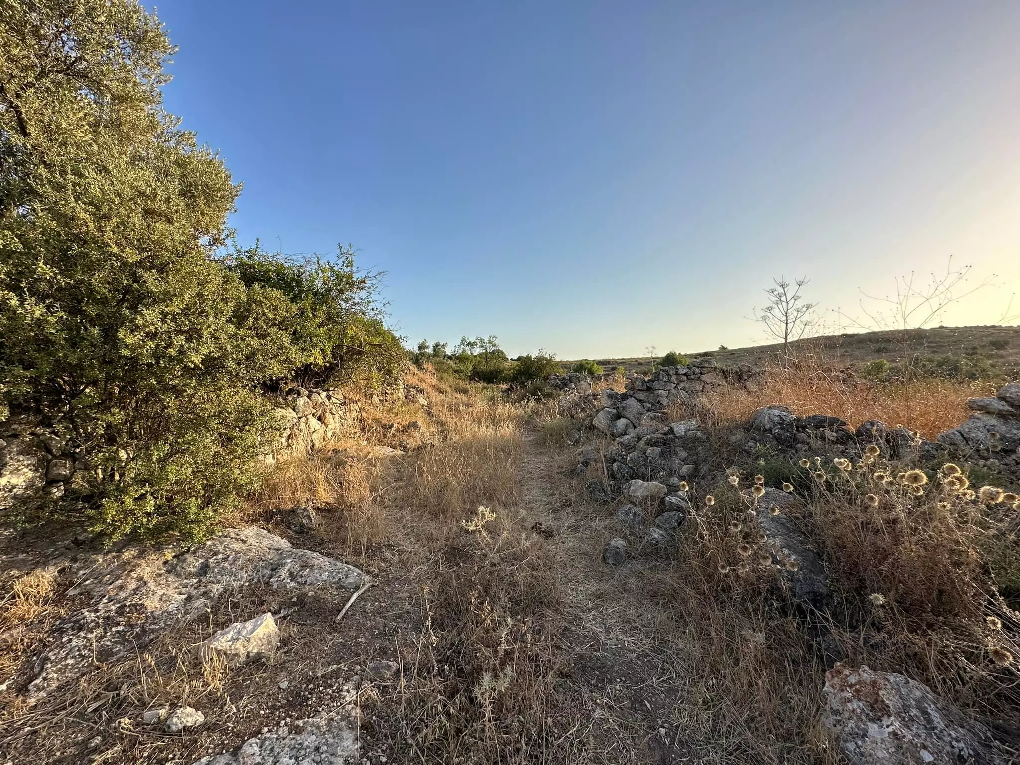
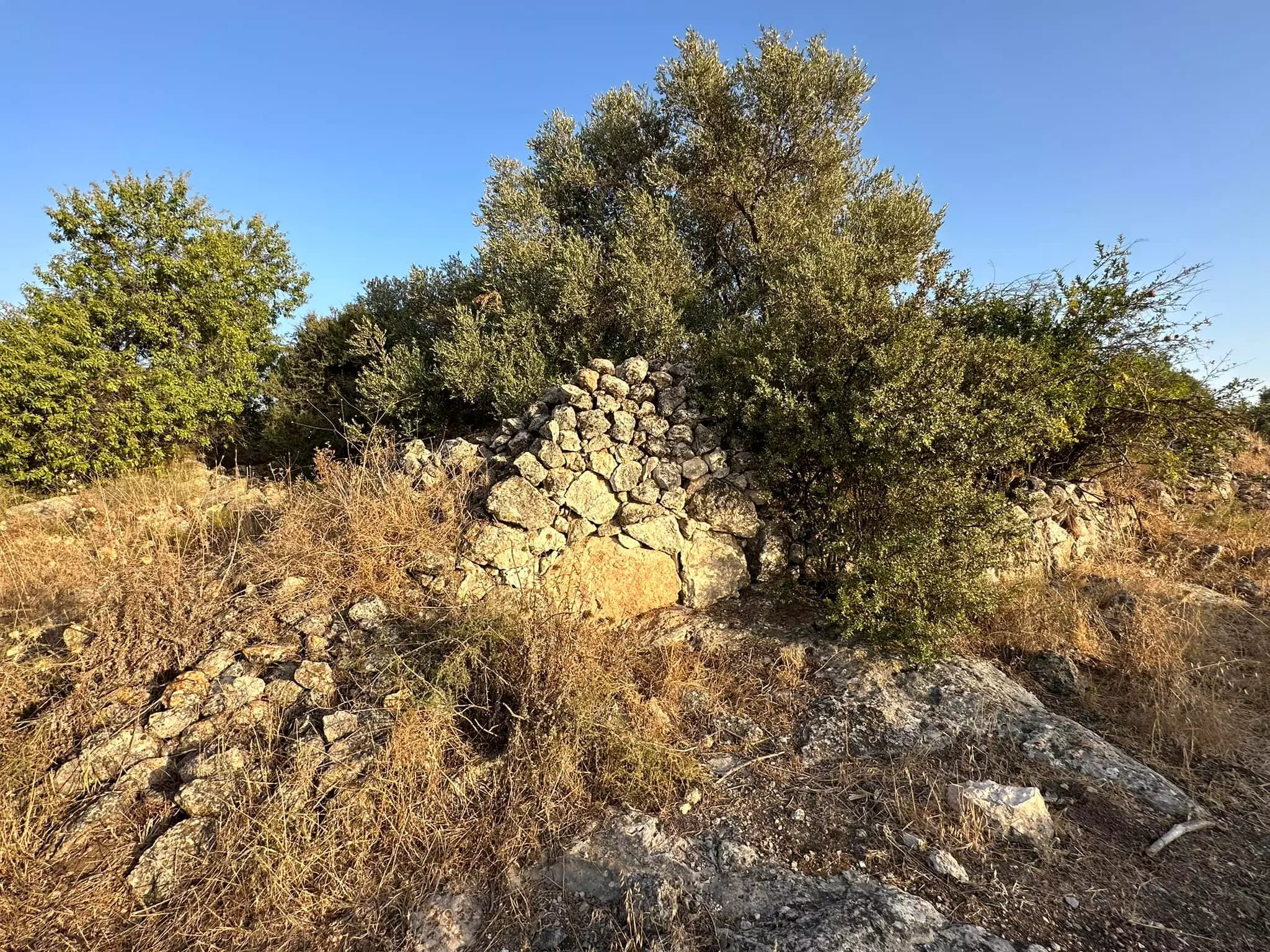
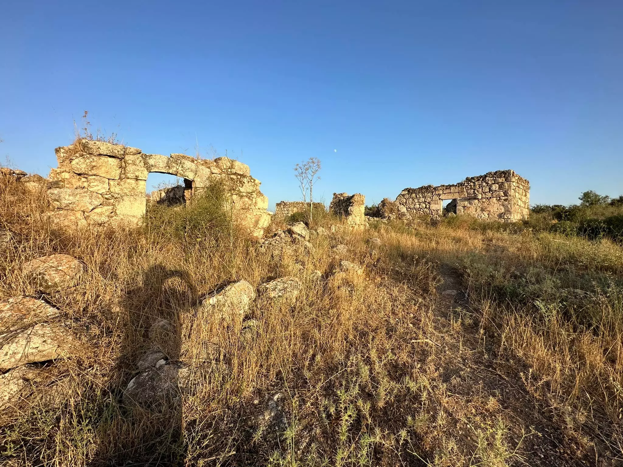
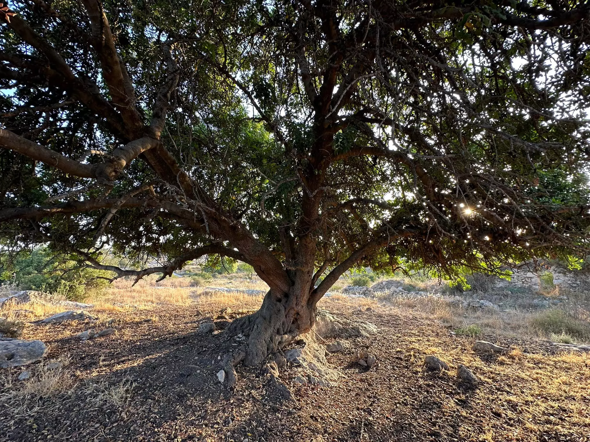
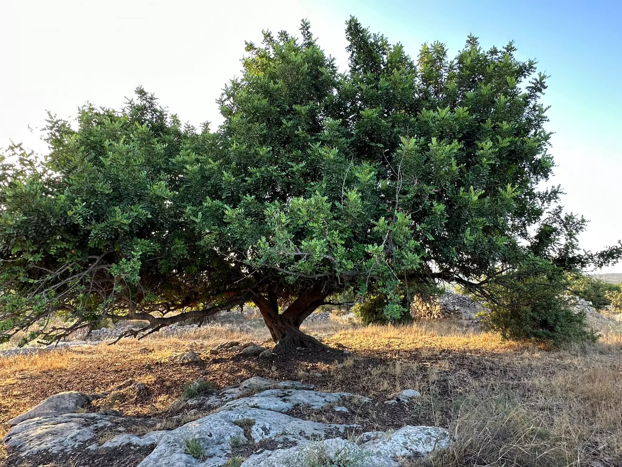
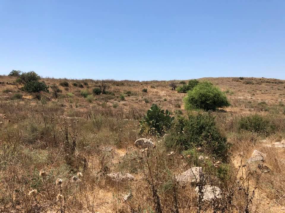
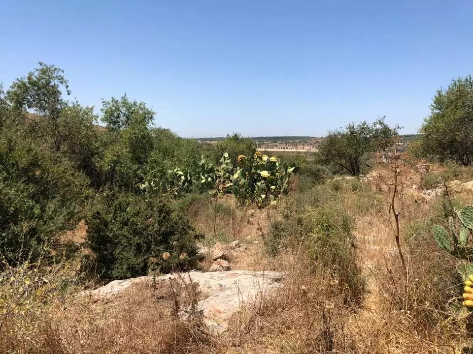
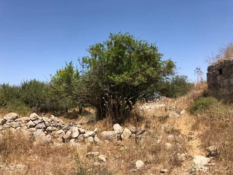
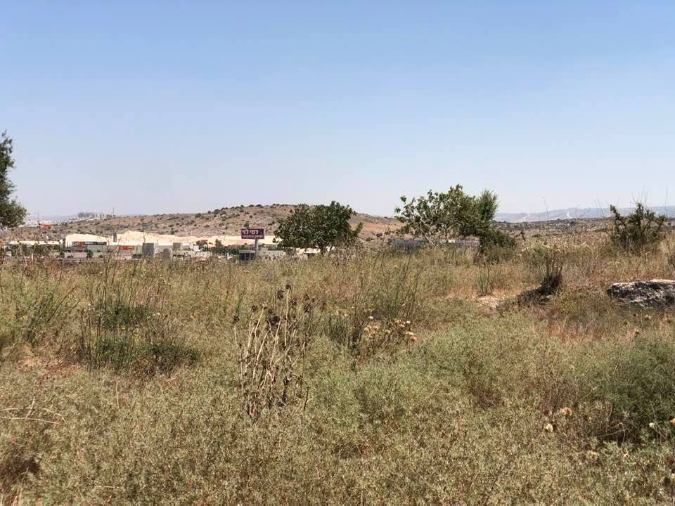
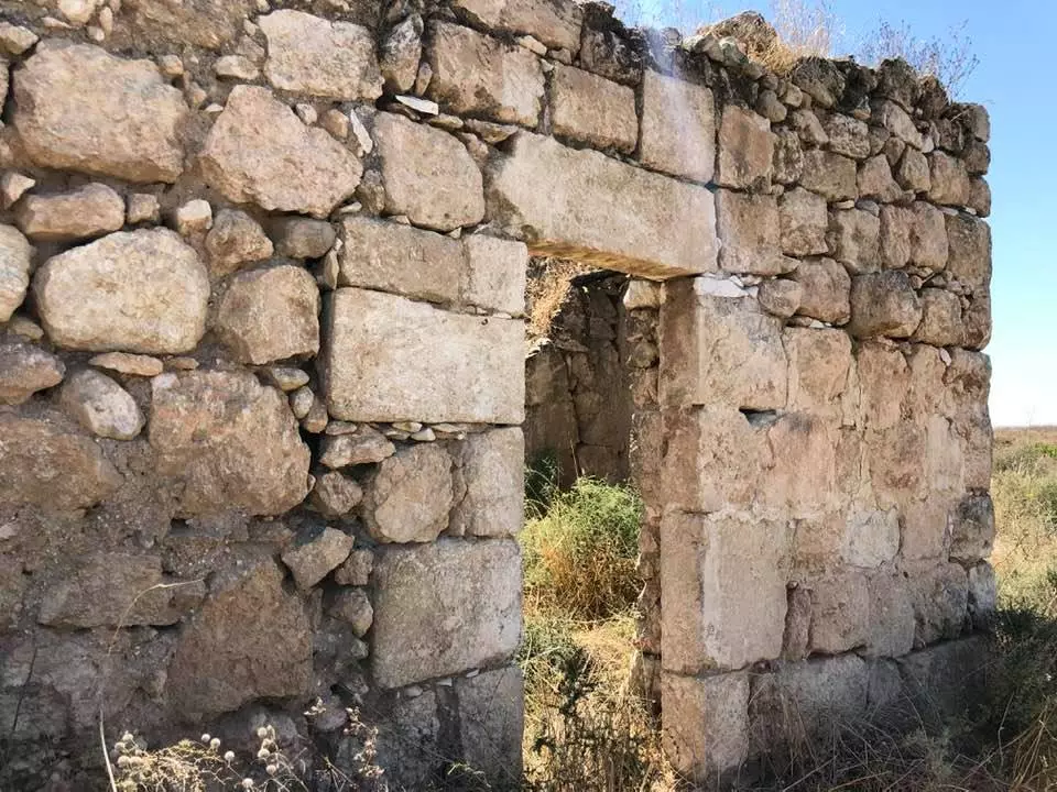
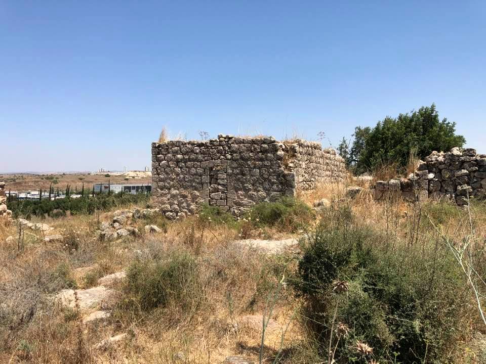
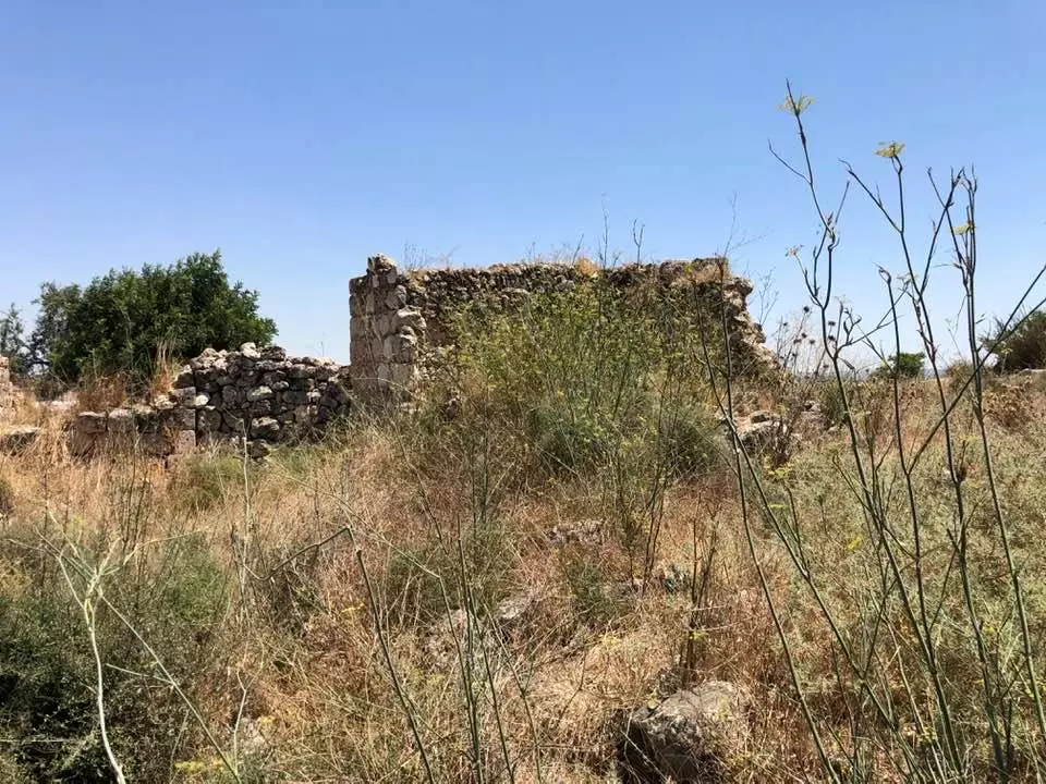
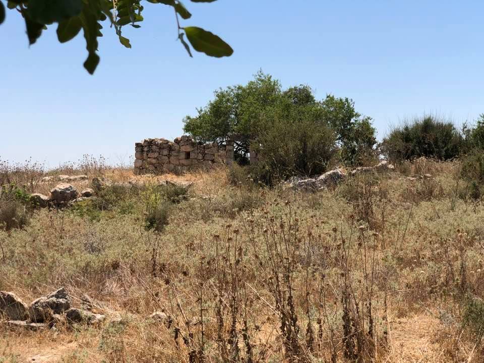
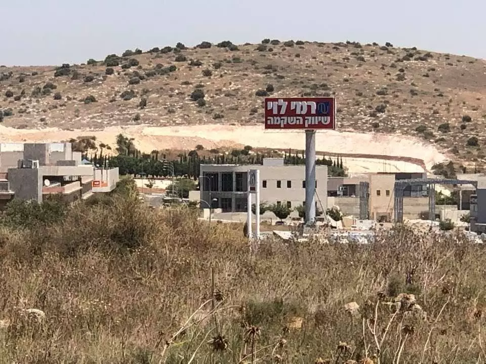
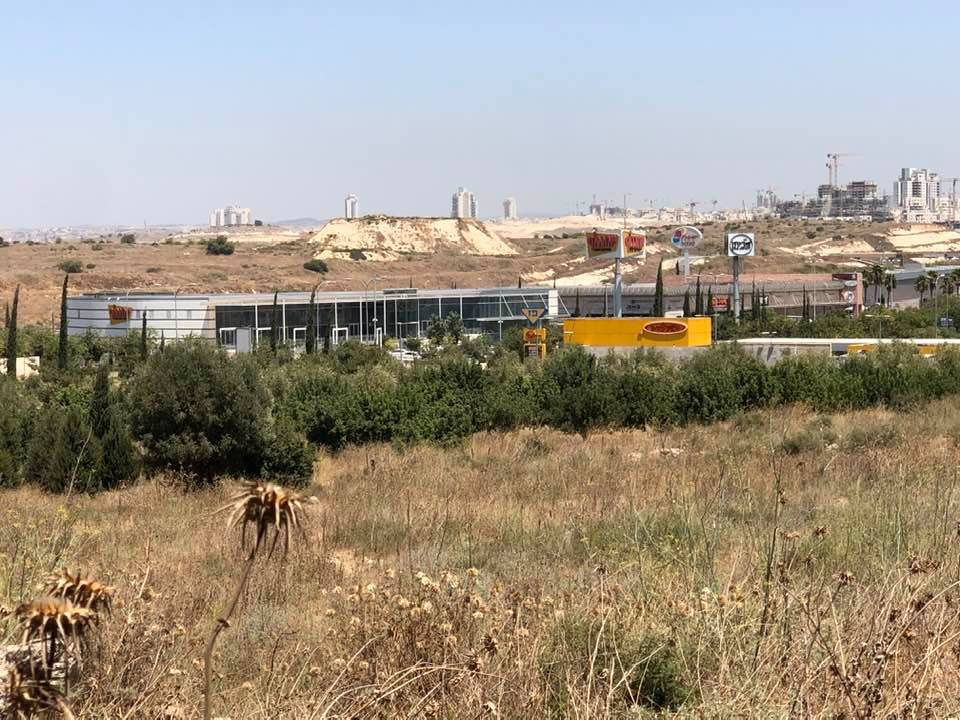
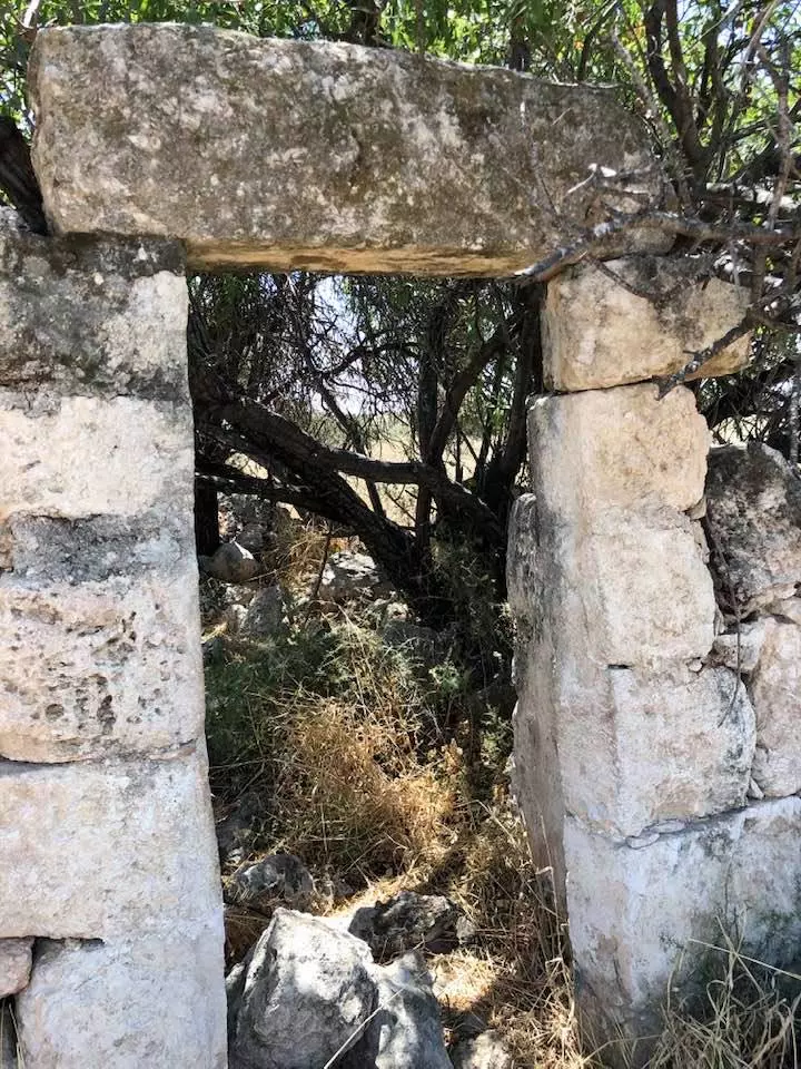
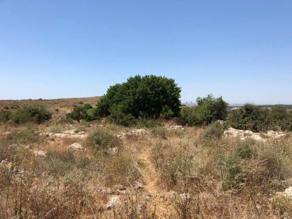
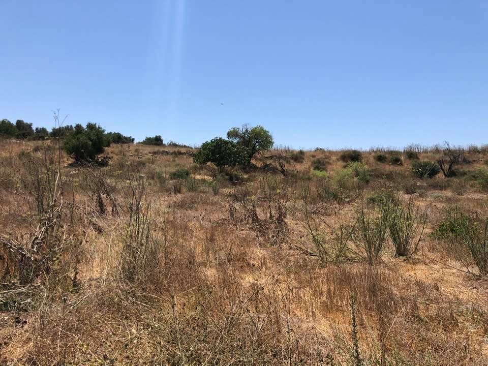
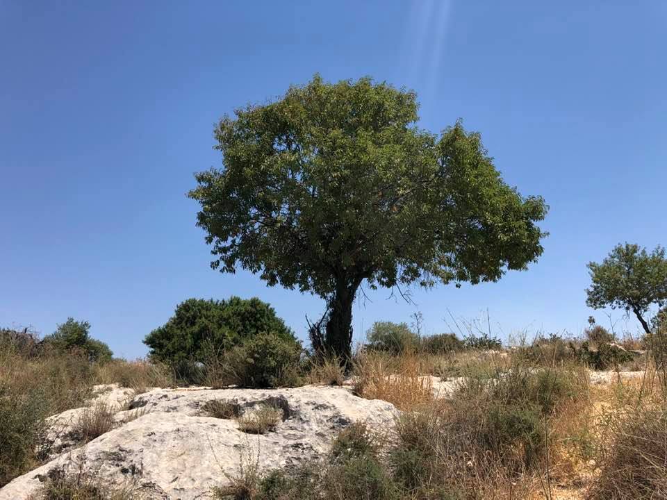
Village Before NakbaThe village stood on a hill that sloped gently to the north, on the eastern edge of the coastal plain. Hills surrounded it on all sides except the south, where it overlooked a wadi. AI-Kunayyisa lay less than 2 km to the northeast of the Ramla-Jerusalem highway, and was linked to it-and to neighboring villages as well-by dirt paths. The village was established over an earlier settlement whose ruins contained building foundations, fallen masonry, cisterns, and rock-cut tombs. Most of its inhabitants came from the adjacent villages of 'Innaba and al-Qubab to farm the land, and gradually they settled there. All of the villagers were Muslims; their adobe brick houses were clustered together, separated only by narrow alleys. Rainfed agriculture constituted the backbone of their economy and was based on grain cultivation. The villagers also cultivated citrus and olives in the northern and southern parts of their lands, which they irrigated from nearby wells. In 1944/45 a total of 2,432 dunums was planted in cereals; 64 dunums were irrigated or used for orchards. To the east of al-Kunayyisa lay a khirba which contained rough stone walls, building foundations, and rock-hewn cisterns.Village Occupation and Ethnic CleaningIsraeli units entered the village on 10 July 1948, at the beginning of Operation Dani (see Abu al-Fadl, Ramla sub-district) and as a prelude to the occupation of Lydda and Ramla. Afterwards, the Yiftach Brigade reported on al-Kunayyisa and the neighboring village of Kharruba as follows: 'After blowing up the houses and cleaning up the village-our troops occupied strongpoints overlooking the village.' The fate of the villagers is not recorded.Zionists Colonies on Village LandsThere are no Israeli settlements on village lands; Kibbutz Mishmar Ayyalon (144142) is close by, to the south, on the lands of al-Qubab.Village TodayFrom a distance, the site looks like a big stone pile overgrown with a thicket of thorns (see photos). More than thirty partially destroyed buildings, including houses, still stand. The remains of arched doors and windows are visible. Fig, almond, olive, and pomegranate trees and cactuses grow among the buildings. The lands in the vicinity are cultivated by the nearby kibbutz; some are planted in cotton.SourceDr. Walid al-Khalidi, 1992: All That Remains. |
|||||||||||||
| Related Maps | Town Lands' Demarcation Maps خرائط للقضاء توضح حدود القرى والاودية Town's map on MapQuest View from satellite Help us map this town at WikiMapia |
||||||||||||
| Related Links | Wikipedia's Page Google Search Google For Images Google For Videos |
||||||||||||
| More Information | في كتاب كي لا ننسى في كتاب بلادنا فلسطين المزيد من موقع هوية |
||||||||||||
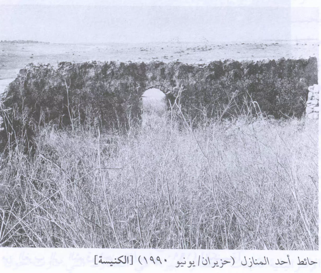
- Group Of Village Houses In 1990
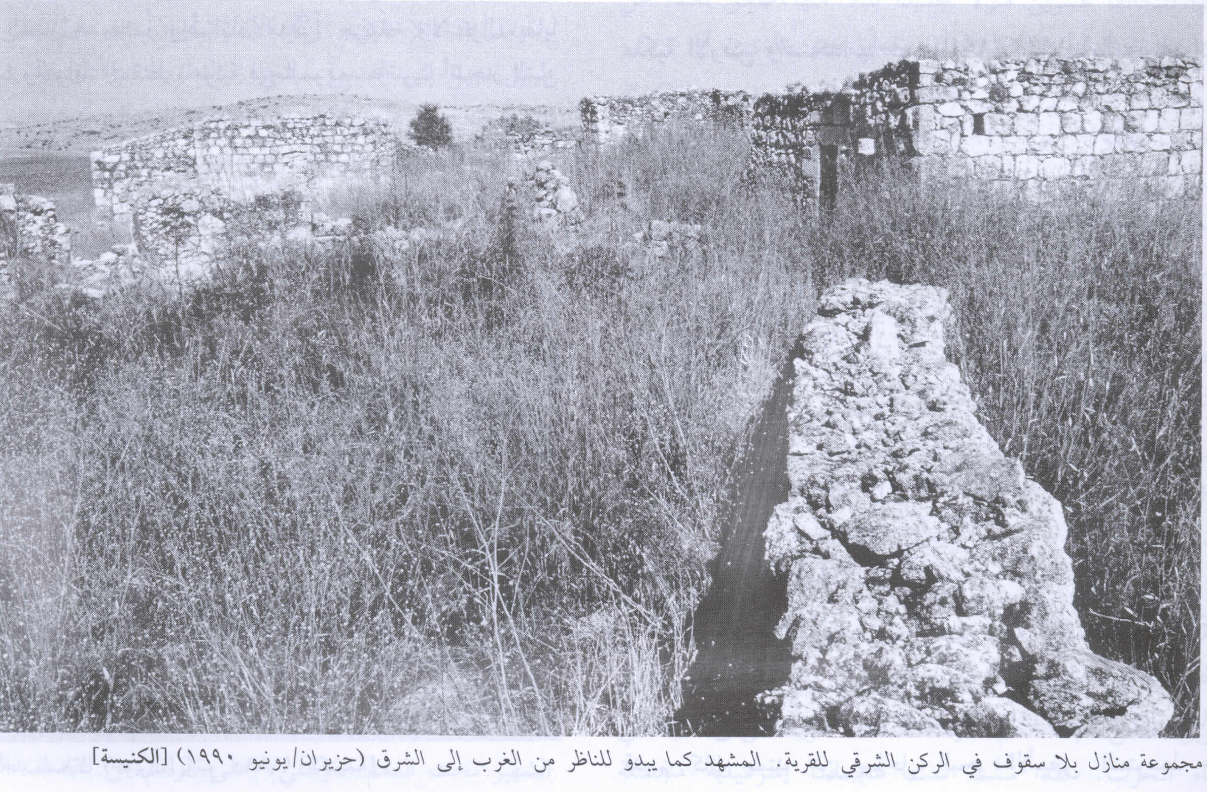
Scanned from "All That Remains" by Dr. Walid Khalidi - Village Remains In 1990
Scanned from "All That Remains" by Dr. Walid Khalidi - Destoyed home in the village October 2006
Posted by Annemarie Jacir - Entrance to home (bars still on window) - Oct. 2006
Posted by Annemarie Jacir - Ruins of the destroyed Palestinian village in the spring season
Posted by Noga Kadman - حائط إحدى البيوت المدمرة. 1990
Scanned from "All That Remains" by Dr. Walid Khalidi - اطلال الكنيسة
Posted by حكمت زكي - اطلال الكنيسة
Posted by حكمت زكي 1 - اطلال الكنيسة
Posted by حكمت زكي 2 - اطلال الكنيسة
Posted by حكمت زكي - بيوت القريه
Posted by abu raya - المتبقي من ببوت القريه
Posted by abu raya - نواحي القريه
Posted by abu raya - زيتون القريه
Posted by abu raya - اراضي القريه والمركز التجاري المقام عليها
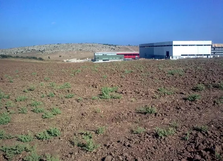
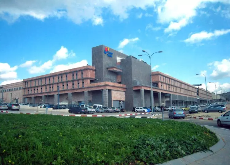
Posted by abu raya - المركز التجاري المقام بالقرب من القريه
Posted by abu raya - جولة في قرية الكنّيسة المهجرة قضاء الرملة..تصوير إياد جابر

- جولة في قرية الكنّيسة المهجرة قضاء الرملة..تصوير إياد جابر #2
- جولة في قرية الكنّيسة المهجرة قضاء الرملة..تصوير إياد جابر #3

- جولة في قرية الكنّيسة المهجرة قضاء الرملة..تصوير إياد جابر #4
- جولة في قرية الكنّيسة المهجرة قضاء الرملة..تصوير إياد جابر #5

- جولة في قرية الكنّيسة المهجرة قضاء الرملة..تصوير إياد جابر #6
- جولة في قرية الكنّيسة المهجرة قضاء الرملة..تصوير إياد جابر #7
- That is how the "civilized" erased and replaced us: al-Kunayyisa was completely obliterated, as you see -- الكنيسة باتت أثر بعد عين. من هنا مر الهمجّ

- That is how the "civilized" erased and replaced us: al-Kunayyisa was completely obliterated, as you see -- الكنيسة باتت أثر بعد عين. من هنا مر الهمجّ #2
- That is how the "civilized" erased and replaced us: al-Kunayyisa was completely obliterated, as you see -- الكنيسة باتت أثر بعد عين. من هنا مر الهمجّ #3

- That is how the "civilized" erased and replaced us: al-Kunayyisa was completely obliterated, as you see -- الكنيسة باتت أثر بعد عين. من هنا مر الهمجّ #4
- That is how the "civilized" erased and replaced us: al-Kunayyisa was completely obliterated, as you see -- الكنيسة باتت أثر بعد عين. من هنا مر الهمجّ #5

- That is how the "civilized" erased and replaced us: al-Kunayyisa was completely obliterated, as you see -- الكنيسة باتت أثر بعد عين. من هنا مر الهمجّ #6
- That is how the "civilized" erased and replaced us: al-Kunayyisa was completely obliterated, as you see -- الكنيسة باتت أثر بعد عين. من هنا مر الهمجّ #7

- That is how the "civilized" erased and replaced us: al-Kunayyisa was completely obliterated, as you see -- الكنيسة باتت أثر بعد عين. من هنا مر الهمجّ #8
- That is how the "civilized" erased and replaced us: al-Kunayyisa was completely obliterated, as you see -- الكنيسة باتت أثر بعد عين. من هنا مر الهمجّ
- That is how the "civilized" erased and replaced us: al-Kunayyisa was completely obliterated, as you see -- الكنيسة باتت أثر بعد عين. من هنا مر الهمجّ
#2
- That is how the "civilized" erased and replaced us: al-Kunayyisa was completely obliterated, as you see -- الكنيسة باتت أثر بعد عين. من هنا مر الهمجّ
#3
- That is how the "civilized" erased and replaced us: al-Kunayyisa was completely obliterated, as you see -- الكنيسة باتت أثر بعد عين. من هنا مر الهمجّ
#4
- That is how the "civilized" erased and replaced us: al-Kunayyisa was completely obliterated, as you see -- الكنيسة باتت أثر بعد عين. من هنا مر الهمجّ
#5
- That is how the "civilized" erased and replaced us: al-Kunayyisa was completely obliterated, as you see -- الكنيسة باتت أثر بعد عين. من هنا مر الهمجّ
#6
- That is how the "civilized" erased and replaced us: al-Kunayyisa was completely obliterated, as you see -- الكنيسة باتت أثر بعد عين. من هنا مر الهمجّ
#7
- That is how the "civilized" erased and replaced us: al-Kunayyisa was completely obliterated, as you see -- الكنيسة باتت أثر بعد عين. من هنا مر الهمجّ
#8
- That is how the "civilized" erased and replaced us: al-Kunayyisa was completely obliterated, as you see -- الكنيسة باتت أثر بعد عين. من هنا مر الهمجّ
#9
- That is how the "civilized" erased and replaced us: al-Kunayyisa was completely obliterated, as you see -- الكنيسة باتت أثر بعد عين. من هنا مر الهمجّ
#10
- That is how the "civilized" erased and replaced us: al-Kunayyisa was completely obliterated, as you see -- الكنيسة باتت أثر بعد عين. من هنا مر الهمجّ
#11
- That is how the "civilized" erased and replaced us: al-Kunayyisa was completely obliterated, as you see -- الكنيسة باتت أثر بعد عين. من هنا مر الهمجّ
#12
- That is how the "civilized" erased and replaced us: al-Kunayyisa was completely obliterated, as you see -- الكنيسة باتت أثر بعد عين. من هنا مر الهمجّ
#13
- That is how the "civilized" erased and replaced us: al-Kunayyisa was completely obliterated, as you see -- الكنيسة باتت أثر بعد عين. من هنا مر الهمجّ
#14
- That is how the "civilized" erased and replaced us: al-Kunayyisa was completely obliterated, as you see -- الكنيسة باتت أثر بعد عين. من هنا مر الهمجّ
#15
- That is how the "civilized" erased and replaced us: al-Kunayyisa was completely obliterated, as you see -- الكنيسة باتت أثر بعد عين. من هنا مر الهمجّ
#16
- That is how the "civilized" erased and replaced us: al-Kunayyisa was completely obliterated, as you see -- الكنيسة باتت أثر بعد عين. من هنا مر الهمجّ
#17
- That is how the "civilized" erased and replaced us: al-Kunayyisa was completely obliterated, as you see -- الكنيسة باتت أثر بعد عين. من هنا مر الهمجّ
#18
- That is how the "civilized" erased and replaced us: al-Kunayyisa was completely obliterated, as you see -- الكنيسة باتت أثر بعد عين. من هنا مر الهمجّ
#19
- That is how the "civilized" erased and replaced us: al-Kunayyisa was completely obliterated, as you see -- الكنيسة باتت أثر بعد عين. من هنا مر الهمجّ
#20
- That is how the "civilized" erased and replaced us: al-Kunayyisa was completely obliterated, as you see -- الكنيسة باتت أثر بعد عين. من هنا مر الهمجّ
#21
- That is how the "civilized" erased and replaced us: al-Kunayyisa was completely obliterated, as you see -- الكنيسة باتت أثر بعد عين. من هنا مر الهمجّ
#22
- That is how the "civilized" erased and replaced us: al-Kunayyisa was completely obliterated, as you see -- الكنيسة باتت أثر بعد عين. من هنا مر الهمجّ
#23
- That is how the "civilized" erased and replaced us: al-Kunayyisa was completely obliterated, as you see -- الكنيسة باتت أثر بعد عين. من هنا مر الهمجّ
#24
- That is how the "civilized" erased and replaced us: al-Kunayyisa was completely obliterated, as you see -- الكنيسة باتت أثر بعد عين. من هنا مر الهمجّ
#25
- That is how the "civilized" erased and replaced us: al-Kunayyisa was completely obliterated, as you see -- الكنيسة باتت أثر بعد عين. من هنا مر الهمجّ
#26
- That is how the "civilized" erased and replaced us: al-Kunayyisa was completely obliterated, as you see -- الكنيسة باتت أثر بعد عين. من هنا مر الهمجّ
#27
- That is how the "civilized" erased and replaced us: al-Kunayyisa was completely obliterated, as you see -- الكنيسة باتت أثر بعد عين. من هنا مر الهمجّ
#28
- That is how the "civilized" erased and replaced us: al-Kunayyisa was completely obliterated, as you see -- الكنيسة باتت أثر بعد عين. من هنا مر الهمجّ
#29
- Let us see how the most "civilized and liberal" of world Jewry has obliterated our village al-Kunayyisa. How else will the Jews be great and safe again?
- Let us see how the most "civilized and liberal" of world Jewry has obliterated our village al-Kunayyisa. How else will the Jews be great and safe again? #2
- Let us see how the most "civilized and liberal" of world Jewry has obliterated our village al-Kunayyisa. How else will the Jews be great and safe again? #3
- Let us see how the most "civilized and liberal" of world Jewry has obliterated our village al-Kunayyisa. How else will the Jews be great and safe again? #4
- Let us see how the most "civilized and liberal" of world Jewry has obliterated our village al-Kunayyisa. How else will the Jews be great and safe again? #5
- Let us see how the most "civilized and liberal" of world Jewry has obliterated our village al-Kunayyisa. How else will the Jews be great and safe again? #6
- Let us see how the most "civilized and liberal" of world Jewry has obliterated our village al-Kunayyisa. How else will the Jews be great and safe again? #7
- Let us see how the most "civilized and liberal" of world Jewry has obliterated our village al-Kunayyisa. How else will the Jews be great and safe again? #8
- Let us see how the most "civilized and liberal" of world Jewry has obliterated our village al-Kunayyisa. How else will the Jews be great and safe again? #9
- Let us see how the most "civilized and liberal" of world Jewry has obliterated our village al-Kunayyisa. How else will the Jews be great and safe again? #10
- Let us see how the most "civilized and liberal" of world Jewry has obliterated our village al-Kunayyisa. How else will the Jews be great and safe again? #11
- Let us see how the most "civilized and liberal" of world Jewry has obliterated our village al-Kunayyisa. How else will the Jews be great and safe again? #12
- Let us see how the most "civilized and liberal" of world Jewry has obliterated our village al-Kunayyisa. How else will the Jews be great and safe again? #13
- Let us see how the most "civilized and liberal" of world Jewry has obliterated our village al-Kunayyisa. How else will the Jews be great and safe again? #14
- Let us see how the most "civilized and liberal" of world Jewry has obliterated our village al-Kunayyisa. How else will the Jews be great and safe again? #15
- Let us see how the most "civilized and liberal" of world Jewry has obliterated our village al-Kunayyisa. How else will the Jews be great and safe again? #16
- Let us see how the most "civilized and liberal" of world Jewry has obliterated our village al-Kunayyisa. How else will the Jews be great and safe again? #17
- Let us see how the most "civilized and liberal" of world Jewry has obliterated our village al-Kunayyisa. How else will the Jews be great and safe again? #18
- Let us see how the most "civilized and liberal" of world Jewry has obliterated our village al-Kunayyisa. How else will the Jews be great and safe again? #19
- Let us see how the most "civilized and liberal" of world Jewry has obliterated our village al-Kunayyisa. How else will the Jews be great and safe again? #20
- Let us see how the most "civilized and liberal" of world Jewry has obliterated our village al-Kunayyisa. How else will the Jews be great and safe again? #21
- Let us see how the most "civilized and liberal" of world Jewry has obliterated our village al-Kunayyisa. How else will the Jews be great and safe again? #22
- Let us see how the most "civilized and liberal" of world Jewry has obliterated our village al-Kunayyisa. How else will the Jews be great and safe again? #23
- Let us see how the most "civilized and liberal" of world Jewry has obliterated our village al-Kunayyisa. How else will the Jews be great and safe again? #24
- Let us see how the most "civilized and liberal" of world Jewry has obliterated our village al-Kunayyisa. How else will the Jews be great and safe again? #25
- Let us see how the most "civilized and liberal" of world Jewry has obliterated our village al-Kunayyisa. How else will the Jews be great and safe again? #26
Want to browse more? 80,000 pictures were grouped in these gallaries:
| Display Name | Clan/Hamolah | Country of Residence |
| Marwa | Salameh | - |
| أبو عبدالله الطيراوي | دار محمد | Jordan, Jordan |
| حسين اسحق يونس محمد محمد | محمد | رام الله, قرية الطيرة |
| محمد الطيراوي | سلامة | فلسطين , فلسطين |
| Fatima S | سلامة | - |
| adel salamah | - | ramallah |
| Abdel-Lateef Jaber Atieh | - | Il, U S A |
| محمود جبر | - | - |
| mohammed ali | RABEE | USA |
| Ghazi Murshid Rashid Ali | Rabee | - |
| Gihad Ali | Rabee | - |
| yousef Marshid Rashid Taha | Taha-Rabee | Palestine |
| dalal ali | Rabee | - |
- في موقع قرية الكنيسة المهجرة ( قضاء الرملة )- آب 2020 Duration: min 2 sec
- قرية الكنّيسة المهجرة قضاء الرملة Duration: 20 sec
- قرية الكنيّسة المهجرة #2 Duration: 20 sec
- قرية الكنيسة المهجرة قضاء الرمله عام 48 Duration: min sec
- جولة رائعة في القرية المهجرة -- 2025 Duration: min 12 sec
No links have been shared yet, be free to the first to share the first link.
 Fake Valor: Why Did Zionist Jews Hoist Nazis Flag on Their Ships in the 1930s?
What is new?
-
Facts About Oct. 7th Gaza Raid
-
Remined Us Please:: Who Did Rape Who? Palestinians Raped Israelis? Or, was the other way around?
-
When Prof. Edward Said was invited to debate Bibi Netanyahu in the 1980s, watch what happened!
-
Abusing Blood Libel!
-
Zionist FAQ: Isn't it true that Palestinians don't want peace? Palestinians never accepted the two-state solution
- Facts about Haavara (Transfer) Agreement between Ben-Gurion & Hitler
-
Haavara FAQs: Why Did Zionist Jews Hoist Nazis' Flags on Their Ships in the 1930s?
-
Dear ChatGPT: Why did the Jewish Agency suppress news of the Holocaust during WWII?
-
Video Playlist: Jews share their DNA tests to end the conflict for good.
-
How Ronald Reagan would have framed the genocide in Gaza if he was still alive?
-
Haavara FAQs: Let us do the math: how many German Jews did The Haavara Agreement save?
-
Zionist FAQs: The Hebron Massacre of 1929, "clearly proves" that Palestinians are antisemitic, how could you deny it?
-
Zionist FAQs: Why Anti-Zionist Is Not Antisemitism?
-
Zionist FAQs: Isn't it true that the KGB create Palestinian Nationalism in the early 1960s?
- Zionist FAQs: Muslims are killing Muslims all the time; why are Israeli Jews being singled out in the media?
- Zionist FAQs: How is Israel an apartheid state when 20% of its citizens are Arabs who enjoy full rights?
-
Haavara FAQs: Analysis of Herzl's Uganda Scheme and how it could have saved millions of Jews.
-
Haavara FAQs: Why did Hayim Greenberg describe American Jewry as "morally bankrupt" in early 1943?
-
Haavara FAQs: What if the Evian Conference was a resounding success? What would have been the impact of saving European Jewry on Zionism?
- Haavara FAQs: What if the six million were saved, how that would have impacted the Zionist project?
-
Haavara FAQs: How did Zionist leaders react when Europe's Jews lingered in the DP camps after WWII ended?
-
Why does the American Jewish community repeat lies that David Ben-Gurion had debunked before he died?
-
Who has the power to rename the Tatar/Khazar Gene Marker to Jewish IV?
-
Zionist FAQs: Why won't Egypt, Syria, and Jordan take their people back? Jews are indigenous to Palestine, and Arabs immigrated after Jews developed the country. Arabs should leave.
-
Haavara FAQs: Did Hitler and the Nazis conflate between Judaism and Zionist? If that wasn't case, then why?
-
Haavara FAQs: Winston Churchill and antisemitism, a collection of articles written Churchill.
-
Haavara FAQs: Broken by country, how many Jews survived vs. killed during the Holocaust?
-
Haavara FAQs: Why did European Jews vote with their feet and to immigrated to the Americas, not Palestine, after WWII?
-
Watch this American Jewish Girl describing Israeli Jews' cognitive dissonance like no other in under two minutes
-
Haavara FAQs: When the Nazis went out of their way to hide the Holocaust, Israeli Jews did the exact opposite by broadcasting their genocide of Gazans. But why?
-
Haavara FAQs: How Zionist Jews went out of their to show their appreciation to Nazism and Fascism?
- Haavara FAQs: Why Zionist leaders were against bombing the death camps & the Railroads leading to them?
-
Haavara FAQs: Hitler's message to the British and American people: If Jews are such noble citizens and you care about them, how come you're not letting them in? I will gladly ship them to you at my expense, even on luxury liners!
-
A shortlist of Zionist and Israeli false flag operations in the name Jews.
-
The Most Moral Army
- The Land of Kapos (Israel): Where the brave are boycotted and Kapos walk free.
- Why did early Zionists often named their communal enterprises "colonial"?
- Zionist Relations with Nazi Germany by Faris Glubb
-
Two NY Times advertisements by Zionists in the early 1943 that exposes Zionists' treason at the height of the calamity
- Facts Not Lies about the Palestinian-Israeli Conflict.
- Site's pictures have been categorized
- Campgain Against Lice
- A Survey of Palestine, the official source about Palestine before Nakba produced by the British Mandate; over 1200 pages.
- Satellite View & Google Earth: Over 6,000 placemarks identifying all destroyed towns, W. Bank & Gaza Strip Towns, & refugee camps.
- PalestineRemembered.com and its Nakba Oral History Project were featured on al-Jazeera Satellite TV.
- Nakba Oral History Video Podcast:
 Over 700 Oral History interviews (including 3,500+ hours of recording) can be viewed online.
 - Palestine Village Statistics Project
- Gaza Jail Break
- النسخة العربية للموقع الان متوفرة
- Videos: Documenting the destroyed villages in video: Tracing all that remains since Nakba.
- Videos: Responding to Zionist Propaganda
- Interview: The ethnic cleansing of Palestine: George Galloway interviews Israeli Historian Ilan Pappe.
- For Palestinians, memory matters. It provides a blueprint for their future By George Bisharat.
- Zionist FAQ now available in Hebrew שאלות שציונים שואלים, עכשיו בעברית
- Video: The Stephen Walt and John Mearsheimer report on the influence of the Israel Lobby on U.S. Foreign Policy
- The Palestinian-Israeli conflict for beginners
