| PalestineRemembered | About Us | Oral History | العربية | |
| Pictures | Zionist FAQs | Haavara | Maps | |
| Search |
| Camps |
| Districts |
| Acre |
| Baysan |
| Beersheba |
| Bethlehem |
| Gaza |
| Haifa |
| Hebron |
| Jaffa |
| Jericho |
| Jerusalem |
| Jinin |
| Nablus |
| Nazareth |
| Ramallah |
| al-Ramla |
| Safad |
| Tiberias |
| Tulkarm |
| Donate |
| Contact |
| Profile |
| Videos |
Welcome To al-Latrun - اللطرون
|
District of al-Ramla
Ethnically cleansed days ago |
العربية Google Earth |
 |
Gallery (83) |
- Statistics & Facts
-
Before & After

- Satellite View
- Articles 5
- Pictures 83
- Land Deeds 1
- Members 5
- All That Remains
- Wikipedia
- Videos 3
- Guest Book 5
- Links
| Statistic & Fact | Value | ||||||||||||||||||||||||
| Occupation Date | August 10, 1948 | ||||||||||||||||||||||||
| Distance From District | 14 (km) Southeast of al-Ramla | ||||||||||||||||||||||||
| Elevation | 250 (meters) | ||||||||||||||||||||||||
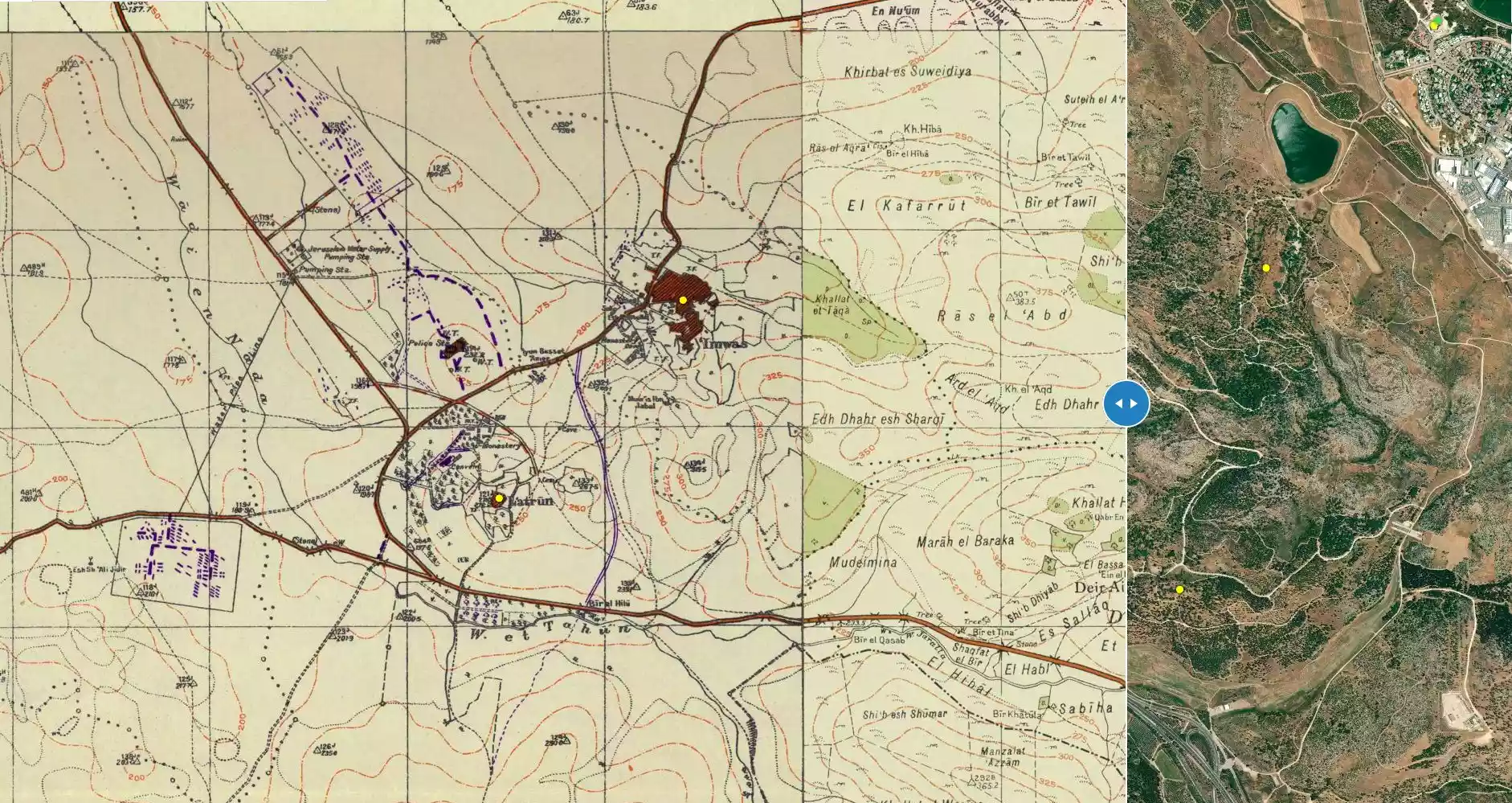
| Before & After Nakba, Click Map For Details |
|||||||||||||||||||||||||
|
|||||||||||||||||||||||||
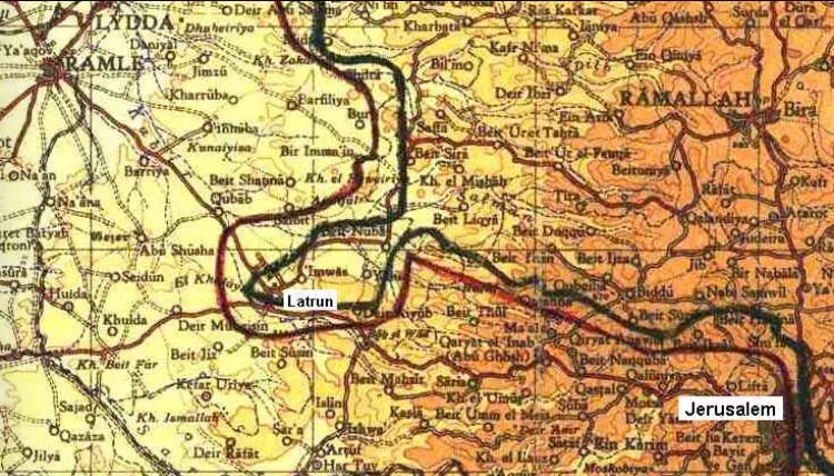
| Map Location | See location #48 on the map View from satellite |
||||||||||||||||||||||||
| Defenders | Jordanian Army | ||||||||||||||||||||||||
| Refugees' Migration Routes | The former residents moved to neighboring 'Imwas. After the 1967 war, they were ethnically cleansed again, a very sad story! | ||||||||||||||||||||||||
| Exodus Cause | Military assault by Zionist troops | ||||||||||||||||||||||||
| Village Temains | al-Latrun was mostly destroyed during the numerous attacks on its fort. | ||||||||||||||||||||||||
| Ethnically Cleansing | al-Latrun inhabitants were completely ethnically cleansed. | ||||||||||||||||||||||||
| Pre-Nakba Land Ownership |
**Town Lands' Demarcation Maps |
||||||||||||||||||||||||
| Land Usage As of 1945 |
|
||||||||||||||||||||||||
| Population |
|
||||||||||||||||||||||||
| Number of Houses | In (1931): 16 houses. Also the monks, from the nearby monastery, bought the land and houses of old al-Latrun and built twenty new houses for the villagers in return; these houses were built away from the monastery, so that the monks could maintain a quiet environment. | ||||||||||||||||||||||||
| Near By Towns |
|||||||||||||||||||||||||
|
|
|||||||||||||||||||||||||
| Town's Name Through History | The village was named after the Crusade castle built nearby, Le Toron des Chevaliers (The Tower of the Knights). | ||||||||||||||||||||||||
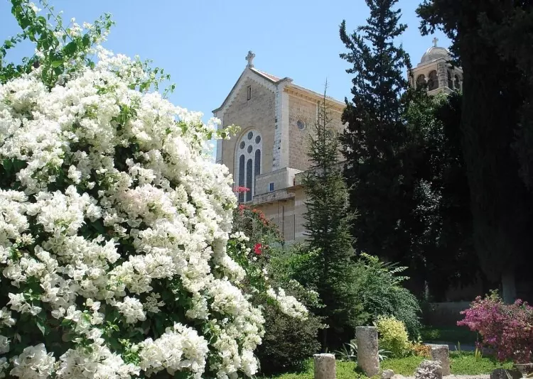
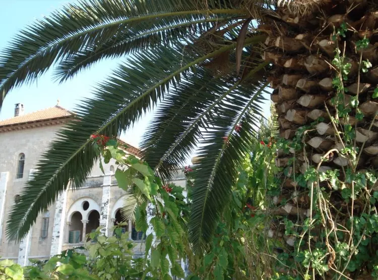
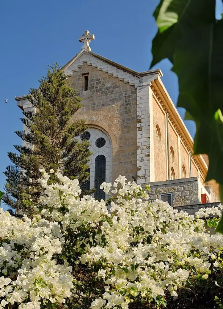
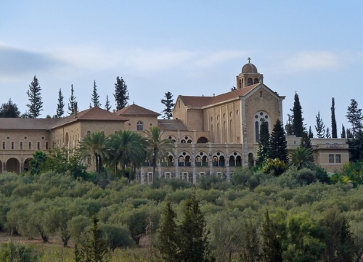
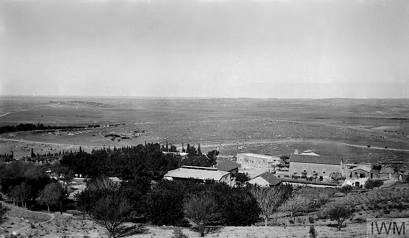
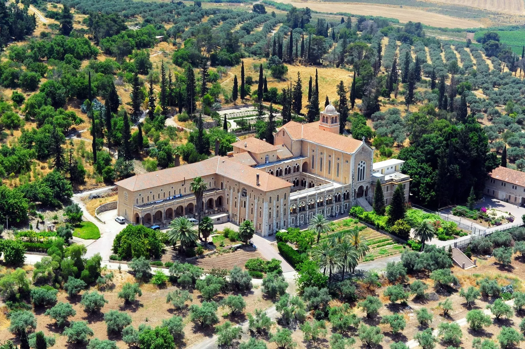
| Schools | In 1890, French Trappist monks built a monastery agricultural school on a slope nearby the village which was famous for its vineyards. | ||||||||||||||||||||||||
| Water Supply | With the aid of the Trappist monastery, the former residents drew their drinking water via pipes from Beir al-Hilw. | ||||||||||||||||||||||||
| Exculsive Jewish Colonies Who Usurped Village Lands |
Newe Shalom | ||||||||||||||||||||||||
| Featured Video | |||||||||||||||||||||||||
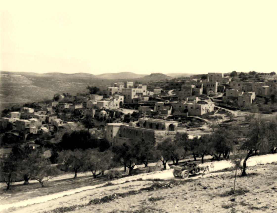
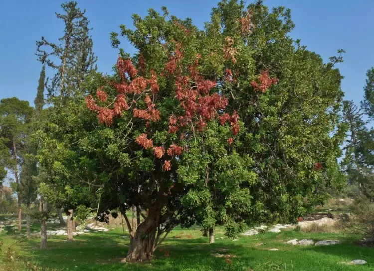
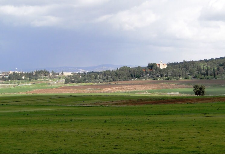
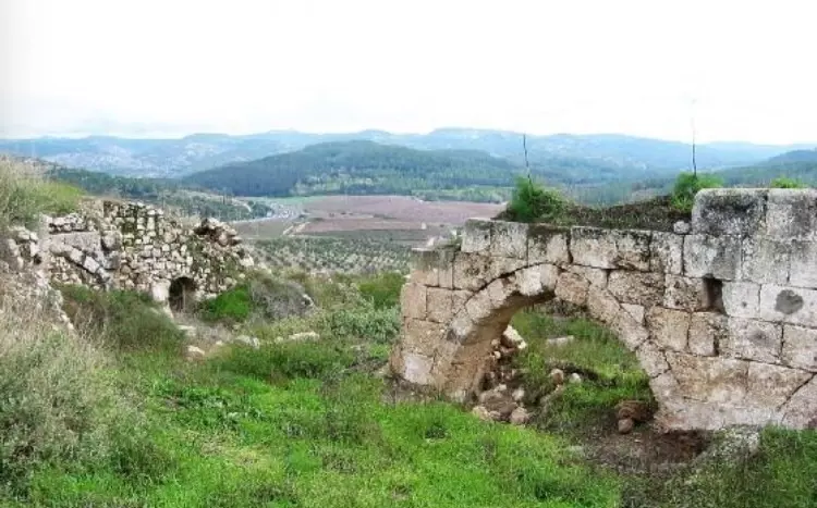
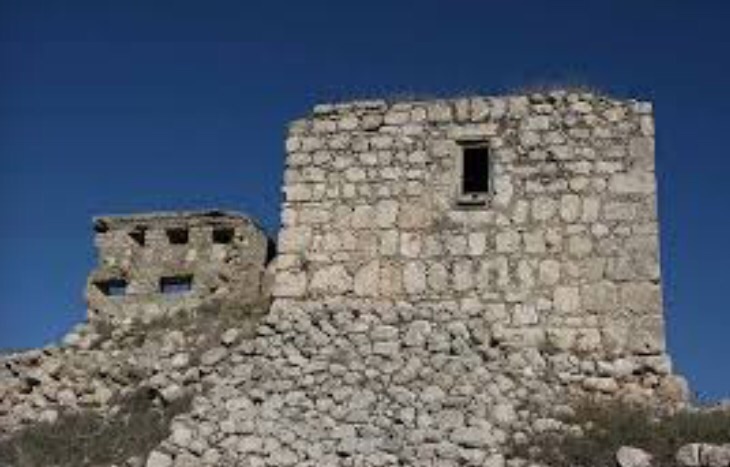
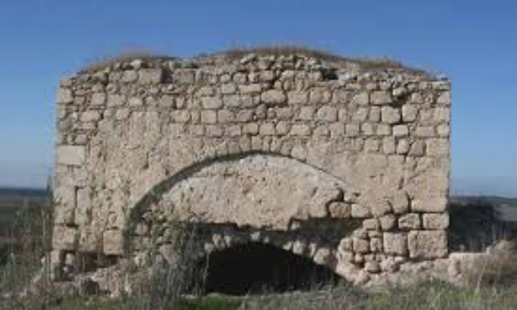
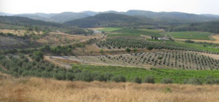
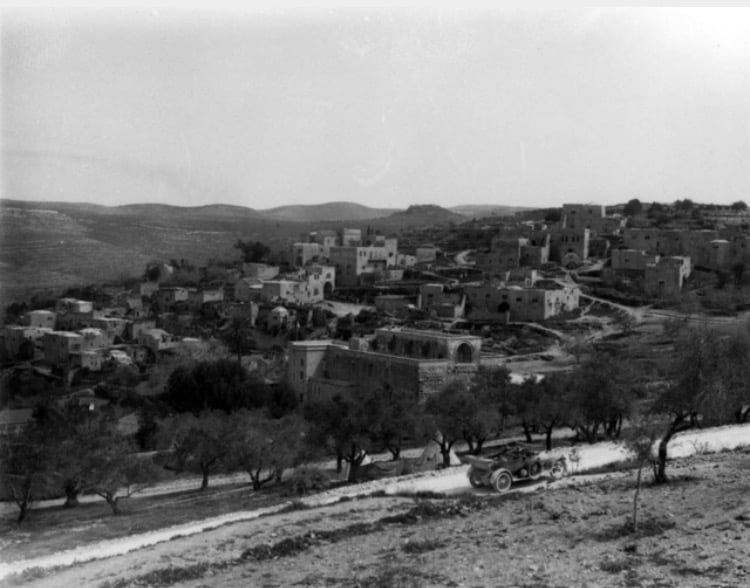
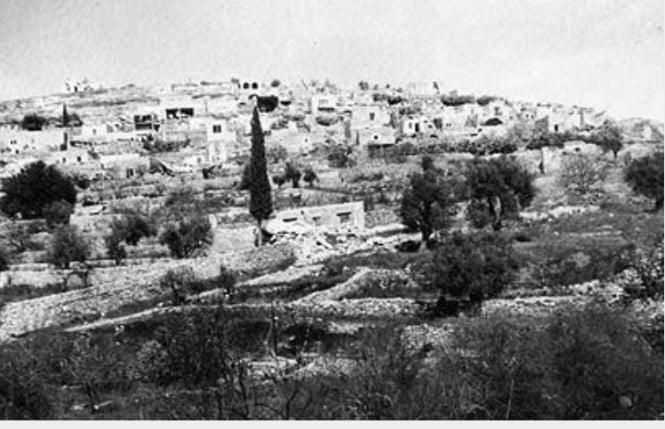
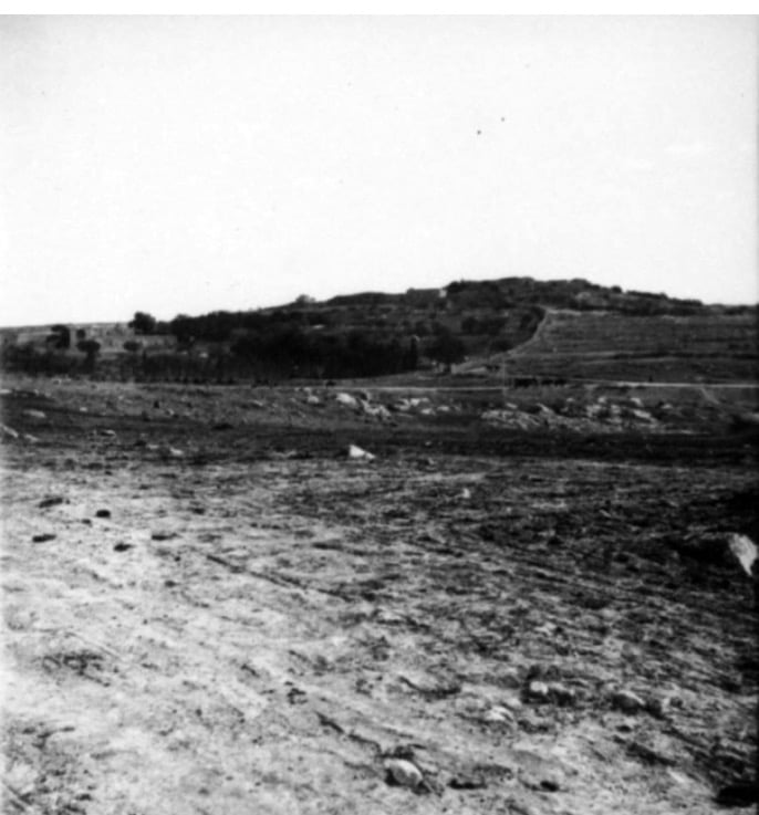
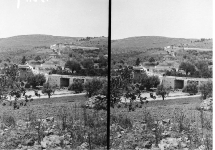
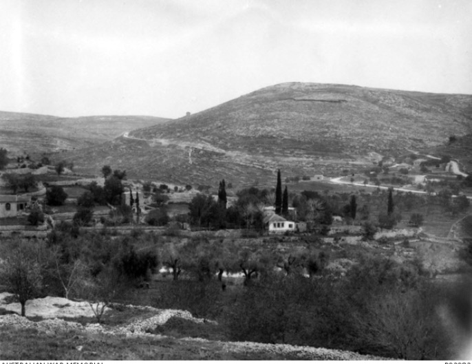
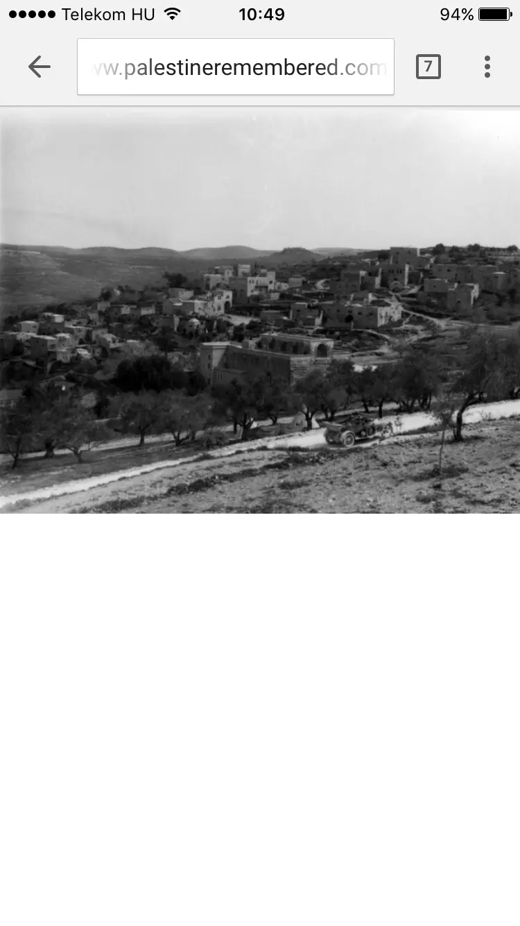
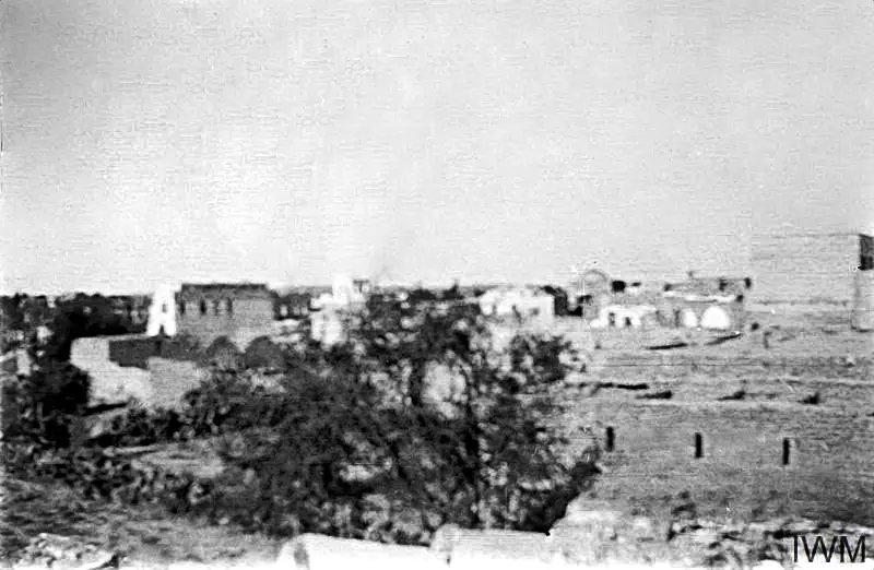
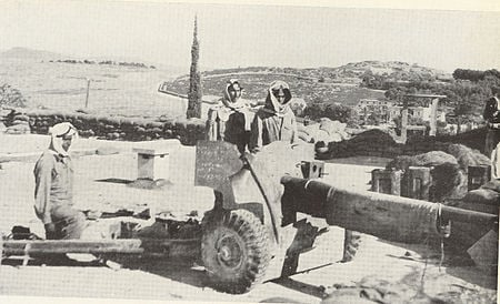
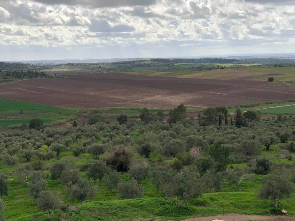
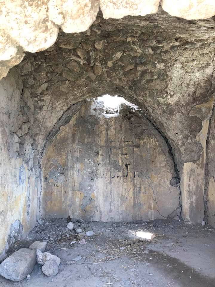
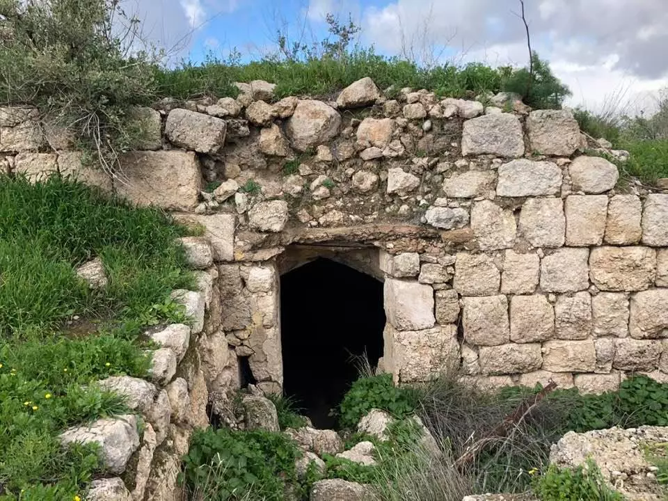
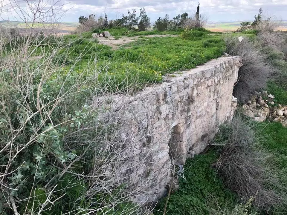
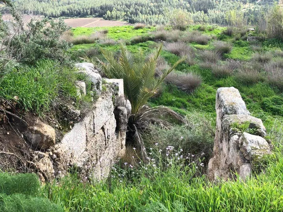
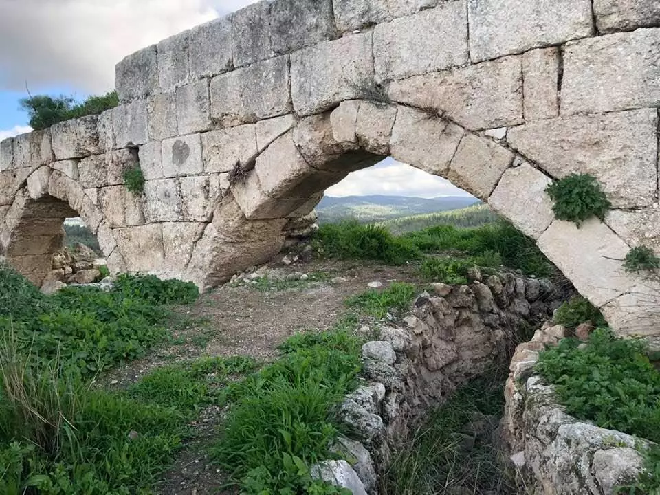
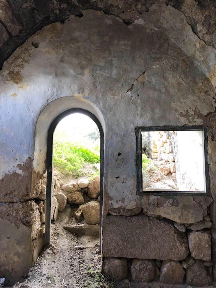
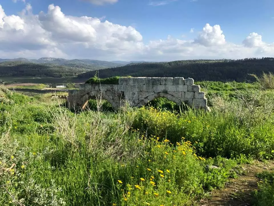
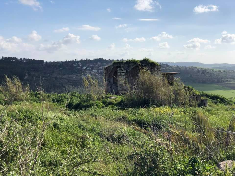
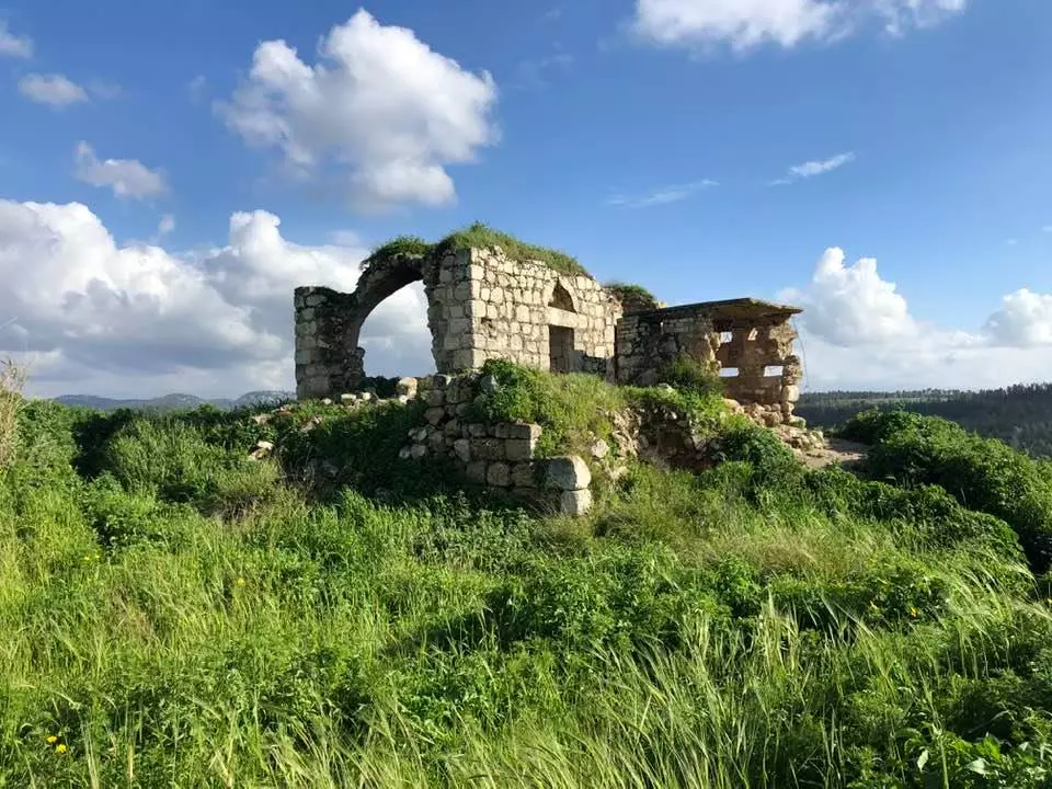
Village Before NakbaThe village was situated on a hill at the junction of the Ramla-Jerusalem highway with other highways that led to Gaza and Ramallah. This location lay just south of an ancient Roman road that ran from the Mediterranean coast through Emmaus/'Imwas and up the mountains to Jerusalem. Because of its proximity to this road, the site of al-Latrun had strategic importance. Its name may have been derived from the phrase Le Toron des Chevaliers ('The Tower of the Knights' in Old French), which was the name of a castle built on the site by the Crusaders between 1150 and 1170. Salah aI-Din al-Ayyubi (Saladin) captured the castle in 1187. Migrants from neighboring villages moved to al-Latrun during the governorship of Mustafa Thurayya Pasha (1852-62). In the late nineteenth century, al-Latrun was a small, mud-brick village built within the walls of the Crusader castle. French Trappist monks built a monastery cum agricultural school on a slope near the village in 1890 that became famous for its vineyards. During the British Mandate it was classified as a hamlet by the Palestine Index Gazetteer.Interviews with monks who arrived at al-Latrun before 1940 revealed that there were two al-Latruns: Old al-Latrun (al-Latrun al-Qadima) and New al-Latrun (al-Latrun al-Jadida). The old al-Latrun was situated about 100 m east of the monastery; the new al-Latrun was built around 1940, some 400-500 m south of the monastery. The monks bought the land and houses of old al-Latrun and built twenty new houses for the villagers in return; these houses were built away from the monastery, so that the monks could maintain a quiet environment. AI-Latrun's population was predominantly Christian. The villagers grew mainly grain and beans. In 1944145 a total of 7 dunums was devoted to citrus and bananas and 6,554 dunums was allocated to cereals; 439 dunums were irrigated or used for orchards. With the aid of the Trappist monastery the residents drew their drinking water via pipes from Bi'r al-Hilw (the 'sweet well'). Al-Latrun contained the ruins of the Crusader fortress, tombs carved in rock, and a canal. About 2 km west of al-Latrun lay Khirbat Jadira (146137), where a ruined tower, three large cisterns with arch-supported roofs, and a rock-cut tomb chamber were found. Village Occupation and Ethnic CleaningThis strategically located hamlet, which controlled the Jerusalem-Jaffa road, was the scene of a long series of battles in the course of the war. Six separate Israeli attacks were launched to capture the al-Latrun salient between mid-May and mid-July 1948. The first attack, during Operation Makkabi, actually led to the occupation of al-Latrun by the Giv'ati Brigade for a brief period on 16-17 May, according to the History of the War of Independence. This occurred while the Arab Liberation Army was in the process of handing over its positions to the Transjordanian Arab Legion. However, al-Latrun was regained by Arab forces when the Giv'ati units were summoned to the southern front.Shortly afterwards, the newly-formed Sheva' (Seventh) Brigade and the Second Battalion of the Alexandroni Brigade launched Operation Ben-Nun (Phase A) to gain control of the road to Jerusalem. Their attempt to capture al-Latrun was repulsed by the Arab Legion, which inflicted heavy casualties upon the Israeli forces. The New York Times stated that Arab Legion units rushed to the area to participate in the twenty-four-hour battle on 25-26 May. The fighting later spread to the area of Khulda and Bayt Jiz. Phase B of the same operation was implemented on 30 May. Israeli units reached the al-Latrun police station, but the demolition squad charged with destroying the building came under fire and withdrew. On 31 May the Israeli commander told a New York Times reporter that the attack had left the village badly burned and its police station gutted. After this failure, the Israelis concentrated on finding an alternative route to Jerusalem, bypassing al-Latrun. This effort resulted in the so-called 'Burma Road' (named after the Chinese supply route in World War II), a dirt road making a detour southwards east of Dayr Muhaysin and rejoining the road at Saris. Since the road was insufficient for military purposes, a fourth attempt to occupy al-Latrun was made during the night of 8-9 June. The History of the War of Independence relates that Operation Yoram aimed at attacking the village from the southeast by occupying two overlooking hills. This time, units of the Har'el and Yiftach brigades were again driven back by the Arab Legion. Shortly after this attack, on 18 June, the 'shock troops' of the Irgun Zvai Leumi blasted part of the al-Latrun monastery. The New York Times quoted the Irgun as saying that the monastery was a stronghold for the Arab Legion. However, in the middle of the following month, an Associated Press (AP) correspondent wrote that 'in the face of repeated shelling by Israeli guns, the venerable Trappist monks still cling to their famous Latrun monastery under the French flag.' The AP report added: 'Neutral foreign reporters accredited to the Trans-Jordan Arab Legion have visited Latrun continually during the Palestine hostilities and never have detected the slightest violation by the Arabs of the monastery's sanctity.' The monastery had been attacked at least once before by Zionist forces, according to the newspaper Filastin. It reported on 16 April that a passing Jewish convoy opened fire on gardeners on the grounds of the monastery, wounding two of them and breaking windows. The fifth attempt to occupy al-Latrun took place in the framework of Operation Dani (see Abu al-Fadl, Ramla sub-disctrict), on 15-16 July, after the end of the first truce of the war. As the second truce drew near, the operation's commander decided to focus on al-Latrun. The plan was to isolate the village from its hinterland and attack it from the east. Once again, the force assigned to isolate the village failed, sustaining nineteen casualties in a confrontation with the Arab Legion, according to the official Israeli version. The sixth and final attempt, just before the second truce on 18 July, involved a direct frontal assault by units of the Yiftach Brigade. The Yiftach forces were equipped with a number of armored vehicles, including two Cromwell tanks that had been dispatched from the northern sector. However, technical difficulties with one of the tanks led to the failure of this effort. Two days into the second truce, a 20 July New York Times dispatch stated that al-Latrun had been completely surrounded by Israeli forces. But it remained accessible from Arab-held territory, being linked by the road to Ramallah. On 10 August, United Nations mediator Count Folke Bernadotte announced that Arab Legion forces had withdrawn from al-Latrun, after having controlled it for many weeks. He did not mention the cause of the withdrawal. The following day, Bernadotte ordered Israeli forces to withdraw from Hill 312 on the al-Latrun-Ramallah road because the position had been occupied after the truce was proclaimed. According to a New York Times report, Israel had agreed to evacuate two unnamed nearby villages and permit 400 inhabitants to return. However, on 12 August a pumping station was blown up at al-Latrun and press reports stated that the 'initial investigation points to Arab irregulars.' In response, the Israeli government countermanded orders for the evacuation of the two villages. Bernadotte then dropped his request that Israeli forces withdraw in the al-Latrun area, according to the New York Times. The History of the War of Independence states that Israel was granted the right to use the al-Latrun-Jerusalem road in the armistice agreement with Jordan. As a result, the old al-Latrun became part of the West Bank and served as a camp for the Jordanian army, whereas the new al-Latrun fell in the no-man's-land. The residents of al-Latrun moved to the neighboring village of '1m was, on the West Bank. Their houses remained empty until 1967, when al-Latrun was captured by the Israeli army during the June War. Zionists Colonies on Village LandsThe settlement of Newe Shalom was established on village land in 1983.Village TodayAll the houses of New al-Latrun have been destroyed. Dense foxtail grass and thorny plants grow among the rubble of former houses. There are also a few almond and carob trees and cactuses on the site.SourceDr. Walid al-Khalidi, 1992: All That Remains. |
|||||||||||||||||||||||||
| Related Maps | Town Lands' Demarcation Maps خرائط للقضاء توضح حدود القرى والاودية Town's map on MapQuest View from satellite Help us map this town at WikiMapia |
||||||||||||||||||||||||
| Related Links | Wikipedia's Page Facebook Page Google Search Google For Images Google For Videos |
||||||||||||||||||||||||
| More Information | في كتاب كي لا ننسى في كتاب بلادنا فلسطين المزيد من موقع هوية |
||||||||||||||||||||||||
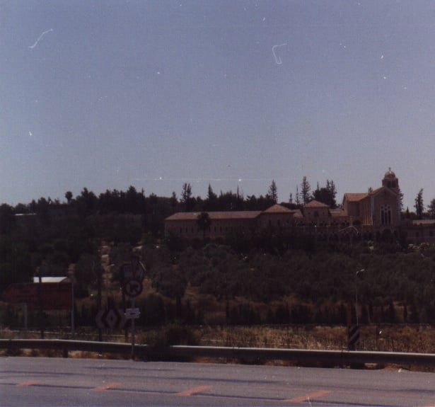
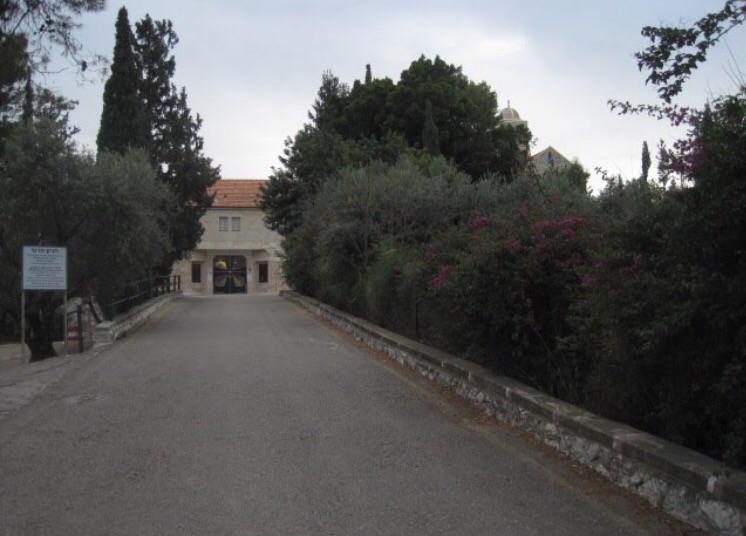
- Latroun monestery
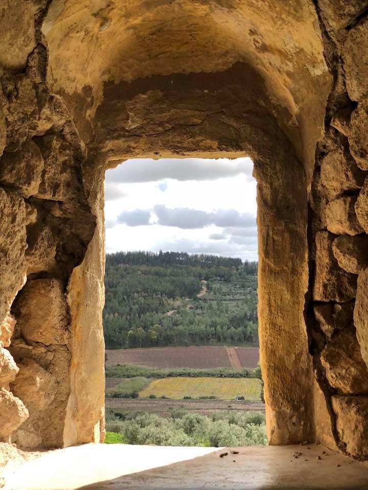
Posted by omar mansour - Panoramic view looking south, click the picture to enlarge it.
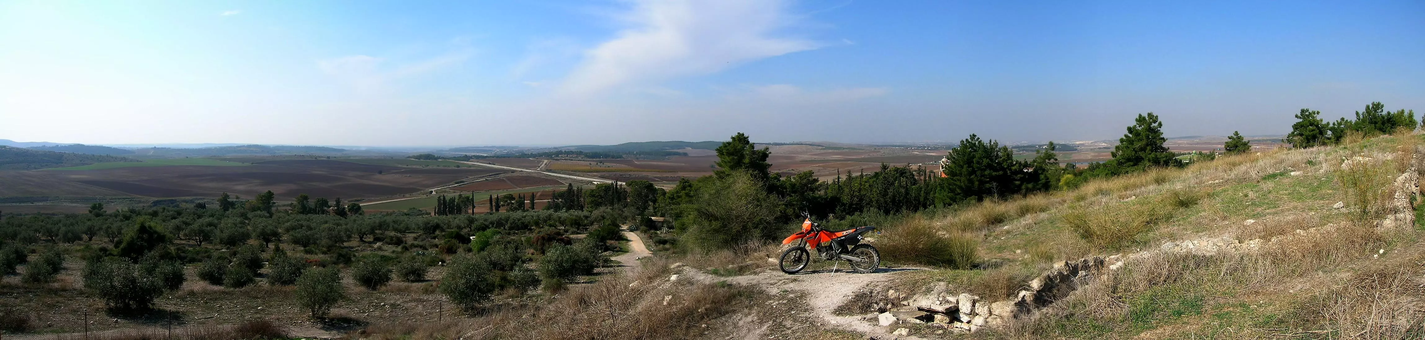
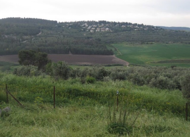
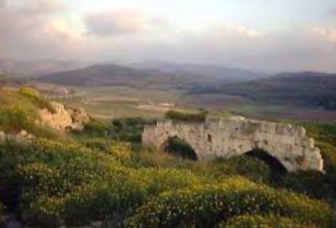
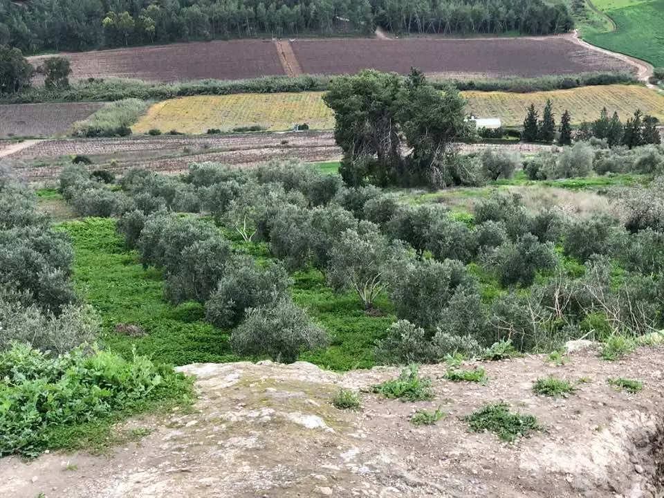
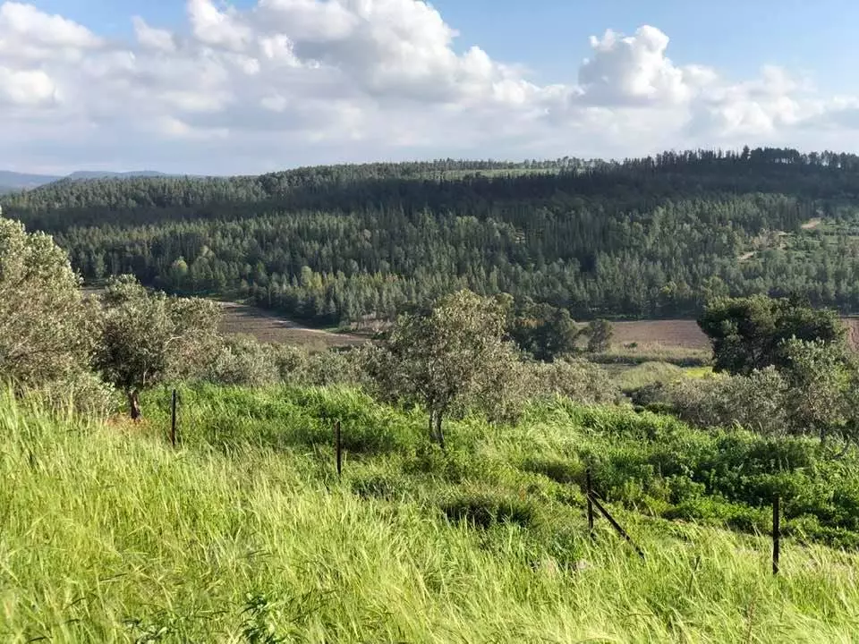
2 - Panoramic view looking toward Canada park which was built on the ruins of the Palestinian villages of 'Imwas, Yalu and Bayt Nuba, click the picture to enlarge it.
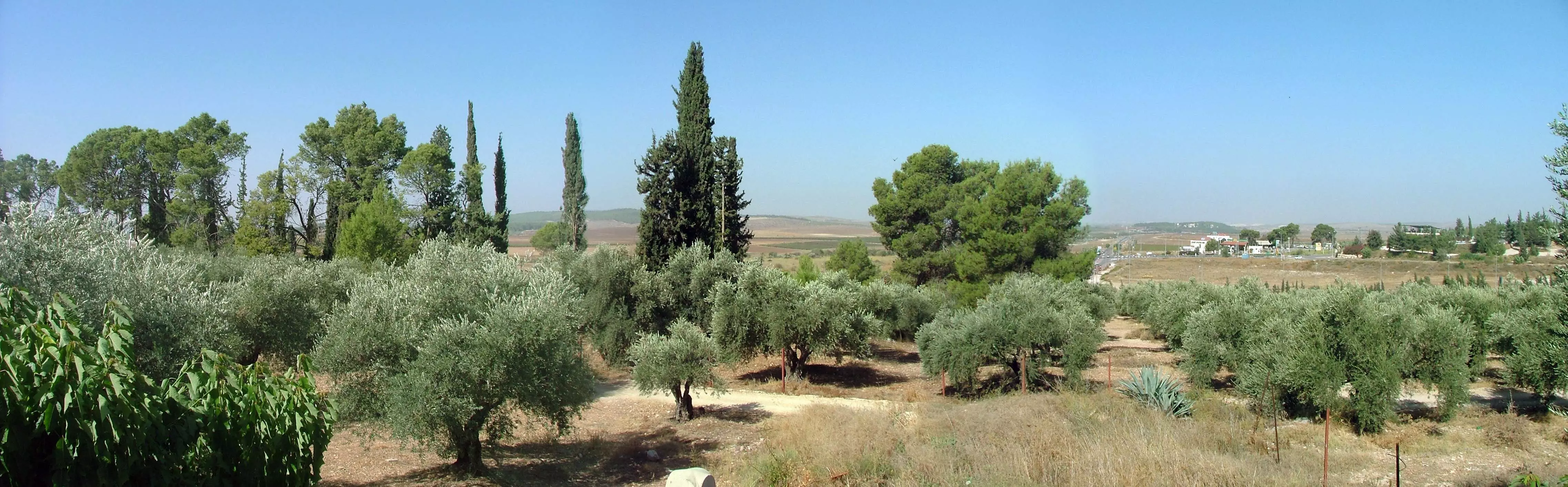
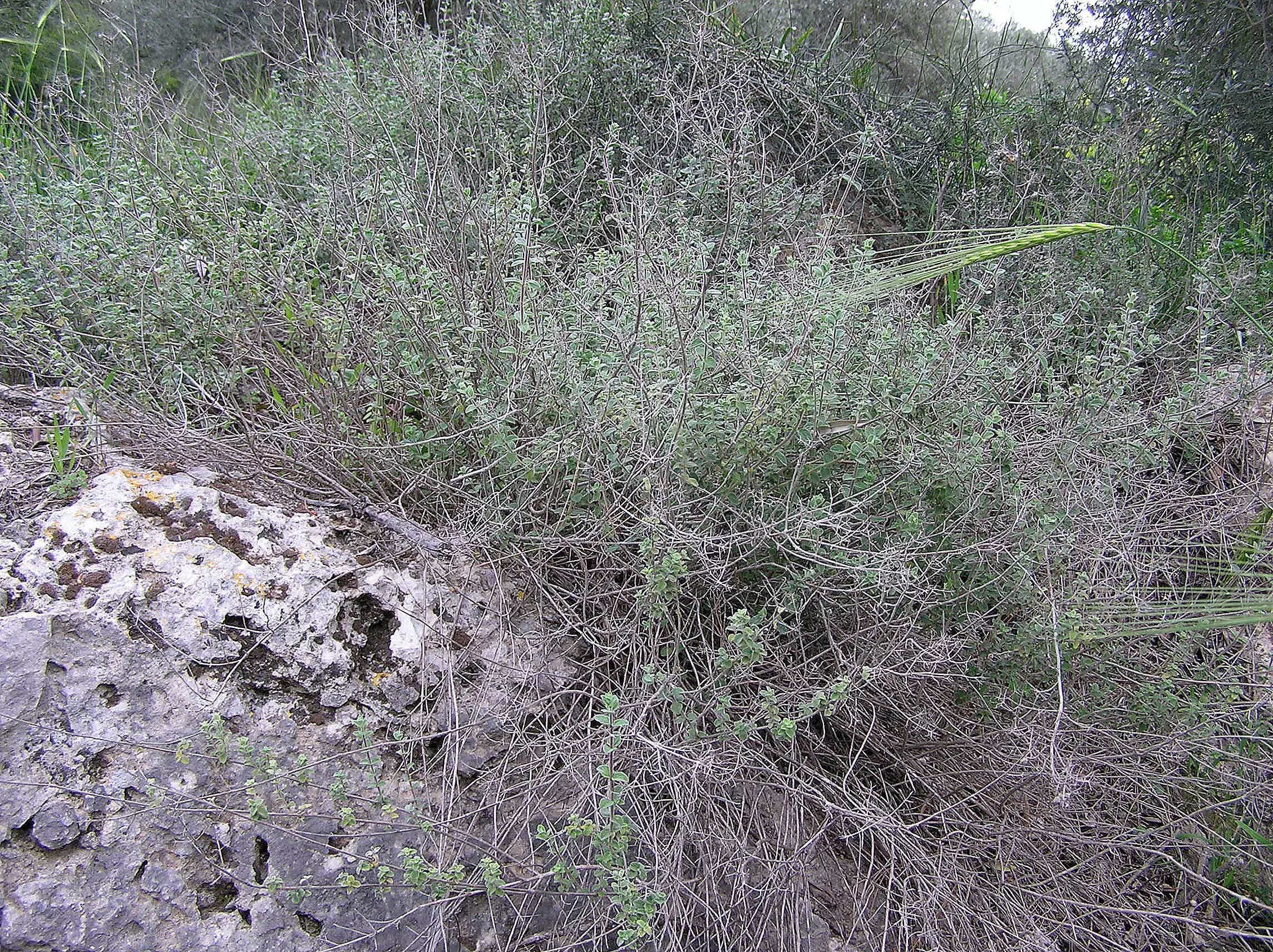
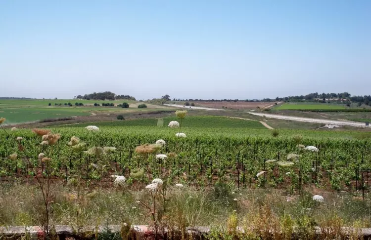
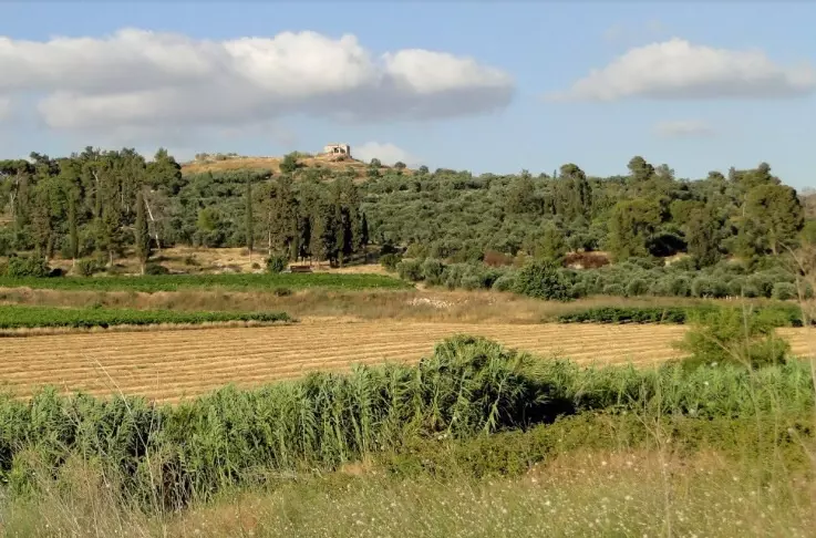
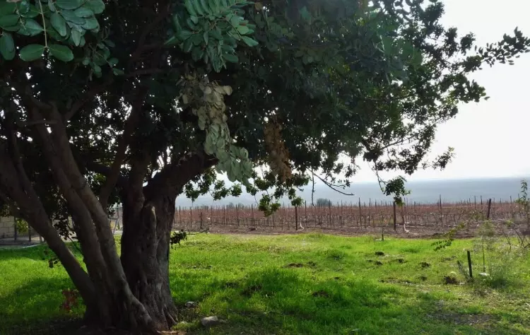
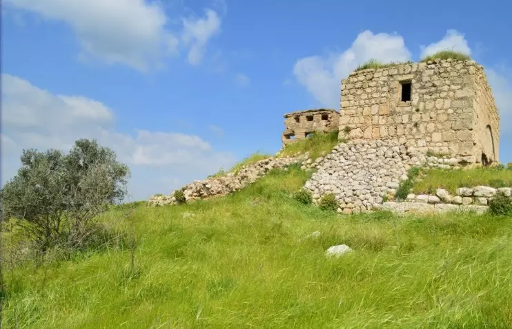
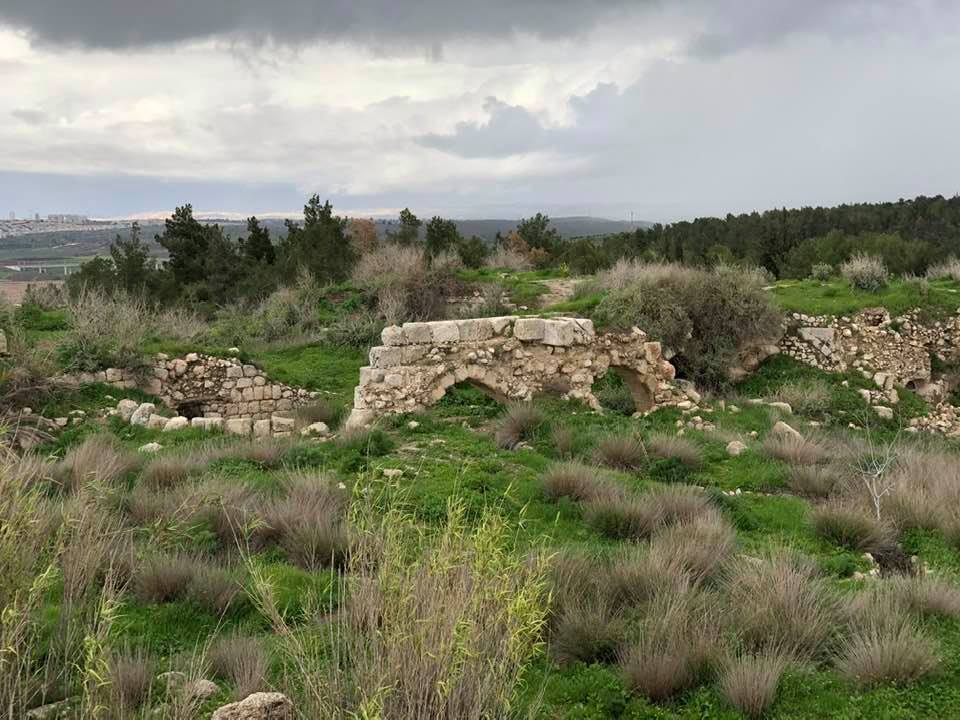
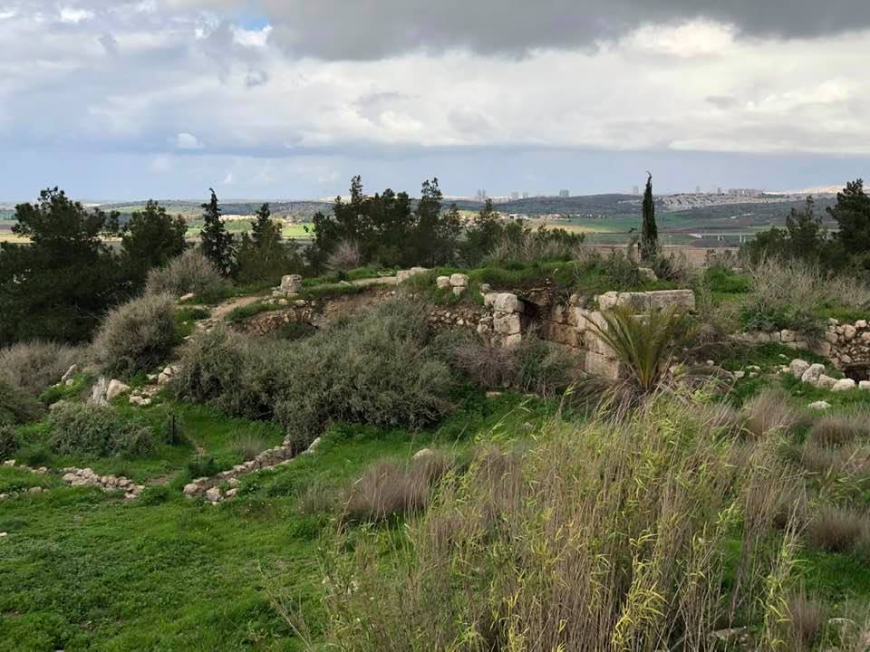
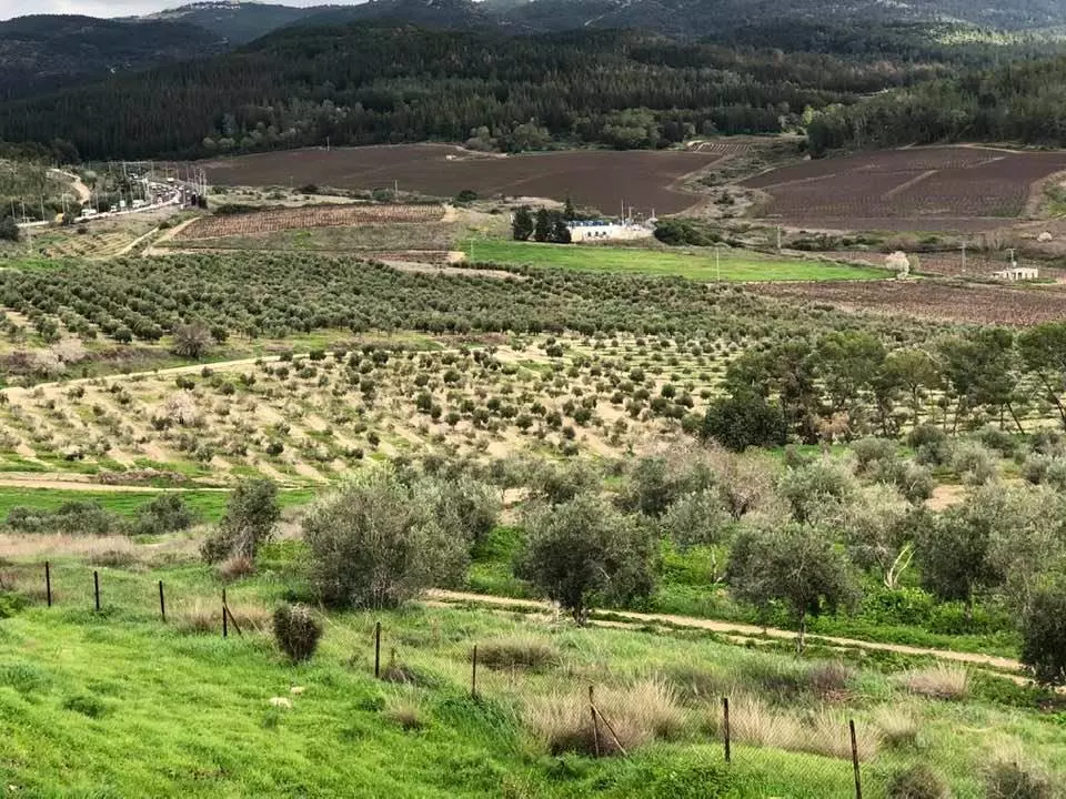
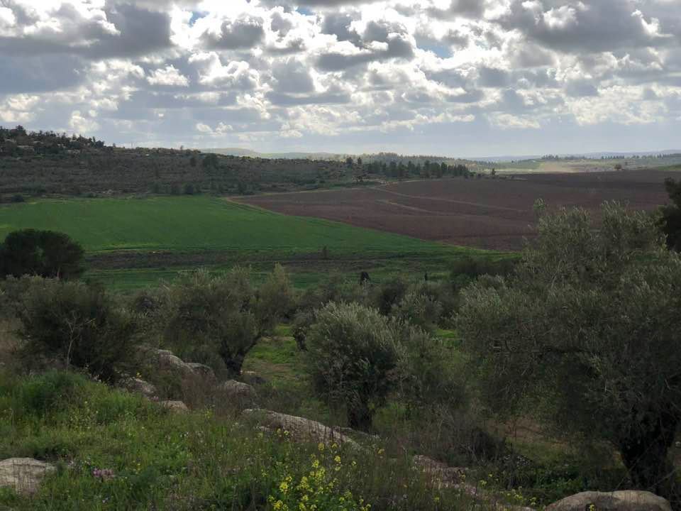
- General view of the lands, note the destroyed house or bunker on the left
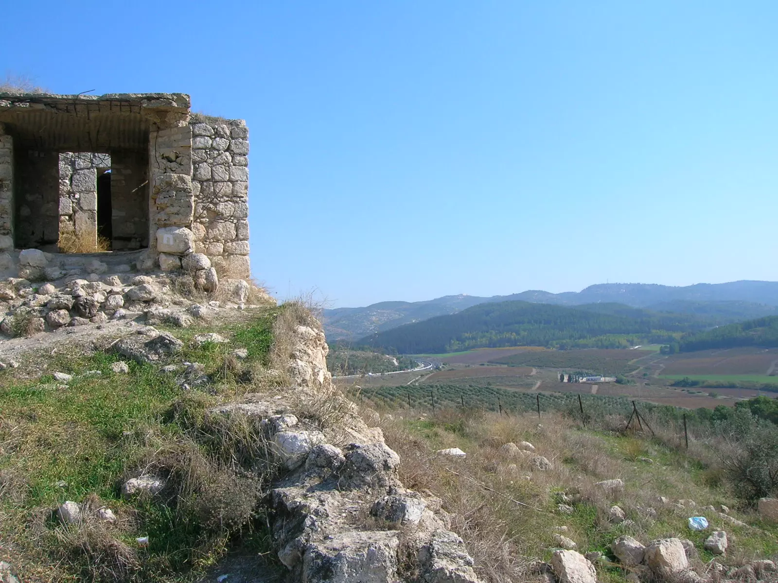
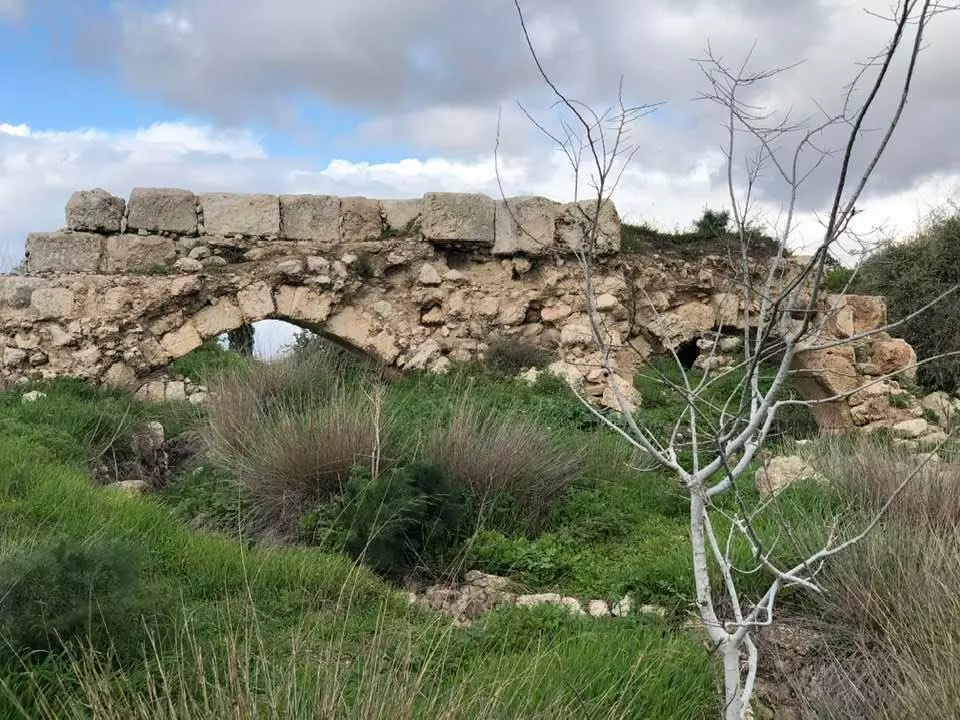
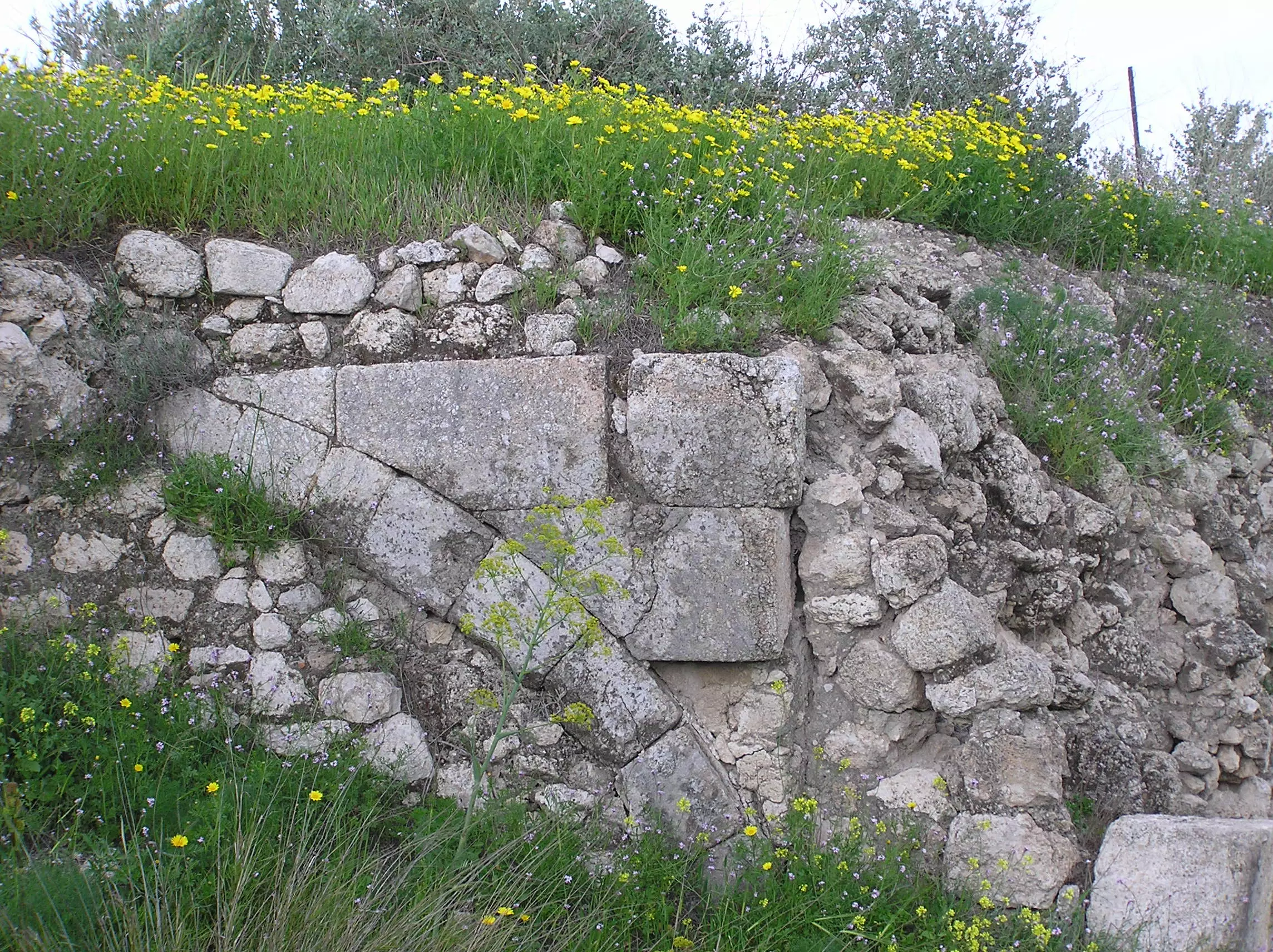
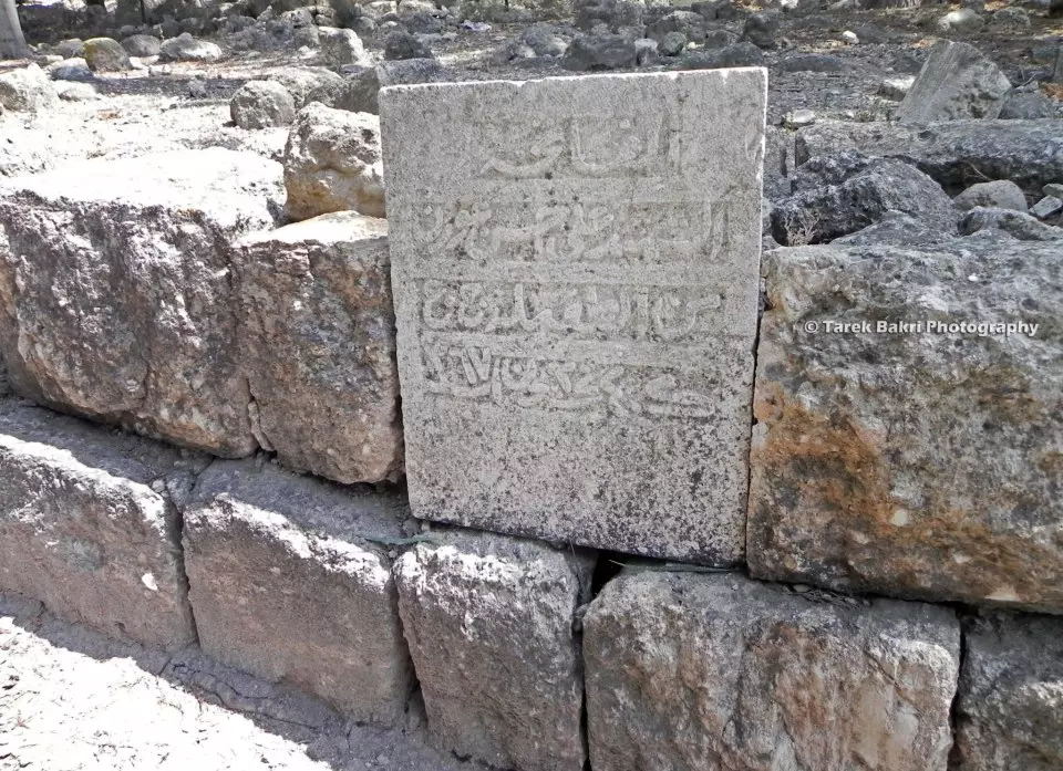
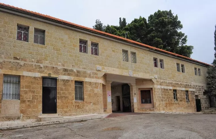
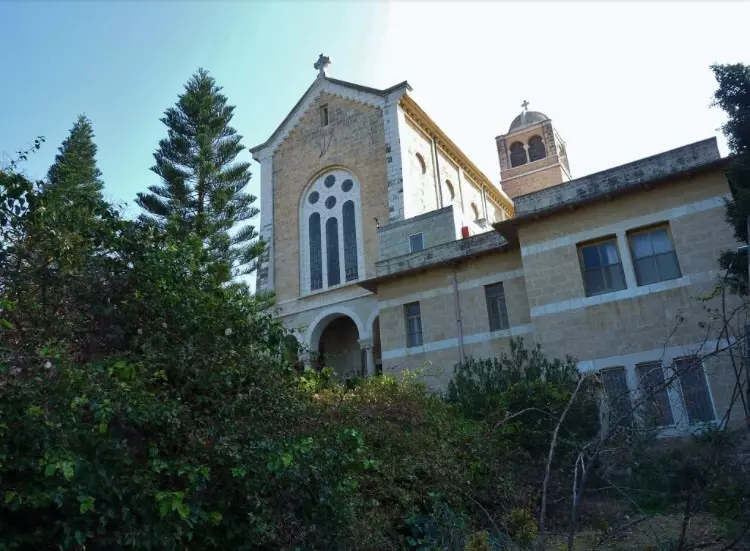
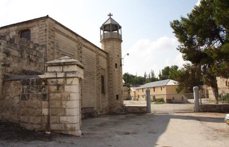
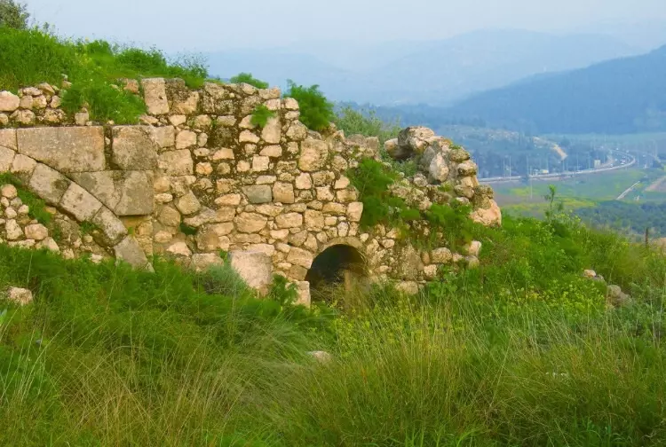
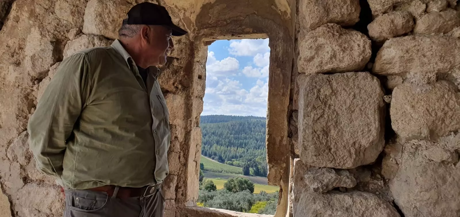
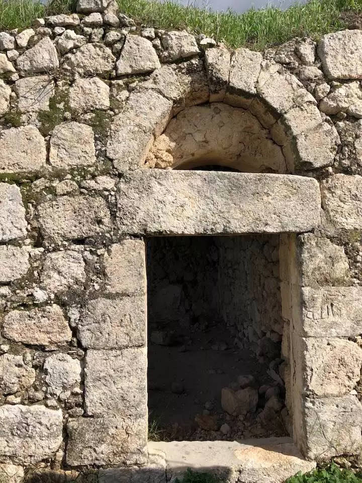
- Al - Latrun Building Stand As A Witness to its Tragic Past
Posted by Umar Abu El-Bararri - Al - Latrun Old Build Stands on top of Hill

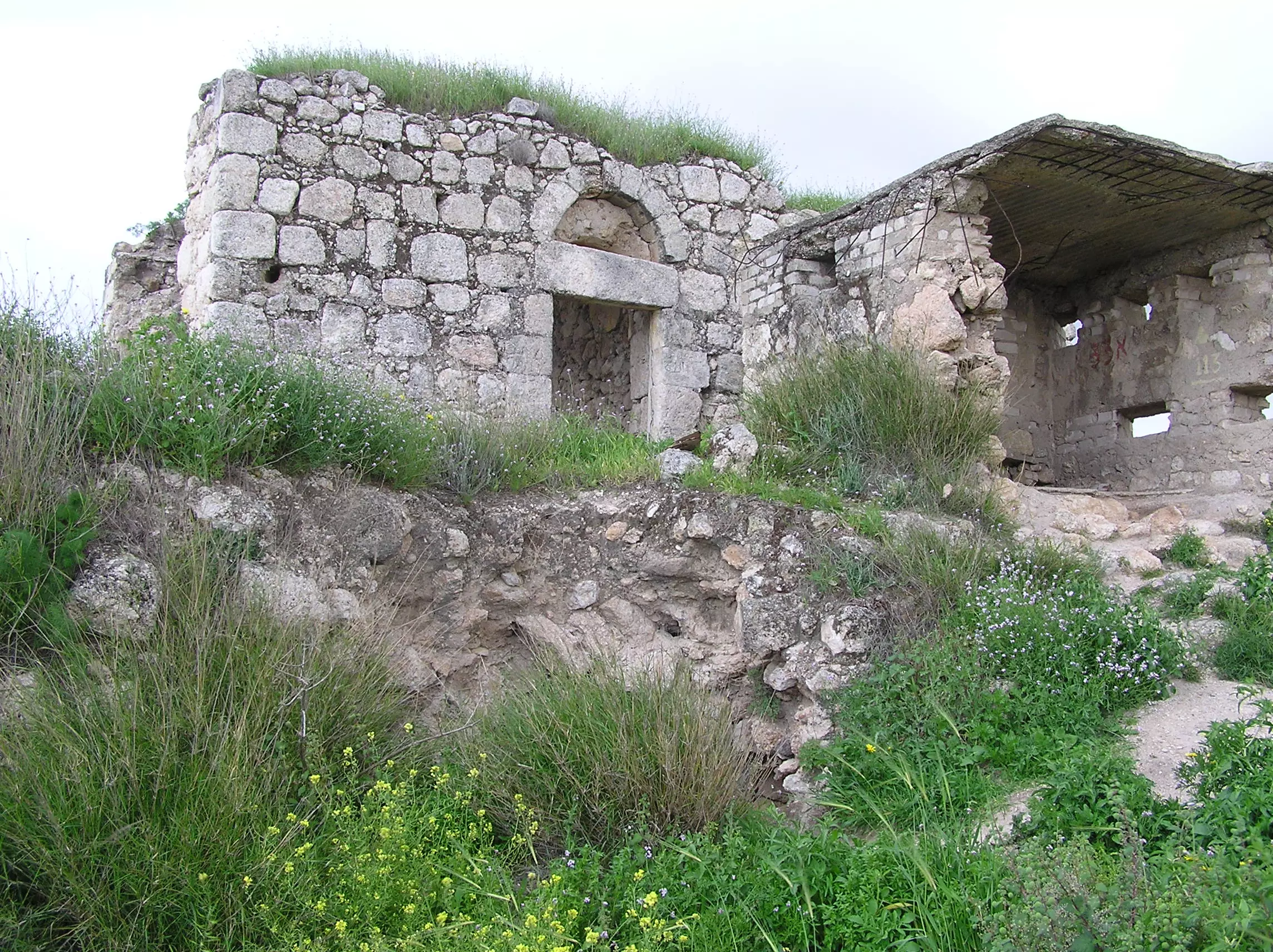
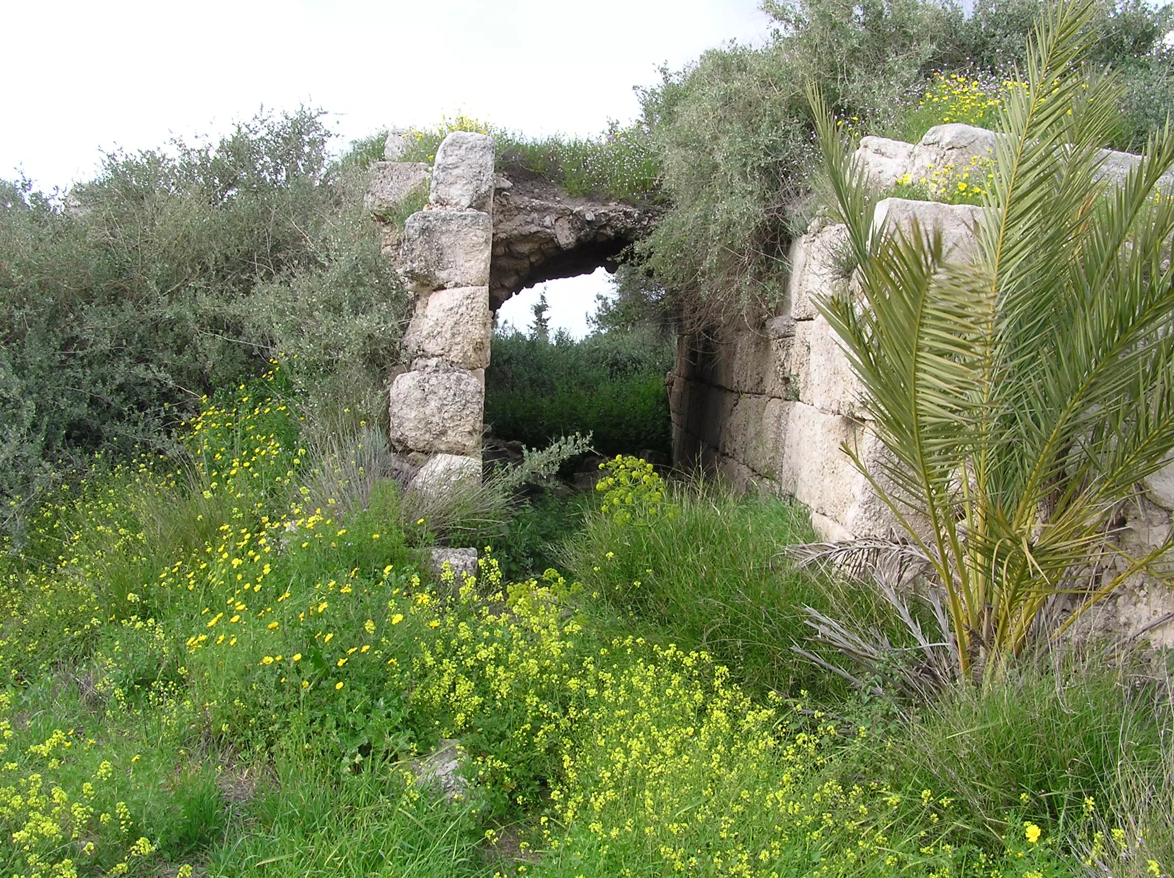
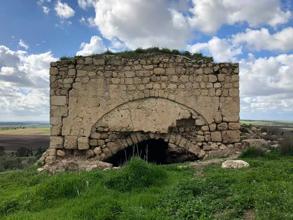
Posted by Umar Abu El-Bararri - Al - Latrun Ruins Tell Its Tragic Story
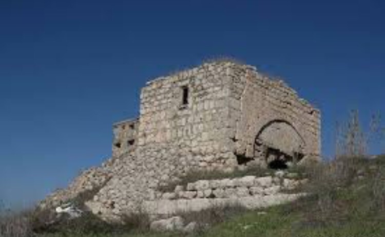
Posted by Umar Abu El-Bararri - Al - Latrun in Ruins
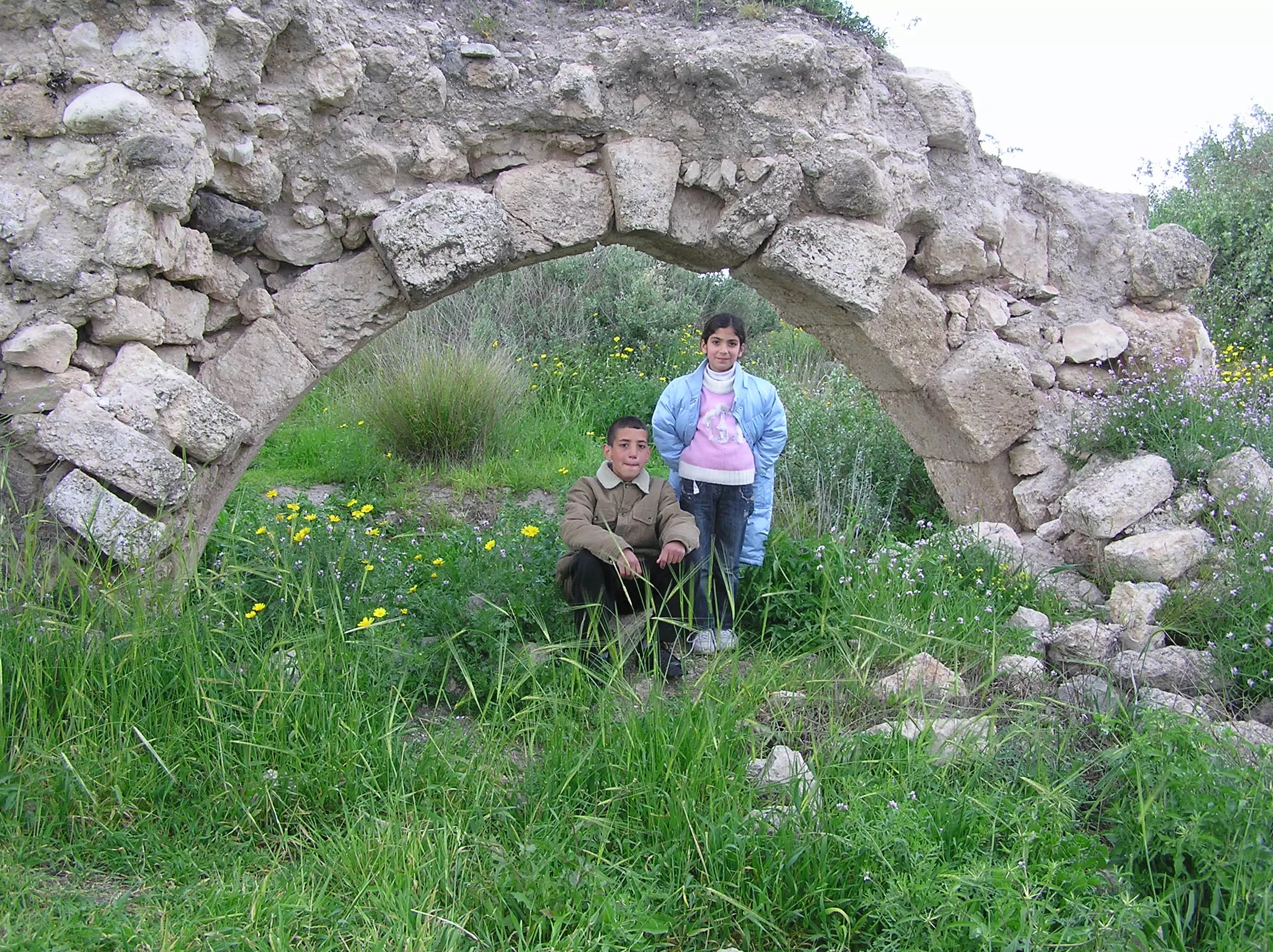
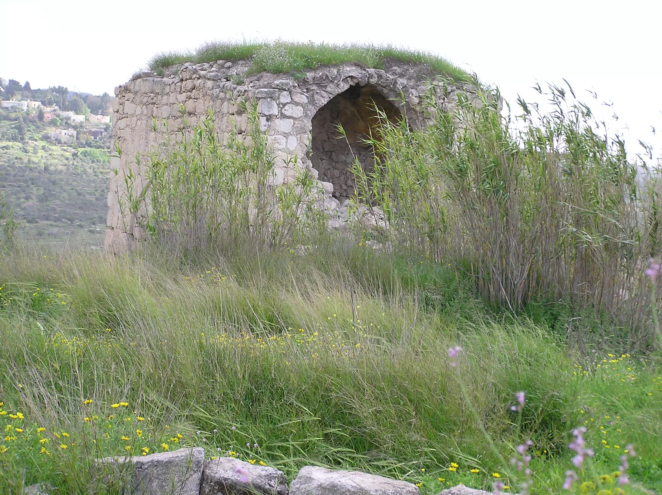
Posted by Umar Abu El-Bararri - Al - Latrun's Remembered
Posted by Umar Abu El-Bararri - Al - Latrun's Building on top of Hill
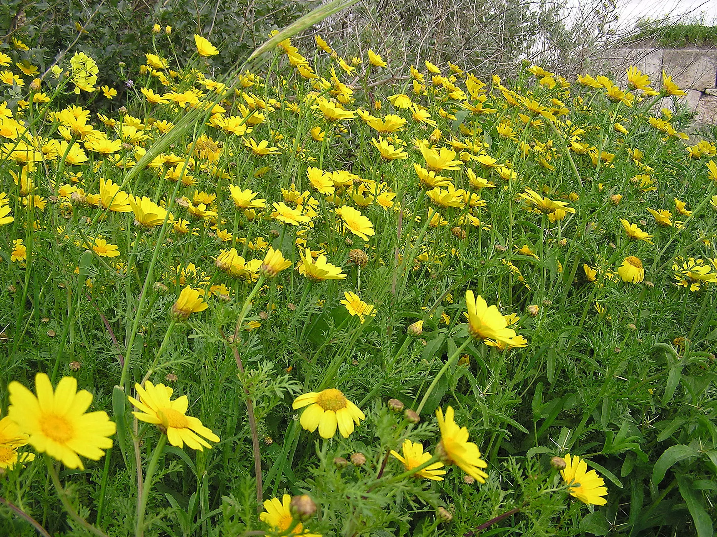
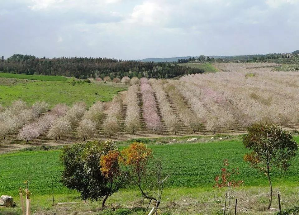
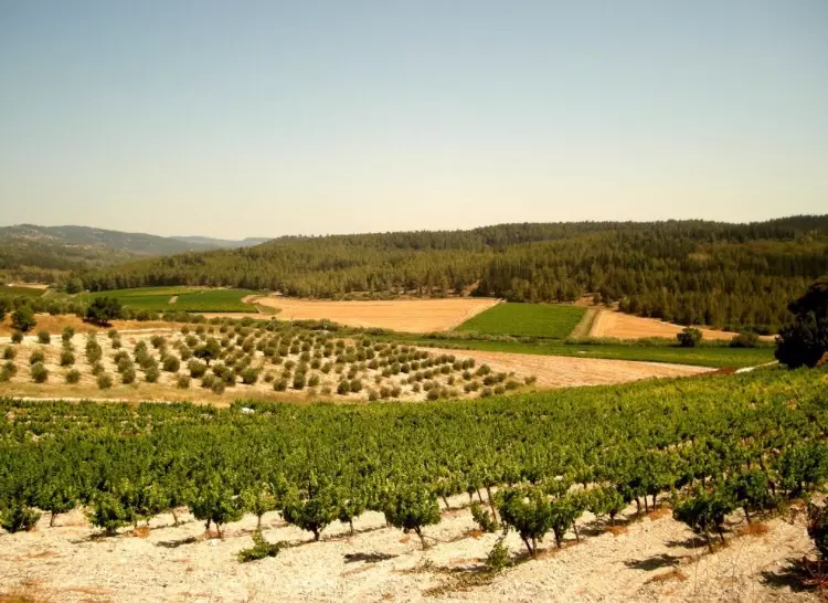
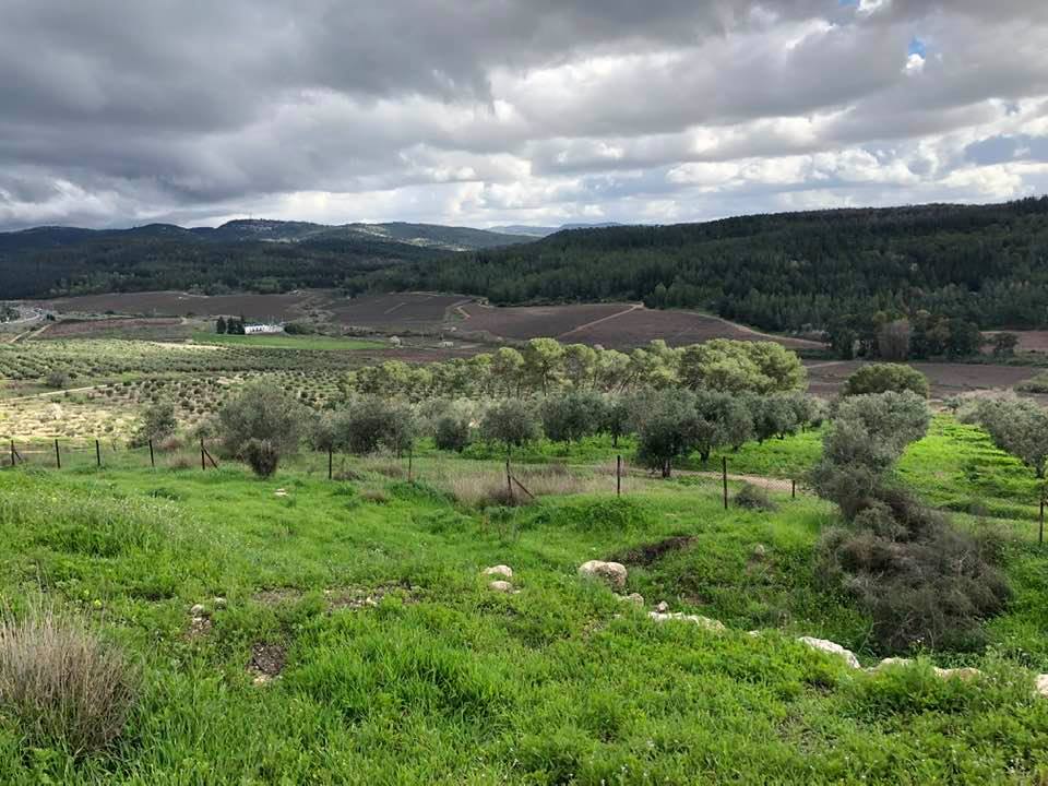
Posted by Umar Abu El-Bararri - Al - Latrun's Olive Groves & Field of Wild Flowers.
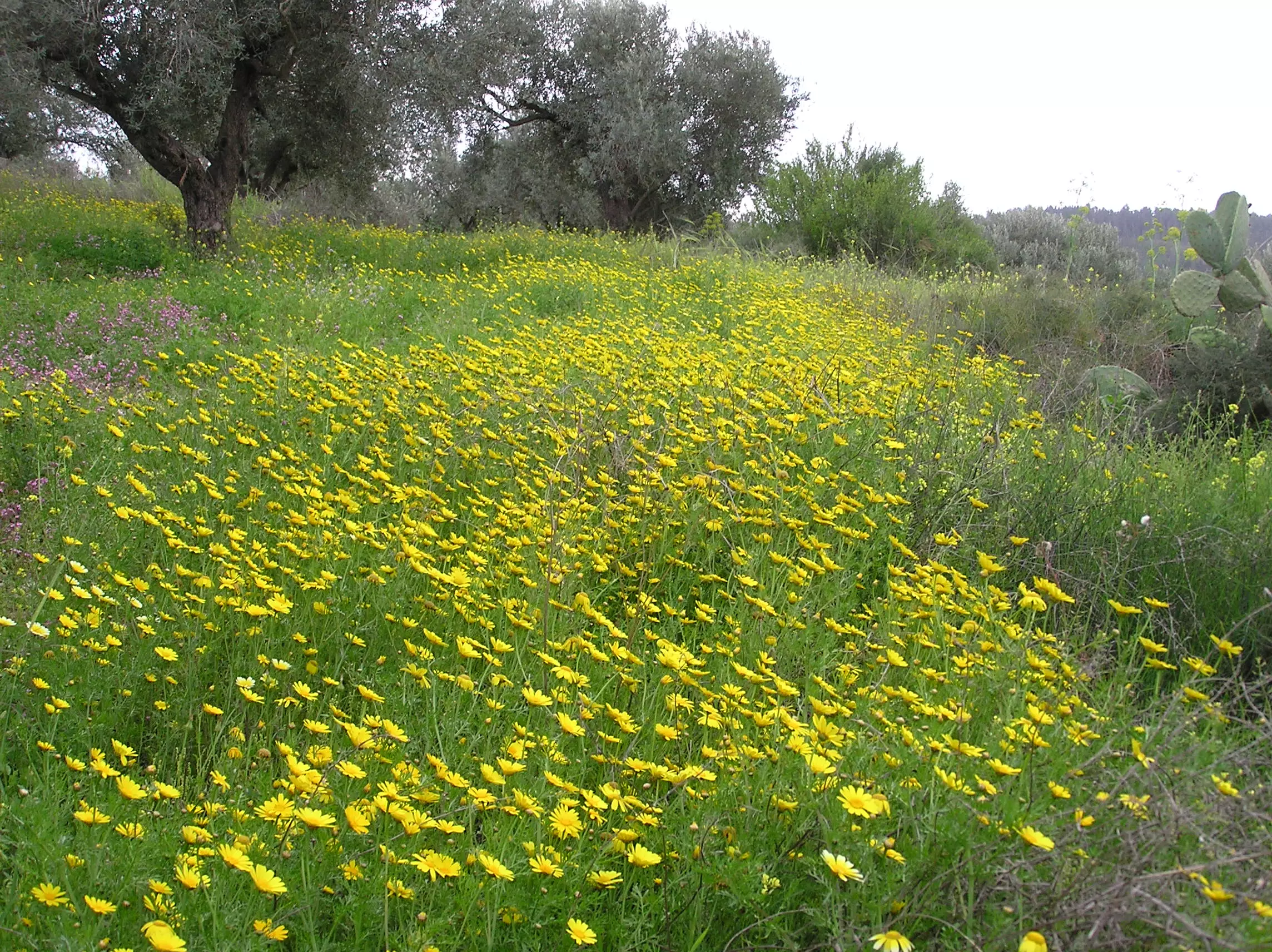
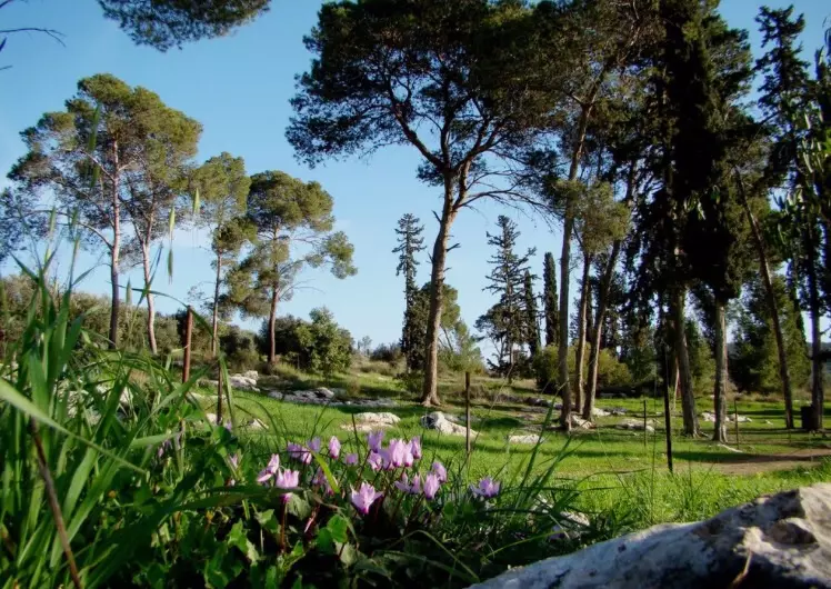
Posted by Umar Abu El-Bararri - Wild Flowers / Plants From Al-Latrun
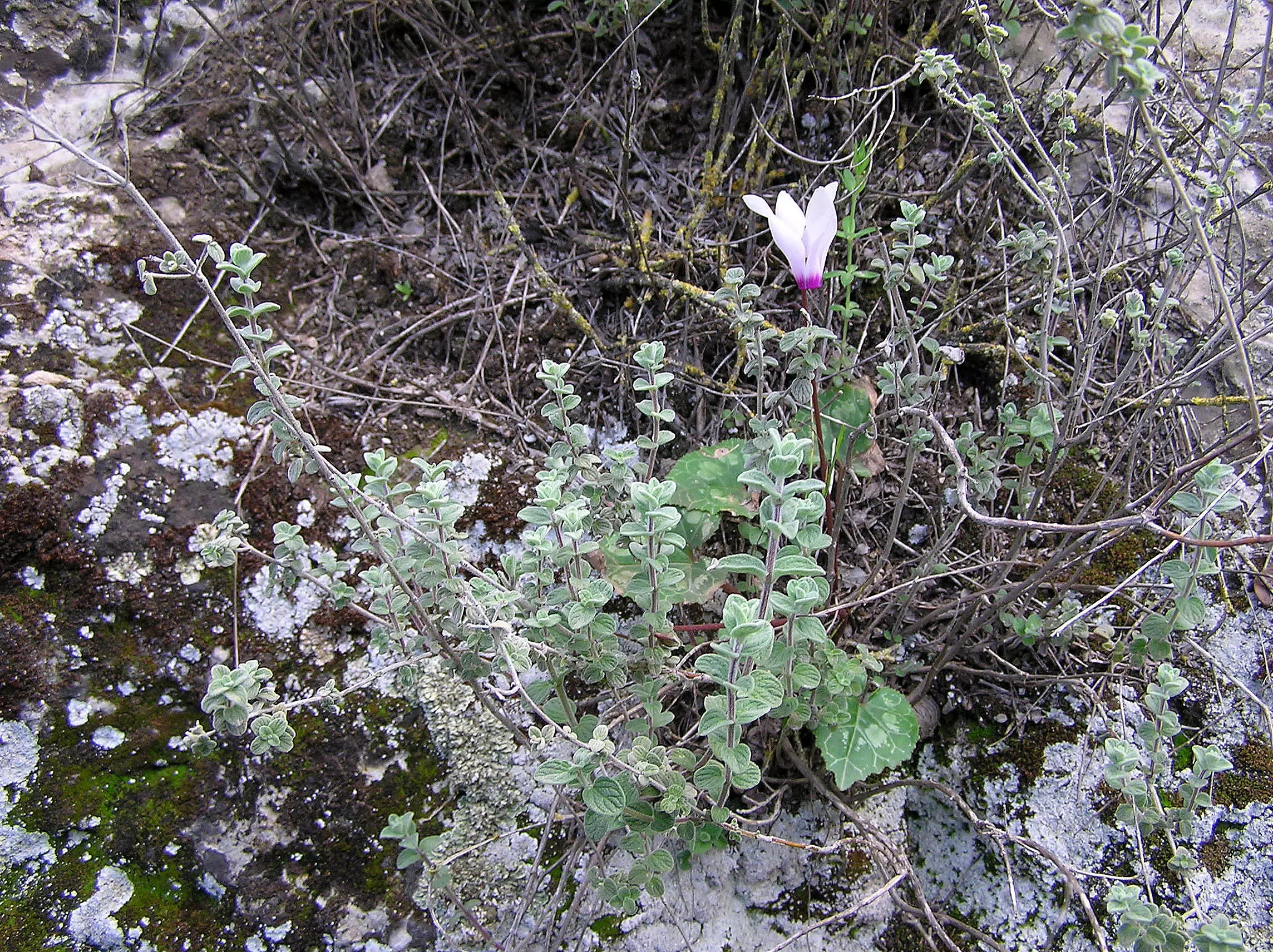
Posted by Umar Abu El-Bararri - Wild Flowers / Plants From Al-Latrun
Posted by Umar Abu El-Bararri - Wild Flowers / Plants From Al-Latrun --
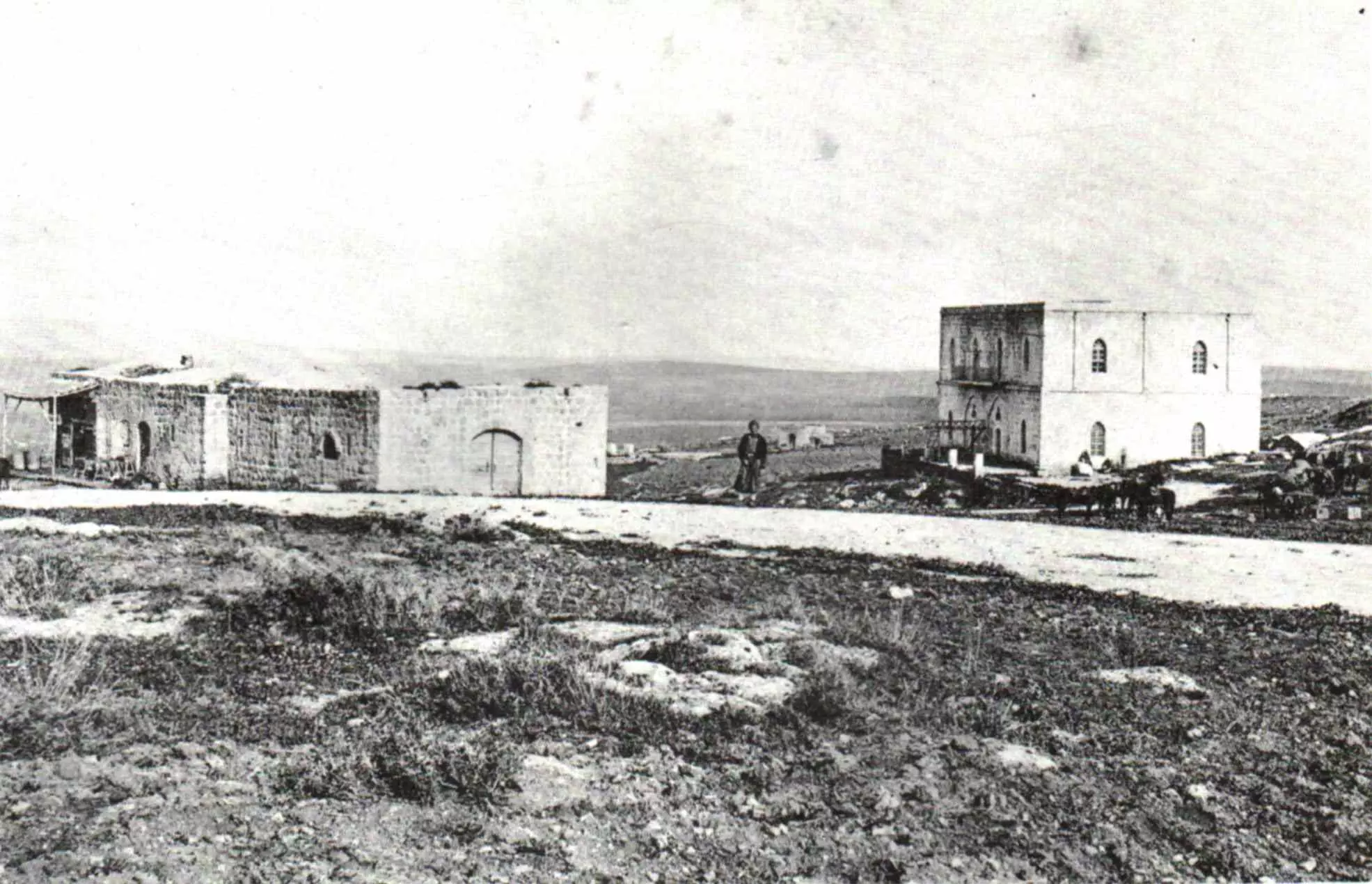
Posted by Umar Abu El-Bararri - Hotel For Pilgrims At Latrun, 1887
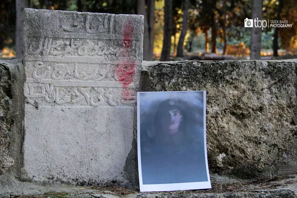
Posted by Rami Atwan - ذه الصورة لقبر الشهيد علي حسن العوران من الطفيلة التقطها في منطقة اللطرون (بين القدس ويافا) اثناء توثيق شواهد قبور شهداء الجيش العربي الاردني الذين استشهدوا دفاعاً عن فلسطين عام 1948
Posted by Tarek Bakri 2 - منظر عام

- منظر عام
- هنا يرقد الشهيد عوض خلف جلال البرماوي من جرش في منطقة اللطرون بين القدس ويافا - منقول من صفحة طارق بكري
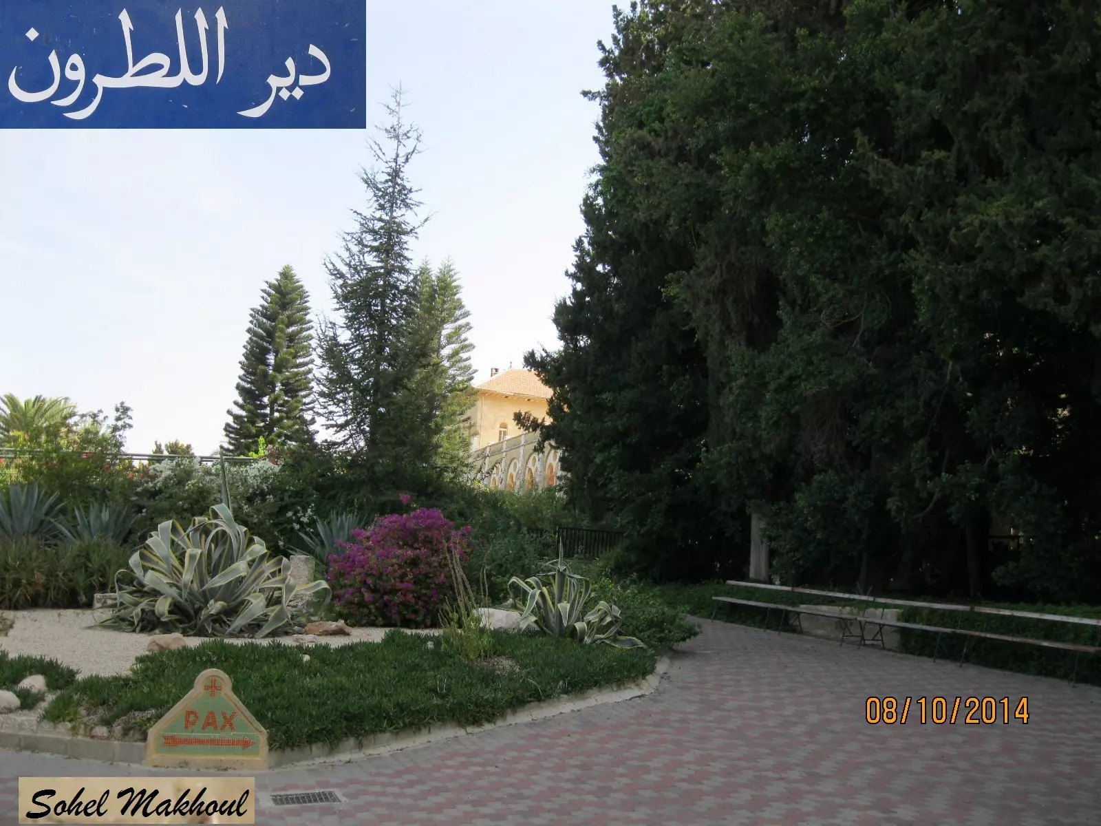
2 - دير اللطرون - بعدسة سهيل مخول
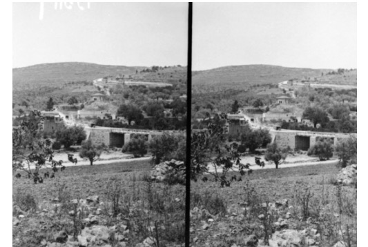
Posted by سهيل مخول - منظر عام للقرية عام 1940 -- منقول من صفحة أحمد مروات
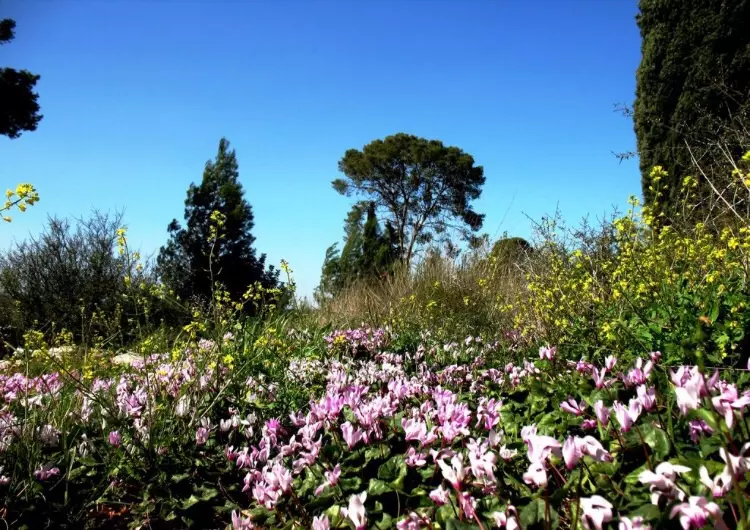
- الربيع في اللطرون
Posted by abu raya - دير اللطرون
Posted by abu raya - دير اللطرون
Posted by abu raya - اراضي اللطرون
Posted by abu raya - احراش اللطرون
Posted by abu raya - اراضي اللطرون
Posted by abu raya - دير اللطرون
Posted by abu raya - الدير
Posted by abu raya - دير اللطرون
Posted by abu raya - الخروب في اللطرون
Posted by abu raya - اللطرون
Posted by abu raya - اللطرون
Posted by abu raya - اللطرون
Posted by abu raya - اراضي اللطرون
Posted by abu raya - اراضي اللطرون
Posted by abu raya - اللطرون
Posted by abu raya - اللطرون واراضيها
Posted by abu raya - المتبقي من بيوت اللطرون
Posted by abu raya - خارطه طريق اللطرون القدس
Posted by abu raya - دير اللطرون
Posted by abu raya - بيوت اللطرون
Posted by abu raya - اثار بيوت اللطرون
Posted by abu raya - اللطرون
Posted by abu raya - اللطرون
Posted by abu raya - اللطرون
Posted by abu raya - اراضي اللطرون
Posted by abu raya - صوره نادره لقريه اللطرون سنه 1918
Posted by abu raya - اللطرون قبل النكبه
Posted by abu raya - اللطرون قبل النكبه
Posted by abu raya - اللطرون قبل النكبه
Posted by abu raya - اللطرون سنه 1918
Posted by abu raya - صوره نادره لقريه اللطرون من سنه 1918
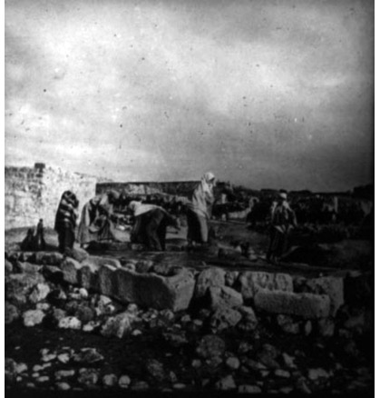
Posted by abu raya - صوره قديمه لنساء قريه اللطرون في زياره احدى الاماكن المقدسه سنه 1918
Posted by abu raya - اللطرون سنه 1918
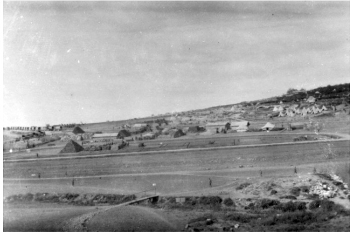
Posted by abu raya - المعسكر البريطاني في اللطرون سنه 1918
Posted by abu raya - Latrun, February 1918
Posted by palestinehistory 1 - Latrun Monastery, 1918 or 1919
Posted by palestinehistory - في بيت مختار قرية اللطرون المهجرة (قضاء الرملة ) .
- جنود أردنيون في اللطرون 1948.
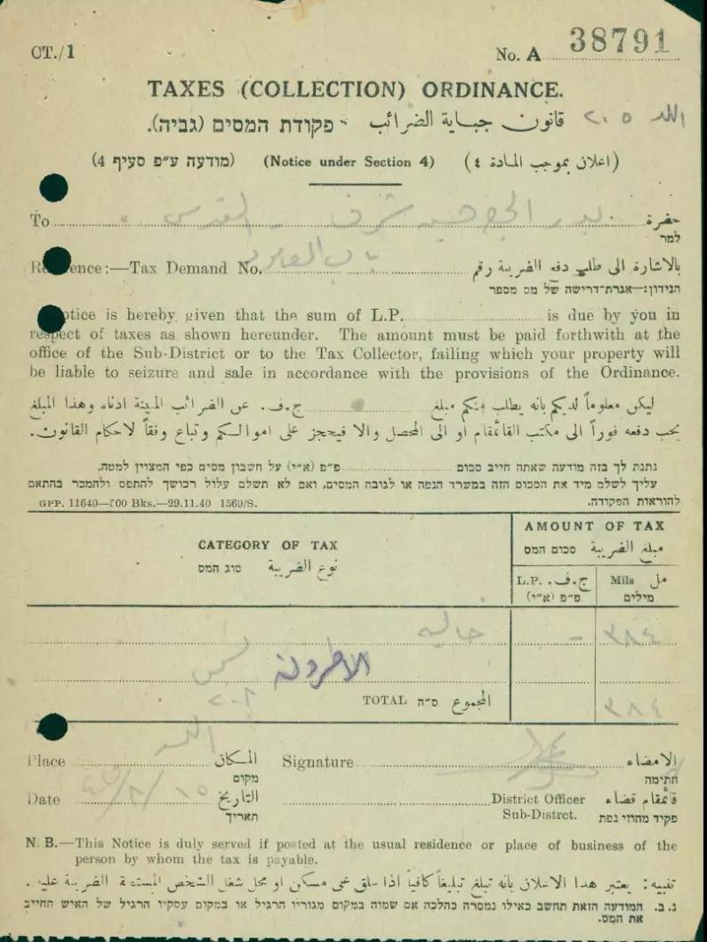
- فاتورة ضريبة أرض اللطرون ومنطقة اللد عام 1945 على إسم بدر شرف روان تيسير شرف التاريخ: 15/08/1945
- دير اللطرون - قرية عمواس
- Let us see how the most "liberal and civilized" of world Jewry has obliterated our village. How else will the Jews be great and safe again?
- Let us see how the most "liberal and civilized" of world Jewry has obliterated our village. How else will the Jews be great and safe again? #2
- Let us see how the most "liberal and civilized" of world Jewry has obliterated our village. How else will the Jews be great and safe again? #3
- Let us see how the most "liberal and civilized" of world Jewry has obliterated our village. How else will the Jews be great and safe again? #4
- Let us see how the most "liberal and civilized" of world Jewry has obliterated our village. How else will the Jews be great and safe again? #5
- Let us see how the most "liberal and civilized" of world Jewry has obliterated our village. How else will the Jews be great and safe again? #6
- Let us see how the most "liberal and civilized" of world Jewry has obliterated our village. How else will the Jews be great and safe again? #7
- Let us see how the most "liberal and civilized" of world Jewry has obliterated our village. How else will the Jews be great and safe again? #8
- Let us see how the most "liberal and civilized" of world Jewry has obliterated our village. How else will the Jews be great and safe again? #9
- Let us see how the most "liberal and civilized" of world Jewry has obliterated our village. How else will the Jews be great and safe again? #10
- Let us see how the most "liberal and civilized" of world Jewry has obliterated our village. How else will the Jews be great and safe again? #11
- Let us see how the most "liberal and civilized" of world Jewry has obliterated our village. How else will the Jews be great and safe again? #12
- Let us see how the most "liberal and civilized" of world Jewry has obliterated our village. How else will the Jews be great and safe again? #13
- Let us see how the most "liberal and civilized" of world Jewry has obliterated our village. How else will the Jews be great and safe again? #14
- Let us see how the most "liberal and civilized" of world Jewry has obliterated our village. How else will the Jews be great and safe again? #15
- Let us see how the most "liberal and civilized" of world Jewry has obliterated our village. How else will the Jews be great and safe again? #16
- Let us see how the most "liberal and civilized" of world Jewry has obliterated our village. How else will the Jews be great and safe again? #17
- Let us see how the most "liberal and civilized" of world Jewry has obliterated our village. How else will the Jews be great and safe again? #18
- Let us see how the most "liberal and civilized" of world Jewry has obliterated our village. How else will the Jews be great and safe again? #19
- Let us see how the most "liberal and civilized" of world Jewry has obliterated our village. How else will the Jews be great and safe again? #20
- Let us see how the most "liberal and civilized" of world Jewry has obliterated our village. How else will the Jews be great and safe again? #21
Want to browse more? 80,000 pictures were grouped in these gallaries:
| Display Name | Clan/Hamolah | Country of Residence |
| محمد اللطروني | مصطفى | palestine |
| latrunia mustafa | mustafa | amman, jordan |
| eyad | mustafa | jordan, jordan |
| omar ahmad sallaj | - | amman, jordan |
| al-latruny | Mustafa | amman |
No links have been shared yet, be free to the first to share the first link.
 Fake Valor: Why Did Zionist Jews Hoist Nazis Flag on Their Ships in the 1930s?
What is new?
-
Facts About Oct. 7th Gaza Raid
-
Remined Us Please:: Who Did Rape Who? Palestinians Raped Israelis? Or, was the other way around?
-
When Prof. Edward Said was invited to debate Bibi Netanyahu in the 1980s, watch what happened!
-
Ezra Klein of the NY Times on the "Jewish Race".
-
Abusing Blood Libel!
-
Zionist FAQ: Isn't it true that Palestinians don't want peace? Palestinians never accepted the two-state solution
- Facts about Haavara (Transfer) Agreement between Ben-Gurion & Hitler
-
Haavara FAQs: Why Did Zionist Jews Hoist Nazis' Flags on Their Ships in the 1930s?
-
Dear ChatGPT: How did Palestinians resist Napoleon's invasion of their country in 1799?
-
Dear ChatGPT: Gaza had a vibrant Jewish community in the mid-17th century. What happened to them?
-
Dear ChatGPT: Why did the Jewish Agency suppress news of the Holocaust during WWII?
-
Video Playlist: Jews share their DNA tests to end the conflict for good.
-
A Tale of Two Conflicts: Examining the Definition of Genocide
-
Prof. Abraham Polak And The Suppressed History of the Khazars and European Jewry
-
How Ronald Reagan would have framed the genocide in Gaza if he were still alive?
-
Haavara FAQs: Let us do the math: how many German Jews did The Haavara Agreement save?
-
Zionist FAQs: The Hebron Massacre of 1929, "clearly proves" that Palestinians are antisemitic, how could you deny it?
-
Zionist FAQs: Why Anti-Zionist Is Not Antisemitism?
-
Zionist FAQs: Isn't it true that the KGB create Palestinian Nationalism in the early 1960s?
- Zionist FAQs: Muslims are killing Muslims all the time; why are Israeli Jews being singled out in the media?
- Zionist FAQs: How is Israel an apartheid state when 20% of its citizens are Arabs who enjoy full rights?
-
Haavara FAQs: Analysis of Herzl's Uganda Scheme and how it could have saved millions of Jews.
-
Haavara FAQs: Why did Hayim Greenberg describe American Jewry as "morally bankrupt" in early 1943?
-
Haavara FAQs: What if the Evian Conference was a resounding success? What would have been the impact of saving European Jewry on Zionism?
- Haavara FAQs: What if the six million were saved, how that would have impacted the Zionist project?
-
Haavara FAQs: How did Zionist leaders react when Europe's Jews lingered in the DP camps after WWII ended?
-
Why does the American Jewish community repeat lies that David Ben-Gurion had debunked before he died?
-
Who has the power to rename the Tatar/Khazar Gene Marker to Jewish IV?
-
Zionist FAQs: Why won't Egypt, Syria, and Jordan take their people back? Jews are indigenous to Palestine, and Arabs immigrated after Jews developed the country. Arabs should leave.
-
Haavara FAQs: Did Hitler and the Nazis conflate between Judaism and Zionist? If that wasn't case, then why?
-
Haavara FAQs: Winston Churchill and antisemitism, a collection of articles written Churchill.
-
Haavara FAQs: Broken by country, how many Jews survived vs. killed during the Holocaust?
-
Haavara FAQs: Why did European Jews vote with their feet and to immigrated to the Americas, not Palestine, after WWII?
-
Watch this American Jewish Girl describing Israeli Jews' cognitive dissonance like no other in under two minutes
-
Haavara FAQs: When the Nazis went out of their way to hide the Holocaust, Israeli Jews did the exact opposite by broadcasting their genocide of Gazans. But why?
-
Haavara FAQs: How Zionist Jews went out of their to show their appreciation to Nazism and Fascism?
- Haavara FAQs: Why Zionist leaders were against bombing the death camps & the Railroads leading to them?
-
Haavara FAQs: Hitler's message to the British and American people: If Jews are such noble citizens and you care about them, how come you're not letting them in? I will gladly ship them to you at my expense, even on luxury liners!
-
A shortlist of Zionist and Israeli false flag operations in the name Jews.
-
The Most Moral Army
- The Land of Kapos (Israel): Where the brave are boycotted and Kapos walk free.
- Why did early Zionists often named their communal enterprises "colonial"?
- Zionist Relations with Nazi Germany by Faris Glubb
-
Two NY Times advertisements by Zionists in the early 1943 that exposes Zionists' treason at the height of the calamity
- Facts Not Lies about the Palestinian-Israeli Conflict.
- Site's pictures have been categorized
- Campgain Against Lice
- A Survey of Palestine, the official source about Palestine before Nakba produced by the British Mandate; over 1200 pages.
- Satellite View & Google Earth: Over 6,000 placemarks identifying all destroyed towns, W. Bank & Gaza Strip Towns, & refugee camps.
- PalestineRemembered.com and its Nakba Oral History Project were featured on al-Jazeera Satellite TV.
- Nakba Oral History Video Podcast:
 Over 700 Oral History interviews (including 3,500+ hours of recording) can be viewed online.
 - Palestine Village Statistics Project
- Gaza Jail Break
- النسخة العربية للموقع الان متوفرة
- Videos: Documenting the destroyed villages in video: Tracing all that remains since Nakba.
- Videos: Responding to Zionist Propaganda
- Interview: The ethnic cleansing of Palestine: George Galloway interviews Israeli Historian Ilan Pappe.
- For Palestinians, memory matters. It provides a blueprint for their future By George Bisharat.
- Zionist FAQ now available in Hebrew שאלות שציונים שואלים, עכשיו בעברית
- Video: The Stephen Walt and John Mearsheimer report on the influence of the Israel Lobby on U.S. Foreign Policy
- The Palestinian-Israeli conflict for beginners
