| PalestineRemembered | About Us | Oral History | العربية | |
| Pictures | Zionist FAQs | Haavara | Maps | |
| Search |
| Camps |
| Districts |
| Acre |
| Baysan |
| Beersheba |
| Bethlehem |
| Gaza |
| Haifa |
| Hebron |
| Jaffa |
| Jericho |
| Jerusalem |
| Jinin |
| Nablus |
| Nazareth |
| Ramallah |
| al-Ramla |
| Safad |
| Tiberias |
| Tulkarm |
| Donate |
| Contact |
| Profile |
| Videos |
Welcome To al-Mukhayzin - المخيزن (אל-מוח'יזין)
|
District of al-Ramla
Ethnically cleansed days ago |
العربية Google Earth |
| Gallery (2) |
- Statistics & Facts
-
Before & After

- Satellite View
- Articles 2
- Pictures 2
- Members 8
- All That Remains
- Wikipedia
- Videos
- Guest Book 3
- Links
| Statistic & Fact | Value | ||||||||||||
| Occupation Date | April 20, 1948 | ||||||||||||
| Distance From District | 10 (km) Southwest of al-Ramla | ||||||||||||
| Elevation | 75 (meters) | ||||||||||||
| Before & After Nakba, Click Map For Details |
|||||||||||||

|
|||||||||||||
| Map Location | See location #44 on the map View from satellite |
||||||||||||
| Military Operation | Operation Har'el | ||||||||||||
| Attacking Units | Giva'ti brigade | ||||||||||||
| Exodus Cause | Military assault by Zionist troops | ||||||||||||
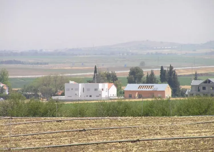
| Village Temains | al-Mukhayzin was completely obliterated and defaced soon after occupation. | ||||||||||||
| Ethnically Cleansing | al-Mukhayzin inhabitants were completely ethnically cleansed. | ||||||||||||
| Clans | Early 19th century, the tribe al-Wuhaydat was the first to settle in the village. | ||||||||||||
| Pre-Nakba Land Ownership |
**Town Lands' Demarcation Maps |
||||||||||||
| Land Usage As of 1945 |
|
||||||||||||
| Population |
|
||||||||||||
| Number of Houses |
|
||||||||||||
| Near By Towns |
|||||||||||||
|
|||||||||||||
| Town's Name Through History | al-Mukhayzin was named after the grains storage warehouses which were built in the village. | ||||||||||||
| Exculsive Jewish Colonies Who Usurped Village Lands |
Chafetz Chayyim, Revadim, Yad Binyamin, and Beyt Chilqiyya. | ||||||||||||
Village TodayAccording to the Palestinian historian Walid Khalidi, the village remaining structures on the village land are:"The village has been completely leveled so that only flat, cultivated fields can be seen. There is a mound of stone and debris, about 2.5 m high, at the southern edge of the site. " |
|||||||||||||
| Related Maps | Town Lands' Demarcation Maps خرائط للقضاء توضح حدود القرى والاودية Town's map on MapQuest View from satellite Help us map this town at WikiMapia |
||||||||||||
| Related Links | Wikipedia's Page Google Search Google For Images Google For Videos |
||||||||||||
| More Information | في كتاب كي لا ننسى في كتاب بلادنا فلسطين المزيد من موقع هوية |
||||||||||||
Want to browse more? 80,000 pictures were grouped in these gallaries:
| Display Name | Clan/Hamolah | Country of Residence |
| طلعت الوحيدي | الوحيدي | غزة, غزة |
| نبض فلسطين | - | الشارقة, الإمارات |
| هيثم الوحيدي | الوحيدي | - |
| Wafiq Bin Jameel Bin Waked Bin Nimer Alwahidi | Alwahidi | Qatar, Qatar |
| amin alwaheidi | alwaheidi | uk, united kingdum |
| wafeeq jamil waked nimer alwahidi | alwuhaidat | state of qatar, state of qatar |
| Moatasem Elwahidi | Elwahidi | Texas, USA |
| MONZER ALWAHIDI | ALWAHIDI | - |
No links have been shared yet, be free to the first to share the first link.


