| PalestineRemembered | About Us | Oral History | العربية | |
| Pictures | Zionist FAQs | Haavara | Maps | |
| Search |
| Camps |
| Districts |
| Acre |
| Baysan |
| Beersheba |
| Bethlehem |
| Gaza |
| Haifa |
| Hebron |
| Jaffa |
| Jericho |
| Jerusalem |
| Jinin |
| Nablus |
| Nazareth |
| Ramallah |
| al-Ramla |
| Safad |
| Tiberias |
| Tulkarm |
| Donate |
| Contact |
| Profile |
| Videos |
Welcome To al-Birwa - البروه (אל-בירוה)
|
District of Acre
Ethnically cleansed days ago |
العربية Google Earth |
 |
Gallery (77) |
- Statistics & Facts
-
Before & After

- Satellite View
- Articles 10
- Pictures 77
- Aerial Views 1
- Oral History 11
- Members 31
- Families
- All That Remains
- Wikipedia
- Videos 7
- Guest Book 28
- Links 5
| Statistic & Fact | Value | |||||||||||||||||||||
| Occupation Date | June 11, 1948 | |||||||||||||||||||||
| Distance From District | 10.5 (km) East of Acre | |||||||||||||||||||||
| Elevation | 60 (meters) | |||||||||||||||||||||
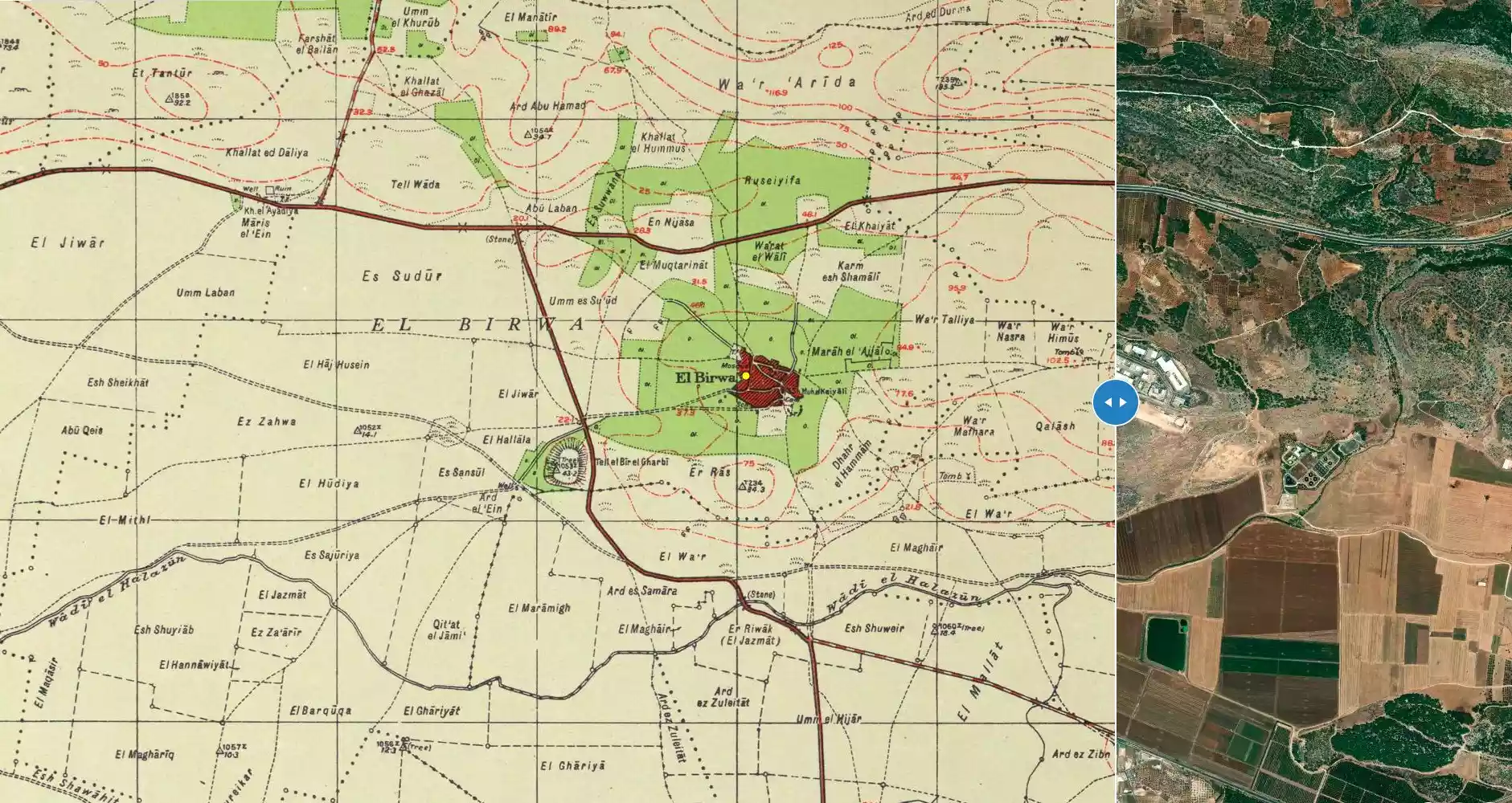
| Before & After Nakba, Click Map For Details |
||||||||||||||||||||||
|
||||||||||||||||||||||
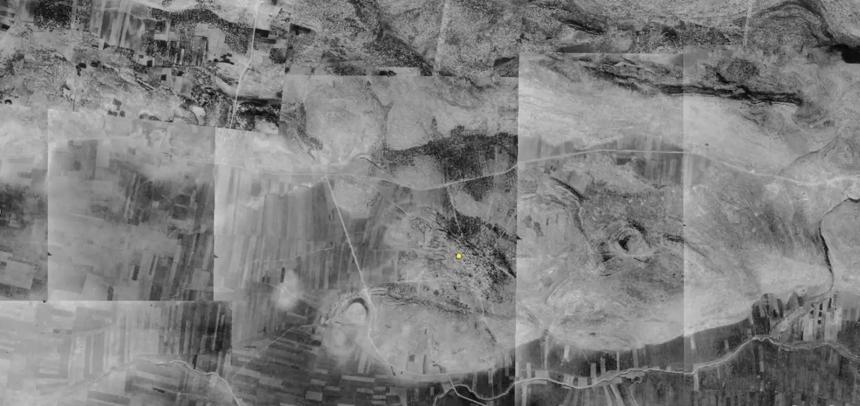
| Pre-Nakba Aerial View |
||||||||||||||||||||||
|
||||||||||||||||||||||
| Map Location | See location #23 on the map View from satellite |
|||||||||||||||||||||
| Military Operation | Operation Dekel | |||||||||||||||||||||
| Defenders | Local militia & Arab Liberation Army | |||||||||||||||||||||
| Exodus Cause | Military assault by Zionist troops | |||||||||||||||||||||
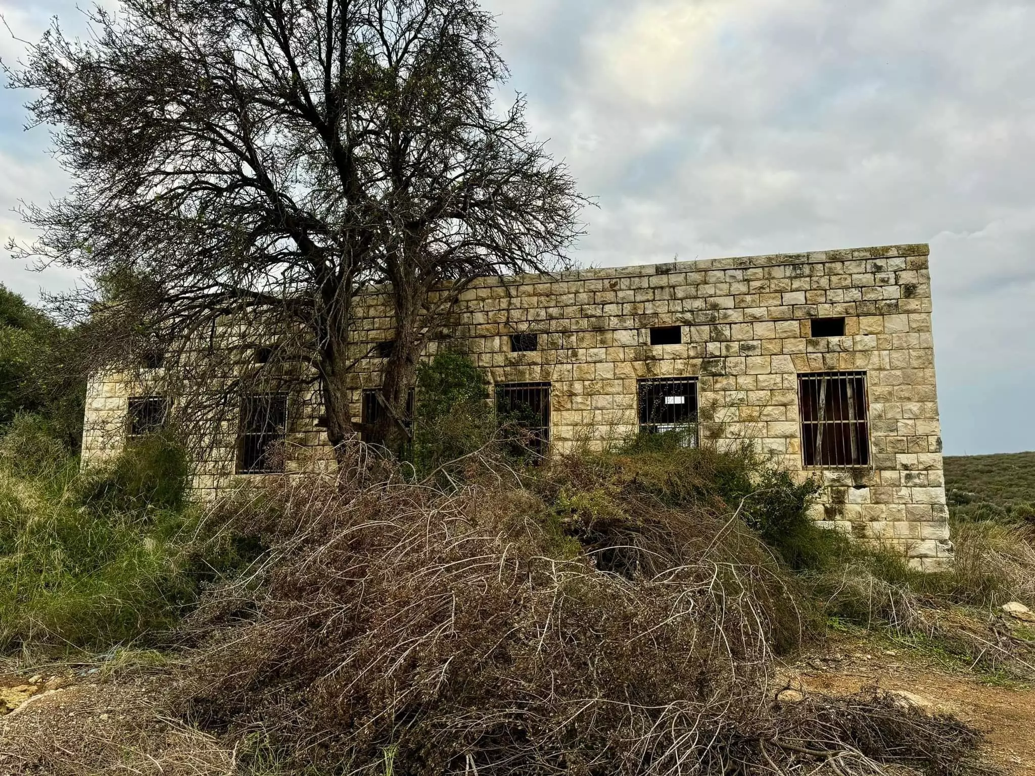
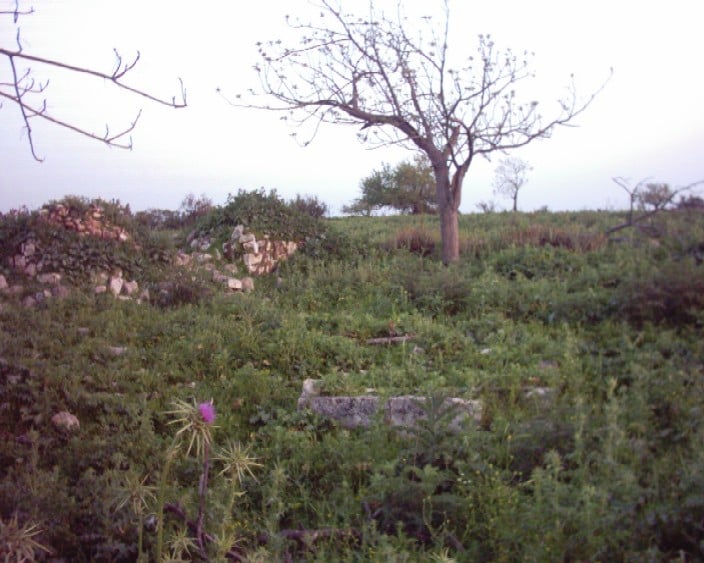
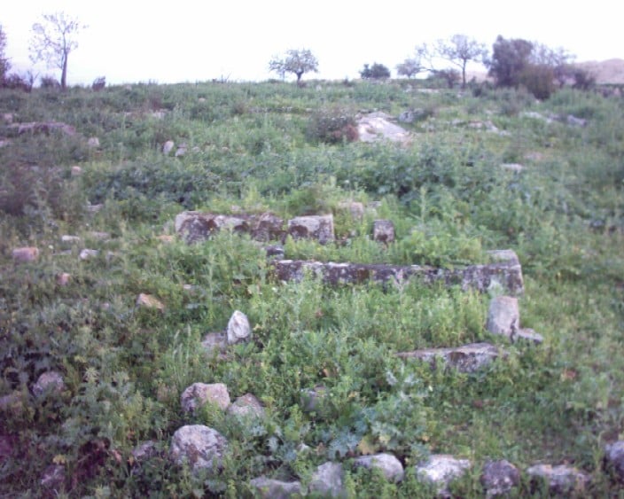
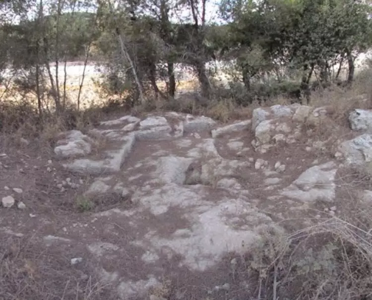
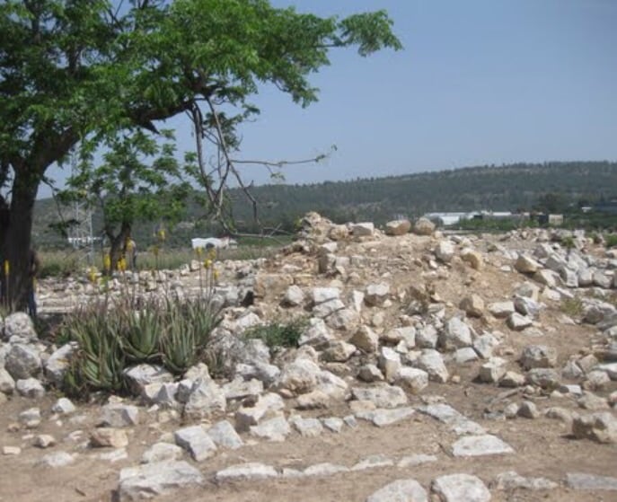
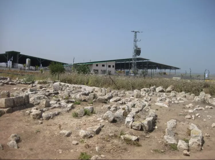
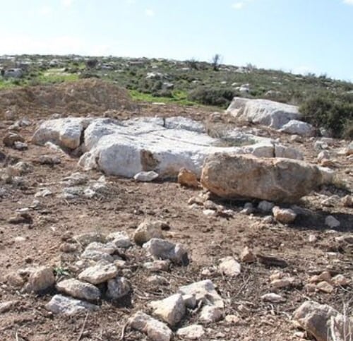
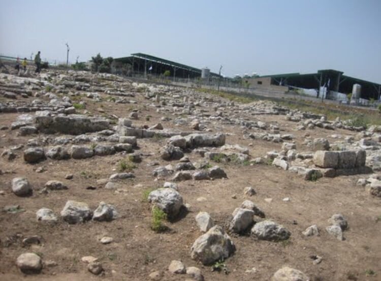
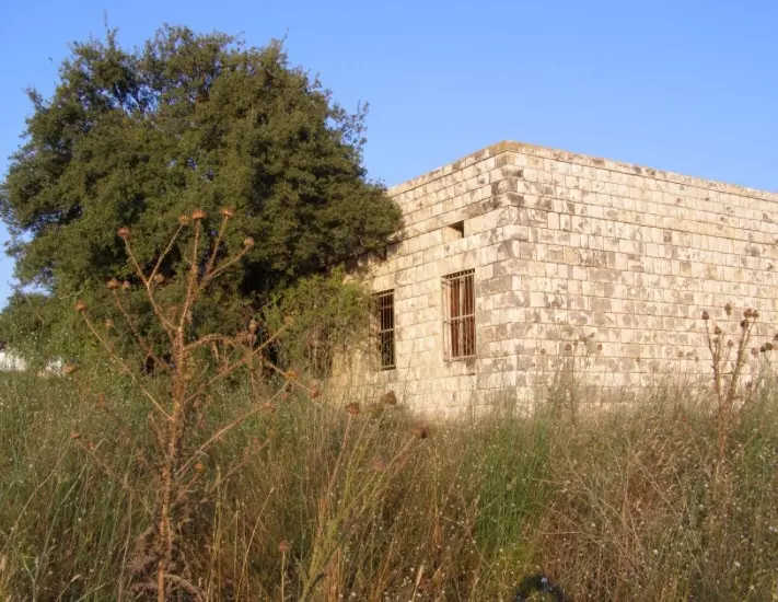
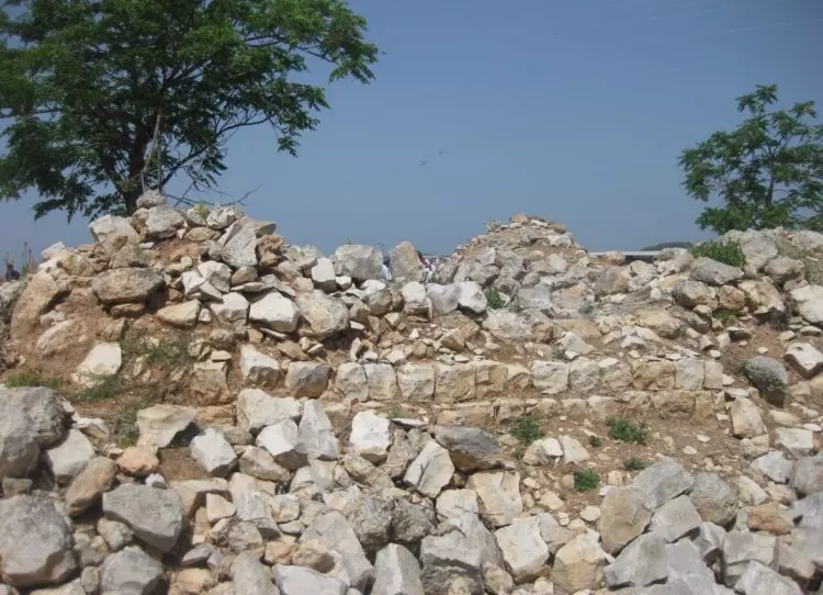
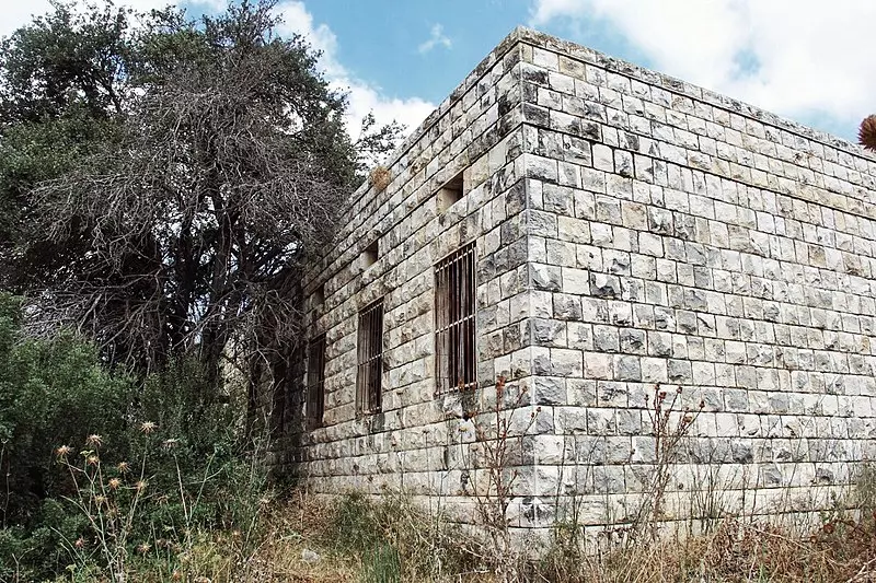
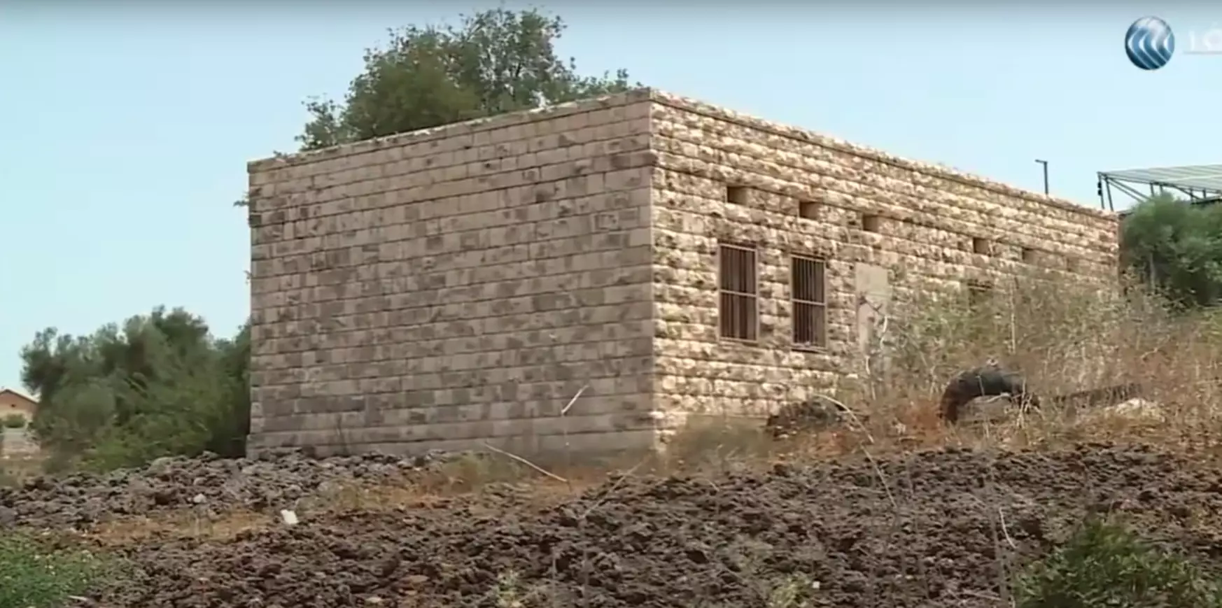
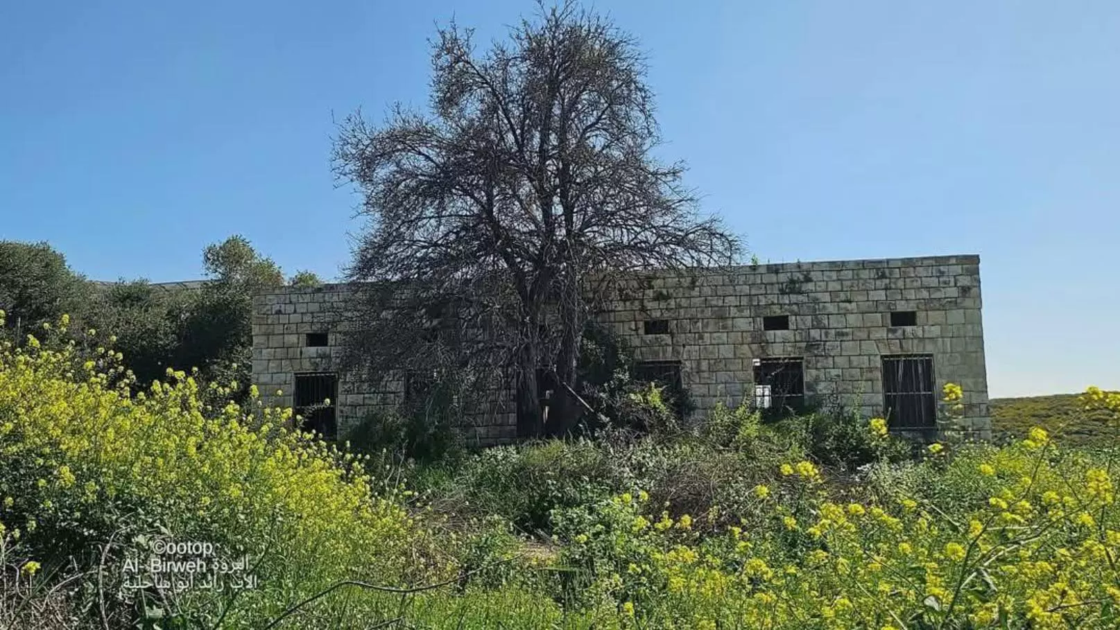
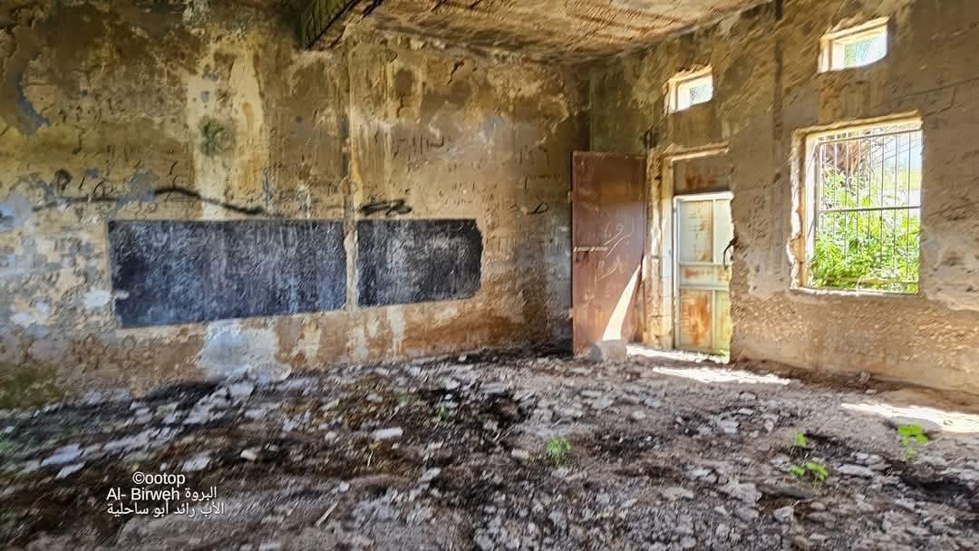
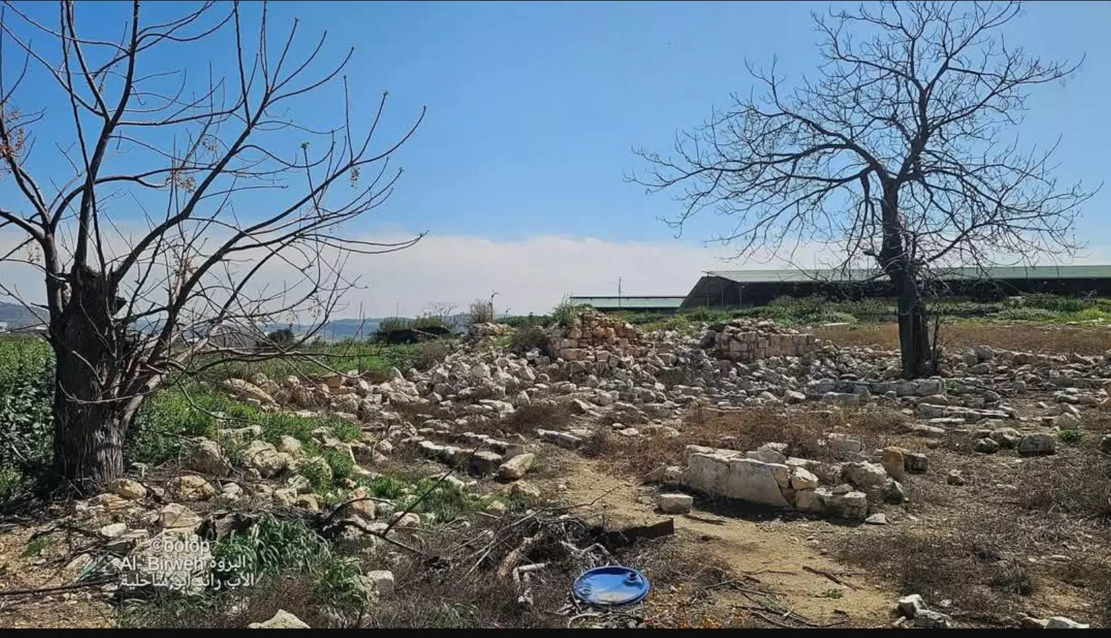
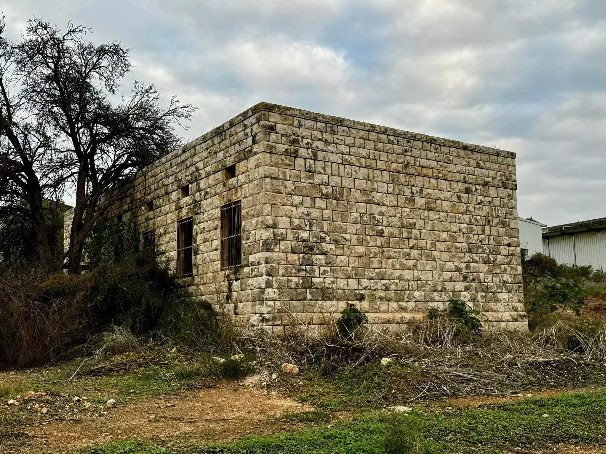
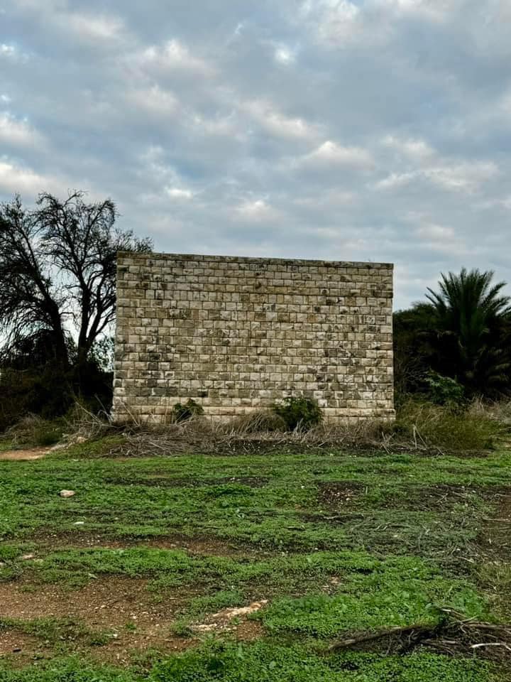
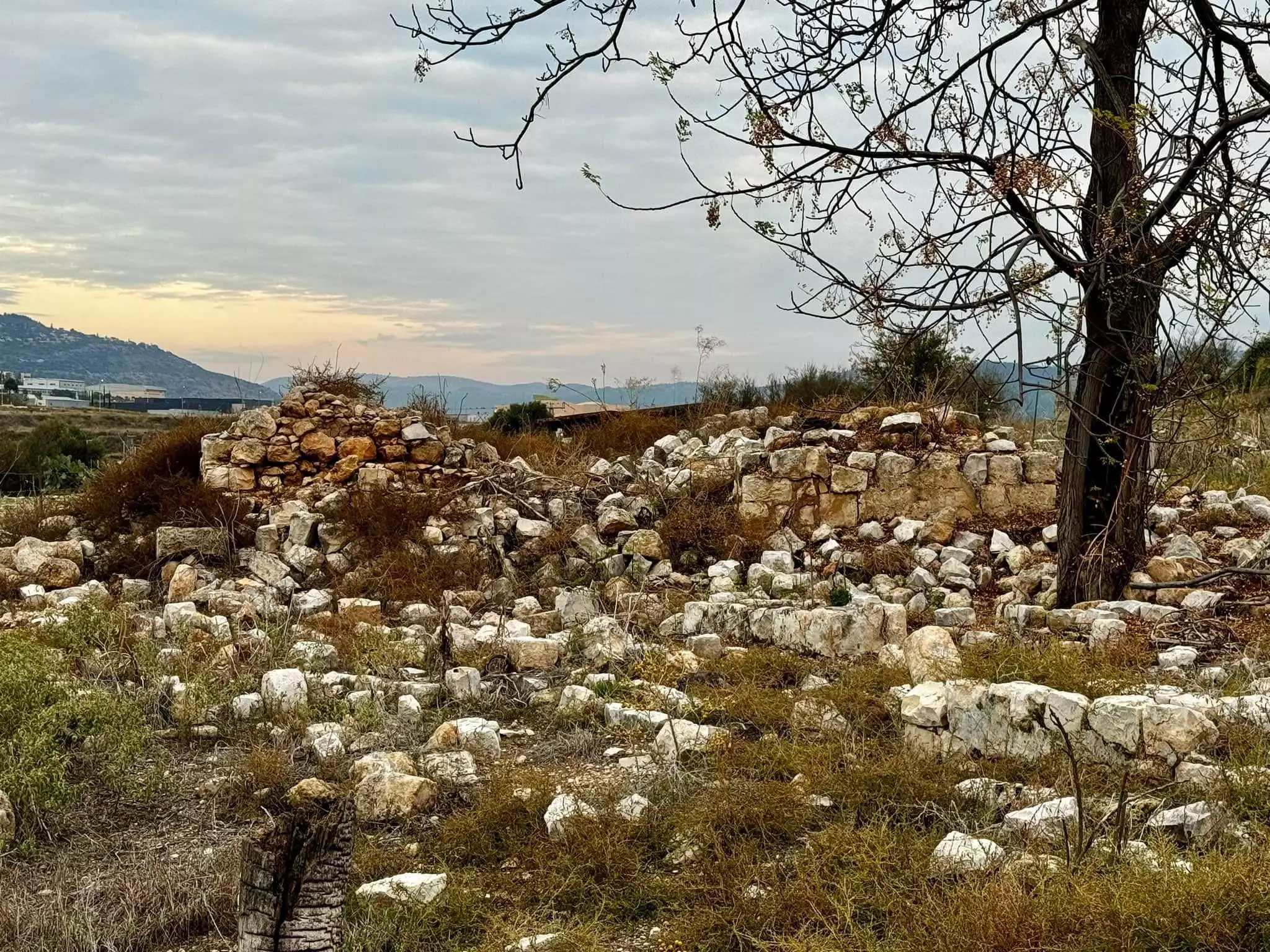
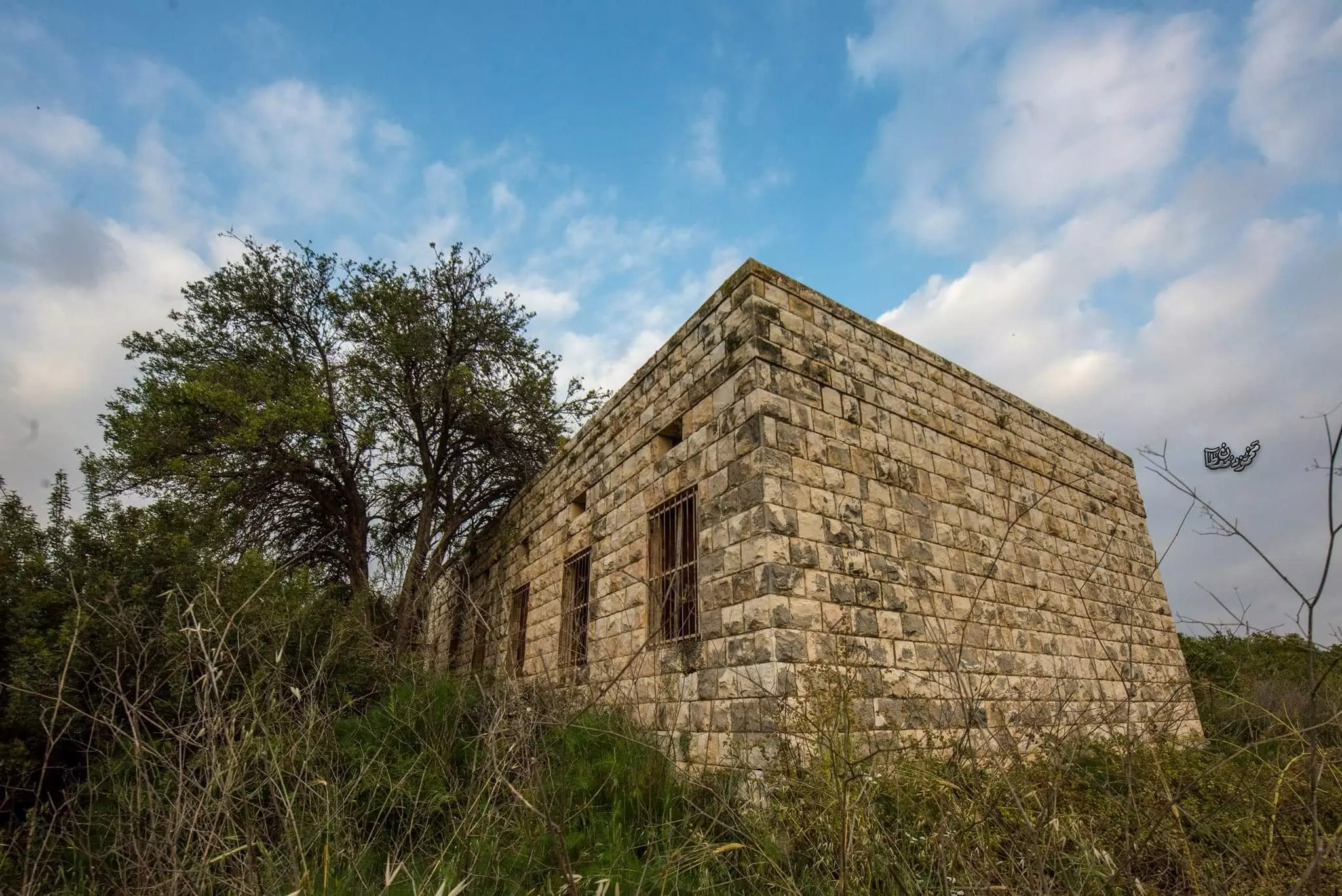
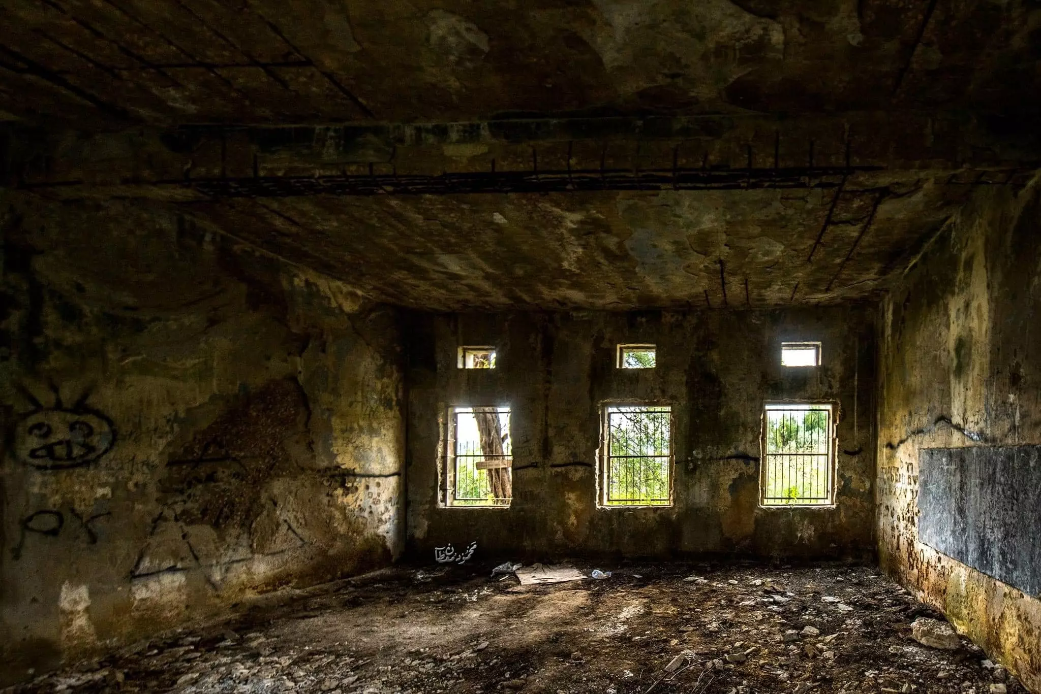
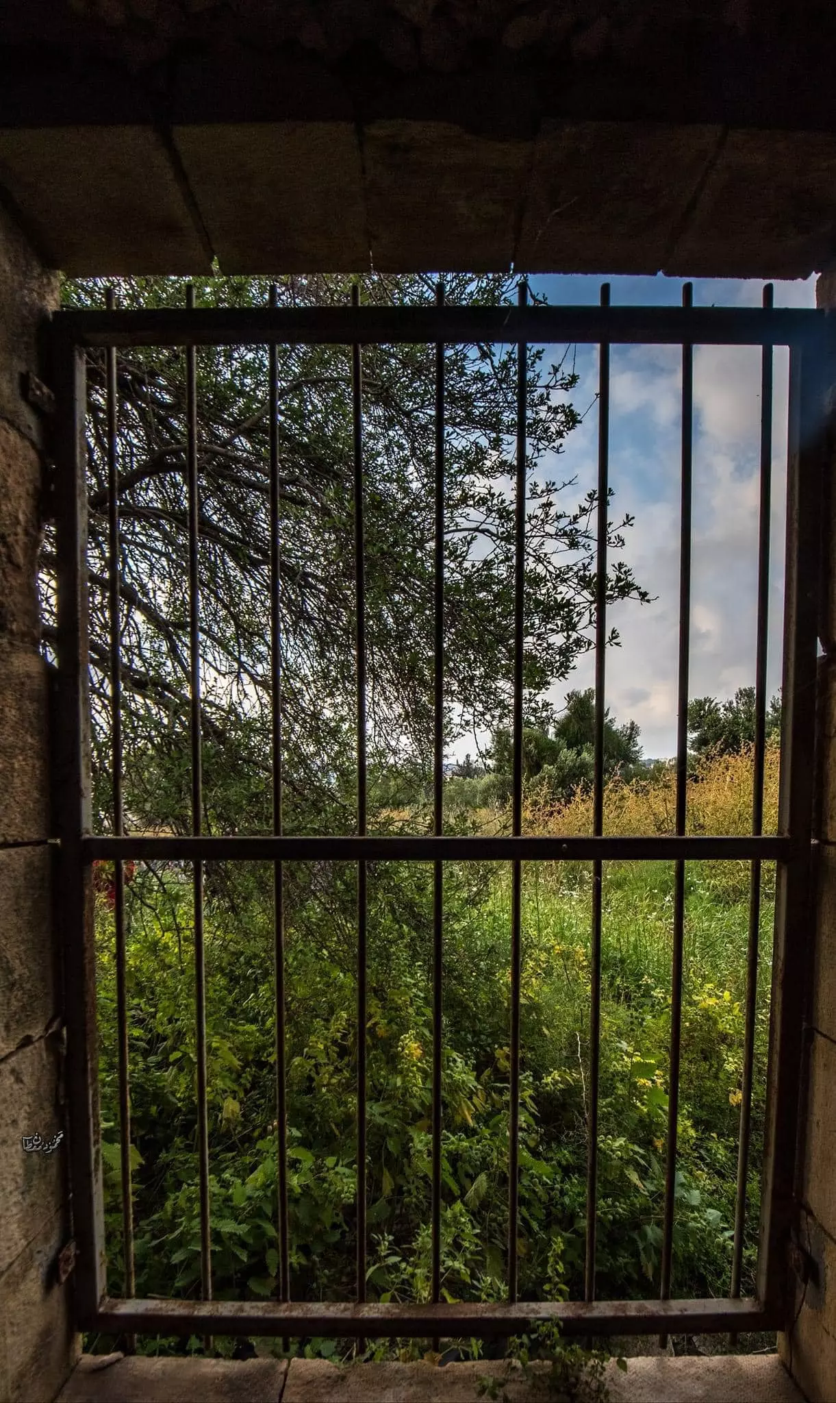
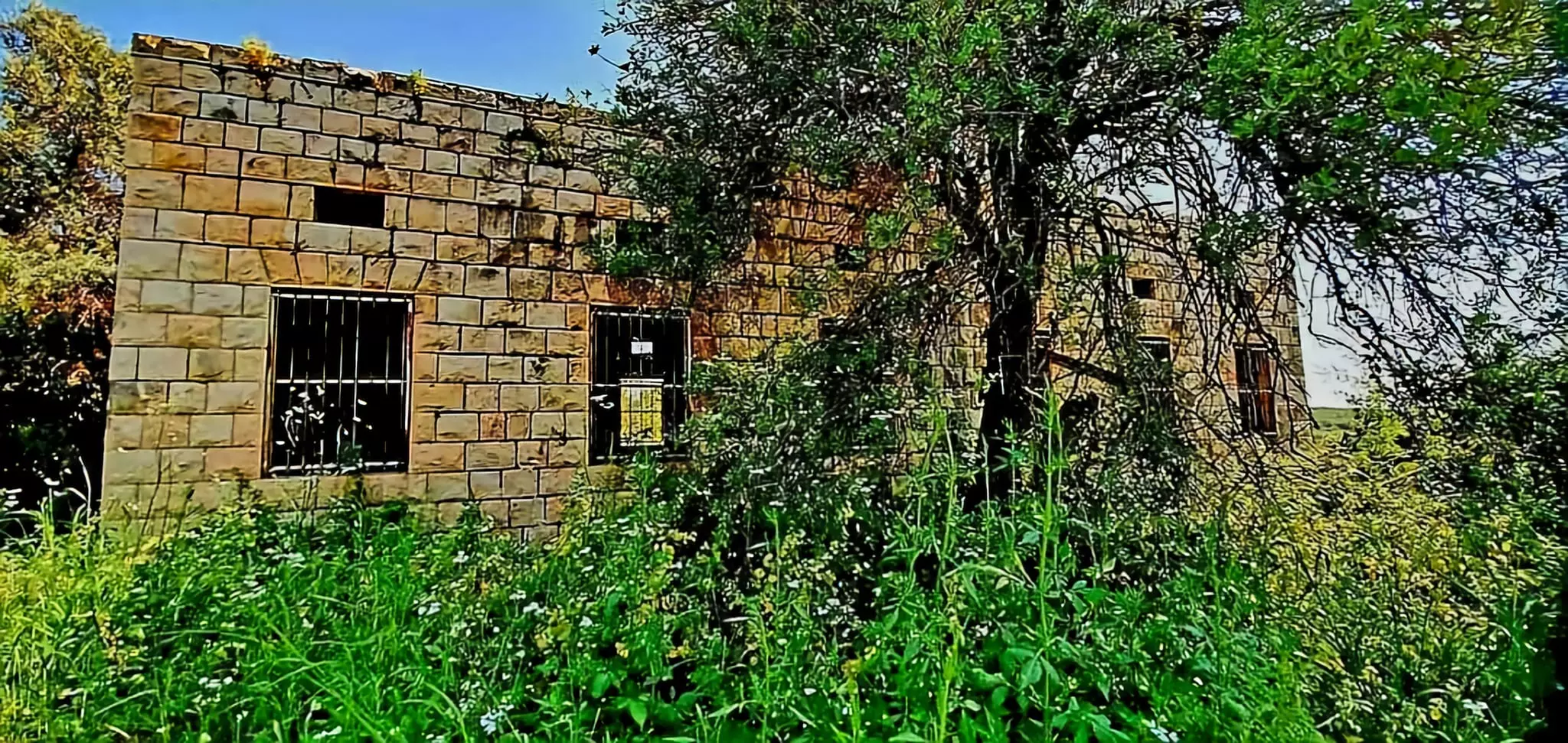
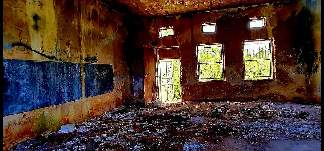
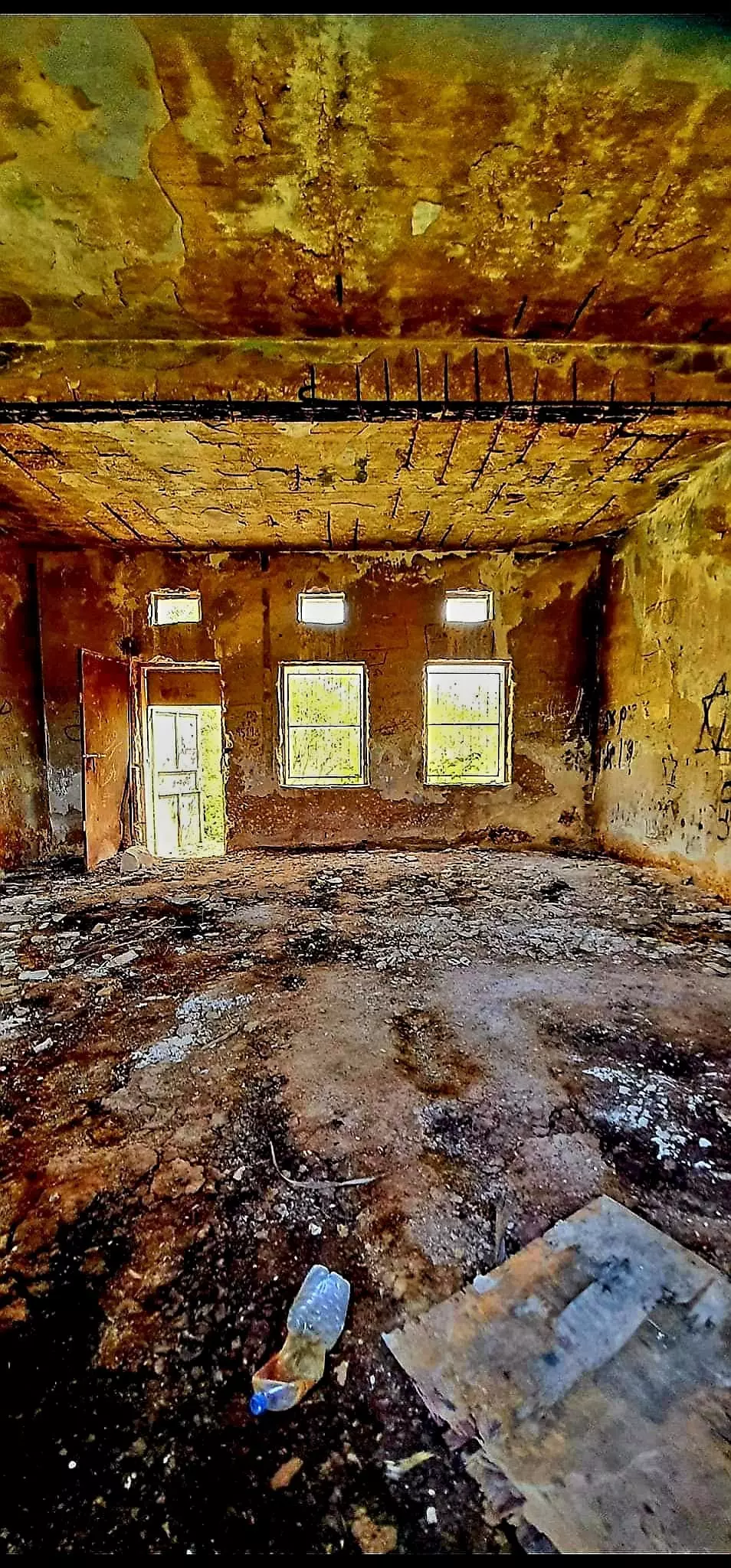
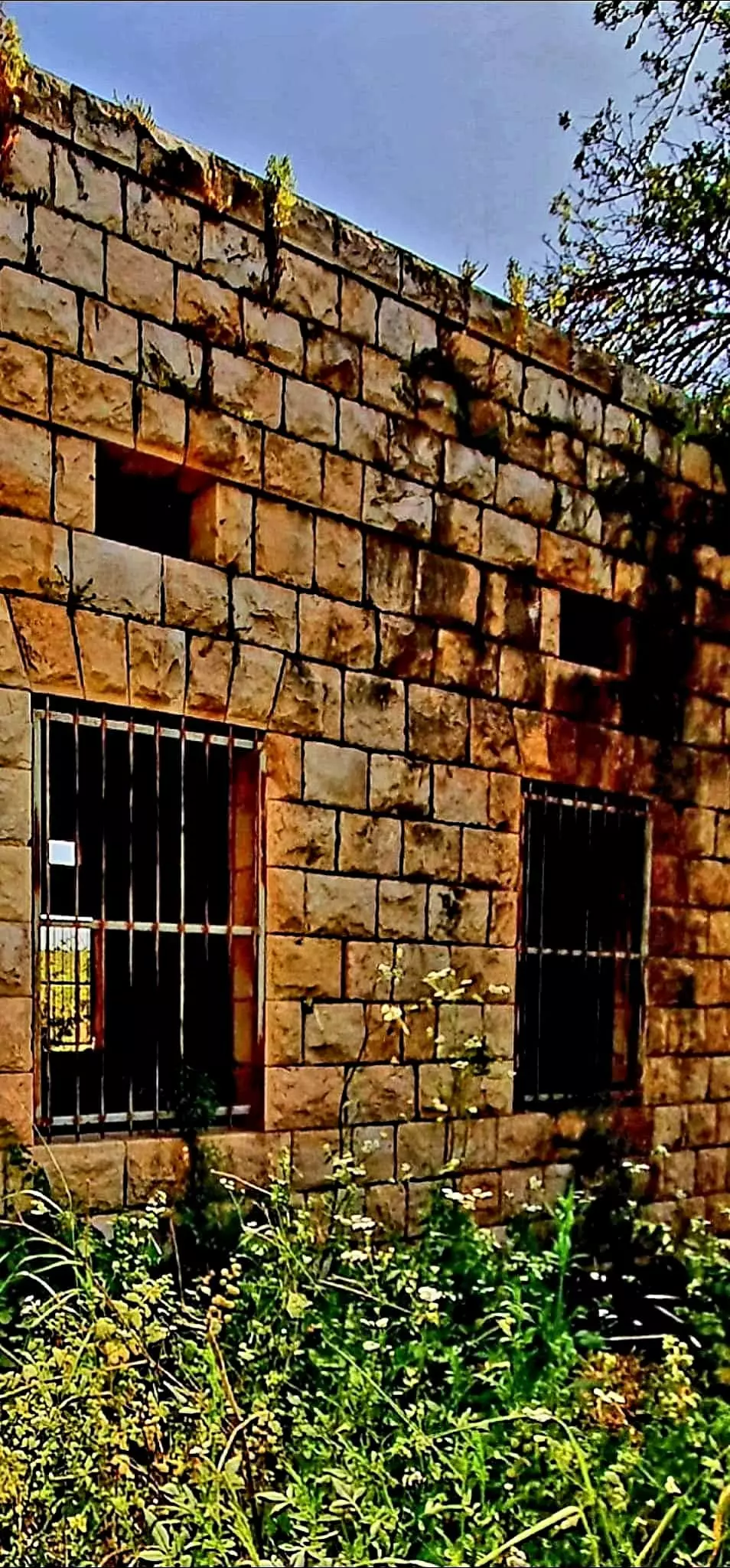
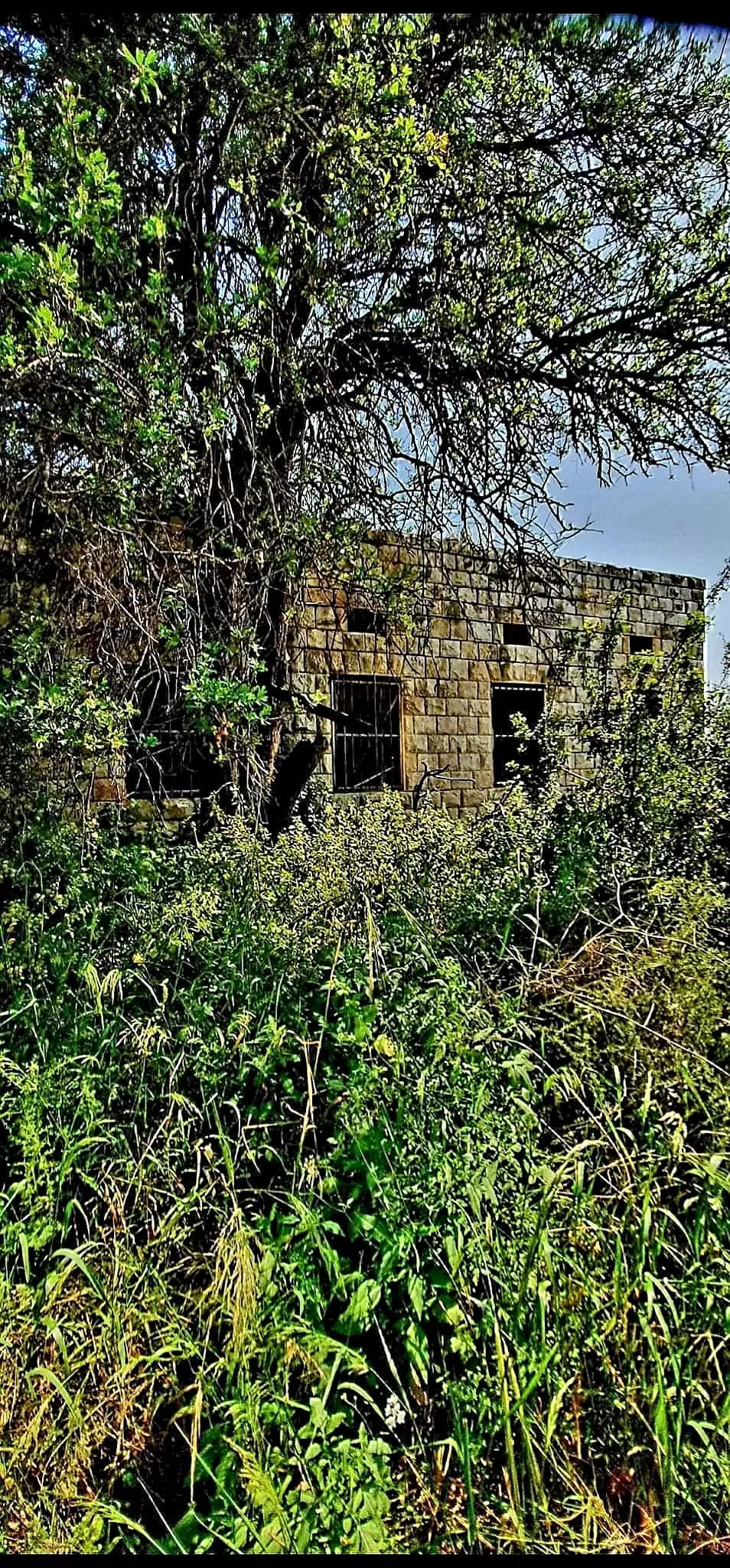
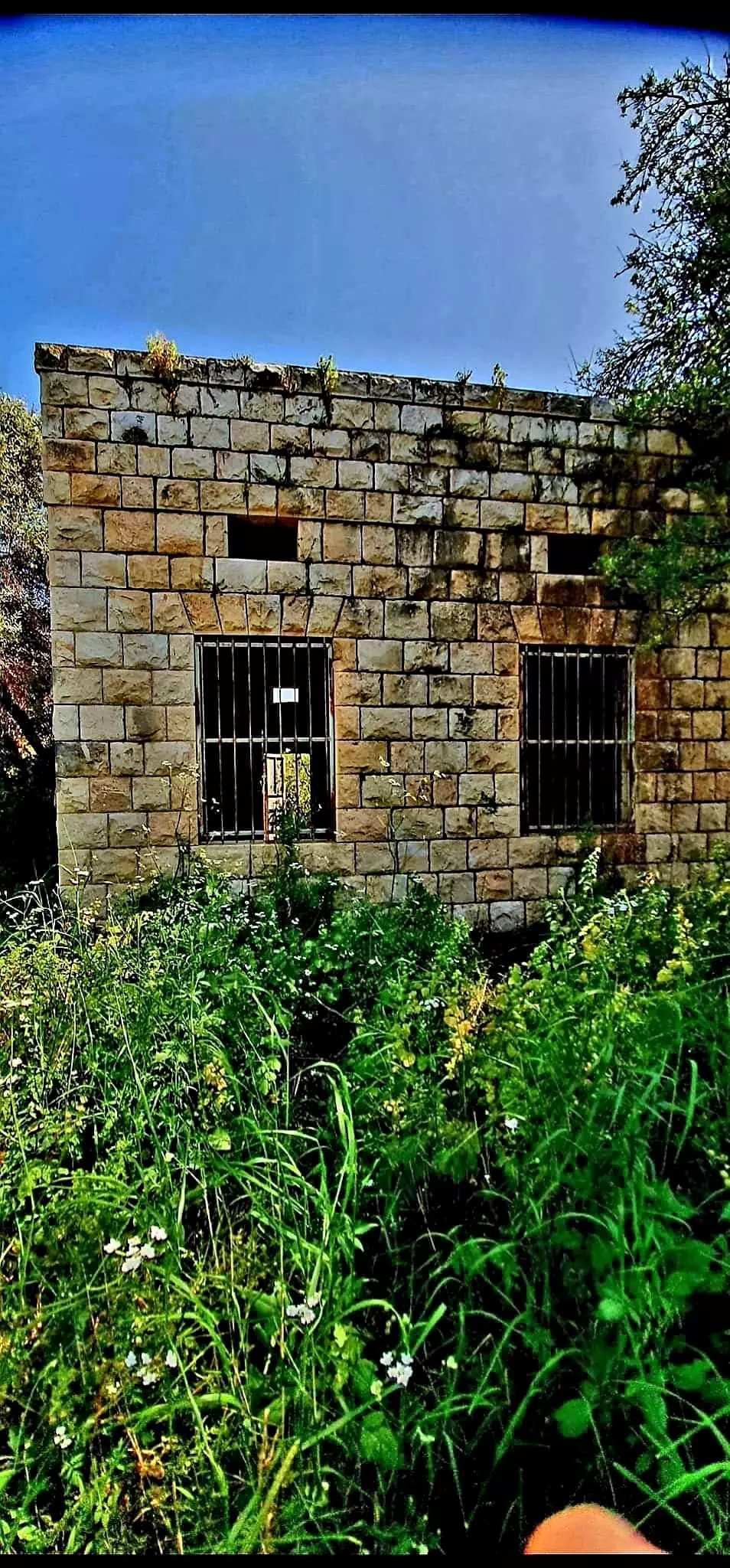
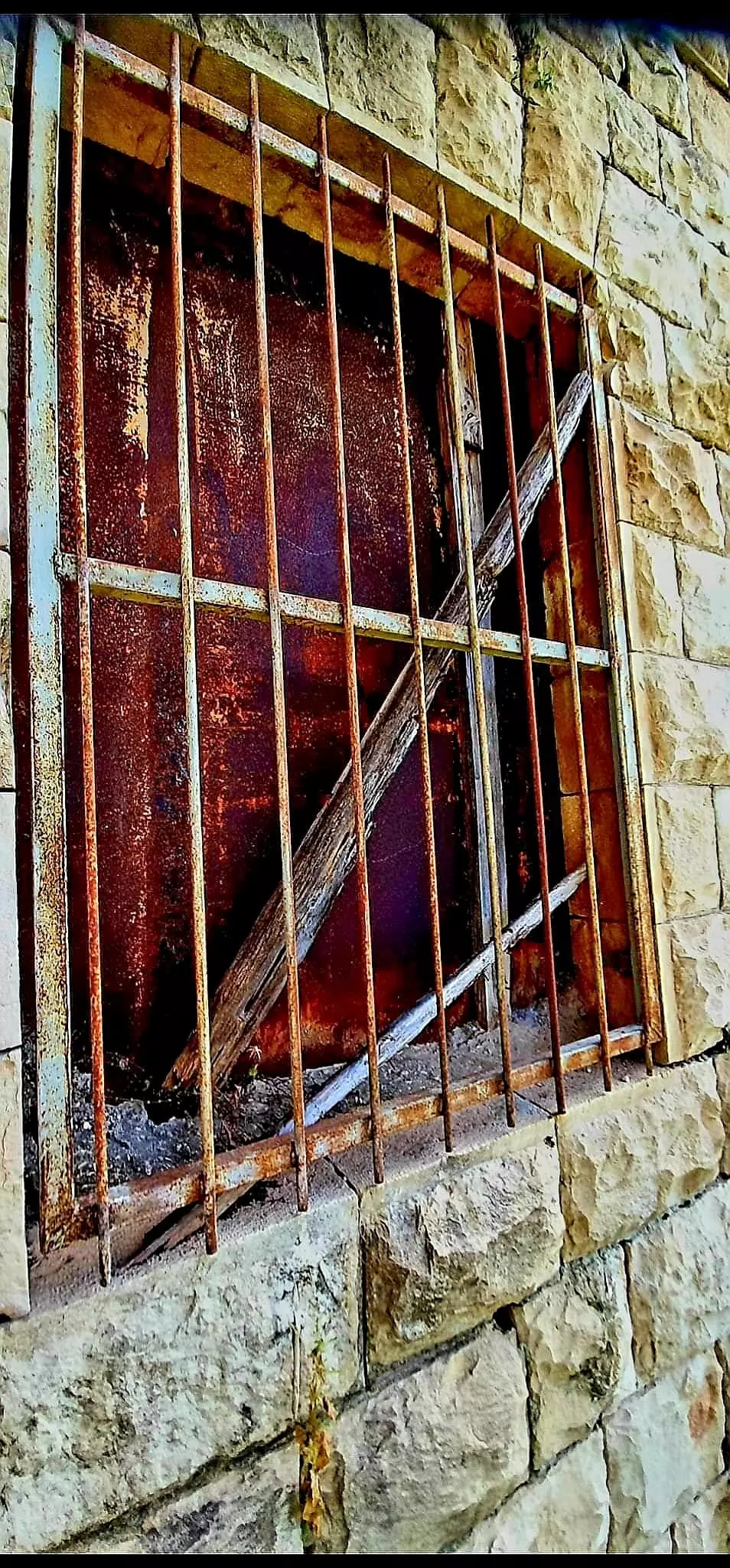
| Village Temains | al-Birwa was mostly destroyed with the exception of three houses, two shrines, and one of the village schools remain standing. | |||||||||||||||||||||
| Ethnically Cleansing | al-Birwa inhabitants were completely ethnically cleansed. | |||||||||||||||||||||
| Pre-Nakba Land Ownership |
**Town Lands' Demarcation Maps |
|||||||||||||||||||||
| Land Usage As of 1945 |
|
|||||||||||||||||||||
| Population |
|
|||||||||||||||||||||
| Number of Houses |
|
|||||||||||||||||||||
| Near By Towns |
||||||||||||||||||||||
|
||||||||||||||||||||||
| Town's Name Through History | The Crusades referred to al-Birwa by Broet. | |||||||||||||||||||||
| Schools | al-Birwa had two schools: the 1st school was an elementary school for boys founded by the Ottomans in 1888, and the 2nd was for girls which was founded in 1943 (one of the schools remains standing, but it requires serious renovations guys. Any volunteers!) | |||||||||||||||||||||
| Town's Notable People | The famous Palestinian poet Mahmoud Darwish, who currently resides in Ramallah, occupied West Bank. | |||||||||||||||||||||
| Places of Warship | One mosque and one church. | |||||||||||||||||||||
| Shrines / Maqams | Two shrines for local sages , and both shrines remain standing to this date. | |||||||||||||||||||||
| Archeological Sites | Khirbat Tall Bir al-Gharbi to the west contains artifacts dating from 2300 to 900 B.C. | |||||||||||||||||||||
| Exculsive Jewish Colonies Who Usurped Village Lands |
Kibbutz Yas'ur and Achihud. | |||||||||||||||||||||
| Featured Video | ||||||||||||||||||||||
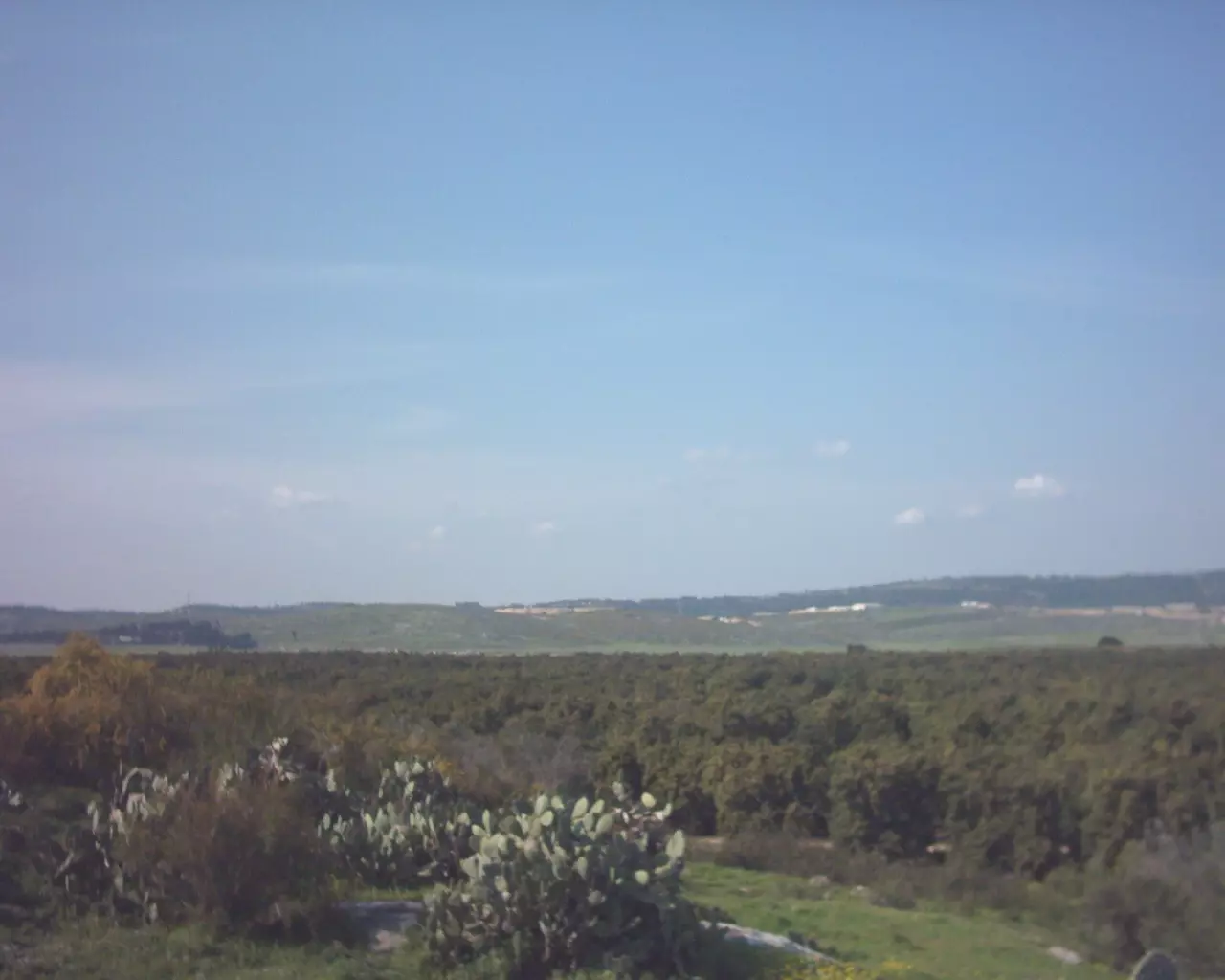
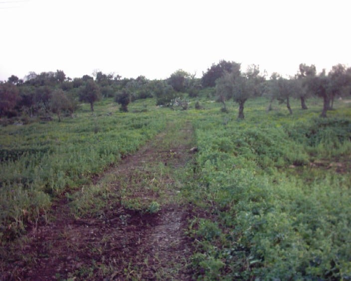
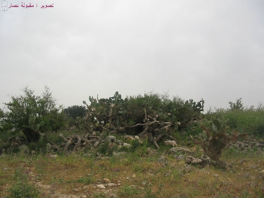
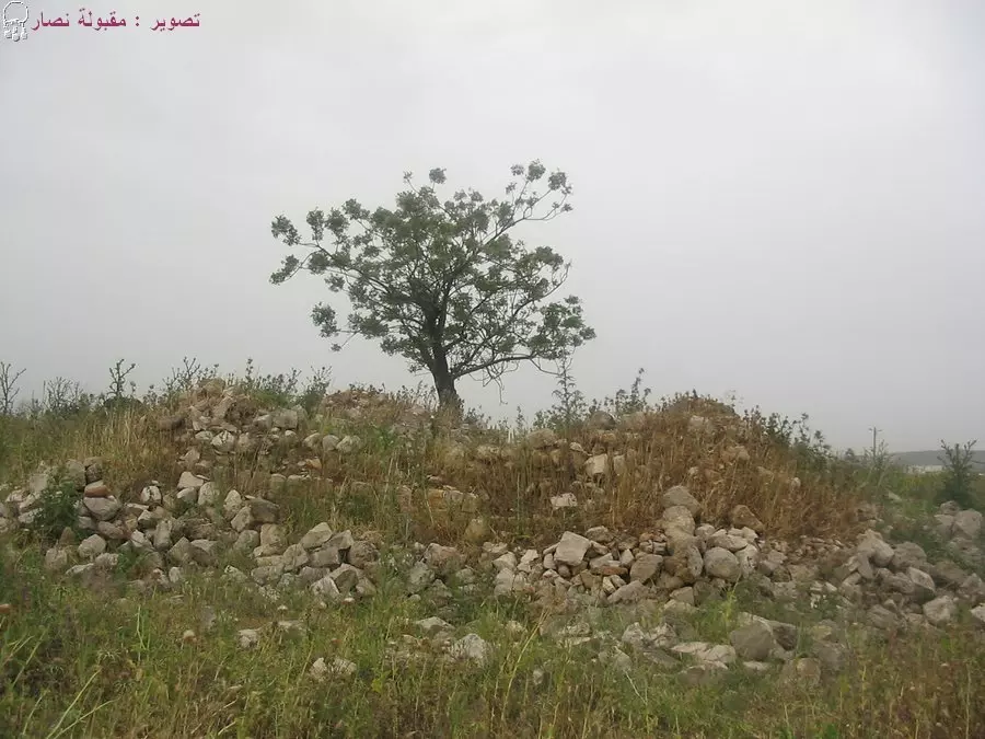
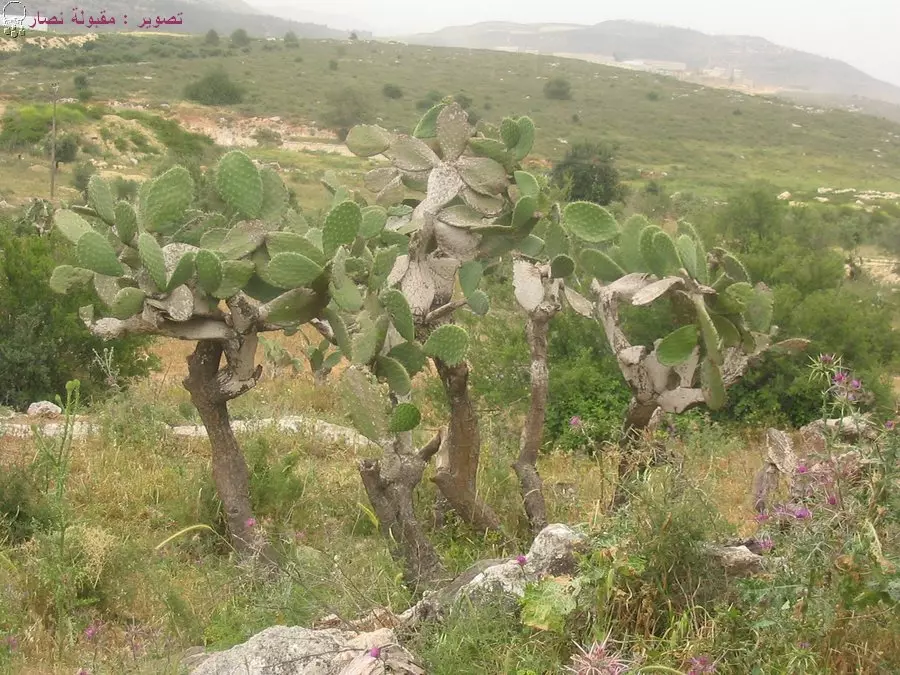
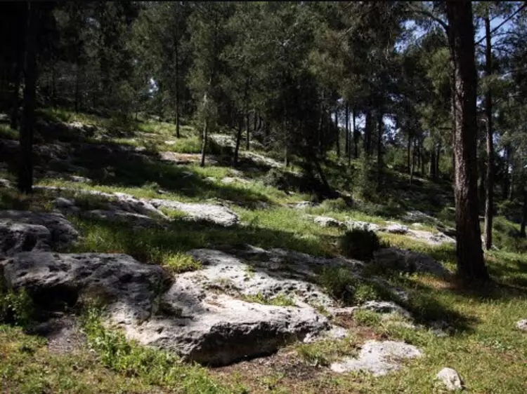
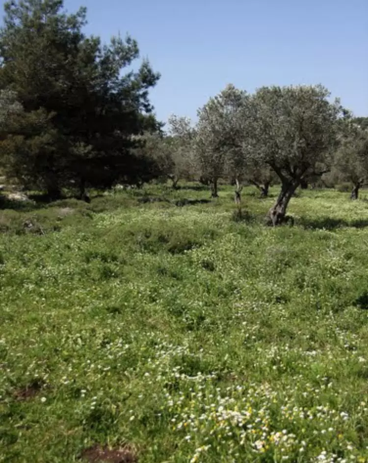
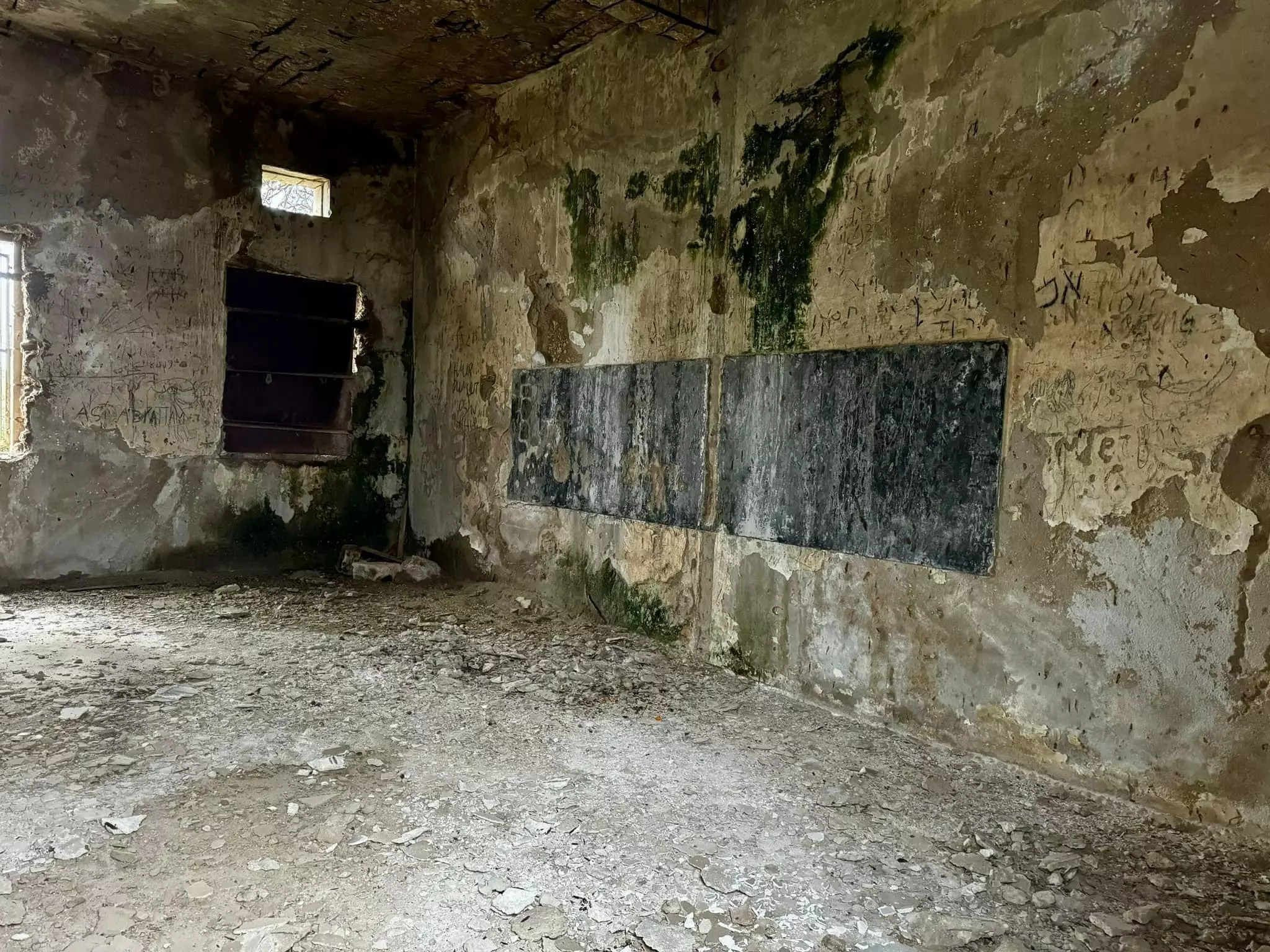
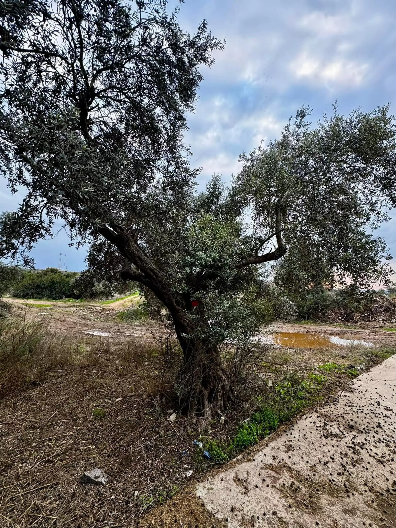
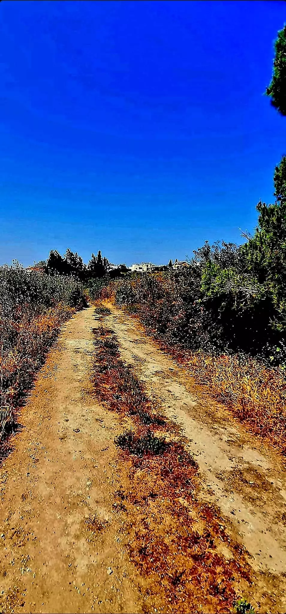
Village Before NakbaThe village stood on a rocky hill that sloped towards the Acre plain. It was a short distance southeast of the junction of two highways, one leading to Acre and the other to Haifa. The Persian traveler Nasir Khusraw (d. 1084), who passed through the village in 1047, called it Birwa ; the Crusaders called it Broet. The village was built around two intersecting roads and its houses were made of stone and mud with wood-and-mud roofs. In 1596, al-Birwa was a village in the nahiya of Akka (liwa' of Safad), with a population of 121. It paid taxes on a number of crops (such as wheat, barley, and fruit) and on other types of produce (such as goats and beehives). In the late nineteenth century, al-Birwa was a large village near the edge of a plain, with a well on the south and olive trees on the north. The estimated 900 residents who lived there tilled about 50 faddans (1 faddan = 100-250 dunums).The village expanded considerably during the Mandate, when it became fashionable to build houses with cement roofs. The population consisted of 1,330 Muslims and 130 Christians. Al-Birwa had a mosque, a church, and two schools. One school, for boys, was built by the Ottomans in 1882; the second school, for girls, was founded in 1942/43. Agriculture represented the mainstay of the economy; the villagers cultivated wheat, barley, corn, sesame, and watermelons. In 1944/45 a total of 8,457 dunums was allotted to cereals; 1,548 dunums were irrigated or used for orchards, of which 1,500 dunums were planted with olive trees. The villagers operated three olive presses; two were animal-drawn and the third was mechanized. A tell (Tall Bir al-Gharbi) that lay directly to the west contained artifacts dating from 2300 to 900 B.C. and may have been a source of cut stone for the village buildings. Village Occupation and Ethnic CleaningOn the eve of the first truce of the war, Israeli forces tried to consolidate their positions in the western Galilee by taking control of the hills parallel to the coast. According to the History of the War of Independence, they managed to occupy al-Birwa and positions overlooking the village at this time (around 11 June 1948). This push was probably effected by the Carmeli Brigade in the wake of Operation Ben-Ami . Battles in this area persisted despite the truce. The Israeli army announced on 25 June that its troops had clashed with Arab units at al-Birwa, inflicting 100 casualties. The New York Times correspondent reported that there had been fighting in the village for two days and that United Nations observers were on the scene investigating the truce violations. The reports added that the village "had been held by a small Israeli garrison prior to the truce," and "fell into the hands of the Arabs when troops operating out of Nazareth launched a surprise attack and recaptured the village."In later years, some of the villagers described the situation at al-Birwa in greater detail, giving an account that diverges somewhat from that of the Haganah and the foreign press. According to their version, the clash at the village was between the Haganah and a group of sparsely armed villagers. Eyewitnesses interviewed by Palestinian historian Nafez Nazzal stated that Zionist forces entered the village on the morning of 11 June, just before the first truce. About forty-five elderly people hid in the church with the village priest. After losing some men in the attack, the village's defenders ran out of ammunition and began to withdraw. The villagers took refuge in surrounding villages for about thirteen days and then decided to reenter the village to harvest their fields before the crops were spoiled. Over ninety-six men armed with rifles and an equal number of unarmed men and women assembled near the front lines of the Arab Liberation Army (ALA). (The ALA did not participate because it had not received any orders.) They then made their way across the lines, shouting Allahu akbar! ("God is greater [than the enemy]!") One villager recalled: "The armed men were in the first line of attack. They were followed by the unarmed men who were carrying shovels, axes and sticks-they picked up the rifles of those who fell in the fighting. Behind came our women, carrying water to help the injured." The villagers took the Zionist occupiers by surprise, attacking from three directions and forcing them to withdraw to an area about half a kilometer to the west of al-Birwa. They harvested the crops-some had already been harvested by the Haganah troops-and remained in the village for two days, until 24 June. The ALA then suggested that the villagers join their families in surrounding villages; it then took control of the village. But that same evening, the Zionists launched a counterattack and the ALA withdrew, allowing the village to be captured a second time. Many people stayed on the outskirts of al-Birwa and in surrounding villages for a long time; some managed to find their way back to gather some belongings. The village was not firmly captured until the first stage of Operation Dekel , after the end of the first truce of the war, around mid-July 1948. The Haganah account indicates that the ALA put up a fight in the vicinity of the village, but by the beginning of the second truce on 18 July, the village lay firmly behind Israeli lines. Zionists Colonies on Village LandsOn 20 August 1948, a blueprint submitted by the Jewish National Fund to the Israeli cabinet called for building a settlement on the village site. On 6 January 1949, Kibbutz Yas'ur was inaugurated on the site, formally supplanting the village of al-Birwa. In 1950 the settlement of Achihud was established on the western part of village land.Village TodayThree houses, two shrines, and a school remain. One of the shrines is made of stone and has a dome with a shallow curvature that spans the entire roof. The school's architecture is similar to that of Qula. All of these landmarks stand deserted amid cactuses, weeds, and fig, olive, and mulberry trees. The debris of destroyed houses punctuates the vegetation. There are also some graves near the site that are in a state of neglect. Part of the site and the land are farmed by the residents of Achihud.SourceDr. Walid al-Khalidi, 1992: All That Remains. |
||||||||||||||||||||||
| Related Maps | Town Lands' Demarcation Maps خرائط للقضاء توضح حدود القرى والاودية Town's map on MapQuest View from satellite Help us map this town at WikiMapia |
|||||||||||||||||||||
| Related Links | Wikipedia's Page Facebook Page Google Search Google For Images Google For Videos |
|||||||||||||||||||||
| More Information | في كتاب كي لا ننسى في كتاب بلادنا فلسطين في كتاب النكبة والفردوس المفقود المزيد من موقع هوية |
|||||||||||||||||||||
- كتاب قرية البروة المهجرة - محمد دبدوب
- Encyclopedia Of The Palestinians: Biography of Mahmoud Darwish
- Memory for forgetfulness by By Mahmoud Darwish
- Identity Card by Mahmoud Darwish
- تصحيح بعض المعلومات الواردة عن البروة
- Amena Mahmoud Hawach
- عائلات البروة قبل ال48 ومكان تواجدهم اليوم
- نبذة تاريخية عن قرية البروه (قضاء عكا) من كتاب (كي لا ننسى)
- جبش الانقاذ لم ينقذ البروة
- كيف سقطت البروة مرتين -- محمد ميعاري
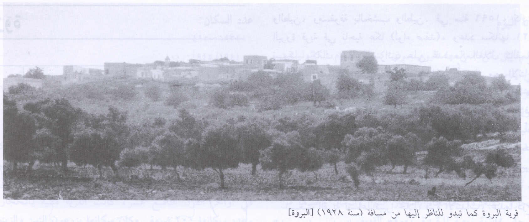
- Village Site from a distance in 1928
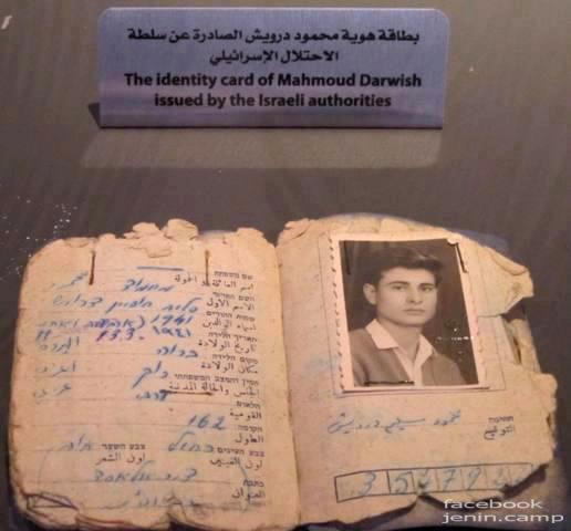
Scanned from "All That Remains" by Dr. Walid Khalidi 8 - Mahmoud Darwish's identity card that was originally issued by the Israeli authorities
- منظر علم عند العين عام 1944، منقول من صفحة احمد مروات على الفيسبوك
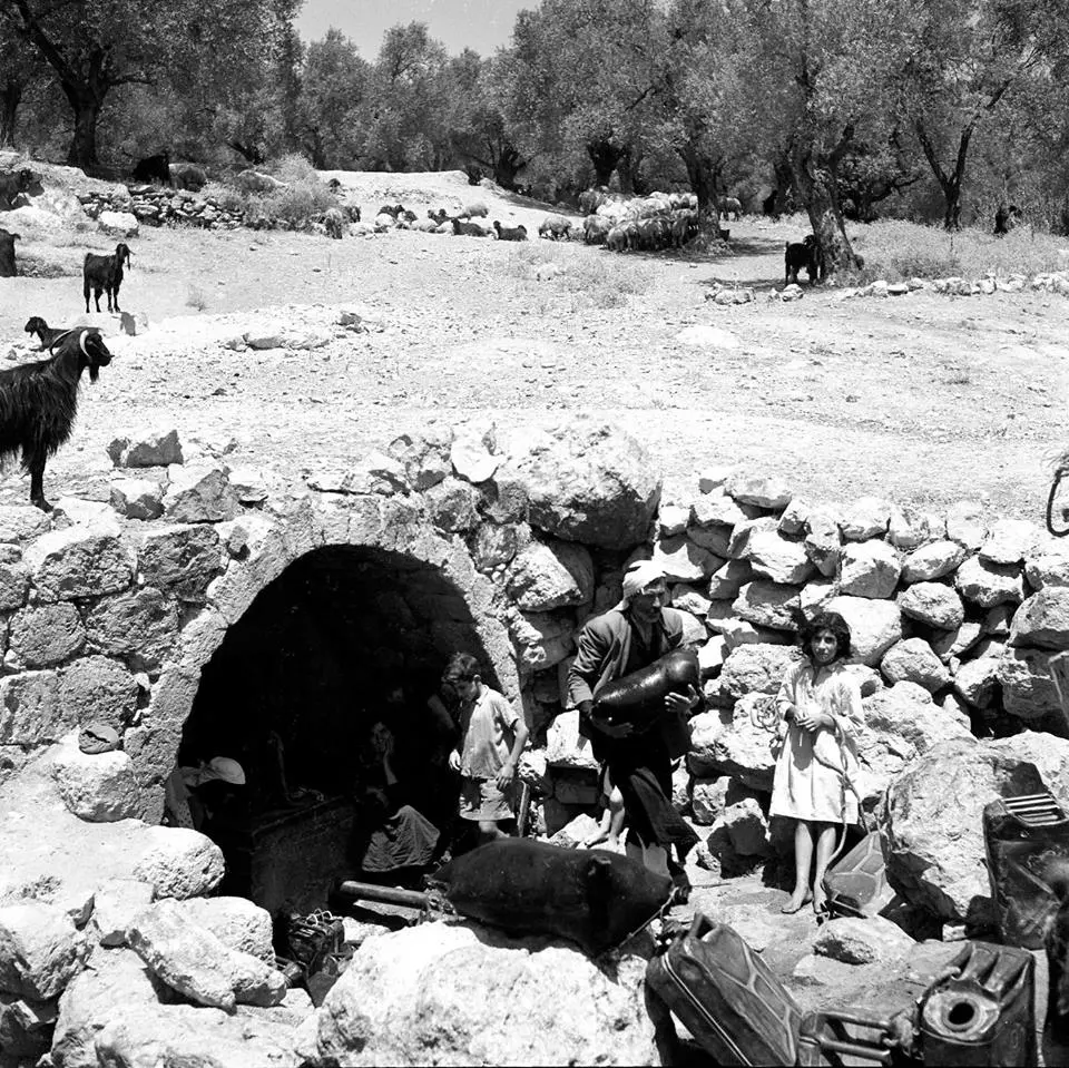
- al-Birwa's destroyed Olive Press in 1995 (scanned from al-Masharef Journal No. 3, Haifa), and in the background you can see the houses of the Israeli Jewish settler built on stolen lands
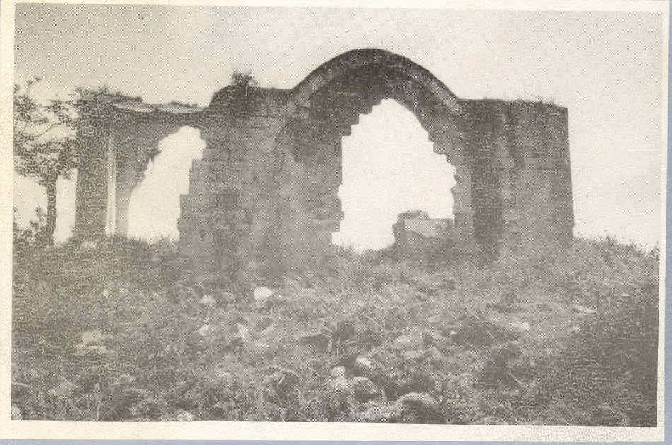
Posted by mahmoud kayyal 1 - Destroyed church of al-Birwah
Posted by mahmoud kayyal 2 - village lands from al Damon side
Posted by Makbula Nassar 1 - طريق تمر من اراضي القرية , من الناحية الشرقية تصل الى المقبرة 2003
Posted by Makbula Nassar 1 - جانب من المقبرة , الت اصبحت جزء من مراعي للابقار لمستوطنة احيهود المقامة على الجزء الشرقي من اراضي البلد 2003
Posted by Makbula Nassar 2 - جانب من المقبرة , الناحية الداخلية ( شرقي القرية ) 2003
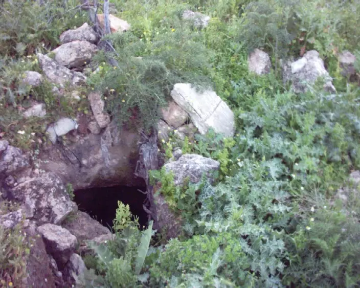
Posted by Makbula Nassar - مغارة صخرية موجودة على مقربة من المقبرة , 2003
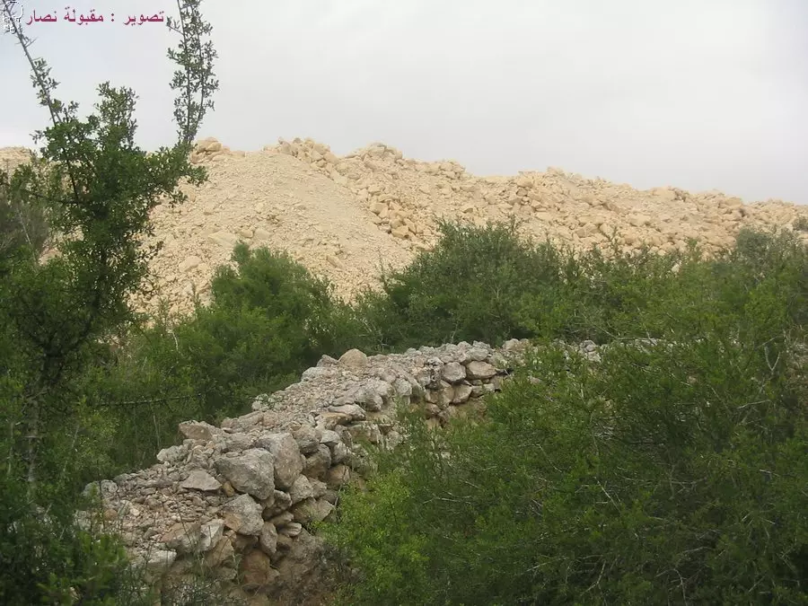
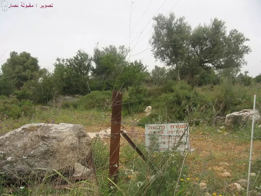
Posted by Makbula Nassar 2 - اراضي القرية, تظهر مستوطنة احيهود الى الغرب , واكوام التراب تغطي مساحات واسعة من القرية لضمها الى المنطقة الصناعية المجاورة 21.4.2005 : تصوير مقبولة نصار
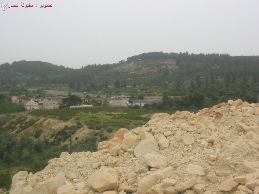
Posted by Makbula Nassar - تظهر ناحية المنطقة الصناعية التي تلتهم اراضي القرية 21.4.2005 : تصوير مقبولة نصار
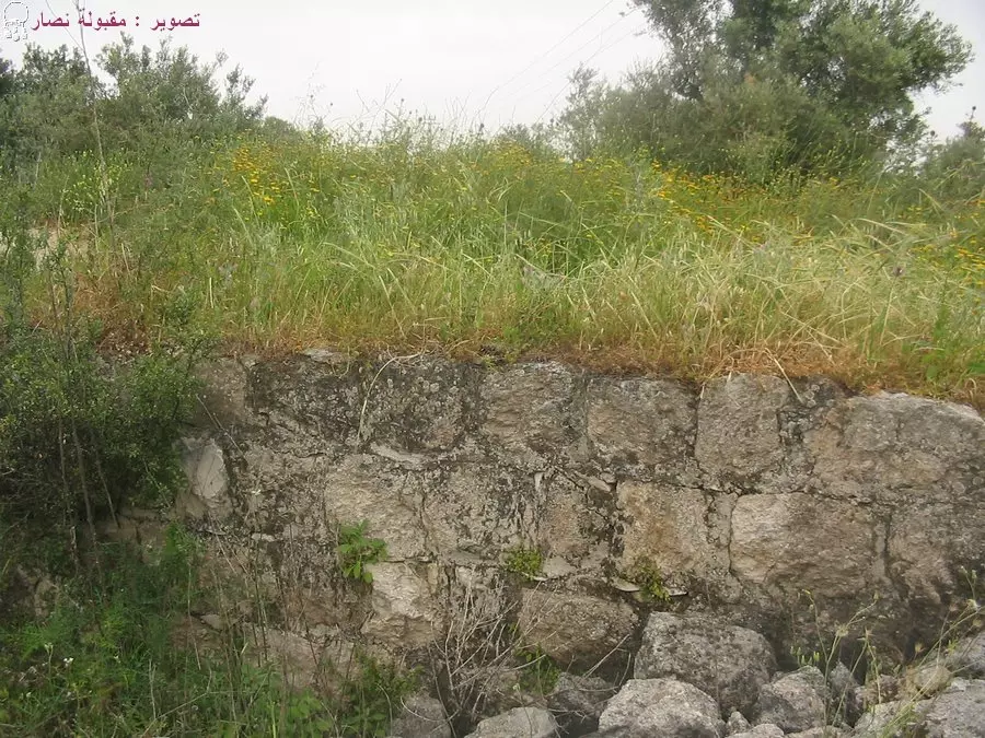
Posted by Makbula Nassar - منظر عام لموقع القرية 21.4.2005 : تصوير مقبولة نصار
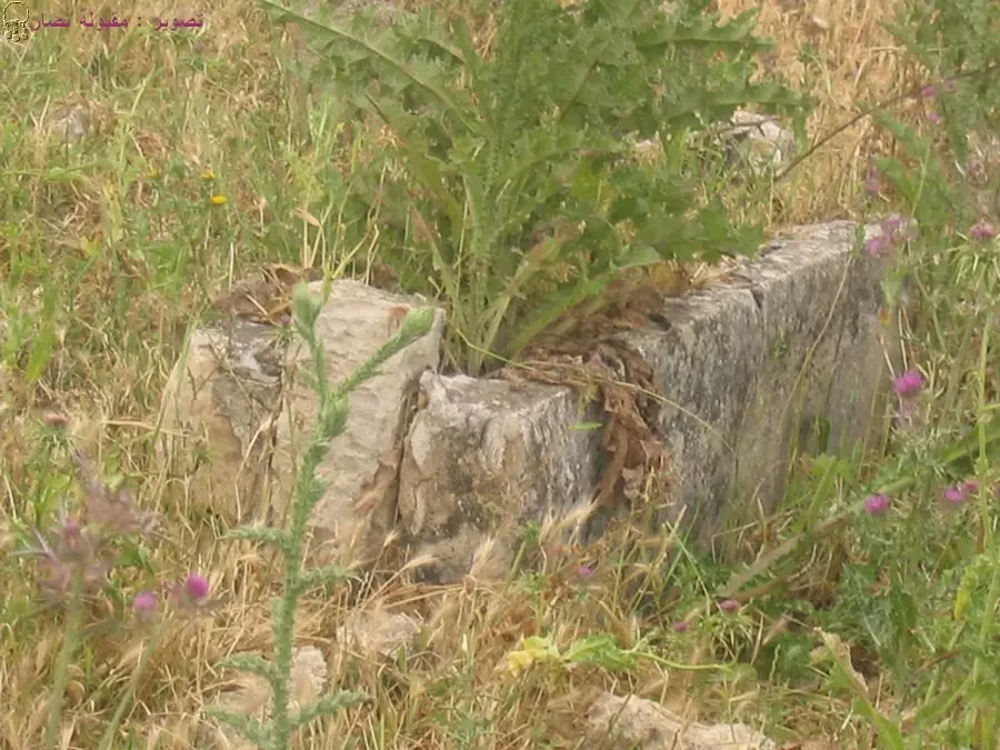
Posted by Makbula Nassar - صور قديم متبقي في القرية 21.4.2005 : تصوير مقبولة نصار
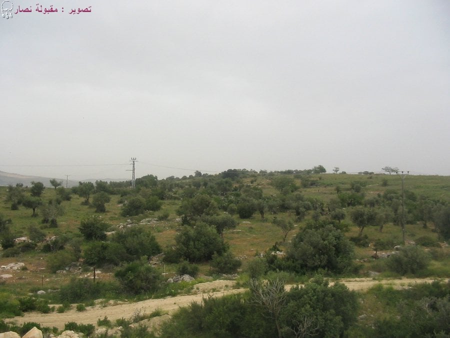
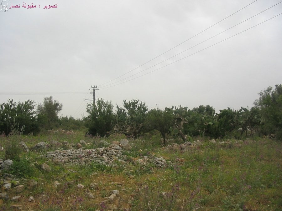
Posted by Makbula Nassar - موقع القرية اصبح منطقة رعي 21.4.2005 : تصوير مقبولة نصار
Posted by Makbula Nassar - اراضي القرية 21.4.2005 : تصوير مقبولة نصار
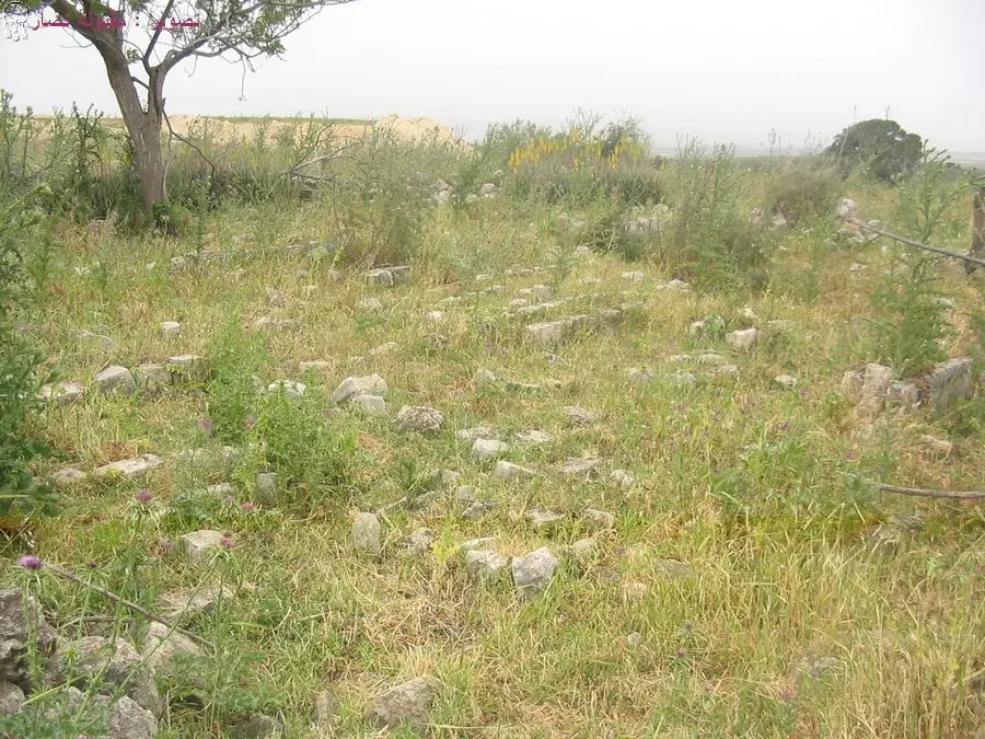
Posted by Makbula Nassar - مقبرة البروة 21.4.2005 : تصوير مقبولة نصار
Posted by Makbula Nassar - اراضي القرية 21.4.2005 : تصوير مقبولة نصار
Posted by Makbula Nassar 1 - مقبرة القرية 21.4.2005 : تصوير مقبولة نصار
Posted by Makbula Nassar - مقبرة البروة 21.4.2005 : تصوير مقبولة نصار
Posted by Makbula Nassar - الصبار المعمر في البروة 21.4.2005 : تصوير مقبولة نصار
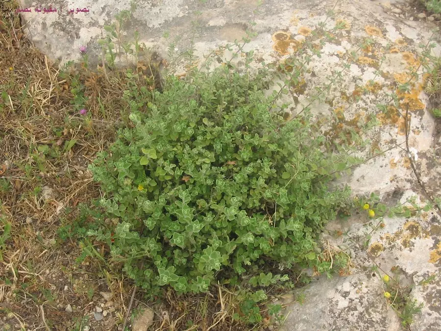
Posted by Makbula Nassar - الزعتر في البروة 21.4.2005 : تصوير مقبولة نصار
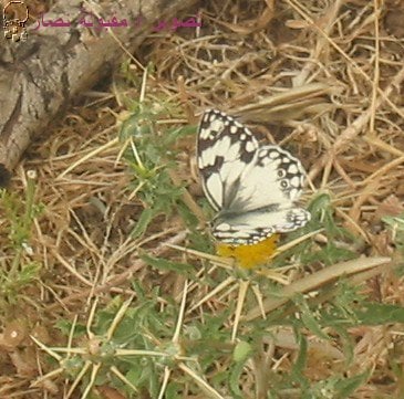
Posted by Makbula Nassar 1 - فراشات الجليل في البروة 21.4.2005 : تصوير مقبولة نصار
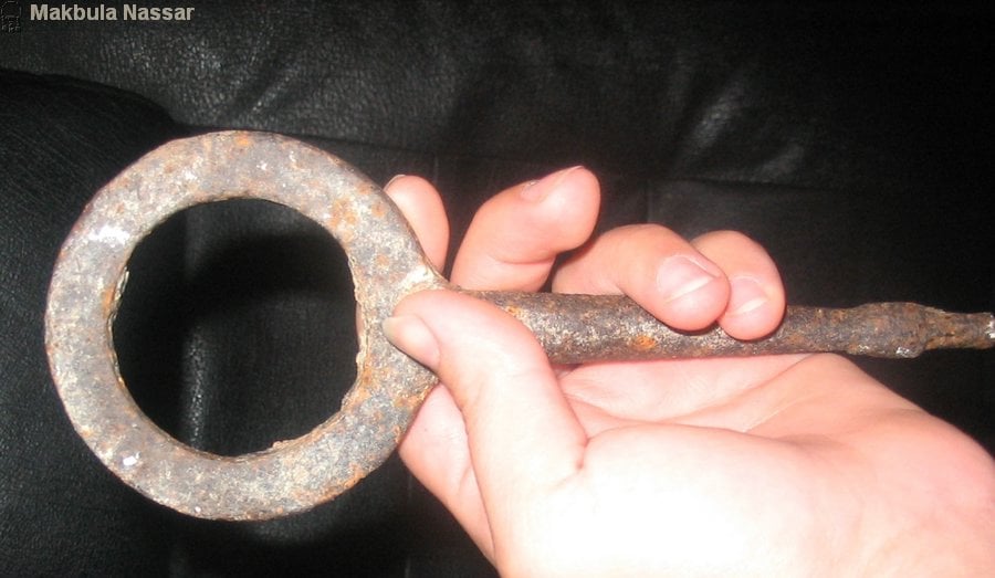
Posted by Makbula Nassar - اداة يبدو انها تستعمل كمفتاح لفك اصفاد الحصان , وجدته خلال التصوير في البروة 21/4/2005- مقبولة نصار
Posted by Makbula Nassar - من الجنازة الرمزية للشاعر محمود درويش في قريته البروة
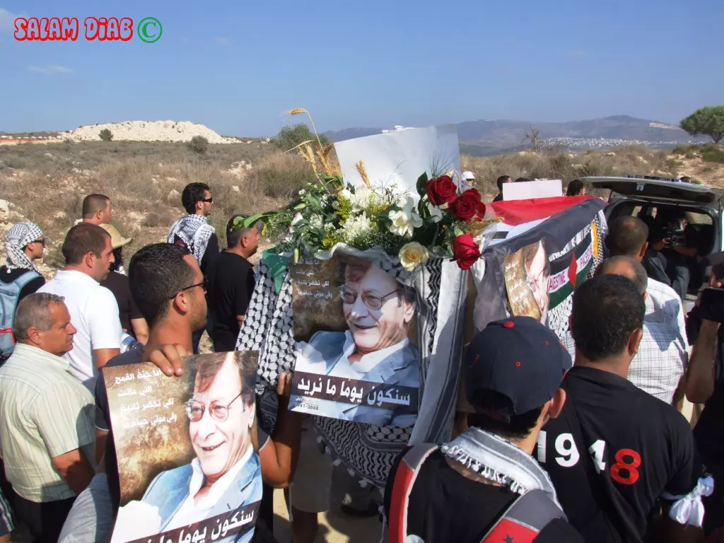
Posted by salam diab 3 - من الجنازة الرمزية للشاعر محمود درويش في البروة - تصوير الفنان سلام منير ذياب
Posted by salam diab 1 - من الجنازة الرمزية للشاعر محمود درويش في البروة - تصوير الفنان سلام منير ذياب
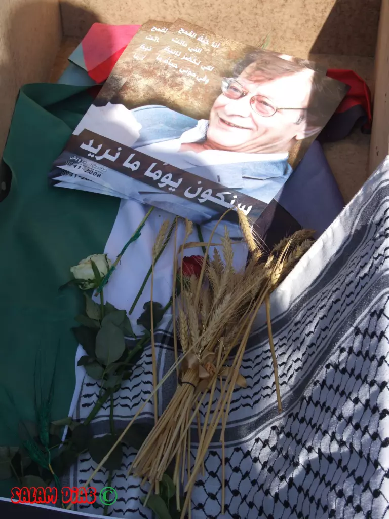
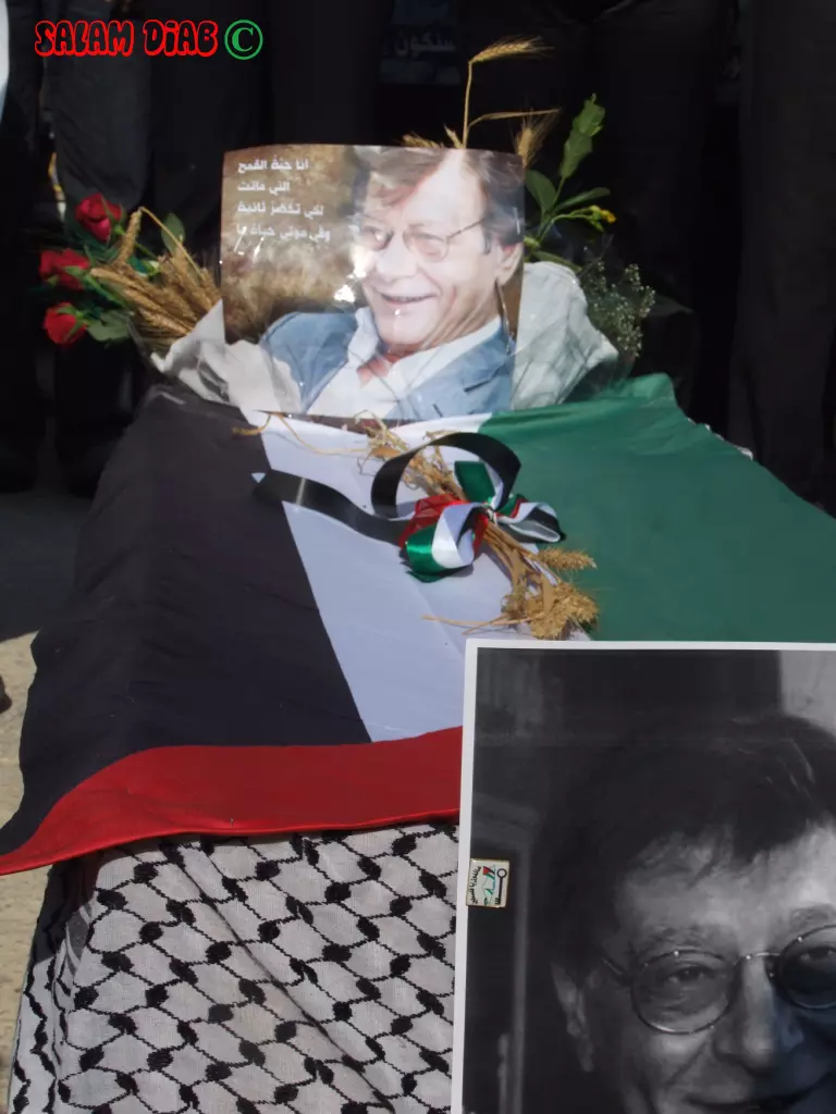
Posted by salam diab - التابوت الرمزي وعليه السنابل والورود والرمان... في الجنازة الرمزية للشاعر محمود درويش في البروة - تصوير الفنان سلام منير ذياب
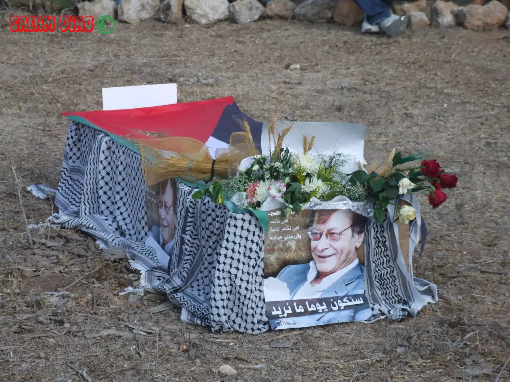
Posted by salam diab - تجهيز التابوت الرمزي وعليه السنابل والورود والرمان... في الجنازة الرمزية للشاعر محمود درويش في البروة - تصوير الفنان سلام منير ذياب
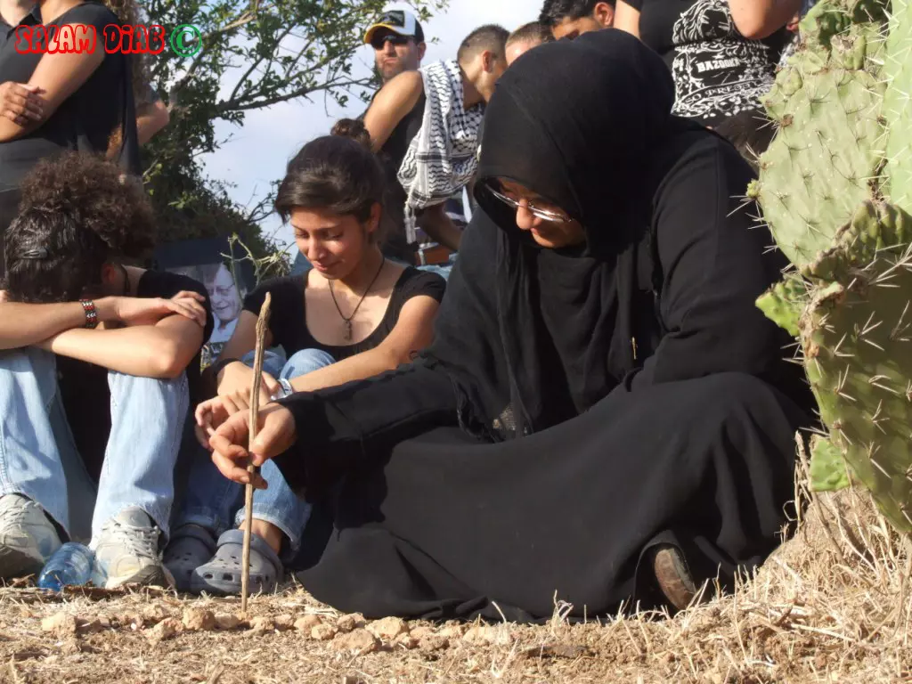
Posted by salam diab - امرأة تبكي على اطلال قريتها البروة - في الجنازة الرمزية للشاعر محمود درويش في البروة - تصوير الفنان سلام منير ذياب
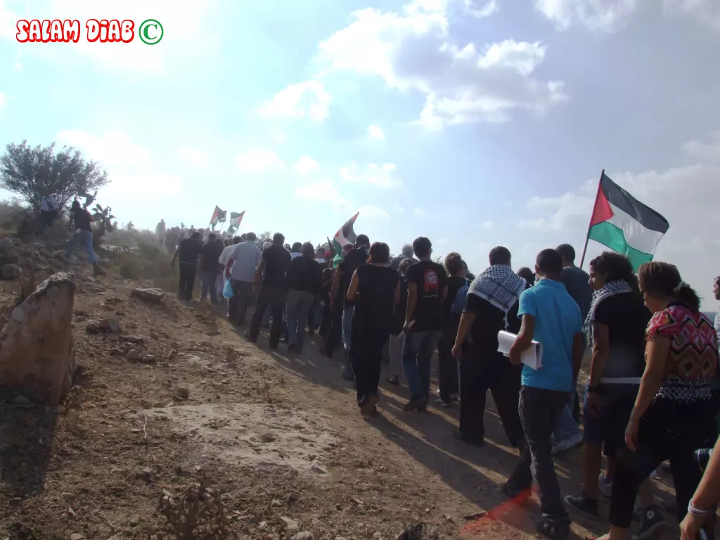
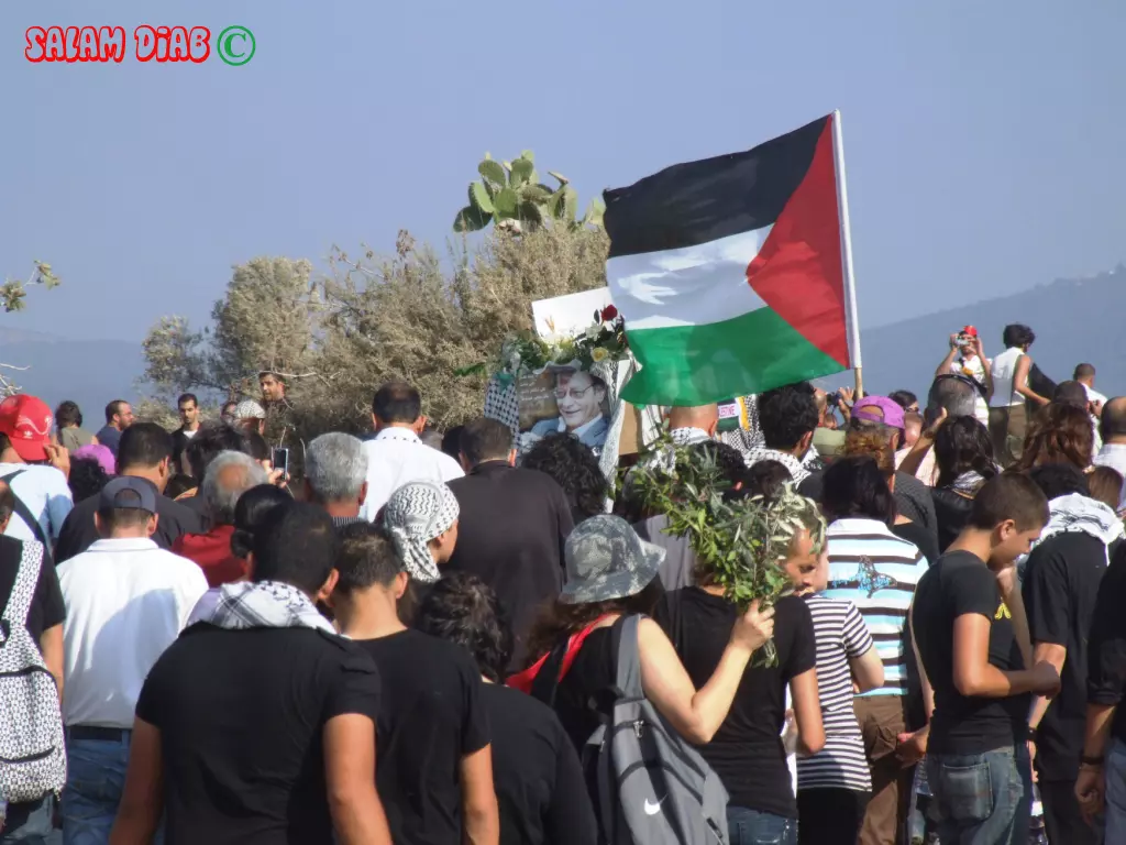
Posted by salam diab 1 - قبل انطلاق الجنازة الرمزية للشاعر محمود درويش في البروة - تصوير الفنان سلام منير ذياب Salam diab
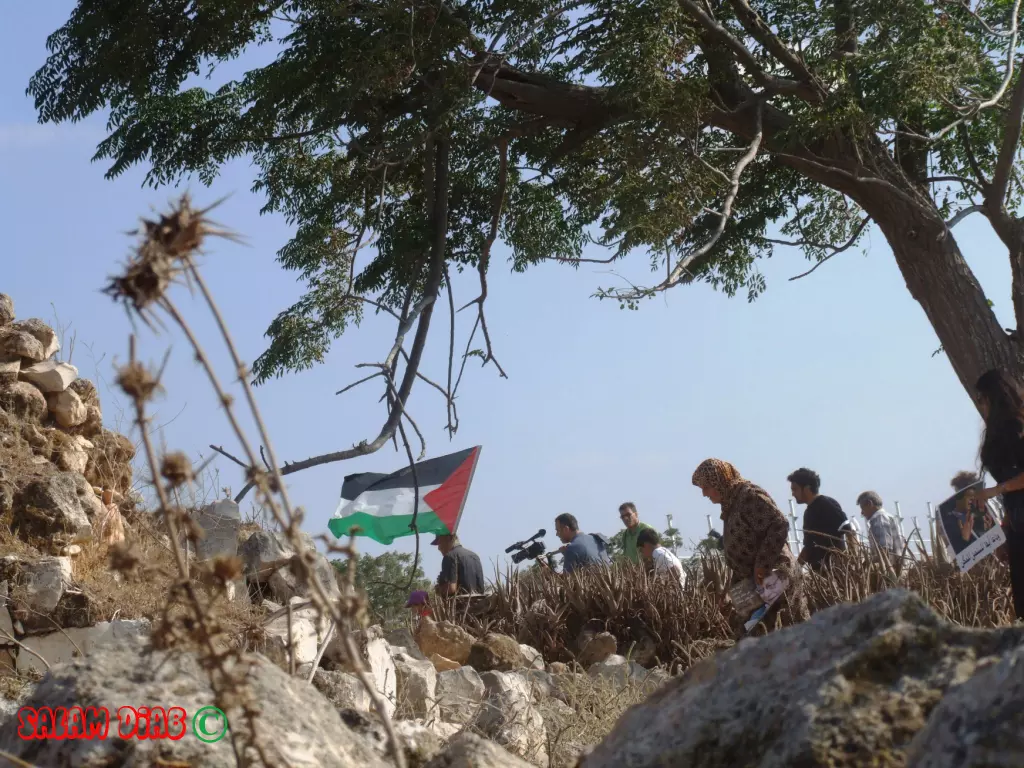
Posted by salam diab - الجنازة الرمزية للشاعر محمود درويش في البروة - تصوير الفنان سلام منير ذياب Salam diab
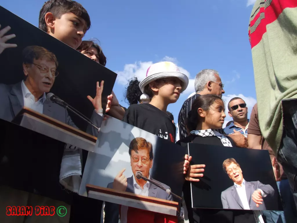
Posted by salam diab - اطفاليحملون صور الشاعر خلال الجنازة الرمزية للشاعر محمود درويش في البروة - تصوير الفنان سلام منير ذياب Salam diab
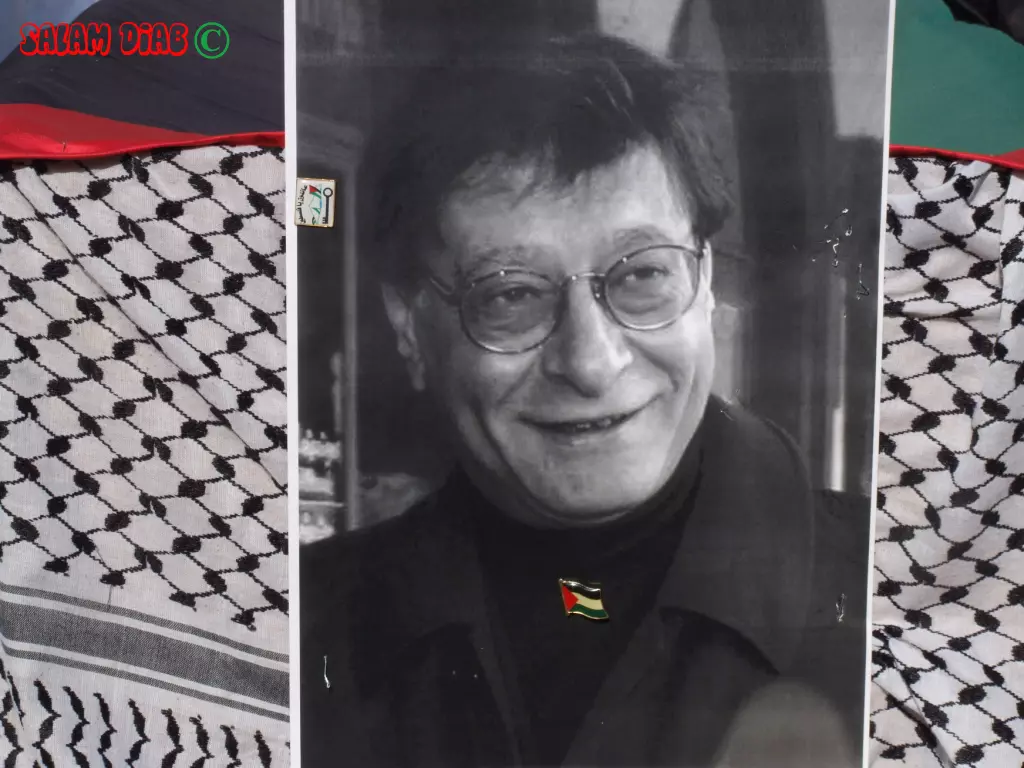
Posted by salam diab 2 - صورة شخصية للشاعر محمود درويش خلال الجنازة الرمزية في البروة 13-8-2008 - تصوير الفنان سلام منير ذياب Salam diab
Posted by salam diab 1 - مدرسة البروة الابتدائية وقد رسم عليها اشعار وصور محمود درويش الذي درس فيها للصف الثالث لحتى النكبة
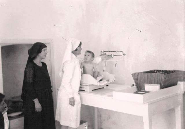
Posted by خالد كساب محاميد 1 - محمود درويش الطفل مع امه في احد مستشفيات حيفا عام 1942
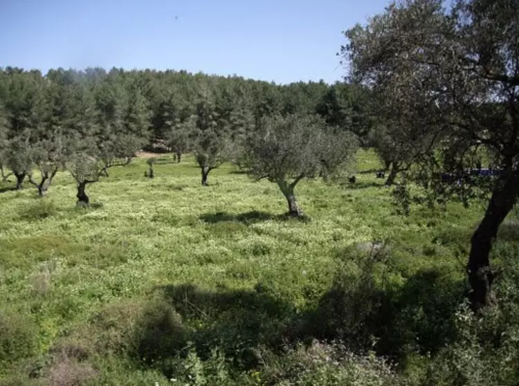
- زيتون القريه
Posted by abu raya - القسم الشمالي من القريه مغطى بالاحراش
Posted by abu raya - ردم بيوت القريه
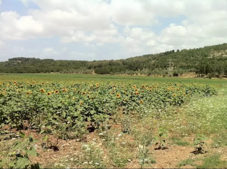
Posted by abu raya - امن اراضي وزيتون القريه
Posted by abu raya - اثار ردم بيوت القريه
Posted by abu raya - مقبره القريه
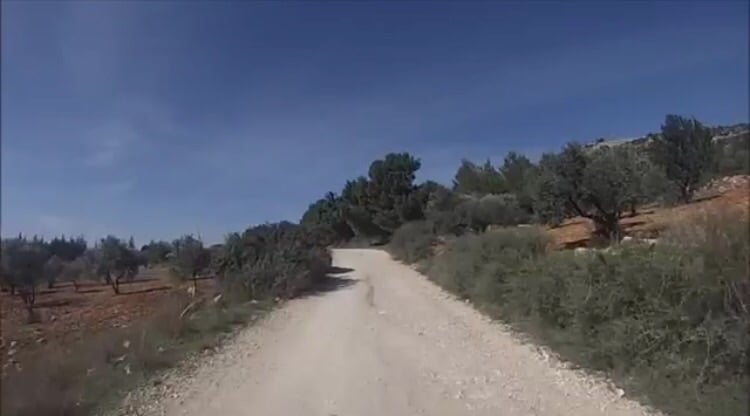
Posted by abu raya - الطريق الى القريه
Posted by abu raya - من اراضي القريه
Posted by abu raya - اثار بيوت القريه
Posted by abu raya - مقبره القريه
Posted by abu raya - مدرسه القريه
Posted by abu raya - مقبره القريه
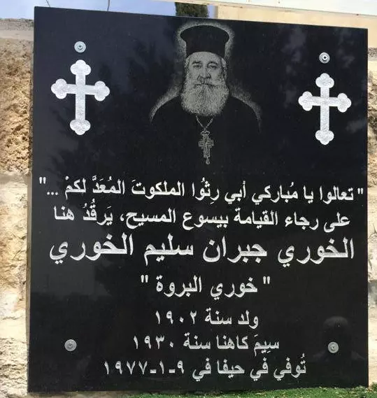
Posted by abu raya - خوري البروة - جبران سليم خوري
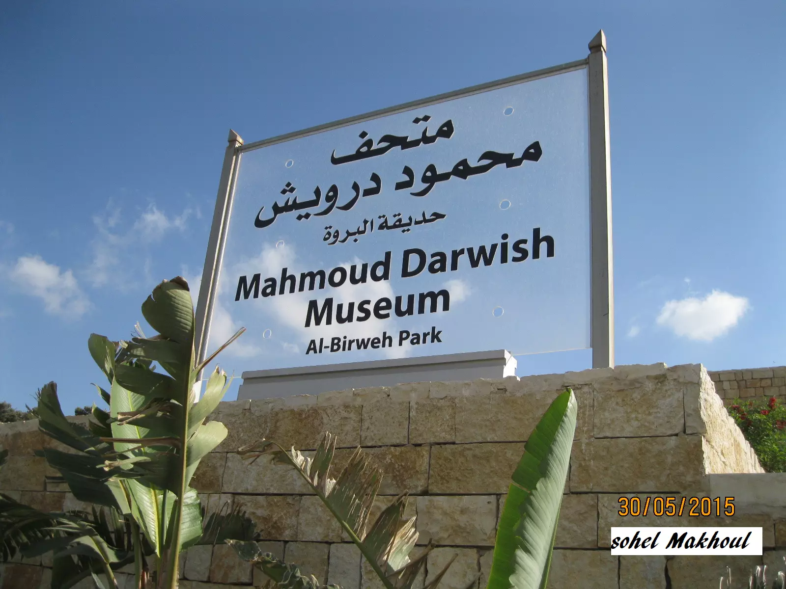
Posted by سهيل مخول - حديقة البروة - متحف محمود درويش
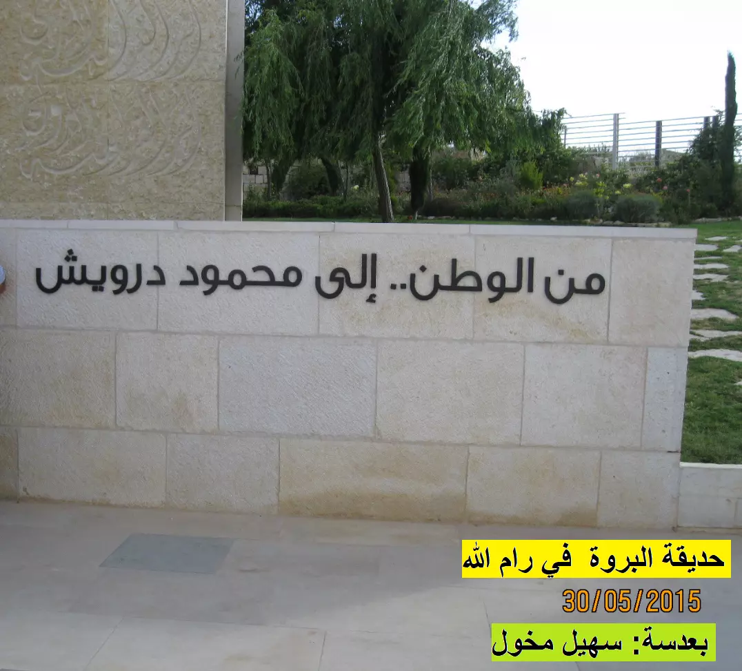
Posted by سهيل مخول - من الوطن الى محمود دروبش - حديقة البروة
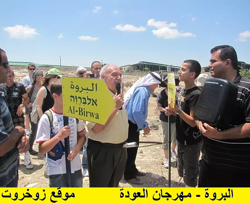
Posted by سهيل مخول - مسيرة العودة للبرو
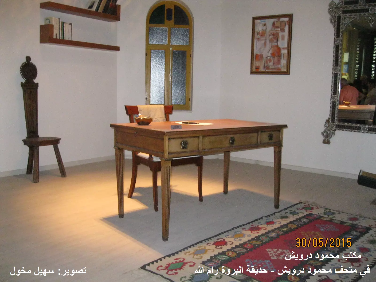
Posted by سهيل مخول - مكتب محمود درويش - حديقة البروة
Posted by سهيل مخول - مدرسة البروه
- مدرسة البروة
- Pre-Nakba Aerial view of the village / صورة من الجو للقرية اخذت قبل النكبة
- جولة بين بيوت القرية المدمرة -- الأب رائد ابو ساحلية
- جولة بين بيوت القرية المدمرة -- الأب رائد ابو ساحلية #2
- جولة بين بيوت القرية المدمرة -- الأب رائد ابو ساحلية #3
- جولة بين بيوت القرية المدمرة -- الأب رائد ابو ساحلية #4
- زيار ة سريعة للمدرسة -- ابراهيم أبو عمّار
- زيار ة سريعة للمدرسة -- ابراهيم أبو عمّار #2
- زيار ة سريعة للمدرسة -- ابراهيم أبو عمّار #3
- زيار ة سريعة للمدرسة -- ابراهيم أبو عمّار #4
- زيار ة سريعة للمدرسة -- ابراهيم أبو عمّار #5
- زيار ة سريعة للمدرسة -- ابراهيم أبو عمّار #6
- المدرسة-- محمود معطان
- المدرسة-- محمود معطان #2
- المدرسة-- محمود معطان #3
-
جولة في مدرسة القرية-- Ibtisam Sulieman
-
جولة في مدرسة القرية-- Ibtisam Sulieman
#2
-
جولة في مدرسة القرية-- Ibtisam Sulieman
#3
-
جولة في مدرسة القرية-- Ibtisam Sulieman
#4
-
جولة في مدرسة القرية-- Ibtisam Sulieman
#5
-
جولة في مدرسة القرية-- Ibtisam Sulieman
#6
-
جولة في مدرسة القرية-- Ibtisam Sulieman
#7
-
جولة في مدرسة القرية-- Ibtisam Sulieman
#8
Want to browse more? 80,000 pictures were grouped in these gallaries:
| Display Name | Clan/Hamolah | Country of Residence |
| monier semri | - | - |
| Khaled Miari | Miari | Denmark |
| zakaria hawash | hawash | algeria syria |
| jephrah | - | dubai |
| Ruham Hawash | Hawash | - |
| مراد كيال | كيال | جديده |
| RANIM | HAWASH | ALEPPO, SYRIA |
| mamun | nimer alkhaled | Germany, germany |
| Amjad | دندن | West Bank, West Bank |
| حبيب الاقصى | علي ديب | - |
| ahmad khaled | khaled | palestine, palestine |
| Rafeeq J. Darwish | RAFEEQ J. DARWISH | JORDAN |
| iyad hawash | hawash | حلب, syria |
| JuberBas | Abu Bassal | Acre, Acre |
| khaled khaled | - | damascus, syria |
| hawash | - | syria, syria |
| ابو طويله | السعدي | فلسطين, فلسطين |
| amer hawash | hawash | Al-nyrab, syria |
| rahman | - | aleppo |
| Ghassan Eid | Eid | ACRE / KABUL, ACRE |
| ameer saad | - | Canada |
| qassem saad | Saad | Saida, Lebanon |
| Noura Dabdoub | Dabdoub | USA |
| njeeb deeb | Ali Deeb | -, - |
| tamer saad | S3d | - |
| Majed Dabdoub | Dabdoub | usa |
| khaled deeb | ali deeb | - |
| Emad Mansour | mansour | acre |
| imad kaiali | kiali | UAE |
| M. SAAD | SAAD | USA |
| salim saad | saad | saudi arabia, saudi arabia |
- الجنازة الرمزية لمحمود درويش في قرية البروة Duration: 6 min 12 sec
- في ذكرى النكبة - كيبوتسات في فلسطين
- قرية البروة المهجرة - فلسطين - حلوة يا دنيا Duration: 15 min 3 sec
- برنامج 48 ¦ قرية البروة قائمة رغم التهجير ¦ 2016⁄6⁄13 Duration: 25 min 20 sec
- الذاكرة مفتاح العودة -- الحلقة 95 -- البروة
- سلسلة حكاية قرية من فلسطين| قرية البروة (1) موسوعة القرى الفلسطينية Duration: 3 min 50 sec
- (جوله الى البروة) Zochrot Tour al-Birwa, סיור לכפר אלברוה Duration: 5 min 25 sec
 Fake Valor: Why Did Zionist Jews Hoist Nazis Flag on Their Ships in the 1930s?
What is new?
-
Facts About Oct. 7th Gaza Raid
-
Remined Us Please:: Who Did Rape Who? Palestinians Raped Israelis? Or, was the other way around?
-
When Prof. Edward Said was invited to debate Bibi Netanyahu in the 1980s, watch what happened!
-
Ezra Klein of the NY Times on the "Jewish Race".
-
Abusing Blood Libel!
-
Did Israeli Soldiers Activate The Hanniba Direective On Oct. 7th? You Be The Judge
-
Zionist FAQ: Isn't it true that Palestinians don't want peace? Palestinians never accepted the two-state solution
- Facts about Haavara (Transfer) Agreement between Ben-Gurion & Hitler
-
Haavara FAQs: Why Did Zionist Jews Hoist Nazis' Flags on Their Ships in the 1930s?
- Haavara FAQs: When Chaim Weizmann met FDR in mid-1943, why was he silent about rescuing European Jewry?
-
Dear ChatGPT: How did Palestinians resist Napoleon's invasion of their country in 1799?
-
Dear ChatGPT: Gaza had a vibrant Jewish community in the mid-17th century. What happened to them?
-
Dear ChatGPT: Why did the Jewish Agency suppress news of the Holocaust during WWII?
-
Video Playlist: Jews share their DNA tests to end the conflict for good.
-
A Tale of Two Conflicts: Examining the Definition of Genocide
-
Prof. Abraham Polak And The Suppressed History of the Khazars and European Jewry
-
How Ronald Reagan would have framed the genocide in Gaza if he were still alive?
-
Haavara FAQs: Let us do the math: how many German Jews did The Haavara Agreement save?
-
Zionist FAQs: The Hebron Massacre of 1929, "clearly proves" that Palestinians are antisemitic, how could you deny it?
-
Zionist FAQs: Why Anti-Zionist Is Not Antisemitism?
-
Zionist FAQs: Isn't it true that the KGB created Palestinian Nationalism in the early 1960s?
- Zionist FAQs: Muslims are killing Muslims all the time; why are Israeli Jews being singled out in the media?
- Zionist FAQs: How is Israel an apartheid state when 20% of its citizens are Arabs who enjoy full rights?
-
Haavara FAQs: Why Did Dorothy Thompson Flip From A Zionist Advocate to A Silenced Dissenter?
-
Haavara FAQs: Analysis of Herzl's Uganda Scheme and how it could have saved millions of Jews.
-
Haavara FAQs: Why did Hayim Greenberg describe American Jewry as "morally bankrupt" in early 1943?
-
Haavara FAQs: What if the Evian Conference was a resounding success? What would have been the impact of saving European Jewry on Zionism?
- Haavara FAQs: What if the six million were saved, how that would have impacted the Zionist project?
-
Haavara FAQs: How did Zionist leaders react when Europe's Jews lingered in the DP camps after WWII ended?
-
Why does the American Jewish community repeat lies that David Ben-Gurion had debunked before he died?
-
Who has the power to rename the Tatar/Khazar Gene Marker to Jewish IV?
-
Zionist FAQs: Why won't Egypt, Syria, and Jordan take their people back? Jews are indigenous to Palestine, and Arabs immigrated after Jews developed the country. Arabs should leave.
-
Haavara FAQs: Did Hitler and the Nazis conflate between Judaism and Zionist? If that wasn't case, then why?
-
Haavara FAQs: Winston Churchill and antisemitism, a collection of articles written Churchill.
-
Haavara FAQs: Broken by country, how many Jews survived vs. killed during the Holocaust?
-
Haavara FAQs: Why did European Jews vote with their feet and to immigrated to the Americas, not Palestine, after WWII?
-
Watch this American Jewish Girl describing Israeli Jews' cognitive dissonance like no other in under two minutes
-
Haavara FAQs: When the Nazis went out of their way to hide the Holocaust, Israeli Jews did the exact opposite by broadcasting their genocide of Gazans. But why?
-
Haavara FAQs: How Zionist Jews went out of their to show their appreciation to Nazism and Fascism?
- Haavara FAQs: Why Zionist leaders were against bombing the death camps & the Railroads leading to them?
-
Haavara FAQs: Hitler's message to the British and American people: If Jews are such noble citizens and you care about them, how come you're not letting them in? I will gladly ship them to you at my expense, even on luxury liners!
-
A shortlist of Zionist and Israeli false flag operations in the name Jews.
-
The Most Moral Army
- The Land of Kapos (Israel): Where the brave are boycotted and Kapos walk free.
- Why did early Zionists often named their communal enterprises "colonial"?
- Zionist Relations with Nazi Germany by Faris Glubb
-
Two NY Times advertisements by Zionists in the early 1943 that exposes Zionists' treason at the height of the calamity
- Facts Not Lies about the Palestinian-Israeli Conflict.
- Site's pictures have been categorized
- Campgain Against Lice
- A Survey of Palestine, the official source about Palestine before Nakba produced by the British Mandate; over 1200 pages.
- Satellite View & Google Earth: Over 6,000 placemarks identifying all destroyed towns, W. Bank & Gaza Strip Towns, & refugee camps.
- PalestineRemembered.com and its Nakba Oral History Project were featured on al-Jazeera Satellite TV.
- Nakba Oral History Video Podcast:
 Over 700 Oral History interviews (including 3,500+ hours of recording) can be viewed online.
 - Palestine Village Statistics Project
- Gaza Jail Break
- النسخة العربية للموقع الان متوفرة
- Videos: Documenting the destroyed villages in video: Tracing all that remains since Nakba.
- Videos: Responding to Zionist Propaganda
- Interview: The ethnic cleansing of Palestine: George Galloway interviews Israeli Historian Ilan Pappe.
- For Palestinians, memory matters. It provides a blueprint for their future By George Bisharat.
- Zionist FAQ now available in Hebrew שאלות שציונים שואלים, עכשיו בעברית
- Video: The Stephen Walt and John Mearsheimer report on the influence of the Israel Lobby on U.S. Foreign Policy
- The Palestinian-Israeli conflict for beginners
