| PalestineRemembered | About Us | Oral History | العربية | |
| Pictures | Zionist FAQs | Haavara | Maps | |
| Search |
| Camps |
| Districts |
| Acre |
| Baysan |
| Beersheba |
| Bethlehem |
| Gaza |
| Haifa |
| Hebron |
| Jaffa |
| Jericho |
| Jerusalem |
| Jinin |
| Nablus |
| Nazareth |
| Ramallah |
| al-Ramla |
| Safad |
| Tiberias |
| Tulkarm |
| Donate |
| Contact |
| Profile |
| Videos |
Welcome To Dimra - دمره (דימרה)
|
District of Gaza
Ethnically cleansed days ago |
العربية Google Earth |
 |
Gallery (19) |
- Statistics & Facts
-
Before & After

- Satellite View
- Articles 2
- Pictures 19
- Aerial Views 1
- Members 6
- All That Remains
- Wikipedia
- Videos
- Guest Book 3
- Links 2
| Statistic & Fact | Value | ||||||||||||||
| Occupation Date | October 28, 1948 | ||||||||||||||
| Distance From District | 12 (km) North East of Gaza | ||||||||||||||
| Elevation | 50 (meters) | ||||||||||||||
| Before & After Nakba, Click Map For Details |
|||||||||||||||
|
|||||||||||||||
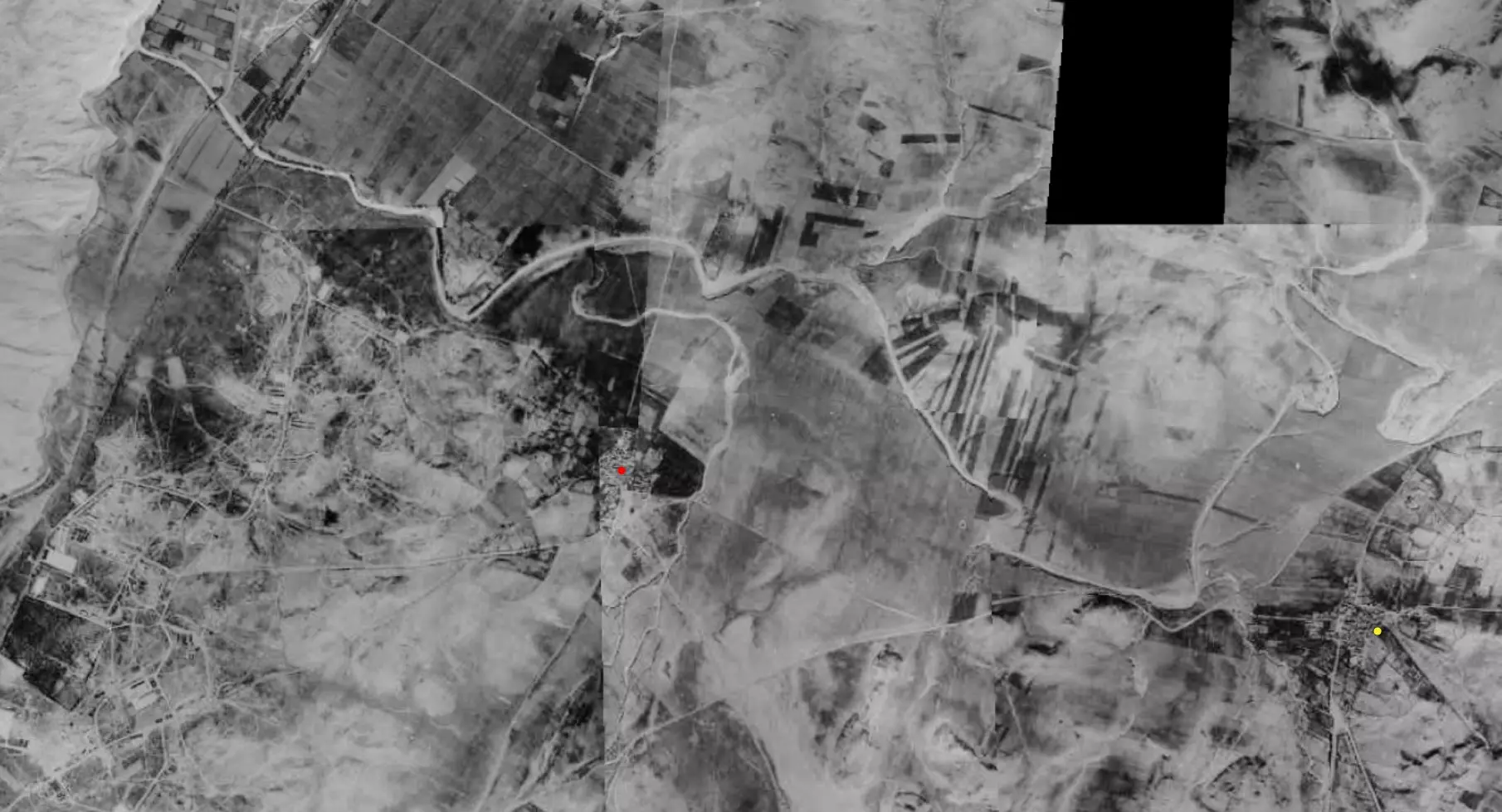
| Pre-Nakba Aerial View |
|||||||||||||||
|
|||||||||||||||
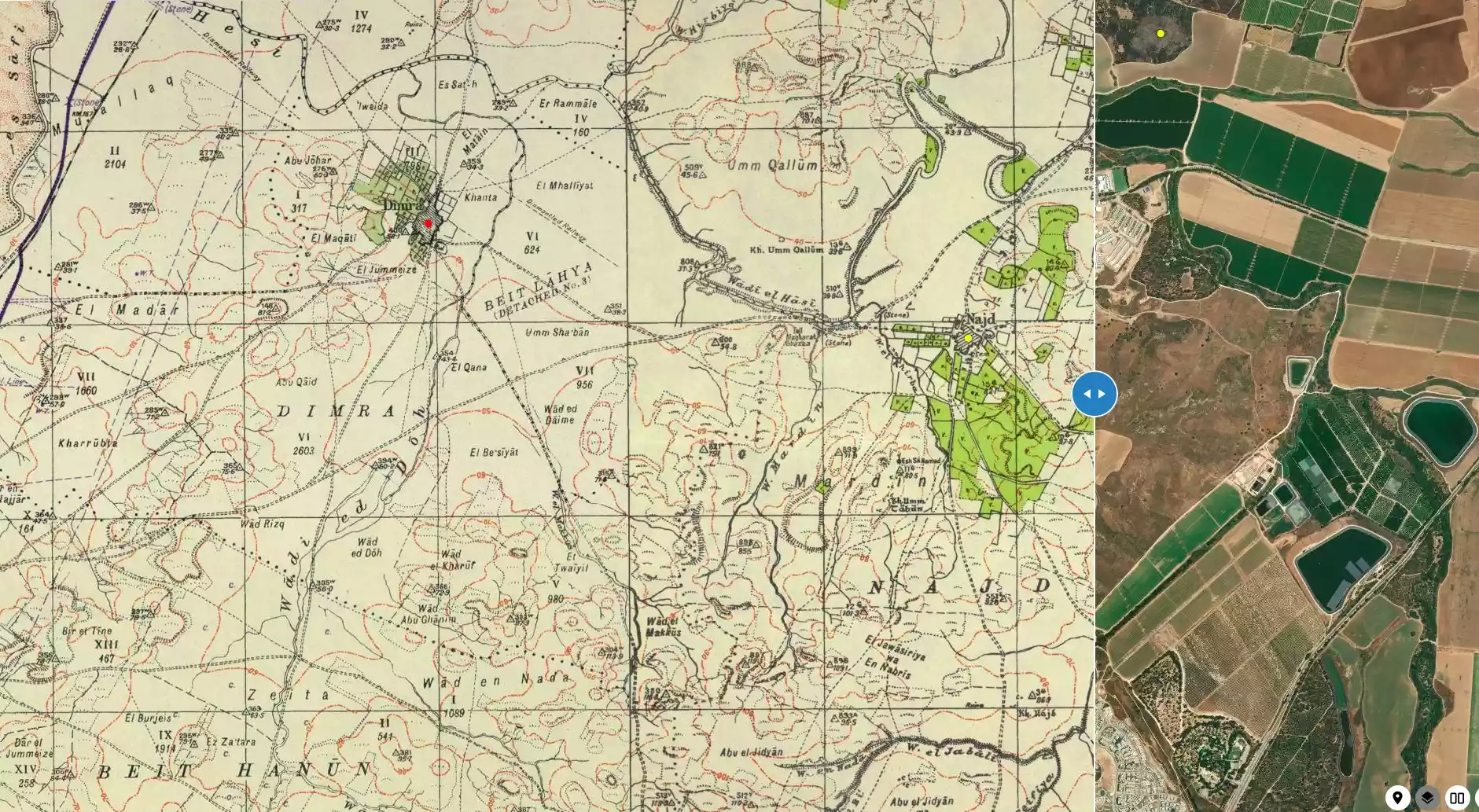
| Map Location | See location #41 on the map View from satellite |
||||||||||||||
| Military Operation | Operation Yo'av | ||||||||||||||
| Attacking Units | Possibly Giva'ti Brigade | ||||||||||||||
| Defenders | Egyptian Army | ||||||||||||||
| Exodus Cause | Military assault by Zionist troops | ||||||||||||||
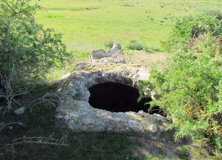
| Village Temains | The village was completely destroyed, and only house rubble left behind. | ||||||||||||||
| Ethnically Cleansing | Dimra inhabitants were completely ethnically cleansed. | ||||||||||||||
| Pre-Nakba Land Ownership |
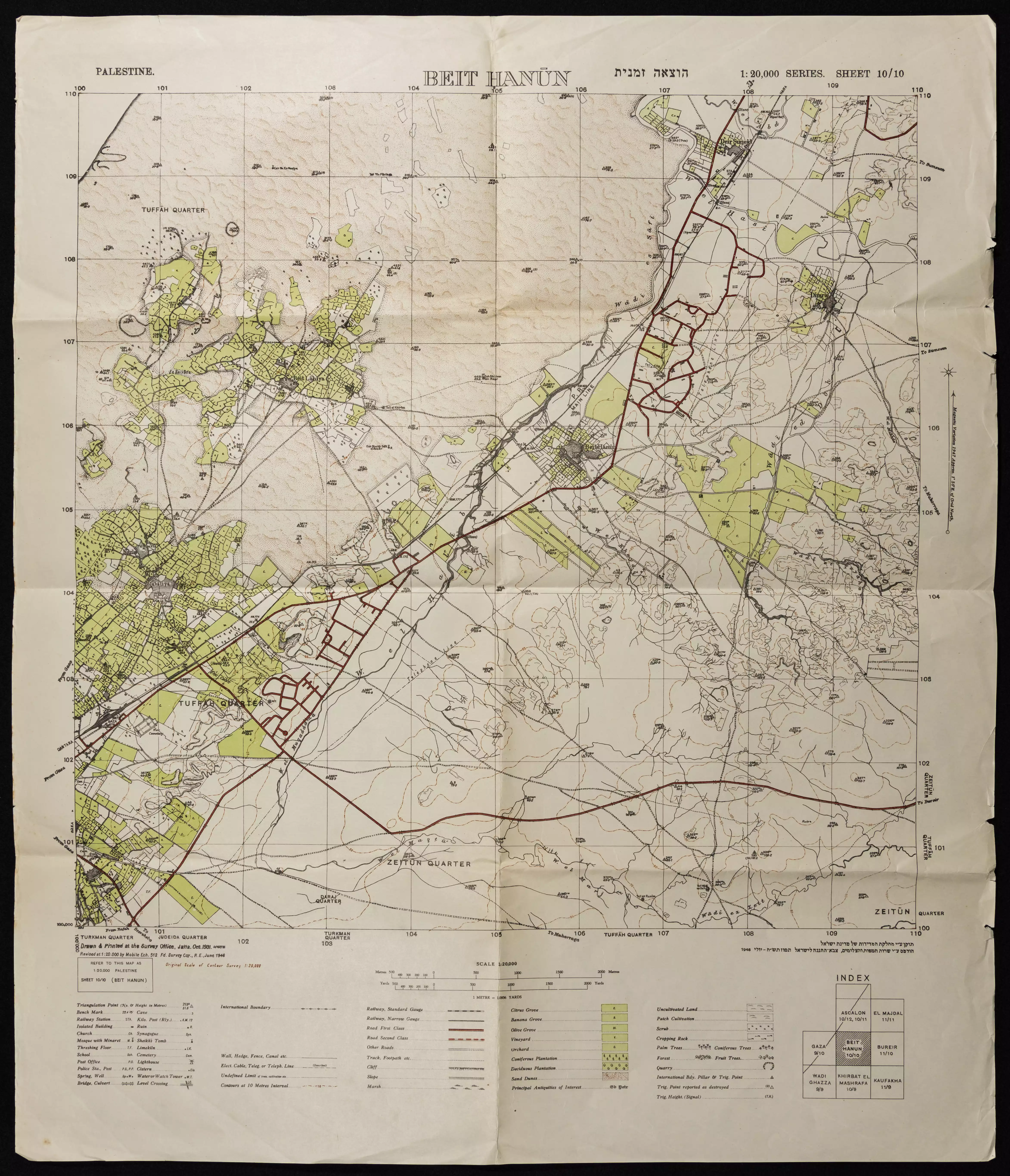
**Town Lands' Demarcation Maps |
||||||||||||||
| Land Usage As of 1945 |
|
||||||||||||||
| Population |
|
||||||||||||||
| Number of Houses |
|
||||||||||||||
| Near By Towns |
|||||||||||||||
|
|||||||||||||||
| Schools | Dimra had one elementary school for boys which was founded in 1946, and when it opened its doors it had initial enrollment of 47 students. | ||||||||||||||
| Inhabitants Place of Origin | In 15th century, Dimra was the home of the Bani Jabir tribe. | ||||||||||||||
| Archeological Sites | Dimra contained the foundations of buildings, a cemetery, columns, and severed column capitals. | ||||||||||||||
| Exculsive Jewish Colonies Who Usurped Village Lands |
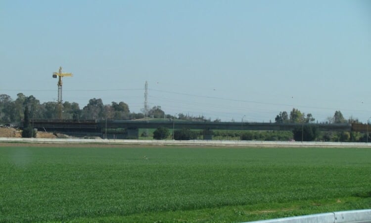
Erez | ||||||||||||||
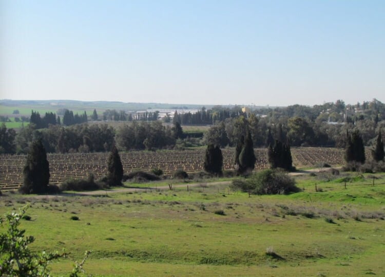
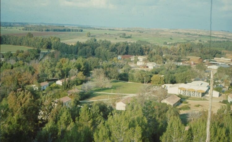
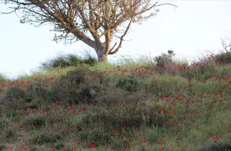
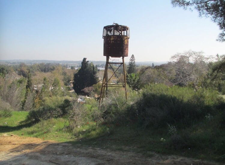
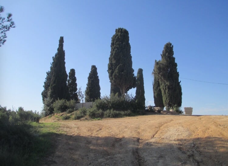
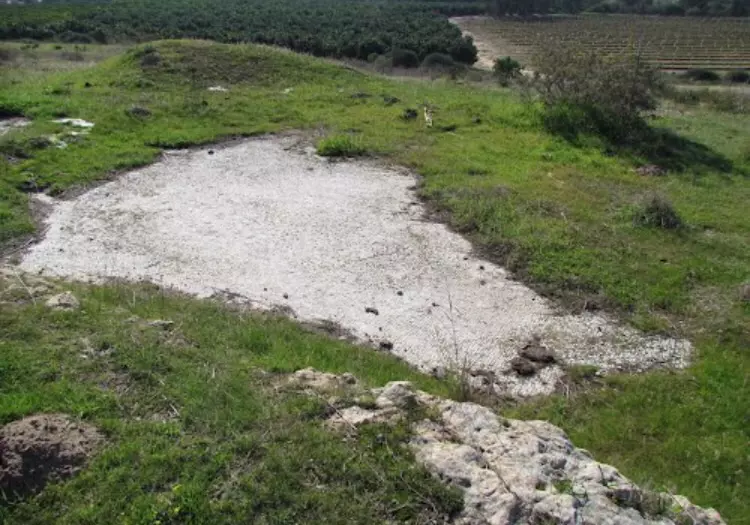
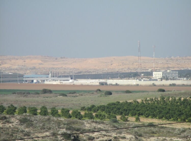
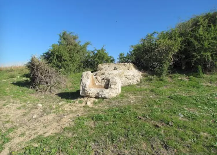
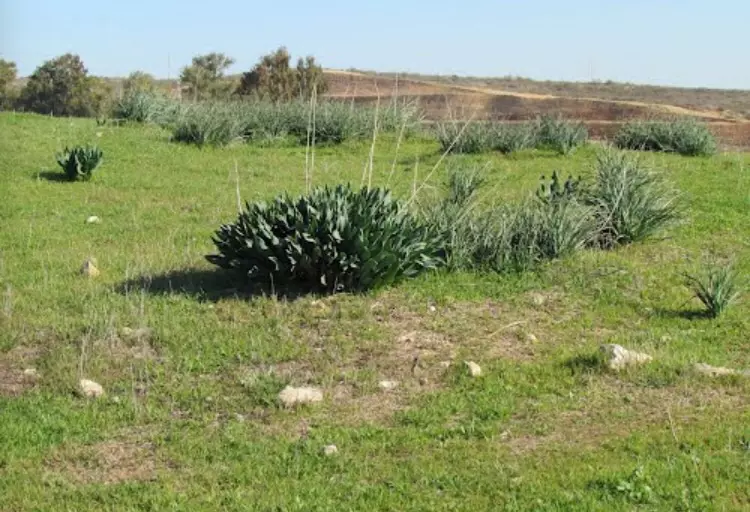
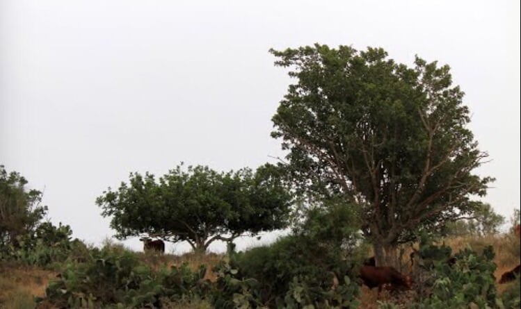
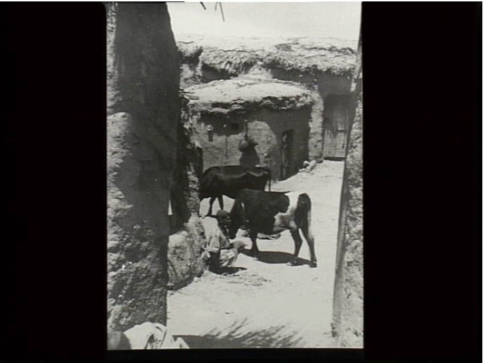
Village Before NakbaThe village stood on the southern coastal plain, on a site that had distinctive, red-brown soil. It was linked by a short secondary road to the main coastal highway and by other secondary roads to neighboring villages. The coastal railway line passed a short distance to the west of it. Dimra appears to have been occupied in the twelfth century; ruins identified as Crusader in origin have been noted in the village. Al-Qalqashandi, an encyclopedic Arab scholar who died in AD. 1418 wrote that Dimra was the home of the Bani Jabir, an Arab tribe. The American biblical scholar Edward Robinson reported passing by Dimra in 1838; he said it was situated near the bend of a valley. The population of the village was Muslim. The center of the village was located at the perpendicular intersection of two main streets. The village expanded during the Mandate period, and houses were built eastward and southward along the roads that led to other villages. Dimra had an elementary school that was opened in 1946 with an initial enrollment of forty-seven students. Its agricultural land was often threatened by the movement of coastal sand dunes. Wells outside the village of depths of 20 to 25 m were found mainly at the bottoms of gullies that ran into Wadi al-Hasi, the winter of which floods fed the underground aquifers. These wells provided irrigation water for cultivation. In 1944/45 a total of 96 dunums was devoted to citrus and bananas and 7,412 dunums were allocated to cereals; 388 dunums were irrigated or used for orchards. The village contained the foundations of buildings, a cemetery, columns, and severed column capitals. Two other ruins with a variety of relics lay on its land.Village Occupation and Ethnic CleaningAs early as 16 February, the Jaffa-based Palestinian daily Filastin reported that a Jewish convoy drove through Dimra, firing at villagers. The villagers reportedly returned the fire. On 31 May, the inhabitants of a nearby village, Huj, were expelled to Dimra. Israeli historian Benny Morris states that they were repeatedly prevented from returning, indicating that they remained in Dimra.It is difficult to determine the exact date of occupation for Dimra, but it was probably occupied in the later stages of the Israeli army's Operation Yoav in October–November 1948. It may have been seized on 28 October, with the withdrawal of Egyptian forces along the coastal road, or on 4–5 November, in the wake of the occupation of al-Majdal. On 22 October, the New York Times correspondent reported on the situation on the southern front. Arab village after village lay deserted,' he wrote, 'some battered beyond repair and still burning where the Egyptians had held out. From all, however, whether destroyed or not, the Arabs had fled to the coastal strip still in Egyptian hands.' Zionists Colonies on Village LandsThe settlement of Erez was founded in 1949 on part of the village site.Village TodayMost of the village site is fenced in and used as a pasture. A crumbling stone water basin, concrete rubble from houses, and a destroyed well are nearly all that remain. A watering trough for cows has been placed on what appears to be a concrete fragment from a former house. The well is topped with an old, nonoperating water pump. More debris lies in a wooded portion of the site, near a Jewish cemetery. Some cactuses that formerly served as fences, as well as shrubs and thorny plants, grow on the adjacent lands.SourceDr. Walid al-Khalidi, 1992: All That Remains. |
|||||||||||||||
| Related Maps | Town Lands' Demarcation Maps خرائط للقضاء توضح حدود القرى والاودية Town's map on MapQuest View from satellite Help us map this town at WikiMapia |
||||||||||||||
| Related Links | Wikipedia's Page Facebook Page Google Search Google For Images Google For Videos |
||||||||||||||
| More Information | في كتاب كي لا ننسى في كتاب بلادنا فلسطين المزيد من موقع هوية |
||||||||||||||
- موقع القريه
Posted by abu raya - اراضي القريه
Posted by abu raya - مستعمره ايرز مقامه على اراضي القريه
Posted by abu raya - من موقع القريه
Posted by abu raya - من موقع القريه
Posted by abu raya - من موقع القريه
Posted by abu raya - من القريه
Posted by abu raya - ابار القريه
Posted by abu raya - اراضي القريه
Posted by abu raya - من اثار القريه
Posted by abu raya - من القريه
Posted by abu raya - من موقع القريه
Posted by abu raya - قريه دمره سنه 1941
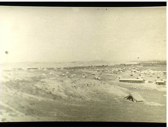
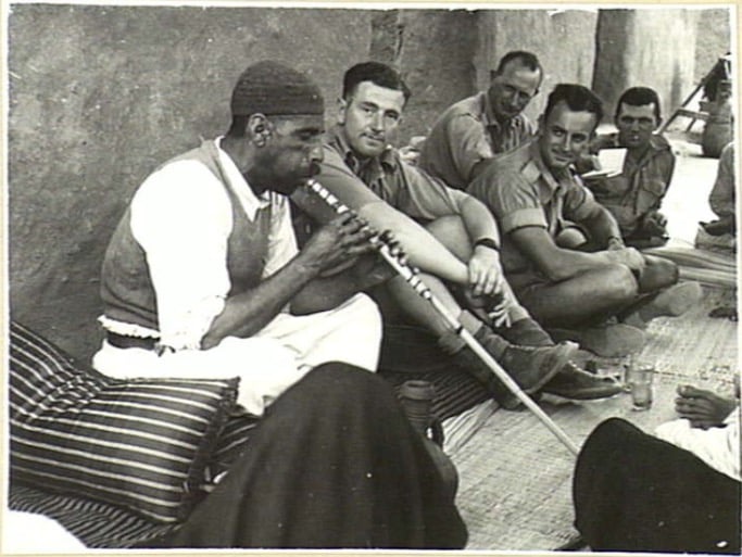
Posted by abu raya - المعسكر البريطاني في دمره سنه 1941
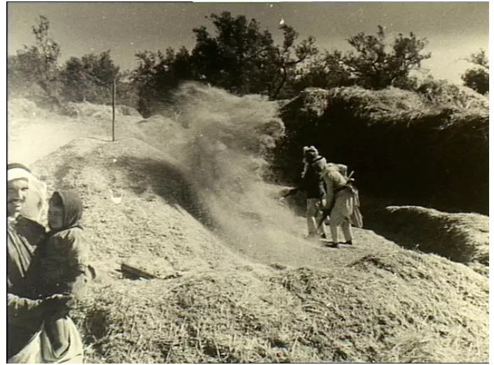
Posted by abu raya - صوره من بيادر قريه دمره سنه 1941
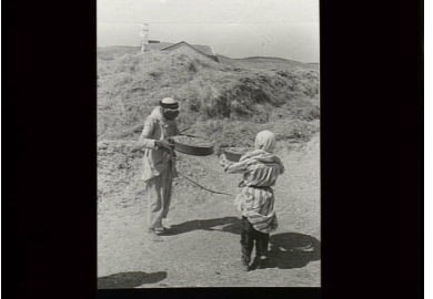
Posted by abu raya - جنود بريطانيين بضيافه اهالي دمره سنه 1941
Posted by abu raya - صوره لبيدر قريه دمره سنه 1942
Posted by abu raya - Pre-Nakba Aerial view of the village / صورة من الجو للقرية اخذت قبل النكبة
- خارطة تُظهِر الحدود والطرق بأنواعها والأماكن المقدسة والطبيعة الطوبغرافية من تلال وسهول ومنحدرات والتشكيلة الطبيعية للأرض وأنواع المزروعات. نُشرت الخريطة فترة الانتداب البريطاني، تم إضافة تعديلات عليها من قِبَل خدمة الخرائط والصور التابعة للقوات العسكرية الاسرائيلية فترة الأربعينيات.
Want to browse more? 80,000 pictures were grouped in these gallaries:
| Display Name | Clan/Hamolah | Country of Residence |
| نوح البرعي | - | غزة |
| abu ibrahim | abu-ghanem | gaza |
| shady okasha | - | Gaza, Palestine |
| أبو نوفل | الصيفي | غزة |
| أبو خالد | الصيفى | غزه |
| Hussein Elburai | Elburai | ON, Canada |
 Fake Valor: Why Did Zionist Jews Hoist Nazis Flag on Their Ships in the 1930s?
What is new?
-
Facts About Oct. 7th Gaza Raid
-
Remined Us Please:: Who Did Rape Who? Palestinians Raped Israelis? Or, was the other way around?
-
When Prof. Edward Said was invited to debate Bibi Netanyahu in the 1980s, watch what happened!
-
Ezra Klein of the NY Times on the "Jewish Race".
-
Abusing Blood Libel!
-
Did Israeli Soldiers Activate The Hanniba Direective On Oct. 7th? You Be The Judge
-
Zionist FAQ: Isn't it true that Palestinians don't want peace? Palestinians never accepted the two-state solution
- Facts about Haavara (Transfer) Agreement between Ben-Gurion & Hitler
-
Haavara FAQs: Why Did Zionist Jews Hoist Nazis' Flags on Their Ships in the 1930s?
- Haavara FAQs: When Chaim Weizmann met FDR in mid-1943, why was he silent about rescuing European Jewry?
-
Dear ChatGPT: How did Palestinians resist Napoleon's invasion of their country in 1799?
-
Dear ChatGPT: Gaza had a vibrant Jewish community in the mid-17th century. What happened to them?
-
Dear ChatGPT: Why did the Jewish Agency suppress news of the Holocaust during WWII?
-
Video Playlist: Jews share their DNA tests to end the conflict for good.
-
A Tale of Two Conflicts: Examining the Definition of Genocide
-
Prof. Abraham Polak And The Suppressed History of the Khazars and European Jewry
-
How Ronald Reagan would have framed the genocide in Gaza if he were still alive?
-
Haavara FAQs: Let us do the math: how many German Jews did The Haavara Agreement save?
-
Zionist FAQs: The Hebron Massacre of 1929, "clearly proves" that Palestinians are antisemitic, how could you deny it?
-
Zionist FAQs: Why Anti-Zionist Is Not Antisemitism?
-
Zionist FAQs: Isn't it true that the KGB created Palestinian Nationalism in the early 1960s?
- Zionist FAQs: Muslims are killing Muslims all the time; why are Israeli Jews being singled out in the media?
- Zionist FAQs: How is Israel an apartheid state when 20% of its citizens are Arabs who enjoy full rights?
-
Haavara FAQs: Why Did Dorothy Thompson Flip From A Zionist Advocate to A Silenced Dissenter?
-
Haavara FAQs: Analysis of Herzl's Uganda Scheme and how it could have saved millions of Jews.
-
Haavara FAQs: Why did Hayim Greenberg describe American Jewry as "morally bankrupt" in early 1943?
-
Haavara FAQs: What if the Evian Conference was a resounding success? What would have been the impact of saving European Jewry on Zionism?
- Haavara FAQs: What if the six million were saved, how that would have impacted the Zionist project?
-
Haavara FAQs: How did Zionist leaders react when Europe's Jews lingered in the DP camps after WWII ended?
-
Why does the American Jewish community repeat lies that David Ben-Gurion had debunked before he died?
-
Who has the power to rename the Tatar/Khazar Gene Marker to Jewish IV?
-
Zionist FAQs: Why won't Egypt, Syria, and Jordan take their people back? Jews are indigenous to Palestine, and Arabs immigrated after Jews developed the country. Arabs should leave.
-
Haavara FAQs: Did Hitler and the Nazis conflate between Judaism and Zionist? If that wasn't case, then why?
-
Haavara FAQs: Winston Churchill and antisemitism, a collection of articles written Churchill.
-
Haavara FAQs: Broken by country, how many Jews survived vs. killed during the Holocaust?
-
Haavara FAQs: Why did European Jews vote with their feet and to immigrated to the Americas, not Palestine, after WWII?
-
Watch this American Jewish Girl describing Israeli Jews' cognitive dissonance like no other in under two minutes
-
Haavara FAQs: When the Nazis went out of their way to hide the Holocaust, Israeli Jews did the exact opposite by broadcasting their genocide of Gazans. But why?
-
Haavara FAQs: How Zionist Jews went out of their to show their appreciation to Nazism and Fascism?
- Haavara FAQs: Why Zionist leaders were against bombing the death camps & the Railroads leading to them?
-
Haavara FAQs: Hitler's message to the British and American people: If Jews are such noble citizens and you care about them, how come you're not letting them in? I will gladly ship them to you at my expense, even on luxury liners!
-
A shortlist of Zionist and Israeli false flag operations in the name Jews.
-
The Most Moral Army
- The Land of Kapos (Israel): Where the brave are boycotted and Kapos walk free.
- Why did early Zionists often named their communal enterprises "colonial"?
- Zionist Relations with Nazi Germany by Faris Glubb
-
Two NY Times advertisements by Zionists in the early 1943 that exposes Zionists' treason at the height of the calamity
- Facts Not Lies about the Palestinian-Israeli Conflict.
- Site's pictures have been categorized
- Campgain Against Lice
- A Survey of Palestine, the official source about Palestine before Nakba produced by the British Mandate; over 1200 pages.
- Satellite View & Google Earth: Over 6,000 placemarks identifying all destroyed towns, W. Bank & Gaza Strip Towns, & refugee camps.
- PalestineRemembered.com and its Nakba Oral History Project were featured on al-Jazeera Satellite TV.
- Nakba Oral History Video Podcast:
 Over 700 Oral History interviews (including 3,500+ hours of recording) can be viewed online.
 - Palestine Village Statistics Project
- Gaza Jail Break
- النسخة العربية للموقع الان متوفرة
- Videos: Documenting the destroyed villages in video: Tracing all that remains since Nakba.
- Videos: Responding to Zionist Propaganda
- Interview: The ethnic cleansing of Palestine: George Galloway interviews Israeli Historian Ilan Pappe.
- For Palestinians, memory matters. It provides a blueprint for their future By George Bisharat.
- Zionist FAQ now available in Hebrew שאלות שציונים שואלים, עכשיו בעברית
- Video: The Stephen Walt and John Mearsheimer report on the influence of the Israel Lobby on U.S. Foreign Policy
- The Palestinian-Israeli conflict for beginners
