| PalestineRemembered | About Us | Oral History | العربية | |
| Pictures | Zionist FAQs | Haavara | Maps | |
| Search |
| Camps |
| Districts |
| Acre |
| Baysan |
| Beersheba |
| Bethlehem |
| Gaza |
| Haifa |
| Hebron |
| Jaffa |
| Jericho |
| Jerusalem |
| Jinin |
| Nablus |
| Nazareth |
| Ramallah |
| al-Ramla |
| Safad |
| Tiberias |
| Tulkarm |
| Donate |
| Contact |
| Profile |
| Videos |
Welcome To Simsim - سمسم (סומסום)
|
District of Gaza
Ethnically cleansed days ago |
العربية Google Earth |
 |
Gallery (56) |
- Statistics & Facts
-
Before & After

- Satellite View
- Articles 5
- Pictures 56
- Aerial Views 1
- Land Deeds 2
- Oral History 2
- Members 33
- Families
- All That Remains
- Wikipedia
- Videos 3
- Guest Book 12
- Links 1
| Statistic & Fact | Value | |||||||||||||||||||||
| Occupation Date | May 13, 1948 | |||||||||||||||||||||
| Distance From District | 15 (km) North East of Gaza | |||||||||||||||||||||
| Elevation | 50 (meters) | |||||||||||||||||||||
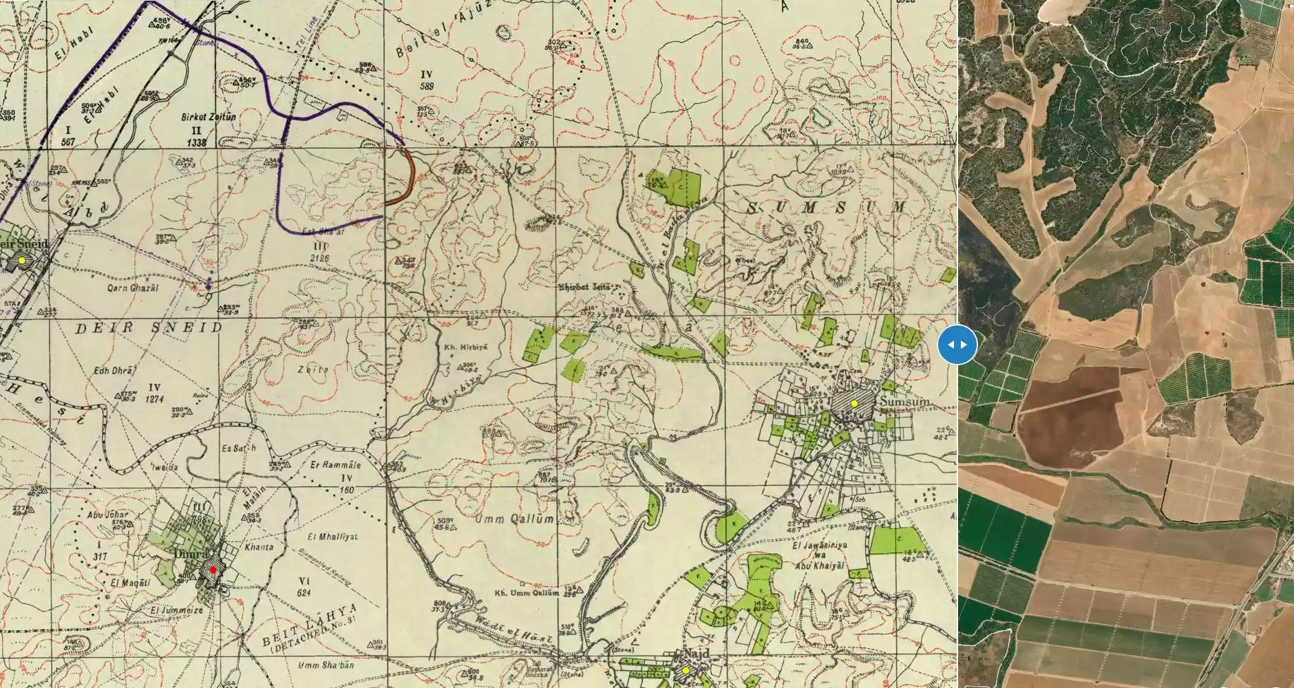
| Before & After Nakba, Click Map For Details |
||||||||||||||||||||||
|
||||||||||||||||||||||
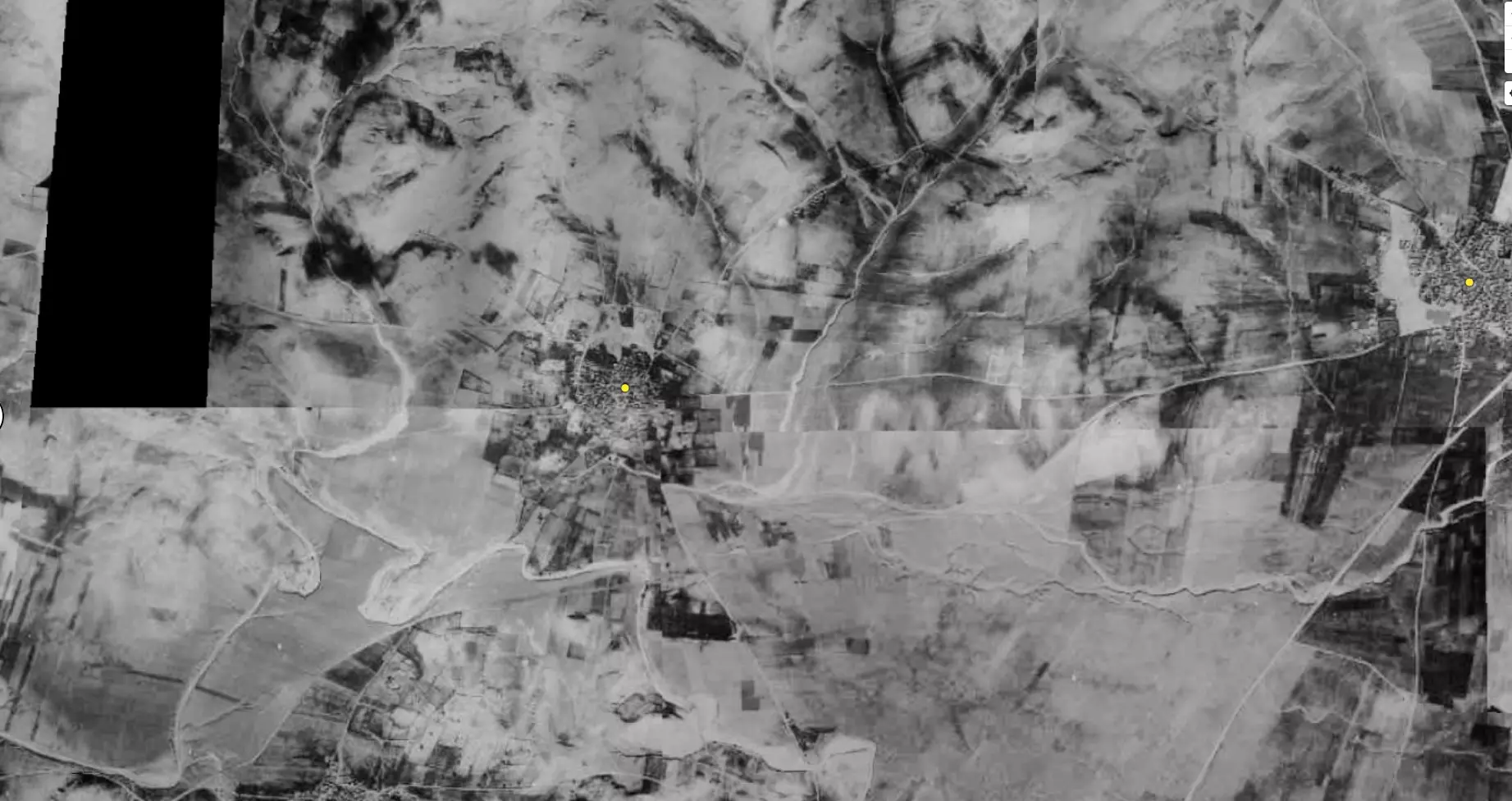
| Pre-Nakba Aerial View |
||||||||||||||||||||||
|
||||||||||||||||||||||
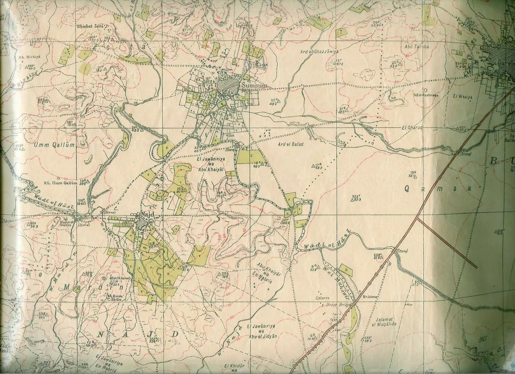
| Map Location | See location #39 on the map View from satellite |
|||||||||||||||||||||
| Military Operation | Operation Barak | |||||||||||||||||||||
| Attacking Units | Negev Brigade | |||||||||||||||||||||
| Acts of Terror | Massacre occured by Zionist troops against the town's inhabitants. | |||||||||||||||||||||
| Exodus Cause | Expulsion by Zionist troops | |||||||||||||||||||||
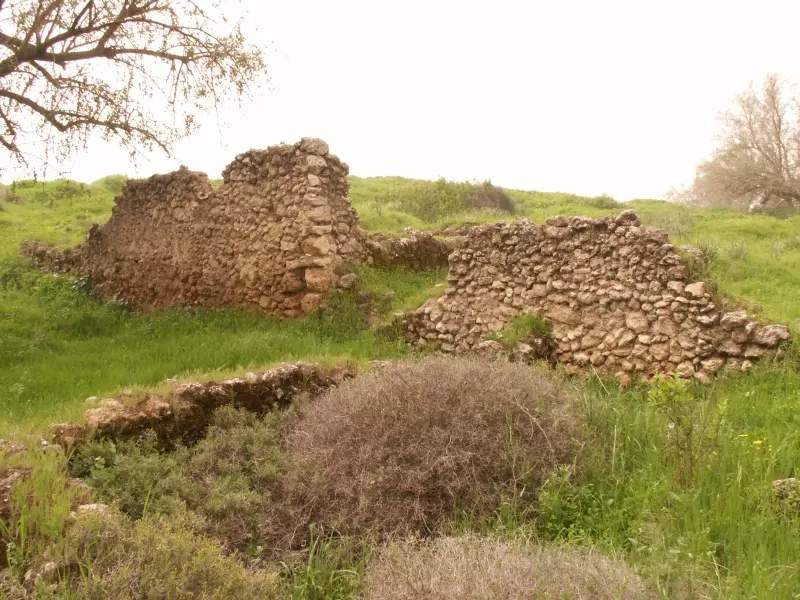
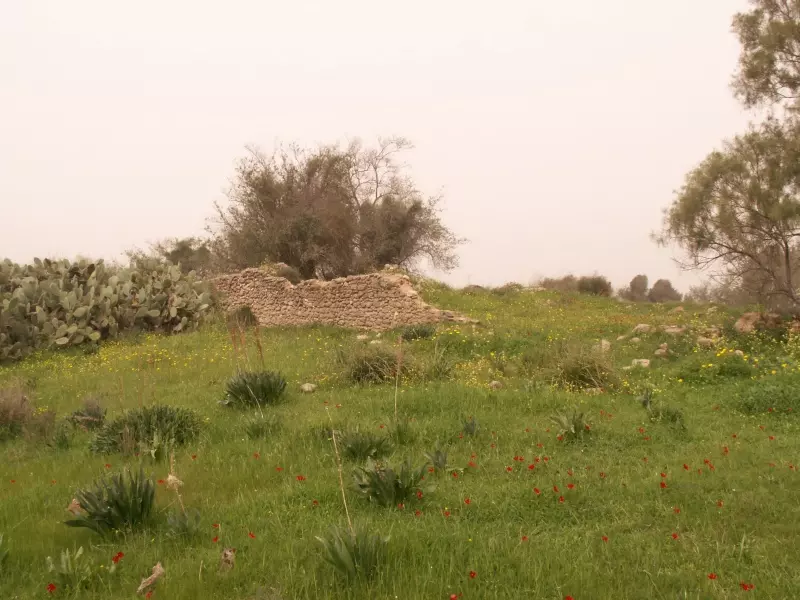
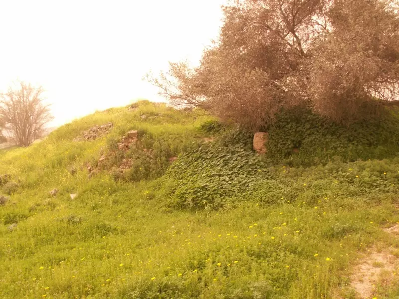
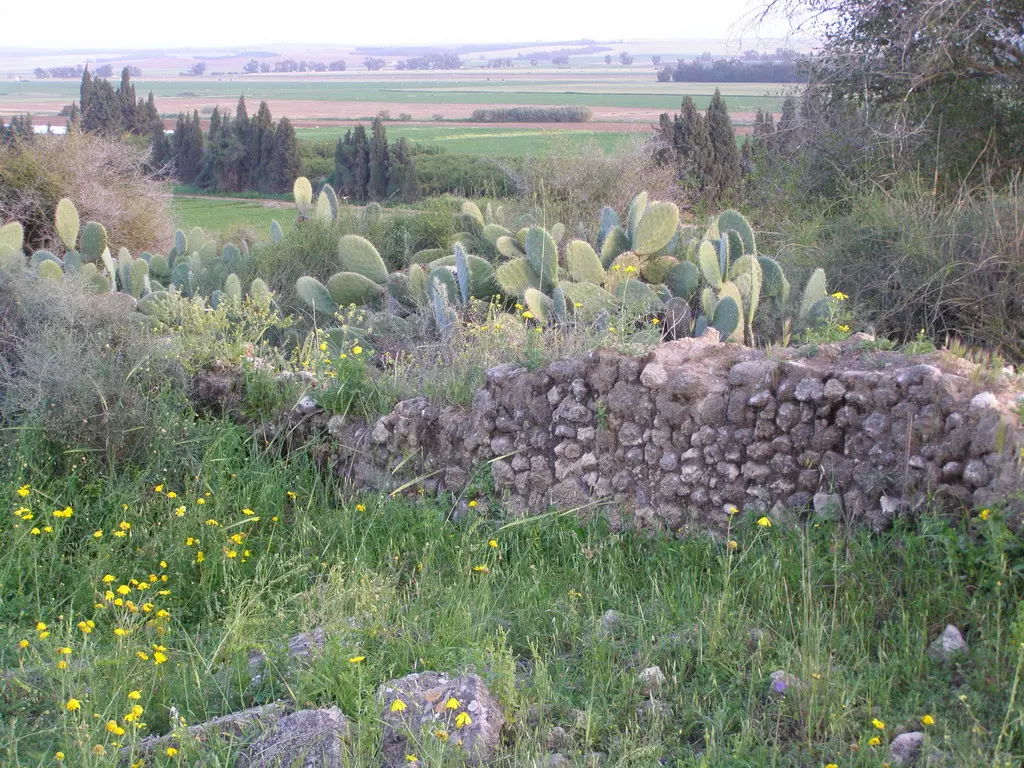
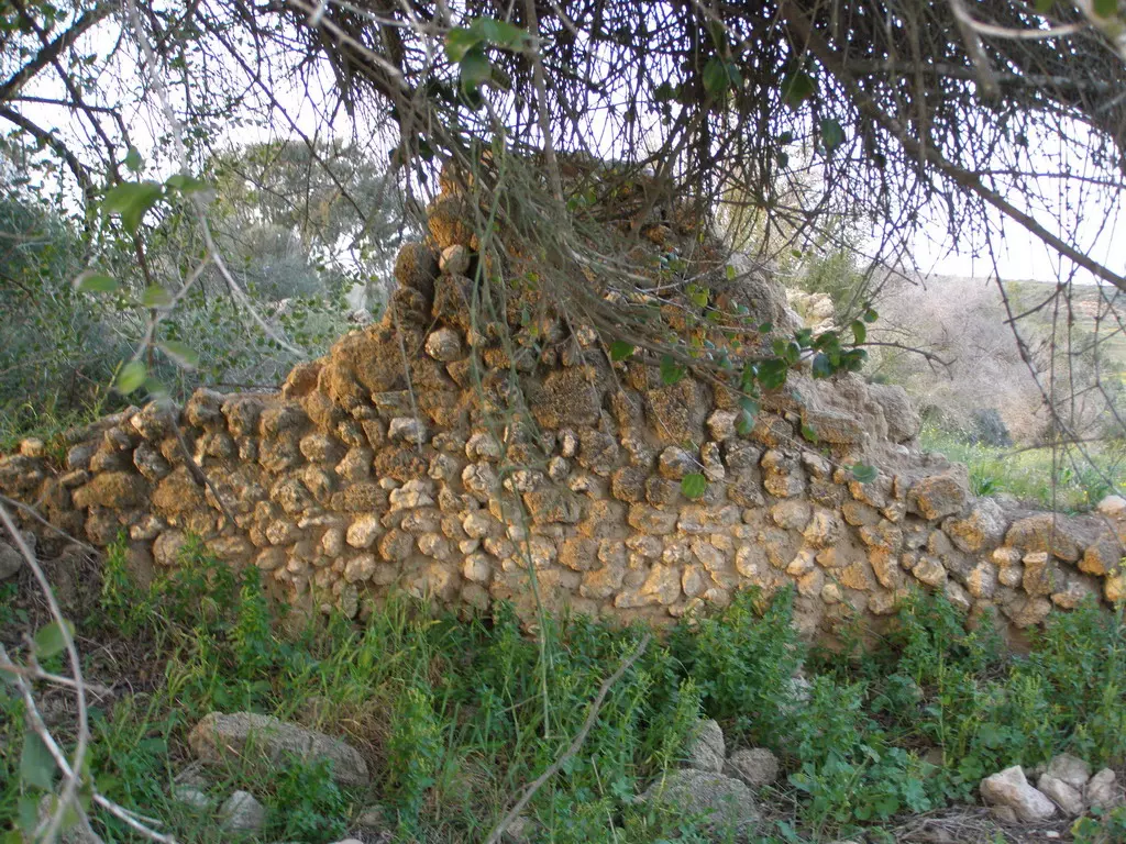
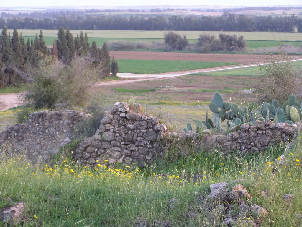
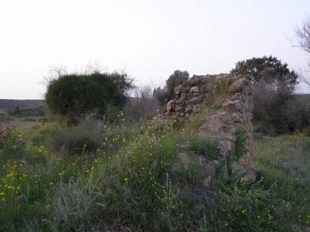
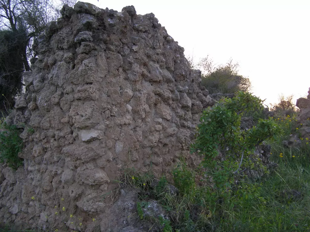
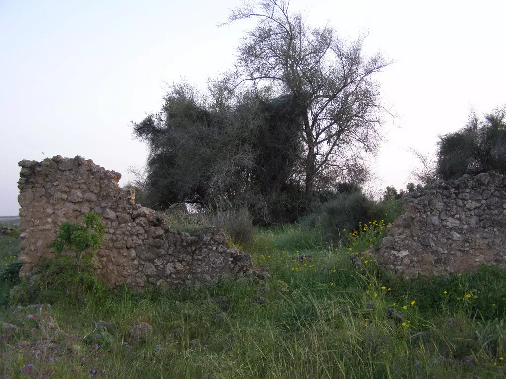
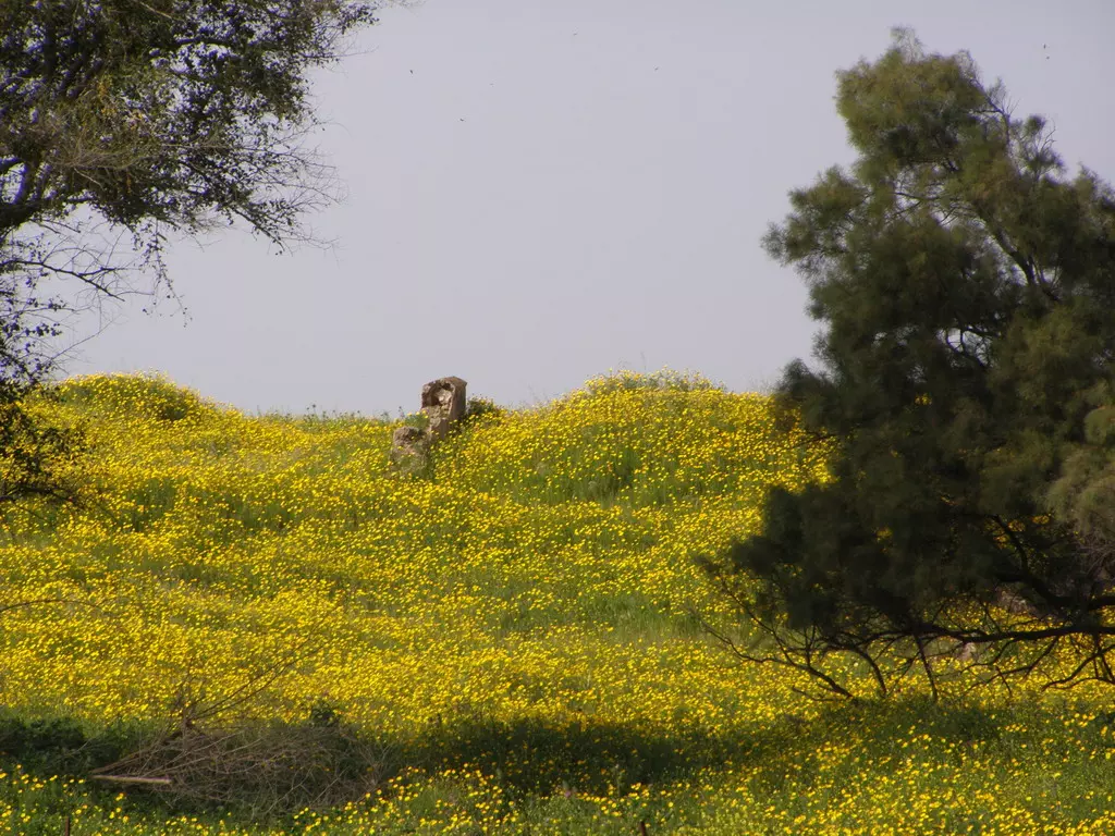
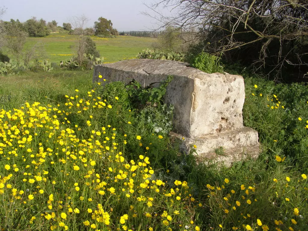
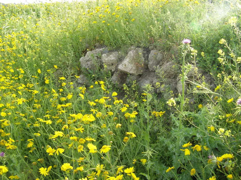
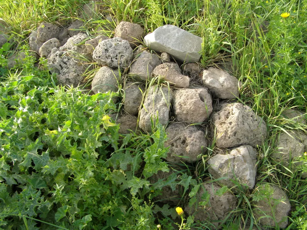
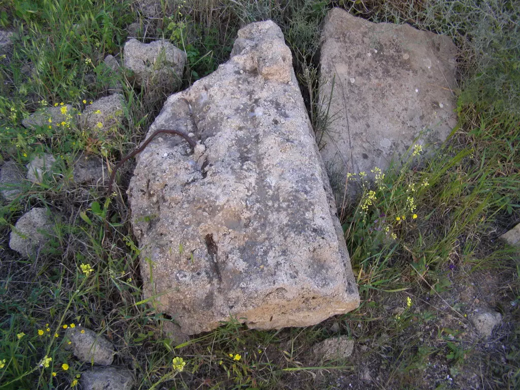
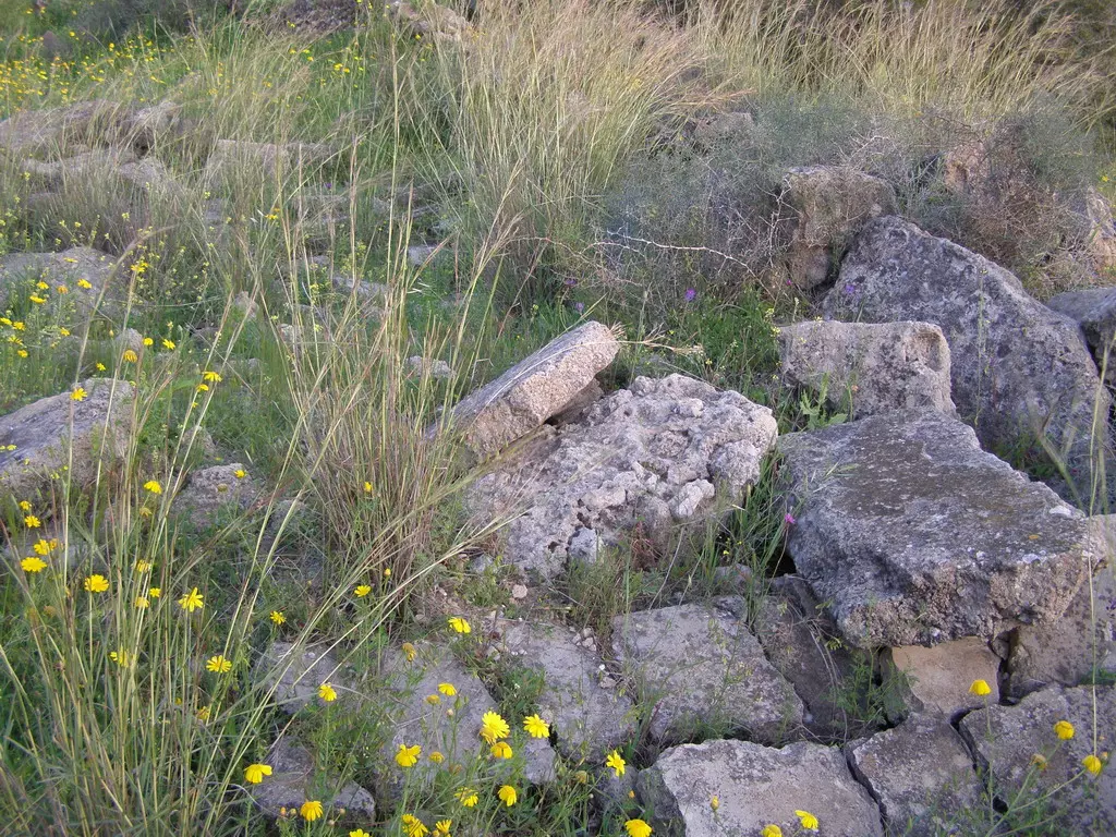
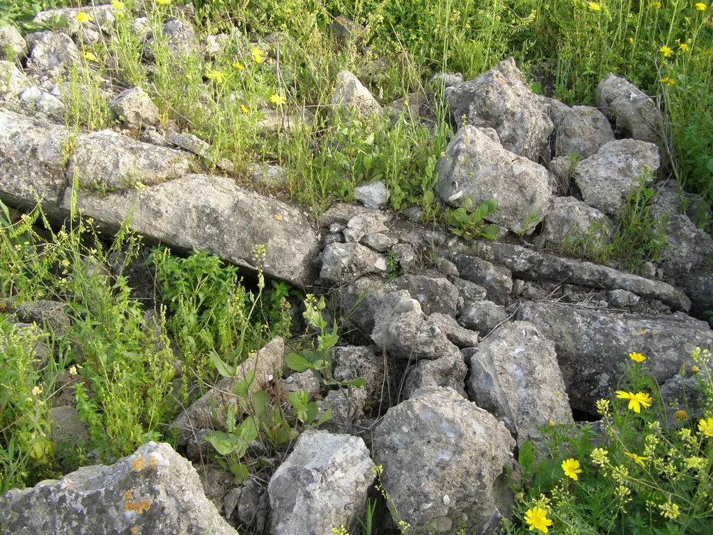
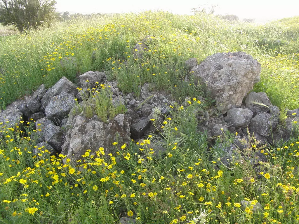
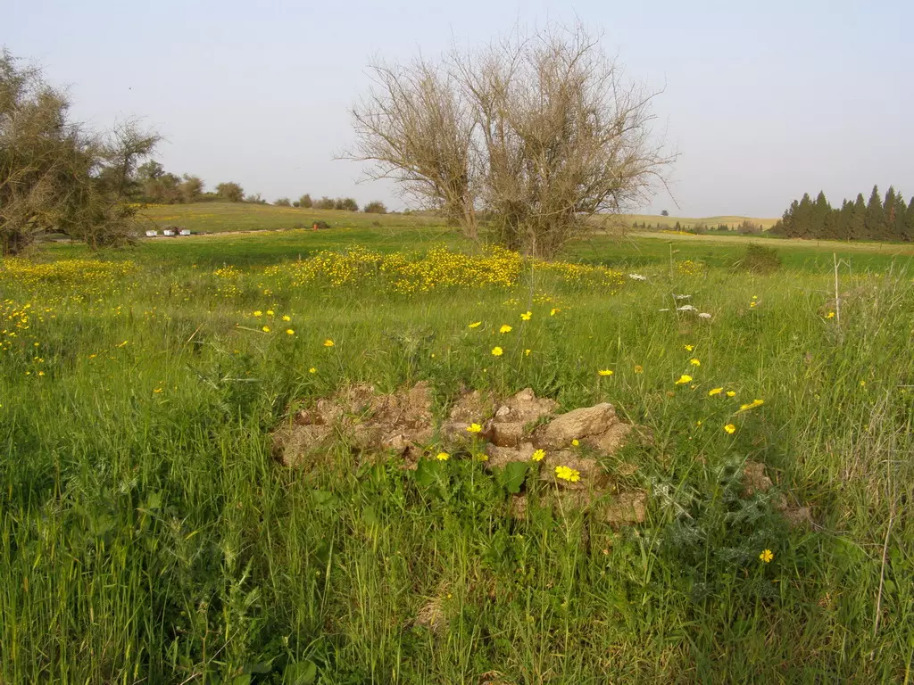
| Village Temains | The village has been completely obliterated. | |||||||||||||||||||||
| Ethnically Cleansing | Simsim inhabitants were completely ethnically cleansed. | |||||||||||||||||||||
| Pre-Nakba Land Ownership |
**Town Lands' Demarcation Maps |
|||||||||||||||||||||
| Land Usage As of 1945 |
|
|||||||||||||||||||||
| Population |
|
|||||||||||||||||||||
| Number of Houses |
|
|||||||||||||||||||||
| Near By Towns |
||||||||||||||||||||||
|
||||||||||||||||||||||
| Town's Name Through History | The Crusaders referred to village by Semsem. | |||||||||||||||||||||
| Schools | Simsim had anb elementary school founded in 1934, and in 1945 it had an enrollment of 45 students. In 1947, Simsim shared its school with the nearby village of Najd. | |||||||||||||||||||||
| Archeological Sites | The village had archaeological site known by al-Ras and Sha'fat al-Mughur (which contained a Roman cemetery). | |||||||||||||||||||||
| Exculsive Jewish Colonies Who Usurped Village Lands |
Gevar'am and Or ha-Ner | |||||||||||||||||||||
| Featured Video | ||||||||||||||||||||||
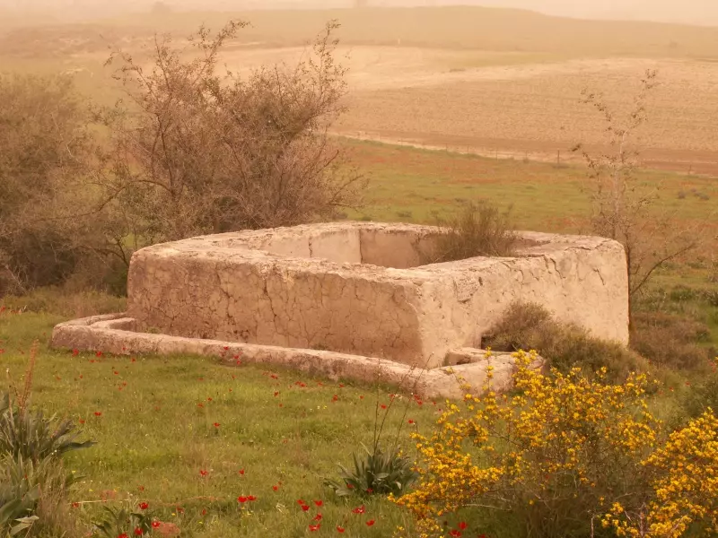
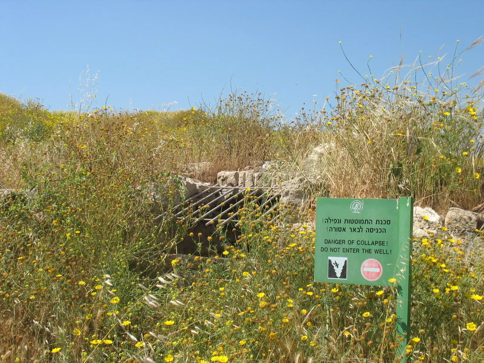
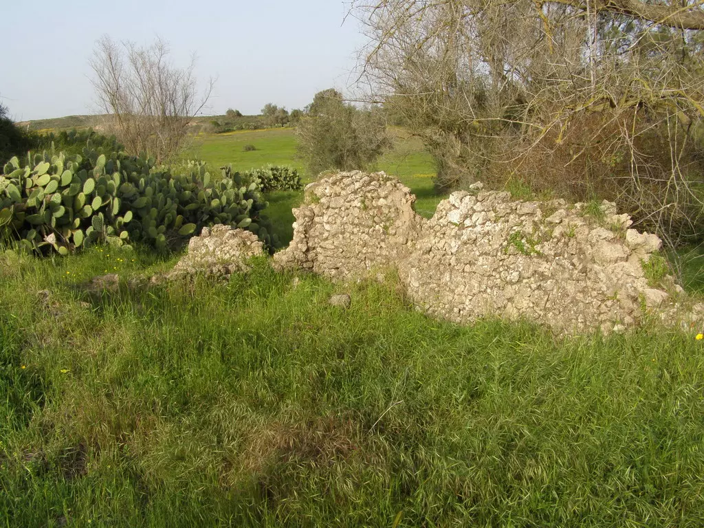
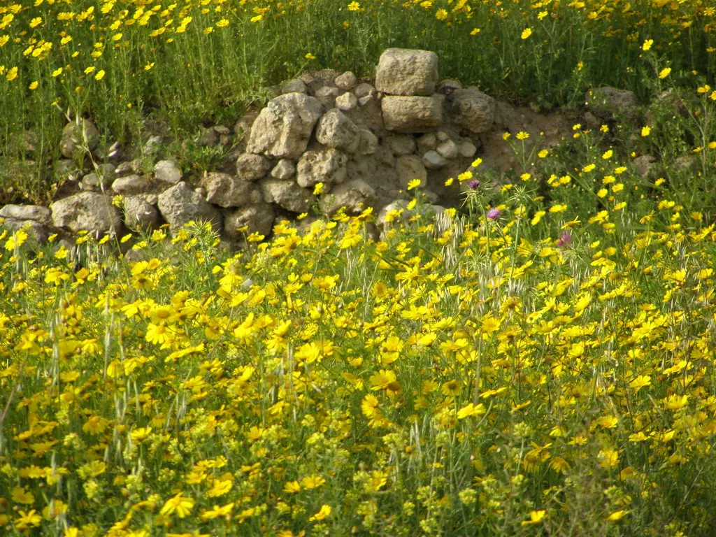
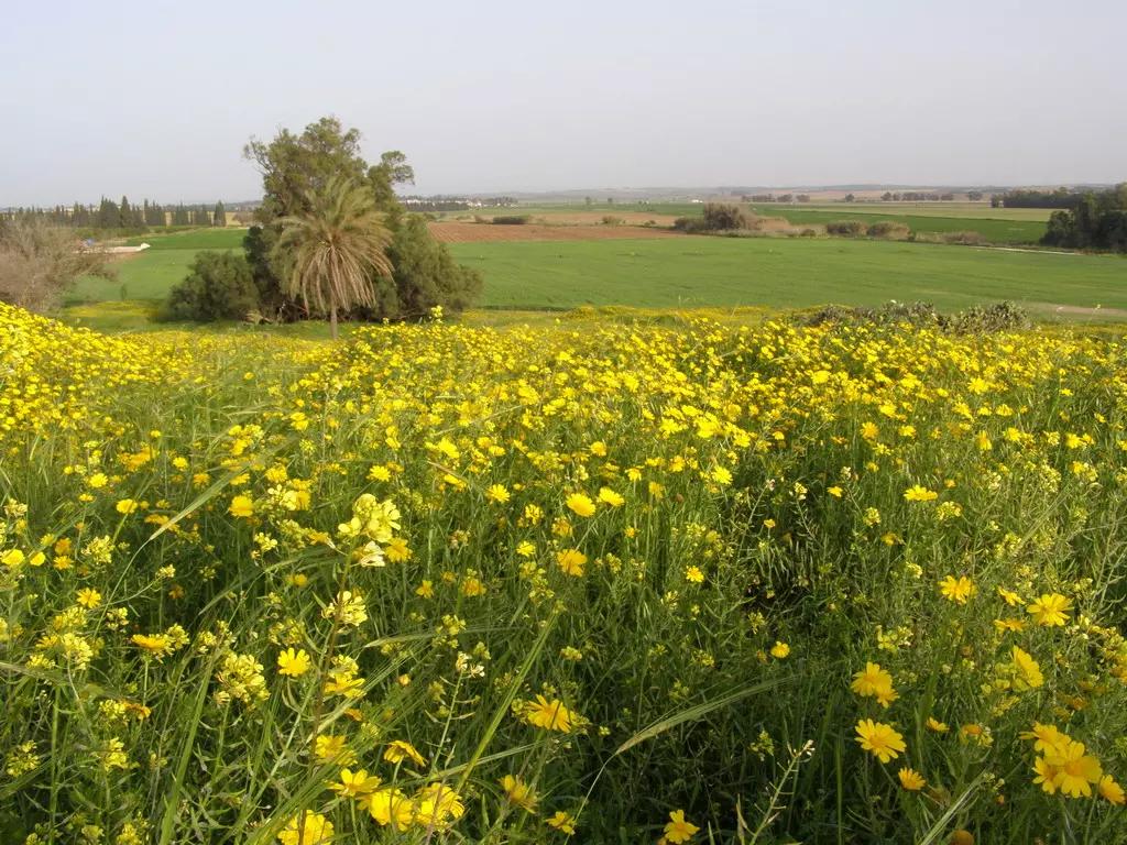
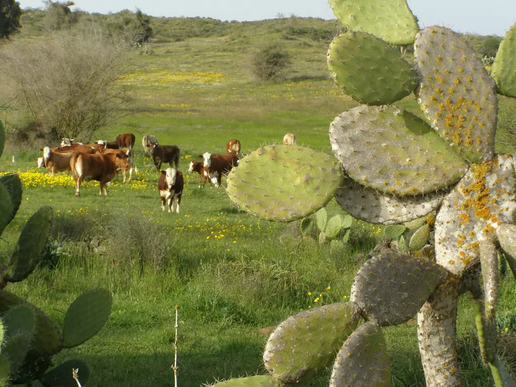
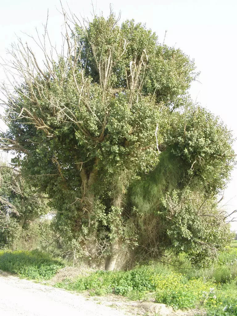
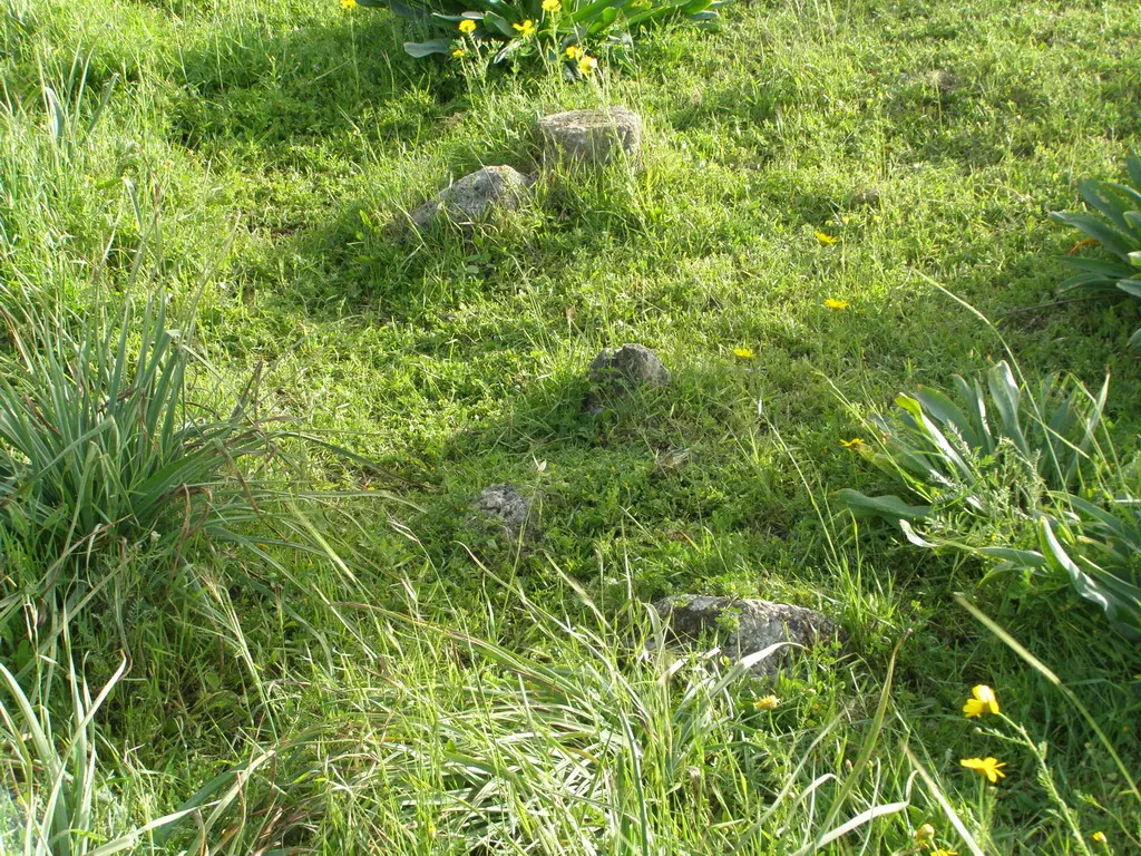
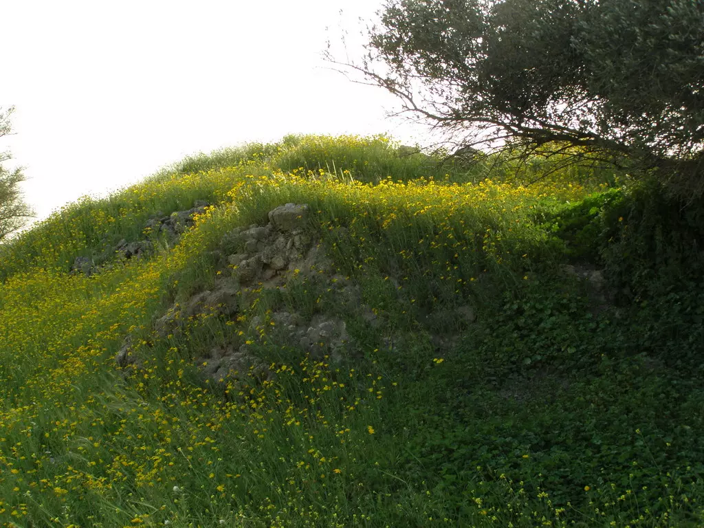
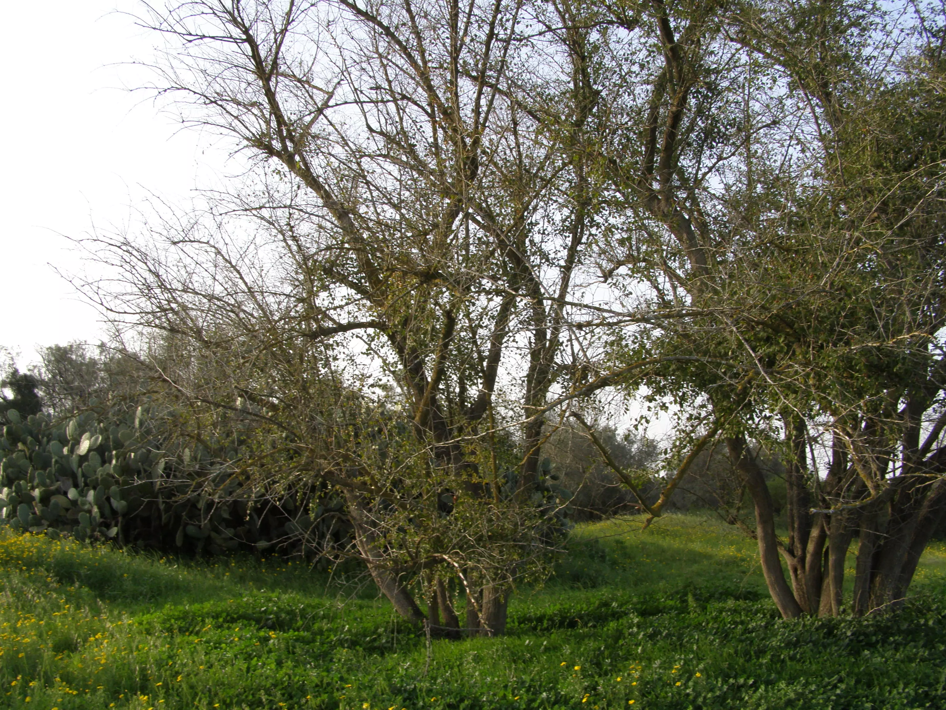
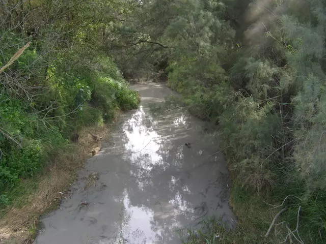
Village Before NakbaThe village stood on flat ground on the coastal plain and was surrounded by hills; Wadi Simsim ran along its southern perimeter. It lay between the coastal highway and a parallel highway that ran from Gaza to Julis. Secondary roads connected Simsim to these highways and to a number of neighboring villages. The village was known as Semsem to the Crusaders. In 1596 Simsim was a village in the nahiya of Gaza (liwa' of Gaza), with a population of 110. It paid taxes on wheat, barley, fruit trees, goats, and beehives. In the late nineteenth century, the village of Simsim was surrounded by gardens. It had a well, a pool, and an olive grove that was planted to the north. Simsim was the hometown of al-Shaykh Sulayman Abd al-Qadir (Abu Ali), one of the leaders of the 1936 revolt against British occupation. It had an overall circular layout, with straight, narrow streets emanating from the center and intersecting with semi-circular ones. Simsim was divided into separate quarters—the largest of which was the northern quarter—by the roads that linked it to the other villages. These roads were also the axes along which it expanded. At the intersection of these axes (the village center) was a mosque. The center also contained a school, founded in 1934 and shared in 1947 with the village of Najd. In the mid-1940s the number of students reached 150. Its population was Muslim, and the village houses were built of adobe brick.Agriculture was the main source of income. Toward the end of the Mandate, the village community cultivated grain, vegetables, and fruits, including 240 dunums of citrus. Agriculture was both rainfed and irrigated from deep (35 to 40 m) wells. Simsim was ringed by fruit trees and gardens, but most of its fruit trees were concentrated in the southwestern lands, which received the flood water from the wadis. In 1944/45 a total of 240 dunums was devoted to citrus and bananas and 12,086 dunums were allocated to cereals; 250 dunums were irrigated or used for orchards. The village included an archaeological mound known as al-Ras and was surrounded by three other archaeological sites, among them a Roman cemetery (known in modern times as Sha'fat al-Mughur) with rock-cut tombs. Village Occupation and Ethnic CleaningIn one of its northward thrusts, just before 15 May 1948, the Palmach's Negev Brigade captured the village and expelled its inhabitants. This was effected in the wake of the occupation of Burayr on 12–13 May, according to Israeli historian Benny Morris. Another source contradicts this account, however. The New York Times mentions that Simsim was occupied two months later, during the Ten Days between the two truces, shortly before 11 July. But the report is suspect because it states that Simsim was occupied along with a cluster of villages well to the north, along the al-Majdal-al-Latrun road. It seems unlikely that these widely-separated villages would have been seized at the same time.Zionists Colonies on Village LandsThe settlement of Gevar'am was established in 1942 on lands that traditionally belonged to the village. The settlement of Or ha-Ner was built in 1957 less than 1 km south of the village site, on the lands of Najd.Village TodayThe village has been obliterated and can only be recognized from the cypress and sycamore trees that still remain. A pile of stones that may be the debris of a village building is visible. The site is fenced in and serves as a pasture. The lands in the vicinity are cultivated by Israeli farmers.SourceDr. Walid al-Khalidi, 1992: All That Remains. |
||||||||||||||||||||||
| Related Maps | Town Lands' Demarcation Maps خرائط للقضاء توضح حدود القرى والاودية Town's map on MapQuest View from satellite Help us map this town at WikiMapia |
|||||||||||||||||||||
| Related Links | Wikipedia's Page Facebook Page Google Search Google For Images Google For Videos |
|||||||||||||||||||||
| More Information | في كتاب كي لا ننسى في كتاب بلادنا فلسطين المزيد من موقع هوية |
|||||||||||||||||||||
- كتاب قرية سمسم المهجرة - إعداد: د. سامي يوسف احمد
- كتاب قرية سمسم المهجرة -- إعداد ختام موسى زملط
- Between Gaza and Sderot: A tour of Simsim, a destroyed Palestinian village Saturday, 28/3/2009
- بين غزة وسدروت ؟ السبت 28/3/2009 جولة إلى القرية الفلسطينية المنكوبة سمسم
- نبذة تاريخية عن قرية سمسم (قضاء غزة) من كتاب (كي لا ننسى)
- Remains, NE of the village centre

Posted by Uri Zackhem 10 - Remains, NE of the village centre
Posted by Uri Zackhem 5 - Irrigation pool, NE of the village centre
Posted by Uri Zackhem 3 - Remains, main hill.
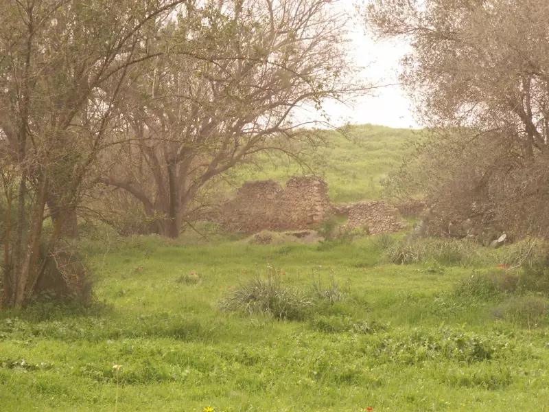
Posted by Uri Zackhem 1 - Remains, main hill (closer look).
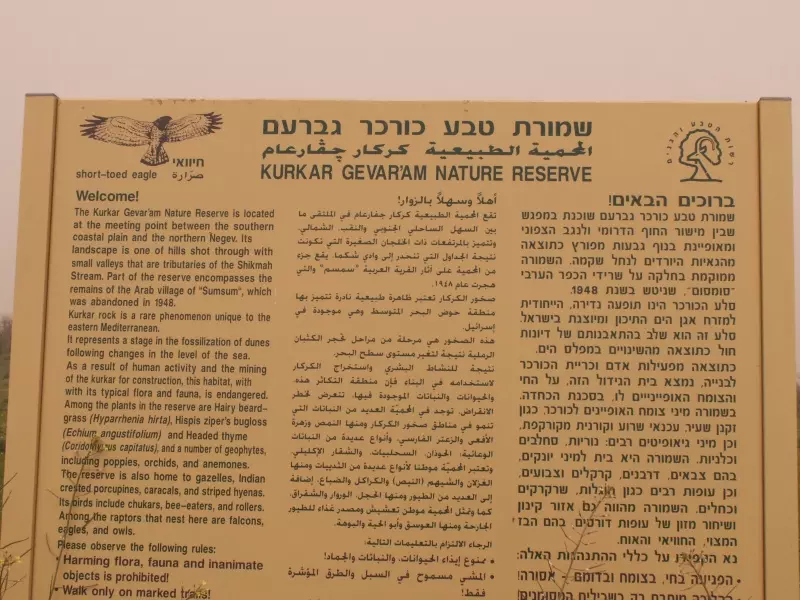
Posted by Uri Zackhem - The signs of the nature reserve mention Simsim.
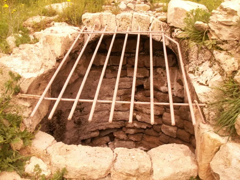
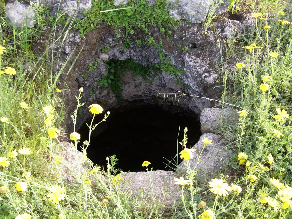
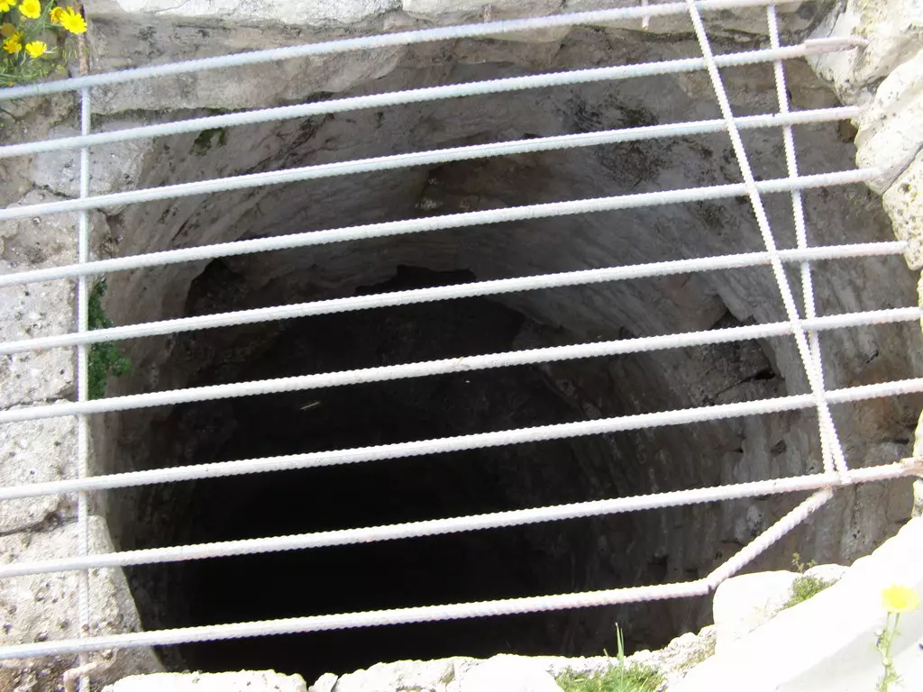
Posted by Uri Zackhem 2 - A deep well, southern side of the main hill.

Posted by Uri Zackhem 2 - A deep well, southern side of the main hill (a closer look).
Posted by Uri Zackhem 4 - Sight near the well.
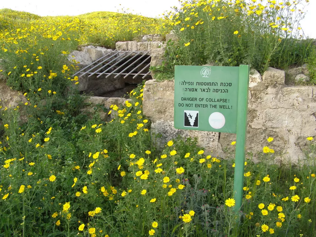
Posted by Uri Zackhem 2 - One of the village's cisterns (water wells)
Posted by Noga Kadman 4 - أطلال منزل عبد ربّه الحوّ، قرية سمسم، آذار 2009 - تصوير عمر اغبارية
Posted by Umar Ighbariyyeh 1 - أطلال بين الأزهار، سمسم، آذار 2009، تصوير عمر اغبارية
Posted by Umar Ighbariyyeh - منظر من مركز قرية سمسم باتجاه الجنوب، آذار 2009، شجرة النخيل كانت حتى 1948 في ساحة منزل عثمان فرج الله، تصوير عمر اغبارية
Posted by Umar Ighbariyyeh 3 - صبّار وأبقار، مقبرة سمسم أصبحت مرعى لأبقار المستوطنين، آذار 2009، تصوير عمر اغبارية
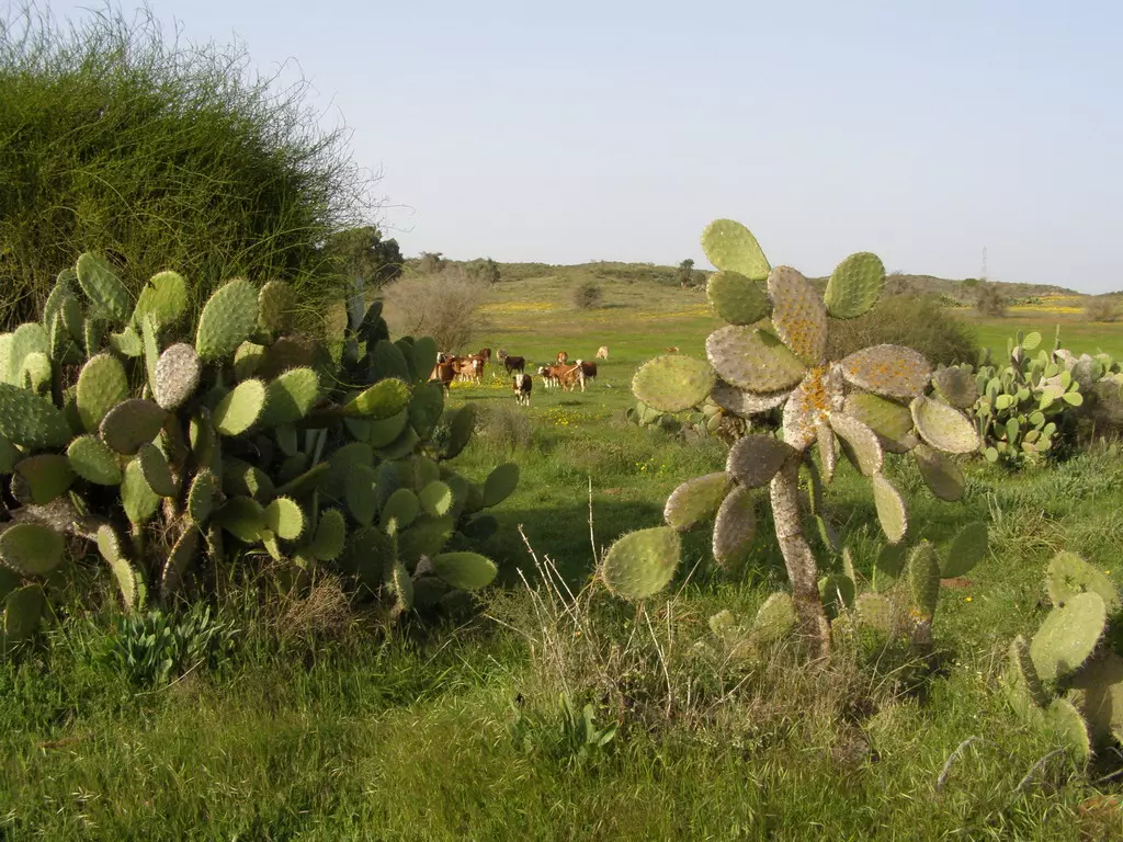
Posted by Umar Ighbariyyeh 2 - صبّار وأبقار، مقبرة سمسم أصبحت مرعى لأبقار المستوطنين، آذار 2009، تصوير عمر اغبارية
Posted by Umar Ighbariyyeh - جمّيزة في سمسم، حتى 1948 كانت قرب
Posted by Umar Ighbariyyeh - قبر في سمسم، آذار 2009، أصبحت المقبرة مرعى لأبقار المستوطنين. تصوير عمر اغبارية
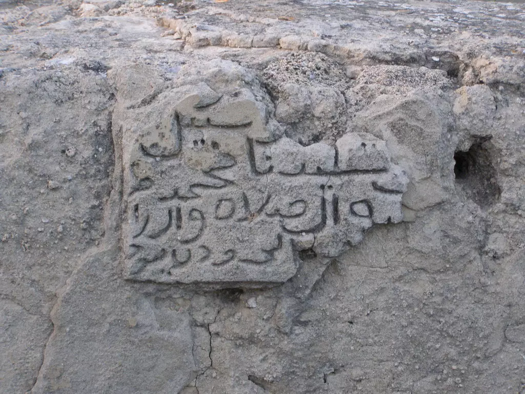
Posted by Umar Ighbariyyeh - كتابة محفورة على بئر دار عابد، تصوير عمر اغبارية، آذار 2009
Posted by Umar Ighbariyyeh 1 - خابية' لتخزين الحبوب، قرية سمسم. تصوير عمر اغبارية، آذار 2009
Posted by Umar Ighbariyyeh 1 - ركام مسجد سمسم ومقام النبي دانيال بجانبه تحت الزيتونة، آذار 2009. تصوير عمر اغبارية
Posted by Umar Ighbariyyeh 2 - أطلال منزل تابع لأحد أبناء عائلة عابد، آذار 2009. تصوير عمر اغبارية
Posted by Umar Ighbariyyeh 2 - أطلال منزل تابع لأحد أبناء عائلة عابد، آذار 2009. تصوير عمر اغبارية
Posted by Umar Ighbariyyeh - أطلال منزل تابع لأحد أبناء عائلة عابد، آذار 2009. تصوير عمر اغبارية
Posted by Umar Ighbariyyeh - أطلال منزل تابع لأحد أبناء عائلة عابد، آذار 2009. تصوير عمر اغبارية
Posted by Umar Ighbariyyeh - أطلال منزل تابع لأحد أبناء عائلة عابد، آذار 2009. تصوير عمر اغبارية
Posted by Umar Ighbariyyeh - أطلال منزل تابع لأحد أبناء عائلة عابد، آذار 2009. تصوير عمر اغبارية
Posted by Umar Ighbariyyeh - بئر البلد، آذار 2009. تصوير عمر اغبارية
Posted by Umar Ighbariyyeh 1 - بئر البلد، آذار 2009. تصوير عمر اغبارية
Posted by Umar Ighbariyyeh - أطلال سمسم، مركز البلد، آذار 2009. تصوير عمر اغبارية
Posted by Umar Ighbariyyeh - قبر الشيخ عرفج، قبر يتسطح ويؤول إلى الفناء، القبر الوحيد البارز في مقبرة سمسم المغتصبة،آذار 2009. تصوير عمر اغبارية
Posted by Umar Ighbariyyeh - أطلال بين الأزهار، سمسم، آذار 2009، تصوير عمر اغبارية
Posted by Umar Ighbariyyeh - أطلال بين الأزهار، سمسم، آذار 2009، تصوير عمر اغبارية
Posted by Umar Ighbariyyeh - حجارة بيت مهدوم في حارة دار عابد، سمسم آذار 2009. تصوير عمر اغبارية
Posted by Umar Ighbariyyeh - حجارة بيت مهدوم في حارة دار عابد، سمسم آذار 2009. تصوير عمر اغبارية
Posted by Umar Ighbariyyeh - شجر السدر والصبّار في مركز البلد، آذار 2009. تصوير عمر اغبارية
Posted by Umar Ighbariyyeh - حجارة البيوت التي دمرها الاحتلال في مركز البلد، تصوير عمر اغبارية، آذار 2009
Posted by Umar Ighbariyyeh - حجارة البيوت التي دمرها الاحتلال في مركز البلد، تصوير عمر اغبارية، آذار 2009
Posted by Umar Ighbariyyeh - حجارة البيوت التي دمرها الاحتلال في مركز البلد، تصوير عمر اغبارية، آذار 2009
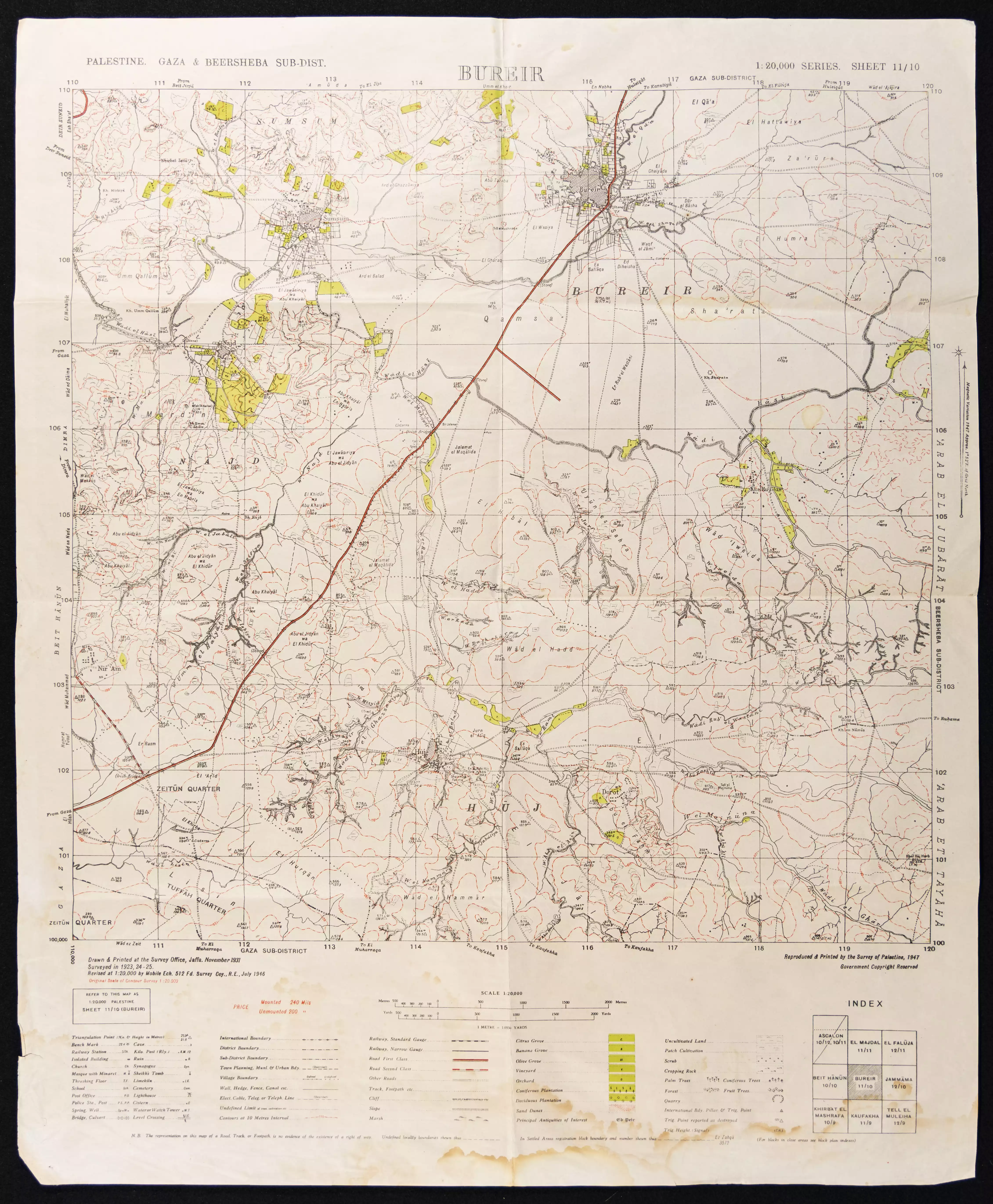
Posted by Umar Ighbariyyeh - خريطة - مسطح قرية سمسم وقرية نجد، يطهر فيها مركز البلد المبني وأراضي القرية حوله. خريطة بريطانية من عام 1946
Posted by Umar Ighbariyyeh 7 - وادي الحسي في أراضي سمسم، تصوير عمر اغبارية، آذار 2009
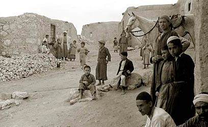
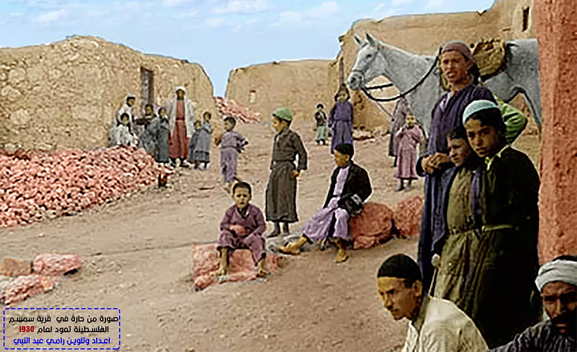
Posted by Umar Ighbariyyeh 2 - قرية سمسم 1930 حيث يمكن رؤية ازقة القرية -- مشاركة صفافي
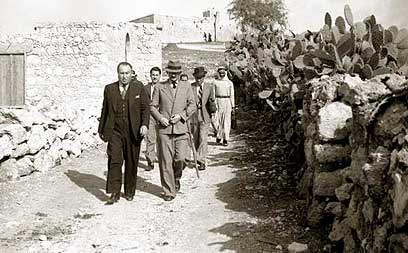
Posted by صفافي أصيل - قرية سمسم 1930 الطريق الى وسط القرية وزيارة الخواجات - مشاركة صفافي
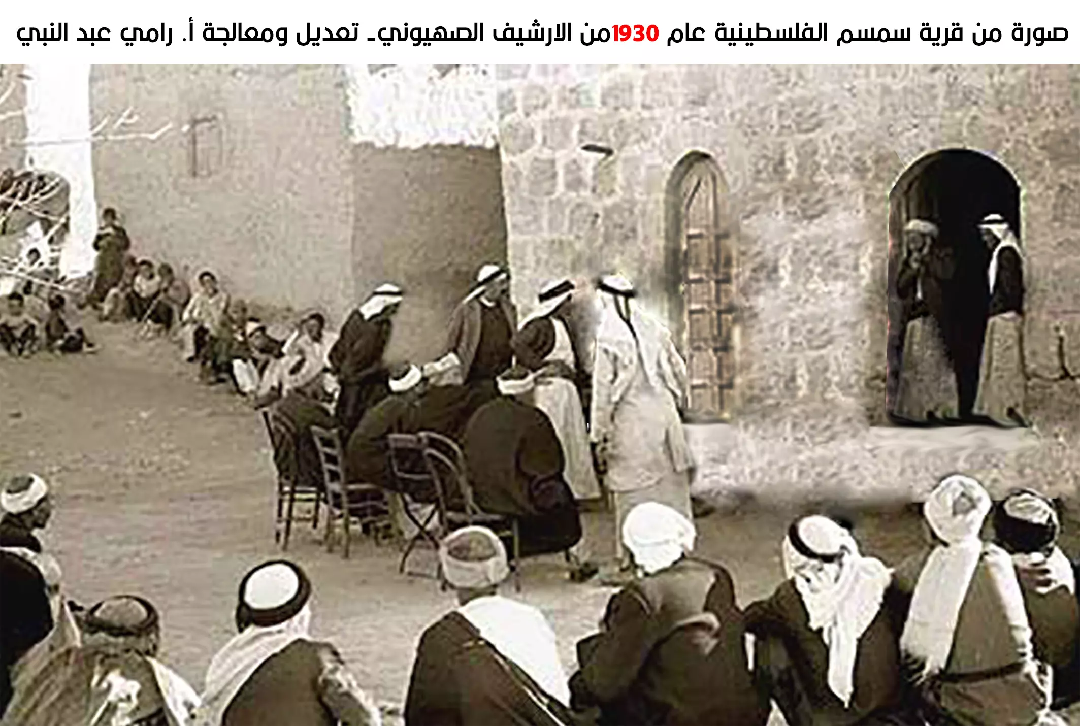
Posted by صفافي أصيل 1 - قرية سمسم 1930 استقبال الخوجات وعقد الصفقات في بيت الشيخ وترقب اهالي القرية
Posted by صفافي أصيل 1 - قرية سمسم : خارطة الموقع ومكتوب أعلى الخارطة باللغة العبرية سمسم
Posted by صفافي أصيل - الشهيد باذن الله اسلام عبد النبي مخيم جباليا القرية الاصلية سمسم
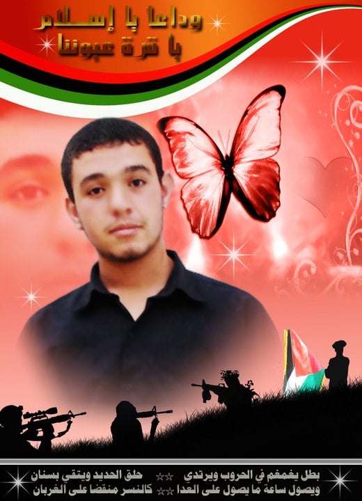
Posted by ابو وطن - الشهيد باذن الله اسلام عبد النبي مخيم جباليا القرية الاصلية سمسم
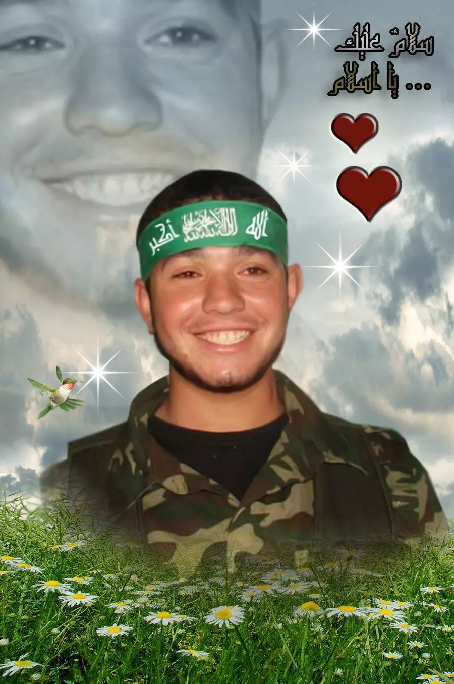
Posted by ابو وطن - الشهيد باذن الله اسلام عبد النبي مخيم جباليا القرية الاصلية سمسم
Posted by ابو وطن - صورة توضيحية لقرية سمسم بالقمر الصناعي
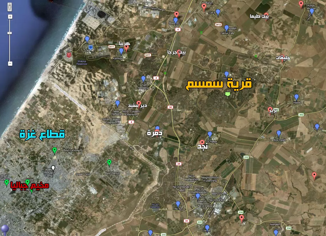
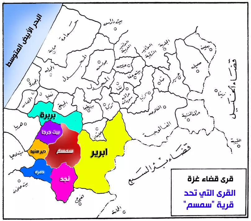
Posted by ابو جهاد - خريطة لموقع قرية سمسم بين القرى الأخرى
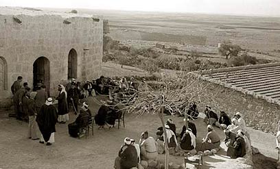
Posted by ابو جهاد - صورة من وسط قرية سمسم في احدى الاجتماعات العامة
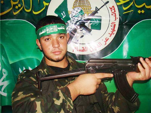
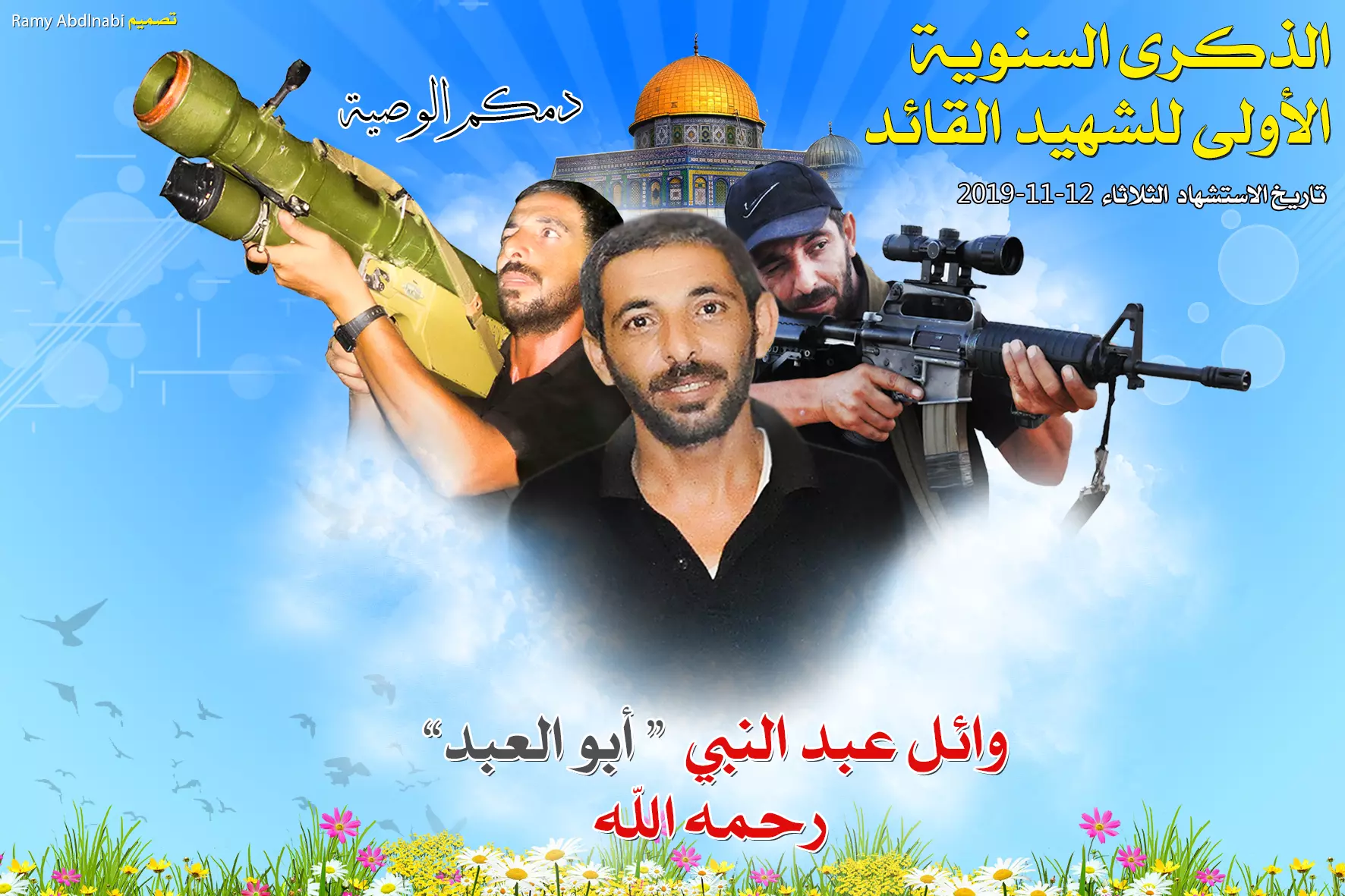
Posted by ابو جهاد - الشهيد وائل عبد النبي قرية سمسم
Posted by ابو جهاد - صورة من قرية سمسم وعلى حسب ما ذُكر لنا من احدى المُعمرات من أهل القرية اتضح ان هذه الحارة هي حارة عابد أو الحارة الجنوبية واكثر من واحد من الموجوددين يعود لعائلة عابد
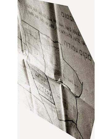
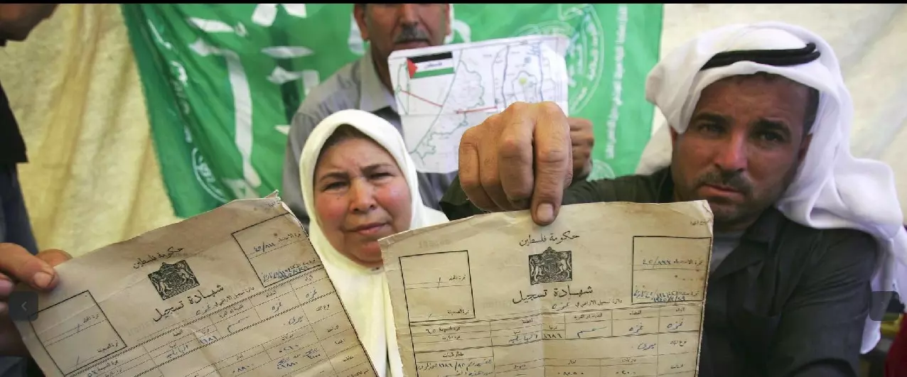
Posted by ابو جهاد - Simsim Land deeds / كواشي الارض لسمسم
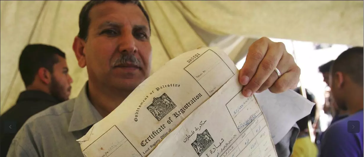
- Simsim Land deeds / كواشي الارض لسمسم #2
- Pre-Nakba Aerial view of the village / صورة من الجو للقرية اخذت قبل النكبة
- خارطة تُظهِر الحدود والطرق بأنواعها والأماكن المقدسة والطبيعة الطوبغرافية من تلال وسهول ومنحدرات والتشكيلة الطبيعية للأرض وأنواع المزروعات. نُشرت الخريطة فترة الانتداب البريطاني، تم إضافة تعديلات عليها من قِبَل خدمة الخرائط والصور التابعة للقوات العسكرية الاسرائيلية فترة الأربعينيات.
Want to browse more? 80,000 pictures were grouped in these gallaries:
| Display Name | Clan/Hamolah | Country of Residence |
| إيمي عابد | عابد | المملكة العربية السعودية, المملكة العربية السعودية |
| سلوى عابد | عابد | الرياض, السعودية |
| الشيخ | - | Dammam, Saudi Arabia |
| ابو وطن | عبد النبي | - |
| Dalia Awad | Awad | Hael, Saudi Arabia |
| عبدالله عبدالنبي | عبدالنبي | الرياض, السعوديه |
| راتب الحمدني | فرج الله | الرياض, السعودية |
| عبدالله غنام | غنام | الرياض, السعودية |
| حسام غنام | غنام | الرياض, السعودية |
| ابو زيـــــد | الكتري | Jaddah, سمسم |
| د. أحمد سامي الكتري | حمد-الكتري | الرياض, السعوديه |
| ABU MOHAMMED | عواد | ابوظبي |
| عصام محمد عابد | - | السعودية, السعودية |
| وسيم عابد | - | - |
| ابو قتادة | عبد النبي | غزة, مخيم جباليا |
| إياد فرج الله | فرج الله | - |
| لؤي فرج الله | فرج الله | - |
| صلاح الدين الكتري | - | - |
| أبو أحمد | othman | gaza |
| tamer-awwad | عواد | - |
| حسام عثمان | فرج الله | - |
| ايمن عواد | - | - |
| محمد فرج الله | - | - |
| علاء الدين زكي حسن | عواد | - |
| وائل صالح | - | الرياض, السعوديه |
| ناهض عثمان | عثمان | - |
| أبو حسين | 00962786139859 | مخيم حطين, الأردن |
| عماد الشيخ | - | - |
| إبراهيم عزيز | - | غزة |
| محمد عثمان | - | - |
| محمد صالح | فرج الله | - |
| ahmad | othman | amman, jordan |
| لؤي كباجه دار العقد | - | - |
- قرية سمسم وتبقى في الذاكرة // انتاج فريد شاهين - ميار للانتاج الاعلامي Duration: 21 min 53 sec
- "قرية سمسم" الفلسطينية - حلقة جديدة من برنامج #أهل_البلاد من انتاج قناة القدس اليوم Duration: 19 min 8 sec
- قرية سمسم المدمرة في الجنوب الفلسطيني قضاء غزة.... تصوير تحيات قيس فحماوي Duration: 11 min 48 sec
 Fake Valor: Why Did Zionist Jews Hoist Nazis Flag on Their Ships in the 1930s?
What is new?
-
Facts About Oct. 7th Gaza Raid
-
Remined Us Please:: Who Did Rape Who? Palestinians Raped Israelis? Or, was the other way around?
-
When Prof. Edward Said was invited to debate Bibi Netanyahu in the 1980s, watch what happened!
-
Ezra Klein of the NY Times on the "Jewish Race".
-
Abusing Blood Libel!
-
Did Israeli Soldiers Activate The Hanniba Direective On Oct. 7th? You Be The Judge
-
Zionist FAQ: Isn't it true that Palestinians don't want peace? Palestinians never accepted the two-state solution
- Facts about Haavara (Transfer) Agreement between Ben-Gurion & Hitler
-
Haavara FAQs: Why Did Zionist Jews Hoist Nazis' Flags on Their Ships in the 1930s?
- Haavara FAQs: When Chaim Weizmann met FDR in mid-1943, why was he silent about rescuing European Jewry?
-
Dear ChatGPT: How did Palestinians resist Napoleon's invasion of their country in 1799?
-
Dear ChatGPT: Gaza had a vibrant Jewish community in the mid-17th century. What happened to them?
-
Dear ChatGPT: Why did the Jewish Agency suppress news of the Holocaust during WWII?
-
Video Playlist: Jews share their DNA tests to end the conflict for good.
-
A Tale of Two Conflicts: Examining the Definition of Genocide
-
Prof. Abraham Polak And The Suppressed History of the Khazars and European Jewry
-
How Ronald Reagan would have framed the genocide in Gaza if he were still alive?
-
Haavara FAQs: Let us do the math: how many German Jews did The Haavara Agreement save?
-
Zionist FAQs: The Hebron Massacre of 1929, "clearly proves" that Palestinians are antisemitic, how could you deny it?
-
Zionist FAQs: Why Anti-Zionist Is Not Antisemitism?
-
Zionist FAQs: Isn't it true that the KGB created Palestinian Nationalism in the early 1960s?
- Zionist FAQs: Muslims are killing Muslims all the time; why are Israeli Jews being singled out in the media?
- Zionist FAQs: How is Israel an apartheid state when 20% of its citizens are Arabs who enjoy full rights?
-
Haavara FAQs: Why Did Dorothy Thompson Flip From A Zionist Advocate to A Silenced Dissenter?
-
Haavara FAQs: Analysis of Herzl's Uganda Scheme and how it could have saved millions of Jews.
-
Haavara FAQs: Why did Hayim Greenberg describe American Jewry as "morally bankrupt" in early 1943?
-
Haavara FAQs: What if the Evian Conference was a resounding success? What would have been the impact of saving European Jewry on Zionism?
- Haavara FAQs: What if the six million were saved, how that would have impacted the Zionist project?
-
Haavara FAQs: How did Zionist leaders react when Europe's Jews lingered in the DP camps after WWII ended?
-
Why does the American Jewish community repeat lies that David Ben-Gurion had debunked before he died?
-
Who has the power to rename the Tatar/Khazar Gene Marker to Jewish IV?
-
Zionist FAQs: Why won't Egypt, Syria, and Jordan take their people back? Jews are indigenous to Palestine, and Arabs immigrated after Jews developed the country. Arabs should leave.
-
Haavara FAQs: Did Hitler and the Nazis conflate between Judaism and Zionist? If that wasn't case, then why?
-
Haavara FAQs: Winston Churchill and antisemitism, a collection of articles written Churchill.
-
Haavara FAQs: Broken by country, how many Jews survived vs. killed during the Holocaust?
-
Haavara FAQs: Why did European Jews vote with their feet and to immigrated to the Americas, not Palestine, after WWII?
-
Watch this American Jewish Girl describing Israeli Jews' cognitive dissonance like no other in under two minutes
-
Haavara FAQs: When the Nazis went out of their way to hide the Holocaust, Israeli Jews did the exact opposite by broadcasting their genocide of Gazans. But why?
-
Haavara FAQs: How Zionist Jews went out of their to show their appreciation to Nazism and Fascism?
- Haavara FAQs: Why Zionist leaders were against bombing the death camps & the Railroads leading to them?
-
Haavara FAQs: Hitler's message to the British and American people: If Jews are such noble citizens and you care about them, how come you're not letting them in? I will gladly ship them to you at my expense, even on luxury liners!
-
A shortlist of Zionist and Israeli false flag operations in the name Jews.
-
The Most Moral Army
- The Land of Kapos (Israel): Where the brave are boycotted and Kapos walk free.
- Why did early Zionists often named their communal enterprises "colonial"?
- Zionist Relations with Nazi Germany by Faris Glubb
-
Two NY Times advertisements by Zionists in the early 1943 that exposes Zionists' treason at the height of the calamity
- Facts Not Lies about the Palestinian-Israeli Conflict.
- Site's pictures have been categorized
- Campgain Against Lice
- A Survey of Palestine, the official source about Palestine before Nakba produced by the British Mandate; over 1200 pages.
- Satellite View & Google Earth: Over 6,000 placemarks identifying all destroyed towns, W. Bank & Gaza Strip Towns, & refugee camps.
- PalestineRemembered.com and its Nakba Oral History Project were featured on al-Jazeera Satellite TV.
- Nakba Oral History Video Podcast:
 Over 700 Oral History interviews (including 3,500+ hours of recording) can be viewed online.
 - Palestine Village Statistics Project
- Gaza Jail Break
- النسخة العربية للموقع الان متوفرة
- Videos: Documenting the destroyed villages in video: Tracing all that remains since Nakba.
- Videos: Responding to Zionist Propaganda
- Interview: The ethnic cleansing of Palestine: George Galloway interviews Israeli Historian Ilan Pappe.
- For Palestinians, memory matters. It provides a blueprint for their future By George Bisharat.
- Zionist FAQ now available in Hebrew שאלות שציונים שואלים, עכשיו בעברית
- Video: The Stephen Walt and John Mearsheimer report on the influence of the Israel Lobby on U.S. Foreign Policy
- The Palestinian-Israeli conflict for beginners
