| PalestineRemembered | About Us | Oral History | العربية | |
| Pictures | Zionist FAQs | Haavara | Maps | |
| Search |
| Camps |
| Districts |
| Acre |
| Baysan |
| Beersheba |
| Bethlehem |
| Gaza |
| Haifa |
| Hebron |
| Jaffa |
| Jericho |
| Jerusalem |
| Jinin |
| Nablus |
| Nazareth |
| Ramallah |
| al-Ramla |
| Safad |
| Tiberias |
| Tulkarm |
| Donate |
| Contact |
| Profile |
| Videos |
Welcome To Dayr Sunayd - دير سنيد (דיר סניד)
|
District of Gaza
Ethnically cleansed days ago |
العربية Google Earth |
 |
Gallery (52) |
- Statistics & Facts
-
Before & After

- Satellite View
- Articles 3
- Pictures 52
- Aerial Views 5
- Members 27
- All That Remains
- Wikipedia
- Videos 2
- Guest Book 8
- Links
| Statistic & Fact | Value | |||||||||||||||||||||
| Occupation Date | October 30, 1948 | |||||||||||||||||||||
| Distance From District | 12 (km) North East of Gaza | |||||||||||||||||||||
| Elevation | 50 (meters) | |||||||||||||||||||||
| Before & After Nakba, Click Map For Details |
||||||||||||||||||||||
|
||||||||||||||||||||||
| Pre-Nakba Aerial View |
||||||||||||||||||||||
|
||||||||||||||||||||||
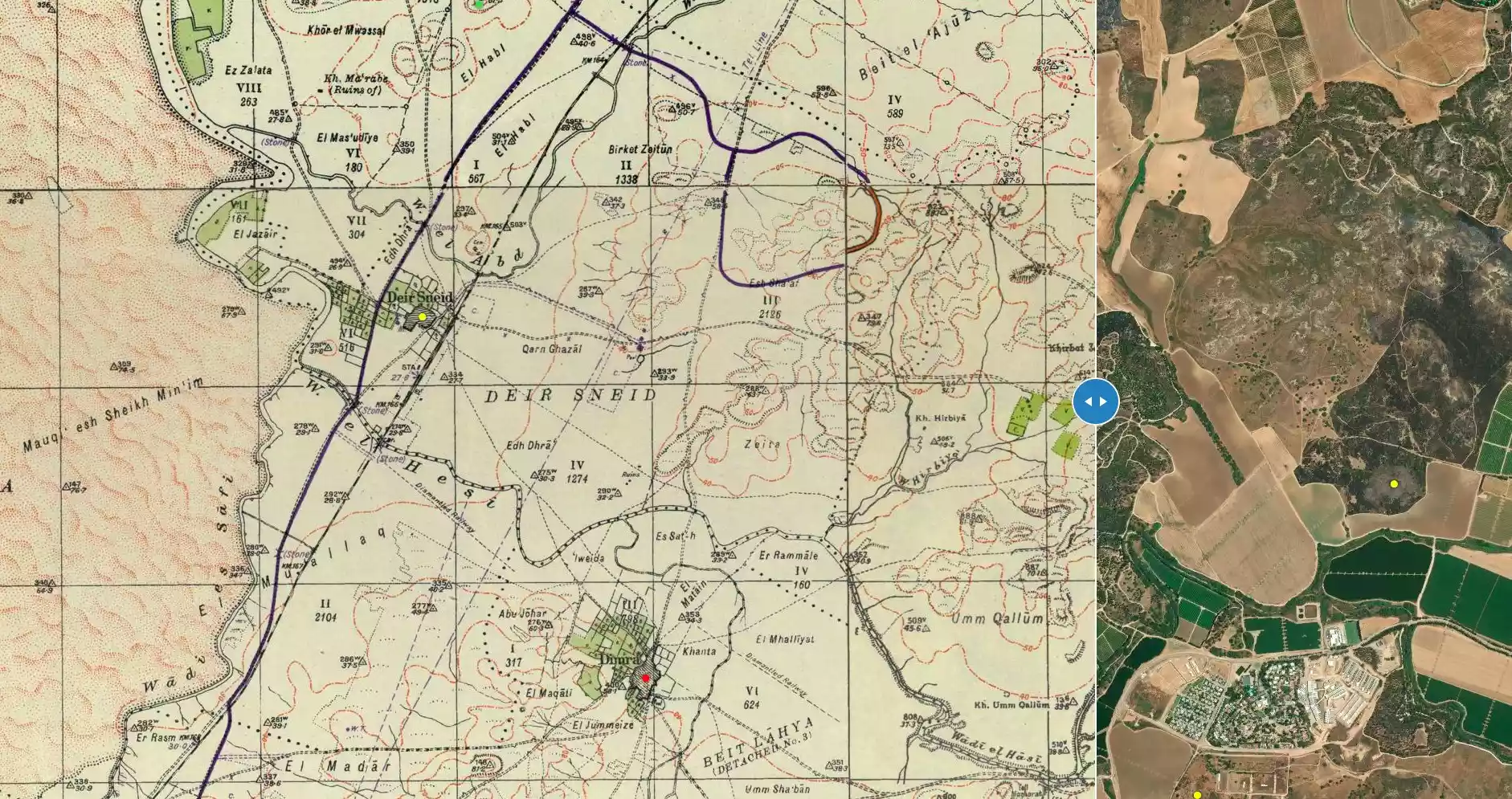
| Map Location | See location #38 on the map View from satellite |
|||||||||||||||||||||
| Military Operation | Operation Yo'av | |||||||||||||||||||||
| Attacking Units | Giv'ati Brigade | |||||||||||||||||||||
| Defenders | Egyptian Army | |||||||||||||||||||||
| Exodus Cause | Military assault by Zionist troops | |||||||||||||||||||||
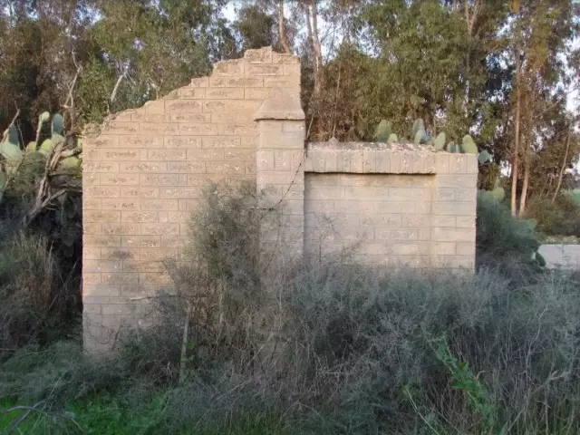
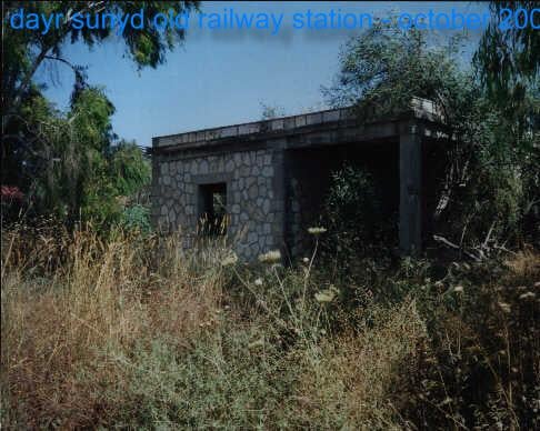
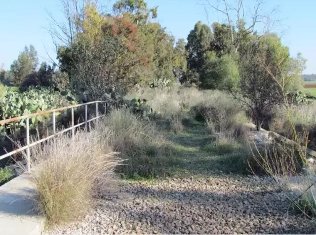
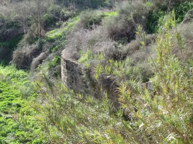
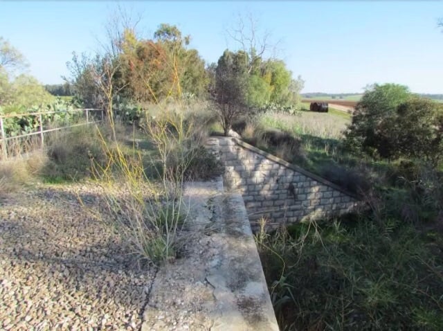
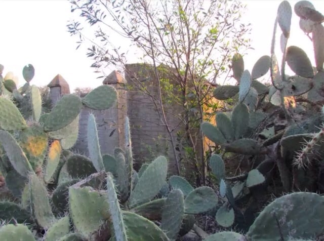
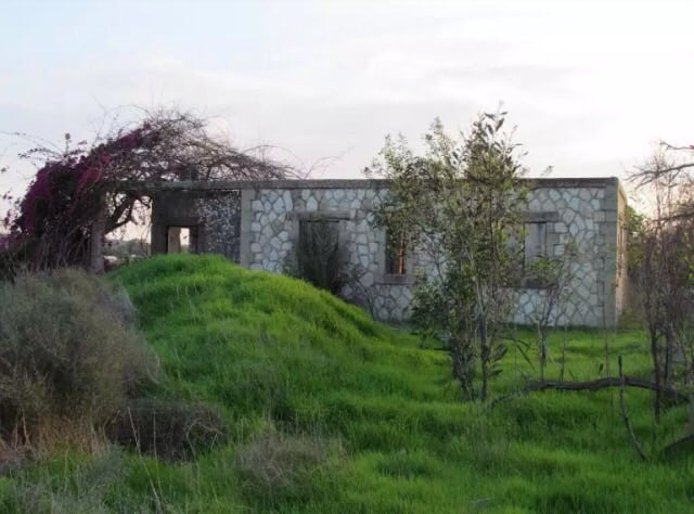
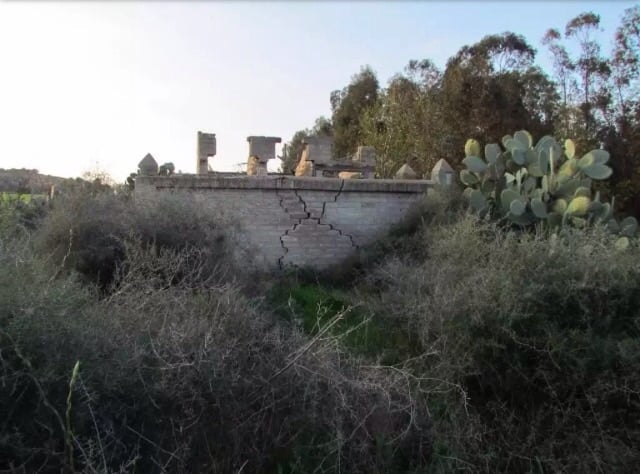
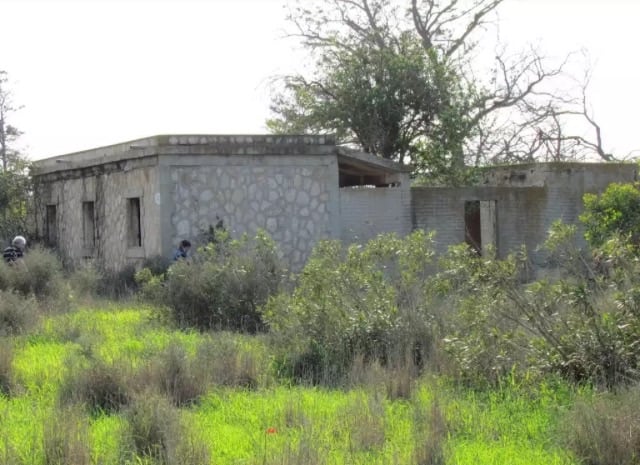
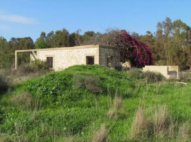
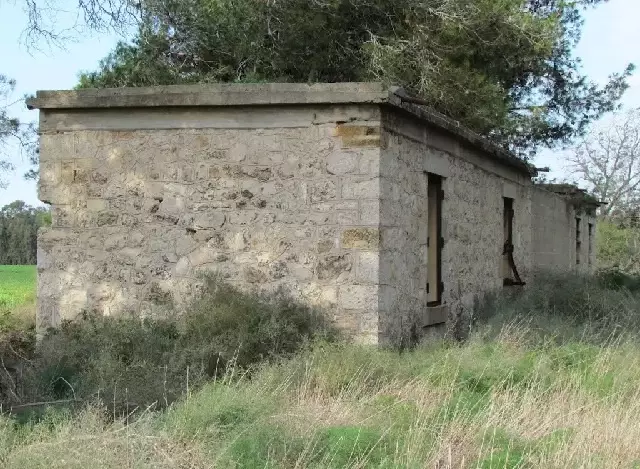
| Village Temains | The village was mostly destroyed with the exception of the train station's buildings. | |||||||||||||||||||||
| Ethnically Cleansing | Dayr Sunayd inhabitants were completely ethnically cleansed. | |||||||||||||||||||||
| Pre-Nakba Land Ownership |
|
|||||||||||||||||||||
| Land Usage As of 1945 |
|
|||||||||||||||||||||
| Population |
|
|||||||||||||||||||||
| Number of Houses |
|
|||||||||||||||||||||
| Near By Towns |
||||||||||||||||||||||
|
||||||||||||||||||||||
| Schools | Dayr Sunayd had one school which was founded in 1945, and when it opened its doors it had an initial enrollment of 63 students. | |||||||||||||||||||||
| Exculsive Jewish Colonies Who Usurped Village Lands |
No settlements on village lands. | |||||||||||||||||||||
| Featured Video | ||||||||||||||||||||||
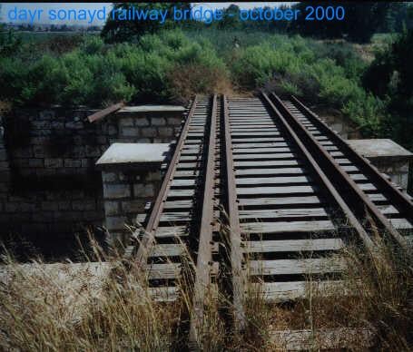
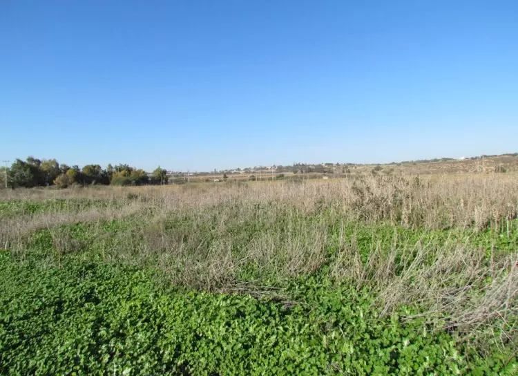
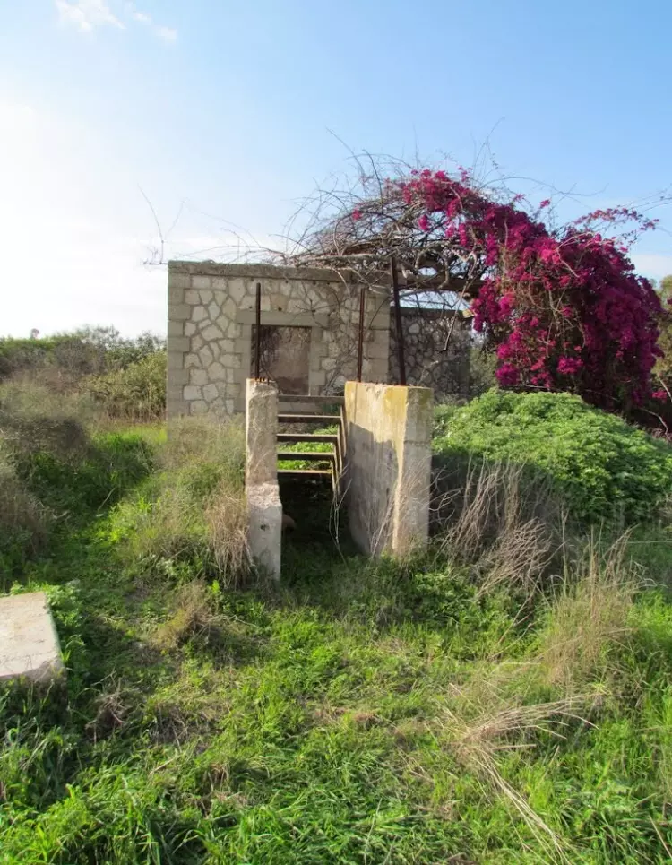
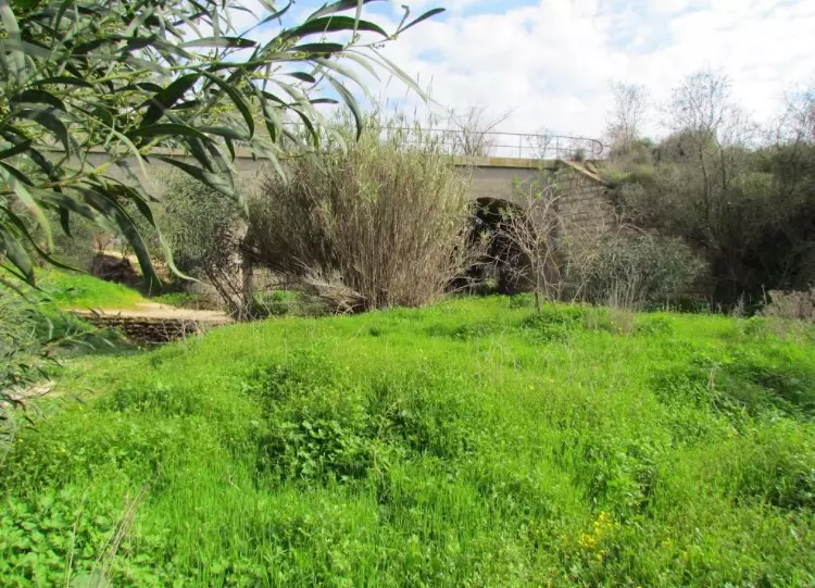
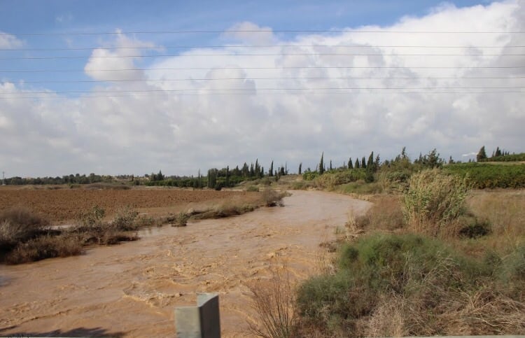
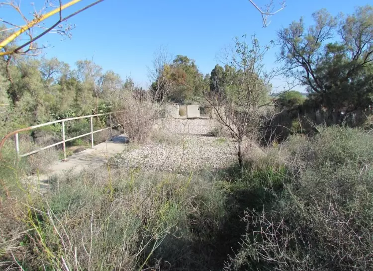
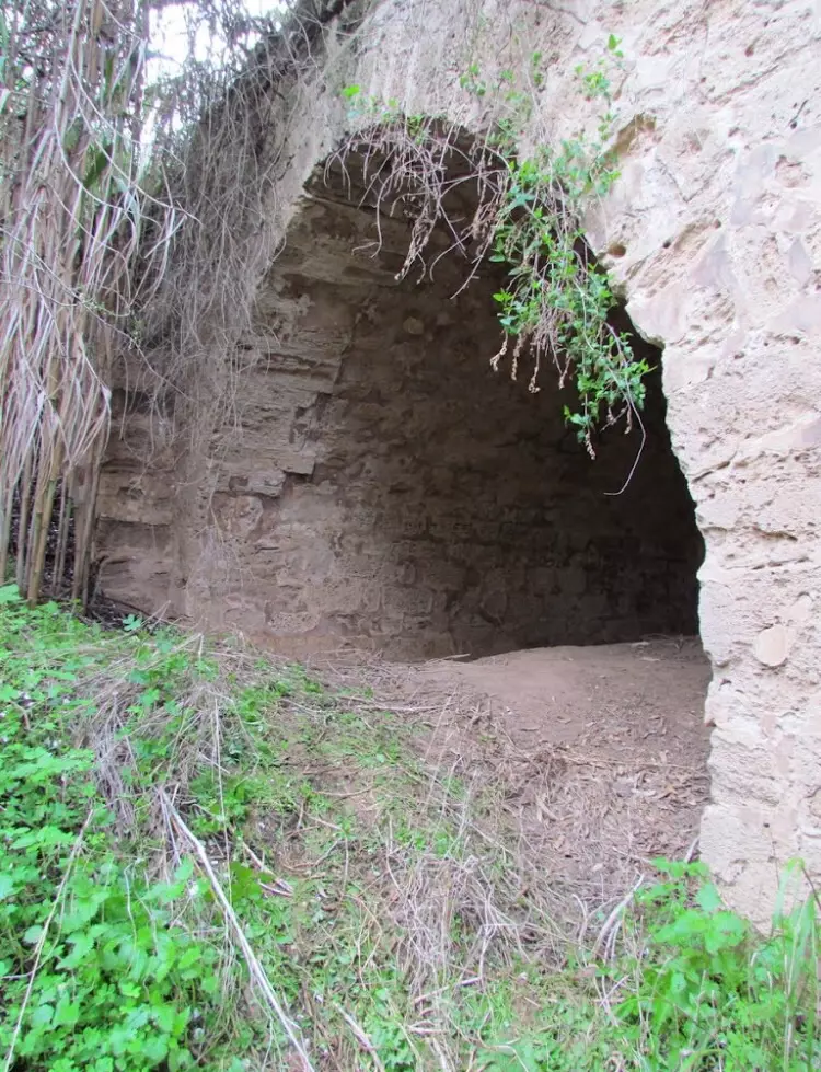
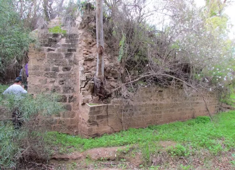
Village Before NakbaThe village was situated on the coastal plain, not far from the seashore, between Wadi al-Abd (to the north) and Wadi al-Hasi (to the south). Because it was located next to the coastal highway and had a station on the coastal railway line, Dayr Sunayd had easy access to Gaza in the south and the city of al-Majdal in the north. The first part of the village name, 'Dayr' (monastery in Arabic), suggests that a Christian monastic order, if not a Christian lay population, resided there at some time. 'Sunayd' was the name of an Arab tribe. In 1596, Dayr Sunayd was a village in the nahiya of Gaza (liwa' of Gaza), with a population of sixty-six. It paid taxes on a number of crops, including wheat, barely, and fruit, as well as on other types of produce, such as goats and beehives.In the late nineteenth century, Dayr Sunayd was a moderate-sized village that was rectangular in shape, split into four quadrants by two roads that crossed at right angles. The village had adobe brick houses, wells, gardens, and a pond, and at its center was a mosque. By the end of the Mandate, construction had expanded west toward the coastal highway. A school was opened in 1945 with an enrollment of sixty-three students, and a number of small shops were opened there as well. Agriculture was the mainstay of Dayr Sunayd's economy. Grain fields were concentrated on the south side of the village, while fruits and vegetables were planted to the northeast and northwest. In 1944/45 a total of 158 dunums was devoted to citrus and bananas and 4,361 dunums were planted in cereals; 512 dunums were irrigated or used for orchards. Eight wells were drilled at depths ranging from 14 to 30 m. Apart from agriculture, commerce was a source of income for some of the inhabitants. Village Occupation and Ethnic CleaningThe date on which Dayr Sunayd was occupied cannot be specified with certainty, but the village was probably captured by Israeli forces in late October or early November 1948. Dayr Sunayd had come under aerial bombardment at the beginning of Operation Yoav on 15–16 October, according to Israeli historian Benny Morris. The New York Times reported that it was 'pummeled' again on 21 October. During the final stages of that operation at the end of October, the Israeli army advanced along the coastal road after the withdrawal of Egyptian forces and occupied al-Majdal, the city to the north of Dayr Sunayd, on 4 November.The village had also witnessed fighting in the early stages of the war, as Egyptian and Jewish forces battled for control of the village and the nearby settlement of Yad Mordekhay shortly after 15 May 1948. The late Egyptian president Gamal Abdel Nasser, who was a junior officer at the time, reported that he spent the night of 19 May in Gaza Military Hospital, where 'the beds around me were filled with our wounded from the battle of Deir Suneid, which was still in progress.' Abd al-Nasir was critical of the Egyptian command's strategy at Dayr Sunayd, but the battle ended in an Egyptian victory 'after heavy sacrifices and in spite of all the difficulties which our forces encountered. Abd al-Hakim Amir, a colleague of Abd al-Nasir's who later became commander of the Egyptian Armed Forces, participated in the battle of Dayr Sunayd with the Ninth Battalion of the Egyptian Army. The New York Times quoted the Egyptian Defense Ministry as saying that there was a 'Jewish fortified settlement' near the village, which Egyptian forces entered on 20 May 1948, after an aerial, artillery, and infantry attack. Zionists Colonies on Village LandsThere are no Israeli settlements on village lands. The settlement of Yad Mordekhay was established in 1943 just to the north of village lands.Village TodayA railroad bridge, unused segments of track, and three of the train station's buildings are all that remain of Dayr Sunayd. The stone bridge is built astride a wadi and passes over four wide, round-arched culverts. The station's buildings are deserted and in a state of deterioration. Cactuses, eucalyptus trees, and thorny plants grow on the site. The surrounding lands are cultivated.SourceDr. Walid al-Khalidi, 1992: All That Remains. |
||||||||||||||||||||||
| Related Maps | Town Lands' Demarcation Maps خرائط للقضاء توضح حدود القرى والاودية Town's map on MapQuest View from satellite Help us map this town at WikiMapia |
|||||||||||||||||||||
| Related Links | Wikipedia's Page Featured Article Google Search Google For Images Google For Videos |
|||||||||||||||||||||
| More Information | في كتاب كي لا ننسى في كتاب بلادنا فلسطين المزيد من موقع هوية |
|||||||||||||||||||||
- The Railway Station at Dayr Sunayd, October 2000
Posted by Prince, Peaceful Israeli 1 - The Railway Bridge Passing by Dayr Sunayd, October 2000
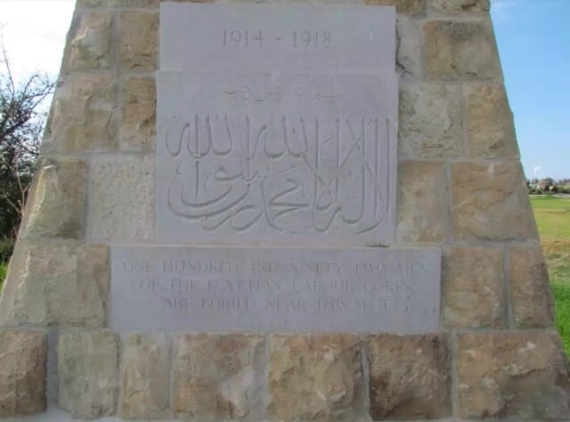
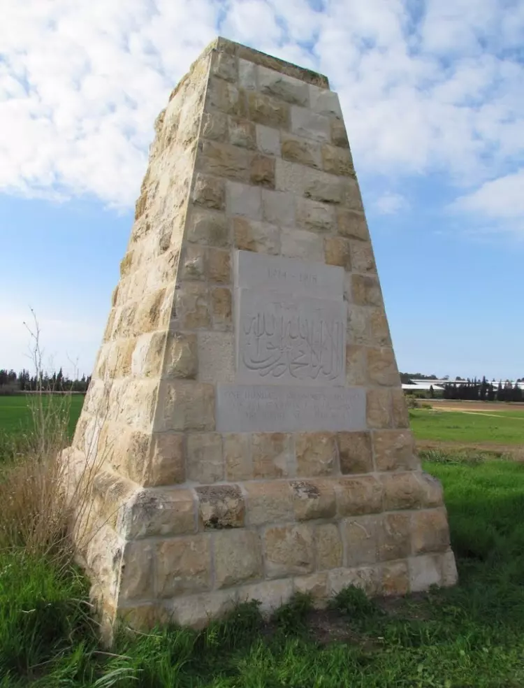
Posted by Prince, Peaceful Israeli - Egyptian labour corps monument & graves

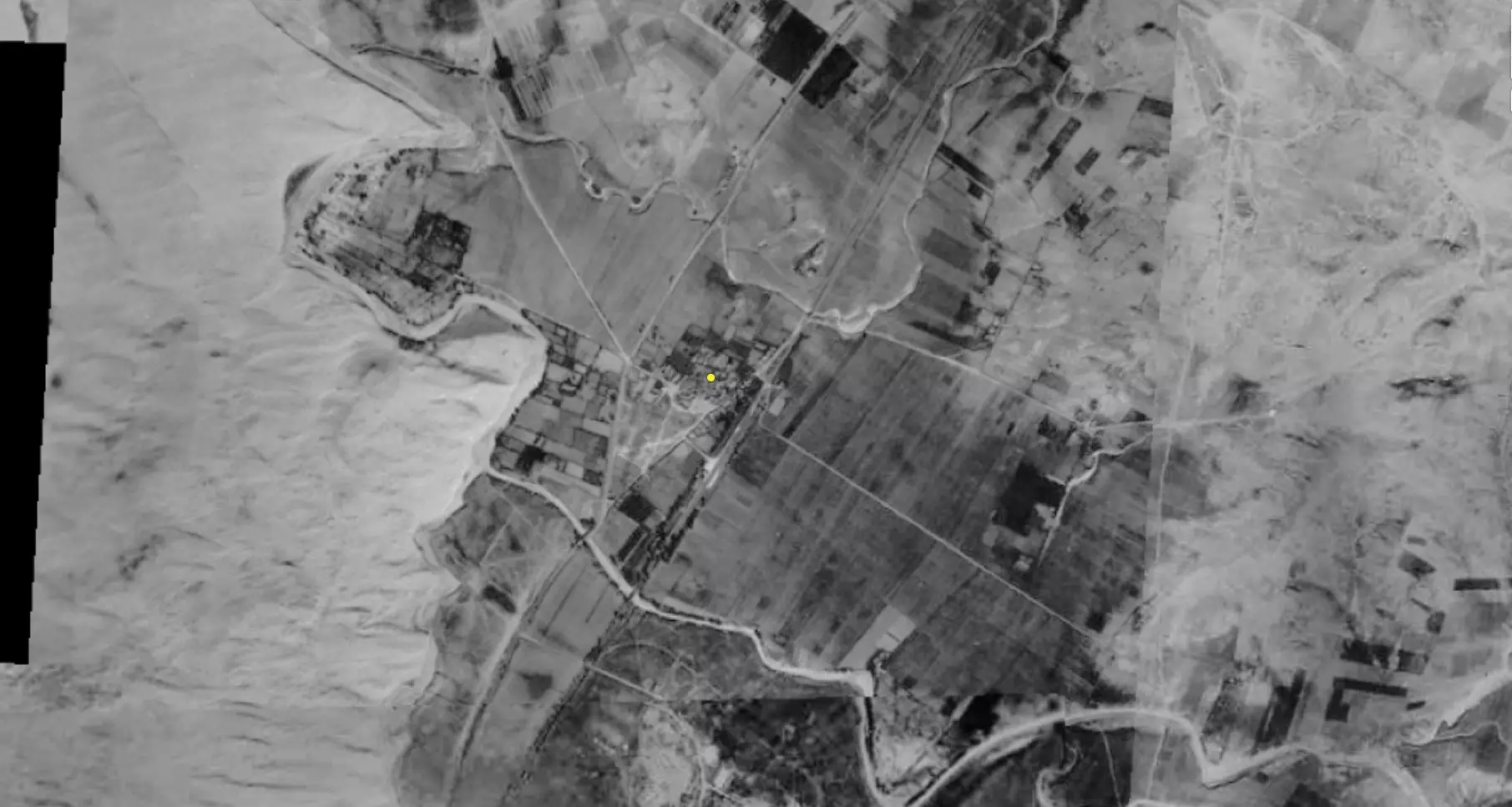
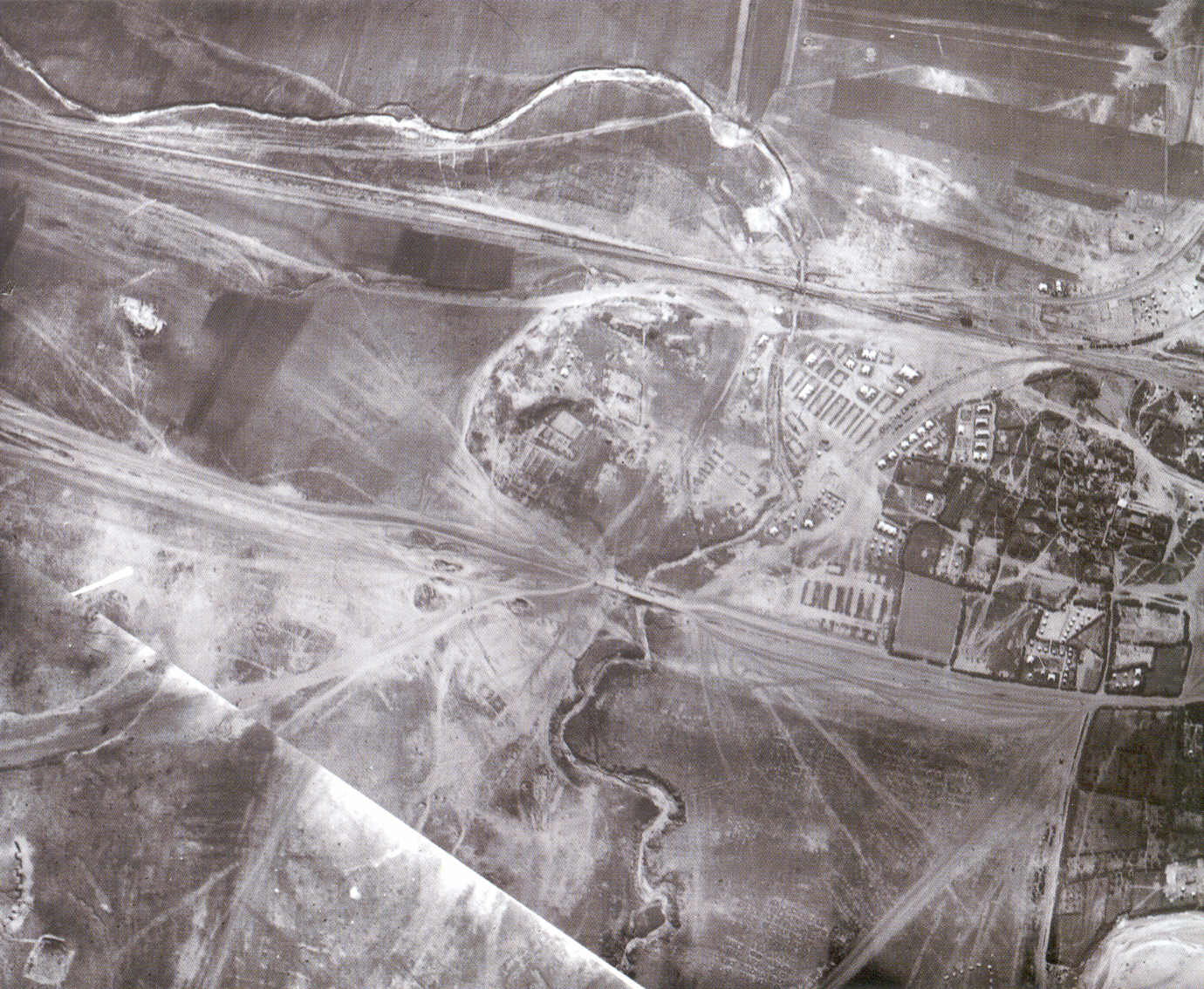
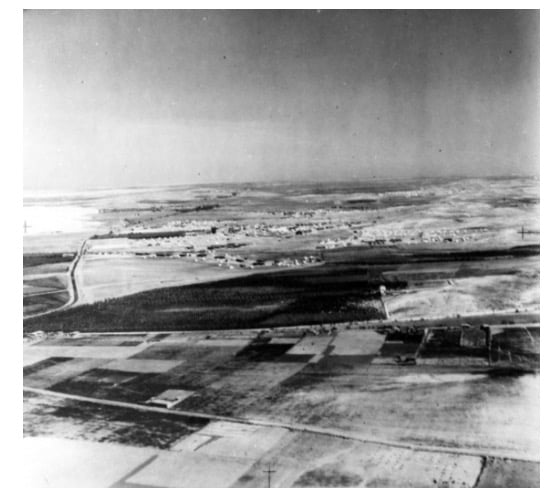
Posted by Uri Zackhem - 1917 Aerial view of Dayr Sunayd, left hand side points north
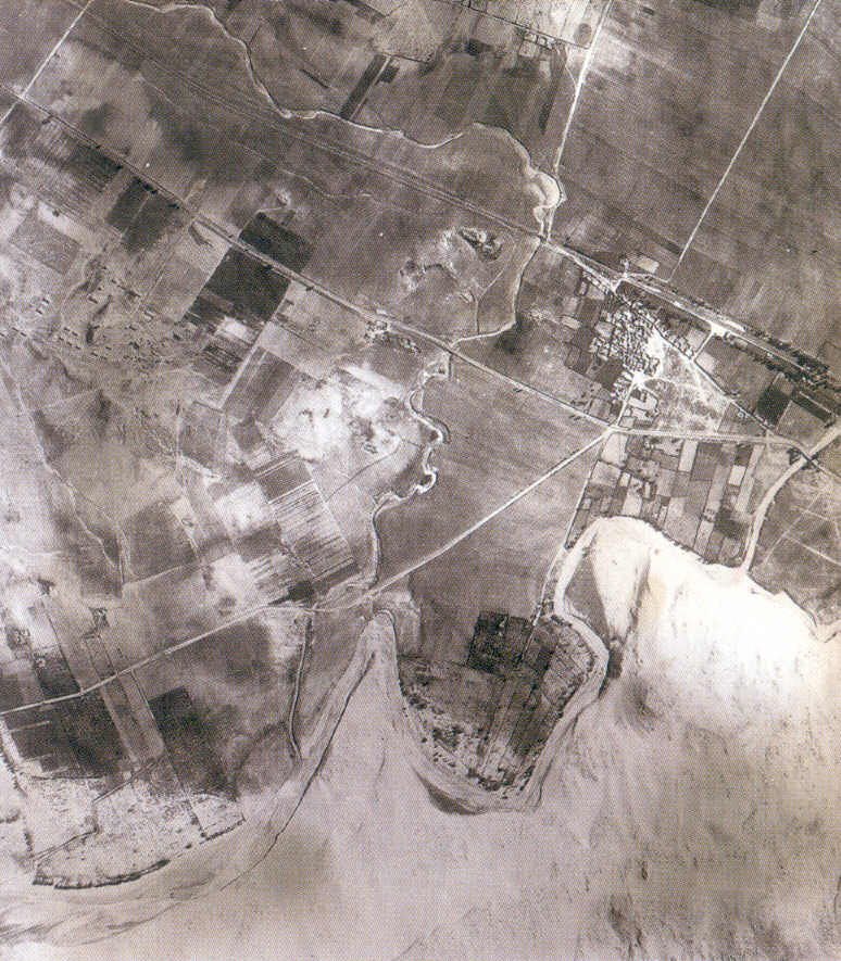
- 1945 Aerial view of Dayr Sunayd, left hand side points north
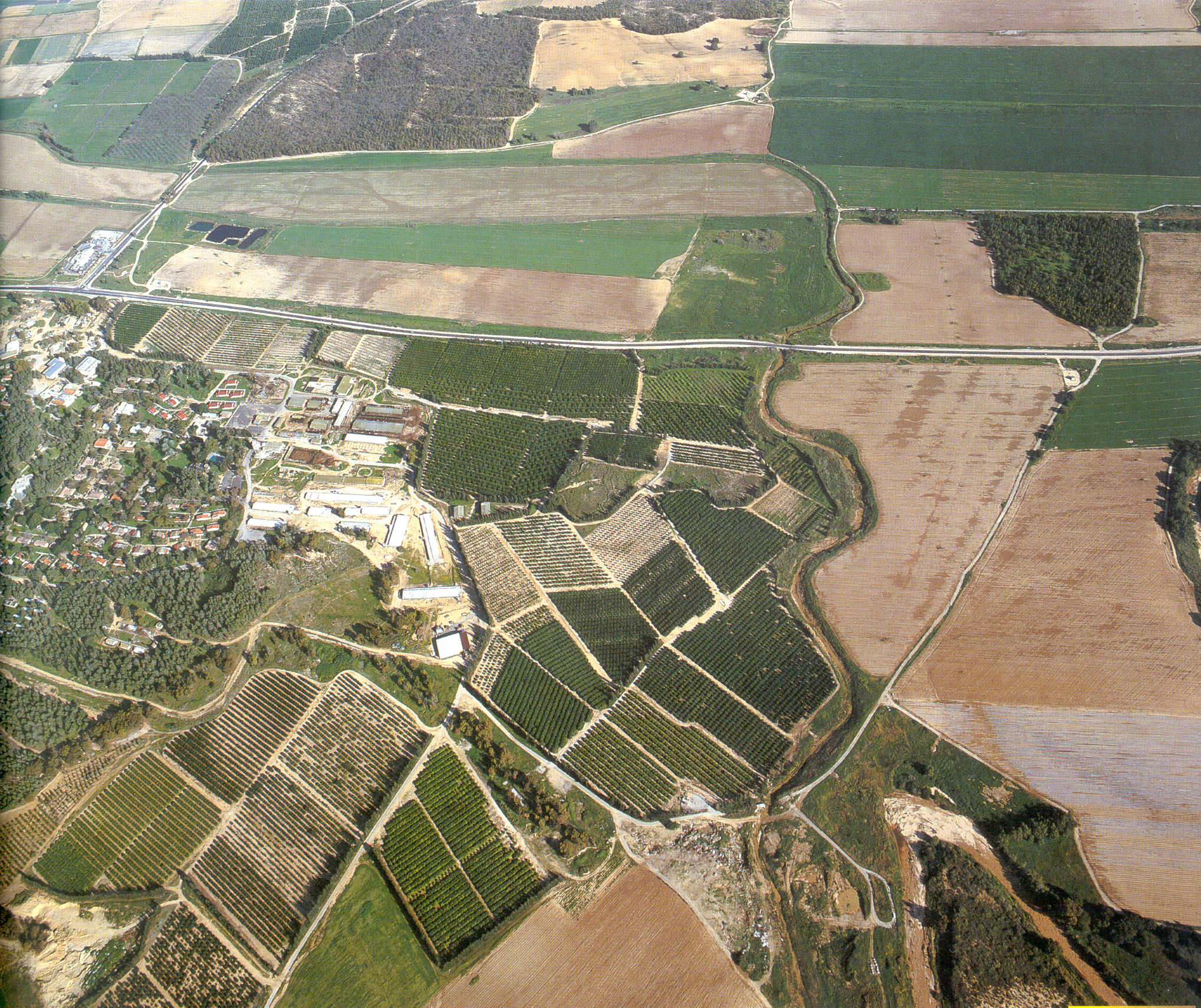
- 1994 Aerial view of Dayr Sunayd, left hand side points north
1 - منظر من اثار القريه
Posted by abu raya - اثار القريه
Posted by abu raya - منظر من القريه
Posted by abu raya - اثار بيوت القريه
Posted by abu raya - موقع القريه
Posted by abu raya - من بيوت القريه
Posted by abu raya - بيوت القريه
Posted by abu raya - بيوت القريه
Posted by abu raya - مباني القريه

Posted by abu raya - بيوت القريه
Posted by abu raya - احدى بيوت القريه
Posted by abu raya - من ذكريات القريه
Posted by abu raya - سكه الحديد القديمه
Posted by abu raya - النصب التذكاري في القريه
Posted by abu raya - اراضي القريه
Posted by abu raya - محطه القطار القديمه في القريه
Posted by abu raya - من القريه
Posted by abu raya - وديان القريه
Posted by abu raya - دير سنيد
Posted by abu raya - جسر قديم في القريه
Posted by abu raya - بيت مهدوم في القريه
Posted by abu raya - صوره قديمه من دير سنيد سنه 1940
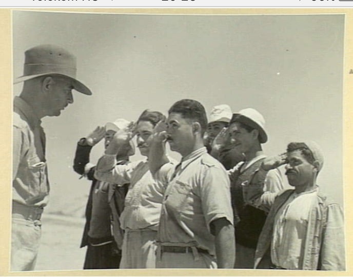
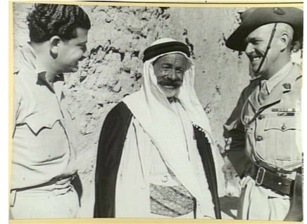
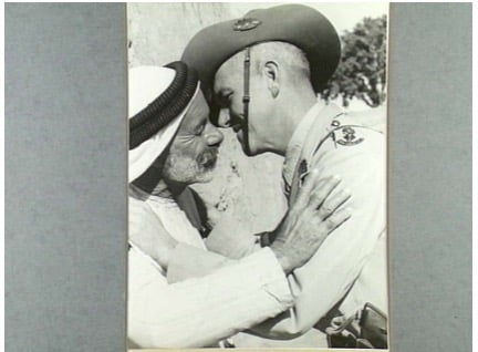
Posted by abu raya - مختار قريه دير سنيد مصطفى العلي برفقه الضابط البريطاني سنه 1940
Posted by abu raya - مختار القريه مصطفى على المصطفى مع الظابط البريطاني سنه 1940
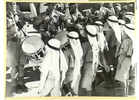
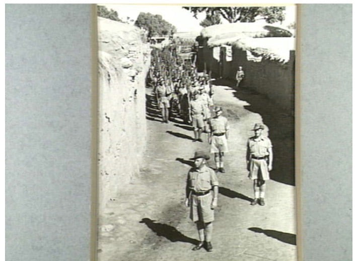
Posted by abu raya - قوات الاستعمار البريطاني في دير سنيد سنه 1940
Posted by abu raya - دير سنيد سنه 1940
Posted by abu raya - قوات الاستعمار البريطاني في القريه سنه 1940
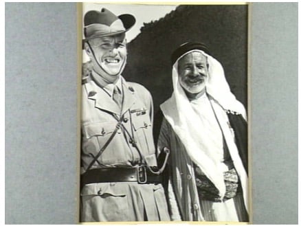
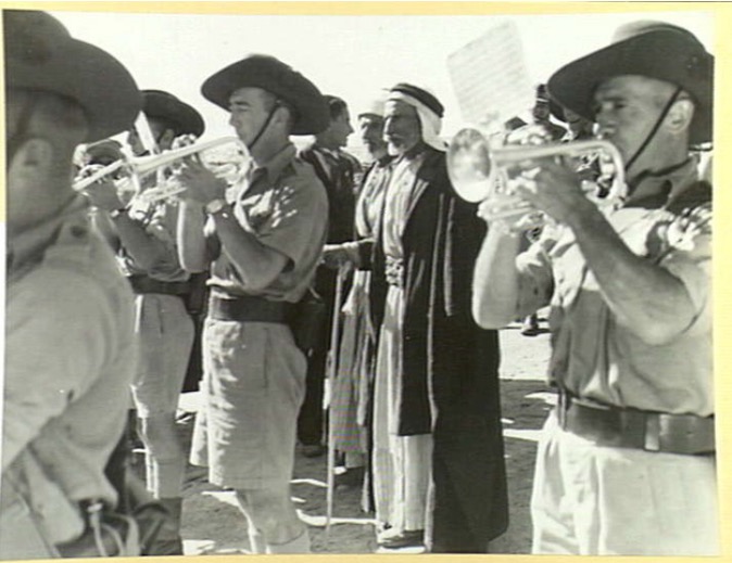
Posted by abu raya - الضابط البريطاني مع مختار القريه سنه 1940
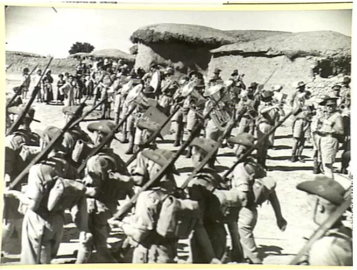
Posted by abu raya - الجيش البريطاني في القريه سنه 1940
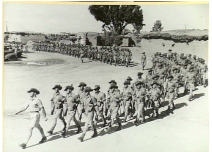
Posted by abu raya - الجيش البريطاني فب القريه سنه 1940
Posted by abu raya - الجيش البريطاني في دير سنيد سنه 1940
Posted by abu raya - الجيش البريطاني في دير سنيد سنه 1940
Posted by abu raya - دير سنيد سنه 1940
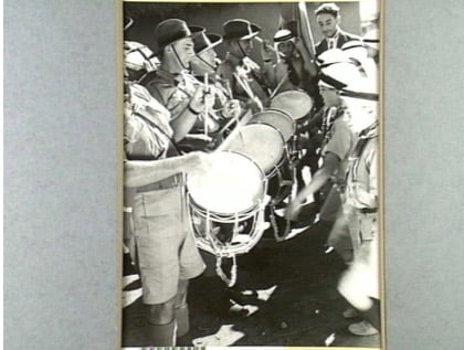
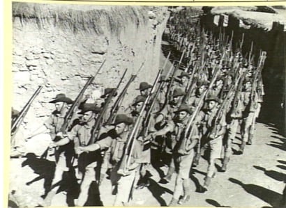
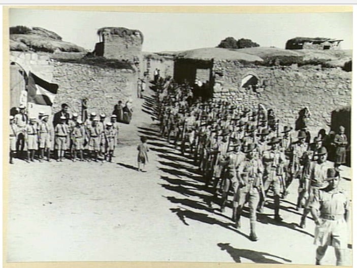
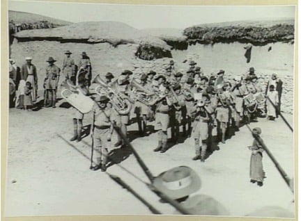
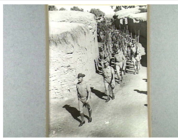
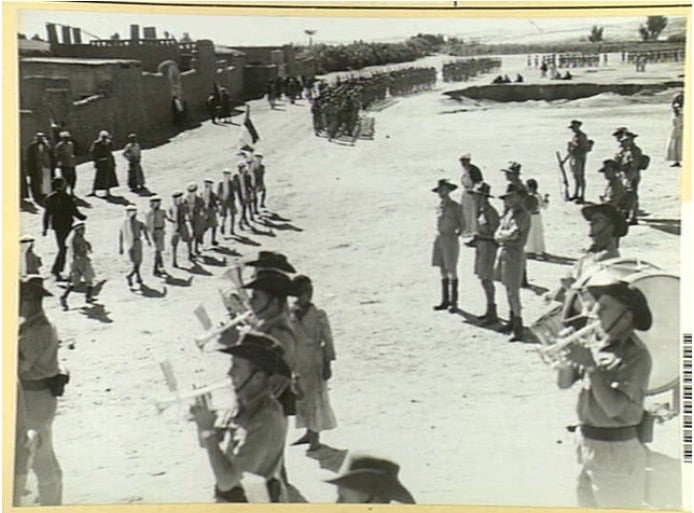
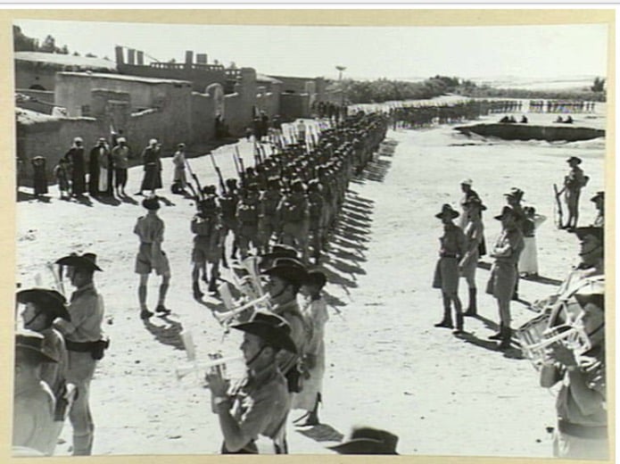
Posted by abu raya - عرض عسكري للجيش البريطاني في دير سنيد سنه 1940
Posted by abu raya - دير سنيد سنه 1940
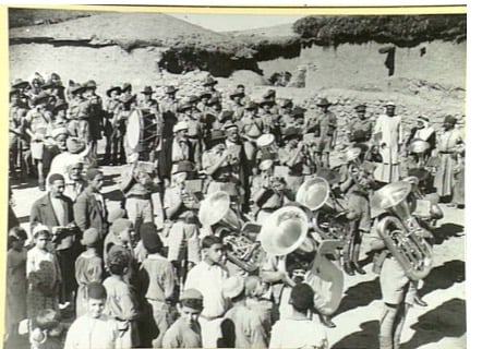
Posted by abu raya - دير سنيد سنه 1940
Posted by abu raya - جيش الانتداب البريطاني في دير سنيد
Posted by abu raya - الجيش البريطاني في دير سنيد سنه 1940
Posted by abu raya - صوره من الجو لدير سنيد واراضيها سنه 1942
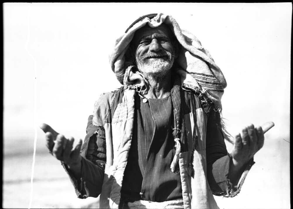
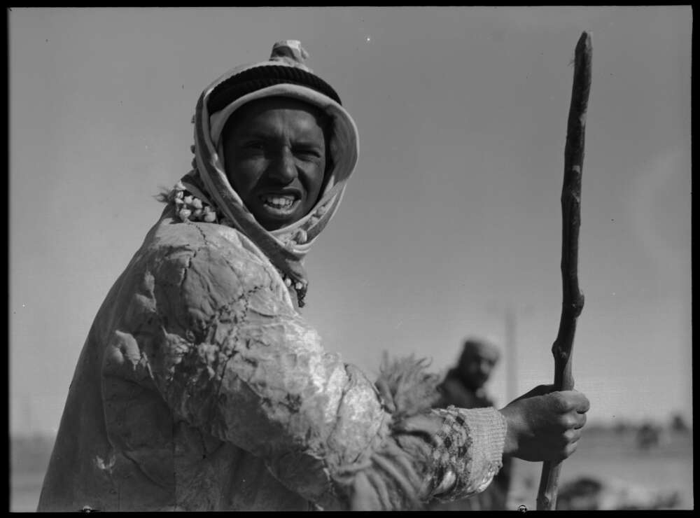
Posted by abu raya - A farmer from Dayr Suneid. Picture taken between 1939 and 1945 (Hurley negative collection)
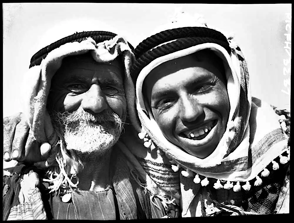
Posted by palestinehistory 1 - Farmers in Dayr Sunayd. Picture taken between 1939 and 1945 (Hurley negative collection) #2
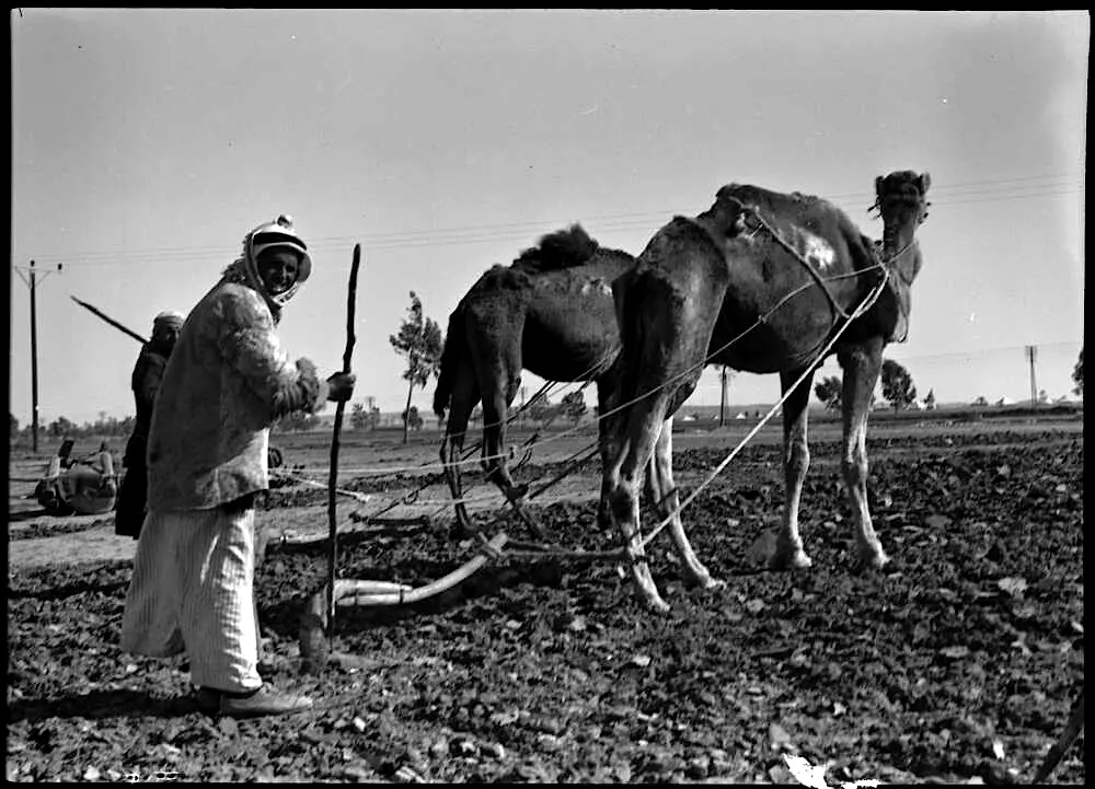
Posted by palestinehistory - Farmers in Dayr Sunayd. Picture taken between 1939 and 1945 (Hurley negative collection) #3
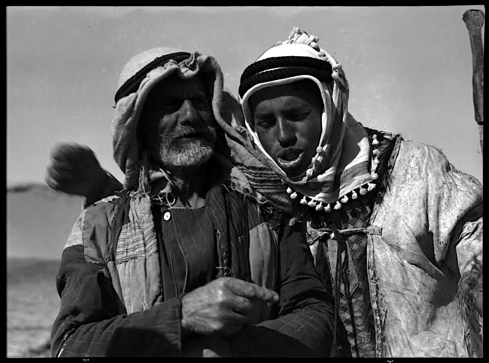
Posted by palestinehistory - Farmers in Dayr Sunayd. Picture taken between 1939 and 1945 (Hurley negative collection) #4
Posted by palestinehistory - Farmers in Dayr Sunayd. Picture taken between 1939 and 1945 (Hurley negative collection) #5
Posted by palestinehistory - Pre-Nakba Aerial view of the village / صورة من الجو للقرية اخذت قبل النكبة
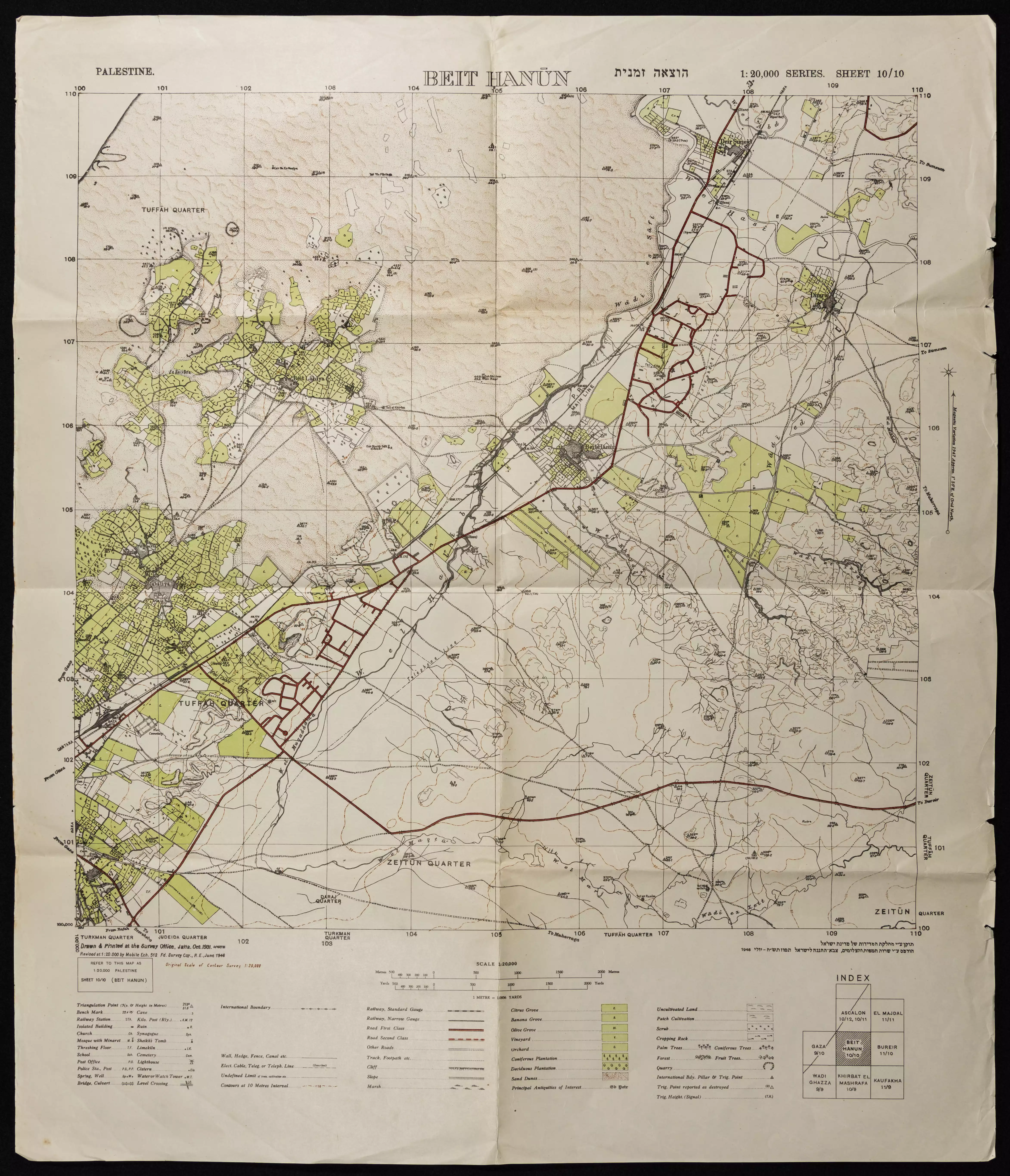
- خارطة تُظهِر الحدود والطرق بأنواعها والأماكن المقدسة والطبيعة الطوبغرافية من تلال وسهول ومنحدرات والتشكيلة الطبيعية للأرض وأنواع المزروعات. نُشرت الخريطة فترة الانتداب البريطاني، تم إضافة تعديلات عليها من قِبَل خدمة الخرائط والصور التابعة للقوات العسكرية الاسرائيلية فترة الأربعينيات.
Want to browse more? 80,000 pictures were grouped in these gallaries:
- 1917 Aerial view of Dayr Sunayd, left hand side points north
- 1945 Aerial view of Dayr Sunayd, left hand side points north
- 1994 Aerial view of Dayr Sunayd, left hand side points north
1 - صوره من الجو لدير سنيد واراضيها سنه 1942
Posted by abu raya - Pre-Nakba Aerial view of the village / صورة من الجو للقرية اخذت قبل النكبة
| Display Name | Clan/Hamolah | Country of Residence |
| Aisha Abdelhadi Masoud | Masoud | CA, USA |
| Faten Nemr Masoud | Masoud | CA, USA |
| Nemr Masoud | Masoud | OH, USA |
| لؤي محمد عبدالعزيز مسعود | مسعود | الدوحة - قطر |
| فهد خليل عيسى صبح | صبح | قطاع غزة, دير سنيد |
| مصطفى أبو القمصان | - | - |
| باسل علي | علي | - |
| ahmed hussain | حسين | gaza, palestine |
| ايمن محمود محمد حجازي | حجازي | غزة, فلسطين |
| ابراهيم محمود محمد حجازي | حجازي | gaza, جباليا |
| توفيق حجازي | حجازي | فلسطين, غزه |
| عبد الجليل محمود محمد مسعود | مسعود | الدوحة, دولة قطر |
| د يوسف محمود محمد حجازى | حجازى | mecca, السعودية |
| TAREK | HEJAZI | riyadh, Saudi Arabia |
| Marwan Hejazi | Hejazi and Abou El Qumsan | Australia |
| Teacher/Lecturer :- Majdi M.Masoud. | مســـعود | Uppland, ممـلكة الســويد _ أبـســـالا -Sweden |
| abudeaa | hossen | - |
| Ibrahim Omar Masoud | - | CA, USA |
| Wael Masoud | Masoud | California, USA |
| loai | Hijazi | Gaza, Palestine |
| khalid subeh | a | 00972, 00972598400006 |
| هادي صبح | صبح | غزة |
| ابن دير سنيد | عليان | عمان, الاردن |
| كريم صبح | - | - |
| لؤي حجازي | 00970599349413 | غزة, فلسطين |
| سائد | صبح | - |
| emad yousef mahmoud hijazi | - | aden, YEMEN |
- Tracing all that remains of Dayr Sunayd since Nakba Duration: 4 min 5 sec
- برنامج اهل البلد يقابل ام عاطف الحجازي Duration: 31 min 30 sec
No links have been shared yet, be free to the first to share the first link.
 Fake Valor: Why Did Zionist Jews Hoist Nazis Flag on Their Ships in the 1930s?
What is new?
-
Facts About Oct. 7th Gaza Raid
-
Remined Us Please:: Who Did Rape Who? Palestinians Raped Israelis? Or, was the other way around?
-
When Prof. Edward Said was invited to debate Bibi Netanyahu in the 1980s, watch what happened!
-
Ezra Klein of the NY Times on the "Jewish Race".
-
Abusing Blood Libel!
-
Did Israeli Soldiers Activate The Hanniba Direective On Oct. 7th? You Be The Judge
-
Zionist FAQ: Isn't it true that Palestinians don't want peace? Palestinians never accepted the two-state solution
- Facts about Haavara (Transfer) Agreement between Ben-Gurion & Hitler
-
Haavara FAQs: Why Did Zionist Jews Hoist Nazis' Flags on Their Ships in the 1930s?
- Haavara FAQs: When Chaim Weizmann met FDR in mid-1943, why was he silent about rescuing European Jewry?
-
Dear ChatGPT: How did Palestinians resist Napoleon's invasion of their country in 1799?
-
Dear ChatGPT: Gaza had a vibrant Jewish community in the mid-17th century. What happened to them?
-
Dear ChatGPT: Why did the Jewish Agency suppress news of the Holocaust during WWII?
-
Video Playlist: Jews share their DNA tests to end the conflict for good.
-
A Tale of Two Conflicts: Examining the Definition of Genocide
-
Prof. Abraham Polak And The Suppressed History of the Khazars and European Jewry
-
How Ronald Reagan would have framed the genocide in Gaza if he were still alive?
-
Haavara FAQs: Let us do the math: how many German Jews did The Haavara Agreement save?
-
Zionist FAQs: The Hebron Massacre of 1929, "clearly proves" that Palestinians are antisemitic, how could you deny it?
-
Zionist FAQs: Why Anti-Zionist Is Not Antisemitism?
-
Zionist FAQs: Isn't it true that the KGB created Palestinian Nationalism in the early 1960s?
- Zionist FAQs: Muslims are killing Muslims all the time; why are Israeli Jews being singled out in the media?
- Zionist FAQs: How is Israel an apartheid state when 20% of its citizens are Arabs who enjoy full rights?
-
Haavara FAQs: Why Did Dorothy Thompson Flip From A Zionist Advocate to A Silenced Dissenter?
-
Haavara FAQs: Analysis of Herzl's Uganda Scheme and how it could have saved millions of Jews.
-
Haavara FAQs: Why did Hayim Greenberg describe American Jewry as "morally bankrupt" in early 1943?
-
Haavara FAQs: What if the Evian Conference was a resounding success? What would have been the impact of saving European Jewry on Zionism?
- Haavara FAQs: What if the six million were saved, how that would have impacted the Zionist project?
-
Haavara FAQs: How did Zionist leaders react when Europe's Jews lingered in the DP camps after WWII ended?
-
Why does the American Jewish community repeat lies that David Ben-Gurion had debunked before he died?
-
Who has the power to rename the Tatar/Khazar Gene Marker to Jewish IV?
-
Zionist FAQs: Why won't Egypt, Syria, and Jordan take their people back? Jews are indigenous to Palestine, and Arabs immigrated after Jews developed the country. Arabs should leave.
-
Haavara FAQs: Did Hitler and the Nazis conflate between Judaism and Zionist? If that wasn't case, then why?
-
Haavara FAQs: Winston Churchill and antisemitism, a collection of articles written Churchill.
-
Haavara FAQs: Broken by country, how many Jews survived vs. killed during the Holocaust?
-
Haavara FAQs: Why did European Jews vote with their feet and to immigrated to the Americas, not Palestine, after WWII?
-
Watch this American Jewish Girl describing Israeli Jews' cognitive dissonance like no other in under two minutes
-
Haavara FAQs: When the Nazis went out of their way to hide the Holocaust, Israeli Jews did the exact opposite by broadcasting their genocide of Gazans. But why?
-
Haavara FAQs: How Zionist Jews went out of their to show their appreciation to Nazism and Fascism?
- Haavara FAQs: Why Zionist leaders were against bombing the death camps & the Railroads leading to them?
-
Haavara FAQs: Hitler's message to the British and American people: If Jews are such noble citizens and you care about them, how come you're not letting them in? I will gladly ship them to you at my expense, even on luxury liners!
-
A shortlist of Zionist and Israeli false flag operations in the name Jews.
-
The Most Moral Army
- The Land of Kapos (Israel): Where the brave are boycotted and Kapos walk free.
- Why did early Zionists often named their communal enterprises "colonial"?
- Zionist Relations with Nazi Germany by Faris Glubb
-
Two NY Times advertisements by Zionists in the early 1943 that exposes Zionists' treason at the height of the calamity
- Facts Not Lies about the Palestinian-Israeli Conflict.
- Site's pictures have been categorized
- Campgain Against Lice
- A Survey of Palestine, the official source about Palestine before Nakba produced by the British Mandate; over 1200 pages.
- Satellite View & Google Earth: Over 6,000 placemarks identifying all destroyed towns, W. Bank & Gaza Strip Towns, & refugee camps.
- PalestineRemembered.com and its Nakba Oral History Project were featured on al-Jazeera Satellite TV.
- Nakba Oral History Video Podcast:
 Over 700 Oral History interviews (including 3,500+ hours of recording) can be viewed online.
 - Palestine Village Statistics Project
- Gaza Jail Break
- النسخة العربية للموقع الان متوفرة
- Videos: Documenting the destroyed villages in video: Tracing all that remains since Nakba.
- Videos: Responding to Zionist Propaganda
- Interview: The ethnic cleansing of Palestine: George Galloway interviews Israeli Historian Ilan Pappe.
- For Palestinians, memory matters. It provides a blueprint for their future By George Bisharat.
- Zionist FAQ now available in Hebrew שאלות שציונים שואלים, עכשיו בעברית
- Video: The Stephen Walt and John Mearsheimer report on the influence of the Israel Lobby on U.S. Foreign Policy
- The Palestinian-Israeli conflict for beginners
