| PalestineRemembered | About Us | Oral History | العربية | |
| Pictures | Zionist FAQs | Haavara | Maps | |
| Search |
| Camps |
| Districts |
| Acre |
| Baysan |
| Beersheba |
| Bethlehem |
| Gaza |
| Haifa |
| Hebron |
| Jaffa |
| Jericho |
| Jerusalem |
| Jinin |
| Nablus |
| Nazareth |
| Ramallah |
| al-Ramla |
| Safad |
| Tiberias |
| Tulkarm |
| Donate |
| Contact |
| Profile |
| Videos |
Welcome To Jusayr - جسير (ג'סיר)
|
District of Gaza
Ethnically cleansed days ago |
العربية Google Earth |
 |
Gallery (39) |
- Statistics & Facts
-
Before & After

- Satellite View
- Articles 6
- Pictures 39
- Aerial Views 1
- Land Deeds 2
- Oral History 4
- Members 69
- All That Remains
- Wikipedia
- Videos 4
- Guest Book 7
- Links 1
| Statistic & Fact | Value | ||||||||||||||||
| Occupation Date | July 17, 1948 | ||||||||||||||||
| Distance From District | 35 (km) North East of Gaza | ||||||||||||||||
| Elevation | 100 (meters) | ||||||||||||||||
| Before & After Nakba, Click Map For Details |
|||||||||||||||||
|
|||||||||||||||||
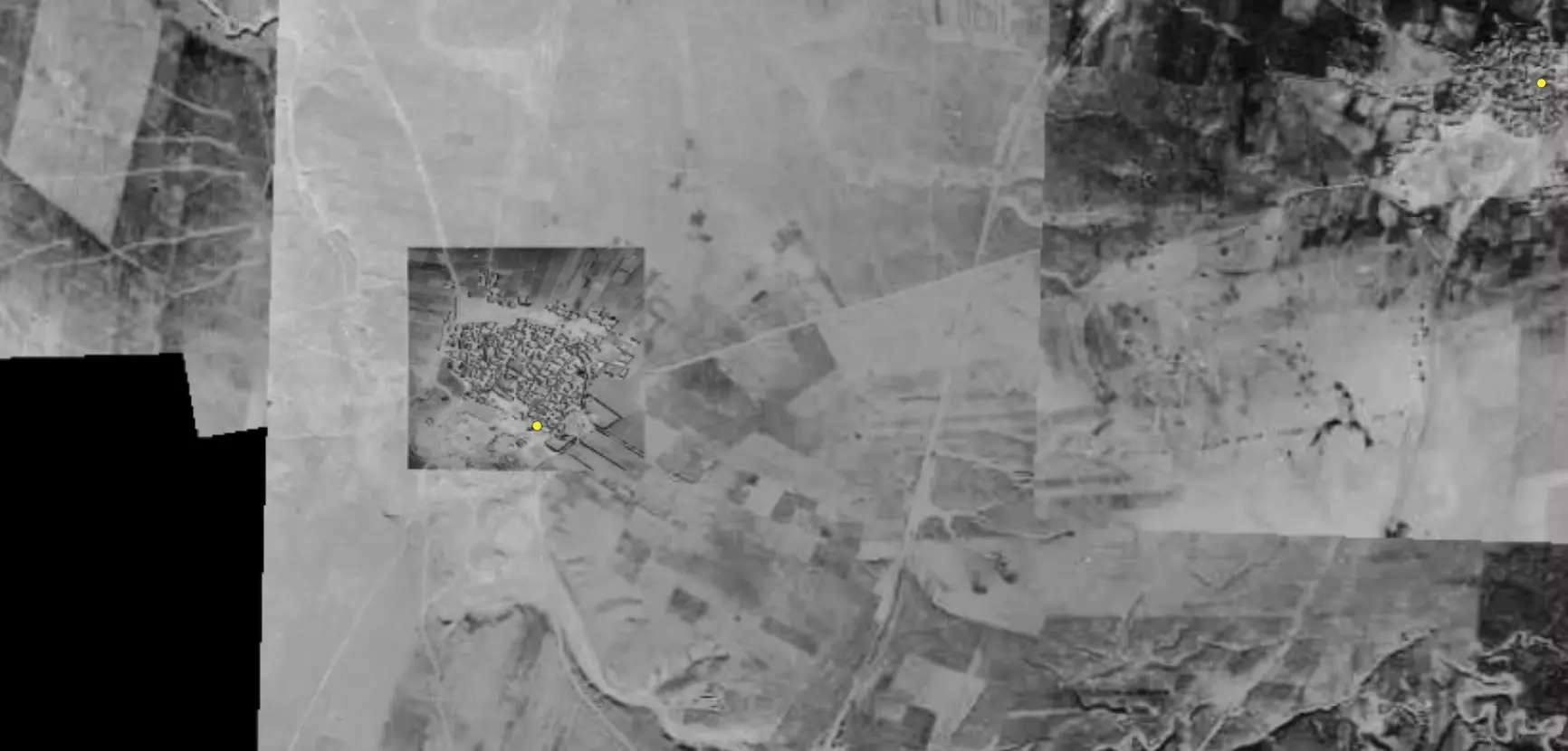
| Pre-Nakba Aerial View |
|||||||||||||||||
|
|||||||||||||||||
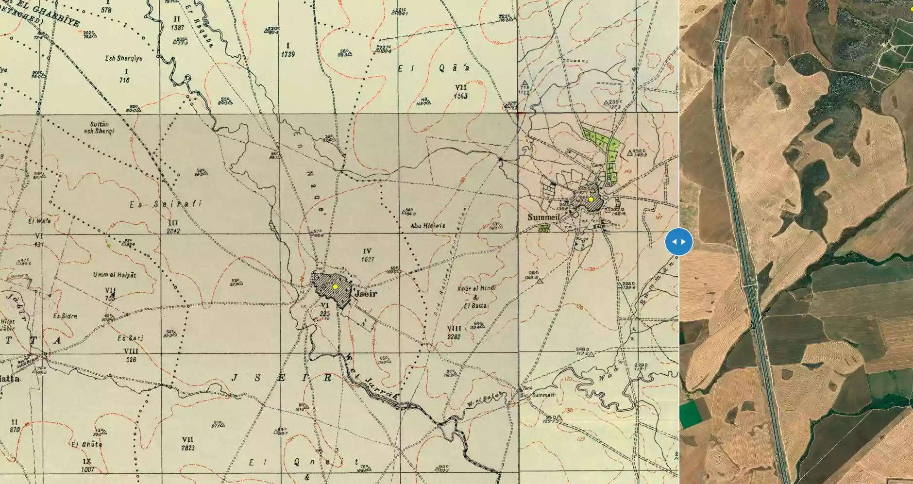
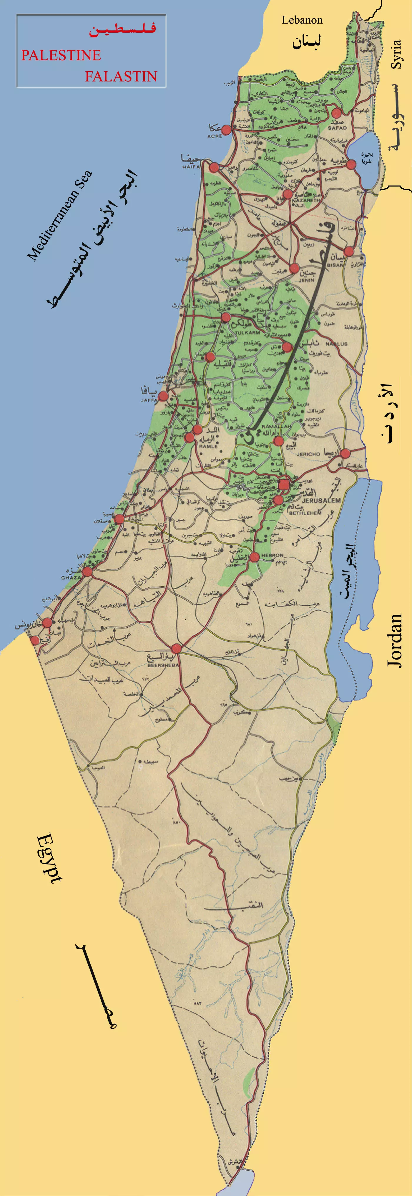
| Map Location | See location #21 on the map View from satellite |
||||||||||||||||
| Military Operation | Possibly Operation Barak or Operation Yo'av | ||||||||||||||||
| Attacking Units | Giv'ati Brigade | ||||||||||||||||
| Defenders | Egyptian Army | ||||||||||||||||
| Exodus Cause | Military assault by Zionist troops | ||||||||||||||||
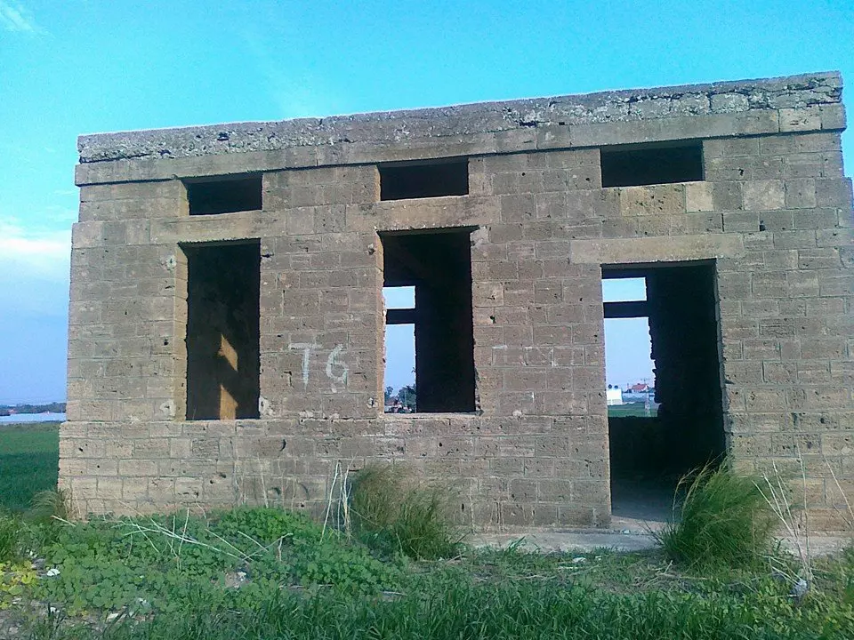
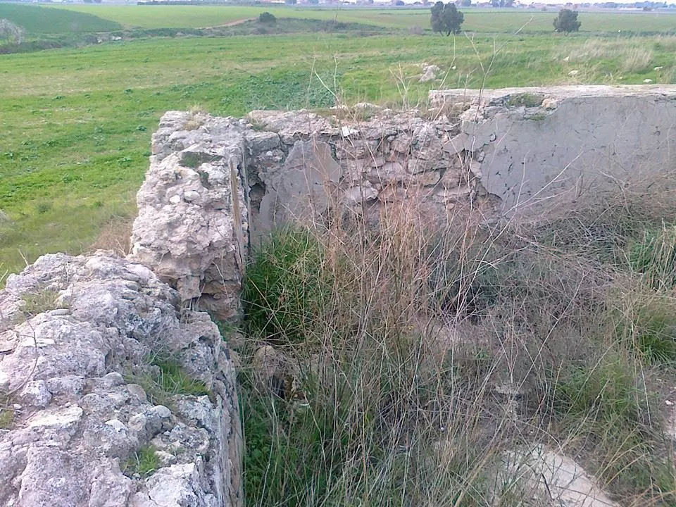
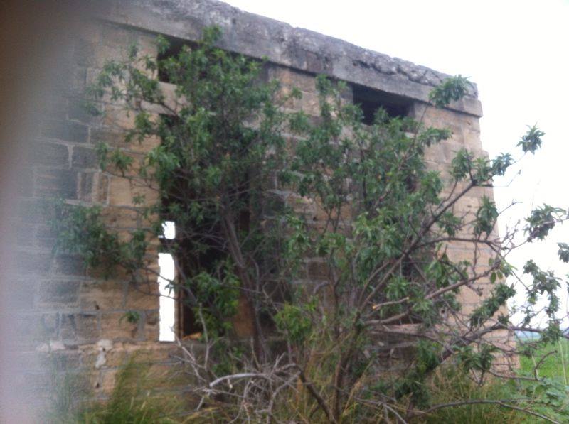
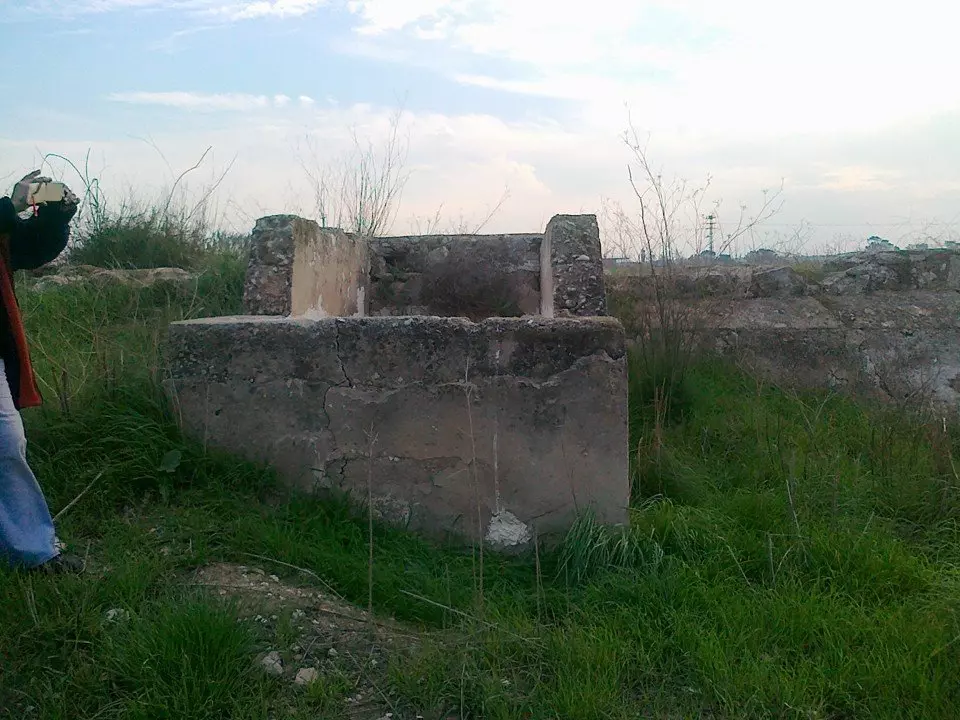
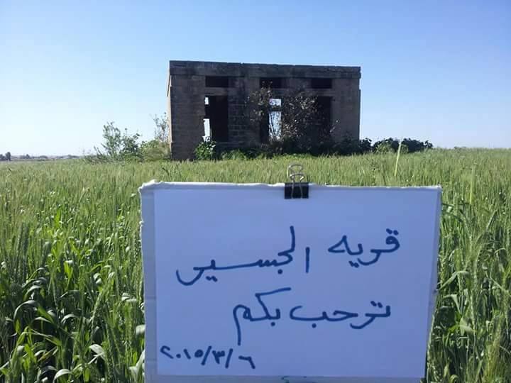
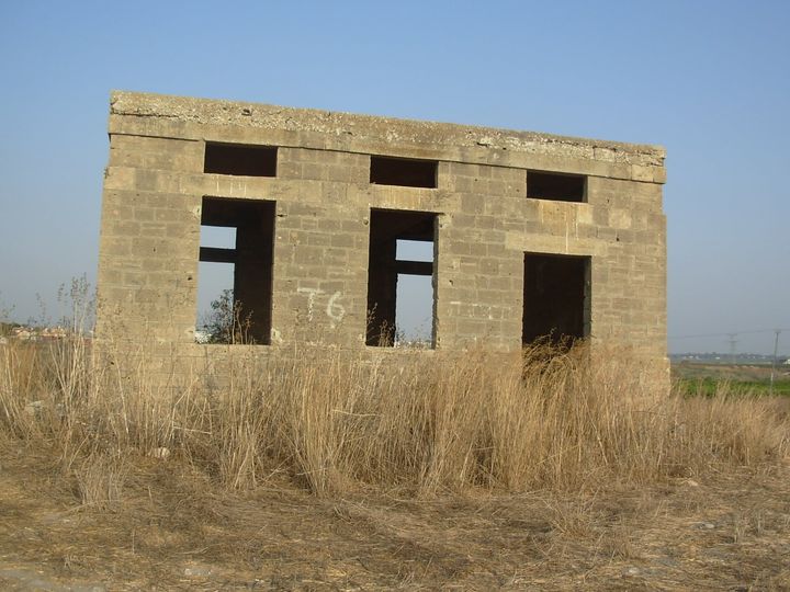
| Village Temains | The village was mostly destroyed with the exception of a single house. | ||||||||||||||||
| Ethnically Cleansing | Jusayr inhabitants were completely ethnically cleansed. | ||||||||||||||||
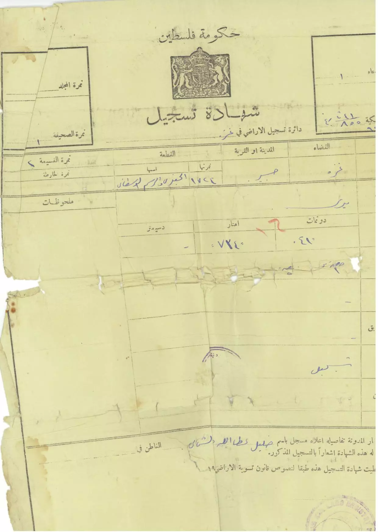
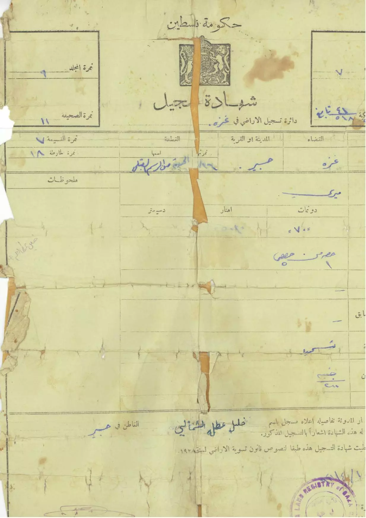
| Pre-Nakba Land Ownership |
**Town Lands' Demarcation Maps |
||||||||||||||||
| Land Usage As of 1945 |
|
||||||||||||||||
| Population |
|
||||||||||||||||
| Number of Houses |
|
||||||||||||||||
| Near By Towns |
|||||||||||||||||
|
|||||||||||||||||
| Schools | Jusayr had an elementary school for boys which was founded in 1937, and in 1945 it had an enrollment of 74 students. | ||||||||||||||||
| Places of Warship | One mosque | ||||||||||||||||
| Exculsive Jewish Colonies Who Usurped Village Lands |
Menucha and Wardon | ||||||||||||||||
| Featured Video | |||||||||||||||||
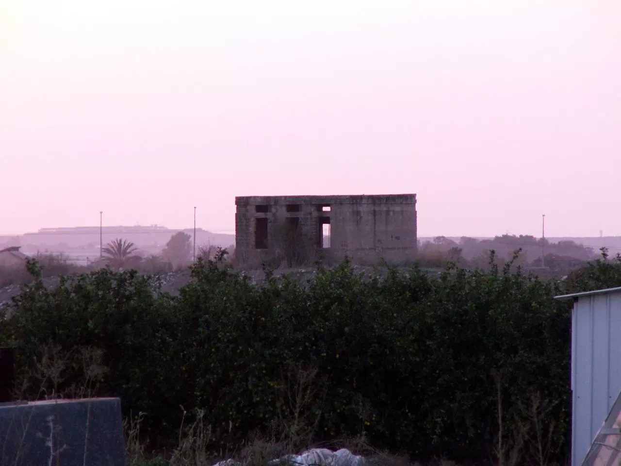
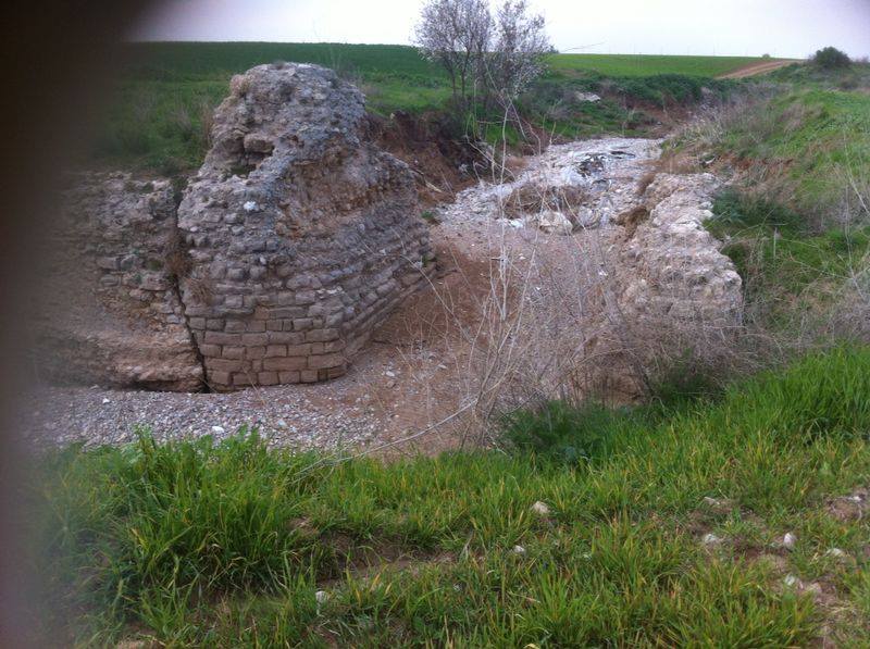
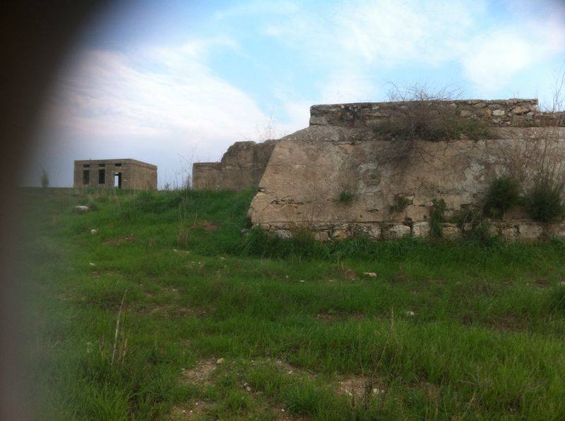
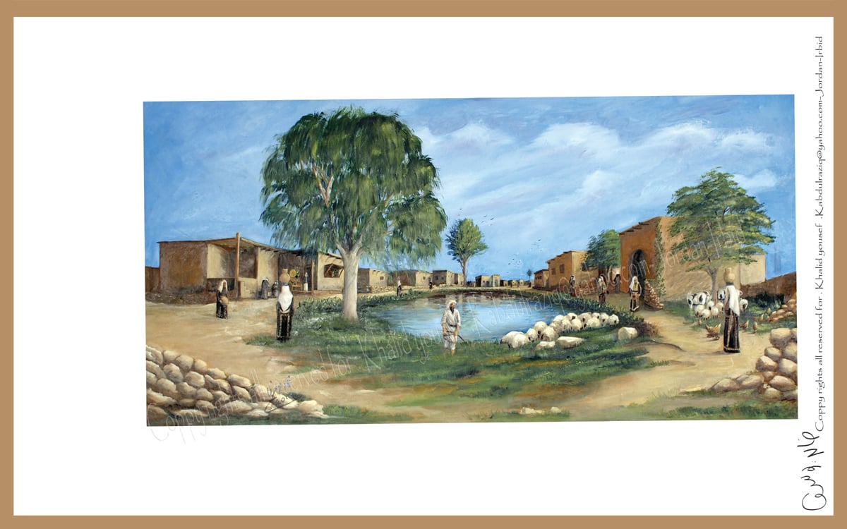
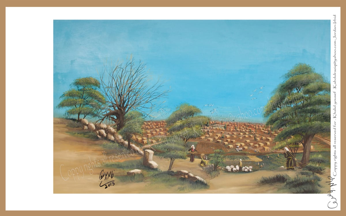
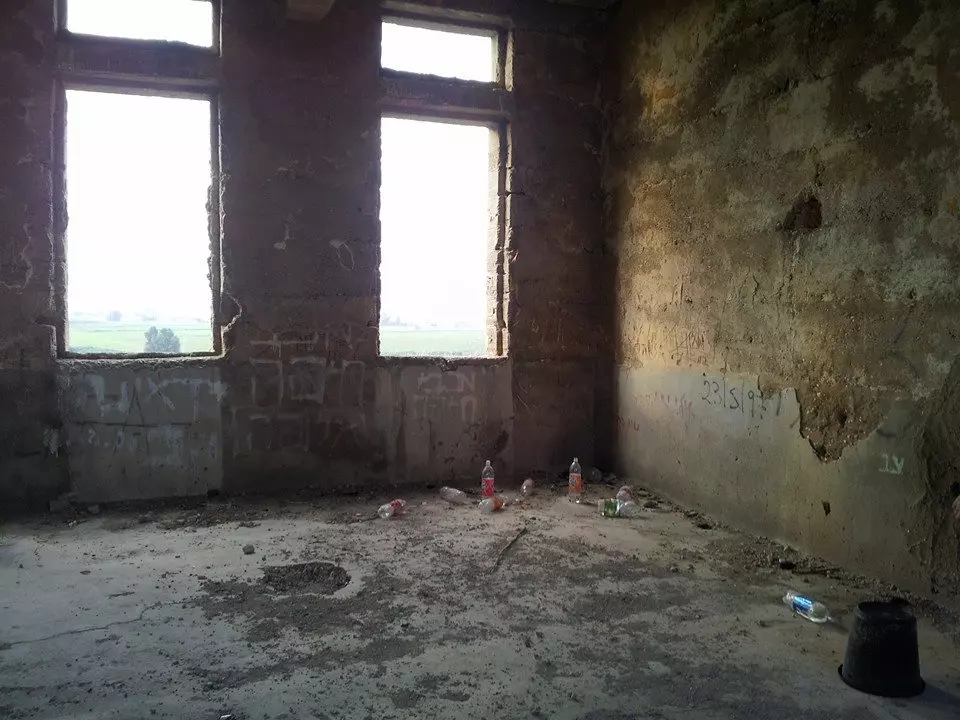
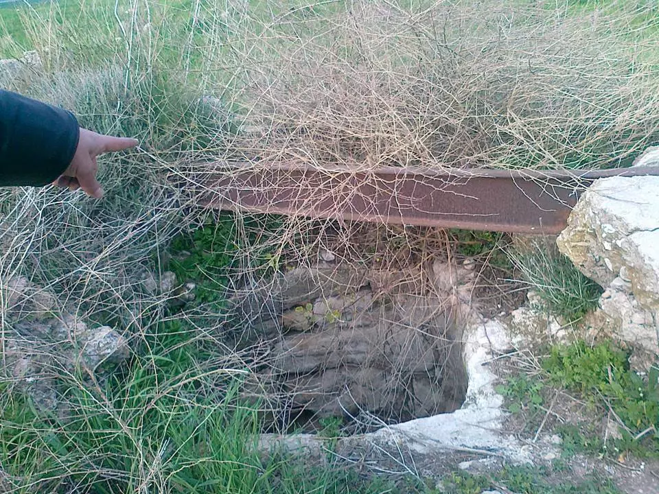
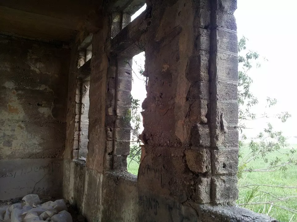
Village Before NakbaThe village stood on flat land on the southern coastal plain, between two bridges that crossed Wadi al-Jira. In 1596, Jusayr was a village in the nahiya of Gaza (liwa' of Gaza) with a population of 330. It paid taxes on a number of crops, including wheat, barley, and fruits, as well as on other types of produce and property, such as goats, beehives, and vineyards. In the late nineteenth century, the village of Jusayr was situated on flat ground and laid out along a northwest-southeast axis. The elders reported that their village served as a stop for pilgrims going to Mecca. The residents were Muslims, and the village had its own mosque and an elementary school that was founded in 1937. Enrollment reached seventy-four students in the mid-1940s. For the most part, however, the community relied on the services in al-Faluja, 4 km to the southeast. A 32-m-deep well supplied Jusayr with water for domestic consumption. While some villagers wove rugs and carpets, the majority worked in agriculture. Their most important crop was grain, but they also cultivated fruit. Orchards bordered Jusayr on its northeast and southeast sides. In 1944/45 a total of 11,852 dunums was allotted to cereals.Village Occupation and Ethnic CleaningAccording to Israeli sources, the village was occupied in the latter stages of an operation launched by the Israeli army's Giv'ati Brigade during the second week of July 1948. As the first truce of the war ended, Giv'ati commander Shim'on Avidan issued orders to break through Egyptian lines (in order to establish a link with the Negev) and to expel civilians from the area occupied. His forces did not manage to link the Negev with the Israeli-held coast, but they did succeed in seizing an arc of territory south of Ramla and parallel to the coast, driving over 20,000 people from their villages. Jusayr was one of the southernmost villages to be occupied in the operation; it probably was not completely occupied until 17–18 July. The Israeli army later claimed that with the start of the operation and the occupation of Tall al-Safi, morale was undermined in the whole area and the villagers fled with the approach of the Giv'ati units.However, two Egyptian sources claim that the village was taken by Israeli forces one month earlier, during the first truce of the war. One of these, the late Egyptian president Gamal Abdel Nasser, recalled in his memoirs that under cover of the truce the enemy 'hoped to seize dominating sites so that when the truce ended he could commence his operations from positions that were most advantageous….' Regarding this and the attack on a handful of other villages (lbdis, Asluj, Julis) attacked in violation of the truce, Abdel Nasser wrote that 'there was no indication that our High Command was aware of what was really going on.' Zionists Colonies on Village LandsTwo settlements have been established on village lands: Menucha in 1953 and Wardon in 1968. These settlements also occupy lands that once belonged to the neighboring village of Summil.Village TodayOne concrete, flat-roofed house still stands in the middle of a peach orchard. Its front facade has two rectangular windows and a rectangular entrance in the middle. The debris of houses among tall grasses and weeds is visible. A garbage dump is now located on the site, as well as buildings that belong to an Israeli settlement. The surrounding lands are cultivated.SourceDr. Walid al-Khalidi, 1992: All That Remains. |
|||||||||||||||||
| Related Maps | Town Lands' Demarcation Maps خرائط للقضاء توضح حدود القرى والاودية Town's map on MapQuest View from satellite Help us map this town at WikiMapia |
||||||||||||||||
| Related Links | Wikipedia's Page Google Search Google For Images Google For Videos |
||||||||||||||||
| More Information | في كتاب كي لا ننسى في كتاب بلادنا فلسطين المزيد من موقع هوية |
||||||||||||||||
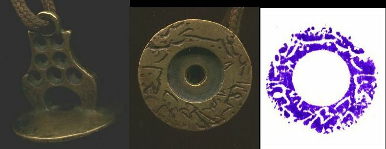
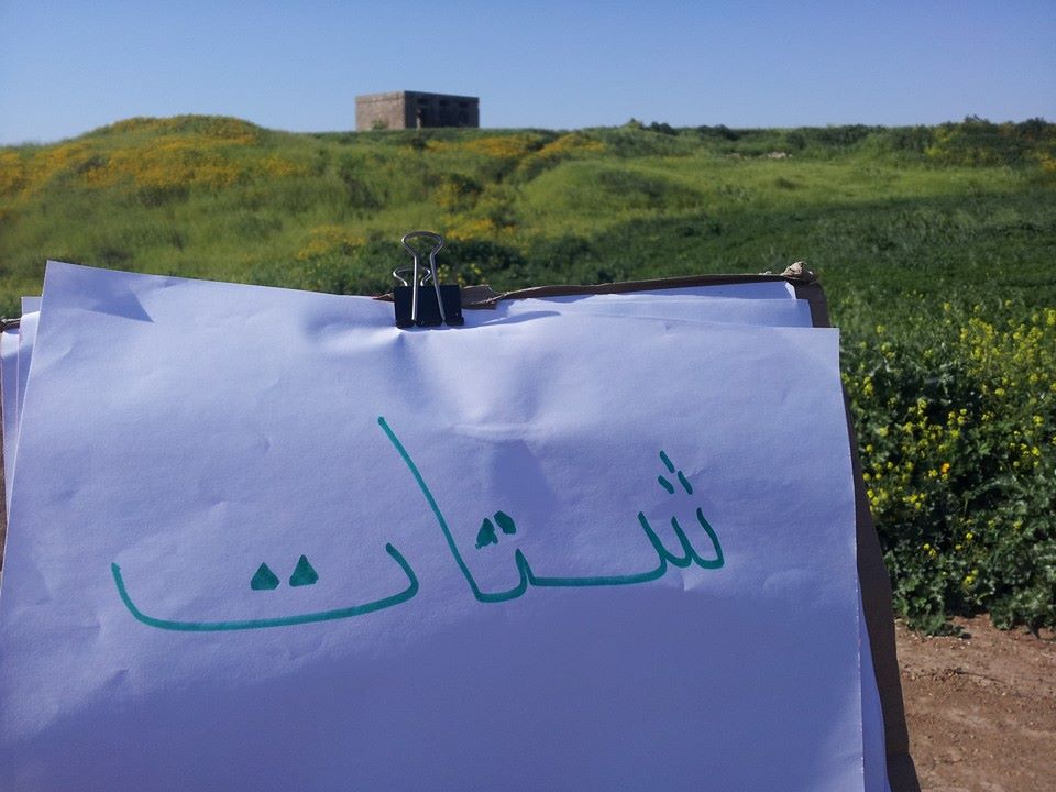
- My grandfather used to be the mayor (Mukhtar) of Jusayr. This was his official seal.
Posted by Mohammad Shatat 31 - A house, seen from Moshav Menuha, looking west. I've seen no other remains except for some cacti.
Posted by Uri Zackhem 12 - ارضنا
Posted by عماد الشمالي 6 - ارضنا1
Posted by عماد الشمالي 2 - عاش جدي الشيخ حسين...بعيدا عن ارضه جسير لكن الحلم لم بفارقه ان يعود اليها وان يصلي في القدس .......فمتى يا ترى سيتحقق لنا هذا الحلم ....و استطاعت التقنيه الحديثه عمل ذلك بالصوره؟؟؟!.... لكنه سيتحقق في الواقع بفضل المقاومه الباسله ان شاء الله...وسنصلي في القدس يا جدي باذن الله
Posted by عصام الشيخ حسين 1 - خارطة قديمة لفلسطين تبين مواقع حميع القرى الصغيرة و منها قريتنا جسير
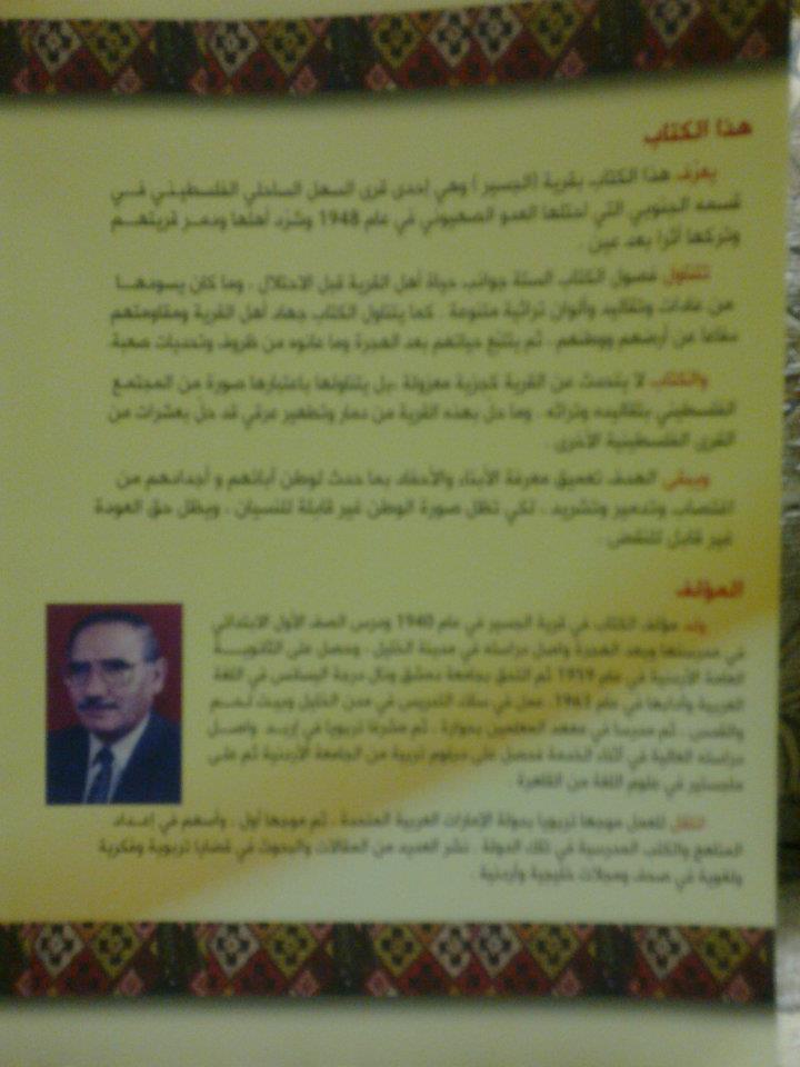
Posted by ابن جسير 1 - كتاب جديد للتربوي والباحث الاكاديمي الاستاذ ((يونس شتات)) حول قرية الجسير.
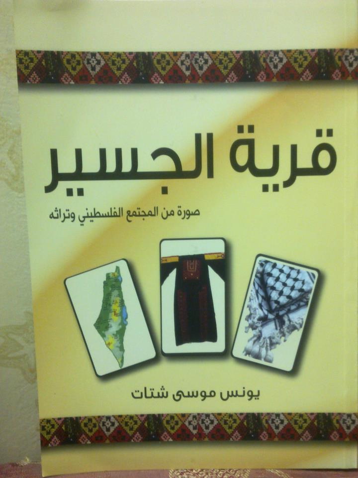
Posted by ziad shatat 3 - Book Cover - كتاب جديد عن قرية الجسير بقلم الكاتب يونس موسى شتات
Posted by ziad shatat 4 - مدرسة الجسير
Posted by بنت الجسير - مدينة الجسير
Posted by بنت الجسير - قريتي الجسير
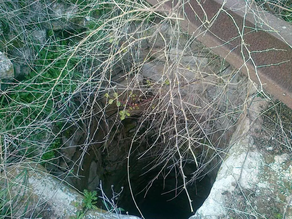
Posted by بنت الجسير - البير المكسور في الجسير
Posted by بنت الجسير - منظر عام للبير مع المدرسه في الجسير
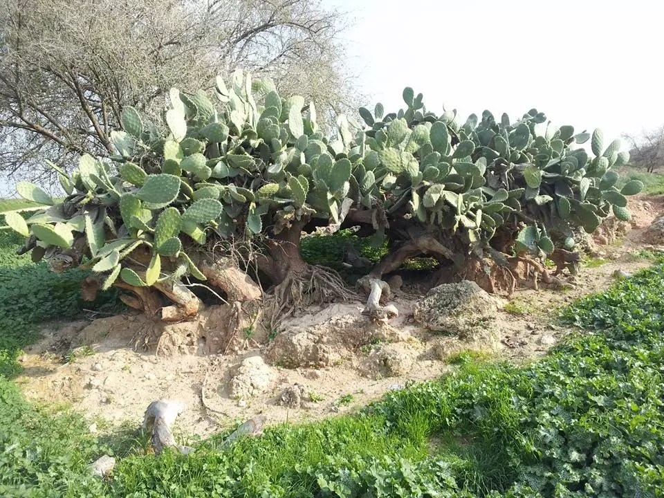
Posted by بنت الجسير - الصبر المحيط بأطراف البلد
Posted by بنت الجسير - البير الغربي
Posted by بنت الجسير - مدرسة الجسير في تلة الحصفه
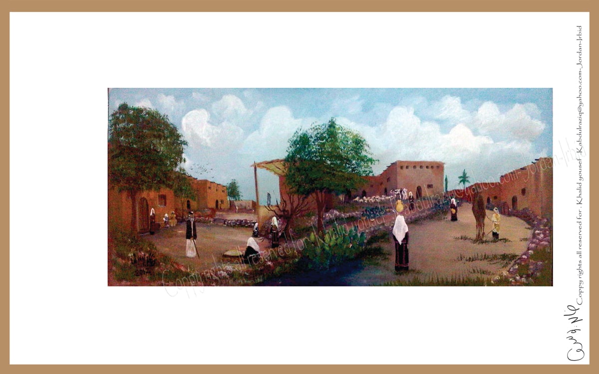
Posted by بنت الجسير - صورة لقرية جسير من الناحية الجنوبية الغربية -من ناحية البركة - تصوير تشكيلي بريشة الفنان التشكيلي خالد يوسف بناءا على البحث العلمي وشهادات اهل القرية المهجرين منها واستنادا الى خرائط الاقمار الصناعية -
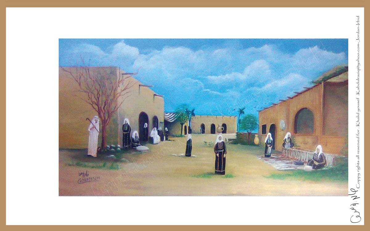
Posted by الفنان التشكيلي خالد يوسف - صورة لقرية جسير من الناحية الغربية -من ناحية طريق كرتيا السوافير - تصوير تشكيلي بريشة الفنان التشكيلي خالد يوسف بناءا على البحث العلمي وشهادات اهل القرية واستنادا الى خرائط الاقمار الصناعية -
Posted by الفنان التشكيلي خالد يوسف - صورة لجانب من الحارة الشرقي في قرية جسير من الناحية الشرقية - تصوير تشكيلي بريشة الفنان التشكيلي خالد يوسف بناءا على البحث العلمي وشهادات اهل الحارة واستنادا الى خرائط الاقمار الصناعية -
Posted by الفنان التشكيلي خالد يوسف - صورة لجانب من الحياة اليومية لاهالي قرية جسير تصوير تشكيلي بريشة الفنان التشكيلي خالد يوسف بناءا
Posted by الفنان التشكيلي خالد يوسف - وادي الجراح
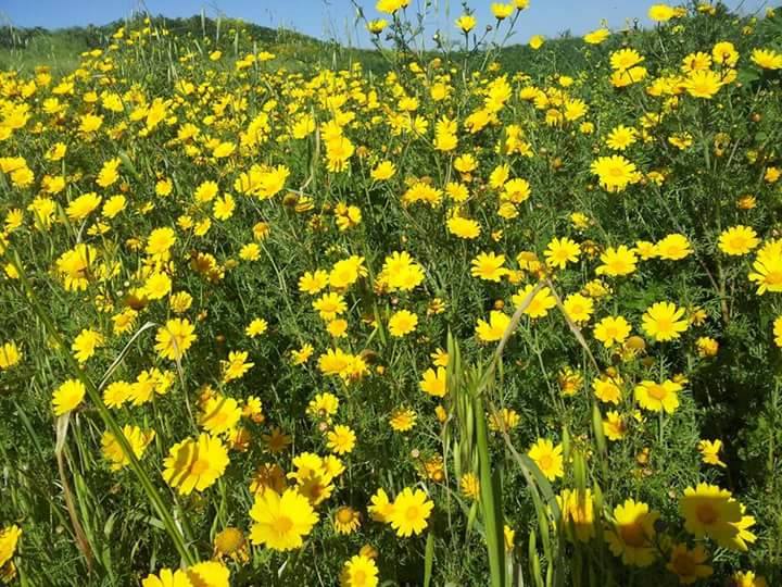
Posted by بنت الجسير - سهول الجسير الخصيبه
Posted by بنت الجسير - منظر للمدرسه من الداخل وقد دنستها ايادي المغتصبين قاتلهم الله
Posted by بنت الجسير - البير الغربي
Posted by بنت الجسير - البير الغربي
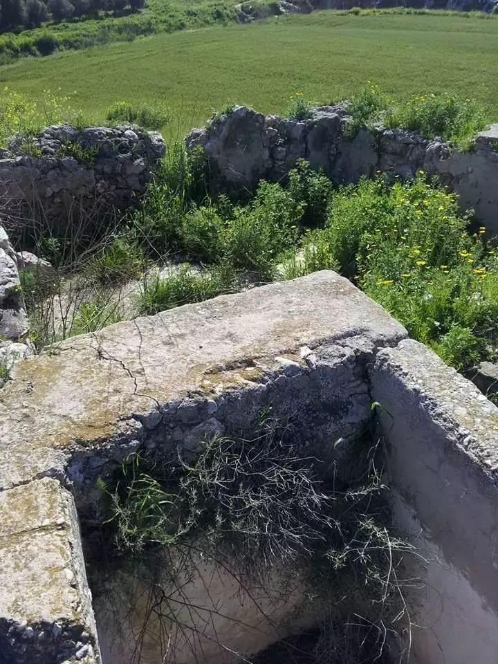
Posted by بنت الجسير - جدران المدرسه
Posted by بنت الجسير - الجابيه المحيطه بالبير
Posted by بنت الجسير - مزارع البرتقال في الجسير بتاريخ 6-3-2015 تصوير د. أحمد عليان
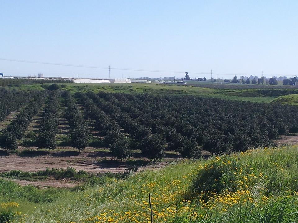
Posted by لؤي شتات - قرية الجسير - تصوير د.احمد عليان
Posted by لؤي شتات - بعض السكان الحاليين للجسير والعاملين بها من الأصل الكردي تصوير د. احمد عليان
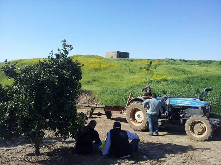
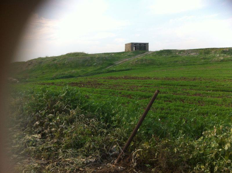
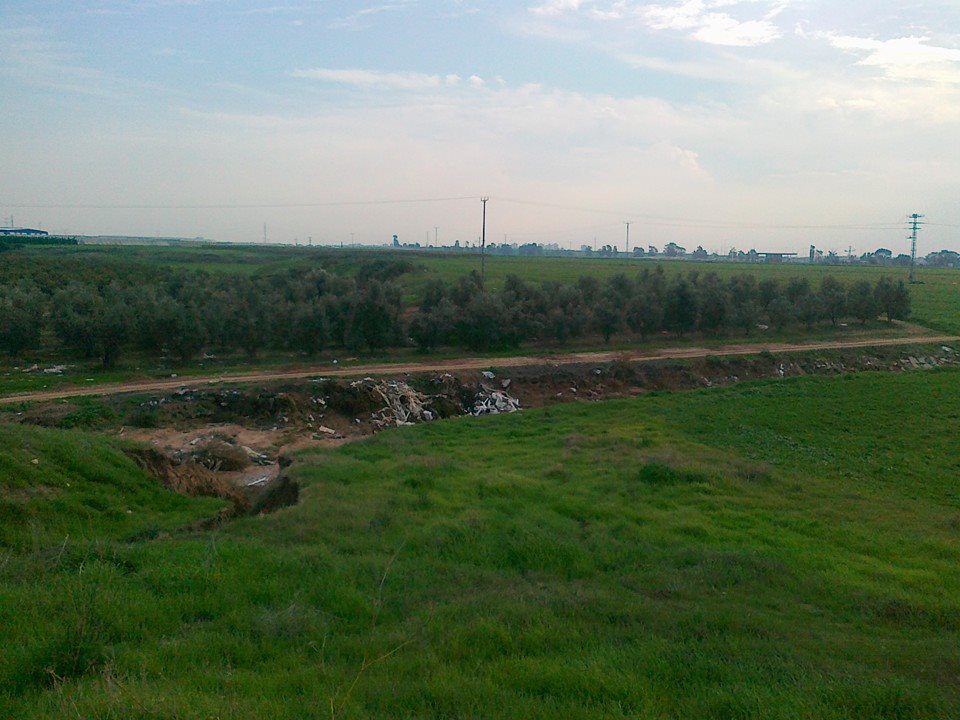
Posted by لؤي شتات 2 - اطراف احدى المستوطنات فوق اراضي البلدة 6-3-2015
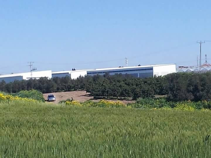
Posted by لؤي شتات - مستوطنة أخرى على أراضي البلدة بتاريخ 6-3-2015 تصوير د.أحمد عليان

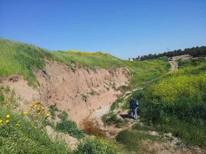
Posted by لؤي شتات - احدى الوديان في القرية
Posted by لؤي شتات - بئر قديمة في الجسير
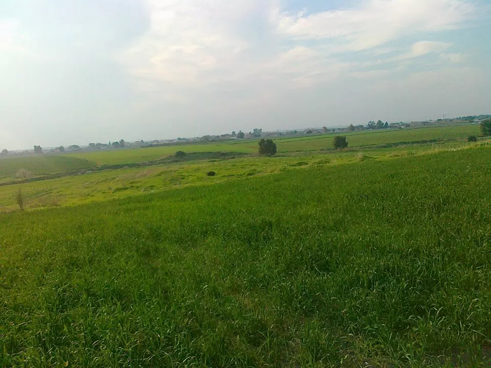
Posted by لؤي شتات - الطبيعة الخلابة للجسير 6-3-2015
Posted by لؤي شتات - صورة اخرى لمدرسة الجسير
Posted by لؤي شتات - جدي عبد القادر الشيخ حسين عليان الله يطوللنا بعمرو يا رب
Posted by Saif Elayan - غرفة متبقية من مدرسة قرية الجسير المهجرة (قضاء غزة )
- Pre-Nakba Aerial view of the village / صورة من الجو للقرية اخذت قبل النكبة
Want to browse more? 80,000 pictures were grouped in these gallaries:
| Display Name | Clan/Hamolah | Country of Residence |
| Mohammed Meshmesh | - | Palestine |
| Anwar Atwa | - | Detroit , USA |
| Saif Elayan | الشيخ حسين(عليان ) | - |
| غيث الشيخ حسين | غيث | الاردن, فلسطين |
| سيف عليان | الشيخ حسين | اربد, الأردن |
| بنت الجسير | شتات | irbid, jordan |
| خالد الناطور | - | - |
| يحيى برهم | برهم | الرياض |
| أنس بركات | - | - |
| عبدالله حسين الخطيب | السبايبة | الرمثا |
| أحمد قنو | السبايبة | - |
| M7MD DARWISH | DARWISH | JORDAN, JORDAN |
| الشيخ حسين | عليان | اربد |
| المهندس | - | بغداد, العراق |
| عماد بركات | - | - |
| ابو محمد | رزق | الرياض, الرياض |
| عطاالله الشمالي | - | الاردن, الاردن |
| نواف ابوناب | hf,khf | jordan |
| هشام برهم | برهم | الرياض, السعودية |
| عماد عبيد | عبيد(السبايبه) | الرياض, السعودية |
| نضال ابو ناب | ابو ناب | العين, الامارات |
| محمد بركات | بركات | - |
| عصام الشيخ حسين | عبدربه-الشيخ حسين | الرمثا, الاردن-الرمثا |
| faluje faluje | faluje | - |
| ابو اسيل | رزق | مادبا, الاردن |
| احمد محمد رزق | - | الرصيفه |
| بسام احمد رزق | - | الرصيفه |
| محمد قنو | قنو ( السبايبة ) | الرمثا |
| ياسر الشمالي | الشمالي | الرمثا, الأردن |
| Jameel | Al-Shamali | Ramtha, Jordan |
| عاشق ارض الشهداء | الحوامده | عمان, الاردن |
| ABD AL-HAMEED JABER REZEQ | rezeq | AMMAN, AMMAN |
| Huda Abdel Alhamed Rezeq | Rezeq | Minnosata, United States |
| nahida rezeq | rezeq | MN U.S.A |
| بنت العبسي العبسي | العبسي | - |
| سعدي | الشمالي | الرمثا, الأردن |
| غسان الشمالي | - | -, الرمثا |
| Ahmad Nofal | Abu Nab | Madaba, Jordan |
| Ashraf Jaber | - | chicago, USA |
| imran shamali | alshamali | - |
| nedal rezeq | rezeq رزق | m n, u s a |
| عماد الشمالي | الشمالي | الرمثا, الاردن |
| hamdan | - | irbid |
| محمد ابو اجميل | ابو اجميل | اربد |
| غزاويه | ملص | الرمثا |
| Mohammed Rezeq | Rezeq | - |
| SSJB | Barham | - |
| صلاح | - | arbid |
| ahmad obaid | al sabaybih | irbid, jordan |
| Ahmed Alkhateeb | - | - |
| Ahmed Alkhateeb | - | - |
| عدلي عامر الخطيب | الخطيب | أبوظبي, أبوظبي |
| أبو عبدالله | سلمان (صرصور) | Gaza, Palestine |
| نايف | العلي | gaza, palestine |
| Akram Amer | - | - |
| Al_KiNg | درويش | الاردن, الاردن |
| محمد abojmeal | ابو اجميل | اربد, الاردن |
| Abo D@rWish | درويش | عمان, الاردن |
| الفلسطيني الثائر | بركات | - |
| mohammad abdulrahim | alali | jordan, jordan |
| ابو غالب | الحمارشه | jinen, jinen |
| MOHANNAD SHATAT | - | - |
| ziad shatat | shatat | uae, uae |
| Hisham Nayef | Alali | United Kingdom |
| Alali | alali | jordan, 0962 |
| Mohammad Shatat | Shatat | Irbid, Jordan |
| فواز شتات | Shatat | Kansas, USA |
| omar mallah | almallah | - |
| قرارية | - | - |
- نبذه عن قريه جسبر وتاريخ سقوطها بايدي الصهاينه
- قرية الجسير| فلسطين| قضاء غزة Duration: 13 min 35 sec
- قرية جسير المهجرة (قضاء غزة): البير والمدرسة والجسر المملوكي القديم. جسير كانت من قرى بلدة الفالوجة وتحدها قرى الجلَدية شمالاً وصميل الخليل شرقًا وزيتا العمار والفالوجة جنوبًا وحتى والسوافير الشرقية غربًا واقيمت عليها مستوطنة منوخا (מנוחה) Duration: min sec
- الذاكرة مفتاح العودة -- الحلقة 86 -- جسير Duration: 23 min 22 sec
 Fake Valor: Why Did Zionist Jews Hoist Nazis Flag on Their Ships in the 1930s?
What is new?
-
Facts About Oct. 7th Gaza Raid
-
Remined Us Please:: Who Did Rape Who? Palestinians Raped Israelis? Or, was the other way around?
-
When Prof. Edward Said was invited to debate Bibi Netanyahu in the 1980s, watch what happened!
-
Ezra Klein of the NY Times on the "Jewish Race".
-
Abusing Blood Libel!
-
Zionist FAQ: Isn't it true that Palestinians don't want peace? Palestinians never accepted the two-state solution
- Facts about Haavara (Transfer) Agreement between Ben-Gurion & Hitler
-
Haavara FAQs: Why Did Zionist Jews Hoist Nazis' Flags on Their Ships in the 1930s?
-
Dear ChatGPT: How did Palestinians resist Napoleon's invasion of their country in 1799?
-
Dear ChatGPT: Gaza had a vibrant Jewish community in the mid-17th century. What happened to them?
-
Dear ChatGPT: Why did the Jewish Agency suppress news of the Holocaust during WWII?
-
Video Playlist: Jews share their DNA tests to end the conflict for good.
-
A Tale of Two Conflicts: Examining the Definition of Genocide
-
Prof. Abraham Polak And The Suppressed History of the Khazars and European Jewry
-
How Ronald Reagan would have framed the genocide in Gaza if he were still alive?
-
Haavara FAQs: Let us do the math: how many German Jews did The Haavara Agreement save?
-
Zionist FAQs: The Hebron Massacre of 1929, "clearly proves" that Palestinians are antisemitic, how could you deny it?
-
Zionist FAQs: Why Anti-Zionist Is Not Antisemitism?
-
Zionist FAQs: Isn't it true that the KGB create Palestinian Nationalism in the early 1960s?
- Zionist FAQs: Muslims are killing Muslims all the time; why are Israeli Jews being singled out in the media?
- Zionist FAQs: How is Israel an apartheid state when 20% of its citizens are Arabs who enjoy full rights?
-
Haavara FAQs: Analysis of Herzl's Uganda Scheme and how it could have saved millions of Jews.
-
Haavara FAQs: Why did Hayim Greenberg describe American Jewry as "morally bankrupt" in early 1943?
-
Haavara FAQs: What if the Evian Conference was a resounding success? What would have been the impact of saving European Jewry on Zionism?
- Haavara FAQs: What if the six million were saved, how that would have impacted the Zionist project?
-
Haavara FAQs: How did Zionist leaders react when Europe's Jews lingered in the DP camps after WWII ended?
-
Why does the American Jewish community repeat lies that David Ben-Gurion had debunked before he died?
-
Who has the power to rename the Tatar/Khazar Gene Marker to Jewish IV?
-
Zionist FAQs: Why won't Egypt, Syria, and Jordan take their people back? Jews are indigenous to Palestine, and Arabs immigrated after Jews developed the country. Arabs should leave.
-
Haavara FAQs: Did Hitler and the Nazis conflate between Judaism and Zionist? If that wasn't case, then why?
-
Haavara FAQs: Winston Churchill and antisemitism, a collection of articles written Churchill.
-
Haavara FAQs: Broken by country, how many Jews survived vs. killed during the Holocaust?
-
Haavara FAQs: Why did European Jews vote with their feet and to immigrated to the Americas, not Palestine, after WWII?
-
Watch this American Jewish Girl describing Israeli Jews' cognitive dissonance like no other in under two minutes
-
Haavara FAQs: When the Nazis went out of their way to hide the Holocaust, Israeli Jews did the exact opposite by broadcasting their genocide of Gazans. But why?
-
Haavara FAQs: How Zionist Jews went out of their to show their appreciation to Nazism and Fascism?
- Haavara FAQs: Why Zionist leaders were against bombing the death camps & the Railroads leading to them?
-
Haavara FAQs: Hitler's message to the British and American people: If Jews are such noble citizens and you care about them, how come you're not letting them in? I will gladly ship them to you at my expense, even on luxury liners!
-
A shortlist of Zionist and Israeli false flag operations in the name Jews.
-
The Most Moral Army
- The Land of Kapos (Israel): Where the brave are boycotted and Kapos walk free.
- Why did early Zionists often named their communal enterprises "colonial"?
- Zionist Relations with Nazi Germany by Faris Glubb
-
Two NY Times advertisements by Zionists in the early 1943 that exposes Zionists' treason at the height of the calamity
- Facts Not Lies about the Palestinian-Israeli Conflict.
- Site's pictures have been categorized
- Campgain Against Lice
- A Survey of Palestine, the official source about Palestine before Nakba produced by the British Mandate; over 1200 pages.
- Satellite View & Google Earth: Over 6,000 placemarks identifying all destroyed towns, W. Bank & Gaza Strip Towns, & refugee camps.
- PalestineRemembered.com and its Nakba Oral History Project were featured on al-Jazeera Satellite TV.
- Nakba Oral History Video Podcast:
 Over 700 Oral History interviews (including 3,500+ hours of recording) can be viewed online.
 - Palestine Village Statistics Project
- Gaza Jail Break
- النسخة العربية للموقع الان متوفرة
- Videos: Documenting the destroyed villages in video: Tracing all that remains since Nakba.
- Videos: Responding to Zionist Propaganda
- Interview: The ethnic cleansing of Palestine: George Galloway interviews Israeli Historian Ilan Pappe.
- For Palestinians, memory matters. It provides a blueprint for their future By George Bisharat.
- Zionist FAQ now available in Hebrew שאלות שציונים שואלים, עכשיו בעברית
- Video: The Stephen Walt and John Mearsheimer report on the influence of the Israel Lobby on U.S. Foreign Policy
- The Palestinian-Israeli conflict for beginners
