| PalestineRemembered | About Us | Oral History | العربية | |
| Pictures | Zionist FAQs | Haavara | Maps | |
| Search |
| Camps |
| Districts |
| Acre |
| Baysan |
| Beersheba |
| Bethlehem |
| Gaza |
| Haifa |
| Hebron |
| Jaffa |
| Jericho |
| Jerusalem |
| Jinin |
| Nablus |
| Nazareth |
| Ramallah |
| al-Ramla |
| Safad |
| Tiberias |
| Tulkarm |
| Donate |
| Contact |
| Profile |
| Videos |
Welcome To Yasur - ياصور (יאצור)
|
District of Gaza
Ethnically cleansed days ago |
العربية Google Earth |
 |
Gallery (29) |
- Statistics & Facts
-
Before & After

- Satellite View
- Articles 2
- Pictures 29
- Aerial Views 1
- Land Deeds 12
- Oral History 1
- Members 19
- All That Remains
- Town's Map
- Wikipedia
- Videos
- Guest Book
- Links 1
| Statistic & Fact | Value | |||||||||||||||||||||
| Occupation Date | June 9, 1948 | |||||||||||||||||||||
| Distance From District | 40 (km) North East of Gaza | |||||||||||||||||||||
| Elevation | 50 (meters) | |||||||||||||||||||||
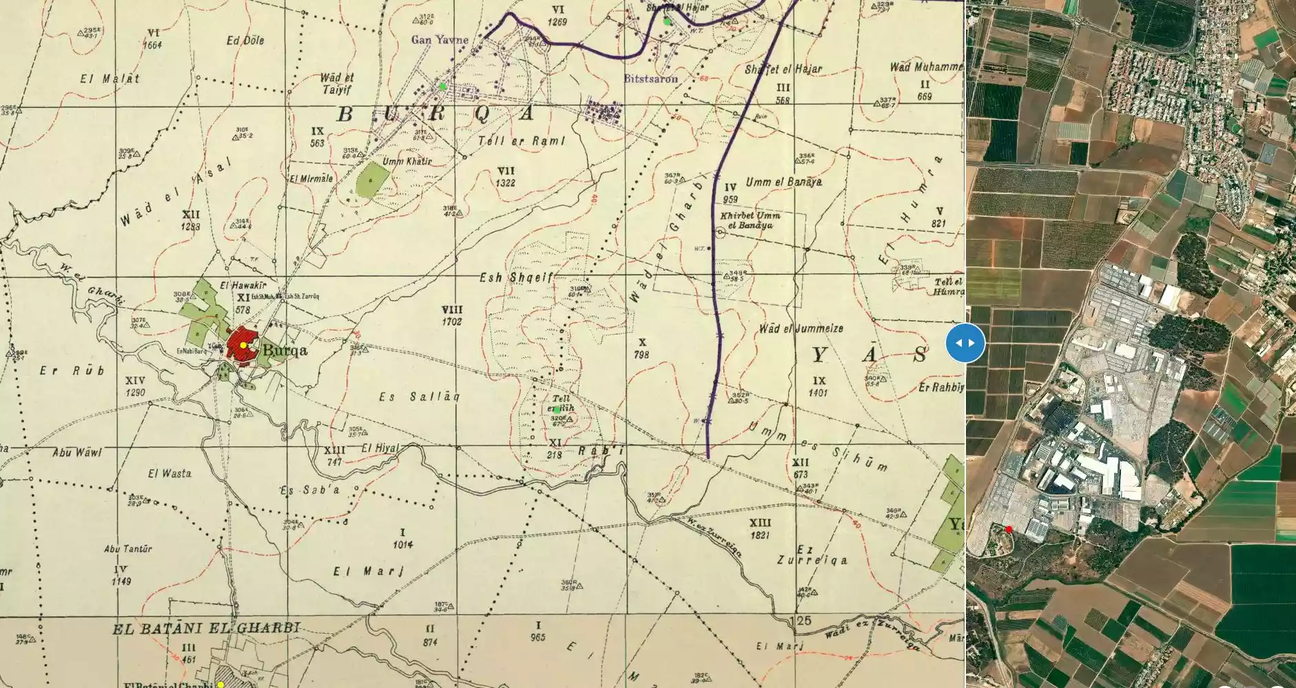
| Before & After Nakba, Click Map For Details |
||||||||||||||||||||||
|
||||||||||||||||||||||
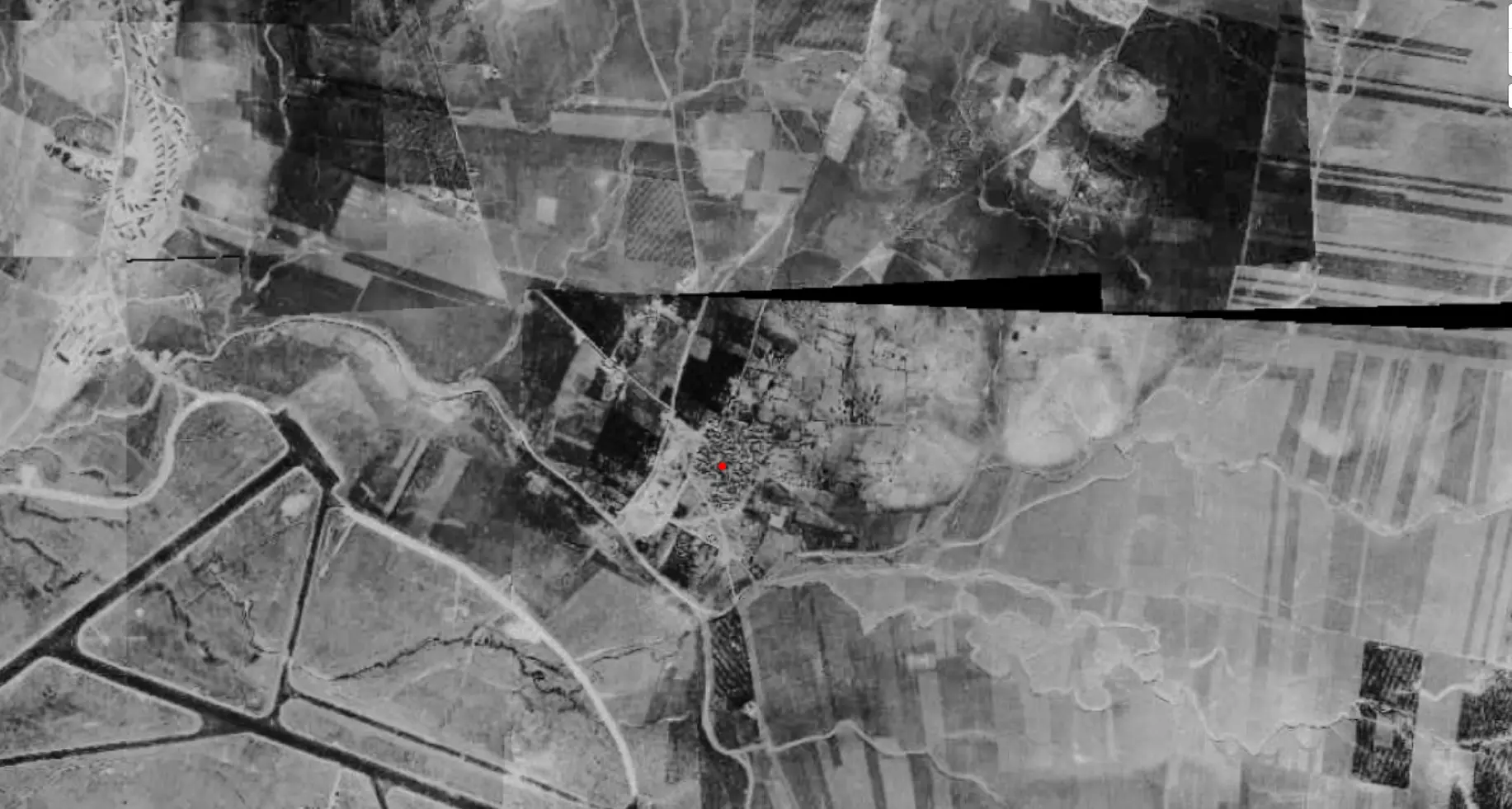
| Pre-Nakba Aerial View |
||||||||||||||||||||||
|
||||||||||||||||||||||
| Map Location | See location #3 on the map View from satellite |
|||||||||||||||||||||
| Military Operation | Operation Barak | |||||||||||||||||||||
| Attacking Units | First Battalion of the Giv'ati Brigade | |||||||||||||||||||||
| Exodus Cause | Military assault by Zionist troops | |||||||||||||||||||||
| Village Temains | The village has been mostly destroyed with the exception of few deserted houses. | |||||||||||||||||||||
| Ethnically Cleansing | Yasur inhabitants were completely ethnically cleansed. | |||||||||||||||||||||
| Pre-Nakba Land Ownership |
**Town Lands' Demarcation Maps |
|||||||||||||||||||||
| Land Usage As of 1945 |
|
|||||||||||||||||||||
| Population |
|
|||||||||||||||||||||
| Number of Houses |
|
|||||||||||||||||||||
| Near By Towns |
||||||||||||||||||||||
|
||||||||||||||||||||||
| Schools | Yasur had an elementary school for boys founded in 1923, and in 1945 it had an enrollment of 123 students. | |||||||||||||||||||||
| Places of Warship | One handsome mosque | |||||||||||||||||||||
| Exculsive Jewish Colonies That Usurped Village Lands |
Talmey Yechi'el and Bene 'Ayish | |||||||||||||||||||||
| Featured Video | ||||||||||||||||||||||
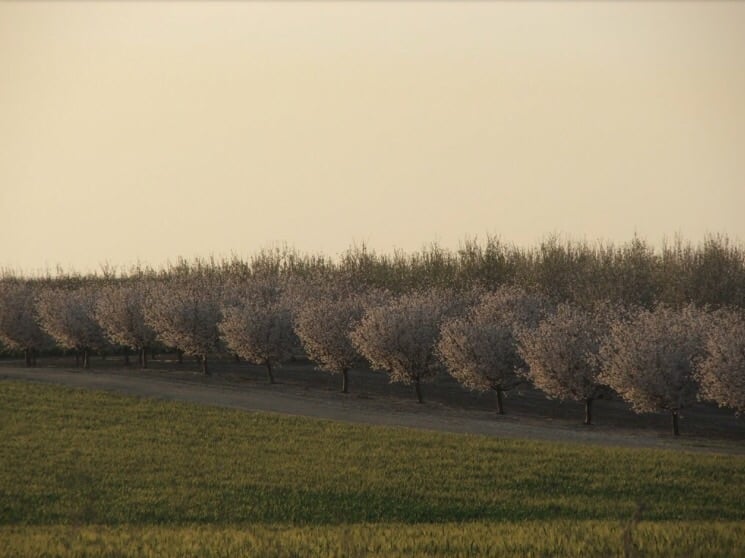
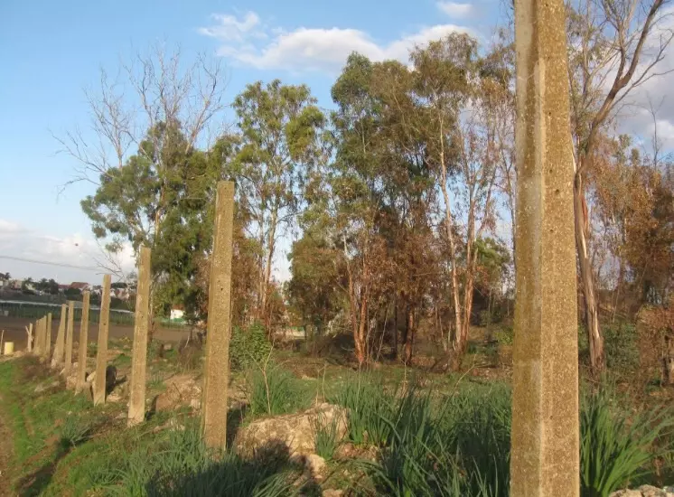
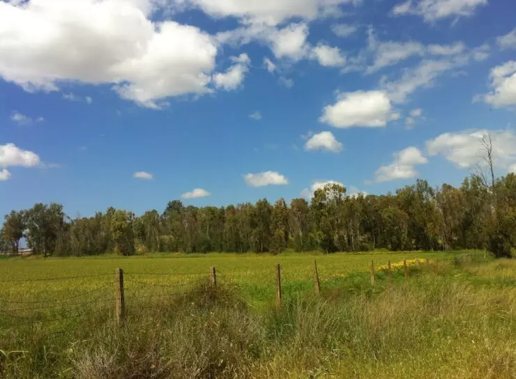
Village Before NakbaThe village stood on a plateau on the coastal plain, linked by secondary roads to one highway that led to the city of al-Majdal, to the southwest, and to another highway that led to Ramla, to the northeast. During the Mamluk period (1205–1517), a mail station between Gaza and Damascus was located in Yasur, although this was later transferred to the village of Bayt Daras. In 1596, Yasur was a village in the nahiya of Gaza (liwa' of Gaza), with a population of 303. It paid taxes on a number of crops, including wheat, barley, fruit, and sesame, as well as on other types of produce, such as goats, beehives, and water buffalos. In the late nineteenth century, the village of Yasur had a well to the south and large gardens to the north and east. It was densely populated; its adobe brick houses were built close together, separated by meandering, narrow alleys. The residents were Muslim. A handsome mosque was located at the village center, as were a number of shops. The center also contained an elementary school that was opened in 1923, for which enrollment reached 132 students in the mid-1940s. The villagers drew water for domestic use from wells. Agriculture was the backbone of their economy; they cultivated grain, citrus, olives, and vegetables. In 1944/45 a total of 636 dunums was devoted to citrus and bananas and 12,173 dunums were allotted to cereals; 180 dunums were irrigated or used for orchards. Grain cultivation relied on rainfall, whereas citrus and vegetables were irrigated. The inhabitants drew their irrigation water from wells that were 25–40 m deep.Village Occupation and Ethnic CleaningThe History of the War of Independence states that the village was occupied just before the first truce of the war took effect, on the night of 10–11 June 1948. 'The truce approached—one night remained for operations,' the account reads, 'and, in fact, many operations were planned for this night, and most were implemented.' One of these was an operation to capture Yasur by the First Battalion of the Giv'ati Brigade. These small thrusts to capture individual villages or positions occurred in the wake of Operation Barak, which was launched in the first half of May.According to the Haganah account, the name of the village was changed to Chatzor, presumably when a settlement was established there. This is probably a reference to Chatzor Ashdod, founded in 1937 on lands that traditionally belonged to al-Batani al-Gharbi, more than 2 km to the northwest. Zionists Colonies on Village LandsThe settlements of Talmey Yechi'e and Bene Ayish were established in 1949 and in 1958, respectively, on village lands.Village TodayThe village is a closed, fenced-in military zone. At the village entrance there is a sign: "TAT Aircraft Parts Industrial Firm." A single undemolished house stands some 10 m away from the entrance. Next to it is a demolished one and a number of cactuses. A dirt road, lined by cactuses and olive and almond trees, passes by the southern boundary of the fence. The area inside and outside the fence has also been planted with eucalyptus trees.SourceDr. Walid al-Khalidi, 1992: All That Remains. |
||||||||||||||||||||||
| Related Maps | Town Lands' Demarcation Maps خرائط للقضاء توضح حدود القرى والاودية Town's map on MapQuest View from satellite Help us map this town at WikiMapia |
|||||||||||||||||||||
| Related Links | Wikipedia's Page Google Search Google For Images Google For Videos |
|||||||||||||||||||||
| More Information | مخطط البلد في كتاب كي لا ننسى في كتاب بلادنا فلسطين المزيد من موقع هوية |
|||||||||||||||||||||
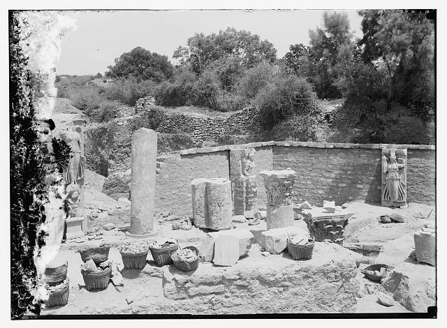
- Ruins at Yasur, around Ashdod.
Posted by Fadel Haddad 4 - Ruins between the cities Ashkalon and Asdod, near Yasur.
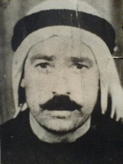
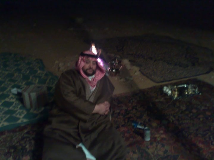
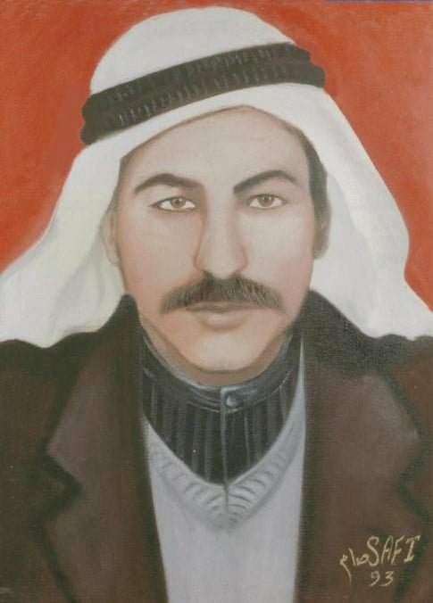
Posted by Fadel Haddad 5 - صوره الحاج حسن محمد خليل شاهين ابو الريش (الشهير ب دودح)
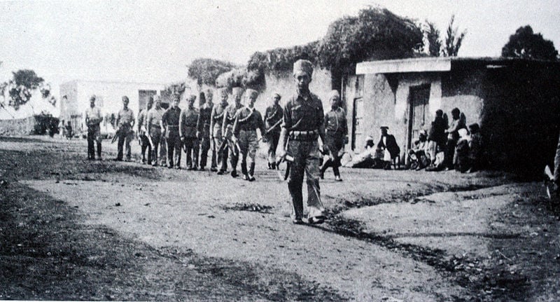
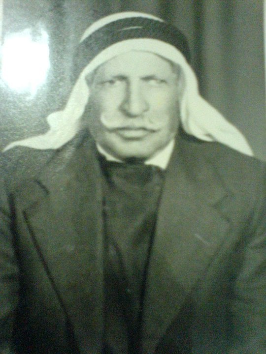
Posted by عبد القادر محمد حسن أبو الريش 2 - فرقة من الشرطة المحلية فى قرية ياسور قضاء غزة قبل النكبة 1948 م
Posted by jamal 1 - المغفر له عبدالفتاح جدوع محمد عبداللطيف مصطفى التميمي
Posted by جدوع - المغفور له هجرس عرب مصطفى
Posted by جدوع - عبدالفتاح لطفي عبدالفتاح جدوع عبداللطيف مصطفى التميمي
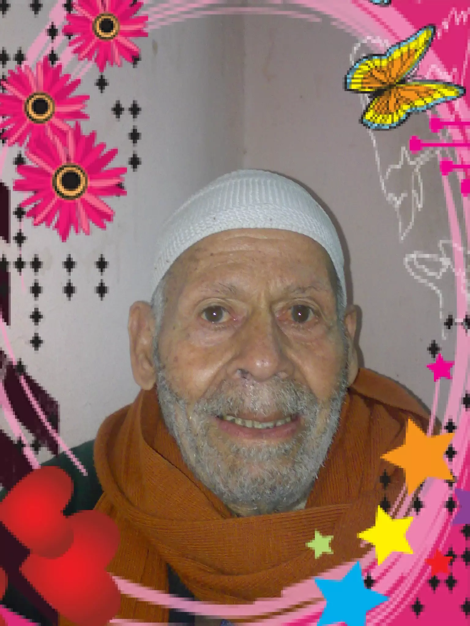
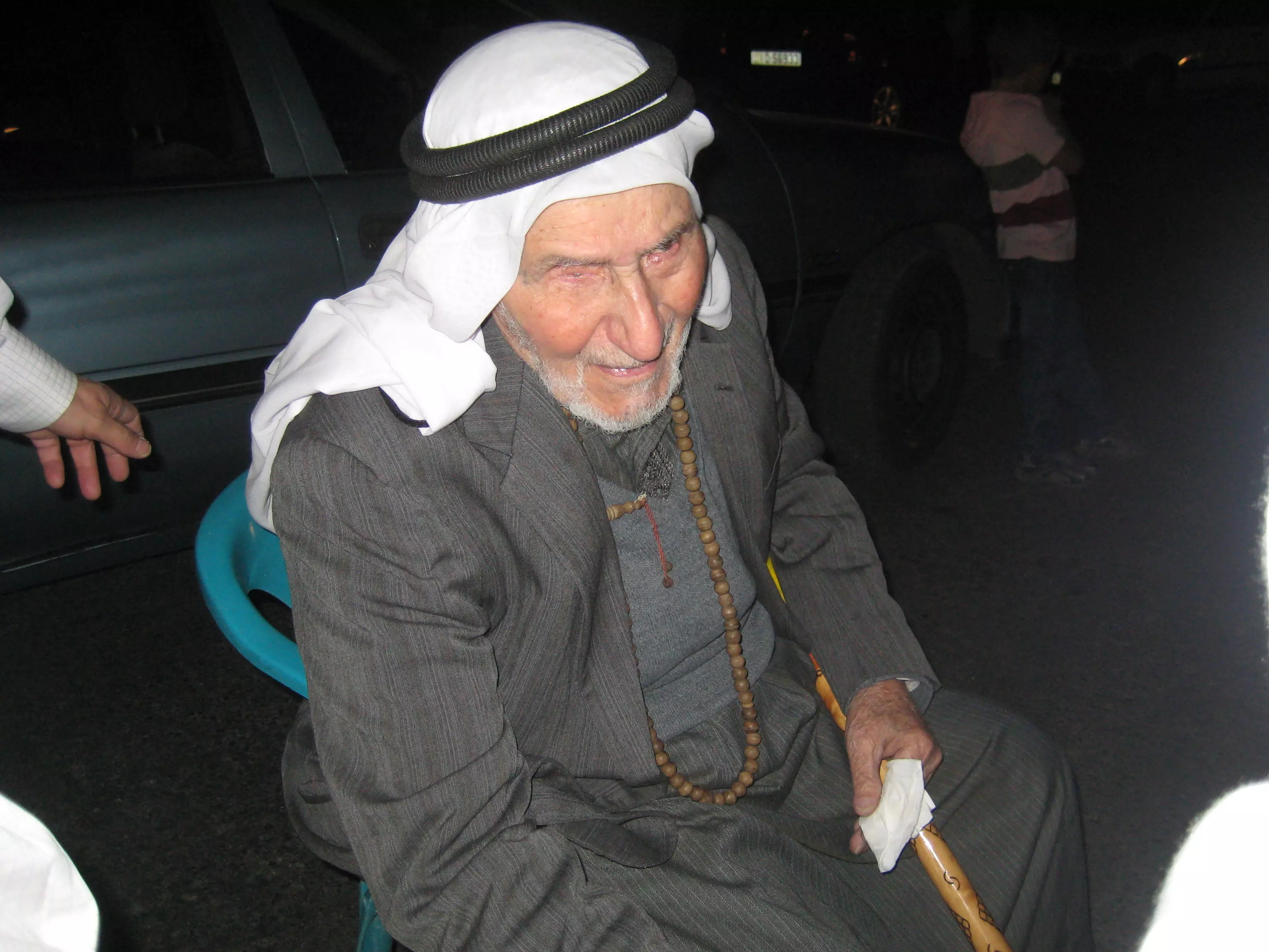
Posted by جدوع - صورة الحاج - عقيل ابوجياب المتوفى عام 2012 عن عمر ( 108 سنين )
Posted by alaadden - اراضي ياصور
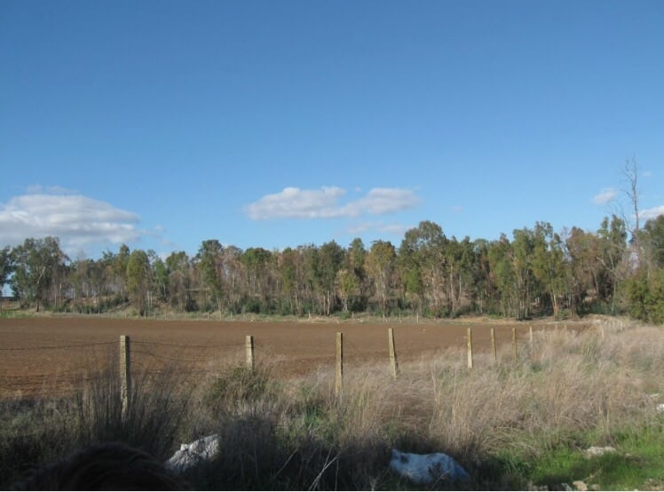
Posted by abu raya - من شمال ياصور
Posted by abu raya - اراضي ياصور
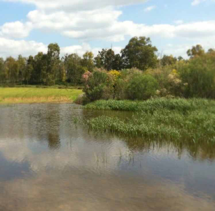
Posted by abu raya - موقع القريه محاط بالسياج
Posted by abu raya - اراضي القريه
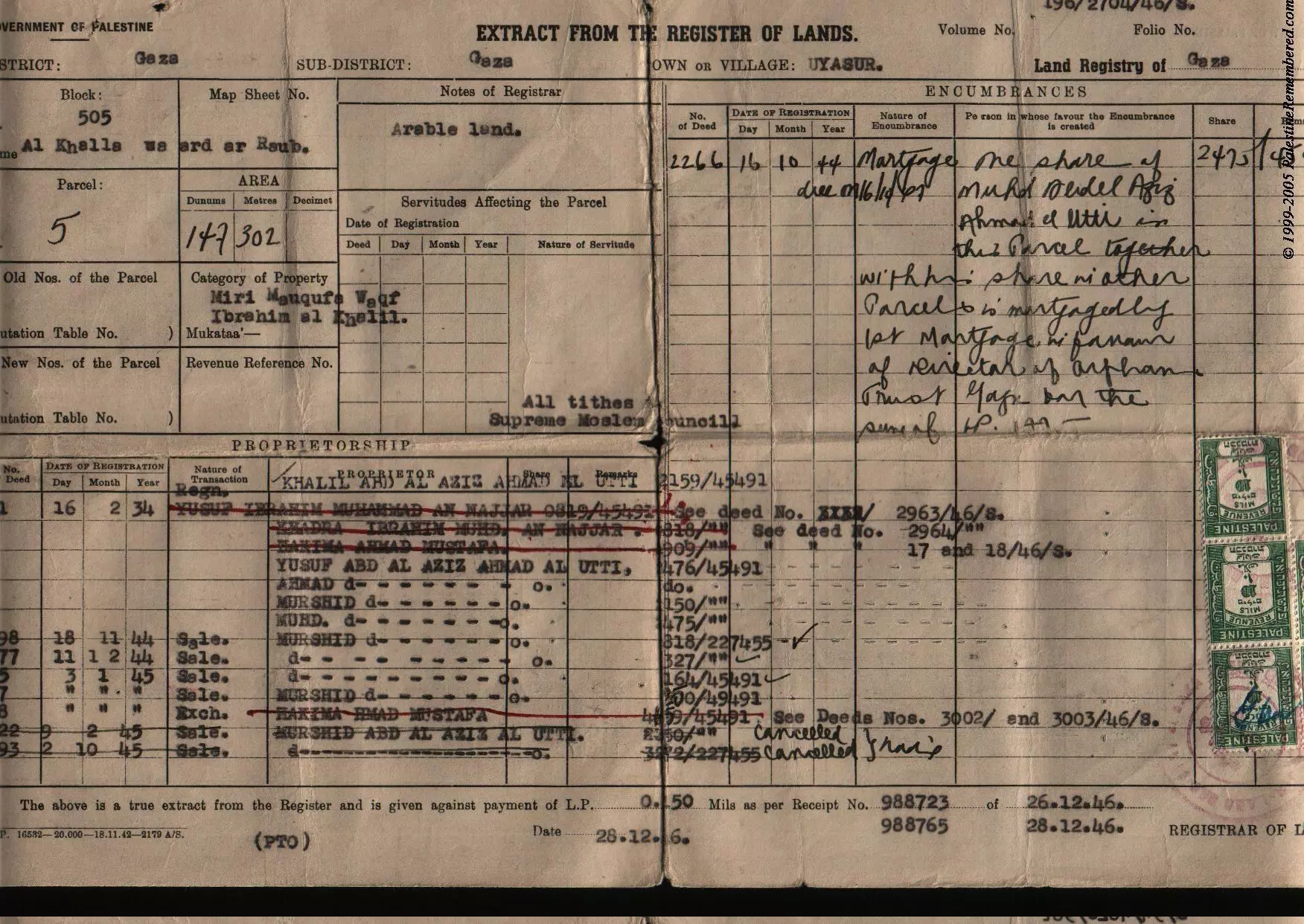
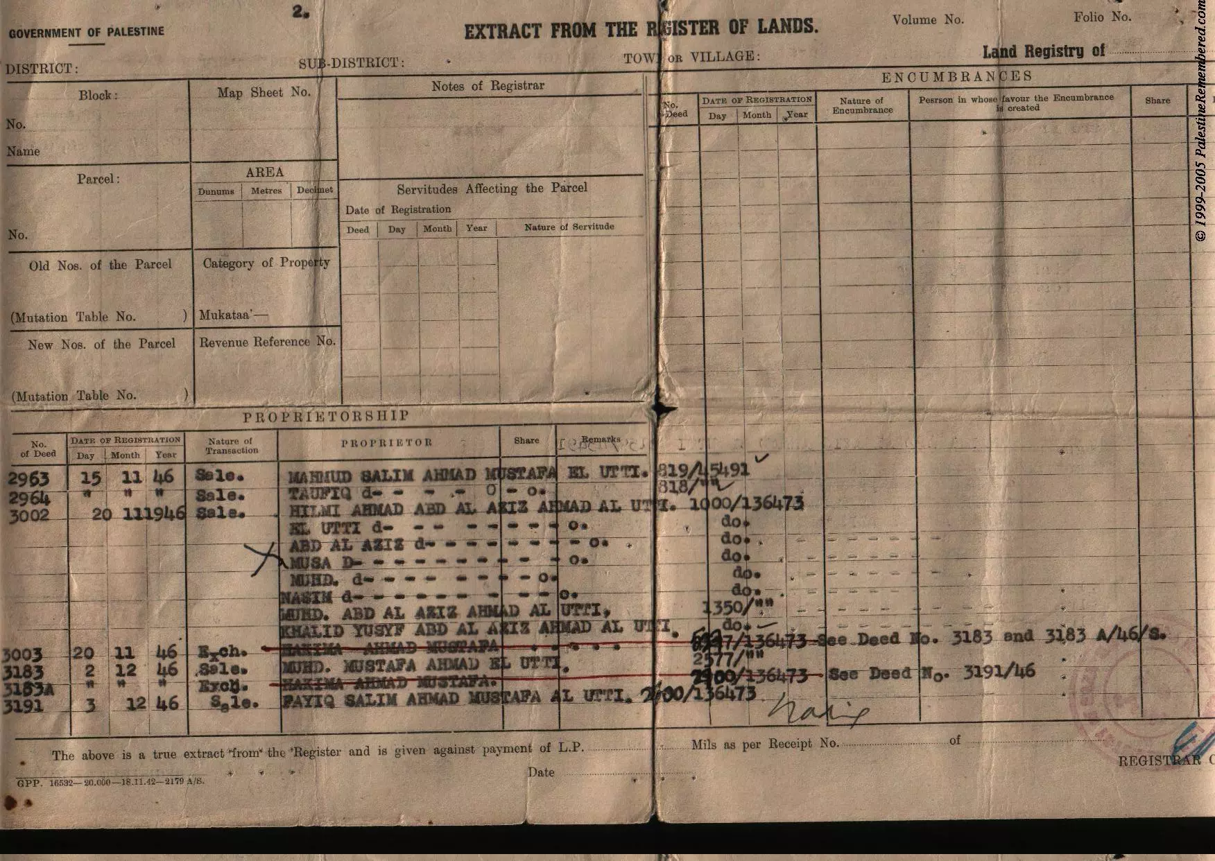
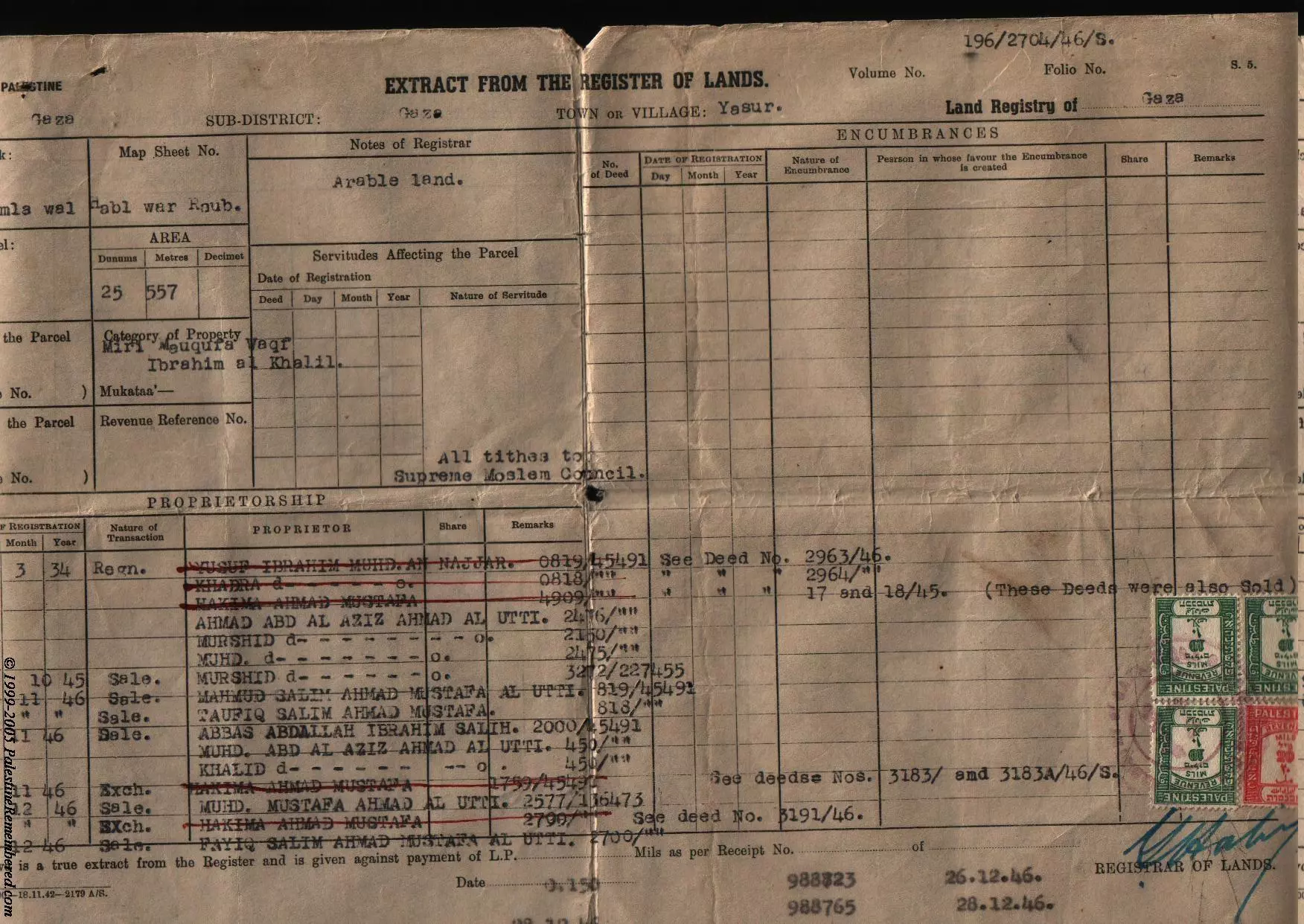
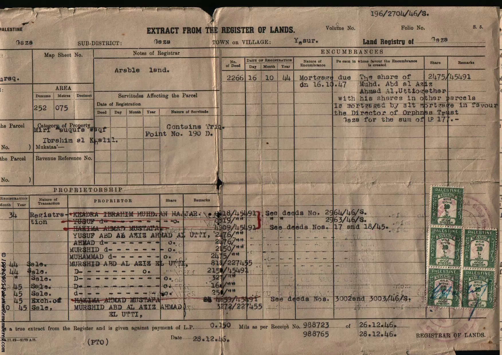
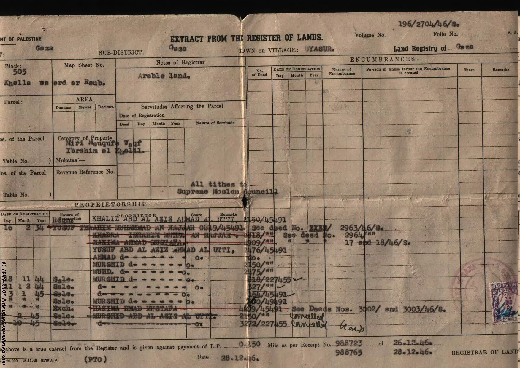
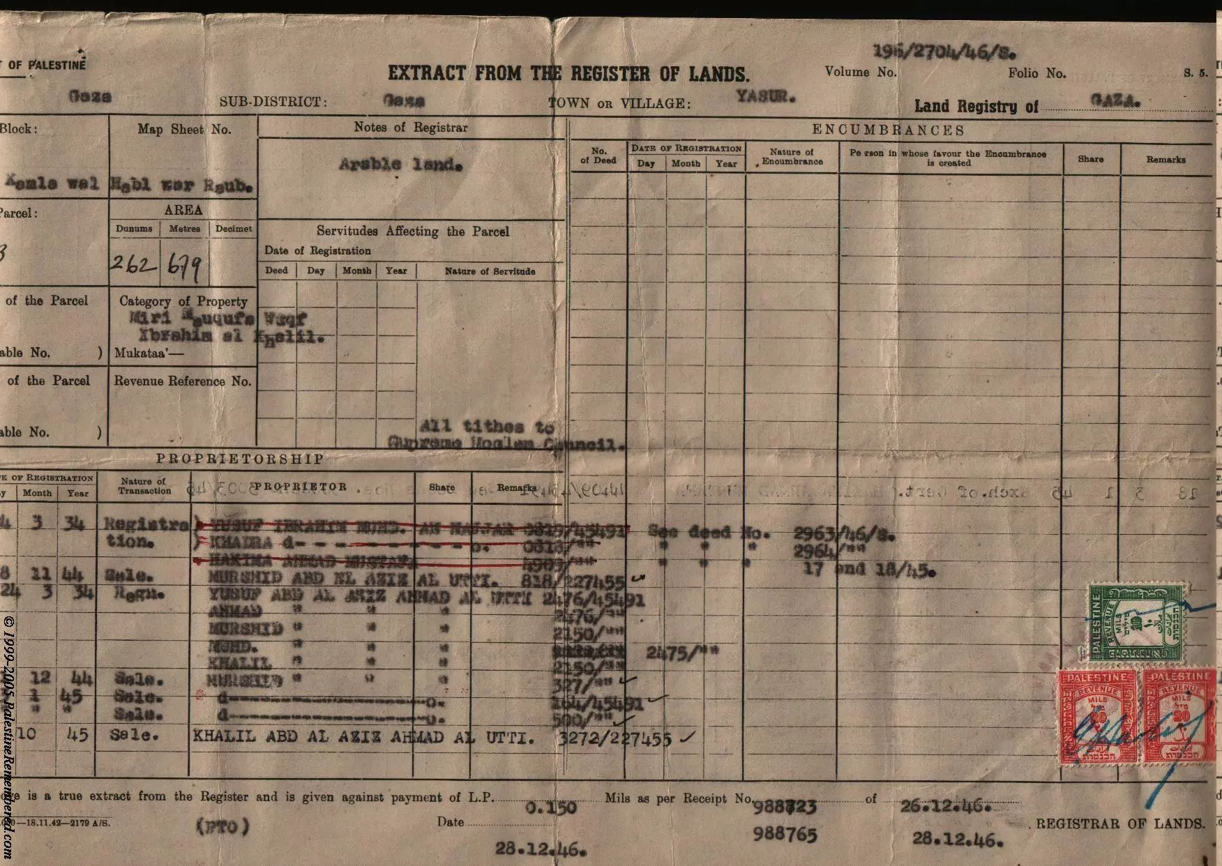
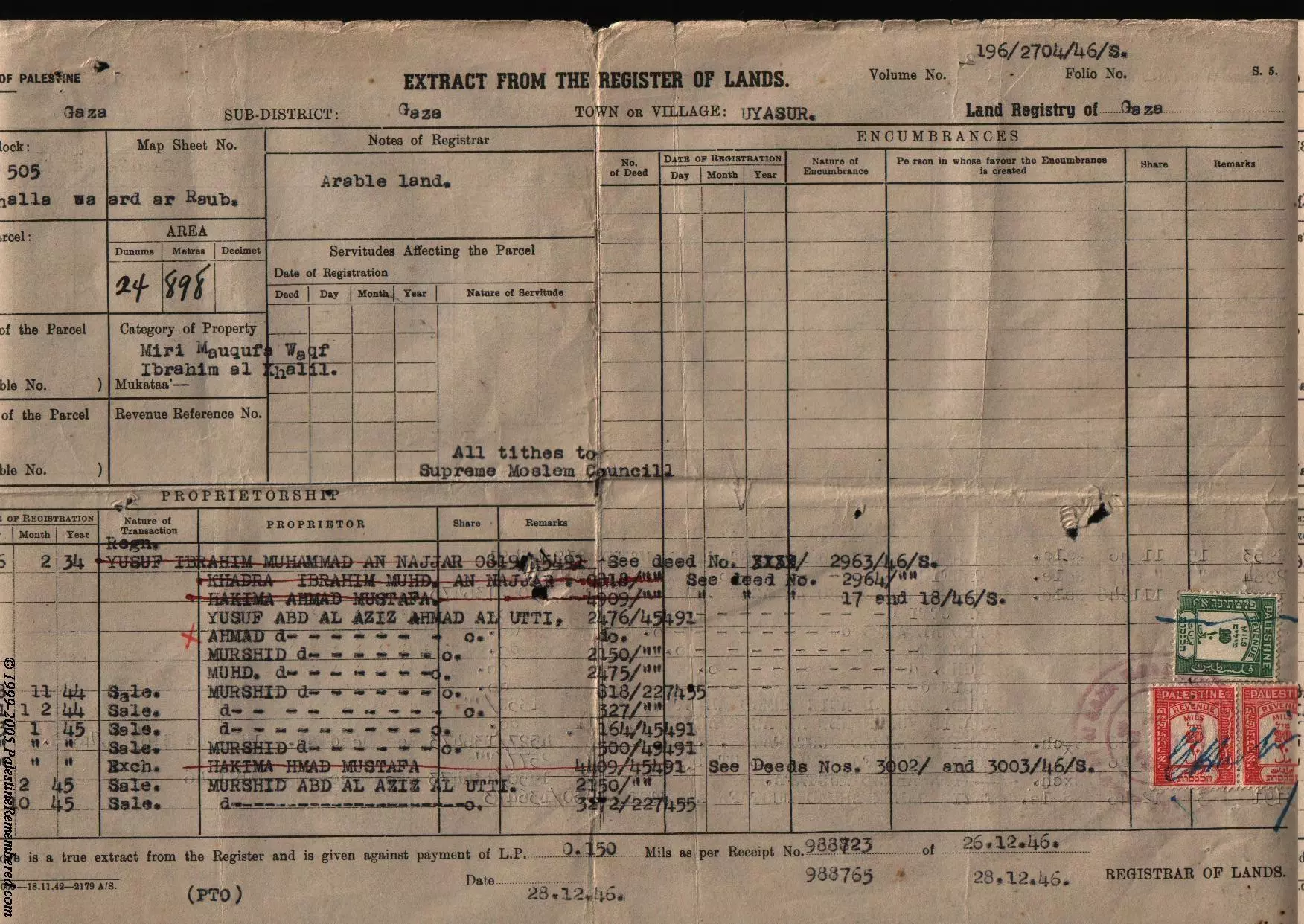
Posted by abu raya - كواشين ارض وفرت لنا غضون مقابلة عبدالعزيز العطي لتدوين شهادته عن النكبة
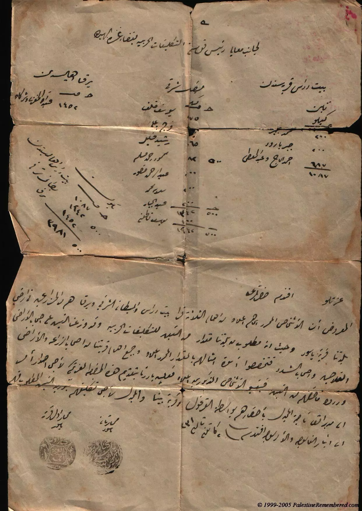
- كواشين ارض وفرت لنا غضون مقابلة عبدالعزيز العطي لتدوين شهادته عن النكبة #2
- كواشين ارض وفرت لنا غضون مقابلة عبدالعزيز العطي لتدوين شهادته عن النكبة #3
- كواشين ارض وفرت لنا غضون مقابلة عبدالعزيز العطي لتدوين شهادته عن النكبة #4
- كواشين ارض وفرت لنا غضون مقابلة عبدالعزيز العطي لتدوين شهادته عن النكبة #5
- كواشين ارض وفرت لنا غضون مقابلة عبدالعزيز العطي لتدوين شهادته عن النكبة #6
- كواشين ارض وفرت لنا غضون مقابلة عبدالعزيز العطي لتدوين شهادته عن النكبة #7
- كواشين ارض وفرت لنا غضون مقابلة عبدالعزيز العطي لتدوين شهادته عن النكبة #8
- Pre-Nakba Aerial view of the village / صورة من الجو للقرية اخذت قبل النكبة
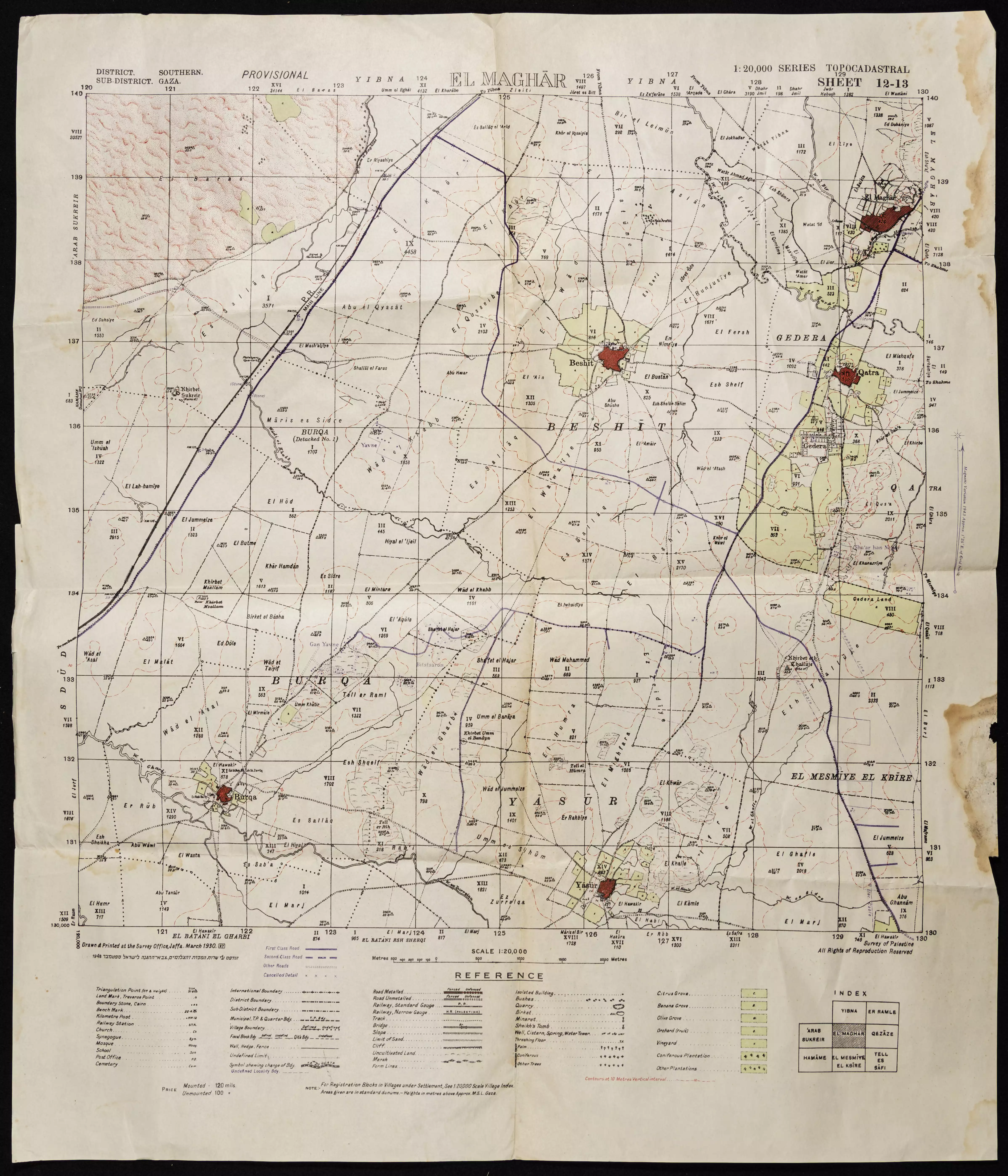
- خارطة تُظهِر الحدود والطرق بأنواعها والأماكن المقدسة والطبيعة الطوبغرافية من تلال وسهول ومنحدرات والتشكيلة الطبيعية للأرض وأنواع المزروعات. نُشرت الخريطة فترة الانتداب البريطاني، تم إضافة تعديلات عليها من قِبَل خدمة الخرائط والصور التابعة للقوات العسكرية الاسرائيلية فترة الأربعينيات.
- عبد اللطيف محمد عرب
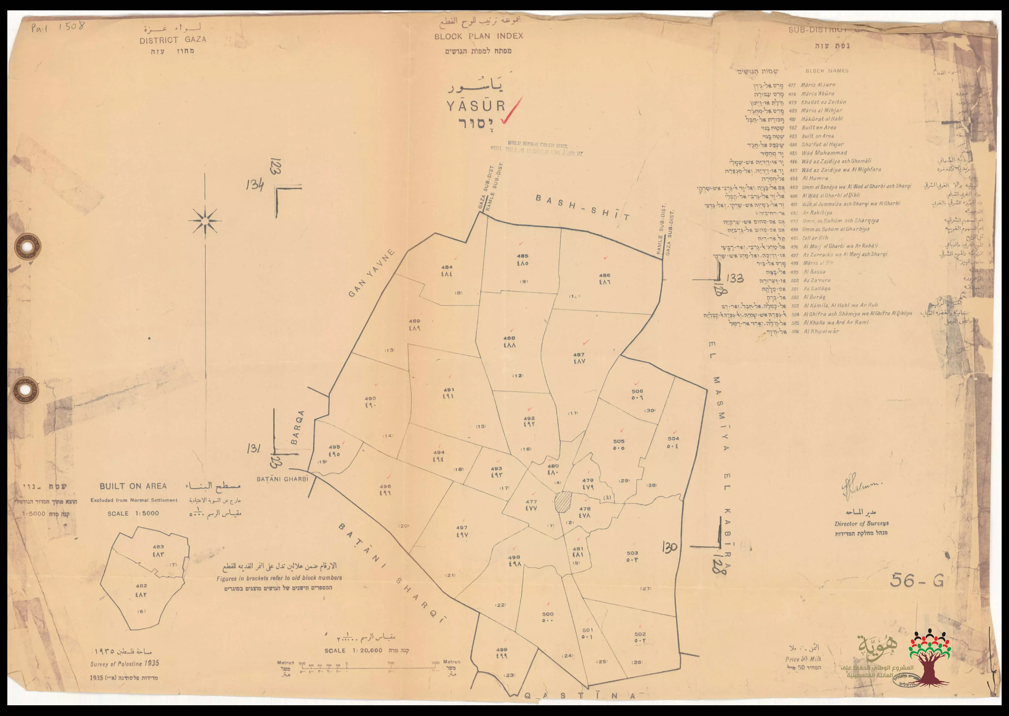
Posted by صامد أبو عرب - خريطة أراضي ياصور عام 1935 وتظهر فيها أسماء قطع الأراضي باللغات العربية والانجليزية والعبرية.
-
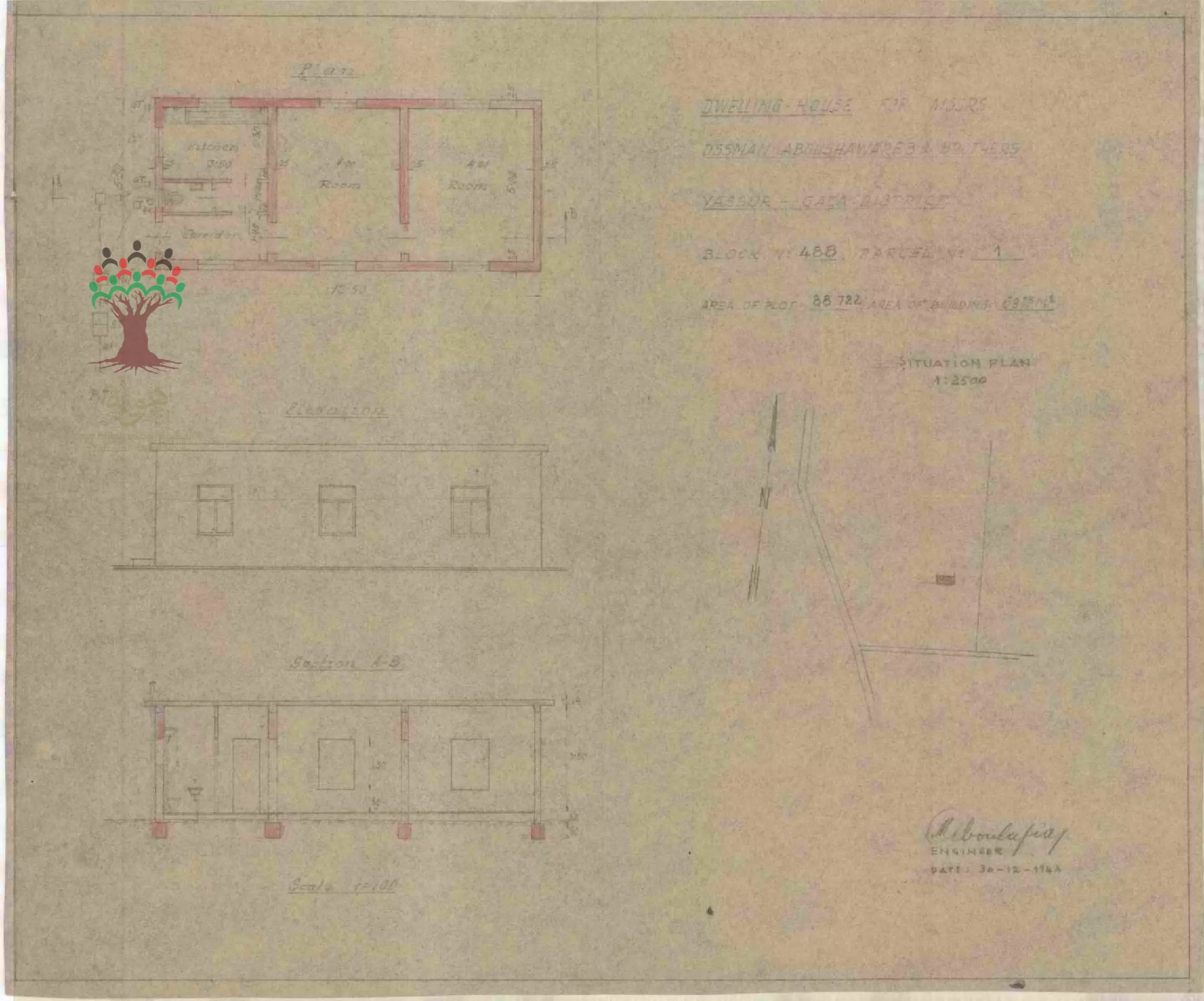
رسم بناء - عثمان أحمد أبو شوارب - ياصور
-
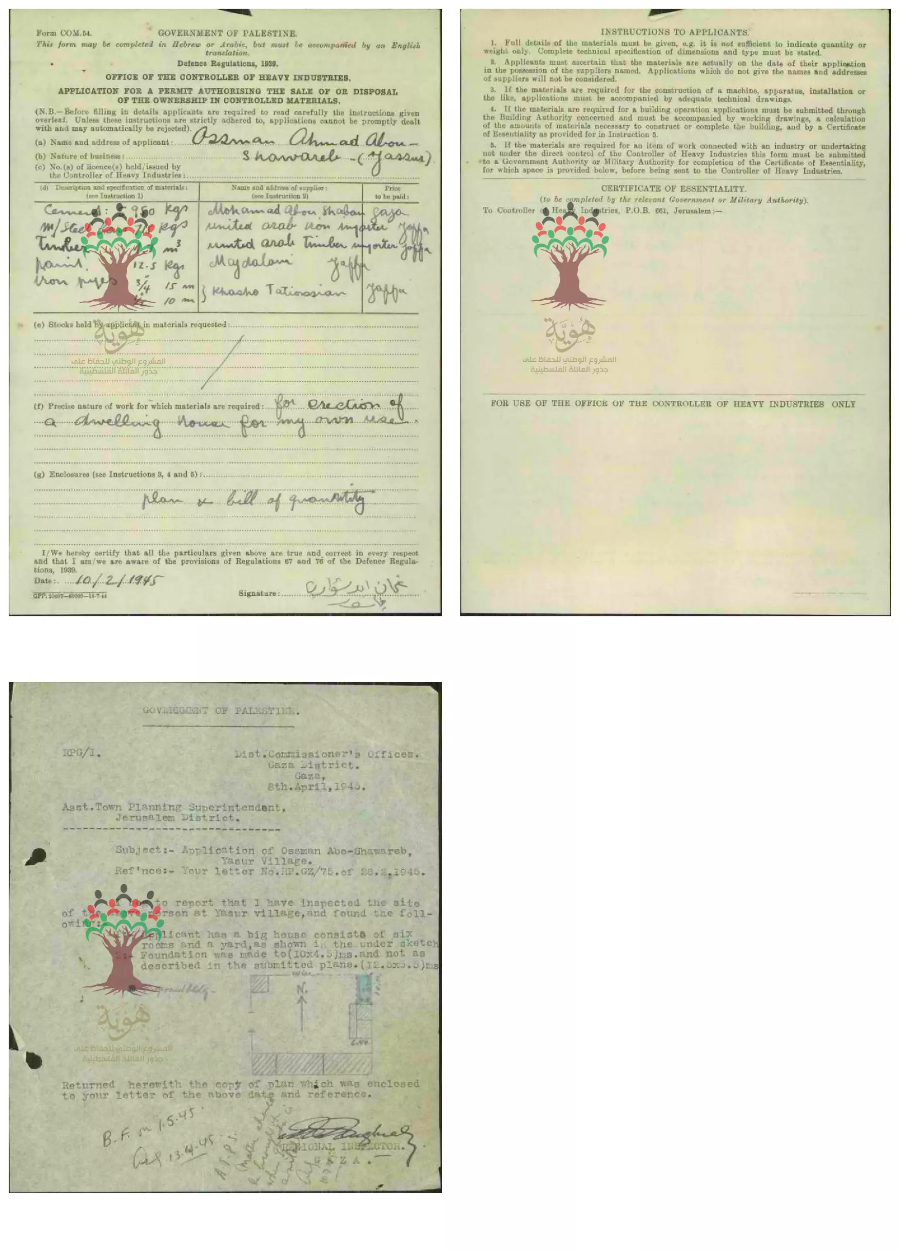
طلب مواد بناء لصالح - عثمان أحمد أبو شوارب - ياصور -- 10/02/1945
-
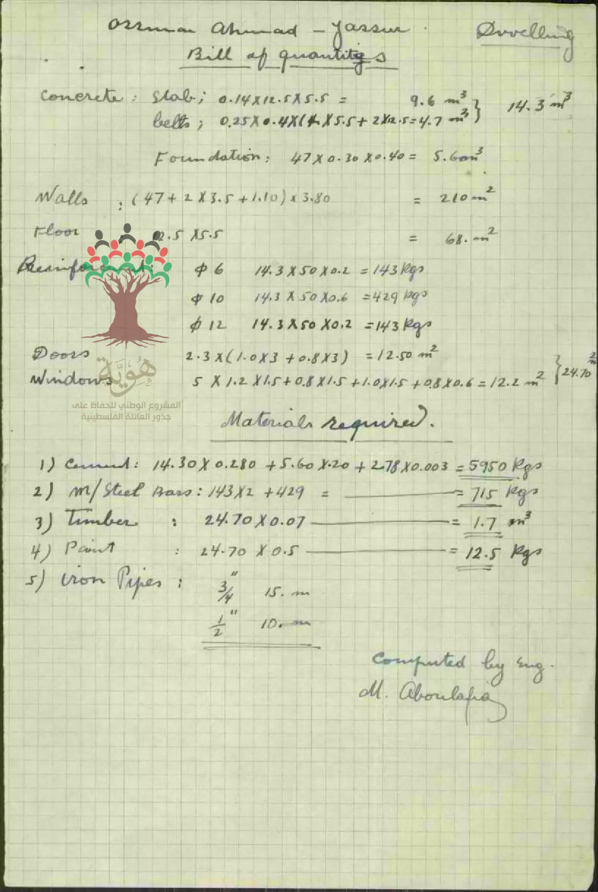
حساب احصائي لمنزل السيد عثمان أحمد أبو شوارب - ياصور
-
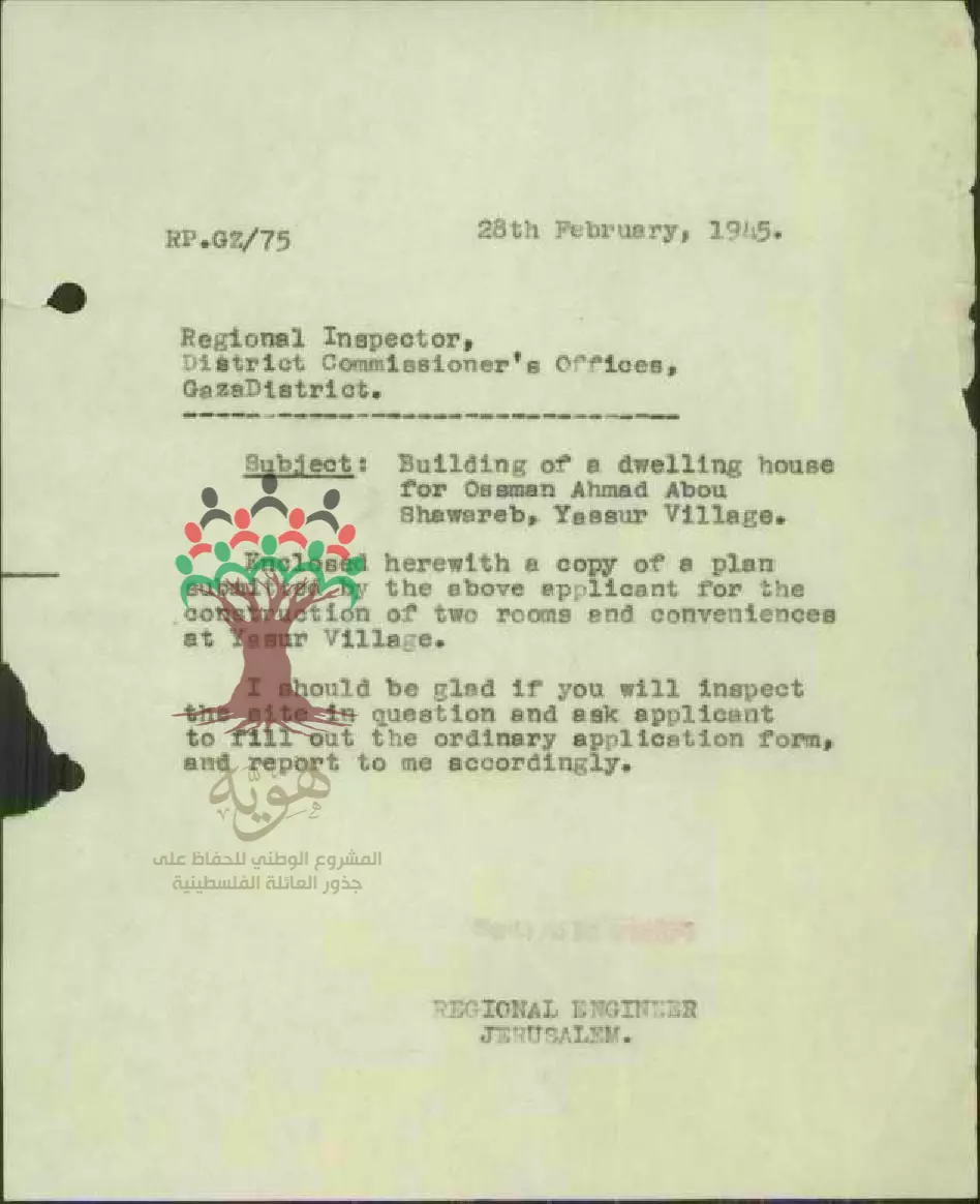
طلب رخصة بناء - عثمان أحمد أبو شوارب - ياصور --- 28/02/1945
Want to browse more? 80,000 pictures were grouped in these gallaries:
- كواشين ارض وفرت لنا غضون مقابلة عبدالعزيز العطي لتدوين شهادته عن النكبة
- كواشين ارض وفرت لنا غضون مقابلة عبدالعزيز العطي لتدوين شهادته عن النكبة #2
- كواشين ارض وفرت لنا غضون مقابلة عبدالعزيز العطي لتدوين شهادته عن النكبة #3
- كواشين ارض وفرت لنا غضون مقابلة عبدالعزيز العطي لتدوين شهادته عن النكبة #4
- كواشين ارض وفرت لنا غضون مقابلة عبدالعزيز العطي لتدوين شهادته عن النكبة #5
- كواشين ارض وفرت لنا غضون مقابلة عبدالعزيز العطي لتدوين شهادته عن النكبة #6
- كواشين ارض وفرت لنا غضون مقابلة عبدالعزيز العطي لتدوين شهادته عن النكبة #7
- كواشين ارض وفرت لنا غضون مقابلة عبدالعزيز العطي لتدوين شهادته عن النكبة #8
-
رسم بناء - عثمان أحمد أبو شوارب - ياصور
-
طلب مواد بناء لصالح - عثمان أحمد أبو شوارب - ياصور -- 10/02/1945
-
حساب احصائي لمنزل السيد عثمان أحمد أبو شوارب - ياصور
-
طلب رخصة بناء - عثمان أحمد أبو شوارب - ياصور --- 28/02/1945
| Display Name | Clan/Hamolah | Country of Residence |
| جدوع | التميمي | الرياض, السعوديه |
| محد المحتسب | التميمي | الاردن |
| ALI ALHAJ | - | - |
| هبه اسماعيل موسى الاحمد | - | - |
| عبد القادر محمد حسن أبو الريش | - | - |
| رياض درويش | - | الزرقاء |
| loranspoker | ALNAMROUTI | AMMAN/ ALASHRAFIYEH , AMMAN |
| jihad harb | - | naharia, فلسطين 48 |
| jehad arab | Arab | Texas, Texas |
| وهيب درويش | درويش | المشيرفة |
| nabeel aldaher | darwish | - |
| Abedellatif | Alohtseeb Eltamimi | PNA, Germany |
| حسن الحاج | المحتسبين | عمان |
| tariq | ghaith | - |
| abo almared | naser | Gaza, jabalia camp |
| صالح سعيد درويش | درويش | - |
| arab | arab | amman, jordan |
| Al-motaz shaheen | Shaheen | Kuwait |
| ismail a. hammad alnatour | ALNATOUR | SAUDI ARABIA |
 Fake Valor: Why Did Zionist Jews Hoist Nazis Flag on Their Ships in the 1930s?
What is new?
-
Facts About Oct. 7th Gaza Raid
-
Remined Us Please: Who Did Rape Whom? Was it Palestinians who raped Israelis? Or, was the other way around? You'll be the judge
-
When Prof. Edward Said was invited to debate Bibi Netanyahu in the 1980s, watch what happened!
-
Ezra Klein of the NY Times on the "Jewish Race".
-
Abusing Blood Libel!
-
How and why Israeli Jewry has become the most hated cult?
-
Did Israeli Soldiers Activate The Hannibal Direective On Oct. 7th? You Be The Judge
-
Zionist FAQ: Isn't it true that Palestinians don't want peace? Palestinians never accepted the two-state solution
- Facts about Haavara (Transfer) Agreement between Ben-Gurion & Hitler
-
Haavara FAQs: Why Did Zionist Jews Hoist Nazis' Flags on Their Ships in the 1930s?
- Haavara FAQs: When Chaim Weizmann met FDR in mid-1943, why was he silent about rescuing European Jewry?
-
Dear ChatGPT: How did Palestinians resist Napoleon's invasion of their country in 1799?
-
Dear ChatGPT: Gaza had a vibrant Jewish community in the mid-17th century. What happened to them?
-
Dear ChatGPT: Why did the Jewish Agency suppress news of the Holocaust during WWII?
-
Video Playlist: Jews share their DNA tests to end the conflict for good.
-
A Tale of Two Conflicts: Examining the Definition of Genocide
-
Prof. Abraham Polak And The Suppressed History of the Khazars and European Jewry
-
How Ronald Reagan would have framed the genocide in Gaza if he were still alive?
-
Haavara FAQs: Let us do the math: how many German Jews did The Haavara Agreement save?
-
Zionist FAQs: The Hebron Massacre of 1929, "clearly proves" that Palestinians are antisemitic, how could you deny it?
-
Zionist FAQs: Why Anti-Zionist Is Not Antisemitism?
-
Zionist FAQs: Isn't it true that the KGB created Palestinian Nationalism in the early 1960s?
- Zionist FAQs: Muslims are killing Muslims all the time; why are Israeli Jews being singled out in the media?
- Zionist FAQs: How is Israel an apartheid state when 20% of its citizens are Arabs who enjoy full rights?
-
Haavara FAQs: Why Did Dorothy Thompson Flip From A Zionist Advocate to A Silenced Dissenter?
-
Haavara FAQs: Analysis of Herzl's Uganda Scheme and how it could have saved millions of Jews.
-
Haavara FAQs: Why did Hayim Greenberg describe American Jewry as "morally bankrupt" in early 1943?
-
Haavara FAQs: What if the Evian Conference was a resounding success? What would have been the impact of saving European Jewry on Zionism?
- Haavara FAQs: What if the six million were saved, how that would have impacted the Zionist project?
-
Haavara FAQs: How did Zionist leaders react when Europe's Jews lingered in the DP camps after WWII ended?
-
Why does the American Jewish community repeat lies that David Ben-Gurion had debunked before he died?
-
Who has the power to rename the Tatar/Khazar Gene Marker to Jewish IV?
-
Zionist FAQs: Why won't Egypt, Syria, and Jordan take their people back? Jews are indigenous to Palestine, and Arabs immigrated after Jews developed the country. Arabs should leave.
-
Haavara FAQs: Did Hitler and the Nazis conflate between Judaism and Zionist? If that wasn't case, then why?
-
Haavara FAQs: Winston Churchill and antisemitism, a collection of articles written Churchill.
-
Haavara FAQs: Broken by country, how many Jews survived vs. killed during the Holocaust?
-
Haavara FAQs: Why did European Jews vote with their feet and to immigrated to the Americas, not Palestine, after WWII?
-
Watch this American Jewish Girl describing Israeli Jews' cognitive dissonance like no other in under two minutes
-
Haavara FAQs: When the Nazis went out of their way to hide the Holocaust, Israeli Jews did the exact opposite by broadcasting their genocide of Gazans. But why?
-
Haavara FAQs: How Zionist Jews went out of their to show their appreciation to Nazism and Fascism?
- Haavara FAQs: Why Zionist leaders were against bombing the death camps & the Railroads leading to them?
-
Haavara FAQs: Hitler's message to the British and American people: If Jews are such noble citizens and you care about them, how come you're not letting them in? I will gladly ship them to you at my expense, even on luxury liners!
-
A shortlist of Zionist and Israeli false flag operations in the name Jews.
-
The Most Moral Army
- The Land of Kapos (Israel): Where the brave are boycotted and Kapos walk free.
- Why did early Zionists often named their communal enterprises "colonial"?
- Zionist Relations with Nazi Germany by Faris Glubb
-
Two NY Times advertisements by Zionists in the early 1943 that exposes Zionists' treason at the height of the calamity
- Facts Not Lies about the Palestinian-Israeli Conflict.
- Site's pictures have been categorized
- Campgain Against Lice
- A Survey of Palestine, the official source about Palestine before Nakba produced by the British Mandate; over 1200 pages.
- Satellite View & Google Earth: Over 6,000 placemarks identifying all destroyed towns, W. Bank & Gaza Strip Towns, & refugee camps.
- PalestineRemembered.com and its Nakba Oral History Project were featured on al-Jazeera Satellite TV.
- Nakba Oral History Video Podcast:
 Over 700 Oral History interviews (including 3,500+ hours of recording) can be viewed online.
 - Palestine Village Statistics Project
- Gaza Jail Break
- النسخة العربية للموقع الان متوفرة
- Videos: Documenting the destroyed villages in video: Tracing all that remains since Nakba.
- Videos: Responding to Zionist Propaganda
- Interview: The ethnic cleansing of Palestine: George Galloway interviews Israeli Historian Ilan Pappe.
- For Palestinians, memory matters. It provides a blueprint for their future By George Bisharat.
- Zionist FAQ now available in Hebrew שאלות שציונים שואלים, עכשיו בעברית
- Video: The Stephen Walt and John Mearsheimer report on the influence of the Israel Lobby on U.S. Foreign Policy
- The Palestinian-Israeli conflict for beginners
