| PalestineRemembered | About Us | Oral History | العربية | |
| Pictures | Zionist FAQs | Haavara | Maps | |
| Search |
| Camps |
| Districts |
| Acre |
| Baysan |
| Beersheba |
| Bethlehem |
| Gaza |
| Haifa |
| Hebron |
| Jaffa |
| Jericho |
| Jerusalem |
| Jinin |
| Nablus |
| Nazareth |
| Ramallah |
| al-Ramla |
| Safad |
| Tiberias |
| Tulkarm |
| Donate |
| Contact |
| Profile |
| Videos |
Welcome To al-Jura - الجورة (אל-ג'ורה)
|
District of Gaza
Ethnically cleansed days ago |
العربية Google Earth |
 |
Gallery (47) |
- Statistics & Facts
-
Before & After

- Satellite View
- Articles 5
- Pictures 47
- Aerial Views 3
- Land Deeds 1
- Oral History 1
- Members 32
- All That Remains
- Town's Map
- Wikipedia
- Videos 5
- Guest Book 9
- Links 3
| Statistic & Fact | Value | ||||||||||||||
| Occupation Date | November 4, 1948 | ||||||||||||||
| Distance From District | 20 (km) North East of Gaza | ||||||||||||||
| Elevation | 25 (meters) | ||||||||||||||
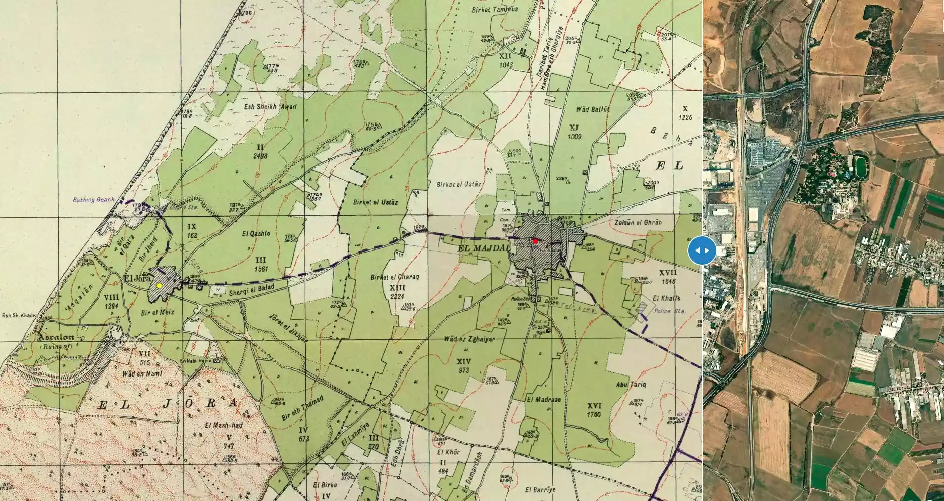
| Before & After Nakba, Click Map For Details |
|||||||||||||||
|
|||||||||||||||
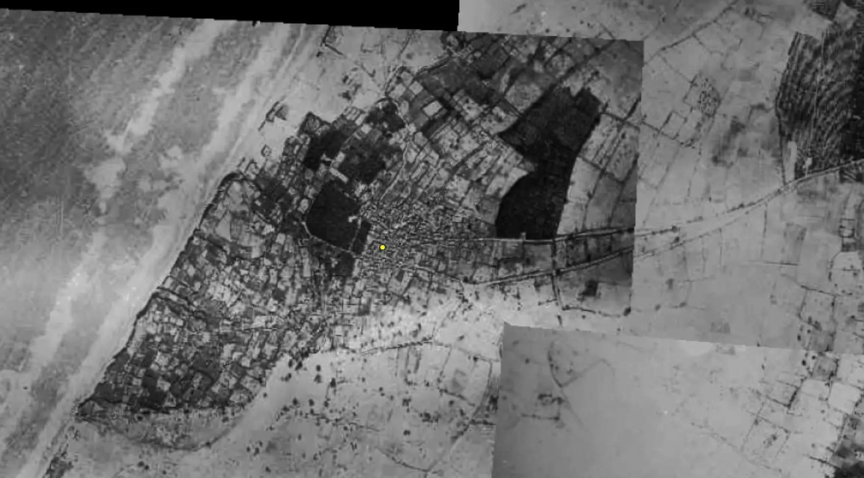
| Pre-Nakba Aerial View |
|||||||||||||||
|
|||||||||||||||
| Map Location | See location #23 on the map View from satellite |
||||||||||||||
| Military Operation | Operation Yo'av | ||||||||||||||
| Attacking Units | Giva'ti Brigade | ||||||||||||||
| Defenders | Egyptian Army | ||||||||||||||
| Exodus Cause | Military assault by Zionist troops | ||||||||||||||
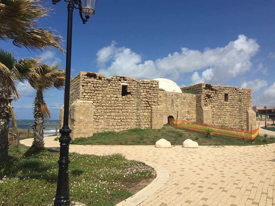
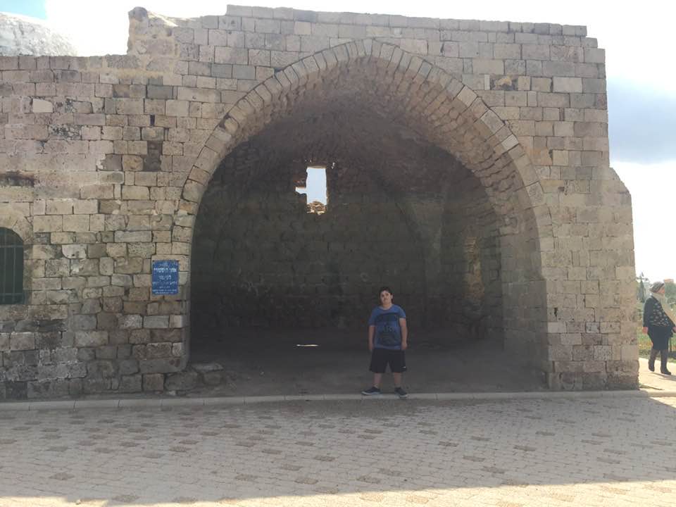
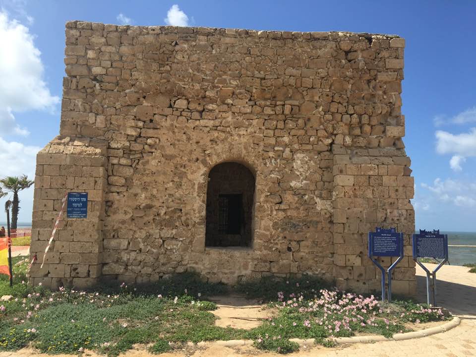
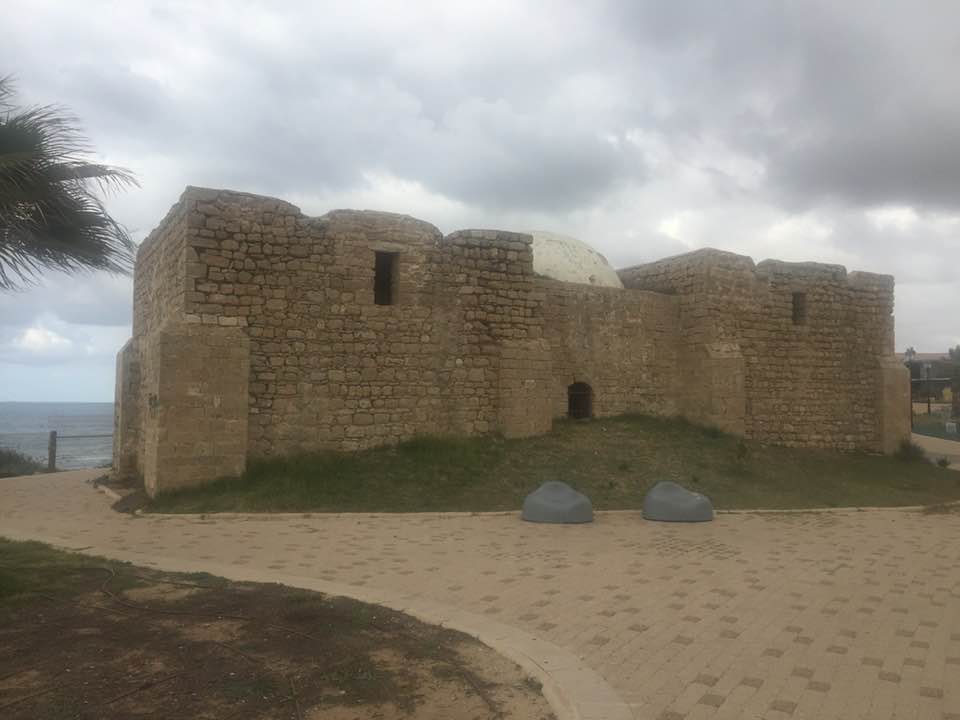
| Village Temains | The village was mostly destroyed with the exception of a single house. | ||||||||||||||
| Ethnically Cleansing | al-Jura inhabitants were completely ethnically cleansed. | ||||||||||||||
| Pre-Nakba Land Ownership |
**Town Lands' Demarcation Maps |
||||||||||||||
| Land Usage As of 1945 |
|
||||||||||||||
| Population |
|
||||||||||||||
| Number of Houses |
|
||||||||||||||
| Near By Towns |
|||||||||||||||
|
|||||||||||||||
| Town's Name Through History | Jurat Ascalon | ||||||||||||||
| Schools | al-Jiyya had an elementary school for boys which was founded in 1919, and in 1945 it had an enrollment of 206 students. | ||||||||||||||
| Places of Warship | One mosque | ||||||||||||||
| Exculsive Jewish Colonies Who Usurped Village Lands |
The city of Ashqelon is occupying village lands. | ||||||||||||||
| Featured Video | |||||||||||||||
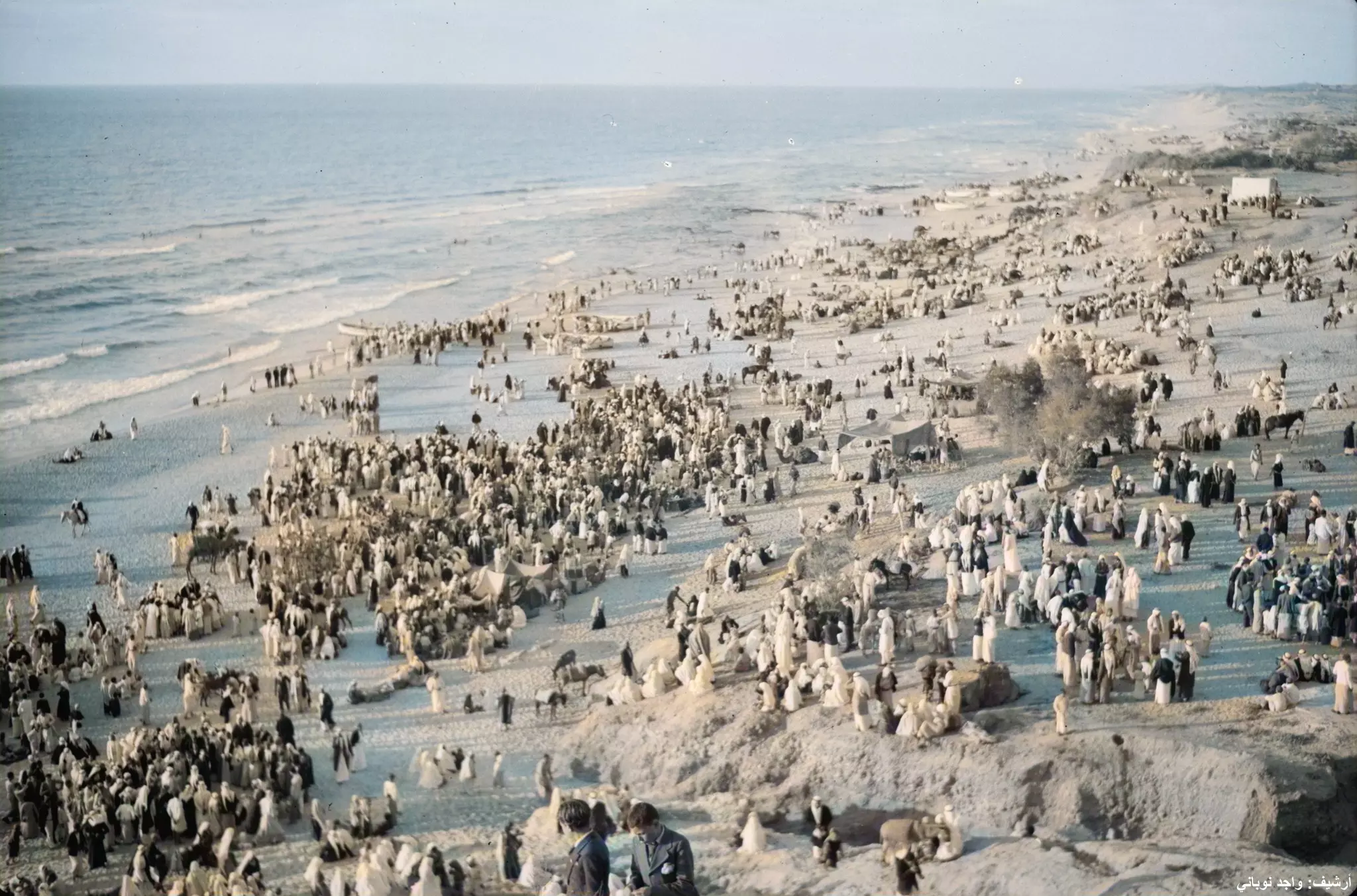
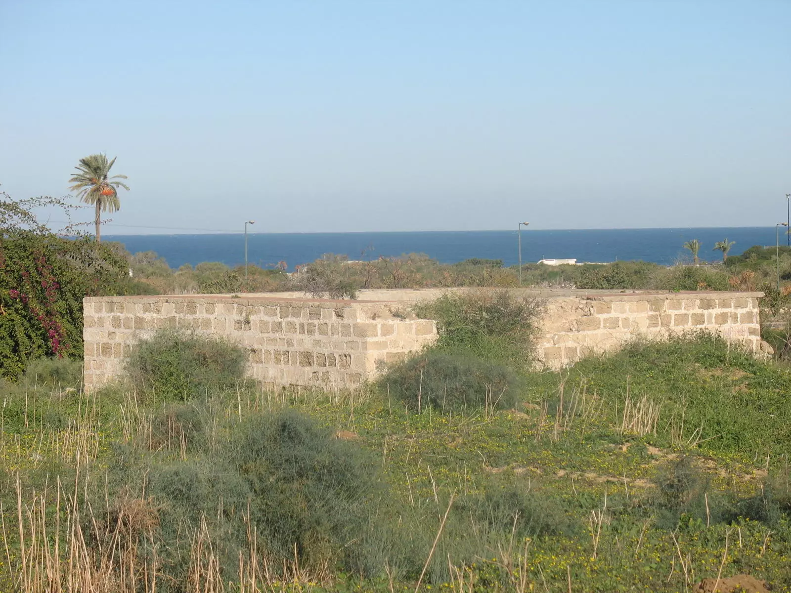
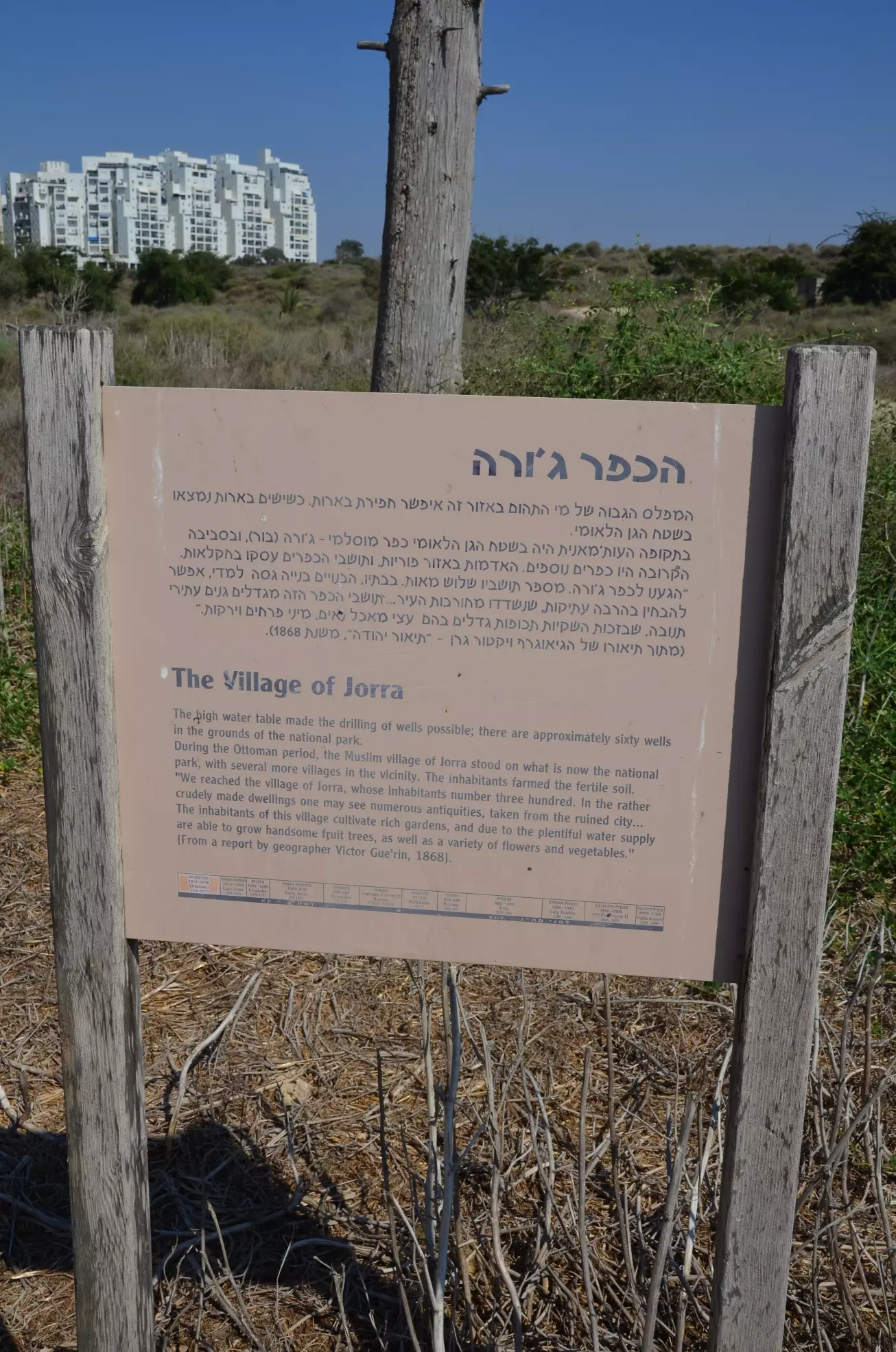
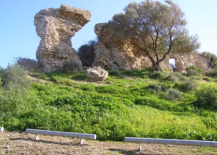
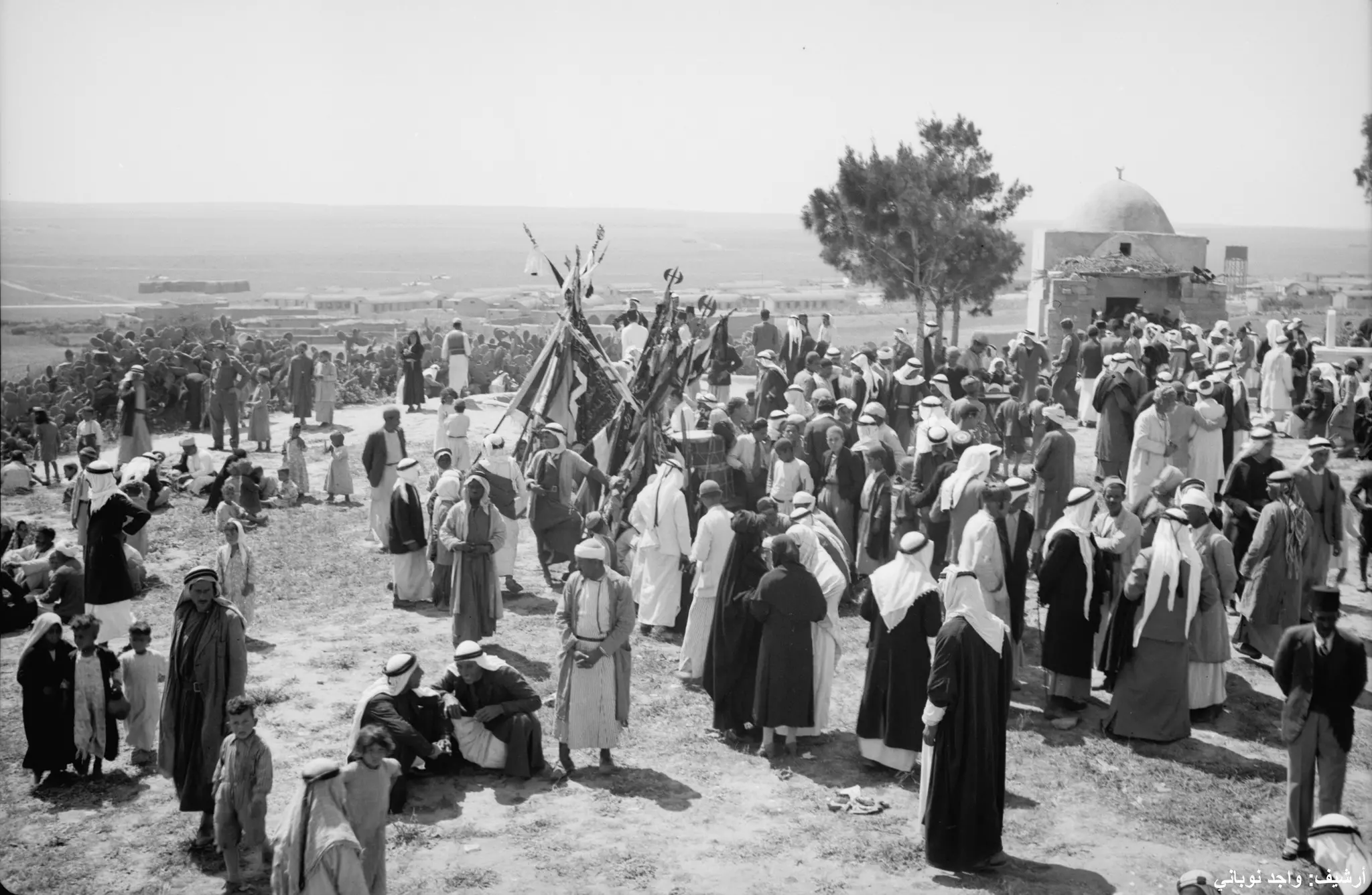
Village Before NakbaThe village stood on flat ground less than 1 km from the seashore, surrounded by sandy hills. To the south lay an expanse of sand known as rimal Ascalon (the 'sands of Ascalon') that had been formed by the gradual movement of coastal sand dunes. Al-Jura, also known as Jurat Ascalon to distinguish it from other villages with the same first name, was thought to have been established on the ruins of an ancient village known during Roman times as Jagur. The village appears in the Ottoman records of the late sixteenth century as Jawra/Jawrit al-Hajja. It was in the nahiya of Gaza (liwa' of Gaza) and had a population of 253. The Syrian Sufi traveler Mustafa al-Bakri al-Siddiqi, who journeyed in the region in the mid-eighteenth century, reported that he visited the village before resuming his trip to Hamama. In the late nineteenth century, the village of al-Jura was situated on flat ground on the outskirts of Ascalon. It was rectangular in shape. Al-Jura's residents, all of them Muslims, built their houses of adobe bricks and stone brought in from the khirbas of Ascalon. They maintained a village mosque with a two-room annex for guests from other localities. They also had a school that was founded in 1919; its enrollment totaled 206 students in the 1940s. The mosque, school, and marketplace were all located at the center of the village.Al-Jura was 5 km west of the city of al-Majdal. Because it was on the coast it was cooler during the summer than the areas farther inland; thus it served as a summer resort for the residents of al-Majdal. An annual spring mawsim (a season of celebration) was held in it, to which people from the cities and villages of Gaza sub-disctrict flocked for swimming, sports events, and religious festivals. A market was organized specially for the occasion where visitors could shop. Al-Jura had a diversified economy. Fishing and bird-hunting were the villagers' main occupations, and their fish and game were sold in several neighboring towns and villages. (In fact, the village was one of the main fishing centers in Palestine.) Next to fishing and hunting, agriculture was the most important occupation. A great variety of rainfed and irrigated crops was cultivated on village land. Some areas were planted with trees that bore citrus, grapes, apricots, apples, and almonds, while other areas were used for growing vegetables, onions, and grain. In 1944/45 a total of 481 dunums was devoted to citrus and bananas, and 2,795 dunums were allocated to cereals; 7,198 dunums were irrigated or used for orchards. Finally, some of the villagers worked in handicrafts, including basketmaking and net-weaving. Village Occupation and Ethnic CleaningThe village was almost certainly occupied at the same time as al-Majdal on 4–5 November 1948, at the very end of Operation Yoav . Al-Jura was one of the first targets to be bombed during the operation, according to an Egyptian communiqué quoted in the New York Times. On 15 October, United Press International reported from Cairo that Israeli planes had bombed the village, along with Gaza and al-Majdal. Villagers probably fled to the Gaza Strip as a result of the occupation and preliminary attacks from the air on the whole coastal area.Zionists Colonies on Village LandsThe city of Ashqelon was established in 1948 on village lands.Village TodayOnly one of the village houses has been spared; thorny plants grow on the parts of the site not built over by Ashqelon.SourceDr. Walid al-Khalidi, 1992: All That Remains. |
|||||||||||||||
| Related Maps | Town Lands' Demarcation Maps خرائط للقضاء توضح حدود القرى والاودية Town's map on MapQuest View from satellite Help us map this town at WikiMapia |
||||||||||||||
| Related Links | Wikipedia's Page Google Search Google For Images Google For Videos |
||||||||||||||
| More Information | مخطط البلد في كتاب كي لا ننسى في كتاب بلادنا فلسطين المزيد من موقع هوية |
||||||||||||||
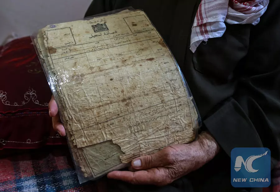
- 80-year-old Palestinian refugee Suleiman Radwan, sits in front of a map showing his birthplace Joarat Askalan village inside his house in a refugee camp in Gaza Strip
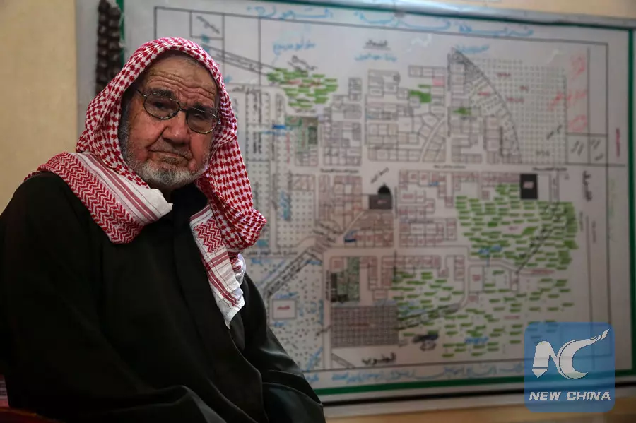
- 80-year-old Palestinian refugee Suleiman Radwan holds land certificate (Kushan) inside his house in a refugee camp in Gaza Strip.
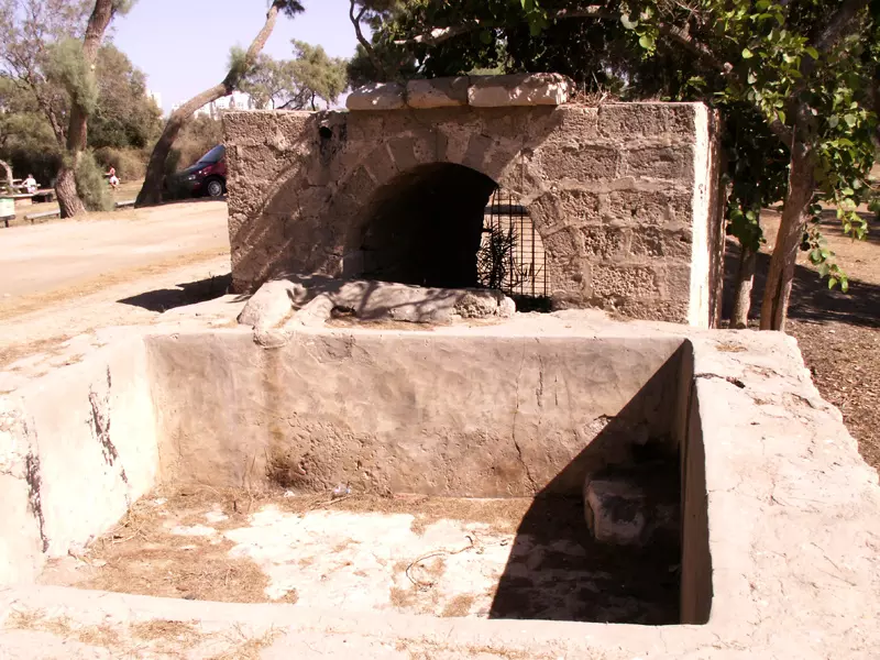
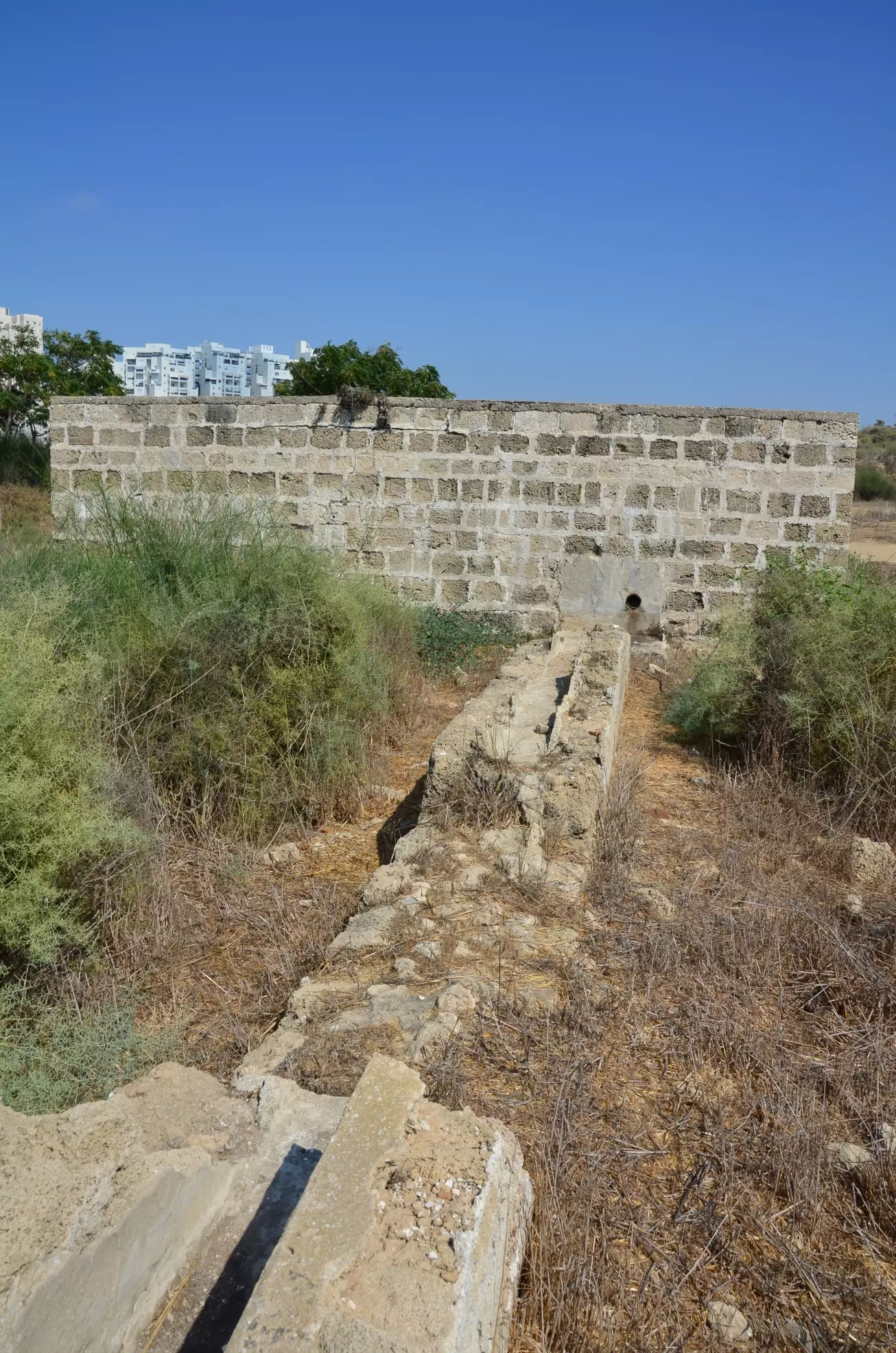
- Well & pool
Posted by Uri Zackhem 2 - Another irrigation pool
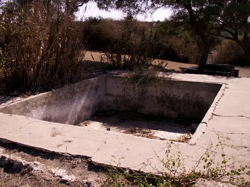
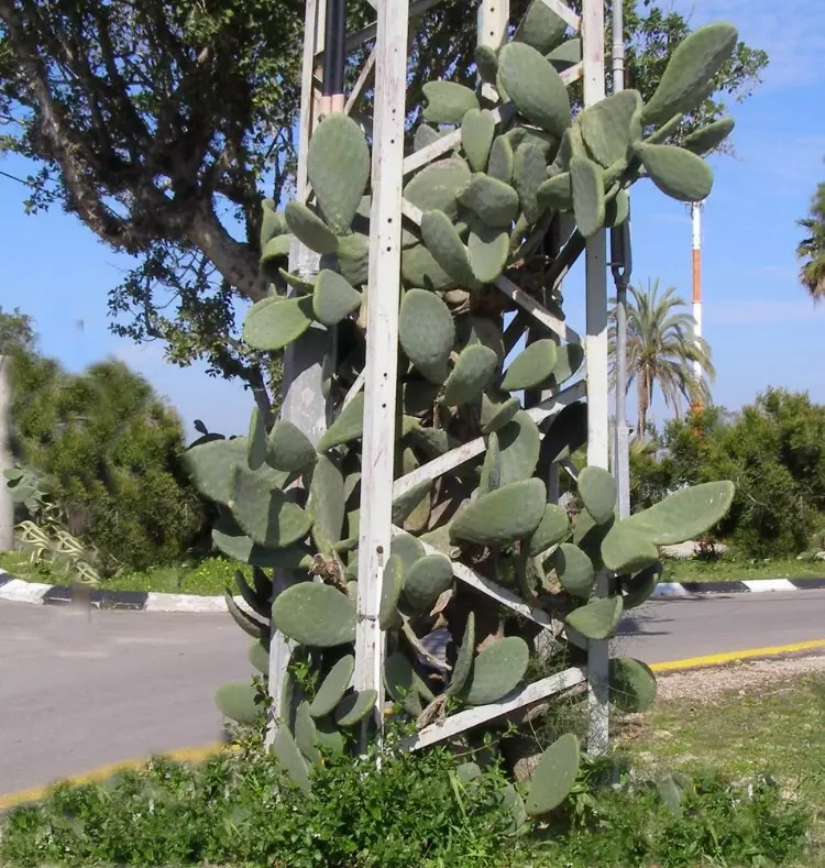
Posted by Uri Zackhem 1 - Another view of the irrigation pool with a cactus.
Posted by Uri Zackhem - A well near the seafront cliff.
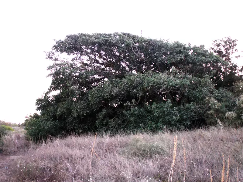
Posted by Uri Zackhem - Sycamore tree not far from thee tomb of Sheikh 'Awwad, north of Jura.
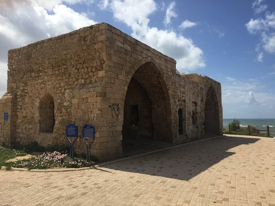
Posted by Uri Zackhem - Sheikh 'Awwad, looking from the south.
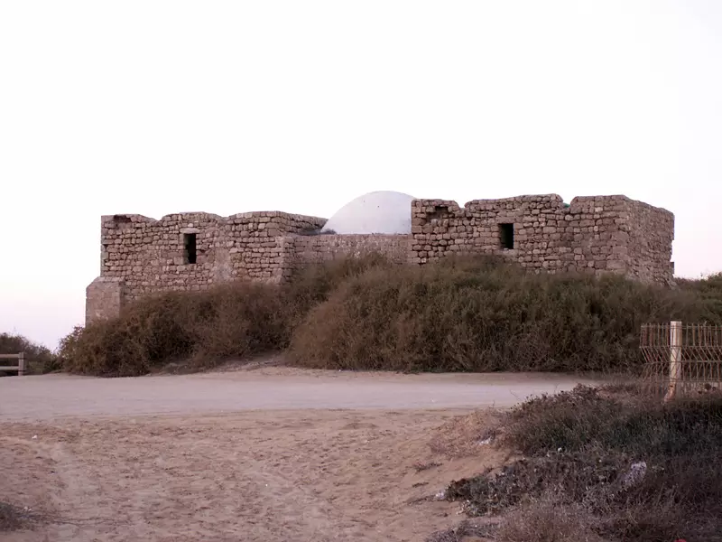
Posted by Uri Zackhem 1 - Sheikh 'Awwad, looking from north.
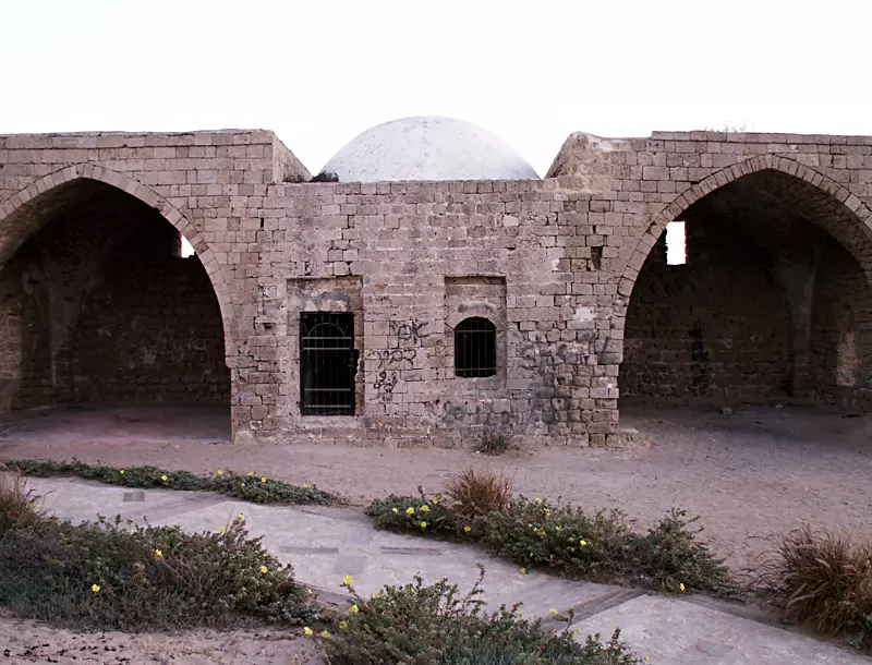
Posted by Uri Zackhem 1 - Sheikh 'Awwad, the tomb.
Posted by Uri Zackhem - Sheikh 'Awwad.
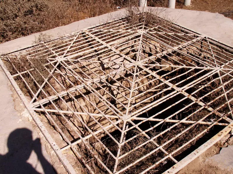
Posted by Uri Zackhem 2 - One of the destroyed village's irrigation pools
Posted by Noga Kadman - شاطيء قرية الجورة

Posted by جوراني - Beach

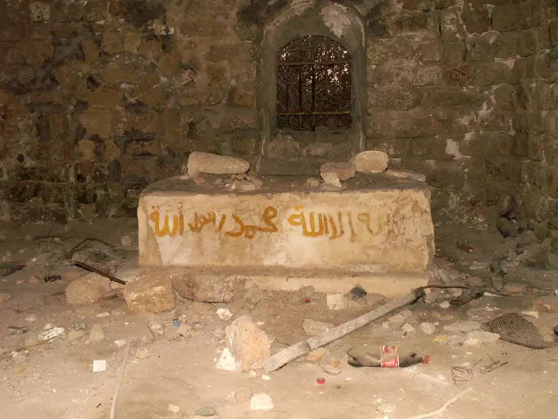
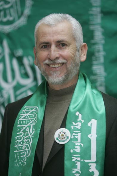
Posted by جوراني 1 - شيخ الأسلام ومنارة( الجورة ) الشهيد الشيخ أحمد ياسين

Posted by ابو عمر 2 - صدقت الله فصدقك فأتخذك شهيداً يا أبن الجورة يا
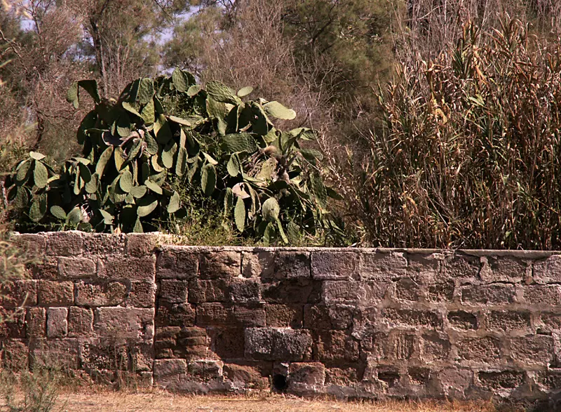
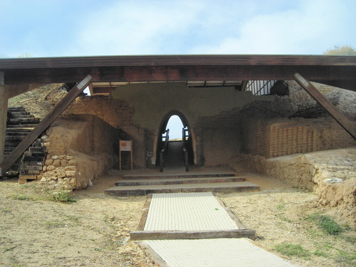
Posted by ابو عمر - احدى البيوت الاثرية
Posted by palestine jura - Sign: Jura. East of the entrance to the natl. park.
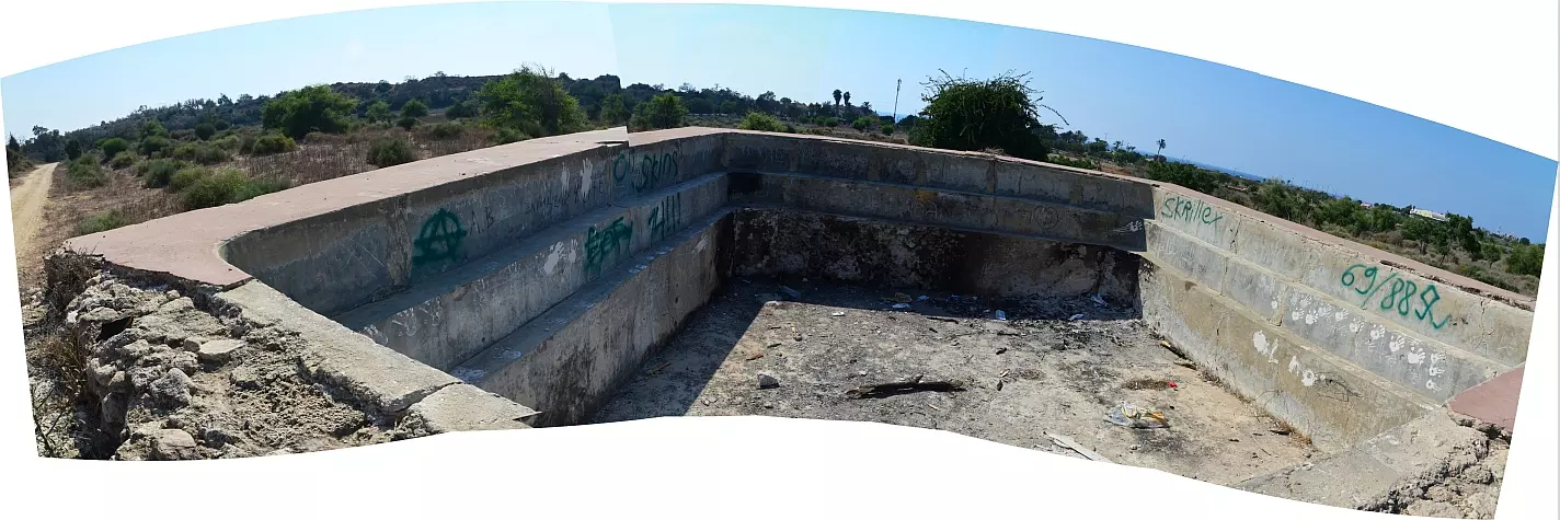
Posted by Uri Zackhem 1 - Large irrigation pool, marked for conservation, east of the natl. park
Posted by Uri Zackhem - The large irrigation pool
Posted by Uri Zackhem - Water carrier coming out of the pool
Posted by Uri Zackhem - Irrigation pool panorama
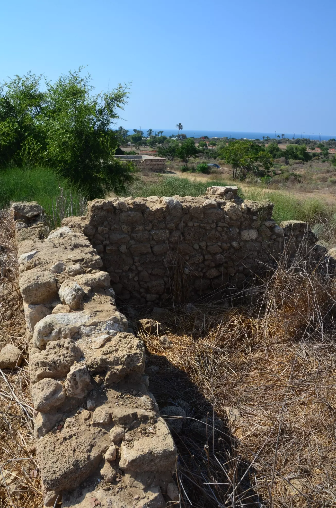
Posted by Uri Zackhem - Remains of a home, the large irrigation pool at the back.
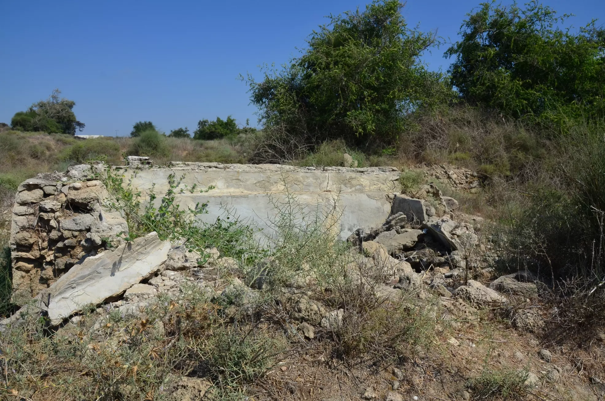
Posted by Uri Zackhem - A small irrigation pool with dom trees (Ziziphus spina-christi) nearby
Posted by Uri Zackhem - الشيخ المجاهد أحمد ياسين .. أبرز أعلام قرية الجورة

Posted by محمد الهبيل - الجوره
Posted by abu raya - الجوره
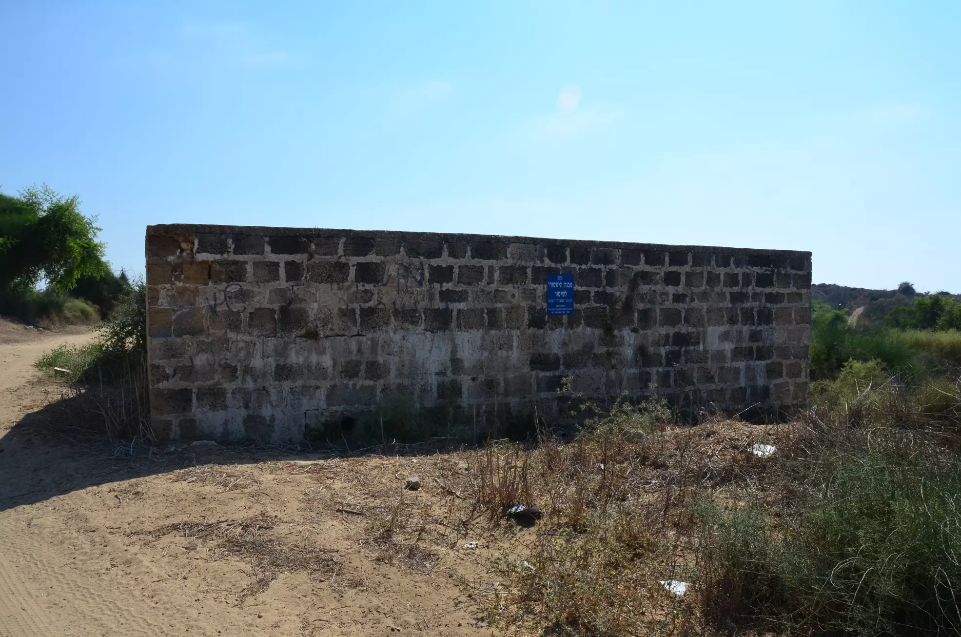
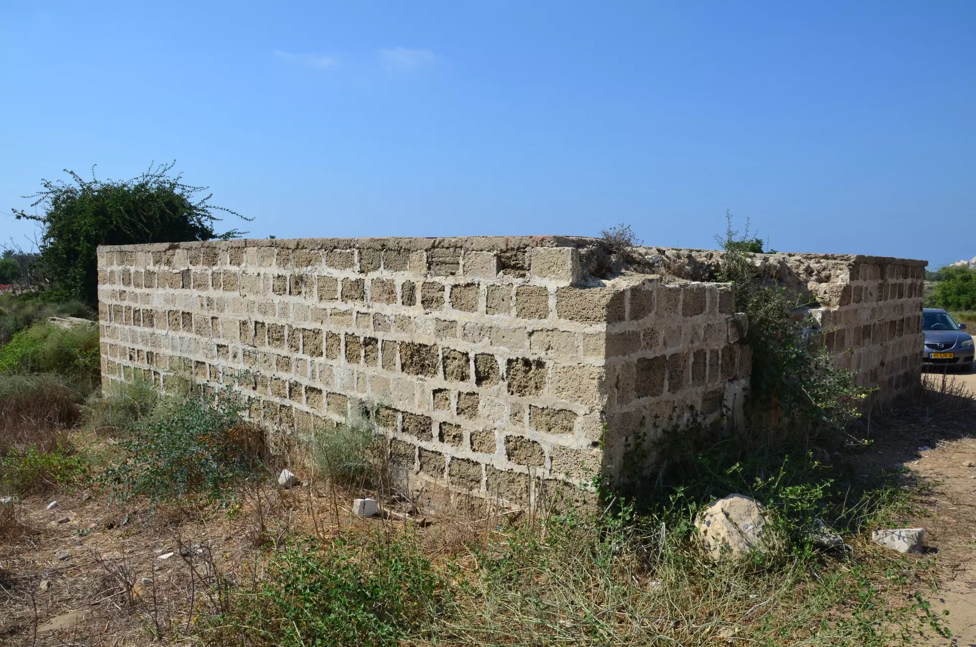
Posted by abu raya - الاثار القديمه غرب القريه
Posted by abu raya - الجوره
Posted by abu raya - الاثار القديمه غرب القريه
Posted by abu raya - الجوره
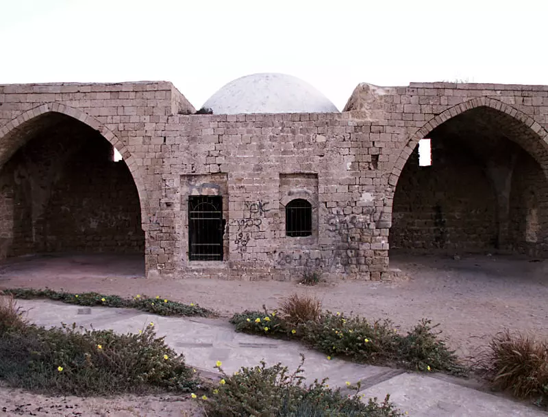
Posted by abu raya - مقام الشيخ عوض في قرية الجورة المهجرة (قضاء غزة )
- Pre-Nakba Aerial view of the village / صورة من الجو للقرية اخذت قبل النكبة
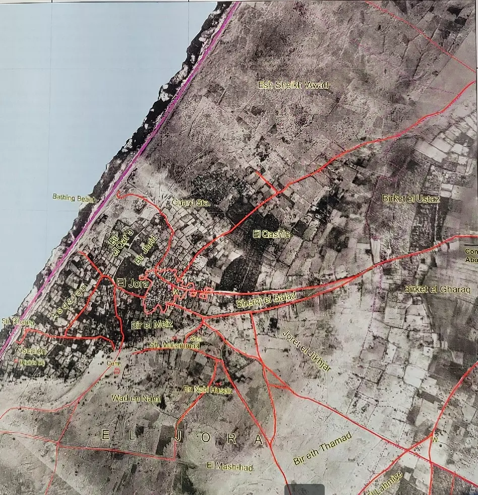
- Pre-Nakba Aerial view of the village / صورة من الجو للقرية اخذت قبل النكبة
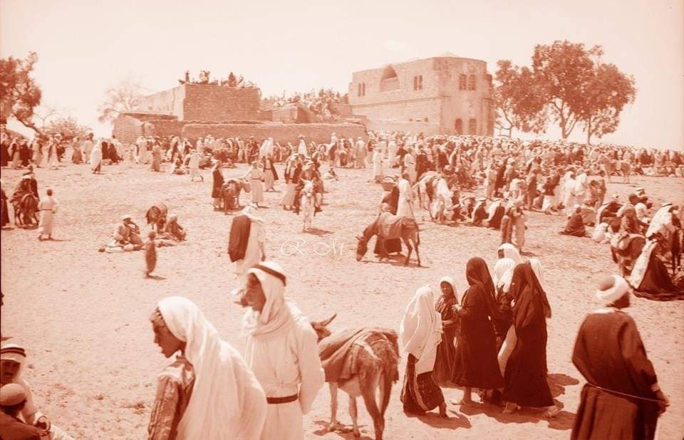
- During one of the seasonal festivals -- 1943 -- منظر عام غضون احد المواسم
- نيسان 1943
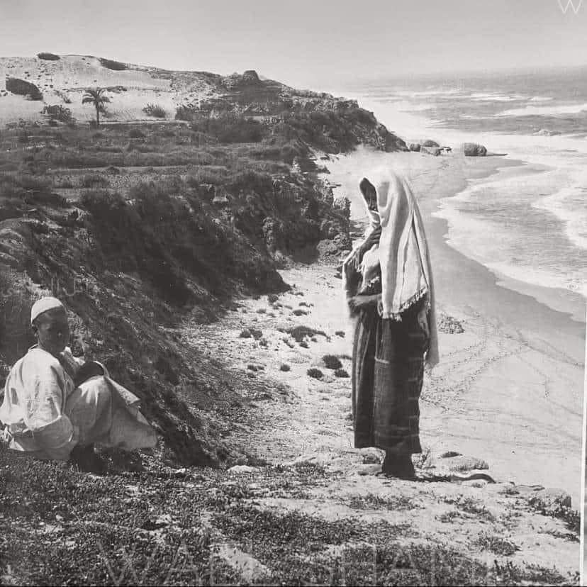
- حوار بين ام وإبنها على شاطىء البحر الابيض المتوسط تحديدا شاطىء عسقلان /فلسطين 1900.
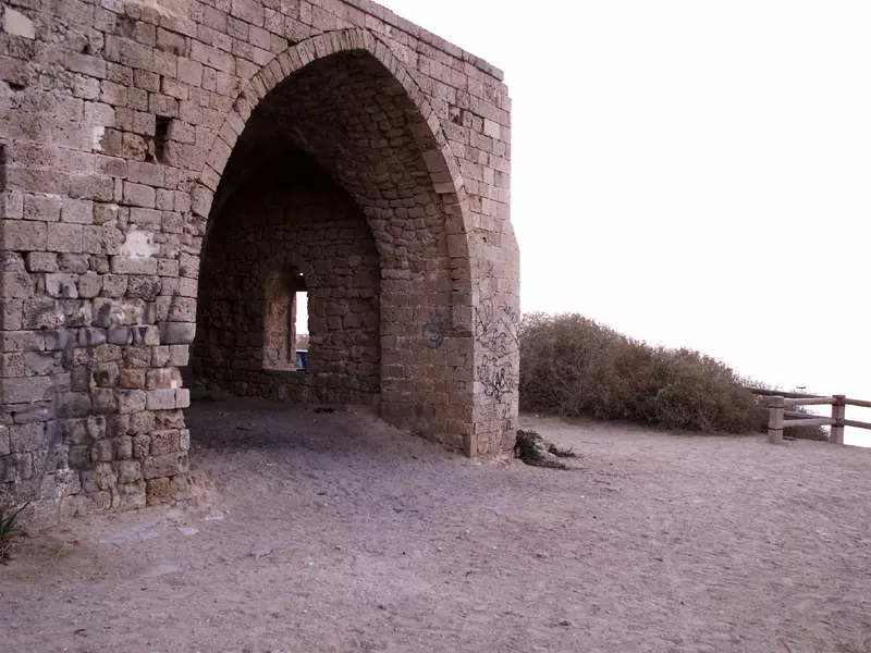
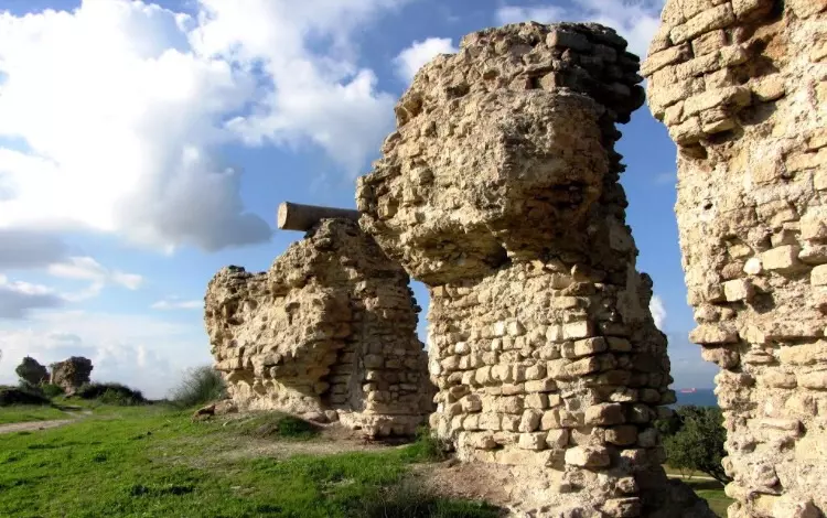
- That is how the "civilized" erased and replaced us: al-Jura was completely obliterated except for the village shrine/maqam for al-Sheikh 'Awad, as you see -- الجورة باتت أثر بعد عين بإستثناء بعض المباني. من هنا مر الهمجّ
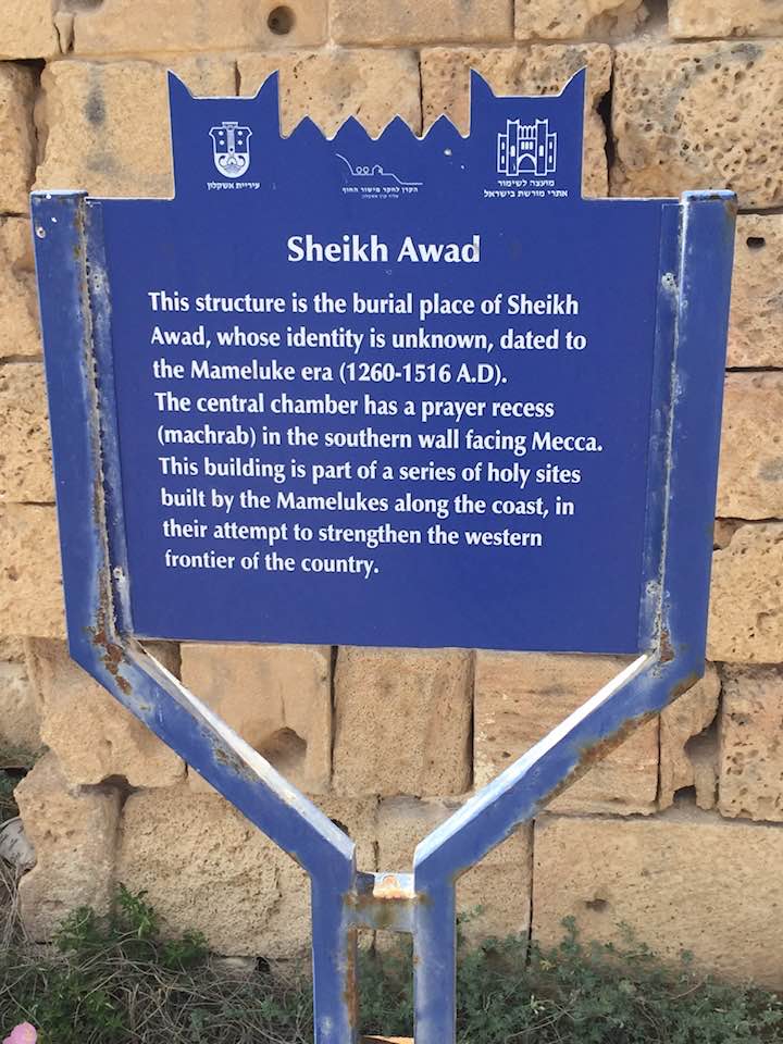
- That is how the "civilized" erased and replaced us: al-Jura was completely obliterated except for the village shrine/maqam for al-Sheikh 'Awad, as you see -- الجورة باتت أثر بعد عين بإستثناء بعض المباني. من هنا مر الهمجّ #2
- That is how the "civilized" erased and replaced us: al-Jura was completely obliterated except for the village shrine/maqam for al-Sheikh 'Awad, as you see -- الجورة باتت أثر بعد عين بإستثناء بعض المباني. من هنا مر الهمجّ #3
- That is how the "civilized" erased and replaced us: al-Jura was completely obliterated except for the village shrine/maqam for al-Sheikh 'Awad, as you see -- الجورة باتت أثر بعد عين بإستثناء بعض المباني. من هنا مر الهمجّ #4
- That is how the "civilized" erased and replaced us: al-Jura was completely obliterated except for the village shrine/maqam for al-Sheikh 'Awad, as you see -- الجورة باتت أثر بعد عين بإستثناء بعض المباني. من هنا مر الهمجّ #5
- That is how the "civilized" erased and replaced us: al-Jura was completely obliterated except for the village shrine/maqam for al-Sheikh 'Awad, as you see -- الجورة باتت أثر بعد عين بإستثناء بعض المباني. من هنا مر الهمجّ #6
- That is how the "civilized" erased and replaced us: al-Jura was completely obliterated except for the village shrine/maqam for al-Sheikh 'Awad, as you see -- الجورة باتت أثر بعد عين بإستثناء بعض المباني. من هنا مر الهمجّ #7
- A rare picture during mousim of al-Hussein way before the "civilized of world Jewry replaced us
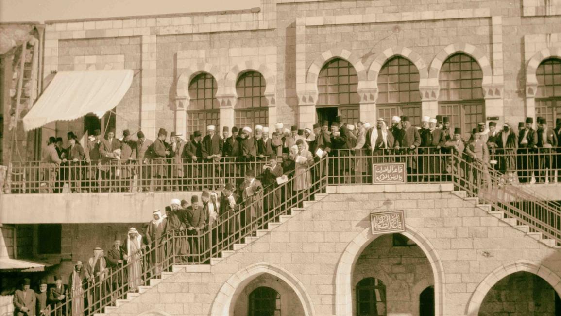
- وقفة احتجاجية ضد الاستعمار البريطاني في مدرسة روضة المعارف بالقدس عام 1929
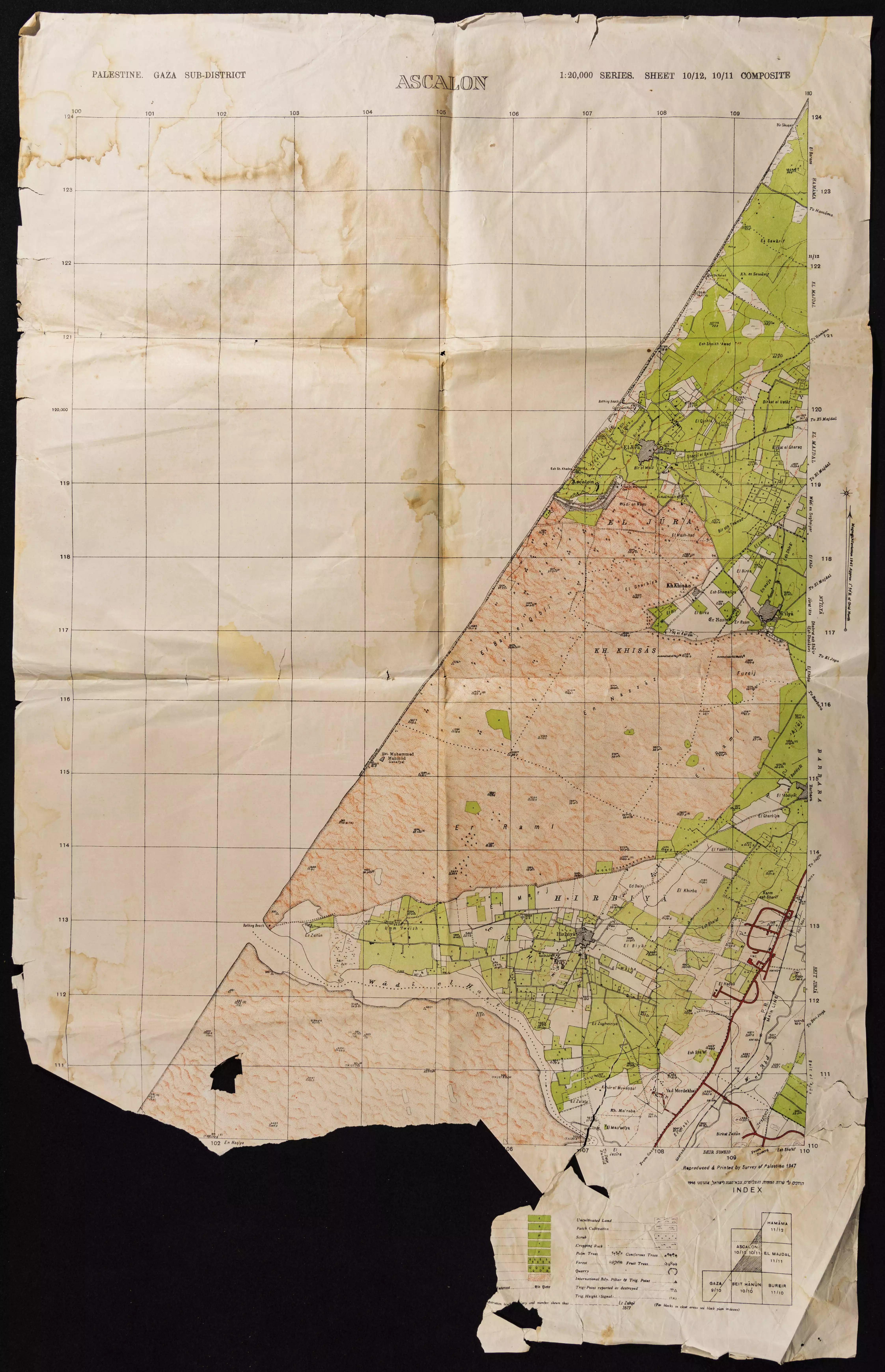
- خارطة تُظهِر الحدود والطرق بأنواعها والأماكن المقدسة والطبيعة الطوبغرافية من تلال وسهول ومنحدرات والتشكيلة الطبيعية للأرض وأنواع المزروعات. نُشرت الخريطة فترة الانتداب البريطاني، تم إضافة تعديلات عليها من قِبَل خدمة الخرائط والصور التابعة للقوات العسكرية الاسرائيلية فترة الأربعينيات.
Want to browse more? 80,000 pictures were grouped in these gallaries:
- 80-year-old Palestinian refugee Suleiman Radwan, sits in front of a map showing his birthplace Joarat Askalan village inside his house in a refugee camp in Gaza Strip
- Pre-Nakba Aerial view of the village / صورة من الجو للقرية اخذت قبل النكبة
- Pre-Nakba Aerial view of the village / صورة من الجو للقرية اخذت قبل النكبة
| Display Name | Clan/Hamolah | Country of Residence |
| عسقلان | كباجة | - |
| ابو عبدالله | - | غزة |
| Mohammed Rouqa | Qannan | Amman |
| Ibrahim Siam | Siam | Gaza |
| abo-maslamh | الجعبري | غزة, فلسطين |
| محمد فرحات | فرحات | Palestine |
| جوراني | البردويل | غزة, فلسطين |
| ابو محمد | النجار | - |
| احمد رمضان حامد | حامد | خانيونس |
| Fadel Matar | Matar | Kuwait |
| فاضل مطر | - | - |
| Yaser Al-Bardawil | Al-Bardawil | Oslo, Norway |
| Muhanad Rouqa | Qannan | SYDNEY, AUSTRALIA |
| Ramy Koussah | KOUSSAH | Sharjah, United Arab Emirates |
| ابا الحارث | matar | غزة |
| FERAS ROUKAH | - | DOHA, QATAR |
| شادى روقة | كسكيل روقة | - |
| ismael radi | راضي | - |
| محمد راضي | راضي | - |
| Basma M | - | Gaza |
| amr | albardaweel | غزة |
| mohammed mattar | mattar | jeddah, saudi arabia |
| Ahmed Seyam | Seyam | Doha, Qatar |
| hani zraid | matar | qatar, qatar |
| Khaled Matar | Matar | Rafah, Palestine_Gaza Strip_Qatar |
| Raghad Koussah | - | - |
| Ismail | Al-Habbash | Saudi Arabia |
| Darwish | Qannan | Riyadh, Saudi Arabia |
| zak ayash | - | - |
| Hala Al Mis-hal | Al Bardaweel | Australia |
| Mattar | Matar | Qatar, Qatar |
| Mahmoud Mattar | Mattar | - |
- Tracing all That Remains of the Israeli usurped & destroyed village of al-Jura Duration: 6 min 16 sec
- Oral History interview with Ibrahim Abu Ghazala Duration: 29 min 2 sec
- مقام الشيخ عوض (جورة عسقلان): زيارة مقام الشيخ عوض الصغير قطب الطريقة العوضية على شاطىء مدينة عسقلان… Duration: 2 min 12 sec
- الكامل بقرية جورة عسقلان: التعرف على قرية ساحلية انجبت القادة والتجوال في مقبرة وادي النمل من أهم المقابر منذ عصر الفتوحات الاسلامية، تابعونا بين اضرحة الصحابة والعلماء الصالحين وزوروا معنا مقام الشيخ محمد واطلعوا على سور عسقلان العظمى. اعادة معالم اختفت تحت الرمال Duration: 14 min 13 sec
- مقام الشيخ العوضي على شاطئ قرية الجورة المهحرة قضاء غزة waze חוף דלילה Duration: 11 sec
 Fake Valor: Why Did Zionist Jews Hoist Nazis Flag on Their Ships in the 1930s?
What is new?
-
Facts About Oct. 7th Gaza Raid
-
Remined Us Please:: Who Did Rape Who? Palestinians Raped Israelis? Or, was the other way around?
-
When Prof. Edward Said was invited to debate Bibi Netanyahu in the 1980s, watch what happened!
-
Ezra Klein of the NY Times on the "Jewish Race".
-
Abusing Blood Libel!
-
Did Israeli Soldiers Activate The Hanniba Direective On Oct. 7th? You Be The Judge
-
Zionist FAQ: Isn't it true that Palestinians don't want peace? Palestinians never accepted the two-state solution
- Facts about Haavara (Transfer) Agreement between Ben-Gurion & Hitler
-
Haavara FAQs: Why Did Zionist Jews Hoist Nazis' Flags on Their Ships in the 1930s?
- Haavara FAQs: When Chaim Weizmann met FDR in mid-1943, why was he silent about rescuing European Jewry?
-
Dear ChatGPT: How did Palestinians resist Napoleon's invasion of their country in 1799?
-
Dear ChatGPT: Gaza had a vibrant Jewish community in the mid-17th century. What happened to them?
-
Dear ChatGPT: Why did the Jewish Agency suppress news of the Holocaust during WWII?
-
Video Playlist: Jews share their DNA tests to end the conflict for good.
-
A Tale of Two Conflicts: Examining the Definition of Genocide
-
Prof. Abraham Polak And The Suppressed History of the Khazars and European Jewry
-
How Ronald Reagan would have framed the genocide in Gaza if he were still alive?
-
Haavara FAQs: Let us do the math: how many German Jews did The Haavara Agreement save?
-
Zionist FAQs: The Hebron Massacre of 1929, "clearly proves" that Palestinians are antisemitic, how could you deny it?
-
Zionist FAQs: Why Anti-Zionist Is Not Antisemitism?
-
Zionist FAQs: Isn't it true that the KGB created Palestinian Nationalism in the early 1960s?
- Zionist FAQs: Muslims are killing Muslims all the time; why are Israeli Jews being singled out in the media?
- Zionist FAQs: How is Israel an apartheid state when 20% of its citizens are Arabs who enjoy full rights?
-
Haavara FAQs: Why Did Dorothy Thompson Flip From A Zionist Advocate to A Silenced Dissenter?
-
Haavara FAQs: Analysis of Herzl's Uganda Scheme and how it could have saved millions of Jews.
-
Haavara FAQs: Why did Hayim Greenberg describe American Jewry as "morally bankrupt" in early 1943?
-
Haavara FAQs: What if the Evian Conference was a resounding success? What would have been the impact of saving European Jewry on Zionism?
- Haavara FAQs: What if the six million were saved, how that would have impacted the Zionist project?
-
Haavara FAQs: How did Zionist leaders react when Europe's Jews lingered in the DP camps after WWII ended?
-
Why does the American Jewish community repeat lies that David Ben-Gurion had debunked before he died?
-
Who has the power to rename the Tatar/Khazar Gene Marker to Jewish IV?
-
Zionist FAQs: Why won't Egypt, Syria, and Jordan take their people back? Jews are indigenous to Palestine, and Arabs immigrated after Jews developed the country. Arabs should leave.
-
Haavara FAQs: Did Hitler and the Nazis conflate between Judaism and Zionist? If that wasn't case, then why?
-
Haavara FAQs: Winston Churchill and antisemitism, a collection of articles written Churchill.
-
Haavara FAQs: Broken by country, how many Jews survived vs. killed during the Holocaust?
-
Haavara FAQs: Why did European Jews vote with their feet and to immigrated to the Americas, not Palestine, after WWII?
-
Watch this American Jewish Girl describing Israeli Jews' cognitive dissonance like no other in under two minutes
-
Haavara FAQs: When the Nazis went out of their way to hide the Holocaust, Israeli Jews did the exact opposite by broadcasting their genocide of Gazans. But why?
-
Haavara FAQs: How Zionist Jews went out of their to show their appreciation to Nazism and Fascism?
- Haavara FAQs: Why Zionist leaders were against bombing the death camps & the Railroads leading to them?
-
Haavara FAQs: Hitler's message to the British and American people: If Jews are such noble citizens and you care about them, how come you're not letting them in? I will gladly ship them to you at my expense, even on luxury liners!
-
A shortlist of Zionist and Israeli false flag operations in the name Jews.
-
The Most Moral Army
- The Land of Kapos (Israel): Where the brave are boycotted and Kapos walk free.
- Why did early Zionists often named their communal enterprises "colonial"?
- Zionist Relations with Nazi Germany by Faris Glubb
-
Two NY Times advertisements by Zionists in the early 1943 that exposes Zionists' treason at the height of the calamity
- Facts Not Lies about the Palestinian-Israeli Conflict.
- Site's pictures have been categorized
- Campgain Against Lice
- A Survey of Palestine, the official source about Palestine before Nakba produced by the British Mandate; over 1200 pages.
- Satellite View & Google Earth: Over 6,000 placemarks identifying all destroyed towns, W. Bank & Gaza Strip Towns, & refugee camps.
- PalestineRemembered.com and its Nakba Oral History Project were featured on al-Jazeera Satellite TV.
- Nakba Oral History Video Podcast:
 Over 700 Oral History interviews (including 3,500+ hours of recording) can be viewed online.
 - Palestine Village Statistics Project
- Gaza Jail Break
- النسخة العربية للموقع الان متوفرة
- Videos: Documenting the destroyed villages in video: Tracing all that remains since Nakba.
- Videos: Responding to Zionist Propaganda
- Interview: The ethnic cleansing of Palestine: George Galloway interviews Israeli Historian Ilan Pappe.
- For Palestinians, memory matters. It provides a blueprint for their future By George Bisharat.
- Zionist FAQ now available in Hebrew שאלות שציונים שואלים, עכשיו בעברית
- Video: The Stephen Walt and John Mearsheimer report on the influence of the Israel Lobby on U.S. Foreign Policy
- The Palestinian-Israeli conflict for beginners
