| PalestineRemembered | About Us | Oral History | العربية | |
| Pictures | Zionist FAQs | Haavara | Maps | |
| Search |
| Camps |
| Districts |
| Acre |
| Baysan |
| Beersheba |
| Bethlehem |
| Gaza |
| Haifa |
| Hebron |
| Jaffa |
| Jericho |
| Jerusalem |
| Jinin |
| Nablus |
| Nazareth |
| Ramallah |
| al-Ramla |
| Safad |
| Tiberias |
| Tulkarm |
| Donate |
| Contact |
| Profile |
| Videos |
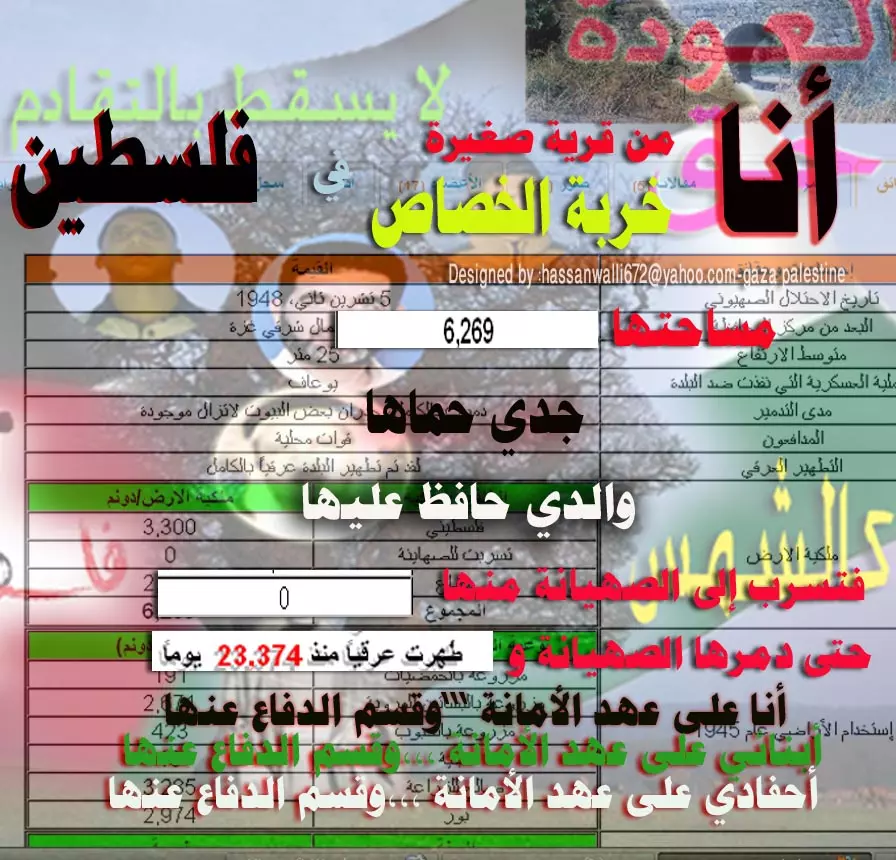
Welcome To al-Khisas - خربة الخِصاص
|
District of Gaza
Ethnically cleansed days ago |
العربية Google Earth |
 |
Gallery (30) |
- Statistics & Facts
-
Before & After

- Satellite View
- Articles 9
- Pictures 30
- Members 19
- All That Remains
- Wikipedia
- Videos 1
- Guest Book 4
- Links 5
| Statistic & Fact | Value | ||||||||||||||
| Occupation Date | November 5, 1948 | ||||||||||||||
| Distance From District | 18.5 (km) North East of Gaza | ||||||||||||||
| Elevation | 25 (meters) | ||||||||||||||
| Before & After Nakba, Click Map For Details |
|||||||||||||||
|
|||||||||||||||
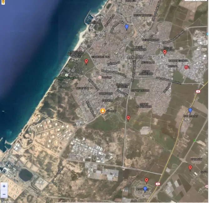
| Map Location | See location #27 on the map View from satellite |
||||||||||||||
| Military Operation | End of Operation Yo'av | ||||||||||||||
| Defenders | Local militia | ||||||||||||||
| Village Temains | The village has been completely destroyed, and only house rubble left behind. | ||||||||||||||
| Ethnically Cleansing | al-Khisas inhabitants were completely ethnically cleansed. | ||||||||||||||
| Pre-Nakba Land Ownership |
**Town Lands' Demarcation Maps |
||||||||||||||
| Land Usage As of 1945 |
|
||||||||||||||
| Population |
|
||||||||||||||
| Number of Houses | In (1931): 26 | ||||||||||||||
| Near By Towns |
|||||||||||||||
|
|||||||||||||||
| Schools | al-Khisas students used to attend school at nearby village of al-Jura. | ||||||||||||||
| Archeological Sites | The villager contained remnants of wells and burial grounds by unknown people. | ||||||||||||||
| Exculsive Jewish Colonies Who Usurped Village Lands |
The village has been engulfed by the nearby city of Ashqelon. | ||||||||||||||
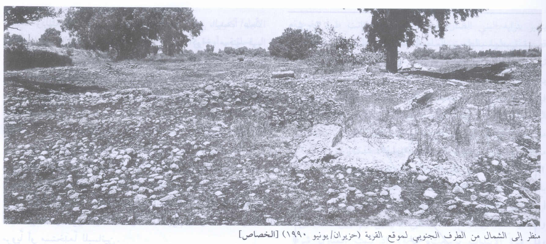
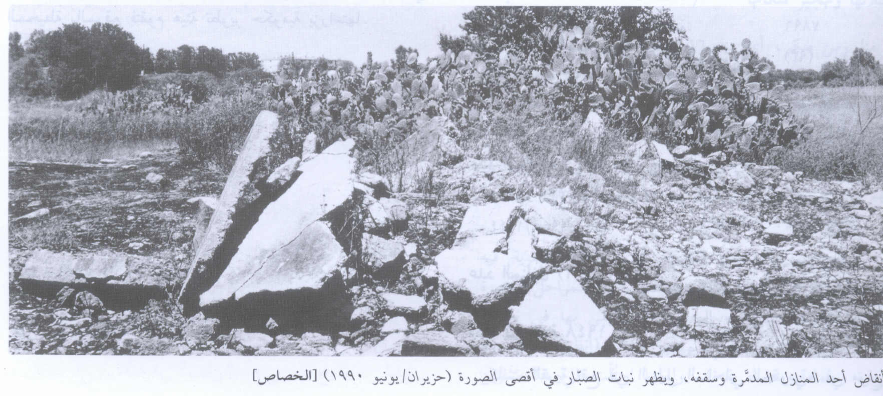
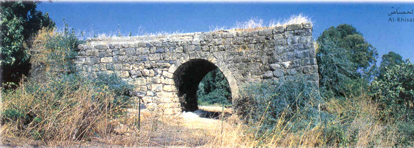
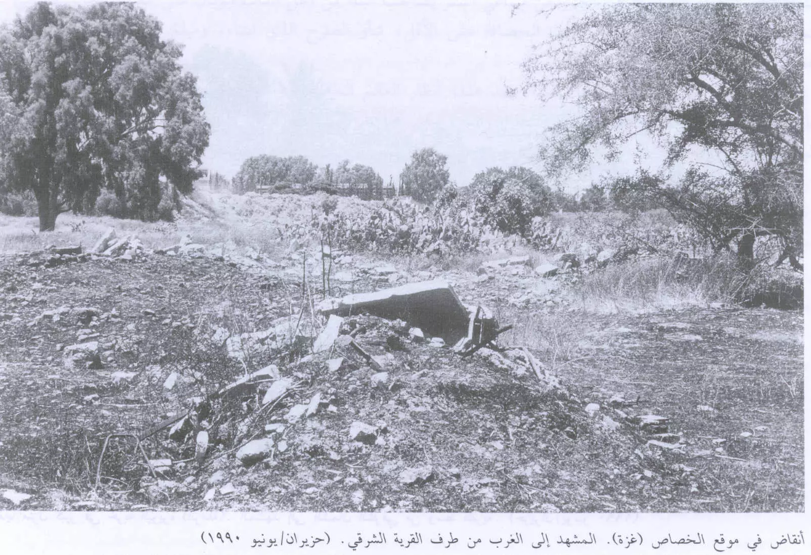
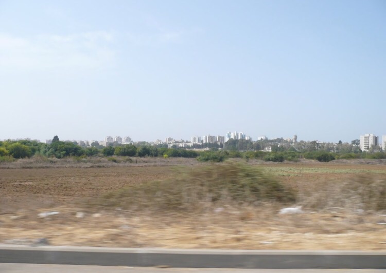
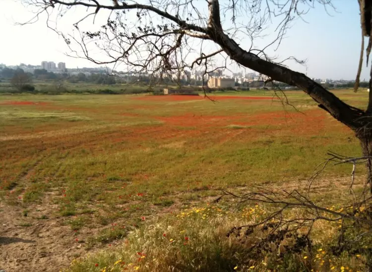
Village Before NakbaThe village stood on a flat spot in the coastal region, surrounded by sand dunes on the northern and western sides (which the villagers prevented from advancing by planting trees). A secondary road linked al-Khisas to the coastal highway about 4 km to the east, giving it access to the cities of al-Majdal and Gaza. It was also connected by paths to the neighboring villages. The site appeared to have been inhabited in earlier times, as evidenced by the remnants of wells and burial grounds.Al-Khisas, which was classified as a hamlet in the Palestine Index Gazetteer, was built on the site of a khirba after World War I. At first, peasants from neighboring areas built temporary huts at the site to shelter themselves during harvest time, then gradually settled and built adobe houses. The village had a square configuration, its houses separated by narrow alleys. The villagers, who were Muslim, relied on al-Majdal and the adjacent villages of al-Jura and Ni'ilya for medical, educational, and administrative services. They obtained water for domestic needs from wells around the village, and grew vegetables and fruit trees (including citrus, grape, fig, almond, and apricot trees), which were irrigated. In 1944/45 a total of 191 dunums was devoted to citrus and bananas and 419 dunums were allotted to cereals; 2,671 dunums were irrigated or used for orchards. Village Occupation and Ethnic CleaningIsraeli troops entered the village at the same time as the city of al-Majdal. This occurred on 4–5 November 1948, at the end of Operation Yoav.Zionists Colonies on Village LandsThe village site has been engulfed by the Israeli town of Ashqelon.Village TodayDemolished houses made of cement and plaster may be seen on the site. Bunches of cactuses, doum palms, sycamores, as well as six very tall eucalyptus trees grow on the site. The surrounding land is cultivated by a governmental development agency.SourceDr. Walid al-Khalidi, 1992: All That Remains. |
|||||||||||||||
| Related Maps | Town Lands' Demarcation Maps خرائط للقضاء توضح حدود القرى والاودية Town's map on MapQuest View from satellite Help us map this town at WikiMapia |
||||||||||||||
| Related Links | Wikipedia's Page Facebook Page Google Search Google For Images Google For Videos |
||||||||||||||
| More Information | في كتاب كي لا ننسى في كتاب بلادنا فلسطين المزيد من موقع هوية |
||||||||||||||
- حرب الذكريات (الفينيق)
- الإنتفاضة وعي لحقيقة الذات .إرادة حياة …ومقاومة
- غزة: الحاجة حليمة المزعنن دفنت تحت أنقاض منزل أخيها
- قصيدة بعنوان أنا غزة-بقلم حسن حسين الوالي
- عذرا أيها القدس لا نملك سوى الدعاء والبكاء والغضب -بقلم حسن حسين الوالي
- عالم أفضل بدون "إسرائيل" -بقلم حسن حسين الوالي
- يوبيل فضي معمد بدماء الشهداء و عبق الوحدة الوطنية
- نبذة تاريخية عن قرية خربة الخِصاص (قضاء غزة) من كتاب (كي لا ننسى)
- تشكيل "رابطة النازحين والمهجرين الفلسطينيين"
- View Of The Destroyed Village And It's Rubble In 1990
- Second View Of The Destroyed Village And It's Rubble In 1990
- The remains of al-Khisas's mosque
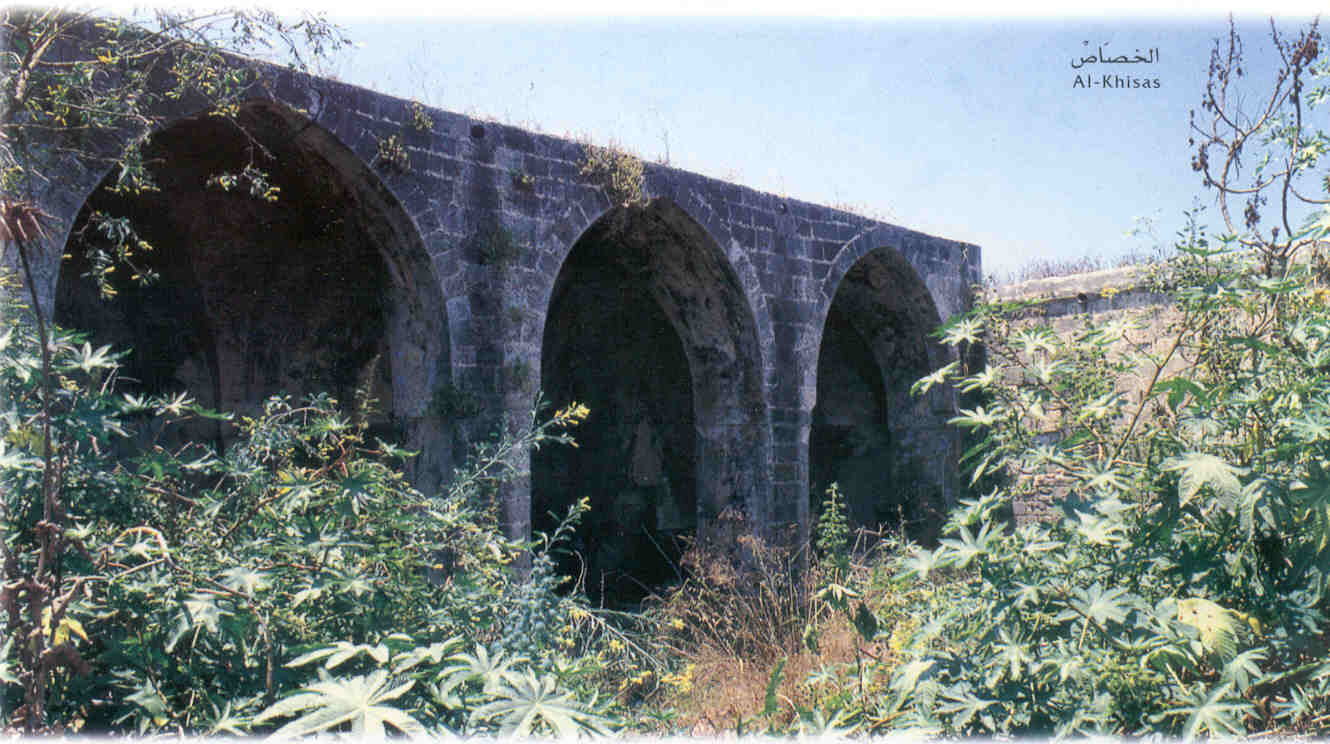
2 - The remains of an arched structure in al-Khisas
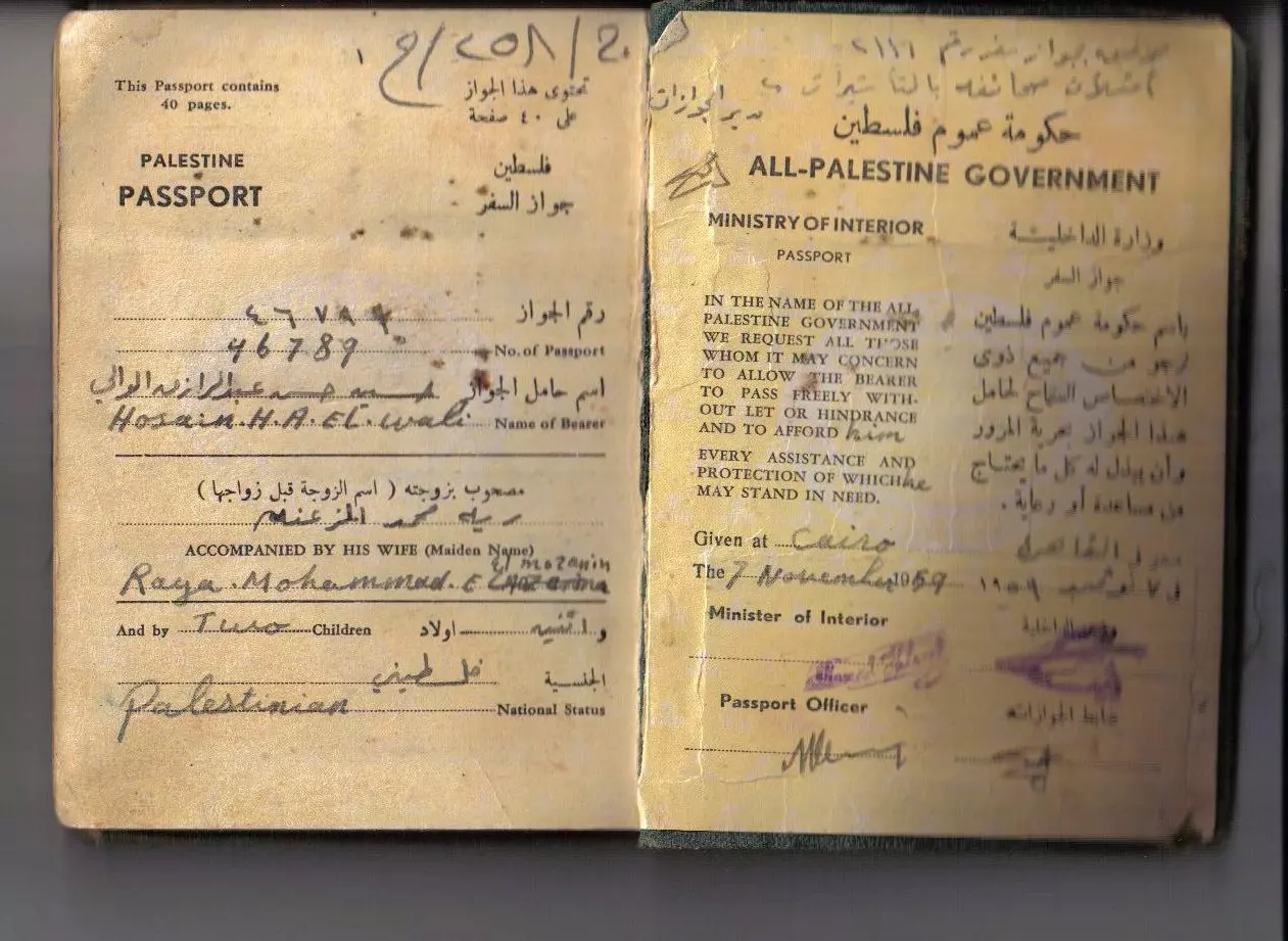
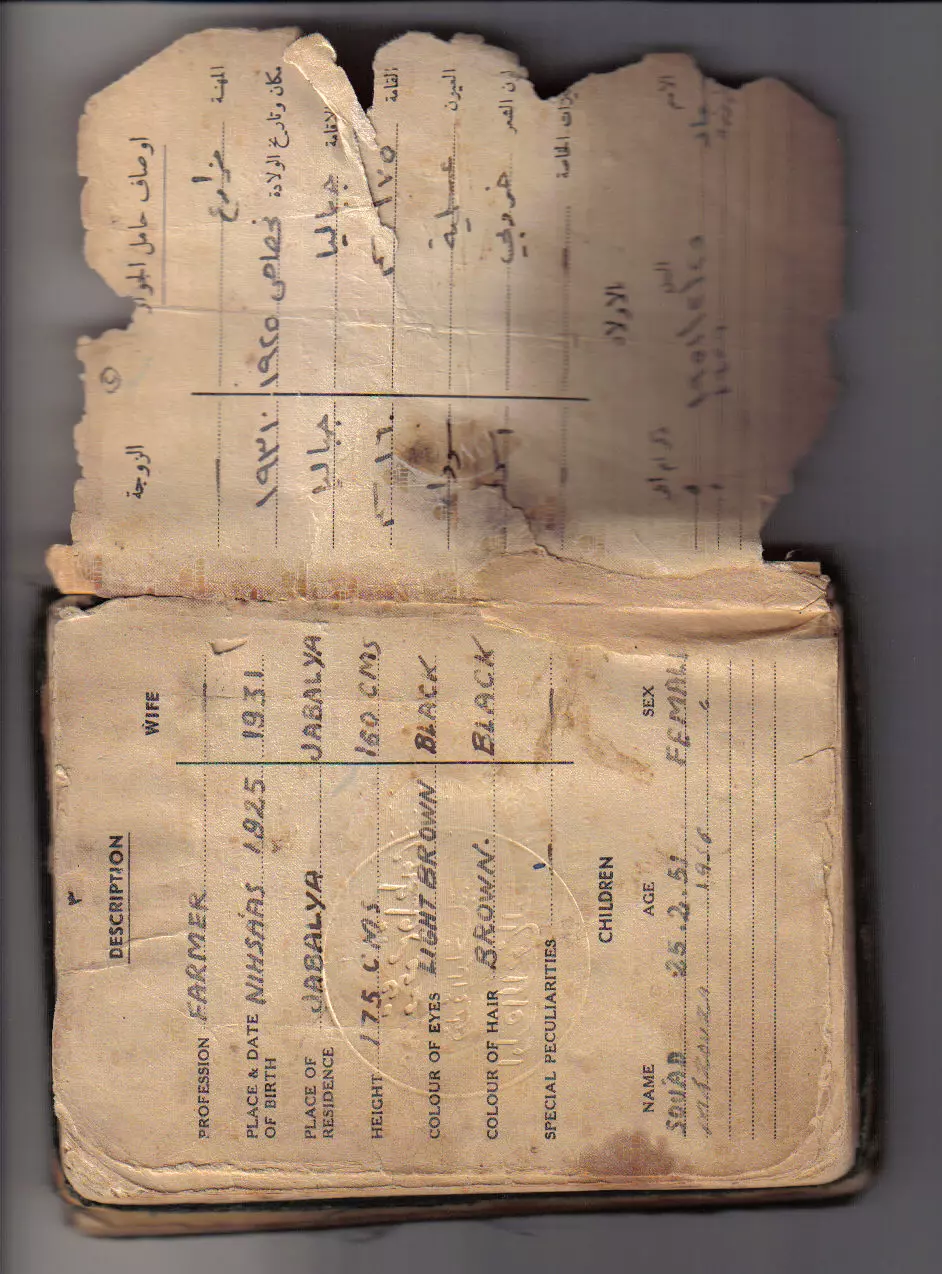
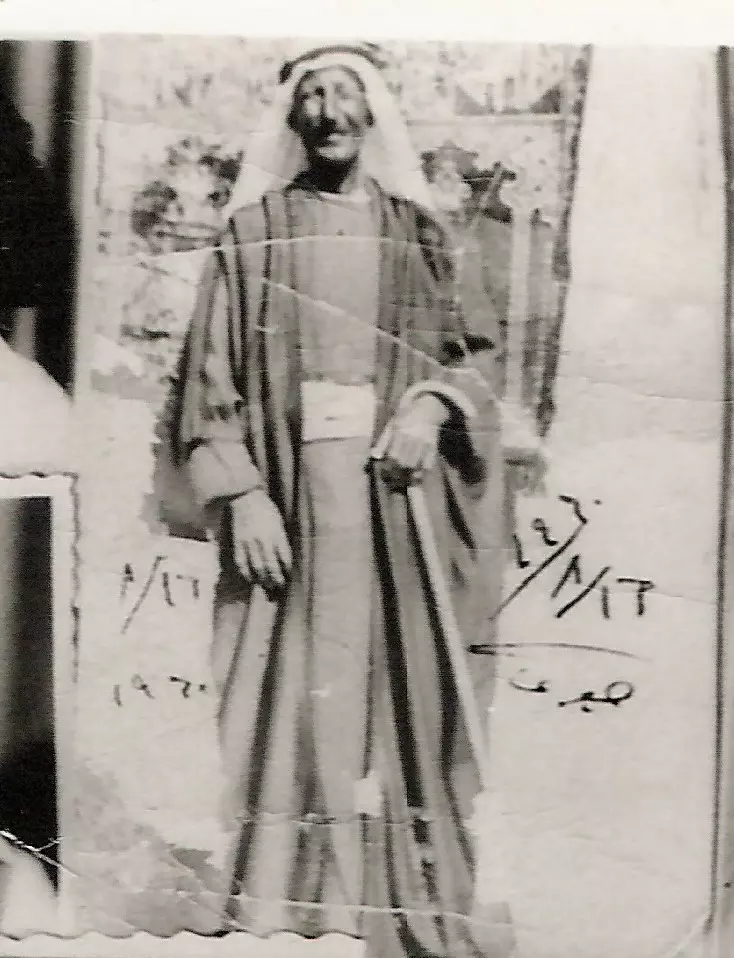
1 - All-Palestine Passport #1
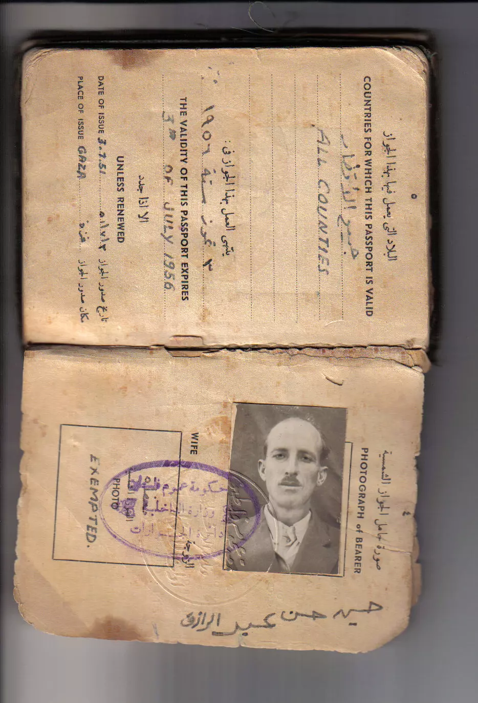
Posted by Hassan all wall y muhssen 1 - All-Palestine Passport #2
Posted by Hassan all wall y muhssen - All-Palestine Passport #3
Posted by Hassan all wall y muhssen - أنقاض البيوت المدمرة في الإتجاه الغربي للجهة الشرقية في القرية المدمرة، اُنقر الصورة لتكبيرها. 1990
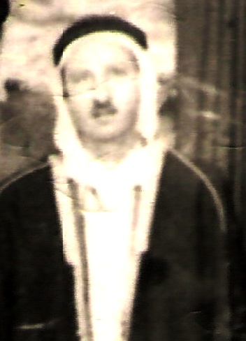
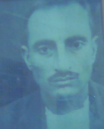
Scanned from "All That Remains" by Dr. Walid Khalidi 4 - الحاج حسين حسن عبدالرارزق (الوالي) محسن
Posted by Hassan all wall y muhssen - الحاج حسين حسن عبدالرارزق (الوالي) محسن
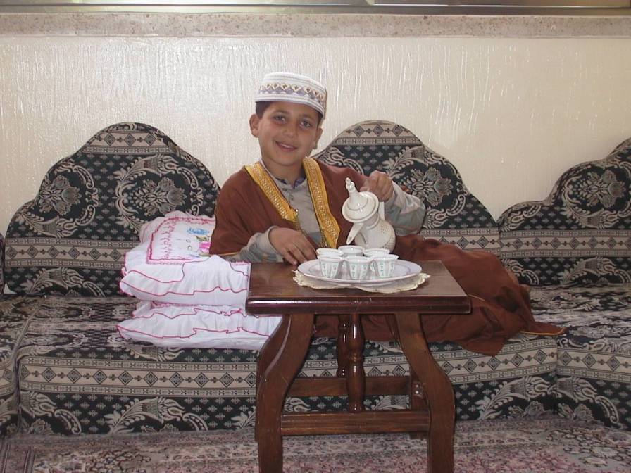
Posted by Hassan all wall y muhssen - على خطى الأجداد أحمد حسن حسين الوالي
Posted by Hassan all wall y muhssen - على خطى الأجداد محمد حسن حسين الوالي
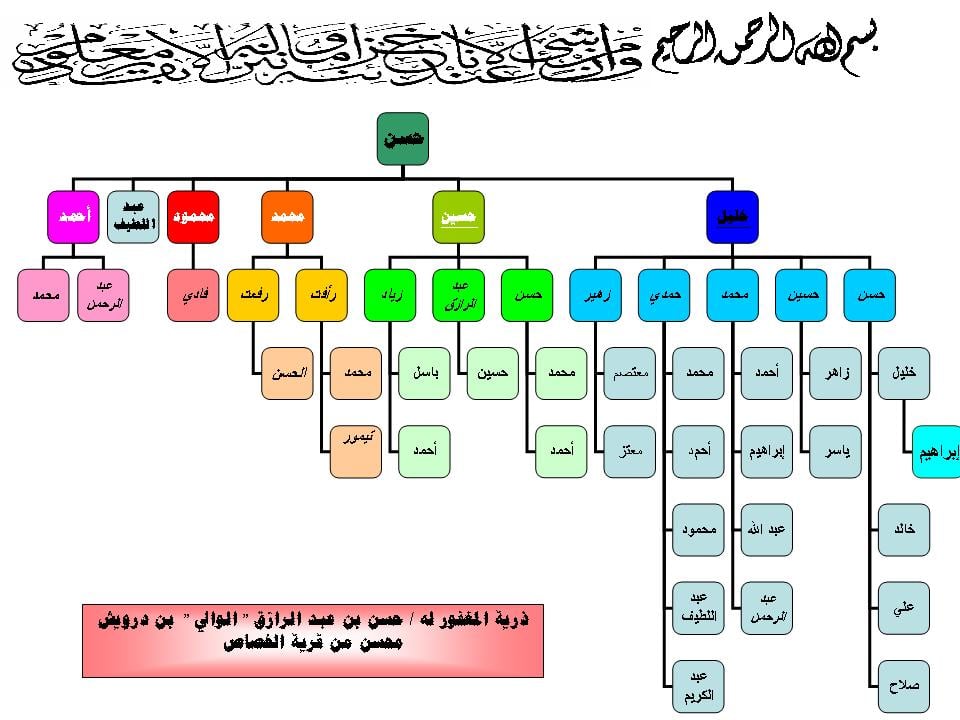
Posted by Hassan all wall y muhssen - شجرة العائلة لذرية المغفور له حسن بن عبد الرازق(الوالي)درويش محسن ولد في 1900م وتوفى في 1961م
Posted by Hassan all wall y muhssen 4 - خليل حسن عبد الرازق الوالي
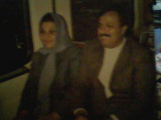
Posted by صلاح الوالي - صورة شهيد الغربة / عبد اللطيف حسن عبد الرازق (محسن) وعلى يمينه زوجته
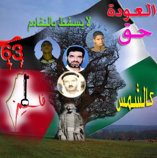
Posted by صلاح الوالي - العودة حق كالشمس
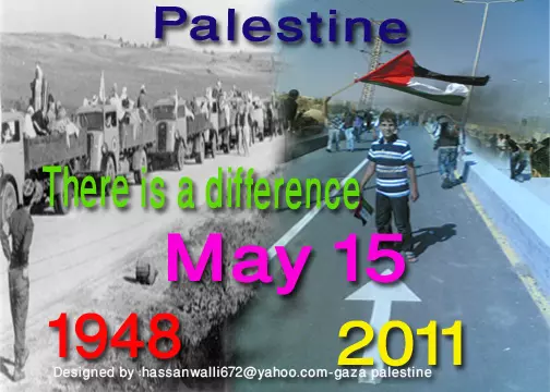
Posted by حسن حسين حسن الوالي - 15 مايو نفس الزمان والمكان -ولكن هناك فرق
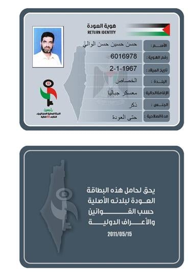
Posted by حسن حسين حسن الوالي 1 - هوية العودة
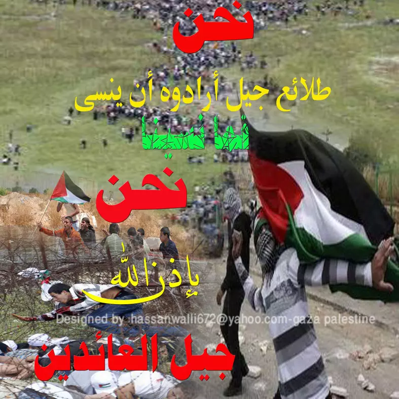
Posted by حسن حسين حسن الوالي - نحن طلائع جيل أرادوه أن ينسى ،،،،ما نسينا نحن ، بإذن الله جيل العائدين
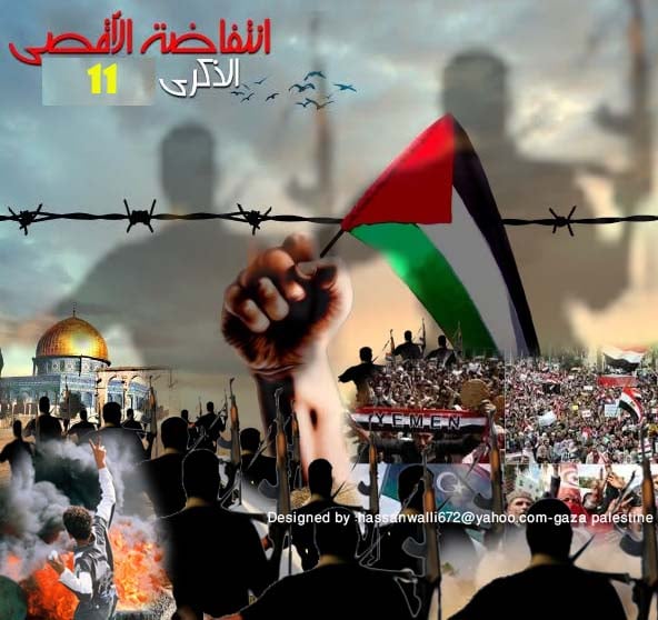
Posted by حسن حسين حسن الوالي 1 - من معاني الذكرى الحادية عشر لإنتفاضة الأقصى ، وحالة المقاومة على أرض الرباط ،،، ومن معاني ربيع الكرامة والثورات العربية ،،،
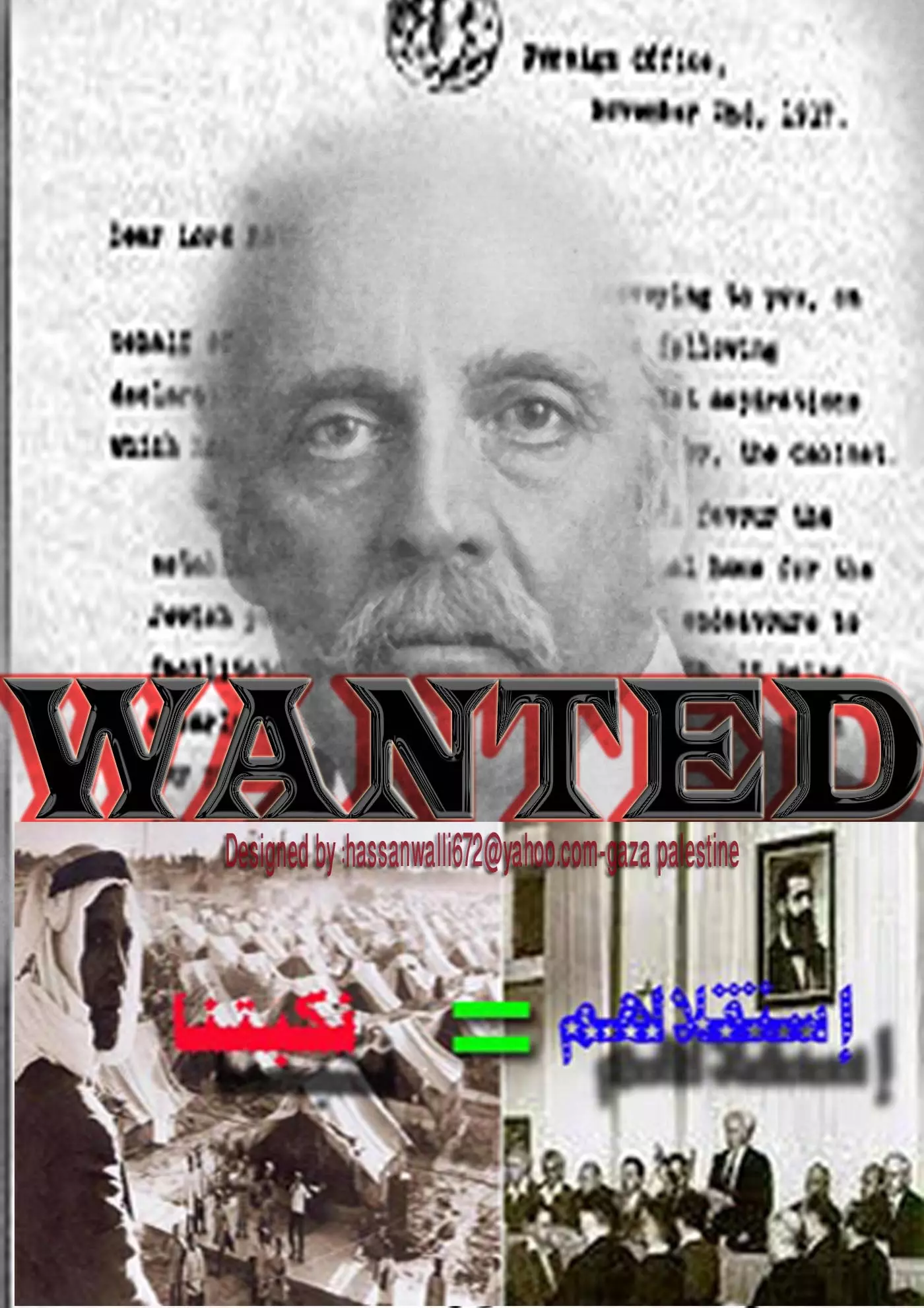
Posted by حسن حسين حسن الوالي - بلفور
Posted by حسن حسين حسن الوالي - المرحوم بإذن الله /الحاج محمد محمد محمد أحمد المزعنن
Posted by حسن حسين حسن الوالي - العودة حق لا يسقط بالتقادم
Posted by حسن حسين حسن الوالي 1 - 29 نوفمبر موعد عضوية فلسطين في الأمم المتحدة-موعد مع النصر
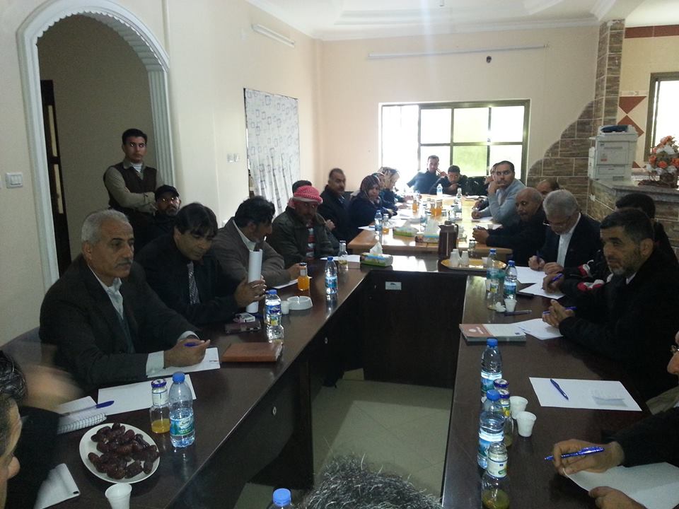
Posted by حسن حسين حسن الوالي - الاجتماع الاول لتأسيس رابطة النازحين و المهجرين الفلسطينيين ديسمبر 2014
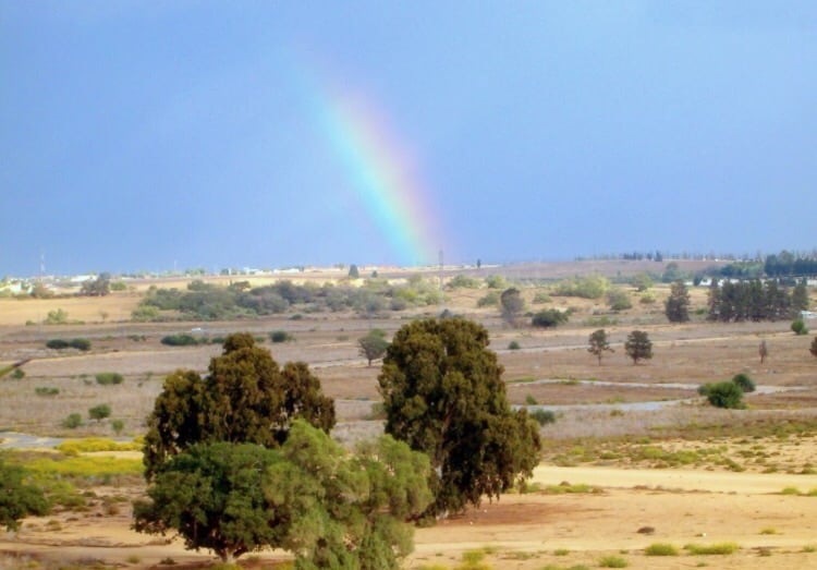
Posted by حسن حسين حسن الوالي - نظره من شرق موقع القريه باتجاه مستعمره اشكلون
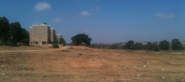
Posted by abu raya - من موقع القريه
Posted by abu raya - موقع القريه على غوغل
Posted by abu raya - اراضي القريه
Posted by abu raya - اراضي القريه
Posted by abu raya
Want to browse more? 80,000 pictures were grouped in these gallaries:
| Display Name | Clan/Hamolah | Country of Residence |
| عبد الرحمن محمود محمد المزعنن | 0599476888 | جباليا |
| رزق محمد محمد المزعنن | آل محسن الحديدي | غزة, فلسطين |
| محمد طبيل | طبيل | غزة, فلسطين |
| حسن حسين حسن الوالي | محسن | gaza-strip, palestine |
| أبو حمزة | الوالي | - |
| rebhimt | طبيل | غزة, فلسطين |
| وائل توفيق ابراهيم محسن | محسن | غزة, غزة |
| باسل مصطفى احمد ابوشباك | ابوشباك | غزة, فلسطين |
| خالد شتات | شتات | غزة, فلسطين |
| اباء نايف محسن | محسن | بنغازى ليبيا, ليبيا |
| عادل نايف محسن | محسن | بنغازى, الخصاص |
| محمد علي طلب محسن | محــسن | قطاع غزة, قطاع غزة |
| Abu Leith | شتات | غزه, غزه |
| ابو حسين | محسن\ الوالي | غزة, غزة |
| علاء نايف محسن | - | australia |
| نايف على طلب محسن | محسن | غزة, الخصاص |
| MOHAMMED AL-MOZANEN | Mohsen | Riyadh, SAUDI ARABIA |
| zead | al wally/mohsen | gaza, palestine |
| Hassan all wall y muhssen | mohsen | gaza strip, palestine |
 Fake Valor: Why Did Zionist Jews Hoist Nazis Flag on Their Ships in the 1930s?
What is new?
-
Facts About Oct. 7th Gaza Raid
-
Remined Us Please:: Who Did Rape Who? Palestinians Raped Israelis? Or, was the other way around?
-
When Prof. Edward Said was invited to debate Bibi Netanyahu in the 1980s, watch what happened!
-
Ezra Klein of the NY Times on the "Jewish Race".
-
Abusing Blood Libel!
-
Did Israeli Soldiers Activate The Hanniba Direective On Oct. 7th? You Be The Judge
-
Zionist FAQ: Isn't it true that Palestinians don't want peace? Palestinians never accepted the two-state solution
- Facts about Haavara (Transfer) Agreement between Ben-Gurion & Hitler
-
Haavara FAQs: Why Did Zionist Jews Hoist Nazis' Flags on Their Ships in the 1930s?
- Haavara FAQs: When Chaim Weizmann met FDR in mid-1943, why was he silent about rescuing European Jewry?
-
Dear ChatGPT: How did Palestinians resist Napoleon's invasion of their country in 1799?
-
Dear ChatGPT: Gaza had a vibrant Jewish community in the mid-17th century. What happened to them?
-
Dear ChatGPT: Why did the Jewish Agency suppress news of the Holocaust during WWII?
-
Video Playlist: Jews share their DNA tests to end the conflict for good.
-
A Tale of Two Conflicts: Examining the Definition of Genocide
-
Prof. Abraham Polak And The Suppressed History of the Khazars and European Jewry
-
How Ronald Reagan would have framed the genocide in Gaza if he were still alive?
-
Haavara FAQs: Let us do the math: how many German Jews did The Haavara Agreement save?
-
Zionist FAQs: The Hebron Massacre of 1929, "clearly proves" that Palestinians are antisemitic, how could you deny it?
-
Zionist FAQs: Why Anti-Zionist Is Not Antisemitism?
-
Zionist FAQs: Isn't it true that the KGB created Palestinian Nationalism in the early 1960s?
- Zionist FAQs: Muslims are killing Muslims all the time; why are Israeli Jews being singled out in the media?
- Zionist FAQs: How is Israel an apartheid state when 20% of its citizens are Arabs who enjoy full rights?
-
Haavara FAQs: Why Did Dorothy Thompson Flip From A Zionist Advocate to A Silenced Dissenter?
-
Haavara FAQs: Analysis of Herzl's Uganda Scheme and how it could have saved millions of Jews.
-
Haavara FAQs: Why did Hayim Greenberg describe American Jewry as "morally bankrupt" in early 1943?
-
Haavara FAQs: What if the Evian Conference was a resounding success? What would have been the impact of saving European Jewry on Zionism?
- Haavara FAQs: What if the six million were saved, how that would have impacted the Zionist project?
-
Haavara FAQs: How did Zionist leaders react when Europe's Jews lingered in the DP camps after WWII ended?
-
Why does the American Jewish community repeat lies that David Ben-Gurion had debunked before he died?
-
Who has the power to rename the Tatar/Khazar Gene Marker to Jewish IV?
-
Zionist FAQs: Why won't Egypt, Syria, and Jordan take their people back? Jews are indigenous to Palestine, and Arabs immigrated after Jews developed the country. Arabs should leave.
-
Haavara FAQs: Did Hitler and the Nazis conflate between Judaism and Zionist? If that wasn't case, then why?
-
Haavara FAQs: Winston Churchill and antisemitism, a collection of articles written Churchill.
-
Haavara FAQs: Broken by country, how many Jews survived vs. killed during the Holocaust?
-
Haavara FAQs: Why did European Jews vote with their feet and to immigrated to the Americas, not Palestine, after WWII?
-
Watch this American Jewish Girl describing Israeli Jews' cognitive dissonance like no other in under two minutes
-
Haavara FAQs: When the Nazis went out of their way to hide the Holocaust, Israeli Jews did the exact opposite by broadcasting their genocide of Gazans. But why?
-
Haavara FAQs: How Zionist Jews went out of their to show their appreciation to Nazism and Fascism?
- Haavara FAQs: Why Zionist leaders were against bombing the death camps & the Railroads leading to them?
-
Haavara FAQs: Hitler's message to the British and American people: If Jews are such noble citizens and you care about them, how come you're not letting them in? I will gladly ship them to you at my expense, even on luxury liners!
-
A shortlist of Zionist and Israeli false flag operations in the name Jews.
-
The Most Moral Army
- The Land of Kapos (Israel): Where the brave are boycotted and Kapos walk free.
- Why did early Zionists often named their communal enterprises "colonial"?
- Zionist Relations with Nazi Germany by Faris Glubb
-
Two NY Times advertisements by Zionists in the early 1943 that exposes Zionists' treason at the height of the calamity
- Facts Not Lies about the Palestinian-Israeli Conflict.
- Site's pictures have been categorized
- Campgain Against Lice
- A Survey of Palestine, the official source about Palestine before Nakba produced by the British Mandate; over 1200 pages.
- Satellite View & Google Earth: Over 6,000 placemarks identifying all destroyed towns, W. Bank & Gaza Strip Towns, & refugee camps.
- PalestineRemembered.com and its Nakba Oral History Project were featured on al-Jazeera Satellite TV.
- Nakba Oral History Video Podcast:
 Over 700 Oral History interviews (including 3,500+ hours of recording) can be viewed online.
 - Palestine Village Statistics Project
- Gaza Jail Break
- النسخة العربية للموقع الان متوفرة
- Videos: Documenting the destroyed villages in video: Tracing all that remains since Nakba.
- Videos: Responding to Zionist Propaganda
- Interview: The ethnic cleansing of Palestine: George Galloway interviews Israeli Historian Ilan Pappe.
- For Palestinians, memory matters. It provides a blueprint for their future By George Bisharat.
- Zionist FAQ now available in Hebrew שאלות שציונים שואלים, עכשיו בעברית
- Video: The Stephen Walt and John Mearsheimer report on the influence of the Israel Lobby on U.S. Foreign Policy
- The Palestinian-Israeli conflict for beginners
