| PalestineRemembered | About Us | Oral History | العربية | |
| Pictures | Zionist FAQs | Haavara | Maps | |
| Search |
| Camps |
| Districts |
| Acre |
| Baysan |
| Beersheba |
| Bethlehem |
| Gaza |
| Haifa |
| Hebron |
| Jaffa |
| Jericho |
| Jerusalem |
| Jinin |
| Nablus |
| Nazareth |
| Ramallah |
| al-Ramla |
| Safad |
| Tiberias |
| Tulkarm |
| Donate |
| Contact |
| Profile |
| Videos |
Welcome To Ni'ilya - نعليا (נעליא)
|
District of Gaza
Ethnically cleansed days ago |
العربية Google Earth |
 |
Gallery (40) |
- Statistics & Facts
-
Before & After

- Satellite View
- Articles 2
- Pictures 40
- Aerial Views 1
- Oral History 1
- Members 16
- All That Remains
- Wikipedia
- Videos 3
- Guest Book 5
- Links 3
| Statistic & Fact | Value | ||||||||||||||
| Occupation Date | November 4, 1948 | ||||||||||||||
| Distance From District | 19 (km) North East of Gaza | ||||||||||||||
| Elevation | 25 (meters) | ||||||||||||||
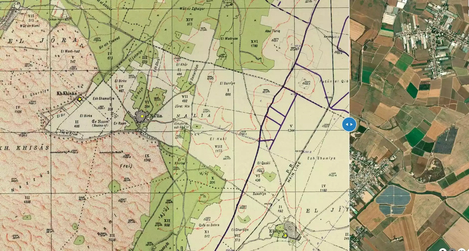
| Before & After Nakba, Click Map For Details |
|||||||||||||||
|
|||||||||||||||
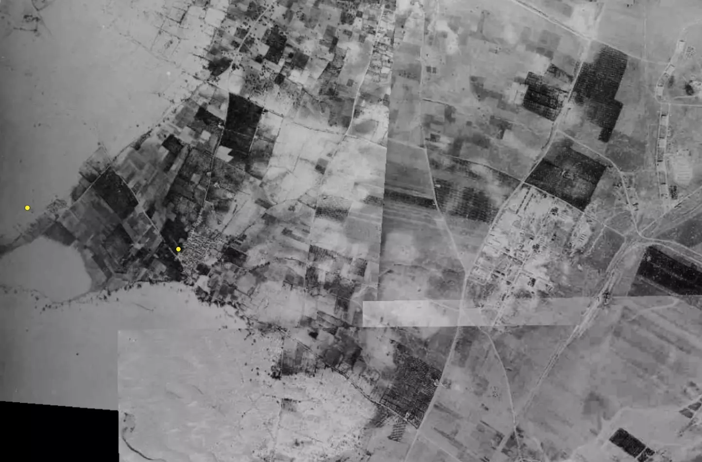
| Pre-Nakba Aerial View |
|||||||||||||||
|
|||||||||||||||
| Map Location | See location #28 on the map View from satellite |
||||||||||||||
| Military Operation | Operation Yo'av | ||||||||||||||
| Attacking Units | Possibly a combination of Giva'ti and Nagav Brigades. | ||||||||||||||
| Defenders | Egyptian Army | ||||||||||||||
| Exodus Cause | Military assault by Zionist troops | ||||||||||||||
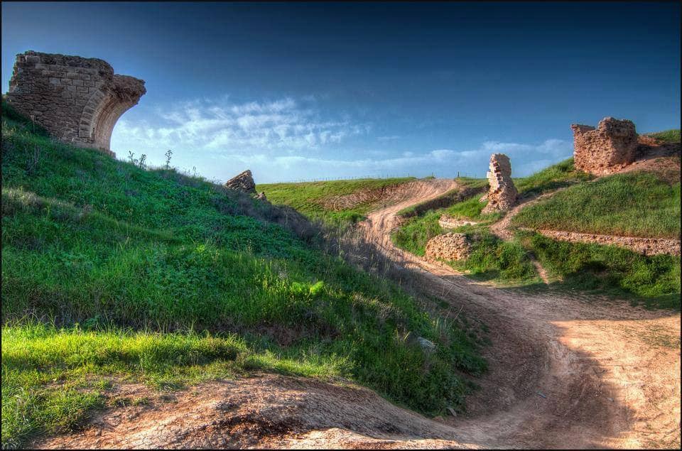
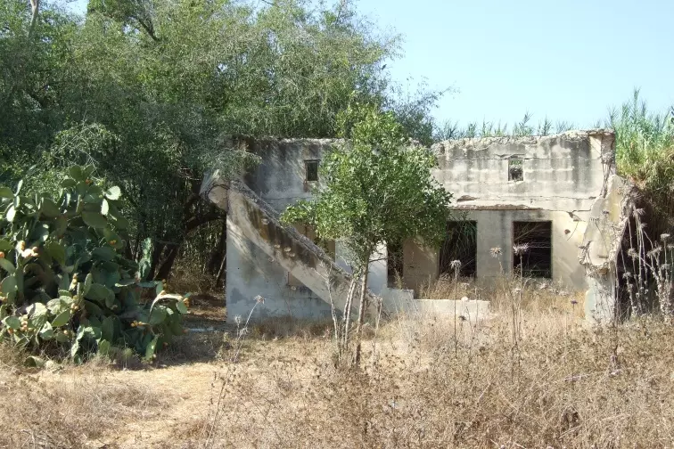
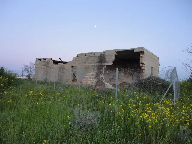
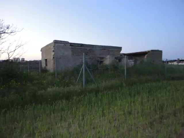
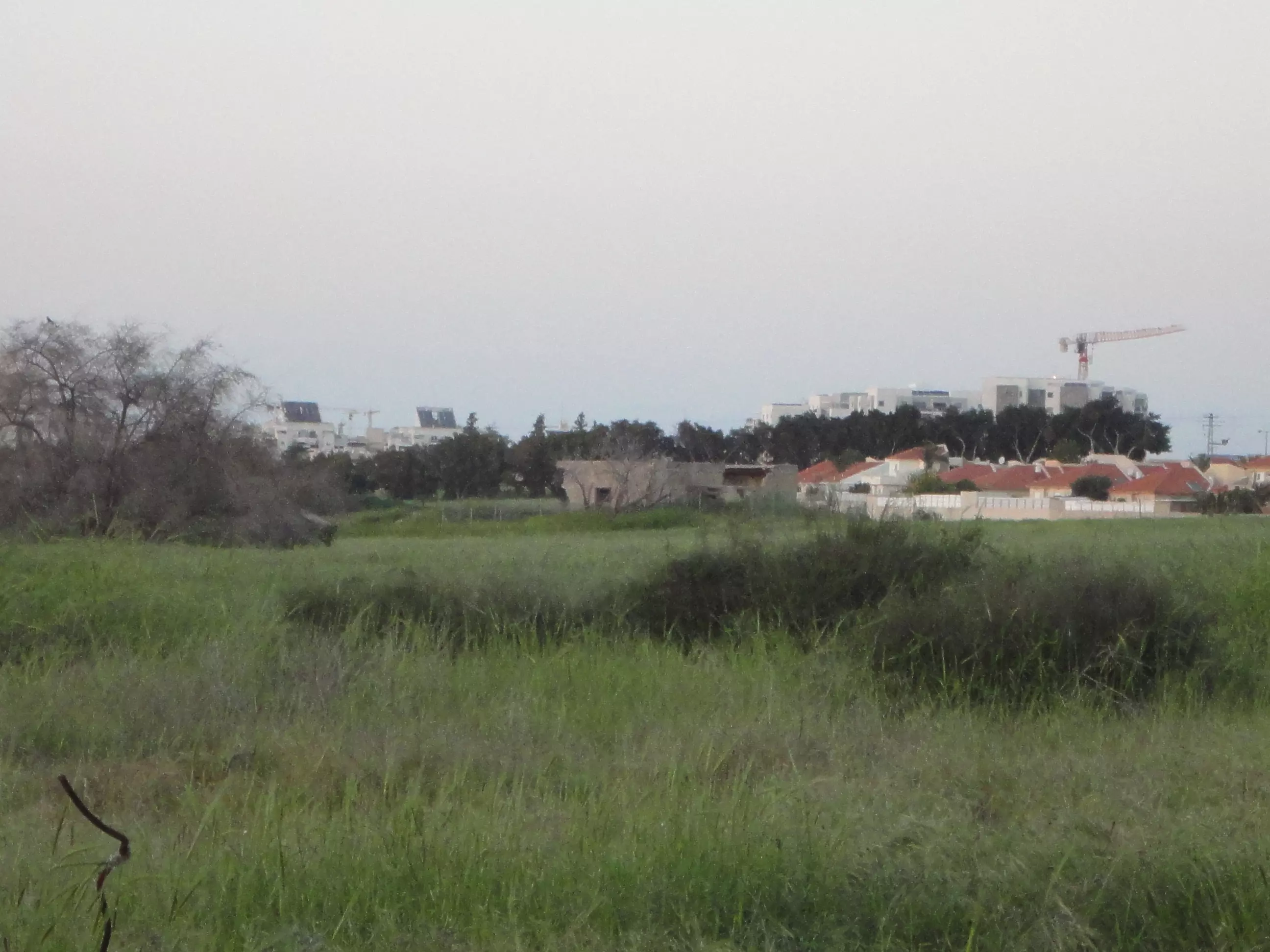
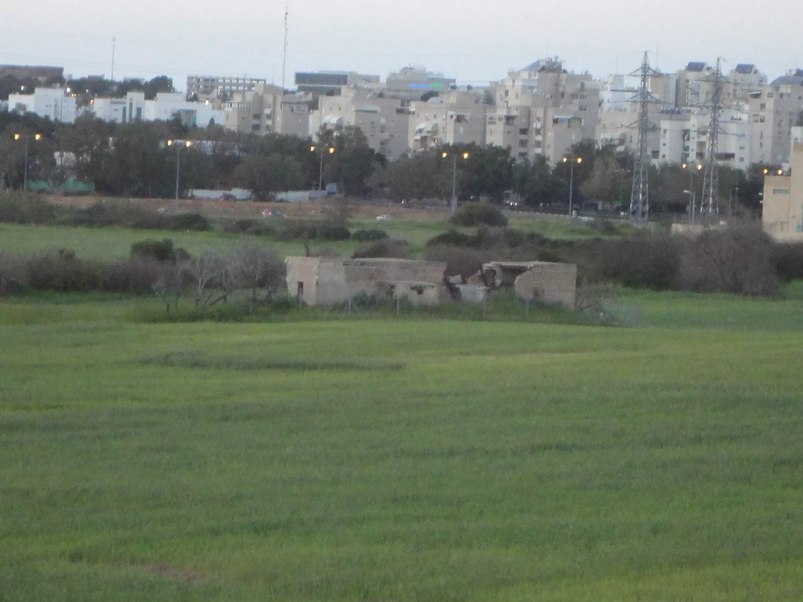
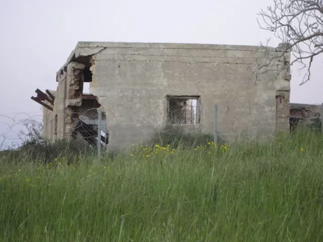
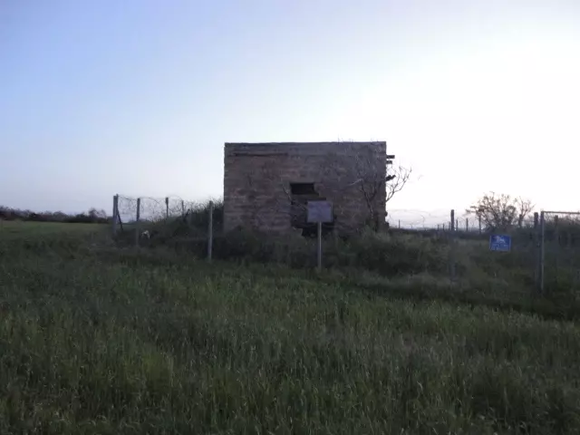
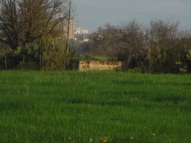
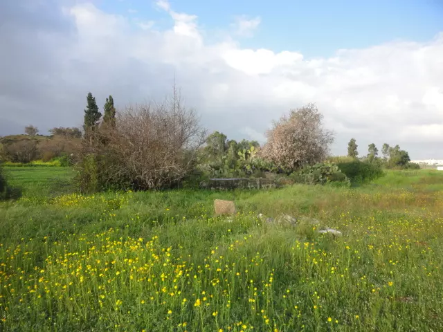
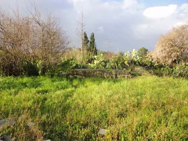
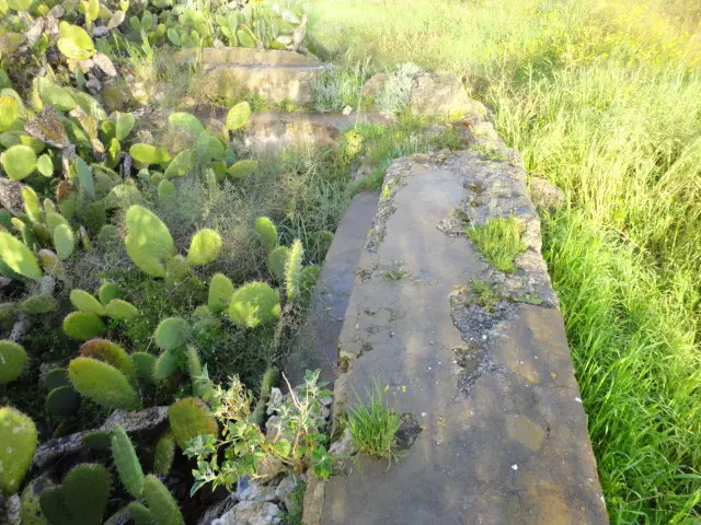
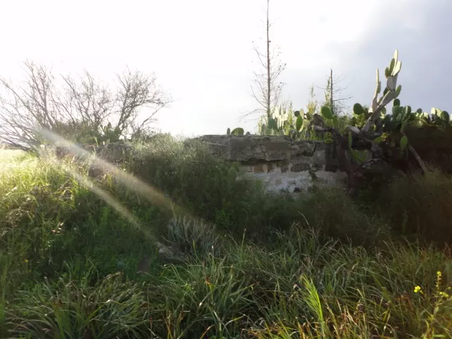
| Village Temains | The village has been mostly destroyed with the exception of a single village house. | ||||||||||||||
| Ethnically Cleansing | Ni'ilya inhabitants were completely ethnically cleansed. | ||||||||||||||
| Pre-Nakba Land Ownership |
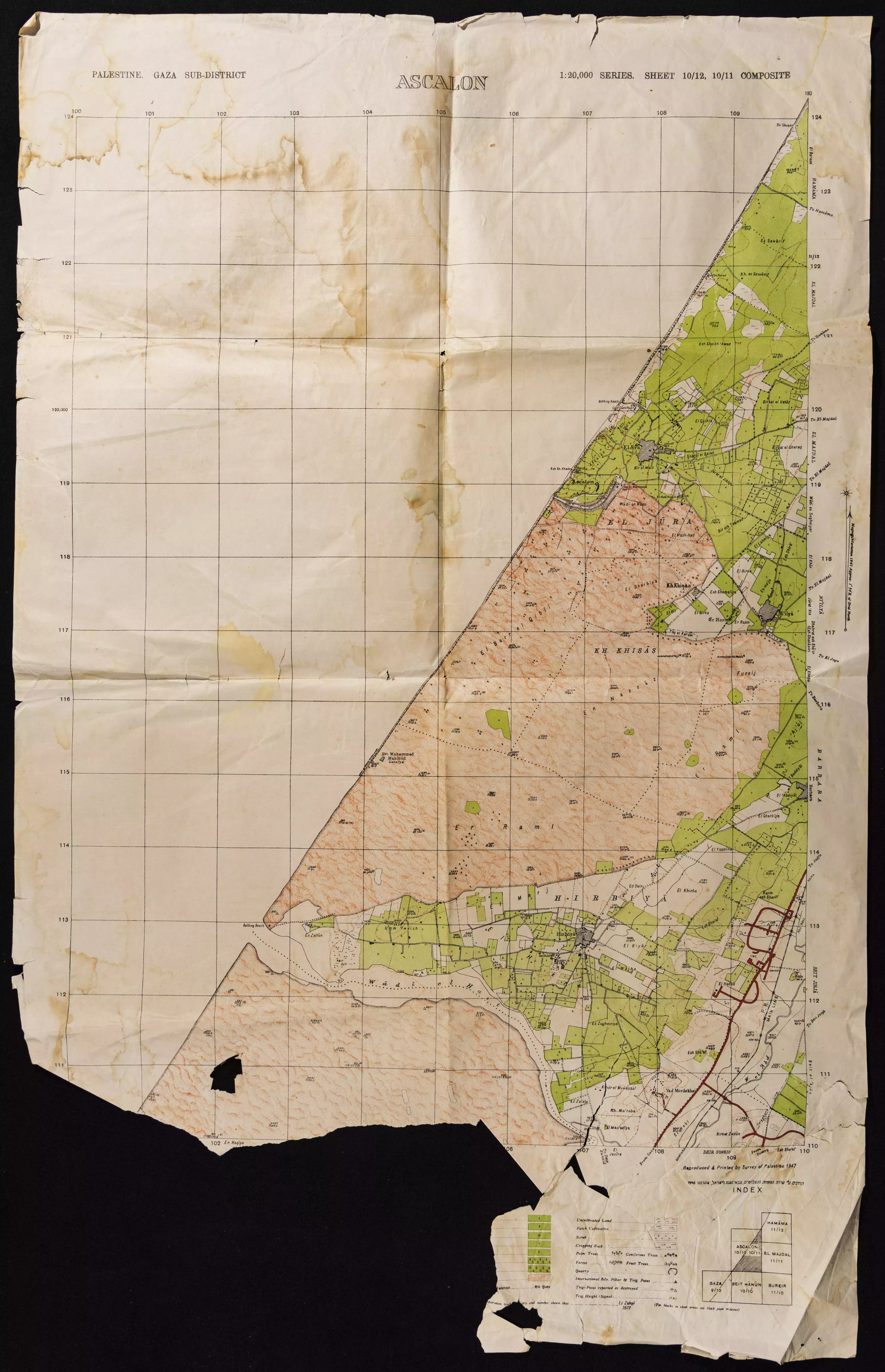
**Town Lands' Demarcation Maps |
||||||||||||||
| Land Usage As of 1945 |
|
||||||||||||||
| Population |
|
||||||||||||||
| Number of Houses |
|
||||||||||||||
| Near By Towns |
|||||||||||||||
|
|
|||||||||||||||
| Schools | Ni'ilya students used to attend school in al-Majdal city, and in the winter of 1948 the village built its elementary school for boys, which was never opened because of the war. | ||||||||||||||
| Places of Warship | One mosque | ||||||||||||||
| Archeological Sites | Ni'ilya had burial places which contained tombs of people who were killed while battling the Crusades. | ||||||||||||||
| Exculsive Jewish Colonies Who Usurped Village Lands |
The city of Ashkelon is occupying village lands. | ||||||||||||||
| Featured Video | |||||||||||||||
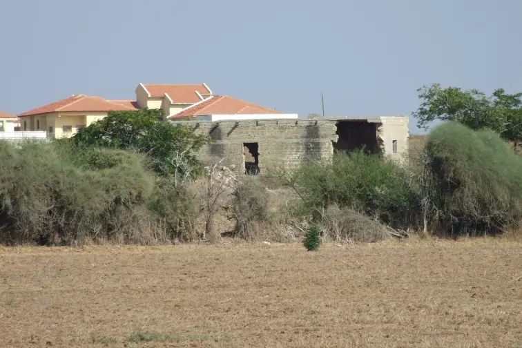
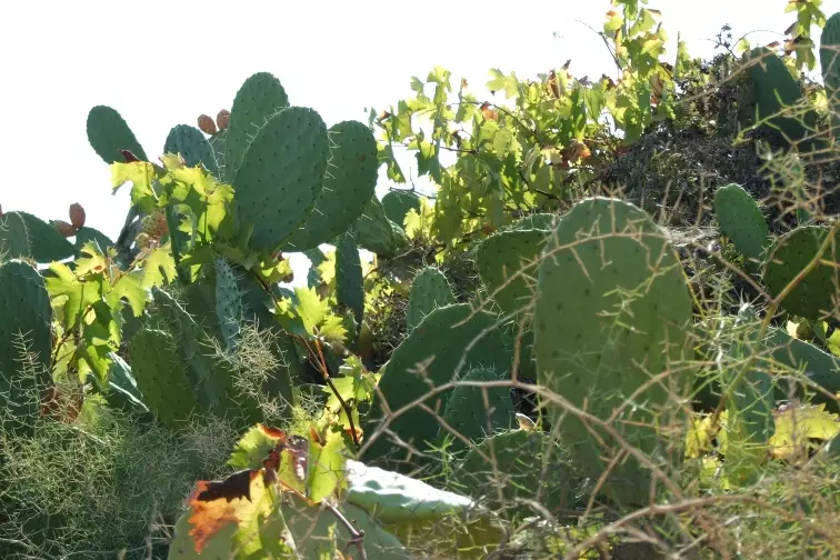
Village Before NakbaThe village was built on flat terrain on the coastal plain, north of an earlier site which had been engulfed by sand dunes. When sand dunes began to surround Ni'ilya on the southern side, the villagers kept their movement in check by planting fruit trees. Secondary roads linked the village to the town of al-Majdal, 3 km to the north-northeast, and to the coastal highway a short distance to the east. In 1596, Ni'ilya was a village in the nahiya of Gaza (liwa' of Gaza), with a population of 440. It paid taxes on a number of crops, including wheat, barley, sesame, and fruit, as well as on other types of produce and property, such as goats, beehives and vineyards.In the late nineteenth century, Ni'ilya was surrounded by gardens with olive groves that extended all the way to al-Majdal. Encroaching sand from the coast had been stopped by cactus hedges. Ni'ilya had a trapezoidal configuration, with the long base pointing northeastward. Its houses, some made of adobe and others of cement, were separated by narrow alleys. Houses were also constructed among the fruit orchards. The village expanded along the road that led to al-Majdal. On the southern side it had a mosque that was decorated with inscriptions and was surrounded by fragments of older buildings and burial places. The villagers, who were Muslim, believed that the tombs contained the bodies of people killed in the fighting against the Crusaders. The children attended school in al-Majdal; their own school building, completed in the winter of 1948, never opened because of the war. The village had several little shops. The community relied mainly on agriculture for its livelihood, growing rainfed grain and many varieties of fruit, such as citrus, grapes, figs, and apricots. In 1944/45 a total of 1,084 dunums was devoted to citrus and bananas and 2,215 dunums were allotted to cereals; 1,436 dunums were irrigated. The village fruit orchards were irrigated from artesian wells. Village Occupation and Ethnic CleaningProbably occupied around the time of the fall of al-Majdal, Ni'ilya was one of the last villages to be seized by Israeli forces in the south. On the heels of Operation Yoav, Israeli units managed to sack the town of al-Majdal along with a number of satellite villages on 4–5 November 1948.Zionists Colonies on Village LandsThe center of the town of Ashqelon, established in 1948, is northwest of the village site; the town has expanded onto village lands.Village TodayThe village has been obliterated, and the site is overgrown with wild plants and a few sycamore trees. One house that had probably been built in a fruit orchard still stands and is currently inhabited by a Palestinian family. It has a flat roof and rectangular windows and door. The land in the vicinity is cultivated by Israeli farmers.SourceDr. Walid al-Khalidi, 1992: All That Remains. |
|||||||||||||||
| Related Maps | Town Lands' Demarcation Maps خرائط للقضاء توضح حدود القرى والاودية Town's map on MapQuest View from satellite Help us map this town at WikiMapia |
||||||||||||||
| Related Links | Wikipedia's Page Facebook Page Google Search Google For Images Google For Videos |
||||||||||||||
| More Information | في كتاب كي لا ننسى في كتاب بلادنا فلسطين المزيد من موقع هوية |
||||||||||||||
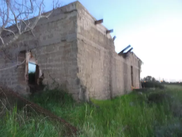
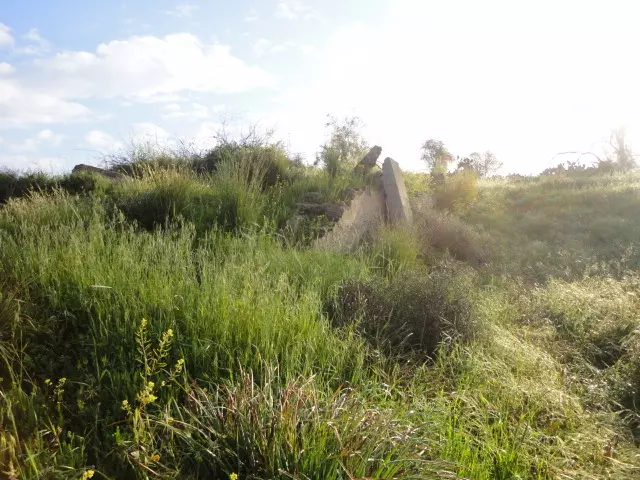
- Remains of a house, south part of Ni'ilya.
Posted by Uri Zackhem 8 - Remains of a house, north part of Ni'ilya.Behind there are new houses.
Posted by Uri Zackhem 3 - Cactus and vine, Niilya.
Posted by Uri Zackhem 11 - Remains of Towm Well in tne northen part of Ni'ilya.Very deep well
Posted by Abdullin - Town Well of Ni'ilya. Rear view from the east.
Posted by Abdullin - Ni'ilya's town well - panoramic view from the south. Right new housing villas
Posted by Abdullin - Ni'ilya's town well - panoramic view from the south east.
Posted by Abdullin - Ni'ilya's town well - the southern side view
Posted by Abdullin - Ni'ilya's town well - view from the northern side
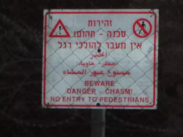
Posted by Abdullin - Ni'ilya's town well - a warning on the fence
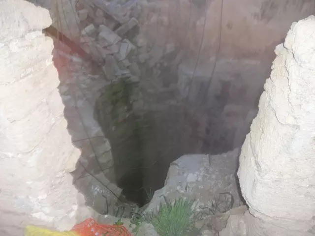
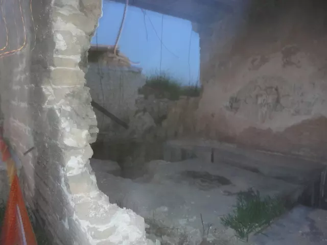
Posted by Abdullin - Ni'ilya's town well - entry into the building
Posted by Abdullin - Ni'ilya's town well - entry into the building - - the view through the doorway
Posted by Abdullin - Ni'ilya's town well - entry into the building - warily very deep!
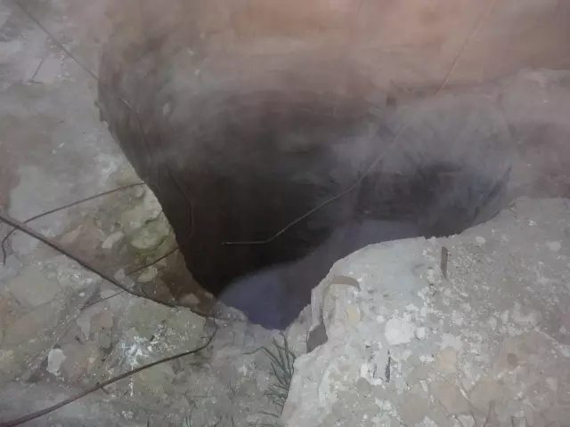
Posted by Abdullin - Ni'ilya's town well - entry into the building - the view through the crumbling wall
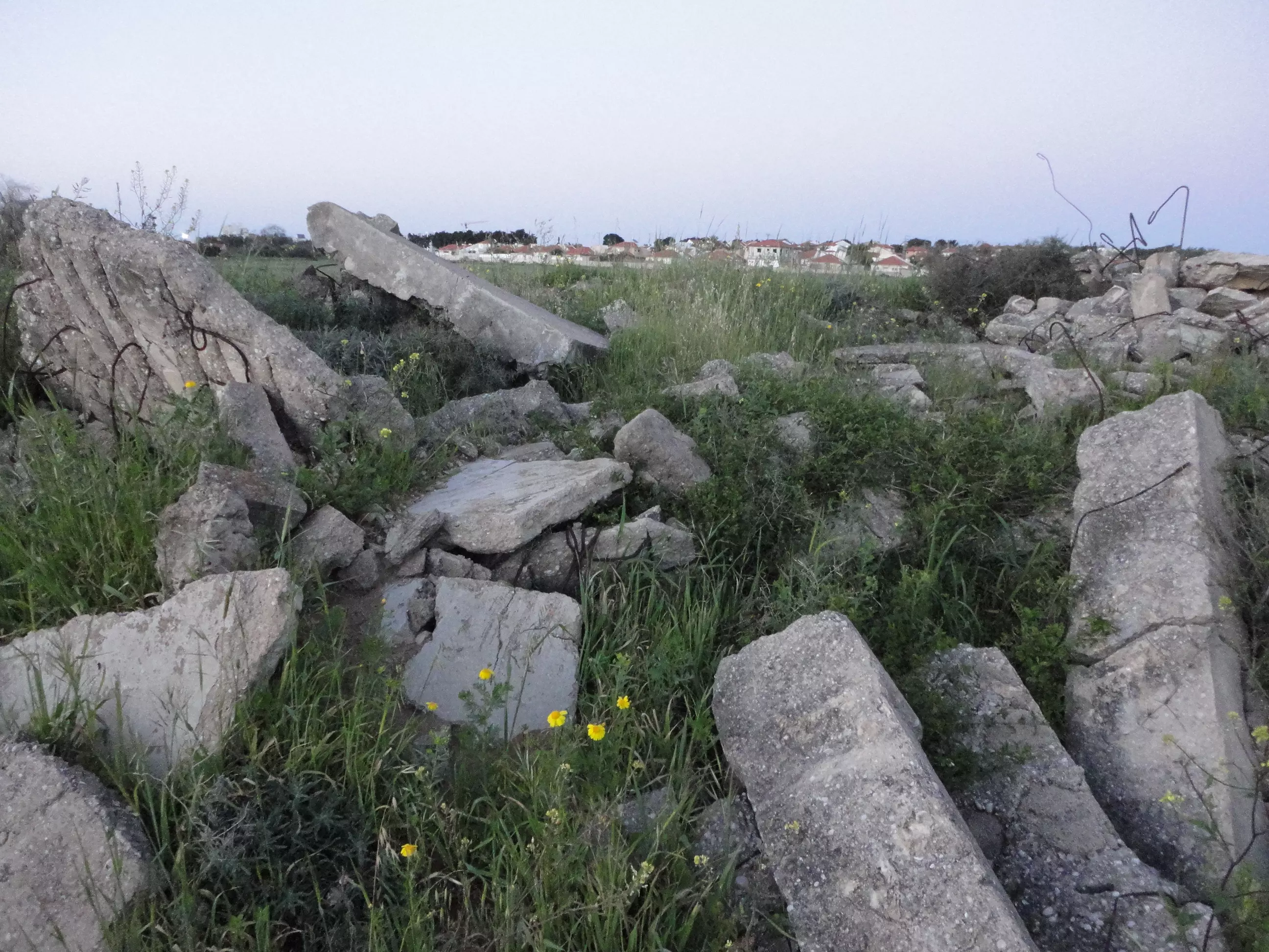
Posted by Abdullin - Ni'ilya's town well - front view of the west side - the remains of the other houses were shoveled into one big heap
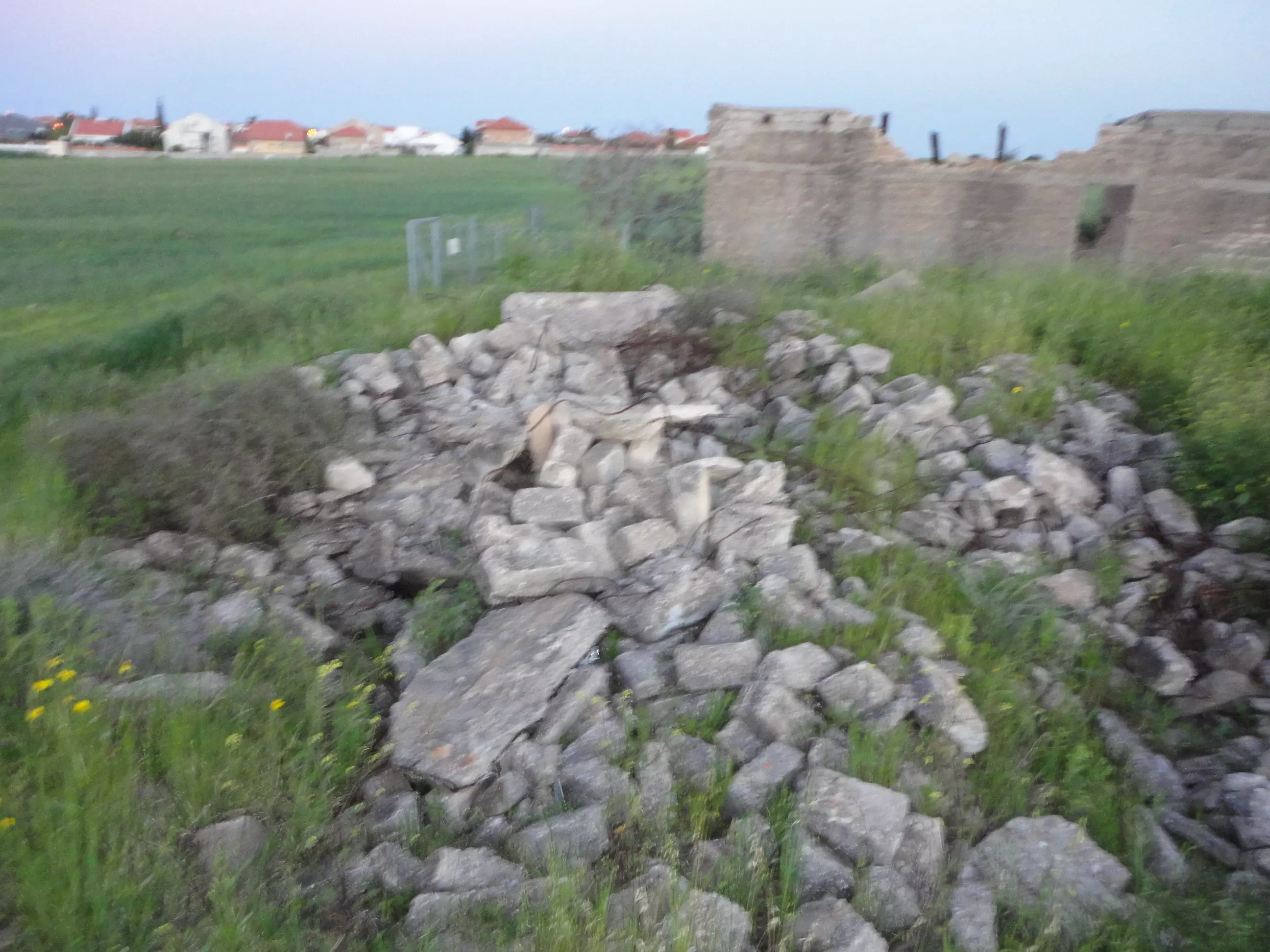
Posted by Abdullin - Ni'ilya's town well - west side - the remains of other buildings
Posted by Abdullin 1 - Remains south part of Ni'ilya.
Posted by Abdullin - Remains south part of Ni'ilya..
Posted by Abdullin - Remains south part of Ni'ilya...

Posted by Abdullin - Remains south part of Ni'ilya...
Posted by Abdullin - Remains south part of Ni'ilya...

Posted by Abdullin - Remains south part of Ni'ilya
Posted by Abdullin - Remains south part of Ni'ilya....
Posted by Abdullin - Remains south part of Ni'ilya.
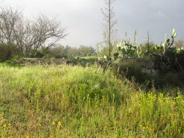
Posted by Abdullin 1 - Remains south part of Ni'ilya.
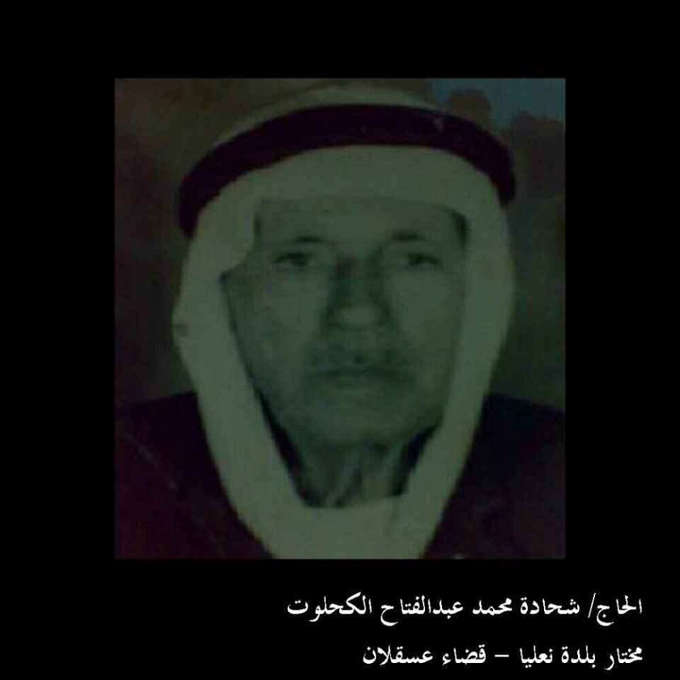
Posted by Abdullin - مختار بلدة نعليا. الحاج شحادة محمد عبدالفتاح الكحلوت
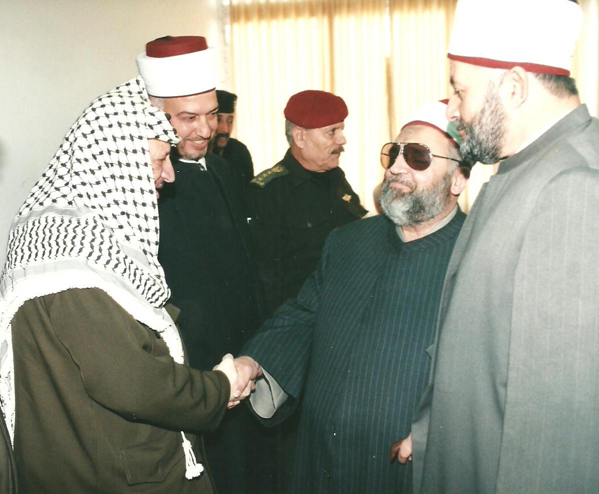
Posted by بلال الكحلوت - ابن بلدة نعليا مفتي قطاع غزة الشيخ عبدالكريم الكحلوت رحمه الله
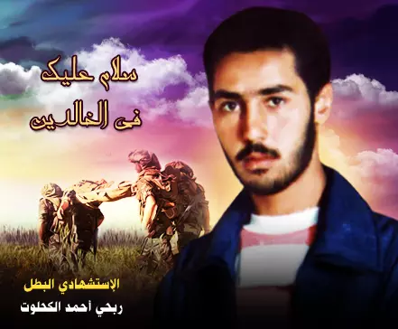
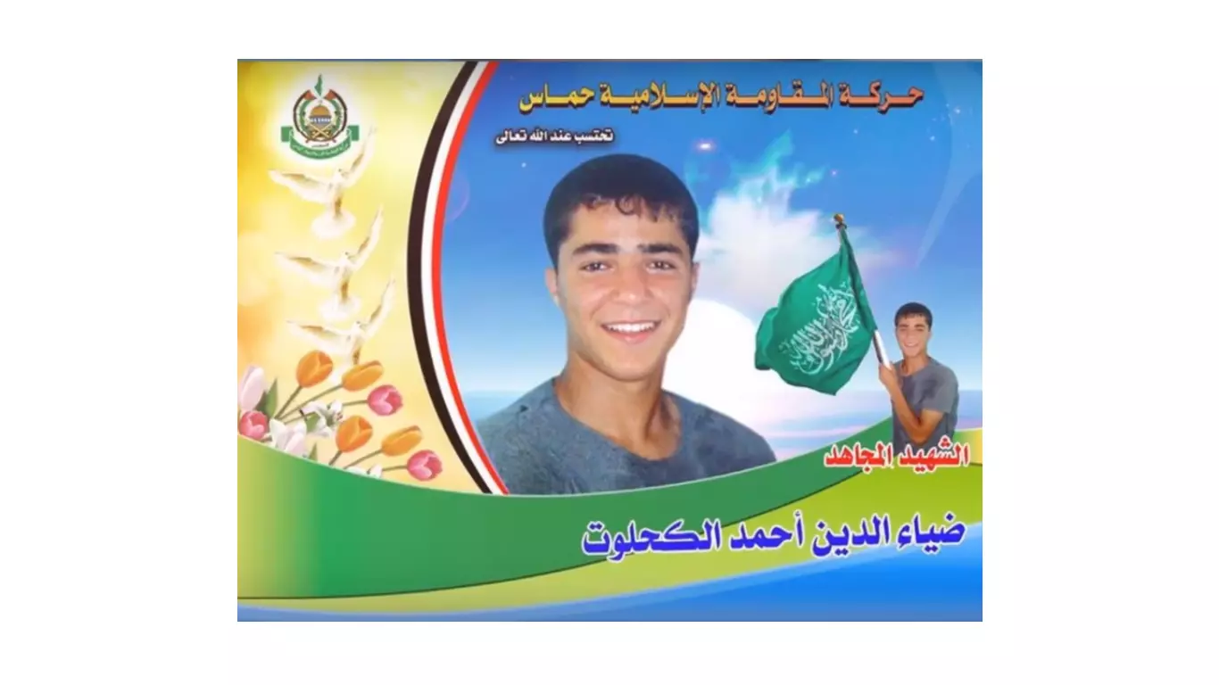
Posted by بلال الكحلوت - صورة لابن نعليا الشهيد ربحي الكحلوت منفذ عمليه استشهادية في غوش قطيف عام 1995 قتل فيها 12 جنديا اسرائيليا
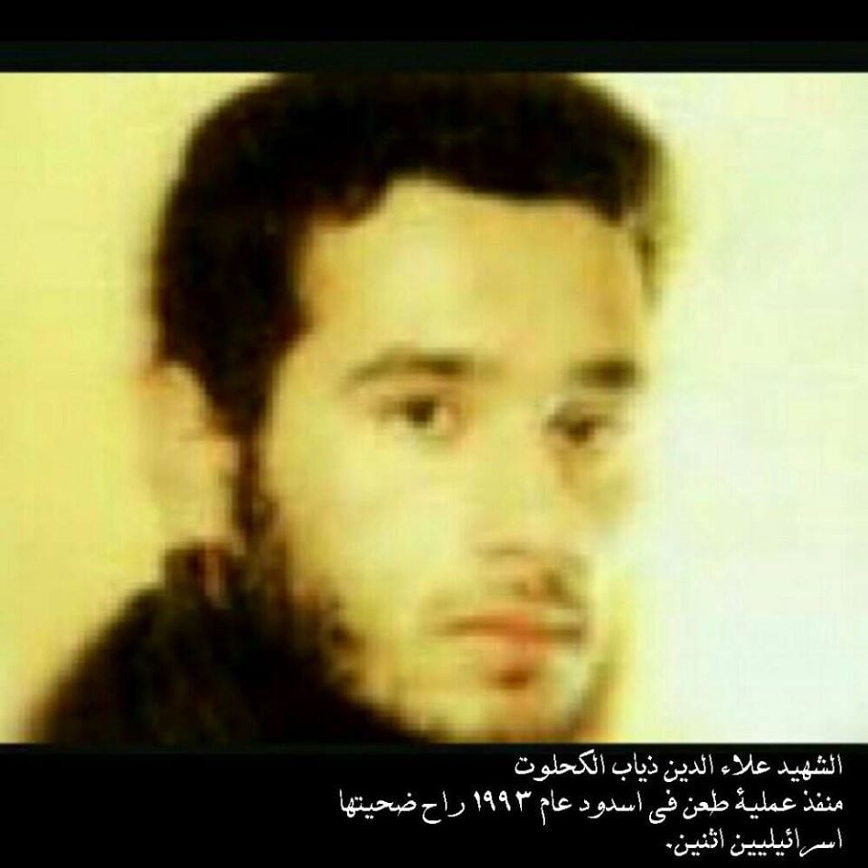
Posted by بلال الكحلوت - صوة لابن نعليا الشهيد علاء الدين ذياب الكحلوت منفذ علمية طعن في اسدود عام 1993
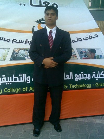
Posted by بلال الكحلوت - الاستشهادي عبد الفتاح أحمد الكحلوت احد منفذي عملية بيسان المعروفة بعملية "عبور الفيلق الفلسطيني" البطولية في السبعينيات
Posted by بلال الكحلوت - صورة الشهيد القسامي/ غسان محمد عبد القادر الكحلوت احد افراد وحدة الهندسة في كتائب الشهيد عز الدين القسام. استشهد في معركة العصف الماكول
Posted by بلال الكحلوت - الشهيد القسامي / محمد كمال العبد الكحلوت احد افراد وحدة الهندسة في كتائب عز الدين القسام. استشهد في معركة العصف الماكول
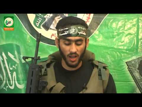
Posted by بلال الكحلوت - الشهيد القسامي المجاهد / ضياء الدين فتحي عبد الله الكحلوت وهو قائد ميداني في كتائب الشهيد عزالدين القسام
Posted by بلال الكحلوت - الشهيد القسامي/ محمد فتحي الكحلوت احد ابطال معركة ايام الغضب في مخيم جباليا و من افراد " وحدة التصنيع" في كتائب الشهيد عز الدين القسام.
Posted by بلال الكحلوت - صوره الشهيد ضياء الدين احمد اسماعيل الكحلوت - ارتقى في اجتياح ايام الغضب بتاريخ 30-9-2004 اثناء محاولة اسعاف احد المجاهدين فاستهدف حينها برصاصة قناص
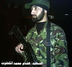
Posted by بلال الكحلوت - صورة الشهيد هشام محمد الكحلوت كان احد افراد الجهاز السري لكتائب القسام . وعين قائدا ميدانيا في كتائب القسام في منطقة جنوب معسكر جباليا واحد اعضاء المجلس العسكري لكتائب القسام.
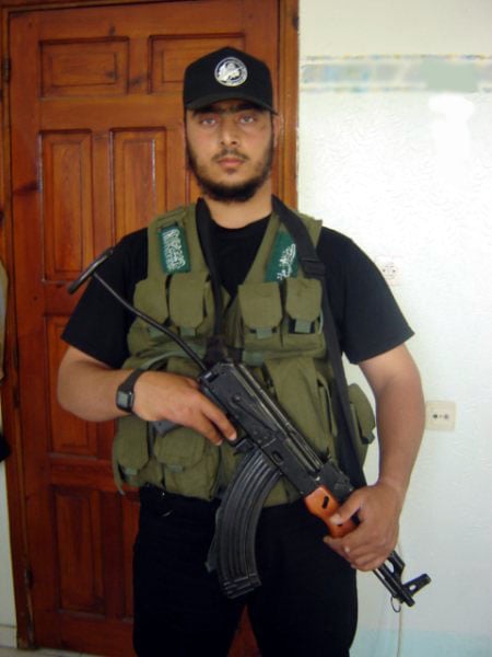
Posted by بلال الكحلوت - الاستشهادي شادي عبدالرحيم الكحلوت استشهد بعد اطلاق النار عليه وهو يحمل عبوة ناسفة تزن «15 كيلو جرامT.N.T وهو متوجه لمعبر كيسوفيم لتنفيذ عملية استشهادية

Posted by بلال الكحلوت - Pre-Nakba Aerial view of the village / صورة من الجو للقرية اخذت قبل النكبة
- That is how the "civilized" erased and replaced us: Ni'ilya as completely obliterated except for a few remaining structures, as you see -- نعليا باتت أثر بعد عين. من هنا مر الهمجّ
- خارطة تُظهِر الحدود والطرق بأنواعها والأماكن المقدسة والطبيعة الطوبغرافية من تلال وسهول ومنحدرات والتشكيلة الطبيعية للأرض وأنواع المزروعات. نُشرت الخريطة فترة الانتداب البريطاني، تم إضافة تعديلات عليها من قِبَل خدمة الخرائط والصور التابعة للقوات العسكرية الاسرائيلية فترة الأربعينيات.
Want to browse more? 80,000 pictures were grouped in these gallaries:
| Display Name | Clan/Hamolah | Country of Residence |
| بلال الكحلوت | - | - |
| zanozza | zanozza | usa, usa |
| حمدي احمد ابراهيم الكحلوت | الكحلوت | غزة, غزة |
| eng.osama | shaheen | - |
| BHSammour | سمور | الرياض , الرياض |
| سمّور | سمّور | ابوظبي, الامارات |
| ابوطلال | المقيد | رفح شمال سيناء, مصر |
| محمد الكحلوت | الكحلوت | - |
| DrShaheen | شاهين | الرياض, السعودية |
| Mr Wonders | سمّور | USA |
| غزاوي | شو يعني | فش, نعليا |
| Dodiii78 | Al Mokayed | Riyadh, KSA |
| ابو دياب | المقيد | غزة, فلسطين |
| م.أبوبكر | المقيد | - |
| heno | AL_MOQAYED | jeddah, K.S.A |
| أبو أمير | المقيد | - |
- Tracing All That Remains of Ni'iliya since Nakba Duration: 5 min 2 sec
- قرية نعليا وتبقى في الذاكرة // انتاج فريد شاهين - ميار للانتاج الاعلامي Duration: 24 min 4 sec
- Return to Ni'ilya, 28/11/15
 Fake Valor: Why Did Zionist Jews Hoist Nazis Flag on Their Ships in the 1930s?
What is new?
-
Facts About Oct. 7th Gaza Raid
-
Remined Us Please:: Who Did Rape Who? Palestinians Raped Israelis? Or, was the other way around?
-
When Prof. Edward Said was invited to debate Bibi Netanyahu in the 1980s, watch what happened!
-
Ezra Klein of the NY Times on the "Jewish Race".
-
Abusing Blood Libel!
-
Did Israeli Soldiers Activate The Hanniba Direective On Oct. 7th? You Be The Judge
-
Zionist FAQ: Isn't it true that Palestinians don't want peace? Palestinians never accepted the two-state solution
- Facts about Haavara (Transfer) Agreement between Ben-Gurion & Hitler
-
Haavara FAQs: Why Did Zionist Jews Hoist Nazis' Flags on Their Ships in the 1930s?
- Haavara FAQs: When Chaim Weizmann met FDR in mid-1943, why was he silent about rescuing European Jewry?
-
Dear ChatGPT: How did Palestinians resist Napoleon's invasion of their country in 1799?
-
Dear ChatGPT: Gaza had a vibrant Jewish community in the mid-17th century. What happened to them?
-
Dear ChatGPT: Why did the Jewish Agency suppress news of the Holocaust during WWII?
-
Video Playlist: Jews share their DNA tests to end the conflict for good.
-
A Tale of Two Conflicts: Examining the Definition of Genocide
-
Prof. Abraham Polak And The Suppressed History of the Khazars and European Jewry
-
How Ronald Reagan would have framed the genocide in Gaza if he were still alive?
-
Haavara FAQs: Let us do the math: how many German Jews did The Haavara Agreement save?
-
Zionist FAQs: The Hebron Massacre of 1929, "clearly proves" that Palestinians are antisemitic, how could you deny it?
-
Zionist FAQs: Why Anti-Zionist Is Not Antisemitism?
-
Zionist FAQs: Isn't it true that the KGB created Palestinian Nationalism in the early 1960s?
- Zionist FAQs: Muslims are killing Muslims all the time; why are Israeli Jews being singled out in the media?
- Zionist FAQs: How is Israel an apartheid state when 20% of its citizens are Arabs who enjoy full rights?
-
Haavara FAQs: Why Did Dorothy Thompson Flip From A Zionist Advocate to A Silenced Dissenter?
-
Haavara FAQs: Analysis of Herzl's Uganda Scheme and how it could have saved millions of Jews.
-
Haavara FAQs: Why did Hayim Greenberg describe American Jewry as "morally bankrupt" in early 1943?
-
Haavara FAQs: What if the Evian Conference was a resounding success? What would have been the impact of saving European Jewry on Zionism?
- Haavara FAQs: What if the six million were saved, how that would have impacted the Zionist project?
-
Haavara FAQs: How did Zionist leaders react when Europe's Jews lingered in the DP camps after WWII ended?
-
Why does the American Jewish community repeat lies that David Ben-Gurion had debunked before he died?
-
Who has the power to rename the Tatar/Khazar Gene Marker to Jewish IV?
-
Zionist FAQs: Why won't Egypt, Syria, and Jordan take their people back? Jews are indigenous to Palestine, and Arabs immigrated after Jews developed the country. Arabs should leave.
-
Haavara FAQs: Did Hitler and the Nazis conflate between Judaism and Zionist? If that wasn't case, then why?
-
Haavara FAQs: Winston Churchill and antisemitism, a collection of articles written Churchill.
-
Haavara FAQs: Broken by country, how many Jews survived vs. killed during the Holocaust?
-
Haavara FAQs: Why did European Jews vote with their feet and to immigrated to the Americas, not Palestine, after WWII?
-
Watch this American Jewish Girl describing Israeli Jews' cognitive dissonance like no other in under two minutes
-
Haavara FAQs: When the Nazis went out of their way to hide the Holocaust, Israeli Jews did the exact opposite by broadcasting their genocide of Gazans. But why?
-
Haavara FAQs: How Zionist Jews went out of their to show their appreciation to Nazism and Fascism?
- Haavara FAQs: Why Zionist leaders were against bombing the death camps & the Railroads leading to them?
-
Haavara FAQs: Hitler's message to the British and American people: If Jews are such noble citizens and you care about them, how come you're not letting them in? I will gladly ship them to you at my expense, even on luxury liners!
-
A shortlist of Zionist and Israeli false flag operations in the name Jews.
-
The Most Moral Army
- The Land of Kapos (Israel): Where the brave are boycotted and Kapos walk free.
- Why did early Zionists often named their communal enterprises "colonial"?
- Zionist Relations with Nazi Germany by Faris Glubb
-
Two NY Times advertisements by Zionists in the early 1943 that exposes Zionists' treason at the height of the calamity
- Facts Not Lies about the Palestinian-Israeli Conflict.
- Site's pictures have been categorized
- Campgain Against Lice
- A Survey of Palestine, the official source about Palestine before Nakba produced by the British Mandate; over 1200 pages.
- Satellite View & Google Earth: Over 6,000 placemarks identifying all destroyed towns, W. Bank & Gaza Strip Towns, & refugee camps.
- PalestineRemembered.com and its Nakba Oral History Project were featured on al-Jazeera Satellite TV.
- Nakba Oral History Video Podcast:
 Over 700 Oral History interviews (including 3,500+ hours of recording) can be viewed online.
 - Palestine Village Statistics Project
- Gaza Jail Break
- النسخة العربية للموقع الان متوفرة
- Videos: Documenting the destroyed villages in video: Tracing all that remains since Nakba.
- Videos: Responding to Zionist Propaganda
- Interview: The ethnic cleansing of Palestine: George Galloway interviews Israeli Historian Ilan Pappe.
- For Palestinians, memory matters. It provides a blueprint for their future By George Bisharat.
- Zionist FAQ now available in Hebrew שאלות שציונים שואלים, עכשיו בעברית
- Video: The Stephen Walt and John Mearsheimer report on the influence of the Israel Lobby on U.S. Foreign Policy
- The Palestinian-Israeli conflict for beginners
