| PalestineRemembered | About Us | Oral History | العربية | |
| Pictures | Zionist FAQs | Haavara | Maps | |
| Search |
| Camps |
| Districts |
| Acre |
| Baysan |
| Beersheba |
| Bethlehem |
| Gaza |
| Haifa |
| Hebron |
| Jaffa |
| Jericho |
| Jerusalem |
| Jinin |
| Nablus |
| Nazareth |
| Ramallah |
| al-Ramla |
| Safad |
| Tiberias |
| Tulkarm |
| Donate |
| Contact |
| Profile |
| Videos |
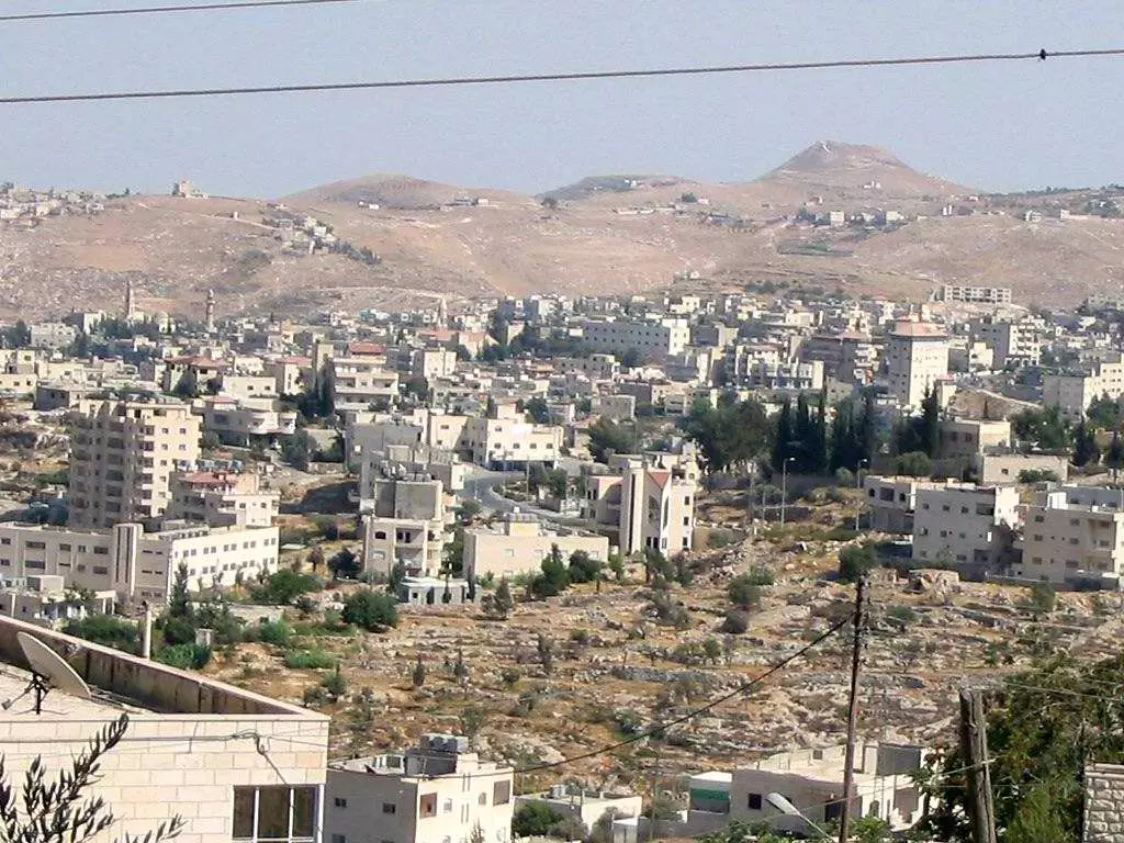
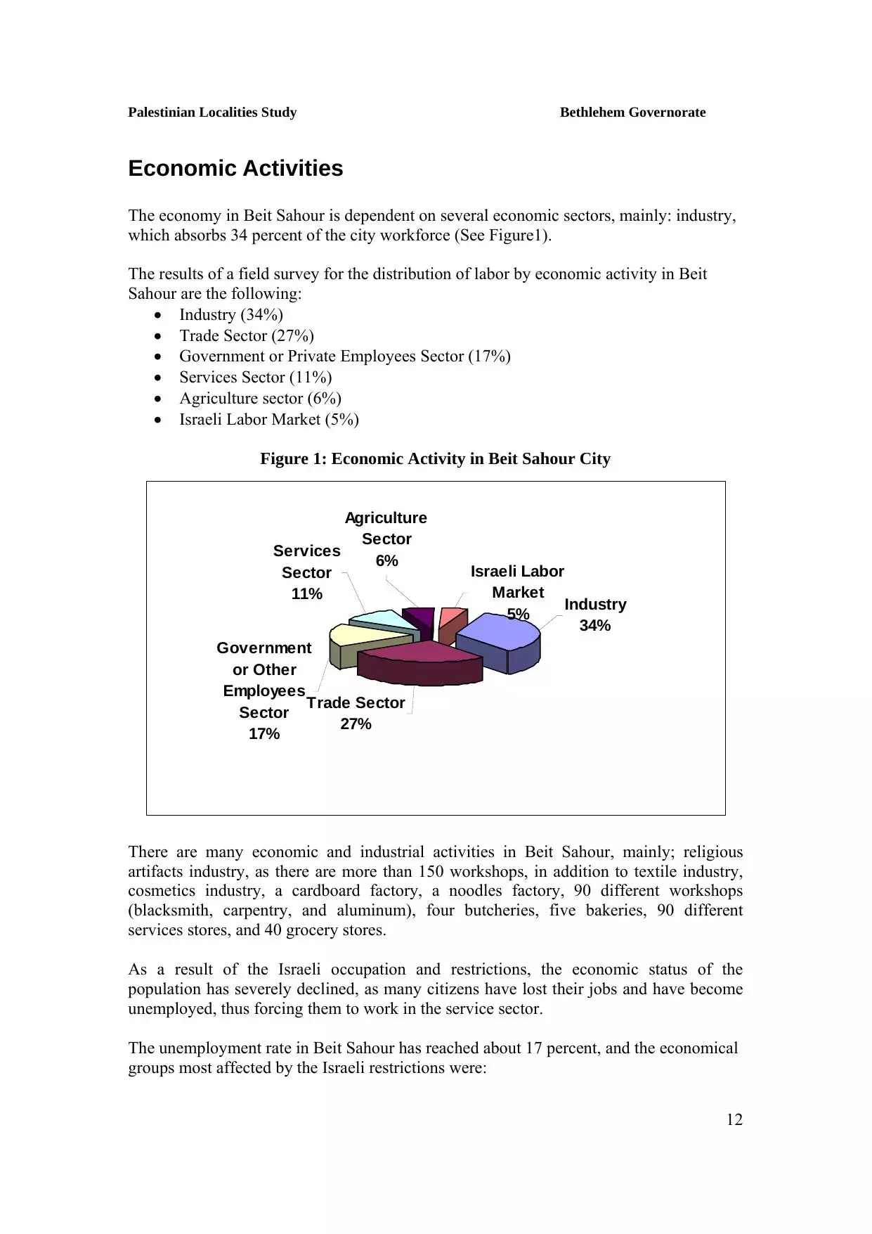
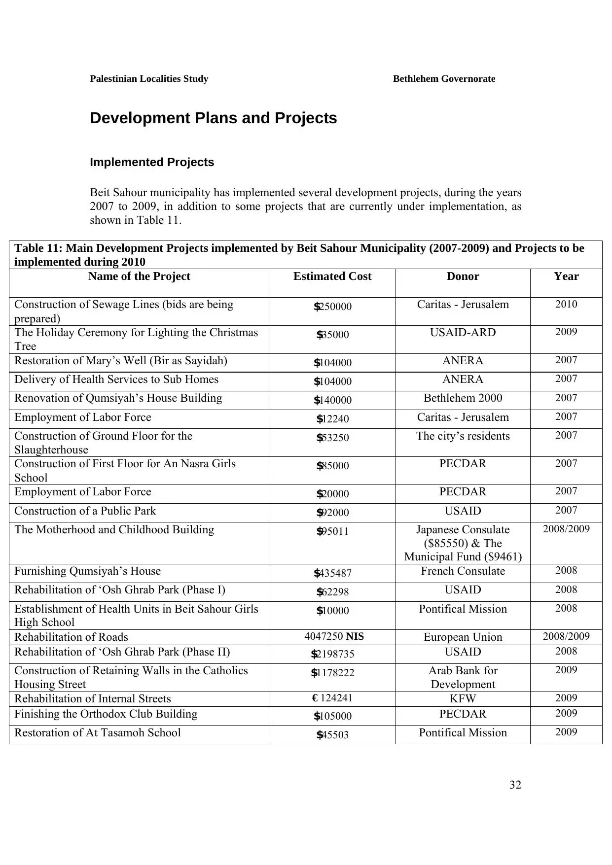
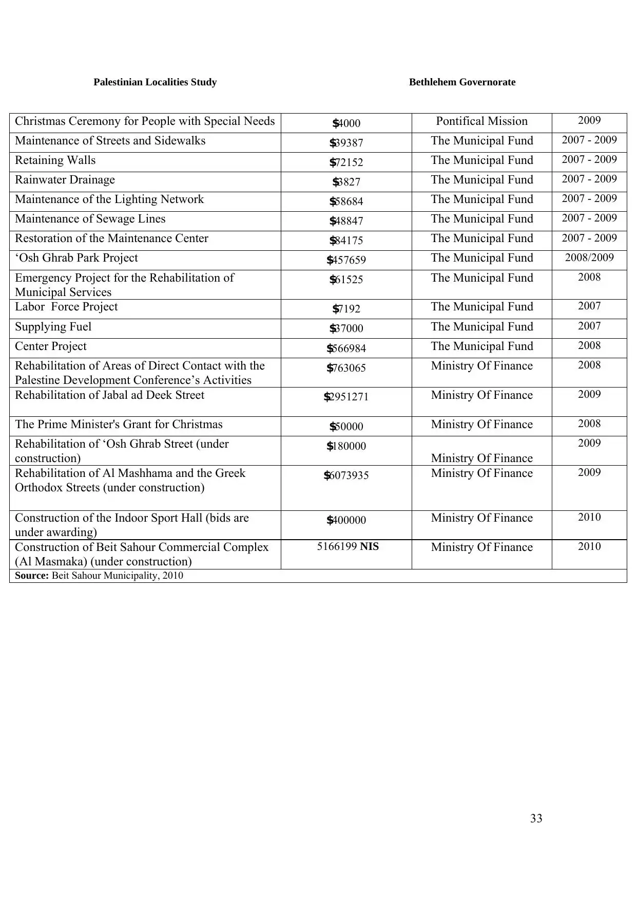
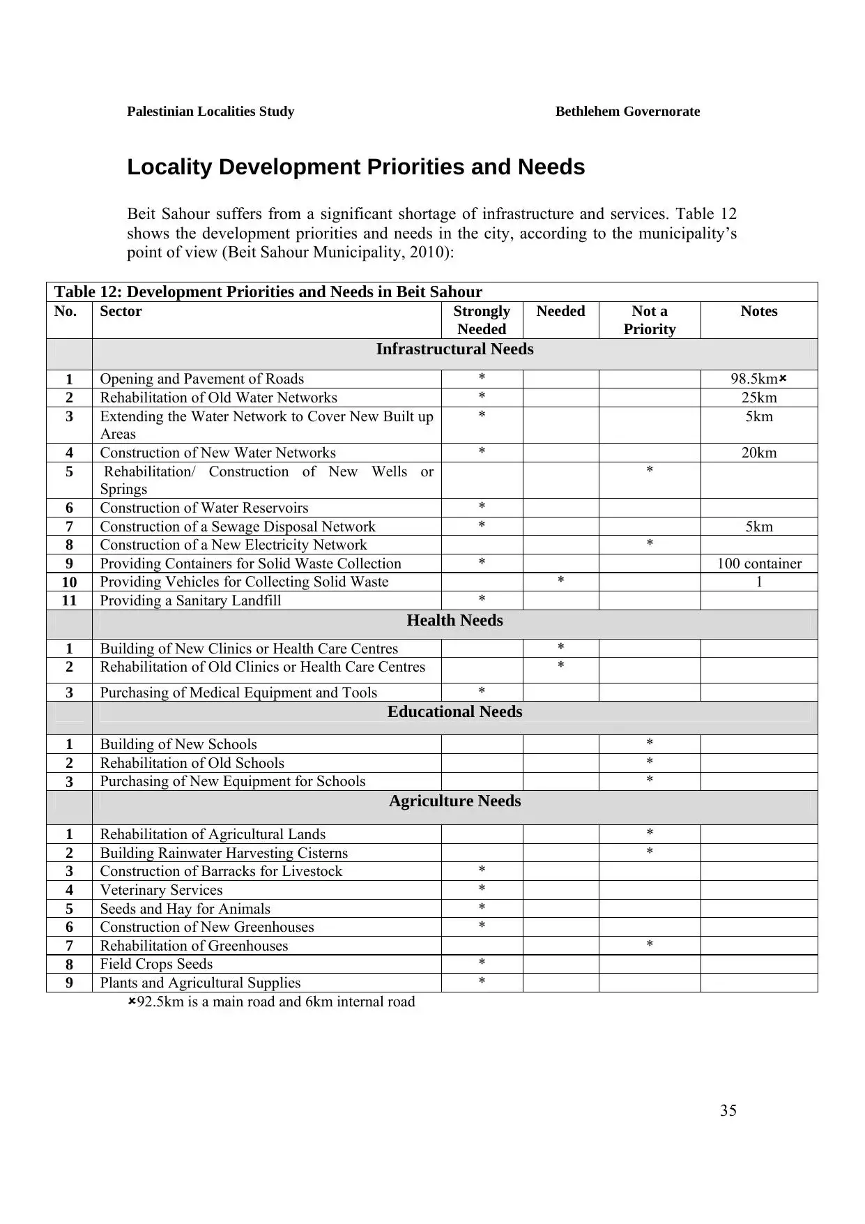
Welcome To Bayt Sahur - بيت ساحور (בית סאחור)
|
District of Bethlehem
Occupied days ago |
العربية Google Earth |
 |
Gallery (90) |
- Statistics & Facts
-
Before & After

- Satellite View
- Articles 2
- Pictures 90
- Aerial Views 1
- Mayrters & Prisoners 1
- Members 10
- Families
- Wikipedia
- ARIJ Guide
- Videos 1
- Guest Book 6
- Links 2
| Statistic & Fact | Value | ||||||||||||||||||||||
| Distance From District | 2 km east of Bethlehem | ||||||||||||||||||||||
| Elevation | 650 meters | ||||||||||||||||||||||
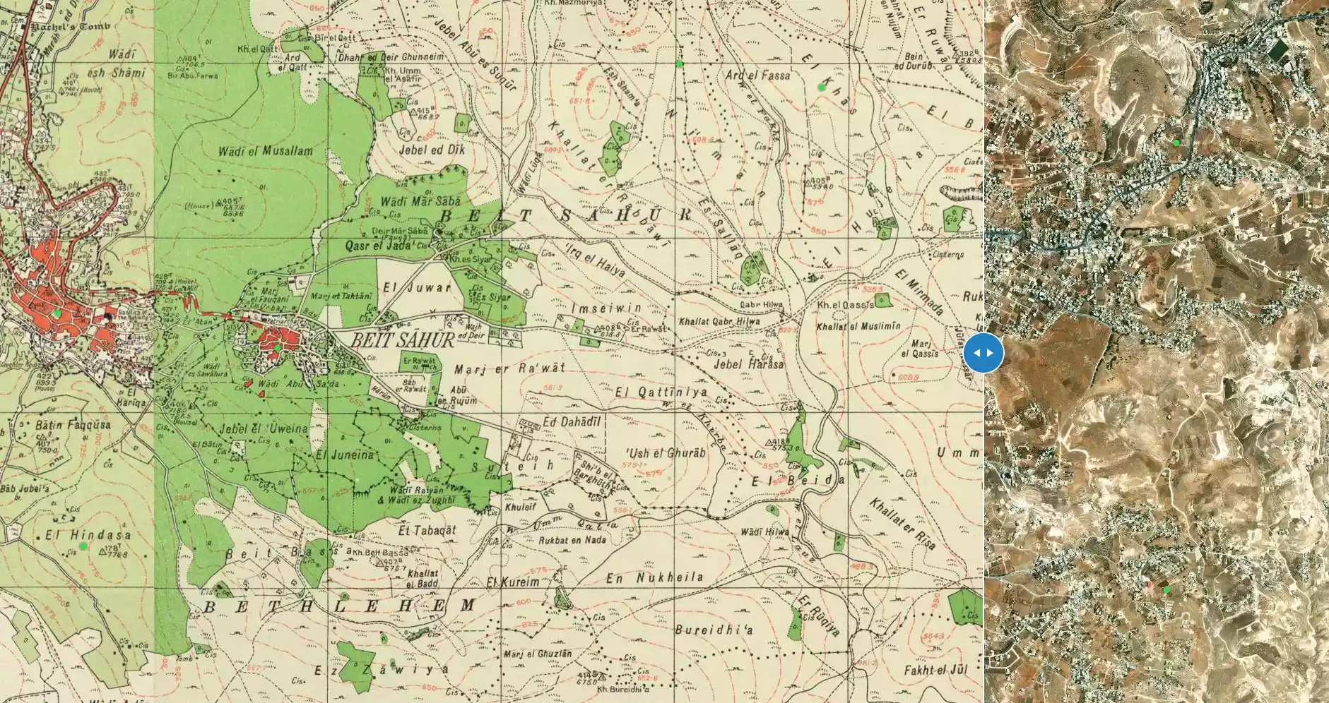
| Before & After Nakba, Click Map For Details |
|||||||||||||||||||||||
|
|||||||||||||||||||||||
| Pre-Nakba Aerial View |
|||||||||||||||||||||||
|
|||||||||||||||||||||||
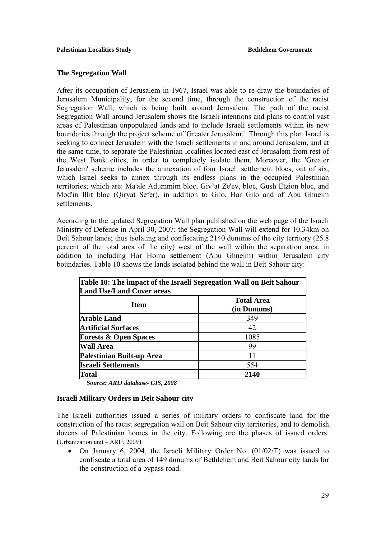
| Land Ownership |
**Town Lands' Demarcation Maps |
||||||||||||||||||||||
| Land Usage As of 1945 |
|
||||||||||||||||||||||
| Population |
|
||||||||||||||||||||||
| Near By Towns |
|||||||||||||||||||||||
|
|
|||||||||||||||||||||||
| Featured Video | |||||||||||||||||||||||
| ARIJ Guide | |||||||||||||||||||||||
3.
4. 
5. 
6. 
7. 
8. 
9. 
10. 
11. 
12. 
13. 
14. 
15. 
16. 
17. 
18. 
19. 
20. 
21. 
22. 
23. 
24. 
25. 
26. 
27. 
28. 
29. 
30. 
31. 
32. 
33. 
34. 
35. 
36. 
Click here to browse online. |
|||||||||||||||||||||||
| Related Maps | Town Lands' Demarcation Maps خرائط للقضاء توضح حدود القرى والاودية View from satellite Town's map on MapQuest Help us map this town at WikiMapia |
||||||||||||||||||||||
| Related Links | Wikipedia's Page Facebook Page ARIJ Guide Google Search Google For Images Google For Videos في كتاب بلادنا فلسطين دليل أريج المزيد من موقع هوية |
||||||||||||||||||||||
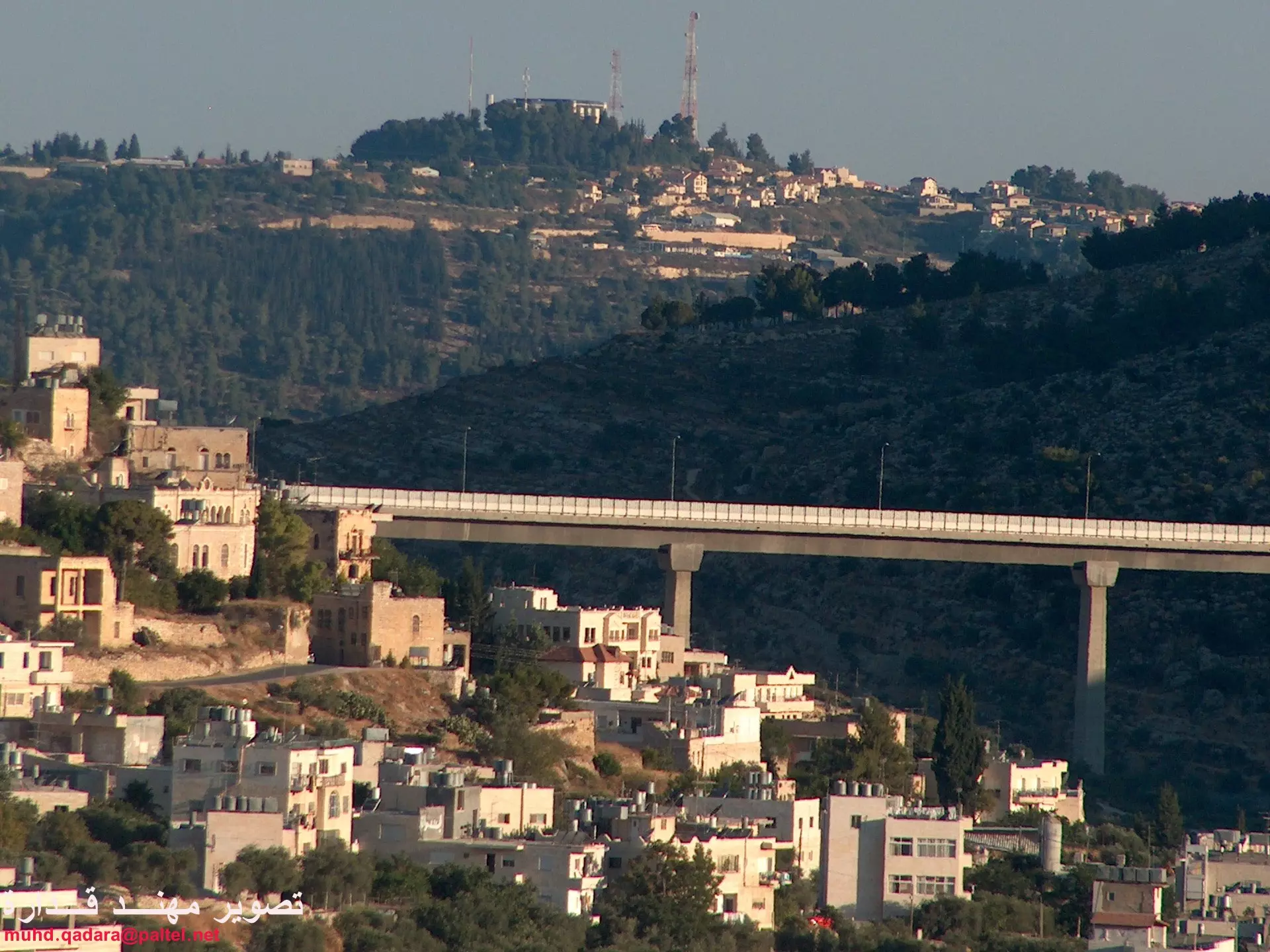
- General view #3, read the notes in the comments section for more details

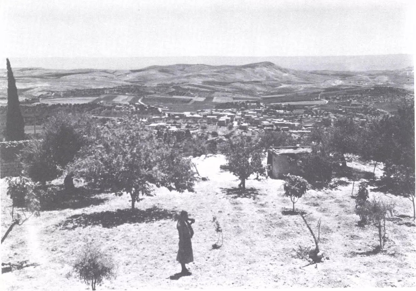
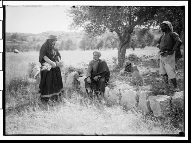
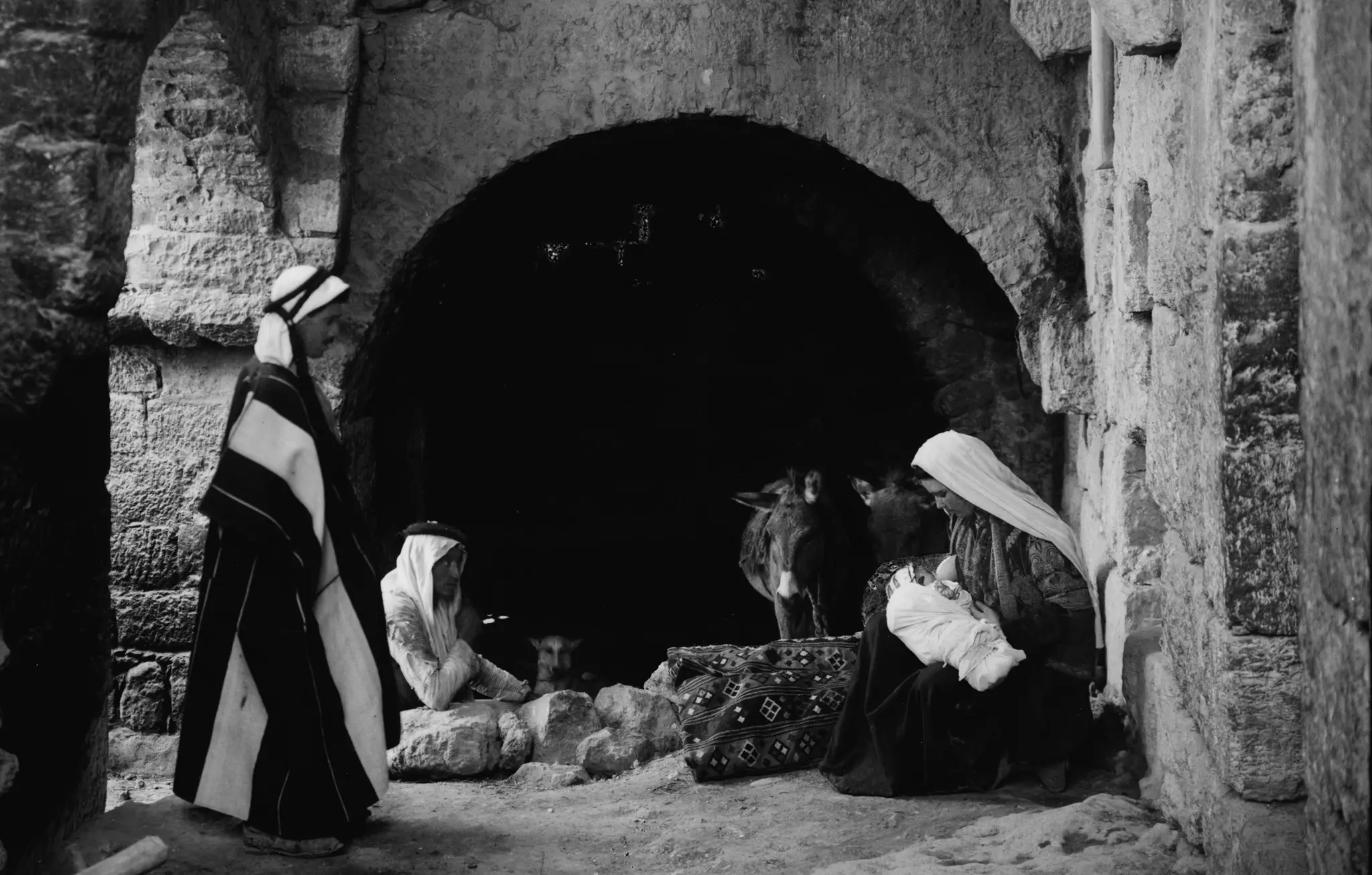
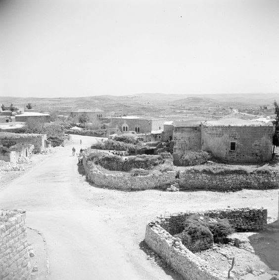
1 - General view #4. Undate old picture taken from Shepherds' Field nearby Bethlehem
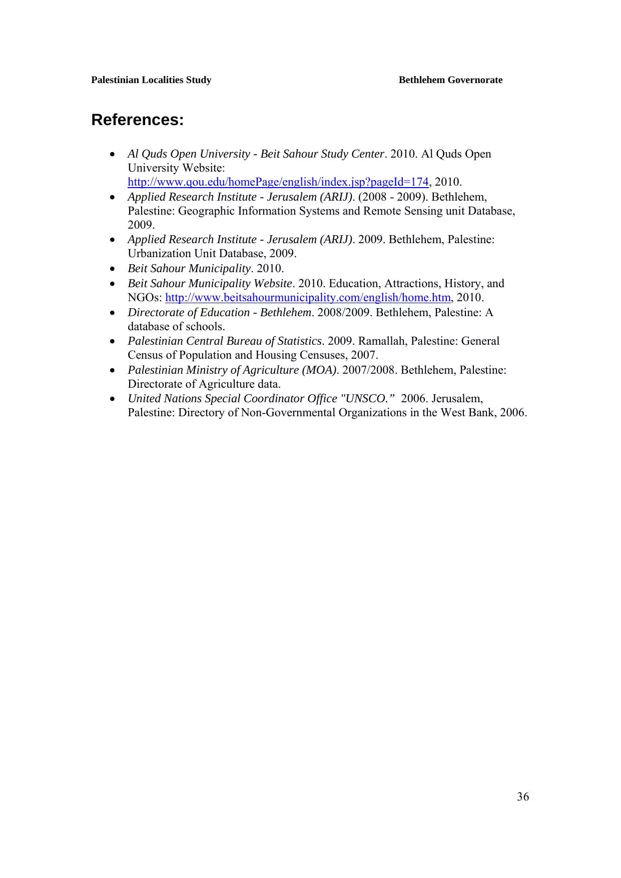
- General view #5 from plain of Shepherds (1920s )
- Sabt Alnur celebration 2007
Posted by khalil Atrash 1 - Yard in Beit Sahour
Posted by Fadel Haddad - Bayt Sahur-Andoni Family Marriage, 1929
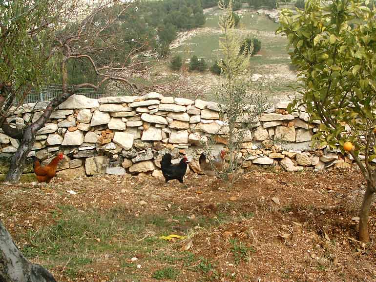
Posted by Fadel Haddad 1 - General view for the oilve fields
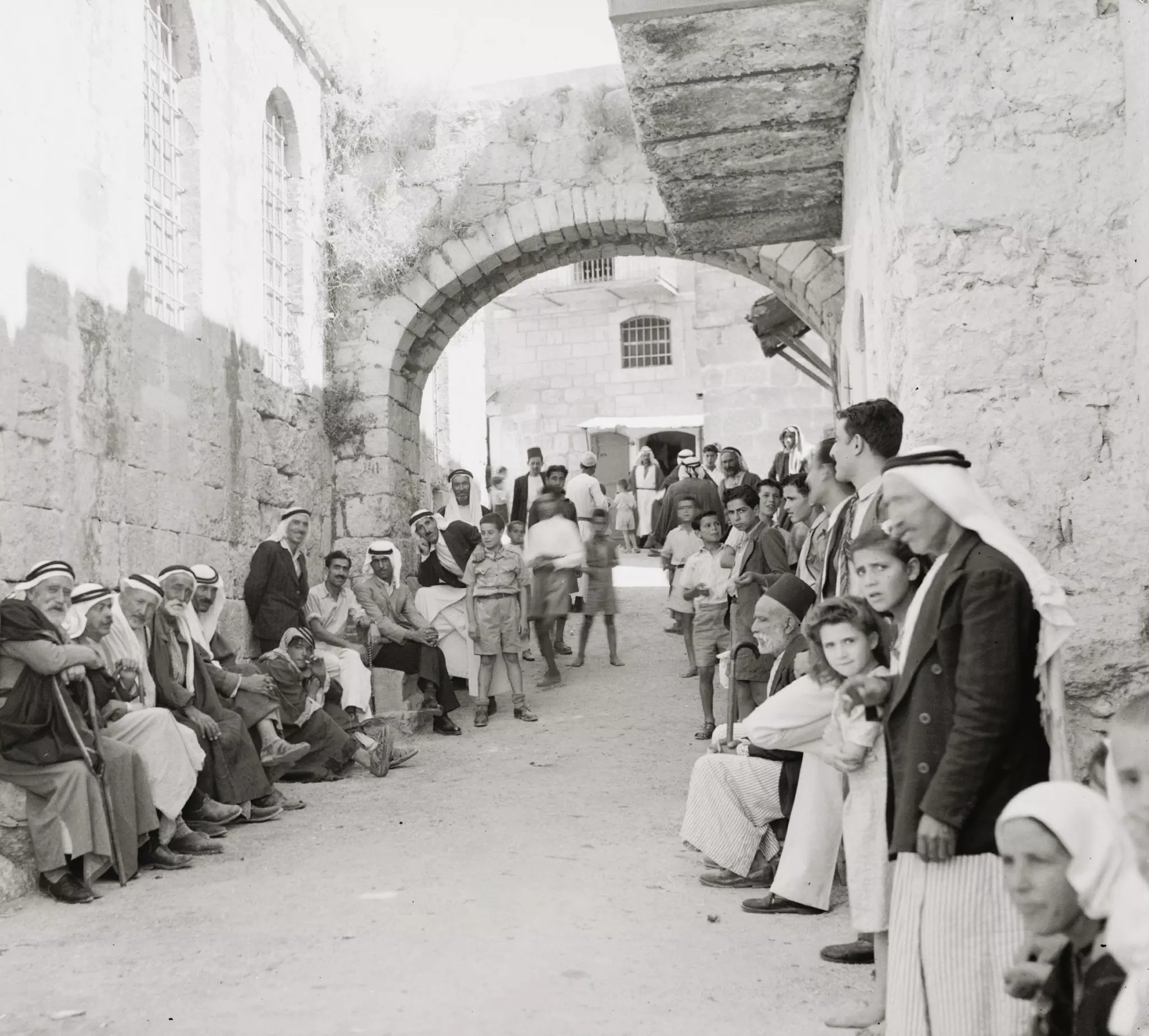
Posted by Fadel Haddad - A street scene in the old section
2 - ستبقى الجنوب شامخ

Posted by مهند قداره 1 - ستبقى الجنوب شامخ
Posted by مهند قداره 1 - Beit-Sahour
Posted by Ranoo Qumsieh - حقل الرعاة
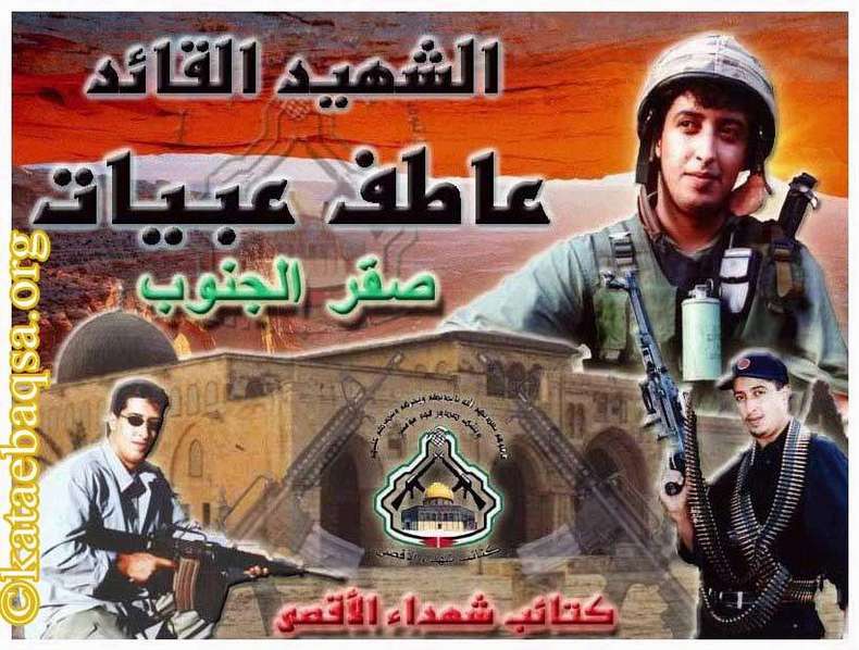
Posted by Ranoo Qumsieh 1 - الشهيد عاطف عبيات الذي استشهد في بيت ساحور
Posted by ايمن محمد عبد الله قطيط السيريسي 1 - Beit Sahour
Posted by Rami Atwan 1 - Beit Sahour 6
Posted by Rami Atwan - Beit Sahur, mid to late 1930s.
Posted by Rami Atwan 1 - حقل الرعاة - بيت ساحور تصوير Sohel Makhoul يوم 29.12.2011
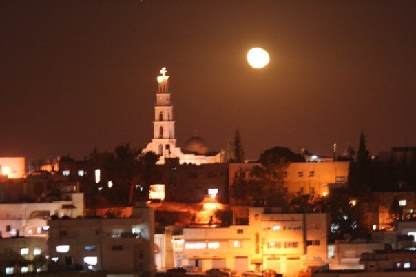
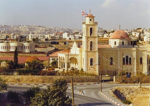
Posted by سهيل مخول - كنيسة حقل الرعاة - بيت ساحور تصوير Sohel Makhoul يوم 29.12.2011

Posted by سهيل مخول - قبة كنيسة حقل الرعاة - بيت ساحور تصوير Sohel Makhoul يوم 29.12.2011
Posted by سهيل مخول - بيت ساحور منظر عام لمنطقة حقل الرعاة تصوير سهيل مخول يوم 19.6.2012
Posted by سهيل مخول 1 - من بيت ساحور عام 1940
- صوره قديمه لموسم الحصاد في بيت ساحور
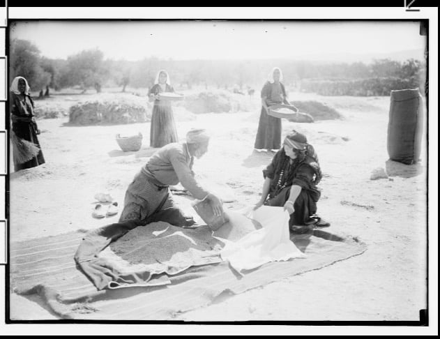
Posted by abu raya - صوره قديمه لموسم الحصاد في بيت ساحور
Posted by abu raya - صوره قديمه لموسم الحصاد في بيت ساحور
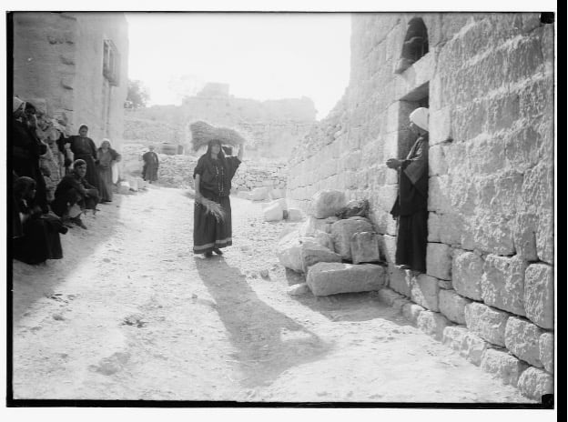
Posted by abu raya - منظر عام للبلدة القديمة
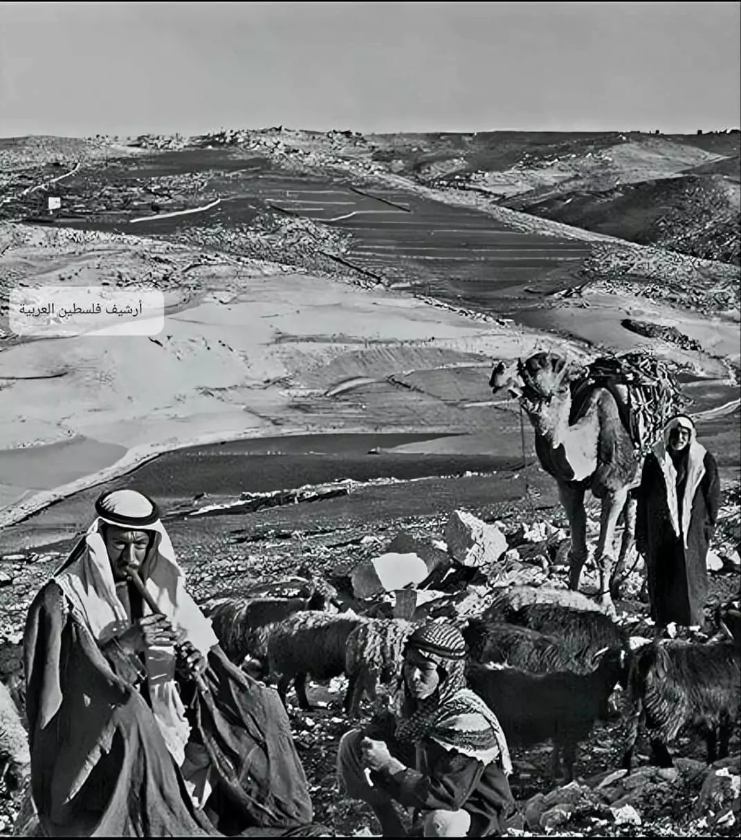
- رعي الاغنام بمحيط بيت ساحور - ١٩٤٠
- صورة لعائلة امام منزلهم بسنة ١٩٣٠ في بيت ساحور العامرة
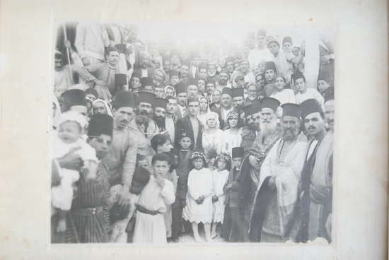
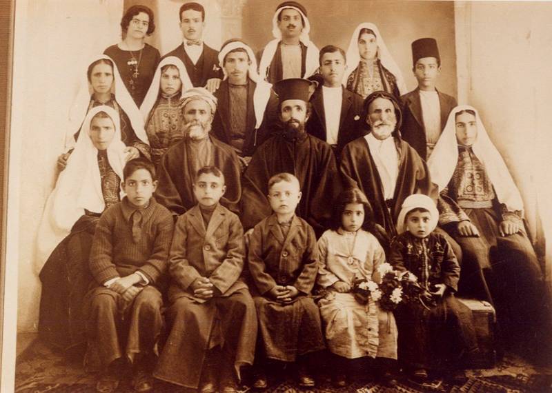
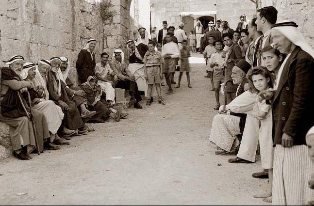
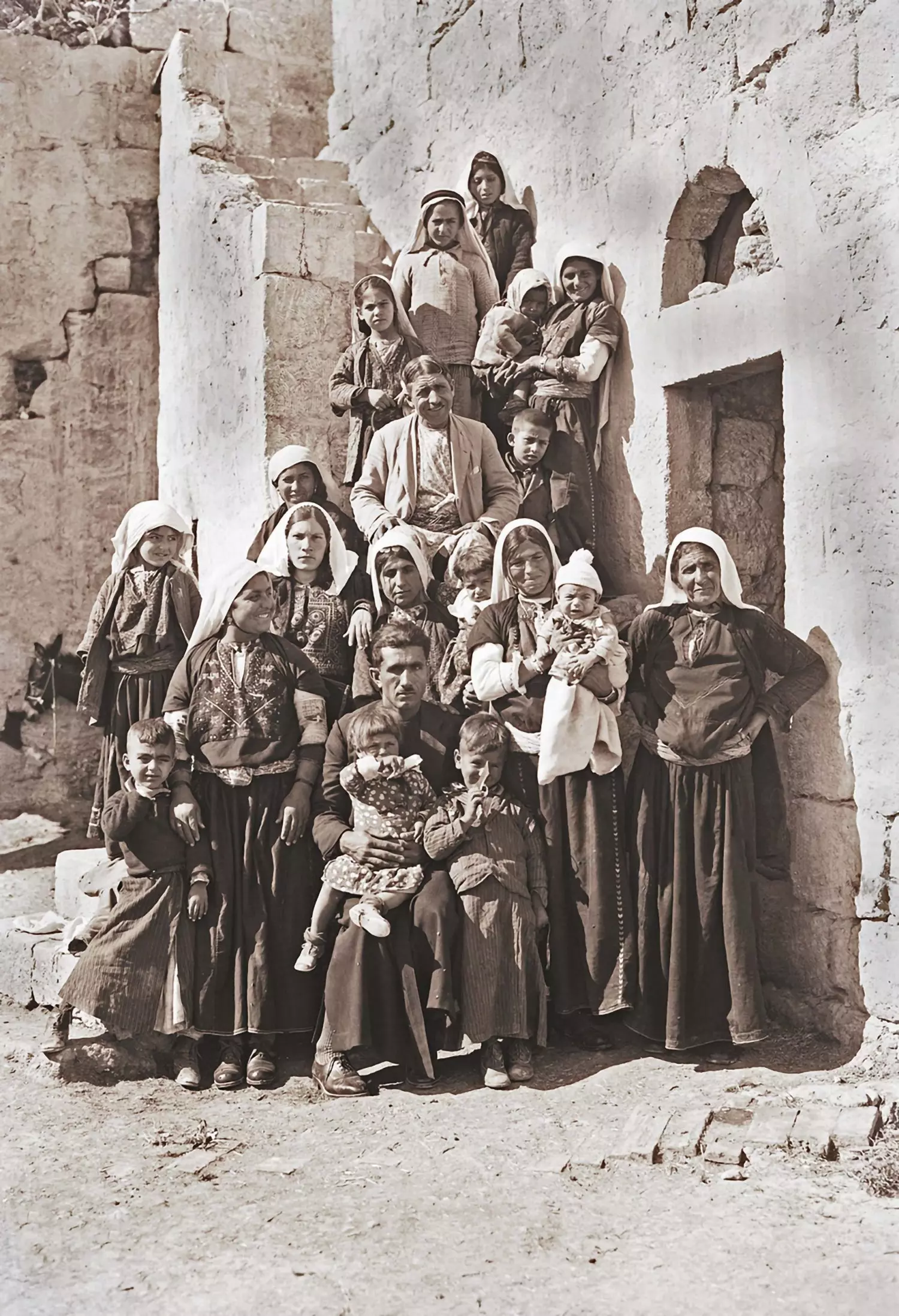
- صورة جماعية لأهالي قرية بيت ساحور قضاء بيت لحم عام 1921..
- بيت ساحور ، عند "القوس" والمدرسة الأرثوذكسية ا
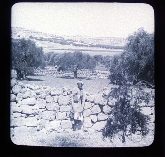
- A pre-WWI view

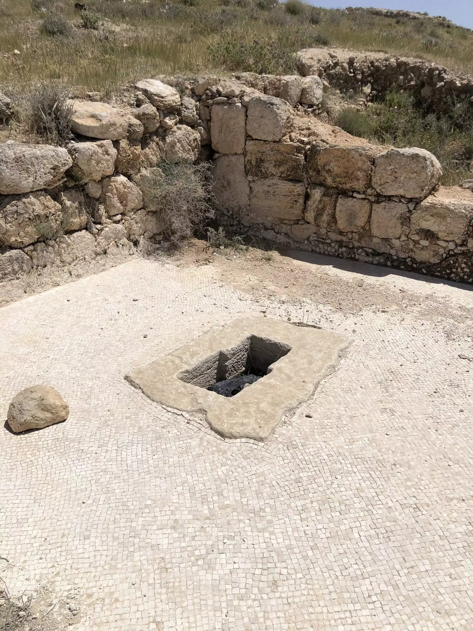
- دير مار سابا في بيت ساحور
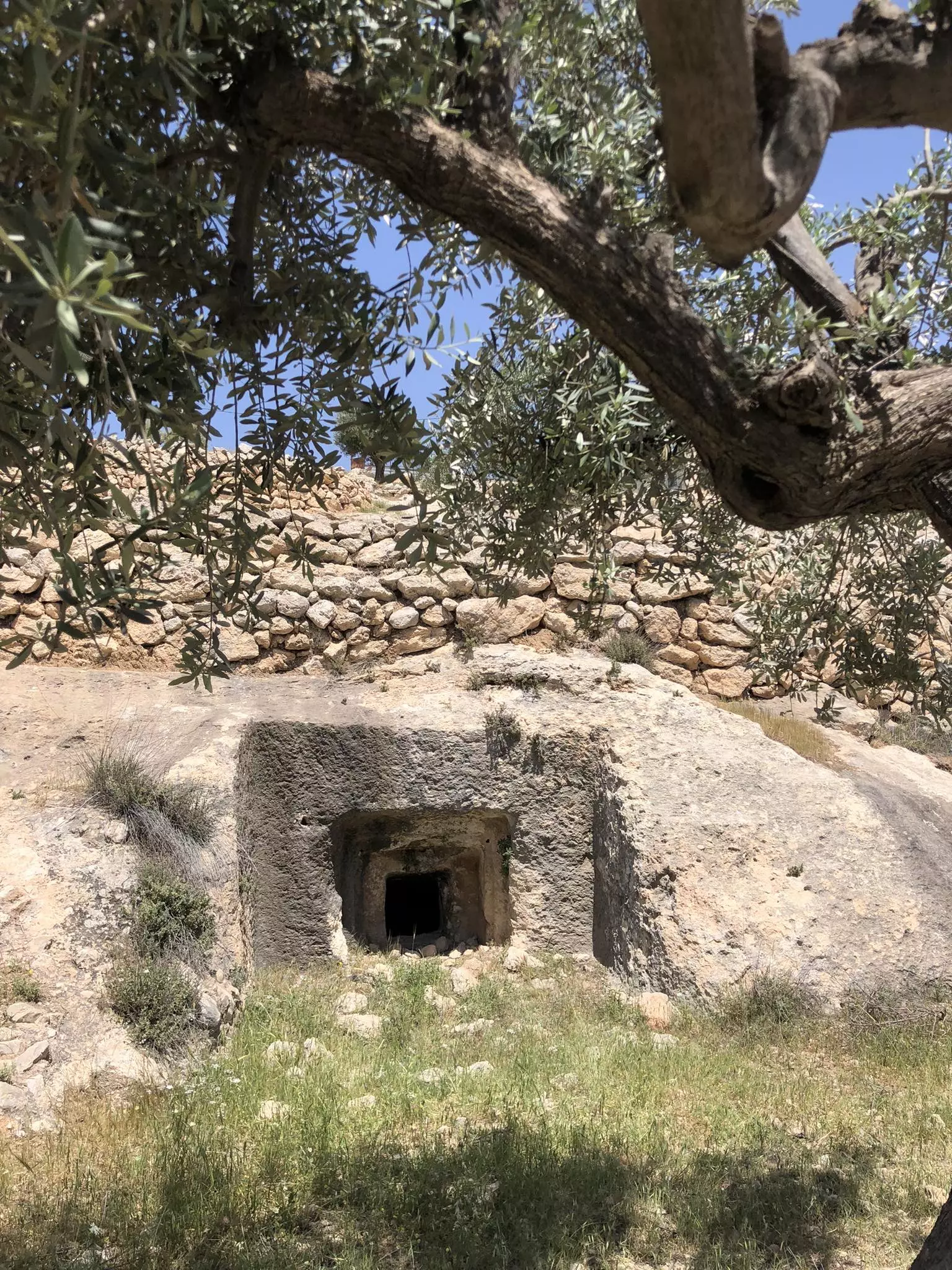
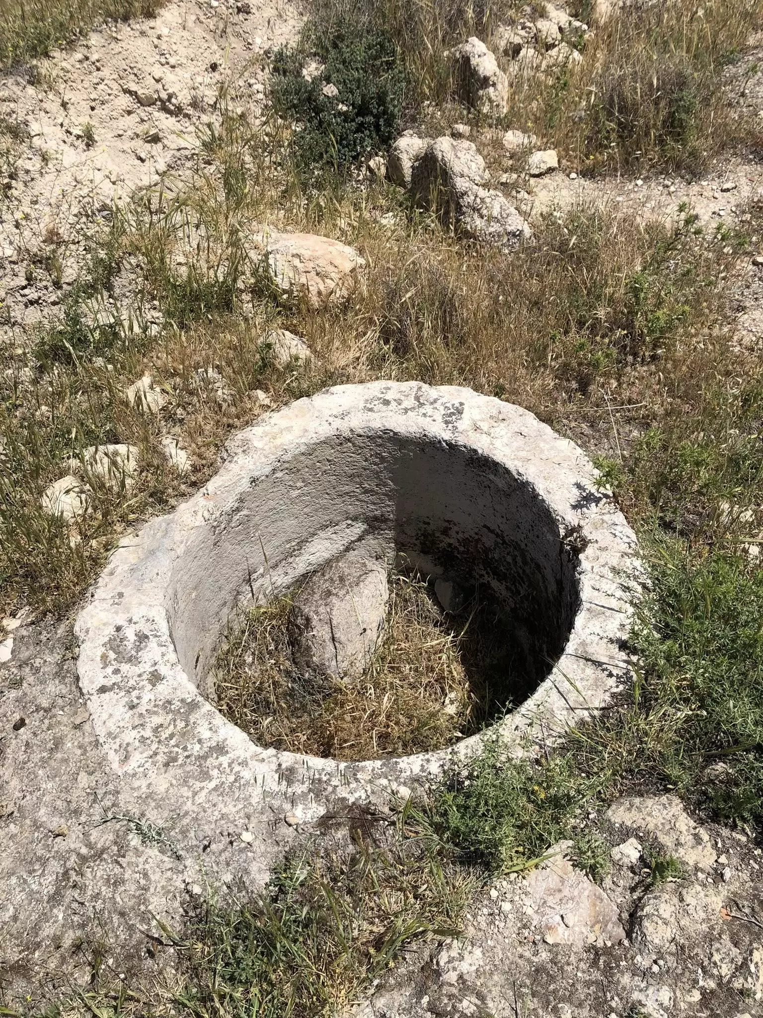
- مدفن منحوت في الصخر -- واجد النوباني
- بيت بصّة -- واجد النوباني
- بيت بصّة -- واجد النوباني #2
- بيت بصّة -- واجد النوباني #3
- بيت بصّة -- واجد النوباني #4
- نساء من البلدة وإحداهن تحمل شمعة كبيرة لطقس ديني، في الطريق نحو كنيسة الرعوات
1 - حقل الرعاة في بيت ساحور. سنة 1921م
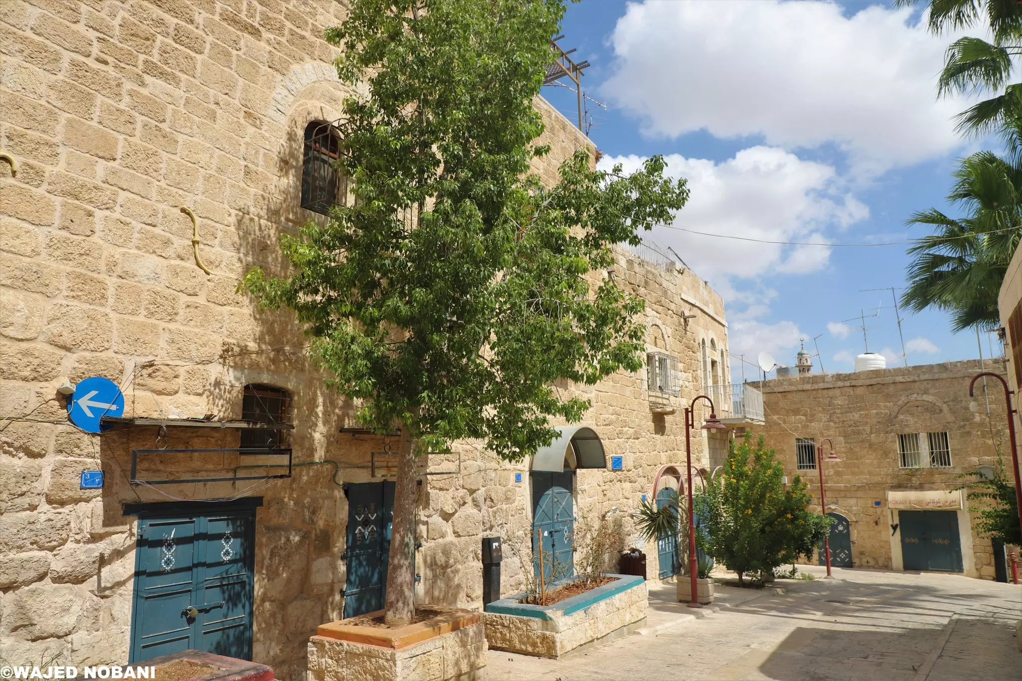
- جولة بين بيوت بيت ساحور القديمة -- واجد النوباني

- جولة بين بيوت بيت ساحور القديمة -- واجد النوباني #2
- جولة بين بيوت بيت ساحور القديمة -- واجد النوباني #3
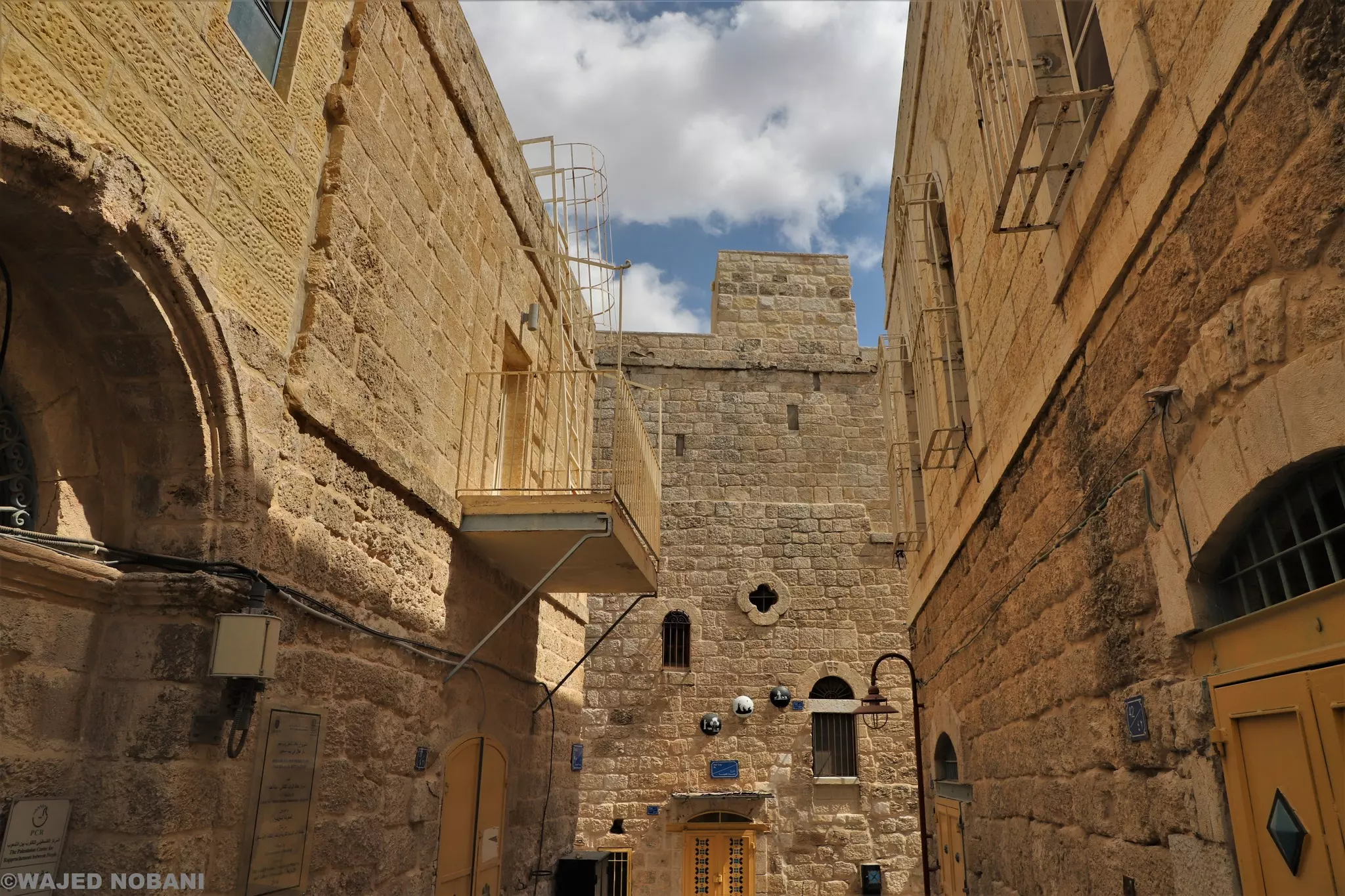
- جولة بين بيوت بيت ساحور القديمة -- واجد النوباني #4
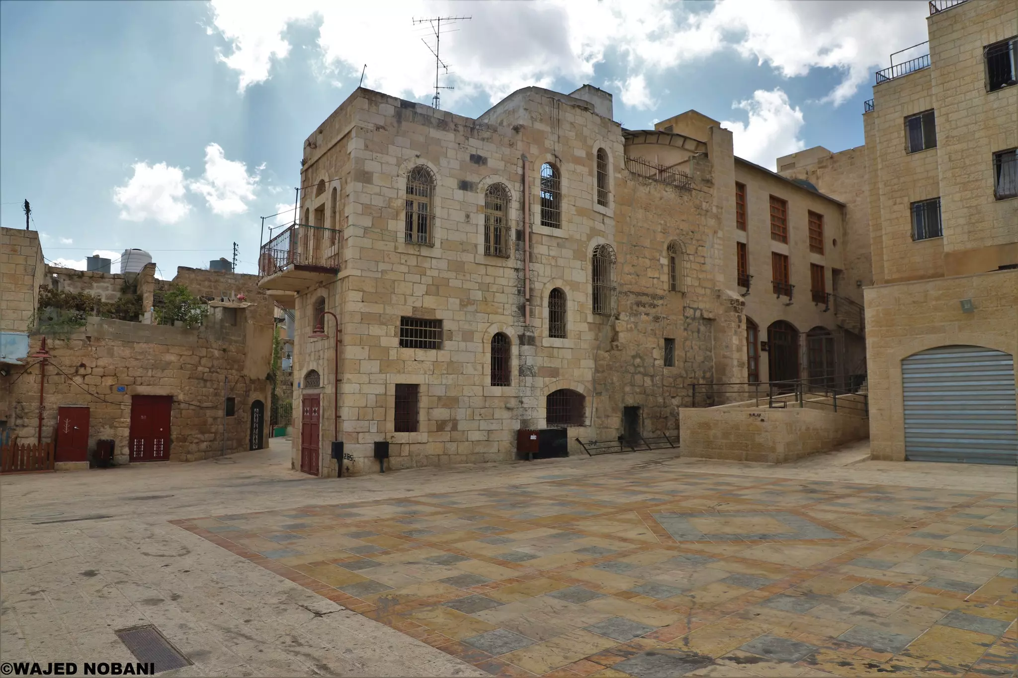
- جولة بين بيوت بيت ساحور القديمة -- واجد النوباني #5
- بيت ساحور في يوم ماطر--1921
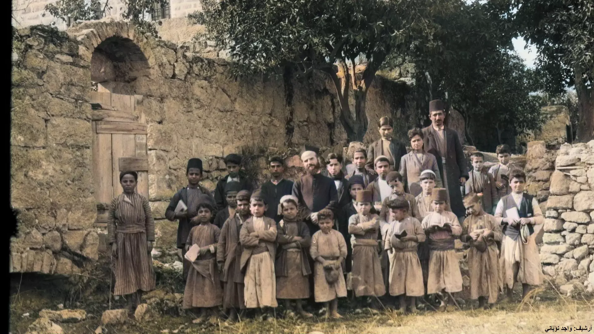
- بيت ساحور، واحدة من المناطق التي اهتمت بشدة بالعلم والمعرفة، هذه الصورة قبل أكثر من 100 عام، تُظهر عدد من الأطفال خلال يوم تعليمي وهم يحملون كتبهم.
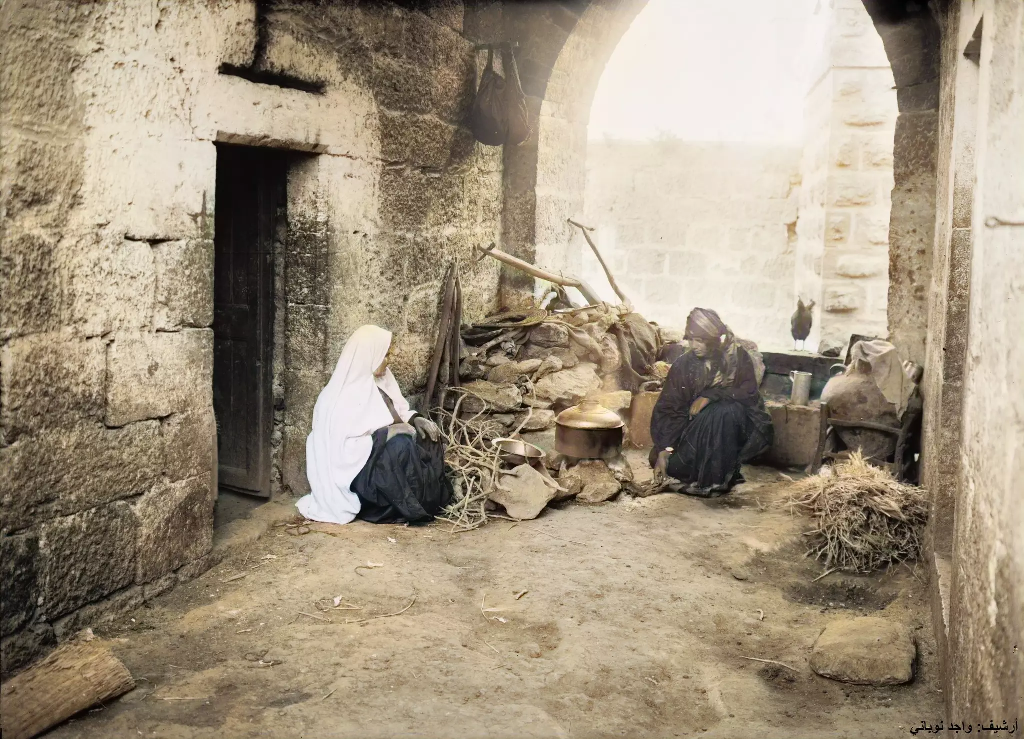
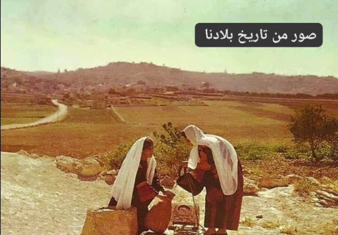
- إمرأة من البلدة في ساحة بيتها وهي ترتدي الشال الأبيض، ويبدو أن في استضافتها امرأة من إحدى قرى عرب التعامرة.
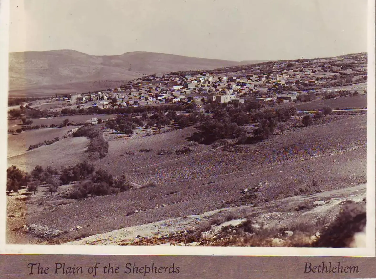
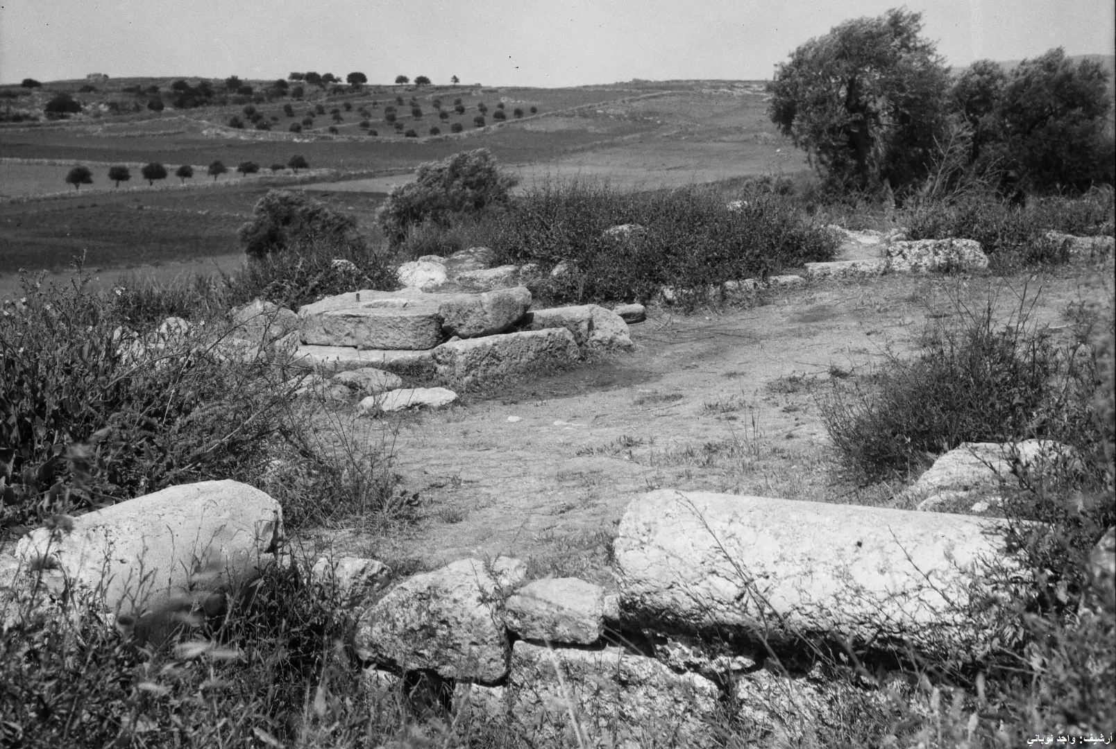
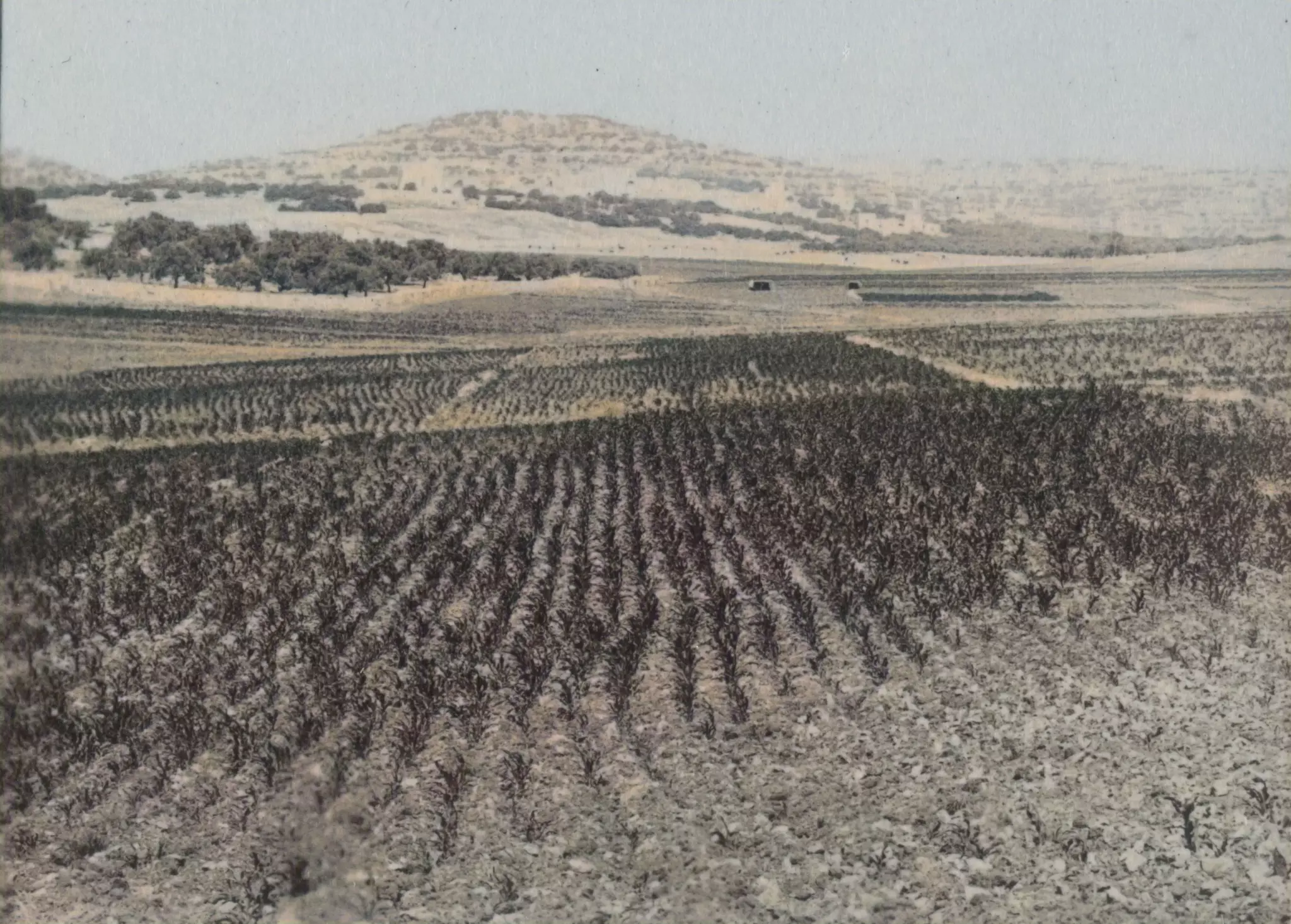
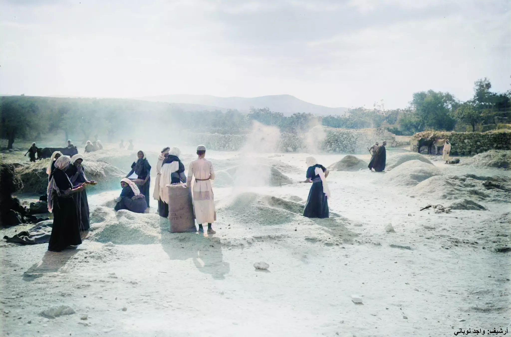
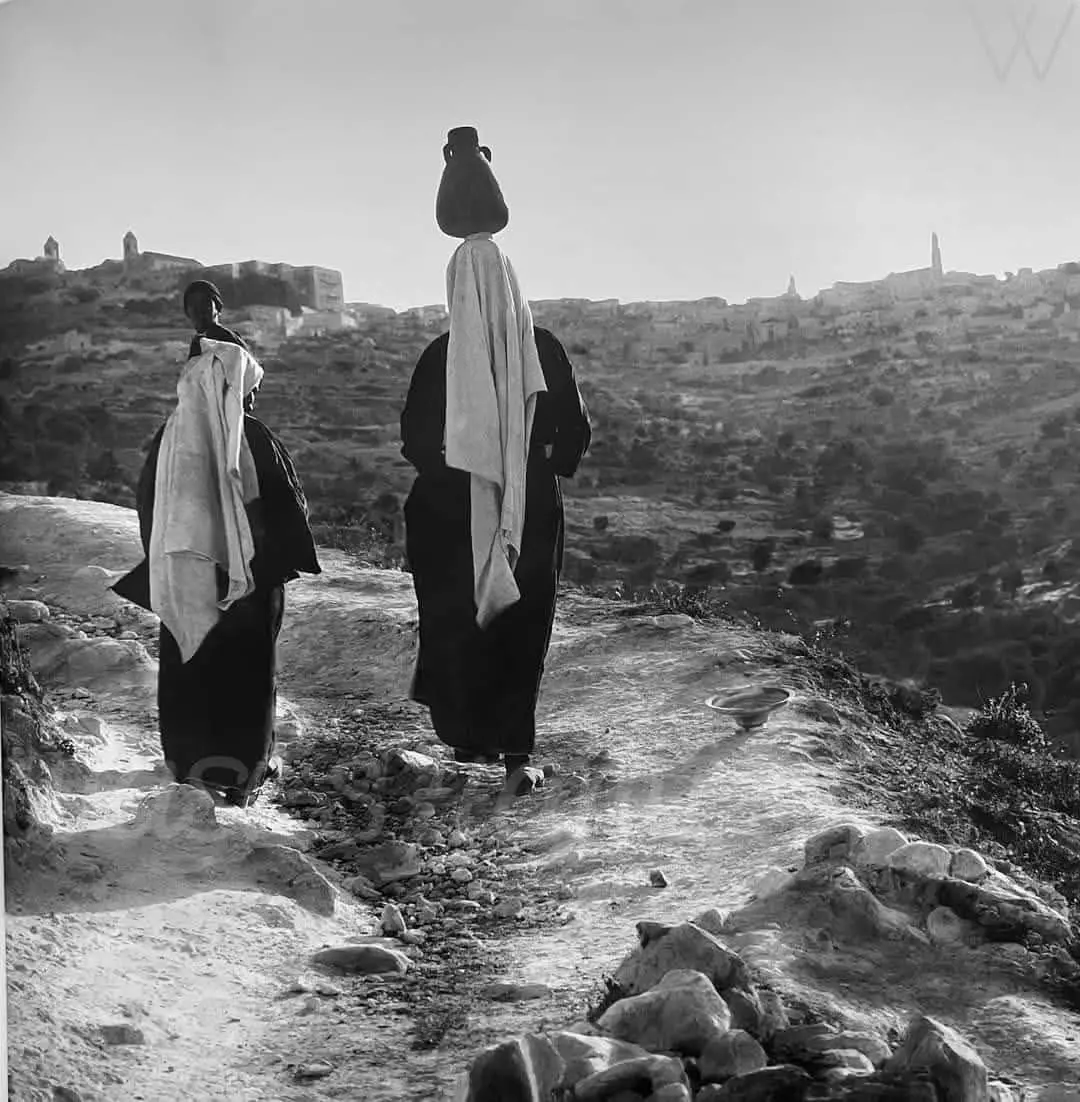
- مرج الرعوات في بيت ساحور 1896م
- عائلة من بيت ساحور في بيتها. 1934م
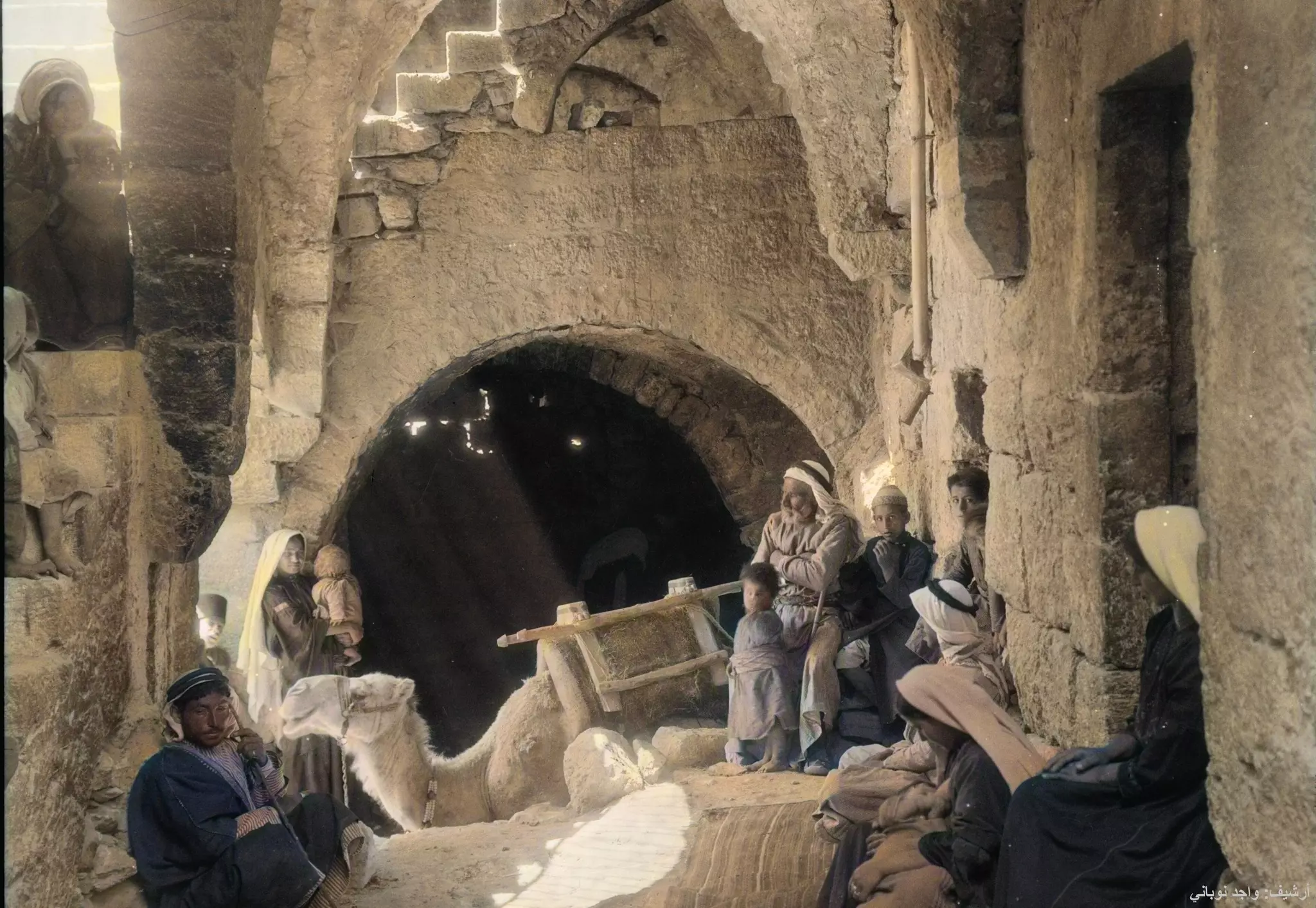
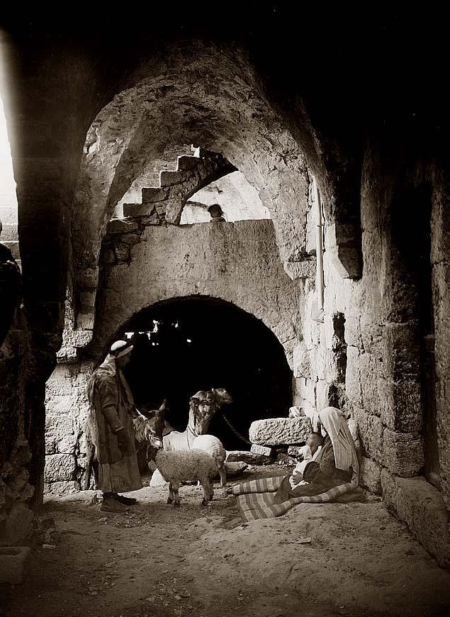
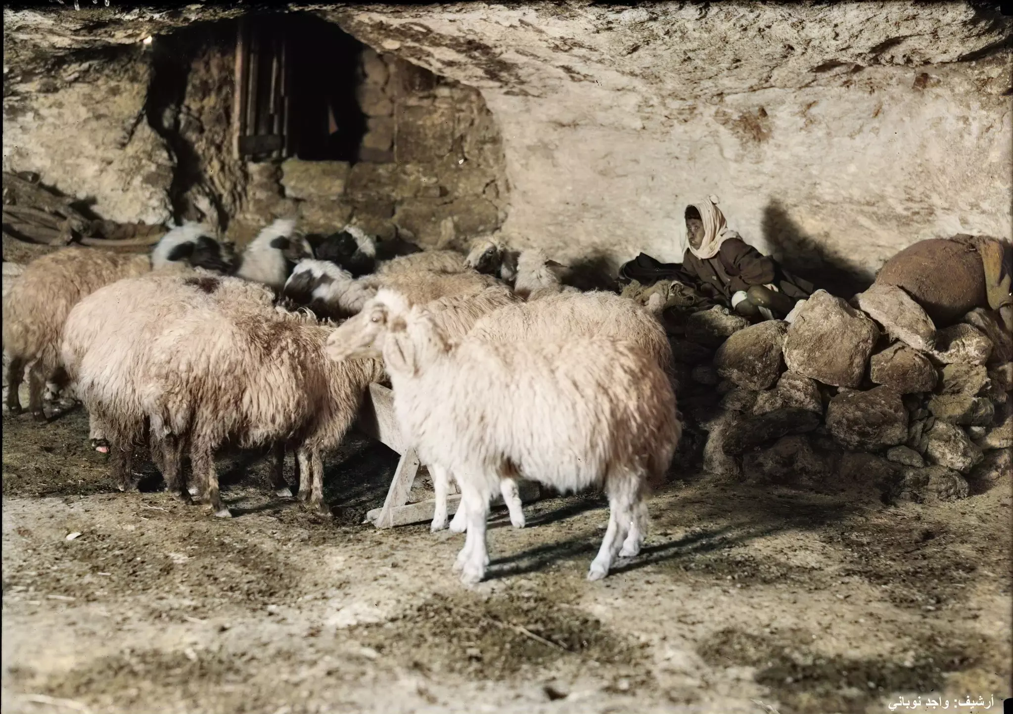
- صورة رائعة ومفرحة. هذا الفتى داخل كهف مع ماشيته في بيت ساحور عام 1934م
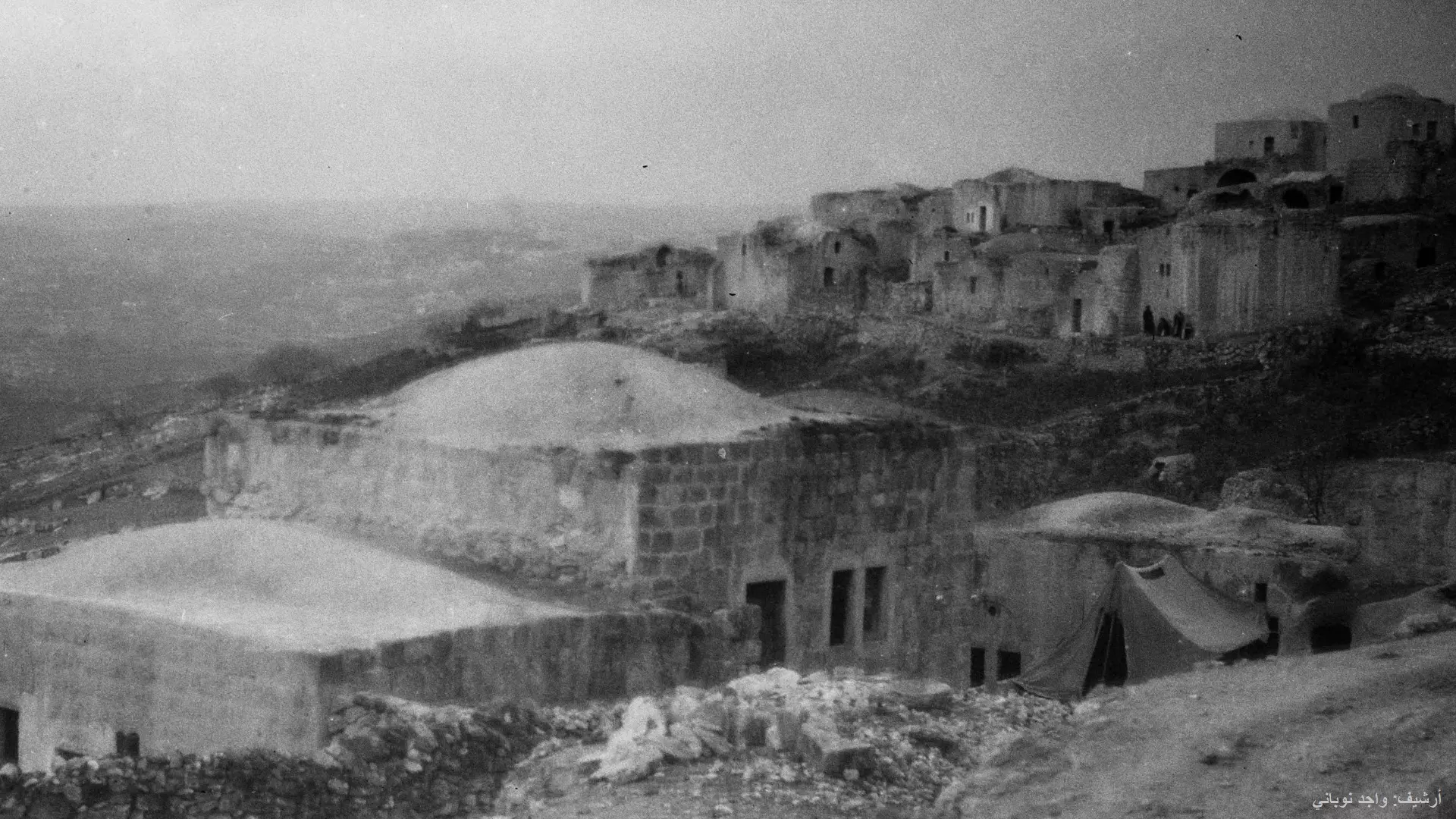
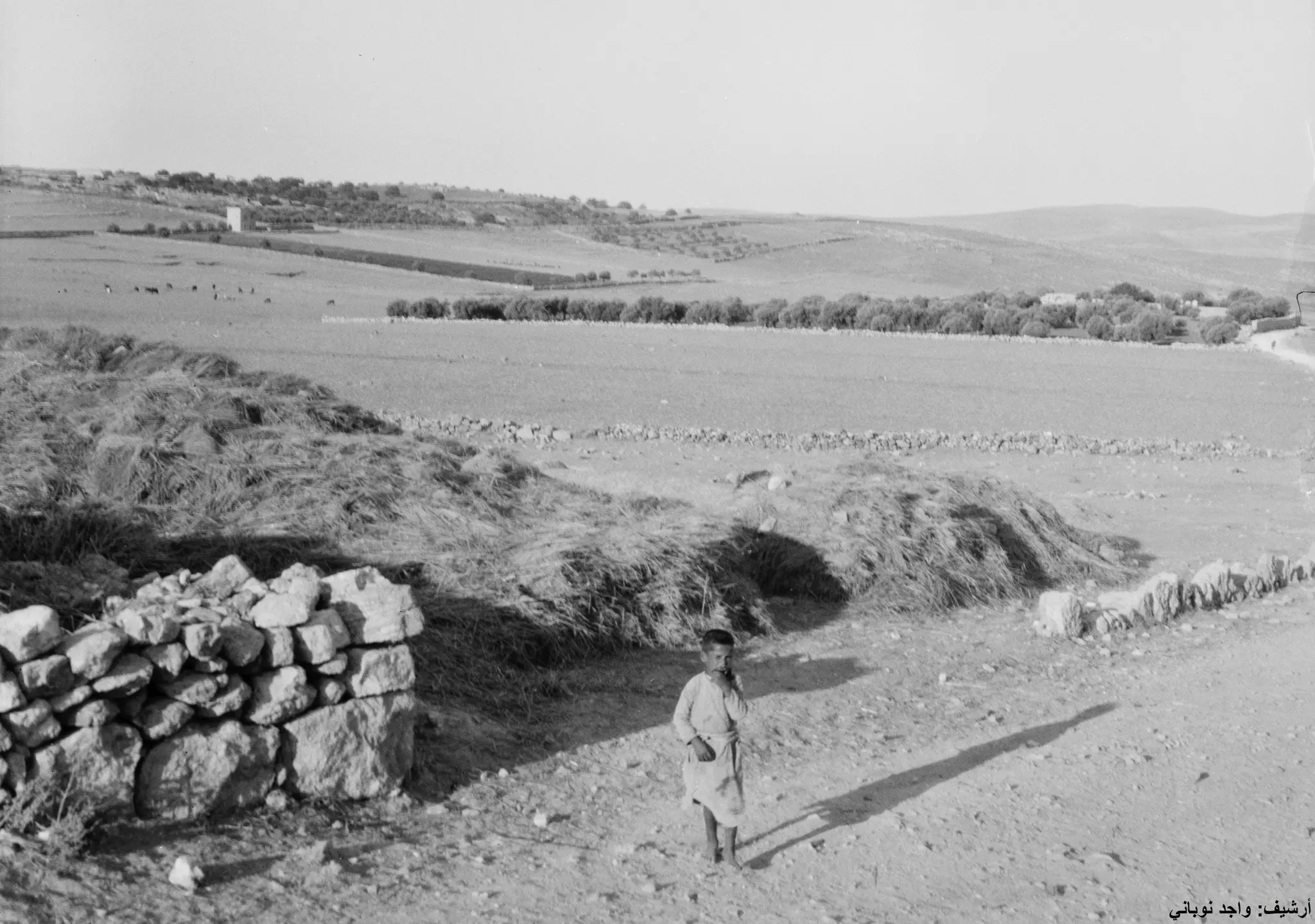
- بيت ساحور قبل أكثر من 100 عام
- حقل الرعاة--1923
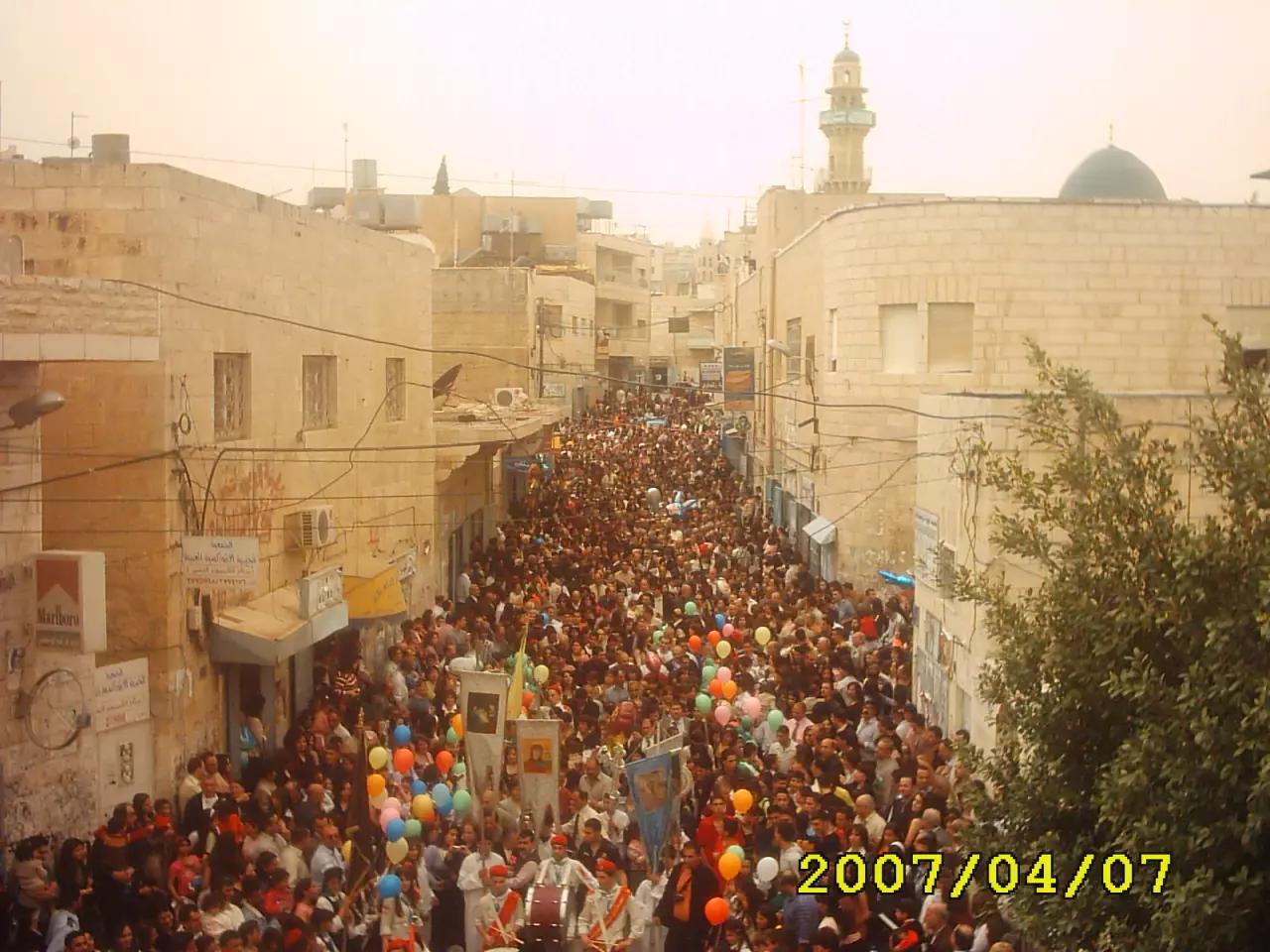
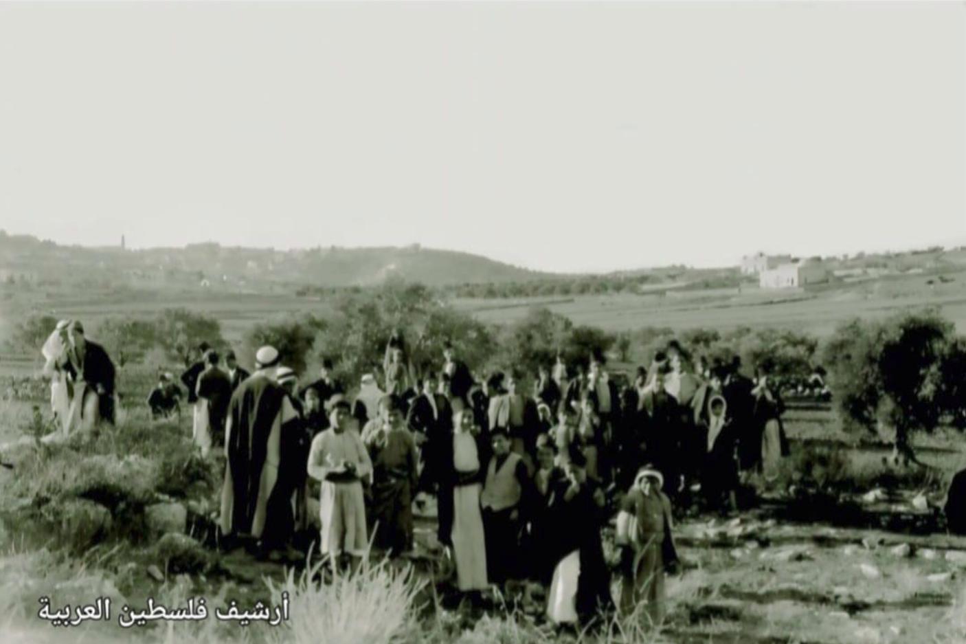
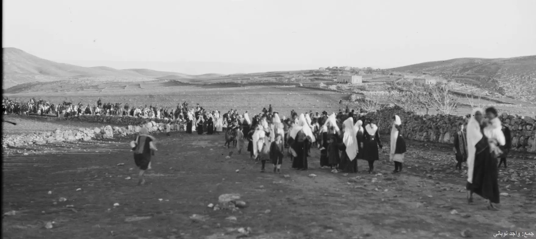
- مسيرة خاصة بموسم مار الياس أو الخضر ( مار جاويرجيوس) والأرجح انها مسيرة من بيت لحم الى كنيسة الخضر ، حيث يجتمع أهل منطقة بيت لحم وبيت جالا وبيت ساحور بمثل هذه المناسبات ، وما زالت هذه العادة حتى الآن
- هكذا بَدَت بيت ساحور في مثل هذه الأيام قبل 100 سن

- بيت ساحور --1934
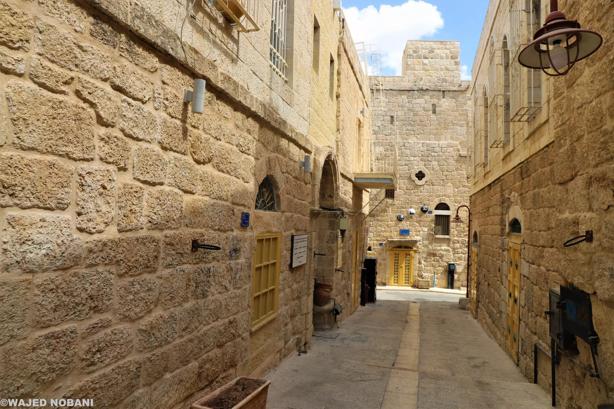
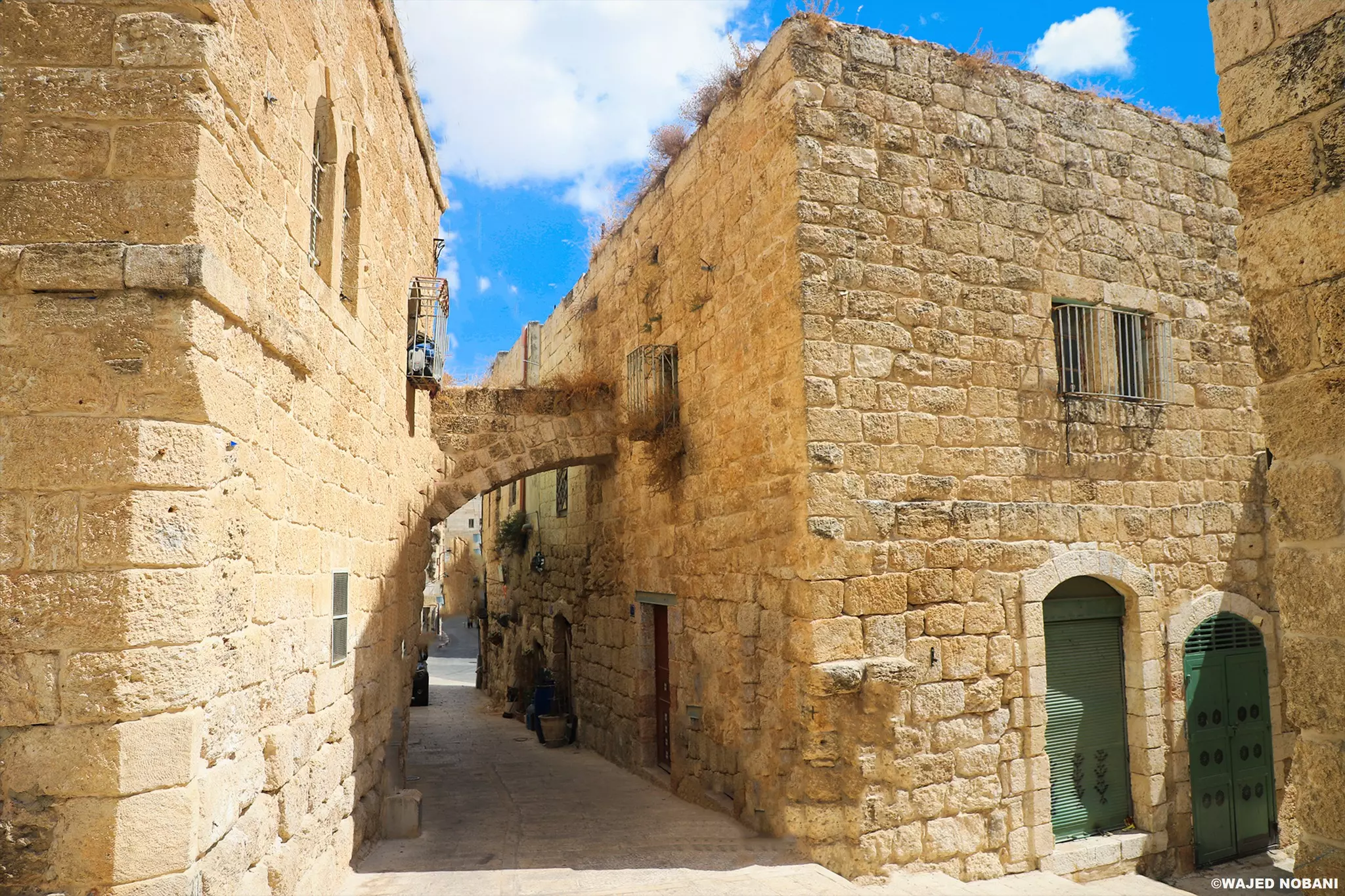
- في البلدة القديمة -- واجد النوباني
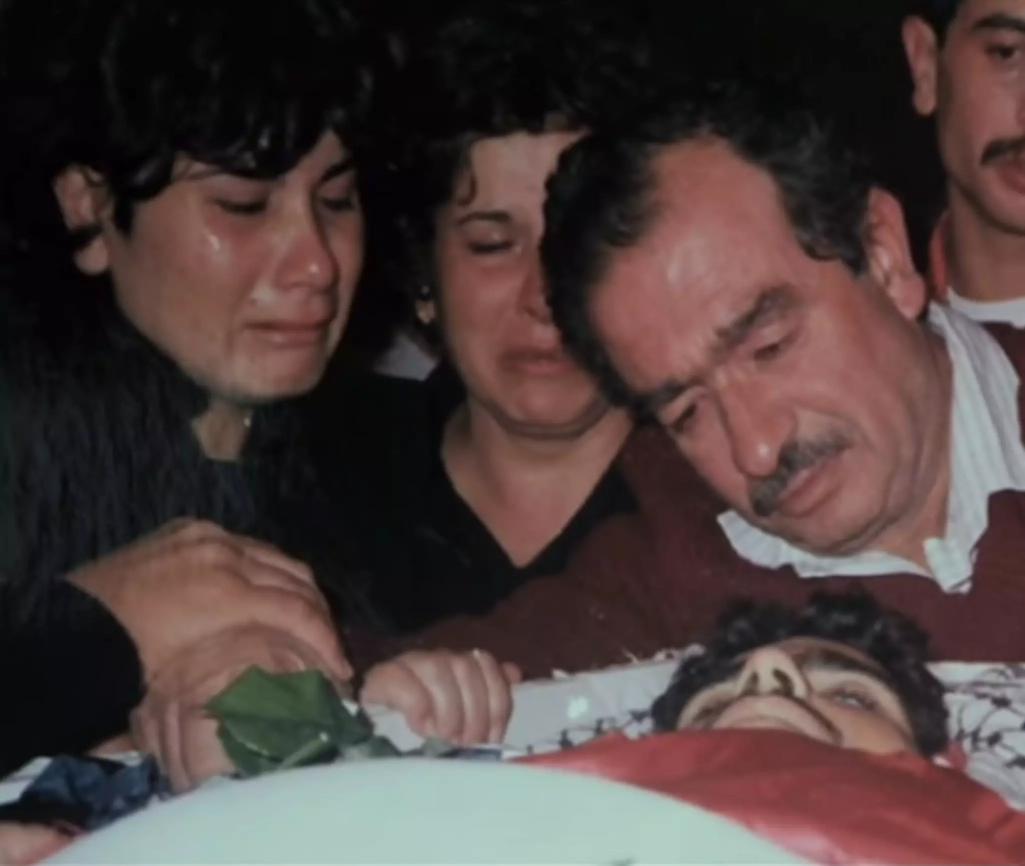
- إياد أبو سعدى "إنسان فلسطيني مسيحي✝🇵🇸" من بيت ساحور قرب بيت لحم.
إرتقى برصاص الاحتلال لرفعه علم فلسطين. الصورة خلال وداعه من قبل عائلته ومحبيه قبل 34 سنة بتاريخ 30.10.1988 .. إذا زرت بيت ساحور والتقيت باهلها، ستجد هناك روح الأرض.
- بلدة بيت ساحور قضاء بيت لحم فلسطين.....
عام ١٩٦٠
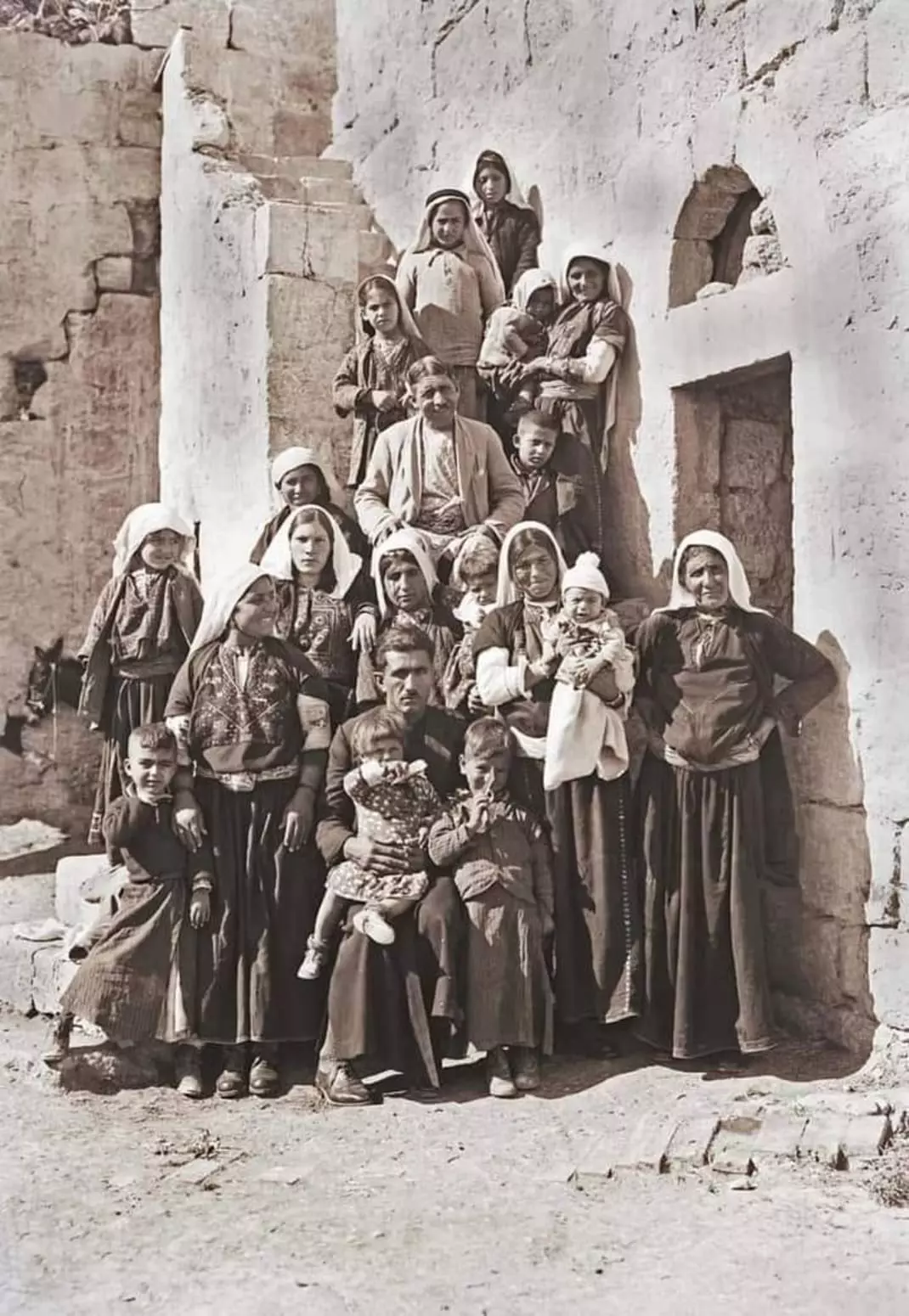
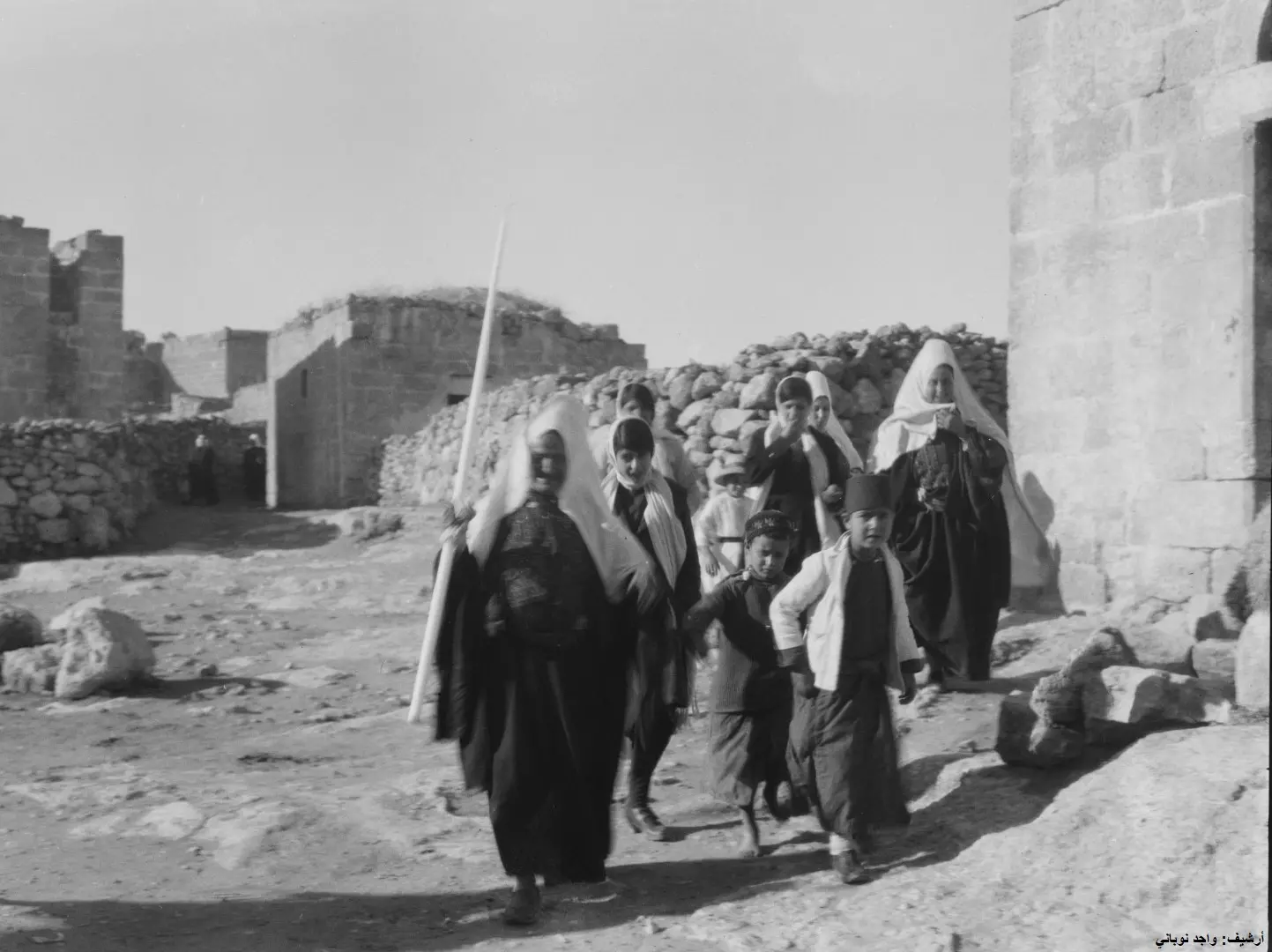
- An extended Palestinian peasant family in front of their house in the village of Beit Sahur, near Bethlehem [1918–35] -- Khalil Raad’s Lens
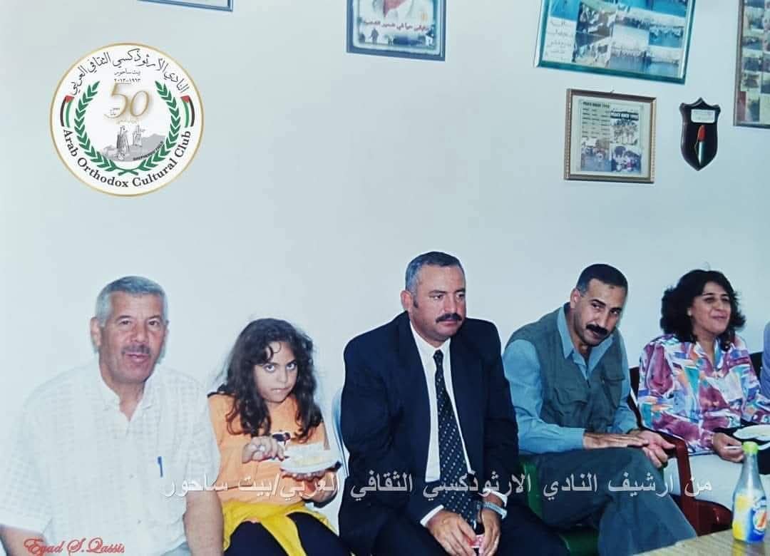
- ذكريات من بيت ساحور ،، أرشيف النادي الأرثودوكسي الثقافي
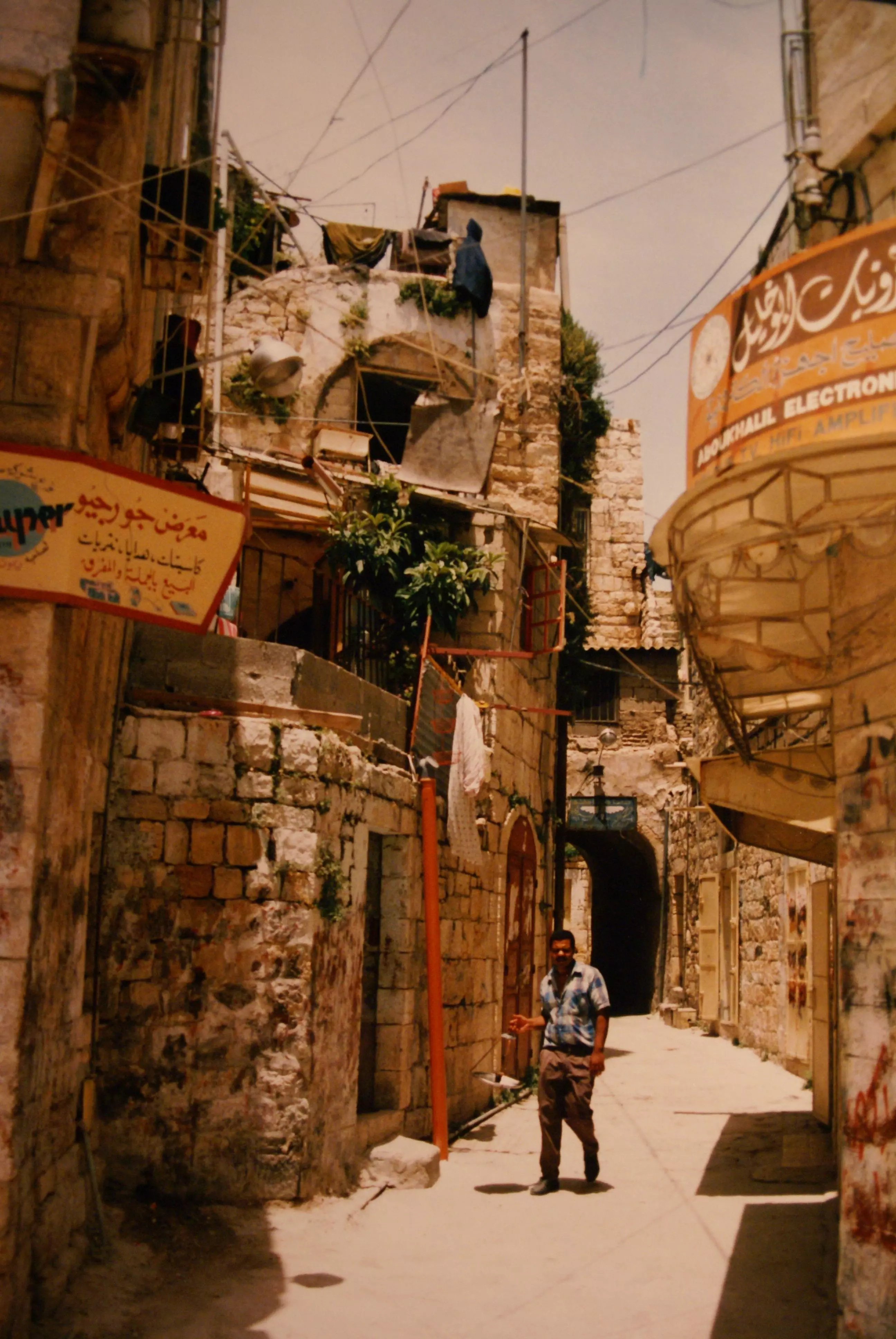
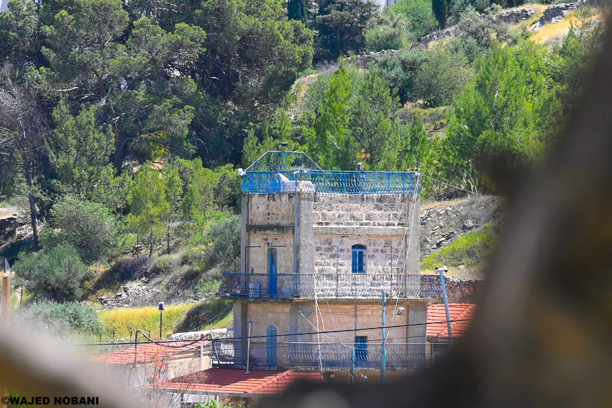
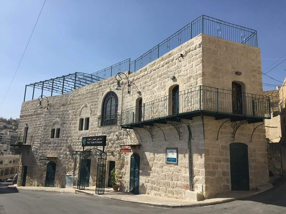
- بيت قديم رمم حديثا
- بيت ساحور قبل ١٠٠ عام / طريق المزار باتجاه بيت لحم وحاليا موقع صحية بيت ساحور
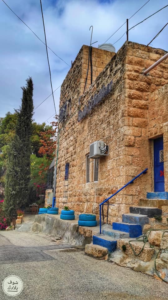
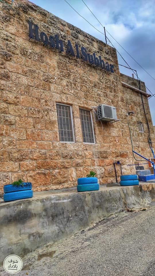
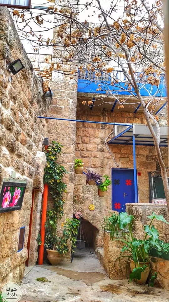
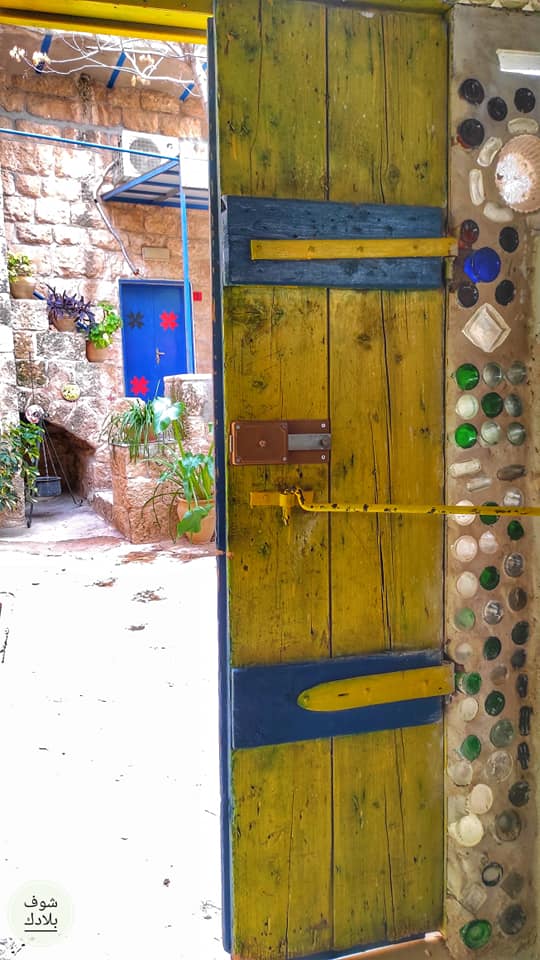
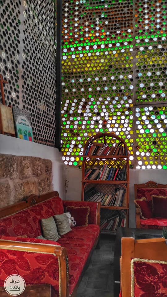
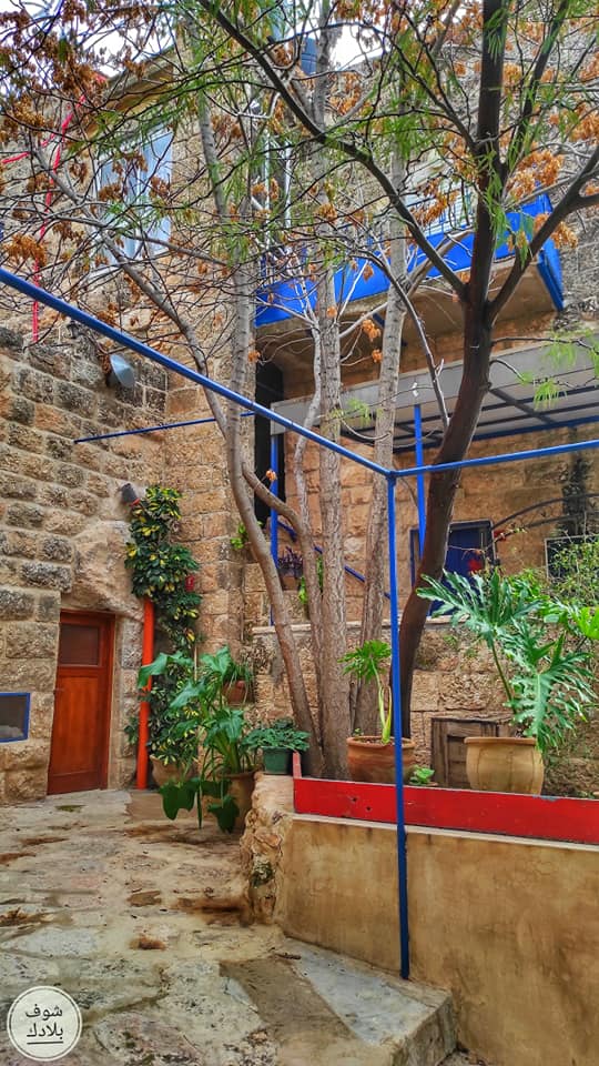
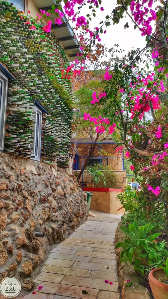
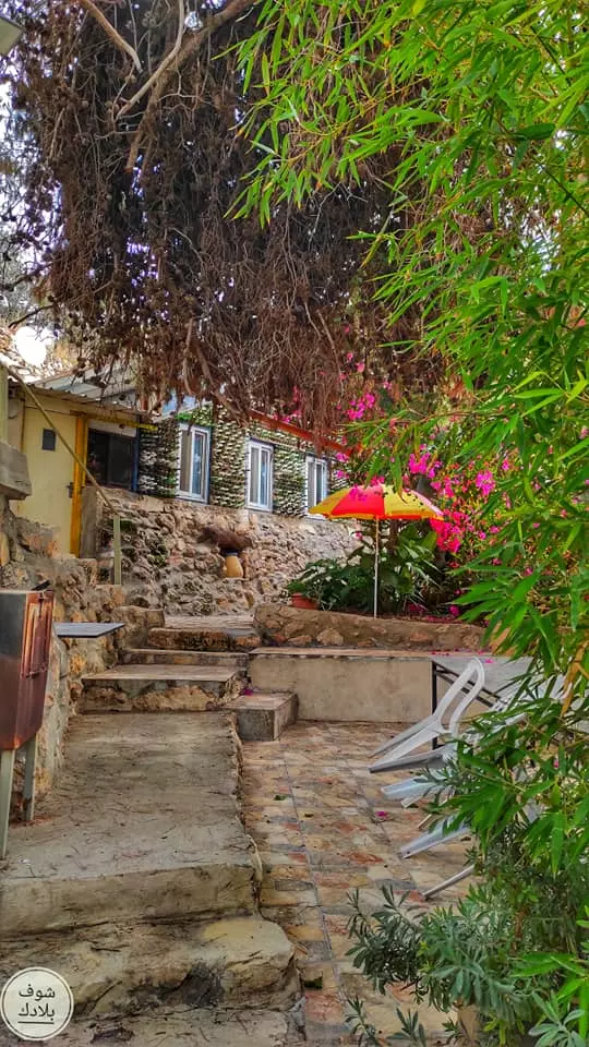
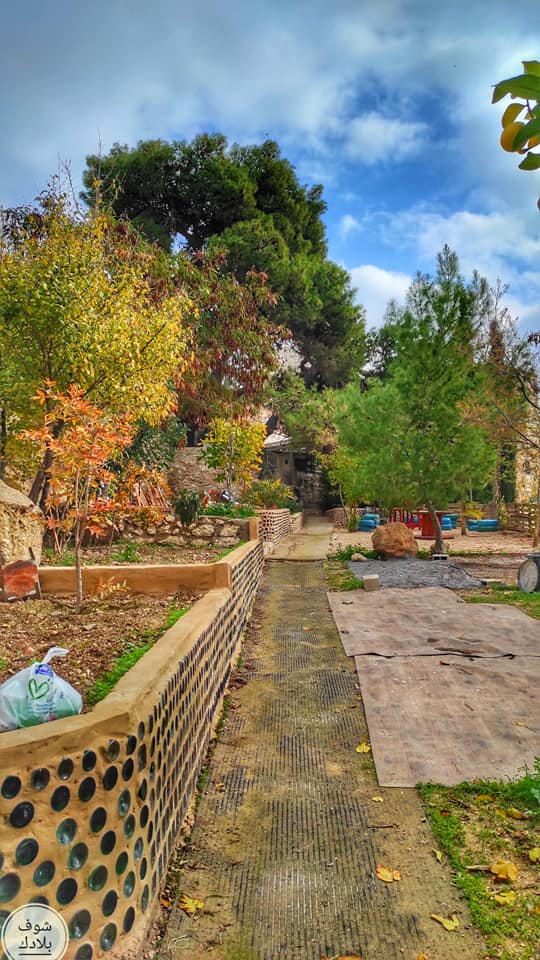
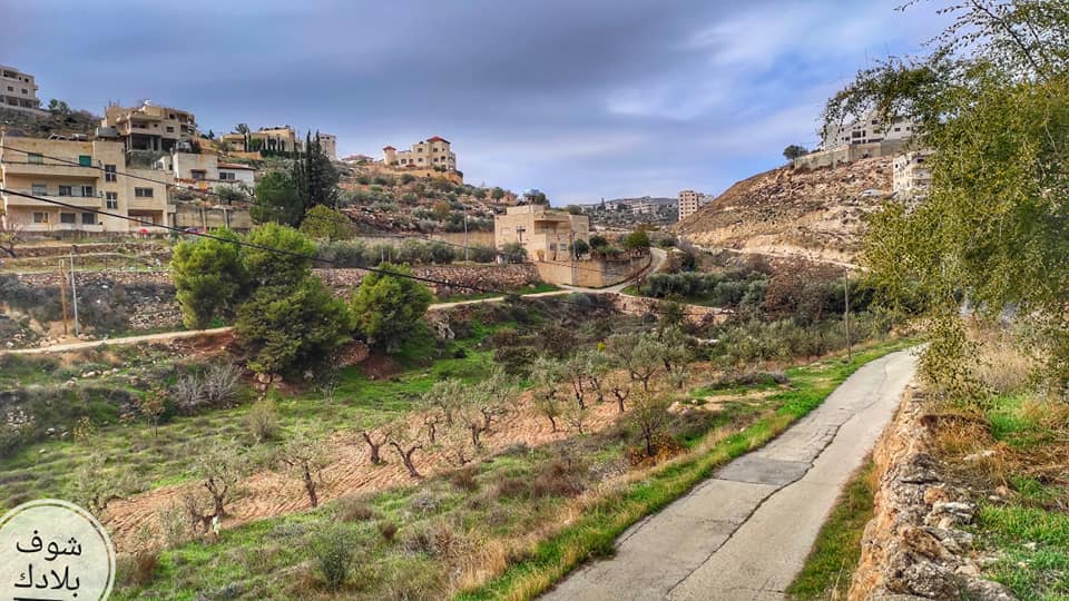
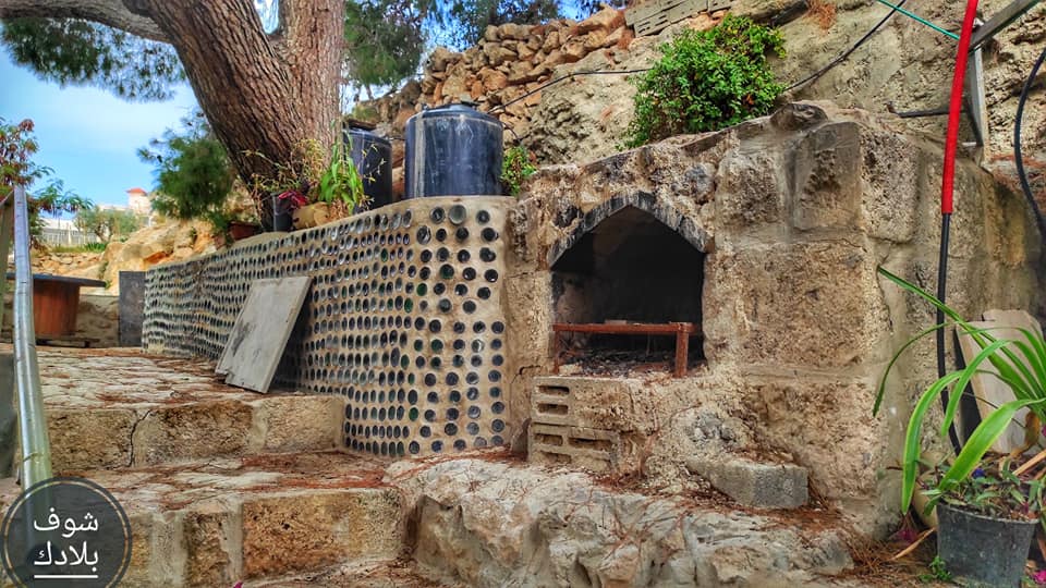
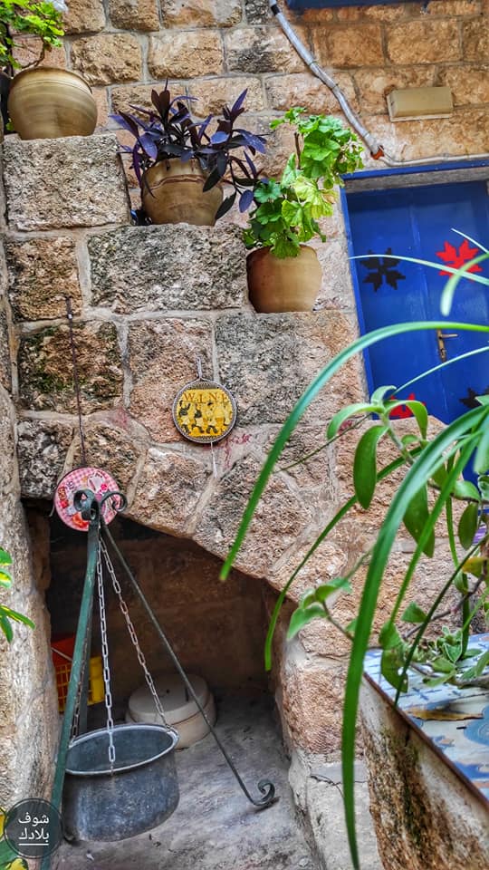
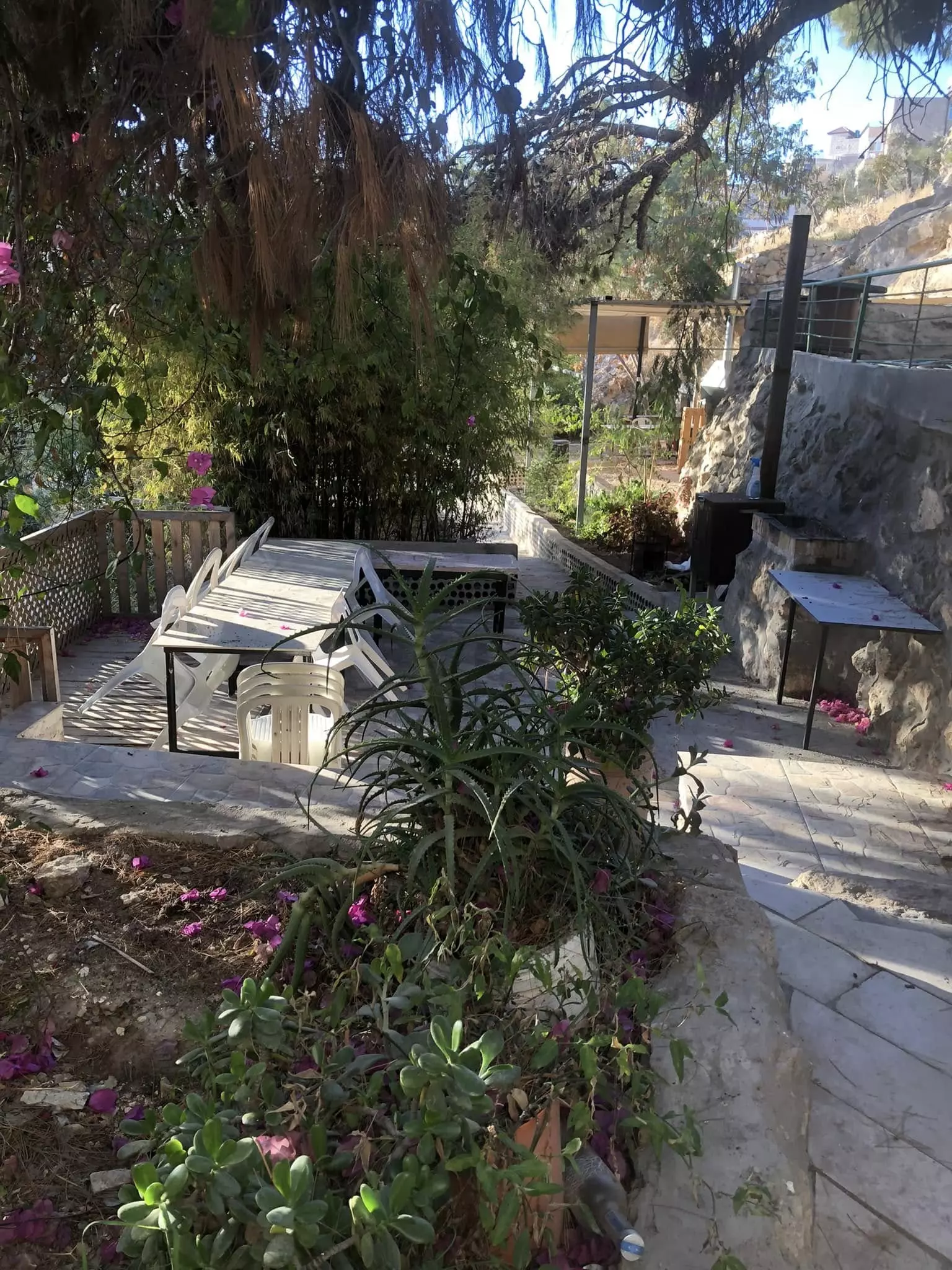
- جولة رائعة في حوش الصبار -- Fairouz Jubran -- July -- 2023
- جولة رائعة في حوش الصبار -- Fairouz Jubran -- July -- 2023 #2
- جولة رائعة في حوش الصبار -- Fairouz Jubran -- July -- 2023 #3
- جولة رائعة في حوش الصبار -- Fairouz Jubran -- July -- 2023 #4
- جولة رائعة في حوش الصبار -- Fairouz Jubran -- July -- 2023 #5
- جولة رائعة في حوش الصبار -- Fairouz Jubran -- July -- 2023 #6
- جولة رائعة في حوش الصبار -- Fairouz Jubran -- July -- 2023 #7
- جولة رائعة في حوش الصبار -- Fairouz Jubran -- July -- 2023 #8
- جولة رائعة في حوش الصبار -- Fairouz Jubran -- July -- 2023 #9
- جولة رائعة في حوش الصبار -- Fairouz Jubran -- July -- 2023 #10
- جولة رائعة في حوش الصبار -- Fairouz Jubran -- July -- 2023 #11

- جولة رائعة في حوش الصبار -- Fairouz Jubran -- July -- 2023 #12
- جولة رائعة في حوش الصبار -- Fairouz Jubran -- July -- 2023 #13
- جولة رائعة في حوش الصبار -- Fairouz Jubran -- July -- 2023 #14
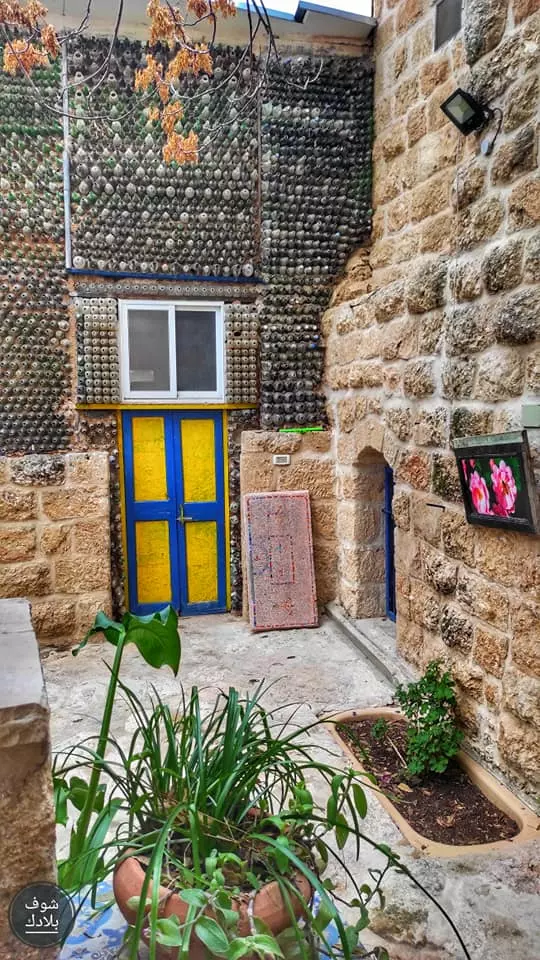
- جولة رائعة في حوش الصبار -- Fairouz Jubran -- July -- 2023 #15
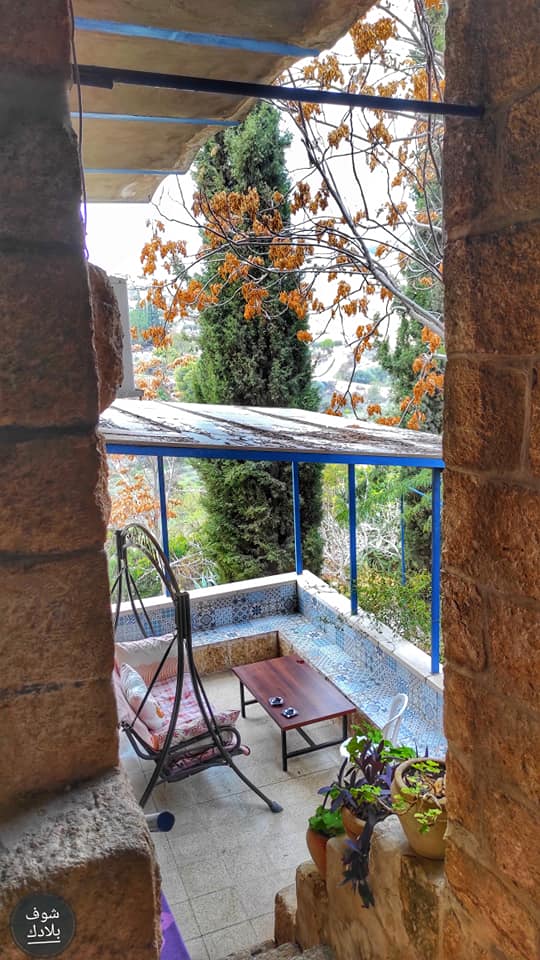
- جولة رائعة في حوش الصبار -- Fairouz Jubran -- July -- 2023 #16
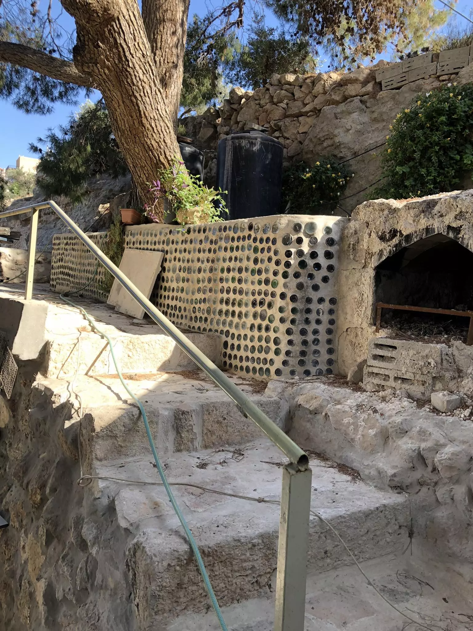
- جولة رائعة في حوش الصبار -- Fairouz Jubran -- July -- 2023 #17
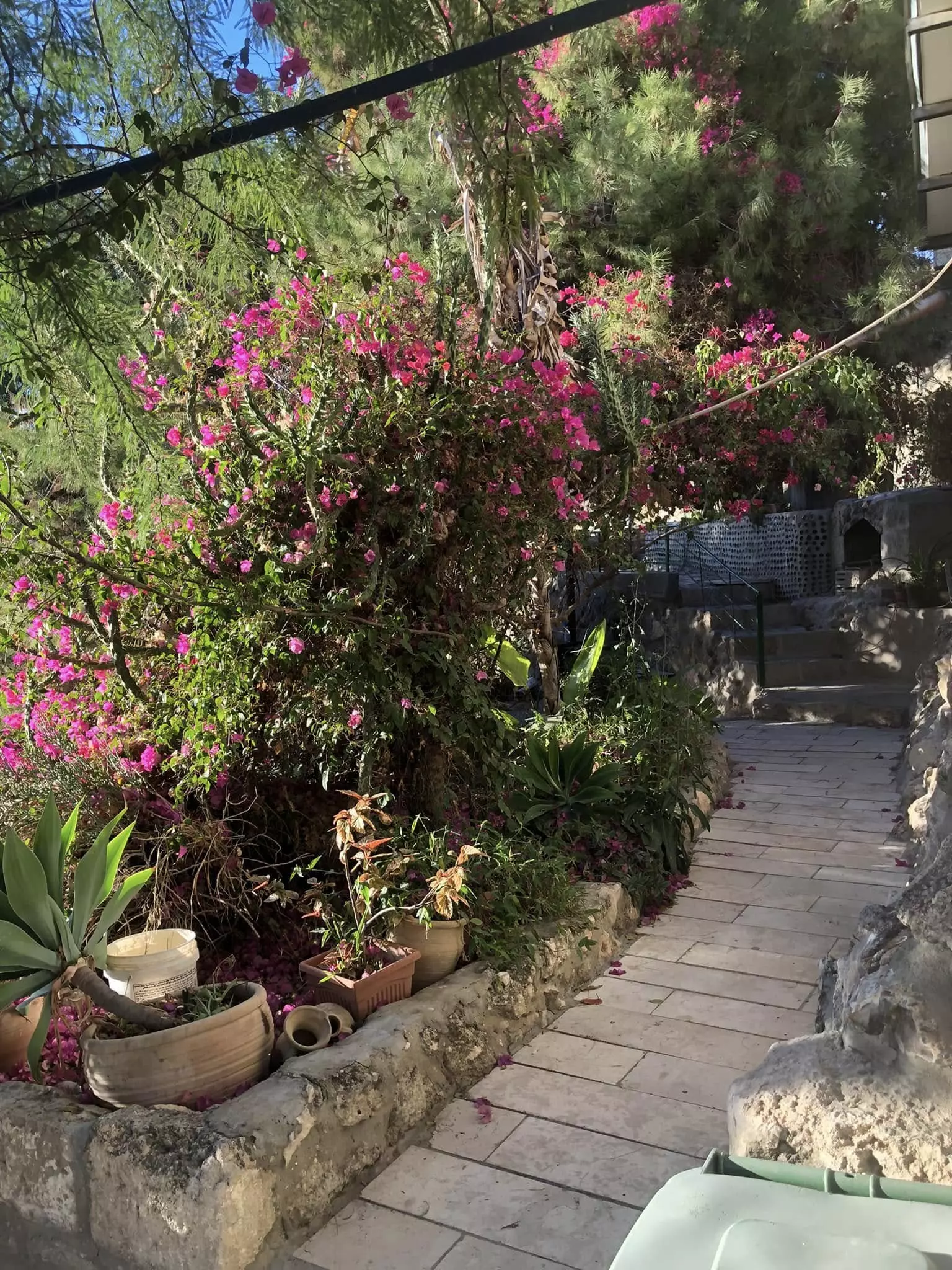
- جولة رائعة في حوش الصبار -- Fairouz Jubran -- July -- 2023 #18
- Beit Sahour with the Herodium in the background
- :
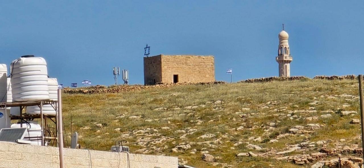
مسجد القعقاع بن عمرو في جبل هراسا في بيت ساحور، وُجدت الصورة ضمن مجموعة مركز السنابل للدراسات والتراث الشعب -- 1990 - 1999

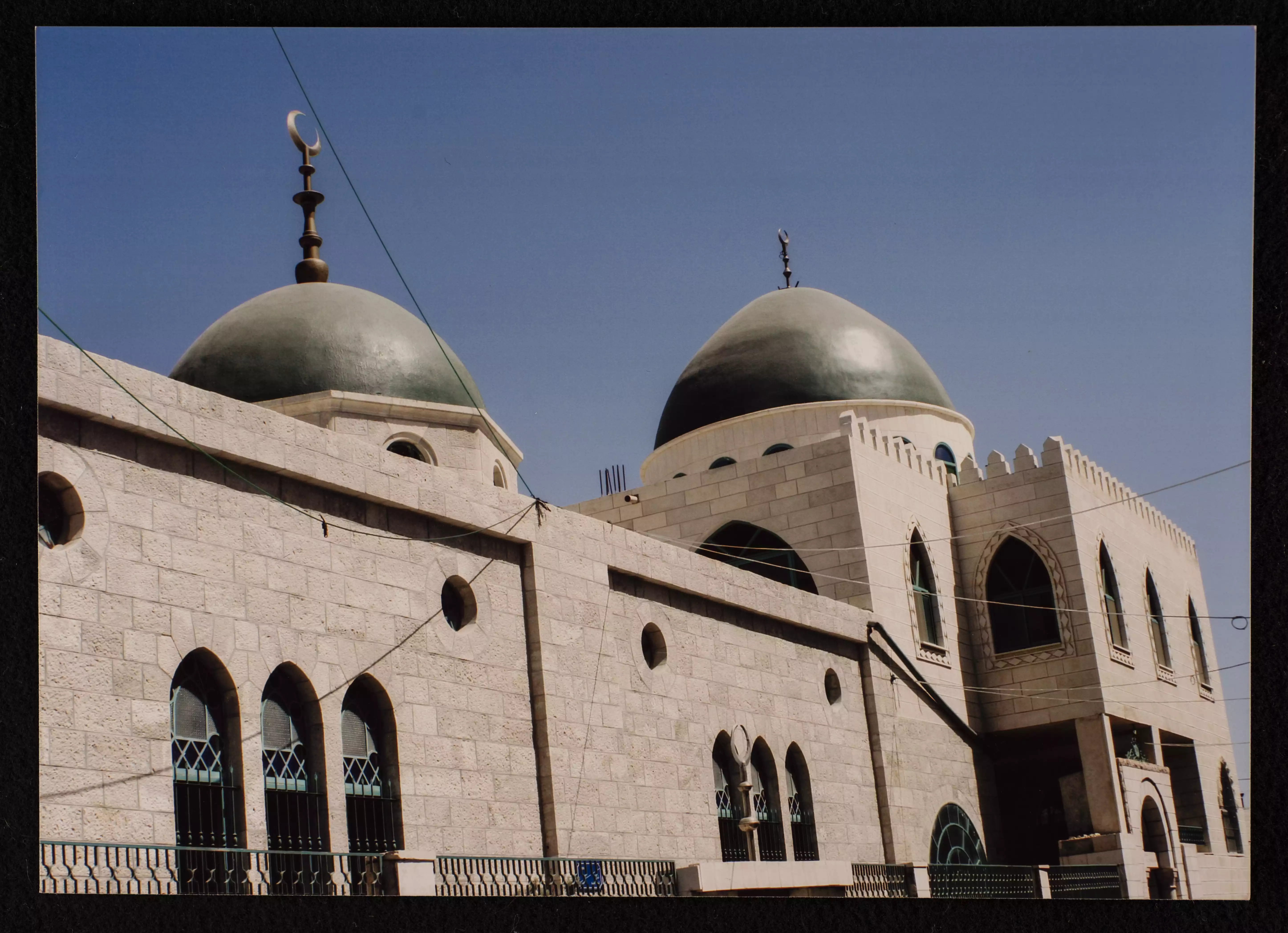
- مسجد عمر بن الخطاب أو مسجد بيت ساحور، وُجدت الصورة ضمن مجموعة مركز السنابل للدراسات والتراث الشعبي. -- 1990 - 1999
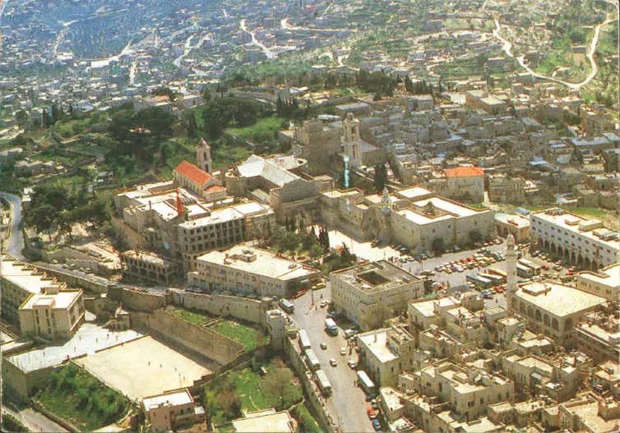
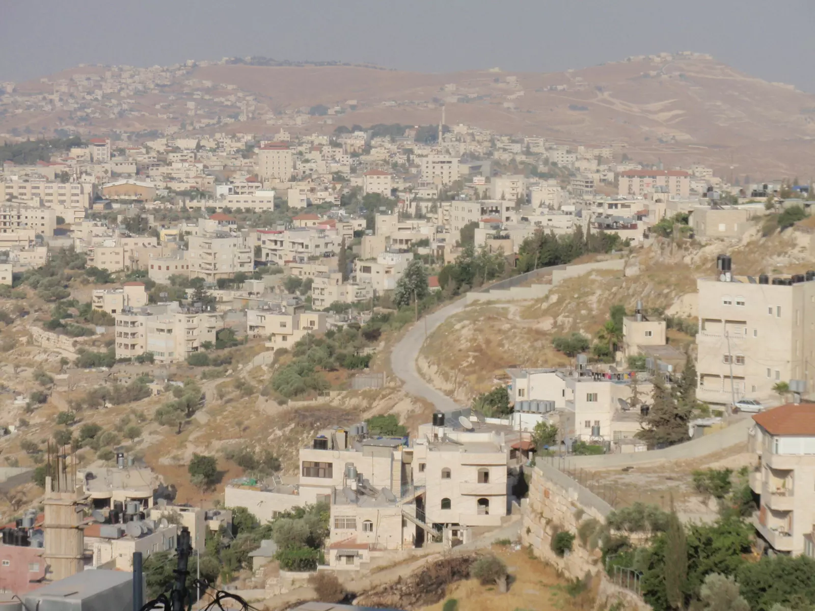
- Aerial View of Beit Sahour
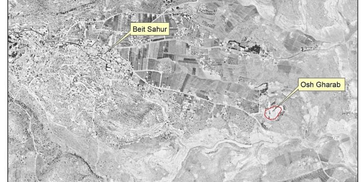
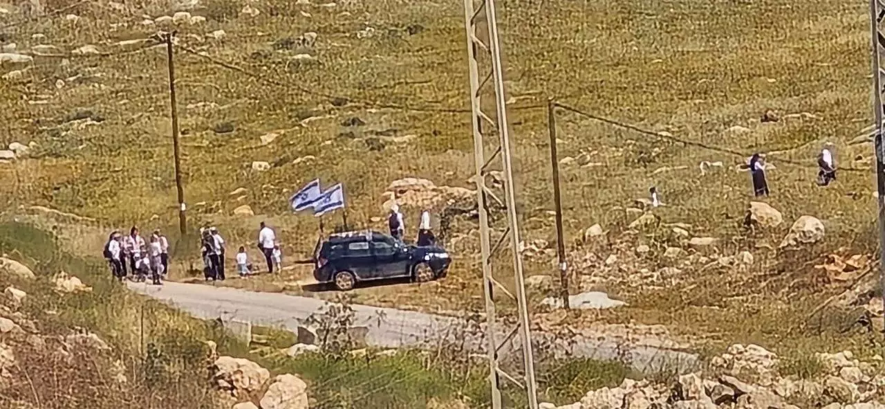
- متابعة: العشرات من المستوطنين يقتحمون منطقتي هراسا وعش غراب في بيت ساحور شرق بيت لحم.
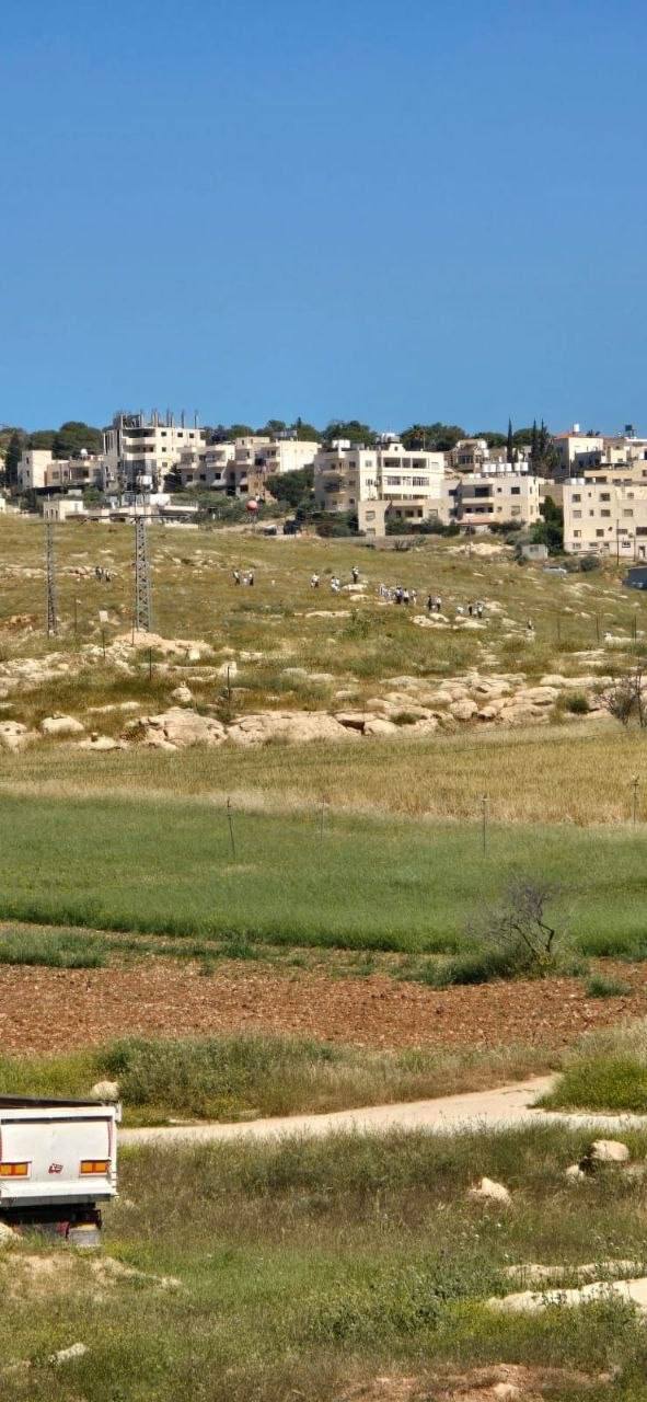
- متابعة: العشرات من المستوطنين يقتحمون منطقتي هراسا وعش غراب في بيت ساحور شرق بيت لحم. #2
- متابعة: العشرات من المستوطنين يقتحمون منطقتي هراسا وعش غراب في بيت ساحور شرق بيت لحم. #3
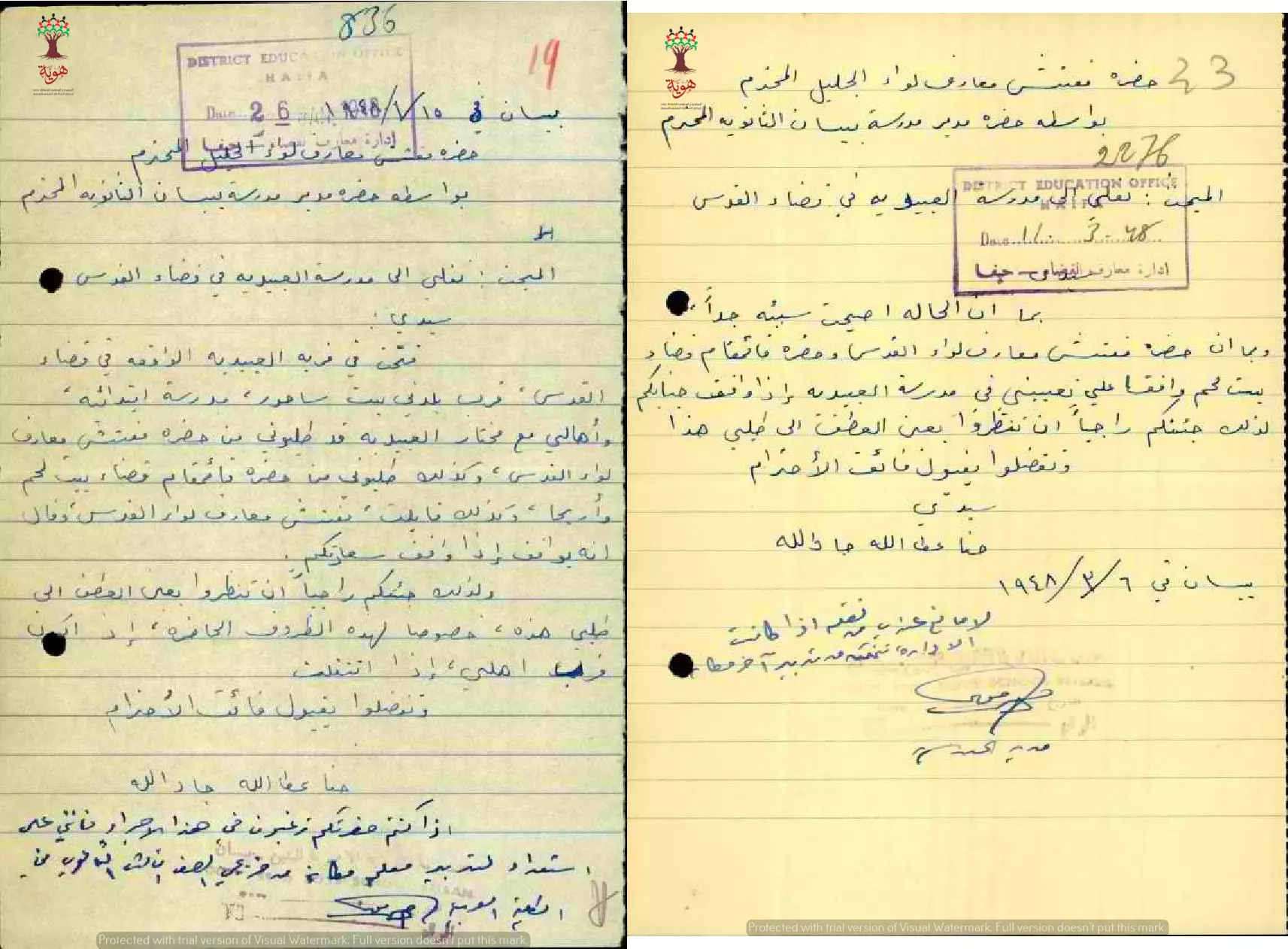
- مجموعة من الوثائق التي تخص تعين المعلم حنا جاد الله --وهو من بيت ساحور -- في مدرسة العبيديّه -- 1948- أنقر الصورة لتكبيرها
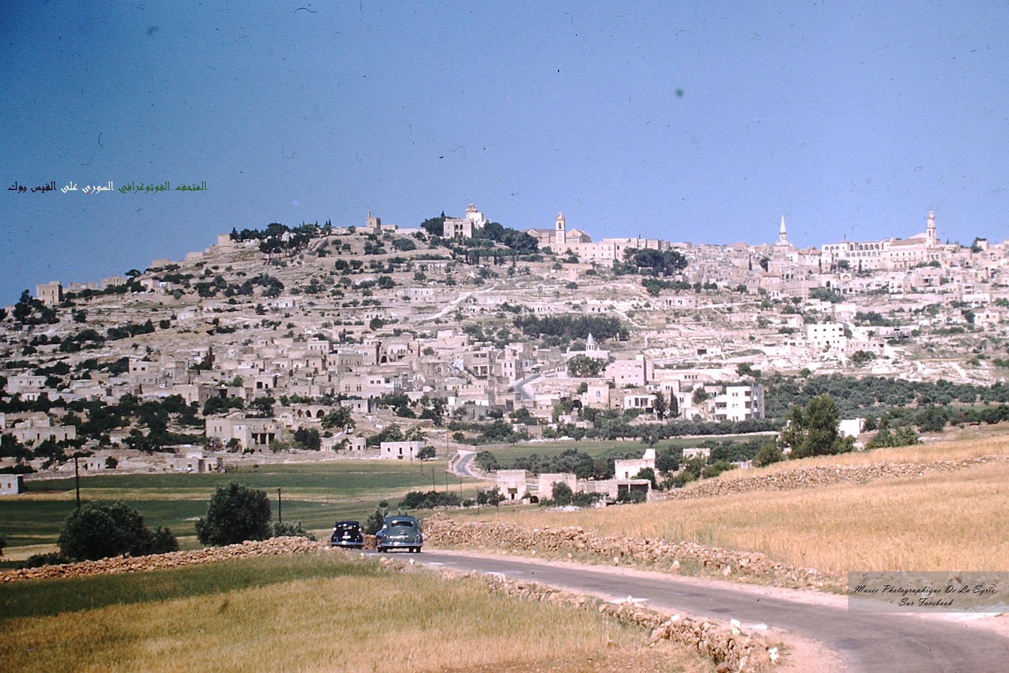
- حقل الرعاة... بيت ساحور وفي الخلفية مدينة بيت لحم قديما
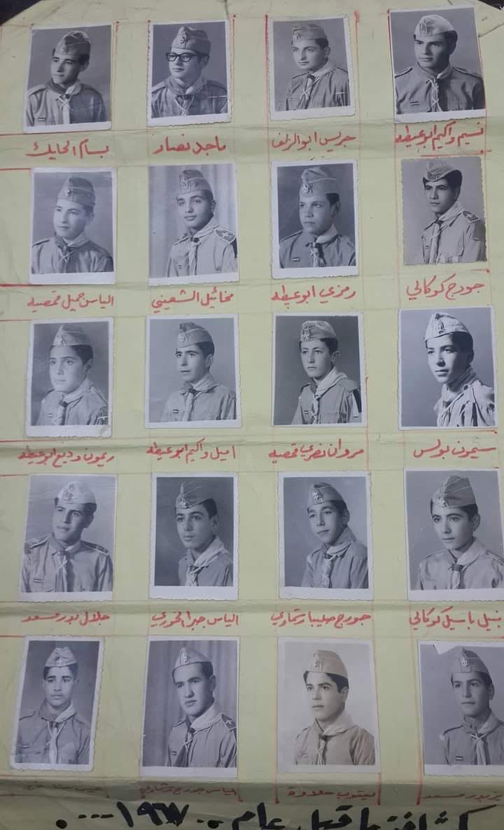
- كشافة بيت ساحور ما قبل 1967 ..
- كفر عقب عام 1950م...
Want to browse more? 80,000 pictures were grouped in these gallaries:
| Display Name | Clan/Hamolah | Country of Residence |
| ايهاب | - | - |
| محمد شاهين | هندي | فلسطين, بيت ساحور |
| لين | شعيبات | عمان, الأردن |
| Simon Ghanem | Abu Farha | Amman, Jordan |
| Mazin Qumsiyeh | Qazaha | Bethlehem, Palestine |
| Lubna Al-Azzeh | - | karnataka, India |
| George Jaraiseh | Jaraiseh | Ecuador, Ecuador |
| مي | - | casablanca, المغرب |
| معتز | عطايا | رام الله , كفر نعمة |
| issita | - | - |
- حلوة يا دنيا - بيت ساحور - فلسطين Duration: 13 min 15 sec
 Fake Valor: Why Did Zionist Jews Hoist Nazis Flag on Their Ships in the 1930s?
What is new?
-
Facts About Oct. 7th Gaza Raid
-
Remined Us Please: Who Did Rape Whom? Was it Palestinians who raped Israelis? Or, was the other way around? You'll be the judge
-
When Prof. Edward Said was invited to debate Bibi Netanyahu in the 1980s, watch what happened!
-
Ezra Klein of the NY Times on the "Jewish Race".
-
Abusing Blood Libel!
-
How and why Israeli Jewry has become the most hated cult?
-
Did Israeli Soldiers Activate The Hannibal Direective On Oct. 7th? You Be The Judge
-
Zionist FAQ: Isn't it true that Palestinians don't want peace? Palestinians never accepted the two-state solution
- Facts about Haavara (Transfer) Agreement between Ben-Gurion & Hitler
-
Haavara FAQs: Why Did Zionist Jews Hoist Nazis' Flags on Their Ships in the 1930s?
- Haavara FAQs: When Chaim Weizmann met FDR in mid-1943, why was he silent about rescuing European Jewry?
-
Dear ChatGPT: How did Palestinians resist Napoleon's invasion of their country in 1799?
-
Dear ChatGPT: Gaza had a vibrant Jewish community in the mid-17th century. What happened to them?
-
Dear ChatGPT: Why did the Jewish Agency suppress news of the Holocaust during WWII?
-
Video Playlist: Jews share their DNA tests to end the conflict for good.
-
A Tale of Two Conflicts: Examining the Definition of Genocide
-
Prof. Abraham Polak And The Suppressed History of the Khazars and European Jewry
-
How Ronald Reagan would have framed the genocide in Gaza if he were still alive?
-
Haavara FAQs: Let us do the math: how many German Jews did The Haavara Agreement save?
-
Zionist FAQs: The Hebron Massacre of 1929, "clearly proves" that Palestinians are antisemitic, how could you deny it?
-
Zionist FAQs: Why Anti-Zionist Is Not Antisemitism?
-
Zionist FAQs: Isn't it true that the KGB created Palestinian Nationalism in the early 1960s?
- Zionist FAQs: Muslims are killing Muslims all the time; why are Israeli Jews being singled out in the media?
- Zionist FAQs: How is Israel an apartheid state when 20% of its citizens are Arabs who enjoy full rights?
-
Haavara FAQs: Why Did Dorothy Thompson Flip From A Zionist Advocate to A Silenced Dissenter?
-
Haavara FAQs: Analysis of Herzl's Uganda Scheme and how it could have saved millions of Jews.
-
Haavara FAQs: Why did Hayim Greenberg describe American Jewry as "morally bankrupt" in early 1943?
-
Haavara FAQs: What if the Evian Conference was a resounding success? What would have been the impact of saving European Jewry on Zionism?
- Haavara FAQs: What if the six million were saved, how that would have impacted the Zionist project?
-
Haavara FAQs: How did Zionist leaders react when Europe's Jews lingered in the DP camps after WWII ended?
-
Why does the American Jewish community repeat lies that David Ben-Gurion had debunked before he died?
-
Who has the power to rename the Tatar/Khazar Gene Marker to Jewish IV?
-
Zionist FAQs: Why won't Egypt, Syria, and Jordan take their people back? Jews are indigenous to Palestine, and Arabs immigrated after Jews developed the country. Arabs should leave.
-
Haavara FAQs: Did Hitler and the Nazis conflate between Judaism and Zionist? If that wasn't case, then why?
-
Haavara FAQs: Winston Churchill and antisemitism, a collection of articles written Churchill.
-
Haavara FAQs: Broken by country, how many Jews survived vs. killed during the Holocaust?
-
Haavara FAQs: Why did European Jews vote with their feet and to immigrated to the Americas, not Palestine, after WWII?
-
Watch this American Jewish Girl describing Israeli Jews' cognitive dissonance like no other in under two minutes
-
Haavara FAQs: When the Nazis went out of their way to hide the Holocaust, Israeli Jews did the exact opposite by broadcasting their genocide of Gazans. But why?
-
Haavara FAQs: How Zionist Jews went out of their to show their appreciation to Nazism and Fascism?
- Haavara FAQs: Why Zionist leaders were against bombing the death camps & the Railroads leading to them?
-
Haavara FAQs: Hitler's message to the British and American people: If Jews are such noble citizens and you care about them, how come you're not letting them in? I will gladly ship them to you at my expense, even on luxury liners!
-
A shortlist of Zionist and Israeli false flag operations in the name Jews.
-
The Most Moral Army
- The Land of Kapos (Israel): Where the brave are boycotted and Kapos walk free.
- Why did early Zionists often named their communal enterprises "colonial"?
- Zionist Relations with Nazi Germany by Faris Glubb
-
Two NY Times advertisements by Zionists in the early 1943 that exposes Zionists' treason at the height of the calamity
- Facts Not Lies about the Palestinian-Israeli Conflict.
- Site's pictures have been categorized
- Campgain Against Lice
- A Survey of Palestine, the official source about Palestine before Nakba produced by the British Mandate; over 1200 pages.
- Satellite View & Google Earth: Over 6,000 placemarks identifying all destroyed towns, W. Bank & Gaza Strip Towns, & refugee camps.
- PalestineRemembered.com and its Nakba Oral History Project were featured on al-Jazeera Satellite TV.
- Nakba Oral History Video Podcast:
 Over 700 Oral History interviews (including 3,500+ hours of recording) can be viewed online.
 - Palestine Village Statistics Project
- Gaza Jail Break
- النسخة العربية للموقع الان متوفرة
- Videos: Documenting the destroyed villages in video: Tracing all that remains since Nakba.
- Videos: Responding to Zionist Propaganda
- Interview: The ethnic cleansing of Palestine: George Galloway interviews Israeli Historian Ilan Pappe.
- For Palestinians, memory matters. It provides a blueprint for their future By George Bisharat.
- Zionist FAQ now available in Hebrew שאלות שציונים שואלים, עכשיו בעברית
- Video: The Stephen Walt and John Mearsheimer report on the influence of the Israel Lobby on U.S. Foreign Policy
- The Palestinian-Israeli conflict for beginners
