| PalestineRemembered | About Us | Oral History | العربية | |
| Pictures | Zionist FAQs | Haavara | Maps | |
| Search |
| Camps |
| Districts |
| Acre |
| Baysan |
| Beersheba |
| Bethlehem |
| Gaza |
| Haifa |
| Hebron |
| Jaffa |
| Jericho |
| Jerusalem |
| Jinin |
| Nablus |
| Nazareth |
| Ramallah |
| al-Ramla |
| Safad |
| Tiberias |
| Tulkarm |
| Donate |
| Contact |
| Profile |
| Videos |
Welcome To Dayr 'Amr - دير عمرو (דיר עמר)
|
District of Jerusalem
Ethnically cleansed days ago |
العربية Google Earth |
 |
Gallery (32) |
- Statistics & Facts
-
Before & After

- Satellite View
- Articles 1
- Pictures 32
- Members
- All That Remains
- Wikipedia
- Videos 2
- Guest Book
- Links
| Statistic & Fact | Value | ||||||||||||
| Occupation Date | July 17, 1948 | ||||||||||||
| Distance From District | 12.5 (km) West of Jerusalem | ||||||||||||
| Elevation | 750 (meters) | ||||||||||||
| Before & After Nakba, Click Map For Details |
|||||||||||||
|
|||||||||||||
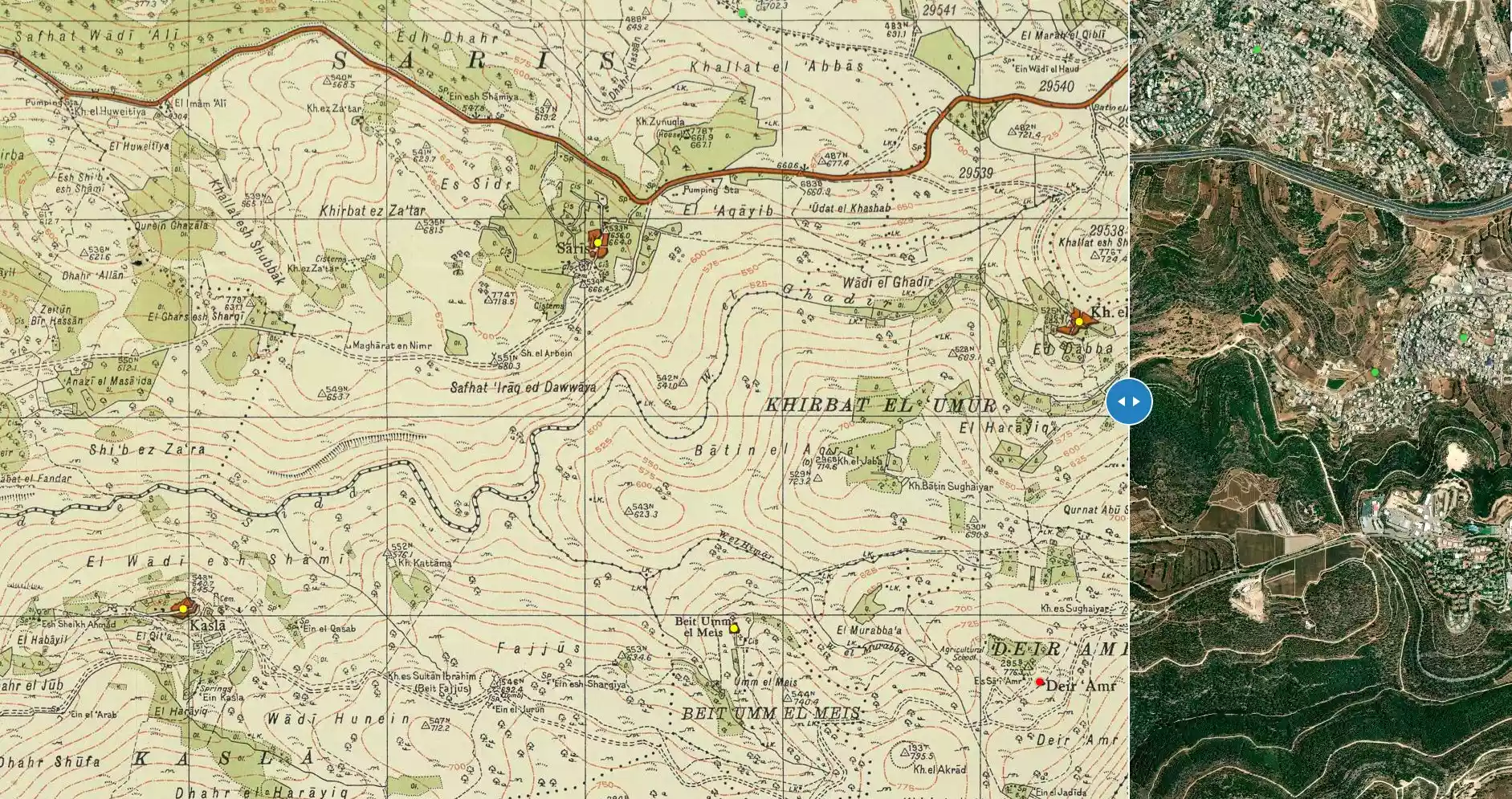
| Map Location | See location #19 on the map View from satellite |
||||||||||||
| Military Operation | Second stage of Operation Dani | ||||||||||||
| Attacking Units | Fourth Battalion of the Har'el Brigade | ||||||||||||
| Exodus Cause | Expulsion by Zionist troops | ||||||||||||
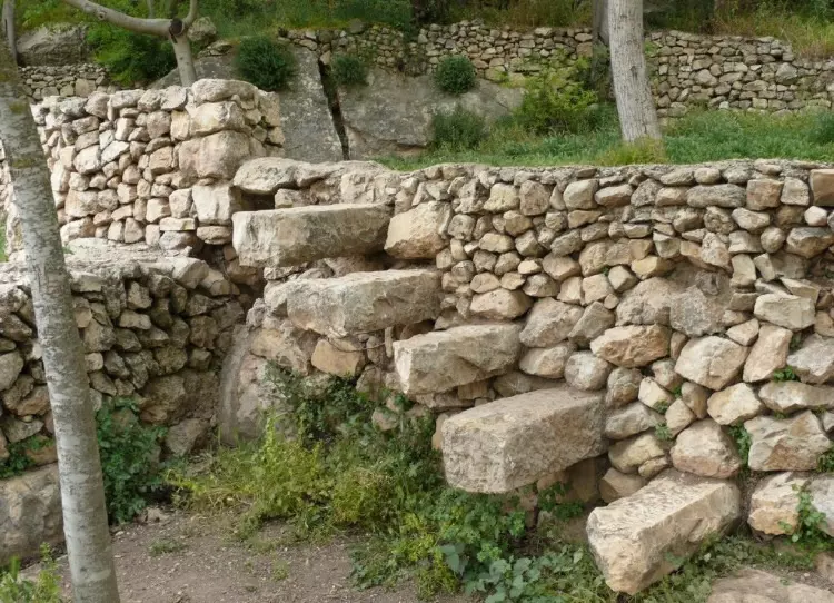
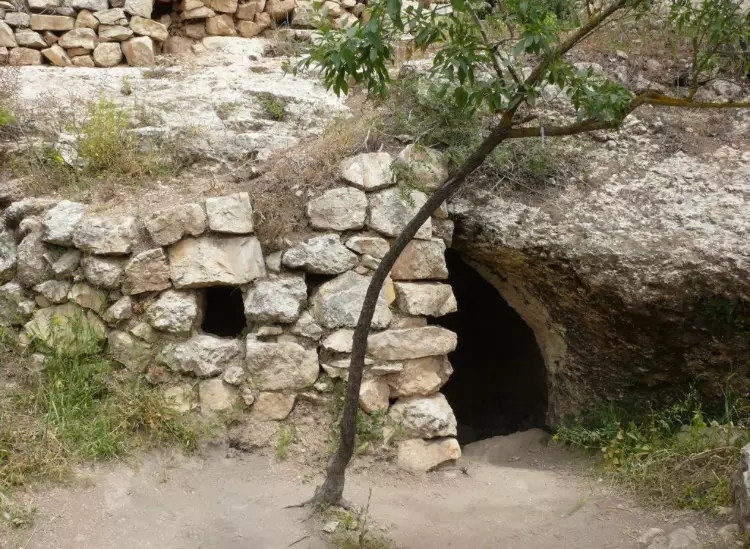
| Village Temains | Dayr 'Amr has mostly survived destruction (one of the miracle in the area?), most of the its houses are currently occupied and being renovated by Israeli Jewish settlers. | ||||||||||||
| Ethnically Cleansing | Dayr 'Amr inhabitants were completely ethnically cleansed. | ||||||||||||
| Pre-Nakba Land Ownership |
**Town Lands' Demarcation Maps |
||||||||||||
| Land Usage As of 1945 |
|
||||||||||||
| Population |
|
||||||||||||
| Number of Houses | In (1931): 110 (includes Suba) | ||||||||||||
| Near By Towns |
|||||||||||||
|
|
|||||||||||||
| Town's Name Through History | Dayr 'Amr was named after a local sage known by al-Sa'i 'Amr. | ||||||||||||
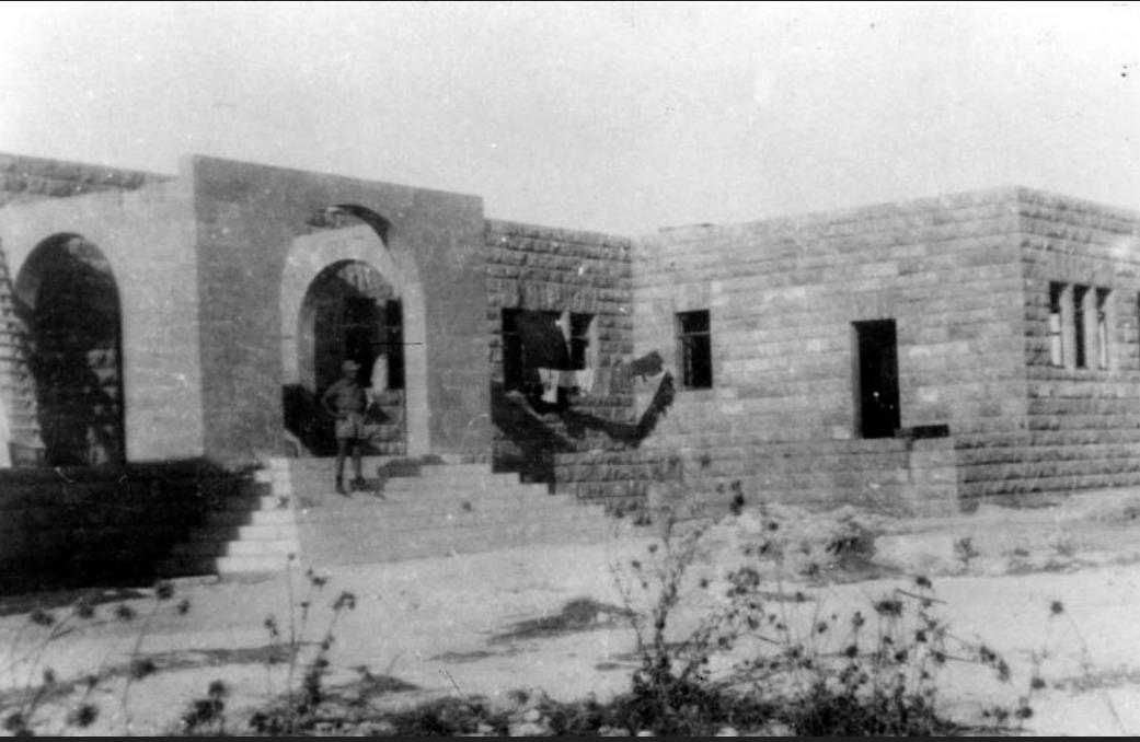
| Schools | In 1942, the General Arab Orphans' Committee (a private body based in Jerusalem) established in Dayr 'Amr a model Boys' Farm. In 1946, the farm had about 60 students. The school remain standing which is currently being used as a hospital by Israelis. | ||||||||||||
| Shrines / Maqams | A shrine for a local sage known by al-Sa'i 'Amr, whom the village was named after. | ||||||||||||
| Exculsive Jewish Colonies Who Usurped Village Lands |
The Boys' Farm were transformed into an Israeli mental hospital, Eytanim and Bezek telephone and television company has established a large facility with radar equipment at the southern edge of the site. | ||||||||||||
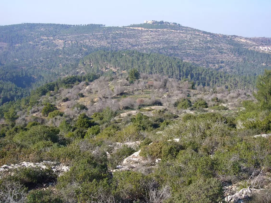
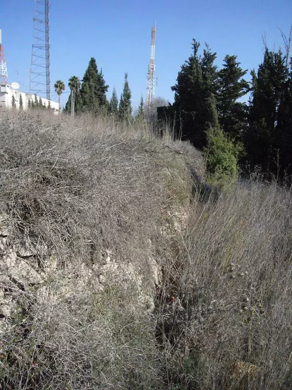
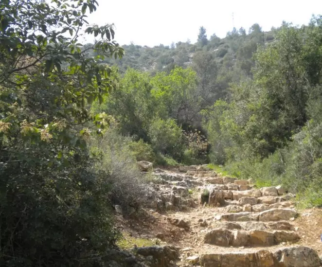
Village Before NakbaThe village was located on a flat mountain peak, oriented in an east−west direction. A secondary road linked it to the Jerusalem−Jaffa highway, and dirt paths led to nearby villages. Dayr 'Amr, a very small village that included only a few stone houses, had an irregular layout. The villagers were Muslims; they maintained a shrine for a saint called al-Sa'i ('the messenger') 'Amr, who was the namesake of the village. His historical identity has not been determined.The village was the site of an interesting Palestinian educational and social venture. In 1942, the General Arab Orphans' Committee―a private body based in Jerusalem―established in Dayr 'Amr a model Boys' Farm, the curriculum of which combined a regular high school syllabus with agricultural training. Students were chosen exclusively from rural families whose breadwinners had died in the resistance during the 1936−39 rebellion against the pro-Zionist policy of the British Mandatory government. The idea was to encourage the Farm's graduates to return to their villages and help in their development. In 1946, the Farm had about 60 boarders. The following year construction of a building began for an adjacent Girls' Farm, to be run along similar lines. The Committee's funds were largely drawn from a countrywide network of contributors who made small but regular donations, thus ensuring the national prominence of Dayr 'Amr. The president of the Committee was the Palestinian educator Ahmad Samih al-Khalidi, whose book is frequently cited in this volume. After 1948, the Palestinian leader Musa 'Alami revived the concepts underlying the Dayr 'Amr Farm when he established the Boys' Farm in Jericho, which continues to operate to this day. A spring located south of the village provided potable water. Grain was planted in the bottom of valleys and in the lowlands, while olive trees and vineyards were located on the slopes. Wild trees, grass, and herbs covered the mountain tops around the village. Rainfed agriculture was the main source of livelihood. In 1944/45 a total of 650 dunums was allocated to cereals; 18 dunums were irrigated or used for orchards. In addition to agriculture, villagers engaged in livestock breeding. The village was built on an archaeological site sometime early in this century. Village Occupation and Ethnic CleaningThe village was 'cleansed' by the Fourth Battalion of the Har'el Brigade on 16 July 1948, according to the History of the War of Independence; Israeli historian Benny Morris states that it was conquered on 17−18 July. These two dates may actually refer to two different stages in the conquest of the village; the New York Times correspondent filed a story on 16 July to the effect that the 'strategic heights' of this village were taken by Palmach fighters. Perhaps the village itself was not seized until the following day. Dayr 'Amr was captured as part of the second stage of Operation Dani (see Abu al-Fadl, Ramla sub-district) along with other villages on a side road leading to Jerusalem. The inhabitants of these villages were displaced in one of three ways: they may have evacuated their homes some time before the operation (perhaps in reaction to the nearby Deir Yasin massacre), or been driven out by the mortaring and attacks that preceded the operation, and some were expelled by the invading Israeli troops. This was the fate of the principal of the Boys' Farm and his deputy, who were sent on their way by shots fired behind them. [Interview with the principal of the Boys' Farm]Zionists Colonies on Village LandsThe main buildings of the Boys' Farm were transformed into an Israeli mental hospital, Eytanim (159131), in 1952.Village TodayThe site is surrounded with a fence and a guarded gate. All the houses still stand and new extensions have been added to some of them. Large cypress and carob trees grow among the houses. There is an olive grove on the southern edge of the village. The Bezek telephone and television company has established a large facility, with radar equipment, at the southern edge of the site. The psychiatric hospital of Eytanim is nearby.SourceDr. Walid al-Khalidi, 1992: All That Remains. |
|||||||||||||
| Related Maps | Town Lands' Demarcation Maps خرائط للقضاء توضح حدود القرى والاودية Town's map on MapQuest View from satellite Help us map this town at WikiMapia |
||||||||||||
| Related Links | Wikipedia's Page Google Search Google For Images Google For Videos |
||||||||||||
| More Information | في كتاب كي لا ننسى في كتاب بلادنا فلسطين |
||||||||||||
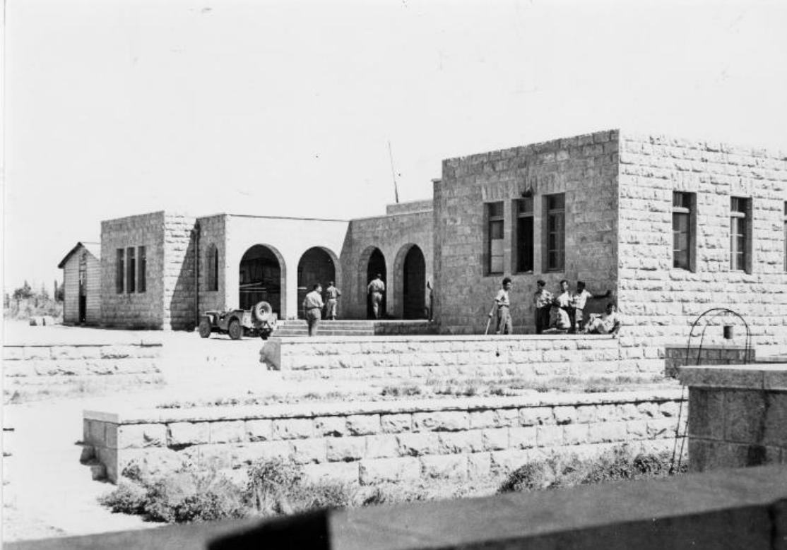
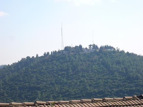
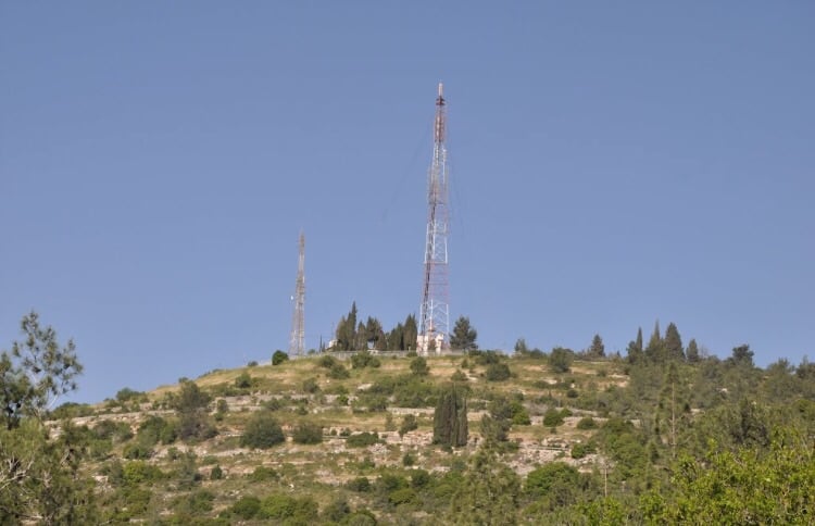
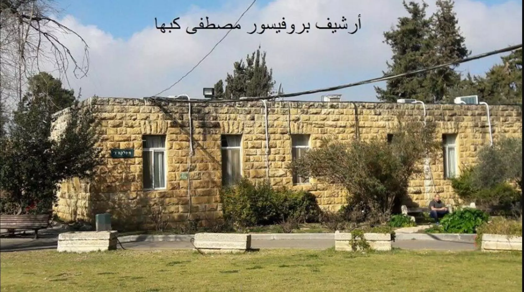
- agricultural school and hamlet site now a mental hospital
Posted by Seth Frantzman - mukam/makam or sheikhs tomb
Posted by Seth Frantzman - actual site
Posted by Seth Frantzman - دير عمر
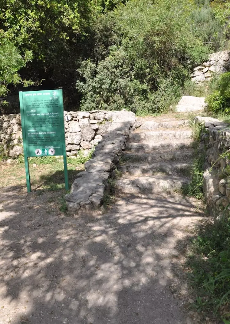
Posted by abu raya - جنوب القريه
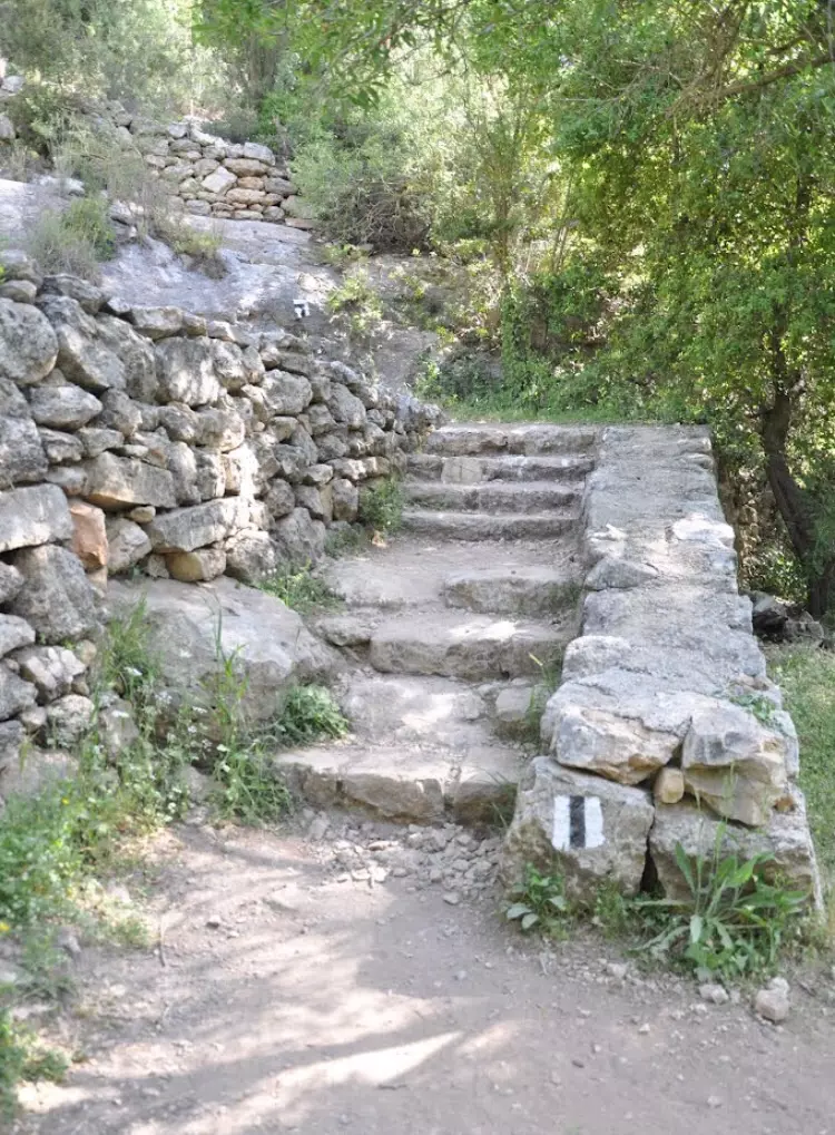
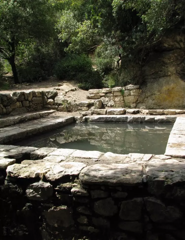
Posted by abu raya - العين في القريه
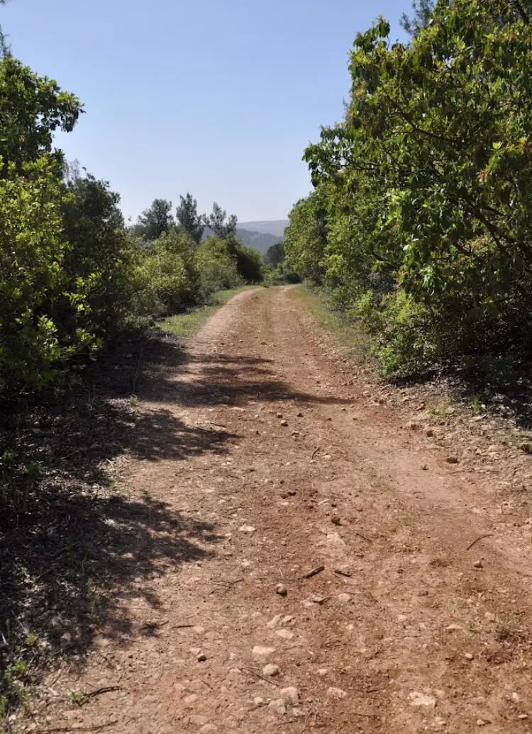
Posted by abu raya - من القريه
Posted by abu raya - دير عمرو
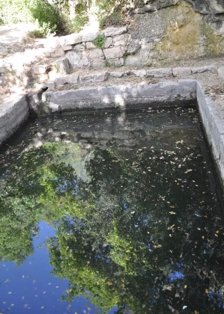
Posted by abu raya - عين دير عمرو
Posted by abu raya 1 - نواحي القريه
Posted by abu raya - دير عمرو
Posted by abu raya - من دير عمرو
Posted by abu raya - دير عمرو
Posted by abu raya - الكتاب الذي ذكرته في تعليقي
Posted by Ramy - اثبات من الكتاب عن بركة القرية وترميمها
Posted by Ramy - من مدرسة نموذجية لتعليم أصول الزراعة الحديثة إلى مصحة للأمراض العقلية -----
بروفيسور مصطفى كبها-- more in the comments section
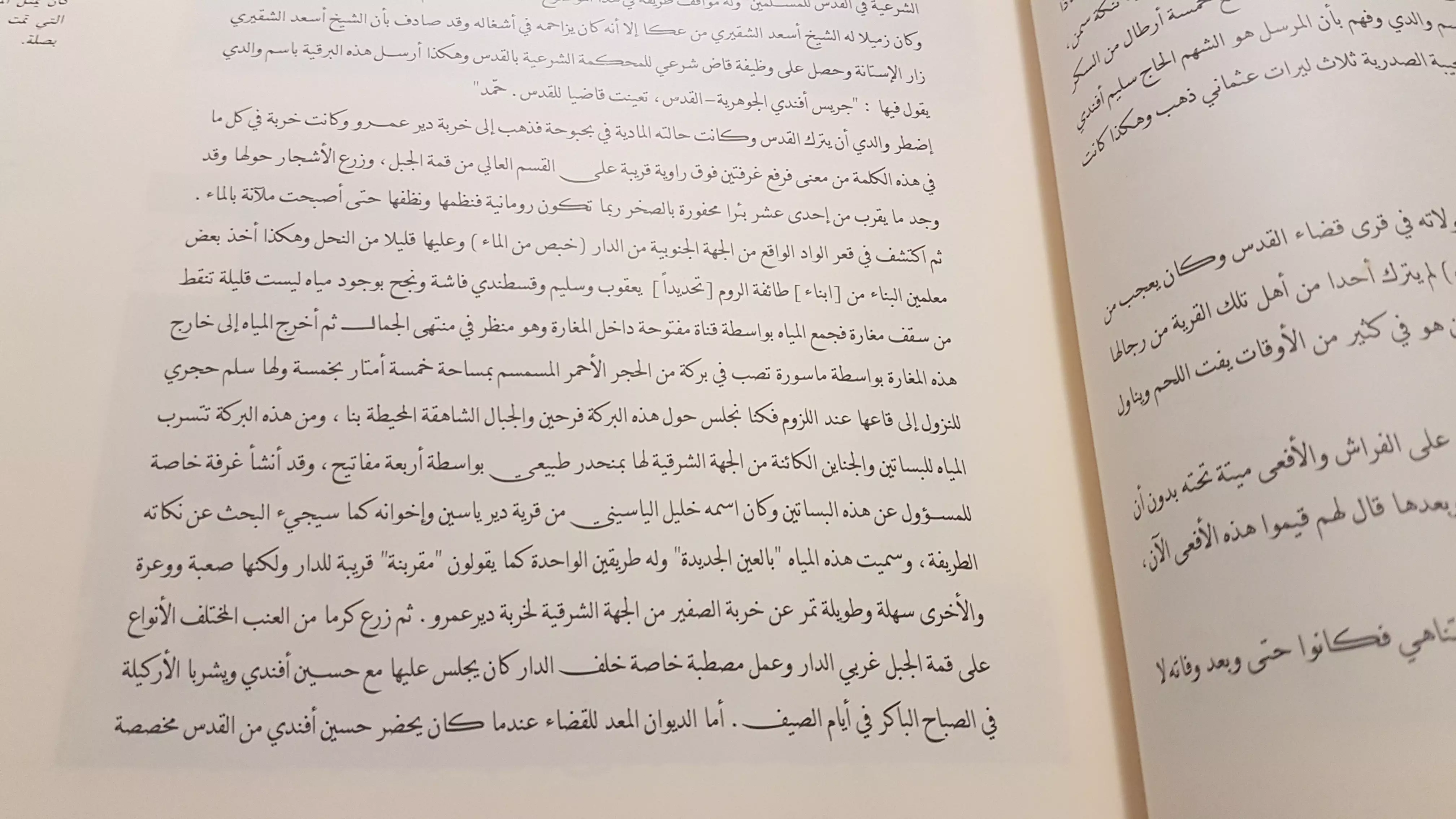
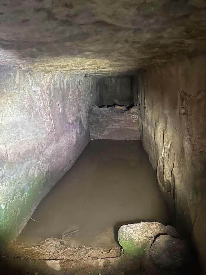
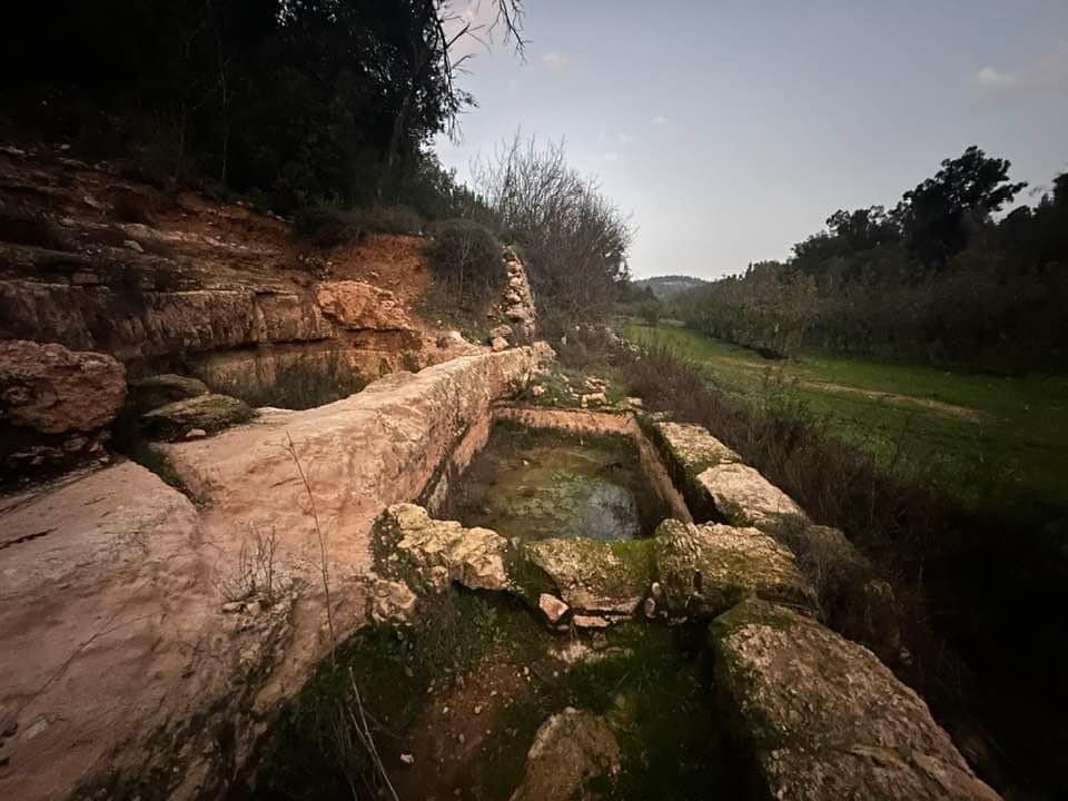
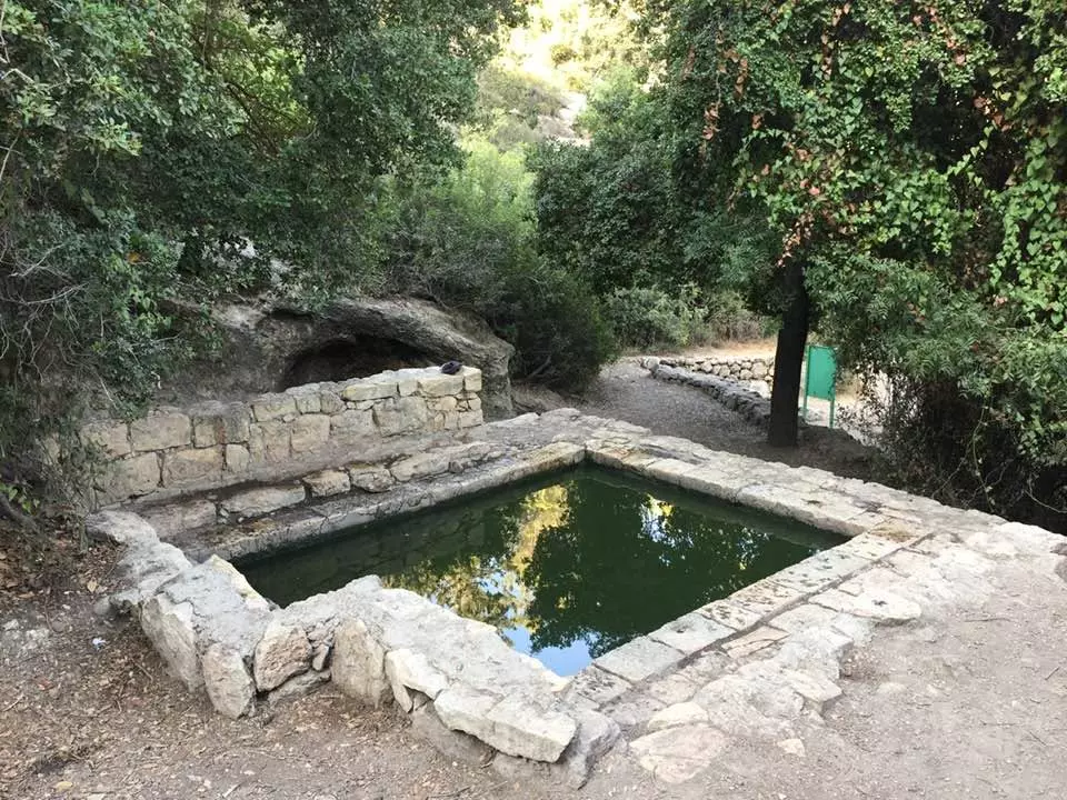
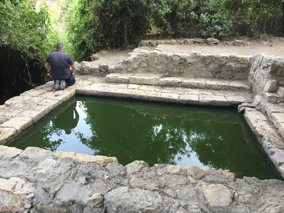
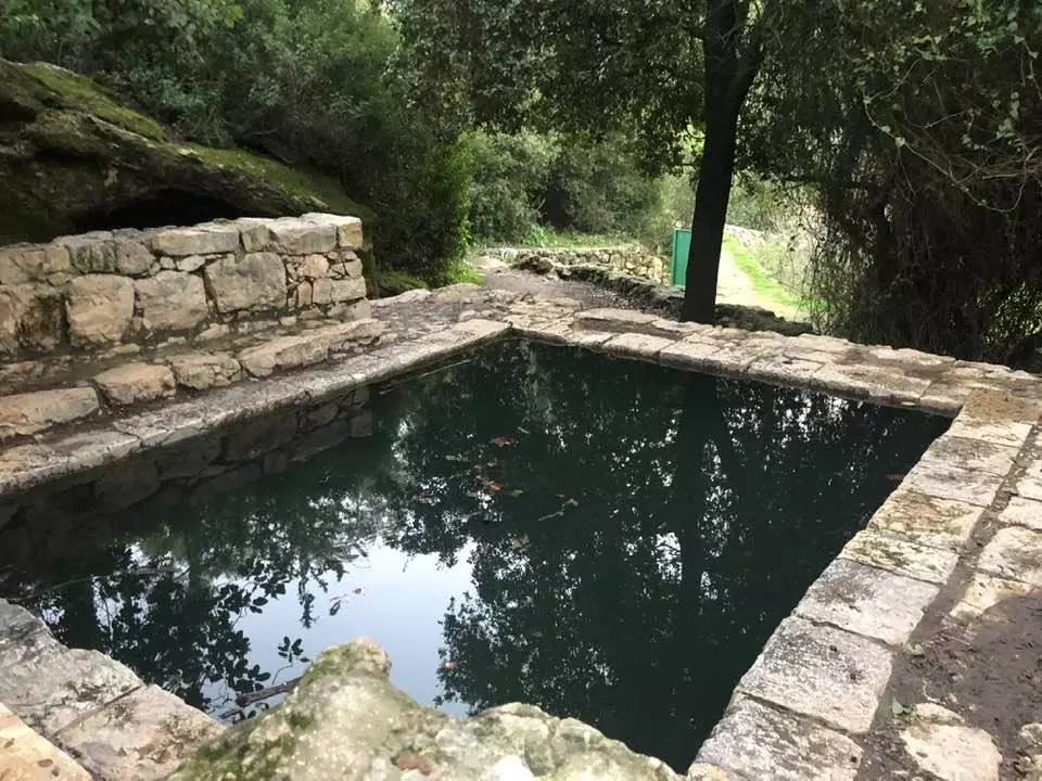
1 - بين قرية صطاف وقرية دير عَمْر قضاء القدس برك قديمة وآبار لتخزين المياه للاستعمال الزراعي .
نقلاً عن : الأستاذ إياد جابر
- بين قرية صطاف وقرية دير عَمْر قضاء القدس برك قديمة وآبار لتخزين المياه للاستعمال الزراعي .
نقلاً عن : الأستاذ إياد جابر #2

- بين قرية صطاف وقرية دير عَمْر قضاء القدس برك قديمة وآبار لتخزين المياه للاستعمال الزراعي .
نقلاً عن : الأستاذ إياد جابر #3
- بين قرية صطاف وقرية دير عَمْر قضاء القدس برك قديمة وآبار لتخزين المياه للاستعمال الزراعي .
نقلاً عن : الأستاذ إياد جابر #4
- بين قرية صطاف وقرية دير عَمْر قضاء القدس برك قديمة وآبار لتخزين المياه للاستعمال الزراعي .
نقلاً عن : الأستاذ إياد جابر #6
- Deir 'Amr orphanage after capture, 1948 -- دار الايتام بعد احتلال القرية
- Deir 'Amr orphanage after capture, 1948 #2 -- دار الايتام بعد احتلال القرية
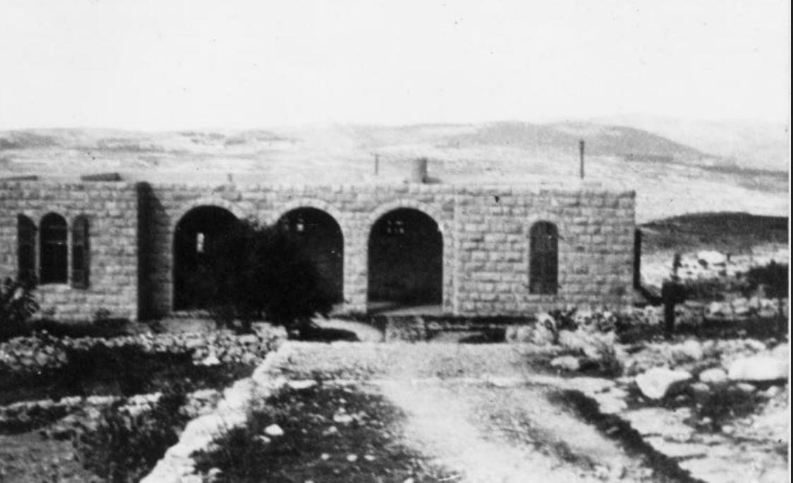
- Deir 'Amr orphanage after capture, 1948 #3 -- دار الايتام بعد احتلال القرية
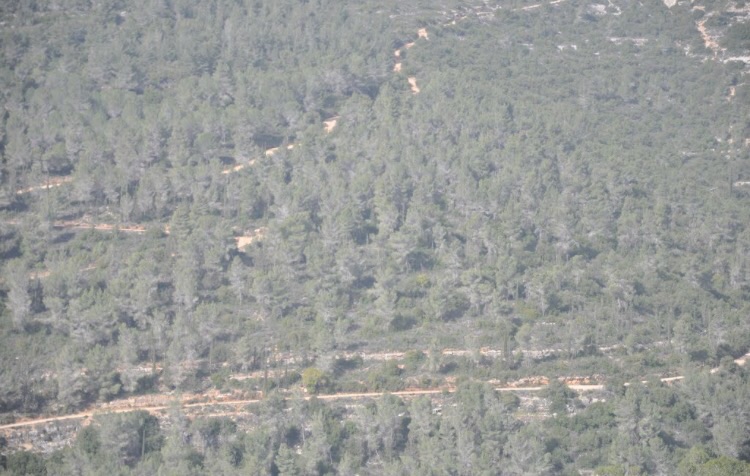
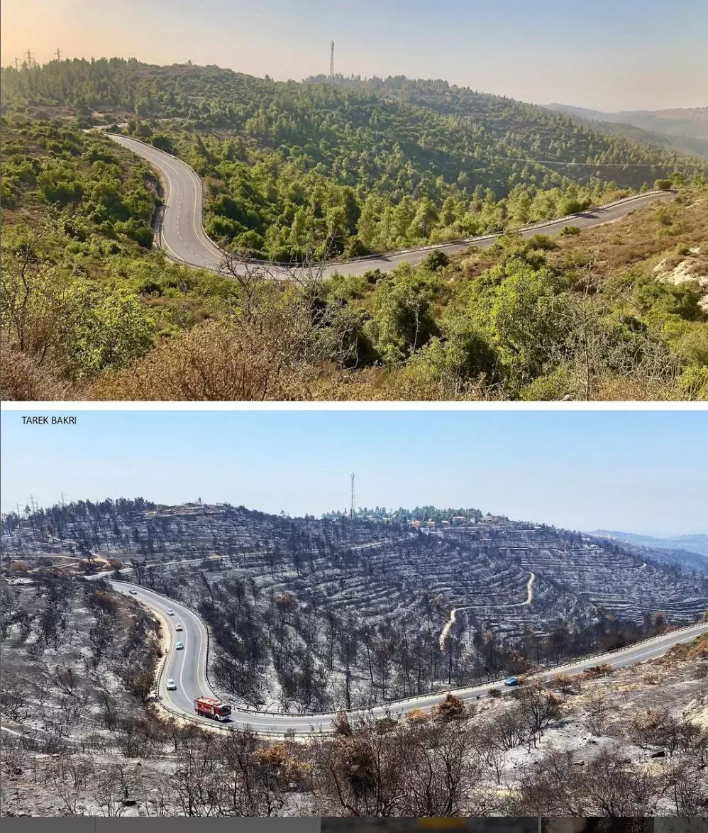
- The recent fires West of Jerusalem exposed how the "civilized settler colonist" hid their crime of erasing the indigenous people (Palestinians) by planting none native trees (like pine) after they cut down Palestinians' olive trees (which are by definition fire resistant). As you can see, the fire exposed the old terraces that were built over hundreds of years. Of course, those terraces were built by the indigenous people who, conveniently for Jews, "don't exist"! Dear Deir 'Amr, stay tuned: we're coming back
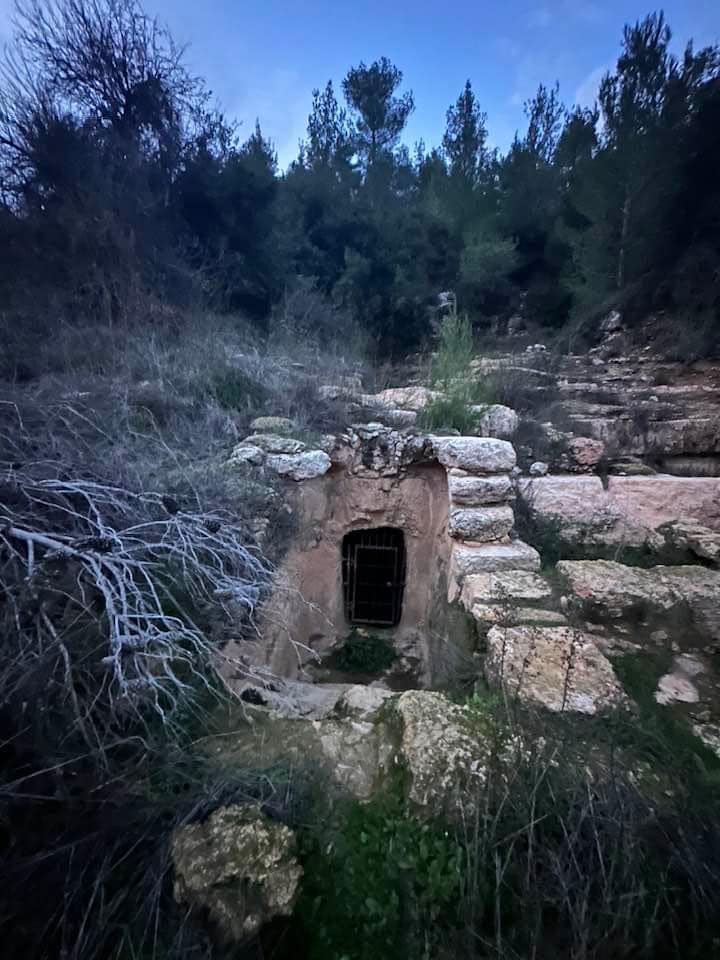
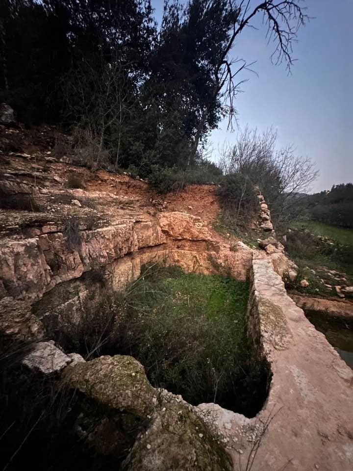
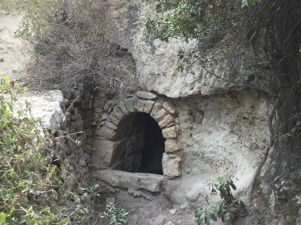
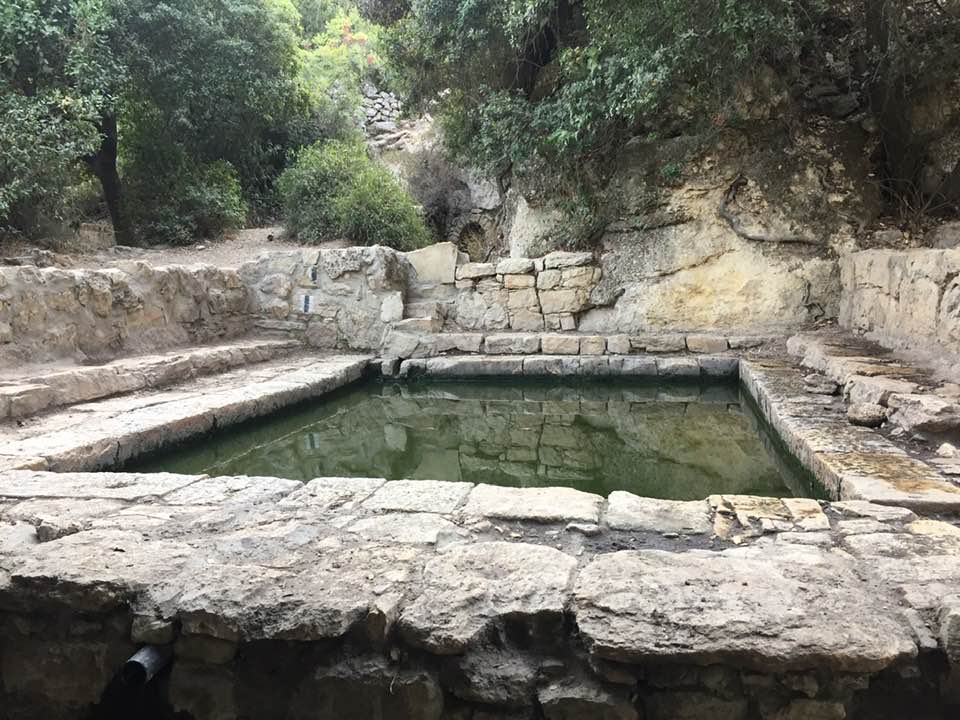
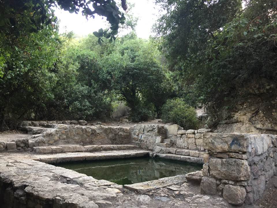
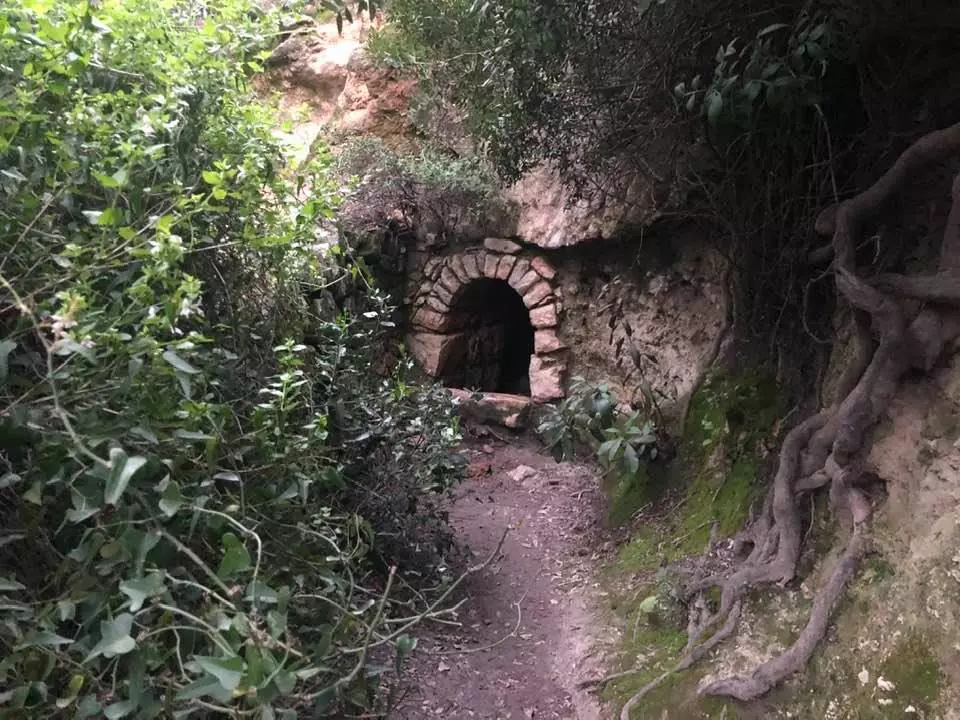
- عين الذيابية اوعين البلد في قرية دير عمْر المهجرة قضاء القدس
استخدم Waze للقيادة إلى עין טייסימ . -- Oct. 5th, 2021 -- Iyad Jaber
- عين الذيابية اوعين البلد في قرية دير عمْر المهجرة قضاء القدس
استخدم Waze للقيادة إلى עין טייסימ . -- Oct. 5th, 2021 -- Iyad Jaber #2
- عين الذيابية اوعين البلد في قرية دير عمْر المهجرة قضاء القدس
استخدم Waze للقيادة إلى עין טייסימ . -- Oct. 5th, 2021 -- Iyad Jaber #3
- عين الذيابية اوعين البلد في قرية دير عمْر المهجرة قضاء القدس
استخدم Waze للقيادة إلى עין טייסימ . -- Oct. 5th, 2021 -- Iyad Jaber #4
- عين الذيابية اوعين البلد في قرية دير عمْر المهجرة قضاء القدس
استخدم Waze للقيادة إلى עין טייסימ . -- Oct. 5th, 2021 -- Iyad Jaber #5
- عين الذيابية اوعين البلد في قرية دير عمْر المهجرة قضاء القدس
استخدم Waze للقيادة إلى עין טייסימ . -- Oct. 5th, 2021 -- Iyad Jaber #6
- عين الذيابية اوعين البلد في قرية دير عمْر المهجرة قضاء القدس
استخدم Waze للقيادة إلى עין טייסימ . -- Oct. 5th, 2021 -- Iyad Jaber #7
Want to browse more? 80,000 pictures were grouped in these gallaries:
| Display Name | Clan/Hamolah | Country of Residence |
- قرية دير عَمْر المهجرة قضاء القدس Duration: min 11 sec
- دير عَمِر المهجرة قضاء القدس تم تحويلها الى مستشفى الامراض العقلية ( اتانيم ). Duration: 11 sec
No links have been shared yet, be free to the first to share the first link.
 Fake Valor: Why Did Zionist Jews Hoist Nazis Flag on Their Ships in the 1930s?
What is new?
-
Facts About Oct. 7th Gaza Raid
-
Remined Us Please:: Who Did Rape Who? Palestinians Raped Israelis? Or, was the other way around?
-
When Prof. Edward Said was invited to debate Bibi Netanyahu in the 1980s, watch what happened!
-
Ezra Klein of the NY Times on the "Jewish Race".
-
Abusing Blood Libel!
-
Did Israeli Soldiers Activate The Hanniba Direective On Oct. 7th? You Be The Judge
-
Zionist FAQ: Isn't it true that Palestinians don't want peace? Palestinians never accepted the two-state solution
- Facts about Haavara (Transfer) Agreement between Ben-Gurion & Hitler
-
Haavara FAQs: Why Did Zionist Jews Hoist Nazis' Flags on Their Ships in the 1930s?
- Haavara FAQs: When Chaim Weizmann met FDR in mid-1943, why was he silent about rescuing European Jewry?
-
Dear ChatGPT: How did Palestinians resist Napoleon's invasion of their country in 1799?
-
Dear ChatGPT: Gaza had a vibrant Jewish community in the mid-17th century. What happened to them?
-
Dear ChatGPT: Why did the Jewish Agency suppress news of the Holocaust during WWII?
-
Video Playlist: Jews share their DNA tests to end the conflict for good.
-
A Tale of Two Conflicts: Examining the Definition of Genocide
-
Prof. Abraham Polak And The Suppressed History of the Khazars and European Jewry
-
How Ronald Reagan would have framed the genocide in Gaza if he were still alive?
-
Haavara FAQs: Let us do the math: how many German Jews did The Haavara Agreement save?
-
Zionist FAQs: The Hebron Massacre of 1929, "clearly proves" that Palestinians are antisemitic, how could you deny it?
-
Zionist FAQs: Why Anti-Zionist Is Not Antisemitism?
-
Zionist FAQs: Isn't it true that the KGB created Palestinian Nationalism in the early 1960s?
- Zionist FAQs: Muslims are killing Muslims all the time; why are Israeli Jews being singled out in the media?
- Zionist FAQs: How is Israel an apartheid state when 20% of its citizens are Arabs who enjoy full rights?
-
Haavara FAQs: Why Did Dorothy Thompson Flip From A Zionist Advocate to A Silenced Dissenter?
-
Haavara FAQs: Analysis of Herzl's Uganda Scheme and how it could have saved millions of Jews.
-
Haavara FAQs: Why did Hayim Greenberg describe American Jewry as "morally bankrupt" in early 1943?
-
Haavara FAQs: What if the Evian Conference was a resounding success? What would have been the impact of saving European Jewry on Zionism?
- Haavara FAQs: What if the six million were saved, how that would have impacted the Zionist project?
-
Haavara FAQs: How did Zionist leaders react when Europe's Jews lingered in the DP camps after WWII ended?
-
Why does the American Jewish community repeat lies that David Ben-Gurion had debunked before he died?
-
Who has the power to rename the Tatar/Khazar Gene Marker to Jewish IV?
-
Zionist FAQs: Why won't Egypt, Syria, and Jordan take their people back? Jews are indigenous to Palestine, and Arabs immigrated after Jews developed the country. Arabs should leave.
-
Haavara FAQs: Did Hitler and the Nazis conflate between Judaism and Zionist? If that wasn't case, then why?
-
Haavara FAQs: Winston Churchill and antisemitism, a collection of articles written Churchill.
-
Haavara FAQs: Broken by country, how many Jews survived vs. killed during the Holocaust?
-
Haavara FAQs: Why did European Jews vote with their feet and to immigrated to the Americas, not Palestine, after WWII?
-
Watch this American Jewish Girl describing Israeli Jews' cognitive dissonance like no other in under two minutes
-
Haavara FAQs: When the Nazis went out of their way to hide the Holocaust, Israeli Jews did the exact opposite by broadcasting their genocide of Gazans. But why?
-
Haavara FAQs: How Zionist Jews went out of their to show their appreciation to Nazism and Fascism?
- Haavara FAQs: Why Zionist leaders were against bombing the death camps & the Railroads leading to them?
-
Haavara FAQs: Hitler's message to the British and American people: If Jews are such noble citizens and you care about them, how come you're not letting them in? I will gladly ship them to you at my expense, even on luxury liners!
-
A shortlist of Zionist and Israeli false flag operations in the name Jews.
-
The Most Moral Army
- The Land of Kapos (Israel): Where the brave are boycotted and Kapos walk free.
- Why did early Zionists often named their communal enterprises "colonial"?
- Zionist Relations with Nazi Germany by Faris Glubb
-
Two NY Times advertisements by Zionists in the early 1943 that exposes Zionists' treason at the height of the calamity
- Facts Not Lies about the Palestinian-Israeli Conflict.
- Site's pictures have been categorized
- Campgain Against Lice
- A Survey of Palestine, the official source about Palestine before Nakba produced by the British Mandate; over 1200 pages.
- Satellite View & Google Earth: Over 6,000 placemarks identifying all destroyed towns, W. Bank & Gaza Strip Towns, & refugee camps.
- PalestineRemembered.com and its Nakba Oral History Project were featured on al-Jazeera Satellite TV.
- Nakba Oral History Video Podcast:
 Over 700 Oral History interviews (including 3,500+ hours of recording) can be viewed online.
 - Palestine Village Statistics Project
- Gaza Jail Break
- النسخة العربية للموقع الان متوفرة
- Videos: Documenting the destroyed villages in video: Tracing all that remains since Nakba.
- Videos: Responding to Zionist Propaganda
- Interview: The ethnic cleansing of Palestine: George Galloway interviews Israeli Historian Ilan Pappe.
- For Palestinians, memory matters. It provides a blueprint for their future By George Bisharat.
- Zionist FAQ now available in Hebrew שאלות שציונים שואלים, עכשיו בעברית
- Video: The Stephen Walt and John Mearsheimer report on the influence of the Israel Lobby on U.S. Foreign Policy
- The Palestinian-Israeli conflict for beginners
