| PalestineRemembered | About Us | Oral History | العربية | |
| Pictures | Zionist FAQs | Haavara | Maps | |
| Search |
| Camps |
| Districts |
| Acre |
| Baysan |
| Beersheba |
| Bethlehem |
| Gaza |
| Haifa |
| Hebron |
| Jaffa |
| Jericho |
| Jerusalem |
| Jinin |
| Nablus |
| Nazareth |
| Ramallah |
| al-Ramla |
| Safad |
| Tiberias |
| Tulkarm |
| Donate |
| Contact |
| Profile |
| Videos |
Welcome To al-'Umur, Khirbat - خربة العمور (ח'ירבת אל-עומור)
|
District of Jerusalem
Ethnically cleansed days ago |
العربية Google Earth |
 |
Gallery (47) |
- Statistics & Facts
-
Before & After

- Satellite View
- Articles 1
- Pictures 47
- Oral History 1
- Members 2
- All That Remains
- Wikipedia
- Videos 1
- Guest Book 2
- Links
| Statistic & Fact | Value | ||||||||||||||||||
| Occupation Date | October 21, 1948 | ||||||||||||||||||
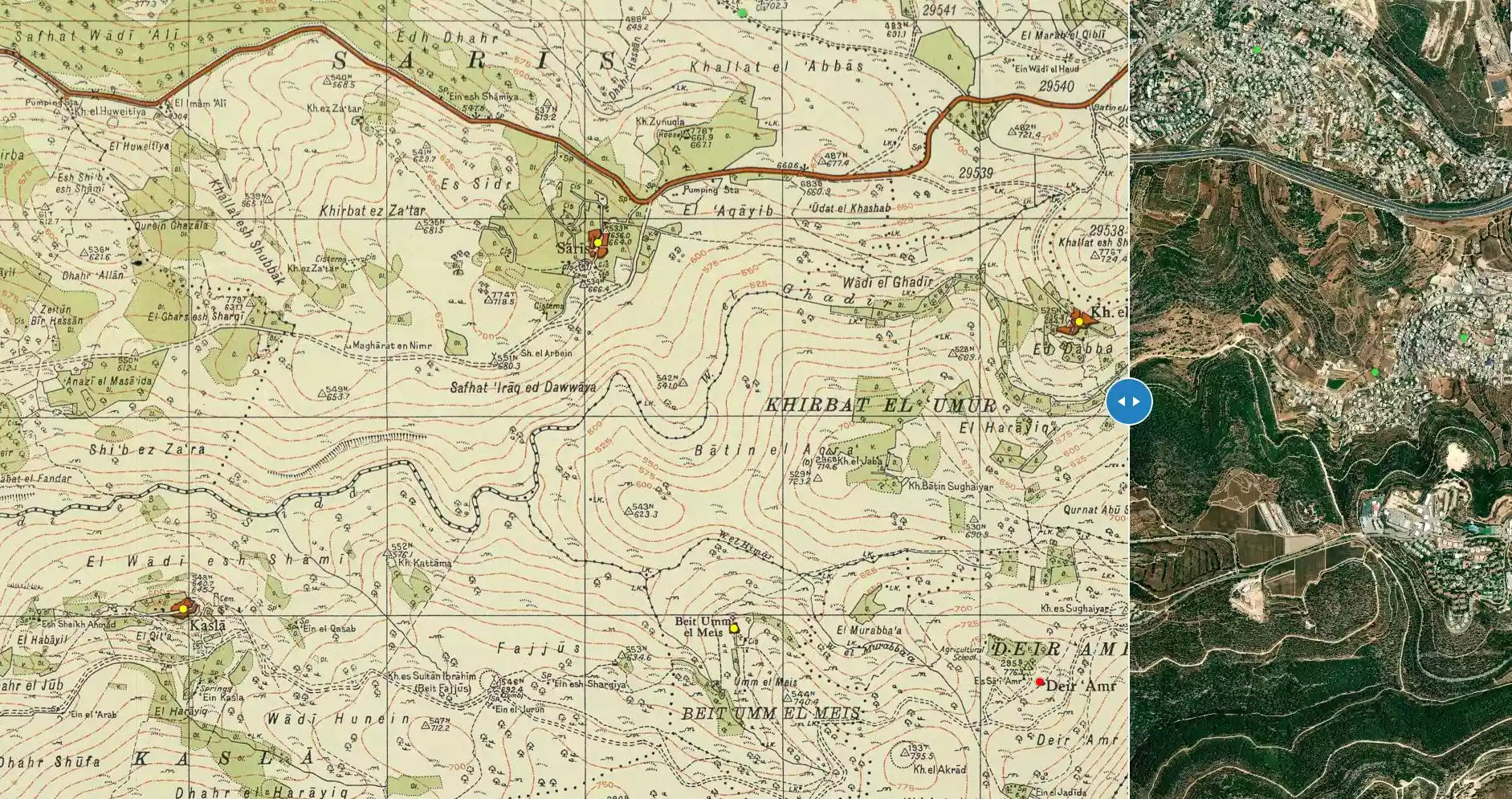
| Distance From District | 12 (km) West of Jerusalem | ||||||||||||||||||
| Elevation | 625 (meters) | ||||||||||||||||||
| Before & After Nakba, Click Map For Details |
|||||||||||||||||||
|
|||||||||||||||||||
| Map Location | See location #7 on the map View from satellite |
||||||||||||||||||
| Military Operation | Operation ha-Har | ||||||||||||||||||
| Attacking Units | Har'el Brigade | ||||||||||||||||||
| Defenders | Local militia and Egyptian Army/Muslim Brotherhood Battalion | ||||||||||||||||||
| Exodus Cause | Military assault by Zionist troops | ||||||||||||||||||
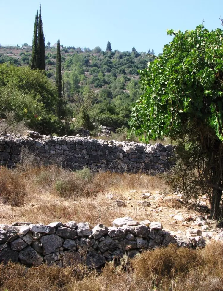
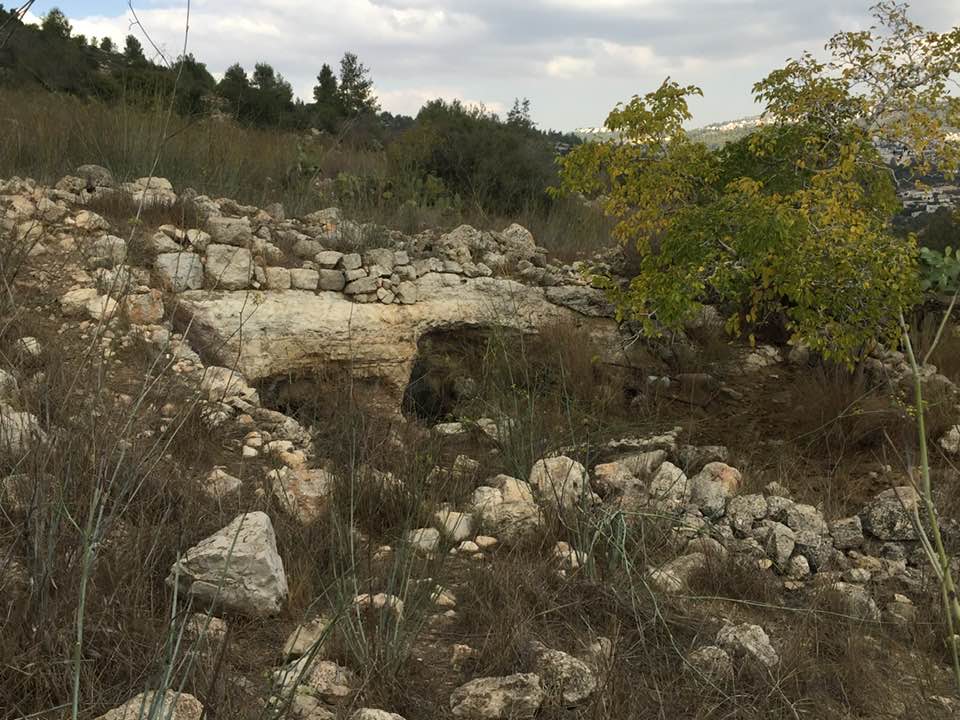
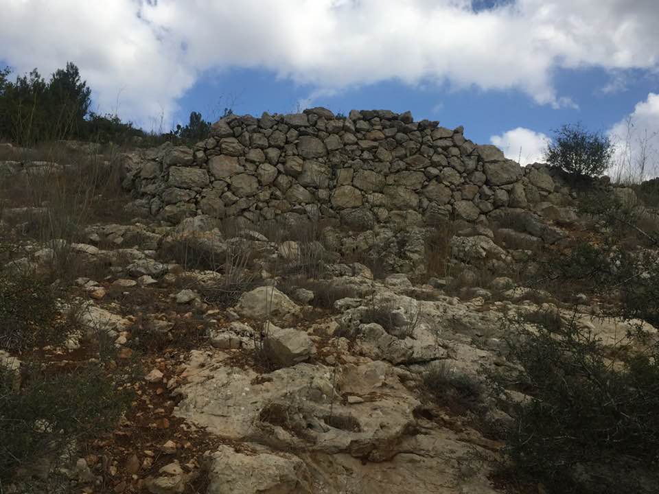
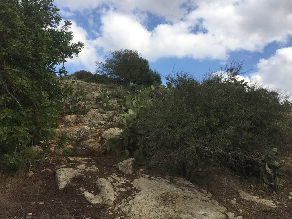
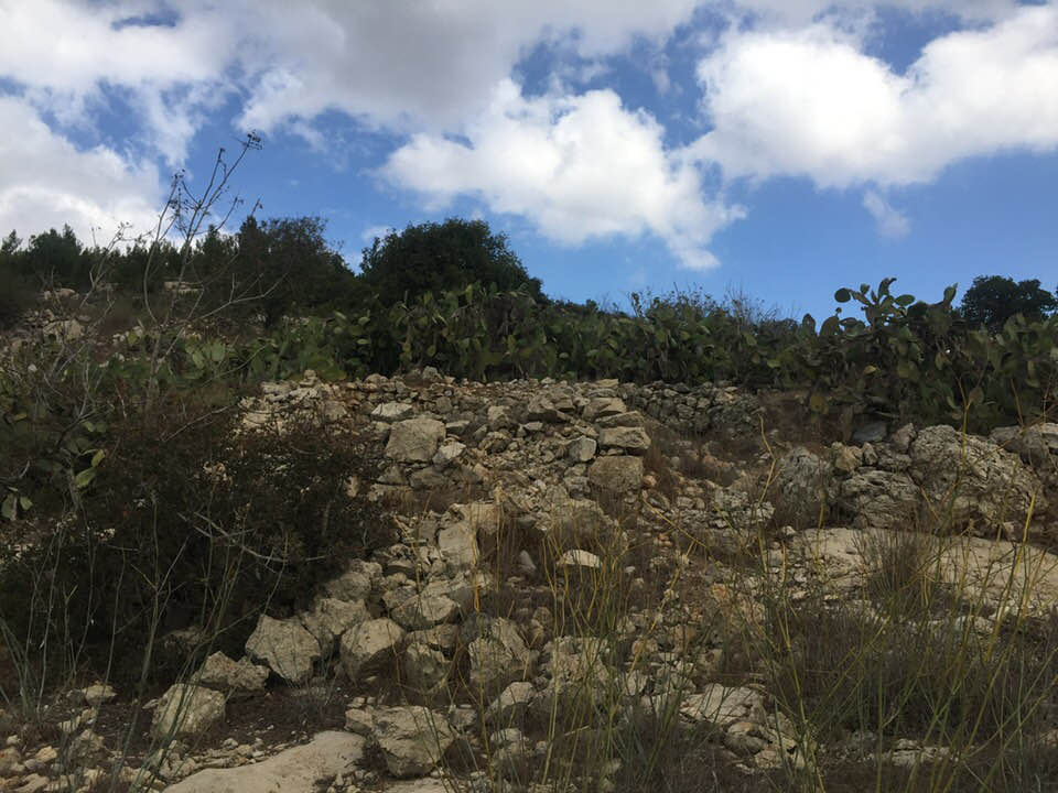
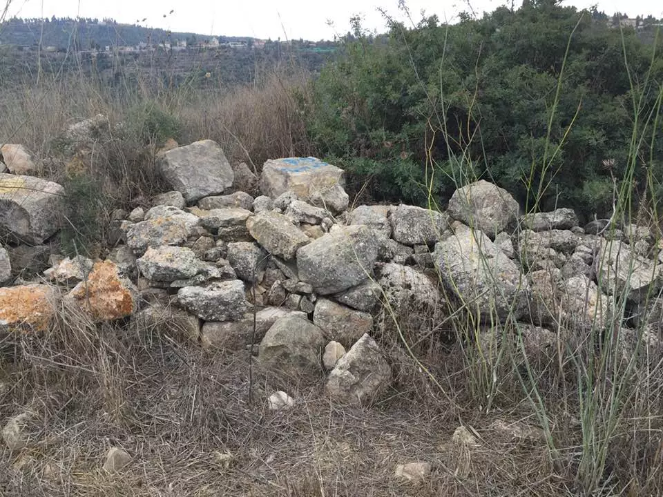
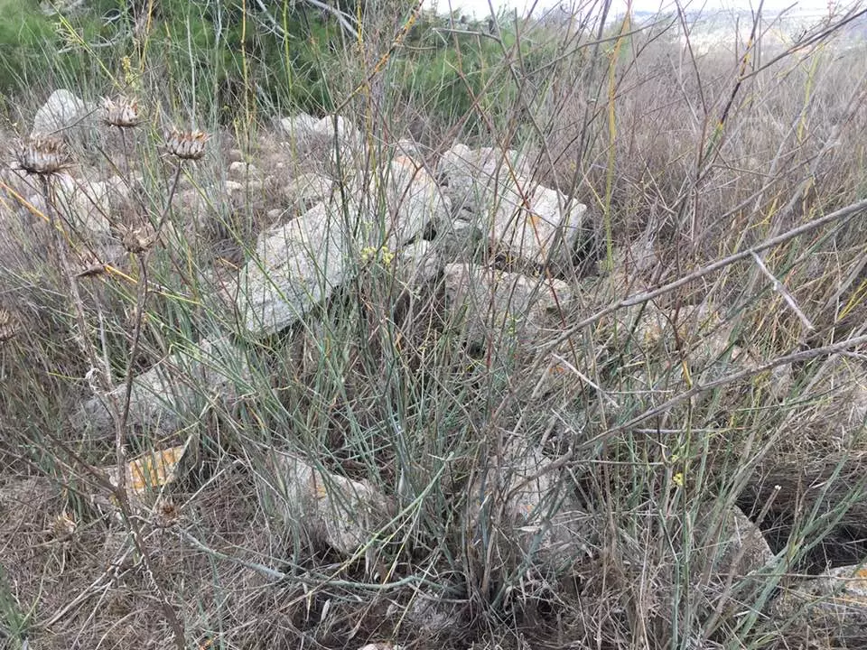
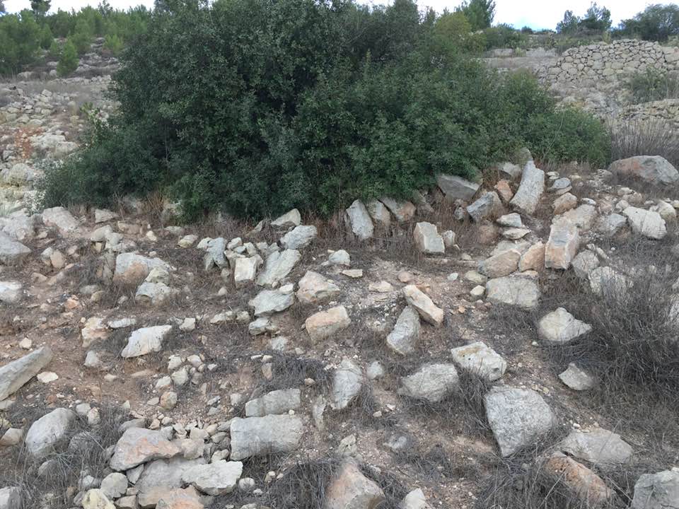
| Village Temains | Khirbat al-'Umur was completely obliterated, and only house rubble left behind. | ||||||||||||||||||
| Ethnically Cleansing | al-'Umur, Khirbat inhabitants were completely ethnically cleansed. | ||||||||||||||||||
| Pre-Nakba Land Ownership |
**Town Lands' Demarcation Maps |
||||||||||||||||||
| Land Usage As of 1945 |
|
||||||||||||||||||
| Population |
|
||||||||||||||||||
| Number of Houses |
|
||||||||||||||||||
| Near By Towns |
|||||||||||||||||||
|
|||||||||||||||||||
| Nearby Wadies & Rivers | Khirbat al-'Umur was facing Wadi al-Ghadir. | ||||||||||||||||||
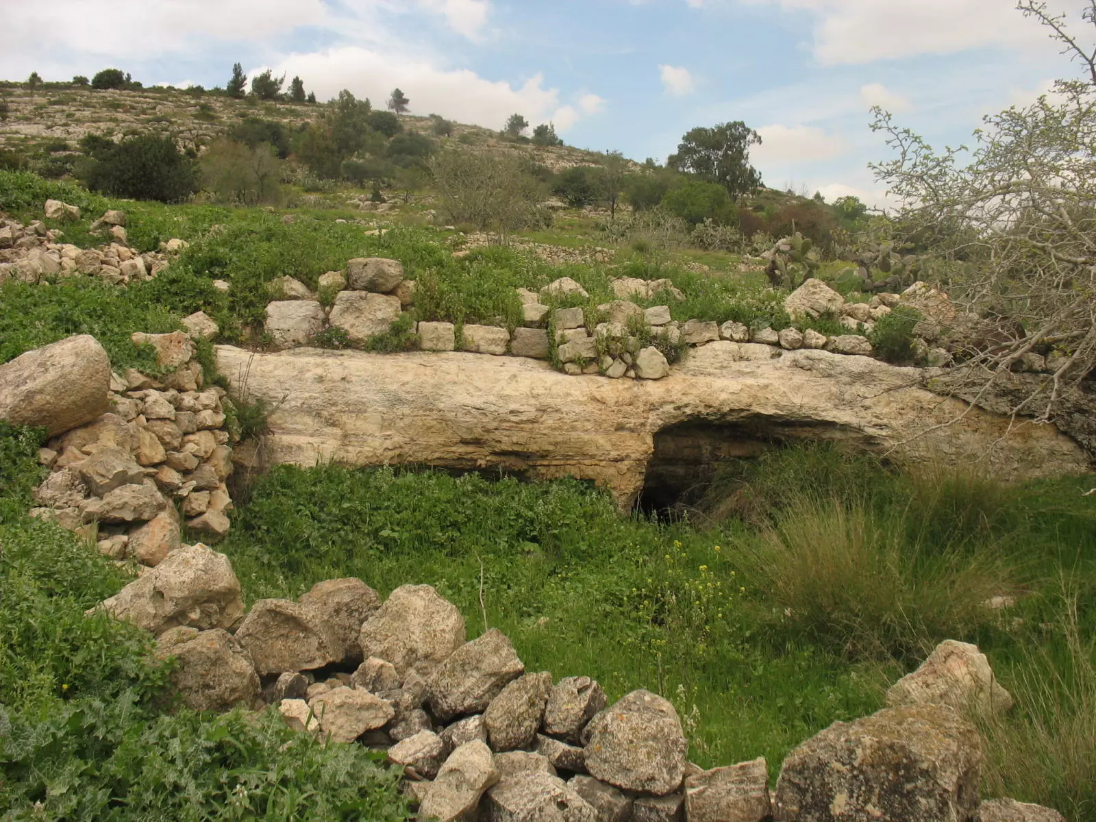
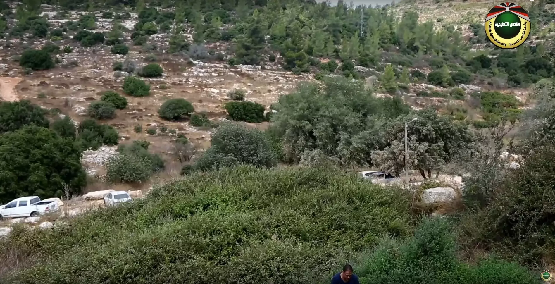
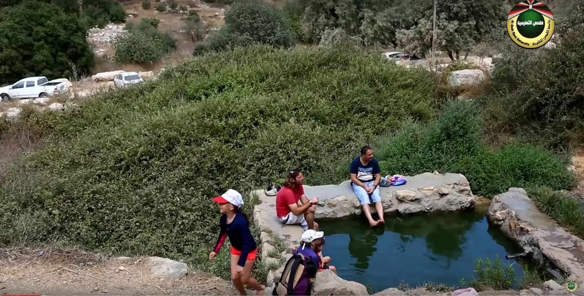
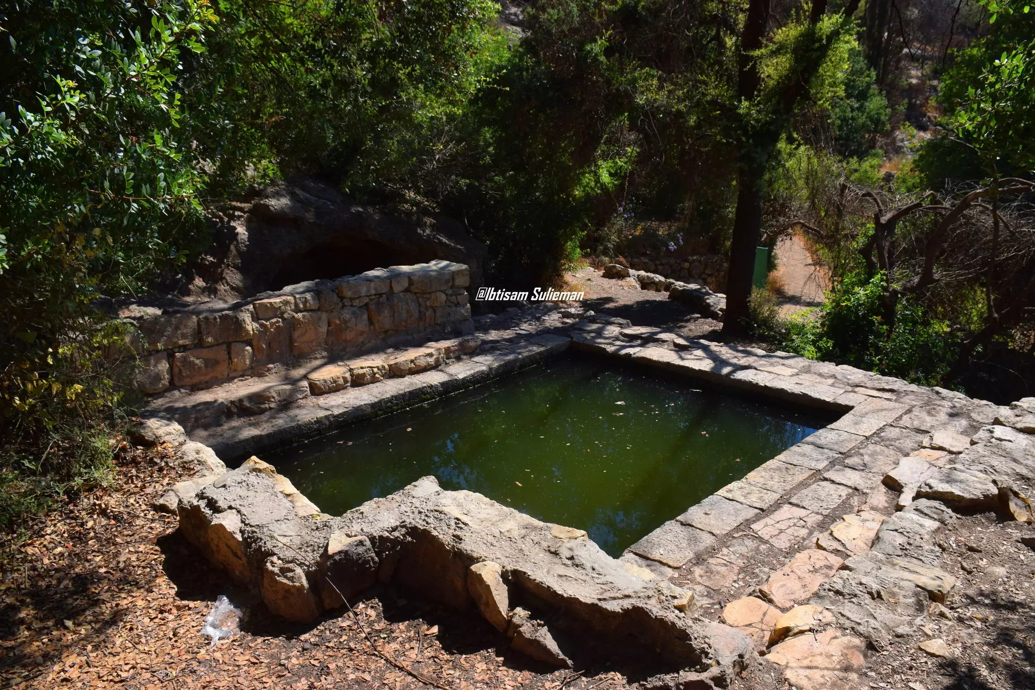
| Water Supply | The spring of 'Ayn al-'Umur (still functioning) and several nearby springs supplied Khirbat al-'Umur with fresh water. | ||||||||||||||||||
| Exculsive Jewish Colonies Who Usurped Village Lands |
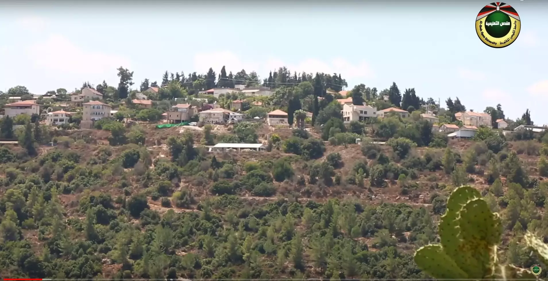
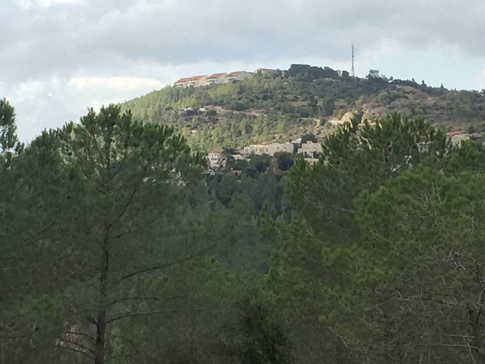
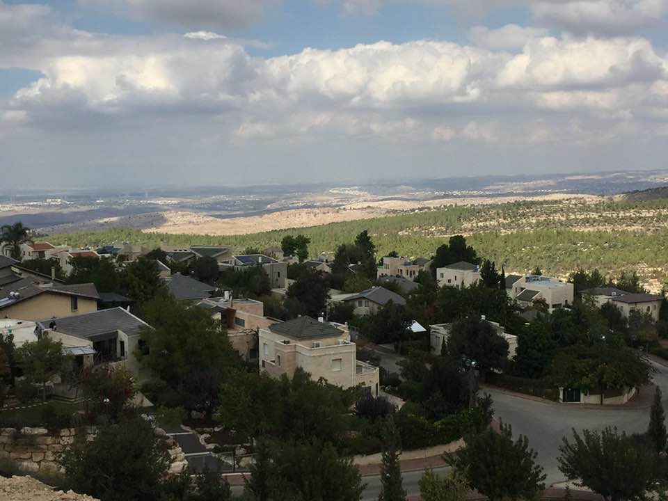
Giv'at Ye'arim | ||||||||||||||||||
| Featured Video | |||||||||||||||||||
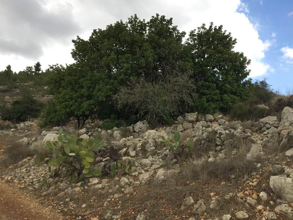
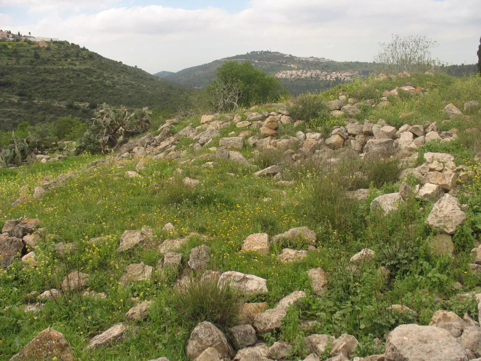
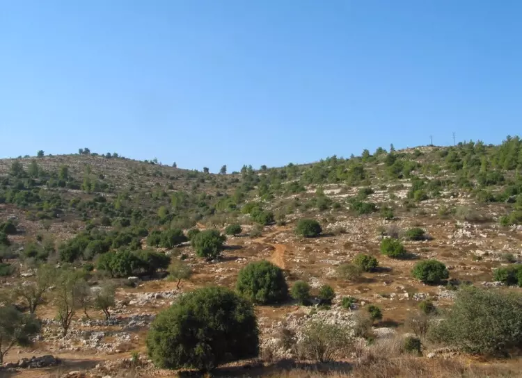
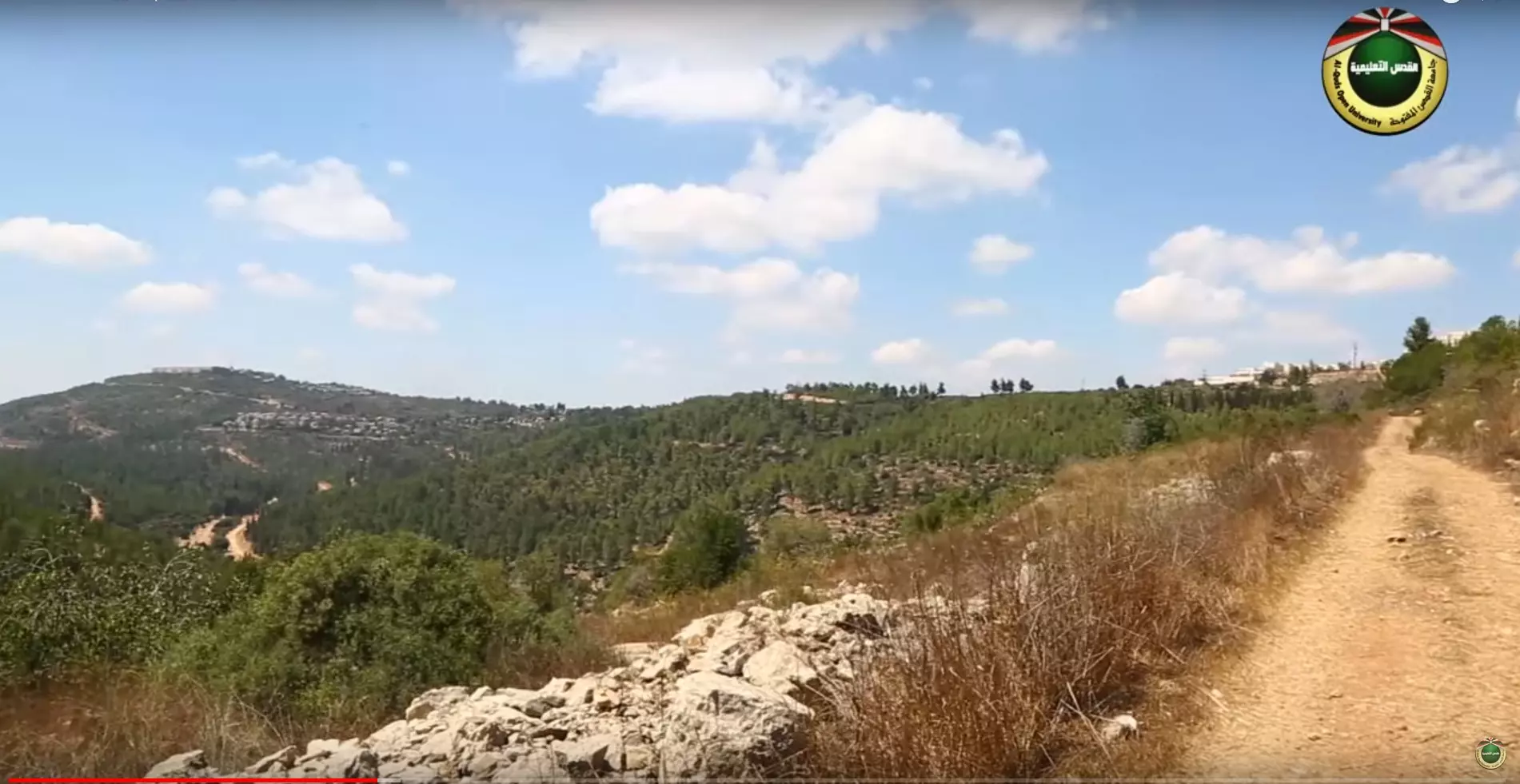
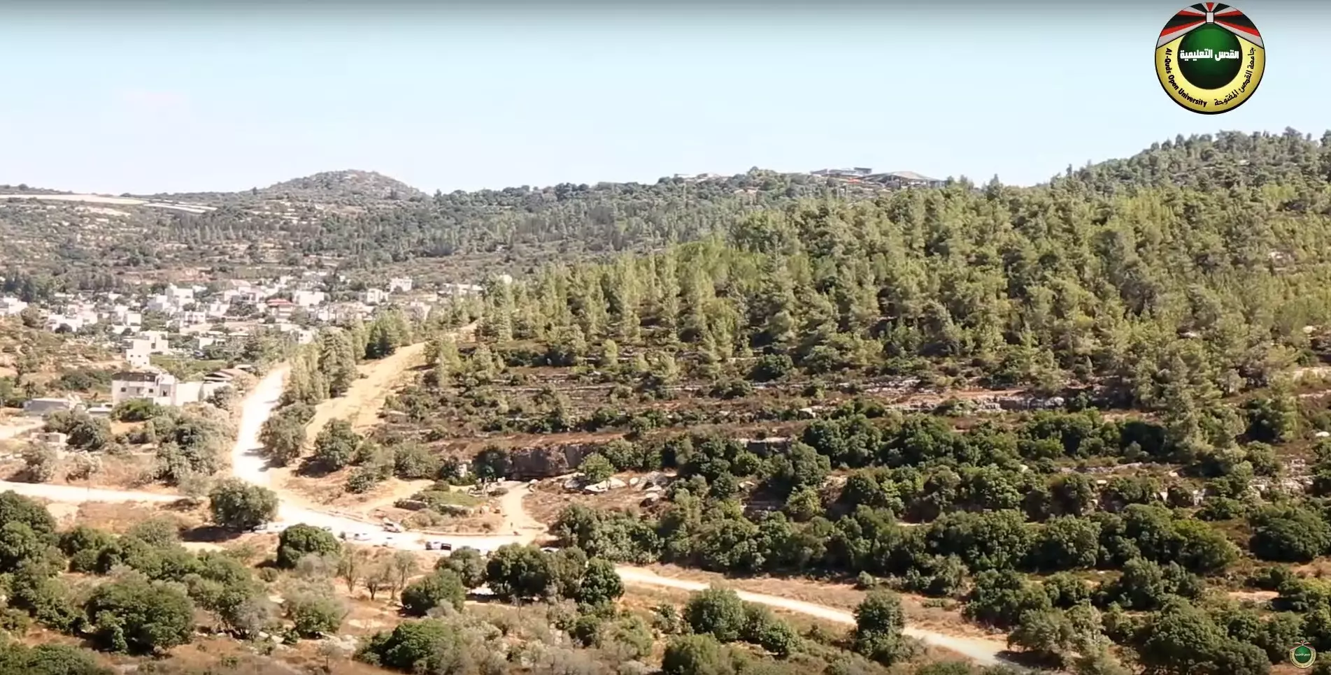
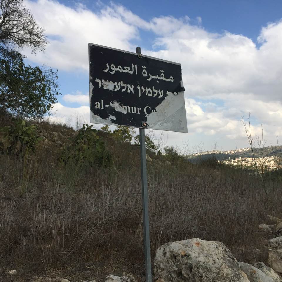
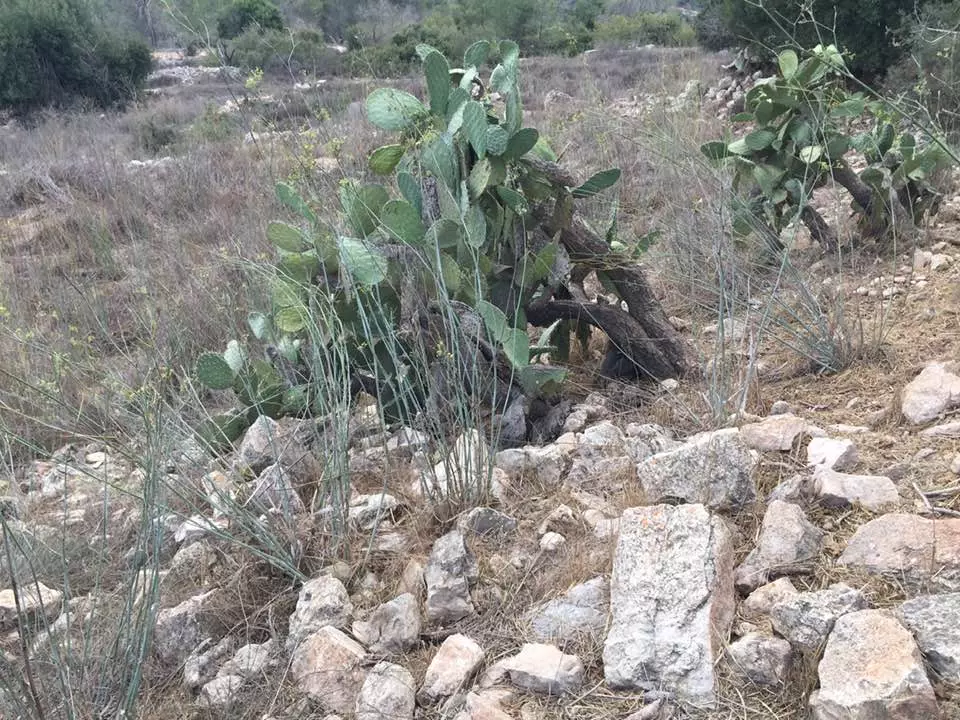
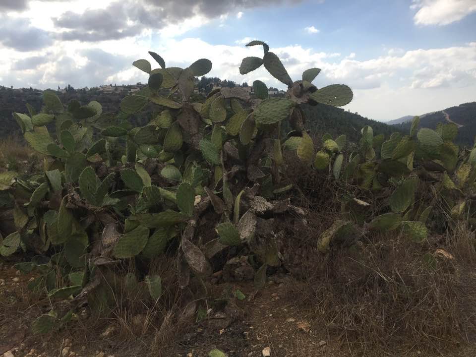
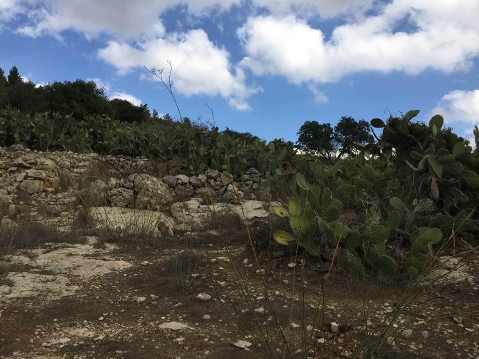
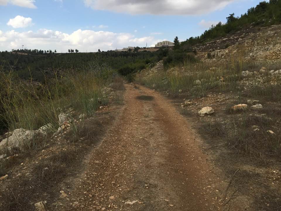
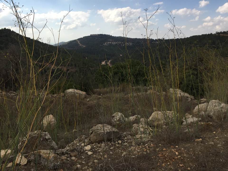
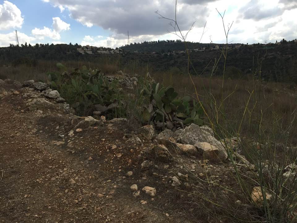
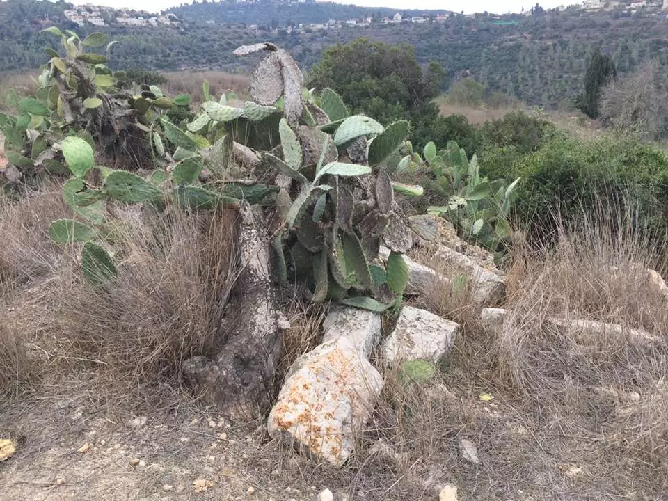
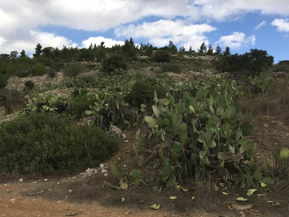
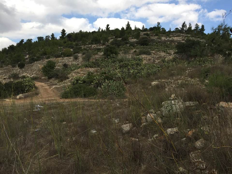
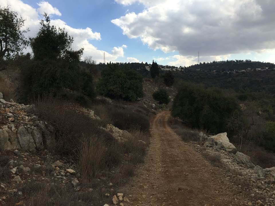
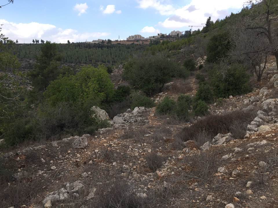
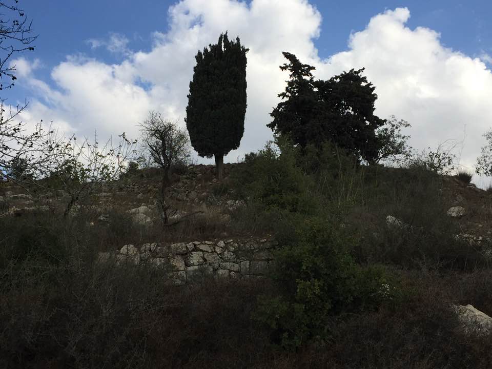
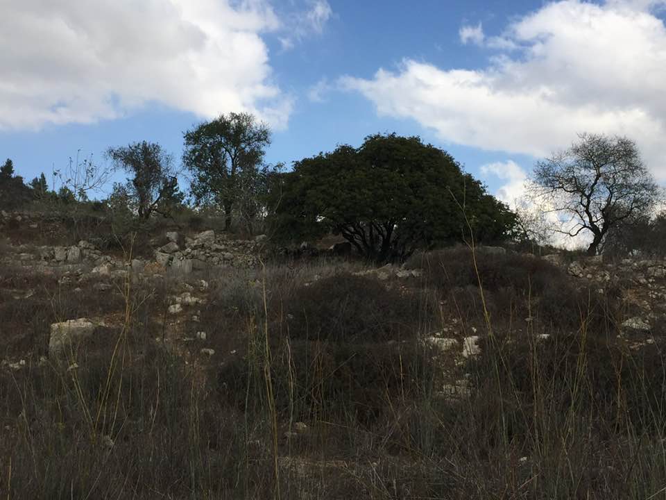
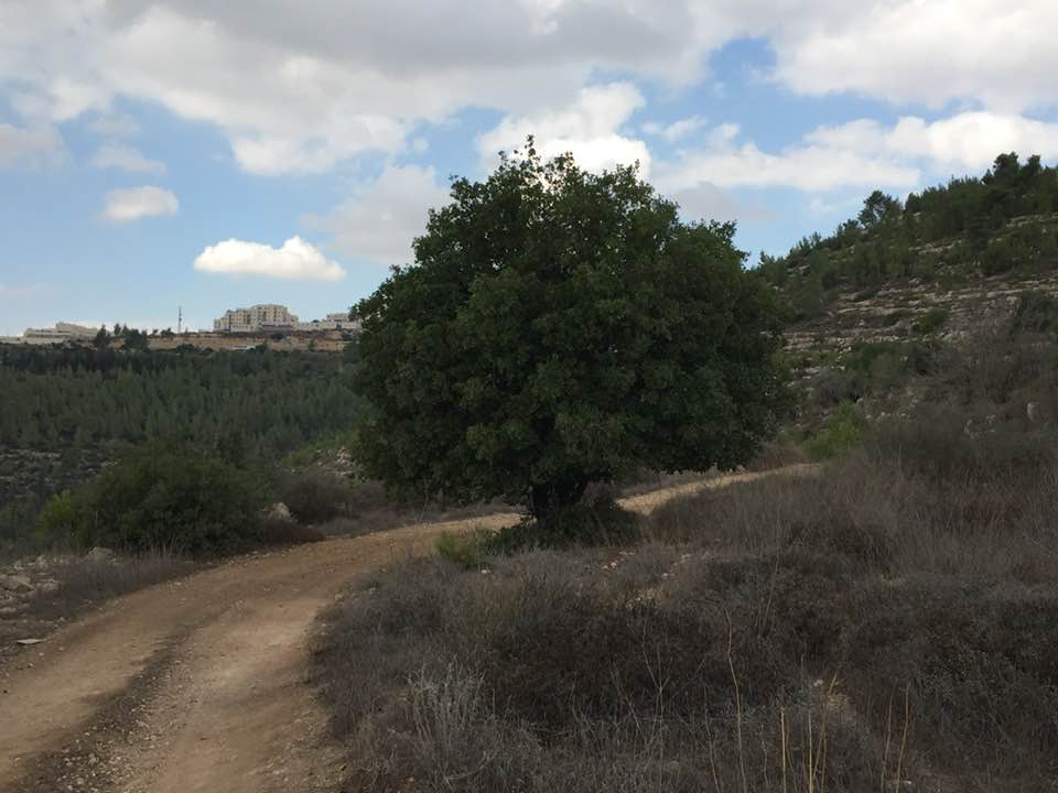
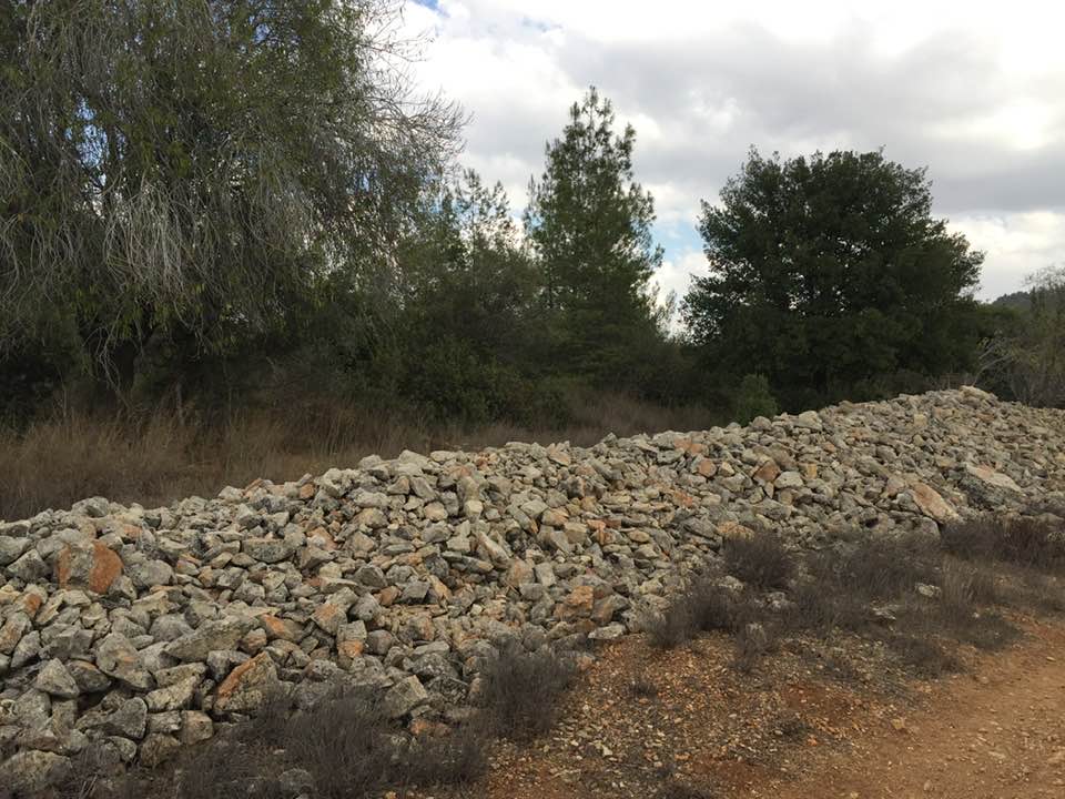
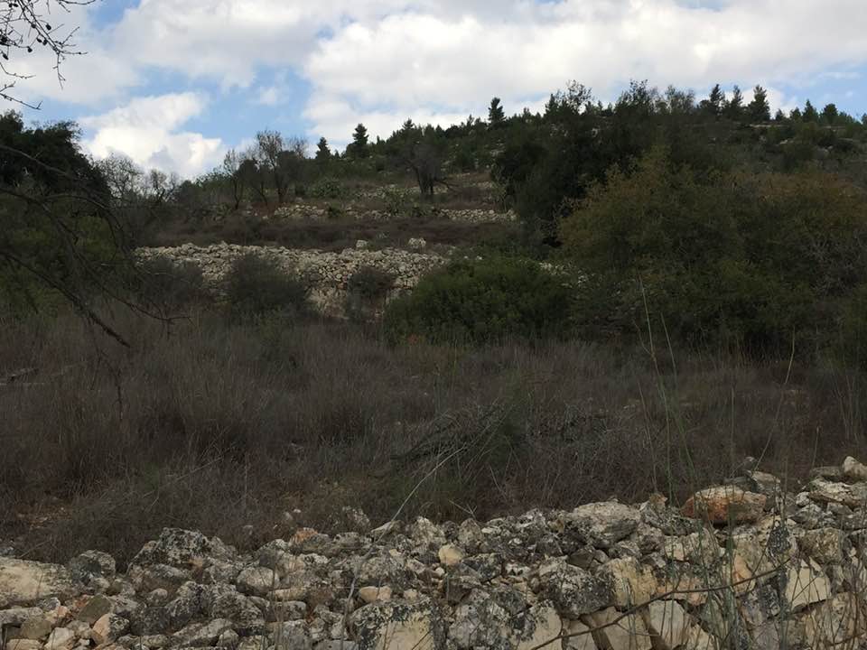
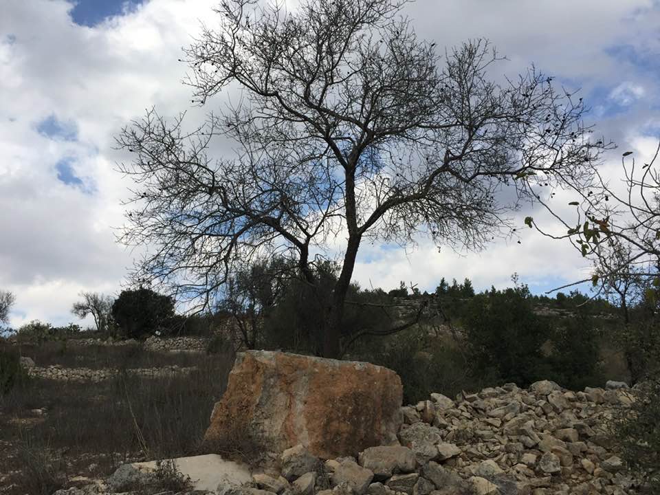
Village Before NakbaThe village stood on a small plateau on the southern slope of a mountain, facing south. Wadi al-Ghadir ran in an east-west direction at the foot of the mountain. A mountain range to the south separated the village land from that of Dayr 'Amr. Dirt paths linked the village to the Jerusalem−Jaffa highway, which passed a short distance to the north, and other dirt paths linked it to neighboring villages. As its name suggests, the village was built next to a khirba; remains in this khirba probably dated to the Byzantine period. During the late nineteenth century, Khirbat al-'Umur was described as a small hamlet. The village plan was rectangular and its houses were built of stone. Two main streets intersected at the center of the village, dividing it into four sections. The residents were Muslim. Their drinking water was supplied by several nearby springs, one of which had the same name as the village. The villagers cultivated fruit, olives, and grain, and irrigated some of these crops, especially those in Wadi al-Ghadir, a strip of land stretching along the southern side of the village. In 1944/45 a total of 1,279 dunums was allotted to cereals; 497 dunums were irrigated or used for orchards, of which 98 dunums were for olive cultivation.Village Occupation and Ethnic CleaningThe village was occupied on 21 October 1948; this implies that it was encroached upon by the Israeli army's Har'el Brigade as part of Operation Ha-Har (see 'Allar, Jerusalem sub-district). No details are given about the occupation of this village in particular, but Israeli historian Benny Morris states that the general pattern was that villagers fled under military pressure or were expelled by the Israeli forces that entered their villages. In all, thousands of people were displaced as a result of the operation, some camping out for weeks in surrounding valleys until they were forced out yet again by Israeli forces.Zionists Colonies on Village LandsGiv'at Ye'arim (158132) was founded in 1950 on village lands.Village TodayStone rubble and window and door frames, partly hidden by wild grass, are scattered across the village site. Many stone terraces are visible. Cactuses grow on the east and north sides of the village site, and almond, olive, fig, and cypress trees grow on the village site itself and on the lands south of it. The village cemetery, to the south, is covered with dirt and grass but many graves are visible; tombstones stand at the head and foot of each one. The spring of 'Ayn al-'Umur and the stone structure around it can still be seen.SourceDr. Walid al-Khalidi, 1992: All That Remains. |
|||||||||||||||||||
| Related Maps | Town Lands' Demarcation Maps خرائط للقضاء توضح حدود القرى والاودية Town's map on MapQuest View from satellite Help us map this town at WikiMapia |
||||||||||||||||||
| Related Links | Wikipedia's Page Google Search Google For Images Google For Videos |
||||||||||||||||||
| More Information | في كتاب كي لا ننسى في كتاب بلادنا فلسطين المزيد من موقع هوية |
||||||||||||||||||
- Ruins of the destroyed Palestinian village
Posted by Noga Kadman 1 - Ruins of the destroyed Palestinian village
Posted by Noga Kadman 5 - خربه العمور
Posted by abu raya - اراضي خربه العمور
Posted by abu raya - جولة بين انقاض وينابيع واحراش قرية خربة العمور المهجرة والمدمرة
- جولة بين انقاض وينابيع واحراش قرية خربة العمور المهجرة والمدمرة #2

- جولة بين انقاض وينابيع واحراش قرية خربة العمور المهجرة والمدمرة #3

- جولة بين انقاض وينابيع واحراش قرية خربة العمور المهجرة والمدمرة #4

- جولة بين انقاض وينابيع واحراش قرية خربة العمور المهجرة والمدمرة #5
- جولة بين انقاض وينابيع واحراش قرية خربة العمور المهجرة والمدمرة #6
- جولة بين انقاض وينابيع واحراش قرية خربة العمور المهجرة والمدمرة #7
- جولة بين انقاض وينابيع واحراش قرية خربة العمور المهجرة والمدمرة #8
- جولة بين انقاض وينابيع واحراش قرية خربة العمور المهجرة والمدمرة #9

- جولة بين انقاض وينابيع واحراش قرية خربة العمور المهجرة والمدمرة #10
- احد عيون المي بقرية العمور المهجرة من قرى القدس
- احد عيون المي بقرية العمور المهجرة من قرى القدس #2

- احد عيون المي بقرية العمور المهجرة من قرى القدس #3

- مقبرة خربة العمور المهجرة -- Jan 21st, 2022 -- Iyad Jaber
- مقبرة خربة العمور المهجرة -- Jan 21st, 2022 -- Iyad Jaber #2
- مقبرة خربة العمور المهجرة -- Jan 21st, 2022 -- Iyad Jaber #3
- Let us see how the most "liberal and civilized" of world Jewry has obliterated our village. How else will the Jews be great and safe again? -- القرية دمرت بالكامل.. من هنا مر الهمج
- Let us see how the most "liberal and civilized" of world Jewry has obliterated our village. How else will the Jews be great and safe again? -- القرية دمرت بالكامل.. من هنا مر الهمج #2
- Let us see how the most "liberal and civilized" of world Jewry has obliterated our village. How else will the Jews be great and safe again? -- القرية دمرت بالكامل.. من هنا مر الهمج #3

- Let us see how the most "liberal and civilized" of world Jewry has obliterated our village. How else will the Jews be great and safe again? -- القرية دمرت بالكامل.. من هنا مر الهمج #4
- Let us see how the most "liberal and civilized" of world Jewry has obliterated our village. How else will the Jews be great and safe again? -- القرية دمرت بالكامل.. من هنا مر الهمج #5
- Let us see how the most "liberal and civilized" of world Jewry has obliterated our village. How else will the Jews be great and safe again? -- القرية دمرت بالكامل.. من هنا مر الهمج #6
- Let us see how the most "liberal and civilized" of world Jewry has obliterated our village. How else will the Jews be great and safe again? -- القرية دمرت بالكامل.. من هنا مر الهمج #7
- Let us see how the most "liberal and civilized" of world Jewry has obliterated our village. How else will the Jews be great and safe again? -- القرية دمرت بالكامل.. من هنا مر الهمج #8
- Let us see how the most "liberal and civilized" of world Jewry has obliterated our village. How else will the Jews be great and safe again? -- القرية دمرت بالكامل.. من هنا مر الهمج #9
- Let us see how the most "liberal and civilized" of world Jewry has obliterated our village. How else will the Jews be great and safe again? -- القرية دمرت بالكامل.. من هنا مر الهمج #10
- Let us see how the most "liberal and civilized" of world Jewry has obliterated our village. How else will the Jews be great and safe again? -- القرية دمرت بالكامل.. من هنا مر الهمج #11
- Let us see how the most "liberal and civilized" of world Jewry has obliterated our village. How else will the Jews be great and safe again? -- القرية دمرت بالكامل.. من هنا مر الهمج #12
- Let us see how the most "liberal and civilized" of world Jewry has obliterated our village. How else will the Jews be great and safe again? -- القرية دمرت بالكامل.. من هنا مر الهمج #13
- Let us see how the most "liberal and civilized" of world Jewry has obliterated our village. How else will the Jews be great and safe again? -- القرية دمرت بالكامل.. من هنا مر الهمج #14
- Let us see how the most "liberal and civilized" of world Jewry has obliterated our village. How else will the Jews be great and safe again? -- القرية دمرت بالكامل.. من هنا مر الهمج #15
- Let us see how the most "liberal and civilized" of world Jewry has obliterated our village. How else will the Jews be great and safe again? -- القرية دمرت بالكامل.. من هنا مر الهمج #16
- Let us see how the most "liberal and civilized" of world Jewry has obliterated our village. How else will the Jews be great and safe again? -- القرية دمرت بالكامل.. من هنا مر الهمج #17

- Let us see how the most "liberal and civilized" of world Jewry has obliterated our village. How else will the Jews be great and safe again? -- القرية دمرت بالكامل.. من هنا مر الهمج #18
- Let us see how the most "liberal and civilized" of world Jewry has obliterated our village. How else will the Jews be great and safe again? -- القرية دمرت بالكامل.. من هنا مر الهمج #19
- Let us see how the most "liberal and civilized" of world Jewry has obliterated our village. How else will the Jews be great and safe again? -- القرية دمرت بالكامل.. من هنا مر الهمج #20
- Let us see how the most "liberal and civilized" of world Jewry has obliterated our village. How else will the Jews be great and safe again? -- القرية دمرت بالكامل.. من هنا مر الهمج #21
- Let us see how the most "liberal and civilized" of world Jewry has obliterated our village. How else will the Jews be great and safe again? -- القرية دمرت بالكامل.. من هنا مر الهمج #22
- Let us see how the most "liberal and civilized" of world Jewry has obliterated our village. How else will the Jews be great and safe again? -- القرية دمرت بالكامل.. من هنا مر الهمج #23
- Let us see how the most "liberal and civilized" of world Jewry has obliterated our village. How else will the Jews be great and safe again? -- القرية دمرت بالكامل.. من هنا مر الهمج #24
- Let us see how the most "liberal and civilized" of world Jewry has obliterated our village. How else will the Jews be great and safe again? -- القرية دمرت بالكامل.. من هنا مر الهمج #25
- Let us see how the most "liberal and civilized" of world Jewry has obliterated our village. How else will the Jews be great and safe again? -- القرية دمرت بالكامل.. من هنا مر الهمج #26
- Let us see how the most "liberal and civilized" of world Jewry has obliterated our village. How else will the Jews be great and safe again? -- القرية دمرت بالكامل.. من هنا مر الهمج #27
Want to browse more? 80,000 pictures were grouped in these gallaries:
| Display Name | Clan/Hamolah | Country of Residence |
| ناصر عبيد | عبيد | amman, jordan |
| ابو قاسم | عبيد | الاحساء |
- خربة العمور | جذور مقدسية 2019 Duration: 21 min 28 sec
No links have been shared yet, be free to the first to share the first link.
 Fake Valor: Why Did Zionist Jews Hoist Nazis Flag on Their Ships in the 1930s?
What is new?
-
Facts About Oct. 7th Gaza Raid
-
Remined Us Please:: Who Did Rape Who? Palestinians Raped Israelis? Or, was the other way around?
-
When Prof. Edward Said was invited to debate Bibi Netanyahu in the 1980s, watch what happened!
-
Ezra Klein of the NY Times on the "Jewish Race".
-
Abusing Blood Libel!
-
Did Israeli Soldiers Activate The Hanniba Direective On Oct. 7th? You Be The Judge
-
Zionist FAQ: Isn't it true that Palestinians don't want peace? Palestinians never accepted the two-state solution
- Facts about Haavara (Transfer) Agreement between Ben-Gurion & Hitler
-
Haavara FAQs: Why Did Zionist Jews Hoist Nazis' Flags on Their Ships in the 1930s?
- Haavara FAQs: When Chaim Weizmann met FDR in mid-1943, why was he silent about rescuing European Jewry?
-
Dear ChatGPT: How did Palestinians resist Napoleon's invasion of their country in 1799?
-
Dear ChatGPT: Gaza had a vibrant Jewish community in the mid-17th century. What happened to them?
-
Dear ChatGPT: Why did the Jewish Agency suppress news of the Holocaust during WWII?
-
Video Playlist: Jews share their DNA tests to end the conflict for good.
-
A Tale of Two Conflicts: Examining the Definition of Genocide
-
Prof. Abraham Polak And The Suppressed History of the Khazars and European Jewry
-
How Ronald Reagan would have framed the genocide in Gaza if he were still alive?
-
Haavara FAQs: Let us do the math: how many German Jews did The Haavara Agreement save?
-
Zionist FAQs: The Hebron Massacre of 1929, "clearly proves" that Palestinians are antisemitic, how could you deny it?
-
Zionist FAQs: Why Anti-Zionist Is Not Antisemitism?
-
Zionist FAQs: Isn't it true that the KGB created Palestinian Nationalism in the early 1960s?
- Zionist FAQs: Muslims are killing Muslims all the time; why are Israeli Jews being singled out in the media?
- Zionist FAQs: How is Israel an apartheid state when 20% of its citizens are Arabs who enjoy full rights?
-
Haavara FAQs: Why Did Dorothy Thompson Flip From A Zionist Advocate to A Silenced Dissenter?
-
Haavara FAQs: Analysis of Herzl's Uganda Scheme and how it could have saved millions of Jews.
-
Haavara FAQs: Why did Hayim Greenberg describe American Jewry as "morally bankrupt" in early 1943?
-
Haavara FAQs: What if the Evian Conference was a resounding success? What would have been the impact of saving European Jewry on Zionism?
- Haavara FAQs: What if the six million were saved, how that would have impacted the Zionist project?
-
Haavara FAQs: How did Zionist leaders react when Europe's Jews lingered in the DP camps after WWII ended?
-
Why does the American Jewish community repeat lies that David Ben-Gurion had debunked before he died?
-
Who has the power to rename the Tatar/Khazar Gene Marker to Jewish IV?
-
Zionist FAQs: Why won't Egypt, Syria, and Jordan take their people back? Jews are indigenous to Palestine, and Arabs immigrated after Jews developed the country. Arabs should leave.
-
Haavara FAQs: Did Hitler and the Nazis conflate between Judaism and Zionist? If that wasn't case, then why?
-
Haavara FAQs: Winston Churchill and antisemitism, a collection of articles written Churchill.
-
Haavara FAQs: Broken by country, how many Jews survived vs. killed during the Holocaust?
-
Haavara FAQs: Why did European Jews vote with their feet and to immigrated to the Americas, not Palestine, after WWII?
-
Watch this American Jewish Girl describing Israeli Jews' cognitive dissonance like no other in under two minutes
-
Haavara FAQs: When the Nazis went out of their way to hide the Holocaust, Israeli Jews did the exact opposite by broadcasting their genocide of Gazans. But why?
-
Haavara FAQs: How Zionist Jews went out of their to show their appreciation to Nazism and Fascism?
- Haavara FAQs: Why Zionist leaders were against bombing the death camps & the Railroads leading to them?
-
Haavara FAQs: Hitler's message to the British and American people: If Jews are such noble citizens and you care about them, how come you're not letting them in? I will gladly ship them to you at my expense, even on luxury liners!
-
A shortlist of Zionist and Israeli false flag operations in the name Jews.
-
The Most Moral Army
- The Land of Kapos (Israel): Where the brave are boycotted and Kapos walk free.
- Why did early Zionists often named their communal enterprises "colonial"?
- Zionist Relations with Nazi Germany by Faris Glubb
-
Two NY Times advertisements by Zionists in the early 1943 that exposes Zionists' treason at the height of the calamity
- Facts Not Lies about the Palestinian-Israeli Conflict.
- Site's pictures have been categorized
- Campgain Against Lice
- A Survey of Palestine, the official source about Palestine before Nakba produced by the British Mandate; over 1200 pages.
- Satellite View & Google Earth: Over 6,000 placemarks identifying all destroyed towns, W. Bank & Gaza Strip Towns, & refugee camps.
- PalestineRemembered.com and its Nakba Oral History Project were featured on al-Jazeera Satellite TV.
- Nakba Oral History Video Podcast:
 Over 700 Oral History interviews (including 3,500+ hours of recording) can be viewed online.
 - Palestine Village Statistics Project
- Gaza Jail Break
- النسخة العربية للموقع الان متوفرة
- Videos: Documenting the destroyed villages in video: Tracing all that remains since Nakba.
- Videos: Responding to Zionist Propaganda
- Interview: The ethnic cleansing of Palestine: George Galloway interviews Israeli Historian Ilan Pappe.
- For Palestinians, memory matters. It provides a blueprint for their future By George Bisharat.
- Zionist FAQ now available in Hebrew שאלות שציונים שואלים, עכשיו בעברית
- Video: The Stephen Walt and John Mearsheimer report on the influence of the Israel Lobby on U.S. Foreign Policy
- The Palestinian-Israeli conflict for beginners
