| PalestineRemembered | About Us | Oral History | العربية | |
| Pictures | Zionist FAQs | Haavara | Maps | |
| Search |
| Camps |
| Districts |
| Acre |
| Baysan |
| Beersheba |
| Bethlehem |
| Gaza |
| Haifa |
| Hebron |
| Jaffa |
| Jericho |
| Jerusalem |
| Jinin |
| Nablus |
| Nazareth |
| Ramallah |
| al-Ramla |
| Safad |
| Tiberias |
| Tulkarm |
| Donate |
| Contact |
| Profile |
| Videos |
Welcome To Saris - ساريس (סאריס)
|
District of Jerusalem
Ethnically cleansed days ago |
العربية Google Earth |
 |
Gallery (113) |
- Statistics & Facts
-
Before & After

- Satellite View
- Articles 5
- Pictures 113
- Oral History 1
- Members 61
- All That Remains
- Wikipedia
- Videos 2
- Guest Book 33
- Links
| Statistic & Fact | Value | |||||||||||||||||||||
| Occupation Date | April 16, 1948 | |||||||||||||||||||||
| Distance From District | 15 (km) West of Jerusalem | |||||||||||||||||||||
| Elevation | 675 (meters) | |||||||||||||||||||||
| Before & After Nakba, Click Map For Details |
||||||||||||||||||||||
|
||||||||||||||||||||||
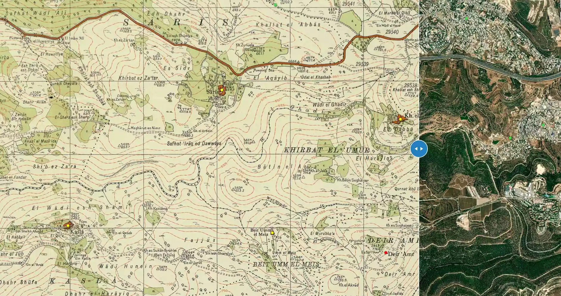
| Map Location | See location #8 on the map View from satellite |
|||||||||||||||||||||
| Military Operation | Operation Nachshon | |||||||||||||||||||||
| Attacking Units | Some unknown brigade from the Haganah | |||||||||||||||||||||
| Defenders | Local militia & Arab Liberation Army | |||||||||||||||||||||
| Exodus Cause | Military assault by Zionist troops | |||||||||||||||||||||
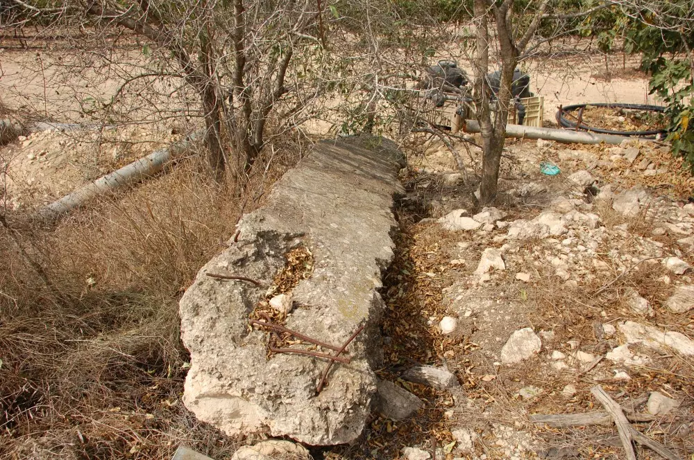
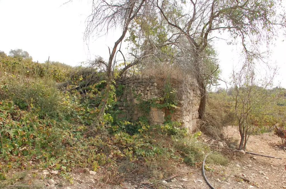
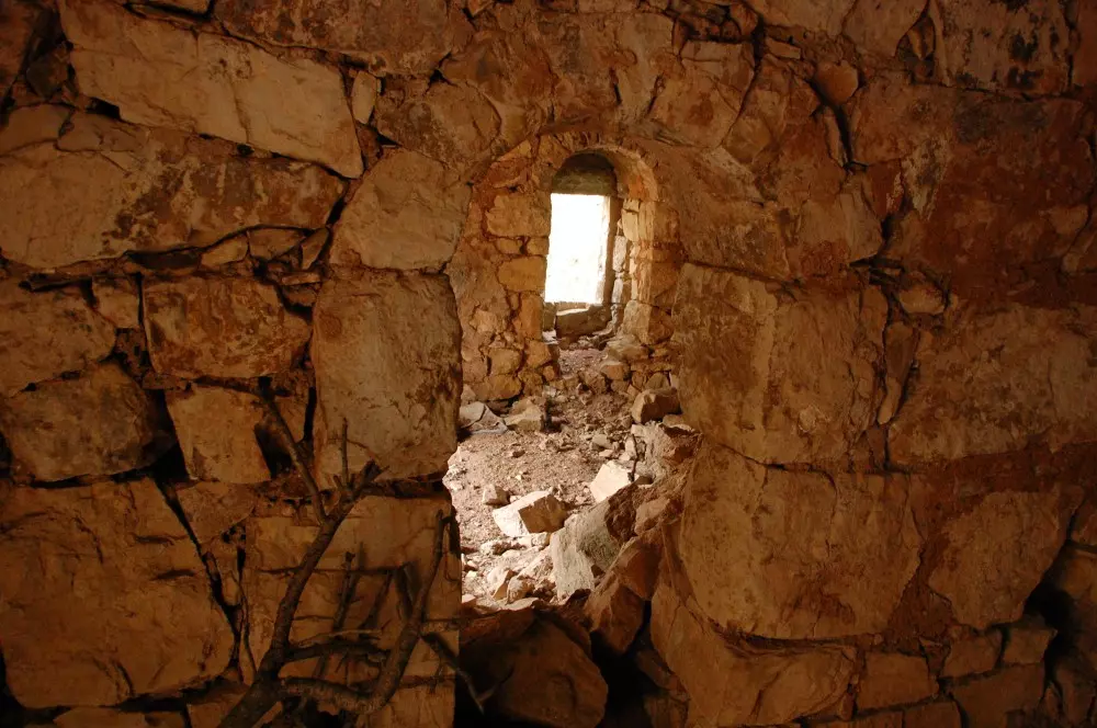
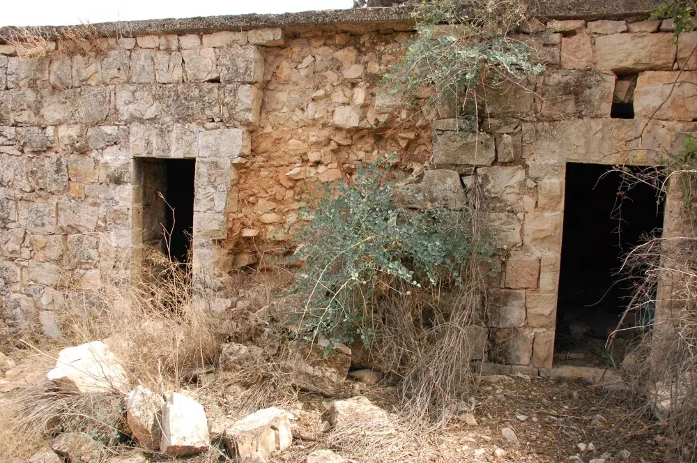
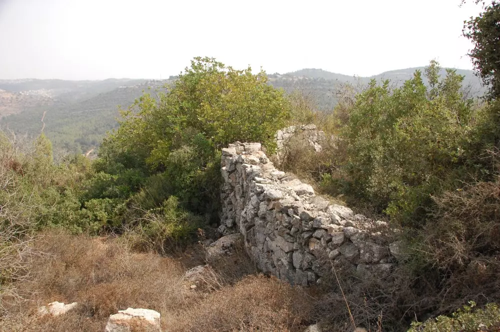
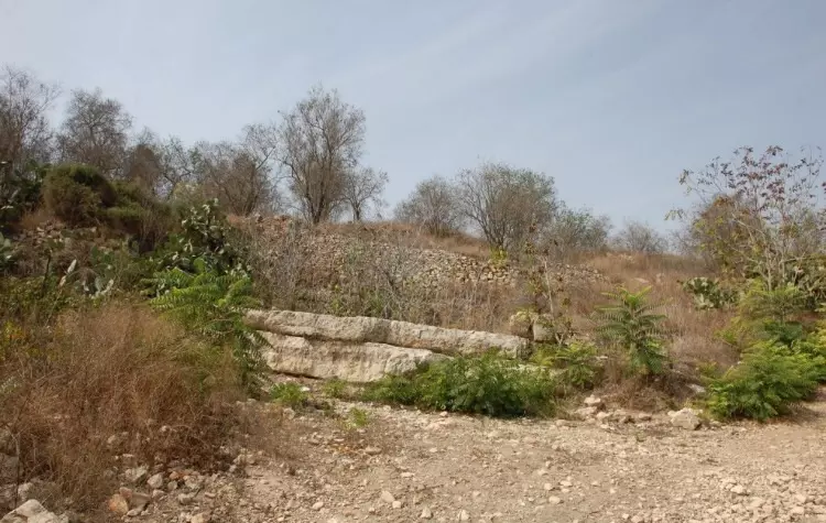
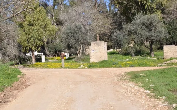
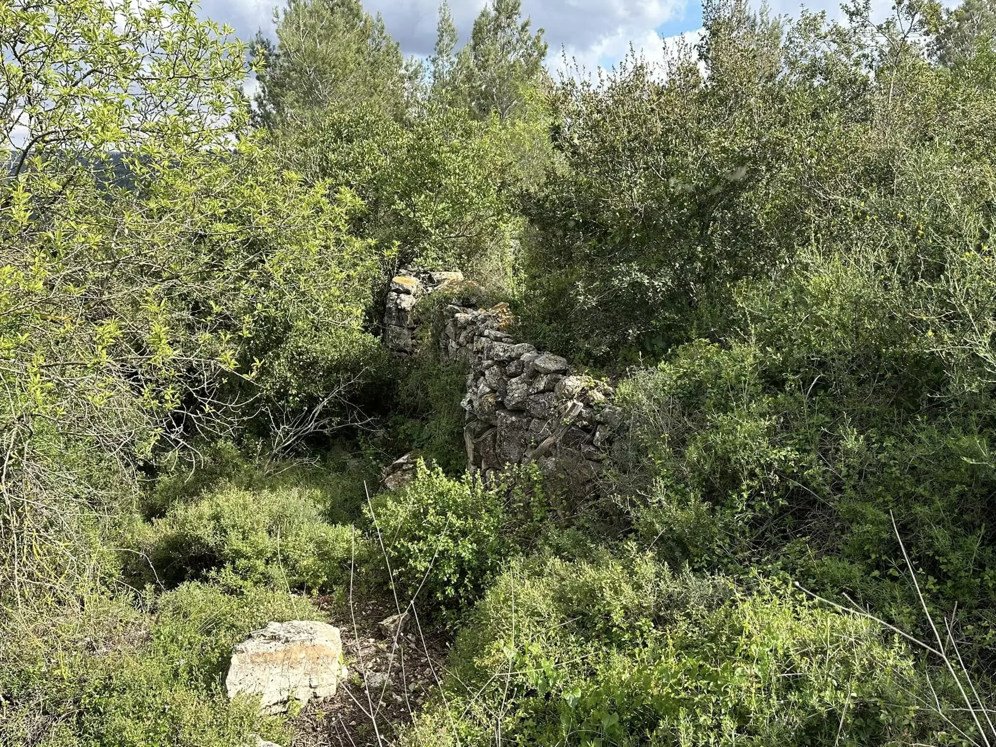
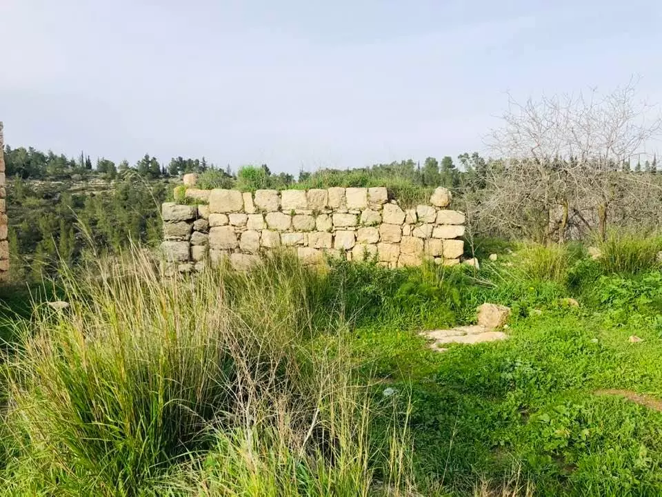
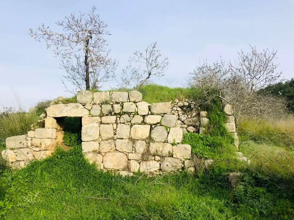
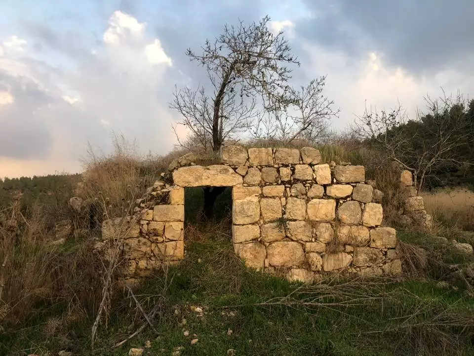
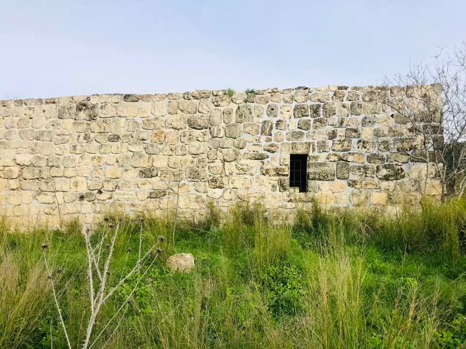
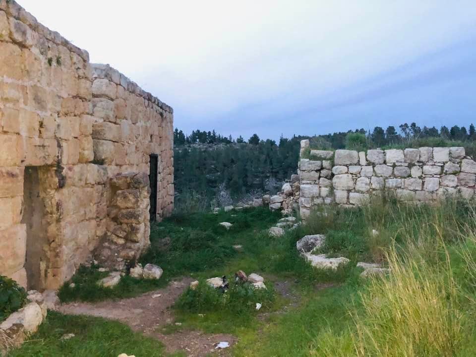
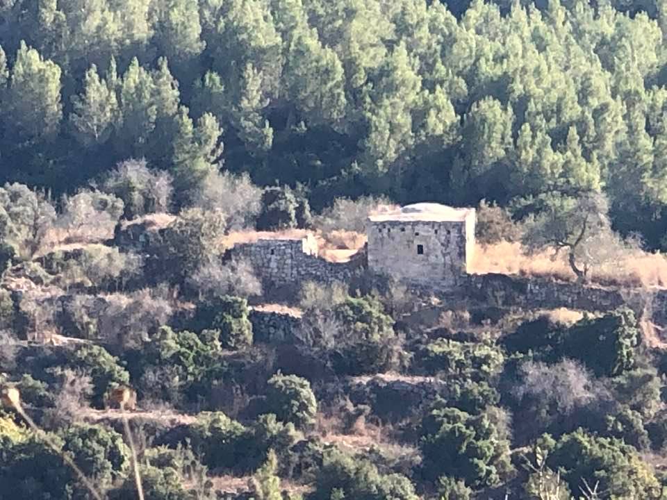
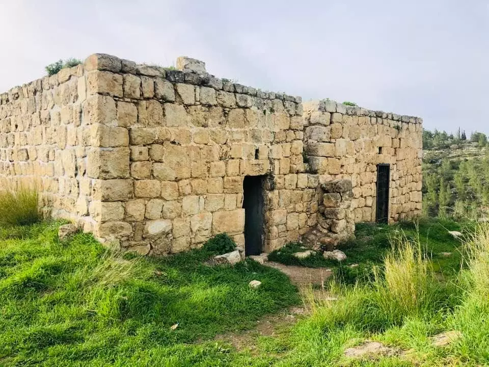
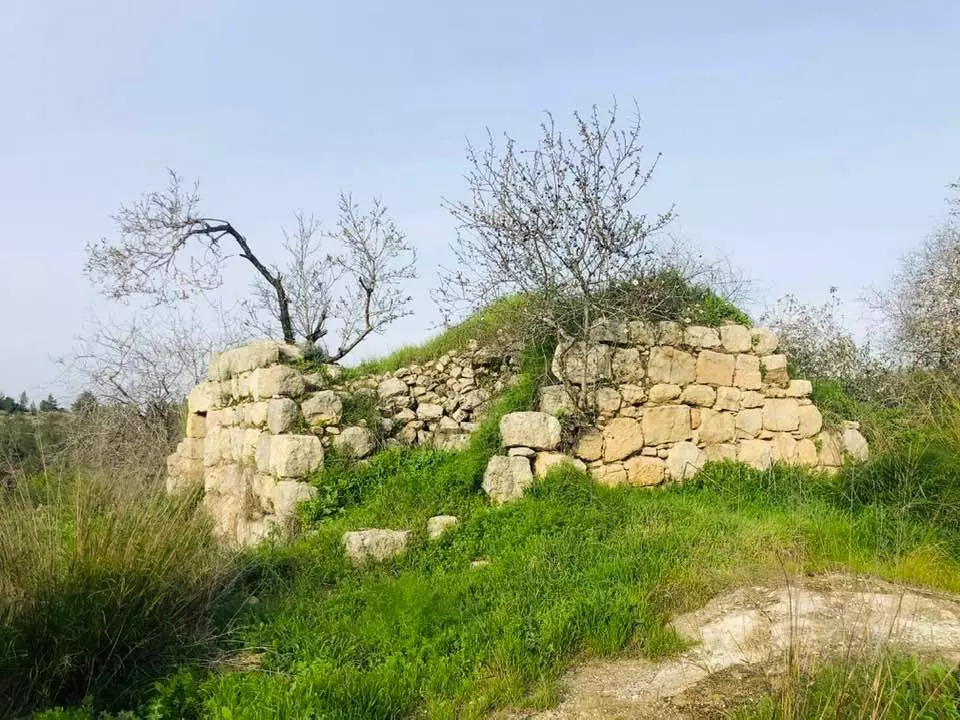
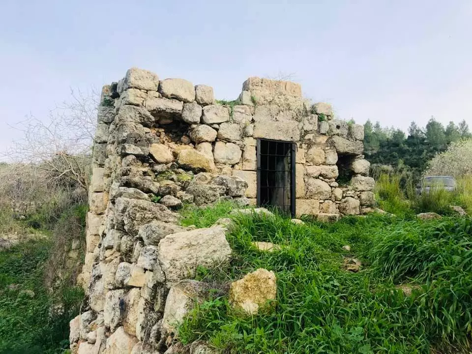
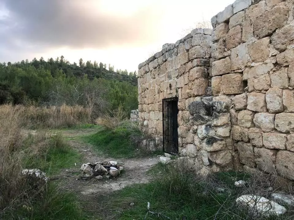
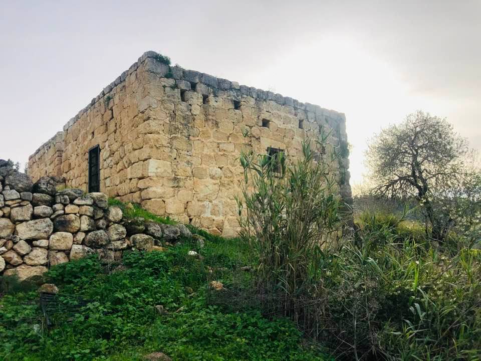
| Village Temains | Saris was completely defaced with the exception of its cemetery. | |||||||||||||||||||||
| Ethnically Cleansing | Saris' population fled under the influence of the Dayr Yasin's massacre committed on the 9th of April, 1948. | |||||||||||||||||||||
| Pre-Nakba Land Ownership |
**Town Lands' Demarcation Maps |
|||||||||||||||||||||
| Land Usage As of 1945 |
|
|||||||||||||||||||||
| Population |
|
|||||||||||||||||||||
| Number of Houses |
|
|||||||||||||||||||||
| Near By Towns |
||||||||||||||||||||||
|
|
||||||||||||||||||||||
| Schools | One school for boys destroyed when the village itself was destoryed in April, 1948. | |||||||||||||||||||||
| Places of Warship | One mosque located in the its center. | |||||||||||||||||||||
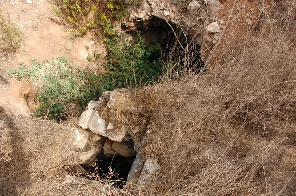
| Water Supply | Saris inhabitants relied on springs and wells for their domestic water needs. | |||||||||||||||||||||
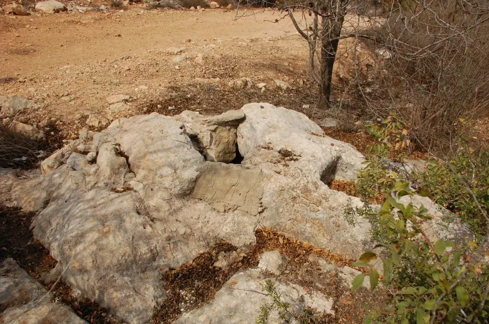
| Archeological Sites | There were several khirbas in the village area. | |||||||||||||||||||||
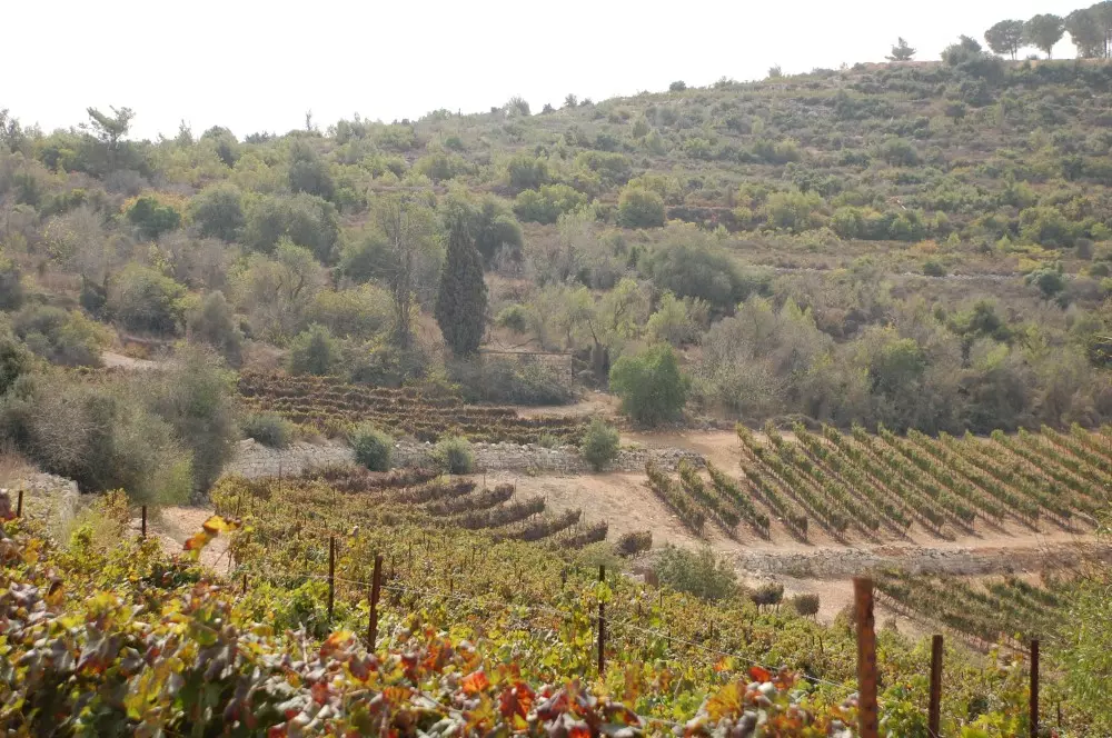
| Exculsive Jewish Colonies Who Usurped Village Lands |
Shoresh and Sho'eva | |||||||||||||||||||||
| Featured Video | ||||||||||||||||||||||
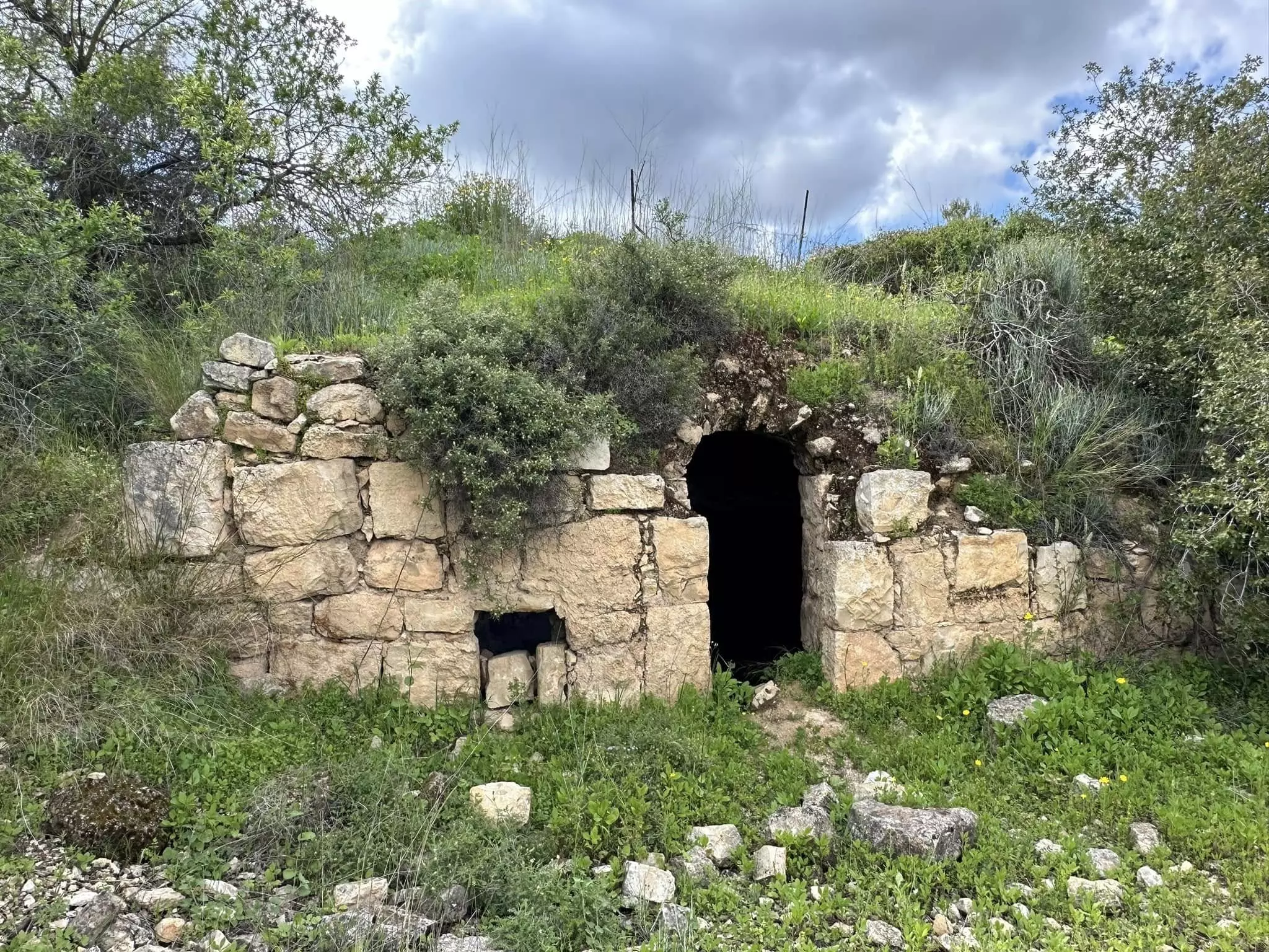
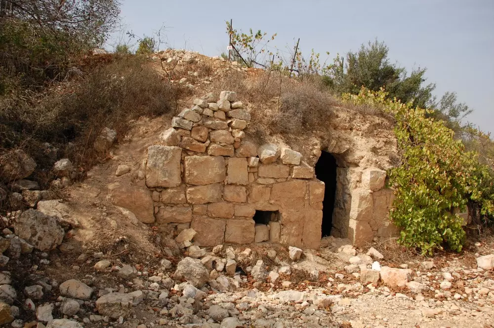
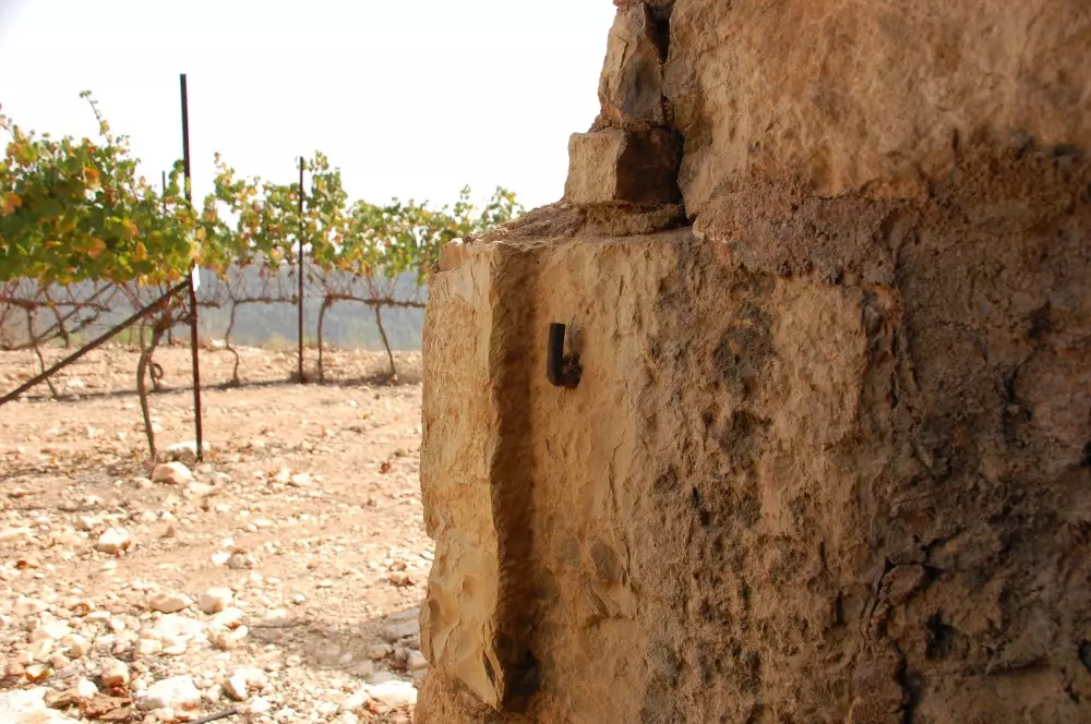
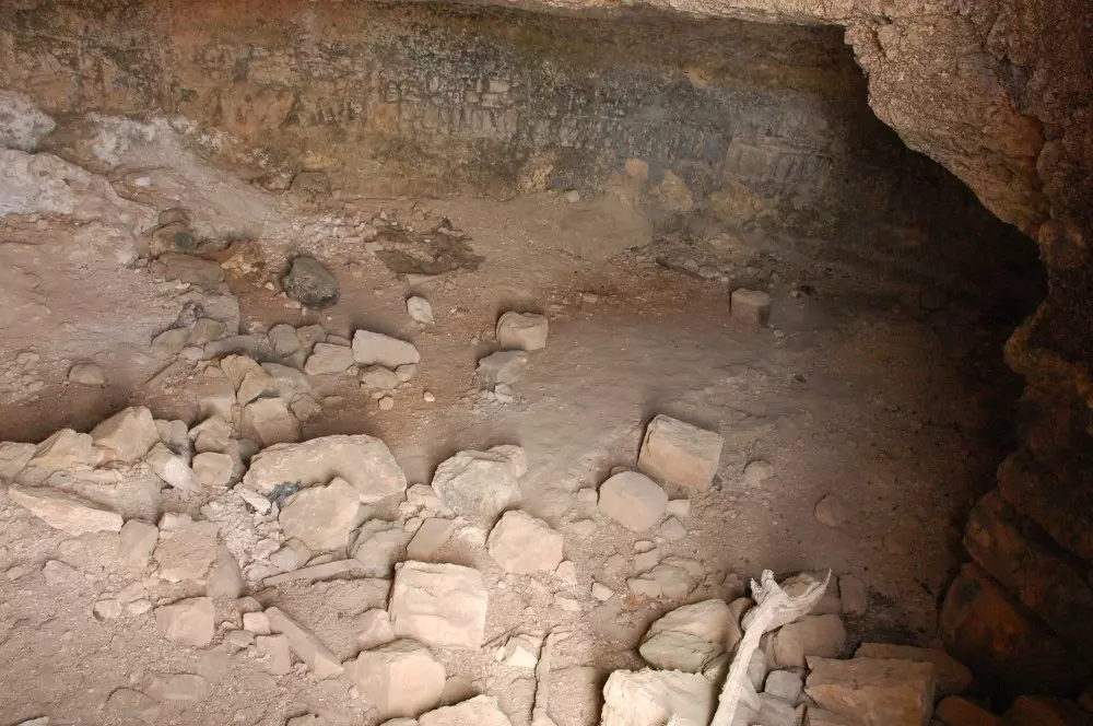
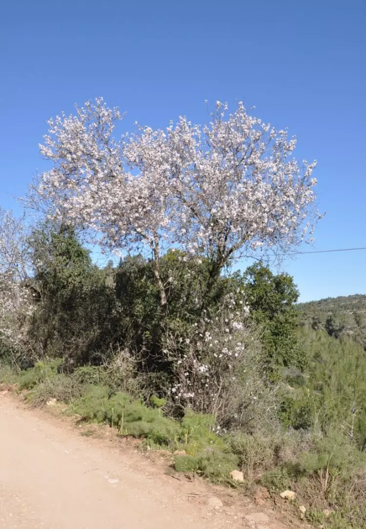
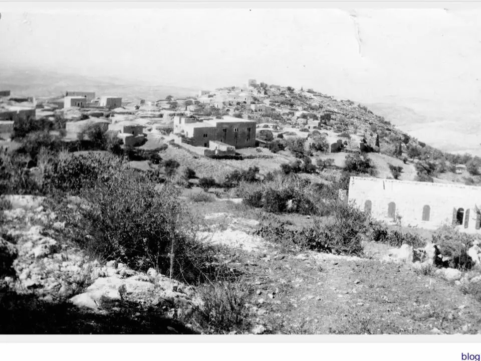
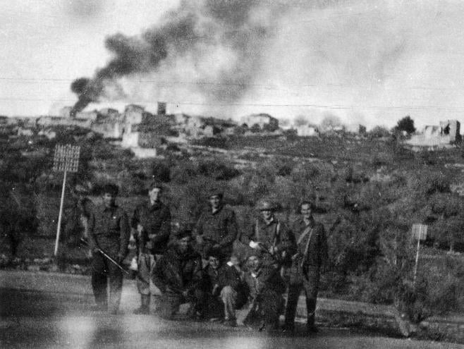
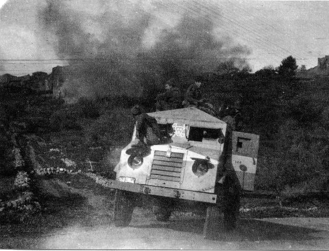
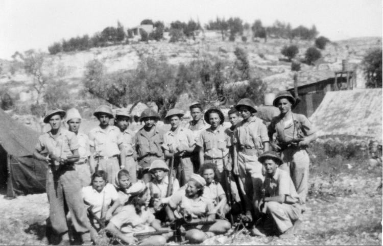
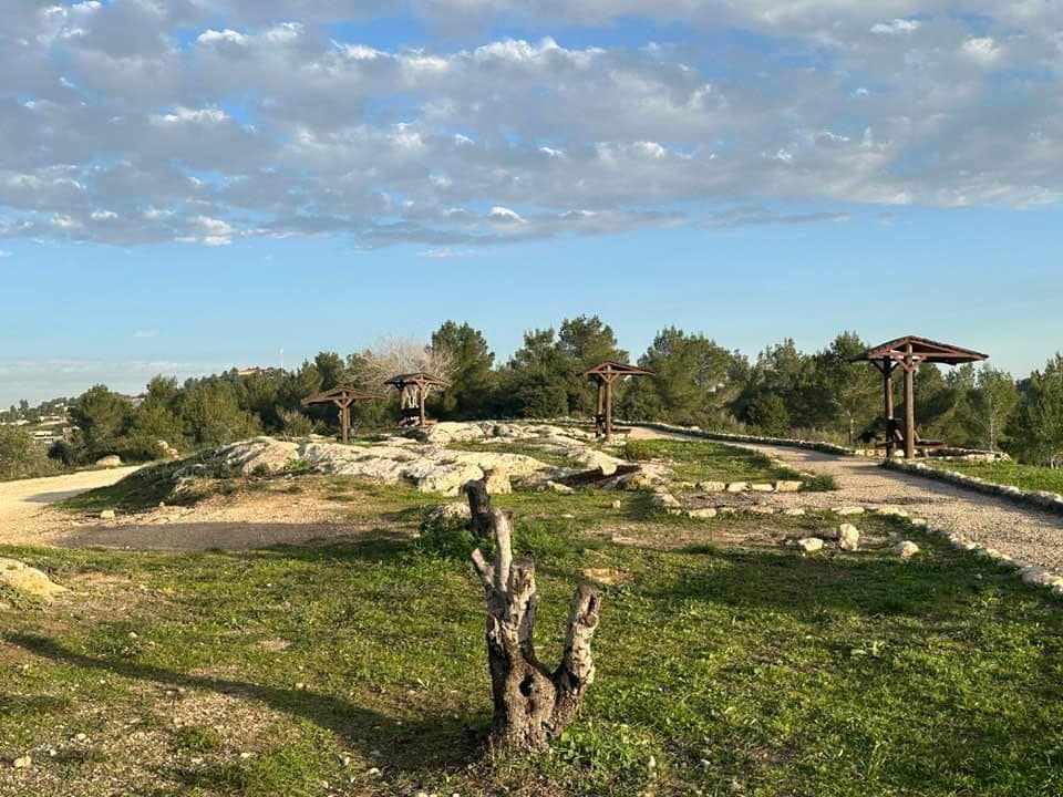
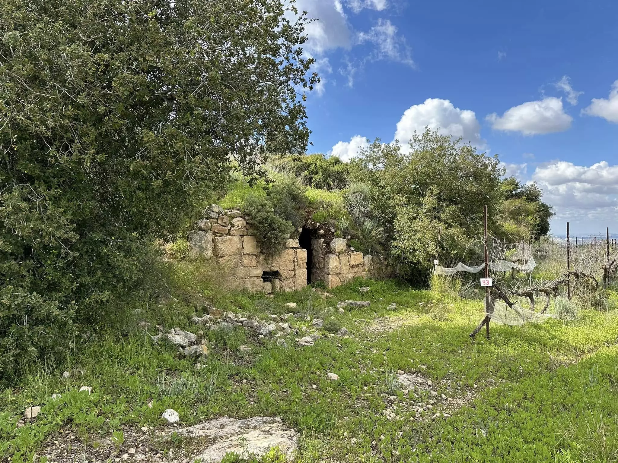
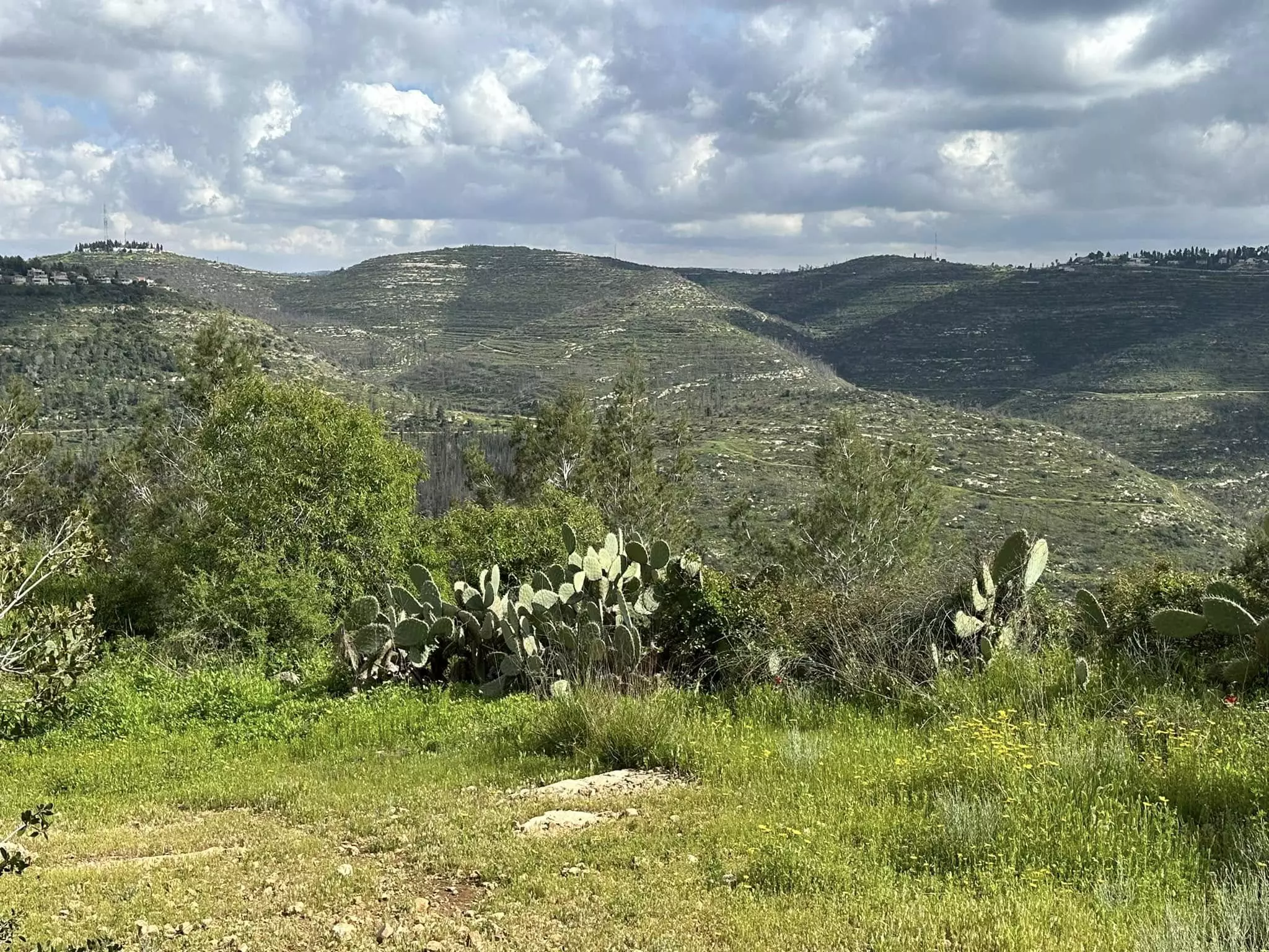
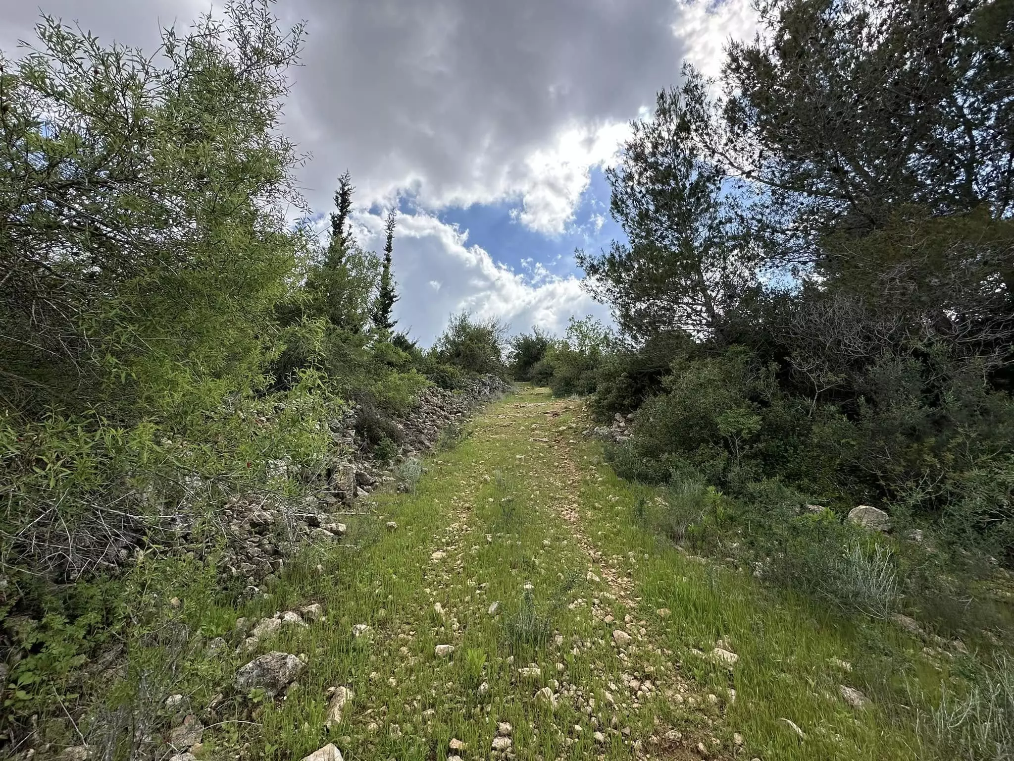
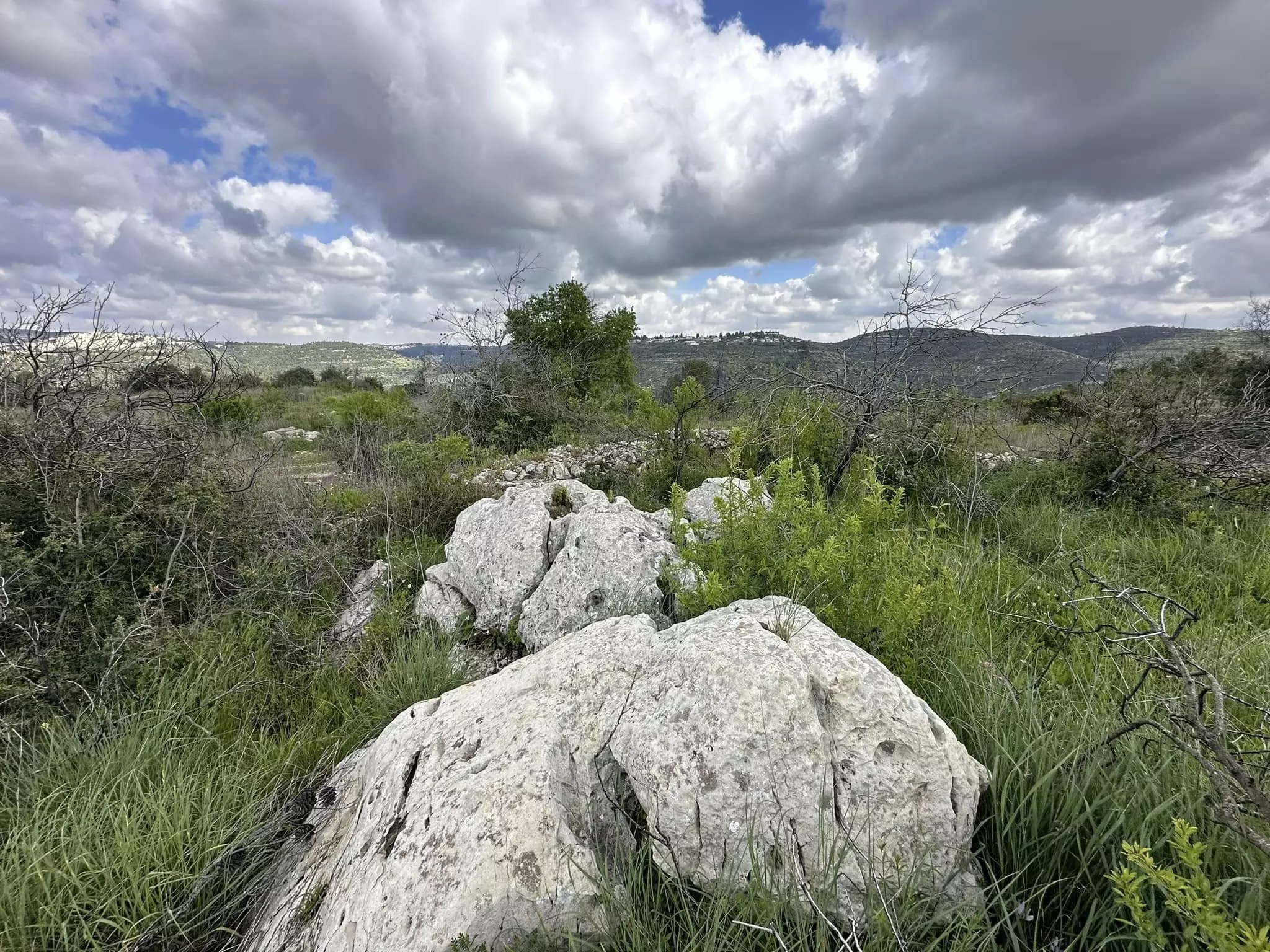
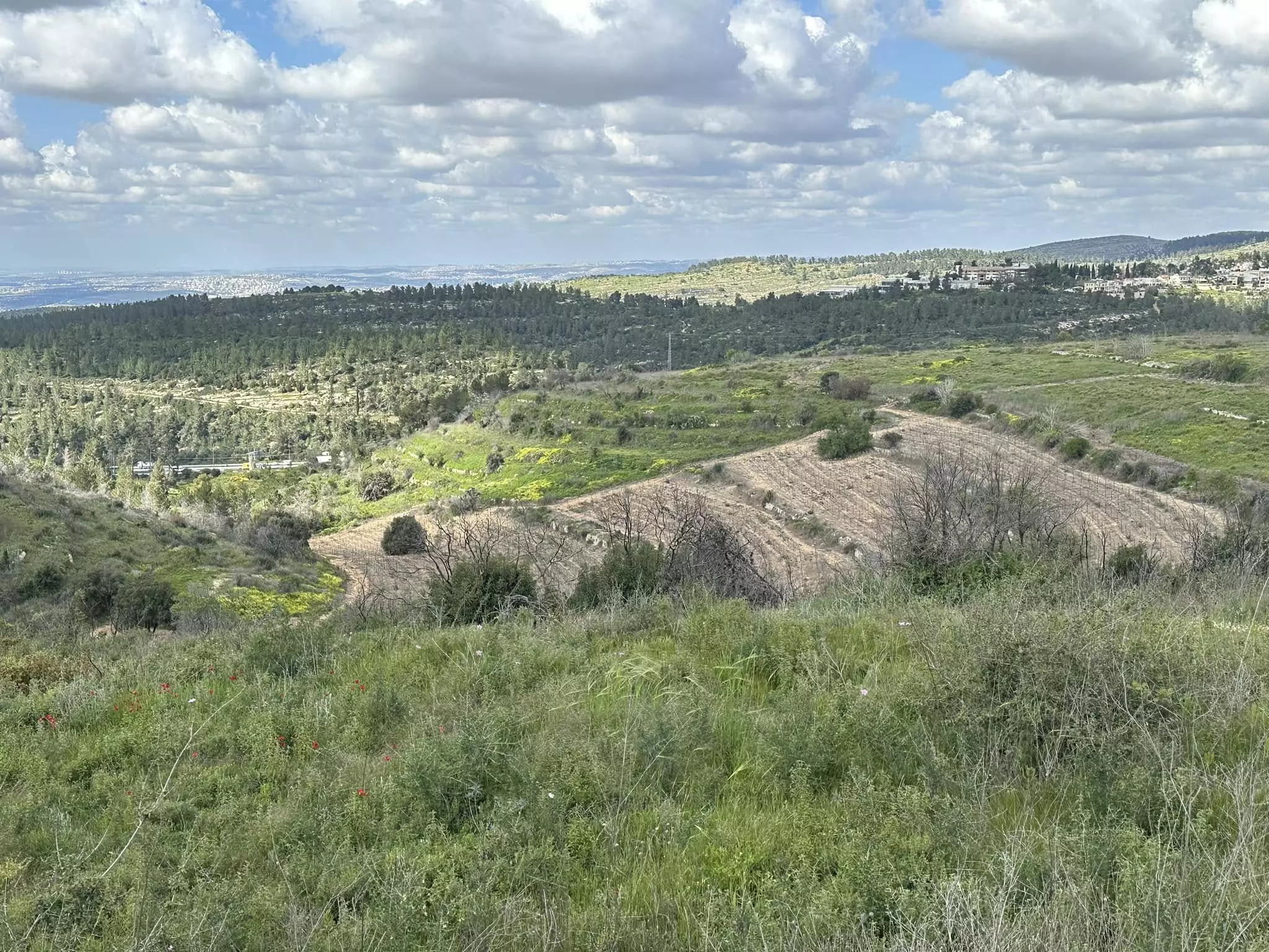
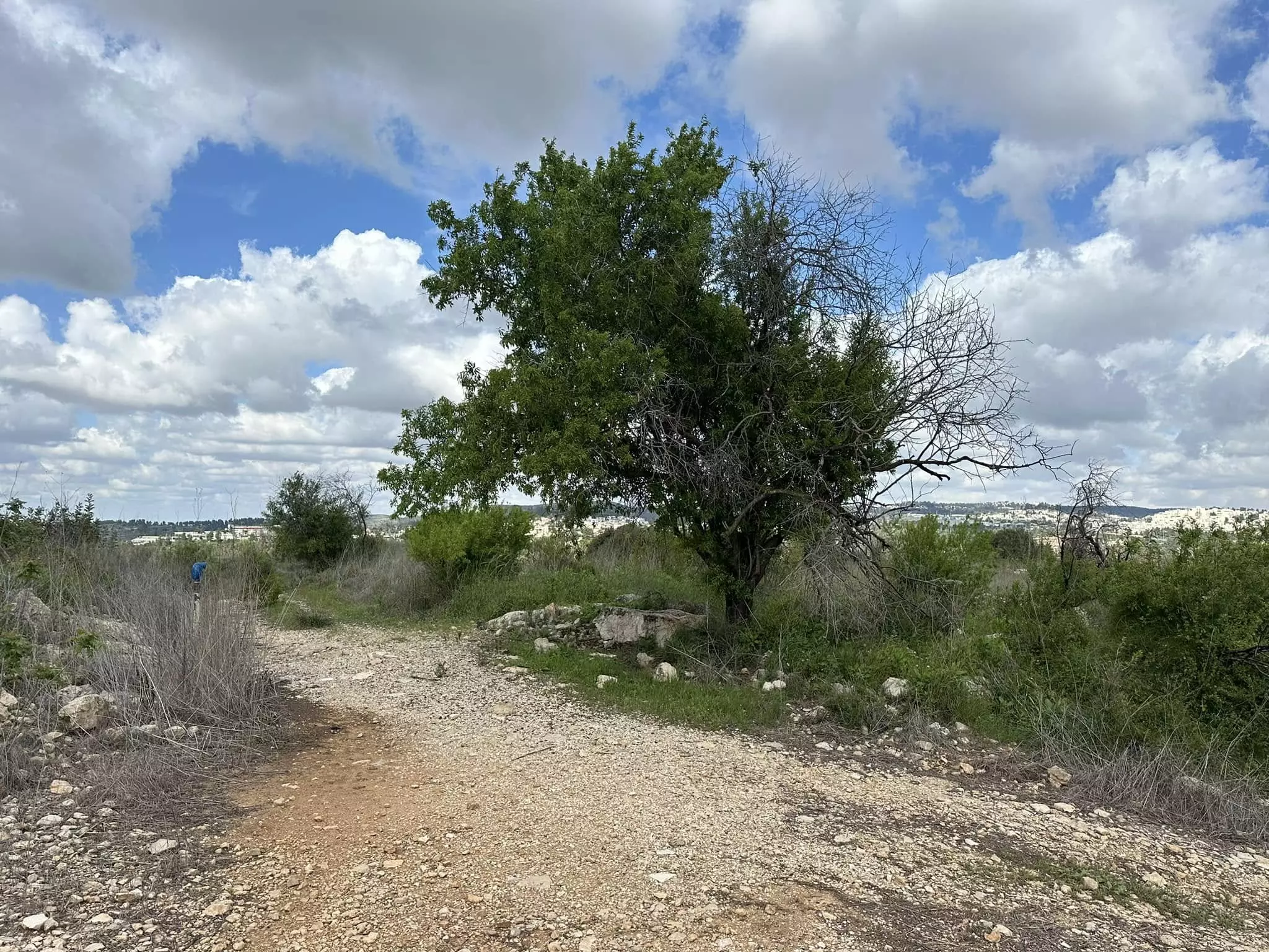
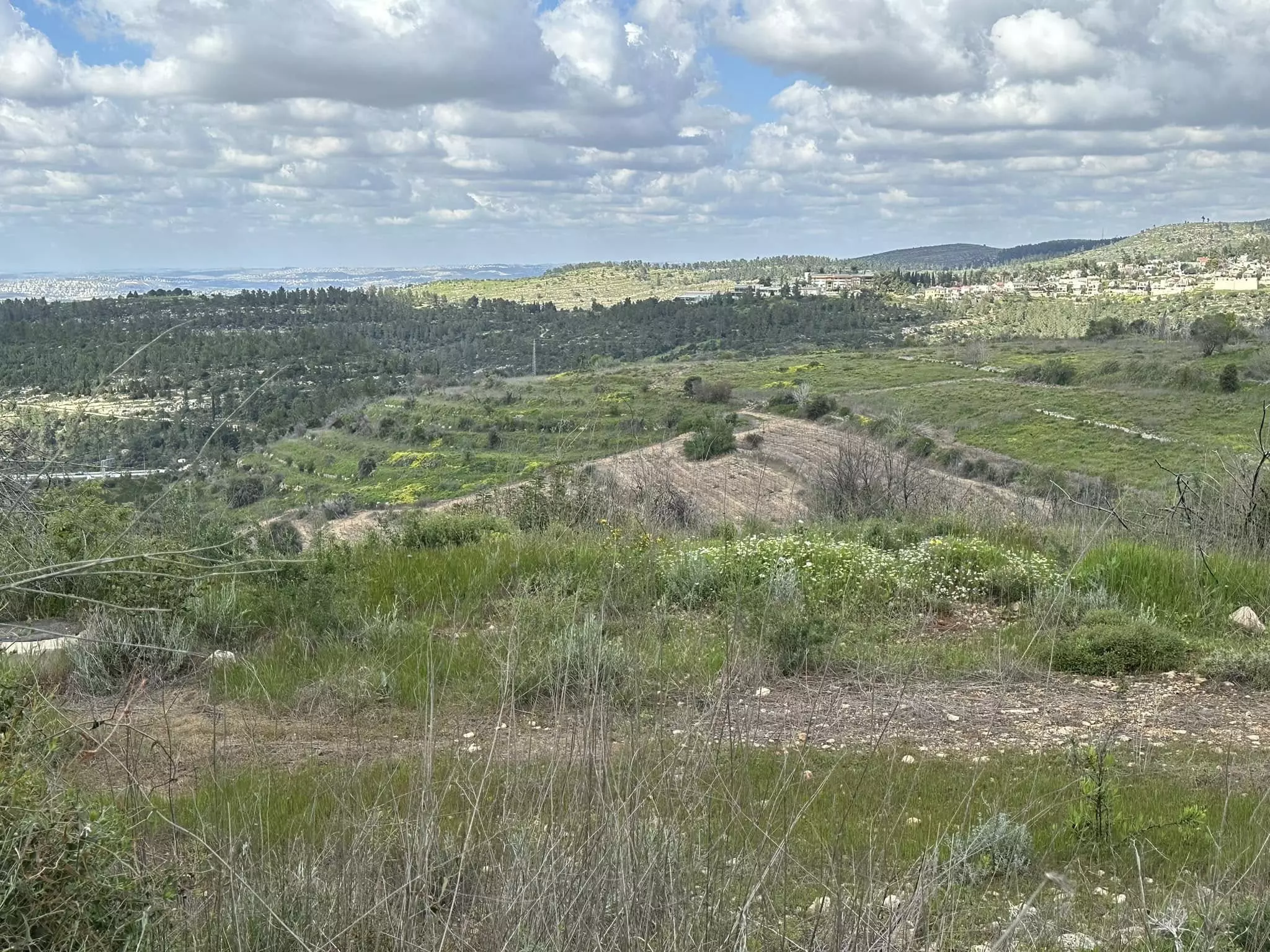
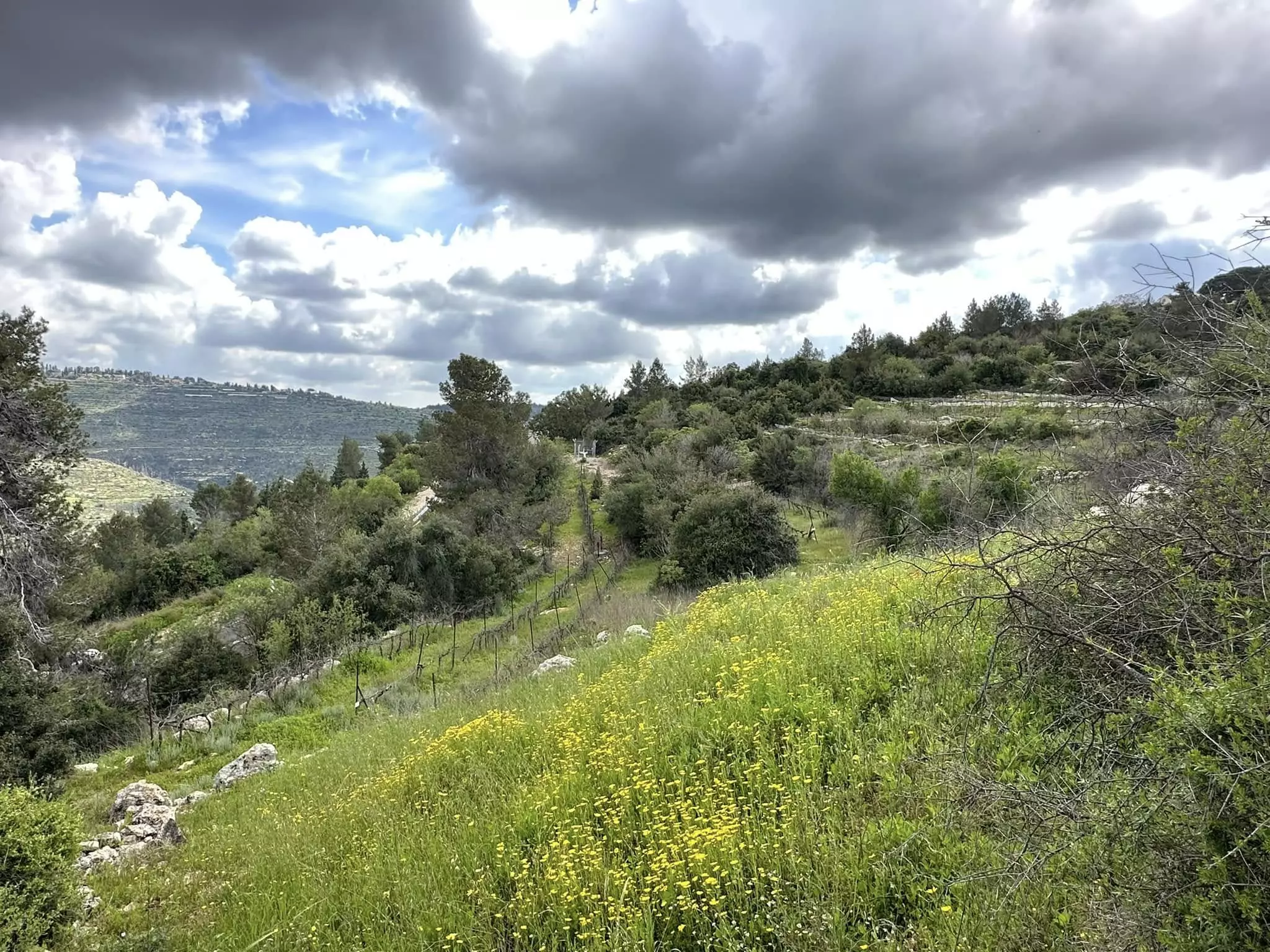
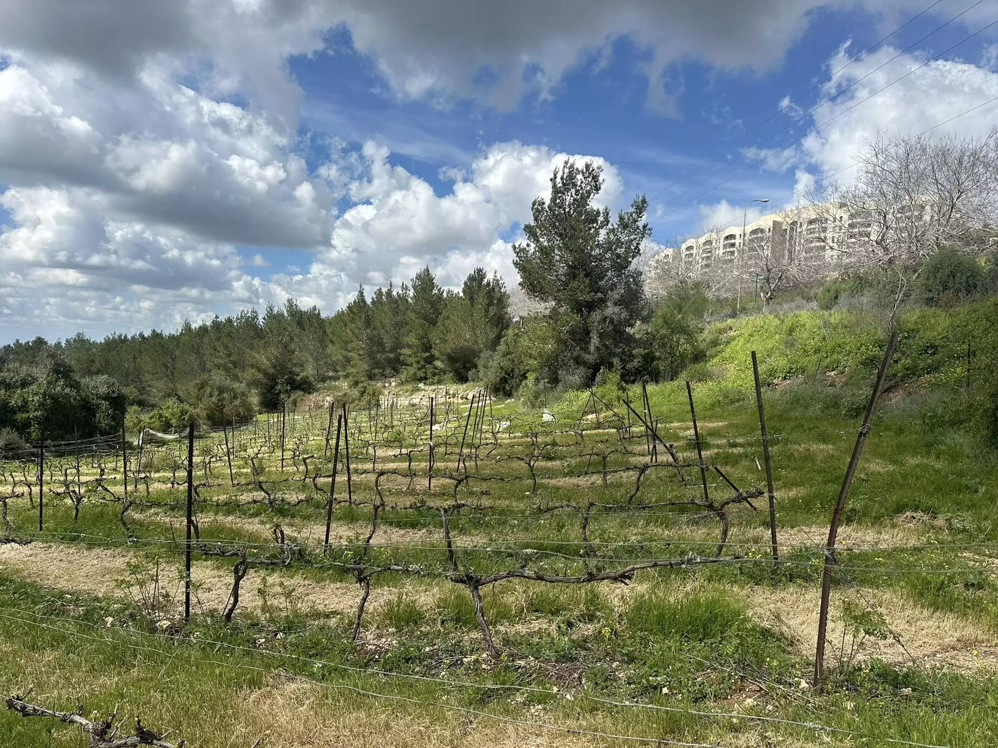
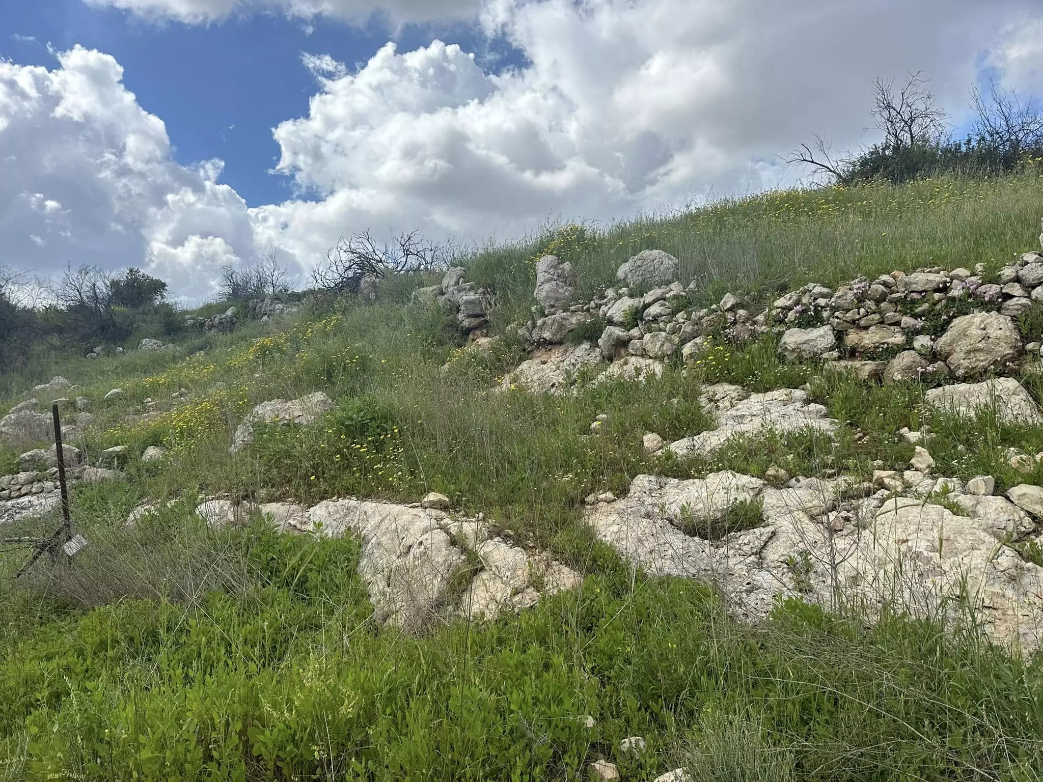
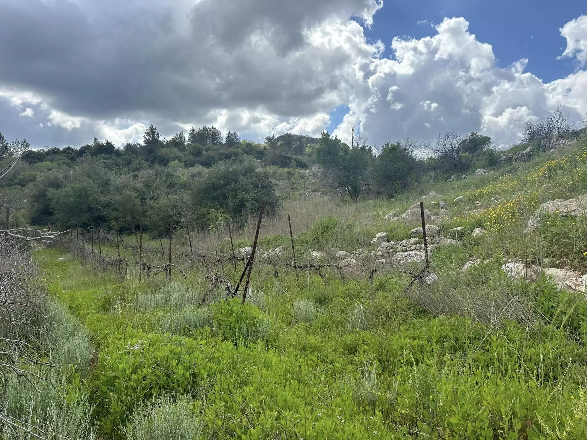
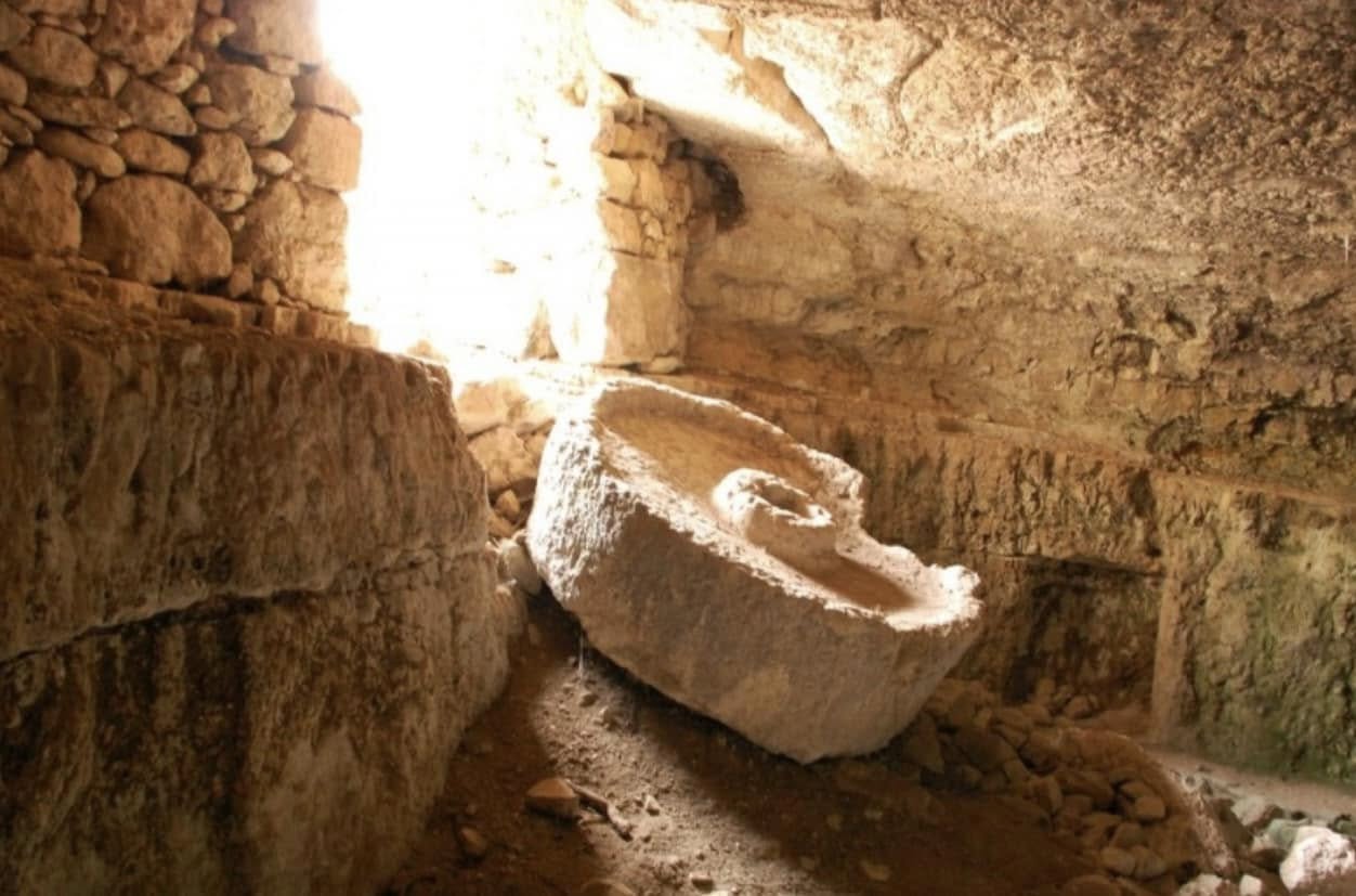
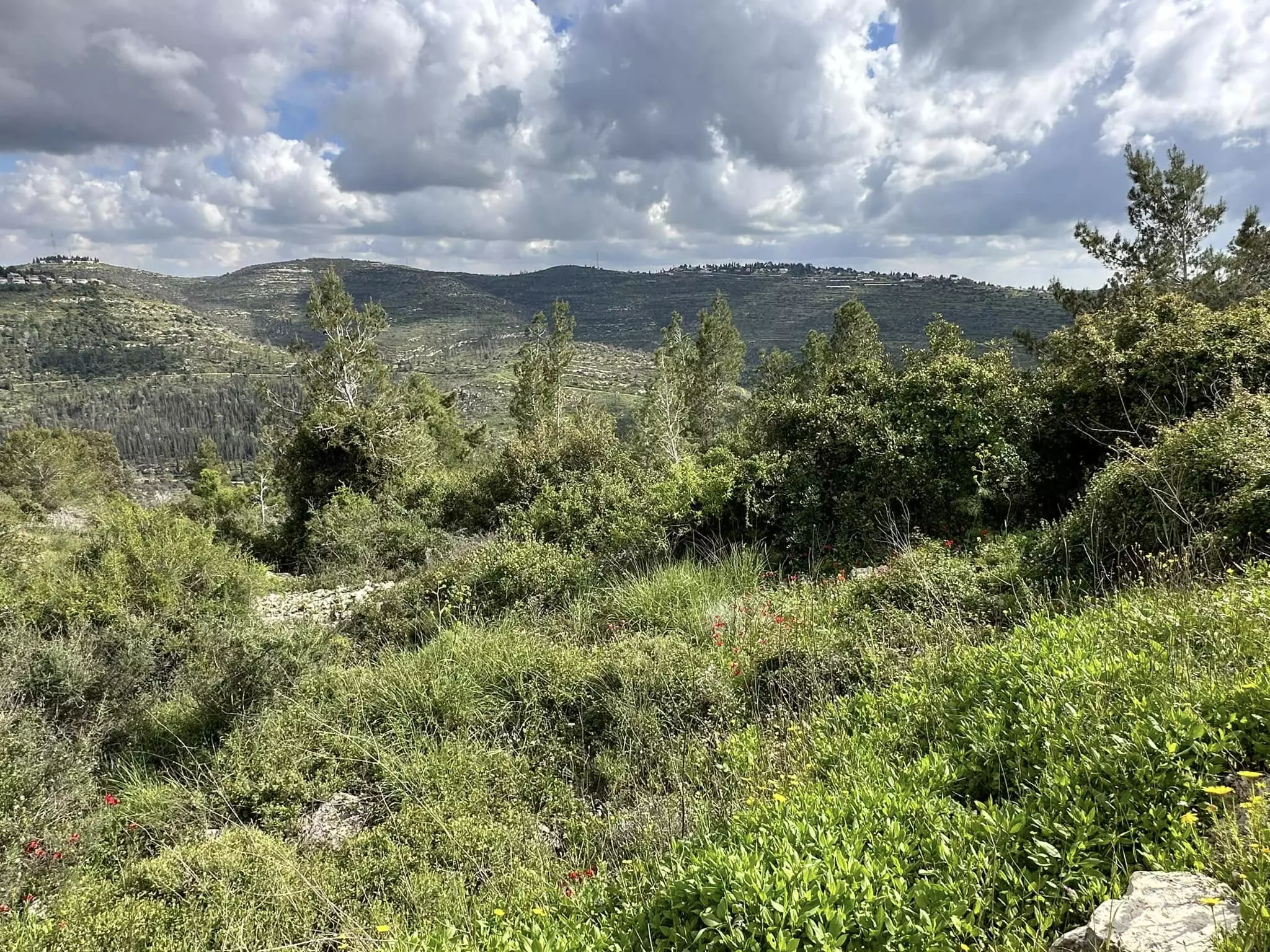
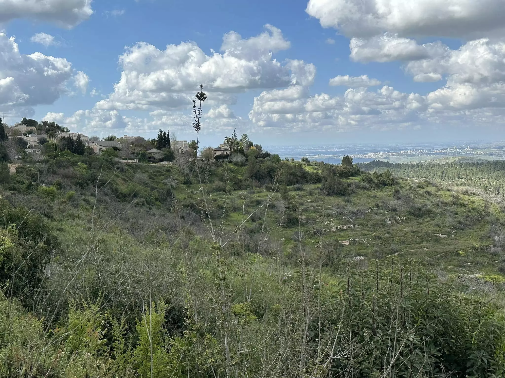
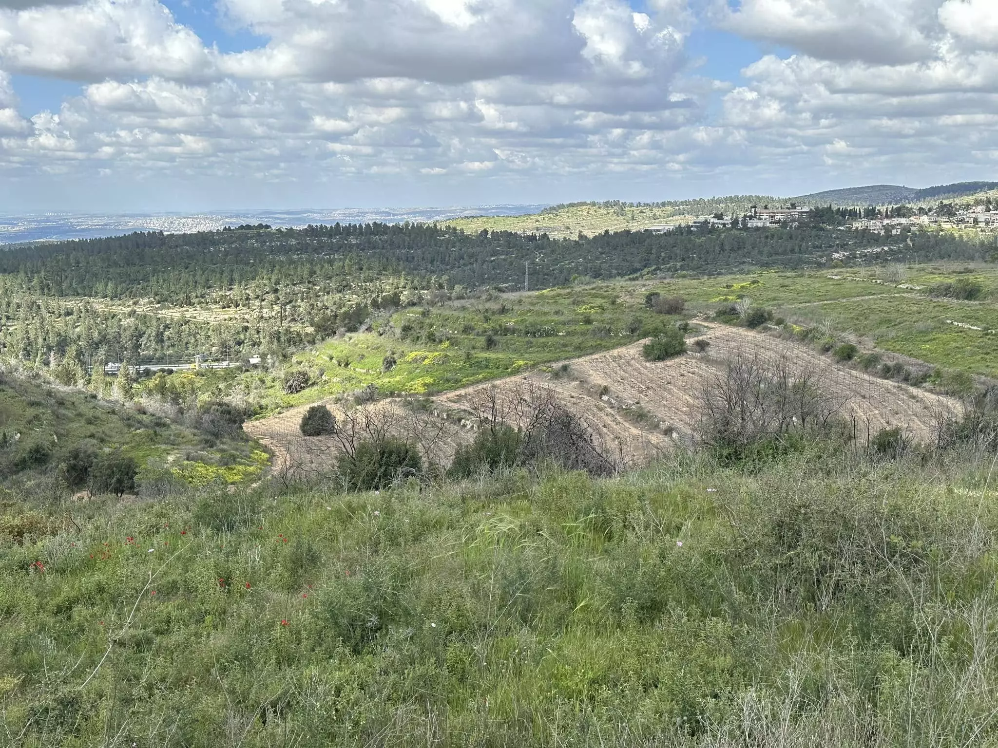
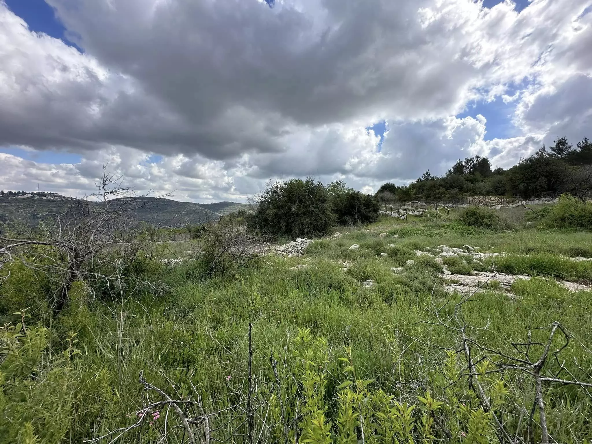
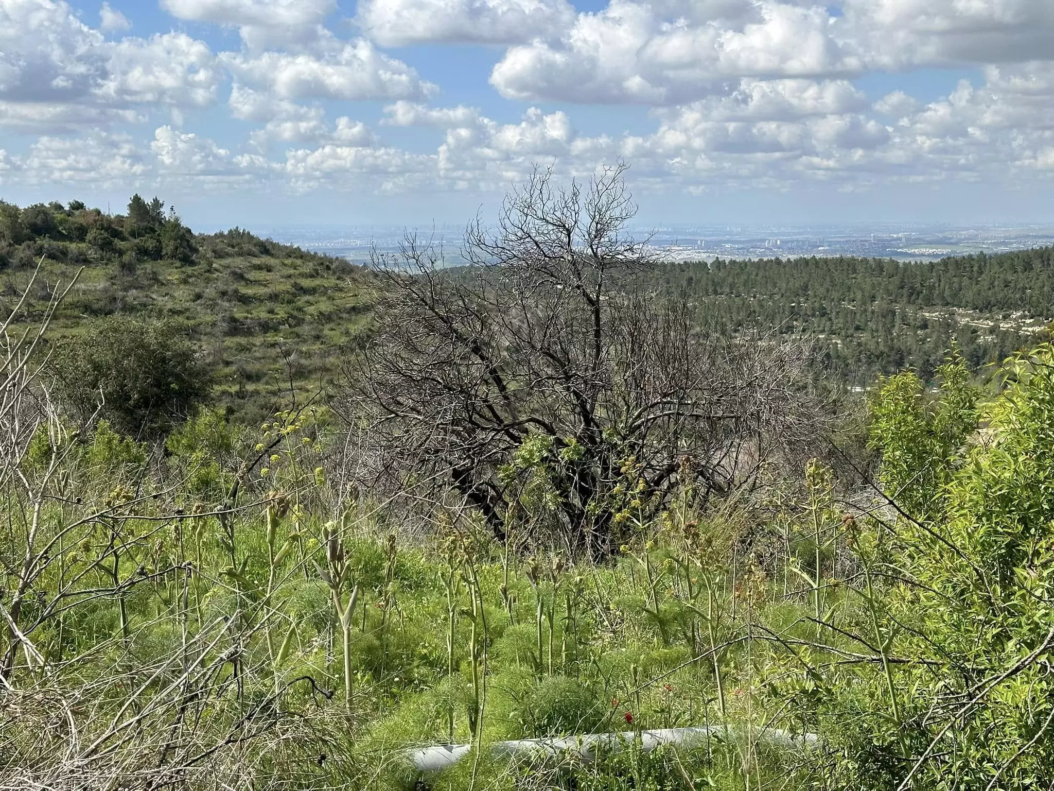
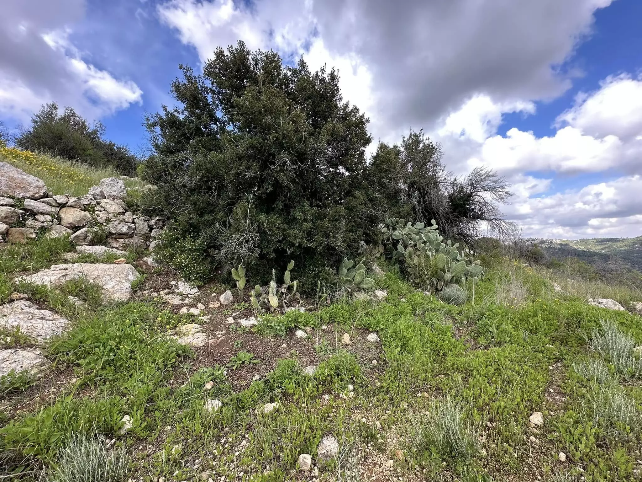
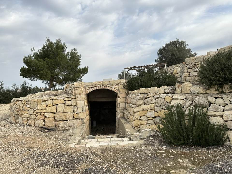
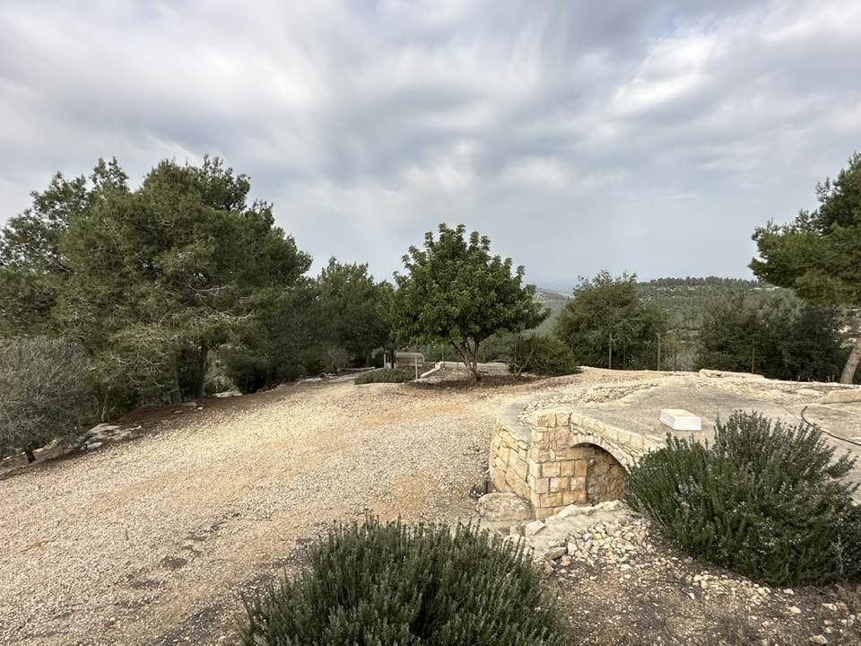
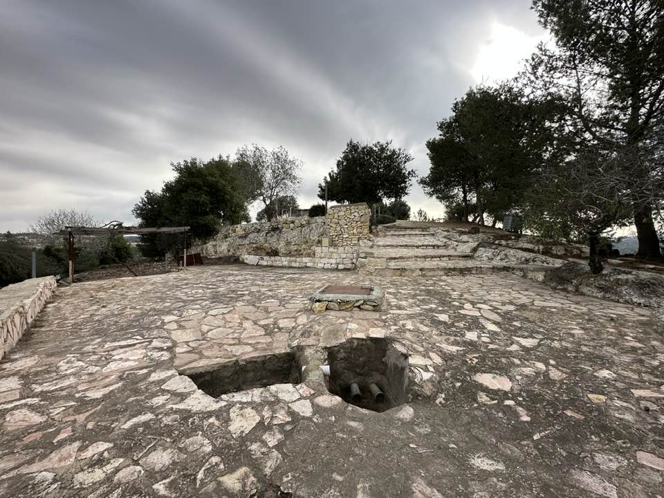
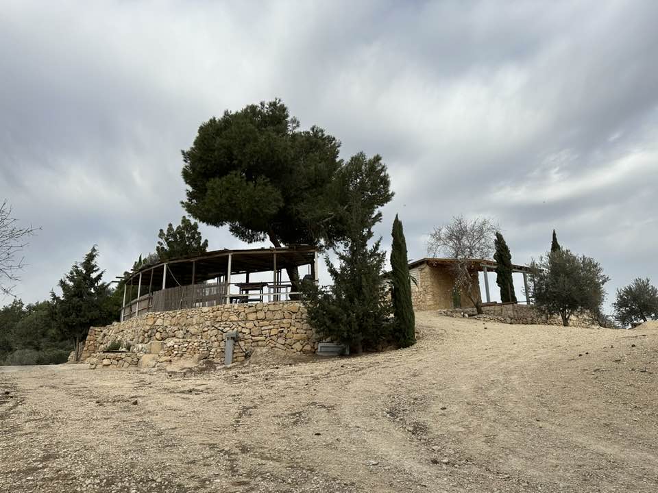
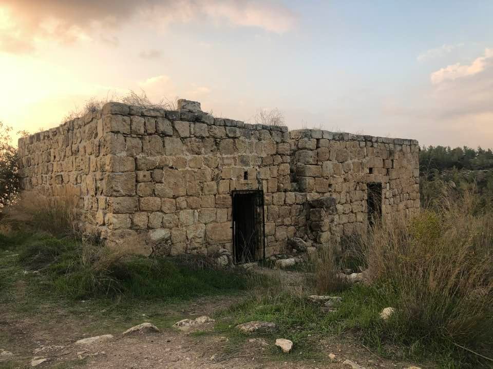
Village Before NakbaThe village stood on a high plateau that stretched north−south and descended steeply on its northern edge, where it overlooked the Jerusalem−Jaffa highway. The village also overlooked wide areas on all sides, especially the western side, where Ramla and Lydda could be seen with the naked eye. Forests around the site enhanced the beauty of its scenery. In 1596, Saris was a village in the nahiya of Jerusalem (liwa' of Jerusalem) with a population of 292. It paid taxes on a number of crops (including wheat, barley, olives, fruit, and carob) as well as on other types of produce and property, such as goats, beehives, and vineyards. In the late nineteenth century, Saris was located on top of a hill, with olive trees growing below the village. The village layout was arc-shaped, in conformity with the contours of the site. Most of its houses were constructed of stone. Its population was Muslim, and there was a mosque in the village center, along with a few shops. The villagers relied on springs and wells for their domestic water needs. Agriculture was their main economic activity. In 1944/45 a total of 3,677 dunums was allocated to cereals; 366 dunums were irrigated or used for orchards. There were several khirbas in the area.Village Occupation and Ethnic CleaningSaris was demolished towards the end of Operation Nachshon (see Bayt Naqquba, Jerusalem sub-district). While the History of the Haganah reports that it was taken on 13 April, other sources indicate that the attack occurred a few days later, on 16 April. Yet in the following month, the Arab Liberation Army recorded an attack on nearby Bayt Mahsir on 9 May, which 'failed at the village of Saris.' It appears, then, that although the village was destroyed in the mid-April attack―Palestinian historian 'Arif al-'Arif states that 35 houses were demolished―it was not held firmly by the Haganah and subsequently remained on the front lines. The New York Times put the number of houses destroyed at 25, in addition to the village mosque and a school. It also stated that 7 Arabs were killed by the Haganah task force of 500 soldiers, which attacked in the early morning, using mortars and small arms before withdrawing. A Haganah statement was quoted as saying that the battalion stayed in the village about five hours, blowing up 25 buildings and burning others. The statement admitted that some women may have been among the casualties, but maintained that the residents were evacuated at the beginning of the attack. The Haganah also made the improbable claim that Syrian soldiers were encountered at the village. Israeli historian Benny Morris quotes an official British dispatch issued later that month which implied that the people of Saris fled under the influence of the massacre at nearby Deir Yasin (Jerusalem sub-district) on 9 April.Shortly before the village was taken, on 13 April, Haganah chief Israel Galili wrote to senior Jewish National Fund (JNF) official Yosef Weitz asking for a settlement to be established at Saris 'as soon as possible.' Galili said that the establishment of settlements at this and seven other sites was regarded as 'important to security,' according to Morris. A JNF plan submitted on 20 August called for a settlement to be built on the site; Shoresh was inaugurated later that year. Zionists Colonies on Village LandsThe settlement of Shoresh (156133) was established 1 km southwest of the site in 1948. The settlement of Sho'eva (157134), established in 1950, is 0.5 km to the northeast. Both are on village land.Village TodayThe Village TodayThe site is covered with stone rubble; iron bars protrude from the collapsed roofs. There are many open wells and several caves with arched roofs. A large number of trees, including cypress, fig, and almond trees, grow on the site. An abandoned grove of almond trees is located on the eastern side. In the middle of the slope are the remains of an artificial pool. The village cemetery, surrounded by trees, is located southwest of the site. It contains several large tombs, one of which is surrounded by a small, roofless enclosure; an almond tree grows in the center. The Shoresh forest, named after the Israeli settlement, was established by the youth of the Jewish National Fund in Johannesburg, South Africa (see photo). Another forest in the area, dedicated to several notable Jews, has been planted under the auspices of the Center for European Jewry. SourceDr. Walid al-Khalidi, 1992: All That Remains. |
||||||||||||||||||||||
| Related Maps | Town Lands' Demarcation Maps خرائط للقضاء توضح حدود القرى والاودية Town's map on MapQuest View from satellite Help us map this town at WikiMapia |
|||||||||||||||||||||
| Related Links | Wikipedia's Page Facebook Page Google Search Google For Images Google For Videos |
|||||||||||||||||||||
| More Information | في كتاب كي لا ننسى في كتاب بلادنا فلسطين المزيد من موقع هوية |
|||||||||||||||||||||
- Palestine Remembered's icon and symbol al-Hajj Ahmad Ali Ulayyahn in Qalandiya's refugee Camp passed away at the age of 96, I am sad I've never got the chance to thank him, or to document his memories

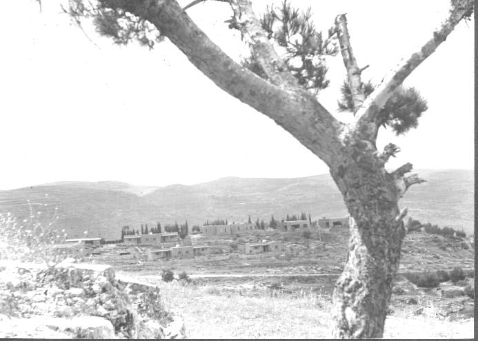
- Village Site In 1986
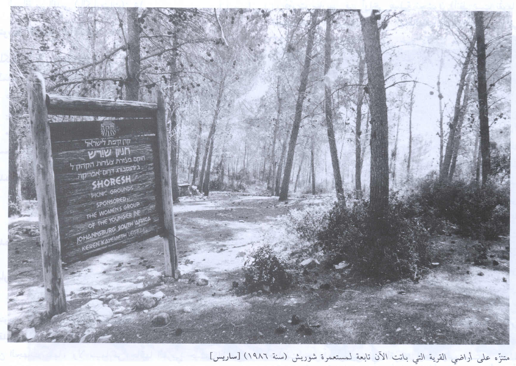
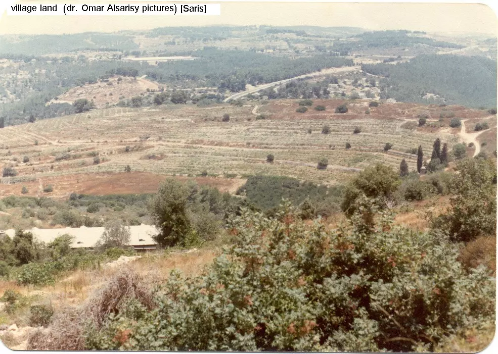
Scanned from "All That Remains" by Dr. Walid Khalidi 12 - General view of Saris land
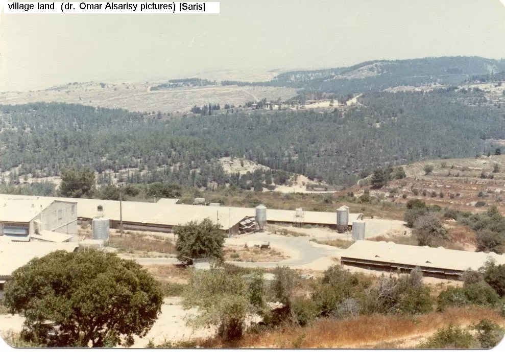
Posted by Osama Odeh 1 - General view of Saris land #2
Posted by Osama Odeh 1 - هنا كان اجدادي....وهنا سيعود ابنائي
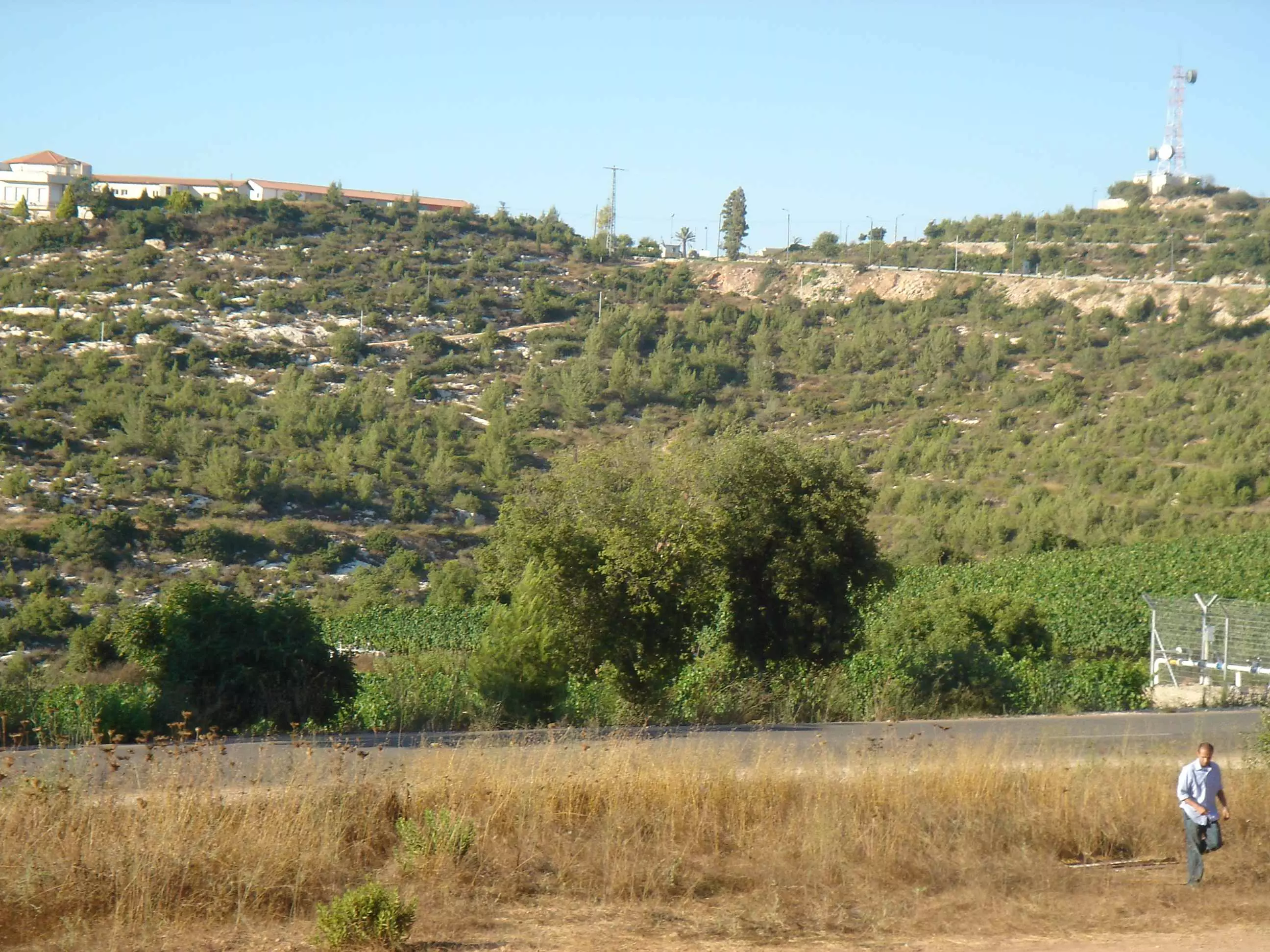
Posted by Hussam 14 - Saris - 2009 - view from Shoresh to the North

Posted by Tameer Alawi 1 - One of wells in Saris

Posted by Tameer Alawi - Wineyards in place of Saris
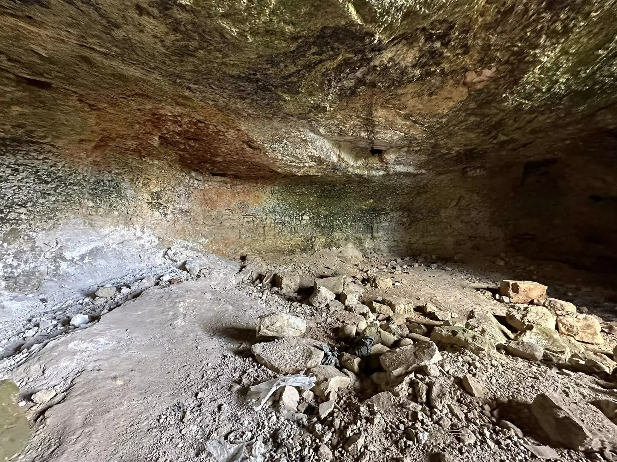
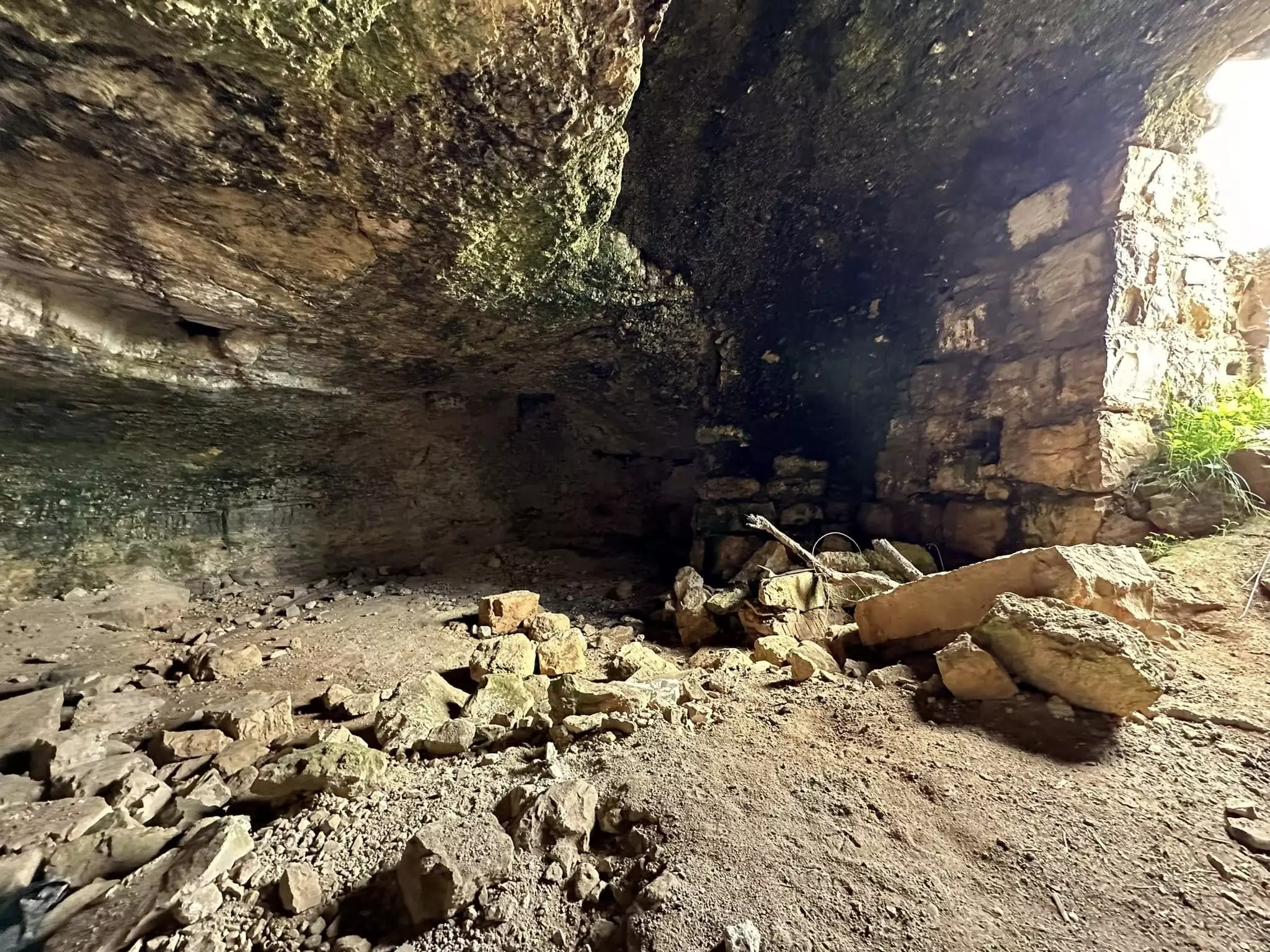
Posted by Tameer Alawi - remains of house-cave in Saris
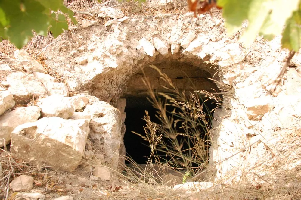
Posted by Tameer Alawi 1 - house-cave in Saris with mill stone inside
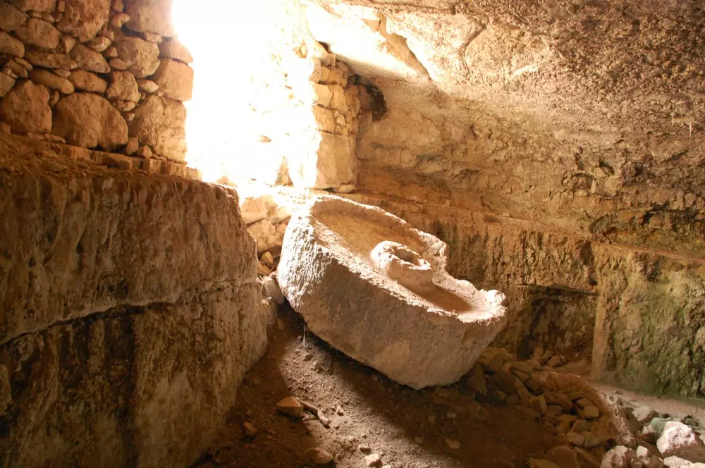
Posted by Tameer Alawi - inside the house-cave in Saris with mill stone inside
Posted by Tameer Alawi - remains of artificial pool on slope of the hill - Saris
Posted by Tameer Alawi - remains of house in Saris
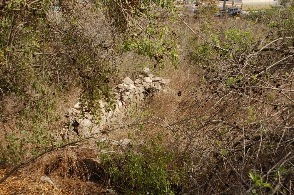
Posted by Tameer Alawi - remains of house
Posted by Tameer Alawi - only one still standing house in Saris in the middle of wineyards
Posted by Tameer Alawi - well in Saris - still with water inside - 2009
Posted by Tameer Alawi - last standing house in Saris - 2009
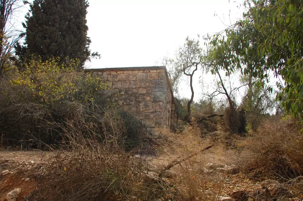
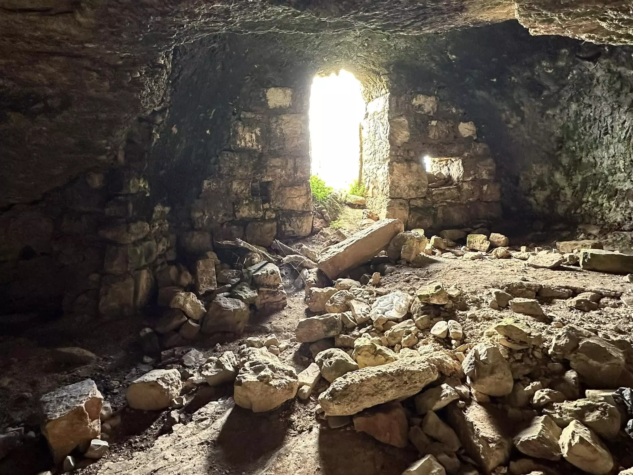
Posted by Tameer Alawi - last remaining house in Saris - October 2009

Posted by Tameer Alawi 1 - inside the last remained house in Saris
Posted by Tameer Alawi - 2 rooms of last remained house in Saris
Posted by Tameer Alawi - one of destroyed water cisterns in Saris
Posted by Tameer Alawi - water cistern- well
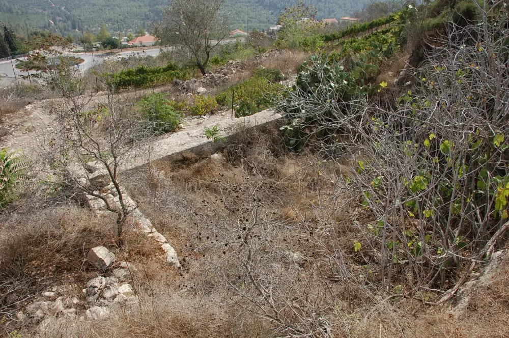
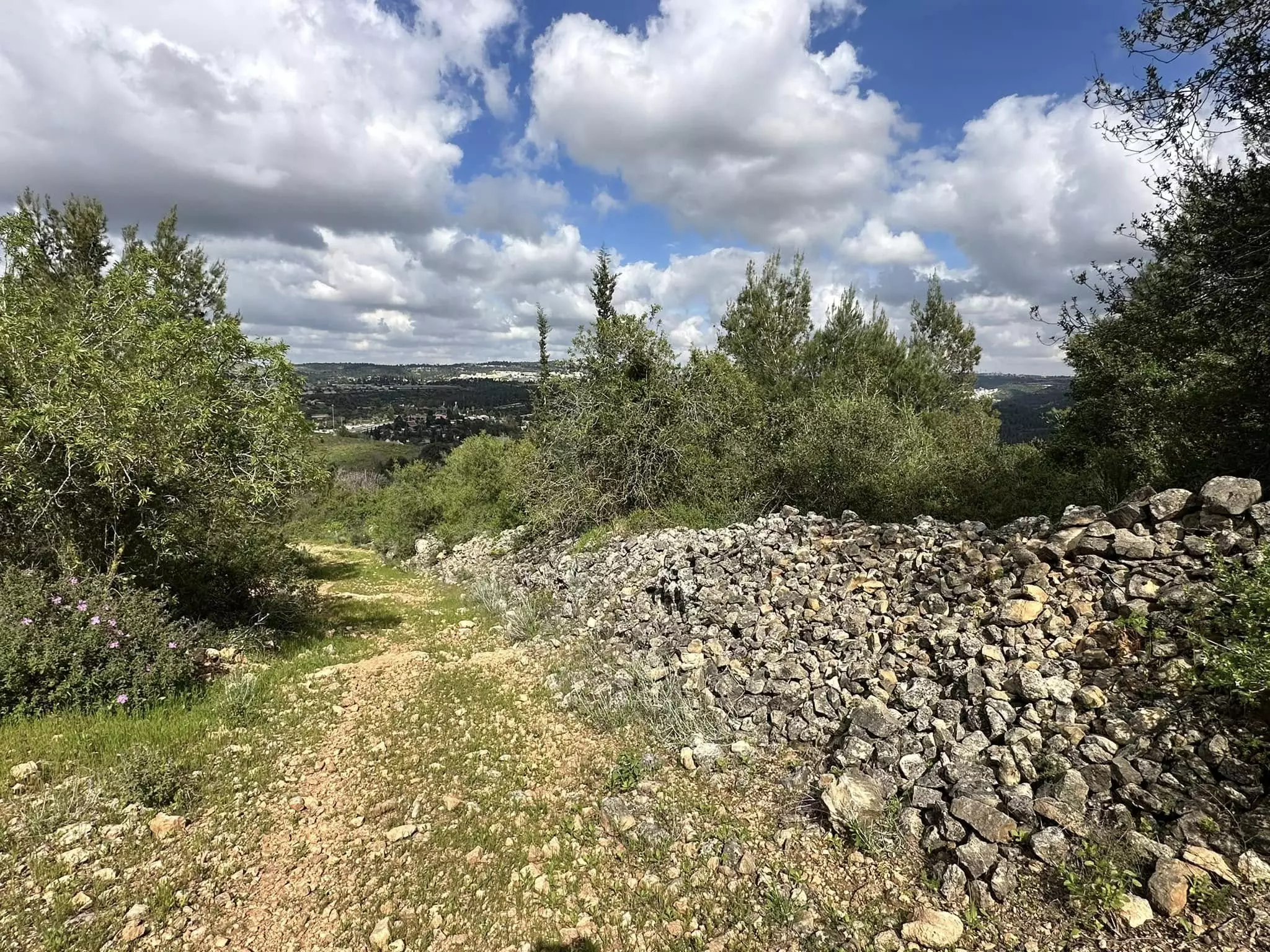
Posted by Tameer Alawi - one of many old terrace walls - Saris 2009
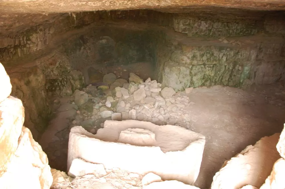
Posted by Tameer Alawi - other house-cave in Saris
Posted by Tameer Alawi - door entrance to the one of of the houses in Saris - October 2009
Posted by Tameer Alawi - inside to house-cave
Posted by Tameer Alawi - قريه ساريس
Posted by abu raya - ساريس
Posted by abu raya - قريه ساريس
Posted by abu raya - ساريس
Posted by abu raya - موقع القريه واثار بيوتها
Posted by abu raya - الربيع في ساريس
Posted by abu raya - ساريس

Posted by abu raya - ساريس
Posted by abu raya - ساريس

Posted by abu raya - قريه ساريس
Posted by abu raya - صورة انادرة اخذت بعد النكبة
- Members of Harel Brigade demolishing houses in Saris, 1948
- Harel Brigade demolishing houses in Saris, 1948
- Members of the Harel Brigade training outside Saris, 1948
- صورة انادرة اخذت بعد النكبة
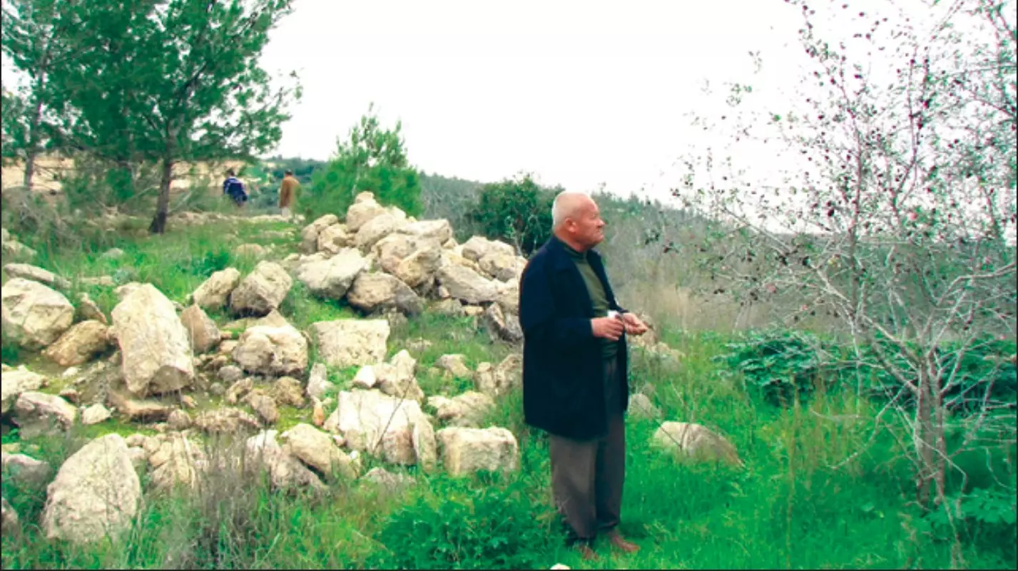
- الحاج يتأمل اماضي بين الانقاض - 2013
- مطلة حرش بلجيكا ويحيط بها قُرى ابو غوش نطاف وساريس قضاء القدس وتبعد عن القدس ١٥ دقيقة ،،
نقلاً عن الأستاذ : إياد جابر .
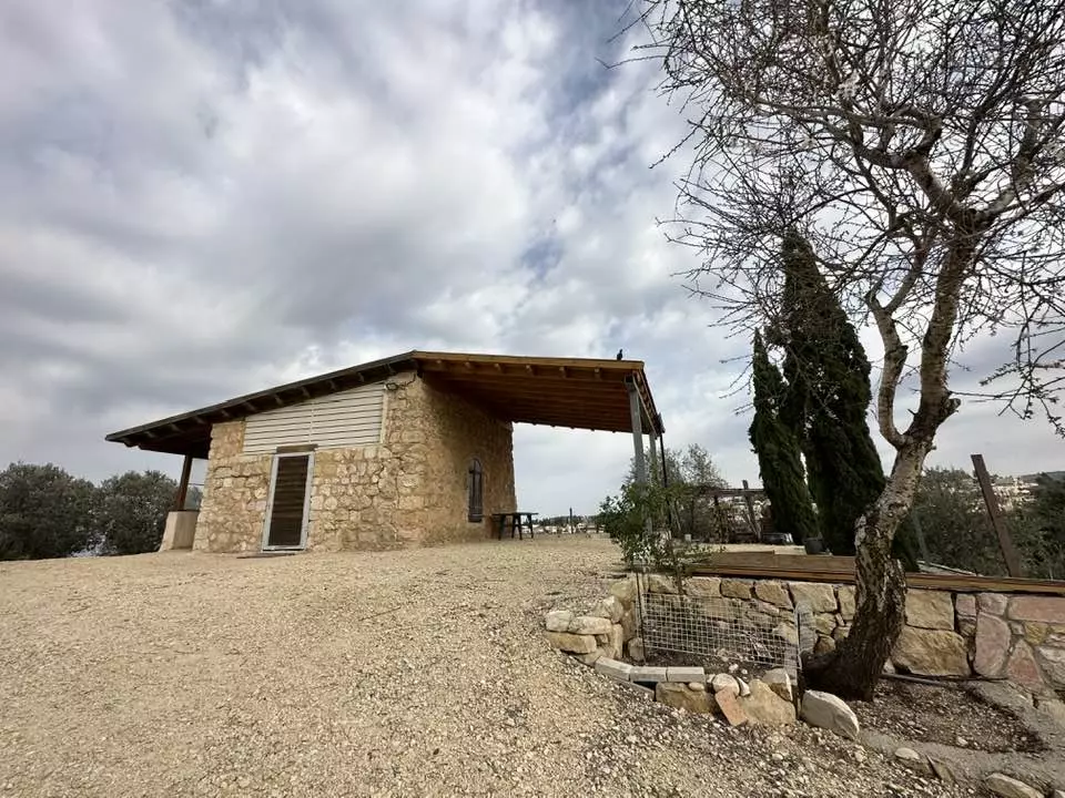
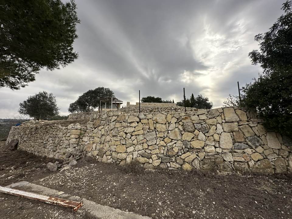
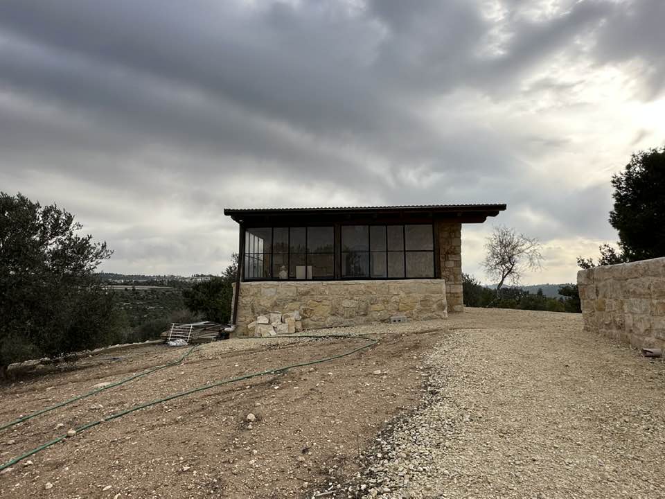
- The "most civilized" who landed on us from Europe obliterated the village, except for a few remaining structures like this one. This is how the Jews will be great again. That is how they can feel safe: Jim Crow, plunder, ethnic cleansing, and genocide.
- The "most civilized" who landed on us from Europe obliterated the village, except for a few remaining structures like this one. This is how the Jews will be great again. That is how they can feel safe: Jim Crow, plunder, ethnic cleansing, and genocide. #2

- The "most civilized" who landed on us from Europe obliterated the village, except for a few remaining structures like this one. This is how the Jews will be great again. That is how they can feel safe: Jim Crow, plunder, ethnic cleansing, and genocide. #3

- The "most civilized" who landed on us from Europe obliterated the village, except for a few remaining structures like this one. This is how the Jews will be great again. That is how they can feel safe: Jim Crow, plunder, ethnic cleansing, and genocide. #4
- The "most civilized" who landed on us from Europe obliterated the village, except for a few remaining structures like this one. This is how the Jews will be great again. That is how they can feel safe: Jim Crow, plunder, ethnic cleansing, and genocide. #5
- The "most civilized" who landed on us from Europe obliterated the village, except for a few remaining structures like this one. This is how the Jews will be great again. That is how they can feel safe: Jim Crow, plunder, ethnic cleansing, and genocide. #6
- The "most civilized" who landed on us from Europe obliterated the village, except for a few remaining structures like this one. This is how the Jews will be great again. That is how they can feel safe: Jim Crow, plunder, ethnic cleansing, and genocide. #7
- The "most civilized" who landed on us from Europe obliterated the village, except for a few remaining structures like this one. This is how the Jews will be great again. That is how they can feel safe: Jim Crow, plunder, ethnic cleansing, and genocide. #8

- The "most civilized" who landed on us from Europe obliterated the village, except for a few remaining structures like this one. This is how the Jews will be great again. That is how they can feel safe: Jim Crow, plunder, ethnic cleansing, and genocide. #9
- The "most civilized" who landed on us from Europe obliterated the village, except for a few remaining structures like this one. This is how the Jews will be great again. That is how they can feel safe: Jim Crow, plunder, ethnic cleansing, and genocide. #10
- The "most civilized" who landed on us from Europe obliterated the village, except for a few remaining structures like this one. This is how the Jews will be great again. That is how they can feel safe: Jim Crow, plunder, ethnic cleansing, and genocide. #11

- The "most civilized" who landed on us from Europe obliterated the village, except for a few remaining structures like this one. This is how the Jews will be great again. That is how they can feel safe: Jim Crow, plunder, ethnic cleansing, and genocide. #12
- The "most civilized" who landed on us from Europe obliterated the village, except for a few remaining structures like this one. This is how the Jews will be great again. That is how they can feel safe: Jim Crow, plunder, ethnic cleansing, and genocide. #13

- The "most civilized" who landed on us from Europe obliterated the village, except for a few remaining structures like this one. This is how the Jews will be great again. That is how they can feel safe: Jim Crow, plunder, ethnic cleansing, and genocide. #14
- The "most civilized" who landed on us from Europe obliterated the village, except for a few remaining structures like this one. This is how the Jews will be great again. That is how they can feel safe: Jim Crow, plunder, ethnic cleansing, and genocide. #15
- The "most civilized" who landed on us from Europe obliterated the village, except for a few remaining structures like this one. This is how the Jews will be great again. That is how they can feel safe: Jim Crow, plunder, ethnic cleansing, and genocide. #16
- The "most civilized" who landed on us from Europe obliterated the village, except for a few remaining structures like this one. This is how the Jews will be great again. That is how they can feel safe: Jim Crow, plunder, ethnic cleansing, and genocide. #17

- The "most civilized" who landed on us from Europe obliterated the village, except for a few remaining structures like this one. This is how the Jews will be great again. That is how they can feel safe: Jim Crow, plunder, ethnic cleansing, and genocide. #18

- The "most civilized" who landed on us from Europe obliterated the village, except for a few remaining structures like this one. This is how the Jews will be great again. That is how they can feel safe: Jim Crow, plunder, ethnic cleansing, and genocide. #19

- The "most civilized" who landed on us from Europe obliterated the village, except for a few remaining structures like this one. This is how the Jews will be great again. That is how they can feel safe: Jim Crow, plunder, ethnic cleansing, and genocide. #20
- The "most civilized" who landed on us from Europe obliterated the village, except for a few remaining structures like this one. This is how the Jews will be great again. That is how they can feel safe: Jim Crow, plunder, ethnic cleansing, and genocide. #21
- The "most civilized" who landed on us from Europe obliterated the village, except for a few remaining structures like this one. This is how the Jews will be great again. That is how they can feel safe: Jim Crow, plunder, ethnic cleansing, and genocide. #22
- The "most civilized" who landed on us from Europe obliterated the village, except for a few remaining structures like this one. This is how the Jews will be great again. That is how they can feel safe: Jim Crow, plunder, ethnic cleansing, and genocide. #23
- The "most civilized" who landed on us from Europe obliterated the village, except for a few remaining structures like this one. This is how the Jews will be great again. That is how they can feel safe: Jim Crow, plunder, ethnic cleansing, and genocide.

- The "most civilized" who landed on us from Europe obliterated the village, except for a few remaining structures like this one. This is how the Jews will be great again. That is how they can feel safe: Jim Crow, plunder, ethnic cleansing, and genocide. #2
- The "most civilized" who landed on us from Europe obliterated the village, except for a few remaining structures like this one. This is how the Jews will be great again. That is how they can feel safe: Jim Crow, plunder, ethnic cleansing, and genocide. #3
- The "most civilized" who landed on us from Europe obliterated the village, except for a few remaining structures like this one. This is how the Jews will be great again. That is how they can feel safe: Jim Crow, plunder, ethnic cleansing, and genocide. #4

- The "most civilized" who landed on us from Europe obliterated the village, except for a few remaining structures like this one. This is how the Jews will be great again. That is how they can feel safe: Jim Crow, plunder, ethnic cleansing, and genocide. #5

- The "most civilized" who landed on us from Europe obliterated the village, except for a few remaining structures like this one. This is how the Jews will be great again. That is how they can feel safe: Jim Crow, plunder, ethnic cleansing, and genocide. #6

- The "most civilized" who landed on us from Europe obliterated the village, except for a few remaining structures like this one. This is how the Jews will be great again. That is how they can feel safe: Jim Crow, plunder, ethnic cleansing, and genocide. #7

- The "most civilized" who landed on us from Europe obliterated the village, except for a few remaining structures like this one. This is how the Jews will be great again. That is how they can feel safe: Jim Crow, plunder, ethnic cleansing, and genocide. #8
- The "most civilized" who landed on us from Europe obliterated the village, except for a few remaining structures like this one. This is how the Jews will be great again. That is how they can feel safe: Jim Crow, plunder, ethnic cleansing, and genocide. #9

- The "most civilized" who landed on us from Europe obliterated the village, except for a few remaining structures like this one. This is how the Jews will be great again. That is how they can feel safe: Jim Crow, plunder, ethnic cleansing, and genocide. #10

- The "most civilized" who landed on us from Europe obliterated the village, except for a few remaining structures like this one. This is how the Jews will be great again. That is how they can feel safe: Jim Crow, plunder, ethnic cleansing, and genocide. #11
- The "most civilized" who landed on us from Europe obliterated the village, except for a few remaining structures like this one. This is how the Jews will be great again. That is how they can feel safe: Jim Crow, plunder, ethnic cleansing, and genocide. #12

- The "most civilized" who landed on us from Europe obliterated the village, except for a few remaining structures like this one. This is how the Jews will be great again. That is how they can feel safe: Jim Crow, plunder, ethnic cleansing, and genocide. #13
- The "most civilized" who landed on us from Europe obliterated the village, except for a few remaining structures like this one. This is how the Jews will be great again. That is how they can feel safe: Jim Crow, plunder, ethnic cleansing, and genocide. #14
- The "most civilized" who landed on us from Europe obliterated the village, except for a few remaining structures like this one. This is how the Jews will be great again. That is how they can feel safe: Jim Crow, plunder, ethnic cleansing, and genocide. #15

- The "most civilized" who landed on us from Europe obliterated the village, except for a few remaining structures like this one. This is how the Jews will be great again. That is how they can feel safe: Jim Crow, plunder, ethnic cleansing, and genocide. #16

- The "most civilized" who landed on us from Europe obliterated the village, except for a few remaining structures like this one. This is how the Jews will be great again. That is how they can feel safe: Jim Crow, plunder, ethnic cleansing, and genocide. #17
- The "most civilized" who landed on us from Europe obliterated the village, except for a few remaining structures like this one. This is how the Jews will be great again. That is how they can feel safe: Jim Crow, plunder, ethnic cleansing, and genocide. #18
- The "most civilized" who landed on us from Europe obliterated the village, except for a few remaining structures like this one. This is how the Jews will be great again. That is how they can feel safe: Jim Crow, plunder, ethnic cleansing, and genocide. #19
- The "most civilized" who landed on us from Europe obliterated the village, except for a few remaining structures like this one. This is how the Jews will be great again. That is how they can feel safe: Jim Crow, plunder, ethnic cleansing, and genocide. #20

- The "most civilized" who landed on us from Europe obliterated the village, except for a few remaining structures like this one. This is how the Jews will be great again. That is how they can feel safe: Jim Crow, plunder, ethnic cleansing, and genocide. #21

- The "most civilized" who landed on us from Europe obliterated the village, except for a few remaining structures like this one. This is how the Jews will be great again. That is how they can feel safe: Jim Crow, plunder, ethnic cleansing, and genocide. #22

- The "most civilized" who landed on us from Europe obliterated the village, except for a few remaining structures like this one. This is how the Jews will be great again. That is how they can feel safe: Jim Crow, plunder, ethnic cleansing, and genocide. #23

- خربة زُنقُله
قريبة من اراضي قرية ساريس المهجرة قضاء القدس .
في الطريق من القدس الى يافا تشاهدون الى اليمين قمة جبل عالية كان يهودي قبل سنوات يستعملها كمطعم واستراحة ولكن تم اغلاق المكان بالكامل . Waze רכס משלטים -- 2023 Iyad Jaber

- خربة زُنقُله
قريبة من اراضي قرية ساريس المهجرة قضاء القدس .
في الطريق من القدس الى يافا تشاهدون الى اليمين قمة جبل عالية كان يهودي قبل سنوات يستعملها كمطعم واستراحة ولكن تم اغلاق المكان بالكامل . Waze רכס משלטים -- 2023 Iyad Jaber #2
- خربة زُنقُله
قريبة من اراضي قرية ساريس المهجرة قضاء القدس .
في الطريق من القدس الى يافا تشاهدون الى اليمين قمة جبل عالية كان يهودي قبل سنوات يستعملها كمطعم واستراحة ولكن تم اغلاق المكان بالكامل . Waze רכס משלטים -- 2023 Iyad Jaber #3
- خربة زُنقُله
قريبة من اراضي قرية ساريس المهجرة قضاء القدس .
في الطريق من القدس الى يافا تشاهدون الى اليمين قمة جبل عالية كان يهودي قبل سنوات يستعملها كمطعم واستراحة ولكن تم اغلاق المكان بالكامل . Waze רכס משלטים -- 2023 Iyad Jaber #4
- خربة زُنقُله
قريبة من اراضي قرية ساريس المهجرة قضاء القدس .
في الطريق من القدس الى يافا تشاهدون الى اليمين قمة جبل عالية كان يهودي قبل سنوات يستعملها كمطعم واستراحة ولكن تم اغلاق المكان بالكامل . Waze רכס משלטים -- 2023 Iyad Jaber #5
- خربة زُنقُله
قريبة من اراضي قرية ساريس المهجرة قضاء القدس .
في الطريق من القدس الى يافا تشاهدون الى اليمين قمة جبل عالية كان يهودي قبل سنوات يستعملها كمطعم واستراحة ولكن تم اغلاق المكان بالكامل . Waze רכס משלטים -- 2023 Iyad Jaber #6
- خربة زُنقُله
قريبة من اراضي قرية ساريس المهجرة قضاء القدس .
في الطريق من القدس الى يافا تشاهدون الى اليمين قمة جبل عالية كان يهودي قبل سنوات يستعملها كمطعم واستراحة ولكن تم اغلاق المكان بالكامل . Waze רכס משלטים -- 2023 Iyad Jaber #7
- خربة زُنقُله
قريبة من اراضي قرية ساريس المهجرة قضاء القدس .
في الطريق من القدس الى يافا تشاهدون الى اليمين قمة جبل عالية كان يهودي قبل سنوات يستعملها كمطعم واستراحة ولكن تم اغلاق المكان بالكامل . Waze רכס משלטים -- 2023 Iyad Jaber #8
- خربة زُنقُله
قريبة من اراضي قرية ساريس المهجرة قضاء القدس .
في الطريق من القدس الى يافا تشاهدون الى اليمين قمة جبل عالية كان يهودي قبل سنوات يستعملها كمطعم واستراحة ولكن تم اغلاق المكان بالكامل . Waze רכס משלטים -- 2023 Iyad Jaber #9
- خربة زُنقُله
قريبة من اراضي قرية ساريس المهجرة قضاء القدس .
في الطريق من القدس الى يافا تشاهدون الى اليمين قمة جبل عالية كان يهودي قبل سنوات يستعملها كمطعم واستراحة ولكن تم اغلاق المكان بالكامل . Waze רכס משלטים -- 2023 Iyad Jaber #10

- خربة زُنقُله
قريبة من اراضي قرية ساريس المهجرة قضاء القدس .
في الطريق من القدس الى يافا تشاهدون الى اليمين قمة جبل عالية كان يهودي قبل سنوات يستعملها كمطعم واستراحة ولكن تم اغلاق المكان بالكامل . Waze רכס משלטים -- 2023 Iyad Jaber #11

- خربة زُنقُله
قريبة من اراضي قرية ساريس المهجرة قضاء القدس .
في الطريق من القدس الى يافا تشاهدون الى اليمين قمة جبل عالية كان يهودي قبل سنوات يستعملها كمطعم واستراحة ولكن تم اغلاق المكان بالكامل . Waze רכס משלטים -- 2023 Iyad Jaber #12
- خربة عَلاّقة في اراضي قرية ساريس المهجرة قضاء القدس waze חורבת עלקת -- June 13th, 2022 Iyad Jaber
- خربة عَلاّقة في اراضي قرية ساريس المهجرة قضاء القدس waze חורבת עלקת -- June 13th, 2022 Iyad Jaber #2
- خربة عَلاّقة في اراضي قرية ساريس المهجرة قضاء القدس waze חורבת עלקת -- June 13th, 2022 Iyad Jaber #3
- خربة عَلاّقة في اراضي قرية ساريس المهجرة قضاء القدس waze חורבת עלקת -- June 13th, 2022 Iyad Jaber #4
- خربة عَلاّقة في اراضي قرية ساريس المهجرة قضاء القدس waze חורבת עלקת -- June 13th, 2022 Iyad Jaber #5
- خربة عَلاّقة في اراضي قرية ساريس المهجرة قضاء القدس waze חורבת עלקת -- June 13th, 2022 Iyad Jaber #6
- خربة عَلاّقة في اراضي قرية ساريس المهجرة قضاء القدس waze חורבת עלקת -- June 13th, 2022 Iyad Jaber #7
- خربة عَلاّقة في اراضي قرية ساريس المهجرة قضاء القدس waze חורבת עלקת -- June 13th, 2022 Iyad Jaber #8
- خربة عَلاّقة في اراضي قرية ساريس المهجرة قضاء القدس waze חורבת עלקת -- June 13th, 2022 Iyad Jaber #9
- خربة عَلاّقة في اراضي قرية ساريس المهجرة قضاء القدس waze חורבת עלקת -- June 13th, 2022 Iyad Jaber #10
- خربة عَلاّقة في اراضي قرية ساريس المهجرة قضاء القدس waze חורבת עלקת -- June 13th, 2022 Iyad Jaber #11
- خربة عَلاّقة في اراضي قرية ساريس المهجرة قضاء القدس waze חורבת עלקת -- June 13th, 2022 Iyad Jaber #12
Want to browse more? 80,000 pictures were grouped in these gallaries:
| Display Name | Clan/Hamolah | Country of Residence |
| Lubna Hammad | Hammad | - |
| rana jaber | Hammad | IL, IL |
| Amal Jaber | Hammad | - |
| mohammad zouheir ziadeh | - | amman- jordan |
| Mustafa Mohd Mustafa | Hamad | Eatern, KSA |
| mohamed bader | - | caracas, venezuela |
| دعاء | - | - |
| Rashed | Jahjooh | Jordan, Amman _Jordan |
| w.ziadeh | ziadeh | amman, Jordan |
| Ghassan Hammad | - | - |
| معتصم صافي | الجحاجحة | عمان, عمان |
| رغد زيادة | - | عمان |
| فرح زيادة | زيادة | عمان |
| مصعب صافي | الجحاجحة | عمان, عمان |
| حليمة عبد الرحمن زيادة | زيادة | عمان |
| ابن فلسطين | علان | رام الله, بيت عور التحتا |
| فاديا زيادة | زيادة | - |
| يزن زيادة | ساريس | الاردن |
| abu ala'a | - | - |
| Abu Jameel | - | California, USA |
| Reem Ateyeh | Hammad | California, USA |
| M Mahmoud | Hammad | - |
| Khari Mahmoud Jab'r | Hammad | Florida, USA |
| ABDALLAH HAMMAD | - | CA, U.S.A |
| SHADE HAMMAD | HAMMAD | - |
| Ahmad Hammad | Hammad | Amman, البقعة |
| shukre | حماد | القدس |
| Osama (Abu laith) Awwad | Al-beerawi | Amman, Jordan |
| manal ziadeh | - | - |
| bader | - | |
| karim allan | abu jahjuh | - |
| MARSILIO | ABO JAHJOH | VARGAS, VENEZUELA |
| mohammad odeh | البيراوي | JORDAN - SAHHAB |
| Mahmoud Hammad | Hammad | CA, U.S.A |
| Najib Najib | HAMMAD | Jerusalem |
| Hussein Najib | HAMMAD | FLORIDA, USA |
| Fanan Jaber | Hamad | Florida, USA |
| Hiba Ateyeh | Hammad | amman, Jordan |
| Najah Ateyeh | Hammad | amman, Jordan |
| abu Hasan | saadeh | Qalandia, Falestine |
| Mahmmoud M.Hamad | Hamad - حـمــد | palestain, Palestain |
| nader | HAMMAD | CALIFORNIA, USA |
| Saleh Ziadah | Ziadah | Palestine |
| EYAD MATAKH | HAMMAD- MATAKH | - |
| HANADI ATEYEH | Hammad | -, - |
| Jihad Abdel Hamid | Hammad | Brazil |
| Ateyeh Ateyeh | Hammad | - |
| Jamal Najib | Hammad | Jerusalem |
| Noor Ateyeh | Hammad | - |
| Fuad Ateyeh | Hammad | - |
| naf' | Hammad | Palestine, Palestine |
| muntaha | - | il, Homer glen |
| taisir hussein | jahjouh | nj, usa |
| Hussam Nafe' | hammad | West Bank, Kalandia |
| Mukarram Najib | HAMMAD | California, USA |
| Nasser Ibrahim | Hammad | California, US |
| Maher Odtallah | Hamad | Riyadh, Saudi Arabia |
| mamoun hussein | jahjouh | NEW JERSEY, usa |
| Mahmoud Hammad | Hammad | Ca, U.S.A |
| Shirien Jaber- Badawi | Hamad | Baltimore, USA |
| Osama Odeh | hama'd | Jordan |
- ساريس المهجرة | جذور مقدسية 2020 Duration: 24 min 48 sec
- قرية ساريس المهجرة - فلسطين - حلوة يا دنيا Duration: 15 min 10 sec
No links have been shared yet, be free to the first to share the first link.
 Fake Valor: Why Did Zionist Jews Hoist Nazis Flag on Their Ships in the 1930s?
What is new?
-
Facts About Oct. 7th Gaza Raid
-
Remined Us Please:: Who Did Rape Who? Palestinians Raped Israelis? Or, was the other way around?
-
When Prof. Edward Said was invited to debate Bibi Netanyahu in the 1980s, watch what happened!
-
Ezra Klein of the NY Times on the "Jewish Race".
-
Abusing Blood Libel!
-
Did Israeli Soldiers Activate The Hanniba Direective On Oct. 7th? You Be The Judge
-
Zionist FAQ: Isn't it true that Palestinians don't want peace? Palestinians never accepted the two-state solution
- Facts about Haavara (Transfer) Agreement between Ben-Gurion & Hitler
-
Haavara FAQs: Why Did Zionist Jews Hoist Nazis' Flags on Their Ships in the 1930s?
- Haavara FAQs: When Chaim Weizmann met FDR in mid-1943, why was he silent about rescuing European Jewry?
-
Dear ChatGPT: How did Palestinians resist Napoleon's invasion of their country in 1799?
-
Dear ChatGPT: Gaza had a vibrant Jewish community in the mid-17th century. What happened to them?
-
Dear ChatGPT: Why did the Jewish Agency suppress news of the Holocaust during WWII?
-
Video Playlist: Jews share their DNA tests to end the conflict for good.
-
A Tale of Two Conflicts: Examining the Definition of Genocide
-
Prof. Abraham Polak And The Suppressed History of the Khazars and European Jewry
-
How Ronald Reagan would have framed the genocide in Gaza if he were still alive?
-
Haavara FAQs: Let us do the math: how many German Jews did The Haavara Agreement save?
-
Zionist FAQs: The Hebron Massacre of 1929, "clearly proves" that Palestinians are antisemitic, how could you deny it?
-
Zionist FAQs: Why Anti-Zionist Is Not Antisemitism?
-
Zionist FAQs: Isn't it true that the KGB created Palestinian Nationalism in the early 1960s?
- Zionist FAQs: Muslims are killing Muslims all the time; why are Israeli Jews being singled out in the media?
- Zionist FAQs: How is Israel an apartheid state when 20% of its citizens are Arabs who enjoy full rights?
-
Haavara FAQs: Why Did Dorothy Thompson Flip From A Zionist Advocate to A Silenced Dissenter?
-
Haavara FAQs: Analysis of Herzl's Uganda Scheme and how it could have saved millions of Jews.
-
Haavara FAQs: Why did Hayim Greenberg describe American Jewry as "morally bankrupt" in early 1943?
-
Haavara FAQs: What if the Evian Conference was a resounding success? What would have been the impact of saving European Jewry on Zionism?
- Haavara FAQs: What if the six million were saved, how that would have impacted the Zionist project?
-
Haavara FAQs: How did Zionist leaders react when Europe's Jews lingered in the DP camps after WWII ended?
-
Why does the American Jewish community repeat lies that David Ben-Gurion had debunked before he died?
-
Who has the power to rename the Tatar/Khazar Gene Marker to Jewish IV?
-
Zionist FAQs: Why won't Egypt, Syria, and Jordan take their people back? Jews are indigenous to Palestine, and Arabs immigrated after Jews developed the country. Arabs should leave.
-
Haavara FAQs: Did Hitler and the Nazis conflate between Judaism and Zionist? If that wasn't case, then why?
-
Haavara FAQs: Winston Churchill and antisemitism, a collection of articles written Churchill.
-
Haavara FAQs: Broken by country, how many Jews survived vs. killed during the Holocaust?
-
Haavara FAQs: Why did European Jews vote with their feet and to immigrated to the Americas, not Palestine, after WWII?
-
Watch this American Jewish Girl describing Israeli Jews' cognitive dissonance like no other in under two minutes
-
Haavara FAQs: When the Nazis went out of their way to hide the Holocaust, Israeli Jews did the exact opposite by broadcasting their genocide of Gazans. But why?
-
Haavara FAQs: How Zionist Jews went out of their to show their appreciation to Nazism and Fascism?
- Haavara FAQs: Why Zionist leaders were against bombing the death camps & the Railroads leading to them?
-
Haavara FAQs: Hitler's message to the British and American people: If Jews are such noble citizens and you care about them, how come you're not letting them in? I will gladly ship them to you at my expense, even on luxury liners!
-
A shortlist of Zionist and Israeli false flag operations in the name Jews.
-
The Most Moral Army
- The Land of Kapos (Israel): Where the brave are boycotted and Kapos walk free.
- Why did early Zionists often named their communal enterprises "colonial"?
- Zionist Relations with Nazi Germany by Faris Glubb
-
Two NY Times advertisements by Zionists in the early 1943 that exposes Zionists' treason at the height of the calamity
- Facts Not Lies about the Palestinian-Israeli Conflict.
- Site's pictures have been categorized
- Campgain Against Lice
- A Survey of Palestine, the official source about Palestine before Nakba produced by the British Mandate; over 1200 pages.
- Satellite View & Google Earth: Over 6,000 placemarks identifying all destroyed towns, W. Bank & Gaza Strip Towns, & refugee camps.
- PalestineRemembered.com and its Nakba Oral History Project were featured on al-Jazeera Satellite TV.
- Nakba Oral History Video Podcast:
 Over 700 Oral History interviews (including 3,500+ hours of recording) can be viewed online.
 - Palestine Village Statistics Project
- Gaza Jail Break
- النسخة العربية للموقع الان متوفرة
- Videos: Documenting the destroyed villages in video: Tracing all that remains since Nakba.
- Videos: Responding to Zionist Propaganda
- Interview: The ethnic cleansing of Palestine: George Galloway interviews Israeli Historian Ilan Pappe.
- For Palestinians, memory matters. It provides a blueprint for their future By George Bisharat.
- Zionist FAQ now available in Hebrew שאלות שציונים שואלים, עכשיו בעברית
- Video: The Stephen Walt and John Mearsheimer report on the influence of the Israel Lobby on U.S. Foreign Policy
- The Palestinian-Israeli conflict for beginners
