| PalestineRemembered | About Us | Oral History | العربية | |
| Pictures | Zionist FAQs | Haavara | Maps | |
| Search |
| Camps |
| Districts |
| Acre |
| Baysan |
| Beersheba |
| Bethlehem |
| Gaza |
| Haifa |
| Hebron |
| Jaffa |
| Jericho |
| Jerusalem |
| Jinin |
| Nablus |
| Nazareth |
| Ramallah |
| al-Ramla |
| Safad |
| Tiberias |
| Tulkarm |
| Donate |
| Contact |
| Profile |
| Videos |
Welcome To 'Aqqur - عقور (עקור)
|
District of Jerusalem
Ethnically cleansed days ago |
العربية Google Earth |
 |
Gallery (72) |
- Statistics & Facts
-
Before & After

- Satellite View
- Articles 1
- Pictures 72
- Members
- All That Remains
- Wikipedia
- Videos 3
- Guest Book
- Links
| Statistic & Fact | Value | ||||||||||||
| Occupation Date | July 13, 1948 | ||||||||||||
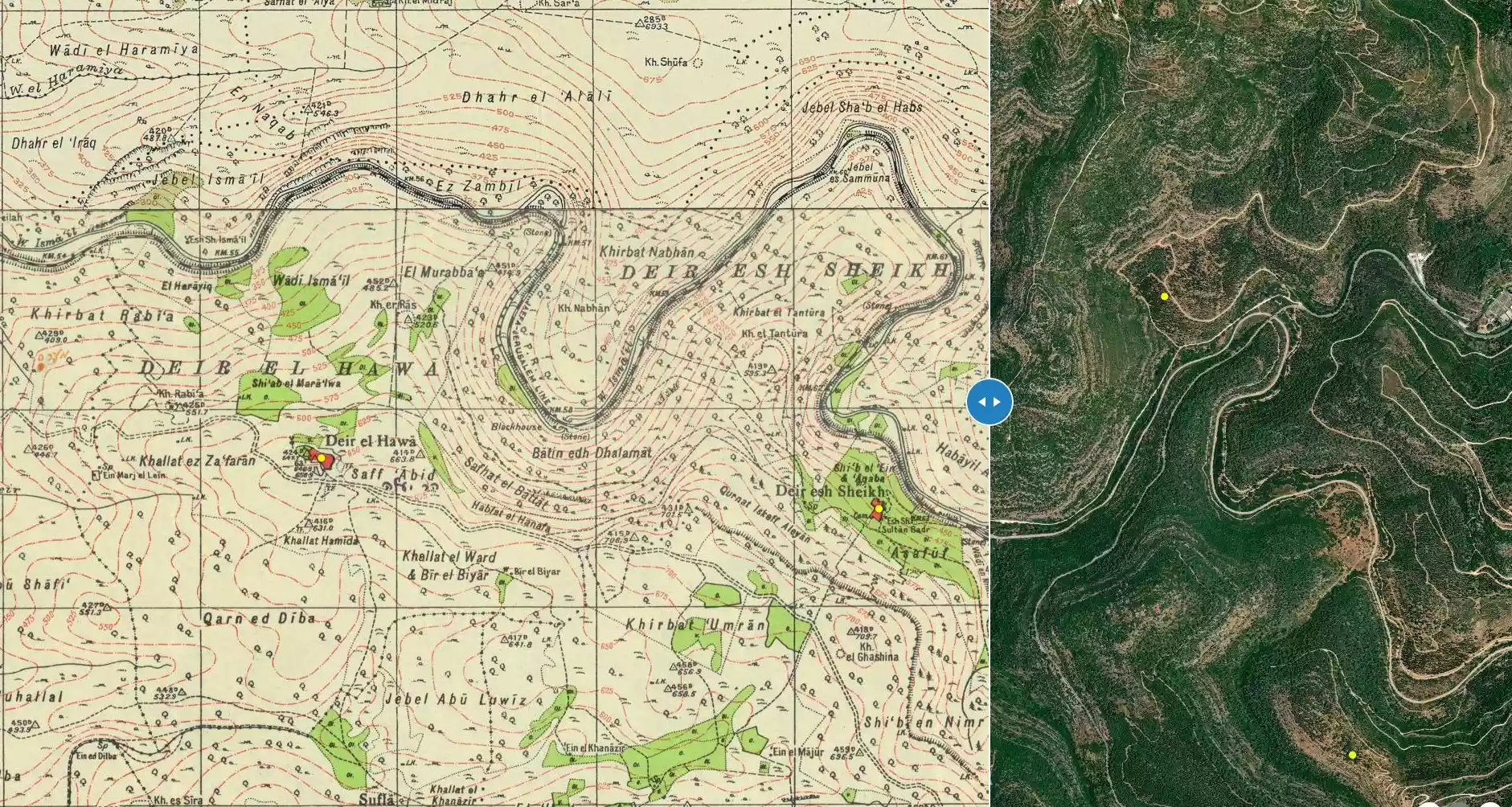
| Distance From District | 14.5 (km) West of Jerusalem | ||||||||||||
| Elevation | 475 (meters) | ||||||||||||
| Before & After Nakba, Click Map For Details |
|||||||||||||
|
|||||||||||||
| Map Location | See location #24 on the map View from satellite |
||||||||||||
| Military Operation | Operation Dani | ||||||||||||
| Exodus Cause | Military assault by Zionist troops | ||||||||||||
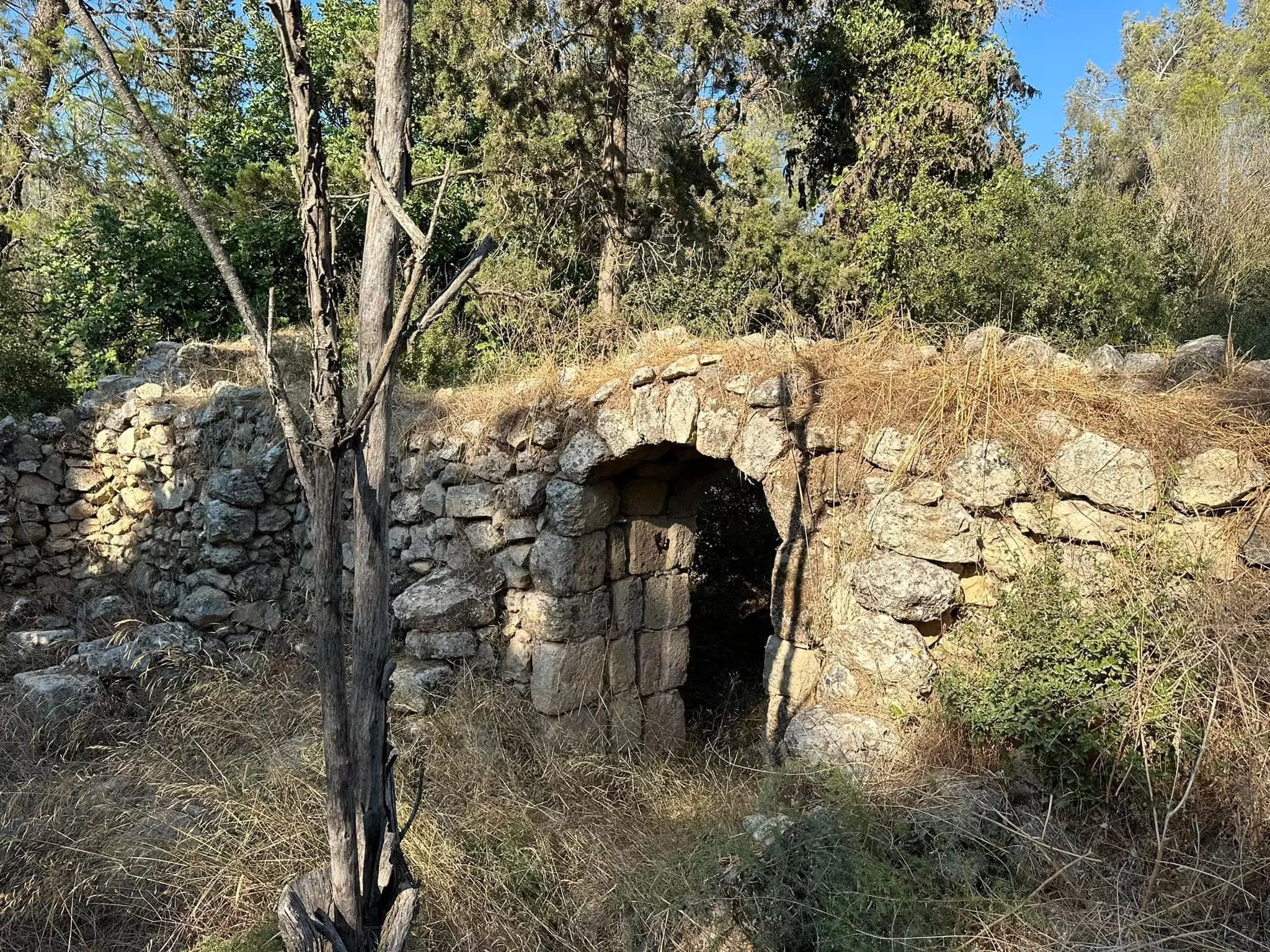
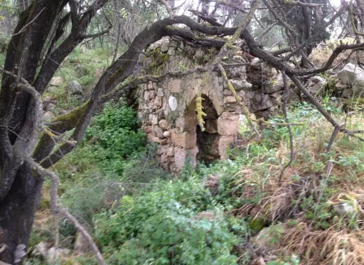
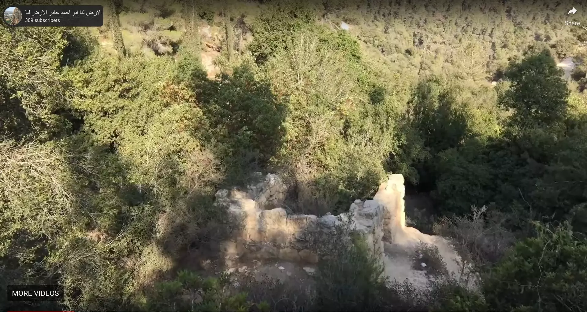
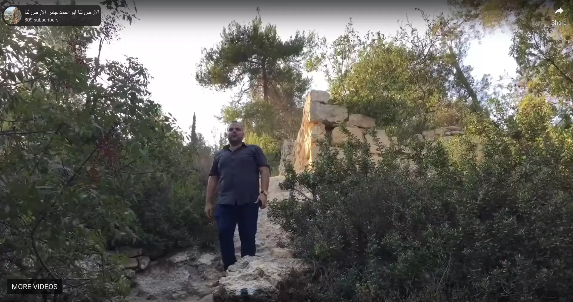
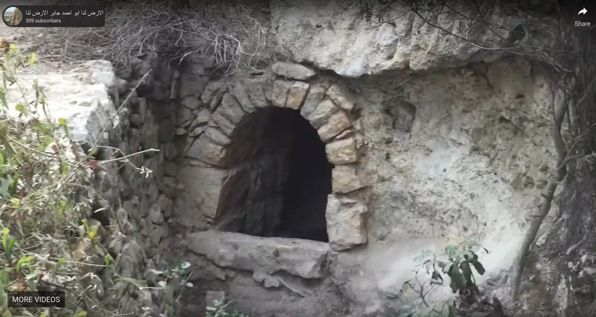
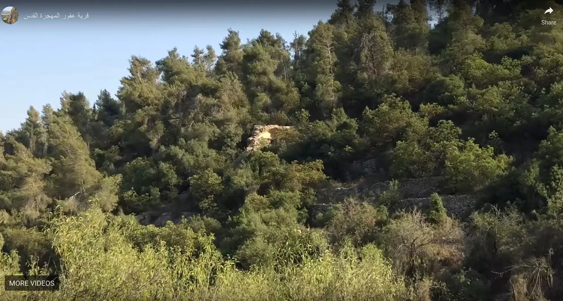
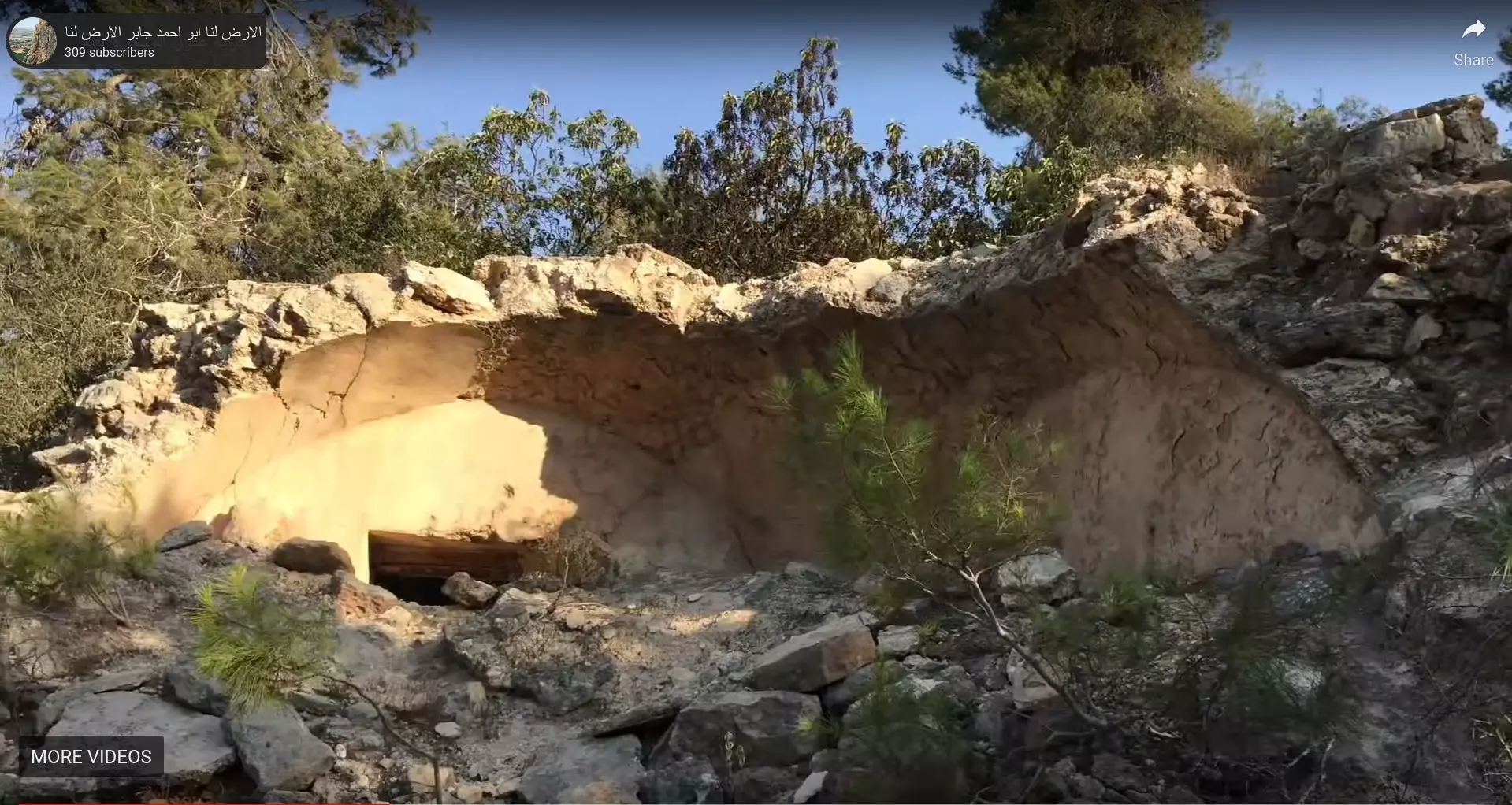
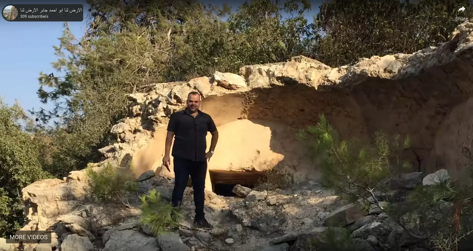
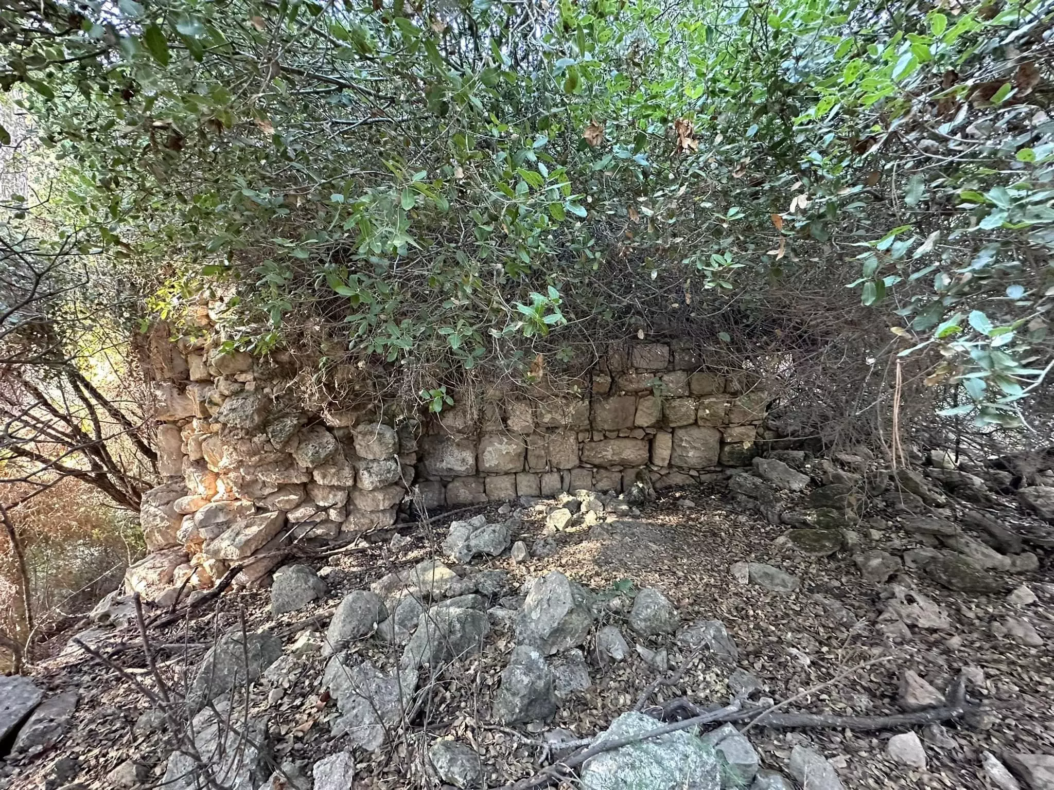
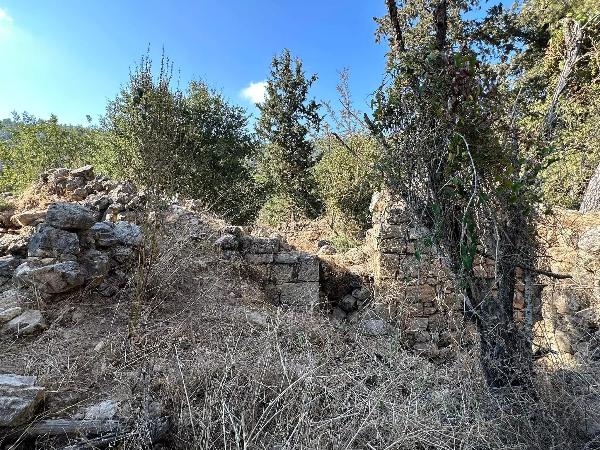
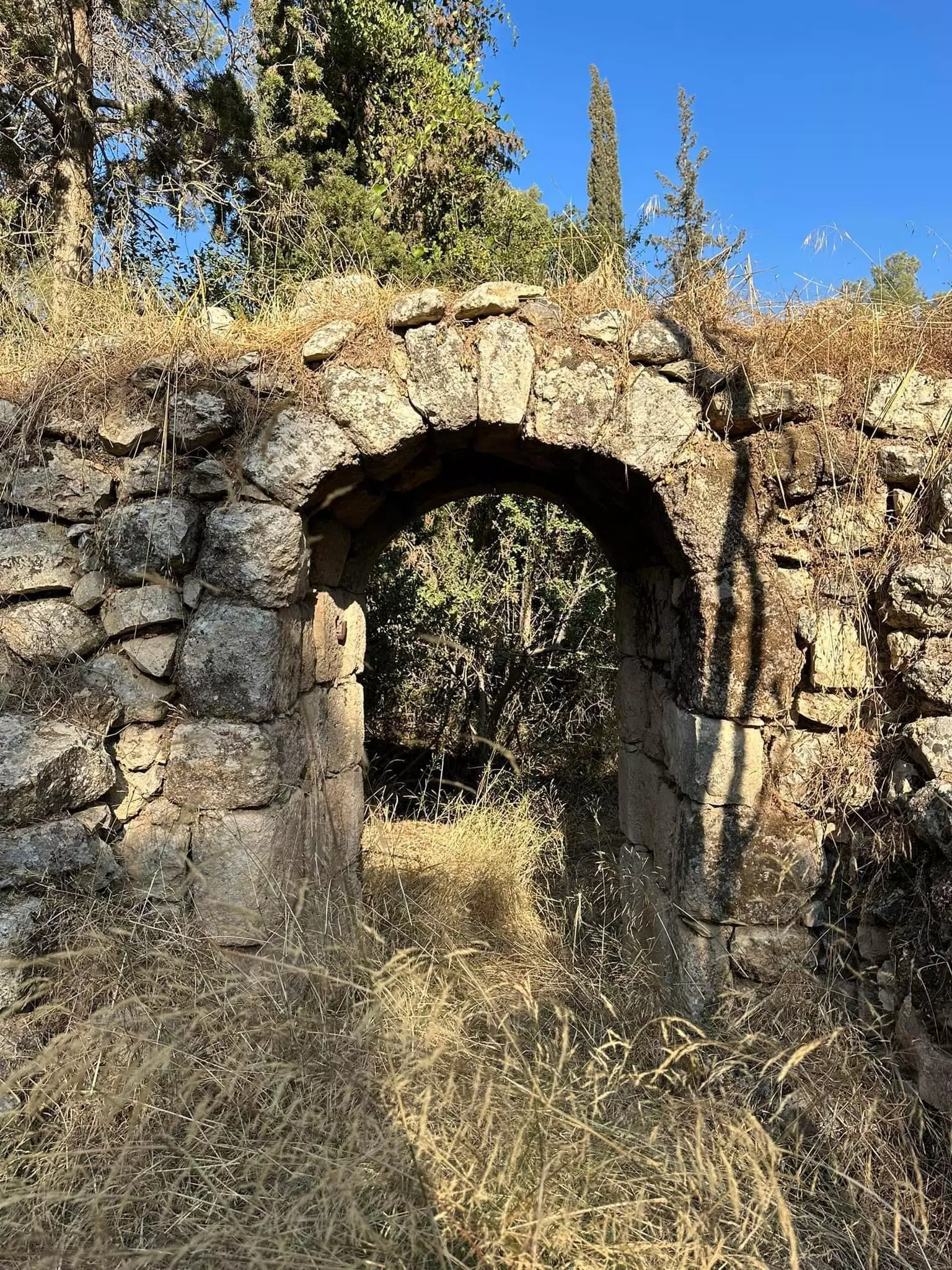
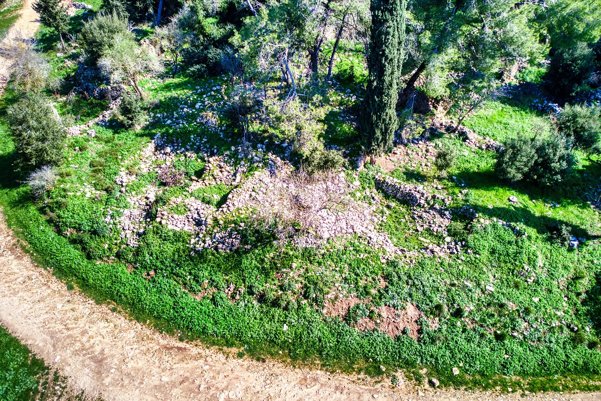
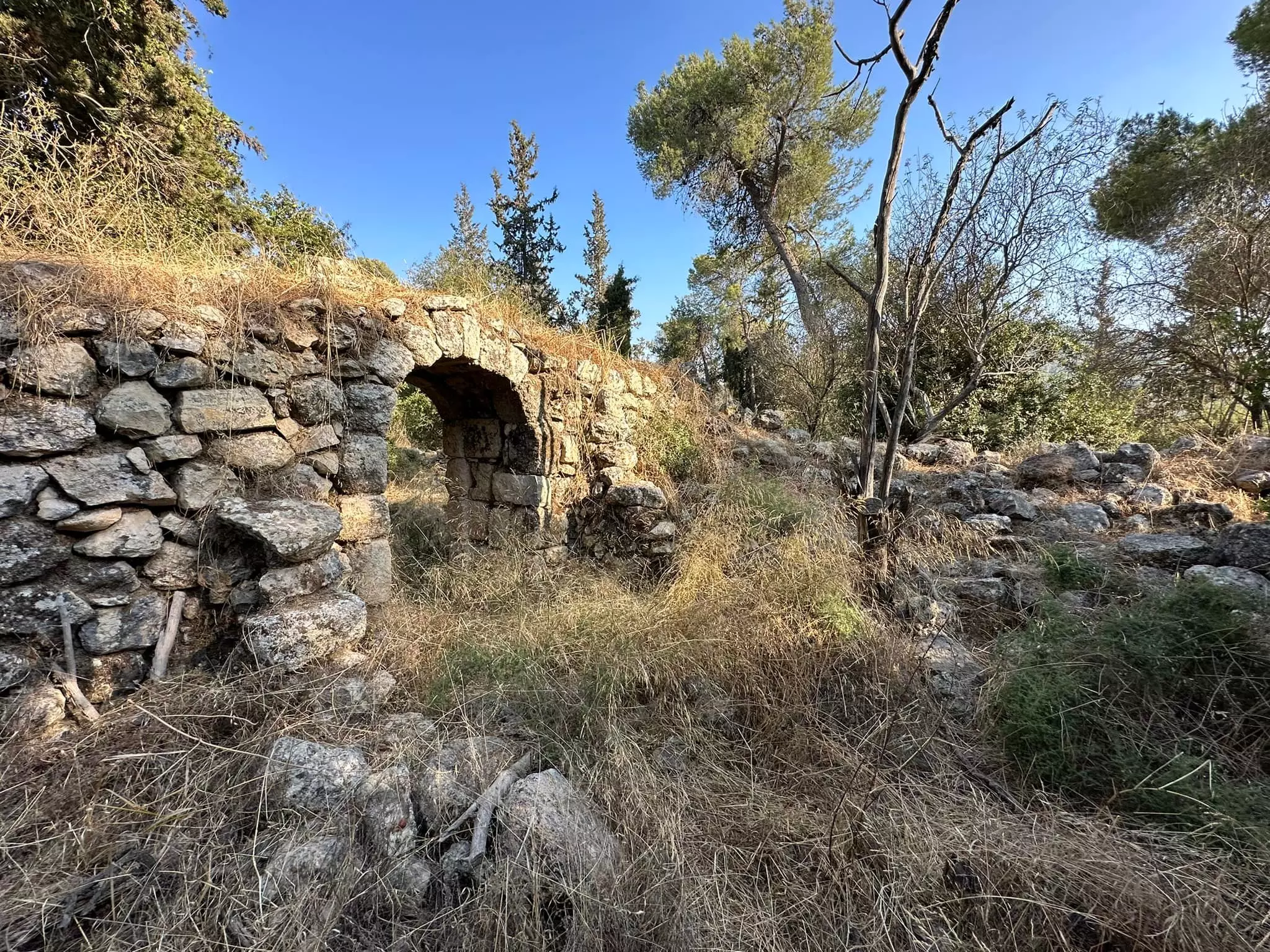
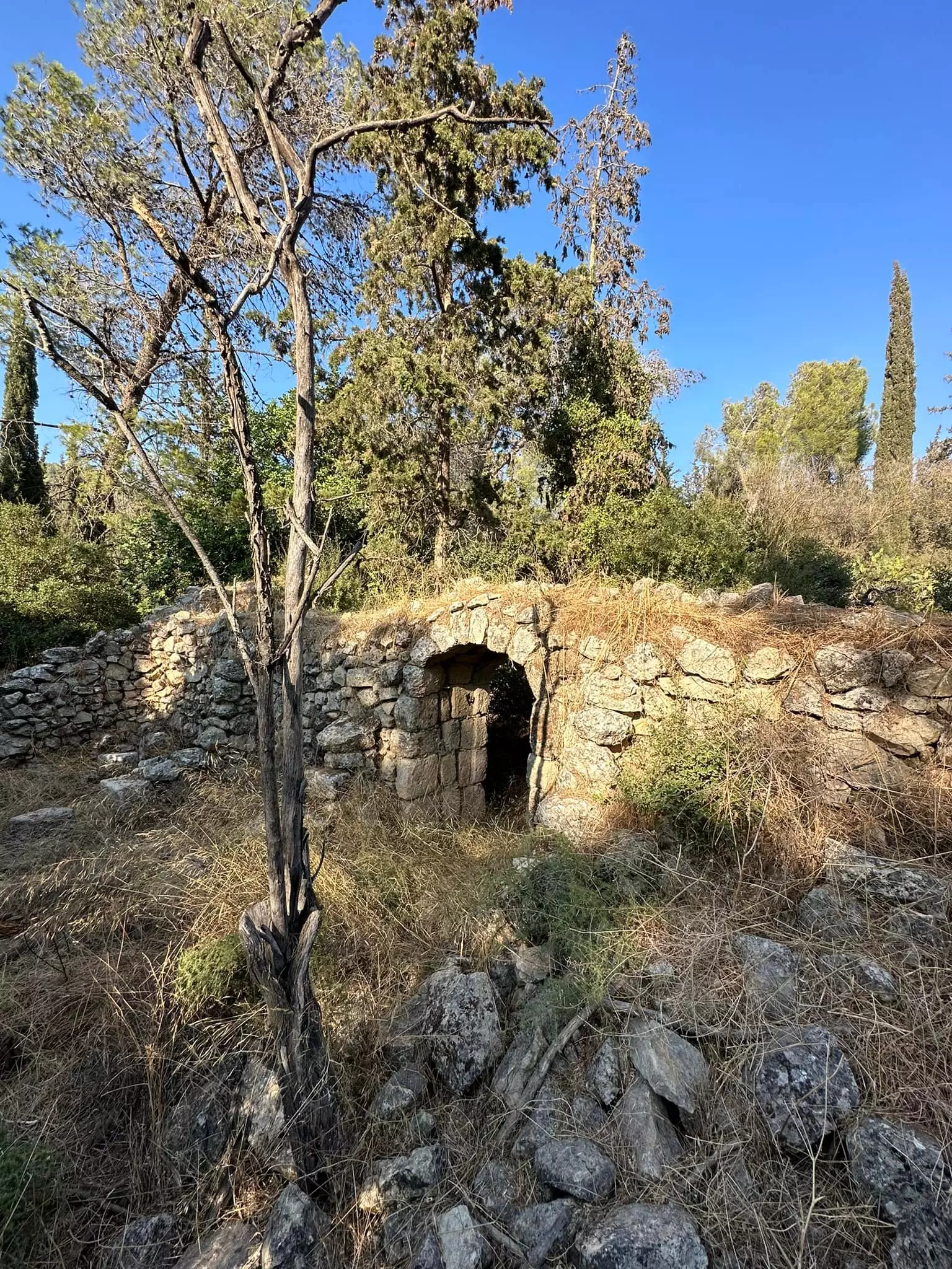
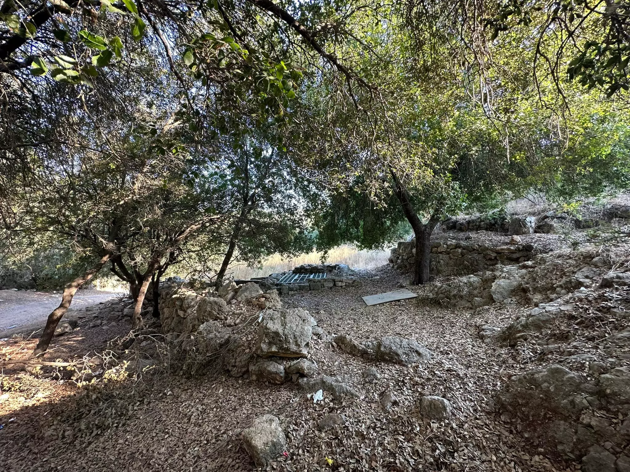
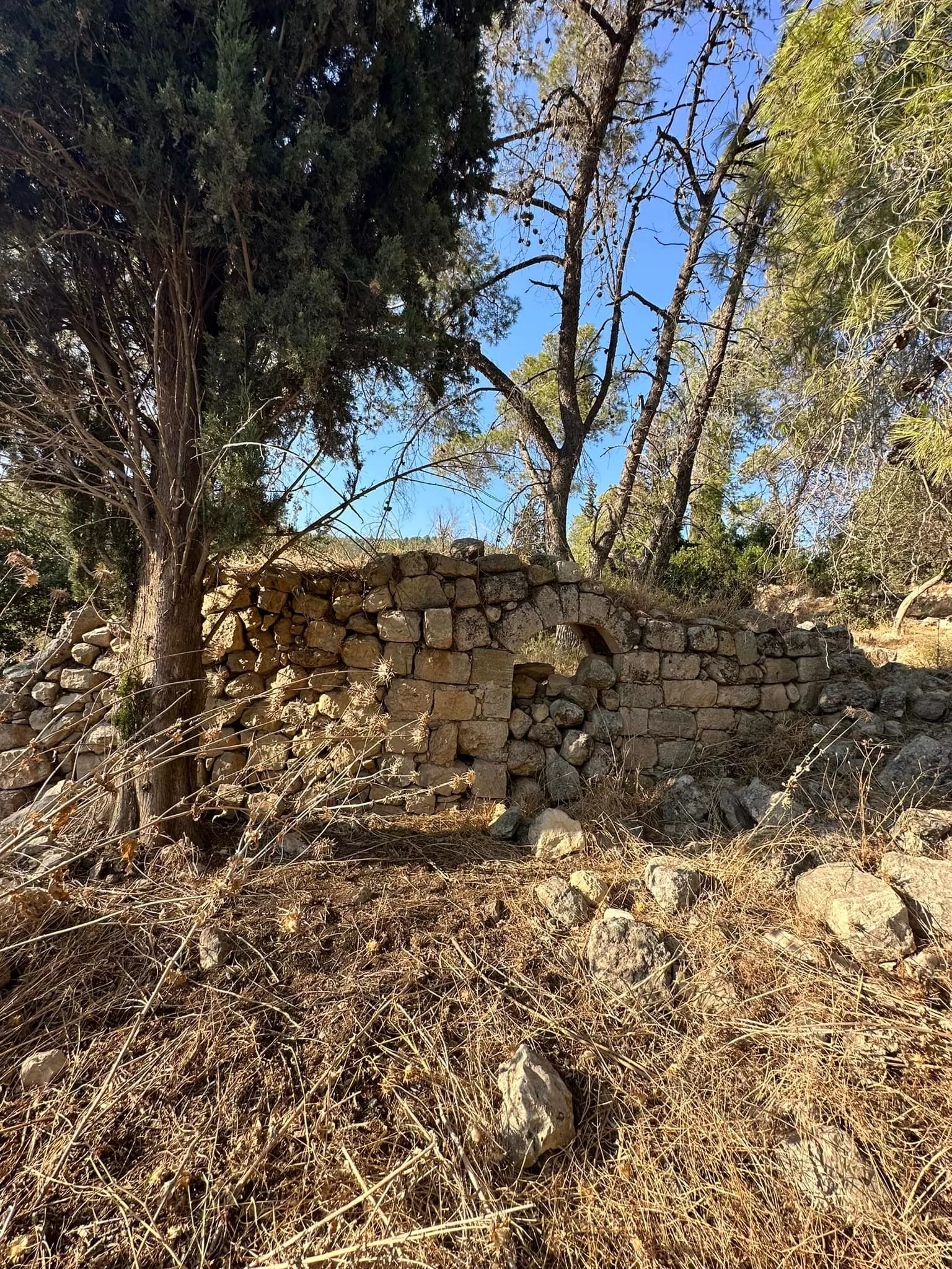
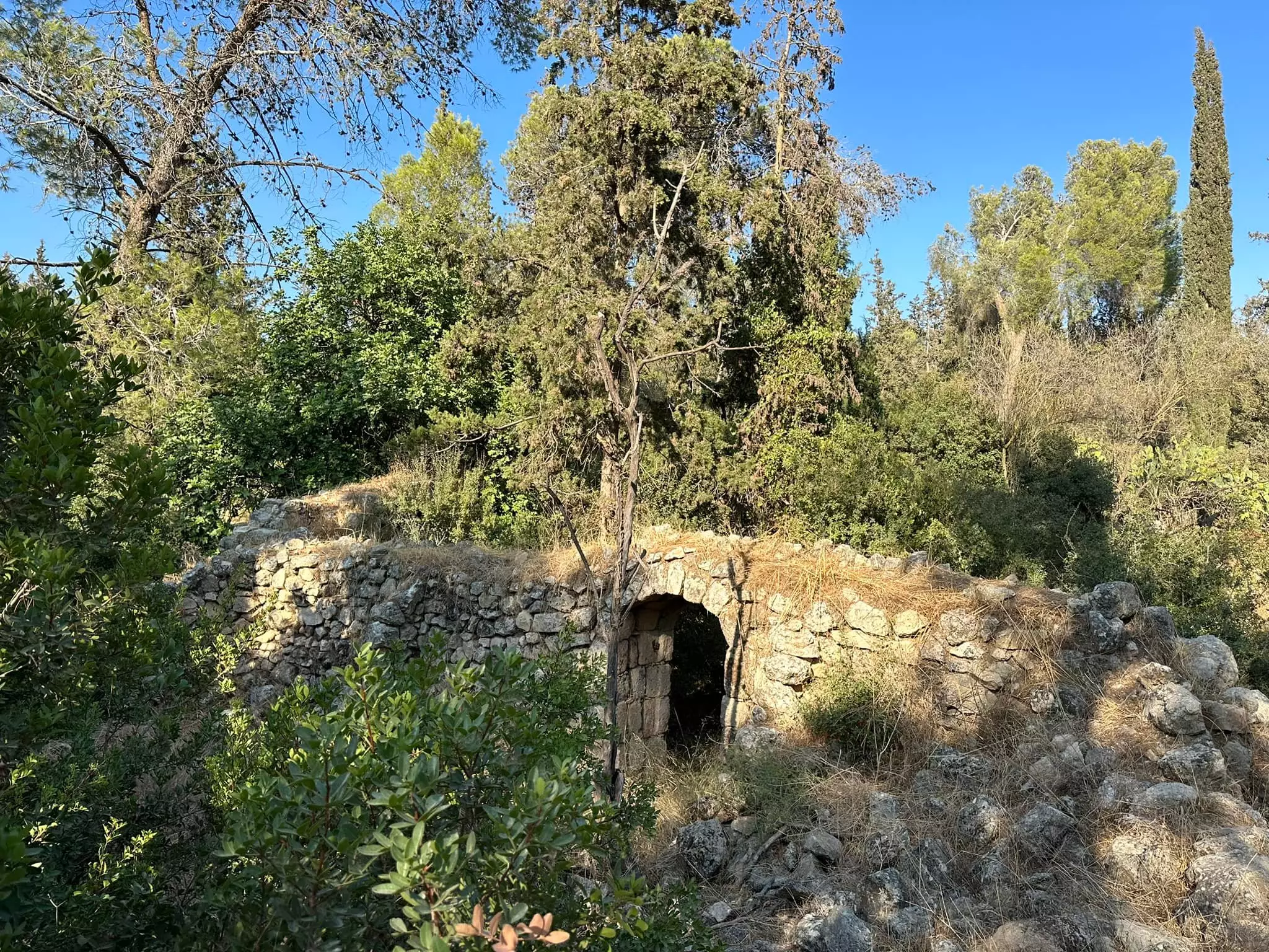
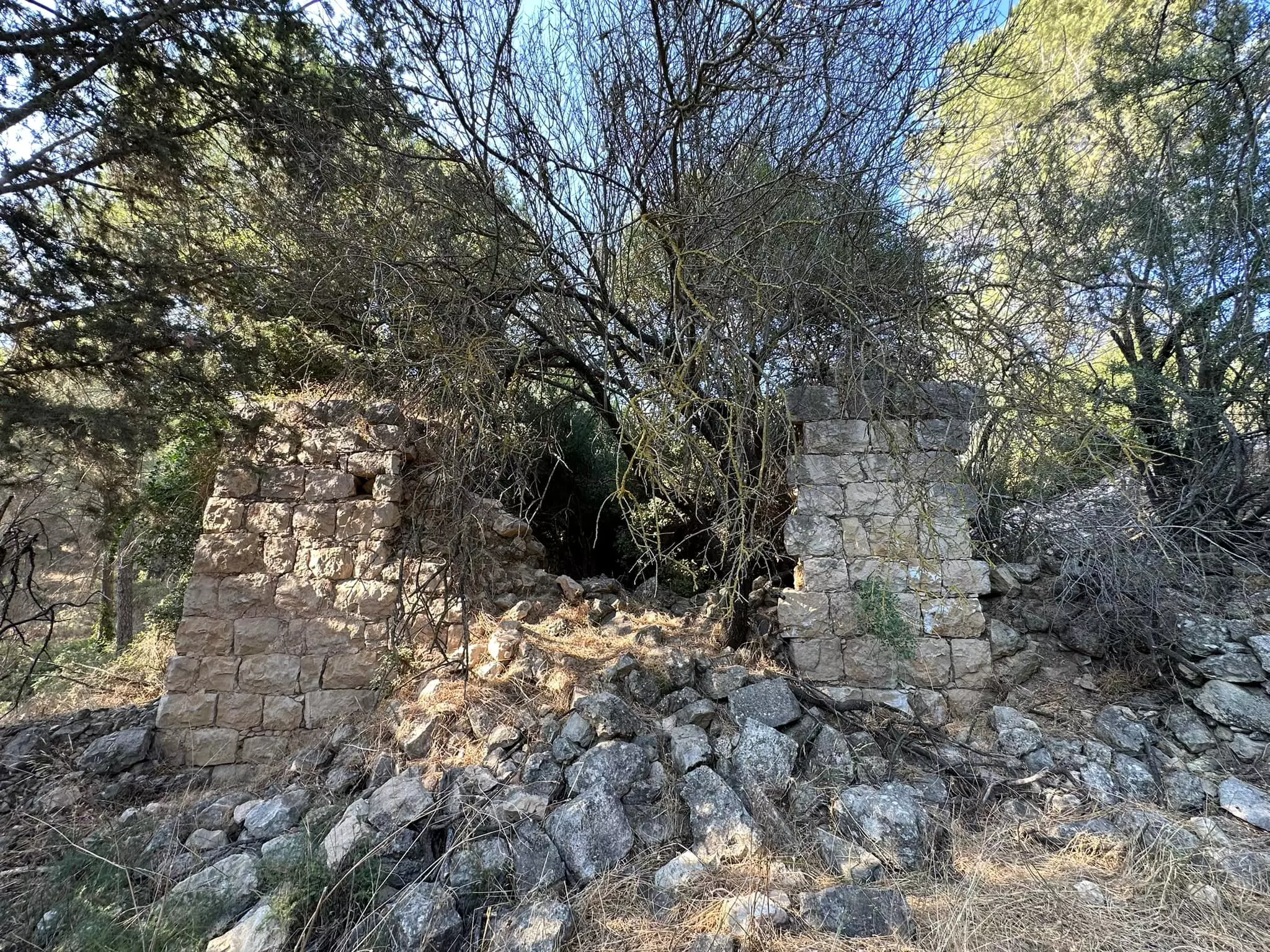
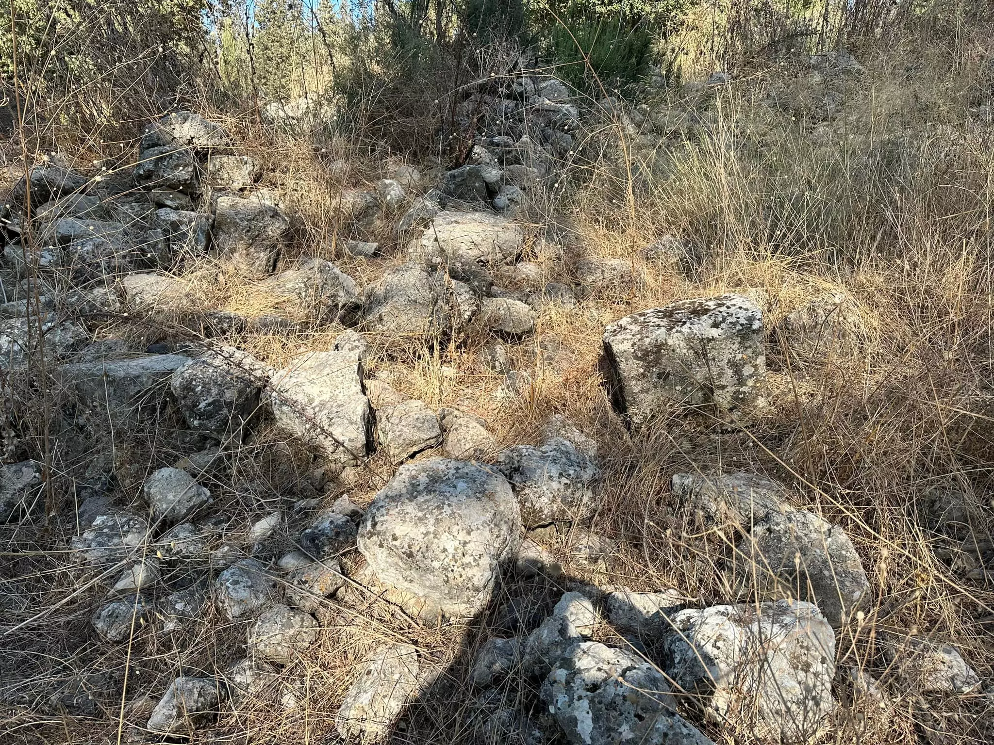
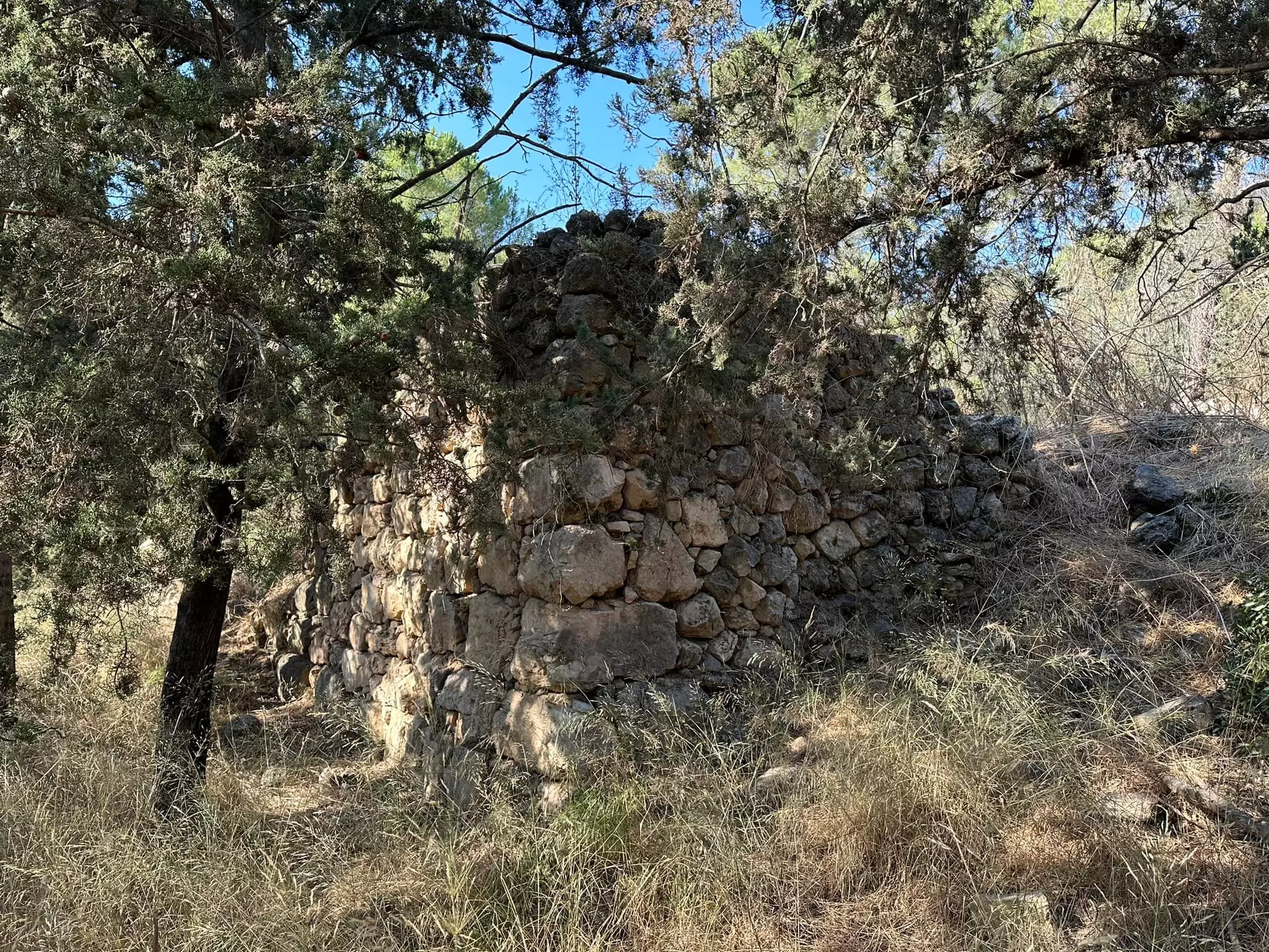
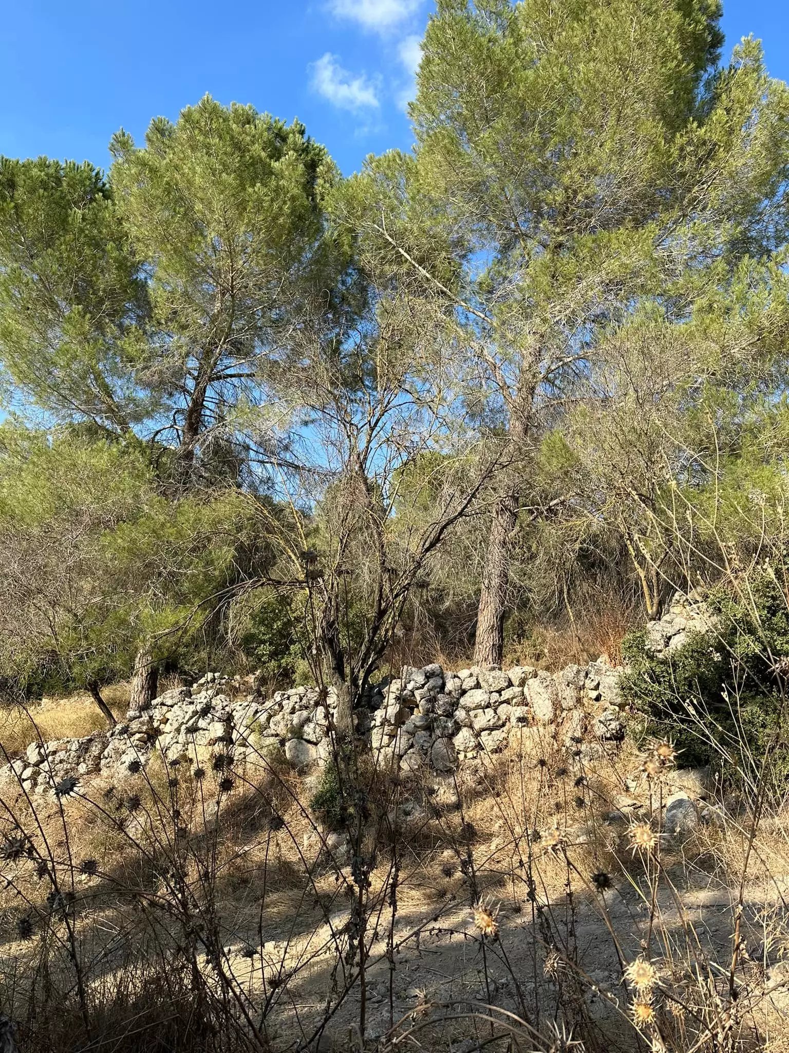
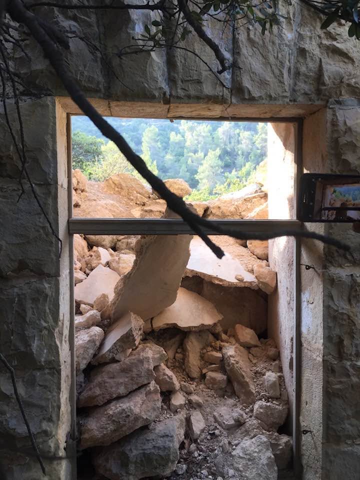
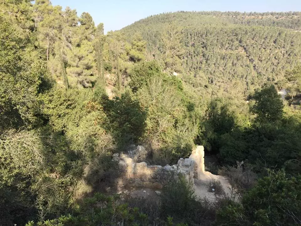
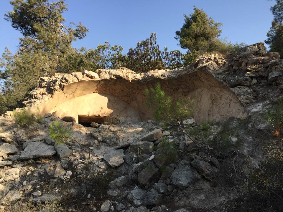
| Village Temains | The village was completely destroyed, and only house walls and rubble left behind. | ||||||||||||
| Ethnically Cleansing | 'Aqqur inhabitants were completely ethnically cleansed. | ||||||||||||
| Pre-Nakba Land Ownership |
**Town Lands' Demarcation Maps |
||||||||||||
| Land Usage As of 1945 |
|
||||||||||||
| Population |
|
||||||||||||
| Number of Houses | In (1931): 106 (includes Ras Abu'Ammar and 'Ayn Hubin) | ||||||||||||
| Near By Towns |
|||||||||||||
|
|||||||||||||
| Shrines / Maqams | 'Aqqur had a maqam for a local sage known by al-Shaykh Ahmad Sulayman. | ||||||||||||
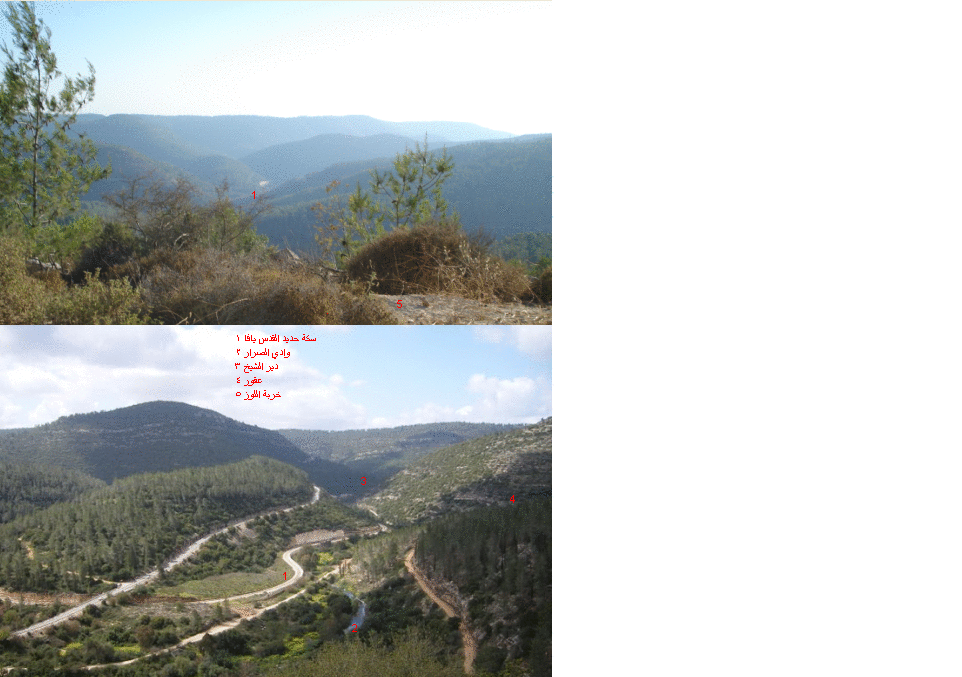
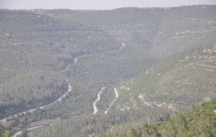
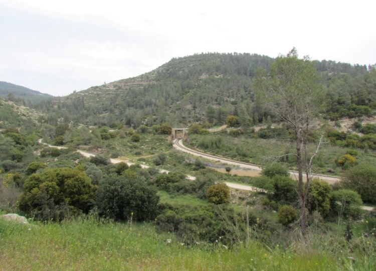
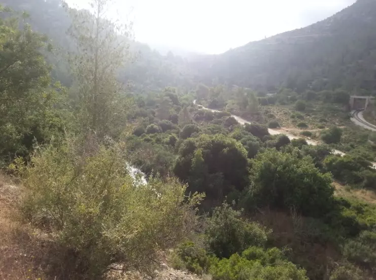
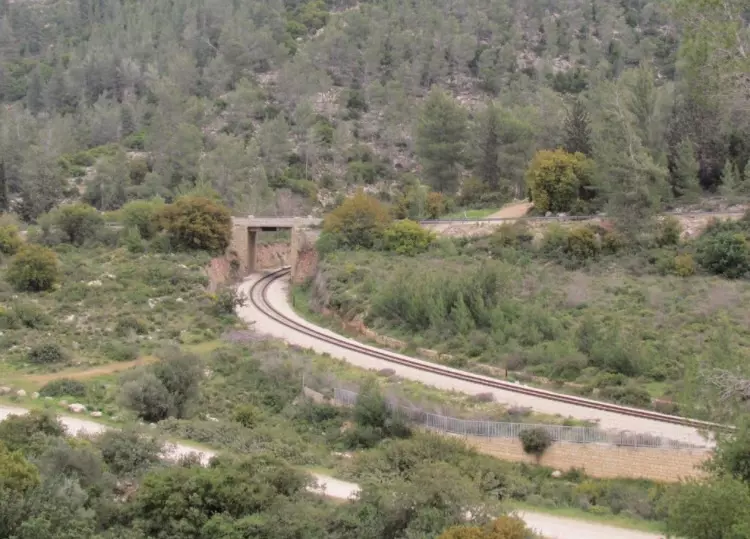
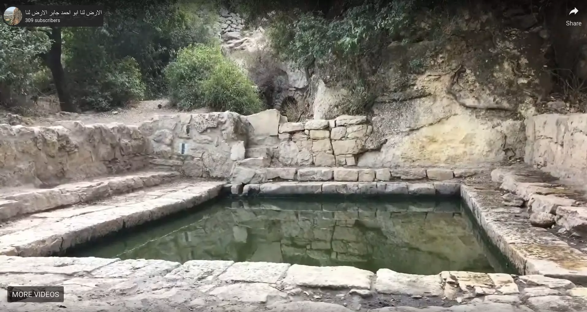
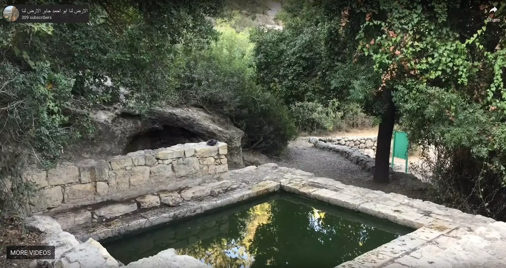
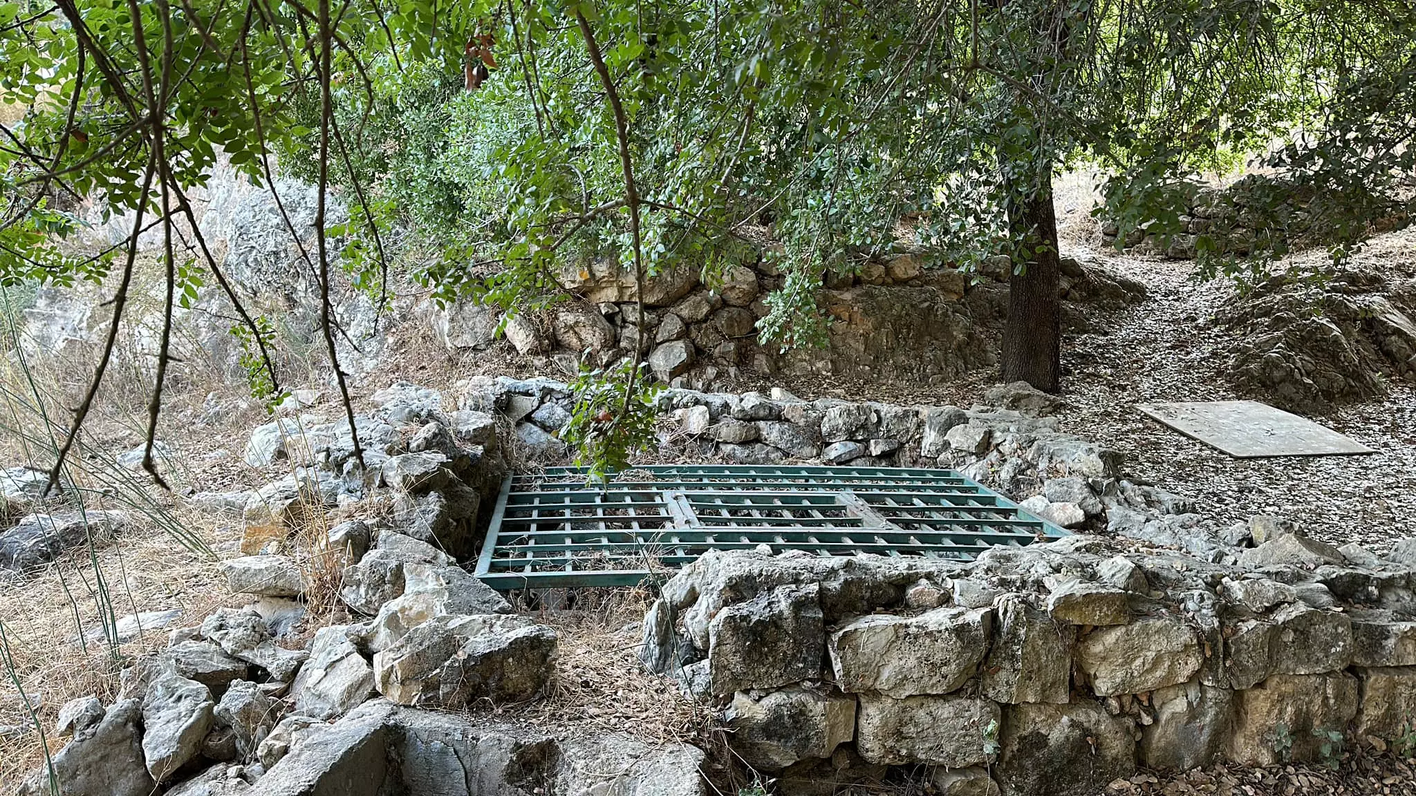
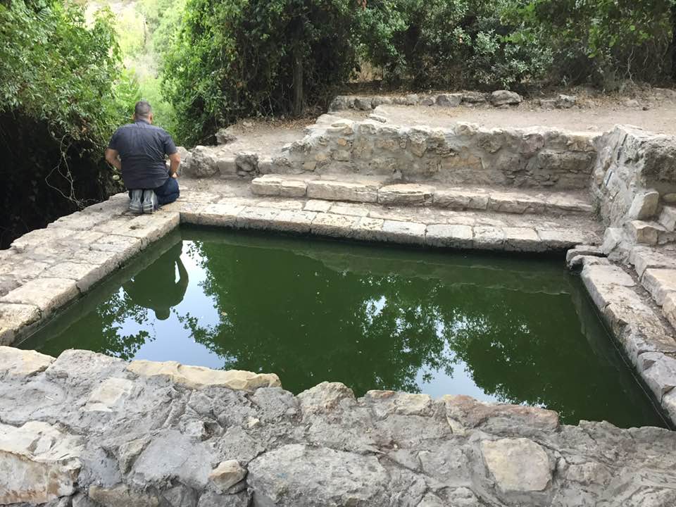
| Nearby Wadies & Rivers | The village overlooks Wadi Isma'il, which is a tributary to Wadi al-Sarar. | ||||||||||||
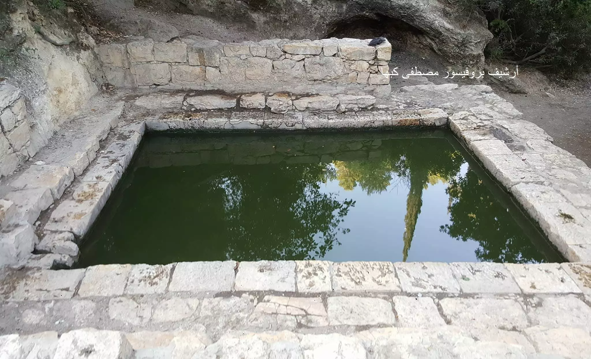
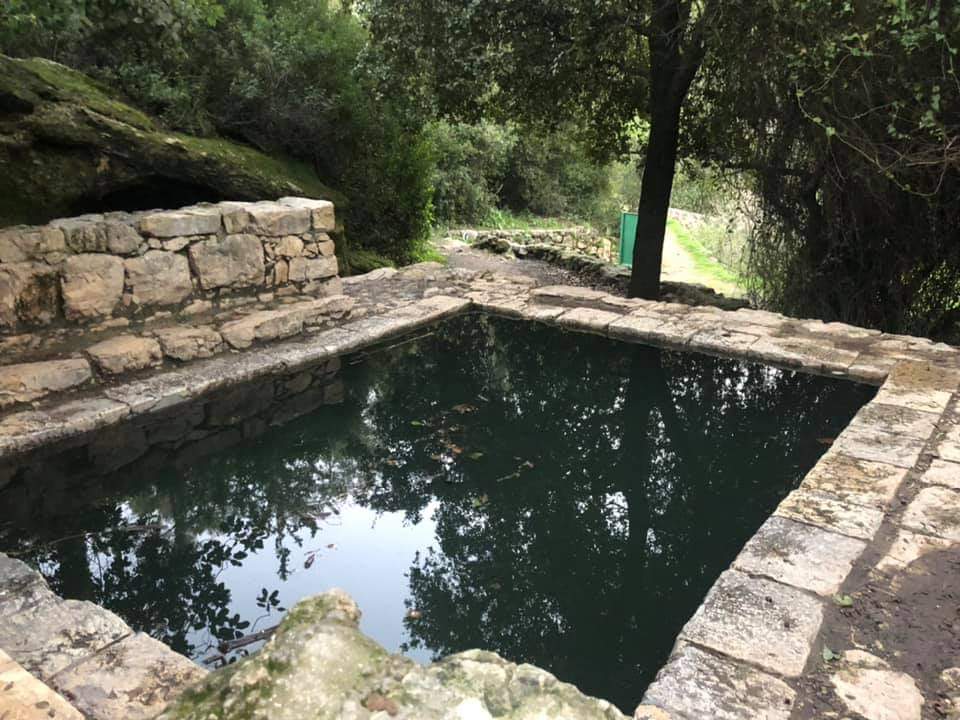
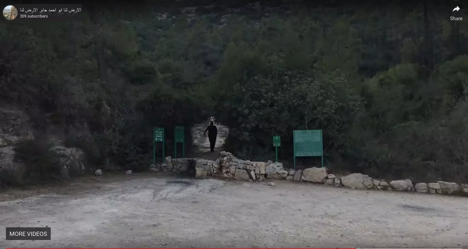
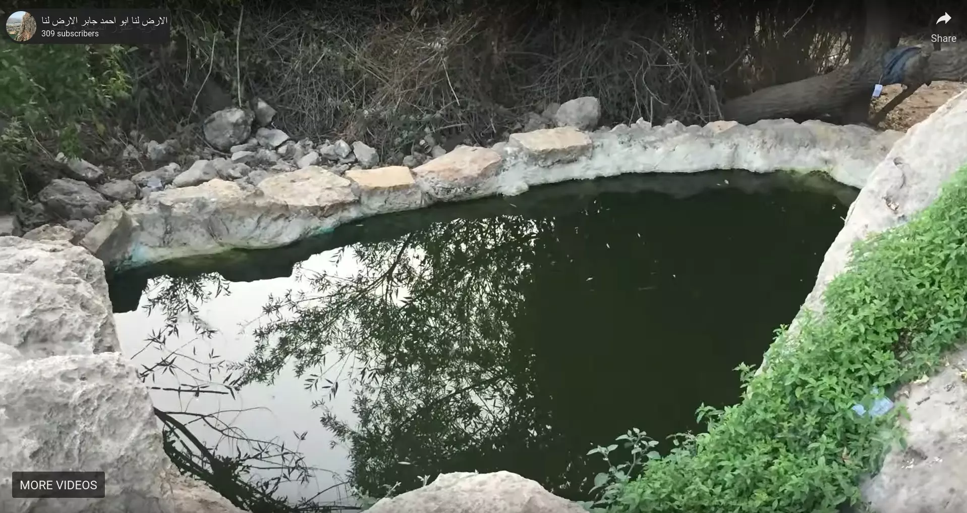
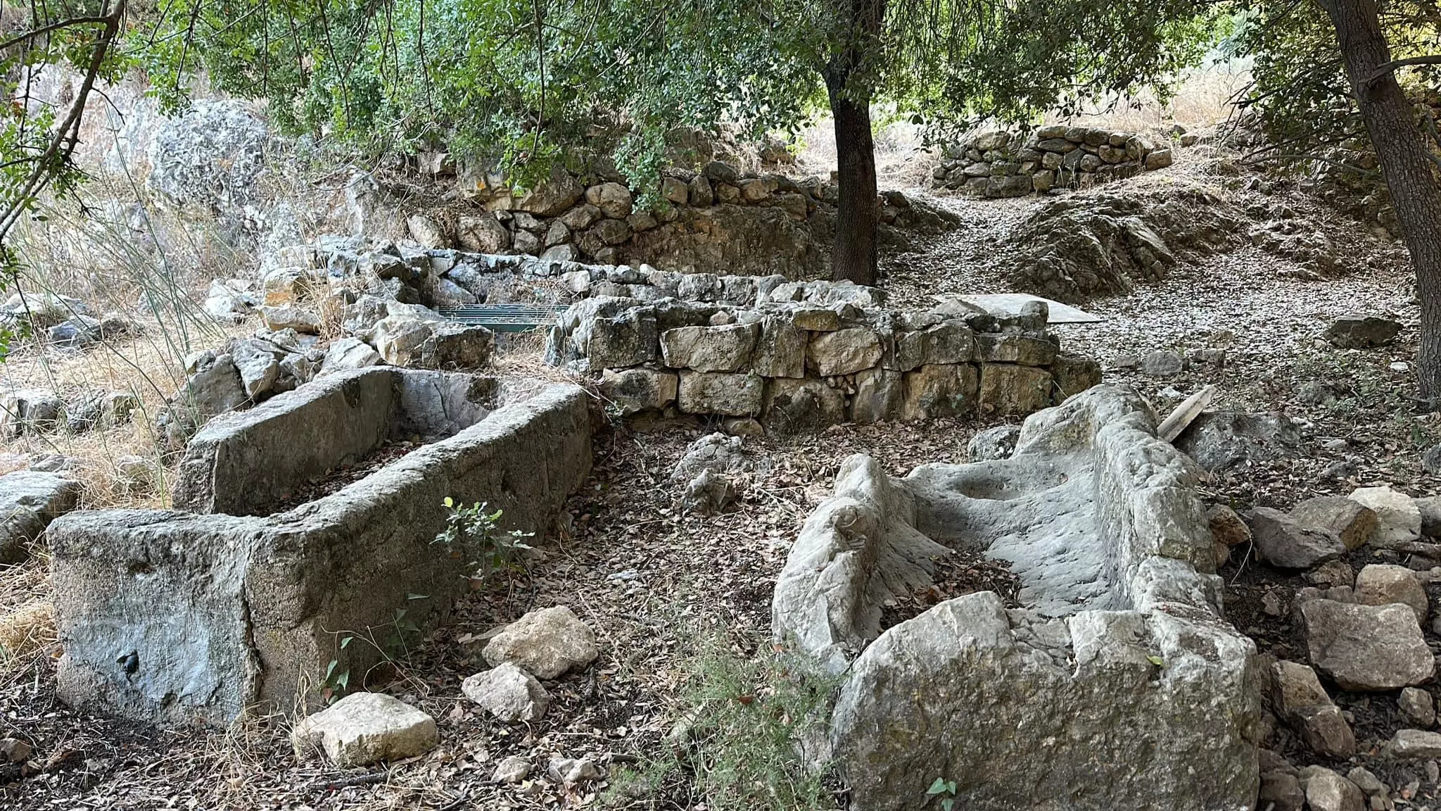
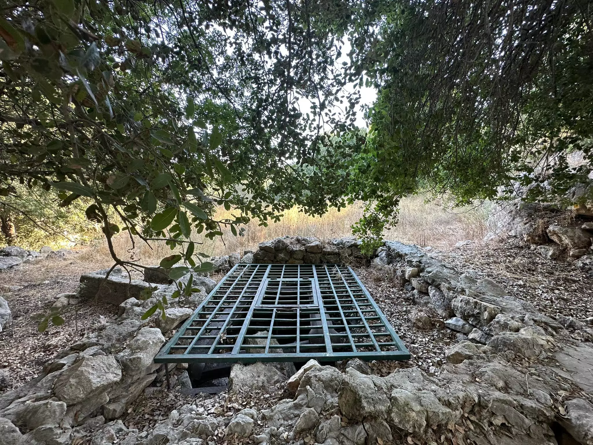
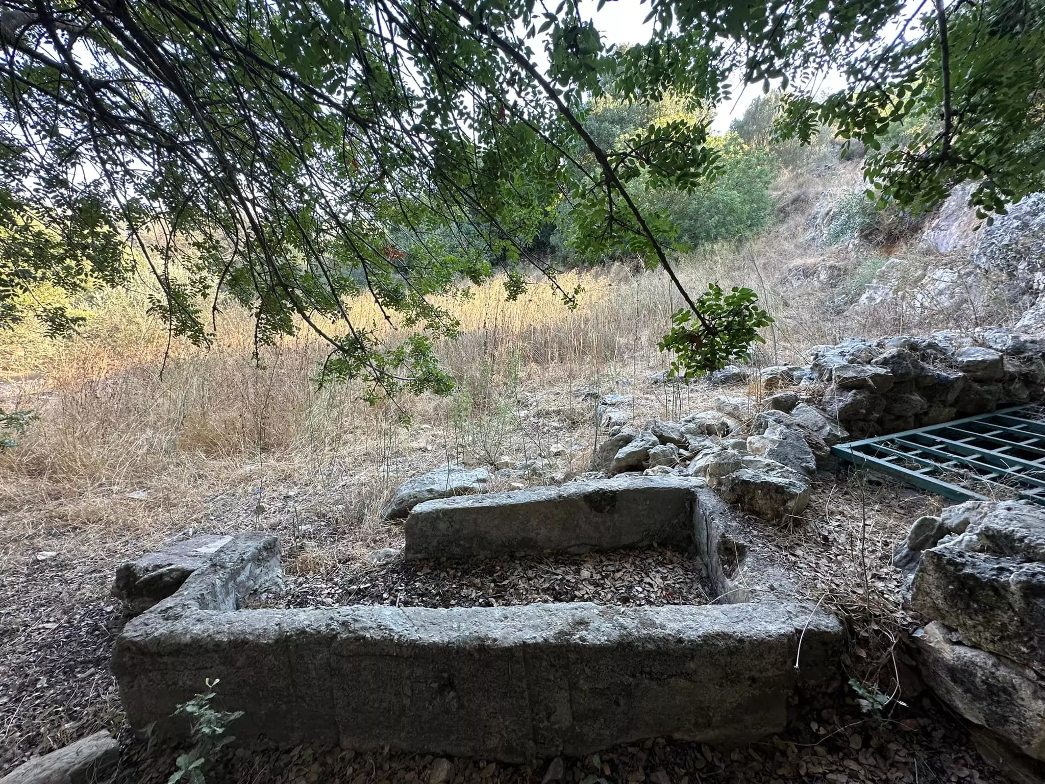
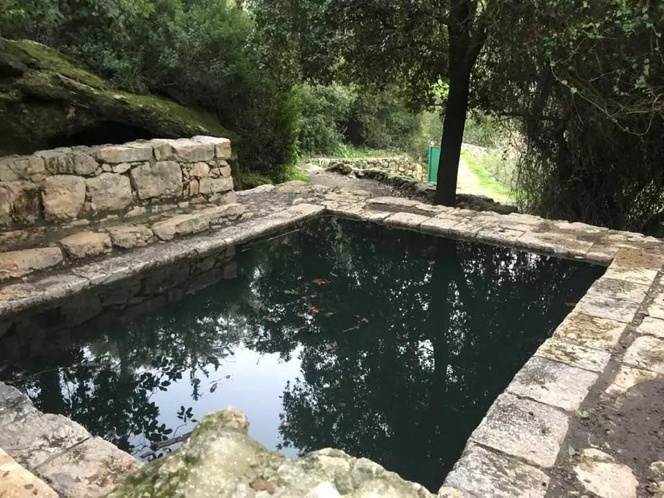
| Water Supply | The spring or 'Ayn al-Shaykh Ahmad Sulayman on southwestern edge of the village. | ||||||||||||
| Exculsive Jewish Colonies Who Usurped Village Lands |
No settlements on village land | ||||||||||||
| Featured Video | |||||||||||||
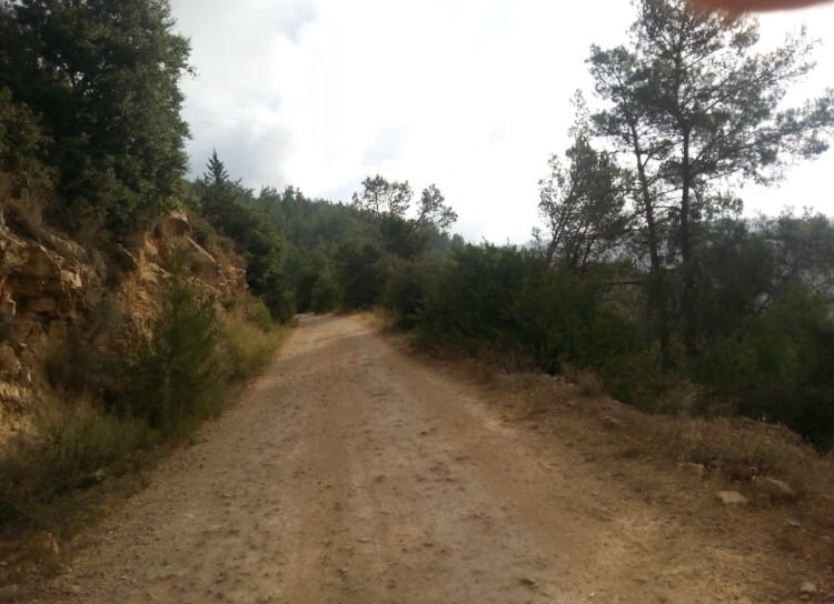
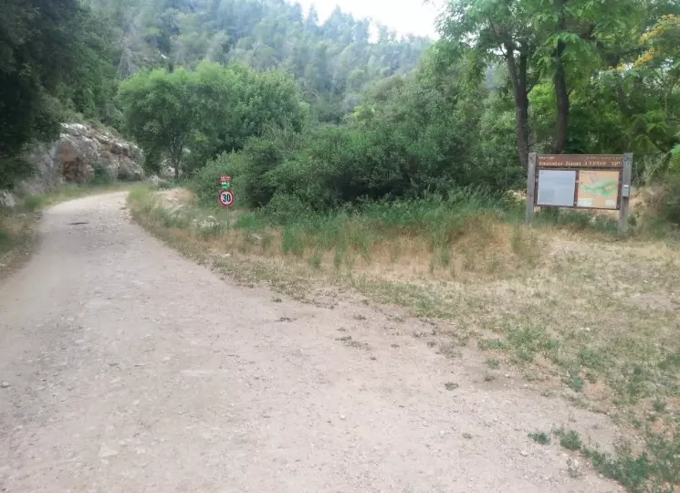
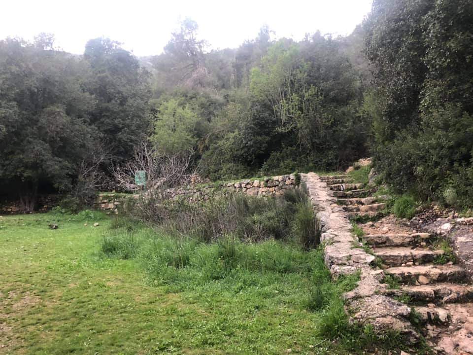
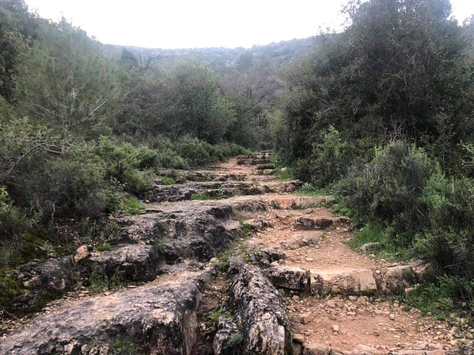
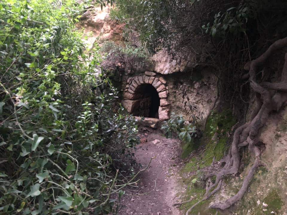
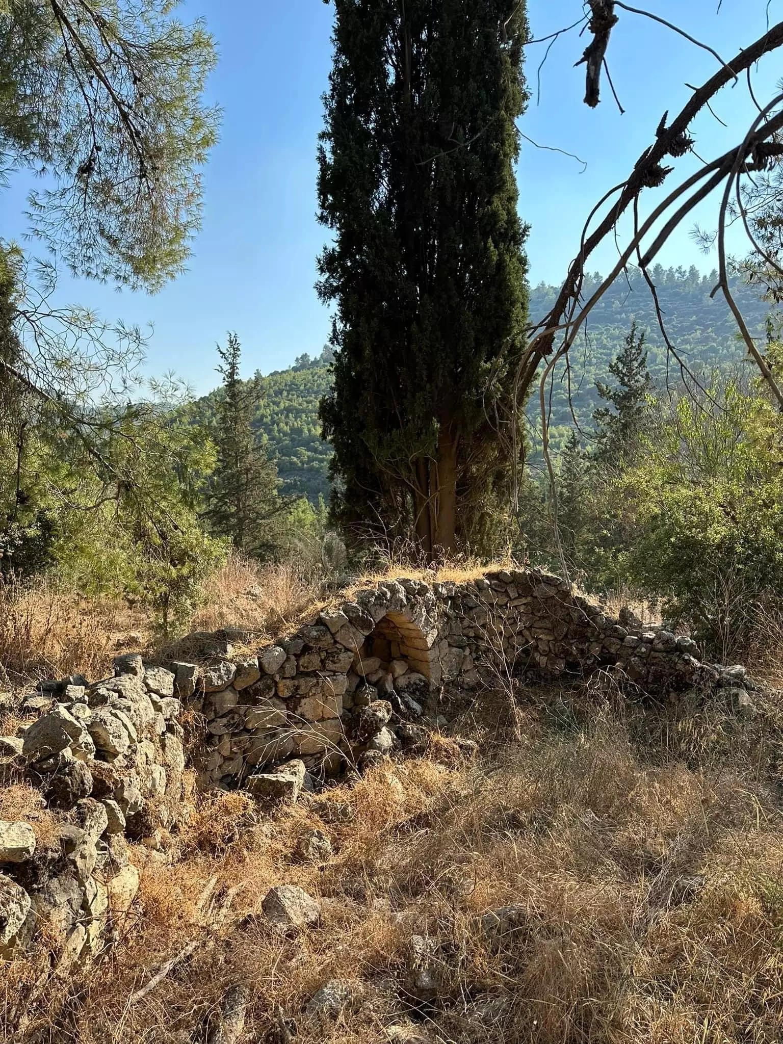
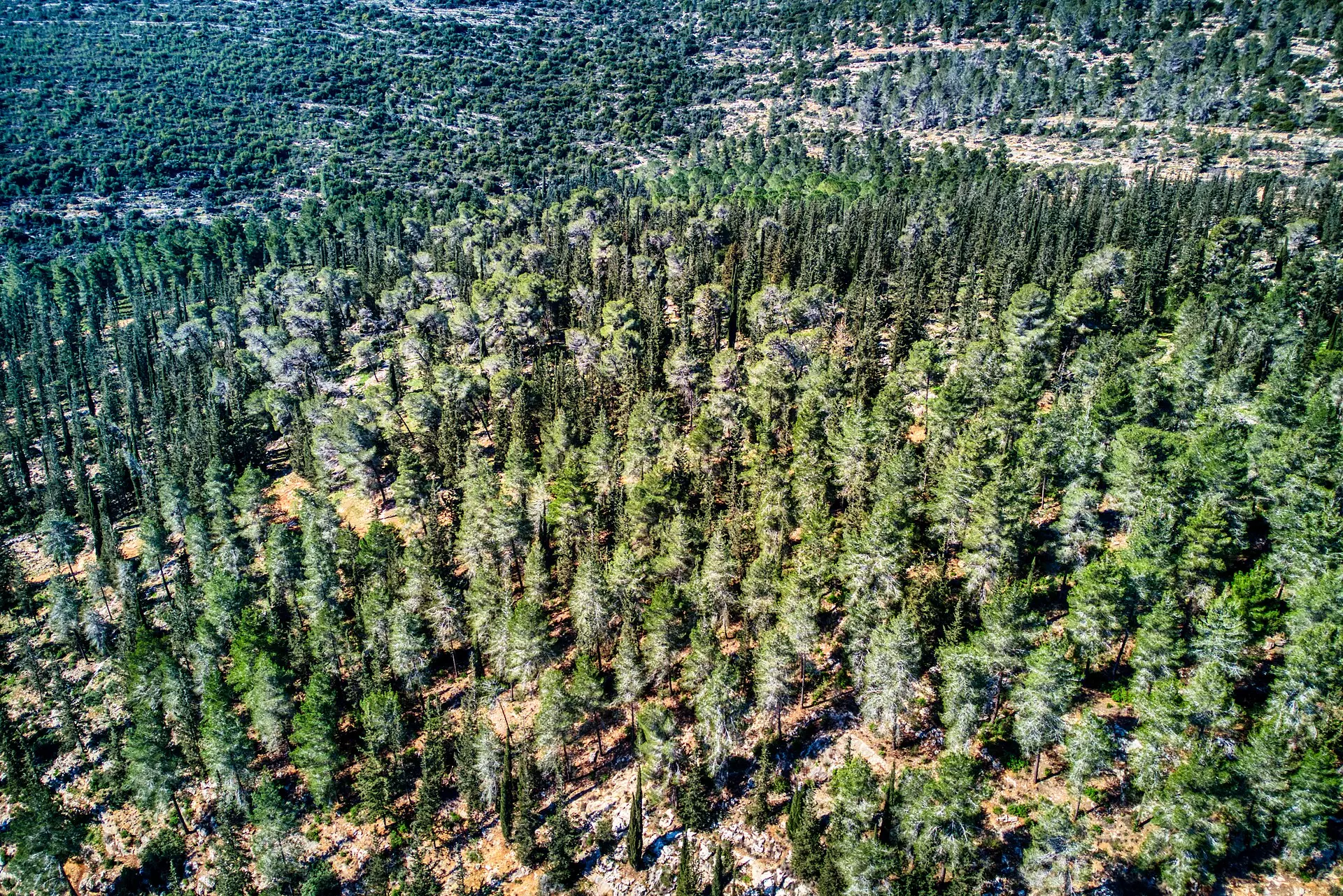
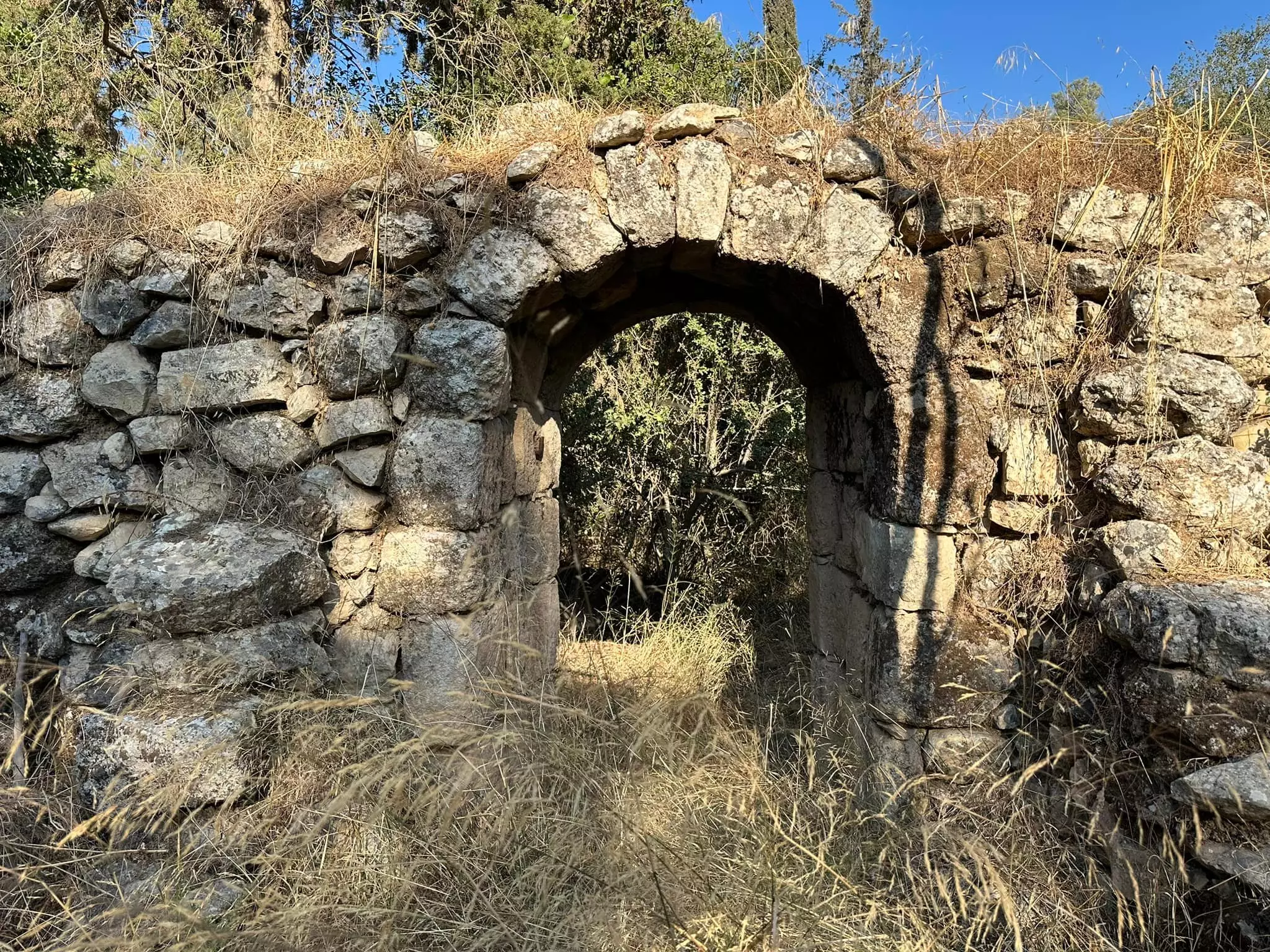
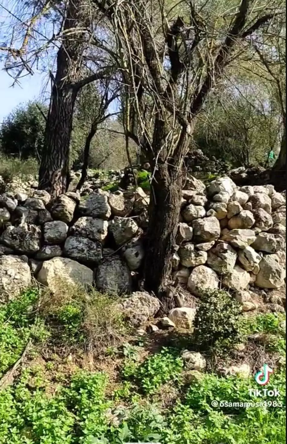
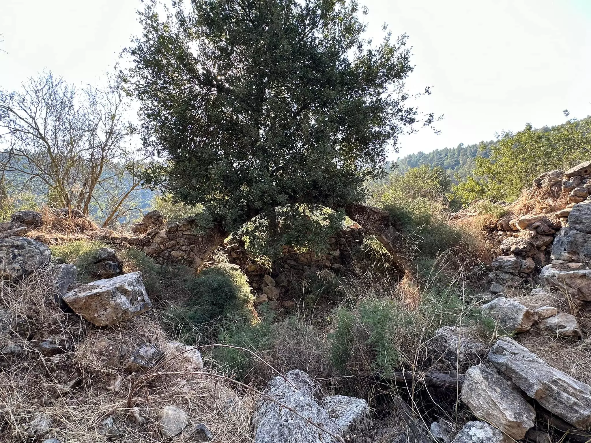
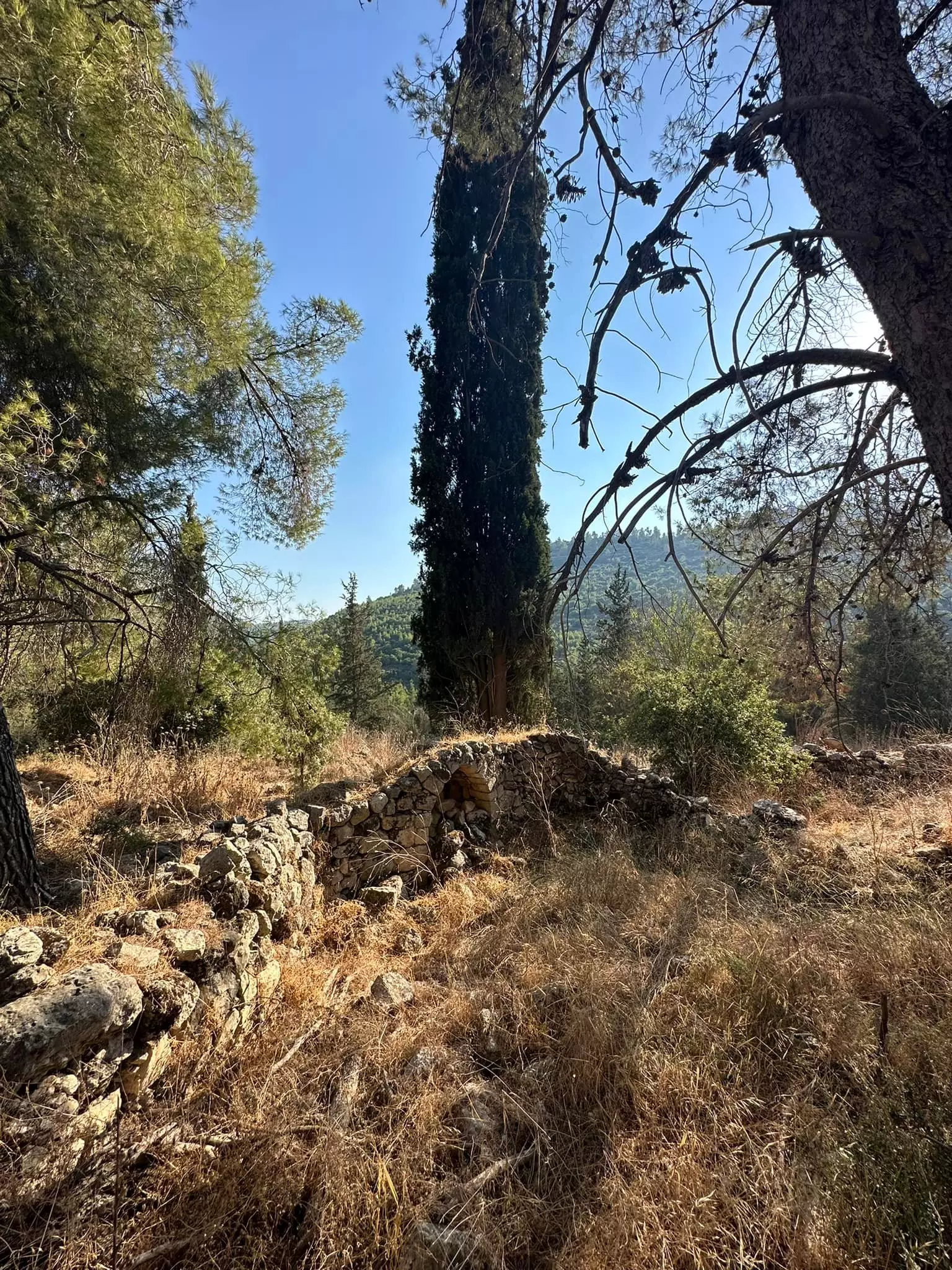
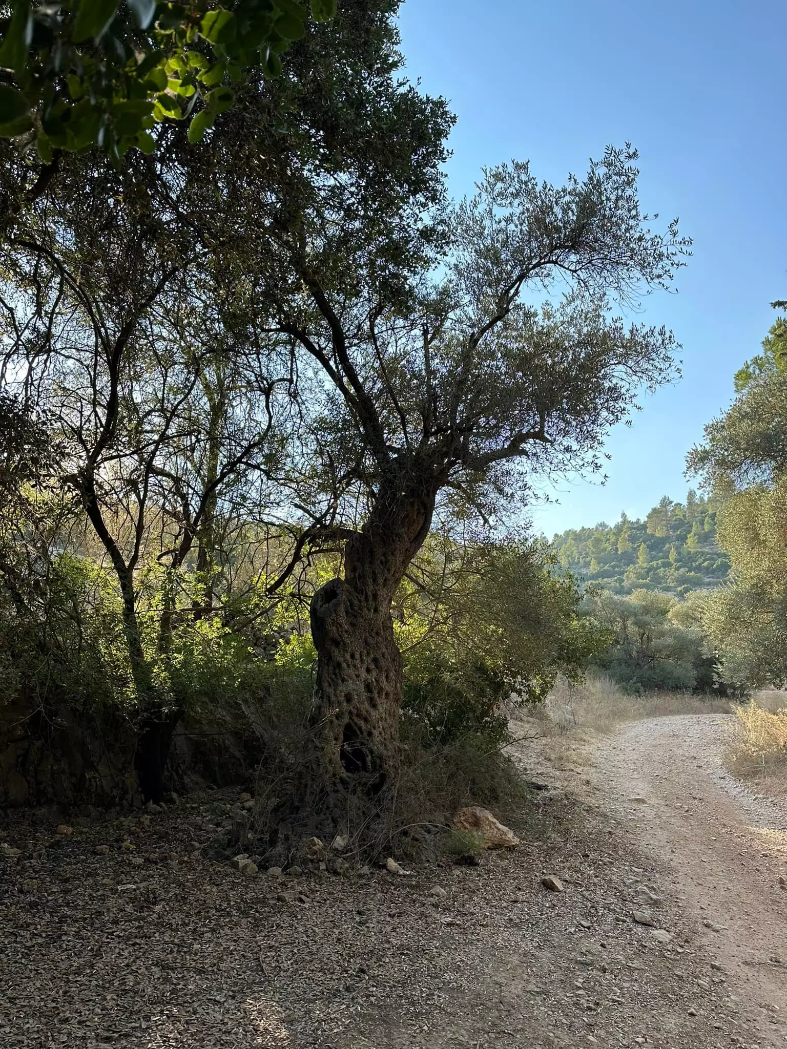
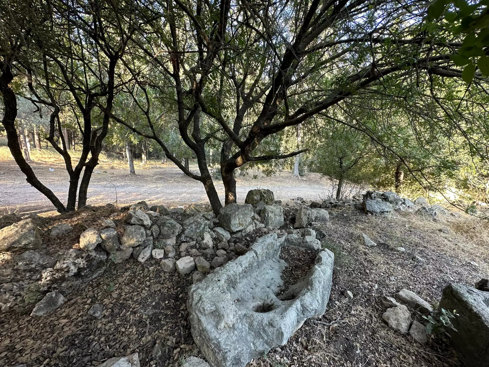
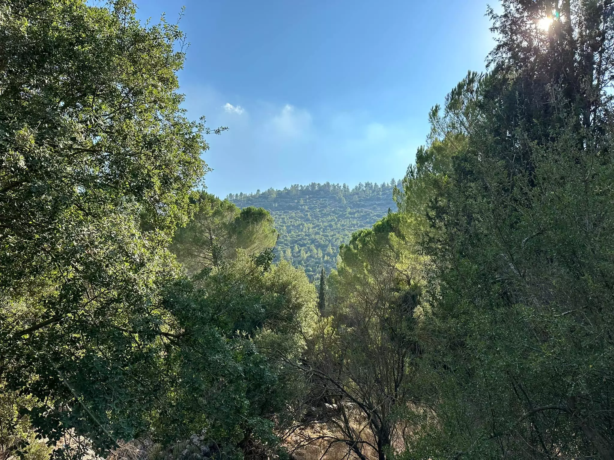
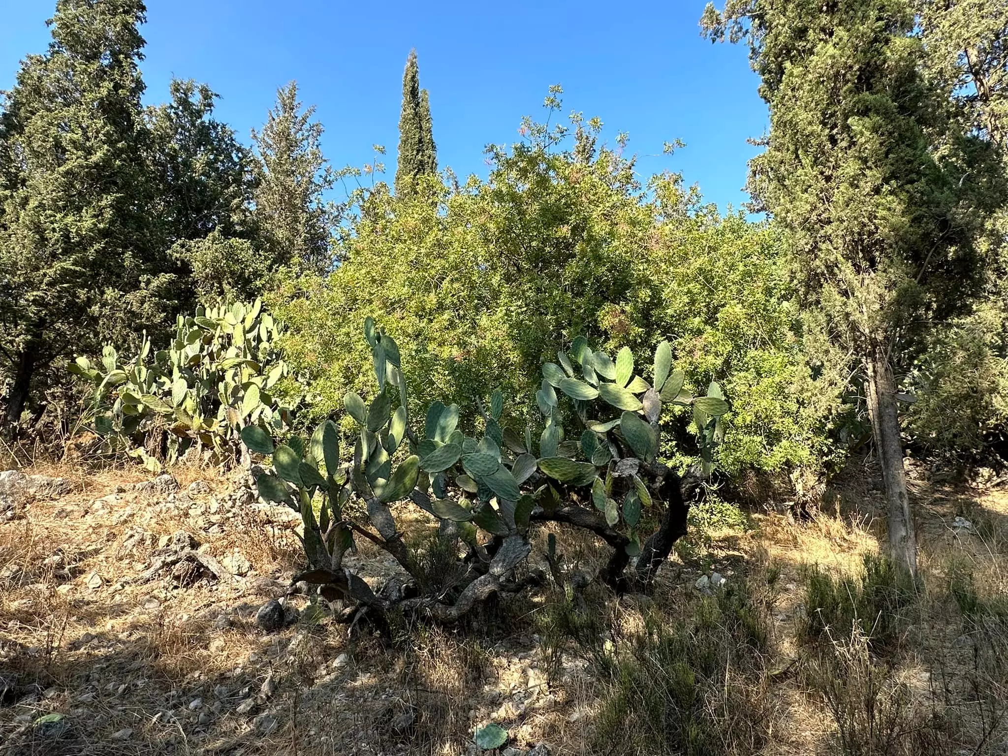
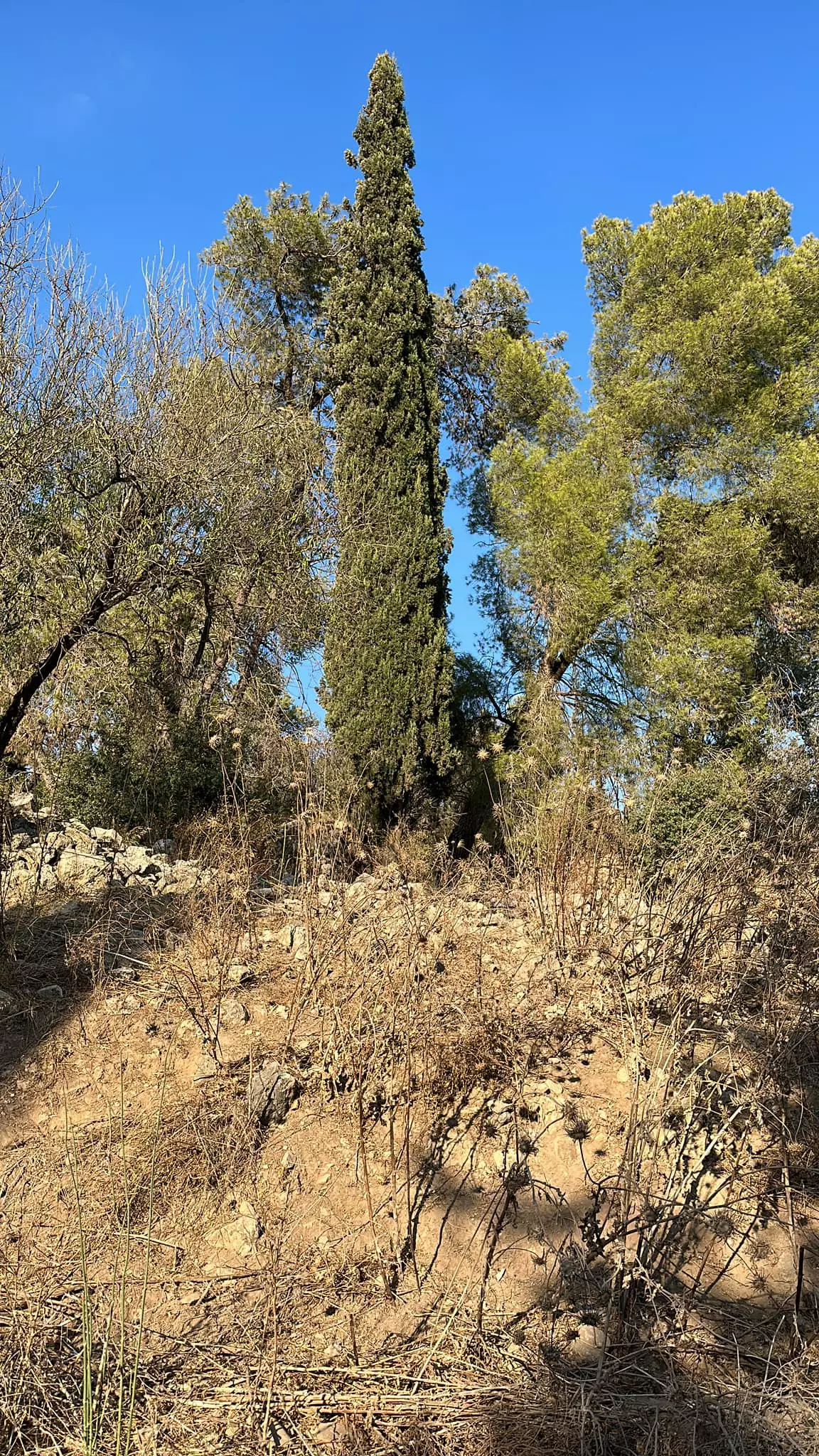
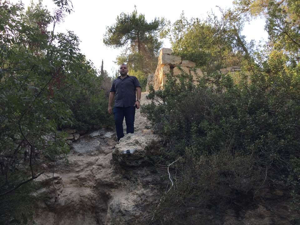
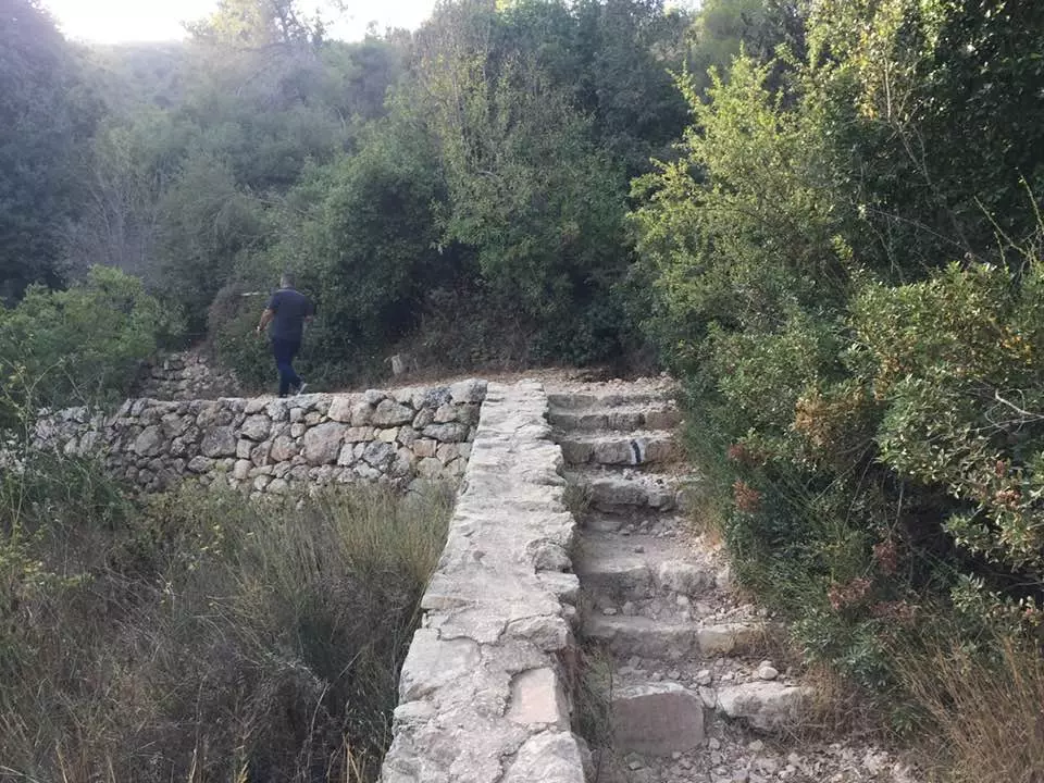
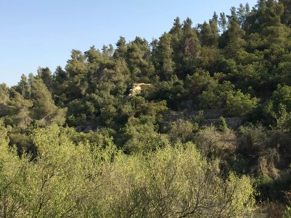
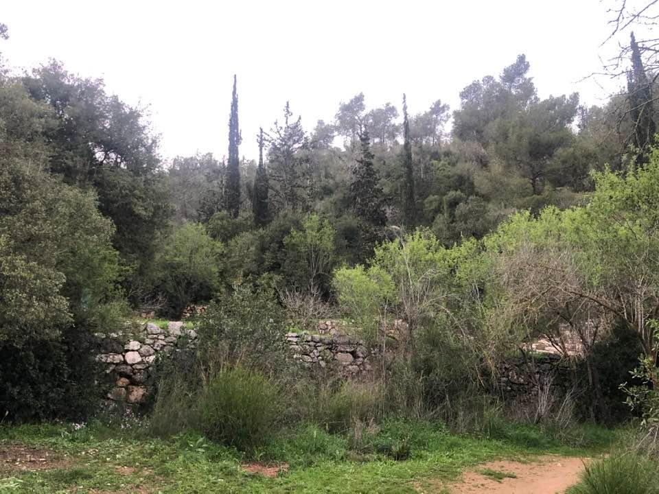
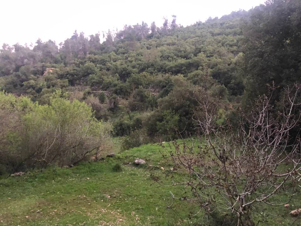
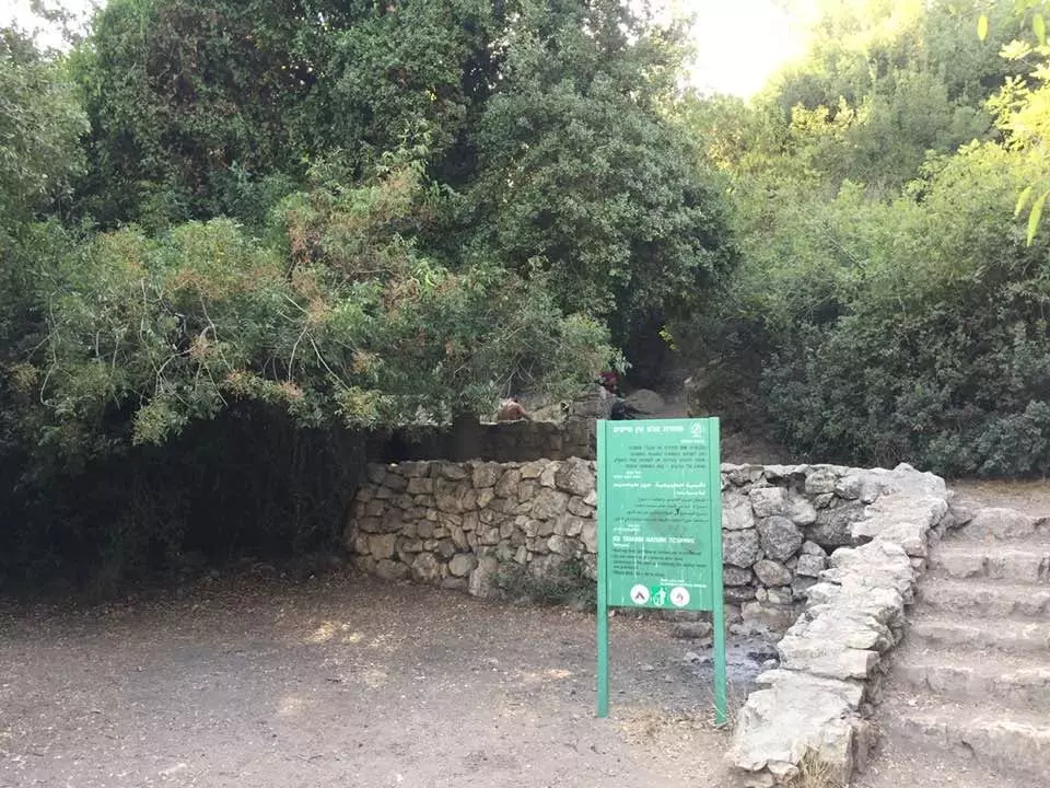
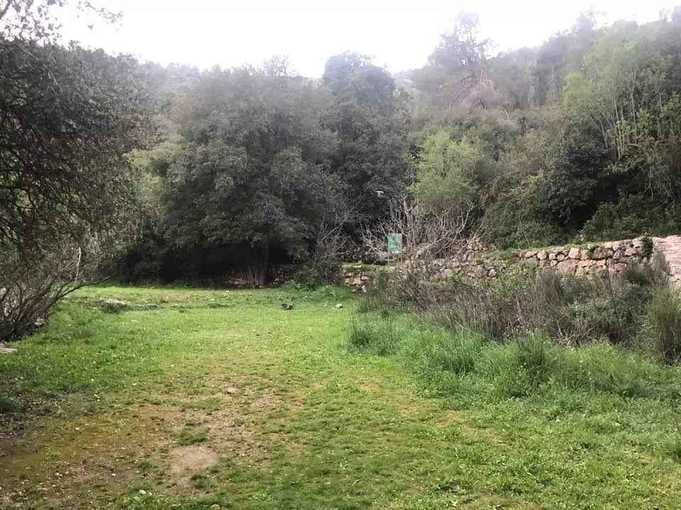
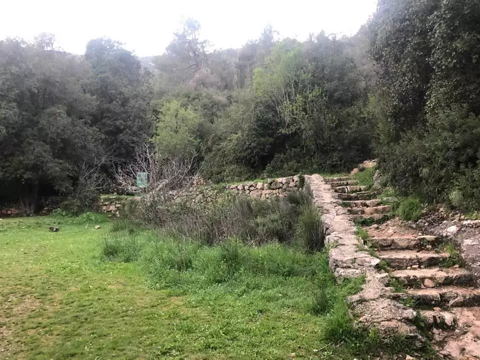
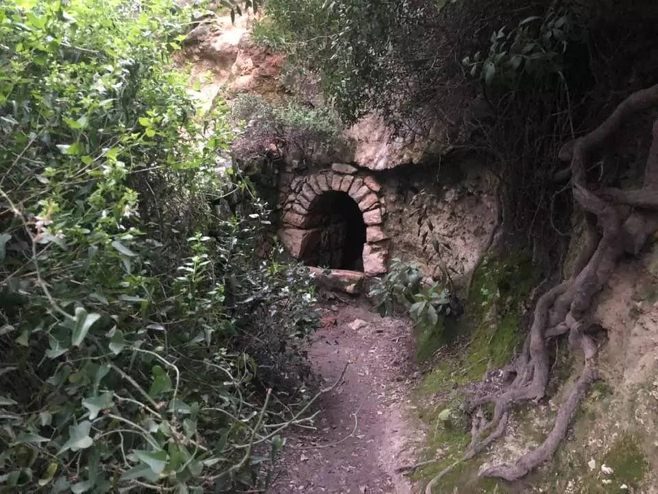
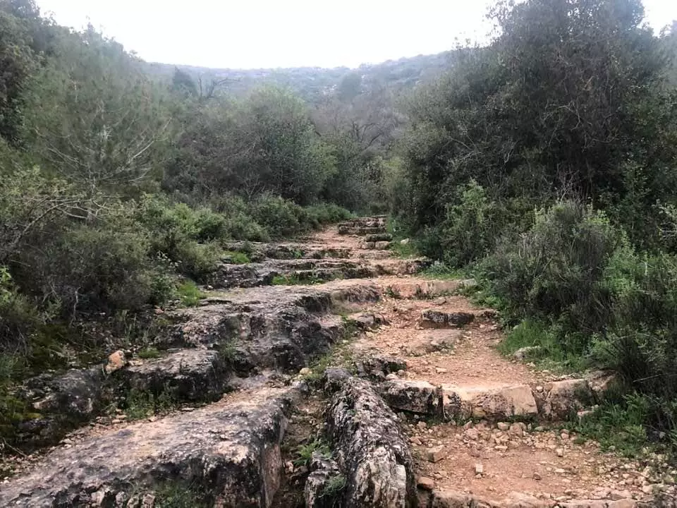
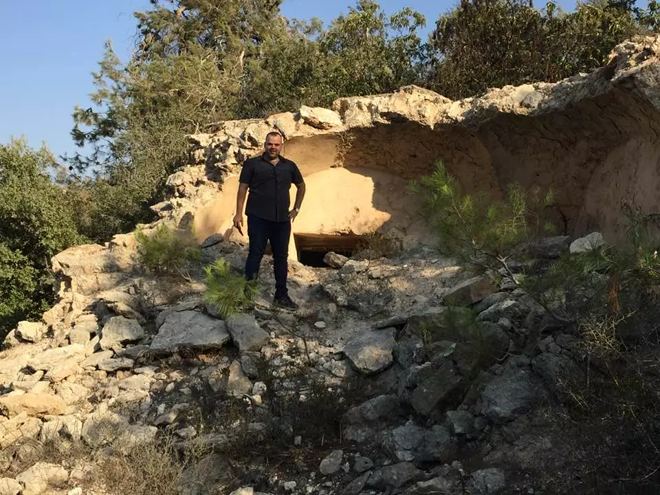
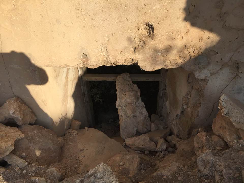
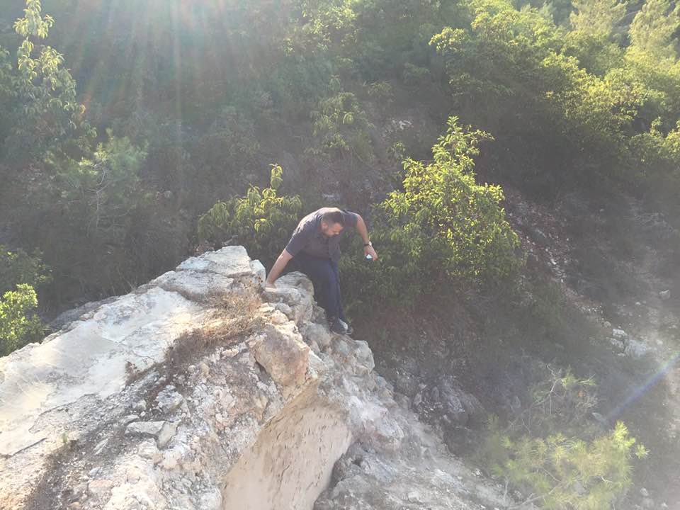
Village Before NakbaThe village stood on the lower eastern slope of Mt. Shaykh Ahmad Sulayman and faced south, where it overlooked Wadi Isma'il (a tributary of Wadi al-Sarar). The Jerusalem−Jaffa railway line passed along this wadi. Dirt paths linked 'Aqqur to other villages in the area. In the late nineteenth century, 'Aqqur was a small village built on a ridge and surrounded by very rugged ground. Under the Mandate, it was classified as a hamlet by the Palestine Index Gazetteer and had a small number of (mostly stone-built) houses that were crowded together in a semi-circular plan. The population was Muslim. Village agriculture was rainfed and was based on olives and grain. Olive trees surrounded the village on all sides, especially on the southern side, along Wadi Isma'il. In 1944/45 a total of 653 dunums was planted in cereals; 174 dunums were irrigated or used for orchards, 164 dunums of which were planted with olive trees. The adjacent slopes, covered with wild trees and herbs, were used for grazing and as a source of firewood. The maqam (shrine) and spring of Shaykh Ahmad Sulayman were on the southwestern edge of the village.Village Occupation and Ethnic CleaningIsraeli historian Benny Morris writes that the village was taken on 13−14 July 1948, during the second phase of Operation Dani (see Abu al-Fadl, Ramla sub-disctrict). But another Israeli source, the History of the Haganah, states that the village was occupied two months earlier (13 May), during the implementation of Plan Dalet. This information is probably incorrect, since the village is mentioned in connection with a few others which lie some 35 km to the west, near the city of Isdud. Moreover, the New York Times quoted an Egyptian communiqué which stated that 'Aqqur was entered by Egyptian forces just before the first truce, on 10 June. The statement did not say that the village had been seized from Israeli forces.Zionists Colonies on Village LandsThere are no Israeli settlements on village land.Village TodayA thick forest of fir and cypress trees has been planted on the site. Within the forest, stone rubble and the ruins of walls with arched openings and terraces are visible. Cactuses and fig, almond, and olive trees also grow on the site, along with grass and thorns. The forest was established by the Jewish National Fund in memory of Zvai Dubroski, Rose Marcus, and Fami Miliman of Los Angeles, and Sam and Rose Schneider of Detroit.SourceDr. Walid al-Khalidi, 1992: All That Remains. |
|||||||||||||
| Related Maps | Town Lands' Demarcation Maps خرائط للقضاء توضح حدود القرى والاودية Town's map on MapQuest View from satellite Help us map this town at WikiMapia |
||||||||||||
| Related Links | Wikipedia's Page Google Search Google For Images Google For Videos |
||||||||||||
| More Information | في كتاب كي لا ننسى في كتاب بلادنا فلسطين المزيد من موقع هوية |
||||||||||||
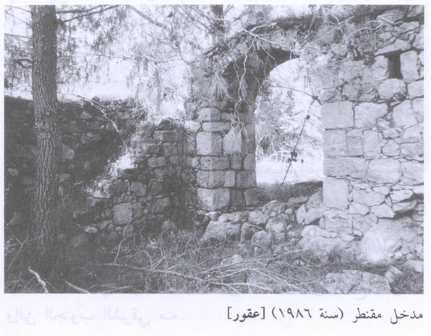
- An arched entrance to a destroyed village house, 1986
Scanned from "All That Remains" by Dr. Walid Khalidi - منظر من خربة اللوز باتجاه الجنوب الغربي والمنظر الثاني للمنطقه وسط الصوره الاولى من مكان اقرب لاراضي عقور
Posted by hussein abdo - جبال عقور
Posted by abu raya - عقور
Posted by abu raya - عقور
Posted by abu raya - الطبيعه في عقور
Posted by abu raya - عقور
Posted by abu raya - غابات عقور
Posted by abu raya - بيوت عقور
Posted by abu raya - بركة وعين القرية
1 - جولةةبين اطلال وانقاض وينابيع عاقور المدمرة والمهجرة
- جولةةبين اطلال وانقاض وينابيع عاقور المدمرة والمهجرة #2
- جولةةبين اطلال وانقاض وينابيع عاقور المدمرة والمهجرة #3
- جولةةبين اطلال وانقاض وينابيع عاقور المدمرة والمهجرة #4
- جولة بين انقاض وكروم وينابيع قرية عقور المهجره
- جولة بين انقاض وكروم وينابيع قرية عقور المهجره #2
- جولة بين انقاض وكروم وينابيع قرية عقور المهجره #3
- جولة بين انقاض وكروم وينابيع قرية عقور المهجره #4
- جولة بين انقاض وكروم وينابيع قرية عقور المهجره #5
- جولة بين انقاض وكروم وينابيع قرية عقور المهجره #6
- جولة بين انقاض وكروم وينابيع قرية عقور المهجره #7
- جولة بين انقاض وكروم وينابيع قرية عقور المهجره #8
- جولة بين انقاض وكروم وينابيع قرية عقور المهجره #9
- جولة بين انقاض وكروم وينابيع قرية عقور المهجره #10
- That is how the "civilized" erased and replaced us: 'Aqqur was completely obliterated, as you see -- عقور باتت أثر بعد عين. من هنا مر الهمجّ
- That is how the "civilized" erased and replaced us: 'Aqqur was completely obliterated, as you see -- عقور باتت أثر بعد عين. من هنا مر الهمجّ #2
- That is how the "civilized" erased and replaced us: 'Aqqur was completely obliterated, as you see -- عقور باتت أثر بعد عين. من هنا مر الهمجّ #3
- That is how the "civilized" erased and replaced us: 'Aqqur was completely obliterated, as you see -- عقور باتت أثر بعد عين. من هنا مر الهمجّ #4
- That is how the "civilized" erased and replaced us: 'Aqqur was completely obliterated, as you see -- عقور باتت أثر بعد عين. من هنا مر الهمجّ #5
- That is how the "civilized" erased and replaced us: 'Aqqur was completely obliterated, as you see -- عقور باتت أثر بعد عين. من هنا مر الهمجّ #6
- That is how the "civilized" erased and replaced us: 'Aqqur was completely obliterated, as you see -- عقور باتت أثر بعد عين. من هنا مر الهمجّ 7
- That is how the "civilized" erased and replaced us: 'Aqqur was completely obliterated, as you see -- عقور باتت أثر بعد عين. من هنا مر الهمجّ #8
- That is how the "civilized" erased and replaced us: 'Aqqur was completely obliterated, as you see -- عقور باتت أثر بعد عين. من هنا مر الهمجّ
- That is how the "civilized" erased and replaced us: 'Aqqur was completely obliterated, as you see -- عقور باتت أثر بعد عين. من هنا مر الهمجّ
#2
- That is how the "civilized" erased and replaced us: 'Aqqur was completely obliterated, as you see -- عقور باتت أثر بعد عين. من هنا مر الهمجّ
#3
- That is how the "civilized" erased and replaced us: 'Aqqur was completely obliterated, as you see -- عقور باتت أثر بعد عين. من هنا مر الهمجّ
#4
- That is how the "civilized" erased and replaced us: 'Aqqur was completely obliterated, as you see -- عقور باتت أثر بعد عين. من هنا مر الهمجّ
#5
- That is how the "civilized" erased and replaced us: 'Aqqur was completely obliterated, as you see -- عقور باتت أثر بعد عين. من هنا مر الهمجّ
#6
- That is how the "civilized" erased and replaced us: 'Aqqur was completely obliterated, as you see -- عقور باتت أثر بعد عين. من هنا مر الهمجّ
#7
- That is how the "civilized" erased and replaced us: 'Aqqur was completely obliterated, as you see -- عقور باتت أثر بعد عين. من هنا مر الهمجّ
#8
- That is how the "civilized" erased and replaced us: 'Aqqur was completely obliterated, as you see -- عقور باتت أثر بعد عين. من هنا مر الهمجّ
#9
- That is how the "civilized" erased and replaced us: 'Aqqur was completely obliterated, as you see -- عقور باتت أثر بعد عين. من هنا مر الهمجّ
#10
- That is how the "civilized" erased and replaced us: 'Aqqur was completely obliterated, as you see -- عقور باتت أثر بعد عين. من هنا مر الهمجّ
#11
- That is how the "civilized" erased and replaced us: 'Aqqur was completely obliterated, as you see -- عقور باتت أثر بعد عين. من هنا مر الهمجّ
#12
- That is how the "civilized" erased and replaced us: 'Aqqur was completely obliterated, as you see -- عقور باتت أثر بعد عين. من هنا مر الهمجّ
#13
- That is how the "civilized" erased and replaced us: 'Aqqur was completely obliterated, as you see -- عقور باتت أثر بعد عين. من هنا مر الهمجّ
#14
- That is how the "civilized" erased and replaced us: 'Aqqur was completely obliterated, as you see -- عقور باتت أثر بعد عين. من هنا مر الهمجّ
#15
- That is how the "civilized" erased and replaced us: 'Aqqur was completely obliterated, as you see -- عقور باتت أثر بعد عين. من هنا مر الهمجّ
#16
- That is how the "civilized" erased and replaced us: 'Aqqur was completely obliterated, as you see -- عقور باتت أثر بعد عين. من هنا مر الهمجّ
#17
- That is how the "civilized" erased and replaced us: 'Aqqur was completely obliterated, as you see -- عقور باتت أثر بعد عين. من هنا مر الهمجّ
#18
- That is how the "civilized" erased and replaced us: 'Aqqur was completely obliterated, as you see -- عقور باتت أثر بعد عين. من هنا مر الهمجّ
#19
- That is how the "civilized" erased and replaced us: 'Aqqur was completely obliterated, as you see -- عقور باتت أثر بعد عين. من هنا مر الهمجّ
#20
- That is how the "civilized" erased and replaced us: 'Aqqur was completely obliterated, as you see -- عقور باتت أثر بعد عين. من هنا مر الهمجّ
#21
- The shrine/maqam of al-Sheikh al-Wili Ahmad Sulayman -- 2023 -- بقايا مقام الشيخ الولي أحمد السليمان

- That is how the "civilized" erased and replaced us: 'Aqqur was completely obliterated, as you see -- عقور باتت أثر بعد عين. من هنا مر الهمجّ
- That is how the "civilized" erased and replaced us: 'Aqqur was completely obliterated, as you see -- عقور باتت أثر بعد عين. من هنا مر الهمجّ #2
- That is how the "civilized" erased and replaced us: 'Aqqur was completely obliterated, as you see -- عقور باتت أثر بعد عين. من هنا مر الهمجّ #3
- That is how the "civilized" erased and replaced us: 'Aqqur was completely obliterated, as you see -- عقور باتت أثر بعد عين. من هنا مر الهمجّ #4
- That is how the "civilized" erased and replaced us: 'Aqqur was completely obliterated, as you see -- عقور باتت أثر بعد عين. من هنا مر الهمجّ #5
- That is how the "civilized" erased and replaced us: 'Aqqur was completely obliterated, as you see -- عقور باتت أثر بعد عين. من هنا مر الهمجّ #6
- That is how the "civilized" erased and replaced us: 'Aqqur was completely obliterated, as you see -- عقور باتت أثر بعد عين. من هنا مر الهمجّ #7
- That is how the "civilized" erased and replaced us: 'Aqqur was completely obliterated, as you see -- عقور باتت أثر بعد عين. من هنا مر الهمجّ #8
- That is how the "civilized" erased and replaced us: 'Aqqur was completely obliterated, as you see -- عقور باتت أثر بعد عين. من هنا مر الهمجّ #9
- That is how the "civilized" erased and replaced us: 'Aqqur was completely obliterated, as you see -- عقور باتت أثر بعد عين. من هنا مر الهمجّ #10
- That is how the "civilized" erased and replaced us: 'Aqqur was completely obliterated, as you see -- عقور باتت أثر بعد عين. من هنا مر الهمجّ #11
- That is how the "civilized" erased and replaced us: 'Aqqur was completely obliterated, as you see -- عقور باتت أثر بعد عين. من هنا مر الهمجّ #12
- That is how the "civilized" erased and replaced us: 'Aqqur was completely obliterated, as you see -- عقور باتت أثر بعد عين. من هنا مر الهمجّ #13
- That is how the "civilized" erased and replaced us: 'Aqqur was completely obliterated, as you see -- عقور باتت أثر بعد عين. من هنا مر الهمجّ #14
- That is how the "civilized" erased and replaced us: 'Aqqur was completely obliterated, as you see -- عقور باتت أثر بعد عين. من هنا مر الهمجّ #15
- That is how the "civilized" erased and replaced us: 'Aqqur was completely obliterated, as you see -- عقور باتت أثر بعد عين. من هنا مر الهمجّ #16
- That is how the "civilized" erased and replaced us: 'Aqqur was completely obliterated, as you see -- عقور باتت أثر بعد عين. من هنا مر الهمجّ #17
- That is how the "civilized" erased and replaced us: 'Aqqur was completely obliterated, as you see -- عقور باتت أثر بعد عين. من هنا مر الهمجّ #18
Want to browse more? 80,000 pictures were grouped in these gallaries:
| Display Name | Clan/Hamolah | Country of Residence |
- زيارة خاطفة لقرية عاقور المهجرة Duration: min 2 sec
- جبل الاكراد في عقور المهجرة Duration: 2 min 52 sec
- قرية عقور المهجرة Duration: 5 min 20 sec
No links have been shared yet, be free to the first to share the first link.
 Fake Valor: Why Did Zionist Jews Hoist Nazis Flag on Their Ships in the 1930s?
What is new?
-
Facts About Oct. 7th Gaza Raid
-
Remined Us Please:: Who Did Rape Who? Palestinians Raped Israelis? Or, was the other way around?
-
When Prof. Edward Said was invited to debate Bibi Netanyahu in the 1980s, watch what happened!
-
Ezra Klein of the NY Times on the "Jewish Race".
-
Abusing Blood Libel!
-
Did Israeli Soldiers Activate The Hanniba Direective On Oct. 7th? You Be The Judge
-
Zionist FAQ: Isn't it true that Palestinians don't want peace? Palestinians never accepted the two-state solution
- Facts about Haavara (Transfer) Agreement between Ben-Gurion & Hitler
-
Haavara FAQs: Why Did Zionist Jews Hoist Nazis' Flags on Their Ships in the 1930s?
- Haavara FAQs: When Chaim Weizmann met FDR in mid-1943, why was he silent about rescuing European Jewry?
-
Dear ChatGPT: How did Palestinians resist Napoleon's invasion of their country in 1799?
-
Dear ChatGPT: Gaza had a vibrant Jewish community in the mid-17th century. What happened to them?
-
Dear ChatGPT: Why did the Jewish Agency suppress news of the Holocaust during WWII?
-
Video Playlist: Jews share their DNA tests to end the conflict for good.
-
A Tale of Two Conflicts: Examining the Definition of Genocide
-
Prof. Abraham Polak And The Suppressed History of the Khazars and European Jewry
-
How Ronald Reagan would have framed the genocide in Gaza if he were still alive?
-
Haavara FAQs: Let us do the math: how many German Jews did The Haavara Agreement save?
-
Zionist FAQs: The Hebron Massacre of 1929, "clearly proves" that Palestinians are antisemitic, how could you deny it?
-
Zionist FAQs: Why Anti-Zionist Is Not Antisemitism?
-
Zionist FAQs: Isn't it true that the KGB created Palestinian Nationalism in the early 1960s?
- Zionist FAQs: Muslims are killing Muslims all the time; why are Israeli Jews being singled out in the media?
- Zionist FAQs: How is Israel an apartheid state when 20% of its citizens are Arabs who enjoy full rights?
-
Haavara FAQs: Why Did Dorothy Thompson Flip From A Zionist Advocate to A Silenced Dissenter?
-
Haavara FAQs: Analysis of Herzl's Uganda Scheme and how it could have saved millions of Jews.
-
Haavara FAQs: Why did Hayim Greenberg describe American Jewry as "morally bankrupt" in early 1943?
-
Haavara FAQs: What if the Evian Conference was a resounding success? What would have been the impact of saving European Jewry on Zionism?
- Haavara FAQs: What if the six million were saved, how that would have impacted the Zionist project?
-
Haavara FAQs: How did Zionist leaders react when Europe's Jews lingered in the DP camps after WWII ended?
-
Why does the American Jewish community repeat lies that David Ben-Gurion had debunked before he died?
-
Who has the power to rename the Tatar/Khazar Gene Marker to Jewish IV?
-
Zionist FAQs: Why won't Egypt, Syria, and Jordan take their people back? Jews are indigenous to Palestine, and Arabs immigrated after Jews developed the country. Arabs should leave.
-
Haavara FAQs: Did Hitler and the Nazis conflate between Judaism and Zionist? If that wasn't case, then why?
-
Haavara FAQs: Winston Churchill and antisemitism, a collection of articles written Churchill.
-
Haavara FAQs: Broken by country, how many Jews survived vs. killed during the Holocaust?
-
Haavara FAQs: Why did European Jews vote with their feet and to immigrated to the Americas, not Palestine, after WWII?
-
Watch this American Jewish Girl describing Israeli Jews' cognitive dissonance like no other in under two minutes
-
Haavara FAQs: When the Nazis went out of their way to hide the Holocaust, Israeli Jews did the exact opposite by broadcasting their genocide of Gazans. But why?
-
Haavara FAQs: How Zionist Jews went out of their to show their appreciation to Nazism and Fascism?
- Haavara FAQs: Why Zionist leaders were against bombing the death camps & the Railroads leading to them?
-
Haavara FAQs: Hitler's message to the British and American people: If Jews are such noble citizens and you care about them, how come you're not letting them in? I will gladly ship them to you at my expense, even on luxury liners!
-
A shortlist of Zionist and Israeli false flag operations in the name Jews.
-
The Most Moral Army
- The Land of Kapos (Israel): Where the brave are boycotted and Kapos walk free.
- Why did early Zionists often named their communal enterprises "colonial"?
- Zionist Relations with Nazi Germany by Faris Glubb
-
Two NY Times advertisements by Zionists in the early 1943 that exposes Zionists' treason at the height of the calamity
- Facts Not Lies about the Palestinian-Israeli Conflict.
- Site's pictures have been categorized
- Campgain Against Lice
- A Survey of Palestine, the official source about Palestine before Nakba produced by the British Mandate; over 1200 pages.
- Satellite View & Google Earth: Over 6,000 placemarks identifying all destroyed towns, W. Bank & Gaza Strip Towns, & refugee camps.
- PalestineRemembered.com and its Nakba Oral History Project were featured on al-Jazeera Satellite TV.
- Nakba Oral History Video Podcast:
 Over 700 Oral History interviews (including 3,500+ hours of recording) can be viewed online.
 - Palestine Village Statistics Project
- Gaza Jail Break
- النسخة العربية للموقع الان متوفرة
- Videos: Documenting the destroyed villages in video: Tracing all that remains since Nakba.
- Videos: Responding to Zionist Propaganda
- Interview: The ethnic cleansing of Palestine: George Galloway interviews Israeli Historian Ilan Pappe.
- For Palestinians, memory matters. It provides a blueprint for their future By George Bisharat.
- Zionist FAQ now available in Hebrew שאלות שציונים שואלים, עכשיו בעברית
- Video: The Stephen Walt and John Mearsheimer report on the influence of the Israel Lobby on U.S. Foreign Policy
- The Palestinian-Israeli conflict for beginners
