| PalestineRemembered | About Us | Oral History | العربية | |
| Pictures | Zionist FAQs | Haavara | Maps | |
| Search |
| Camps |
| Districts |
| Acre |
| Baysan |
| Beersheba |
| Bethlehem |
| Gaza |
| Haifa |
| Hebron |
| Jaffa |
| Jericho |
| Jerusalem |
| Jinin |
| Nablus |
| Nazareth |
| Ramallah |
| al-Ramla |
| Safad |
| Tiberias |
| Tulkarm |
| Donate |
| Contact |
| Profile |
| Videos |
Welcome To Nitaf - نطاف (נטאף)
|
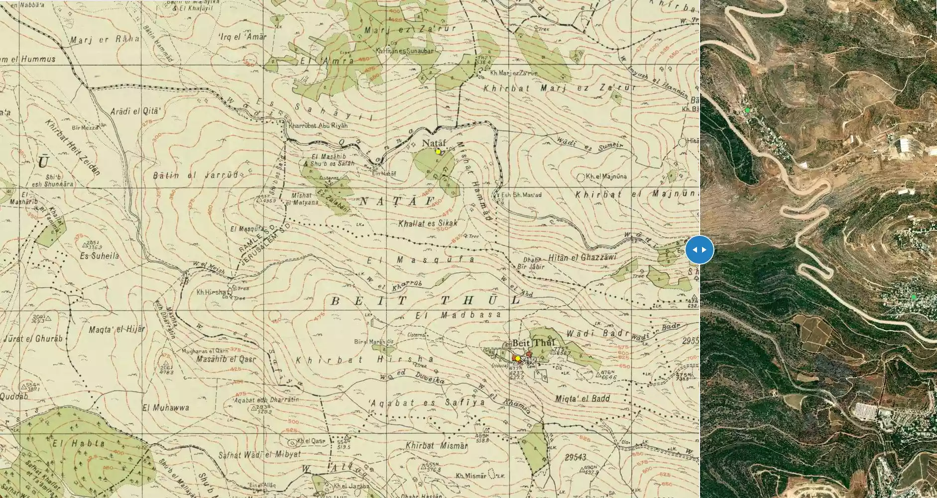
District of Jerusalem
Ethnically cleansed days ago |
العربية Google Earth |
 |
Gallery (56) |
- Statistics & Facts
-
Before & After

- Satellite View
- Articles 1
- Pictures 56
- Members 1
- All That Remains
- Wikipedia
- Videos 4
- Guest Book 1
- Links
| Statistic & Fact | Value | ||||||||||||
| Occupation Date | April 15, 1948 | ||||||||||||
| Distance From District | 17 (km) West of Jerusalem | ||||||||||||
| Elevation | 400 (meters) | ||||||||||||
| Before & After Nakba, Click Map For Details |
|||||||||||||
|
|||||||||||||
| Map Location | See location #1 on the map View from satellite |
||||||||||||
| Military Operation | Second stage of Operation Dani | ||||||||||||
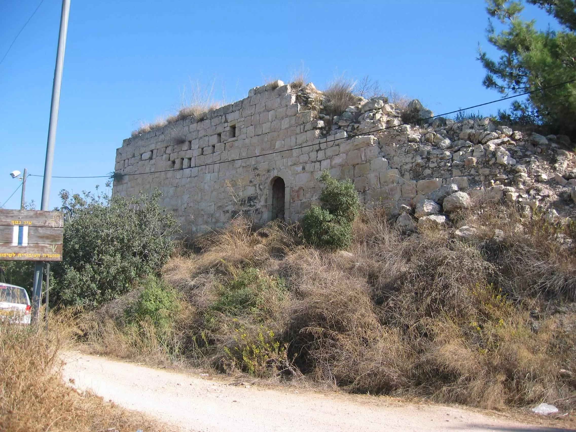
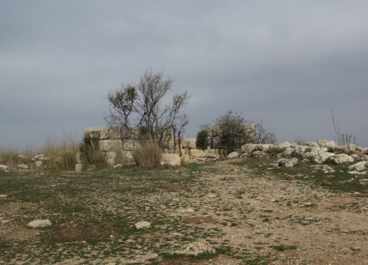
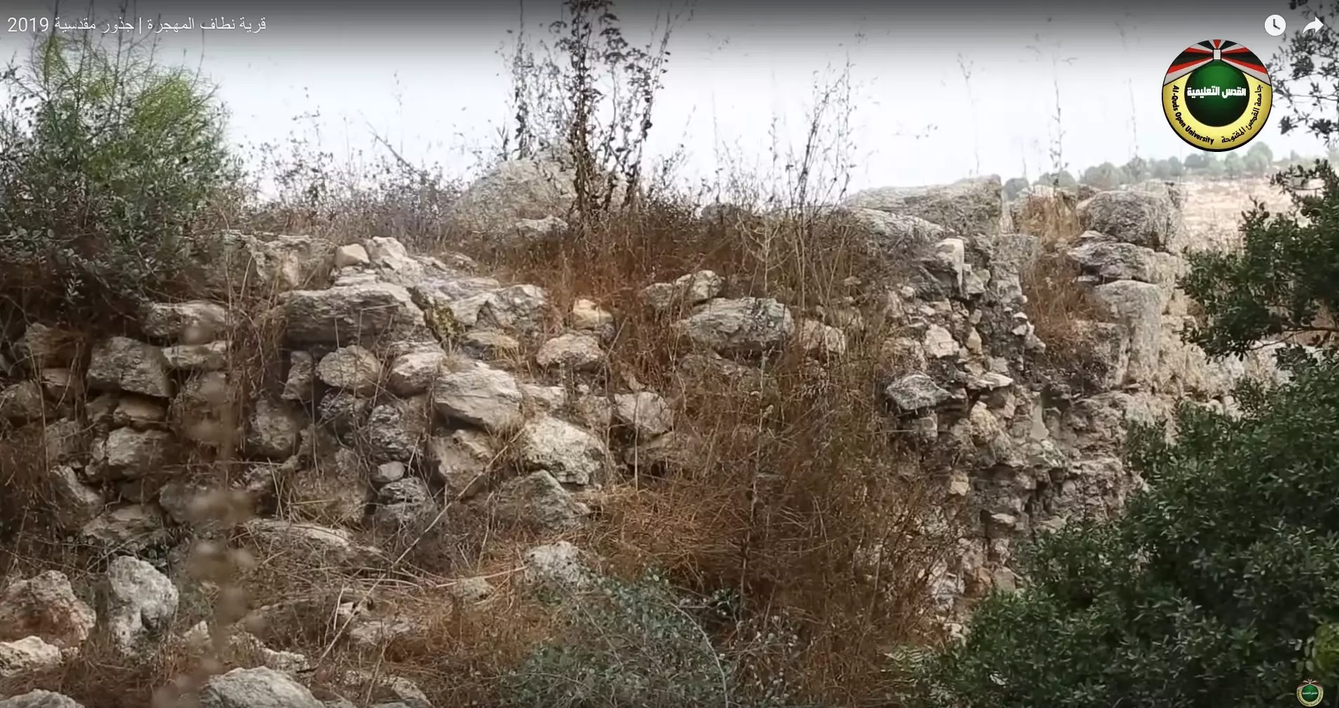
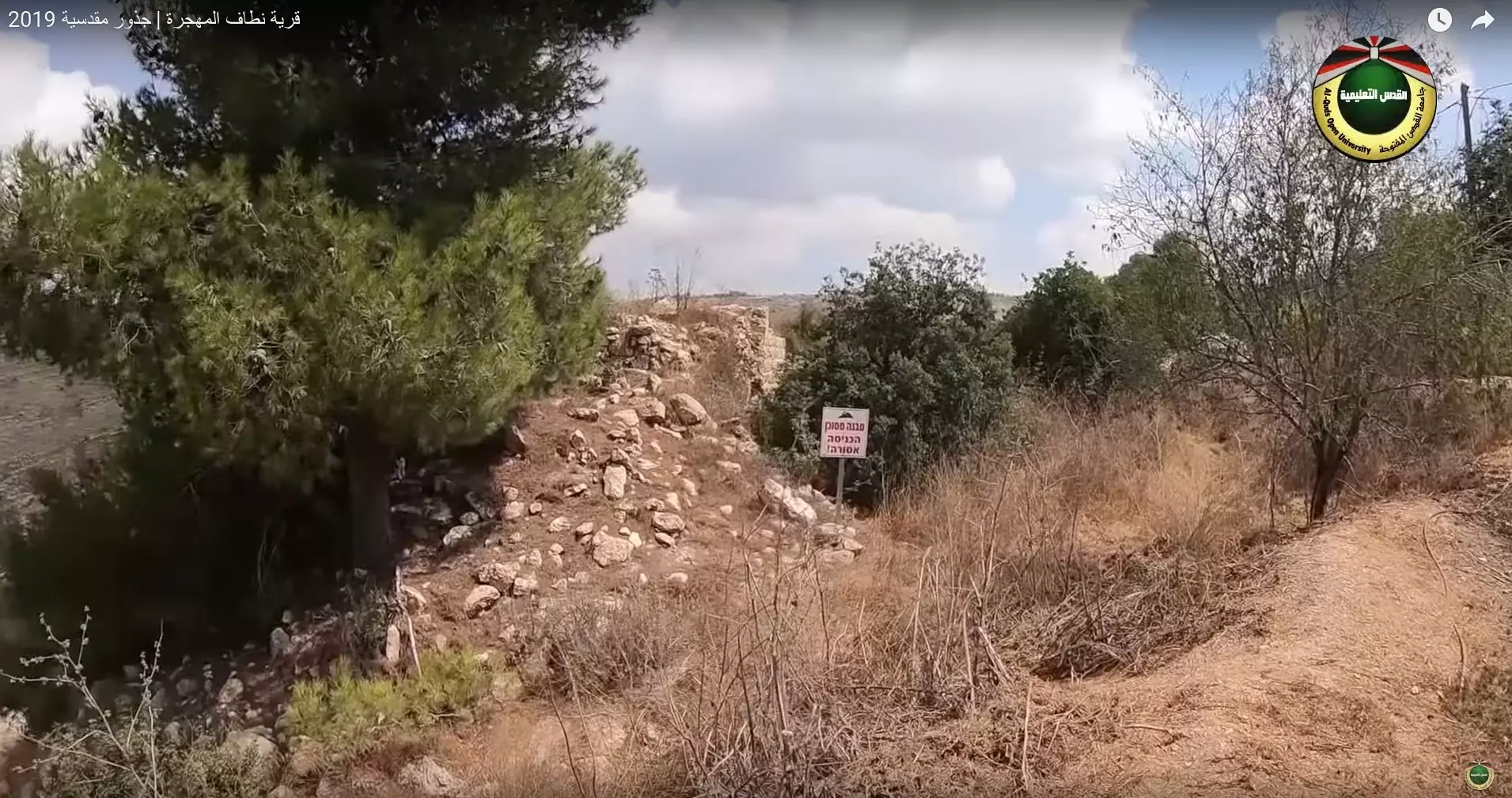
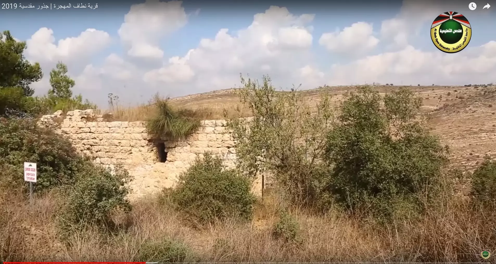
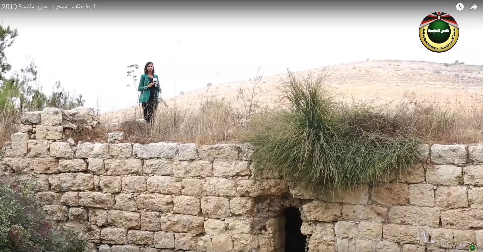
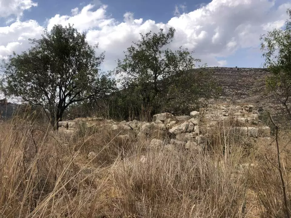
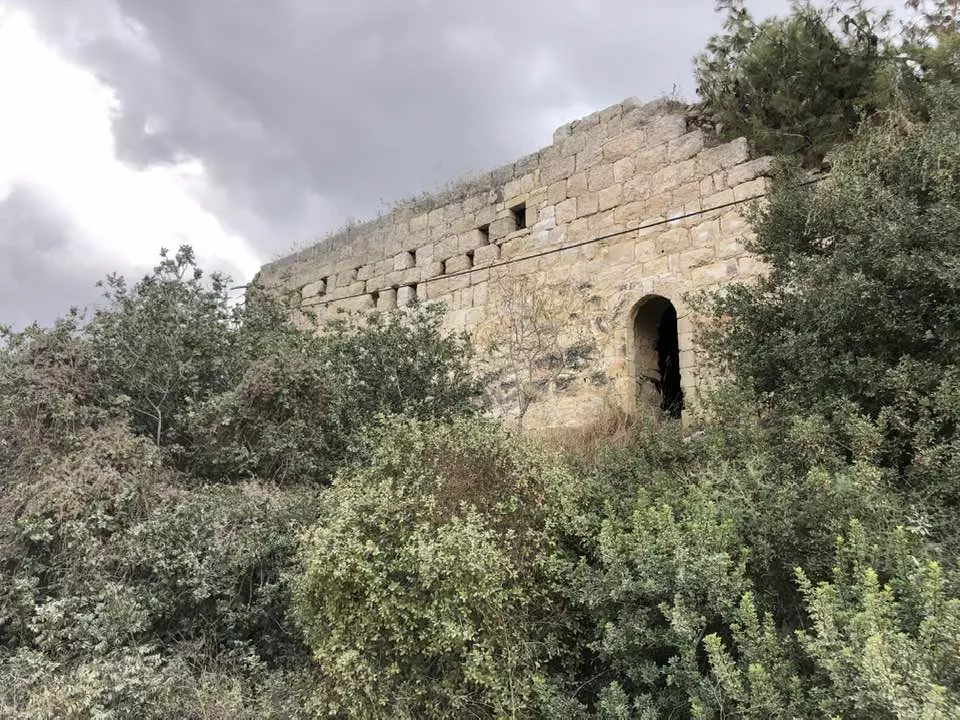
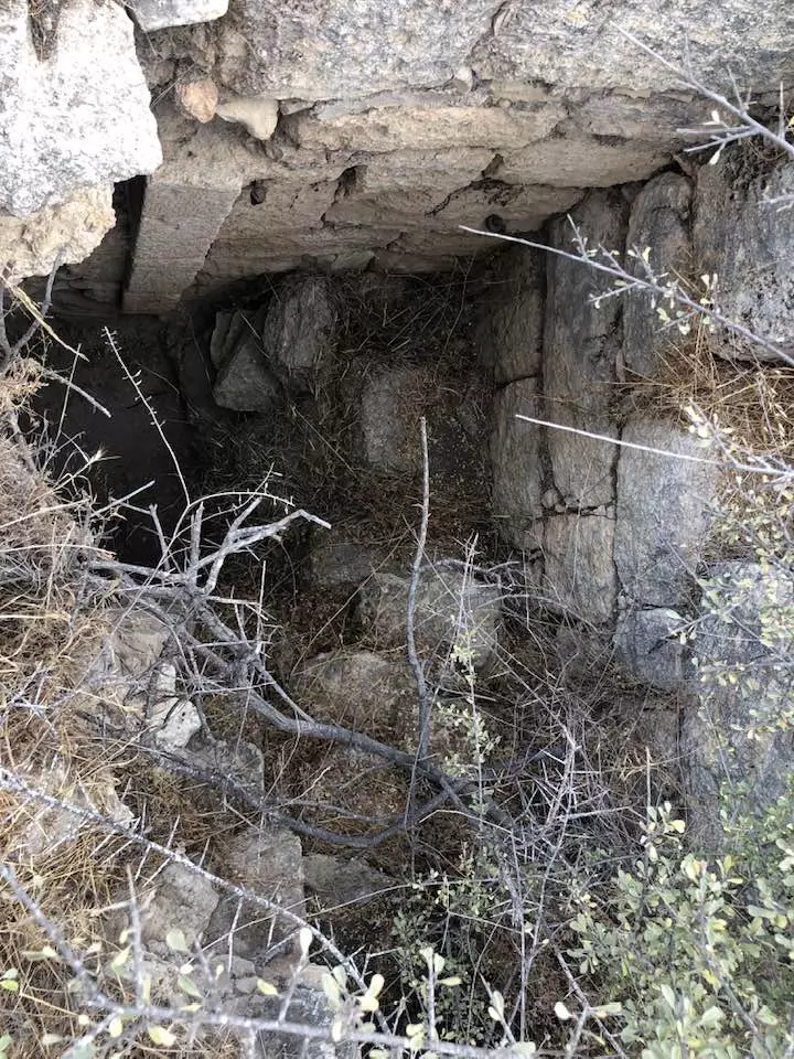
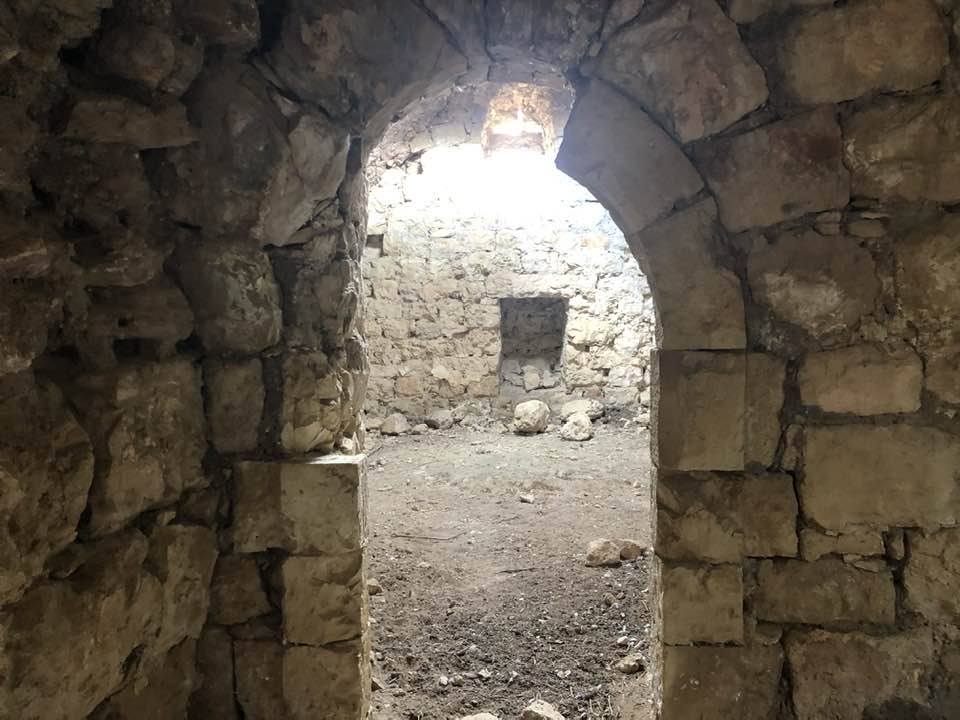
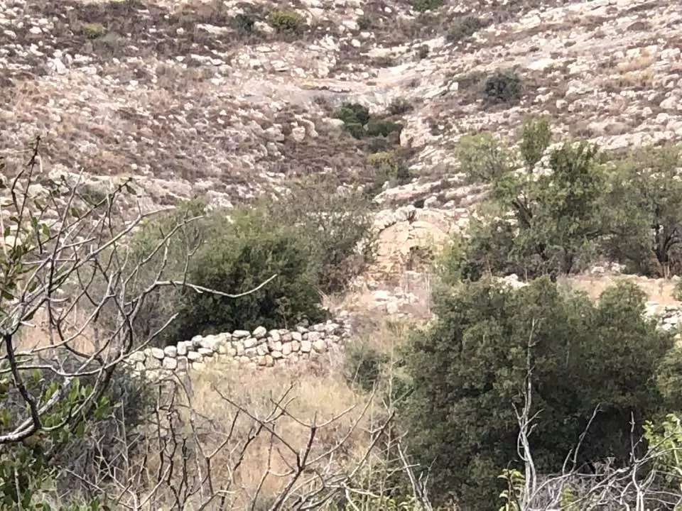
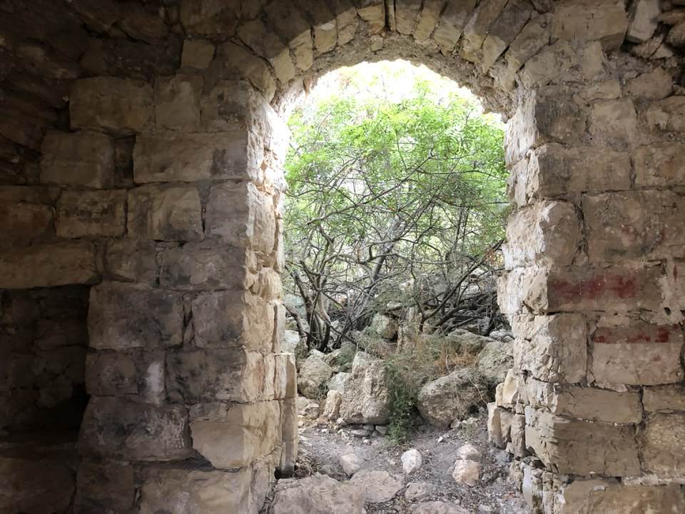
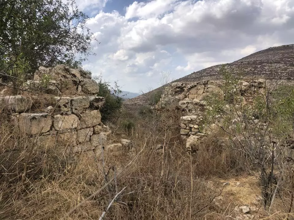
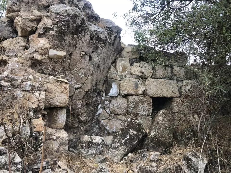
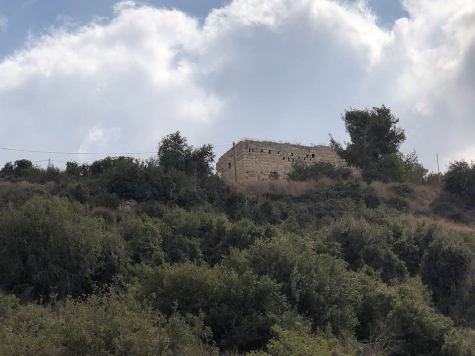
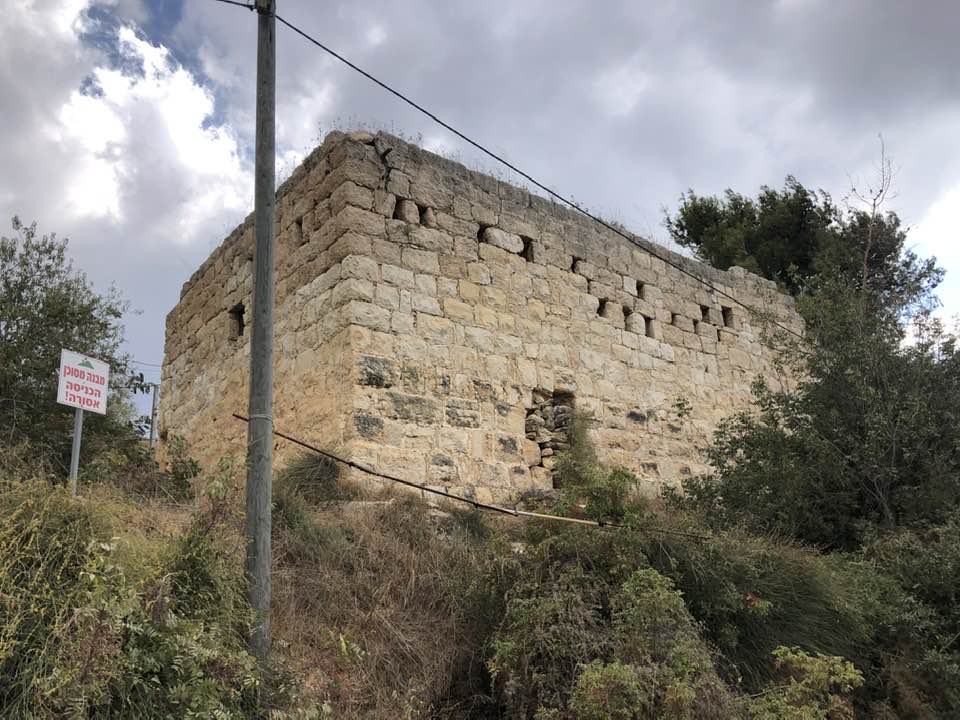
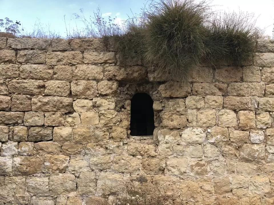
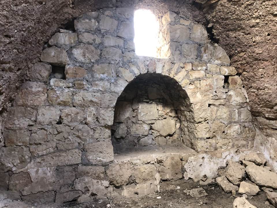
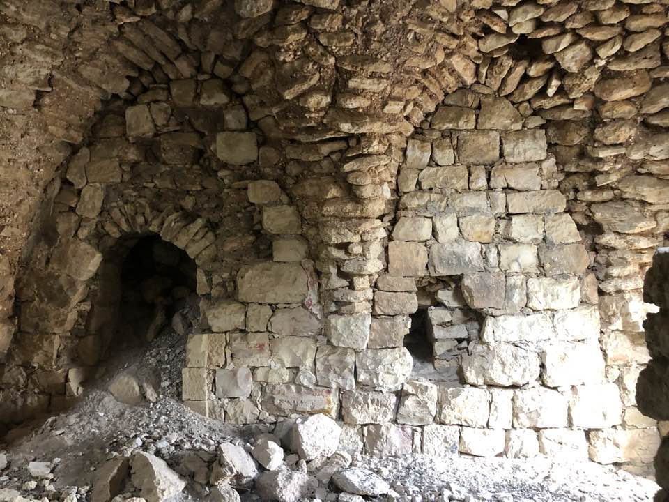
| Village Temains | Nitaf was mostly destroyed with the exception of ONE deserted house. | ||||||||||||
| Ethnically Cleansing | Nitaf inhabitants were completely ethnically cleansed. | ||||||||||||
| Pre-Nakba Land Ownership |
**Town Lands' Demarcation Maps |
||||||||||||
| Land Usage As of 1945 |
|
||||||||||||
| Population |
|
||||||||||||
| Near By Towns |
|||||||||||||
|
|||||||||||||
| Shrines / Maqams | Nitaf had a maqam for local sage known as al-Shaykh Mas'ud. | ||||||||||||
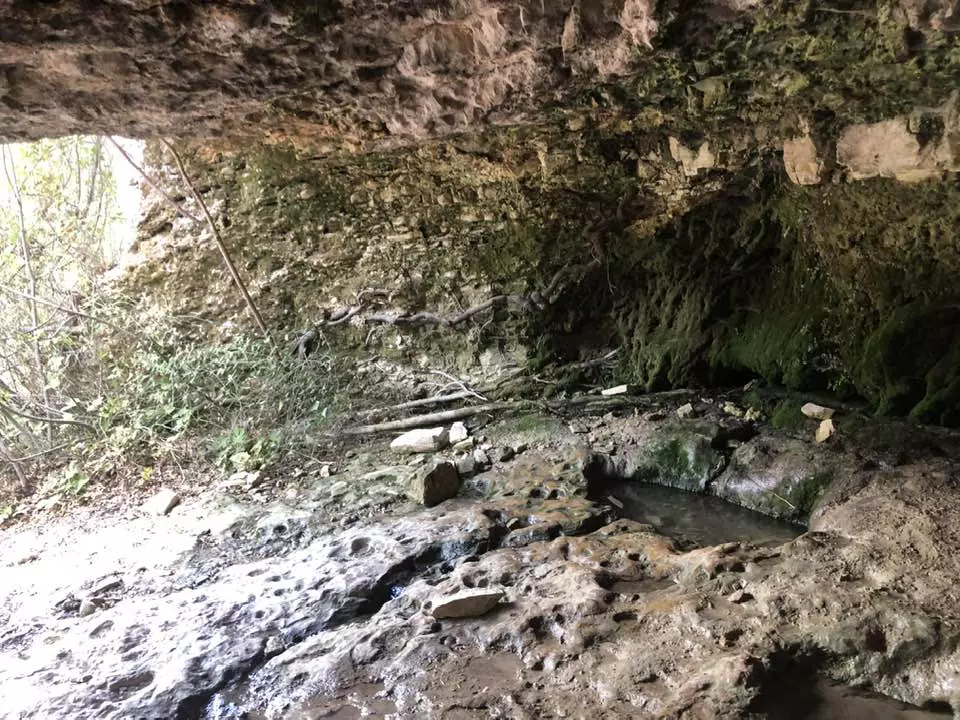
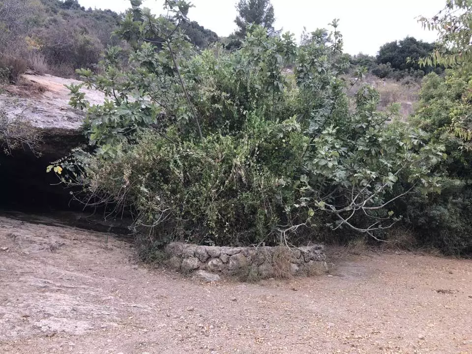
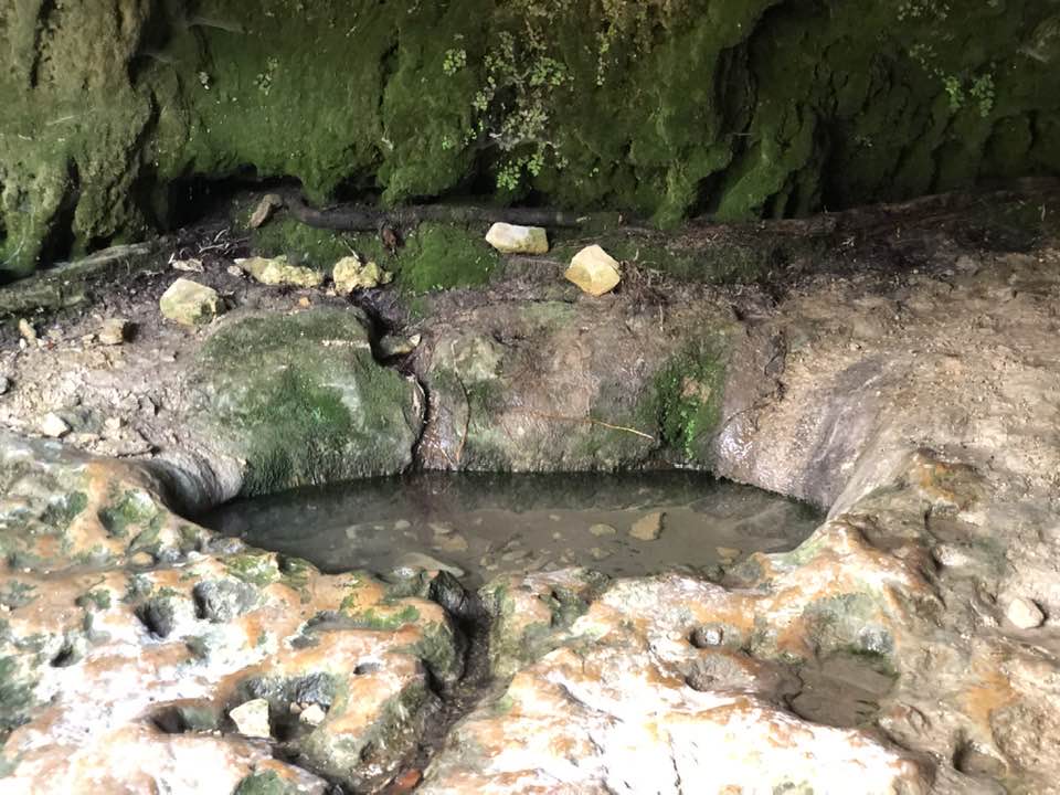
| Water Supply | The villagers used to obtained their domestic water from a spring to the west and depended on rain for watering their crops. | ||||||||||||
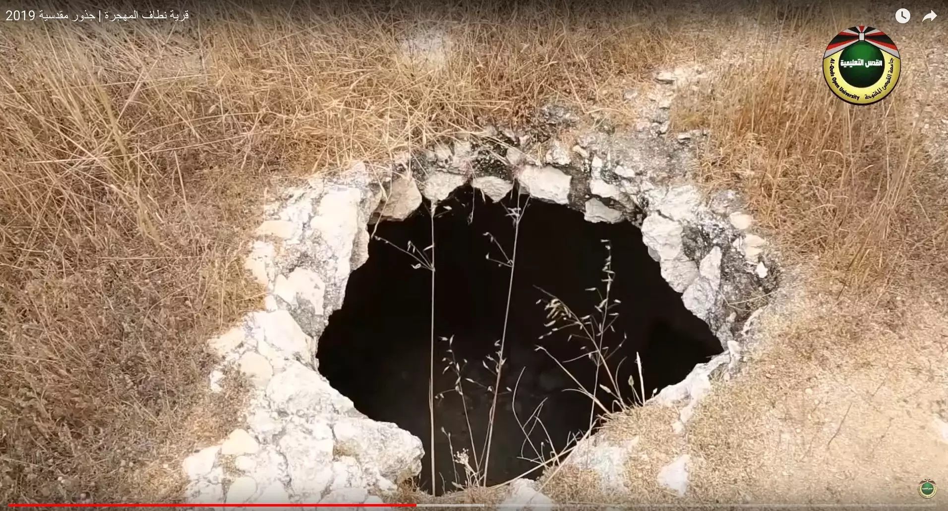
| Archeological Sites | Nitaf was built on an archaeological site and was surrounded by a number of khirbas. | ||||||||||||
| Exculsive Jewish Colonies Who Usurped Village Lands |
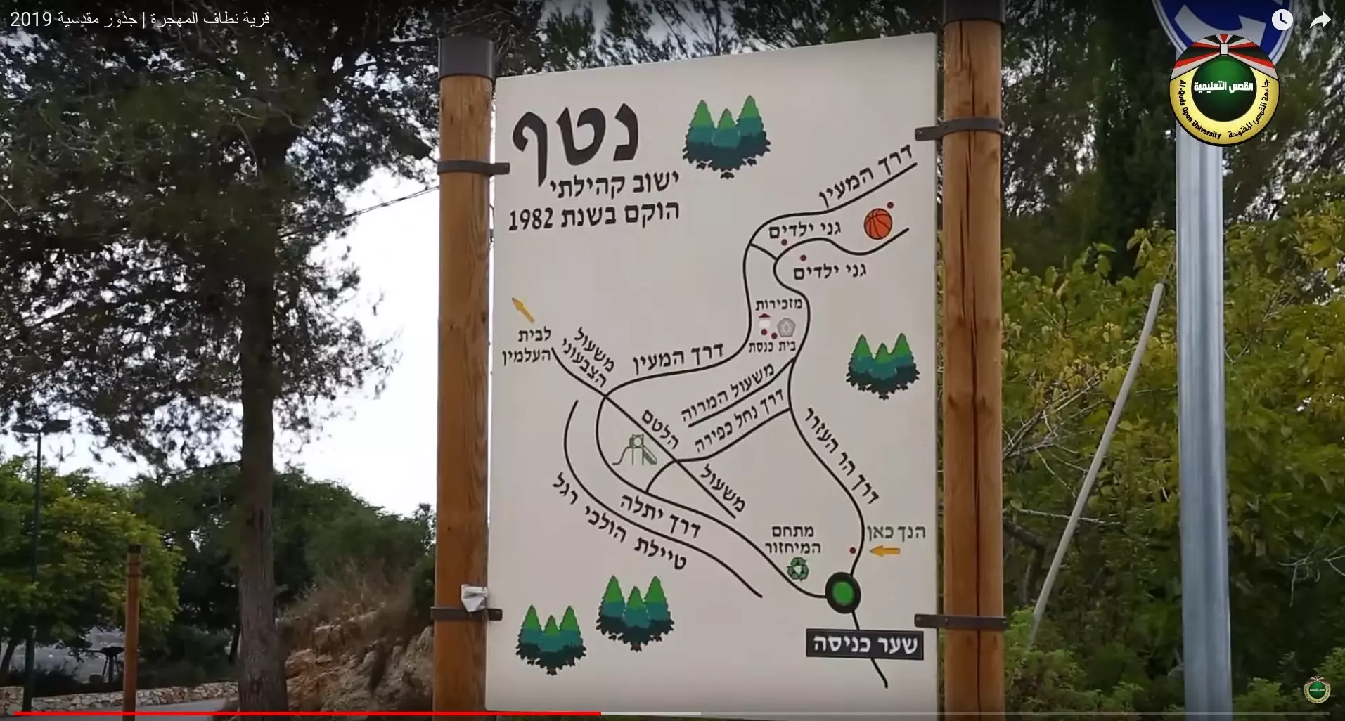
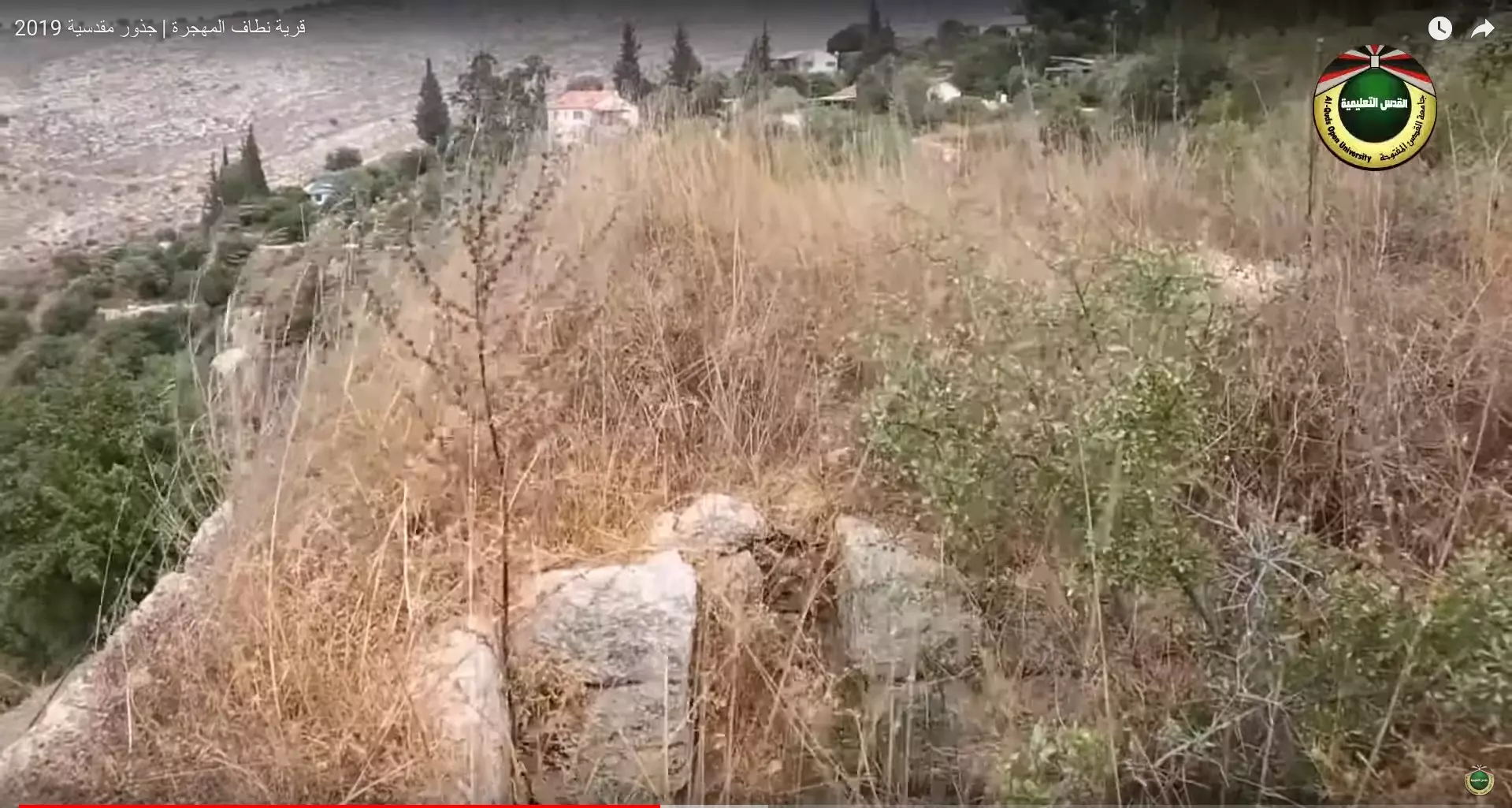
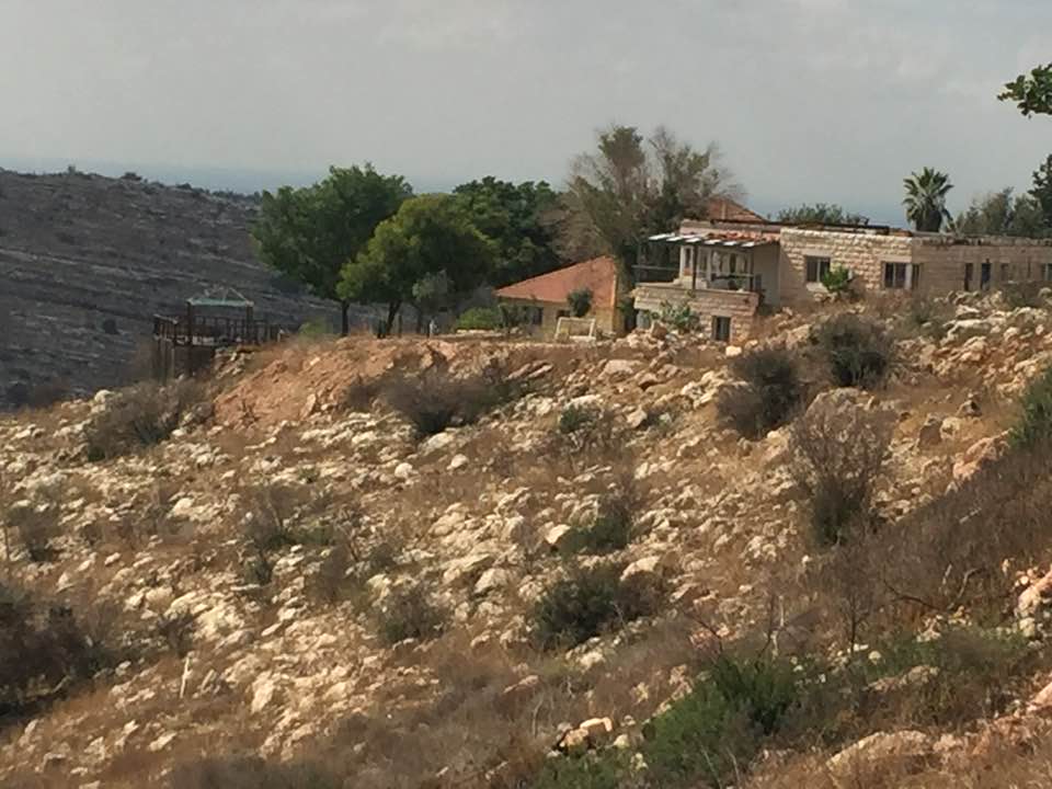
The Israeli settlement of "Nataf" is not far from village lands. | ||||||||||||
| Featured Video | |||||||||||||
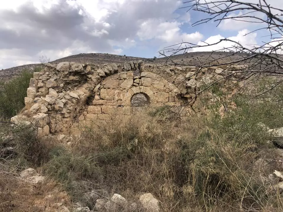
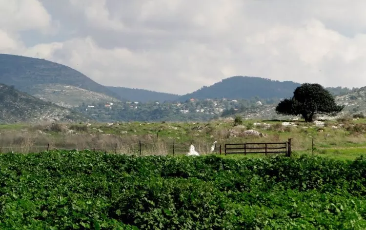
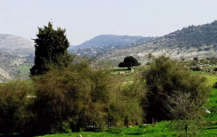
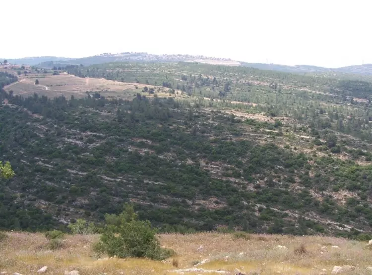
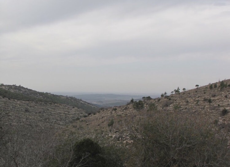
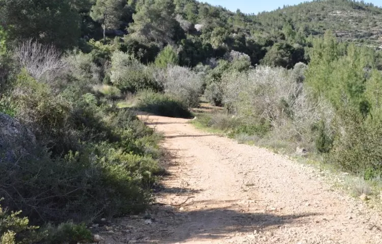
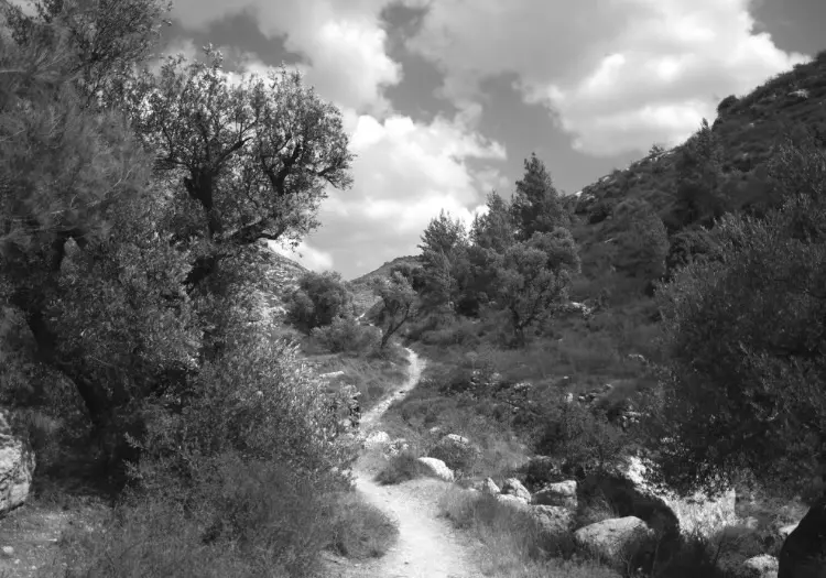
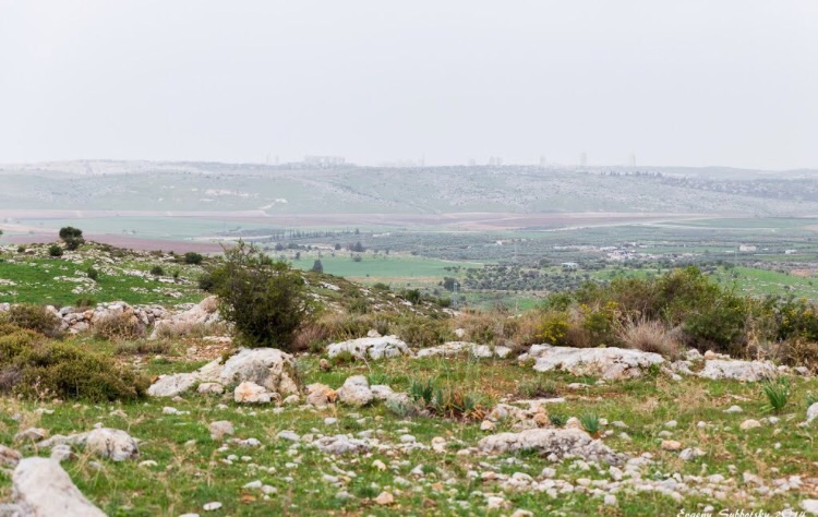
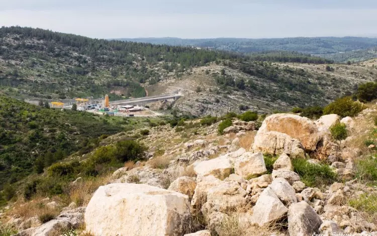
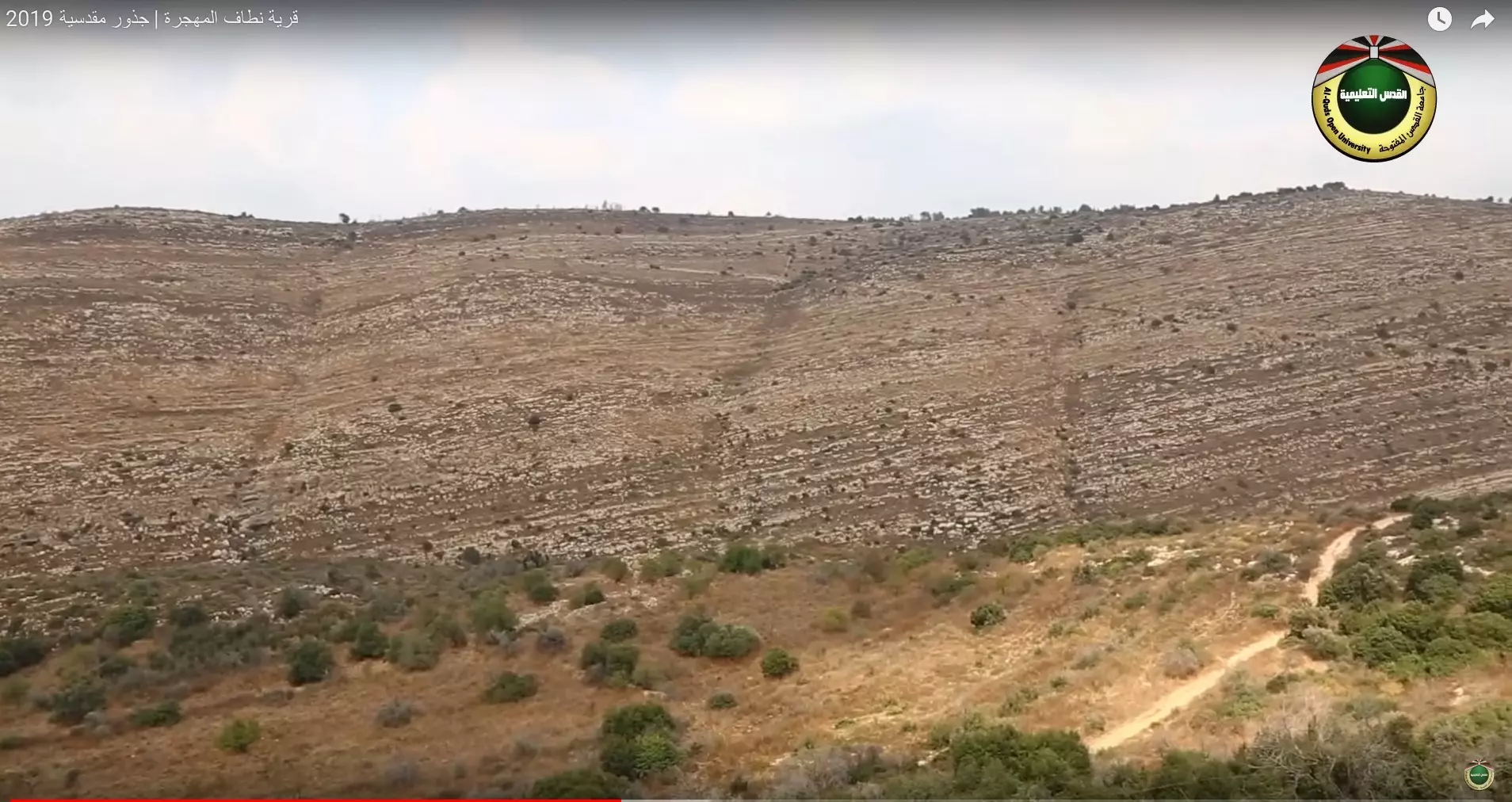
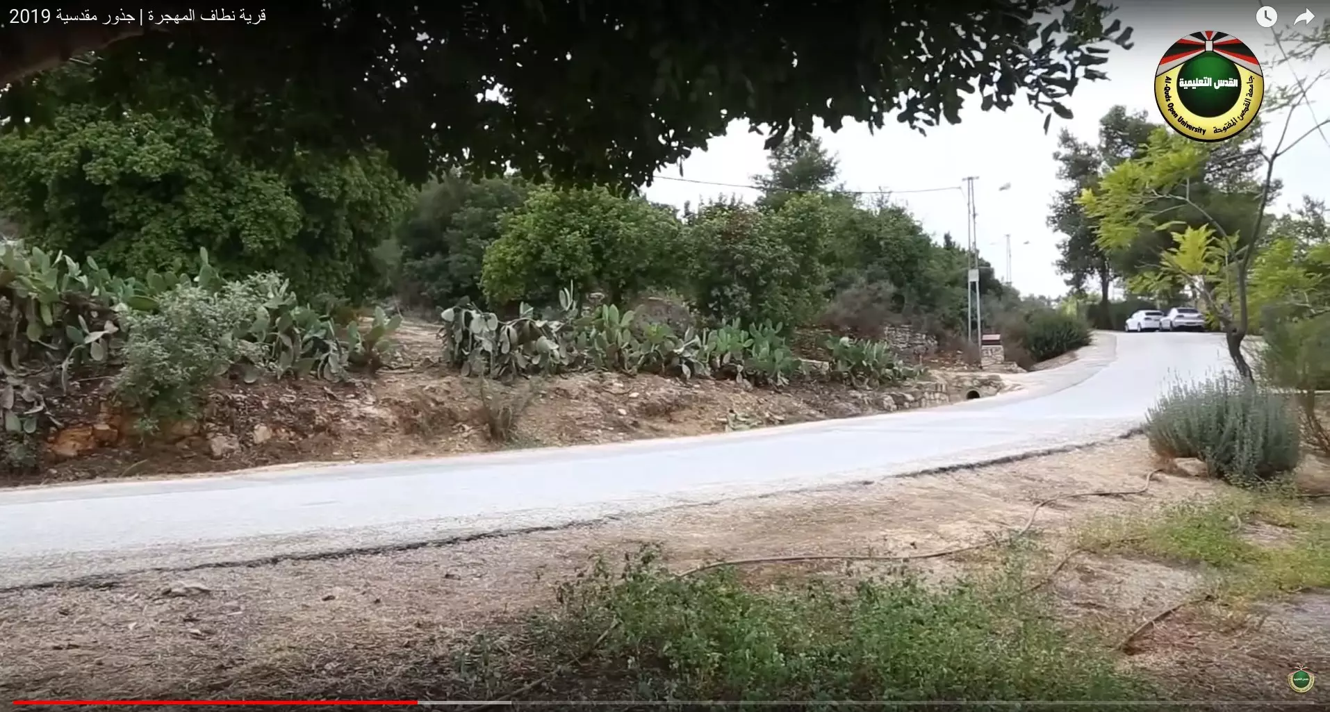
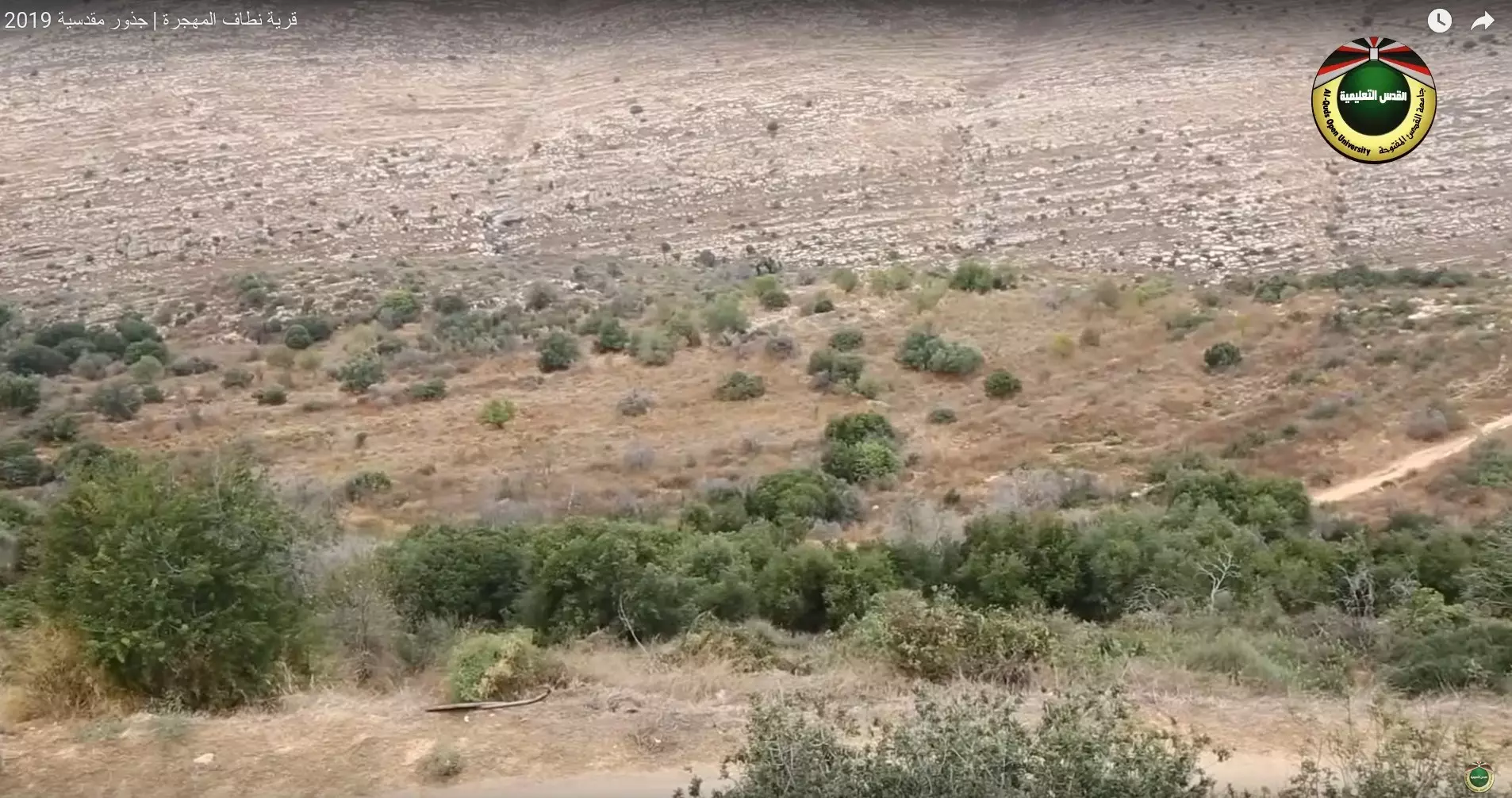
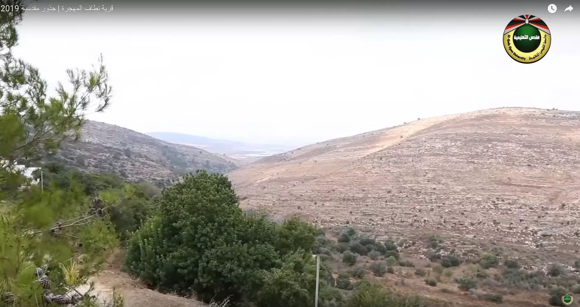
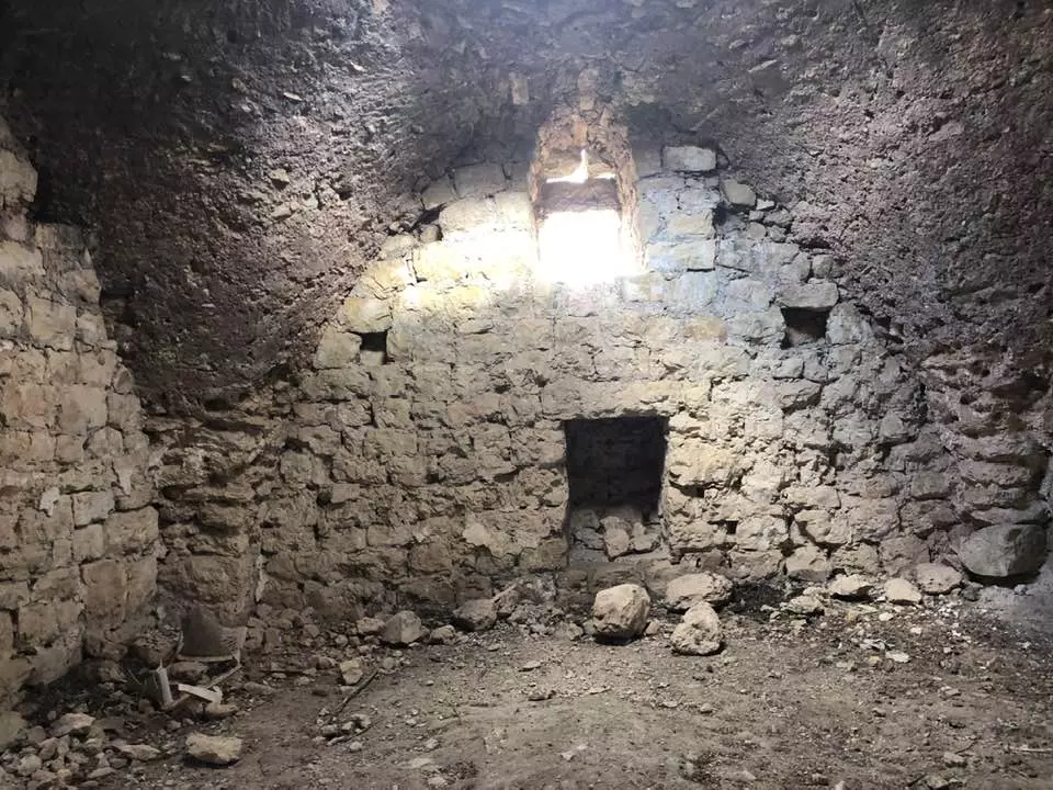
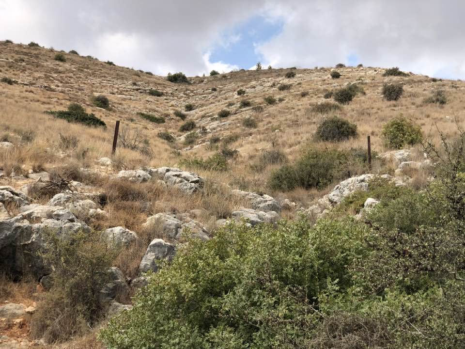
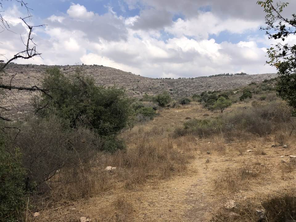
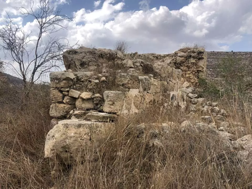
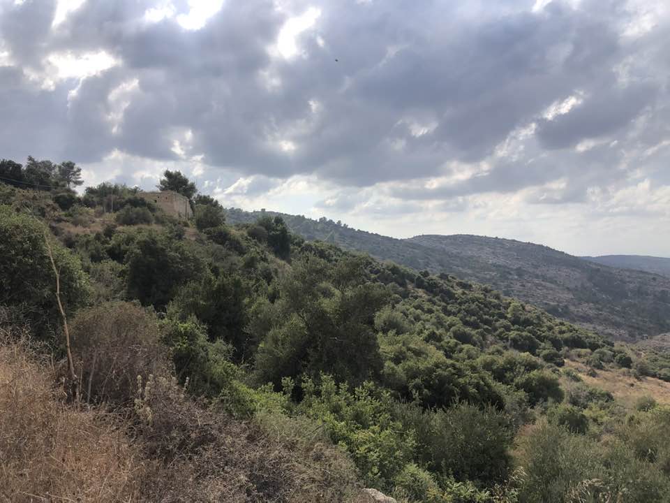
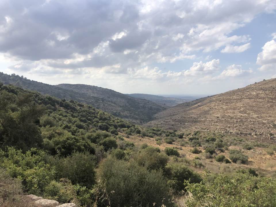
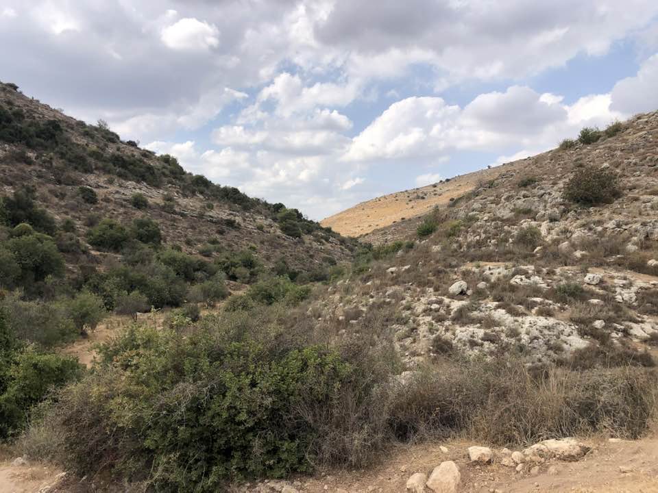
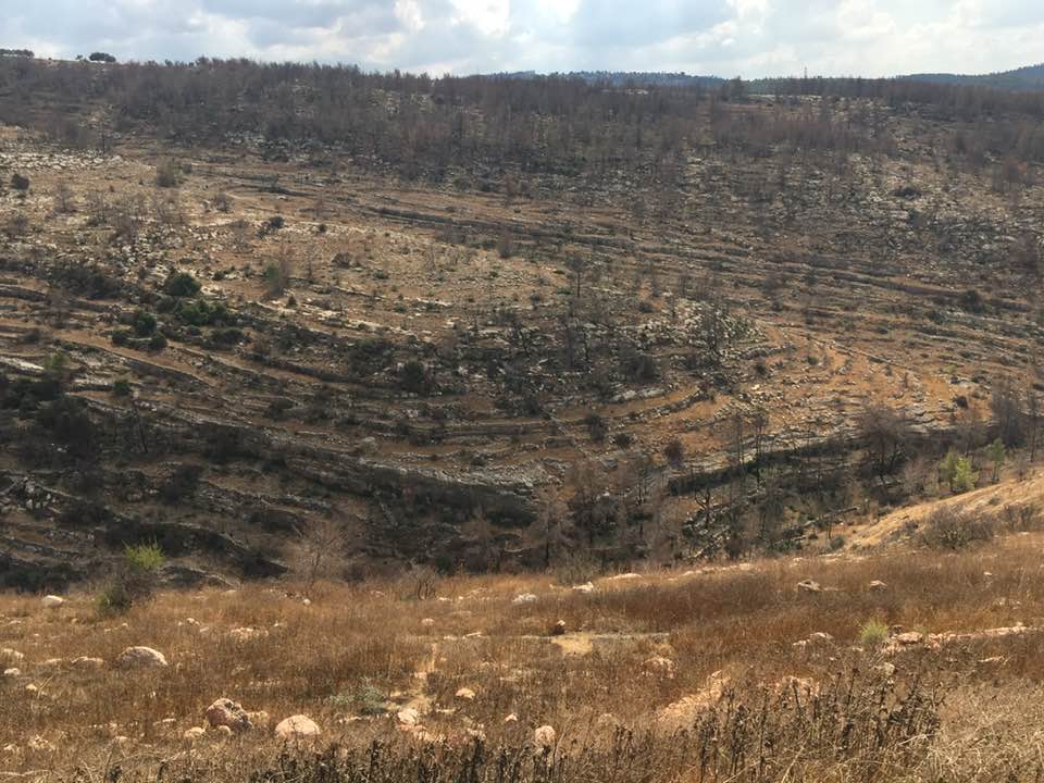
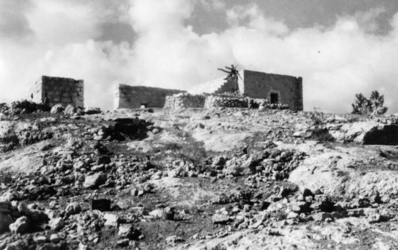
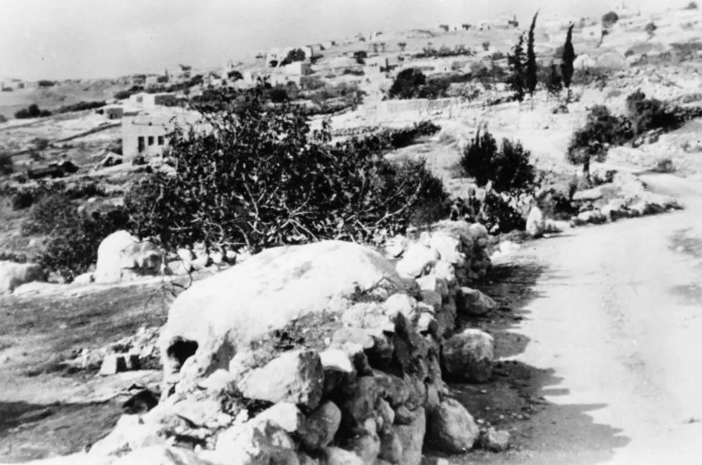
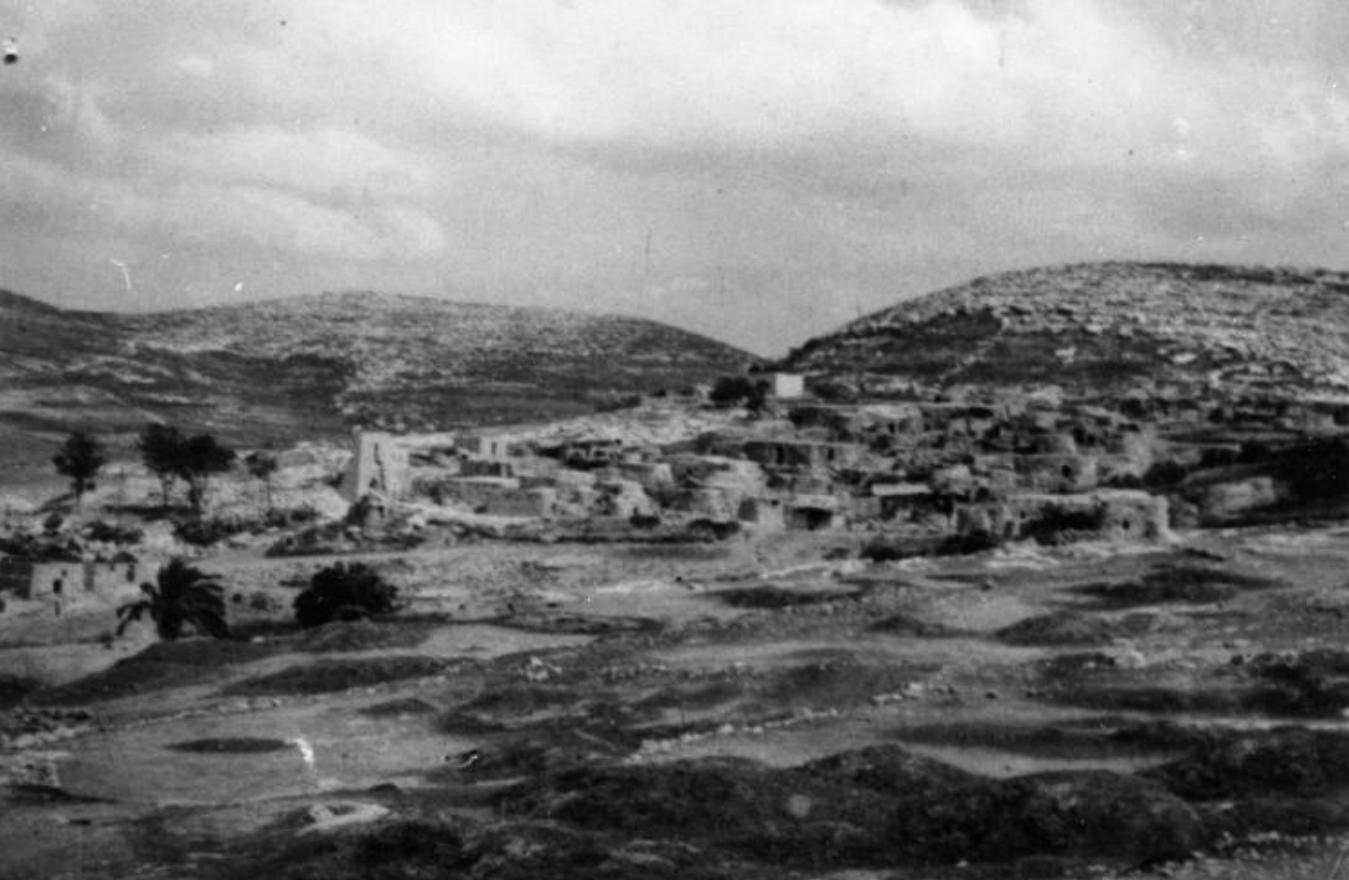
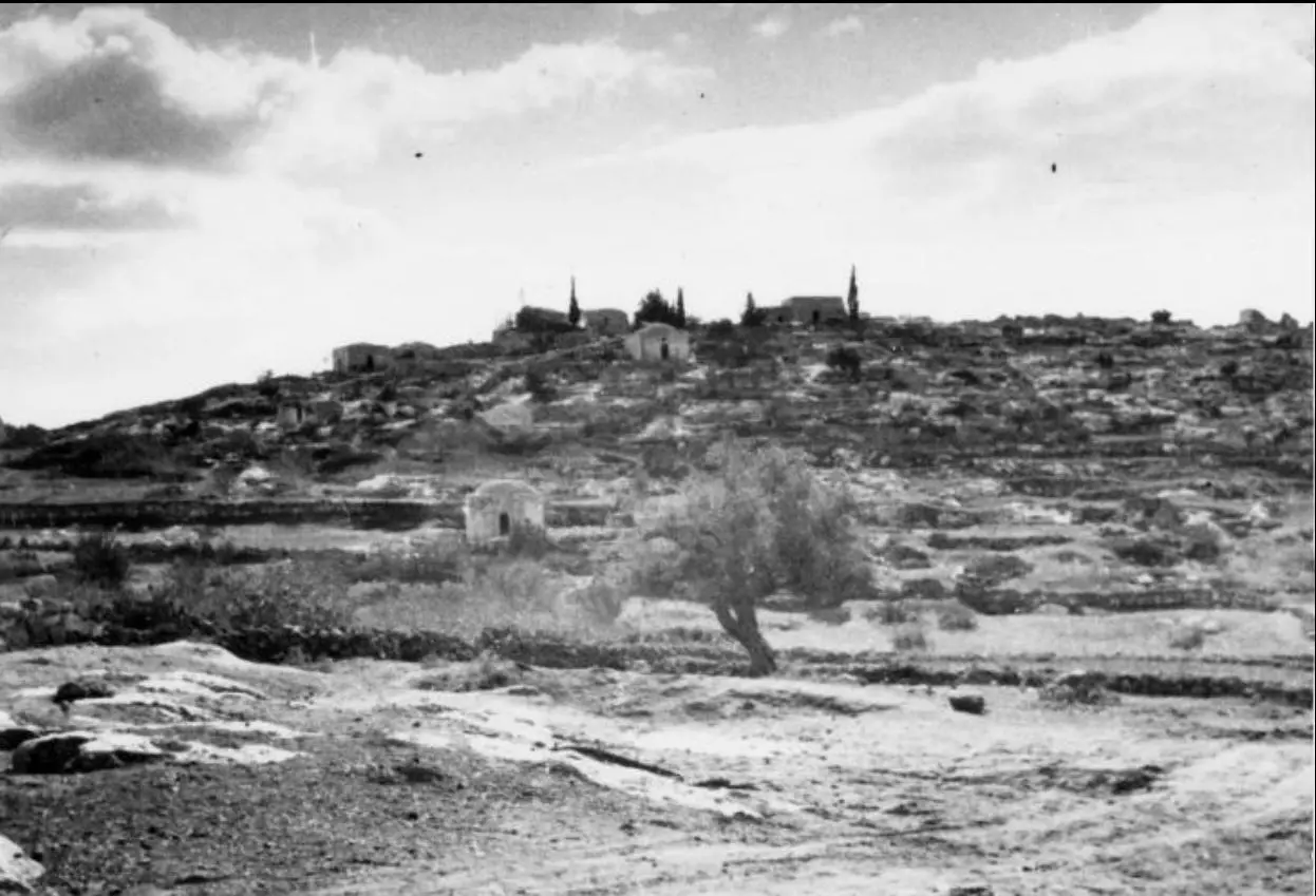
Village Before NakbaThe village stood on a steep slope that faced west, and overlooked a deep, winding wadi that ran from east to west. Secondary roads and dirt paths linked Nitaf to the other villages in the area and ultimately led to major highways, such as the Jerusalem−Jaffa highway. The village houses were built of stone and were clustered together in a small area, in no distinct pattern. The village population was Muslim. The villagers obtained their domestic water from a spring to the west and depended on rain for watering their crops. They planted grain, fruit trees, olive trees, and vineyards on their lands. Some of their lands were also used as grazing areas. In 1944/45 a total of 158 dunums was allocated to cereals; 166 dunums were irrigated or used for orchards, of which 77 dunums were for olives. Nitaf was built on an archaeological site and was surrounded by a number of khirbas. There was a maqam (shrine) for a Shaykh Mas'ud to the east of the village.Village Occupation and Ethnic CleaningThe nearest village for which reliable information exists is Dayr Ayyub. That village, like many in the northern half of the Jerusalem corridor, was occupied (on three separate occasions) during the battles that took place around the strategic al-Latrun salient from mid-April to early June 1948. Haganah attacks were launched in the context of a series of operations following Operation Nachshon (see Bayt Naqquba, Jerusalem sub-district), and although they did not succeed in occupying al-Latrun, they managed to widen the Haganah-held territory in the western approaches to Jerusalem. If Nitaf was not occupied by early June, it almost certainly fell to Israeli forces in the second stage of Operation Dani (see Abu al-Fadl, Ramla sub-district).Zionists Colonies on Village LandsThere are no Israeli settlements on village lands. However, the settlement of Nataf (156137), established on the land of Bayt Thul in 1982, is less than 1 km south of the site. Its name clearly resembles that of Nitaf.Village TodayThere is a large, deserted stone house on the site surrounded by old terraces. It is a one-storey house with an arched door and arched windows. Northwest of this house, at the bottom of a slope, stands another deserted house. Most of the village lands fell within the Demilitarized Zone that was delineated by the armistice agreement of 1949 between Israel and Jordan.SourceDr. Walid al-Khalidi, 1992: All That Remains. |
|||||||||||||
| Related Maps | Town Lands' Demarcation Maps خرائط للقضاء توضح حدود القرى والاودية Town's map on MapQuest View from satellite Help us map this town at WikiMapia |
||||||||||||
| Related Links | Wikipedia's Page Google Search Google For Images Google For Videos |
||||||||||||
| More Information | في كتاب كي لا ننسى في كتاب بلادنا فلسطين المزيد من موقع هوية |
||||||||||||
- Village House Rubble In 1986
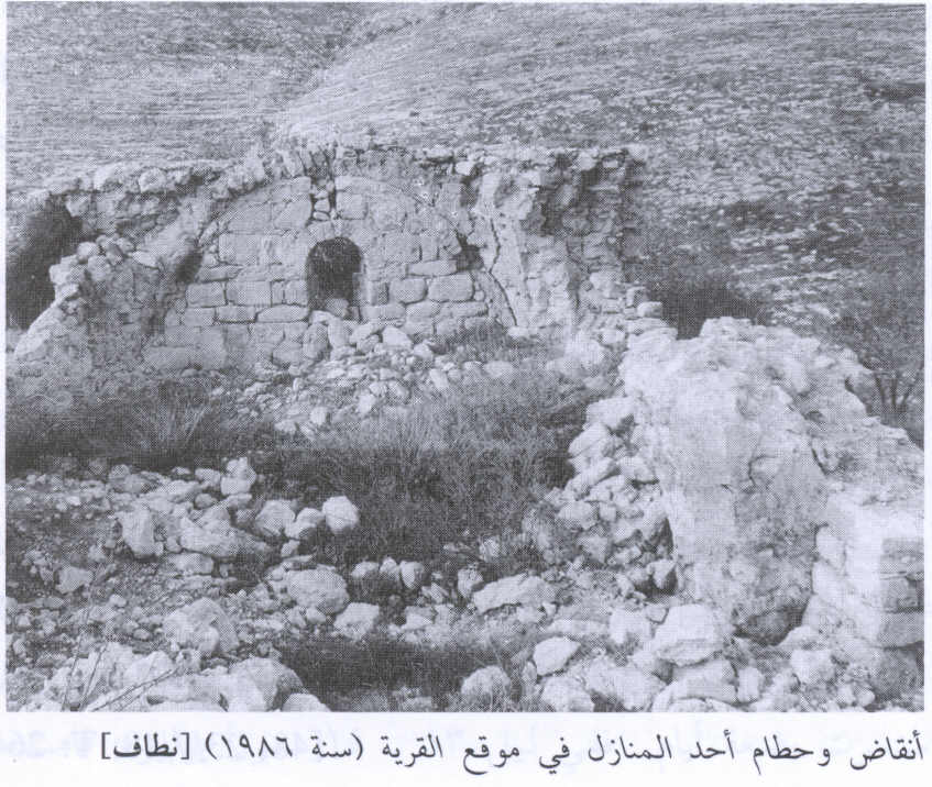
Scanned from "All That Remains" by Dr. Walid Khalidi - Interior of home (now located inside Kibbutz)
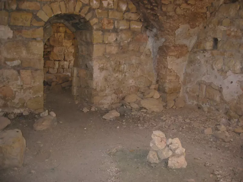
Posted by Annemarie Jacir - Home Fall 2006. Photo: Annemarie Jacir
Posted by Annemarie Jacir - موقع القريه
Posted by abu raya - اثار بيوت القريه
Posted by abu raya - نطاف
Posted by abu raya - نطاف
Posted by abu raya - نطاف
Posted by abu raya - نطاف
Posted by abu raya - نطاف
Posted by abu raya - نطاف
Posted by abu raya - نطاف
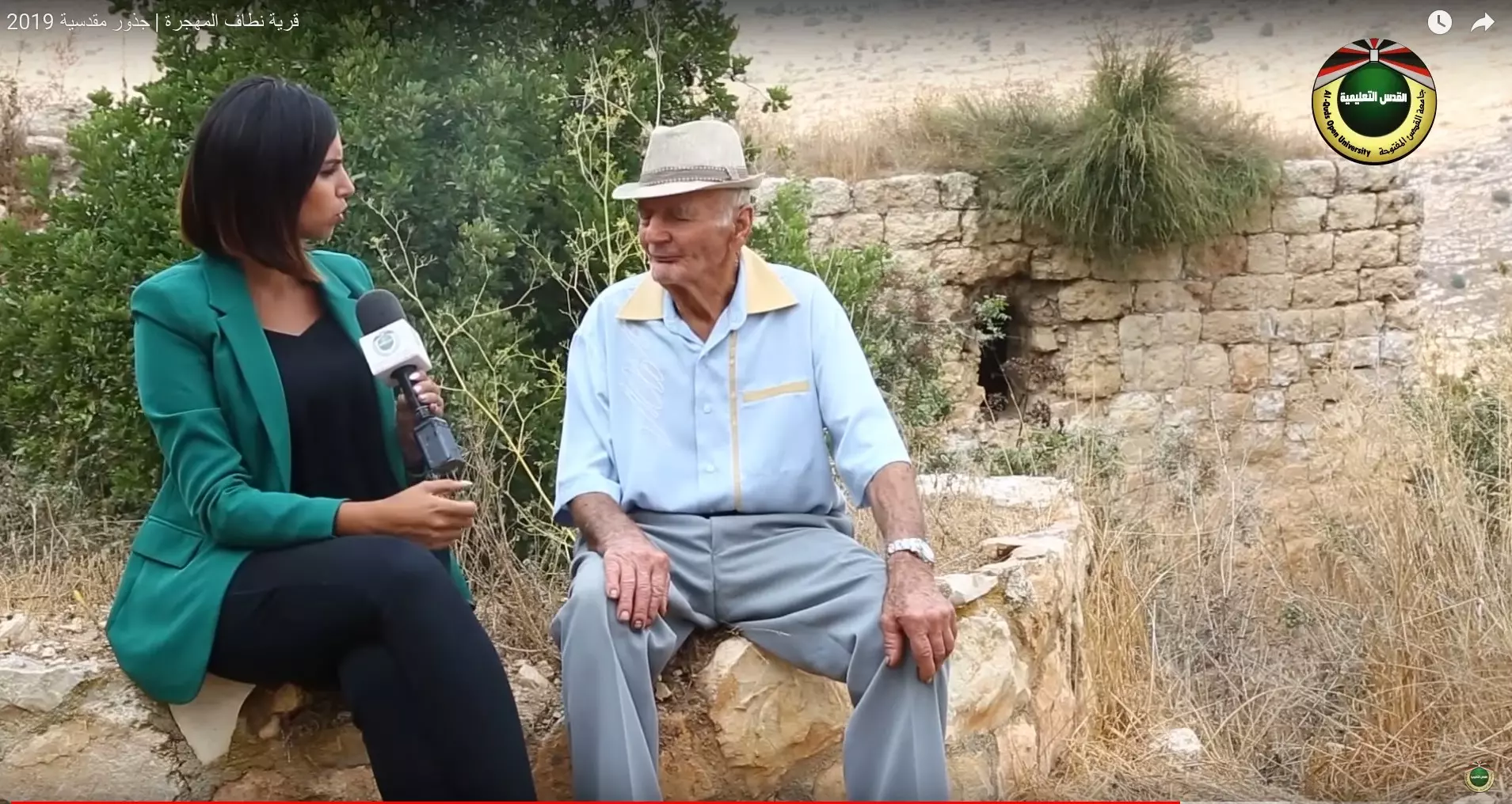
Posted by abu raya - جولة بين انقاض وكروم قرية نطاف المهجرة- من فديو لبرنامج جذور مقدسية
- جولة بين انقاض وكروم قرية نطاف المهجرة- من فديو لبرنامج جذور مقدسية #2
- جولة بين انقاض وكروم قرية نطاف المهجرة- من فديو لبرنامج جذور مقدسية #3
- جولة بين انقاض وكروم قرية نطاف المهجرة- من فديو لبرنامج جذور مقدسية #4
- جولة بين انقاض وكروم قرية نطاف المهجرة- من فديو لبرنامج جذور مقدسية #5
- جولة بين انقاض وكروم قرية نطاف المهجرة- من فديو لبرنامج جذور مقدسية #6
- جولة بين انقاض وكروم قرية نطاف المهجرة- من فديو لبرنامج جذور مقدسية #7
- جولة بين انقاض وكروم قرية نطاف المهجرة- من فديو لبرنامج جذور مقدسية #8
- جولة بين انقاض وكروم قرية نطاف المهجرة- من فديو لبرنامج جذور مقدسية #9
- جولة بين انقاض وكروم قرية نطاف المهجرة- من فديو لبرنامج جذور مقدسية #10
- جولة بين انقاض وكروم قرية نطاف المهجرة- من فديو لبرنامج جذور مقدسية #11
- جولة بين انقاض وكروم قرية نطاف المهجرة- من فديو لبرنامج جذور مقدسية #12
- That is how the "civilized" erased and replaced us: Nitaf was completely obliterated except for a few remaining structures, as you see -- نطاف باتت أثر بعد عين. من هنا مر الهمجّ
- That is how the "civilized" erased and replaced us: Nitaf was completely obliterated except for a few remaining structures, as you see -- نطاف باتت أثر بعد عين. من هنا مر الهمجّ #2
- That is how the "civilized" erased and replaced us: Nitaf was completely obliterated except for a few remaining structures, as you see -- نطاف باتت أثر بعد عين. من هنا مر الهمجّ #3
- That is how the "civilized" erased and replaced us: Nitaf was completely obliterated except for a few remaining structures, as you see -- نطاف باتت أثر بعد عين. من هنا مر الهمجّ #4
- That is how the "civilized" erased and replaced us: Nitaf was completely obliterated except for a few remaining structures, as you see -- نطاف باتت أثر بعد عين. من هنا مر الهمجّ #5
- That is how the "civilized" erased and replaced us: Nitaf was completely obliterated except for a few remaining structures, as you see -- نطاف باتت أثر بعد عين. من هنا مر الهمجّ #6
- That is how the "civilized" erased and replaced us: Nitaf was completely obliterated except for a few remaining structures, as you see -- نطاف باتت أثر بعد عين. من هنا مر الهمجّ #7
- That is how the "civilized" erased and replaced us: Nitaf was completely obliterated except for a few remaining structures, as you see -- نطاف باتت أثر بعد عين. من هنا مر الهمجّ #8
- That is how the "civilized" erased and replaced us: Nitaf was completely obliterated except for a few remaining structures, as you see -- نطاف باتت أثر بعد عين. من هنا مر الهمجّ #9
- That is how the "civilized" erased and replaced us: Nitaf was completely obliterated except for a few remaining structures, as you see -- نطاف باتت أثر بعد عين. من هنا مر الهمجّ #10
- That is how the "civilized" erased and replaced us: Nitaf was completely obliterated except for a few remaining structures, as you see -- نطاف باتت أثر بعد عين. من هنا مر الهمجّ #11
- That is how the "civilized" erased and replaced us: Nitaf was completely obliterated except for a few remaining structures, as you see -- نطاف باتت أثر بعد عين. من هنا مر الهمجّ #12
- That is how the "civilized" erased and replaced us: Nitaf was completely obliterated except for a few remaining structures, as you see -- نطاف باتت أثر بعد عين. من هنا مر الهمجّ #13
- That is how the "civilized" erased and replaced us: Nitaf was completely obliterated except for a few remaining structures, as you see -- نطاف باتت أثر بعد عين. من هنا مر الهمجّ #14
- That is how the "civilized" erased and replaced us: Nitaf was completely obliterated except for a few remaining structures, as you see -- نطاف باتت أثر بعد عين. من هنا مر الهمجّ #15
- That is how the "civilized" erased and replaced us: Nitaf was completely obliterated except for a few remaining structures, as you see -- نطاف باتت أثر بعد عين. من هنا مر الهمجّ #16
- That is how the "civilized" erased and replaced us: Nitaf was completely obliterated except for a few remaining structures, as you see -- نطاف باتت أثر بعد عين. من هنا مر الهمجّ #17
- That is how the "civilized" erased and replaced us: Nitaf was completely obliterated except for a few remaining structures, as you see -- نطاف باتت أثر بعد عين. من هنا مر الهمجّ #18
- That is how the "civilized" erased and replaced us: Nitaf was completely obliterated except for a few remaining structures, as you see -- نطاف باتت أثر بعد عين. من هنا مر الهمجّ #19
- That is how the "civilized" erased and replaced us: Nitaf was completely obliterated except for a few remaining structures, as you see -- نطاف باتت أثر بعد عين. من هنا مر الهمجّ #20
- That is how the "civilized" erased and replaced us: Nitaf was completely obliterated except for a few remaining structures, as you see -- نطاف باتت أثر بعد عين. من هنا مر الهمجّ #21
- That is how the "civilized" erased and replaced us: Nitaf was completely obliterated except for a few remaining structures, as you see -- نطاف باتت أثر بعد عين. من هنا مر الهمجّ #22
- That is how the "civilized" erased and replaced us: Nitaf was completely obliterated except for a few remaining structures, as you see -- نطاف باتت أثر بعد عين. من هنا مر الهمجّ #23
- That is how the "civilized" erased and replaced us: Nitaf was completely obliterated except for a few remaining structures, as you see -- نطاف باتت أثر بعد عين. من هنا مر الهمجّ #24
- That is how the "civilized" erased and replaced us: Nitaf was completely obliterated except for a few remaining structures, as you see -- نطاف باتت أثر بعد عين. من هنا مر الهمجّ #25
- That is how the "civilized" erased and replaced us: Nitaf was completely obliterated except for a few remaining structures, as you see -- نطاف باتت أثر بعد عين. من هنا مر الهمجّ #26
- That is how the "civilized" erased and replaced us: Nitaf was completely obliterated except for a few remaining structures, as you see -- نطاف باتت أثر بعد عين. من هنا مر الهمجّ #27
- That is how the "civilized" erased and replaced us: Nitaf was completely obliterated except for a few remaining structures, as you see -- نطاف باتت أثر بعد عين. من هنا مر الهمجّ #28
- Our village, Nitaf, was occupied intact, then, when the battle was over, the "civilized" destroyed it to hinder our return. How else will Jews be great & safe again?
- Our village, Nitaf, was occupied intact, then, when the battle was over, the "civilized" destroyed it to hinder our return. How else will Jews be great & safe again? #2
- Our village, Nitaf, was occupied intact, then, when the battle was over, the "civilized" destroyed it to hinder our return. How else will Jews be great & safe again? #3
- Our village, Nitaf, was occupied intact, then, when the battle was over, the "civilized" destroyed it to hinder our return. How else will Jews be great & safe again? #4
Want to browse more? 80,000 pictures were grouped in these gallaries:
| Display Name | Clan/Hamolah | Country of Residence |
| md souqi | الحوشية | - |
- قرية نطاف المهجرة | جذور مقدسية 2019 Duration: 18 min 13 sec
- عين نطاف او عين البلد في قرية نطاف المهجرة قضاء القدس . Duration: min 4 sec
- من أراضي قرية نطاف المهجرة قضاء القدس . Duration: 16 sec
- نطاف المهجرة قضاء: القدس Duration: 38 sec
No links have been shared yet, be free to the first to share the first link.
 Fake Valor: Why Did Zionist Jews Hoist Nazis Flag on Their Ships in the 1930s?
What is new?
-
Facts About Oct. 7th Gaza Raid
-
Remined Us Please:: Who Did Rape Who? Palestinians Raped Israelis? Or, was the other way around?
-
When Prof. Edward Said was invited to debate Bibi Netanyahu in the 1980s, watch what happened!
-
Ezra Klein of the NY Times on the "Jewish Race".
-
Abusing Blood Libel!
-
Did Israeli Soldiers Activate The Hanniba Direective On Oct. 7th? You Be The Judge
-
Zionist FAQ: Isn't it true that Palestinians don't want peace? Palestinians never accepted the two-state solution
- Facts about Haavara (Transfer) Agreement between Ben-Gurion & Hitler
-
Haavara FAQs: Why Did Zionist Jews Hoist Nazis' Flags on Their Ships in the 1930s?
- Haavara FAQs: When Chaim Weizmann met FDR in mid-1943, why was he silent about rescuing European Jewry?
-
Dear ChatGPT: How did Palestinians resist Napoleon's invasion of their country in 1799?
-
Dear ChatGPT: Gaza had a vibrant Jewish community in the mid-17th century. What happened to them?
-
Dear ChatGPT: Why did the Jewish Agency suppress news of the Holocaust during WWII?
-
Video Playlist: Jews share their DNA tests to end the conflict for good.
-
A Tale of Two Conflicts: Examining the Definition of Genocide
-
Prof. Abraham Polak And The Suppressed History of the Khazars and European Jewry
-
How Ronald Reagan would have framed the genocide in Gaza if he were still alive?
-
Haavara FAQs: Let us do the math: how many German Jews did The Haavara Agreement save?
-
Zionist FAQs: The Hebron Massacre of 1929, "clearly proves" that Palestinians are antisemitic, how could you deny it?
-
Zionist FAQs: Why Anti-Zionist Is Not Antisemitism?
-
Zionist FAQs: Isn't it true that the KGB created Palestinian Nationalism in the early 1960s?
- Zionist FAQs: Muslims are killing Muslims all the time; why are Israeli Jews being singled out in the media?
- Zionist FAQs: How is Israel an apartheid state when 20% of its citizens are Arabs who enjoy full rights?
-
Haavara FAQs: Why Did Dorothy Thompson Flip From A Zionist Advocate to A Silenced Dissenter?
-
Haavara FAQs: Analysis of Herzl's Uganda Scheme and how it could have saved millions of Jews.
-
Haavara FAQs: Why did Hayim Greenberg describe American Jewry as "morally bankrupt" in early 1943?
-
Haavara FAQs: What if the Evian Conference was a resounding success? What would have been the impact of saving European Jewry on Zionism?
- Haavara FAQs: What if the six million were saved, how that would have impacted the Zionist project?
-
Haavara FAQs: How did Zionist leaders react when Europe's Jews lingered in the DP camps after WWII ended?
-
Why does the American Jewish community repeat lies that David Ben-Gurion had debunked before he died?
-
Who has the power to rename the Tatar/Khazar Gene Marker to Jewish IV?
-
Zionist FAQs: Why won't Egypt, Syria, and Jordan take their people back? Jews are indigenous to Palestine, and Arabs immigrated after Jews developed the country. Arabs should leave.
-
Haavara FAQs: Did Hitler and the Nazis conflate between Judaism and Zionist? If that wasn't case, then why?
-
Haavara FAQs: Winston Churchill and antisemitism, a collection of articles written Churchill.
-
Haavara FAQs: Broken by country, how many Jews survived vs. killed during the Holocaust?
-
Haavara FAQs: Why did European Jews vote with their feet and to immigrated to the Americas, not Palestine, after WWII?
-
Watch this American Jewish Girl describing Israeli Jews' cognitive dissonance like no other in under two minutes
-
Haavara FAQs: When the Nazis went out of their way to hide the Holocaust, Israeli Jews did the exact opposite by broadcasting their genocide of Gazans. But why?
-
Haavara FAQs: How Zionist Jews went out of their to show their appreciation to Nazism and Fascism?
- Haavara FAQs: Why Zionist leaders were against bombing the death camps & the Railroads leading to them?
-
Haavara FAQs: Hitler's message to the British and American people: If Jews are such noble citizens and you care about them, how come you're not letting them in? I will gladly ship them to you at my expense, even on luxury liners!
-
A shortlist of Zionist and Israeli false flag operations in the name Jews.
-
The Most Moral Army
- The Land of Kapos (Israel): Where the brave are boycotted and Kapos walk free.
- Why did early Zionists often named their communal enterprises "colonial"?
- Zionist Relations with Nazi Germany by Faris Glubb
-
Two NY Times advertisements by Zionists in the early 1943 that exposes Zionists' treason at the height of the calamity
- Facts Not Lies about the Palestinian-Israeli Conflict.
- Site's pictures have been categorized
- Campgain Against Lice
- A Survey of Palestine, the official source about Palestine before Nakba produced by the British Mandate; over 1200 pages.
- Satellite View & Google Earth: Over 6,000 placemarks identifying all destroyed towns, W. Bank & Gaza Strip Towns, & refugee camps.
- PalestineRemembered.com and its Nakba Oral History Project were featured on al-Jazeera Satellite TV.
- Nakba Oral History Video Podcast:
 Over 700 Oral History interviews (including 3,500+ hours of recording) can be viewed online.
 - Palestine Village Statistics Project
- Gaza Jail Break
- النسخة العربية للموقع الان متوفرة
- Videos: Documenting the destroyed villages in video: Tracing all that remains since Nakba.
- Videos: Responding to Zionist Propaganda
- Interview: The ethnic cleansing of Palestine: George Galloway interviews Israeli Historian Ilan Pappe.
- For Palestinians, memory matters. It provides a blueprint for their future By George Bisharat.
- Zionist FAQ now available in Hebrew שאלות שציונים שואלים, עכשיו בעברית
- Video: The Stephen Walt and John Mearsheimer report on the influence of the Israel Lobby on U.S. Foreign Policy
- The Palestinian-Israeli conflict for beginners
