| PalestineRemembered | About Us | Oral History | العربية | |
| Pictures | Zionist FAQs | Haavara | Maps | |
| Search |
| Camps |
| Districts |
| Acre |
| Baysan |
| Beersheba |
| Bethlehem |
| Gaza |
| Haifa |
| Hebron |
| Jaffa |
| Jericho |
| Jerusalem |
| Jinin |
| Nablus |
| Nazareth |
| Ramallah |
| al-Ramla |
| Safad |
| Tiberias |
| Tulkarm |
| Donate |
| Contact |
| Profile |
| Videos |
Welcome To Bayt Thul - بيت ثول (בית ת'ול)
|
District of Jerusalem
Ethnically cleansed days ago |
العربية Google Earth |
 |
Gallery (58) |
- Statistics & Facts
-
Before & After

- Satellite View
- Articles 4
- Pictures 58
- Members 6
- All That Remains
- Wikipedia
- Videos
- Guest Book 9
- Links
| Statistic & Fact | Value | ||||||||||||||||||
| Occupation Date | April 1, 1948 | ||||||||||||||||||
| Distance From District | 15.5 (km) West of Jerusalem | ||||||||||||||||||
| Elevation | 825(meters) | ||||||||||||||||||
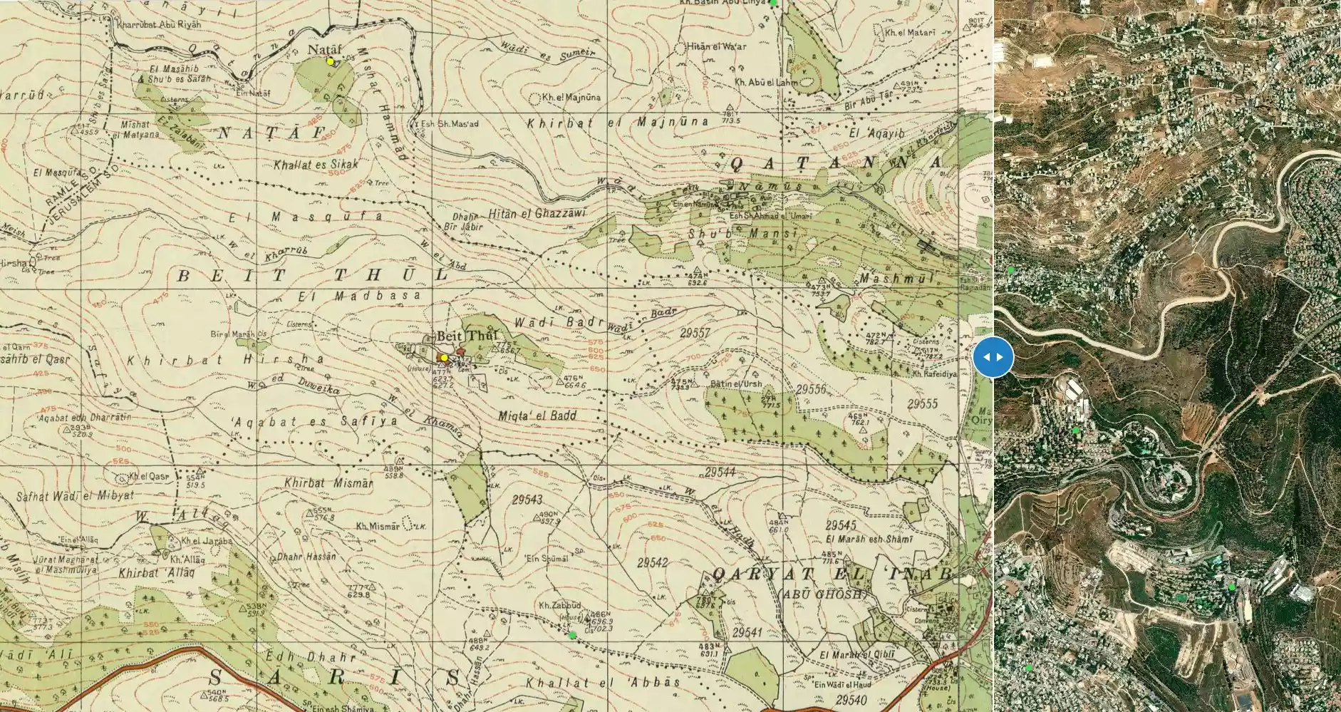
| Before & After Nakba, Click Map For Details |
|||||||||||||||||||
|
|||||||||||||||||||
| Map Location | See location #2 on the map View from satellite |
||||||||||||||||||
| Military Operation | Operation Nachshon | ||||||||||||||||||
| Village Temains | Bayt Thul was completely destroyed, and only house rubble left behind. | ||||||||||||||||||
| Ethnically Cleansing | Bayt Thul was NOT completely ethnically cleansed, few of the villagers were allowed to live in the village to this date. | ||||||||||||||||||
| Pre-Nakba Land Ownership |
**Town Lands' Demarcation Maps |
||||||||||||||||||
| Land Usage As of 1945 |
|
||||||||||||||||||
| Population |
|
||||||||||||||||||
| Number of Houses |
|
||||||||||||||||||
| Near By Towns |
|||||||||||||||||||
|
|||||||||||||||||||
| Town's Name Through History | Bayt Thul was also identified with Bayt Tun in the 1596 Ottoman tax records. | ||||||||||||||||||
| Places of Warship | The village had one mosque. | ||||||||||||||||||
| Shrines / Maqams | One maqam for unknown person | ||||||||||||||||||
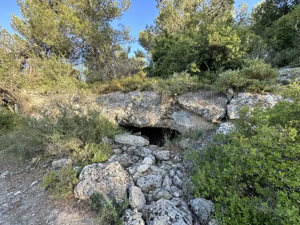
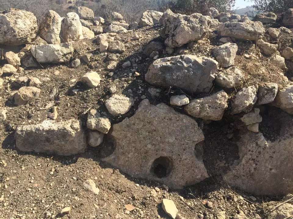
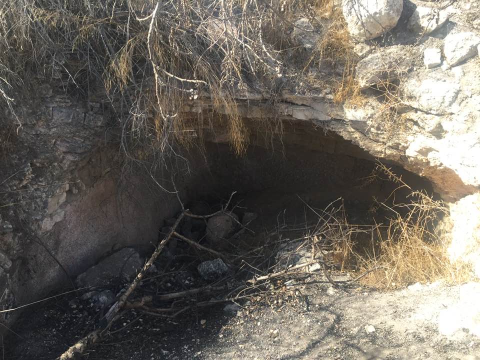
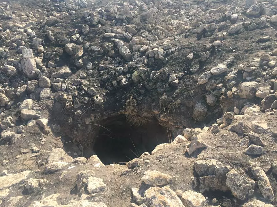
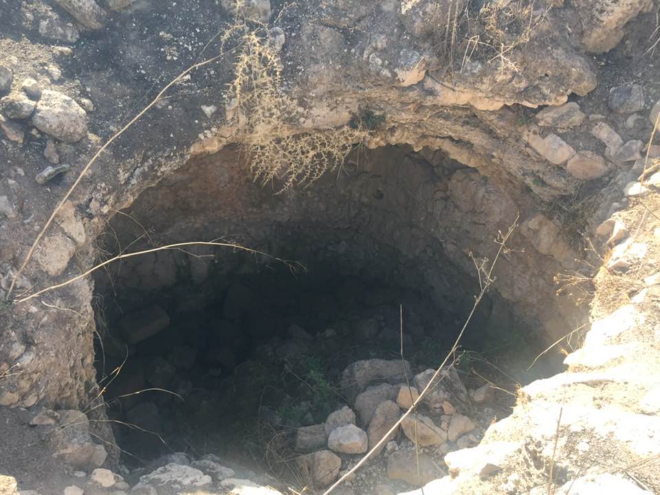
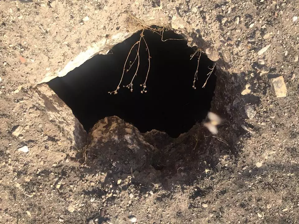
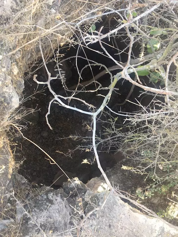
| Archeological Sites | Bayt Thul has several Khirbats containing columns, foundations of ruined buildings, cisterns, and formerly inhabited caves. | ||||||||||||||||||
| Exculsive Jewish Colonies Who Usurped Village Lands |
Nataf and Newe Ilan | ||||||||||||||||||
| Featured Video | |||||||||||||||||||
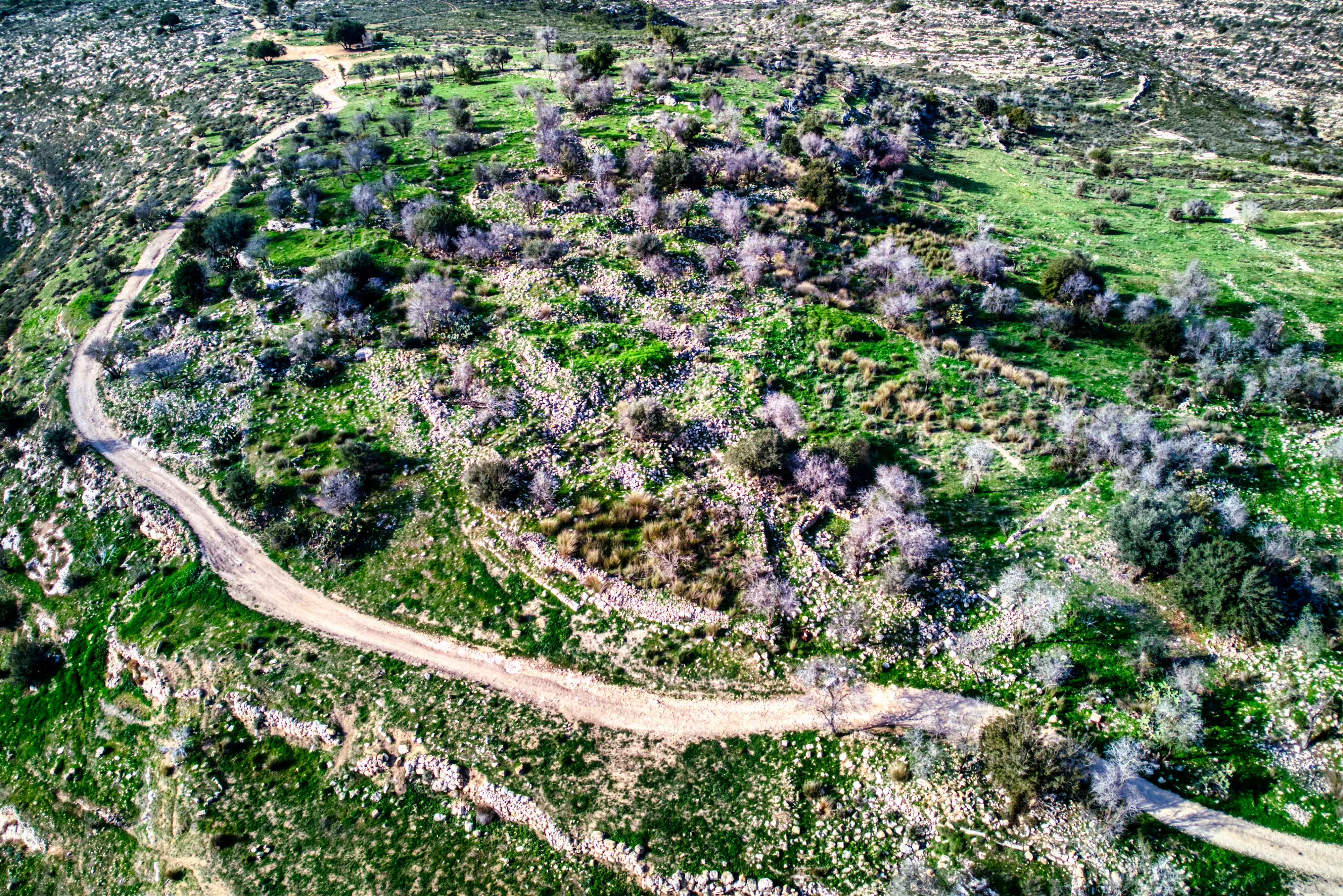
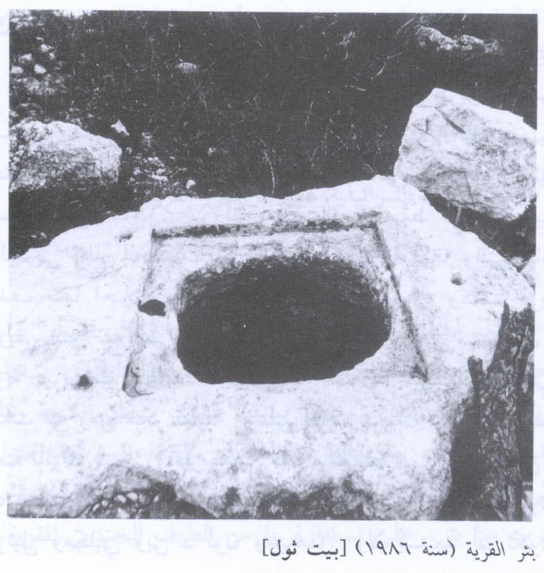
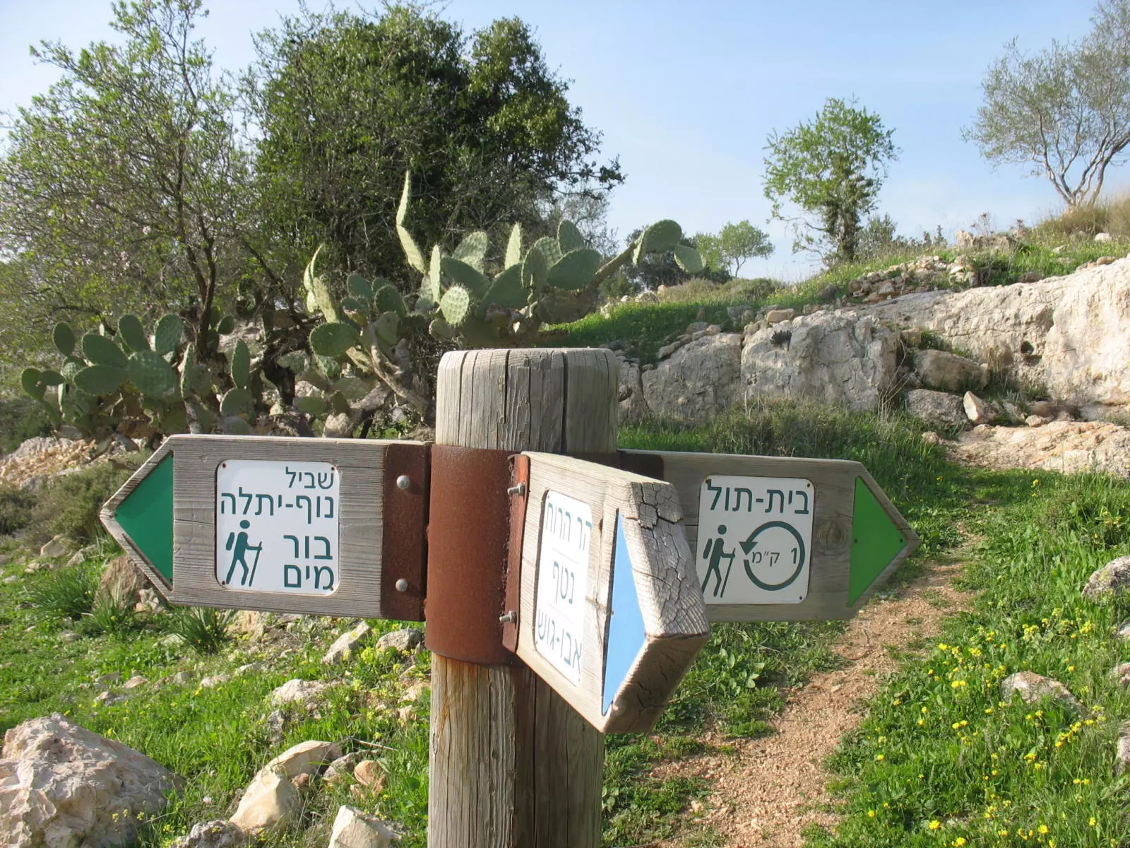
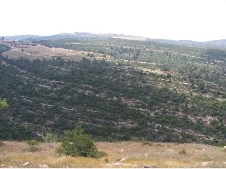
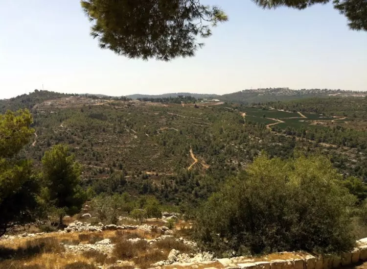
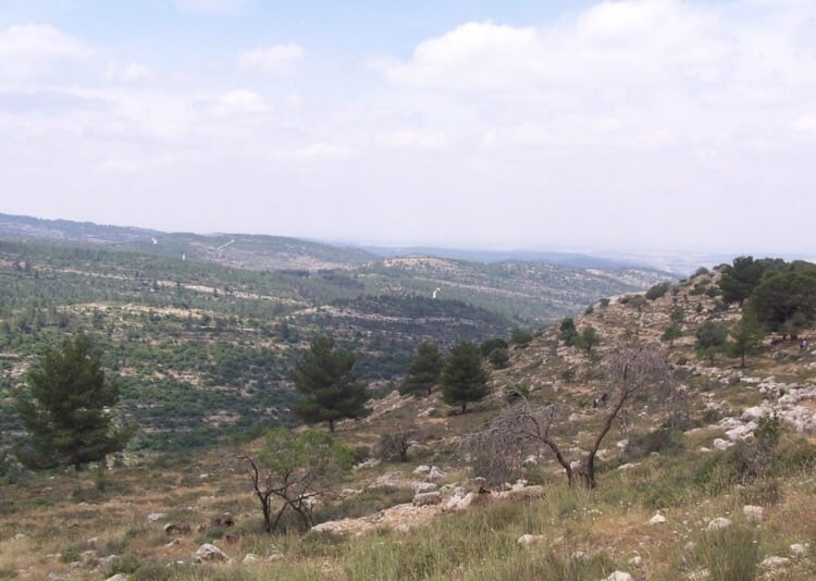
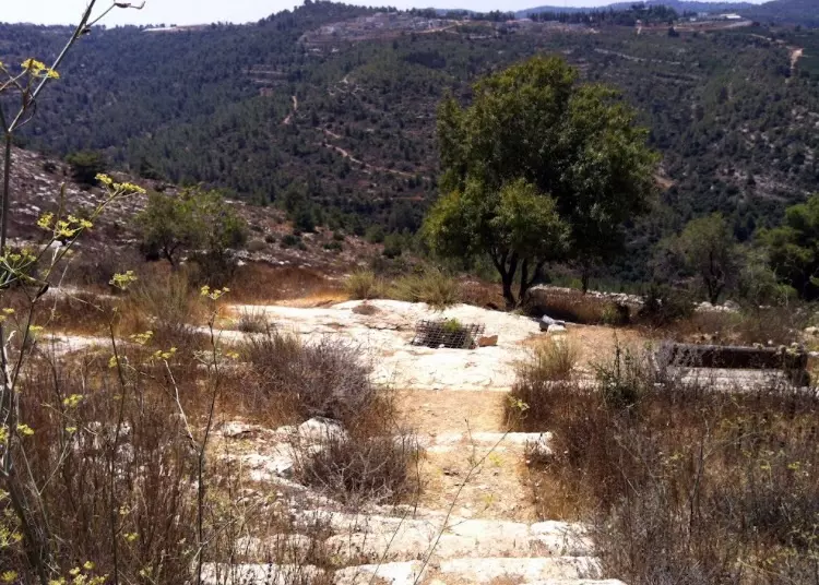
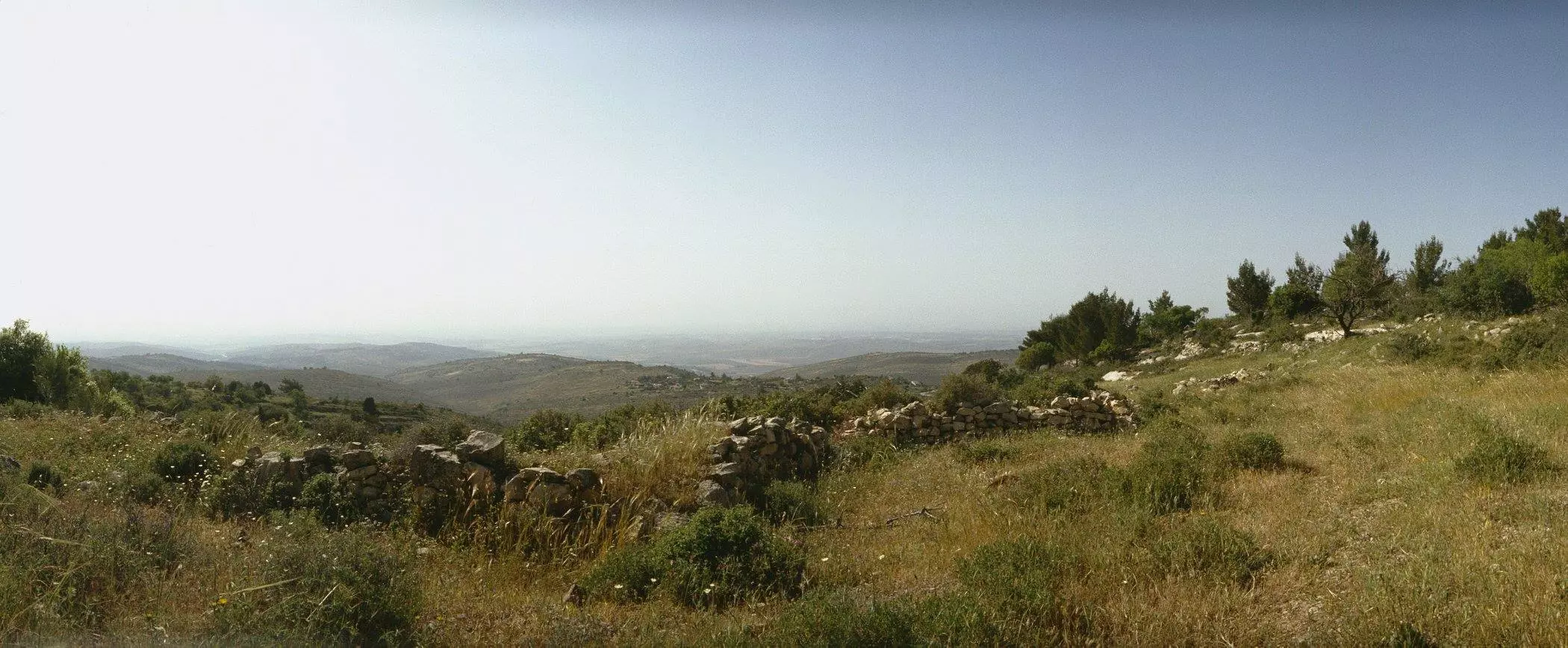
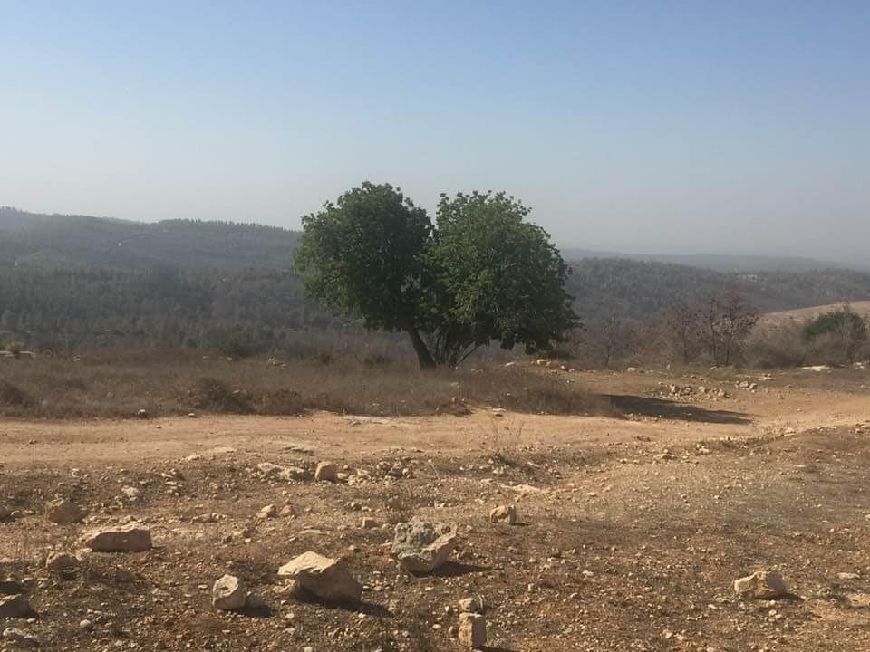
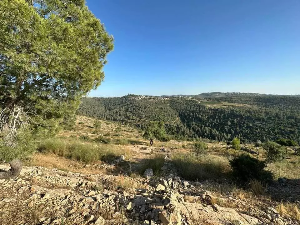
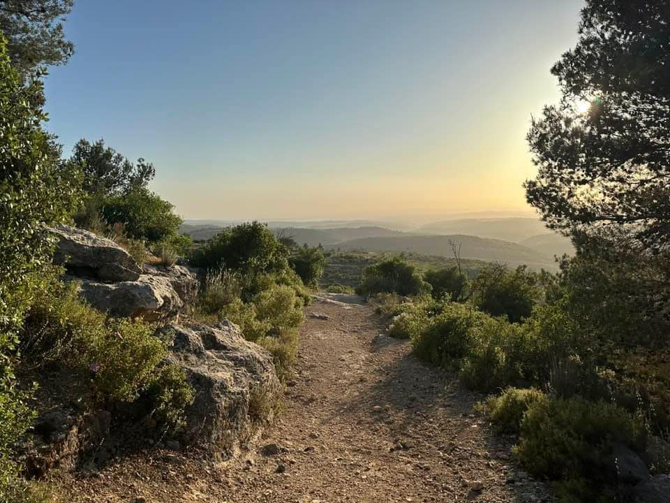
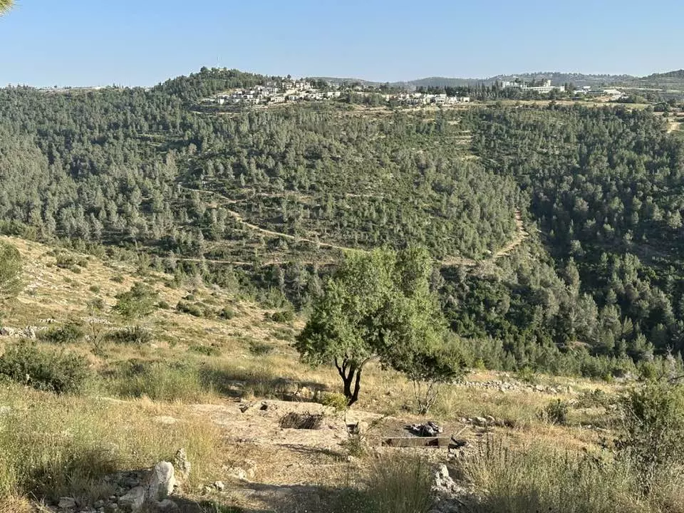
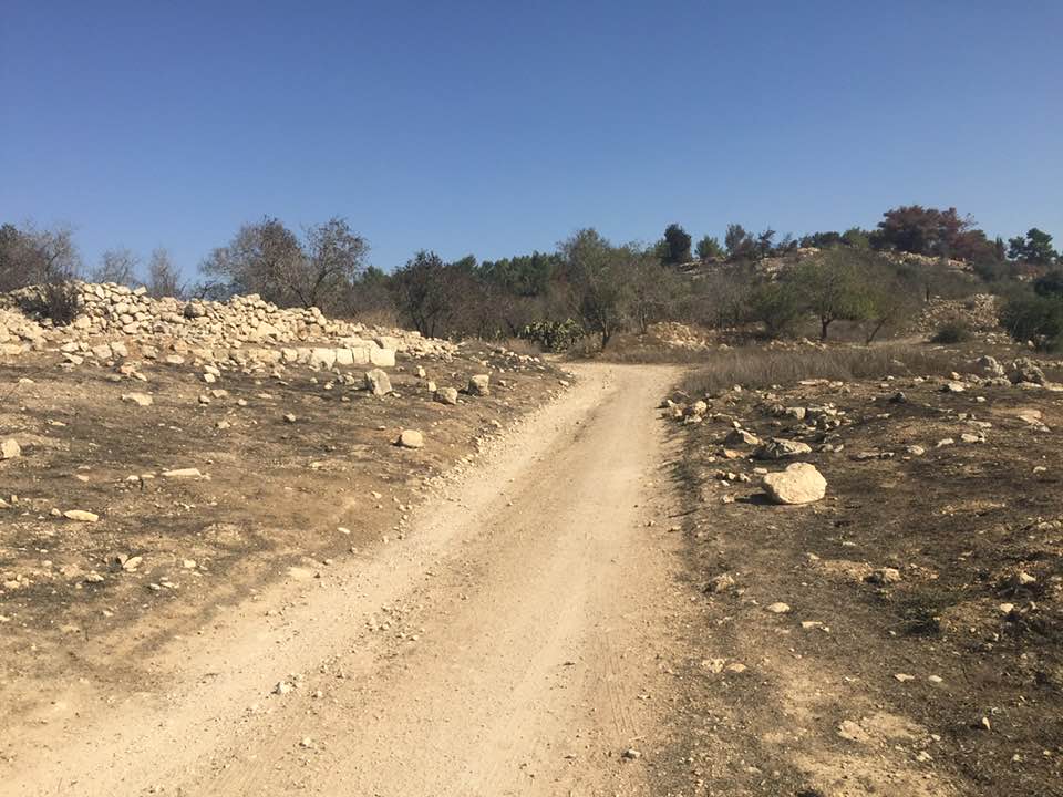
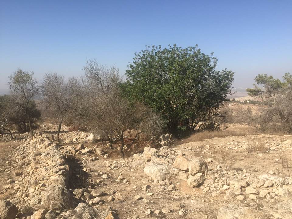
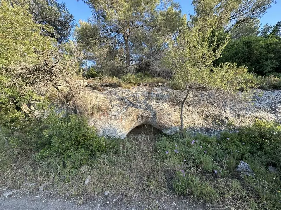
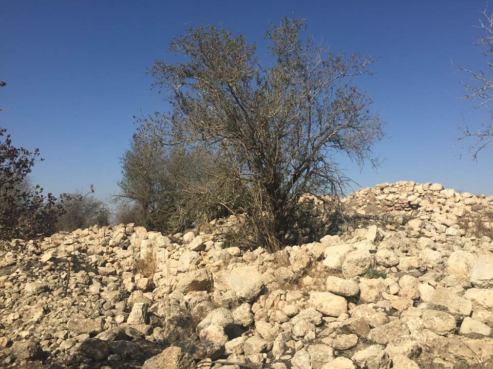
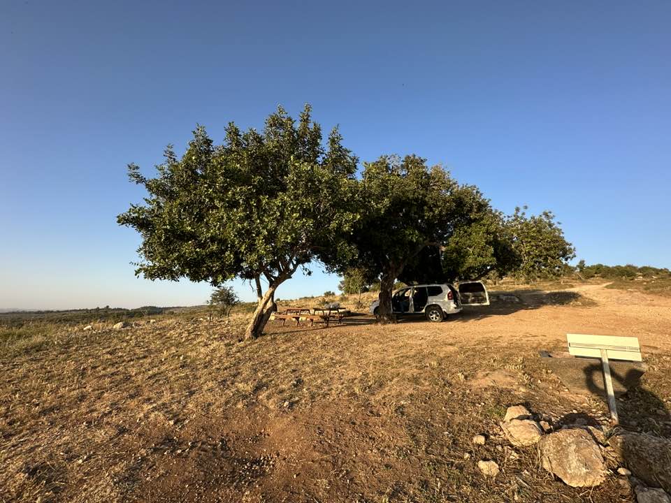
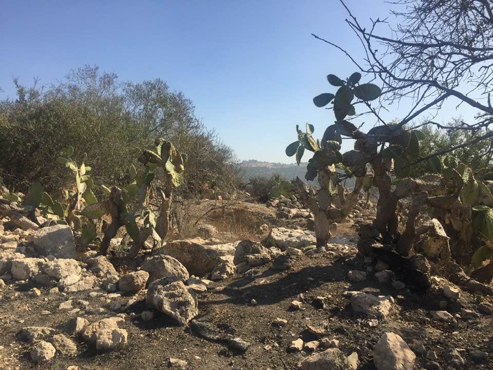
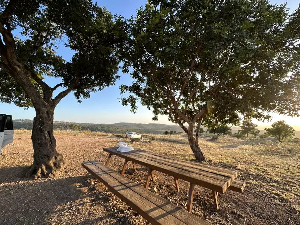
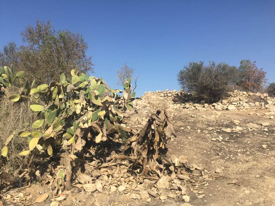
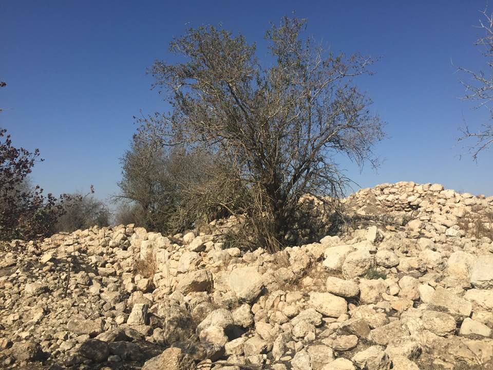
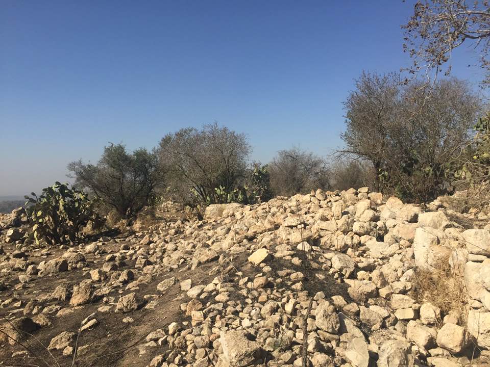
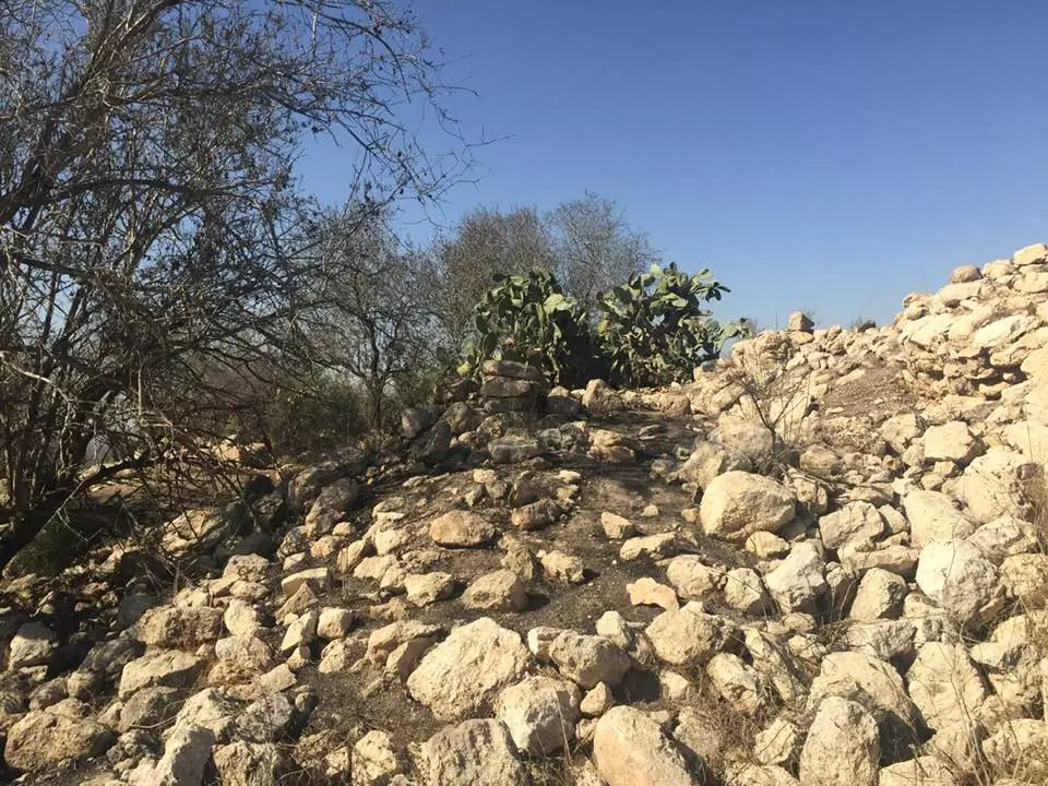
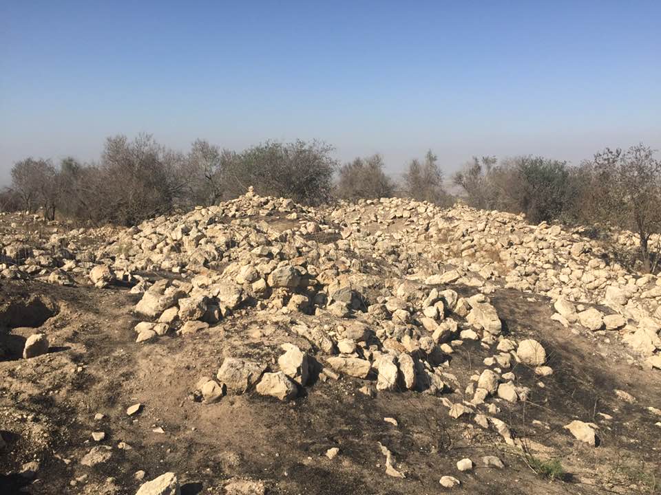
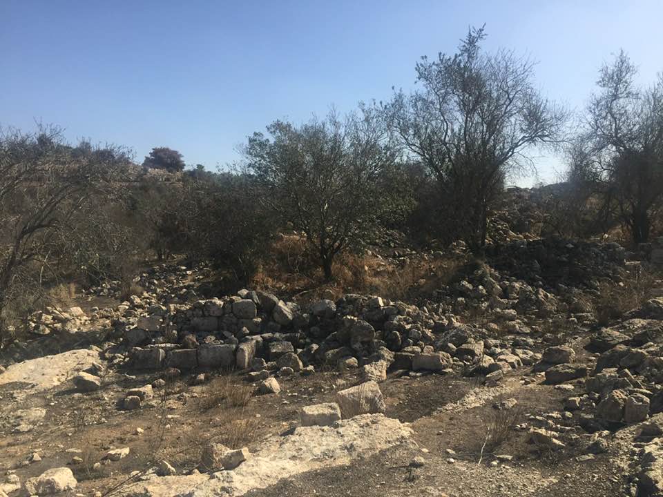
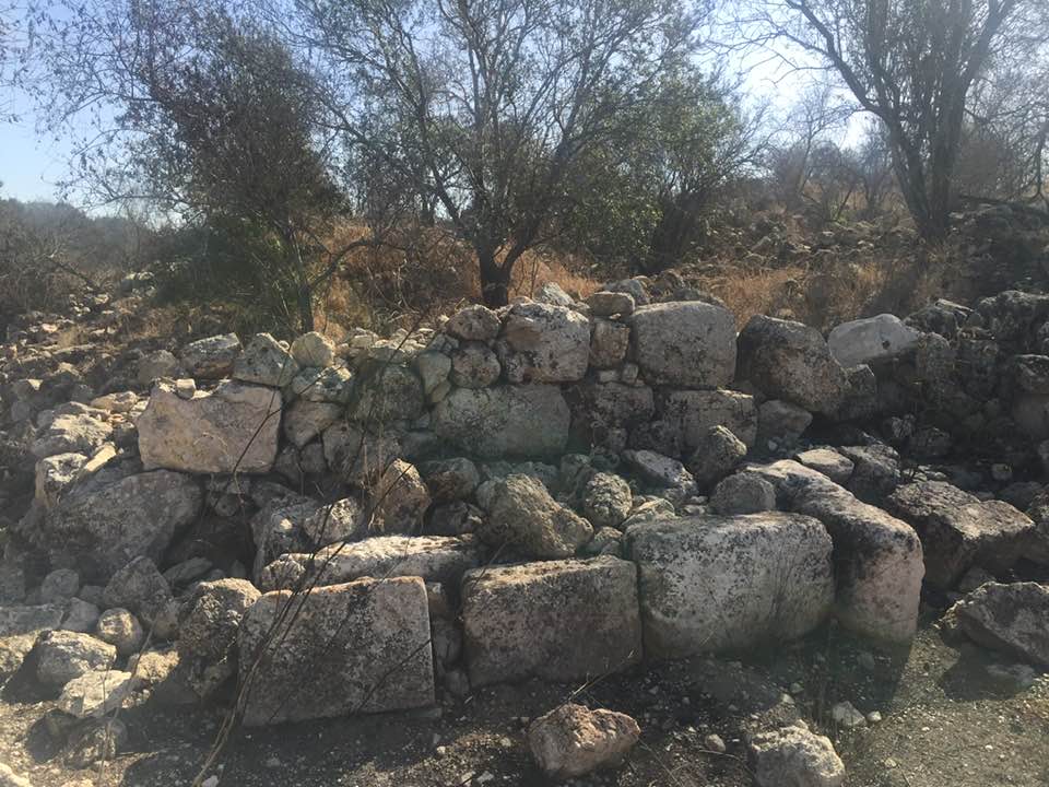
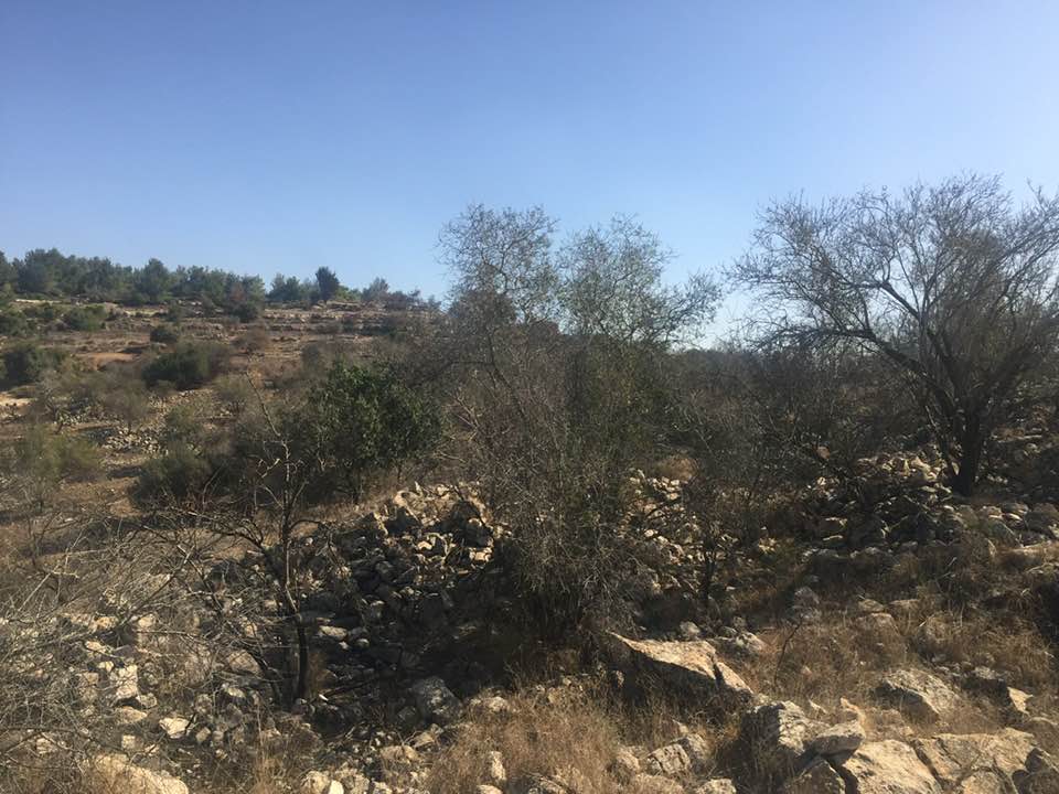
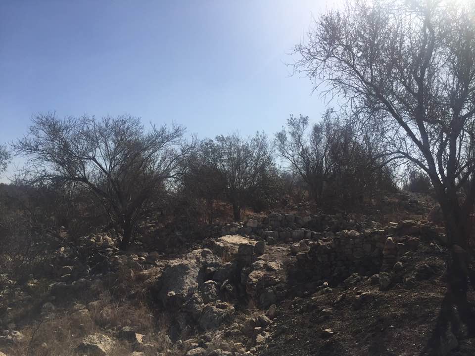
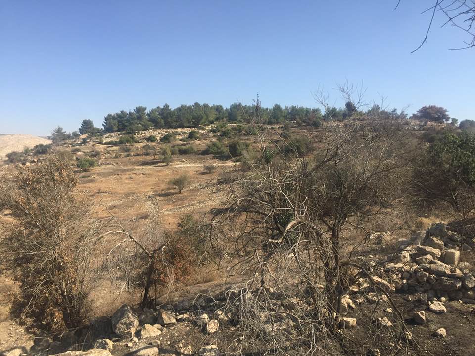
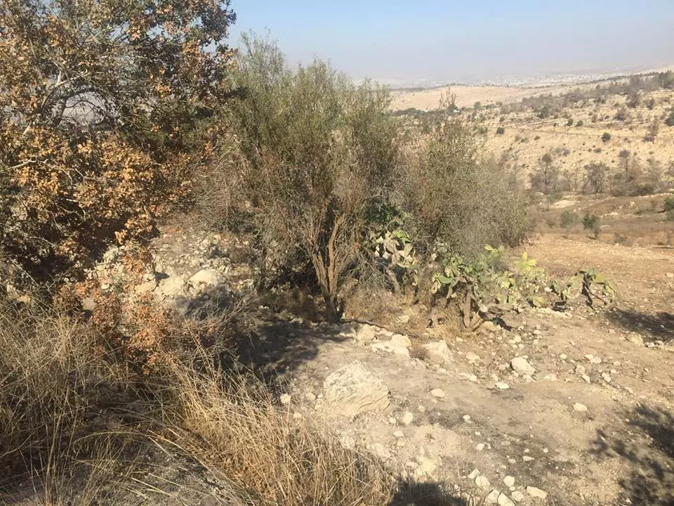
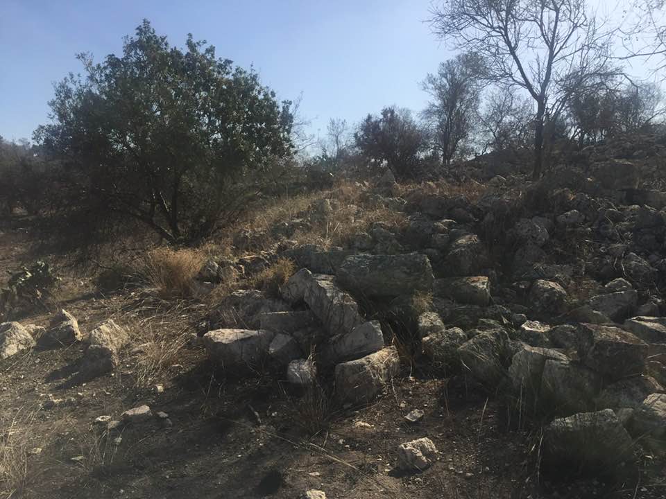
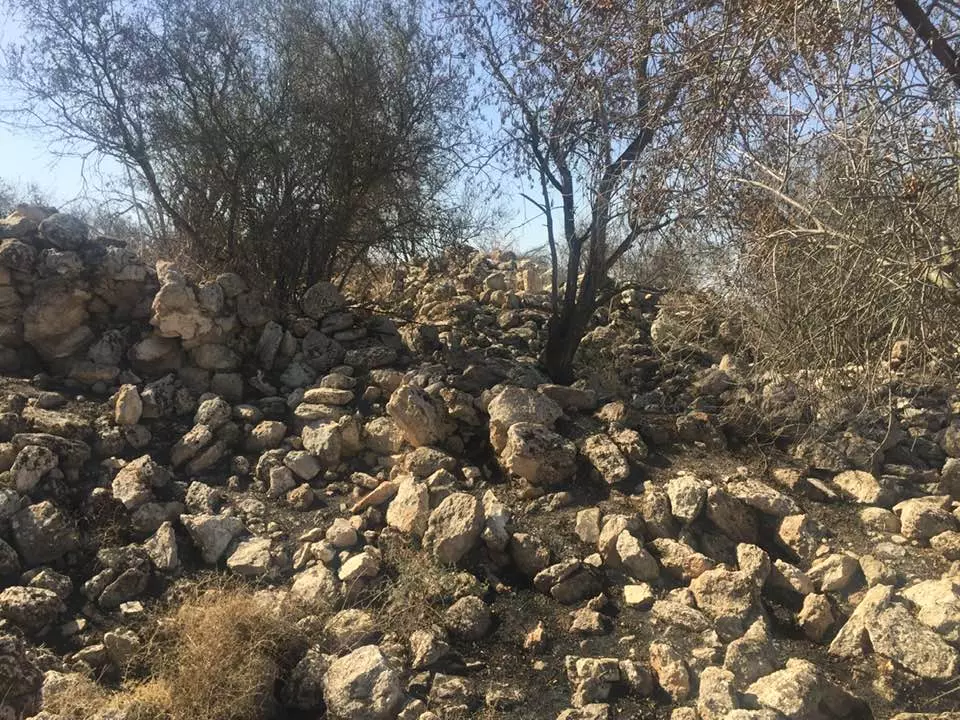
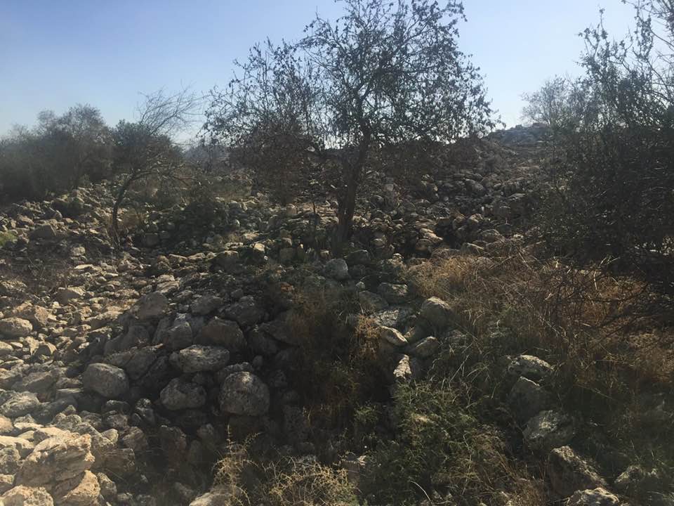
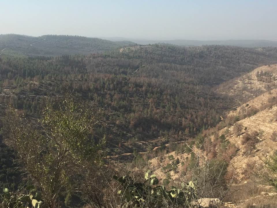
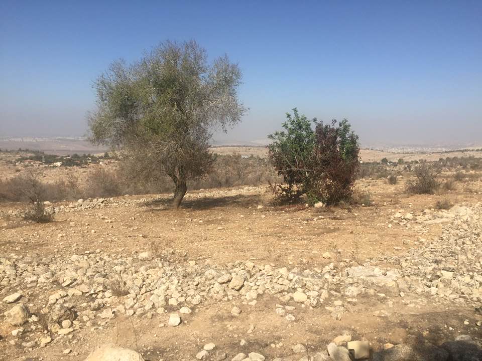
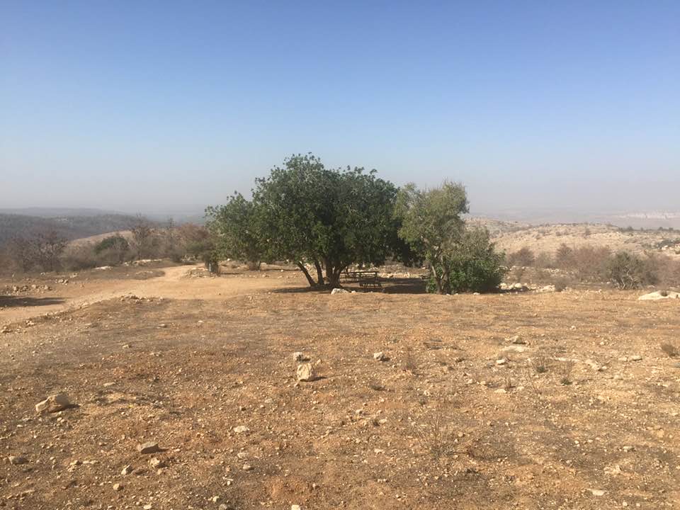
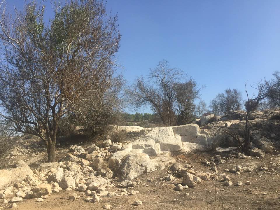
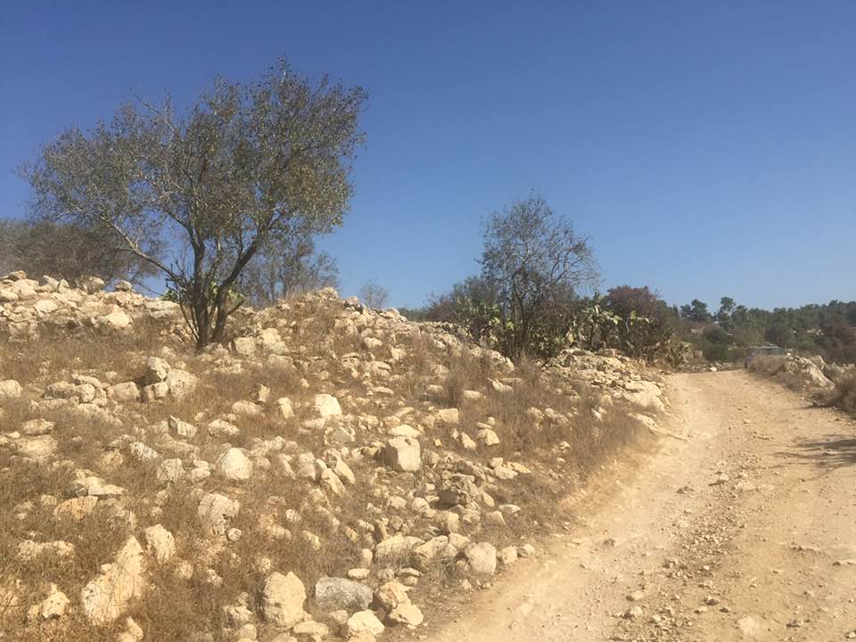
Village Before NakbaThe village stood on the western peak of a mountain range that stretched in an east−west direction. It overlooked the coastal plain, to the west. Two deep wadis ran to the northwest along the northern and southern perimeters of Bayt Thul. It was about 2 km north of the Jerusalem−Jaffa highway and was linked to it by a secondary road. Similar roads linked it to six nearby villages. Bayt Thul is identified with Bayt Tun in the 1596 Ottoman tax records. It was a village in the nahiya of Jerusalem (liwa' of Jerusalem) with a population of sixty-six. It paid taxes on wheat, barley, olive trees, pasture, goats, and beehives. The village had a rectangular configuration. It was divided into two main sections, one on the east and another on the west, flanking the village center, where shops, a mosque, and a shrine (maqam) were built. Most of its houses were built of stone; some were partially constructed of reused stones and columns from previous settlements. The villagers were Muslims. Most of them worked in agriculture, growing crops such as grain, vegetables, olives, and fruits. Their agricultural lands lay to the north, east, and south of the village, and were watered mainly by rainfall, although some orchards in the south were irrigated from spring. Olive trees covered two dunums of their land. In 1944/45 a total of 787 dunums was allotted to cereals; 55 dunums were irrigated or used for orchards. There were some archaeological remains in the village, such as columns and the foundations of ruined buildings. Four khirbas in the vicinity contained cisterns, formerly inhabited caves, and the foundations of buildings.Village Occupation and Ethnic CleaningMany of the villages on both sides of the coastal road to Jerusalem east of Ramla, including Bayt Thul, were occupied during Operation Nachshon (see Bayt Naqquba, Jerusalem sub-district), which was launched in early April 1948. But some villages fell in subsequent weeks during the smaller sub-operations that focused on the occupation of the strategic town of al-Latrun. Among the villages occupied fairly early was Saris, a few km to the south of Bayt Thul, as well as Deir Yasin, somewhat further east. While Bayt Thul itself may have been affected by the massacre at Deir Yasin, it probably fell a few weeks later in the operations which followed Nachshon (Har'el, Makkabi, Ben-Nun, and so on). Like nearby Dayr Ayyub, it may have changed hands more than once in the course of May and June. What is certain is that it was firmly in Israeli hands by mid-July. On 18 July, Israeli forces used the village as a launching point for a failed attempt to capture the village of Safa in the final hours before the beginning of the second truce.Zionists Colonies on Village LandsThe settlement of Nataf (156137) was founded on village land in 1982. Newe Ilan (158135), established in 1946, is close by, to the southeast, on lands that traditionally belonged to the village of Abu Ghawsh.Village TodayPiles of rubble are spread over a wide area on the hill. The remains of walls can be seen, with thick wild grass growing among them. Carob, cactuses, and olive and almond trees grow on terraces on the west and north sides of the site. The ruins of a large house are on the eastern side of the site, surrounded by a dilapidated wall. Two wells, carved in the rock, are still used by Palestinians who have remained in the area (see photos). Graves on the southern edge of the village are covered with weeds. A memorial has been erected for two Israeli pilots whose plane crashed on the site. A small forest on the site is dedicated to the memory of Miriam and Yehuda Lev Blichman; another forest on the site is dedicated to Hadassah/Canada. (Hadassah is the Women's Zionist Organization of America; it carries out public relations campaigns for Israel and raises money for the state.)SourceDr. Walid al-Khalidi, 1992: All That Remains. |
|||||||||||||||||||
| Related Maps | Town Lands' Demarcation Maps خرائط للقضاء توضح حدود القرى والاودية Town's map on MapQuest View from satellite Help us map this town at WikiMapia |
||||||||||||||||||
| Related Links | Wikipedia's Page Facebook Page Google Search Google For Images Google For Videos |
||||||||||||||||||
| More Information | في كتاب كي لا ننسى في كتاب بلادنا فلسطين المزيد من موقع هوية |
||||||||||||||||||
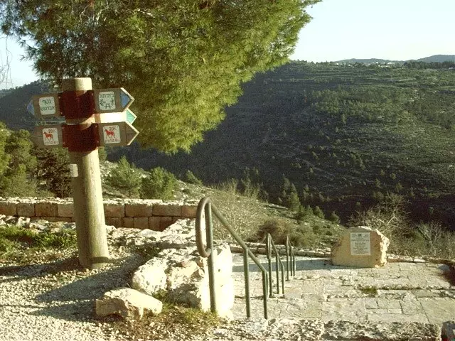
- The entrance to the village site, 1986
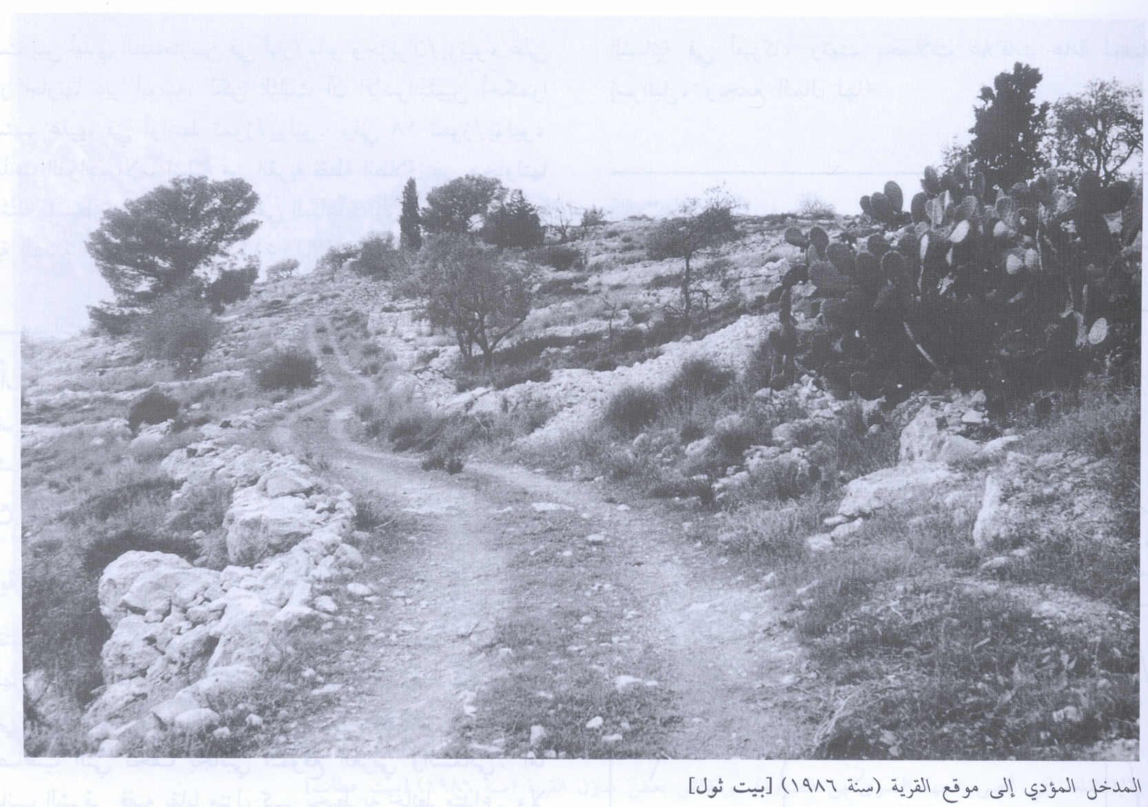
Scanned from "All That Remains" by Dr. Walid Khalidi 2 - The remains of the village well, 1986
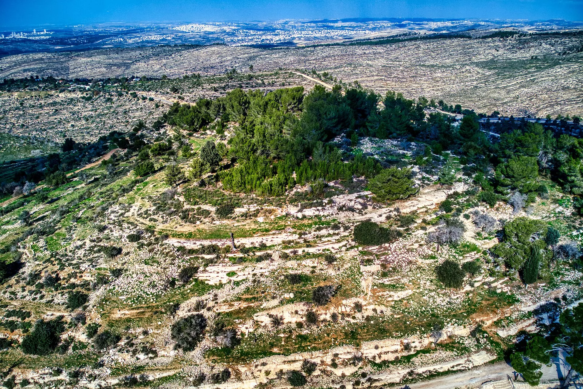
Scanned from "All That Remains" by Dr. Walid Khalidi - Beit Thul 2007
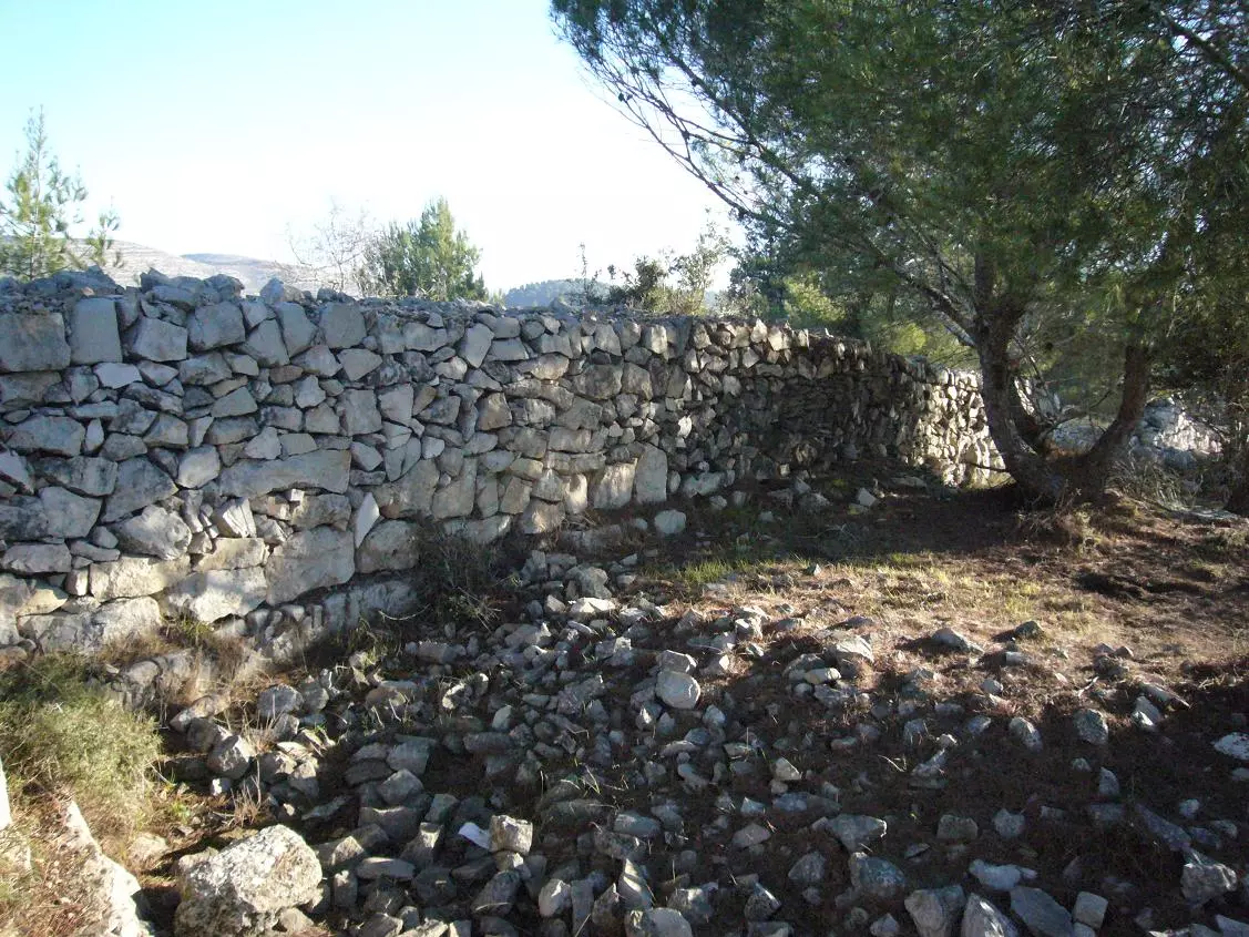
Posted by Seth Frantzman - The ruins of destroyed houses in the destroyed Palestinian village.
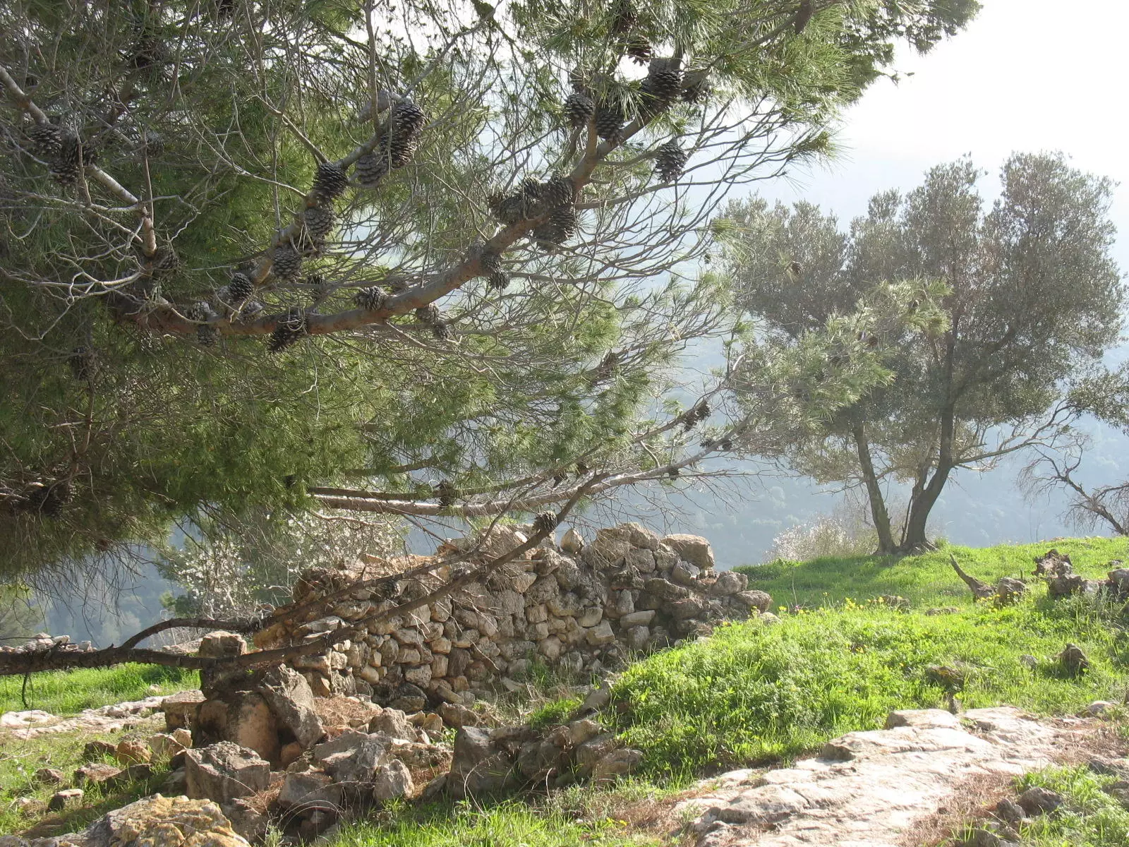
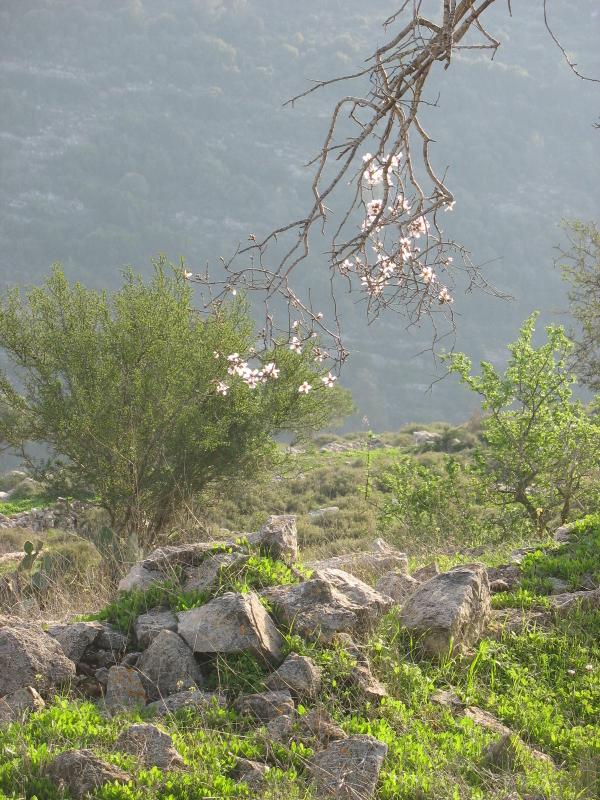
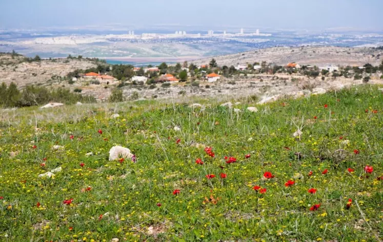
Posted by Noga Kadman - The ruins of the destroyed Palestinian house in the destroyed village. Almond trees appears in the background during the spring season.
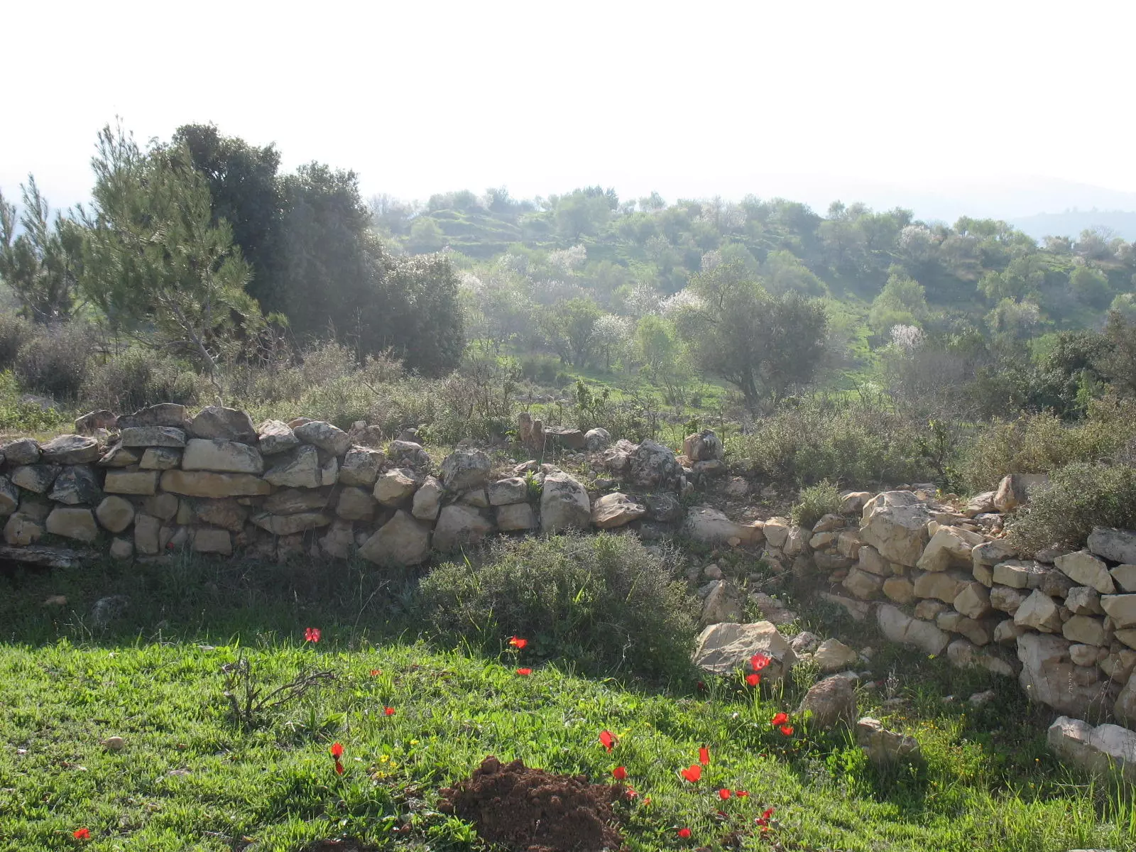
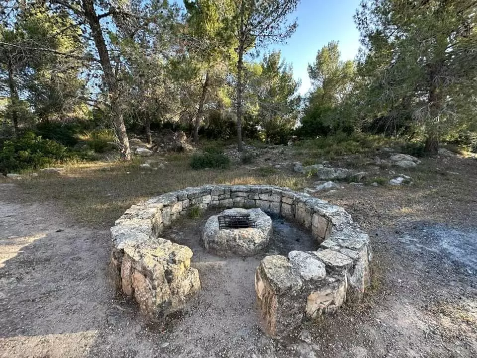
Posted by Noga Kadman - Now the ruins of the destroyed Palestinian village serves the Israeli public (as usually done) as picnic park.
Posted by Noga Kadman - More ruins and destruction
Posted by Noga Kadman - More ruins and destruction

Posted by Noga Kadman 6 - طبعا بأستخدام حجارة المنازل المدمرة للقرية(JNF) مدخل لساحة تم عملها من صندوق اليهود الوطني
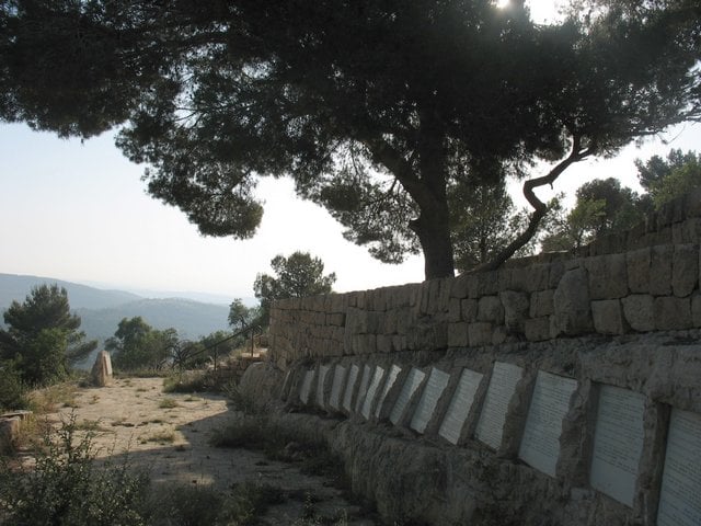
Posted by Fadi ALI 1 - نصب تذكاري يبين اسماء اليهود المتبرعين لصندوق اليهود الوطني من دول العالم )
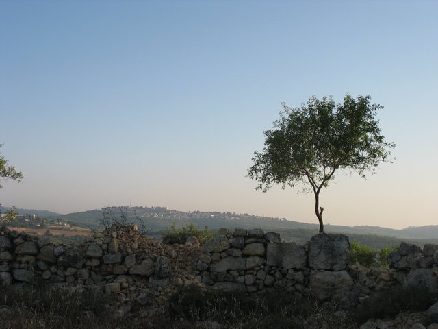
Posted by Fadi ALI 1 - منظر مطل على مستعمرة نتاف
Posted by Fadi ALI - من موقع القريه
Posted by abu raya - جنوب القريه
Posted by abu raya - موقع القريه واثار البيوت
Posted by abu raya - بيت ثول
Posted by abu raya - بيت ثول
Posted by abu raya - أطلال قرية بيت ثول (قضاء القدس ) .
- That is how the "civilized" erased and replaced us: Bayt Thul was completely obliterated, as you see -- بيت ثول باتت أثر بعد عين. من هنا مر الهمجّ
- That is how the "civilized" erased and replaced us: Bayt Thul was completely obliterated, as you see -- بيت ثول باتت أثر بعد عين. من هنا مر الهمجّ #2
- That is how the "civilized" erased and replaced us: Bayt Thul was completely obliterated, as you see -- بيت ثول باتت أثر بعد عين. من هنا مر الهمجّ #3
- That is how the "civilized" erased and replaced us: Bayt Thul was completely obliterated, as you see -- بيت ثول باتت أثر بعد عين. من هنا مر الهمجّ #4
- That is how the "civilized" erased and replaced us: Bayt Thul was completely obliterated, as you see -- بيت ثول باتت أثر بعد عين. من هنا مر الهمجّ #5

- That is how the "civilized" erased and replaced us: Bayt Thul was completely obliterated, as you see -- بيت ثول باتت أثر بعد عين. من هنا مر الهمجّ #6
- That is how the "civilized" erased and replaced us: Bayt Thul was completely obliterated, as you see -- بيت ثول باتت أثر بعد عين. من هنا مر الهمجّ #7
- That is how the "civilized" erased and replaced us: Bayt Thul was completely obliterated, as you see -- بيت ثول باتت أثر بعد عين. من هنا مر الهمجّ
- That is how the "civilized" erased and replaced us: Bayt Thul was completely obliterated, as you see -- بيت ثول باتت أثر بعد عين. من هنا مر الهمجّ
#2
- That is how the "civilized" erased and replaced us: Bayt Thul was completely obliterated, as you see -- بيت ثول باتت أثر بعد عين. من هنا مر الهمجّ
#3
- That is how the "civilized" erased and replaced us: Bayt Thul was completely obliterated, as you see -- بيت ثول باتت أثر بعد عين. من هنا مر الهمجّ
#4
- That is how the "civilized" erased and replaced us: Bayt Thul was completely obliterated, as you see -- بيت ثول باتت أثر بعد عين. من هنا مر الهمجّ
#5
- That is how the "civilized" erased and replaced us: Bayt Thul was completely obliterated, as you see -- بيت ثول باتت أثر بعد عين. من هنا مر الهمجّ
#6
- That is how the "civilized" erased and replaced us: Bayt Thul was completely obliterated, as you see -- بيت ثول باتت أثر بعد عين. من هنا مر الهمجّ
#7
- That is how the "civilized" erased and replaced us: Bayt Thul was completely obliterated, as you see -- بيت ثول باتت أثر بعد عين. من هنا مر الهمجّ
#8
- That is how the "civilized" erased and replaced us: Bayt Thul was completely obliterated, as you see -- بيت ثول باتت أثر بعد عين. من هنا مر الهمجّ
#9
- Let us see how the most "liberal and civilized" of world Jewry has obliterated our village. How else will the Jews be great and safe again? -- القرية دمرت بالكامل.. من هنا مر الهمج
- Let us see how the most "liberal and civilized" of world Jewry has obliterated our village. How else will the Jews be great and safe again? -- القرية دمرت بالكامل.. من هنا مر الهمج #2
- Let us see how the most "liberal and civilized" of world Jewry has obliterated our village. How else will the Jews be great and safe again? -- القرية دمرت بالكامل.. من هنا مر الهمج #3
- Let us see how the most "liberal and civilized" of world Jewry has obliterated our village. How else will the Jews be great and safe again? -- القرية دمرت بالكامل.. من هنا مر الهمج #4
- Let us see how the most "liberal and civilized" of world Jewry has obliterated our village. How else will the Jews be great and safe again? -- القرية دمرت بالكامل.. من هنا مر الهمج #5
- Let us see how the most "liberal and civilized" of world Jewry has obliterated our village. How else will the Jews be great and safe again? -- القرية دمرت بالكامل.. من هنا مر الهمج #6
- Let us see how the most "liberal and civilized" of world Jewry has obliterated our village. How else will the Jews be great and safe again? -- القرية دمرت بالكامل.. من هنا مر الهمج #7
- Let us see how the most "liberal and civilized" of world Jewry has obliterated our village. How else will the Jews be great and safe again? -- القرية دمرت بالكامل.. من هنا مر الهمج #8
- Let us see how the most "liberal and civilized" of world Jewry has obliterated our village. How else will the Jews be great and safe again? -- القرية دمرت بالكامل.. من هنا مر الهمج #9
- Let us see how the most "liberal and civilized" of world Jewry has obliterated our village. How else will the Jews be great and safe again? -- القرية دمرت بالكامل.. من هنا مر الهمج #10
- Let us see how the most "liberal and civilized" of world Jewry has obliterated our village. How else will the Jews be great and safe again? -- القرية دمرت بالكامل.. من هنا مر الهمج #11
- Let us see how the most "liberal and civilized" of world Jewry has obliterated our village. How else will the Jews be great and safe again? -- القرية دمرت بالكامل.. من هنا مر الهمج #12
- Let us see how the most "liberal and civilized" of world Jewry has obliterated our village. How else will the Jews be great and safe again? -- القرية دمرت بالكامل.. من هنا مر الهمج #13
- Let us see how the most "liberal and civilized" of world Jewry has obliterated our village. How else will the Jews be great and safe again? -- القرية دمرت بالكامل.. من هنا مر الهمج #14
- Let us see how the most "liberal and civilized" of world Jewry has obliterated our village. How else will the Jews be great and safe again? -- القرية دمرت بالكامل.. من هنا مر الهمج #15
- Let us see how the most "liberal and civilized" of world Jewry has obliterated our village. How else will the Jews be great and safe again? -- القرية دمرت بالكامل.. من هنا مر الهمج #16
- Let us see how the most "liberal and civilized" of world Jewry has obliterated our village. How else will the Jews be great and safe again? -- القرية دمرت بالكامل.. من هنا مر الهمج #17
- Let us see how the most "liberal and civilized" of world Jewry has obliterated our village. How else will the Jews be great and safe again? -- القرية دمرت بالكامل.. من هنا مر الهمج #18
- Let us see how the most "liberal and civilized" of world Jewry has obliterated our village. How else will the Jews be great and safe again? -- القرية دمرت بالكامل.. من هنا مر الهمج #19
- Let us see how the most "liberal and civilized" of world Jewry has obliterated our village. How else will the Jews be great and safe again? -- القرية دمرت بالكامل.. من هنا مر الهمج #20
- Let us see how the most "liberal and civilized" of world Jewry has obliterated our village. How else will the Jews be great and safe again? -- القرية دمرت بالكامل.. من هنا مر الهمج #21
- Let us see how the most "liberal and civilized" of world Jewry has obliterated our village. How else will the Jews be great and safe again? -- القرية دمرت بالكامل.. من هنا مر الهمج #22
- Let us see how the most "liberal and civilized" of world Jewry has obliterated our village. How else will the Jews be great and safe again? -- القرية دمرت بالكامل.. من هنا مر الهمج #23
- Let us see how the most "liberal and civilized" of world Jewry has obliterated our village. How else will the Jews be great and safe again? -- القرية دمرت بالكامل.. من هنا مر الهمج #24
- Let us see how the most "liberal and civilized" of world Jewry has obliterated our village. How else will the Jews be great and safe again? -- القرية دمرت بالكامل.. من هنا مر الهمج #25
Want to browse more? 80,000 pictures were grouped in these gallaries:
| Display Name | Clan/Hamolah | Country of Residence |
| Ala' | Alqam | Jerusalem |
| غاده | علقم | - |
| علقم | - | القدس, مخيم شعفاط |
| Fadi ALI | - | - |
| alqam | alqam | ramallah, palestine |
| Neda Khalil | Mohammed Ali | NJ, USA |
No links have been shared yet, be free to the first to share the first link.
 Fake Valor: Why Did Zionist Jews Hoist Nazis Flag on Their Ships in the 1930s?
What is new?
-
Facts About Oct. 7th Gaza Raid
-
Remined Us Please:: Who Did Rape Who? Palestinians Raped Israelis? Or, was the other way around?
-
When Prof. Edward Said was invited to debate Bibi Netanyahu in the 1980s, watch what happened!
-
Ezra Klein of the NY Times on the "Jewish Race".
-
Abusing Blood Libel!
-
Did Israeli Soldiers Activate The Hanniba Direective On Oct. 7th? You Be The Judge
-
Zionist FAQ: Isn't it true that Palestinians don't want peace? Palestinians never accepted the two-state solution
- Facts about Haavara (Transfer) Agreement between Ben-Gurion & Hitler
-
Haavara FAQs: Why Did Zionist Jews Hoist Nazis' Flags on Their Ships in the 1930s?
- Haavara FAQs: When Chaim Weizmann met FDR in mid-1943, why was he silent about rescuing European Jewry?
-
Dear ChatGPT: How did Palestinians resist Napoleon's invasion of their country in 1799?
-
Dear ChatGPT: Gaza had a vibrant Jewish community in the mid-17th century. What happened to them?
-
Dear ChatGPT: Why did the Jewish Agency suppress news of the Holocaust during WWII?
-
Video Playlist: Jews share their DNA tests to end the conflict for good.
-
A Tale of Two Conflicts: Examining the Definition of Genocide
-
Prof. Abraham Polak And The Suppressed History of the Khazars and European Jewry
-
How Ronald Reagan would have framed the genocide in Gaza if he were still alive?
-
Haavara FAQs: Let us do the math: how many German Jews did The Haavara Agreement save?
-
Zionist FAQs: The Hebron Massacre of 1929, "clearly proves" that Palestinians are antisemitic, how could you deny it?
-
Zionist FAQs: Why Anti-Zionist Is Not Antisemitism?
-
Zionist FAQs: Isn't it true that the KGB created Palestinian Nationalism in the early 1960s?
- Zionist FAQs: Muslims are killing Muslims all the time; why are Israeli Jews being singled out in the media?
- Zionist FAQs: How is Israel an apartheid state when 20% of its citizens are Arabs who enjoy full rights?
-
Haavara FAQs: Why Did Dorothy Thompson Flip From A Zionist Advocate to A Silenced Dissenter?
-
Haavara FAQs: Analysis of Herzl's Uganda Scheme and how it could have saved millions of Jews.
-
Haavara FAQs: Why did Hayim Greenberg describe American Jewry as "morally bankrupt" in early 1943?
-
Haavara FAQs: What if the Evian Conference was a resounding success? What would have been the impact of saving European Jewry on Zionism?
- Haavara FAQs: What if the six million were saved, how that would have impacted the Zionist project?
-
Haavara FAQs: How did Zionist leaders react when Europe's Jews lingered in the DP camps after WWII ended?
-
Why does the American Jewish community repeat lies that David Ben-Gurion had debunked before he died?
-
Who has the power to rename the Tatar/Khazar Gene Marker to Jewish IV?
-
Zionist FAQs: Why won't Egypt, Syria, and Jordan take their people back? Jews are indigenous to Palestine, and Arabs immigrated after Jews developed the country. Arabs should leave.
-
Haavara FAQs: Did Hitler and the Nazis conflate between Judaism and Zionist? If that wasn't case, then why?
-
Haavara FAQs: Winston Churchill and antisemitism, a collection of articles written Churchill.
-
Haavara FAQs: Broken by country, how many Jews survived vs. killed during the Holocaust?
-
Haavara FAQs: Why did European Jews vote with their feet and to immigrated to the Americas, not Palestine, after WWII?
-
Watch this American Jewish Girl describing Israeli Jews' cognitive dissonance like no other in under two minutes
-
Haavara FAQs: When the Nazis went out of their way to hide the Holocaust, Israeli Jews did the exact opposite by broadcasting their genocide of Gazans. But why?
-
Haavara FAQs: How Zionist Jews went out of their to show their appreciation to Nazism and Fascism?
- Haavara FAQs: Why Zionist leaders were against bombing the death camps & the Railroads leading to them?
-
Haavara FAQs: Hitler's message to the British and American people: If Jews are such noble citizens and you care about them, how come you're not letting them in? I will gladly ship them to you at my expense, even on luxury liners!
-
A shortlist of Zionist and Israeli false flag operations in the name Jews.
-
The Most Moral Army
- The Land of Kapos (Israel): Where the brave are boycotted and Kapos walk free.
- Why did early Zionists often named their communal enterprises "colonial"?
- Zionist Relations with Nazi Germany by Faris Glubb
-
Two NY Times advertisements by Zionists in the early 1943 that exposes Zionists' treason at the height of the calamity
- Facts Not Lies about the Palestinian-Israeli Conflict.
- Site's pictures have been categorized
- Campgain Against Lice
- A Survey of Palestine, the official source about Palestine before Nakba produced by the British Mandate; over 1200 pages.
- Satellite View & Google Earth: Over 6,000 placemarks identifying all destroyed towns, W. Bank & Gaza Strip Towns, & refugee camps.
- PalestineRemembered.com and its Nakba Oral History Project were featured on al-Jazeera Satellite TV.
- Nakba Oral History Video Podcast:
 Over 700 Oral History interviews (including 3,500+ hours of recording) can be viewed online.
 - Palestine Village Statistics Project
- Gaza Jail Break
- النسخة العربية للموقع الان متوفرة
- Videos: Documenting the destroyed villages in video: Tracing all that remains since Nakba.
- Videos: Responding to Zionist Propaganda
- Interview: The ethnic cleansing of Palestine: George Galloway interviews Israeli Historian Ilan Pappe.
- For Palestinians, memory matters. It provides a blueprint for their future By George Bisharat.
- Zionist FAQ now available in Hebrew שאלות שציונים שואלים, עכשיו בעברית
- Video: The Stephen Walt and John Mearsheimer report on the influence of the Israel Lobby on U.S. Foreign Policy
- The Palestinian-Israeli conflict for beginners
