| PalestineRemembered | About Us | Oral History | العربية | |
| Pictures | Zionist FAQs | Haavara | Maps | |
| Search |
| Camps |
| Districts |
| Acre |
| Baysan |
| Beersheba |
| Bethlehem |
| Gaza |
| Haifa |
| Hebron |
| Jaffa |
| Jericho |
| Jerusalem |
| Jinin |
| Nablus |
| Nazareth |
| Ramallah |
| al-Ramla |
| Safad |
| Tiberias |
| Tulkarm |
| Donate |
| Contact |
| Profile |
| Videos |
Welcome To Kirad al-Ghannama - كراد الغنامة (כיראד אל-ע'נאמה)
|
District of Safad
Ethnically cleansed days ago |
العربية Google Earth |
 |
Gallery (16) |
- Statistics & Facts
-
Before & After

- Satellite View
- Articles 1
- Pictures 16
- Oral History 2
- Members 2
- All That Remains
- Wikipedia
- Videos 1
- Guest Book 2
- Links
| Statistic & Fact | Value | |||||||||||||||||||||
| Occupation Date | April 22, 1948 | |||||||||||||||||||||
| Distance From District | 11 (km) North East of Safad | |||||||||||||||||||||
| Elevation | 150 (meters) | |||||||||||||||||||||
| Before & After Nakba, Click Map For Details |
||||||||||||||||||||||
|
||||||||||||||||||||||
| Map Location | See location #47 on the map View from satellite |
|||||||||||||||||||||
| Military Operation | Operation Yiftach (commanded by the ethnic cleansing champion Yigal Allon) | |||||||||||||||||||||
| Attacking Units | The Palmach's First Battalion | |||||||||||||||||||||
| Acts of Terror | Kirad al-Ghannama was mostly ethnically cleansed and terrorized soon after the massacre committed at the nearby village of al-Husayniyya(Safad). See al-Husayniyya (Safad) for more details | |||||||||||||||||||||
| Exodus Cause | Influence of fall of, or exoduce from, neighboring town | |||||||||||||||||||||
| Village Temains | The village has been completely destroyed, and only the rubble of destroyed houses left behind. | |||||||||||||||||||||
| Ethnically Cleansing |
In mid-March, the inhabitants of Kiradal-Ghannama were partially terrorized into fleeing their homes after the massacre perpetrated in al-Husayniyya, and in 1956 the DMZ's 2,200 inhabitants were all terrorized into fleeing to Syria by the Israeli Army. |
|||||||||||||||||||||
| Pre-Nakba Land Ownership |
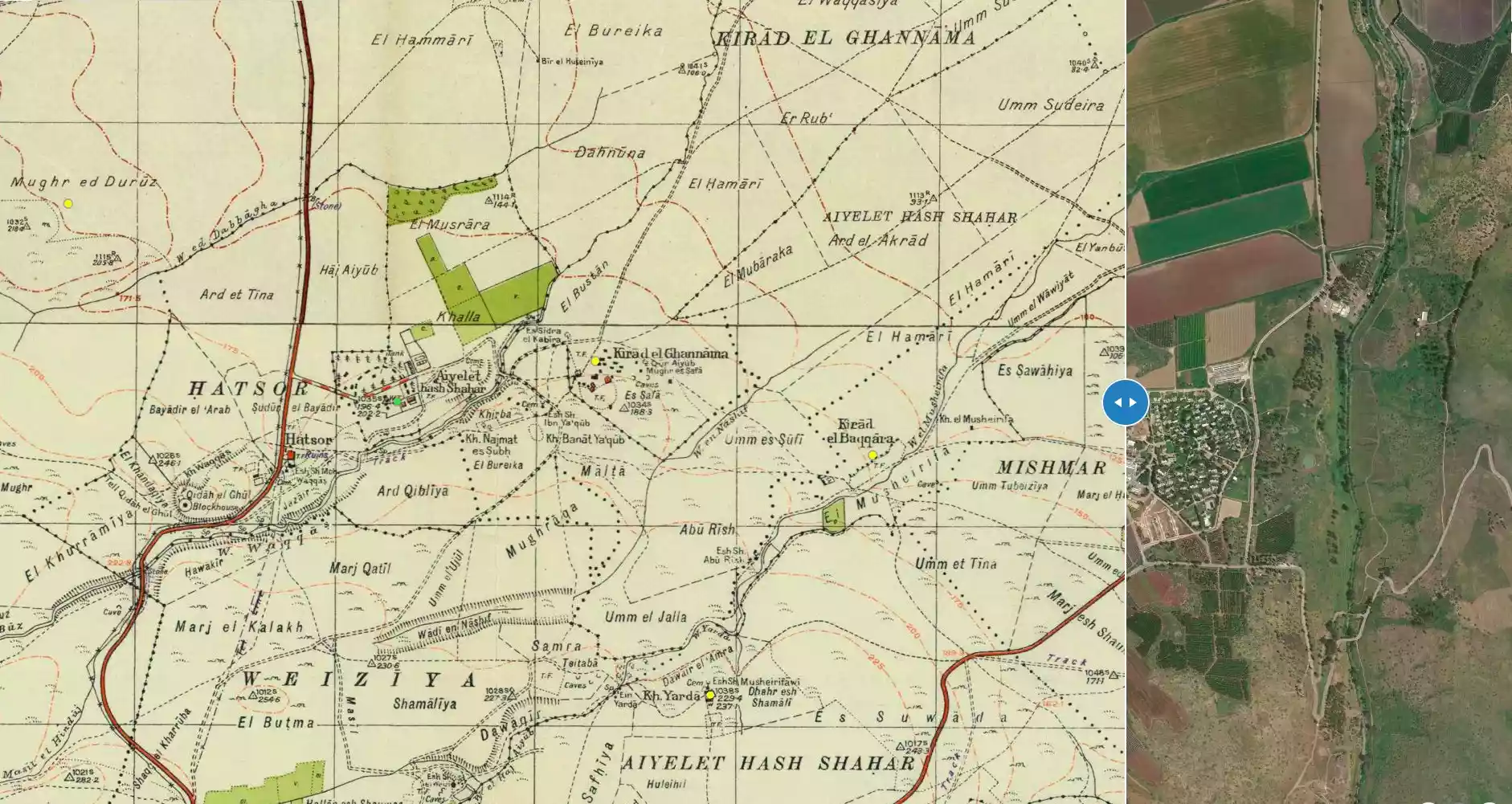
**Town Lands' Demarcation Maps |
|||||||||||||||||||||
| Land Usage As of 1945 |
|
|||||||||||||||||||||
| Population |
|
|||||||||||||||||||||
| Number of Houses |
|
|||||||||||||||||||||
| Near By Towns |
||||||||||||||||||||||
|
||||||||||||||||||||||
| Nearby Wadies & Rivers | Wadi Mushayrifa ran between the two Kirad villages (al-Ghannama and al-Baqqara) | |||||||||||||||||||||
| Water Supply | Wadi Waqqas contained plentiful supply of springs and wells the supplied the village with its water needs | |||||||||||||||||||||
| Archeological Sites | The village contained the following khirbas: Khirbat Nijmat al-Subh, Tall al-Qadah, and Tall al-Safa | |||||||||||||||||||||
| Exculsive Jewish Colonies Who Usurped Village Lands |
Ayyelet ha-Shahar and Gadot are nearby village lands | |||||||||||||||||||||
| Featured Video | ||||||||||||||||||||||
Village Before NakbaKirad al-Ghannama was the "twin" of the adjacent village, Kirad al-Baqqara. It was situated on a gently sloping, volcanic outcrop on the southern edge of the aI-Hula Plain, overlooking it to the north. Its houses were made of adobe bricks and had wooden roofs. Water was plentiful and came from a variety of sources-wells, springs, and the nearby Wadi Waqqas (to the west). The village population was predominantly Muslim. The villagers cultivated mainly grain. In 1944/45 a total of 77 dunums was devoted to citrus and bananas and 3,451 dunums were allocated to cereals; 20 dunums were irrigated or used for orchards. Near the village were two archaeological sites, Khirbat Nijmat al-Subh (204269) and Tall al-Safa (205269), that contained columns, the remains of walls, and cisterns. About 2 km to the southwest lay the large Bronze-Iron Age site of Tall al-Qadah (203269).Village Occupation and Ethnic CleaningIn mid-March 1948, a Haganah massacre in the neighboring village of al-Husayniyya 'left dozens of dead,' according to Israeli sources, and led to the temporary evacuation of Kirad al-Ghannama. The following month, it was temporarily (or partially) evacuated again during Operation yiftach (see Abil al-Qamh, Safad sub-disctrict). On 22 April the villagers reportedly left during that operation under the influence of a direct military assault on a nearby village, perhaps al-'Ulmaniyya (which was attacked on 20 April). [M:56, 123-24].In July 1949, Israel signed an armistice agreement according to which Kirad al-Ghannama was to be located within a Demilitarized Zone (DMZ) and the inhabitants of the area were to be protected. However, the Israeli authorities were determined to drive out those villagers who had remained, and deployed a variety of means over the following seven years to do so (see Kirad al-Baqqara, Safad sub-district). By 1956, the DMZ's 2,200 inhabitants had been pushed out, and Kirad al-Ghannama was evacuated for the third time. [M:243] Zionists Colonies on Village LandsThere are no Israeli settlements on village lands, although Gadot (205269), founded in 1949, is very close to the site and Ayyelet ha-Shahar (204269), founded in 1918, is close by to the west.Village TodayOnly the rubble of houses remains. Vegetation, such as shrubs, some trees, and grass, grows throughout the area. The surrounding land is used by Israelis both for crop cultivation and as pasture.SourceDr. Walid al-Khalidi, 1992: All That Remains. |
||||||||||||||||||||||
| Related Maps | Town Lands' Demarcation Maps خرائط للقضاء توضح حدود القرى والاودية Town's map on MapQuest View from satellite Help us map this town at WikiMapia |
|||||||||||||||||||||
| Related Links | Wikipedia's Page Google Search Google For Images Google For Videos |
|||||||||||||||||||||
| More Information | في كتاب كي لا ننسى في كتاب بلادنا فلسطين المزيد من موقع هوية |
|||||||||||||||||||||
- Village Rubble In 1987
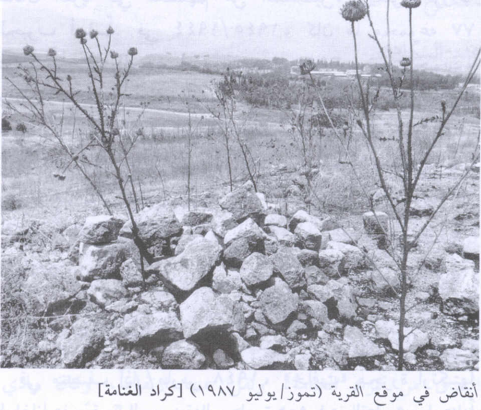
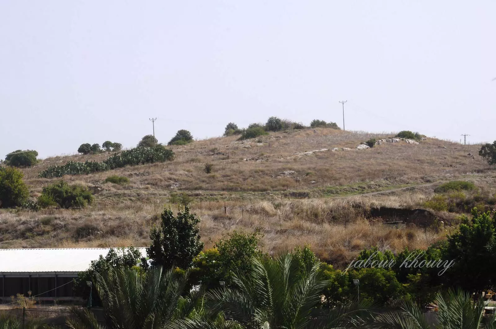
Scanned from "All That Remains" by Dr. Walid Khalidi - نظره من الغرب الى الشرق عل التل التي كانت تقع عليه القريه
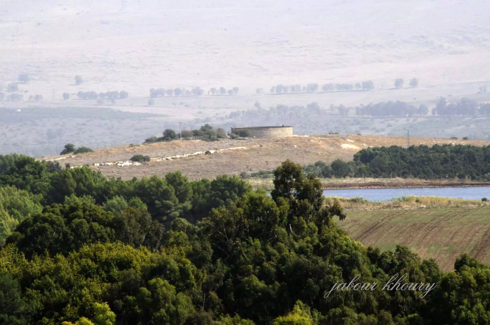
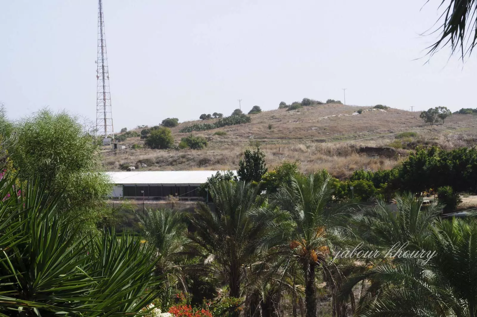
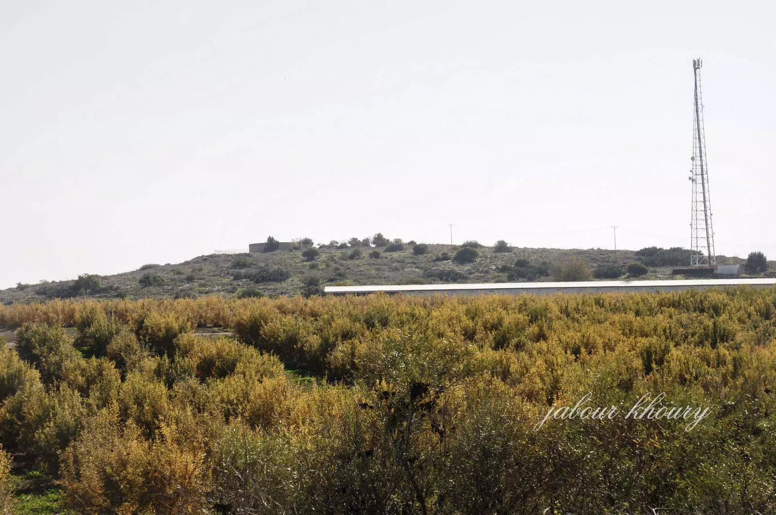
Posted by Jabour Khoury - موقع القريه
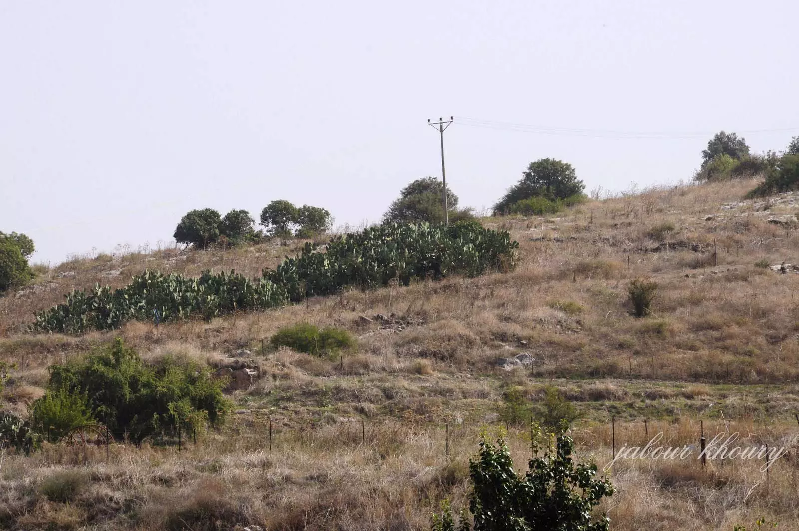
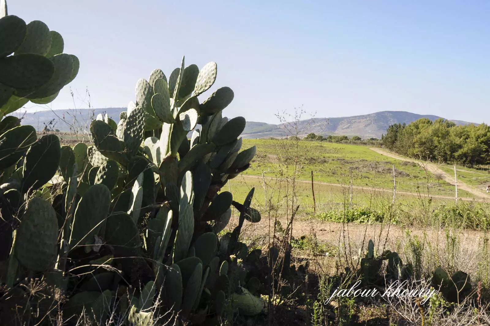
Posted by Jabour Khoury - موقع القريه يظهر نبات الصبار في موقع القريه للدلاله على هويه المكان
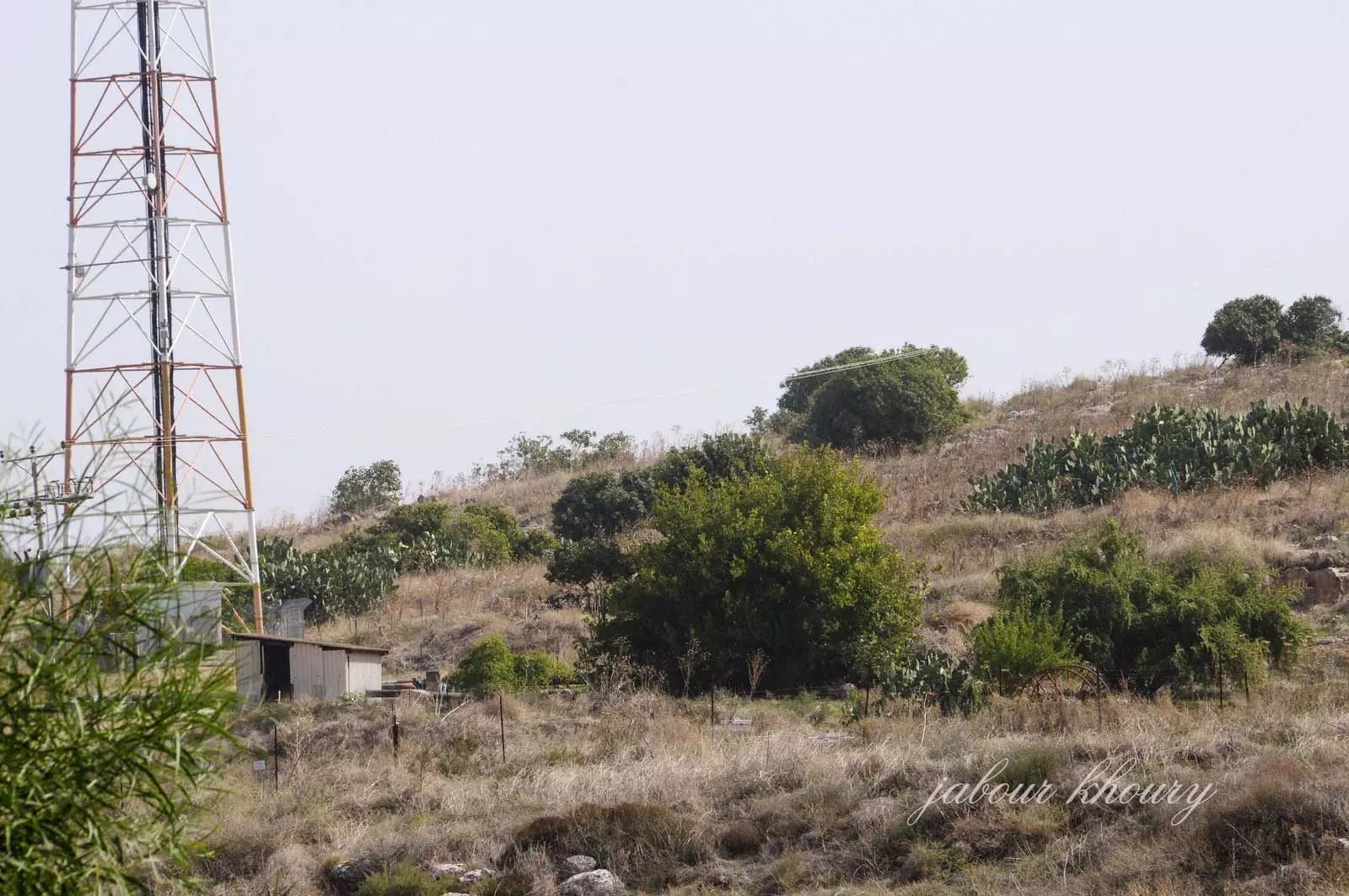
Posted by Jabour Khoury - موقع القريه ويظهر ردم بعض البيوت
Posted by Jabour Khoury - موقع القريه نظره من الغرب الى الشرق
Posted by Jabour Khoury - اشجار الرمان والزيتون ونبات الصبار في موقع القريه
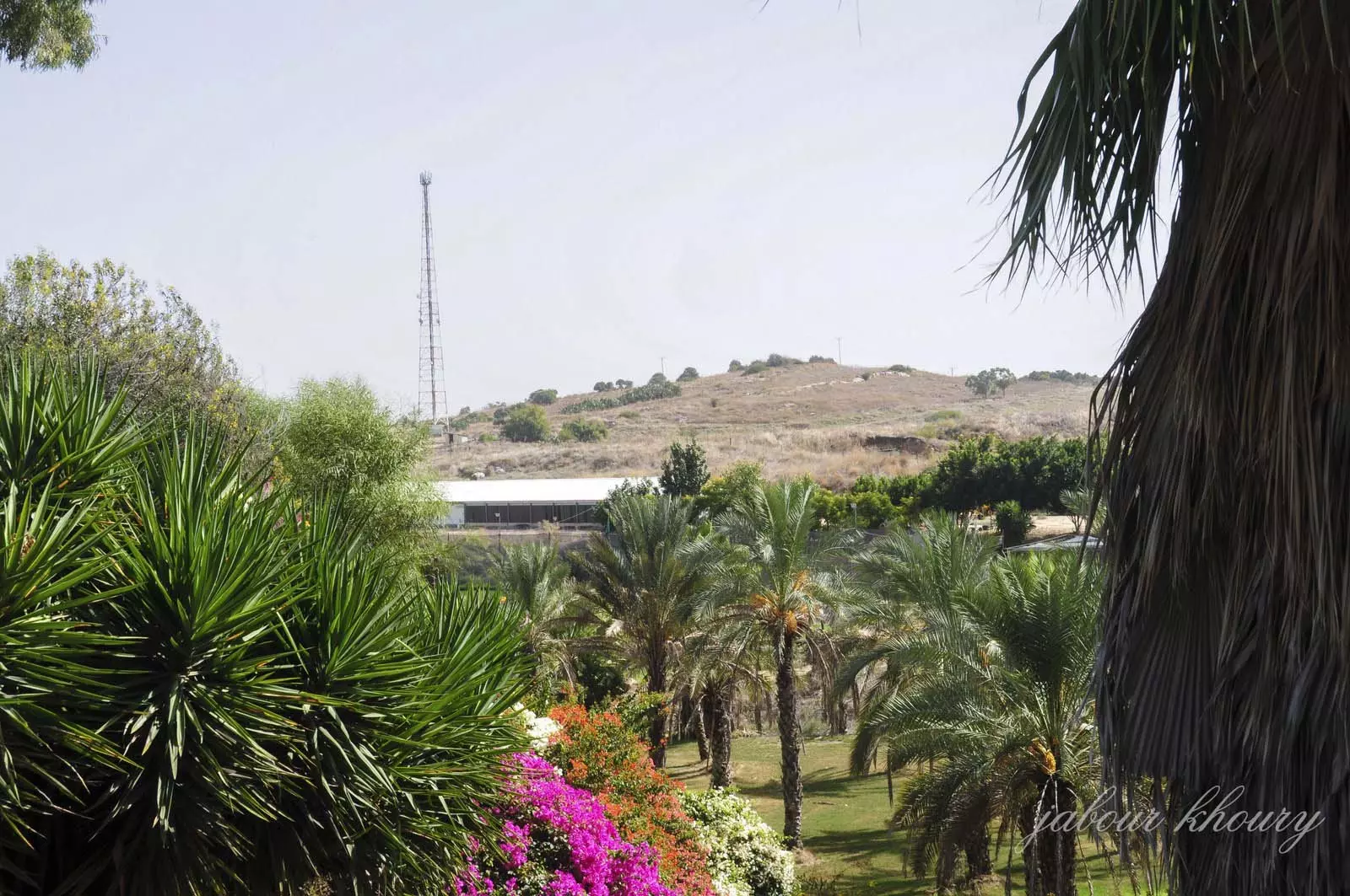
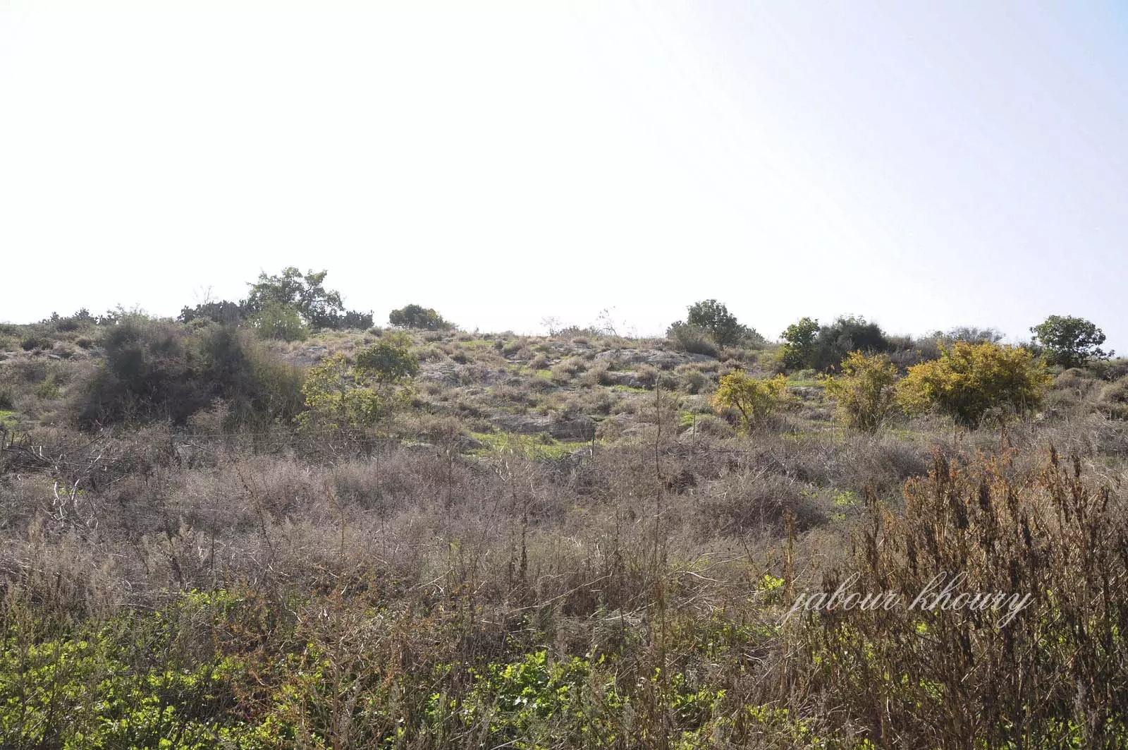
Posted by Jabour Khoury - من موقع القريه نظره باتجاه الغرب
Posted by Jabour Khoury - اراضي القريه المسيجه من الجهه الشماليه
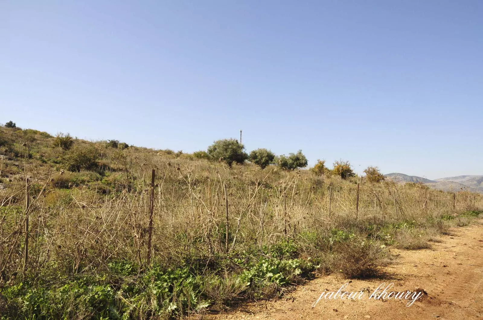
Posted by Jabour Khoury - اراضي القريه من الجهه الشماليه
Posted by Jabour Khoury - اراضي القريه
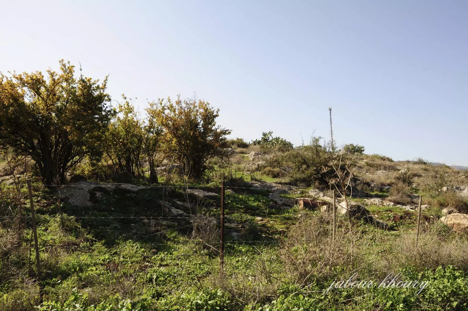
Posted by Jabour Khoury - موقع القريه نظره من الجهه الشماليه
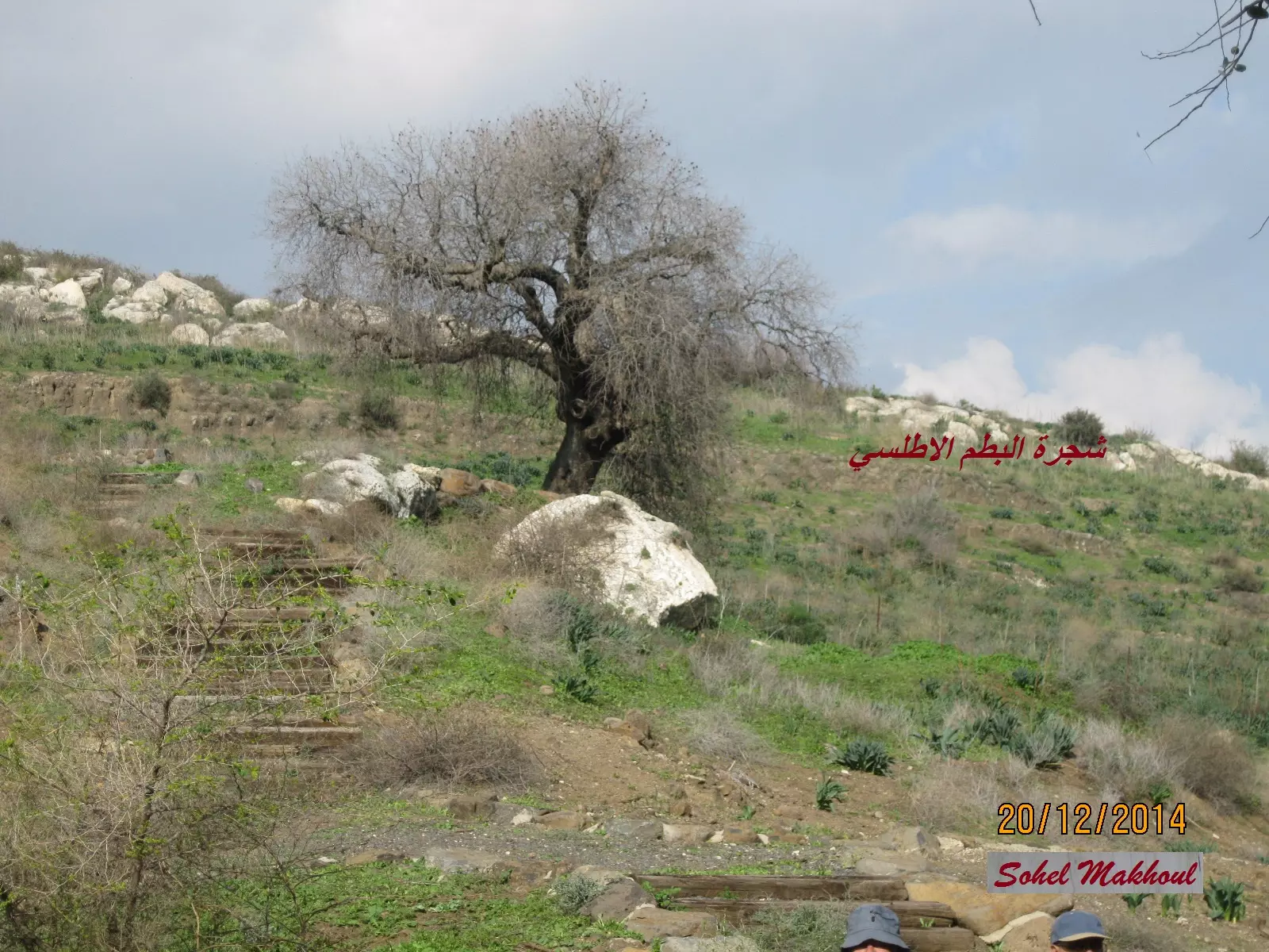
Posted by Jabour Khoury - شجرة بطم اطلسي بالقرب القرية المهجرة كراد الغنامة تصوير بعدسة سهيل مخول يوم 20.12.2014
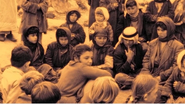
Posted by سهيل مخول - صوره قديمه لاطفال من قريه كراد الغنامه برفقه اطفال مستوطنه اييلت هشاحرالقريبه من القريه
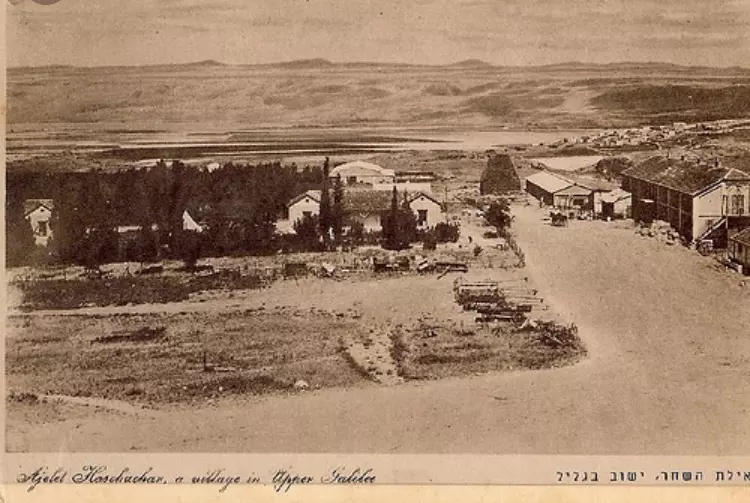
Posted by abu raya - صوره قديمه لمستعمره اييلت هشاحر ومن خلفها قريه كراد الغنامه
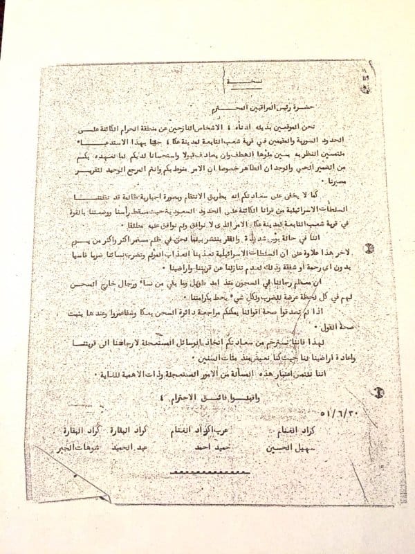
Posted by abu raya - وثيقة تعود لعام ١٩٥١ ، يطالب فيها المرحوم " توهان الجبر " وآخرون ( انظر الأسماء محفوظة في الوثيقة )، رئيس لجنة المراقبين في هيئة الأمم المتحدة ، بإعادتهم إلى مسقط رأسهم في قريتي كراد البقارة وكراد الغنامة.
Want to browse more? 80,000 pictures were grouped in these gallaries:
| Display Name | Clan/Hamolah | Country of Residence |
| العراب | اكراد الغنامة | - |
| ديانا مطاوع | - | - |
No links have been shared yet, be free to the first to share the first link.
 Fake Valor: Why Did Zionist Jews Hoist Nazis Flag on Their Ships in the 1930s?
What is new?
-
Facts About Oct. 7th Gaza Raid
-
Remined Us Please:: Who Did Rape Who? Palestinians Raped Israelis? Or, was the other way around?
-
When Prof. Edward Said was invited to debate Bibi Netanyahu in the 1980s, watch what happened!
-
Ezra Klein of the NY Times on the "Jewish Race".
-
Abusing Blood Libel!
-
Did Israeli Soldiers Activate The Hanniba Direective On Oct. 7th? You Be The Judge
-
Zionist FAQ: Isn't it true that Palestinians don't want peace? Palestinians never accepted the two-state solution
- Facts about Haavara (Transfer) Agreement between Ben-Gurion & Hitler
-
Haavara FAQs: Why Did Zionist Jews Hoist Nazis' Flags on Their Ships in the 1930s?
- Haavara FAQs: When Chaim Weizmann met FDR in mid-1943, why was he silent about rescuing European Jewry?
-
Dear ChatGPT: How did Palestinians resist Napoleon's invasion of their country in 1799?
-
Dear ChatGPT: Gaza had a vibrant Jewish community in the mid-17th century. What happened to them?
-
Dear ChatGPT: Why did the Jewish Agency suppress news of the Holocaust during WWII?
-
Video Playlist: Jews share their DNA tests to end the conflict for good.
-
A Tale of Two Conflicts: Examining the Definition of Genocide
-
Prof. Abraham Polak And The Suppressed History of the Khazars and European Jewry
-
How Ronald Reagan would have framed the genocide in Gaza if he were still alive?
-
Haavara FAQs: Let us do the math: how many German Jews did The Haavara Agreement save?
-
Zionist FAQs: The Hebron Massacre of 1929, "clearly proves" that Palestinians are antisemitic, how could you deny it?
-
Zionist FAQs: Why Anti-Zionist Is Not Antisemitism?
-
Zionist FAQs: Isn't it true that the KGB created Palestinian Nationalism in the early 1960s?
- Zionist FAQs: Muslims are killing Muslims all the time; why are Israeli Jews being singled out in the media?
- Zionist FAQs: How is Israel an apartheid state when 20% of its citizens are Arabs who enjoy full rights?
-
Haavara FAQs: Why Did Dorothy Thompson Flip From A Zionist Advocate to A Silenced Dissenter?
-
Haavara FAQs: Analysis of Herzl's Uganda Scheme and how it could have saved millions of Jews.
-
Haavara FAQs: Why did Hayim Greenberg describe American Jewry as "morally bankrupt" in early 1943?
-
Haavara FAQs: What if the Evian Conference was a resounding success? What would have been the impact of saving European Jewry on Zionism?
- Haavara FAQs: What if the six million were saved, how that would have impacted the Zionist project?
-
Haavara FAQs: How did Zionist leaders react when Europe's Jews lingered in the DP camps after WWII ended?
-
Why does the American Jewish community repeat lies that David Ben-Gurion had debunked before he died?
-
Who has the power to rename the Tatar/Khazar Gene Marker to Jewish IV?
-
Zionist FAQs: Why won't Egypt, Syria, and Jordan take their people back? Jews are indigenous to Palestine, and Arabs immigrated after Jews developed the country. Arabs should leave.
-
Haavara FAQs: Did Hitler and the Nazis conflate between Judaism and Zionist? If that wasn't case, then why?
-
Haavara FAQs: Winston Churchill and antisemitism, a collection of articles written Churchill.
-
Haavara FAQs: Broken by country, how many Jews survived vs. killed during the Holocaust?
-
Haavara FAQs: Why did European Jews vote with their feet and to immigrated to the Americas, not Palestine, after WWII?
-
Watch this American Jewish Girl describing Israeli Jews' cognitive dissonance like no other in under two minutes
-
Haavara FAQs: When the Nazis went out of their way to hide the Holocaust, Israeli Jews did the exact opposite by broadcasting their genocide of Gazans. But why?
-
Haavara FAQs: How Zionist Jews went out of their to show their appreciation to Nazism and Fascism?
- Haavara FAQs: Why Zionist leaders were against bombing the death camps & the Railroads leading to them?
-
Haavara FAQs: Hitler's message to the British and American people: If Jews are such noble citizens and you care about them, how come you're not letting them in? I will gladly ship them to you at my expense, even on luxury liners!
-
A shortlist of Zionist and Israeli false flag operations in the name Jews.
-
The Most Moral Army
- The Land of Kapos (Israel): Where the brave are boycotted and Kapos walk free.
- Why did early Zionists often named their communal enterprises "colonial"?
- Zionist Relations with Nazi Germany by Faris Glubb
-
Two NY Times advertisements by Zionists in the early 1943 that exposes Zionists' treason at the height of the calamity
- Facts Not Lies about the Palestinian-Israeli Conflict.
- Site's pictures have been categorized
- Campgain Against Lice
- A Survey of Palestine, the official source about Palestine before Nakba produced by the British Mandate; over 1200 pages.
- Satellite View & Google Earth: Over 6,000 placemarks identifying all destroyed towns, W. Bank & Gaza Strip Towns, & refugee camps.
- PalestineRemembered.com and its Nakba Oral History Project were featured on al-Jazeera Satellite TV.
- Nakba Oral History Video Podcast:
 Over 700 Oral History interviews (including 3,500+ hours of recording) can be viewed online.
 - Palestine Village Statistics Project
- Gaza Jail Break
- النسخة العربية للموقع الان متوفرة
- Videos: Documenting the destroyed villages in video: Tracing all that remains since Nakba.
- Videos: Responding to Zionist Propaganda
- Interview: The ethnic cleansing of Palestine: George Galloway interviews Israeli Historian Ilan Pappe.
- For Palestinians, memory matters. It provides a blueprint for their future By George Bisharat.
- Zionist FAQ now available in Hebrew שאלות שציונים שואלים, עכשיו בעברית
- Video: The Stephen Walt and John Mearsheimer report on the influence of the Israel Lobby on U.S. Foreign Policy
- The Palestinian-Israeli conflict for beginners
