| PalestineRemembered | About Us | Oral History | العربية | |
| Pictures | Zionist FAQs | Haavara | Maps | |
| Search |
| Camps |
| Districts |
| Acre |
| Baysan |
| Beersheba |
| Bethlehem |
| Gaza |
| Haifa |
| Hebron |
| Jaffa |
| Jericho |
| Jerusalem |
| Jinin |
| Nablus |
| Nazareth |
| Ramallah |
| al-Ramla |
| Safad |
| Tiberias |
| Tulkarm |
| Donate |
| Contact |
| Profile |
| Videos |
Welcome To 'Arab al-Zubayd - عرب الزبيد (ערב א-זביד)
|
District of Safad
Ethnically cleansed days ago |
العربية Google Earth |
 |
Gallery (13) |
- Statistics & Facts
-
Before & After

- Satellite View
- Articles 2
- Pictures 13
- Mayrters & Prisoners 1
- Oral History 5
- Members 20
- Families
- All That Remains
- Wikipedia
- Videos 1
- Guest Book 8
- Links
| Statistic & Fact | Value | ||||||||||||||||||
| Occupation Date | April 20, 1948 | ||||||||||||||||||
| Distance From District | 15 (km) North East of Safad | ||||||||||||||||||
| Elevation | 100 (meters) | ||||||||||||||||||
| Before & After Nakba, Click Map For Details |
|||||||||||||||||||
|
|||||||||||||||||||
| Map Location | See location #34 on the map View from satellite |
||||||||||||||||||
| Military Operation | Operation Yiftach (commanded by the ethnic cleansing champion Yigal Allon) | ||||||||||||||||||
| Attacking Units | The Palmach's First Battalion | ||||||||||||||||||
| Exodus Cause | Fear of Jewish attack, or of being caught in the fighting | ||||||||||||||||||
| Village Temains | In August 1948, the village has been completely obliterated | ||||||||||||||||||
| Ethnically Cleansing | 'Arab al-Zubayd inhabitants were completely ethnically cleansed. | ||||||||||||||||||
| Pre-Nakba Land Ownership |
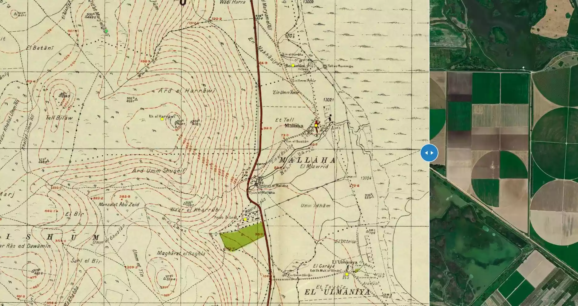
**Town Lands' Demarcation Maps |
||||||||||||||||||
| Land Usage As of 1945 |
|
||||||||||||||||||
| Population |
|
||||||||||||||||||
| Number of Houses | In (1931): 100 (includes al-'Ulmaniyya) | ||||||||||||||||||
| Near By Towns |
|||||||||||||||||||
|
|||||||||||||||||||
| Nearby Wadies & Rivers | TThe village was situated close to al-Barid River. | ||||||||||||||||||
| Water Supply | 'Arab al-Zubayd contained many springs which terminated into al-Barid River. | ||||||||||||||||||
| Exculsive Jewish Colonies Who Usurped Village Lands |
No settlements on village lands | ||||||||||||||||||
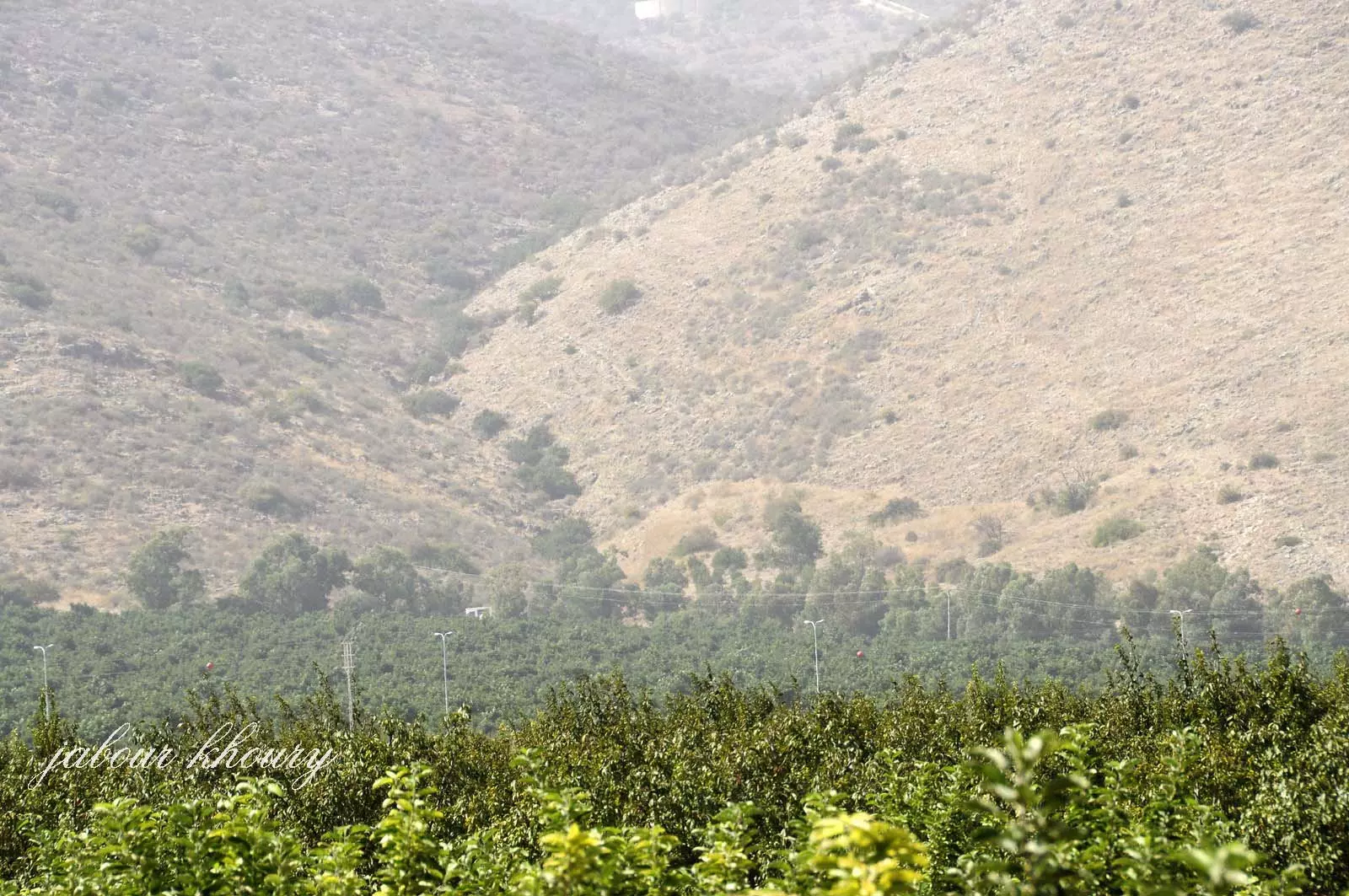
Village Before NakbaThe village was built in the foothills of the Upper Galilee Mountains, which slope towards the al-Hula Plain. It was just west of the al-Mutilla-Safad-Tiberias highway. It benefitted from the presence of many springs, to the north and to the northeast. Together these springs formed the al-Barid River, which ended in the al-Hula marshland. 'Arab al-Zubayd's name suggests that its residents were members of the al-Zubayd Bedouin tribe. The entire village population was Muslim. Its economy was based on grain cultivation. In 1944/45 a total of 1,761 dunums was allocated to cereals.Village Occupation and Ethnic CleaningThe location of the village suggests that it fell within the scope of Operation Yiftach (see Abil al-Qamh, Safad sub-disctrict). Israeli historian Benny Morris indicates that its population feared the possibility of a Jewish attack and fled on 20 April. If so, that would have been at the very beginning of the operation, prior to the attack on Safad and before the occupation of any villages in the area. [M:xiv, 120-24]The subsequent fate of the village is quite revealing. Several months later, in August 1948, Golani Brigade units were preparing to blow up the village when a complaint arrived from the members of nearby Kibbutz Sha'ar ha-'Amaqim, who objected to the destruction of 'Arab al-Zubayd. Morris suggests that they may have complained because they were associates of Aharon Cohen, the director of the Arab Department of the left-wing Mapam party. The matter was even brought up in an Israeli cabinet meeting. Prime Minister Ben-Gurion denied responsibility, saying: 'No permission was given [by me] to any commander to destroy houses.' He promised to investigate, according to Morris. But the fuss raised by Mapam succeeded only in postponing the destruction of the village for a few months. It did not bring about the return of the villagers, and as Morris writes, 'in the absence of such a return, the village was doomed.' [M:166-67] Zionists Colonies on Village LandsThere are no Israeli settlements on village land.Village TodayAll that remains of 'Arab al-Zubayd is scattered rubble, buried under a thicket of woods, grass, and thorny plants. Irrigation works tap the village's water resources. Animals graze in the mountainous portion of the land near the site. Some land in the plain that borders the site has been converted into an Israeli nature reserve, while the rest is cultivated by Israeli farmers.SourceDr. Walid al-Khalidi, 1992: All That Remains. |
|||||||||||||||||||
| Related Maps | Town Lands' Demarcation Maps خرائط للقضاء توضح حدود القرى والاودية Town's map on MapQuest View from satellite Help us map this town at WikiMapia |
||||||||||||||||||
| Related Links | Wikipedia's Page Google Search Google For Images Google For Videos |
||||||||||||||||||
| More Information | في كتاب كي لا ننسى المزيد من موقع هوية |
||||||||||||||||||
- Village Lands From The West Of al-Hula Plain In 1987
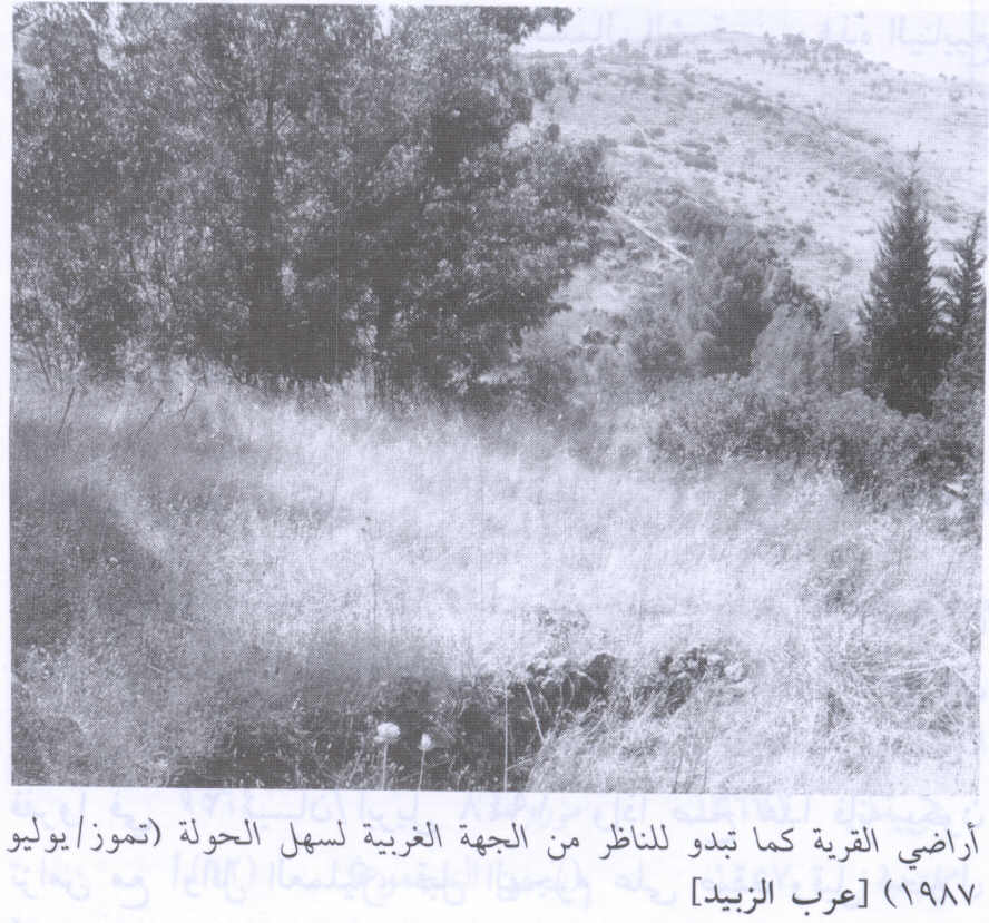
Scanned from "All That Remains" by Dr. Walid Khalidi - Shaheed Arab al-Zubayd : Khaled Hussein Ali Ahmad

Posted by Mazen Zubeidi 1 - موقع القريه كما يظهر من اراضي العلمانيه
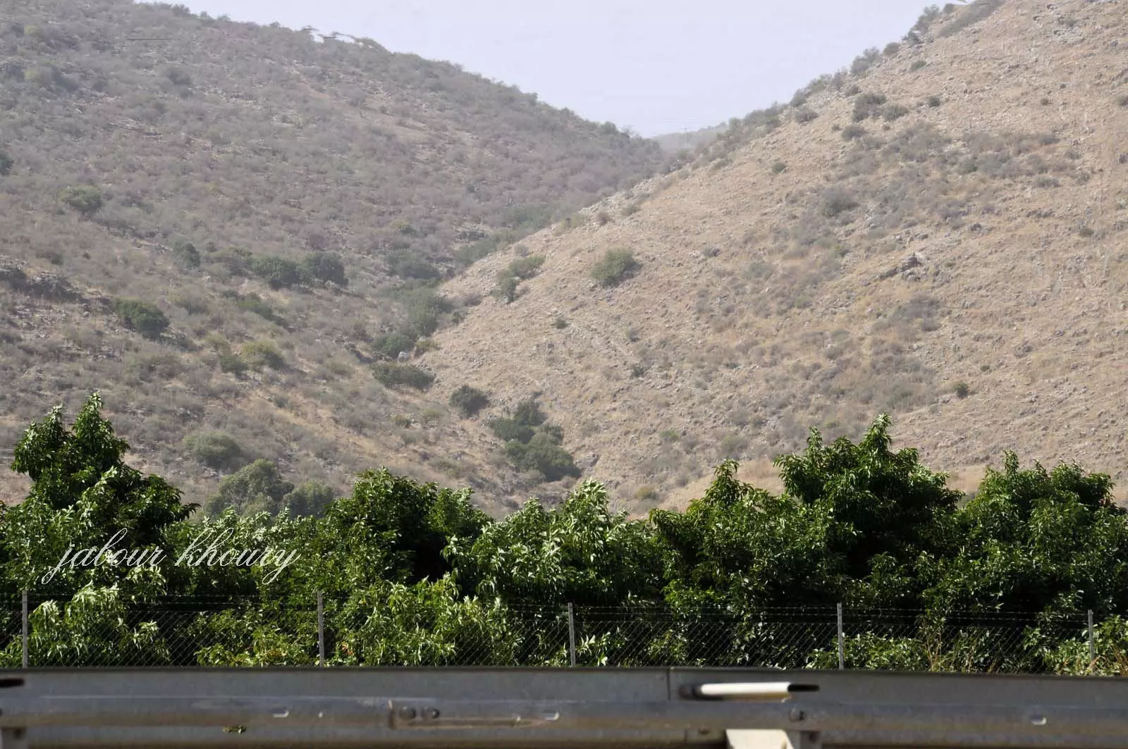
Posted by Jabour Khoury - موقع القريه بنظره تقريبيه اراضي القريه محاطه بسياج ولا يمكن وصوله
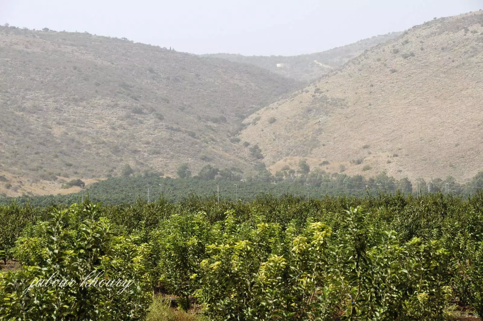
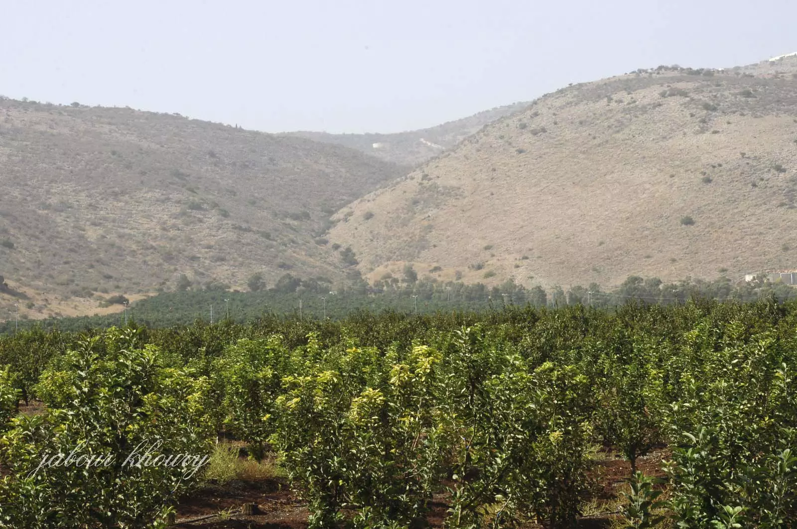
Posted by Jabour Khoury - اراضي القريه المزروعه بالبساتين من قبل المستوطنات القريبه وهناك خزانات مياه كثيره فر اراضي القريه
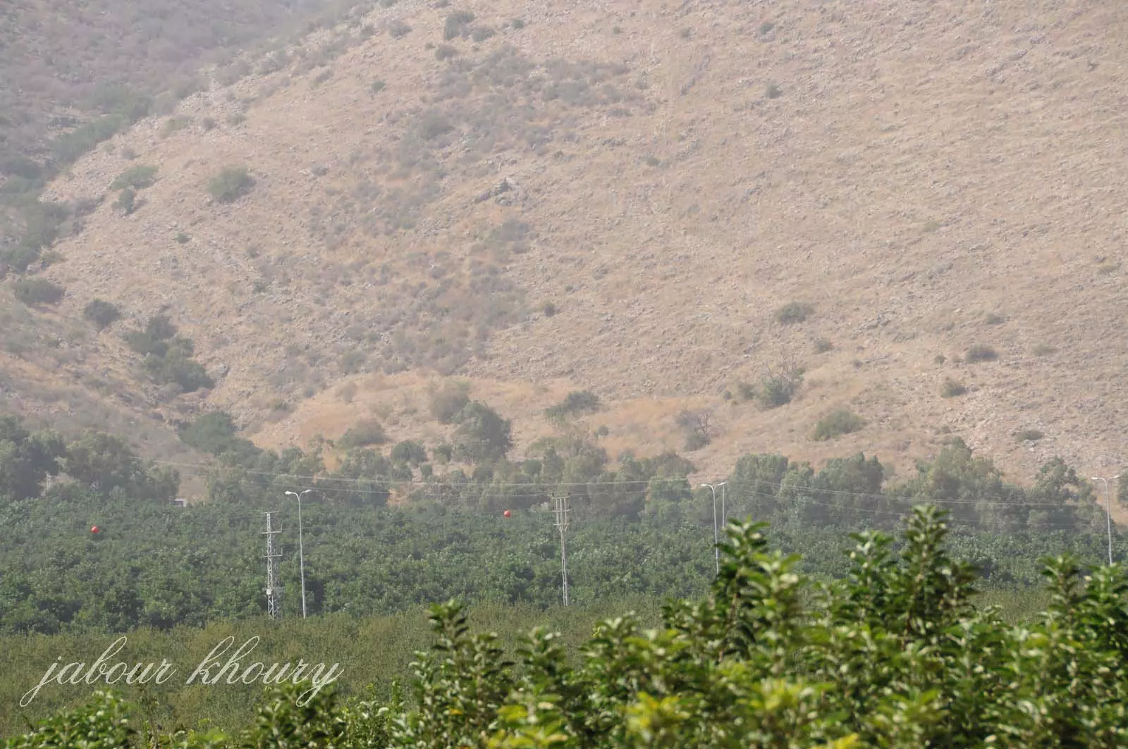
Posted by Jabour Khoury - موقع القريه
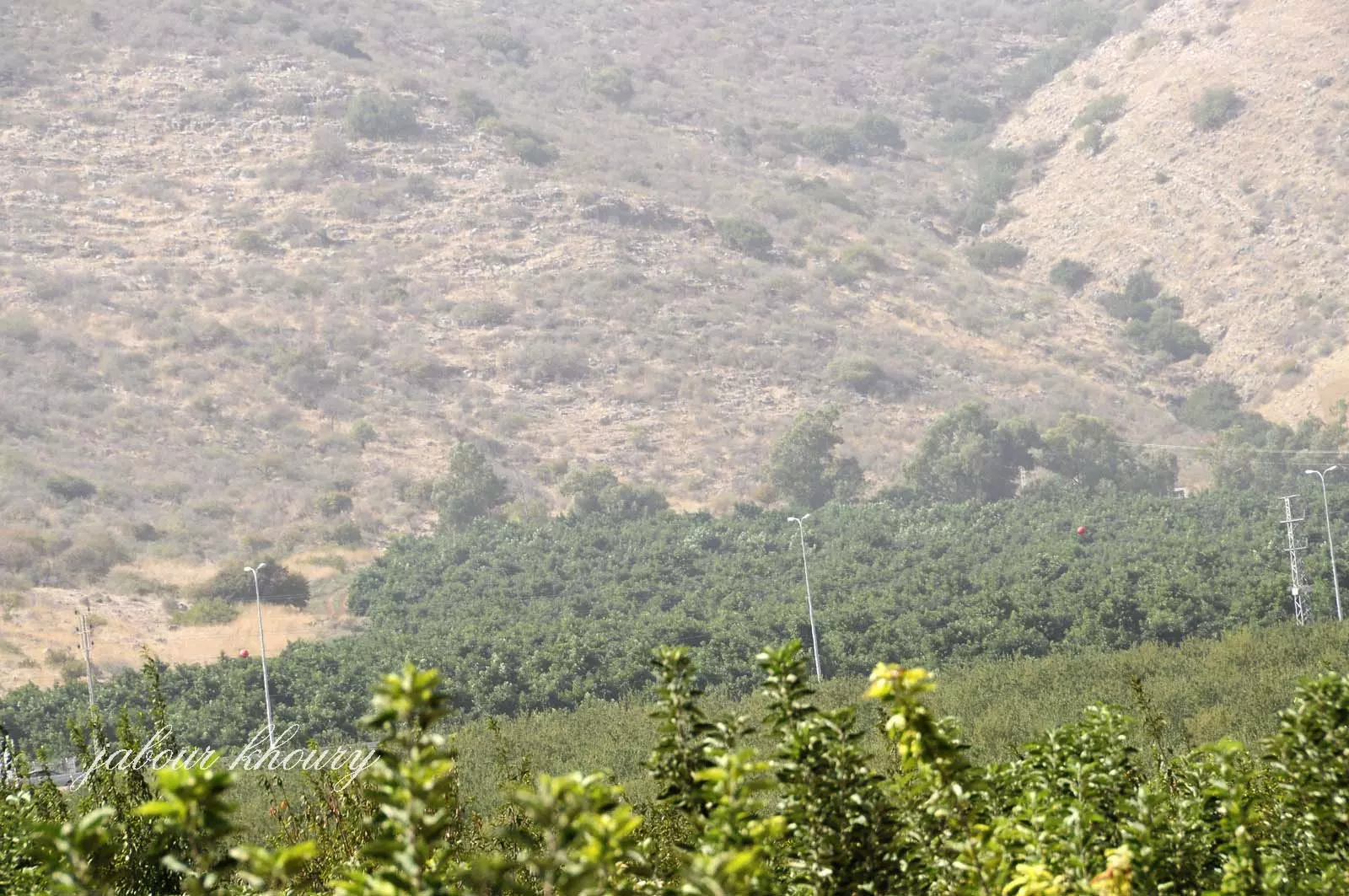
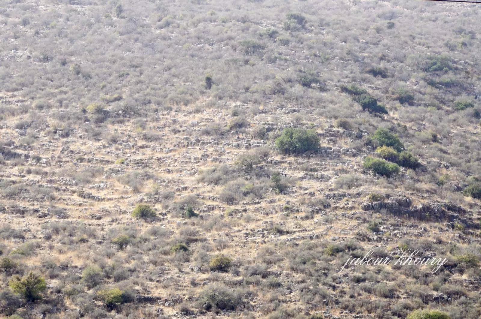
Posted by Jabour Khoury - اراضي القريه من الجهه الجنوبيه
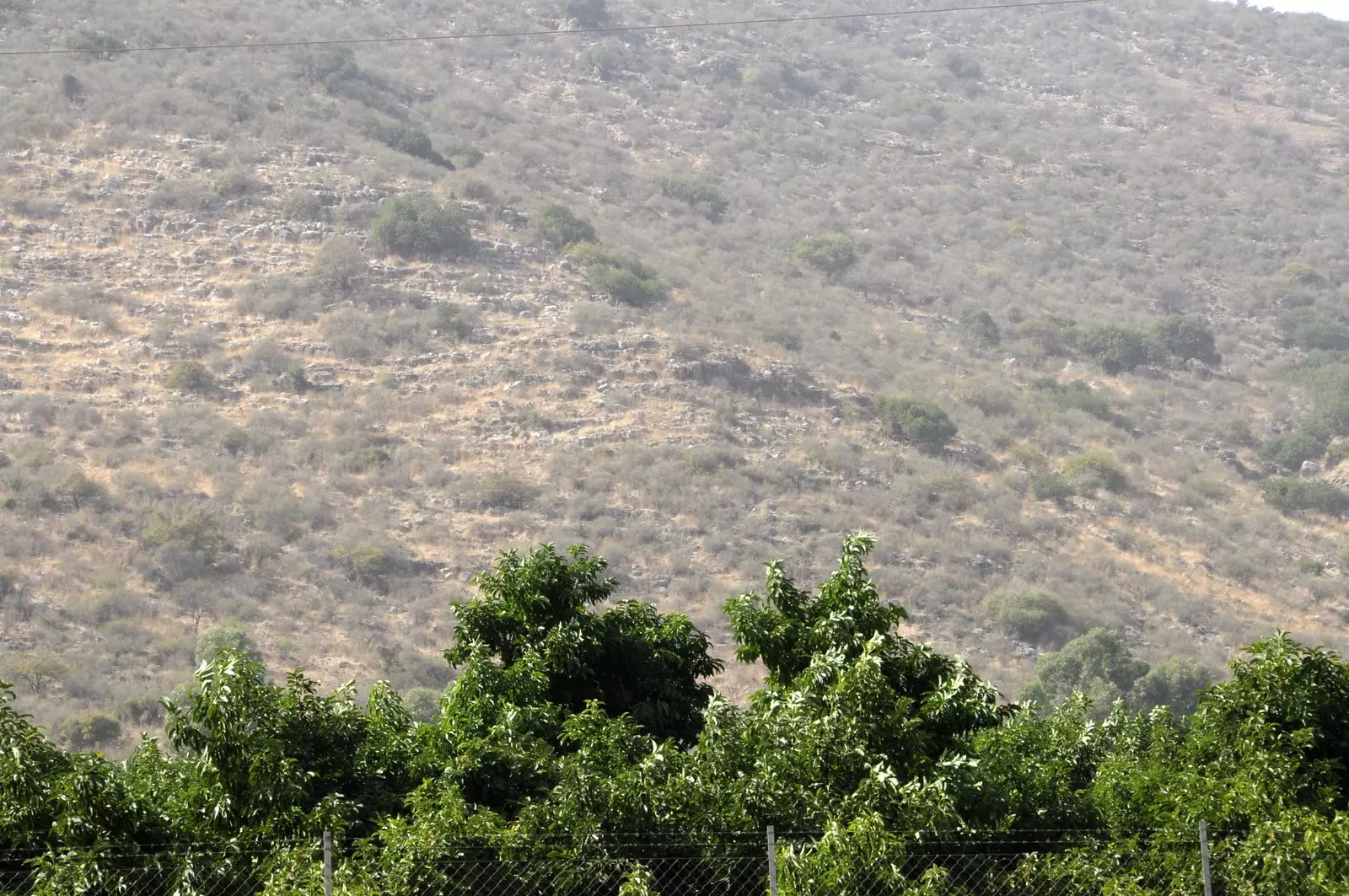
Posted by Jabour Khoury - الجزء الجنوبي من القريه وتظر اكوام الحجاره التي ربما تكون بقايا المنازل المهدمه
Posted by Jabour Khoury - موقع القريه ويظهر بقايا احد المنازل من الجهه الشماليه
Posted by Jabour Khoury - الجهه الجنوبيه من موقع القريه وتظهر بالصوره اساسات بعض المنازل
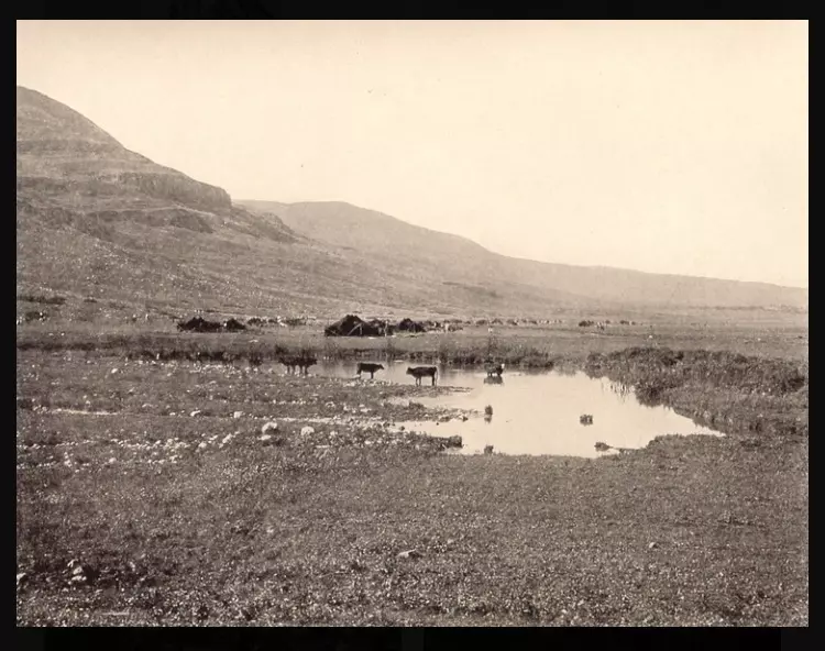
Posted by Jabour Khoury - عين الماء بالقرب من قريه عرب الزبيد قبل النكبه
Posted by abu raya - من نواحي عرب الزبيد قبل النكبه
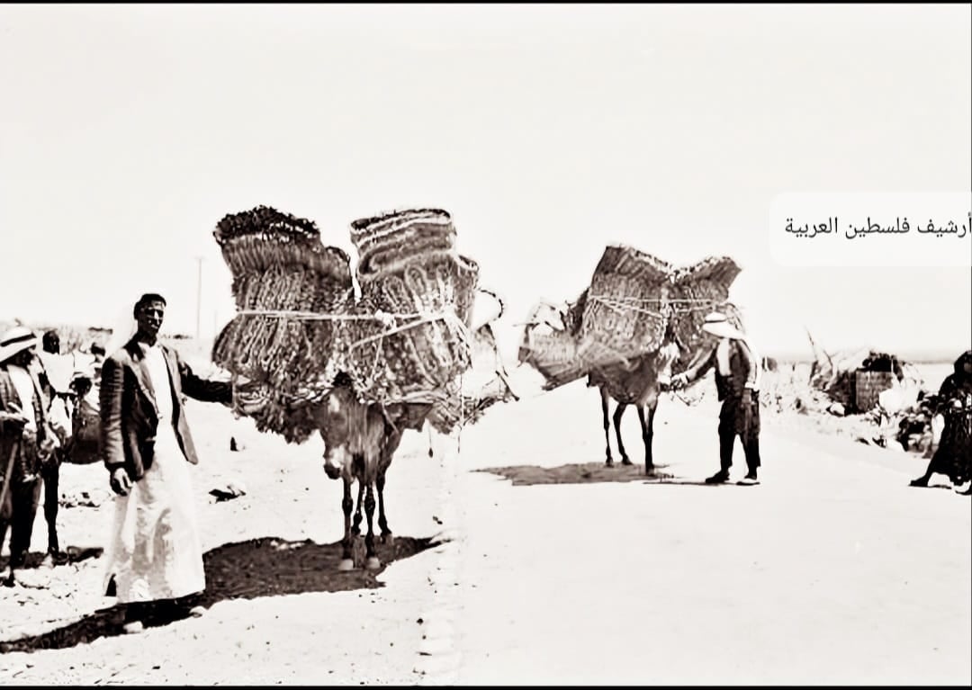
Posted by abu raya - رجال من ملاحة"عرب الزبيد" قضاء صفد خلال رحلتهم إلى سوق الخالصة لبيع الحصر قبل النكبة..
Want to browse more? 80,000 pictures were grouped in these gallaries:
| Display Name | Clan/Hamolah | Country of Residence |
| STOUHAN | - | DUBAI, DUBAI |
| mij | ismail | abu dhabi, arab zubayed |
| Dr. Majdi Ghaleb Shehadeh | - | kiev, ukraine |
| JININ | - | Aarhus, Danmark |
| Nasser yousef | Yousef Al Abedallah | lebanon |
| معاذ حسام محمد حمدان | - | طولكرم, كفر جمال |
| Yousef Deeb | Zubeidi | Palestine, Palestine |
| Ali Al-zubeidi | Arab Al-zubeidi | - |
| Hani al-mosleh | - | Saida, Lebanon |
| Diab Issa El Ali | zubeidy | sweden, sweden |
| Yemany AlZubaidy | - | - |
| FOUAD EL-ZUBEIDI | ZUBEID | - |
| Amin Hussein Ahmad | Arab Zubeid | Texas, U.S.A |
| amen yousef | - | u.a.e |
| khaled ahmad ibrahim | alzubaidy | - |
| Hossny Ahmad | Arab Zubaid | Central Province, Saudi Arabia |
| mohammed ahmad | arab ei-zubayd | central province, saudi arabia |
| amer abushehadeh | sharaqa | - |
| wael | ali deeb | beirut, beirut |
| Mazen Zubeidi | Zubeidi | Ontario, Canada |
- الذاكرة مفتاح العودة -الحلقة 9 - قرية عرب زبيد Duration: 23 min 22 sec
No links have been shared yet, be free to the first to share the first link.
 Fake Valor: Why Did Zionist Jews Hoist Nazis Flag on Their Ships in the 1930s?
What is new?
-
Facts About Oct. 7th Gaza Raid
-
Remined Us Please:: Who Did Rape Who? Palestinians Raped Israelis? Or, was the other way around?
-
When Prof. Edward Said was invited to debate Bibi Netanyahu in the 1980s, watch what happened!
-
Ezra Klein of the NY Times on the "Jewish Race".
-
Abusing Blood Libel!
-
Did Israeli Soldiers Activate The Hanniba Direective On Oct. 7th? You Be The Judge
-
Zionist FAQ: Isn't it true that Palestinians don't want peace? Palestinians never accepted the two-state solution
- Facts about Haavara (Transfer) Agreement between Ben-Gurion & Hitler
-
Haavara FAQs: Why Did Zionist Jews Hoist Nazis' Flags on Their Ships in the 1930s?
- Haavara FAQs: When Chaim Weizmann met FDR in mid-1943, why was he silent about rescuing European Jewry?
-
Dear ChatGPT: How did Palestinians resist Napoleon's invasion of their country in 1799?
-
Dear ChatGPT: Gaza had a vibrant Jewish community in the mid-17th century. What happened to them?
-
Dear ChatGPT: Why did the Jewish Agency suppress news of the Holocaust during WWII?
-
Video Playlist: Jews share their DNA tests to end the conflict for good.
-
A Tale of Two Conflicts: Examining the Definition of Genocide
-
Prof. Abraham Polak And The Suppressed History of the Khazars and European Jewry
-
How Ronald Reagan would have framed the genocide in Gaza if he were still alive?
-
Haavara FAQs: Let us do the math: how many German Jews did The Haavara Agreement save?
-
Zionist FAQs: The Hebron Massacre of 1929, "clearly proves" that Palestinians are antisemitic, how could you deny it?
-
Zionist FAQs: Why Anti-Zionist Is Not Antisemitism?
-
Zionist FAQs: Isn't it true that the KGB created Palestinian Nationalism in the early 1960s?
- Zionist FAQs: Muslims are killing Muslims all the time; why are Israeli Jews being singled out in the media?
- Zionist FAQs: How is Israel an apartheid state when 20% of its citizens are Arabs who enjoy full rights?
-
Haavara FAQs: Why Did Dorothy Thompson Flip From A Zionist Advocate to A Silenced Dissenter?
-
Haavara FAQs: Analysis of Herzl's Uganda Scheme and how it could have saved millions of Jews.
-
Haavara FAQs: Why did Hayim Greenberg describe American Jewry as "morally bankrupt" in early 1943?
-
Haavara FAQs: What if the Evian Conference was a resounding success? What would have been the impact of saving European Jewry on Zionism?
- Haavara FAQs: What if the six million were saved, how that would have impacted the Zionist project?
-
Haavara FAQs: How did Zionist leaders react when Europe's Jews lingered in the DP camps after WWII ended?
-
Why does the American Jewish community repeat lies that David Ben-Gurion had debunked before he died?
-
Who has the power to rename the Tatar/Khazar Gene Marker to Jewish IV?
-
Zionist FAQs: Why won't Egypt, Syria, and Jordan take their people back? Jews are indigenous to Palestine, and Arabs immigrated after Jews developed the country. Arabs should leave.
-
Haavara FAQs: Did Hitler and the Nazis conflate between Judaism and Zionist? If that wasn't case, then why?
-
Haavara FAQs: Winston Churchill and antisemitism, a collection of articles written Churchill.
-
Haavara FAQs: Broken by country, how many Jews survived vs. killed during the Holocaust?
-
Haavara FAQs: Why did European Jews vote with their feet and to immigrated to the Americas, not Palestine, after WWII?
-
Watch this American Jewish Girl describing Israeli Jews' cognitive dissonance like no other in under two minutes
-
Haavara FAQs: When the Nazis went out of their way to hide the Holocaust, Israeli Jews did the exact opposite by broadcasting their genocide of Gazans. But why?
-
Haavara FAQs: How Zionist Jews went out of their to show their appreciation to Nazism and Fascism?
- Haavara FAQs: Why Zionist leaders were against bombing the death camps & the Railroads leading to them?
-
Haavara FAQs: Hitler's message to the British and American people: If Jews are such noble citizens and you care about them, how come you're not letting them in? I will gladly ship them to you at my expense, even on luxury liners!
-
A shortlist of Zionist and Israeli false flag operations in the name Jews.
-
The Most Moral Army
- The Land of Kapos (Israel): Where the brave are boycotted and Kapos walk free.
- Why did early Zionists often named their communal enterprises "colonial"?
- Zionist Relations with Nazi Germany by Faris Glubb
-
Two NY Times advertisements by Zionists in the early 1943 that exposes Zionists' treason at the height of the calamity
- Facts Not Lies about the Palestinian-Israeli Conflict.
- Site's pictures have been categorized
- Campgain Against Lice
- A Survey of Palestine, the official source about Palestine before Nakba produced by the British Mandate; over 1200 pages.
- Satellite View & Google Earth: Over 6,000 placemarks identifying all destroyed towns, W. Bank & Gaza Strip Towns, & refugee camps.
- PalestineRemembered.com and its Nakba Oral History Project were featured on al-Jazeera Satellite TV.
- Nakba Oral History Video Podcast:
 Over 700 Oral History interviews (including 3,500+ hours of recording) can be viewed online.
 - Palestine Village Statistics Project
- Gaza Jail Break
- النسخة العربية للموقع الان متوفرة
- Videos: Documenting the destroyed villages in video: Tracing all that remains since Nakba.
- Videos: Responding to Zionist Propaganda
- Interview: The ethnic cleansing of Palestine: George Galloway interviews Israeli Historian Ilan Pappe.
- For Palestinians, memory matters. It provides a blueprint for their future By George Bisharat.
- Zionist FAQ now available in Hebrew שאלות שציונים שואלים, עכשיו בעברית
- Video: The Stephen Walt and John Mearsheimer report on the influence of the Israel Lobby on U.S. Foreign Policy
- The Palestinian-Israeli conflict for beginners
