| PalestineRemembered | About Us | Oral History | العربية | |
| Pictures | Zionist FAQs | Haavara | Maps | |
| Search |
| Camps |
| Districts |
| Acre |
| Baysan |
| Beersheba |
| Bethlehem |
| Gaza |
| Haifa |
| Hebron |
| Jaffa |
| Jericho |
| Jerusalem |
| Jinin |
| Nablus |
| Nazareth |
| Ramallah |
| al-Ramla |
| Safad |
| Tiberias |
| Tulkarm |
| Donate |
| Contact |
| Profile |
| Videos |
Welcome To al-Khisas - الخصاص (אל-ח'צאץ)
|
District of Safad
Ethnically cleansed days ago |
العربية Google Earth |
 |
Gallery (60) |
- Statistics & Facts
-
Before & After

- Satellite View
- Articles 2
- Pictures 60
- Oral History 2
- Members 3
- All That Remains
- Wikipedia
- Videos 2
- Guest Book 2
- Links 1
| Statistic & Fact | Value | |||||||||||||||
| Occupation Date | May 25, 1948 | |||||||||||||||
| Distance From District | 31 (km) North East of Safad | |||||||||||||||
| Elevation | 100 (meters) | |||||||||||||||
| Before & After Nakba, Click Map For Details |
||||||||||||||||
|
||||||||||||||||
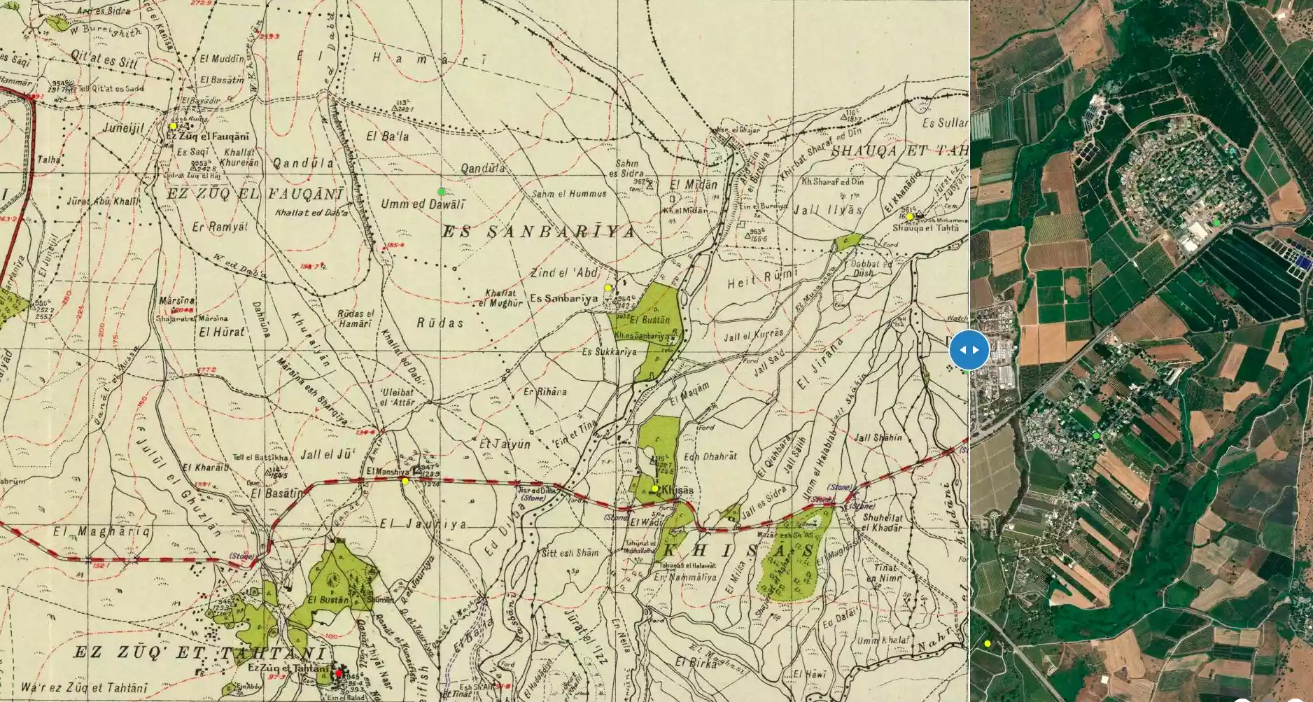
| Map Location | See location #7 on the map View from satellite |
|||||||||||||||
| Military Operation | Operation Yiftach (commanded by the ethnic cleansing champion Yigal Allon) | |||||||||||||||
| Attacking Units | The Palmach's First Battalion | |||||||||||||||
| Acts of Terror | Based on a New York Times report on the 18th of December 1947, 10 people were killed including 5 children, and some victims were buried in the wreckage of their houses. Yigal Anon approved this terror act to be executed by the Haganah. | |||||||||||||||
| Exodus Cause | Haganah 'Wispering' campaign (psychological warfare) | |||||||||||||||
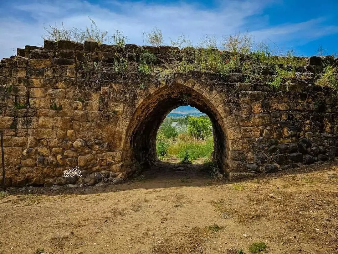
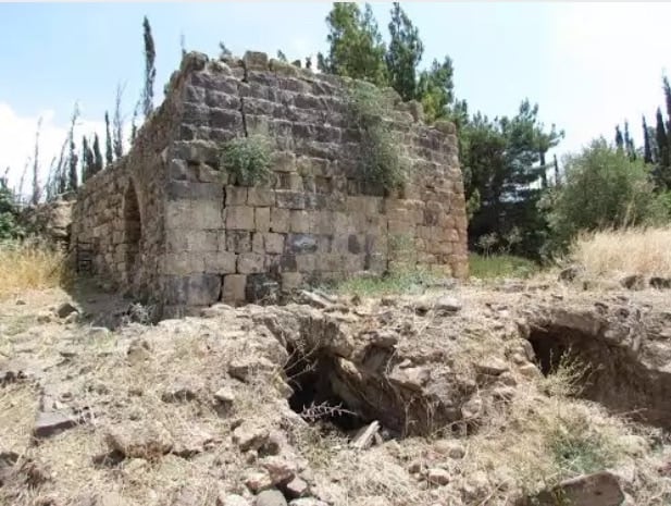
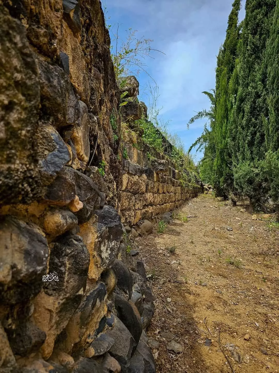
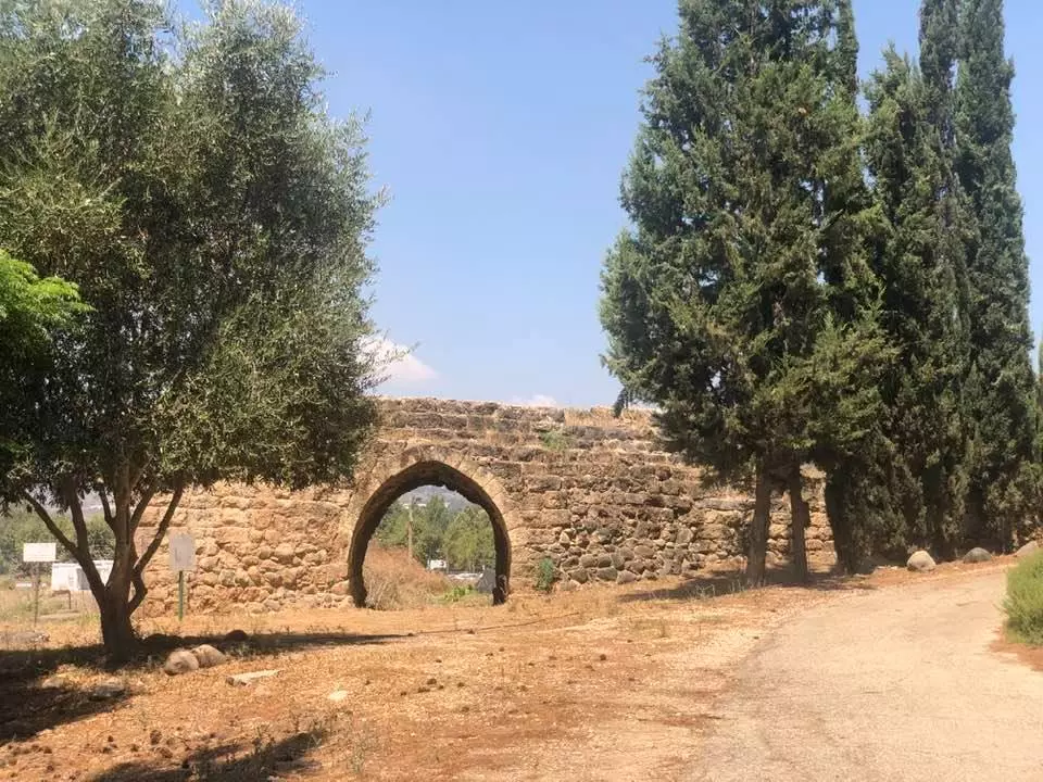
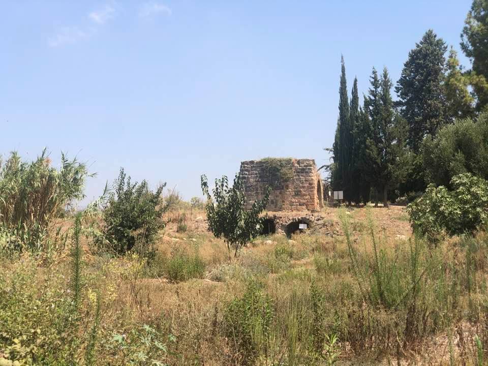
| Village Temains | The village has been completely destroyed, and only house rubble left behind. | |||||||||||||||
| Ethnically Cleansing | al-Khisas was ethnicaly cleansed as a result of psychological warfare conducted on the 25th of May 1948. | |||||||||||||||
| Pre-Nakba Land Ownership |
**Town Lands' Demarcation Maps |
|||||||||||||||
| Land Usage As of 1945 |
|
|||||||||||||||
| Population |
|
|||||||||||||||
| Number of Houses |
|
|||||||||||||||
| Near By Towns |
||||||||||||||||
|
|
||||||||||||||||
| Shrines / Maqams | A shrine of local sage known by al-Shaykh 'Ali | |||||||||||||||
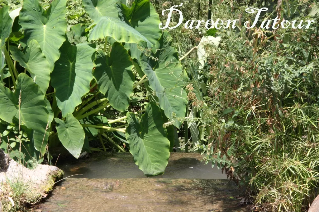
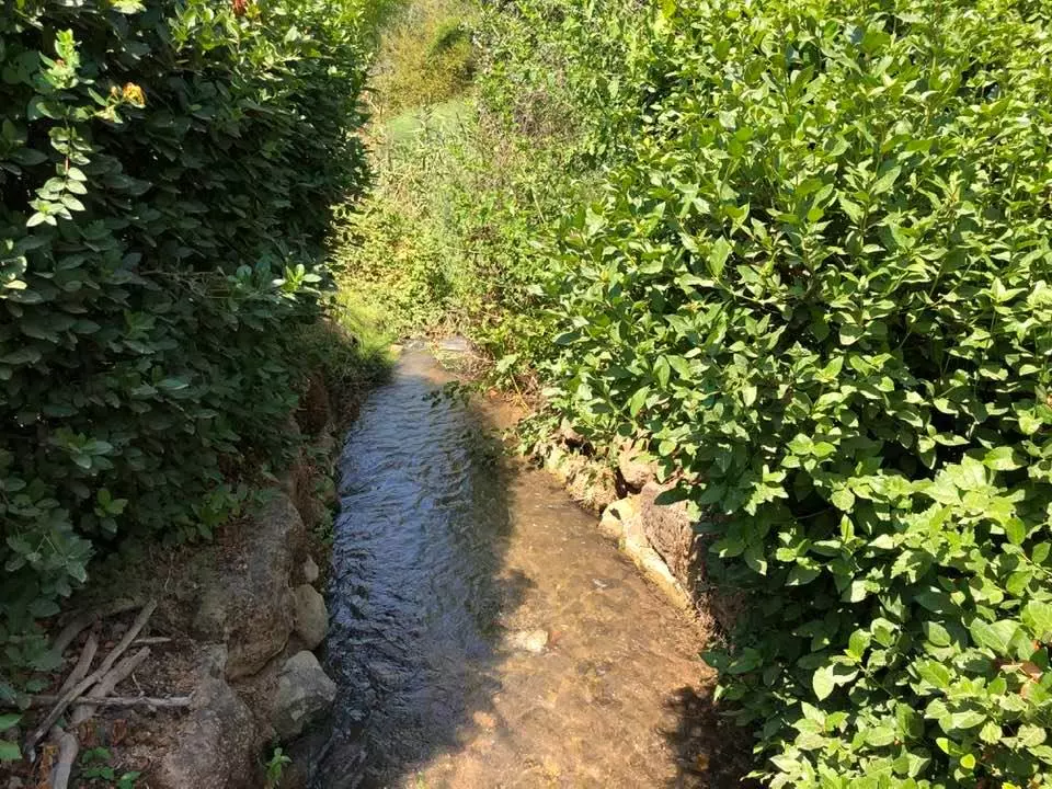
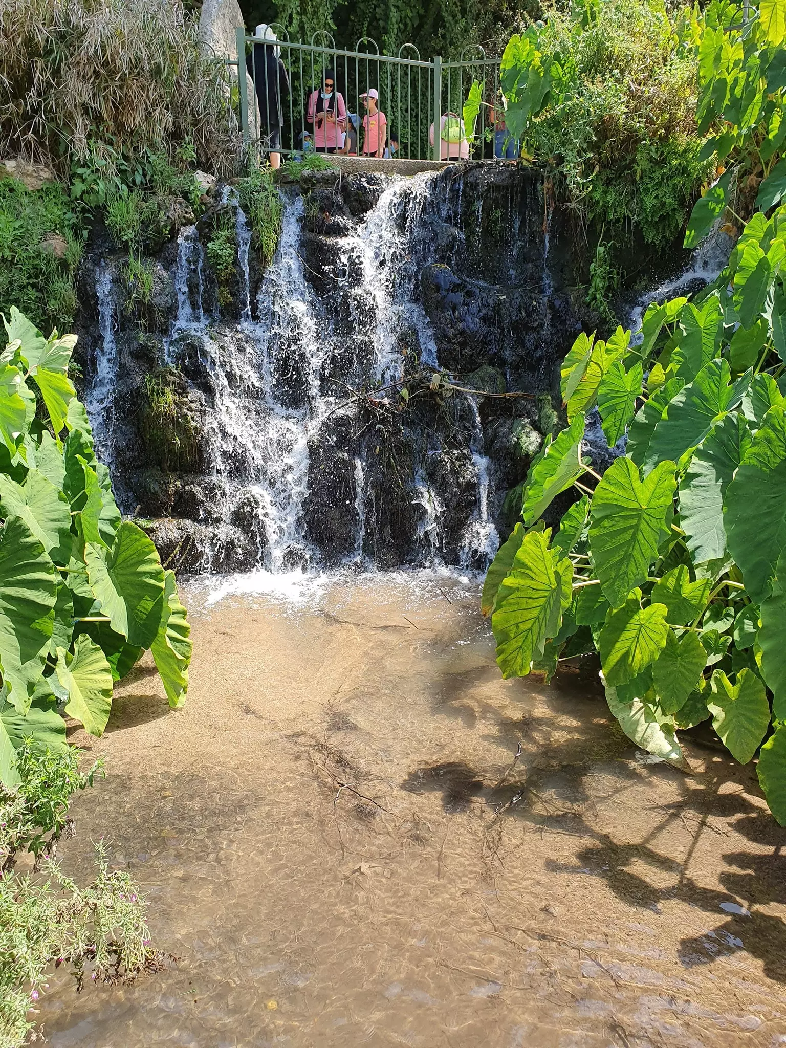
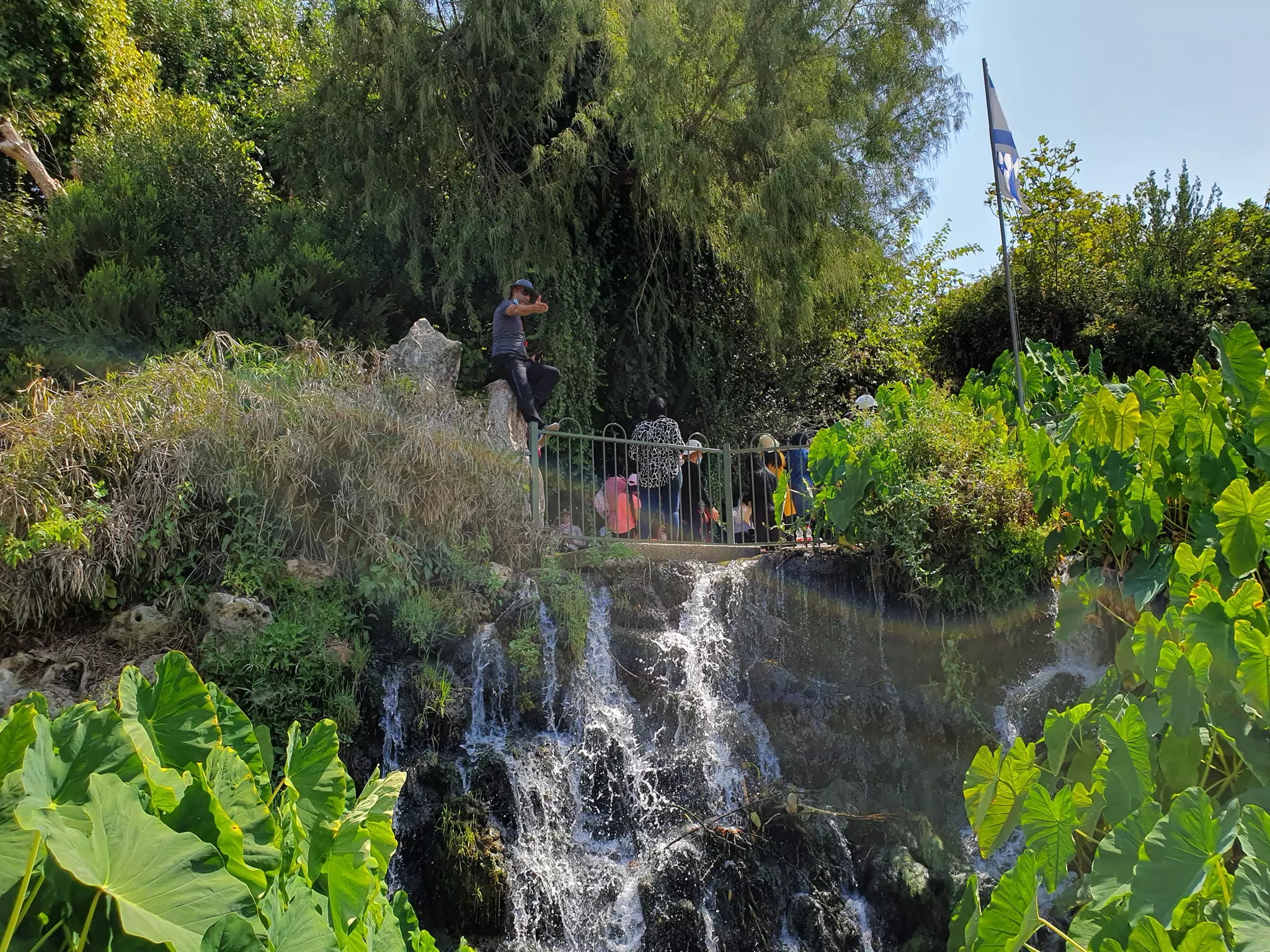
| Nearby Wadies & Rivers | The village was situated on the western banks Wadi al-Hasibani. | |||||||||||||||
| Exculsive Jewish Colonies That Usurped Village Lands |
ha-Gosherim | |||||||||||||||
| Featured Video | ||||||||||||||||
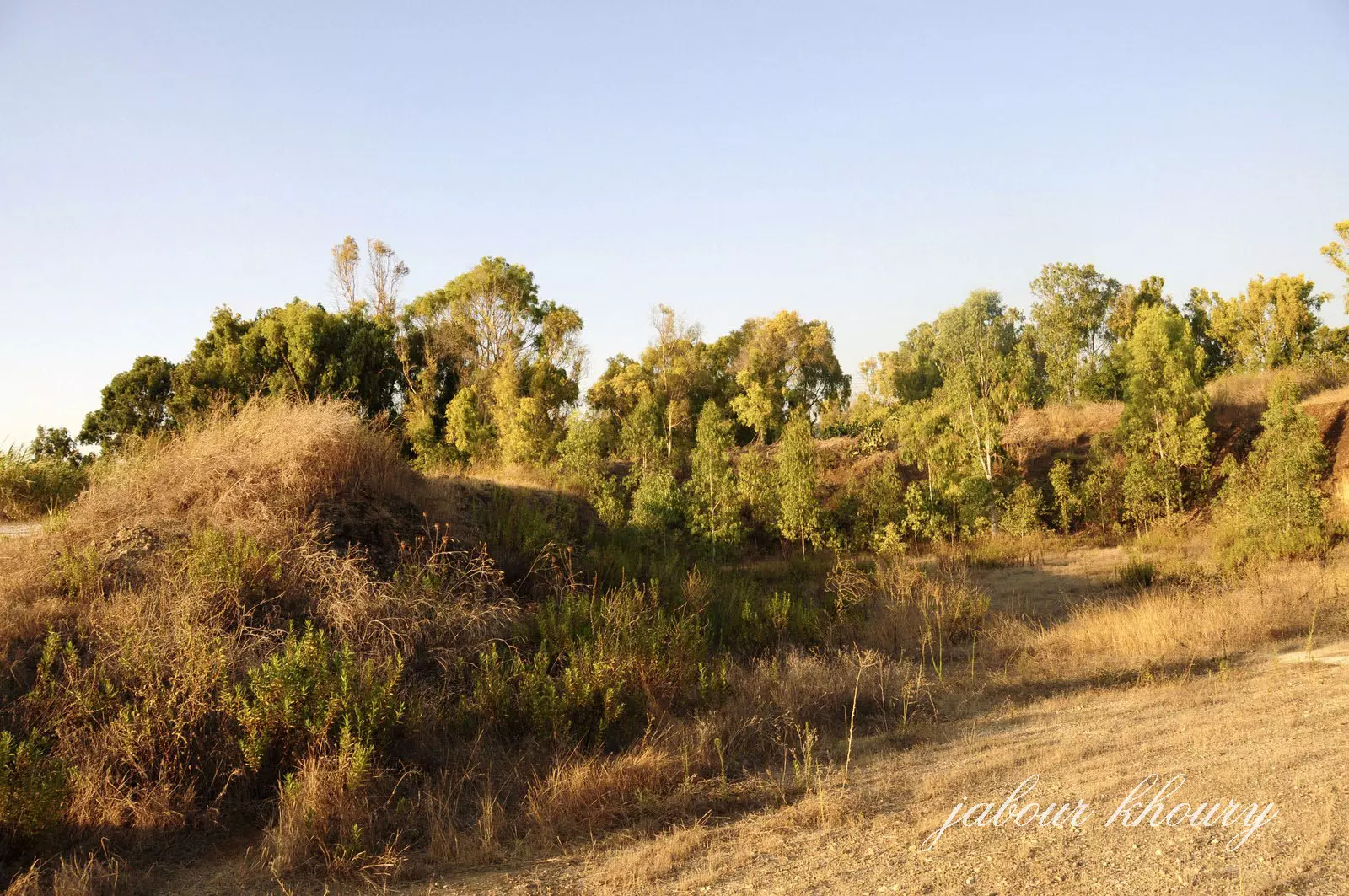
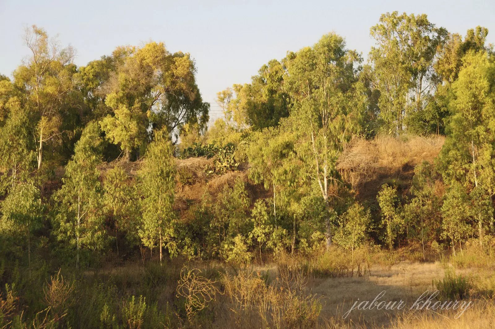
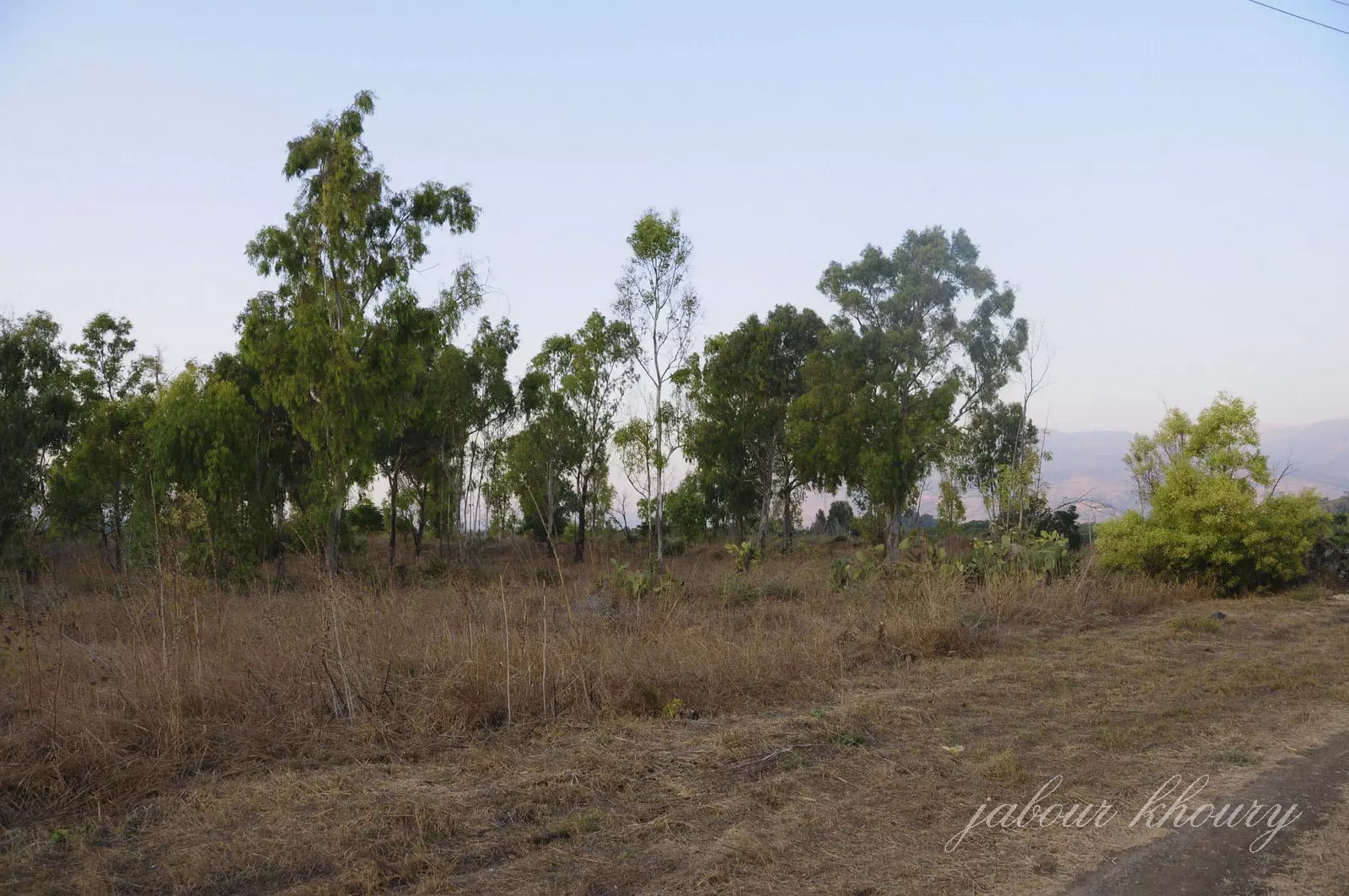
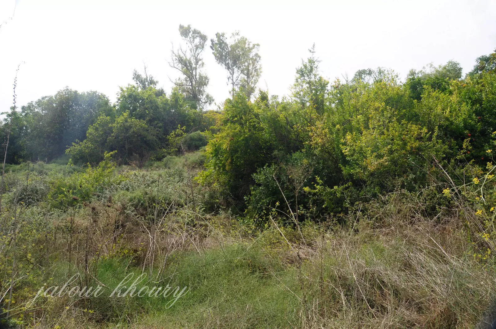
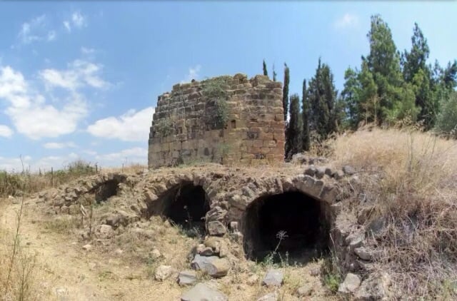
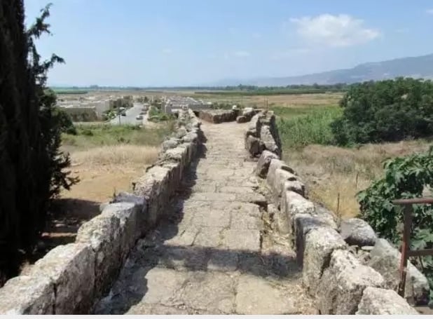
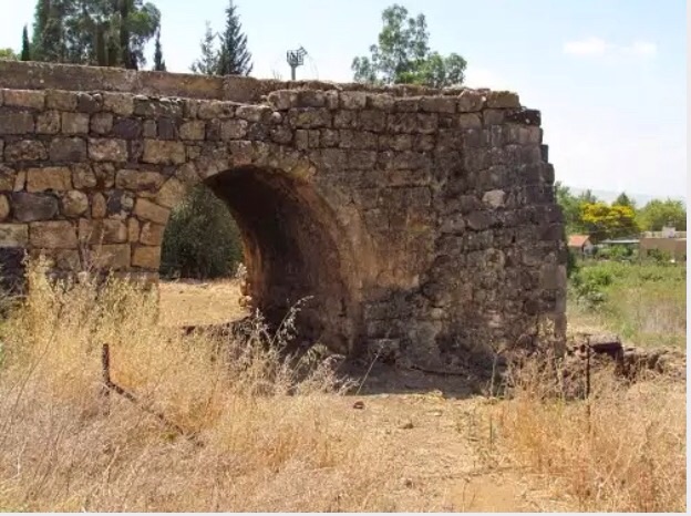
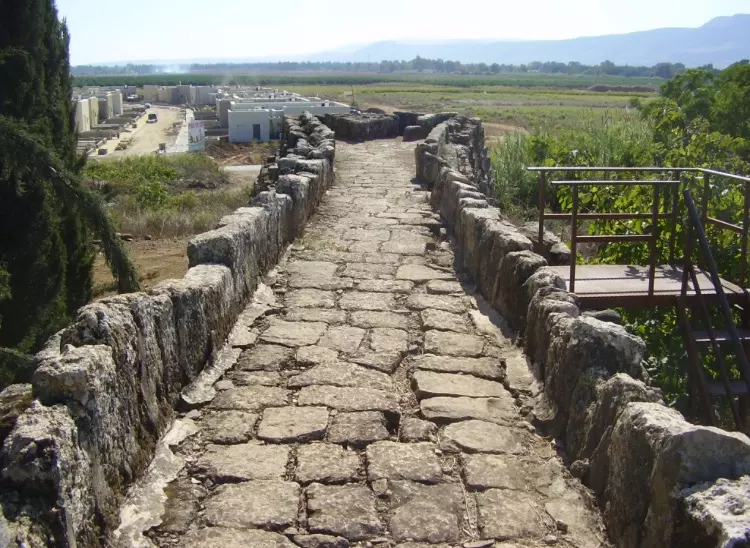
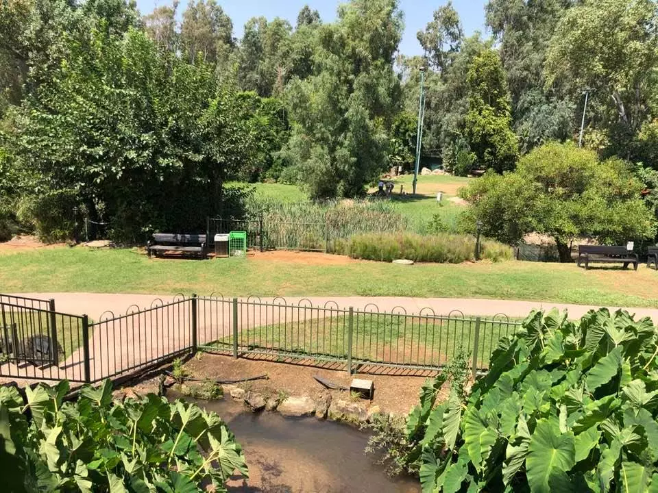
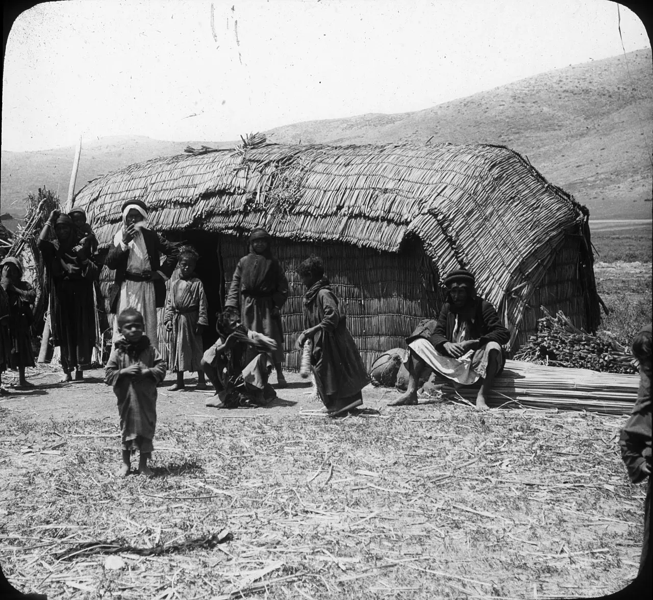
Village Before NakbaThe village was located in the northern part of the al-Hula Plain, on a natural terrace that was about 100 m wide. This terrace had been formed thousands of years earlier when the ancient Lake al-Hula (which once filled the entire al-Hula Basin) shrank. Wadi al-Hasibani passed by the western part of al-Khisas, cutting a trough through the mountains. Al-Khisas was linked by a secondary road to a highway leading to Safad and Tiberias and by a similar road to a neighboring village. The Arab geographer Yaqut al-Hamawi (d. 1228) described al-Khisas as falling within the administrative jurisdiction of Banyas in Syria (today occupied by Israel). In 1945 the village had an Arab population of 400 Muslims and 70 Christians. Agriculture was its principal economic activity. Fruit orchards were tended south of the village, along the al-Hasibani River, while olive trees grew on the west side. In 1944145 a total of 1,438 dunums was irrigated or used for orchards. Evidence that the village site had been inhabited before 1900 includes the nearby shrine of a Shaykh 'Ali and rock-hewn tombs.Village Occupation and Ethnic CleaningAl-Khisas was the target of a Haganah hit-and-run attack in the very first weeks of the war. On 18 December 1947, members of a Haganah strike force raided the village under cover of night, driving through the village, firing their guns, and throwing bombs. Several houses were blown up and about a dozen civilians (including 4 children) were killed, according to figures cited by Israeli historian Benny Morris. A New York Times report put the number of dead at 10, including 5 children, and added that some victims were buried in the wreckage of their houses. (The Haganah initially denied that children were killed, but a spokesman later admitted the fact.) The newspaper story stated that the attack was in revenge for the killing of two men from the Jewish Settlement Police in the Safad area.Morris states that some local Haganah intelligence officers and civilian leaders initially opposed the planned 'retaliatory' operation, but it was approved by the Palmach commanding officer, Yigal Allon. A few days later, a Haganah spokesman said that one of the dynamited houses had been a base for Syrian and Lebanese forces, adding: 'It is very unfortunate that children should have been sleeping in that sort of smallscale military center and should have fallen victims to that kind of attack.' An assessment of the al-Khisas attack was made during a high-level meeting of Zionist military and civilian officials on 1-2 January 1948. Morris summarizes what seems to have been the majority view at the meeting (attended by Jewish Agency chairman David Ben-Gurion and Moshe Dayan, then a relatively junior Arab affairs expert): 'However unpleasant, the use of force, even if occasionally excessive, was in the long run fruitful.' According to Morris, the villagers fled al-Khisas on 25 May 1948, some five months after the Haganah attack, at the very end of Operation Yiftach (see Abil al-Qamh, Safad sub-disctrict). An Israeli intelligence report credited their dispersal to the campaign of psychological warfare launched during that operation. But the exodus was evidently partial, for some villagers remained in their homes for just over a year afterwards, until they were forcibly ousted by the Israeli army. At midnight on 5 June 1949, the village was surrounded by trucks and the villagers were forced into the trucks 'with kicks, curses and maltreatment,' in the words of a Mapam Knesset member quoted by Morris. The villagers said that they had been 'forced with their hands to destroy their dwellings,' and had been treated like 'cattle.' They were then dumped on a bare, sunscorched hillside near the village of 'Akbara where they were left 'wandering in the wilderness, thirsty and hungry.' They lived there under inhuman conditions for years afterwards, along with the inhabitants of at least two other villages (Qaddita and al-Ja'una) expelled in the same circumstances. Zionists Colonies on Village LandsThe settlement of ha-Gosherim (208291), established in 1948 before the villagers of al-Khisas were expelled, is a few hundred meters south of the village site, on village land.Village TodayMost of the village land is covered with woods and grass. There are scattered cactuses and some piles of stones, as well as the remains of an old building and a large arched stone barrage. The village lands are cultivated by the settlement of ha-Gosherim.SourceDr. Walid al-Khalidi, 1992: All That Remains. |
||||||||||||||||
| Related Maps | Town Lands' Demarcation Maps خرائط للقضاء توضح حدود القرى والاودية Town's map on MapQuest View from satellite Help us map this town at WikiMapia |
|||||||||||||||
| Related Links | Wikipedia's Page Google Search Google For Images Google For Videos |
|||||||||||||||
| More Information | في كتاب كي لا ننسى في كتاب بلادنا فلسطين المزيد من موقع هوية |
|||||||||||||||
- مشهد لأراضي الخصاص المسلوبة من مدخلها الشمالي
Posted by دارين طاطور - مشهد لأراضي الخصاص المسلوبة من مدخلها الشمالي تصوير دارين طاطور
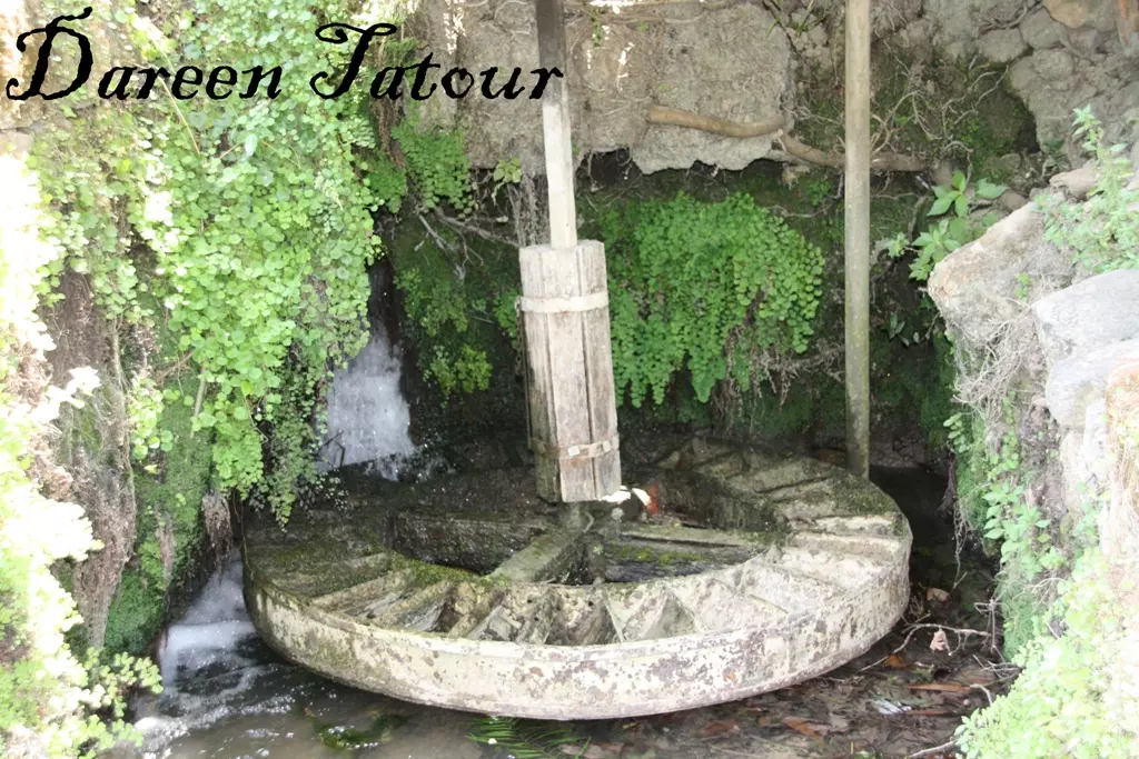
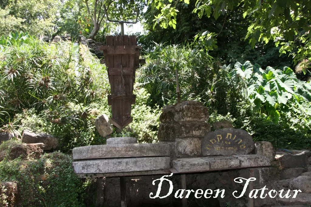
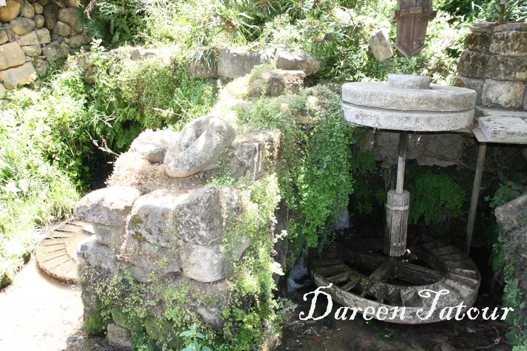
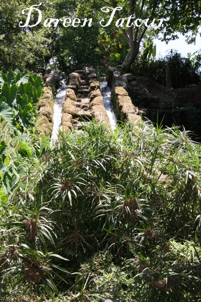
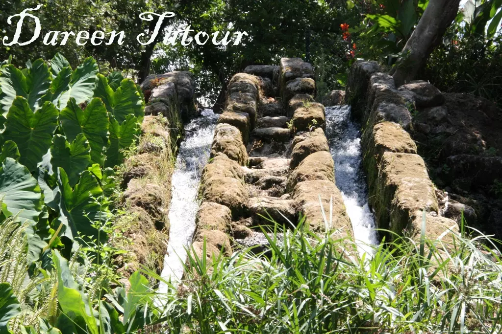
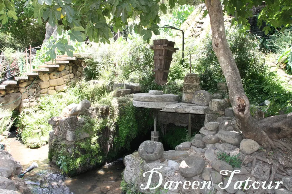
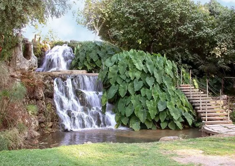
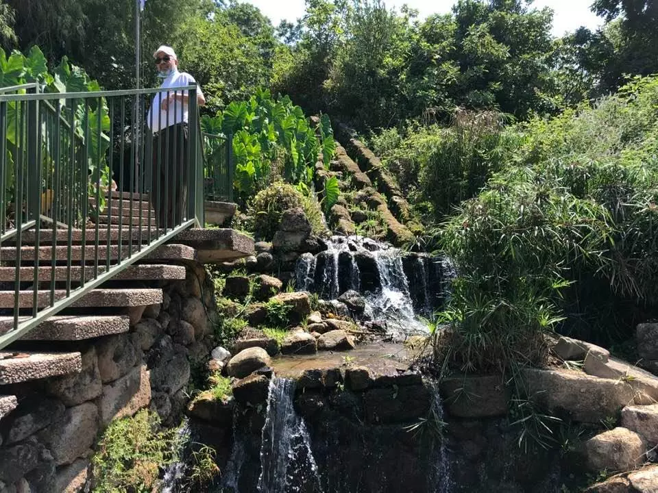
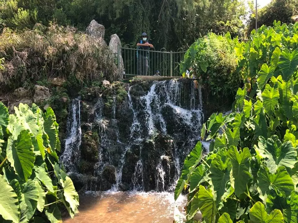
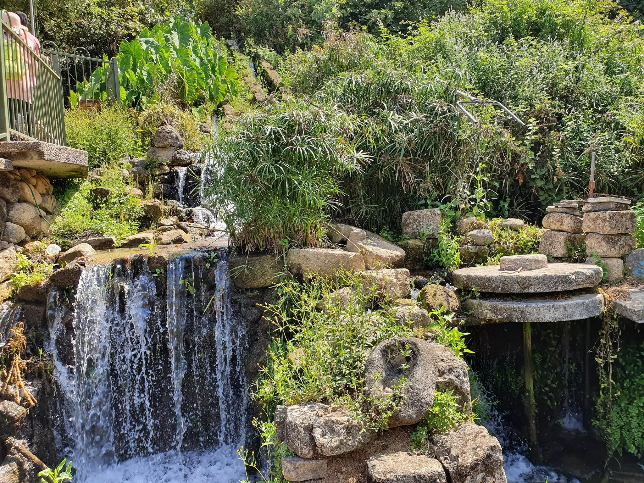
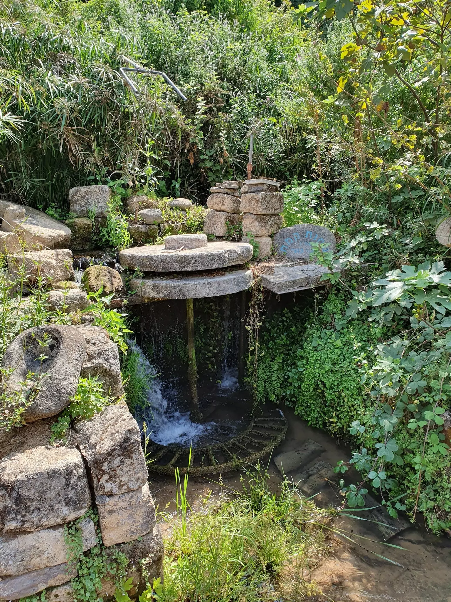
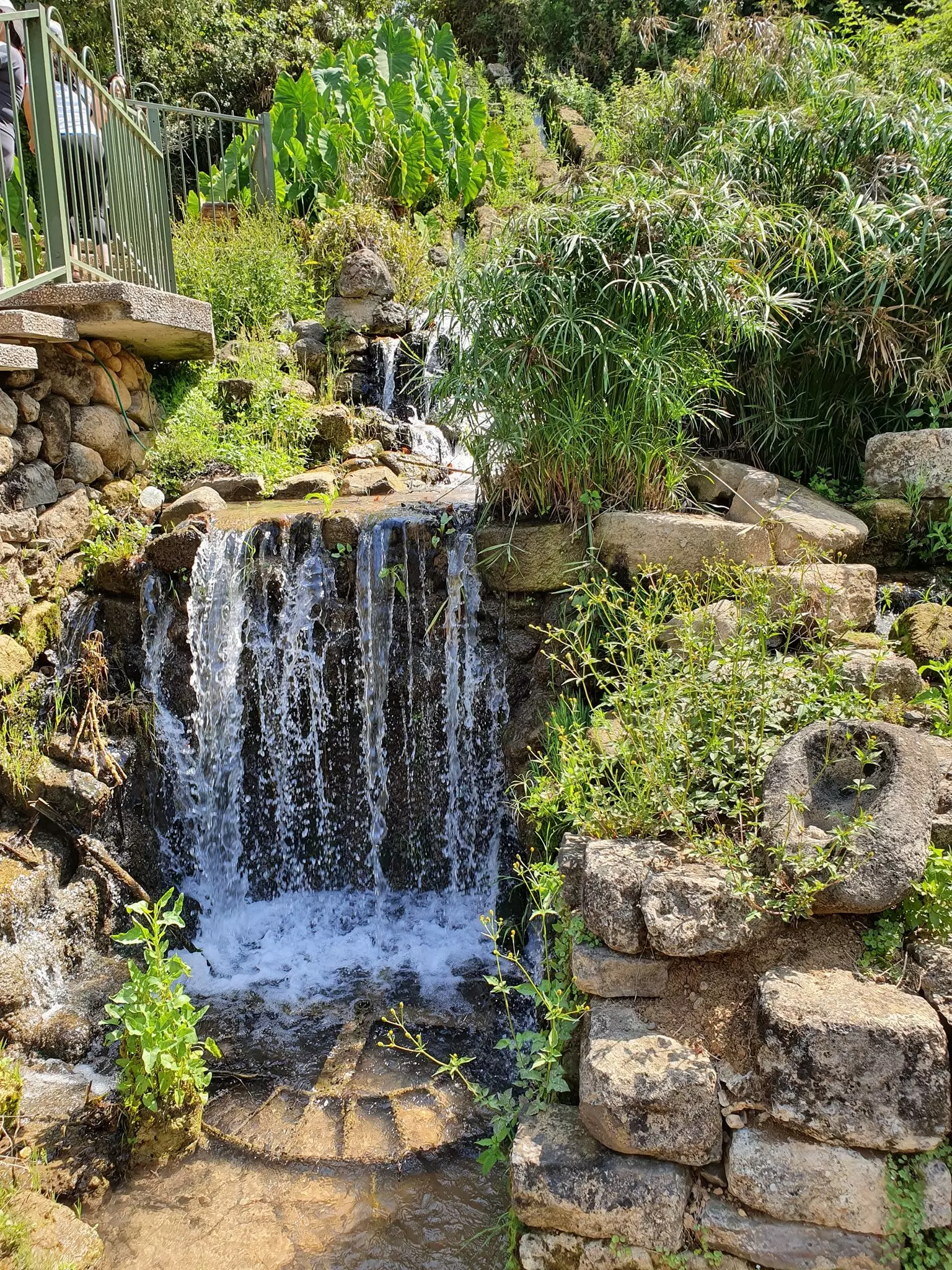
Posted by دارين طاطور - مشهد لطاحونة البلدة كانت تعمل بواسطة قوة الماء والشلال تصوير دارين طاطور
Posted by دارين طاطور - مشهد لطاحونة البلدة كانت تعمل بواسطة قوة الماء والشلال تصوير دارين طاطور
Posted by دارين طاطور - مشهد لطاحونة البلدة كانت تعمل بواسطة قوة الماء والشلال تصوير دارين طاطور
Posted by دارين طاطور - مشهد لطاحونة البلدة كانت تعمل بواسطة قوة الماء والشلال تصوير دارين طاطور
Posted by دارين طاطور - مشهد لطاحونة البلدة كانت تعمل بواسطة قوة الماء والشلال تصوير دارين طاطور
Posted by دارين طاطور - مشهد لطاحونة البلدة كانت تعمل بواسطة قوة الماء والشلال تصوير دارين طاطور
Posted by دارين طاطور - مشهد لطاحونة البلدة كانت تعمل بواسطة قوة الماء والشلال تصوير دارين طاطور
Posted by دارين طاطور - مشهد لطاحونة البلدة كانت تعمل بواسطة قوة الماء والشلال تصوير دارين طاطور
Posted by دارين طاطور - موقع القريه - نظره من الى الشمال
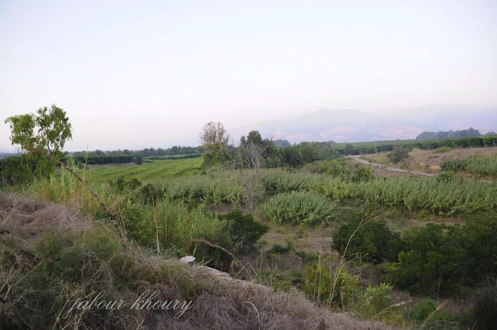
Posted by Jabour Khoury - جنوب القريه
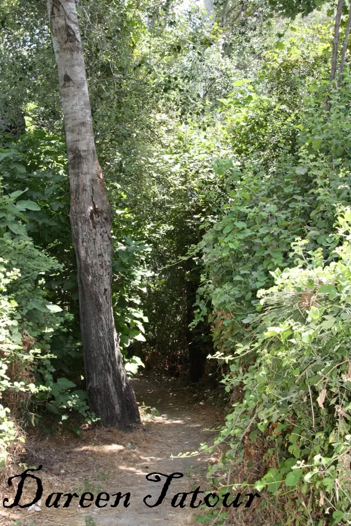
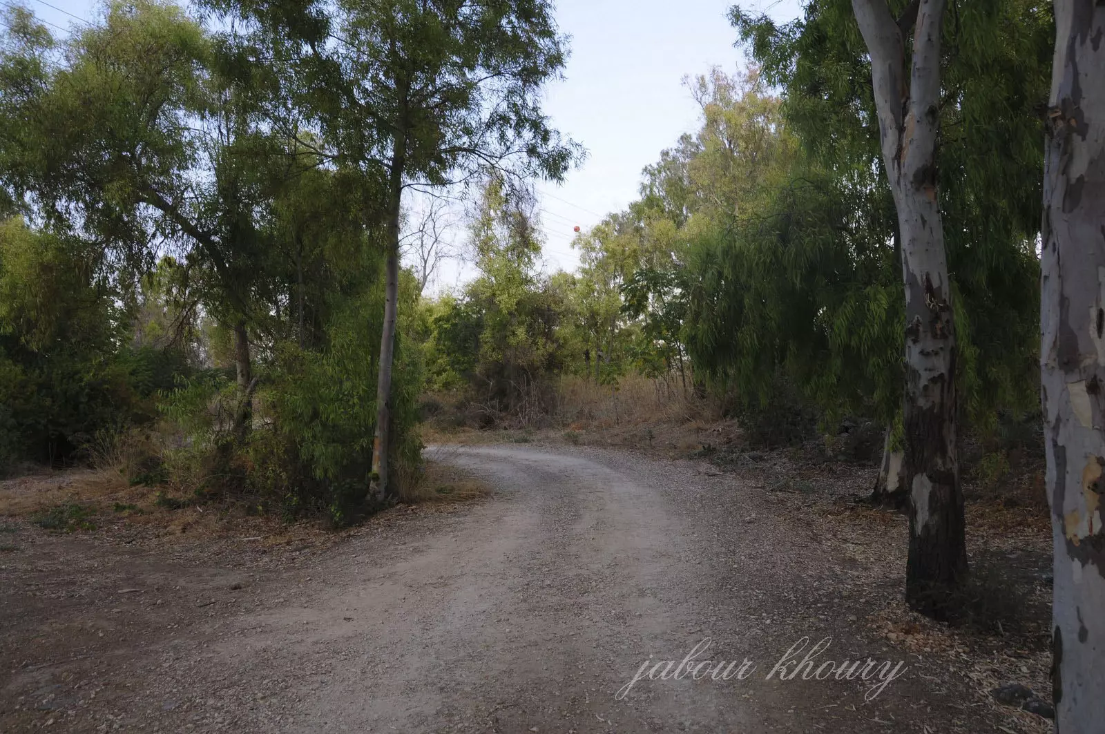
Posted by Jabour Khoury - الطريق المؤديه الى القريه
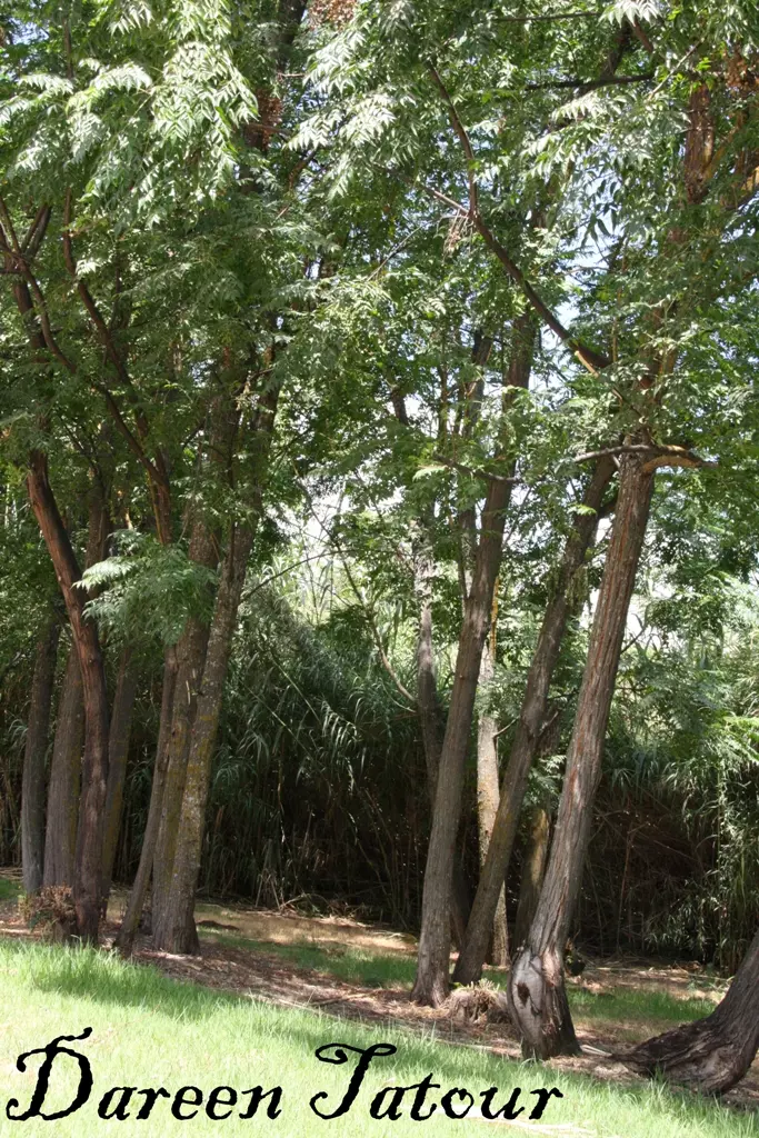
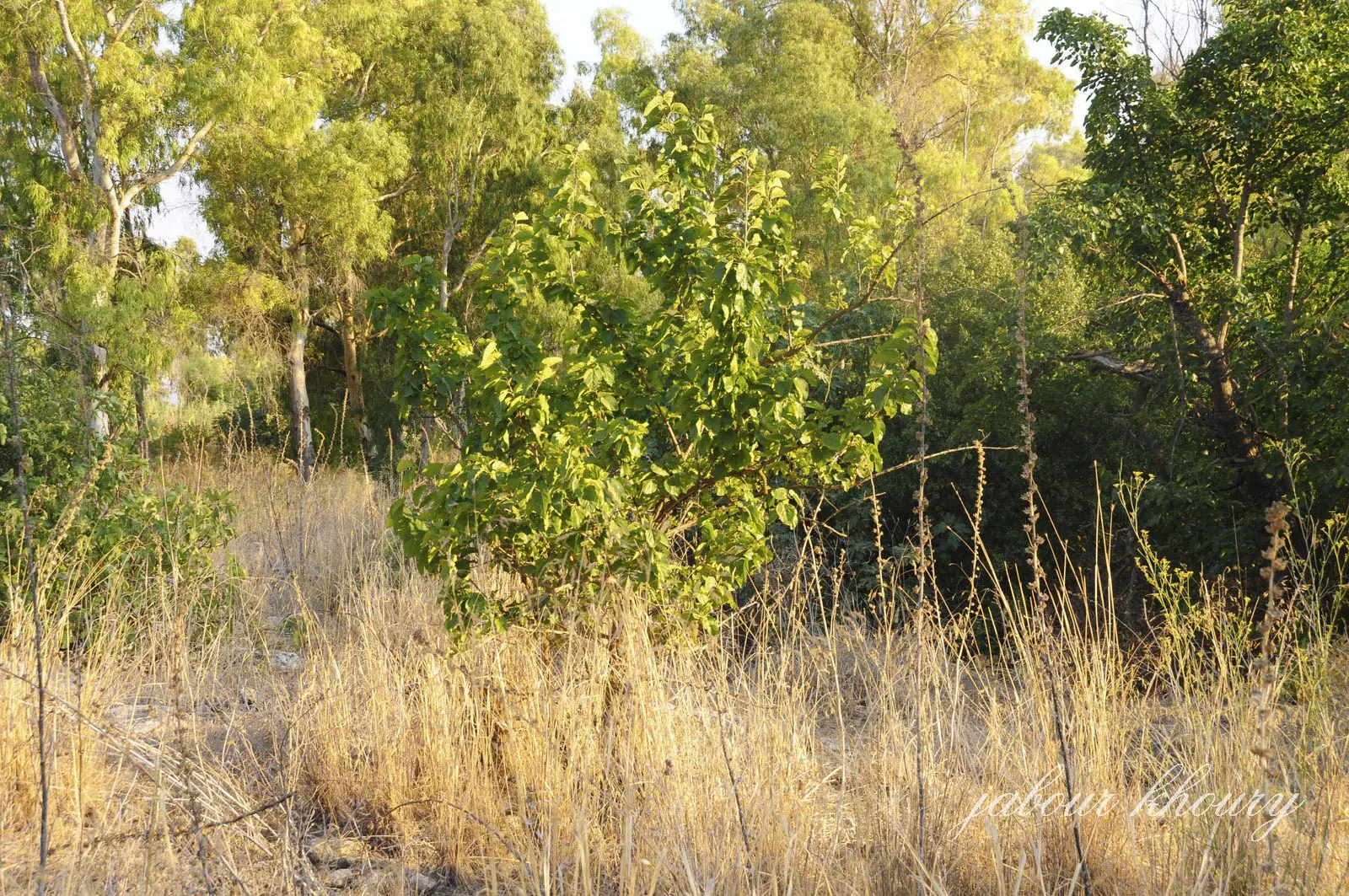
Posted by Jabour Khoury - مركز موقع القريه والمكان تغطيه الاعشاب واشجار الكينا
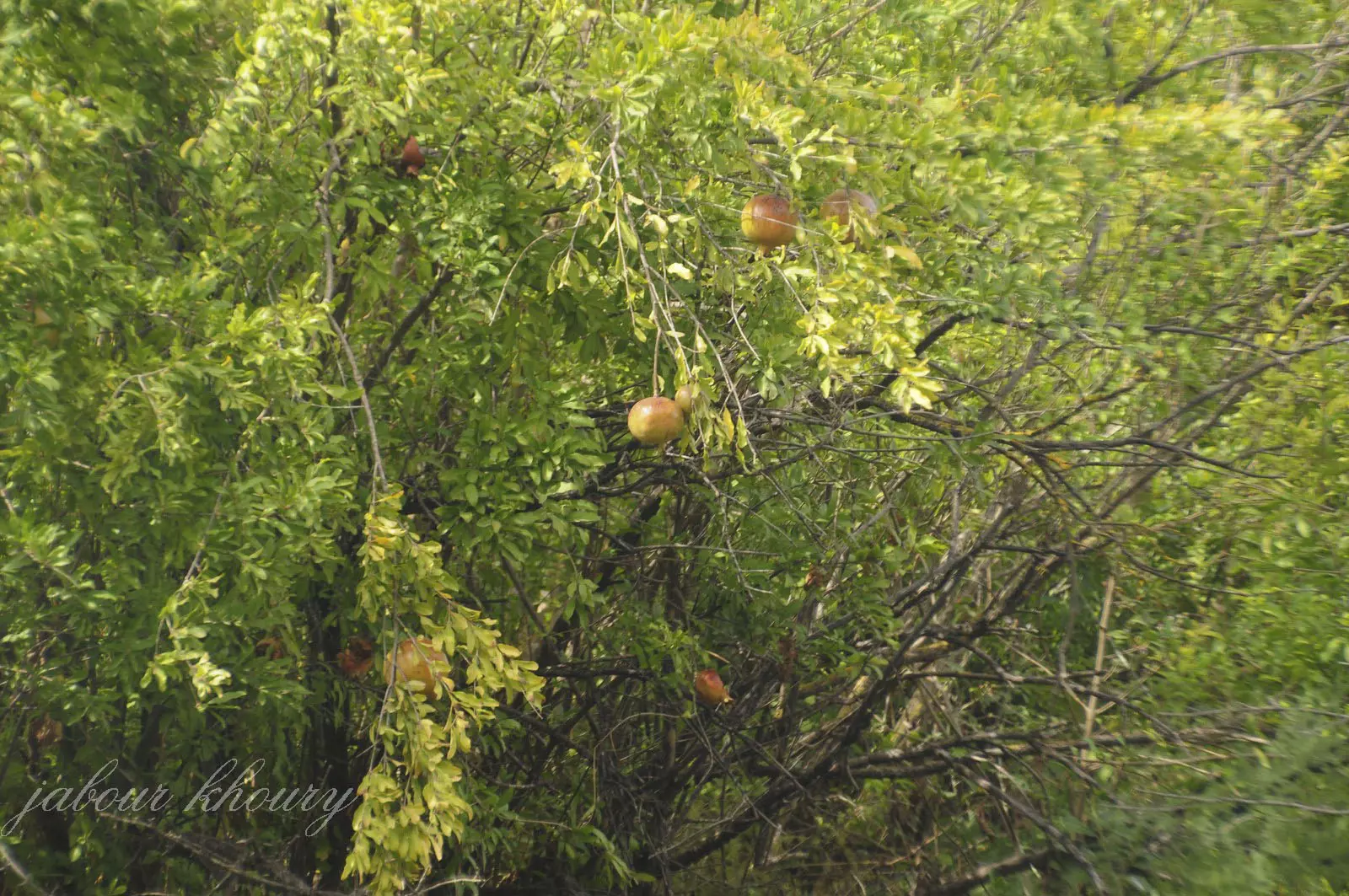
Posted by Jabour Khoury - اشجار الرمان الكثيره في القريه بالاضافه الى شجر التين والدوالي وشجر التوت هذه الاشجار تميز الزراعه الفلسطينينه
Posted by Jabour Khoury - اشجار الرمان ما زلات تعطي ثمارها منذ سته وستون عاما
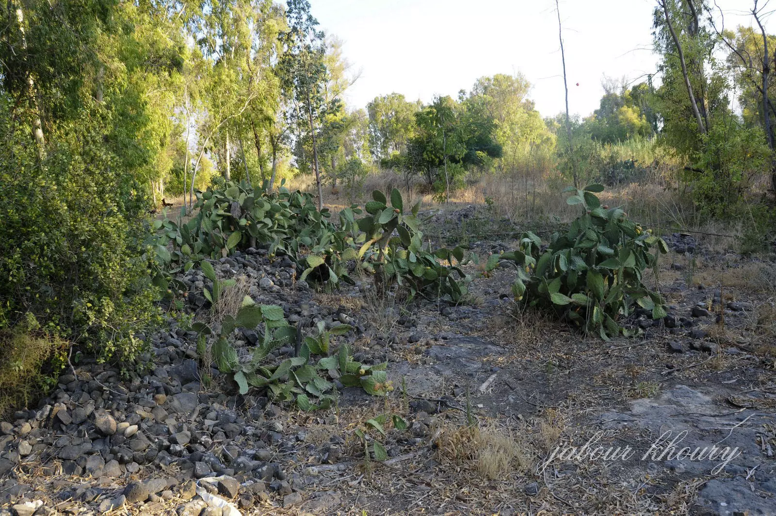
Posted by Jabour Khoury - اشجار الصبار في كل مكان ليبين هويه المكان وهويه من كانو ساكنيه
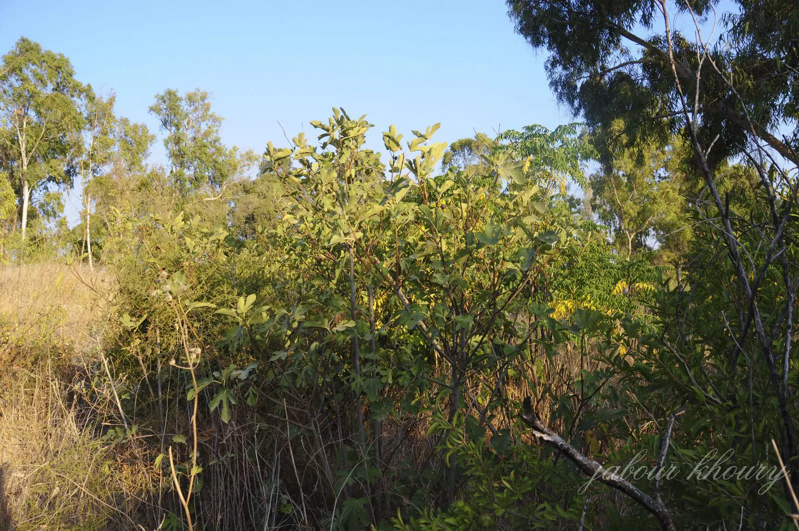
Posted by Jabour Khoury - اشجار التين والرمان
Posted by Jabour Khoury - الدوالي واشجار الرمان والتوت
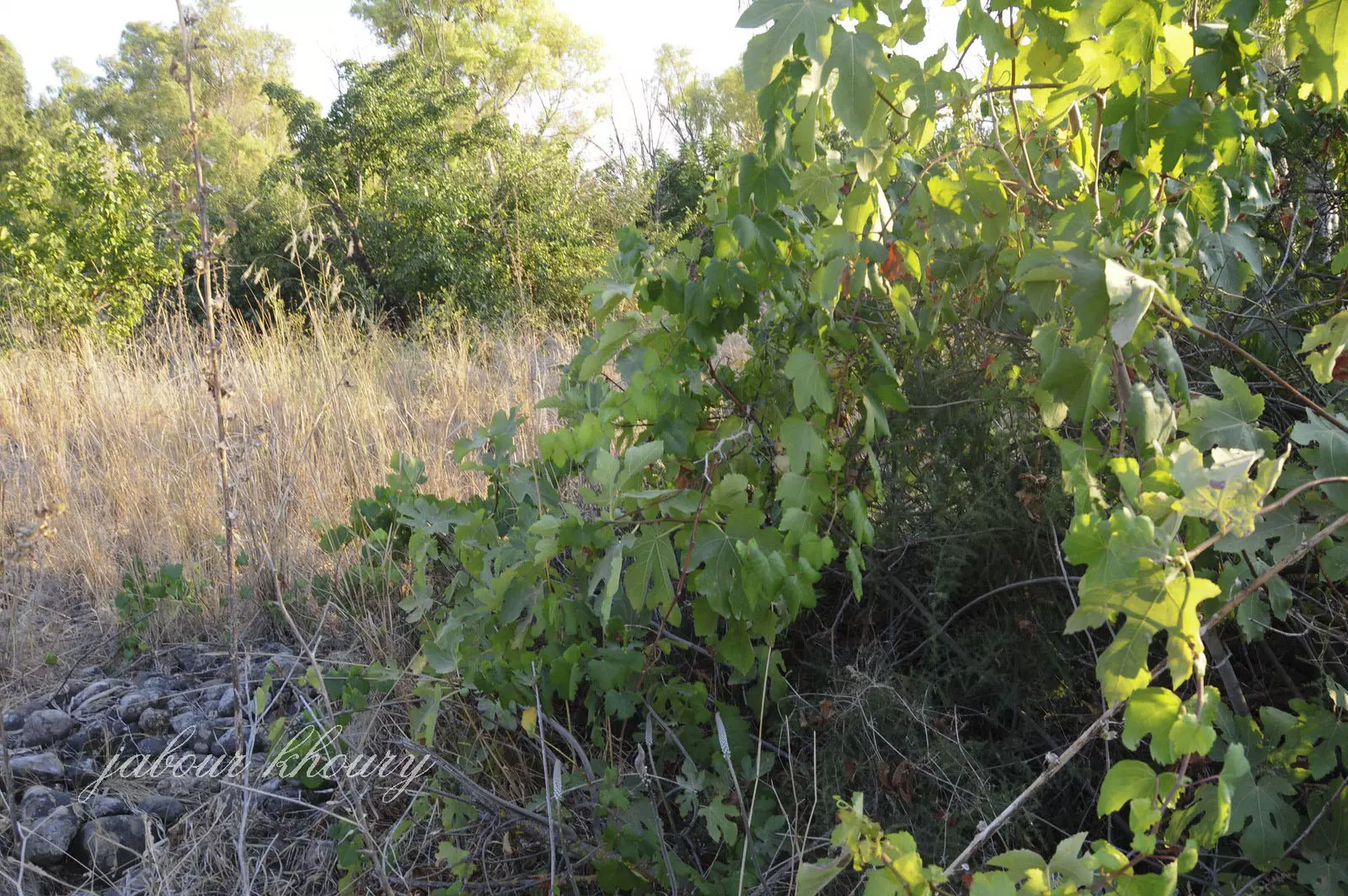
Posted by Jabour Khoury - اشجار التوت في وسط القريه
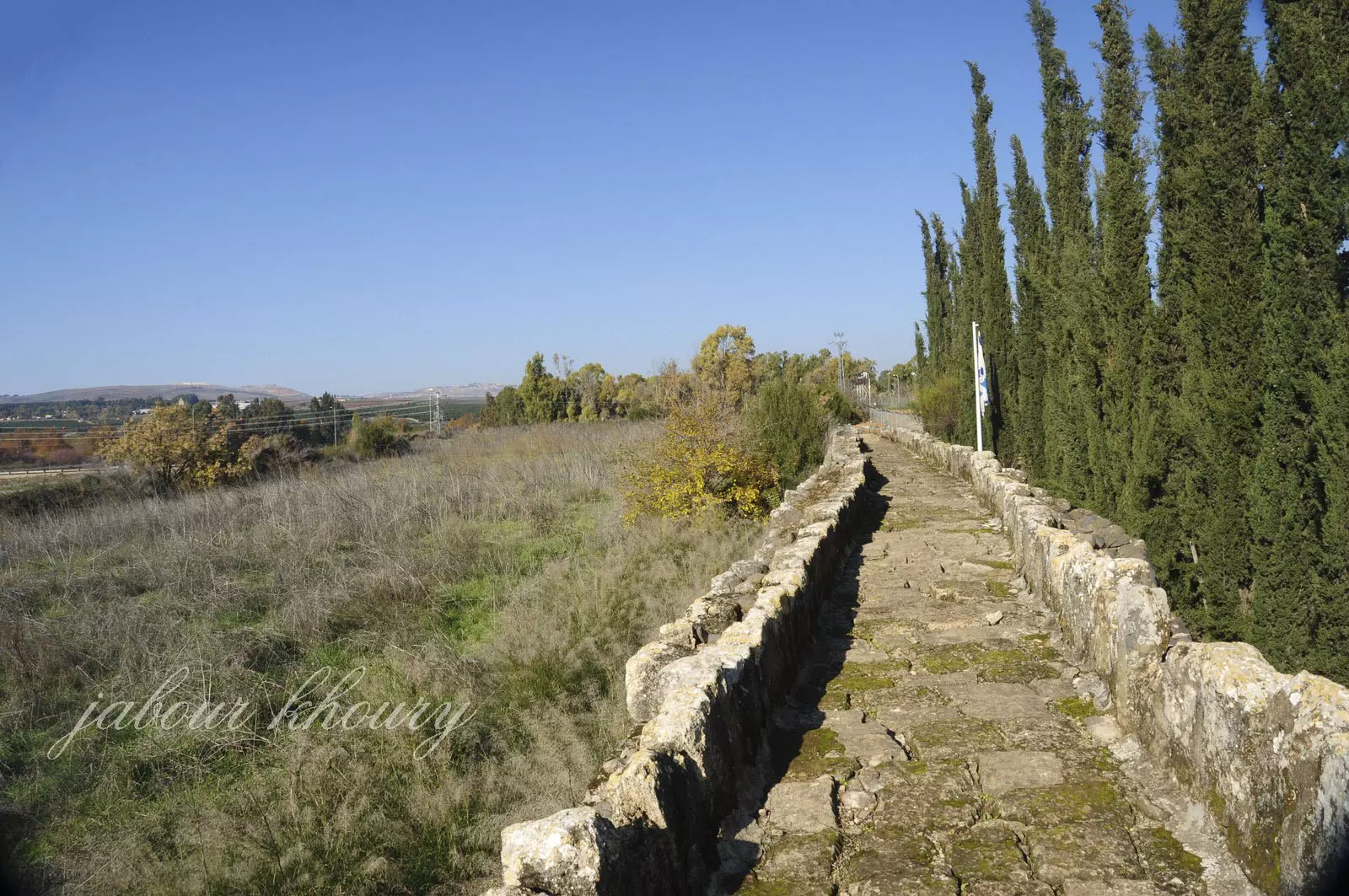
Posted by Jabour Khoury - مجرى نهر الدان الى الشرق من موقع القريه
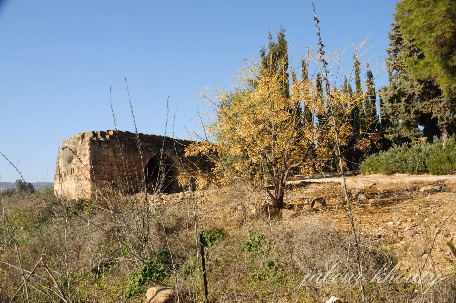
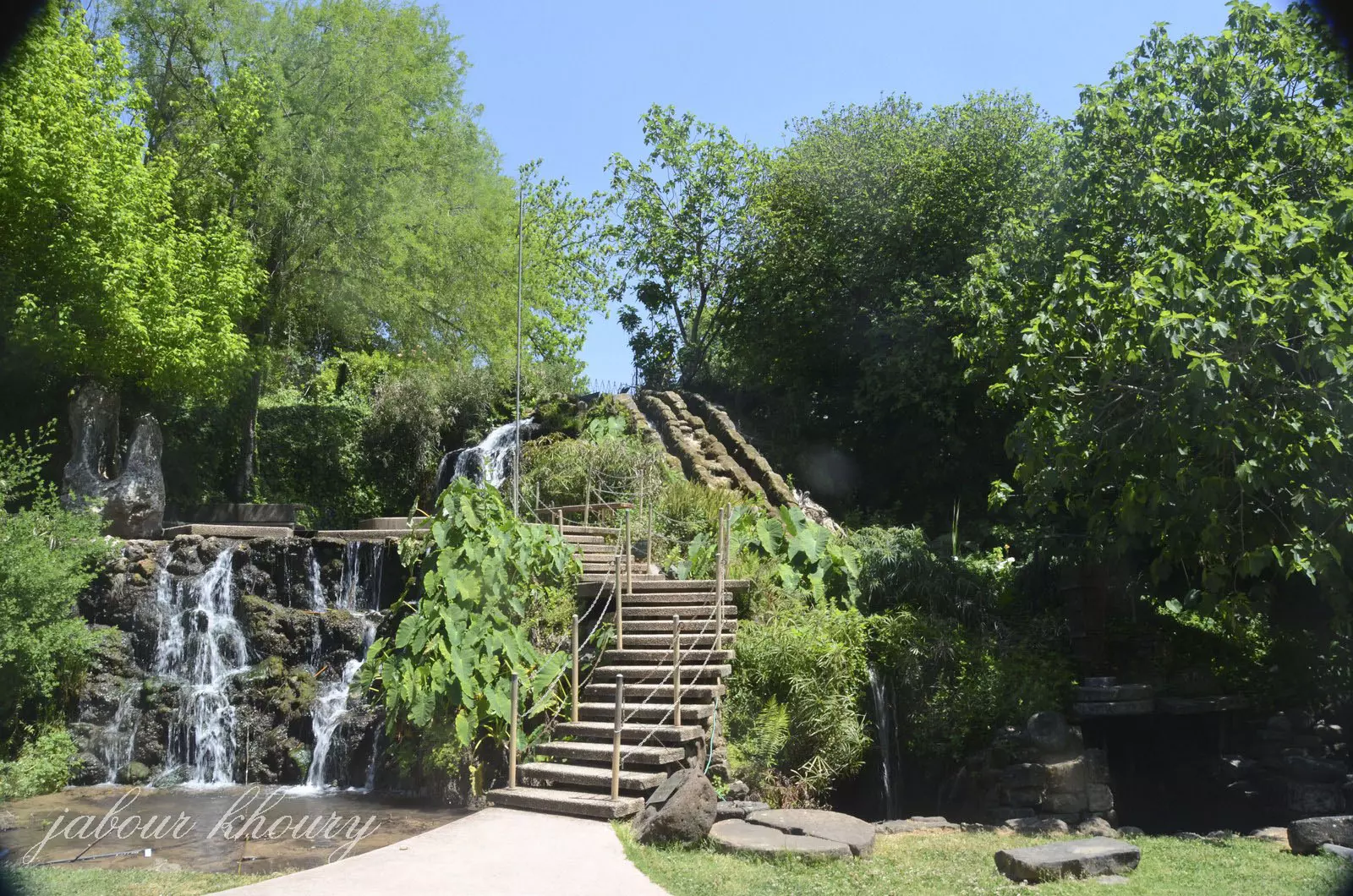
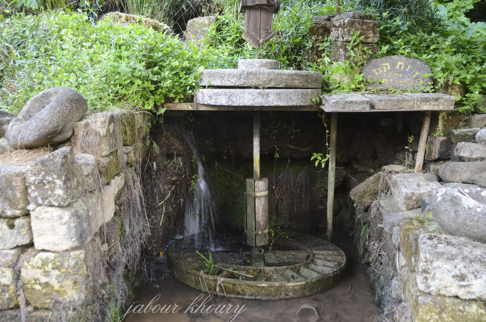
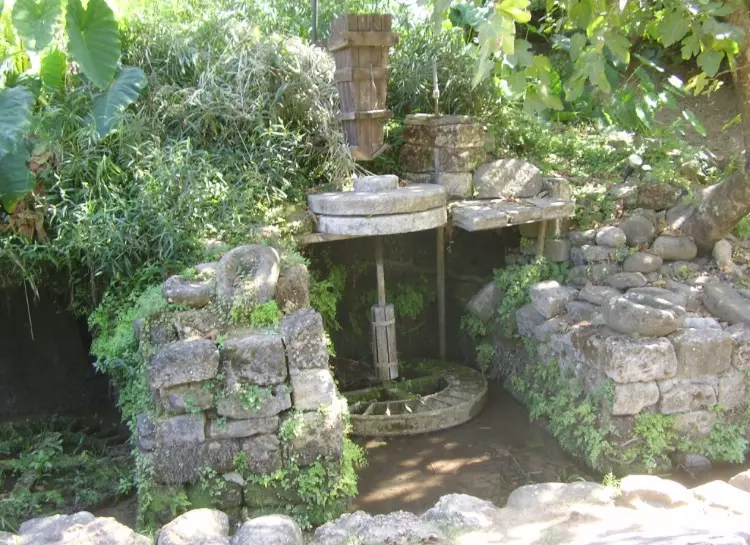
Posted by Jabour Khoury - طاحونه الخصاص وهي تقع في جنوب القريه وقد تمت سرقه كل محتوياتها والاتها وركبت في مستوطنه هاجوشريم التي اقيمت على اراضي القريه لجلب السياح الى المكان
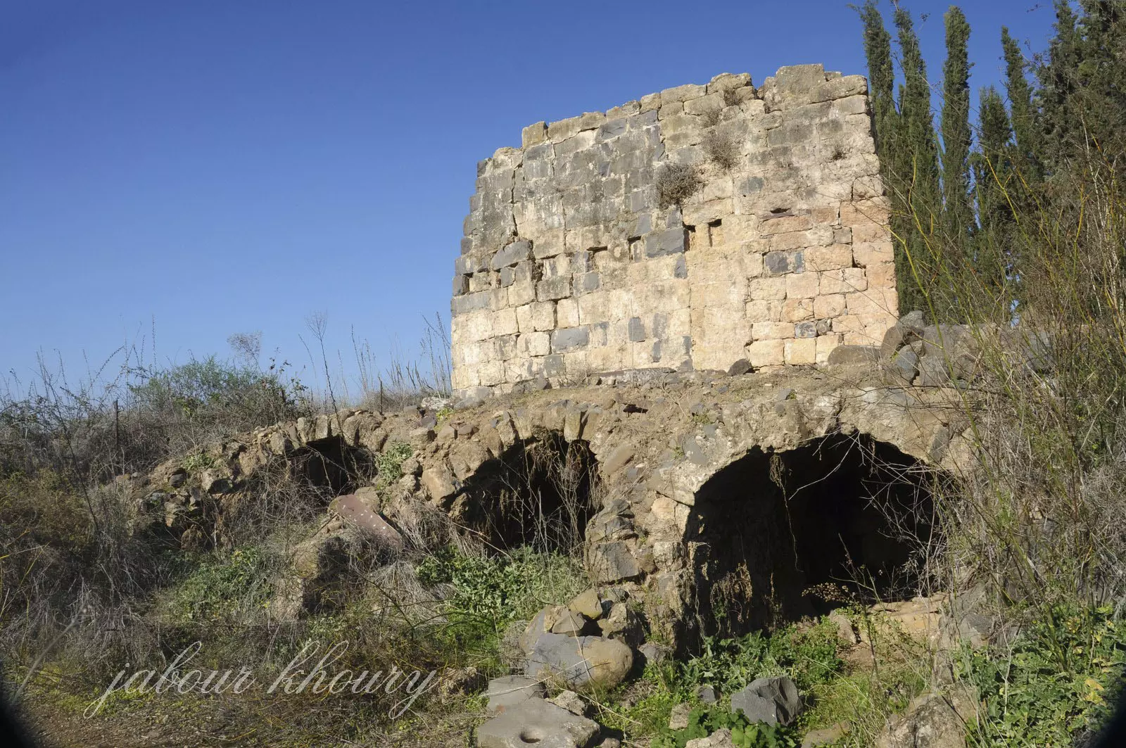
Posted by Jabour Khoury - طاحونه الخصاص
Posted by Jabour Khoury - الطاحونه
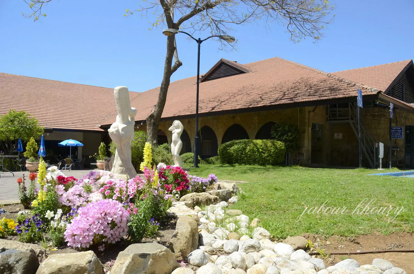
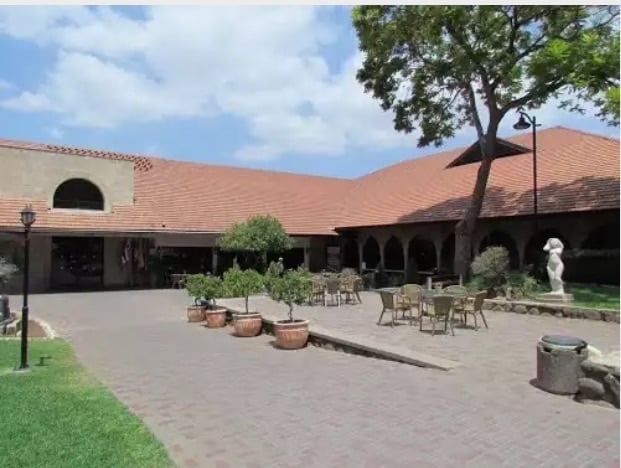
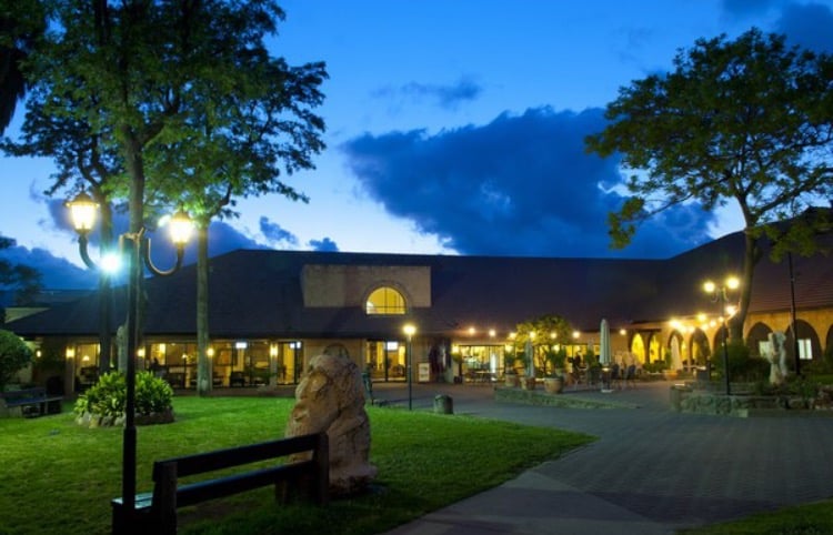
Posted by Jabour Khoury - قصر الامير فاعور ما زال يستعمل حتى يومنا هذا كفندق بالمستوطنه
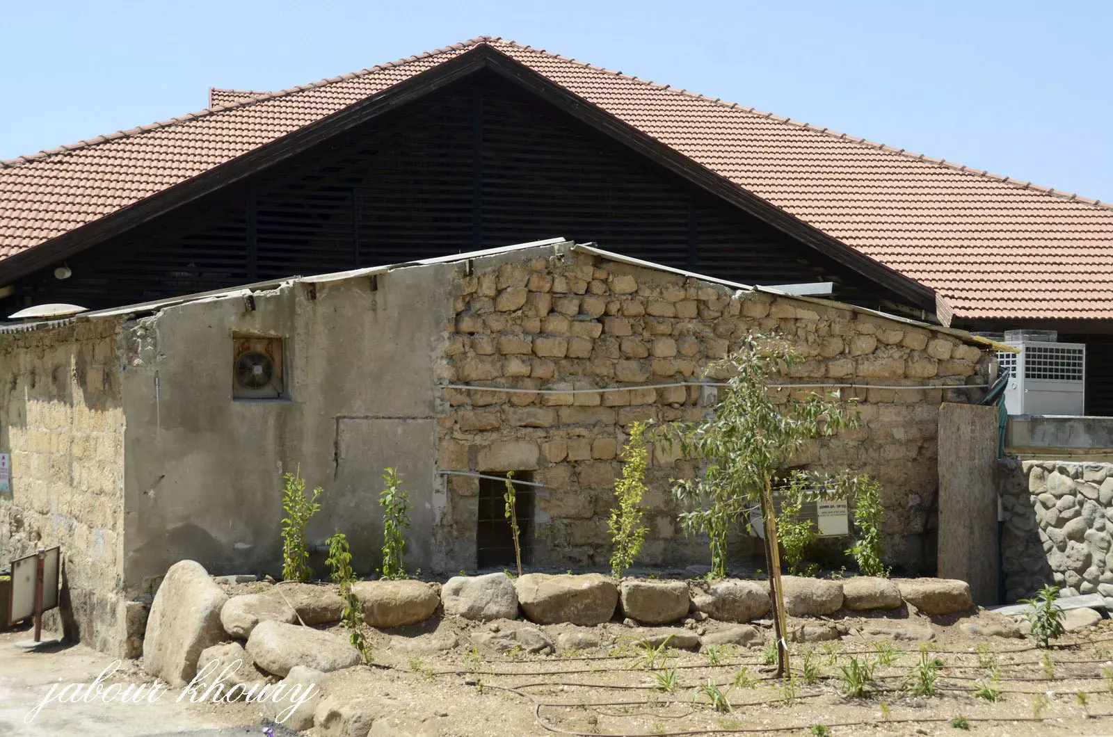
Posted by Jabour Khoury - خلفيه قصر الامير فاعور ويظهر بوضوح اسلوب البناء العربي
Posted by Jabour Khoury - برج الماء المقام في وسط المستوطنه لجلب السياح وفي يمين الصوره تظهر كل معدات الطاحونه المسروقه والمركبه بشكل اصطناعي
Posted by Jabour Khoury - الطاحونه المركبه بشكل صوري والمسروقه قطعها من طاحونه الخصاص الاصليه
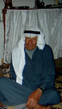
Posted by Jabour Khoury - صورة الشيخ شحادة ذيبان السوالمة رحمة الله علية وهو من ضمن ابناء قرية الخصاص اللذين هجروا سنة 1947 م إلى مخيمات الشتات في لبنان ومن ثمة استقر في سوريا في مخيم جرمانا وتوفي هناك عن عمر يناهز 82 عاماً
Posted by okasha - قصر الامير فاعور في الخصاص تم تحويله الى فندق
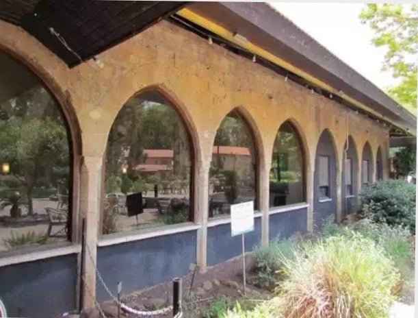
Posted by abu raya - قصر الامير فاعور في الخصاص
Posted by abu raya - طاحونه الخصاص
Posted by abu raya - الطاحونه
Posted by abu raya - قناه المياه الموديه الى الطاحونه
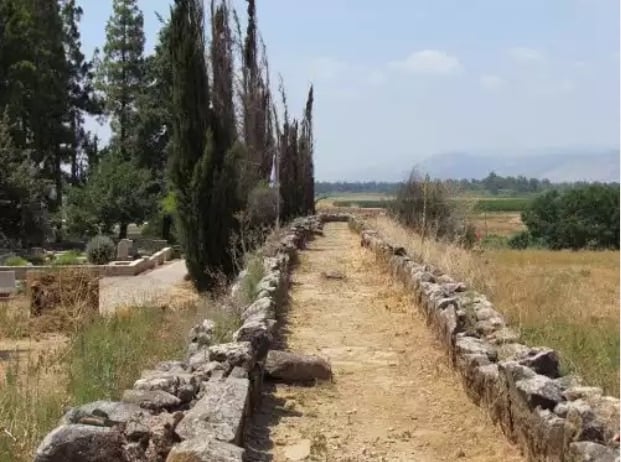
Posted by abu raya - قناه المياه
Posted by abu raya - اثار مبنى في الخصاص
Posted by abu raya - الخصاص
Posted by abu raya - قصر الامير فاعور في القريه
Posted by abu raya - الخصاص
Posted by abu raya - قناه المياه في الخصاص
Posted by abu raya - الخصاص
Posted by abu raya - الخصاص

Posted by abu raya - All that remains from the mill -- Yousef Odeh
- All that remains from the mill -- Yousef Odeh #2
- That is how the "civilized" erased and replaced us: al-Khisas was completely obliterated, as you see -- الخصاص باتت أثر بعد عين. من هنا مر الهمجّ
- That is how the "civilized" erased and replaced us: al-Khisas was completely obliterated, as you see -- الخصاص باتت أثر بعد عين. من هنا مر الهمجّ #2
- That is how the "civilized" erased and replaced us: al-Khisas was completely obliterated, as you see -- الخصاص باتت أثر بعد عين. من هنا مر الهمجّ #3
- That is how the "civilized" erased and replaced us: al-Khisas was completely obliterated, as you see -- الخصاص باتت أثر بعد عين. من هنا مر الهمجّ #4
- That is how the "civilized" erased and replaced us: al-Khisas was completely obliterated, as you see -- الخصاص باتت أثر بعد عين. من هنا مر الهمجّ #5
- That is how the "civilized" erased and replaced us: al-Khisas was completely obliterated, as you see -- الخصاص باتت أثر بعد عين. من هنا مر الهمجّ #6
- That is how the "civilized" erased and replaced us: al-Khisas was completely obliterated, as you see -- الخصاص باتت أثر بعد عين. من هنا مر الهمجّ #7
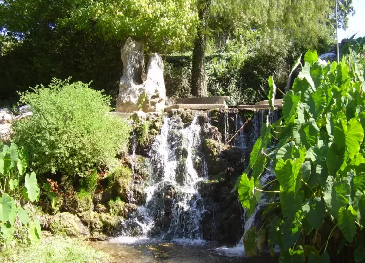
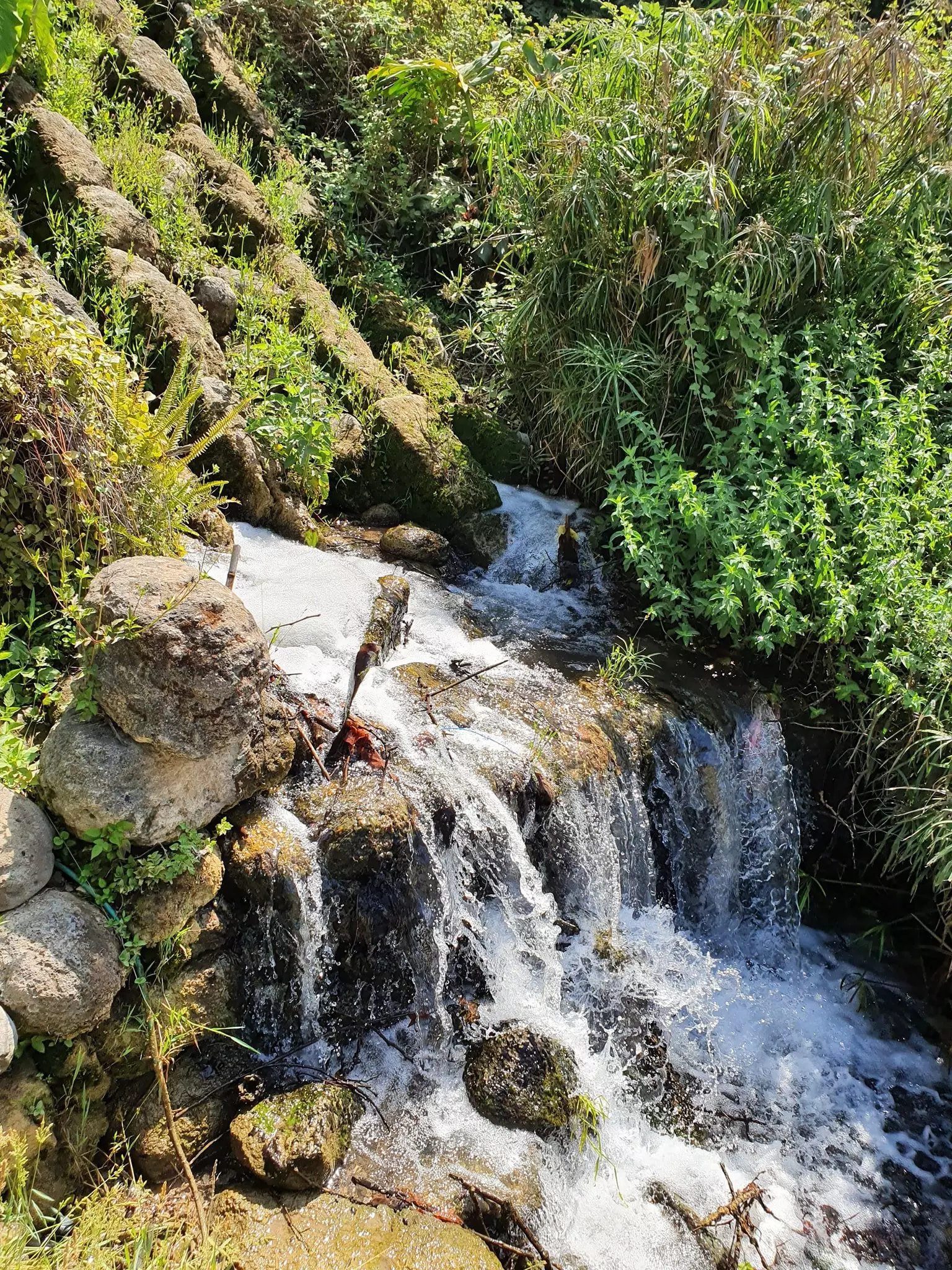
- جولة في طاحونة البلد والينابيع المغذية لها Sept. 2020 -- Nabela Salem
- جولة في طاحونة البلد والينابيع المغذية لها Sept. 2020 -- Nabela Salem #2
- جولة في طاحونة البلد والينابيع المغذية لها Sept. 2020 -- Nabela Salem #3
- جولة في طاحونة البلد والينابيع المغذية لها Sept. 2020 -- Nabela Salem #4
- جولة في طاحونة البلد والينابيع المغذية لها Sept. 2020 -- Nabela Salem #5
- جولة في طاحونة البلد والينابيع المغذية لها Sept. 2020 -- Nabela Salem #6
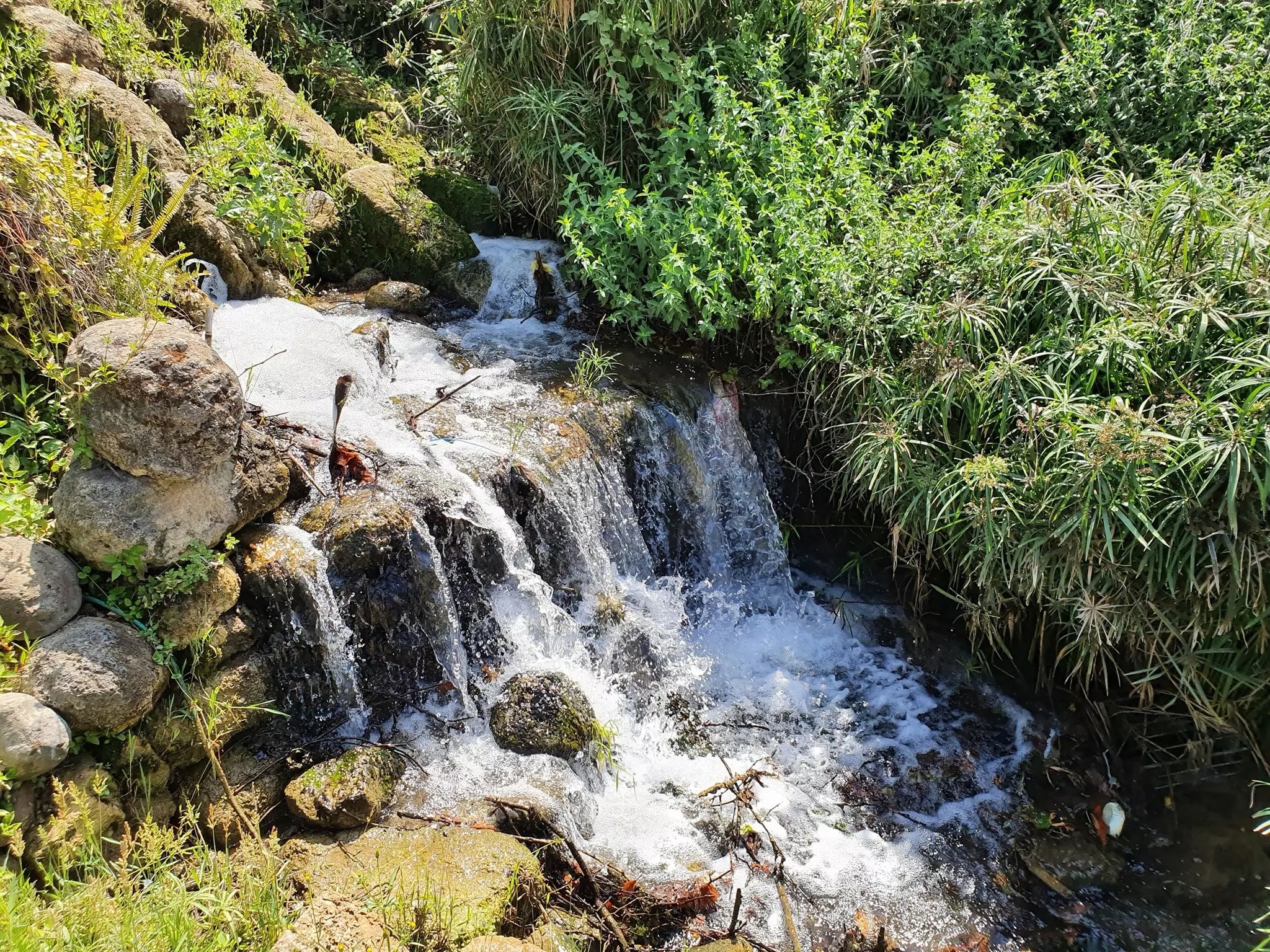
- جولة في طاحونة البلد والينابيع المغذية لها Sept. 2020 -- Nabela Salem #7
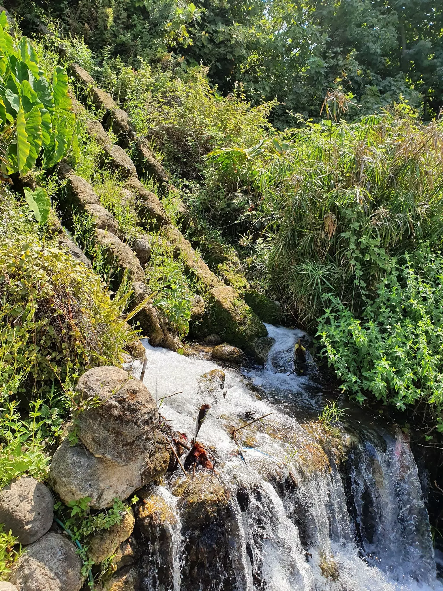
- جولة في طاحونة البلد والينابيع المغذية لها Sept. 2020 -- Nabela Salem #8
- قرية الخصاص، الواقعة قرب بحيرة الحولة في قضاء صفد، عام 1937 -- المزيد في قسم التعليقات
Want to browse more? 80,000 pictures were grouped in these gallaries:
| Display Name | Clan/Hamolah | Country of Residence |
| Mahdi Abduallh | - | Palestine |
| okasha | salman | - |
| Ismail Abdullah | - | Bekaa, Lebanon |
 Fake Valor: Why Did Zionist Jews Hoist Nazis Flag on Their Ships in the 1930s?
What is new?
-
Facts About Oct. 7th Gaza Raid
-
Remined Us Please: Who Did Rape Whom? Was it Palestinians who raped Israelis? Or, was the other way around? You'll be the judge
-
When Prof. Edward Said was invited to debate Bibi Netanyahu in the 1980s, watch what happened!
-
Ezra Klein of the NY Times on the "Jewish Race".
-
Abusing Blood Libel!
-
How and why Israeli Jewry has become the most hated cult?
-
Did Israeli Soldiers Activate The Hannibal Direective On Oct. 7th? You Be The Judge
-
Zionist FAQ: Isn't it true that Palestinians don't want peace? Palestinians never accepted the two-state solution
- Facts about Haavara (Transfer) Agreement between Ben-Gurion & Hitler
-
Haavara FAQs: Why Did Zionist Jews Hoist Nazis' Flags on Their Ships in the 1930s?
- Haavara FAQs: When Chaim Weizmann met FDR in mid-1943, why was he silent about rescuing European Jewry?
-
Dear ChatGPT: How did Palestinians resist Napoleon's invasion of their country in 1799?
-
Dear ChatGPT: Gaza had a vibrant Jewish community in the mid-17th century. What happened to them?
-
Dear ChatGPT: Why did the Jewish Agency suppress news of the Holocaust during WWII?
-
Video Playlist: Jews share their DNA tests to end the conflict for good.
-
A Tale of Two Conflicts: Examining the Definition of Genocide
-
Prof. Abraham Polak And The Suppressed History of the Khazars and European Jewry
-
How Ronald Reagan would have framed the genocide in Gaza if he were still alive?
-
Haavara FAQs: Let us do the math: how many German Jews did The Haavara Agreement save?
-
Zionist FAQs: The Hebron Massacre of 1929, "clearly proves" that Palestinians are antisemitic, how could you deny it?
-
Zionist FAQs: Why Anti-Zionist Is Not Antisemitism?
-
Zionist FAQs: Isn't it true that the KGB created Palestinian Nationalism in the early 1960s?
- Zionist FAQs: Muslims are killing Muslims all the time; why are Israeli Jews being singled out in the media?
- Zionist FAQs: How is Israel an apartheid state when 20% of its citizens are Arabs who enjoy full rights?
-
Haavara FAQs: Why Did Dorothy Thompson Flip From A Zionist Advocate to A Silenced Dissenter?
-
Haavara FAQs: Analysis of Herzl's Uganda Scheme and how it could have saved millions of Jews.
-
Haavara FAQs: Why did Hayim Greenberg describe American Jewry as "morally bankrupt" in early 1943?
-
Haavara FAQs: What if the Evian Conference was a resounding success? What would have been the impact of saving European Jewry on Zionism?
- Haavara FAQs: What if the six million were saved, how that would have impacted the Zionist project?
-
Haavara FAQs: How did Zionist leaders react when Europe's Jews lingered in the DP camps after WWII ended?
-
Why does the American Jewish community repeat lies that David Ben-Gurion had debunked before he died?
-
Who has the power to rename the Tatar/Khazar Gene Marker to Jewish IV?
-
Zionist FAQs: Why won't Egypt, Syria, and Jordan take their people back? Jews are indigenous to Palestine, and Arabs immigrated after Jews developed the country. Arabs should leave.
-
Haavara FAQs: Did Hitler and the Nazis conflate between Judaism and Zionist? If that wasn't case, then why?
-
Haavara FAQs: Winston Churchill and antisemitism, a collection of articles written Churchill.
-
Haavara FAQs: Broken by country, how many Jews survived vs. killed during the Holocaust?
-
Haavara FAQs: Why did European Jews vote with their feet and to immigrated to the Americas, not Palestine, after WWII?
-
Watch this American Jewish Girl describing Israeli Jews' cognitive dissonance like no other in under two minutes
-
Haavara FAQs: When the Nazis went out of their way to hide the Holocaust, Israeli Jews did the exact opposite by broadcasting their genocide of Gazans. But why?
-
Haavara FAQs: How Zionist Jews went out of their to show their appreciation to Nazism and Fascism?
- Haavara FAQs: Why Zionist leaders were against bombing the death camps & the Railroads leading to them?
-
Haavara FAQs: Hitler's message to the British and American people: If Jews are such noble citizens and you care about them, how come you're not letting them in? I will gladly ship them to you at my expense, even on luxury liners!
-
A shortlist of Zionist and Israeli false flag operations in the name Jews.
-
The Most Moral Army
- The Land of Kapos (Israel): Where the brave are boycotted and Kapos walk free.
- Why did early Zionists often named their communal enterprises "colonial"?
- Zionist Relations with Nazi Germany by Faris Glubb
-
Two NY Times advertisements by Zionists in the early 1943 that exposes Zionists' treason at the height of the calamity
- Facts Not Lies about the Palestinian-Israeli Conflict.
- Site's pictures have been categorized
- Campgain Against Lice
- A Survey of Palestine, the official source about Palestine before Nakba produced by the British Mandate; over 1200 pages.
- Satellite View & Google Earth: Over 6,000 placemarks identifying all destroyed towns, W. Bank & Gaza Strip Towns, & refugee camps.
- PalestineRemembered.com and its Nakba Oral History Project were featured on al-Jazeera Satellite TV.
- Nakba Oral History Video Podcast:
 Over 700 Oral History interviews (including 3,500+ hours of recording) can be viewed online.
 - Palestine Village Statistics Project
- Gaza Jail Break
- النسخة العربية للموقع الان متوفرة
- Videos: Documenting the destroyed villages in video: Tracing all that remains since Nakba.
- Videos: Responding to Zionist Propaganda
- Interview: The ethnic cleansing of Palestine: George Galloway interviews Israeli Historian Ilan Pappe.
- For Palestinians, memory matters. It provides a blueprint for their future By George Bisharat.
- Zionist FAQ now available in Hebrew שאלות שציונים שואלים, עכשיו בעברית
- Video: The Stephen Walt and John Mearsheimer report on the influence of the Israel Lobby on U.S. Foreign Policy
- The Palestinian-Israeli conflict for beginners
