| PalestineRemembered | About Us | Oral History | العربية | |
| Pictures | Zionist FAQs | Haavara | Maps | |
| Search |
| Camps |
| Districts |
| Acre |
| Baysan |
| Beersheba |
| Bethlehem |
| Gaza |
| Haifa |
| Hebron |
| Jaffa |
| Jericho |
| Jerusalem |
| Jinin |
| Nablus |
| Nazareth |
| Ramallah |
| al-Ramla |
| Safad |
| Tiberias |
| Tulkarm |
| Donate |
| Contact |
| Profile |
| Videos |
Welcome To Kafr Saba - كفر سابا (כפר סאבא)
|
District of Tulkarm
Ethnically cleansed days ago |
العربية Google Earth |
 |
Gallery (69) |
- Statistics & Facts
-
Before & After

- Satellite View
- Articles 6
- Pictures 69
- Aerial Views 1
- Mayrters & Prisoners 1
- Oral History 2
- Members 39
- Families
- All That Remains
- Wikipedia
- Videos 6
- Guest Book 75
- Links 3
| Statistic & Fact | Value | ||||||||||||||||||||||||
| Occupation Date | May 15, 1948 | ||||||||||||||||||||||||
| Distance From District | 16.5 (km) Southeast of Tulkarm | ||||||||||||||||||||||||
| Elevation | 50 (meters) | ||||||||||||||||||||||||
| Before & After Nakba, Click Map For Details |
|||||||||||||||||||||||||

|
|||||||||||||||||||||||||
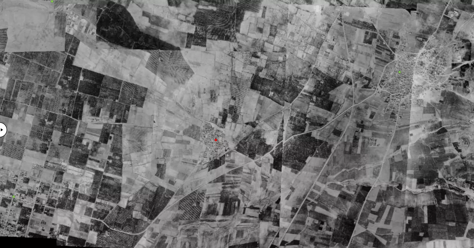
| Pre-Nakba Aerial View |
|||||||||||||||||||||||||
|
|||||||||||||||||||||||||
| Map Location | See location #17 on the map View from satellite |
||||||||||||||||||||||||
| Military Operation | Coastal Clearing | ||||||||||||||||||||||||
| Attacking Units | Alexandroni Brigade | ||||||||||||||||||||||||
| Defenders | Local militia & Arab Liberation Army | ||||||||||||||||||||||||
| Exodus Cause | Military assault by Zionist troops | ||||||||||||||||||||||||
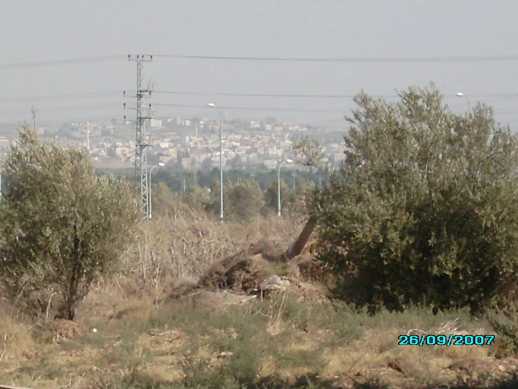
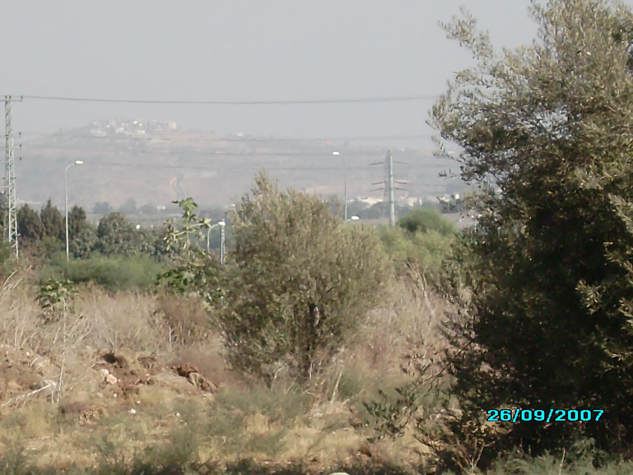
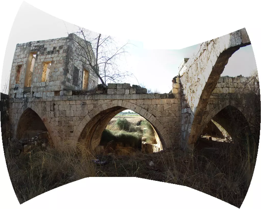
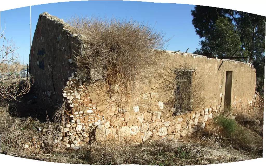
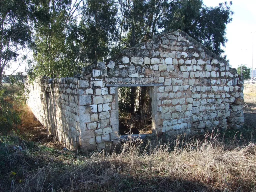
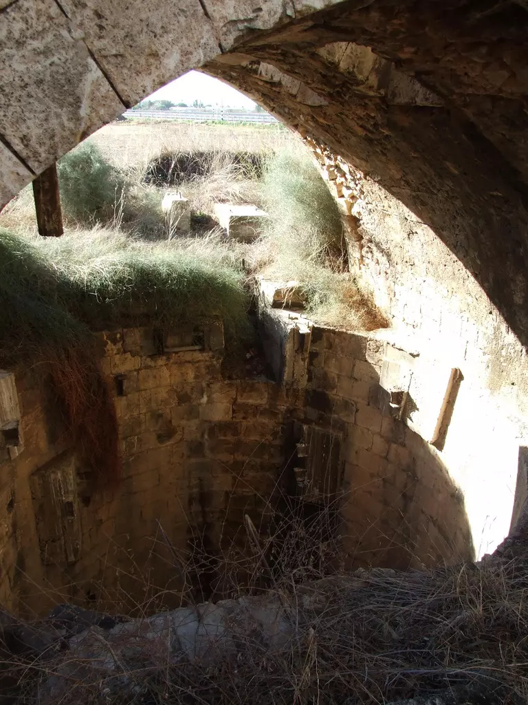
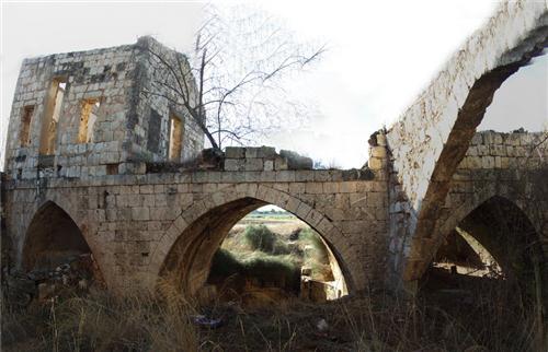
| Village Temains | Kafr Saba was completely defaced with the exception of its two shrines, the school, and ruins of the village cemetery. | ||||||||||||||||||||||||
| Ethnically Cleansing | Kafr Saba inhabitants were completely ethnically cleansed. | ||||||||||||||||||||||||
| Pre-Nakba Land Ownership |
**Town Lands' Demarcation Maps |
||||||||||||||||||||||||
| Land Usage As of 1945 |
|
||||||||||||||||||||||||
| Population |
|
||||||||||||||||||||||||
| Number of Houses | In (1931): 169 (includes 'Arab al-'Ubaydat) | ||||||||||||||||||||||||
| Near By Towns |
|||||||||||||||||||||||||
|
|||||||||||||||||||||||||
| Town's Name Through History | The Crusades referred to Kafr Saba by Caphar Saba, and the Romans called it Kapharseb. | ||||||||||||||||||||||||
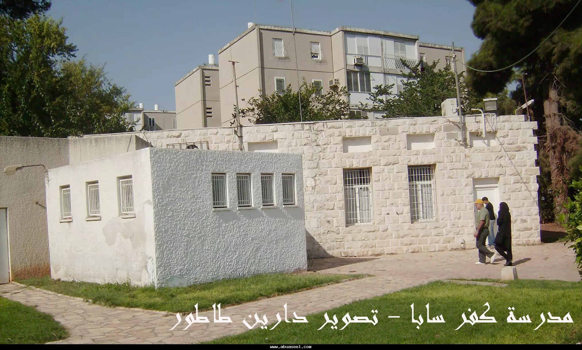
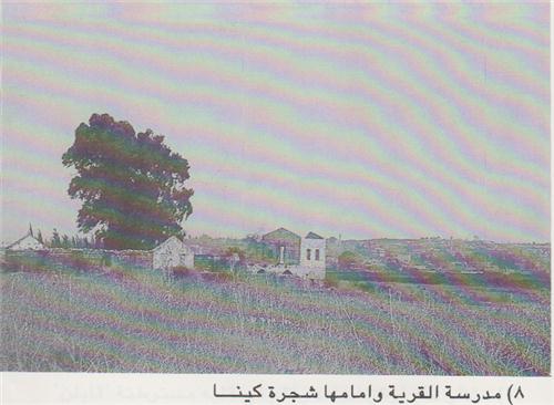
| Schools | Kafr Saba had one elementary school for boys which remain standing. | ||||||||||||||||||||||||
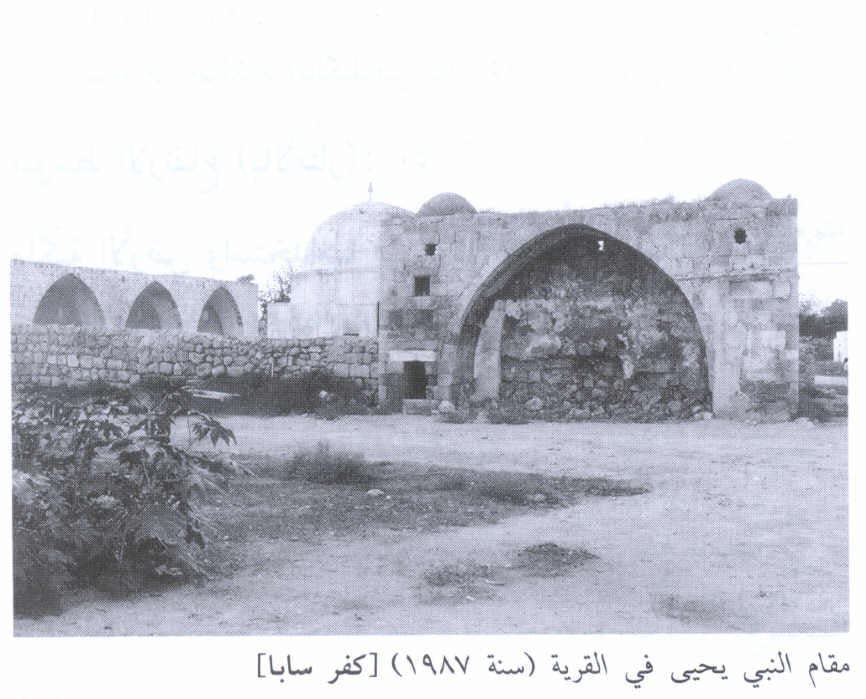
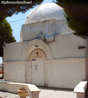
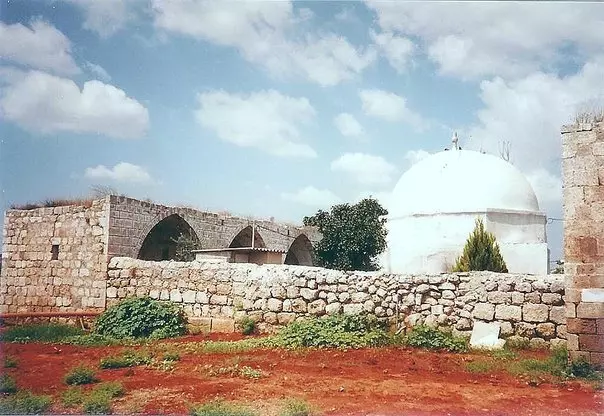
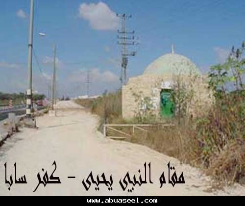
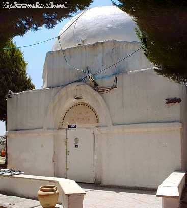
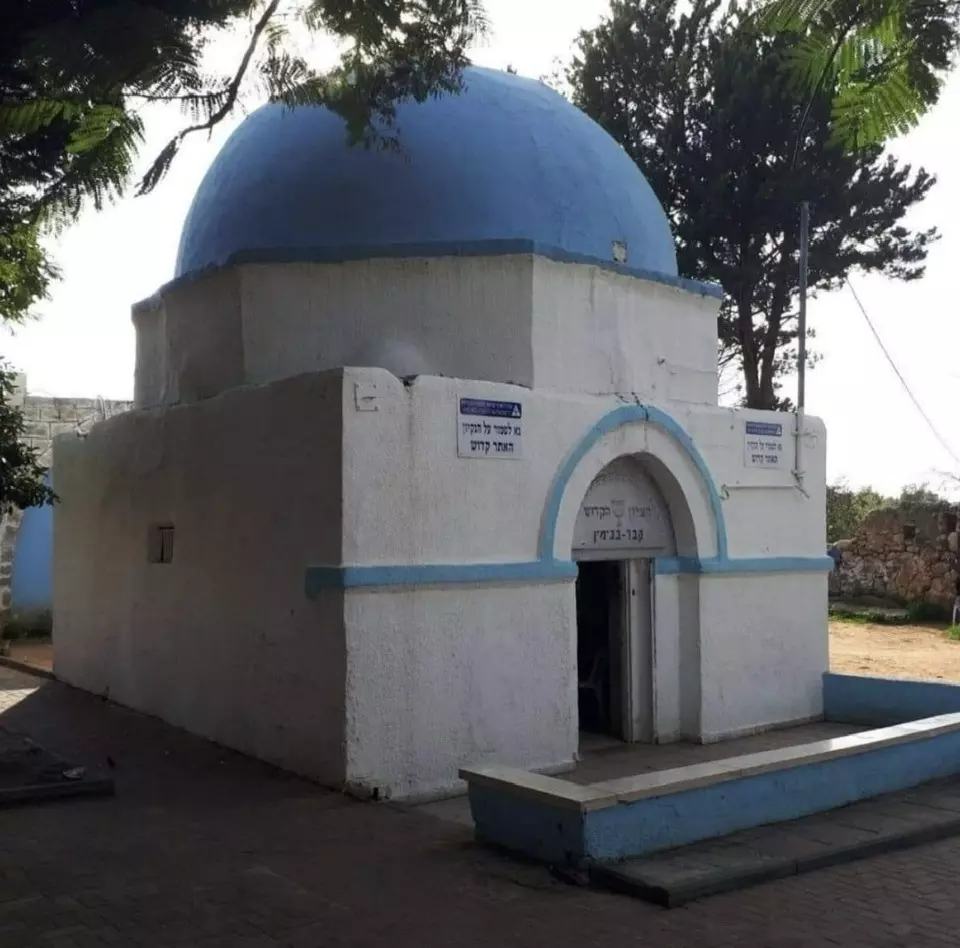
| Shrines / Maqams | The village has two shrines: the 1st is for al-Nabi Yamin and the 2nd for al-Nabi Yahya (John the Baptist, see 'Ayn Karim, Jerusalem for more details). Both shrines remain standing, see Pictures section for details. | ||||||||||||||||||||||||
| Archeological Sites | One Mosque | ||||||||||||||||||||||||
| Exculsive Jewish Colonies That Usurped Village Lands |
Newe Yamin, Nir Eliyyahu, & the Israeli City of Kefar Sava. | ||||||||||||||||||||||||
| Featured Video | |||||||||||||||||||||||||
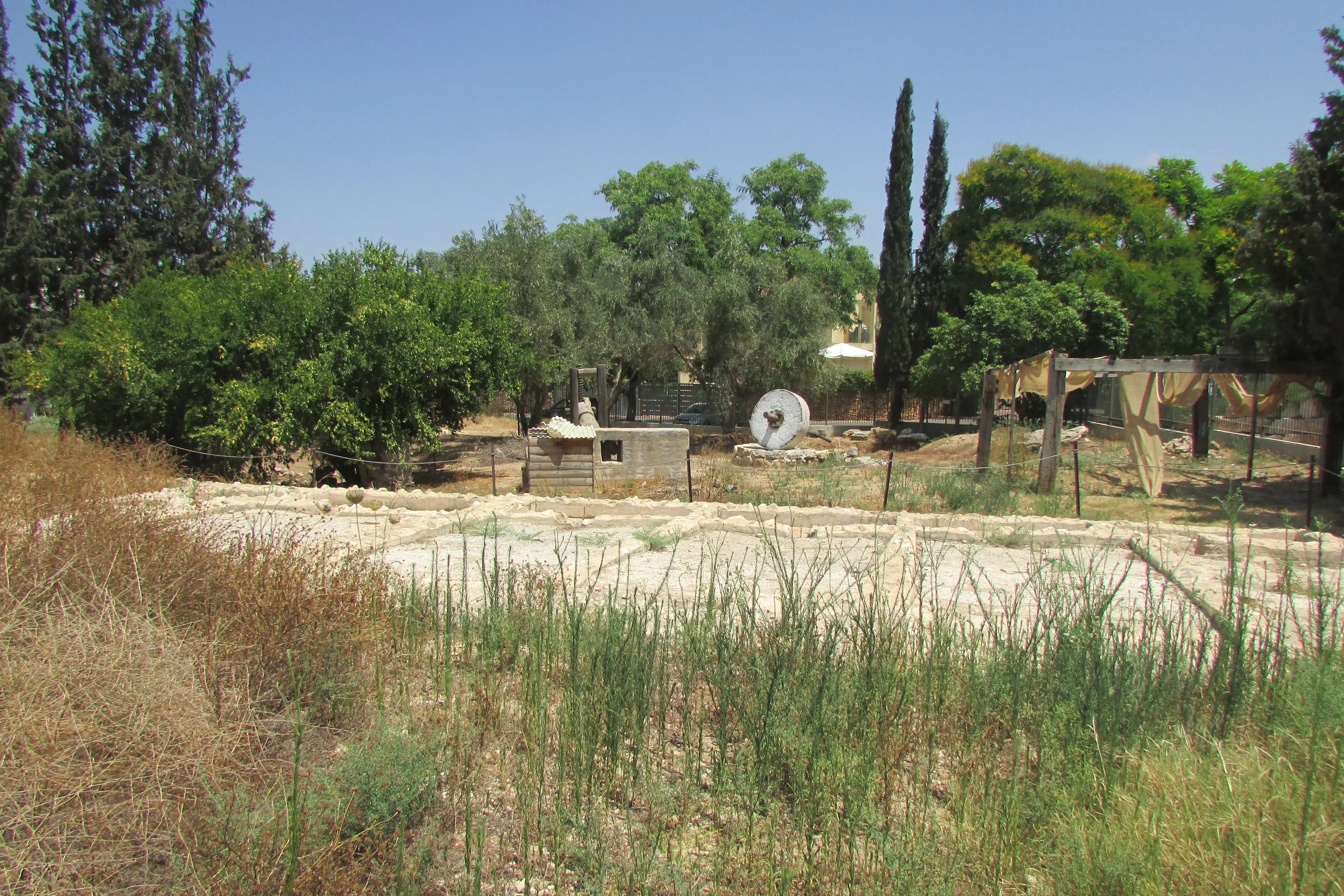
Village Before NakbaThe village stood on flat ground on the coastal plain. The Jaffa-Tulkarm highway passed 2.5 km east of it, and the Haifa-Lydda railway line ran 1.5 km to the east, forming the boundary between the lands of Kafr Saba and Qalqilya. A secondary road linked the village to the town of Qalqilya, 3 km to the northwest, and similar roads connected it to other villages in the area. Kafr Saba was established 4 km southeast of Khirbat Sabya, which has been identified with the Roman Caphar Saba. During the Crusader period the village was known as Kapharseb.Kafr Saba was mentioned by a number of Arab and Muslim geographers and chroniclers. Al-Maqdisi, writing in A.D. 985, described it as a large village with a mosque that was situated on the road to Damascus. An account by Nasir Khusraw, who wrote in A.D. 1047, described it as a town rich in fig and olive trees that lay along the road to Ramla. In 1596, Kafr Saba was a village in the nahiya of Bani Sa'b (liwa' of Nablus) with a population of 231. It paid taxes on a number of crops, including wheat and barley, as well as on other types of produce, such as goats and beehives. The Egyptian Sufi traveler al-Luqaymi attests to the continued existence of the village; in 1730, he wrote that he visited Kafr Saba and saw a shrine for a local religious figure, Binyamin (also called al-Nabi Yamin). In the late nineteenth century, Kafr Saba was described as a village built of stone and adobe brick and was situated on a low hill. Its population was estimated at 800. It contained a mosque and was surrounded by sandy ground; olive groves were visible to the north. Springs were located to the east and northeast, and one of them supplied the village with drinking water. The village plan was roughly square. During the British Mandate period the village grew; new housing expanded towards the Tulkarm-Jaffa highway onto nonagricultural lands, while new agricultural lands were cultivated to the west of the village. The residents of Kafr Saba were Muslims and maintained two religious shrines: the aforementioned shrine for al-Nabi Yamin and another for al-Nabi Yahya (John the Baptist). The village had one elementary school. The villagers cultivated grain, watermelons, cucumbers, and vegetables. In 1944/45 a total of 1,026 dunums was devoted to citrus and bananas and 4,600 dunums were allocated to cereals; 355 dunums were irrigated or used for orchards, of which 30 dunums were planted with olive trees. Village Occupation and Ethnic CleaningKafr Saba was one of the villages located north of Tel Aviv in an area of heavy Jewish settlement. The New York Times reported that leaders from Kafr Saba met with Jewish community leaders as early as December 1947 and that both parties pledged to keep the peace. However, because it was the policy of the Haganah General Staff that the area should be emptied of its Arab residents by 15 May 1948, the Alexandroni Brigade was charged with the capture of Kafr Saba. Its units attacked and occupied the village on 13 May, according to Israeli historian Benny Morris. The History of the Haganah's account of the occupation states: 'Because of the nature of the terrain (valleys and orchards), the operation was carried out in daylight.' The Alexandroni Brigade's official history claims that Arab Liberation Army (ALA) irregulars quartered in the village made the residents pay a fee when they left. However, ALA records show that their unit defending Kafr Saba had ordered the villagers to return after an earlier Haganah attack, just a few days before, and this is corroborated by Morris. According to ALA commander Fawzi al-Qawuqji, that 'surprise' assault occurred on 10 May, and it was repelled 'from the start.' Qawuqji commented: 'I think the purpose of the attack was to reconnoitre and discover the placement of our positions and forces, and that the target was Qalqilya. This unimportant attack caused a panic among the people of Kafr Saba….'On 13 May, Qawuqji recorded a second attack, which occurred along a north-south axis from Tulkarm to Kafr Saba, and stated that the initial thrust was repelled with heavy Haganah losses and that fighting was still continuing. The villagers probably fled or were expelled after the second attack, and their arrival in Qalqilya led, in turn, to the temporary evacuation of that town. Zionists Colonies on Village LandsThe town of Kefar Sava, which had been founded in 1903 and had a population of over 5,000 in 1948, was southwest of the village on the eve of the war. Currently, with a population of about 45,000, it has expanded to cover much of the village land. Beyt Berl, established in 1947 to the northwest of the site, is on village lands. The settlement of Newe Yamin, named after al-Nabi Yamin, was established in 1949 to the east of the village site on the land around the shrine for al-Nabi Yamin. The settlement of Nir Eliyyahu was established in 1950 on the lands of nearby Qalqilya; it is about 1 km northeast of the village site.Village TodayThe Village TodayThe village site has been used for the construction of new residential quarters within an industrial area that is part of the settlement of Kefar Sava. Some of the old village houses have survived destruction and are located today within the settlement; a number of them are used as commercial buildings. The two shrines, the school, and the ruins of the village cemetery remain. The shrines have arched entrances and are surmounted by domes. The land around the site is cultivated by Israelis. SourceDr. Walid al-Khalidi, 1992: All That Remains. |
|||||||||||||||||||||||||
| Related Maps | Town Lands' Demarcation Maps خرائط للقضاء توضح حدود القرى والاودية Town's map on MapQuest View from satellite Help us map this town at WikiMapia |
||||||||||||||||||||||||
| Related Links | Wikipedia's Page Facebook Page Google Search Google For Images Google For Videos |
||||||||||||||||||||||||
| More Information | في كتاب كي لا ننسى في كتاب بلادنا فلسطين المزيد من موقع هوية |
||||||||||||||||||||||||
- The Shrine of al-Nabi Yahya (John the Babtist see 'Ayn Karim in the Jerusalem distirct for more details)
Scanned from "All That Remains" by Dr. Walid Khalidi 2 - للاسف الشديد يزعمون ان هذا القبر لهم - هذا هو نفس القبر الذي في الصورة, سبحان الله ما اسفههم.
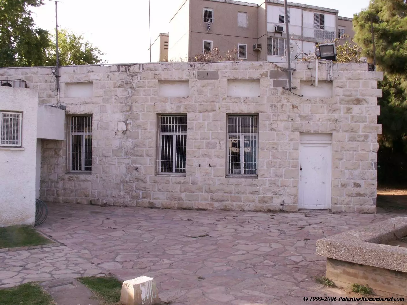
Posted by mohamad suki 3 - Backside of Kafr Saba's School, now municipality building
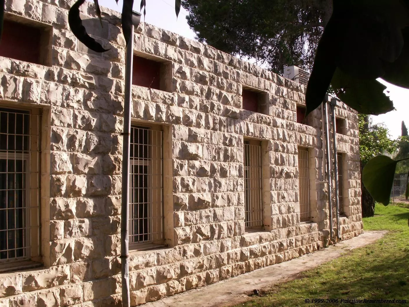
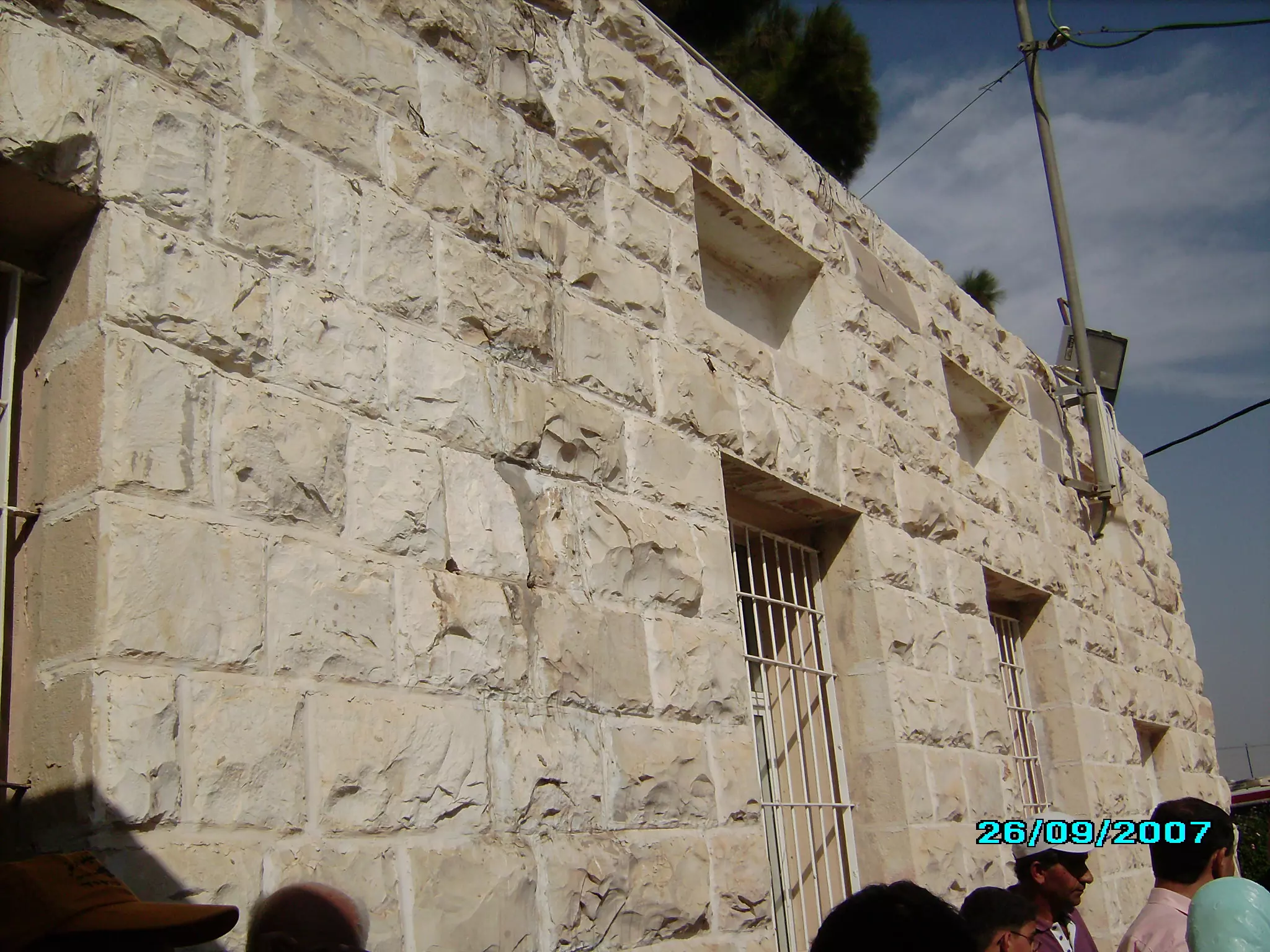
Posted by Uri Zackhem 2 - Kafr Saba's School: The Only Remaining House. Now Used as a Youth Club. Now Israelis refer to it by 'The Stone House'
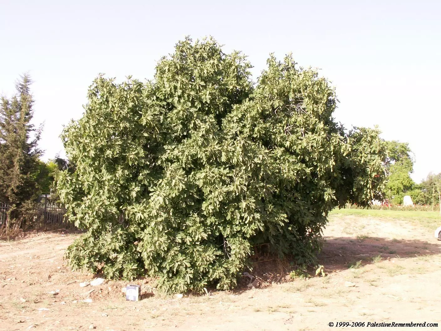
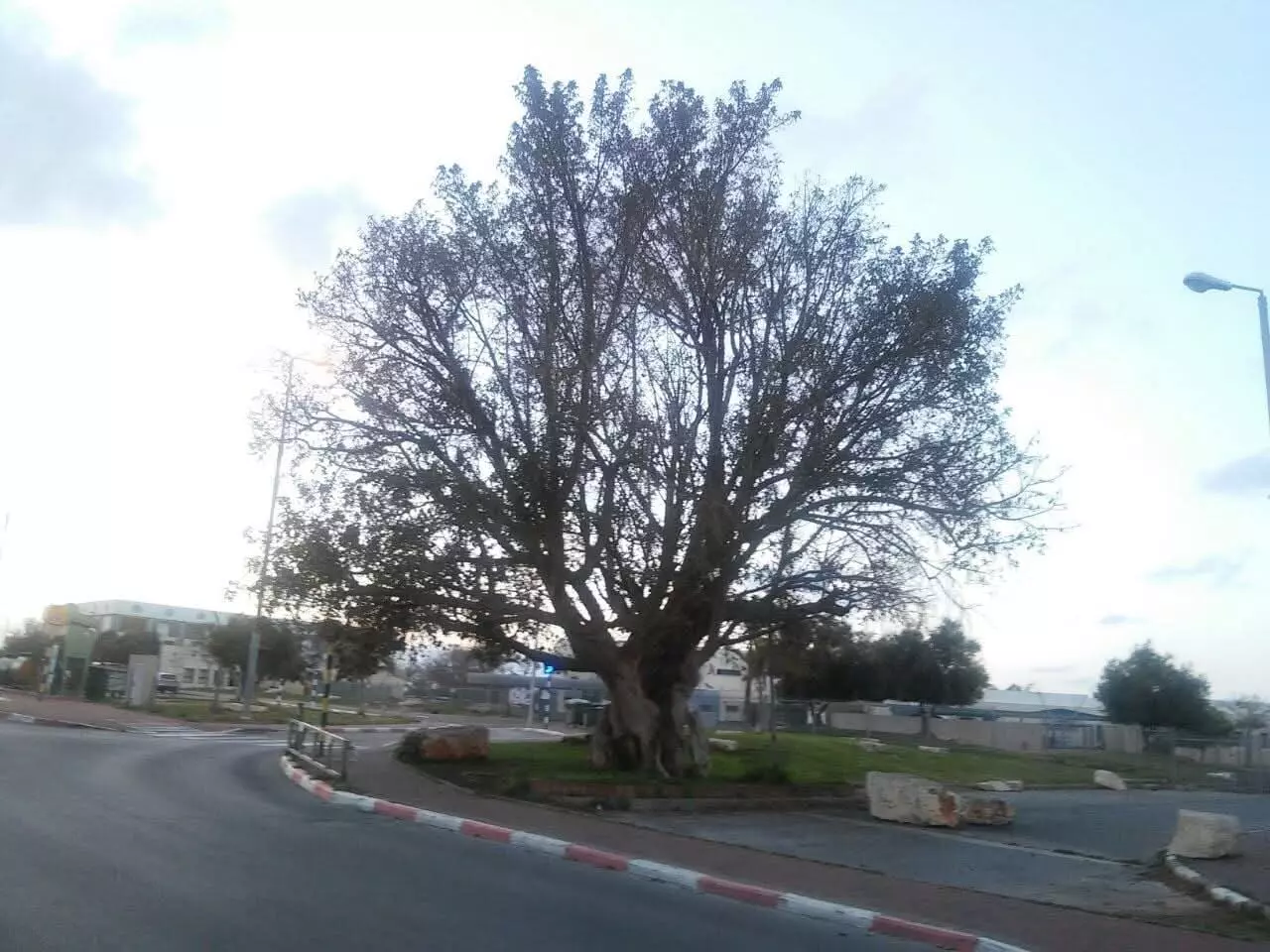
Posted by Uri Zackhem 2 - One of the remaining fig trees in Kafr Saba
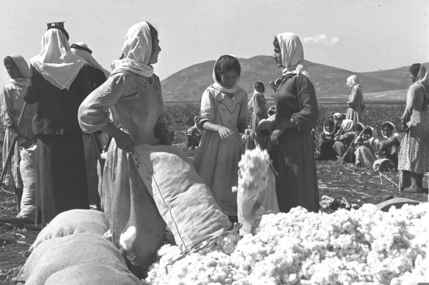
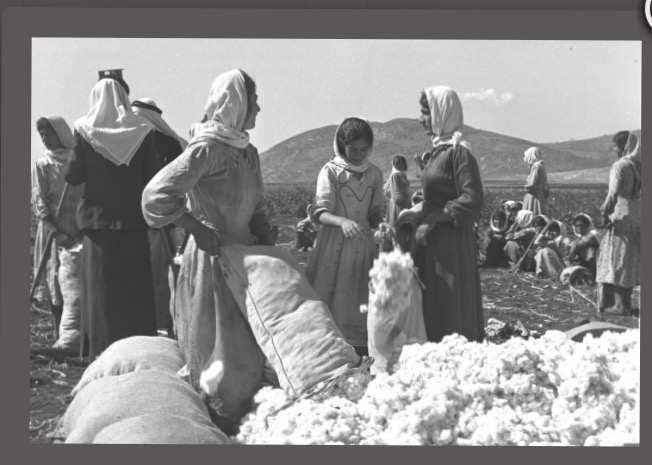
Posted by Uri Zackhem 2 - Palestinian women harvest cotton in the village of Kafr Saba in 1937
- منظر عام 1931، منقول من صفحة أحمد مروات على الفيسبوك

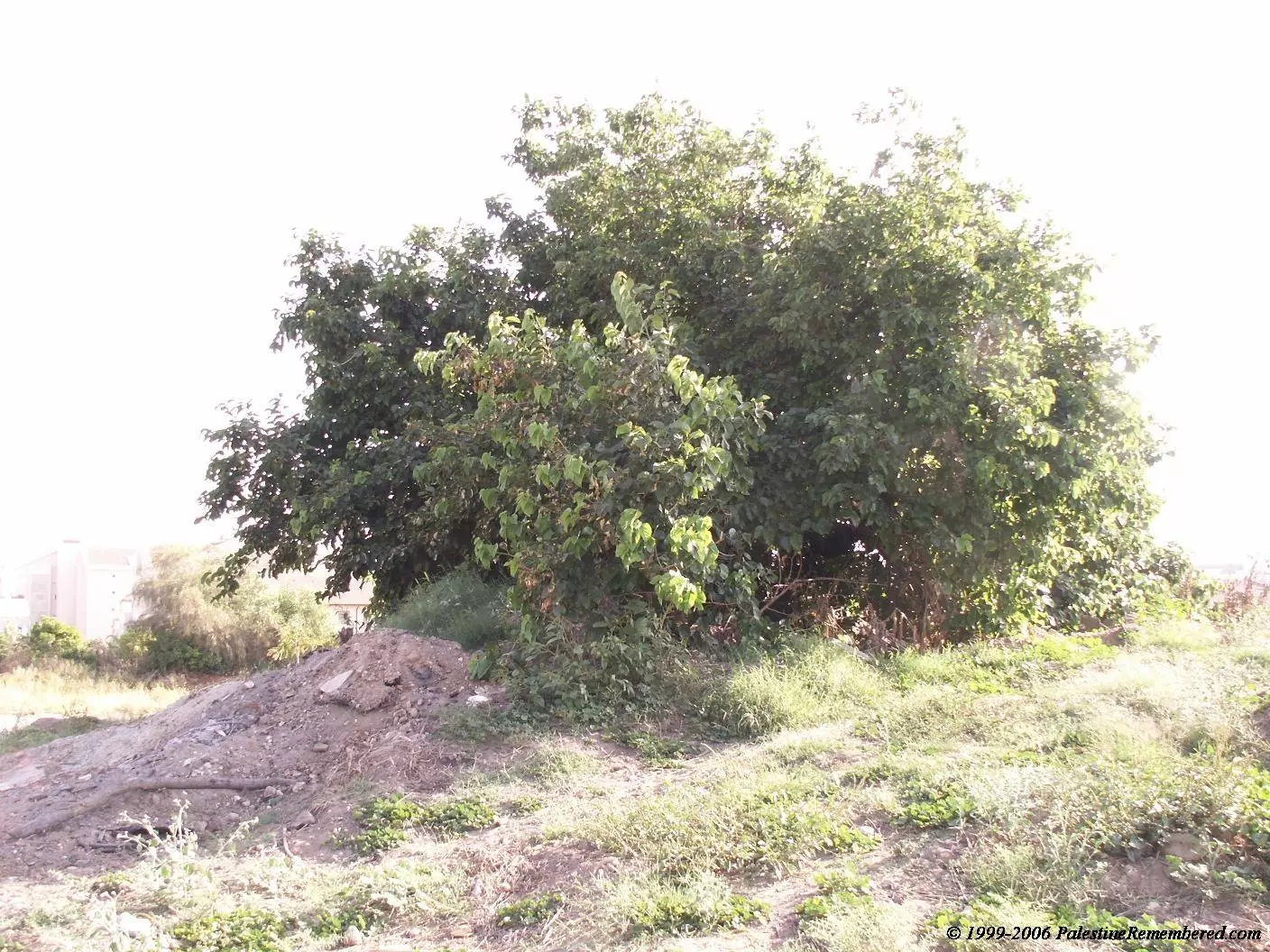
- Mulberry Tree Nearby Village Site
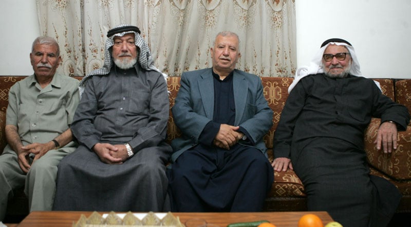
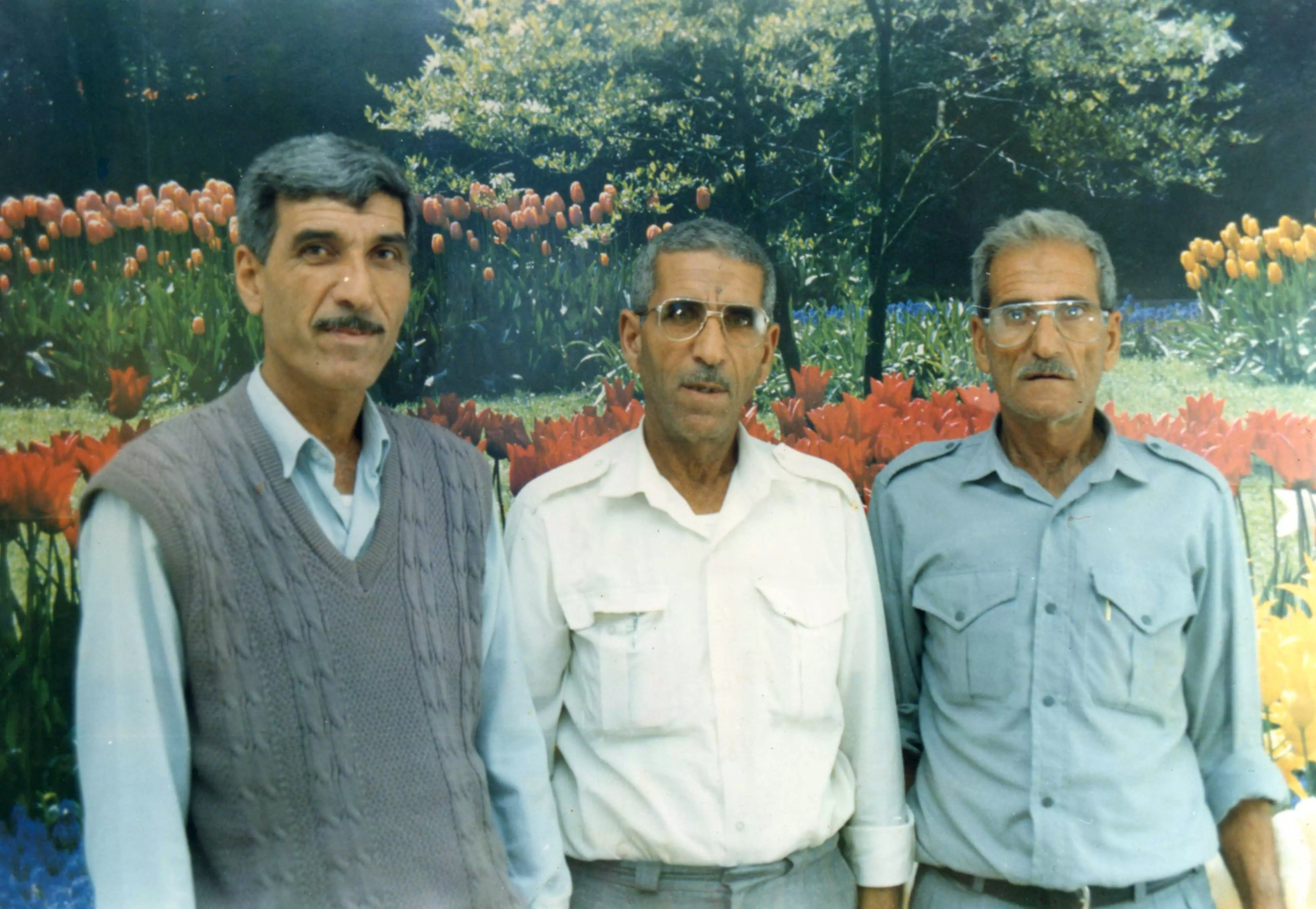
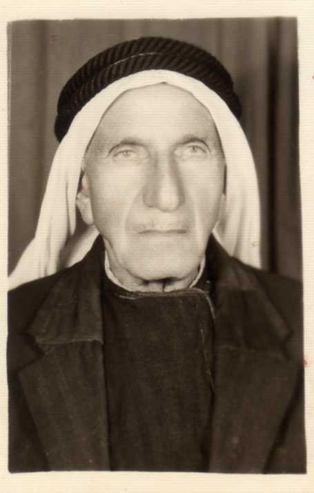
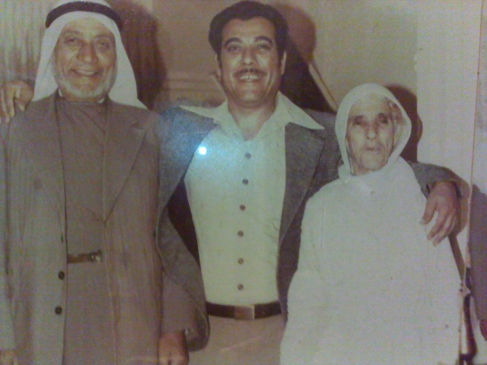
Posted by Uri Zackhem 1 - الحاج محمد عبداللطيف النجار (75سنة) والحاج كامل نجيب ولويل (75سنة) والحاج محمد صبحي جابر (75سنة) والحاج فخري محمود القرعاوي (73سنة) من كفر سابا بمنزل الحاج محمد عبداللطيف النجار (أبو عصام) بعمان ، 2/5/2008
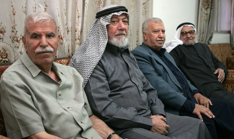
Posted by saher kaddarah 2 - الحاج محمد عبداللطيف النجار (75سنة) والحاج كامل نجيب ولويل (75سنة) والحاج محمد صبحي جبر (75سنة) والحاج فخري محمود القرعاوي (73سنة) من كفر سابا بمنزل الحاج محمد عبداللطيف النجار (أبو عصام) بعمان ، 2/5/2008
Posted by saher kaddarah 3 - صورة الاستاذ زياد ياسين والحاج المرحوم صادق ياسين ووائل ياسين ومحمد ياسين جميعهم من ابناء كفر سابا الحبيبه
Posted by ياسين زياد ياسين - صورة الشيخ روحي عبدالرحيم احمد النجار وابنة البكر محمد في حج عام 2007 وهم من ابناء قرية كفر سابا
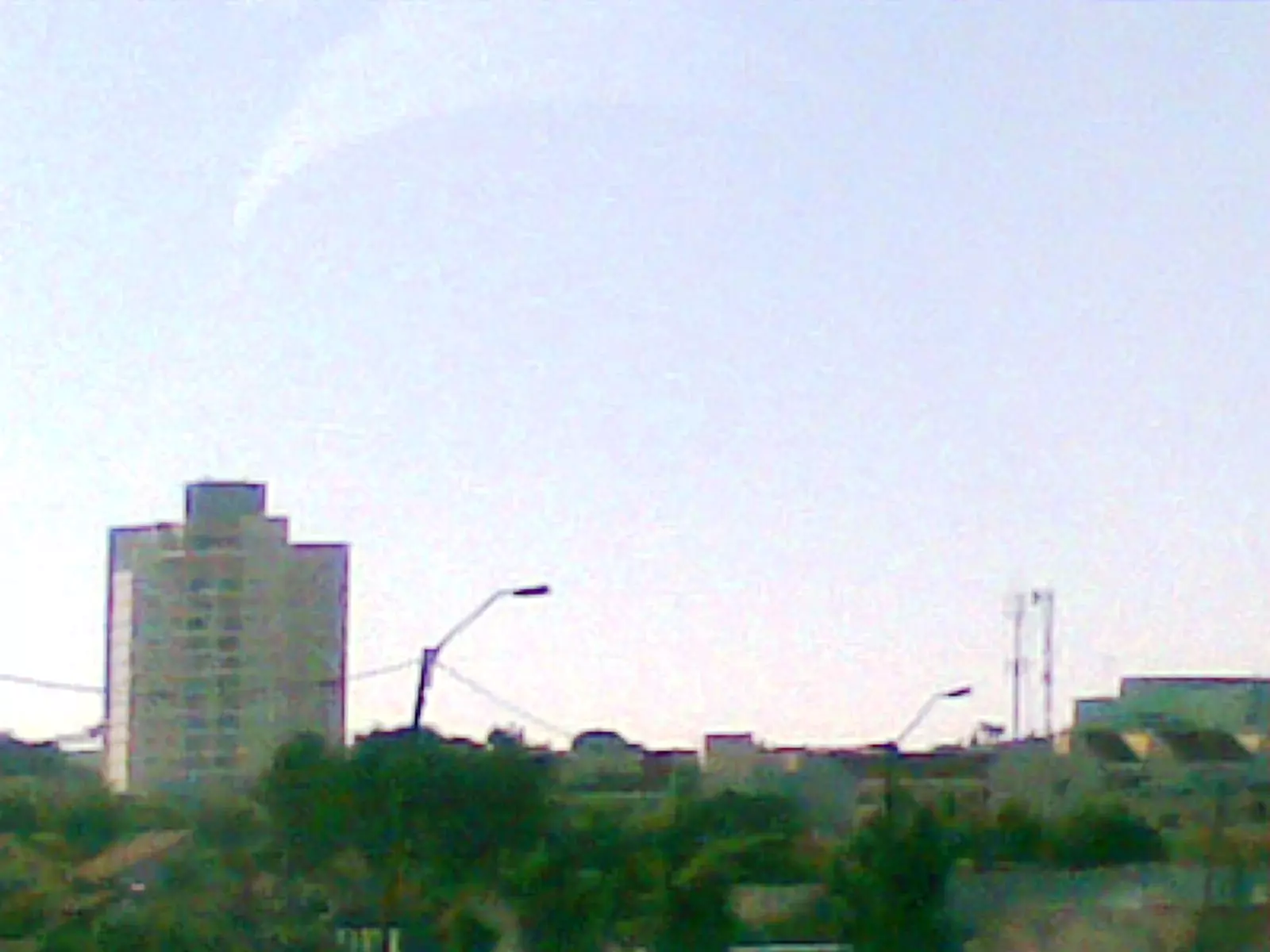
Posted by mohammed ALnajjar 1 - مباني جنوب غرب مدينة كفار سابا الواقعه على اراضي قرية كفر سابا على الطريق العام رقم 4
Posted by ابو الثائر - بنايات من مدينة رعنانا الواقعه على اراضي قرية تبصر وكفر سابا صوره من الطريق العام رقم 4
Posted by ابو الثائر 1 - مباني في شمال شرق مدينة رعنانا الصهيونيه الواقعه على اراضي قرية تبصر وكفر سابا
Posted by ابو الثائر - بنايه تجاريه تابعه لمدينة كفار سابا على ارض كفر سابا
Posted by ابو الثائر - البيوت القديمه المتبقيه على اراضي البلده
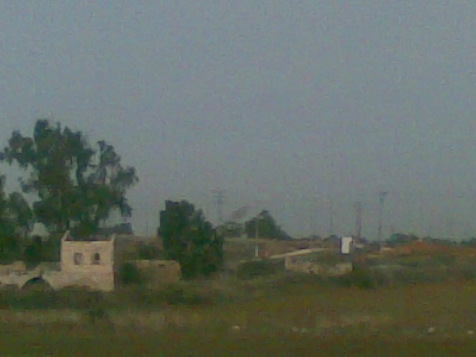
Posted by ابو الثائر - البيوت القديمه المتبقيه على اراضي البلده
Posted by ابو الثائر 1 - البيوت القديمه المتبقيه على اراضي البلده
Posted by ابو الثائر 1 - مدرسة كفر سابا - تصوير دارين طاطور
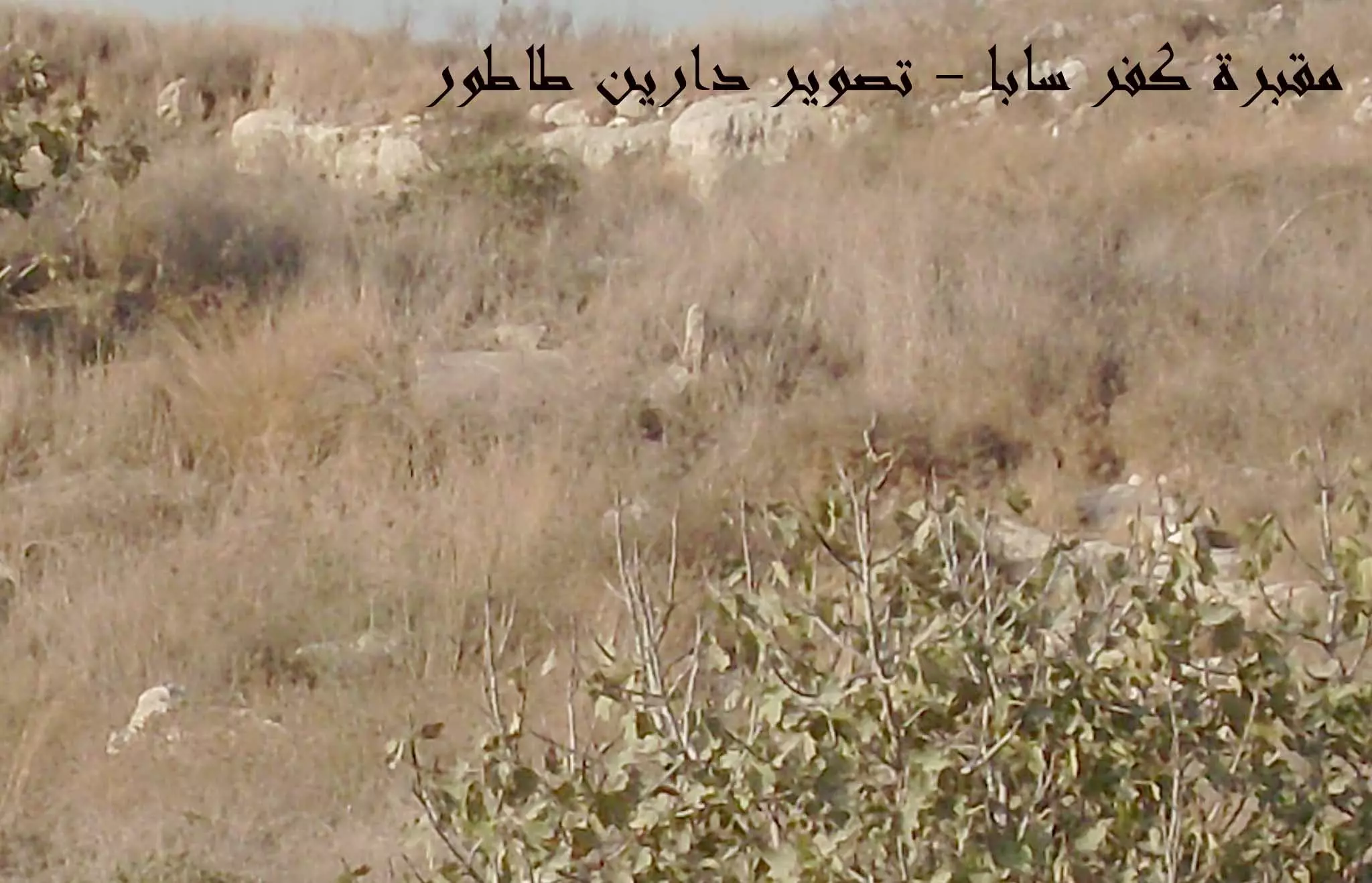
Posted by دارين طاطور - مقبرة كفر سابا - تصوير دارين طاطور
Posted by دارين طاطور - مقبرة كفر سابا ومشهد شجرة التين - تصوير دارين طاطور
Posted by دارين طاطور - مقبرة كفر سابا ومشهد شجرة التين - تصوير دارين طاطور
Posted by دارين طاطور - A well house in a cluster near Nabi Yamin
Posted by Uri Zackhem - A house near a cluster near Nabi Yamin
Posted by Uri Zackhem - A house in a cluster near Nabi Yamin
Posted by Uri Zackhem 1 - The well in the well house, near Nabi Yamin
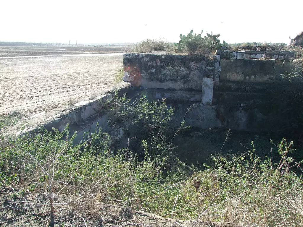
Posted by Uri Zackhem 1 - Irrigation pool, near Nabi Yamin
Posted by Uri Zackhem 1 - الشهيد بإذن الله / محمد ابراهيم عرباس
Posted by زياد عرباس 2 - عبد العزيز عرباس , هاشم عرباس , عيسى عرباس
Posted by زياد عرباس 3 - عبدالرحمن عرباس ( ابو زياد ) رحمه الله
Posted by زياد عرباس 2 - محمود عيس عرباس ( ابو العبد )
Posted by زياد عرباس - خليل حسن علي عرباس ( ابوحافظ )
Posted by زياد عرباس 1 - Mausoleum of Nabi Yamin, with riwaq (prayer hall) to the left.
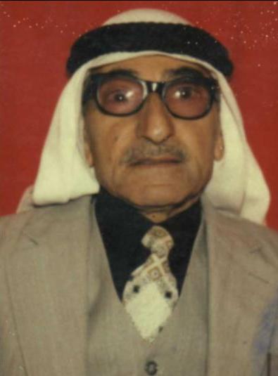
Posted by زياد عرباس - هذه صورتي في سن 24 سنة اي سنة 1969

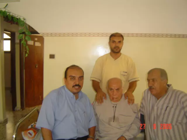
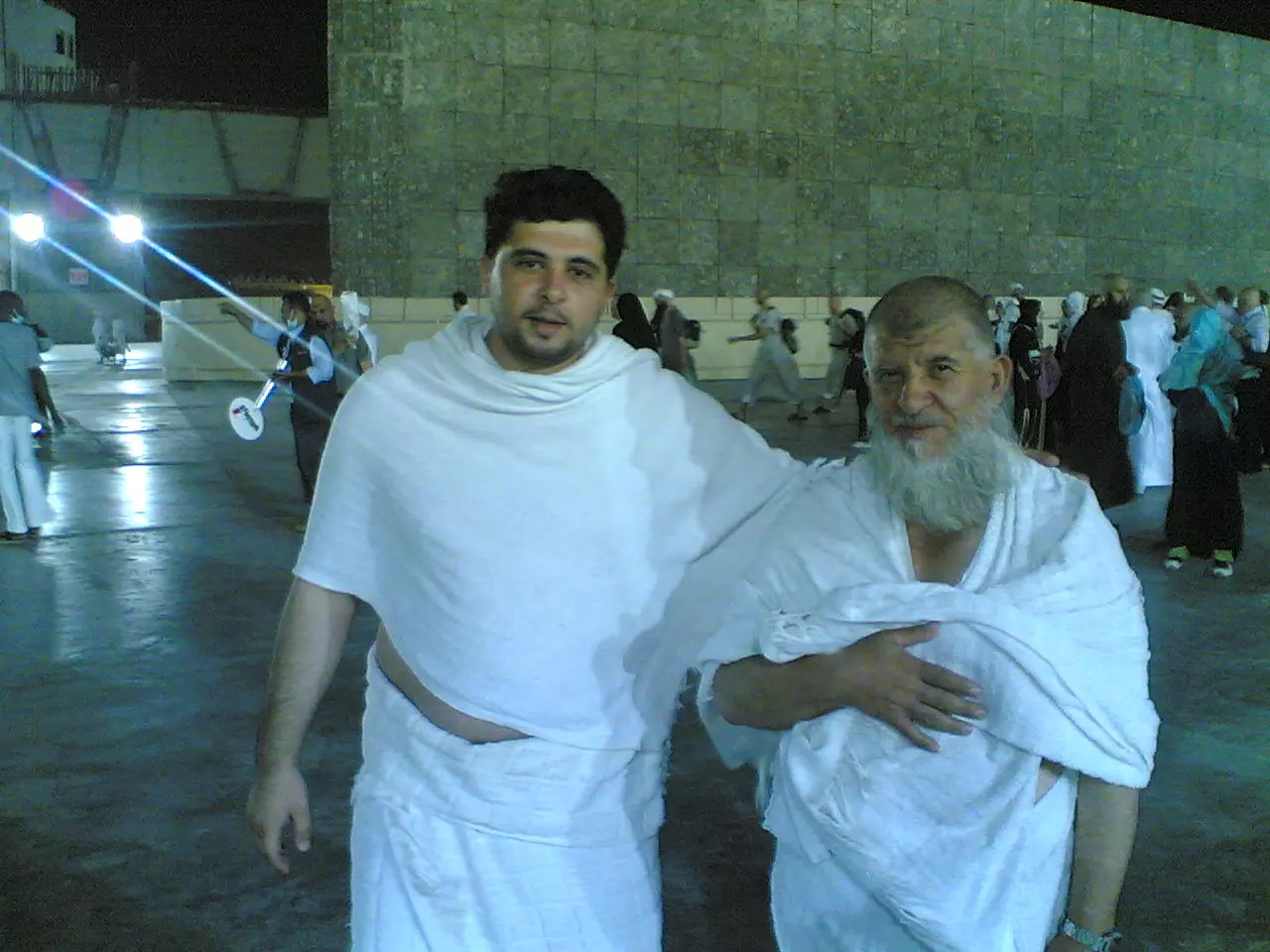
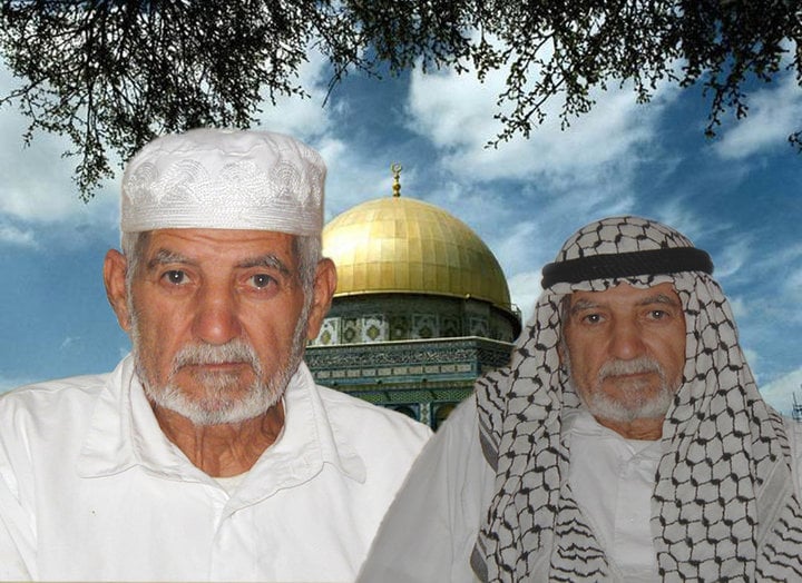
Posted by ابو أحمد / عدنان يوسف - صورة / عدنان يوسف ابراهيم عاجز - عند العودة من الحج في سنة 2010
Posted by ابو أحمد / عدنان يوسف - هذه صورة المرحوم الحاج/ يوسف ابراهيم يوسف عاجز (ابو رسلان )وابنه الحاج/ عدنان يوسف ابراهيم عاجز (ابو احمد ) والحاجة (أم رسلان) سنة 1981 في زيارتهم للكويت
Posted by ابو أحمد / عدنان يوسف 2 - صورة الحاج/ رسلان يوسف ابراهيم عاجز (ابو يوسف) في يناير 2010
Posted by ابو أحمد / عدنان يوسف 3 - صورة كل من الحاج عبد اللطيف محمد مصطفى عاجز (ابو محمد ) مع الحاج عدنان يوسف ابراهيم عاجز (ابو أحمد) أخذت هذه الصورة في 11 / 8 / 2011
Posted by ابو أحمد / عدنان يوسف - زياد عرباس - 2011م
Posted by زياد عرباس - عام 1948
- مقام النبي يحيى
Posted by زياد عرباس - مدرسة كفر سابا
Posted by زياد عرباس - مدرسة القرية وامامها شجرة كينا
Posted by زياد عرباس - مقام النبي يامين
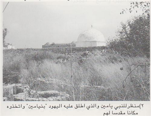
Posted by زياد عرباس - مقام النبي يامين، وهو مقام اسلامي
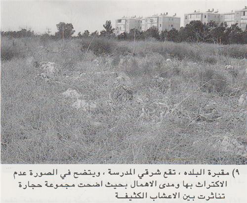
Posted by زياد عرباس - مقبرة البلده تقع شرقي المدرسة ويتضح في الصورة عدم الاكتراث بها ومدى الاهمال بحيث اضحت مجموعة حجارة تناثرت بين الاعشاب الكثيفة
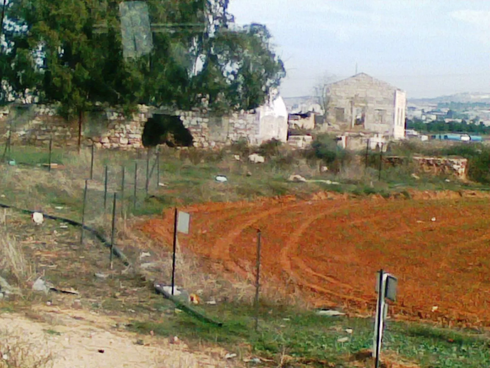
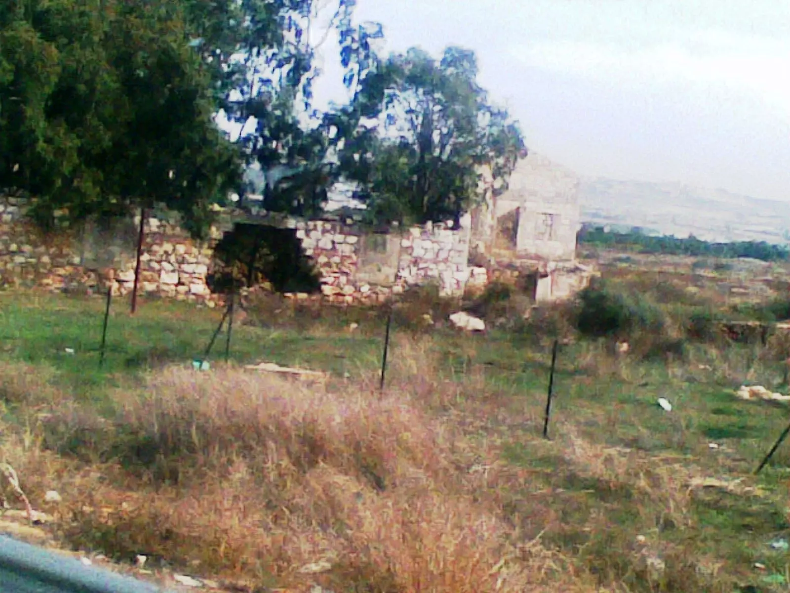
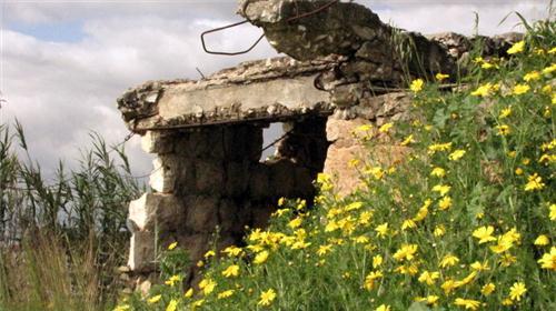
Posted by زياد عرباس - منزل مدمر من بيوت اهالي كفرسابا وقد نمت زهور الاقحوان في محيطه
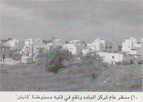
Posted by زياد عرباس - منظر عام لمركز البلده وتقع في قلبه مستوطنة قابلن
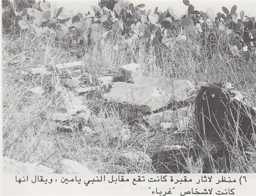
Posted by زياد عرباس - منظر لآثار مقبرة كانت تقع مقابل النبي يامين ويقال انها كانت لاشخاص غرباء
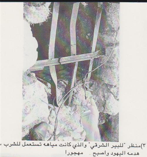
Posted by زياد عرباس - منظر للبير الشرقي المهدوم والمهجور
Posted by زياد عرباس - جانب من جسر السكة الحديد بالقرب من كفرسابا
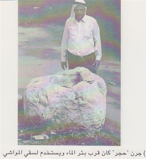
Posted by زياد عرباس - جرن حجر كان قرب بئر الماء ويستخدم لسقي المواشي
Posted by زياد عرباس - جسر السكة الحديد بين حيفا واللد الذي كان يمر بالقرب من كفرسابا
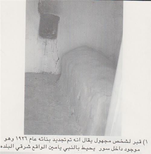
Posted by زياد عرباس 2 - قبر لشخص مجهول يقال انه تم بنائه عام 1926 وهو موجود داخل سور يحيط بالنبي يامين الواقع شرقي البلده
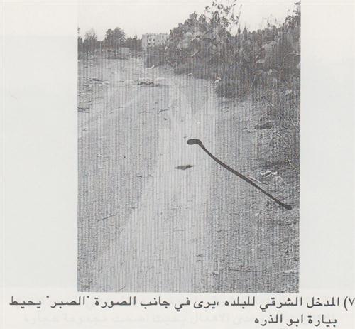
Posted by زياد عرباس - المدخل الشرقي للبلده يرى في جانب الصورة الصبر يحيط بيارة ابو الذره
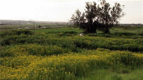
Posted by زياد عرباس - اراضي كفرسابا- اقحوانة فلسطين
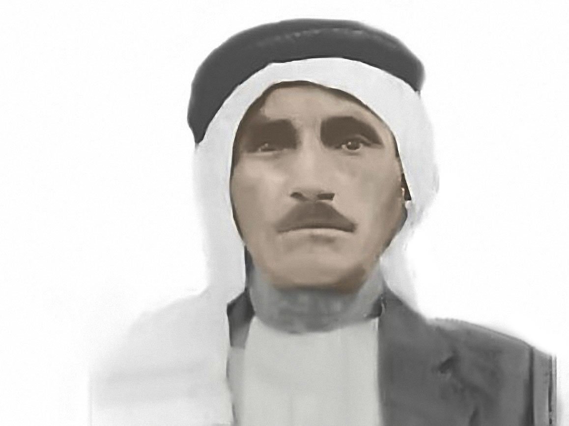
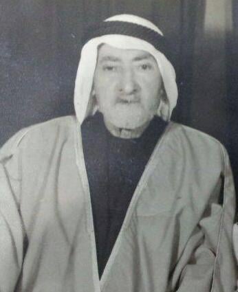
Posted by زياد عرباس - حسن علي عرباس من مواليد كفر سابا سنة1880 .... توفي في سلفيت سنة 1967
Posted by زياد عرباس 1 - منظر عام ١٩٠٠
- كفر سابا سنه 1937
Posted by abu raya - Pre-Nakba Aerial view of the village / صورة من الجو للقرية اخذت قبل النكبة
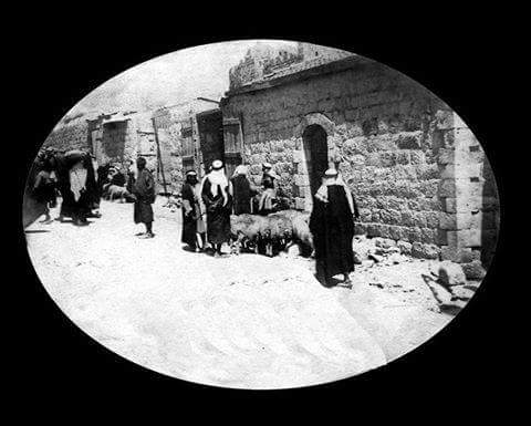
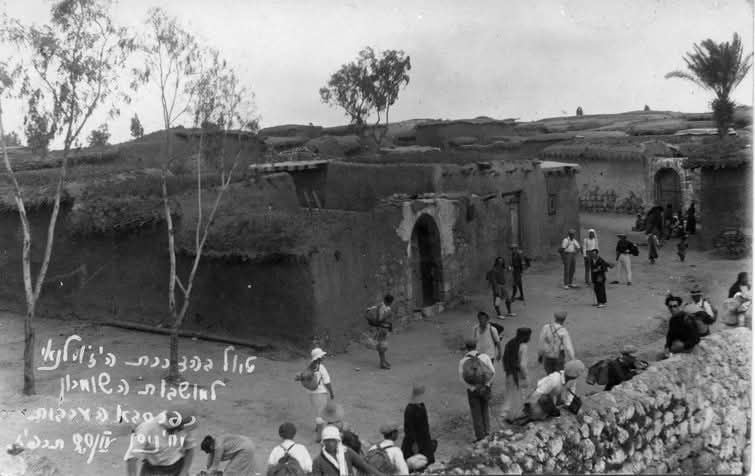
- جلسة لطيفة أمام أحد بيوت قرية كفر سابا قضاء طولكرم عام 1918..
- هذا المبنى المملوكي الذي في فترة تنكيز الاشرفي . هو مقام النبي يامين . في قرية كفر سابا المهجرة ،" جنوب قضاء طولكرم ،" . بعد النكبة تم تهويد المقام ليصبح בית כנסת בנימין בן יעקב . بنيامين بن يعقوب اخ النبي يوسف -- Iyad Jaber
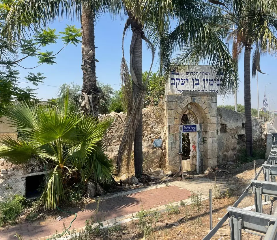
- هذا المبنى المملوكي الذي في فترة تنكيز الاشرفي . هو مقام النبي يامين . في قرية كفر سابا المهجرة ،" جنوب قضاء طولكرم ،" . بعد النكبة تم تهويد المقام ليصبح בית כנסת בנימין בן יעקב . بنيامين بن يعقوب اخ النبي يوسف -- Iyad Jaber #2
- That is how the "civilized" erased and replaced us: Kafr Saba was completely obliterated except for a few remaining structures like the school and the shrine/maqam, as you see -- كفر سابا باتت أثر بعد عين. من هنا مر الهمجّ
- شجرة جميز ضخمة تقع في أطراف قرية كفر سابا المهجرة - تصوير البروفيسور مصطفى كبها - ٱب 2025م
Posted by T-City - منظر عام نادر للقرية قبل النكبة
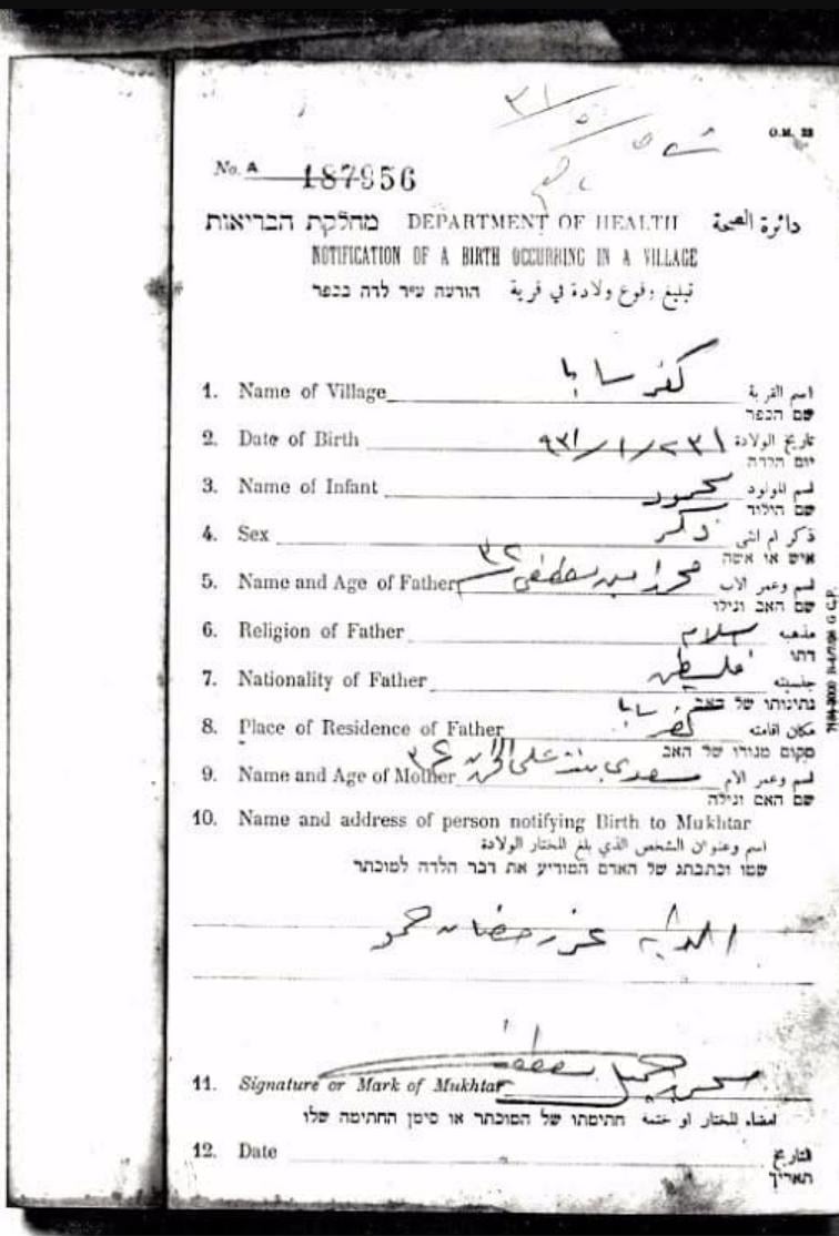
- شهادة ميلادمحمود محمد مصطفى ---21 أيار 1931
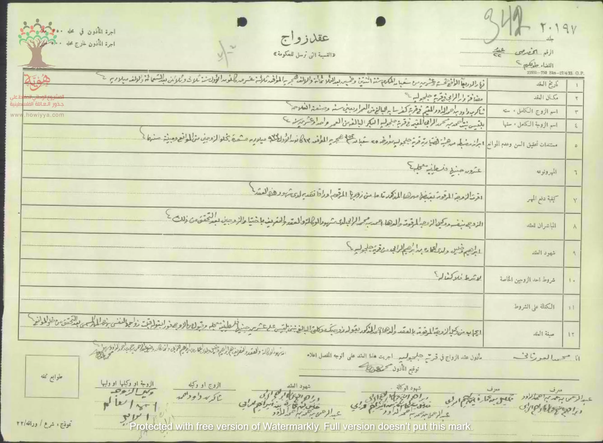
- عقد زواج :
الزوج شاكر داود داوود - كفر سابا
--
الزوجة بلقيس محمد الرابي - جلجولية -- المأذون محمد العورتاني --13-12-1933
Want to browse more? 80,000 pictures were grouped in these gallaries:
| Display Name | Clan/Hamolah | Country of Residence |
| ايمن سمير نمر حمدان الولويل | الولويل | بون , المانيا |
| صايل الجبر | - | الزرقاء, الزرقاء |
| امجد | غنيم | bruxelles, bruxelles |
| ابو سابا | عرباس | عمان, الأردن |
| محمد نجار | - | - |
| " محمد عماد" جبر | جبر | - |
| سهيل | عرباس | حولي, الكويت |
| محمد ياسين | - | - |
| نادر ولويل | ولويل | - |
| ابو هيثم | البلاسمة | العاصمة, عمان |
| عرفات عثمان بلاسمة | - | طولكرم, طولكرم |
| معتز سارة | داوود | الاردن |
| the deeth to israel | hamed - walweel | UAE, DUBAI |
| BARAKAT | BARAKAT | JORDAN |
| وليد شريف | - | - |
| علان | allan | kuwait, kuwait |
| ahmad_najjar | - | - |
| ابوانس | بلاسمه | amman, الاردن |
| ابو عبيده | بلاسمه | - |
| Ghassan Jabr | Jabr | Ramallah |
| mahmoud balasmeh | balasmeh | - |
| عماد ولويل | ولويل | - |
| ياسين زياد ياسين | ياسين | |
| انس النجار | النجار | صويلح, الاردن |
| ahmad balasmeh | بلاسمة | wadi alseer, jordan |
| Mustafa Alhamed | Alhamed | Amman, Jordan |
| Mahmood Adnan Yousef Ajez | Ajez | Marj Al-Hamam, Jordan |
| khaliline | hamed | kuwait |
| abu ghassan | alkhatib | amman |
| firas ayash | alblasma | - |
| hasan hamed | Walweel | Amman, Jordan |
| Anas | - | - |
| MOHMMAD ALNAJJAR | - | - |
| زياد عرباس | عرباس | ***********, فلسطين |
| Mohammed Barakat | - | - |
| Anas | Walweel | Riyadh, Saudi Arabia |
| Abdul Rahman Hisham Walweel | Walweel | Kuwait |
| Hamzeh Bdeir | Bdeir | - |
| tarek tayem | - | - |
- Tracing All That Remains Since Nakba: Visiting Kafr Saba Duration: 7 min 36 sec
- كفر سابا - الجزء الاول
- What Zionism Means to Me Duration: 3 min 50 sec
- لدى مبنى مدرسة كفر سابا المهجرة -وهي أحد المعالم القليلة الباقية من قرية كفر سابا المهجرة والتي إحدى كبريات قرى قضاء طولكرم الانتدابي . المبى ما زال كما كان ويستعمل ناديا شبابيا للياقة البدنية . Duration: min 2 sec
- لدى موقع عسكري عراقي من حرب 1948ويدعى ((كينيات أبو علبة)) ويقع بين الطيرة وكفر سابا . كان له الفضل الكبير ببقاء معظم مدن وقرى المثلث الجنوبي وعدم تهجيرها . Duration: min 30 sec
- الذاكرة مفتاح العودة--الحلقة 57- كفر سابا Duration: 23 min 22 sec
 Fake Valor: Why Did Zionist Jews Hoist Nazis Flag on Their Ships in the 1930s?
What is new?
-
Facts About Oct. 7th Gaza Raid
-
Remined Us Please: Who Did Rape Whom? Was it Palestinians who raped Israelis? Or, was the other way around? You'll be the judge
-
When Prof. Edward Said was invited to debate Bibi Netanyahu in the 1980s, watch what happened!
-
Ezra Klein of the NY Times on the "Jewish Race".
-
Abusing Blood Libel!
-
How and why Israeli Jewry has become the most hated cult?
-
Did Israeli Soldiers Activate The Hannibal Direective On Oct. 7th? You Be The Judge
-
Zionist FAQ: Isn't it true that Palestinians don't want peace? Palestinians never accepted the two-state solution
- Facts about Haavara (Transfer) Agreement between Ben-Gurion & Hitler
-
Haavara FAQs: Why Did Zionist Jews Hoist Nazis' Flags on Their Ships in the 1930s?
- Haavara FAQs: When Chaim Weizmann met FDR in mid-1943, why was he silent about rescuing European Jewry?
-
Dear ChatGPT: How did Palestinians resist Napoleon's invasion of their country in 1799?
-
Dear ChatGPT: Gaza had a vibrant Jewish community in the mid-17th century. What happened to them?
-
Dear ChatGPT: Why did the Jewish Agency suppress news of the Holocaust during WWII?
-
Video Playlist: Jews share their DNA tests to end the conflict for good.
-
A Tale of Two Conflicts: Examining the Definition of Genocide
-
Prof. Abraham Polak And The Suppressed History of the Khazars and European Jewry
-
How Ronald Reagan would have framed the genocide in Gaza if he were still alive?
-
Haavara FAQs: Let us do the math: how many German Jews did The Haavara Agreement save?
-
Zionist FAQs: The Hebron Massacre of 1929, "clearly proves" that Palestinians are antisemitic, how could you deny it?
-
Zionist FAQs: Why Anti-Zionist Is Not Antisemitism?
-
Zionist FAQs: Isn't it true that the KGB created Palestinian Nationalism in the early 1960s?
- Zionist FAQs: Muslims are killing Muslims all the time; why are Israeli Jews being singled out in the media?
- Zionist FAQs: How is Israel an apartheid state when 20% of its citizens are Arabs who enjoy full rights?
-
Haavara FAQs: Why Did Dorothy Thompson Flip From A Zionist Advocate to A Silenced Dissenter?
-
Haavara FAQs: Analysis of Herzl's Uganda Scheme and how it could have saved millions of Jews.
-
Haavara FAQs: Why did Hayim Greenberg describe American Jewry as "morally bankrupt" in early 1943?
-
Haavara FAQs: What if the Evian Conference was a resounding success? What would have been the impact of saving European Jewry on Zionism?
- Haavara FAQs: What if the six million were saved, how that would have impacted the Zionist project?
-
Haavara FAQs: How did Zionist leaders react when Europe's Jews lingered in the DP camps after WWII ended?
-
Why does the American Jewish community repeat lies that David Ben-Gurion had debunked before he died?
-
Who has the power to rename the Tatar/Khazar Gene Marker to Jewish IV?
-
Zionist FAQs: Why won't Egypt, Syria, and Jordan take their people back? Jews are indigenous to Palestine, and Arabs immigrated after Jews developed the country. Arabs should leave.
-
Haavara FAQs: Did Hitler and the Nazis conflate between Judaism and Zionist? If that wasn't case, then why?
-
Haavara FAQs: Winston Churchill and antisemitism, a collection of articles written Churchill.
-
Haavara FAQs: Broken by country, how many Jews survived vs. killed during the Holocaust?
-
Haavara FAQs: Why did European Jews vote with their feet and to immigrated to the Americas, not Palestine, after WWII?
-
Watch this American Jewish Girl describing Israeli Jews' cognitive dissonance like no other in under two minutes
-
Haavara FAQs: When the Nazis went out of their way to hide the Holocaust, Israeli Jews did the exact opposite by broadcasting their genocide of Gazans. But why?
-
Haavara FAQs: How Zionist Jews went out of their to show their appreciation to Nazism and Fascism?
- Haavara FAQs: Why Zionist leaders were against bombing the death camps & the Railroads leading to them?
-
Haavara FAQs: Hitler's message to the British and American people: If Jews are such noble citizens and you care about them, how come you're not letting them in? I will gladly ship them to you at my expense, even on luxury liners!
-
A shortlist of Zionist and Israeli false flag operations in the name Jews.
-
The Most Moral Army
- The Land of Kapos (Israel): Where the brave are boycotted and Kapos walk free.
- Why did early Zionists often named their communal enterprises "colonial"?
- Zionist Relations with Nazi Germany by Faris Glubb
-
Two NY Times advertisements by Zionists in the early 1943 that exposes Zionists' treason at the height of the calamity
- Facts Not Lies about the Palestinian-Israeli Conflict.
- Site's pictures have been categorized
- Campgain Against Lice
- A Survey of Palestine, the official source about Palestine before Nakba produced by the British Mandate; over 1200 pages.
- Satellite View & Google Earth: Over 6,000 placemarks identifying all destroyed towns, W. Bank & Gaza Strip Towns, & refugee camps.
- PalestineRemembered.com and its Nakba Oral History Project were featured on al-Jazeera Satellite TV.
- Nakba Oral History Video Podcast:
 Over 700 Oral History interviews (including 3,500+ hours of recording) can be viewed online.
 - Palestine Village Statistics Project
- Gaza Jail Break
- النسخة العربية للموقع الان متوفرة
- Videos: Documenting the destroyed villages in video: Tracing all that remains since Nakba.
- Videos: Responding to Zionist Propaganda
- Interview: The ethnic cleansing of Palestine: George Galloway interviews Israeli Historian Ilan Pappe.
- For Palestinians, memory matters. It provides a blueprint for their future By George Bisharat.
- Zionist FAQ now available in Hebrew שאלות שציונים שואלים, עכשיו בעברית
- Video: The Stephen Walt and John Mearsheimer report on the influence of the Israel Lobby on U.S. Foreign Policy
- The Palestinian-Israeli conflict for beginners
