| PalestineRemembered | About Us | Oral History | العربية | |
| Pictures | Zionist FAQs | Haavara | Maps | |
| Search |
| Camps |
| Districts |
| Acre |
| Baysan |
| Beersheba |
| Bethlehem |
| Gaza |
| Haifa |
| Hebron |
| Jaffa |
| Jericho |
| Jerusalem |
| Jinin |
| Nablus |
| Nazareth |
| Ramallah |
| al-Ramla |
| Safad |
| Tiberias |
| Tulkarm |
| Donate |
| Contact |
| Profile |
| Videos |
Welcome To Barqa - برقة (ברקה)
|
District of Gaza
Ethnically cleansed days ago |
العربية Google Earth |
 |
Gallery (19) |
- Statistics & Facts
-
Before & After

- Satellite View
- Articles 3
- Pictures 19
- Aerial Views 1
- Members 23
- Families
- All That Remains
- Wikipedia
- Videos
- Guest Book 5
- Links 3
| Statistic & Fact | Value | |||||||||||||||||||||
| Occupation Date | May 13, 1948 | |||||||||||||||||||||
| Distance From District | 37 (km) North East of Gaza | |||||||||||||||||||||
| Elevation | 25 (meters) | |||||||||||||||||||||
| Before & After Nakba, Click Map For Details |
||||||||||||||||||||||
|
||||||||||||||||||||||
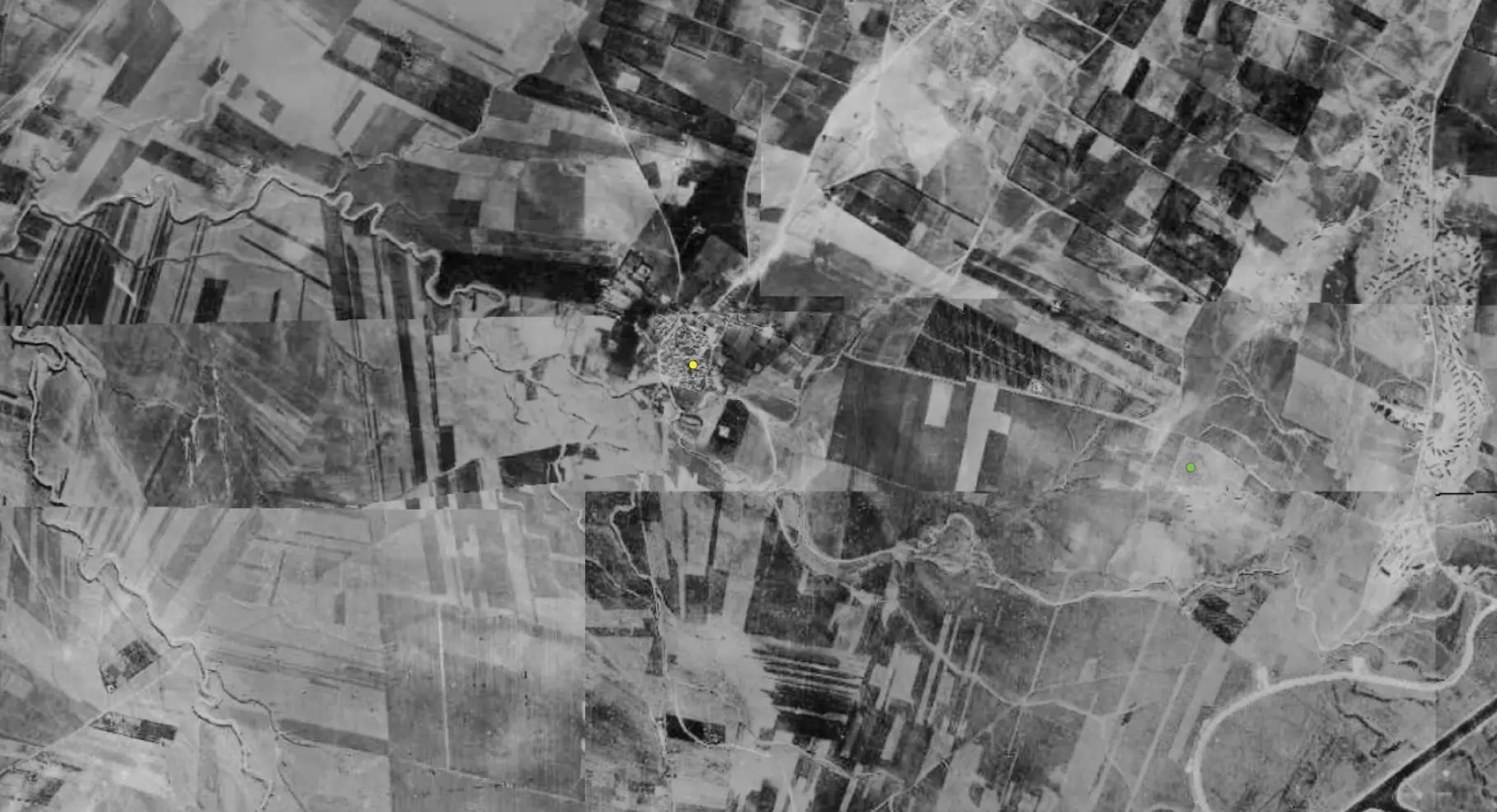
| Pre-Nakba Aerial View |
||||||||||||||||||||||
|
||||||||||||||||||||||
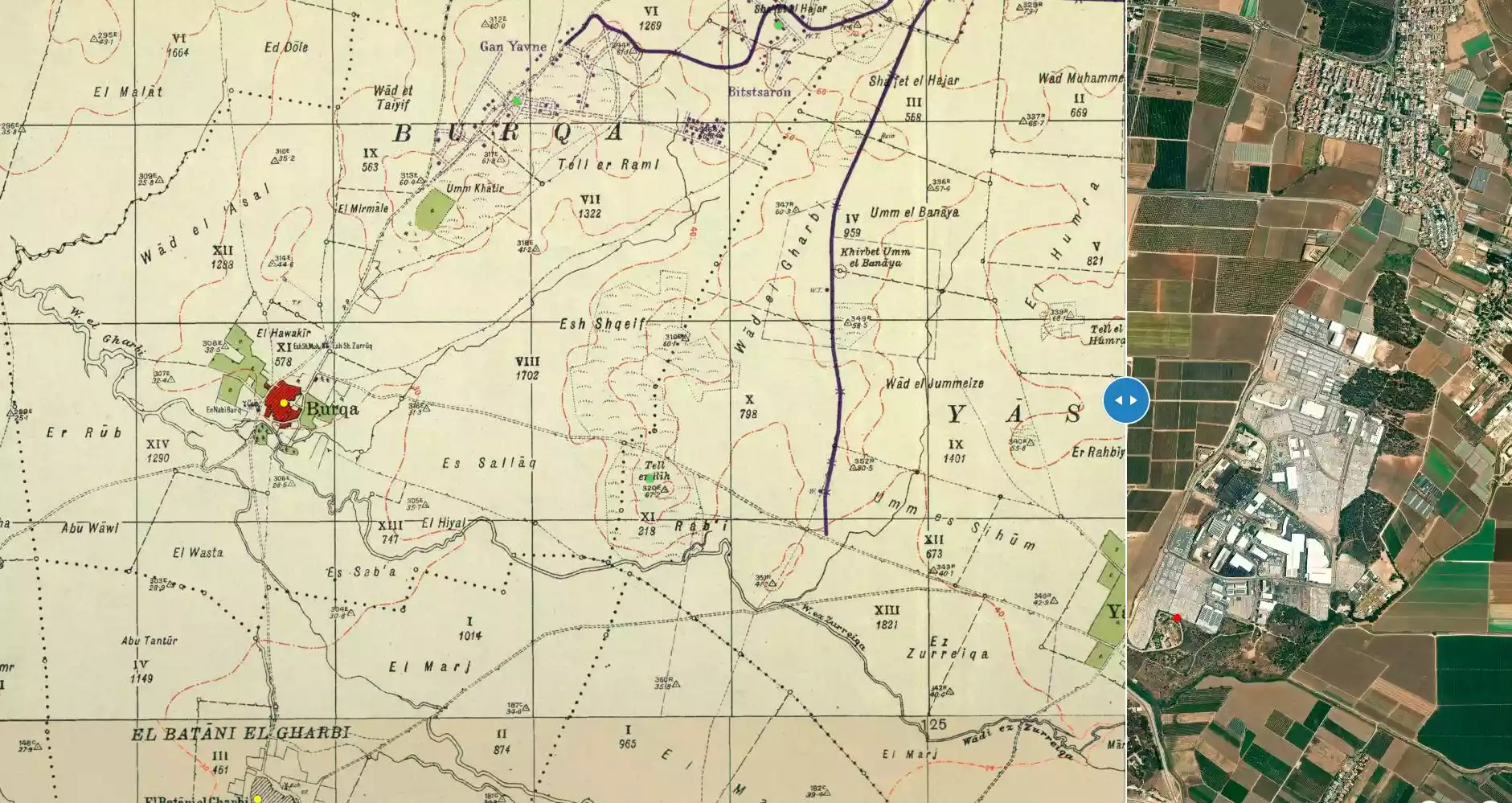
| Map Location | See location #2 on the map View from satellite |
|||||||||||||||||||||
| Military Operation | Operation Barak (lightening) | |||||||||||||||||||||
| Attacking Units | Giv'ati Brigade | |||||||||||||||||||||
| Exodus Cause | Military assault by Zionist troops | |||||||||||||||||||||
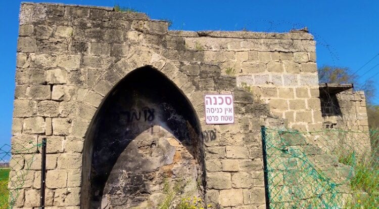
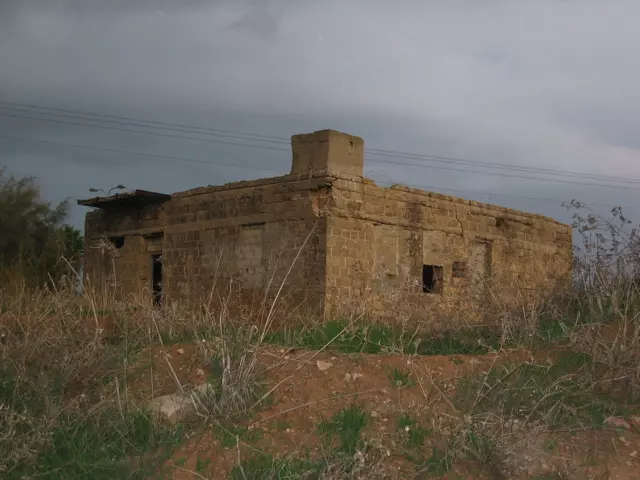
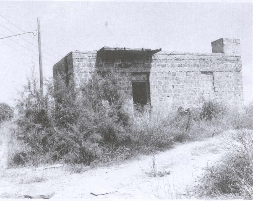
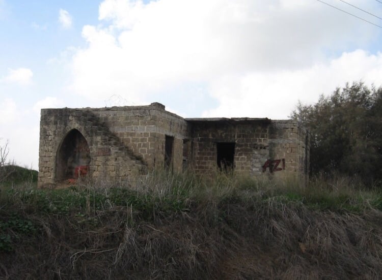
| Village Temains | The village was completely destroyed with the exception of two houses remain standing. | |||||||||||||||||||||
| Ethnically Cleansing | Barqa inhabitants were completely ethnically cleansed. | |||||||||||||||||||||
| Pre-Nakba Land Ownership |
**Town Lands' Demarcation Maps |
|||||||||||||||||||||
| Land Usage As of 1945 |
|
|||||||||||||||||||||
| Population |
|
|||||||||||||||||||||
| Number of Houses |
|
|||||||||||||||||||||
| Near By Towns |
||||||||||||||||||||||
|
||||||||||||||||||||||
| Town's Name Through History | The Greeks referred to Barqa by Barka, and the Romans called it Bareca. | |||||||||||||||||||||
| Schools | Baraqa had no schools, however, its students attended school in the nearby village of the al-Batani al-Gharbi. | |||||||||||||||||||||
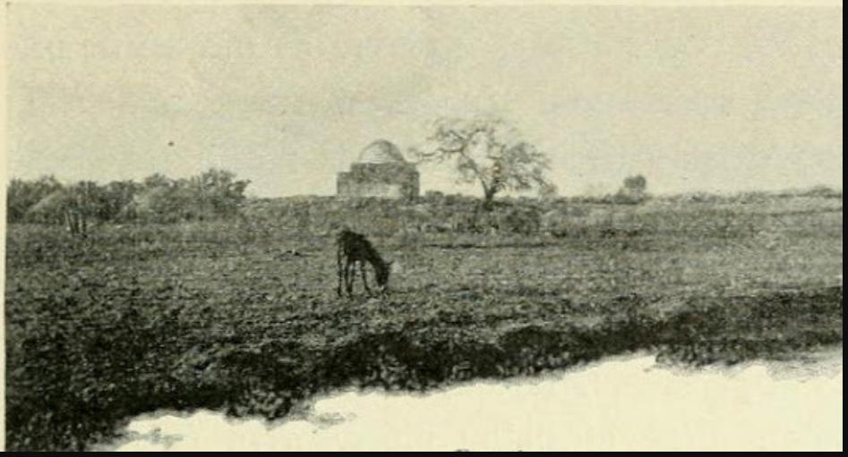
| Shrines / Maqams | Barqa had three shrines: the 1st for al-Shaykh Muhammad, the 2nd for al-Shaykh Zarruq, and the 3rd for al-Nabi Barq. | |||||||||||||||||||||
| Archeological Sites | Barqa contained Greek relics, an old well, stone carvings, and fragments of pottery. | |||||||||||||||||||||
| Exculsive Jewish Colonies Who Usurped Village Lands |
No settlements on village lands. | |||||||||||||||||||||
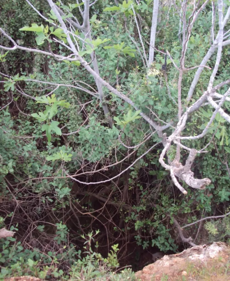
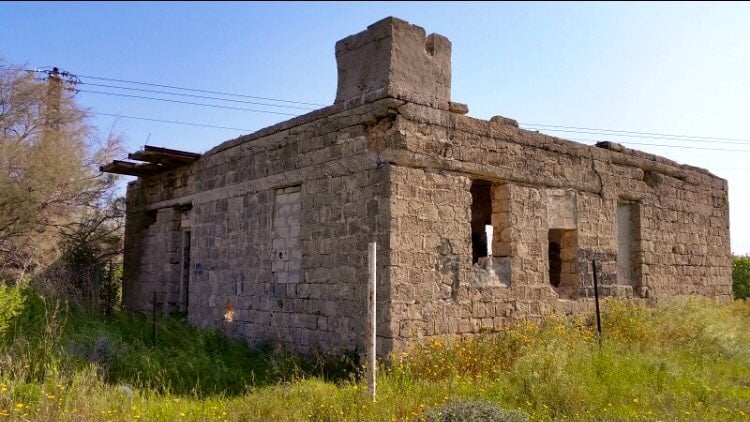
Village Before NakbaThe village was situated on level ground in the coastal plain area, some 7 km from the Mediterranean. A secondary road linked it to the coastal highway, which gave it access to Gaza as well as to the urban centers in the north. It is likely that Barqa was built on the site of the Greek town of Barka, which the Romans called Bareca. Barqa was irregular in outline. Its houses―made, for the most part, of adobe brick―were close together, separated only by narrow alleys. The villagers were Muslim, and around the village mosque were a number of tombs that they referred to as the tombs of Shaykh Muhammad, Shaykh Zarruq, and the prophet (al-nabi) Barq. Small shops were located at the village center. The children attended school in the adjacent village of al-Batani al-Gharbi . Agriculture constituted the mainstay of the economy, which combined basic staples such as grain and vegetables with fruits, especially citrus. In 1944/45 a total of 667 dunums was devoted to citrus and bananas and 3,898 dunums were allotted to grain; 47 dunums were irrigated or used for orchards. The village residents drilled several wells for irrigation, although agriculture remained largely rainfed. Barqa contained Greek relics, including a well, stone carvings, and fragments of pottery.Village Occupation and Ethnic CleaningThe village is said to have been evacuated by its inhabitants at the beginning of an attack by the Haganah's Giv'ati Brigade between 10 and 13 May 1948. Giv'ati was expanding its area of control southwards and westwards in the course of Operation Barak.Zionists Colonies on Village LandsThere are no Israeli settlements on village lands. Gan Yavn, established in 1931, is close to the village site, to the north. The settlement of Shetulim , built in 1950, is near the village, on the lands of Isdud.Village TodayTwo houses remain standing on the site. One serves as a warehouse; it is made of concrete and has a covered portico on two sides. The other, a stone house with rectangular doors and windows and a flat roof, stands deserted in the midst of wild vegetation. The site is overgrown with weeds interspersed with cactuses and eucalyptus and palm trees. Israelis cultivate the land around the site.SourceDr. Walid al-Khalidi, 1992: All That Remains. |
||||||||||||||||||||||
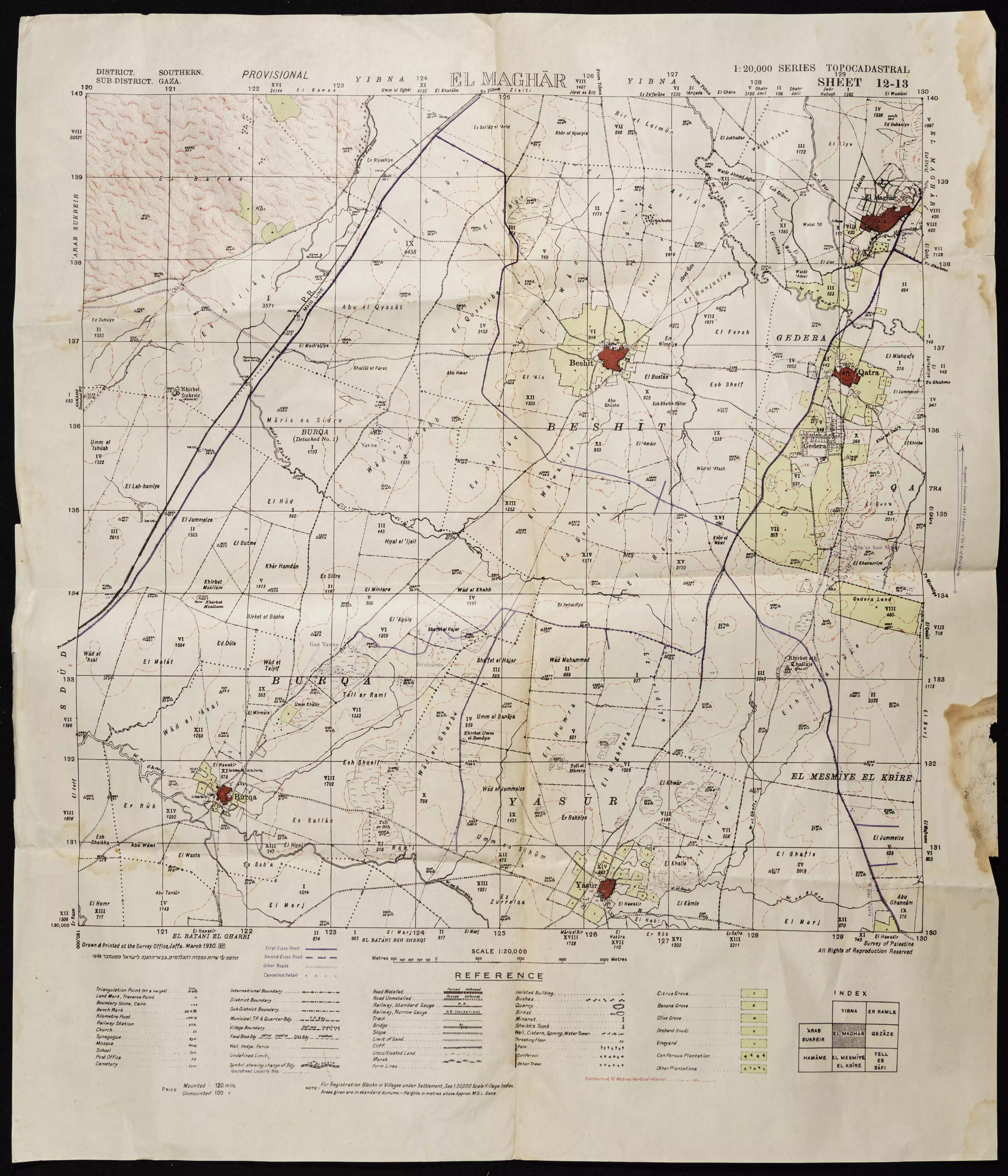
| Related Maps | Town Lands' Demarcation Maps خرائط للقضاء توضح حدود القرى والاودية Town's map on MapQuest View from satellite Help us map this town at WikiMapia |
|||||||||||||||||||||
| Related Links | Wikipedia's Page Google Search Google For Images Google For Videos |
|||||||||||||||||||||
| More Information | في كتاب كي لا ننسى في كتاب بلادنا فلسطين المزيد من موقع هوية |
|||||||||||||||||||||
- Village House In 1987
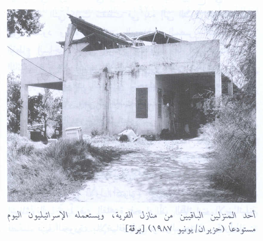
Scanned from "All That Remains" by Dr. Walid Khalidi 3 - Home near kibbutz. Fall 2006. Photo: Annemarie Jacir
Posted by Annemarie Jacir 6 - إحدى بيوت القرية التي سلمت من التدمير
Scanned from "All That Remains" by Dr. Walid Khalidi 3 - من موقع القريه
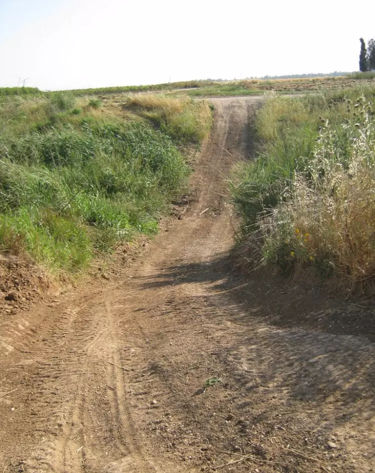
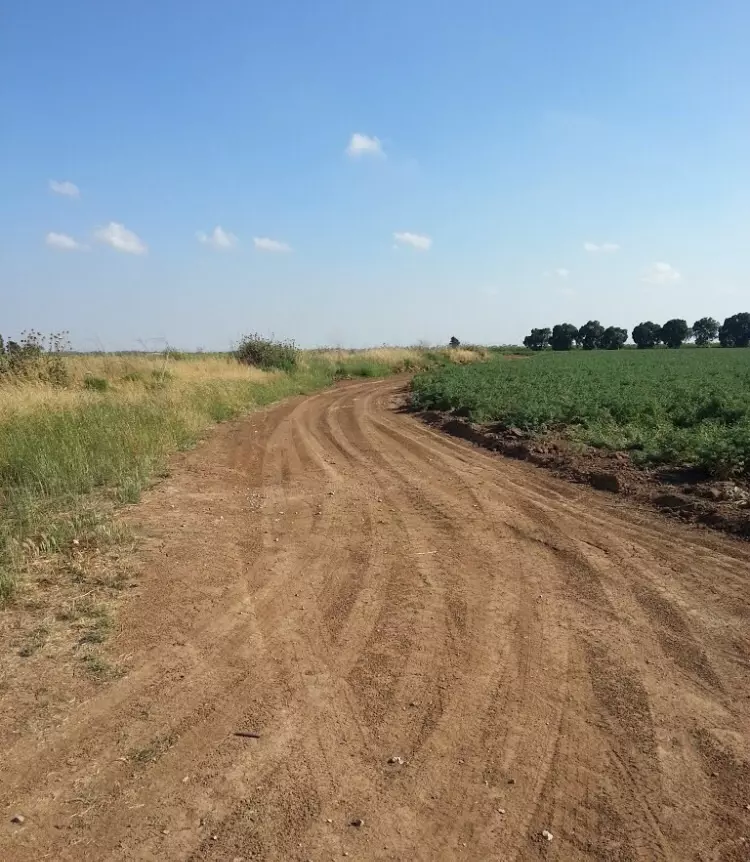
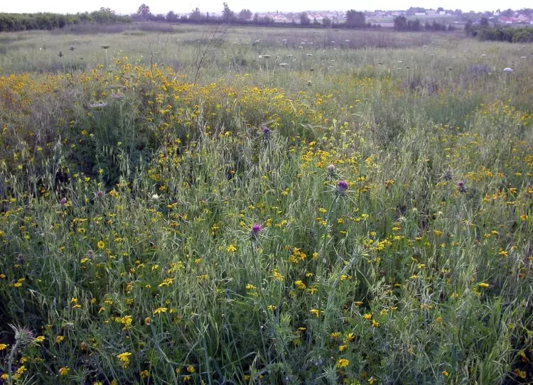
Posted by abu raya - اراضي القريه
Posted by abu raya - بيت باقي في القريه
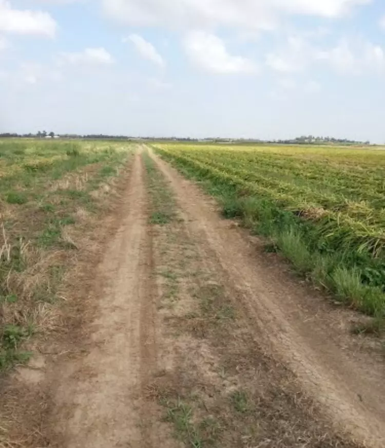
Posted by abu raya - من جنوب القريه
Posted by abu raya - اراضي القريه جنوبها
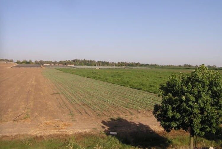
Posted by abu raya - من شرق القريه
Posted by abu raya - اراضي القريه
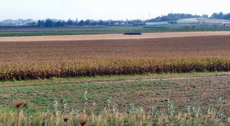
Posted by abu raya - من شرق القريه
Posted by abu raya - اراضي القريه
Posted by abu raya 1 - اراضي برقه
Posted by abu raya - برقه
Posted by abu raya - إحدى بيوت القرية التي سلمت من التدمير
- إحدى بيوت القرية التي سلمت من التدمير #2
- Pre-Nakba Aerial view of the village / صورة من الجو للقرية اخذت قبل النكبة
- احد مقامات القرية -- 1898
- خارطة تُظهِر الحدود والطرق بأنواعها والأماكن المقدسة والطبيعة الطوبغرافية من تلال وسهول ومنحدرات والتشكيلة الطبيعية للأرض وأنواع المزروعات. نُشرت الخريطة فترة الانتداب البريطاني، تم إضافة تعديلات عليها من قِبَل خدمة الخرائط والصور التابعة للقوات العسكرية الاسرائيلية فترة الأربعينيات.
Want to browse more? 80,000 pictures were grouped in these gallaries:
| Display Name | Clan/Hamolah | Country of Residence |
| ربيع الدين كمال | - | النصيرات, برقة |
| عبدالله حسن ابو الخير | أبو الخير | رفح, فلسطين |
| ahmad el suradi | - | - |
| خالد ابو الخير | ابو الخير | gaza |
| bahaa hamalawi | - | dir al balah, palestine |
| أبو عمر | أبو الخير | Gaza, فلسطين |
| ياسر ابو على | - | مكة |
| ابو خالد | الخراز | مخيم الرشيدية, لبنان |
| sohaeb | - | - |
| د.أمجد الدواهيدي | الدواهيدي | غزة |
| محمد الدواهيدي | - | غزة, فلسطين |
| ابو حسن | ابو الخير | رفح |
| realahmed8 | أبو الخير | Gaza, Palestine |
| ألتاغراسيا | أبو شاويش | - |
| رامىابو شاويش | ابو شاويش | غزة, فلسطين |
| أبو أحمد | البلبيسي | السعودية |
| bahaa | abu shawish | - |
| احمد | العامودي | غزة |
| Karam | العامودي | Doha |
| EMAD AbuShawiSh | abushawish | middle, middle |
| Attea Abu-khadra | - | Buriej |
| zead m ABOU SHAWISH | abou shawish | syria, syria damascus |
| Kahina-Said | - | algeria |
 Fake Valor: Why Did Zionist Jews Hoist Nazis Flag on Their Ships in the 1930s?
What is new?
-
Facts About Oct. 7th Gaza Raid
-
Remined Us Please: Who Did Rape Whom? Was it Palestinians who raped Israelis? Or, was the other way around? You'll be the judge
-
When Prof. Edward Said was invited to debate Bibi Netanyahu in the 1980s, watch what happened!
-
Ezra Klein of the NY Times on the "Jewish Race".
-
Abusing Blood Libel!
-
How and why Israeli Jewry has become the most hated cult?
-
Did Israeli Soldiers Activate The Hannibal Direective On Oct. 7th? You Be The Judge
-
Zionist FAQ: Isn't it true that Palestinians don't want peace? Palestinians never accepted the two-state solution
- Facts about Haavara (Transfer) Agreement between Ben-Gurion & Hitler
-
Haavara FAQs: Why Did Zionist Jews Hoist Nazis' Flags on Their Ships in the 1930s?
- Haavara FAQs: When Chaim Weizmann met FDR in mid-1943, why was he silent about rescuing European Jewry?
-
Dear ChatGPT: How did Palestinians resist Napoleon's invasion of their country in 1799?
-
Dear ChatGPT: Gaza had a vibrant Jewish community in the mid-17th century. What happened to them?
-
Dear ChatGPT: Why did the Jewish Agency suppress news of the Holocaust during WWII?
-
Video Playlist: Jews share their DNA tests to end the conflict for good.
-
A Tale of Two Conflicts: Examining the Definition of Genocide
-
Prof. Abraham Polak And The Suppressed History of the Khazars and European Jewry
-
How Ronald Reagan would have framed the genocide in Gaza if he were still alive?
-
Haavara FAQs: Let us do the math: how many German Jews did The Haavara Agreement save?
-
Zionist FAQs: The Hebron Massacre of 1929, "clearly proves" that Palestinians are antisemitic, how could you deny it?
-
Zionist FAQs: Why Anti-Zionist Is Not Antisemitism?
-
Zionist FAQs: Isn't it true that the KGB created Palestinian Nationalism in the early 1960s?
- Zionist FAQs: Muslims are killing Muslims all the time; why are Israeli Jews being singled out in the media?
- Zionist FAQs: How is Israel an apartheid state when 20% of its citizens are Arabs who enjoy full rights?
-
Haavara FAQs: Why Did Dorothy Thompson Flip From A Zionist Advocate to A Silenced Dissenter?
-
Haavara FAQs: Analysis of Herzl's Uganda Scheme and how it could have saved millions of Jews.
-
Haavara FAQs: Why did Hayim Greenberg describe American Jewry as "morally bankrupt" in early 1943?
-
Haavara FAQs: What if the Evian Conference was a resounding success? What would have been the impact of saving European Jewry on Zionism?
- Haavara FAQs: What if the six million were saved, how that would have impacted the Zionist project?
-
Haavara FAQs: How did Zionist leaders react when Europe's Jews lingered in the DP camps after WWII ended?
-
Why does the American Jewish community repeat lies that David Ben-Gurion had debunked before he died?
-
Who has the power to rename the Tatar/Khazar Gene Marker to Jewish IV?
-
Zionist FAQs: Why won't Egypt, Syria, and Jordan take their people back? Jews are indigenous to Palestine, and Arabs immigrated after Jews developed the country. Arabs should leave.
-
Haavara FAQs: Did Hitler and the Nazis conflate between Judaism and Zionist? If that wasn't case, then why?
-
Haavara FAQs: Winston Churchill and antisemitism, a collection of articles written Churchill.
-
Haavara FAQs: Broken by country, how many Jews survived vs. killed during the Holocaust?
-
Haavara FAQs: Why did European Jews vote with their feet and to immigrated to the Americas, not Palestine, after WWII?
-
Watch this American Jewish Girl describing Israeli Jews' cognitive dissonance like no other in under two minutes
-
Haavara FAQs: When the Nazis went out of their way to hide the Holocaust, Israeli Jews did the exact opposite by broadcasting their genocide of Gazans. But why?
-
Haavara FAQs: How Zionist Jews went out of their to show their appreciation to Nazism and Fascism?
- Haavara FAQs: Why Zionist leaders were against bombing the death camps & the Railroads leading to them?
-
Haavara FAQs: Hitler's message to the British and American people: If Jews are such noble citizens and you care about them, how come you're not letting them in? I will gladly ship them to you at my expense, even on luxury liners!
-
A shortlist of Zionist and Israeli false flag operations in the name Jews.
-
The Most Moral Army
- The Land of Kapos (Israel): Where the brave are boycotted and Kapos walk free.
- Why did early Zionists often named their communal enterprises "colonial"?
- Zionist Relations with Nazi Germany by Faris Glubb
-
Two NY Times advertisements by Zionists in the early 1943 that exposes Zionists' treason at the height of the calamity
- Facts Not Lies about the Palestinian-Israeli Conflict.
- Site's pictures have been categorized
- Campgain Against Lice
- A Survey of Palestine, the official source about Palestine before Nakba produced by the British Mandate; over 1200 pages.
- Satellite View & Google Earth: Over 6,000 placemarks identifying all destroyed towns, W. Bank & Gaza Strip Towns, & refugee camps.
- PalestineRemembered.com and its Nakba Oral History Project were featured on al-Jazeera Satellite TV.
- Nakba Oral History Video Podcast:
 Over 700 Oral History interviews (including 3,500+ hours of recording) can be viewed online.
 - Palestine Village Statistics Project
- Gaza Jail Break
- النسخة العربية للموقع الان متوفرة
- Videos: Documenting the destroyed villages in video: Tracing all that remains since Nakba.
- Videos: Responding to Zionist Propaganda
- Interview: The ethnic cleansing of Palestine: George Galloway interviews Israeli Historian Ilan Pappe.
- For Palestinians, memory matters. It provides a blueprint for their future By George Bisharat.
- Zionist FAQ now available in Hebrew שאלות שציונים שואלים, עכשיו בעברית
- Video: The Stephen Walt and John Mearsheimer report on the influence of the Israel Lobby on U.S. Foreign Policy
- The Palestinian-Israeli conflict for beginners
