| PalestineRemembered | About Us | Oral History | العربية | |
| Pictures | Zionist FAQs | Haavara | Maps | |
| Search |
| Camps |
| Districts |
| Acre |
| Baysan |
| Beersheba |
| Bethlehem |
| Gaza |
| Haifa |
| Hebron |
| Jaffa |
| Jericho |
| Jerusalem |
| Jinin |
| Nablus |
| Nazareth |
| Ramallah |
| al-Ramla |
| Safad |
| Tiberias |
| Tulkarm |
| Donate |
| Contact |
| Profile |
| Videos |
Welcome To Isdud - اسدود (איסדוד)
|
District of Gaza
Ethnically cleansed days ago |
العربية Google Earth |
 |
Gallery (151) |
- Statistics & Facts
-
Before & After

- Satellite View
- Articles 6
- Pictures 151
- Aerial Views 3
- Land Deeds 3
- Oral History 3
- Members 68
- All That Remains
- Wikipedia
- Videos 5
- Guest Book 31
- Links 3
| Statistic & Fact | Value | |||||||||||||||||||||
| Occupation Date | October 28, 1948 | |||||||||||||||||||||
| Distance From District | 35 (km) North East of Gaza | |||||||||||||||||||||
| Elevation | 35 (meters) | |||||||||||||||||||||
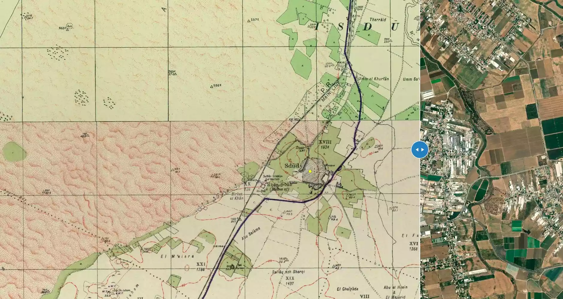
| Before & After Nakba, Click Map For Details |
||||||||||||||||||||||
|
||||||||||||||||||||||
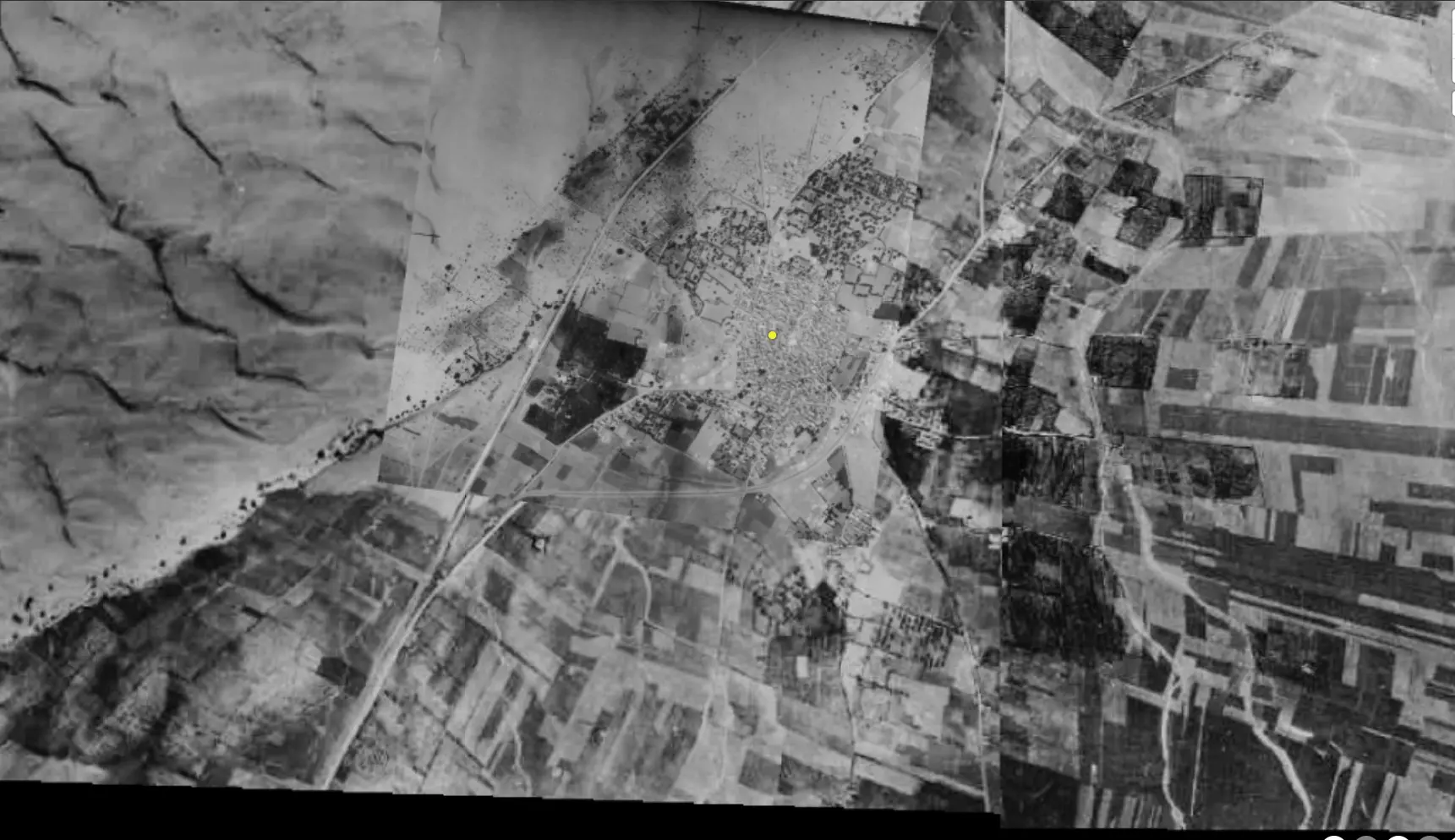
| Pre-Nakba Aerial View |
||||||||||||||||||||||
|
||||||||||||||||||||||
| Map Location | See location #4 on the map View from satellite |
|||||||||||||||||||||
| Military Operation | Operations Yo'av and ha-Har | |||||||||||||||||||||
| Attacking Units | Giv'ati Brigade | |||||||||||||||||||||
| Defenders | Egyptian Army | |||||||||||||||||||||
| Acts of Terror | Massacre occured by Zionist troops against the town's inhabitants. | |||||||||||||||||||||
| Exodus Cause | Military assault by Zionist troops | |||||||||||||||||||||
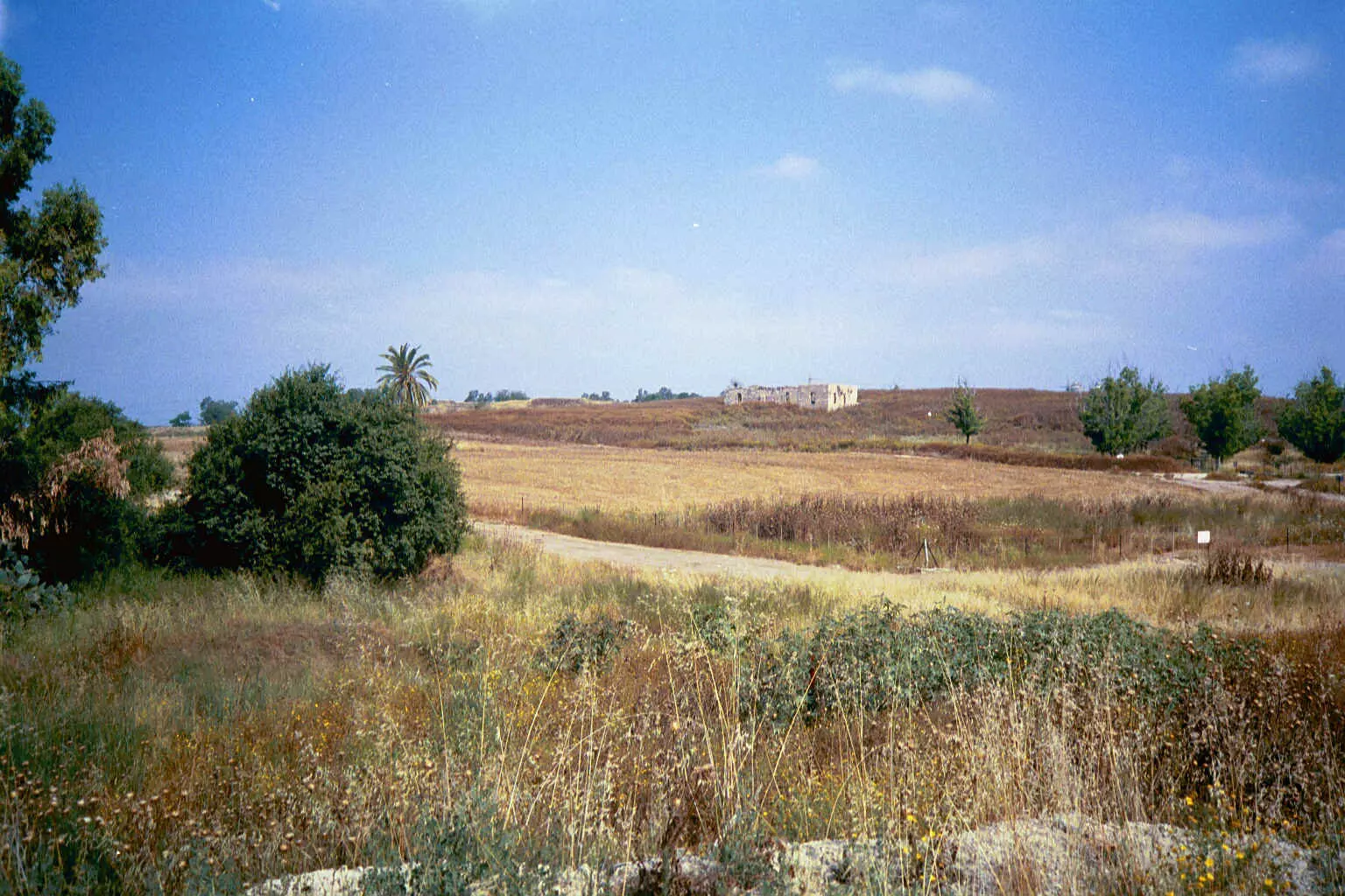
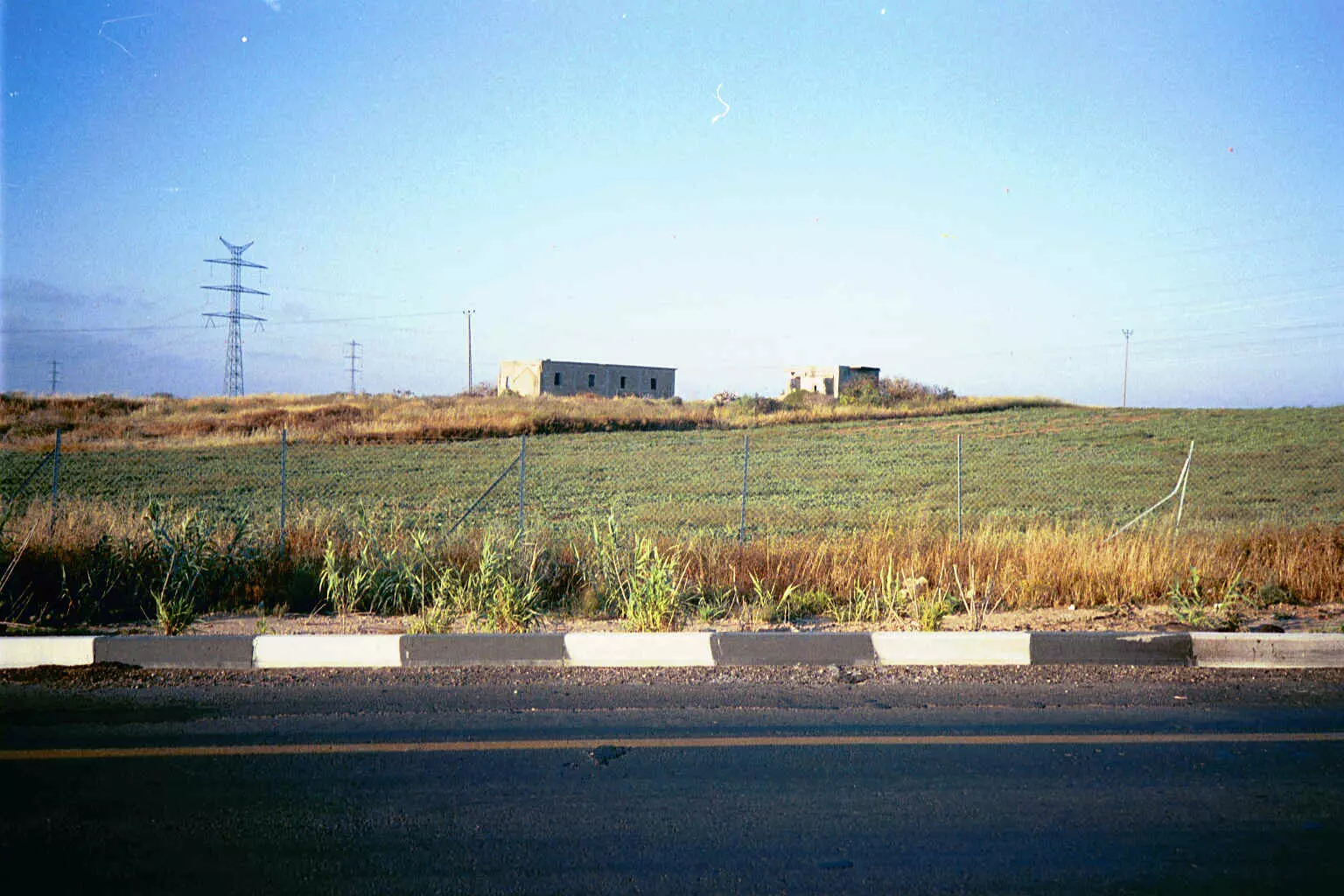
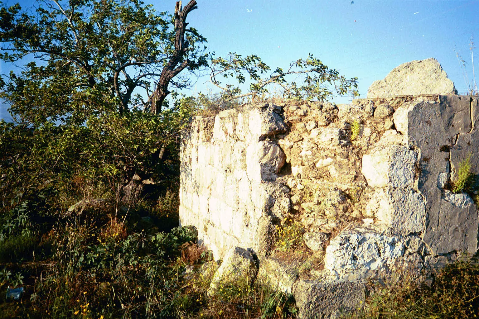
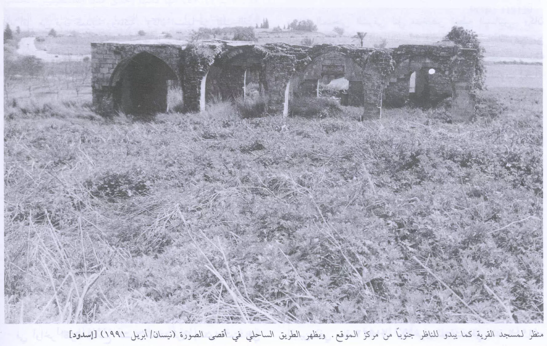
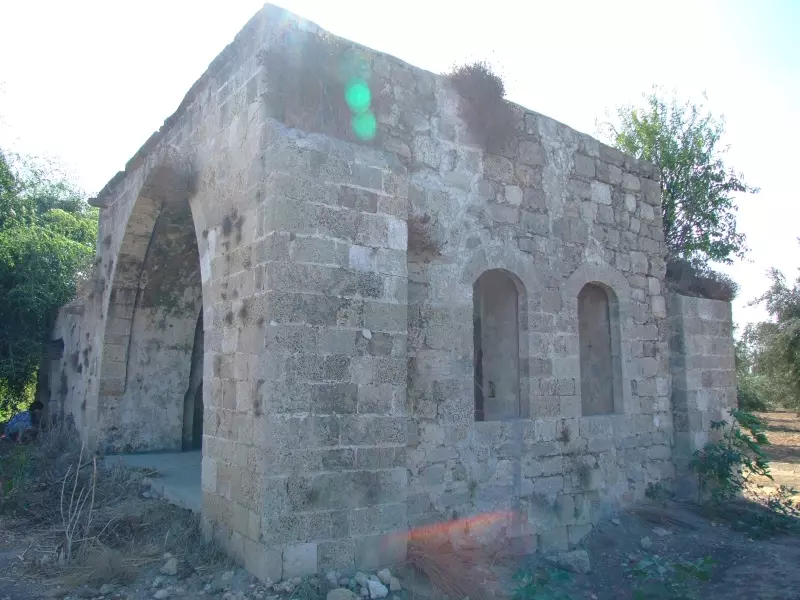
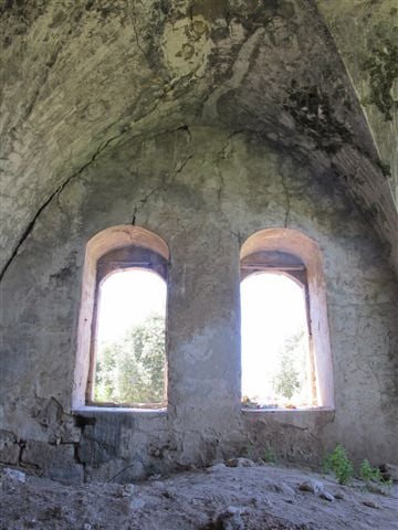
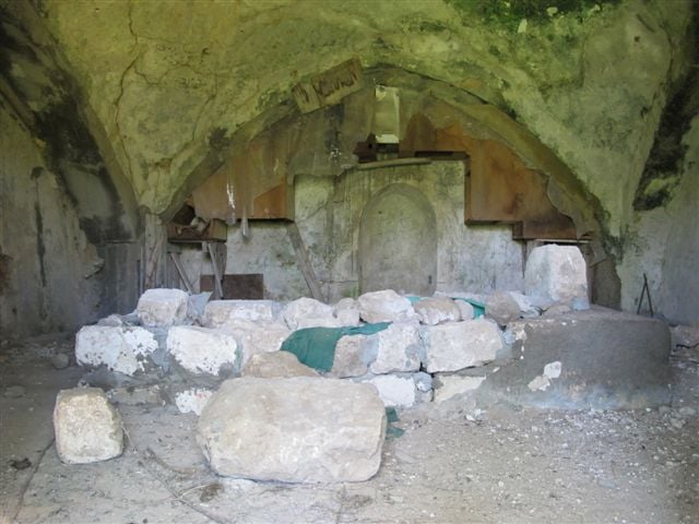
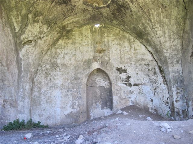
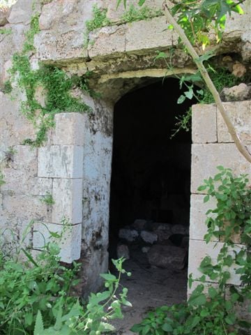
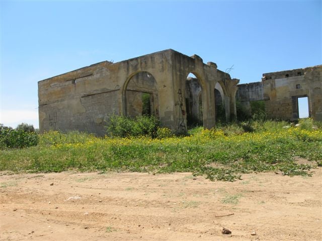
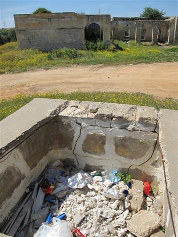
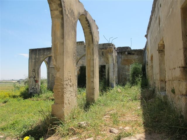
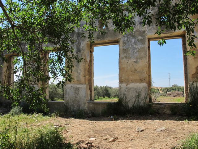
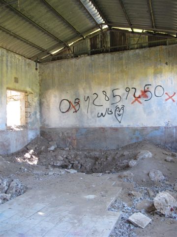
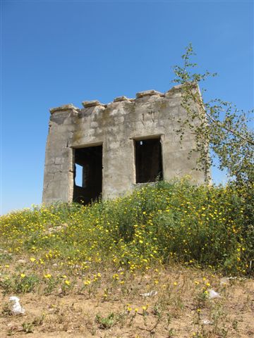
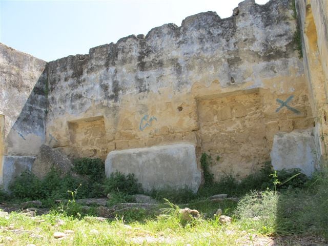
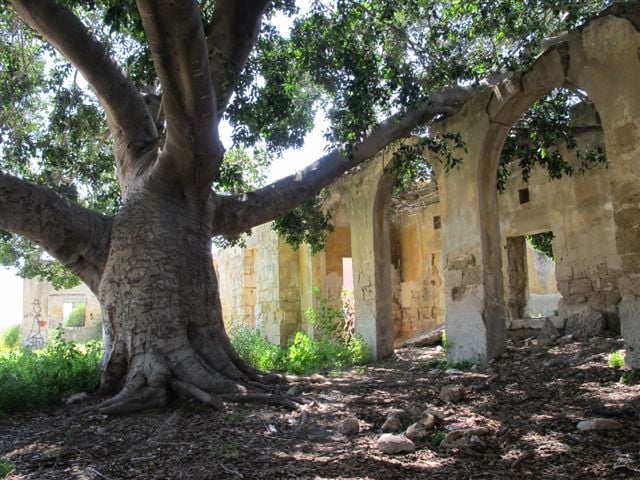
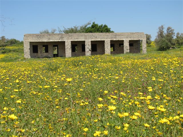
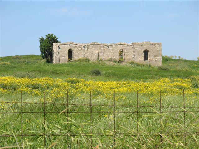
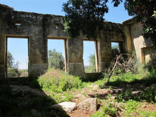
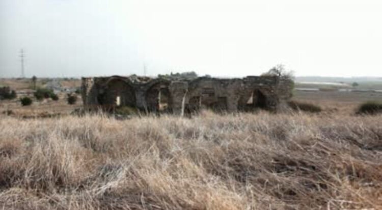
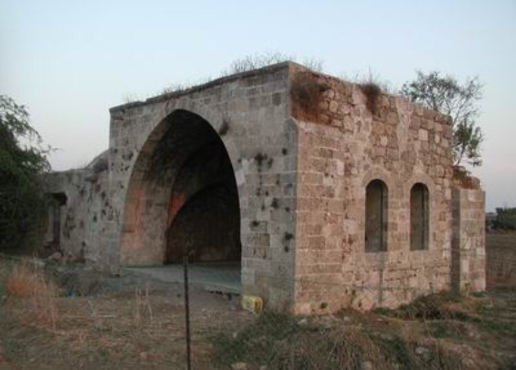
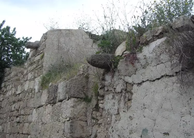
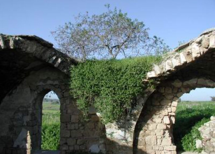
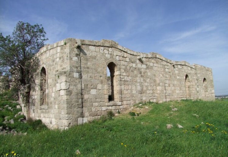
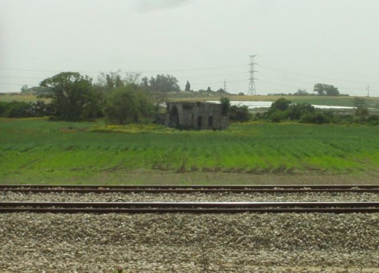
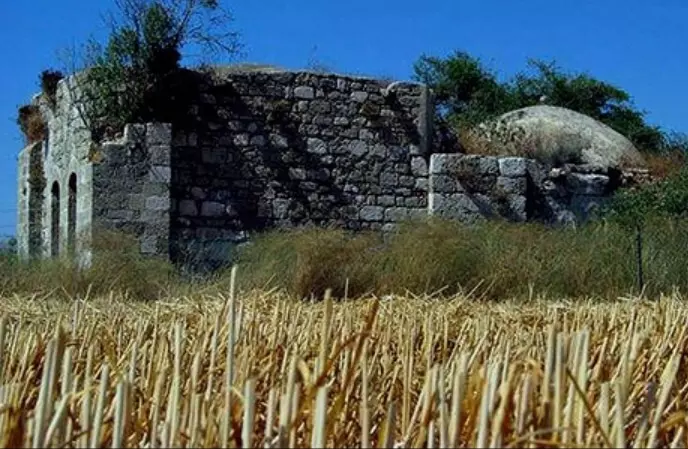
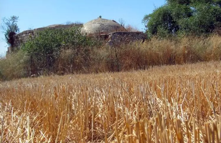
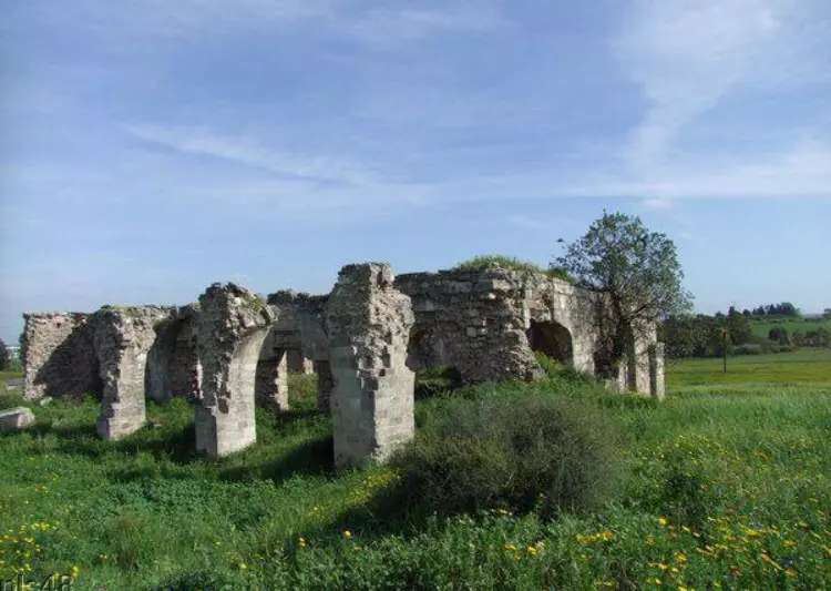
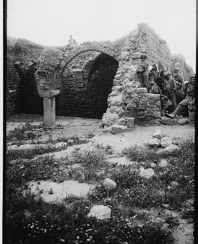
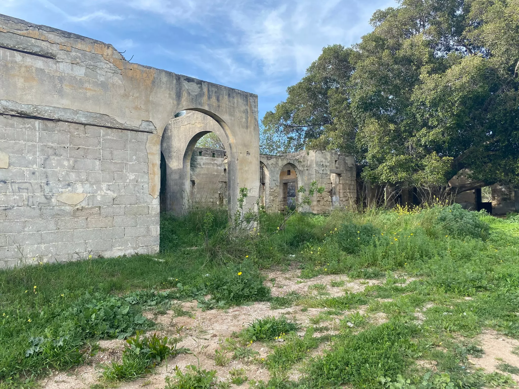
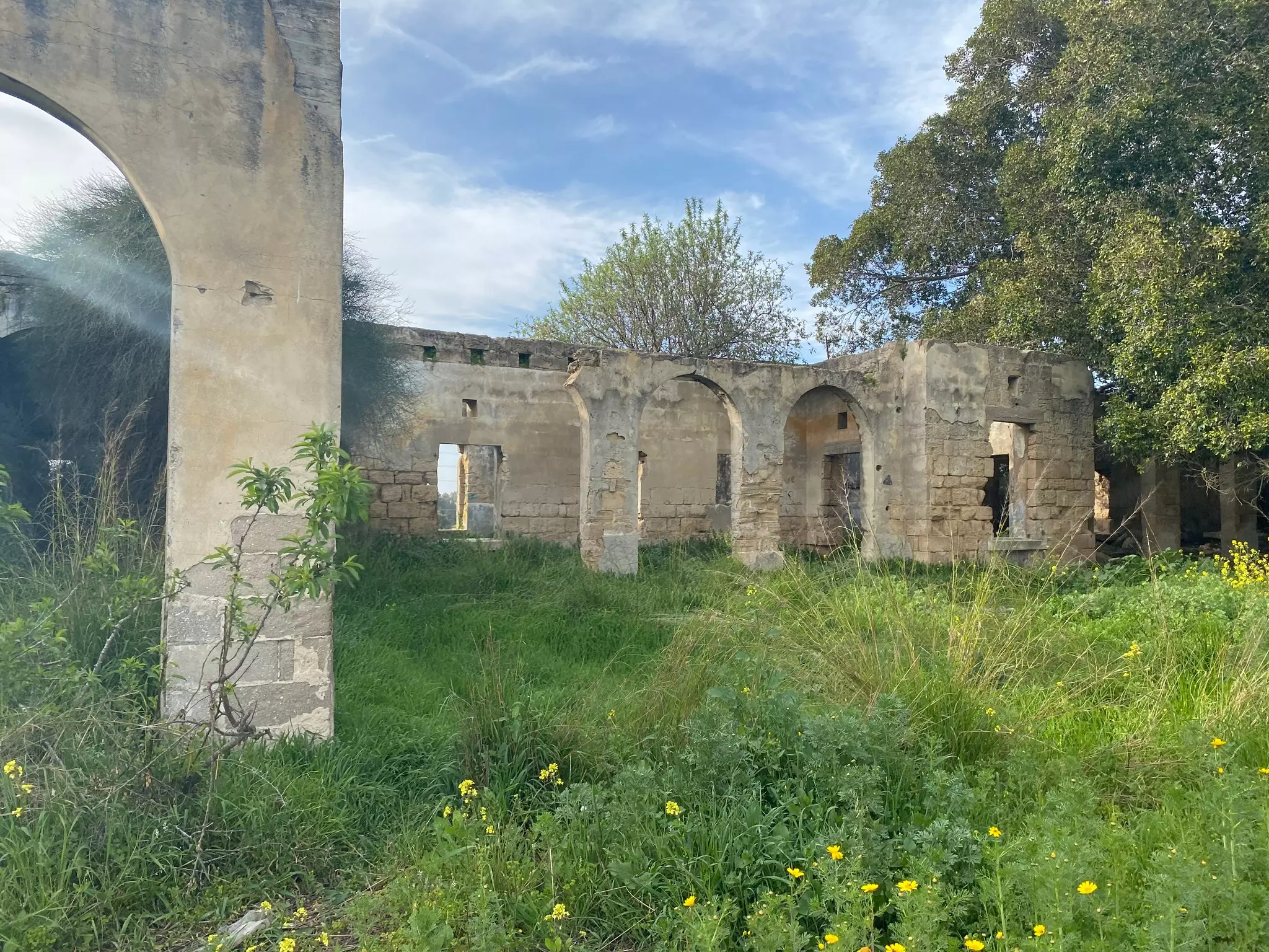
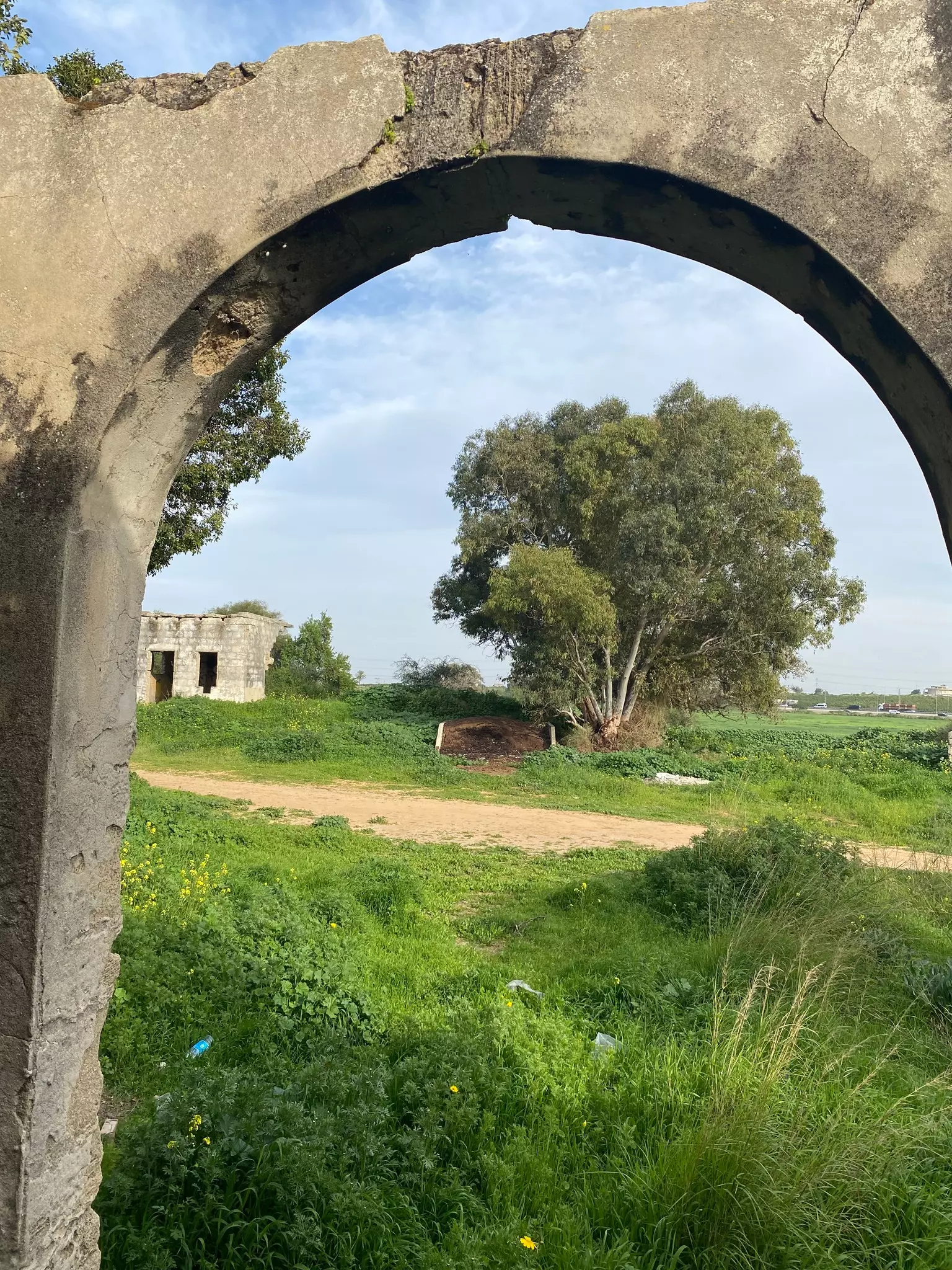
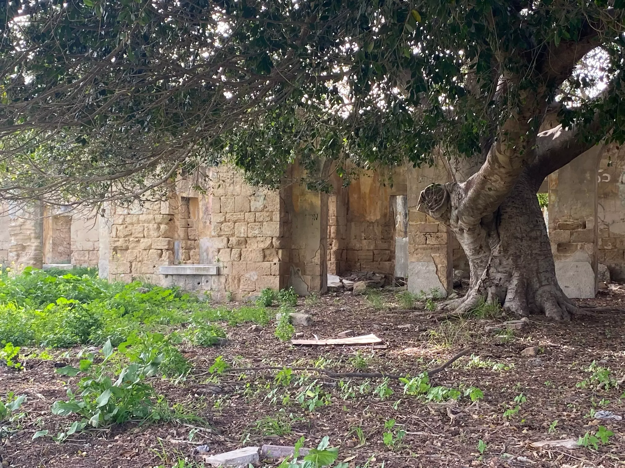
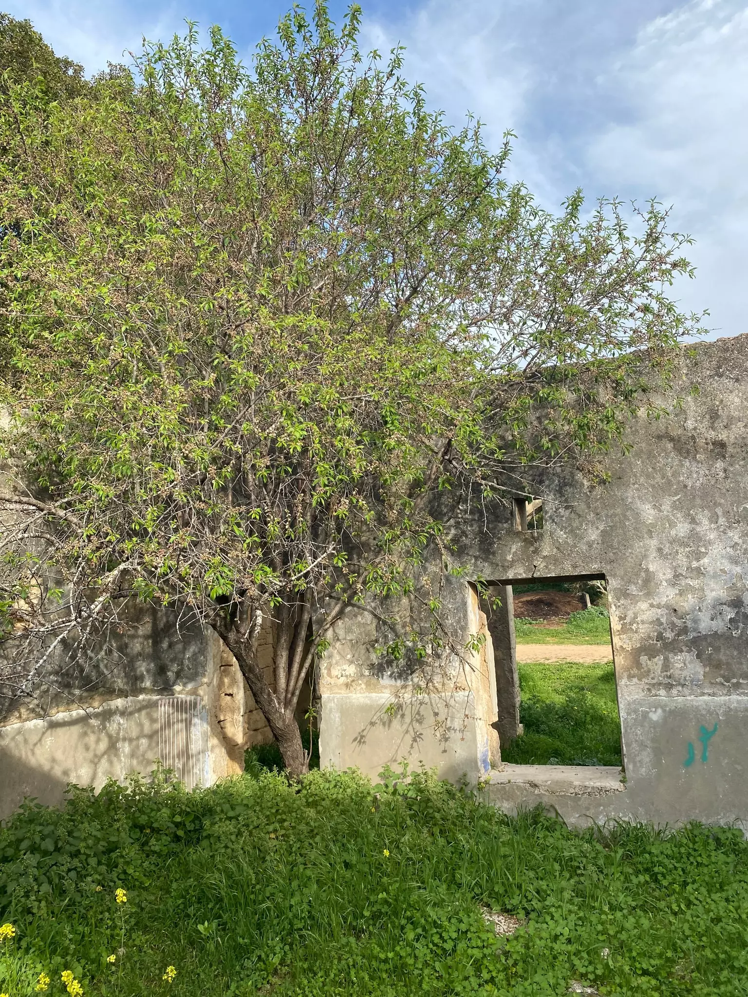
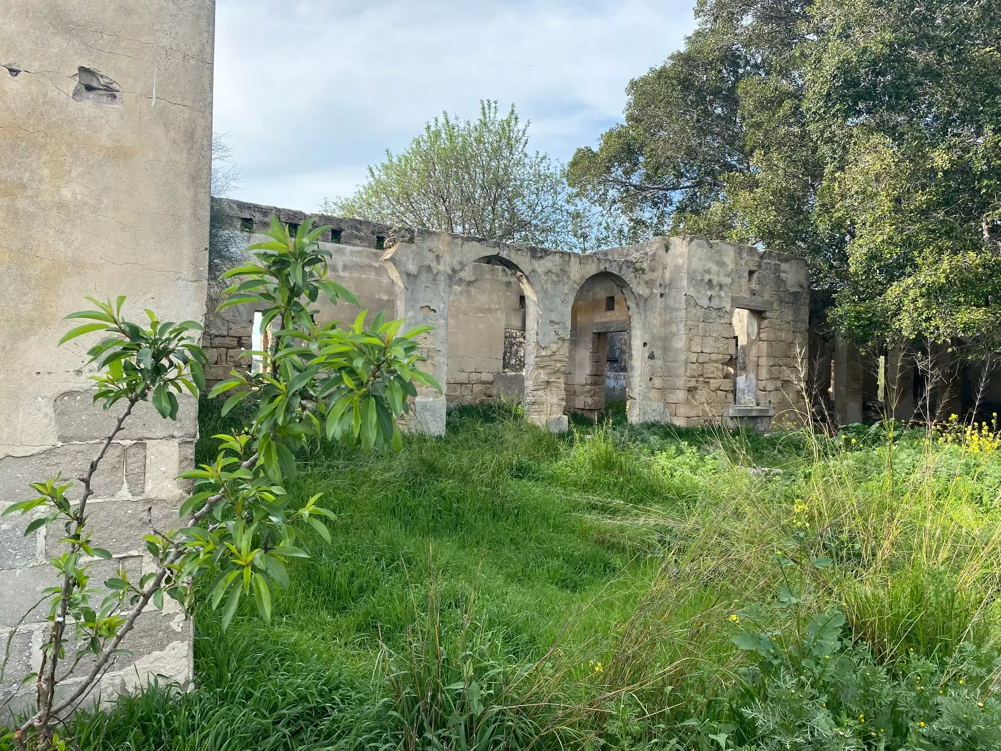
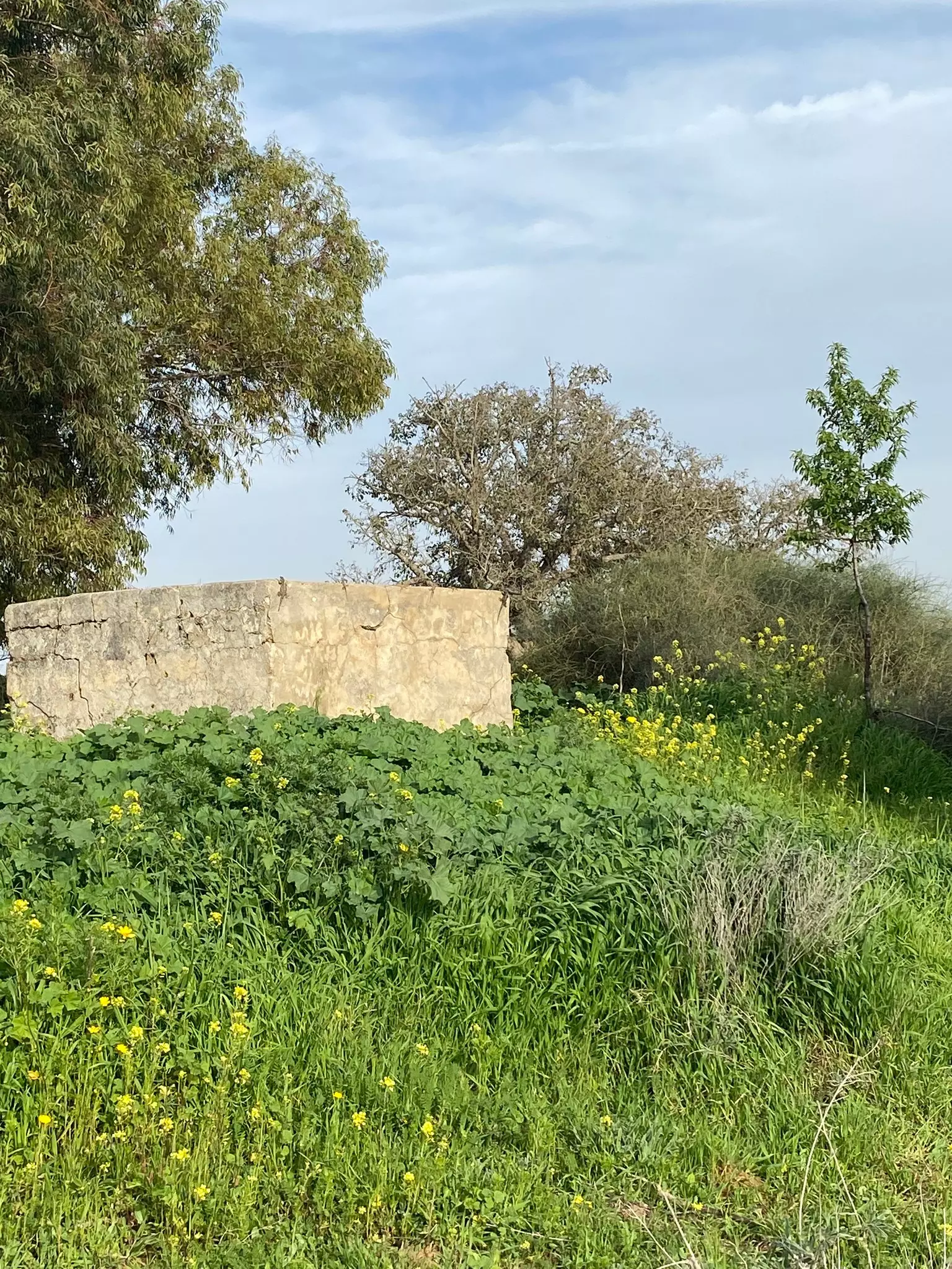
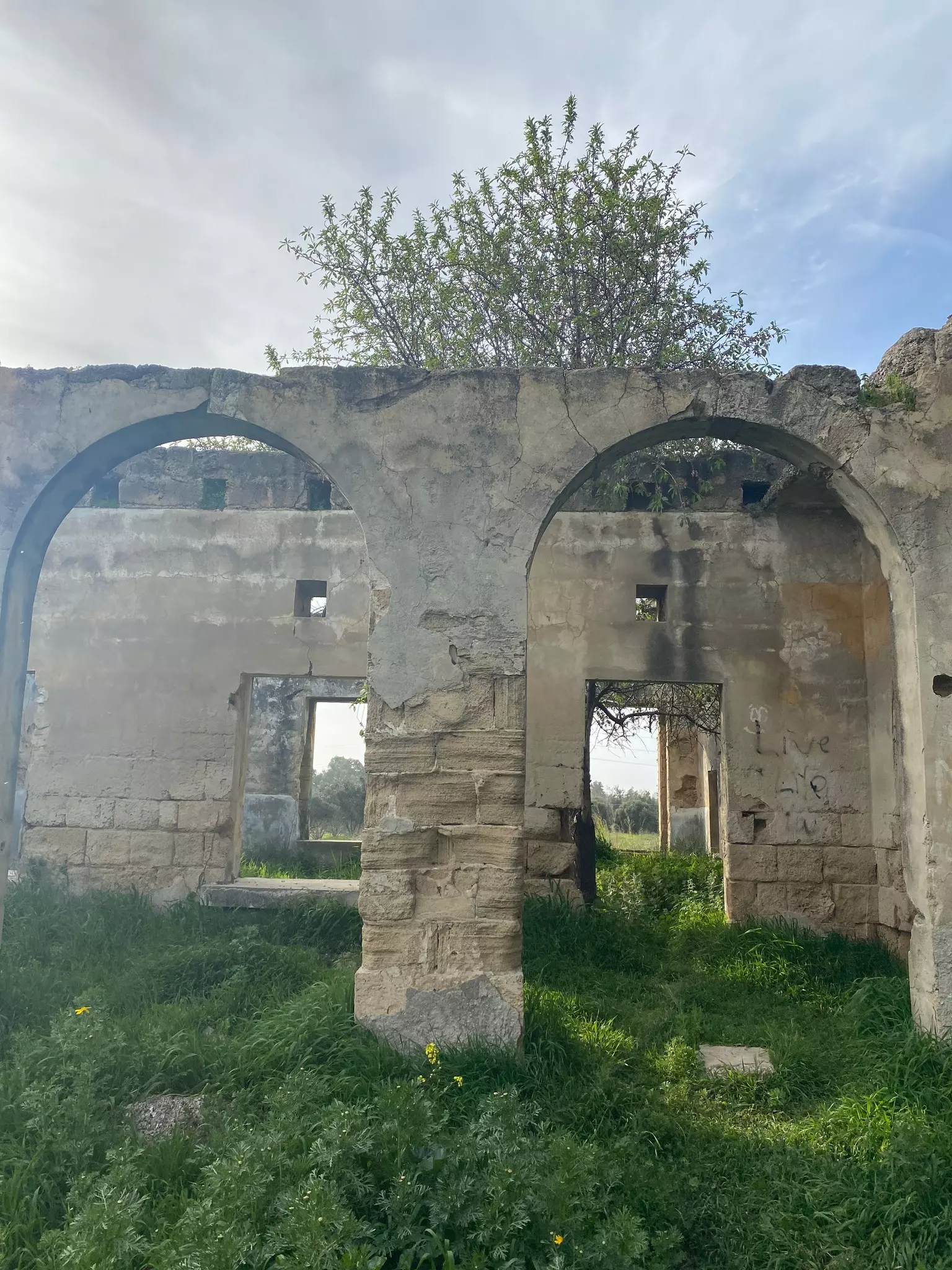
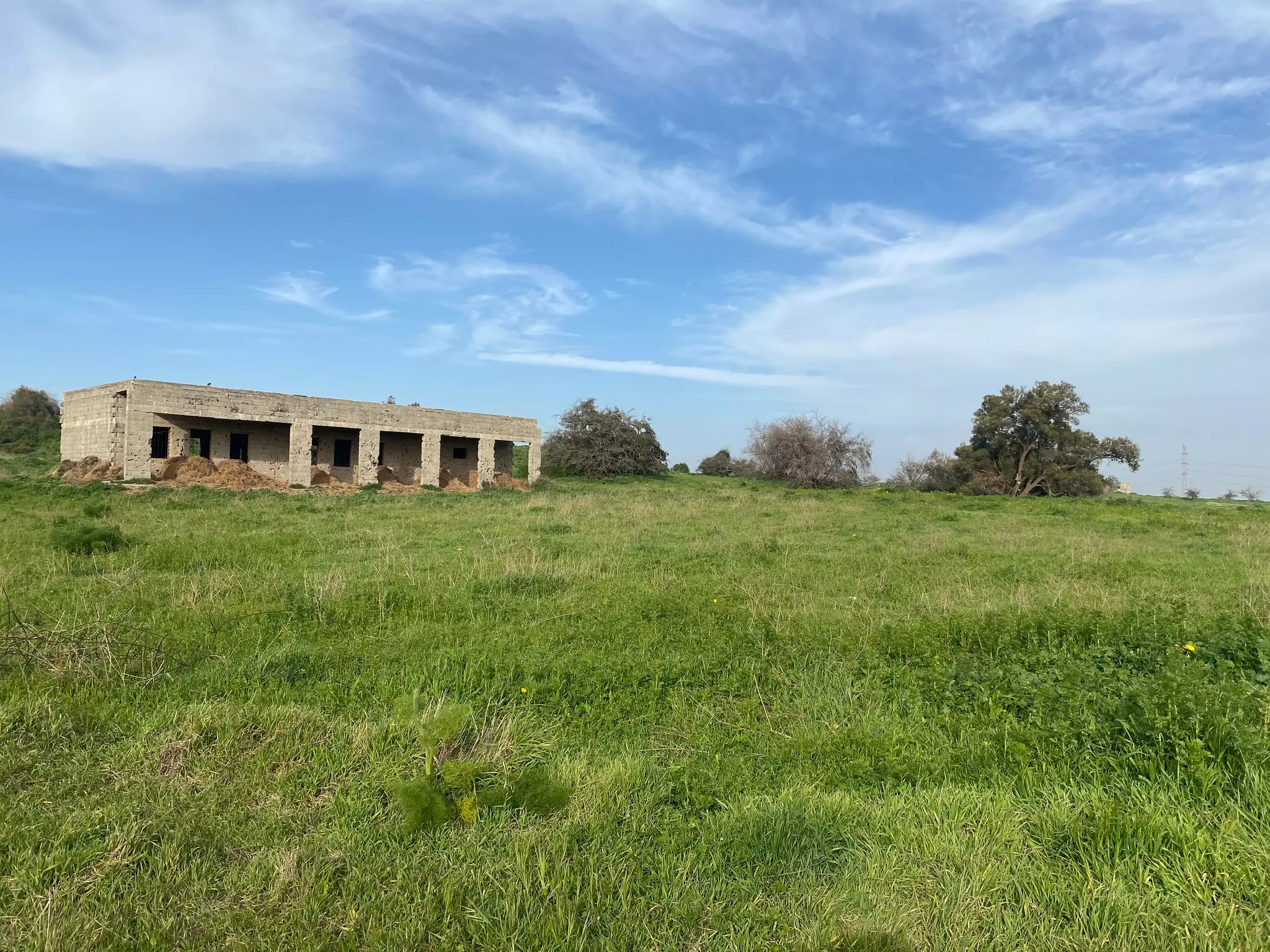
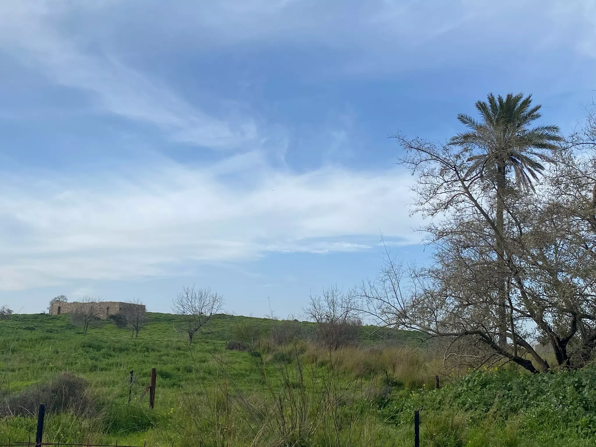
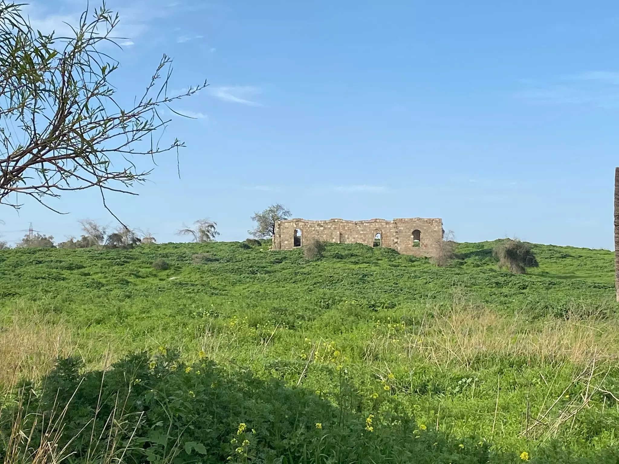
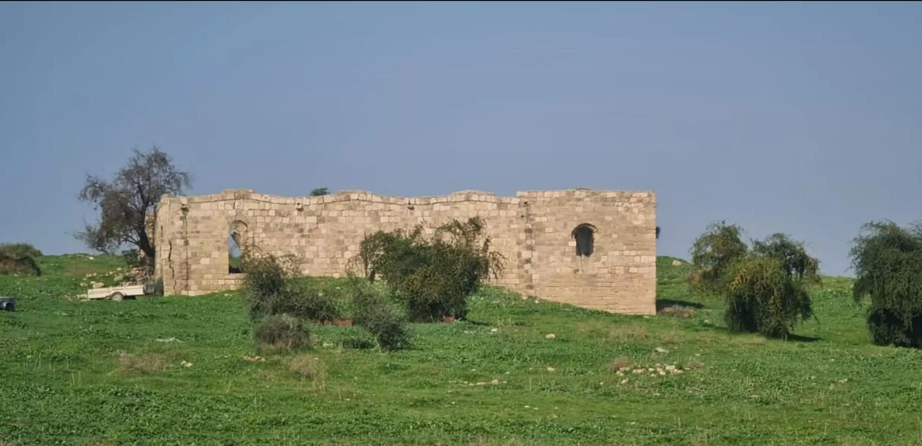
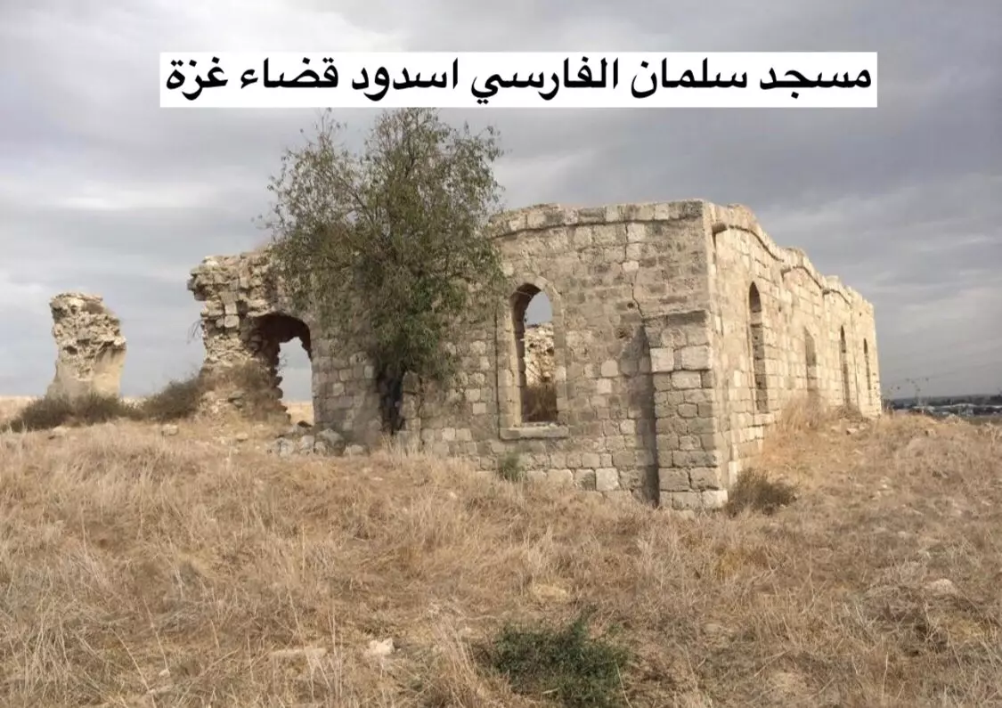
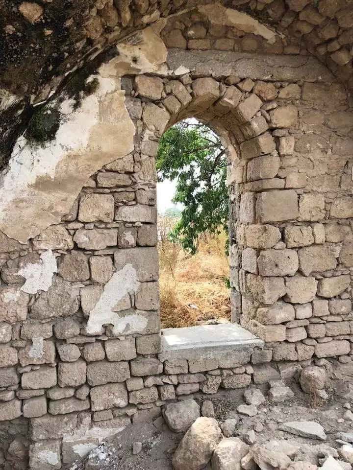
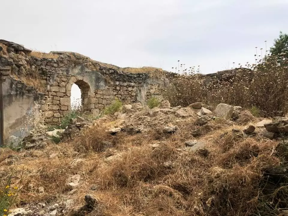
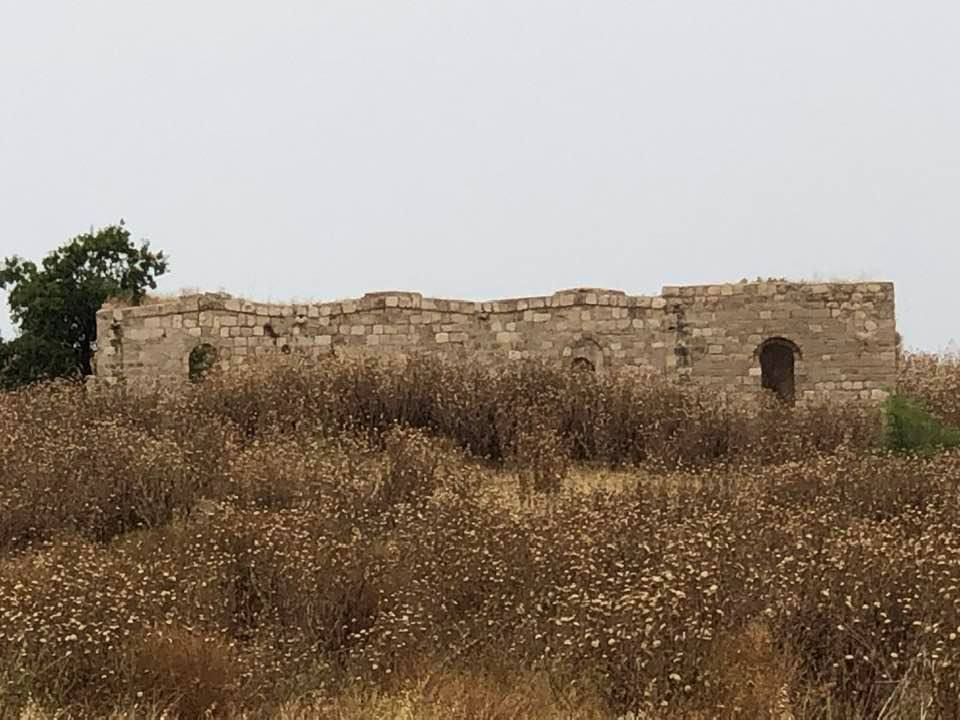
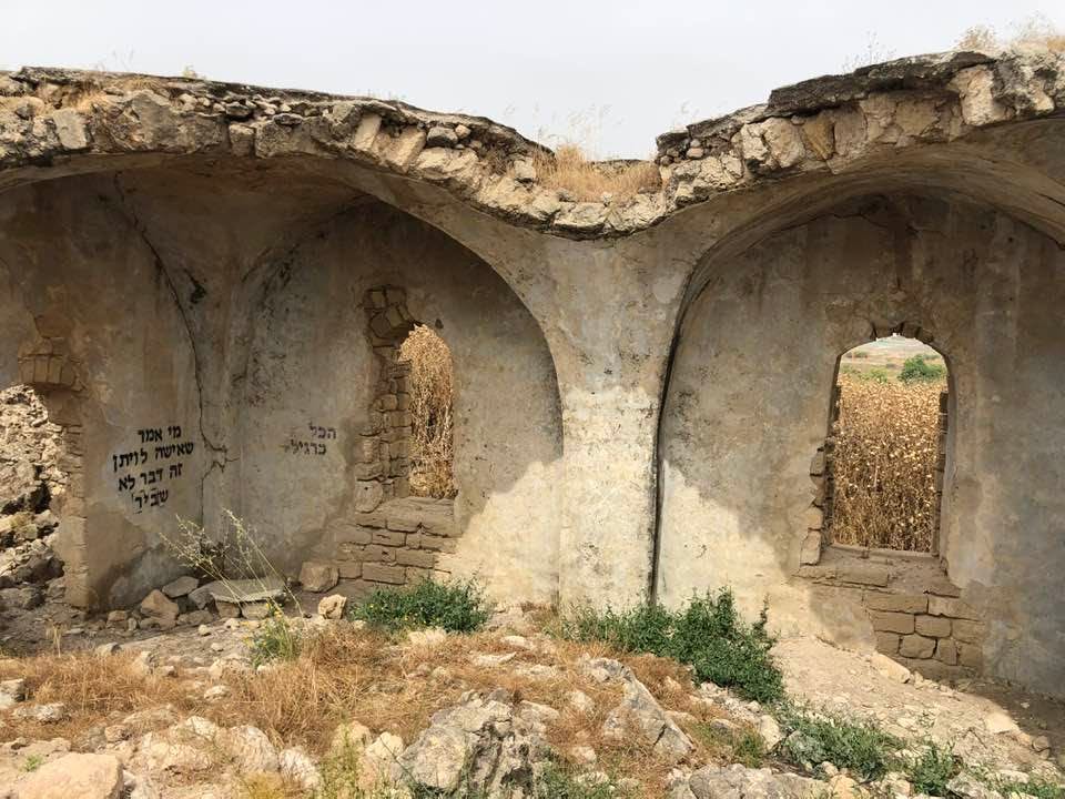
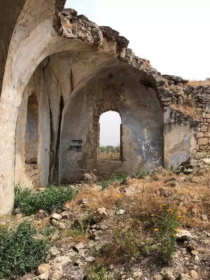
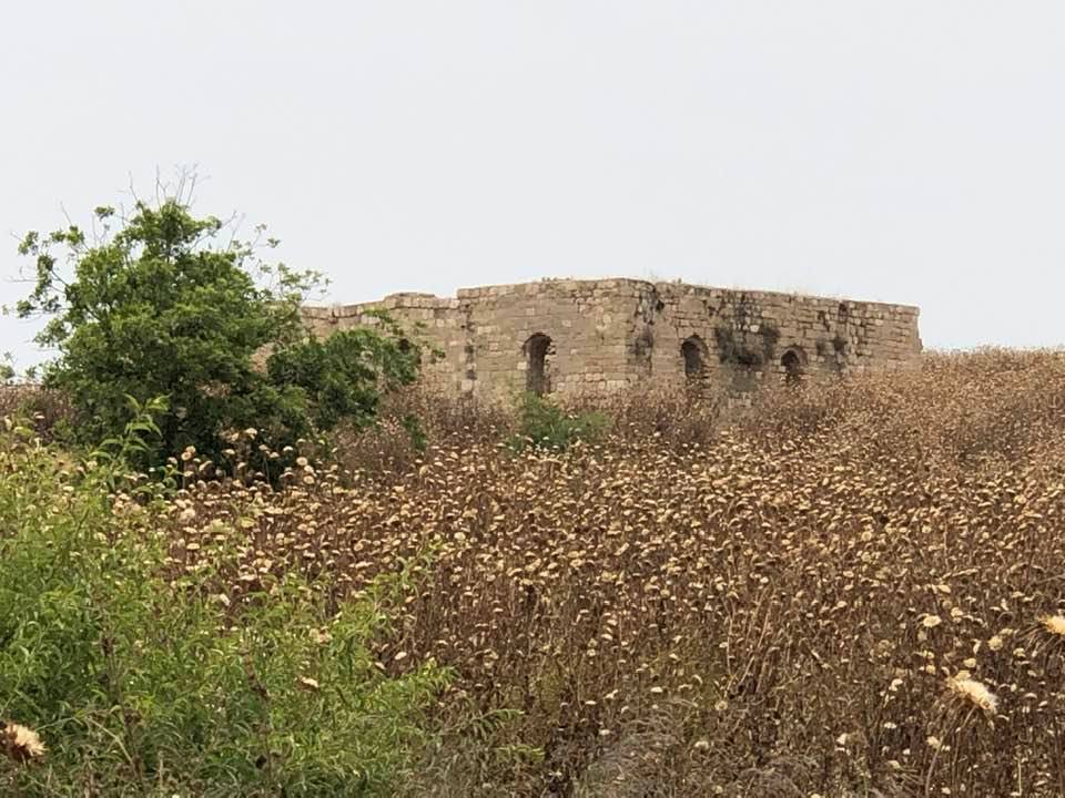
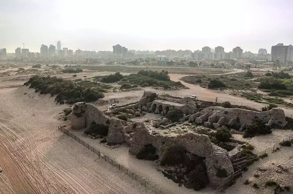
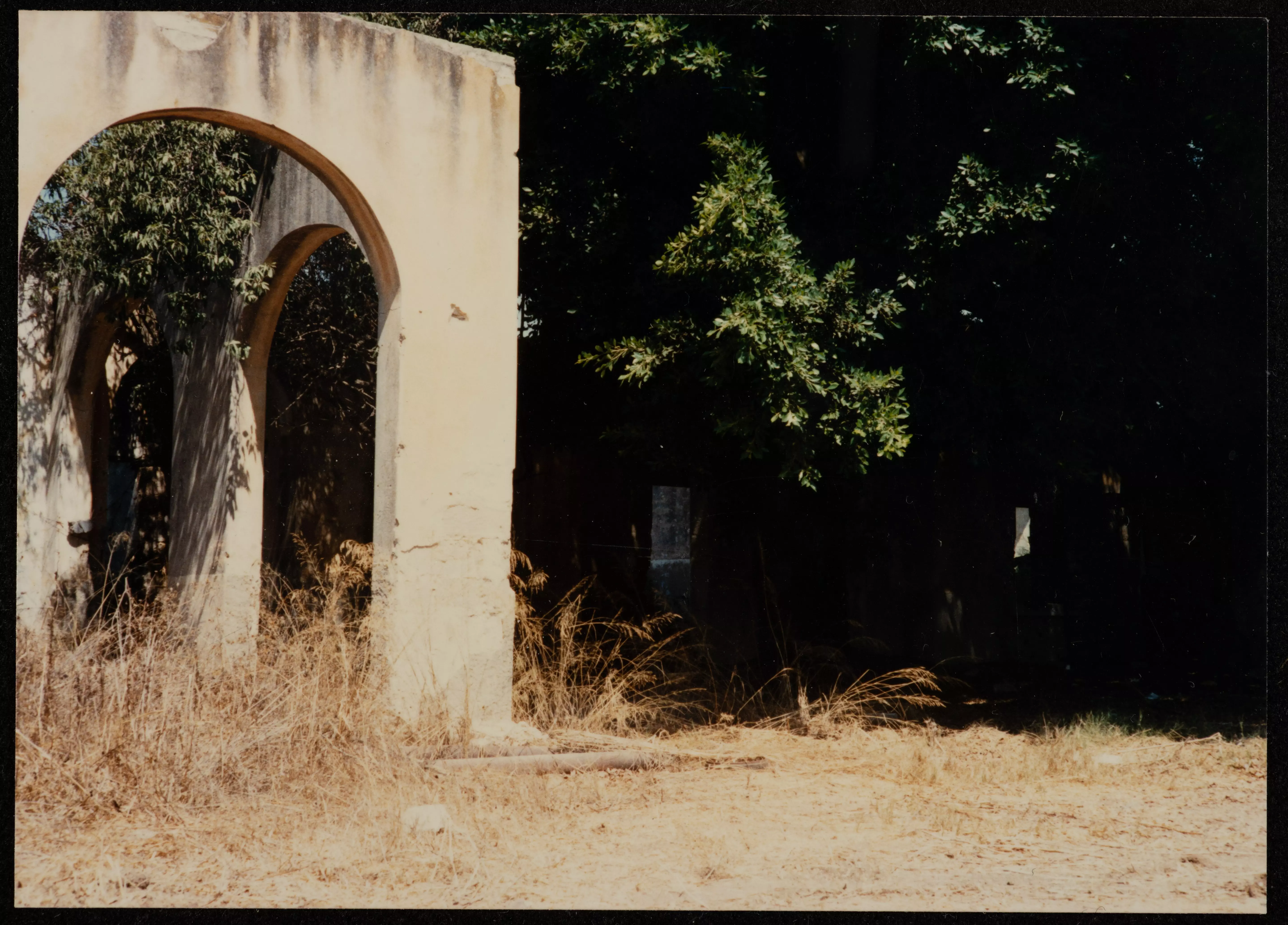
| Village Temains | The village was mostly destroyed with the exception of its two schools, its crumbling mosque, and one of its shrines. | |||||||||||||||||||||
| Ethnically Cleansing | Isdud inhabitants were completely ethnically cleansed. | |||||||||||||||||||||
| Pre-Nakba Land Ownership |
**Town Lands' Demarcation Maps |
|||||||||||||||||||||
| Land Usage As of 1945 |
|
|||||||||||||||||||||
| Population |
|
|||||||||||||||||||||
| Number of Houses |
|
|||||||||||||||||||||
| Near By Towns |
||||||||||||||||||||||
|
||||||||||||||||||||||
| Town's Name Through History | The Romans referred to Isdud by Azotus. | |||||||||||||||||||||
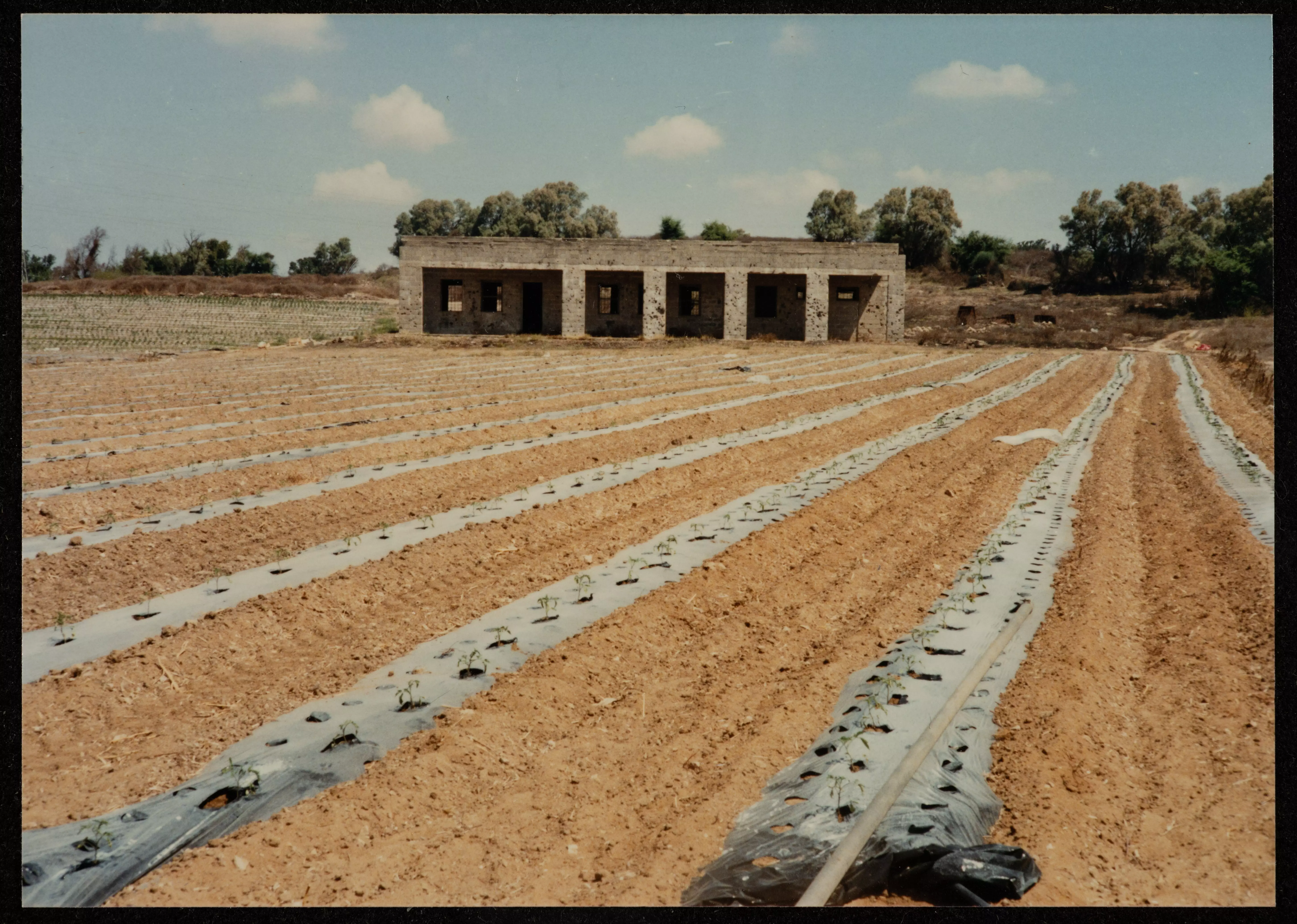
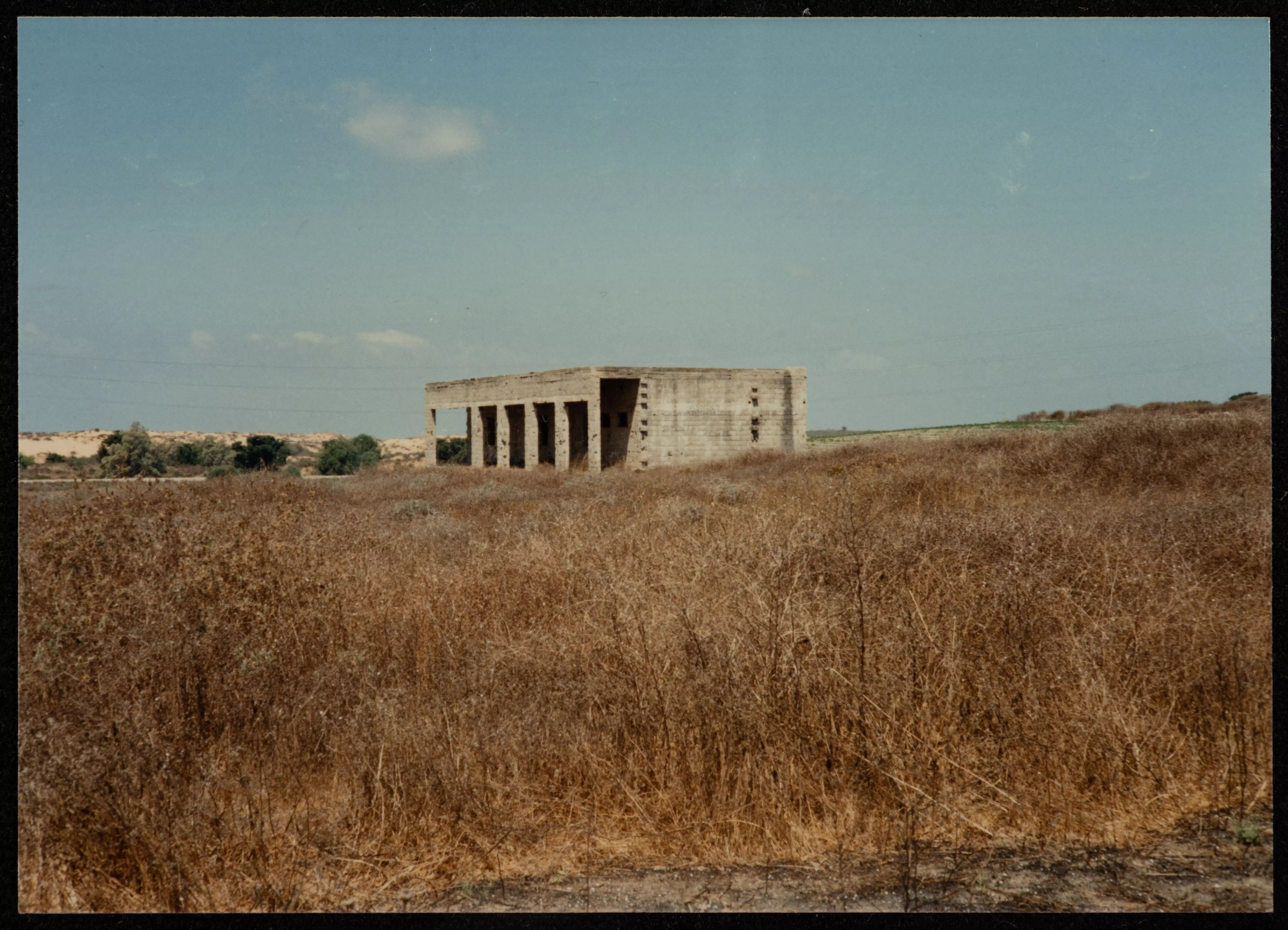
| Schools | Isdud had two schools: the 1st was an elementary school for boys founded in 1922, and in 1945 it had an enrollment of 371 boys; the 2nd school was for girls founded in 1942, and in 1945 it had an enrollment of 74 girls. Both schools are deserted now. | |||||||||||||||||||||
| Places of Warship | Isdud had two mosques, one of which is still standing, but in bad conditions. | |||||||||||||||||||||
| Shrines / Maqams | The village had three shrine (one shrine remain standing): the 1st shrine was for Salman al-Farisi (al-Nabi Muhammad's companion), the 2nd shrine was for the Egyptian, al-Shaykh al-Matbuli, and the 3rd shrine was for Ahmad Abu al-Iqbal. | |||||||||||||||||||||
| Archeological Sites | Isdud had at least nine khirbats containing a wide variety of relics, including pottery fragments, mosaic floors, cisterns, and an ancient olive press | |||||||||||||||||||||
| Exculsive Jewish Colonies Who Usurped Village Lands |
Sde 'Uzziyyahu and Bene Darom | |||||||||||||||||||||
| Featured Video | ||||||||||||||||||||||
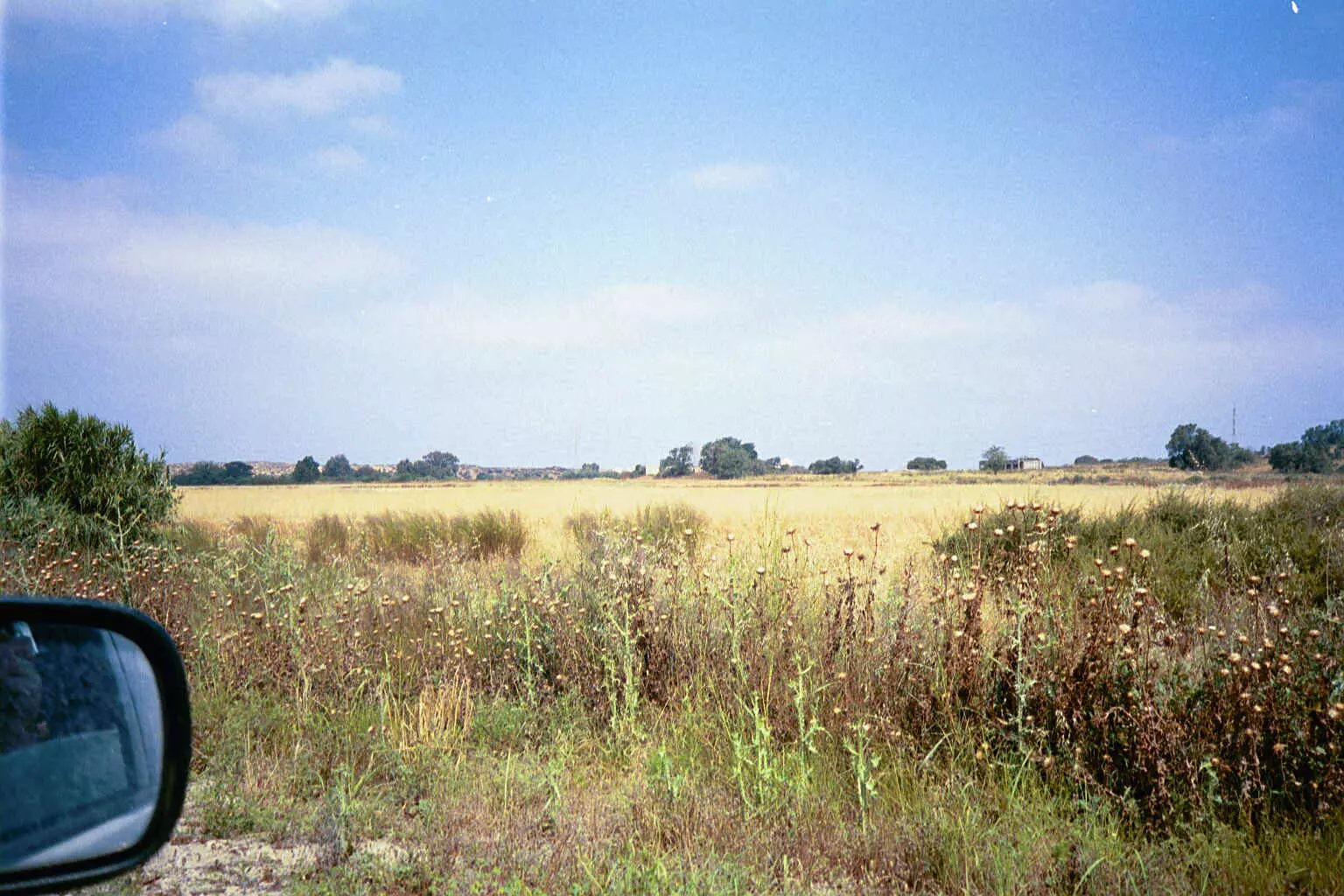
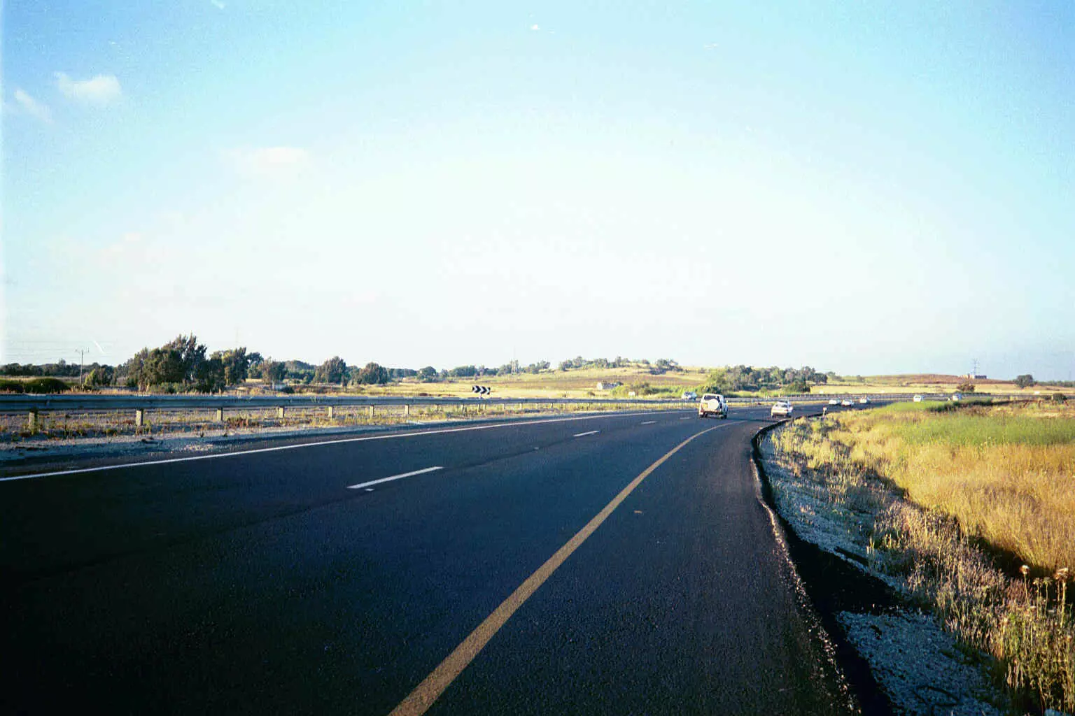
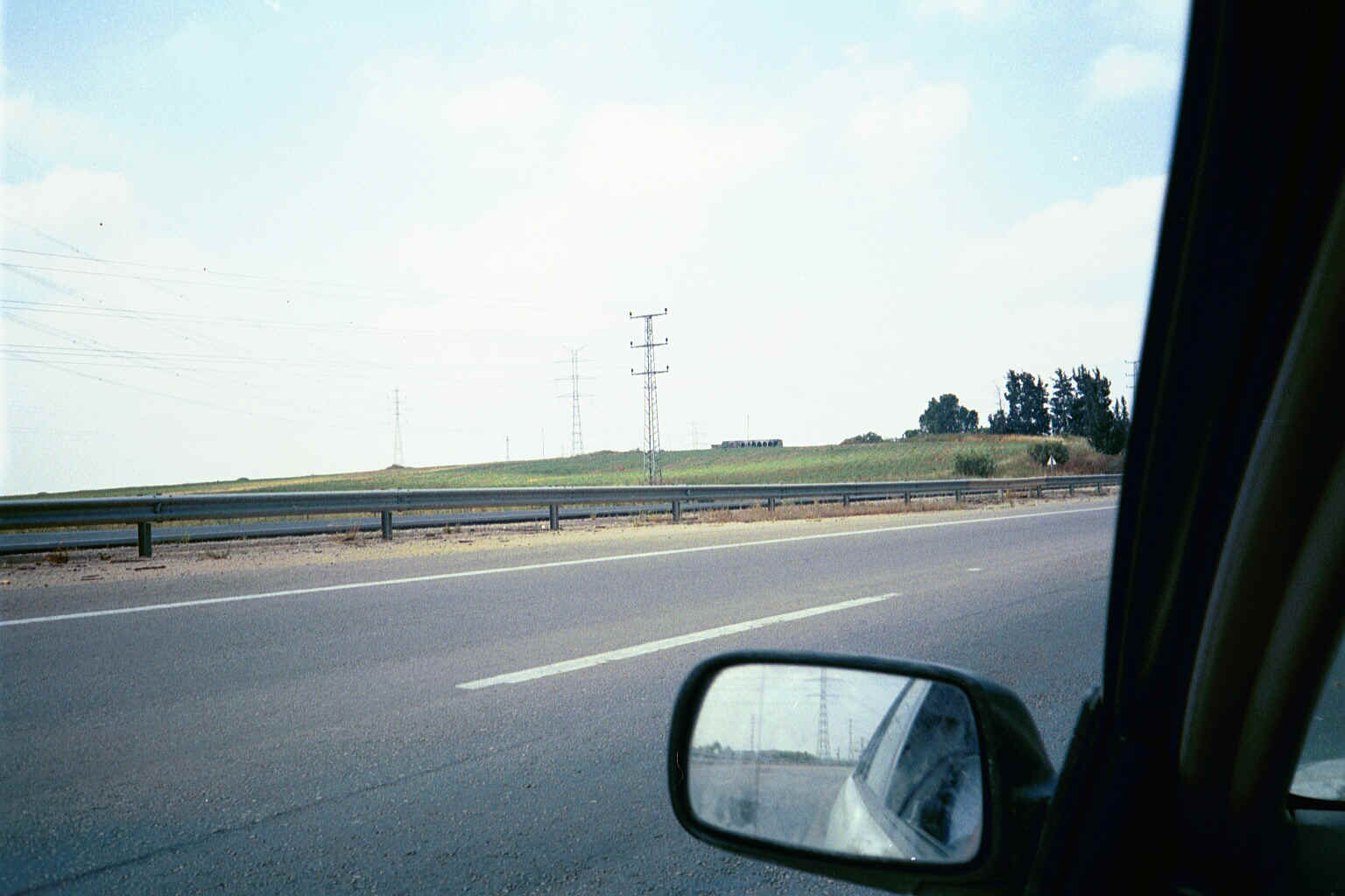
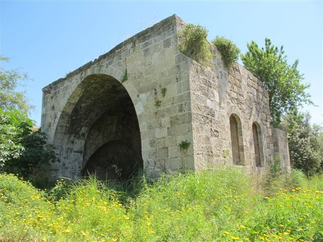
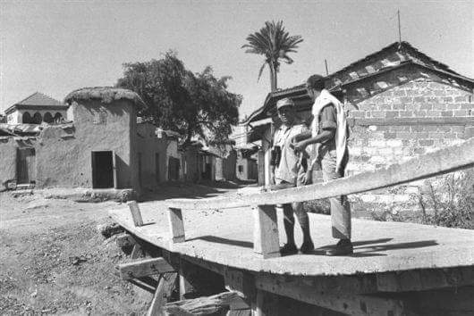
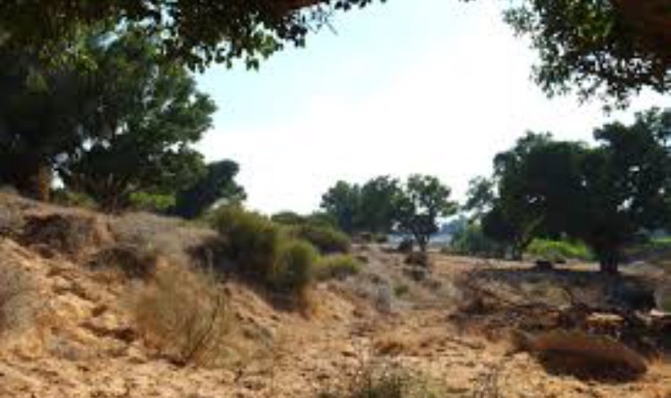
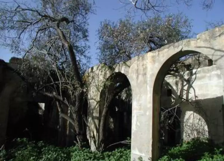
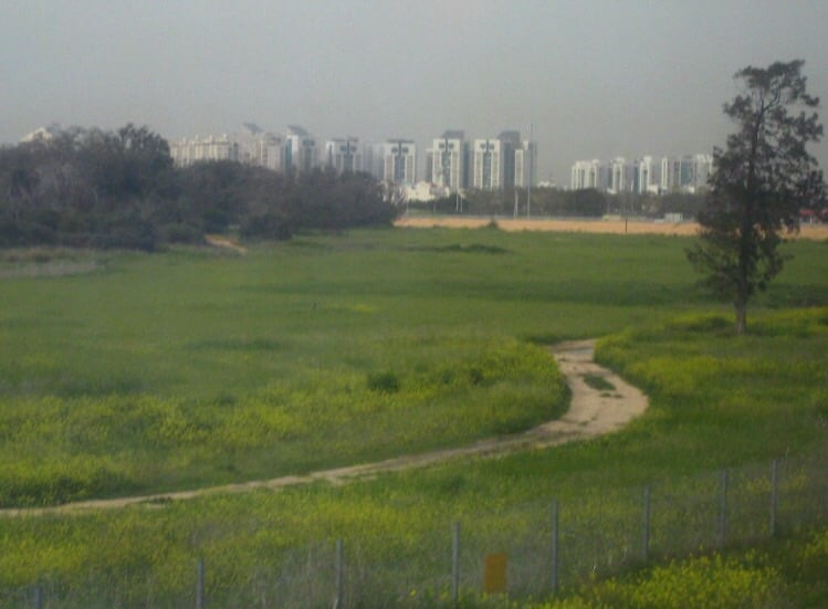
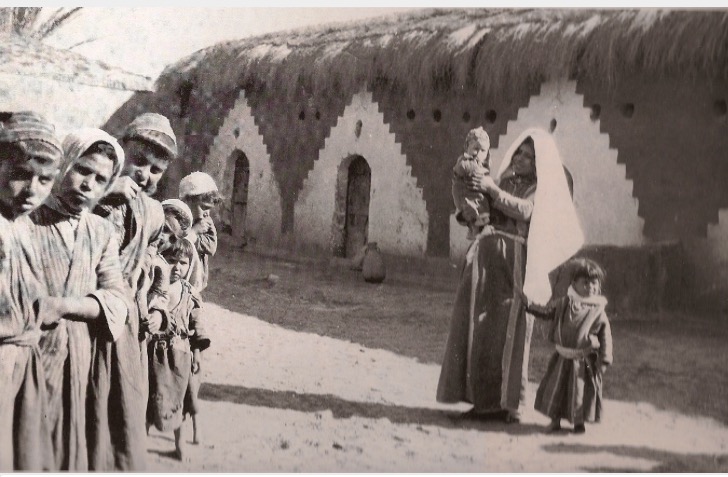
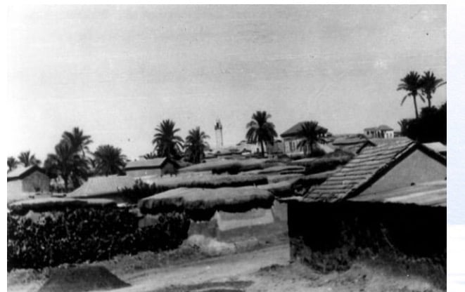
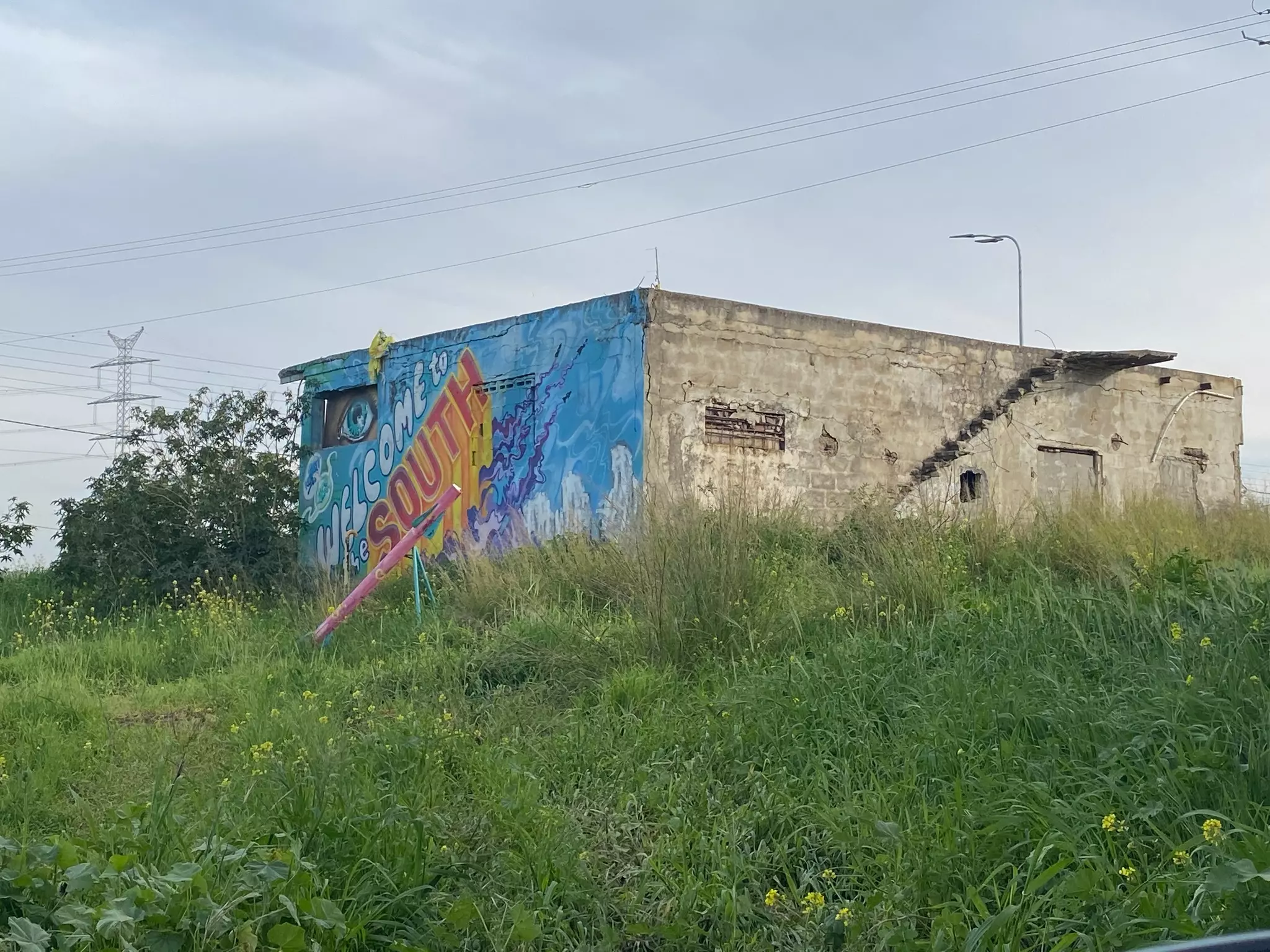
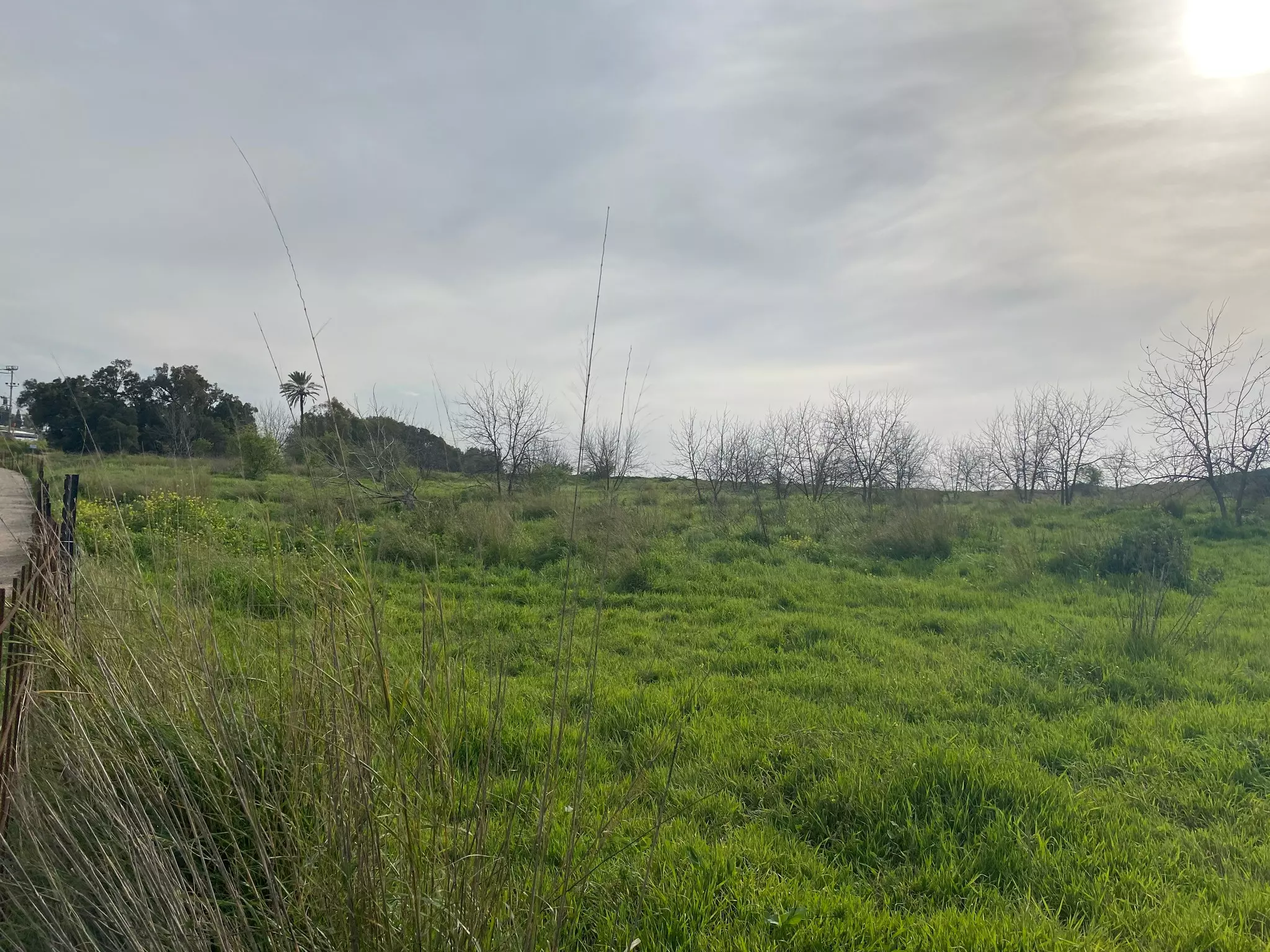
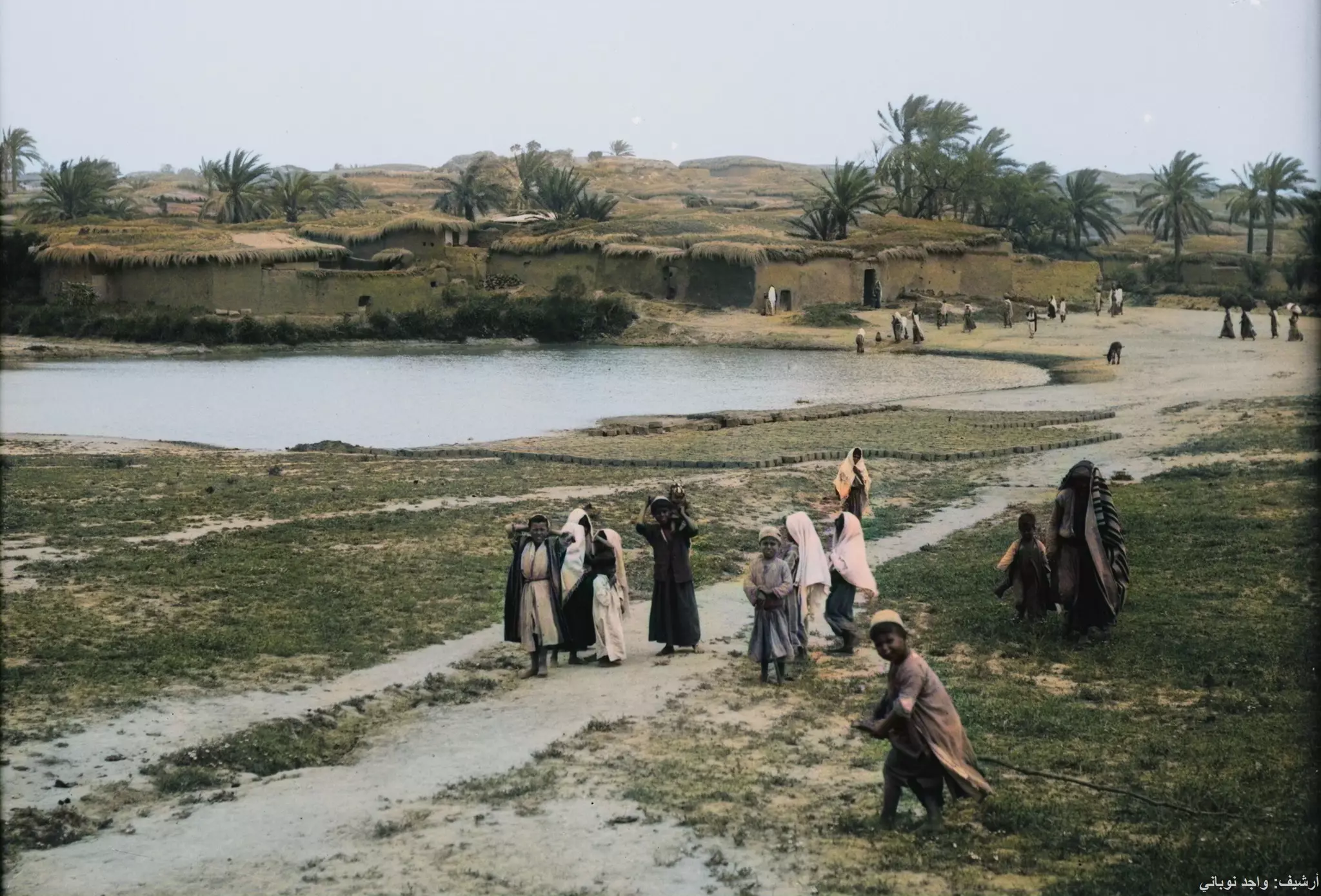
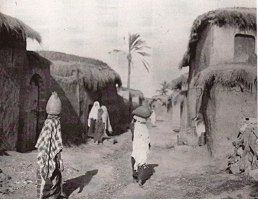
Village Before NakbaThe village stood on a sandy hill that overlooked wide areas to the east, north, and south, and faced a higher hill to the west. This hill was in fact the accumulated remains of many earlier towns with the same name. Isdud was about 5 km from the seashore, on the coastal highway, and next to the railway line. Its name was derived from that of the ancient town of Ashdod, which dated back to at least the seventeenth century B.C. According to the Bible (Joshua 13:1–3) it was one of the five major cities of the Philistines (the pentapolis). It should be distinguished from the harbor town which was known in the classical period as Azotos Paralios (or Minat al-Qal'a [114131] ), that is, 'by the sea.' This town was separated from Isdud by a 5-km-wide band of sand dunes. After the town was devastated by the Maccabees in the second century B.C. it was rebuilt, less than a century later, as a Roman town. Its name at that time was Azotus. During the Byzantine period the port town became more important than the mother town itself.Isdud came under Muslim rule in the seventh century. The Persian geographer Ibn Khurdadhbi (d. 912) called it Azdud and said it was a postal station between Ramla and Gaza. The Marnluk sultan Qaytbay (1467–1496) was said to have passed through the village in 1477 on his way to Damascus. (‘Attallah 1986:72–73]" In 1596, Isdud was a village in the nahiya of Gaza (liwa' of Gaza), with a population of 413. It paid taxes on a number of crops, including wheat, barley, sesame, and fruit, as well as on other types of produce such as goats and beehives. The Egyptian Sufi traveler As'ad al-Luqaymi, writing in 1730, reported visiting the khan or caravansary of Isdud after having left Gaza. In the late nineteenth century, the village of Isdud ran along the eastern slope of a low, garden-covered hill. The (by then) ruined khan stood southwest of the village. Its houses were one-storey high with walls and enclosures all built of adobe brick. The two main sources of water, a masonry well and a pond, were surrounded by groves of date-palm and fig trees. Baedeker estimated that it had 5,000 inhabitants before World War I and described it as standing 'on the slope of a hill commanded by a still higher eminence.' Isdud's Arab population was primarily Muslim. The village had two mosques and three tomb-shrines for Muslim historical and religious figures. The villagers erroneously believed that one of the shrines belonged to Salman al-Farisi, a companion of the prophet Muhammad. His shrine stood inside a mosque that had been built during the reign of the Mamluk sultan al-Zahir Baybars (1259–1277). A second shrine was believed to belong to an Egyptian, Shaykh al-Matbuli, and a third was devoted to Ahmad Abu al-Iqbal. Two elementary schools were established in Isdud, one for boys (opened in 1922) and a second for girls (built in 1942). The number of students reached 371 in the boys' school and 74 in the girls' by the mid-1940s. Isdud had a village council. Agriculture constituted the village's main source of livelihood. The main crops were fruit—especially citrus, grapes, and figs—and grain, particularly wheat. In 1944/45 a total of 1,921 dunums was devoted to citrus and bananas and 22,170 dunums were allocated to cereals; 8,322 dunums were irrigated or used for orchards. The villagers relied on both rainfall and irrigation from wells (which ranged from 15 to 35 m in depth) for water for their crops. In addition to agriculture, the inhabitants worked in commerce. Isdud had a number of shops and held a weekly Wednesday market that attracted people from neighboring villages. Commerce was facilitated by Isdud's train station, which was part of the coastal railway. In the vicinity, nine khirbas contained a wide variety of relics, including pottery fragments, mosaic floors, cisterns, and an ancient olive press. Excavations of the site itself determined that it had been occupied almost continuously from the seventeenth century B.C. until 1948. In antiquity its most flourishing periods appear to have been in the fourteenth and thirteenth centuries B.C. Village Occupation and Ethnic CleaningWhen Egyptian forces entered Palestine on 15 May 1948, one of their early objectives was to take up positions in Isdud. This task was assigned to the Egyptian Ninth Battalion. But on 22 May a new battalion reached the front, and Isdud was handed over to the Sixth Battalion, according to former Egyptian president Gamal Abdel Nasser, then a staff officer in that Battalion: (The foreign press did not report that an Egyptian column had reached Isdud until 30 May, but Abdel Nasser's eyewitness account seems more reliable.) At that point, Isdud was on the front lines between the Egyptian and Israeli forces. Israeli forces briefly cut off the road between al-Majdal and Isdud, but the Egyptians managed to dislodge them, thus restoring their supply lines. This occurred during the Israeli army's Operation Barak .The Israeli operational orders also called for an attack on al-Majdal, Isdud, or Yibna, to 'cause the wandering [i.e., exodus] of the smaller settlements in the area.' A three-pronged attack was launched on 2–3 June which led to the flight of thousands among the local population, according to Israeli historian Benny Morris. The New York Times reported that the 'bloodiest fighting' in the south of the country on 3 June was taking place around Isdud. Another Israeli attack was initiated a few days later, on 9–10 June. The following day, the first truce of the war took effect. Throughout the truce, Abdel Nasser was stationed at Isdud, from which he monitored Israeli military activity during this period. In the period between the two truces, Israeli commando units carried out raids in the vicinity of Isdud. A New York Times story on 16 July indicated that a unit named 'Samson's Foxes' had reached Egyptian positions at Isdud. The town of Isdud was not occupied until the end of the second truce of the war, in October 1948. It came under naval and aerial attack at the beginning of Operation Yoav and fell into Israeli hands in the last stage of the operation. The earlier stages of Operation Yoav were coordinated with parts of Operation Ha-Har, which was carried out by the Giv'ati Brigade further north. The Giv'ati Brigade stormed a number of villages in Hebron sub-disctrict while other forces implemented Operation Yoav. Numerous villages in Hebron sub-disctrict fell into Israeli hands on 22–23 October. Many of the people in the hills around Hebron fled before the arrival of Israeli troops; those remaining were expelled towards Hebron. Towards the end of operations Ha-Har and Yoav, in the last week of October 1948, the operational areas were merged. Israeli units broke through Egyptian lines on 23 October 1948, linking the Israeli-held parts of the Hebron hills with the Jerusalem corridor. The New York Times stated on 18 October that Israeli air force bombers had flown 'practically unhindered' to their targets for three nights in succession and that these targets included Isdud. The Egyptians were in danger of being encircled and isolated and withdrew southwards along the coastal road. The bulk of the remaining civilian population fled with the retreating Egyptian columns before the Israeli entry on 28 October. According to Morris, some 300 townspeople remained, putting up white flags, and 'they were almost immediately expelled southwards.' Nevertheless, an Israeli army communiqué issued on the date of occupation claimed that Israeli forces had entered Isdud at the request of a delegation from the local Arab population. Zionists Colonies on Village LandsTwo settlements, Sde 'Uzziyyahu and Shetulim, were established east of the Site, on village lands, in 1950. Bene Darom and Gan ha-Darom, founded in 1949 and 1953, respectively, are at a good distance to the north of the village site, on village lands.Village TodayMost of the houses have been destroyed; the rubble is covered with grasses and thorns. Just south of the center of the site stands a large, ruined mosque. Its crumbling pillars are still standing, and its arched entrances and windows still retain their distinctive shape. About 200 m southwest of the site are two deserted school buildings; a neglected shrine stands close to them to the south. The main street of the village can still be seen running north to south on one side of the site; a large unused building remains on its east side. Palm, doum palm, and cypress trees are scattered around the perimeter of the site. An avocado grove has been planted along the northern edge of the site, and Israeli agricultural fields lie along its southern edge.SourceDr. Walid al-Khalidi, 1992: All That Remains. |
||||||||||||||||||||||
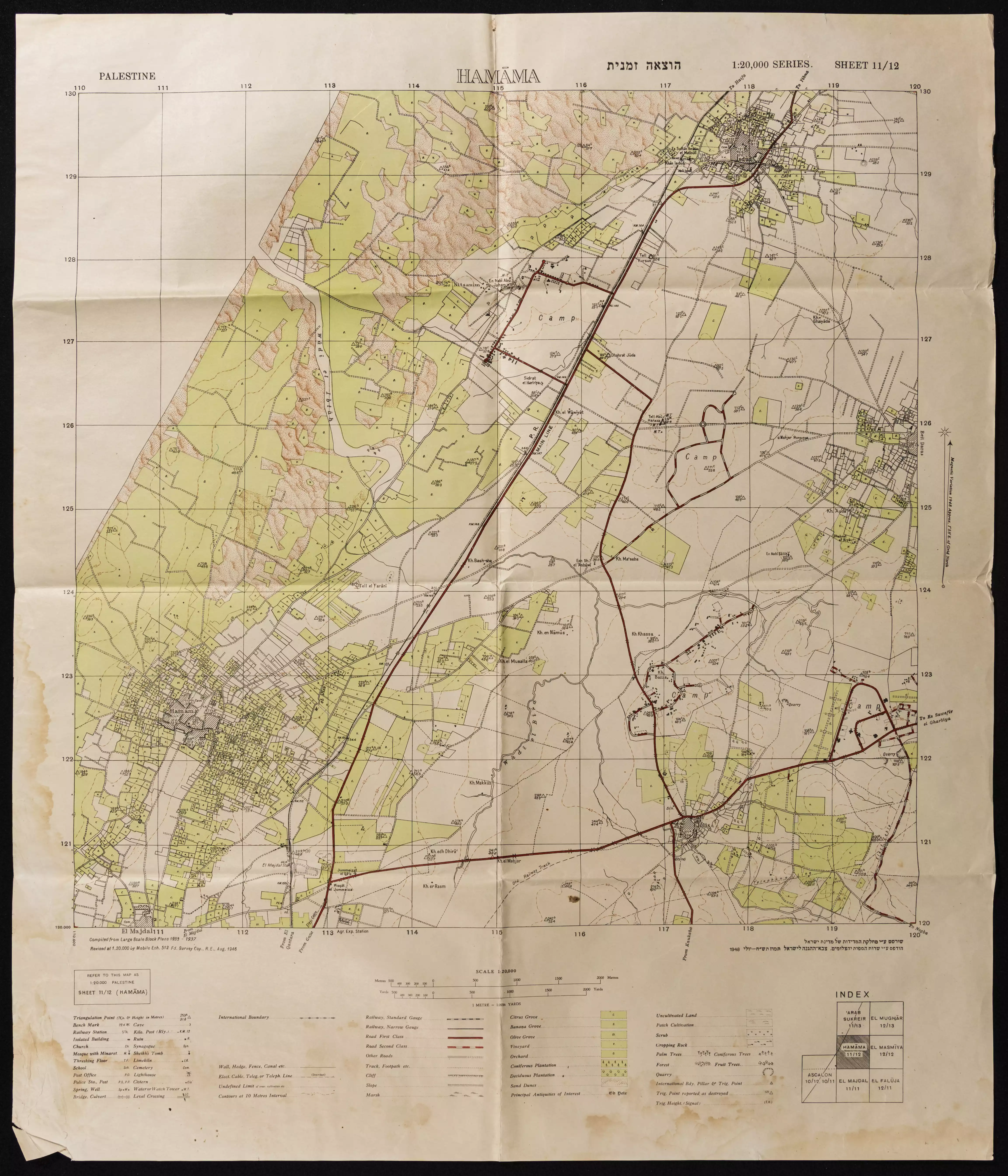
| Related Maps | Town Lands' Demarcation Maps خرائط للقضاء توضح حدود القرى والاودية Town's map on MapQuest View from satellite Help us map this town at WikiMapia |
|||||||||||||||||||||
| Related Links | Wikipedia's Page Facebook Page Google Search Google For Images Google For Videos |
|||||||||||||||||||||
| More Information | في كتاب كي لا ننسى في كتاب بلادنا فلسطين في كتاب النكبة والفردوس المفقود المزيد من موقع هوية |
|||||||||||||||||||||
- معارك نقبا واُسدود وبيروت إسحاق - للأستاذ عارف العارف
- عدينا يا بلــدنا اســـدودانشودة رائعة اسمها
- نبذة تاريخية عن قرية اسدود (قضاء غزة) من كتاب (كي لا ننسى)
- رحلة العذاب من أسدود كما يذكرا احمد حسان جود في يوم 28 أكتوبر 1948
- Nakba, Exodus Day from Isdood: October 28, 1948 By Ahmad Hassan Joudah
- A Brief History of Isdood A Brief History of Isdood By Mariam Shanin
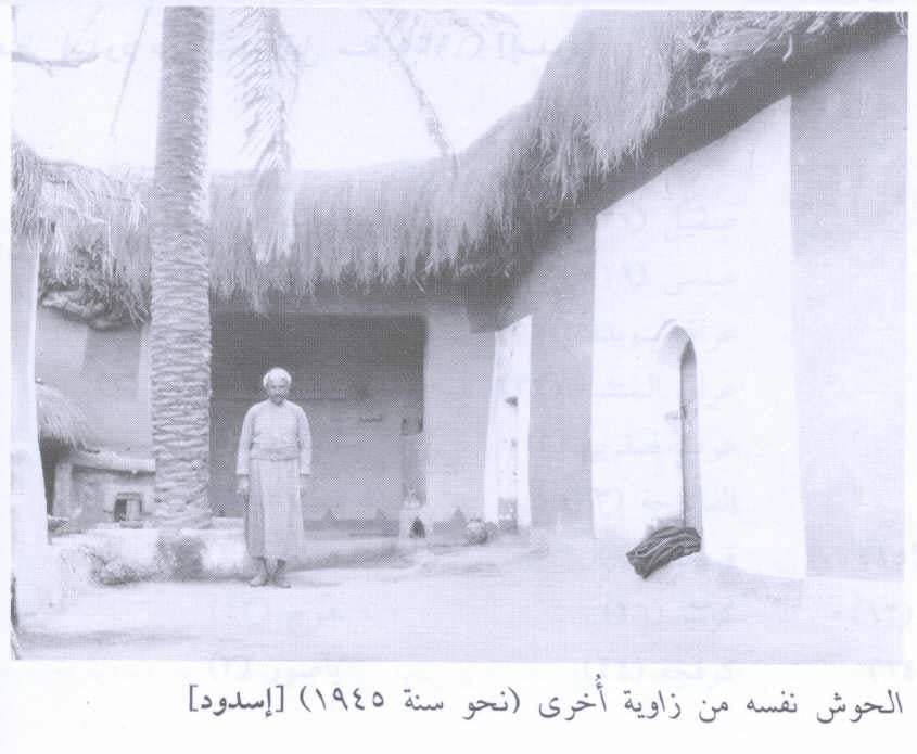
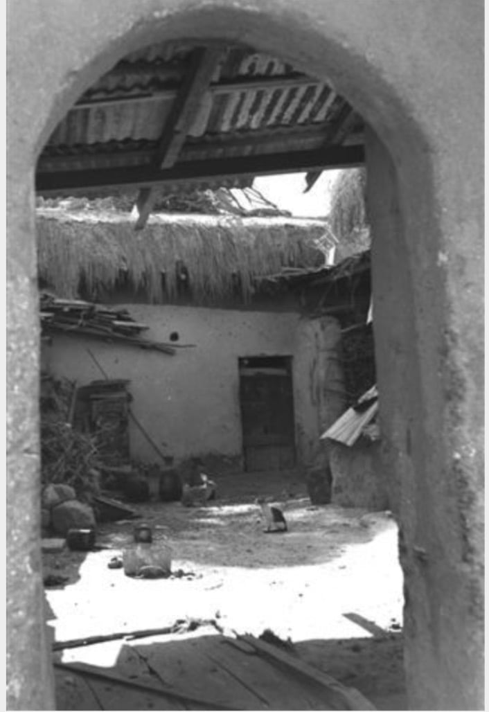
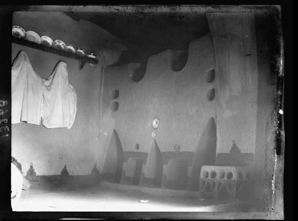
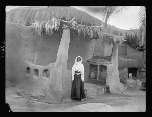
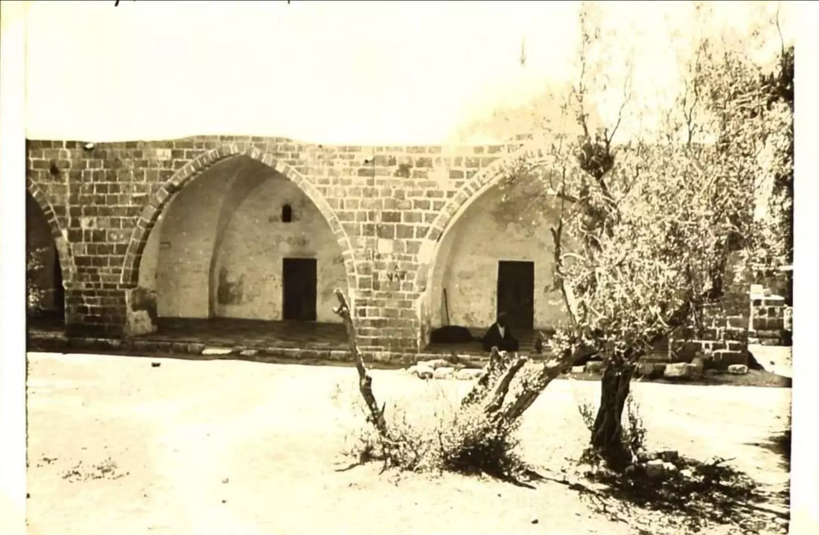
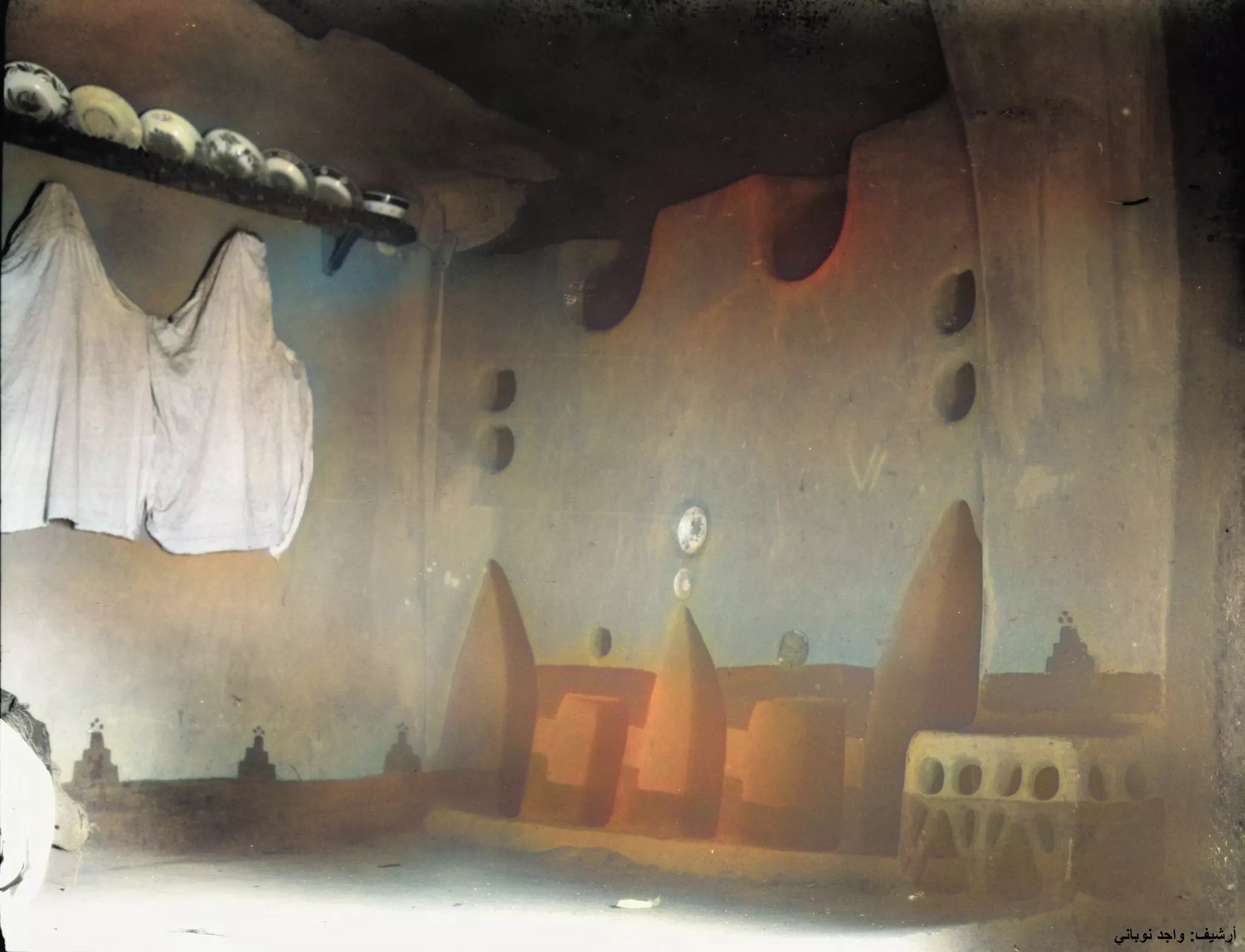
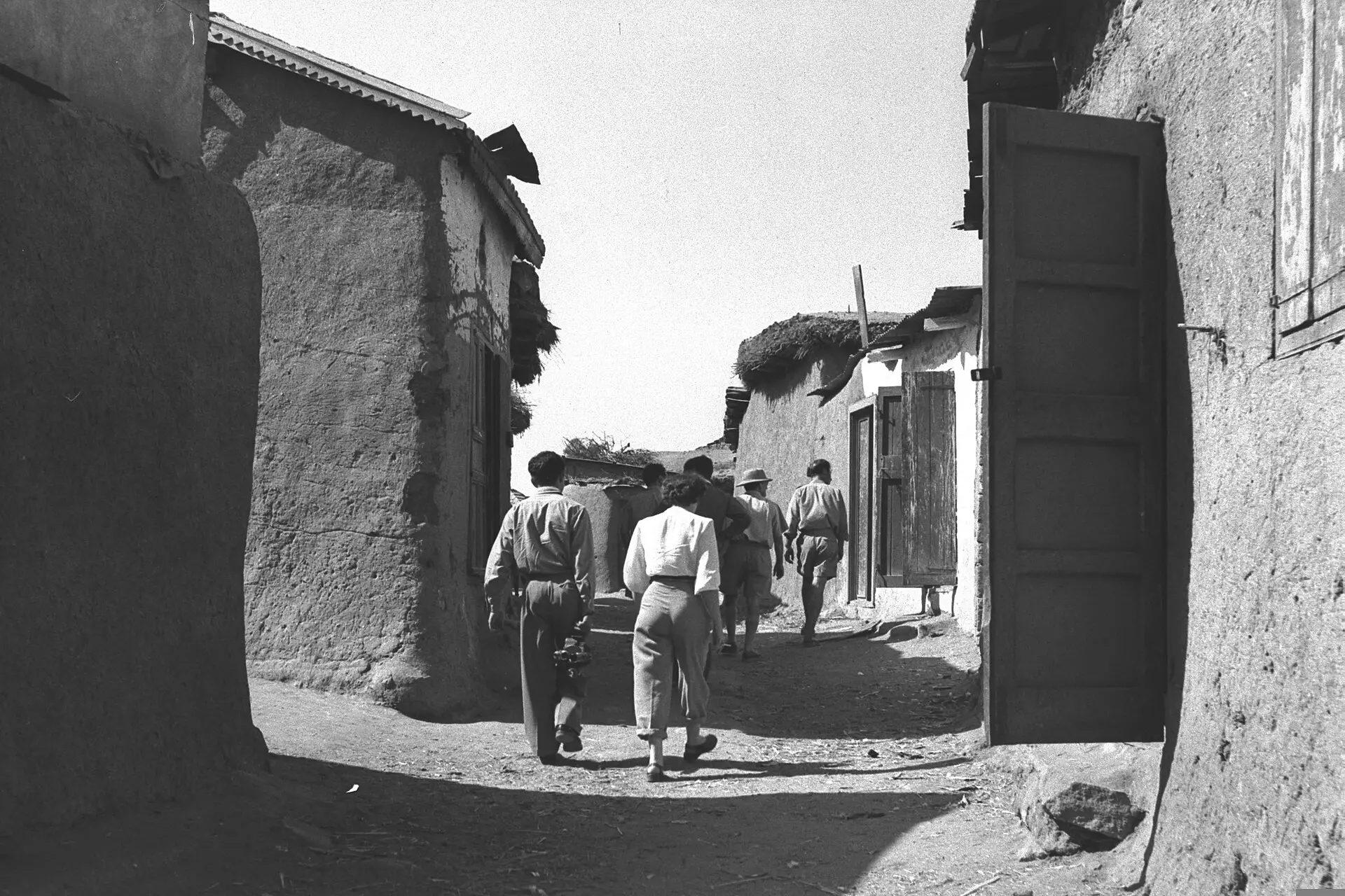
- Court Yard Of A Village House In 1945
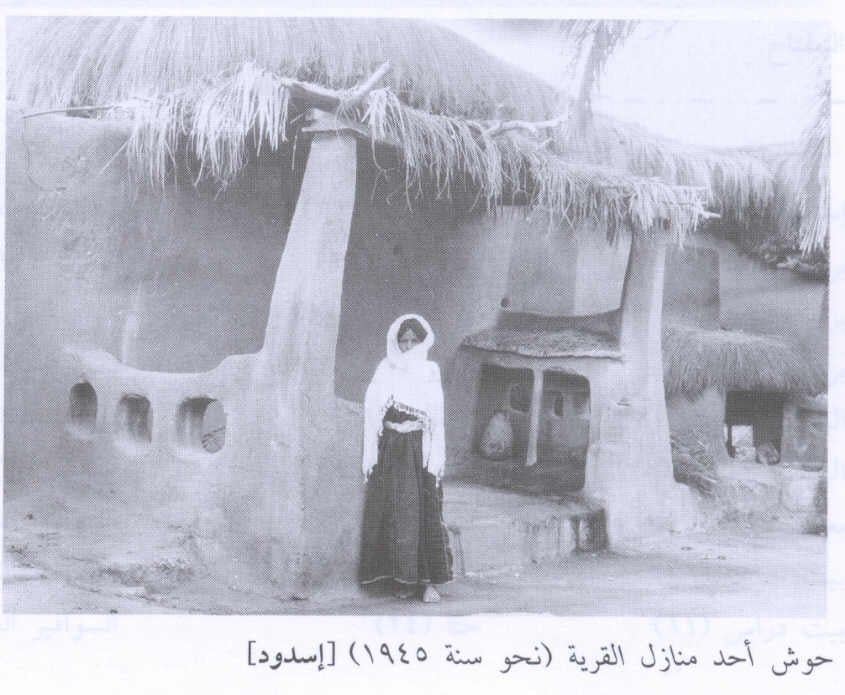
Scanned from "All That Remains" by Dr. Walid Khalidi 5 - Court Yard Of A Village House 2 In 1945
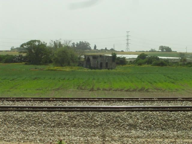
Scanned from "All That Remains" by Dr. Walid Khalidi - General View Of Village Remaining Structures In 1987
Scanned from "All That Remains" by Dr. Walid Khalidi - Areal View Of Isdud Pre 1935

Scanned from "All That Remains" by Dr. Walid Khalidi 5 - Few houses remain standing-May-2002
Posted by Uri Zackhem 1 - Few houses remain standing #2-May-2002
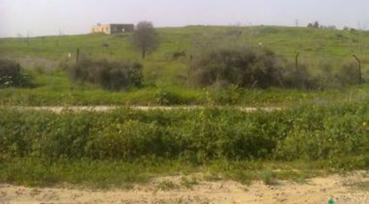
Posted by Uri Zackhem - General View of Isdud's lands and single remaining house-May-2002
Posted by Uri Zackhem - General View of Isdud's lands and single remaining house #1 -May-2002
Posted by Uri Zackhem - General View of Isdud's lands and single remaining house #2 -May-2002
Posted by Uri Zackhem - General view of Isdud's school and other areas, May 2002
Posted by Uri Zackhem - The remains of a Maqam or Shrine of a Muslim sage-May-2002
Posted by Uri Zackhem 1 - Makam of Ahmad Abu al-Iqbal - view from the west , Spring 2005
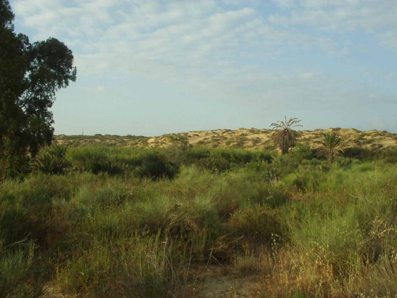
Posted by Haled Iskrur 1 - Sand orchard 1.5 Km west of Isdud, date palms, grape wines, figs and mulberry trees still bare fruits 57 years after their owners left
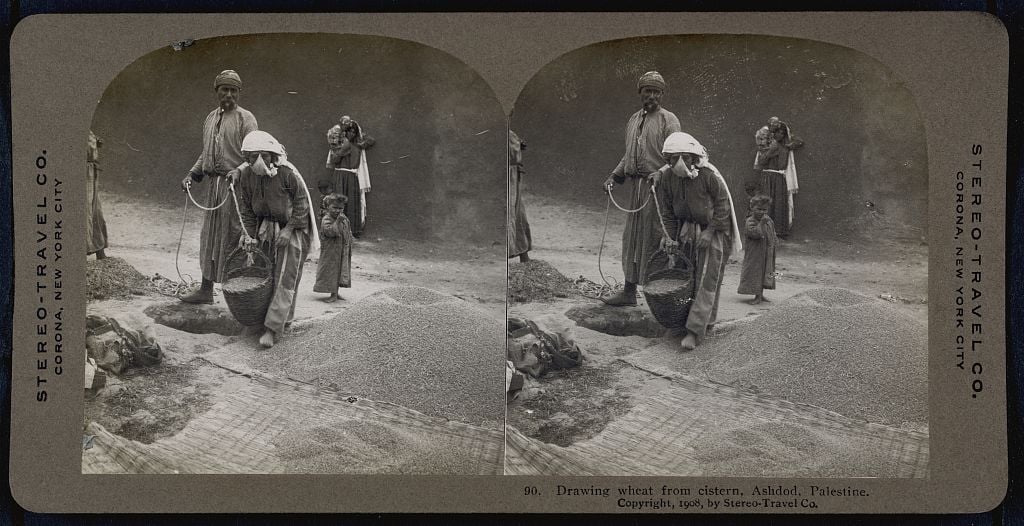
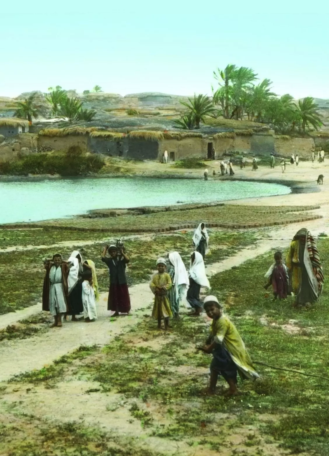
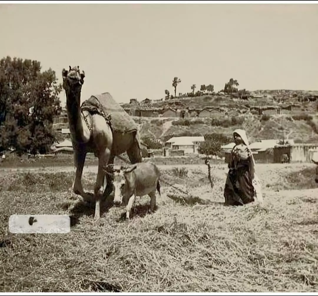
Posted by Haled Iskrur 2 - Drawing wheat from cistern, Ashdod, Palestine c1908 March 12.
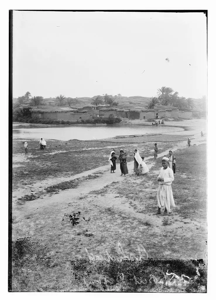
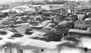
Posted by Joehar Hamdan 2 - General view, Matson Collection (Before 1914)
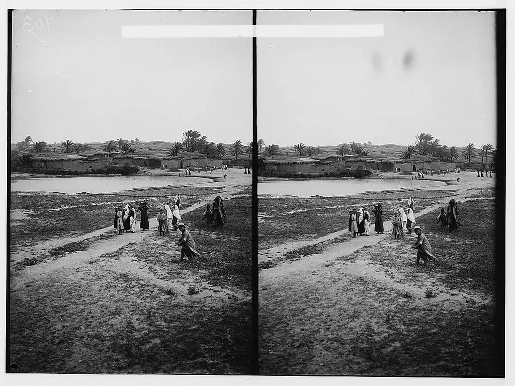
1 - General view, Matson Collection (Before 1914)
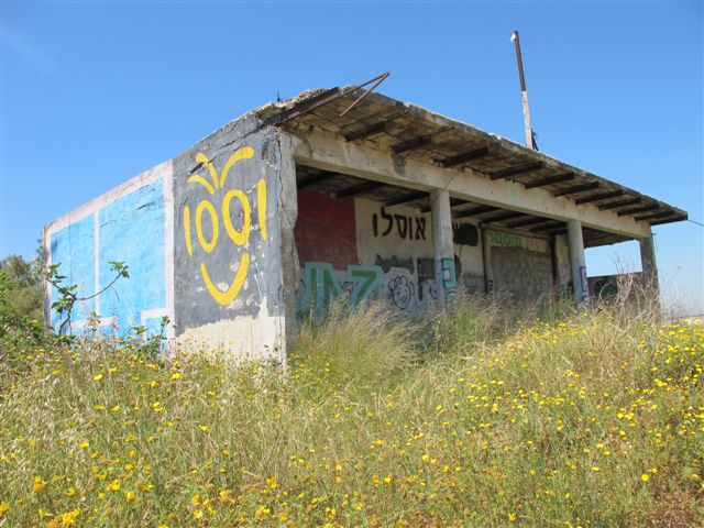
- One of the remaining structures
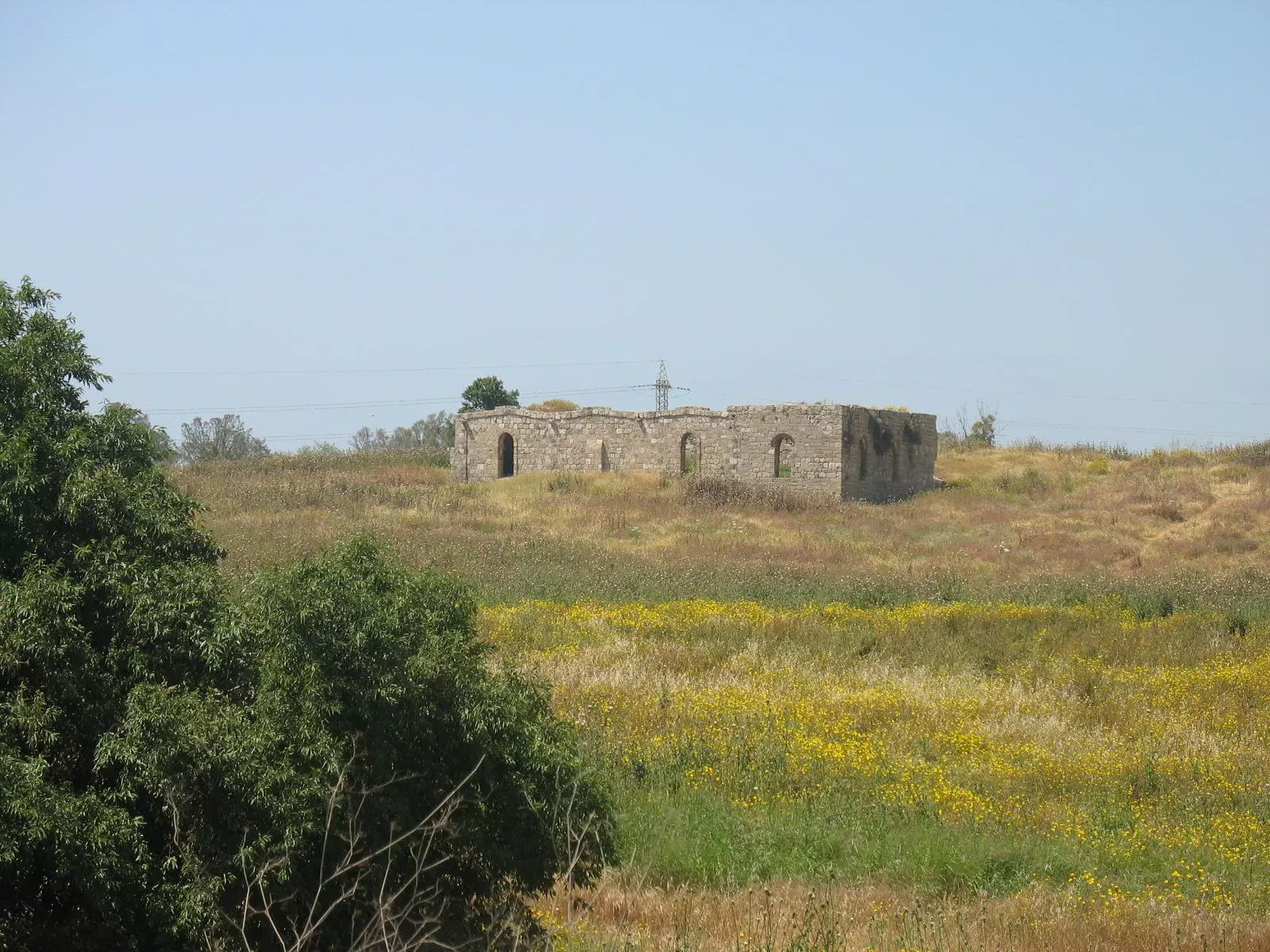
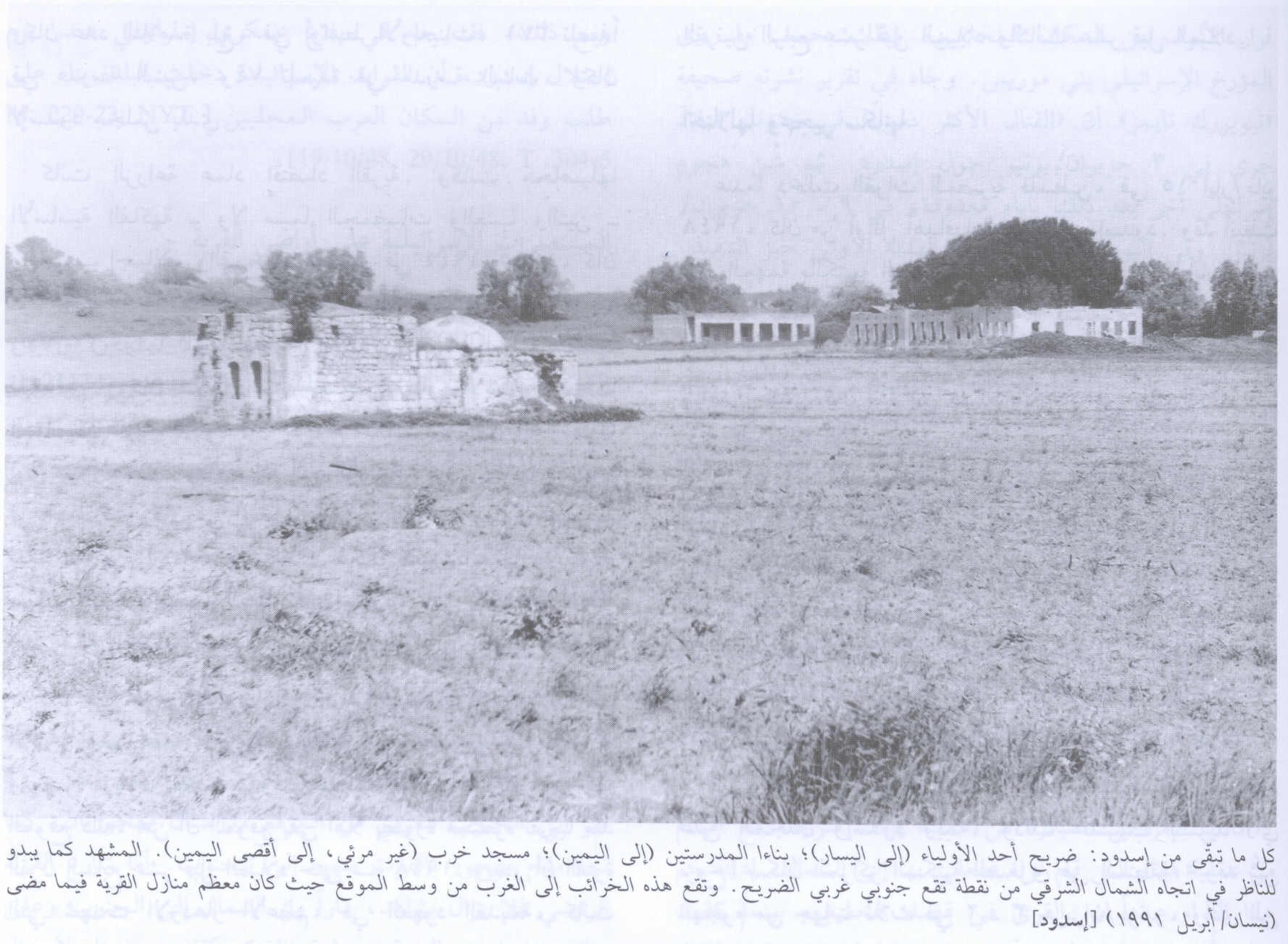
Posted by Noga Kadman - جامع القرية كما يظهر في جنوب القرية ويظهر في الخلف الشارع الساحلي الرئيسي، اُنقر الصورة لتكبيرها. 1991
Scanned from "All That Remains" by Dr. Walid Khalidi 5 - A shrine in Isdud, 27/09/08
Posted by Uri Zackhem - Inside the Shrine, 27/09/08
Posted by Uri Zackhem - Someone tries to maintain this shrine
Posted by Uri Zackhem - ميناء اسدود (اشدود اليوم)
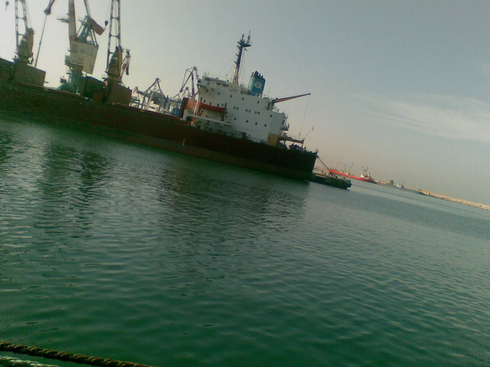
Posted by ابو الثائر - ميناء اسدود (اشدود اليوم)
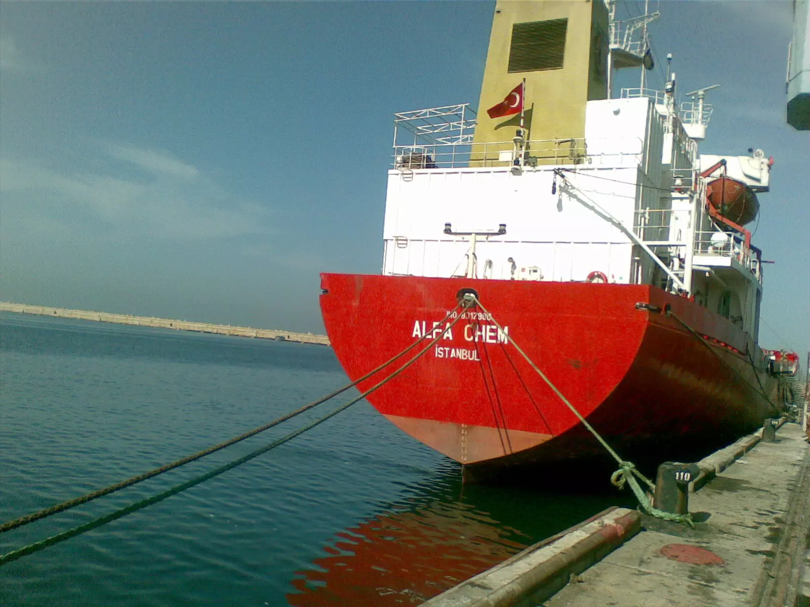
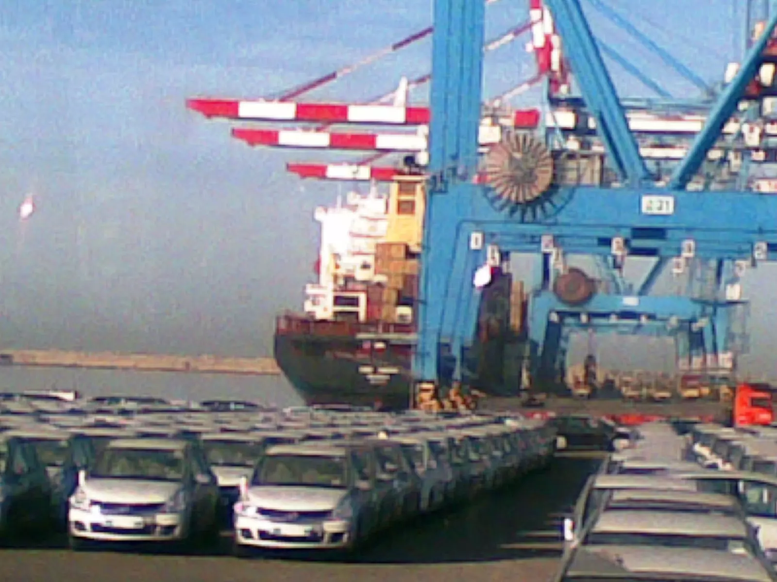
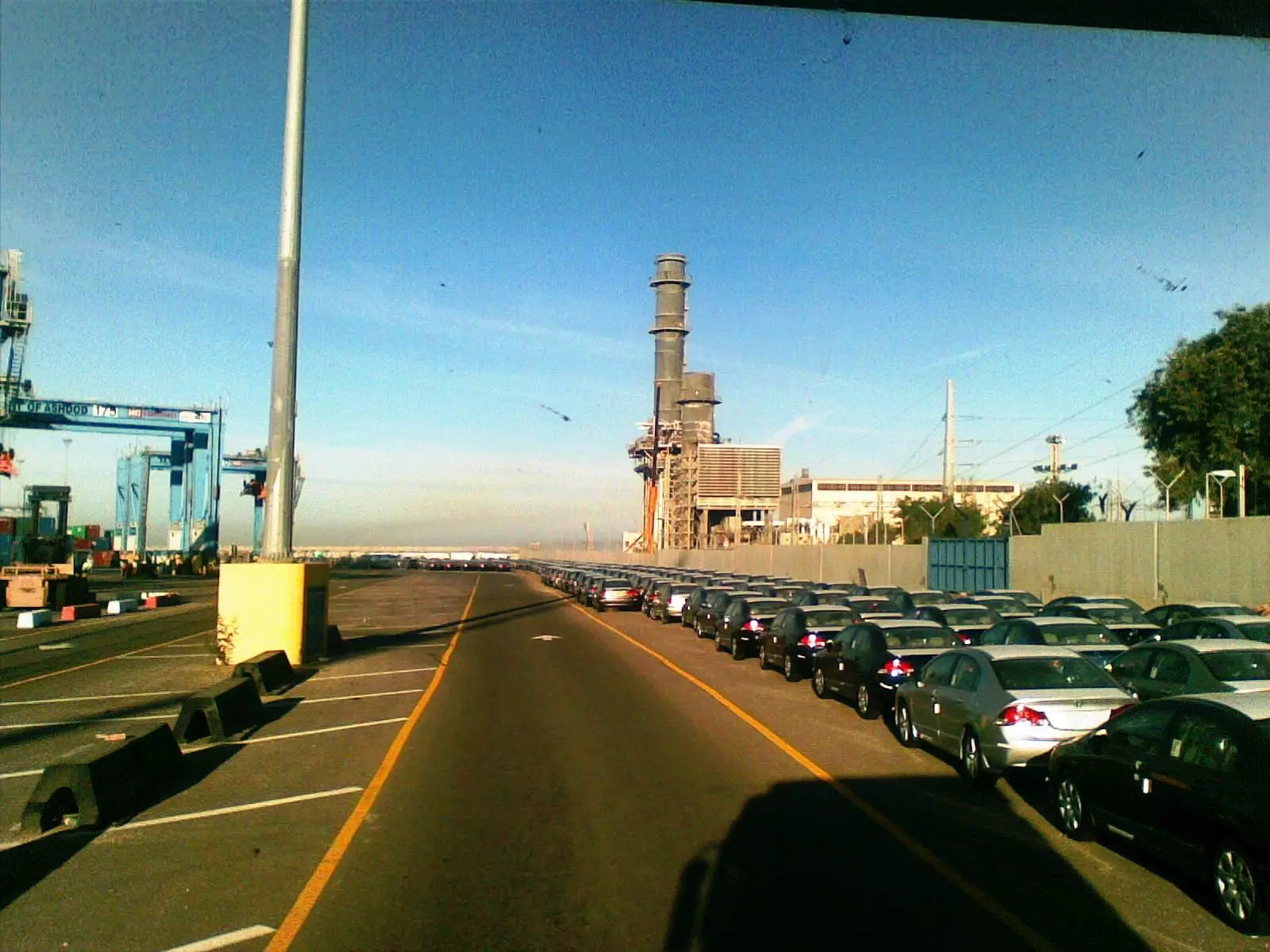
Posted by ابو الثائر - بعض السيارات المستورده بميناء اشدود
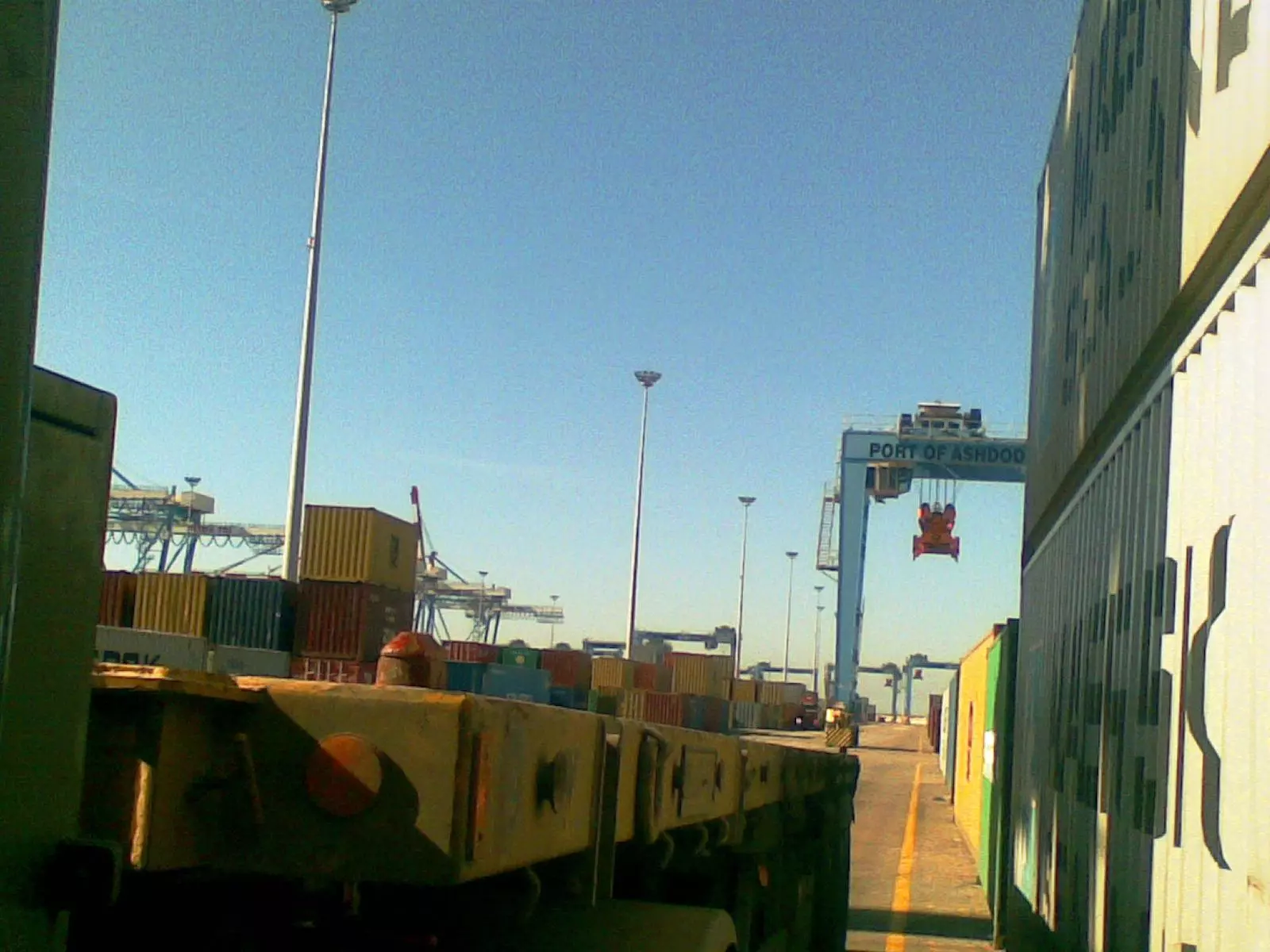
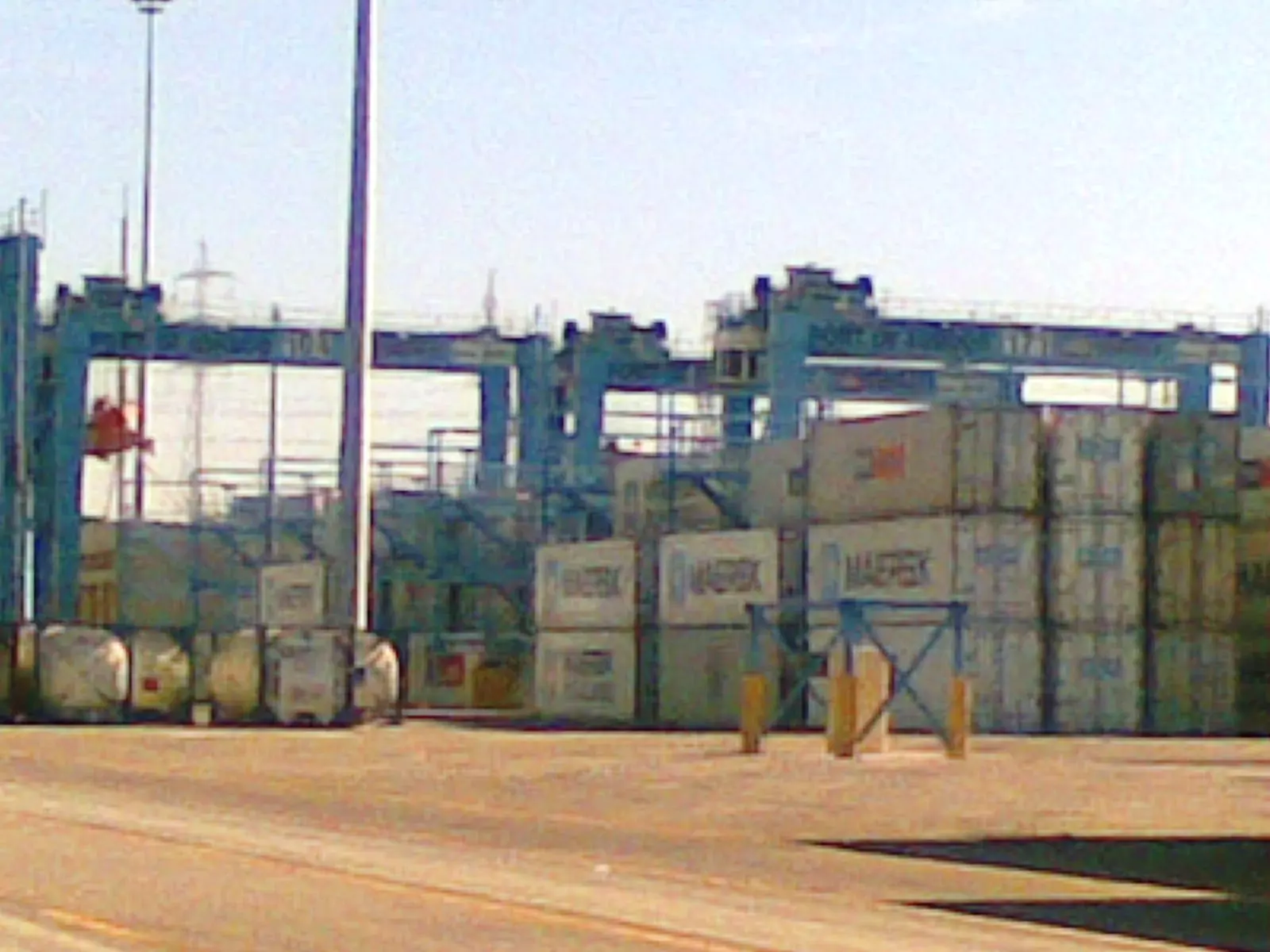
Posted by ابو الثائر - منطقه لتحميل الحاويات بميناء اشدود
Posted by ابو الثائر - منطقه لتحميل الحاويات بميناء اشدود
Posted by ابو الثائر - سفينة مايرون وقت التفريغ في ميناء اشدود
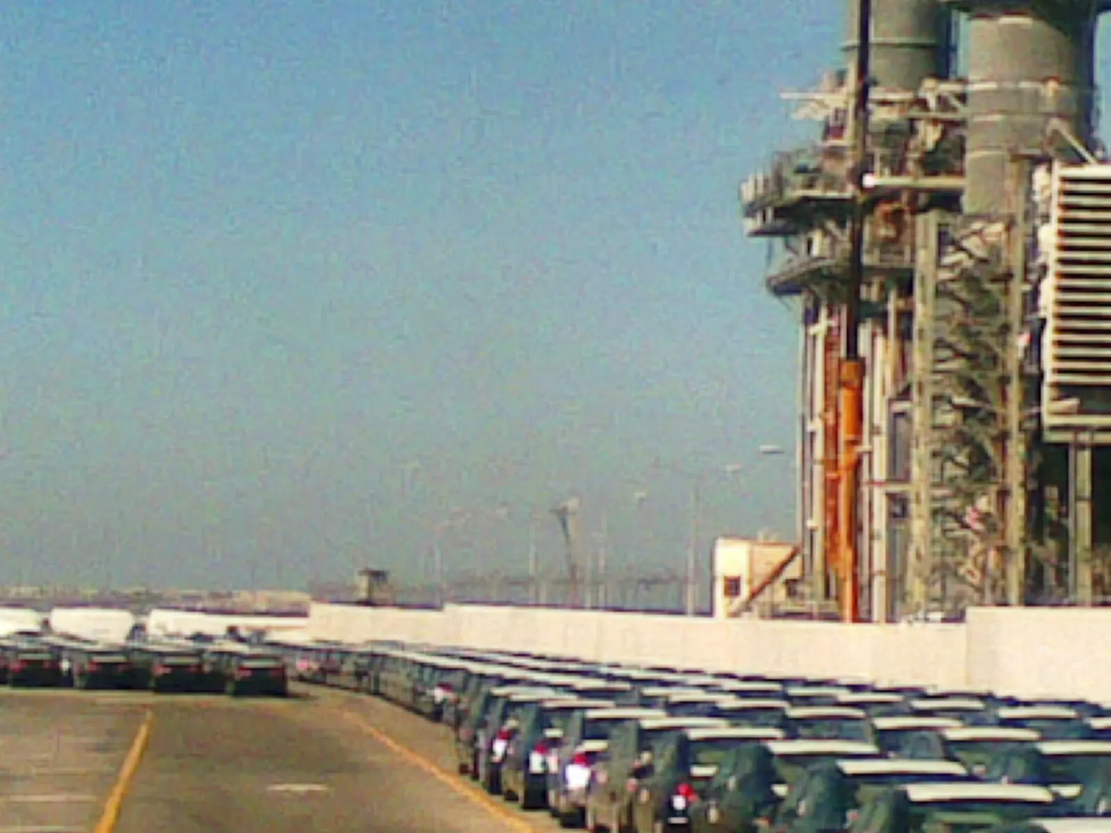
Posted by ابو الثائر - مولدات تابعه لشركة الكهرباء من محطة القوه داخل ميناء اشدود
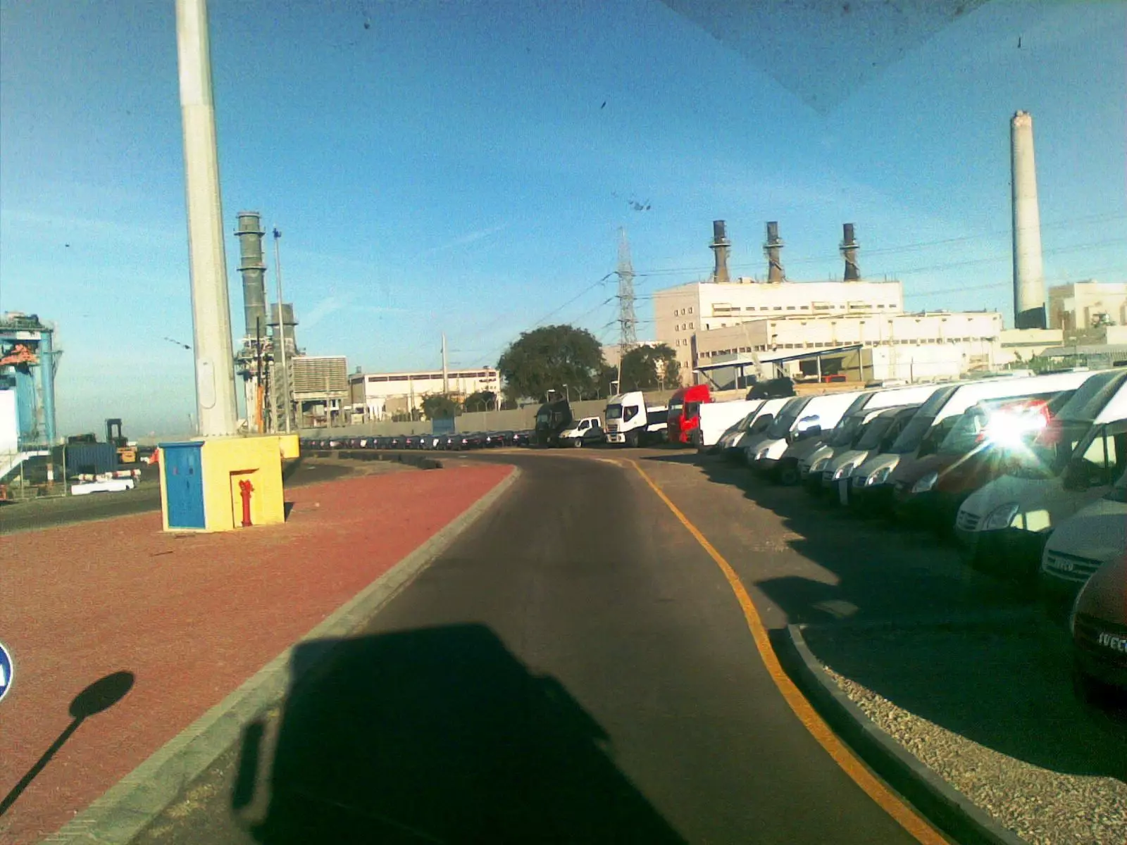
Posted by ابو الثائر 1 - منظر من داخل ميناء اشدود
Posted by ابو الثائر - منطقة التوزين داخل ميناء اشدود
Posted by ابو الثائر - صوره من ميناء اشدود
Posted by ابو الثائر - صوره داخل ميناء اشدود
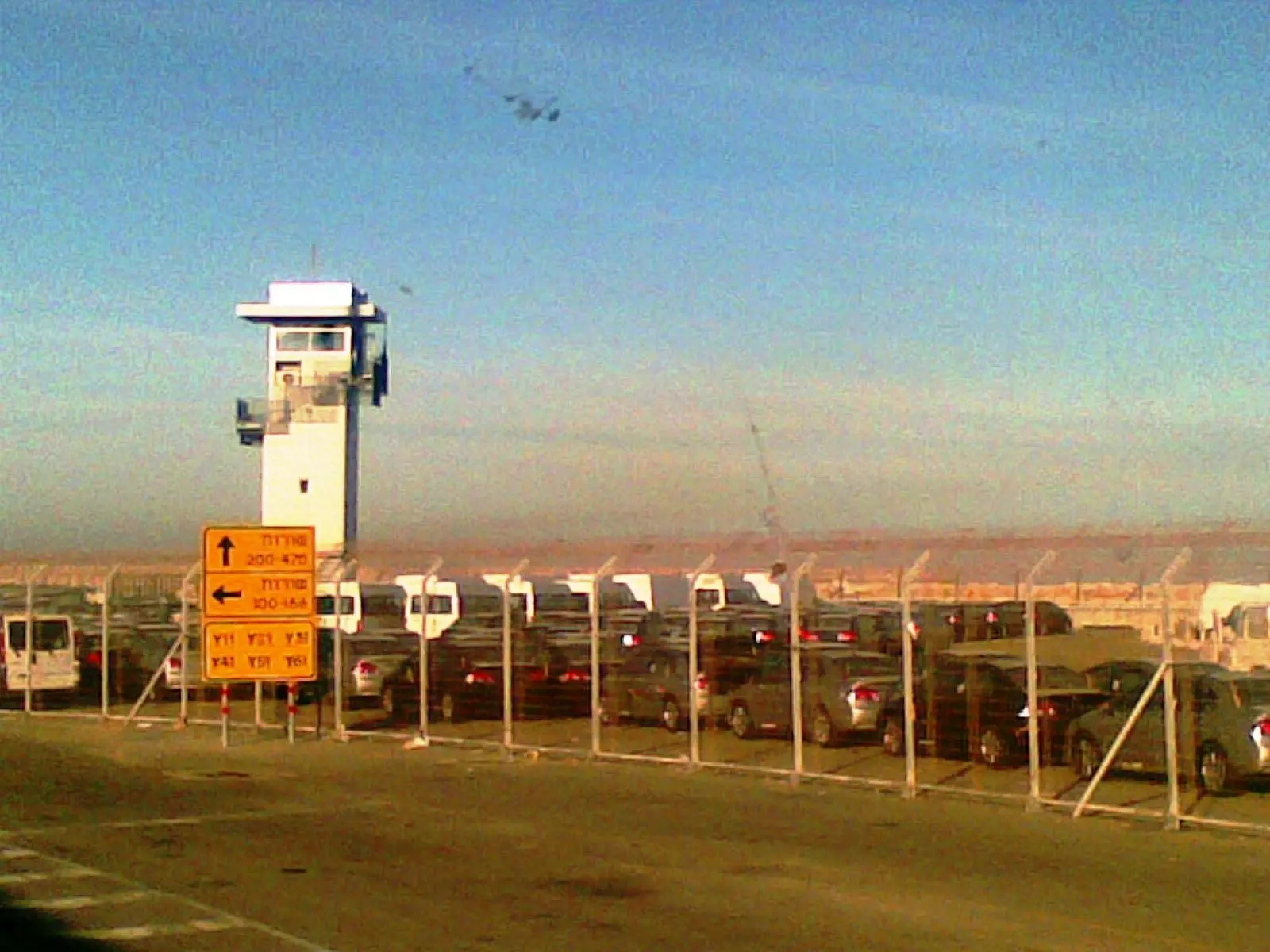
Posted by ابو الثائر - برج المراقبه من الجهه الغربيه الشماليه في ميناء اشدود
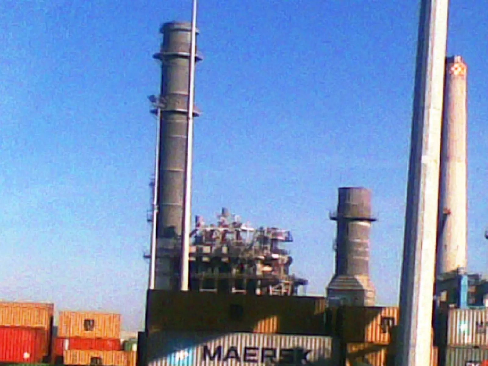
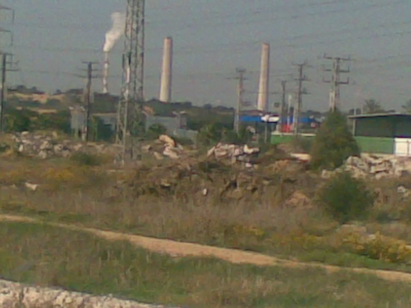
Posted by ابو الثائر - مداخن اشدود
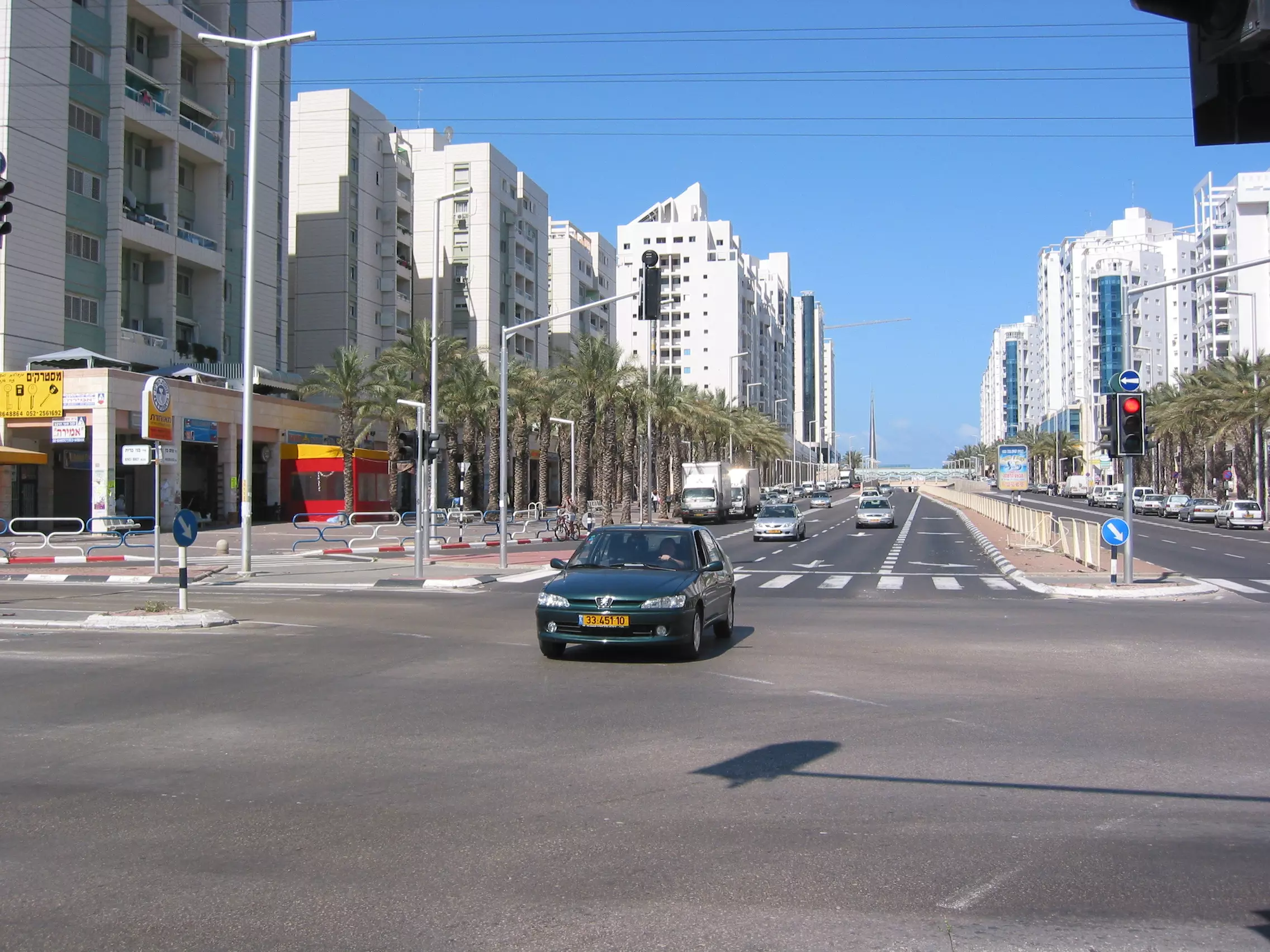
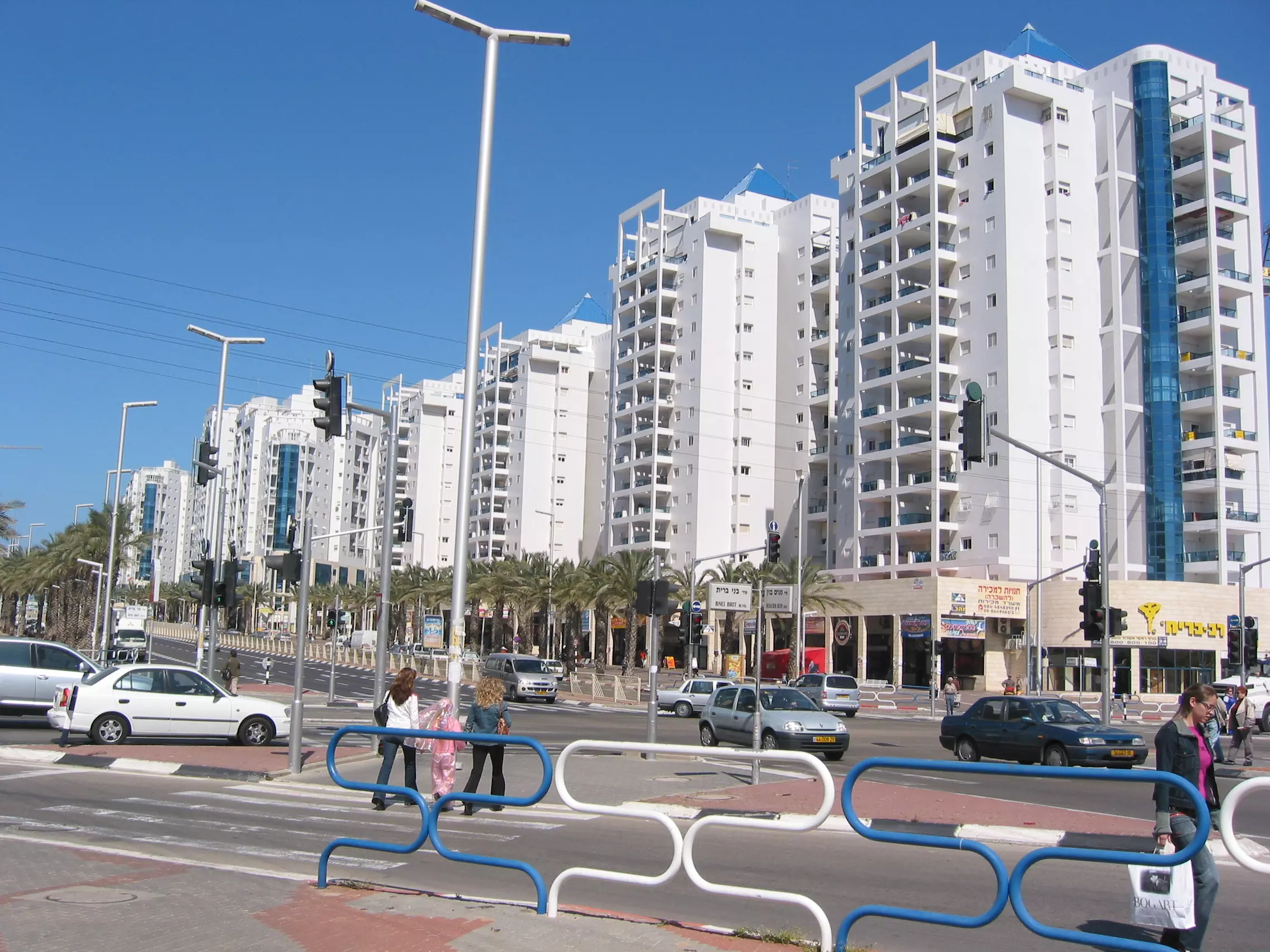
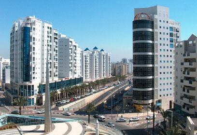
Posted by ابو الثائر - مدينة اسدود المحتلة عام 2005
Posted by Joe Sanad - اسدود
Posted by Joe Sanad - مدينة اسدود اليوم
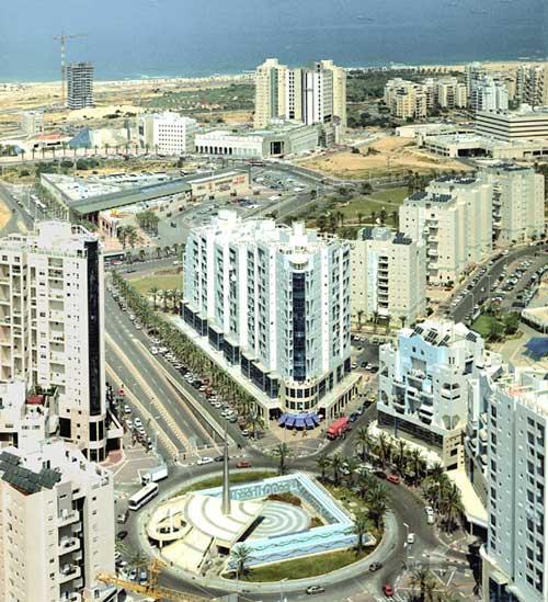
Posted by Joe Sanad - اسدود اليوم
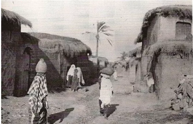
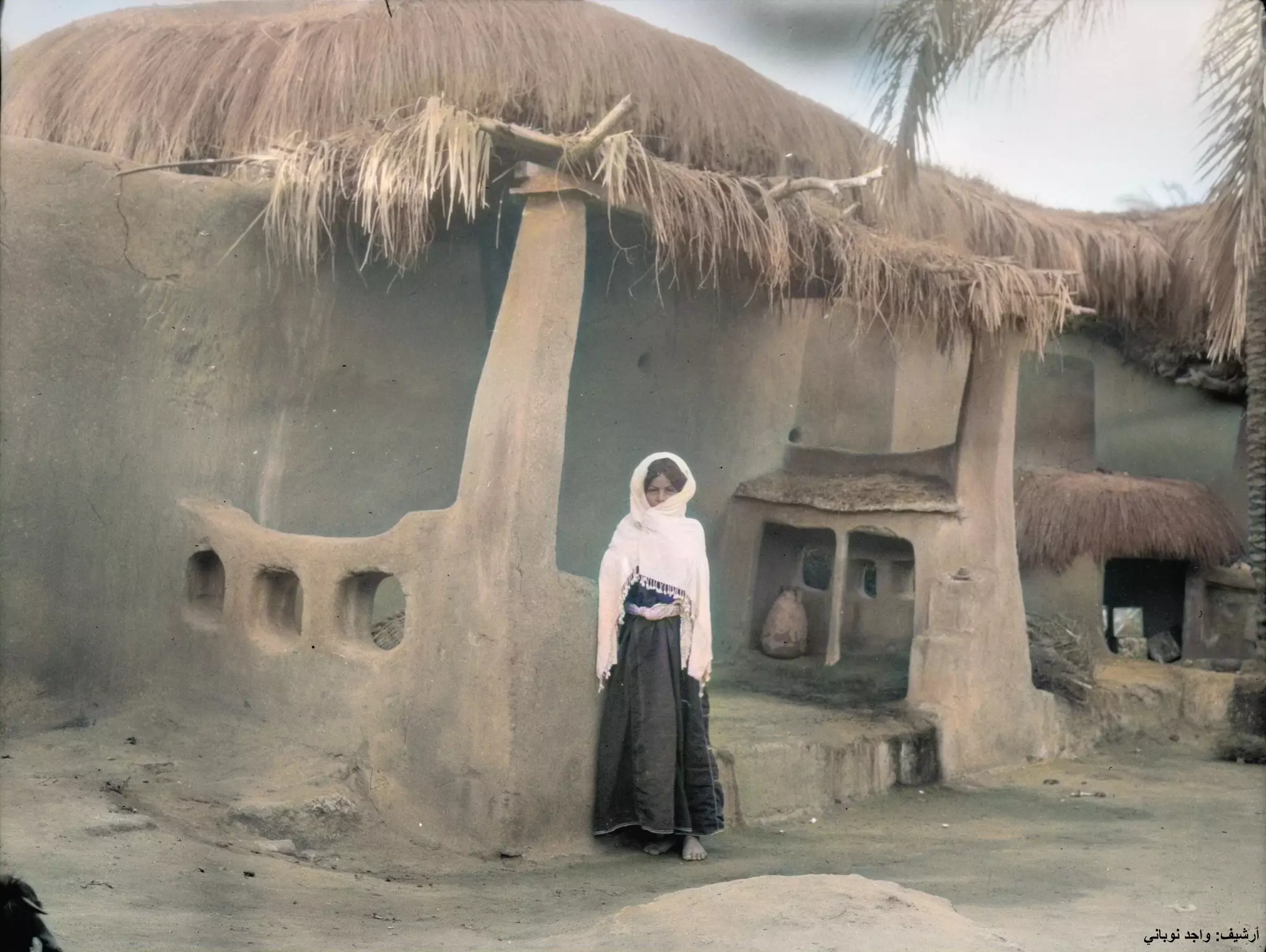
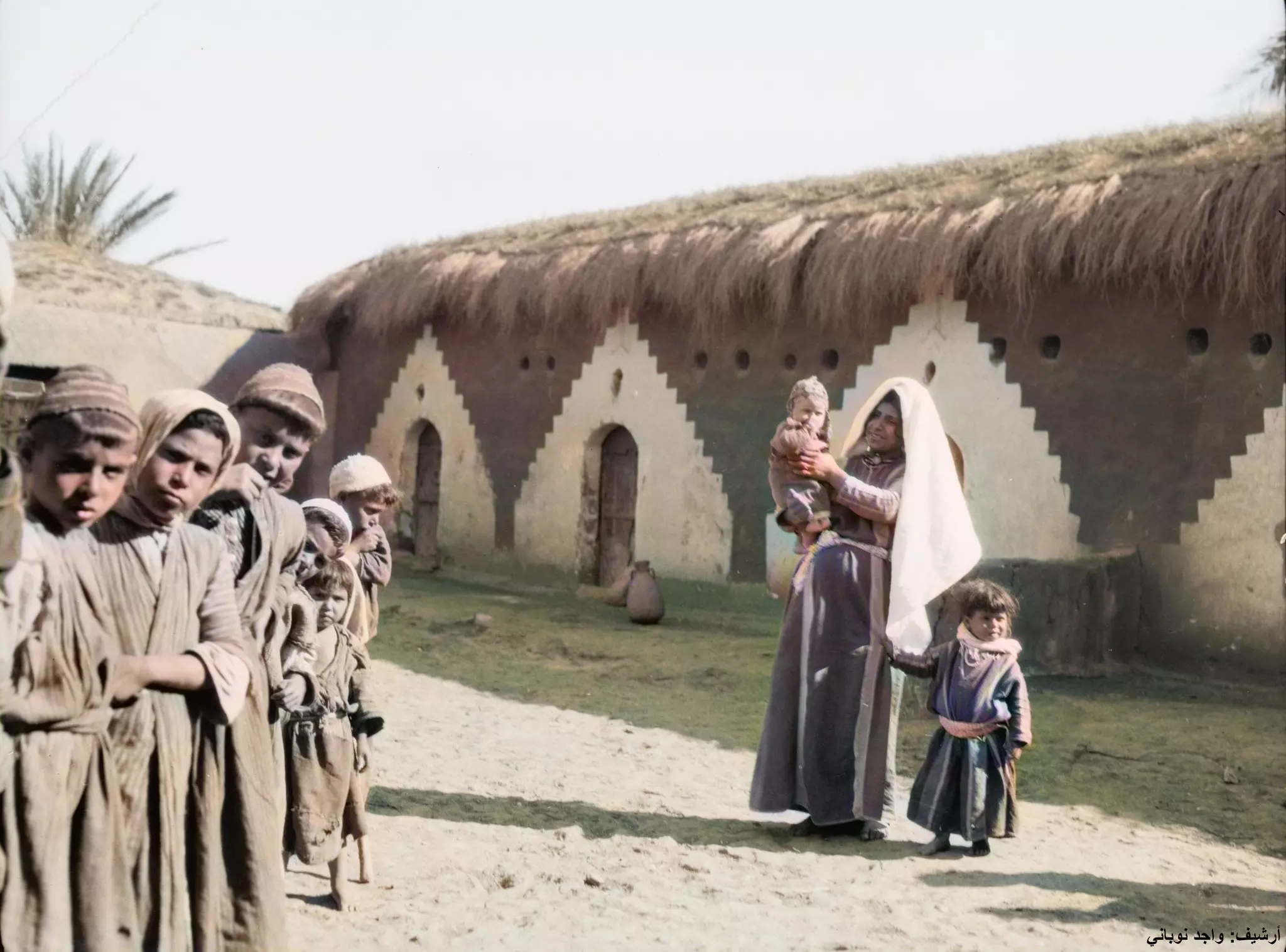
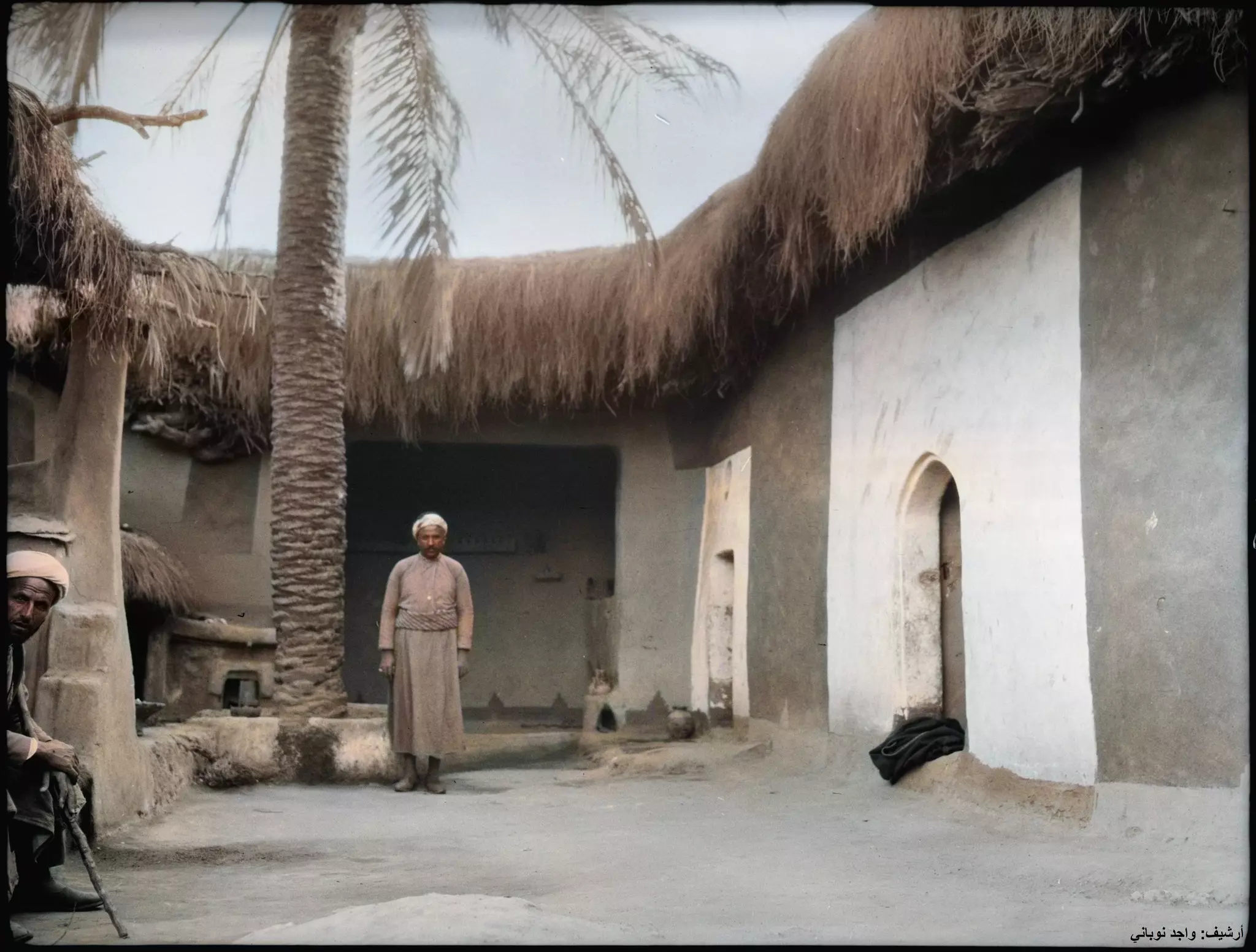
Posted by Joe Sanad 1 - ISDUD - A glimpse of a vanished life in a wiped-out Palestinian village and people - ca. 1880
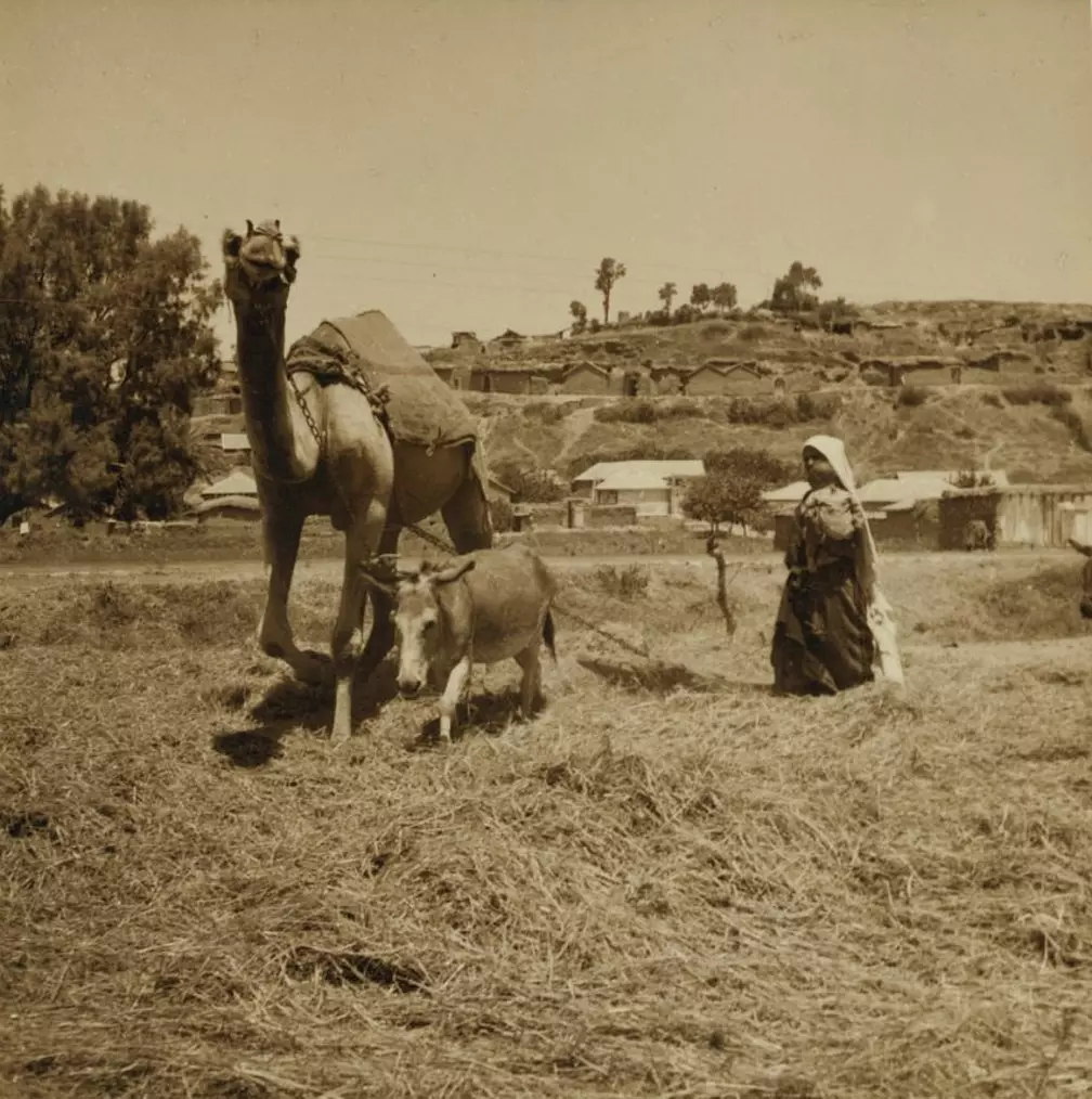
Posted by Rami Atwan - ISDUD - Threshing field in Isdud (Ashdod), 1938
Posted by Rami Atwan - The village of Isdud (Ashdod), as seen from a mosque, 1940s.
Posted by Khaled El Sala - إسدود isdud 2014 The caffe 01
Posted by said - إسدود isdud 2014 The caffe 02

Posted by said - إسدود isdud 2014 The graveyard 01
Posted by said - إسدود isdud 2014 The graveyard 02
Posted by said 1 - إسدود isdud 2014 The graveyard 03
Posted by said - إسدود isdud 2014 The graveyard 04
Posted by said - إسدود isdud 2014 The graveyard 05
Posted by said - إسدود isdud 2014 The school 01
Posted by said - إسدود isdud 2014 The school 02
Posted by said - إسدود isdud 2014 The school 03
Posted by said - إسدود isdud 2014 The school 04
Posted by said - إسدود isdud 2014 The school 05
Posted by said - إسدود isdud 2014 The school 06
Posted by said - إسدود isdud 2014 The school 07
Posted by said - إسدود isdud 2014 The school 08
Posted by said - إسدود isdud 2014 The school 09
Posted by said - إسدود isdud 2014 The mosqe
Posted by said - بقاية مدرسة في اسدود
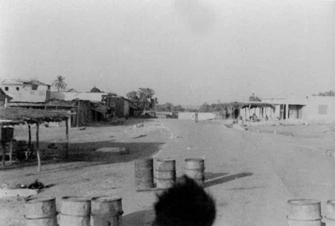
- منظر عام في القرية بعد إنسحاب الجيش المصري منها عام ١٩٤٨
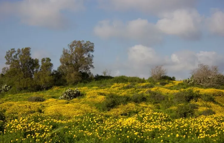
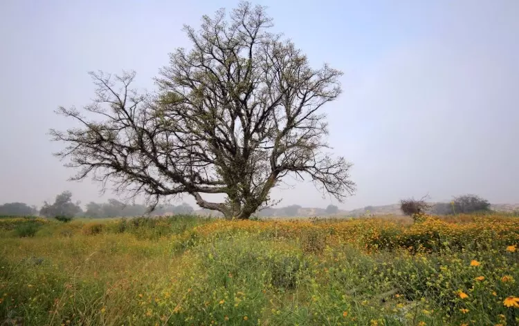
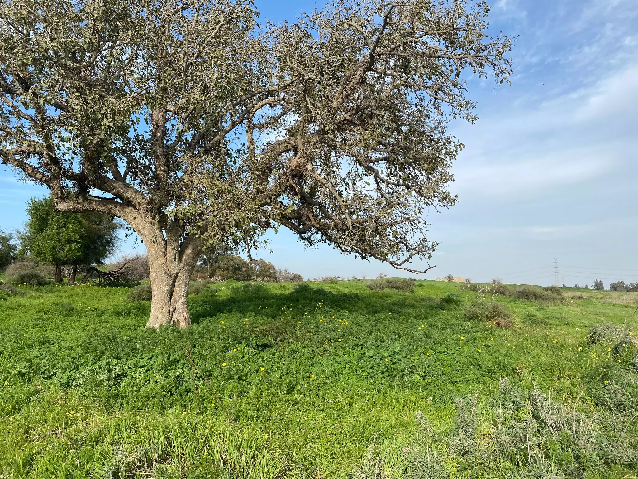
- الربيع في اسدود
Posted by abu raya - اسدود
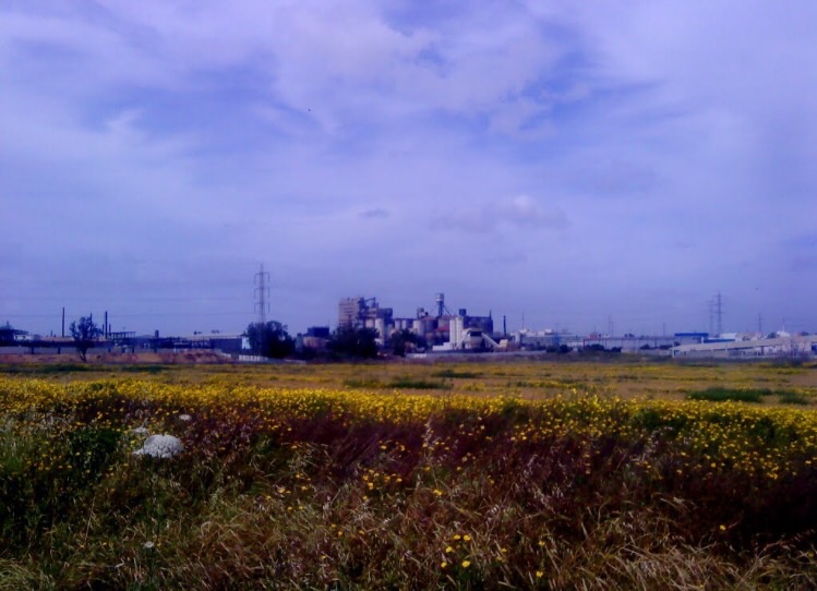
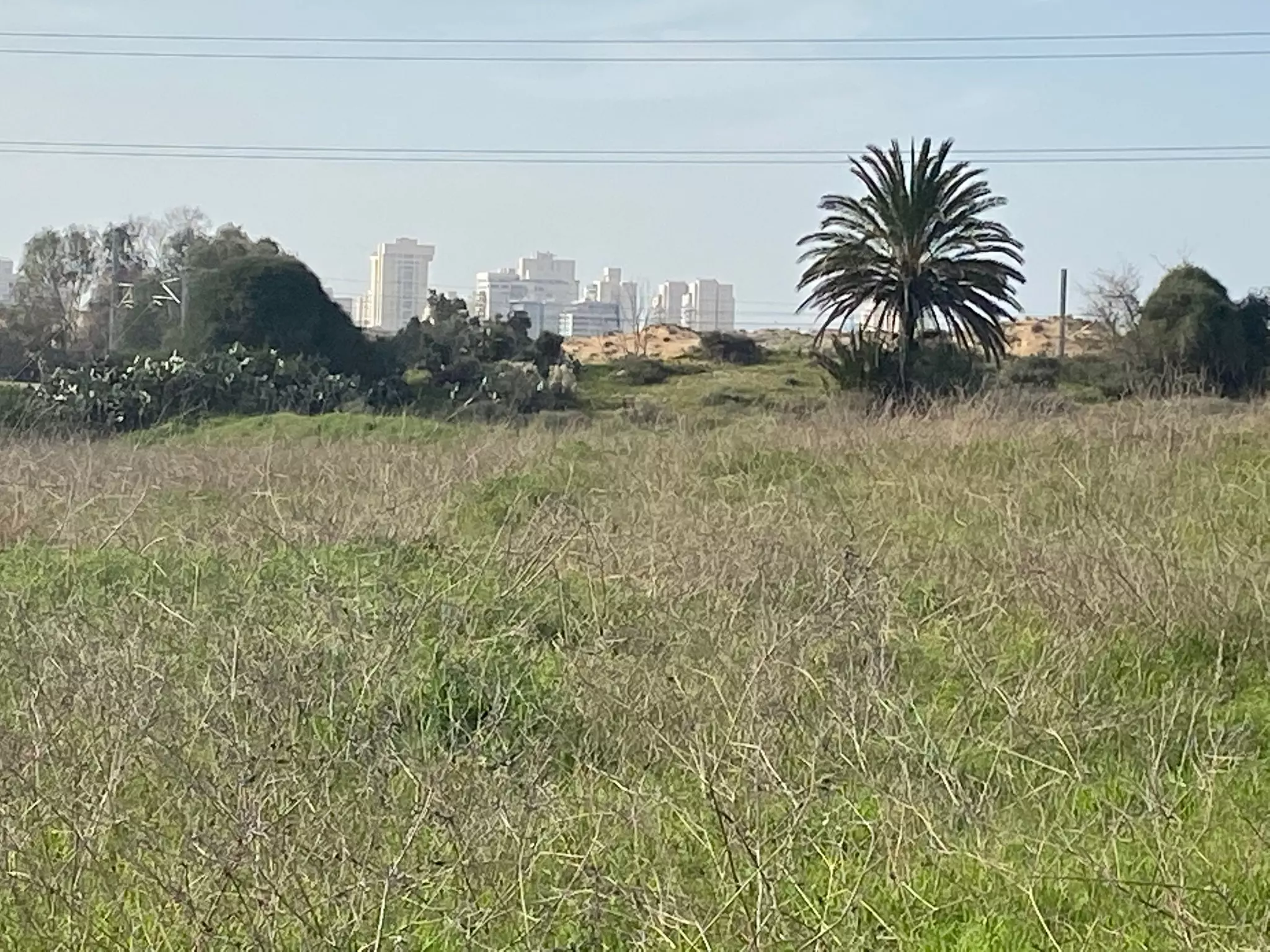
Posted by abu raya - اسدود والمنطقه الصناعيه المقامه على اراضيها
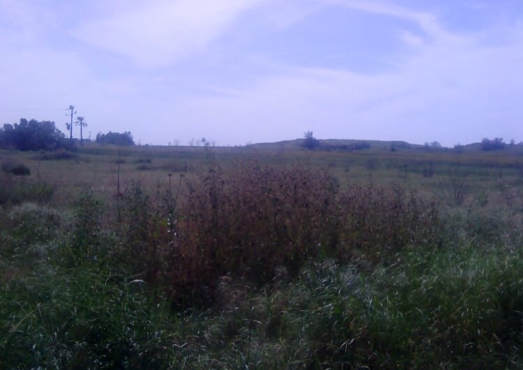
Posted by abu raya - اسدود
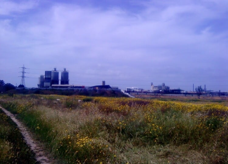
Posted by abu raya - اسدود
Posted by abu raya - اسدود
Posted by abu raya - اسدود
Posted by abu raya - اسدود
Posted by abu raya - جامع اسدود
Posted by abu raya - اسدود
Posted by abu raya - اسدود
Posted by abu raya - اسدود
Posted by abu raya - اسدود
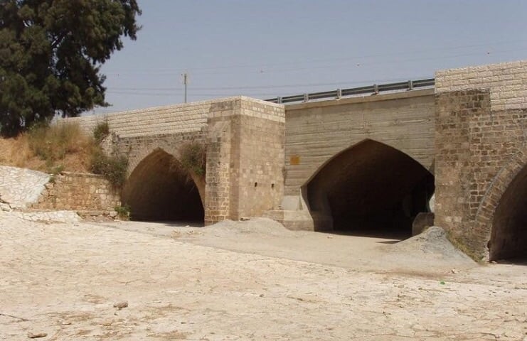
Posted by abu raya - جسر قديم شمال اسدود
Posted by abu raya - من موقع القريه ومستعمره اشدود
Posted by abu raya - اسدود
Posted by abu raya - اسدود
Posted by abu raya - اسدود
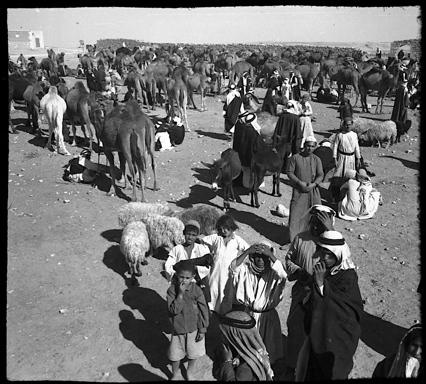
Posted by abu raya - السوق الاسبوعي في اسدود
Posted by abu raya - اسدود
Posted by abu raya - اسدود
Posted by abu raya - اسدود
Posted by abu raya - وين يا خال؟ ... ع اسدود ..... منظر رائع قبل النكبة .. .
- صوره قديمه من المدرسه الاميريه في اسدود
Posted by abu raya - اسدود قبل النكبه
Posted by abu raya - اسدود قبل النكبه
Posted by abu raya - اسدود قبل النكبه
Posted by abu raya - اسدود بعد احتلالها
Posted by abu raya - اسدود قبل النكبه
Posted by abu raya - اسدود قبل النكبه
Posted by abu raya - صوره محزنه لقريه اسدود يوم تهجير اهاليها
Posted by abu raya - المعسكر البريطاني في اسدود سنه 1918
Posted by abu raya - صوره قديمه لاطفال من اسدود يلعبون مع احد جنود الاستعمار البريطاني سنه 1918
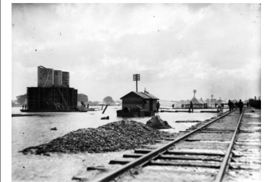
Posted by abu raya - محطه سكه الحديد في اسدود سنه 1918
Posted by abu raya - صوره قديمه من اسدود سنه 1918
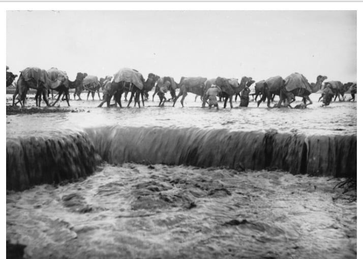
Posted by abu raya - قافله جمال على شاطى اسدود سنه 1918
Posted by abu raya - من بيوت اسدود قبل النكبه
Posted by abu raya - اسدود قبل النكبه
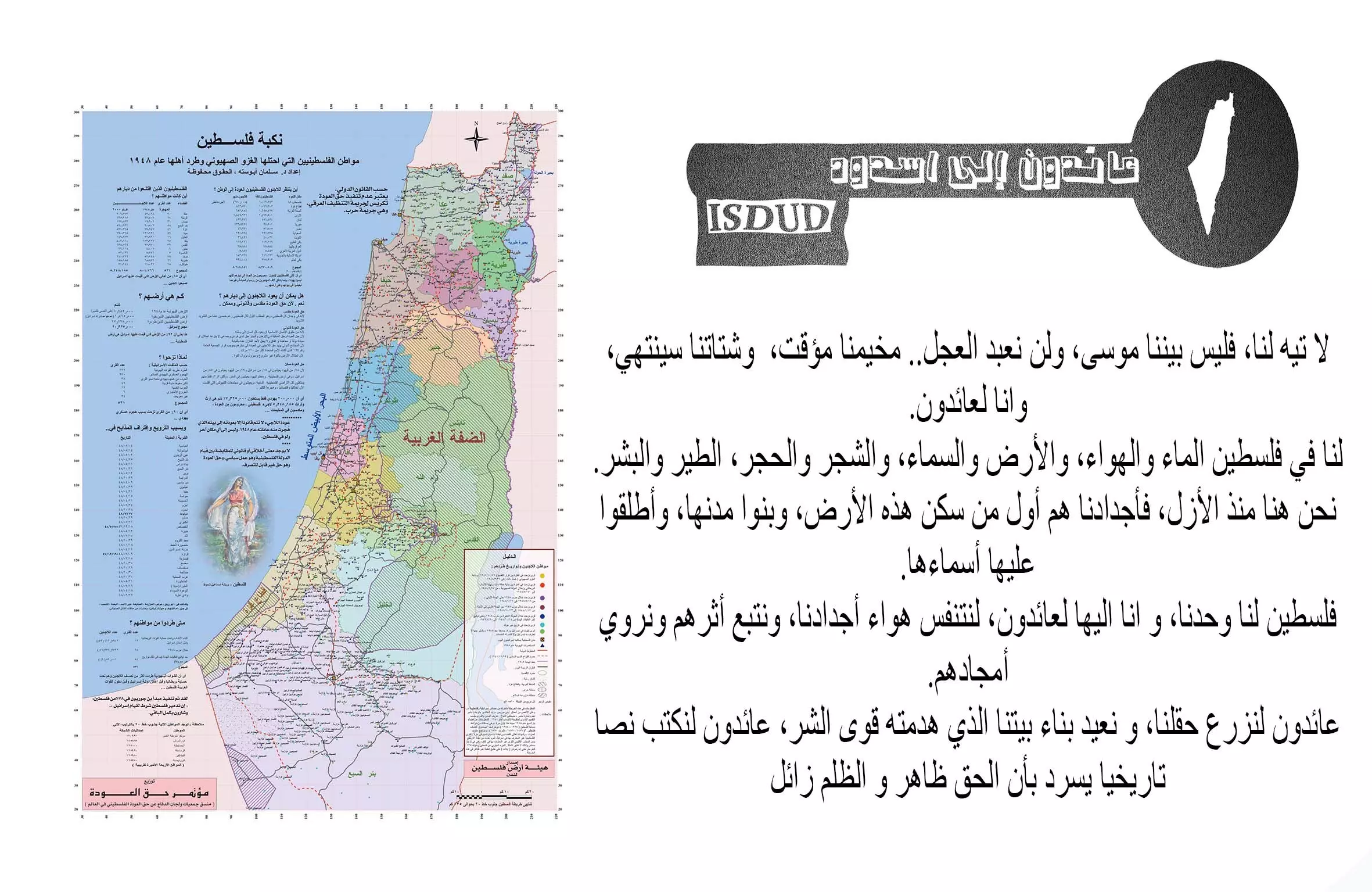
Posted by abu raya - سنعود
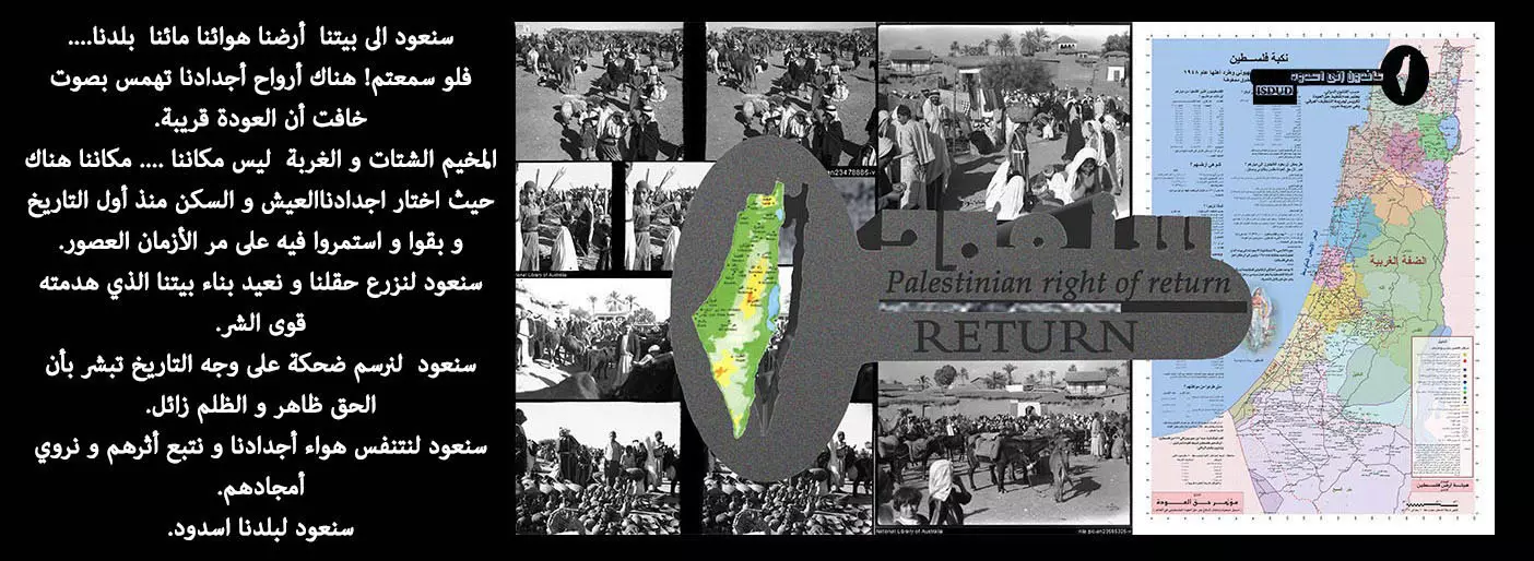
Posted by Isdud - لا تيه لنا
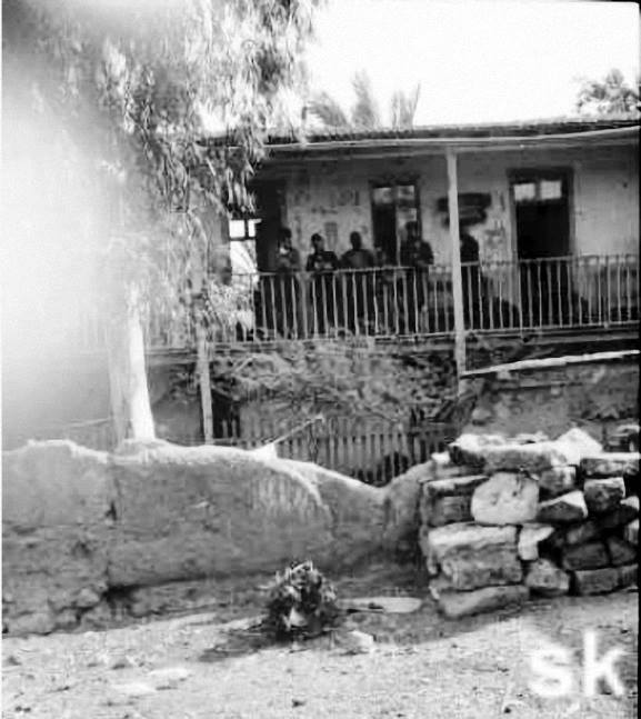
Posted by Isdud - إسدود بعد أيام من الإحتلال 1948
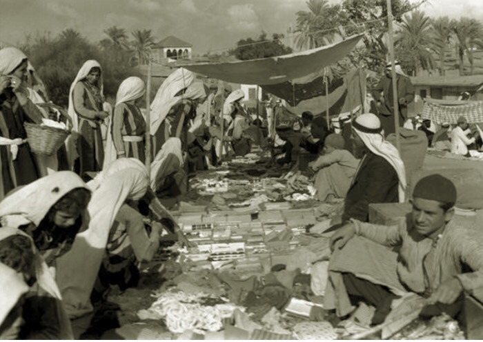
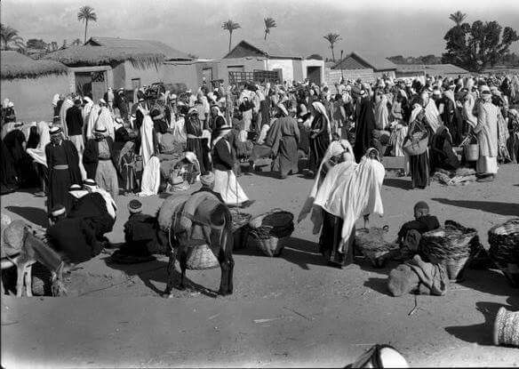
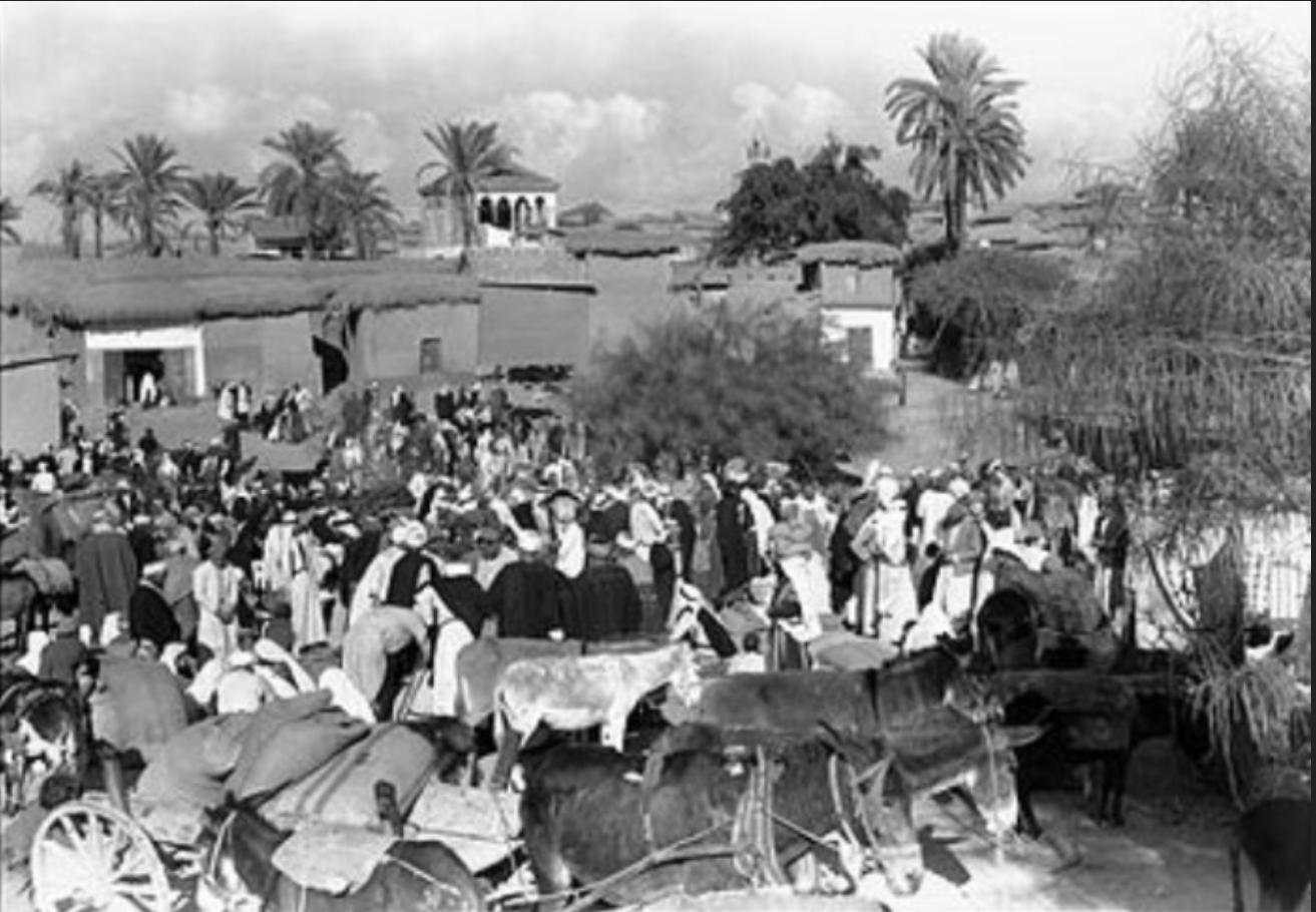
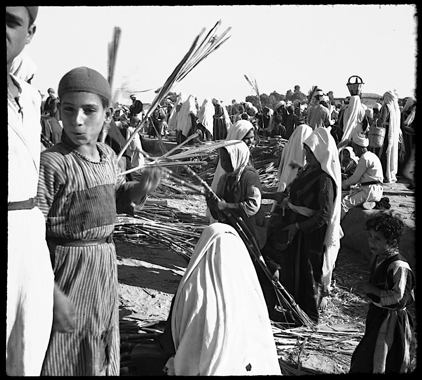
Posted by أبو اليزن السعافين - Market in Isdud, between 1939 and 1945 (Hurley negative collection) #1
Posted by palestinehistory 1 - Market in Isdud, between 1939 and 1945 (Hurley negative collection) #2
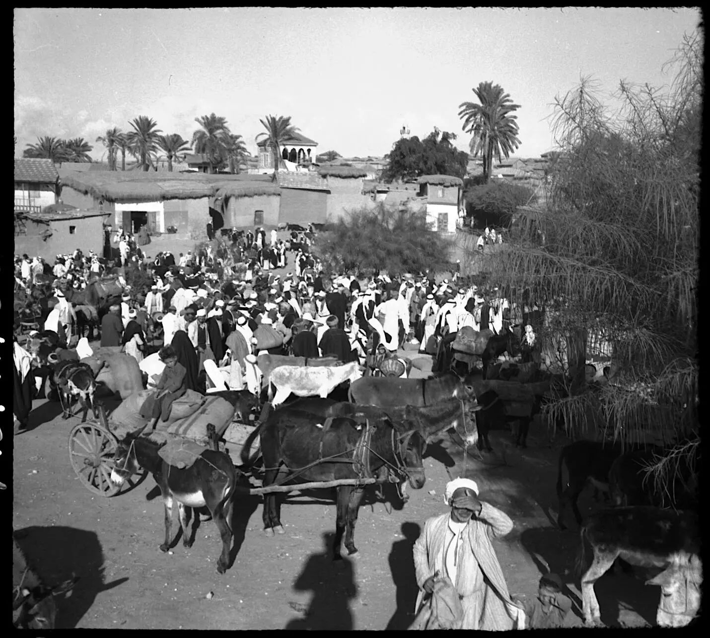
Posted by palestinehistory - Market in Isdud, between 1939 and 1945 (Hurley negative collection) #3
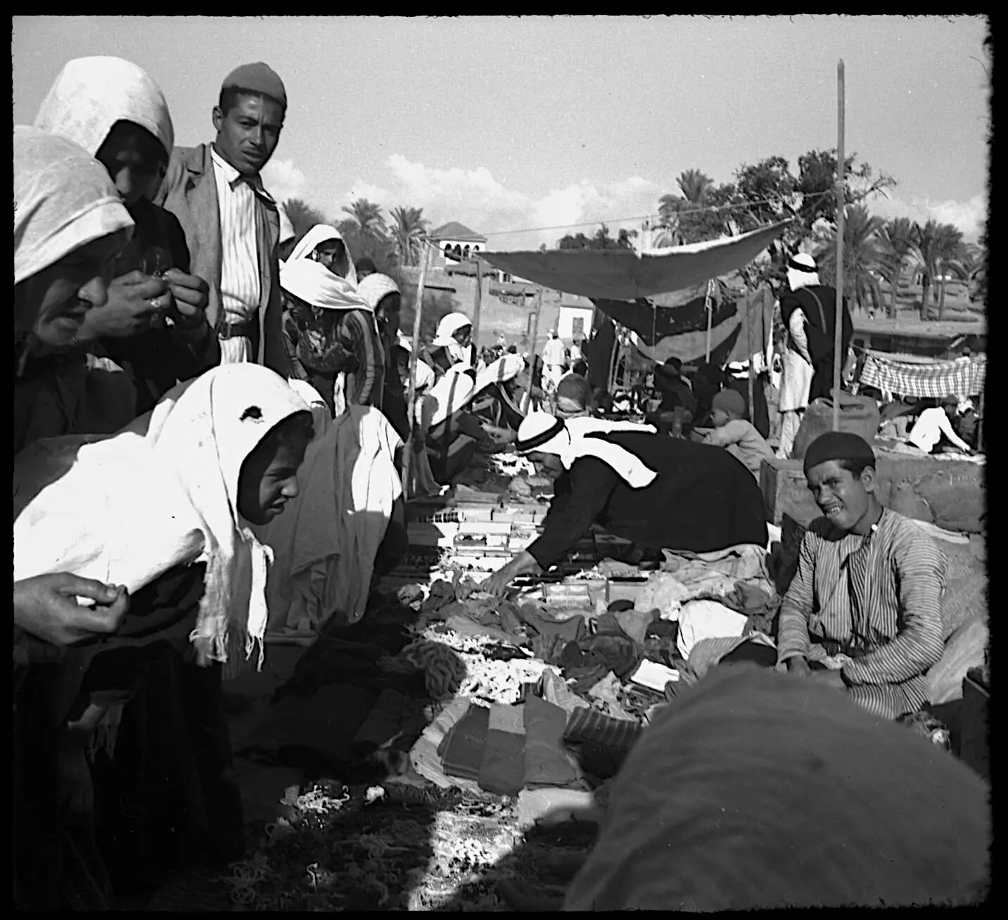
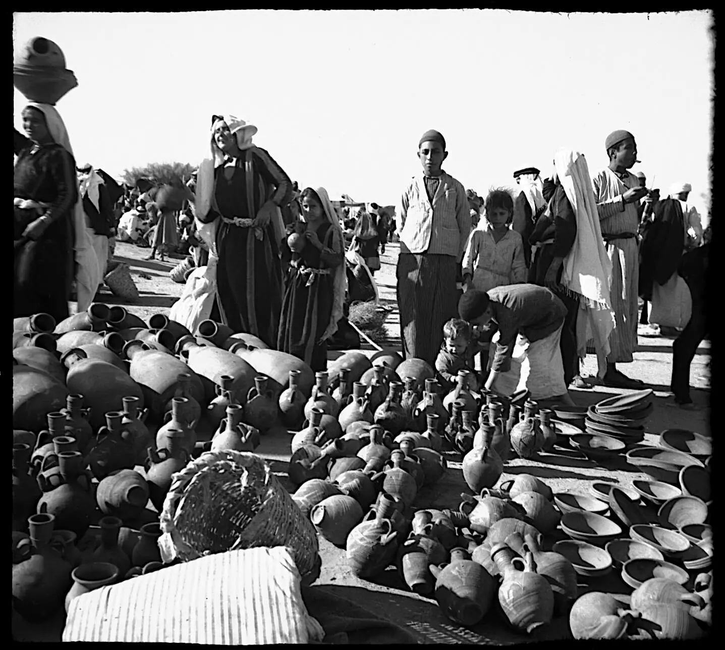
Posted by palestinehistory - A fair in Isdud, between 1939 and 1945 (Hurley negative collection) #1
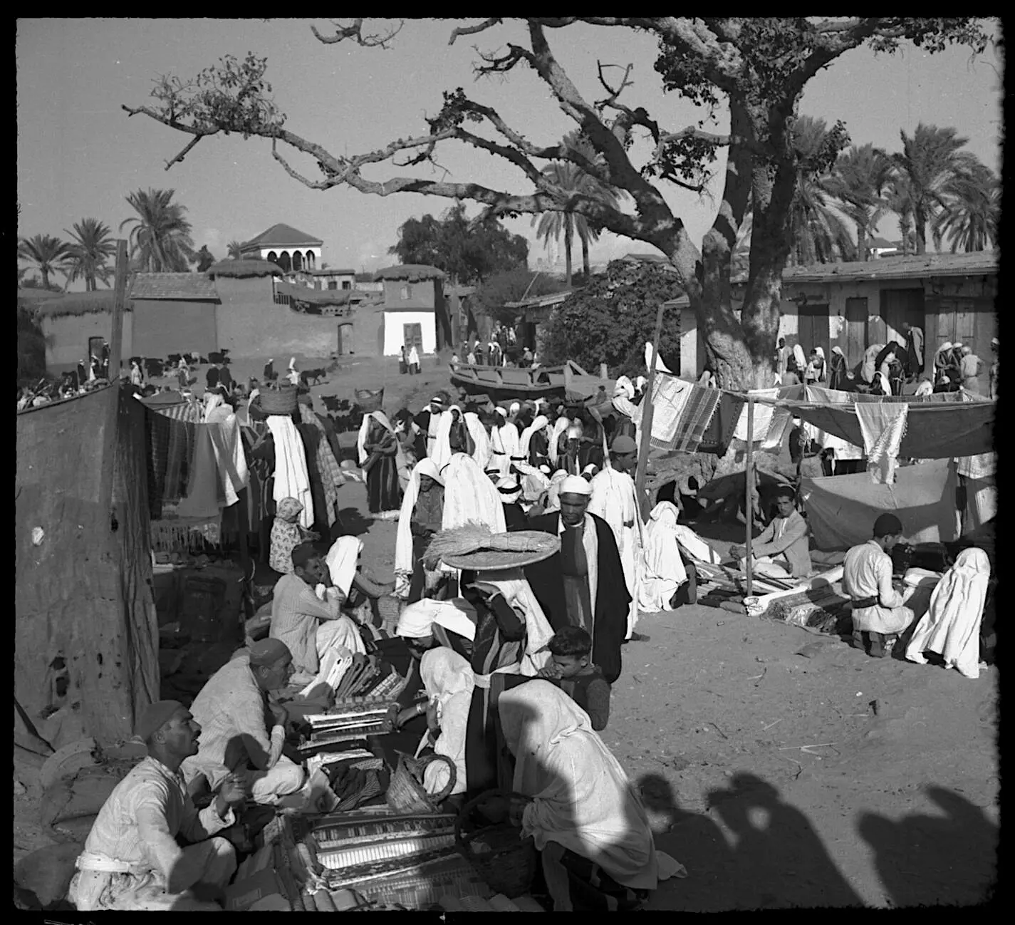
Posted by palestinehistory 1 - A fair in Isdud, between 1939 and 1945 (Hurley negative collection) #2
Posted by palestinehistory 1 - A fair in Isdud, between 1939 and 1945 (Hurley negative collection) #3
Posted by palestinehistory 1 - فندق في اسدود سنة 1907
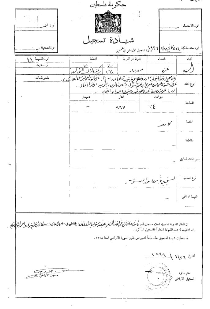
- كوشان ارض --- فلسطين---اسدود
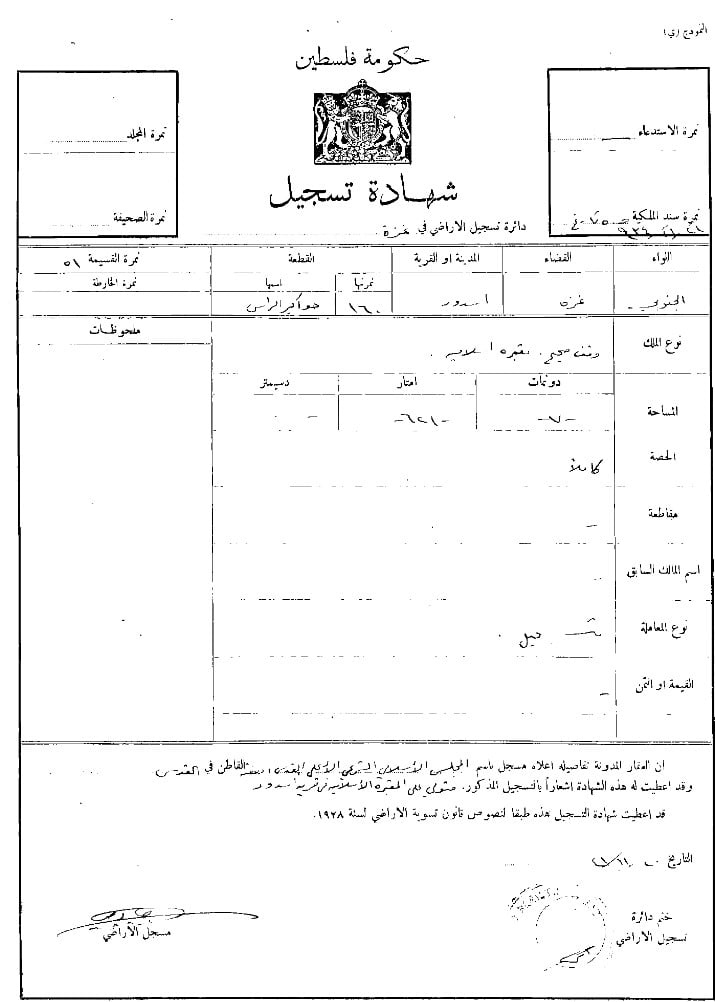
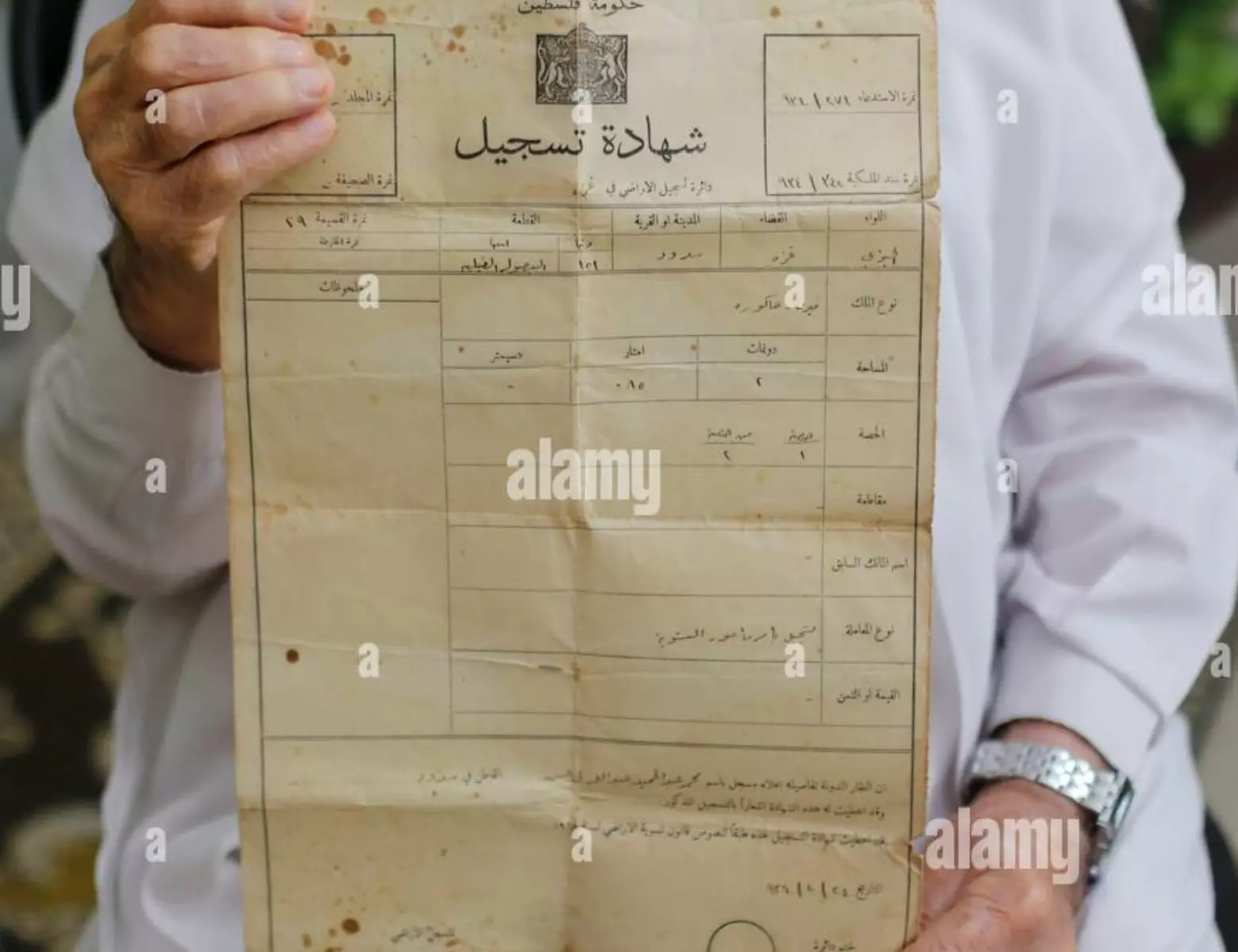
- شهادة تسجيل : قرية اسدود قضاء غزة : منطقة الخان الشمالية. نمرتها 161 بتاريخ 18_9_1936.
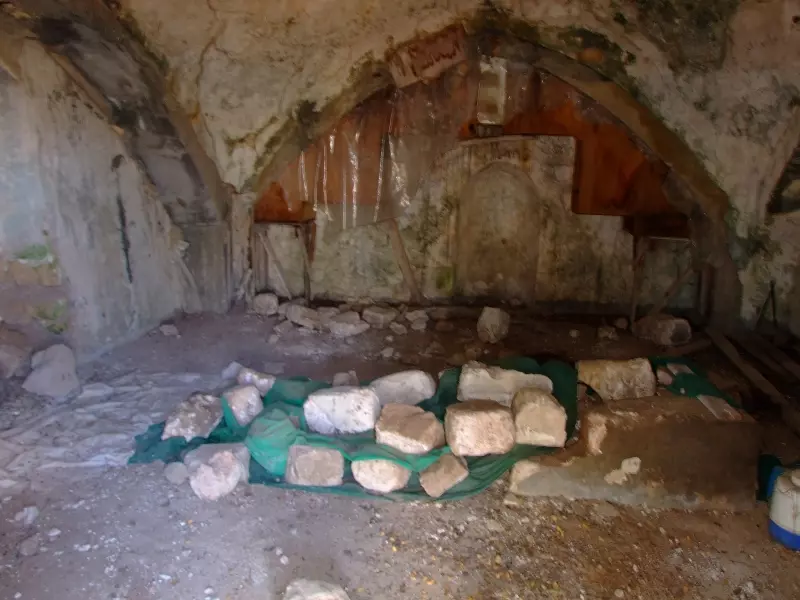
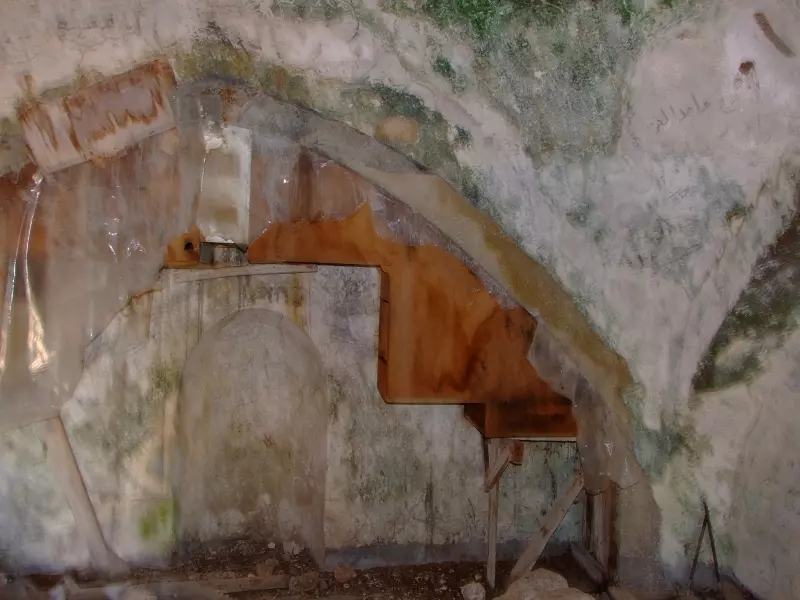
- جولة بين مباني وانقاض قرية اسدود المدمرة والمهجرة
- جولة بين مباني وانقاض قرية اسدود المدمرة والمهجرة #2
- جولة بين مباني وانقاض قرية اسدود المدمرة والمهجرة #3
- جولة بين مباني وانقاض قرية اسدود المدمرة والمهجرة #4
- جولة بين مباني وانقاض قرية اسدود المدمرة والمهجرة #5
- جولة بين مباني وانقاض قرية اسدود المدمرة والمهجرة #6
- جولة بين مباني وانقاض قرية اسدود المدمرة والمهجرة #7
- جولة بين مباني وانقاض قرية اسدود المدمرة والمهجرة #8
- جولة بين مباني وانقاض قرية اسدود المدمرة والمهجرة #9
- جولة بين مباني وانقاض قرية اسدود المدمرة والمهجرة #10
- جولة بين مباني وانقاض قرية اسدود المدمرة والمهجرة #11
- جولة بين مباني وانقاض قرية اسدود المدمرة والمهجرة #12
- جولة بين مباني وانقاض قرية اسدود المدمرة والمهجرة #13
- جولة بين مباني وانقاض قرية اسدود المدمرة والمهجرة #14
- جولة بين مباني وانقاض قرية اسدود المدمرة والمهجرة #15
- Pre-Nakba Aerial view of the village / صورة من الجو للقرية اخذت قبل النكبة
- ذات نهار خريفي في قرية أسدود قضاء غزة عام 1911..
- كوشان لقطعة ارض في اسدود تعود ملكيتها لابو انور طافش الذي يقطن في مخيم جباليا
1 - مسجد قرية أسدود المهجرة (قضاء غزة )
- مقام الشيخ ابراهيم - قرية اسدود المهجرة.قضاء غزة.
.المزيد عن المقام اسفل الصورة في قسم التعليقات..يقع في الناحية الغربية من البلدة
1 - صور مكررة لاسدود لكنها ملونة واعلى جودة- 1940م
- صور مكررة لاسدود لكنها ملونة واعلى جودة- 1940م #2
- صور مكررة لاسدود لكنها ملونة واعلى جودة- 1940م #3
- صور مكررة لاسدود لكنها ملونة واعلى جودة- 1940م #4
- صور مكررة لاسدود لكنها ملونة واعلى جودة- 1940م #5
- Let us see what the most "civilized" have done to our mosque -- مسجد سلمان الفارسي
- A rare picture in Isdud, c. 1914?1918
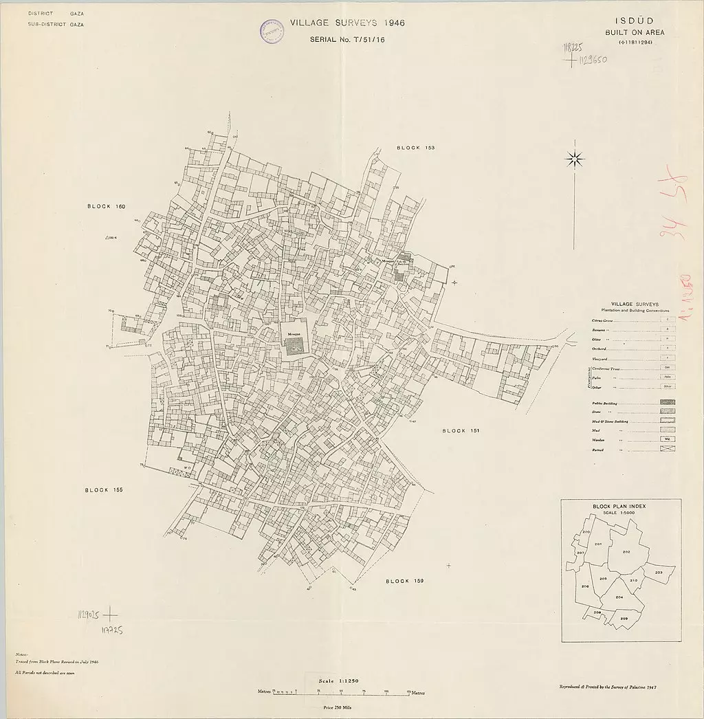
- A detailed village map, 1946
- Our village was mostly occupied intact; then the most "civilized" destroyed it. That is how Jew will be great again!
- That is how the "civilized" erased and replaced us: Isdud was completely obliterated except for the mosque of Salman al-Farisi, as you see -- اسدود باتت أثر بعد عين بإستثناء بمسجد سلمان الفارسي. من هنا مر الهمجّ
- That is how the "civilized" erased and replaced us: Isdud was completely obliterated except for the mosque of Salman al-Farisi, as you see -- اسدود باتت أثر بعد عين بإستثناء بمسجد سلمان الفارسي. من هنا مر الهمجّ #2
- That is how the "civilized" erased and replaced us: Isdud was completely obliterated except for the mosque of Salman al-Farisi, as you see -- اسدود باتت أثر بعد عين بإستثناء بمسجد سلمان الفارسي. من هنا مر الهمجّ #3
- That is how the "civilized" erased and replaced us: Isdud was completely obliterated except for the mosque of Salman al-Farisi, as you see -- اسدود باتت أثر بعد عين بإستثناء بمسجد سلمان الفارسي. من هنا مر الهمجّ #4
- That is how the "civilized" erased and replaced us: Isdud was completely obliterated except for the mosque of Salman al-Farisi, as you see -- اسدود باتت أثر بعد عين بإستثناء بمسجد سلمان الفارسي. من هنا مر الهمجّ #5
- That is how the "civilized" erased and replaced us: Isdud was completely obliterated except for the mosque of Salman al-Farisi, as you see -- اسدود باتت أثر بعد عين بإستثناء بمسجد سلمان الفارسي. من هنا مر الهمجّ #6
- That is how the "civilized" erased and replaced us: Isdud was completely obliterated except for the mosque of Salman al-Farisi, as you see -- اسدود باتت أثر بعد عين بإستثناء بمسجد سلمان الفارسي. من هنا مر الهمجّ #7
- قلعة اسدود - قلعة الأمويين..على الشاطئ، جنوب غرب مدينة أسدود الجديدة...المزيد عنها في قسم التعليقات
1 - Taken on 22 August 1987, this photograph shows the remains of the girls' school in the depopulated village of Asdod.
- صورة لبقايا مدرسة الذكور، في مدينة أسدود المهجرة، في 22 آب 1987.
- صورة لبقايا مدرسة الذكور، في مدينة أسدود المهجرة، في 22 آب 1987. #2
- خارطة تُظهِر الحدود والطرق بأنواعها والأماكن المقدسة والطبيعة الطوبغرافية من تلال وسهول ومنحدرات والتشكيلة الطبيعية للأرض وأنواع المزروعات. نُشرت الخريطة فترة الانتداب البريطاني، تم إضافة تعديلات عليها من قِبَل خدمة الخرائط والصور التابعة للقوات العسكرية الاسرائيلية فترة الأربعينيات.
Want to browse more? 80,000 pictures were grouped in these gallaries:
| Display Name | Clan/Hamolah | Country of Residence |
| Anas Salama | المناعمة - سلامة | Sharjah, United Arab Emirates |
| aboahmadalbaz | الباز | نابلس |
| علي جودة | جودة | بنغازي, ليبيا |
| فتحي جودة | جودة | بنغازي, ليبيا |
| Ahed Abdulrahman Mahmoud Joudeh | AL Joudeh | Isdud, Palestine |
| محمد | جودة | الامارات, الامارات |
| عادل جوده | - | - |
| MOE JOUDEH | JOUDEH | PALESTINE, PALESTINE |
| Mohd JOUDEH | AL JOUDEH | Palestine, Palestine |
| Hussam | Jadallah | Jeddah, Saudi Arabia |
| ماجد الدعليس | الدعالسه | الدوحة, قطر |
| ابو جمال | الدعالسه | قطاع غزه, فلسطين |
| نضال البطراوي | - | رام الله, فلسطين |
| عبد المعطى جهاد جودة | الجودة | النصيرات |
| ماهر حميدmaher hmead | الدعالسة-حميد | م-جباليا, م-جباليا |
| Shady temraz | temraz | jordan |
| noor temraz | temraz | دير البلح , فلسطين |
| احمد سعادات | بيومي - جودة | jordan, jordan |
| M. Haroon | Joodah | - |
| A.Aziz Toman | Joudah | Jeddah, Saudi Arabia |
| munther | jouda | Abu Dhabi, UAE |
| Omar | Awadallah | Kiev, Ukriane |
| talal darwish | daalsa | salmiya, kuwait |
| Azzam Joudeh | Joudeh | Gaza |
| Mohammed Ghannam | Ghannam | Ontario, Canada |
| Nour H. Almozain | المزين | الرياض, saudi arabia |
| samer batrawi | BATRAWI | RAMALLAH |
| Hossam Ghannam | الدعالسة | jeddah, saudi arabia |
| ألاء | عباس | أبوظبي, الامارات |
| مصطفى الكردي | الجودة | الرياض, السعودية |
| لؤي فتحي فياض | المناعمة | قطاع غزة, فلسطين |
| هشام المصري | المصري | جدة, السعودية |
| Hussein Awadallah | El Mana'mah | Jeddah, S.A |
| nafez | abo-elreish | CALIFONIA, U.S.A |
| Fuad Timraz | Timraz/ Abu Hamde | Spydeberg, Norway |
| أشرف أبوغزة | جوده | الدوحة, قطر |
| عمرو بطراوي | بطراوي | رام الله |
| jamal batrawi | batrawi | - |
| سعيد هارون | الجودة | - |
| Dr. Mohammed Timraz | - | - |
| Mustafa Al-Kordi | Joudah | - |
| أبو قصي - م. وائل عصام عيسى | Mana3ma | Gaza, Palestine |
| حسام البيومي | Joudah | Jeddah, K.S.A |
| Red_wave | Jouda | - |
| juda | juda | libya, libya |
| Eyad Elbayoumi اياد البيومي | Joudah | Ontario, Canada |
| Batrawi | Batrawi | Ramallah |
| 3essa(3iasa) | essa | gaza |
| ayman Timraz | TIMRAZ | Kuwait, Kuwait |
| HAMID TIMRAZ | TIMRAZ | NORWAY, NORWAY |
| abed elrahman batrawi | - | ramallah |
| Samah Batrawi | - | Tripoli, Libya |
| abu yousef | - | gaza strip, palestine |
| Yousef Batrawi | Manama | Amman, Jordan |
| Mohammad Batrawi | Mana'meh | Ramallah, PALESTINE |
| Arwa Dalees | Dalees | - |
| Samah | Da'alsah | - |
| Walid Batrawi | Batrawi | Ramallah, Palestine |
| E.BAHA TOMAN | jooda | cyprus, cyprus |
| abu ourof | daalsah | gaza, palistin |
| Palestine , | ||
| HILMI MOUSSA | Mana'ameh | - |
| Dr. Joudah | Joudah | Gaza, Palestine |
| IBRAHEEM HAROON - JOODA | JOODA | KUWAIT |
| Ahmed Issa | El Mana'mah | Gaza, Palestine |
| Hussam Khamees Jouda | Jouda | Gaza, Palestine |
| moheeb joda | joda | palestine, palestine |
| Youssef | ElKhouli | Ontario, Canada |
- Abdullah Zaqut remembers hist destroyed and ethnically cleansed village of Isdud and al-Majdal city in Palestine before Nakba Duration: 12 min 20 sec
- وتبقى في الذاكرة فيلم مدينة اسدود الفلسطينية المحتلة// انتاج فريد شاهين - ميار للانتاج الاعلامي Duration: 26 min 49 sec
- Return to Isdud 28/11/15
- عدينا يا بلدنا اسدود
- اسدود المهجرة تنتظر أهلها، تنتظر العائدين لبلدهم بلد الآباء والأجداد، فنحن الفلسطينيون هنا منذ الأزل وأجدادنا هم الذين سكنوا هذه الارض وأطلقوا عليها اسما من أسمائهم وبقوا فيها على مر الأزمان والعصور. ورغما عن كل الطارئين Duration: 2 min 48 sec
 Fake Valor: Why Did Zionist Jews Hoist Nazis Flag on Their Ships in the 1930s?
What is new?
-
Facts About Oct. 7th Gaza Raid
-
Remined Us Please:: Who Did Rape Who? Palestinians Raped Israelis? Or, was the other way around?
-
When Prof. Edward Said was invited to debate Bibi Netanyahu in the 1980s, watch what happened!
-
Ezra Klein of the NY Times on the "Jewish Race".
-
Abusing Blood Libel!
-
Did Israeli Soldiers Activate The Hanniba Direective On Oct. 7th? You Be The Judge
-
Zionist FAQ: Isn't it true that Palestinians don't want peace? Palestinians never accepted the two-state solution
- Facts about Haavara (Transfer) Agreement between Ben-Gurion & Hitler
-
Haavara FAQs: Why Did Zionist Jews Hoist Nazis' Flags on Their Ships in the 1930s?
- Haavara FAQs: When Chaim Weizmann met FDR in mid-1943, why was he silent about rescuing European Jewry?
-
Dear ChatGPT: How did Palestinians resist Napoleon's invasion of their country in 1799?
-
Dear ChatGPT: Gaza had a vibrant Jewish community in the mid-17th century. What happened to them?
-
Dear ChatGPT: Why did the Jewish Agency suppress news of the Holocaust during WWII?
-
Video Playlist: Jews share their DNA tests to end the conflict for good.
-
A Tale of Two Conflicts: Examining the Definition of Genocide
-
Prof. Abraham Polak And The Suppressed History of the Khazars and European Jewry
-
How Ronald Reagan would have framed the genocide in Gaza if he were still alive?
-
Haavara FAQs: Let us do the math: how many German Jews did The Haavara Agreement save?
-
Zionist FAQs: The Hebron Massacre of 1929, "clearly proves" that Palestinians are antisemitic, how could you deny it?
-
Zionist FAQs: Why Anti-Zionist Is Not Antisemitism?
-
Zionist FAQs: Isn't it true that the KGB created Palestinian Nationalism in the early 1960s?
- Zionist FAQs: Muslims are killing Muslims all the time; why are Israeli Jews being singled out in the media?
- Zionist FAQs: How is Israel an apartheid state when 20% of its citizens are Arabs who enjoy full rights?
-
Haavara FAQs: Why Did Dorothy Thompson Flip From A Zionist Advocate to A Silenced Dissenter?
-
Haavara FAQs: Analysis of Herzl's Uganda Scheme and how it could have saved millions of Jews.
-
Haavara FAQs: Why did Hayim Greenberg describe American Jewry as "morally bankrupt" in early 1943?
-
Haavara FAQs: What if the Evian Conference was a resounding success? What would have been the impact of saving European Jewry on Zionism?
- Haavara FAQs: What if the six million were saved, how that would have impacted the Zionist project?
-
Haavara FAQs: How did Zionist leaders react when Europe's Jews lingered in the DP camps after WWII ended?
-
Why does the American Jewish community repeat lies that David Ben-Gurion had debunked before he died?
-
Who has the power to rename the Tatar/Khazar Gene Marker to Jewish IV?
-
Zionist FAQs: Why won't Egypt, Syria, and Jordan take their people back? Jews are indigenous to Palestine, and Arabs immigrated after Jews developed the country. Arabs should leave.
-
Haavara FAQs: Did Hitler and the Nazis conflate between Judaism and Zionist? If that wasn't case, then why?
-
Haavara FAQs: Winston Churchill and antisemitism, a collection of articles written Churchill.
-
Haavara FAQs: Broken by country, how many Jews survived vs. killed during the Holocaust?
-
Haavara FAQs: Why did European Jews vote with their feet and to immigrated to the Americas, not Palestine, after WWII?
-
Watch this American Jewish Girl describing Israeli Jews' cognitive dissonance like no other in under two minutes
-
Haavara FAQs: When the Nazis went out of their way to hide the Holocaust, Israeli Jews did the exact opposite by broadcasting their genocide of Gazans. But why?
-
Haavara FAQs: How Zionist Jews went out of their to show their appreciation to Nazism and Fascism?
- Haavara FAQs: Why Zionist leaders were against bombing the death camps & the Railroads leading to them?
-
Haavara FAQs: Hitler's message to the British and American people: If Jews are such noble citizens and you care about them, how come you're not letting them in? I will gladly ship them to you at my expense, even on luxury liners!
-
A shortlist of Zionist and Israeli false flag operations in the name Jews.
-
The Most Moral Army
- The Land of Kapos (Israel): Where the brave are boycotted and Kapos walk free.
- Why did early Zionists often named their communal enterprises "colonial"?
- Zionist Relations with Nazi Germany by Faris Glubb
-
Two NY Times advertisements by Zionists in the early 1943 that exposes Zionists' treason at the height of the calamity
- Facts Not Lies about the Palestinian-Israeli Conflict.
- Site's pictures have been categorized
- Campgain Against Lice
- A Survey of Palestine, the official source about Palestine before Nakba produced by the British Mandate; over 1200 pages.
- Satellite View & Google Earth: Over 6,000 placemarks identifying all destroyed towns, W. Bank & Gaza Strip Towns, & refugee camps.
- PalestineRemembered.com and its Nakba Oral History Project were featured on al-Jazeera Satellite TV.
- Nakba Oral History Video Podcast:
 Over 700 Oral History interviews (including 3,500+ hours of recording) can be viewed online.
 - Palestine Village Statistics Project
- Gaza Jail Break
- النسخة العربية للموقع الان متوفرة
- Videos: Documenting the destroyed villages in video: Tracing all that remains since Nakba.
- Videos: Responding to Zionist Propaganda
- Interview: The ethnic cleansing of Palestine: George Galloway interviews Israeli Historian Ilan Pappe.
- For Palestinians, memory matters. It provides a blueprint for their future By George Bisharat.
- Zionist FAQ now available in Hebrew שאלות שציונים שואלים, עכשיו בעברית
- Video: The Stephen Walt and John Mearsheimer report on the influence of the Israel Lobby on U.S. Foreign Policy
- The Palestinian-Israeli conflict for beginners
