| PalestineRemembered | About Us | Oral History | العربية | |
| Pictures | Zionist FAQs | Haavara | Maps | |
| Search |
| Camps |
| Districts |
| Acre |
| Baysan |
| Beersheba |
| Bethlehem |
| Gaza |
| Haifa |
| Hebron |
| Jaffa |
| Jericho |
| Jerusalem |
| Jinin |
| Nablus |
| Nazareth |
| Ramallah |
| al-Ramla |
| Safad |
| Tiberias |
| Tulkarm |
| Donate |
| Contact |
| Profile |
| Videos |
Welcome To Hiribya - هربيا (הירביא)
|
District of Gaza
Ethnically cleansed days ago |
العربية Google Earth |
 |
Gallery (30) |
- Statistics & Facts
-
Before & After

- Satellite View
- Articles 4
- Pictures 30
- Aerial Views 1
- Oral History 1
- Members 49
- All That Remains
- Wikipedia
- Videos 1
- Guest Book 148
- Links 3
| Statistic & Fact | Value | |||||||||||||||||||||
| Occupation Date | November 1, 1948 | |||||||||||||||||||||
| Distance From District | 14 (km) North East of Gaza | |||||||||||||||||||||
| Elevation | 25 (meters) | |||||||||||||||||||||
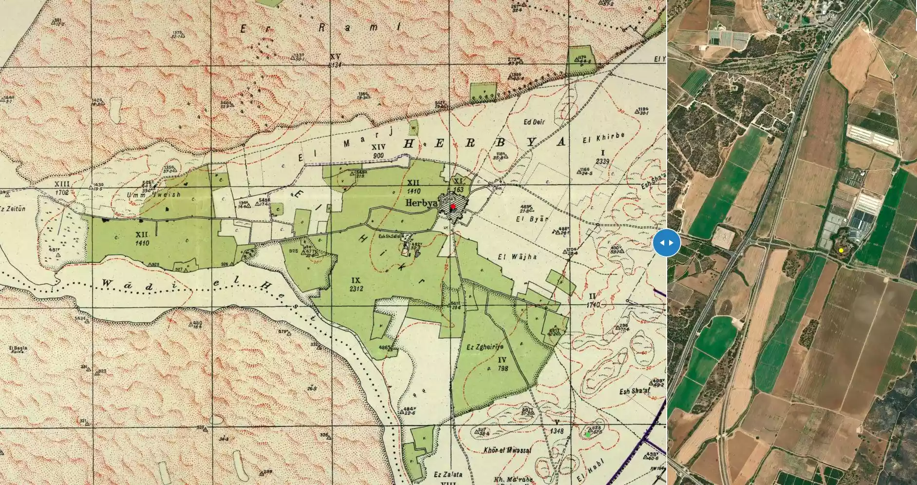
| Before & After Nakba, Click Map For Details |
||||||||||||||||||||||
|
||||||||||||||||||||||
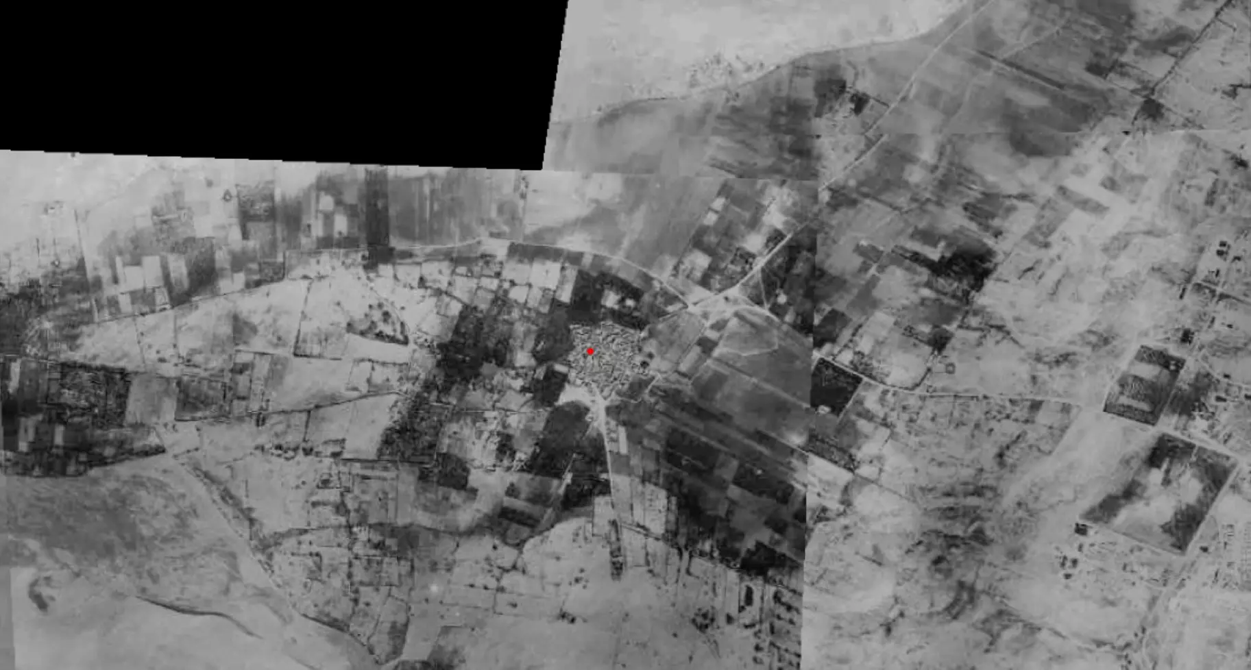
| Pre-Nakba Aerial View |
||||||||||||||||||||||
|
||||||||||||||||||||||
| Map Location | See location #35 on the map View from satellite |
|||||||||||||||||||||
| Military Operation | Operation Yo'av | |||||||||||||||||||||
| Attacking Units | Possibly Giva'ti brigade | |||||||||||||||||||||
| Defenders | Egyptian Army | |||||||||||||||||||||
| Exodus Cause | Military assault by Zionist troops | |||||||||||||||||||||
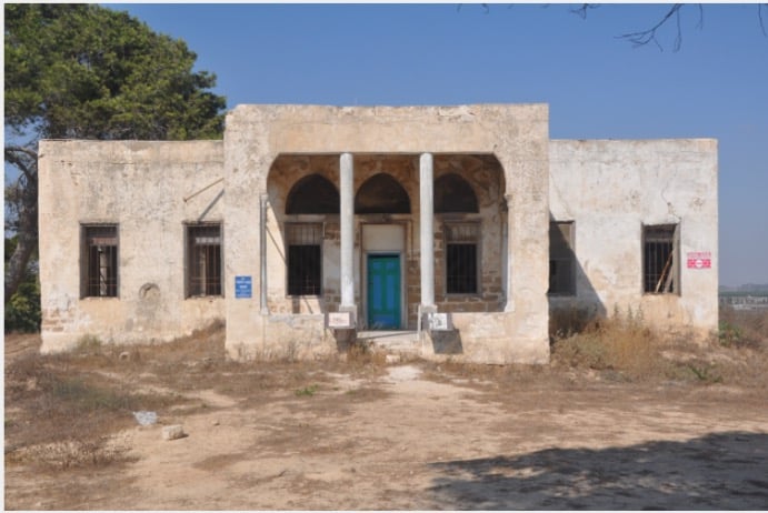
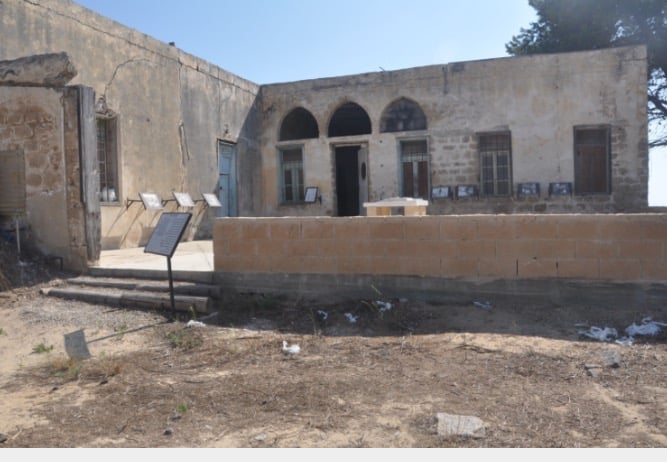
| Village Temains | The village was mostly destroyed with the exception of the village mosque. | |||||||||||||||||||||
| Ethnically Cleansing | Hiribya inhabitants were completely ethnically cleansed. | |||||||||||||||||||||
| Pre-Nakba Land Ownership |
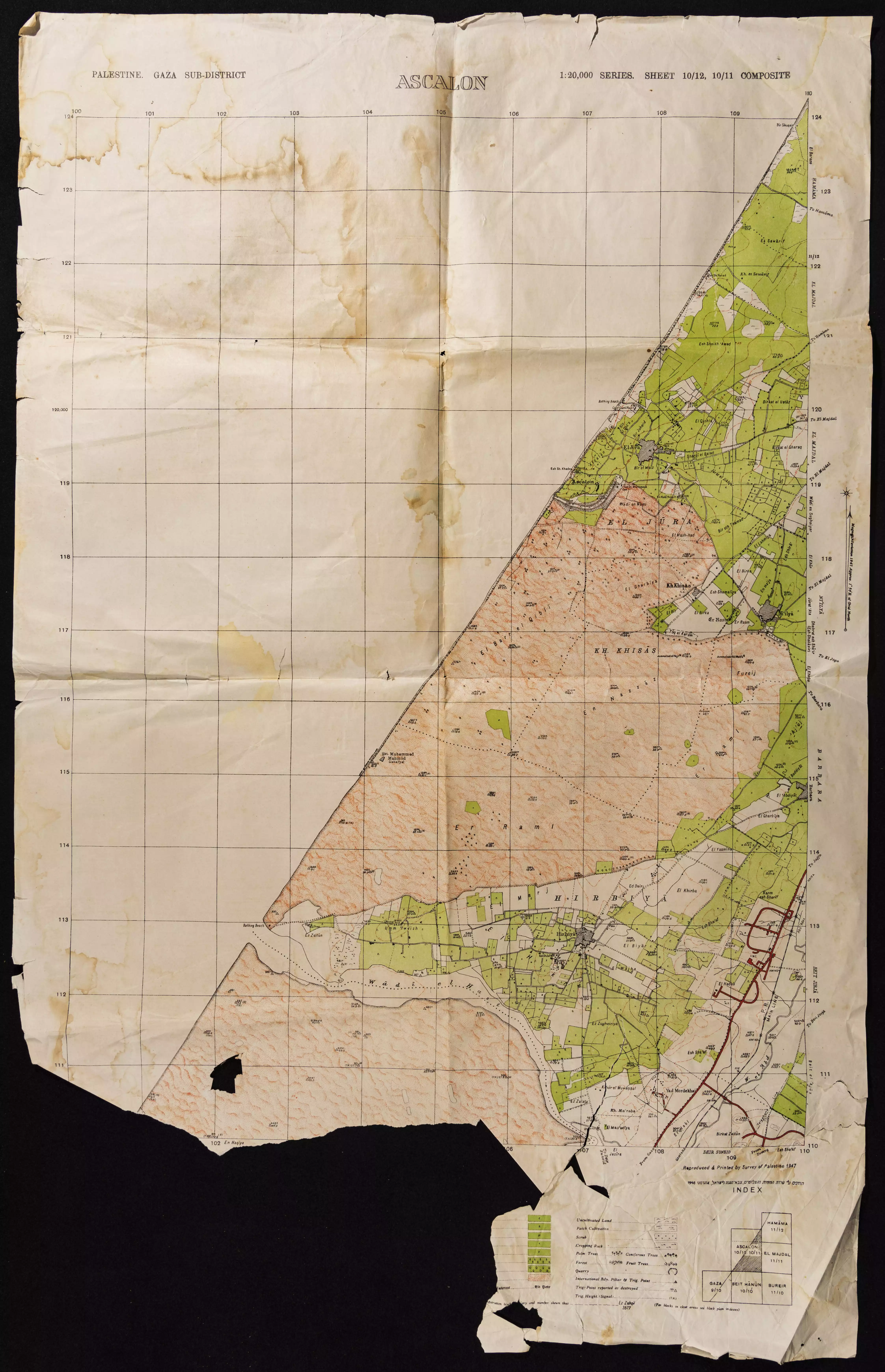
**Town Lands' Demarcation Maps |
|||||||||||||||||||||
| Land Usage As of 1945 |
|
|||||||||||||||||||||
| Population |
|
|||||||||||||||||||||
| Number of Houses |
|
|||||||||||||||||||||
| Near By Towns |
||||||||||||||||||||||
|
||||||||||||||||||||||
| Town's Name Through History | The Crusades referred to the Hiribya by Forbie. | |||||||||||||||||||||
| Schools | Hiribya had an elementary school for boys which was founded in 1922, and in 1945 it had an enrollment of 124 students. | |||||||||||||||||||||
| Places of Warship | One mosque still standing | |||||||||||||||||||||
| Archeological Sites | The village contained the remains of a tower, architectural fragments, and water reservoirs located in the Southwest. Hiribya also had another couple of khirbat: the 1st is Khirbat al-Sharf and the 2nd is Khirbat al-Yasmina. | |||||||||||||||||||||
| Exculsive Jewish Colonies Who Usurped Village Lands |
Ziqim and Karmiyya | |||||||||||||||||||||
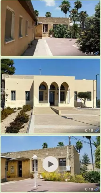
| Featured Video | ||||||||||||||||||||||
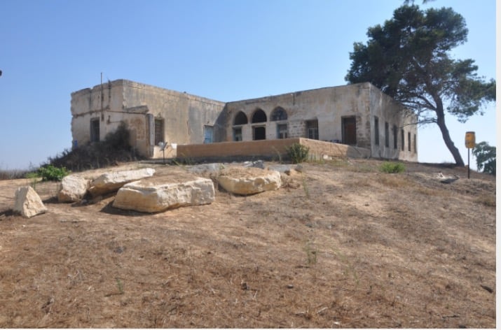
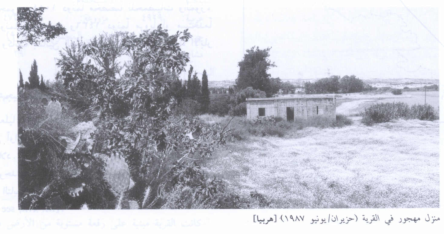
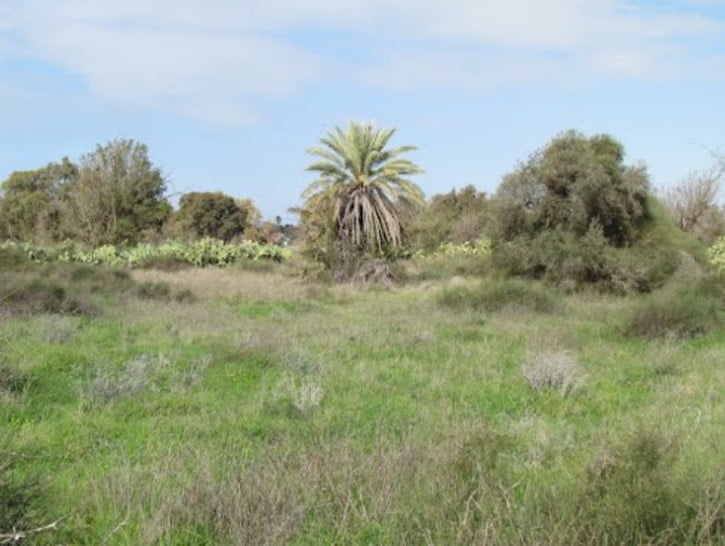
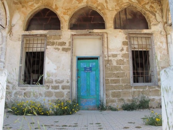
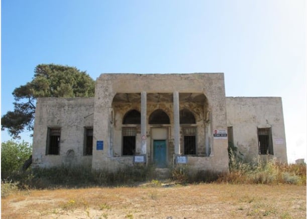
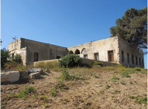
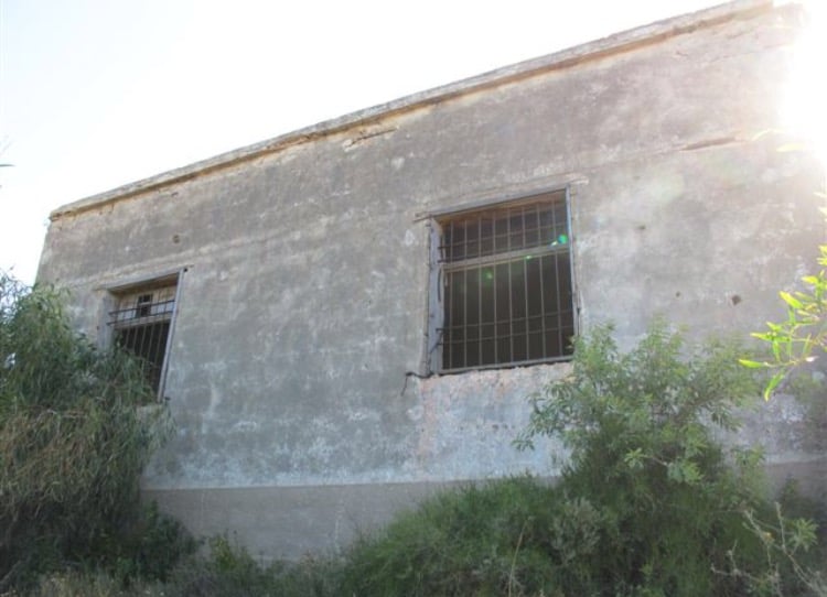
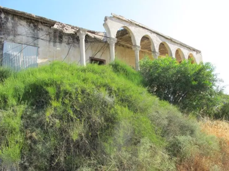
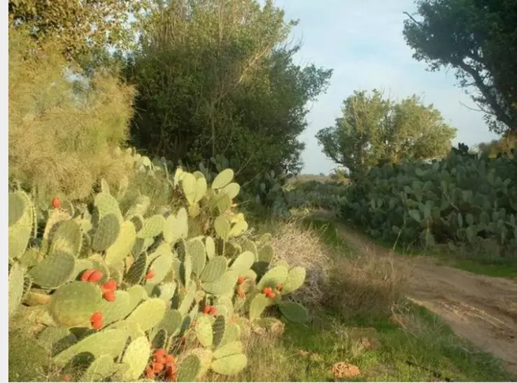
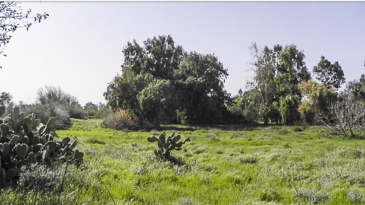
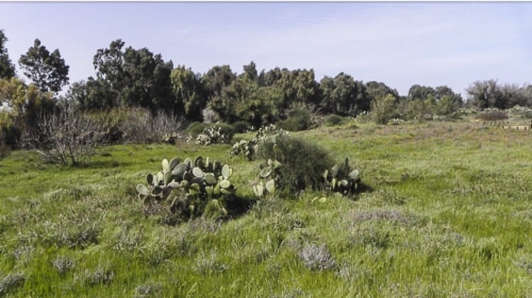
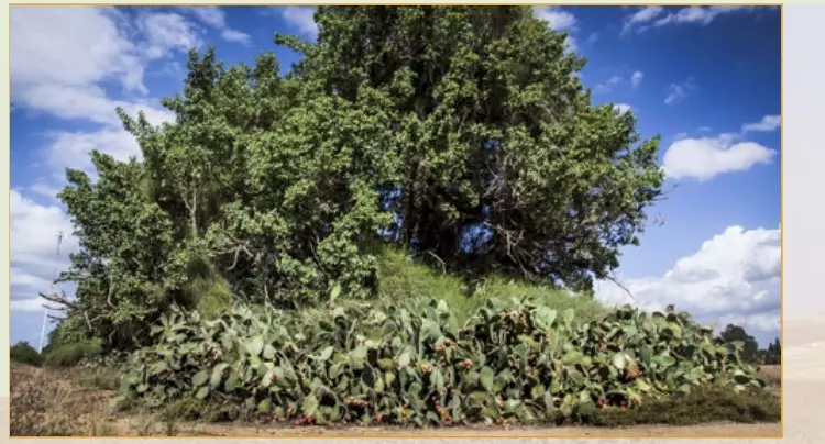
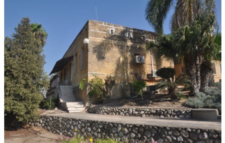
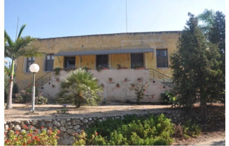
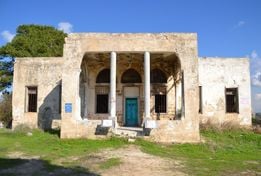
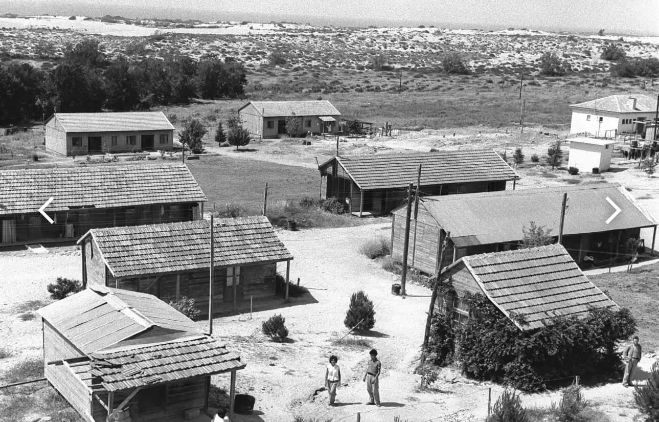
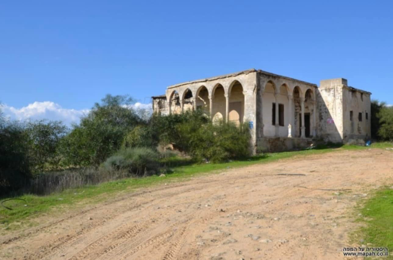
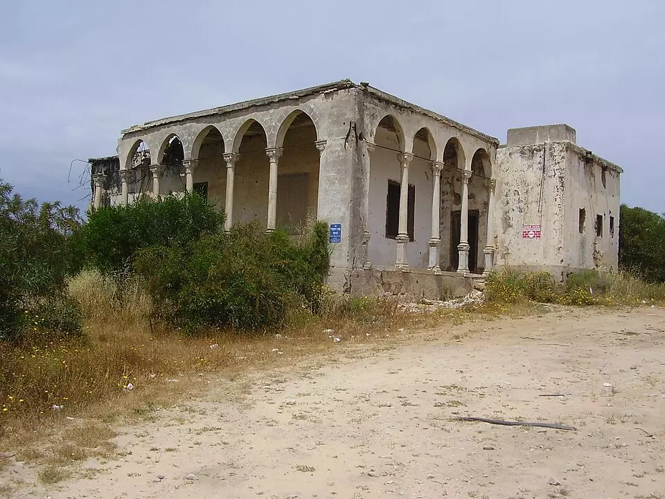
Village Before NakbaThe village stood on the southern coastal plain, in a flat area that was covered by sand dunes. A secondary road linked it to the coastal highway that passed about 2 km to the east, thus giving it access to Gaza and the city of al-Majdal. The site dated back to the Canaanite period. It was also known to the Crusaders, who called it Forbie. The Arab geographer Yaqut al-Hamawi (d. 1228) called the village Firbiya and noted that it was within the administrative jurisdiction of Ascalon. Ascalon was an important city in ancient times and flourished in the early Islamic period until the Mamluk sultan al-Zahir Baybars destroyed it in 1270 to prevent the Crusaders from using it as springboard to threaten Palestine and Egypt. Hiribya was the site of a crucial battle in 1244 between Muslim forces and a joint force of Crusaders and some Muslim recruits from Syria. Historians consider it second in strategic significance to the battle of Hittin in 1187. In 1596, Hiribya was a village in the nahiya of Gaza (liwa' of Gaza) with a population of 963. It paid taxes on a number of crops, including wheat, barley, grapes, fruit, and cotton.In the late nineteenth century, the village of Hiribya had a rectangular layout, although some of its adobe brick houses were scattered in surrounding orchards. The village was surrounded by a pond, a well, and several gardens. To the south were the remains of a Crusader fortress. Hiribya's population at that time was Muslim. Expansion took place along the road linking it to the coastal highway. Hiribya had a mosque and an elementary school, both located at the village center. The school was opened in 1922 and had an enrollment of 124 students in the mid-1940s. Placed amid sand dunes, Hiribya resembled an oasis. Rainfall was sufficient for agriculture and groundwater was generally close to the surface. The villagers grew citrus, grapes, bananas, and sugar cane. In 1944/45 a total of 2,765 dunums was devoted to citrus and bananas and 4,366 dunums were allocated to cereals; 5,706 dunums were irrigated or used for orchards; Numerous ruins in the village indicated that the site was inhabited in antiquity. These included the remains of a tower, architectural fragments, and, in the southwest, reservoirs. Khirbat al-Sharf was identified with Roman Diocletianupolis (which was also known as Sarafia―hence the Arabic toponym). A bit further east was a Byzantine site, Khirbat al-Yasmina. Village Occupation and Ethnic CleaningIt is difficult to determine precisely when Hiribya was occupied, although it was definitely targeted for attack in October 1948 during Operation Yoav. It came under aerial bombardment on 15–16 October, along with a number of towns and villages in the area. Later during the same operation, an attack on Hiribya was planned. But the History of the War of Independence states that the attack was called off when it was learned that a large Egyptian force was quartered in the village. It probably fell to Israeli forces in early November, shortly after the occupation of al-Majdal, a city a few km to the north, at the end of Operation Yoav.Zionists Colonies on Village LandsThe settlements of Ziqim and Karmiyya were established in 1949 and 1950, respectively, on village lands. The previously existing settlement of Yad Mordekhay, founded in 1943, has expanded onto village lands.Village TodayThe mosque (which has been converted into a warehouse) and the house of Muhammad Atiyya are the only buildings that survive. The site is overgrown with cactuses, camomile, shrubs, and sycamore trees. The surrounding land is planted in wheat, avocados, and other crops.SourceDr. Walid al-Khalidi, 1992: All That Remains. |
||||||||||||||||||||||
| Related Maps | Town Lands' Demarcation Maps خرائط للقضاء توضح حدود القرى والاودية Town's map on MapQuest View from satellite Help us map this town at WikiMapia |
|||||||||||||||||||||
| Related Links | Wikipedia's Page Facebook Page Google Search Google For Images Google For Videos |
|||||||||||||||||||||
| More Information | في كتاب كي لا ننسى في كتاب بلادنا فلسطين المزيد من موقع هوية |
|||||||||||||||||||||
- The House Of Mohammad 'Atyya In 1987
Scanned from "All That Remains" by Dr. Walid Khalidi 5 - من بيوت هربيا المتبقيه
Posted by abu raya - بيوت هربيا
Posted by abu raya - بيوت هربيا
Posted by abu raya - من موقع القريه
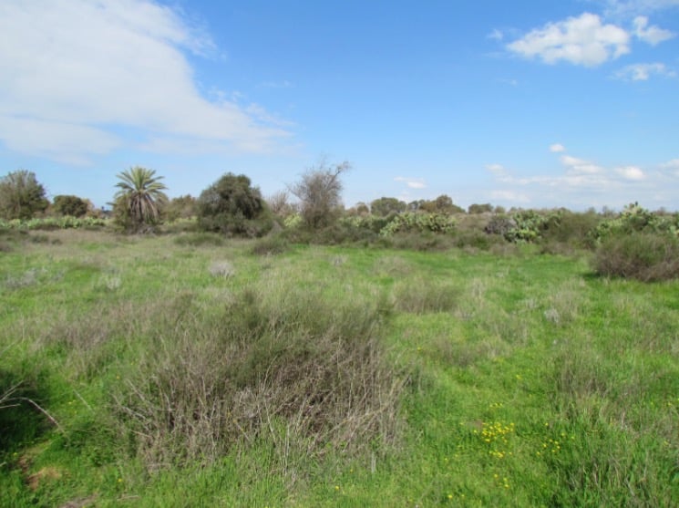
Posted by abu raya - موقع القريه
Posted by abu raya - هربيا
Posted by abu raya - بيوت هربيا الجميله
Posted by abu raya - هربيا
Posted by abu raya - بيوت هربيا
Posted by abu raya - هربيا
Posted by abu raya - قريه هربيا
Posted by abu raya - موقع القريه
Posted by abu raya - موقع القريه
Posted by abu raya - هربيا
Posted by abu raya - بيوت هربيا
Posted by abu raya - بيوت هربيا
Posted by abu raya - بيوت هربيا
Posted by abu raya - هربيا
Posted by abu raya - هربيا
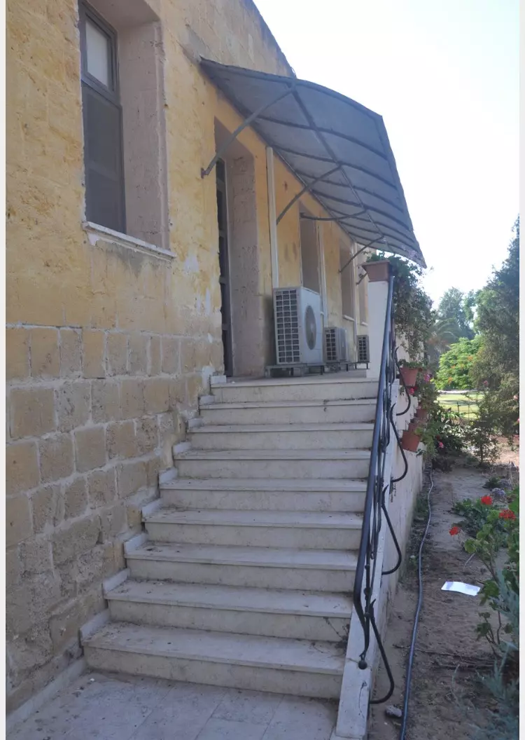
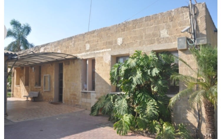
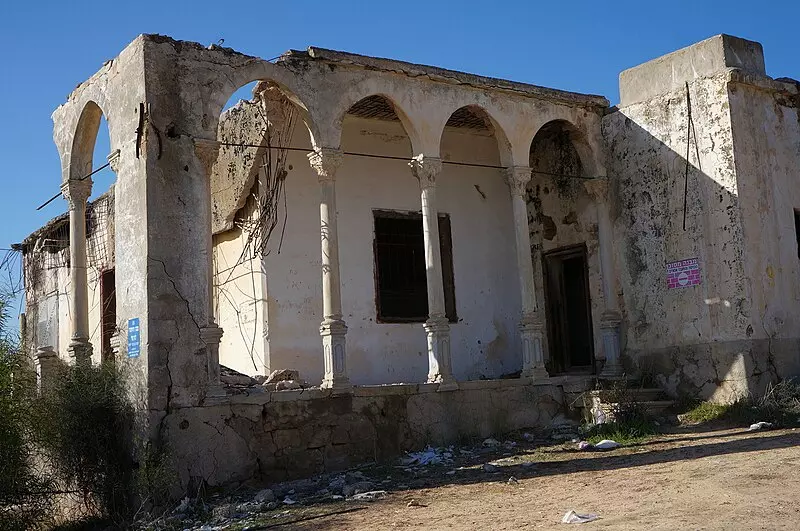
Posted by abu raya - قصر حافظ العلمي في قرية هربيا المهجرة
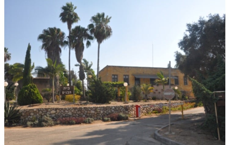
- ومدرسة هربيا الابتدائيه التي تحولت الى مكاتب كيبوتس كرميا (בית הבנים)
- Pre-Nakba Aerial view of the village / صورة من الجو للقرية اخذت قبل النكبة
- The village soon after it was occupied and its population was ethnically cleansed
- Mousa Alam's house -- بيت موسى العلمي
- Mousa Alam's house -- بيت موسى العلمي #3
- Mousa Alam's house -- بيت موسى العلمي #4
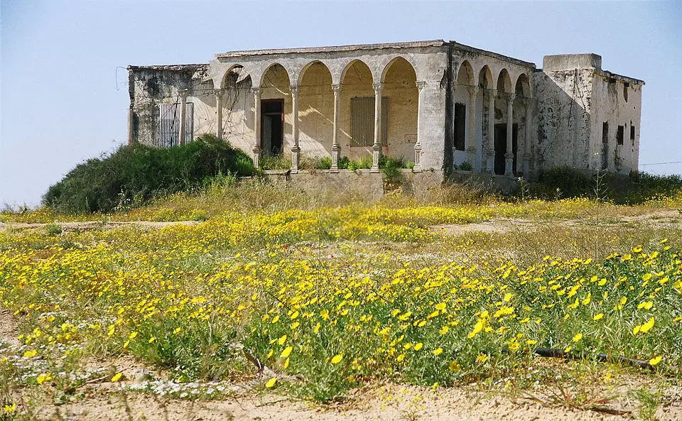
- Mousa Alam's house -- بيت موسى العلمي #5
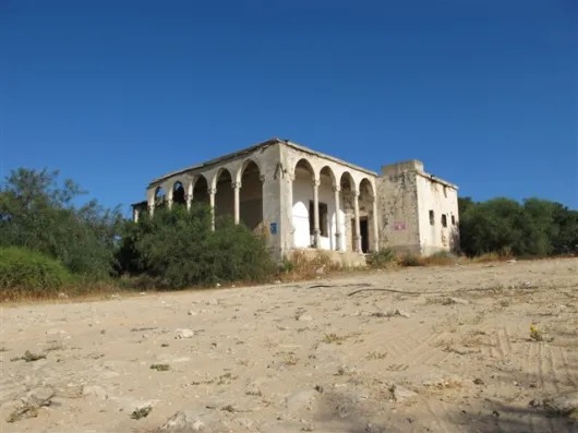
- Mousa Alam's house -- بيت موسى العلمي #6
- خارطة تُظهِر الحدود والطرق بأنواعها والأماكن المقدسة والطبيعة الطوبغرافية من تلال وسهول ومنحدرات والتشكيلة الطبيعية للأرض وأنواع المزروعات. نُشرت الخريطة فترة الانتداب البريطاني، تم إضافة تعديلات عليها من قِبَل خدمة الخرائط والصور التابعة للقوات العسكرية الاسرائيلية فترة الأربعينيات.
Want to browse more? 80,000 pictures were grouped in these gallaries:
| Display Name | Clan/Hamolah | Country of Residence |
| احمد الكومي | - | - |
| Abomaher | سالم | - |
| dawoud m s | Salem | Gaza |
| kamal al arabid mohamed | - | abo dhabi emaretes |
| العرابيد | - | - |
| محمود امين ابو عميرة | عميرة | معسكر جباليا |
| عبد الرؤوف عليان | عليان | غزة مخيم الشاطئ |
| ياسمين | الغول | أبوظبي, الإمارات |
| ام خالد ابوشقفه | ابوشقفه | الزرقاء, الاردن |
| وسيم ابوشقفه | ابوشقفه | عمان, الاردن |
| Miss Rose-Dawas | - | أبوظبي, أبوظبي |
| سهيل سالم | - | فلسطين, +972 |
| ابو كمال | العرابيد | - |
| ابو عدي | حسونه | - |
| iyad jaber | جابر | - |
| ابو احمد | - | هربيا |
| aburahma | altaramsi | lapaz, bolivia |
| قرية هربيا | نعيم سالم | - |
| Maher Muin Abu Kloub | ابو كلوب | AMMAN |
| احمد سيد الغول | الغول | رام الله, فلسطين |
| محمد | أبو هاشم | هربيا |
| ابو الامير | الداعور | جباليا |
| abunedal | ابو غبن | غزة |
| NIDAL KRAIYM | - | - |
| kalloupov | kaloub | annaba, algeria |
| **نسيم فلسطين** | الطناني | غزة |
| عبدالله أبو كلوب | أبو كلوب | - |
| محمد كلوب | - | - |
| mohammed reziq elyan | elyan | khanyounes, palstine |
| saidkaloub | - | Guelma, Algeria |
| شادي الغول | الغول | رام الله, فلسطين |
| shadi | abu daher | niederِsterreich, austria |
| الغول | الغول | غزة, غزة |
| عائلة الطناني | الطناني | السعودية |
| isa amin hasona | hasona | - |
| feras | Feras el-ghoul | PA, PA |
| Husam | Abedrabou | Gaza strip, Palestine |
| Ahmed Elkomey | - | - |
| Kamal Kalloub | kalloub | Palestine, Palestine |
| Faress Abd Rabouh | Abd Rabouh | kuwait, kuwait |
| Ribhi Salem | Salem | Illinois, USA |
| khaled alshrafi | shrafi | jabalia, jabalia |
| rana alghoul | alghoul | - |
| Muath Kraizim | - | - |
| said kaloub | kaloub | Guelma, ALGERIA |
| mohammed el-ghoul | el-ghoul | - |
| Rezeq R.Abdrabbou | Abdrabbou | Dubai, U.A.E |
| Jehad Abu Kaloub | Abu Kalloub | AMMAN, Jordan |
| Anwar | Abu Kalloub | Amman, Jordan |
 Fake Valor: Why Did Zionist Jews Hoist Nazis Flag on Their Ships in the 1930s?
What is new?
-
Facts About Oct. 7th Gaza Raid
-
Remined Us Please:: Who Did Rape Who? Palestinians Raped Israelis? Or, was the other way around?
-
When Prof. Edward Said was invited to debate Bibi Netanyahu in the 1980s, watch what happened!
-
Ezra Klein of the NY Times on the "Jewish Race".
-
Abusing Blood Libel!
-
Did Israeli Soldiers Activate The Hanniba Direective On Oct. 7th? You Be The Judge
-
Zionist FAQ: Isn't it true that Palestinians don't want peace? Palestinians never accepted the two-state solution
- Facts about Haavara (Transfer) Agreement between Ben-Gurion & Hitler
-
Haavara FAQs: Why Did Zionist Jews Hoist Nazis' Flags on Their Ships in the 1930s?
- Haavara FAQs: When Chaim Weizmann met FDR in mid-1943, why was he silent about rescuing European Jewry?
-
Dear ChatGPT: How did Palestinians resist Napoleon's invasion of their country in 1799?
-
Dear ChatGPT: Gaza had a vibrant Jewish community in the mid-17th century. What happened to them?
-
Dear ChatGPT: Why did the Jewish Agency suppress news of the Holocaust during WWII?
-
Video Playlist: Jews share their DNA tests to end the conflict for good.
-
A Tale of Two Conflicts: Examining the Definition of Genocide
-
Prof. Abraham Polak And The Suppressed History of the Khazars and European Jewry
-
How Ronald Reagan would have framed the genocide in Gaza if he were still alive?
-
Haavara FAQs: Let us do the math: how many German Jews did The Haavara Agreement save?
-
Zionist FAQs: The Hebron Massacre of 1929, "clearly proves" that Palestinians are antisemitic, how could you deny it?
-
Zionist FAQs: Why Anti-Zionist Is Not Antisemitism?
-
Zionist FAQs: Isn't it true that the KGB created Palestinian Nationalism in the early 1960s?
- Zionist FAQs: Muslims are killing Muslims all the time; why are Israeli Jews being singled out in the media?
- Zionist FAQs: How is Israel an apartheid state when 20% of its citizens are Arabs who enjoy full rights?
-
Haavara FAQs: Why Did Dorothy Thompson Flip From A Zionist Advocate to A Silenced Dissenter?
-
Haavara FAQs: Analysis of Herzl's Uganda Scheme and how it could have saved millions of Jews.
-
Haavara FAQs: Why did Hayim Greenberg describe American Jewry as "morally bankrupt" in early 1943?
-
Haavara FAQs: What if the Evian Conference was a resounding success? What would have been the impact of saving European Jewry on Zionism?
- Haavara FAQs: What if the six million were saved, how that would have impacted the Zionist project?
-
Haavara FAQs: How did Zionist leaders react when Europe's Jews lingered in the DP camps after WWII ended?
-
Why does the American Jewish community repeat lies that David Ben-Gurion had debunked before he died?
-
Who has the power to rename the Tatar/Khazar Gene Marker to Jewish IV?
-
Zionist FAQs: Why won't Egypt, Syria, and Jordan take their people back? Jews are indigenous to Palestine, and Arabs immigrated after Jews developed the country. Arabs should leave.
-
Haavara FAQs: Did Hitler and the Nazis conflate between Judaism and Zionist? If that wasn't case, then why?
-
Haavara FAQs: Winston Churchill and antisemitism, a collection of articles written Churchill.
-
Haavara FAQs: Broken by country, how many Jews survived vs. killed during the Holocaust?
-
Haavara FAQs: Why did European Jews vote with their feet and to immigrated to the Americas, not Palestine, after WWII?
-
Watch this American Jewish Girl describing Israeli Jews' cognitive dissonance like no other in under two minutes
-
Haavara FAQs: When the Nazis went out of their way to hide the Holocaust, Israeli Jews did the exact opposite by broadcasting their genocide of Gazans. But why?
-
Haavara FAQs: How Zionist Jews went out of their to show their appreciation to Nazism and Fascism?
- Haavara FAQs: Why Zionist leaders were against bombing the death camps & the Railroads leading to them?
-
Haavara FAQs: Hitler's message to the British and American people: If Jews are such noble citizens and you care about them, how come you're not letting them in? I will gladly ship them to you at my expense, even on luxury liners!
-
A shortlist of Zionist and Israeli false flag operations in the name Jews.
-
The Most Moral Army
- The Land of Kapos (Israel): Where the brave are boycotted and Kapos walk free.
- Why did early Zionists often named their communal enterprises "colonial"?
- Zionist Relations with Nazi Germany by Faris Glubb
-
Two NY Times advertisements by Zionists in the early 1943 that exposes Zionists' treason at the height of the calamity
- Facts Not Lies about the Palestinian-Israeli Conflict.
- Site's pictures have been categorized
- Campgain Against Lice
- A Survey of Palestine, the official source about Palestine before Nakba produced by the British Mandate; over 1200 pages.
- Satellite View & Google Earth: Over 6,000 placemarks identifying all destroyed towns, W. Bank & Gaza Strip Towns, & refugee camps.
- PalestineRemembered.com and its Nakba Oral History Project were featured on al-Jazeera Satellite TV.
- Nakba Oral History Video Podcast:
 Over 700 Oral History interviews (including 3,500+ hours of recording) can be viewed online.
 - Palestine Village Statistics Project
- Gaza Jail Break
- النسخة العربية للموقع الان متوفرة
- Videos: Documenting the destroyed villages in video: Tracing all that remains since Nakba.
- Videos: Responding to Zionist Propaganda
- Interview: The ethnic cleansing of Palestine: George Galloway interviews Israeli Historian Ilan Pappe.
- For Palestinians, memory matters. It provides a blueprint for their future By George Bisharat.
- Zionist FAQ now available in Hebrew שאלות שציונים שואלים, עכשיו בעברית
- Video: The Stephen Walt and John Mearsheimer report on the influence of the Israel Lobby on U.S. Foreign Policy
- The Palestinian-Israeli conflict for beginners
