| PalestineRemembered | About Us | Oral History | العربية | |
| Pictures | Zionist FAQs | Haavara | Maps | |
| Search |
| Camps |
| Districts |
| Acre |
| Baysan |
| Beersheba |
| Bethlehem |
| Gaza |
| Haifa |
| Hebron |
| Jaffa |
| Jericho |
| Jerusalem |
| Jinin |
| Nablus |
| Nazareth |
| Ramallah |
| al-Ramla |
| Safad |
| Tiberias |
| Tulkarm |
| Donate |
| Contact |
| Profile |
| Videos |
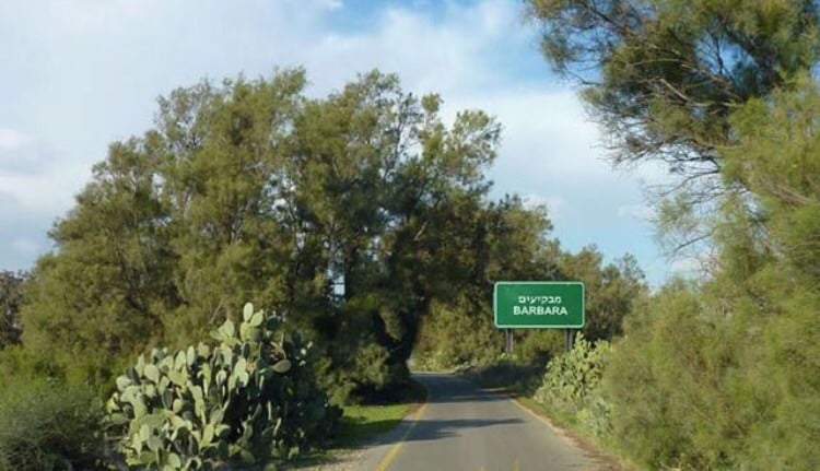
Welcome To Barbara - بربره (ברברה)
|
District of Gaza
Ethnically cleansed days ago |
العربية Google Earth |
 |
Gallery (48) |
- Statistics & Facts
-
Before & After

- Satellite View
- Articles 11
- Pictures 48
- Aerial Views 1
- Land Deeds 22
- Oral History 1
- Members 58
- Families
- All That Remains
- Wikipedia
- Videos 1
- Guest Book 9
- Links 3
| Statistic & Fact | Value | ||||||||||||||
| Occupation Date | November 4, 1948 | ||||||||||||||
| Distance From District | 17 (km) North East of Gaza | ||||||||||||||
| Elevation | 50 (meters) | ||||||||||||||
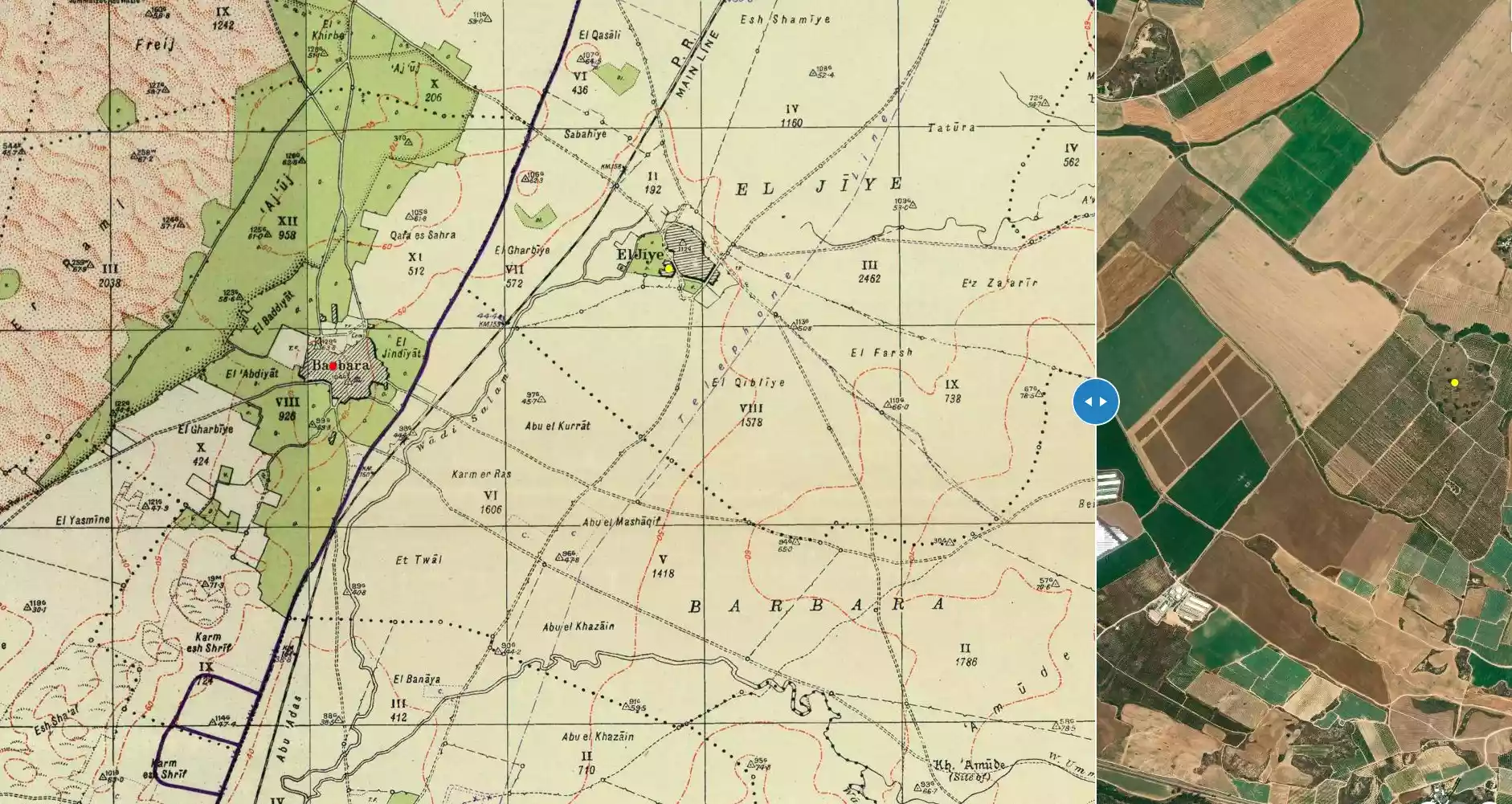
| Before & After Nakba, Click Map For Details |
|||||||||||||||
|
|||||||||||||||
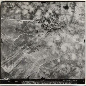
| Pre-Nakba Aerial View |
|||||||||||||||
|
|||||||||||||||
| Map Location | See location #30 on the map View from satellite |
||||||||||||||
| Military Operation | Operation Yo'av | ||||||||||||||
| Attacking Units | Possibly a combination of Giv'ati, Negev, and Yiftach brigades. | ||||||||||||||
| Defenders | Egyptian Army | ||||||||||||||
| Exodus Cause | Military assault by Zionist troops | ||||||||||||||
| Village Temains | The village was completely destroyed, and only house rubble left behind. | ||||||||||||||
| Ethnically Cleansing | Barbara inhabitants were completely ethnically cleansed. | ||||||||||||||
| Clans | For now, we're aware of the clans of Adwan, 'Ayesh, Ahmad, Younis, Al Ashqar, as well as branches of above, Saleh, Saad Al Din, Abu Sharik, Abu Selimeh, Al Sharif, Nashuan, Shehadeh, Hammad, Nasar, Abu Dubaa, and Eid. Please do not hesitate to contact us if your clan name is not listed. | ||||||||||||||
| Pre-Nakba Land Ownership |
**Town Lands' Demarcation Maps |
||||||||||||||
| Land Usage As of 1945 |
|
||||||||||||||
| Population |
|
||||||||||||||
| Number of Houses |
|
||||||||||||||
| Near By Towns |
|||||||||||||||
|
|||||||||||||||
| Town's Name Through History | The Romans referred to Barbara by Barbara. | ||||||||||||||
| Schools | Barbara had an elementary school for boys which was founded in 1921, and in 1947 it had an enrollment of 252 students. | ||||||||||||||
| Places of Warship | Barbara had an old mosque which was built during the reign of the Ottoman Sultan Murad III (1574-1596). | ||||||||||||||
| Shrines / Maqams | The village had a shrine/maqam for a local Muslim scholar known by al-Shaykh Yusuf al-Barbarawi. | ||||||||||||||
| Exculsive Jewish Colonies Who Usurped Village Lands |
Mavqi'im & Talmey yare | ||||||||||||||
| Featured Video | |||||||||||||||
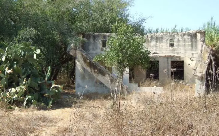
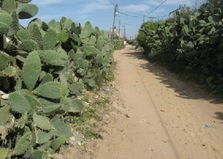
Village Before NakbaThe village was on the eastern periphery of the coastal sand dunes that ran parallel to the Mediterranean. The village center was situated on a relatively flat spot, but some village buildings were near dunes on uneven ground. Sand encroachment presented a serious problem until the 1940s, when the inhabitants were able to stabilize the dunes by building houses and planting trees in the appropriate places. Barbara was located immediately to the west of the coastal highway and the railway line and so had access to the urban centers both north and south; secondary roads linked it to adjacent villages. A village with the same name (Barbara) appears to have existed on this site during the Roman occupation of Palestine. The Arab geographer Mujir al-Din al-Hanbali (d. ca. 1522) said that the village was the hometown of al-Shaykh Yusuf al-Barbarawi, a local sage and a student of renowned Muslim scholar Ahmad ibn Dawud, who died in 1323. In 1596, Barbara was a village in the nahiya of Gaza (liwa' of Gaza), with a population of 402.In the late nineteenth century, the village of Barbara was rectangular in shape and surrounded by gardens and two ponds. The sand encroaching from the coast was stopped by the cactus hedges of the gardens. Olive groves were found in the east. Barbara's adobe brick houses were separated by sandy streets. Its population was Muslim, and worshipped in an old mosque at the village center. This mosque was established during the reign of the Ottoman sultan Murad III (1574–1596); it contained the tomb of the above-mentioned al-Shaykh Yusuf al-Barbarawi. In addition to the mosque, the village center contained a number of shops and an elementary school—founded in 1921―in which 252 students were enrolled in 1947. Agricultural land ringed the village on all sides. Grapes, the chief crop and considered some of the best in Palestine, were sold in numerous coastal towns and villages. In addition, people cultivated almonds, figs, olives, oranges, guavas, watermelons, cantaloupes, and grain. The fruit trees were concentrated on the west side of the village and grain on the east. In 1944/45 a total of 132 dunums was devoted to citrus and bananas, and 9,613 dunums were allocated to cereals; 2,952 dunums were irrigated or used for orchards. Agriculture was primarily rainfed. A few wells with depths of 35–40 m were drilled to irrigate the orange groves and vegetable fields. Barbara was also known for its long rugs, al-mazawid, which were woven by women. Village Occupation and Ethnic CleaningBarbara had been the scene of skirmishes since the early weeks of the war. In the first half of January 1948, a Jewish bus passing through the village opened fire on villagers, without causing any casualties. On 12 January at 7:00 a.m., according to a report in the Palestinian newspaper Filastin, the village was sprayed with gunfire and several windows were broken in the (empty) village school. Another attack, which took place in April 1948, was recorded by Tariq al-Ifriqi, the Sudanese commander of the irregular Arab forces in the Gaza area. As villagers ploughed their fields on 10 April, they were fired at by members of a nearby Jewish settlement; one villager was wounded. The village militia returned the fire, and a two-hour-long battle ensued. No casualties were reported among the villagers, who said that Jewish forces were seen carrying their dead and wounded as they withdrew.Barbara was captured toward the end of the Operation Yoav, on 4–5 November, soon after al-Majdal. The villagers were either expelled or fled under fire. Zionists Colonies on Village LandsTwo settlements were built on village lands. Mavqi'im was established on 12 January 1949, just south of the village, for the purpose of preventing the villagers' return. Talmey Yafe, established in 1950, is southeast of the site. Ge'a, built in the same year, is northeast of the site and is close to, but not on, village lands; it was built on the lands of the neighboring al-Jiyya.Village TodayThe crumbled walls and debris of houses are all that remains of the village buildings. The debris is overgrown with thorns and brush. Old eucalyptus and sycamore trees and cactuses also grow on the site. Some of the old streets are clearly identifiable. One area of the site serves as a garbage dump and a junkyard for old cars. The surrounding lands are planted by Israeli farmers in corn.SourceDr. Walid al-Khalidi, 1992: All That Remains. |
|||||||||||||||
| Related Maps | Town Lands' Demarcation Maps خرائط للقضاء توضح حدود القرى والاودية Town's map on MapQuest View from satellite Help us map this town at WikiMapia |
||||||||||||||
| Related Links | Wikipedia's Page Facebook Page Google Search Google For Images Google For Videos |
||||||||||||||
| More Information | في كتاب كي لا ننسى في كتاب بلادنا فلسطين المزيد من موقع هوية |
||||||||||||||
- Battle for the village of Barbara
- Resistance in Barbara
- وجه من بربرة
- المدارس في بربرة
- المساجد في بربرة
- الشتاء في بربرة
- بعض من العادات والتقاليد في بربرة
- قصة اليوسفي - من روائع القصص الشعبية-
- قصة عطرطش - من روائع القصص الشعبية-
- أسماء العائلات التي كانت تسكن بربره حتى نكبة 1948
- نبذة تاريخية عن قرية بربره (قضاء غزة) من كتاب (كي لا ننسى)
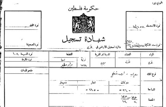
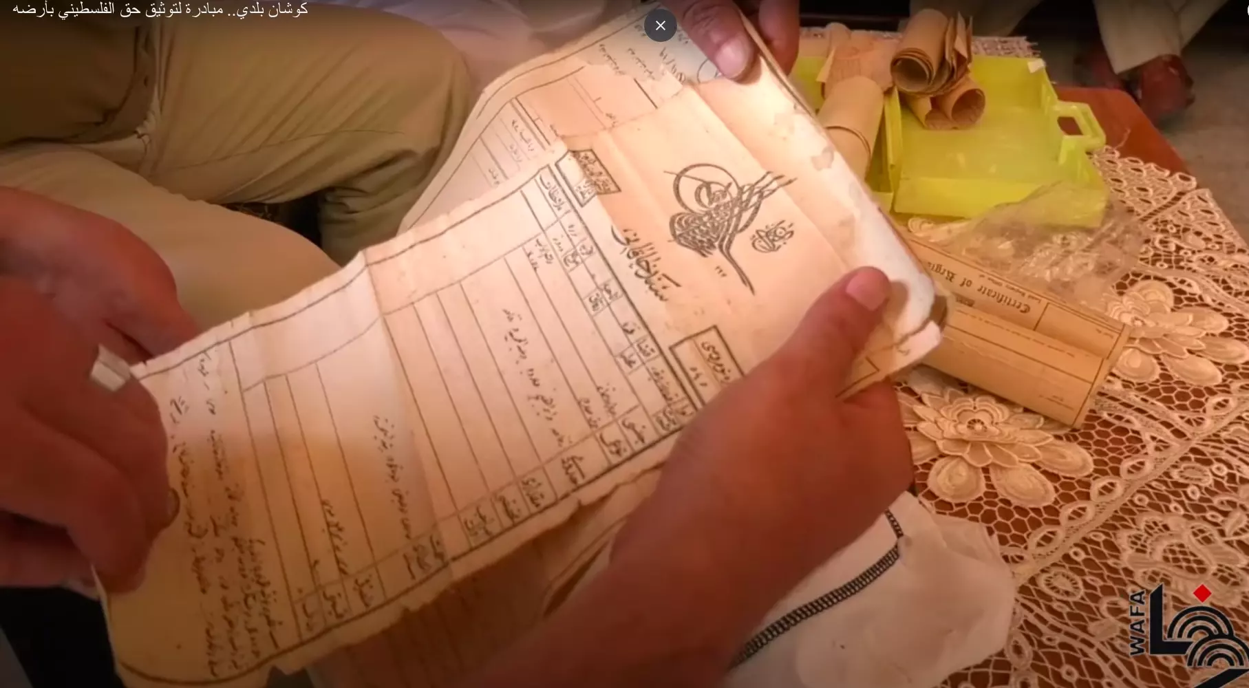
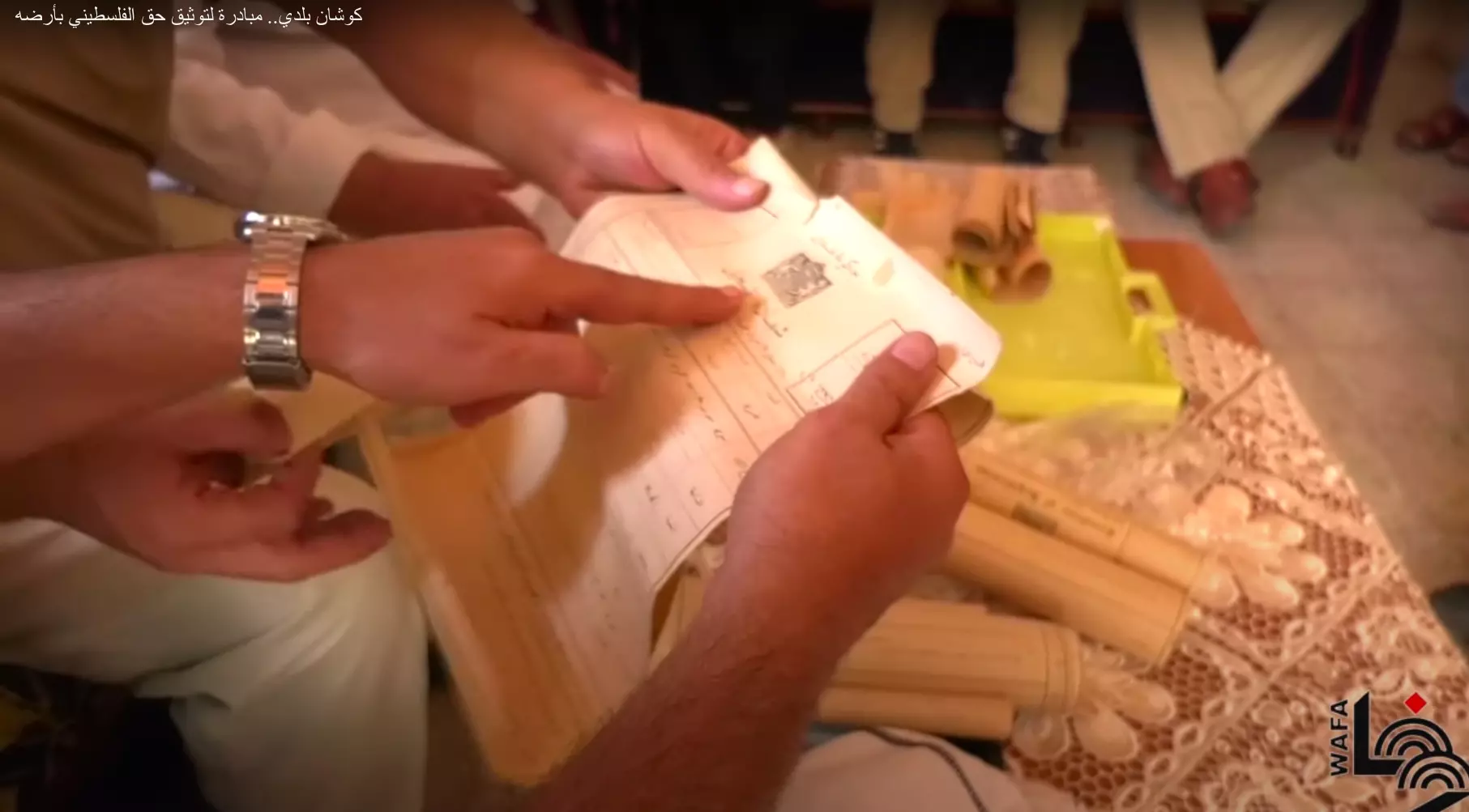
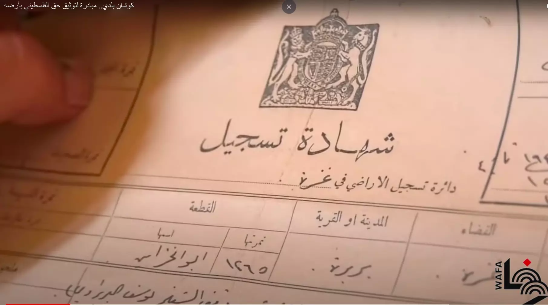
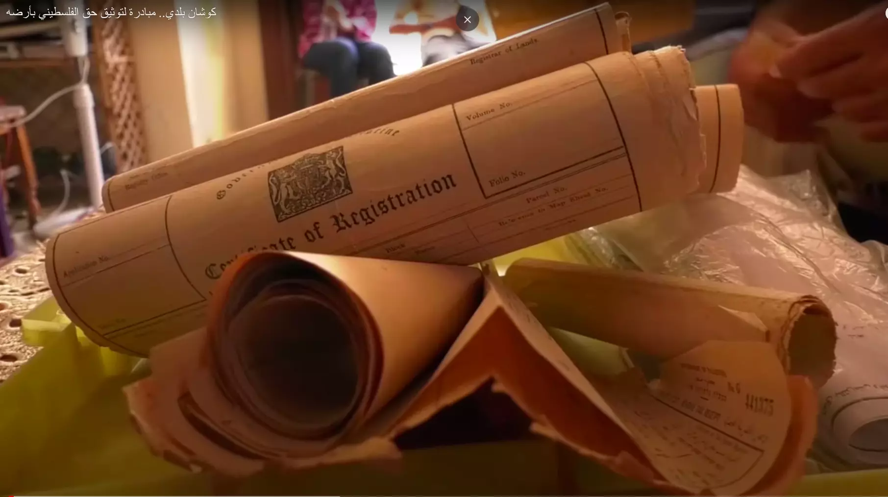
- Barbara Land Document 30.10.1941
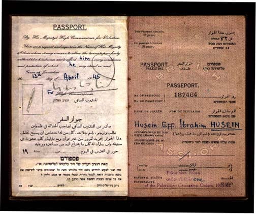
Posted by Abdel Gabbar Adwan - British Palestine Passport Jerusalem 1945 pre Nakba

Posted by Abdel Gabbar Adwan 1 - British Palestine Passport Jerusalem 1945 pre Nakba
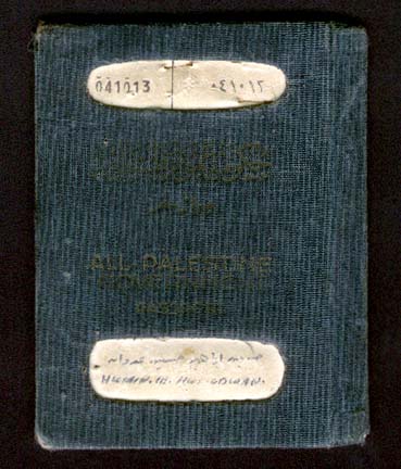
Posted by Abdel Gabbar Adwan - All Palestine Government Passport Cairo 4.12.1958
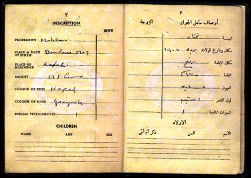
Posted by Abdel Gabbar Adwan - All Palestine Government Passport former Barbara resident in Raffah
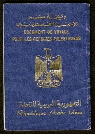
Posted by Abdel Gabbar Adwan - Refugee Document for all Gaza residents
Posted by Abdel Gabbar Adwan 3 - barbara
Posted by ziad sukkar - من بيوت القريه
Posted by abu raya 1 - موقع القريه
Posted by abu raya - موقع القريه وطرقها
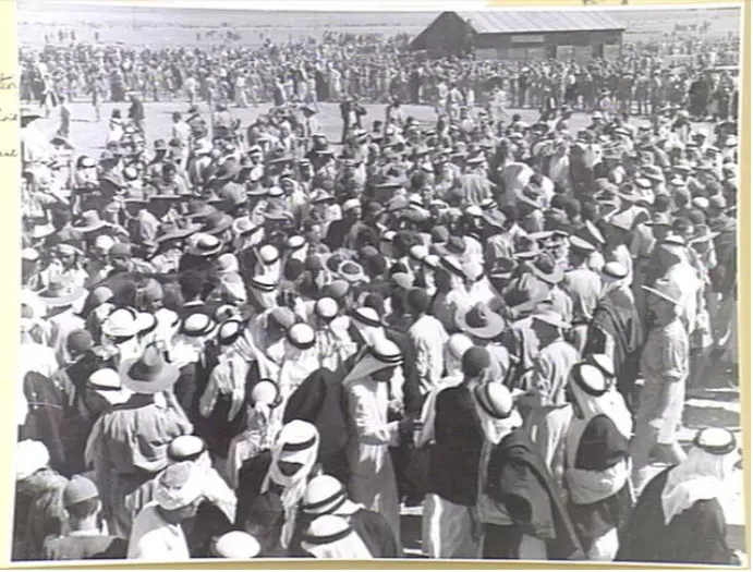
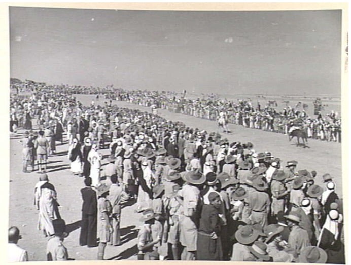
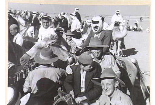
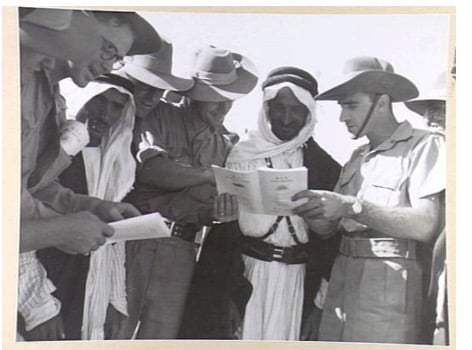
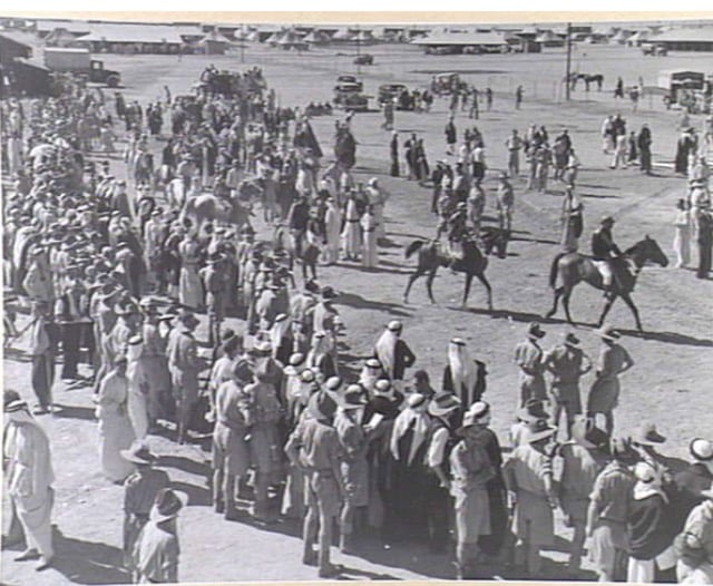
Posted by abu raya - صوره لاهالي قريه بربره في معسكر الجيش البريطاني سنه 1941
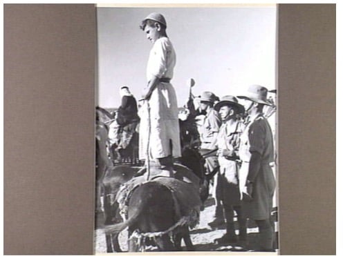
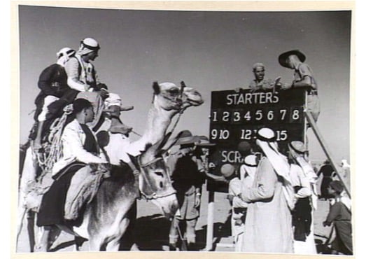
Posted by abu raya 1 - المعسكر البريطاني في بربره سنه 1940
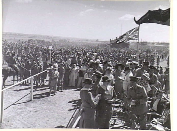
Posted by abu raya - اهالي بربره في المعسكر البريطاني سنه 1940
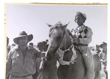
Posted by abu raya - بربره سنه 1940
Posted by abu raya - قريه بربره سنه 1940
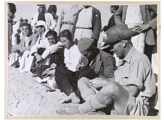
Posted by abu raya - اهالي بربره في المعسكر البريطاني سنه 1940
Posted by abu raya - قريه بربره 1940
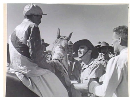
Posted by abu raya - المعسكر البريطاني بربره سنه 1940
Posted by abu raya - بربره سنه 1940
Posted by abu raya - بربره سنه 1940
Posted by abu raya - بربره سنه 1940
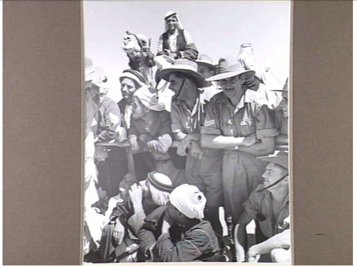
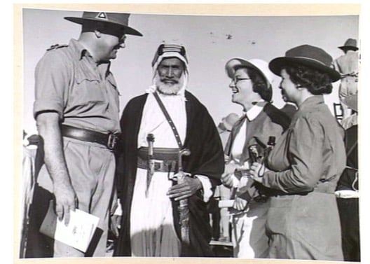
Posted by abu raya - ضابط بريطاني برفقه مختار بربره سنه 1940
Posted by abu raya - المعسكر البريطاني في القريه سنه 1942
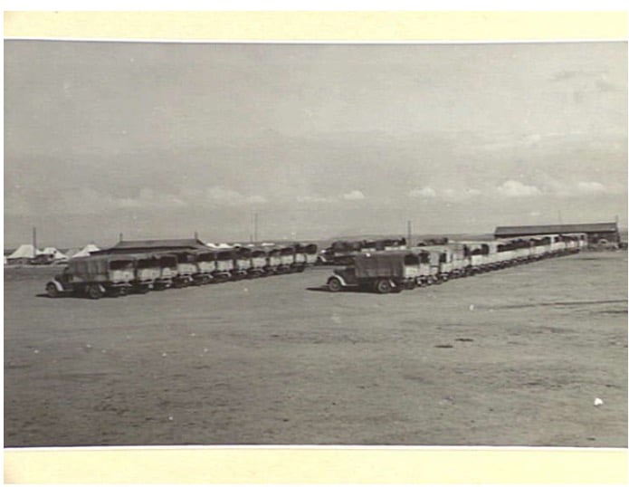
Posted by abu raya - المعسكر البريطاني في بربره سنه 1940
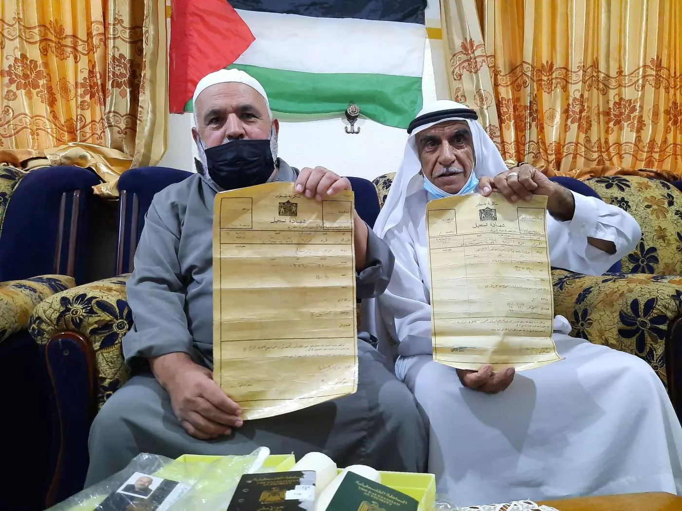
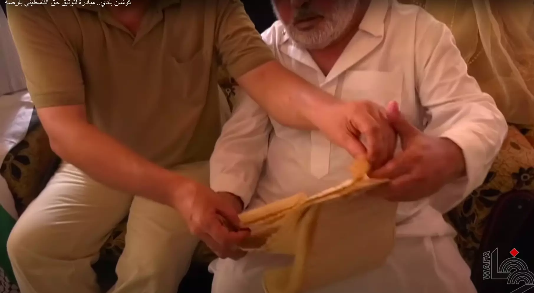
Posted by abu raya - Abu Hamed (on the left) and his 70-year-old Mohammed hold their land titles
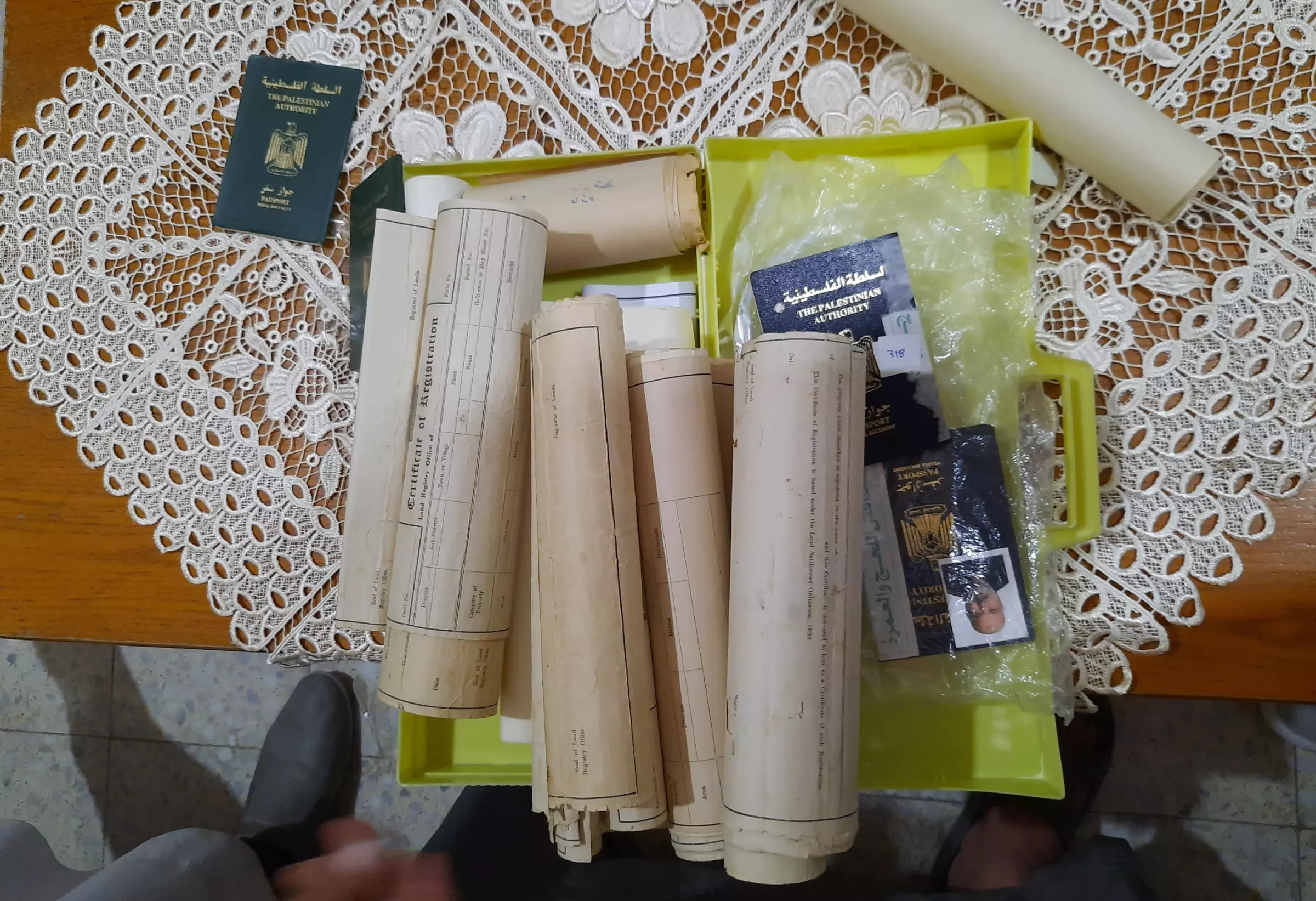
- Abu Hamed (on the left) and his 70-year-old Mohammed hold their land titles #2
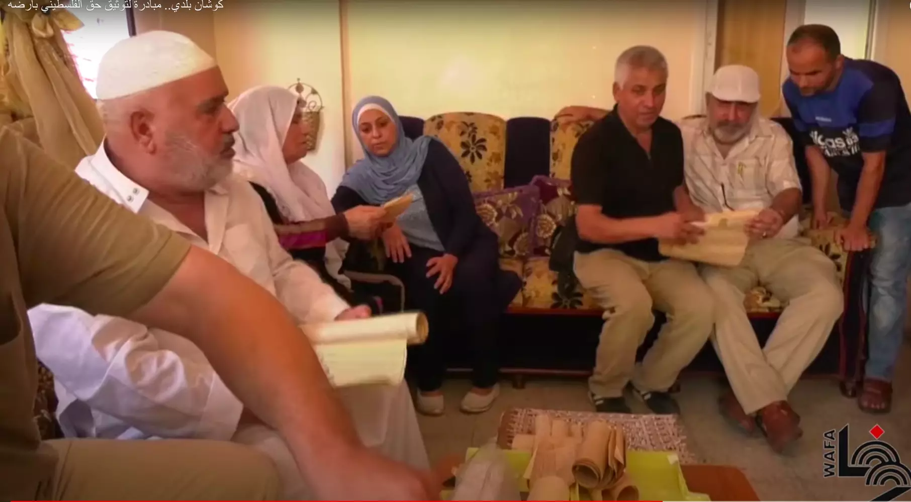
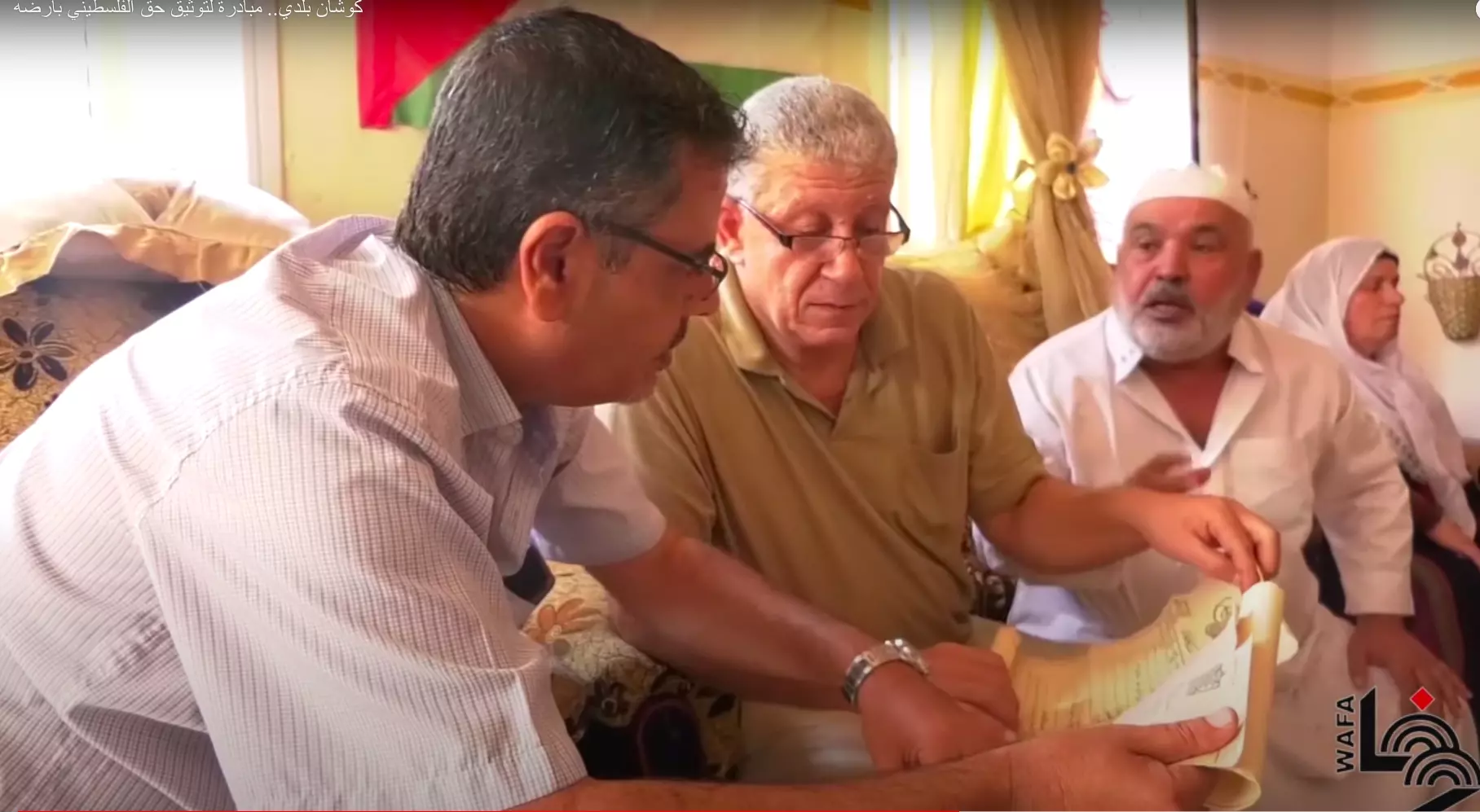
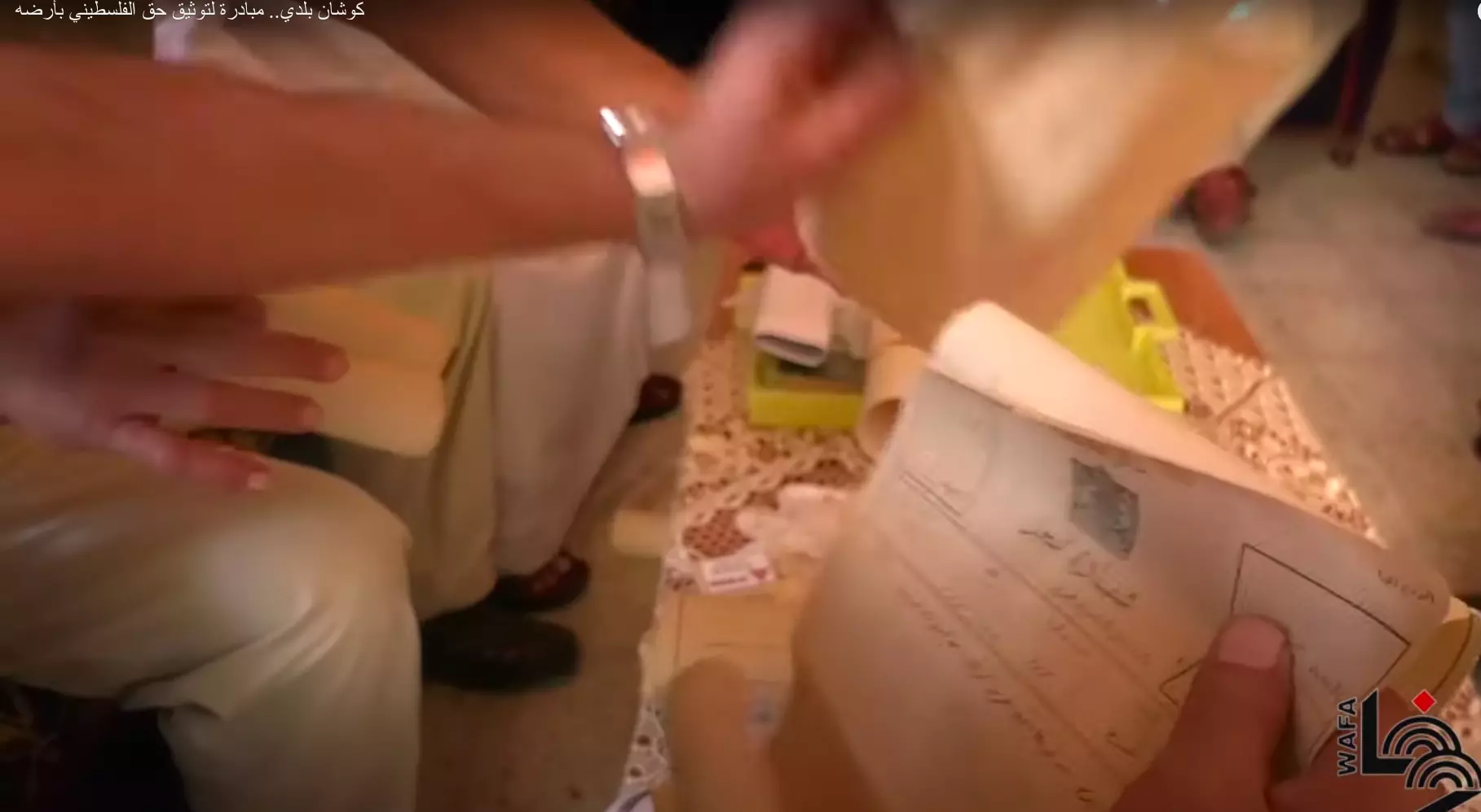
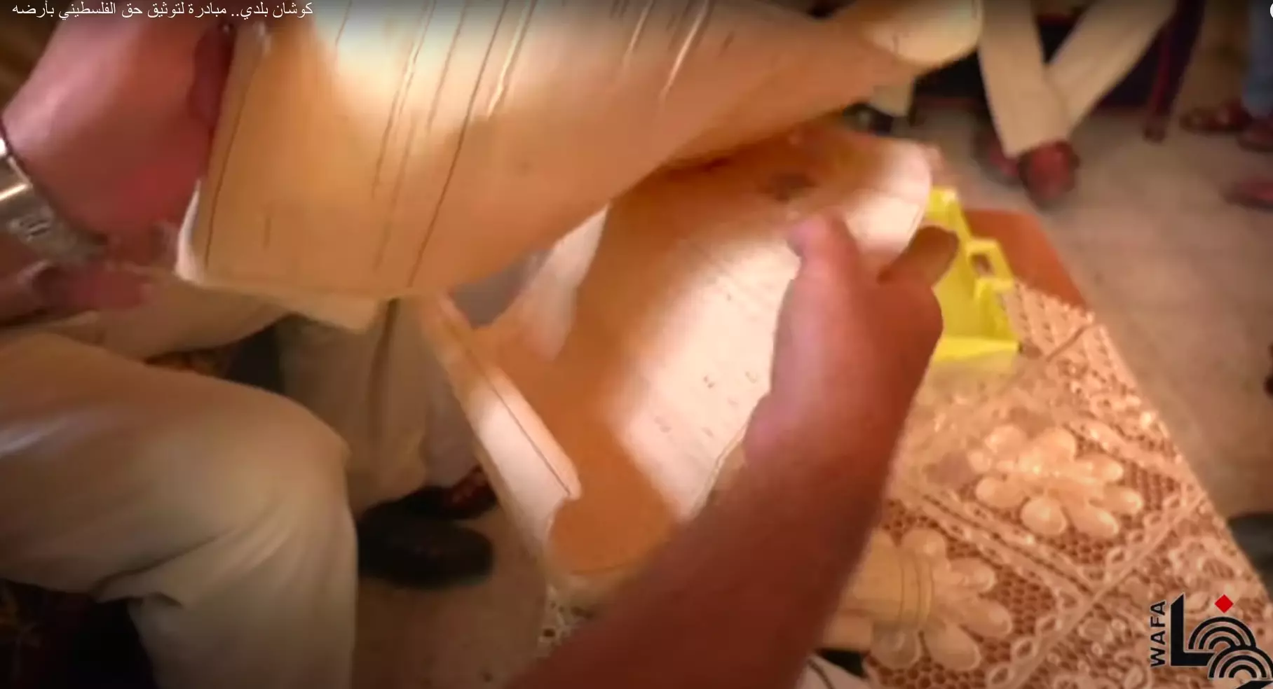
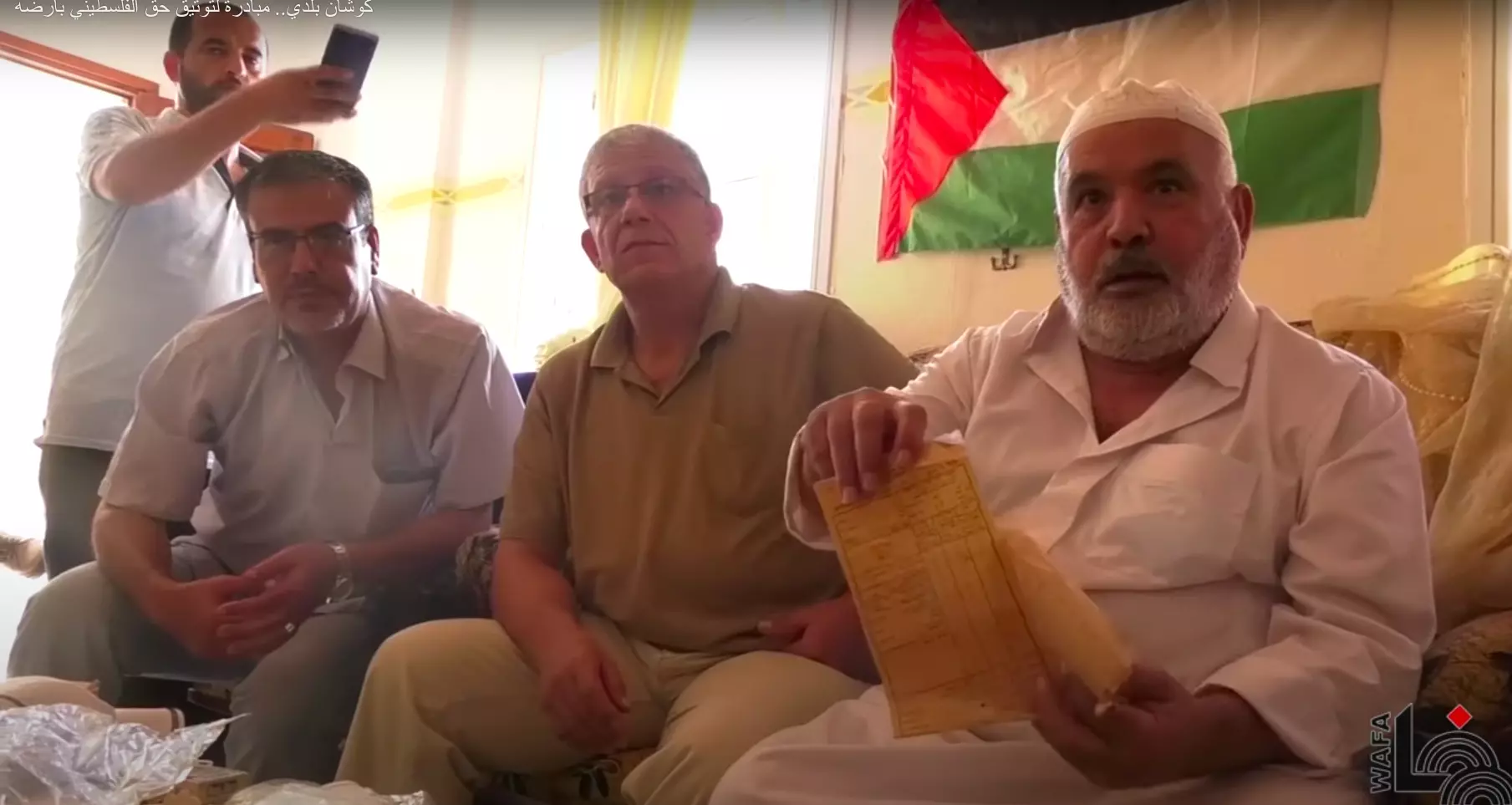
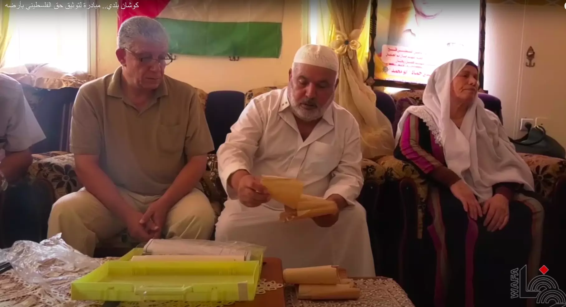
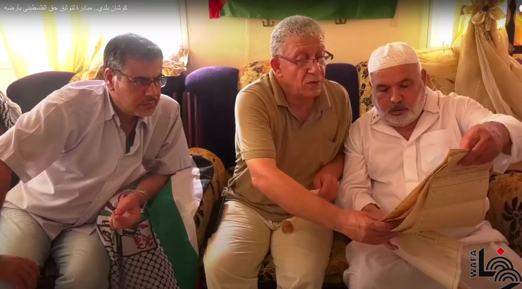
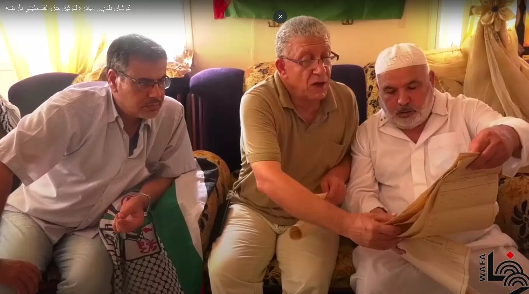
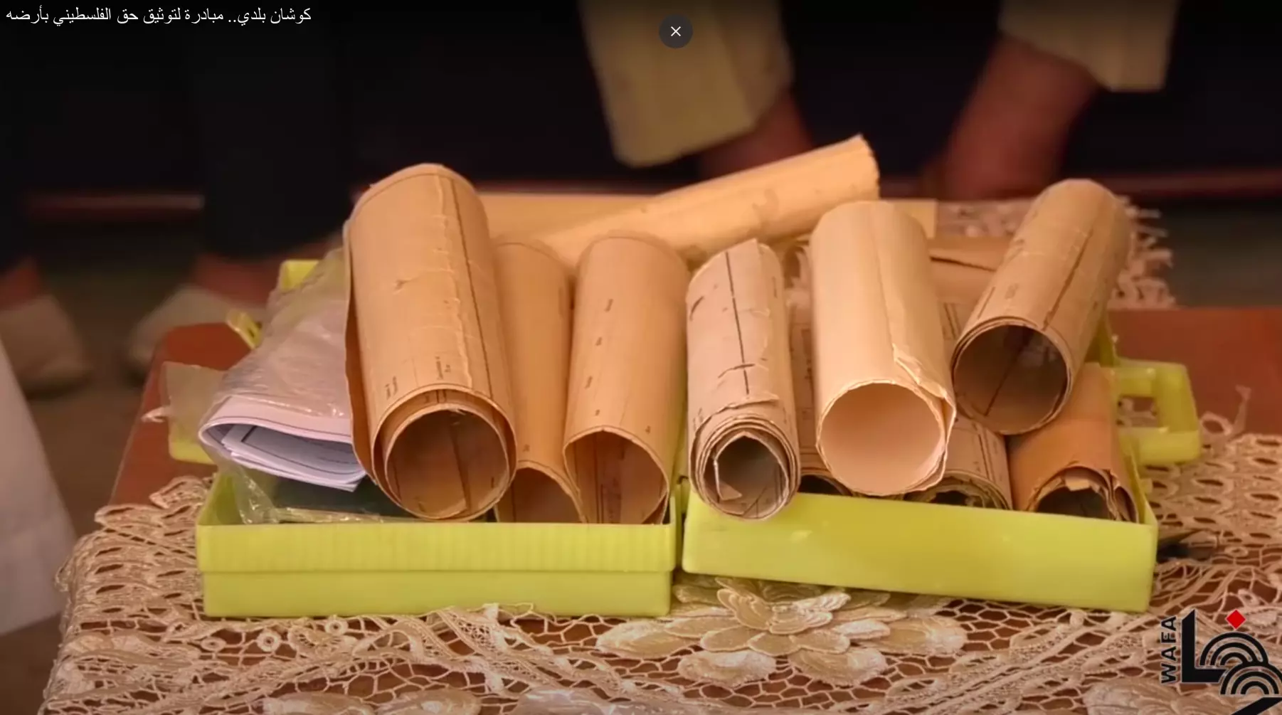
- من فعاليات مجموعة كوشان بلدي دونت مجموعة من الكواشين لقرية بربة امهجرة. زر صفحتهم عبر الفيس للمزد عن نشاطاتهم.
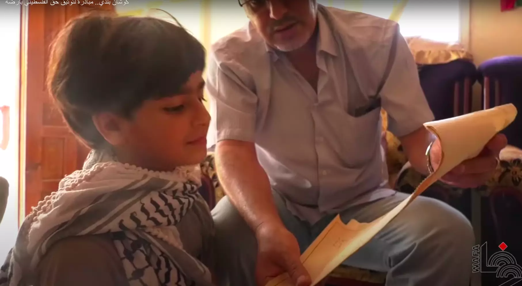
- من فعاليات مجموعة كوشان بلدي دونت مجموعة من الكواشين لقرية بربة امهجرة. زر صفحتهم عبر الفيس للمزد عن نشاطاتهم. #2
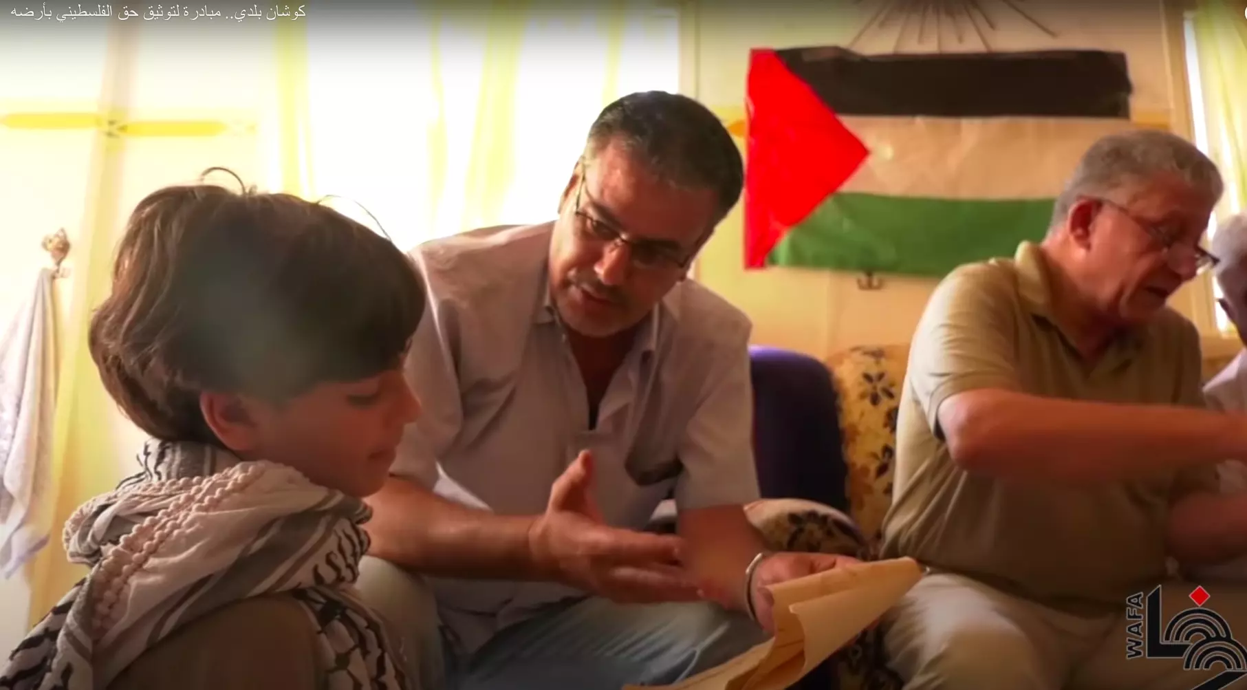
- من فعاليات مجموعة كوشان بلدي دونت مجموعة من الكواشين لقرية بربة امهجرة. زر صفحتهم عبر الفيس للمزد عن نشاطاتهم. #3
- من فعاليات مجموعة كوشان بلدي دونت مجموعة من الكواشين لقرية بربة امهجرة. زر صفحتهم عبر الفيس للمزد عن نشاطاتهم. #4
- من فعاليات مجموعة كوشان بلدي دونت مجموعة من الكواشين لقرية بربة امهجرة. زر صفحتهم عبر الفيس للمزد عن نشاطاتهم. #5

- من فعاليات مجموعة كوشان بلدي دونت مجموعة من الكواشين لقرية بربة امهجرة. زر صفحتهم عبر الفيس للمزد عن نشاطاتهم. #6
- من فعاليات مجموعة كوشان بلدي دونت مجموعة من الكواشين لقرية بربة امهجرة. زر صفحتهم عبر الفيس للمزد عن نشاطاتهم. #7
- من فعاليات مجموعة كوشان بلدي دونت مجموعة من الكواشين لقرية بربة امهجرة. زر صفحتهم عبر الفيس للمزد عن نشاطاتهم. #8
- من فعاليات مجموعة كوشان بلدي دونت مجموعة من الكواشين لقرية بربة امهجرة. زر صفحتهم عبر الفيس للمزد عن نشاطاتهم. #9
- من فعاليات مجموعة كوشان بلدي دونت مجموعة من الكواشين لقرية بربة امهجرة. زر صفحتهم عبر الفيس للمزد عن نشاطاتهم. #10
- من فعاليات مجموعة كوشان بلدي دونت مجموعة من الكواشين لقرية بربة امهجرة. زر صفحتهم عبر الفيس للمزد عن نشاطاتهم. #11
- من فعاليات مجموعة كوشان بلدي دونت مجموعة من الكواشين لقرية بربة امهجرة. زر صفحتهم عبر الفيس للمزد عن نشاطاتهم. #12
- من فعاليات مجموعة كوشان بلدي دونت مجموعة من الكواشين لقرية بربة امهجرة. زر صفحتهم عبر الفيس للمزد عن نشاطاتهم. #13
- من فعاليات مجموعة كوشان بلدي دونت مجموعة من الكواشين لقرية بربة امهجرة. زر صفحتهم عبر الفيس للمزد عن نشاطاتهم. #14
- من فعاليات مجموعة كوشان بلدي دونت مجموعة من الكواشين لقرية بربة امهجرة. زر صفحتهم عبر الفيس للمزد عن نشاطاتهم. #15
- من فعاليات مجموعة كوشان بلدي دونت مجموعة من الكواشين لقرية بربة امهجرة. زر صفحتهم عبر الفيس للمزد عن نشاطاتهم. #16
- من فعاليات مجموعة كوشان بلدي دونت مجموعة من الكواشين لقرية بربة امهجرة. زر صفحتهم عبر الفيس للمزد عن نشاطاتهم. #17
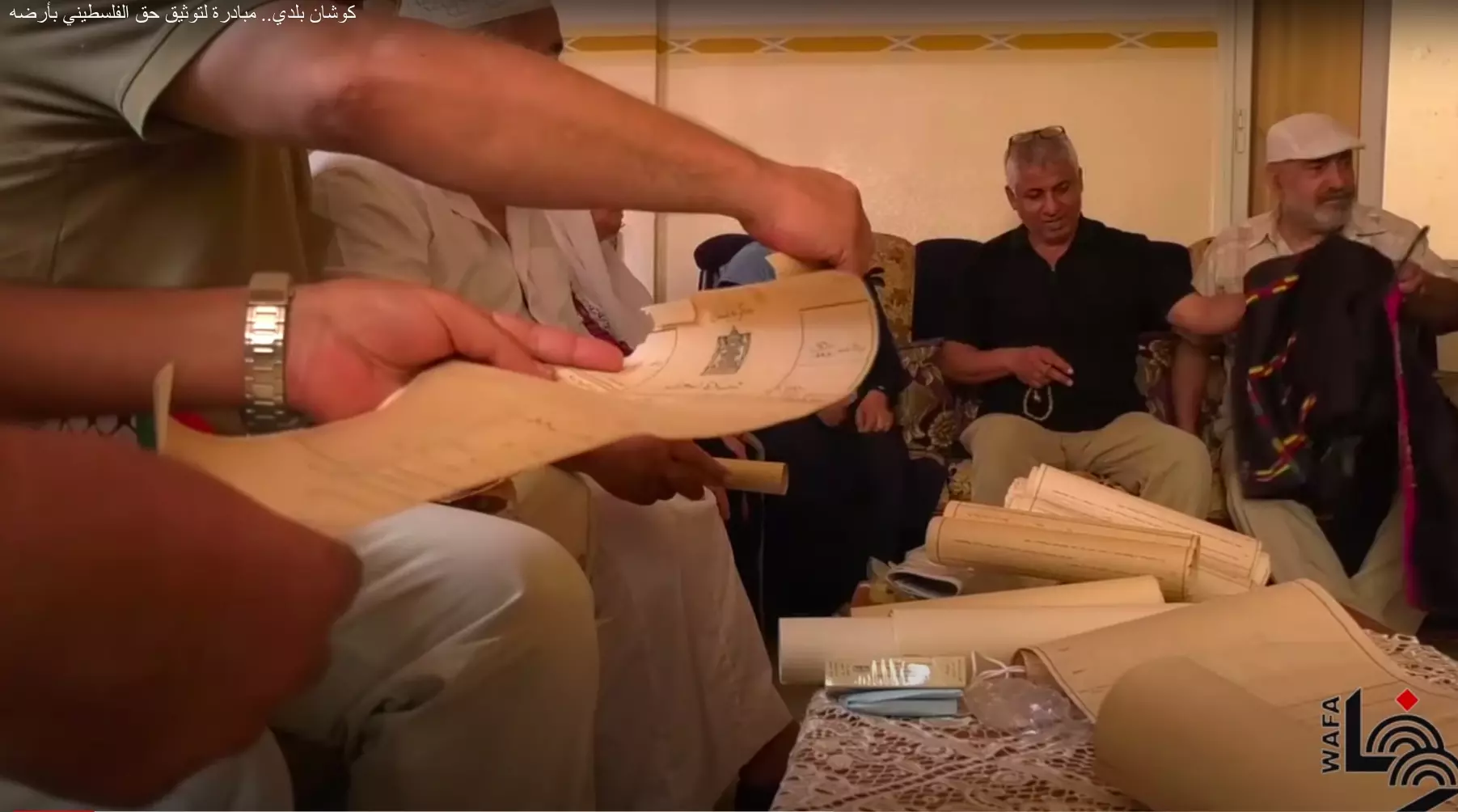
- من فعاليات مجموعة كوشان بلدي دونت مجموعة من الكواشين لقرية بربة امهجرة. زر صفحتهم عبر الفيس للمزد عن نشاطاتهم. #18
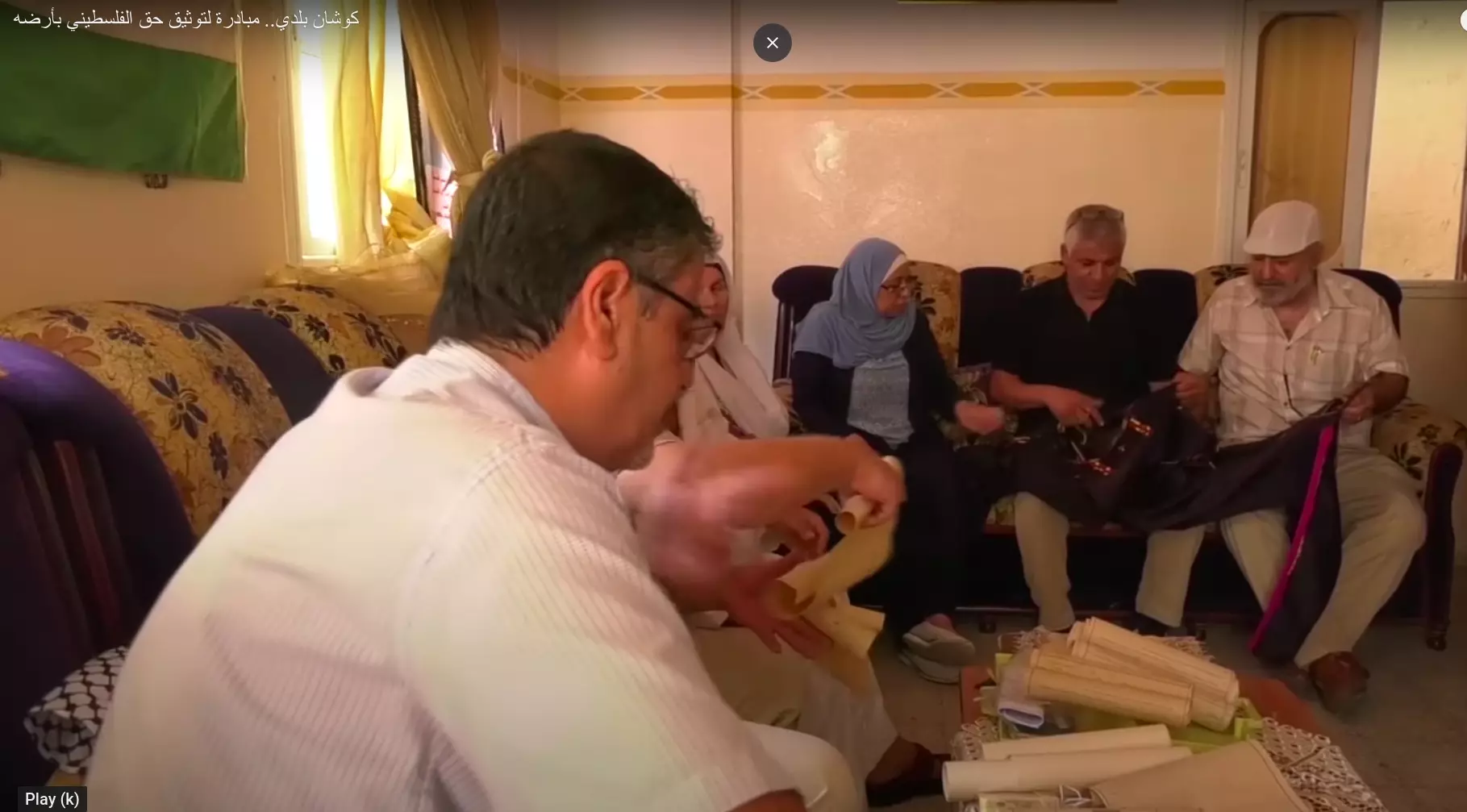
- من فعاليات مجموعة كوشان بلدي دونت مجموعة من الكواشين لقرية بربة امهجرة. زر صفحتهم عبر الفيس للمزد عن نشاطاتهم. #19
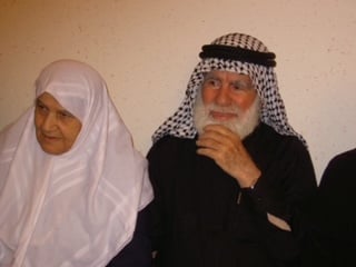
- الحاج كامل عبدالرحمن ابونحل زوجته مريم طباجه ام غازي و
ن قريه بربره
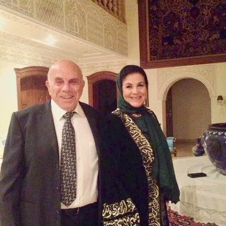
Posted by Rania Elashkar - الدكتور المهندس اسماعيل ديب ذياب الاشقر و زوجته الماظه كامل عبدالرحمن ابو نحل من قريه بربره فلسطين
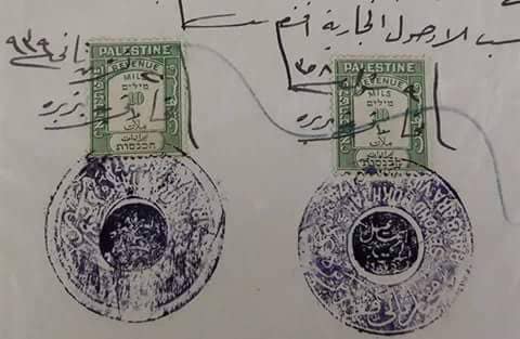
Posted by Rania Elashkar - صورة لاختام مختارى قرية بربرة الفلسطينية ..سنة 1939
على وثيقة مظبطة زواج..
المختار اسماعيل عبد الحميد يونس ..
ومختار عائلة أحمد ..
Want to browse more? 80,000 pictures were grouped in these gallaries:
- Barbara Land Document 30.10.1941
Posted by Abdel Gabbar Adwan - Abu Hamed (on the left) and his 70-year-old Mohammed hold their land titles
- Abu Hamed (on the left) and his 70-year-old Mohammed hold their land titles #2
- من فعاليات مجموعة كوشان بلدي دونت مجموعة من الكواشين لقرية بربة امهجرة. زر صفحتهم عبر الفيس للمزد عن نشاطاتهم.
- من فعاليات مجموعة كوشان بلدي دونت مجموعة من الكواشين لقرية بربة امهجرة. زر صفحتهم عبر الفيس للمزد عن نشاطاتهم. #2
- من فعاليات مجموعة كوشان بلدي دونت مجموعة من الكواشين لقرية بربة امهجرة. زر صفحتهم عبر الفيس للمزد عن نشاطاتهم. #3
- من فعاليات مجموعة كوشان بلدي دونت مجموعة من الكواشين لقرية بربة امهجرة. زر صفحتهم عبر الفيس للمزد عن نشاطاتهم. #4
- من فعاليات مجموعة كوشان بلدي دونت مجموعة من الكواشين لقرية بربة امهجرة. زر صفحتهم عبر الفيس للمزد عن نشاطاتهم. #5
- من فعاليات مجموعة كوشان بلدي دونت مجموعة من الكواشين لقرية بربة امهجرة. زر صفحتهم عبر الفيس للمزد عن نشاطاتهم. #6
- من فعاليات مجموعة كوشان بلدي دونت مجموعة من الكواشين لقرية بربة امهجرة. زر صفحتهم عبر الفيس للمزد عن نشاطاتهم. #7
- من فعاليات مجموعة كوشان بلدي دونت مجموعة من الكواشين لقرية بربة امهجرة. زر صفحتهم عبر الفيس للمزد عن نشاطاتهم. #8
- من فعاليات مجموعة كوشان بلدي دونت مجموعة من الكواشين لقرية بربة امهجرة. زر صفحتهم عبر الفيس للمزد عن نشاطاتهم. #9
- من فعاليات مجموعة كوشان بلدي دونت مجموعة من الكواشين لقرية بربة امهجرة. زر صفحتهم عبر الفيس للمزد عن نشاطاتهم. #10
- من فعاليات مجموعة كوشان بلدي دونت مجموعة من الكواشين لقرية بربة امهجرة. زر صفحتهم عبر الفيس للمزد عن نشاطاتهم. #11
- من فعاليات مجموعة كوشان بلدي دونت مجموعة من الكواشين لقرية بربة امهجرة. زر صفحتهم عبر الفيس للمزد عن نشاطاتهم. #12
- من فعاليات مجموعة كوشان بلدي دونت مجموعة من الكواشين لقرية بربة امهجرة. زر صفحتهم عبر الفيس للمزد عن نشاطاتهم. #13
- من فعاليات مجموعة كوشان بلدي دونت مجموعة من الكواشين لقرية بربة امهجرة. زر صفحتهم عبر الفيس للمزد عن نشاطاتهم. #14
- من فعاليات مجموعة كوشان بلدي دونت مجموعة من الكواشين لقرية بربة امهجرة. زر صفحتهم عبر الفيس للمزد عن نشاطاتهم. #15
- من فعاليات مجموعة كوشان بلدي دونت مجموعة من الكواشين لقرية بربة امهجرة. زر صفحتهم عبر الفيس للمزد عن نشاطاتهم. #16
- من فعاليات مجموعة كوشان بلدي دونت مجموعة من الكواشين لقرية بربة امهجرة. زر صفحتهم عبر الفيس للمزد عن نشاطاتهم. #17
- من فعاليات مجموعة كوشان بلدي دونت مجموعة من الكواشين لقرية بربة امهجرة. زر صفحتهم عبر الفيس للمزد عن نشاطاتهم. #18
- من فعاليات مجموعة كوشان بلدي دونت مجموعة من الكواشين لقرية بربة امهجرة. زر صفحتهم عبر الفيس للمزد عن نشاطاتهم. #19
| Display Name | Clan/Hamolah | Country of Residence |
| محمد سعد (صالحة) | - | Chui, قرغيزستان |
| احمد يونس | يونس | قطاع غزة, فلسطين |
| هيثم عايش حمدان | حمدان | - |
| ديانا | - | غزة, فلسطين |
| Feda.Adwan | ADWAN | sana'a, Yemen |
| أحمد عدوان | عدوان | - |
| Dr .yasser ayesh Ayesh | Ayesh | Riyadh |
| عاطف | صالح | عمان, الاردن |
| DR.Ahmed nassar | nassar | بربرة |
| Renad | Adwan | Jordan, Jordan |
| Abu Saleh | Ayesh | - |
| سامر أحمد | أحمد | غزة |
| أيمن عبد الحليم | نصار | البيضاء, ليبيا |
| حسن | نصار | غزة, بربرة |
| Abu Elzein | زين الدين | ramallah |
| جمال نصار | نصار | الدوحة |
| Wafa | Halawa | Gaza Strip, Palestine |
| Ayman Saleem | Ahmad | West Bank, Palestine |
| إسماعيل | أحمد | غزة, فلسطين |
| Barber Jones | - | - |
| bessan salam | shehada | amman |
| UM IBRAHEEM | elashkar | qatar, qatar |
| Rania Adwan | Adwan | - |
| jihad younis | younis | Palestine, Rafah-Gaza |
| randa adwan | adwan | riffa, bahrain |
| wael nassar | nassar | azyzya, saudi aribia |
| Mohammad Ali Adwan | Adwan | jeddah, saudi arabia |
| DR ABDALLA NASSAR | nassar | gaza |
| almaza abu-nahel | abu-nahel | marbella, spain |
| dr. ismail el-ashkar | el-ashkar | marbella, spain |
| Munir Hassan Adwan | - | Amman Jordan |
| Hassan Adwan | Adwan | Amman |
| Mahmoud Hammad | Hammad | Amman, Jordan |
| Ali | Hag Abed | Tayebah, Israel |
| zead m ABOU SHAWISH | abou shawish | syria, syria damascus |
| Mohamed Edwan | - | Istanbul, TURKEY |
| kamal | adwan | ., s.arabia |
| Rami Adwan | Adwan | - |
| Maysarah 3idwan | Adwan | ISTANBUL, Turkey |
| Afaf Adwan | Adwan | London, UK |
| Linda Hammad | Hammad | - |
| Aminah Hammad | Hammad | Texas, USA |
| محمود محسن احمد | احمد | Gaza, Palestine |
| abusami | ahmed | palestine , gaza strip |
| abd el jawad mousa hassan adwan | adwan | yemen, yemen |
| Mohammed | - | - |
| Abdel Gabbar Adwan | Adwan | - |
| MONTASER | - | 00966, saudi arabia |
| Mohammed Hammad | Hammad | Niedersachsen, Germany |
| aref ramadan | AHMAD | md, USA |
| abu suhail | edwan | malaga, spain |
| Sousan Hammad | Hammad | - |
| Buthayna Hammad | Hammad | Texas, usa |
| Nadia Hammad | Hammad | CO, USA |
| Muhammad Hammad | Hammad | - |
| Iman Hammad | Hammad | TX, USA |
| Ramsey Hammad | Hammad | Texas, USA |
| Edwan | Edwan "E is Ain in arabic" | - |
- كوشان بلدي.. مبادرة لتوثيق حق الفلسطيني بأرضه Duration: 2 min 57 sec
 Fake Valor: Why Did Zionist Jews Hoist Nazis Flag on Their Ships in the 1930s?
What is new?
-
Facts About Oct. 7th Gaza Raid
-
Remined Us Please:: Who Did Rape Who? Palestinians Raped Israelis? Or, was the other way around?
-
When Prof. Edward Said was invited to debate Bibi Netanyahu in the 1980s, watch what happened!
-
Ezra Klein of the NY Times on the "Jewish Race".
-
Abusing Blood Libel!
-
Did Israeli Soldiers Activate The Hanniba Direective On Oct. 7th? You Be The Judge
-
Zionist FAQ: Isn't it true that Palestinians don't want peace? Palestinians never accepted the two-state solution
- Facts about Haavara (Transfer) Agreement between Ben-Gurion & Hitler
-
Haavara FAQs: Why Did Zionist Jews Hoist Nazis' Flags on Their Ships in the 1930s?
- Haavara FAQs: When Chaim Weizmann met FDR in mid-1943, why was he silent about rescuing European Jewry?
-
Dear ChatGPT: How did Palestinians resist Napoleon's invasion of their country in 1799?
-
Dear ChatGPT: Gaza had a vibrant Jewish community in the mid-17th century. What happened to them?
-
Dear ChatGPT: Why did the Jewish Agency suppress news of the Holocaust during WWII?
-
Video Playlist: Jews share their DNA tests to end the conflict for good.
-
A Tale of Two Conflicts: Examining the Definition of Genocide
-
Prof. Abraham Polak And The Suppressed History of the Khazars and European Jewry
-
How Ronald Reagan would have framed the genocide in Gaza if he were still alive?
-
Haavara FAQs: Let us do the math: how many German Jews did The Haavara Agreement save?
-
Zionist FAQs: The Hebron Massacre of 1929, "clearly proves" that Palestinians are antisemitic, how could you deny it?
-
Zionist FAQs: Why Anti-Zionist Is Not Antisemitism?
-
Zionist FAQs: Isn't it true that the KGB created Palestinian Nationalism in the early 1960s?
- Zionist FAQs: Muslims are killing Muslims all the time; why are Israeli Jews being singled out in the media?
- Zionist FAQs: How is Israel an apartheid state when 20% of its citizens are Arabs who enjoy full rights?
-
Haavara FAQs: Why Did Dorothy Thompson Flip From A Zionist Advocate to A Silenced Dissenter?
-
Haavara FAQs: Analysis of Herzl's Uganda Scheme and how it could have saved millions of Jews.
-
Haavara FAQs: Why did Hayim Greenberg describe American Jewry as "morally bankrupt" in early 1943?
-
Haavara FAQs: What if the Evian Conference was a resounding success? What would have been the impact of saving European Jewry on Zionism?
- Haavara FAQs: What if the six million were saved, how that would have impacted the Zionist project?
-
Haavara FAQs: How did Zionist leaders react when Europe's Jews lingered in the DP camps after WWII ended?
-
Why does the American Jewish community repeat lies that David Ben-Gurion had debunked before he died?
-
Who has the power to rename the Tatar/Khazar Gene Marker to Jewish IV?
-
Zionist FAQs: Why won't Egypt, Syria, and Jordan take their people back? Jews are indigenous to Palestine, and Arabs immigrated after Jews developed the country. Arabs should leave.
-
Haavara FAQs: Did Hitler and the Nazis conflate between Judaism and Zionist? If that wasn't case, then why?
-
Haavara FAQs: Winston Churchill and antisemitism, a collection of articles written Churchill.
-
Haavara FAQs: Broken by country, how many Jews survived vs. killed during the Holocaust?
-
Haavara FAQs: Why did European Jews vote with their feet and to immigrated to the Americas, not Palestine, after WWII?
-
Watch this American Jewish Girl describing Israeli Jews' cognitive dissonance like no other in under two minutes
-
Haavara FAQs: When the Nazis went out of their way to hide the Holocaust, Israeli Jews did the exact opposite by broadcasting their genocide of Gazans. But why?
-
Haavara FAQs: How Zionist Jews went out of their to show their appreciation to Nazism and Fascism?
- Haavara FAQs: Why Zionist leaders were against bombing the death camps & the Railroads leading to them?
-
Haavara FAQs: Hitler's message to the British and American people: If Jews are such noble citizens and you care about them, how come you're not letting them in? I will gladly ship them to you at my expense, even on luxury liners!
-
A shortlist of Zionist and Israeli false flag operations in the name Jews.
-
The Most Moral Army
- The Land of Kapos (Israel): Where the brave are boycotted and Kapos walk free.
- Why did early Zionists often named their communal enterprises "colonial"?
- Zionist Relations with Nazi Germany by Faris Glubb
-
Two NY Times advertisements by Zionists in the early 1943 that exposes Zionists' treason at the height of the calamity
- Facts Not Lies about the Palestinian-Israeli Conflict.
- Site's pictures have been categorized
- Campgain Against Lice
- A Survey of Palestine, the official source about Palestine before Nakba produced by the British Mandate; over 1200 pages.
- Satellite View & Google Earth: Over 6,000 placemarks identifying all destroyed towns, W. Bank & Gaza Strip Towns, & refugee camps.
- PalestineRemembered.com and its Nakba Oral History Project were featured on al-Jazeera Satellite TV.
- Nakba Oral History Video Podcast:
 Over 700 Oral History interviews (including 3,500+ hours of recording) can be viewed online.
 - Palestine Village Statistics Project
- Gaza Jail Break
- النسخة العربية للموقع الان متوفرة
- Videos: Documenting the destroyed villages in video: Tracing all that remains since Nakba.
- Videos: Responding to Zionist Propaganda
- Interview: The ethnic cleansing of Palestine: George Galloway interviews Israeli Historian Ilan Pappe.
- For Palestinians, memory matters. It provides a blueprint for their future By George Bisharat.
- Zionist FAQ now available in Hebrew שאלות שציונים שואלים, עכשיו בעברית
- Video: The Stephen Walt and John Mearsheimer report on the influence of the Israel Lobby on U.S. Foreign Policy
- The Palestinian-Israeli conflict for beginners
