| PalestineRemembered | About Us | Oral History | العربية | |
| Pictures | Zionist FAQs | Haavara | Maps | |
| Search |
| Camps |
| Districts |
| Acre |
| Baysan |
| Beersheba |
| Bethlehem |
| Gaza |
| Haifa |
| Hebron |
| Jaffa |
| Jericho |
| Jerusalem |
| Jinin |
| Nablus |
| Nazareth |
| Ramallah |
| al-Ramla |
| Safad |
| Tiberias |
| Tulkarm |
| Donate |
| Contact |
| Profile |
| Videos |
Welcome To Bayt Ijza - بيت إجزا (בית איג'זא)
|
District of Jerusalem
Occupied days ago |
العربية Google Earth |
| Gallery (56) |
- Statistics & Facts
-
Before & After

- Satellite View
- Articles 7
- Pictures 56
- Members 7
- Families

- Wikipedia
- ARIJ Guide

- Videos 1
- Guest Book 4
- Links
| Statistic & Fact | Value | |||||||||||||||||||||
| Distance From District | 12 km northwest of Jerusalem | |||||||||||||||||||||
| Elevation | 810 meters | |||||||||||||||||||||
| Before & After Nakba, Click Map For Details |
||||||||||||||||||||||

|
||||||||||||||||||||||
| Land Ownership |
**Town Lands' Demarcation Maps |
|||||||||||||||||||||
| Land Usage As of 1945 |
|
|||||||||||||||||||||
| Population |
|
|||||||||||||||||||||
| Near By Towns |
||||||||||||||||||||||
|
||||||||||||||||||||||
| Featured Video | ||||||||||||||||||||||
| ARIJ Guide | ||||||||||||||||||||||
3.
4. 
5. 
6. 
7. 
8. 
9. 
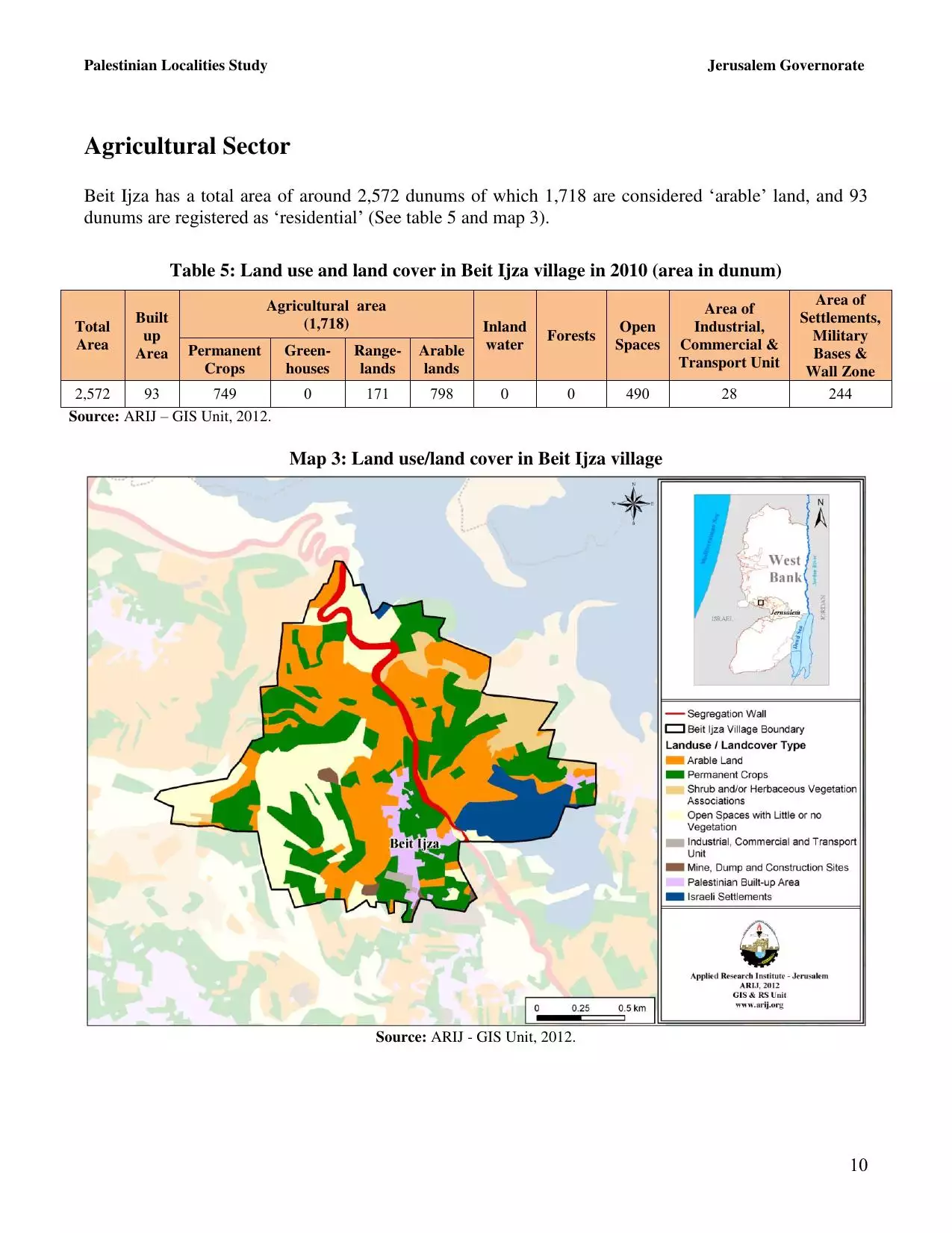
10. 
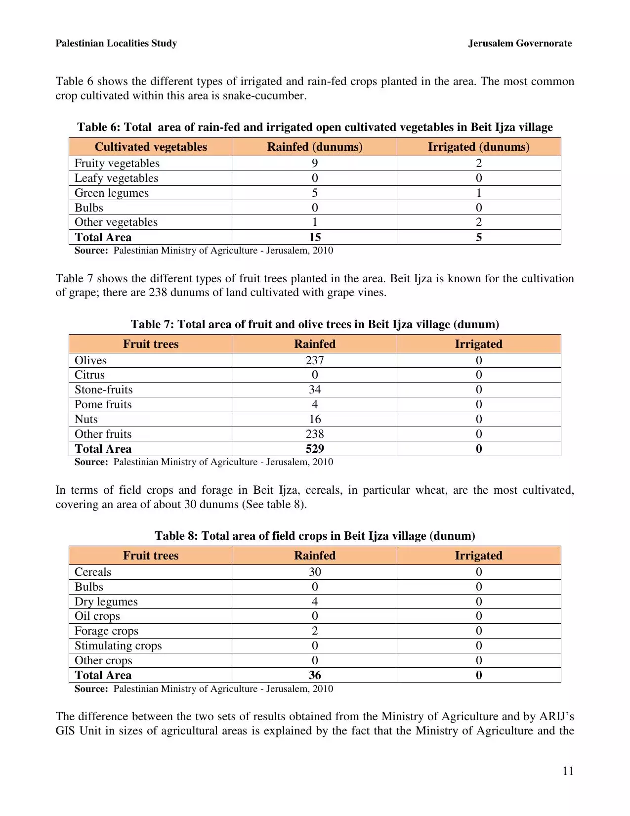
11. 
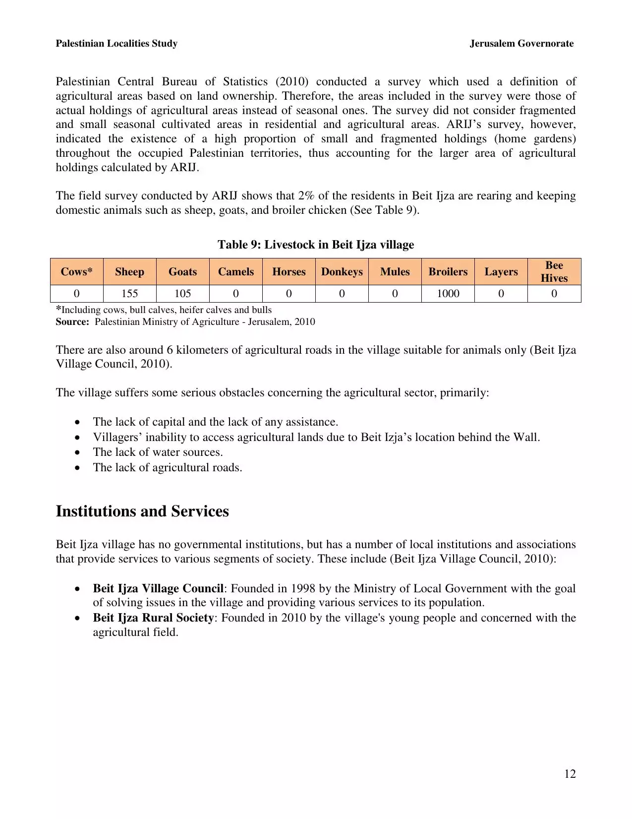
12. 
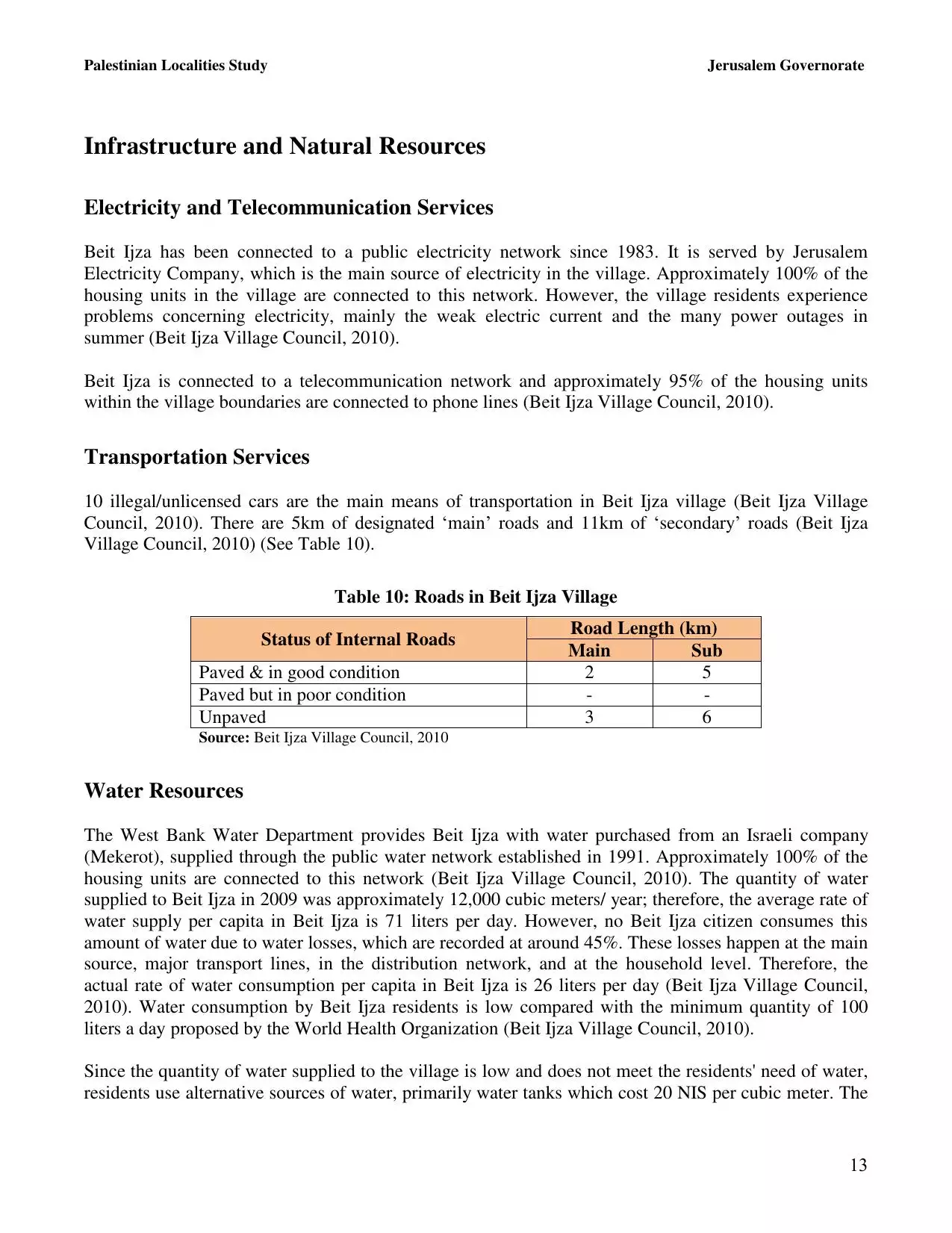
13. 
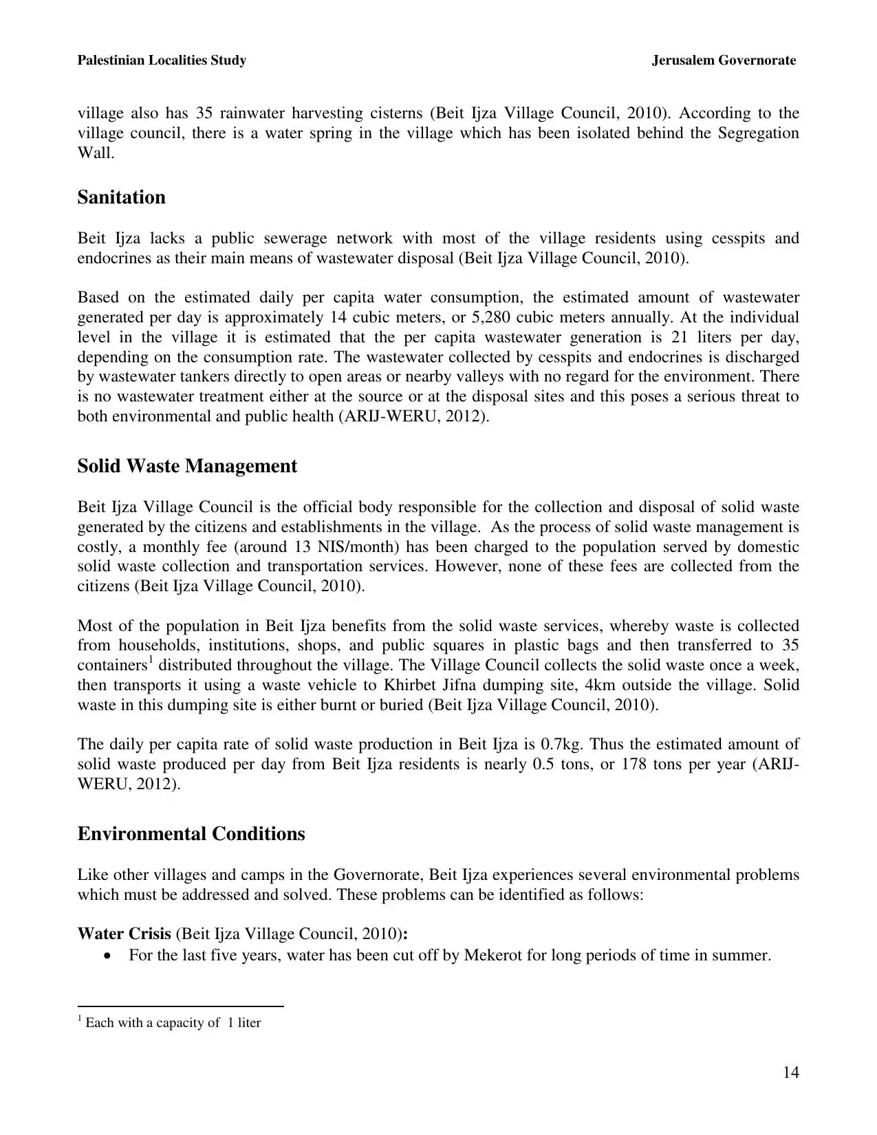
14. 
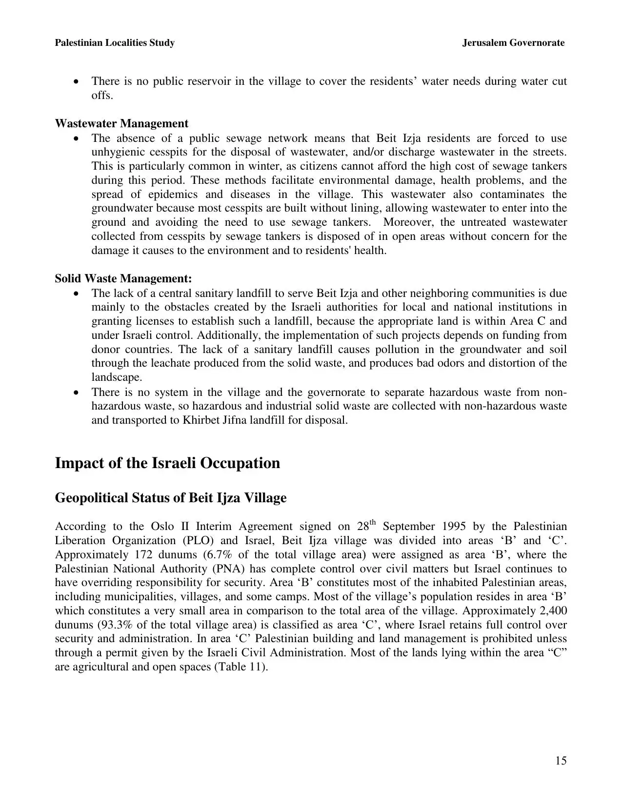
15. 
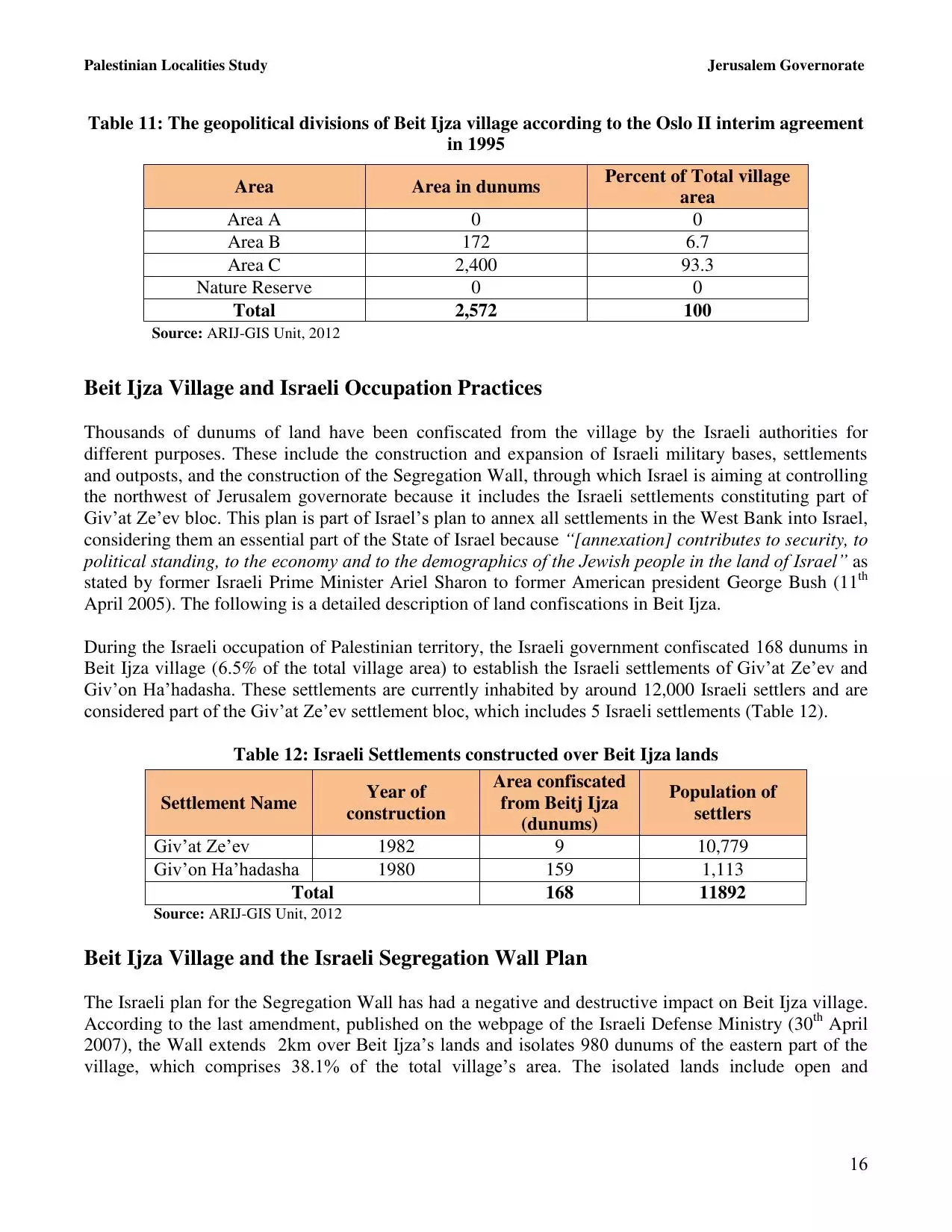
16. 
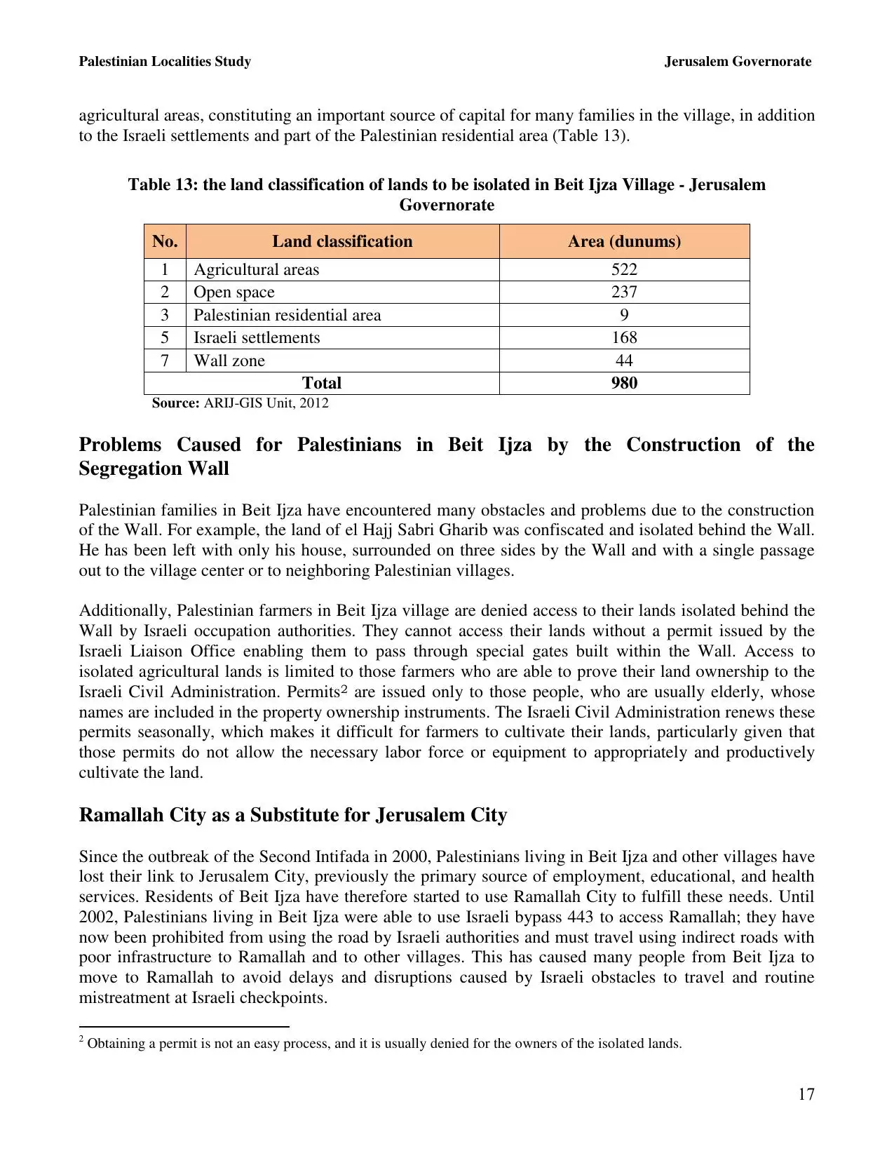
17. 
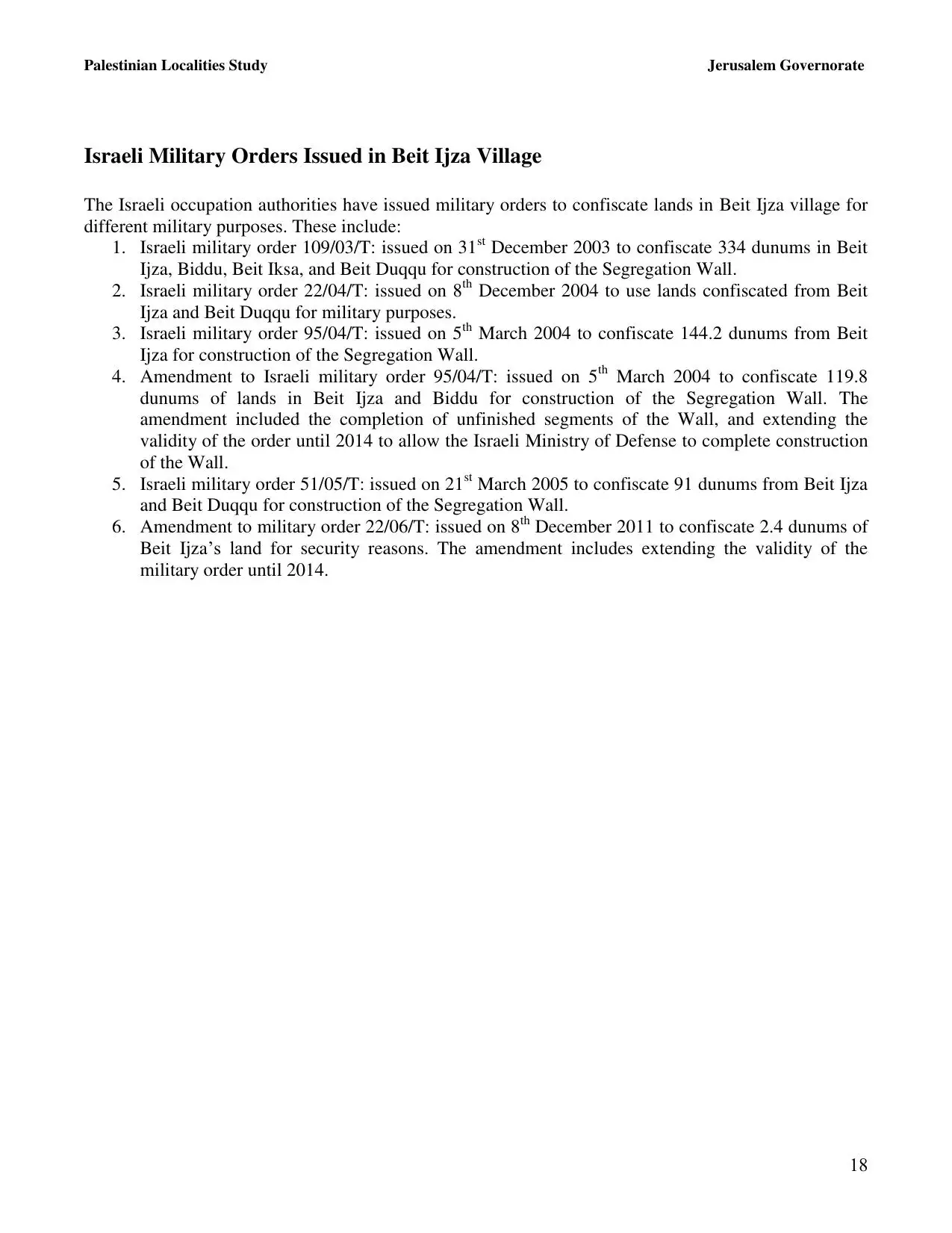
18. 
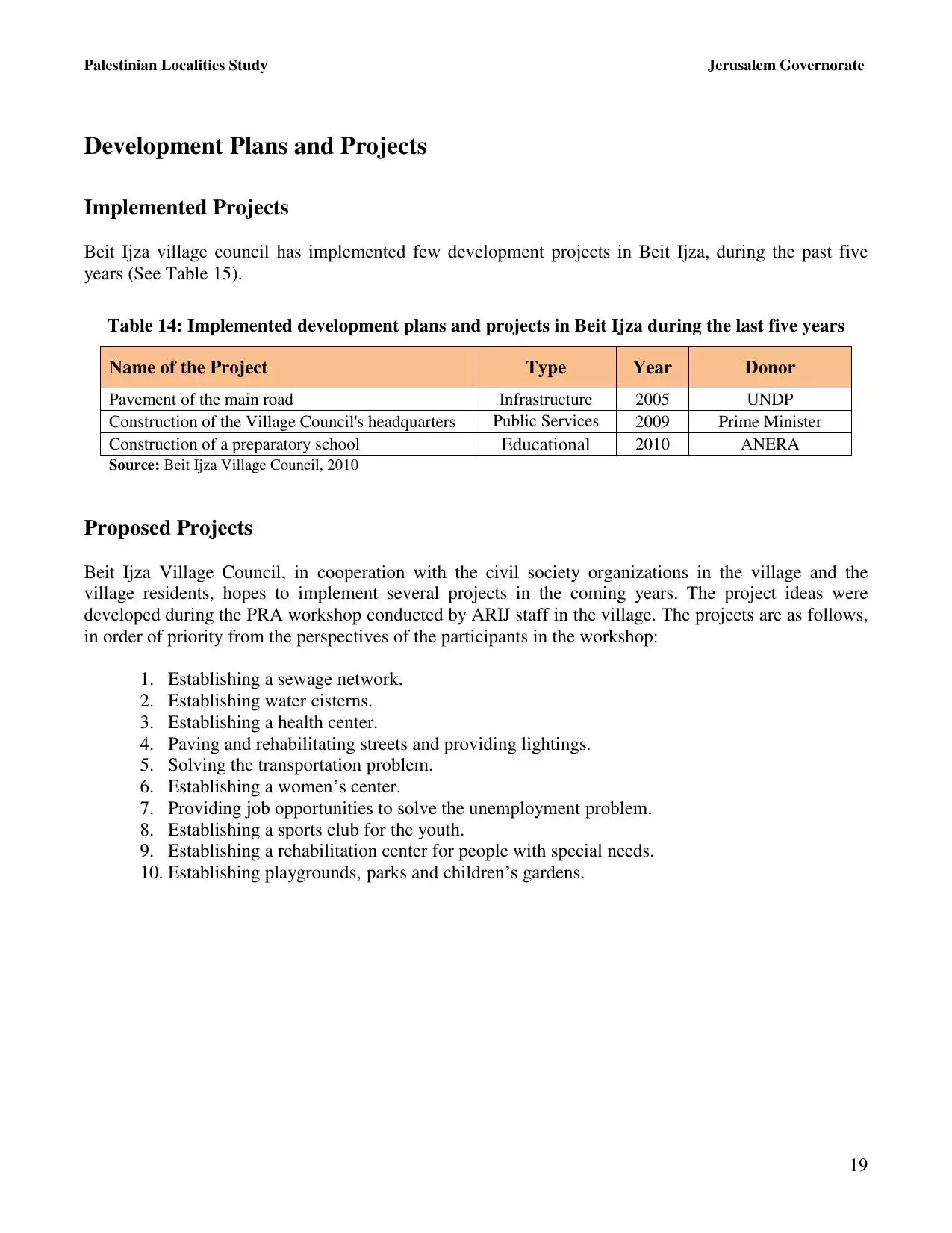
19. 
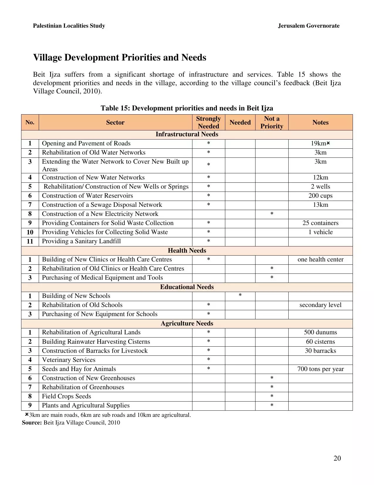
20. 
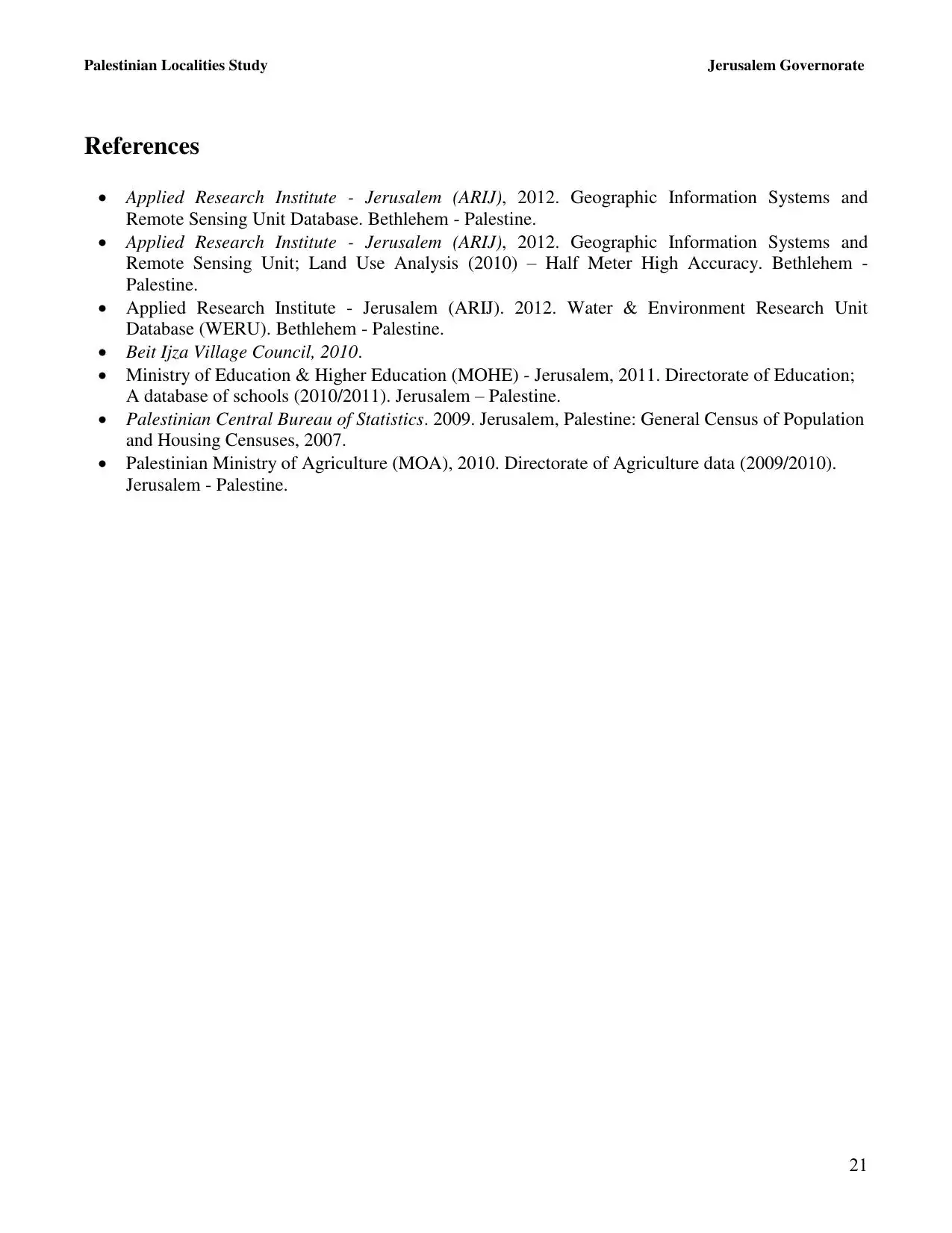
21. 
Click here to browse online. |
||||||||||||||||||||||
| Related Maps | Town Lands' Demarcation Maps خرائط للقضاء توضح حدود القرى والاودية View from satellite Town's map on MapQuest Help us map this town at WikiMapia |
|||||||||||||||||||||
| Related Links | Wikipedia's Page ARIJ Guide Google Search Google For Images Google For Videos في كتاب بلادنا فلسطين دليل أريج المزيد من موقع هوية |
|||||||||||||||||||||
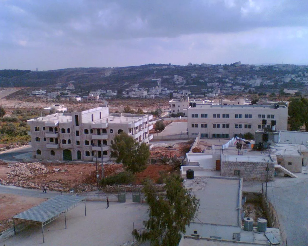
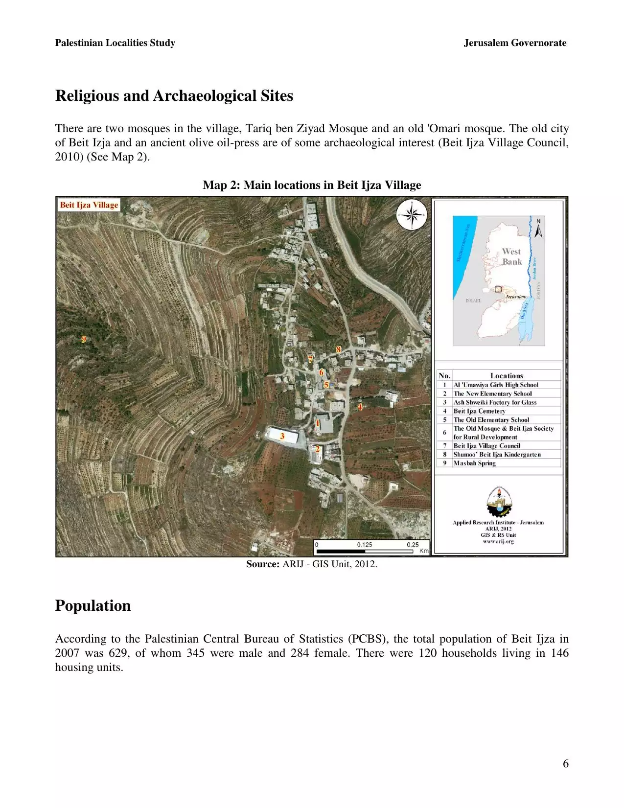
- الجزء الجنوبي من قرية بيت إجزا حيث توجد المدرسه الثانوية للإناث و في الجوار الجزء الشرقي من بلدة بدو
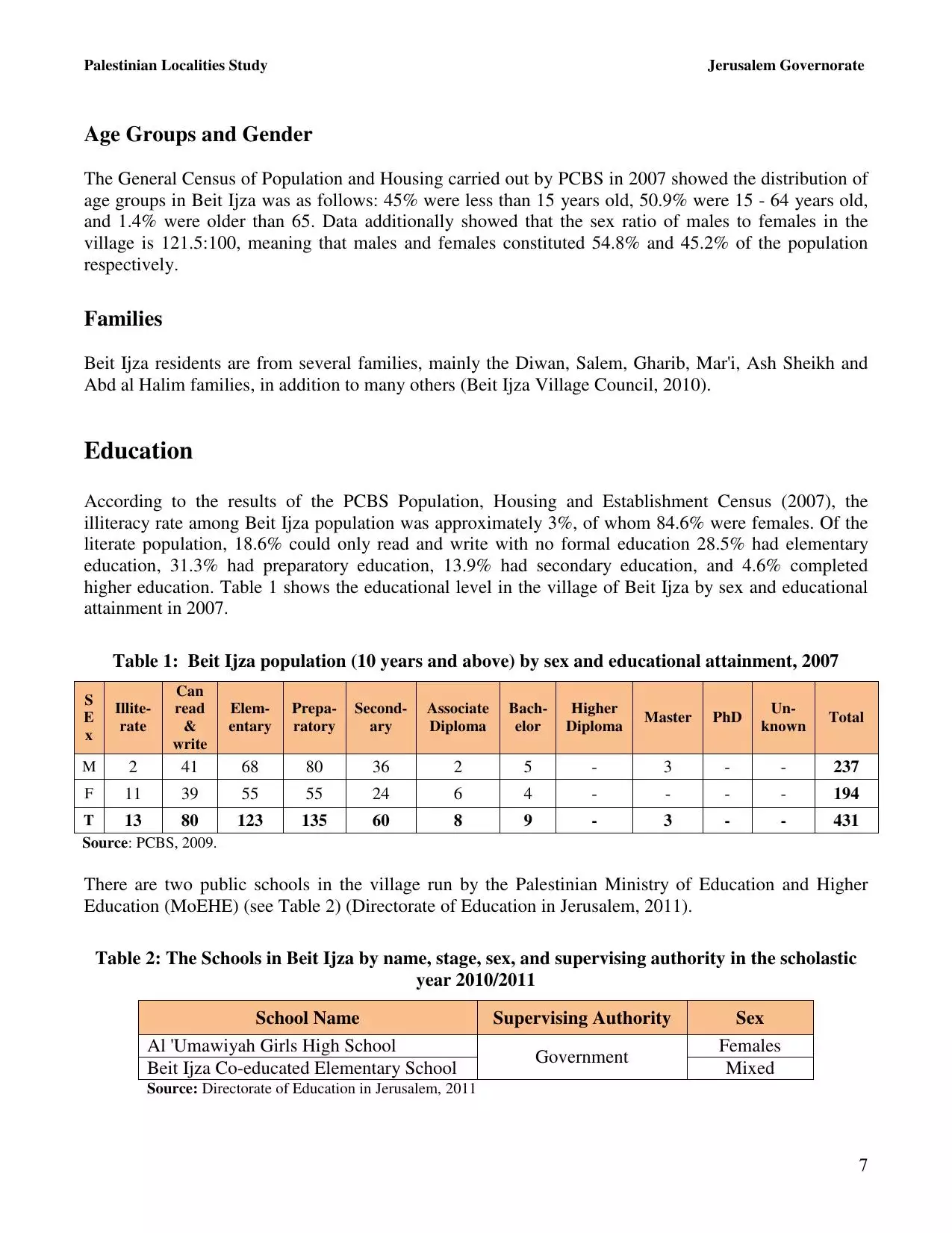
Posted by omar dewan 1 - قرية بيت إجزا القديمة وشمال البلدة الجديد
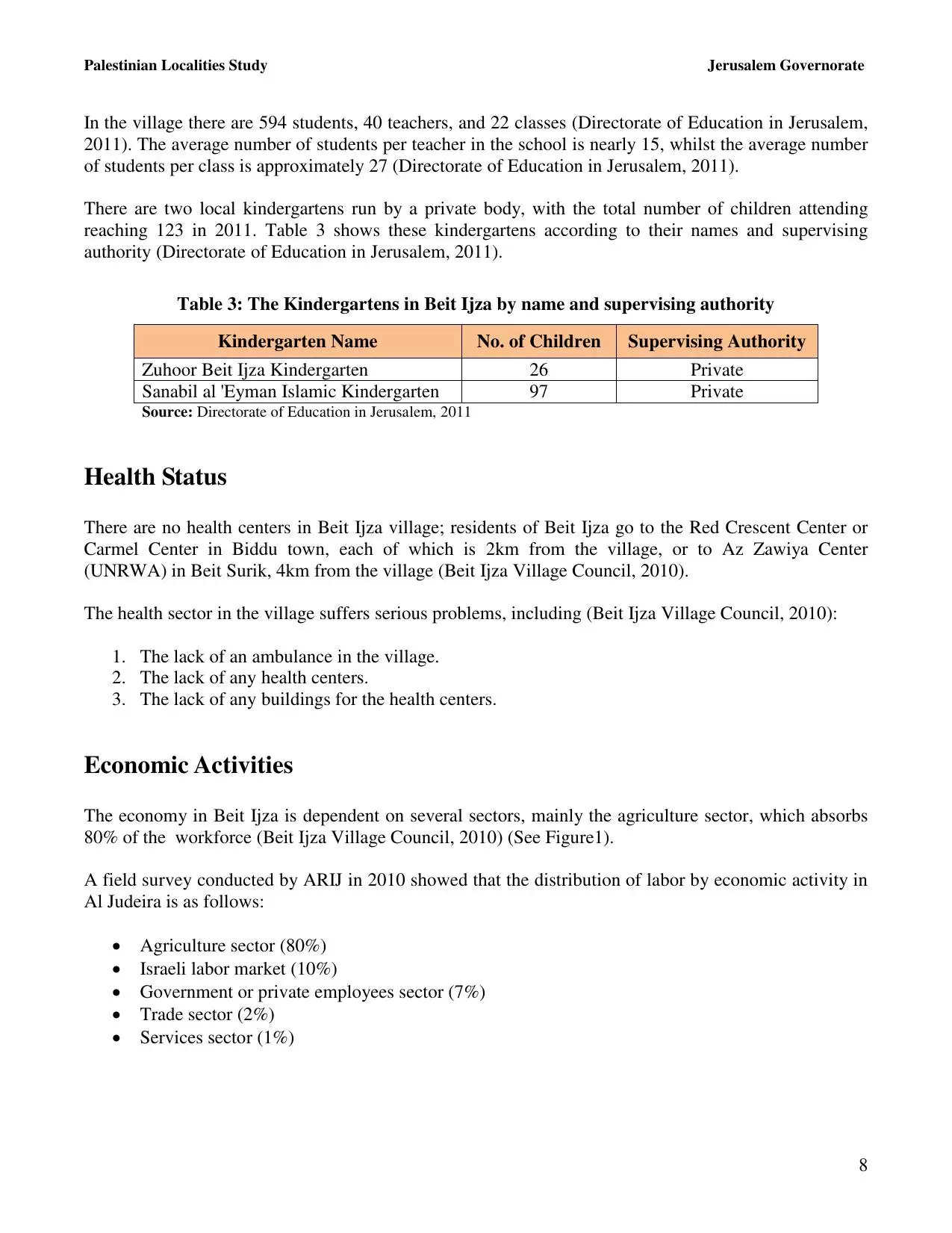
Posted by omar dewan - قرية بيت إجزا القديمة وشمال البلدة الجديد
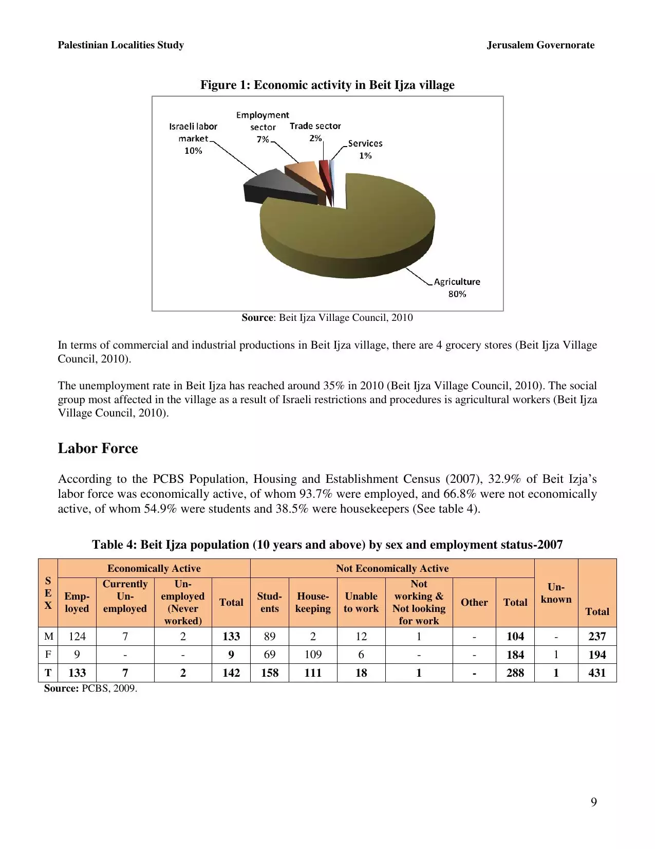
Posted by omar dewan - مجلس القرية
Posted by ابو علي - .وسط قرية بيت إجزا حيث يوجد المسجد الجديد وشرق بلدة بدو
Posted by omar dewan - الجزء الشمالي الشرفي من قرية بيت إجزا و بجوارها الشرقي مسطوطنة حد شاة و في المدى البعيد مسطوطنة جفعات زئيف و مدينة رام الله.
Posted by omar dewan - .الجزء الشمالي الشرفي من بيت إجزا القديمة و في المدى القريب جفعات زئيف و في المدى البعيد رام الله والبيرة و شرق بيتونيا
Posted by omar dewan 1 - معصرة الزيت
Posted by ابو علي - حجر الزيت
Posted by ابو علي - صور للقرية
Posted by ابو علي - صور للقرية
Posted by ابو علي - صور للقرية
Posted by ابو علي - صور للقرية
Posted by ابو علي - صور للقرية
Posted by ابو علي - صور للقرية
Posted by ابو علي - صور للقرية
Posted by ابو علي - صور للقرية
Posted by ابو علي - صور للقرية
Posted by ابو علي - صور للقرية
Posted by ابو علي - صور للقرية
Posted by ابو علي - صور للقرية
Posted by ابو علي - صور للقرية
Posted by ابو علي - صور للبلدة
Posted by ابو علي - صور للبلدة
Posted by ابو علي - صور للبلدة
Posted by ابو علي - صور للبلدة
Posted by ابو علي - صور للبلدة
Posted by ابو علي - صور للبلدة
Posted by ابو علي - صور للبلدة
Posted by ابو علي - صور للبلدة
Posted by ابو علي - صور للبلدة
Posted by ابو علي - صور للبلدة
Posted by ابو علي - صور للبلدة
Posted by ابو علي - صور للبلدة
Posted by ابو علي - صور للبلدة
Posted by ابو علي - صور للبلدة
Posted by ابو علي - صور للبلدة
Posted by ابو علي - الجنوب الشرقي لبيت إجزا وحدشاه ومنطقة السهل من بدو
Posted by omar dewan - الواجهه الجنوبيه لبيت إجزا
Posted by omar dewan - بيت إجزا كما تبدو من من بلدة بدو
Posted by omar dewan - بيت إجزا.واد أبوزعرور الذي يفصل بيت إجزا عن قرية القبيبه
Posted by omar dewan - بيت إجزا كما تراها من جبل بريطا شرق قرية بيت دقو
Posted by omar dewan - الثلج يغطي قرية بيت إجزا
Posted by omar dewan - الثلج يغطي قرية بيت إجزا
Posted by omar dewan - منظرعام لبيت إجزا مأخوذ من بلدة بدو
Posted by omar dewan - منظرعام لبيت إجزا مأخوذ من بلدة بدو
Posted by omar dewan - حدشاه الملاصقه لبيت إجزا من جهة الشرق
Posted by omar dewan - بيت إجزا وحشاه ومنطقة السهل من بدو
Posted by omar dewan - الواجهه الجنوبيه لبيت إجزا ومنطقة السهل من بلدة بدو
Posted by omar dewan - بيت إجزا.واد أبوزعرور الذي يفصل بيت إجزا عن قرية القبيبه وفي المدى البعيد مدينتي رام الله وبيتونيا وجبلي أبو زيتون غرب بيتونيا
Posted by omar dewan - الثلج يكسو بيت إجزا ورام الله وبيتونيا
Posted by omar dewan - وسط وشرق بيت إجزا وشرقهما جفعات حدشاه
Posted by omar dewan - وسط وجنوب شرق بيت إجزا وفي المدى البعيد في يمين الصوره جبل النبي صموئيل
Posted by omar dewan - الطريق والشيك الذي يفصل بيت إجزا عن جفعات حدشاه
Posted by omar dewan - تلاصق البيوت في بيت إجزا وجفعات حدشاه
Posted by omar dewan - منظر عام
Want to browse more? 80,000 pictures were grouped in these gallaries:
| Display Name | Clan/Hamolah | Country of Residence |
| النرجسة المقدسية | ديوان | عمان |
| محمود محمد سلامة | الدحابرة | سوريـا, سوريـا |
| omar dewan | dewan | palestine, west bank |
| Rasha Salameh | Dahabra | Damascus, Syria |
| Mohammad Salameh | Dahabra | Syria, Syria |
| ابو علي | ابو كافية | - |
| Zeinab Salameh | Dahabra | Damascus |
- قرية بيت إجزا - تصوير جوي Bayt Ijza - aerial view Duration: 8 min 50 sec
No links have been shared yet, be free to the first to share the first link.
