| PalestineRemembered | About Us | Oral History | العربية | |
| Pictures | Zionist FAQs | Haavara | Maps | |
| Search |
| Camps |
| Districts |
| Acre |
| Baysan |
| Beersheba |
| Bethlehem |
| Gaza |
| Haifa |
| Hebron |
| Jaffa |
| Jericho |
| Jerusalem |
| Jinin |
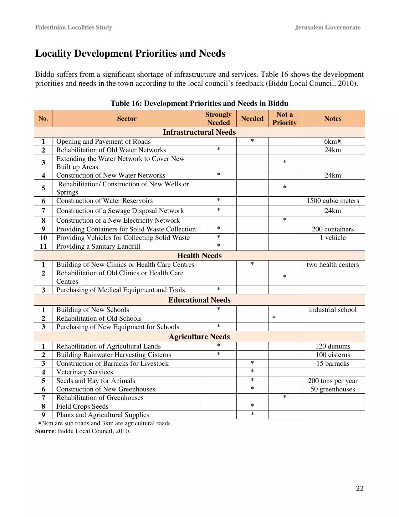
| Nablus |
| Nazareth |
| Ramallah |
| al-Ramla |
| Safad |
| Tiberias |
| Tulkarm |
| Donate |
| Contact |
| Profile |
| Videos |
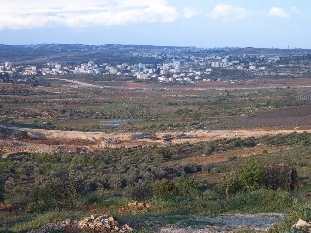
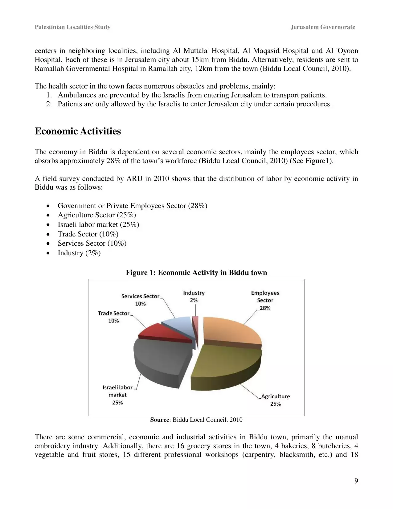
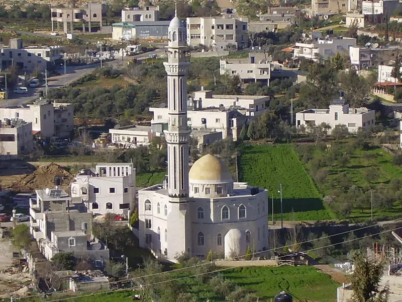
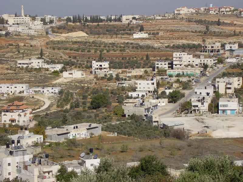
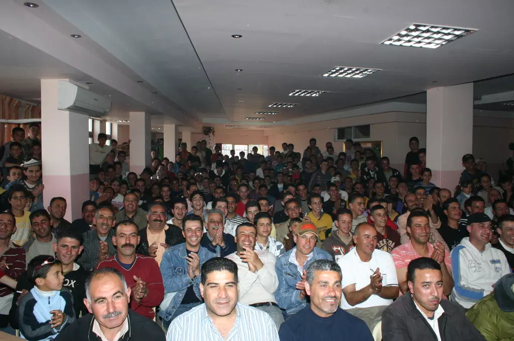
Welcome To Biddu - بدو (בידו)
|
District of Jerusalem
Occupied days ago |
العربية Google Earth |
 |
Gallery (86) |
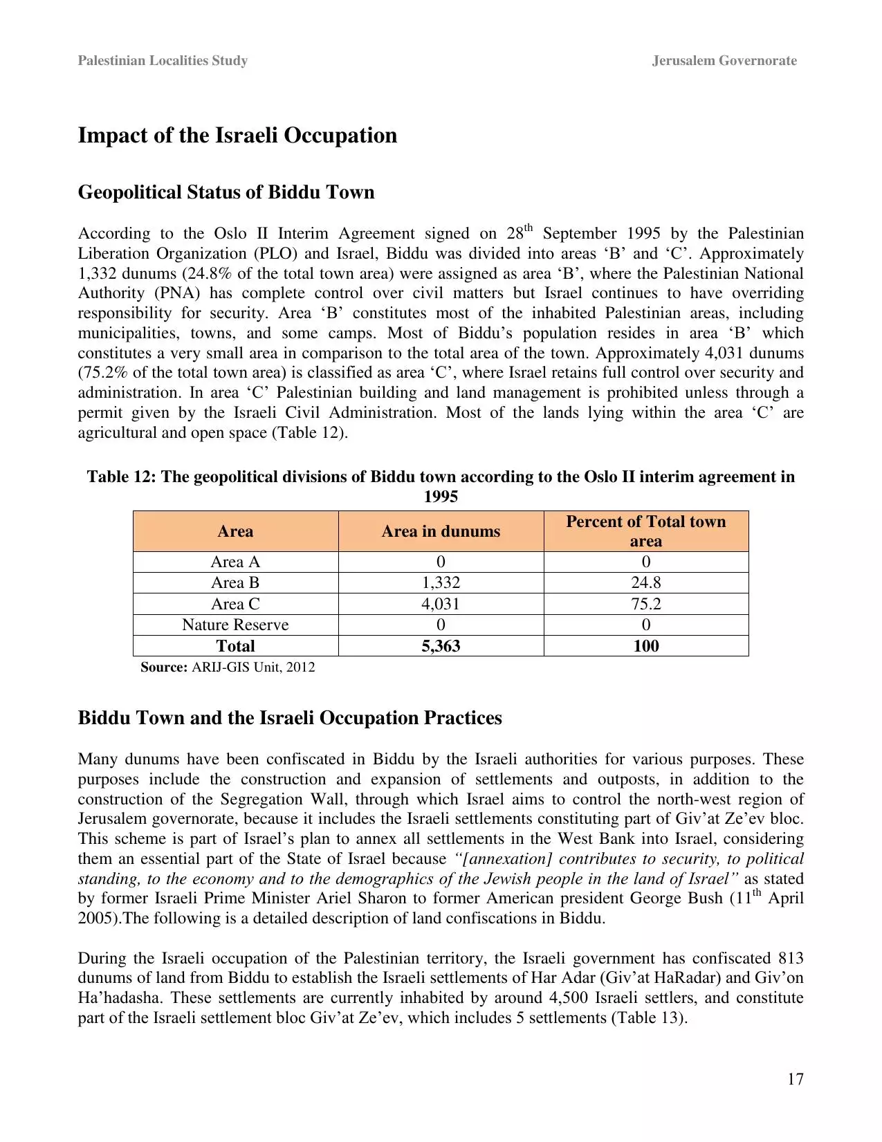
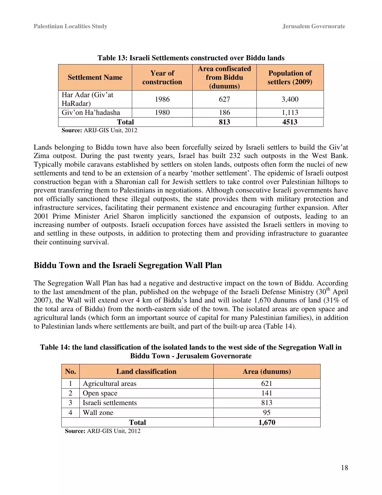
- Statistics & Facts
-
Before & After

- Satellite View
- Articles 43
- Pictures 86
- Members 39
- Families
- Wikipedia
- ARIJ Guide
- Videos 11
- Guest Book 21
- Links 3
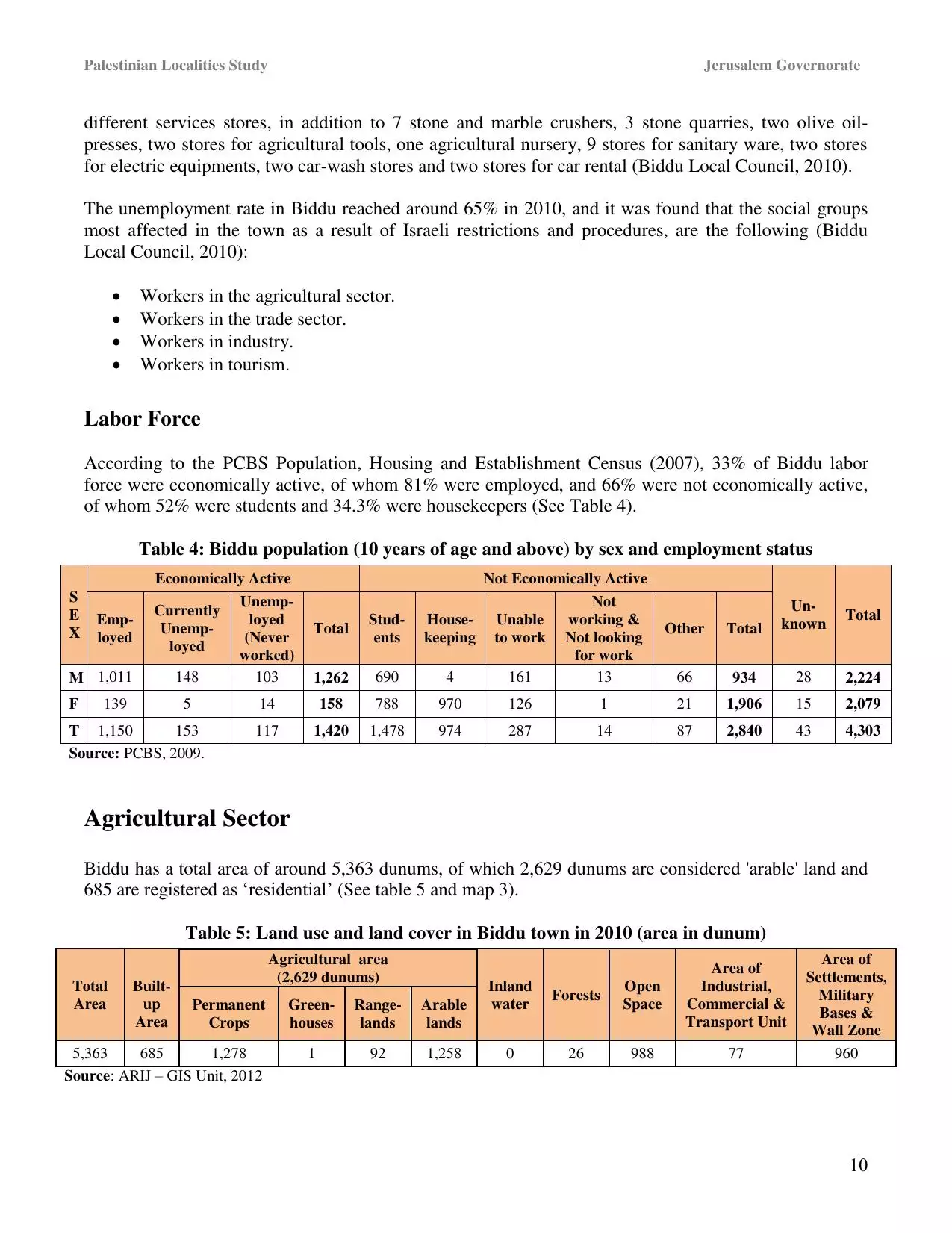
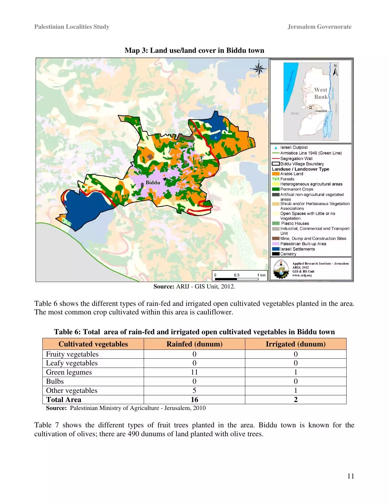
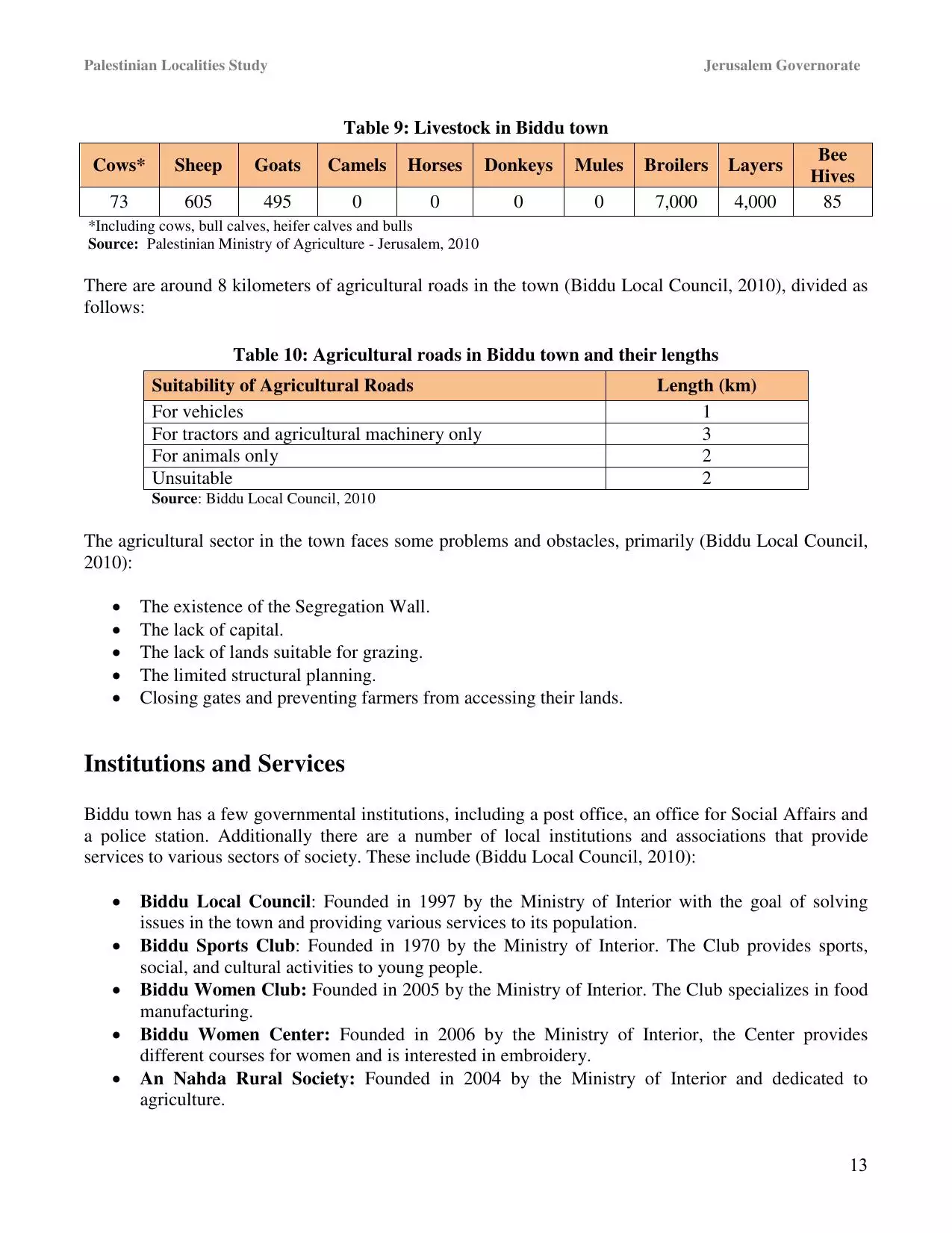
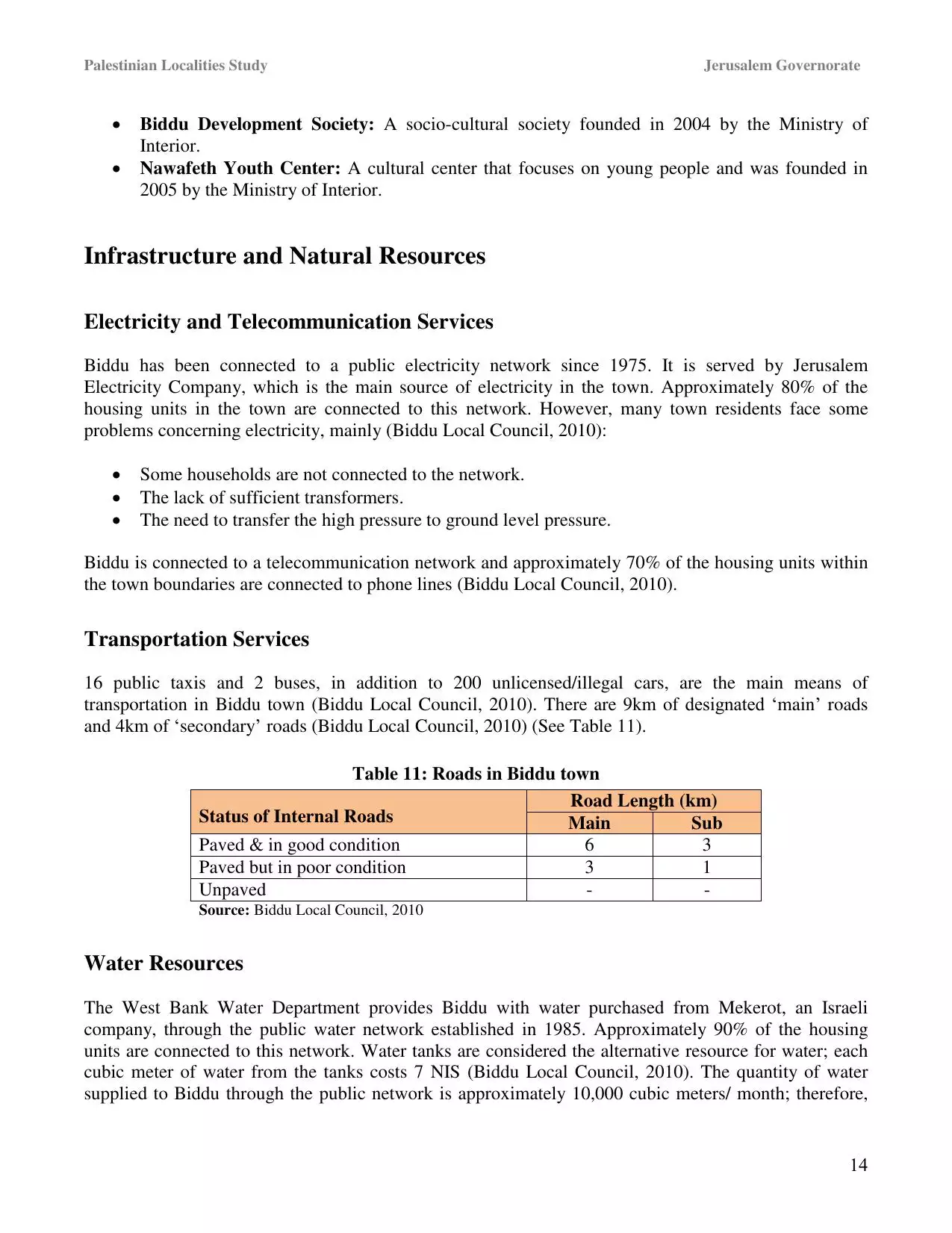
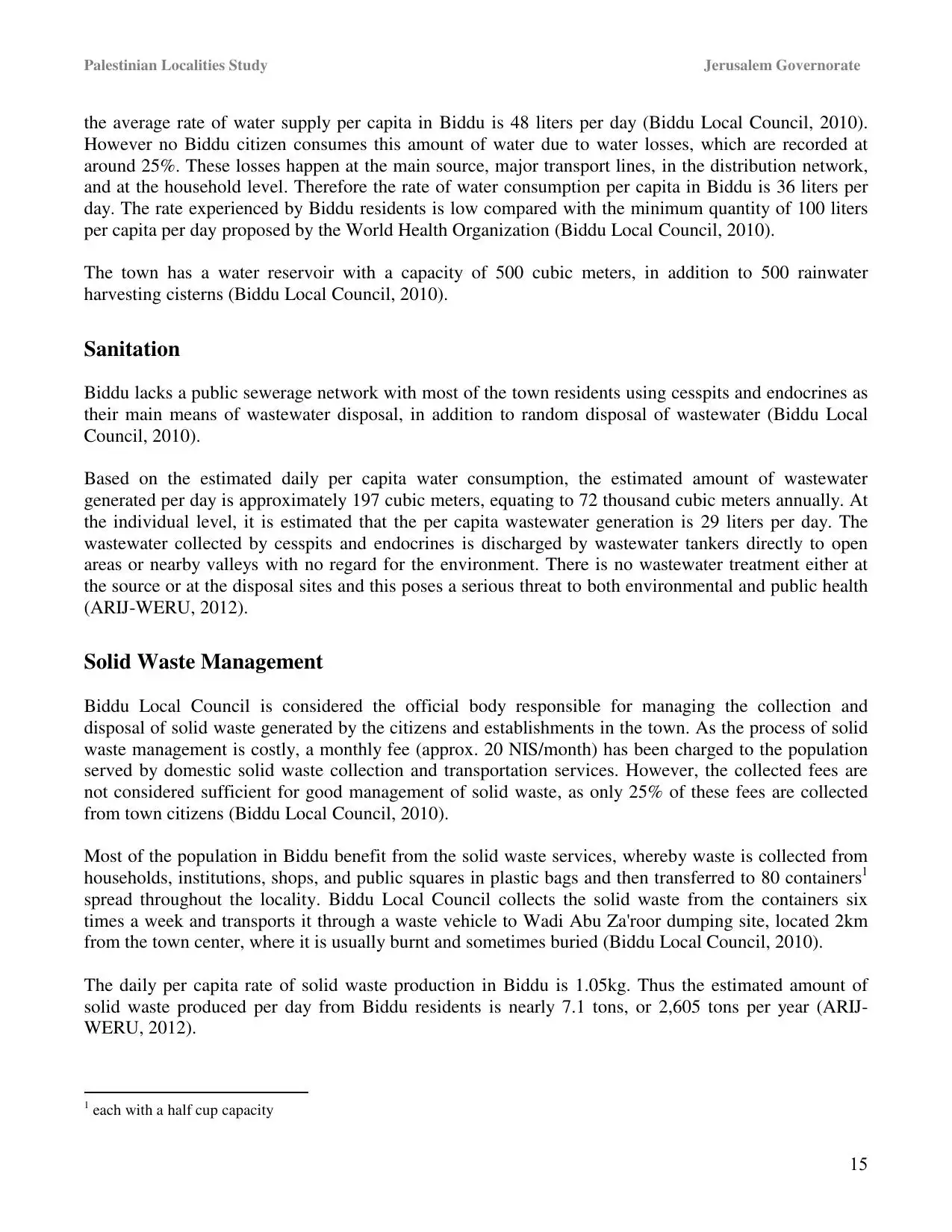
| Statistic & Fact | Value | ||||||||||||||||||||||
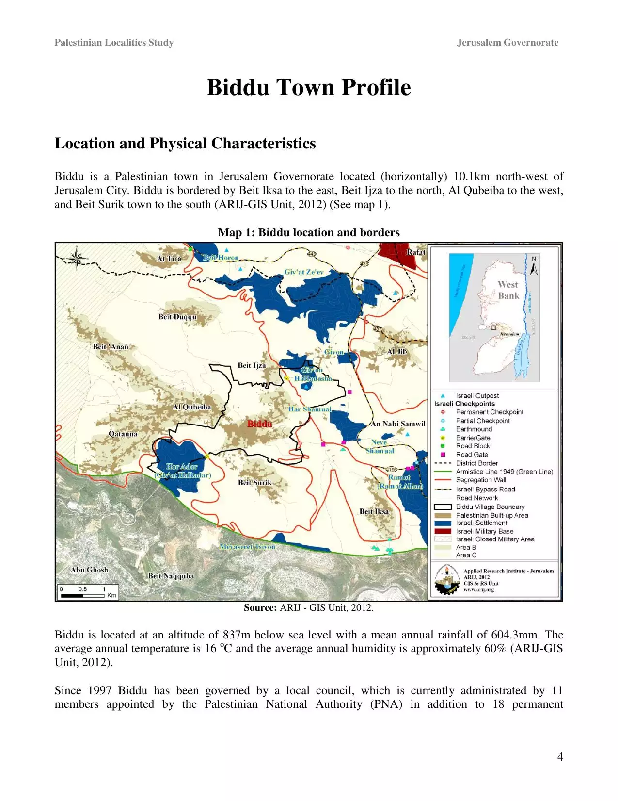
| Distance From District | 9 km northwest of Jerusalem | ||||||||||||||||||||||
| Elevation | 850 meters | ||||||||||||||||||||||
| Before & After Nakba, Click Map For Details |
|||||||||||||||||||||||
|
|||||||||||||||||||||||
| Land Ownership |
**Town Lands' Demarcation Maps |
||||||||||||||||||||||
| Land Usage As of 1945 |
|
||||||||||||||||||||||
| Population |
|
||||||||||||||||||||||
| Near By Towns |
|||||||||||||||||||||||
|
|||||||||||||||||||||||
| Featured Video | |||||||||||||||||||||||
| ARIJ Guide | |||||||||||||||||||||||
3.
4. 
5. 
6. 
7. 
8. 
9. 
10. 
11. 
12. 
13. 
14. 
15. 
16. 
17. 
18. 
19. 
20. 
21. 
22. 
23. 
Click here to browse online. |
|||||||||||||||||||||||
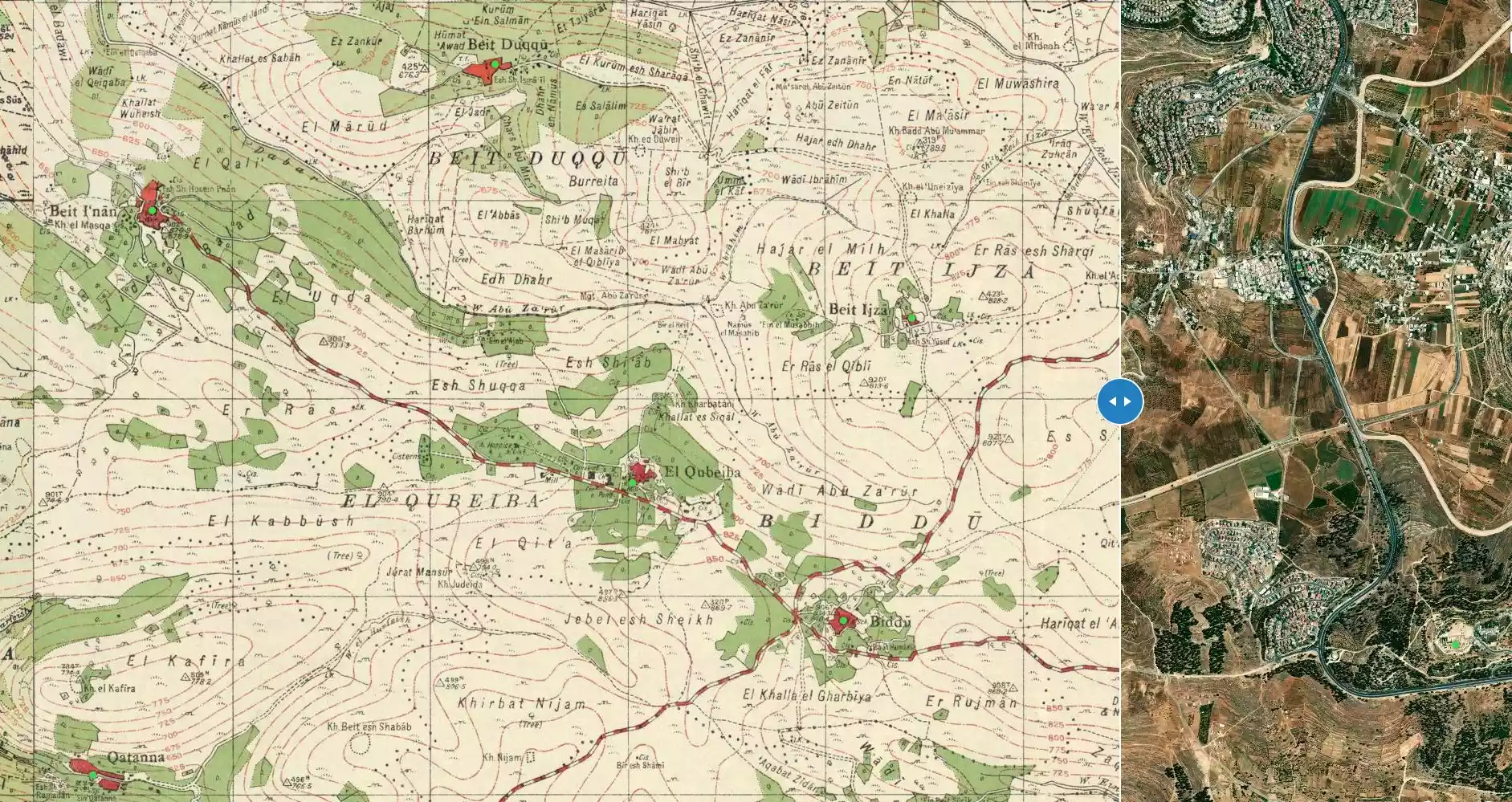
| Related Maps | Town Lands' Demarcation Maps خرائط للقضاء توضح حدود القرى والاودية View from satellite Town's map on MapQuest Help us map this town at WikiMapia |
||||||||||||||||||||||
| Related Links | Wikipedia's Page Facebook Page ARIJ Guide Google Search Google For Images Google For Videos في كتاب بلادنا فلسطين دليل أريج المزيد من موقع هوية |
||||||||||||||||||||||
- اميركا شرطي العالم
- درة فلسطين
- يوم الاسير
- يوم الاسير الفلسطيني1
- يوم الاسير الفلسطيني الجزء الثاني 2
- غزة الى اين؟
- حيدر عبد الشافي ومدريد2
- عبد الشافي ومدريد 2 نص كامل
- الاسرى والجلادون
- اعياد ما بعد رمضان
- العودة حق وقدر
- يا عيد
- انتفاضة الاسرى واوهام التسوية
- خريف غزة وصيد الافاعي
- الخط الاحمر
- اي سيناء التي عادت؟
- الاقصى في خطر
- معلزمات عن بدو
- تخاريف انابوليس
- مفاوضات بلا نهاية
- عالم اميركا السفلي
- الخيمة الفلسطينية الواحدة
- حواجز الموت الصهيونية
- الاستيطان يبتلع القدس -موسى ابراهيم ابو عيد
- اتفقوا او ارحلوا -موسى ابو عيد
- جولة بوش الامنية-موسى ابراهيم ابو عيد
- مفاوضات عبثية ومجازر مستمرة -موسى ابراهيم ابو عيد
- ظلام غزة ونصرة العرب
- العرب والانتخابات الاميركية -موسى ابراهيم
- عملية ديمونة وردع العدوان -موسى ابراهيم ابو عيد
- ابو تريكة ونحن نحبك بقلم موسى ابو عيد
- رسائل سعدات ودويك -موسى ابراهيم ابو عيد
- القول الفصل بقلم مو سى ابراهيم ابو عيد
- باراك اوباما في المنطقة العربية
- اوسلو في ذكراها
- القدس تهودت ونحن غافلون-موسى ابو عيد
- نفق بدو -رام الله
- مذكرات كعوش عن بدو خلال حرب 67
- بدو خلال حرب 48 معركة الرادار
- القدس بين تهويدها وتدعيم عروبتها-موسى ابو عيد
- ندوة القدس -الجزء الثاني
- الاستيطان الصهيوني يقضي على حلم الدولة الفلسطينية -موسى ابو عيد
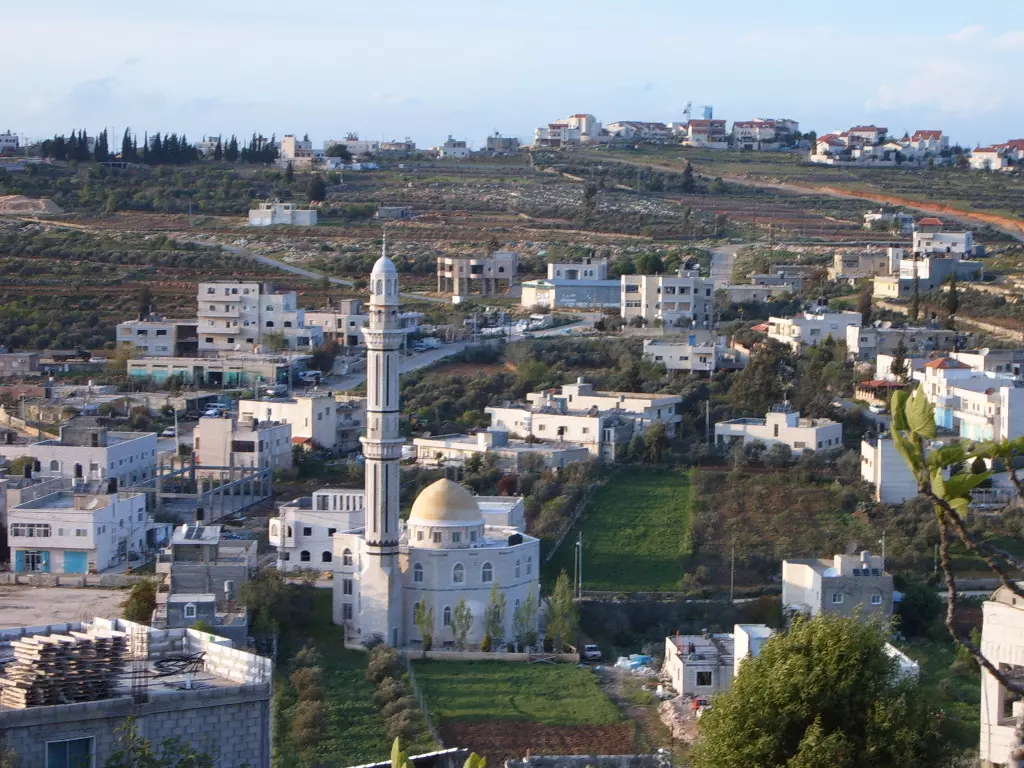
- بدّو في سطور
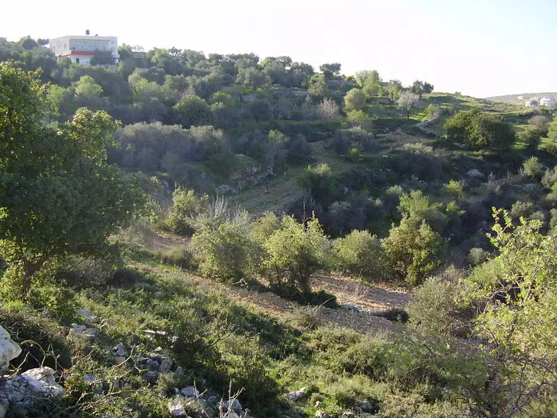
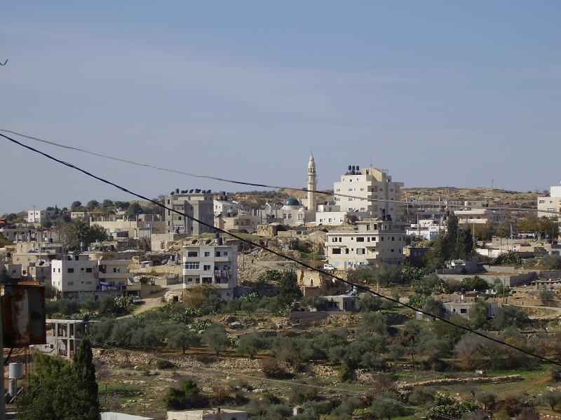
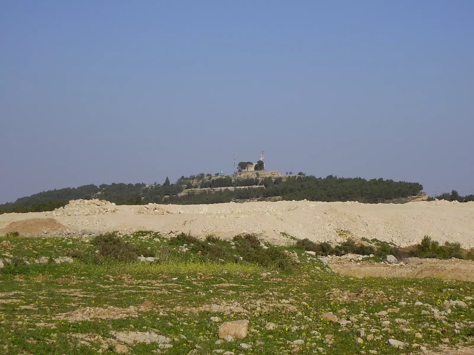
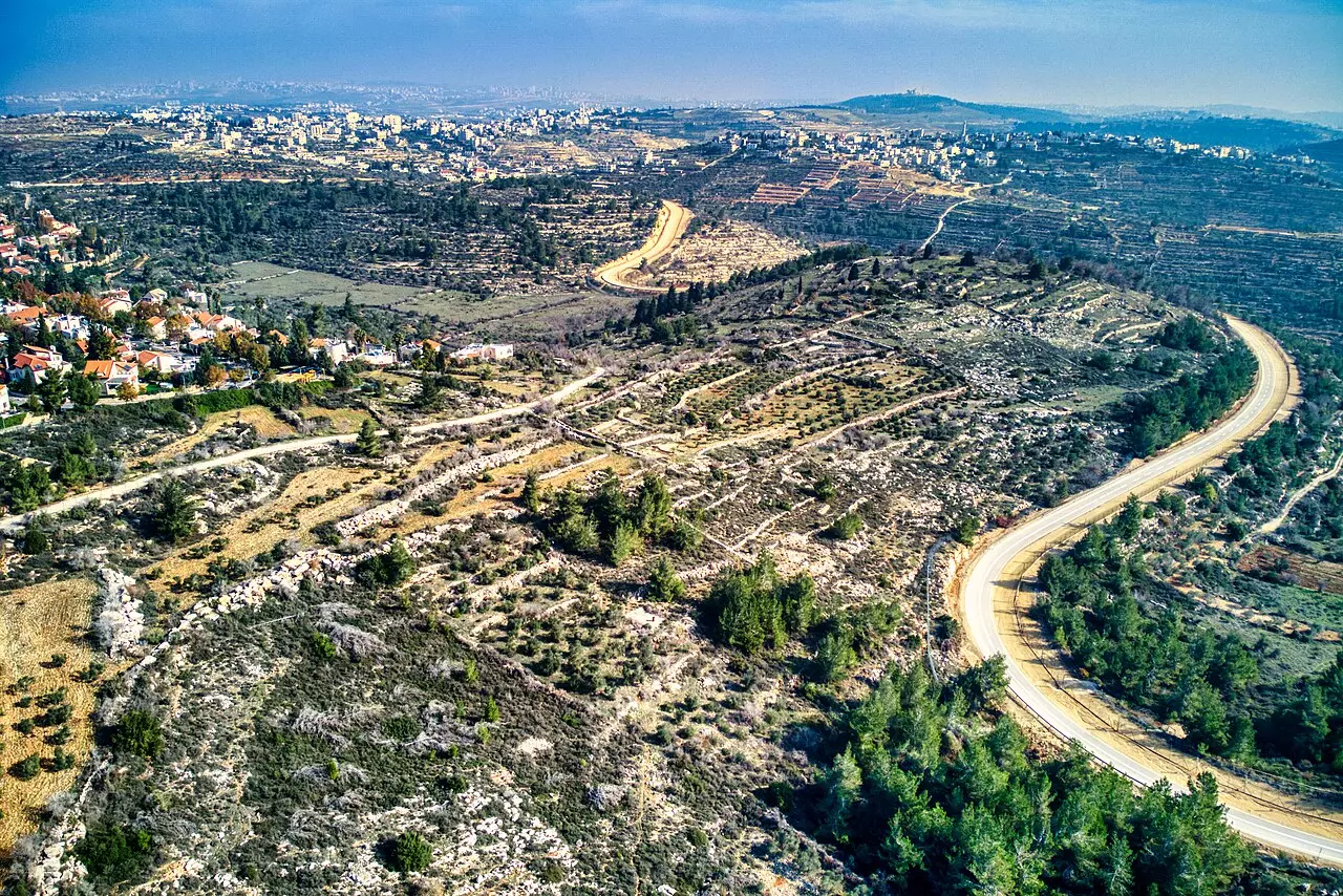
- بدو ويظهر سهلها وجبالها
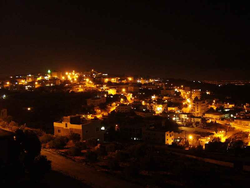
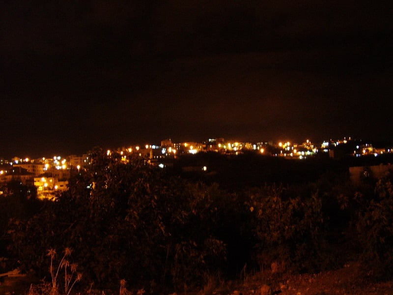
Posted by ابو عيد 7 - بدّو- صورة ليلية لمنطقة السهل
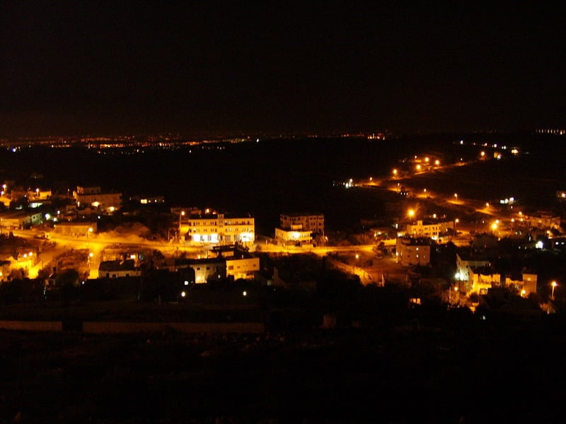
Posted by Ahmad Dali 1 - بدّو- صورة ليلية لمنطقة العرقوب
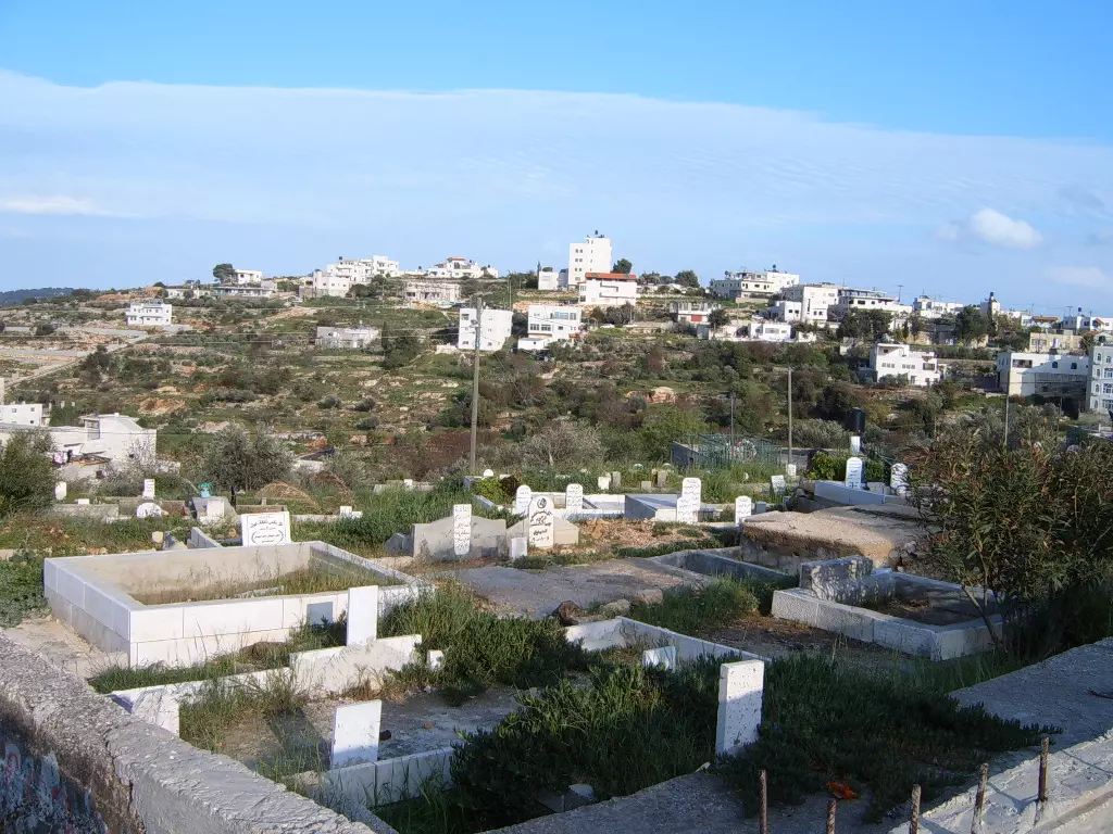
Posted by Ahmad Dali 1 - قبور الشهداء في حواكير الجامع ويظهر ايضا منطقة راس الشيخ
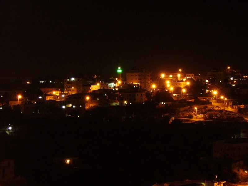
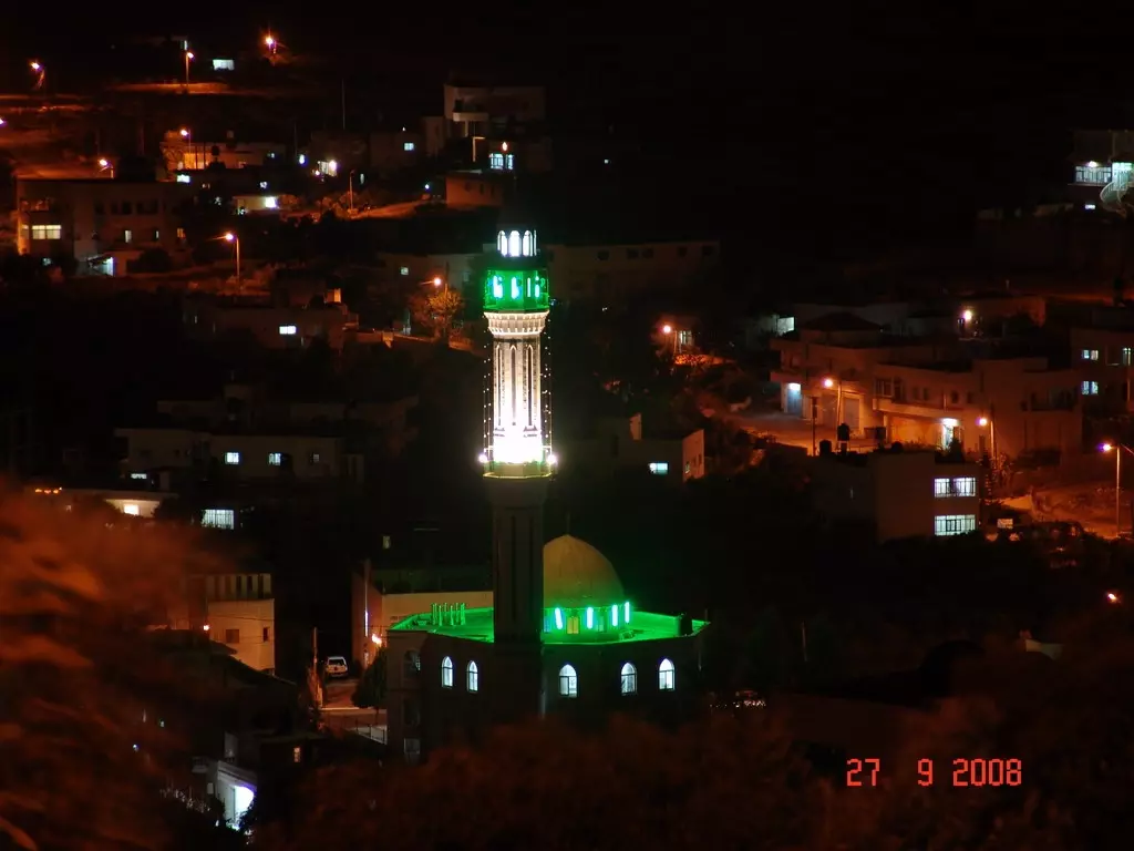
Posted by ابو عيد 2 - بدو في الليل - منظر رائع جدا والضوء الاخضر لمسجد بدو الرئيسي

Posted by ابو عيد 1 - بدّو- صورة ليلية لمنطقة النوادر من الجهة الشمالية الشرقية
Posted by Ahmad Dali - منطقة العرقوب
Posted by ابو عيد 2 - الشهيد يوسف ابراهيم ابو عيد
Posted by ابو عيد 1 - منظر ليلي

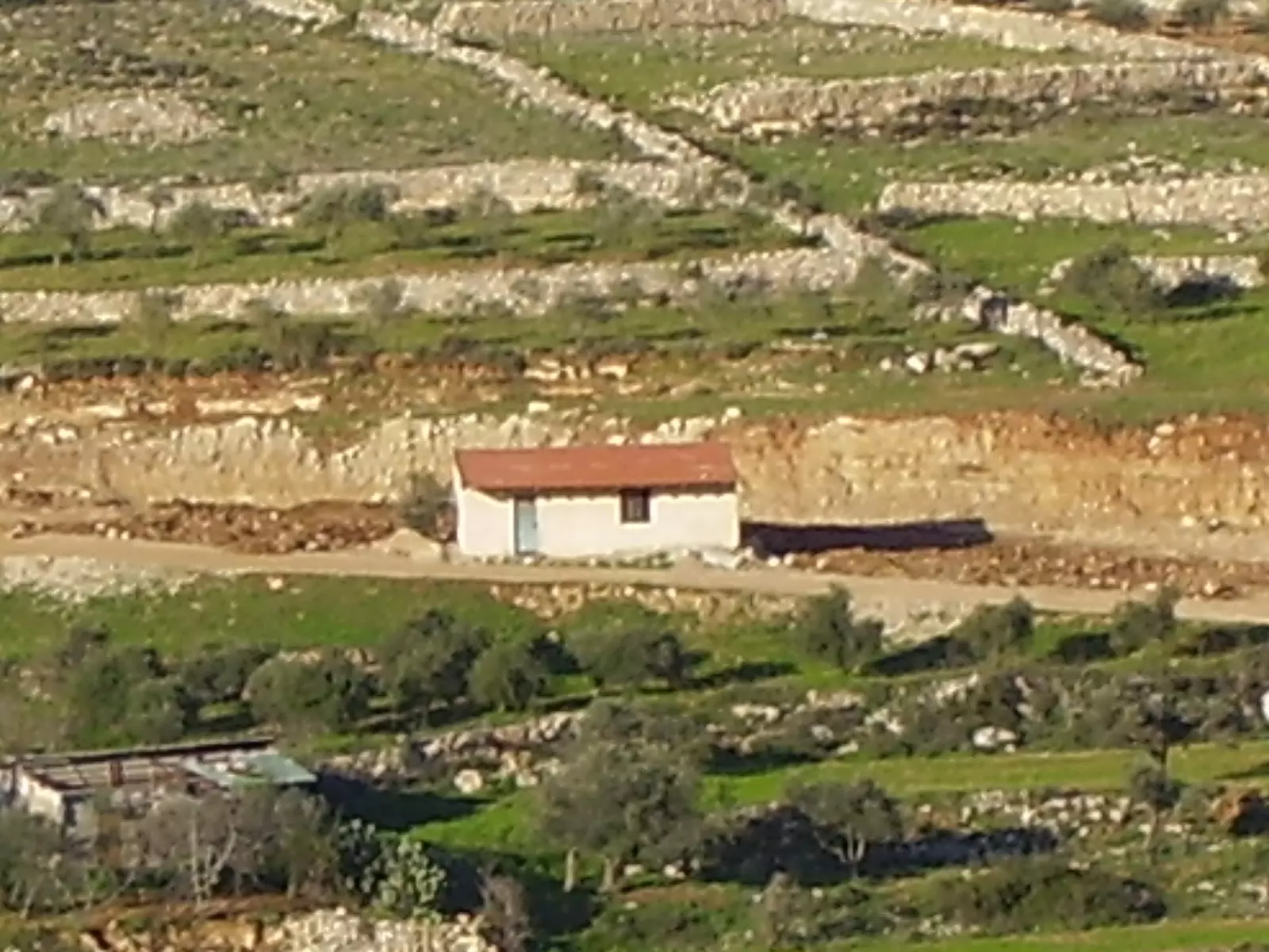
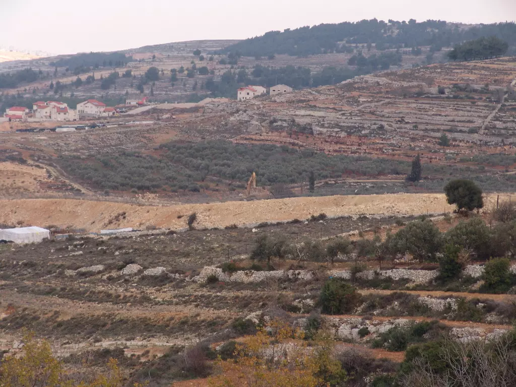
Posted by ابو عيد 1 - بدو في الربيع ويظهر المسجد الجديد في منطقة السها وحي الكتف في الاعلى ويظهر جدار الفصل العنصري في الاعلى ومستوطنة هداشا المقامة على ارض بدو المصادرة بالقوة
Posted by ابو عيد 3 - مسجد بدو القديم والذي يعود للعصر العثماني
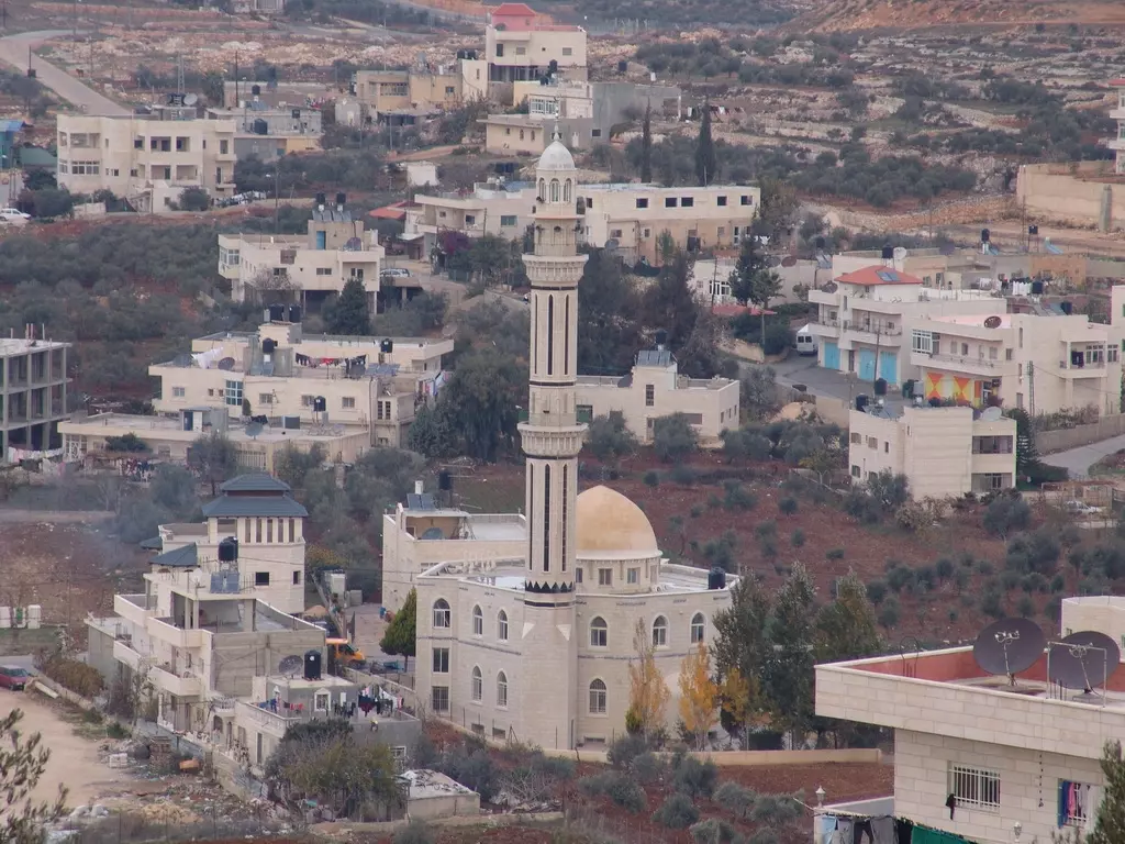
Posted by ابو عيد 3 - صورة لمسجد البلدة - منطقة النوادر
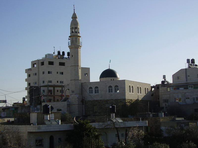
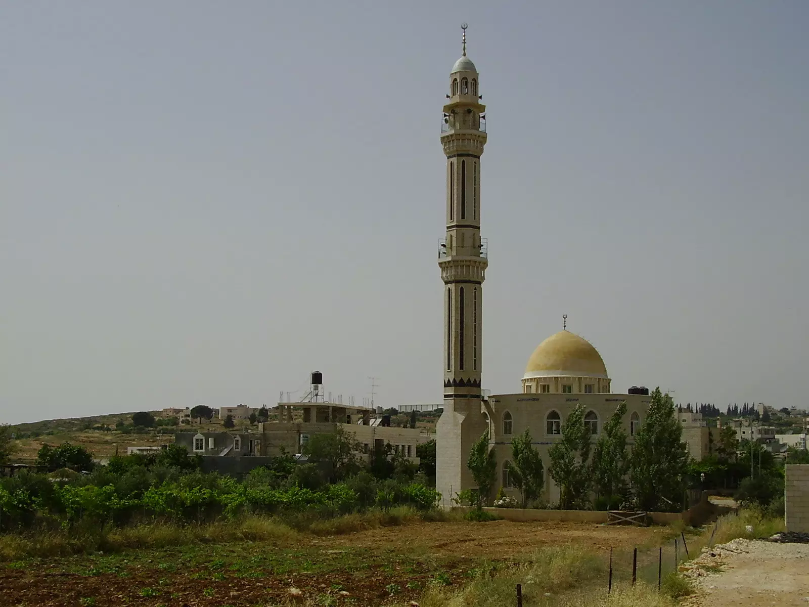
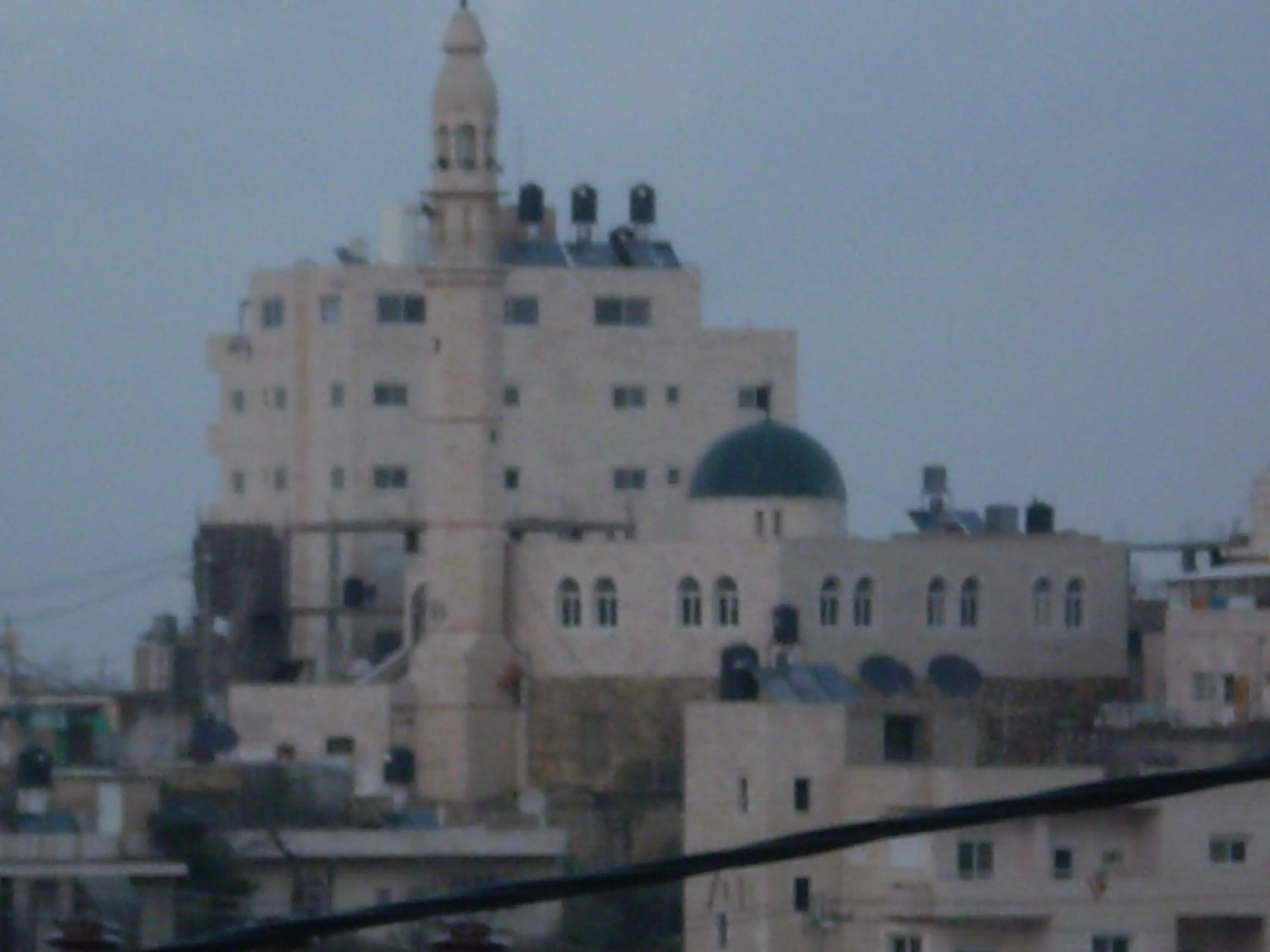
Posted by Ahmad Dali - صورة لمسجد السهل - منطقة السهل
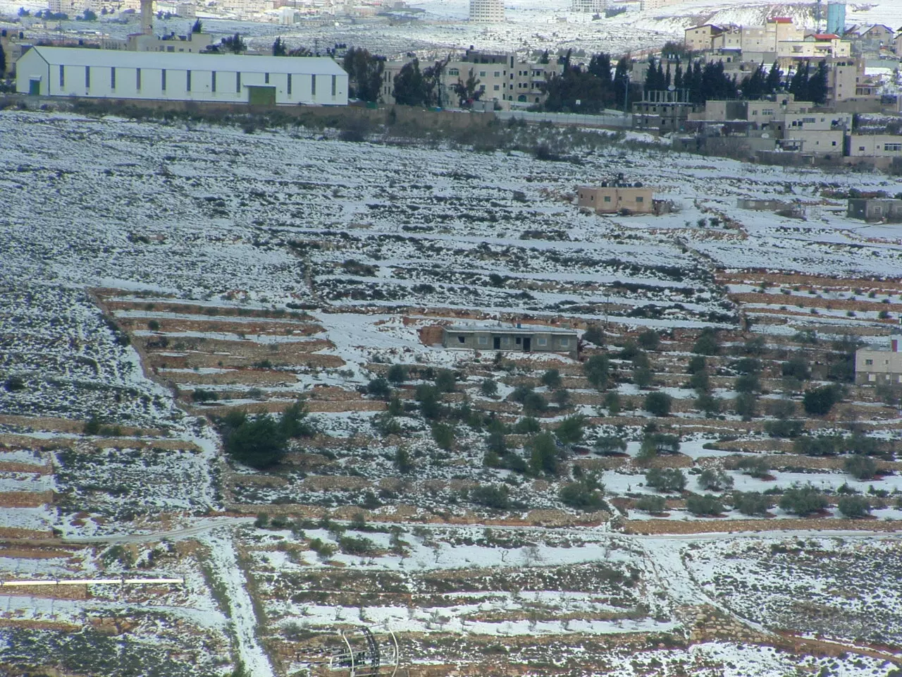
Posted by Ahmad Dali 2 - صورة لجزء من منطقة السهل
Posted by Ahmad Dali 1 - صورة لكرم زيتون في منطقة الحرايق
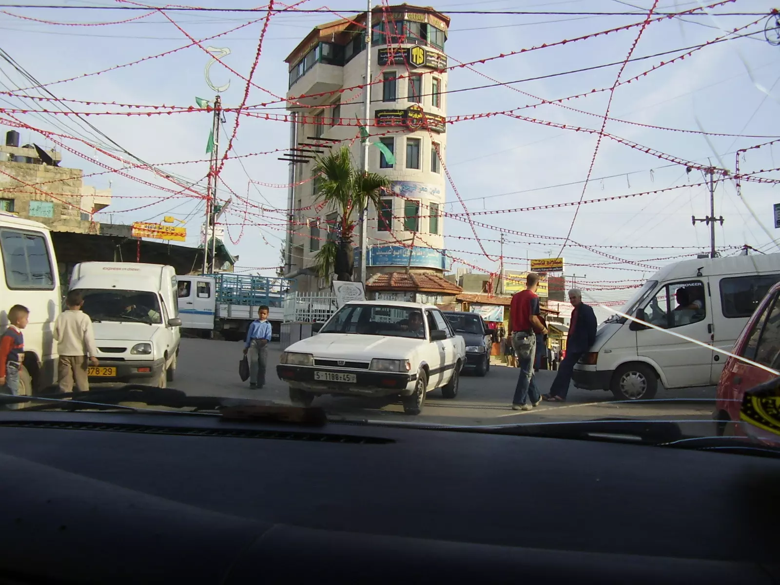
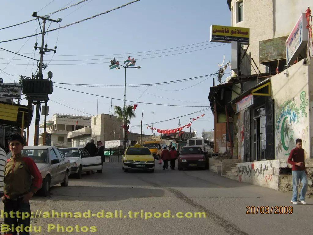
Posted by Ahmad Dali 1 - المنطقة التجارية وسط بدو والمعروفة بالمثلث او باب الغرس
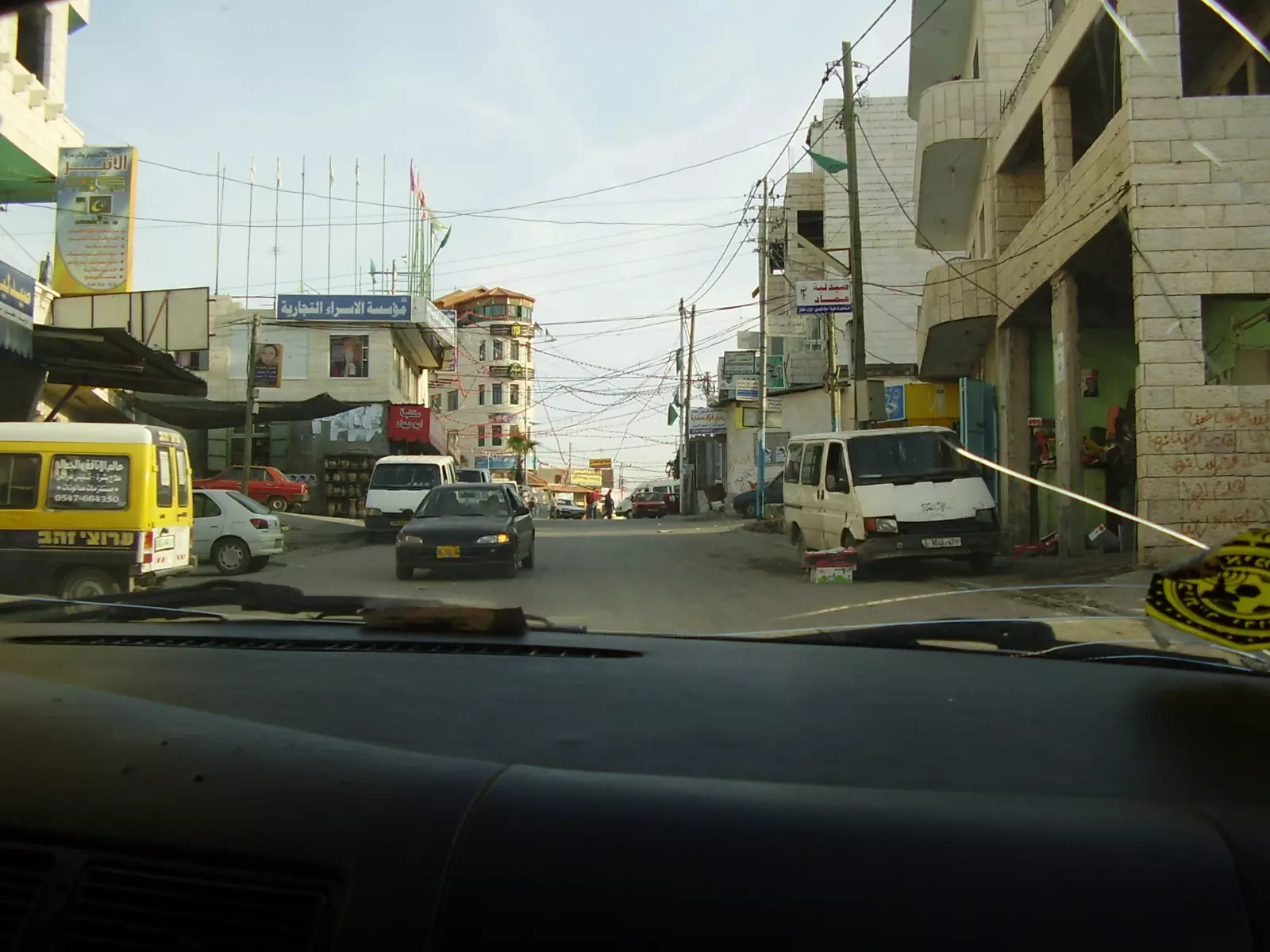
Posted by ابو عيد - محلات تجارية وسط بدو والمعروفة بالمثلث او باب الغرس
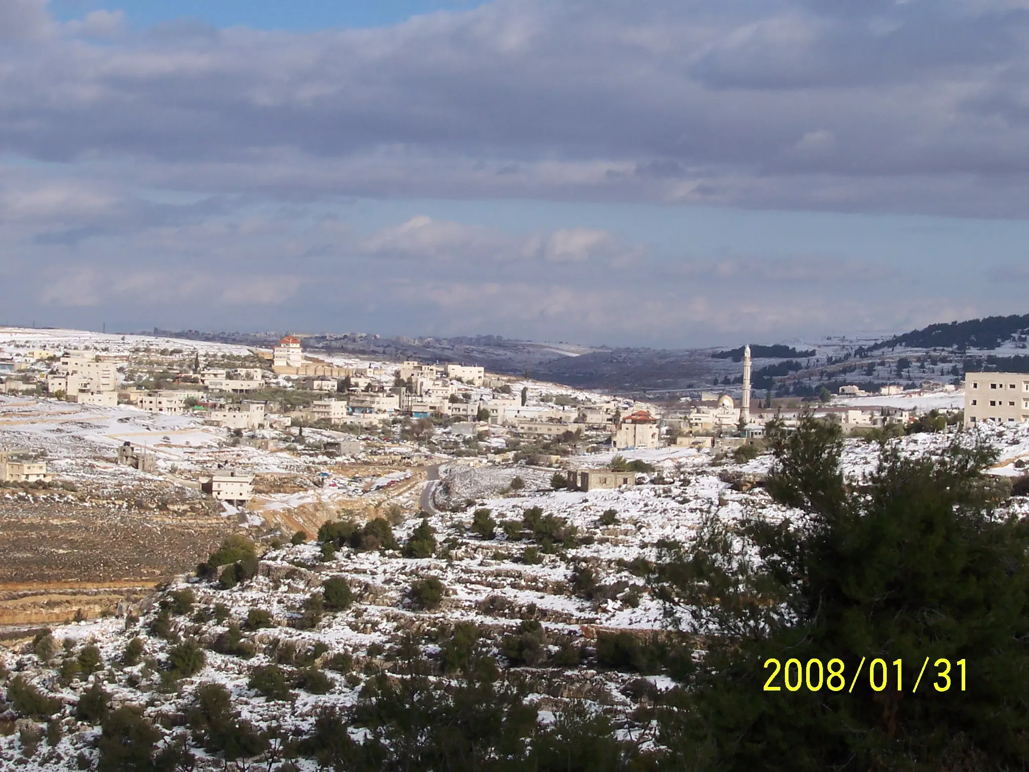
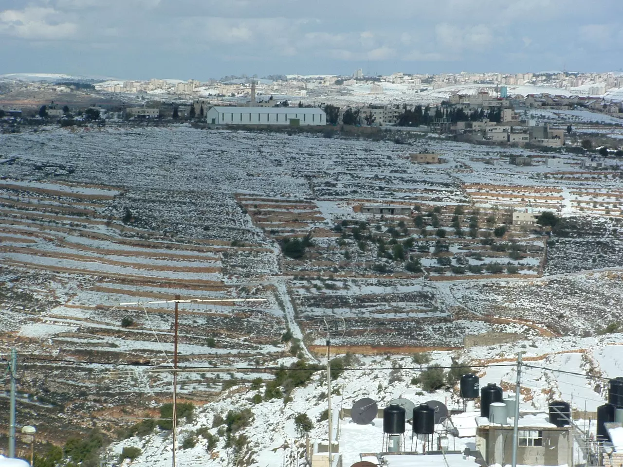
Posted by ابو عيد 1 - بدو - السهل يوم ثلج منظر من القبيبة
Posted by جمال بدوان 1 - صورة لمنطقة النوادر
Posted by Ahmad Dali - صورة لمسجد السهل من الجهة الشرقية
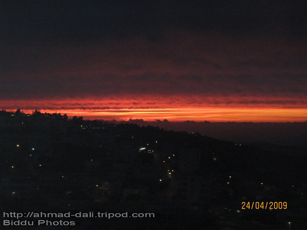
Posted by Ahmad Dali - صورة ليلية مأخوذة من منطقة السهل
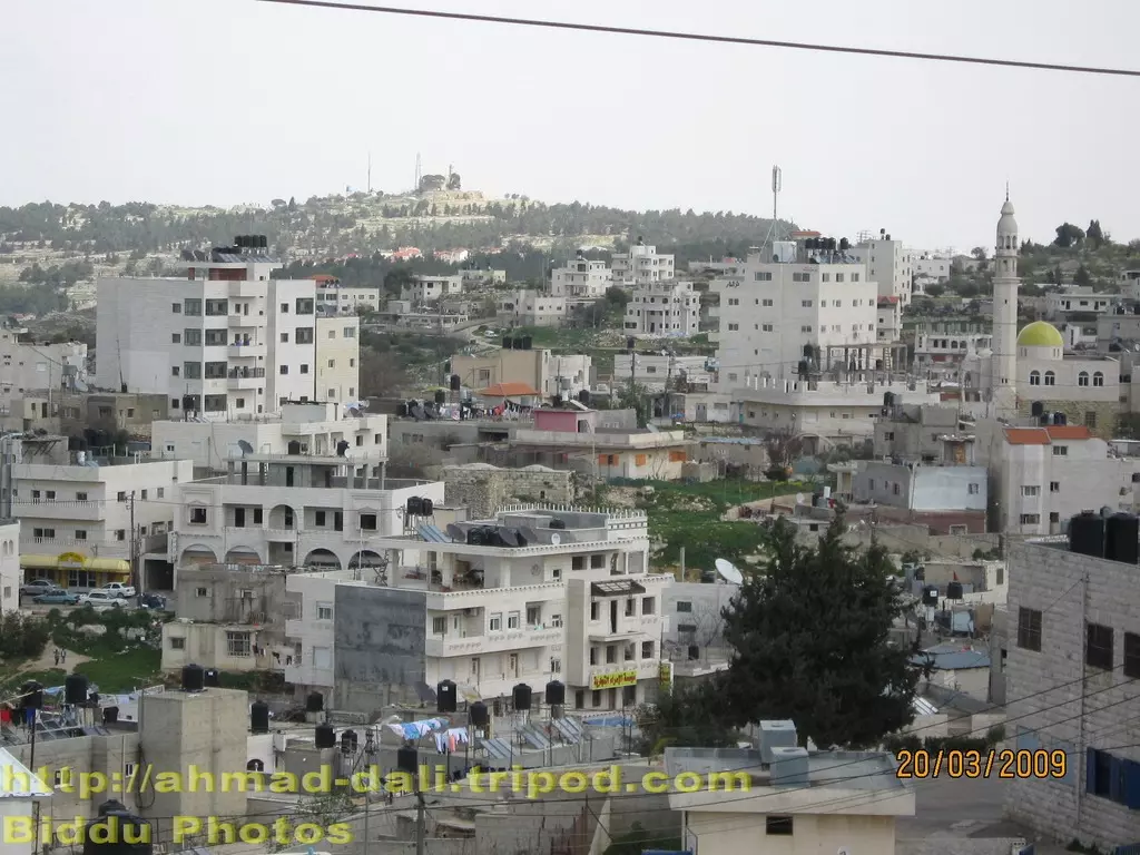
Posted by Ahmad Dali - صورة لجزء من البلد مأخوذة من السهل
Posted by Ahmad Dali - صورة منظر للغروب لحواكير الجامع مأخوذة من منطقة الحرايق
Posted by Ahmad Dali 4 - بدو منطقه الجامع الكبير
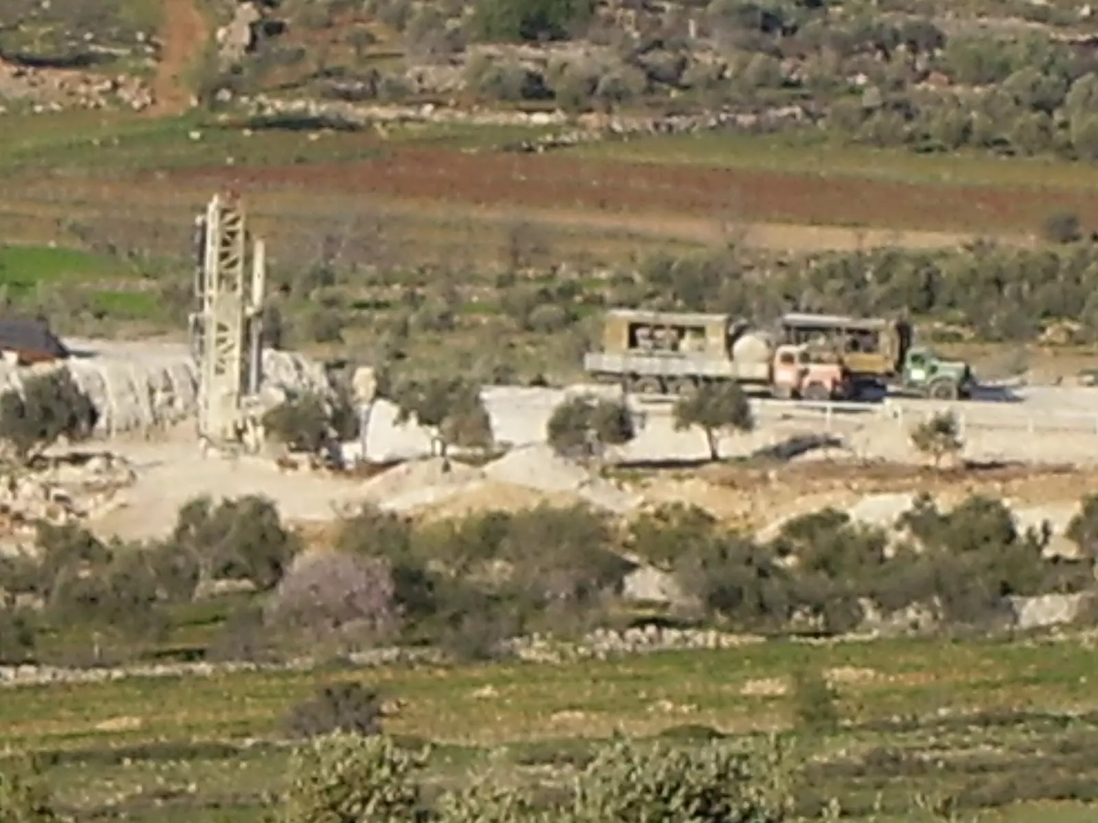
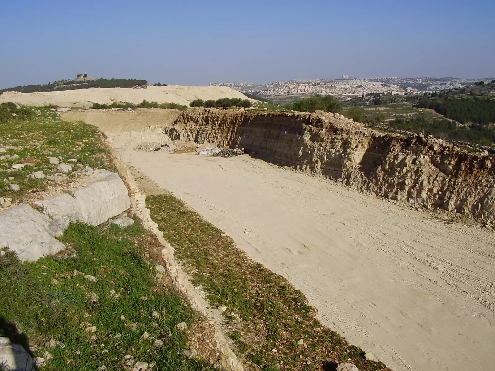
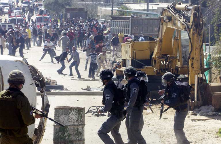
Posted by محمود فضل نعمان الشيخ 2 - الآليات الإسرائيلية تحفر قواعد للعبارة تحت الجدار في السهل، حيث أن هذه العبارة هي بداية الطريق الجديدة حاليا
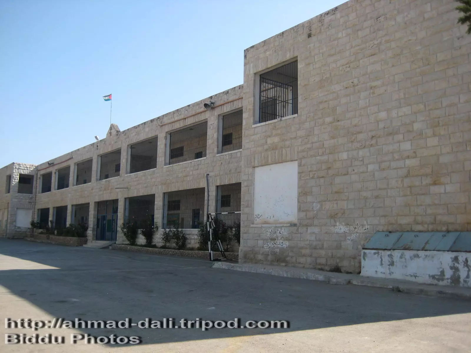
Posted by Ahmad Dali 1 - صورة لمدرسة بنات بدو الأساسية
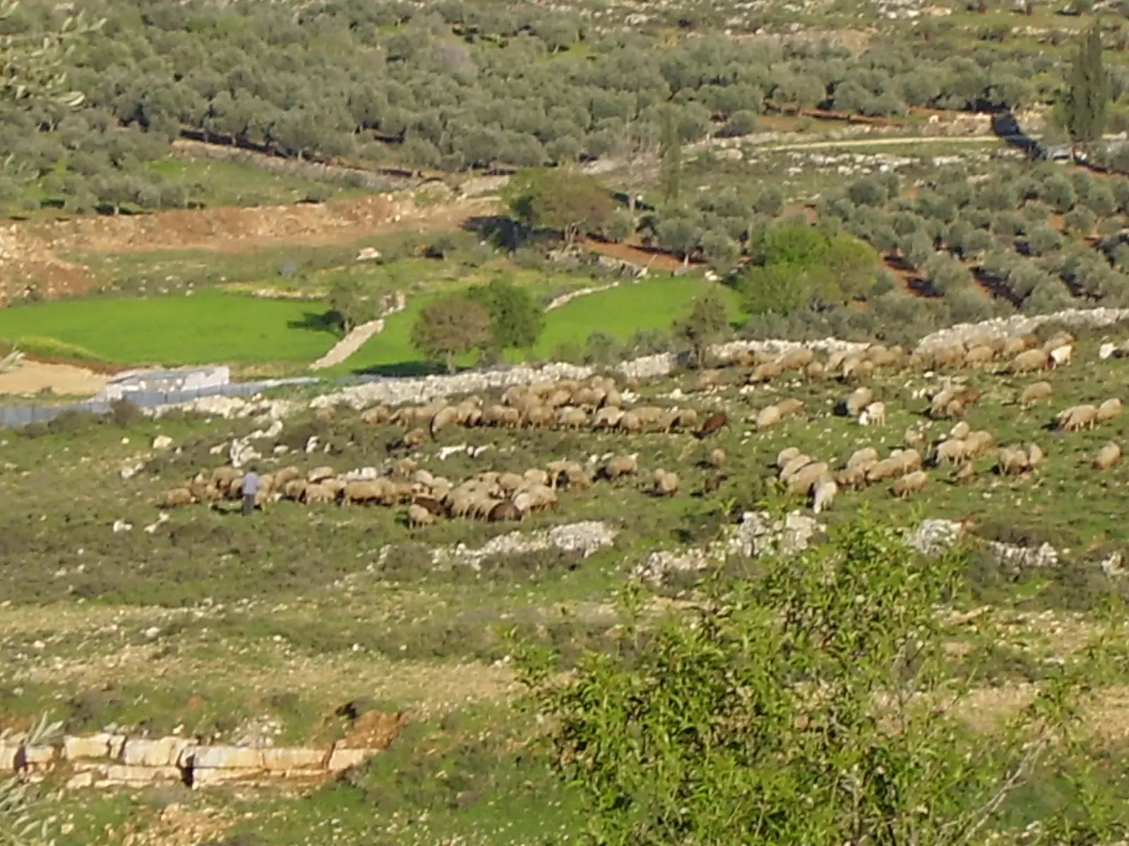
Posted by Ahmad Dali - قطيع للأغنام في طرف البلد الشمالي الشرقي
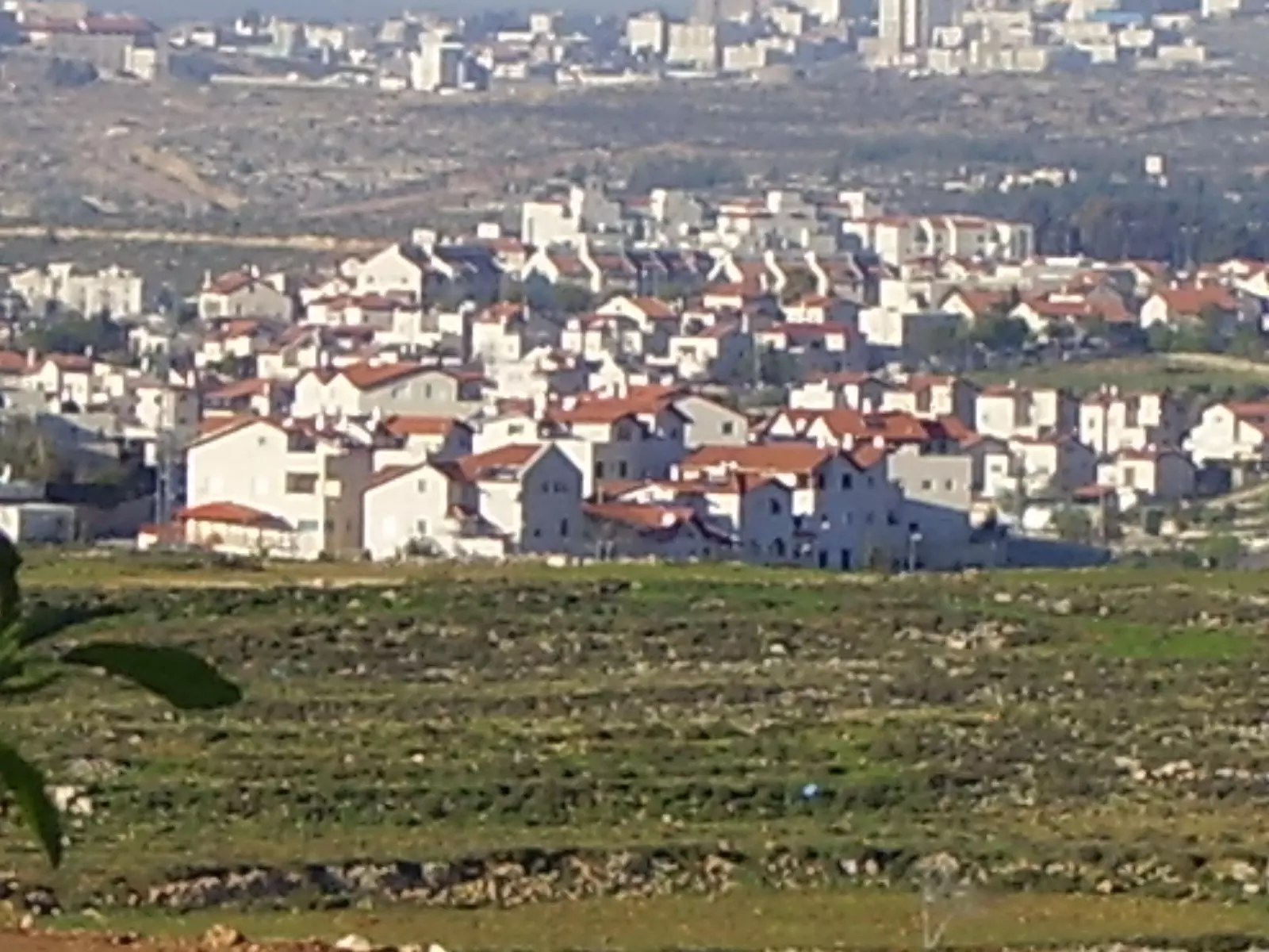
Posted by Ahmad Dali 1 - صورة لمستوطنة جفعون حداشا مأخوذة من الجهة الشمالية للبلد
Posted by Ahmad Dali - جزء من المسار القديم للجدار في منطقة السهل
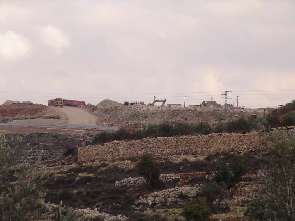
Posted by Ahmad Dali - تجريف أراضي أهالي بدو قبل إقامة الجدار في منطقة راس حمد - شرق البلد
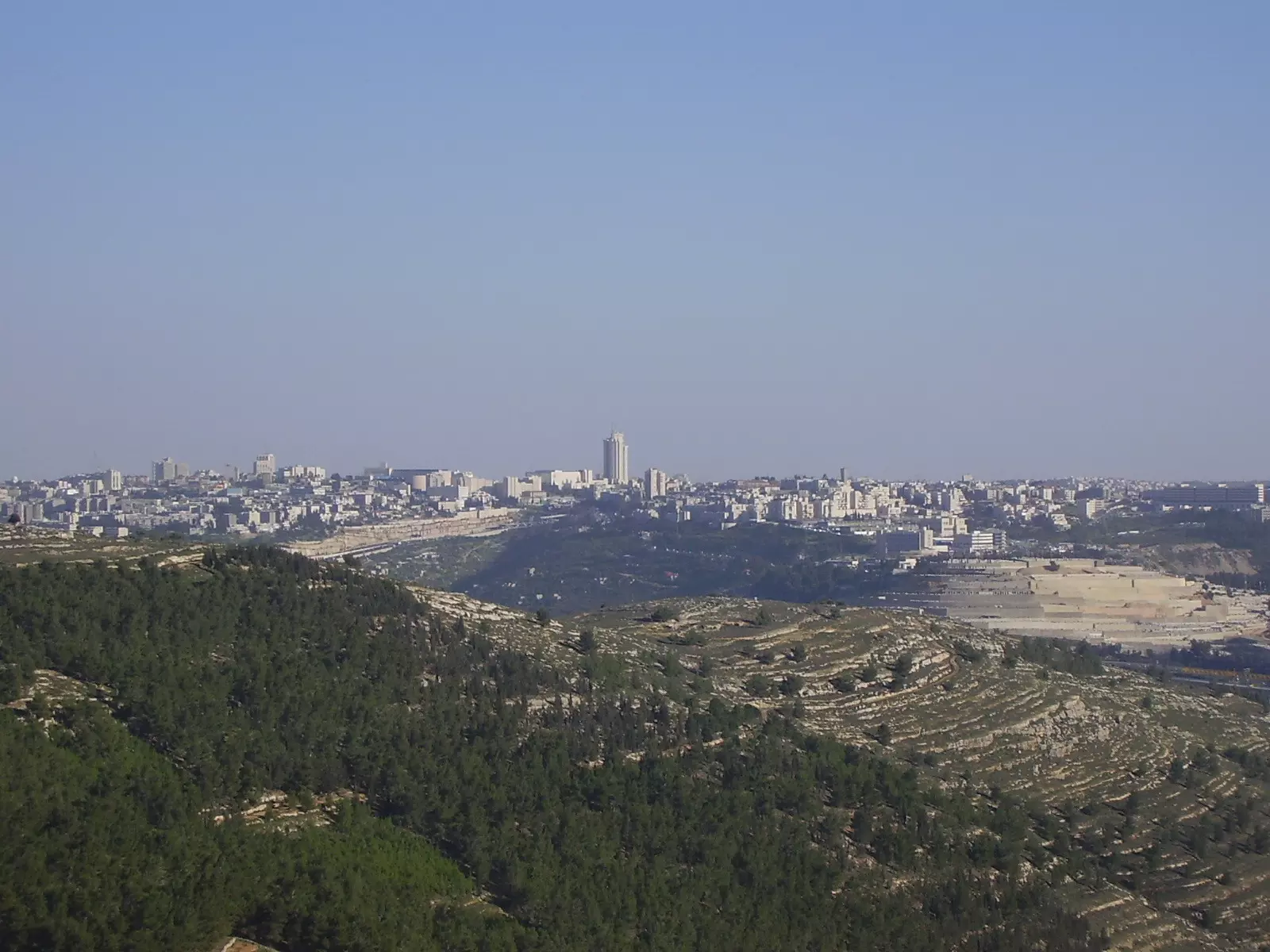
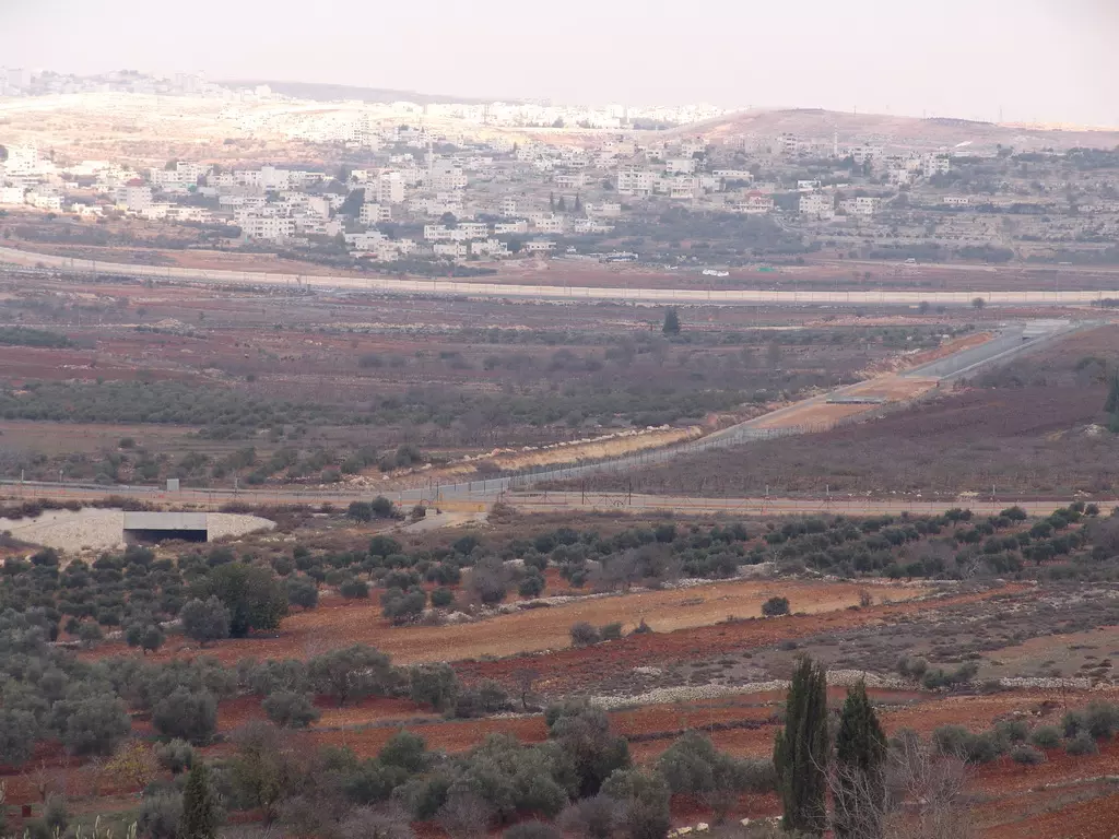
Posted by Ahmad Dali - صورة للجزء الغربي من مدينة القدس المحتلة مأخوذة من الطرف الشرقي للبلد
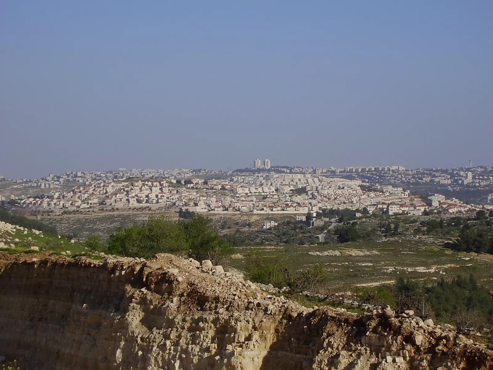
Posted by Ahmad Dali - صورة لمستوطنة راموت، مأخوذة من الطرف الشرقي للبلد
Posted by Ahmad Dali 1 - صورة لمنطقة النبي صموائيل
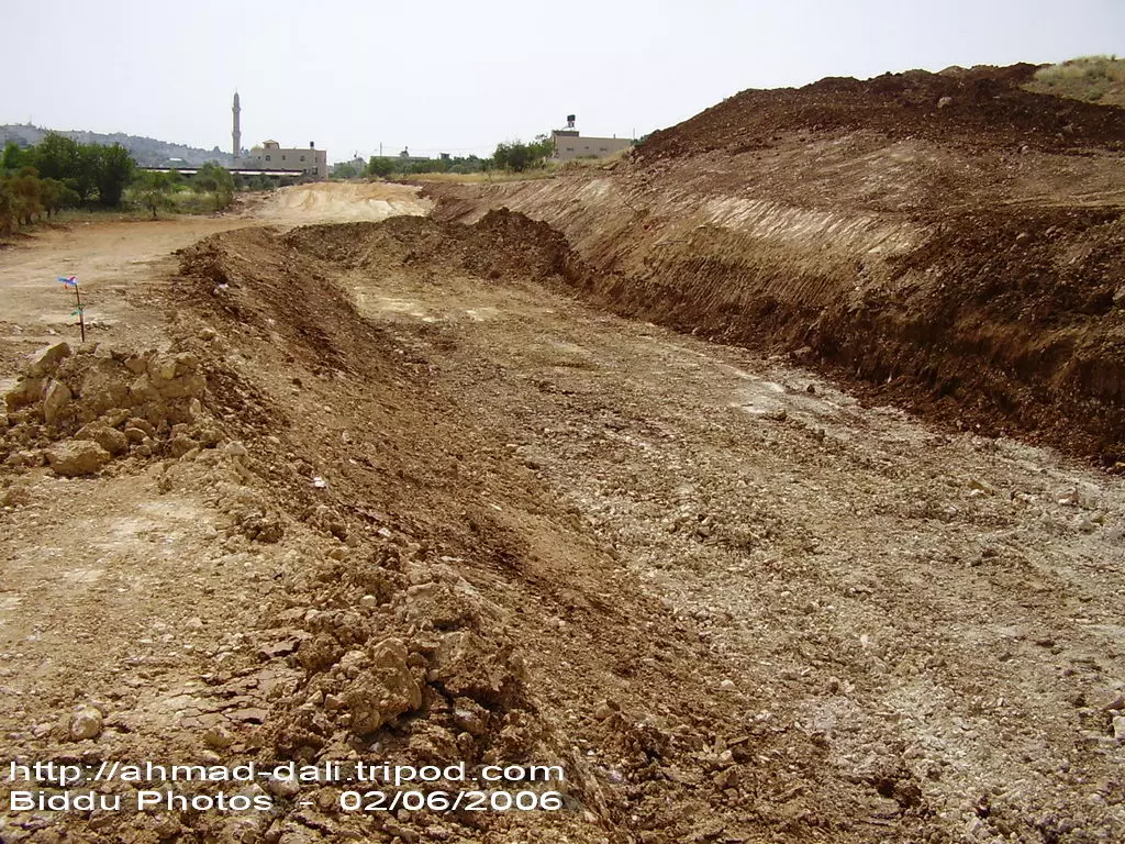
Posted by Ahmad Dali 1 - تجريف الأراضي الزراعية في منطقة العروض شرق البلد لإقامة الجدار عليها
Posted by Ahmad Dali - تجريف الأراضي الزراعية في منطقة العروض شرق البلد لإقامة الجدار عليها2
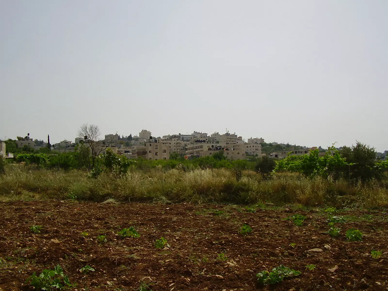
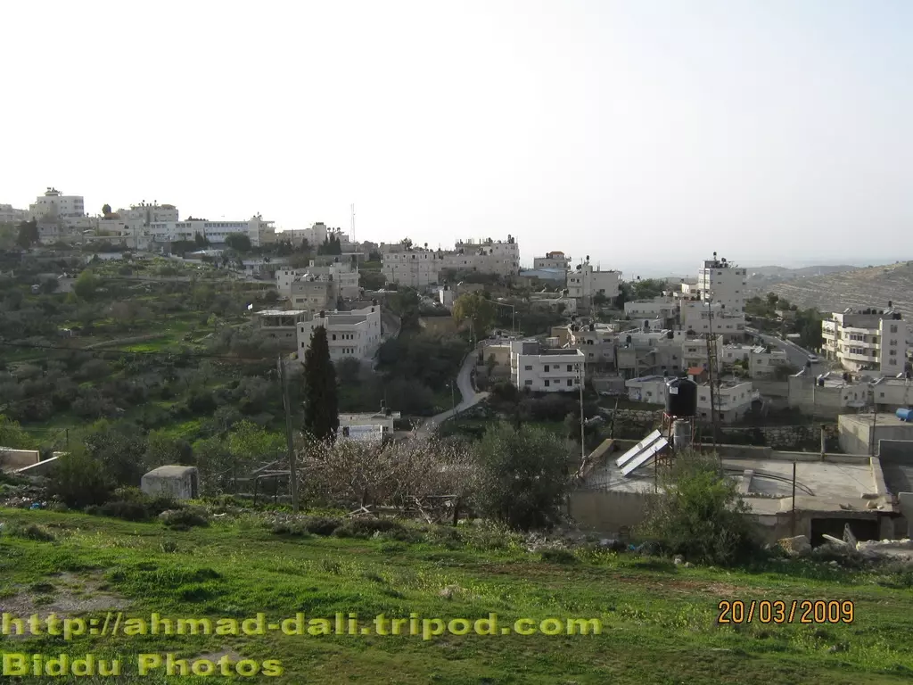
Posted by Ahmad Dali 1 - منظر عام
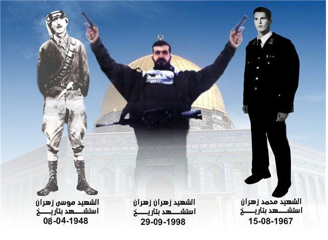
Posted by shadi murrar 1 - الشهيد زهران زهران
Posted by تقي الدين زهران 5 - مسجد فاطمة الزهراء ليلة العيد
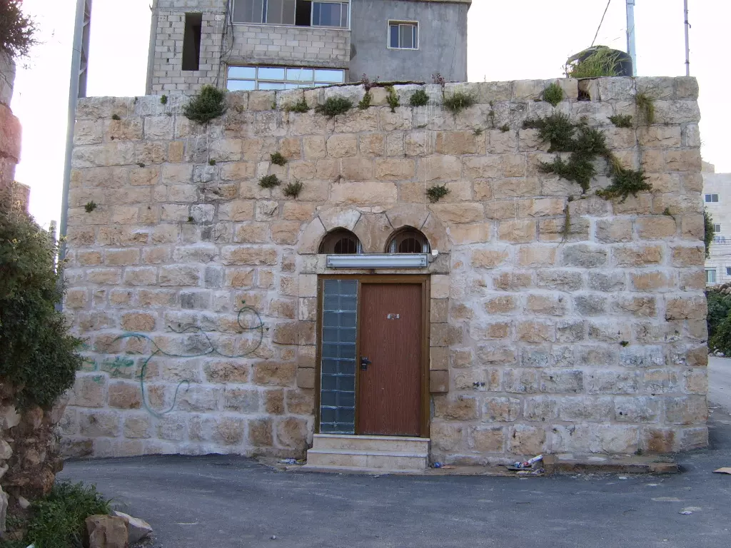
Posted by ابو عيد 2 - وسط البلدة القديمة
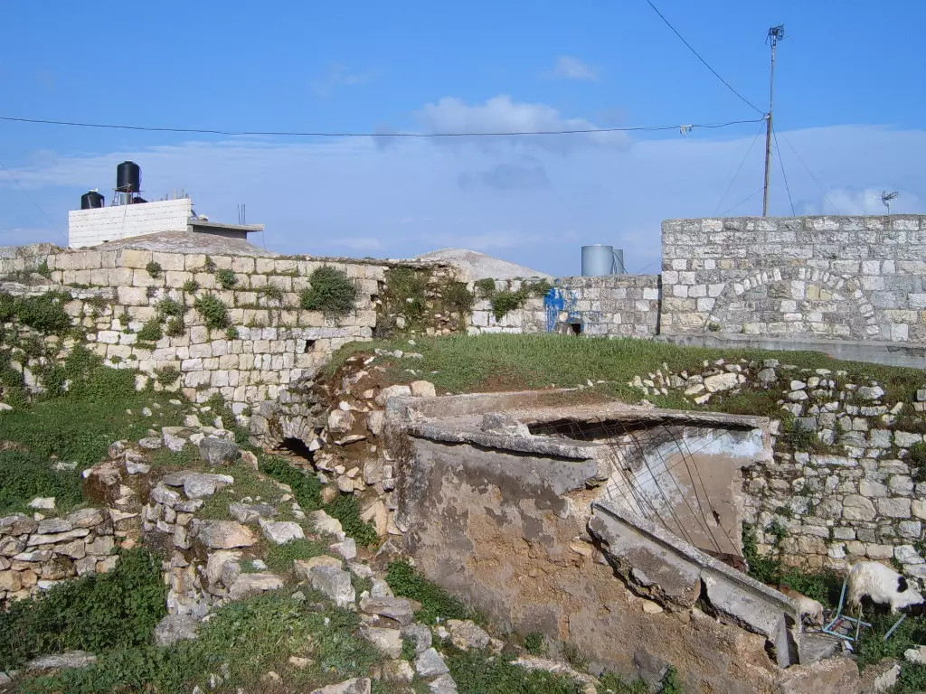
Posted by ابو عيد - منطقة النوادر - وسط بلدة بدّو
Posted by Ahmad Dali - الجدار العنصري في منطقة السهل 15-12-2008
Posted by Ahmad Dali - الجدار العنصري وتحته طريق النفق 15-12-2008
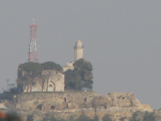
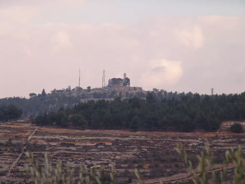
Posted by Ahmad Dali - مقام النبي صموائيل - شرق بلدة بدّو 15-12-2008
Posted by Ahmad Dali - منطقة جبل زعرور
Posted by ابو عيد 1 - جرافات الاحتلال الصهيوني تسوي الارض في منطقة راس حمد شرق بلدة بدو
Posted by ابو عيد - bidoo2009
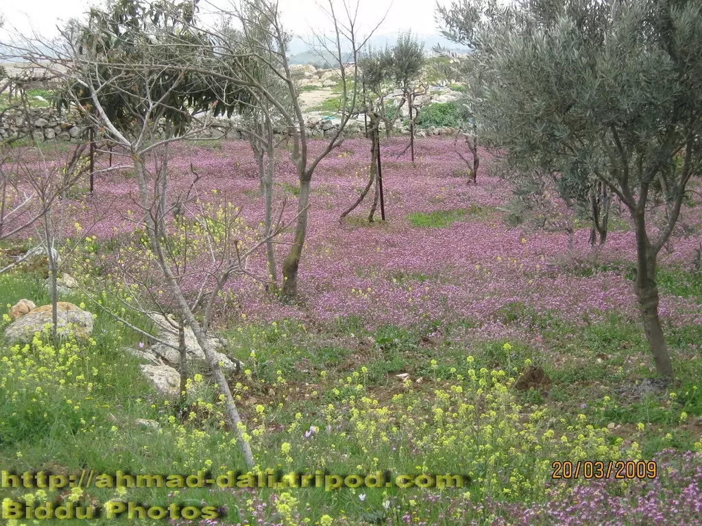
Posted by ابو عيد - منظر الربيع
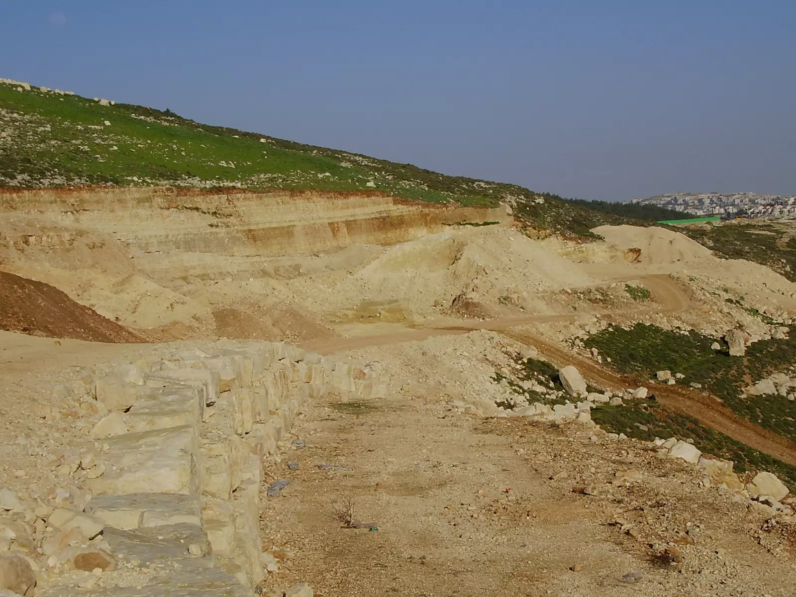
Posted by ابو عيد - بدو -منظر عام
Posted by ابو عيد 2 - biddooo
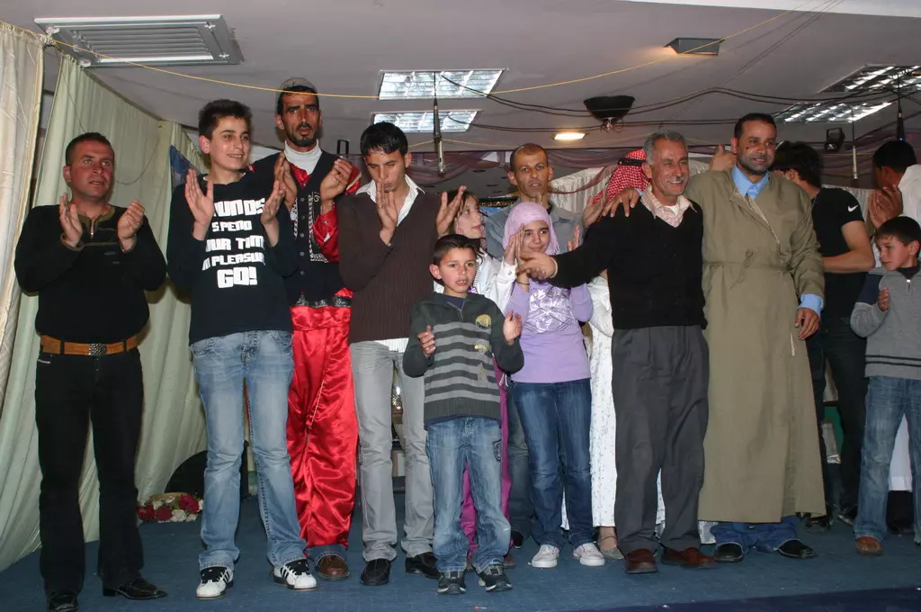
Posted by ابو عيد 1 - صورة من مسرحية
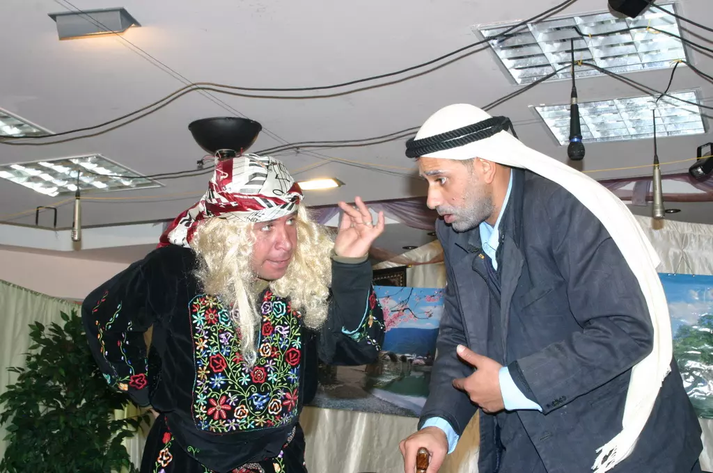
Posted by Ahmad Dali - صورة من مسرحية "العقل زينة" التي قام بها عدد من أبناء البلدة-3
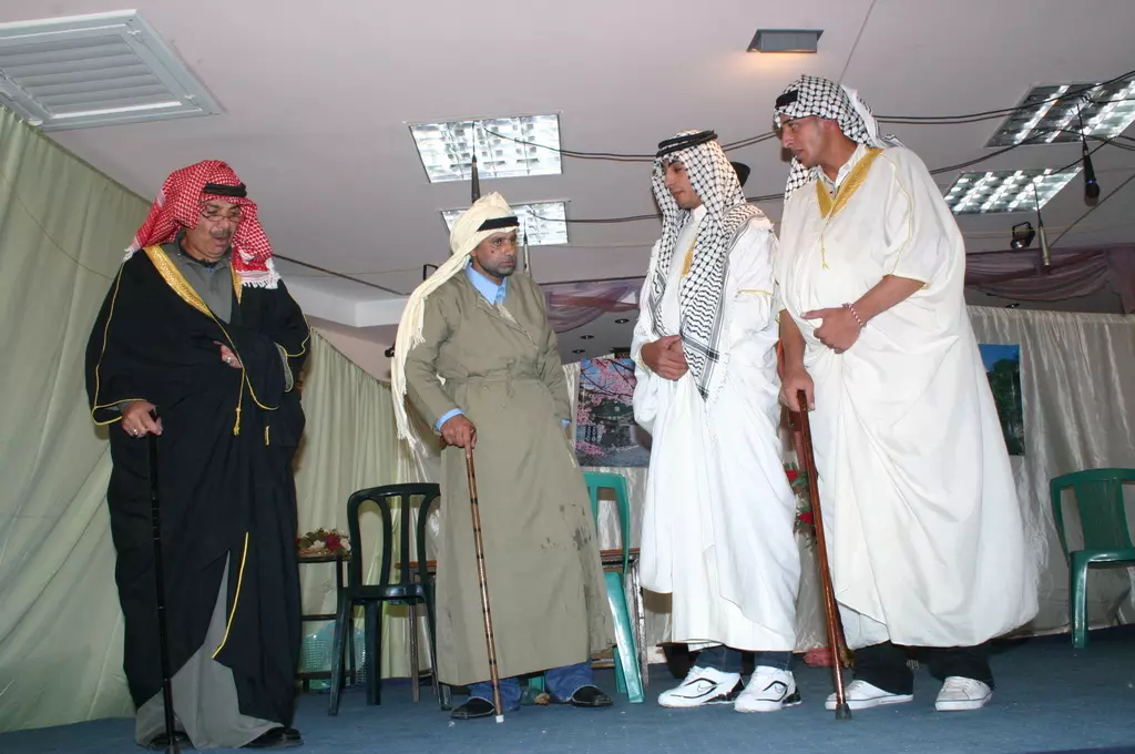
Posted by Ahmad Dali - صورة من مسرحية "العقل زينة" التي قام بها عدد من أبناء البلدة-4
Posted by Ahmad Dali - صورة من مسرحية "العقل زينة" التي قام بها عدد من أبناء البلدة-5
Posted by Ahmad Dali - الصورة الأولى شارع النفق قبل تجهيزه - والذي يمر من تحت الجدار المقام على أراضي بلدة بدّو
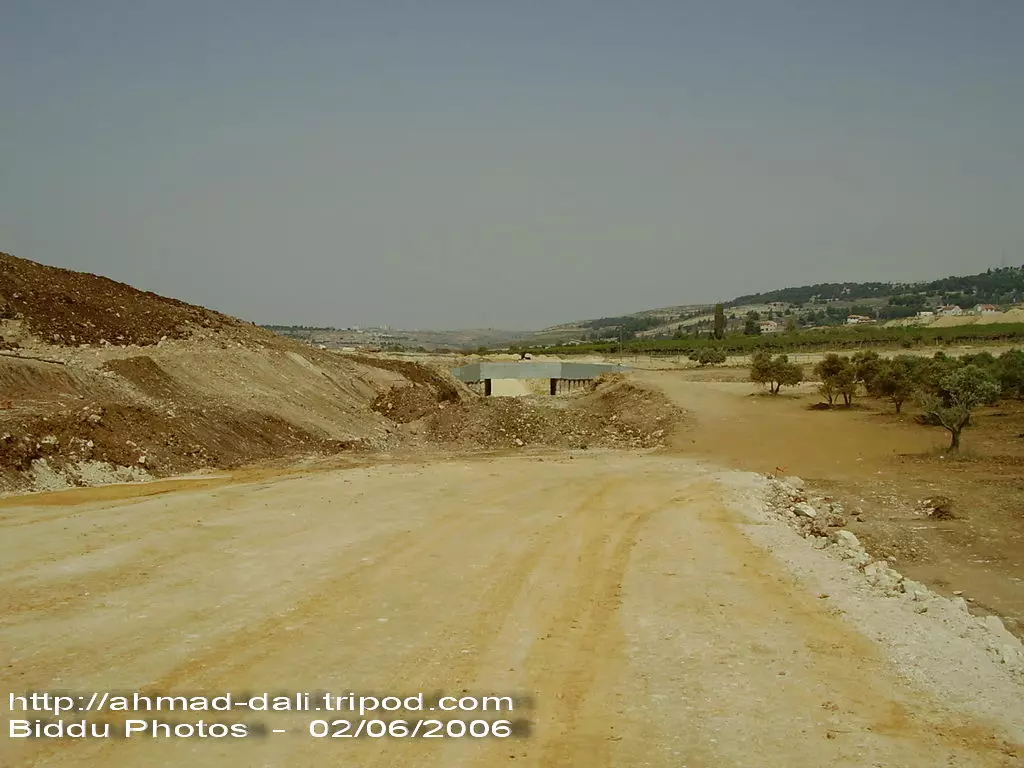
Posted by Ahmad Dali - الصورة الثانية لشارع النفق قبل تجهيزه - والذي يمر من تحت الجدار المقام على أراضي بلدة بدّو
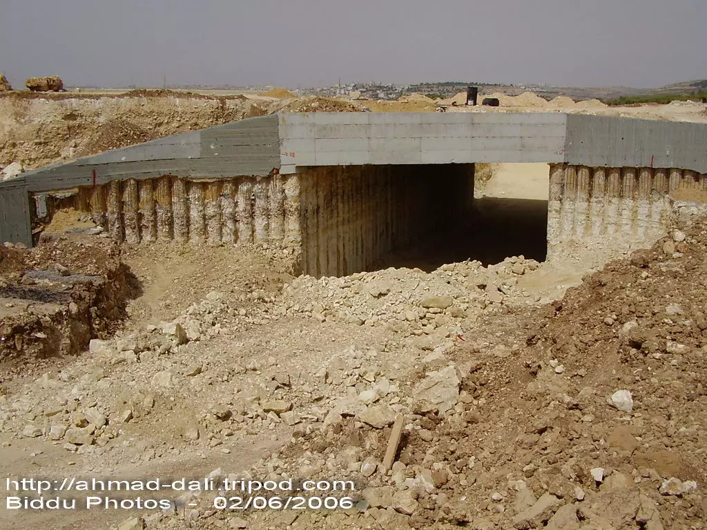
Posted by Ahmad Dali - الصورة الثالثة لشارع النفق قبل تجهيزه - والذي يمر من تحت الجدار المقام على أراضي بلدة بدّو
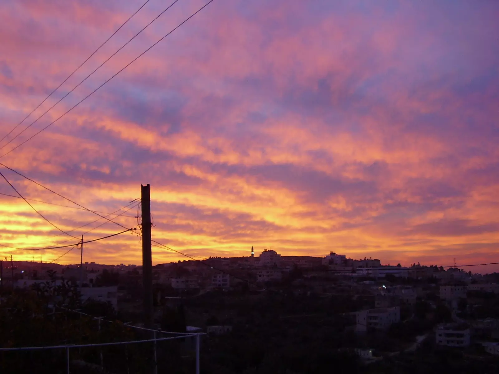
Posted by Ahmad Dali - منظر الغروب - الصورة مأخوذة من منطقة الحرايق
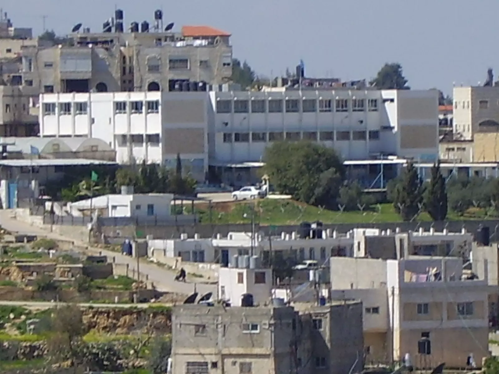
Posted by Ahmad Dali - مدرسة الملك غازي الثانوية
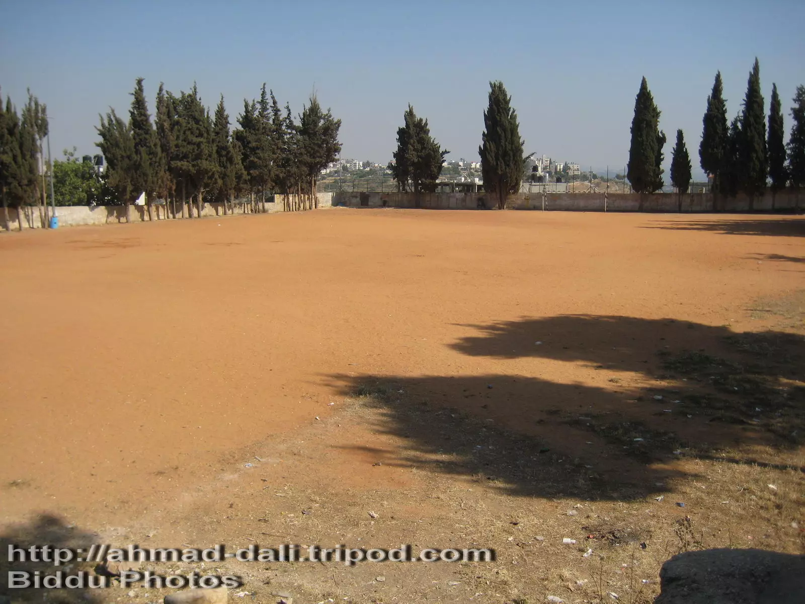
Posted by Ahmad Dali 1 - ملعب مدرسة الملك غازي الثانوية للبنين
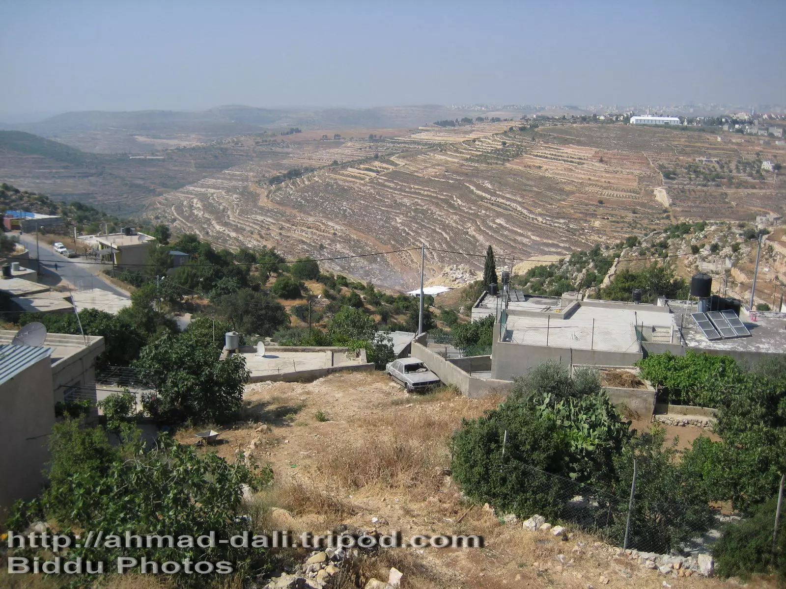
Posted by Ahmad Dali - صورة عامة تظهر فيها منطقة واد أبو زعرور
Posted by Ahmad Dali - مقاومة اهل بدو لبناء الجدار والتصدي لجيش الاحتلال
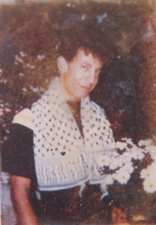
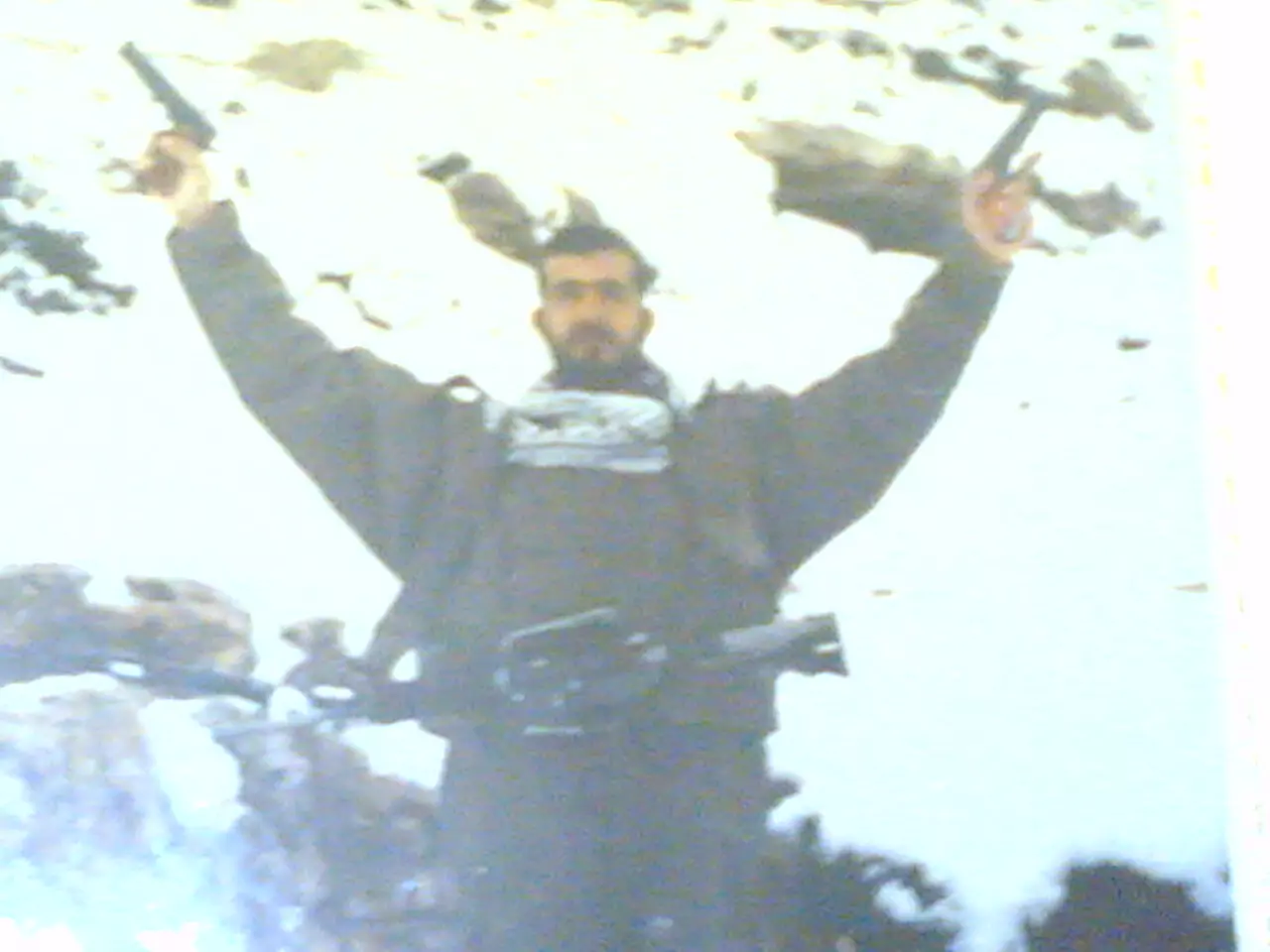
Posted by ابو عيد - الشهيد موسى زهران ابن قريه بدو الذي استشهد في معركه القسطل مع عبد القادر الحسيني
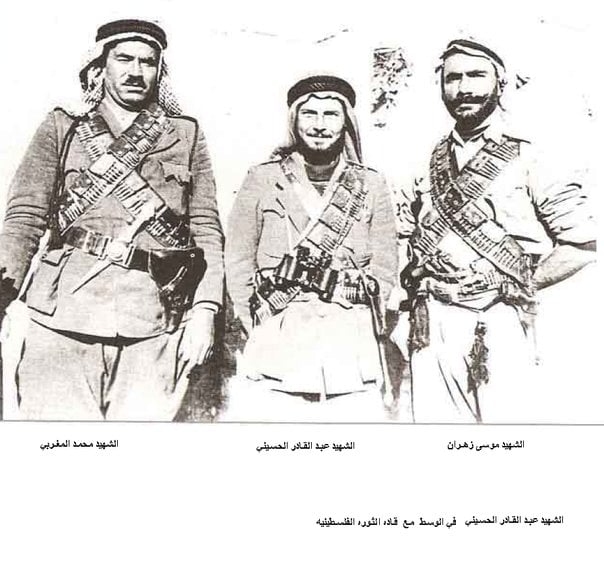
Posted by تقي الدين زهران 2 - الشهيد موسى زهران و الشهيد زهران زهران و الشهيد محمد زهران
Posted by تقي الدين زهران 1 - شهيد من شهداء قرية بيت لقيا استشهد بتاريخ 2/4/1988
Posted by مرعي عاصي - BIDDU AT SNOWY WEATHER-12/2008
Posted by abueid - Snowy weather - Biddu village Dec 2008
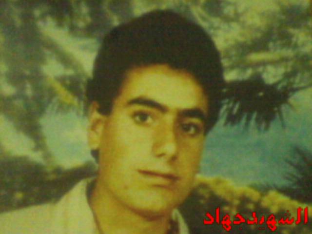
Posted by abueid - الشهيد نعيم محمد نعيم منصور__ دقيقة لقرأة الفاتحة على ارواح شهداءنا البواسل
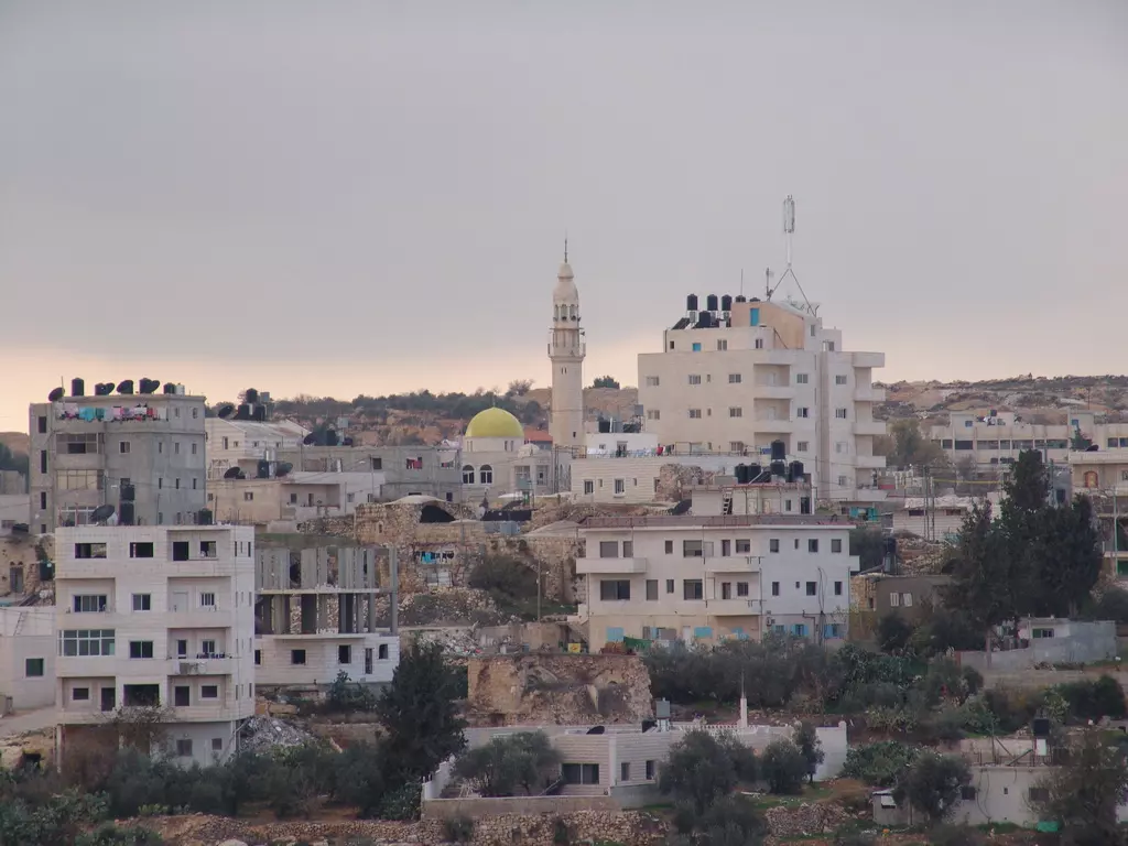
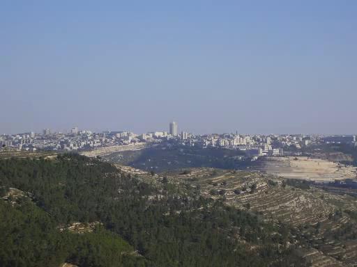
Posted by عبدالقادر نعيم 1 - مدينة القدس كما يراها المشاهد من بلدة بدو
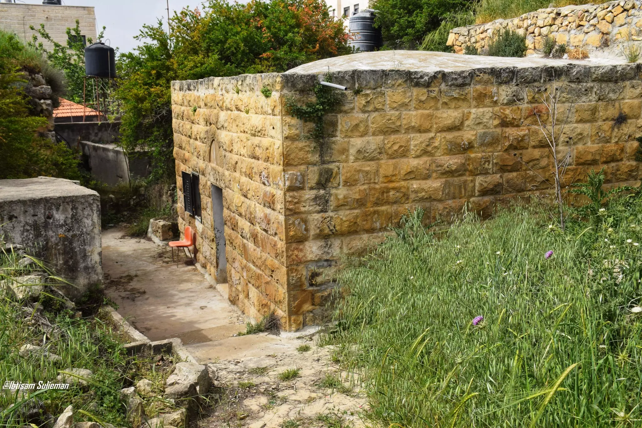
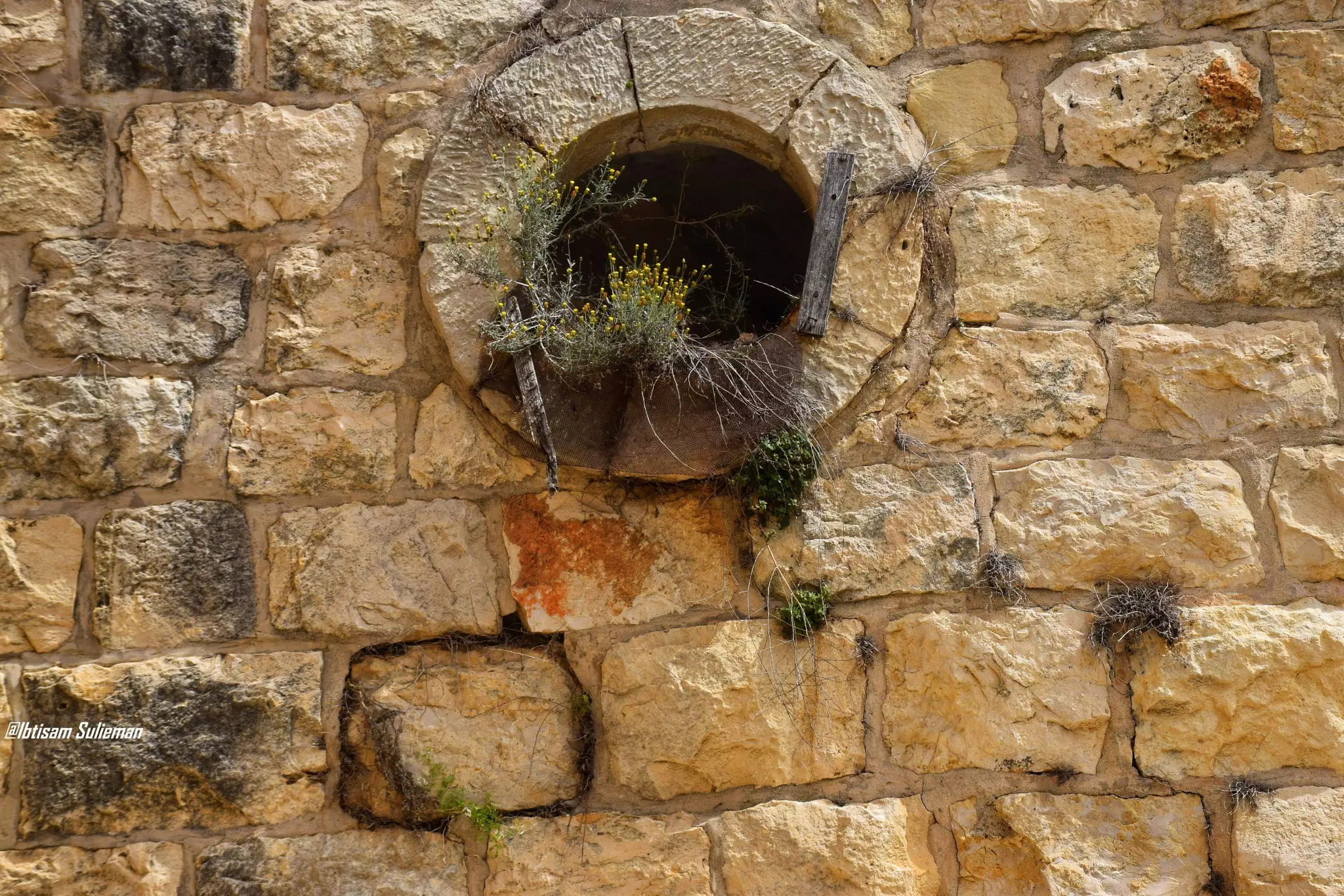
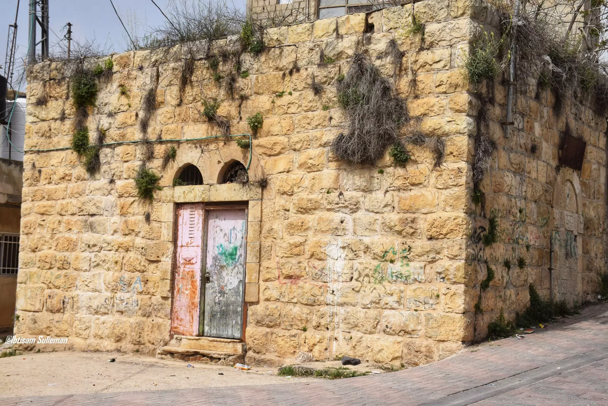
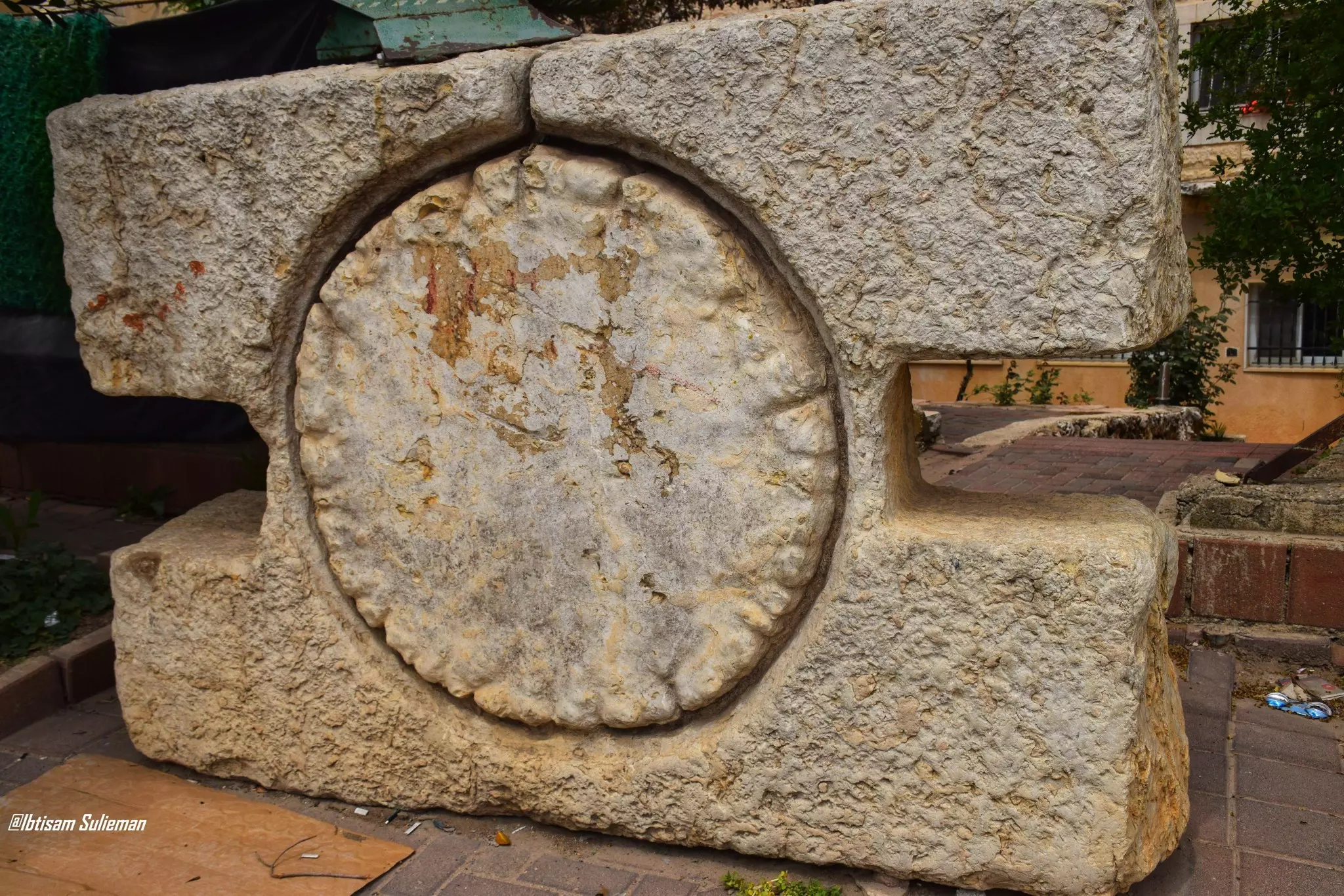
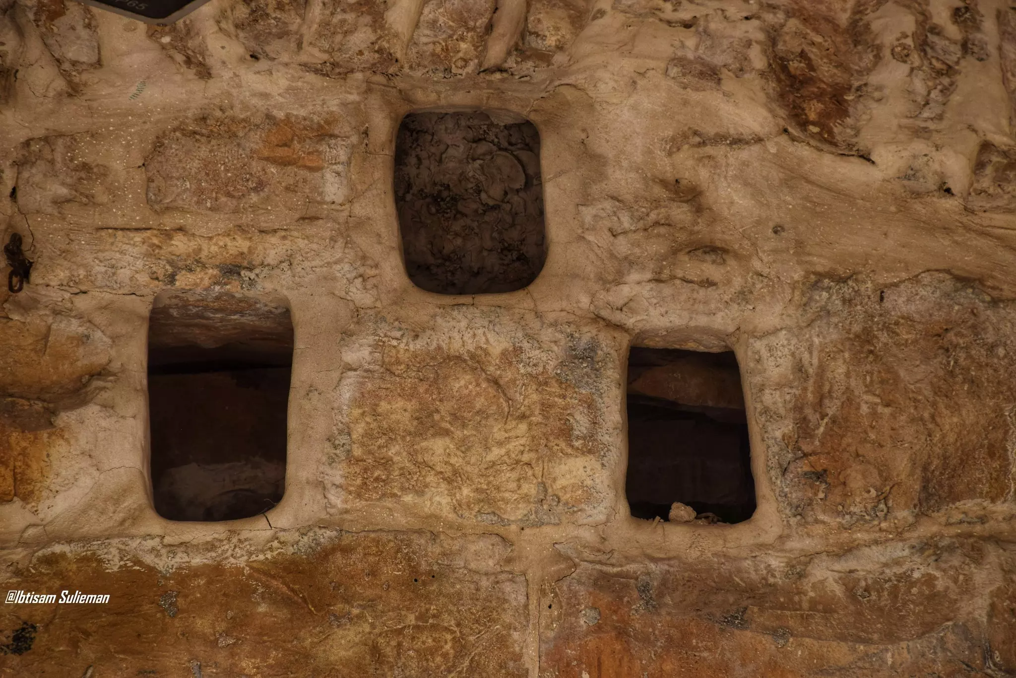
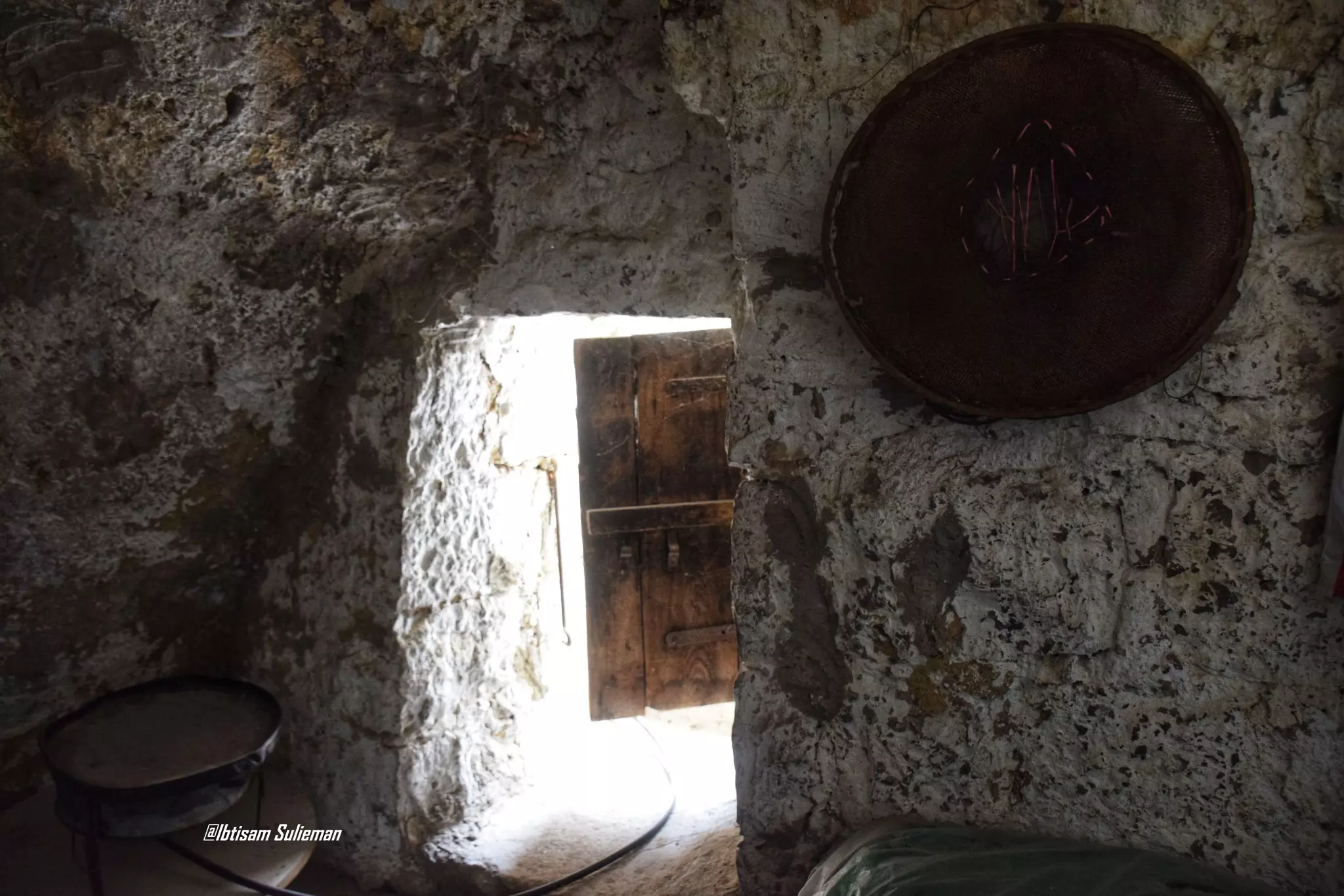
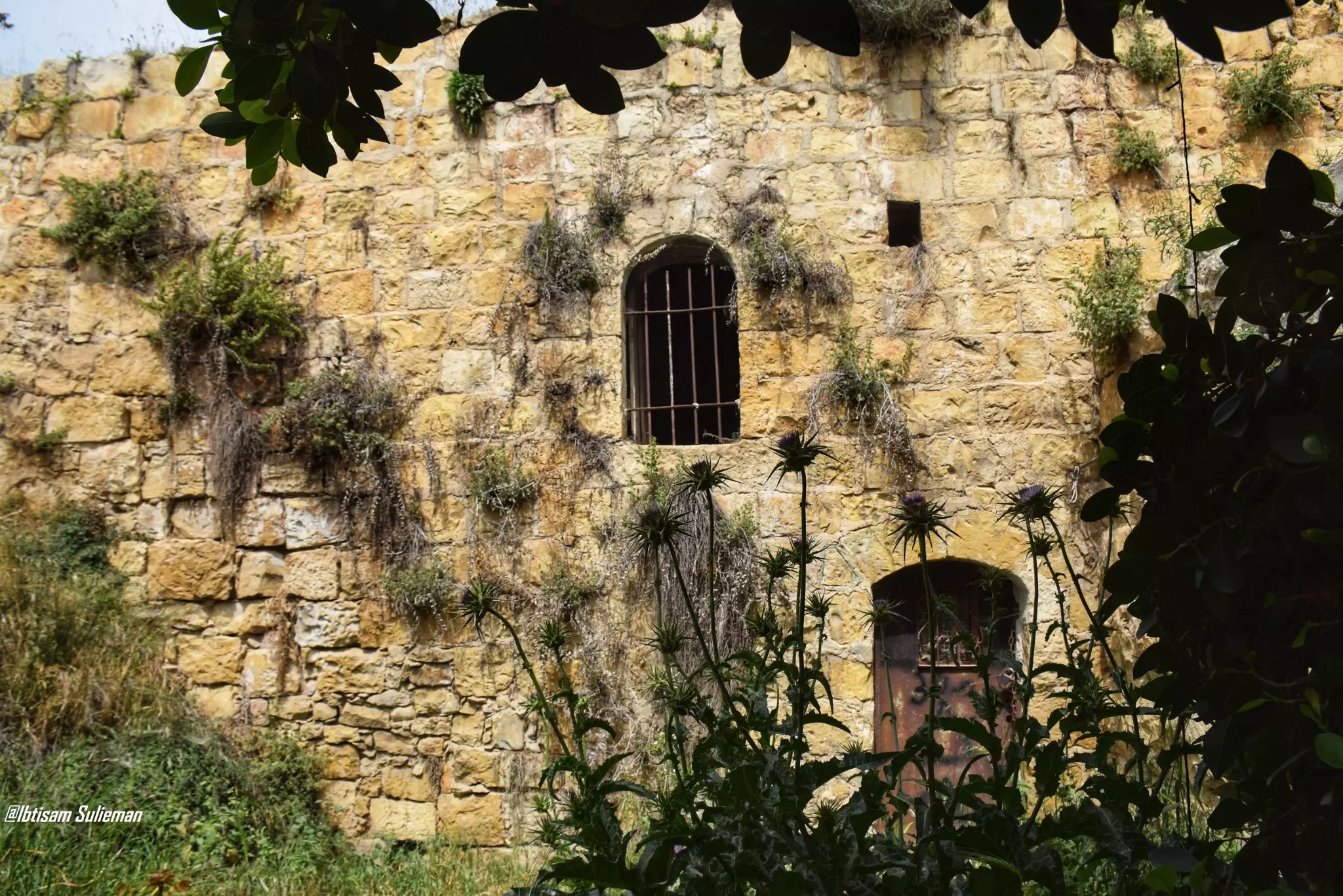
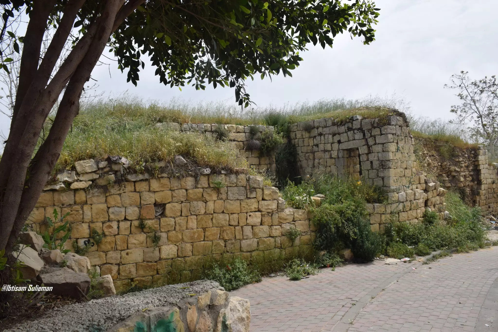
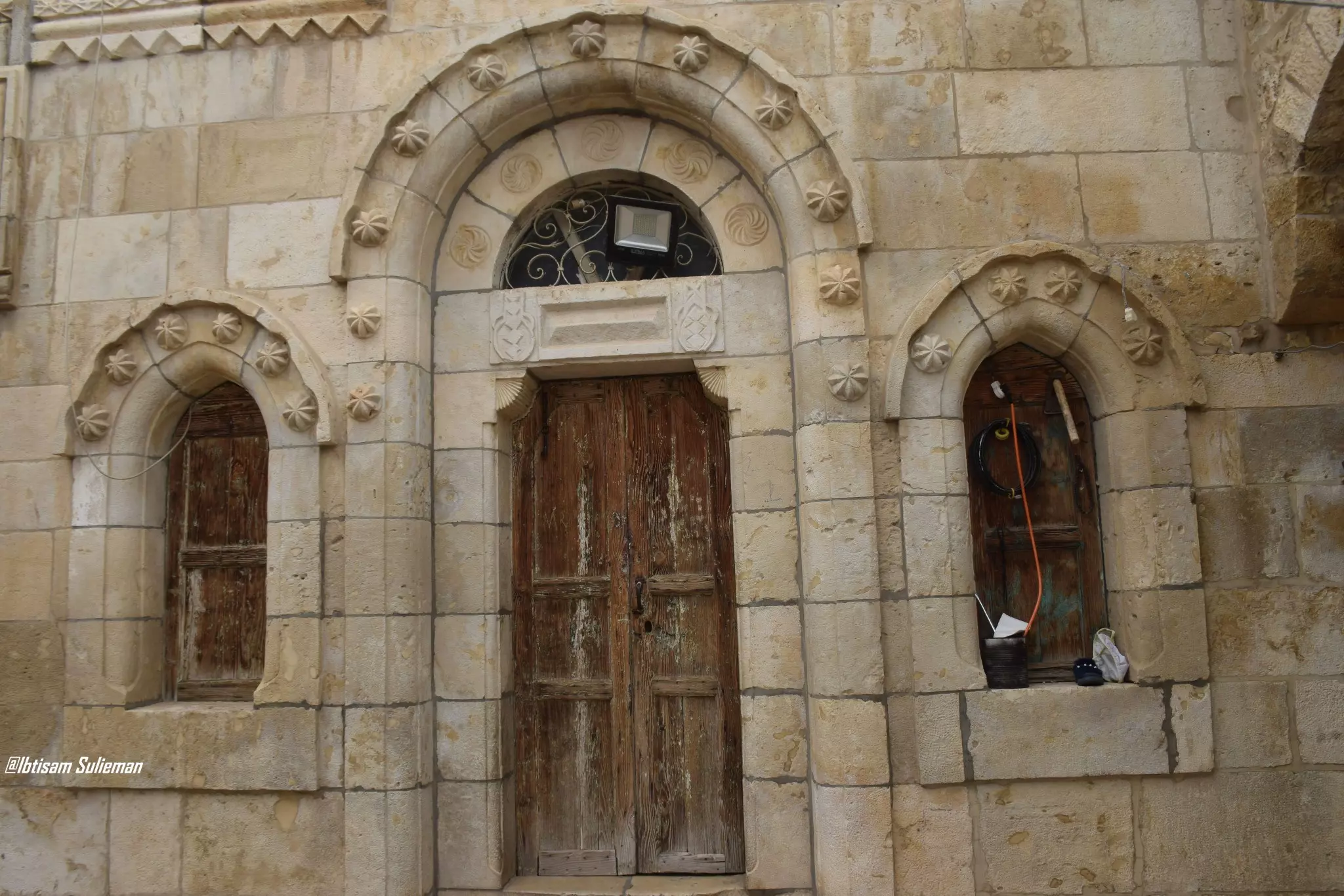
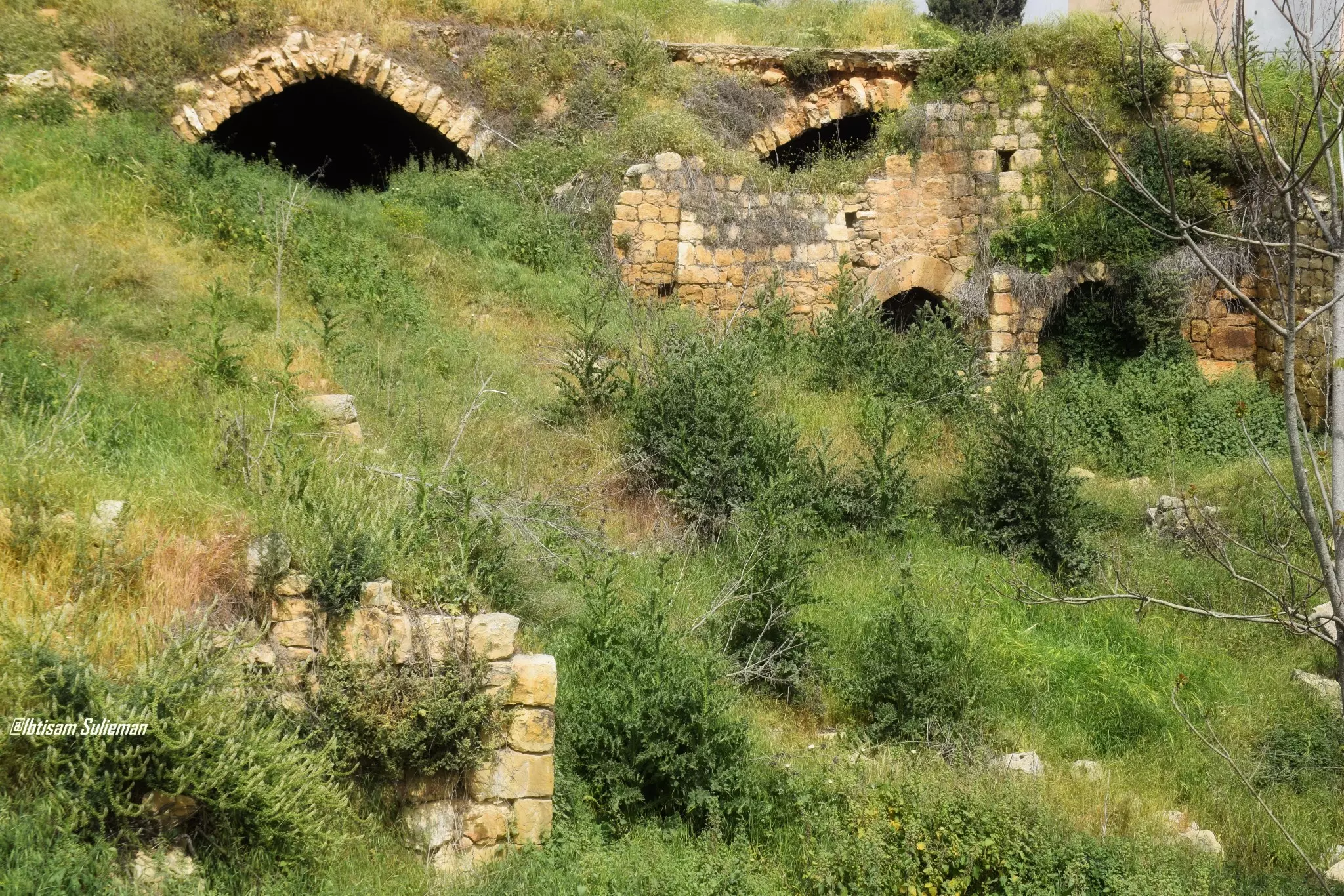
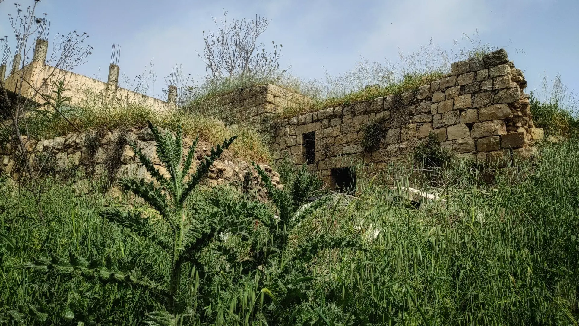
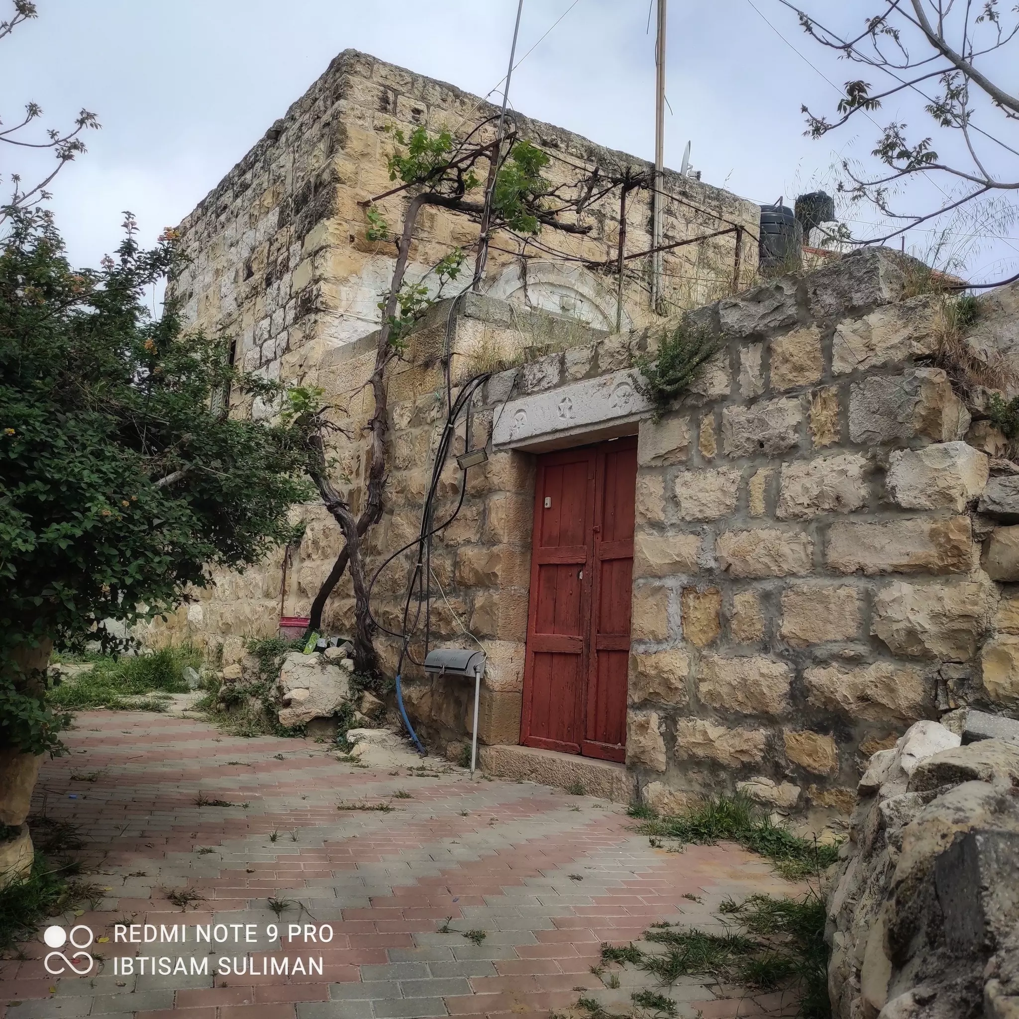
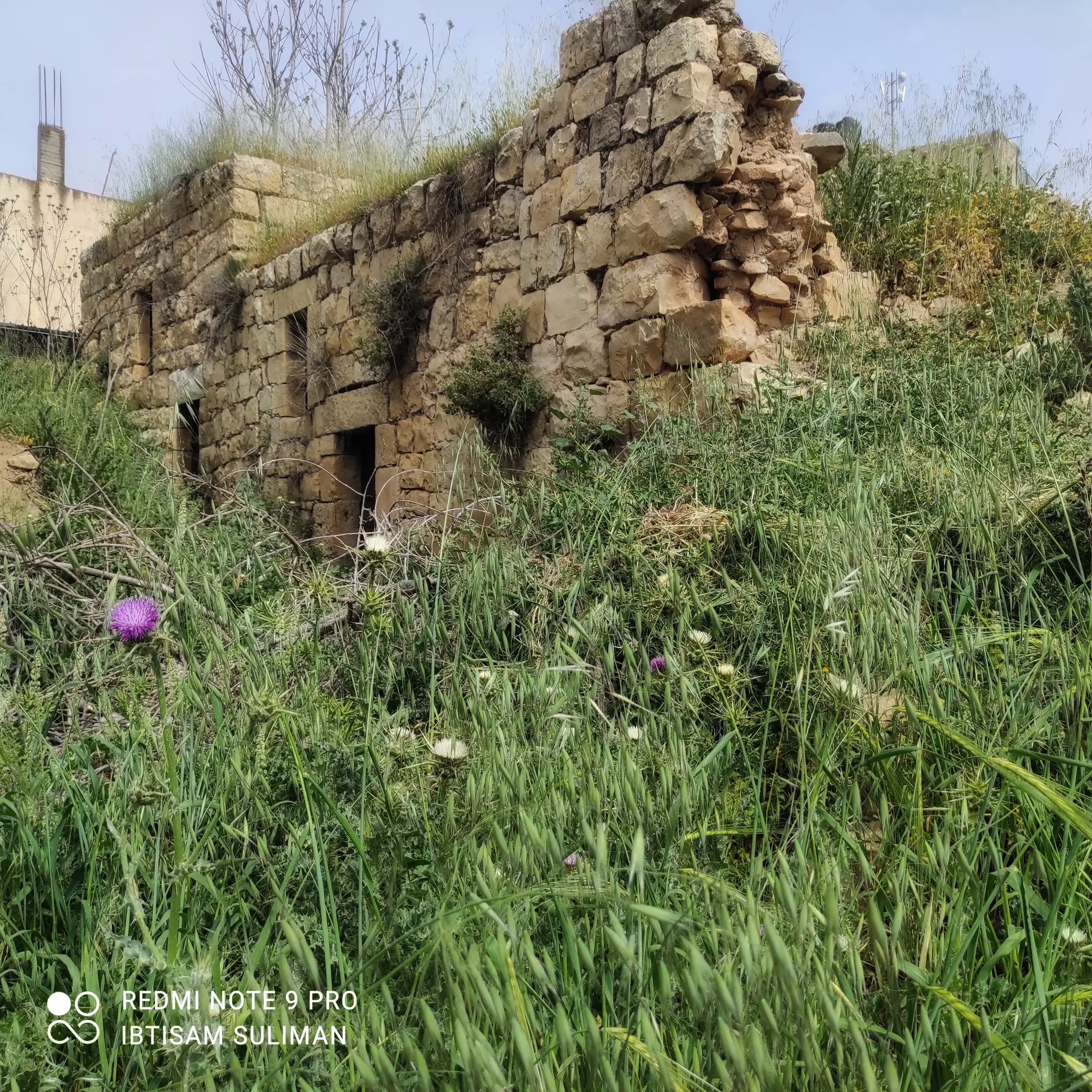
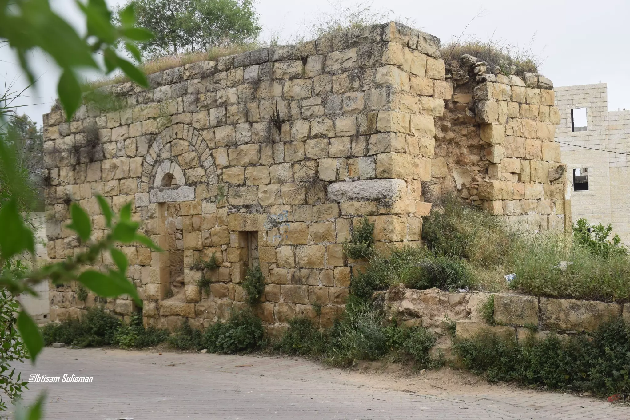
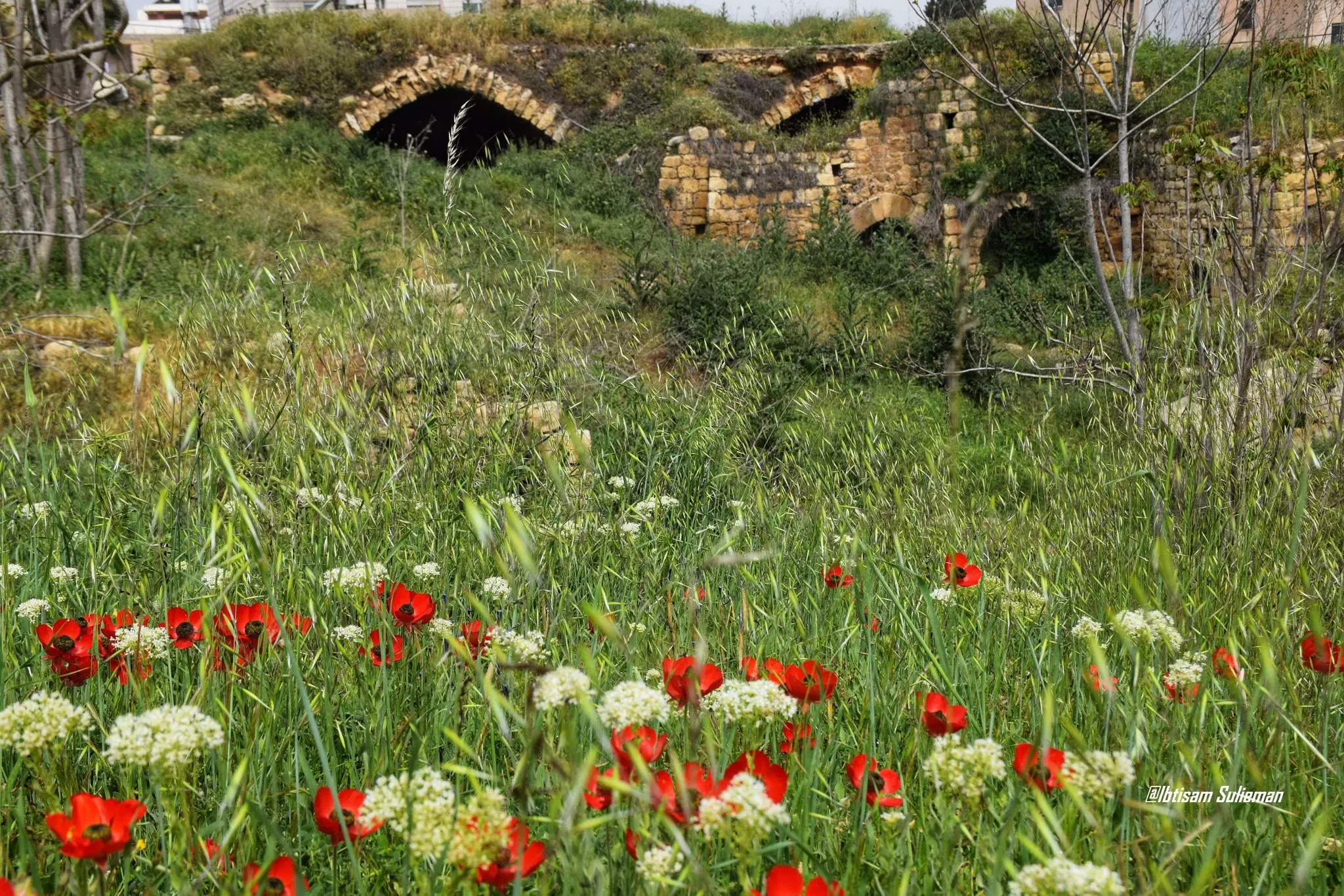
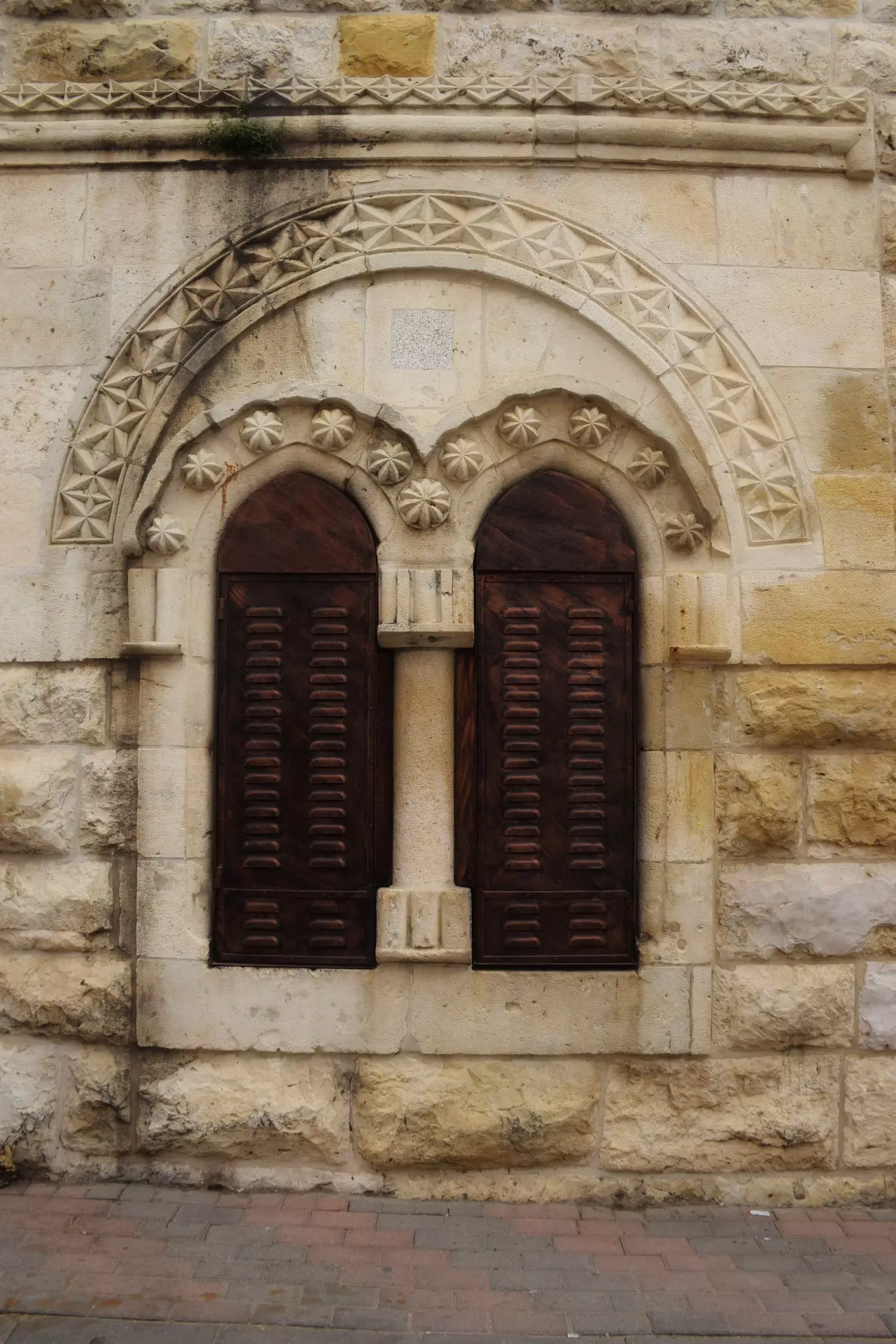
Posted by omar dewan - جولة بين بيوت القرية القديمة -- Ibtisam Sulieman
- جولة بين بيوت القرية القديمة -- Ibtisam Sulieman #2
- جولة بين بيوت القرية القديمة -- Ibtisam Sulieman #3
- جولة بين بيوت القرية القديمة -- Ibtisam Sulieman #4
- جولة بين بيوت القرية القديمة -- Ibtisam Sulieman #5
- جولة بين بيوت القرية القديمة -- Ibtisam Sulieman #6
- جولة بين بيوت القرية القديمة -- Ibtisam Sulieman #7
- جولة بين بيوت القرية القديمة -- Ibtisam Sulieman #8
- جولة بين بيوت القرية القديمة -- Ibtisam Sulieman #9
- جولة بين بيوت القرية القديمة -- Ibtisam Sulieman #10
- جولة بين بيوت القرية القديمة -- Ibtisam Sulieman #11
- جولة بين بيوت القرية القديمة -- Ibtisam Sulieman #12

- جولة بين بيوت القرية القديمة -- Ibtisam Sulieman #13
- جولة بين بيوت القرية القديمة -- Ibtisam Sulieman #14
- جولة بين بيوت القرية القديمة -- Ibtisam Sulieman #15
- جولة بين بيوت القرية القديمة -- Ibtisam Sulieman #16
- جولة بين بيوت القرية القديمة -- Ibtisam Sulieman #17
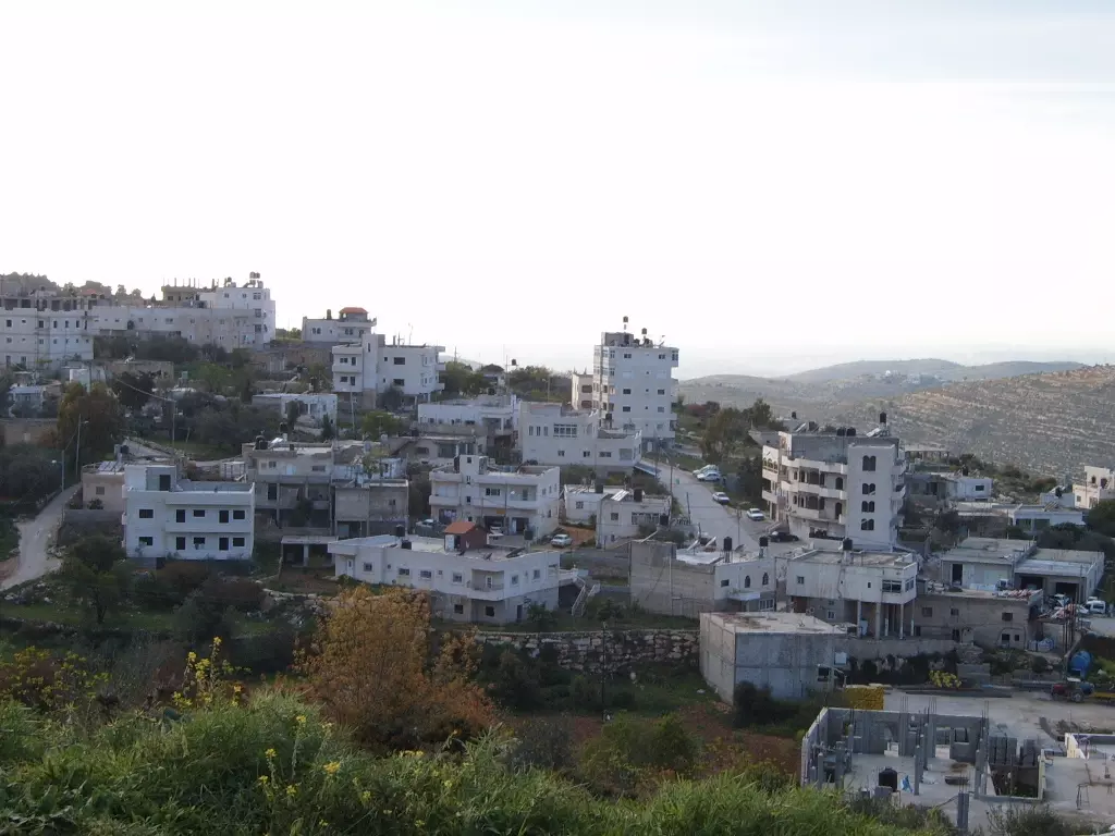
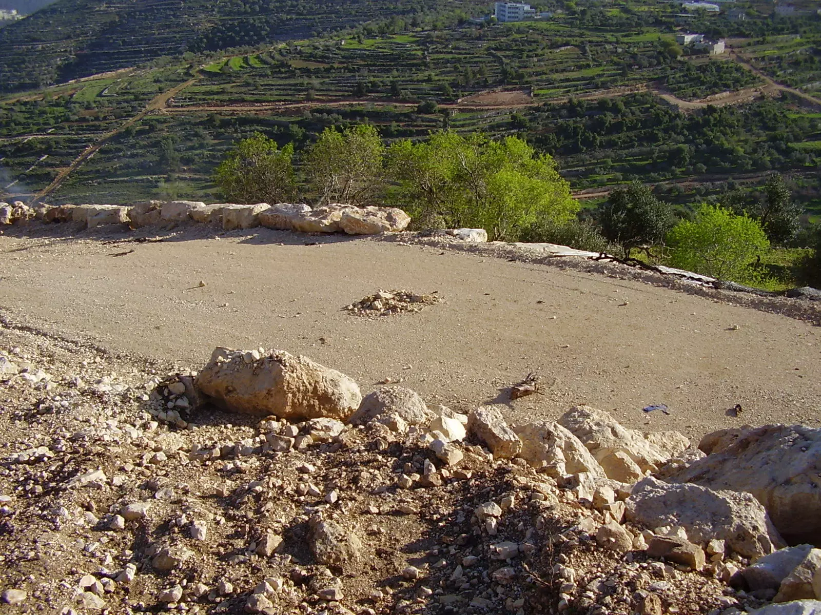
- منظر عام رائع للقرية
Want to browse more? 80,000 pictures were grouped in these gallaries:
| Display Name | Clan/Hamolah | Country of Residence |
| هادي صخر حميدان | Hmeidan | FLORIDA, USA |
| صخر موس حميدان | Hmeidan | Florida, USA |
| روزان صخر حميدان | Hmeidan | Florida, USA |
| احمد زهران | حميدان/ زهران | - |
| الحوت | منصور | الاردن, الاردن |
| بلال منصور | منصور | عمان |
| احمد سماره | - | القبيبه, القبيبه |
| abdallah khdour | - | ohio, ohio |
| عماد فضل نعمان الشيخ | الشيخ | القدس, بدو |
| ناصر عبد الكريم أحمد حسن أبو زر | الخضور | الفجيرة, الامارات |
| محمود محمد يوسف مصطفى صالح الشيخ حمدالله | الشيخ حمدالله | عمان, الأردن |
| Mustafa Alshaikh | Alshaikh | biddu |
| mustafa nassar | MANSOUR | FLORIDA, FLORIDA |
| abdalhameed albitar | badwan | -new york -brooklyn , u.s.a |
| فارس البلد | ابو عيد | القدس, فلسطين |
| خالد خضور | خضور | القدس |
| رامي سماره | بدوان | amman, الاردن |
| احمد | - | عمان |
| Mohammed Badwan | - | Texas, Texas |
| Ibrahim Al-Dali | الدالي | Amman, Jordan |
| راكان الشمري | - | الاردن |
| Ahmed Mansour | Mansour | jerusalem, Palestine |
| shadi murrar | Murrar | Chicago, USA, Biddu |
| تقي الدين زهران | زهــــران | بدو القدس |
| وردة الخضور | alkhdour | dubai, UAE |
| ناصر | - | uae, uae |
| Ali mohammad ali nassar | mansour | Jerusalem, biddo |
| محمود فضل نعمان الشيخ | نعمان | فلسطين, بدو |
| Ahmad Dali | Al-Dali | Biddu, Palestine |
| nooreddin saleh | al shik | florida, usa |
| Haitham Al Dali | Al Dali | - |
| جمال الدالي | الدالي | عمان, الاردن |
| Ahmad Mansour | Mansour | Jerusalem, Palestine |
| Mansour Mansour | Mansour | Biddo, Palestine |
| Raw3a | mansour | Palestine, Biddu |
| emad saleh | al sheik | florida, usa |
| ابوعيد | - | - |
| Dr.mohammed zuheir | hmedan | florida, biddo |
| ابو عيد | ابو عيد | dubai, uae |
- قرية بدو - جولة في شوارع بدو Duration: 7 min 46 sec
- فيديو لقرية بدو
- Biddu 07.04.2004 Duration: 2 min
- مقطع من حفلة سهرة حناء شعبية في بدّو - حفلة مهدي مازن
- بدو -اجمل الاوطان
- فرقة الضيعة للدبكة الشعبية - بلدة بدّو - جزء (1 من 2)
- فرقة الضيعة للدبكة الشعبية - بلدة بدّو - جزء (2 من 2)
- منطقة السهل -بدو
- فيدو لقرية بدو
- فديو لشهداء قرية بدو
- جولة في بدّو
 Fake Valor: Why Did Zionist Jews Hoist Nazis Flag on Their Ships in the 1930s?
What is new?
-
Facts About Oct. 7th Gaza Raid
-
Remined Us Please:: Who Did Rape Who? Palestinians Raped Israelis? Or, was the other way around?
-
When Prof. Edward Said was invited to debate Bibi Netanyahu in the 1980s, watch what happened!
-
Ezra Klein of the NY Times on the "Jewish Race".
-
Abusing Blood Libel!
-
Did Israeli Soldiers Activate The Hanniba Direective On Oct. 7th? You Be The Judge
-
Zionist FAQ: Isn't it true that Palestinians don't want peace? Palestinians never accepted the two-state solution
- Facts about Haavara (Transfer) Agreement between Ben-Gurion & Hitler
-
Haavara FAQs: Why Did Zionist Jews Hoist Nazis' Flags on Their Ships in the 1930s?
- Haavara FAQs: When Chaim Weizmann met FDR in mid-1943, why was he silent about rescuing European Jewry?
-
Dear ChatGPT: How did Palestinians resist Napoleon's invasion of their country in 1799?
-
Dear ChatGPT: Gaza had a vibrant Jewish community in the mid-17th century. What happened to them?
-
Dear ChatGPT: Why did the Jewish Agency suppress news of the Holocaust during WWII?
-
Video Playlist: Jews share their DNA tests to end the conflict for good.
-
A Tale of Two Conflicts: Examining the Definition of Genocide
-
Prof. Abraham Polak And The Suppressed History of the Khazars and European Jewry
-
How Ronald Reagan would have framed the genocide in Gaza if he were still alive?
-
Haavara FAQs: Let us do the math: how many German Jews did The Haavara Agreement save?
-
Zionist FAQs: The Hebron Massacre of 1929, "clearly proves" that Palestinians are antisemitic, how could you deny it?
-
Zionist FAQs: Why Anti-Zionist Is Not Antisemitism?
-
Zionist FAQs: Isn't it true that the KGB created Palestinian Nationalism in the early 1960s?
- Zionist FAQs: Muslims are killing Muslims all the time; why are Israeli Jews being singled out in the media?
- Zionist FAQs: How is Israel an apartheid state when 20% of its citizens are Arabs who enjoy full rights?
-
Haavara FAQs: Why Did Dorothy Thompson Flip From A Zionist Advocate to A Silenced Dissenter?
-
Haavara FAQs: Analysis of Herzl's Uganda Scheme and how it could have saved millions of Jews.
-
Haavara FAQs: Why did Hayim Greenberg describe American Jewry as "morally bankrupt" in early 1943?
-
Haavara FAQs: What if the Evian Conference was a resounding success? What would have been the impact of saving European Jewry on Zionism?
- Haavara FAQs: What if the six million were saved, how that would have impacted the Zionist project?
-
Haavara FAQs: How did Zionist leaders react when Europe's Jews lingered in the DP camps after WWII ended?
-
Why does the American Jewish community repeat lies that David Ben-Gurion had debunked before he died?
-
Who has the power to rename the Tatar/Khazar Gene Marker to Jewish IV?
-
Zionist FAQs: Why won't Egypt, Syria, and Jordan take their people back? Jews are indigenous to Palestine, and Arabs immigrated after Jews developed the country. Arabs should leave.
-
Haavara FAQs: Did Hitler and the Nazis conflate between Judaism and Zionist? If that wasn't case, then why?
-
Haavara FAQs: Winston Churchill and antisemitism, a collection of articles written Churchill.
-
Haavara FAQs: Broken by country, how many Jews survived vs. killed during the Holocaust?
-
Haavara FAQs: Why did European Jews vote with their feet and to immigrated to the Americas, not Palestine, after WWII?
-
Watch this American Jewish Girl describing Israeli Jews' cognitive dissonance like no other in under two minutes
-
Haavara FAQs: When the Nazis went out of their way to hide the Holocaust, Israeli Jews did the exact opposite by broadcasting their genocide of Gazans. But why?
-
Haavara FAQs: How Zionist Jews went out of their to show their appreciation to Nazism and Fascism?
- Haavara FAQs: Why Zionist leaders were against bombing the death camps & the Railroads leading to them?
-
Haavara FAQs: Hitler's message to the British and American people: If Jews are such noble citizens and you care about them, how come you're not letting them in? I will gladly ship them to you at my expense, even on luxury liners!
-
A shortlist of Zionist and Israeli false flag operations in the name Jews.
-
The Most Moral Army
- The Land of Kapos (Israel): Where the brave are boycotted and Kapos walk free.
- Why did early Zionists often named their communal enterprises "colonial"?
- Zionist Relations with Nazi Germany by Faris Glubb
-
Two NY Times advertisements by Zionists in the early 1943 that exposes Zionists' treason at the height of the calamity
- Facts Not Lies about the Palestinian-Israeli Conflict.
- Site's pictures have been categorized
- Campgain Against Lice
- A Survey of Palestine, the official source about Palestine before Nakba produced by the British Mandate; over 1200 pages.
- Satellite View & Google Earth: Over 6,000 placemarks identifying all destroyed towns, W. Bank & Gaza Strip Towns, & refugee camps.
- PalestineRemembered.com and its Nakba Oral History Project were featured on al-Jazeera Satellite TV.
- Nakba Oral History Video Podcast:
 Over 700 Oral History interviews (including 3,500+ hours of recording) can be viewed online.
 - Palestine Village Statistics Project
- Gaza Jail Break
- النسخة العربية للموقع الان متوفرة
- Videos: Documenting the destroyed villages in video: Tracing all that remains since Nakba.
- Videos: Responding to Zionist Propaganda
- Interview: The ethnic cleansing of Palestine: George Galloway interviews Israeli Historian Ilan Pappe.
- For Palestinians, memory matters. It provides a blueprint for their future By George Bisharat.
- Zionist FAQ now available in Hebrew שאלות שציונים שואלים, עכשיו בעברית
- Video: The Stephen Walt and John Mearsheimer report on the influence of the Israel Lobby on U.S. Foreign Policy
- The Palestinian-Israeli conflict for beginners
