| PalestineRemembered | About Us | Oral History | العربية | |
| Pictures | Zionist FAQs | Haavara | Maps | |
| Search |
| Camps |
| Districts |
| Acre |
| Baysan |
| Beersheba |
| Bethlehem |
| Gaza |
| Haifa |
| Hebron |
| Jaffa |
| Jericho |
| Jerusalem |
| Jinin |
| Nablus |
| Nazareth |
| Ramallah |
| al-Ramla |
| Safad |
| Tiberias |
| Tulkarm |
| Donate |
| Contact |
| Profile |
| Videos |
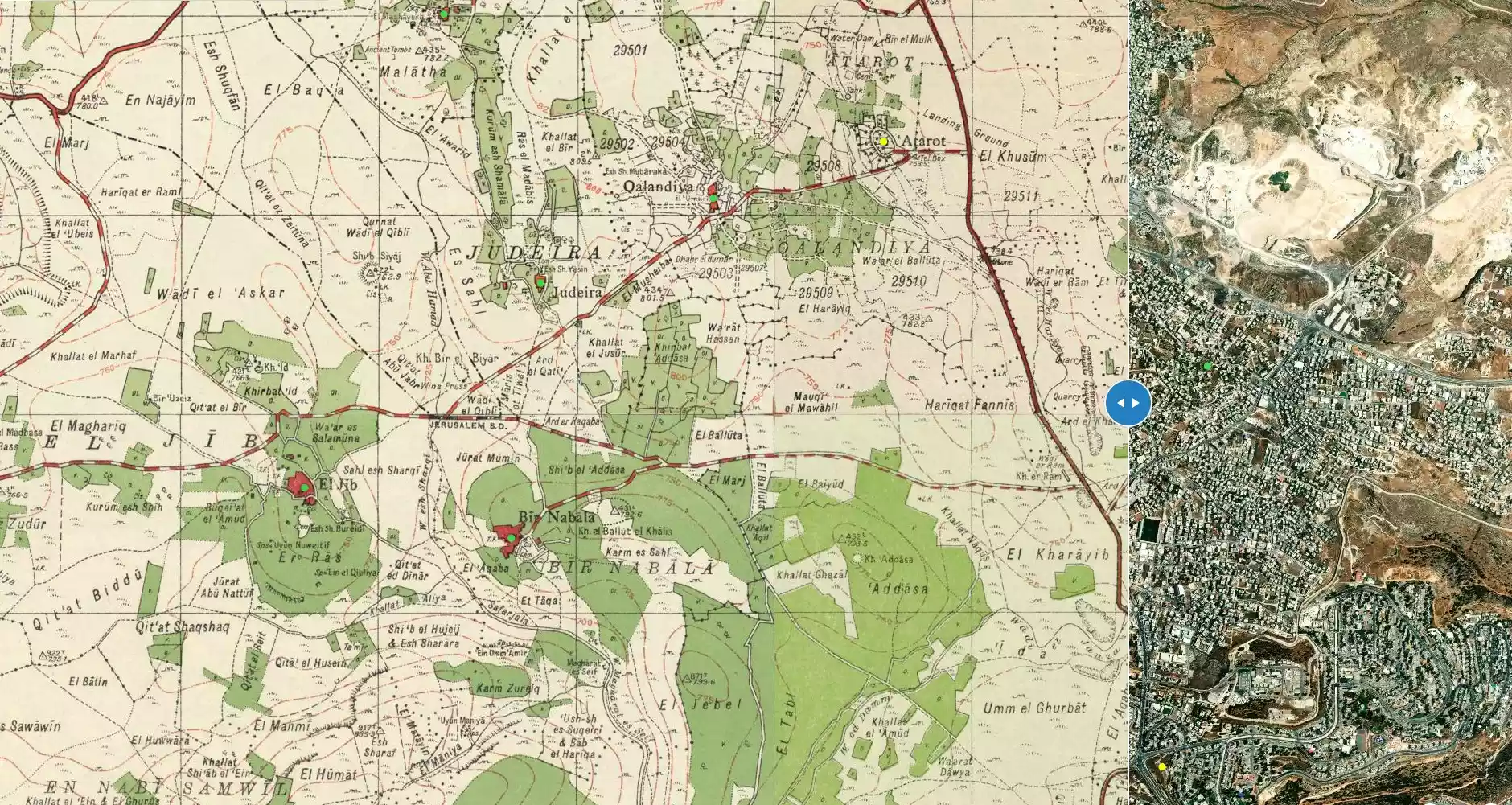
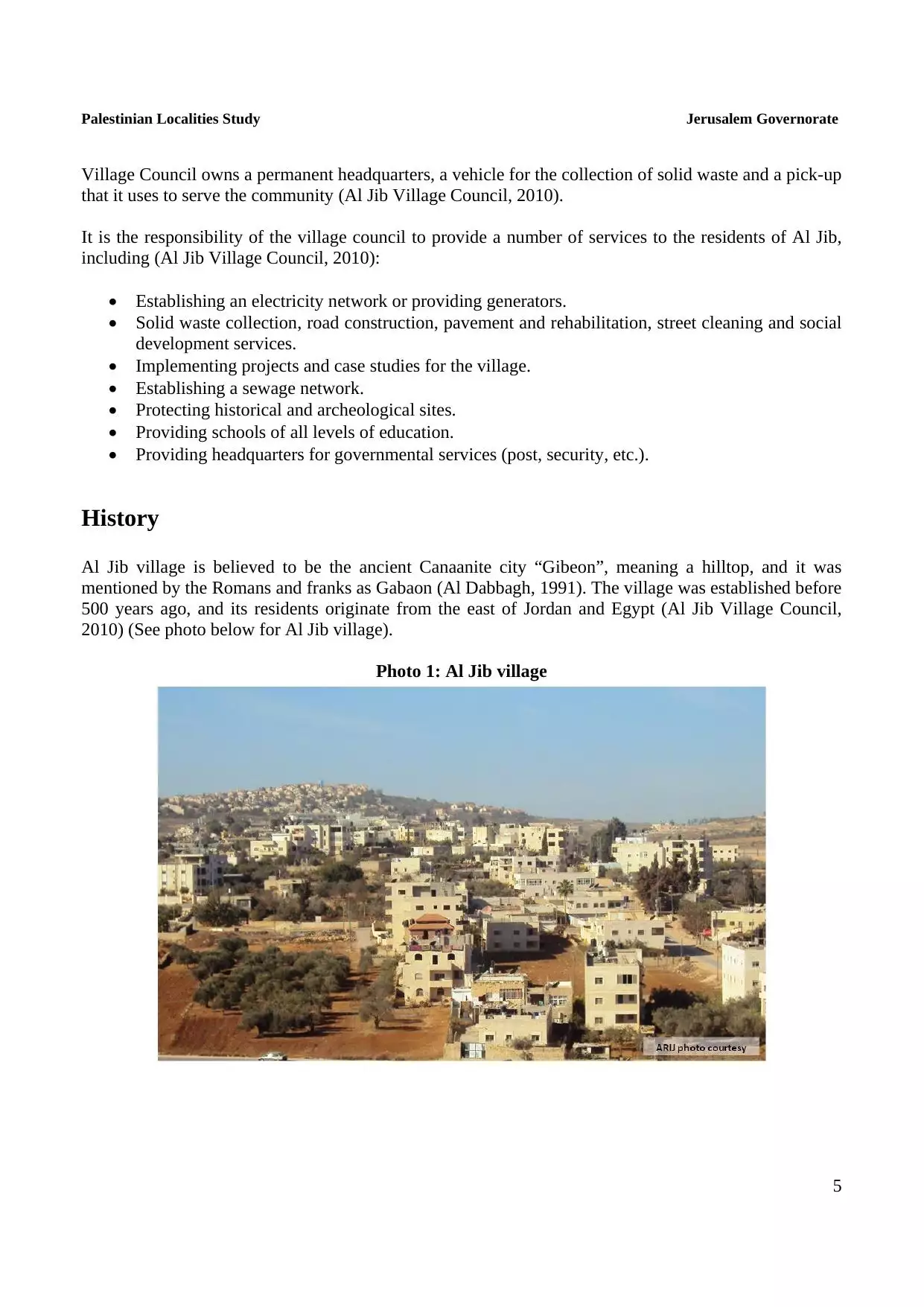
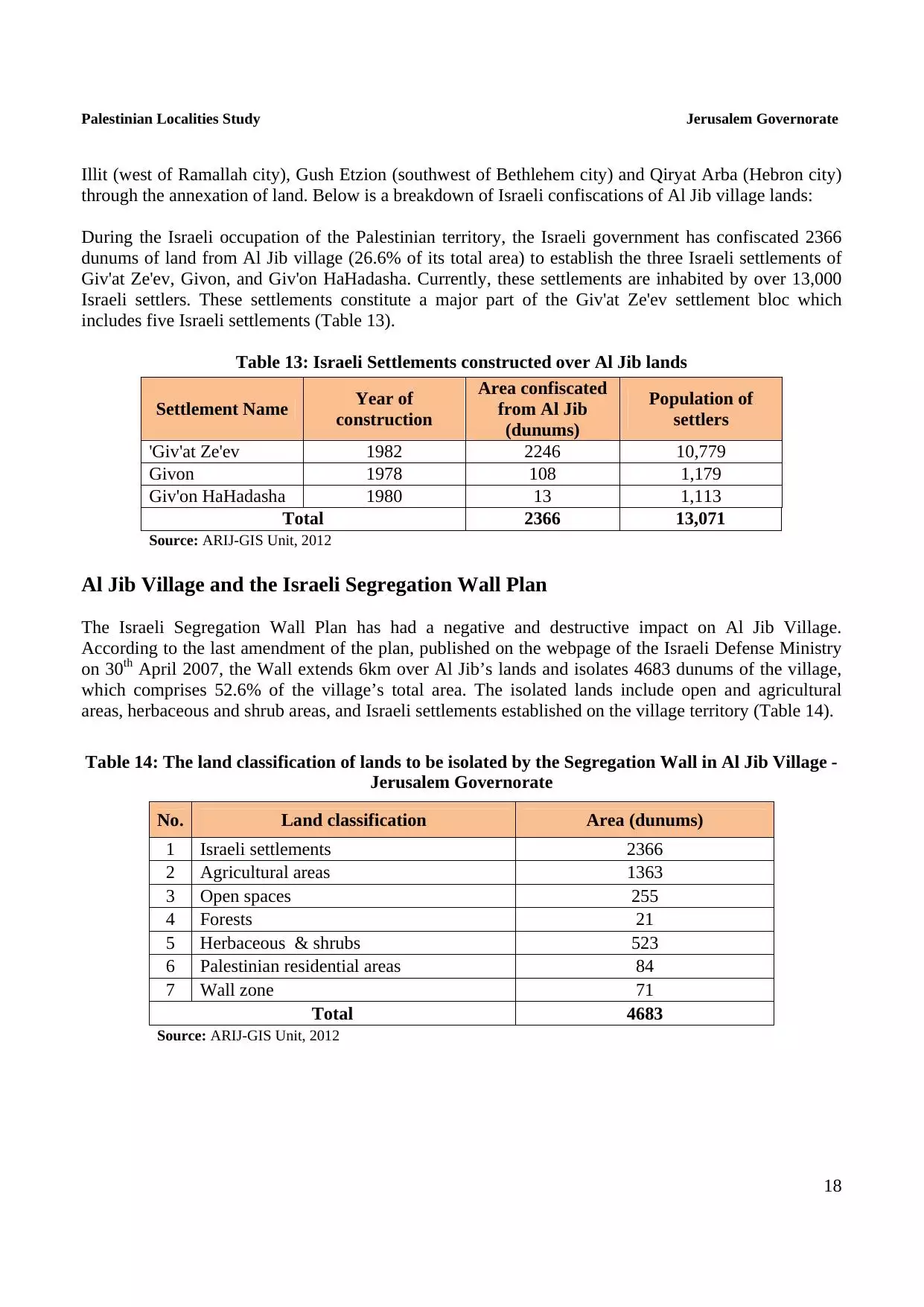
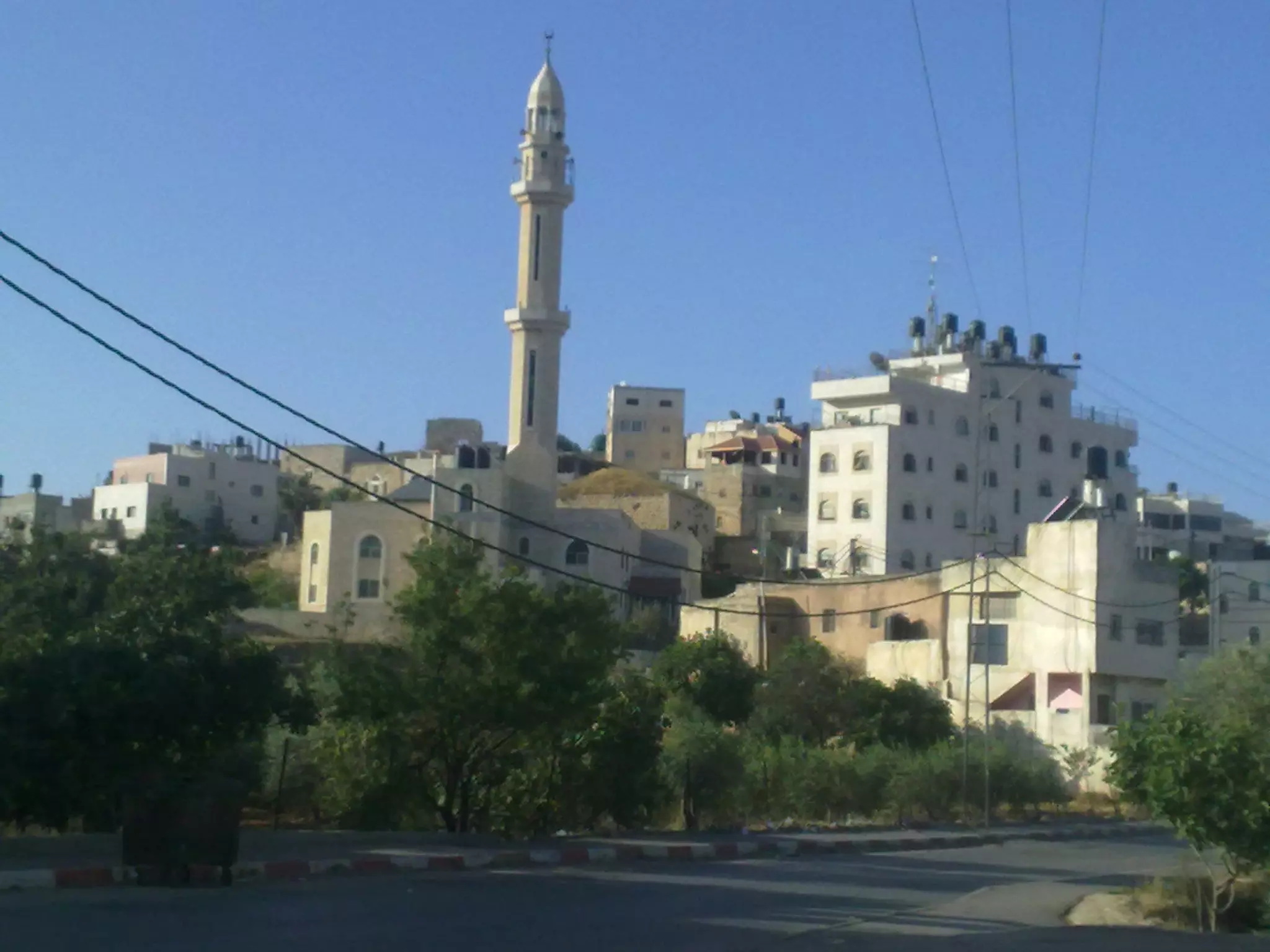
Welcome To al-Jib - الجيب (אל-ג'יב)
|
District of Jerusalem
Occupied days ago |
العربية Google Earth |
 |
Gallery (266) |
- Statistics & Facts
-
Before & After

- Satellite View
- Articles 27
- Pictures 266
- Mayrters & Prisoners 3
- Members 23
- Families
- Wikipedia
- ARIJ Guide
- Videos 62
- Guest Book 99
- Links 2
| Statistic & Fact | Value | ||||||||||||||||||||||
| Distance From District | 10 km northwest of Jerusalem | ||||||||||||||||||||||
| Elevation | 710 meters | ||||||||||||||||||||||
| Before & After Nakba, Click Map For Details |
|||||||||||||||||||||||
|
|||||||||||||||||||||||
| Land Ownership |
**Town Lands' Demarcation Maps |
||||||||||||||||||||||
| Land Usage As of 1945 |
|
||||||||||||||||||||||
| Population |
|
||||||||||||||||||||||
| Near By Towns |
|||||||||||||||||||||||
|
|
|||||||||||||||||||||||
| Featured Video | |||||||||||||||||||||||
| ARIJ Guide | |||||||||||||||||||||||
3.
4. 
5. 
6. 
7. 
8. 
9. 
10. 
11. 
12. 
13. 
14. 
15. 
16. 
17. 
18. 
19. 
20. 
21. 
22. 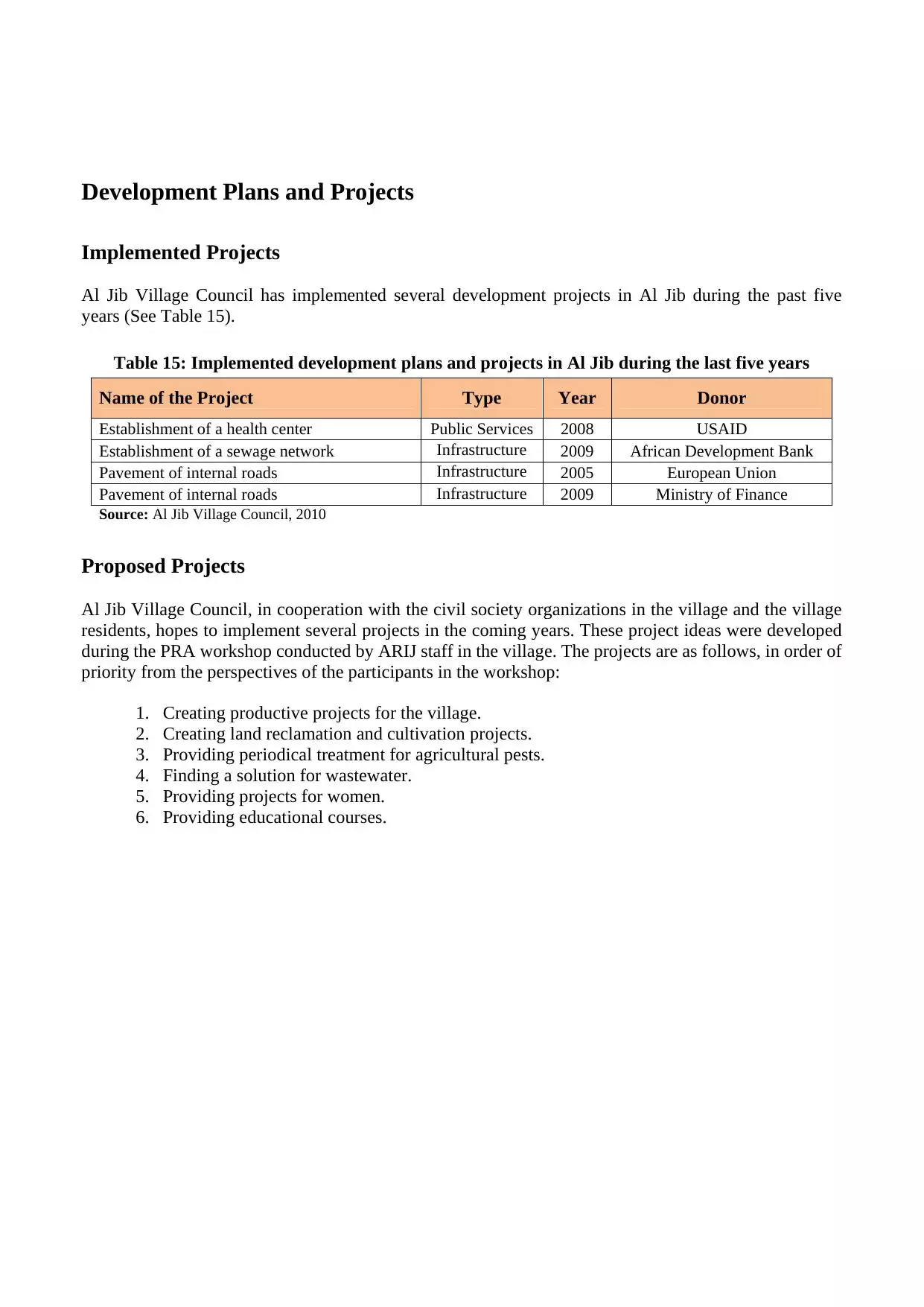
23. 
24. 
Click here to browse online. |
|||||||||||||||||||||||
| Related Maps | Town Lands' Demarcation Maps خرائط للقضاء توضح حدود القرى والاودية View from satellite Town's map on MapQuest Help us map this town at WikiMapia |
||||||||||||||||||||||
| Related Links | Wikipedia's Page Facebook Page ARIJ Guide Google Search Google For Images Google For Videos في كتاب بلادنا فلسطين دليل أريج المزيد من موقع هوية |
||||||||||||||||||||||
- خاطرة : ليلة من الليالي
- زيتون فلسطين2008
- إمرأة دخلت النار لأنها حبست قطة
- ذكرت صحيفة روسية تصدر في أمريكا معروفة بتشددها للصهيونية العالمية
- الجهاد
- طريق واحد غنتها ام كلثوم عام 1969 من كلمات نزار قباني والحان محمد عبد الوهاب أصبح عندي الآن بندقية إلى فلسطين خذوني معكم إلى ربىً حزينة كوجه المجدلية إلى القباب الخضر والحجارة النبيَّة عشرين عاماً...
- فيروز ونزار... وأنا وغزة
- العزف على اوتار البندقية
- القدس والثقافه
- قصيدة أعيرونا مدافعكم للدكتور عبد الغني التميمي
- عيد العمال
- !!! 61عاماً لمن لم يسمع بعد
- نكبة القدس
- طفل يعرب كلمة فلسطين إعرابا تدمع له العين
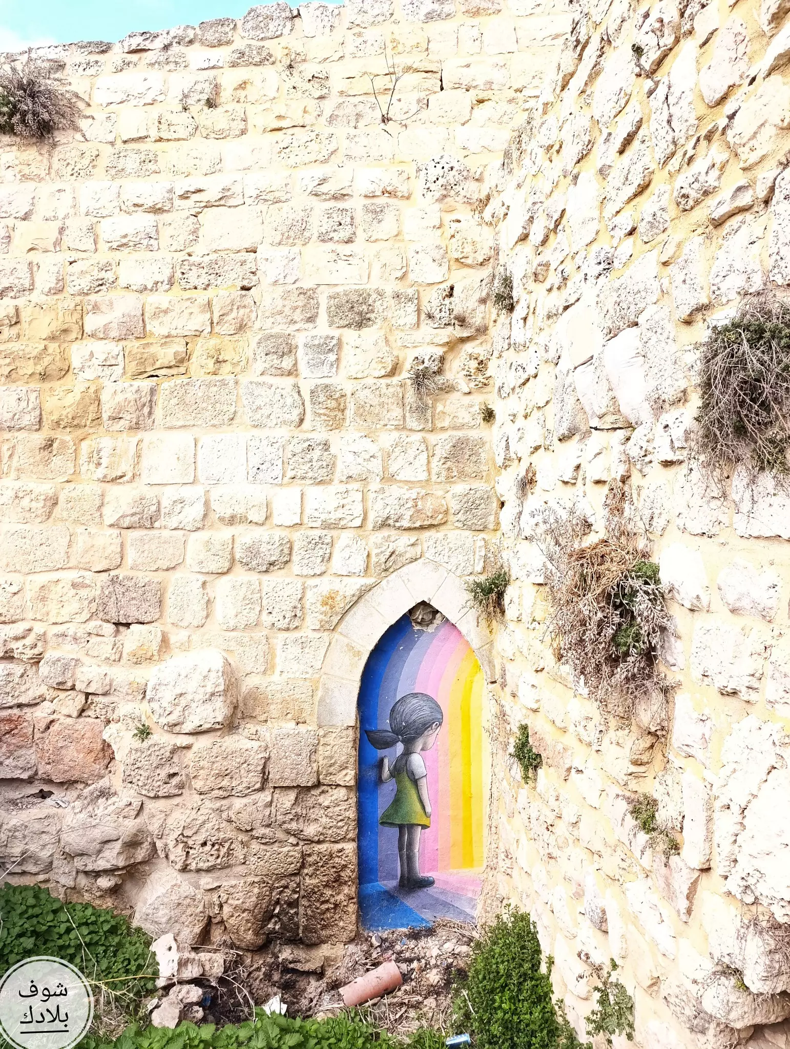
- بلدة الجيب القديمة ...!!! جبعون / بقلم: زياد جيوسي 05/09/
- اتحداك اذا مادمعت عيناك
- أروع ما قيل من شعر في فلسطين
- ثماني مرات : كذبت أمي عليّ
- حوار شيّق ... بين عاقل ومجنــون ؟
- انا فلسطينيه
- معلومات عن قرية الجيب
- قصة جميلة
- عالم في ناسا يعلن إسلامه
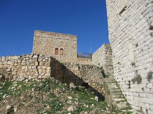
- الجيب: مملكة كنعانية وإرث تاريخي يتآكل
- معلومات عامة عن قرية الجيب
- الجيب: مملكة كنعانية وإرث تاريخي يتآكل
- الجيب: مملكة كنعانية وإرث تاريخي يتآكل
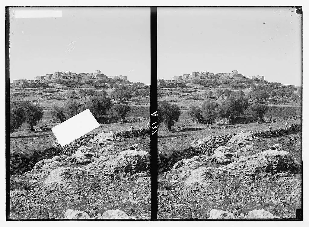
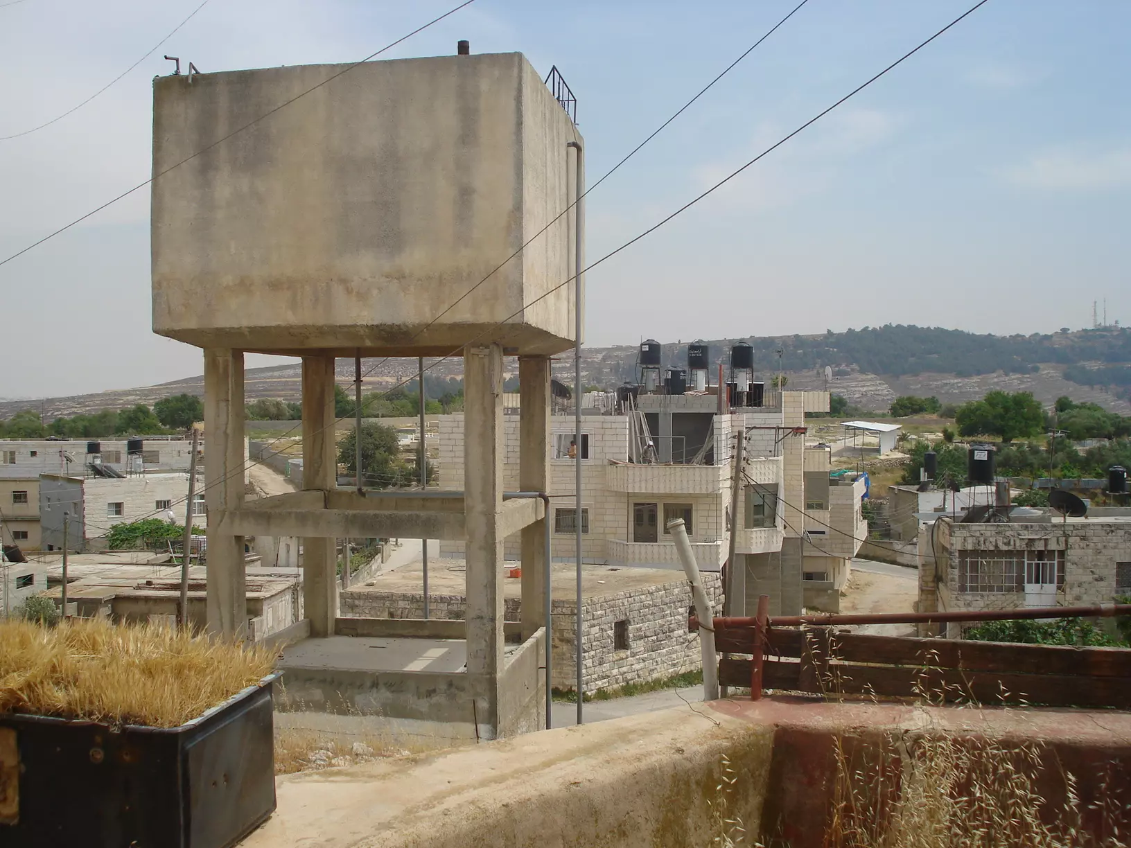
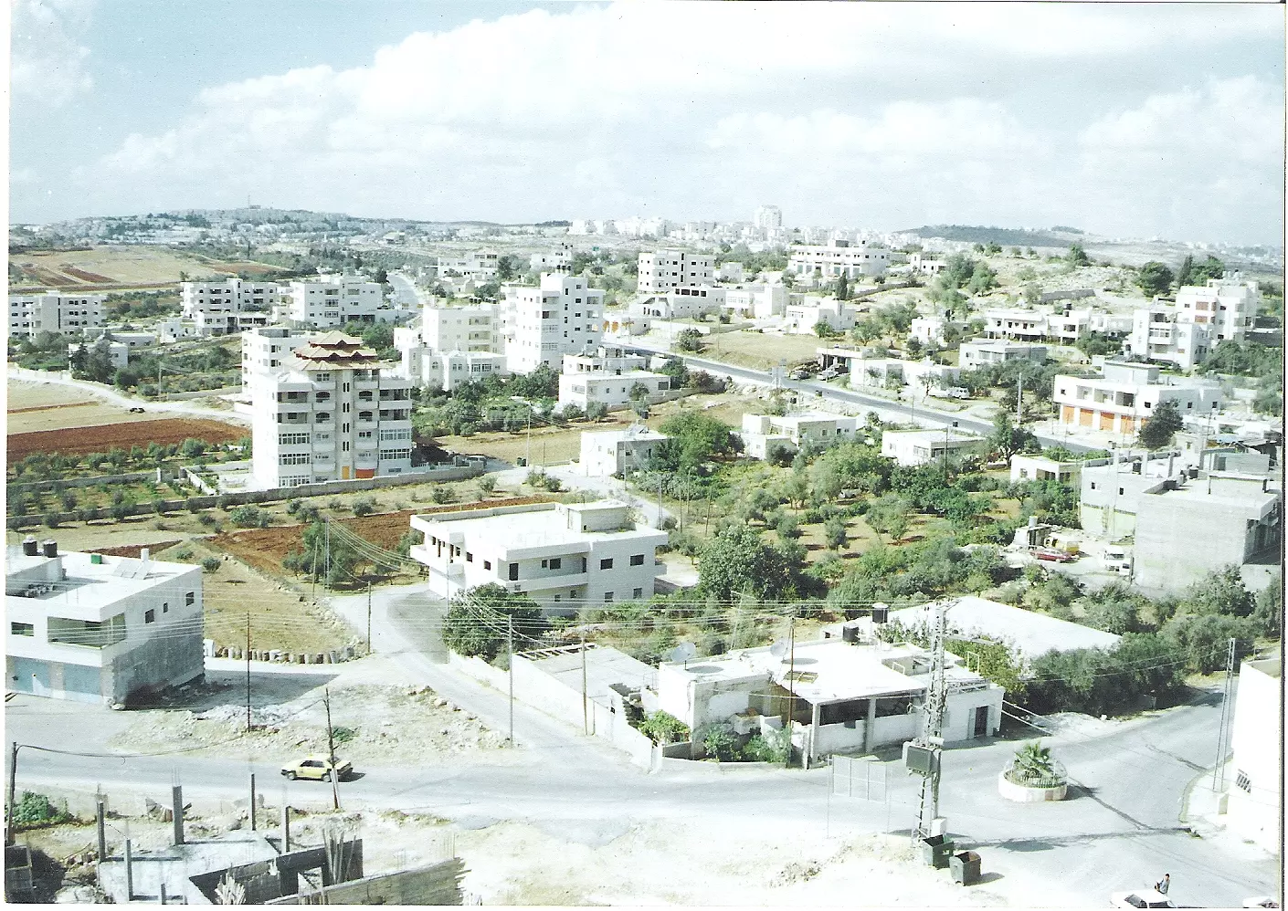
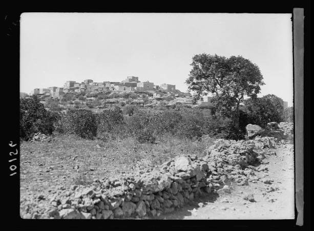
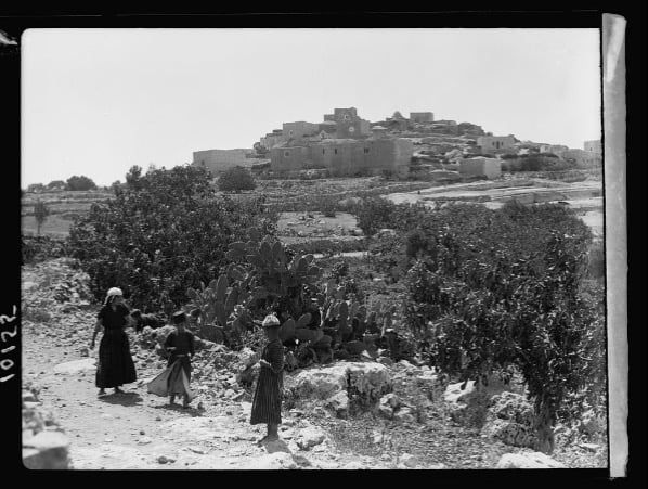
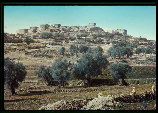
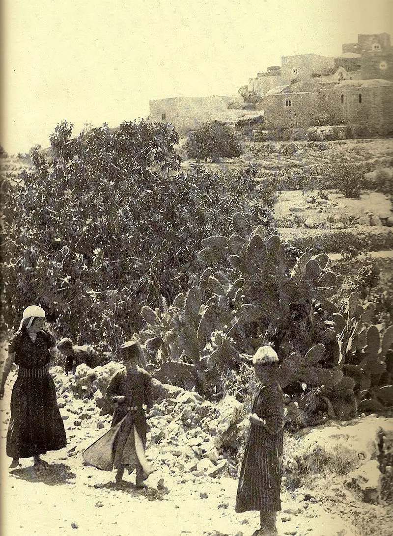
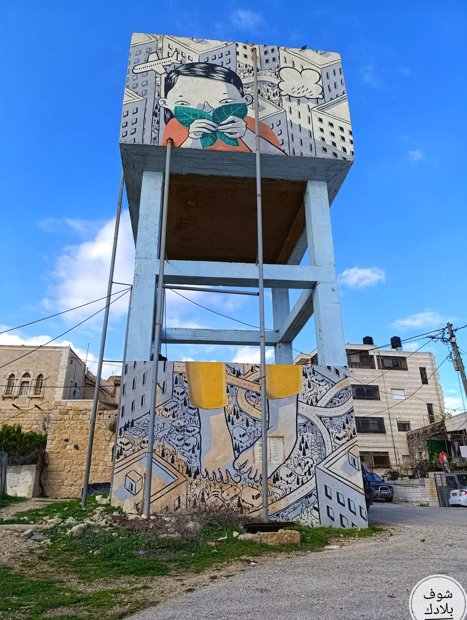
- General view, Matson Collection. (1900-1920)
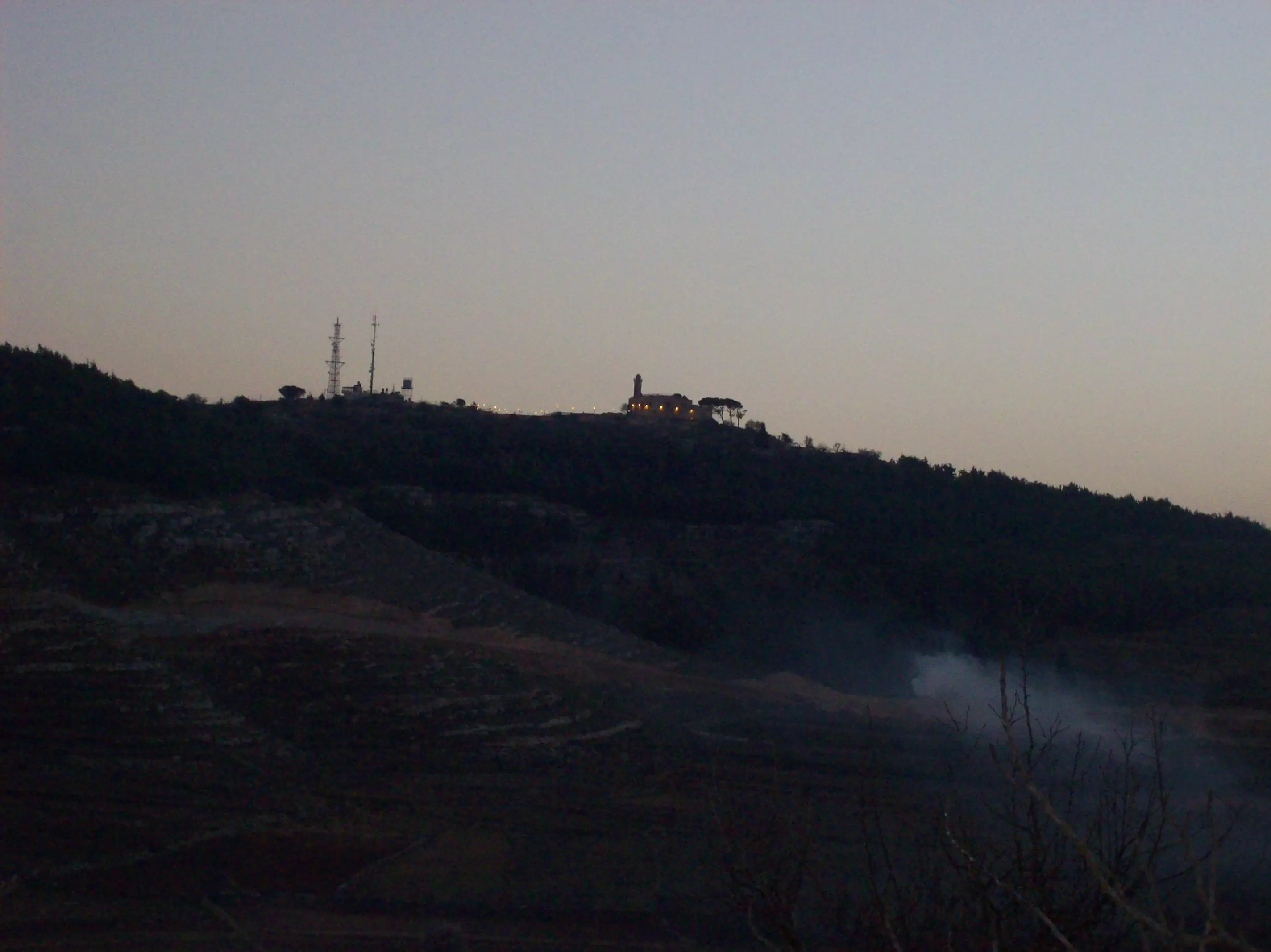
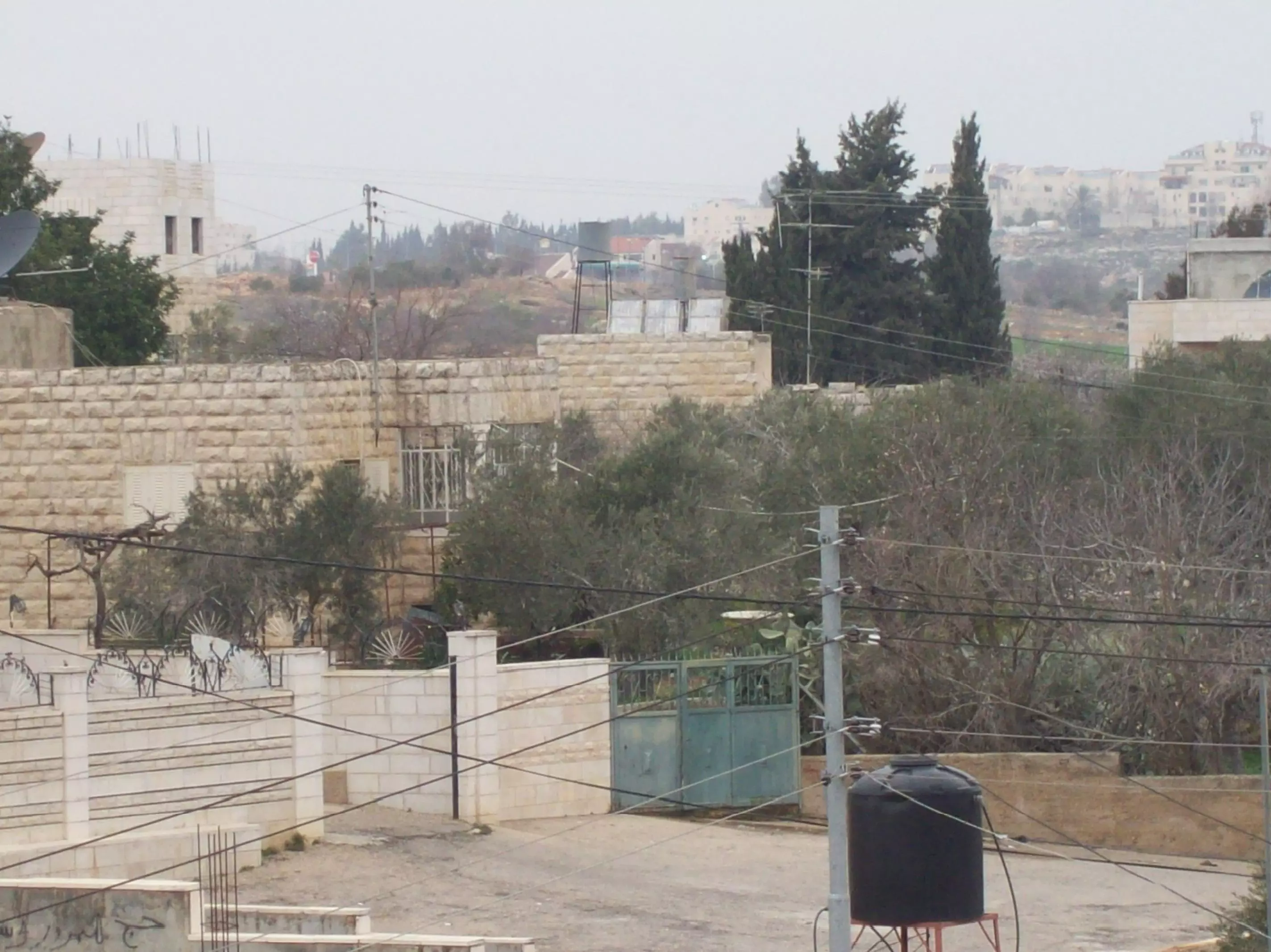
6 - هذه الصورة أخذت سنة 2001 من الجهة الشرقية من قرية الجيب
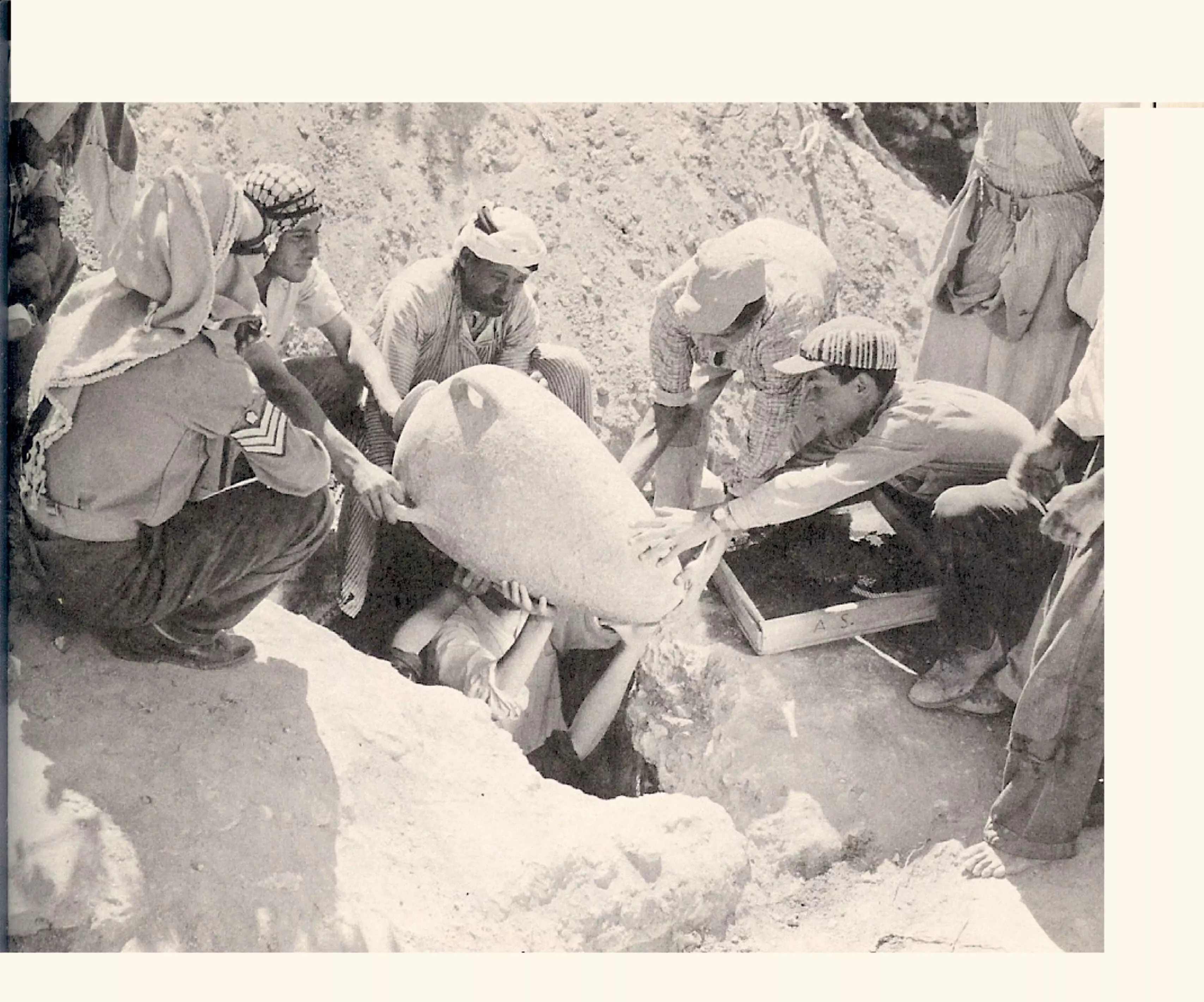
Posted by فوزي محمد علي سعادة 2 - هذه الصورة أخذت سنة 1962 وقد وجدو داخل هذة الجرات تبر وهي مادة يصنع منها الذهب وقد وجدوها في أرض محمد علي سعاده في الجيب
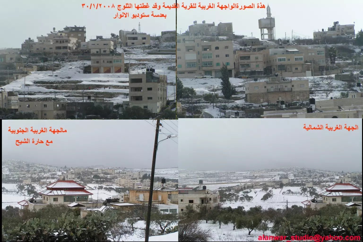
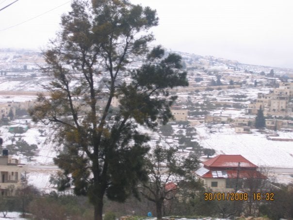
Posted by فوزي محمد علي سعادة 3 - الجيب مع ثلوج 2008، اُنقر الصورة لتكبيرها.
Posted by ستوديو الانوار 1 - هذه الصورة لعلية دار عساف في وسط القرية
Posted by فوزي محمد علي سعادة 3 - هذه الصورة أخذت سنة 2006 من الجهة الغربية من الجيب
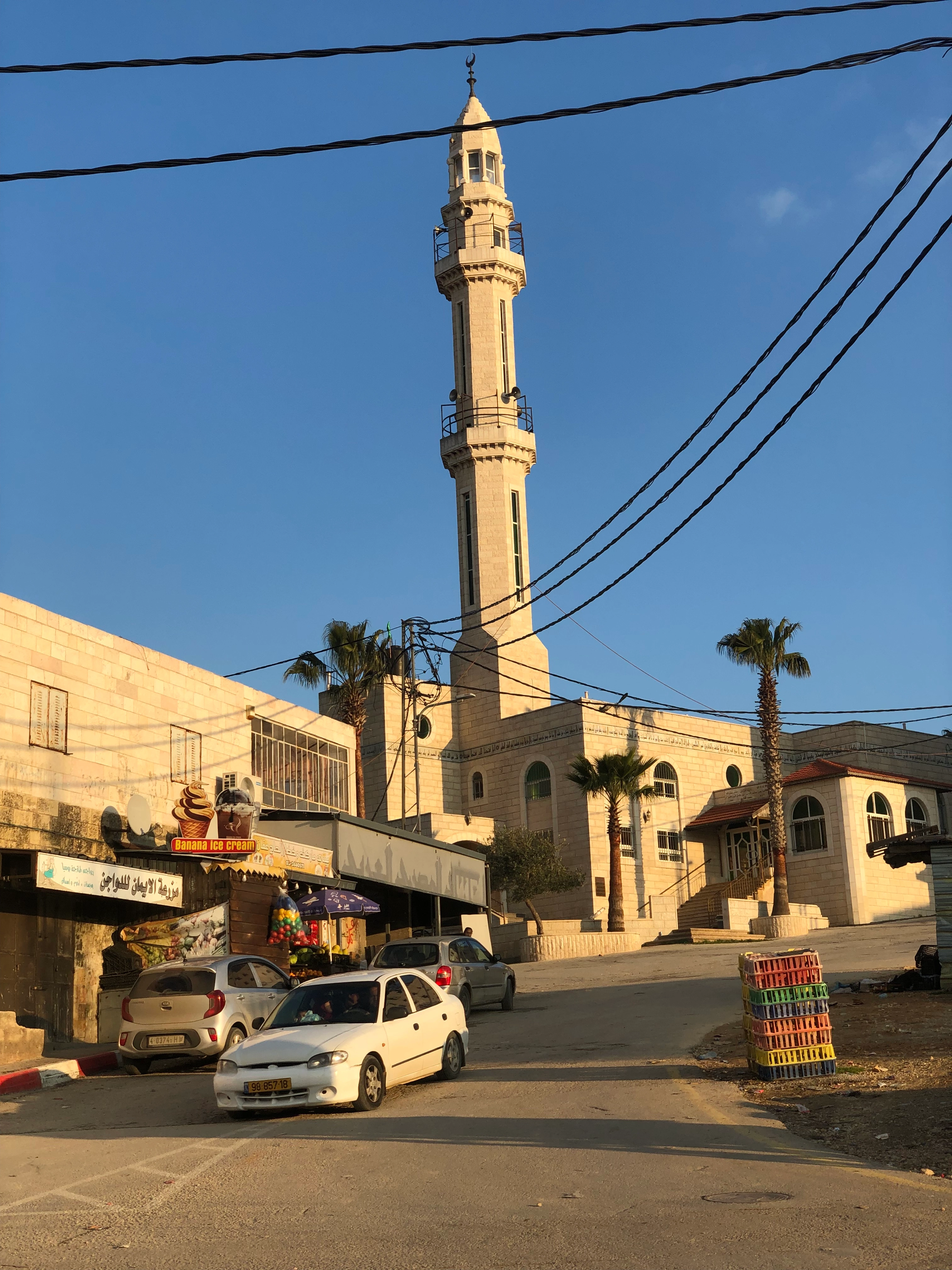
Posted by فوزي محمد علي سعادة 6 - الجامع القديم في وسط القرية
Posted by فوزي محمد علي سعادة 1 - قرية الجيب
Posted by فوزي محمد علي سعادة - هذة الدار لعائلة الخلايفة في قرية الجيب من الجهة الشمالية من القرية
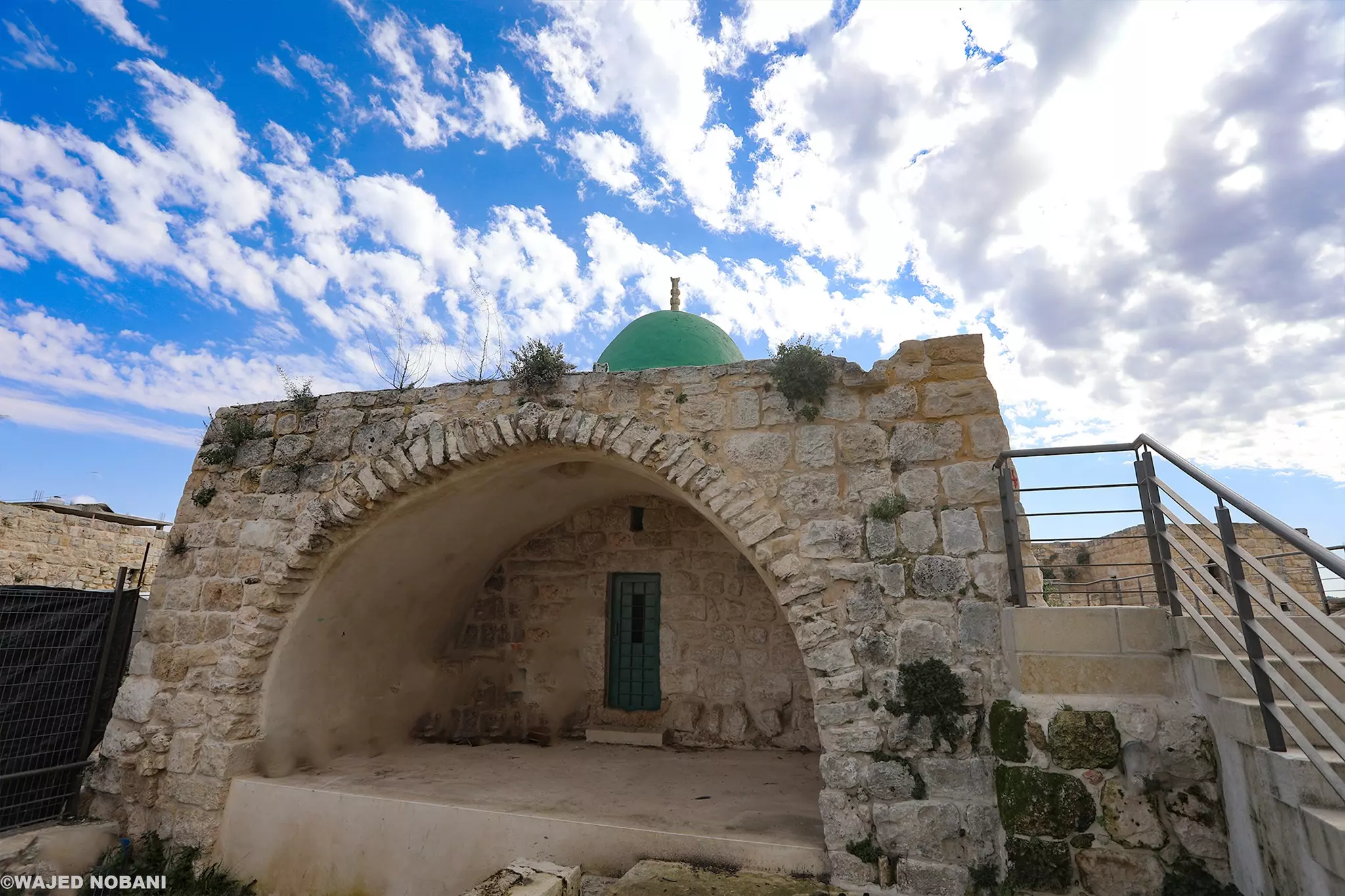
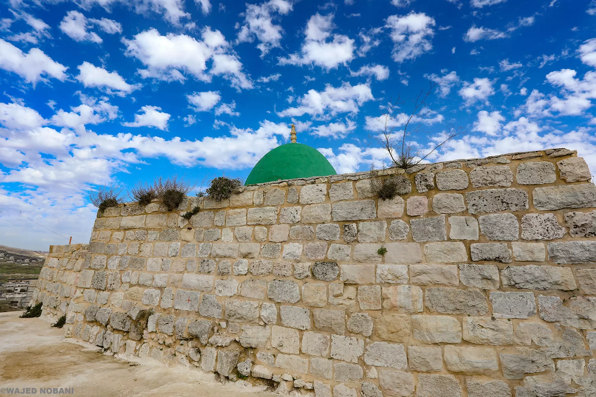
Posted by فوزي محمد علي سعادة 1 - مقام الشيخ حامد
Posted by فوزي محمد علي سعادة 2 - بقاية من عليت الشعابنة
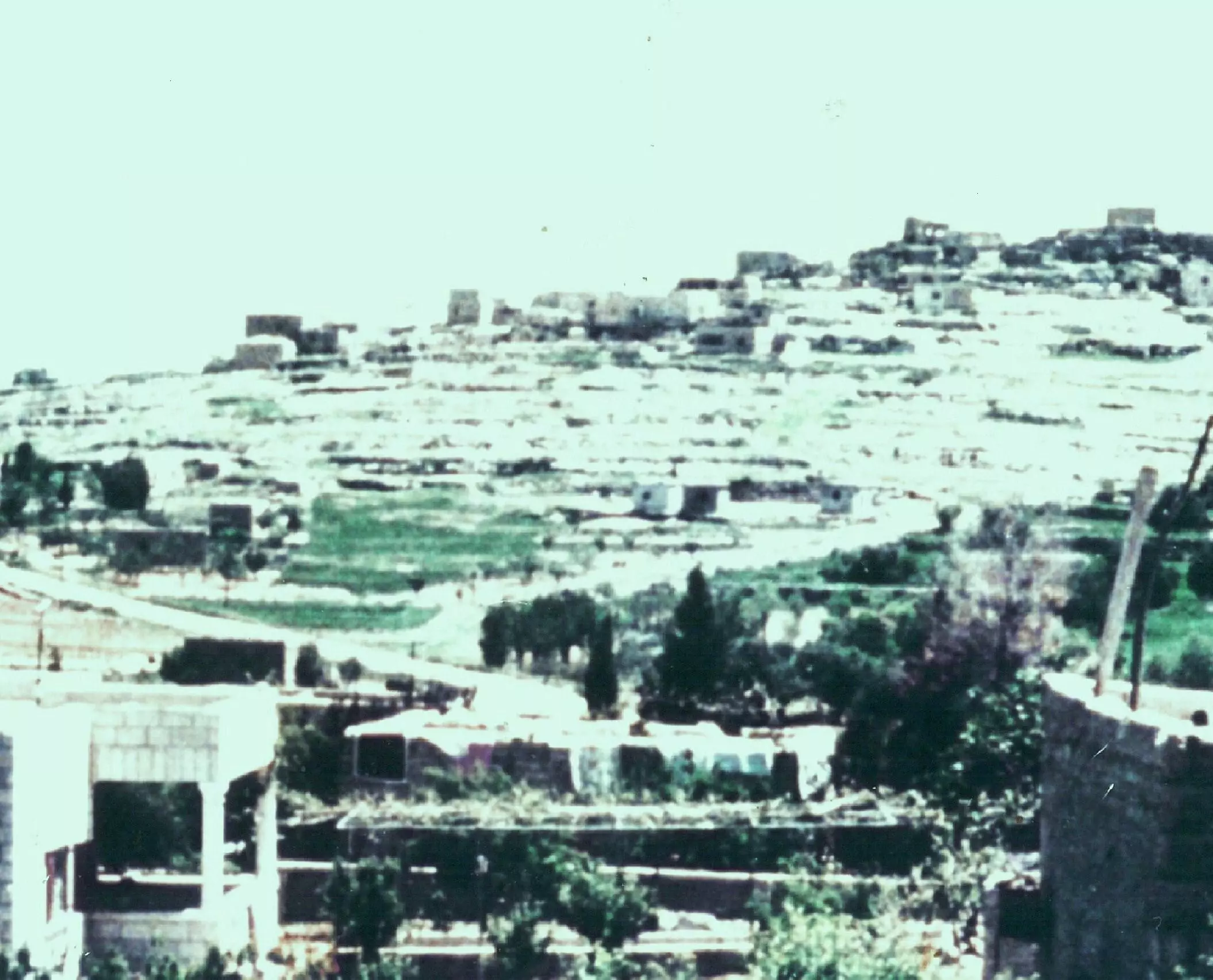
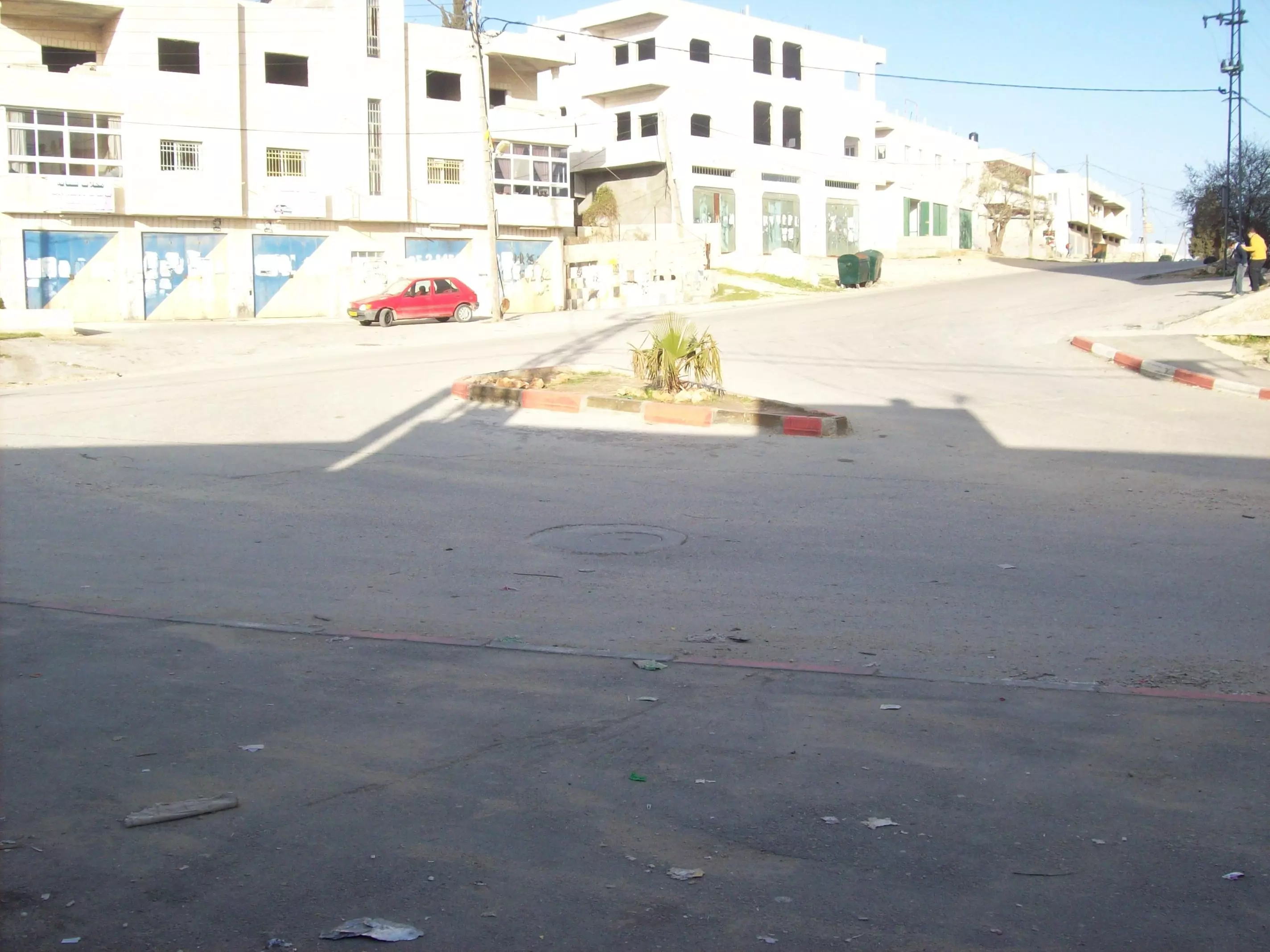
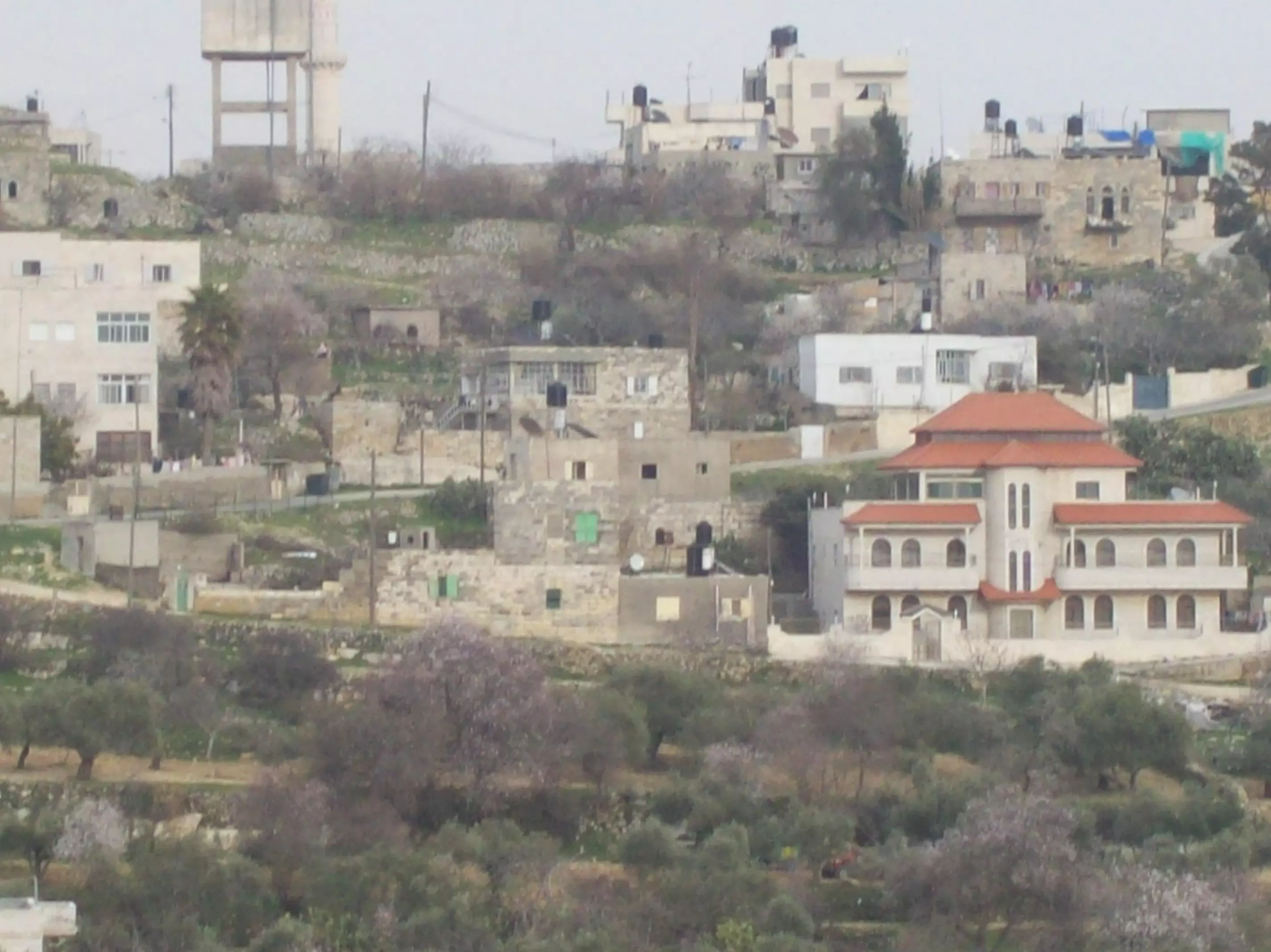
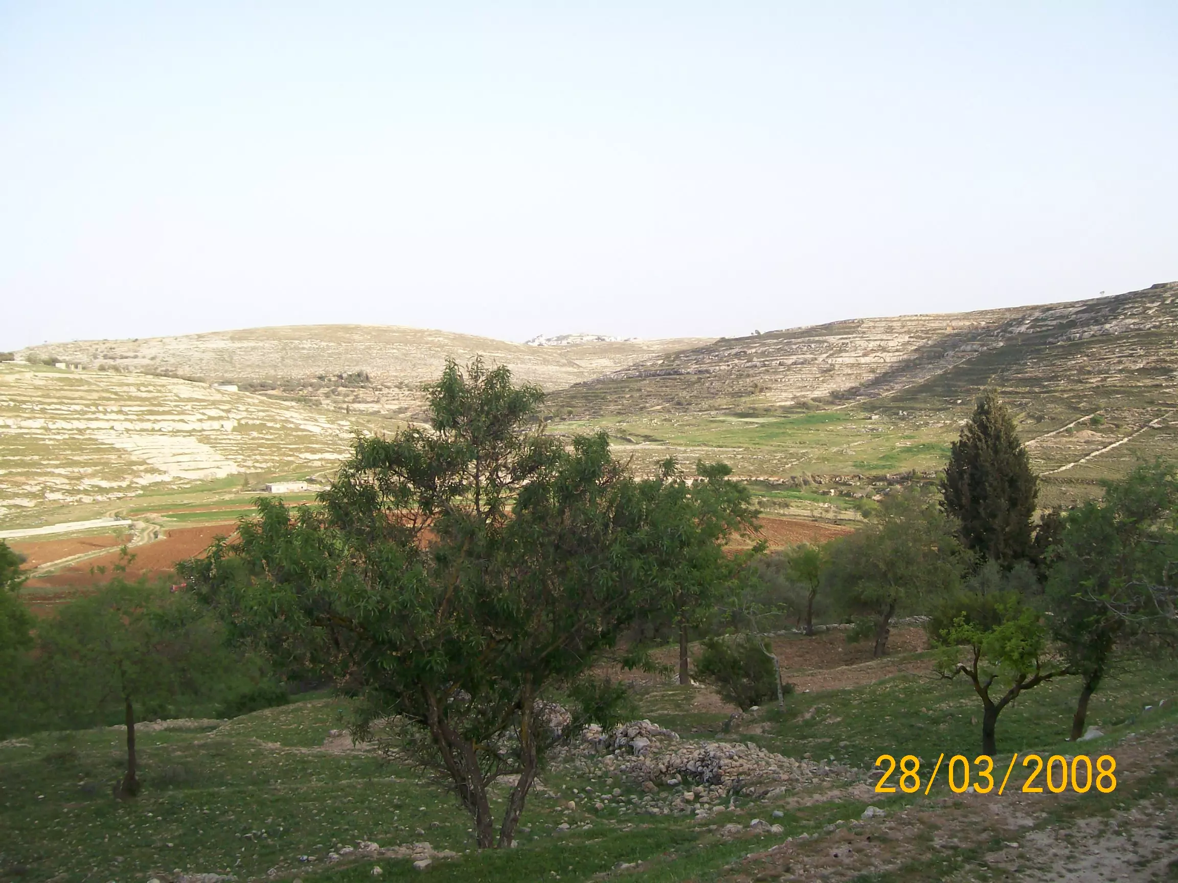
Posted by فوزي محمد علي سعادة 3 - منظر عام من قرية الجيب
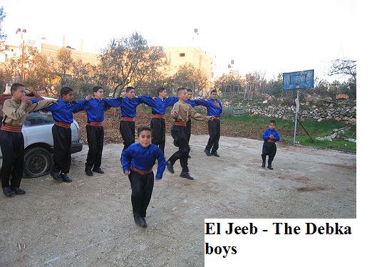
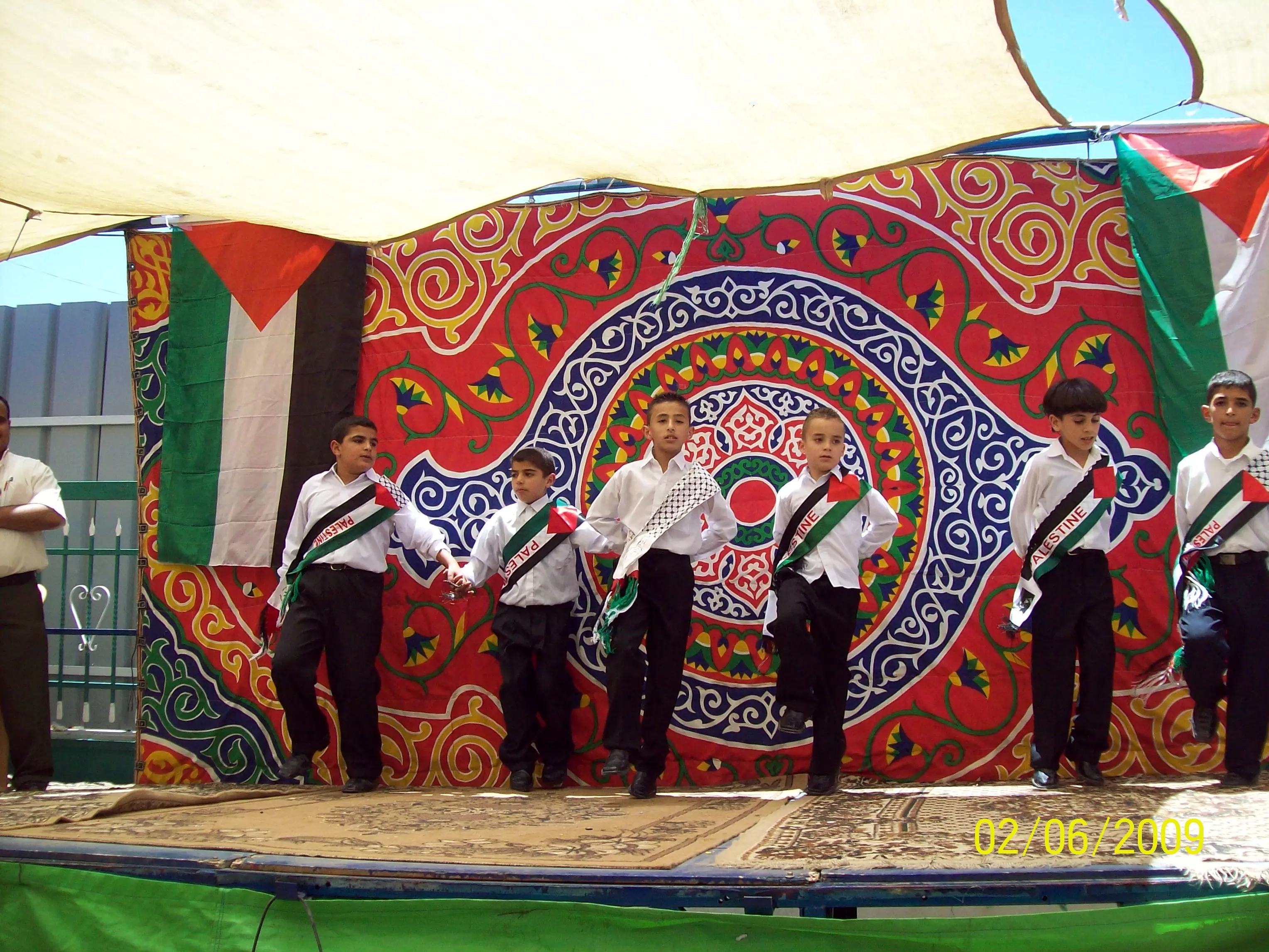
Posted by فوزي محمد علي سعادة 3 - عرض لدبكه من الجيب
Posted by فوزي محمد علي سعادة - صورة لقرية الجيب سنة 1971
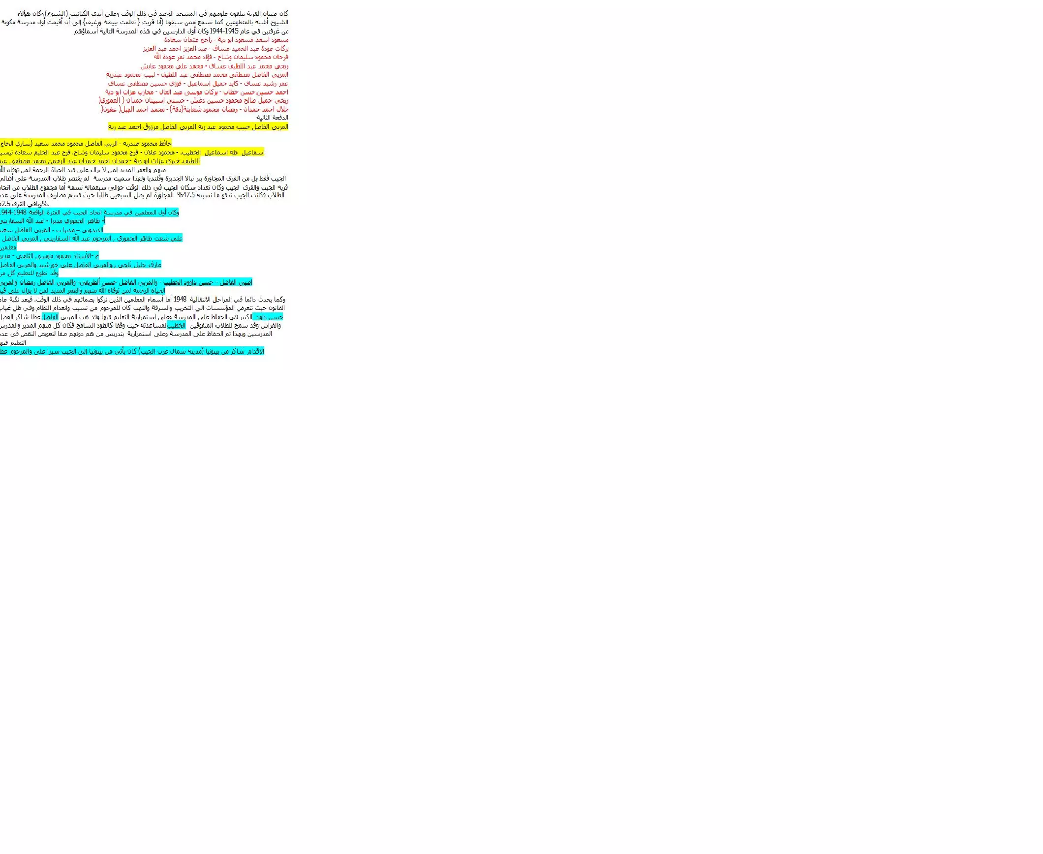
Posted by فوزي محمد علي سعادة 1 - اسماء الطلاب الذين دخلوا مدرسة الجيب سنة 1944-1945، اُنقر الصورة لتكبيرها
Posted by فوزي محمد علي سعادة 1 - منظر علم للقرية من الجهة الشمالية الشرقية من قرية الجيب
Posted by sharif 1 - منظر عام
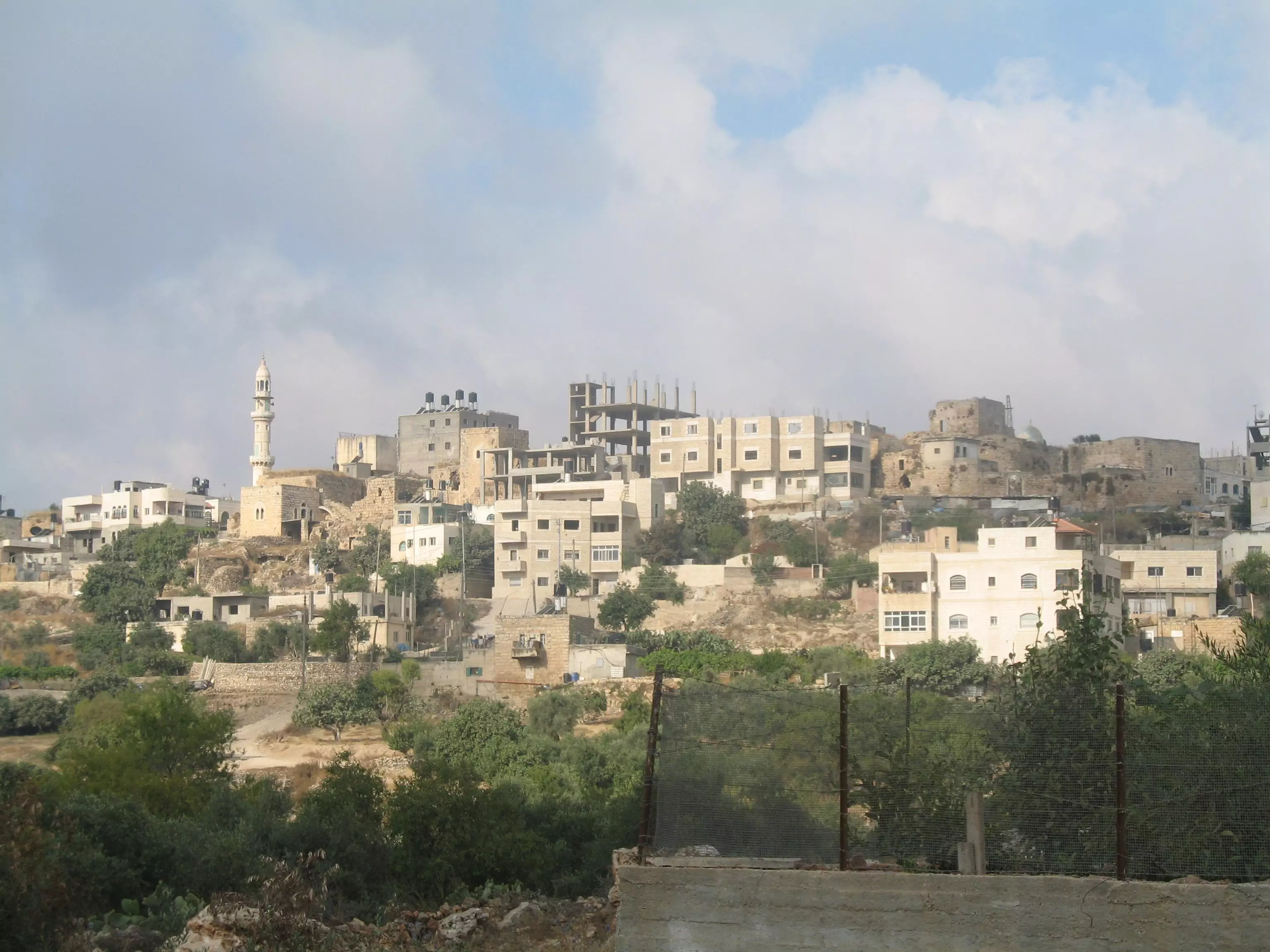
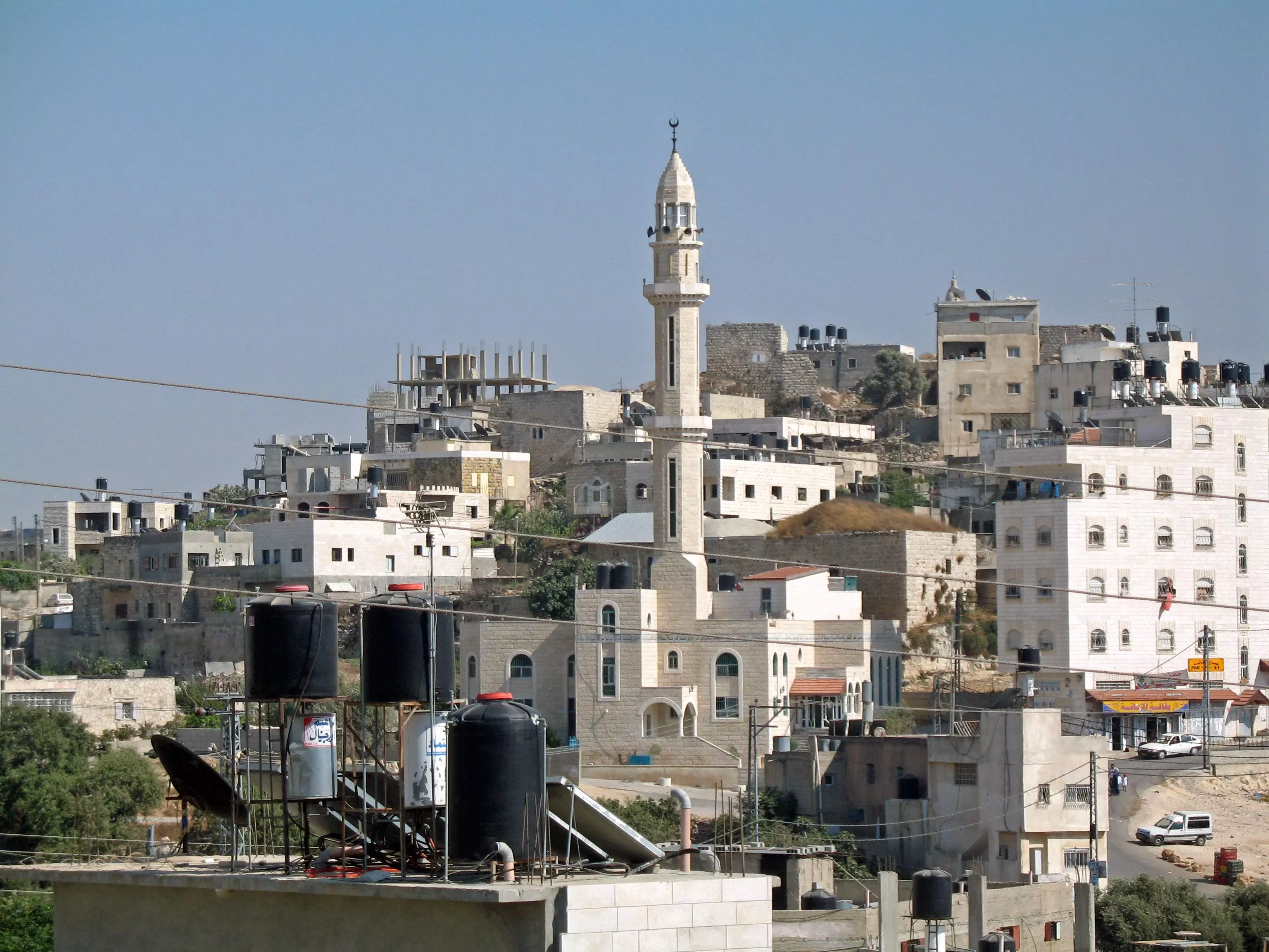
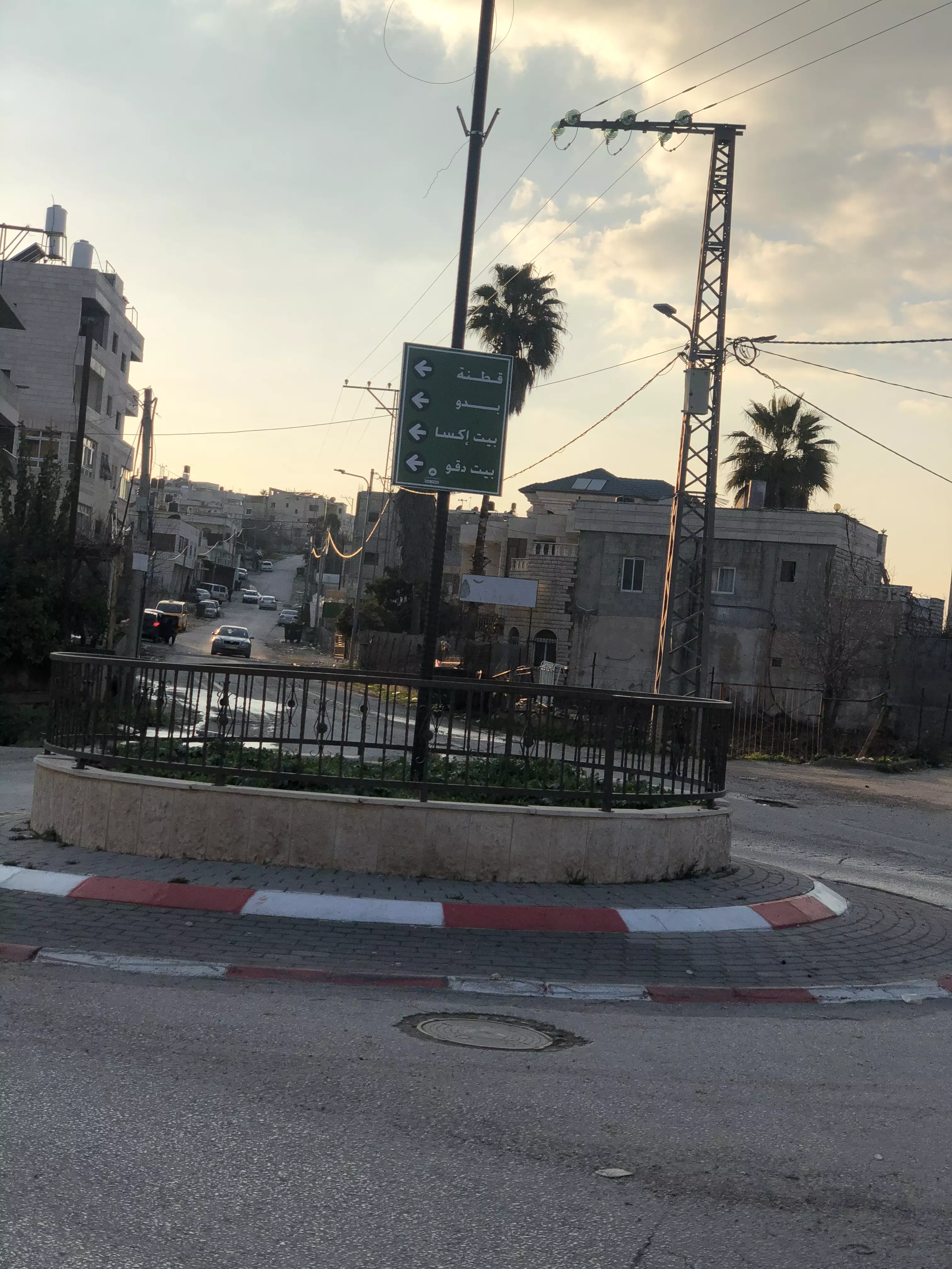
Posted by sharif 2 - منظر عام من الجهة الشمالية الغربية من قرية الجيب ويظهر الجامع الجديد جامع الفاروق
Posted by sharif 1 - منطقة غير معرفة
Posted by sharif 6 - علية دار أبو دية
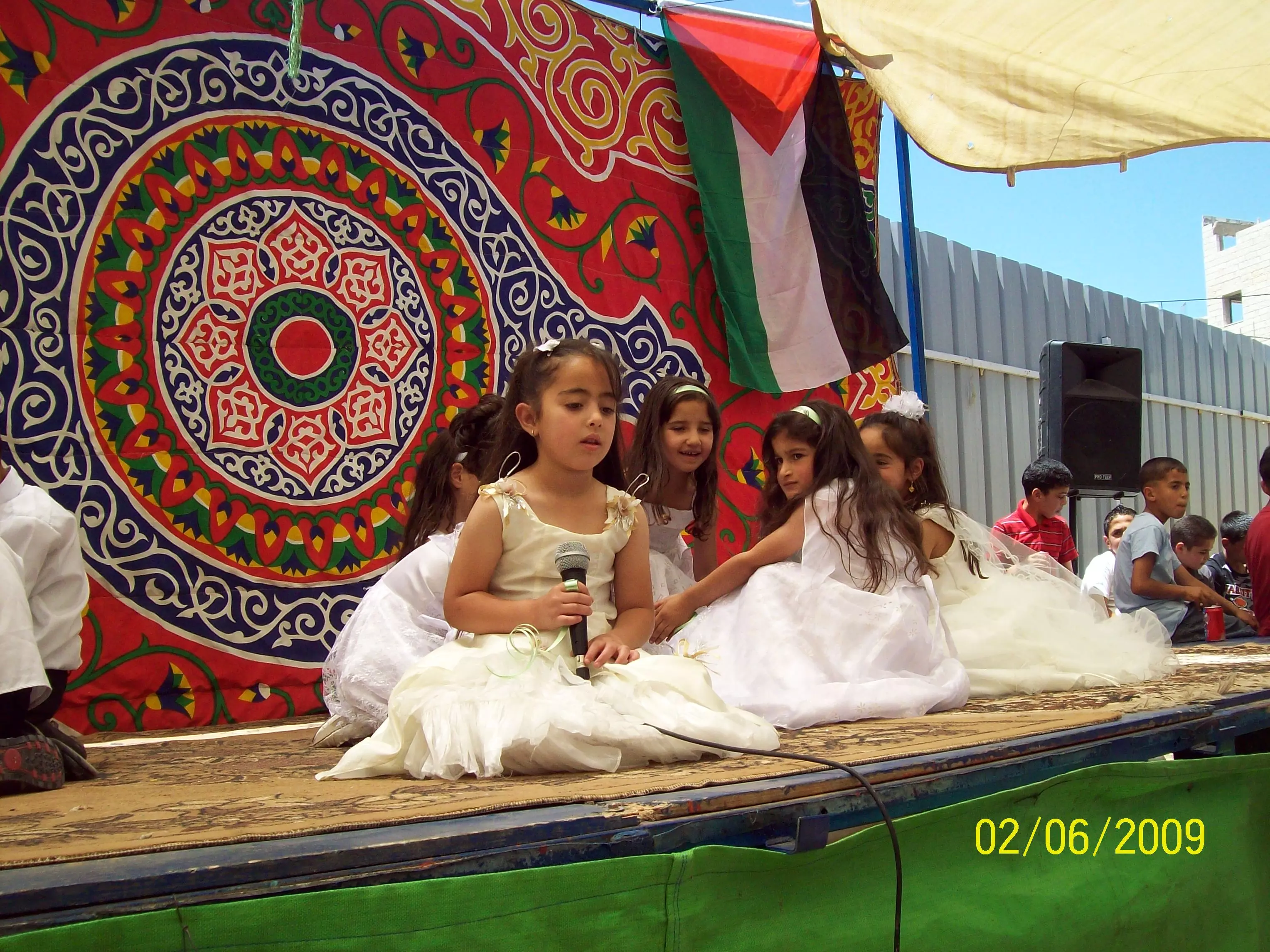
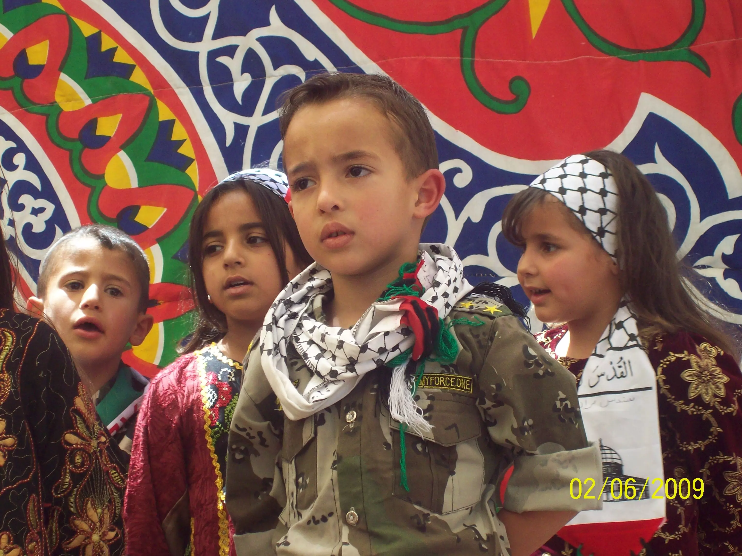
Posted by sharif 5 - صور من جانب الاحتفال لمدرسة الجيب الاساسية المختلطة 2006
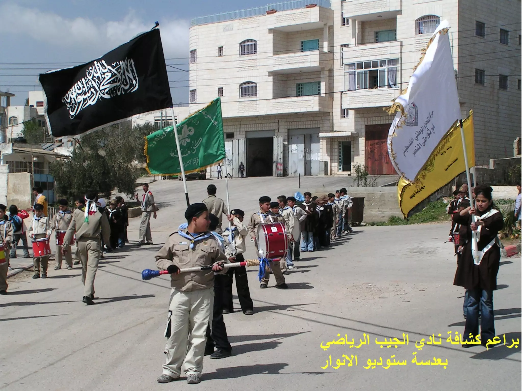
Posted by ستوديو الانوار 1 - كشافة النادي
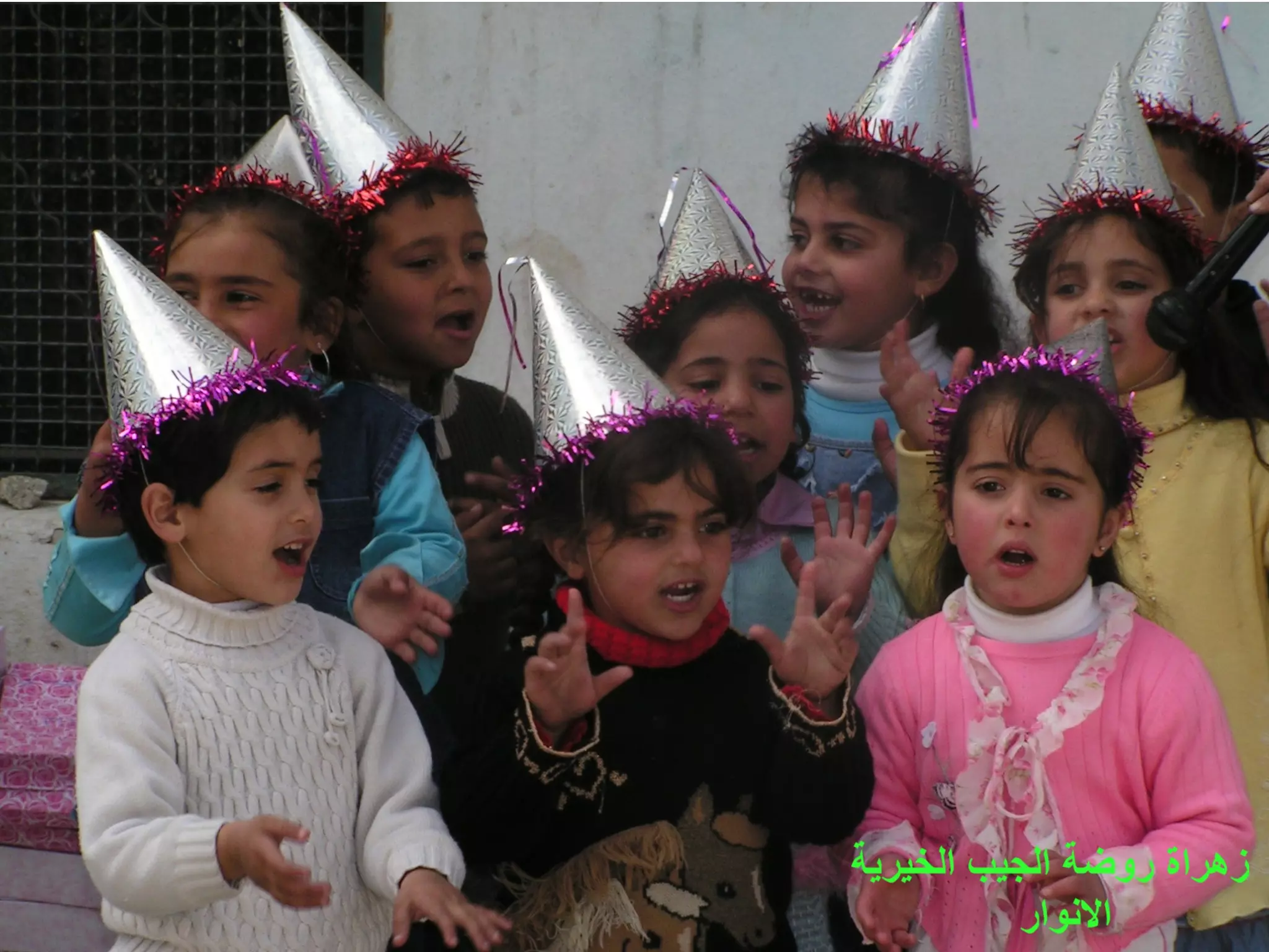
Posted by ستوديو الانوار 1 - من اطفال روضة الجيب
Posted by ستوديو الانوار - عين زاهر سميت بذلك نسبة الى سيدي زاهر
Posted by محمد عارف الياس الزواهره - الجورة الموجودة بالراس التي تعود الى زمن الملك جبعون
Posted by محمد عارف الياس الزواهره 1 - المثلث في بداية البلد المسمية بالعقبة
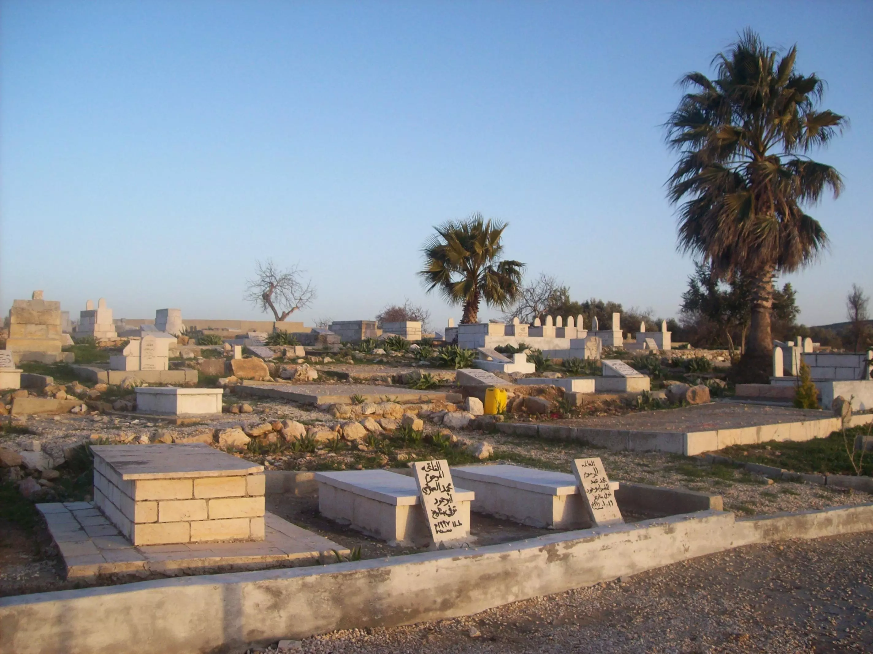
Posted by محمد عارف الياس الزواهره - مقبرة البلد
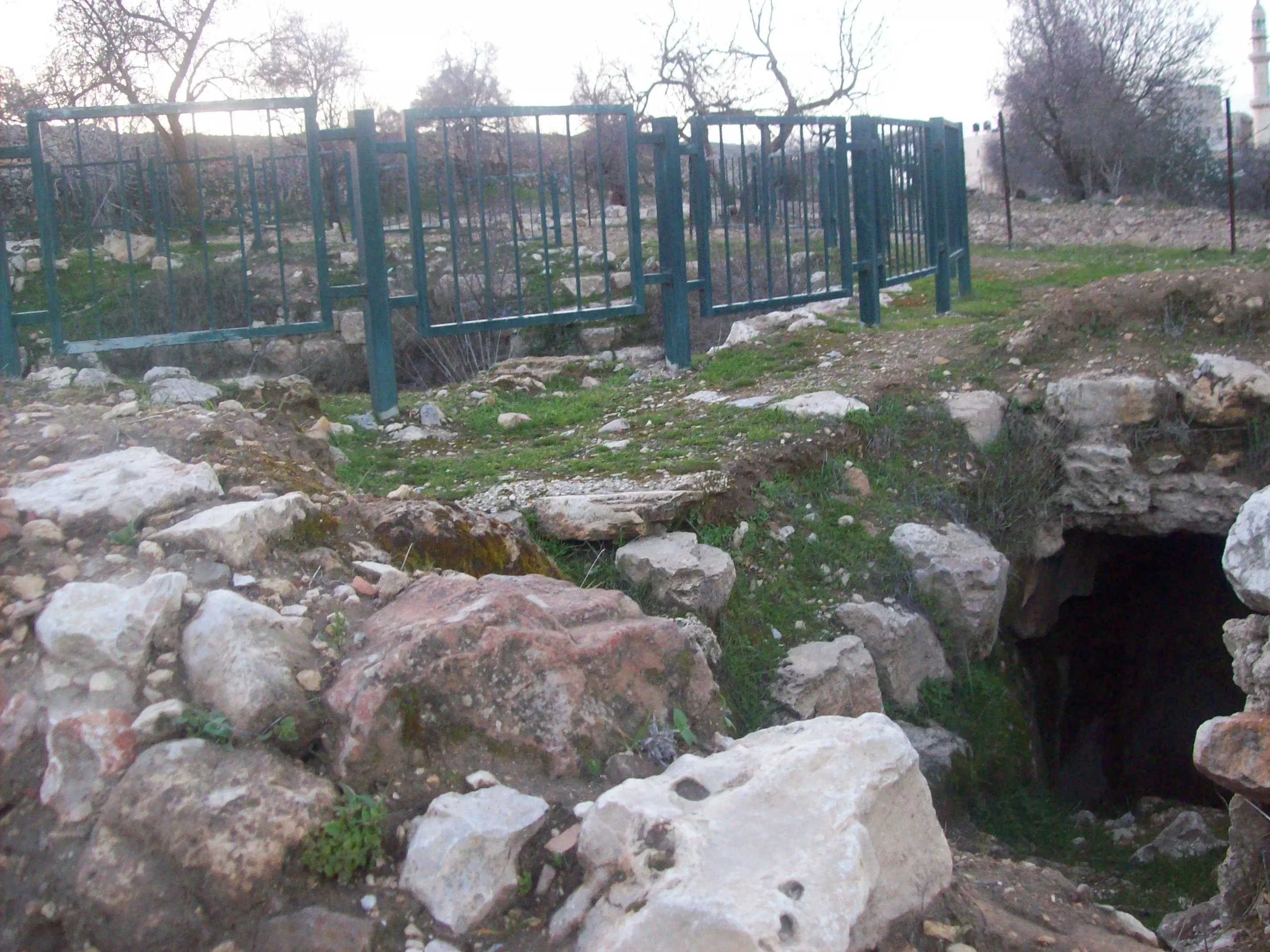
Posted by محمد عارف الياس الزواهره 2 - النفق والجورة التي بالراس
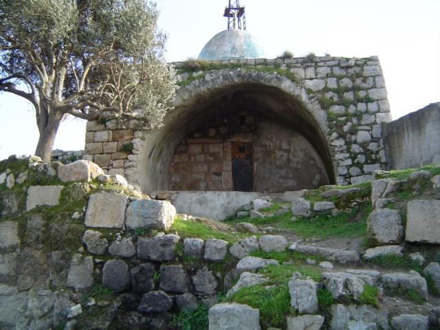
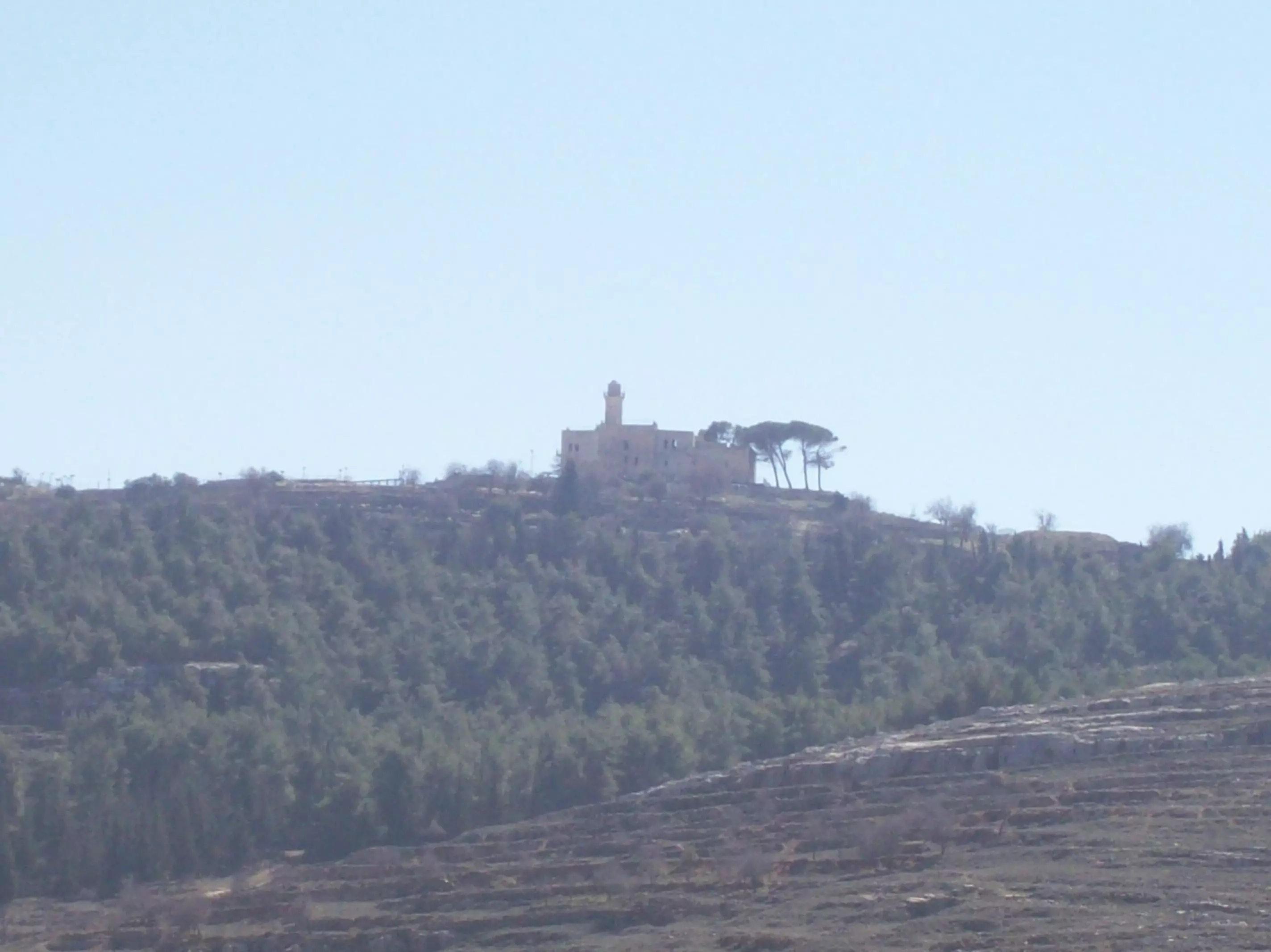
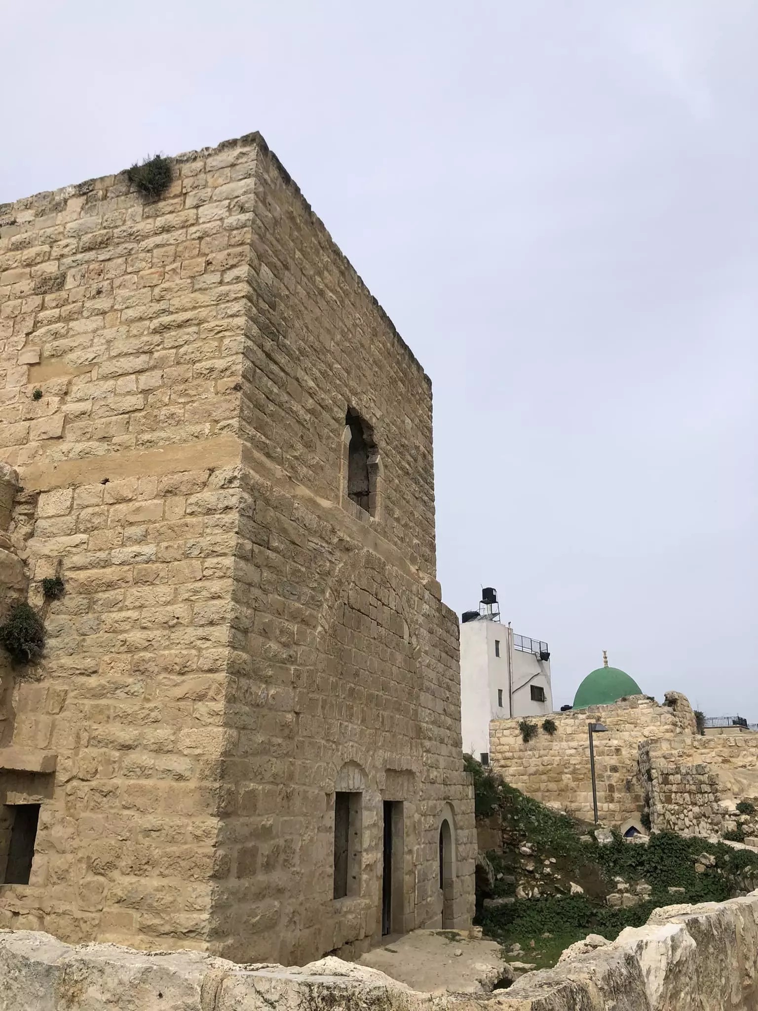
Posted by محمد عارف الياس الزواهره 2 - مسجد النبي صمويل جنوب البلد
Posted by محمد عارف الياس الزواهره - مسجد النبي صمويل جنوب البلد2
Posted by محمد عارف الياس الزواهره - المسجد القديم الاول بالبلدة وهو خلف المسجد القديم الثاني
Posted by محمد عارف الياس الزواهره 1 - دار ستي ام نزيه
Posted by محمد عارف الياس الزواهره - دار ستي ام نزيه من الجانب
Posted by محمد عارف الياس الزواهره - مسجد النبي صمويل بالنهار
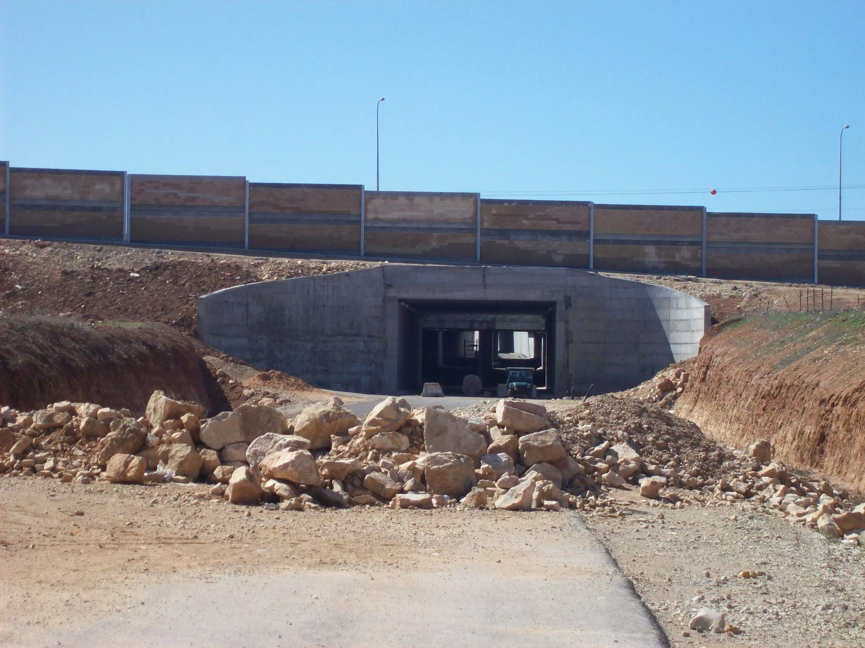
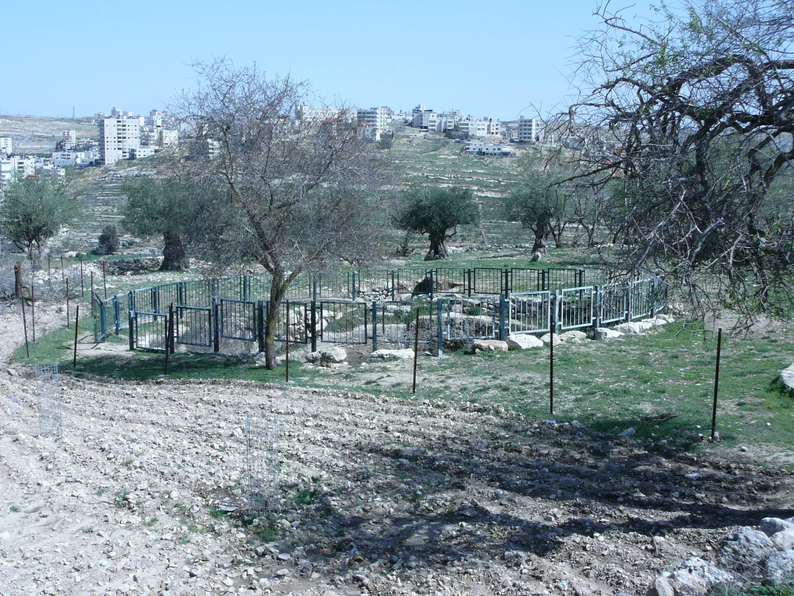
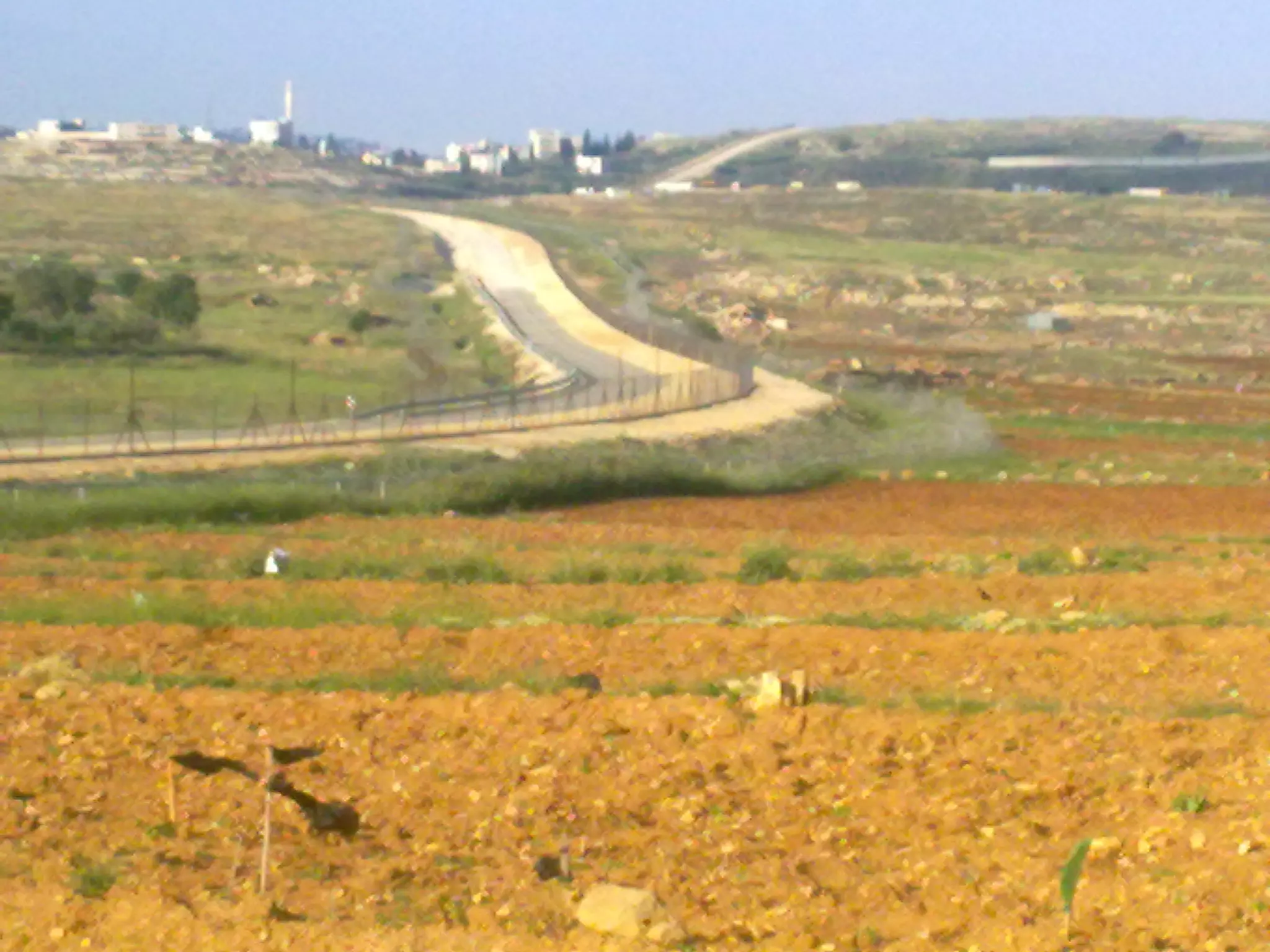
Posted by محمد عارف الياس الزواهره - جدار الفصل العنصري حنوب البلد حيث يظهر بالصورة ايضا النفق الذي سوف يصل بين البلد والبلدات المجاورة
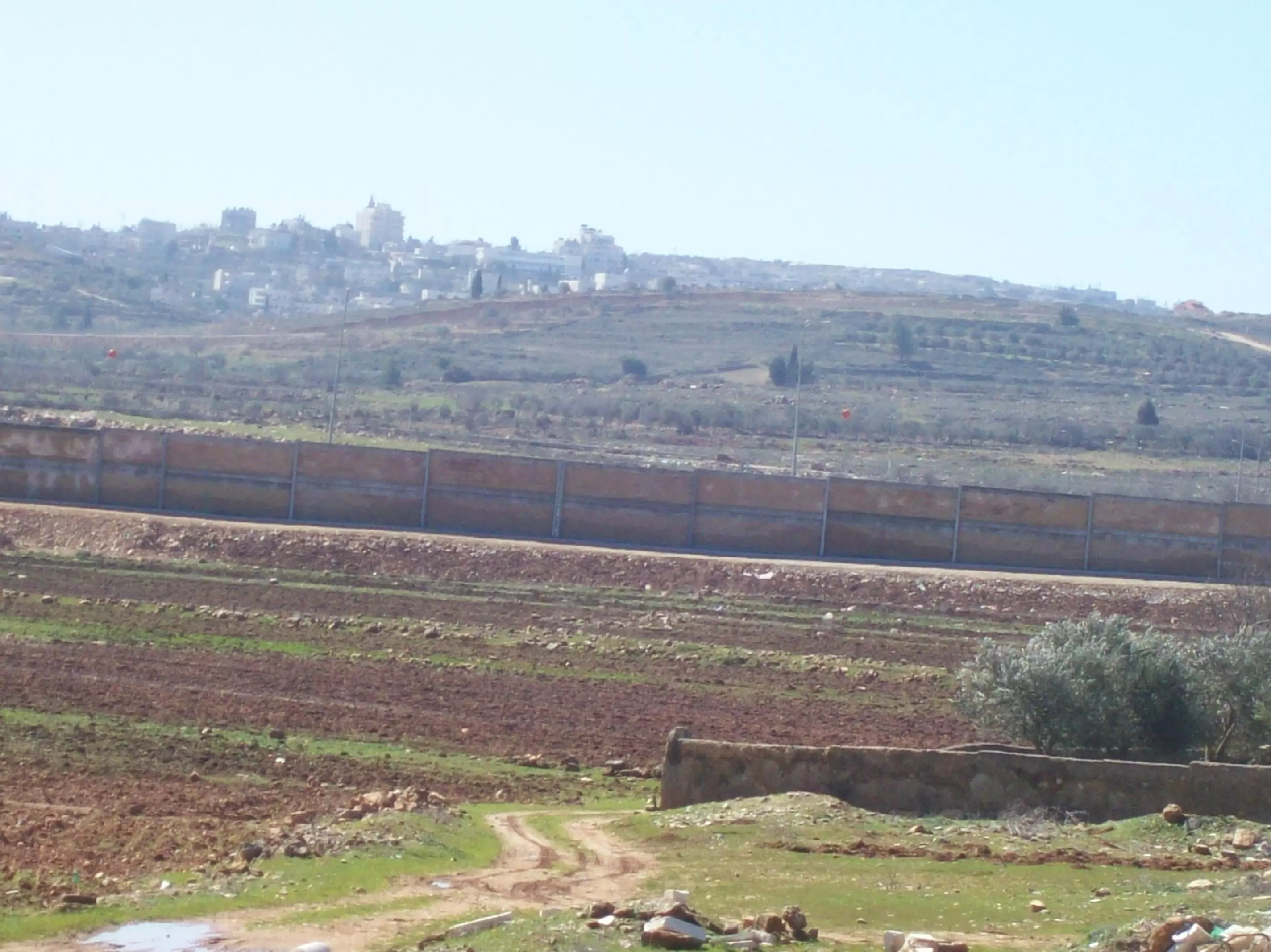
Posted by محمد عارف الياس الزواهره - صورة تظهر الجدار العازل
Posted by محمد عارف الياس الزواهره - صورة للبلد من الجهة الشمالية

Posted by محمد عارف الياس الزواهره 1 - دار سيدي جميل رحمة الله عليه
Posted by محمد عارف الياس الزواهره - مدخل دار سيدي ربحي ابو نزيه سعادة
Posted by محمد عارف الياس الزواهره - دار سيدي جميل التي تظهر بالافق
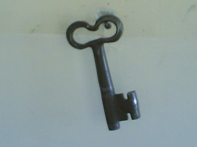
Posted by محمد عارف الياس الزواهره 1 - عائدون
Posted by محمد عارف الياس الزواهره - هذه الصورة للمرحوم الحاج علي عبد العال (أبو محمود) عندما رفض اوامر اليهود أن يقوم من تحت هذه شجرة الزيتون لخلعها
Posted by فوزي محمد علي سعادة 2 - الثلج في القرية-1
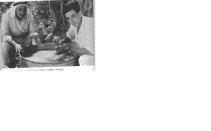
Posted by صمود فراج 2 - صورة المرحوم ابراهيم لبيبه سنه 1959 كان يشتغل في الآثار للبلدة
Posted by فوزي محمد علي سعادة 1 - صورة من كتاب gibeon where the sun stood still

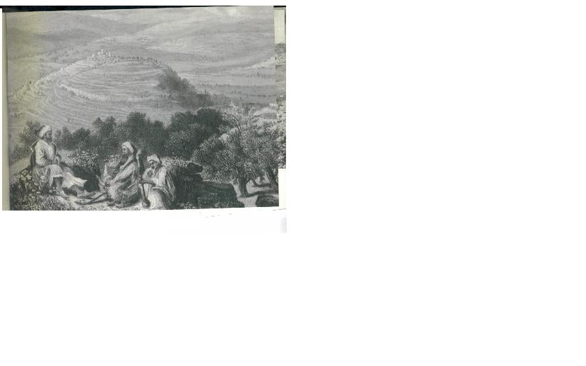
Posted by فوزي سعادة 1 - I. A view of el-jib from Nebi Samwil as it appeared in an engraving of about two centuries ago.
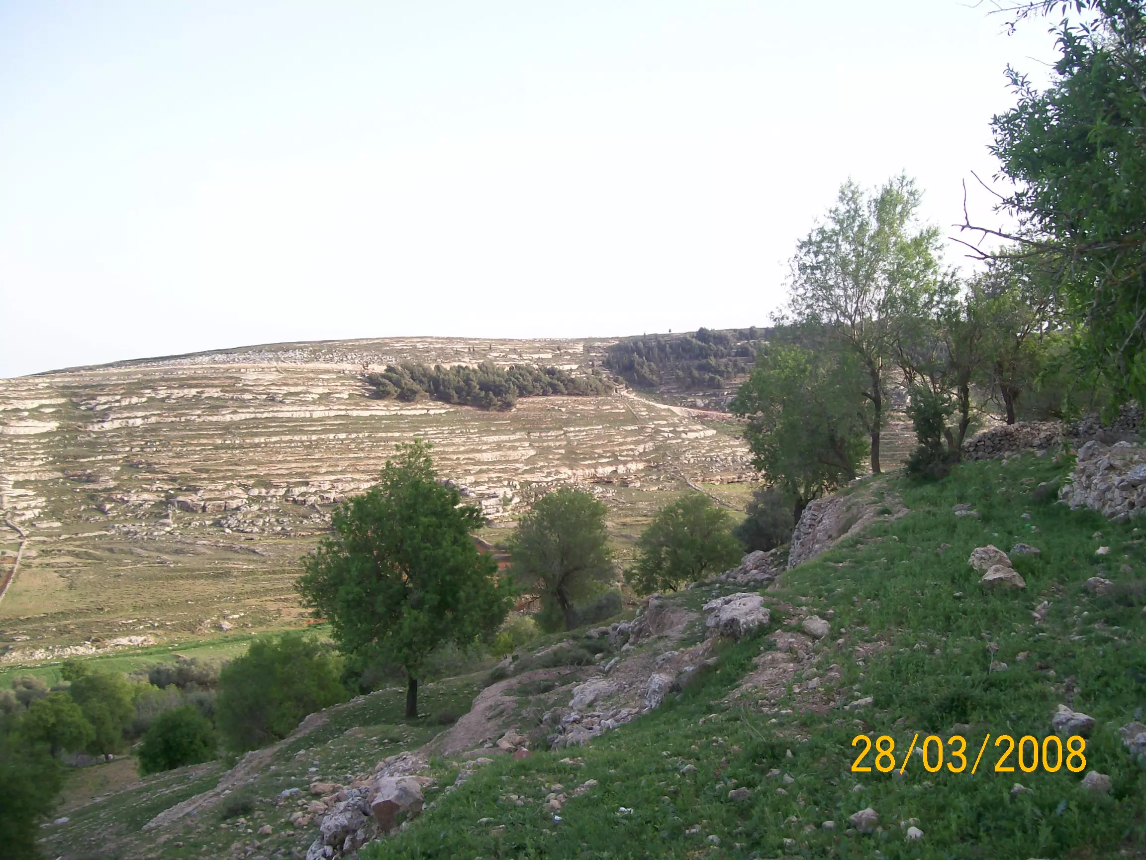
Posted by فوزي سعادة - الجهة الشمالية للقرية (واد العسكر)
Posted by صمود فراج - الراس
Posted by صمود فراج 3 - الراس2
Posted by صمود فراج - قرية الجيب
Posted by فوزي سعادة 2 - قرية الجيب
Posted by فوزي سعادة - قرية الجيب

Posted by فوزي سعادة 2 - New picture of center of Al-Jeeb and grave yard May2008
Posted by Yasir Abdallatif 1 - صور حفله تخريج فوج القدس\مدرسه الهدى الاسلاميه\الجيب
Posted by مراد ابو ديه 2 - .زهرات من مدرسه الهدى الاسلاميه\الجيب
Posted by مراد ابو ديه - من براعم وزهرات روضه الهدى الاسلاميه
Posted by مراد ابو ديه - احلى فلكلور جيوابي
Posted by مراد ابو ديه - صورة جامع البلد الجديد
Posted by firas sbeih 2 - ما اجمل مناخ بلادنا وفي هذه الصوره يظهر طريق الجدار
Posted by firas sbeih 1 - صورة حديثة لقرية الجيب
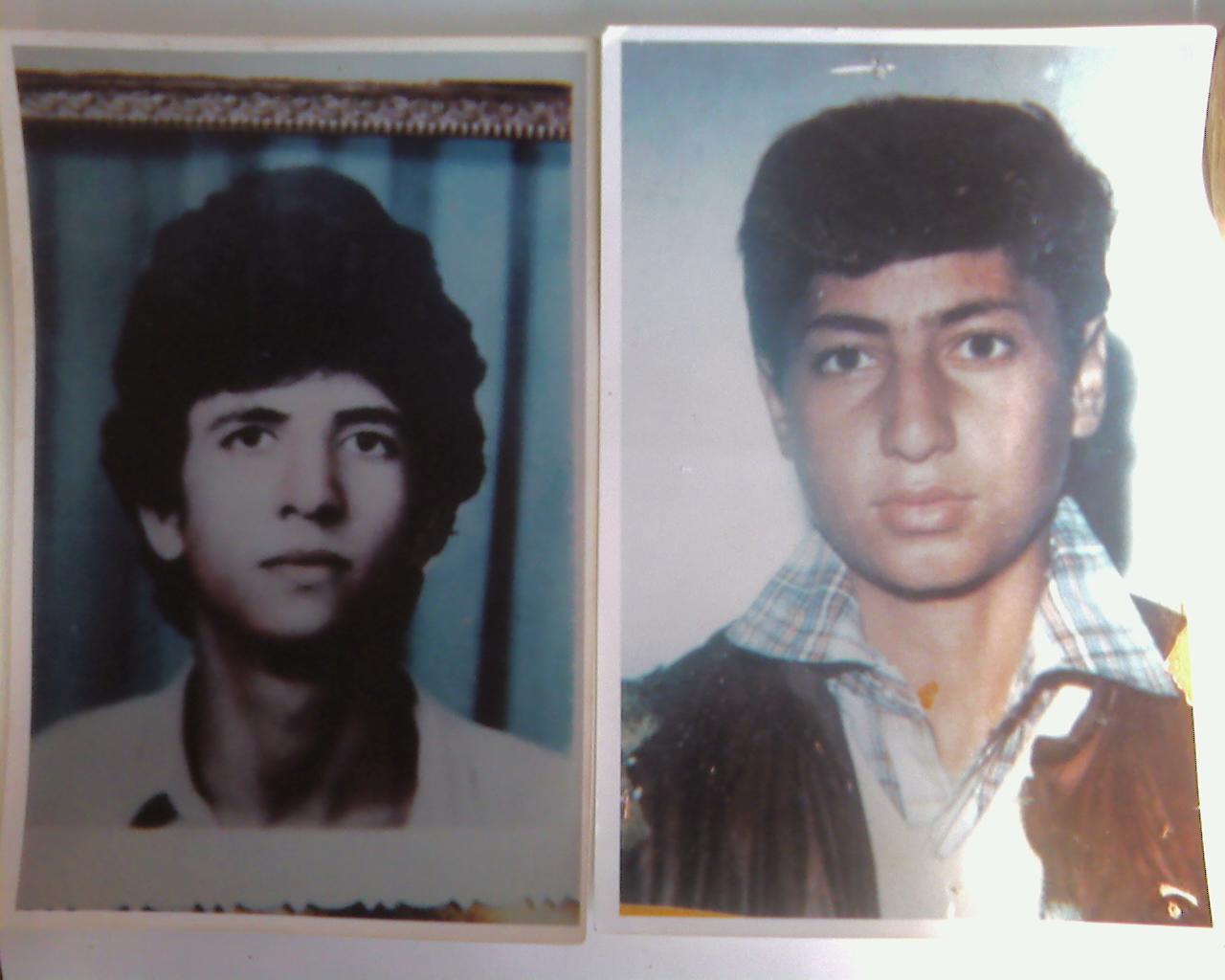
Posted by فوزي محمد علي سعادة 2 - صورة الشهيدين محمد وصبري منصور عبدربه من قرية الجيب
Posted by صهيب سعادة 6 - منطقة راس البلد (الصورة) _صهيب سعاده
Posted by صهيب سعادة - بئر عزيز ومنطقة الشيح
Posted by ستوديو الانوار - منطقة السهل الشامي بعد الجدار
Posted by ستوديو الانوار - قرية الجيب
Posted by فوزي محمد علي سعادة - بيوت لقرية الجيب قديما
Posted by فوزي محمد علي سعادة 1 - صور من قرية الجيب
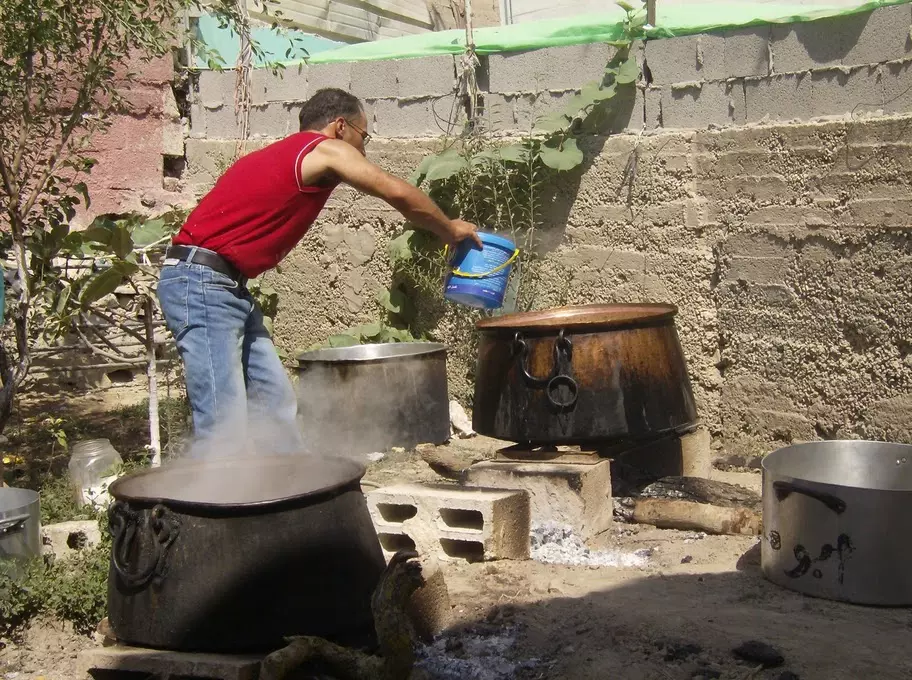
Posted by فوزي محمد علي سعادة - طبخ العسيدة
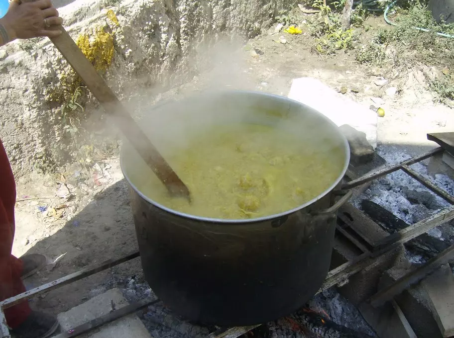
Posted by فوزي محمد علي سعادة 1 - طبخ العسيدة
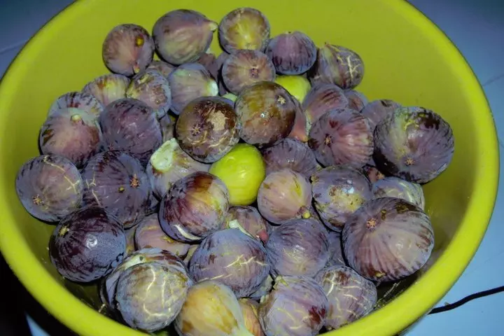
Posted by فوزي محمد علي سعادة 1 - يا محلى التين
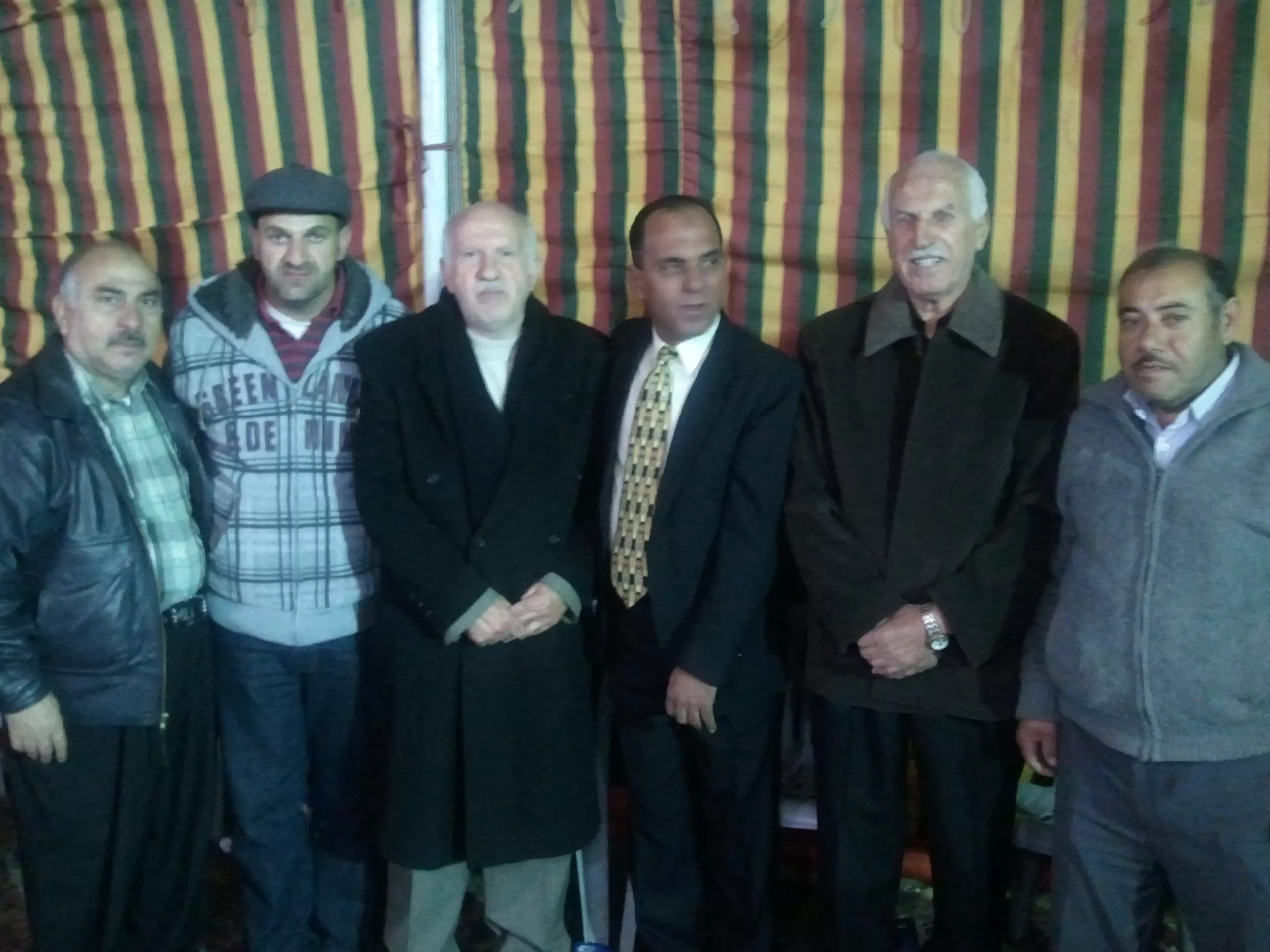
Posted by فوزي محمد علي سعادة 1 - هذه الصورة أخذت في تخريج محمد عريف من كلية البحرية مهندس برتبة ملازم في الأردن ويظر في الصورة الأستاذ ساري الحاج محمد وأخوه حامد وأولاد صبح زاهر وخالد ربحي سعادة وفوزي سعادة(أبو أسامة
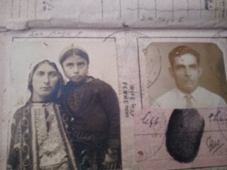
Posted by فوزي محمد علي سعادة 2 - جواز سفر سنة 1938عليه حكومة فلسطين بثلاث لغات عربي وانجليزي وعبراني هذا الجواز بعود لمحمد علي صالح سعادة من الجيب عند سفره لبنما
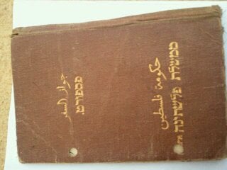
Posted by فوزي محمد علي سعادة 1 - جواز سفر سنة 1938عليه حكومة فلسطين بثلاث لغات عربي وانجليزي وعبراني هذا الجواز بعود لمحمد علي صالح سعادة من الجيب عند سفره لبنما
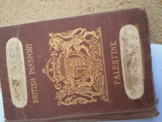
Posted by فوزي محمد علي سعادة - جواز سفر سنة 1938عليه حكومة فلسطين بثلاث لغات عربي وانجليزي وعبراني هذا الجواز بعود لمحمد علي صالح سعادة من الجيب عند سفره لبنما
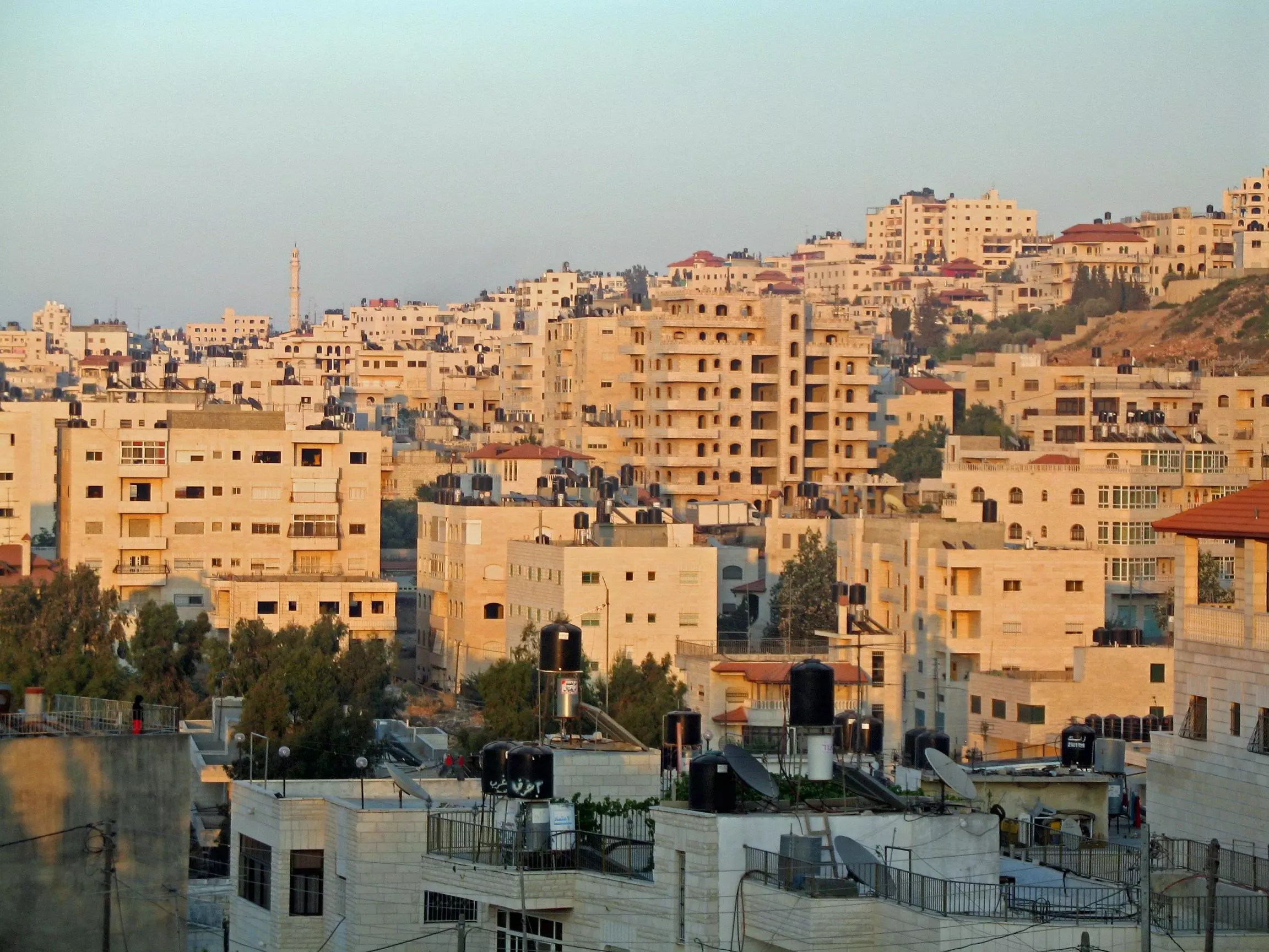
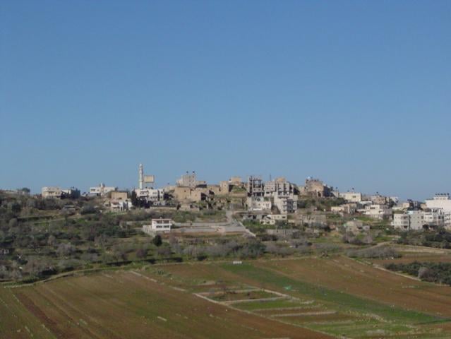
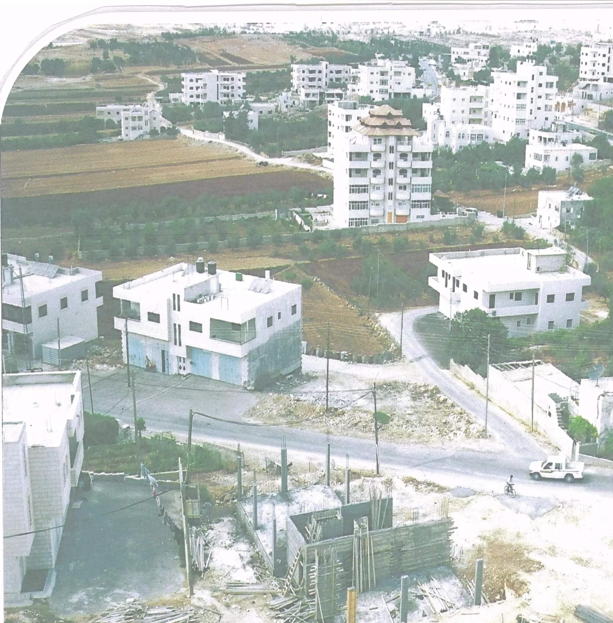
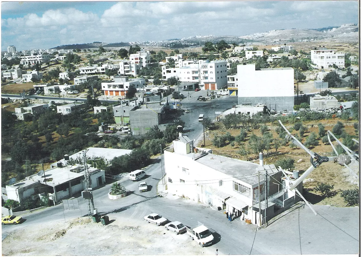
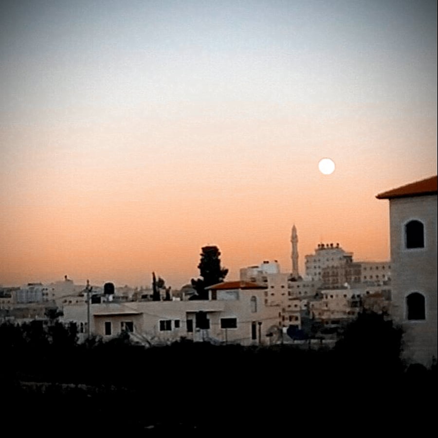
Posted by فوزي محمد علي سعادة - General View, 2012
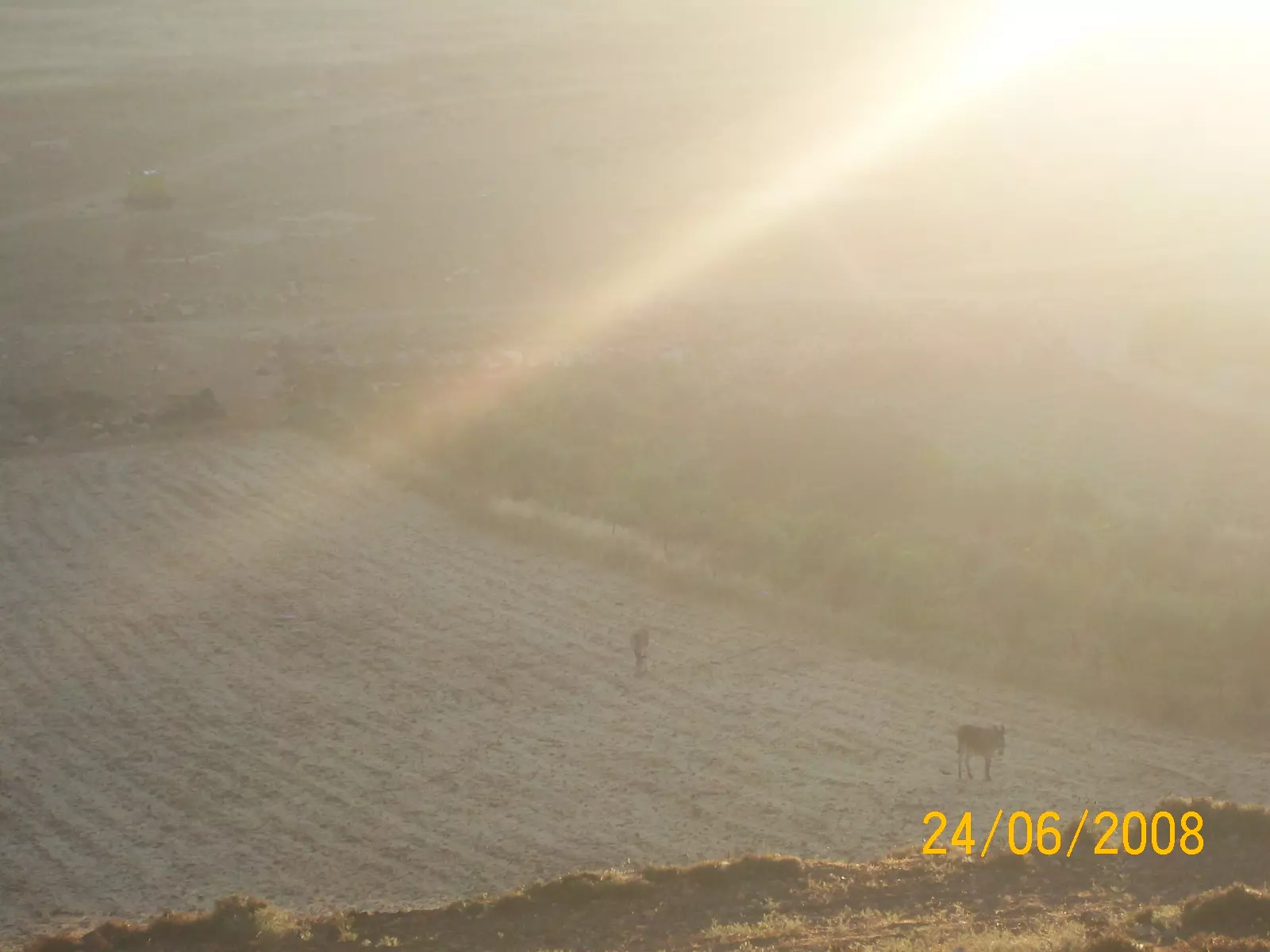
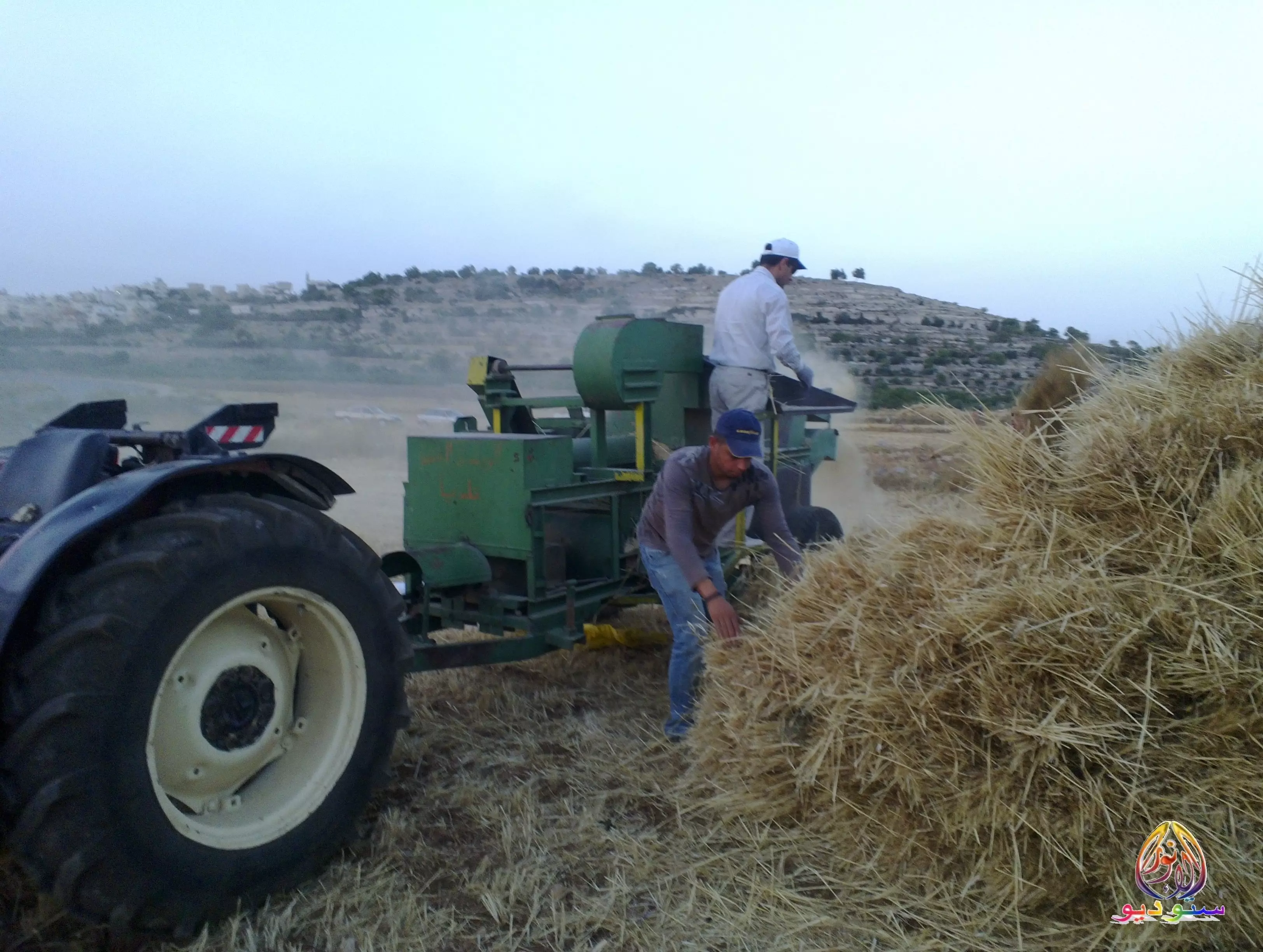
Posted by فوزي محمد علي سعادة - موسم الحصاد
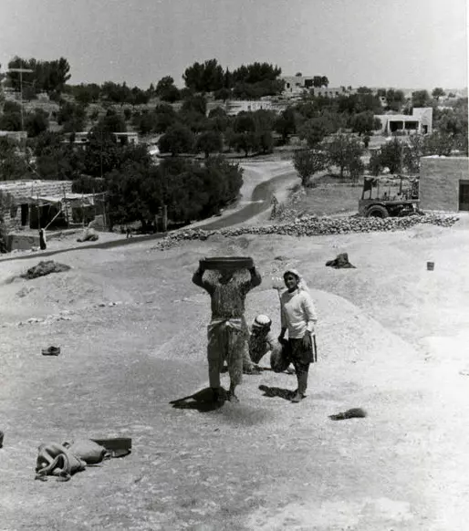
Posted by ستوديو الانوار 1 - منظر عام لقريه الجيب قبل النكبه
Posted by abu raya - قريه الجيب قبل النكبه
Posted by abu raya - صوره قديمه من قريه الجيب
Posted by abu raya - صوره قديمه من القريه
Posted by abu raya - سماء قرية الجيب
Posted by شيماء عبدربه - منظر عام
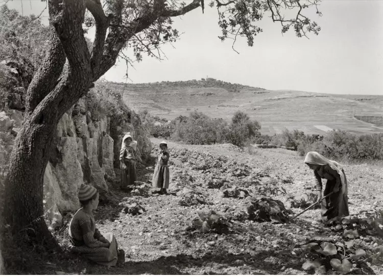
- تذرية الحبوب في قرية الجيب 1980
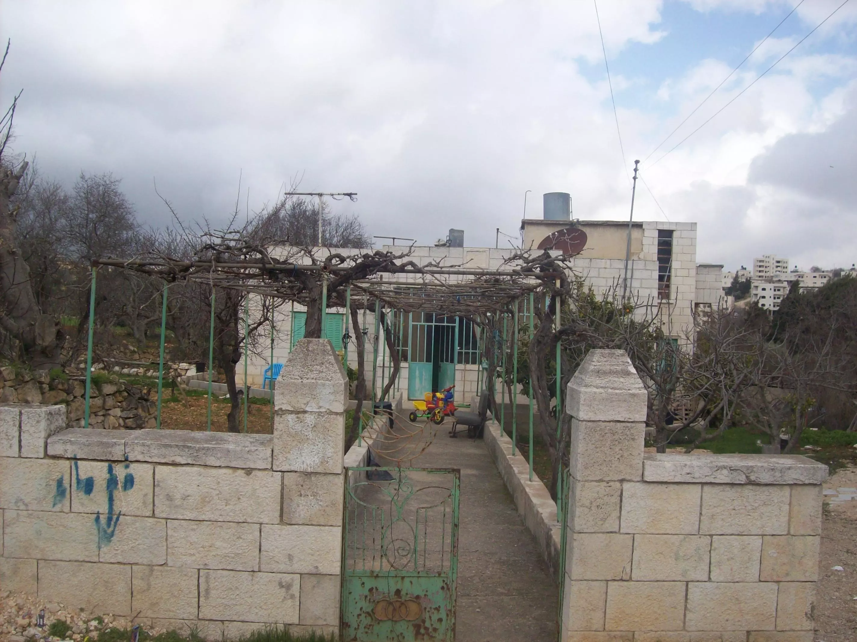
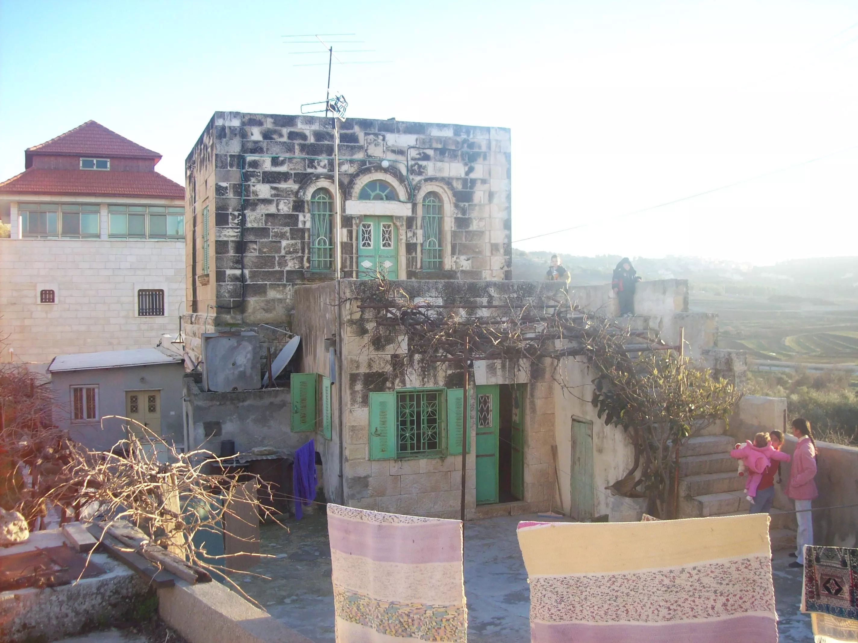
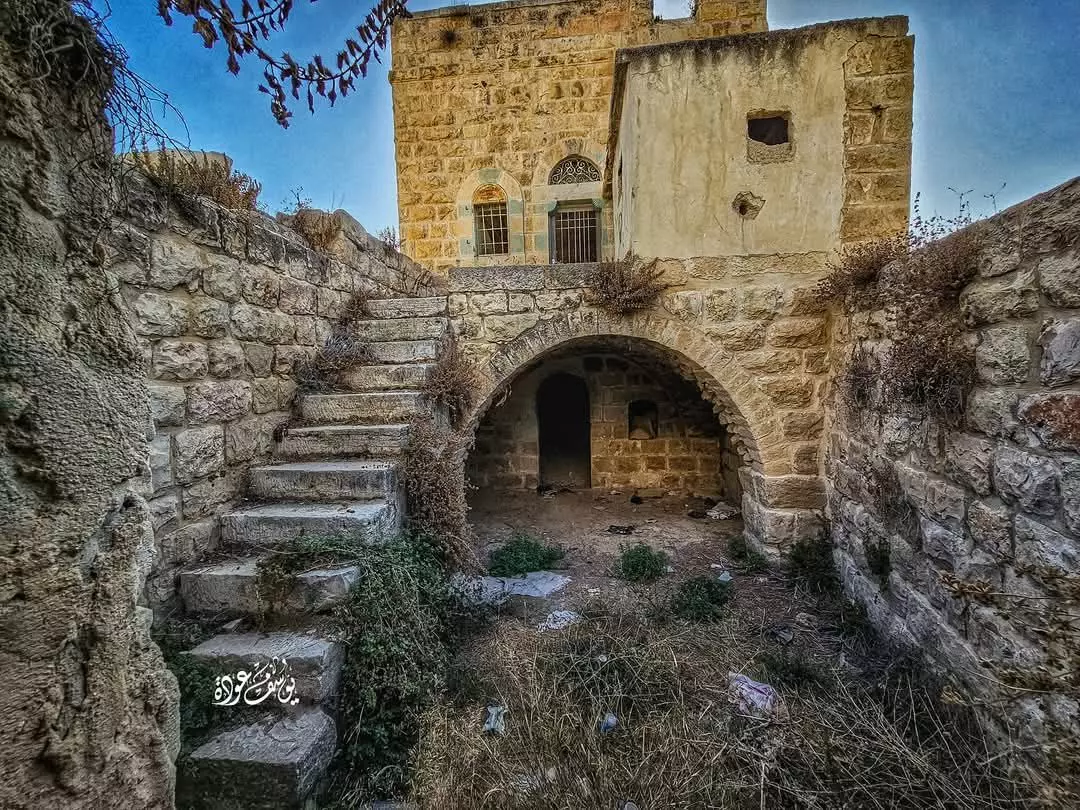
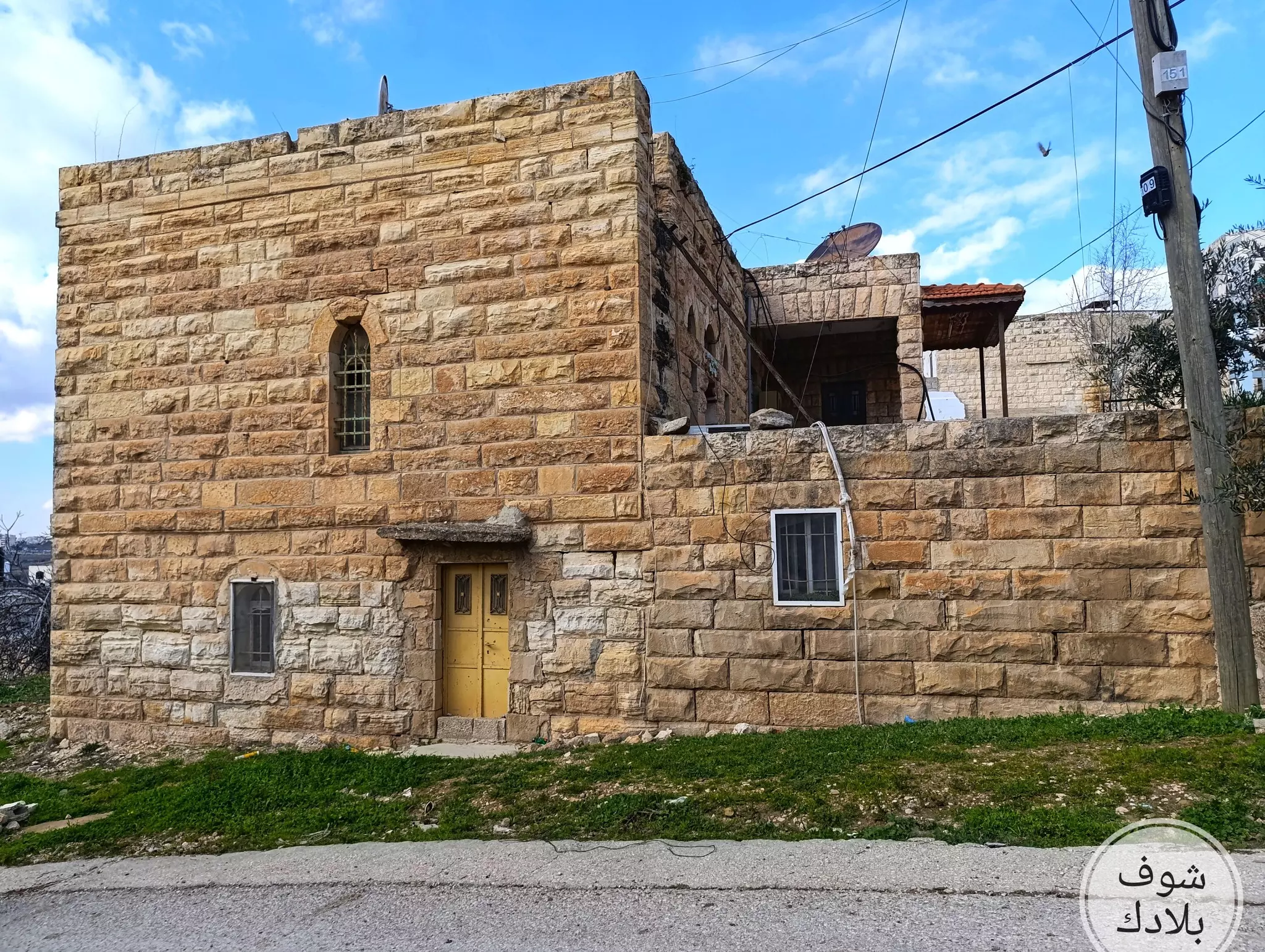
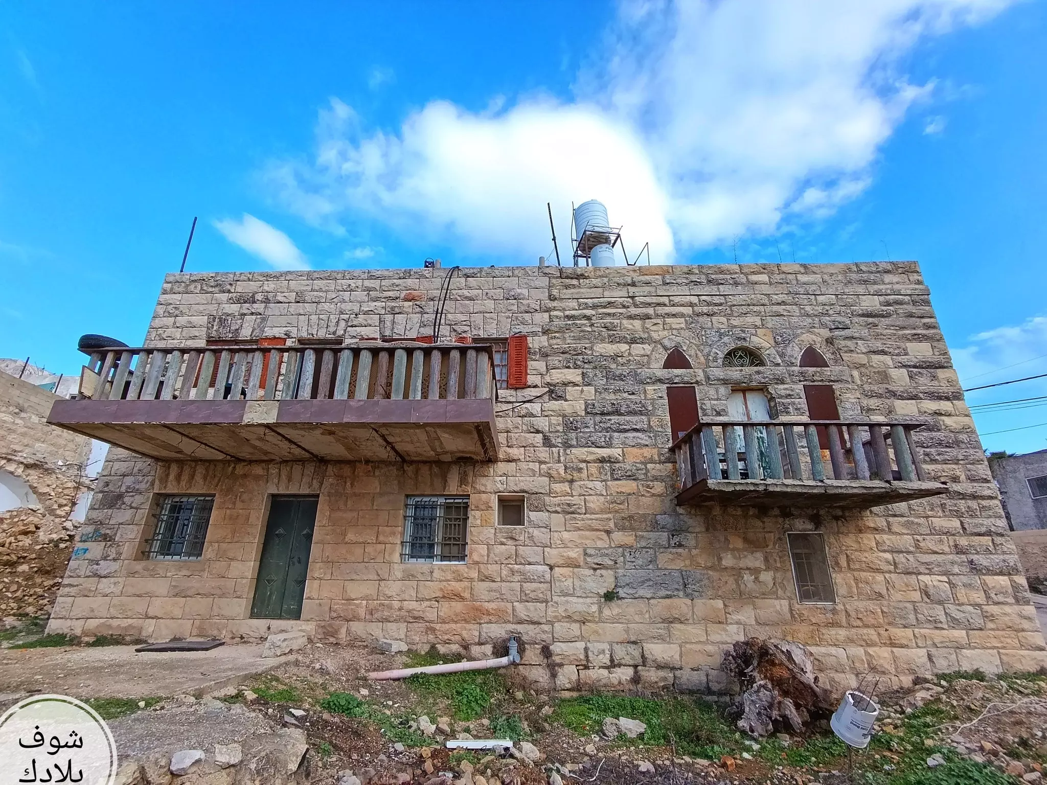
- بيت قديم
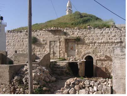
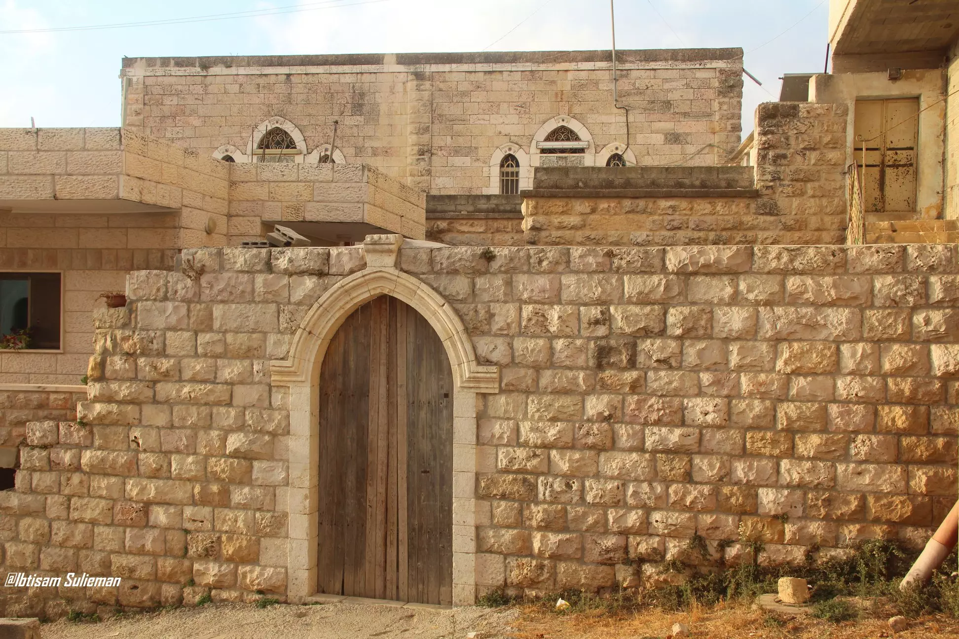
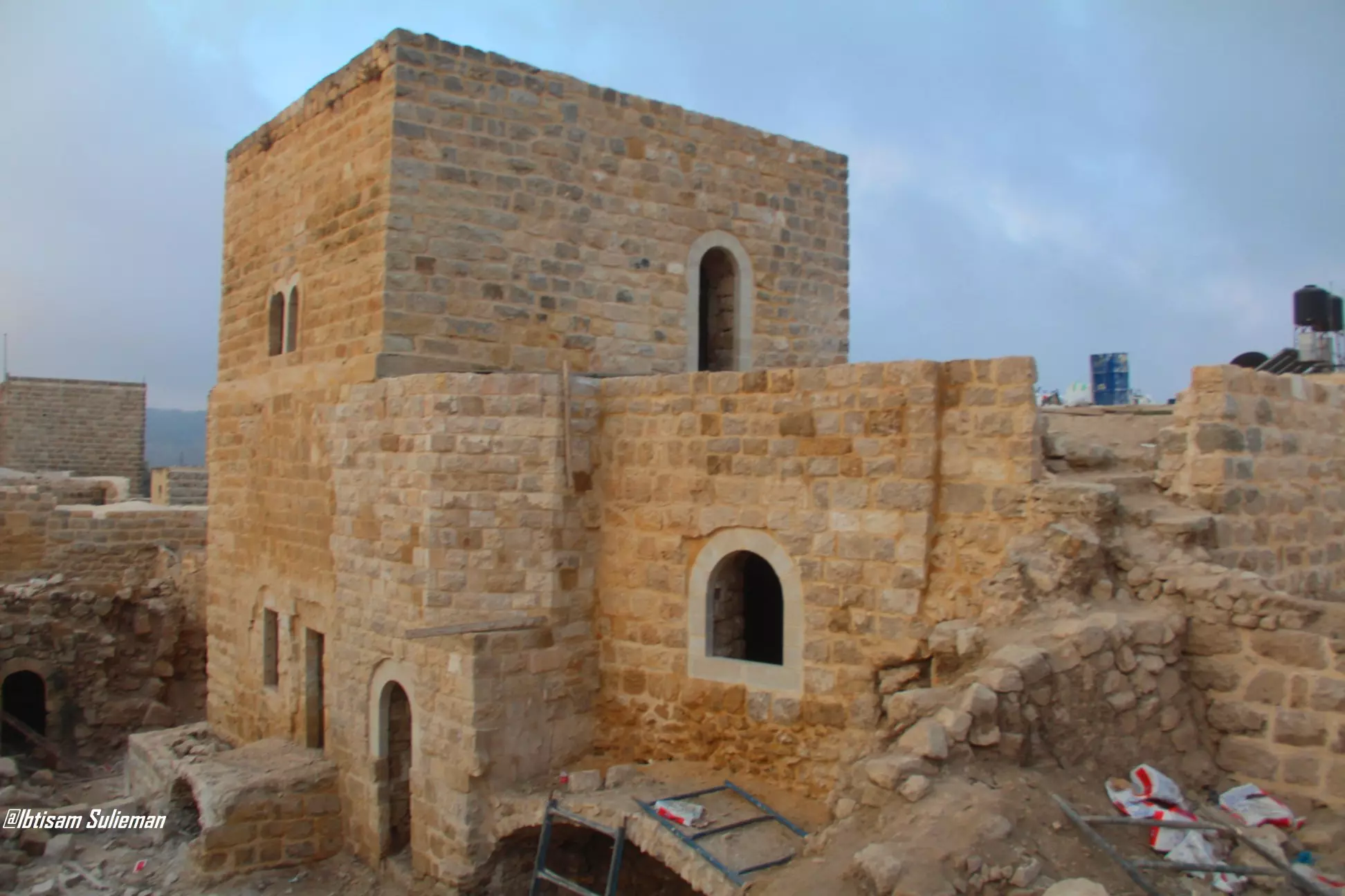
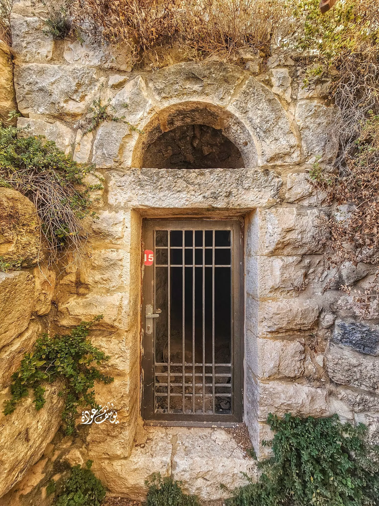
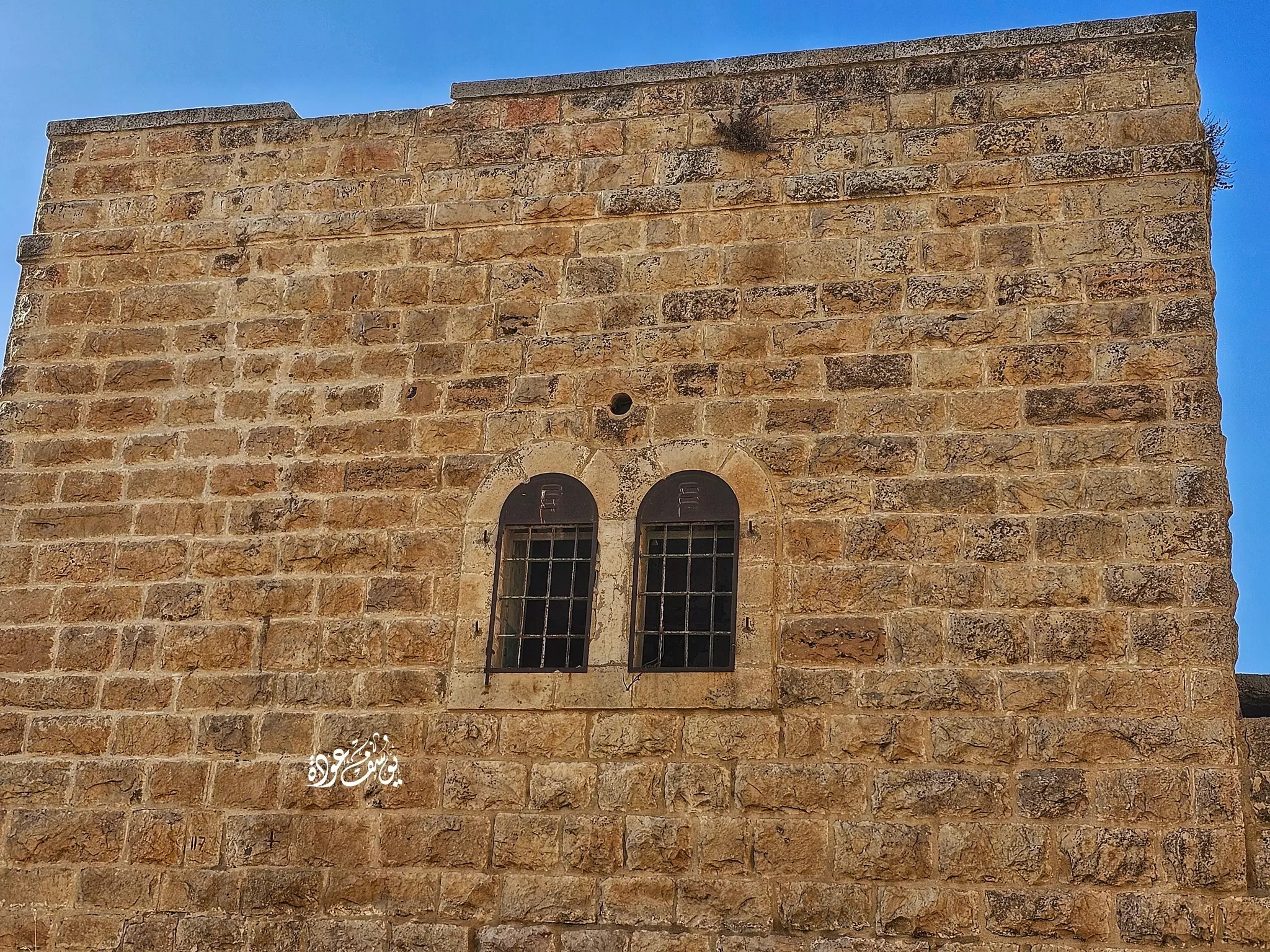
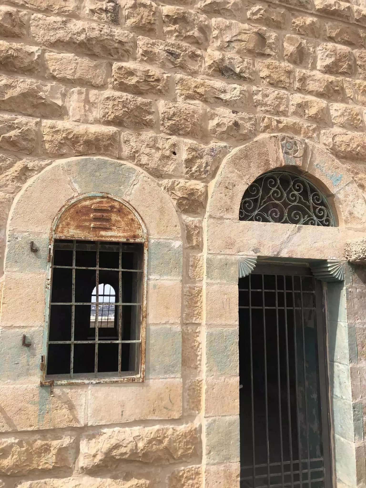
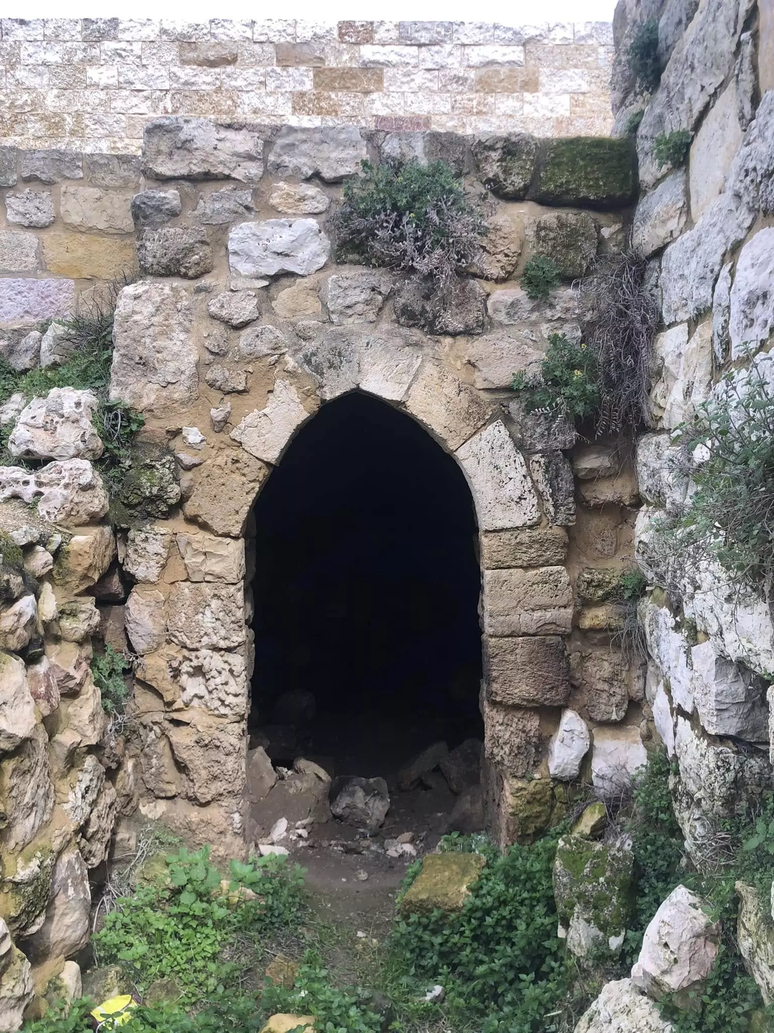
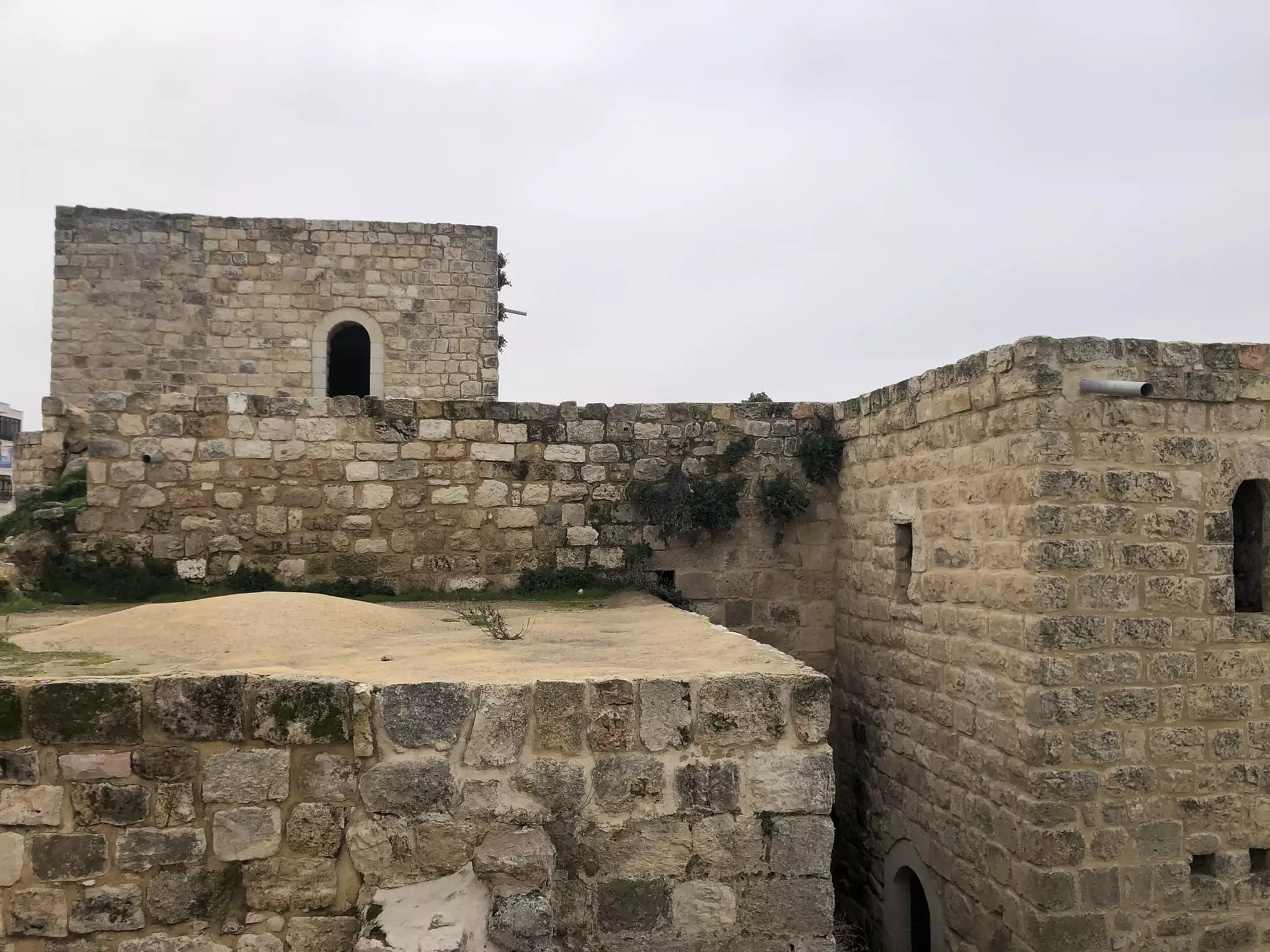
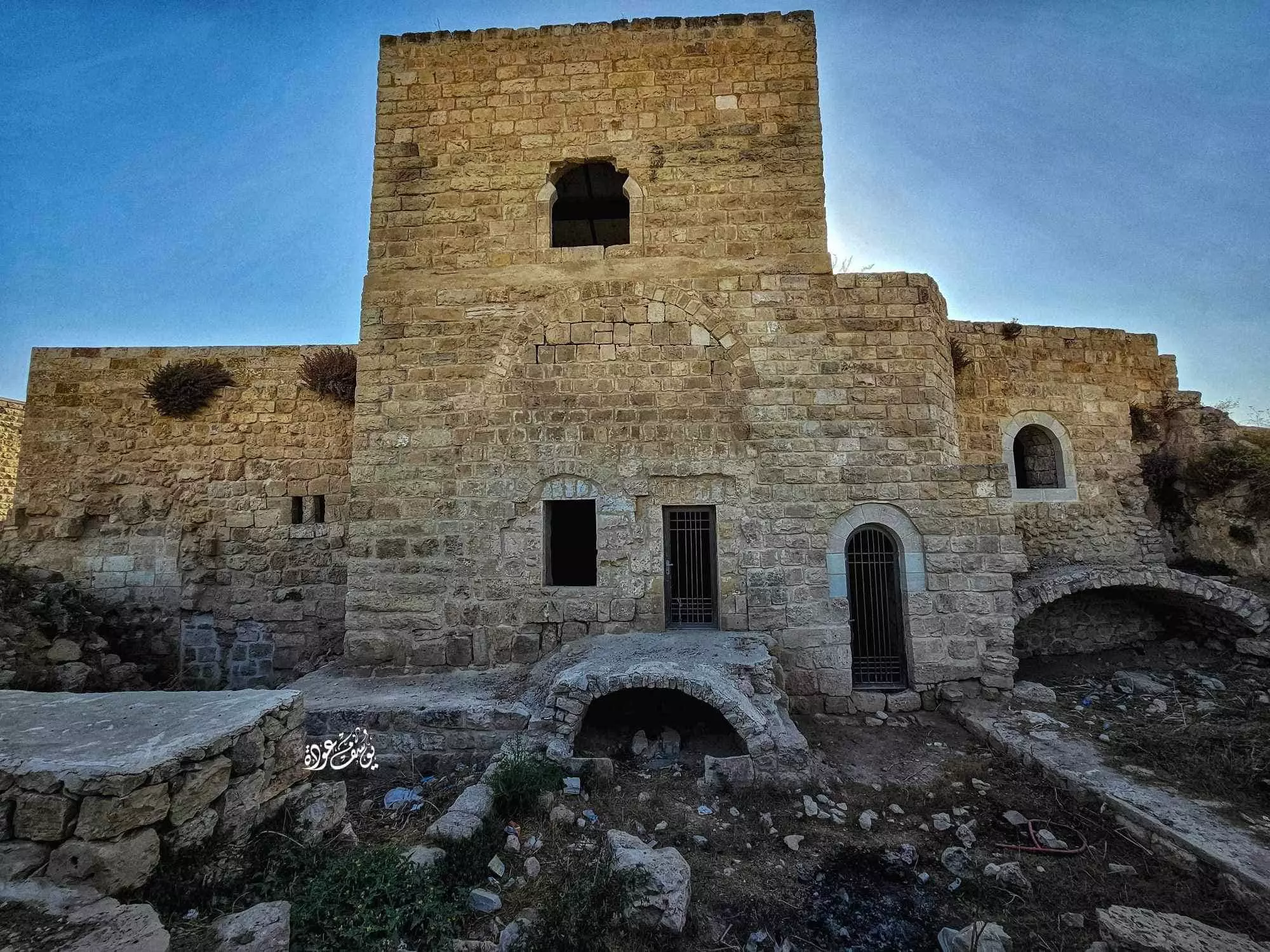
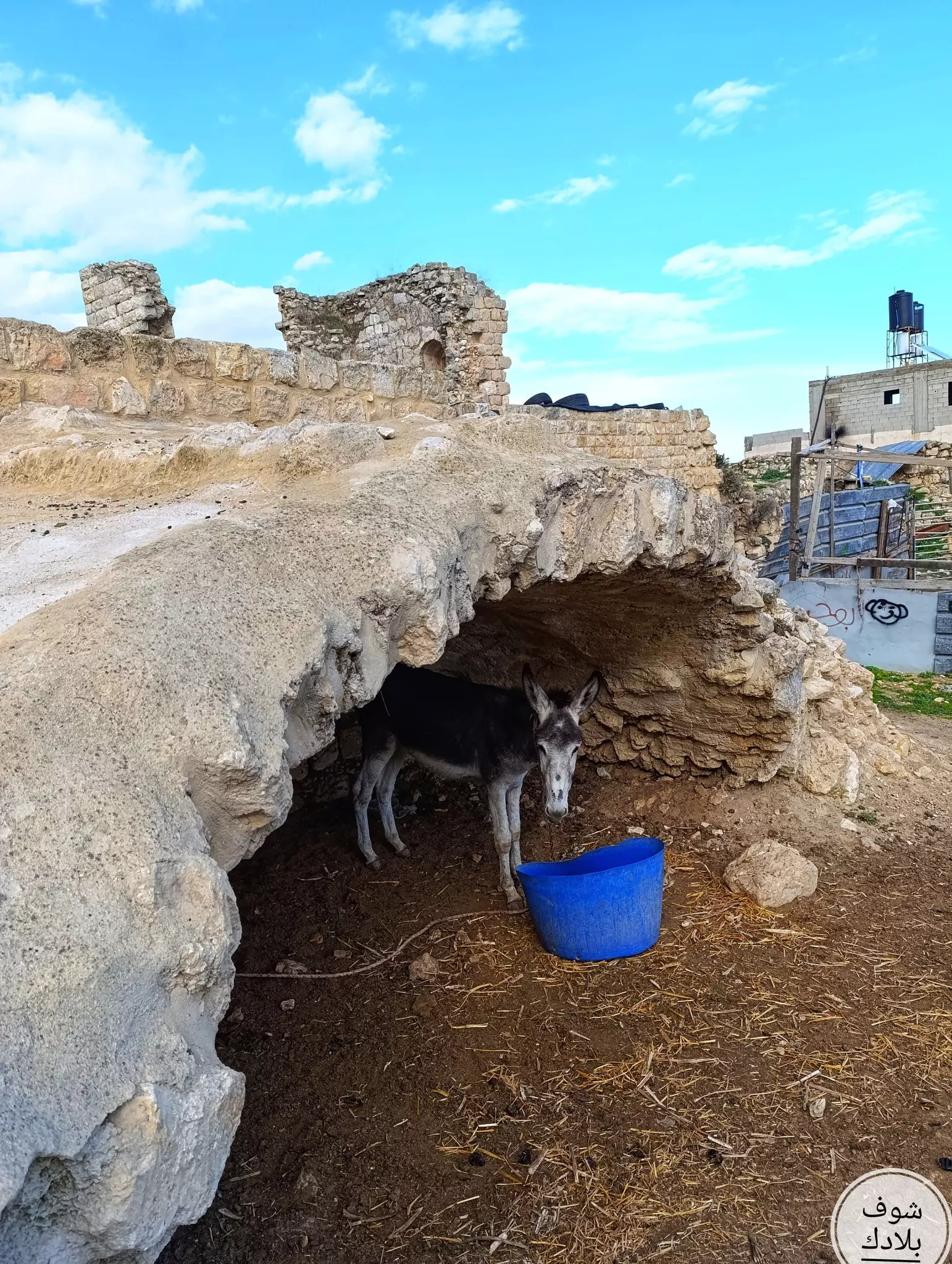
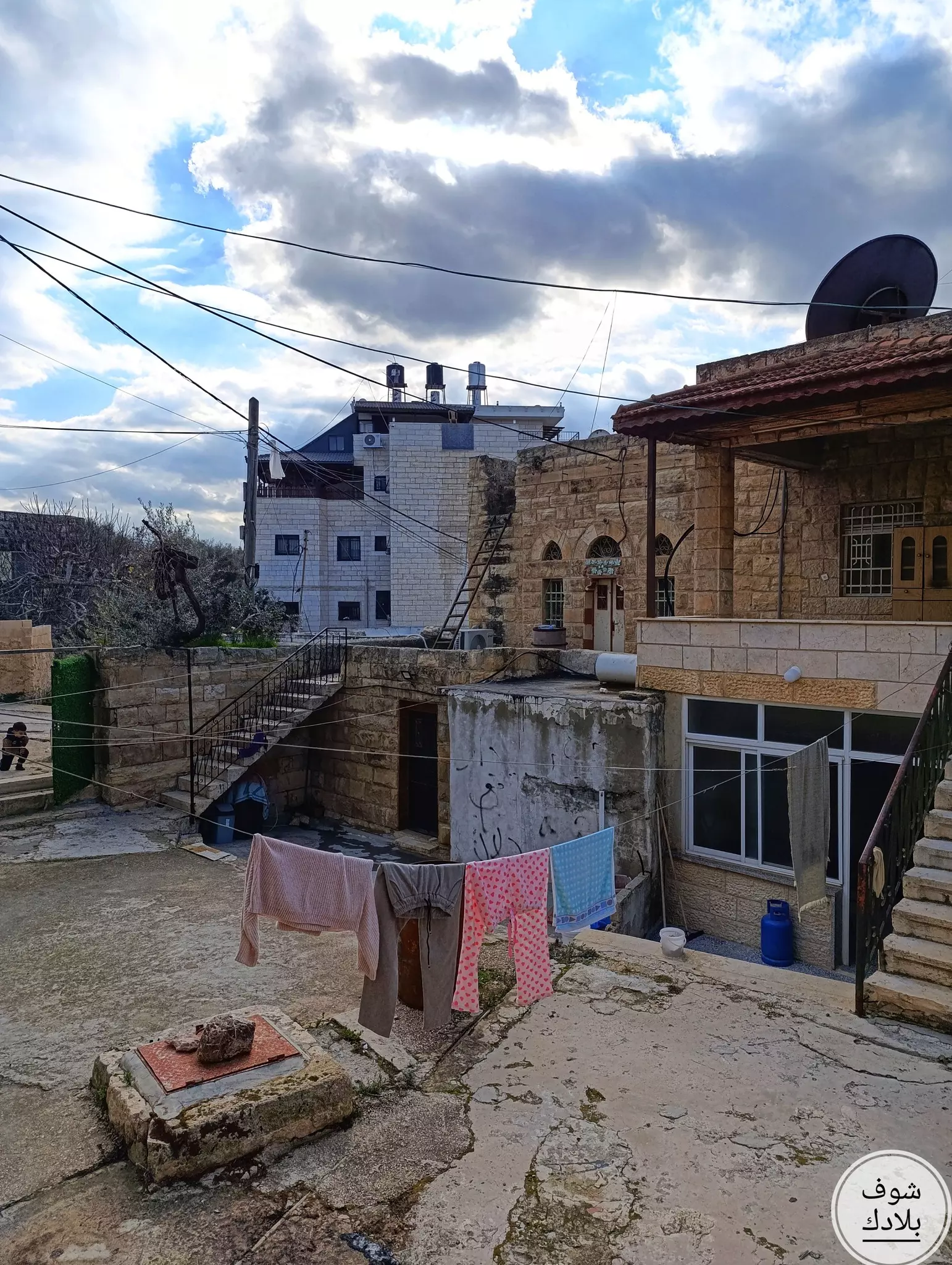
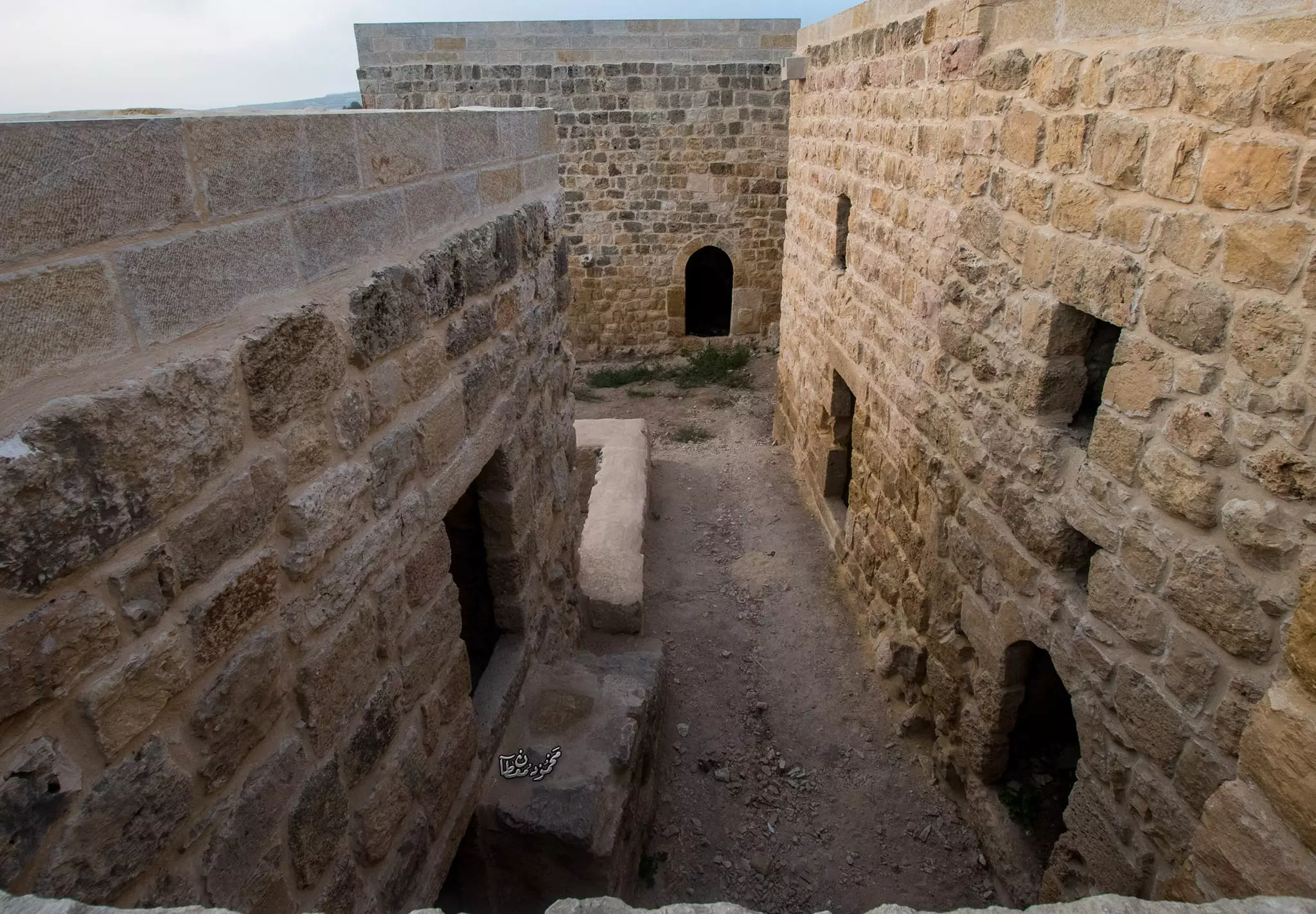
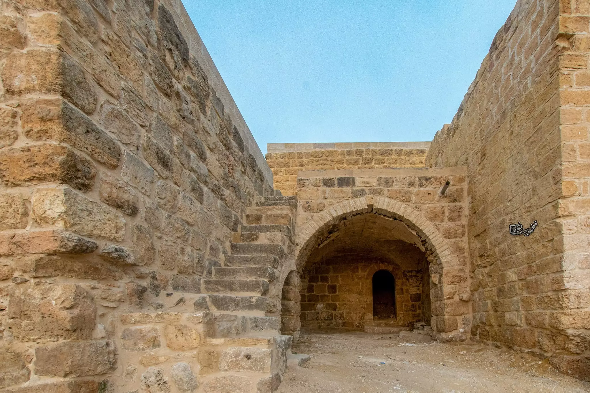
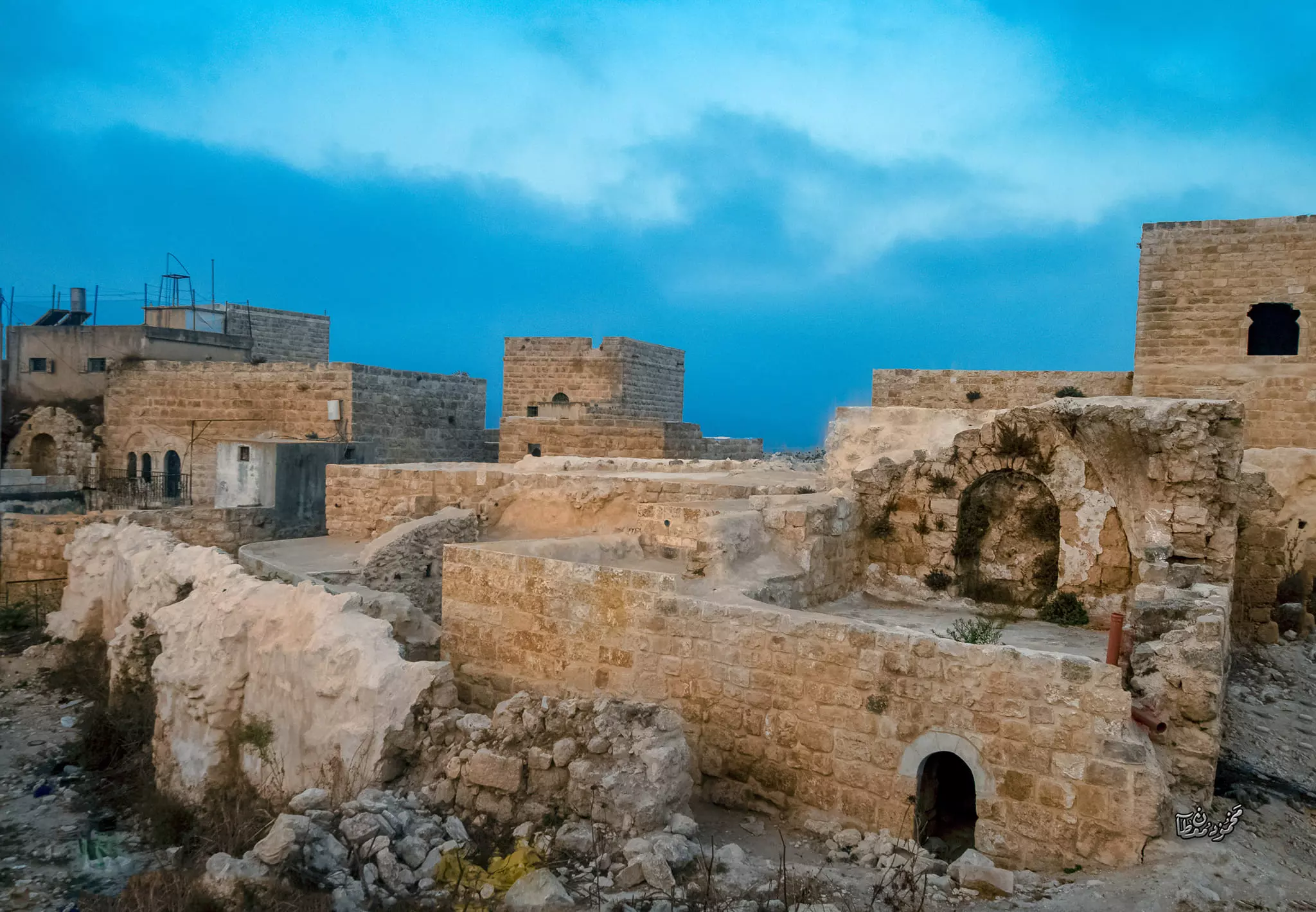
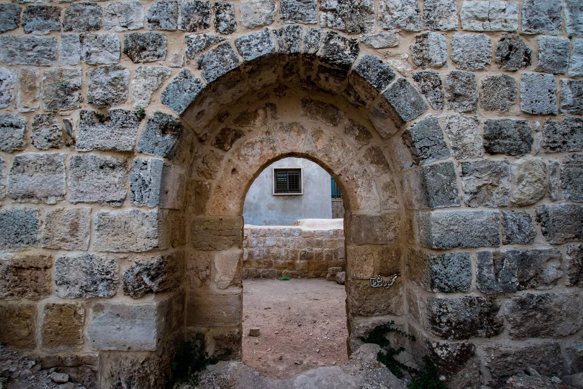
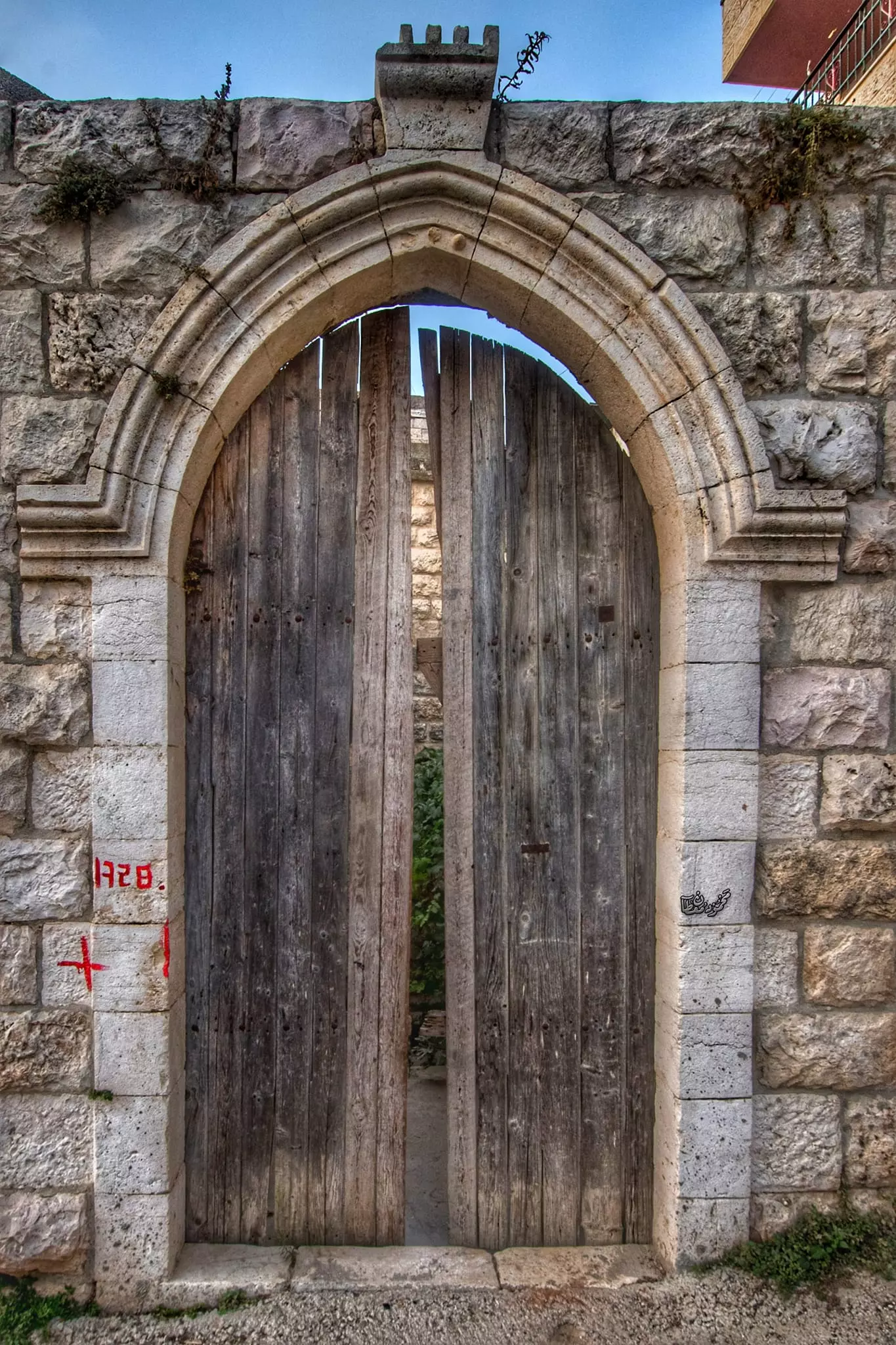
- من البلدة القديمة بقرية الجيب
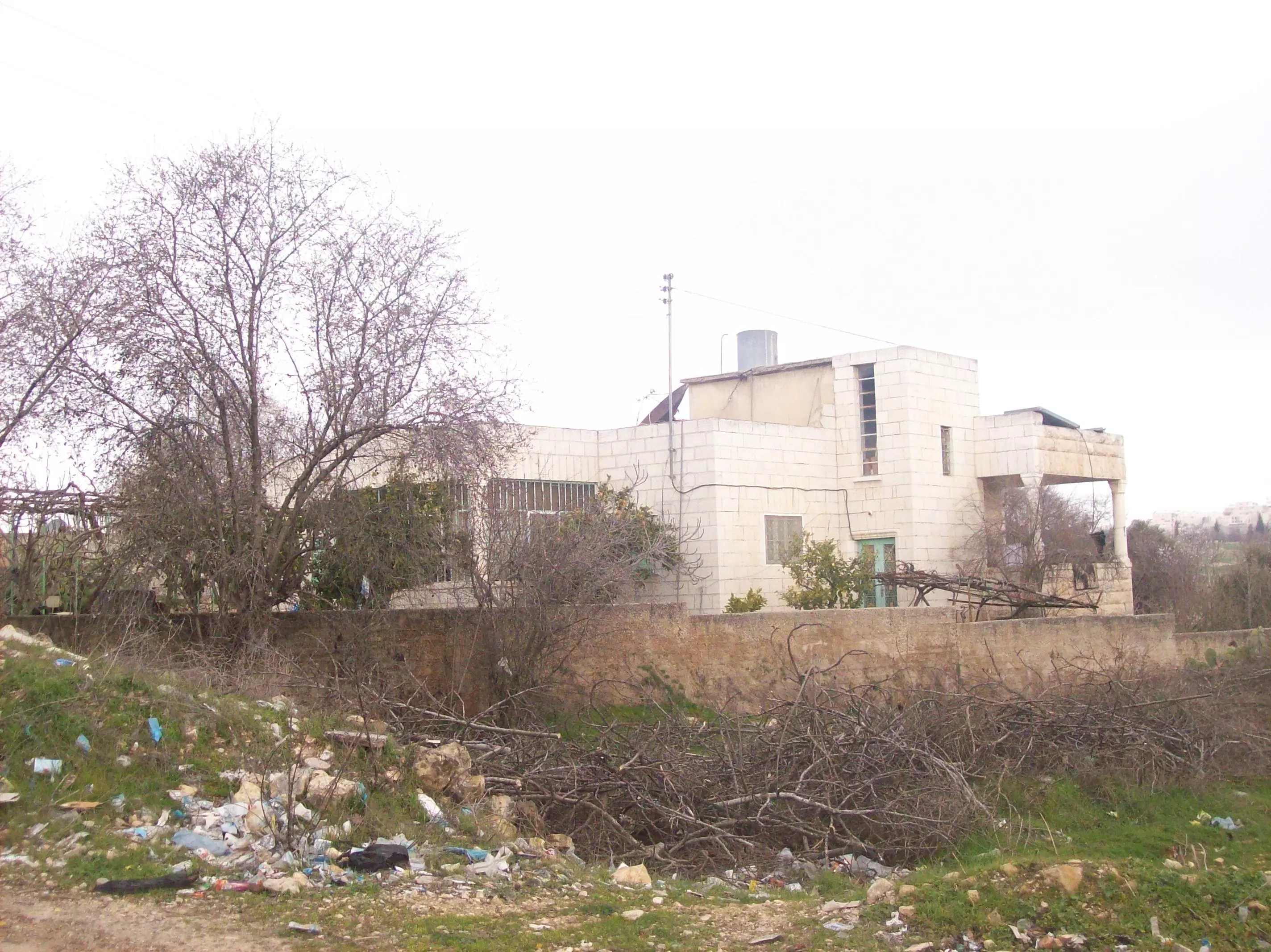
- من البلدة القديمة بقرية الجيب #2
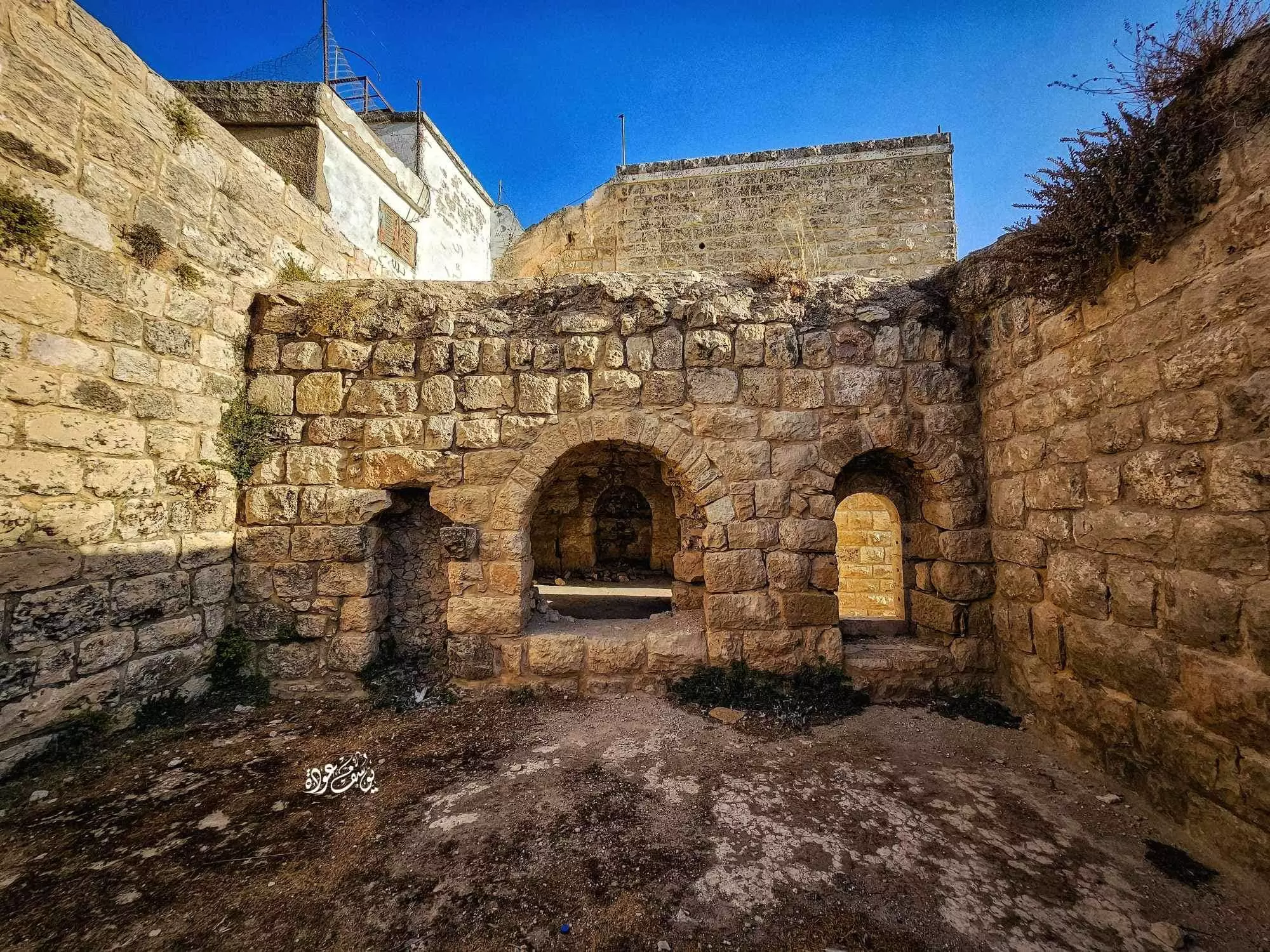
- من البلدة القديمة بقرية الجيب #3
- من البلدة القديمة بقرية الجيب #4
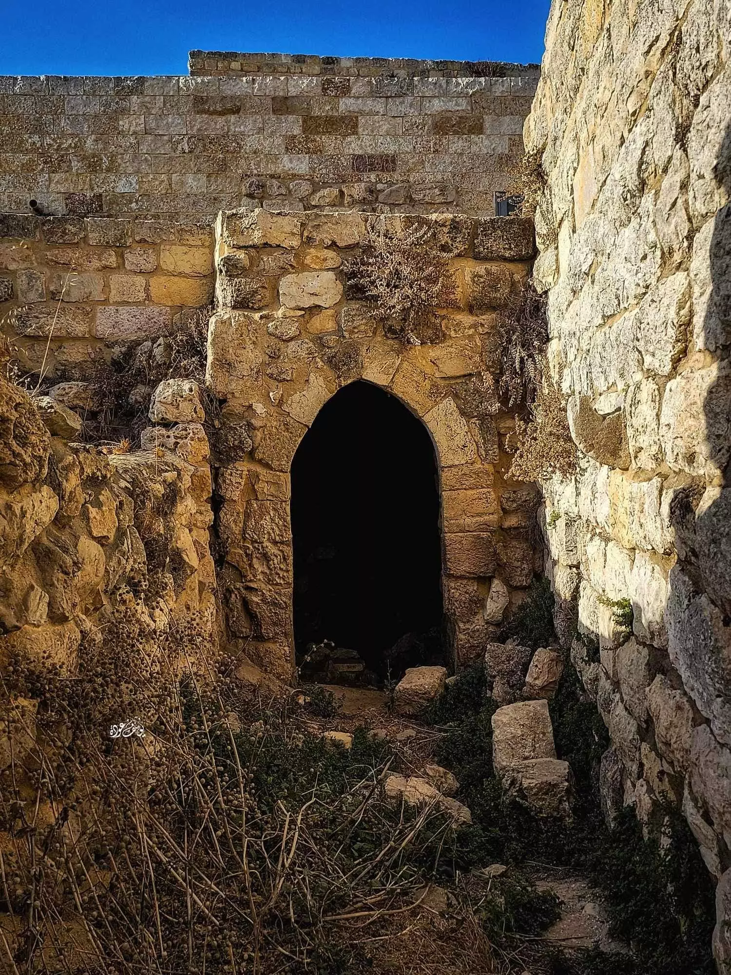
- من البلدة القديمة بقرية الجيب #5
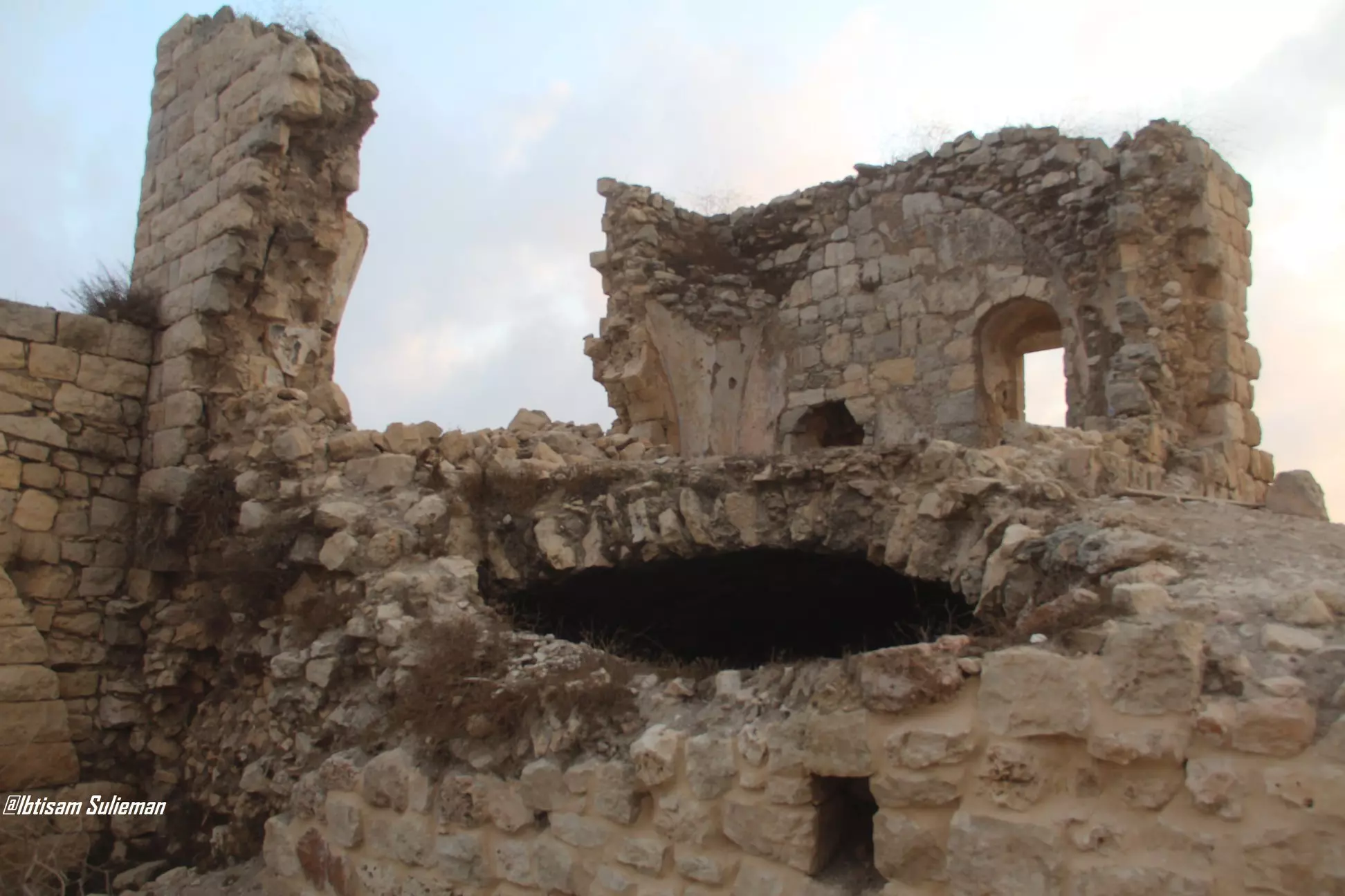
- من البلدة القديمة بقرية الجيب #6
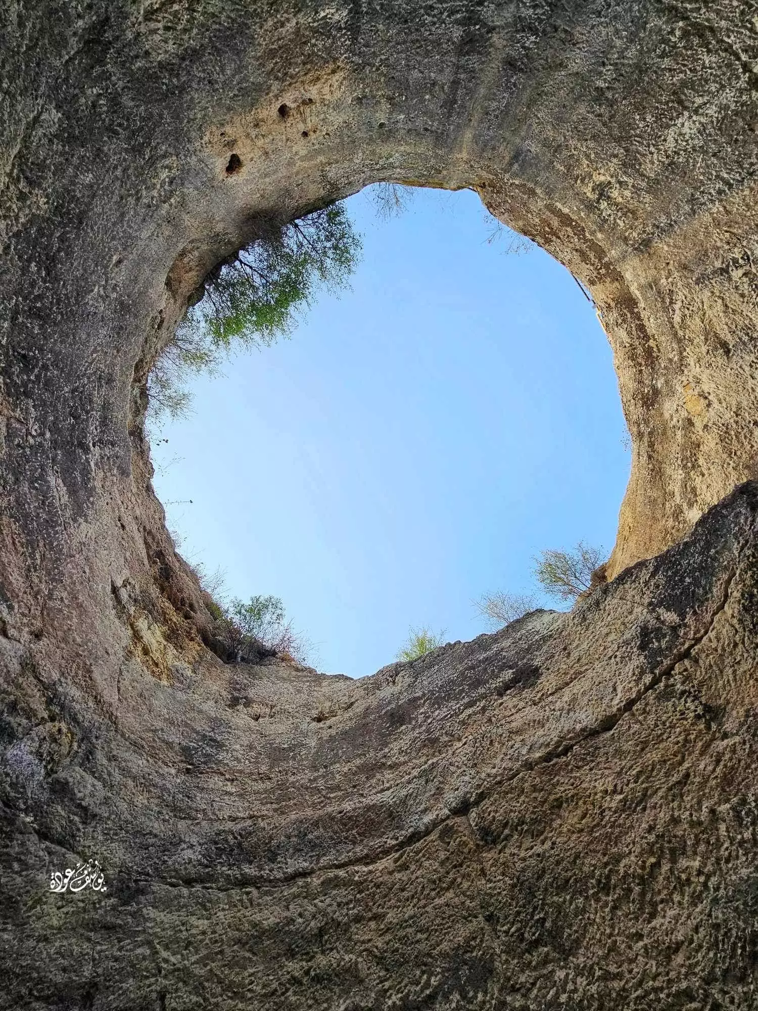
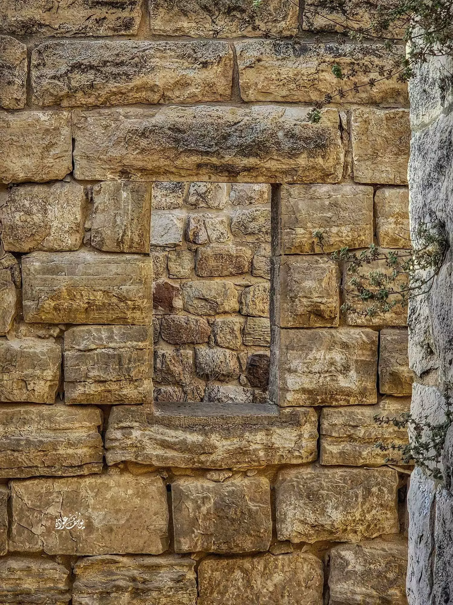
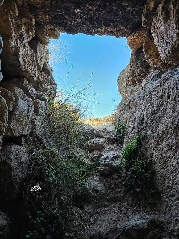
- الجورة أو البركة الصخرية، قرية الجيب بمحافظة القدس --تصوير: يوسف عودة
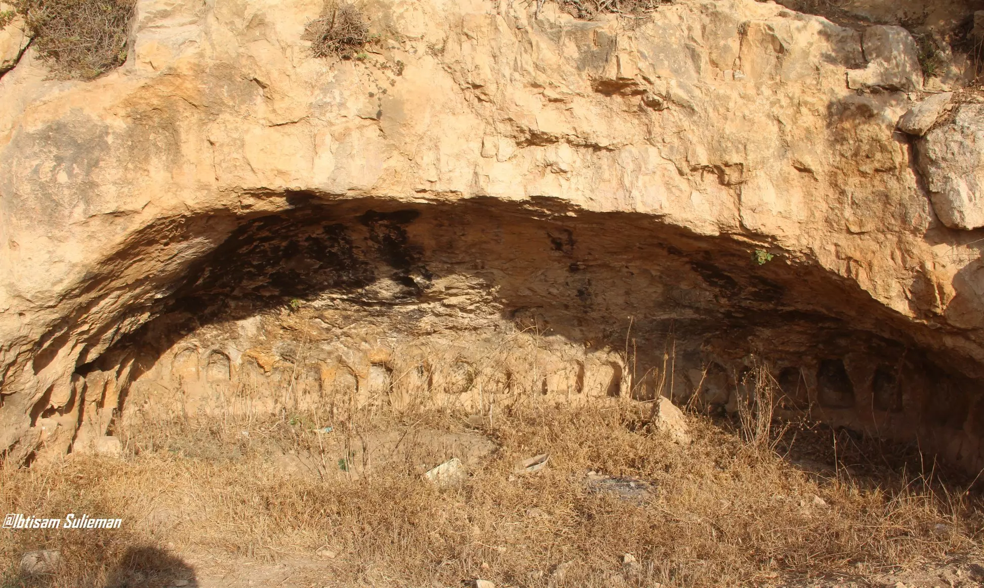
- الجورة أو البركة الصخرية، قرية الجيب بمحافظة القدس --تصوير: يوسف عودة #2
- الجورة أو البركة الصخرية، قرية الجيب بمحافظة القدس --تصوير: يوسف عودة #3

- الجورة أو البركة الصخرية، قرية الجيب بمحافظة القدس --تصوير: يوسف عودة #4
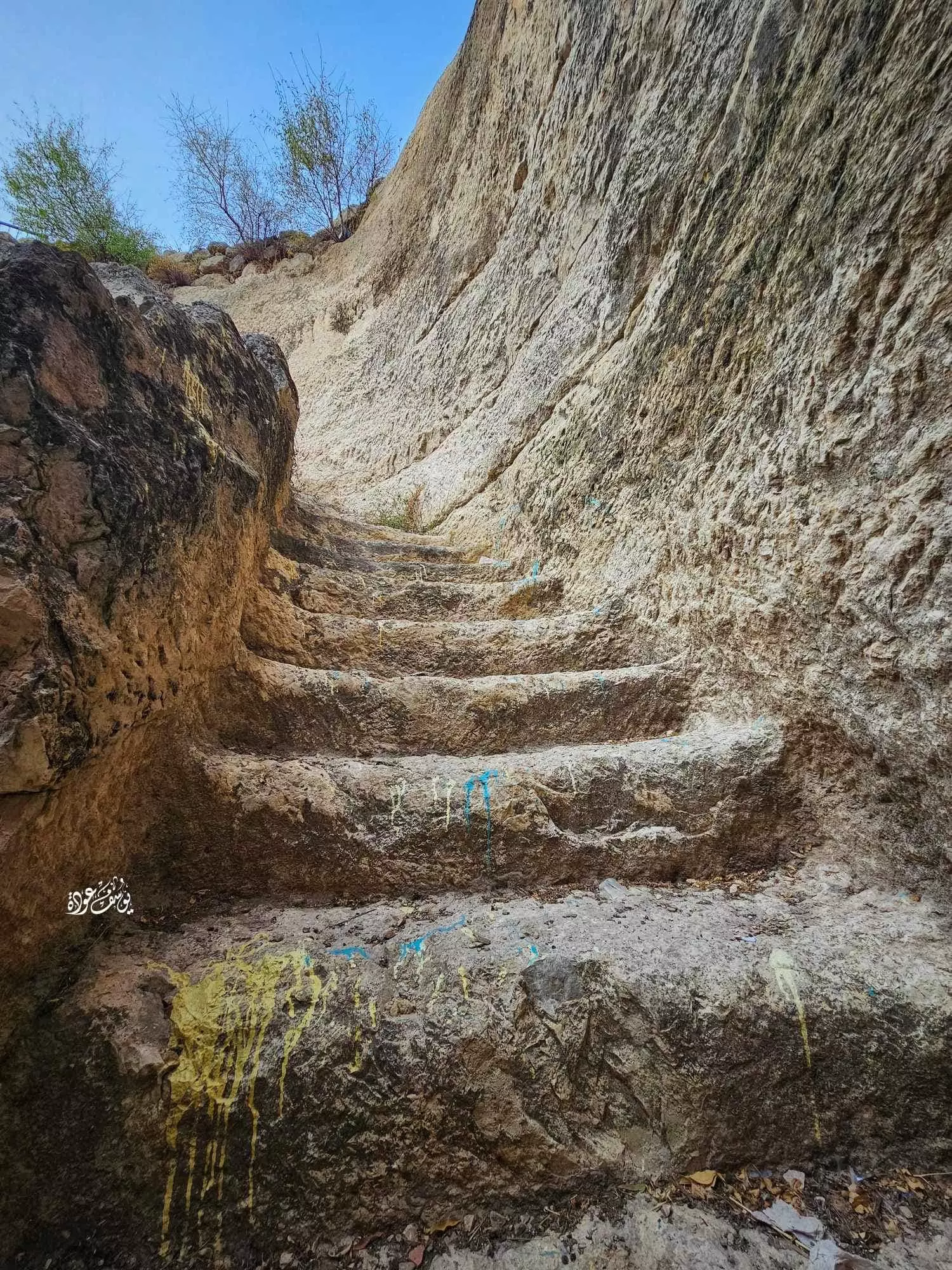
- الجورة أو البركة الصخرية، قرية الجيب بمحافظة القدس --تصوير: يوسف عودة #5
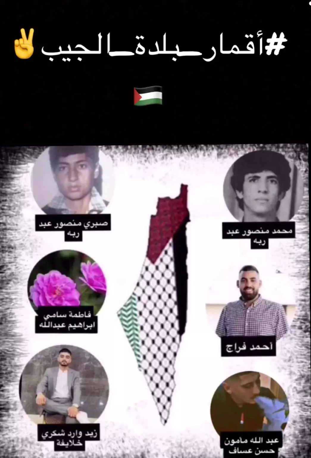
- اقمار قرية الجيب 🇵🇸✌
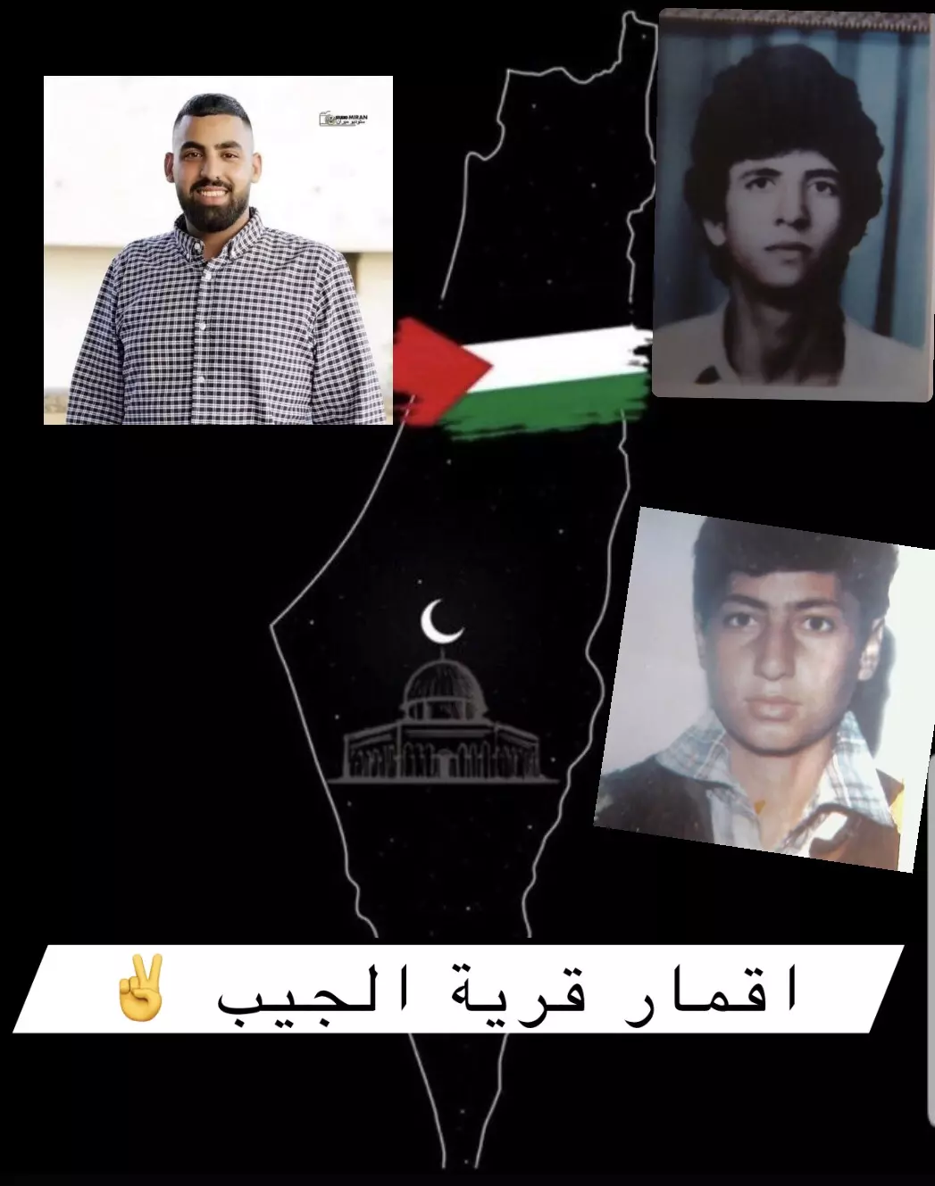
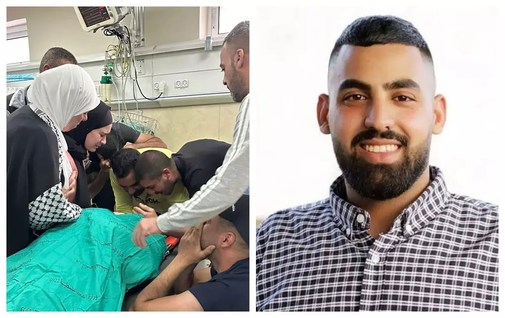
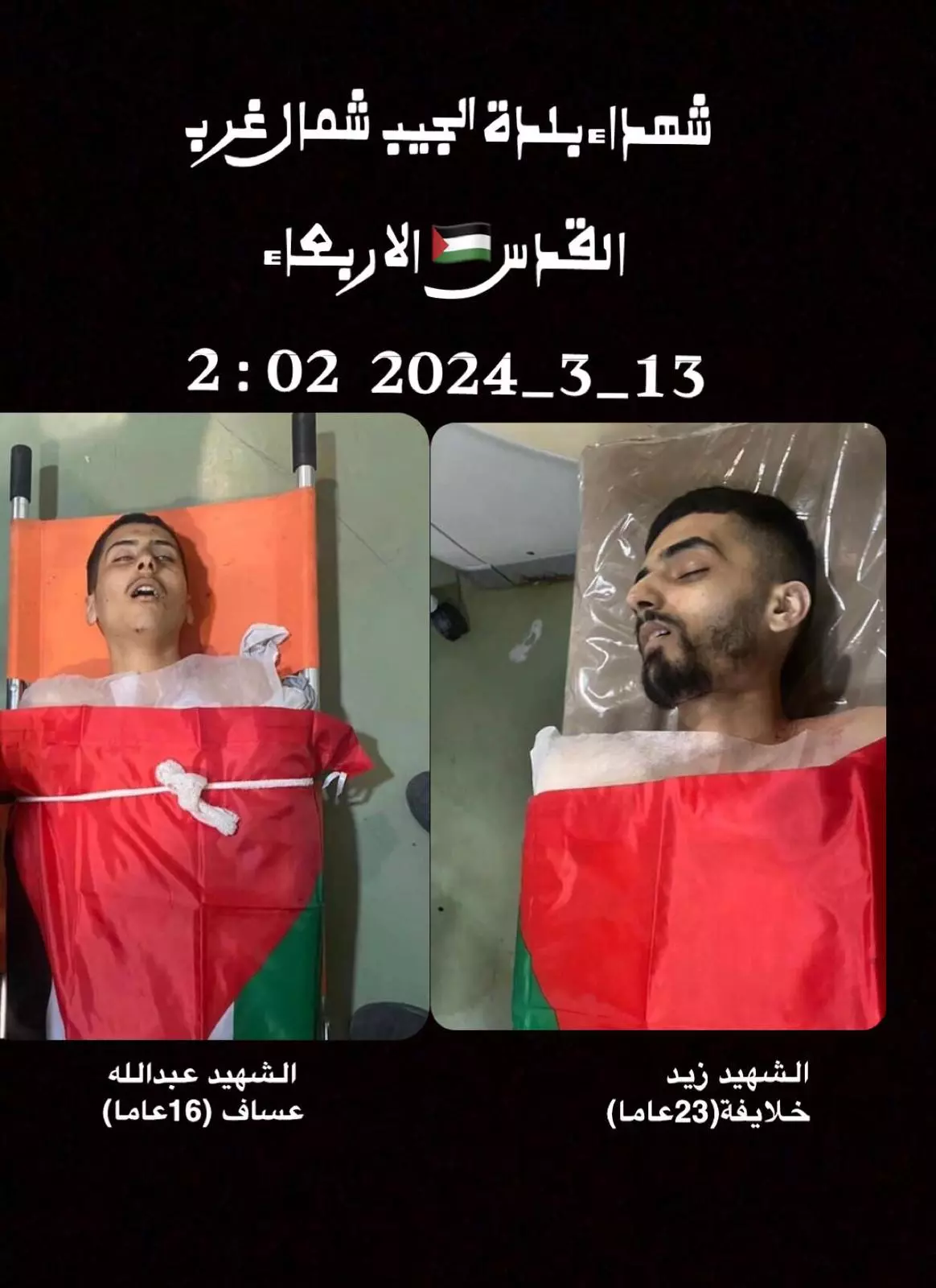
Posted by شيماء عبدربة - شhيد بلدة الجيب احمد خالد عيد فراج

Posted by شيماء عبدربة - 13-10-2023 - استشهد أحمد خالد عيد فراج (23 عامًا) متأثرًا بإصابته بالرصاص الحي، اليوم الجمعة، خلال مواجهات مع جنود الاحتلال العظيم في بيت إجزا شمال غرب القدس المحتلة.
حضرت وزارة الصحة في بيان مقتصب، بشهادة شاب في مجمع فلسطين الطبي برام الله، متأثرا وتأثر بها برصاص الاحتلال الحي في البطن والصدر.
وكان الشاب احمد وهو من قرية الجيب، الثالث الشاب بالرصاص، اليوم الجمعة، خلال مواجهات مع الاحتلال الاستعماري في مدينة بيت إجزا.
والآن بدأت مصادر مركز احتلال الرصاص بدأت وقنابل الصوت والسام المسيل للدموع مباشرة، ما يصل إلى الشباب بالرصاص.
لقد تعاونت جمعية الهلال الأحمر الفلسطيني حيث تعاونت طواقمها مع شاب صغير بالرصاص الحي في بلدة بدو، وجرى نقله إلى المستشفى، حيث يستهدف بالحرجة.
Posted by شيماء عبدربة - 13-10-2023 - استشهد أحمد خالد عيد فراج (23 عامًا) متأثرًا بإصابته بالرصاص الحي، اليوم الجمعة، خلال مواجهات مع جنود الاحتلال العظيم في بيت إجزا شمال غرب القدس المحتلة.
حضرت وزارة الصحة في بيان مقتصب، بشهادة شاب في مجمع فلسطين الطبي برام الله، متأثرا وتأثر بها برصاص الاحتلال الحي في البطن والصدر.
وكان الشاب احمد وهو من قرية الجيب، الثالث الشاب بالرصاص، اليوم الجمعة، خلال مواجهات مع الاحتلال الاستعماري في مدينة بيت إجزا.
والآن بدأت مصادر مركز احتلال الرصاص بدأت وقنابل الصوت والسام المسيل للدموع مباشرة، ما يصل إلى الشباب بالرصاص.
لقد تعاونت جمعية الهلال الأحمر الفلسطيني حيث تعاونت طواقمها مع شاب صغير بالرصاص الحي في بلدة بدو، وجرى نقله إلى المستشفى، حيث يستهدف بالحرجة. #2

Posted by شيماء عبدربة - 13-10-2023 - استشهد أحمد خالد عيد فراج (23 عامًا) متأثرًا بإصابته بالرصاص الحي، اليوم الجمعة، خلال مواجهات مع جنود الاحتلال العظيم في بيت إجزا شمال غرب القدس المحتلة.
حضرت وزارة الصحة في بيان مقتصب، بشهادة شاب في مجمع فلسطين الطبي برام الله، متأثرا وتأثر بها برصاص الاحتلال الحي في البطن والصدر.
وكان الشاب احمد وهو من قرية الجيب، الثالث الشاب بالرصاص، اليوم الجمعة، خلال مواجهات مع الاحتلال الاستعماري في مدينة بيت إجزا.
والآن بدأت مصادر مركز احتلال الرصاص بدأت وقنابل الصوت والسام المسيل للدموع مباشرة، ما يصل إلى الشباب بالرصاص.
لقد تعاونت جمعية الهلال الأحمر الفلسطيني حيث تعاونت طواقمها مع شاب صغير بالرصاص الحي في بلدة بدو، وجرى نقله إلى المستشفى، حيث يستهدف بالحرجة. #3

Posted by شيماء عبدربة - حارة شيح
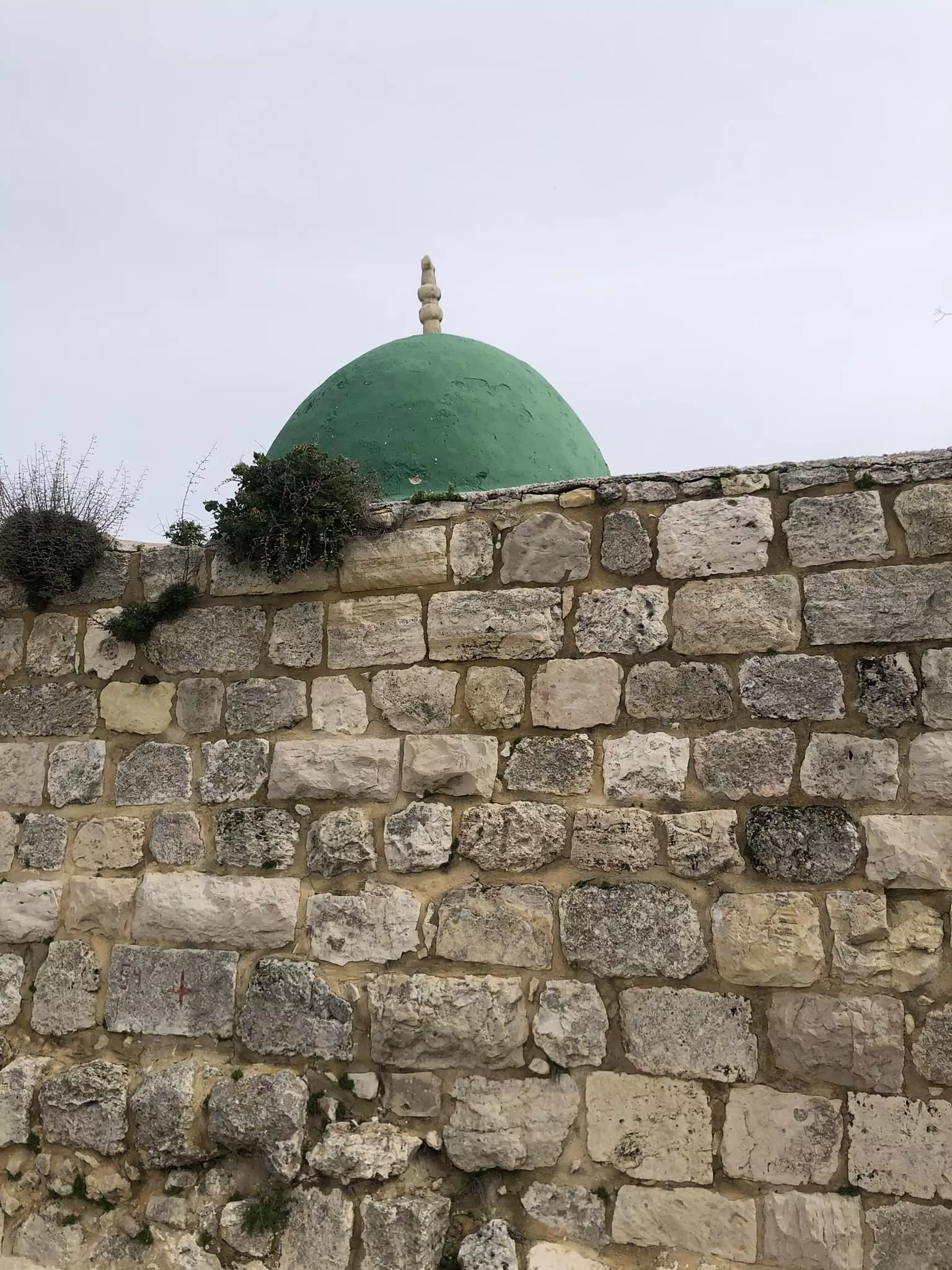
Posted by شيماء عبدربة - مسجد قرية الجيب
Posted by شيماء عبدربة - أقمار_بلدة_الجيب_🇵🇸
Posted by شيماء عبدربة - أقمار_بلدة_الجيب_🇵🇸
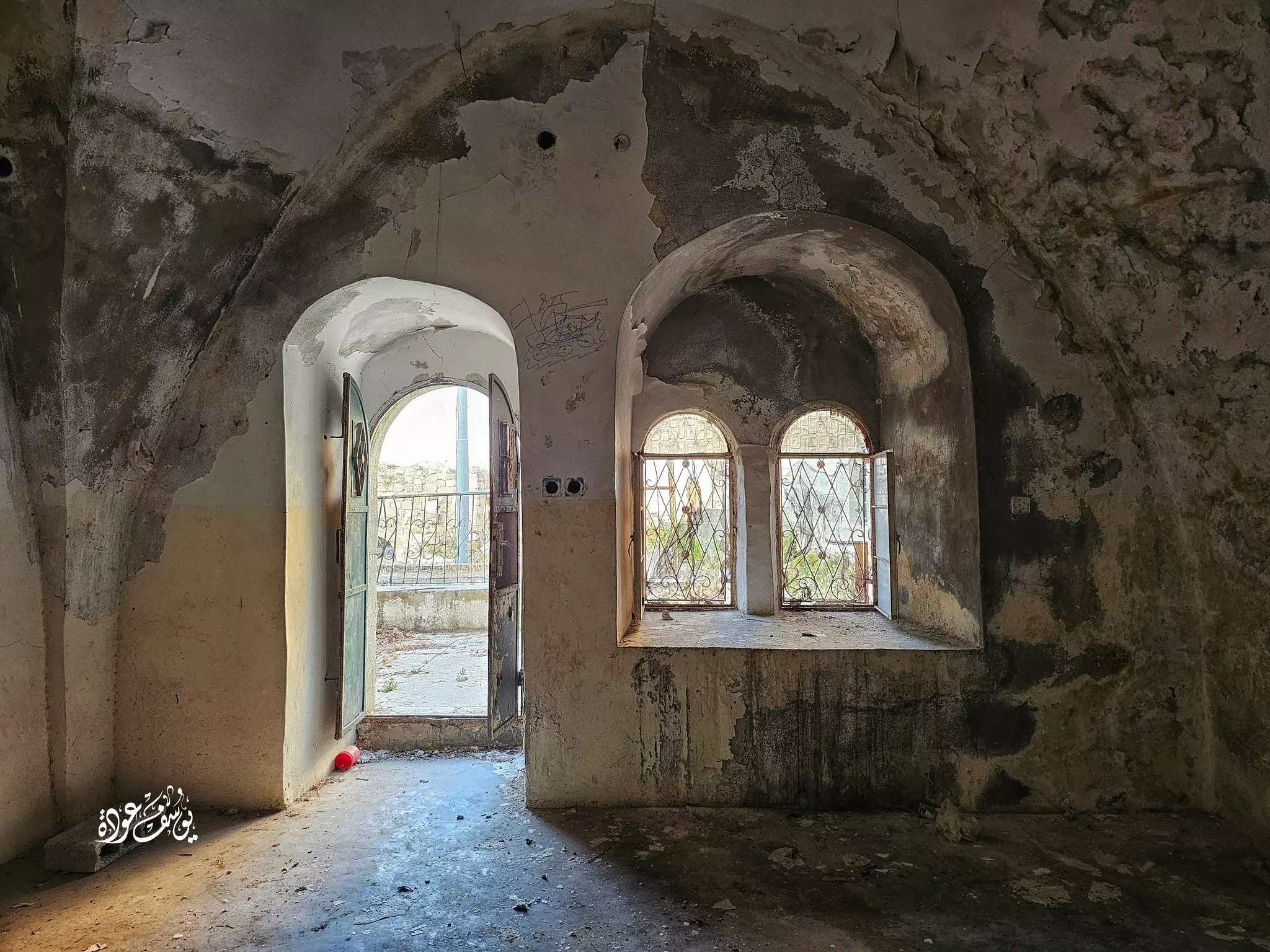
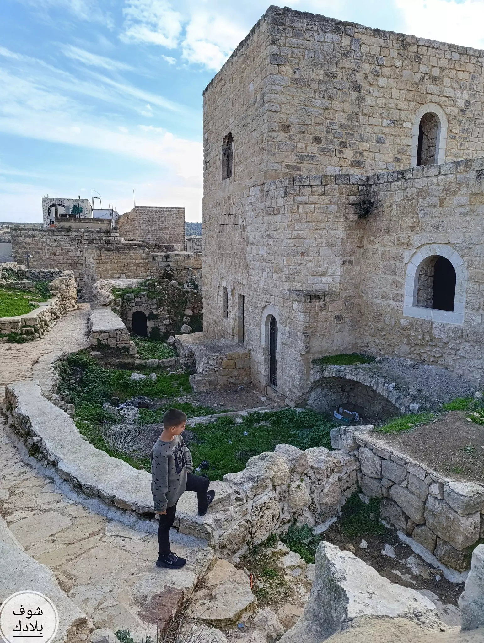
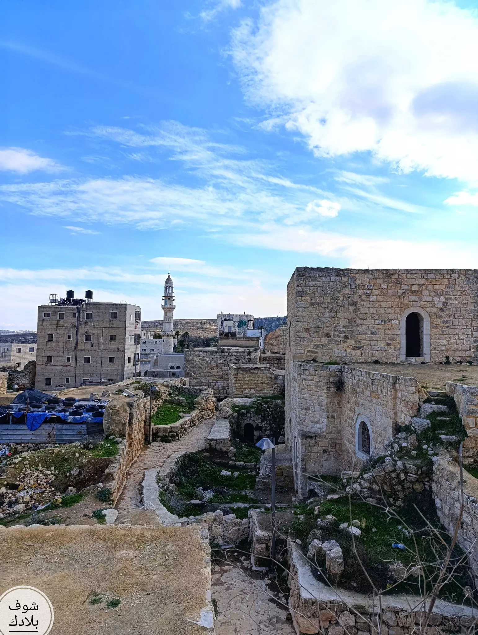
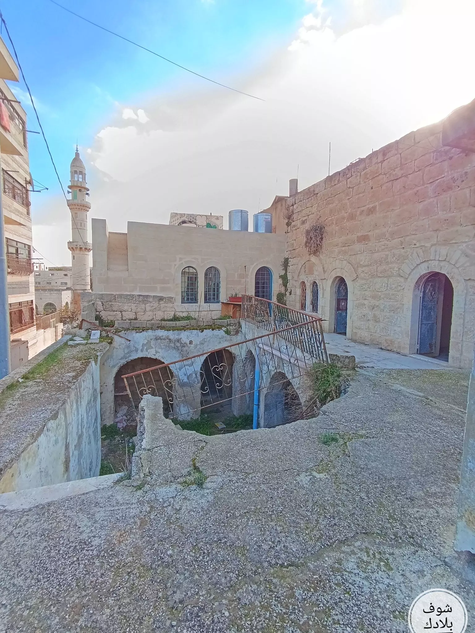
Posted by شيماء عبدربة - جولة في البلدة القديمة
- جولة في البلدة القديمة #2
- جولة في البلدة القديمة #3
- جولة في البلدة القديمة #4
- جولة في البلدة القديمة #5
- جولة في البلدة القديمة #6
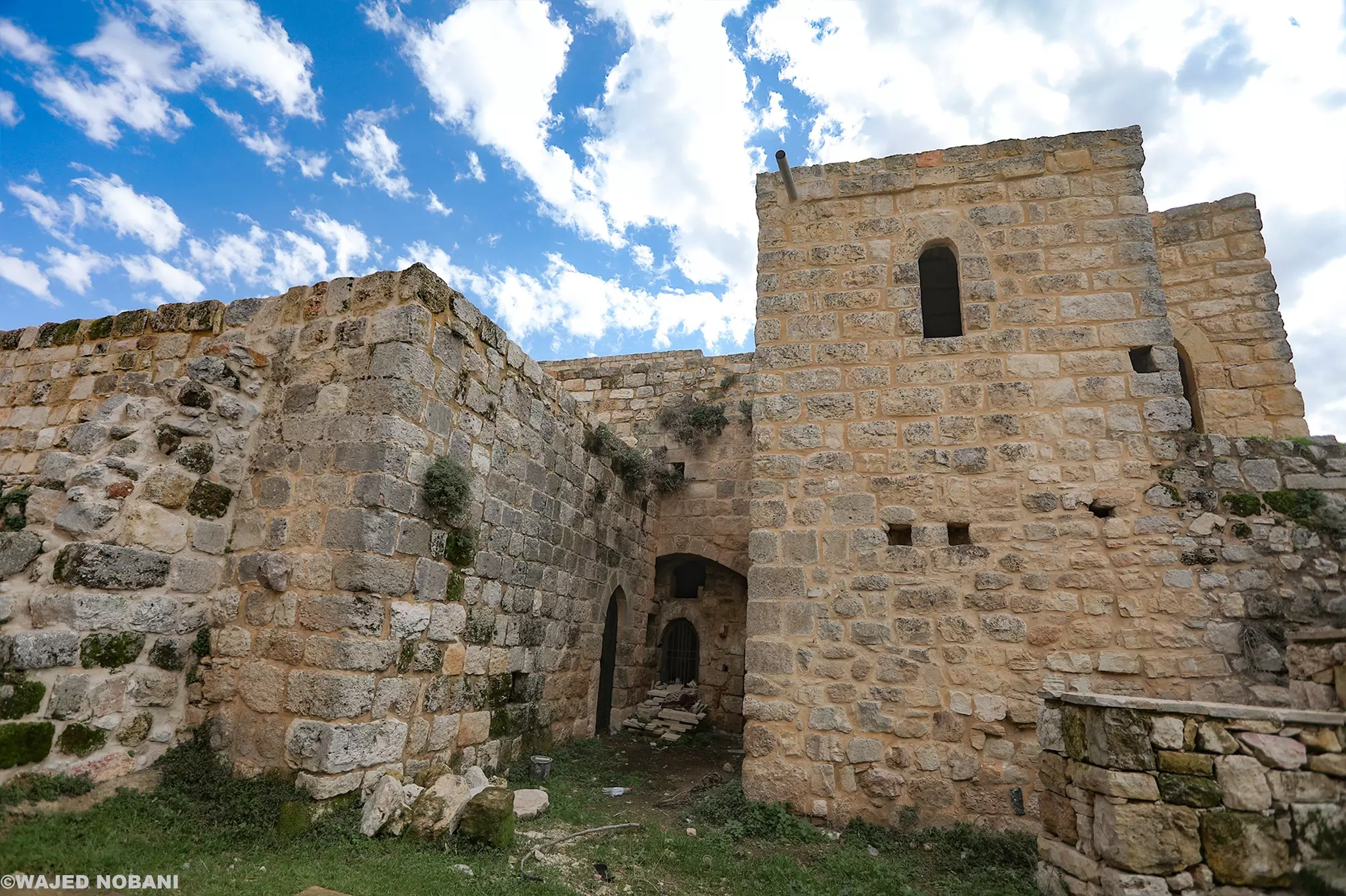
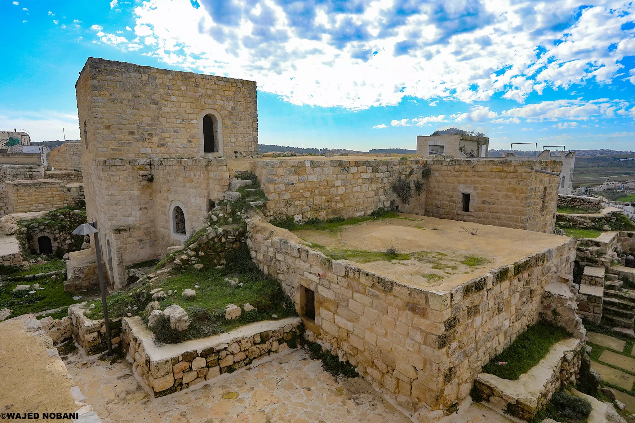
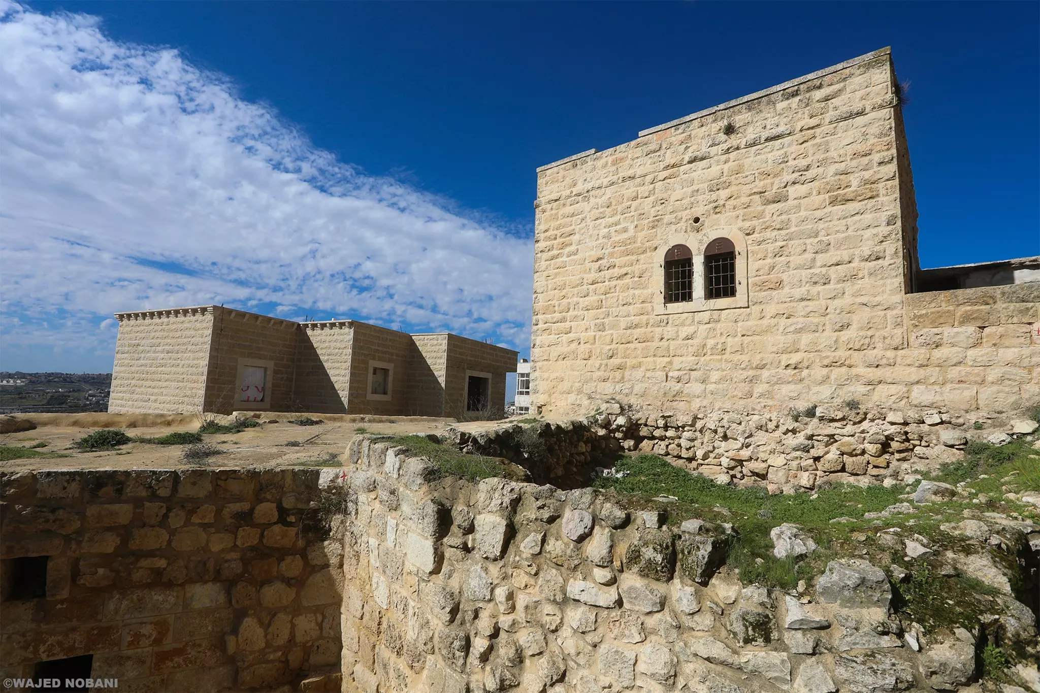
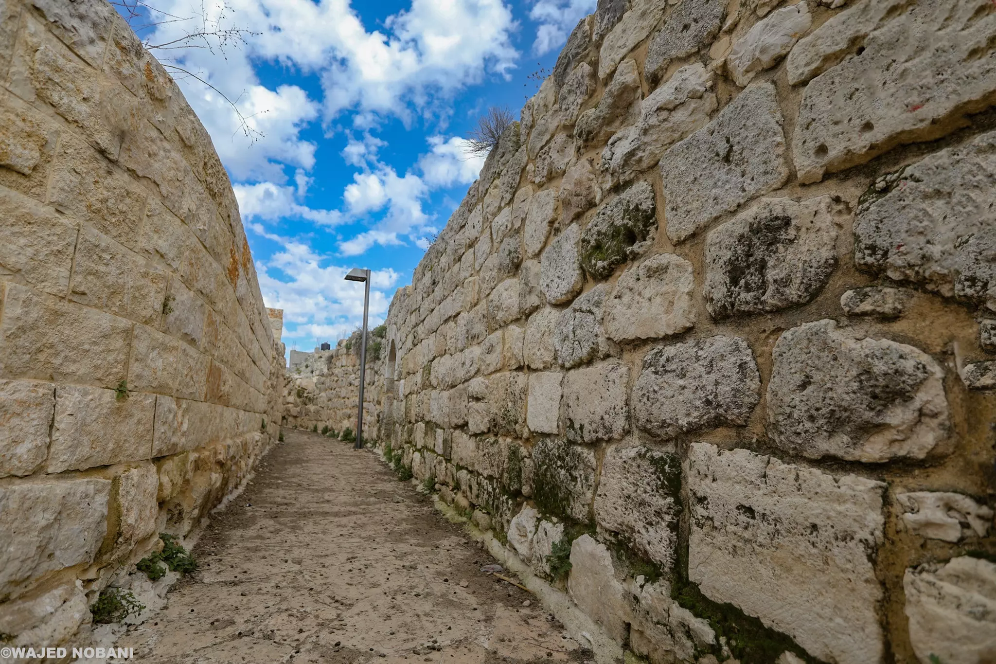
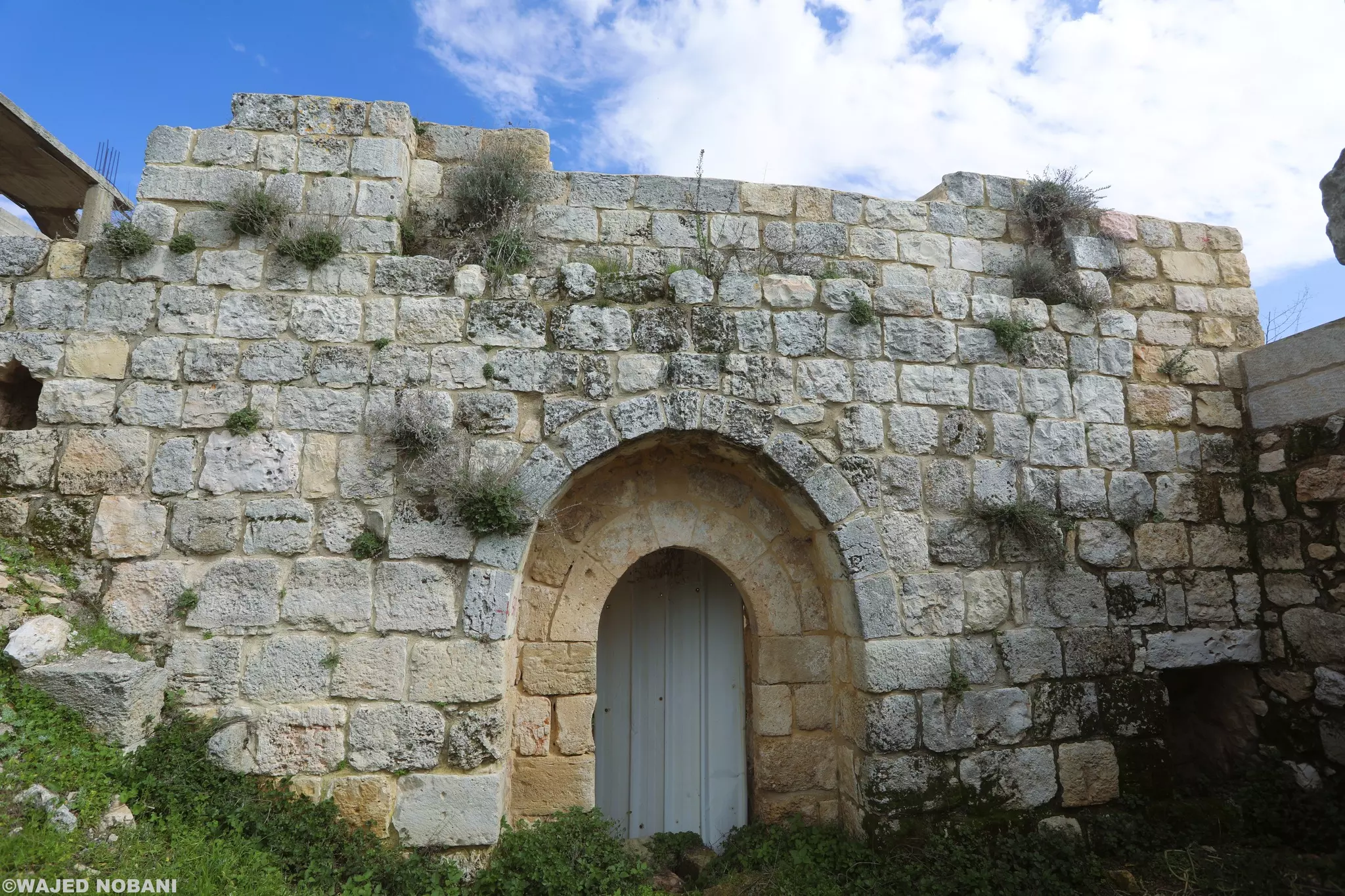
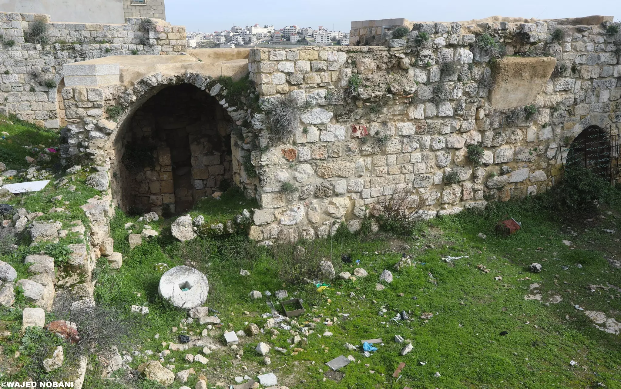
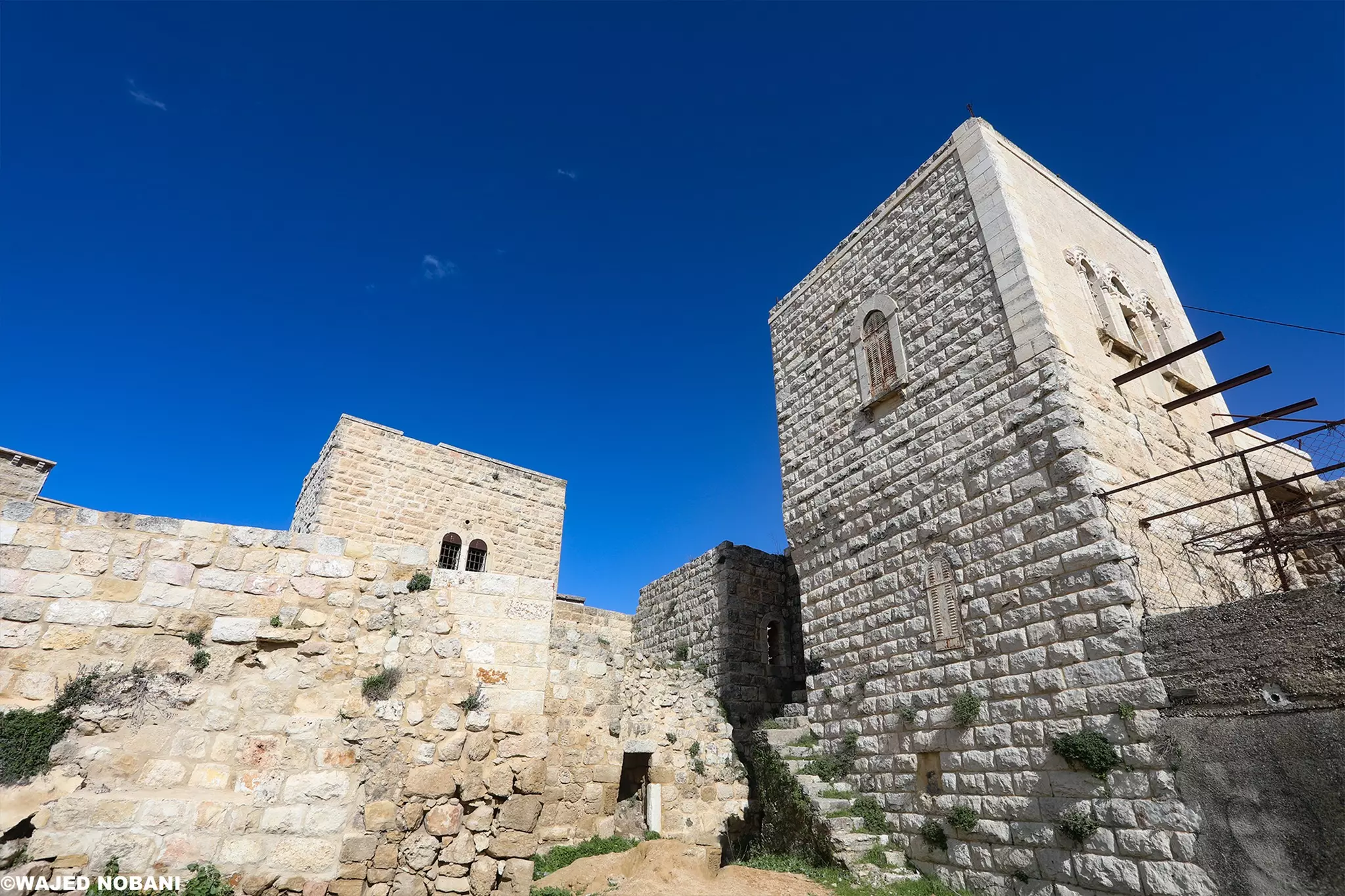
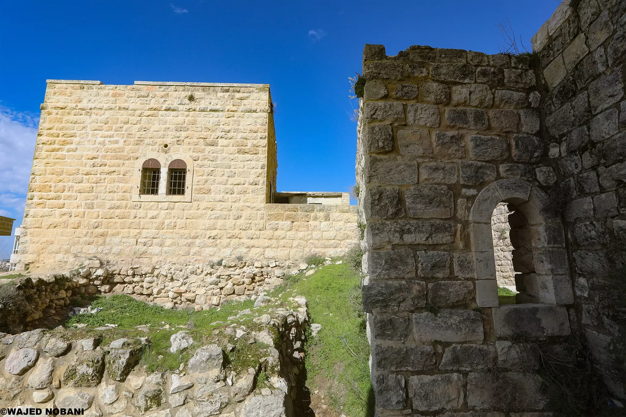
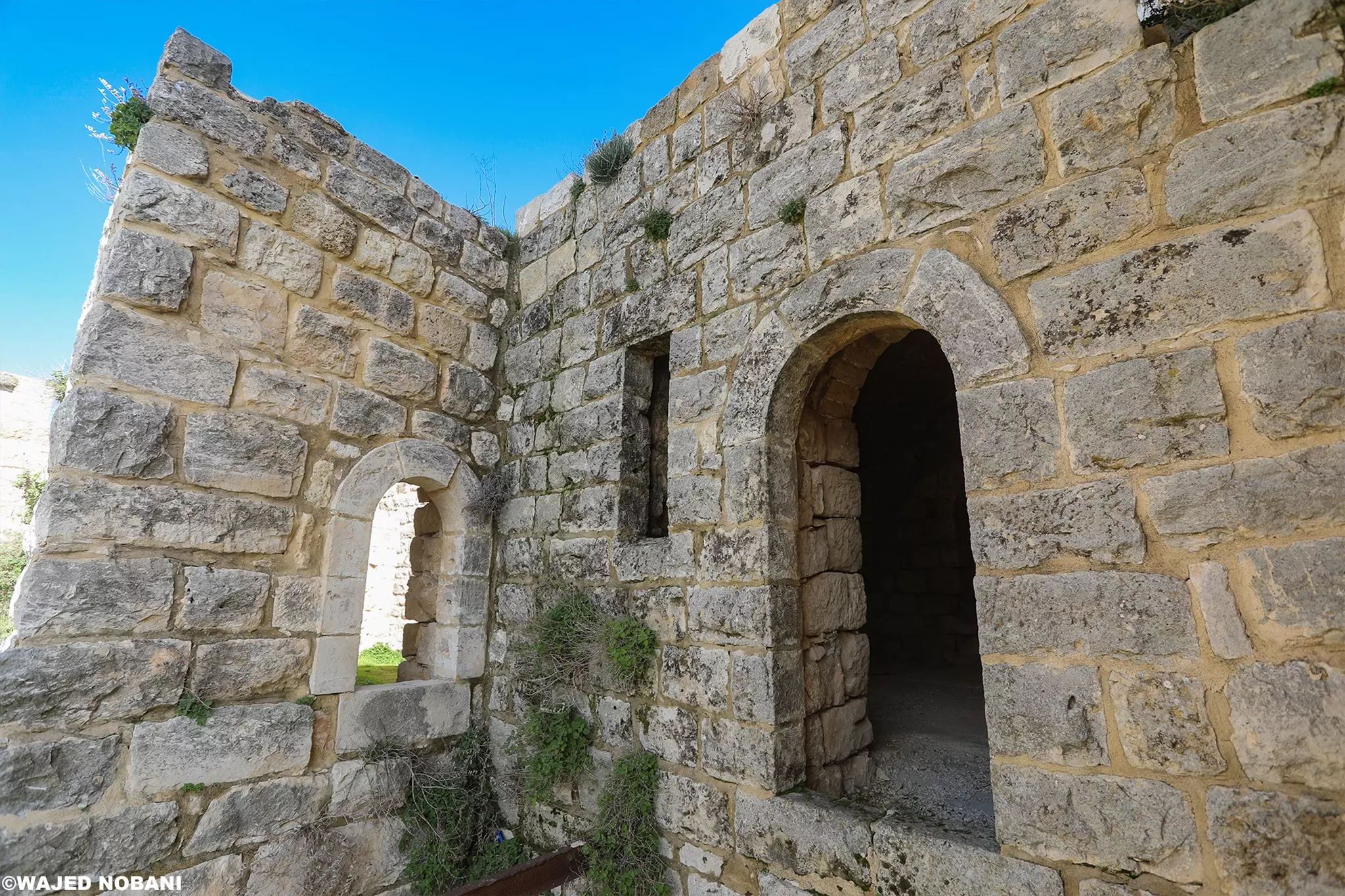
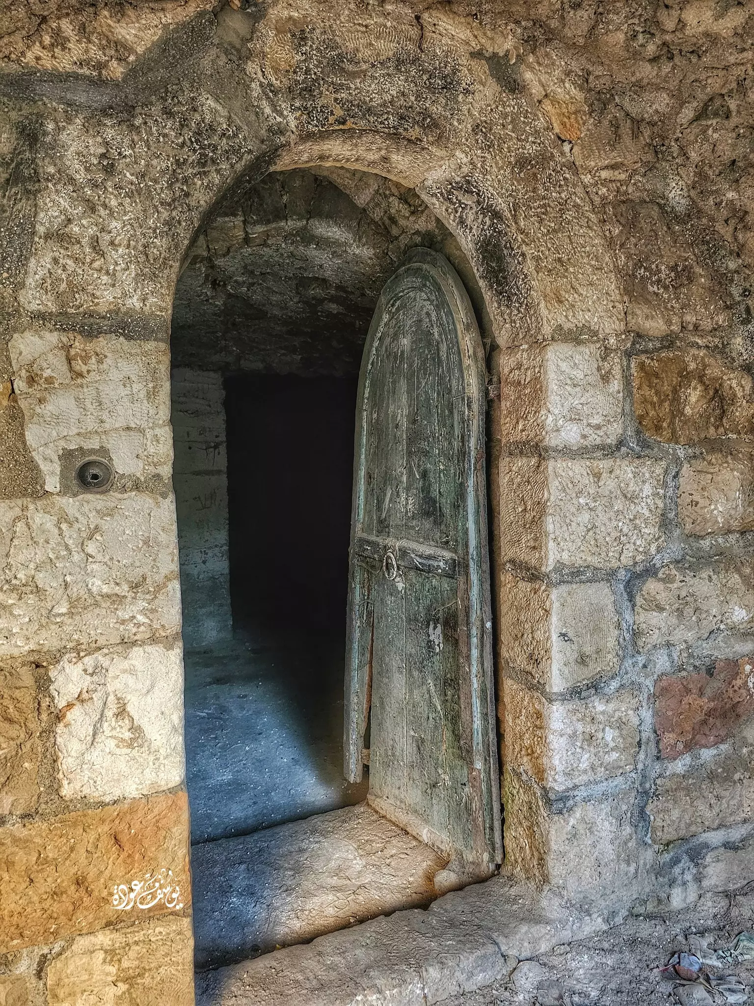
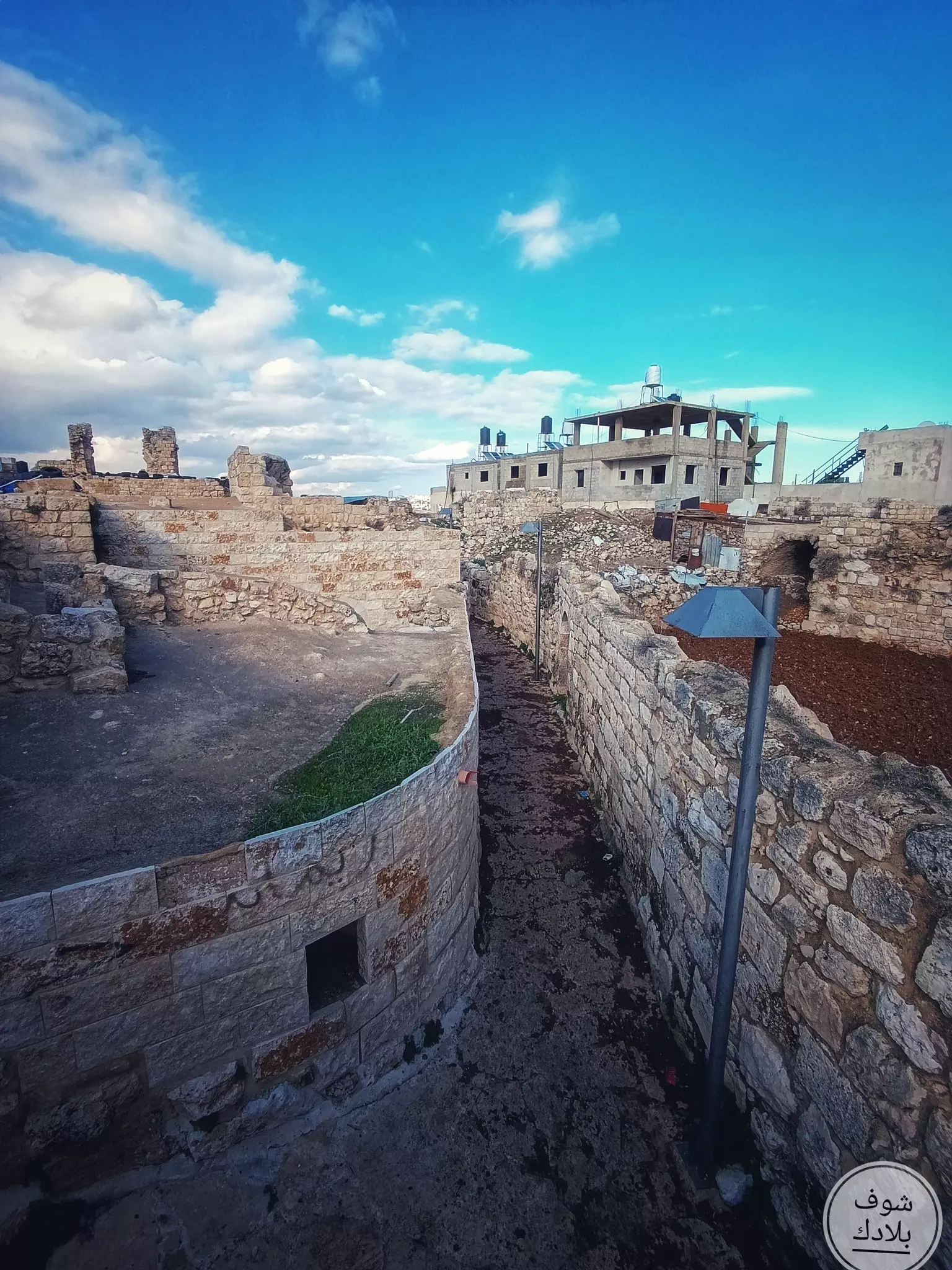
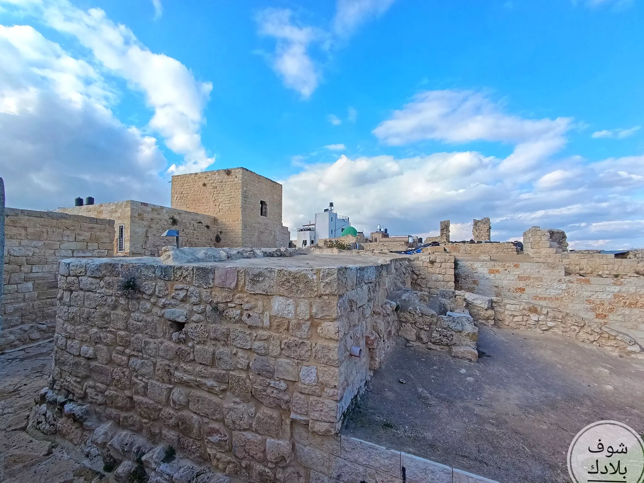
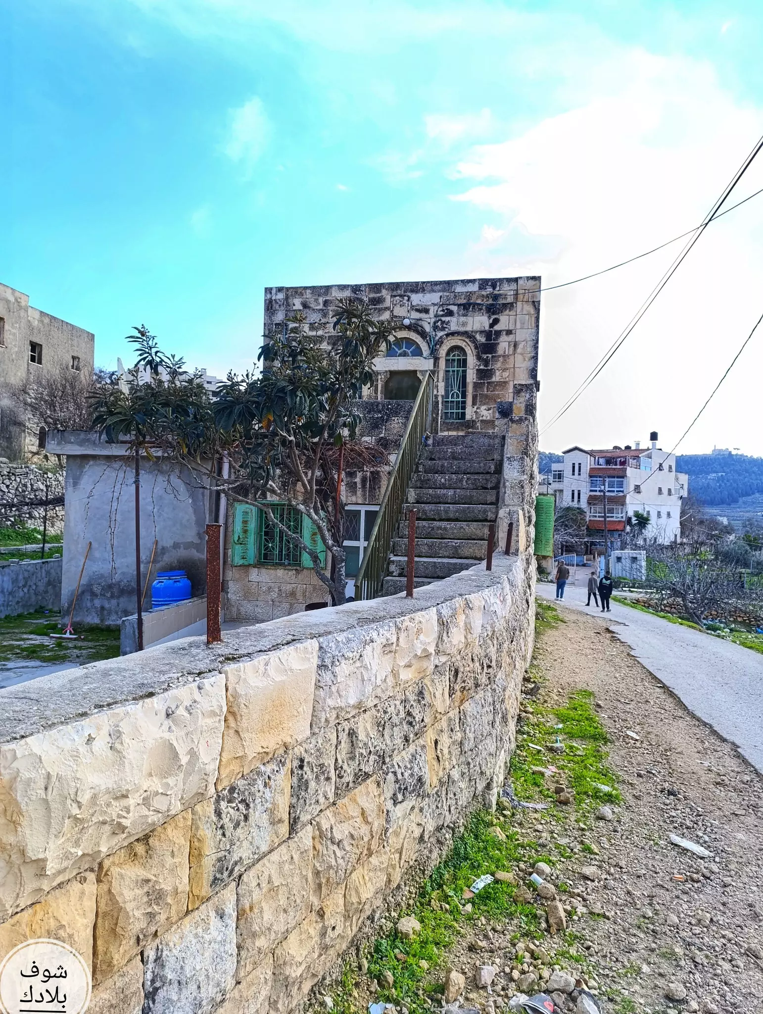
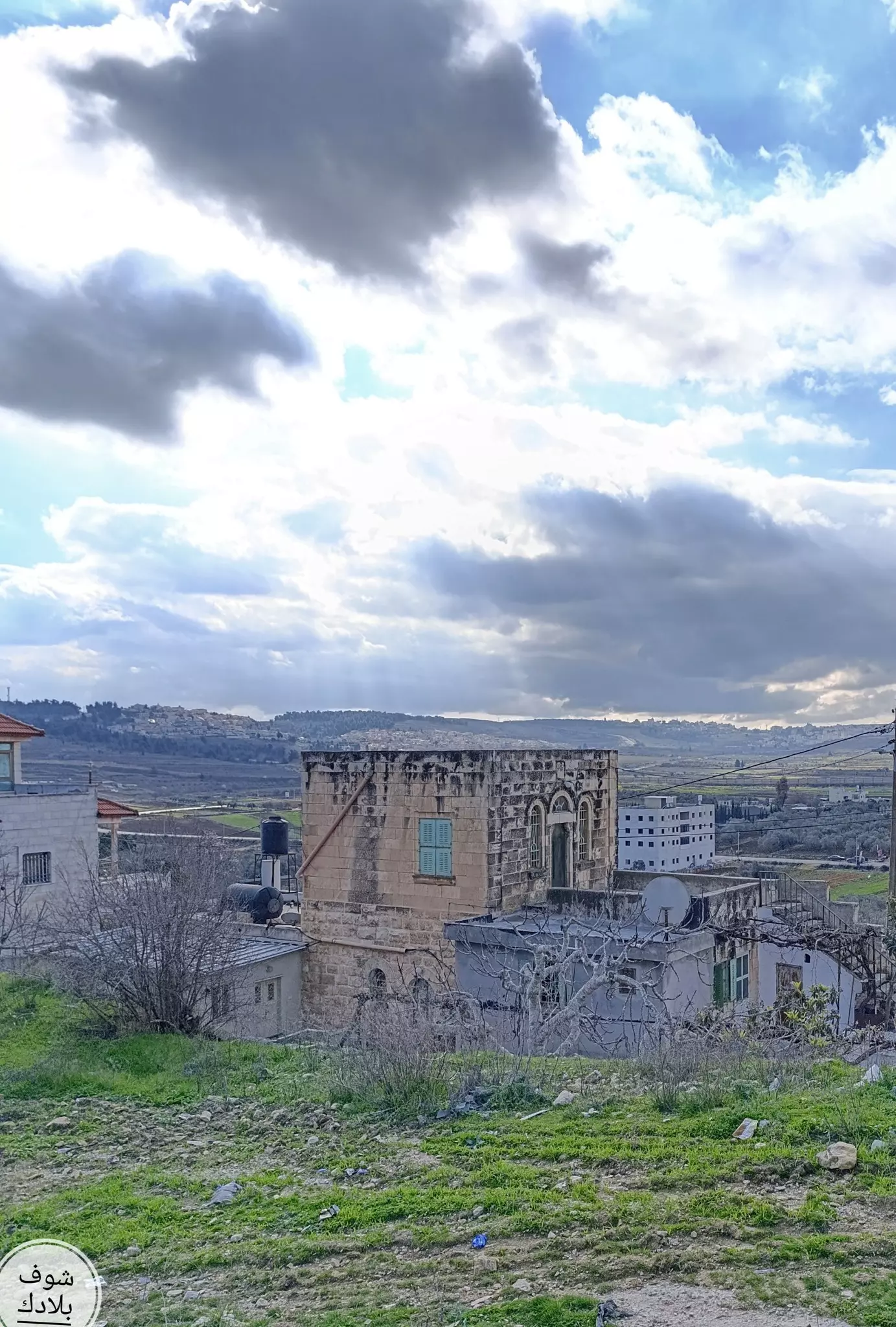
- جولة بين بيوت الجيب القديمة -- واجد النوباني
- جولة بين بيوت الجيب القديمة -- واجد النوباني #2
- جولة بين بيوت الجيب القديمة -- واجد النوباني #3
- جولة بين بيوت الجيب القديمة -- واجد النوباني #4
- جولة بين بيوت الجيب القديمة -- واجد النوباني #5
- جولة بين بيوت الجيب القديمة -- واجد النوباني #6
- جولة بين بيوت الجيب القديمة -- واجد النوباني #7
- جولة بين بيوت الجيب القديمة -- واجد النوباني #8
- جولة بين بيوت الجيب القديمة -- واجد النوباني #9
- جولة بين بيوت الجيب القديمة -- واجد النوباني #10
- جولة بين بيوت الجيب القديمة -- واجد النوباني
- جولة بين بيوت الجيب القديمة -- واجد النوباني
#2
- جولة بين بيوت الجيب القديمة -- واجد النوباني
#3
- جولة بين بيوت الجيب القديمة -- واجد النوباني
#4
- جولة بين بيوت الجيب القديمة -- واجد النوباني
#5
- جولة بين بيوت الجيب القديمة -- واجد النوباني
#6
- جولة بين بيوت الجيب القديمة -- واجد النوباني
#7
- جولة بين بيوت الجيب القديمة -- واجد النوباني
#8
- جولة بين بيوت الجيب القديمة -- واجد النوباني
#9
- جولة بين بيوت الجيب القديمة -- واجد النوباني
#10
- جولة بين بيوت الجيب القديمة -- واجد النوباني
#11
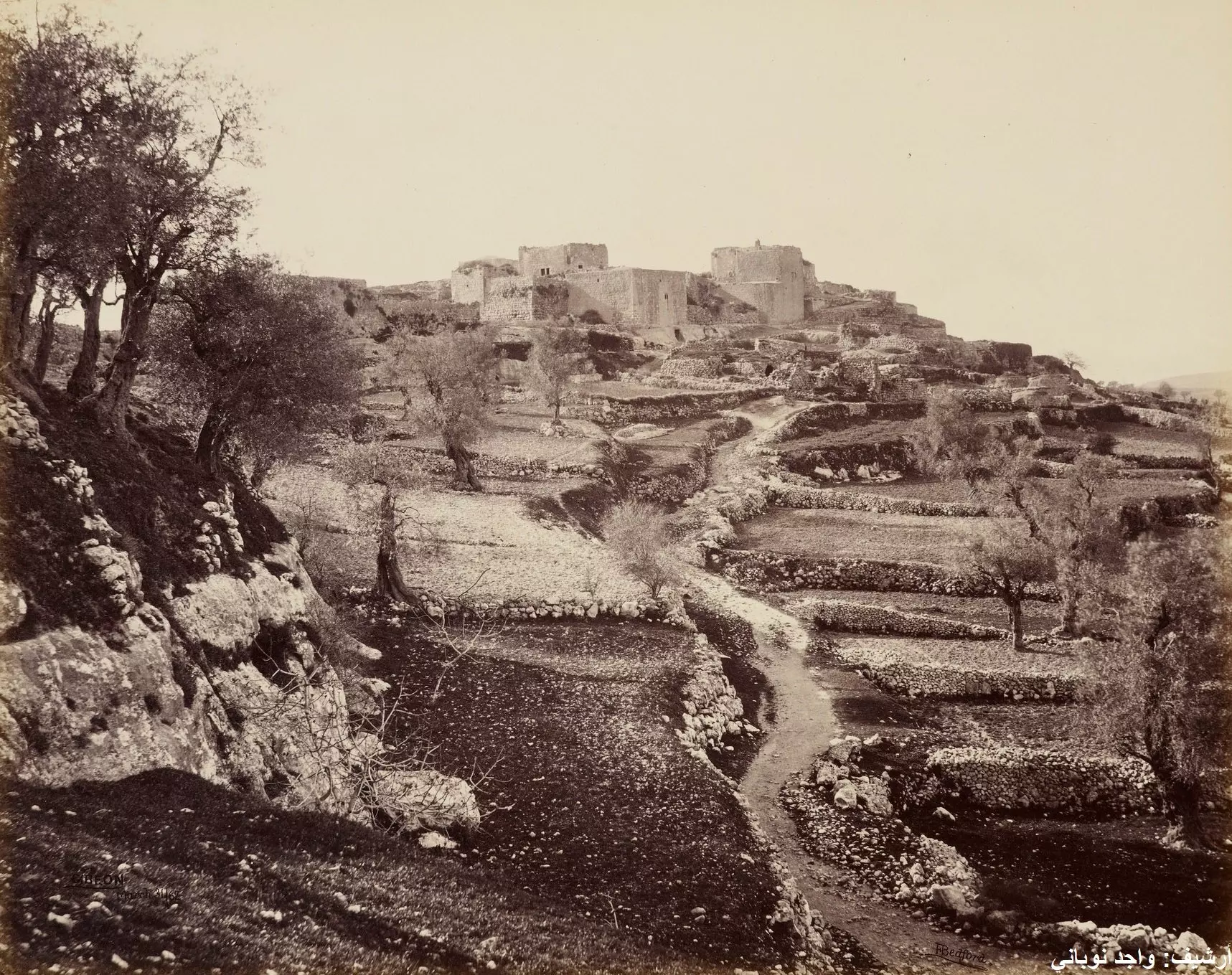
- قرية الجيب في عام 1862
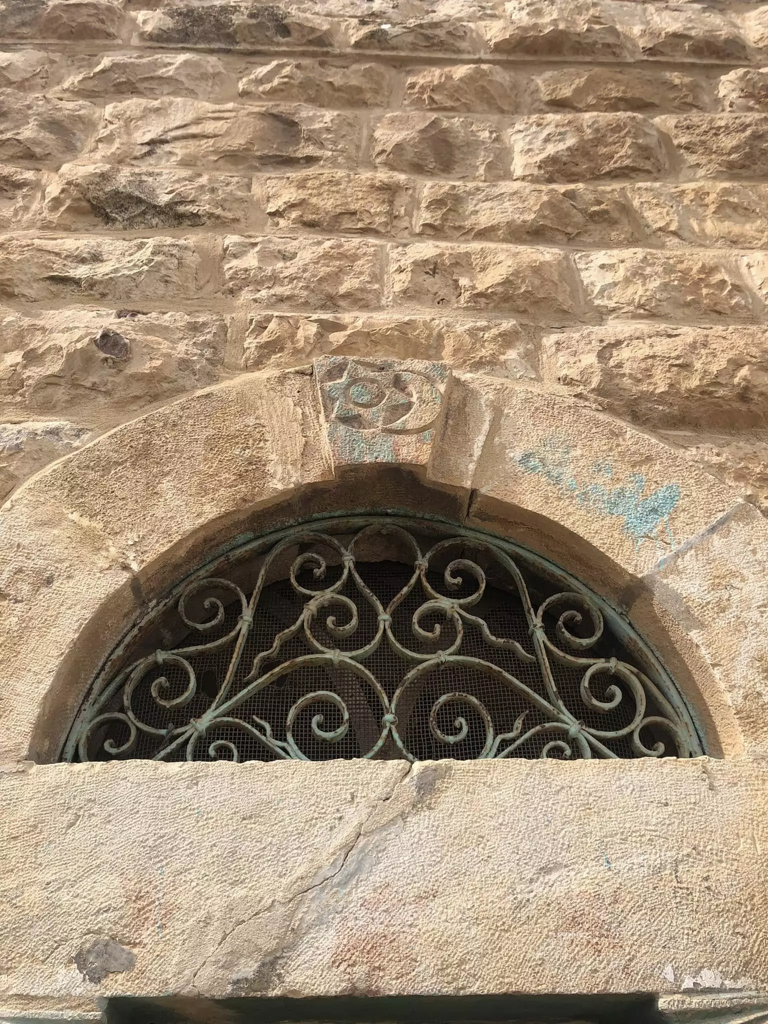
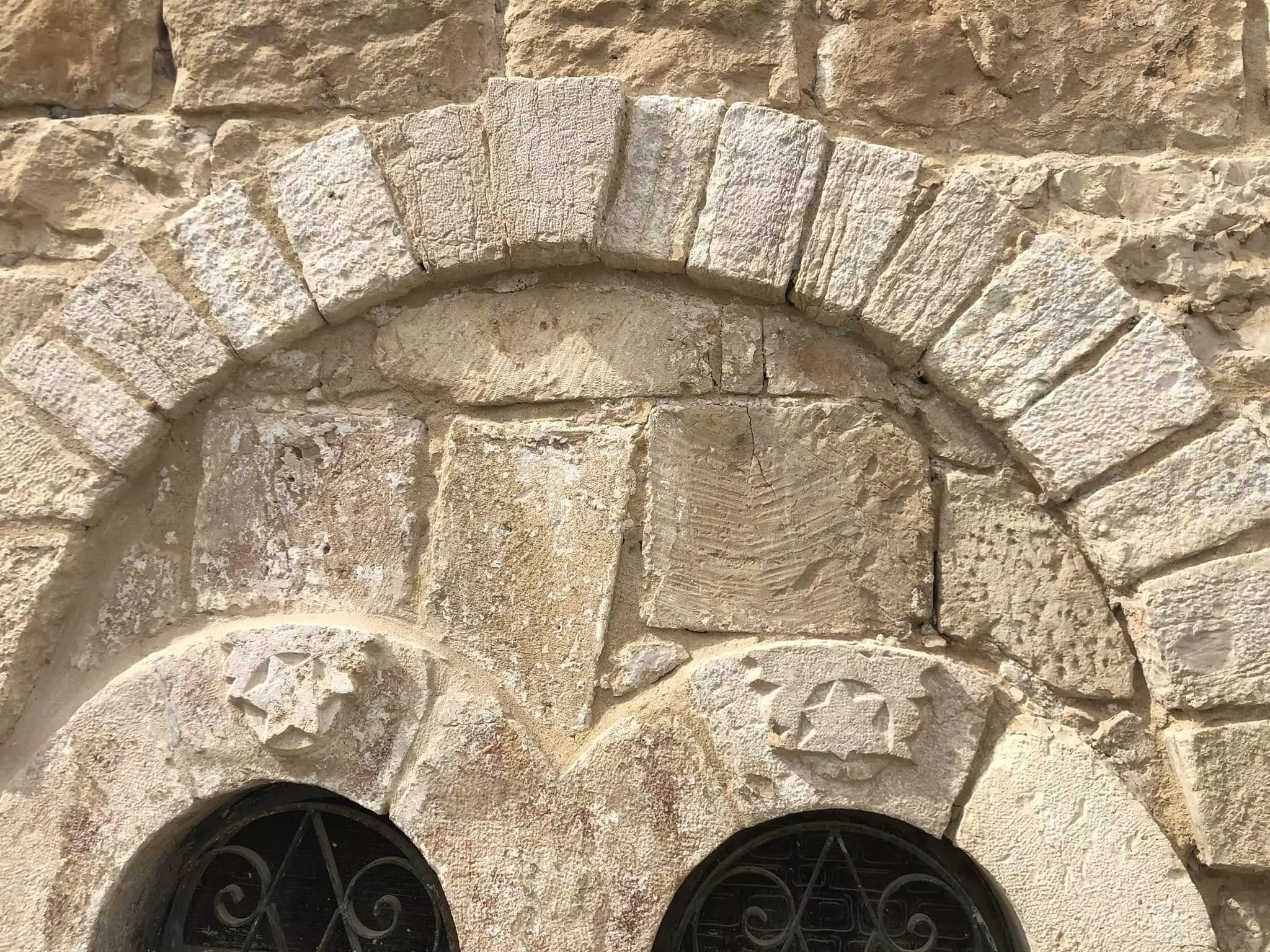
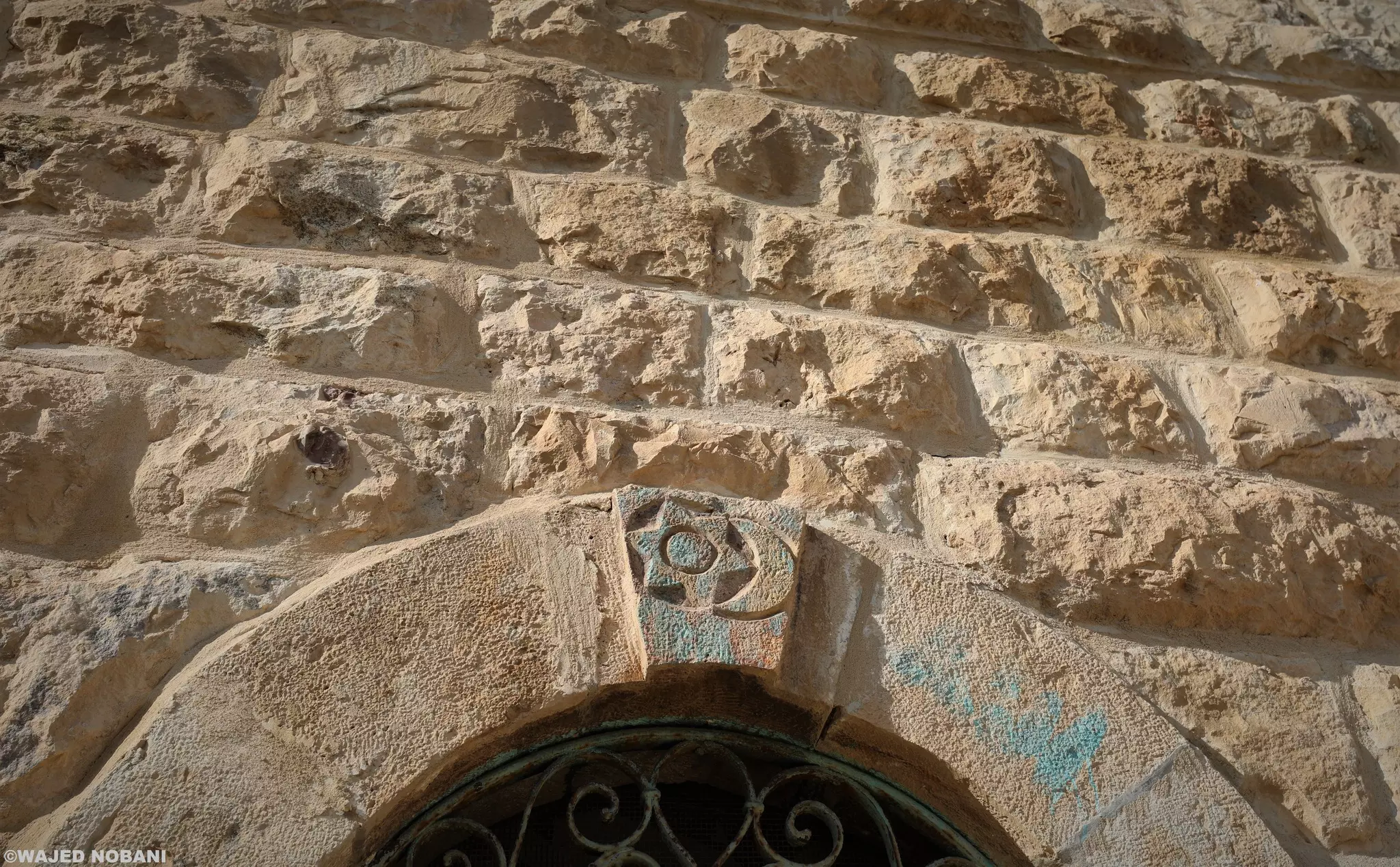
- بيت عائلة فلسطينية من القرن الماضي .. على النافذة نقش للنجمة السداسية إلى جانب هلال القمر، والدائرة وسط النجمة ربما تمثل الشمس -- واجد النوباني
- الجورة او البركة الصخرية في قرية الجيب -- محمد أبو نوح ،
- الجورة او البركة الصخرية في قرية الجيب -- محمد أبو نوح ، #2
- الجورة او البركة الصخرية في قرية الجيب -- محمد أبو نوح ، #3
- الجورة او البركة الصخرية في قرية الجيب -- محمد أبو نوح ، #4
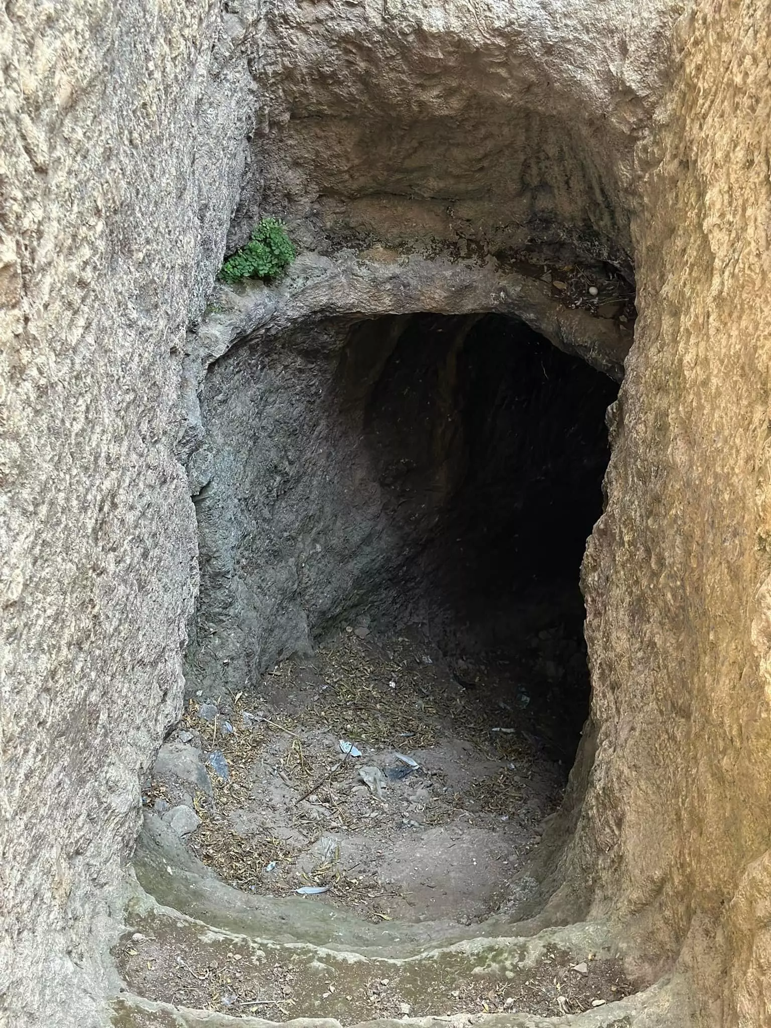
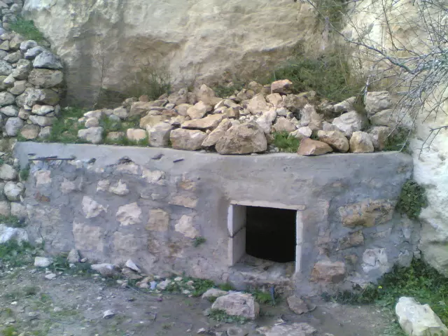
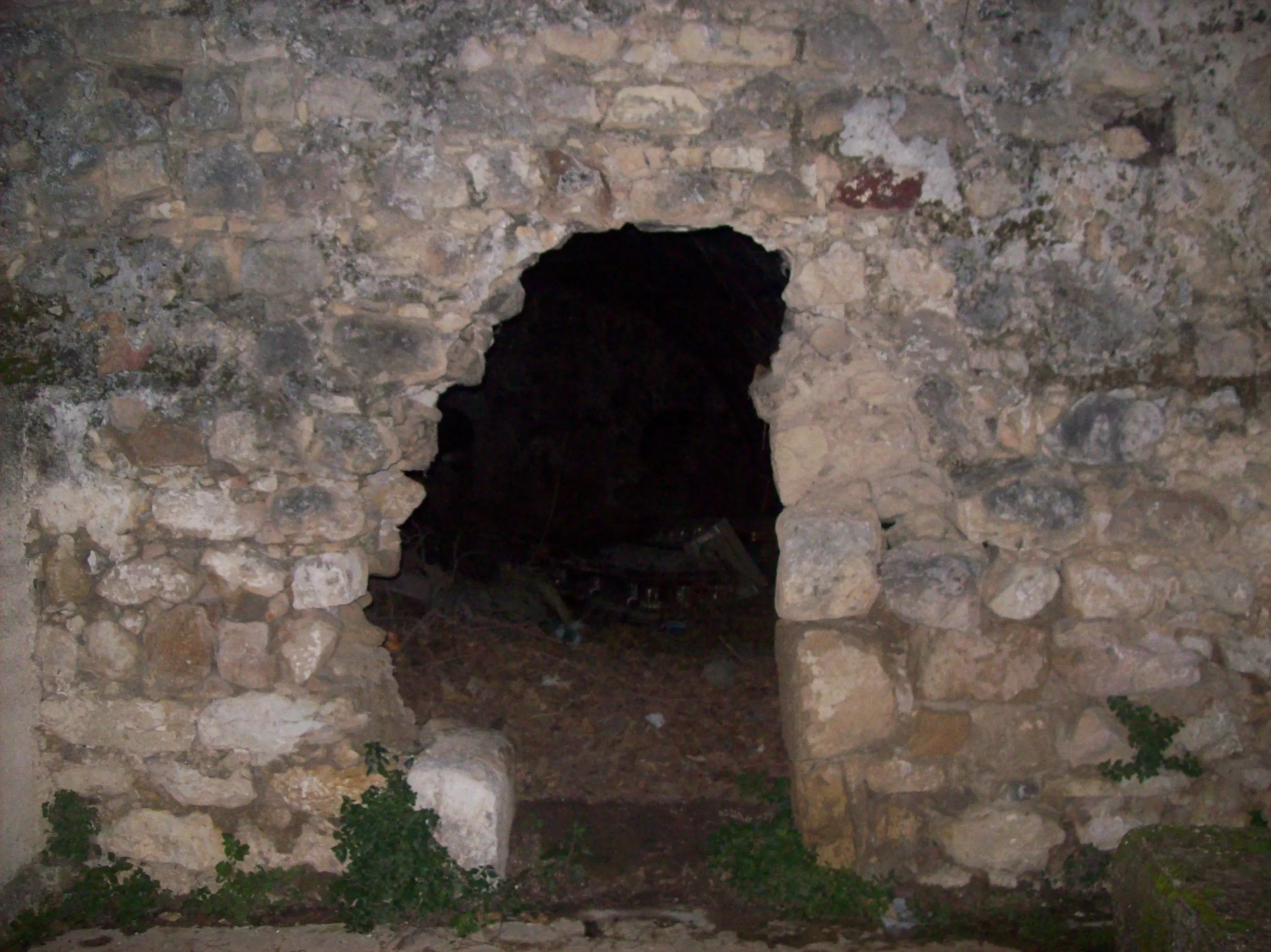
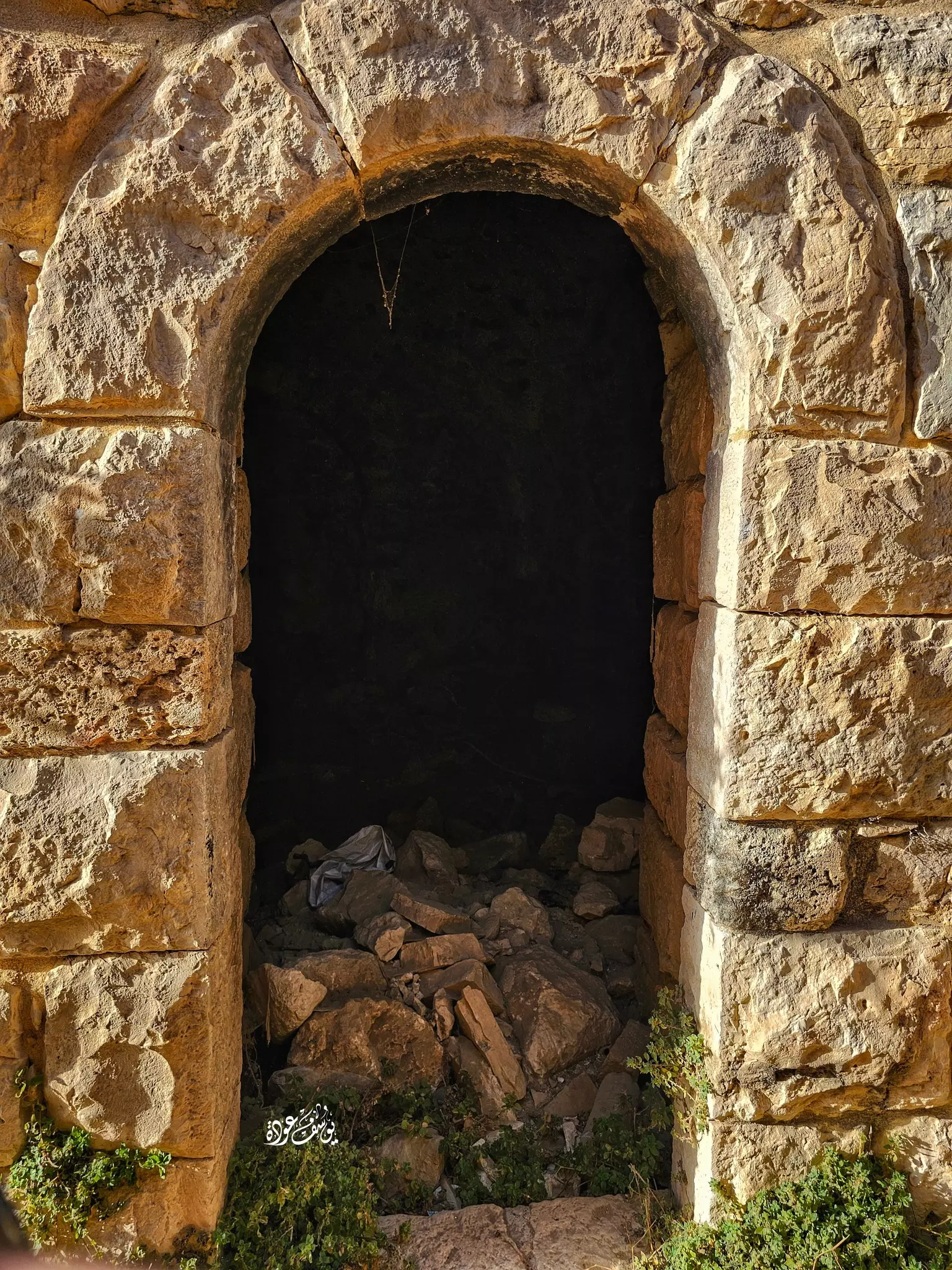
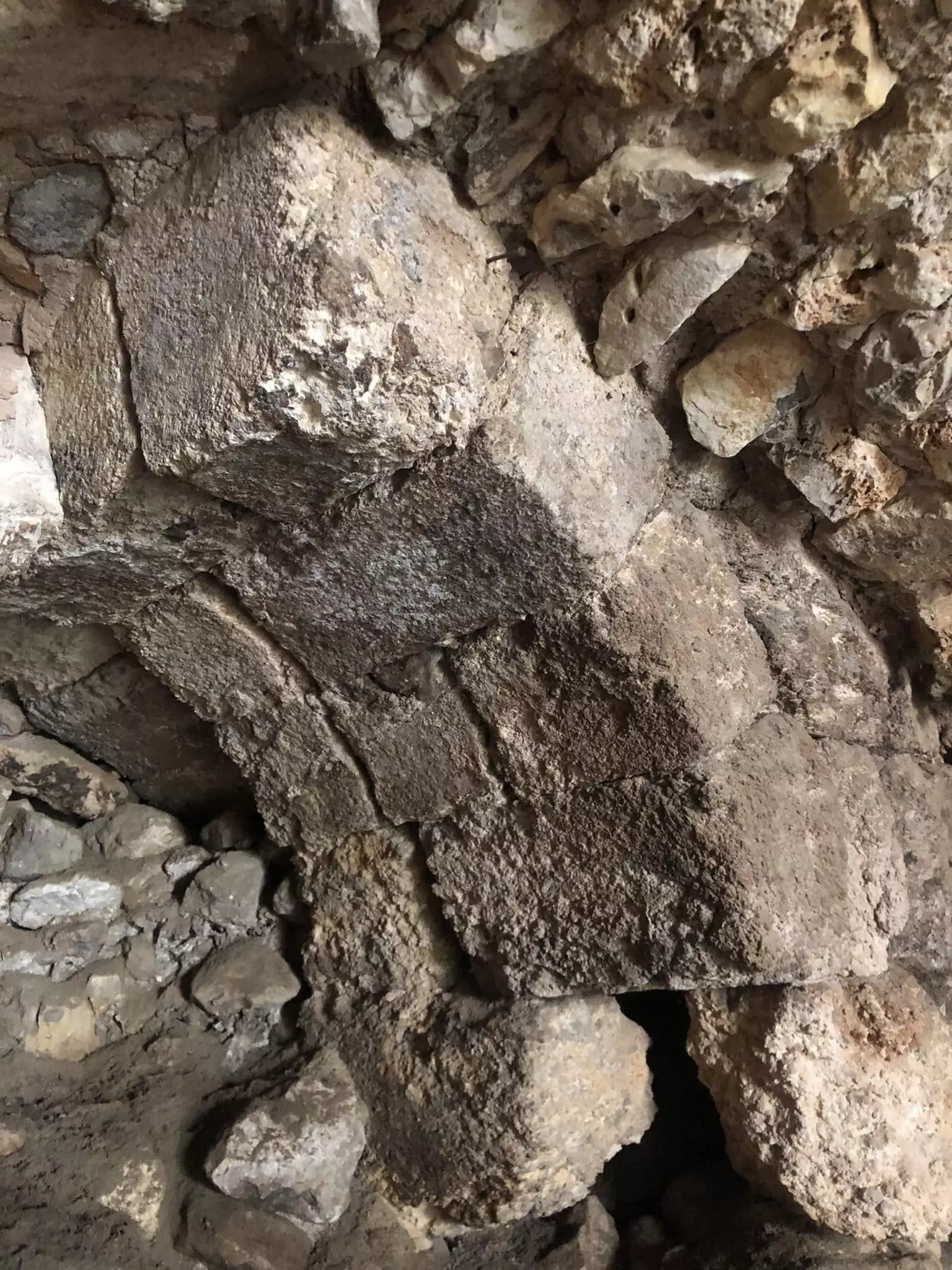
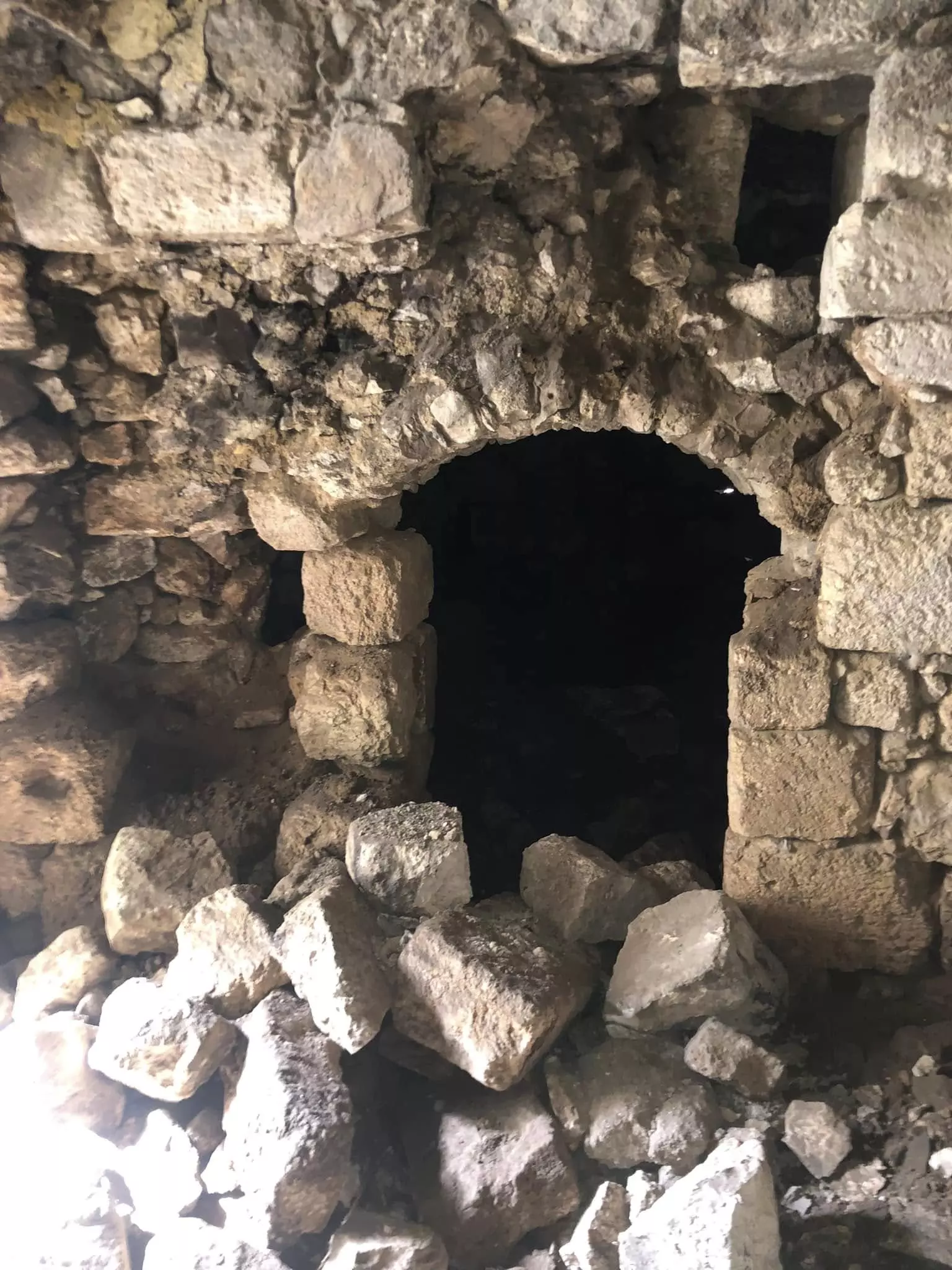
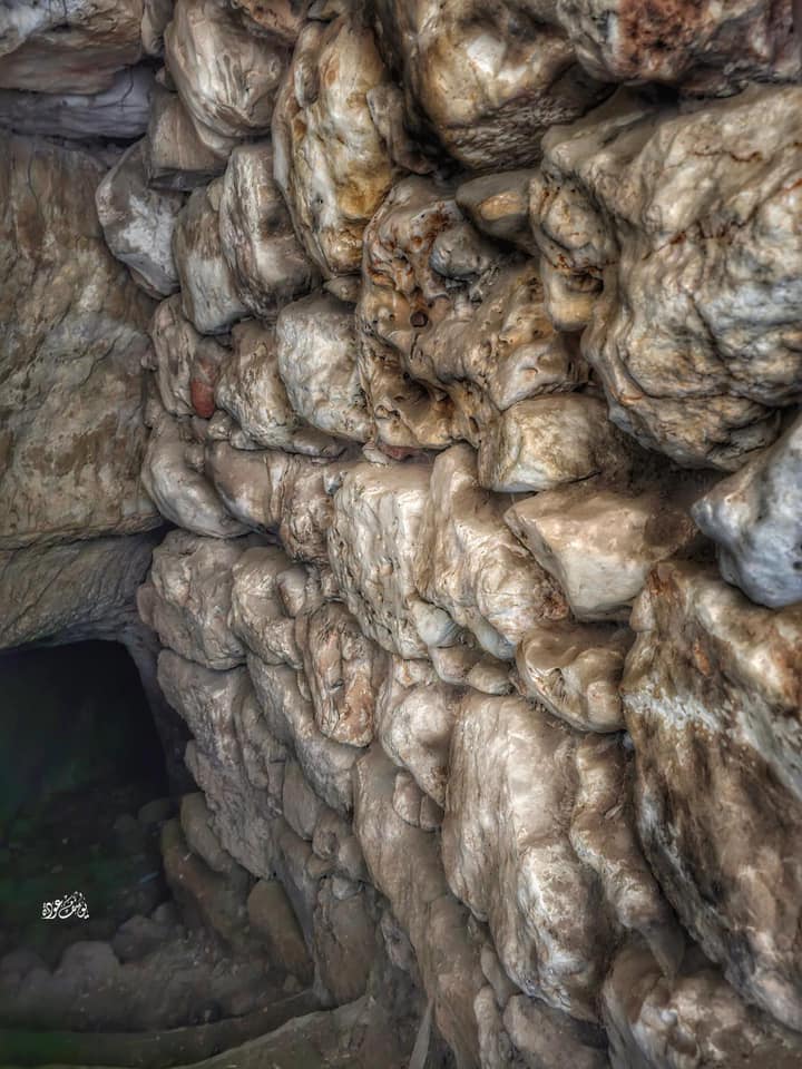
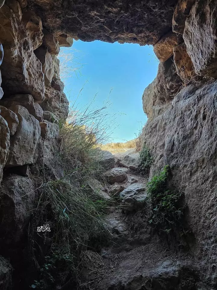
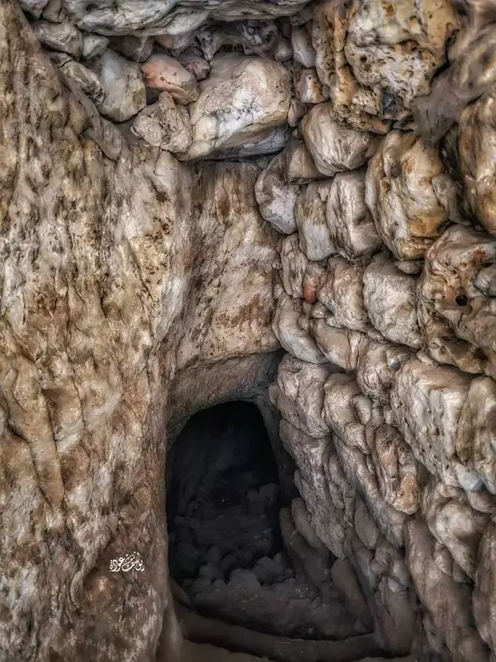
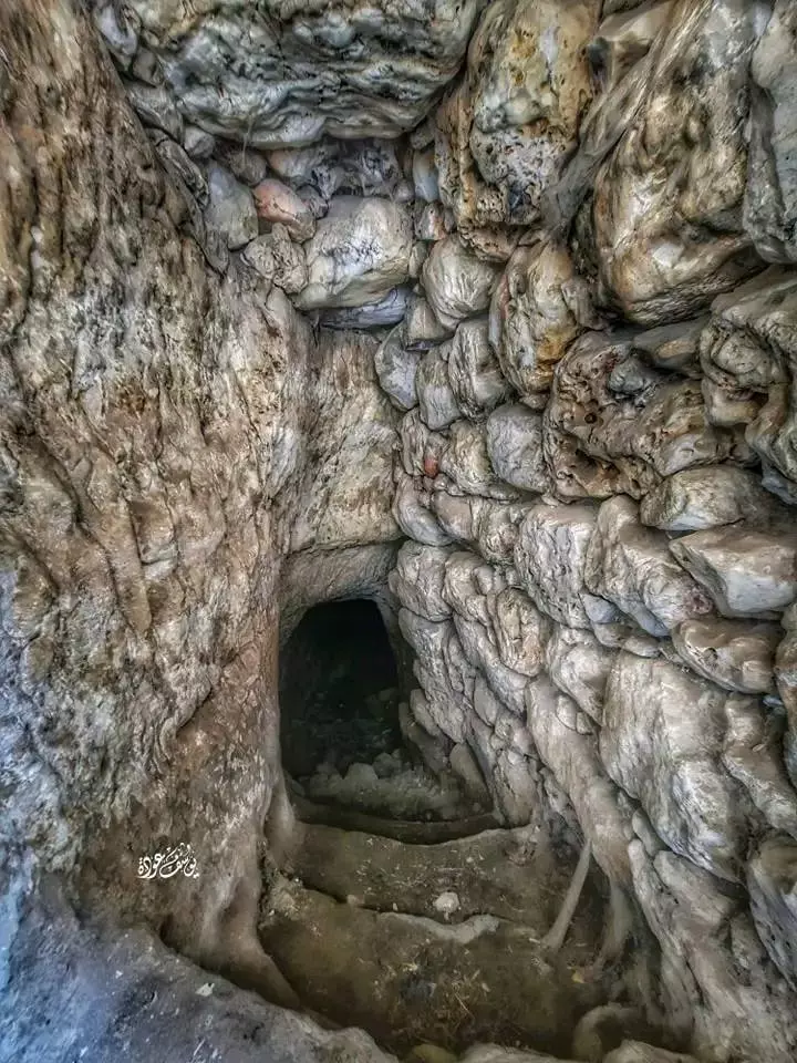
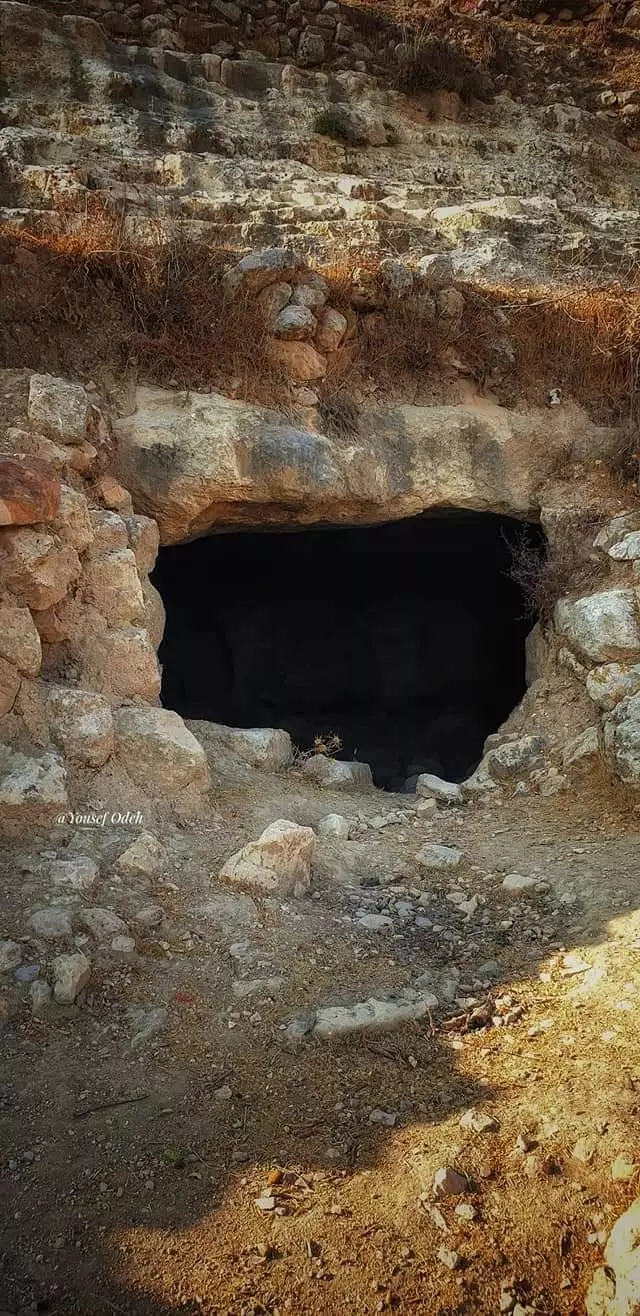
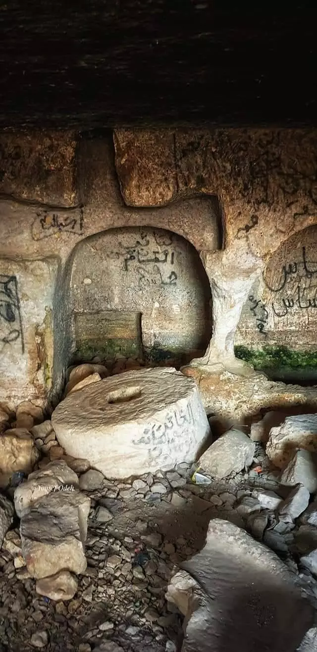
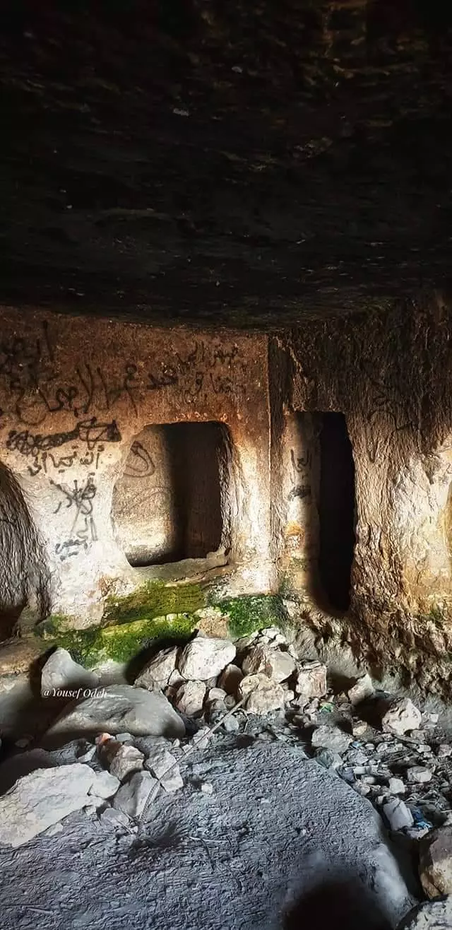
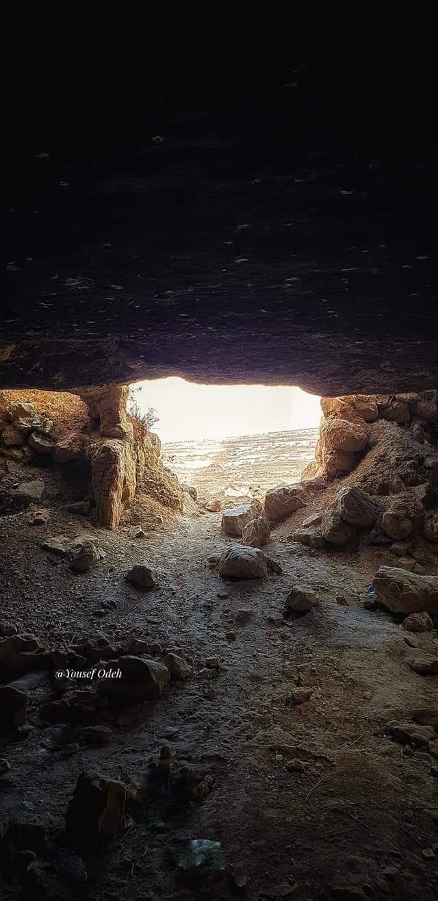
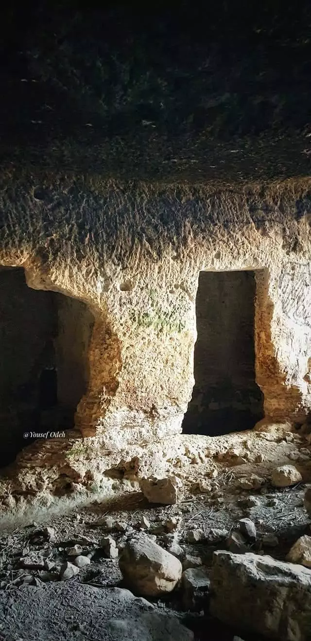
- سرداب قرية الجيب -- المزيد عنه في اول تعليق -- يوسف عودة

1 - سرداب قرية الجيب -- المزيد عنه في اول تعليق -- يوسف عودة
#2
- سرداب قرية الجيب -- المزيد عنه في اول تعليق -- يوسف عودة
#3

- سرداب قرية الجيب -- المزيد عنه في اول تعليق -- يوسف عودة
#4

- سرداب قرية الجيب -- المزيد عنه في اول تعليق -- يوسف عودة
#5

- سرداب قرية الجيب -- المزيد عنه في اول تعليق -- يوسف عودة
#6
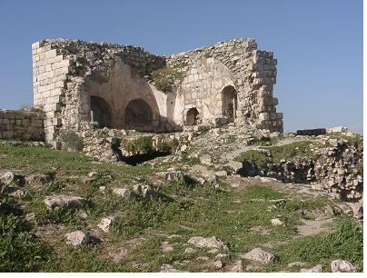
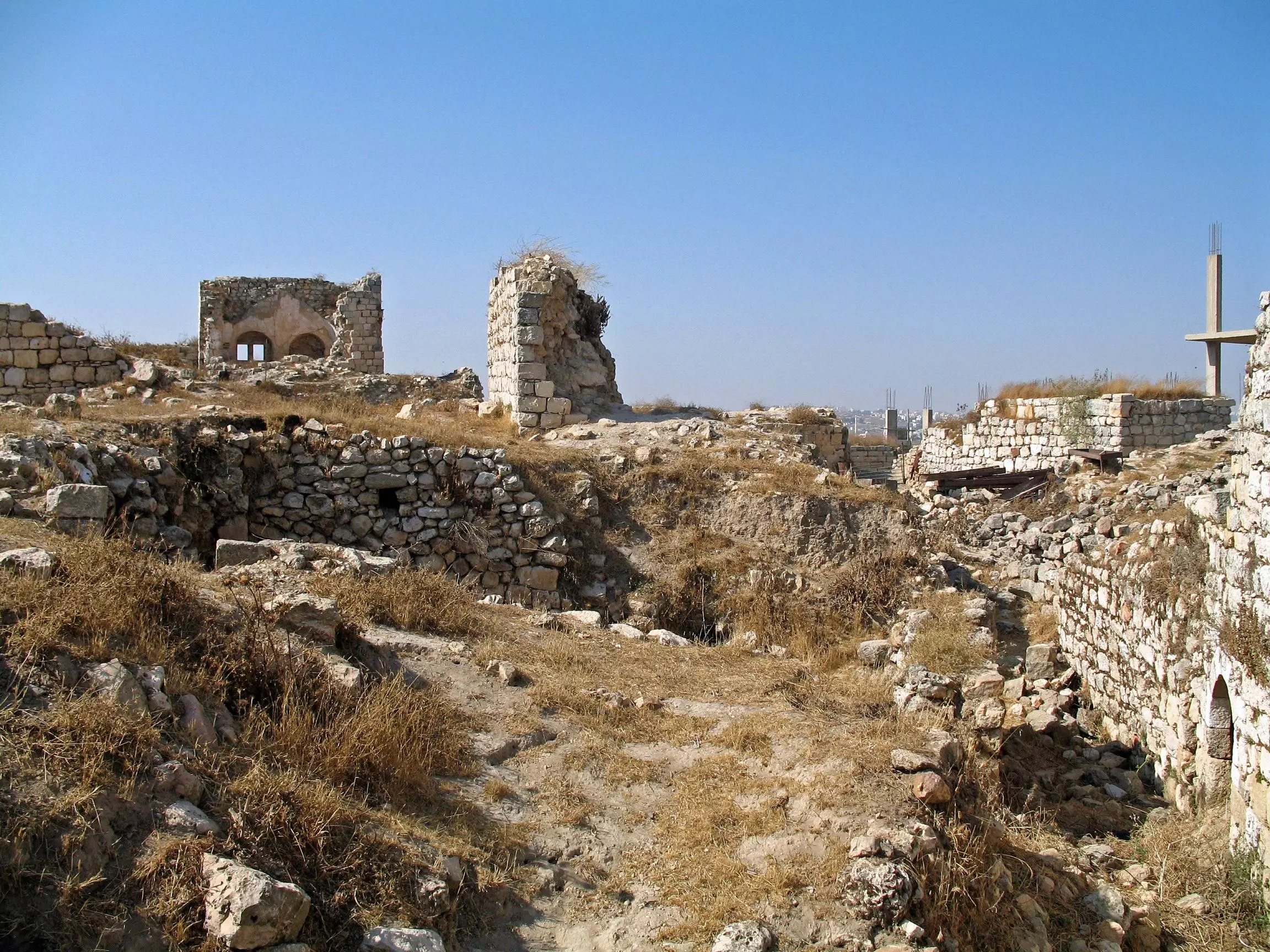
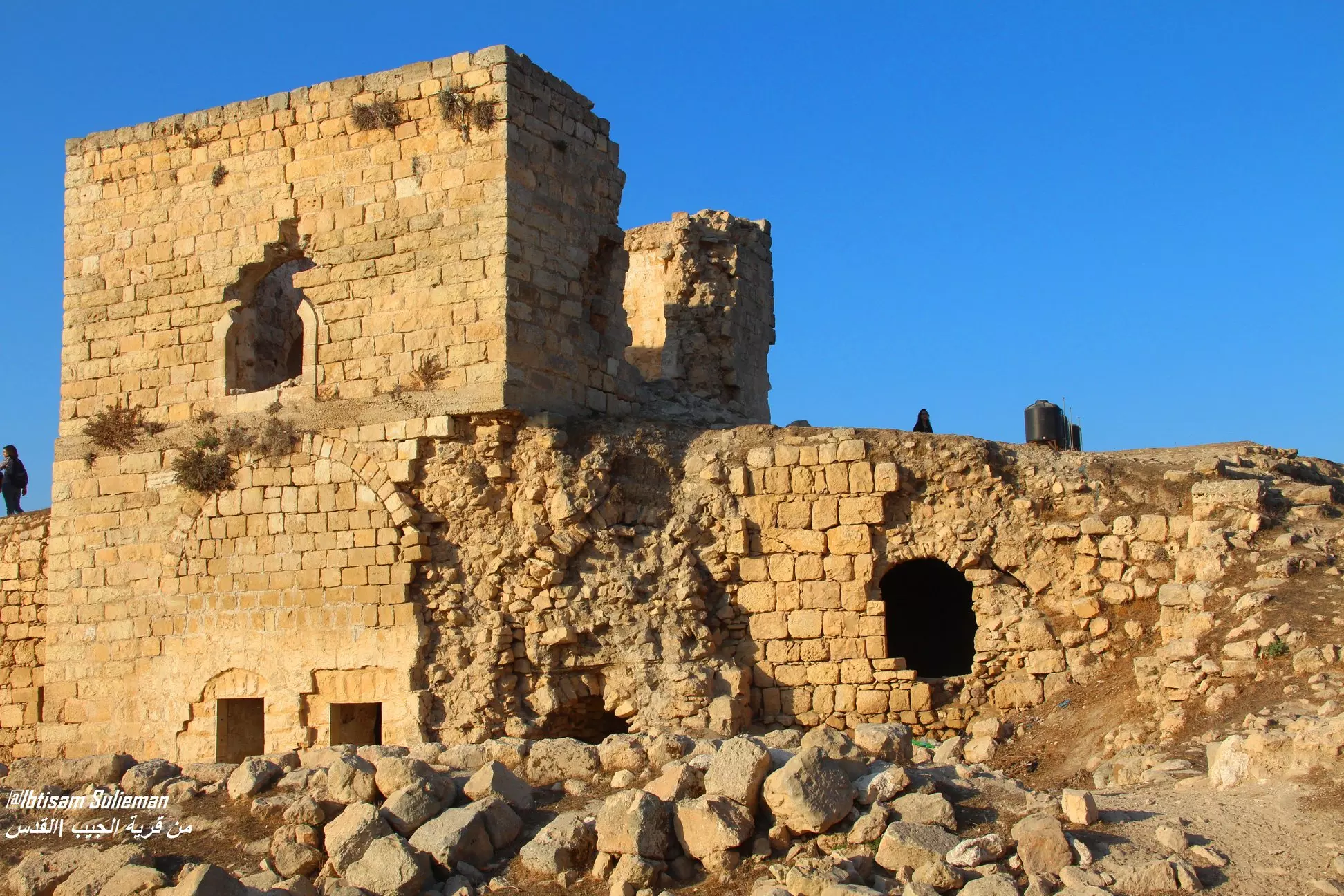
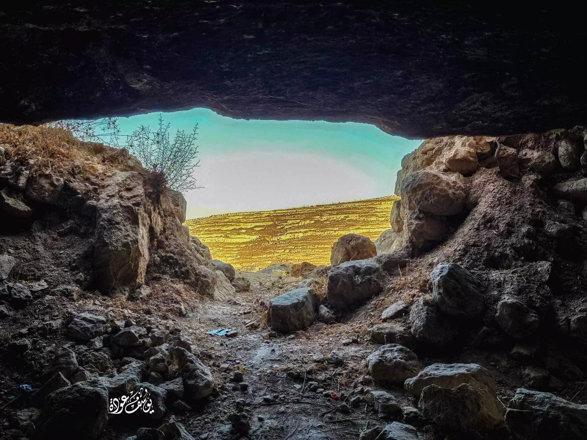
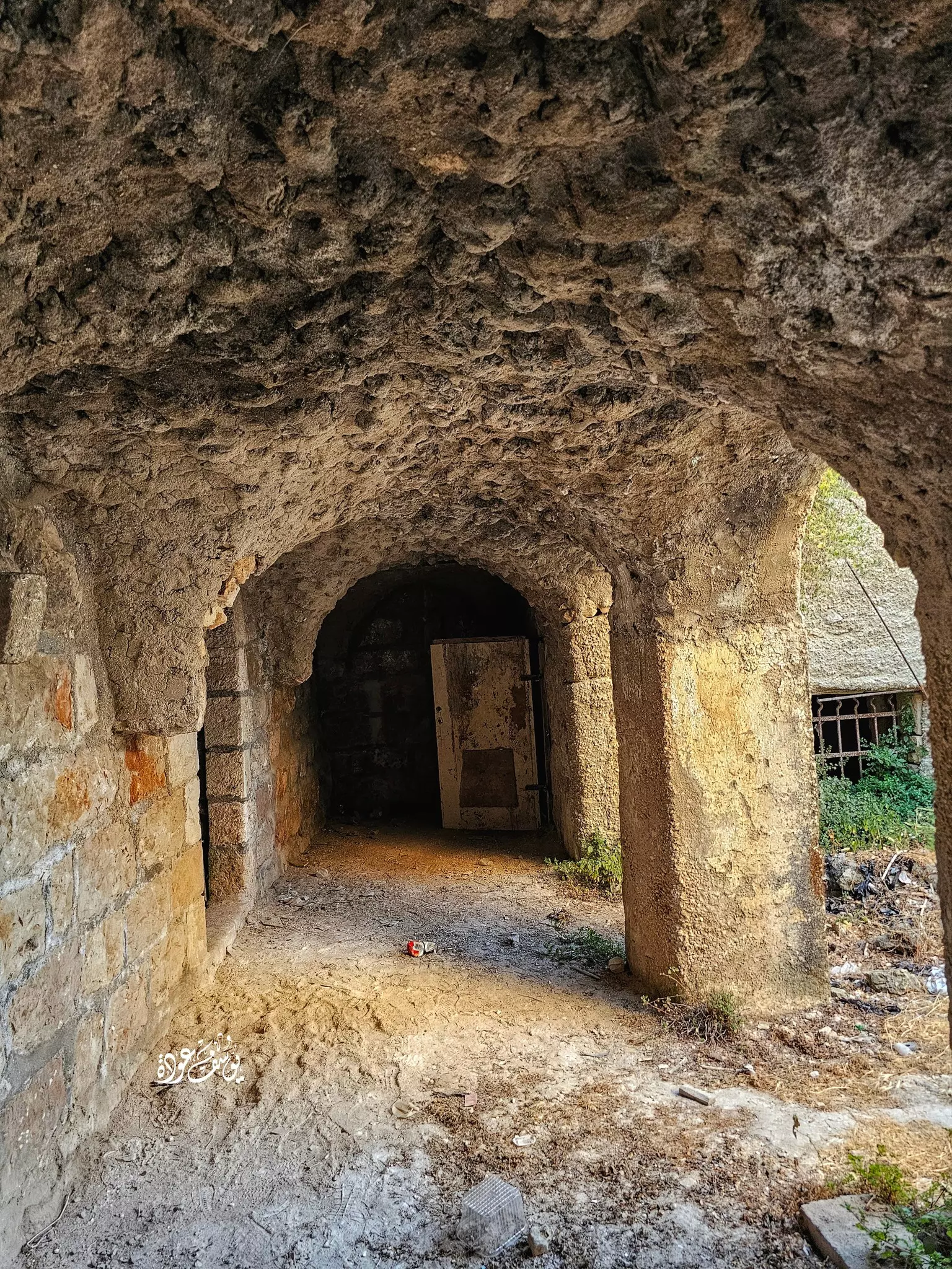
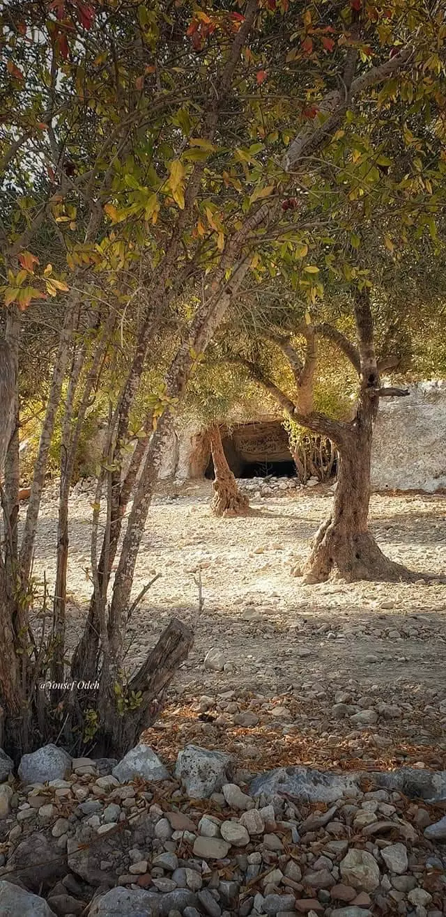
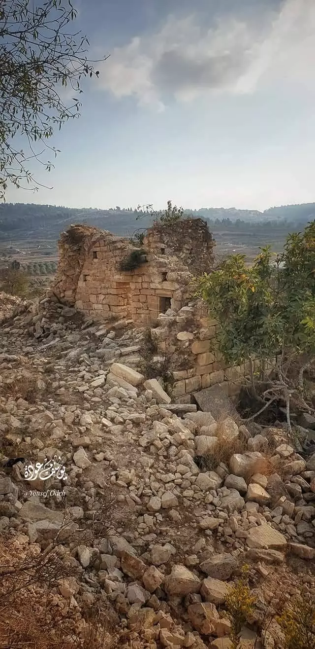
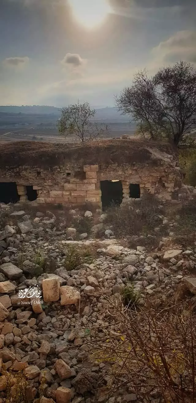
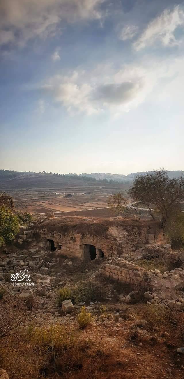
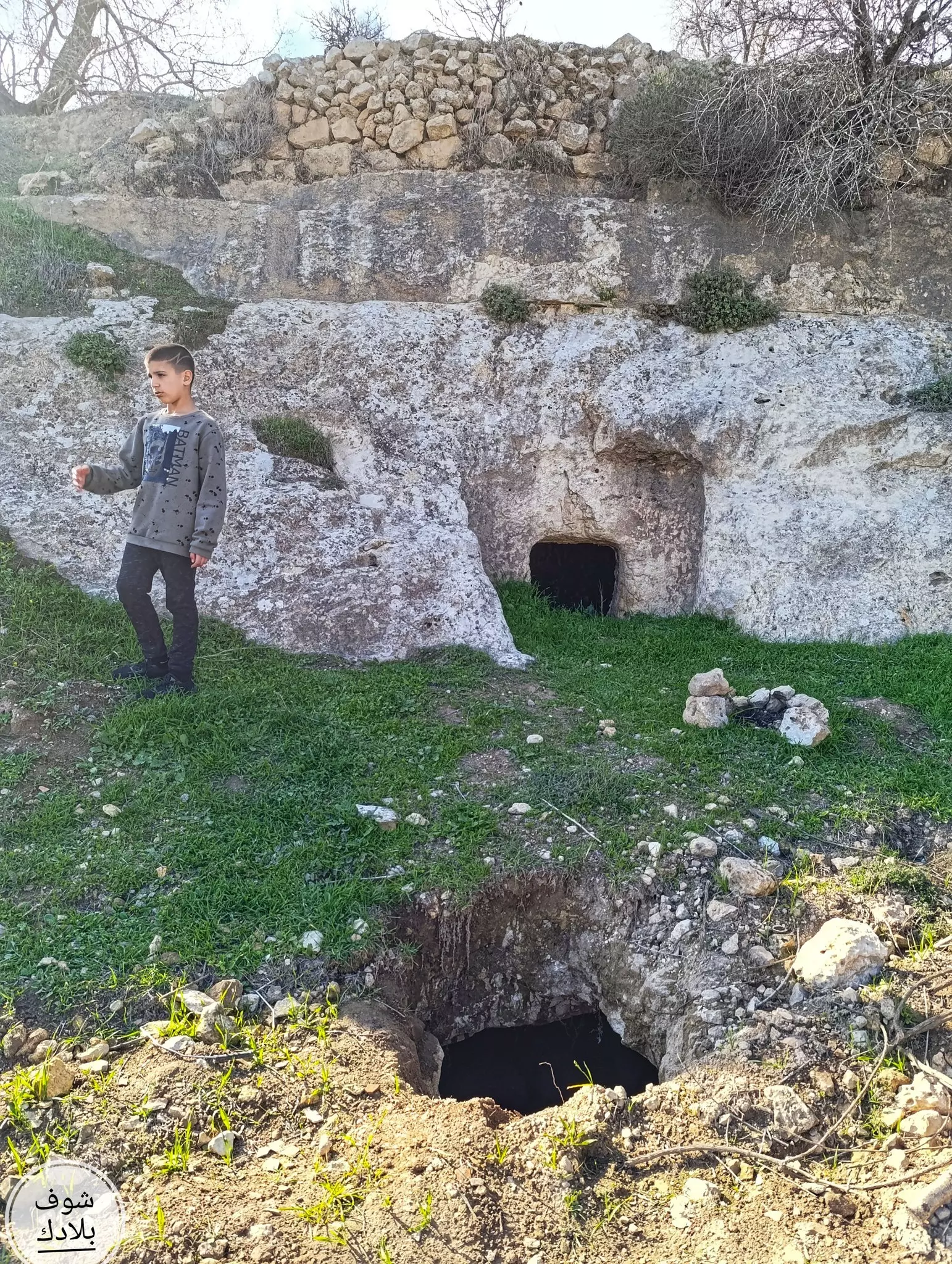
- جولة في احد الخرب المحيطة -- يوسف عودة
- جولة في احد الخرب المحيطة -- يوسف عودة #2
- جولة في احد الخرب المحيطة -- يوسف عودة #3
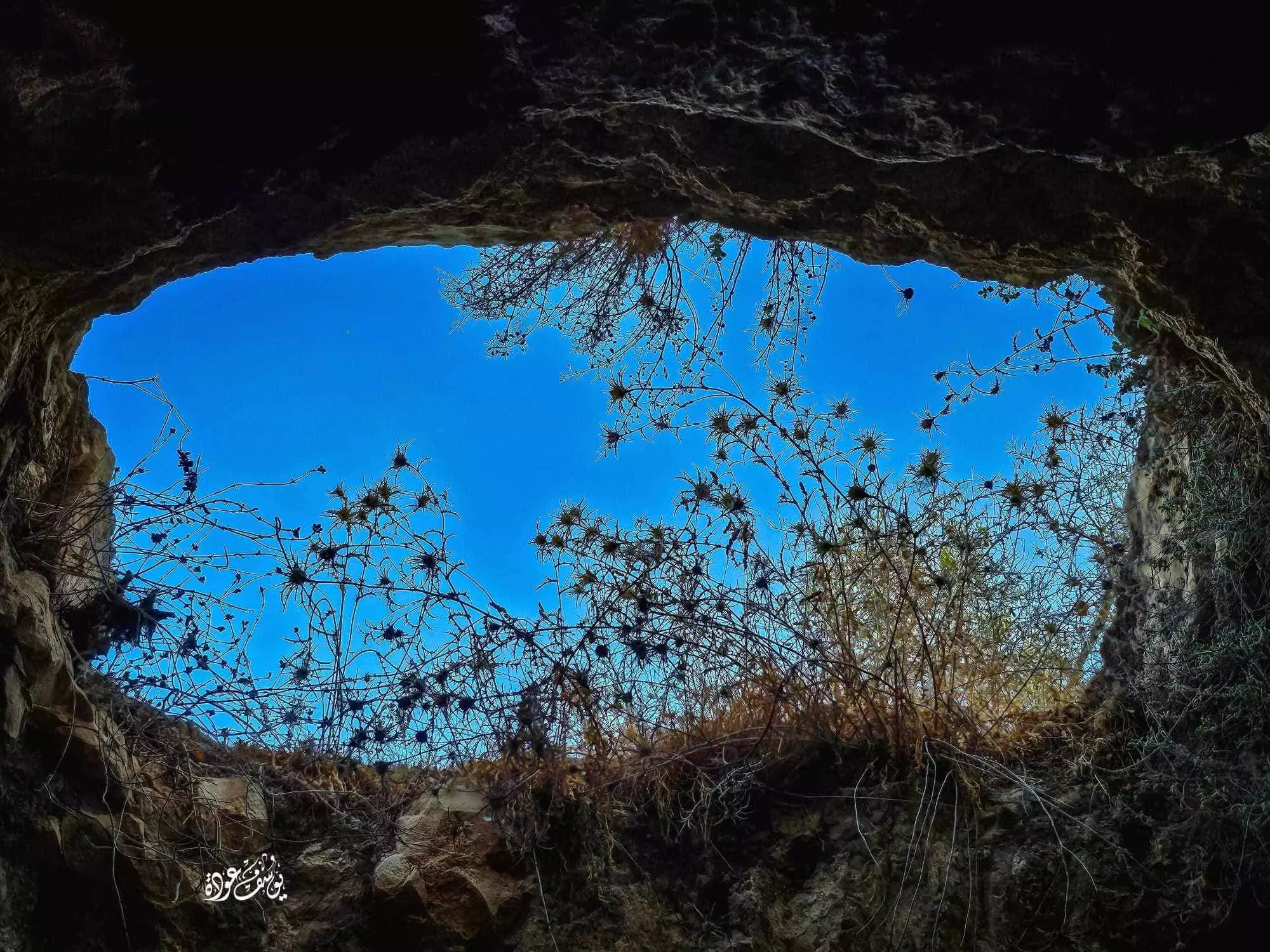
- جولة في احد الخرب المحيطة -- يوسف عودة #4
- جولة في احد الخرب المحيطة -- يوسف عودة #5
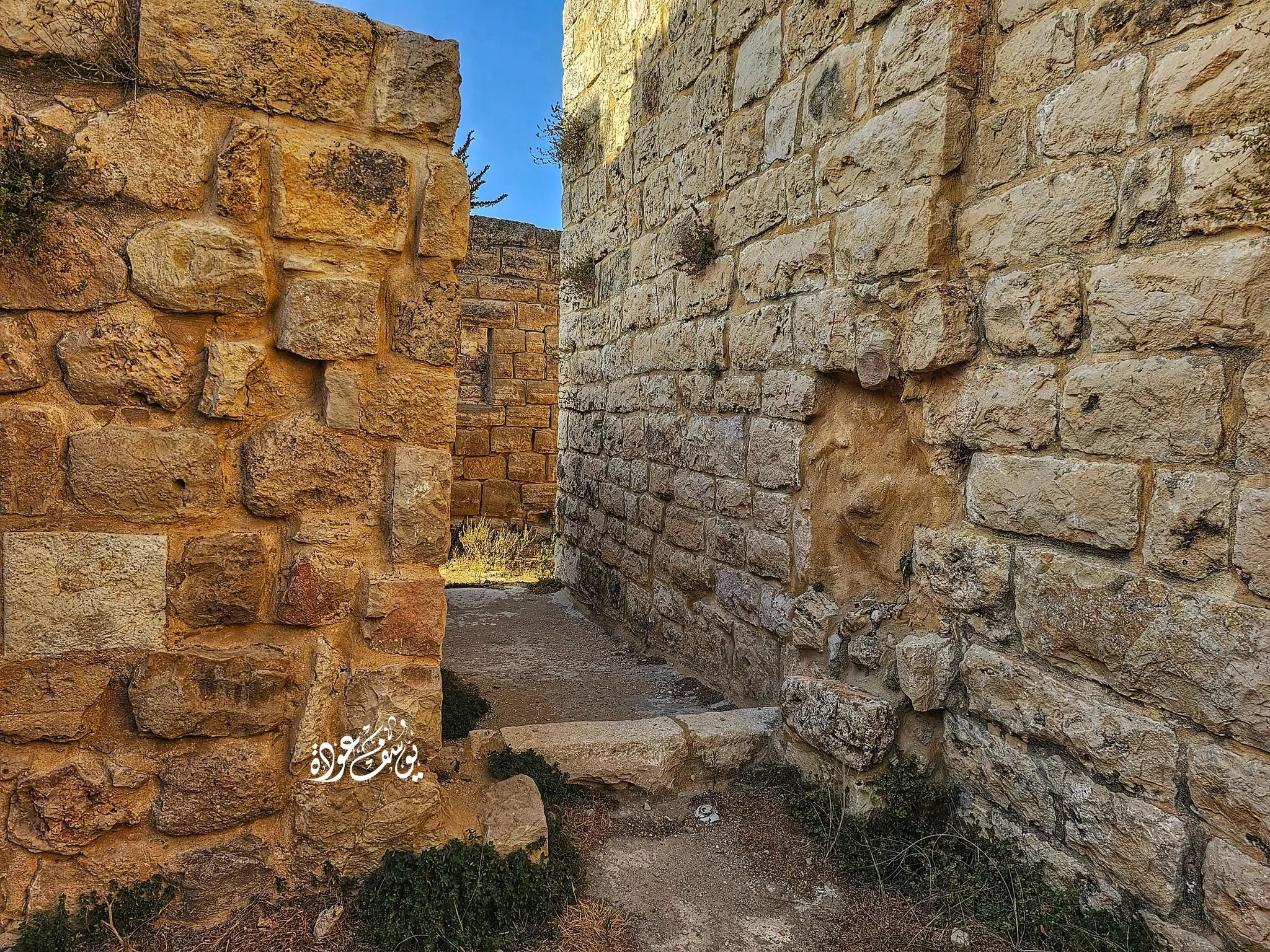
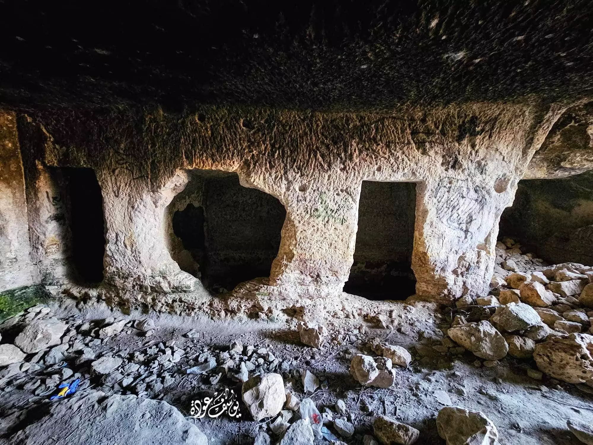
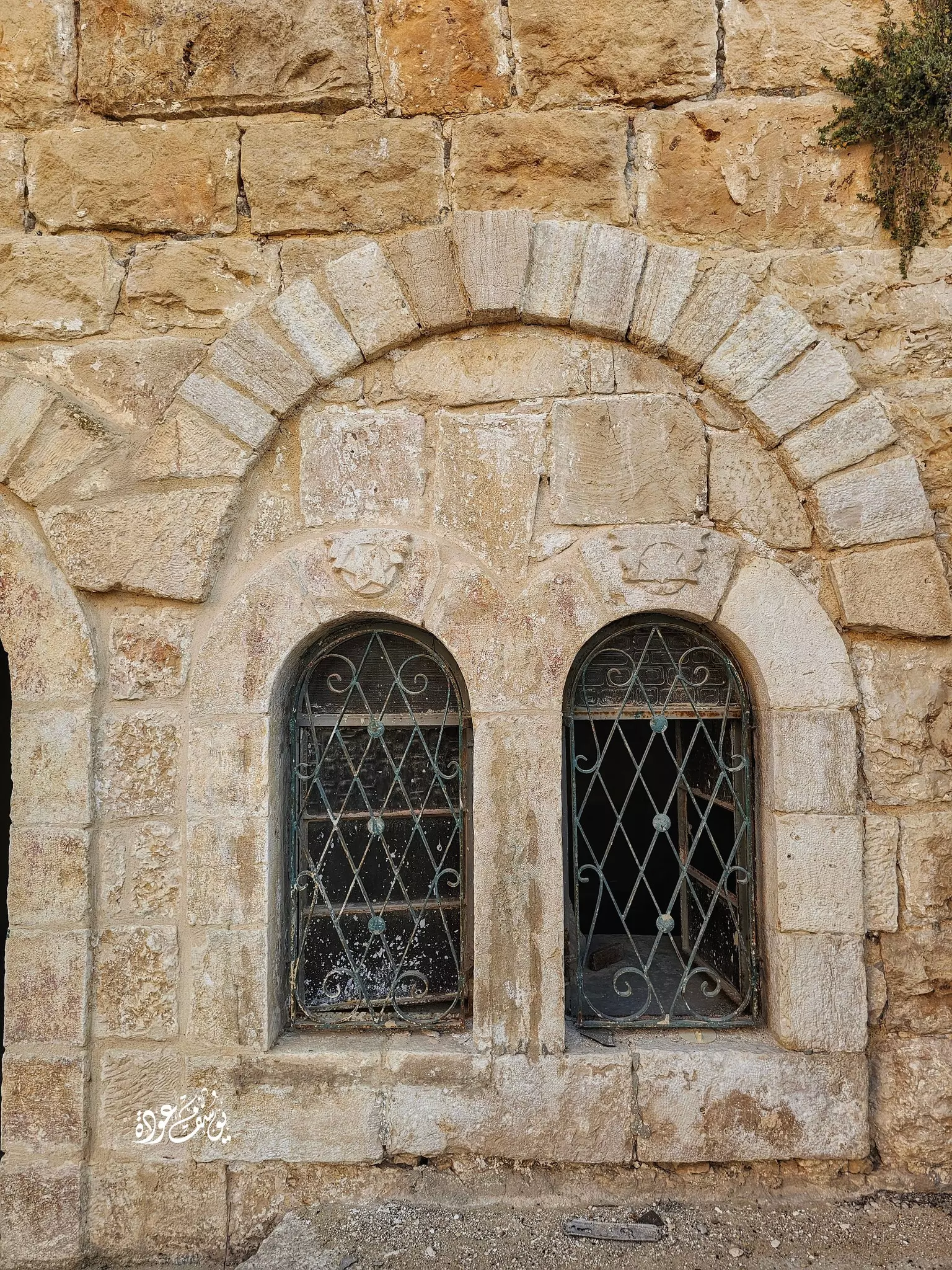
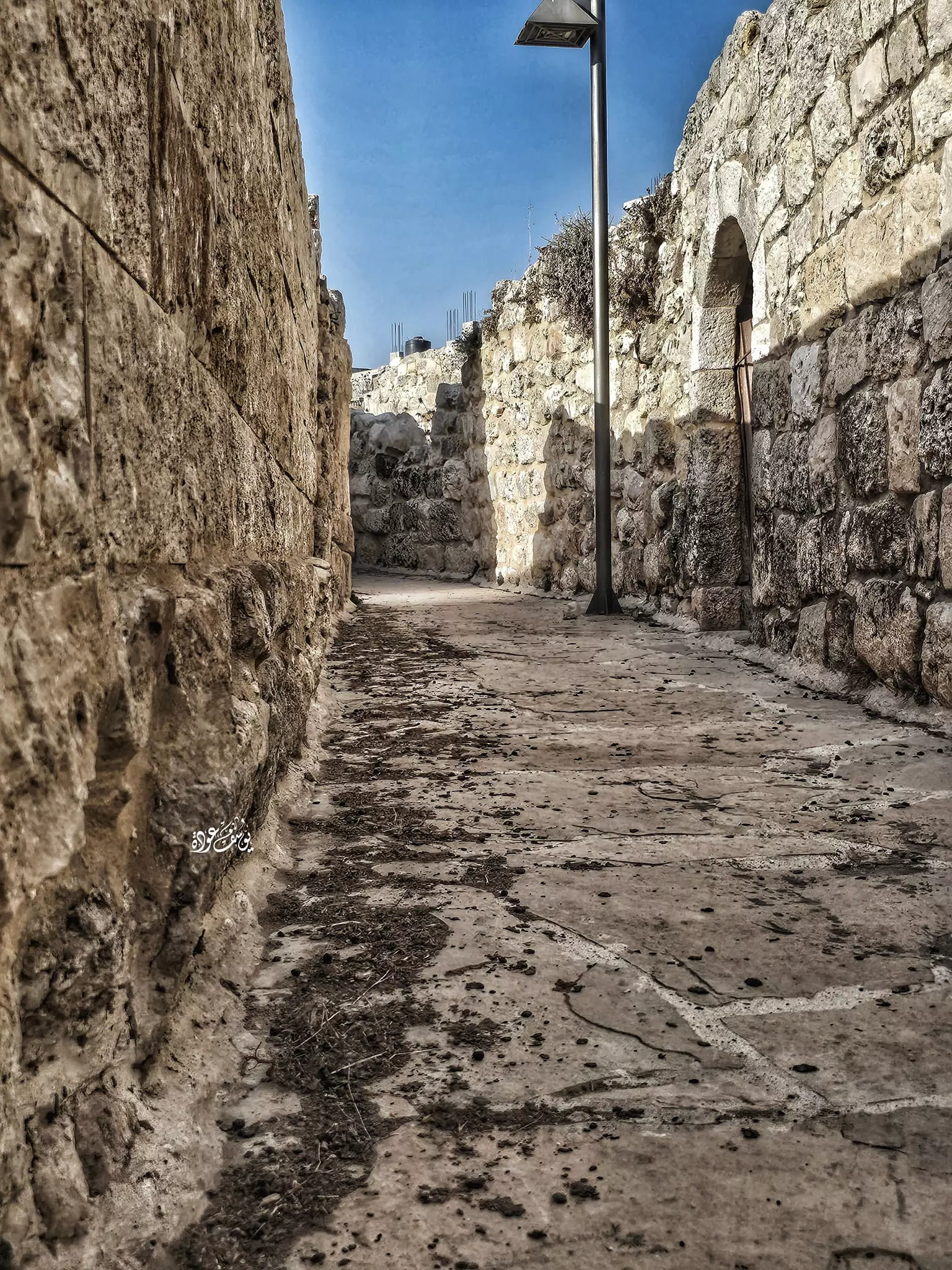
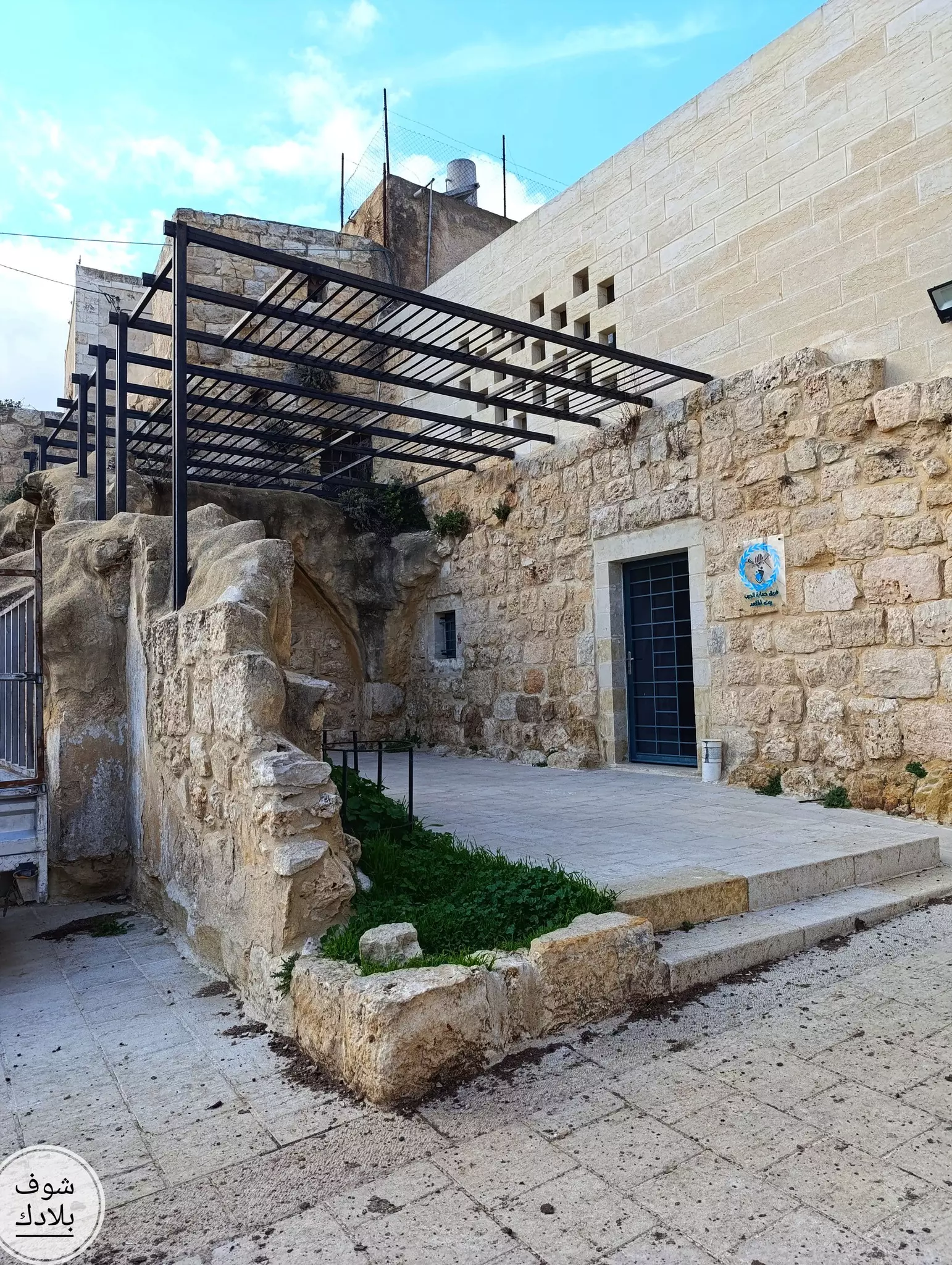
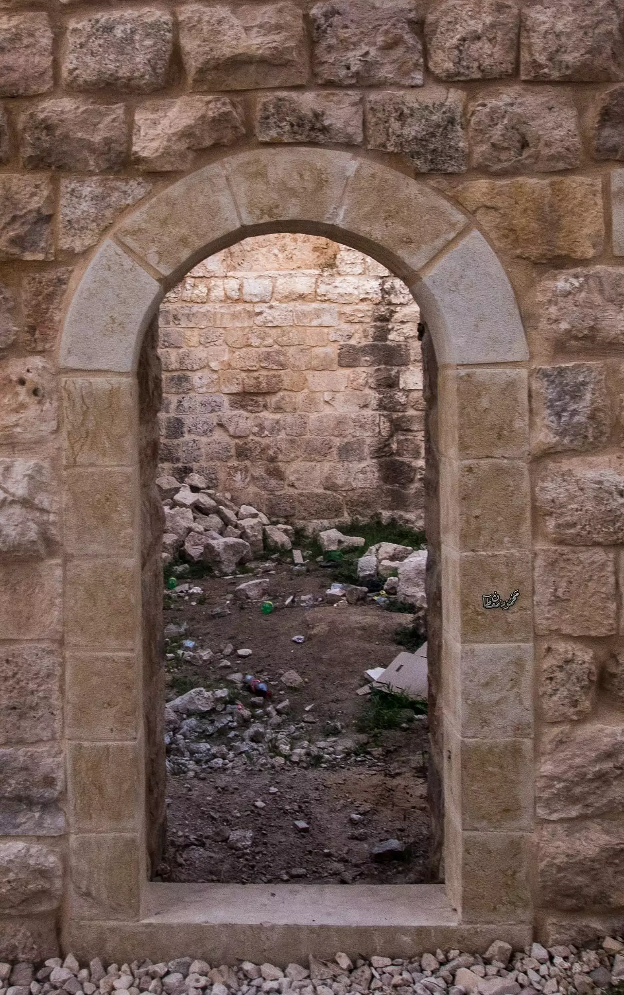
- جولة بين بيوت وأزقة البلدة القديمة --يوسف عودة
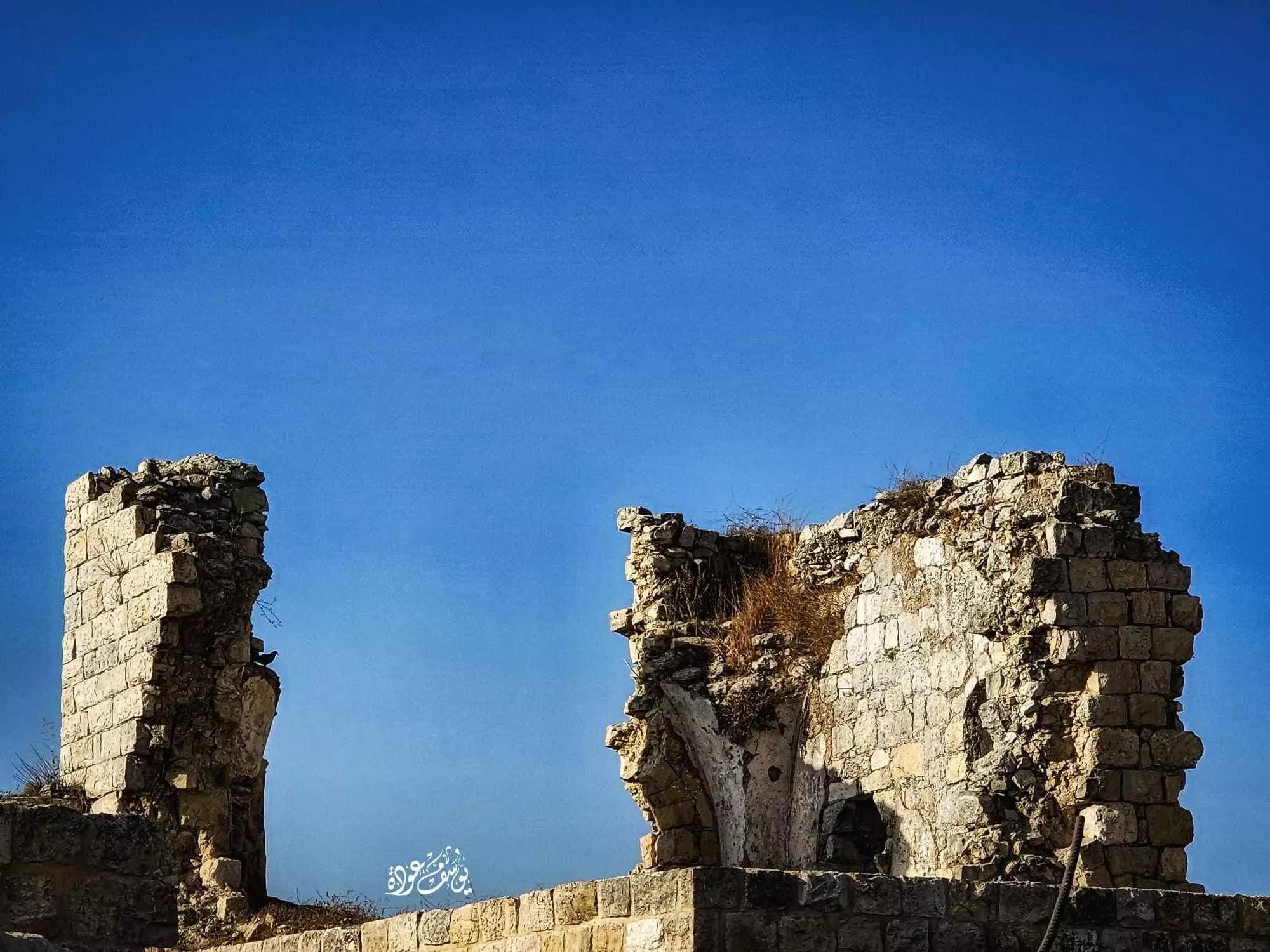
- جولة بين بيوت وأزقة البلدة القديمة --يوسف عودة #2
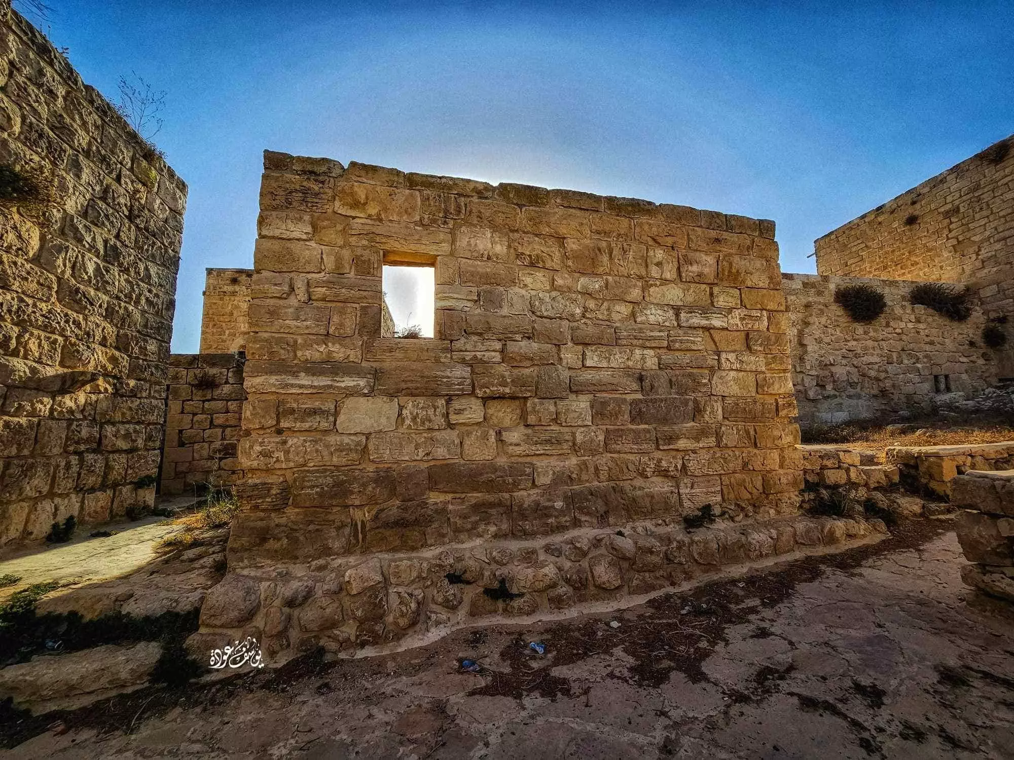
- جولة بين بيوت وأزقة البلدة القديمة --يوسف عودة #3
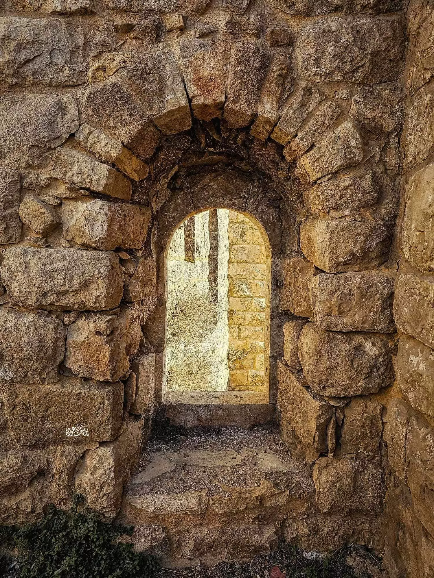
- جولة بين بيوت وأزقة البلدة القديمة --يوسف عودة #4
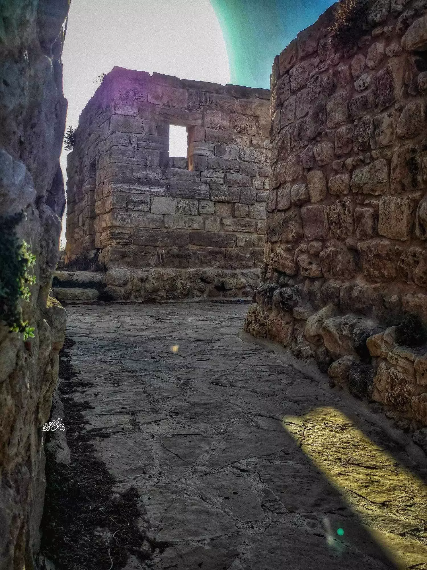
- جولة بين بيوت وأزقة البلدة القديمة --يوسف عودة #5
- جولة بين بيوت وأزقة البلدة القديمة --يوسف عودة #6
- جولة بين بيوت وأزقة البلدة القديمة --يوسف عودة #7
- جولة بين بيوت وأزقة البلدة القديمة --يوسف عودة #8
- جولة بين بيوت وأزقة البلدة القديمة --يوسف عودة #9
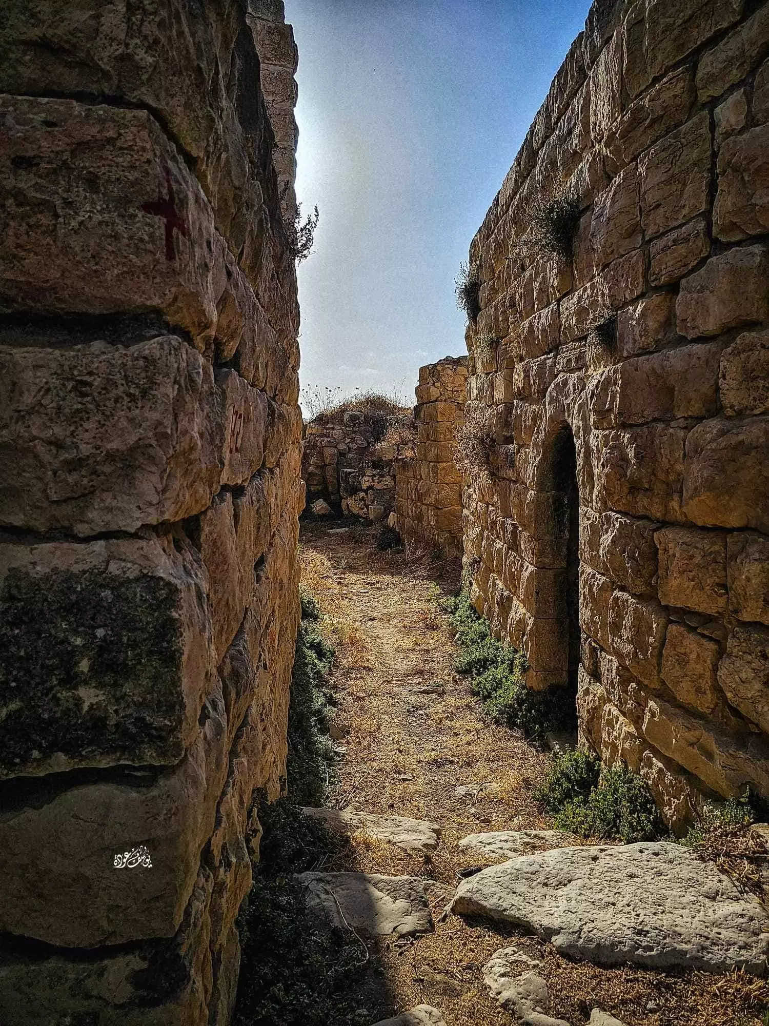
- جولة بين بيوت وأزقة البلدة القديمة --يوسف عودة #10
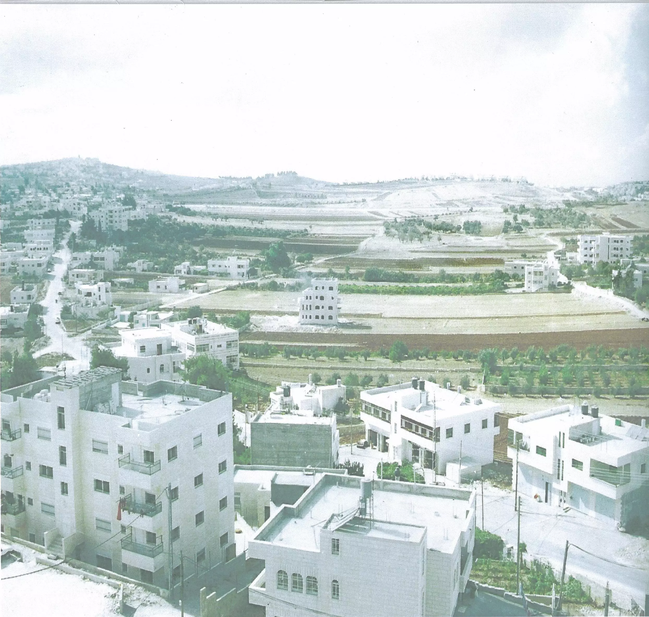
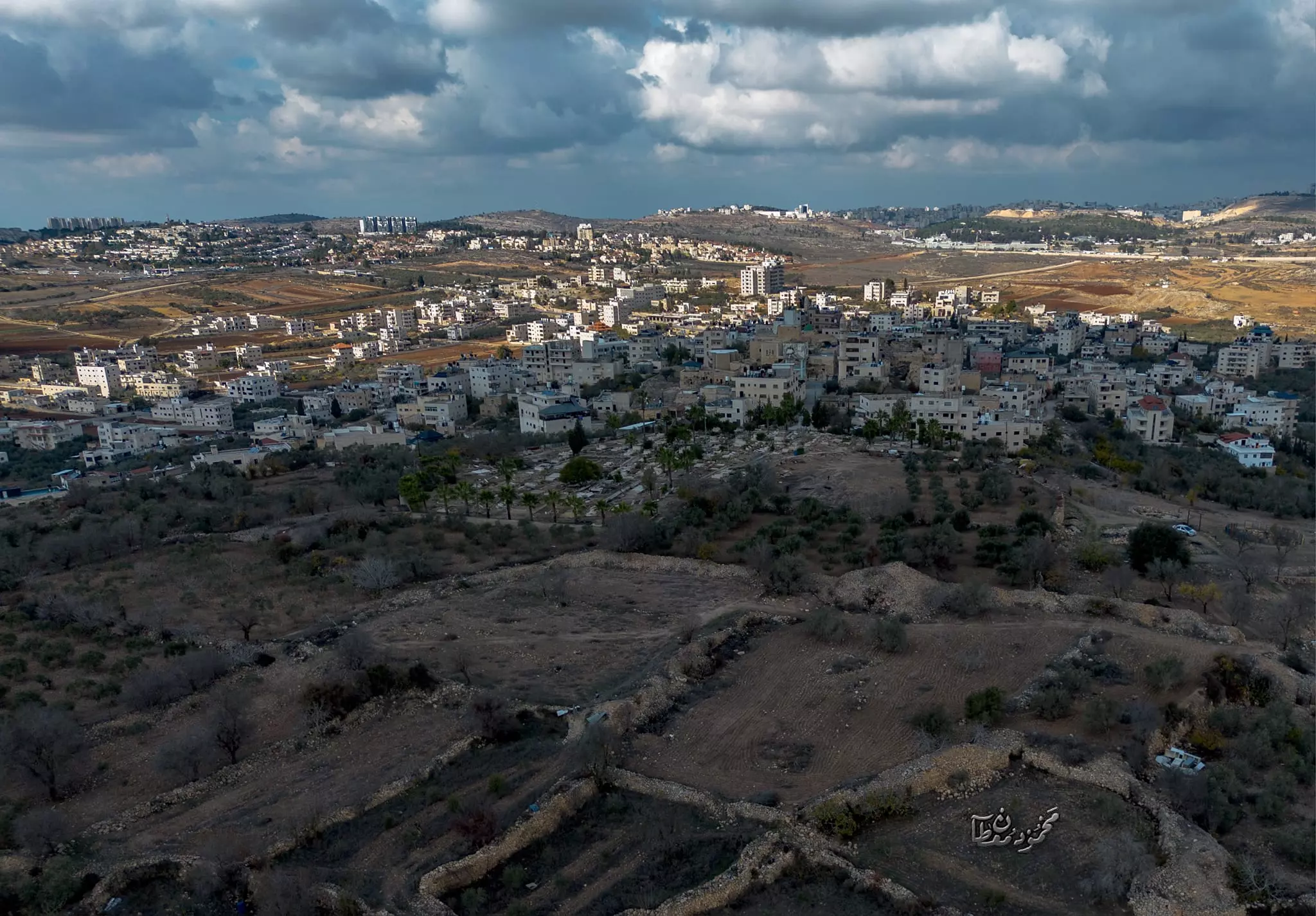
- منظر عام للبلدة -- 2012

- منظر عام للبلدة -- 1938-39
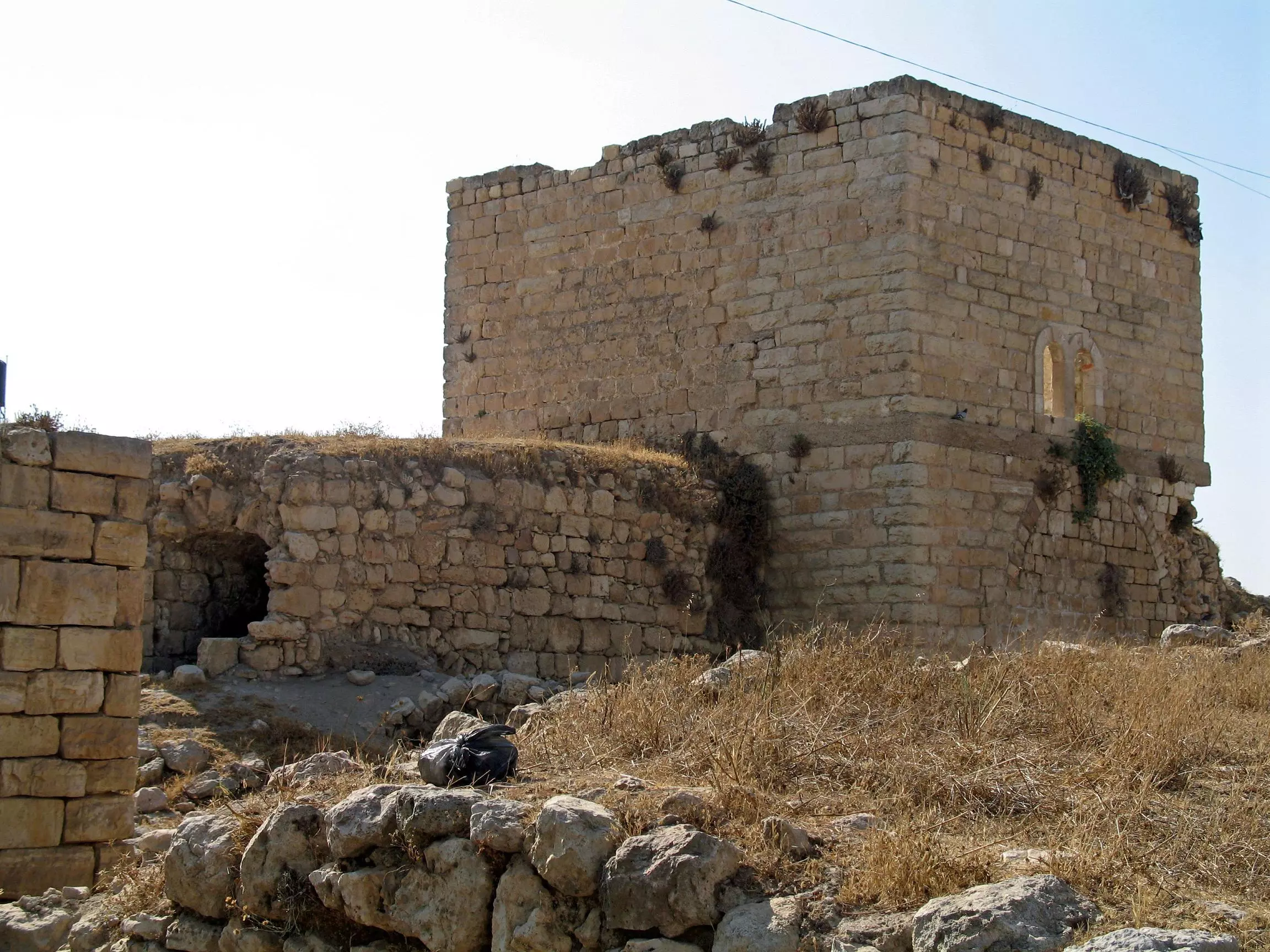
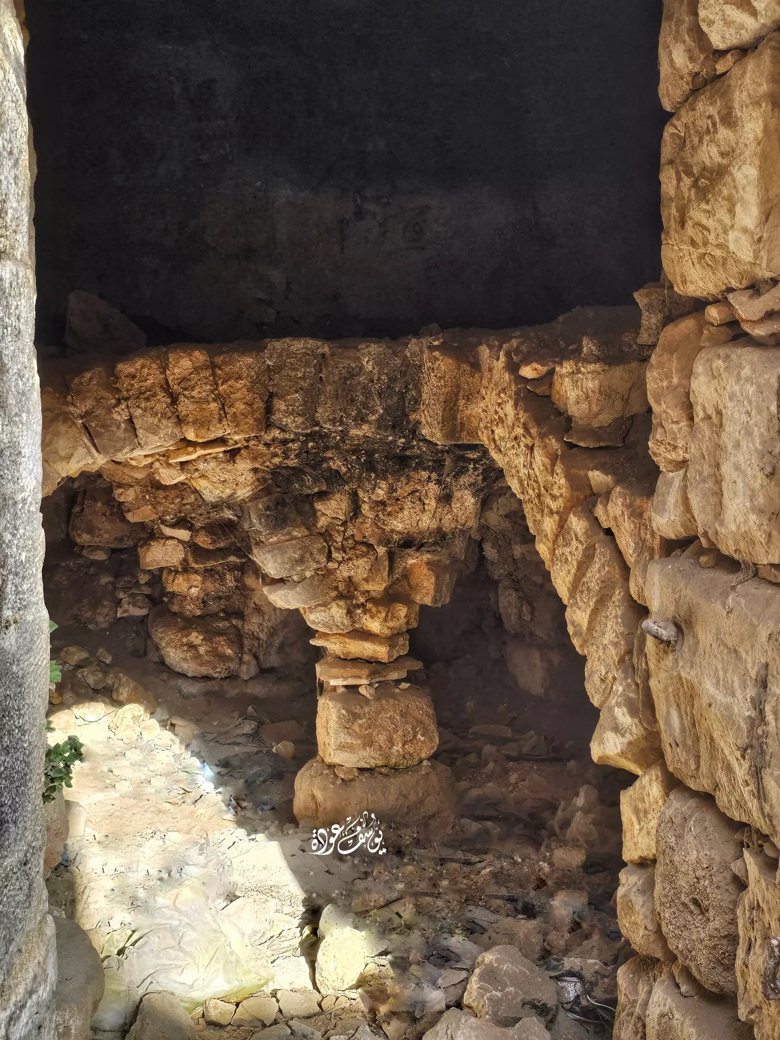
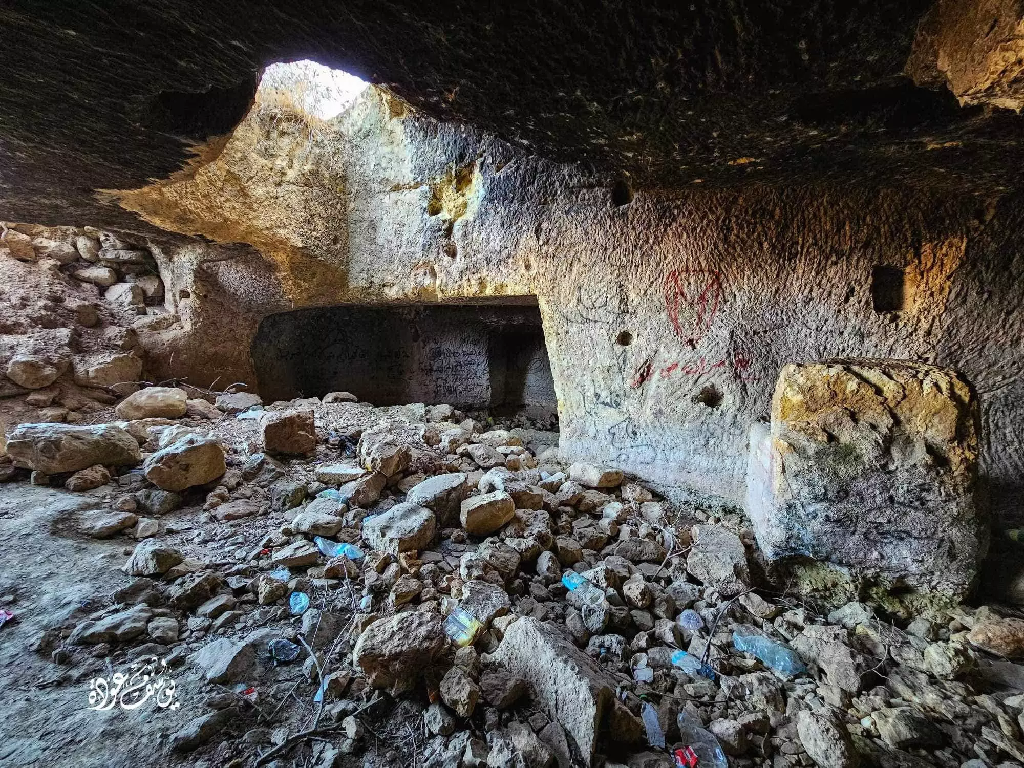
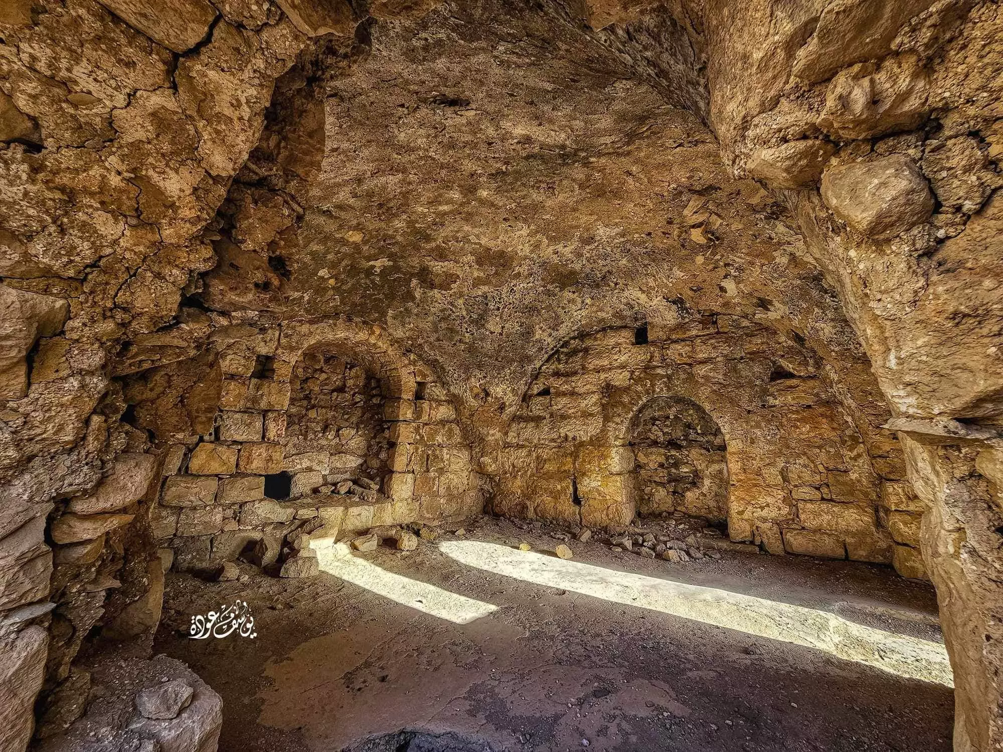
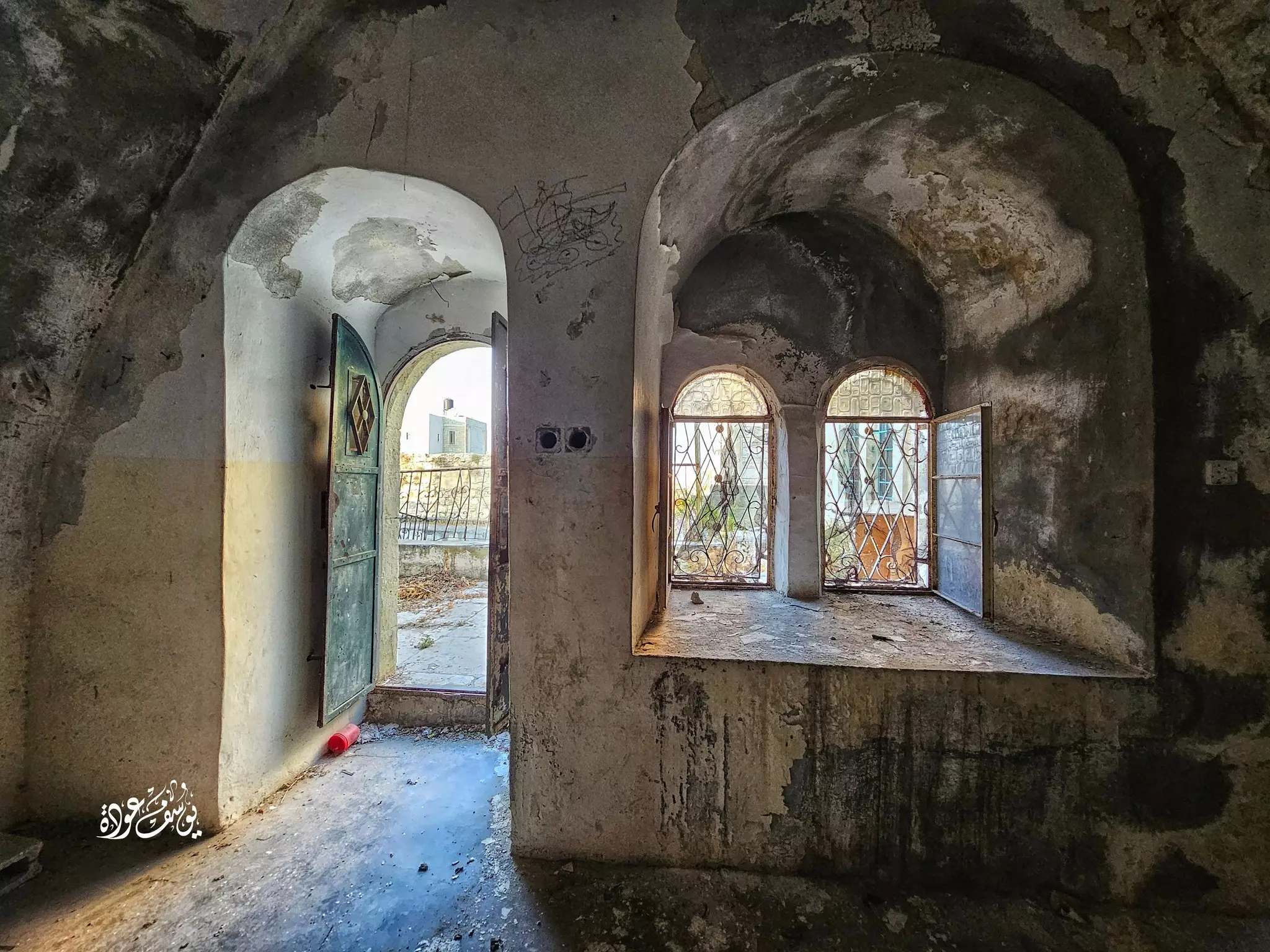
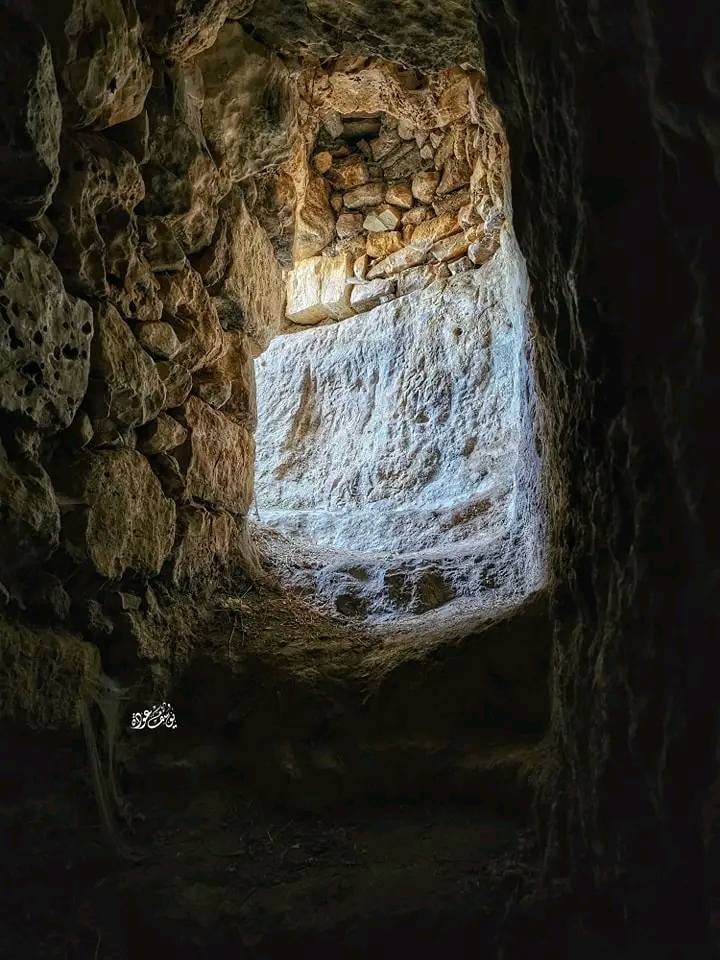
- جولة في احد البيوت القديمة -- يوسف عودة
- جولة في احد البيوت القديمة -- يوسف عودة #2
- جولة في احد البيوت القديمة -- يوسف عودة #3
- جولة في احد البيوت القديمة -- يوسف عودة #4
- جولة في احد البيوت القديمة -- يوسف عودة #5
- جولة في احد البيوت القديمة -- يوسف عودة #6
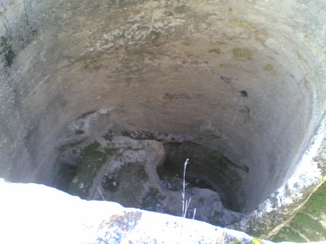
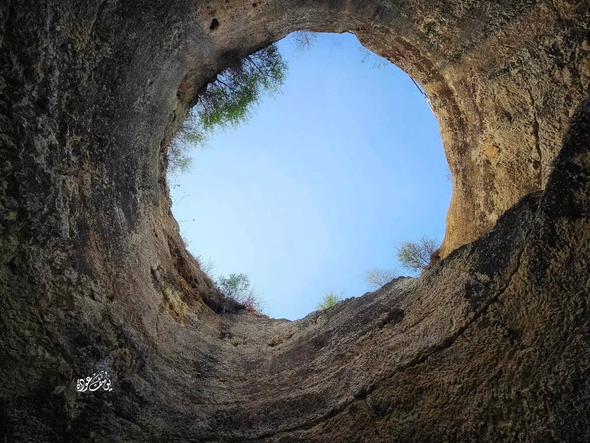
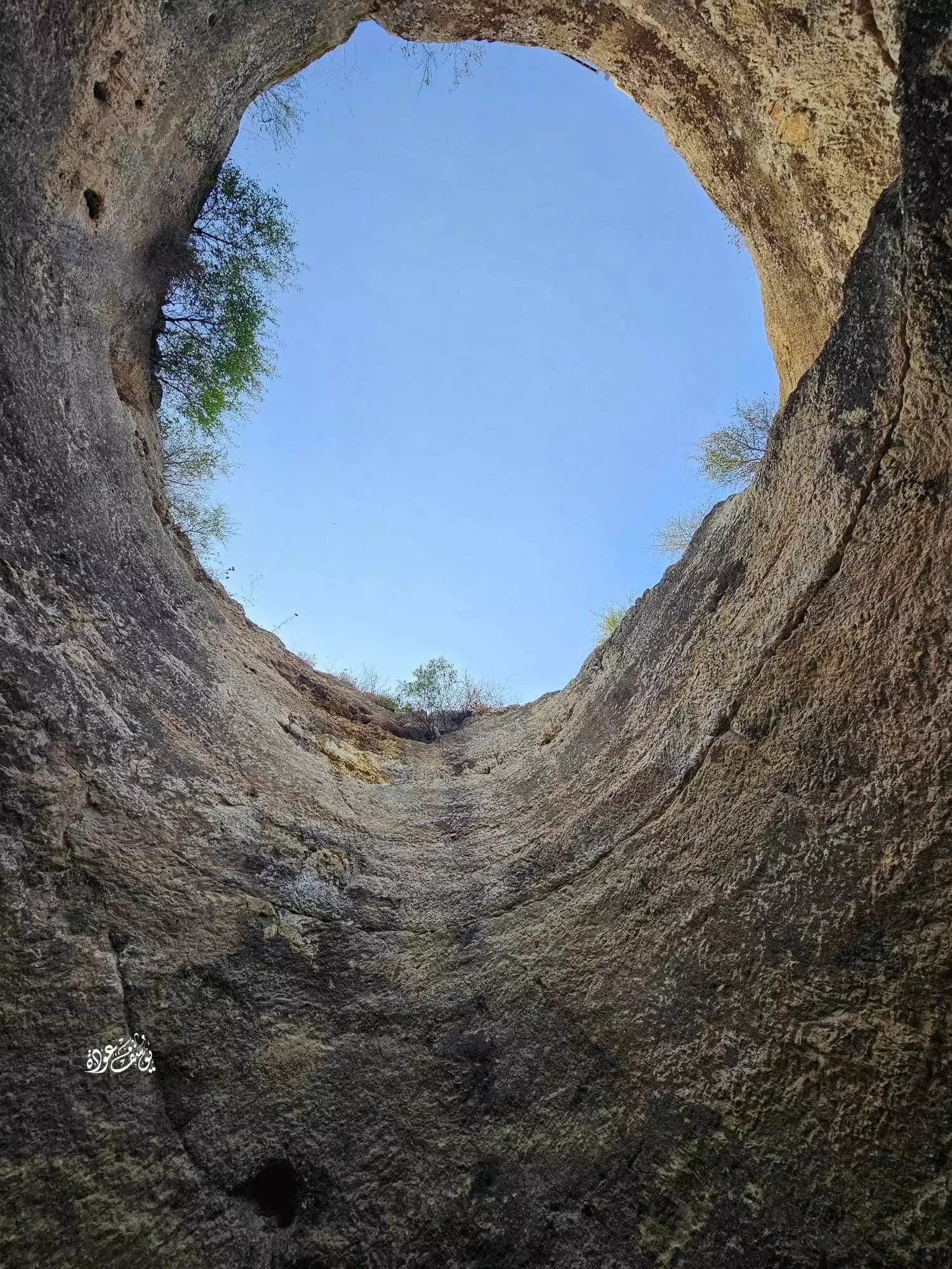
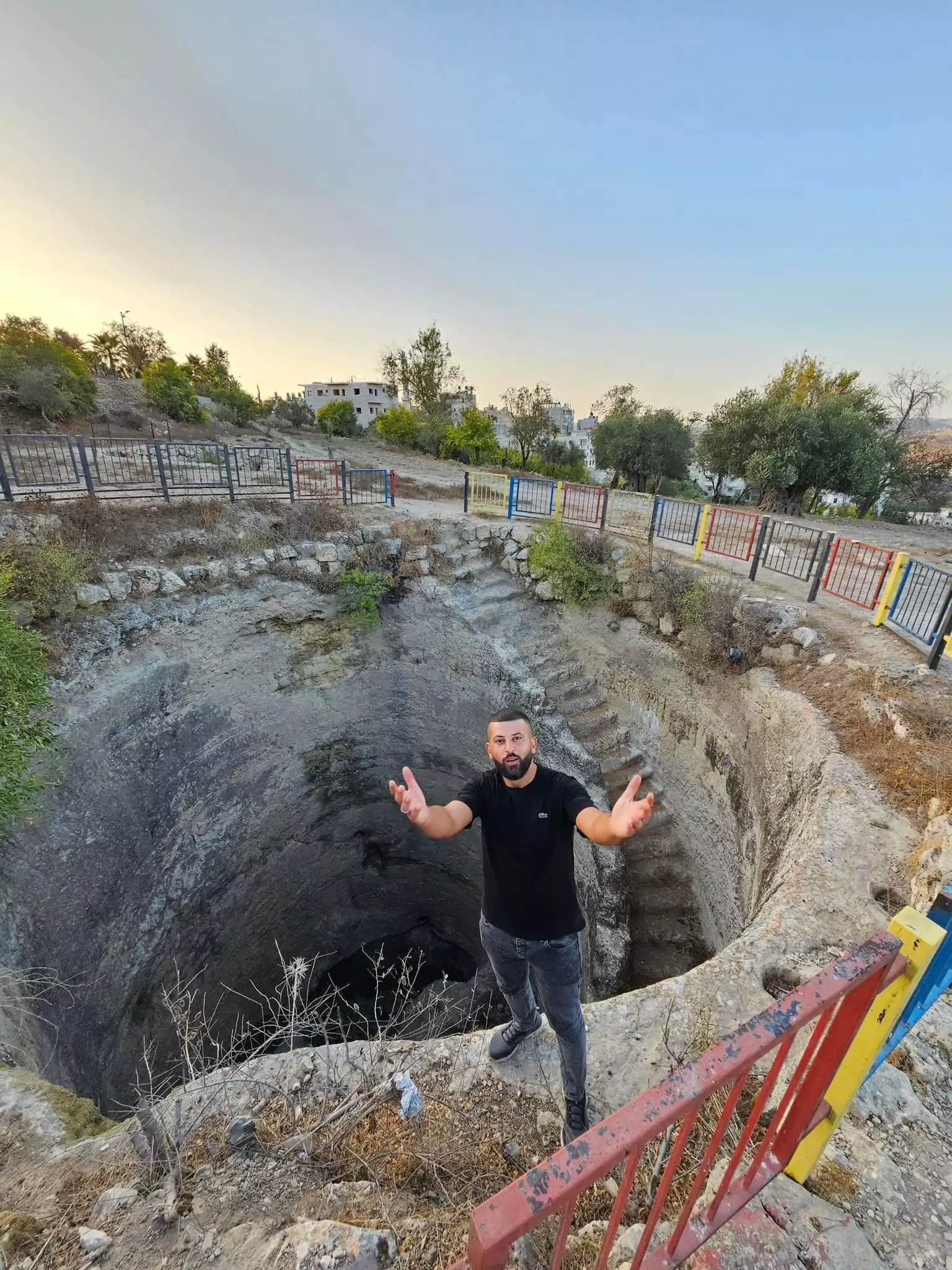
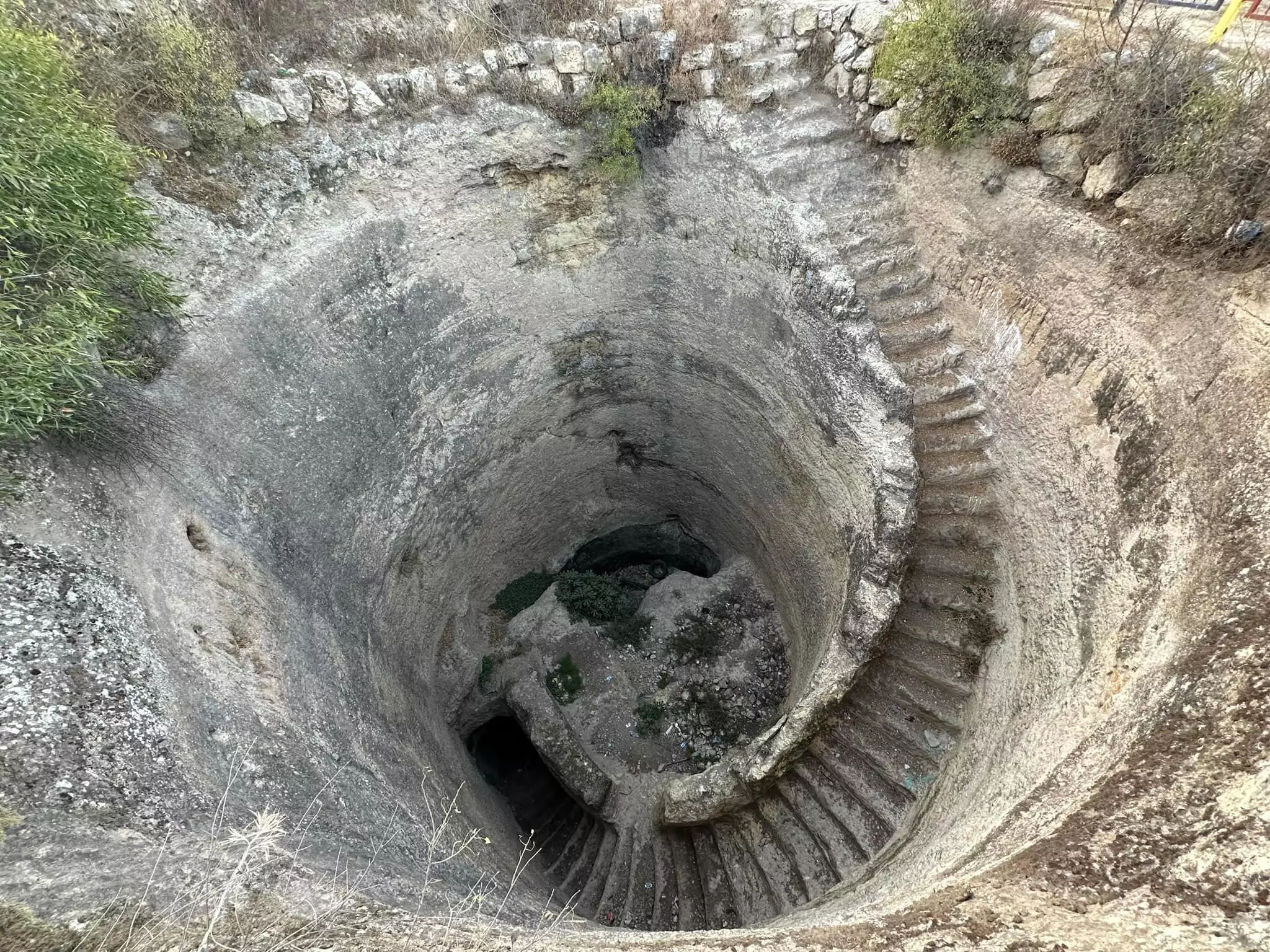
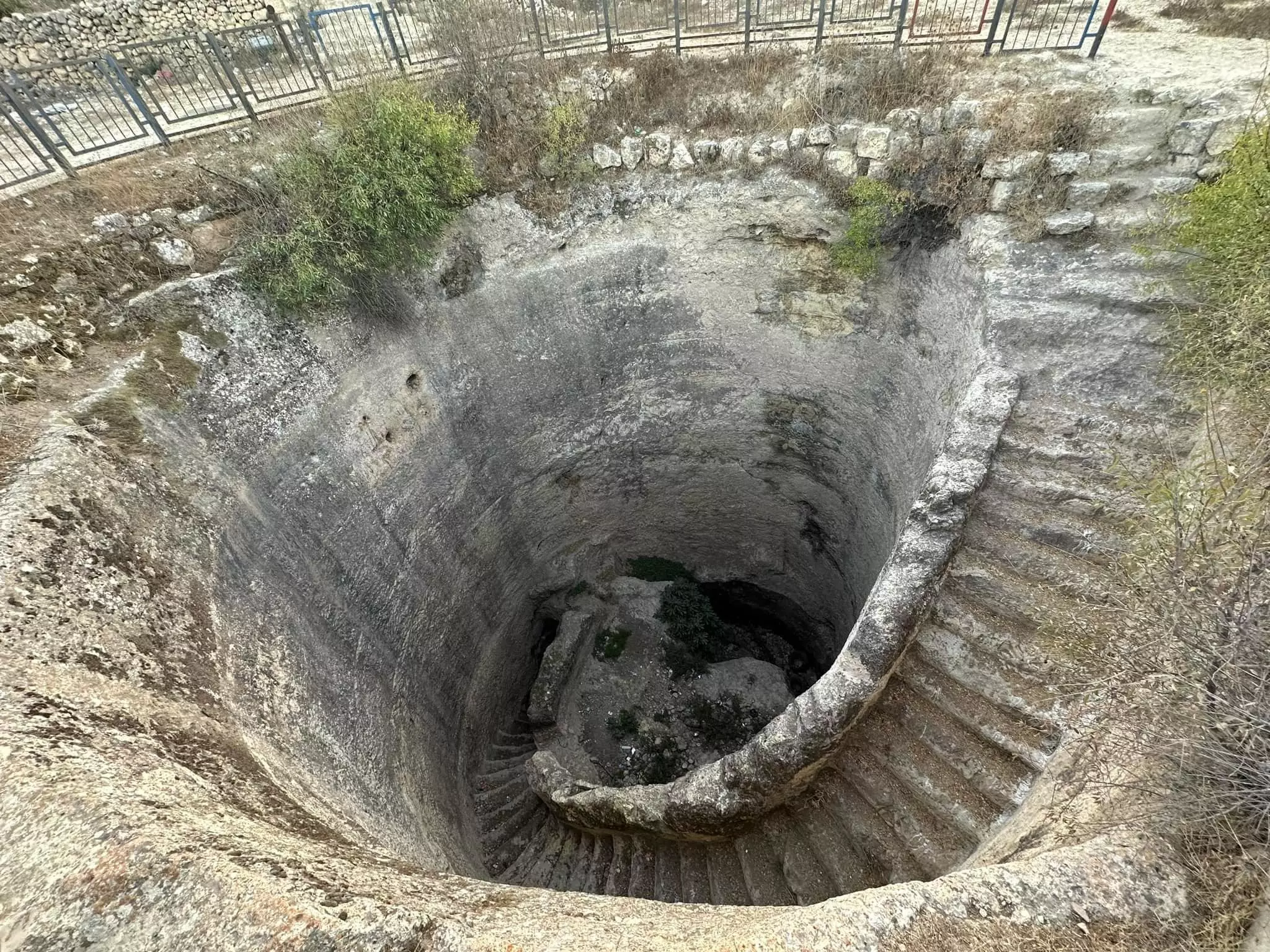
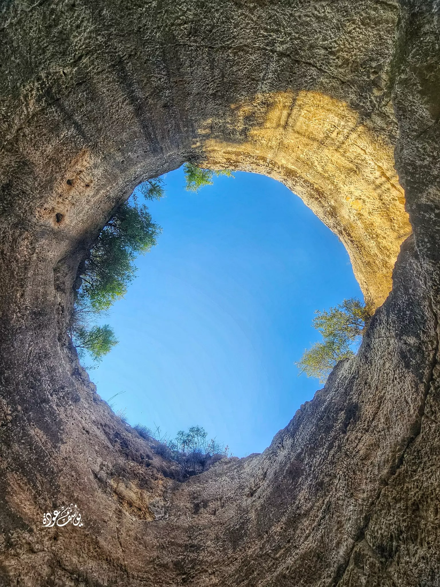
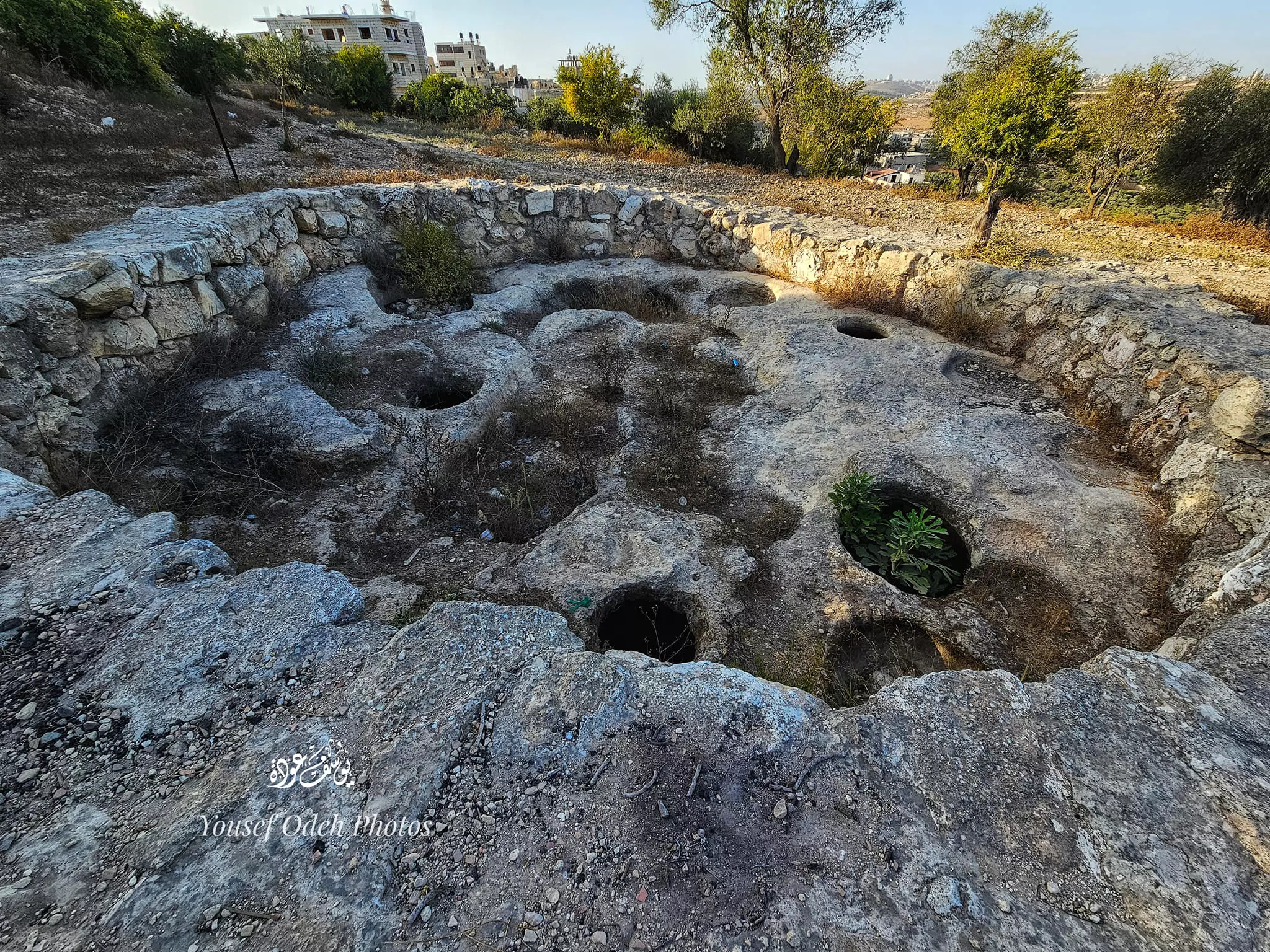
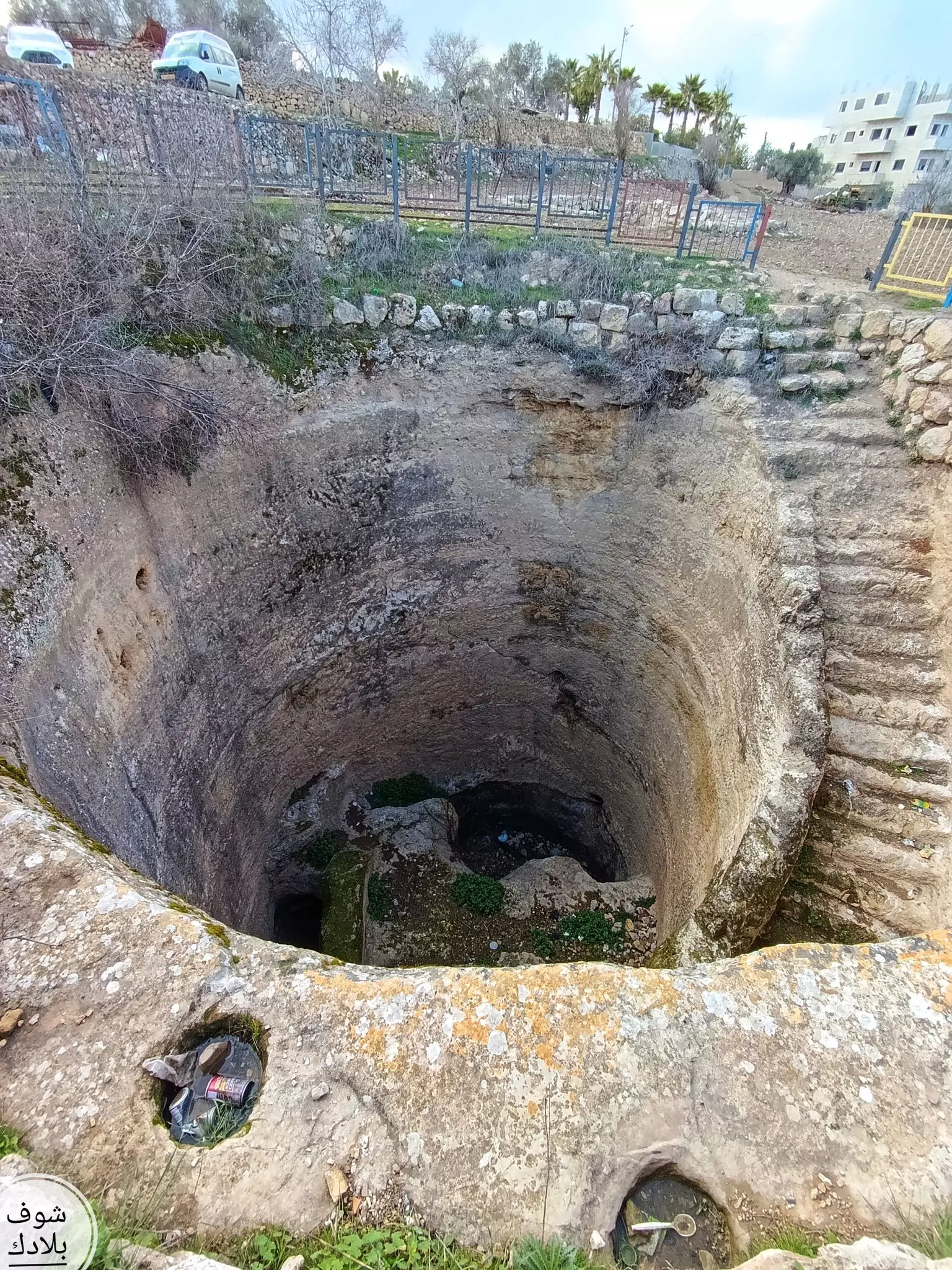
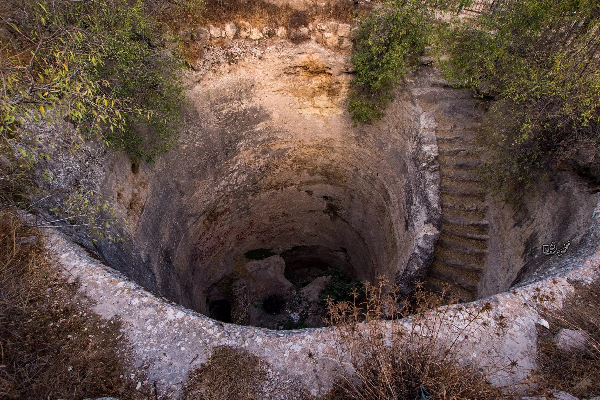
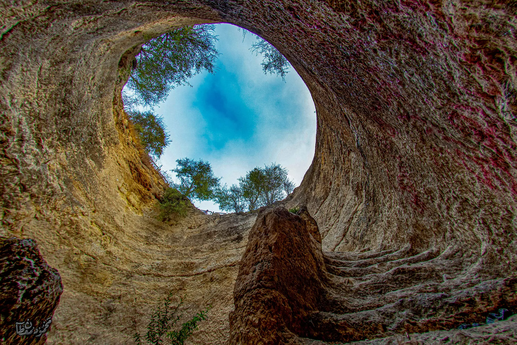
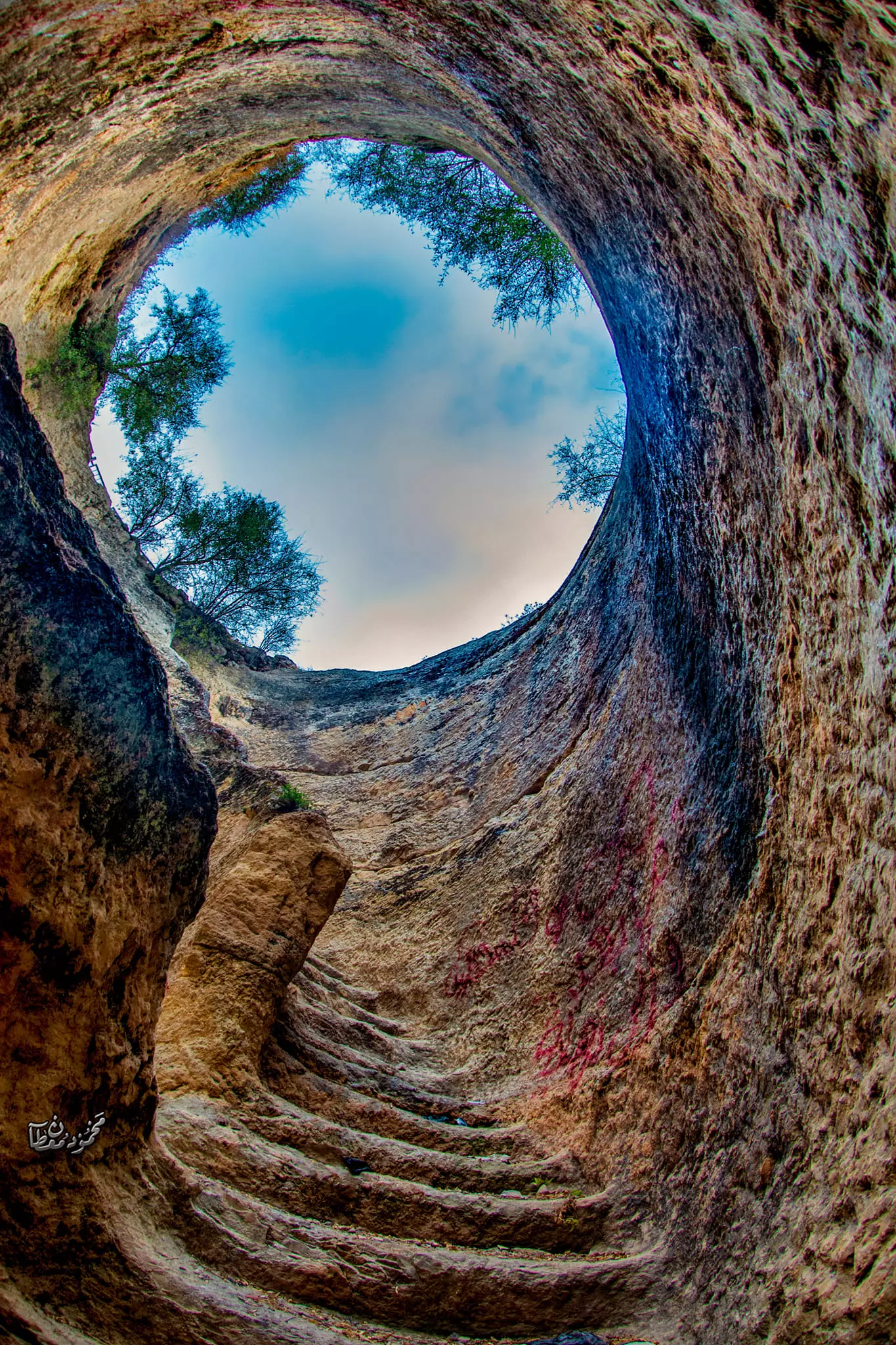
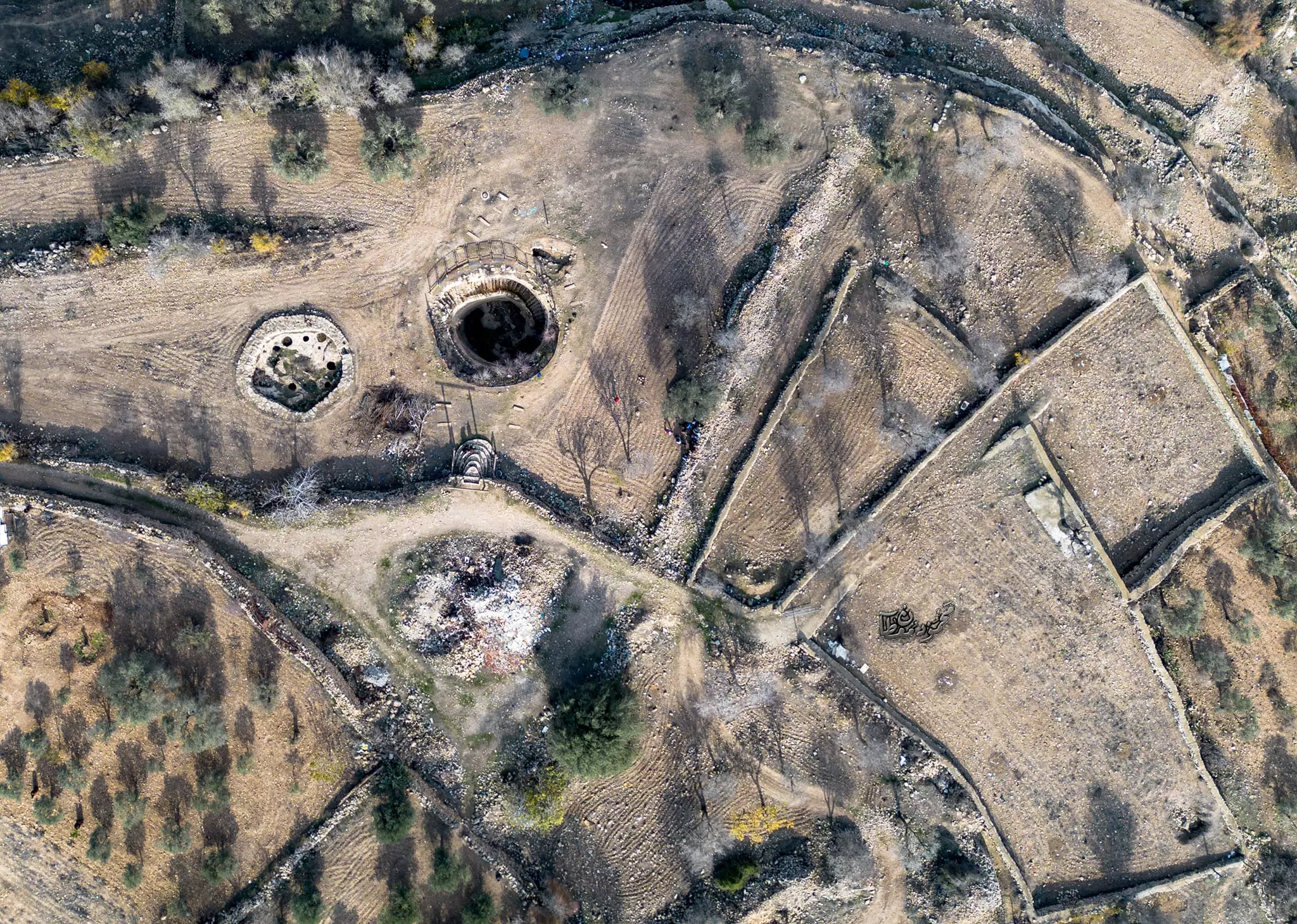
- بركة الجيب أو الحفرة... --عمرها أكثر من ٥٠٠٠ عام، من العصر البرونزي، أي فترة الممالك الكنعانية في فلسطين، وهي جزء من النظام المائي في المملكة، وتعد من أهم الإنجازات الهندسية في العالم القديم -- Yousif Odeh
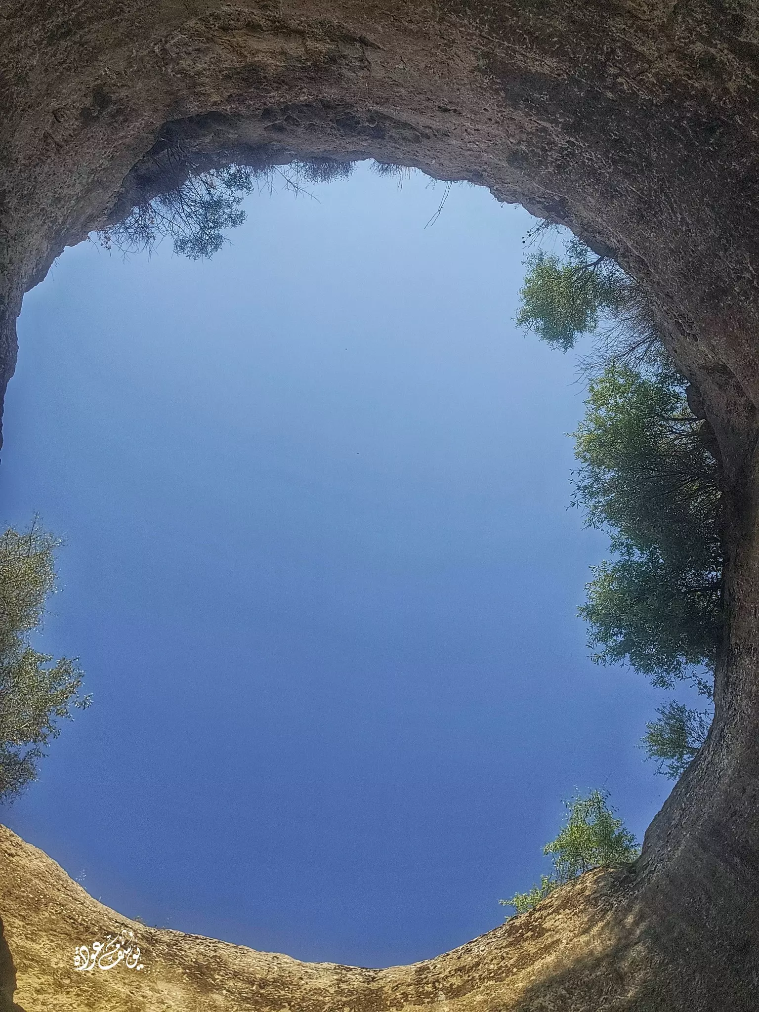
- بركة الجيب أو الحفرة... --عمرها أكثر من ٥٠٠٠ عام، من العصر البرونزي، أي فترة الممالك الكنعانية في فلسطين، وهي جزء من النظام المائي في المملكة، وتعد من أهم الإنجازات الهندسية في العالم القديم -- Yousif Odeh #2
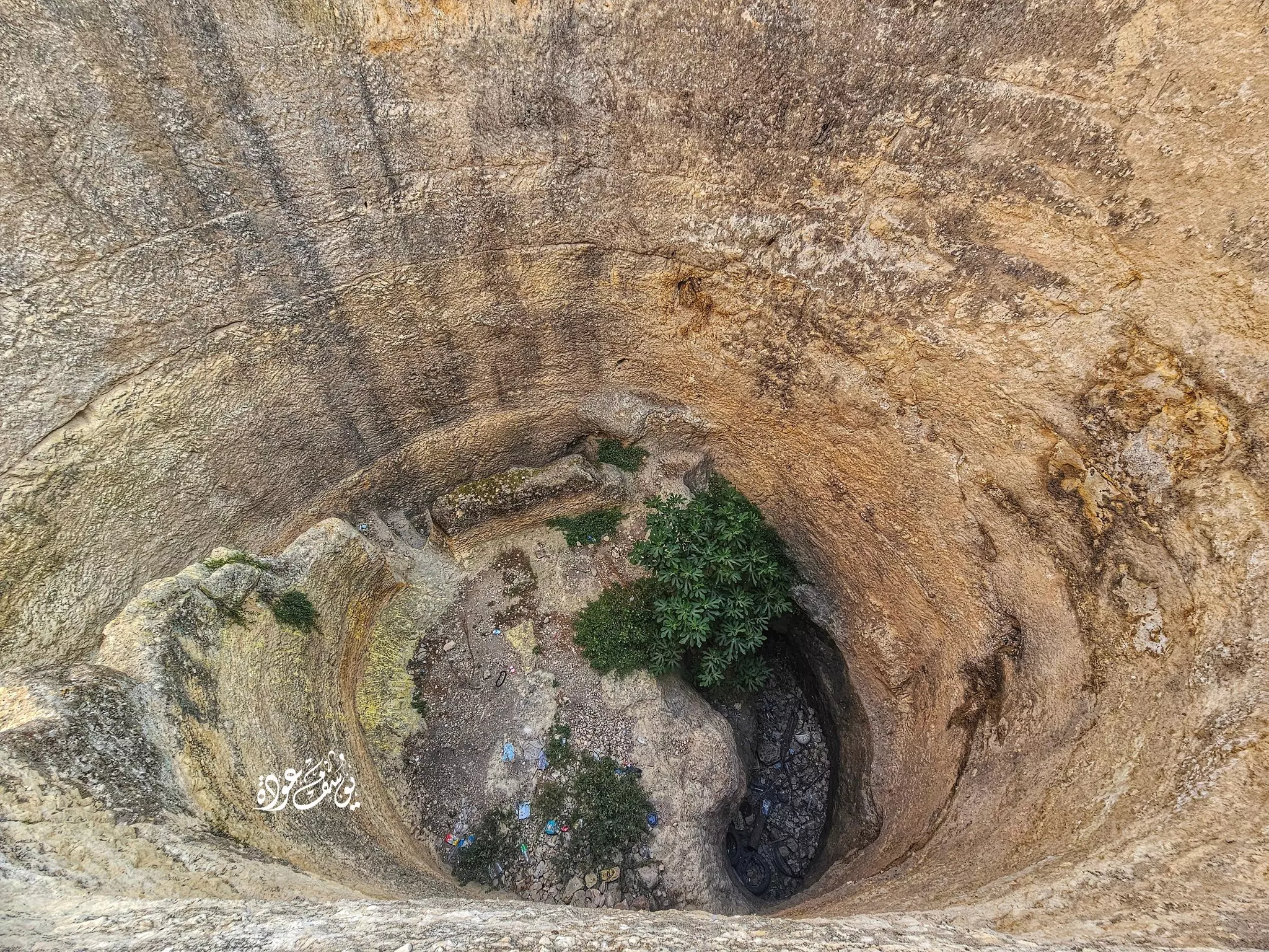
- بركة الجيب أو الحفرة... --عمرها أكثر من ٥٠٠٠ عام، من العصر البرونزي، أي فترة الممالك الكنعانية في فلسطين، وهي جزء من النظام المائي في المملكة، وتعد من أهم الإنجازات الهندسية في العالم القديم -- Yousif Odeh #3
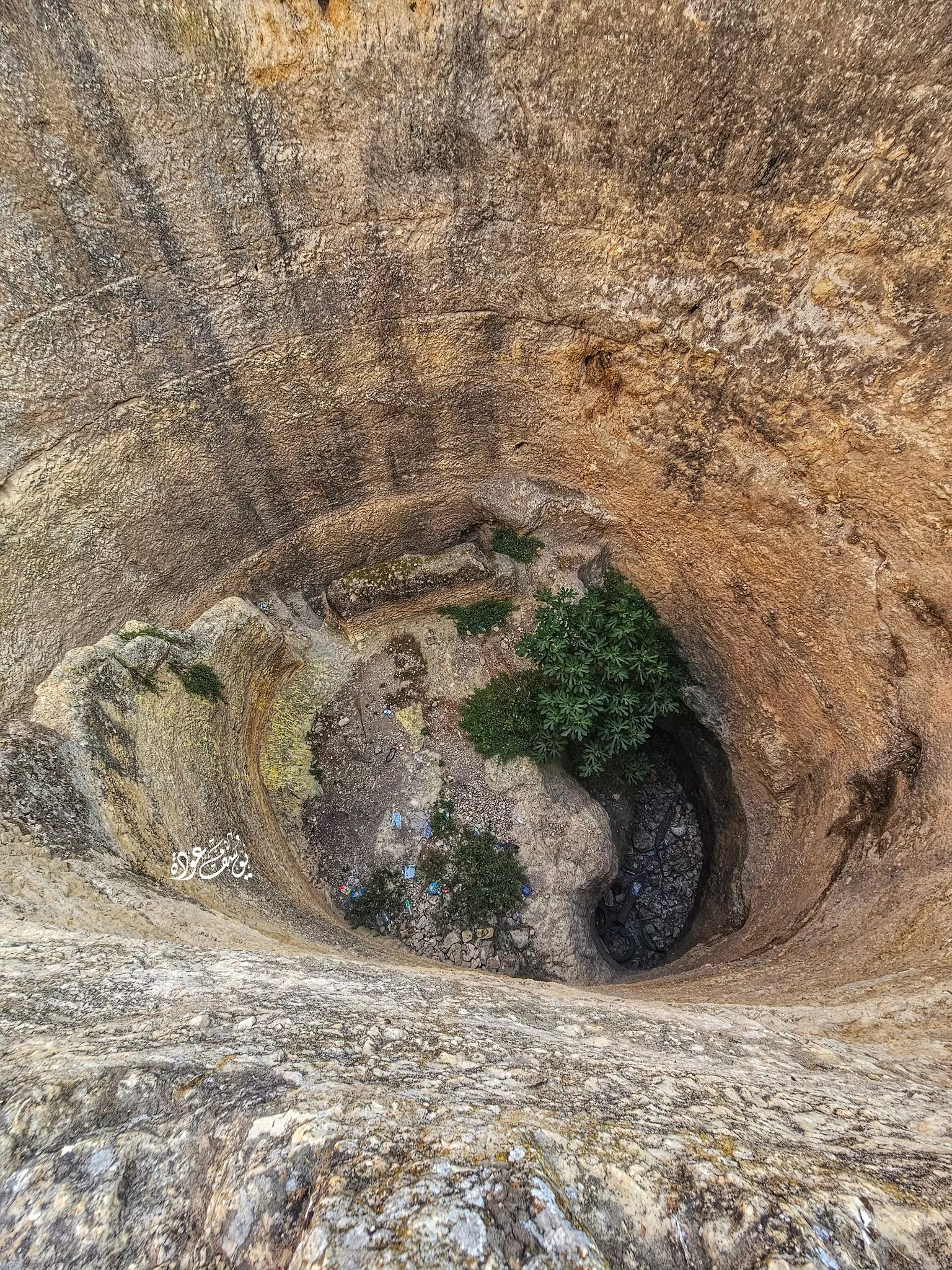
- بركة الجيب أو الحفرة... --عمرها أكثر من ٥٠٠٠ عام، من العصر البرونزي، أي فترة الممالك الكنعانية في فلسطين، وهي جزء من النظام المائي في المملكة، وتعد من أهم الإنجازات الهندسية في العالم القديم -- Yousif Odeh #6
- بركة الجيب أو الحفرة... --عمرها أكثر من ٥٠٠٠ عام، من العصر البرونزي، أي فترة الممالك الكنعانية في فلسطين، وهي جزء من النظام المائي في المملكة، وتعد من أهم الإنجازات الهندسية في العالم القديم -- Yousif Odeh #5
- بركة الجيب أو الحفرة... --عمرها أكثر من ٥٠٠٠ عام، من العصر البرونزي، أي فترة الممالك الكنعانية في فلسطين، وهي جزء من النظام المائي في المملكة، وتعد من أهم الإنجازات الهندسية في العالم القديم -- Yousif Odeh #4
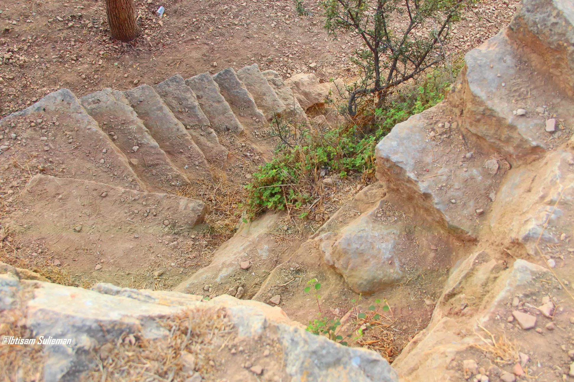
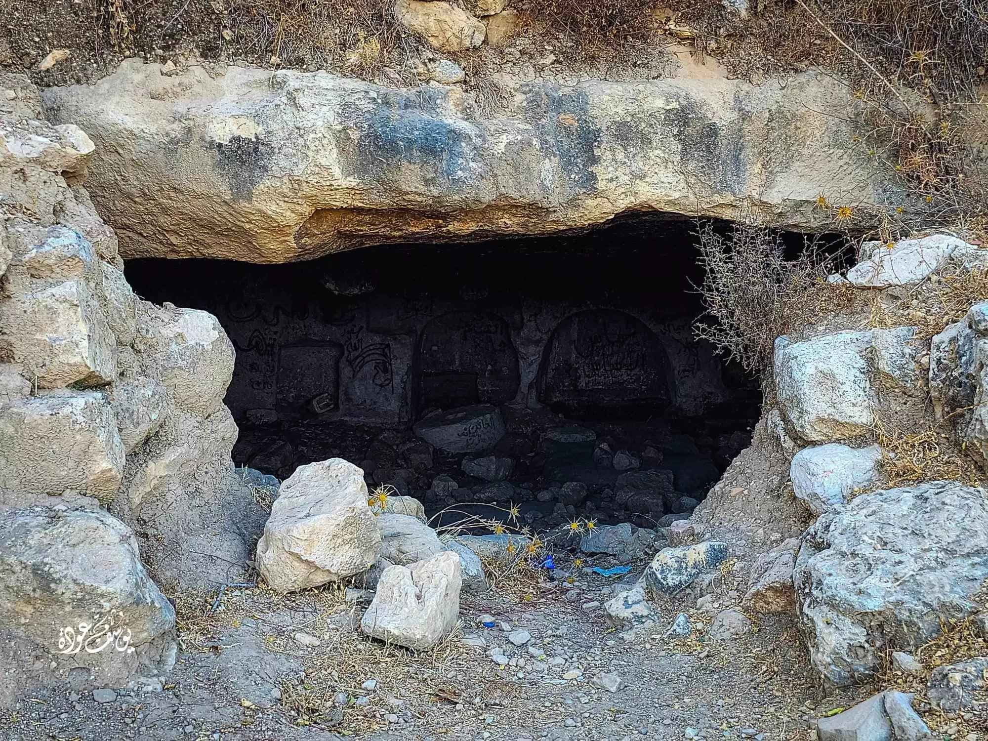
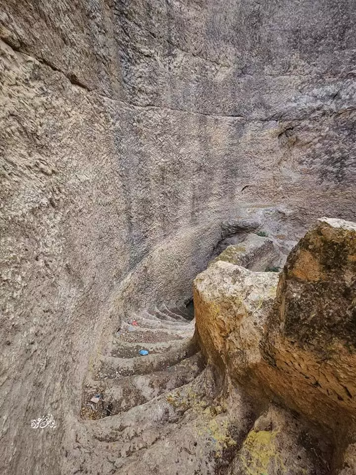
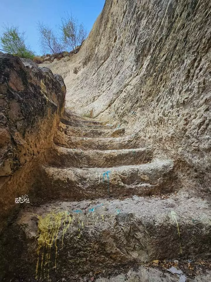
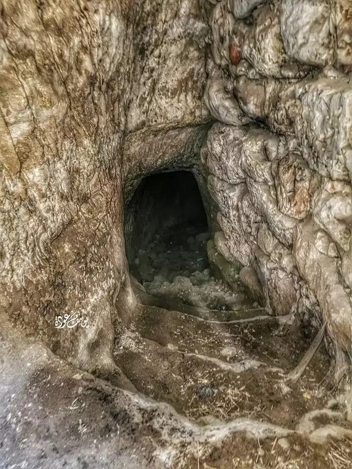
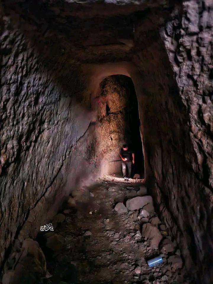
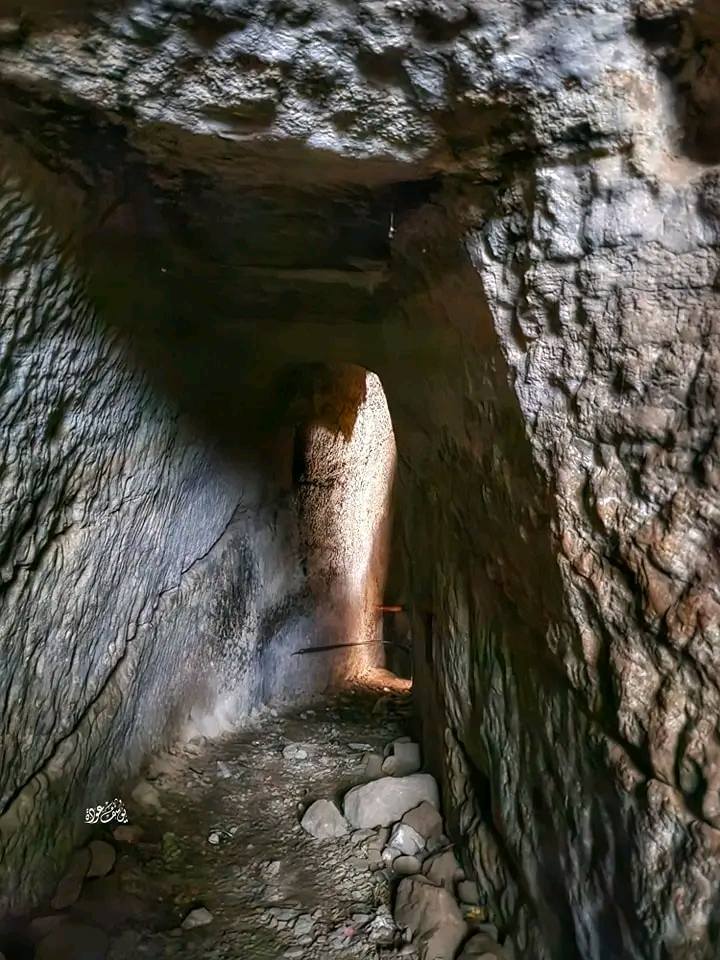
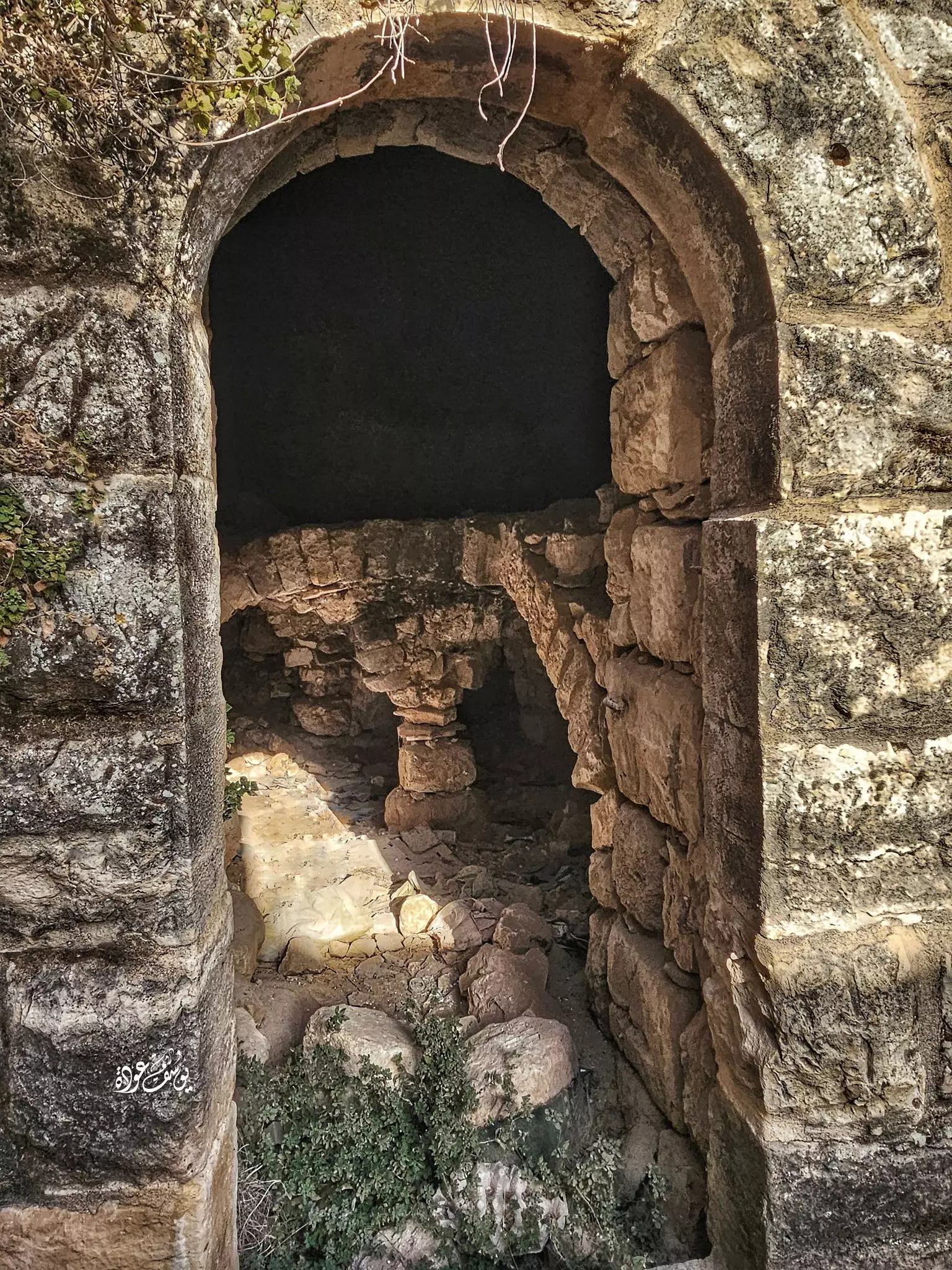
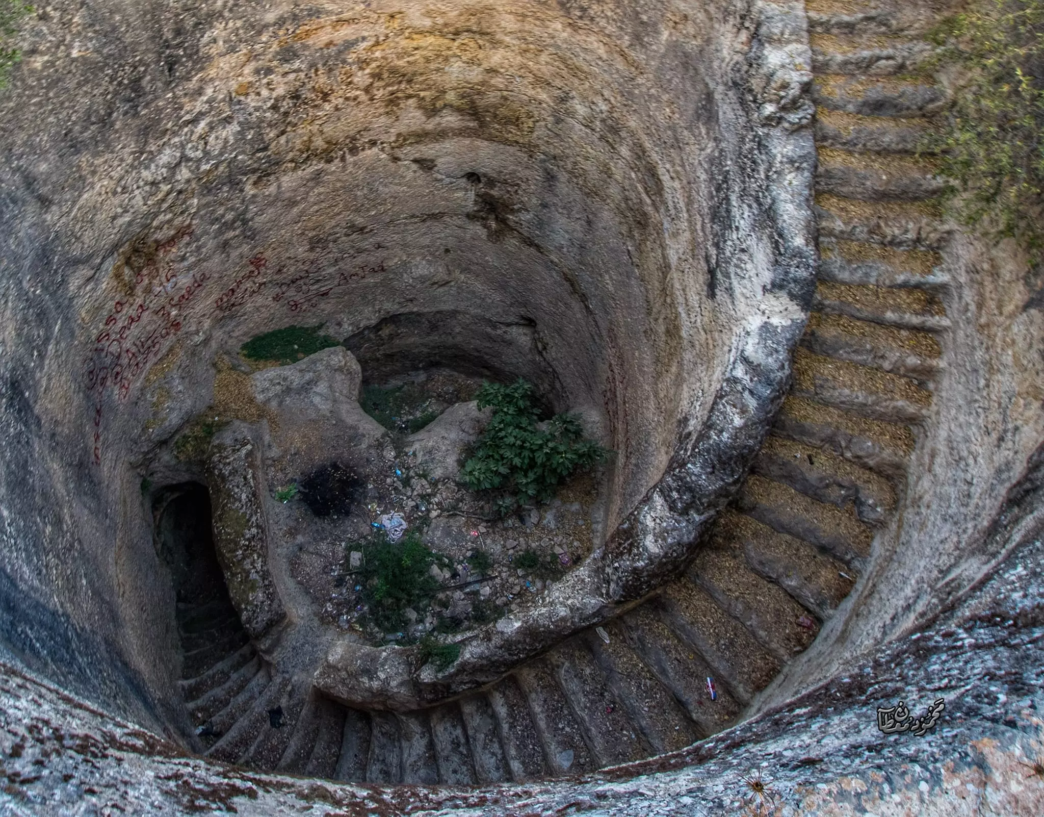
- سرداب يقع بجانب خزان مياه جبعون، سرداب بفتحة صغيرة تهبط تحت الأرض حوالي ٧٠ درجة صخرية -- يوسف عودة
- سرداب يقع بجانب خزان مياه جبعون، سرداب بفتحة صغيرة تهبط تحت الأرض حوالي ٧٠ درجة صخرية -- يوسف عودة #2
- سرداب يقع بجانب خزان مياه جبعون، سرداب بفتحة صغيرة تهبط تحت الأرض حوالي ٧٠ درجة صخرية -- يوسف عودة #3
- سرداب يقع بجانب خزان مياه جبعون، سرداب بفتحة صغيرة تهبط تحت الأرض حوالي ٧٠ درجة صخرية -- يوسف عودة #4
- سرداب يقع بجانب خزان مياه جبعون، سرداب بفتحة صغيرة تهبط تحت الأرض حوالي ٧٠ درجة صخرية -- يوسف عودة #5
- سرداب يقع بجانب خزان مياه جبعون، سرداب بفتحة صغيرة تهبط تحت الأرض حوالي ٧٠ درجة صخرية -- يوسف عودة #6
- سرداب يقع بجانب خزان مياه جبعون، سرداب بفتحة صغيرة تهبط تحت الأرض حوالي ٧٠ درجة صخرية -- يوسف عودة #7
- منظر عام -- يوسف عودة
- جولة رائعه في معصرة زيتون من الفترة الرومانية في الصخر -- يوسف عودة
- جولة رائعه في معصرة زيتون من الفترة الرومانية في الصخر -- يوسف عودة #2
- جولة رائعه في معصرة زيتون من الفترة الرومانية في الصخر -- يوسف عودة #3
- جولة رائعه في معصرة زيتون من الفترة الرومانية في الصخر -- يوسف عودة #4
- جولة رائعه في معصرة زيتون من الفترة الرومانية في الصخر -- يوسف عودة #5
- جولة رائعه في معصرة زيتون من الفترة الرومانية في الصخر -- يوسف عودة #6
- منظر في احد بيوت القرية القديمة -- يوسف عودة
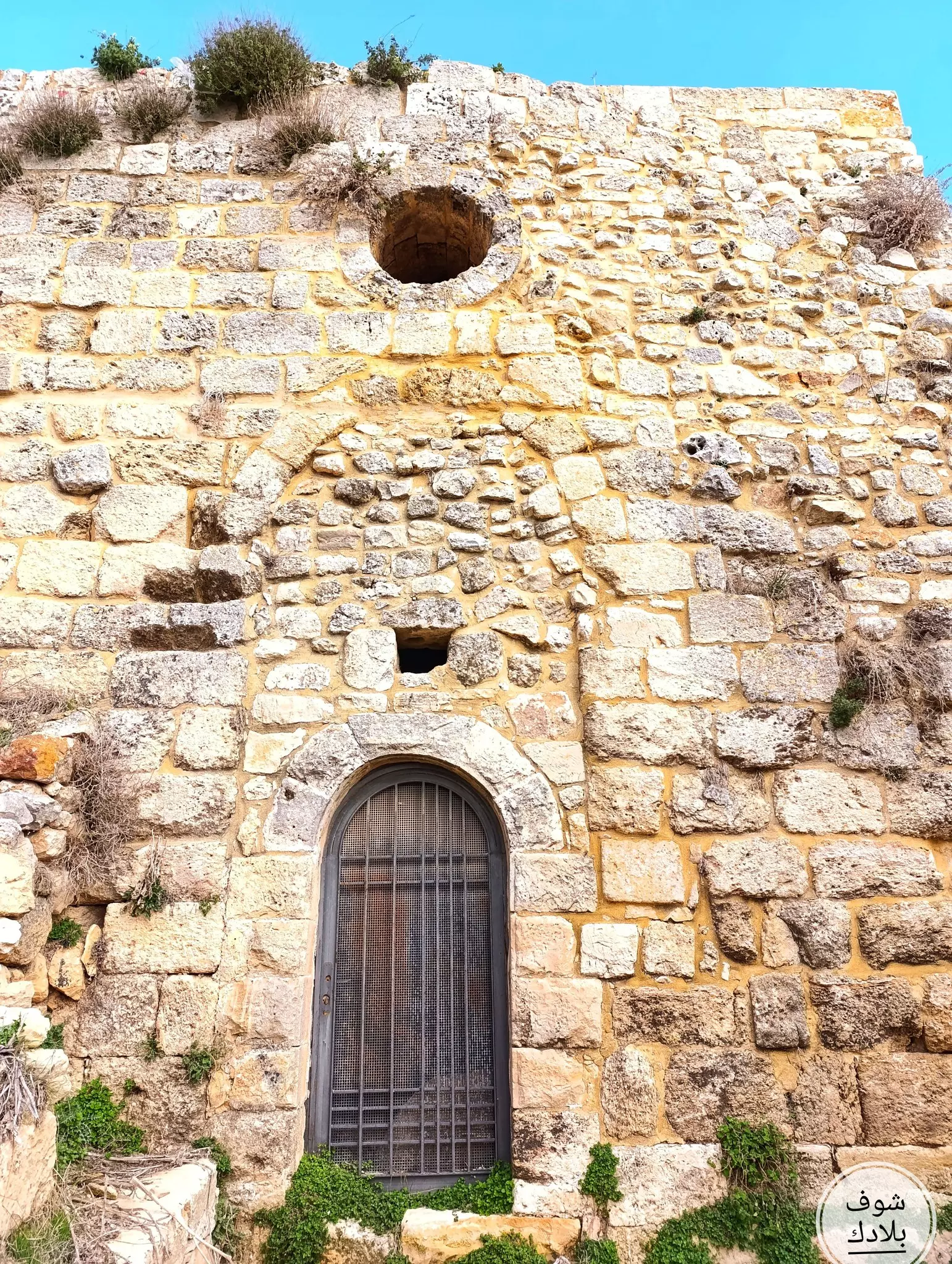
- جولة في احد خرب القرية -- يوسف عودة
- جولة في احد خرب القرية -- يوسف عودة #2
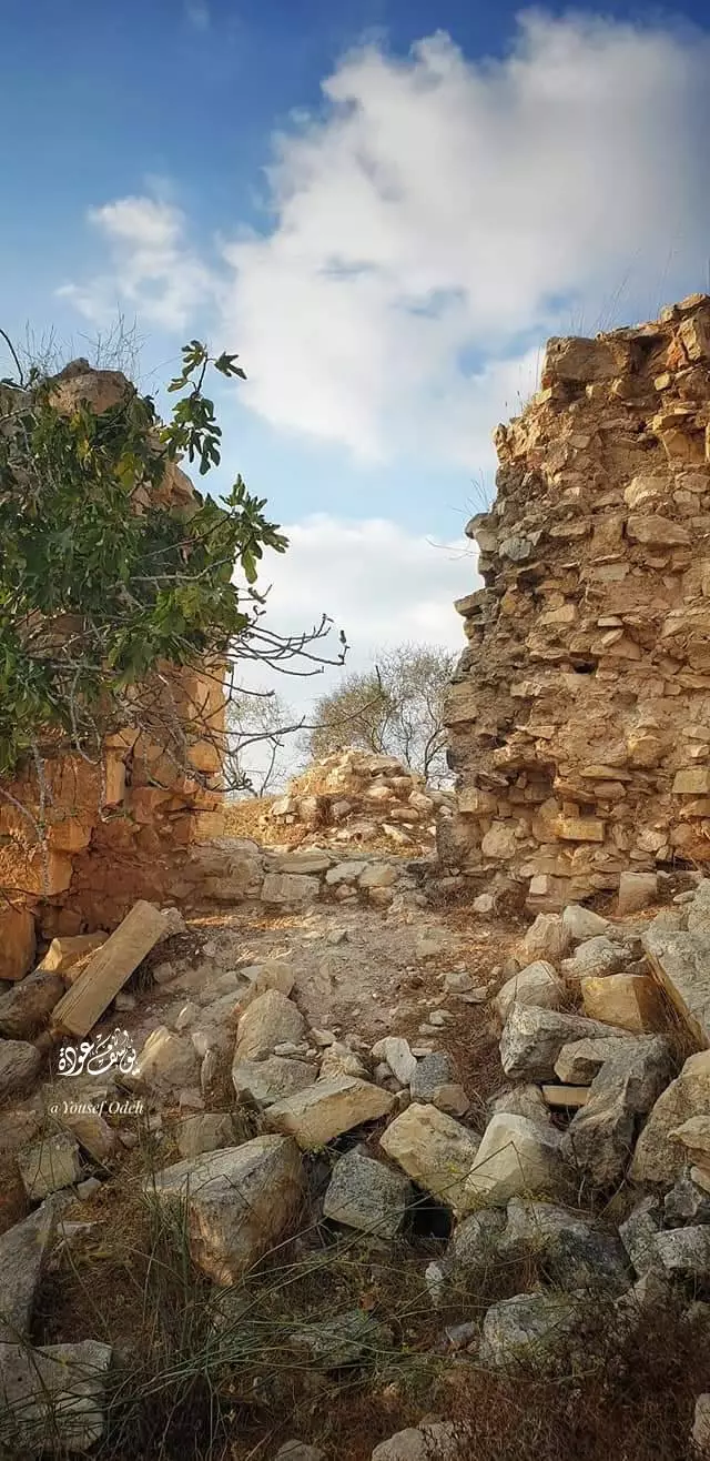
- جولة في احد خرب القرية -- يوسف عودة #3
- جولة في احد خرب القرية -- يوسف عودة #4
- جولة في احد خرب القرية -- يوسف عودة #5
- عصرة نبيذ العنب -- يوسف عودة
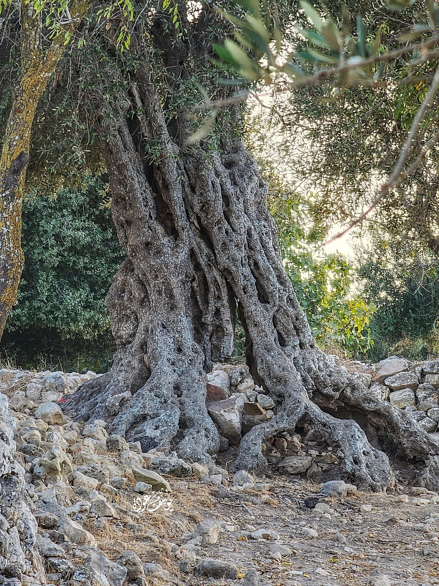
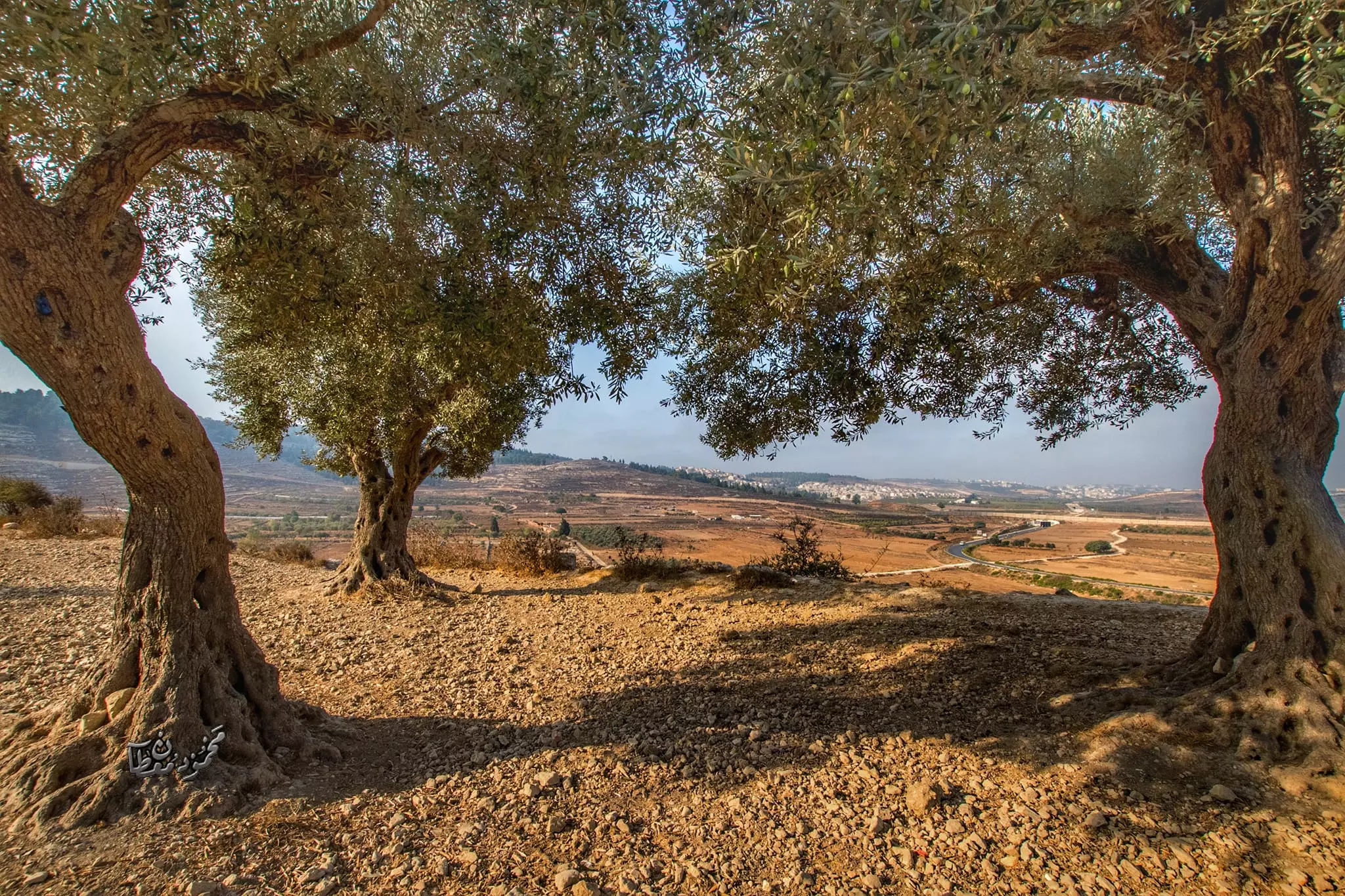
- شجرة زيتون معمرة -- يوسف عودة
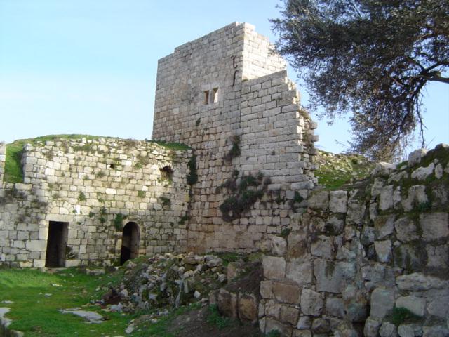
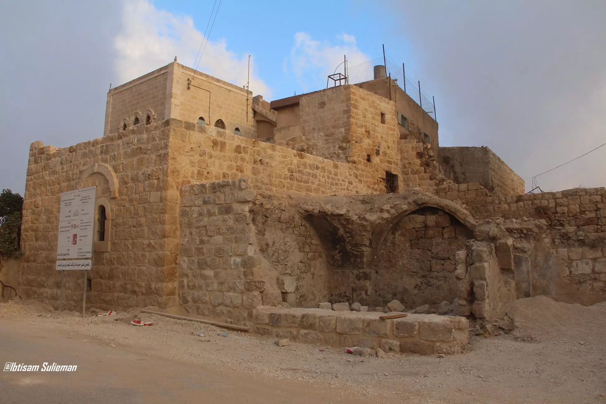
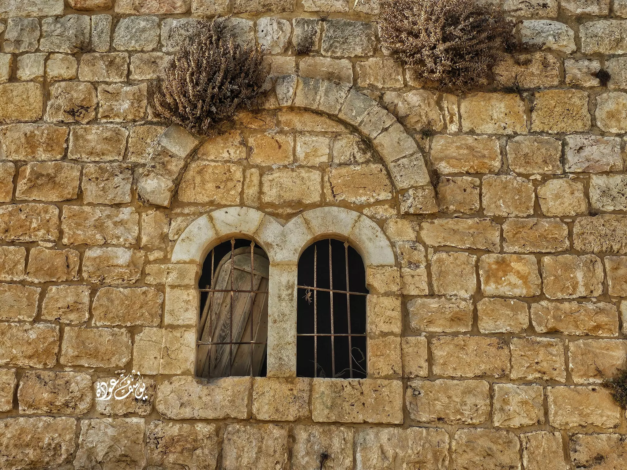
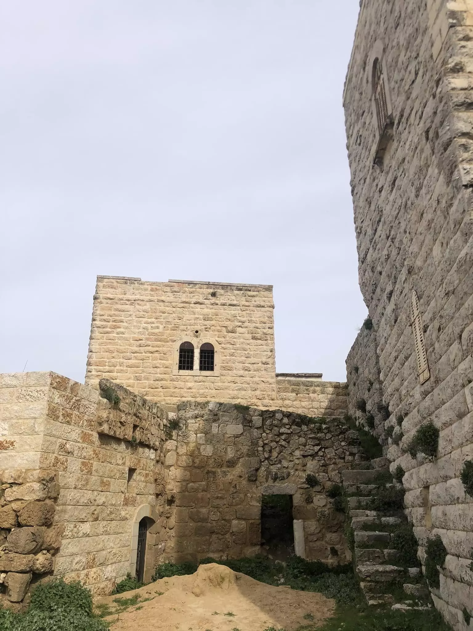
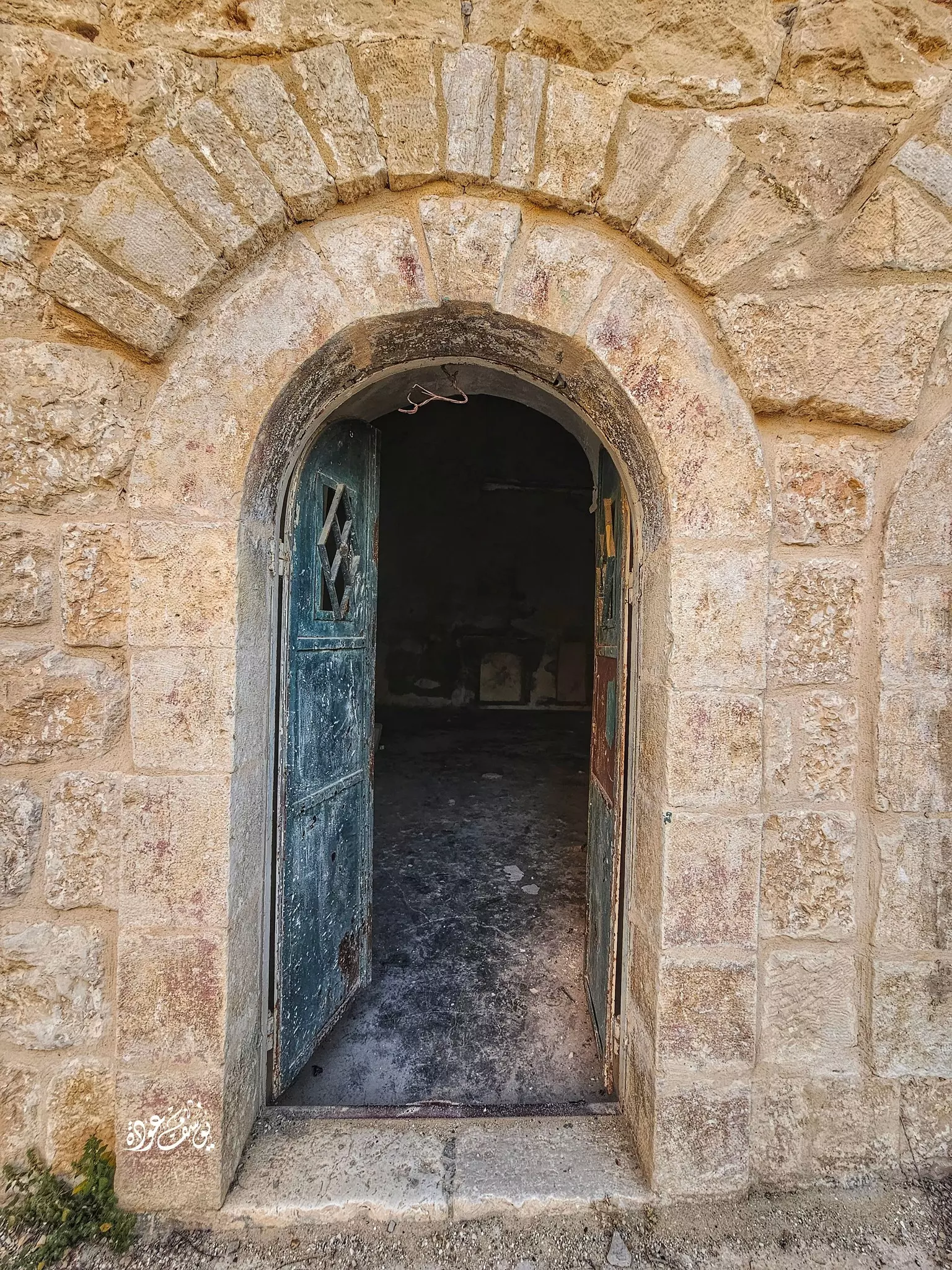
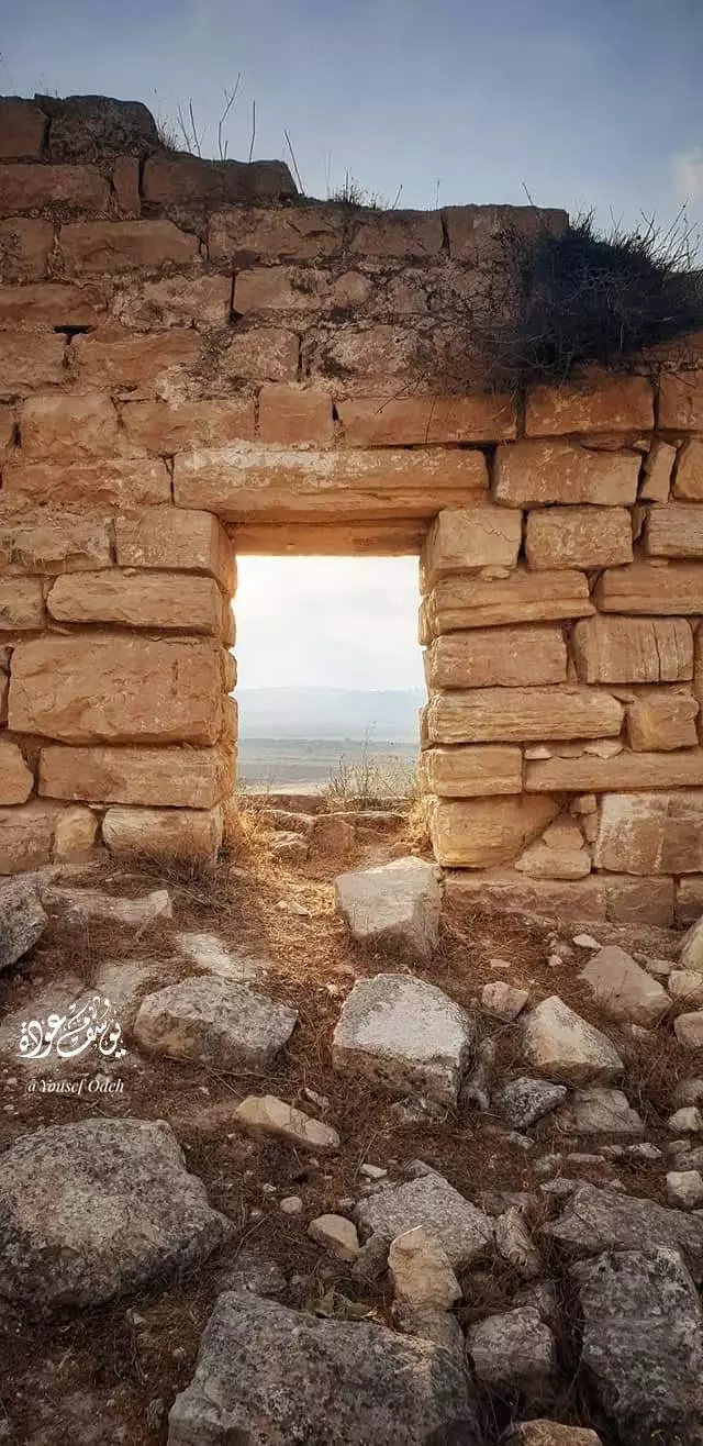
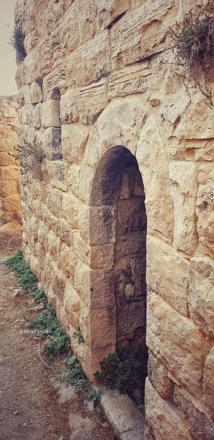
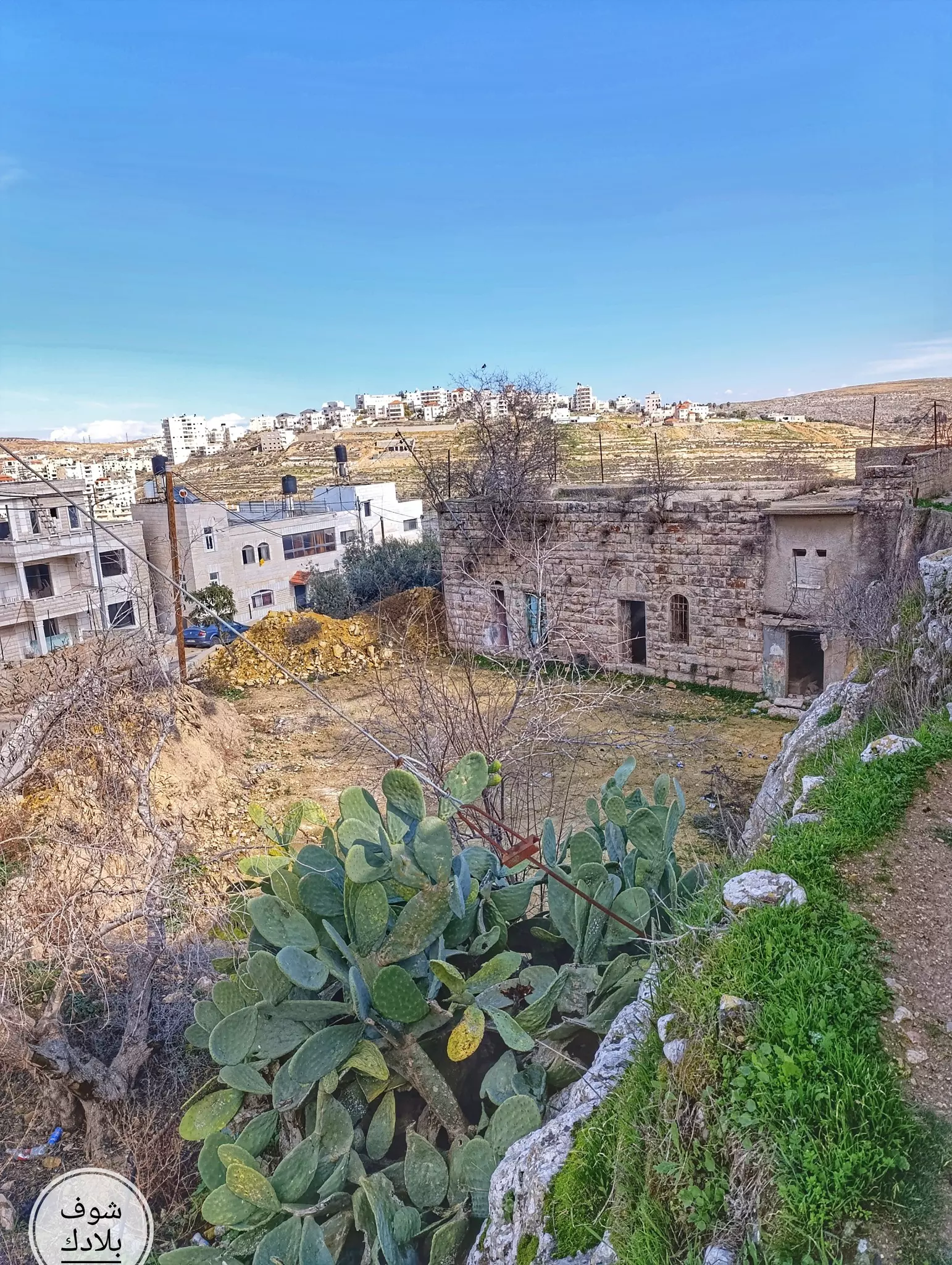
- البلدة القديمة -- يوسف عودة
- بيت قديم في البلدة القديمة -- يوسف عودة
- الجورة او البركة الصخرية في قرية الجيب -- Fairouz Jubran -- Jan -2025
- الجورة او البركة الصخرية في قرية الجيب -- Fairouz Jubran -- Jan -2025 #2
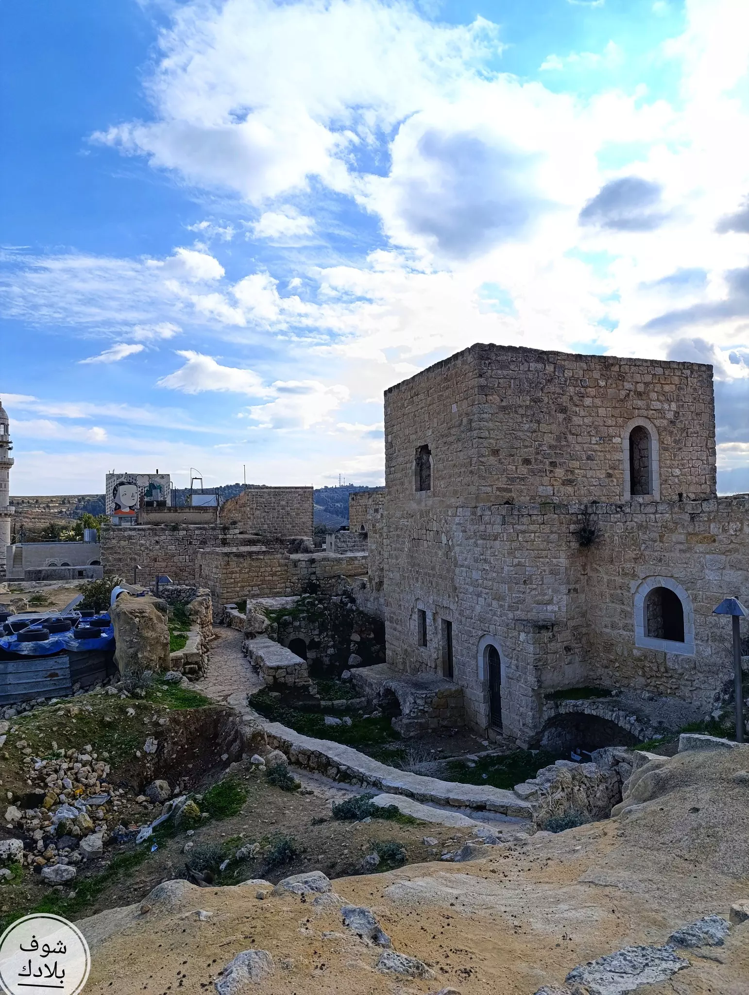
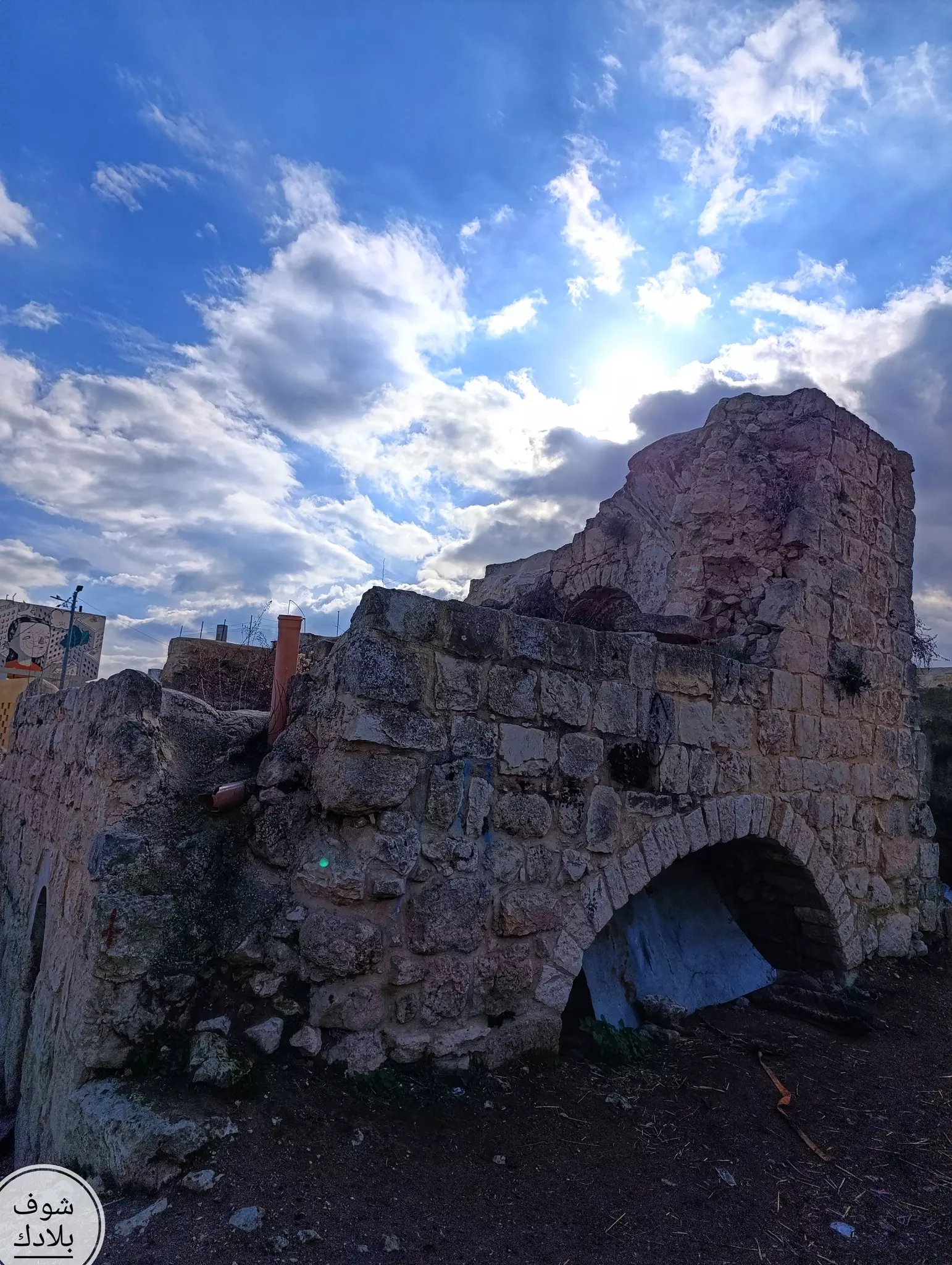
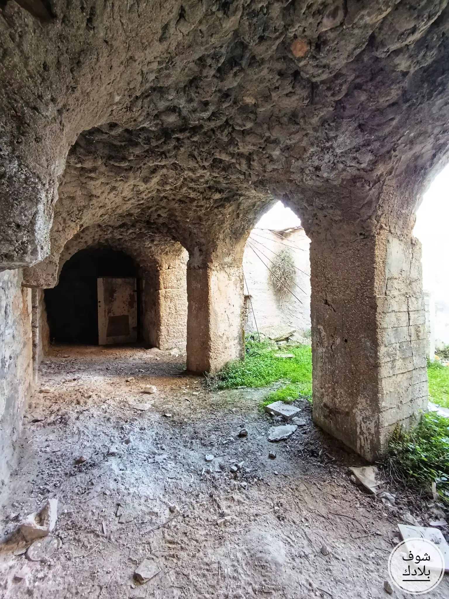
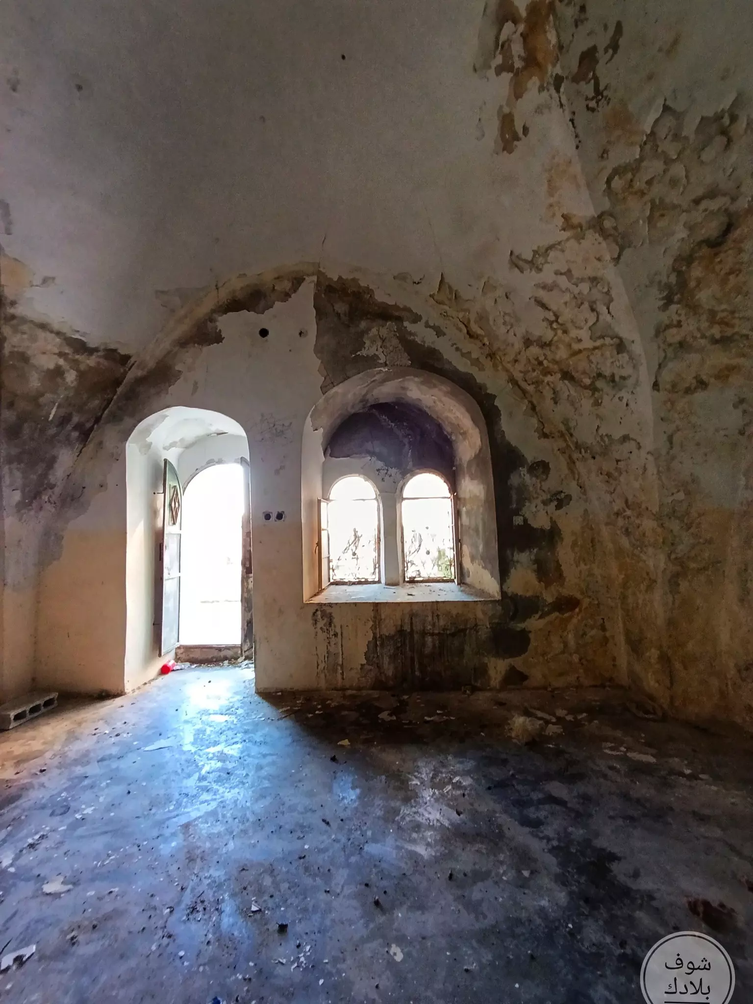
- جولة رائعة بين بيوت القرية القديمة -- Fairouz Jubran -- Jan. 2025
- جولة رائعة بين بيوت القرية القديمة -- Fairouz Jubran -- Jan. 2025 #2
- جولة رائعة بين بيوت القرية القديمة -- Fairouz Jubran -- Jan. 2025 #3
- جولة رائعة بين بيوت القرية القديمة -- Fairouz Jubran -- Jan. 2025 #4
- جولة رائعة بين بيوت القرية القديمة -- Fairouz Jubran -- Jan. 2025 #5
- جولة رائعة بين بيوت القرية القديمة -- Fairouz Jubran -- Jan. 2025 #6
- جولة رائعة بين بيوت القرية القديمة -- Fairouz Jubran -- Jan. 2025 #7
- جولة رائعة بين بيوت القرية القديمة -- Fairouz Jubran -- Jan. 2025 #8
- جولة رائعة بين بيوت القرية القديمة -- Fairouz Jubran -- Jan. 2025 #9
- جولة رائعة بين بيوت القرية القديمة -- Fairouz Jubran -- Jan. 2025 #10
- جولة رائعة بين بيوت القرية القديمة -- Fairouz Jubran -- Jan. 2025 #11
- جولة رائعة بين بيوت القرية القديمة -- Fairouz Jubran -- Jan. 2025 #12
- جولة رائعة بين بيوت القرية القديمة -- Fairouz Jubran -- Jan. 2025 #13
- جولة رائعة بين بيوت القرية القديمة -- Fairouz Jubran -- Jan. 2025 #14
- جولة رائعة بين بيوت القرية القديمة -- Fairouz Jubran -- Jan. 2025 #15
- جولة رائعة بين بيوت القرية القديمة -- Fairouz Jubran -- Jan. 2025 #16
- جولة رائعة بين بيوت القرية القديمة -- Fairouz Jubran -- Jan. 2025 #17
- جولة رائعة بين بيوت القرية القديمة -- Fairouz Jubran -- Jan. 2025 #18
- جولة رائعة بين بيوت القرية القديمة -- Fairouz Jubran -- Jan. 2025 #19
- جولة رائعة بين بيوت القرية القديمة -- Fairouz Jubran -- Jan. 2025 #20
- جولة رائعة بين بيوت القرية القديمة -- Fairouz Jubran -- Jan. 2025 #21
- جولة رائعة بين بيوت القرية القديمة -- Fairouz Jubran -- Jan. 2025 #22
- جولة رائعة بين بيوت القرية القديمة -- Fairouz Jubran -- Jan. 2025 #23
- جولة رائعة بين بيوت القرية القديمة -- Fairouz Jubran -- Jan. 2025 #24
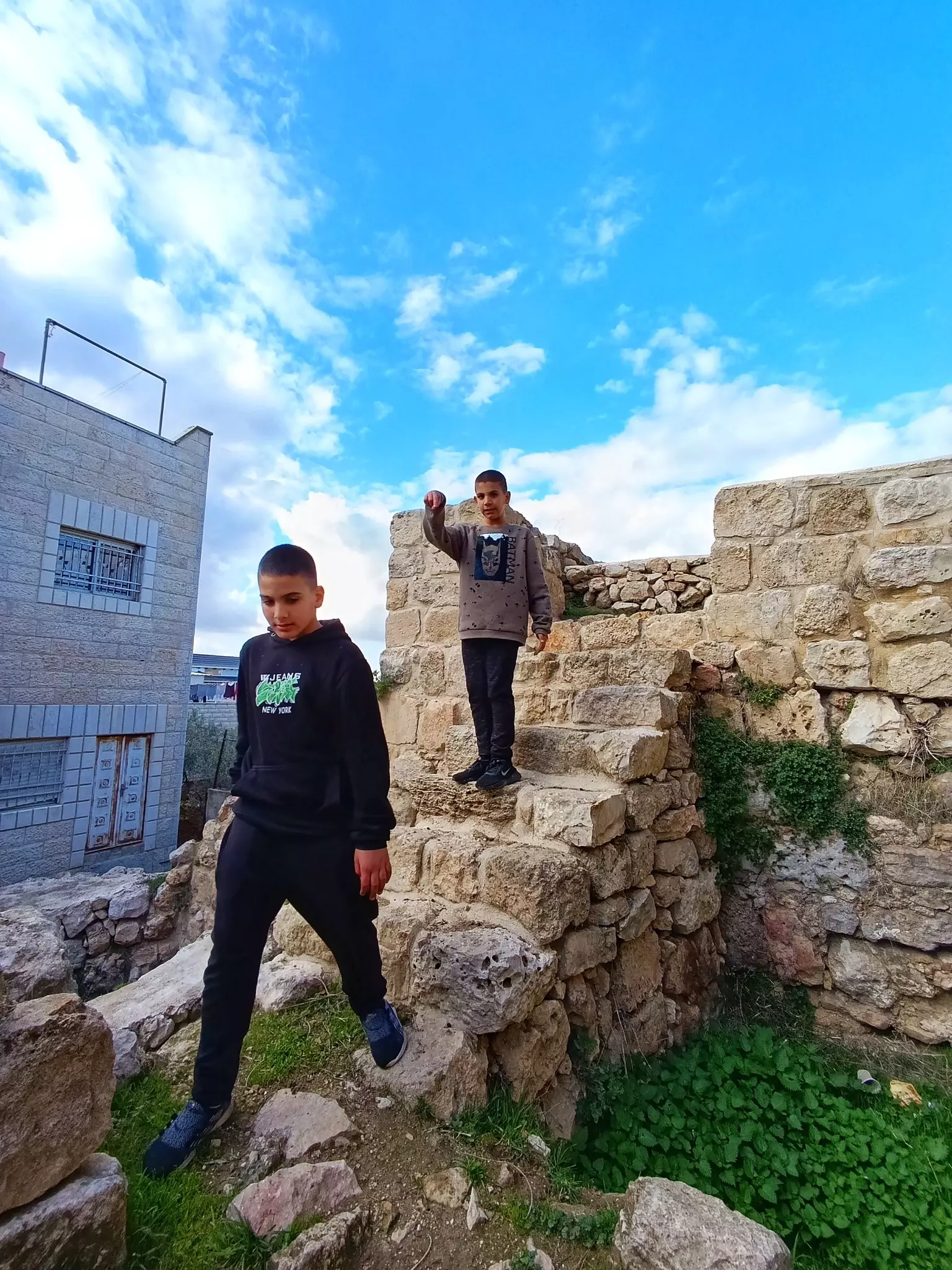
- جولة رائعة بين المعالم الاثرية في القرية وبيوتها القديمة -- June 2022 -- Mohammad Moutan
- جولة رائعة بين المعالم الاثرية في القرية وبيوتها القديمة -- June 2022 -- Mohammad Moutan #2
- جولة رائعة بين المعالم الاثرية في القرية وبيوتها القديمة -- June 2022 -- Mohammad Moutan #3
- جولة رائعة بين المعالم الاثرية في القرية وبيوتها القديمة -- June 2022 -- Mohammad Moutan #4
- جولة رائعة بين المعالم الاثرية في القرية وبيوتها القديمة -- June 2022 -- Mohammad Moutan #5
- جولة رائعة بين المعالم الاثرية في القرية وبيوتها القديمة -- June 2022 -- Mohammad Moutan #6
- جولة رائعة بين المعالم الاثرية في القرية وبيوتها القديمة -- June 2022 -- Mohammad Moutan #7
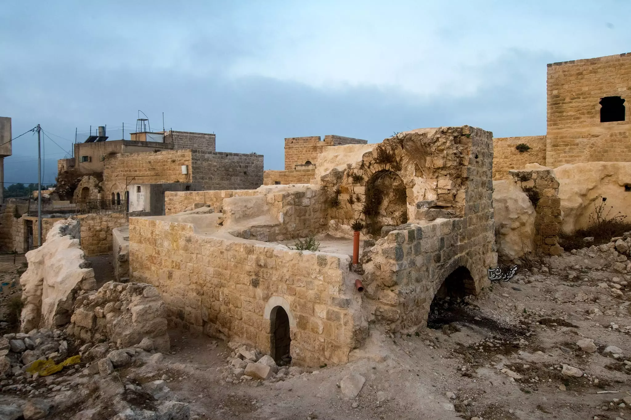
- جولة رائعة بين المعالم الاثرية في القرية وبيوتها القديمة -- June 2022 -- Mohammad Moutan #8
- جولة رائعة بين المعالم الاثرية في القرية وبيوتها القديمة -- June 2022 -- Mohammad Moutan #9
- جولة رائعة بين المعالم الاثرية في القرية وبيوتها القديمة -- June 2022 -- Mohammad Moutan #10
- جولة رائعة بين المعالم الاثرية في القرية وبيوتها القديمة -- June 2022 -- Mohammad Moutan #11
- جولة رائعة بين المعالم الاثرية في القرية وبيوتها القديمة -- June 2022 -- Mohammad Moutan #12
- جولة رائعة بين المعالم الاثرية في القرية وبيوتها القديمة -- June 2022 -- Mohammad Moutan #13
- جولة رائعة بين المعالم الاثرية في القرية وبيوتها القديمة -- June 2022 -- Mohammad Moutan #14
- جولة رائعة بين المعالم الاثرية في القرية وبيوتها القديمة -- June 2022 -- Mohammad Moutan #15
- جولة رائعة بين المعالم الاثرية في القرية وبيوتها القديمة -- June 2022 -- Mohammad Moutan #16
- جولة رائعة بين المعالم الاثرية في القرية وبيوتها القديمة -- June 2022 -- Mohammad Moutan #17
- جولة رائعة بين المعالم الاثرية في القرية وبيوتها القديمة -- June 2022 -- Mohammad Moutan #18
- جولة رائعة بين المعالم الاثرية في القرية وبيوتها القديمة -- June 2022 -- Mohammad Moutan #19
- جولة رائعة بين المعالم الاثرية في القرية وبيوتها القديمة -- June 2022 -- Mohammad Moutan #20
- جولة رائعة بين المعالم الاثرية في القرية وبيوتها القديمة -- June 2022 -- Mohammad Moutan #21
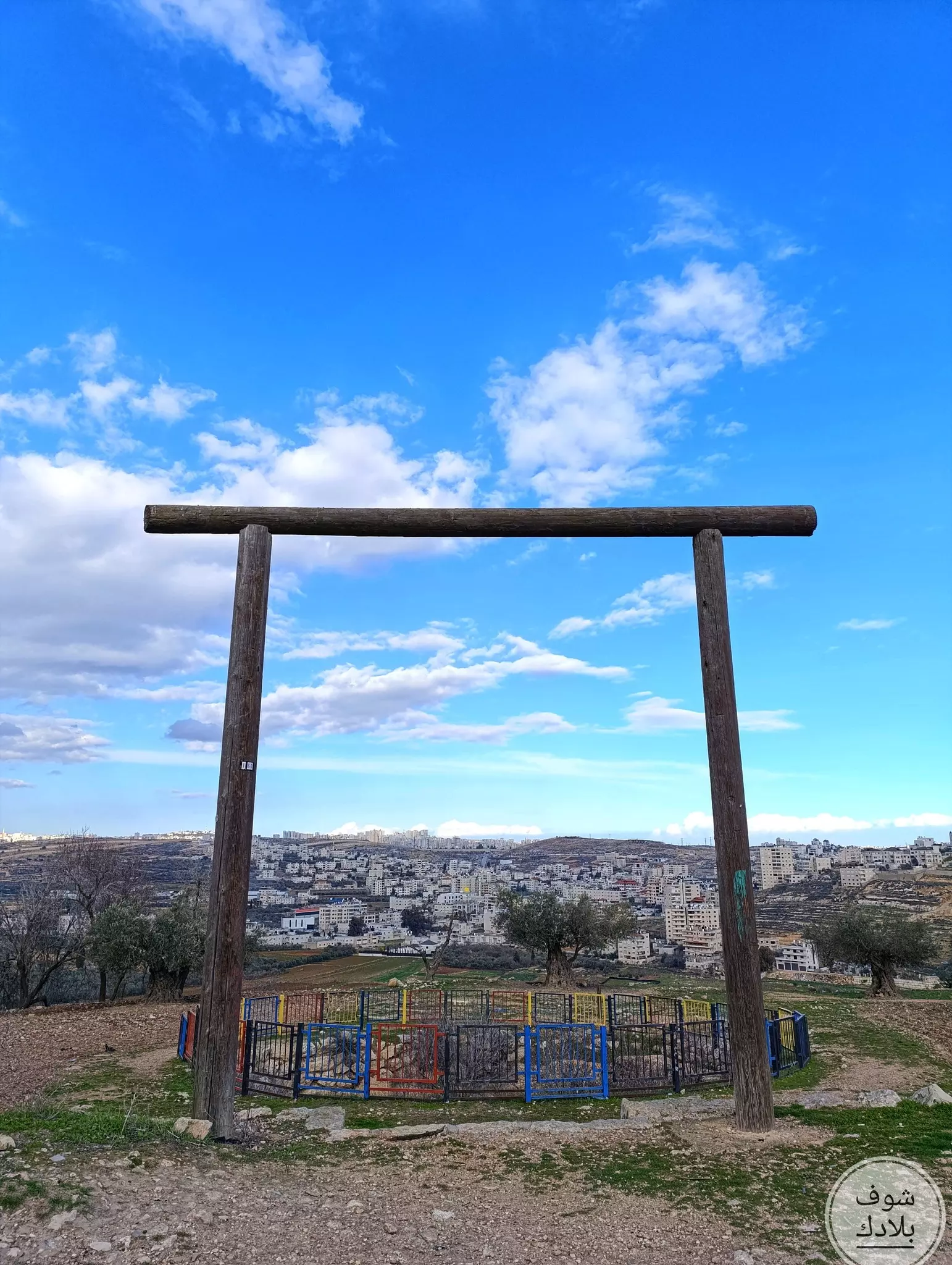
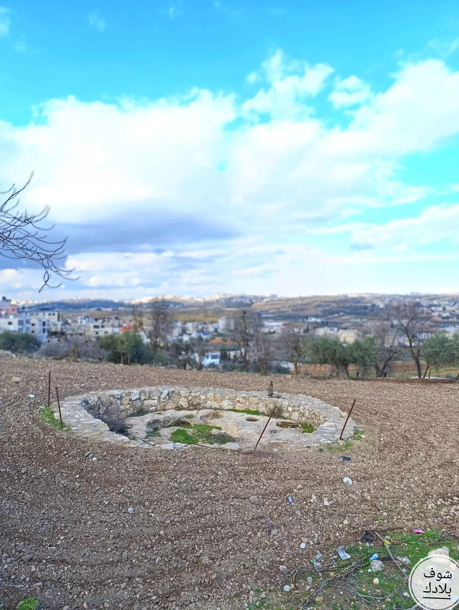
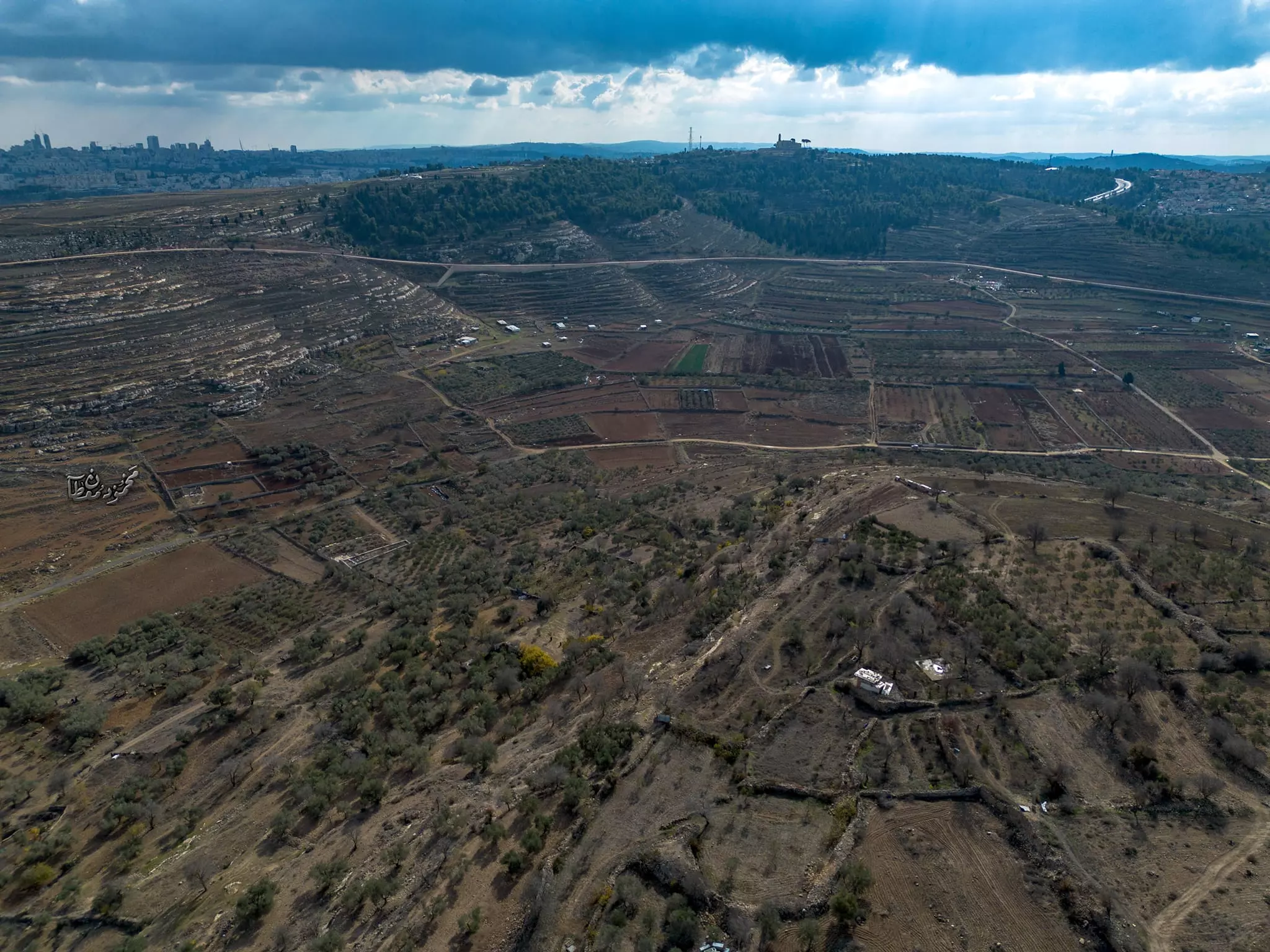
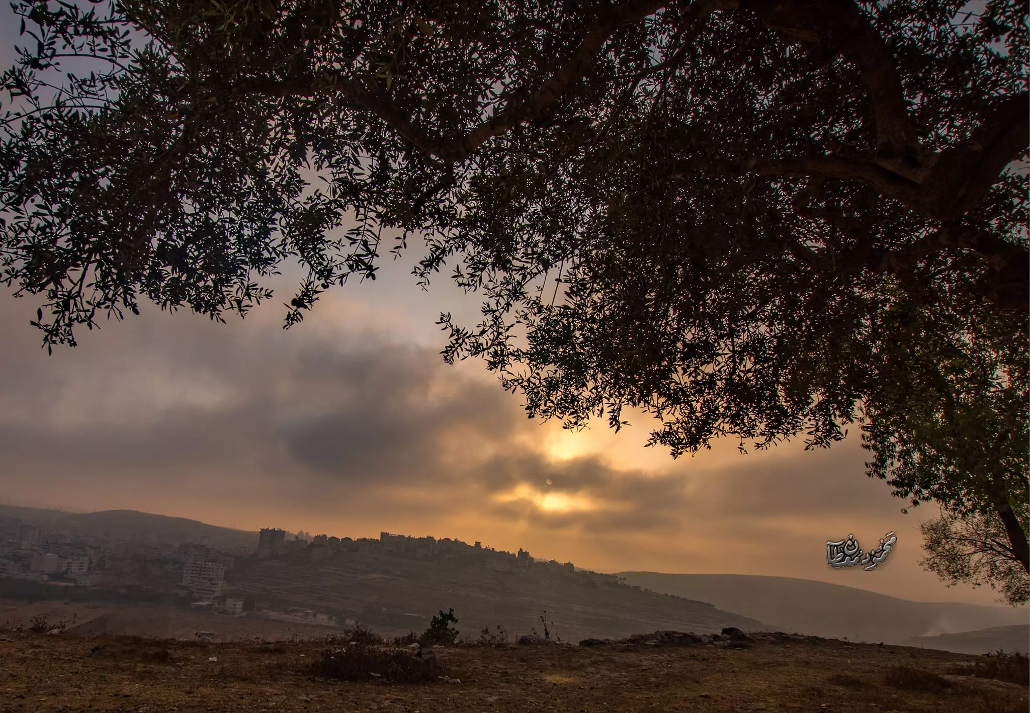
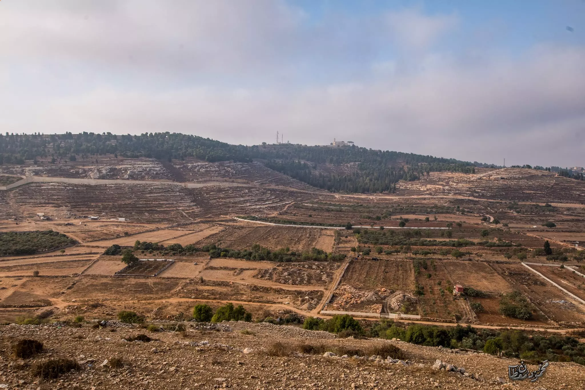
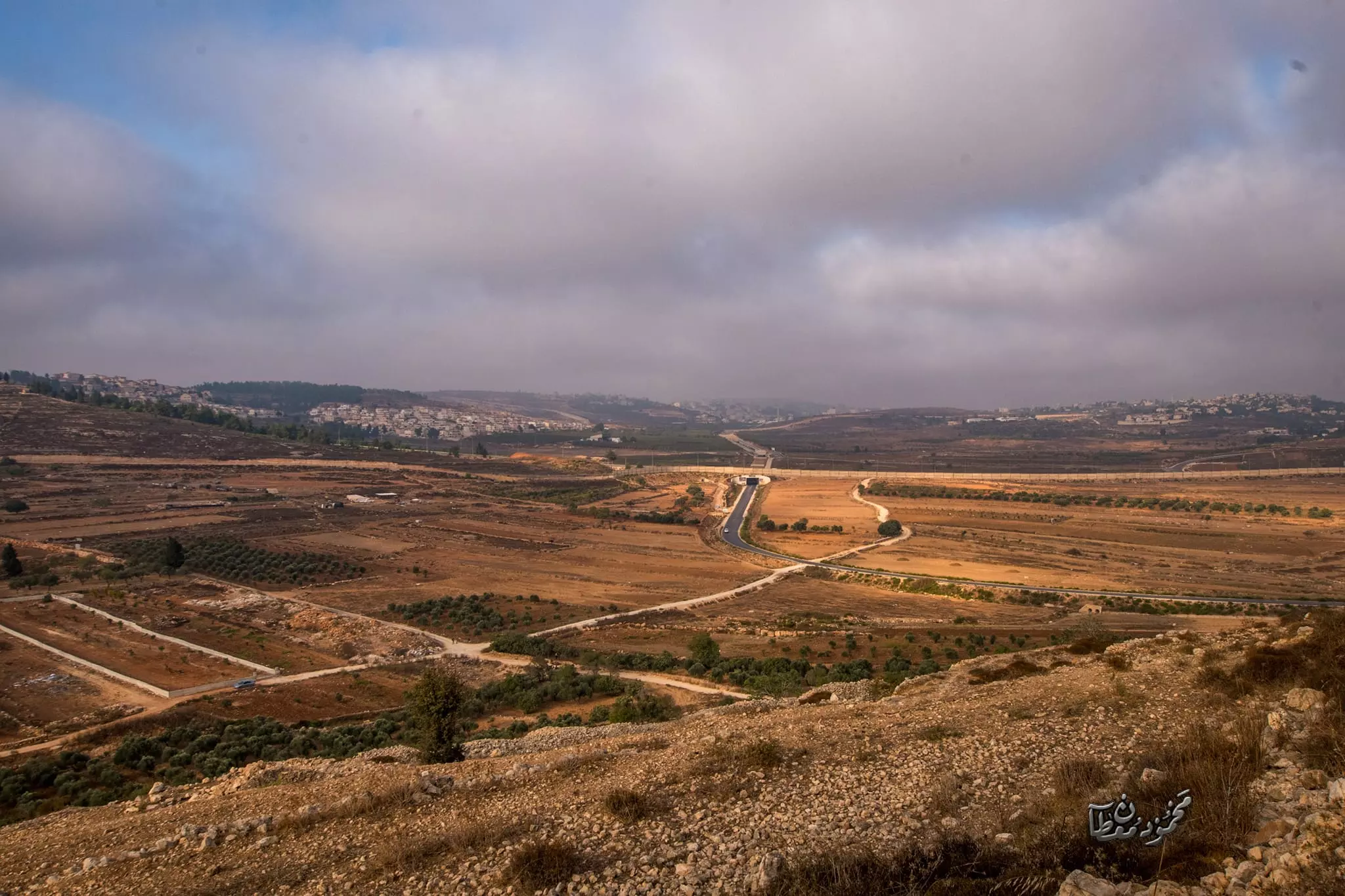
- مناظر ساحرة للجيب وما حولها صوّرت من الجو -- Mahmoud Moutan
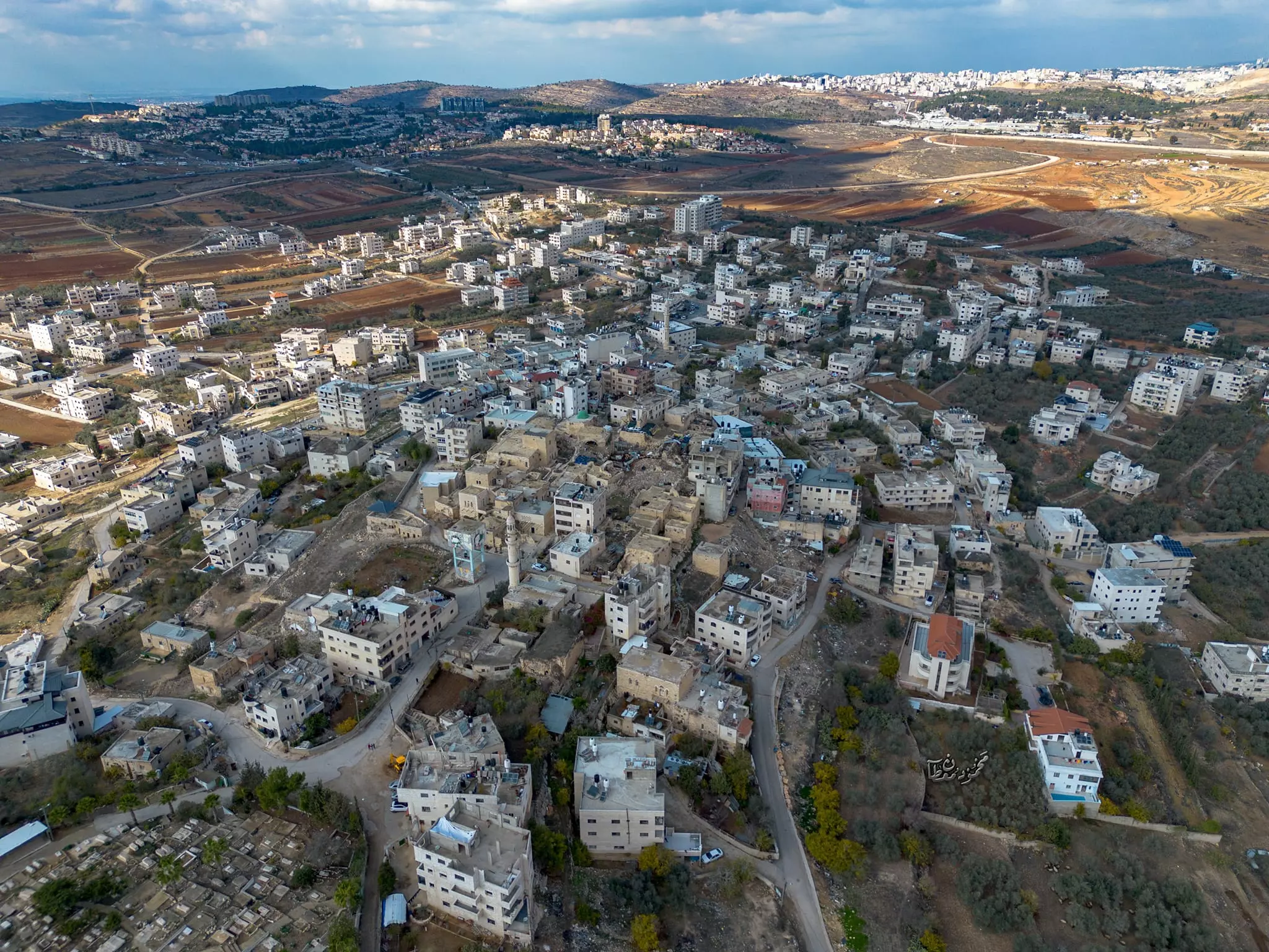
- مناظر ساحرة للجيب وما حولها صوّرت من الجو -- Mahmoud Moutan #2
- مناظر ساحرة للجيب وما حولها صوّرت من الجو -- Mahmoud Moutan #3
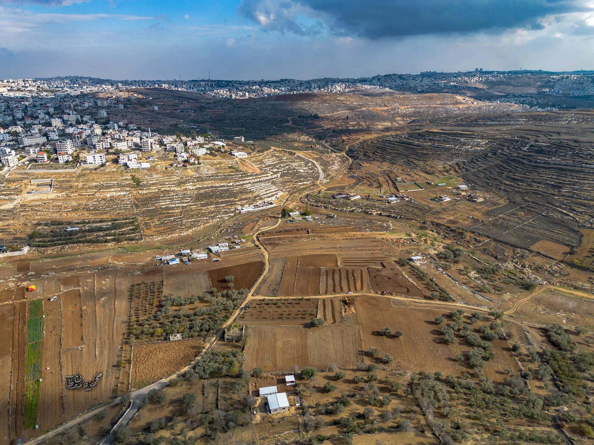
- مناظر ساحرة للجيب وما حولها صوّرت من الجو -- Mahmoud Moutan #4
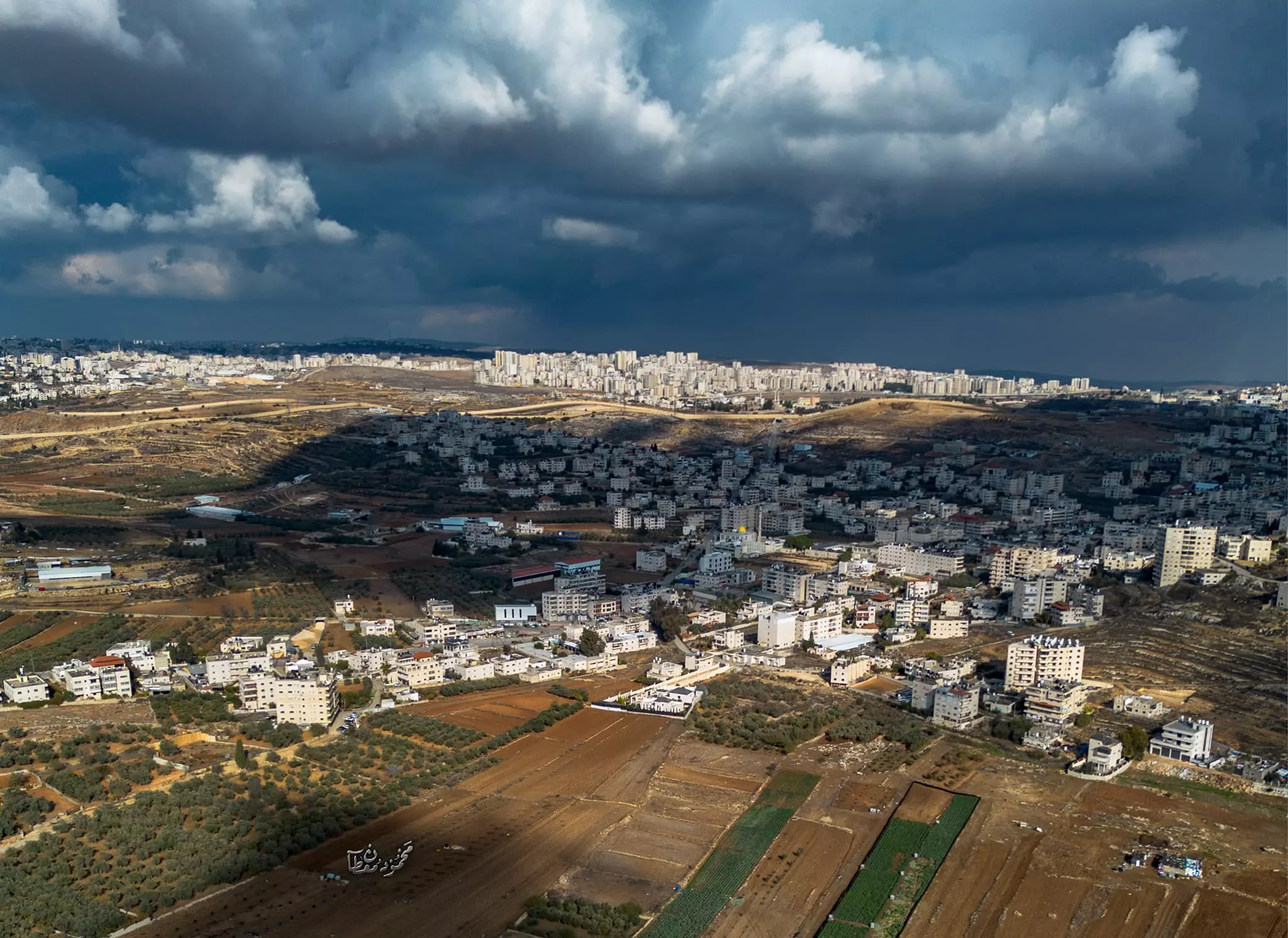
- مناظر ساحرة للجيب وما حولها صوّرت من الجو -- Mahmoud Moutan #5
- مناظر ساحرة للجيب وما حولها صوّرت من الجو -- Mahmoud Moutan #6
- مناظر ساحرة للجيب وما حولها صوّرت من الجو -- Mahmoud Moutan #7
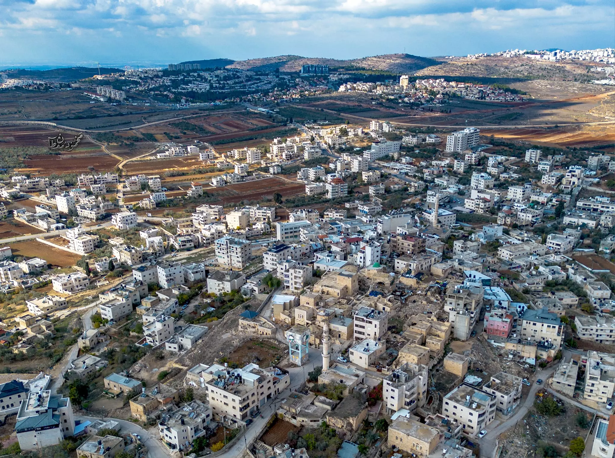
- مناظر ساحرة للجيب وما حولها صوّرت من الجو -- Mahmoud Moutan #8
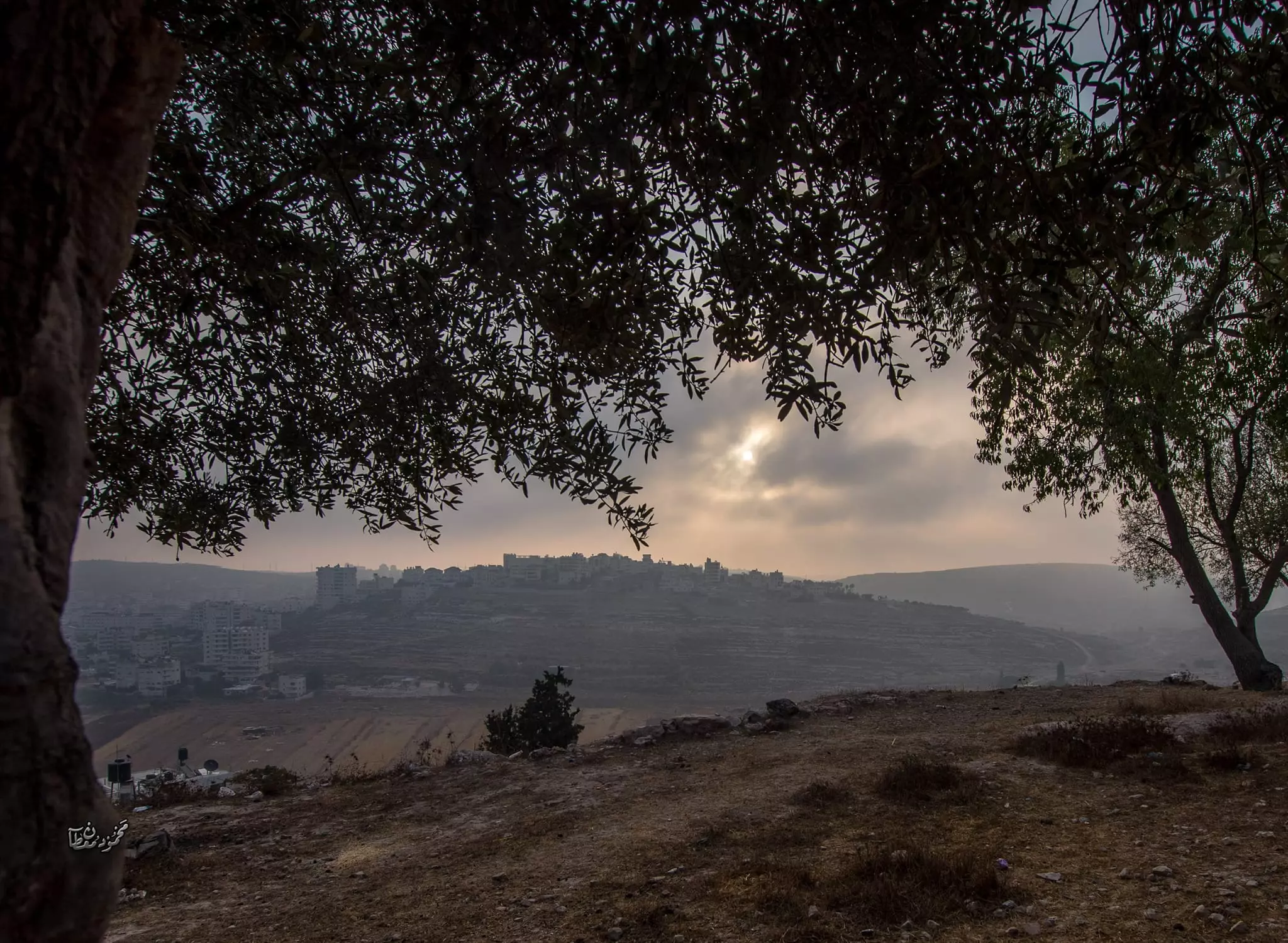
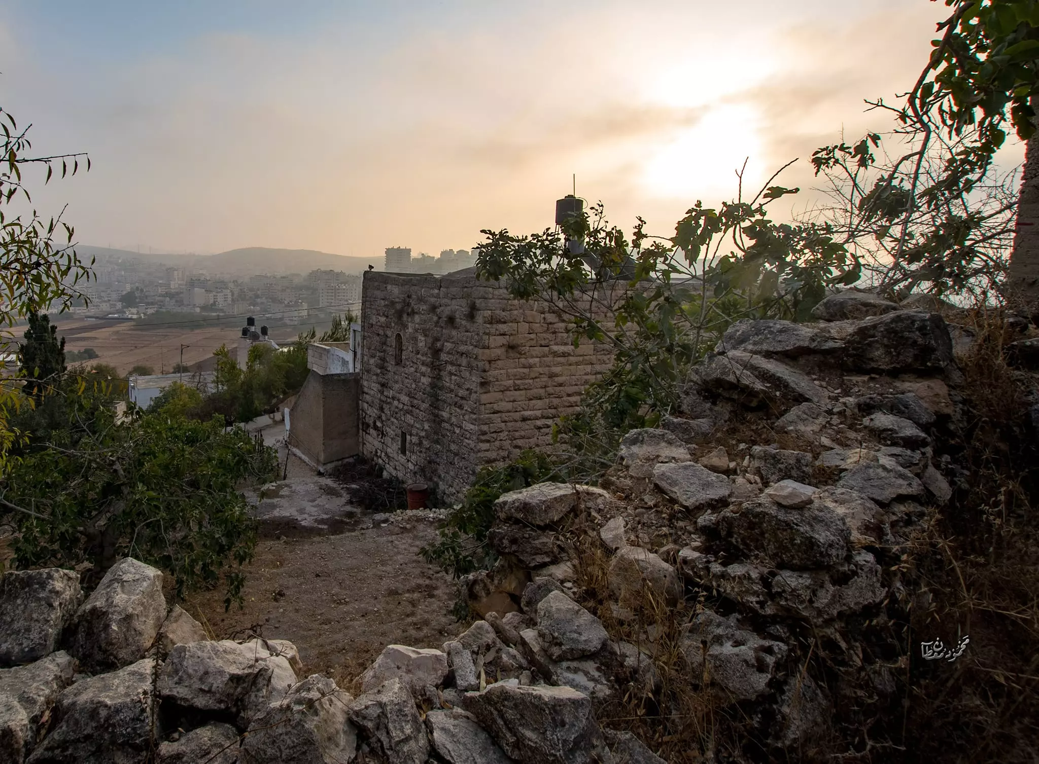
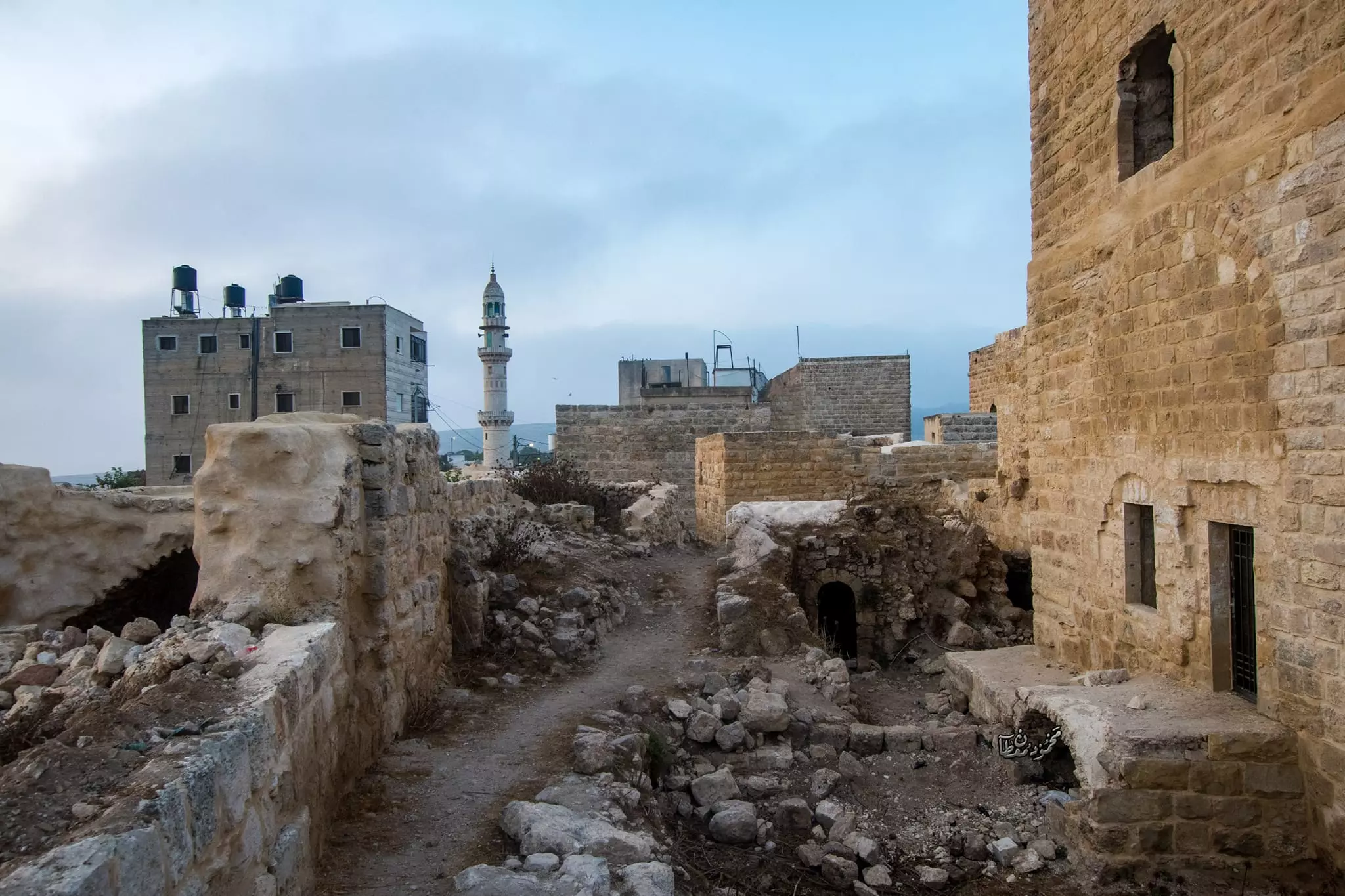
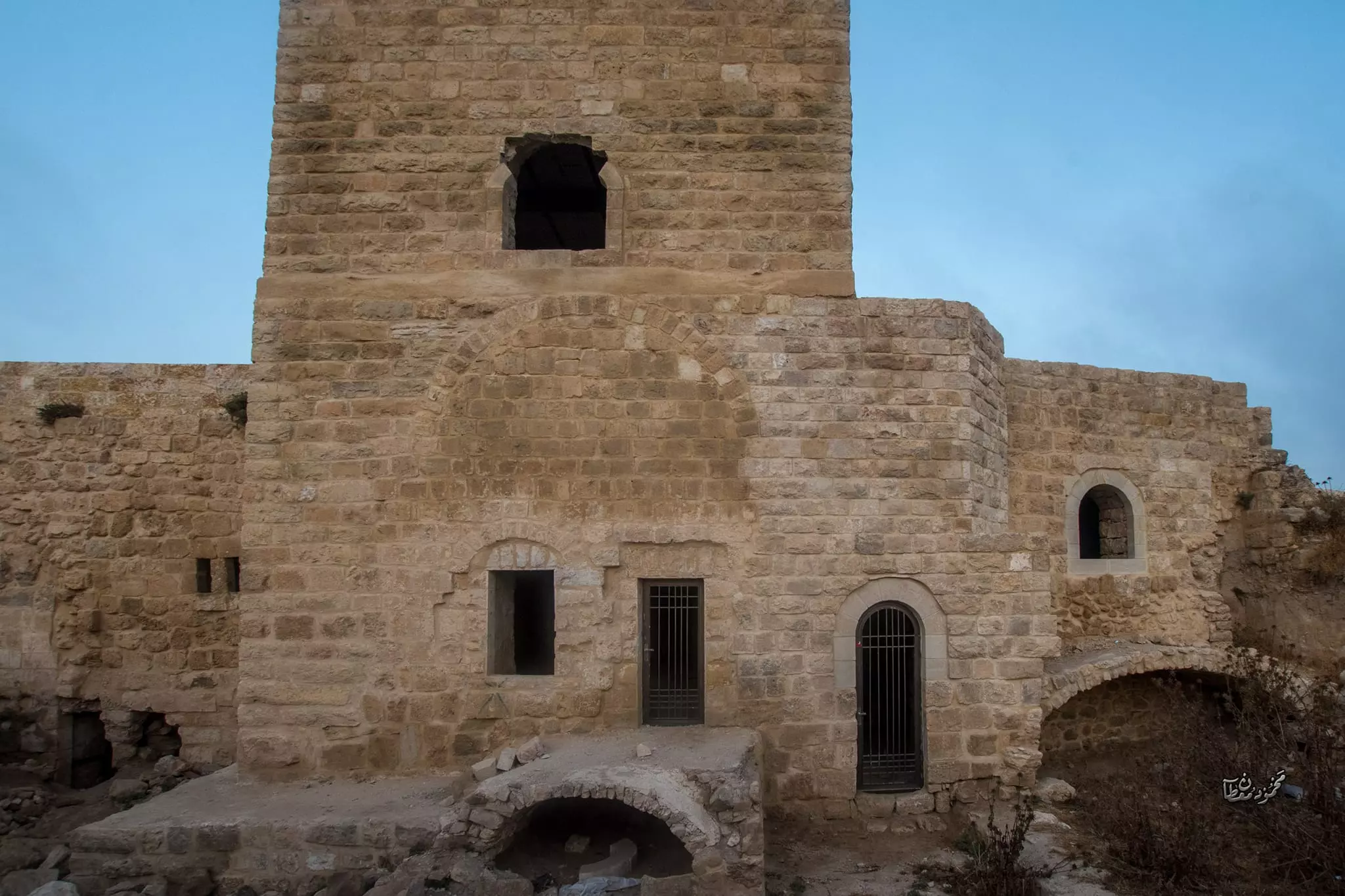
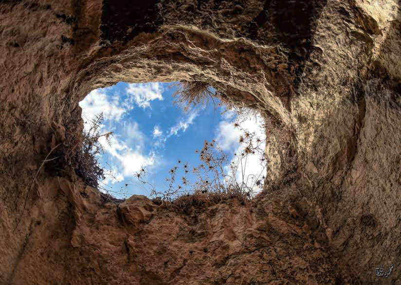
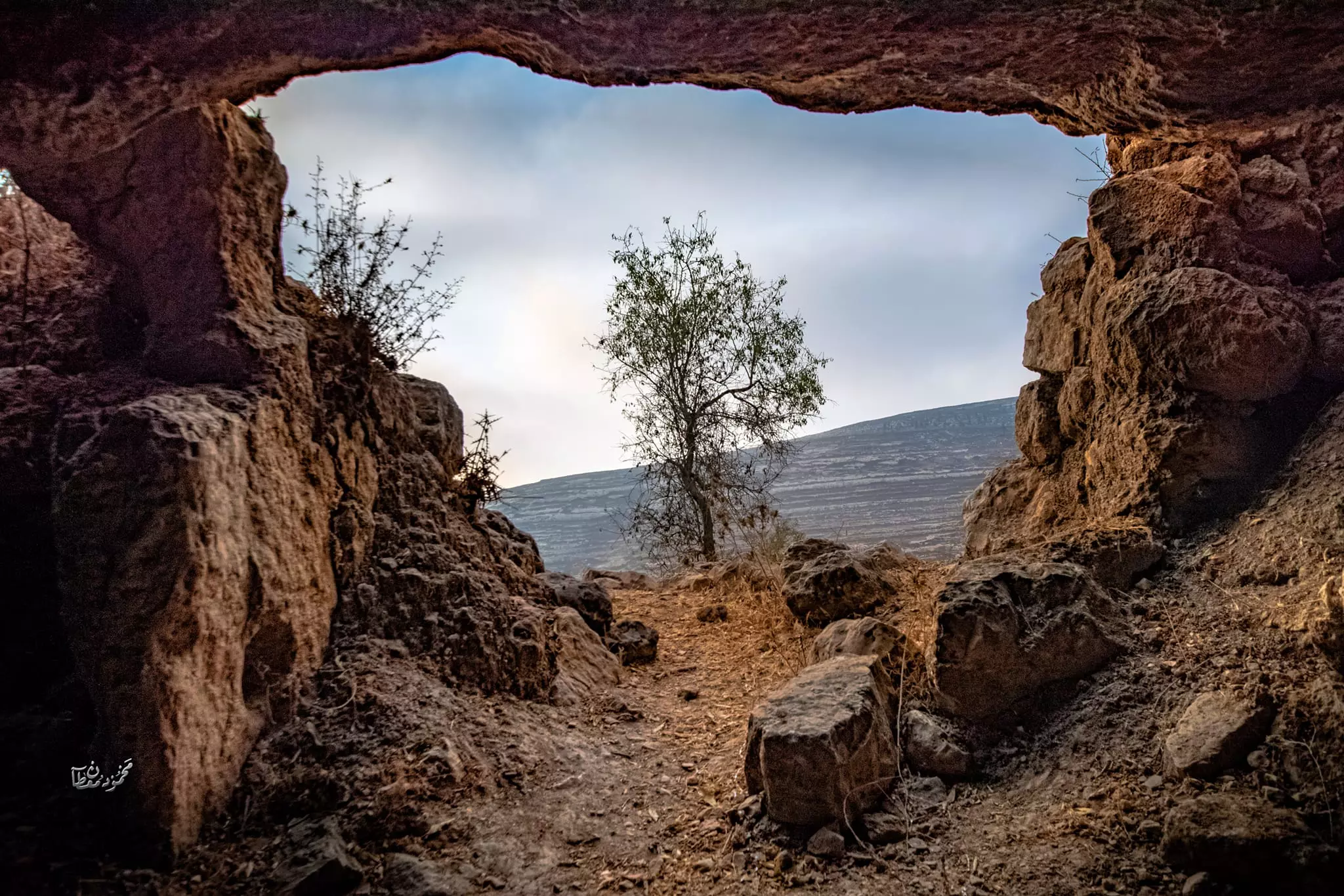
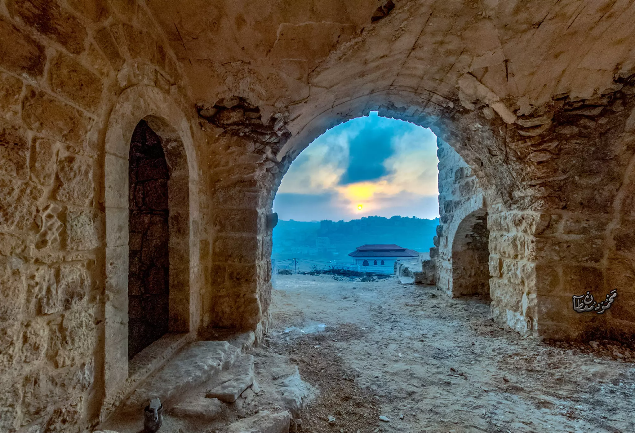
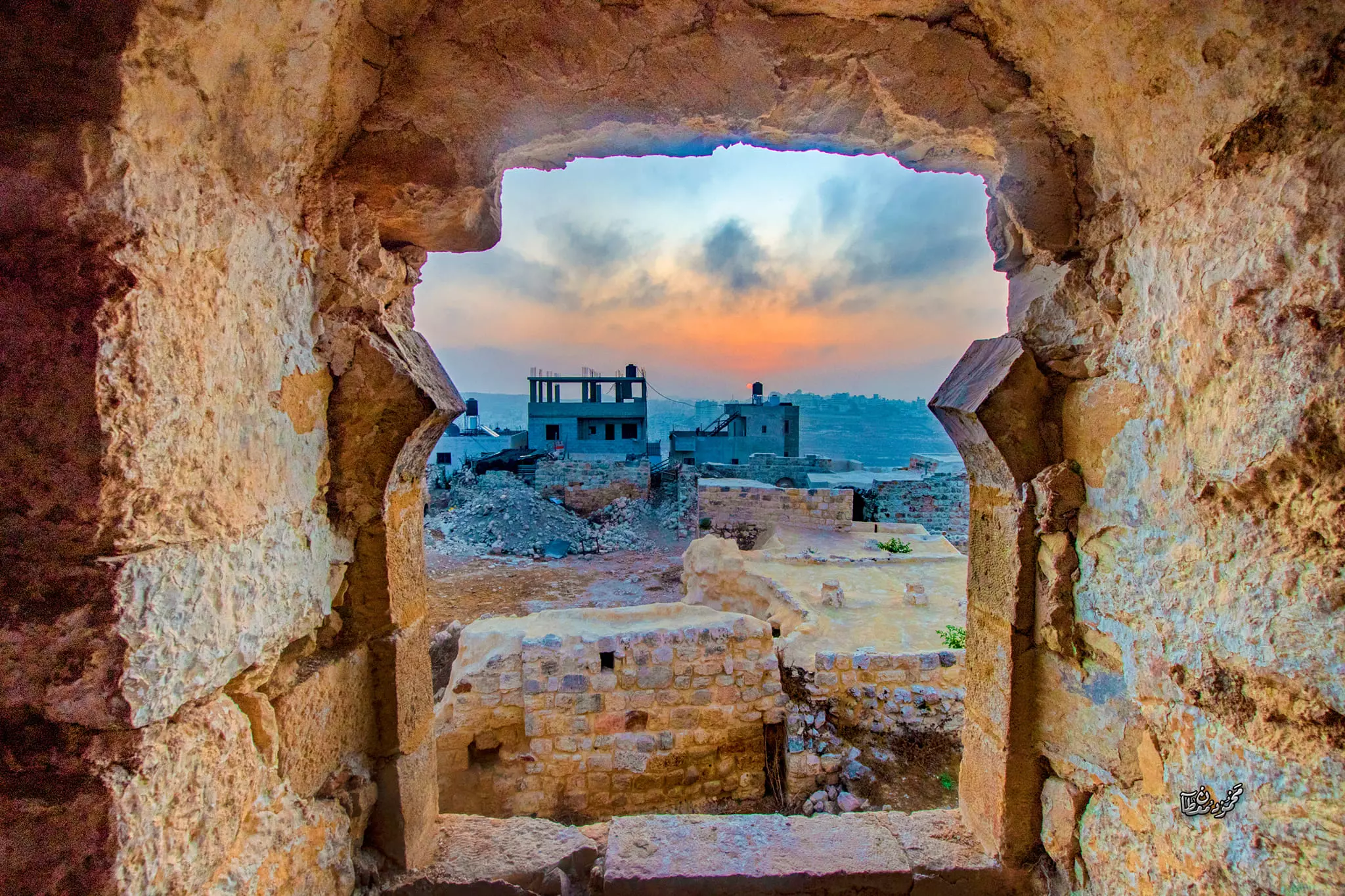
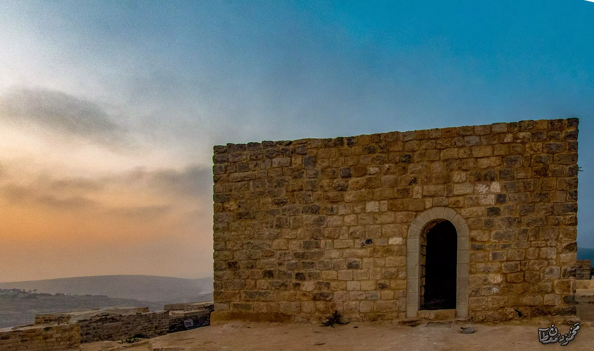
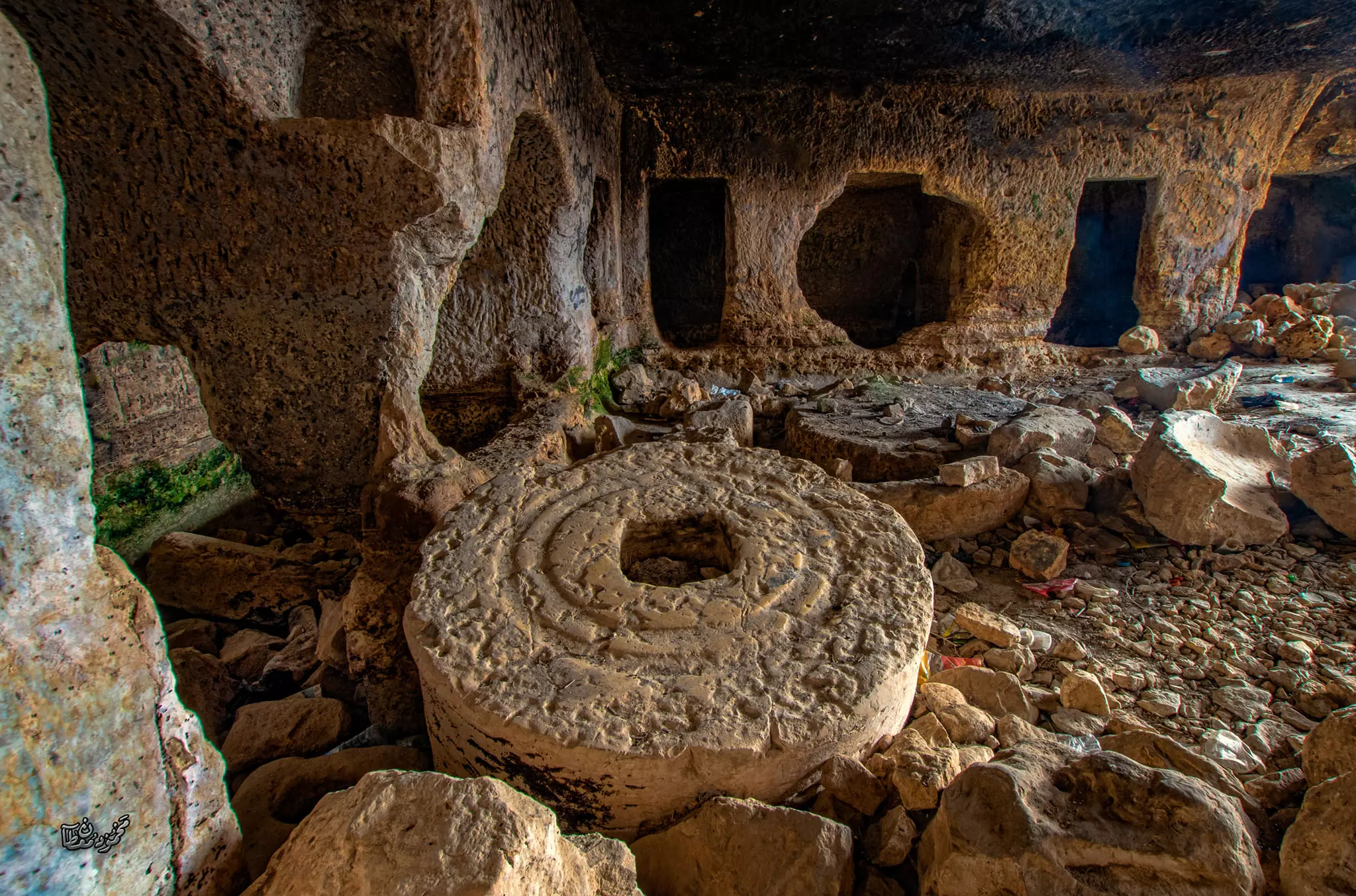
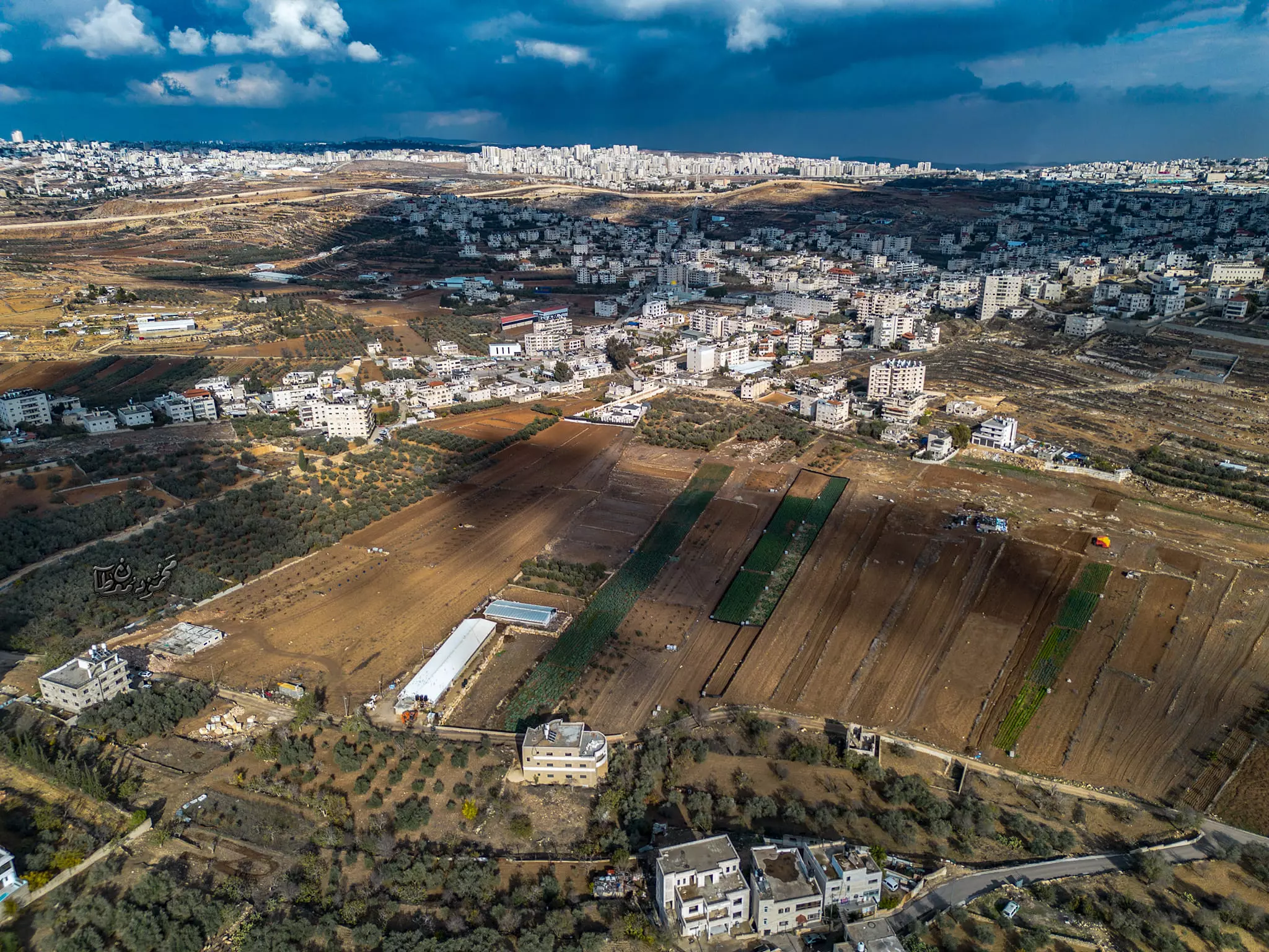
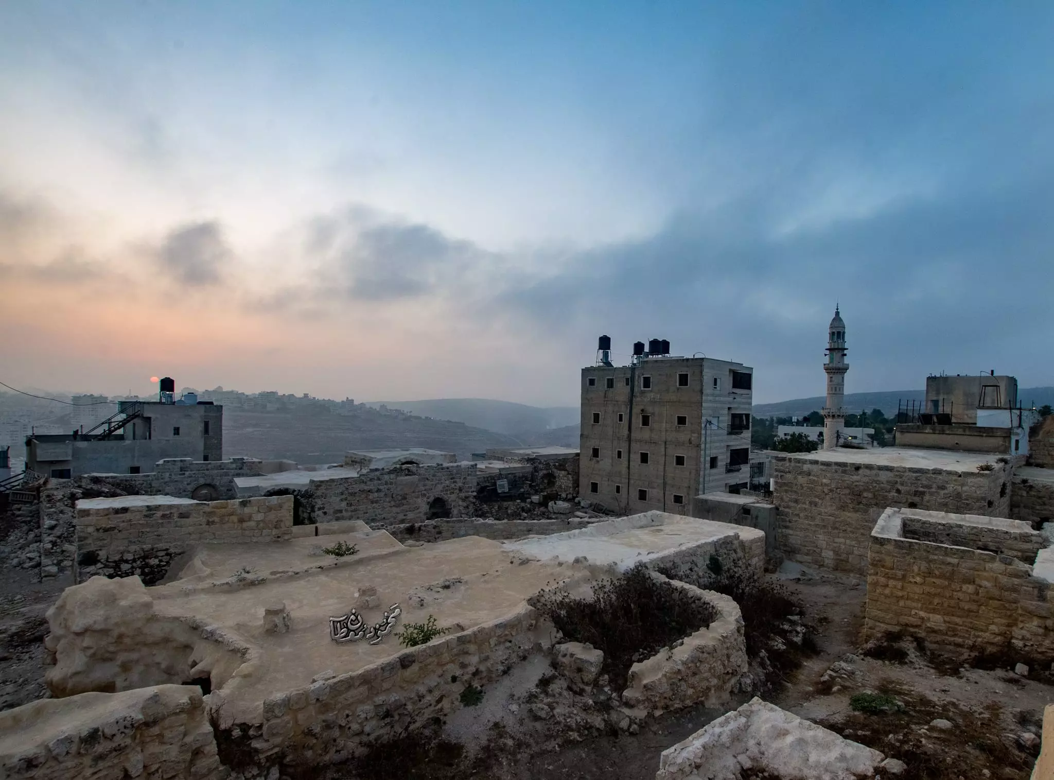
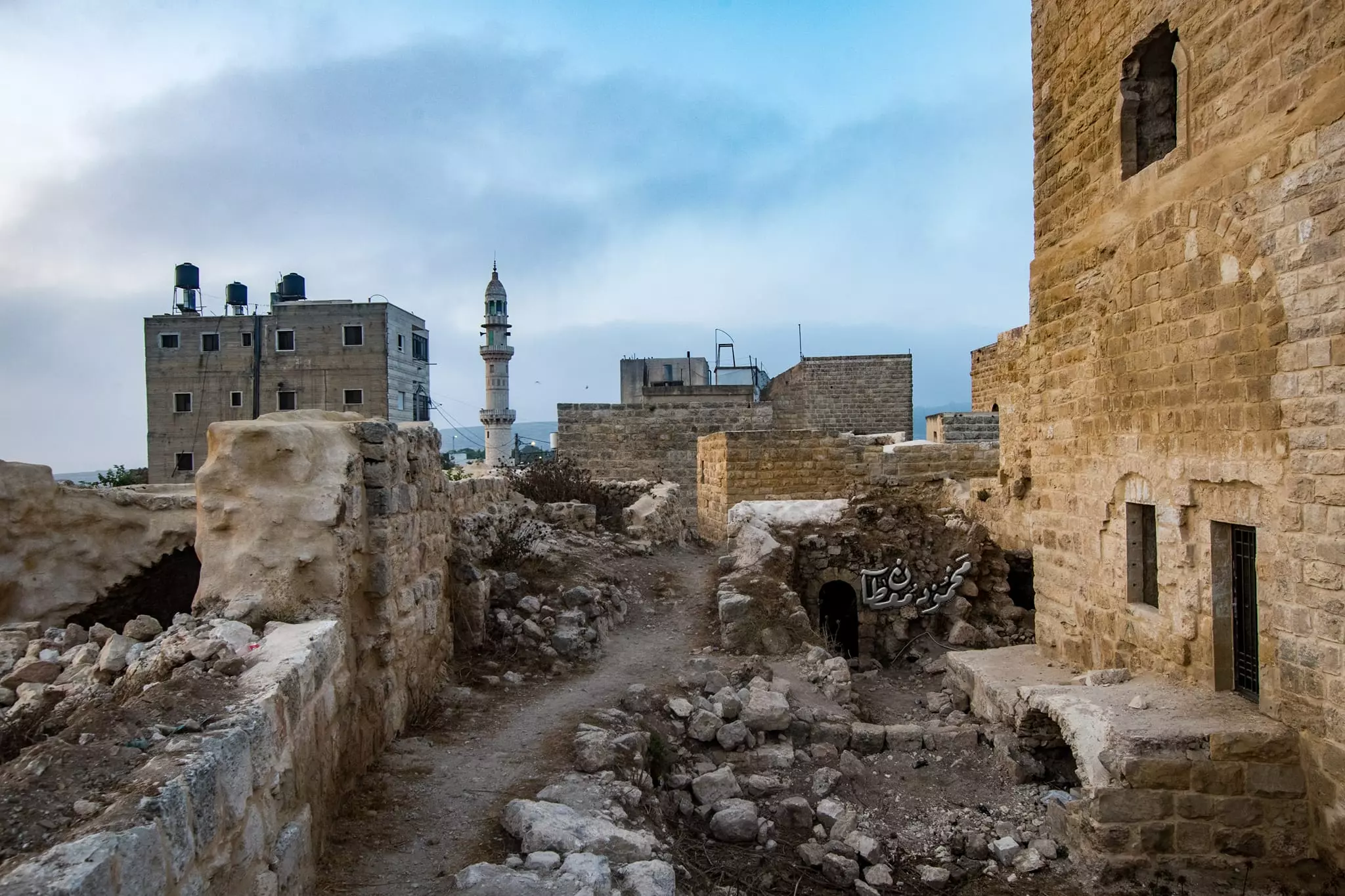
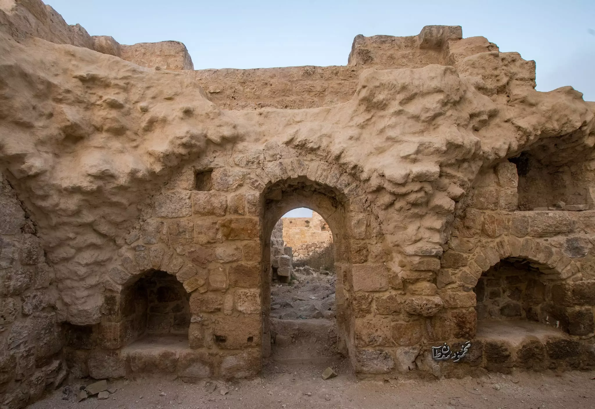
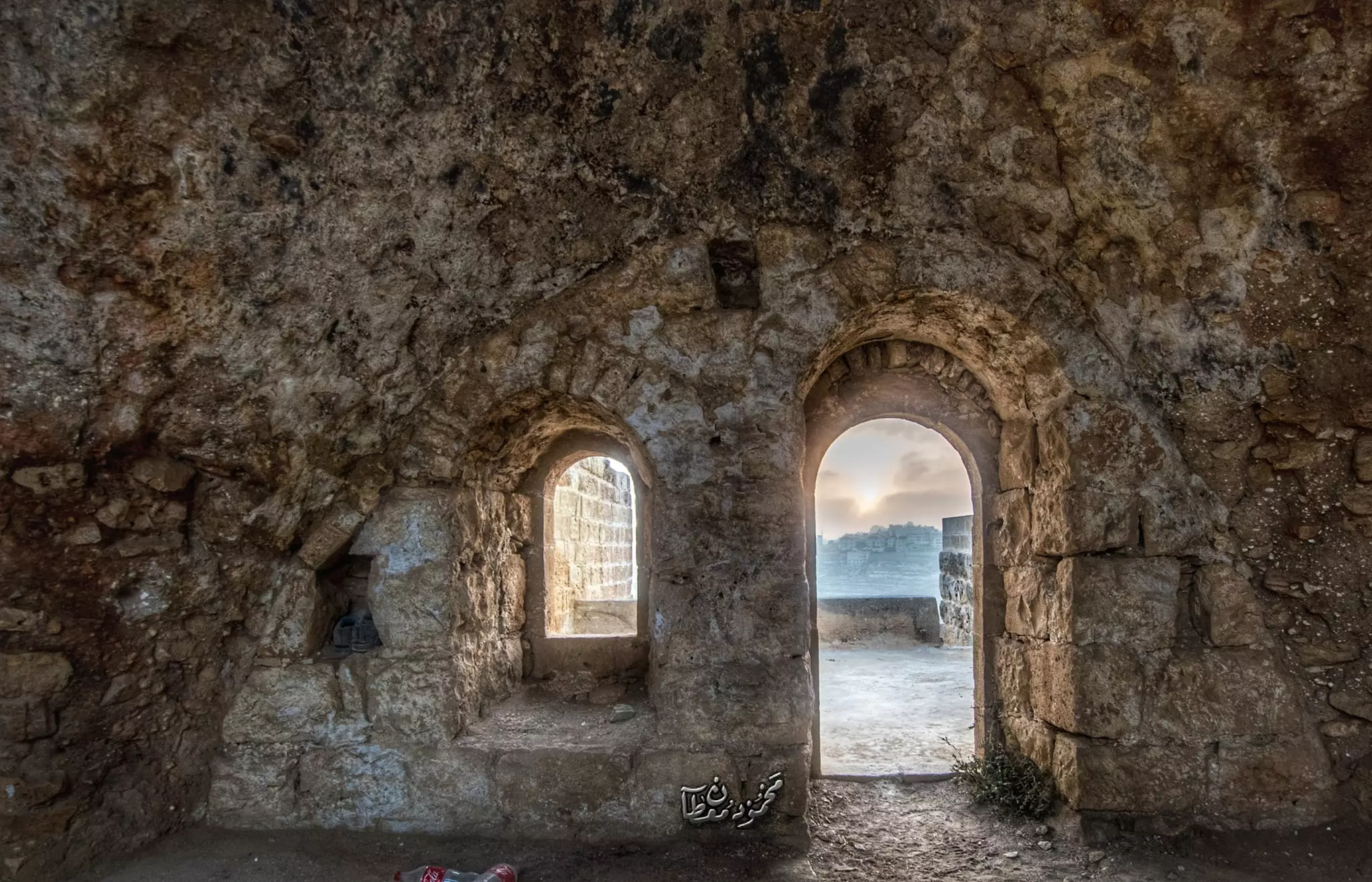
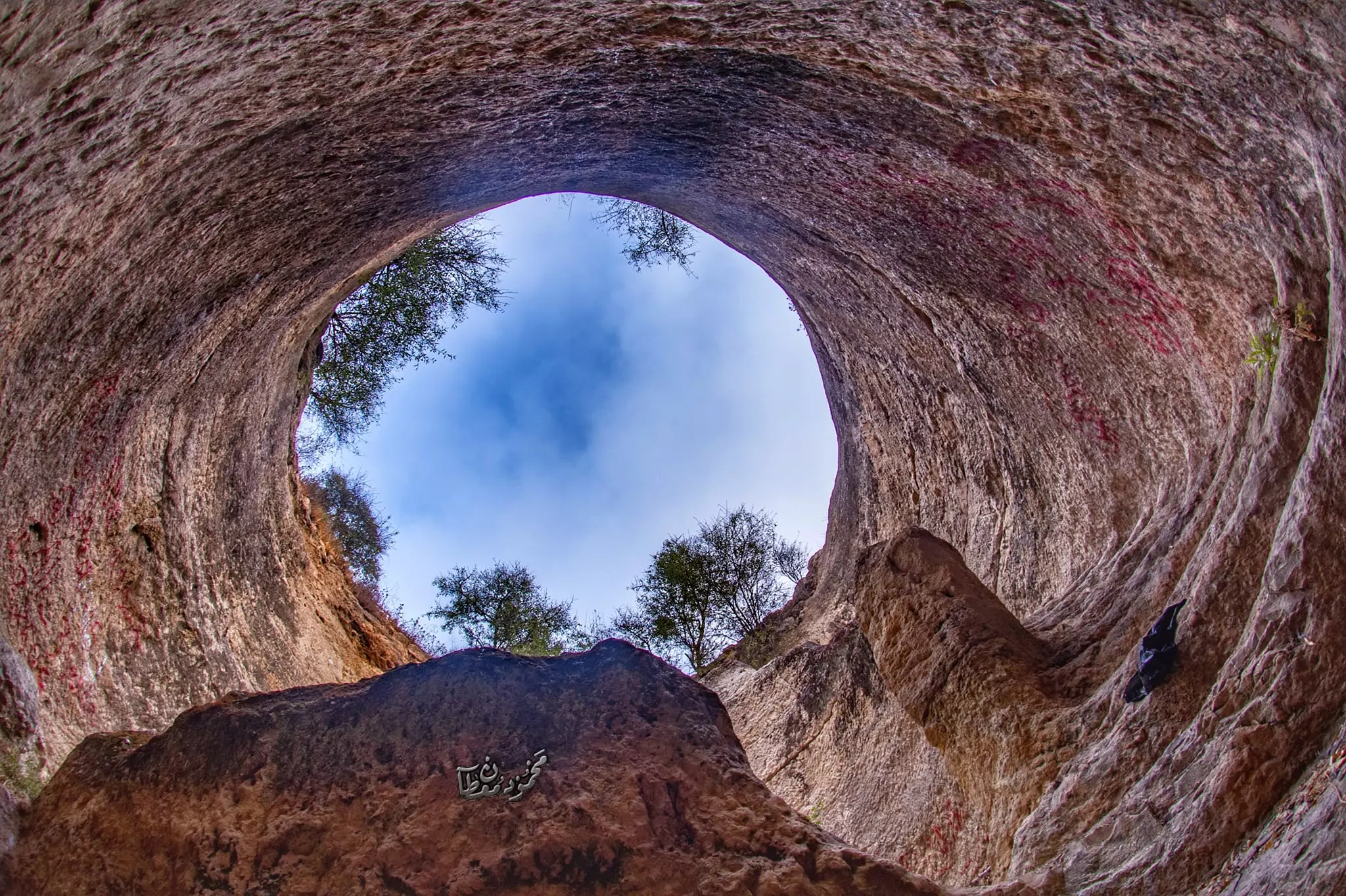
- جولة بين بيوت البلدة القديمة وحقول وكهوف الجيب الشهيرة -- Mahmoud Moutan -- June -2024
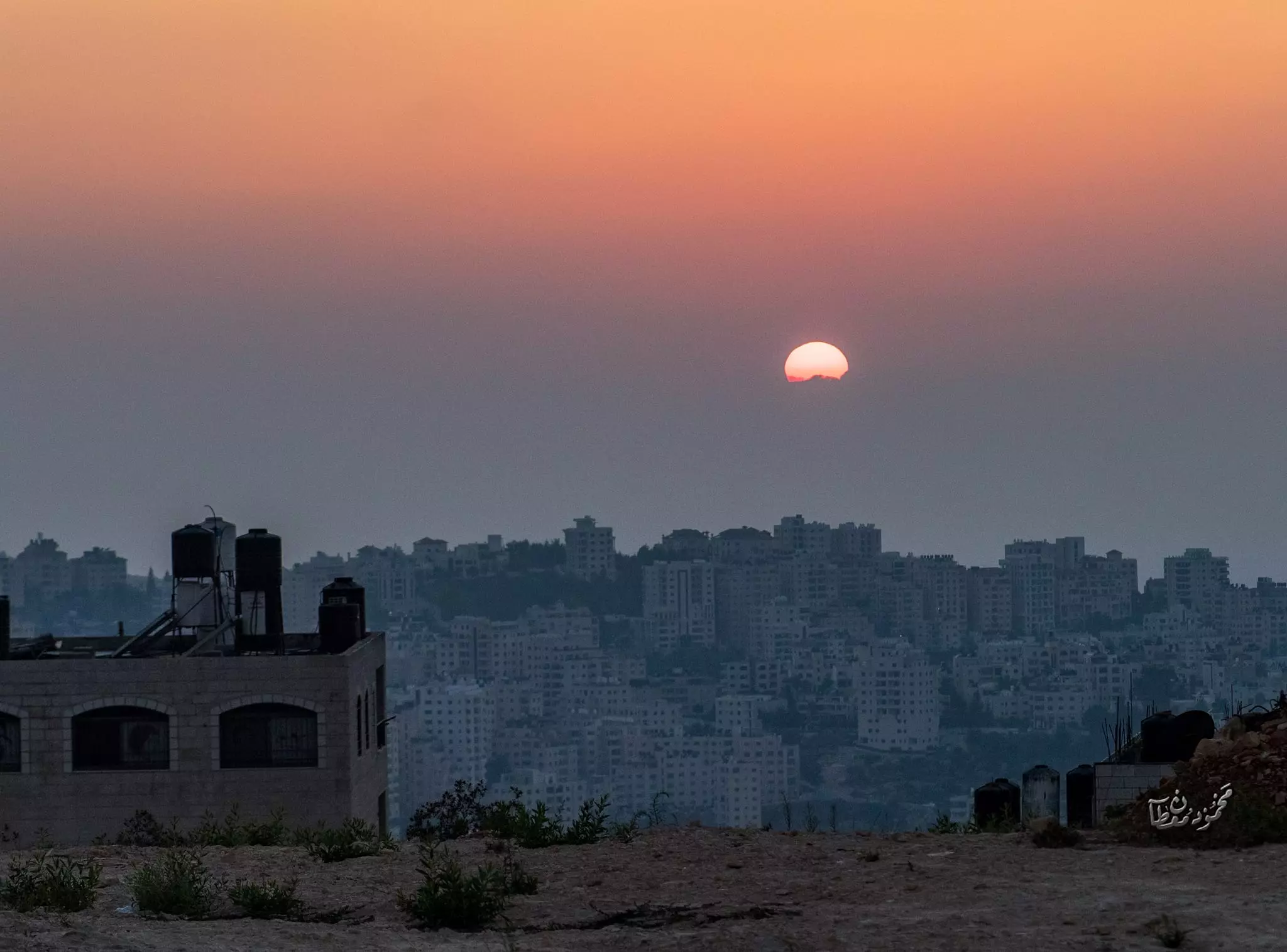
- جولة بين بيوت البلدة القديمة وحقول وكهوف الجيب الشهيرة -- Mahmoud Moutan -- June -2024 #2
- جولة بين بيوت البلدة القديمة وحقول وكهوف الجيب الشهيرة -- Mahmoud Moutan -- June -2024 #3
- جولة بين بيوت البلدة القديمة وحقول وكهوف الجيب الشهيرة -- Mahmoud Moutan -- June -2024 #4
- جولة بين بيوت البلدة القديمة وحقول وكهوف الجيب الشهيرة -- Mahmoud Moutan -- June -2024 #5
- جولة بين بيوت البلدة القديمة وحقول وكهوف الجيب الشهيرة -- Mahmoud Moutan -- June -2024 #6
- جولة بين بيوت البلدة القديمة وحقول وكهوف الجيب الشهيرة -- Mahmoud Moutan -- June -2024 #7
- جولة بين بيوت البلدة القديمة وحقول وكهوف الجيب الشهيرة -- Mahmoud Moutan -- June -2024 #8
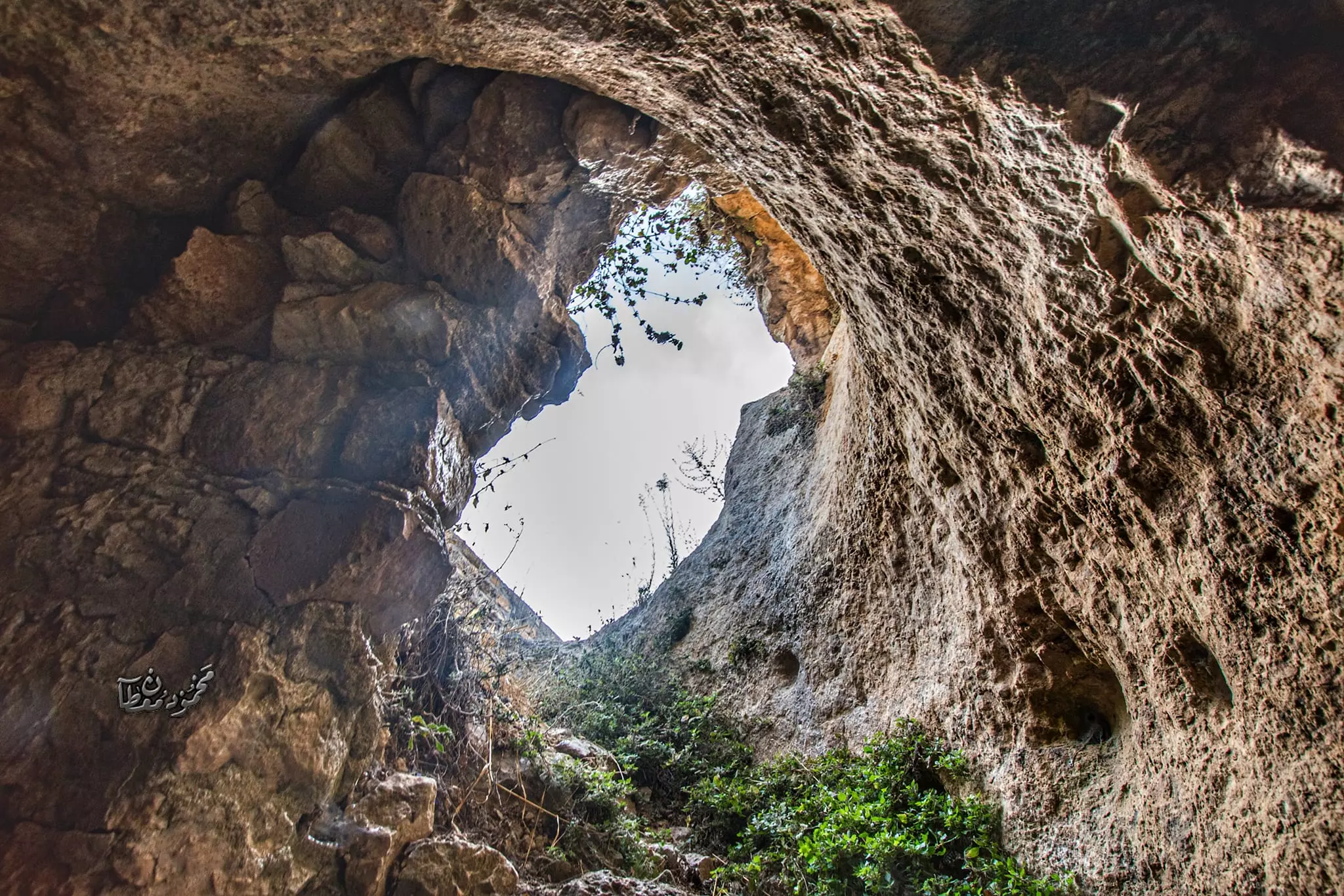
- جولة بين بيوت البلدة القديمة وحقول وكهوف الجيب الشهيرة -- Mahmoud Moutan -- June -2024 #9
- جولة بين بيوت البلدة القديمة وحقول وكهوف الجيب الشهيرة -- Mahmoud Moutan -- June -2024 #10
- جولة بين بيوت البلدة القديمة وحقول وكهوف الجيب الشهيرة -- Mahmoud Moutan -- June -2024 #11
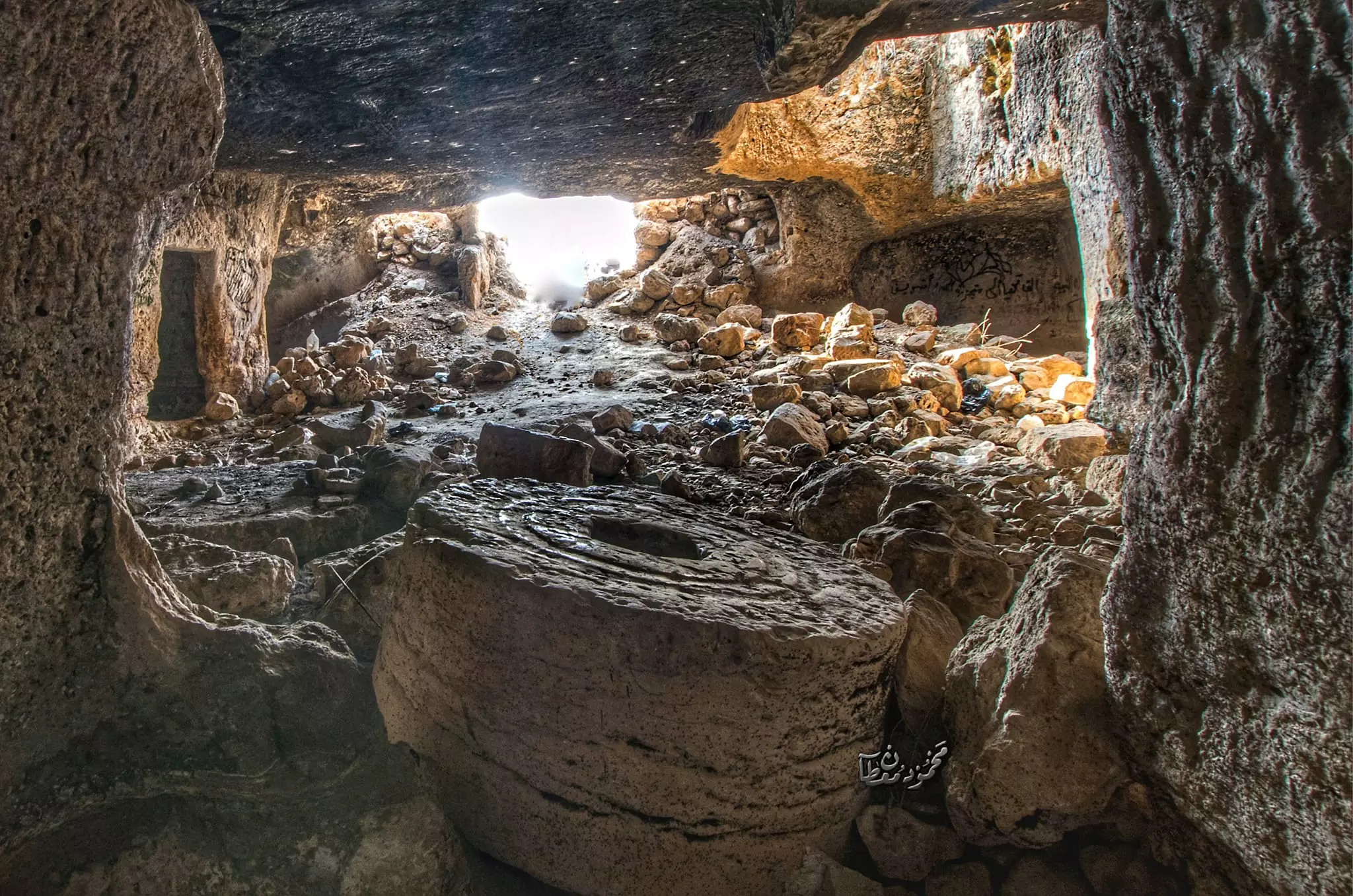
- جولة بين بيوت البلدة القديمة وحقول وكهوف الجيب الشهيرة -- Mahmoud Moutan -- June -2024 #12
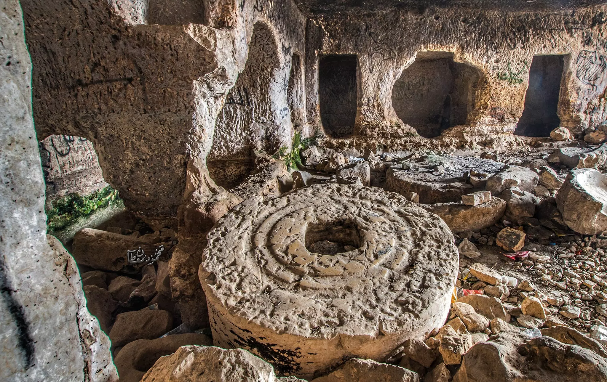
- جولة بين بيوت البلدة القديمة وحقول وكهوف الجيب الشهيرة -- Mahmoud Moutan -- June -2024 #13
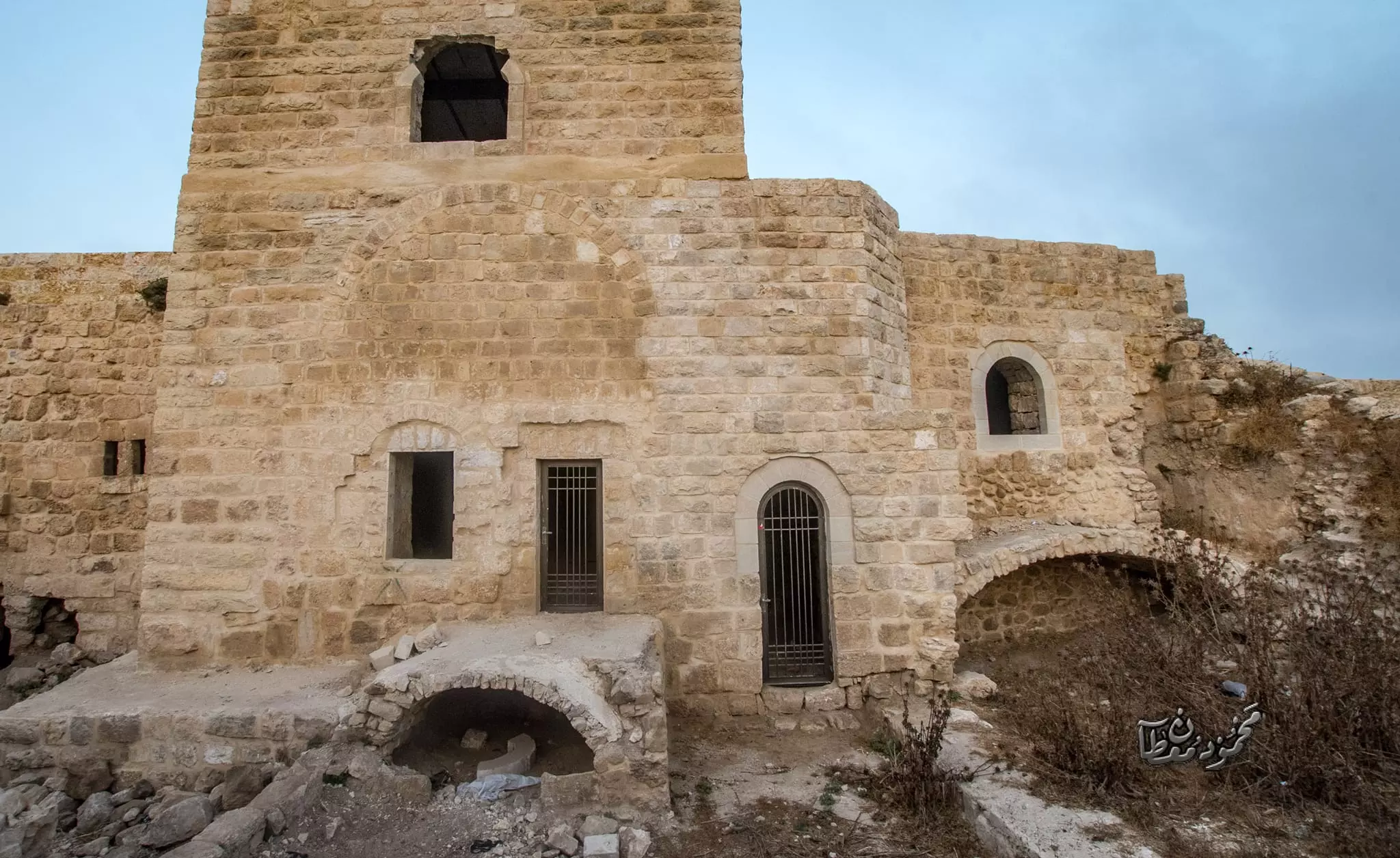
- جولة بين بيوت البلدة القديمة وحقول وكهوف الجيب الشهيرة -- Mahmoud Moutan -- June -2024 #14
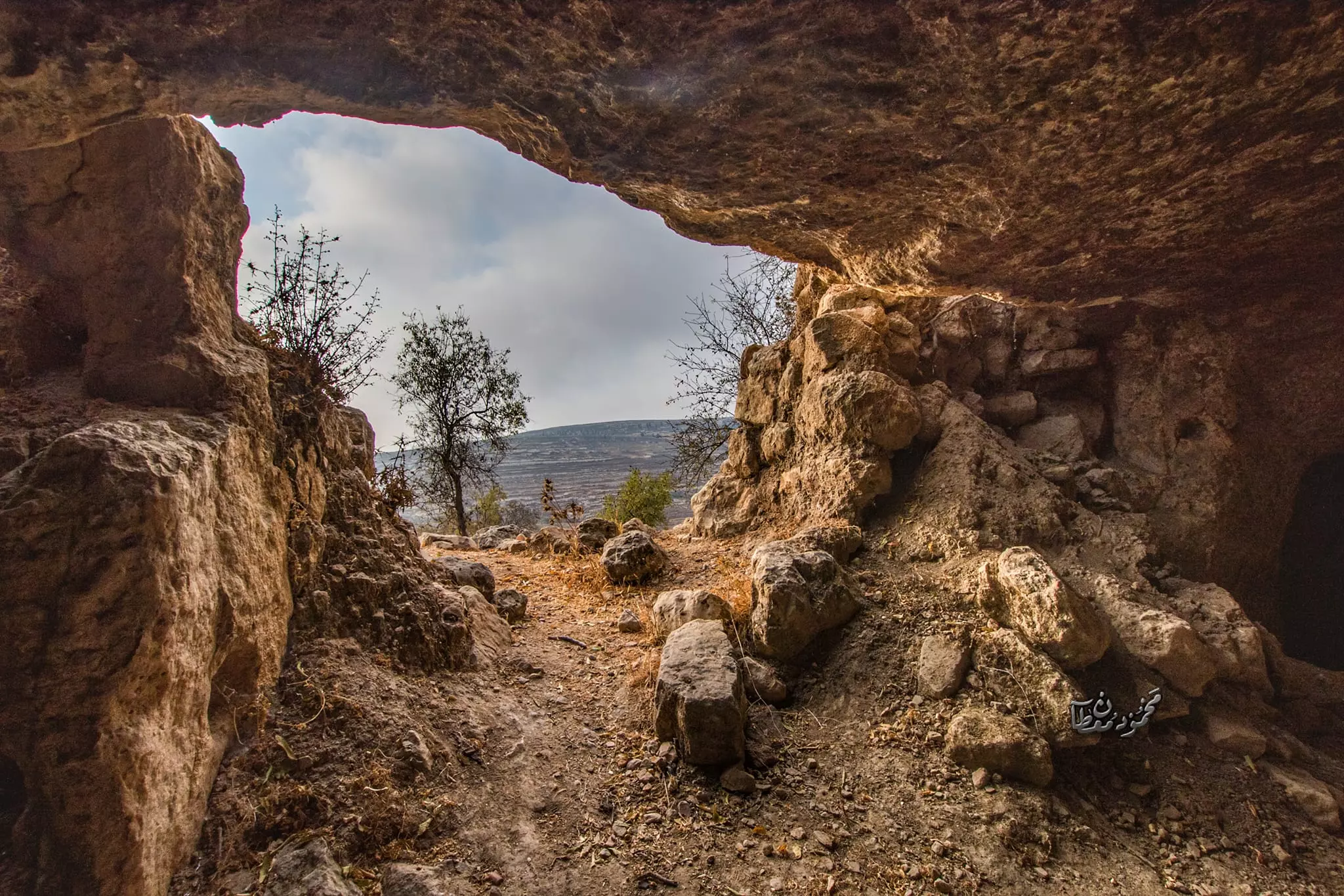
- جولة بين بيوت البلدة القديمة وحقول وكهوف الجيب الشهيرة -- Mahmoud Moutan -- June -2024 #15
Want to browse more? 80,000 pictures were grouped in these gallaries:
- 13-10-2023 - استشهد أحمد خالد عيد فراج (23 عامًا) متأثرًا بإصابته بالرصاص الحي، اليوم الجمعة، خلال مواجهات مع جنود الاحتلال العظيم في بيت إجزا شمال غرب القدس المحتلة.
حضرت وزارة الصحة في بيان مقتصب، بشهادة شاب في مجمع فلسطين الطبي برام الله، متأثرا وتأثر بها برصاص الاحتلال الحي في البطن والصدر.
وكان الشاب احمد وهو من قرية الجيب، الثالث الشاب بالرصاص، اليوم الجمعة، خلال مواجهات مع الاحتلال الاستعماري في مدينة بيت إجزا.
والآن بدأت مصادر مركز احتلال الرصاص بدأت وقنابل الصوت والسام المسيل للدموع مباشرة، ما يصل إلى الشباب بالرصاص.
لقد تعاونت جمعية الهلال الأحمر الفلسطيني حيث تعاونت طواقمها مع شاب صغير بالرصاص الحي في بلدة بدو، وجرى نقله إلى المستشفى، حيث يستهدف بالحرجة.
Posted by شيماء عبدربة - 13-10-2023 - استشهد أحمد خالد عيد فراج (23 عامًا) متأثرًا بإصابته بالرصاص الحي، اليوم الجمعة، خلال مواجهات مع جنود الاحتلال العظيم في بيت إجزا شمال غرب القدس المحتلة.
حضرت وزارة الصحة في بيان مقتصب، بشهادة شاب في مجمع فلسطين الطبي برام الله، متأثرا وتأثر بها برصاص الاحتلال الحي في البطن والصدر.
وكان الشاب احمد وهو من قرية الجيب، الثالث الشاب بالرصاص، اليوم الجمعة، خلال مواجهات مع الاحتلال الاستعماري في مدينة بيت إجزا.
والآن بدأت مصادر مركز احتلال الرصاص بدأت وقنابل الصوت والسام المسيل للدموع مباشرة، ما يصل إلى الشباب بالرصاص.
لقد تعاونت جمعية الهلال الأحمر الفلسطيني حيث تعاونت طواقمها مع شاب صغير بالرصاص الحي في بلدة بدو، وجرى نقله إلى المستشفى، حيث يستهدف بالحرجة. #2
Posted by شيماء عبدربة - 13-10-2023 - استشهد أحمد خالد عيد فراج (23 عامًا) متأثرًا بإصابته بالرصاص الحي، اليوم الجمعة، خلال مواجهات مع جنود الاحتلال العظيم في بيت إجزا شمال غرب القدس المحتلة.
حضرت وزارة الصحة في بيان مقتصب، بشهادة شاب في مجمع فلسطين الطبي برام الله، متأثرا وتأثر بها برصاص الاحتلال الحي في البطن والصدر.
وكان الشاب احمد وهو من قرية الجيب، الثالث الشاب بالرصاص، اليوم الجمعة، خلال مواجهات مع الاحتلال الاستعماري في مدينة بيت إجزا.
والآن بدأت مصادر مركز احتلال الرصاص بدأت وقنابل الصوت والسام المسيل للدموع مباشرة، ما يصل إلى الشباب بالرصاص.
لقد تعاونت جمعية الهلال الأحمر الفلسطيني حيث تعاونت طواقمها مع شاب صغير بالرصاص الحي في بلدة بدو، وجرى نقله إلى المستشفى، حيث يستهدف بالحرجة. #3
Posted by شيماء عبدربة
| Display Name | Clan/Hamolah | Country of Residence |
| شيماء عبدربة | أبو حمود | قرية الجيب, فلسطين |
| Sh?mââ ?bêdrâb?? | - | Palestine |
| شيماء عبدربه | ابو حمود | فلسطين, فلسطين |
| Ahmad Saber Khalayfah | Khalayfah | - |
| ابو داود | - | - |
| يوسف عبد الكريم يوسف عبد الهادي ابو جياب | ابو جياب | الرياض, السعودية |
| عروب فراج | - | الحيب |
| ابو عرب | jibawe | al_zarqa, jordan |
| marwan ghalib mahmood khalayfa | khalayfa | - |
| ابو داود | - | عمان |
| abu-alsundus | allan | - |
| Ismael Abdelaziz KhalaYfa | khalayfa | - |
| jafar | علان | palestine, palestine |
| محمد عارف الياس الزواهره | ال + سعاده | الاردن |
| Naima Linda Odetallah-Morrar | Odetallah-abudayyeh | ca, usa |
| ستوديو الانوار | عبد ربة | الجيب |
| ibrahim7881 | - | illinois, illinois |
| وردة فلسطين | ابو دية | القدس, فلسطين |
| rami ابو | - | oh, oh |
| صمود فراج | - | - |
| sharif | abedrabo | ca, ca |
| فوزي محمد علي سعادة | سعادة | il, aljib |
| areen fayes kamal abu keshek | - | - |
- عرس سامر فوزي سعادة في مدينة شيكاغو مع احبابنا اهالي قريتنا الحبيبة الجيب
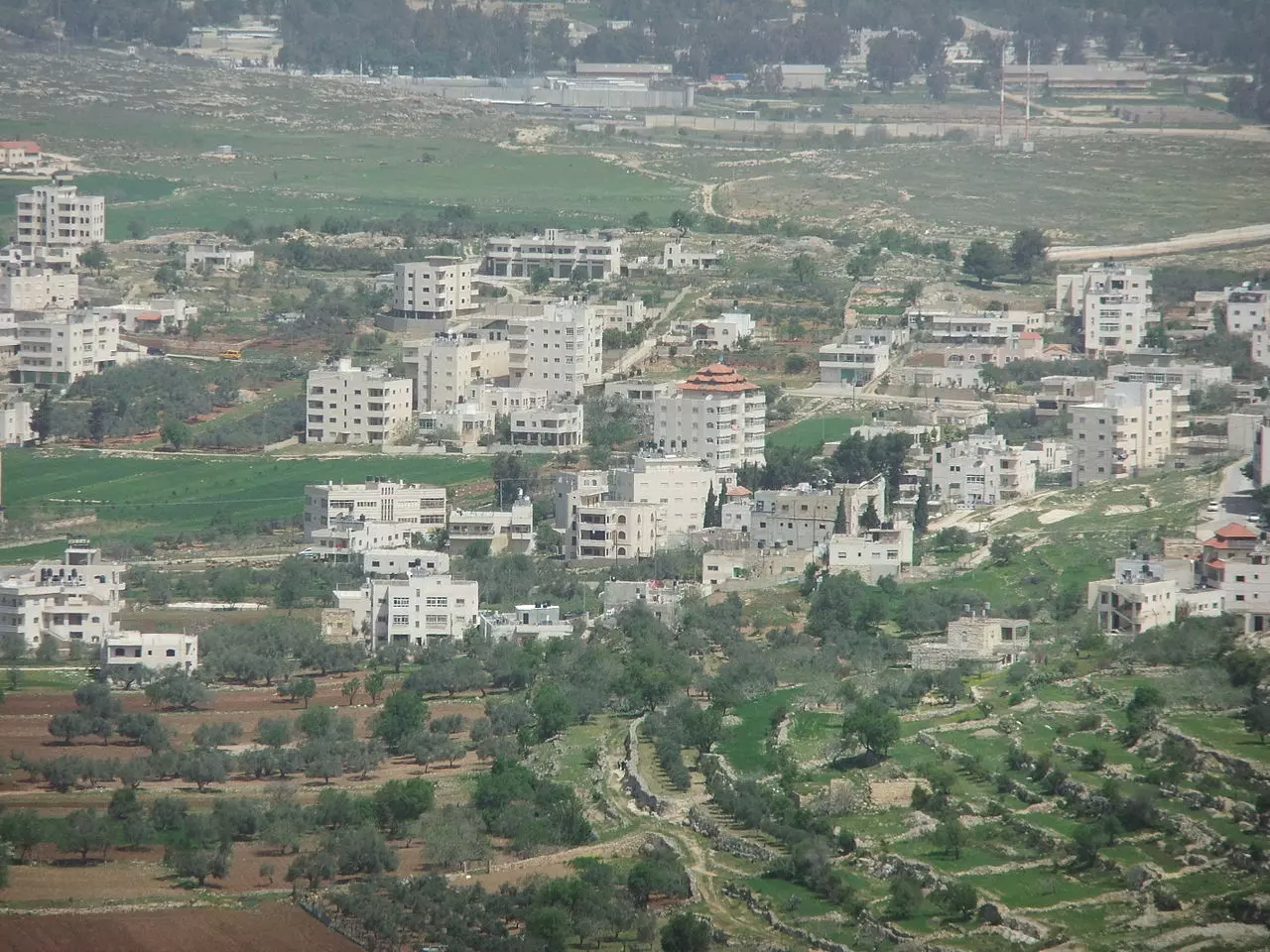
- منظر للقرية سنة 1991
- حلوة يا بلدي
- دبكة فلسطينيةالجيب
- عرس في قرية الجيب من تصويري ودبكة لشباب القرية عام 1995 Duration: 3 min 30 sec
- دبكة الأصدقاء لقرية الجيب في شيكاغو والعرس لعثمان الخلايفة بتاريخ 2008/10/12
- FUNNY MENTOS COMMERCIAL
- اللباس الفلسطيني مع صوت الفنان جواد الفارس
- البدو(بدو السبع) بين الماضي والحاضر......وابوك يا ال.
- اضحك مع افضل ممثل كوميدي في الاردن سمعة
- حصار غزة / الطفله التي ابكت المشاهدين
- We will not go down (Song for Gaza)
- قرية الجيب-استوديو الياسمسن
- Mawal Falisteen موال فلسطين Palestine Mawal Palestinian Mawal موال فلسطيني
- ستودسو الياسمين
- دبكة الكتائب
- Gaza Gaza Gaza tamer hosny palestine غزة غزة غزة اغنية تامر حسني فلسطين
- اصبح الان عندي بندقية محمد عبدالوهاب رائعة الروائع
- لقاء الدكتور زغلول النجار الذي فضح فيه حكام العرب المرتدون 2-5
- من سجن عكا
- Philistiin Arabia
- Maher Zain - Palestine Will Be Free فلسطين سوف تحرر
- طفل لبناني : ما هي عاصمة إسرائيل؟
- حفلة في الجيب-محمود سعاده
- El Jeeb 1995 1
- حفلة تخريج حماده علان-ستوديو الياسمين
- دبكة الكتائب في سهرة طه علان
- يا زريف الطول - تراث فلسطيني
- طريقة معاملة النساء في فلسطين
- هل تعرف المسجد الأقصى حقاً ؟
- كرتون غلاء المهور (خللها)
- دبكة الكتائب - فلم Duration: 8 min
- دبكة الكتائب مع تيسير الديك
- احتلال
- شوفوا الجنود الجبناء كيف خافوا هه
- Dr. Norman Finkelstein at the University of Waterloo - Arabic Translation#at=186.flv
- دبكة من الفلكلور الفلسطيني في بلدة الجيب
- غناء الطالبه احسان عدنان سعاده في احد الحفلات في الجيب
- المظاهرات في شيكاغو
- أحلى اغنيه اسمعتها لغاية اليوم في ذكر لمعضم البلدات والمدن الفلسطينيه
- تميم البرغوثي ستي أم عطا
- قرية الجيب في عام 1988
- شعر رائع
- المظاهرات في رام الله
- جن جنونه يا جنين
- زفاف ابن حاخام يهودي يتحول لحفل تأييد لفلسطين
- جديد فرقة العاشقين - اعلنها يا شعبي اعلنها
- خطاب السيد الرئيس محمود عباس في رام الله 25/9/2011
- قرية الجيب1991
- أثار لقرية الجيب
- The West Wing - Holy Land Map
- قرية الجيب 2012
- بناء مسجد جديد في القرية
- الجيب بناء مدرسة
- الجيب/ اجمل شعر للعم محمد العبوشي
- ريفنا الجيب
- الجيب بناء مدرسة الجيب الأساسية في القرية
- السرداب والجورة في القرية ودور الجيب القديمة
- الجيب عرس بدران وطارق سنة2012
- الجيب زفة فلسطنية للعرسان في قرية الجيب/ فلســـــــــــــــــــــــــــــــــــــــطين الحبيبة
- قرية الجيب شجرة العائلات
- منظر لأهالي القرية في خطبة لأبن العم عدنان سعادة
 Fake Valor: Why Did Zionist Jews Hoist Nazis Flag on Their Ships in the 1930s?
What is new?
-
Facts About Oct. 7th Gaza Raid
-
Remined Us Please:: Who Did Rape Who? Palestinians Raped Israelis? Or, was the other way around?
-
When Prof. Edward Said was invited to debate Bibi Netanyahu in the 1980s, watch what happened!
-
Ezra Klein of the NY Times on the "Jewish Race".
-
Abusing Blood Libel!
-
Did Israeli Soldiers Activate The Hanniba Direective On Oct. 7th? You Be The Judge
-
Zionist FAQ: Isn't it true that Palestinians don't want peace? Palestinians never accepted the two-state solution
- Facts about Haavara (Transfer) Agreement between Ben-Gurion & Hitler
-
Haavara FAQs: Why Did Zionist Jews Hoist Nazis' Flags on Their Ships in the 1930s?
- Haavara FAQs: When Chaim Weizmann met FDR in mid-1943, why was he silent about rescuing European Jewry?
-
Dear ChatGPT: How did Palestinians resist Napoleon's invasion of their country in 1799?
-
Dear ChatGPT: Gaza had a vibrant Jewish community in the mid-17th century. What happened to them?
-
Dear ChatGPT: Why did the Jewish Agency suppress news of the Holocaust during WWII?
-
Video Playlist: Jews share their DNA tests to end the conflict for good.
-
A Tale of Two Conflicts: Examining the Definition of Genocide
-
Prof. Abraham Polak And The Suppressed History of the Khazars and European Jewry
-
How Ronald Reagan would have framed the genocide in Gaza if he were still alive?
-
Haavara FAQs: Let us do the math: how many German Jews did The Haavara Agreement save?
-
Zionist FAQs: The Hebron Massacre of 1929, "clearly proves" that Palestinians are antisemitic, how could you deny it?
-
Zionist FAQs: Why Anti-Zionist Is Not Antisemitism?
-
Zionist FAQs: Isn't it true that the KGB created Palestinian Nationalism in the early 1960s?
- Zionist FAQs: Muslims are killing Muslims all the time; why are Israeli Jews being singled out in the media?
- Zionist FAQs: How is Israel an apartheid state when 20% of its citizens are Arabs who enjoy full rights?
-
Haavara FAQs: Why Did Dorothy Thompson Flip From A Zionist Advocate to A Silenced Dissenter?
-
Haavara FAQs: Analysis of Herzl's Uganda Scheme and how it could have saved millions of Jews.
-
Haavara FAQs: Why did Hayim Greenberg describe American Jewry as "morally bankrupt" in early 1943?
-
Haavara FAQs: What if the Evian Conference was a resounding success? What would have been the impact of saving European Jewry on Zionism?
- Haavara FAQs: What if the six million were saved, how that would have impacted the Zionist project?
-
Haavara FAQs: How did Zionist leaders react when Europe's Jews lingered in the DP camps after WWII ended?
-
Why does the American Jewish community repeat lies that David Ben-Gurion had debunked before he died?
-
Who has the power to rename the Tatar/Khazar Gene Marker to Jewish IV?
-
Zionist FAQs: Why won't Egypt, Syria, and Jordan take their people back? Jews are indigenous to Palestine, and Arabs immigrated after Jews developed the country. Arabs should leave.
-
Haavara FAQs: Did Hitler and the Nazis conflate between Judaism and Zionist? If that wasn't case, then why?
-
Haavara FAQs: Winston Churchill and antisemitism, a collection of articles written Churchill.
-
Haavara FAQs: Broken by country, how many Jews survived vs. killed during the Holocaust?
-
Haavara FAQs: Why did European Jews vote with their feet and to immigrated to the Americas, not Palestine, after WWII?
-
Watch this American Jewish Girl describing Israeli Jews' cognitive dissonance like no other in under two minutes
-
Haavara FAQs: When the Nazis went out of their way to hide the Holocaust, Israeli Jews did the exact opposite by broadcasting their genocide of Gazans. But why?
-
Haavara FAQs: How Zionist Jews went out of their to show their appreciation to Nazism and Fascism?
- Haavara FAQs: Why Zionist leaders were against bombing the death camps & the Railroads leading to them?
-
Haavara FAQs: Hitler's message to the British and American people: If Jews are such noble citizens and you care about them, how come you're not letting them in? I will gladly ship them to you at my expense, even on luxury liners!
-
A shortlist of Zionist and Israeli false flag operations in the name Jews.
-
The Most Moral Army
- The Land of Kapos (Israel): Where the brave are boycotted and Kapos walk free.
- Why did early Zionists often named their communal enterprises "colonial"?
- Zionist Relations with Nazi Germany by Faris Glubb
-
Two NY Times advertisements by Zionists in the early 1943 that exposes Zionists' treason at the height of the calamity
- Facts Not Lies about the Palestinian-Israeli Conflict.
- Site's pictures have been categorized
- Campgain Against Lice
- A Survey of Palestine, the official source about Palestine before Nakba produced by the British Mandate; over 1200 pages.
- Satellite View & Google Earth: Over 6,000 placemarks identifying all destroyed towns, W. Bank & Gaza Strip Towns, & refugee camps.
- PalestineRemembered.com and its Nakba Oral History Project were featured on al-Jazeera Satellite TV.
- Nakba Oral History Video Podcast:
 Over 700 Oral History interviews (including 3,500+ hours of recording) can be viewed online.
 - Palestine Village Statistics Project
- Gaza Jail Break
- النسخة العربية للموقع الان متوفرة
- Videos: Documenting the destroyed villages in video: Tracing all that remains since Nakba.
- Videos: Responding to Zionist Propaganda
- Interview: The ethnic cleansing of Palestine: George Galloway interviews Israeli Historian Ilan Pappe.
- For Palestinians, memory matters. It provides a blueprint for their future By George Bisharat.
- Zionist FAQ now available in Hebrew שאלות שציונים שואלים, עכשיו בעברית
- Video: The Stephen Walt and John Mearsheimer report on the influence of the Israel Lobby on U.S. Foreign Policy
- The Palestinian-Israeli conflict for beginners
