| PalestineRemembered | About Us | Oral History | العربية | |
| Pictures | Zionist FAQs | Haavara | Maps | |
| Search |
| Camps |
| Districts |
| Acre |
| Baysan |
| Beersheba |
| Bethlehem |
| Gaza |
| Haifa |
| Hebron |
| Jaffa |
| Jericho |
| Jerusalem |
| Jinin |
| Nablus |
| Nazareth |
| Ramallah |
| al-Ramla |
| Safad |
| Tiberias |
| Tulkarm |
| Donate |
| Contact |
| Profile |
| Videos |
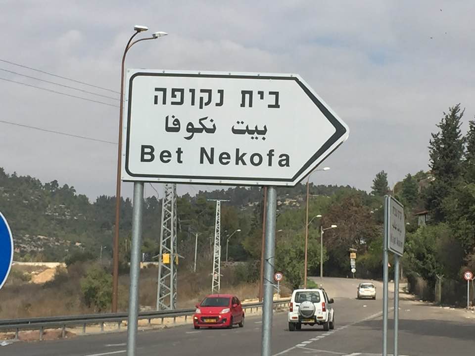
Welcome To Bayt Naqquba - بيت نقوبا (בית נקובא)
|
District of Jerusalem
Ethnically cleansed days ago |
العربية Google Earth |
 |
Gallery (121) |
- Statistics & Facts
-
Before & After

- Satellite View
- Articles 2
- Pictures 121
- Members 8
- All That Remains
- Wikipedia
- Videos 1
- Guest Book 8
- Links 1
| Statistic & Fact | Value | |||||||||||||||||||||
| Occupation Date | April 1, 1948 | |||||||||||||||||||||
| Distance From District | 9.5 (km) West of Jerusalem | |||||||||||||||||||||
| Elevation | 660 (meters) | |||||||||||||||||||||
| Before & After Nakba, Click Map For Details |
||||||||||||||||||||||
|
||||||||||||||||||||||
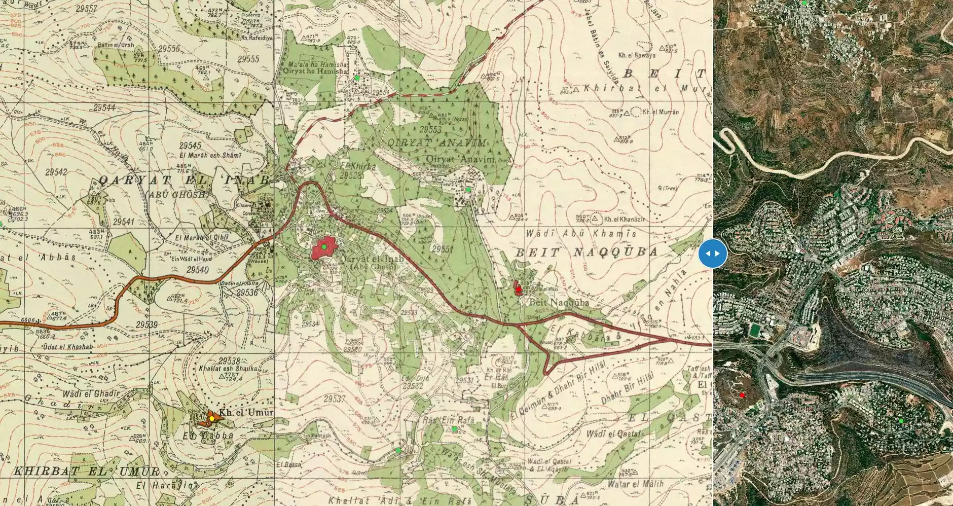
| Map Location | See location #3 on the map View from satellite |
|||||||||||||||||||||
| Military Operation | Operation Nachshon | |||||||||||||||||||||
| Attacking Units | A force of 1,500 Palmach and Haganah troops | |||||||||||||||||||||
| Defenders | Arab Liberation Army volunteers and some local Palestinian militia. | |||||||||||||||||||||
| Exodus Cause | Military assault by Zionist troops | |||||||||||||||||||||
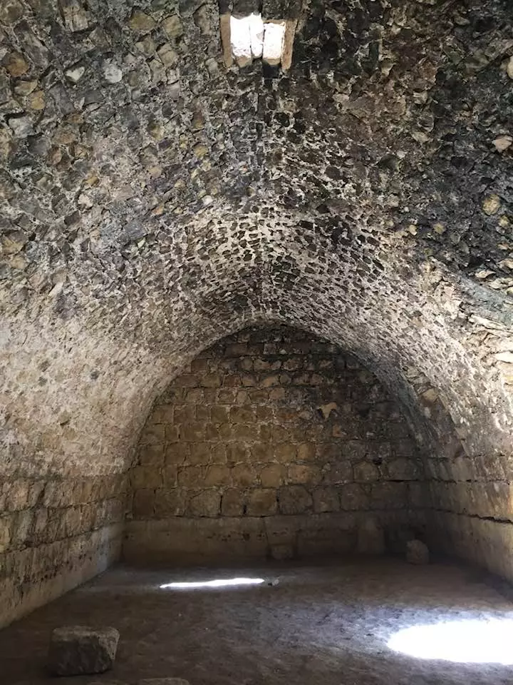
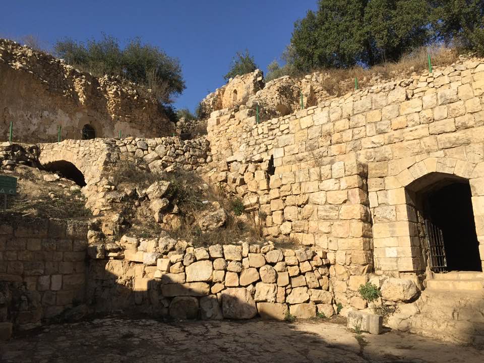
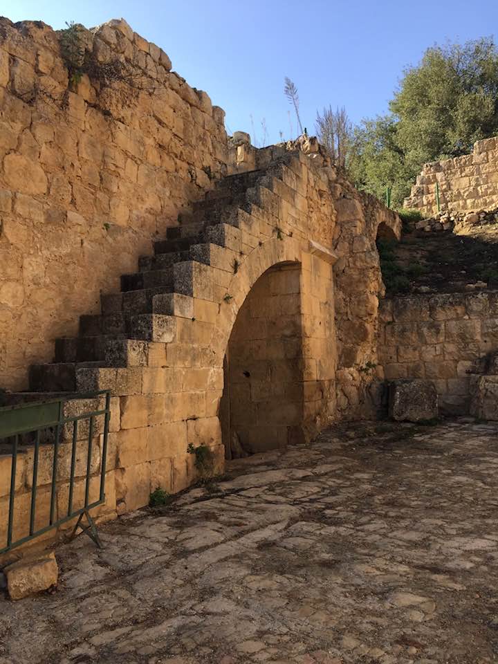
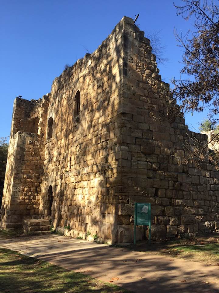
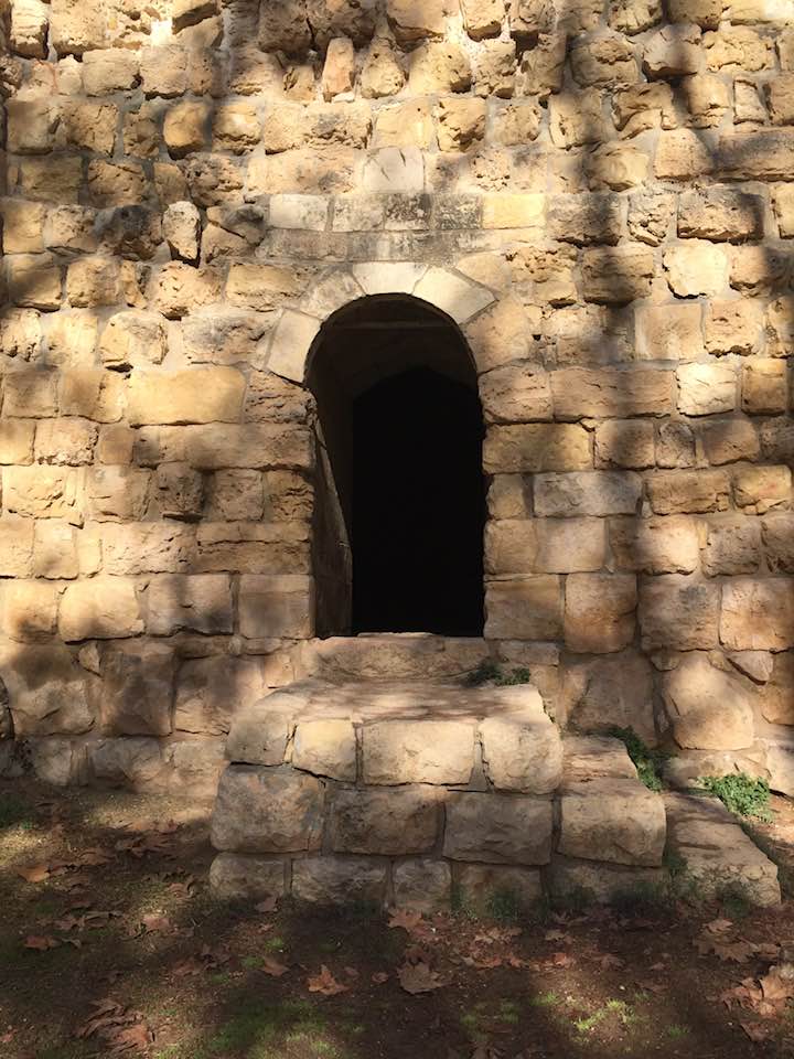
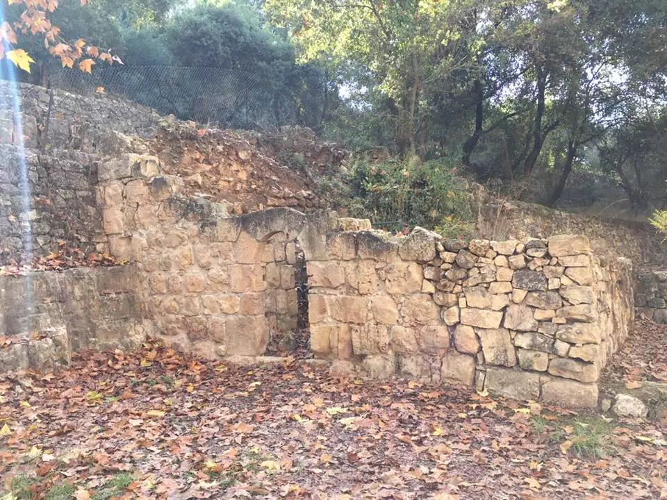
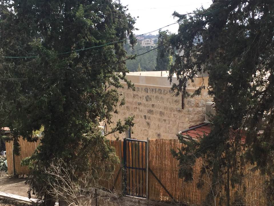
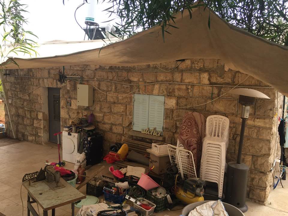
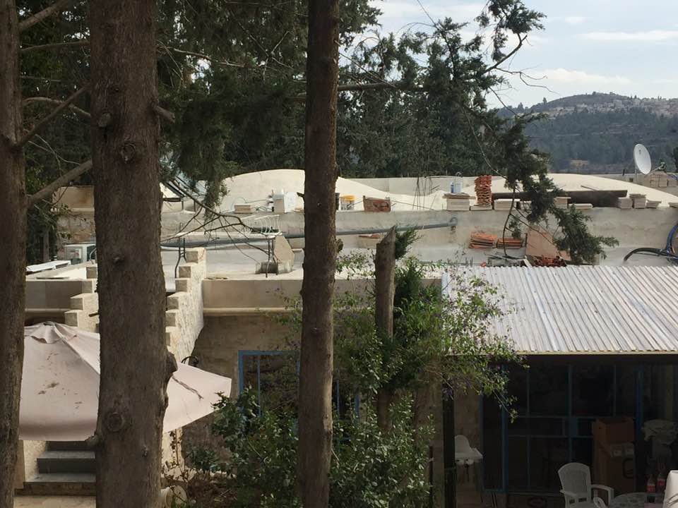
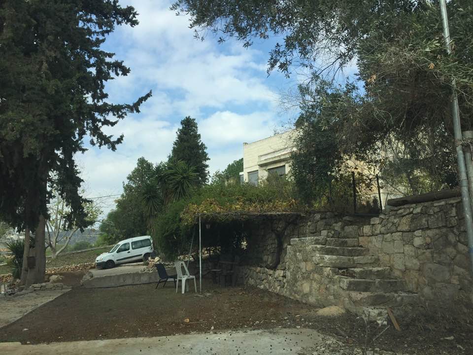
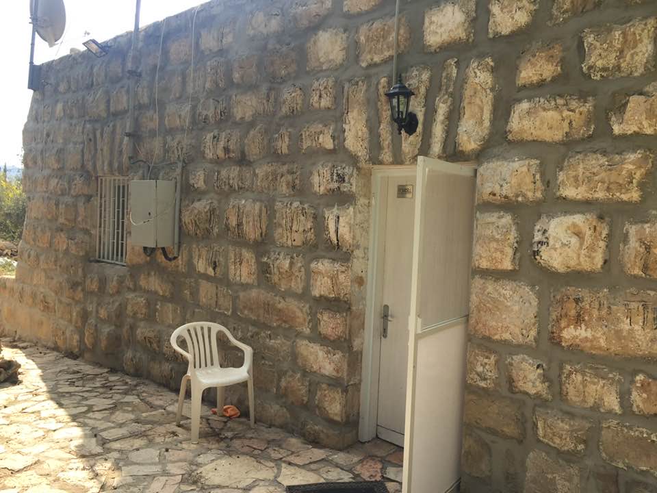
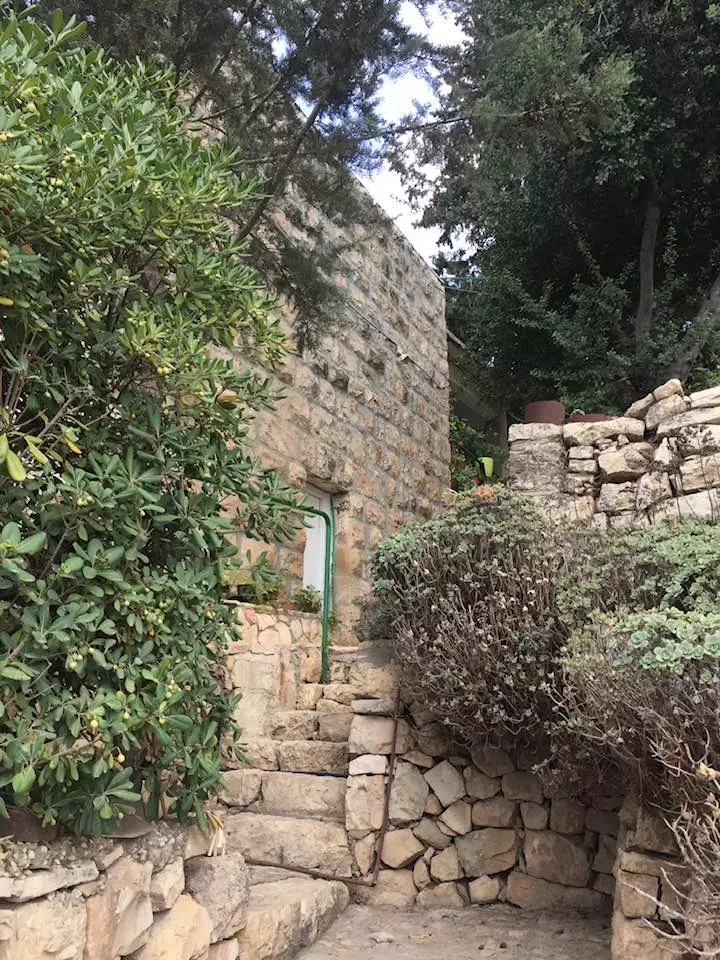
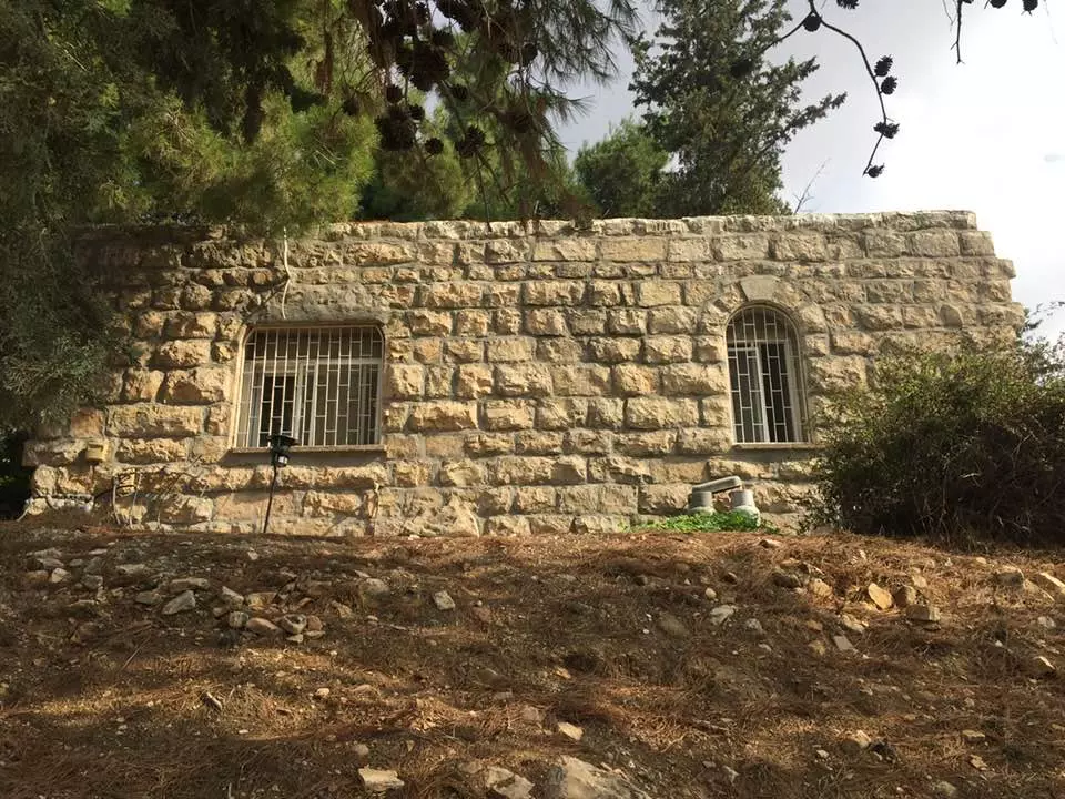
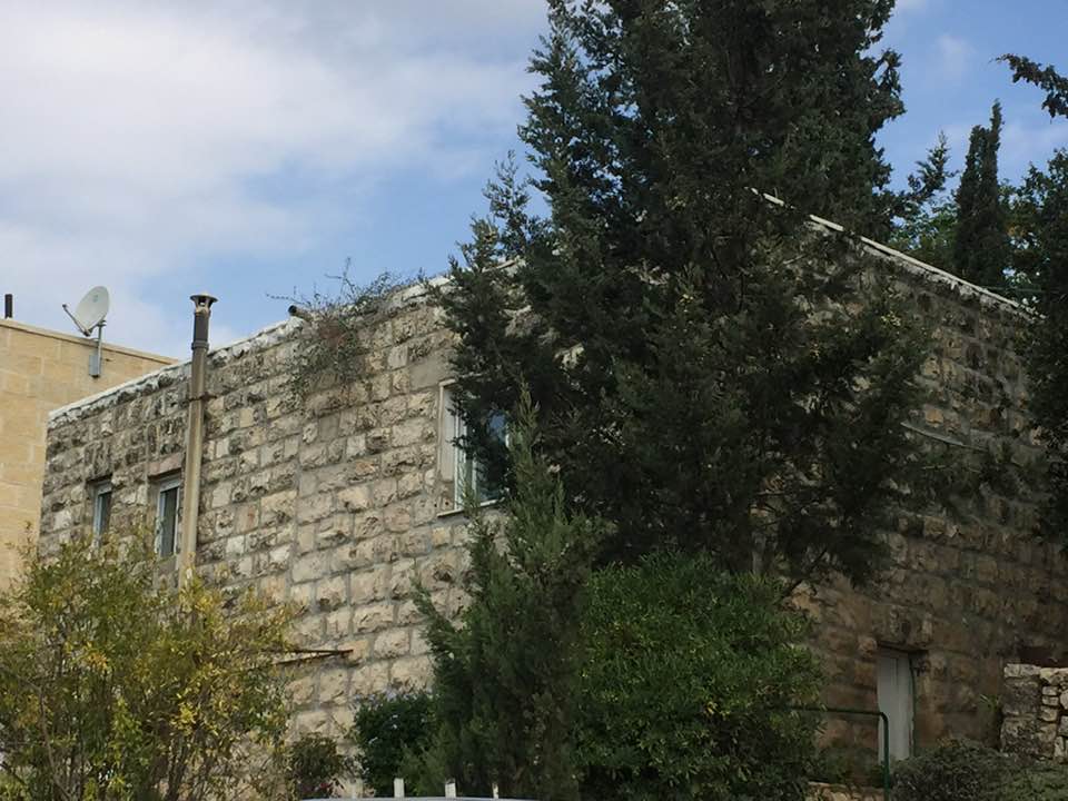
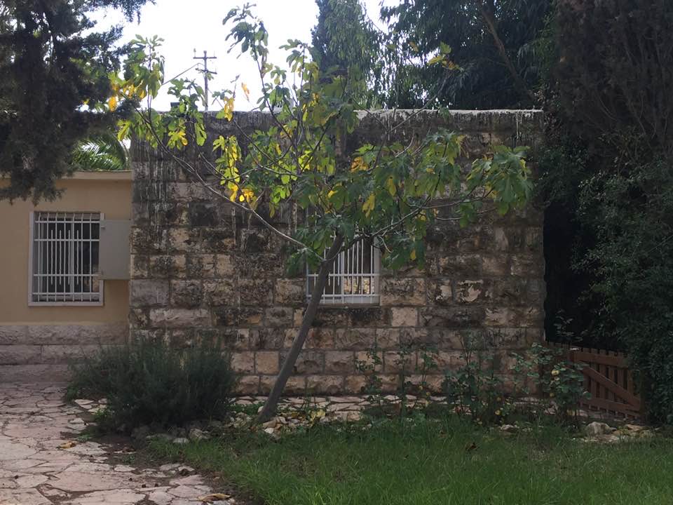
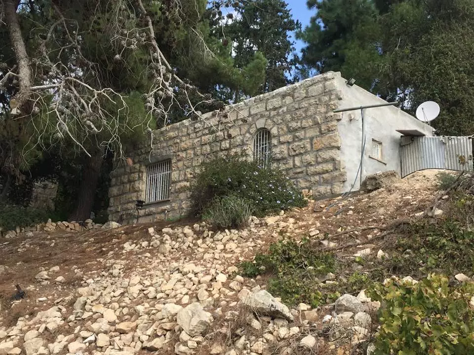
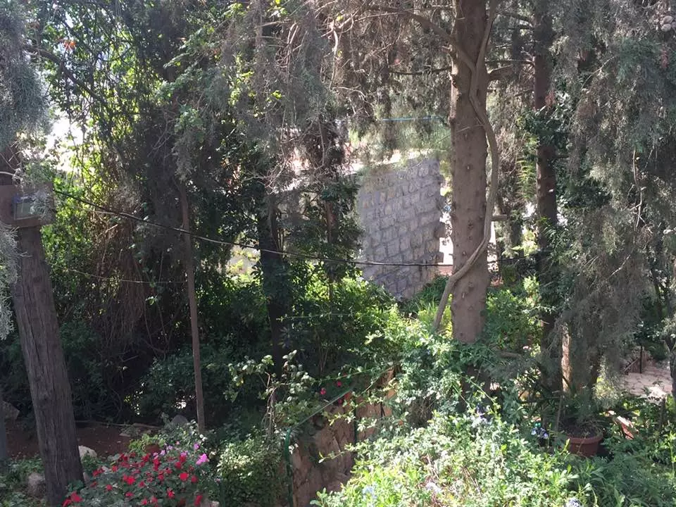
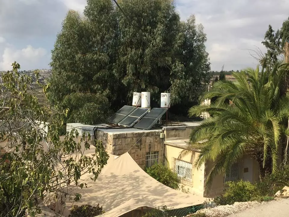
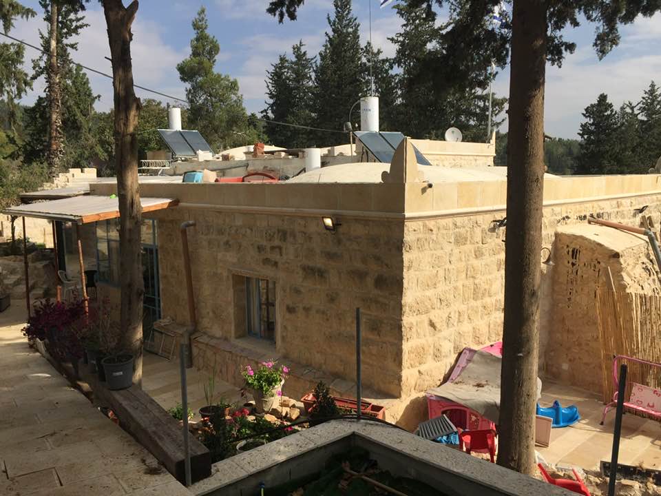
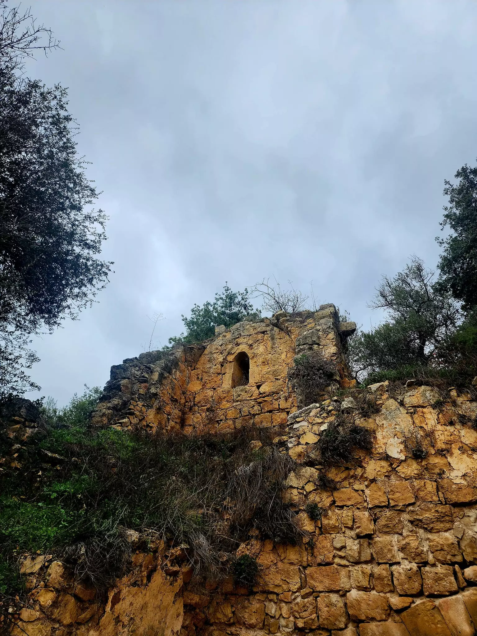
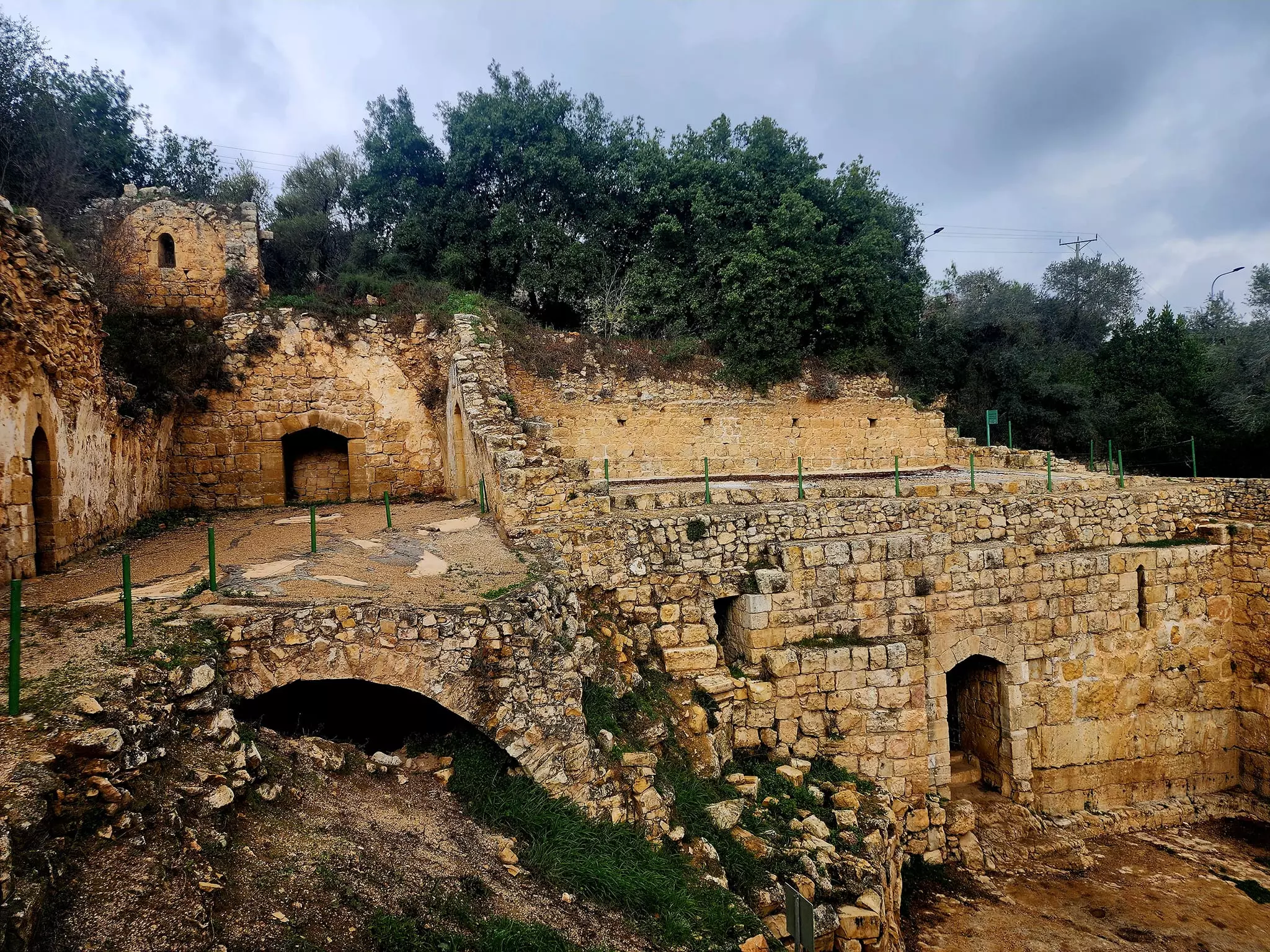
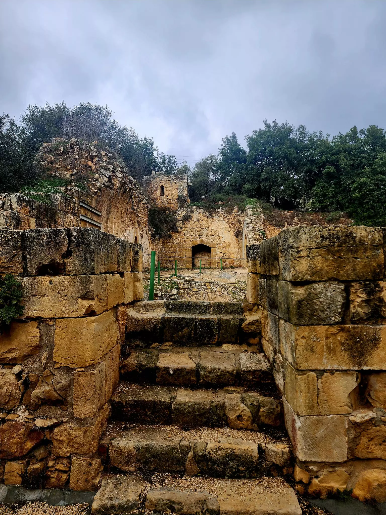
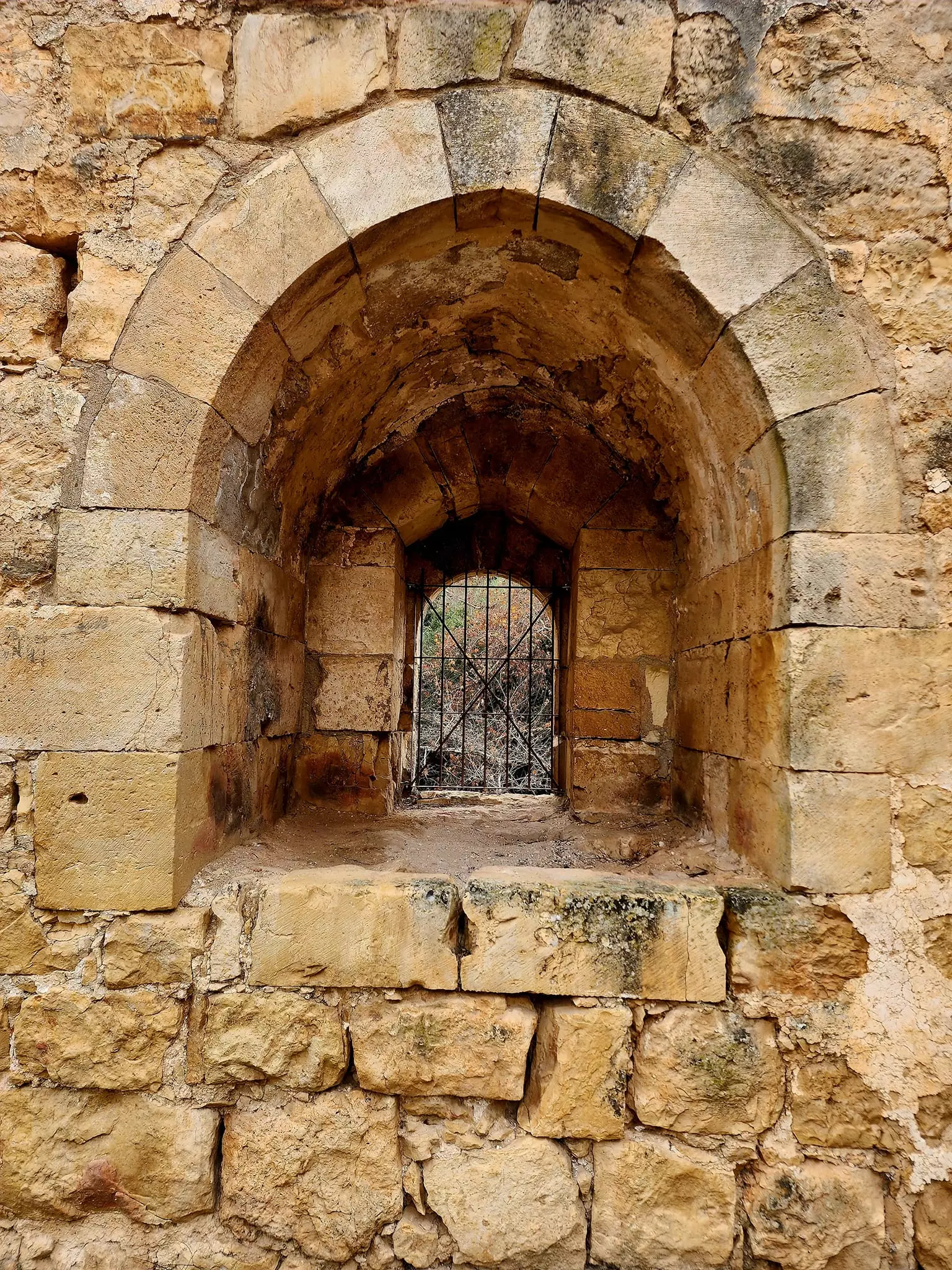
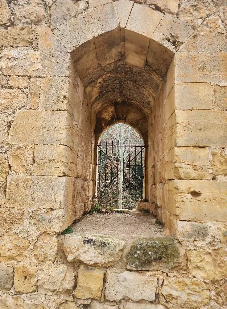
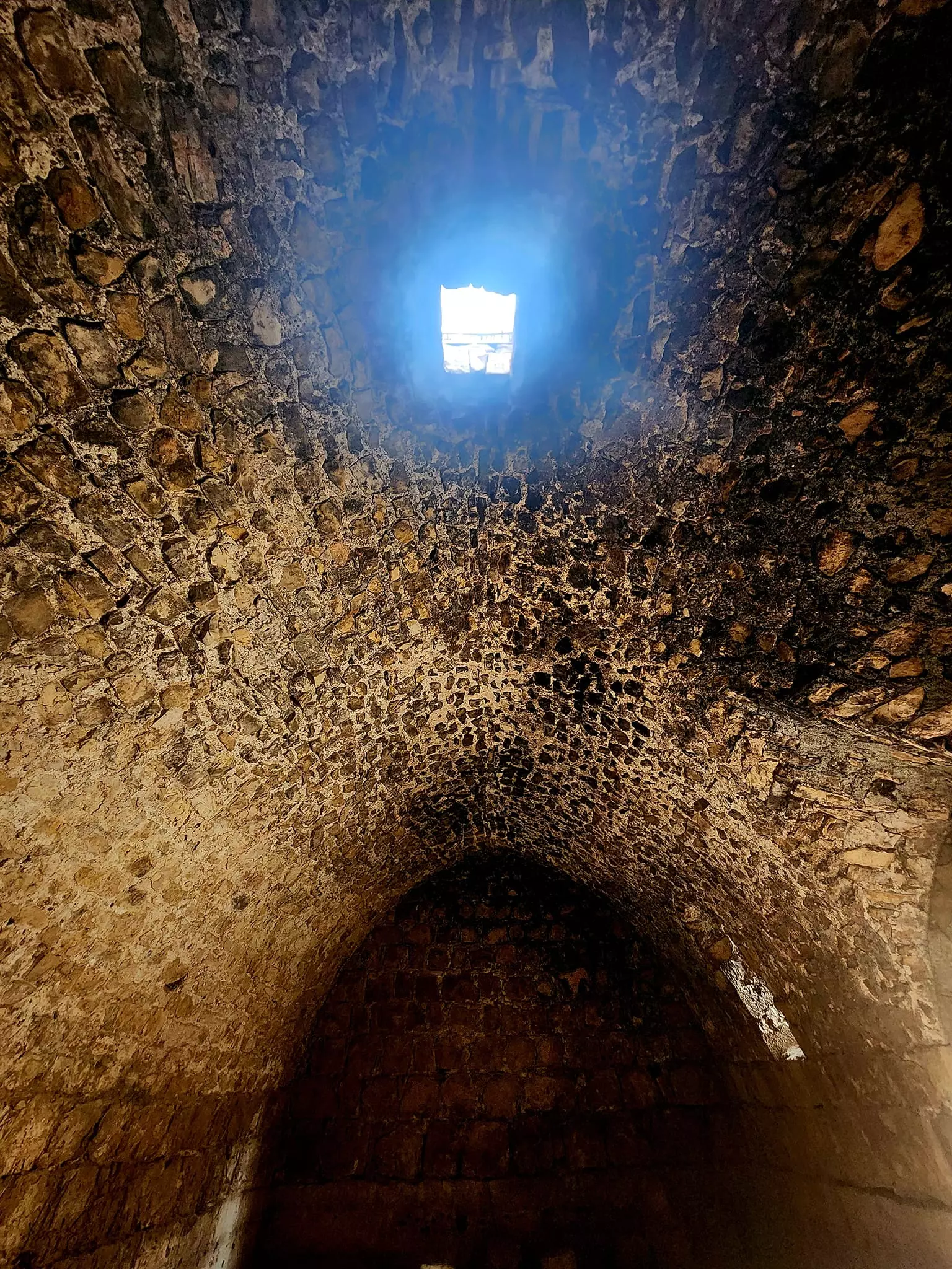
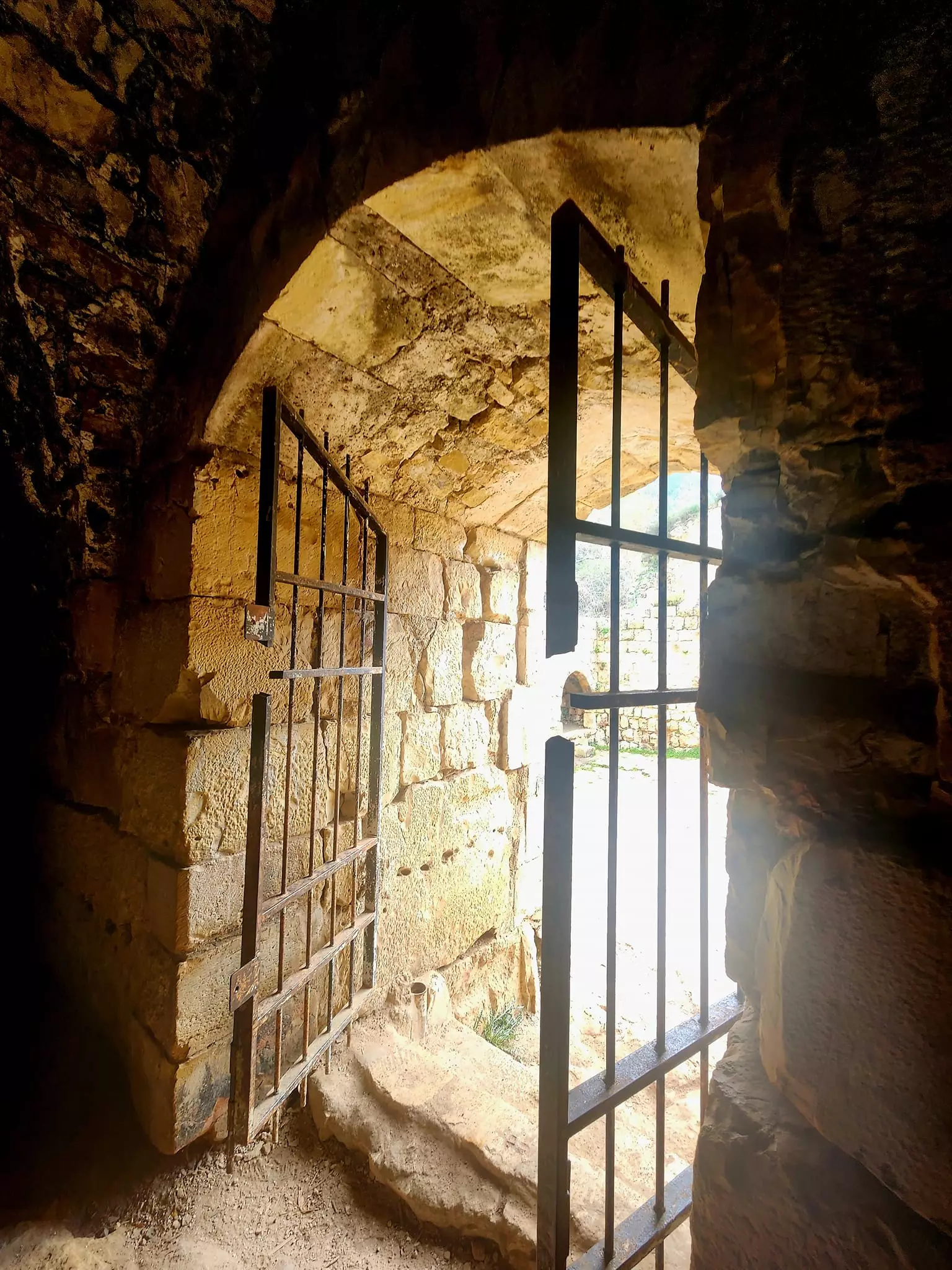
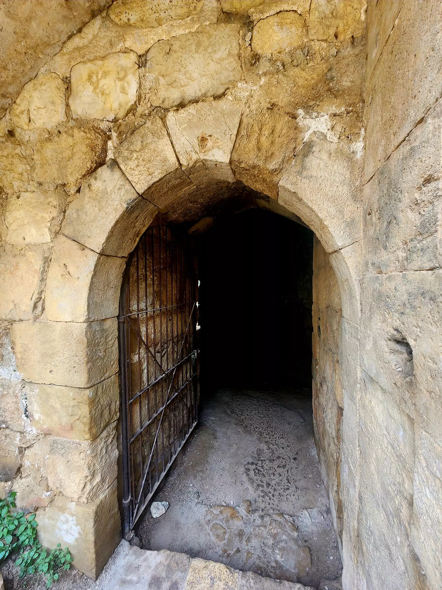
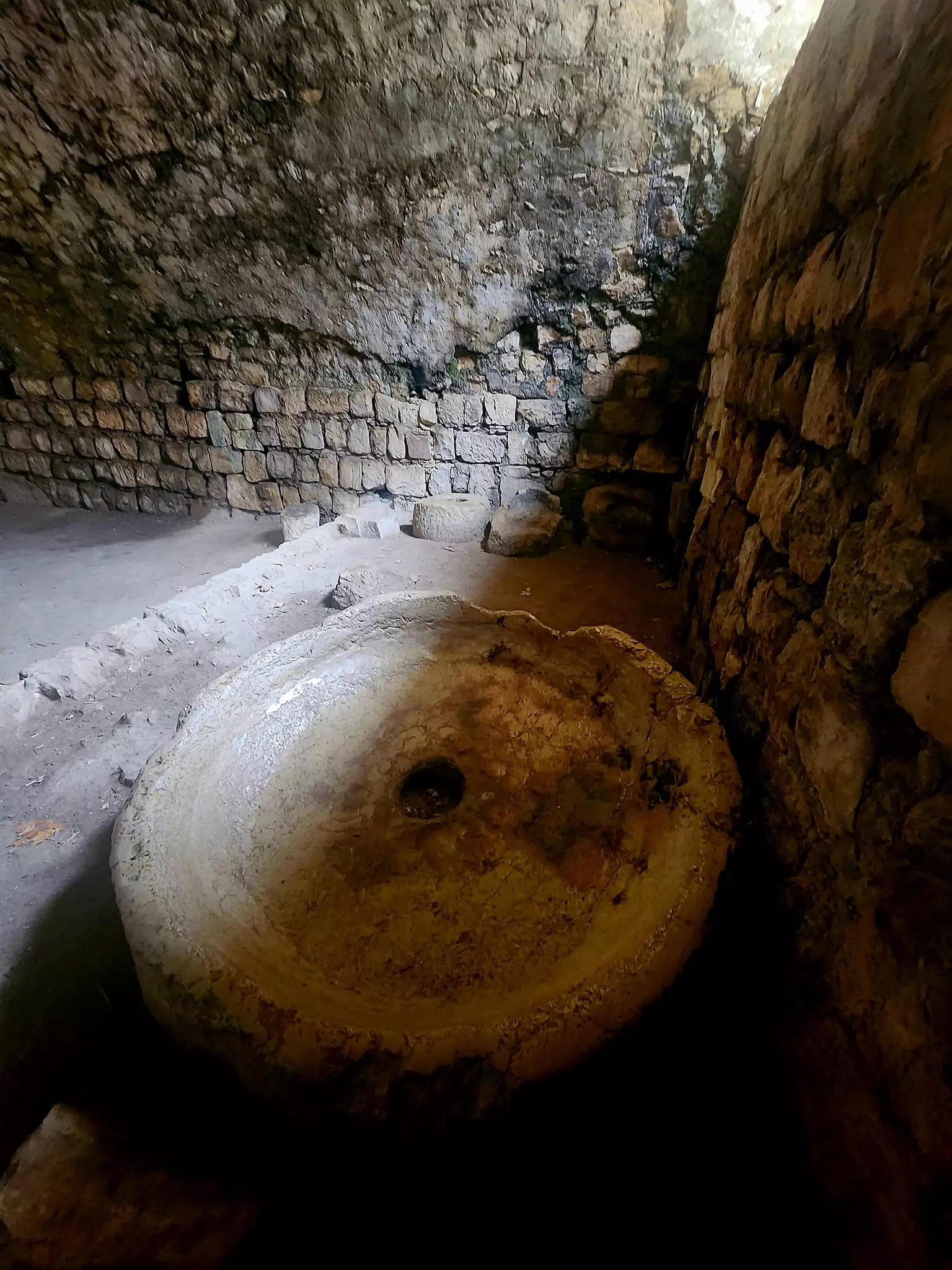
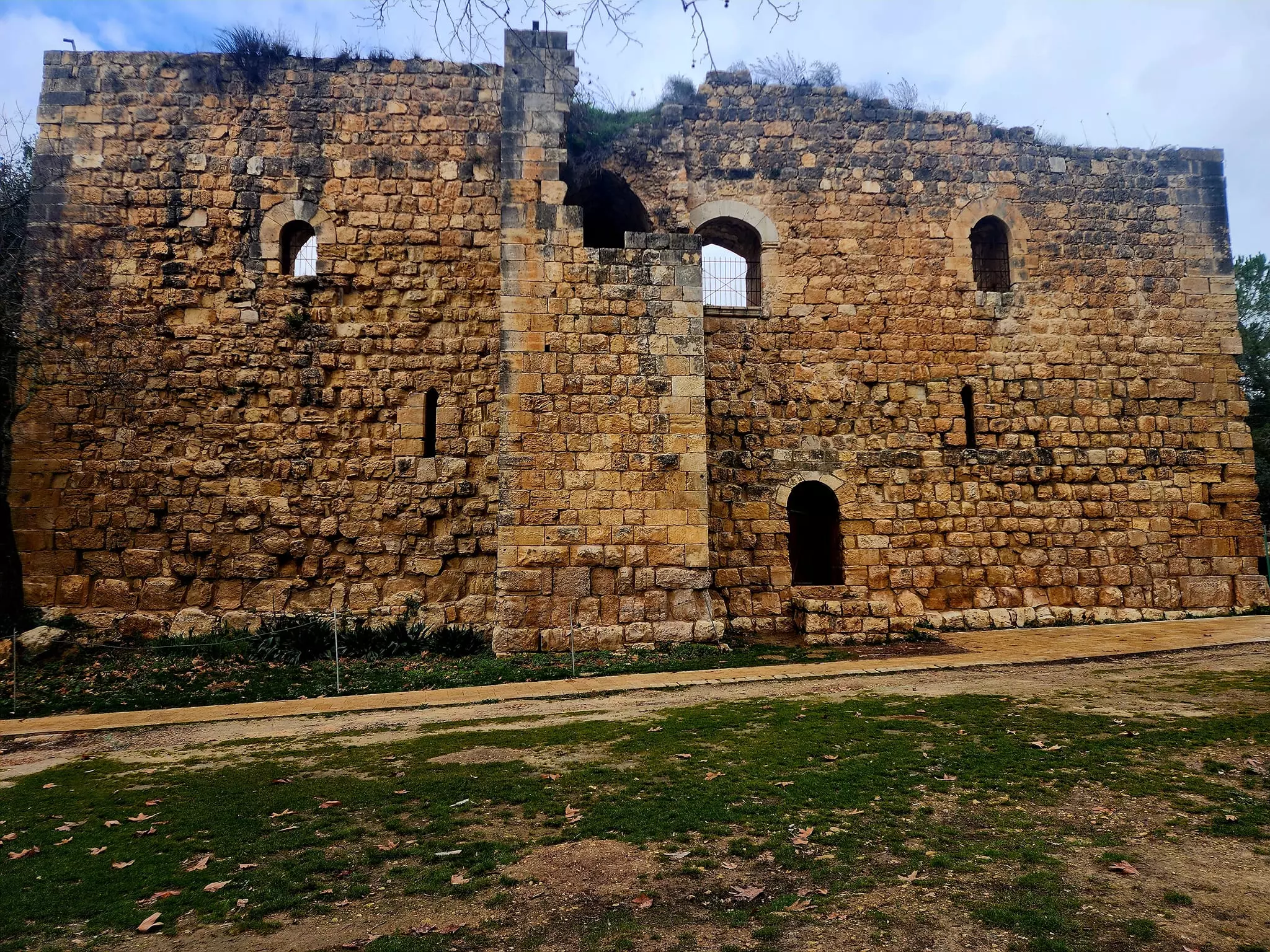
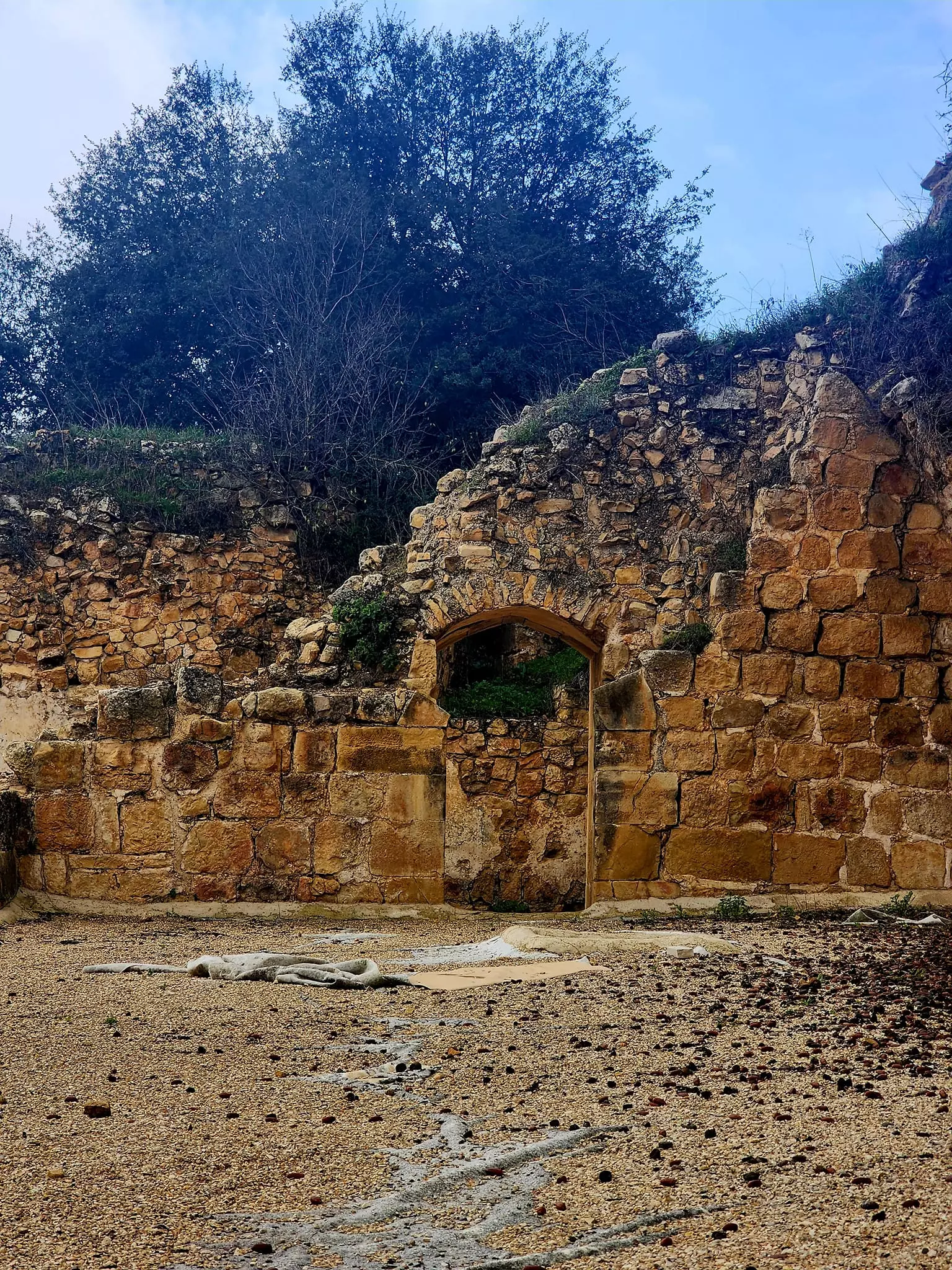
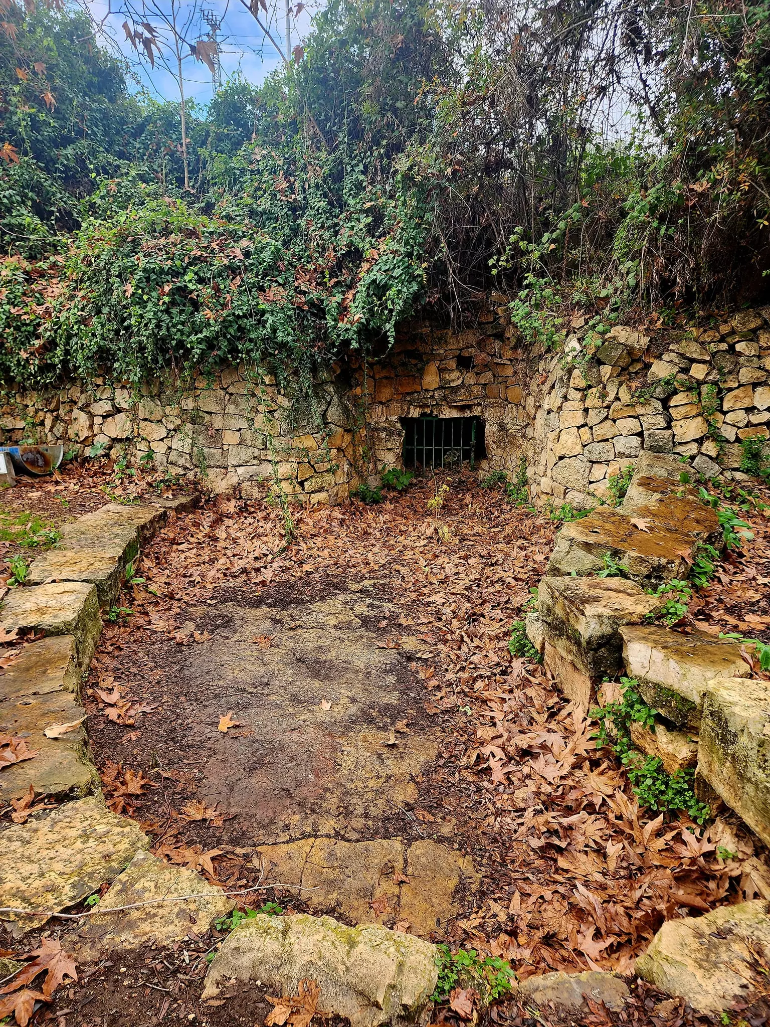
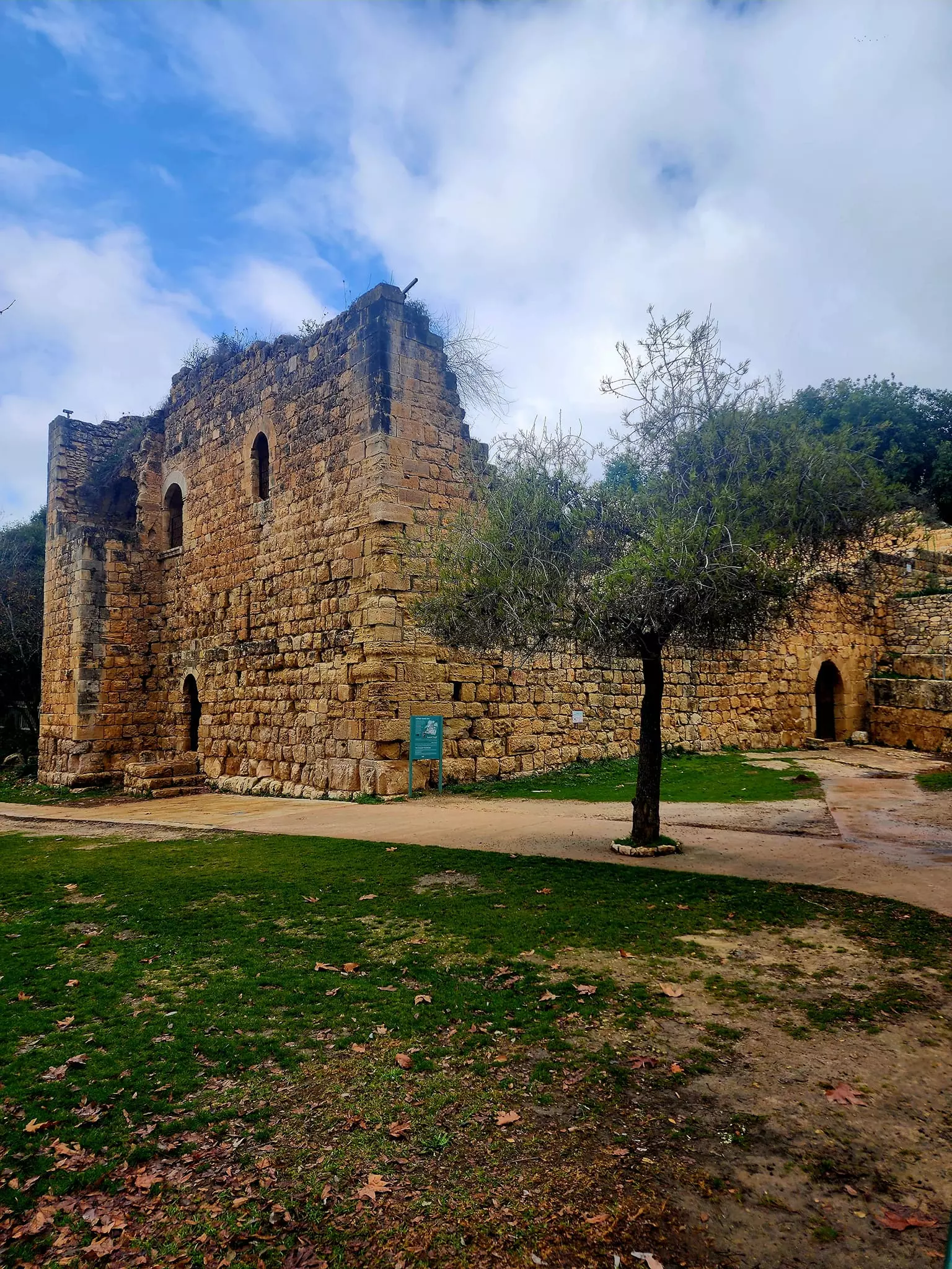
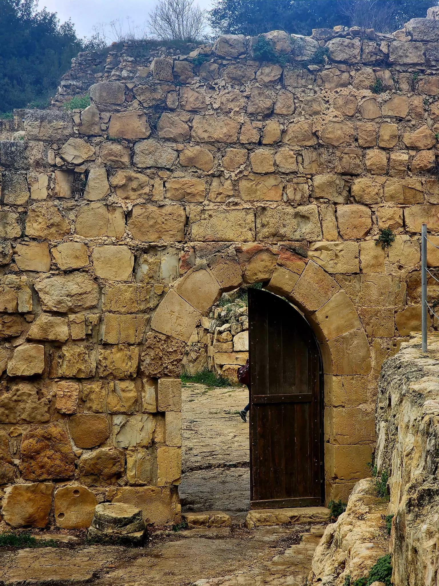
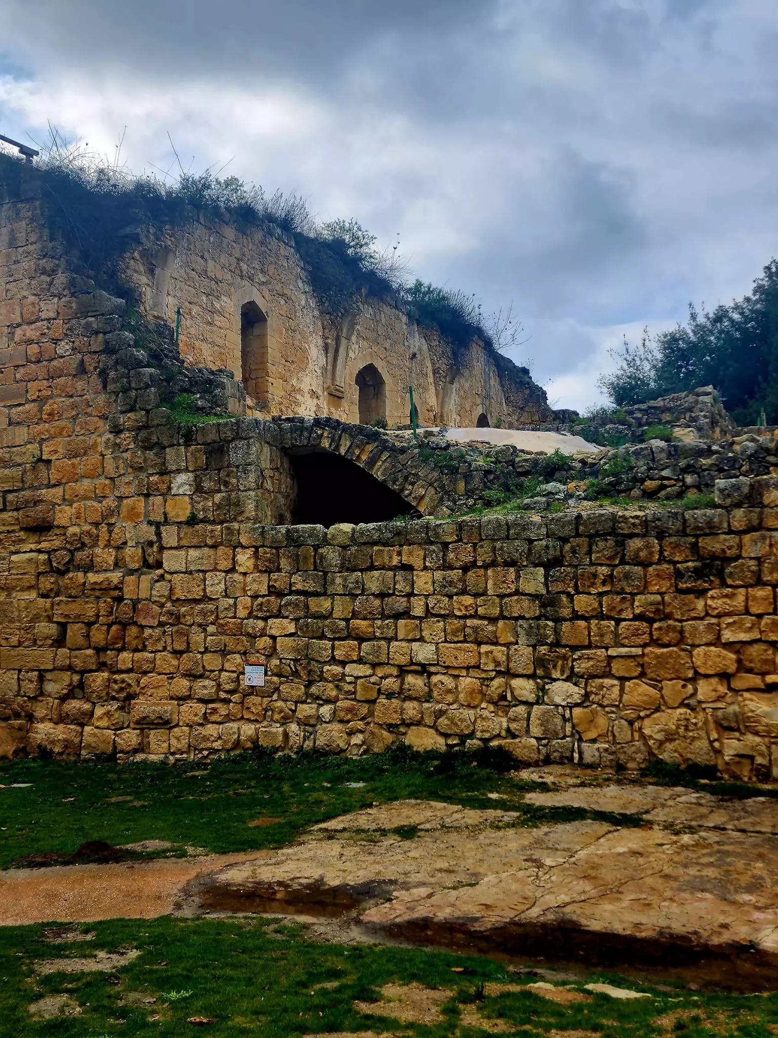
| Village Temains | Bayt Naqquba was mostly destroyed with the exception of a few houses remain standing. | |||||||||||||||||||||
| Ethnically Cleansing | Bayt Naqquba inhabitants were completely ethnically cleansed. | |||||||||||||||||||||
| Pre-Nakba Land Ownership |
**Town Lands' Demarcation Maps |
|||||||||||||||||||||
| Land Usage As of 1945 |
|
|||||||||||||||||||||
| Population |
|
|||||||||||||||||||||
| Number of Houses |
|
|||||||||||||||||||||
| Near By Towns |
||||||||||||||||||||||
|
|
||||||||||||||||||||||
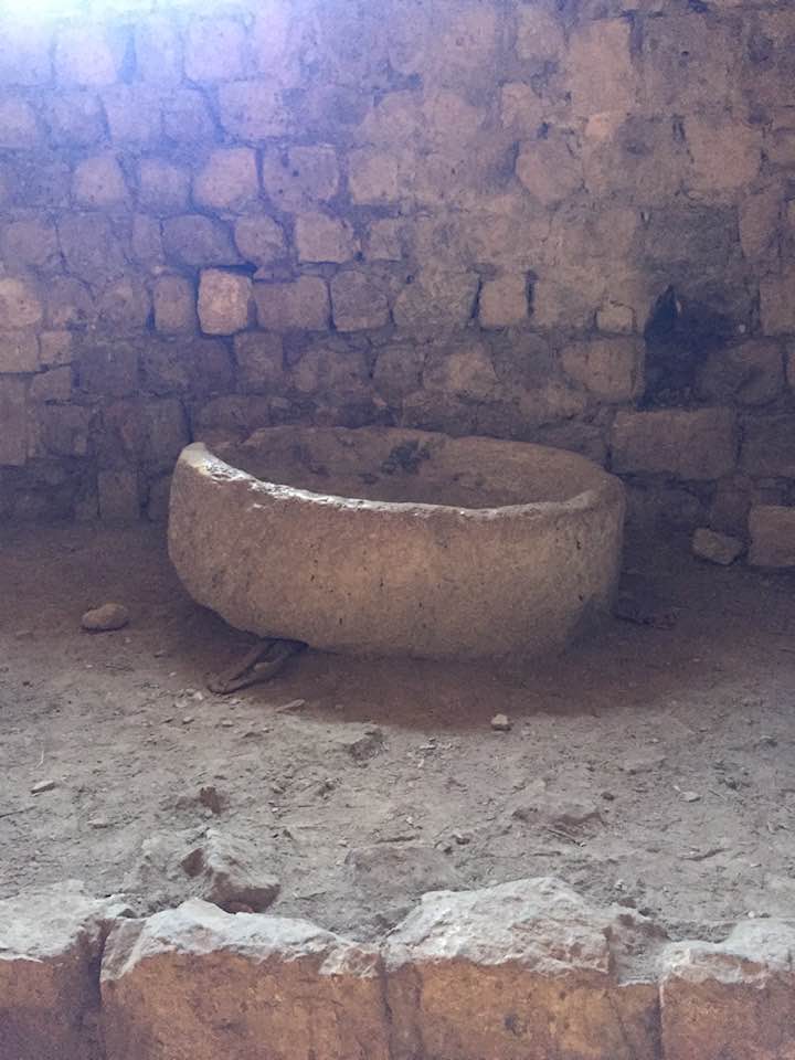
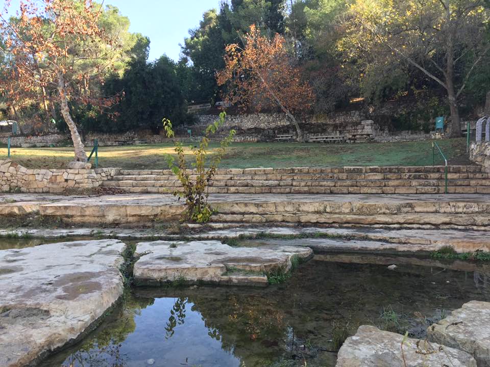
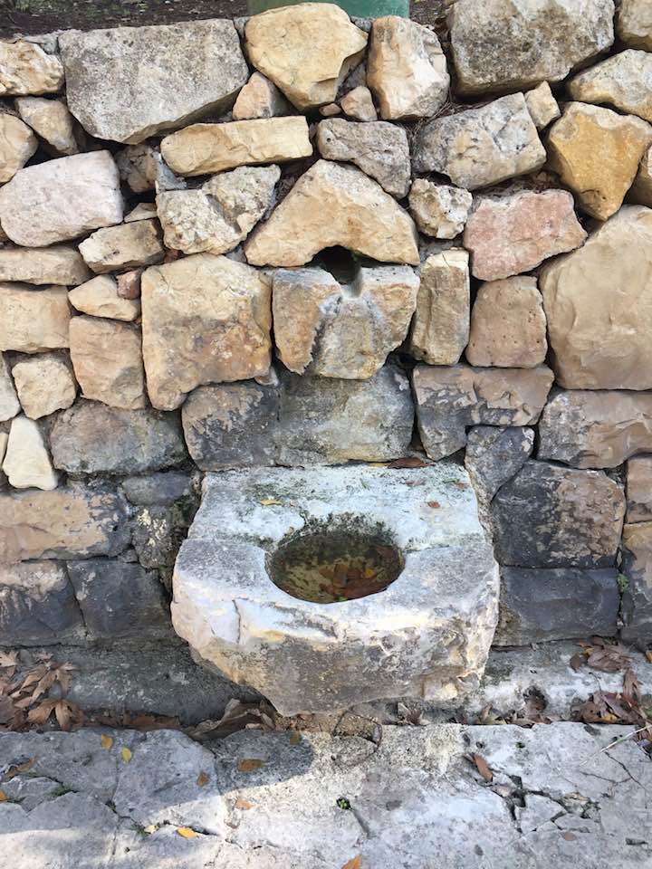
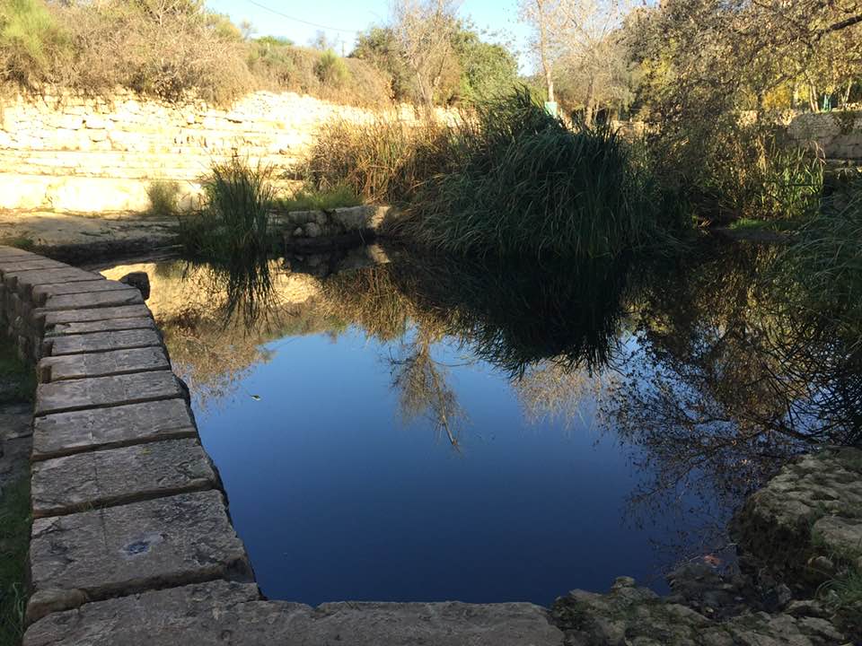
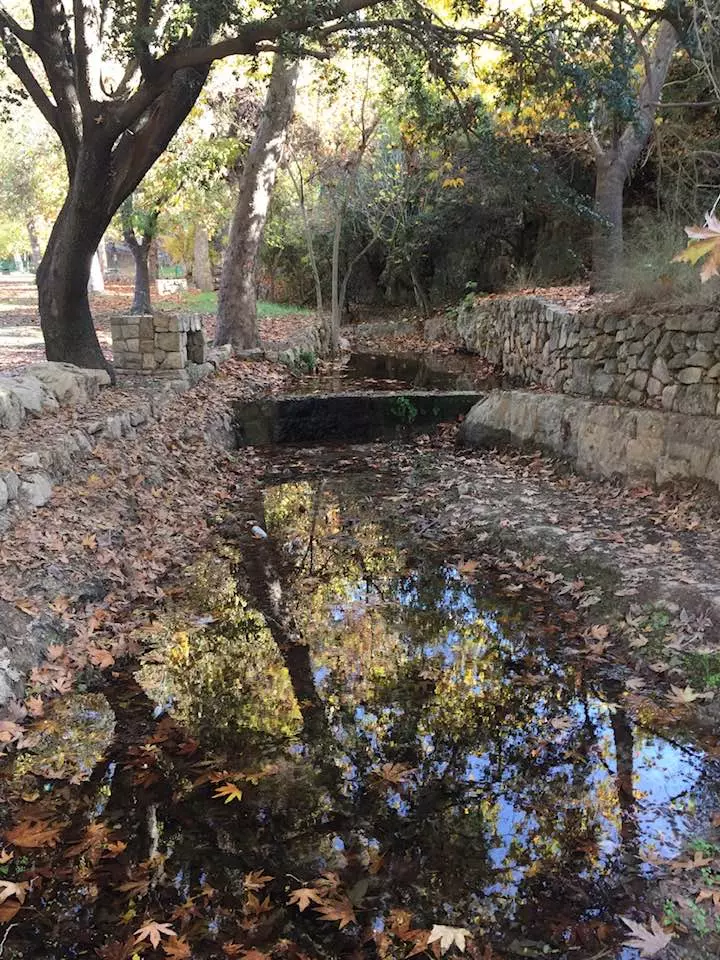
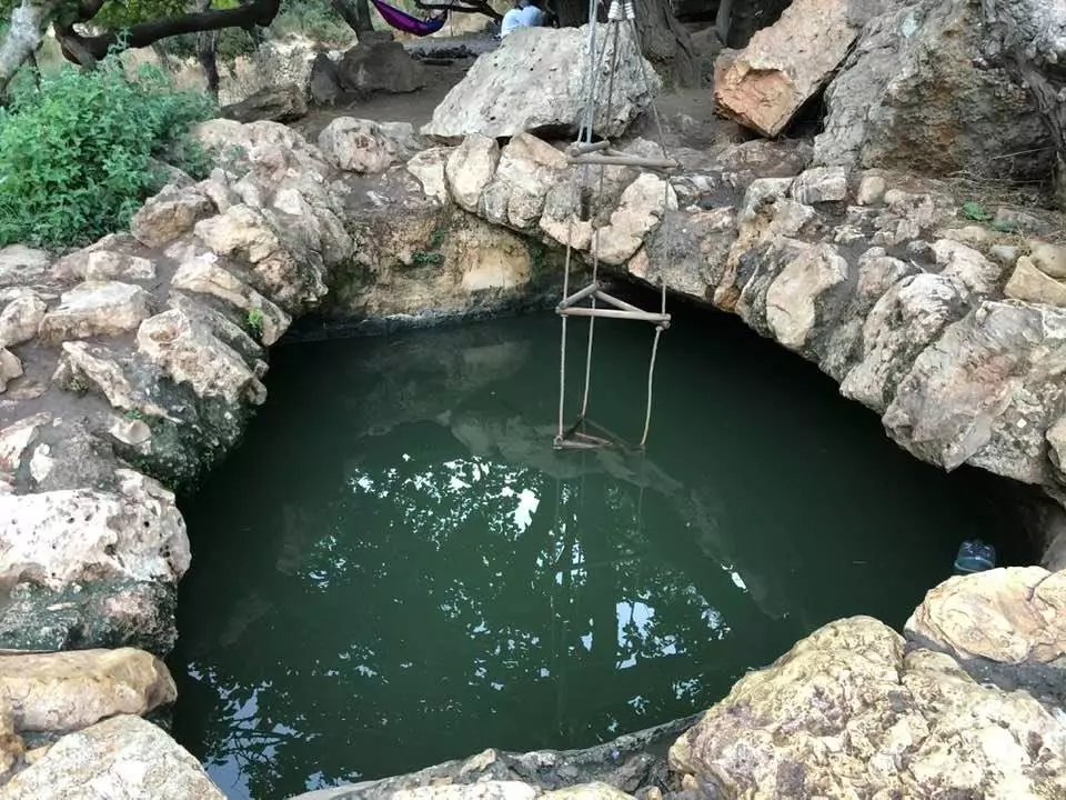
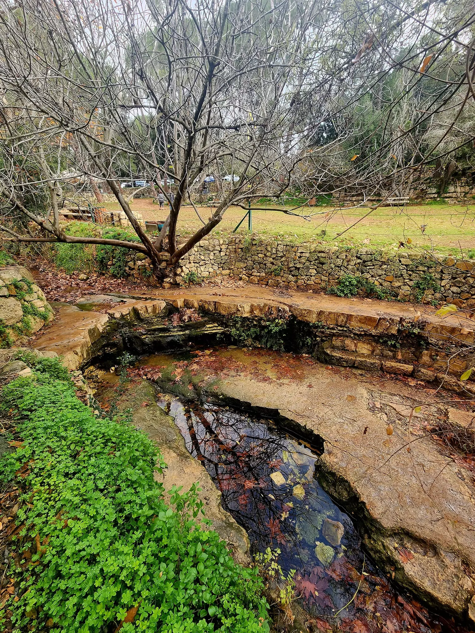
| Water Supply | A spring on the eastern edge of the village provided Bayt Naqquba with fresh water supply. | |||||||||||||||||||||
| Archeological Sites | Bayt Naqquba contains several khirbats including Khirbat al-Khanazir and Khirbat al-Ra's. | |||||||||||||||||||||
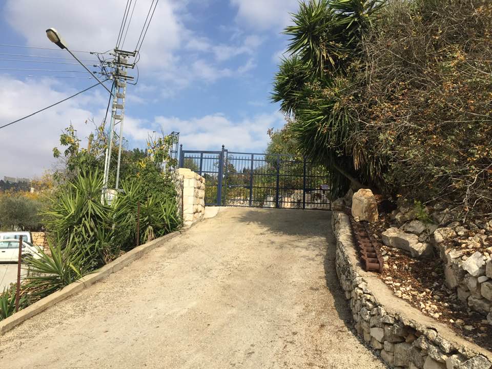
| Exculsive Jewish Colonies Who Usurped Village Lands |
Beyt Neqofa | |||||||||||||||||||||
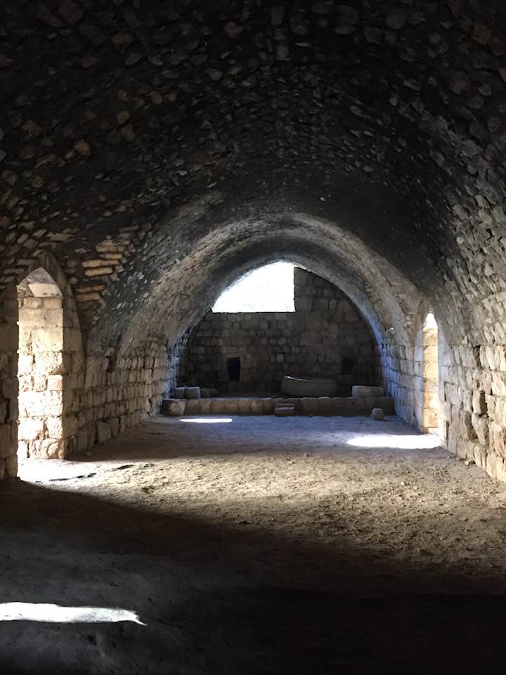
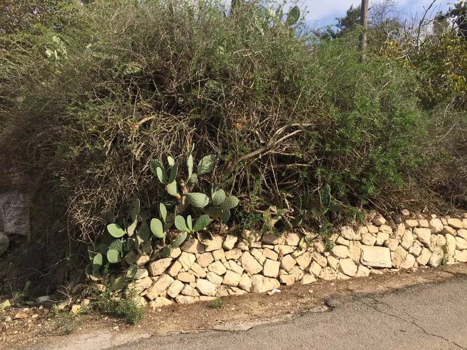
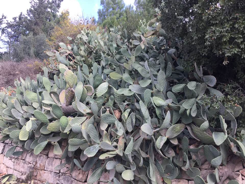
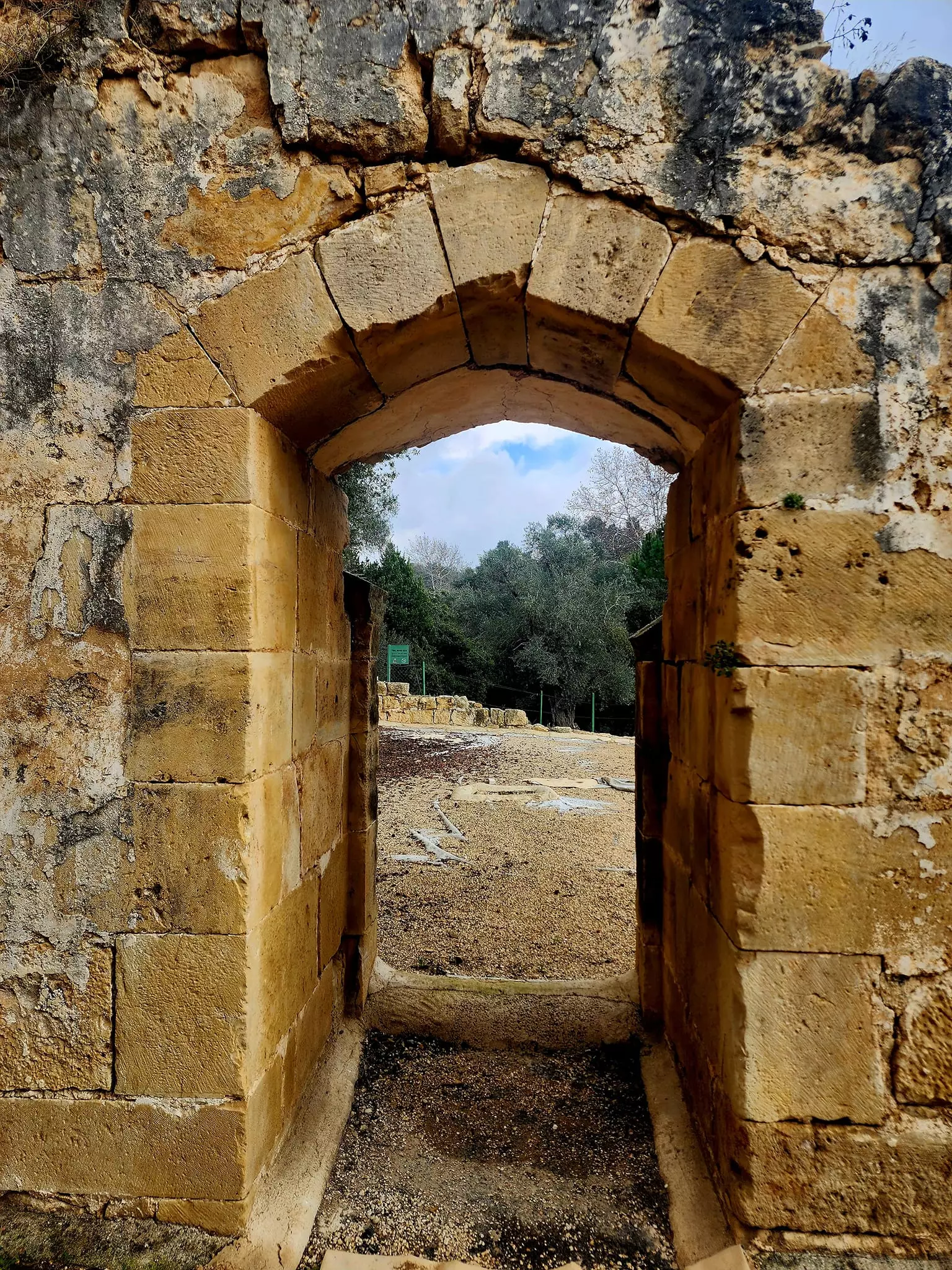
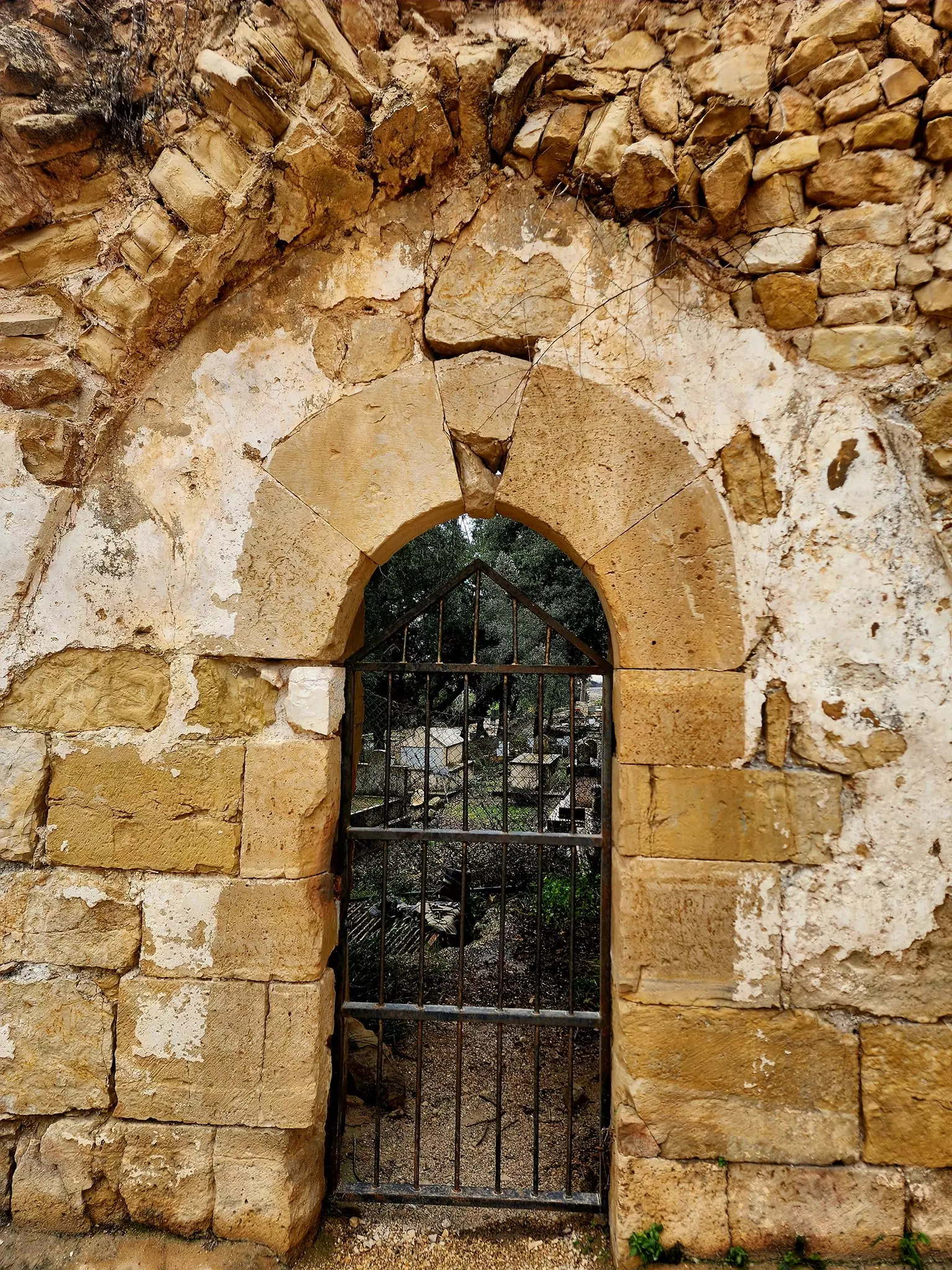
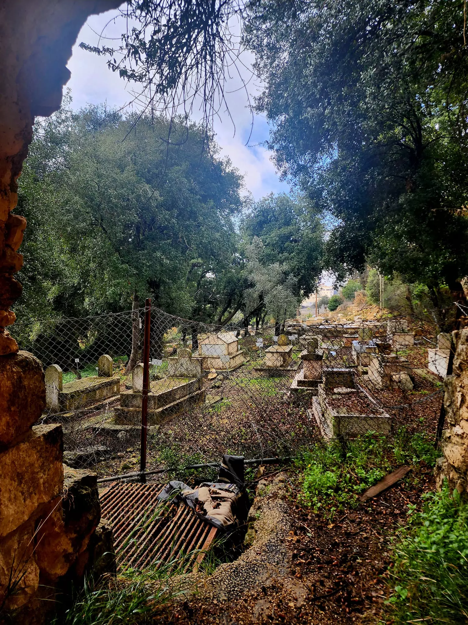
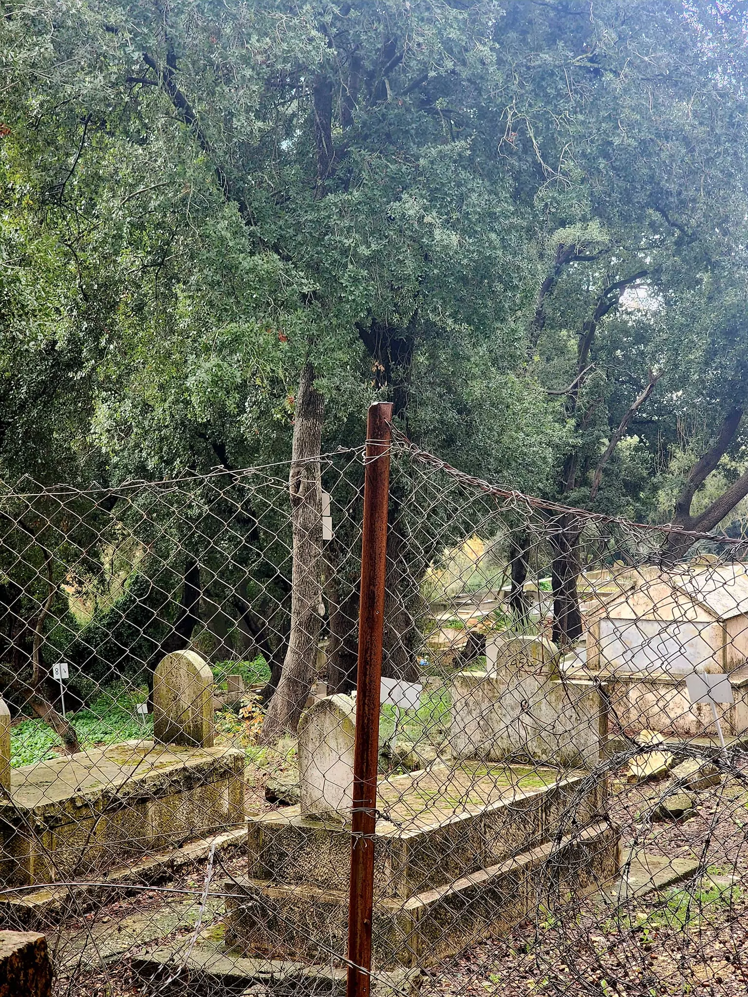
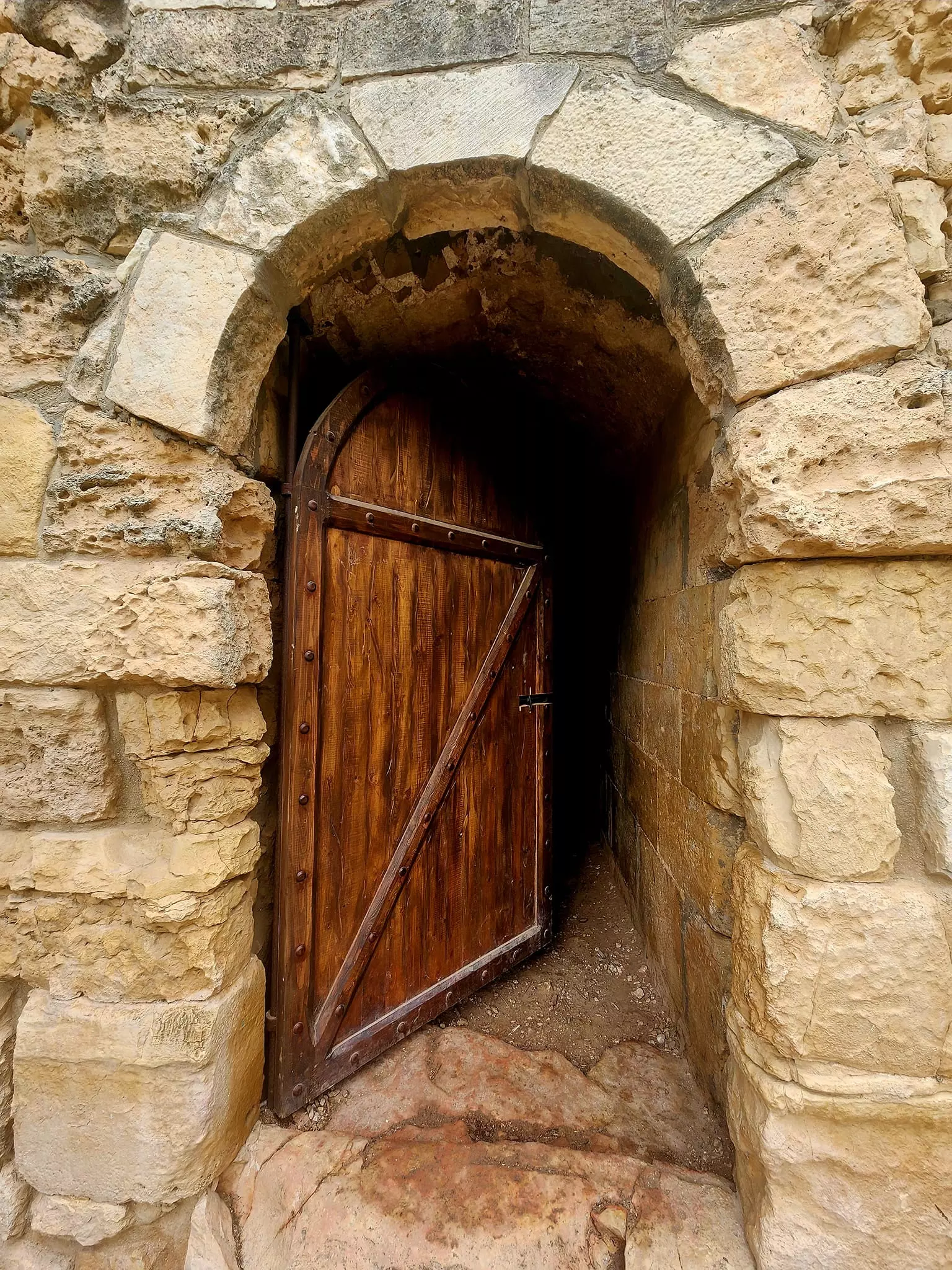
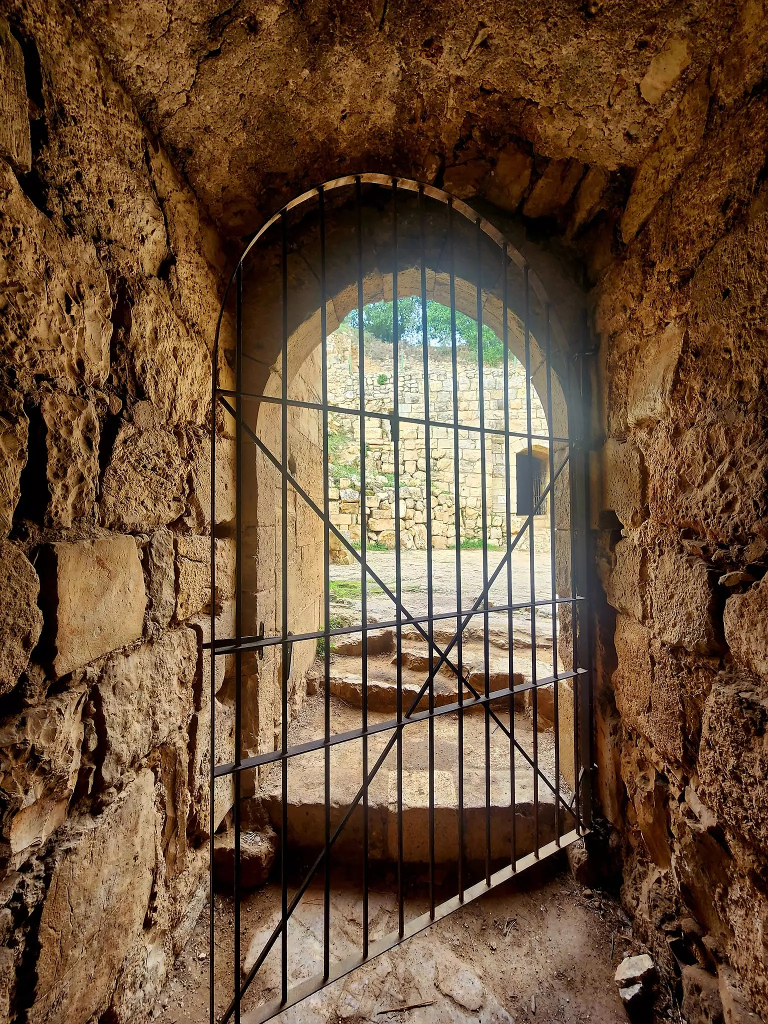
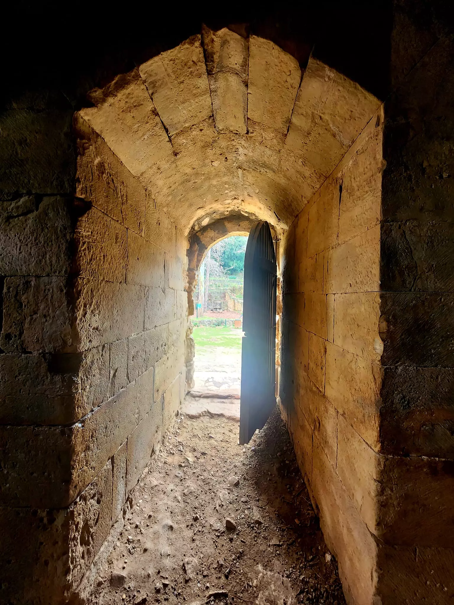
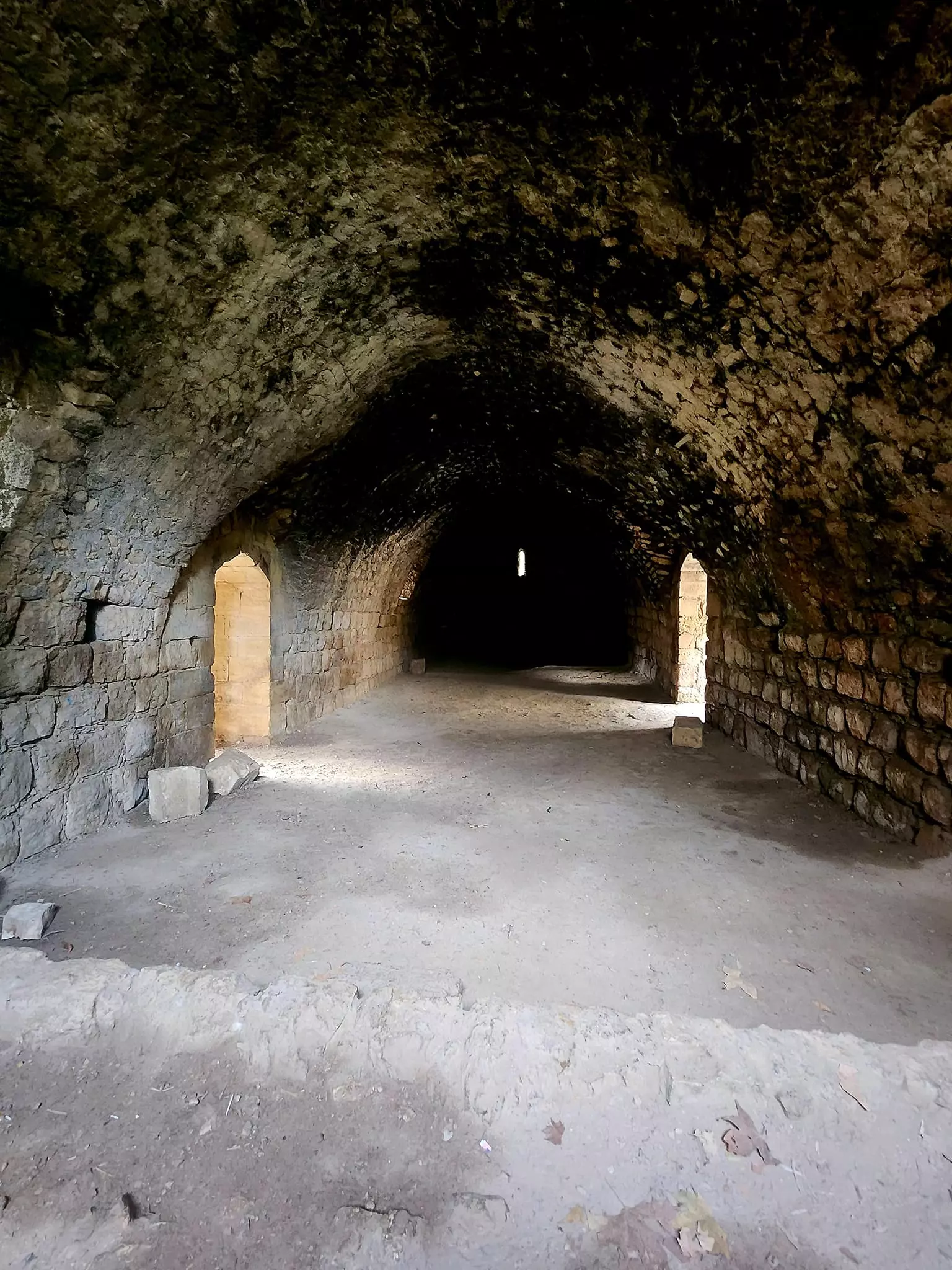
Village Before NakbaThe village stood on a long hill that extended in a north−south direction, surrounded by wadis on all sides except the north. It faced the village of Suba to the south and was on the north side of the Jerusalem−Jaffa highway. Secondary roads linked it to five nearby villages. In the late nineteenth century, Bayt Naqquba was a village built on a slope with a spring to the south. The village had a rectangular outline; most of its houses and small shops were built of stone. Its residents were Muslims. A spring on the eastern edge of the village provided potable water. They planted olive trees and vineyards, which grew mainly west of the village and on the valley floors, and irrigated their crops with water drawn from the village springs. Olive trees covered 194 dunums of land, and wild plants grew at the feet of the slopes. In 1944/45 a total of 515 dunums was allocated to cereals; 303 dunums were irrigated or used for orchards, including 194 dunums planted with olive trees. Khirbat al-Khanazir (162135) and Khirbat al-Ra's (161133) were near the village.Village Occupation and Ethnic CleaningThe only information available about the capture of Bayt Naqquba is that it took place early in April 1948. This implies that it fell within the scope of Operation Nachshon, the largest Haganah operation to date. Judging from its location, Bayt Naqquba was probably captured about the same time as al-Qastal and Qalunya, both of which were levelled shortly after occupation. Israeli historian Benny Morris gives the date but does not mention the fate of the villagers.Zionists Colonies on Village LandsIsrael established the settlement of Beyt Neqofa (162134) in 1949 on the remains of the village.Village TodayA few houses are used either as dwellings or as stables. These houses were built of stone and many had domed roofs (see photo). Stones recovered from the ruins of the village houses have been used as steps for entrances to new Jewish homes. Almond and olive trees and cactuses cover the village site. In what was probably a unique case among all the villages occupied and depopulated, a new Arab village with the same name was established south of the original site in 1962, and some refugees from the old village were allowed to live there. The old village cemetery lies about 0.5 km south of the village site. It is maintained by the more recent Arab village.SourceDr. Walid al-Khalidi, 1992: All That Remains. |
||||||||||||||||||||||
| Related Maps | Town Lands' Demarcation Maps خرائط للقضاء توضح حدود القرى والاودية Town's map on MapQuest View from satellite Help us map this town at WikiMapia |
|||||||||||||||||||||
| Related Links | Wikipedia's Page Google Search Google For Images Google For Videos |
|||||||||||||||||||||
| More Information | في كتاب كي لا ننسى في كتاب بلادنا فلسطين المزيد من موقع هوية |
|||||||||||||||||||||
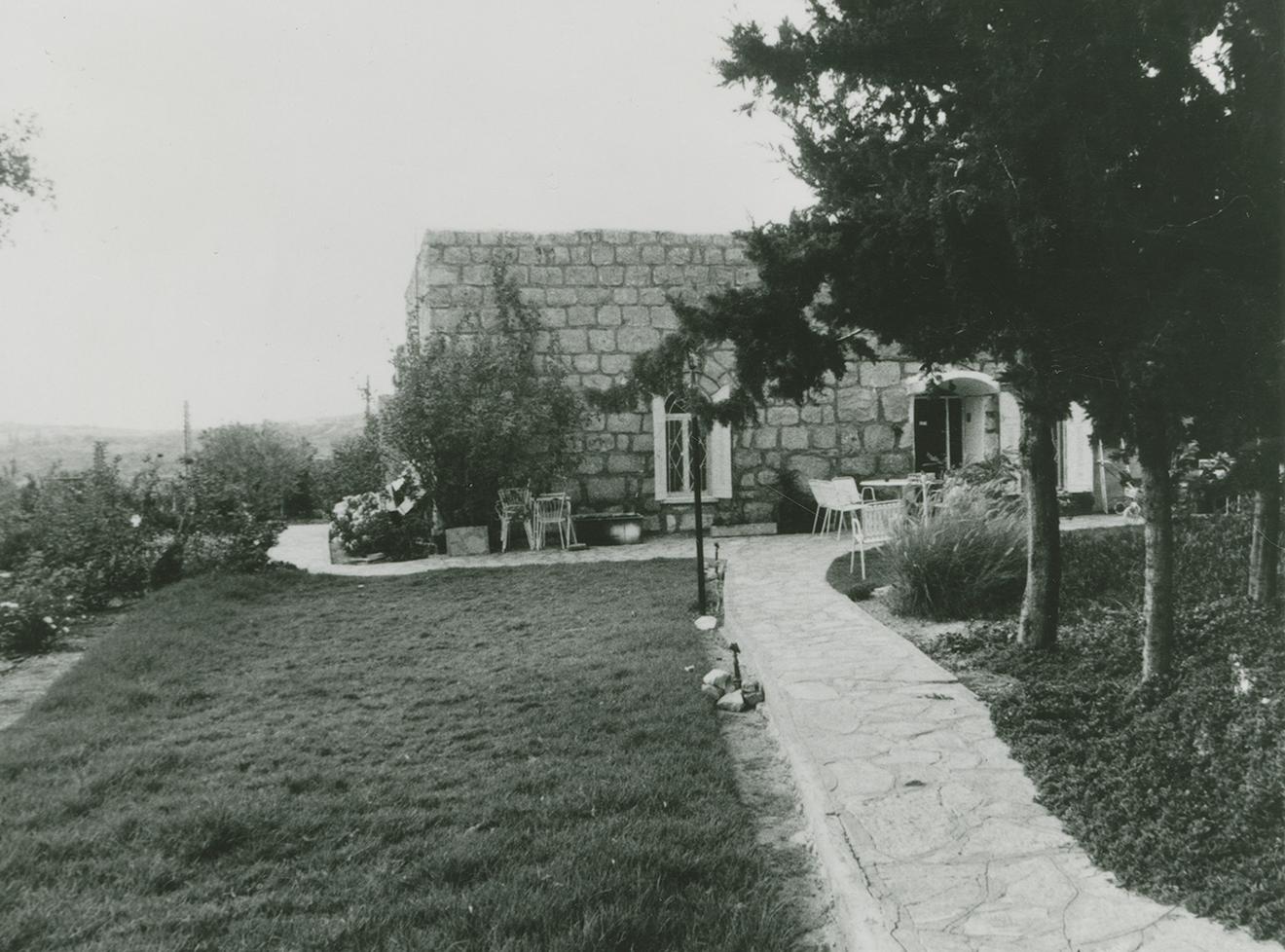
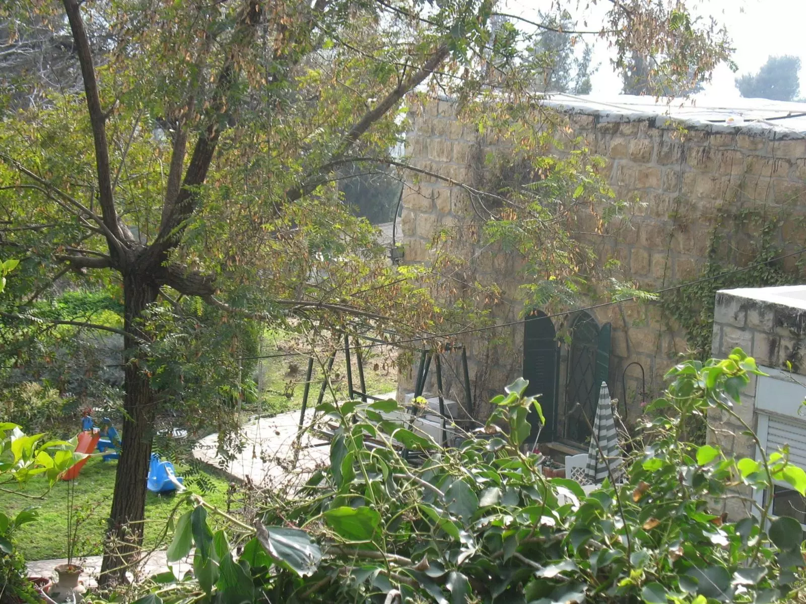
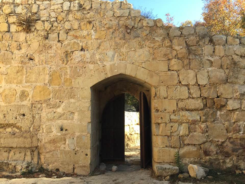
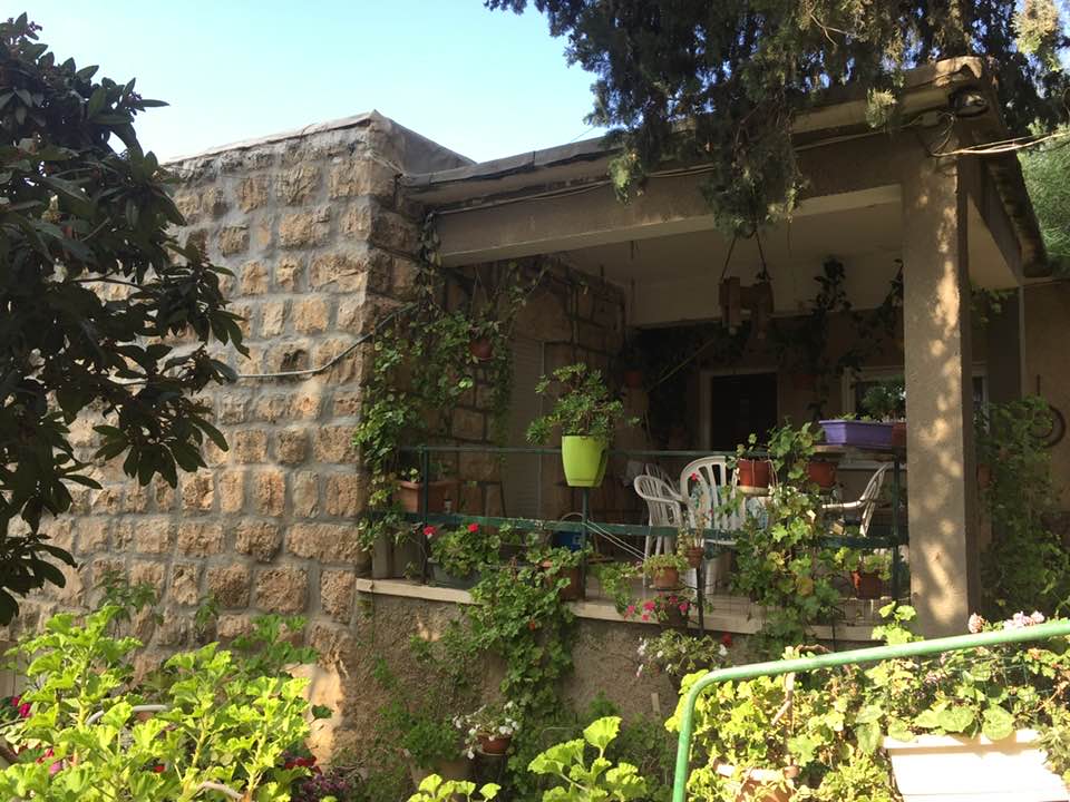
- A looted/stolen village house which is being used by Jewish settlers, 1986
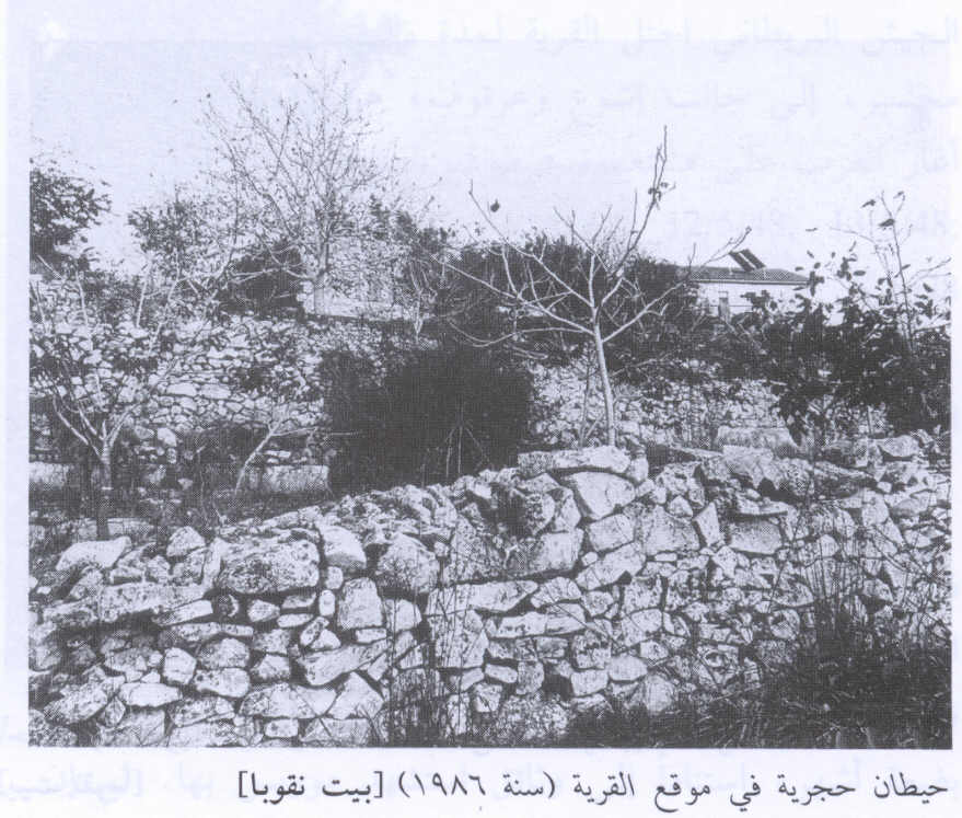
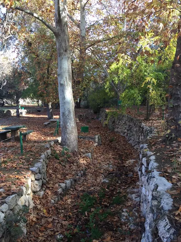
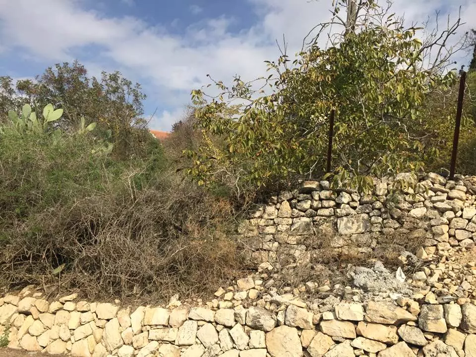
Scanned from "All That Remains" by Dr. Walid Khalidi - Stone walls from the village site, 1986
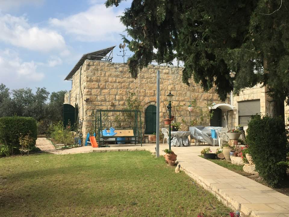
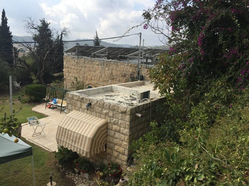
Scanned from "All That Remains" by Dr. Walid Khalidi - One of the Israeli looted Palestinian houses in the exclusive Jewish colony that was built on top village's ruins
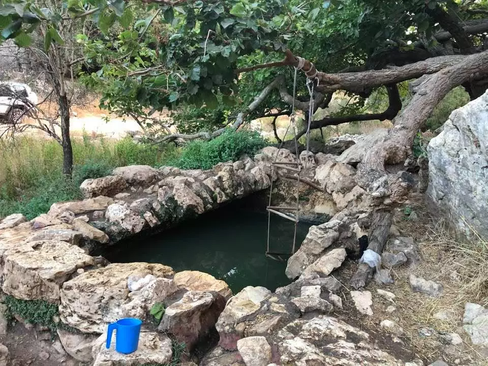
Posted by Noga Kadman 1 - عين ماء رومانية شرق قرية بيت نقوبا المهجرة -- Iyad -Jabir
- عين ماء رومانية شرق قرية بيت نقوبا المهجرة -- Iyad -Jabir #2
- عين ماء رومانية شرق قرية بيت نقوبا المهجرة -- Iyad -Jabir #3
- عين ماء رومانية شرق قرية بيت نقوبا المهجرة -- Iyad -Jabir #4
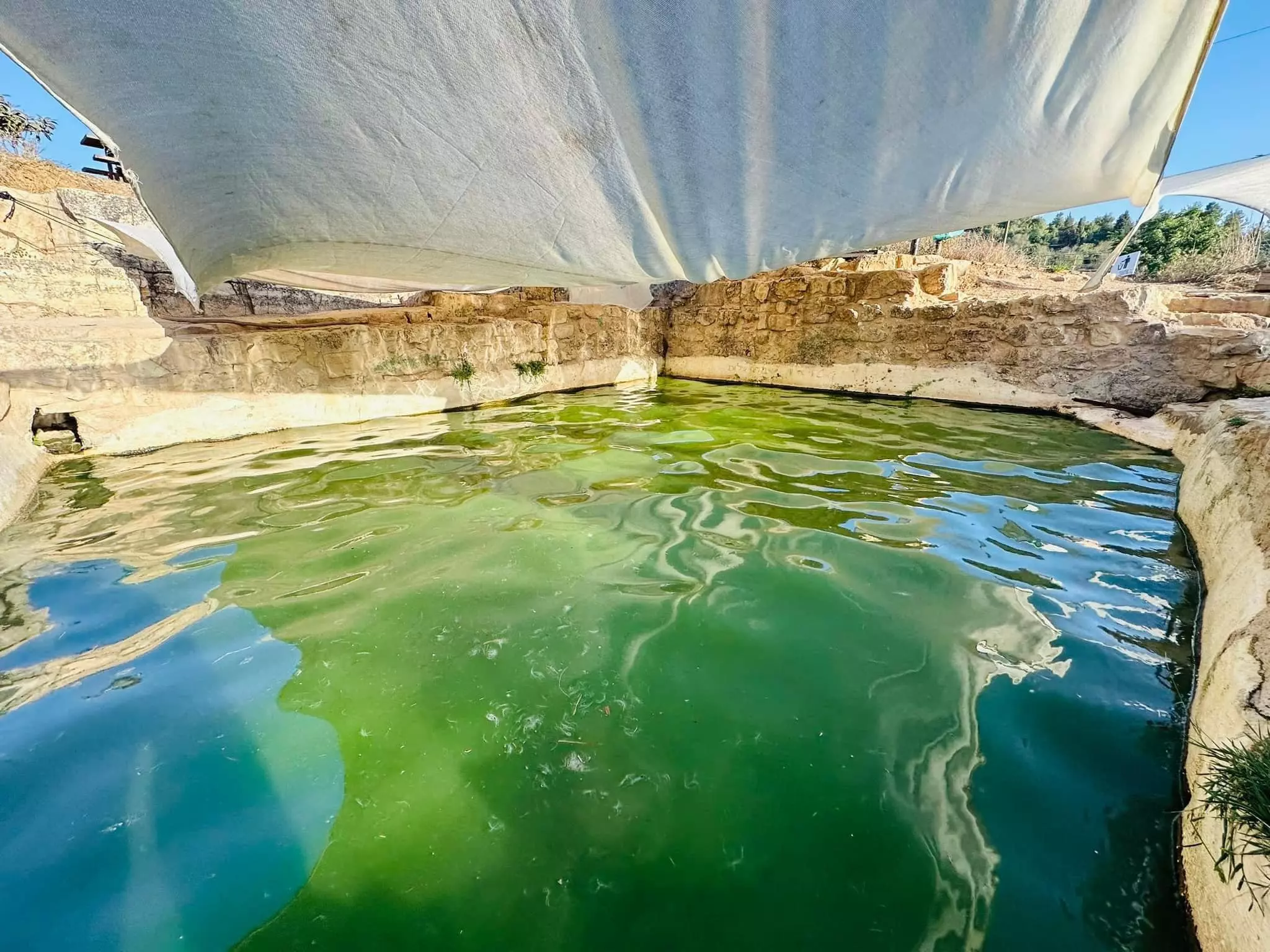
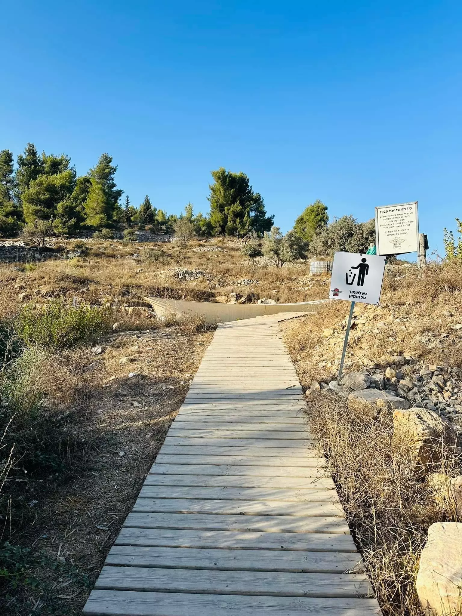
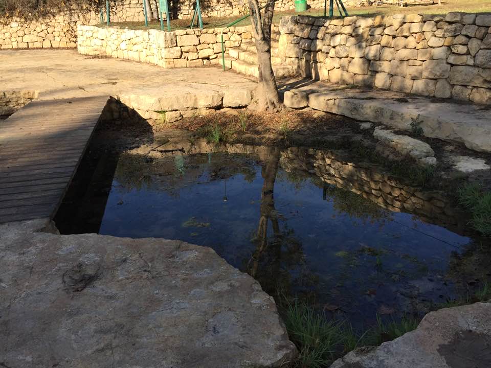
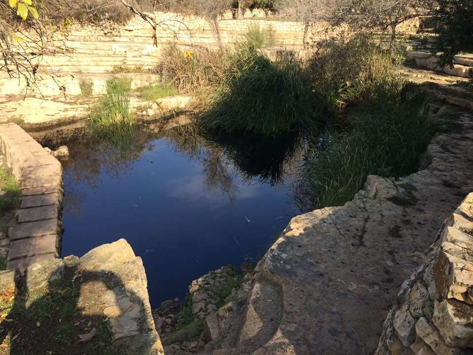
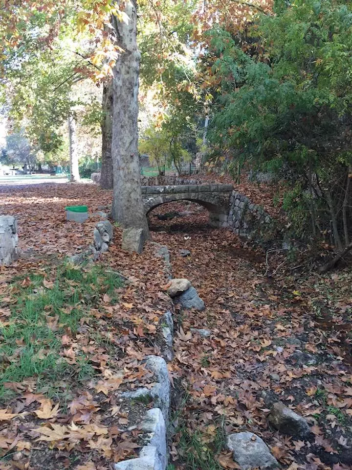
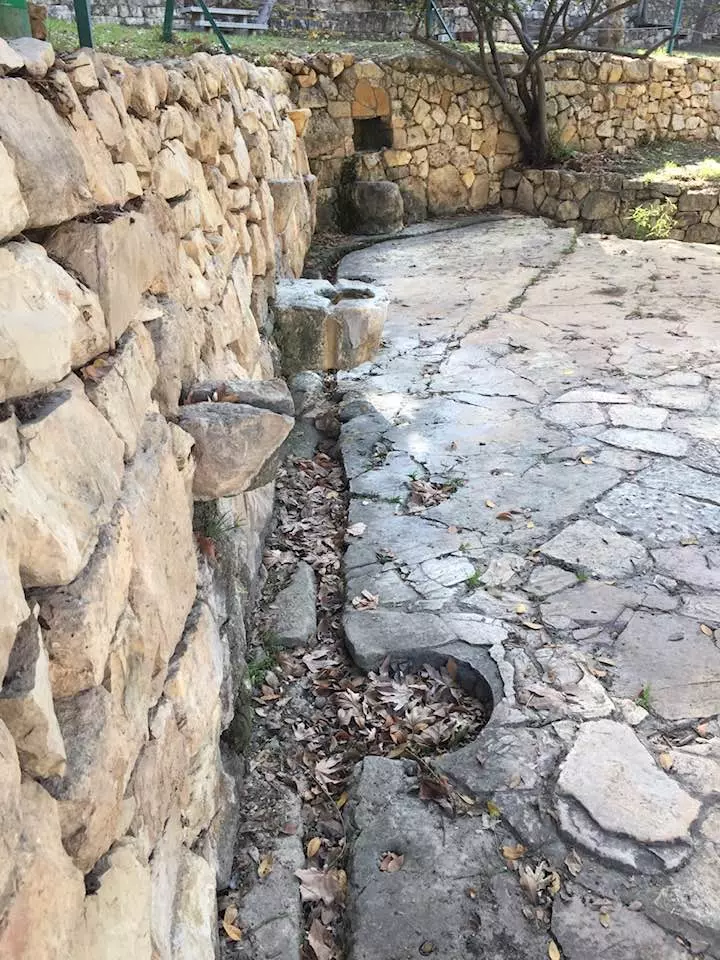
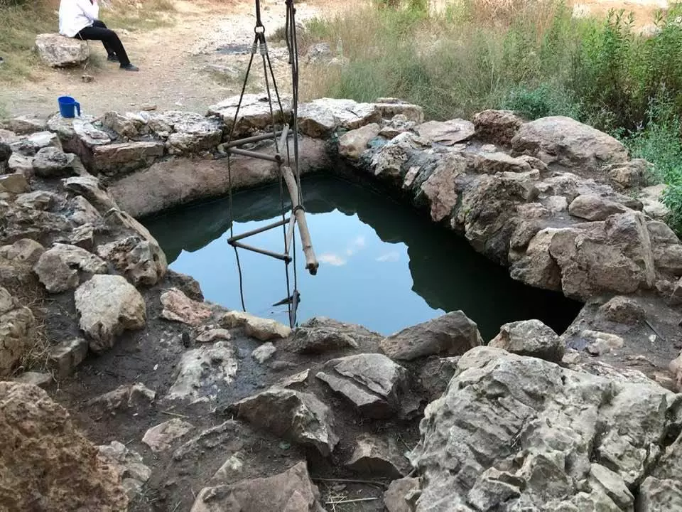
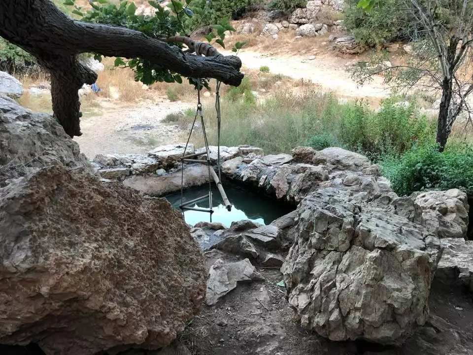
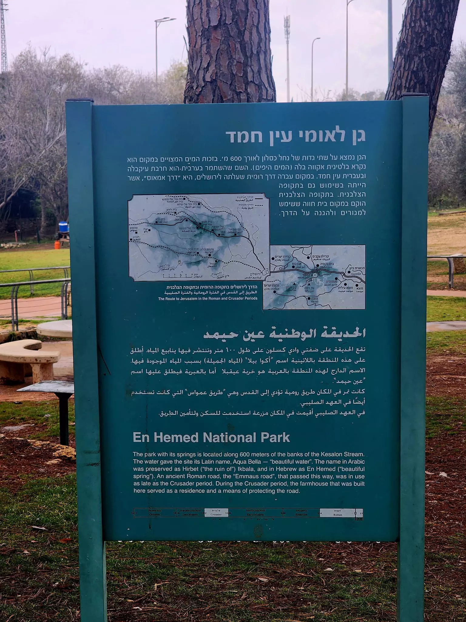
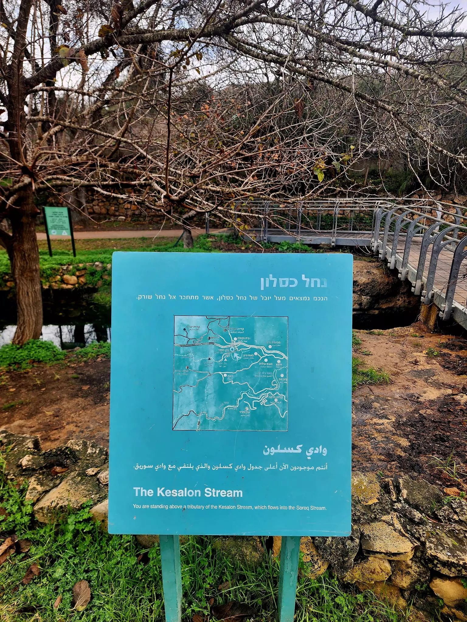
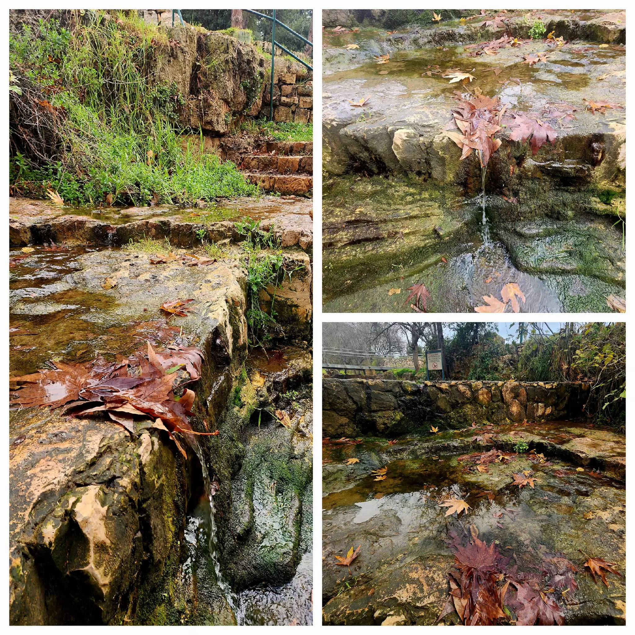
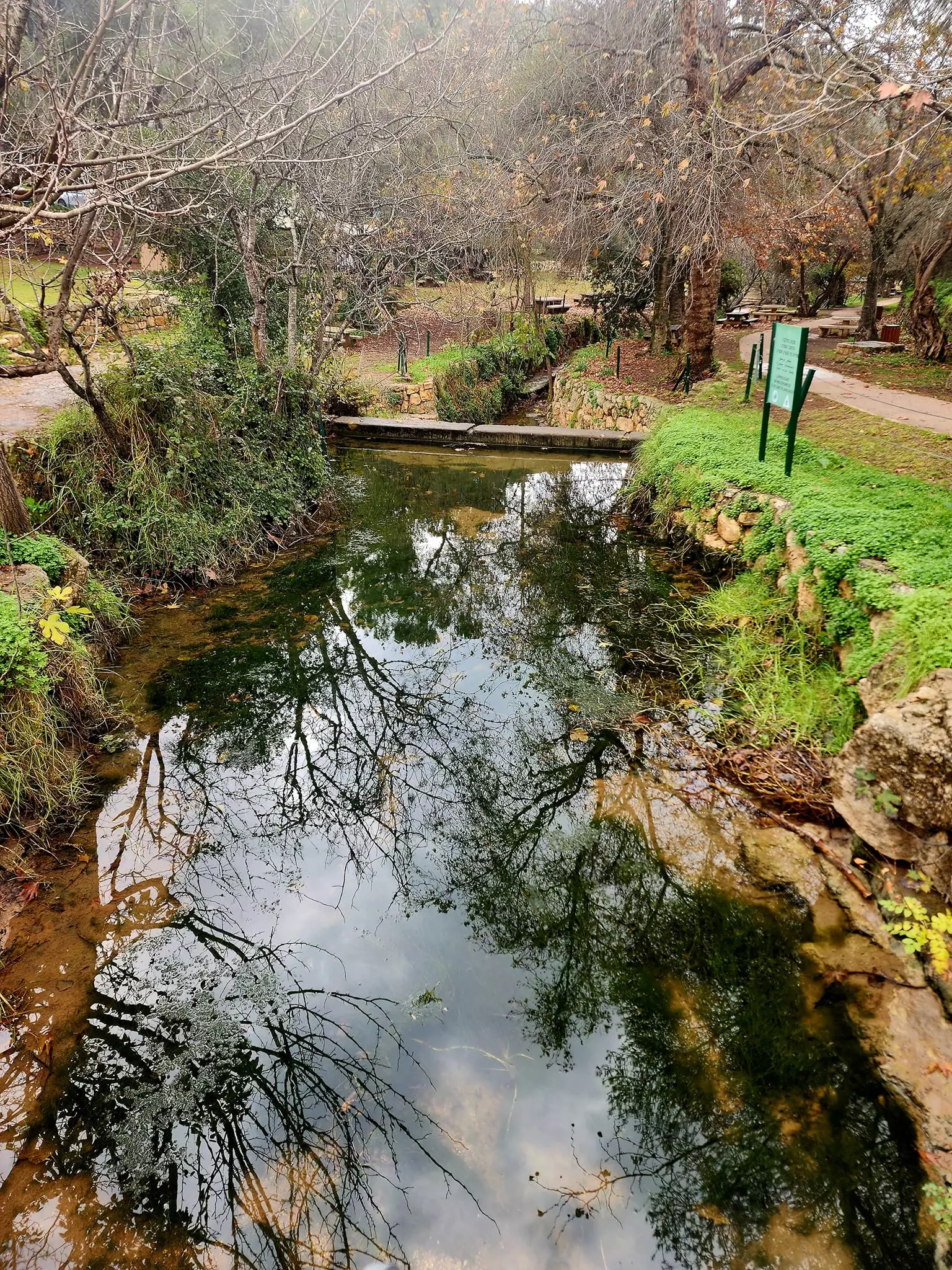
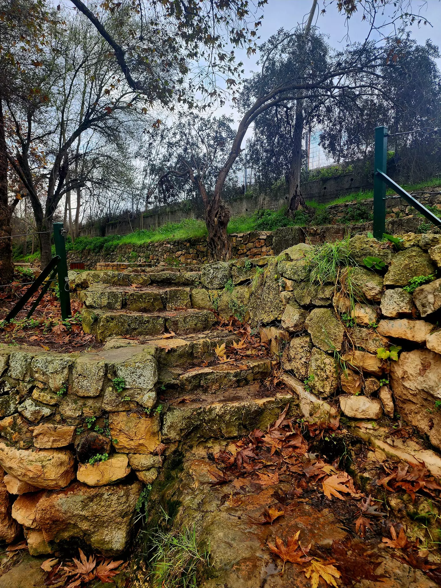
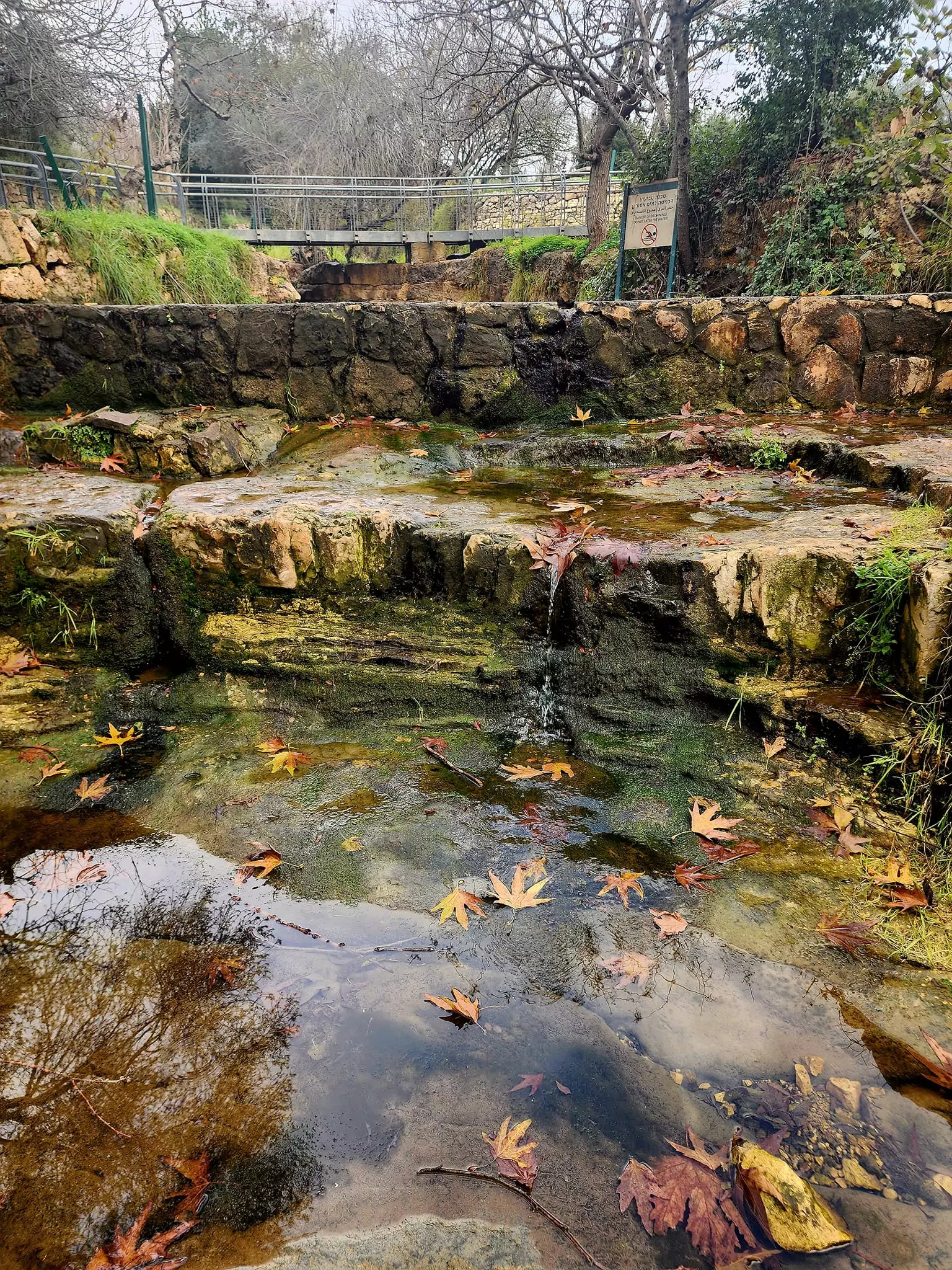
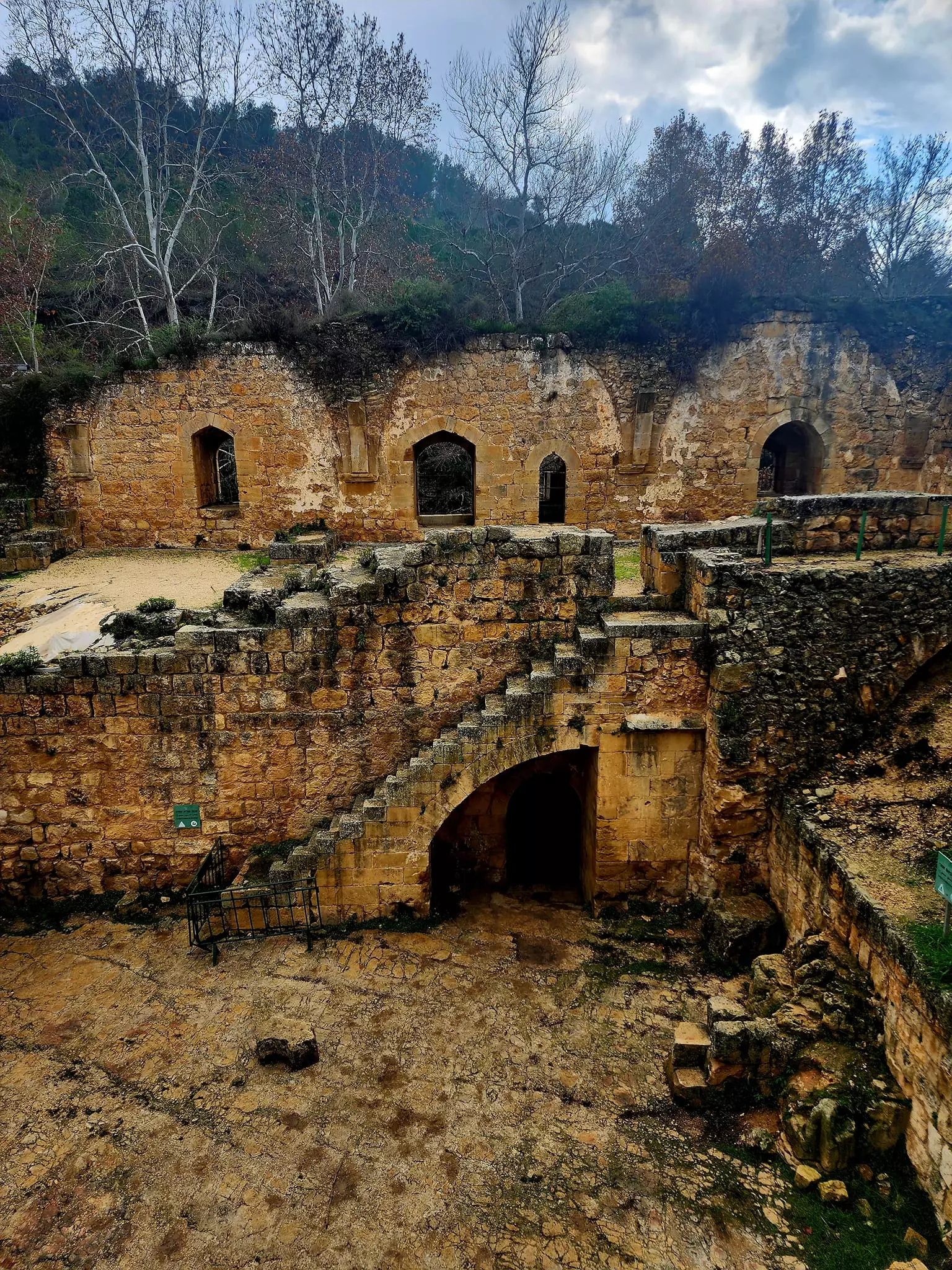
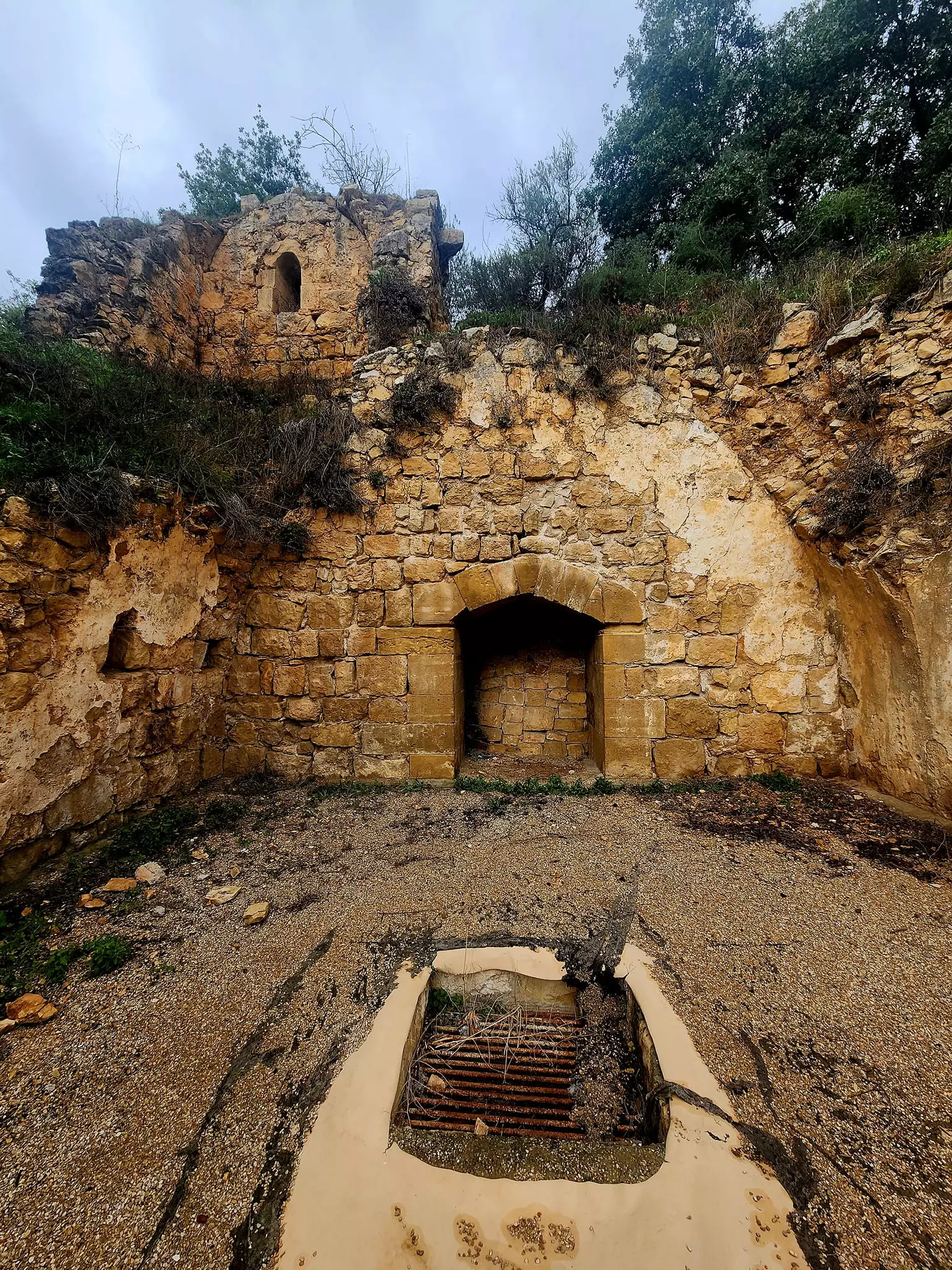
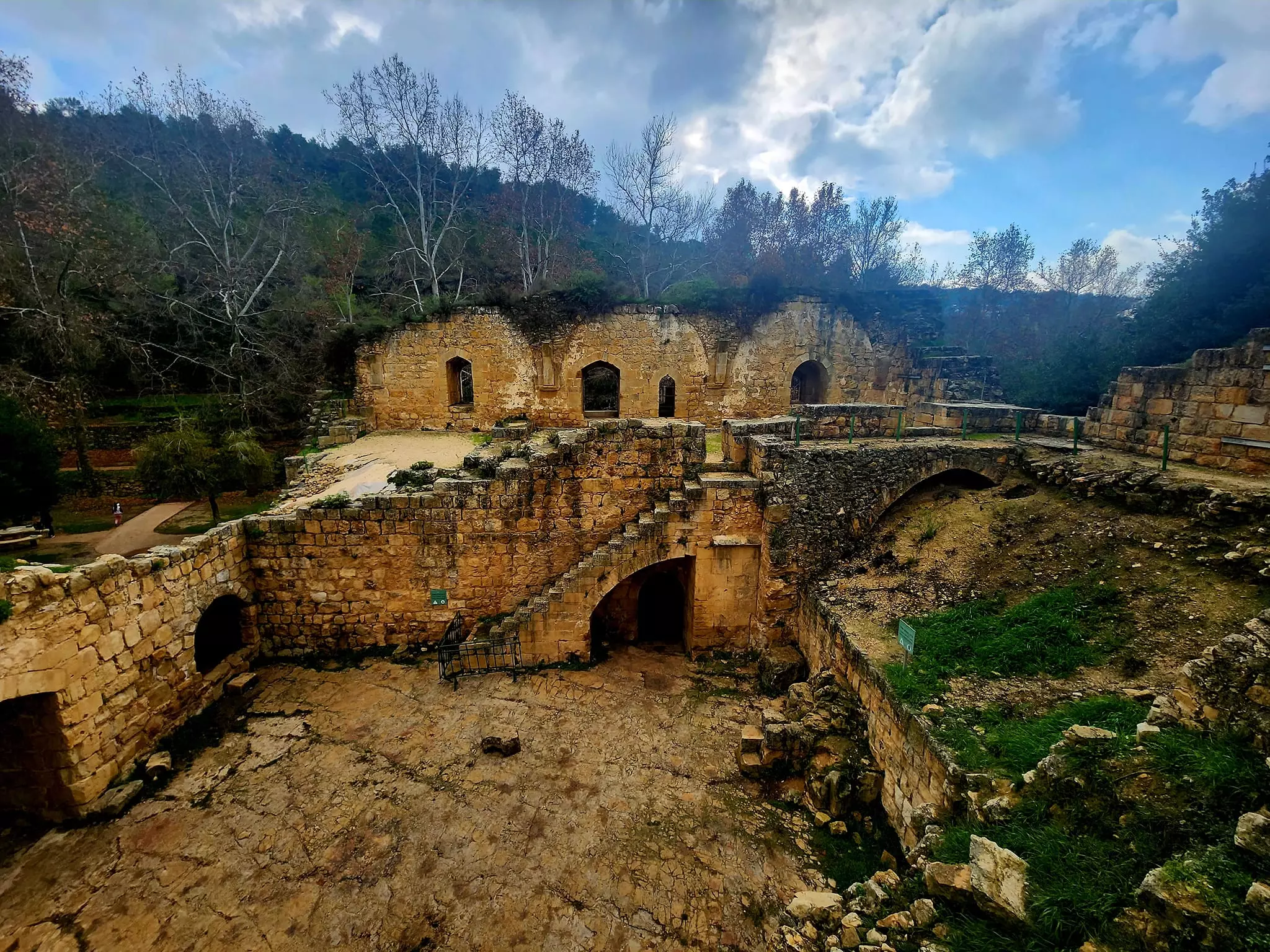
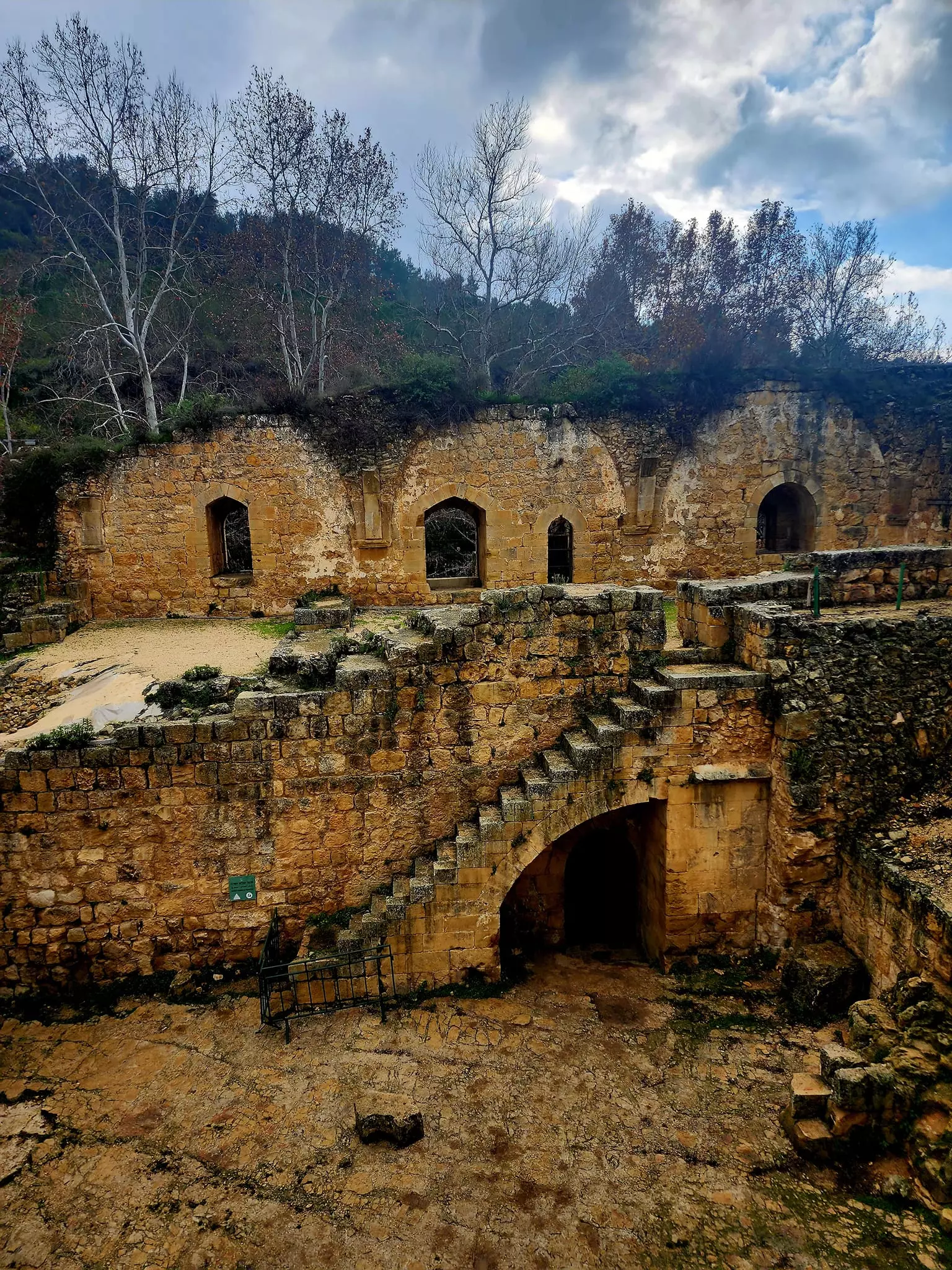
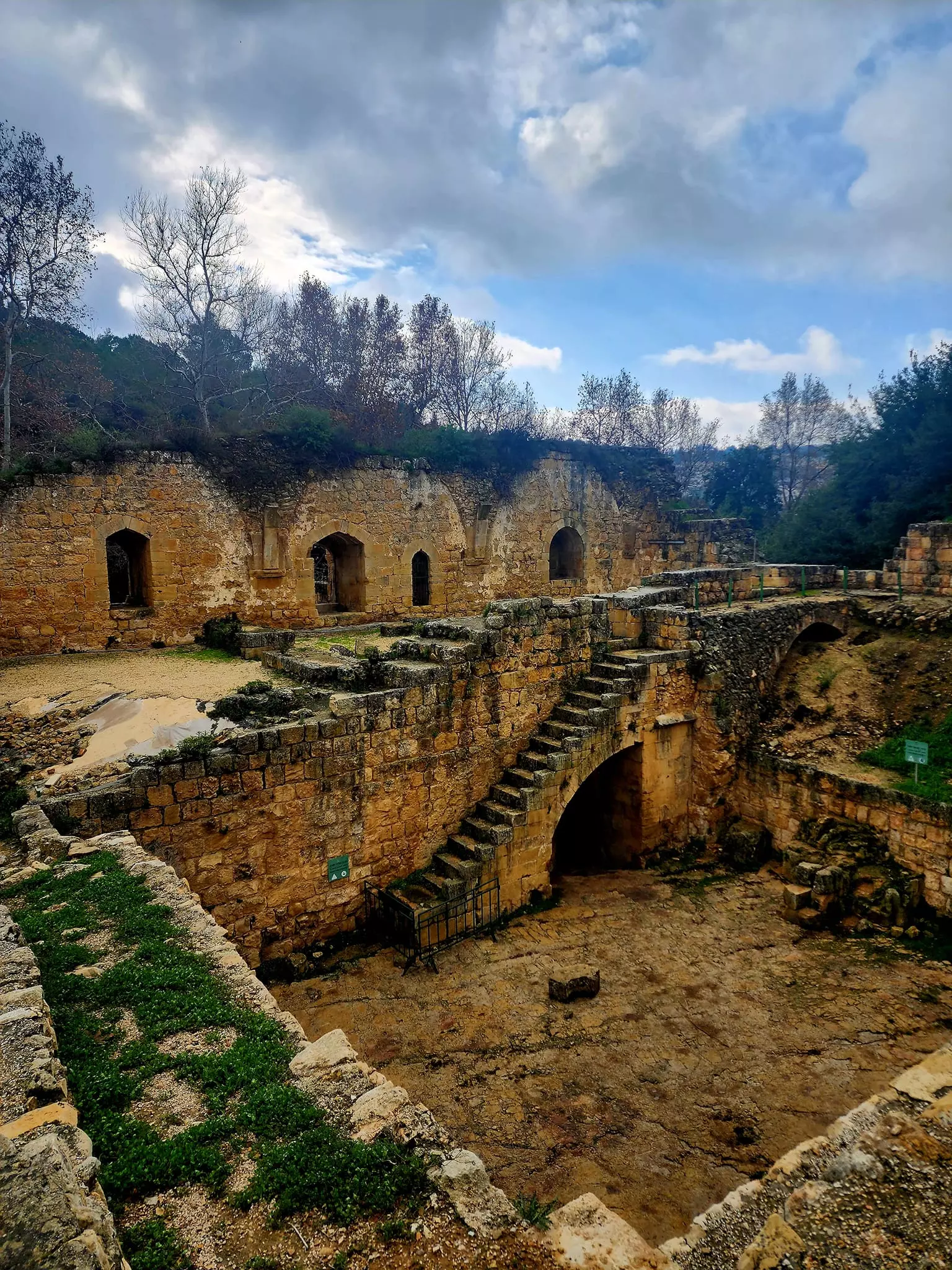
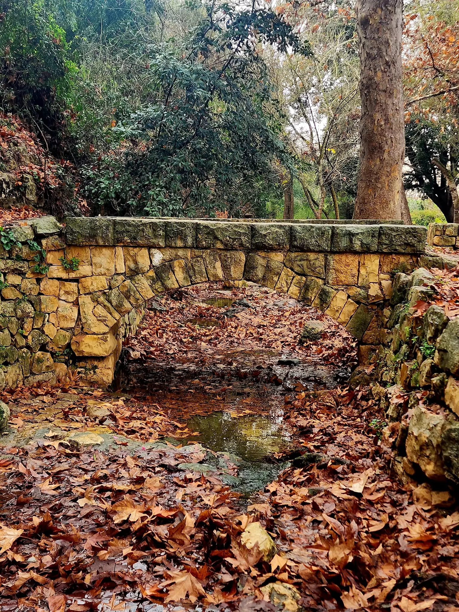
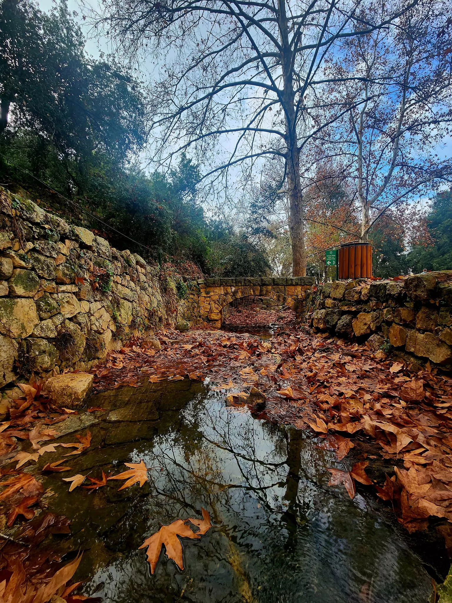
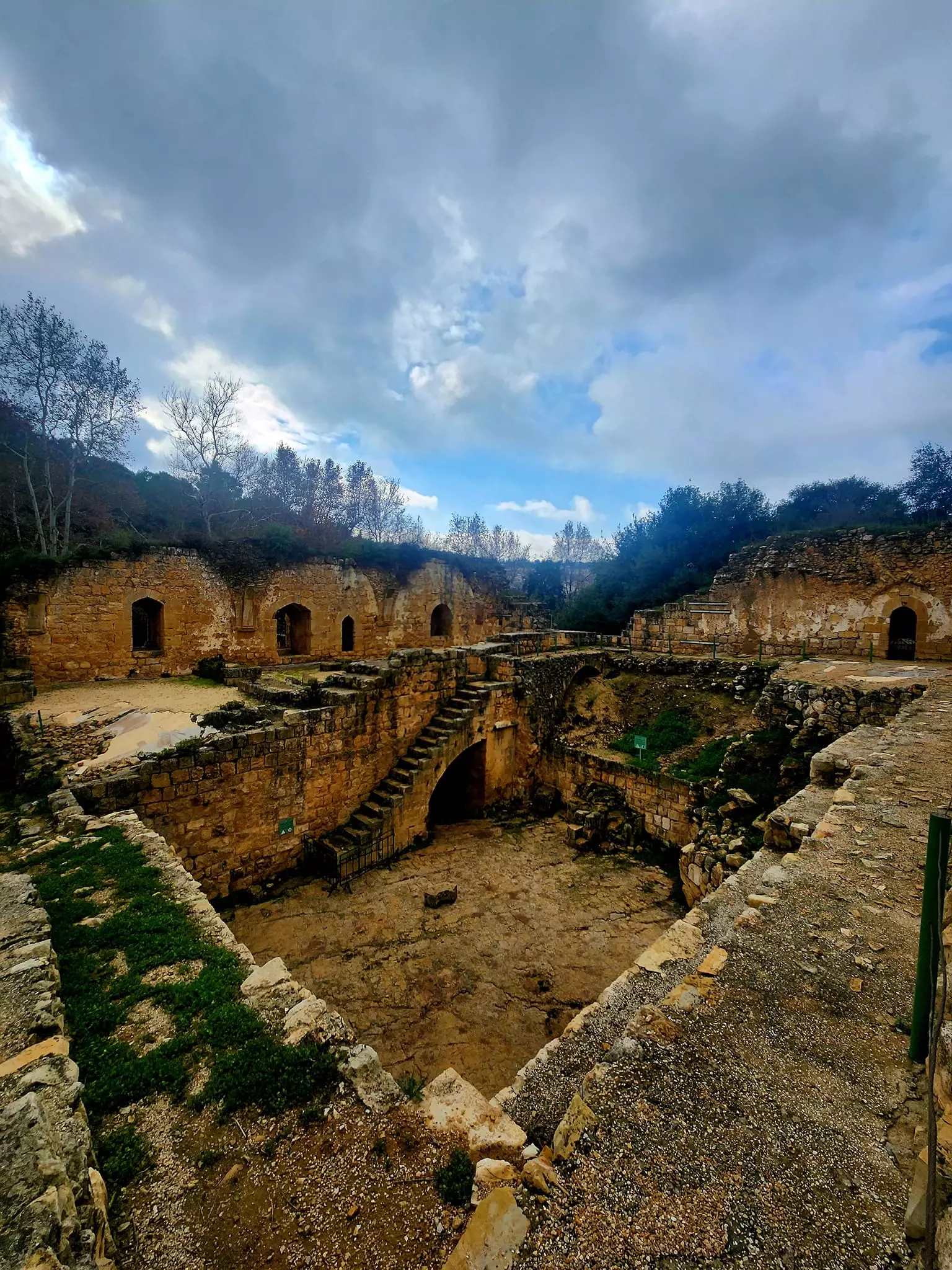
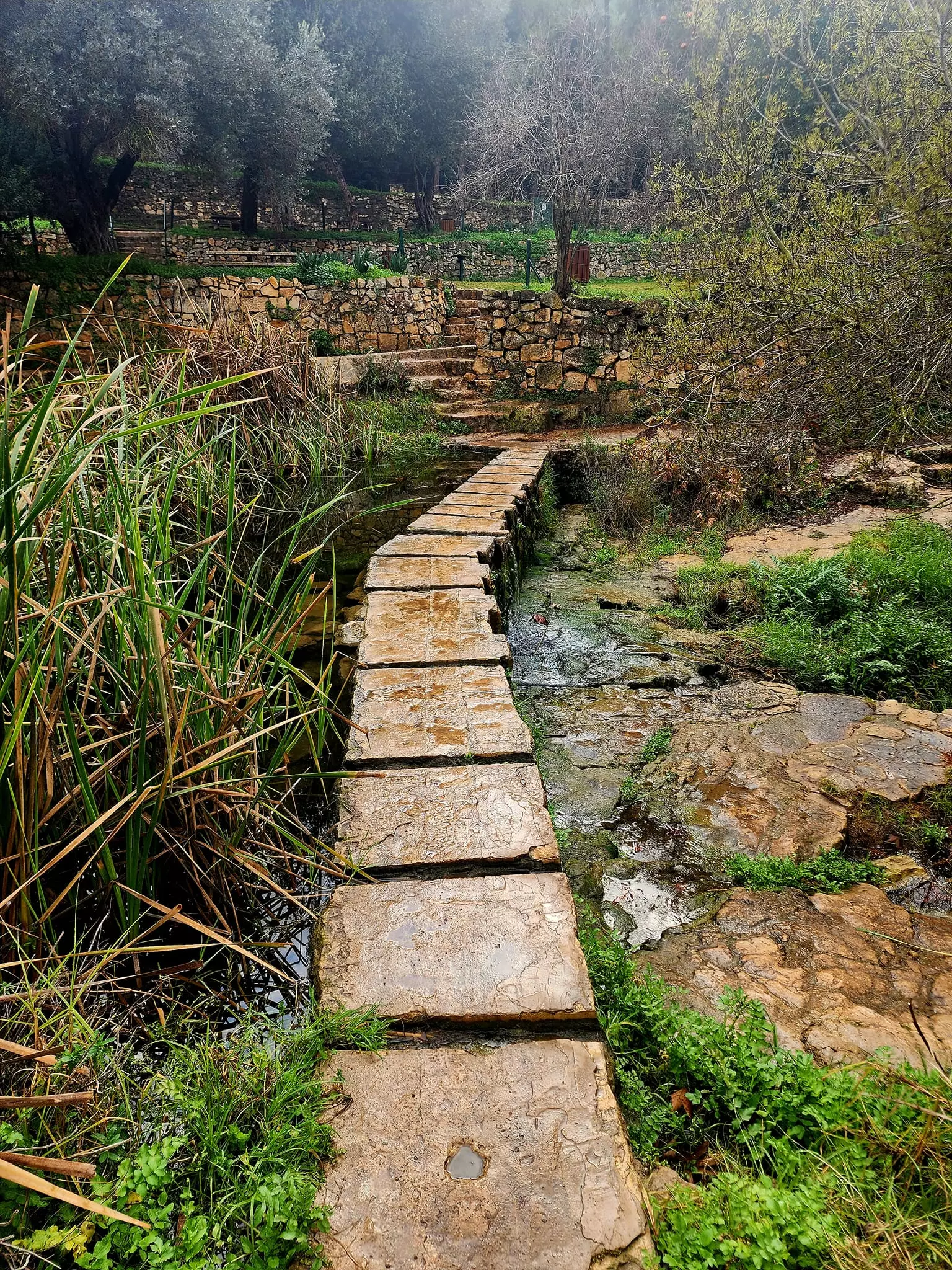
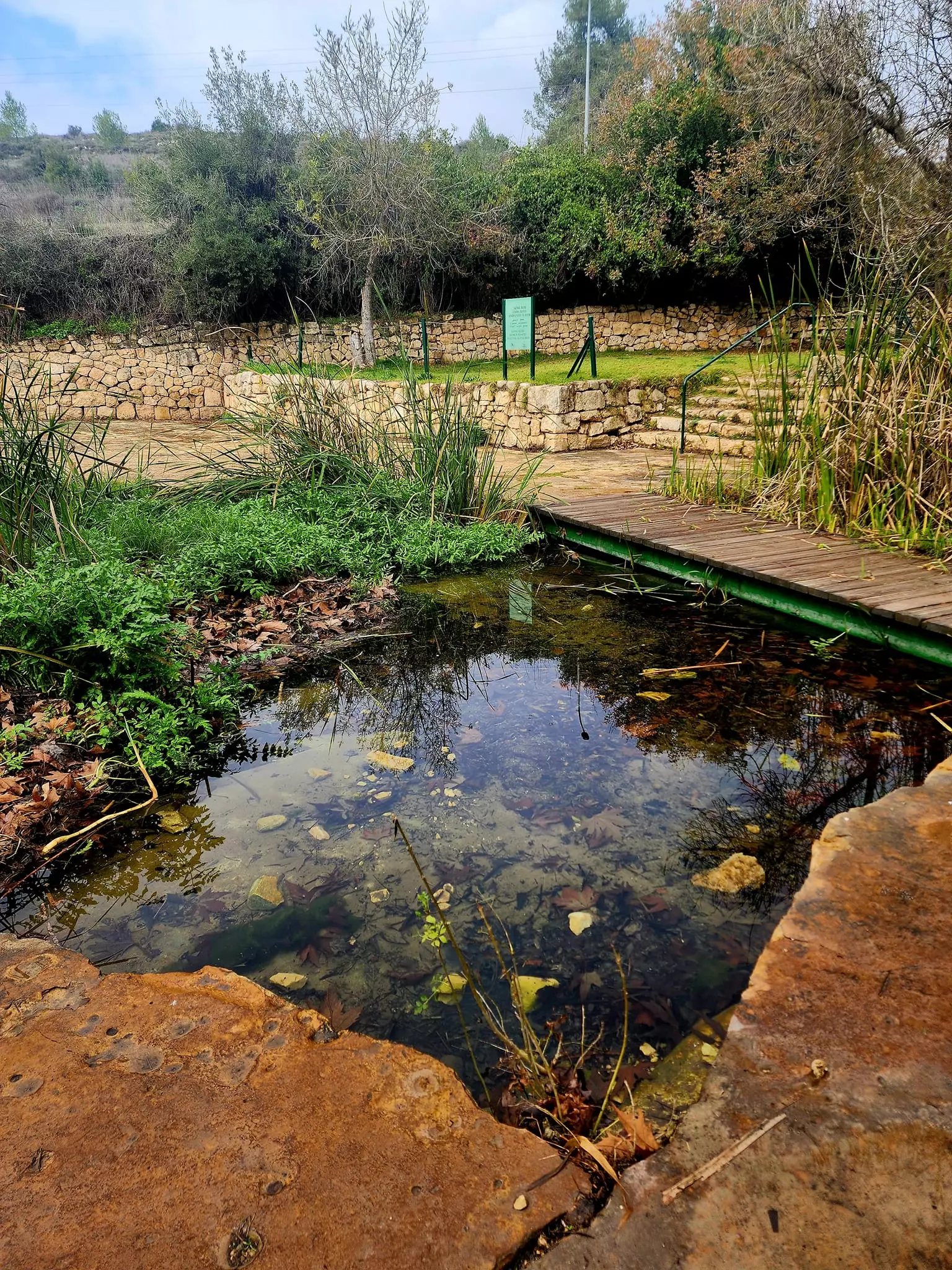
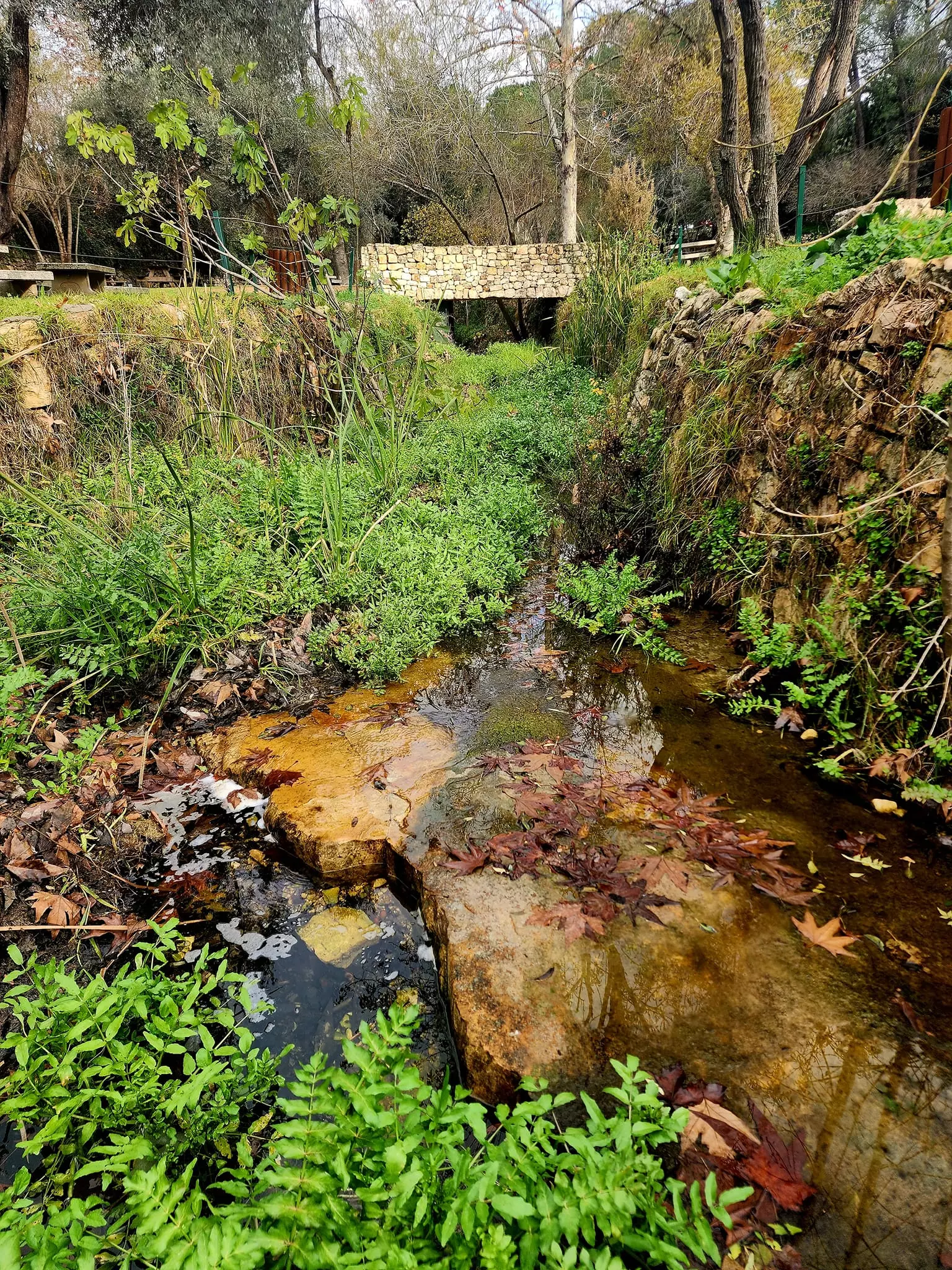
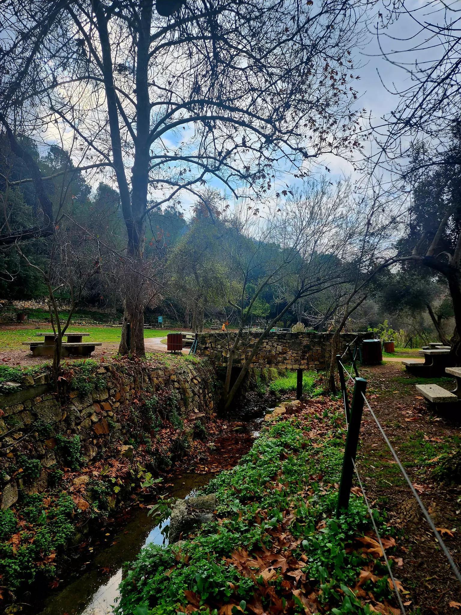
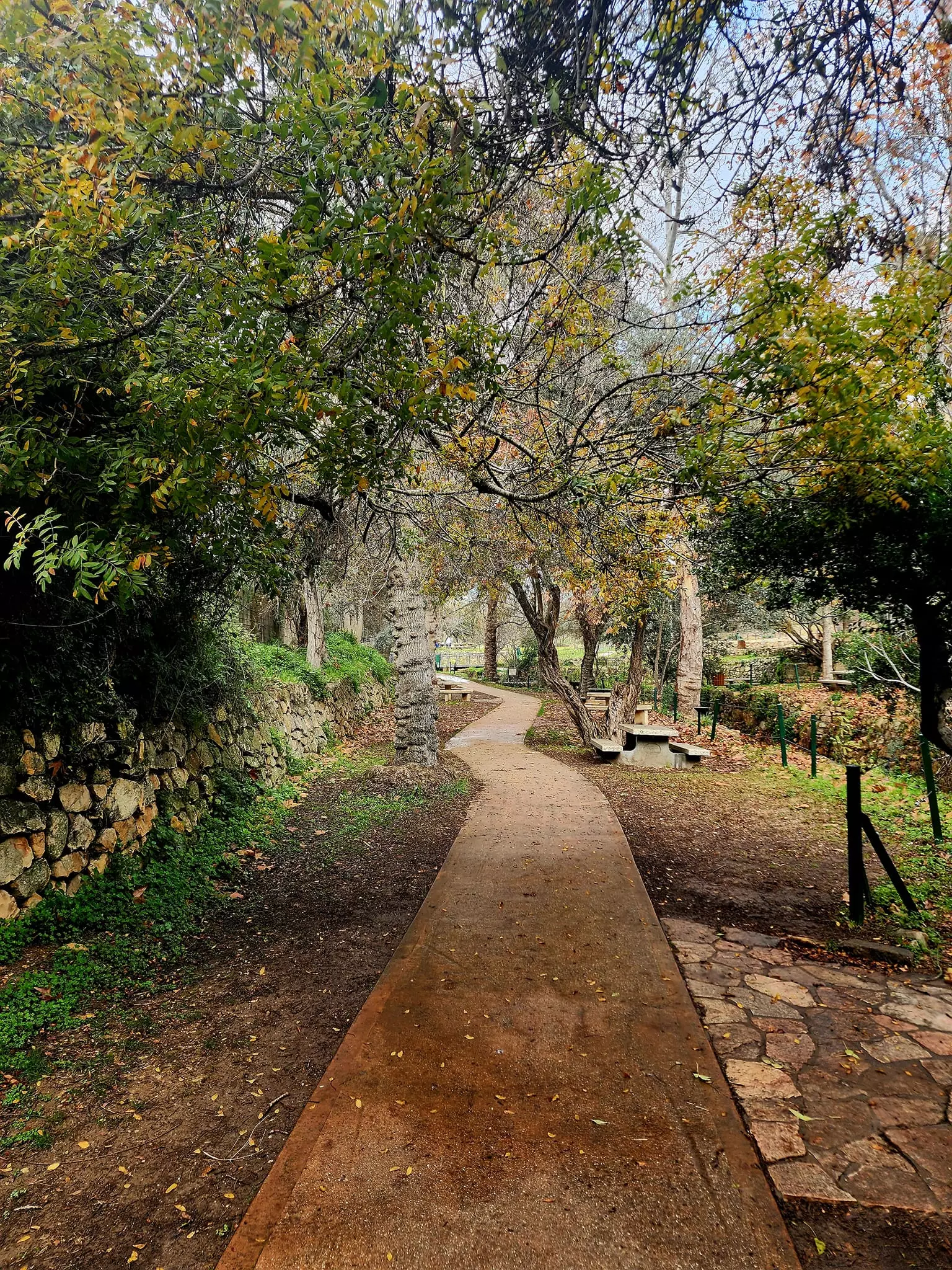
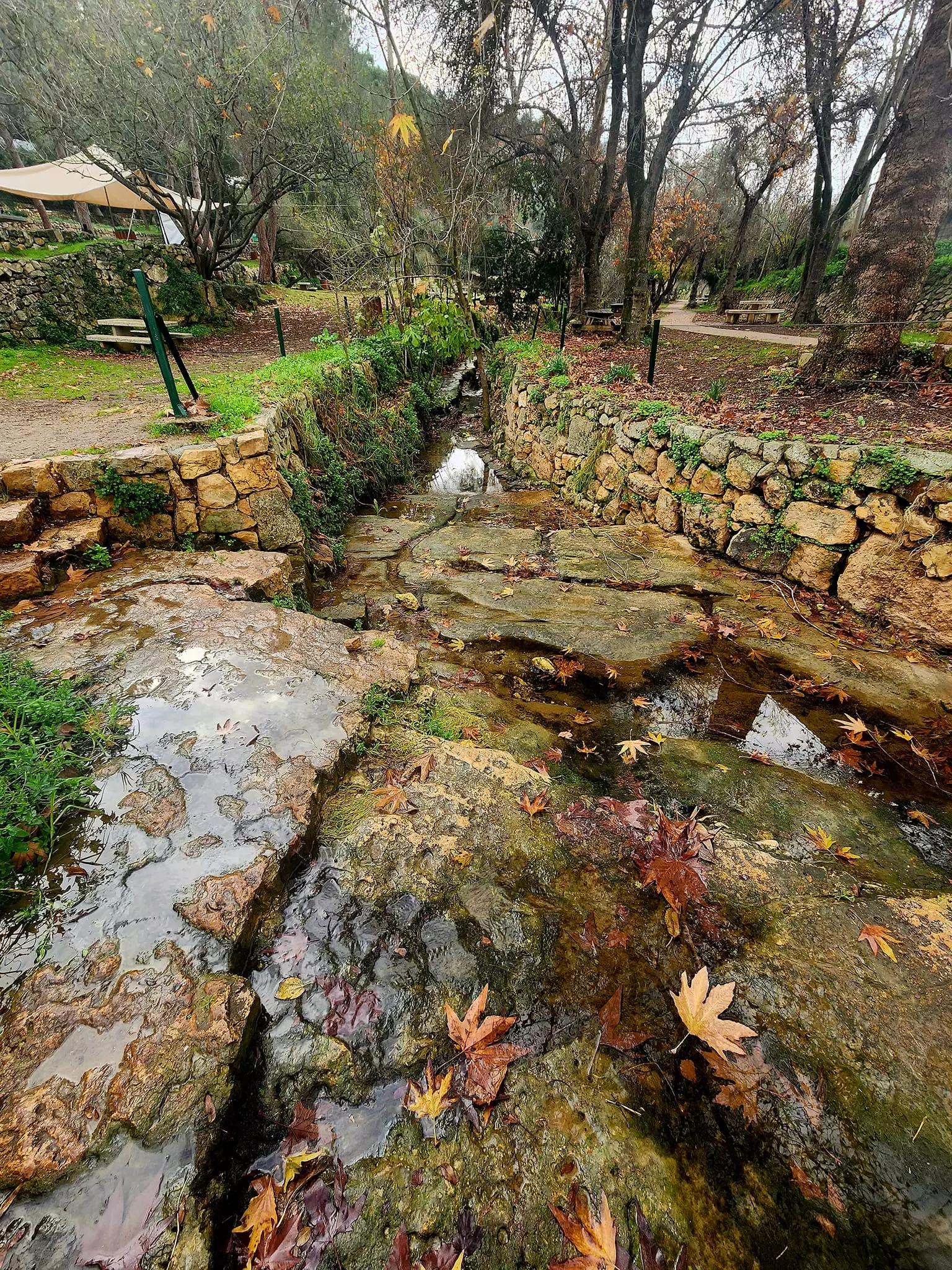
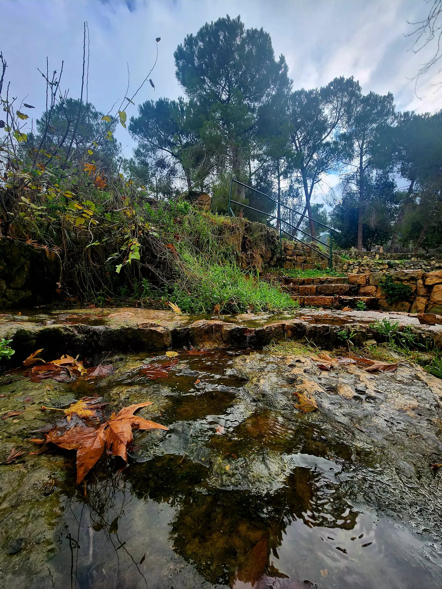
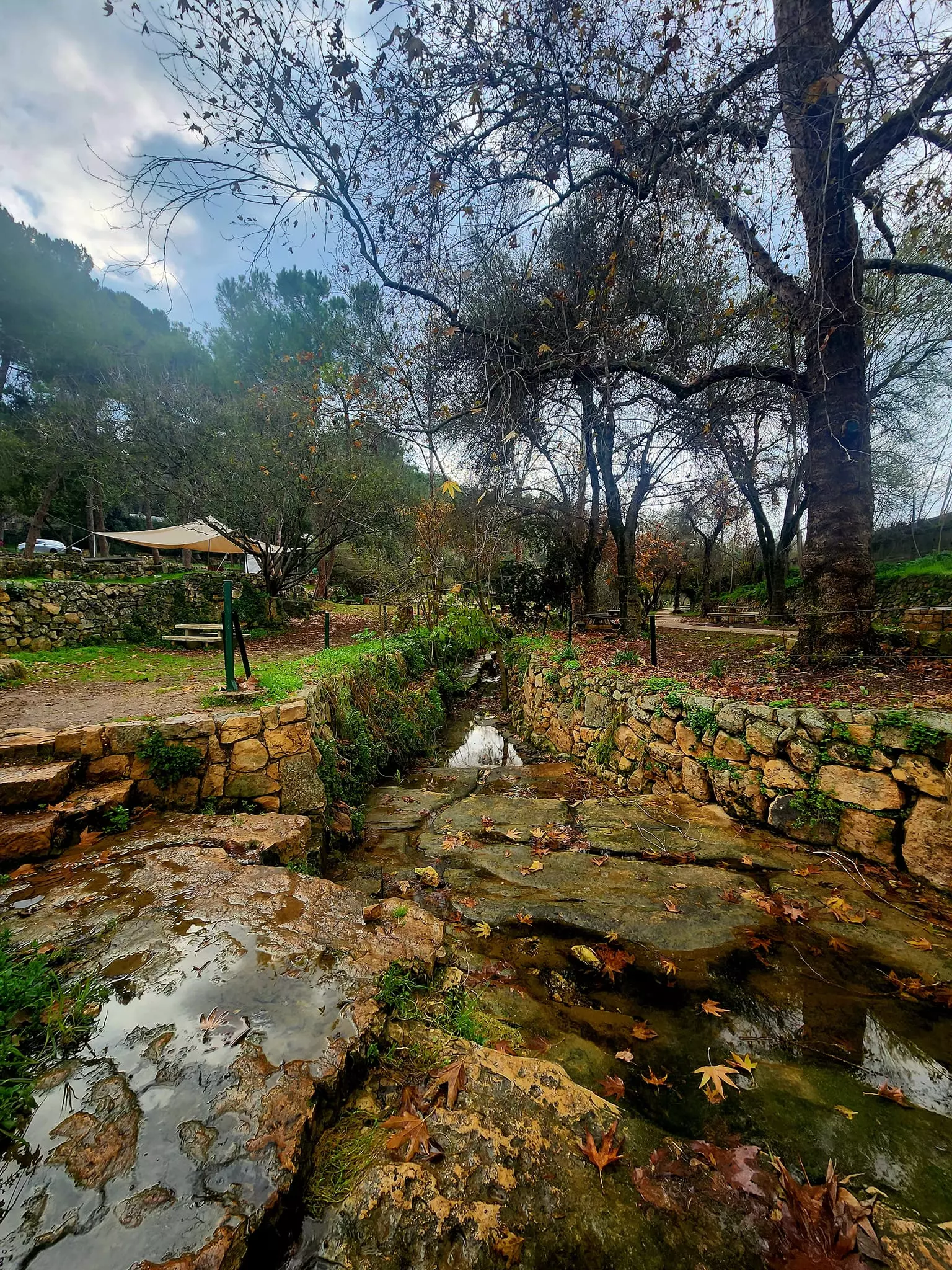
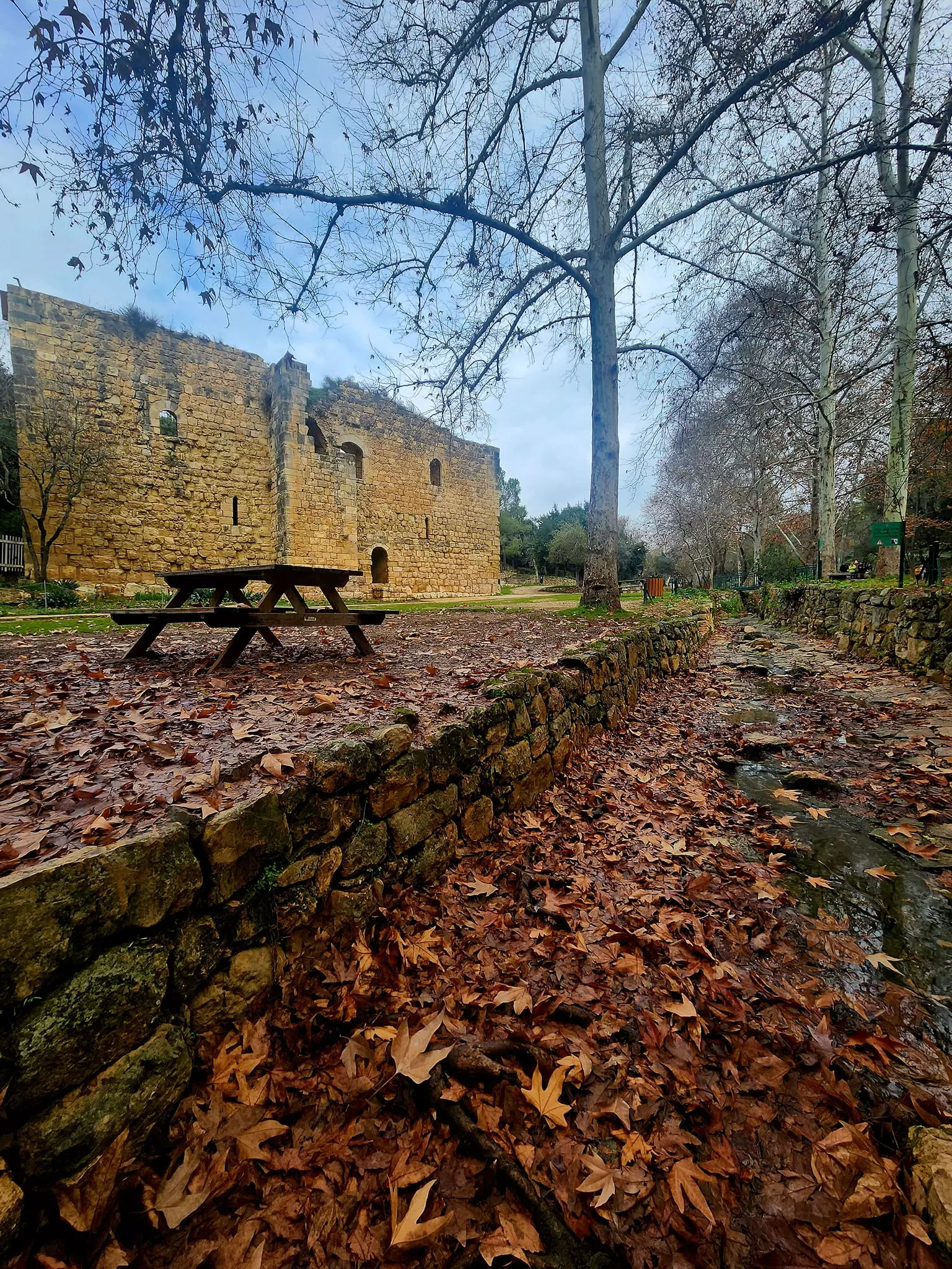
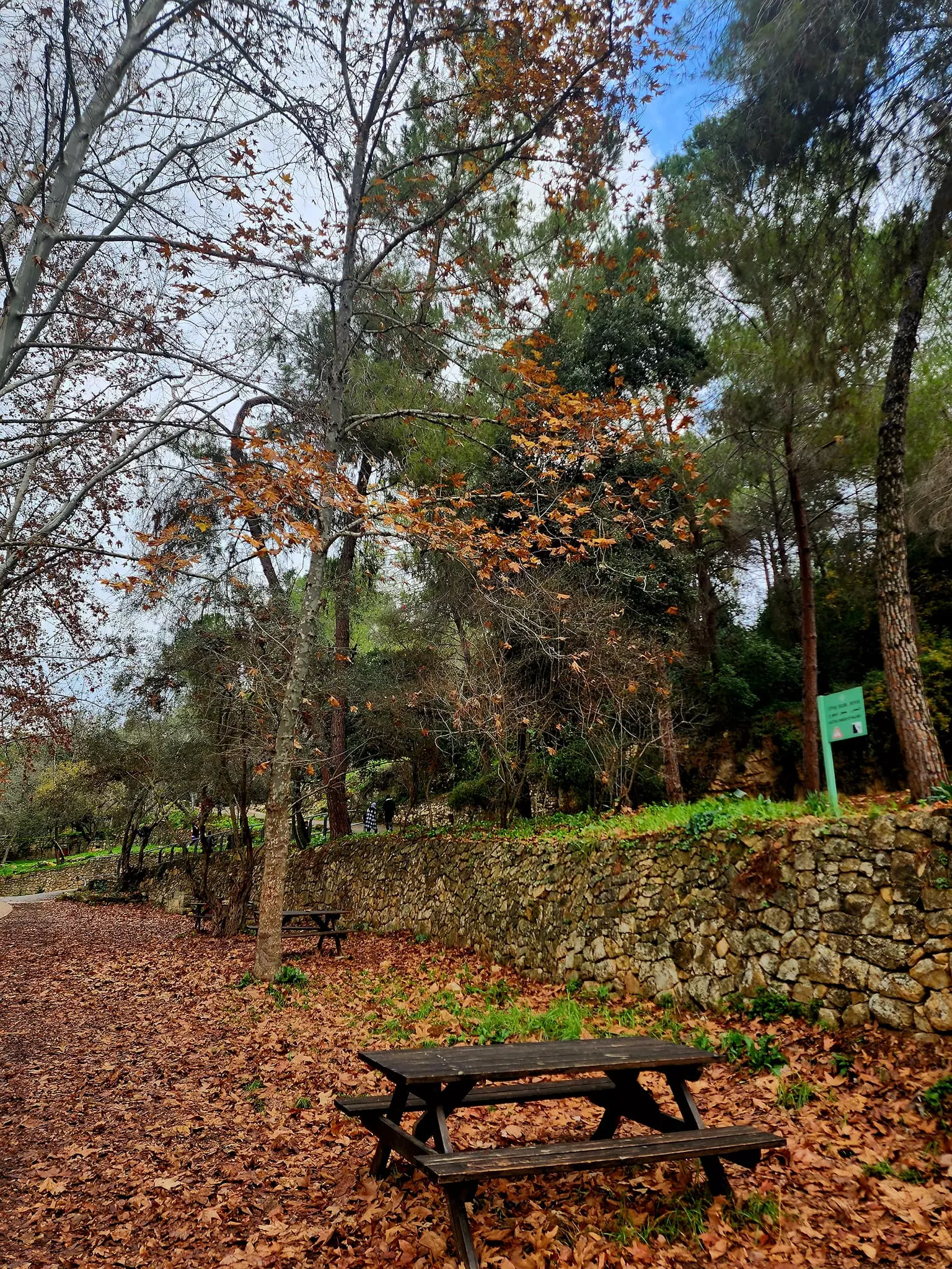
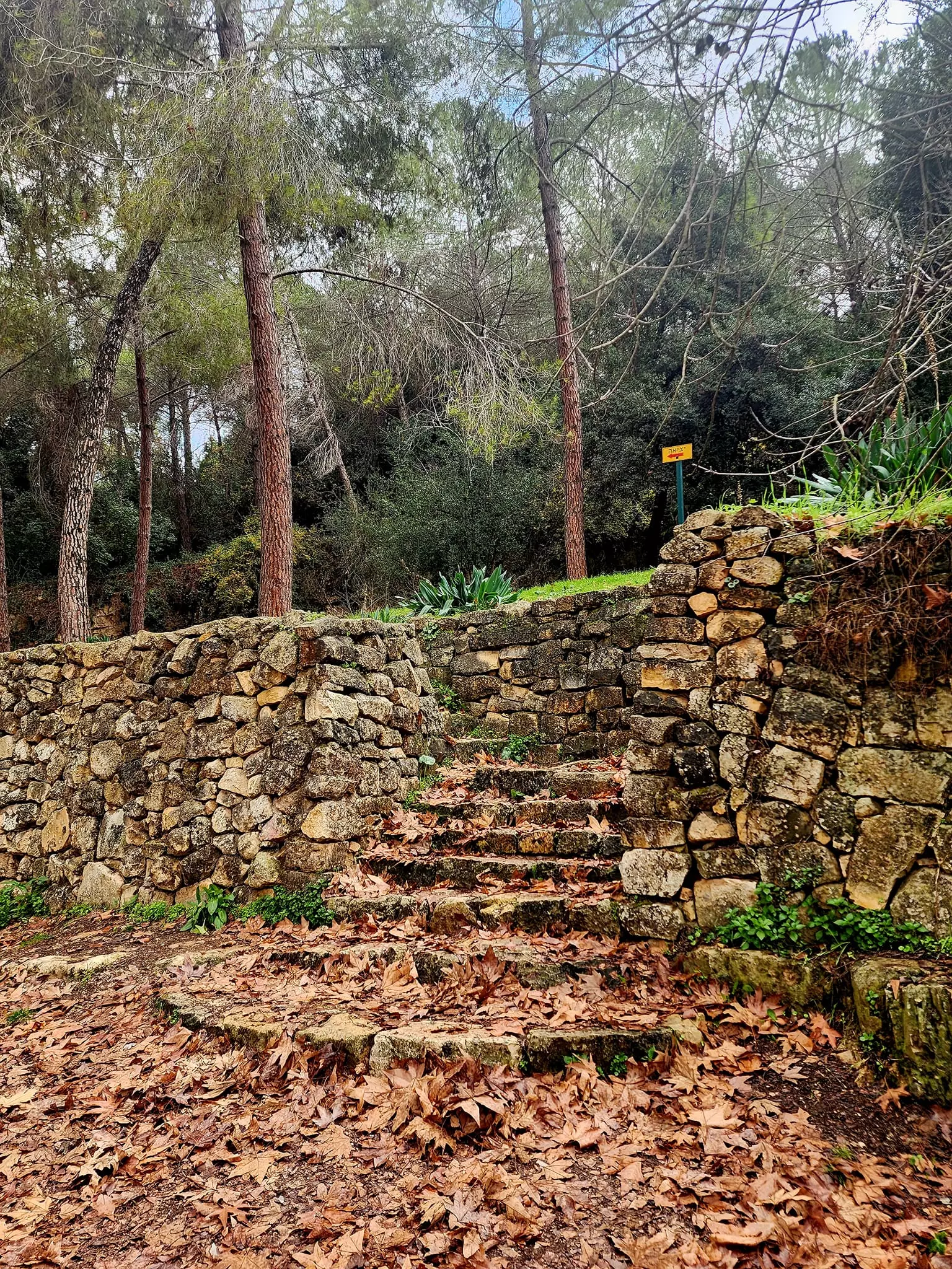
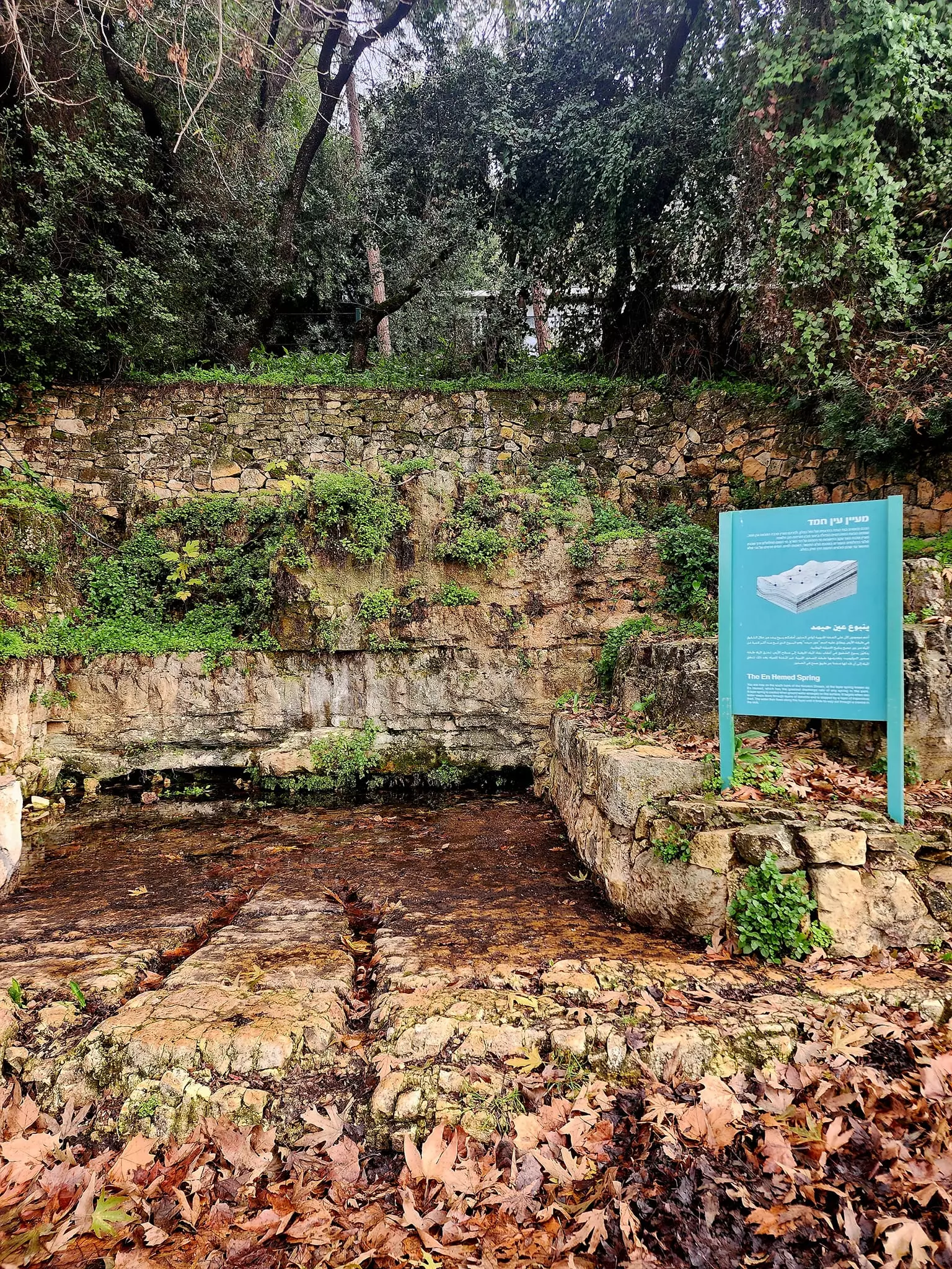
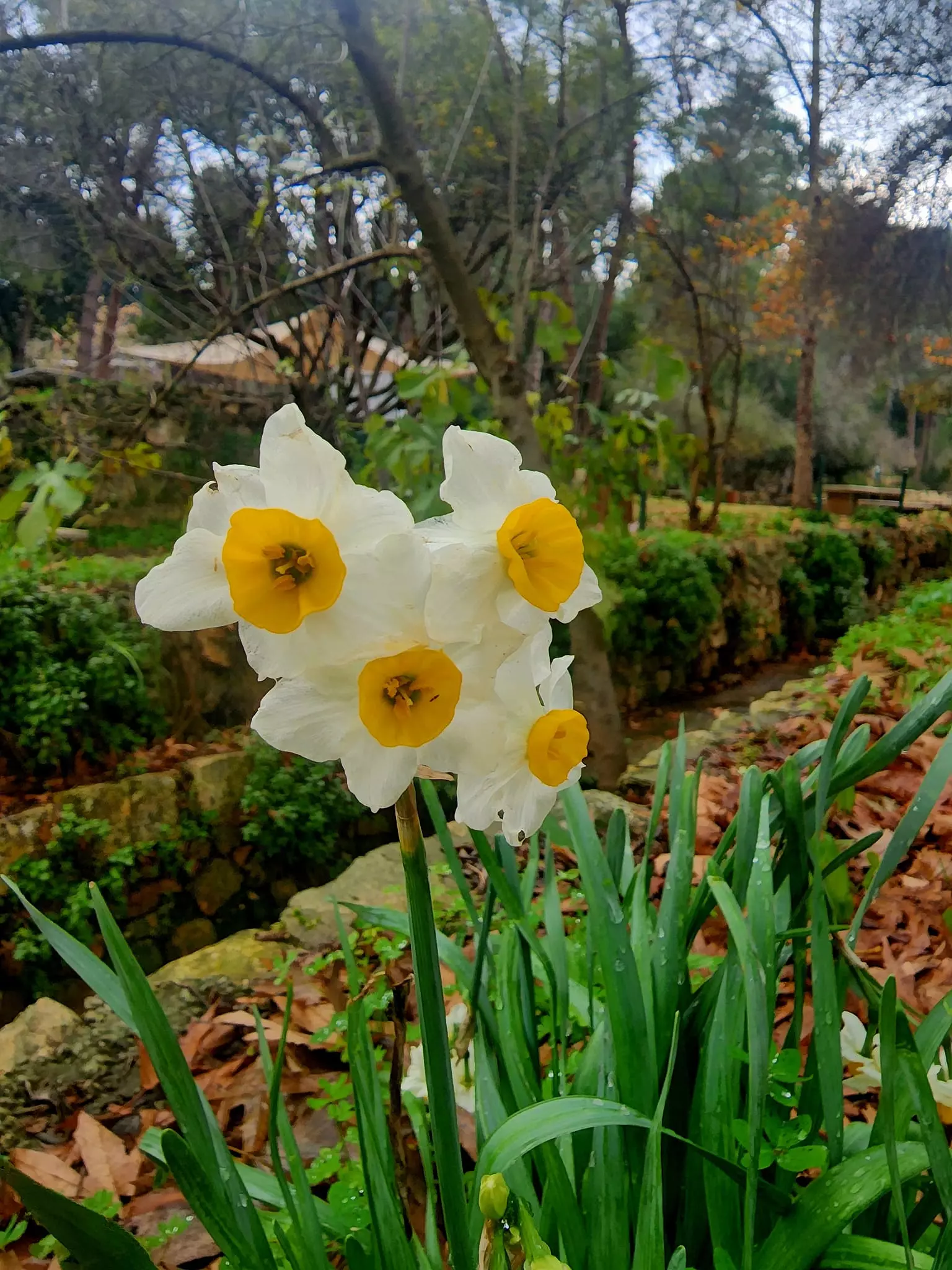
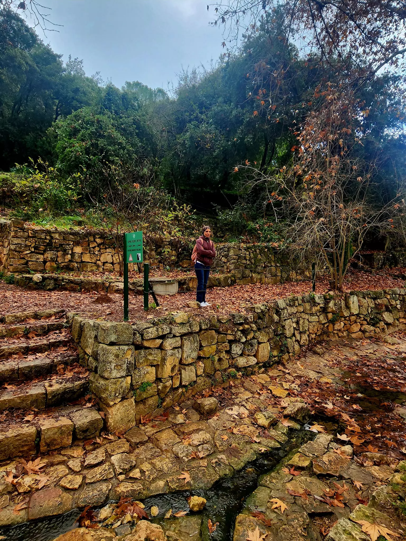
- عين حمد او عين مهرج واحدة من عيون الماء المتدفقة من السفوح الغربية لجبال القدس ، وتقع بالقرب من قرية بيت نقوبا ويوجد في العين أربعة ينابيع تتدفق في مجرى الحديقة . والتي تشكل اليوم متنزهاً و محمية طبيعية.كانت تمر في المكان طريق رومانية تصل الى القدس و أقام بها الصليبيون مبنى للسكن -- Aug, 2022 -- Iyad Jaber
- عين حمد او عين مهرج واحدة من عيون الماء المتدفقة من السفوح الغربية لجبال القدس ، وتقع بالقرب من قرية بيت نقوبا ويوجد في العين أربعة ينابيع تتدفق في مجرى الحديقة . والتي تشكل اليوم متنزهاً و محمية طبيعية.كانت تمر في المكان طريق رومانية تصل الى القدس و أقام بها الصليبيون مبنى للسكن -- Aug, 2022 -- Iyad Jaber #2
- عين حمد او عين مهرج واحدة من عيون الماء المتدفقة من السفوح الغربية لجبال القدس ، وتقع بالقرب من قرية بيت نقوبا ويوجد في العين أربعة ينابيع تتدفق في مجرى الحديقة . والتي تشكل اليوم متنزهاً و محمية طبيعية.كانت تمر في المكان طريق رومانية تصل الى القدس و أقام بها الصليبيون مبنى للسكن -- Aug, 2022 -- Iyad Jaber #3
- عين حمد او عين مهرج واحدة من عيون الماء المتدفقة من السفوح الغربية لجبال القدس ، وتقع بالقرب من قرية بيت نقوبا ويوجد في العين أربعة ينابيع تتدفق في مجرى الحديقة . والتي تشكل اليوم متنزهاً و محمية طبيعية.كانت تمر في المكان طريق رومانية تصل الى القدس و أقام بها الصليبيون مبنى للسكن -- Aug, 2022 -- Iyad Jaber #4
- عين حمد او عين مهرج واحدة من عيون الماء المتدفقة من السفوح الغربية لجبال القدس ، وتقع بالقرب من قرية بيت نقوبا ويوجد في العين أربعة ينابيع تتدفق في مجرى الحديقة . والتي تشكل اليوم متنزهاً و محمية طبيعية.كانت تمر في المكان طريق رومانية تصل الى القدس و أقام بها الصليبيون مبنى للسكن -- Aug, 2022 -- Iyad Jaber #5
- عين حمد او عين مهرج واحدة من عيون الماء المتدفقة من السفوح الغربية لجبال القدس ، وتقع بالقرب من قرية بيت نقوبا ويوجد في العين أربعة ينابيع تتدفق في مجرى الحديقة . والتي تشكل اليوم متنزهاً و محمية طبيعية.كانت تمر في المكان طريق رومانية تصل الى القدس و أقام بها الصليبيون مبنى للسكن -- Aug, 2022 -- Iyad Jaber #6
- عين حمد او عين مهرج واحدة من عيون الماء المتدفقة من السفوح الغربية لجبال القدس ، وتقع بالقرب من قرية بيت نقوبا ويوجد في العين أربعة ينابيع تتدفق في مجرى الحديقة . والتي تشكل اليوم متنزهاً و محمية طبيعية.كانت تمر في المكان طريق رومانية تصل الى القدس و أقام بها الصليبيون مبنى للسكن -- Aug, 2022 -- Iyad Jaber #7
- عين حمد او عين مهرج واحدة من عيون الماء المتدفقة من السفوح الغربية لجبال القدس ، وتقع بالقرب من قرية بيت نقوبا ويوجد في العين أربعة ينابيع تتدفق في مجرى الحديقة . والتي تشكل اليوم متنزهاً و محمية طبيعية.كانت تمر في المكان طريق رومانية تصل الى القدس و أقام بها الصليبيون مبنى للسكن -- Aug, 2022 -- Iyad Jaber #8
- عين حمد او عين مهرج واحدة من عيون الماء المتدفقة من السفوح الغربية لجبال القدس ، وتقع بالقرب من قرية بيت نقوبا ويوجد في العين أربعة ينابيع تتدفق في مجرى الحديقة . والتي تشكل اليوم متنزهاً و محمية طبيعية.كانت تمر في المكان طريق رومانية تصل الى القدس و أقام بها الصليبيون مبنى للسكن -- Aug, 2022 -- Iyad Jaber #9
- عين حمد او عين مهرج واحدة من عيون الماء المتدفقة من السفوح الغربية لجبال القدس ، وتقع بالقرب من قرية بيت نقوبا ويوجد في العين أربعة ينابيع تتدفق في مجرى الحديقة . والتي تشكل اليوم متنزهاً و محمية طبيعية.كانت تمر في المكان طريق رومانية تصل الى القدس و أقام بها الصليبيون مبنى للسكن -- Aug, 2022 -- Iyad Jaber #10
- عين حمد او عين مهرج واحدة من عيون الماء المتدفقة من السفوح الغربية لجبال القدس ، وتقع بالقرب من قرية بيت نقوبا ويوجد في العين أربعة ينابيع تتدفق في مجرى الحديقة . والتي تشكل اليوم متنزهاً و محمية طبيعية.كانت تمر في المكان طريق رومانية تصل الى القدس و أقام بها الصليبيون مبنى للسكن -- Aug, 2022 -- Iyad Jaber #11
- عين حمد او عين مهرج واحدة من عيون الماء المتدفقة من السفوح الغربية لجبال القدس ، وتقع بالقرب من قرية بيت نقوبا ويوجد في العين أربعة ينابيع تتدفق في مجرى الحديقة . والتي تشكل اليوم متنزهاً و محمية طبيعية.كانت تمر في المكان طريق رومانية تصل الى القدس و أقام بها الصليبيون مبنى للسكن -- Aug, 2022 -- Iyad Jaber #12
- عين حمد او عين مهرج واحدة من عيون الماء المتدفقة من السفوح الغربية لجبال القدس ، وتقع بالقرب من قرية بيت نقوبا ويوجد في العين أربعة ينابيع تتدفق في مجرى الحديقة . والتي تشكل اليوم متنزهاً و محمية طبيعية.كانت تمر في المكان طريق رومانية تصل الى القدس و أقام بها الصليبيون مبنى للسكن -- Aug, 2022 -- Iyad Jaber #13
- عين حمد او عين مهرج واحدة من عيون الماء المتدفقة من السفوح الغربية لجبال القدس ، وتقع بالقرب من قرية بيت نقوبا ويوجد في العين أربعة ينابيع تتدفق في مجرى الحديقة . والتي تشكل اليوم متنزهاً و محمية طبيعية.كانت تمر في المكان طريق رومانية تصل الى القدس و أقام بها الصليبيون مبنى للسكن -- Aug, 2022 -- Iyad Jaber #14
- عين حمد او عين مهرج واحدة من عيون الماء المتدفقة من السفوح الغربية لجبال القدس ، وتقع بالقرب من قرية بيت نقوبا ويوجد في العين أربعة ينابيع تتدفق في مجرى الحديقة . والتي تشكل اليوم متنزهاً و محمية طبيعية.كانت تمر في المكان طريق رومانية تصل الى القدس و أقام بها الصليبيون مبنى للسكن -- Aug, 2022 -- Iyad Jaber #15
- عين حمد او عين مهرج واحدة من عيون الماء المتدفقة من السفوح الغربية لجبال القدس ، وتقع بالقرب من قرية بيت نقوبا ويوجد في العين أربعة ينابيع تتدفق في مجرى الحديقة . والتي تشكل اليوم متنزهاً و محمية طبيعية.كانت تمر في المكان طريق رومانية تصل الى القدس و أقام بها الصليبيون مبنى للسكن -- Aug, 2022 -- Iyad Jaber #16
- عين حمد او عين مهرج واحدة من عيون الماء المتدفقة من السفوح الغربية لجبال القدس ، وتقع بالقرب من قرية بيت نقوبا ويوجد في العين أربعة ينابيع تتدفق في مجرى الحديقة . والتي تشكل اليوم متنزهاً و محمية طبيعية.كانت تمر في المكان طريق رومانية تصل الى القدس و أقام بها الصليبيون مبنى للسكن -- Aug, 2022 -- Iyad Jaber #17
- عين حمد او عين مهرج واحدة من عيون الماء المتدفقة من السفوح الغربية لجبال القدس ، وتقع بالقرب من قرية بيت نقوبا ويوجد في العين أربعة ينابيع تتدفق في مجرى الحديقة . والتي تشكل اليوم متنزهاً و محمية طبيعية.كانت تمر في المكان طريق رومانية تصل الى القدس و أقام بها الصليبيون مبنى للسكن -- Aug, 2022 -- Iyad Jaber #18
- عين حمد او عين مهرج واحدة من عيون الماء المتدفقة من السفوح الغربية لجبال القدس ، وتقع بالقرب من قرية بيت نقوبا ويوجد في العين أربعة ينابيع تتدفق في مجرى الحديقة . والتي تشكل اليوم متنزهاً و محمية طبيعية.كانت تمر في المكان طريق رومانية تصل الى القدس و أقام بها الصليبيون مبنى للسكن -- Aug, 2022 -- Iyad Jaber #19
- عين حمد او عين مهرج واحدة من عيون الماء المتدفقة من السفوح الغربية لجبال القدس ، وتقع بالقرب من قرية بيت نقوبا ويوجد في العين أربعة ينابيع تتدفق في مجرى الحديقة . والتي تشكل اليوم متنزهاً و محمية طبيعية.كانت تمر في المكان طريق رومانية تصل الى القدس و أقام بها الصليبيون مبنى للسكن -- Aug, 2022 -- Iyad Jaber #20
- عين حمد او عين مهرج واحدة من عيون الماء المتدفقة من السفوح الغربية لجبال القدس ، وتقع بالقرب من قرية بيت نقوبا ويوجد في العين أربعة ينابيع تتدفق في مجرى الحديقة . والتي تشكل اليوم متنزهاً و محمية طبيعية.كانت تمر في المكان طريق رومانية تصل الى القدس و أقام بها الصليبيون مبنى للسكن -- Aug, 2022 -- Iyad Jaber #21
- عين حمد او عين مهرج واحدة من عيون الماء المتدفقة من السفوح الغربية لجبال القدس ، وتقع بالقرب من قرية بيت نقوبا ويوجد في العين أربعة ينابيع تتدفق في مجرى الحديقة . والتي تشكل اليوم متنزهاً و محمية طبيعية.كانت تمر في المكان طريق رومانية تصل الى القدس و أقام بها الصليبيون مبنى للسكن -- Aug, 2022 -- Iyad Jaber #22
- عين حمد او عين مهرج واحدة من عيون الماء المتدفقة من السفوح الغربية لجبال القدس ، وتقع بالقرب من قرية بيت نقوبا ويوجد في العين أربعة ينابيع تتدفق في مجرى الحديقة . والتي تشكل اليوم متنزهاً و محمية طبيعية.كانت تمر في المكان طريق رومانية تصل الى القدس و أقام بها الصليبيون مبنى للسكن -- Aug, 2022 -- Iyad Jaber #23
- عين حمد او عين مهرج واحدة من عيون الماء المتدفقة من السفوح الغربية لجبال القدس ، وتقع بالقرب من قرية بيت نقوبا ويوجد في العين أربعة ينابيع تتدفق في مجرى الحديقة . والتي تشكل اليوم متنزهاً و محمية طبيعية.كانت تمر في المكان طريق رومانية تصل الى القدس و أقام بها الصليبيون مبنى للسكن -- Aug, 2022 -- Iyad Jaber #24
- عين حمد او عين مهرج واحدة من عيون الماء المتدفقة من السفوح الغربية لجبال القدس ، وتقع بالقرب من قرية بيت نقوبا ويوجد في العين أربعة ينابيع تتدفق في مجرى الحديقة . والتي تشكل اليوم متنزهاً و محمية طبيعية.كانت تمر في المكان طريق رومانية تصل الى القدس و أقام بها الصليبيون مبنى للسكن -- Aug, 2022 -- Iyad Jaber #25
- عين حمد او عين مهرج واحدة من عيون الماء المتدفقة من السفوح الغربية لجبال القدس ، وتقع بالقرب من قرية بيت نقوبا ويوجد في العين أربعة ينابيع تتدفق في مجرى الحديقة . والتي تشكل اليوم متنزهاً و محمية طبيعية.كانت تمر في المكان طريق رومانية تصل الى القدس و أقام بها الصليبيون مبنى للسكن -- Aug, 2022 -- Iyad Jaber #26
- عين حمد او عين مهرج واحدة من عيون الماء المتدفقة من السفوح الغربية لجبال القدس ، وتقع بالقرب من قرية بيت نقوبا ويوجد في العين أربعة ينابيع تتدفق في مجرى الحديقة . والتي تشكل اليوم متنزهاً و محمية طبيعية.كانت تمر في المكان طريق رومانية تصل الى القدس و أقام بها الصليبيون مبنى للسكن -- Aug, 2022 -- Iyad Jaber #27
- عين حمد او عين مهرج واحدة من عيون الماء المتدفقة من السفوح الغربية لجبال القدس ، وتقع بالقرب من قرية بيت نقوبا ويوجد في العين أربعة ينابيع تتدفق في مجرى الحديقة . والتي تشكل اليوم متنزهاً و محمية طبيعية.كانت تمر في المكان طريق رومانية تصل الى القدس و أقام بها الصليبيون مبنى للسكن -- Aug, 2022 -- Iyad Jaber #28
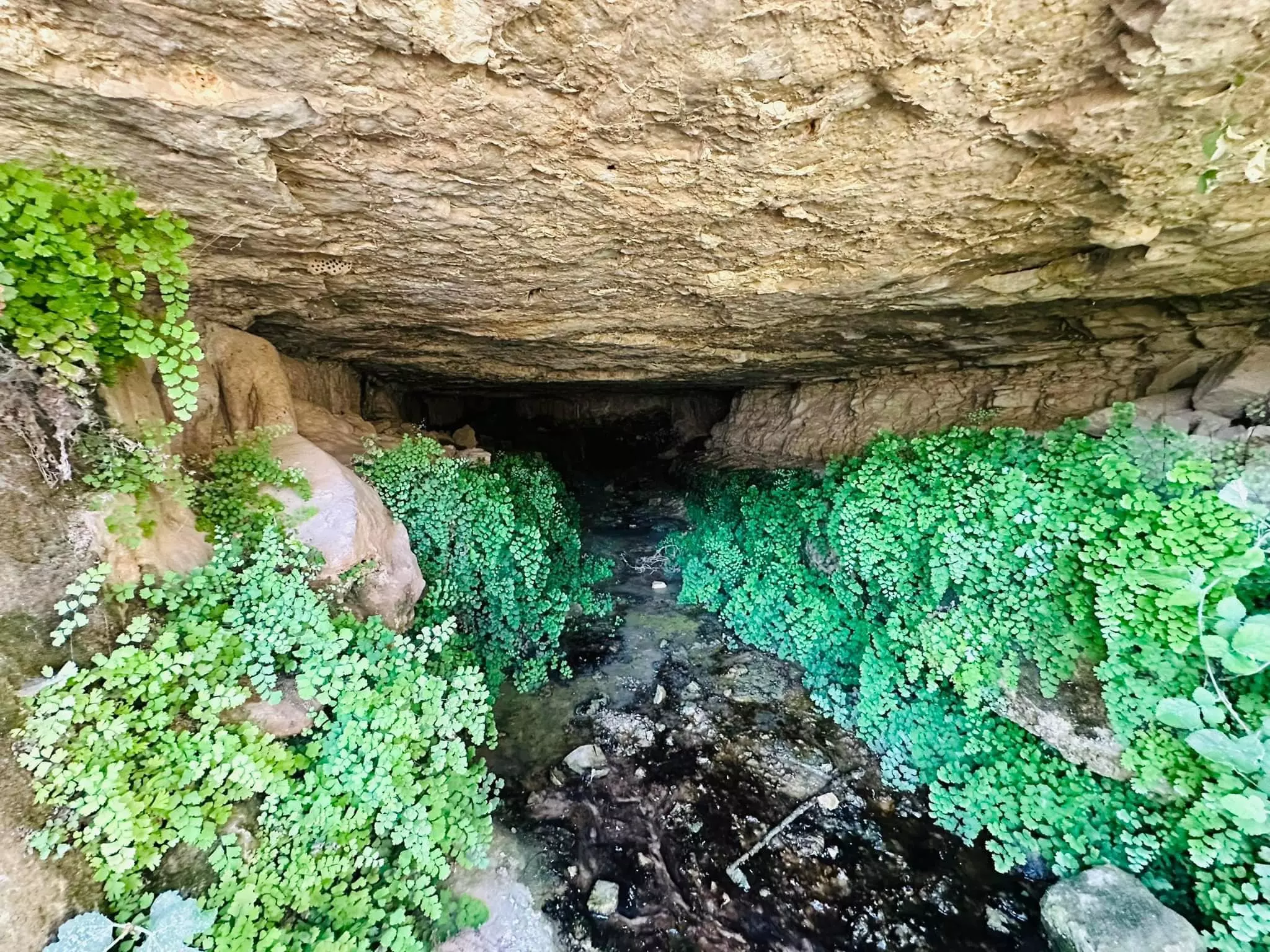
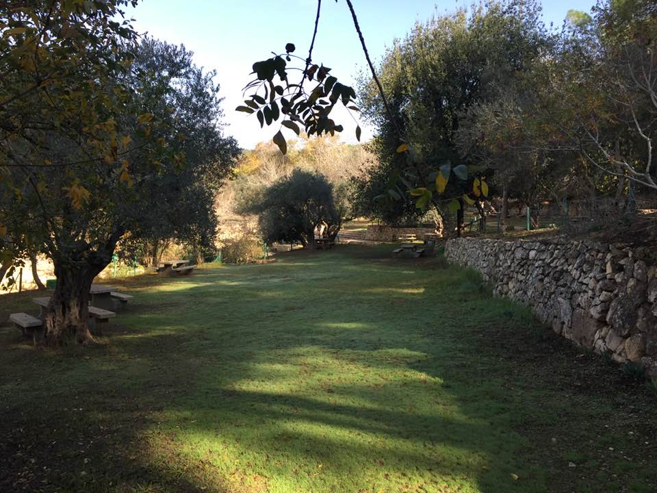
- عين جميل في اراضي قرية بيت نقوبا المهجرة-- Sept 25th, 2021 -- Iyad Jaber
- عين جميل في اراضي قرية بيت نقوبا المهجرة-- Sept 25th, 2021 -- Iyad Jaber #2
- عين جميل في اراضي قرية بيت نقوبا المهجرة-- Sept 25th, 2021 -- Iyad Jaber #3
- عين جميل في اراضي قرية بيت نقوبا المهجرة-- Sept 25th, 2021 -- Iyad Jaber #4
- Let us see how the "MOST CIVILIZED & LIBERAL" of world Jewry looted from the Palestinian people. Soon, Gaza might have a similar fate. Mazeltov. How else will Jews be great again?
- Let us see how the "MOST CIVILIZED & LIBERAL" of world Jewry looted from the Palestinian people. Soon, Gaza might have a similar fate. Mazeltov. How else will Jews be great again? #2
- Let us see how the "MOST CIVILIZED & LIBERAL" of world Jewry looted from the Palestinian people. Soon, Gaza might have a similar fate. Mazeltov. How else will Jews be great again? #3
- Let us see how the "MOST CIVILIZED & LIBERAL" of world Jewry looted from the Palestinian people. Soon, Gaza might have a similar fate. Mazeltov. How else will Jews be great again? #4
- Let us see how the "MOST CIVILIZED & LIBERAL" of world Jewry looted from the Palestinian people. Soon, Gaza might have a similar fate. Mazeltov. How else will Jews be great again? #5
- Let us see how the "MOST CIVILIZED & LIBERAL" of world Jewry looted from the Palestinian people. Soon, Gaza might have a similar fate. Mazeltov. How else will Jews be great again? #6
- Let us see how the "MOST CIVILIZED & LIBERAL" of world Jewry looted from the Palestinian people. Soon, Gaza might have a similar fate. Mazeltov. How else will Jews be great again? #7
- Let us see how the "MOST CIVILIZED & LIBERAL" of world Jewry looted from the Palestinian people. Soon, Gaza might have a similar fate. Mazeltov. How else will Jews be great again? #8
- Let us see how the "MOST CIVILIZED & LIBERAL" of world Jewry looted from the Palestinian people. Soon, Gaza might have a similar fate. Mazeltov. How else will Jews be great again? #9
- Let us see how the "MOST CIVILIZED & LIBERAL" of world Jewry looted from the Palestinian people. Soon, Gaza might have a similar fate. Mazeltov. How else will Jews be great again? #10
- Let us see how the "MOST CIVILIZED & LIBERAL" of world Jewry looted from the Palestinian people. Soon, Gaza might have a similar fate. Mazeltov. How else will Jews be great again? #11
- Let us see how the "MOST CIVILIZED & LIBERAL" of world Jewry looted from the Palestinian people. Soon, Gaza might have a similar fate. Mazeltov. How else will Jews be great again? #12
- Let us see how the "MOST CIVILIZED & LIBERAL" of world Jewry looted from the Palestinian people. Soon, Gaza might have a similar fate. Mazeltov. How else will Jews be great again? #13
- Let us see how the "MOST CIVILIZED & LIBERAL" of world Jewry looted from the Palestinian people. Soon, Gaza might have a similar fate. Mazeltov. How else will Jews be great again? #14
- Let us see how the "MOST CIVILIZED & LIBERAL" of world Jewry looted from the Palestinian people. Soon, Gaza might have a similar fate. Mazeltov. How else will Jews be great again? #15
- Let us see how the "MOST CIVILIZED & LIBERAL" of world Jewry looted from the Palestinian people. Soon, Gaza might have a similar fate. Mazeltov. How else will Jews be great again? #16
- Let us see how the "MOST CIVILIZED & LIBERAL" of world Jewry looted from the Palestinian people. Soon, Gaza might have a similar fate. Mazeltov. How else will Jews be great again? #17
- Let us see how the "MOST CIVILIZED & LIBERAL" of world Jewry looted from the Palestinian people. Soon, Gaza might have a similar fate. Mazeltov. How else will Jews be great again? #18
- Let us see how the "MOST CIVILIZED & LIBERAL" of world Jewry looted from the Palestinian people. Soon, Gaza might have a similar fate. Mazeltov. How else will Jews be great again? #19
- Let us see how the "MOST CIVILIZED & LIBERAL" of world Jewry looted from the Palestinian people. Soon, Gaza might have a similar fate. Mazeltov. How else will Jews be great again? #20
- Let us see how the "MOST CIVILIZED & LIBERAL" of world Jewry looted from the Palestinian people. Soon, Gaza might have a similar fate. Mazeltov. How else will Jews be great again? #21
- Let us see how the "MOST CIVILIZED & LIBERAL" of world Jewry looted from the Palestinian people. Soon, Gaza might have a similar fate. Mazeltov. How else will Jews be great again? #22
- Let us see how the "MOST CIVILIZED & LIBERAL" of world Jewry looted from the Palestinian people. Soon, Gaza might have a similar fate. Mazeltov. How else will Jews be great again? #23
- Let us see how the "MOST CIVILIZED & LIBERAL" of world Jewry looted from the Palestinian people. Soon, Gaza might have a similar fate. Mazeltov. How else will Jews be great again? #24
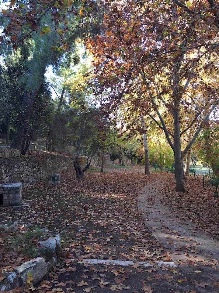
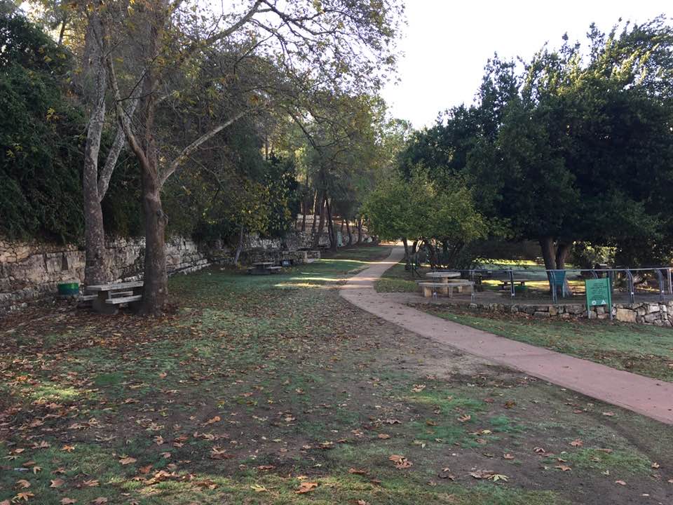
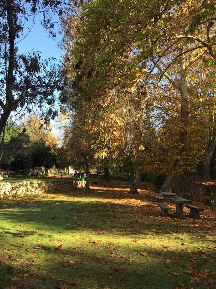
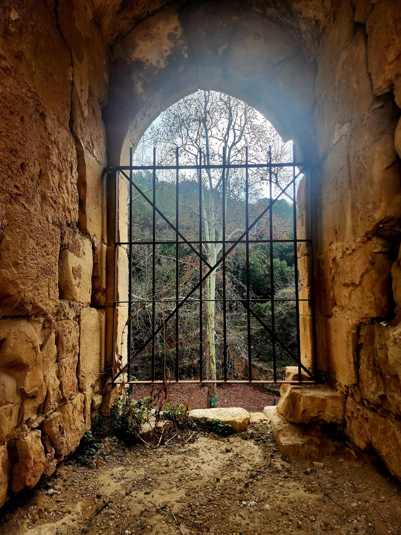
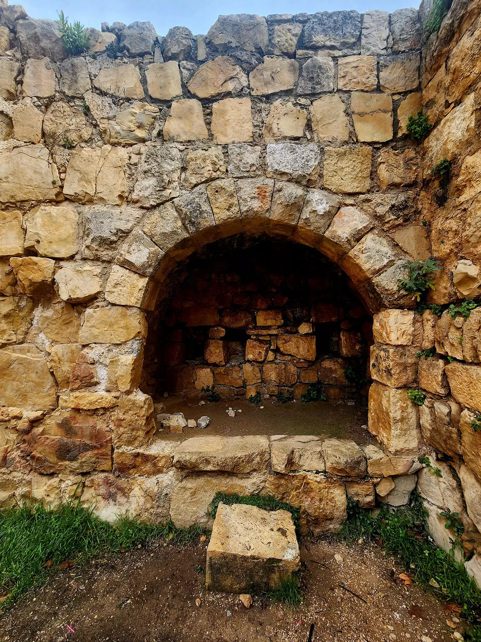
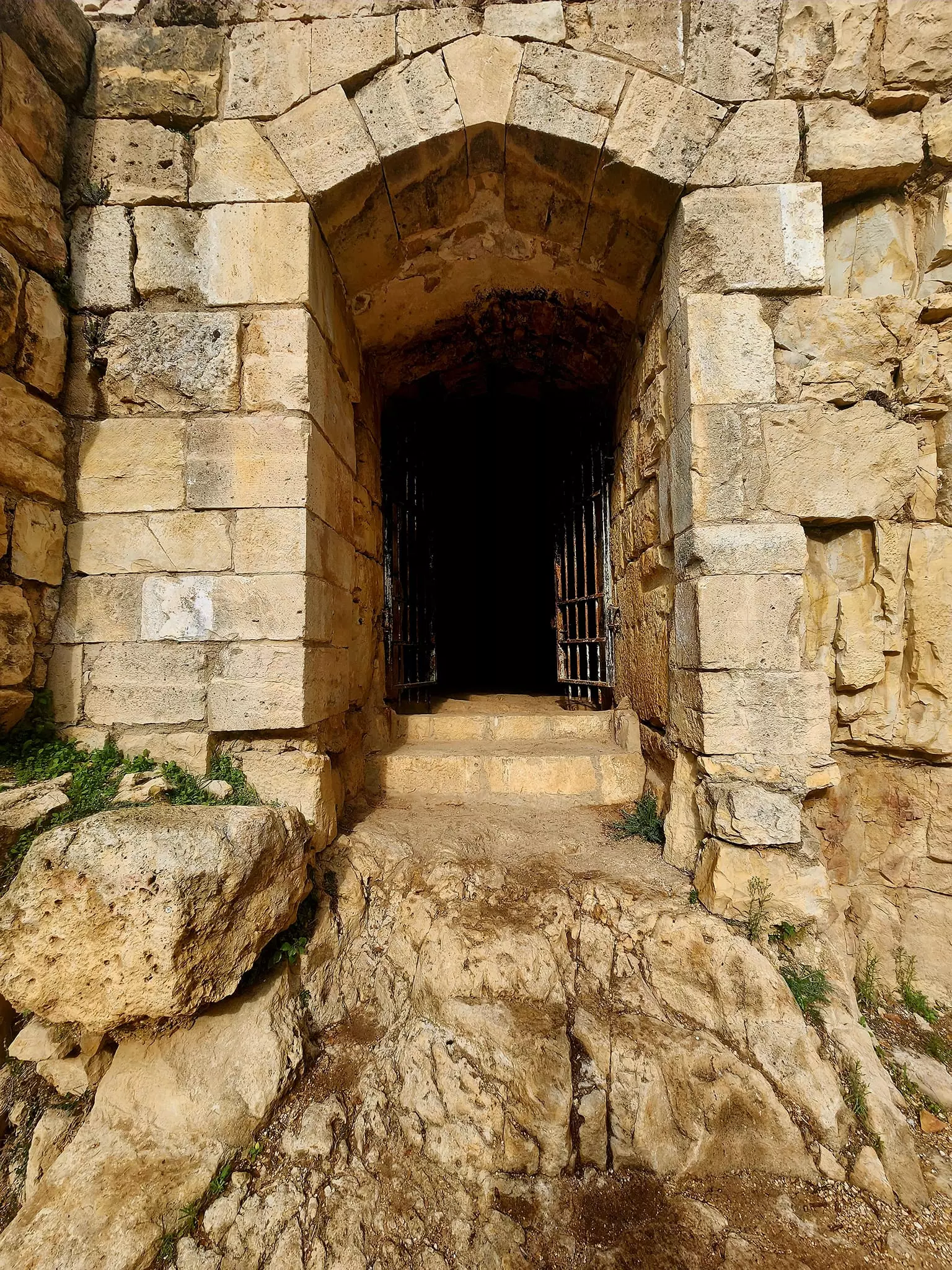
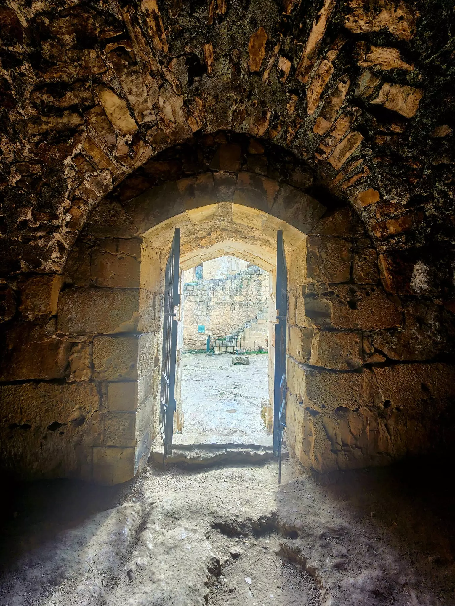
- Touring En Hemed in Wadi Kesalon. Let see how the most :liberal" of world Jewry destroyed and ethnically cleansed this peaceful town. That is how the Jews became great again-- جولة في خربة (دير البنات ) وعين إقبالا ( عين حيمد) وادي كسلون..وهو موقع تاريخي يقع على طريق يافا ألقدس قرب مفرق أبو غوش الذي عرف بالإسم ألصليبين أكوا بيلا اي المياه ألطيبة..بينما جولة في نعرفها بخربة إقبالا .
- Touring En Hemed in Wadi Kesalon. Let see how the most :liberal" of world Jewry destroyed and ethnically cleansed this peaceful town. That is how the Jews became great again-- جولة في خربة (دير البنات ) وعين إقبالا ( عين حيمد) وادي كسلون..وهو موقع تاريخي يقع على طريق يافا ألقدس قرب مفرق أبو غوش الذي عرف بالإسم ألصليبين أكوا بيلا اي المياه ألطيبة..بينما جولة في نعرفها بخربة إقبالا . #2
- Touring En Hemed in Wadi Kesalon. Let see how the most :liberal" of world Jewry destroyed and ethnically cleansed this peaceful town. That is how the Jews became great again-- جولة في خربة (دير البنات ) وعين إقبالا ( عين حيمد) وادي كسلون..وهو موقع تاريخي يقع على طريق يافا ألقدس قرب مفرق أبو غوش الذي عرف بالإسم ألصليبين أكوا بيلا اي المياه ألطيبة..بينما جولة في نعرفها بخربة إقبالا . #3
- Touring En Hemed in Wadi Kesalon. Let see how the most :liberal" of world Jewry destroyed and ethnically cleansed this peaceful town. That is how the Jews became great again-- جولة في خربة (دير البنات ) وعين إقبالا ( عين حيمد) وادي كسلون..وهو موقع تاريخي يقع على طريق يافا ألقدس قرب مفرق أبو غوش الذي عرف بالإسم ألصليبين أكوا بيلا اي المياه ألطيبة..بينما جولة في نعرفها بخربة إقبالا . #4
- Touring En Hemed in Wadi Kesalon. Let see how the most :liberal" of world Jewry destroyed and ethnically cleansed this peaceful town. That is how the Jews became great again-- جولة في خربة (دير البنات ) وعين إقبالا ( عين حيمد) وادي كسلون..وهو موقع تاريخي يقع على طريق يافا ألقدس قرب مفرق أبو غوش الذي عرف بالإسم ألصليبين أكوا بيلا اي المياه ألطيبة..بينما جولة في نعرفها بخربة إقبالا . #5
- Touring En Hemed in Wadi Kesalon. Let see how the most :liberal" of world Jewry destroyed and ethnically cleansed this peaceful town. That is how the Jews became great again-- جولة في خربة (دير البنات ) وعين إقبالا ( عين حيمد) وادي كسلون..وهو موقع تاريخي يقع على طريق يافا ألقدس قرب مفرق أبو غوش الذي عرف بالإسم ألصليبين أكوا بيلا اي المياه ألطيبة..بينما جولة في نعرفها بخربة إقبالا . #6
- Touring En Hemed in Wadi Kesalon. Let see how the most :liberal" of world Jewry destroyed and ethnically cleansed this peaceful town. That is how the Jews became great again-- جولة في خربة (دير البنات ) وعين إقبالا ( عين حيمد) وادي كسلون..وهو موقع تاريخي يقع على طريق يافا ألقدس قرب مفرق أبو غوش الذي عرف بالإسم ألصليبين أكوا بيلا اي المياه ألطيبة..بينما جولة في نعرفها بخربة إقبالا . #7
- Touring En Hemed in Wadi Kesalon. Let see how the most :liberal" of world Jewry destroyed and ethnically cleansed this peaceful town. That is how the Jews became great again-- جولة في خربة (دير البنات ) وعين إقبالا ( عين حيمد) وادي كسلون..وهو موقع تاريخي يقع على طريق يافا ألقدس قرب مفرق أبو غوش الذي عرف بالإسم ألصليبين أكوا بيلا اي المياه ألطيبة..بينما جولة في نعرفها بخربة إقبالا . #8
- Touring En Hemed in Wadi Kesalon. Let see how the most :liberal" of world Jewry destroyed and ethnically cleansed this peaceful town. That is how the Jews became great again-- جولة في خربة (دير البنات ) وعين إقبالا ( عين حيمد) وادي كسلون..وهو موقع تاريخي يقع على طريق يافا ألقدس قرب مفرق أبو غوش الذي عرف بالإسم ألصليبين أكوا بيلا اي المياه ألطيبة..بينما جولة في نعرفها بخربة إقبالا . #9
- Touring En Hemed in Wadi Kesalon. Let see how the most :liberal" of world Jewry destroyed and ethnically cleansed this peaceful town. That is how the Jews became great again-- جولة في خربة (دير البنات ) وعين إقبالا ( عين حيمد) وادي كسلون..وهو موقع تاريخي يقع على طريق يافا ألقدس قرب مفرق أبو غوش الذي عرف بالإسم ألصليبين أكوا بيلا اي المياه ألطيبة..بينما جولة في نعرفها بخربة إقبالا . #10
- Touring En Hemed in Wadi Kesalon. Let see how the most :liberal" of world Jewry destroyed and ethnically cleansed this peaceful town. That is how the Jews became great again-- جولة في خربة (دير البنات ) وعين إقبالا ( عين حيمد) وادي كسلون..وهو موقع تاريخي يقع على طريق يافا ألقدس قرب مفرق أبو غوش الذي عرف بالإسم ألصليبين أكوا بيلا اي المياه ألطيبة..بينما جولة في نعرفها بخربة إقبالا . #11
- Touring En Hemed in Wadi Kesalon. Let see how the most :liberal" of world Jewry destroyed and ethnically cleansed this peaceful town. That is how the Jews became great again-- جولة في خربة (دير البنات ) وعين إقبالا ( عين حيمد) وادي كسلون..وهو موقع تاريخي يقع على طريق يافا ألقدس قرب مفرق أبو غوش الذي عرف بالإسم ألصليبين أكوا بيلا اي المياه ألطيبة..بينما جولة في نعرفها بخربة إقبالا . #12
- Touring En Hemed in Wadi Kesalon. Let see how the most :liberal" of world Jewry destroyed and ethnically cleansed this peaceful town. That is how the Jews became great again-- جولة في خربة (دير البنات ) وعين إقبالا ( عين حيمد) وادي كسلون..وهو موقع تاريخي يقع على طريق يافا ألقدس قرب مفرق أبو غوش الذي عرف بالإسم ألصليبين أكوا بيلا اي المياه ألطيبة..بينما جولة في نعرفها بخربة إقبالا . #13
- Touring En Hemed in Wadi Kesalon. Let see how the most :liberal" of world Jewry destroyed and ethnically cleansed this peaceful town. That is how the Jews became great again-- جولة في خربة (دير البنات ) وعين إقبالا ( عين حيمد) وادي كسلون..وهو موقع تاريخي يقع على طريق يافا ألقدس قرب مفرق أبو غوش الذي عرف بالإسم ألصليبين أكوا بيلا اي المياه ألطيبة..بينما جولة في نعرفها بخربة إقبالا . #14
- Touring En Hemed in Wadi Kesalon. Let see how the most :liberal" of world Jewry destroyed and ethnically cleansed this peaceful town. That is how the Jews became great again-- جولة في خربة (دير البنات ) وعين إقبالا ( عين حيمد) وادي كسلون..وهو موقع تاريخي يقع على طريق يافا ألقدس قرب مفرق أبو غوش الذي عرف بالإسم ألصليبين أكوا بيلا اي المياه ألطيبة..بينما جولة في نعرفها بخربة إقبالا . #15
- Touring En Hemed in Wadi Kesalon. Let see how the most :liberal" of world Jewry destroyed and ethnically cleansed this peaceful town. That is how the Jews became great again-- جولة في خربة (دير البنات ) وعين إقبالا ( عين حيمد) وادي كسلون..وهو موقع تاريخي يقع على طريق يافا ألقدس قرب مفرق أبو غوش الذي عرف بالإسم ألصليبين أكوا بيلا اي المياه ألطيبة..بينما جولة في نعرفها بخربة إقبالا . #16
- Touring En Hemed in Wadi Kesalon. Let see how the most :liberal" of world Jewry destroyed and ethnically cleansed this peaceful town. That is how the Jews became great again-- جولة في خربة (دير البنات ) وعين إقبالا ( عين حيمد) وادي كسلون..وهو موقع تاريخي يقع على طريق يافا ألقدس قرب مفرق أبو غوش الذي عرف بالإسم ألصليبين أكوا بيلا اي المياه ألطيبة..بينما جولة في نعرفها بخربة إقبالا . #17
- Touring En Hemed in Wadi Kesalon. Let see how the most :liberal" of world Jewry destroyed and ethnically cleansed this peaceful town. That is how the Jews became great again-- جولة في خربة (دير البنات ) وعين إقبالا ( عين حيمد) وادي كسلون..وهو موقع تاريخي يقع على طريق يافا ألقدس قرب مفرق أبو غوش الذي عرف بالإسم ألصليبين أكوا بيلا اي المياه ألطيبة..بينما جولة في نعرفها بخربة إقبالا . #18
- Touring En Hemed in Wadi Kesalon. Let see how the most :liberal" of world Jewry destroyed and ethnically cleansed this peaceful town. That is how the Jews became great again-- جولة في خربة (دير البنات ) وعين إقبالا ( عين حيمد) وادي كسلون..وهو موقع تاريخي يقع على طريق يافا ألقدس قرب مفرق أبو غوش الذي عرف بالإسم ألصليبين أكوا بيلا اي المياه ألطيبة..بينما جولة في نعرفها بخربة إقبالا . #19
- Touring En Hemed in Wadi Kesalon. Let see how the most :liberal" of world Jewry destroyed and ethnically cleansed this peaceful town. That is how the Jews became great again-- جولة في خربة (دير البنات ) وعين إقبالا ( عين حيمد) وادي كسلون..وهو موقع تاريخي يقع على طريق يافا ألقدس قرب مفرق أبو غوش الذي عرف بالإسم ألصليبين أكوا بيلا اي المياه ألطيبة..بينما جولة في نعرفها بخربة إقبالا . #20
- Touring En Hemed in Wadi Kesalon. Let see how the most :liberal" of world Jewry destroyed and ethnically cleansed this peaceful town. That is how the Jews became great again-- جولة في خربة (دير البنات ) وعين إقبالا ( عين حيمد) وادي كسلون..وهو موقع تاريخي يقع على طريق يافا ألقدس قرب مفرق أبو غوش الذي عرف بالإسم ألصليبين أكوا بيلا اي المياه ألطيبة..بينما جولة في نعرفها بخربة إقبالا . #21
- Touring En Hemed in Wadi Kesalon. Let see how the most :liberal" of world Jewry destroyed and ethnically cleansed this peaceful town. That is how the Jews became great again-- جولة في خربة (دير البنات ) وعين إقبالا ( عين حيمد) وادي كسلون..وهو موقع تاريخي يقع على طريق يافا ألقدس قرب مفرق أبو غوش الذي عرف بالإسم ألصليبين أكوا بيلا اي المياه ألطيبة..بينما جولة في نعرفها بخربة إقبالا . #22
- Touring En Hemed in Wadi Kesalon. Let see how the most :liberal" of world Jewry destroyed and ethnically cleansed this peaceful town. That is how the Jews became great again-- جولة في خربة (دير البنات ) وعين إقبالا ( عين حيمد) وادي كسلون..وهو موقع تاريخي يقع على طريق يافا ألقدس قرب مفرق أبو غوش الذي عرف بالإسم ألصليبين أكوا بيلا اي المياه ألطيبة..بينما جولة في نعرفها بخربة إقبالا . #23
- Touring En Hemed in Wadi Kesalon. Let see how the most :liberal" of world Jewry destroyed and ethnically cleansed this peaceful town. That is how the Jews became great again-- جولة في خربة (دير البنات ) وعين إقبالا ( عين حيمد) وادي كسلون..وهو موقع تاريخي يقع على طريق يافا ألقدس قرب مفرق أبو غوش الذي عرف بالإسم ألصليبين أكوا بيلا اي المياه ألطيبة..بينما جولة في نعرفها بخربة إقبالا . #24
- Touring En Hemed in Wadi Kesalon. Let see how the most :liberal" of world Jewry destroyed and ethnically cleansed this peaceful town. That is how the Jews became great again-- جولة في خربة (دير البنات ) وعين إقبالا ( عين حيمد) وادي كسلون..وهو موقع تاريخي يقع على طريق يافا ألقدس قرب مفرق أبو غوش الذي عرف بالإسم ألصليبين أكوا بيلا اي المياه ألطيبة..بينما جولة في نعرفها بخربة إقبالا . #25
- Touring En Hemed in Wadi Kesalon. Let see how the most :liberal" of world Jewry destroyed and ethnically cleansed this peaceful town. That is how the Jews became great again-- جولة في خربة (دير البنات ) وعين إقبالا ( عين حيمد) وادي كسلون..وهو موقع تاريخي يقع على طريق يافا ألقدس قرب مفرق أبو غوش الذي عرف بالإسم ألصليبين أكوا بيلا اي المياه ألطيبة..بينما جولة في نعرفها بخربة إقبالا . #26
- Touring En Hemed in Wadi Kesalon. Let see how the most :liberal" of world Jewry destroyed and ethnically cleansed this peaceful town. That is how the Jews became great again-- جولة في خربة (دير البنات ) وعين إقبالا ( عين حيمد) وادي كسلون..وهو موقع تاريخي يقع على طريق يافا ألقدس قرب مفرق أبو غوش الذي عرف بالإسم ألصليبين أكوا بيلا اي المياه ألطيبة..بينما جولة في نعرفها بخربة إقبالا . #27
- Touring En Hemed in Wadi Kesalon. Let see how the most :liberal" of world Jewry destroyed and ethnically cleansed this peaceful town. That is how the Jews became great again-- جولة في خربة (دير البنات ) وعين إقبالا ( عين حيمد) وادي كسلون..وهو موقع تاريخي يقع على طريق يافا ألقدس قرب مفرق أبو غوش الذي عرف بالإسم ألصليبين أكوا بيلا اي المياه ألطيبة..بينما جولة في نعرفها بخربة إقبالا . #28
- Touring En Hemed in Wadi Kesalon. Let see how the most :liberal" of world Jewry destroyed and ethnically cleansed this peaceful town. That is how the Jews became great again-- جولة في خربة (دير البنات ) وعين إقبالا ( عين حيمد) وادي كسلون..وهو موقع تاريخي يقع على طريق يافا ألقدس قرب مفرق أبو غوش الذي عرف بالإسم ألصليبين أكوا بيلا اي المياه ألطيبة..بينما جولة في نعرفها بخربة إقبالا . #29
- Touring En Hemed in Wadi Kesalon. Let see how the most :liberal" of world Jewry destroyed and ethnically cleansed this peaceful town. That is how the Jews became great again-- جولة في خربة (دير البنات ) وعين إقبالا ( عين حيمد) وادي كسلون..وهو موقع تاريخي يقع على طريق يافا ألقدس قرب مفرق أبو غوش الذي عرف بالإسم ألصليبين أكوا بيلا اي المياه ألطيبة..بينما جولة في نعرفها بخربة إقبالا . #30
- Touring En Hemed in Wadi Kesalon. Let see how the most :liberal" of world Jewry destroyed and ethnically cleansed this peaceful town. That is how the Jews became great again-- جولة في خربة (دير البنات ) وعين إقبالا ( عين حيمد) وادي كسلون..وهو موقع تاريخي يقع على طريق يافا ألقدس قرب مفرق أبو غوش الذي عرف بالإسم ألصليبين أكوا بيلا اي المياه ألطيبة..بينما جولة في نعرفها بخربة إقبالا . #31
- Touring En Hemed in Wadi Kesalon. Let see how the most :liberal" of world Jewry destroyed and ethnically cleansed this peaceful town. That is how the Jews became great again-- جولة في خربة (دير البنات ) وعين إقبالا ( عين حيمد) وادي كسلون..وهو موقع تاريخي يقع على طريق يافا ألقدس قرب مفرق أبو غوش الذي عرف بالإسم ألصليبين أكوا بيلا اي المياه ألطيبة..بينما جولة في نعرفها بخربة إقبالا . #32
- Touring En Hemed in Wadi Kesalon. Let see how the most :liberal" of world Jewry destroyed and ethnically cleansed this peaceful town. That is how the Jews became great again-- جولة في خربة (دير البنات ) وعين إقبالا ( عين حيمد) وادي كسلون..وهو موقع تاريخي يقع على طريق يافا ألقدس قرب مفرق أبو غوش الذي عرف بالإسم ألصليبين أكوا بيلا اي المياه ألطيبة..بينما جولة في نعرفها بخربة إقبالا . #33
- Touring En Hemed in Wadi Kesalon. Let see how the most :liberal" of world Jewry destroyed and ethnically cleansed this peaceful town. That is how the Jews became great again-- جولة في خربة (دير البنات ) وعين إقبالا ( عين حيمد) وادي كسلون..وهو موقع تاريخي يقع على طريق يافا ألقدس قرب مفرق أبو غوش الذي عرف بالإسم ألصليبين أكوا بيلا اي المياه ألطيبة..بينما جولة في نعرفها بخربة إقبالا . #34
- Touring En Hemed in Wadi Kesalon. Let see how the most :liberal" of world Jewry destroyed and ethnically cleansed this peaceful town. That is how the Jews became great again-- جولة في خربة (دير البنات ) وعين إقبالا ( عين حيمد) وادي كسلون..وهو موقع تاريخي يقع على طريق يافا ألقدس قرب مفرق أبو غوش الذي عرف بالإسم ألصليبين أكوا بيلا اي المياه ألطيبة..بينما جولة في نعرفها بخربة إقبالا . #35
- Touring En Hemed in Wadi Kesalon. Let see how the most :liberal" of world Jewry destroyed and ethnically cleansed this peaceful town. That is how the Jews became great again-- جولة في خربة (دير البنات ) وعين إقبالا ( عين حيمد) وادي كسلون..وهو موقع تاريخي يقع على طريق يافا ألقدس قرب مفرق أبو غوش الذي عرف بالإسم ألصليبين أكوا بيلا اي المياه ألطيبة..بينما جولة في نعرفها بخربة إقبالا . #36
- Touring En Hemed in Wadi Kesalon. Let see how the most :liberal" of world Jewry destroyed and ethnically cleansed this peaceful town. That is how the Jews became great again-- جولة في خربة (دير البنات ) وعين إقبالا ( عين حيمد) وادي كسلون..وهو موقع تاريخي يقع على طريق يافا ألقدس قرب مفرق أبو غوش الذي عرف بالإسم ألصليبين أكوا بيلا اي المياه ألطيبة..بينما جولة في نعرفها بخربة إقبالا . #37
- Touring En Hemed in Wadi Kesalon. Let see how the most :liberal" of world Jewry destroyed and ethnically cleansed this peaceful town. That is how the Jews became great again-- جولة في خربة (دير البنات ) وعين إقبالا ( عين حيمد) وادي كسلون..وهو موقع تاريخي يقع على طريق يافا ألقدس قرب مفرق أبو غوش الذي عرف بالإسم ألصليبين أكوا بيلا اي المياه ألطيبة..بينما جولة في نعرفها بخربة إقبالا . #38
- Touring En Hemed in Wadi Kesalon. Let see how the most :liberal" of world Jewry destroyed and ethnically cleansed this peaceful town. That is how the Jews became great again-- جولة في خربة (دير البنات ) وعين إقبالا ( عين حيمد) وادي كسلون..وهو موقع تاريخي يقع على طريق يافا ألقدس قرب مفرق أبو غوش الذي عرف بالإسم ألصليبين أكوا بيلا اي المياه ألطيبة..بينما جولة في نعرفها بخربة إقبالا . #39
- Touring En Hemed in Wadi Kesalon. Let see how the most :liberal" of world Jewry destroyed and ethnically cleansed this peaceful town. That is how the Jews became great again-- جولة في خربة (دير البنات ) وعين إقبالا ( عين حيمد) وادي كسلون..وهو موقع تاريخي يقع على طريق يافا ألقدس قرب مفرق أبو غوش الذي عرف بالإسم ألصليبين أكوا بيلا اي المياه ألطيبة..بينما جولة في نعرفها بخربة إقبالا . #40
- Touring En Hemed in Wadi Kesalon. Let see how the most :liberal" of world Jewry destroyed and ethnically cleansed this peaceful town. That is how the Jews became great again-- جولة في خربة (دير البنات ) وعين إقبالا ( عين حيمد) وادي كسلون..وهو موقع تاريخي يقع على طريق يافا ألقدس قرب مفرق أبو غوش الذي عرف بالإسم ألصليبين أكوا بيلا اي المياه ألطيبة..بينما جولة في نعرفها بخربة إقبالا . #41
- Touring En Hemed in Wadi Kesalon. Let see how the most :liberal" of world Jewry destroyed and ethnically cleansed this peaceful town. That is how the Jews became great again-- جولة في خربة (دير البنات ) وعين إقبالا ( عين حيمد) وادي كسلون..وهو موقع تاريخي يقع على طريق يافا ألقدس قرب مفرق أبو غوش الذي عرف بالإسم ألصليبين أكوا بيلا اي المياه ألطيبة..بينما جولة في نعرفها بخربة إقبالا . #42
- Touring En Hemed in Wadi Kesalon. Let see how the most :liberal" of world Jewry destroyed and ethnically cleansed this peaceful town. That is how the Jews became great again-- جولة في خربة (دير البنات ) وعين إقبالا ( عين حيمد) وادي كسلون..وهو موقع تاريخي يقع على طريق يافا ألقدس قرب مفرق أبو غوش الذي عرف بالإسم ألصليبين أكوا بيلا اي المياه ألطيبة..بينما جولة في نعرفها بخربة إقبالا . #43
- Touring En Hemed in Wadi Kesalon. Let see how the most :liberal" of world Jewry destroyed and ethnically cleansed this peaceful town. That is how the Jews became great again-- جولة في خربة (دير البنات ) وعين إقبالا ( عين حيمد) وادي كسلون..وهو موقع تاريخي يقع على طريق يافا ألقدس قرب مفرق أبو غوش الذي عرف بالإسم ألصليبين أكوا بيلا اي المياه ألطيبة..بينما جولة في نعرفها بخربة إقبالا . #44
- Touring En Hemed in Wadi Kesalon. Let see how the most :liberal" of world Jewry destroyed and ethnically cleansed this peaceful town. That is how the Jews became great again-- جولة في خربة (دير البنات ) وعين إقبالا ( عين حيمد) وادي كسلون..وهو موقع تاريخي يقع على طريق يافا ألقدس قرب مفرق أبو غوش الذي عرف بالإسم ألصليبين أكوا بيلا اي المياه ألطيبة..بينما جولة في نعرفها بخربة إقبالا . #45
- Touring En Hemed in Wadi Kesalon. Let see how the most :liberal" of world Jewry destroyed and ethnically cleansed this peaceful town. That is how the Jews became great again-- جولة في خربة (دير البنات ) وعين إقبالا ( عين حيمد) وادي كسلون..وهو موقع تاريخي يقع على طريق يافا ألقدس قرب مفرق أبو غوش الذي عرف بالإسم ألصليبين أكوا بيلا اي المياه ألطيبة..بينما جولة في نعرفها بخربة إقبالا . #46
- Touring En Hemed in Wadi Kesalon. Let see how the most :liberal" of world Jewry destroyed and ethnically cleansed this peaceful town. That is how the Jews became great again-- جولة في خربة (دير البنات ) وعين إقبالا ( عين حيمد) وادي كسلون..وهو موقع تاريخي يقع على طريق يافا ألقدس قرب مفرق أبو غوش الذي عرف بالإسم ألصليبين أكوا بيلا اي المياه ألطيبة..بينما جولة في نعرفها بخربة إقبالا . #47
- Touring En Hemed in Wadi Kesalon. Let see how the most :liberal" of world Jewry destroyed and ethnically cleansed this peaceful town. That is how the Jews became great again-- جولة في خربة (دير البنات ) وعين إقبالا ( عين حيمد) وادي كسلون..وهو موقع تاريخي يقع على طريق يافا ألقدس قرب مفرق أبو غوش الذي عرف بالإسم ألصليبين أكوا بيلا اي المياه ألطيبة..بينما جولة في نعرفها بخربة إقبالا . #48
- Touring En Hemed in Wadi Kesalon. Let see how the most :liberal" of world Jewry destroyed and ethnically cleansed this peaceful town. That is how the Jews became great again-- جولة في خربة (دير البنات ) وعين إقبالا ( عين حيمد) وادي كسلون..وهو موقع تاريخي يقع على طريق يافا ألقدس قرب مفرق أبو غوش الذي عرف بالإسم ألصليبين أكوا بيلا اي المياه ألطيبة..بينما جولة في نعرفها بخربة إقبالا . #49
- Touring En Hemed in Wadi Kesalon. Let see how the most :liberal" of world Jewry destroyed and ethnically cleansed this peaceful town. That is how the Jews became great again-- جولة في خربة (دير البنات ) وعين إقبالا ( عين حيمد) وادي كسلون..وهو موقع تاريخي يقع على طريق يافا ألقدس قرب مفرق أبو غوش الذي عرف بالإسم ألصليبين أكوا بيلا اي المياه ألطيبة..بينما جولة في نعرفها بخربة إقبالا . #50
- Touring En Hemed in Wadi Kesalon. Let see how the most :liberal" of world Jewry destroyed and ethnically cleansed this peaceful town. That is how the Jews became great again-- جولة في خربة (دير البنات ) وعين إقبالا ( عين حيمد) وادي كسلون..وهو موقع تاريخي يقع على طريق يافا ألقدس قرب مفرق أبو غوش الذي عرف بالإسم ألصليبين أكوا بيلا اي المياه ألطيبة..بينما جولة في نعرفها بخربة إقبالا . #51
- Touring En Hemed in Wadi Kesalon. Let see how the most :liberal" of world Jewry destroyed and ethnically cleansed this peaceful town. That is how the Jews became great again-- جولة في خربة (دير البنات ) وعين إقبالا ( عين حيمد) وادي كسلون..وهو موقع تاريخي يقع على طريق يافا ألقدس قرب مفرق أبو غوش الذي عرف بالإسم ألصليبين أكوا بيلا اي المياه ألطيبة..بينما جولة في نعرفها بخربة إقبالا . #52
- Touring En Hemed in Wadi Kesalon. Let see how the most :liberal" of world Jewry destroyed and ethnically cleansed this peaceful town. That is how the Jews became great again-- جولة في خربة (دير البنات ) وعين إقبالا ( عين حيمد) وادي كسلون..وهو موقع تاريخي يقع على طريق يافا ألقدس قرب مفرق أبو غوش الذي عرف بالإسم ألصليبين أكوا بيلا اي المياه ألطيبة..بينما جولة في نعرفها بخربة إقبالا . #53
- Touring En Hemed in Wadi Kesalon. Let see how the most :liberal" of world Jewry destroyed and ethnically cleansed this peaceful town. That is how the Jews became great again-- جولة في خربة (دير البنات ) وعين إقبالا ( عين حيمد) وادي كسلون..وهو موقع تاريخي يقع على طريق يافا ألقدس قرب مفرق أبو غوش الذي عرف بالإسم ألصليبين أكوا بيلا اي المياه ألطيبة..بينما جولة في نعرفها بخربة إقبالا . #54
- Touring En Hemed in Wadi Kesalon. Let see how the most :liberal" of world Jewry destroyed and ethnically cleansed this peaceful town. That is how the Jews became great again-- جولة في خربة (دير البنات ) وعين إقبالا ( عين حيمد) وادي كسلون..وهو موقع تاريخي يقع على طريق يافا ألقدس قرب مفرق أبو غوش الذي عرف بالإسم ألصليبين أكوا بيلا اي المياه ألطيبة..بينما جولة في نعرفها بخربة إقبالا . #55
- Touring En Hemed in Wadi Kesalon. Let see how the most :liberal" of world Jewry destroyed and ethnically cleansed this peaceful town. That is how the Jews became great again-- جولة في خربة (دير البنات ) وعين إقبالا ( عين حيمد) وادي كسلون..وهو موقع تاريخي يقع على طريق يافا ألقدس قرب مفرق أبو غوش الذي عرف بالإسم ألصليبين أكوا بيلا اي المياه ألطيبة..بينما جولة في نعرفها بخربة إقبالا . #56
- Touring En Hemed in Wadi Kesalon. Let see how the most :liberal" of world Jewry destroyed and ethnically cleansed this peaceful town. That is how the Jews became great again-- جولة في خربة (دير البنات ) وعين إقبالا ( عين حيمد) وادي كسلون..وهو موقع تاريخي يقع على طريق يافا ألقدس قرب مفرق أبو غوش الذي عرف بالإسم ألصليبين أكوا بيلا اي المياه ألطيبة..بينما جولة في نعرفها بخربة إقبالا . #57
- Touring En Hemed in Wadi Kesalon. Let see how the most :liberal" of world Jewry destroyed and ethnically cleansed this peaceful town. That is how the Jews became great again-- جولة في خربة (دير البنات ) وعين إقبالا ( عين حيمد) وادي كسلون..وهو موقع تاريخي يقع على طريق يافا ألقدس قرب مفرق أبو غوش الذي عرف بالإسم ألصليبين أكوا بيلا اي المياه ألطيبة..بينما جولة في نعرفها بخربة إقبالا . #58
Want to browse more? 80,000 pictures were grouped in these gallaries:
| Display Name | Clan/Hamolah | Country of Residence |
| Hana anwar amin | - | אבו גוש, ישראל |
| Naema Badwen | Bet Naqquba | Germany, Hessen |
| نكوبي | رمضان | القدس |
| AbdelKarim Ramadan | Ramadan | Valletta, Malta-EU |
| mohammed hussien jadalah | jadalah | - |
| ahmadkhierallah | khierallah | amman, jordan |
| Mohammed | Jadalla | Beirut, Lebanon |
| ABDUL RAHMAN KHAIRALLAH | KHAIRALLAH | RIYADH, SAUDI ARABIA |
- من اراضي قرية بيت نكوبا المهجرة قضاء القدس Duration: 17 sec
 Fake Valor: Why Did Zionist Jews Hoist Nazis Flag on Their Ships in the 1930s?
What is new?
-
Facts About Oct. 7th Gaza Raid
-
Remined Us Please:: Who Did Rape Who? Palestinians Raped Israelis? Or, was the other way around?
-
When Prof. Edward Said was invited to debate Bibi Netanyahu in the 1980s, watch what happened!
-
Ezra Klein of the NY Times on the "Jewish Race".
-
Abusing Blood Libel!
-
Did Israeli Soldiers Activate The Hanniba Direective On Oct. 7th? You Be The Judge
-
Zionist FAQ: Isn't it true that Palestinians don't want peace? Palestinians never accepted the two-state solution
- Facts about Haavara (Transfer) Agreement between Ben-Gurion & Hitler
-
Haavara FAQs: Why Did Zionist Jews Hoist Nazis' Flags on Their Ships in the 1930s?
- Haavara FAQs: When Chaim Weizmann met FDR in mid-1943, why was he silent about rescuing European Jewry?
-
Dear ChatGPT: How did Palestinians resist Napoleon's invasion of their country in 1799?
-
Dear ChatGPT: Gaza had a vibrant Jewish community in the mid-17th century. What happened to them?
-
Dear ChatGPT: Why did the Jewish Agency suppress news of the Holocaust during WWII?
-
Video Playlist: Jews share their DNA tests to end the conflict for good.
-
A Tale of Two Conflicts: Examining the Definition of Genocide
-
Prof. Abraham Polak And The Suppressed History of the Khazars and European Jewry
-
How Ronald Reagan would have framed the genocide in Gaza if he were still alive?
-
Haavara FAQs: Let us do the math: how many German Jews did The Haavara Agreement save?
-
Zionist FAQs: The Hebron Massacre of 1929, "clearly proves" that Palestinians are antisemitic, how could you deny it?
-
Zionist FAQs: Why Anti-Zionist Is Not Antisemitism?
-
Zionist FAQs: Isn't it true that the KGB created Palestinian Nationalism in the early 1960s?
- Zionist FAQs: Muslims are killing Muslims all the time; why are Israeli Jews being singled out in the media?
- Zionist FAQs: How is Israel an apartheid state when 20% of its citizens are Arabs who enjoy full rights?
-
Haavara FAQs: Why Did Dorothy Thompson Flip From A Zionist Advocate to A Silenced Dissenter?
-
Haavara FAQs: Analysis of Herzl's Uganda Scheme and how it could have saved millions of Jews.
-
Haavara FAQs: Why did Hayim Greenberg describe American Jewry as "morally bankrupt" in early 1943?
-
Haavara FAQs: What if the Evian Conference was a resounding success? What would have been the impact of saving European Jewry on Zionism?
- Haavara FAQs: What if the six million were saved, how that would have impacted the Zionist project?
-
Haavara FAQs: How did Zionist leaders react when Europe's Jews lingered in the DP camps after WWII ended?
-
Why does the American Jewish community repeat lies that David Ben-Gurion had debunked before he died?
-
Who has the power to rename the Tatar/Khazar Gene Marker to Jewish IV?
-
Zionist FAQs: Why won't Egypt, Syria, and Jordan take their people back? Jews are indigenous to Palestine, and Arabs immigrated after Jews developed the country. Arabs should leave.
-
Haavara FAQs: Did Hitler and the Nazis conflate between Judaism and Zionist? If that wasn't case, then why?
-
Haavara FAQs: Winston Churchill and antisemitism, a collection of articles written Churchill.
-
Haavara FAQs: Broken by country, how many Jews survived vs. killed during the Holocaust?
-
Haavara FAQs: Why did European Jews vote with their feet and to immigrated to the Americas, not Palestine, after WWII?
-
Watch this American Jewish Girl describing Israeli Jews' cognitive dissonance like no other in under two minutes
-
Haavara FAQs: When the Nazis went out of their way to hide the Holocaust, Israeli Jews did the exact opposite by broadcasting their genocide of Gazans. But why?
-
Haavara FAQs: How Zionist Jews went out of their to show their appreciation to Nazism and Fascism?
- Haavara FAQs: Why Zionist leaders were against bombing the death camps & the Railroads leading to them?
-
Haavara FAQs: Hitler's message to the British and American people: If Jews are such noble citizens and you care about them, how come you're not letting them in? I will gladly ship them to you at my expense, even on luxury liners!
-
A shortlist of Zionist and Israeli false flag operations in the name Jews.
-
The Most Moral Army
- The Land of Kapos (Israel): Where the brave are boycotted and Kapos walk free.
- Why did early Zionists often named their communal enterprises "colonial"?
- Zionist Relations with Nazi Germany by Faris Glubb
-
Two NY Times advertisements by Zionists in the early 1943 that exposes Zionists' treason at the height of the calamity
- Facts Not Lies about the Palestinian-Israeli Conflict.
- Site's pictures have been categorized
- Campgain Against Lice
- A Survey of Palestine, the official source about Palestine before Nakba produced by the British Mandate; over 1200 pages.
- Satellite View & Google Earth: Over 6,000 placemarks identifying all destroyed towns, W. Bank & Gaza Strip Towns, & refugee camps.
- PalestineRemembered.com and its Nakba Oral History Project were featured on al-Jazeera Satellite TV.
- Nakba Oral History Video Podcast:
 Over 700 Oral History interviews (including 3,500+ hours of recording) can be viewed online.
 - Palestine Village Statistics Project
- Gaza Jail Break
- النسخة العربية للموقع الان متوفرة
- Videos: Documenting the destroyed villages in video: Tracing all that remains since Nakba.
- Videos: Responding to Zionist Propaganda
- Interview: The ethnic cleansing of Palestine: George Galloway interviews Israeli Historian Ilan Pappe.
- For Palestinians, memory matters. It provides a blueprint for their future By George Bisharat.
- Zionist FAQ now available in Hebrew שאלות שציונים שואלים, עכשיו בעברית
- Video: The Stephen Walt and John Mearsheimer report on the influence of the Israel Lobby on U.S. Foreign Policy
- The Palestinian-Israeli conflict for beginners
