| PalestineRemembered | About Us | Oral History | العربية | |
| Pictures | Zionist FAQs | Haavara | Maps | |
| Search |
| Camps |
| Districts |
| Acre |
| Baysan |
| Beersheba |
| Bethlehem |
| Gaza |
| Haifa |
| Hebron |
| Jaffa |
| Jericho |
| Jerusalem |
| Jinin |
| Nablus |
| Nazareth |
| Ramallah |
| al-Ramla |
| Safad |
| Tiberias |
| Tulkarm |
| Donate |
| Contact |
| Profile |
| Videos |
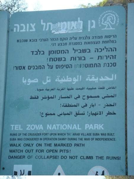
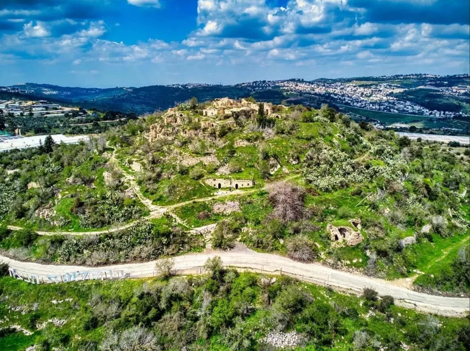
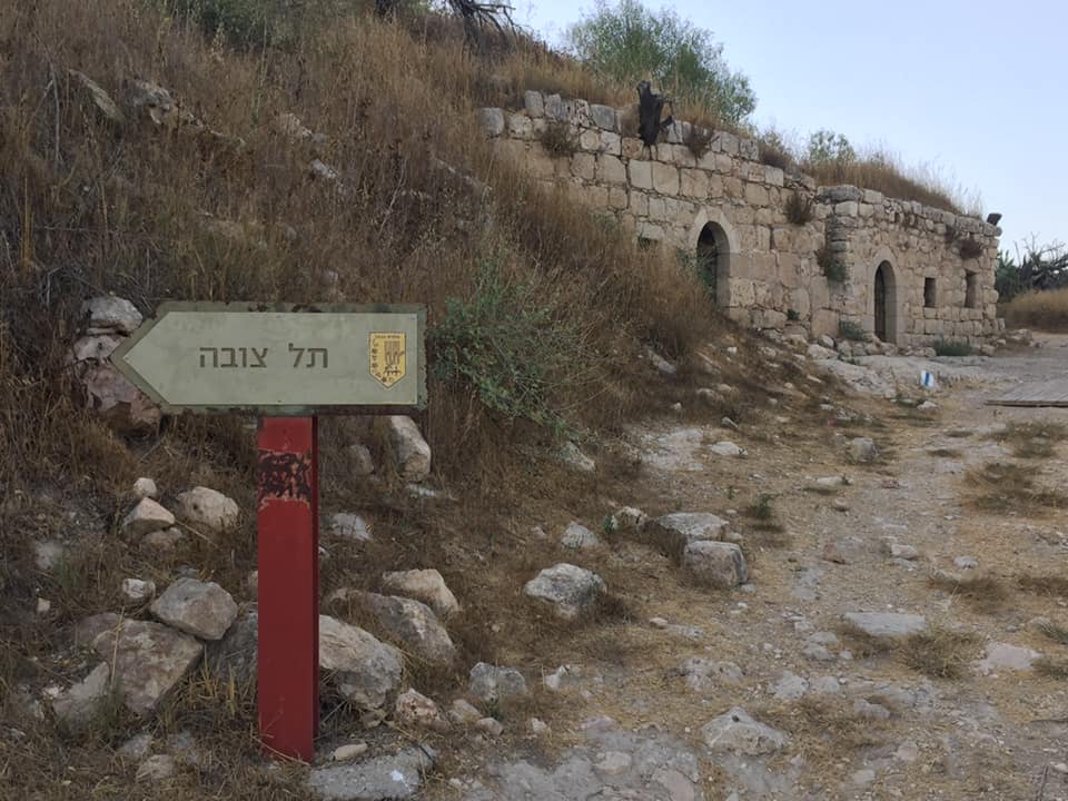
Welcome To Suba - صوبا (צובא)
|
District of Jerusalem
Ethnically cleansed days ago |
العربية Google Earth |
 |
Gallery (336) |
- Statistics & Facts
-
Before & After

- Satellite View
- Articles 41
- Pictures 336
- Aerial Views 5
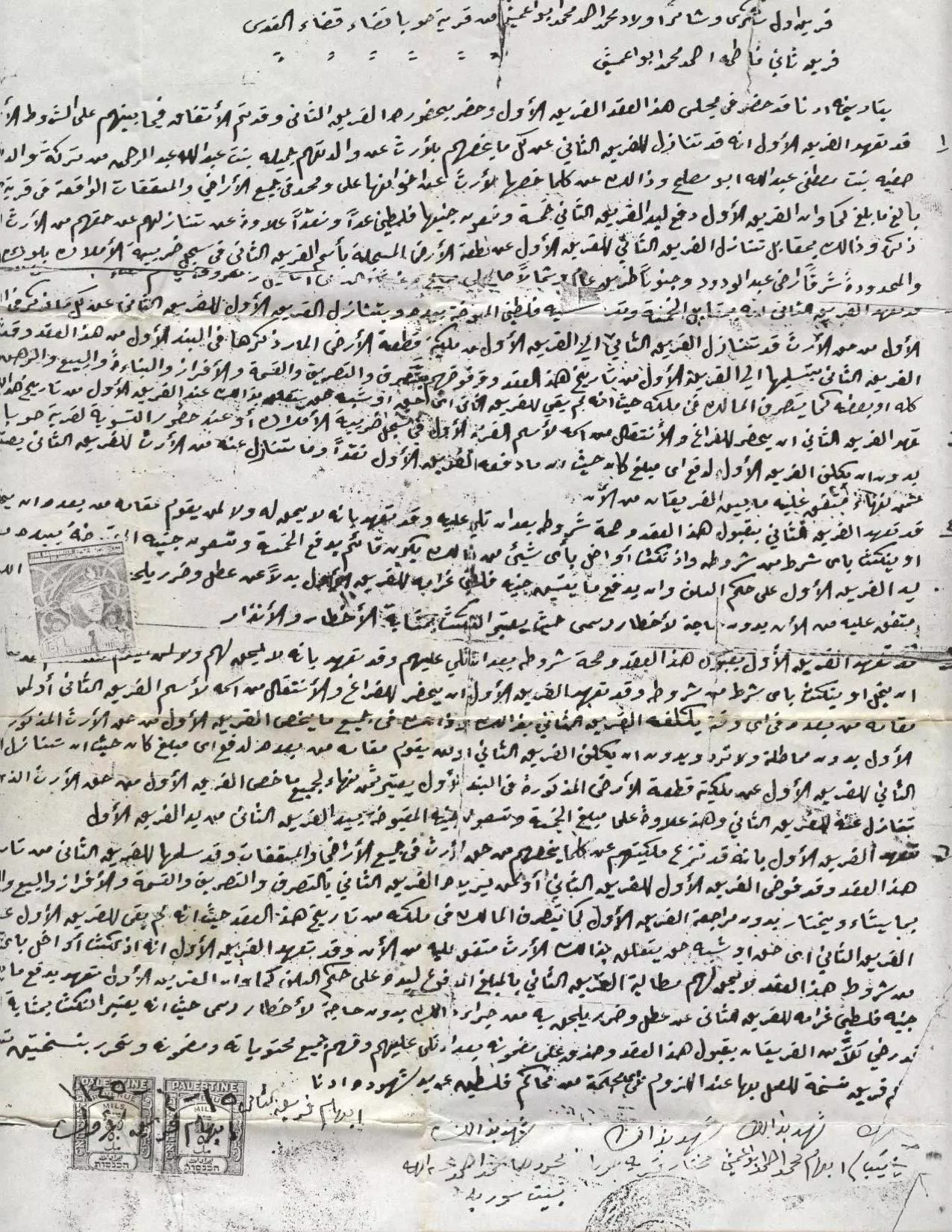
- Land Deeds 3
- Oral History 3
- Members 56
- Families
- All That Remains
- Wikipedia
- Videos 8
- Guest Book 268
- Links 1
| Statistic & Fact | Value | |||||||||||||||||||||
| Occupation Date | July 13, 1948 | |||||||||||||||||||||
| Distance From District | 10 (km) West of Jerusalem | |||||||||||||||||||||
| Elevation | 750 (meters) | |||||||||||||||||||||
| Before & After Nakba, Click Map For Details |
||||||||||||||||||||||
|
||||||||||||||||||||||
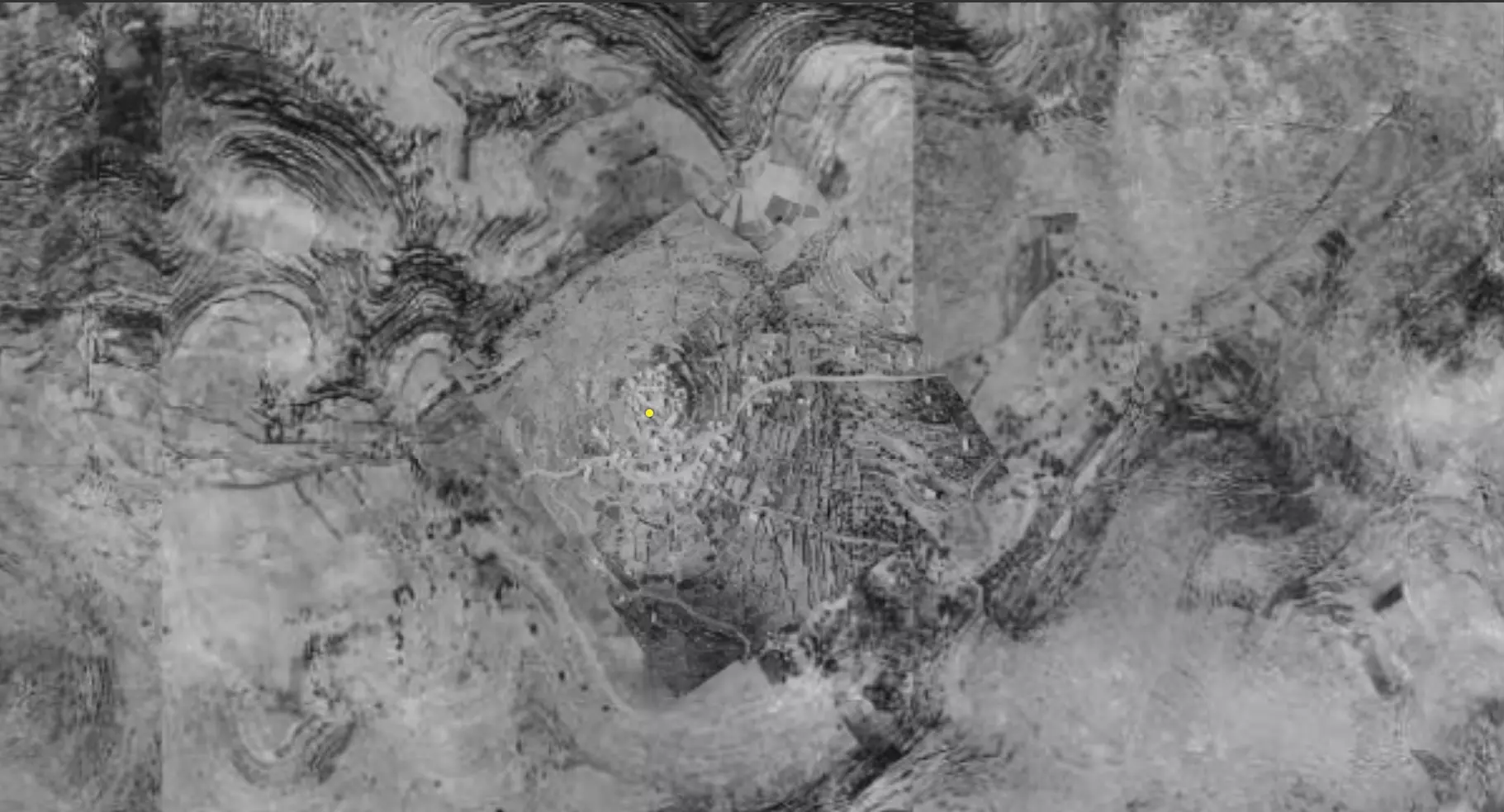
| Pre-Nakba Aerial View |
||||||||||||||||||||||
|
||||||||||||||||||||||
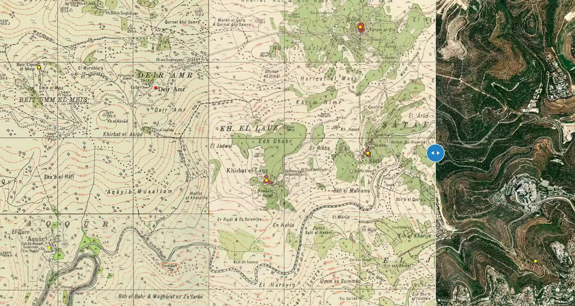
| Map Location | See location #11 on the map View from satellite |
|||||||||||||||||||||
| Military Operation | Operation Dani | |||||||||||||||||||||
| Attacking Units | Har'el Brigade | |||||||||||||||||||||
| Exodus Cause | Military assault by Zionist troops | |||||||||||||||||||||
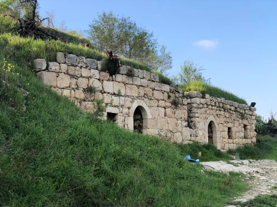
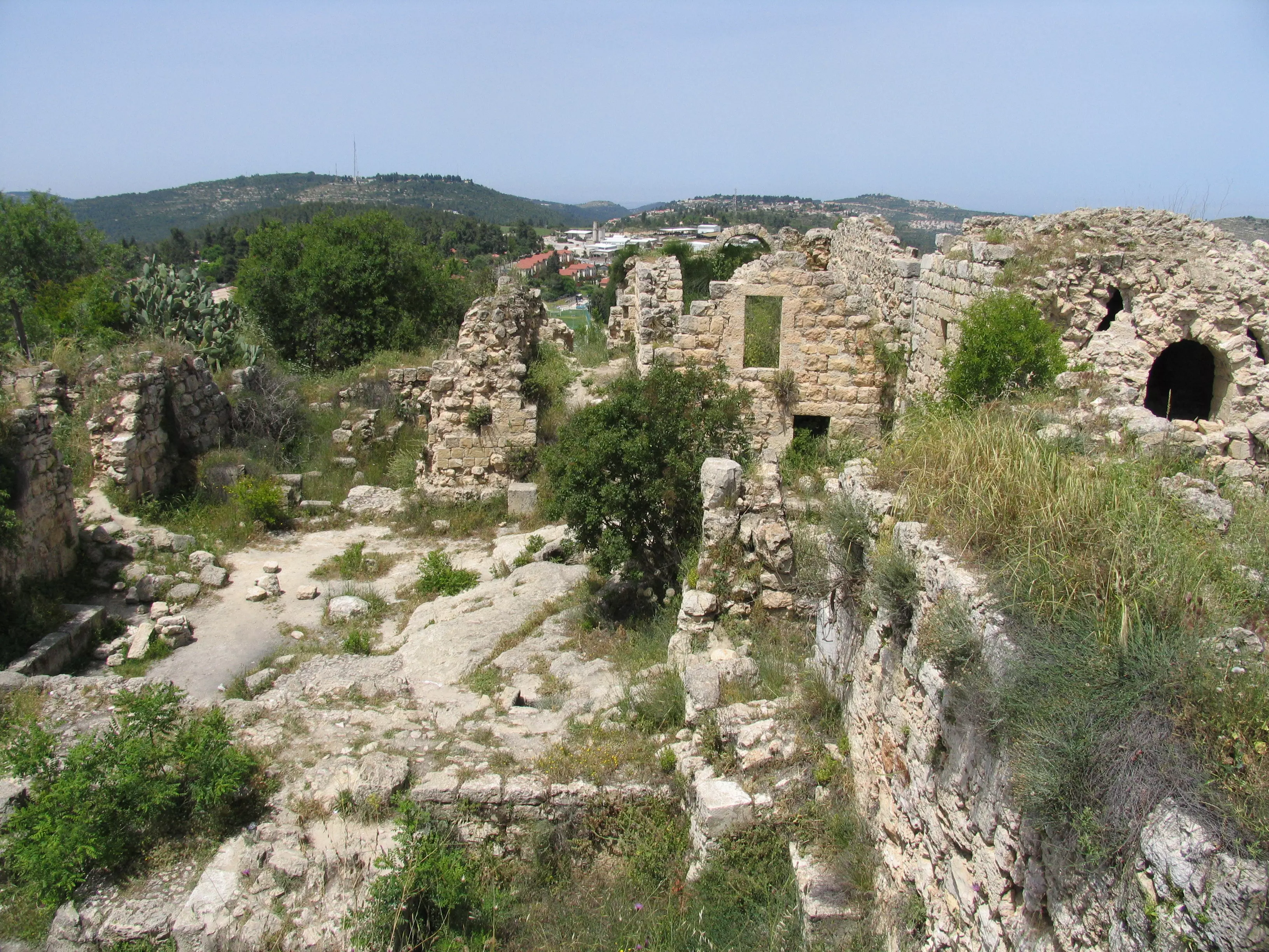
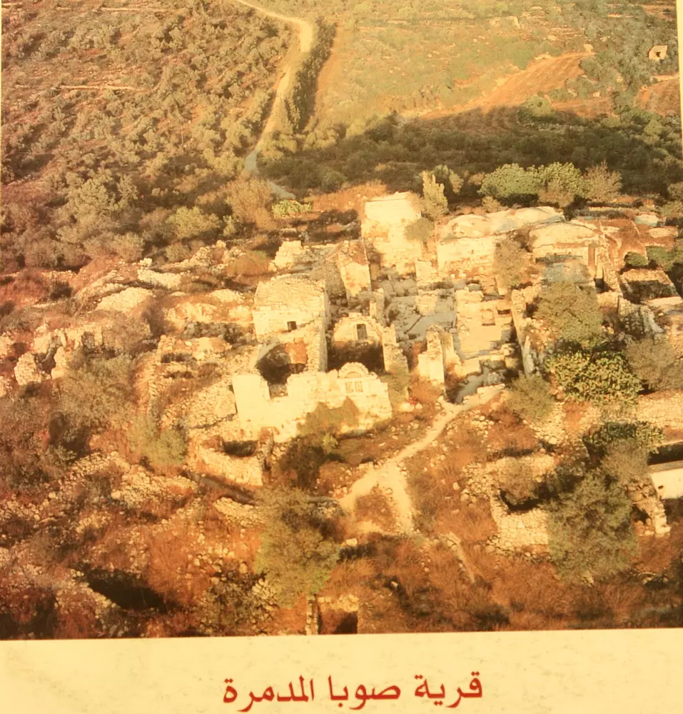
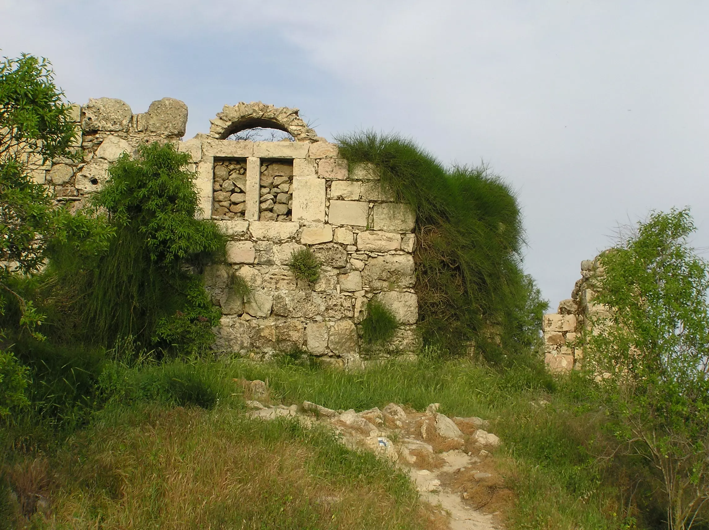
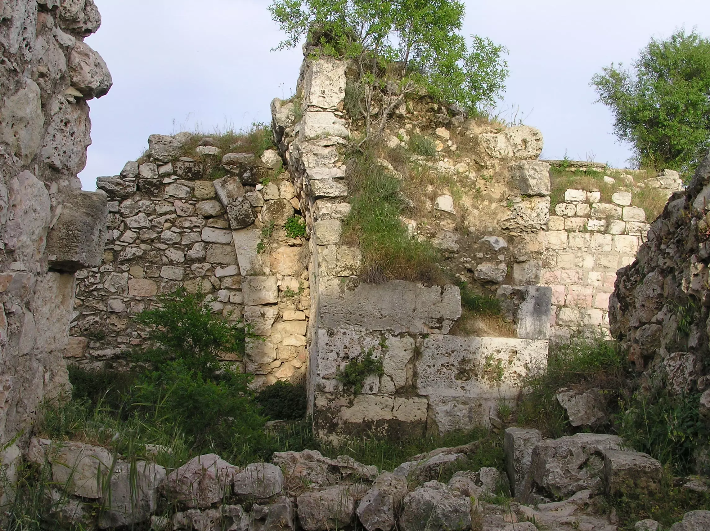
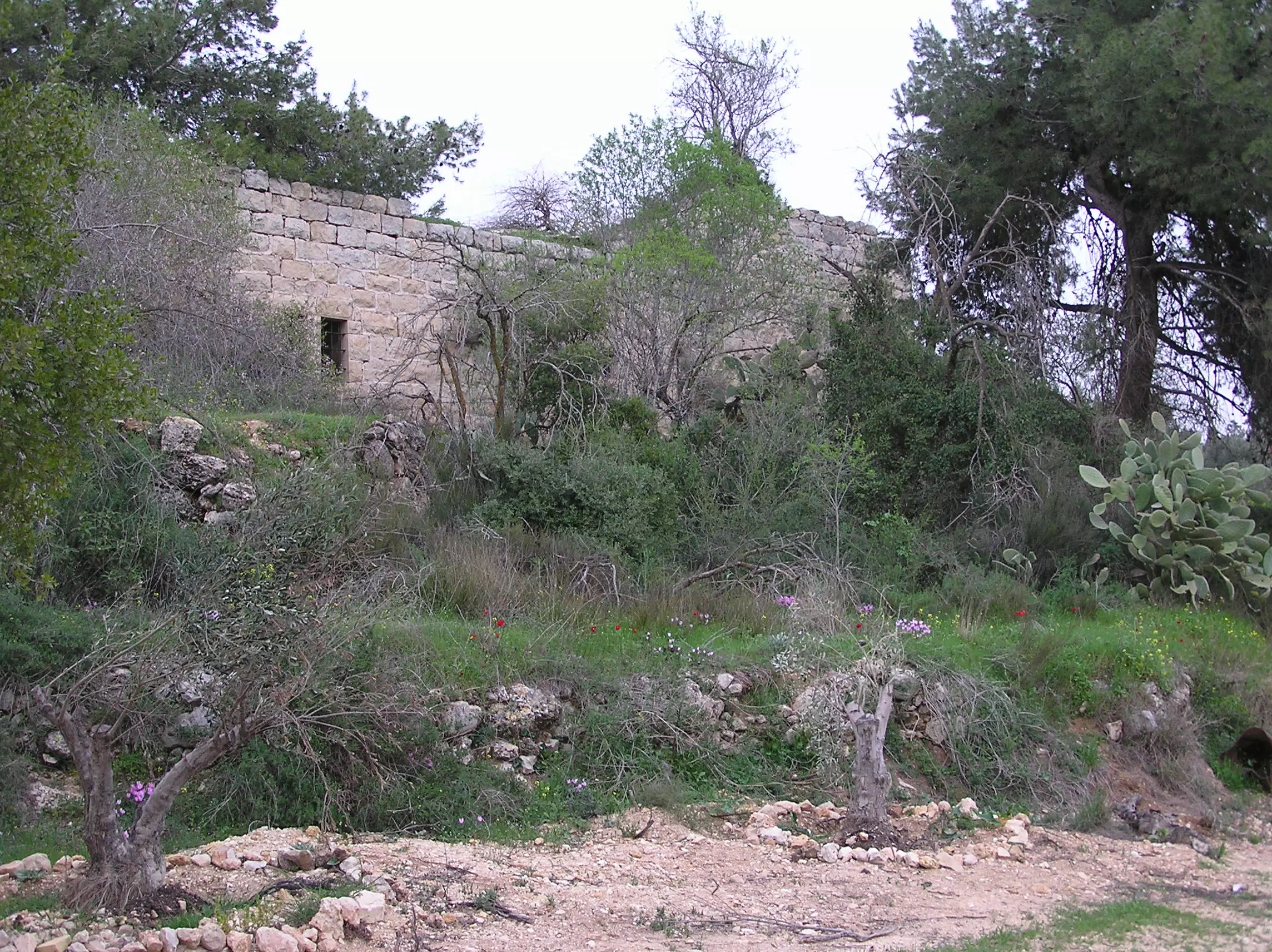
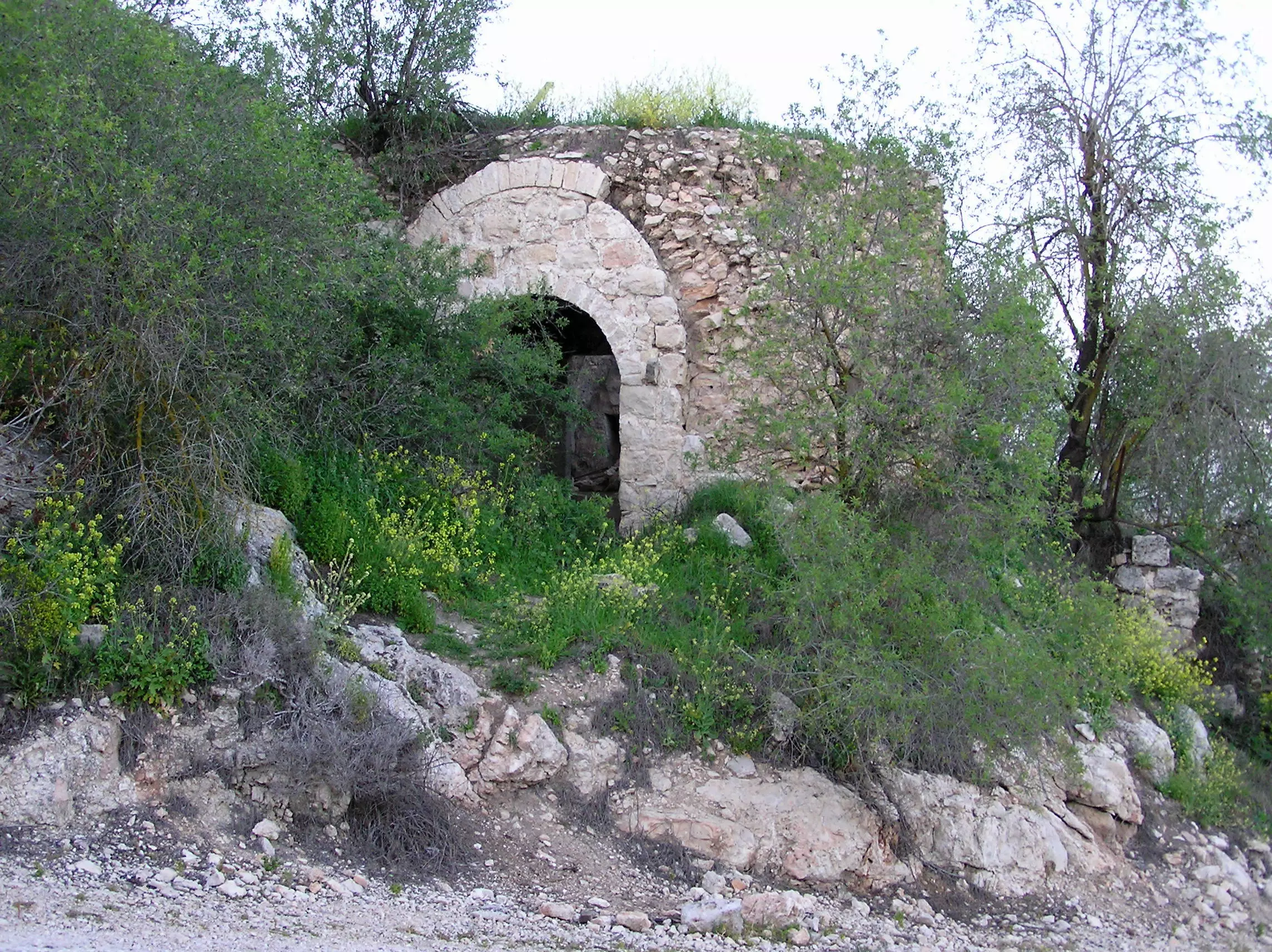
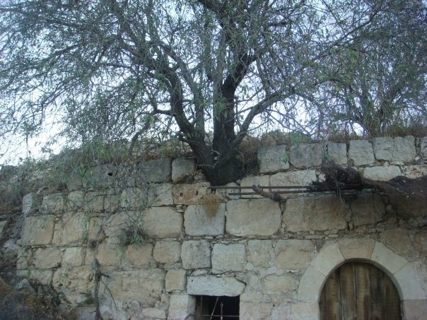
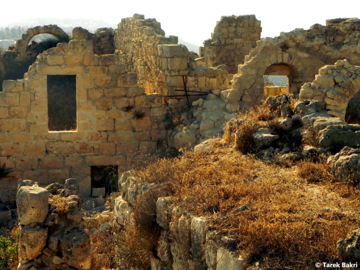
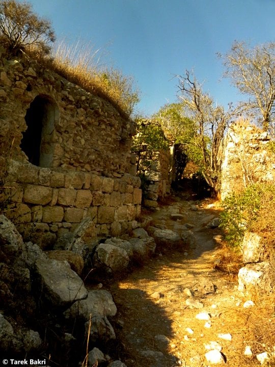
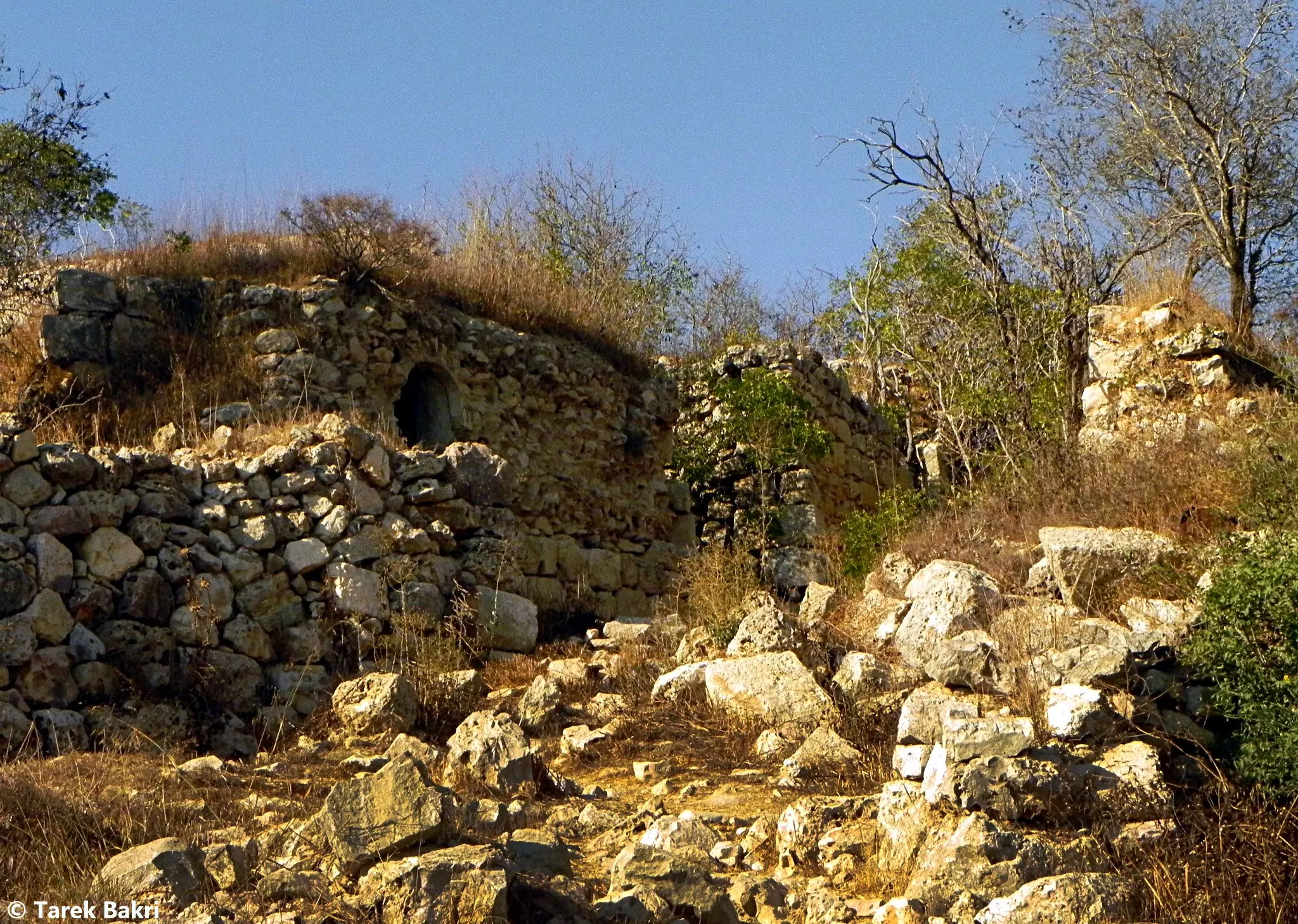
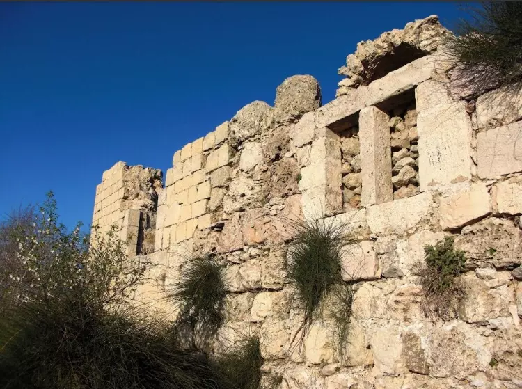
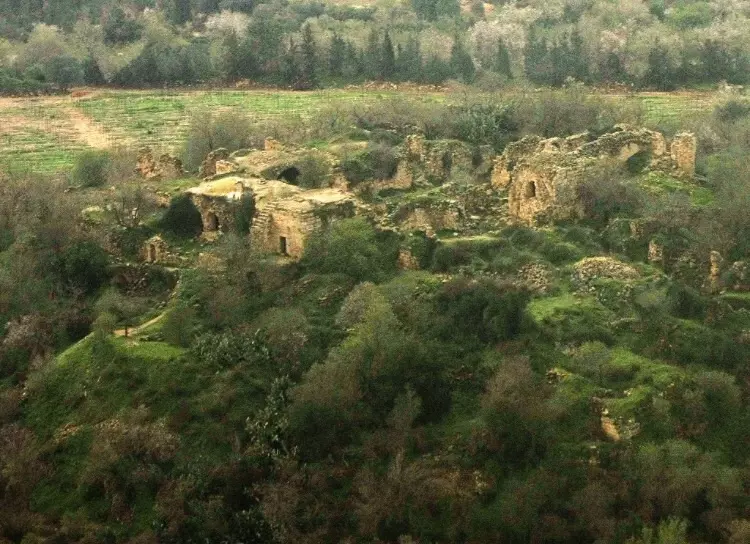
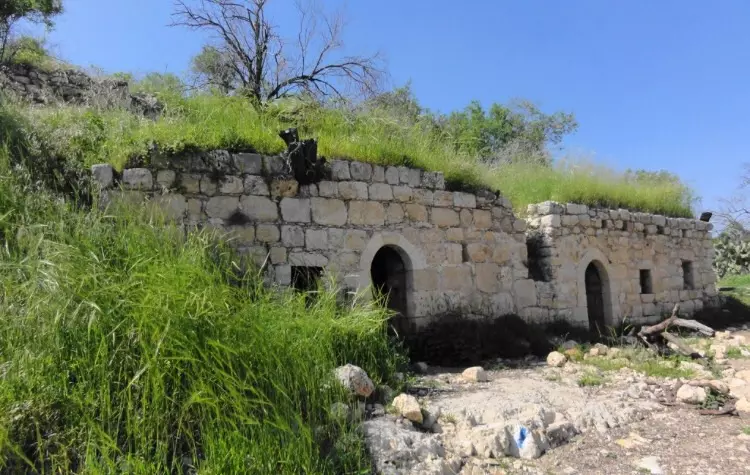
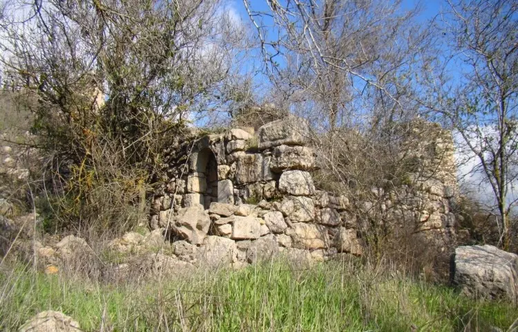
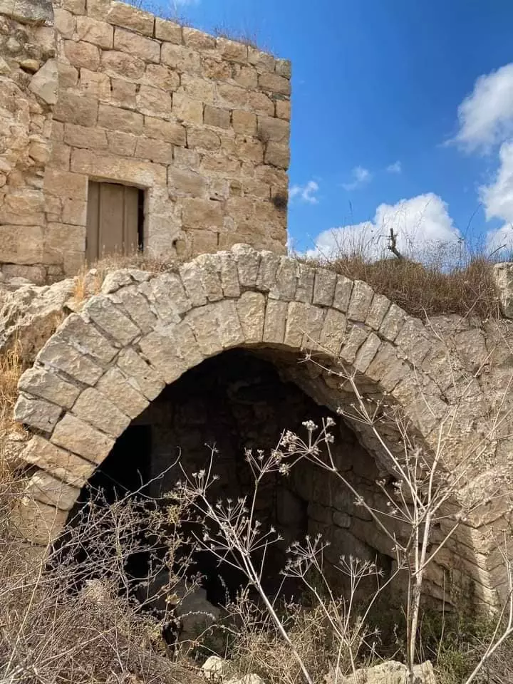
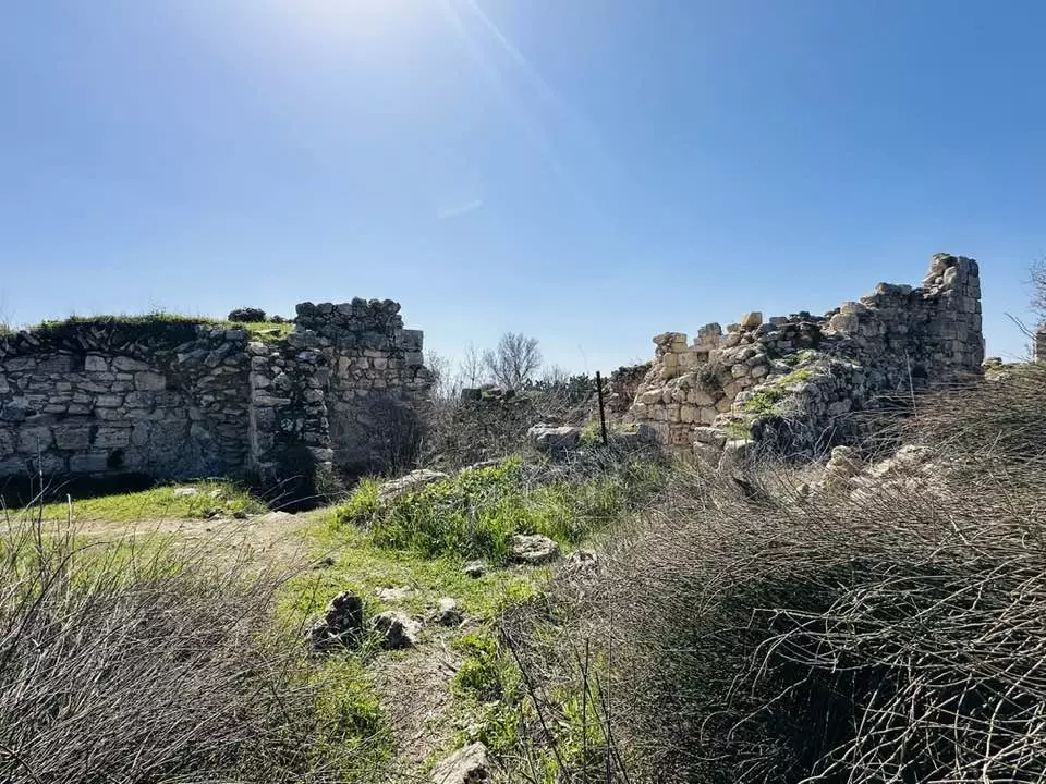
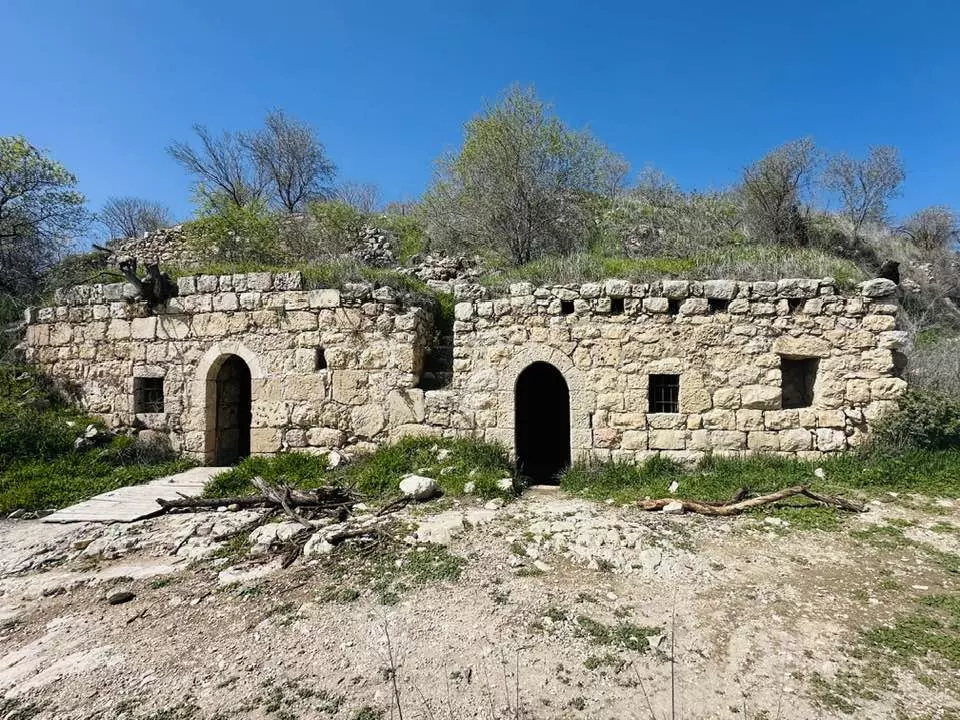
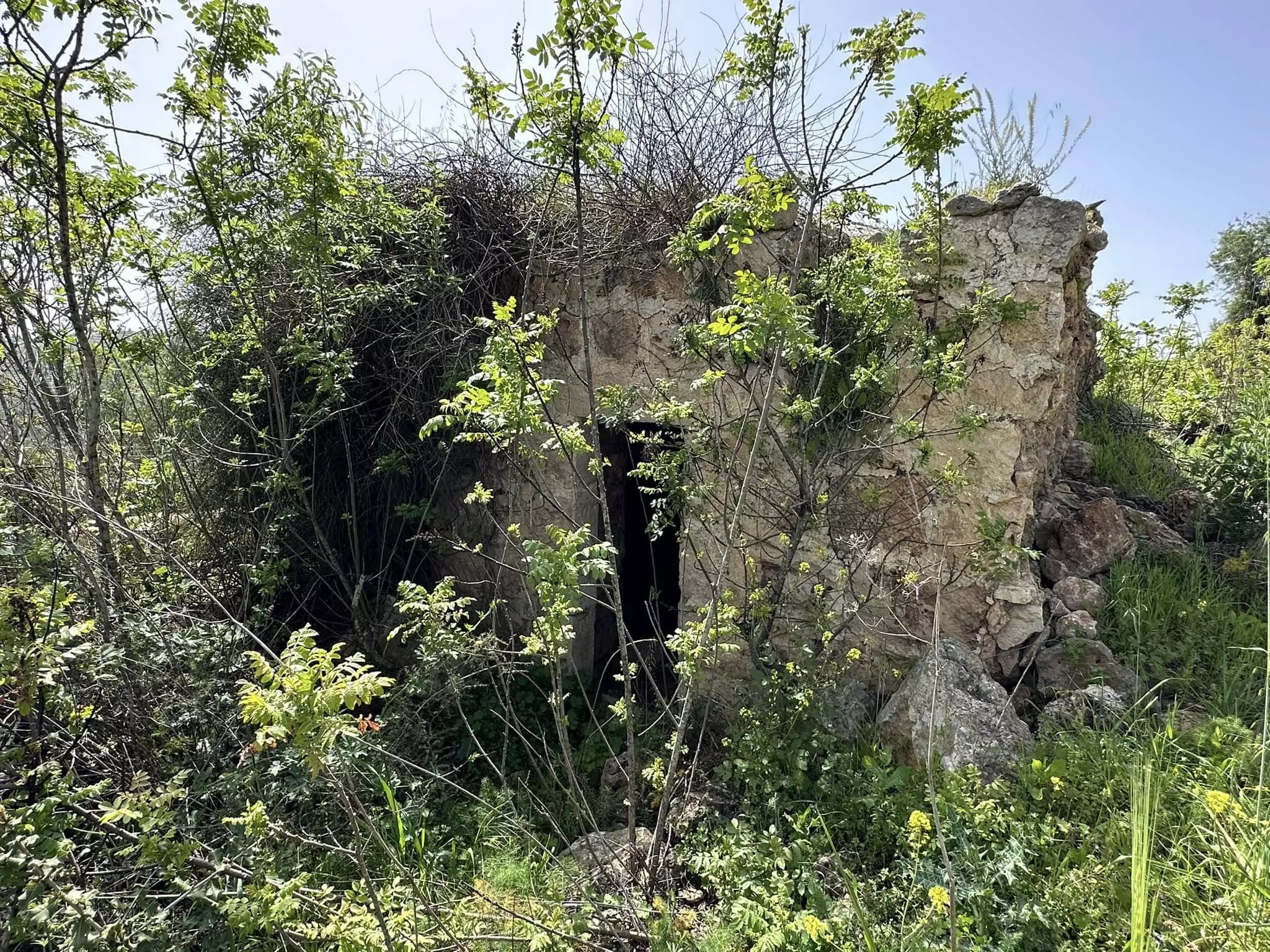
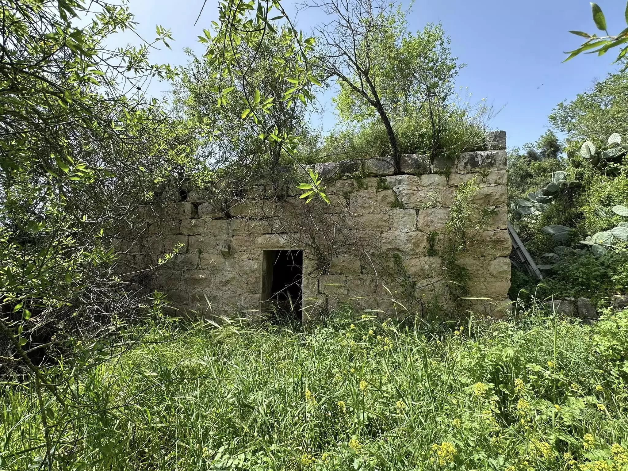
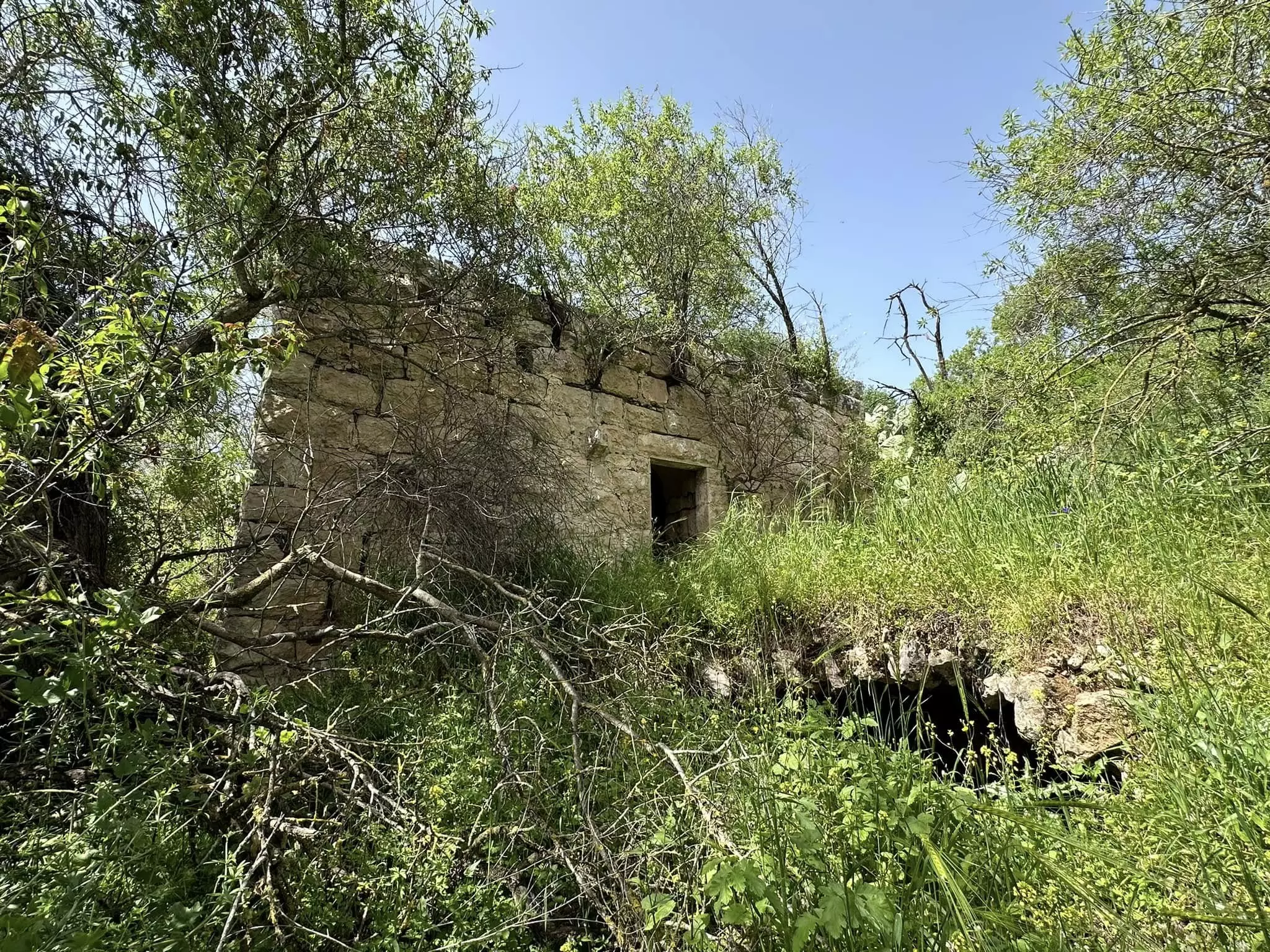
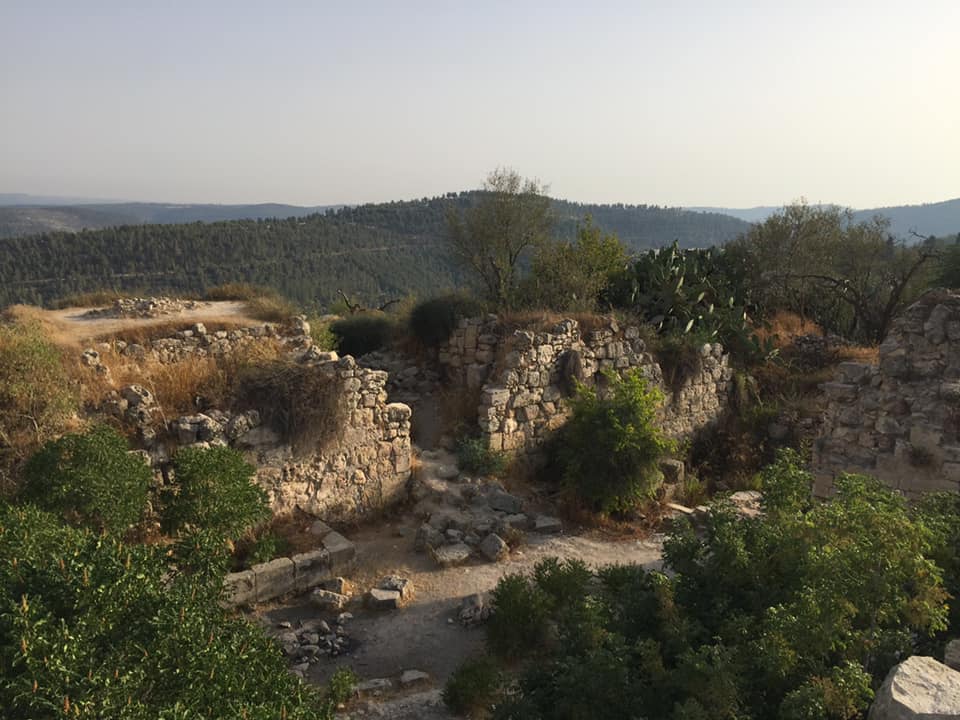
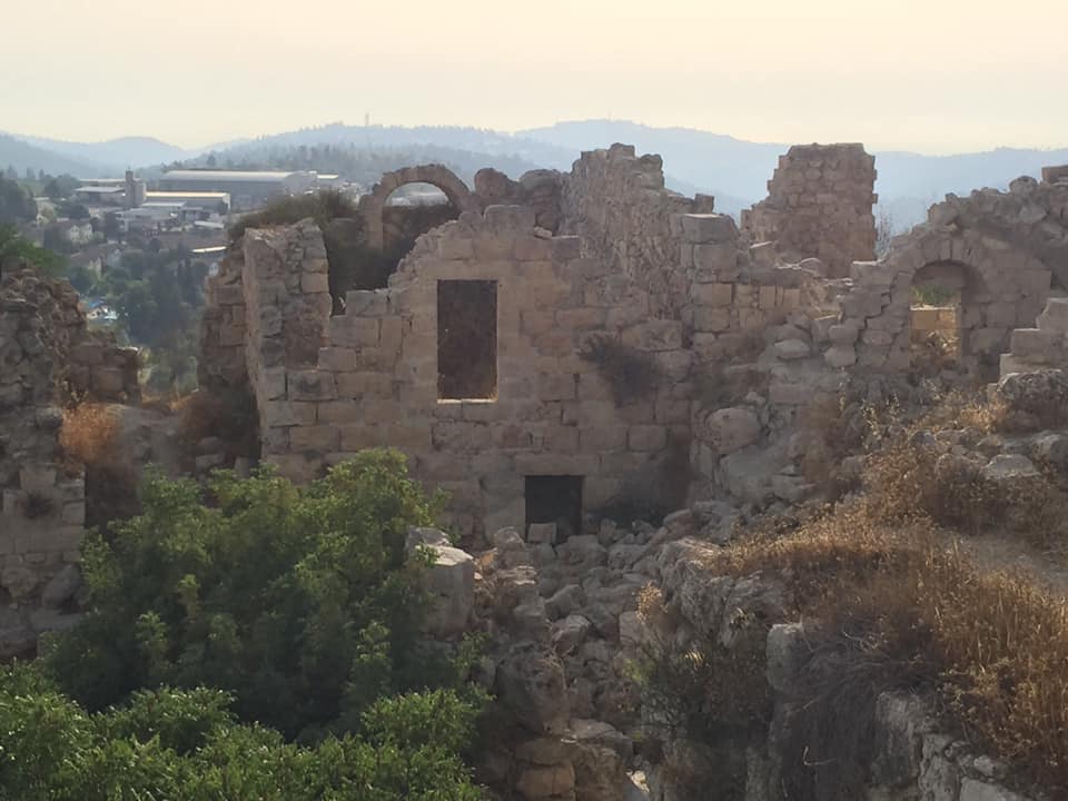
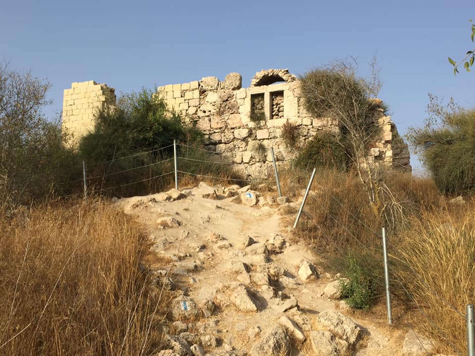
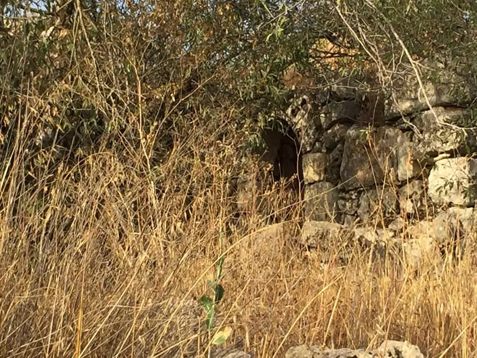
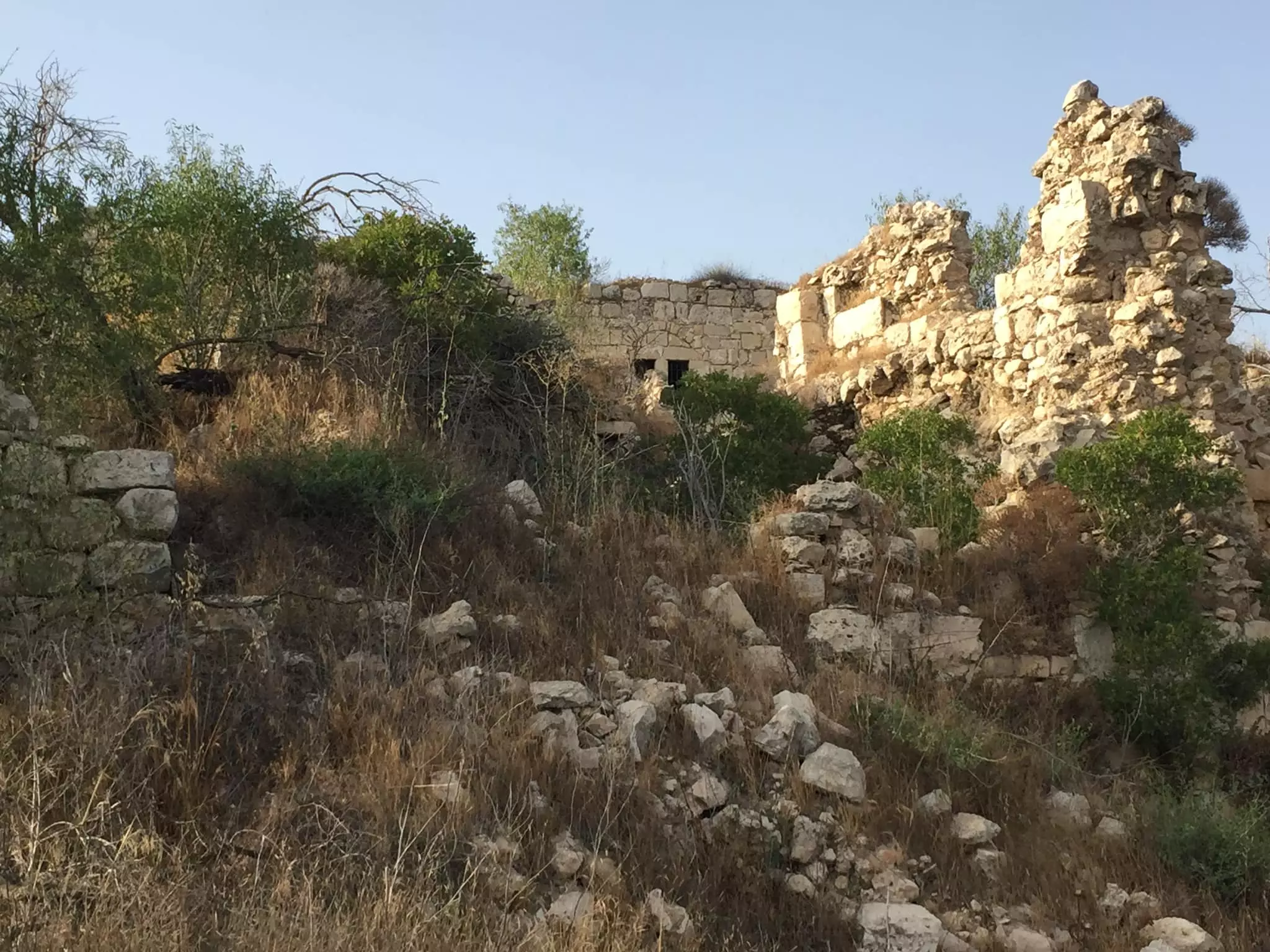
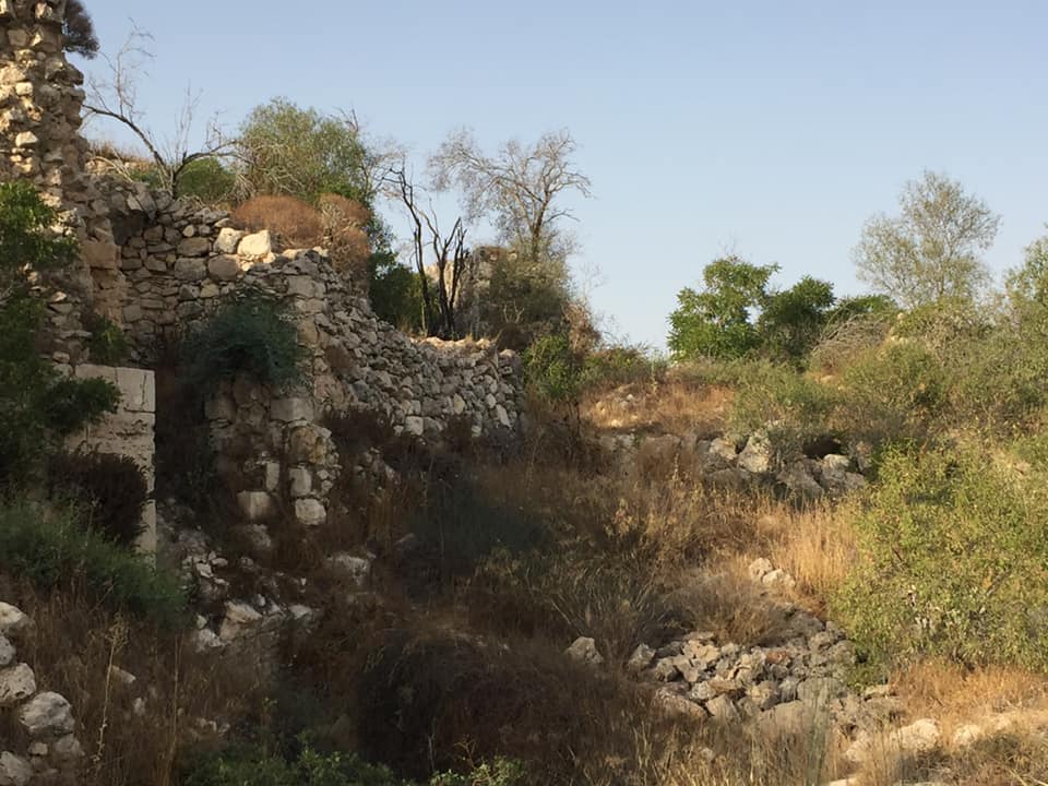
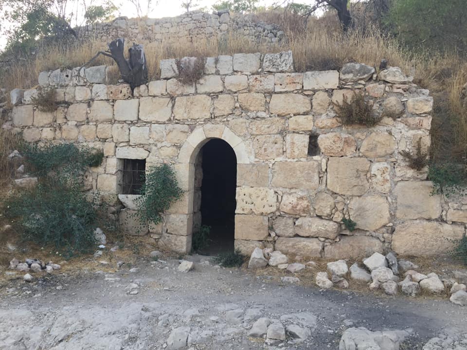
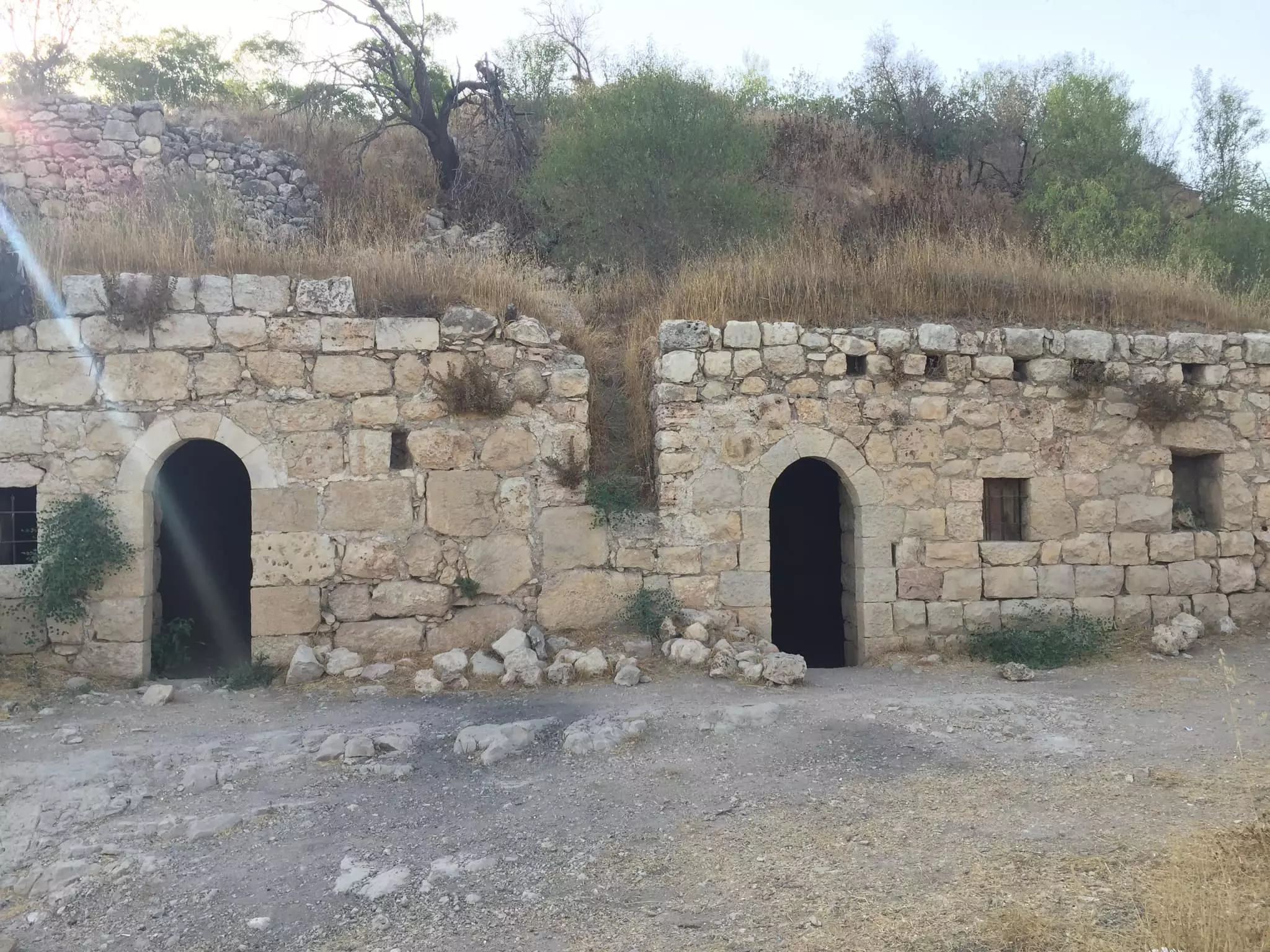
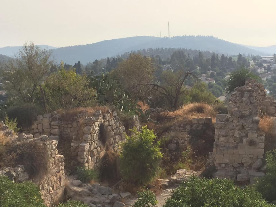
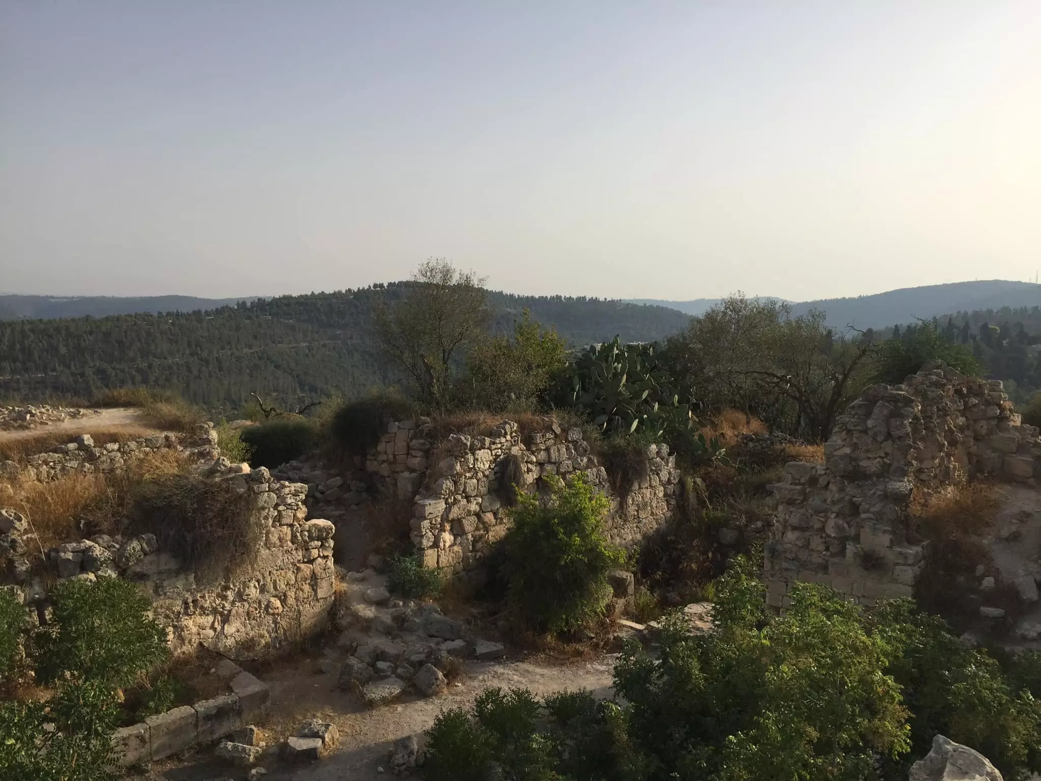
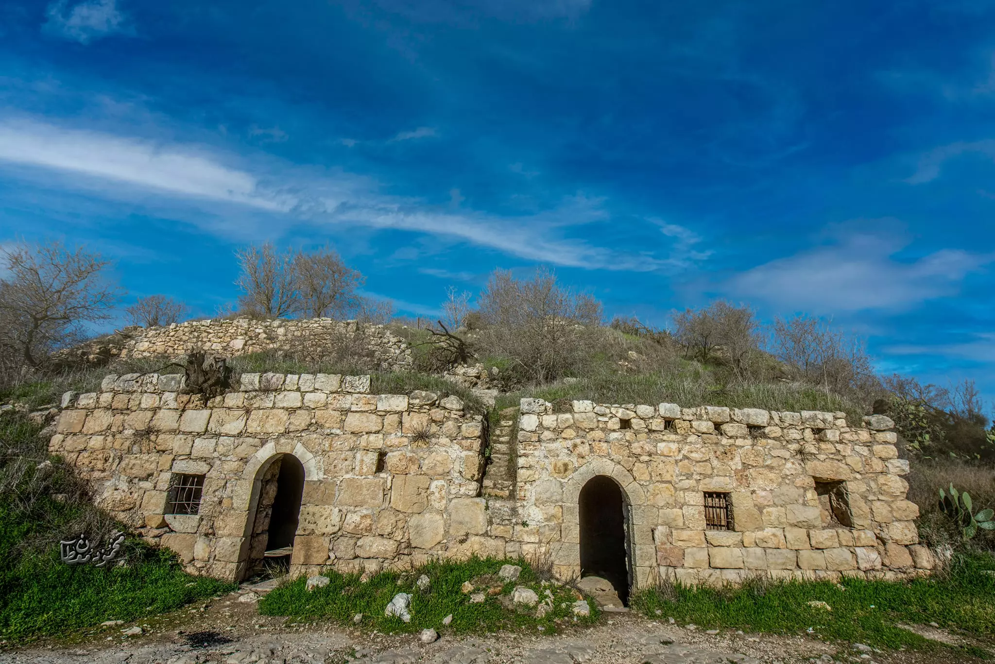
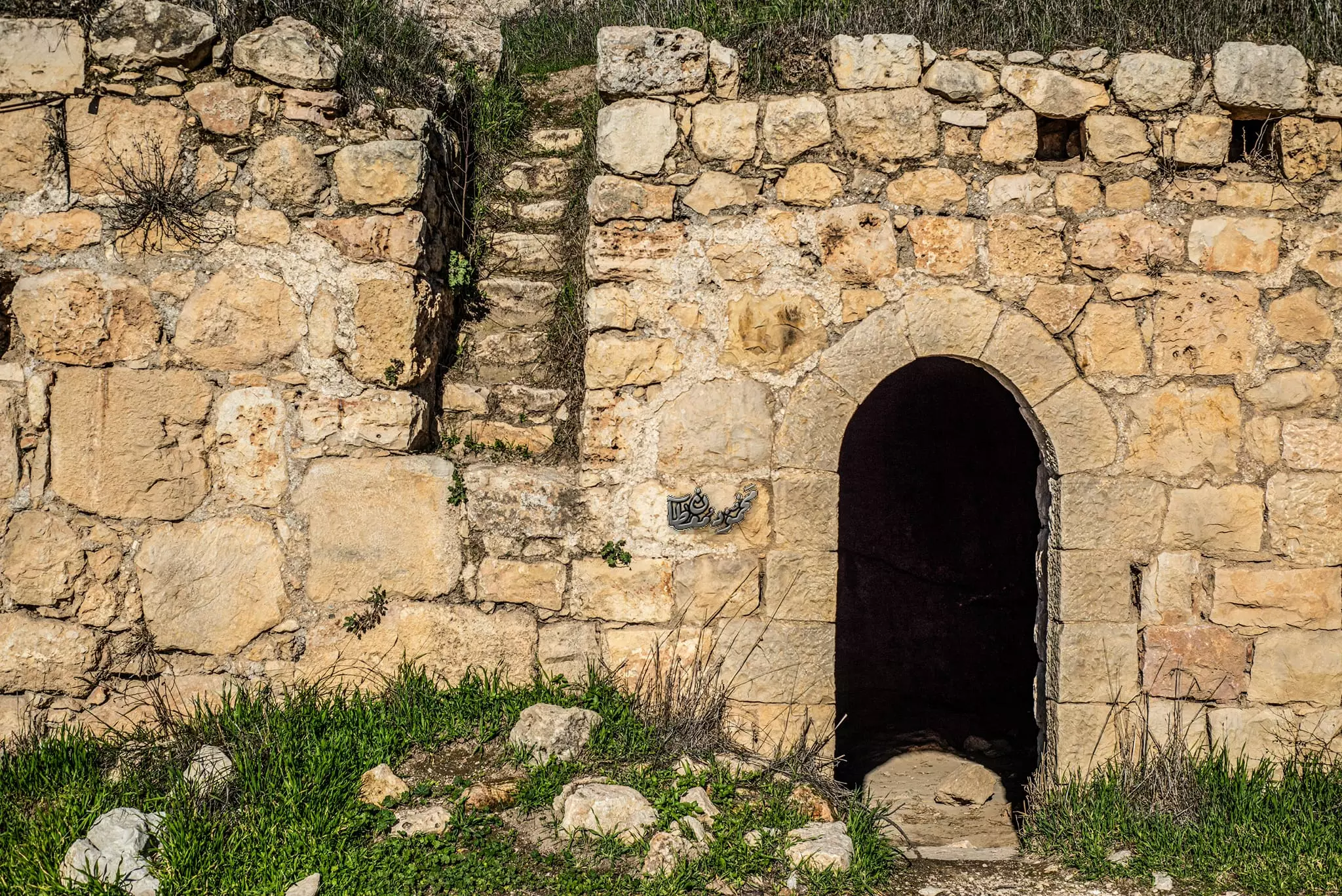
| Village Temains | Suba was mostly destroyed with the exception few deserted and partially destroyed houses. | |||||||||||||||||||||
| Ethnically Cleansing | Suba inhabitants were completely ethnically cleansed. | |||||||||||||||||||||
| Clans | Suba was controlled by the powerful Abu Ghawsh family in the mid 19th century. | |||||||||||||||||||||
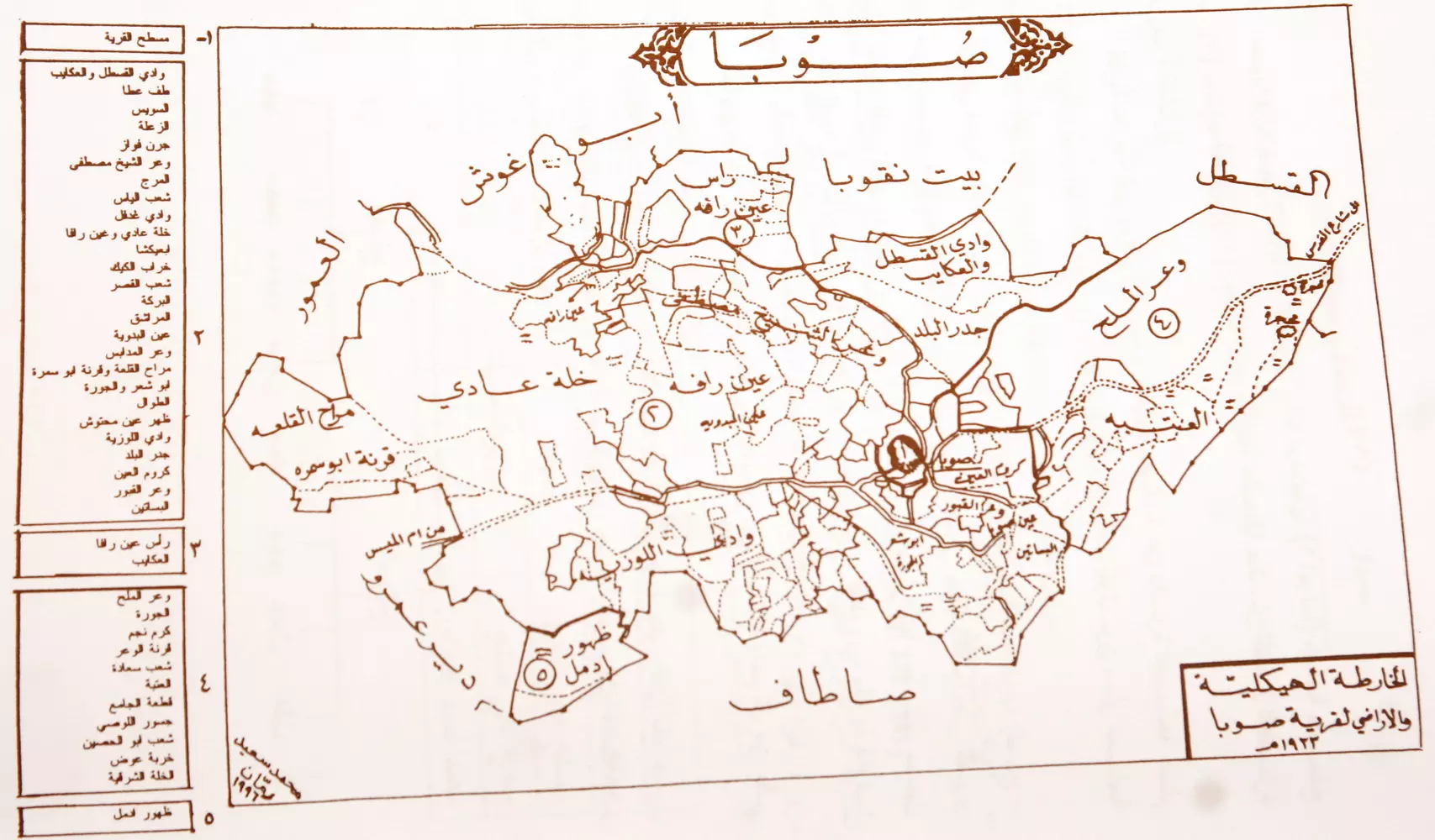
| Pre-Nakba Land Ownership |
**Town Lands' Demarcation Maps |
|||||||||||||||||||||
| Land Usage As of 1945 |
|
|||||||||||||||||||||
| Population |
|
|||||||||||||||||||||
| Number of Houses | In (1931): 110 (includes Dayr 'Amr) | |||||||||||||||||||||
| Near By Towns |
||||||||||||||||||||||
|
|
||||||||||||||||||||||
| Town's Name Through History | During the Roman period Suba was referred to by Soba or Sobetha. | |||||||||||||||||||||
| Shrines / Maqams | A shrine for a local sage known as al-Shaykh Ibrahim. | |||||||||||||||||||||
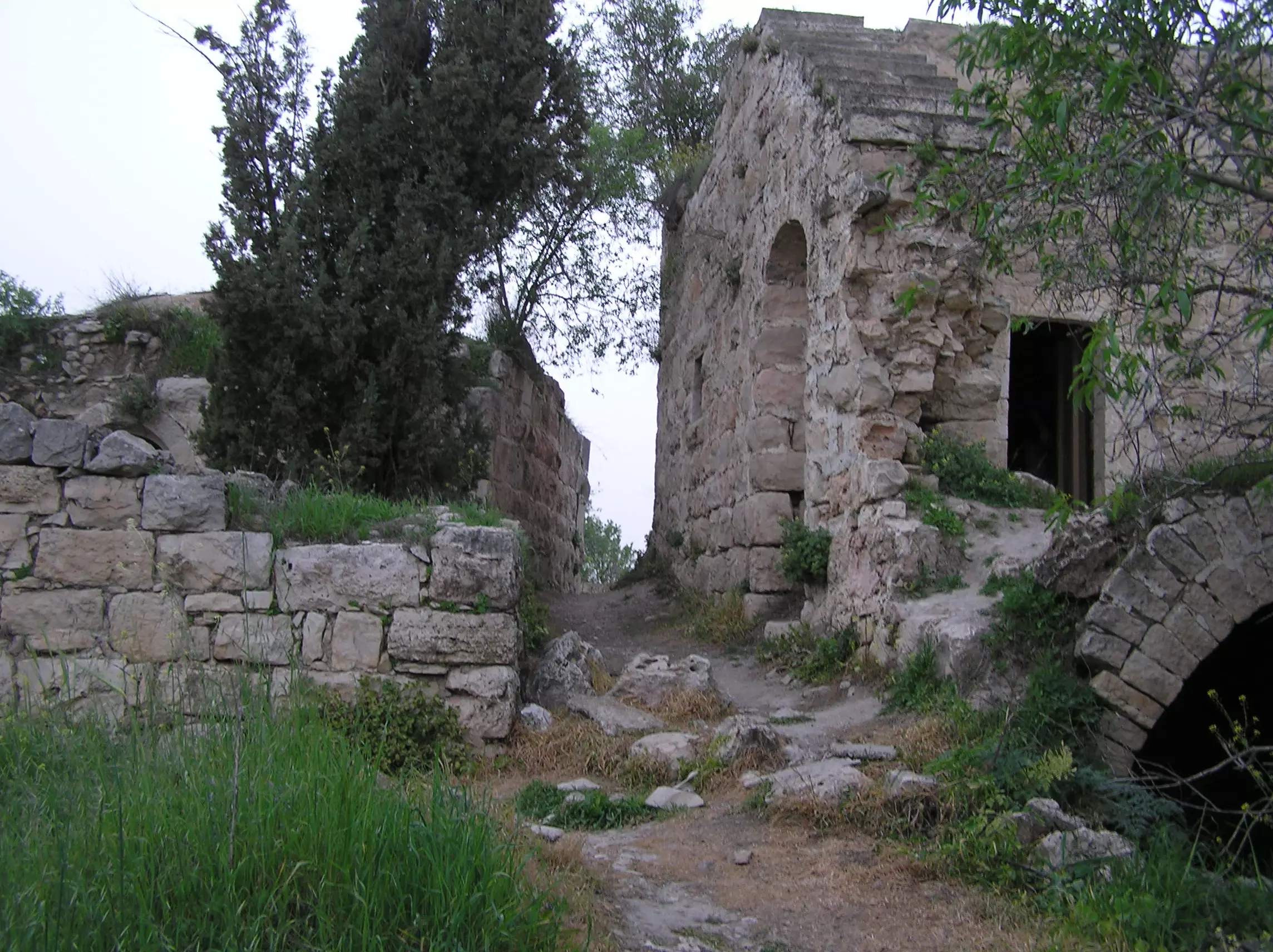
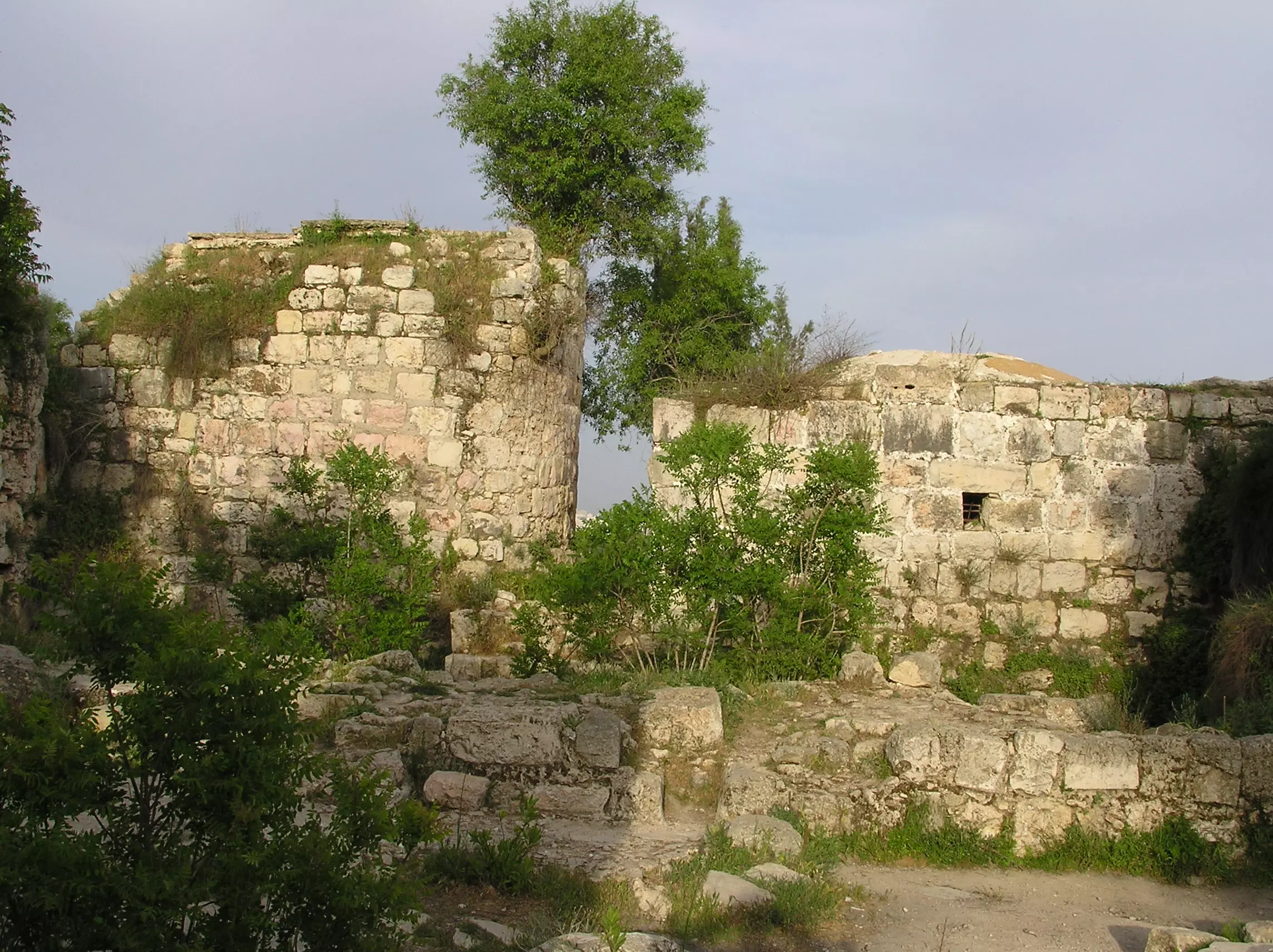
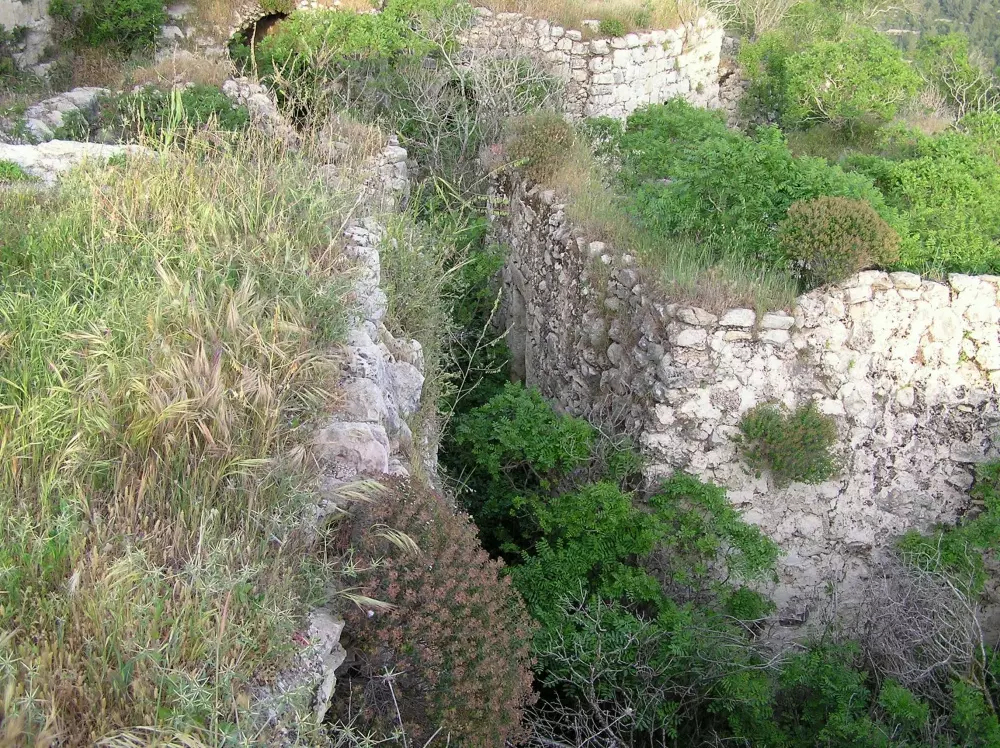
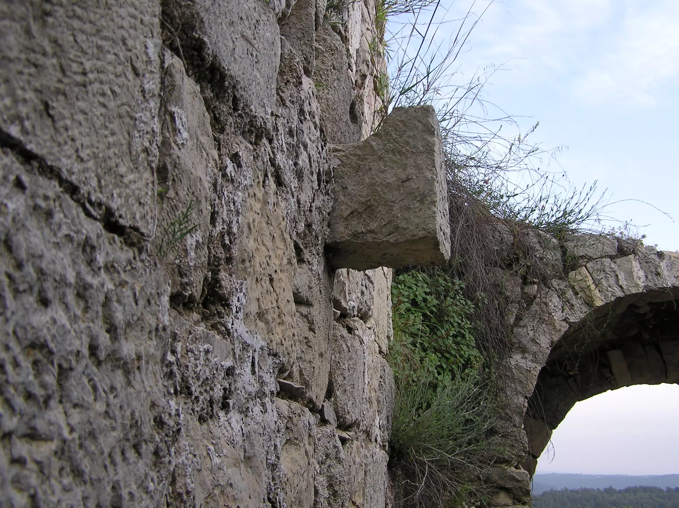
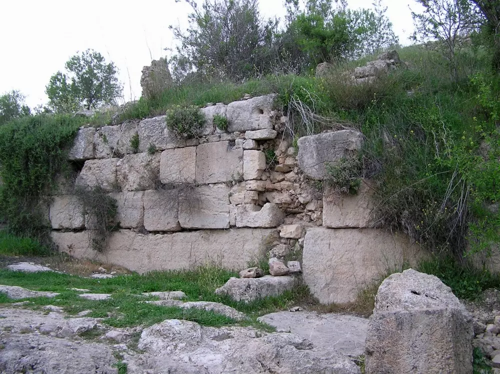
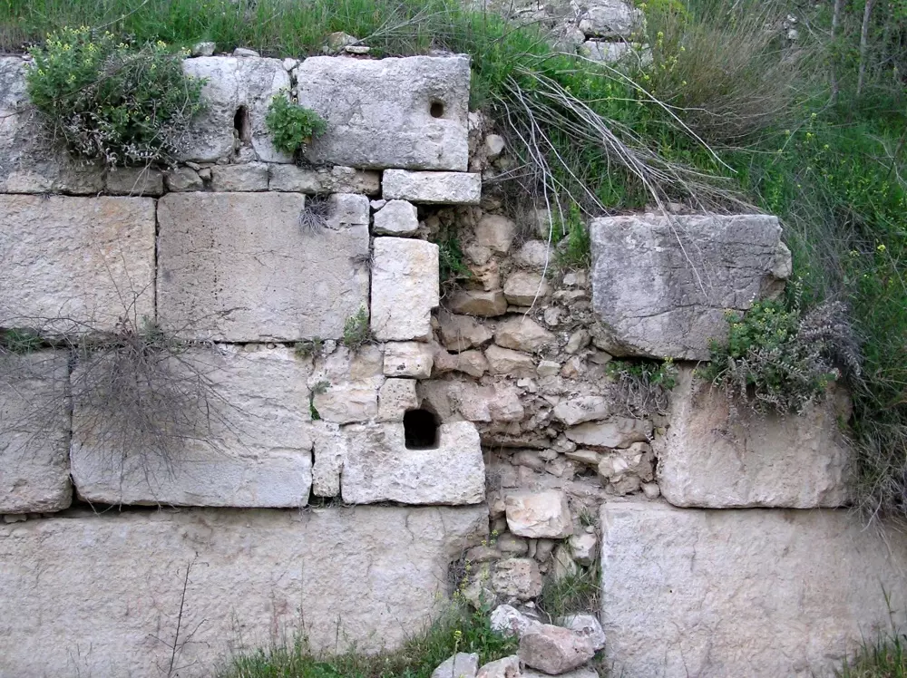
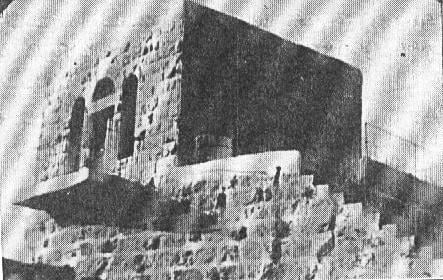
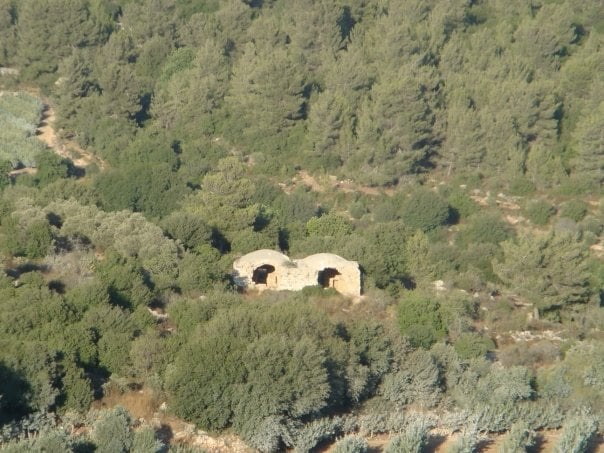
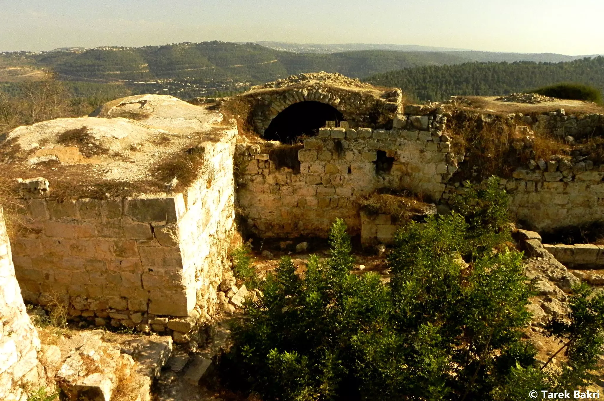
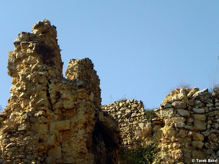
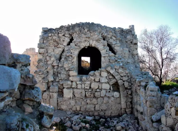
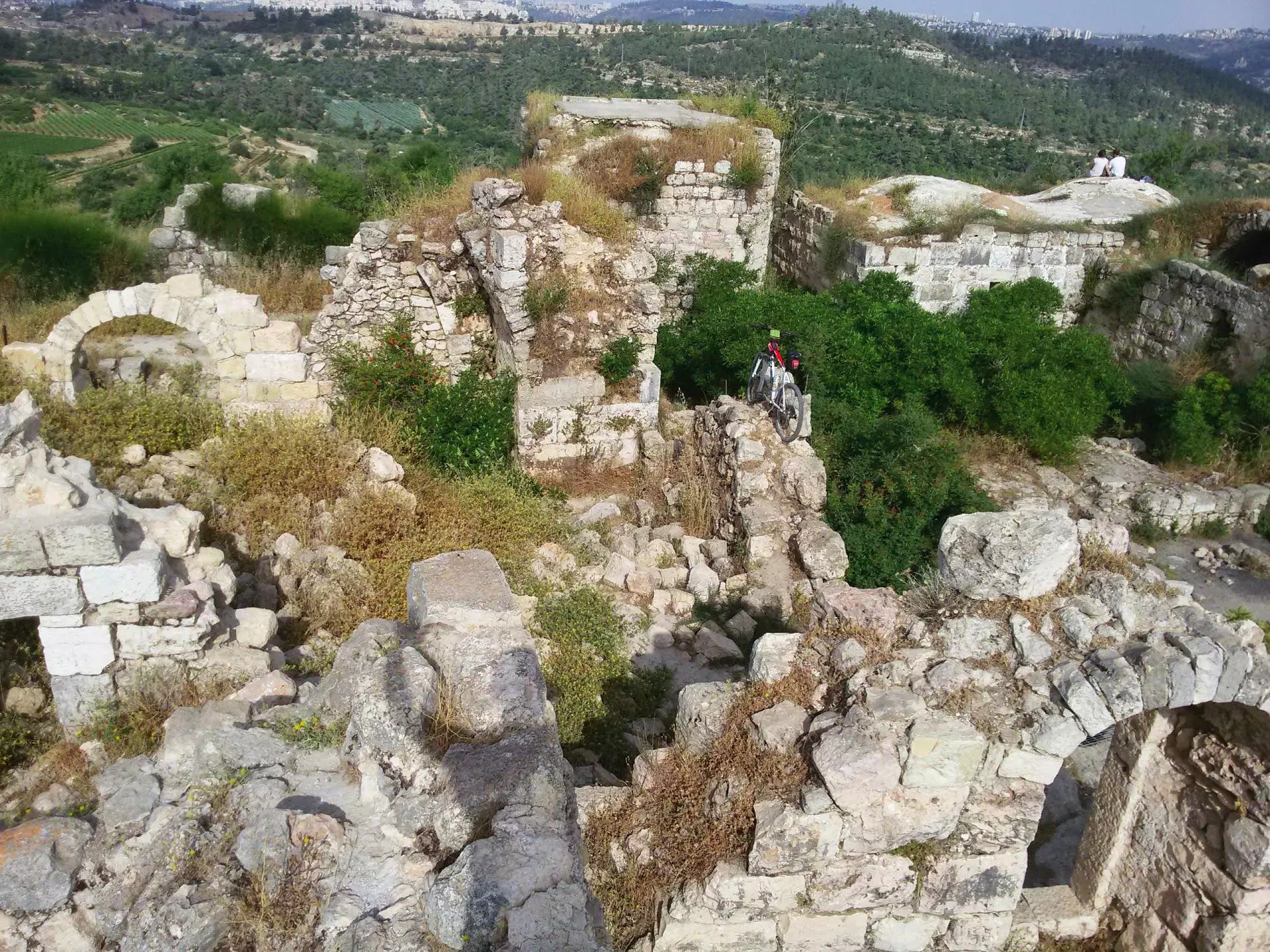
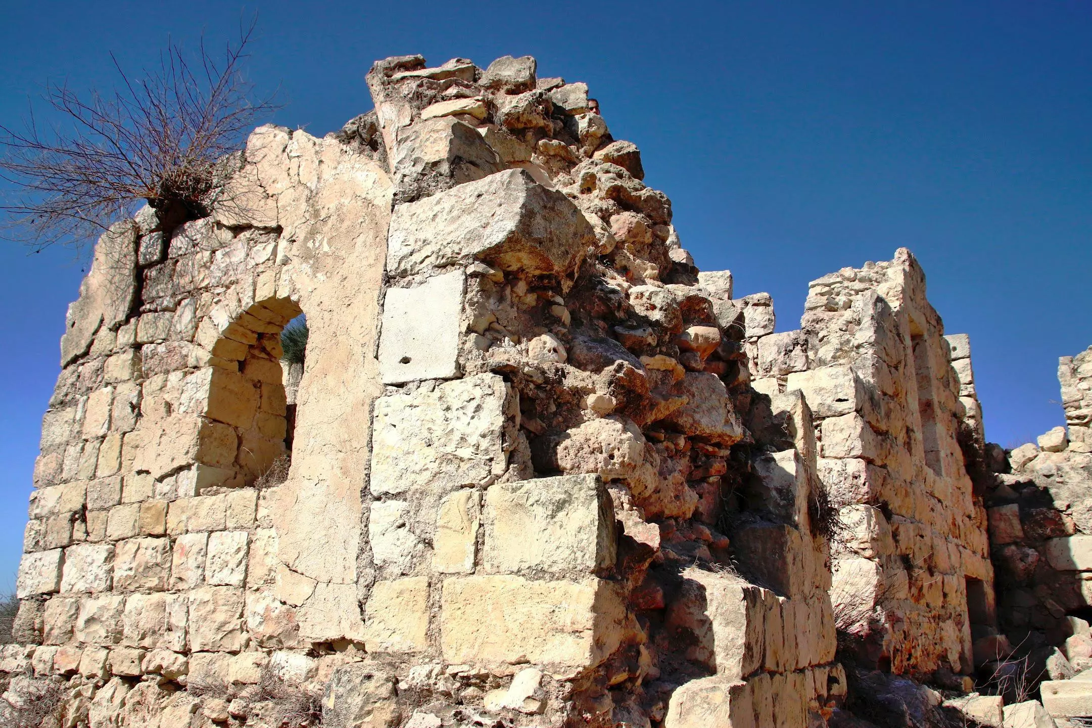
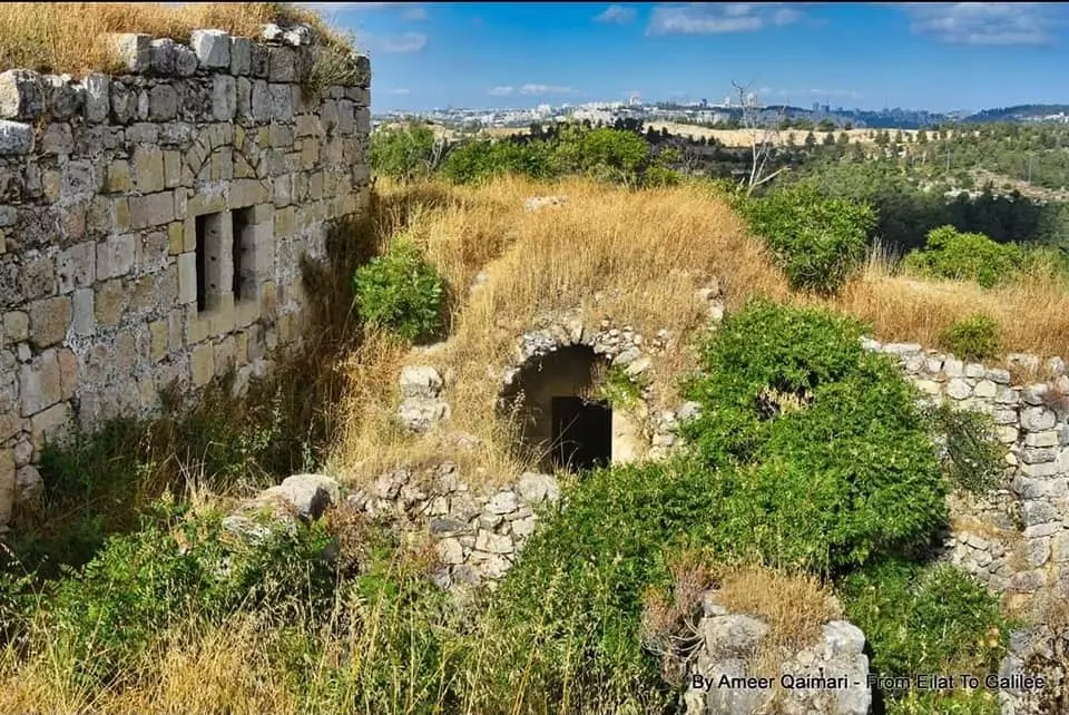
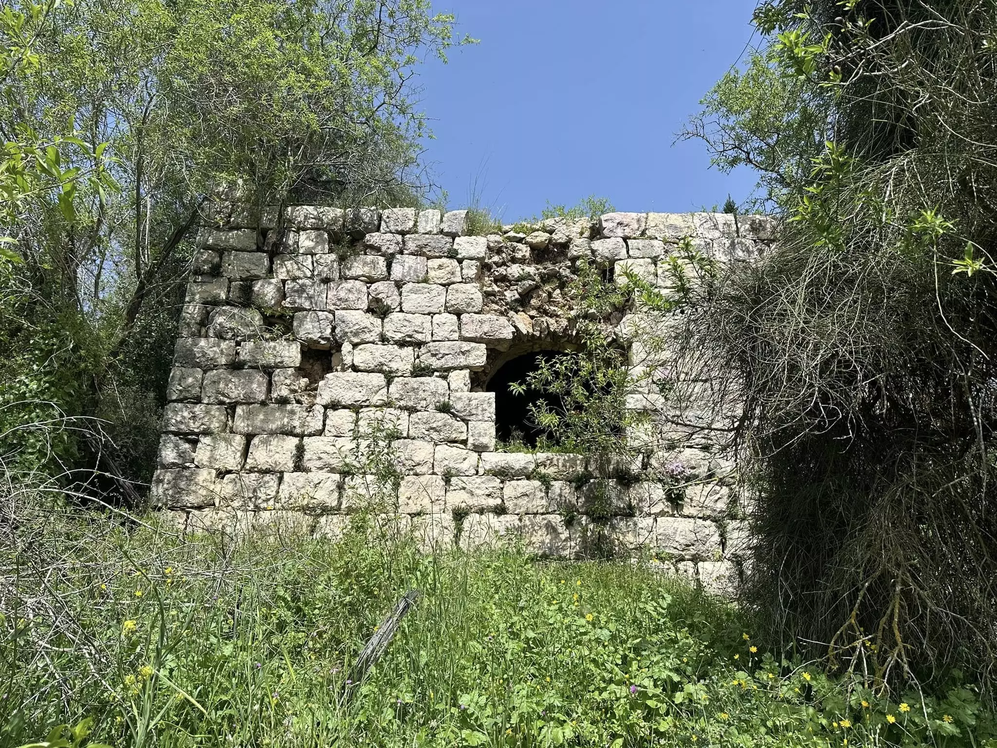
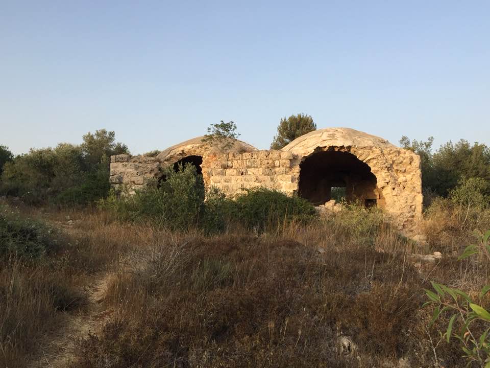
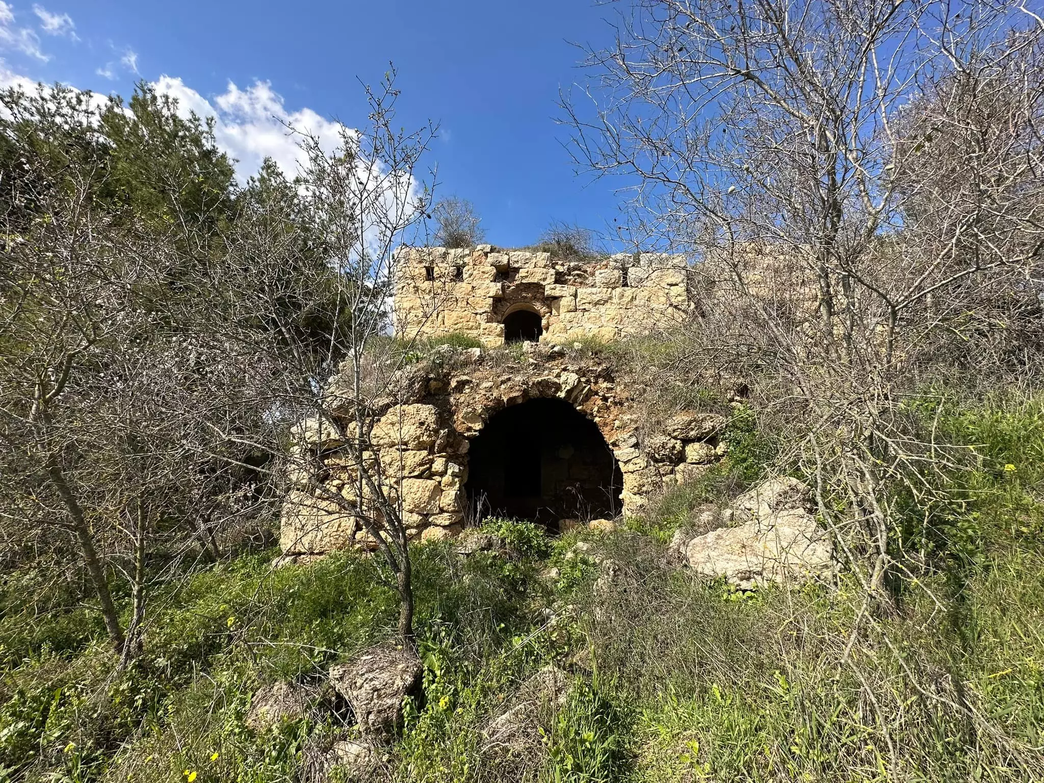
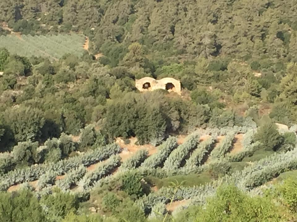
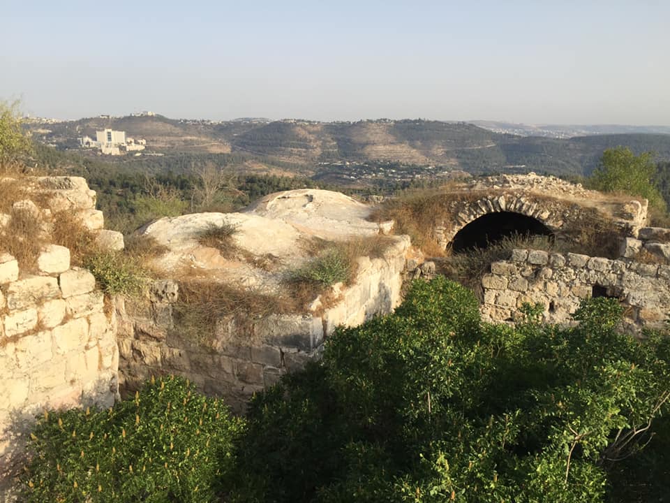
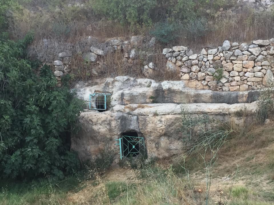
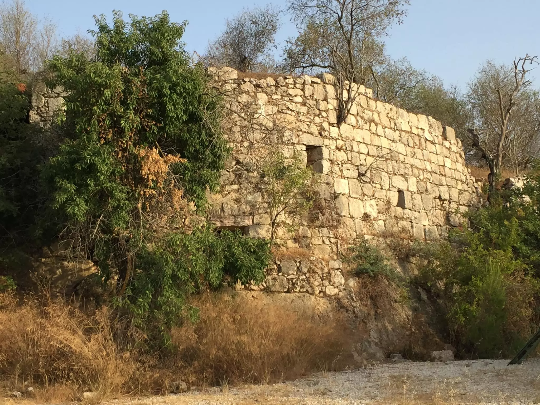
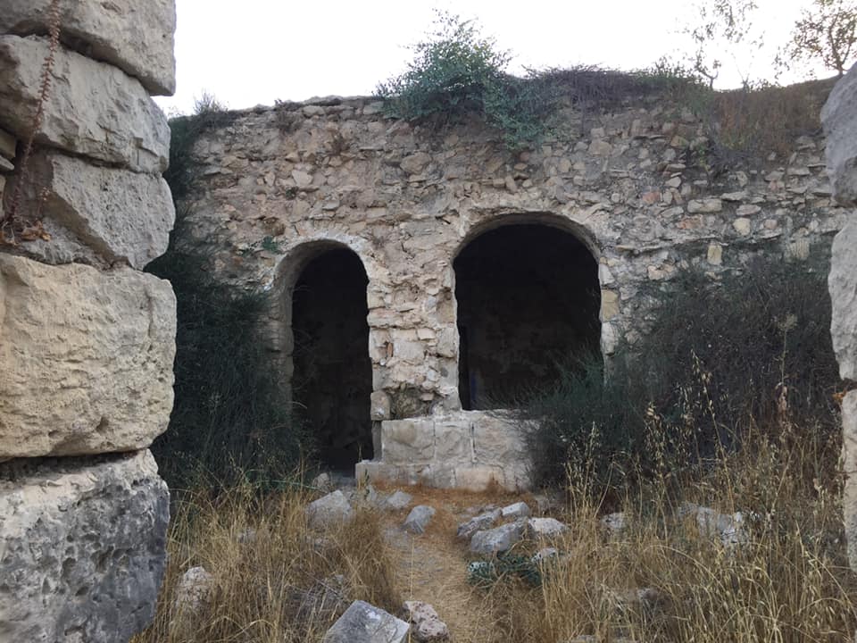
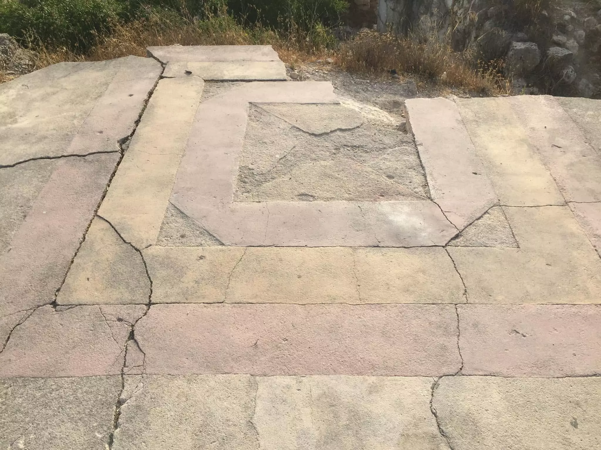
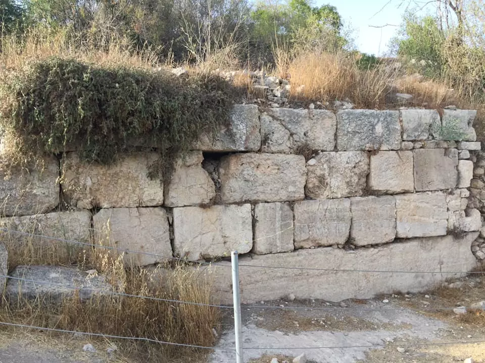
| Archeological Sites | The Abu Ghawsh family constructed a fort in Suba within the walls of the Crusader fortress. This fort, along with the walls of the Crusade fortress, were destroyed by the Egyptian General, Ibrahim Pasha, during the Egyptian champaign in Palestine in 1832. | |||||||||||||||||||||
| Exculsive Jewish Colonies Who Usurped Village Lands |
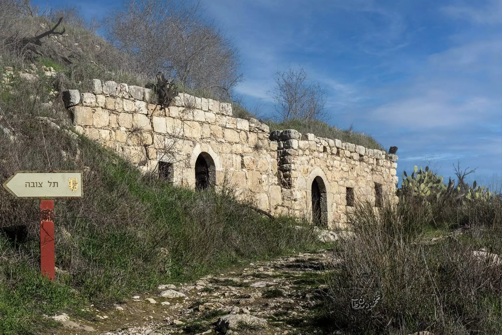
Kibbutz Tzova and a school called Yedida. | |||||||||||||||||||||
| Featured Video | ||||||||||||||||||||||
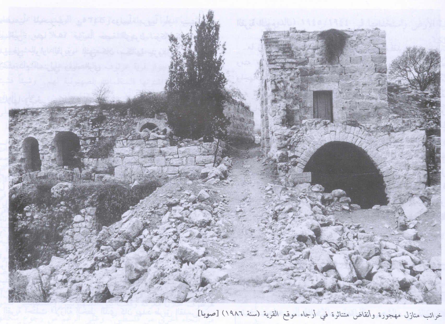
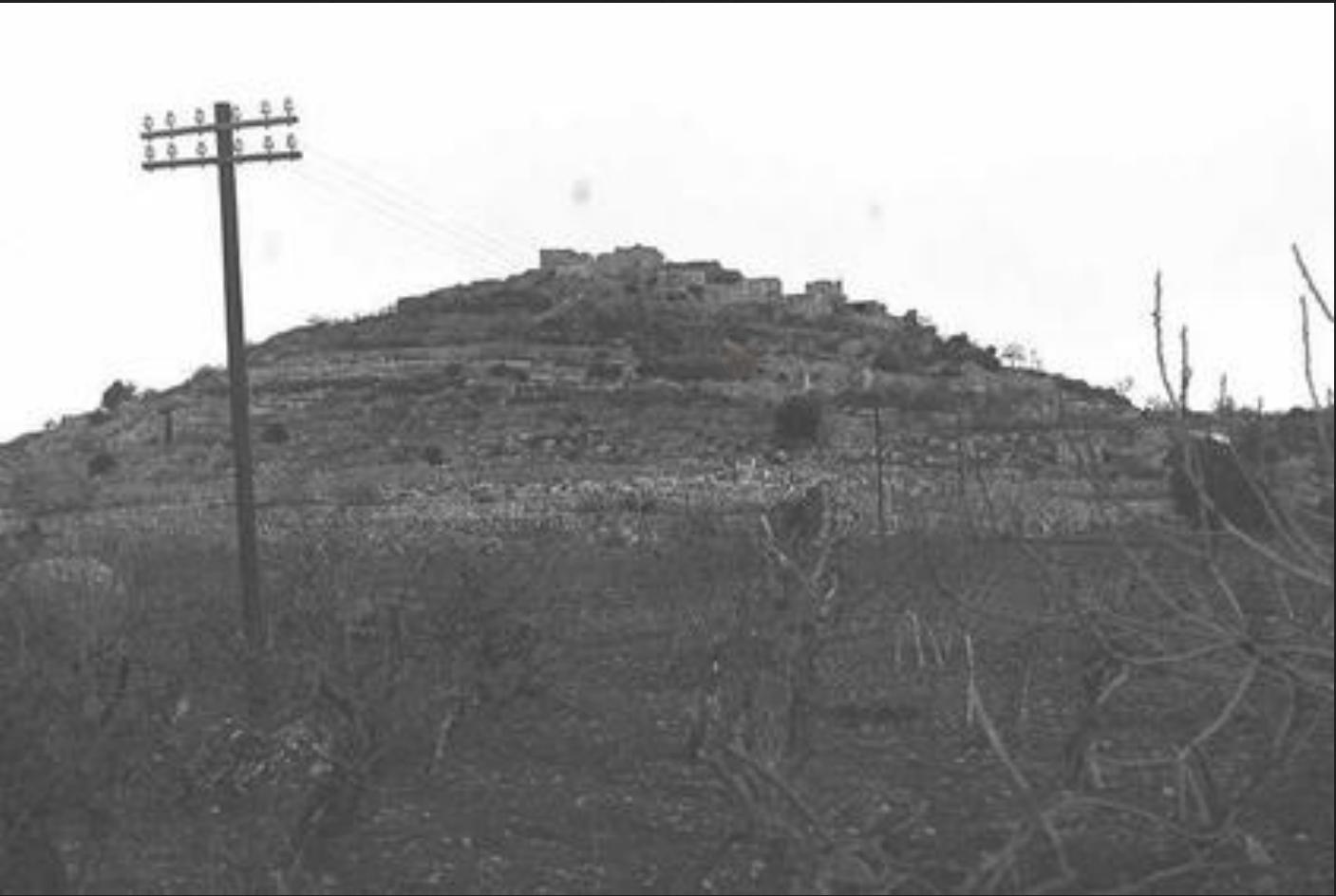
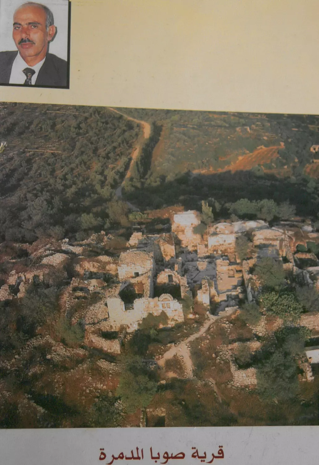
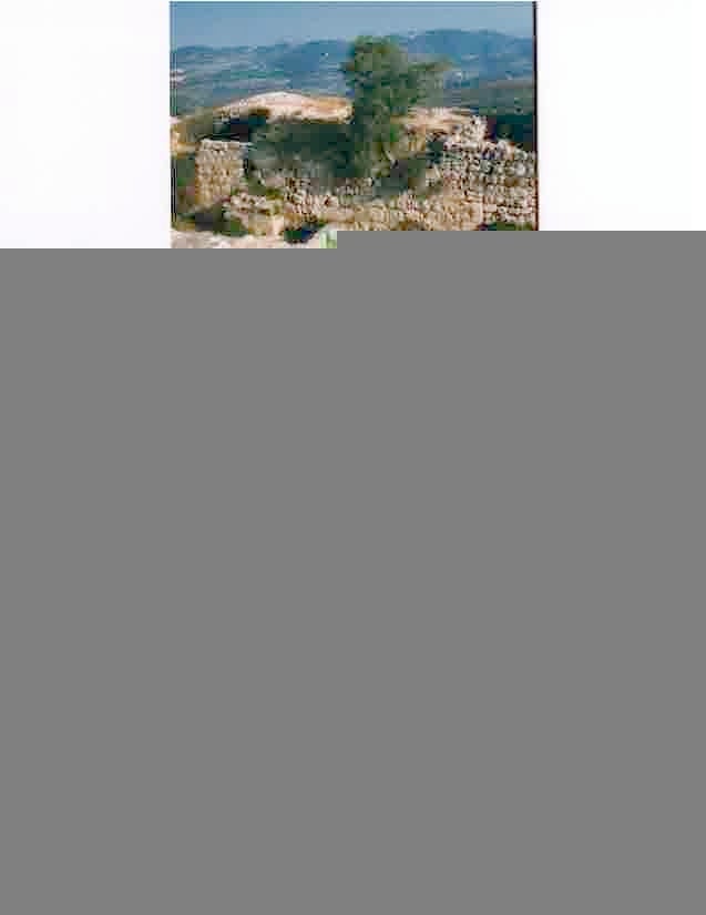
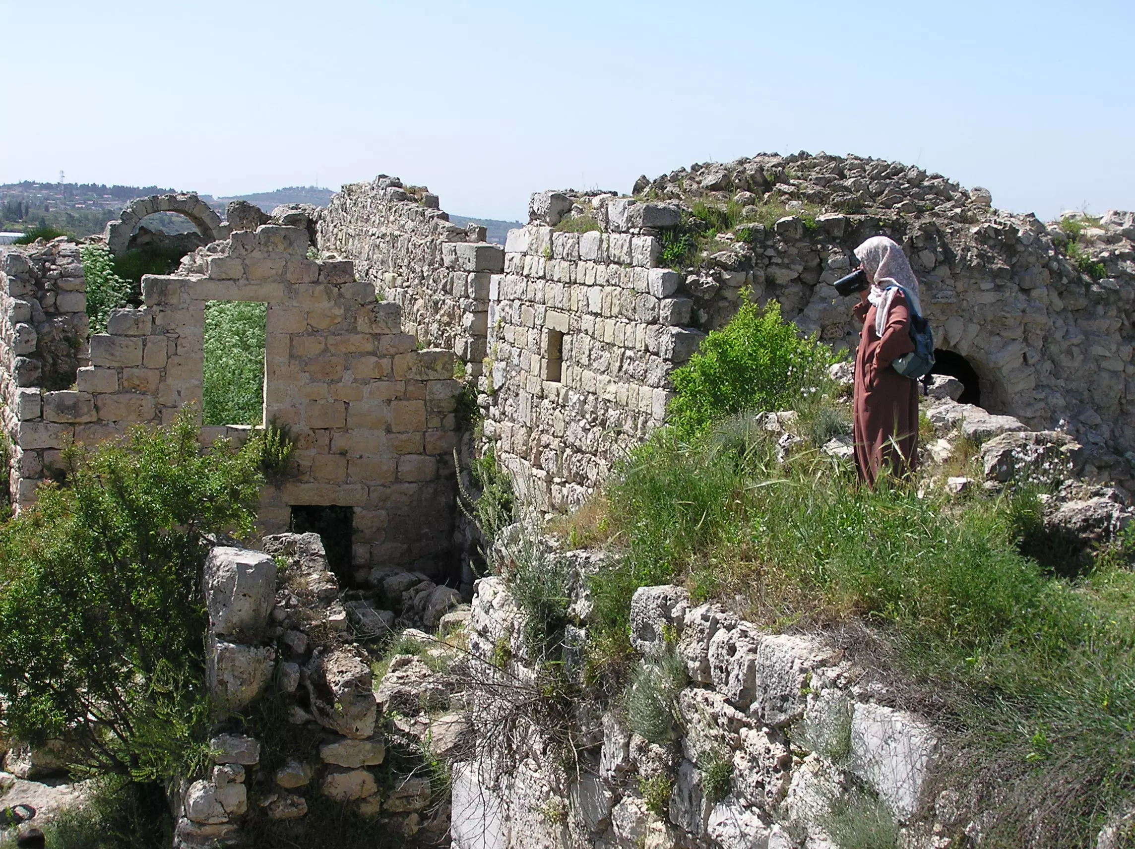
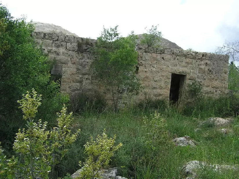
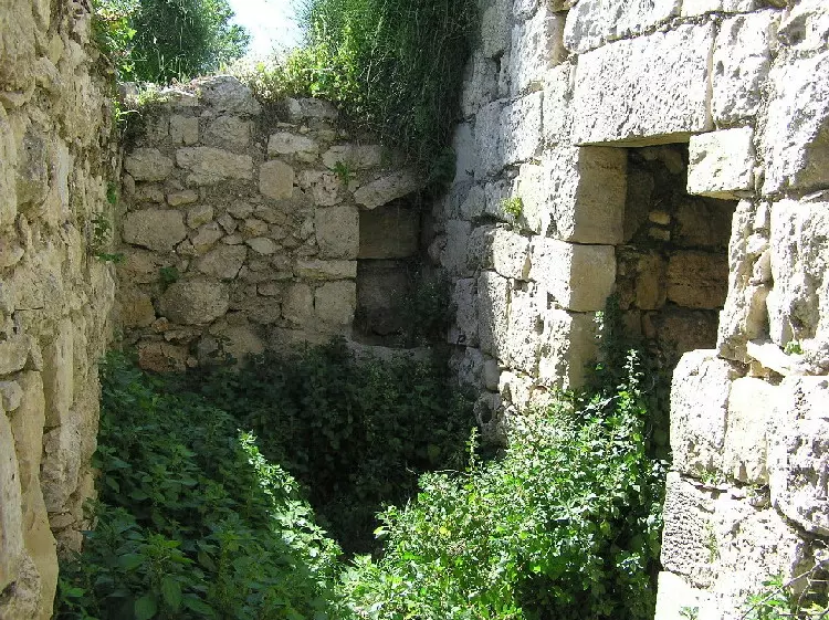
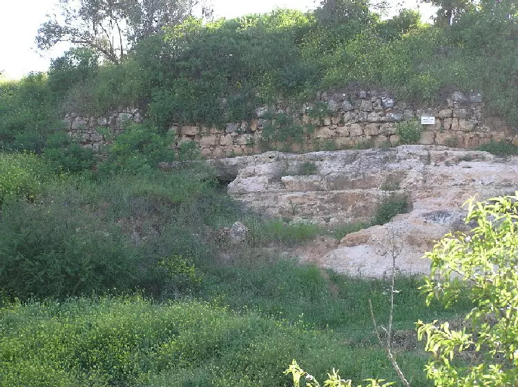
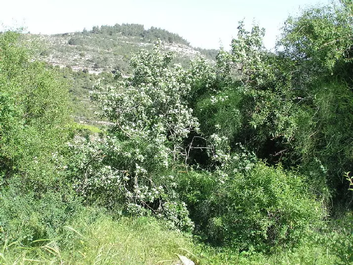
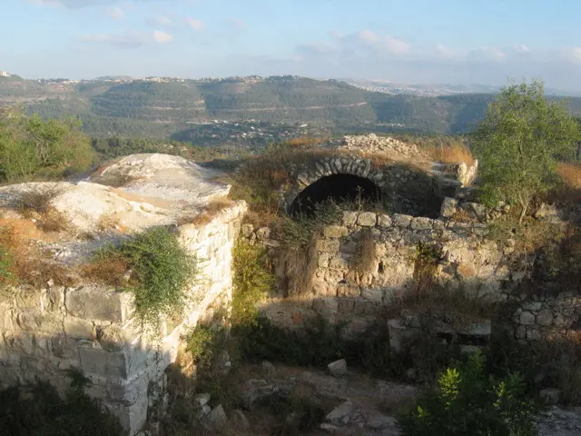
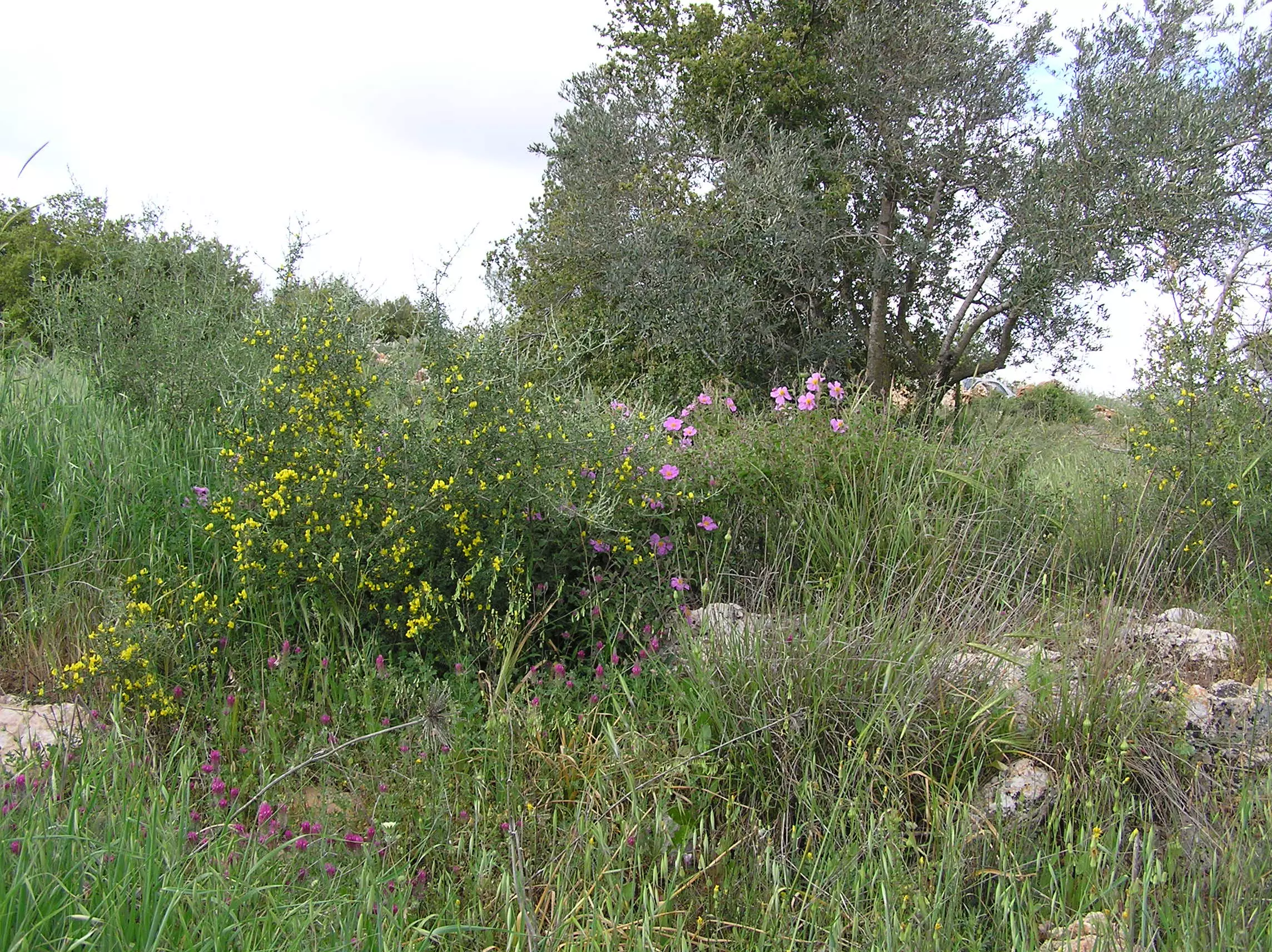
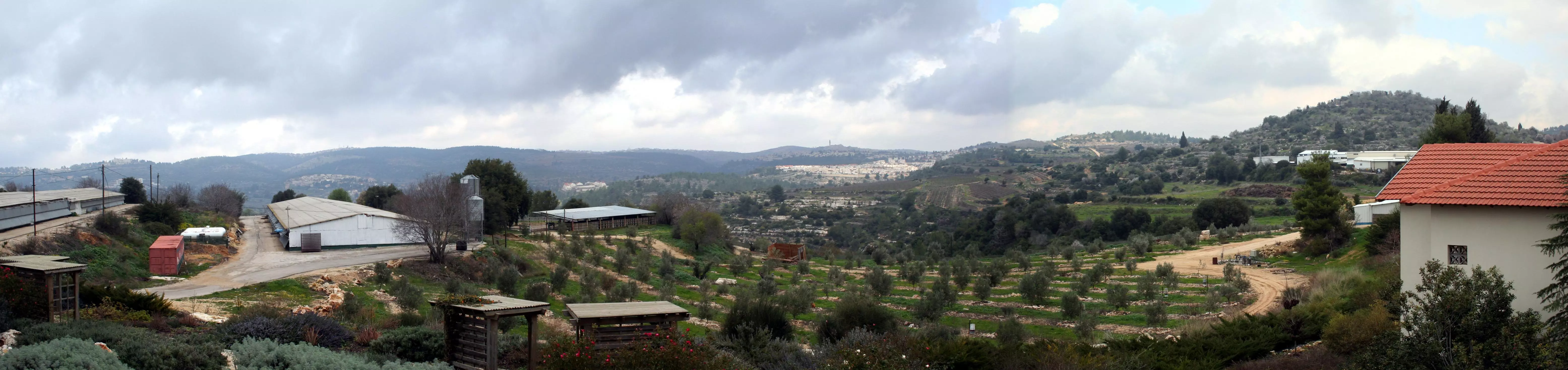
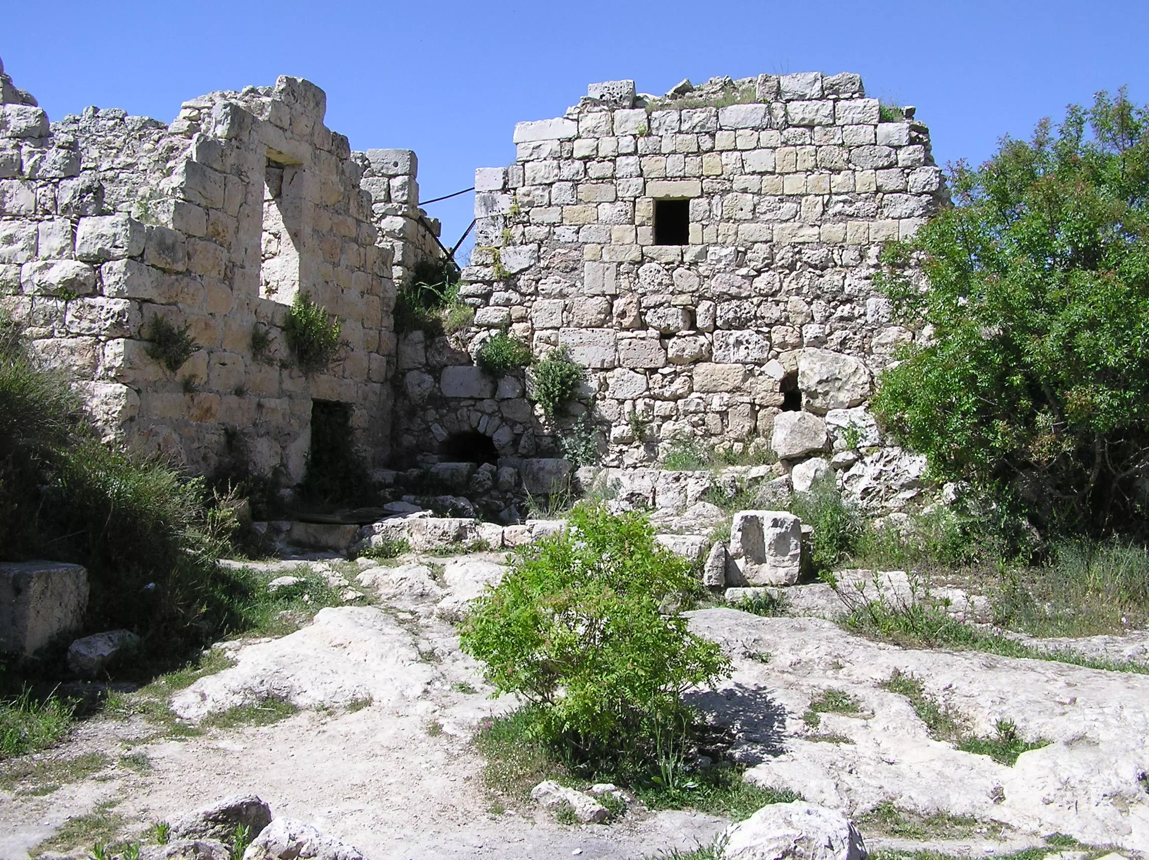
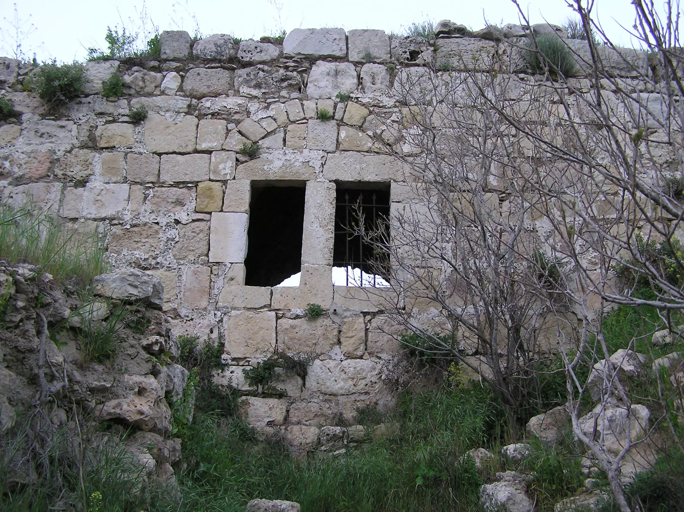
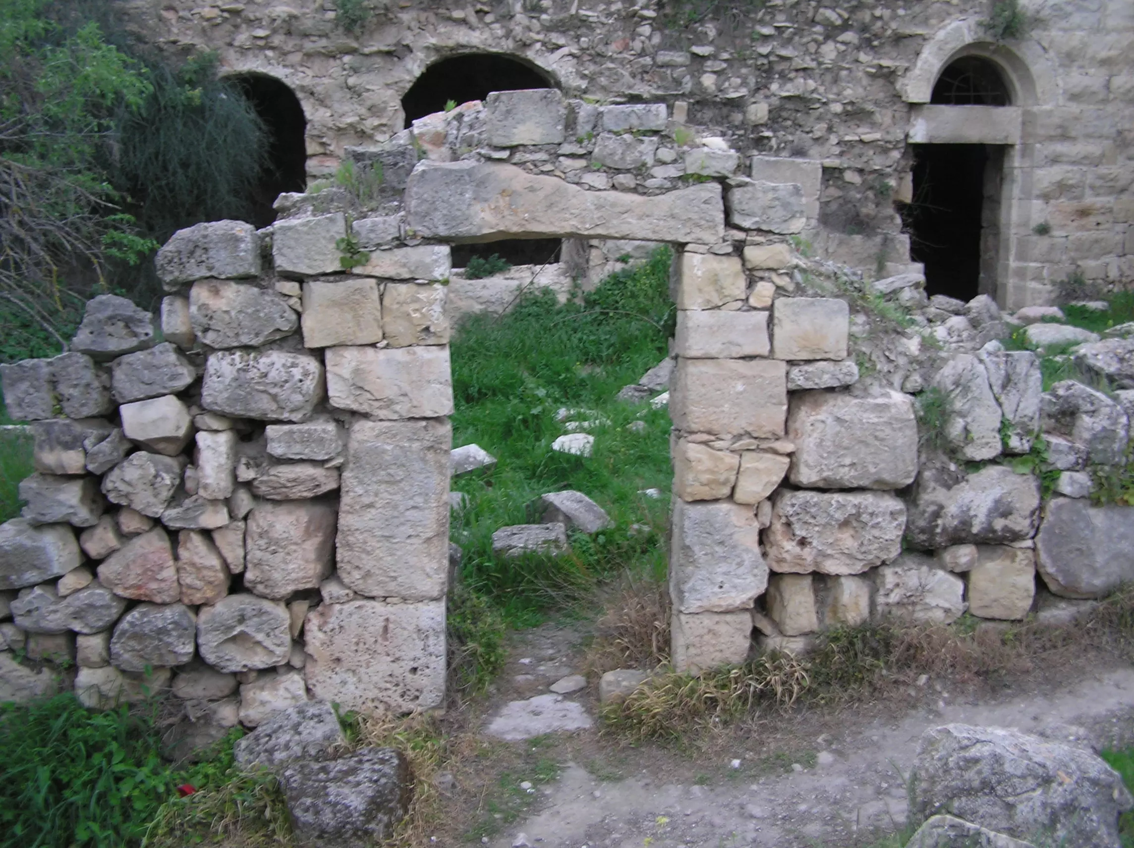
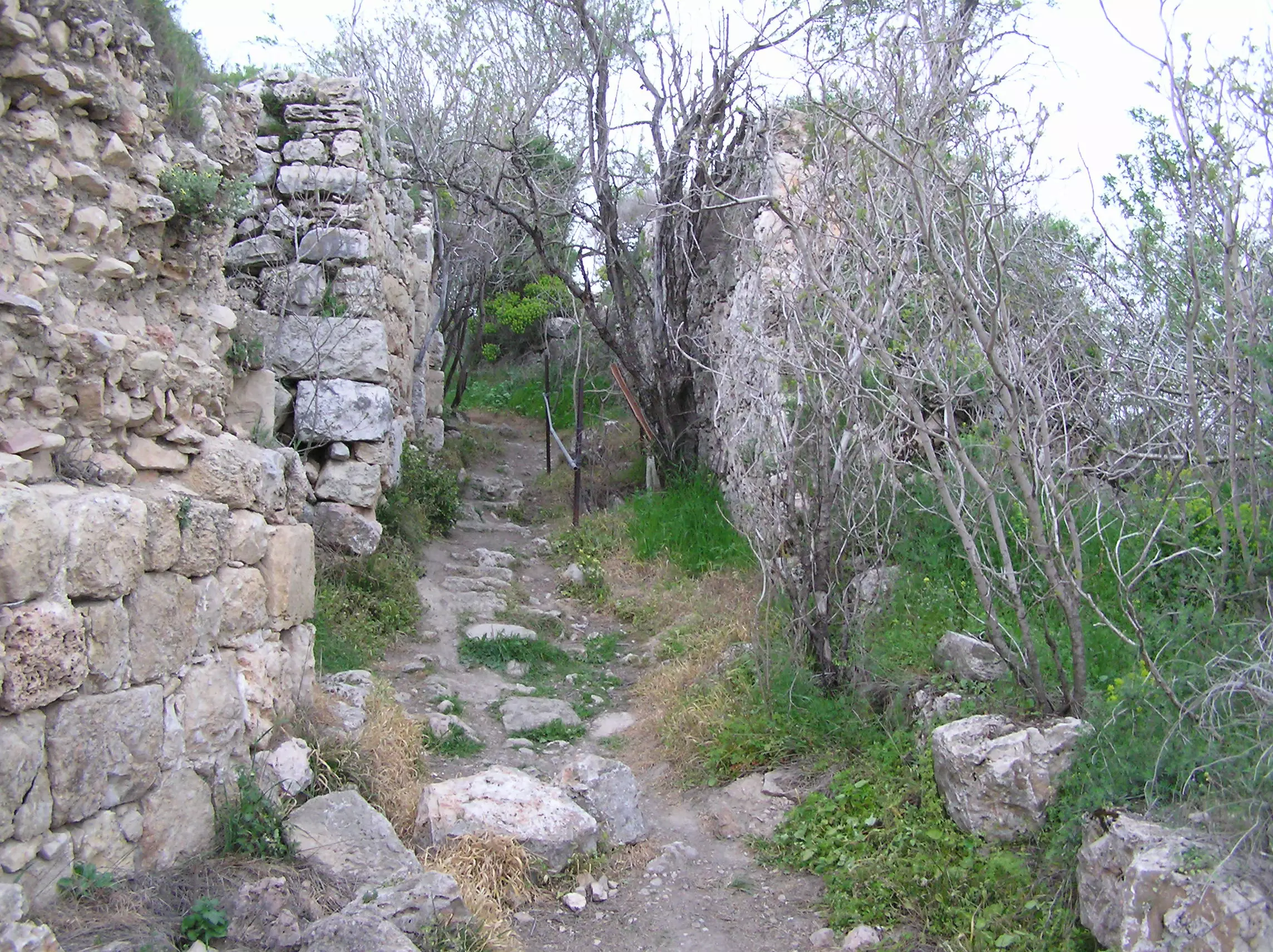
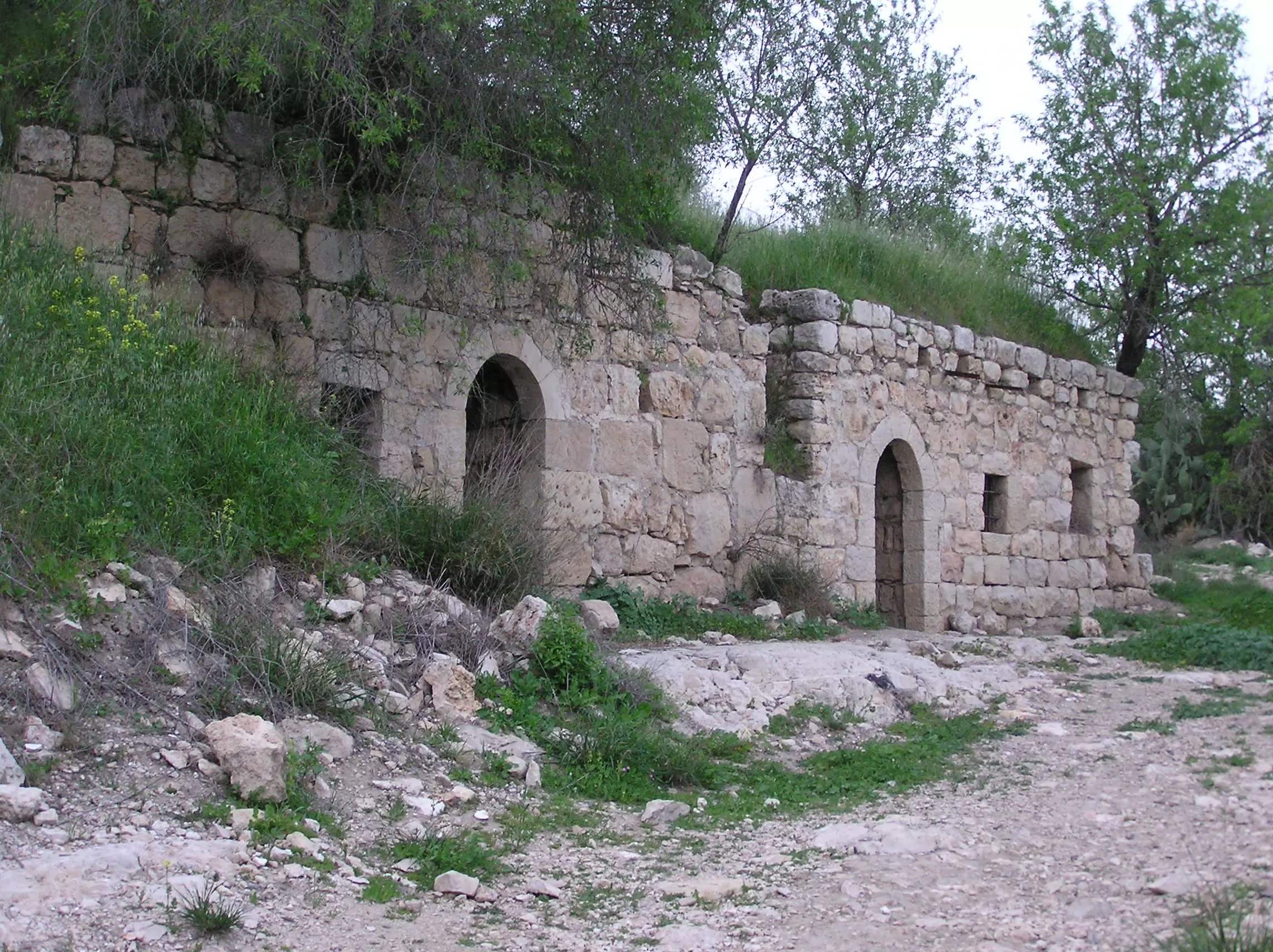
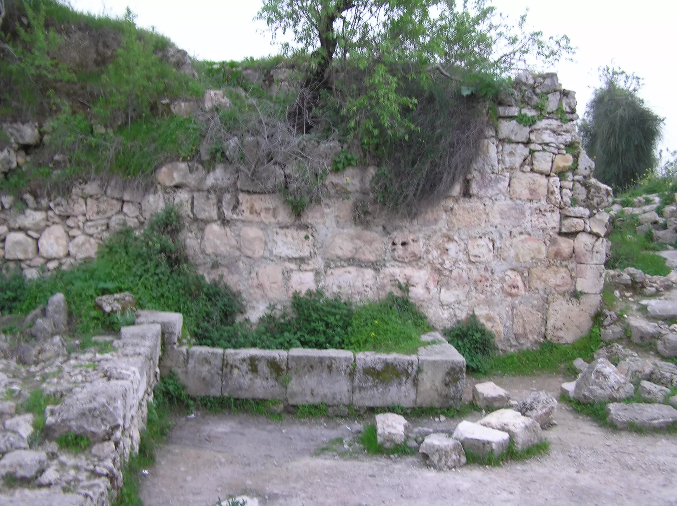
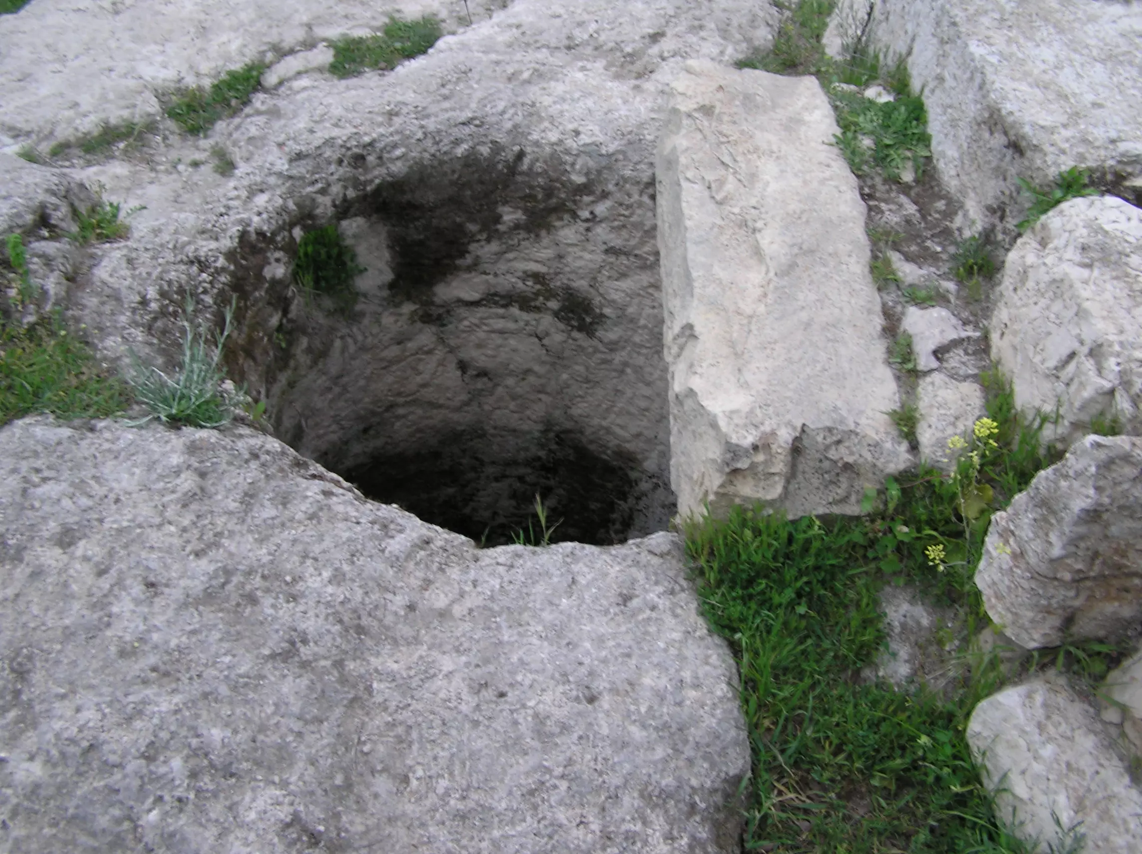
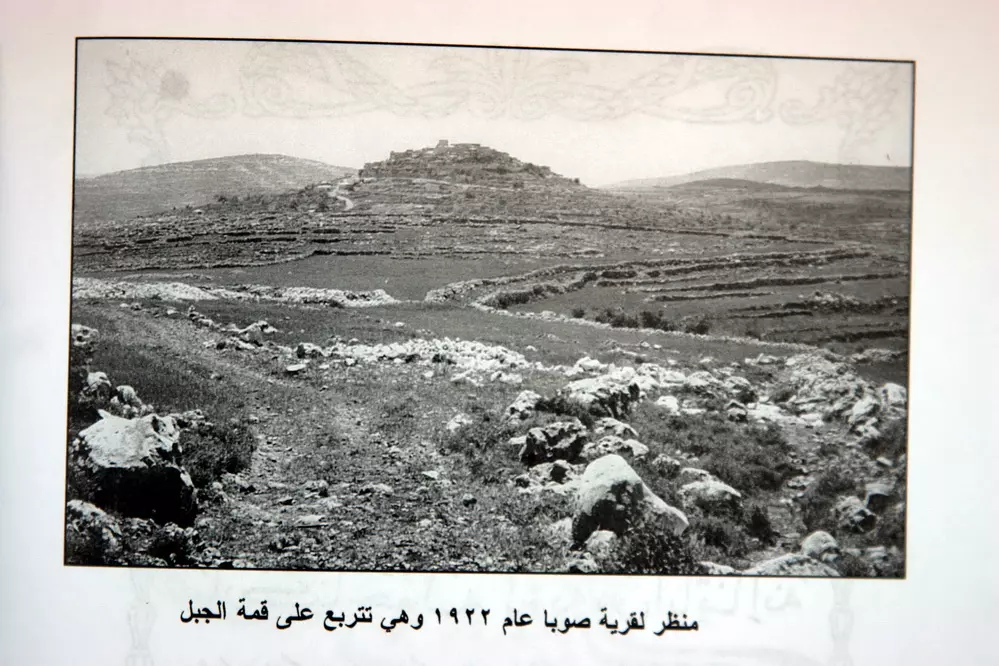
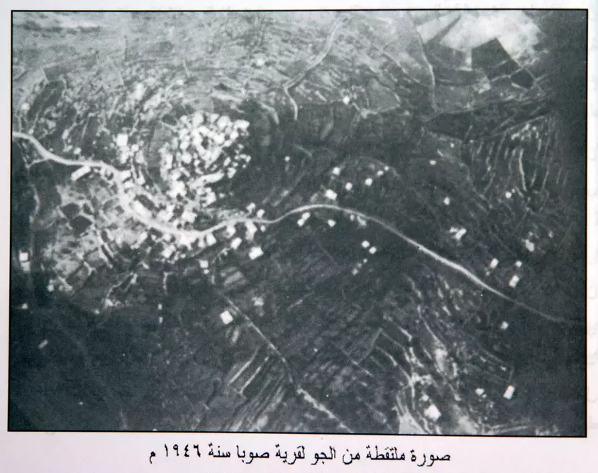
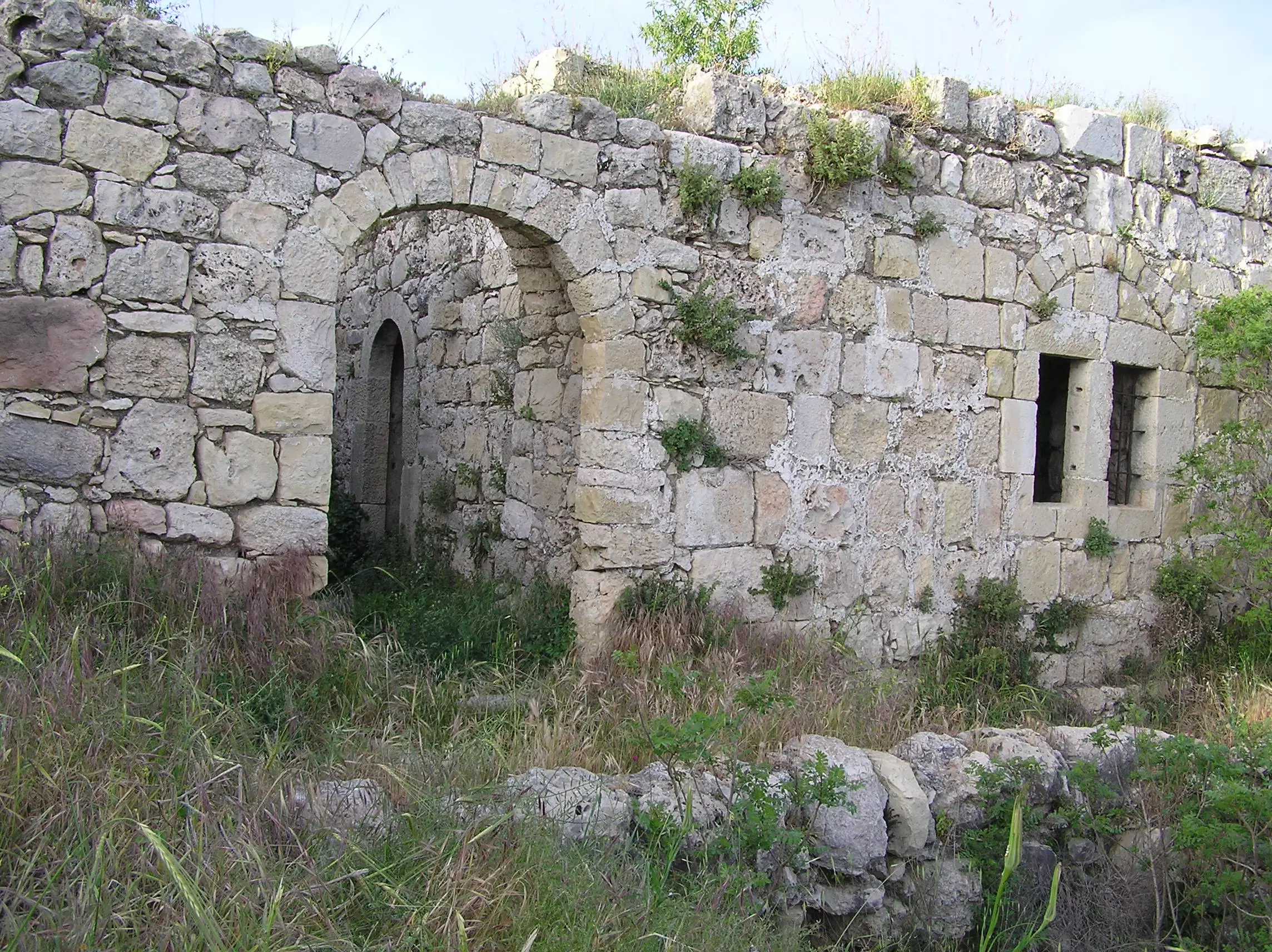
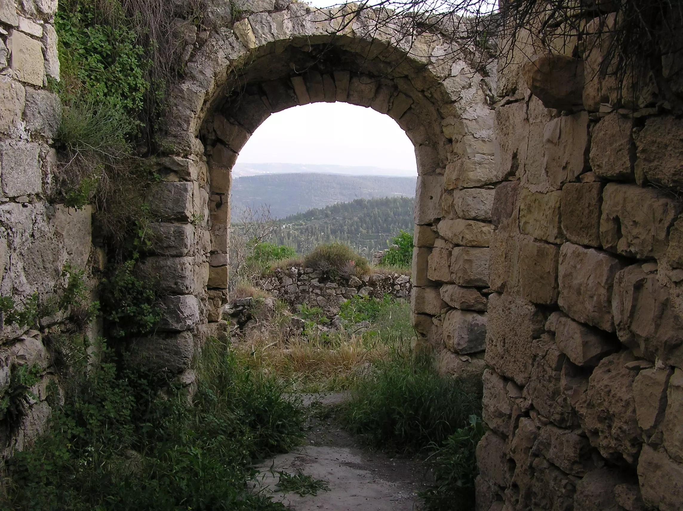
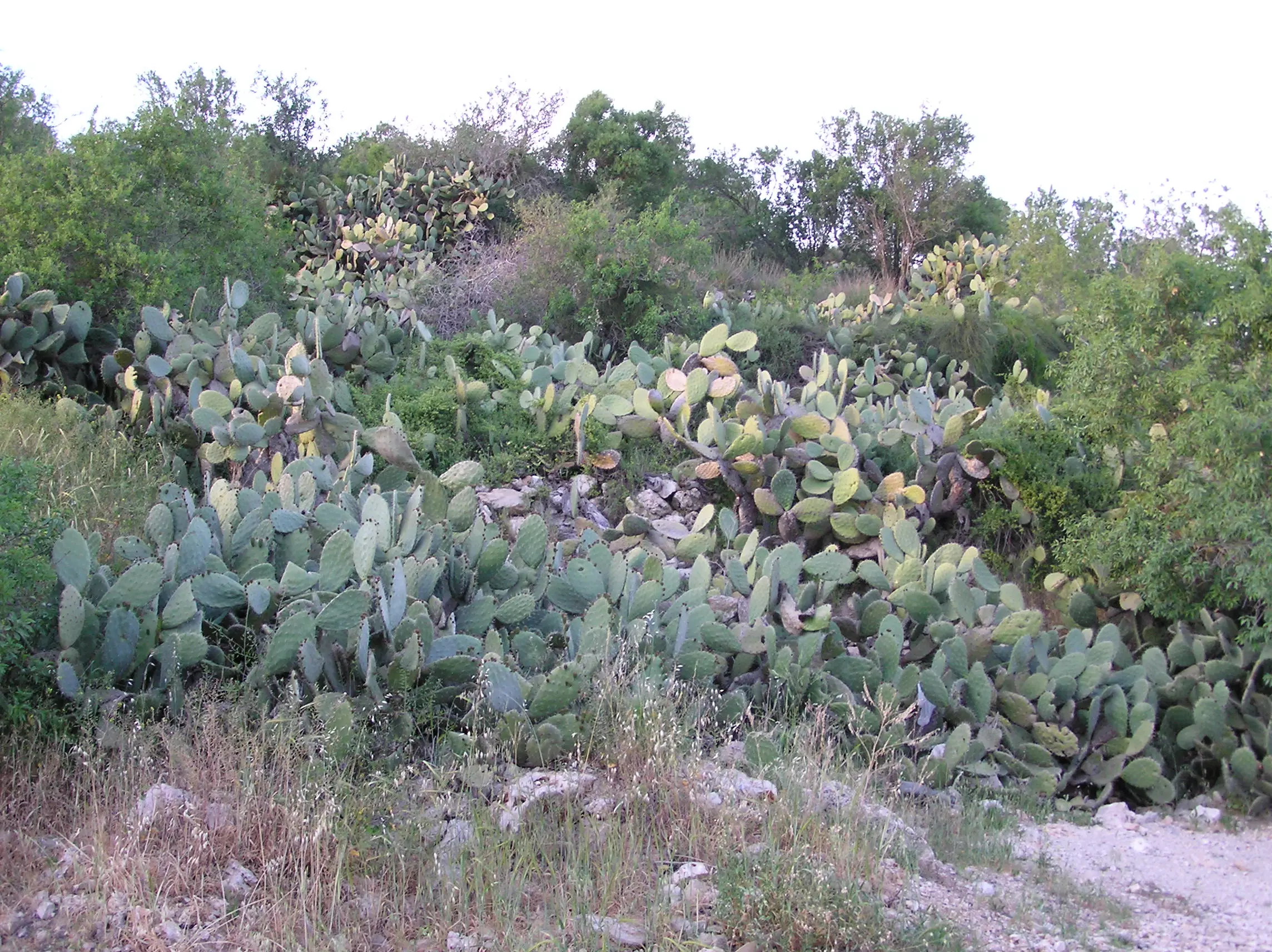
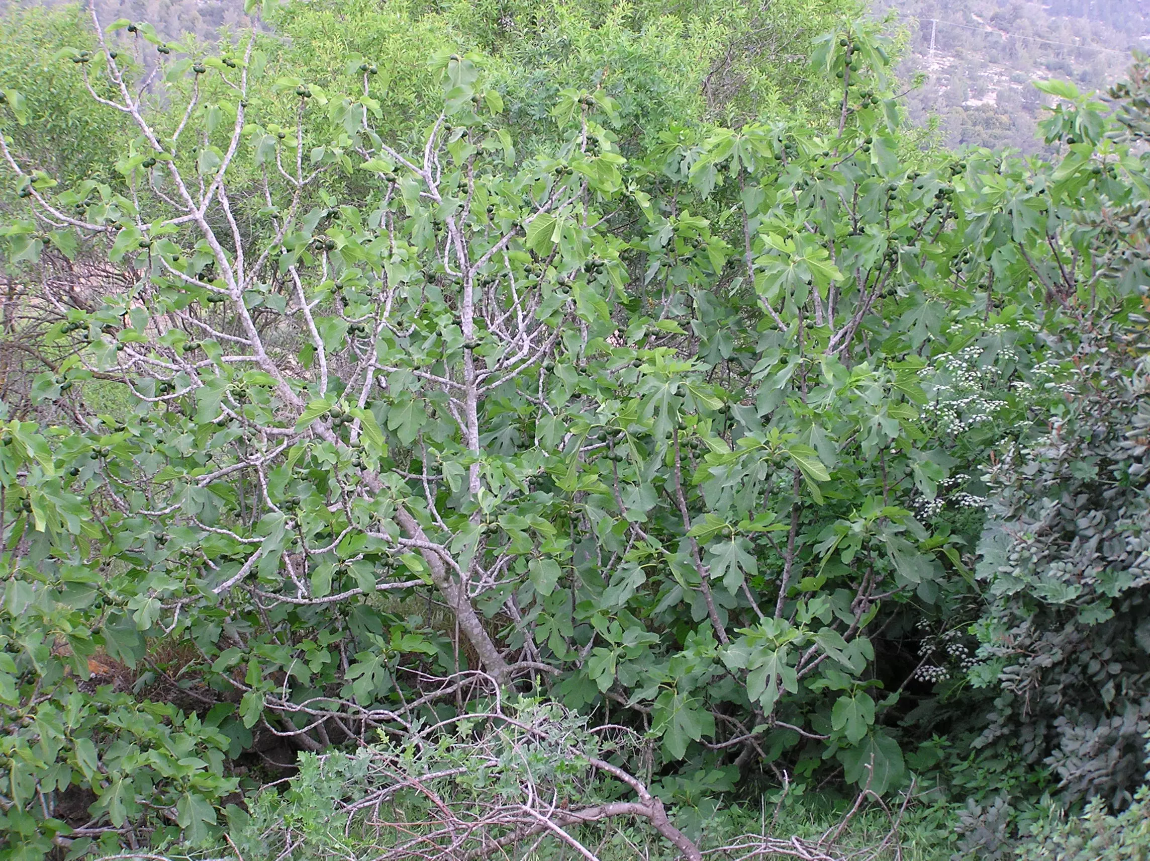
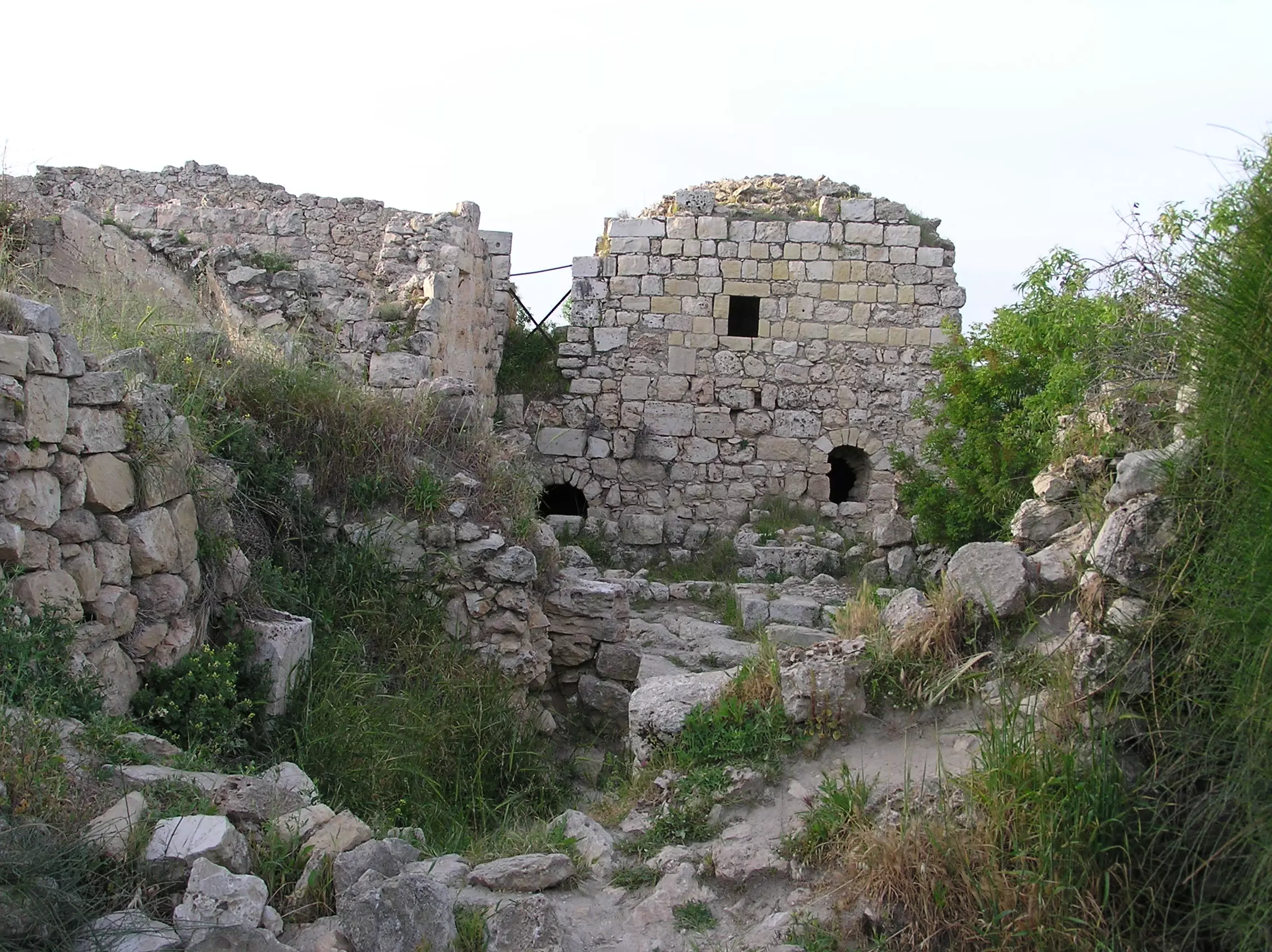
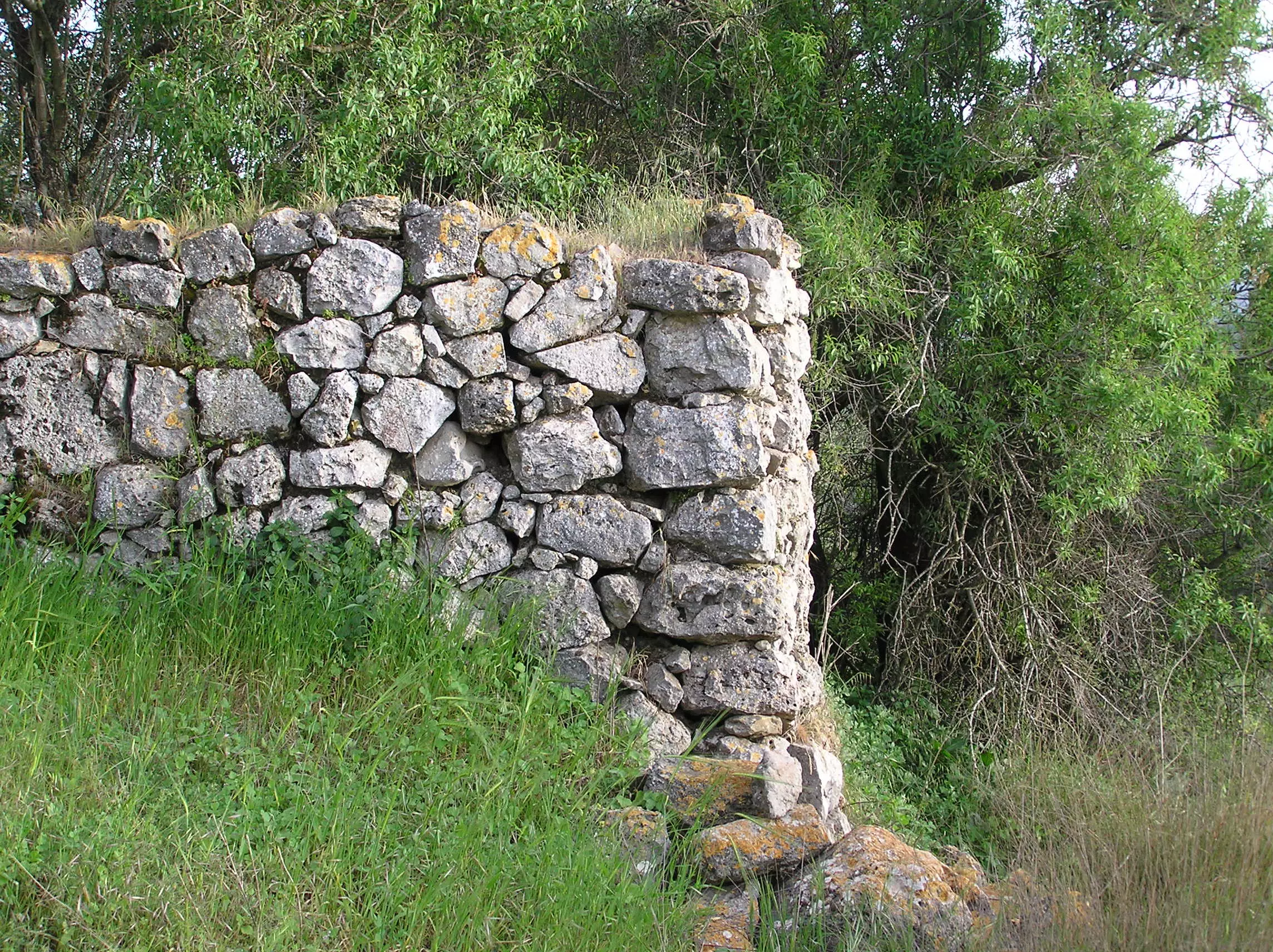
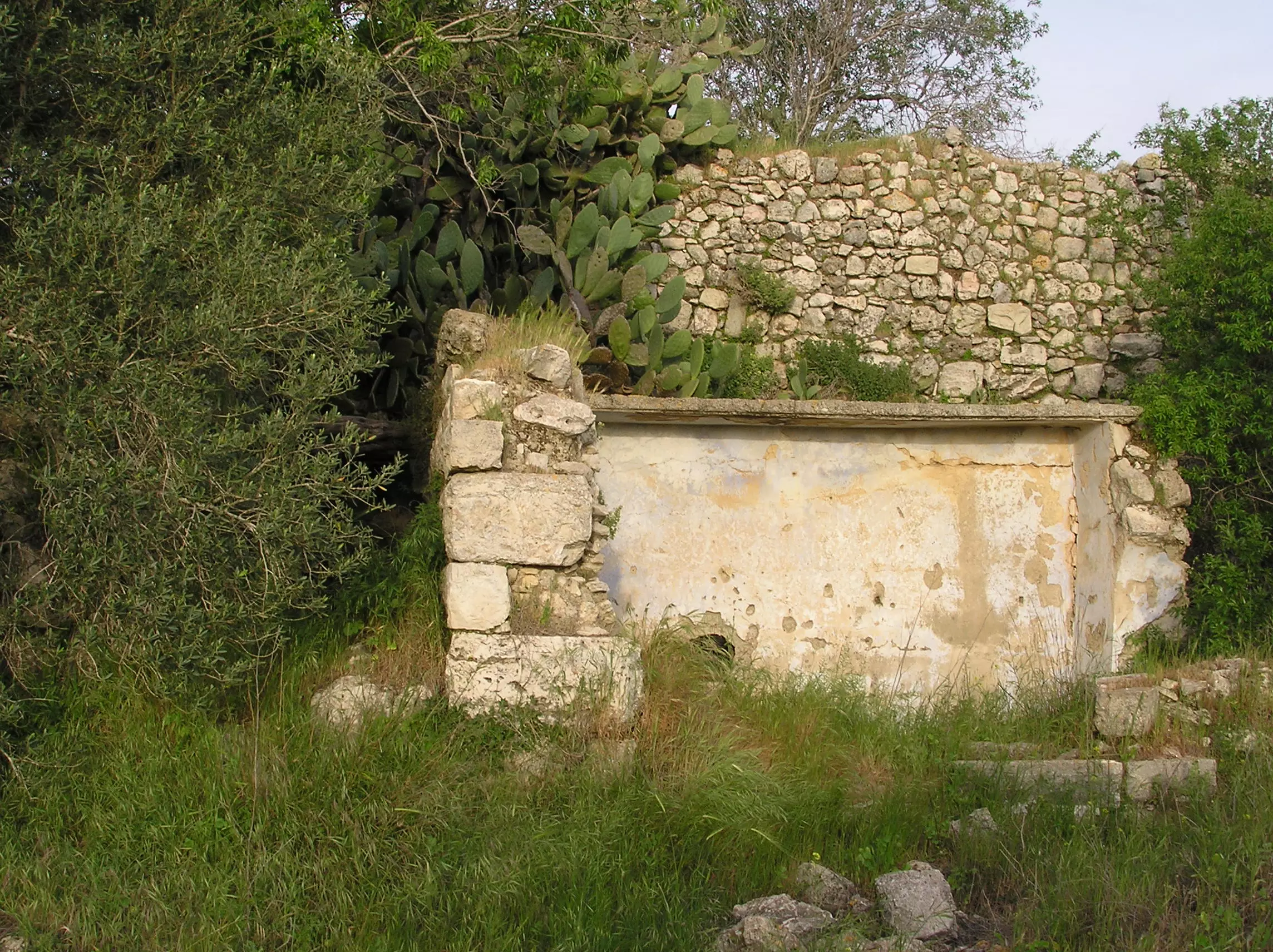
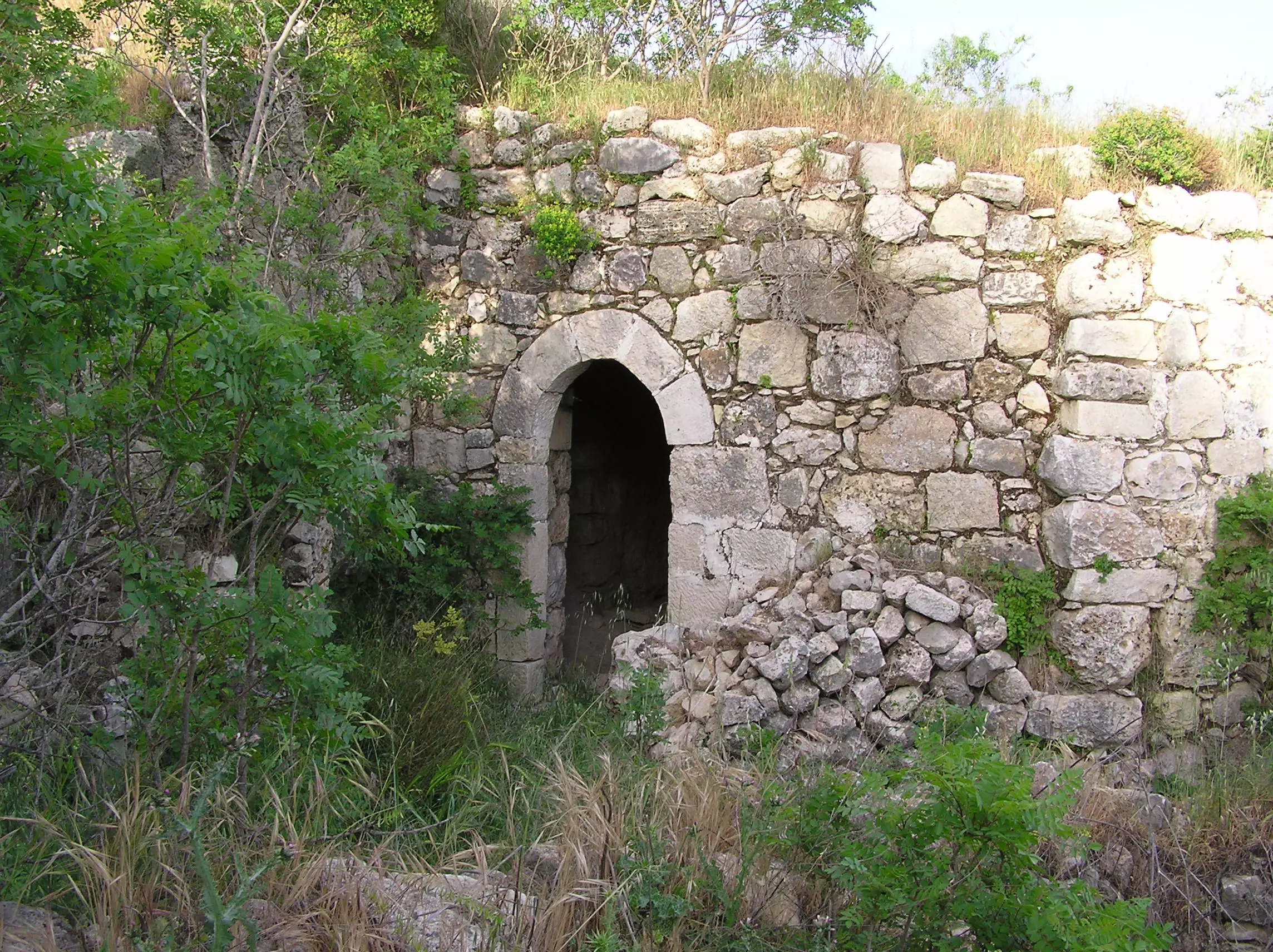
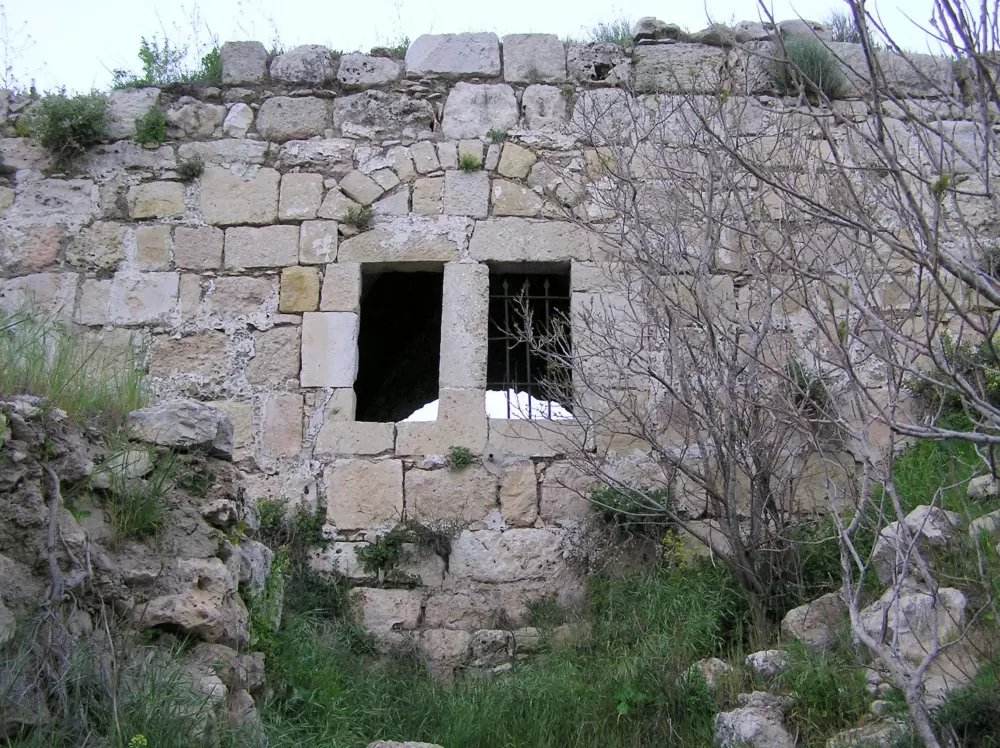
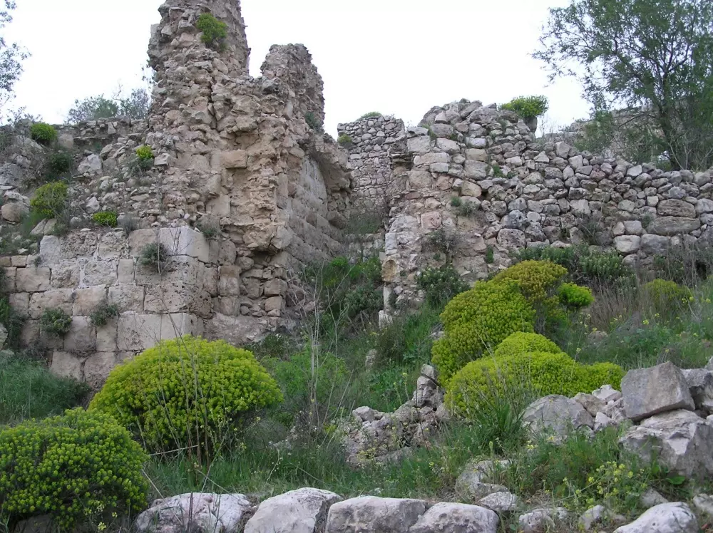
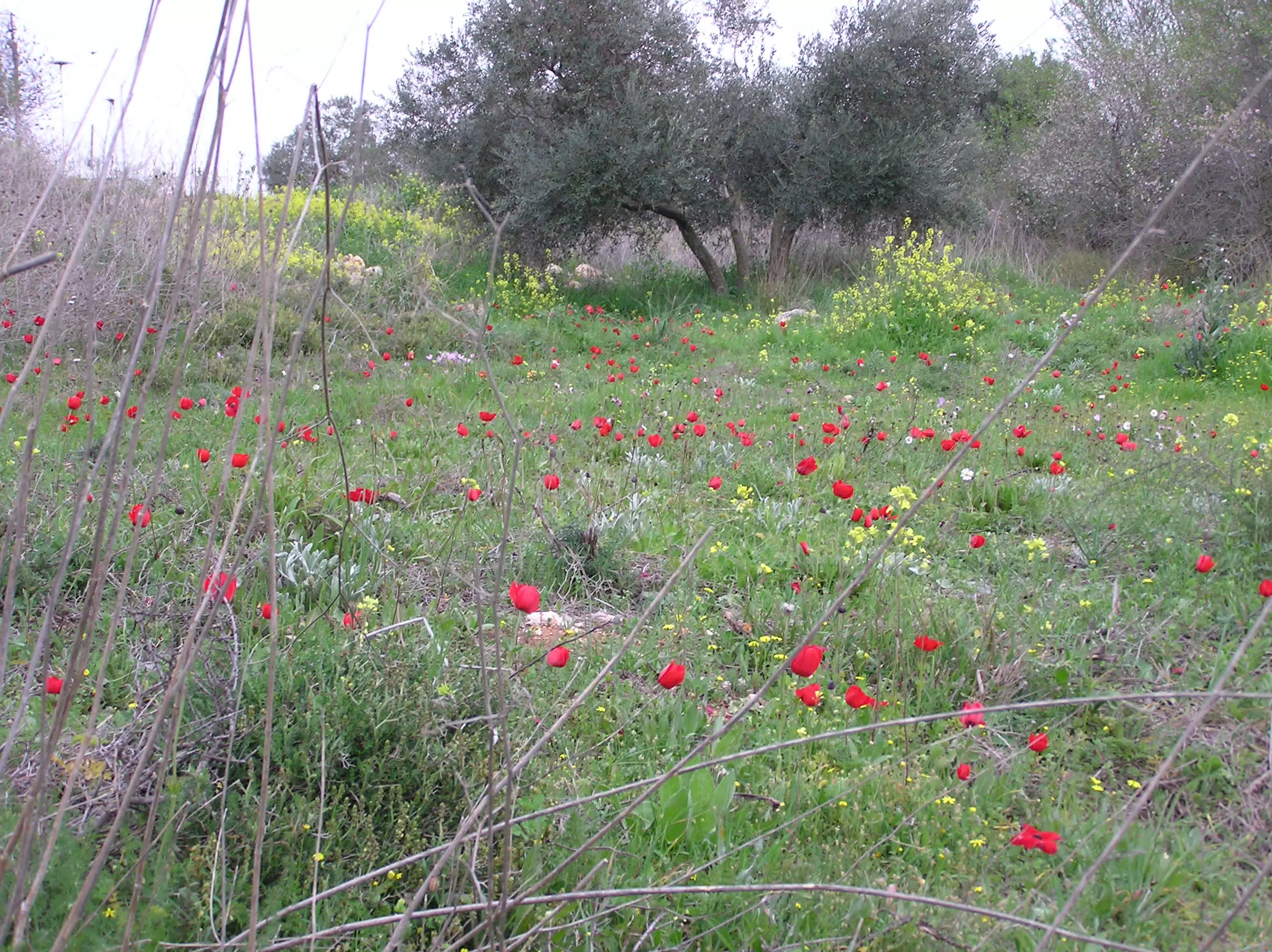
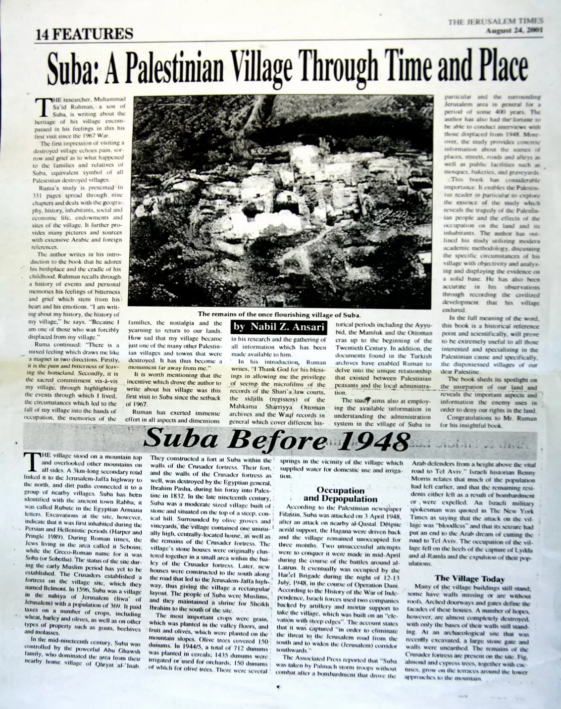
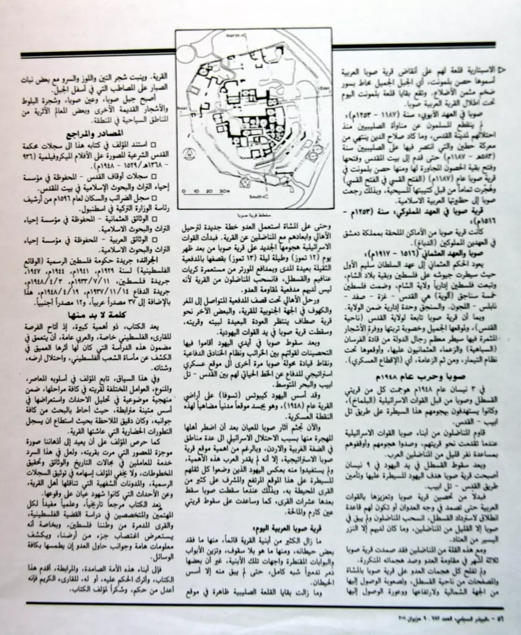
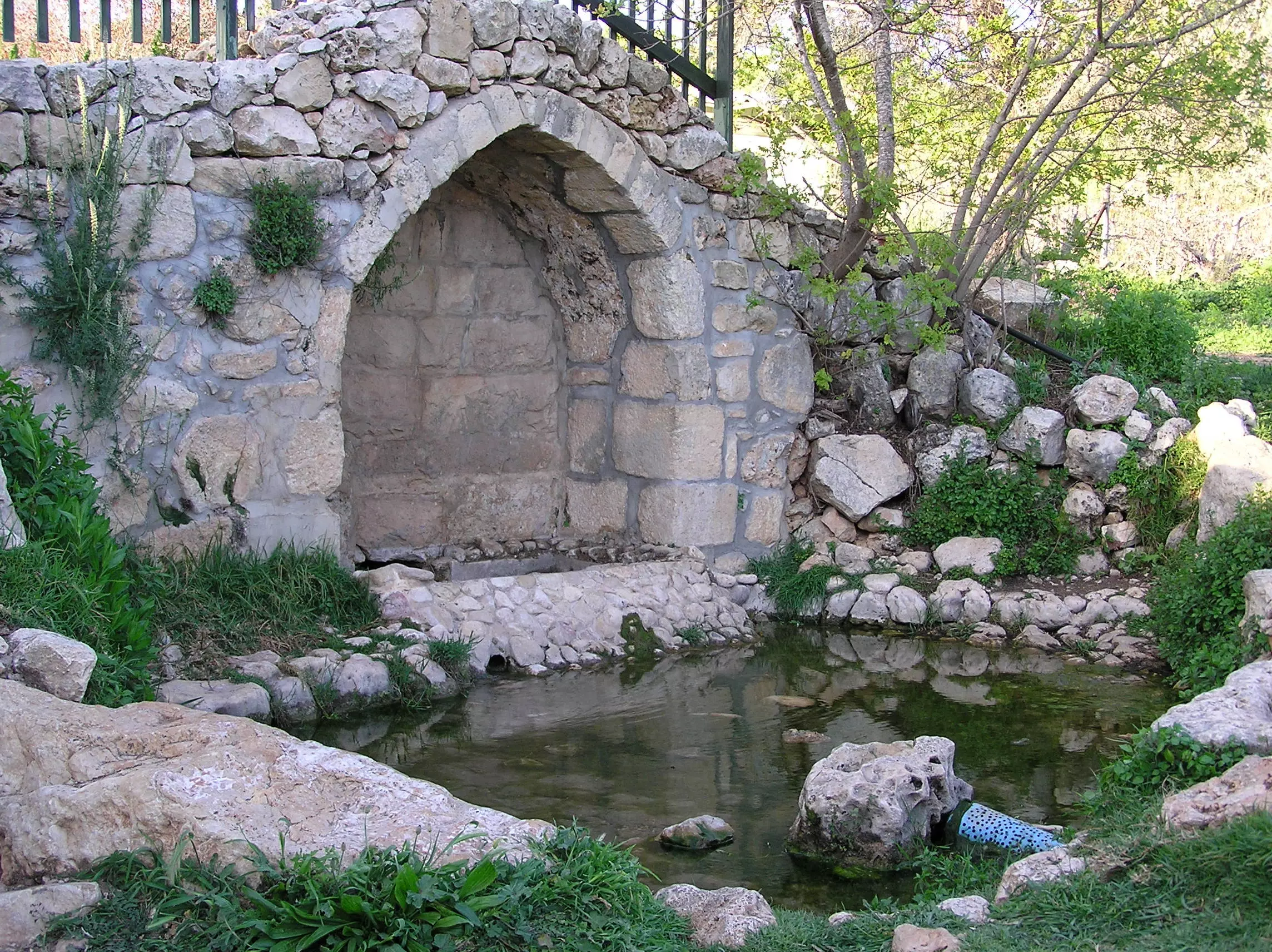
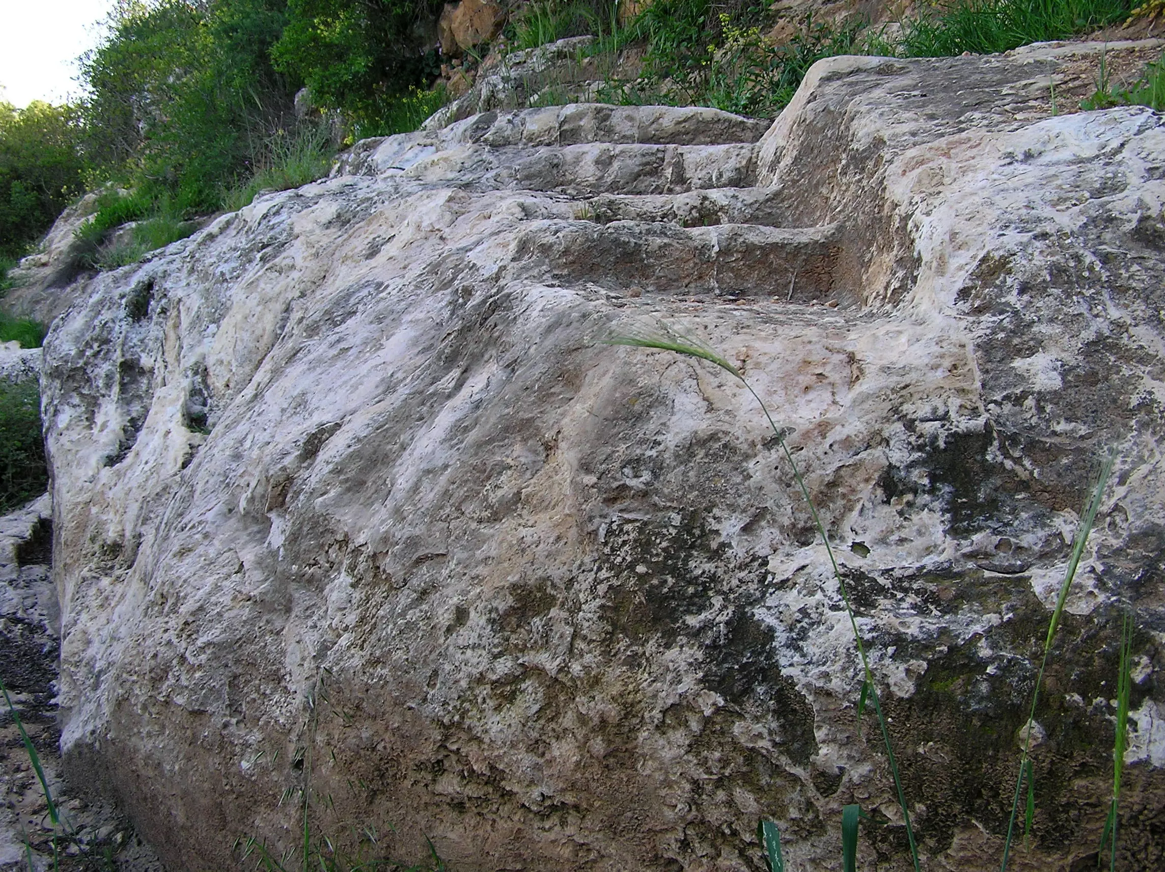
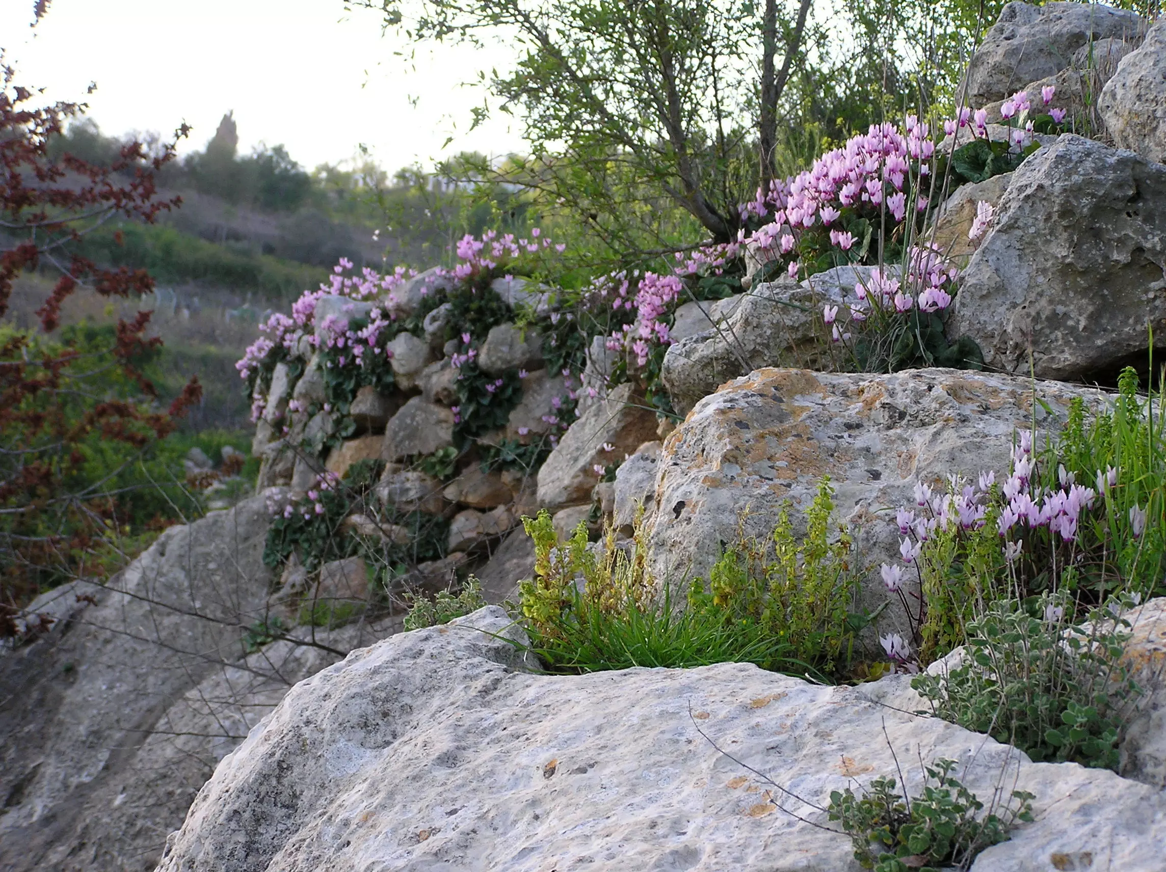
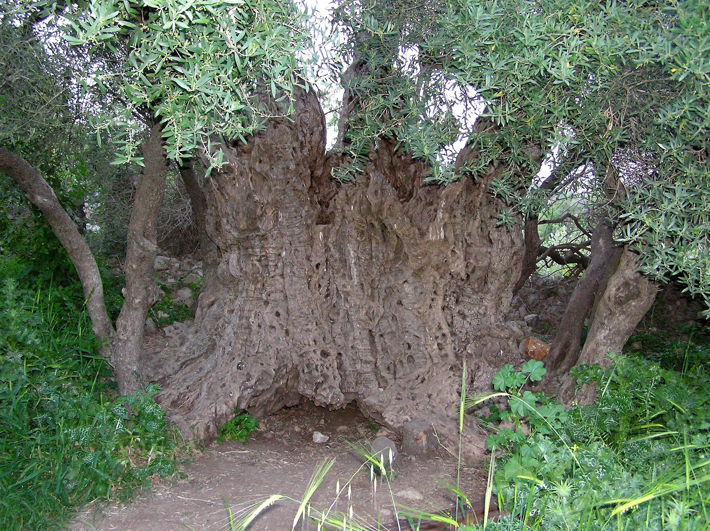
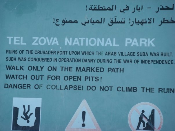
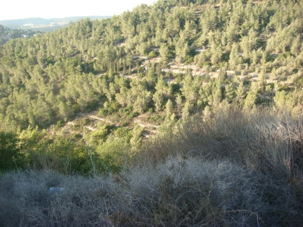
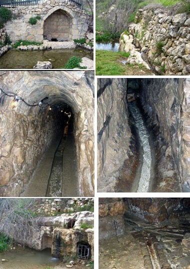
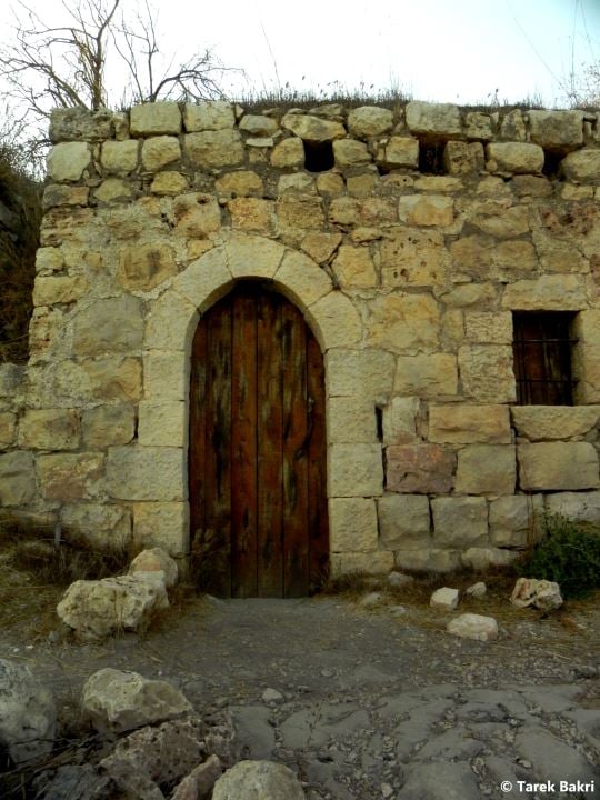
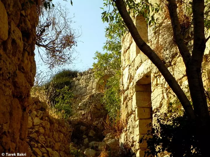
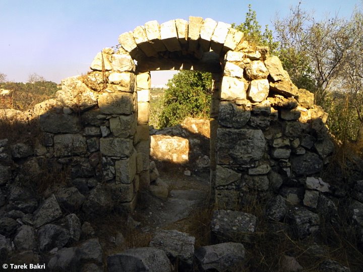
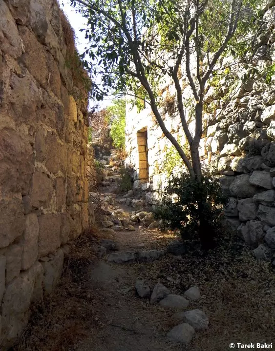
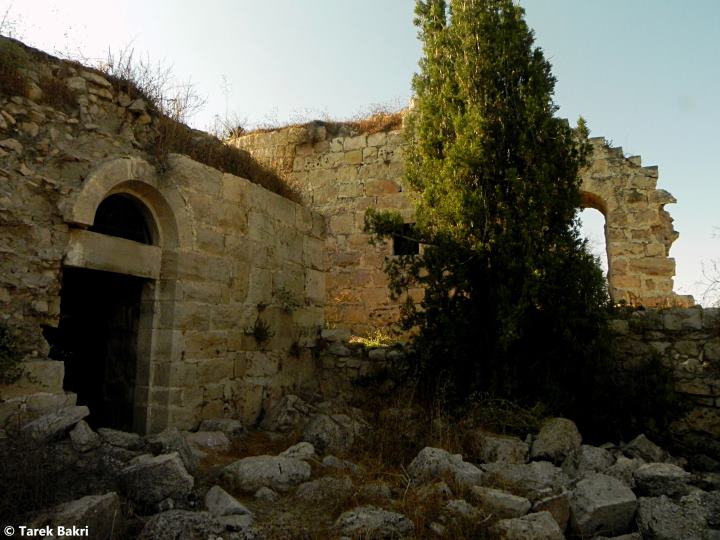
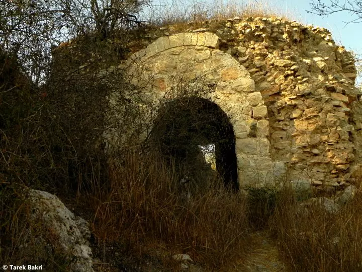
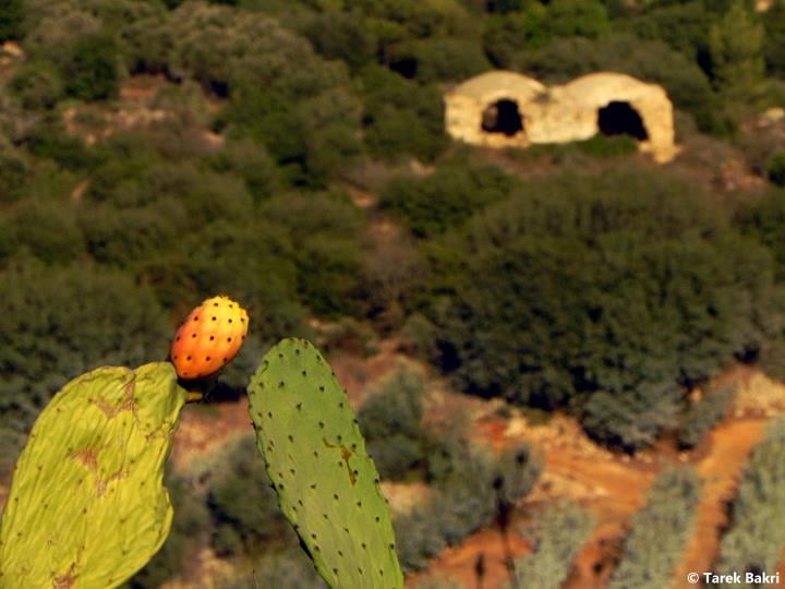
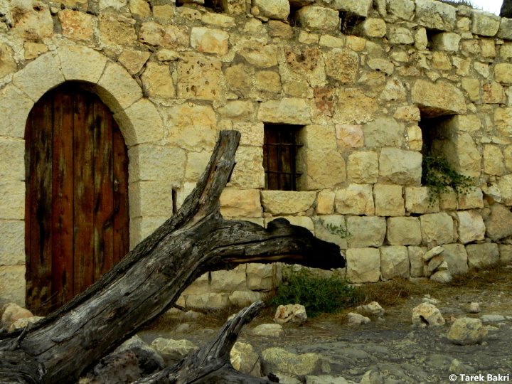
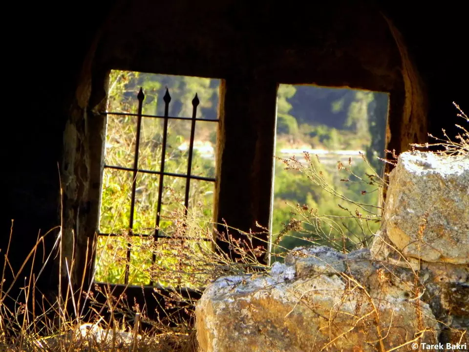
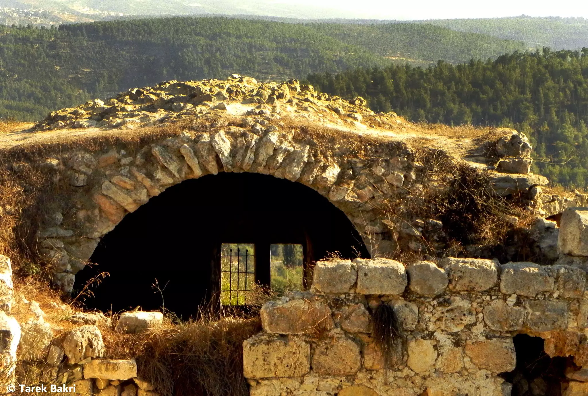
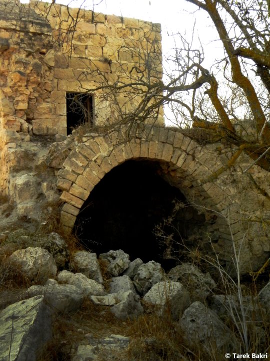
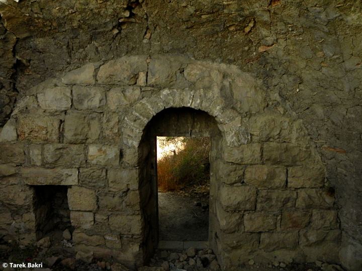
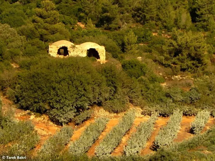
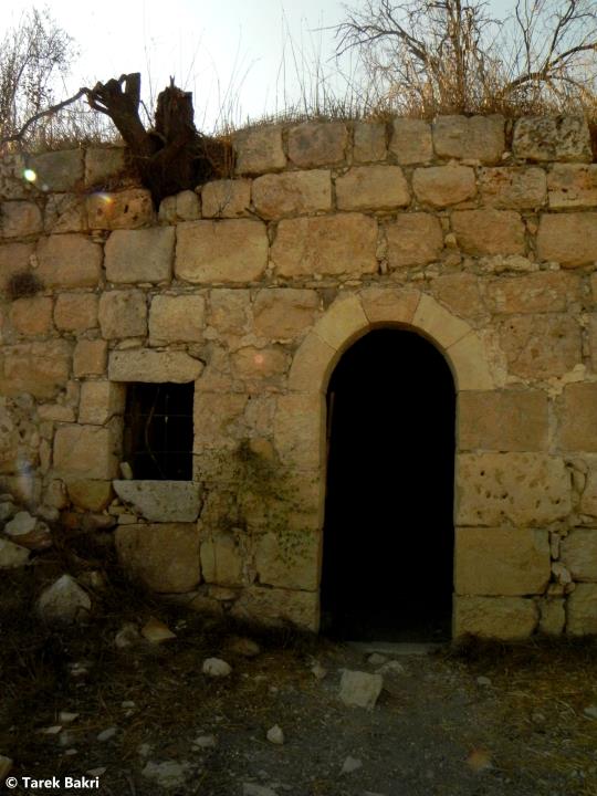
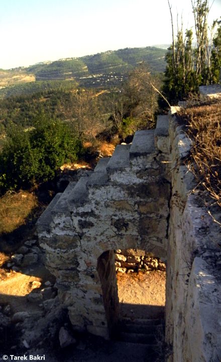
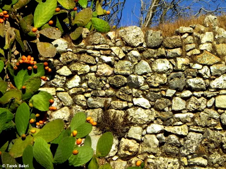
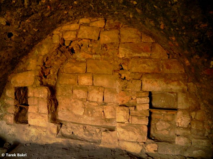
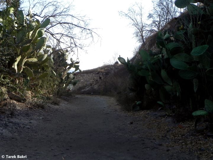
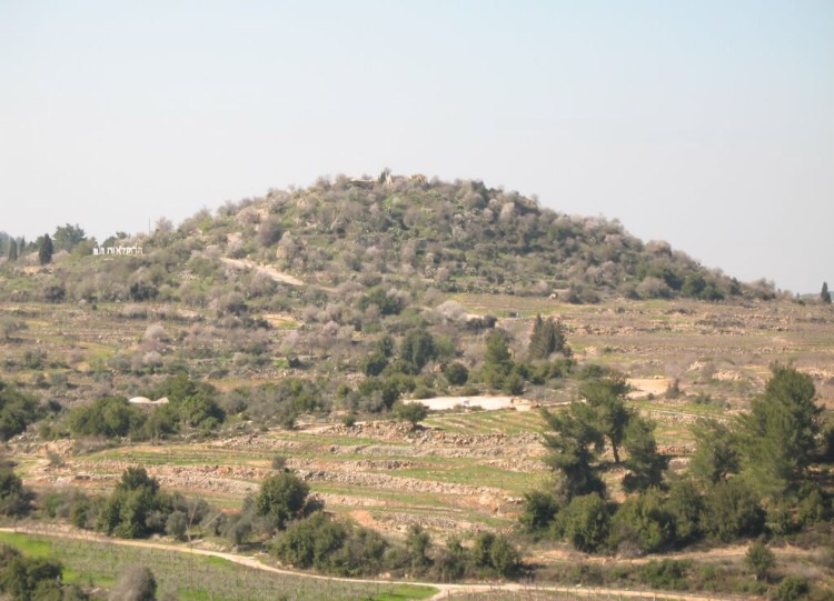
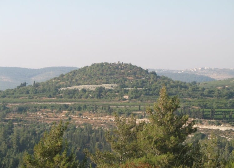
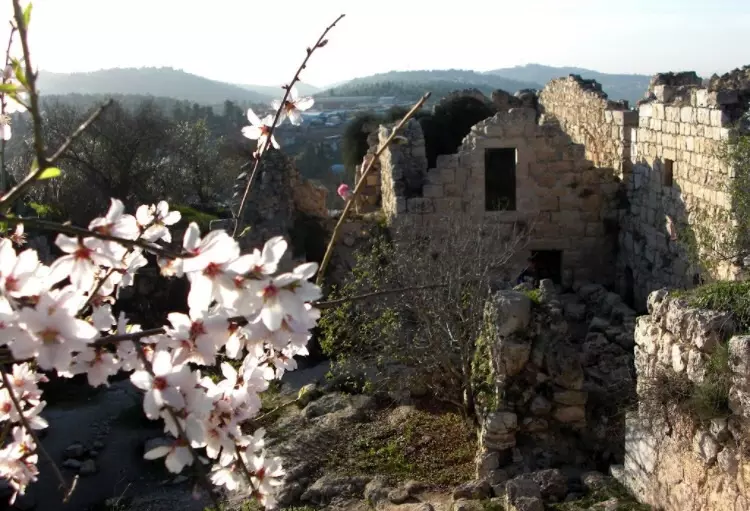
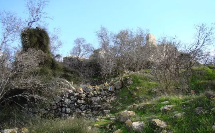
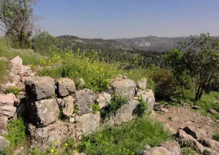
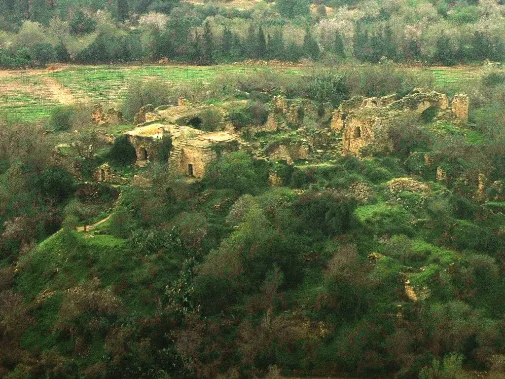
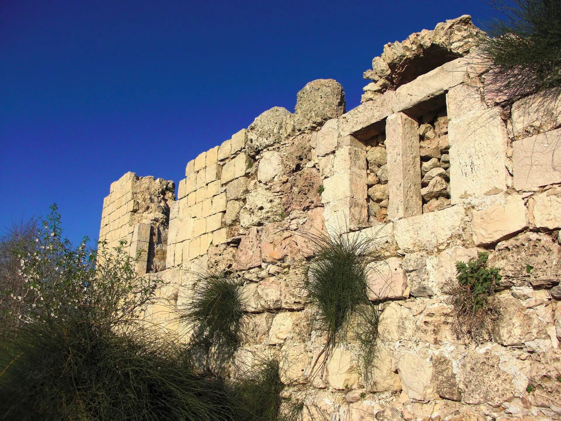
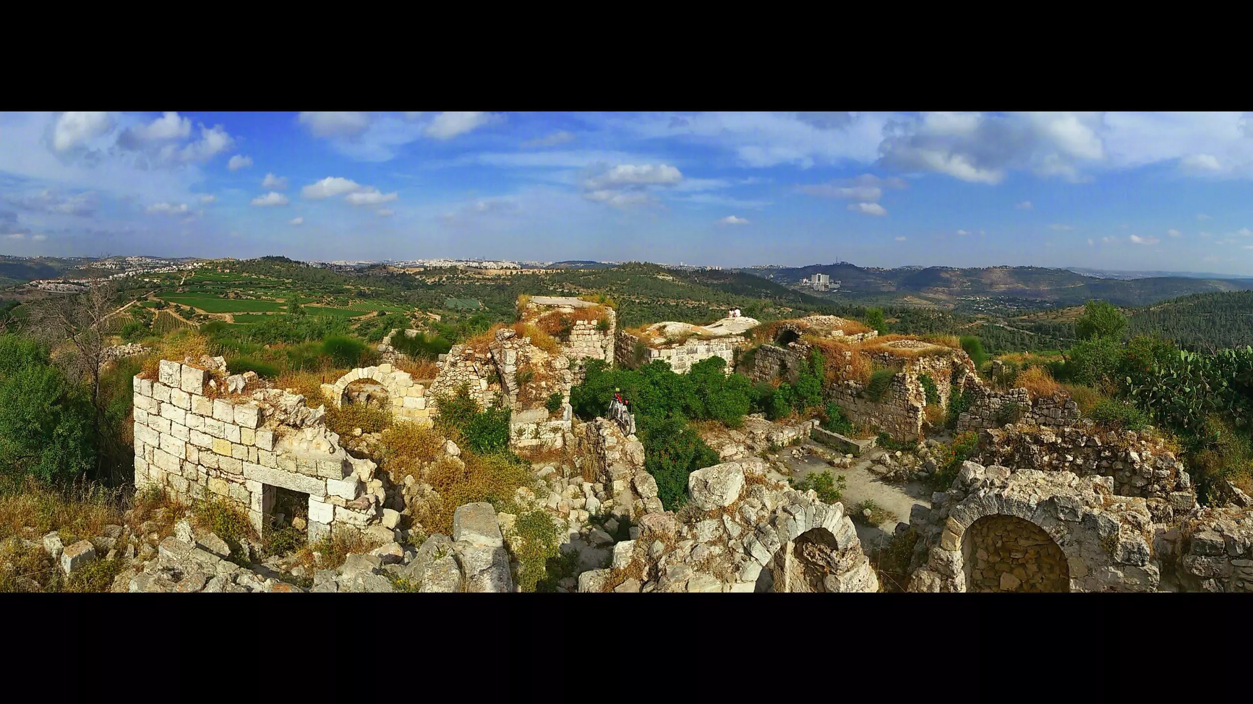
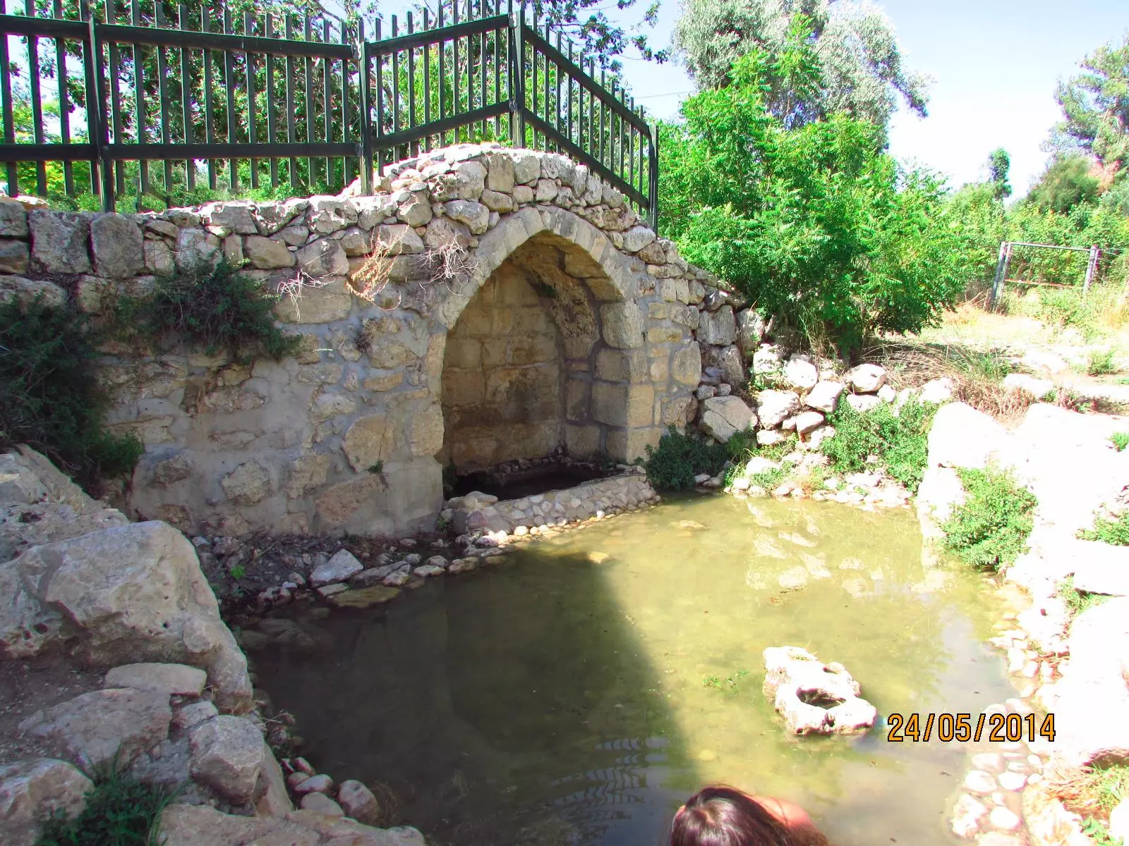
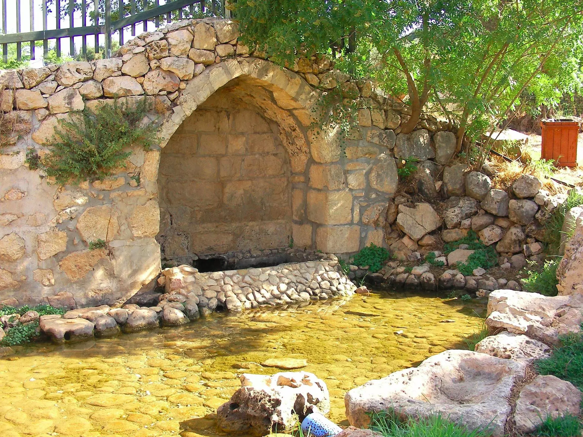
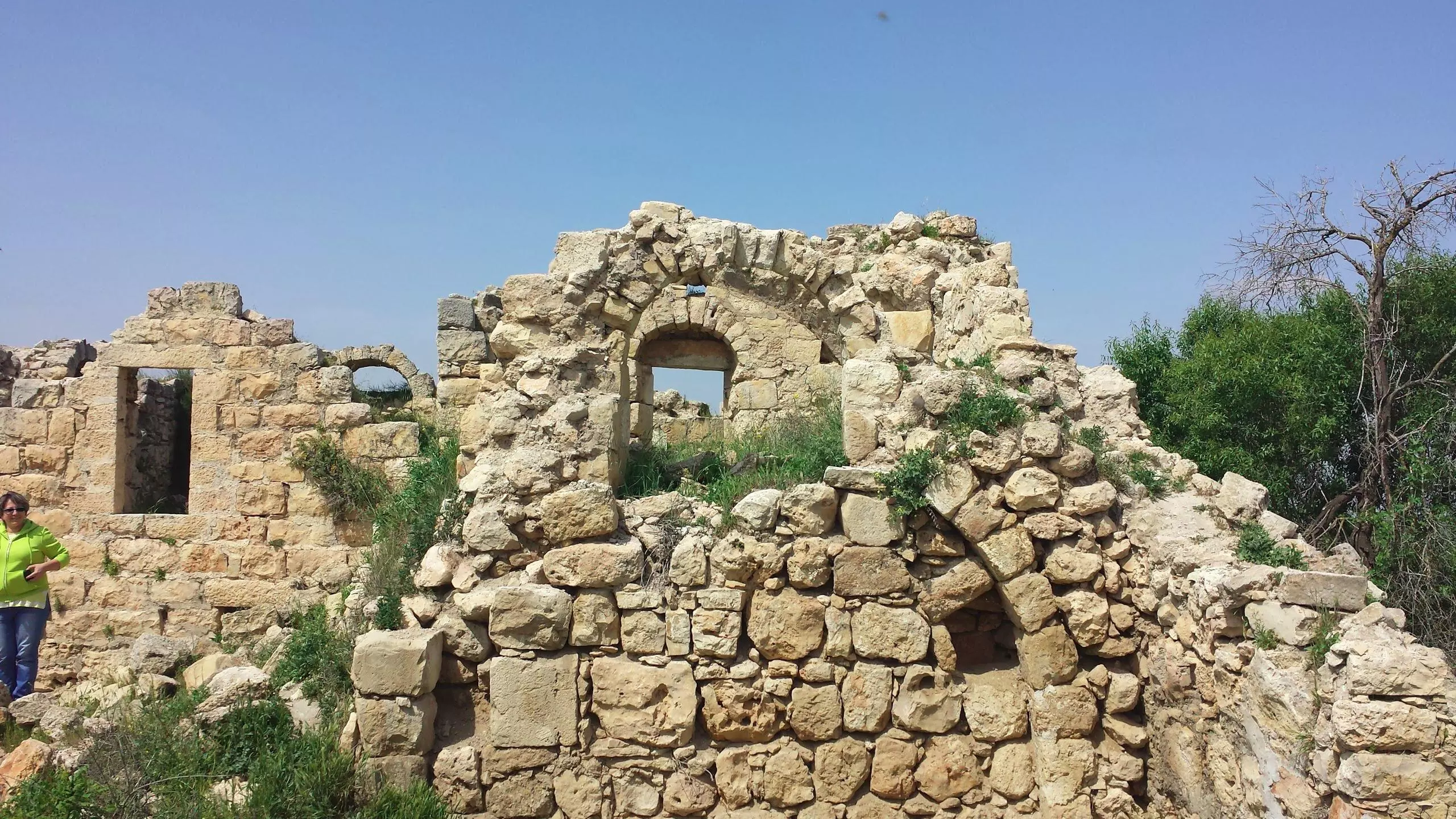
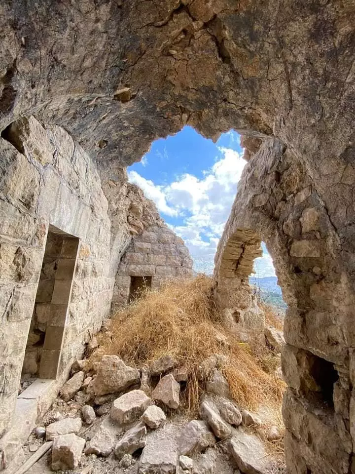
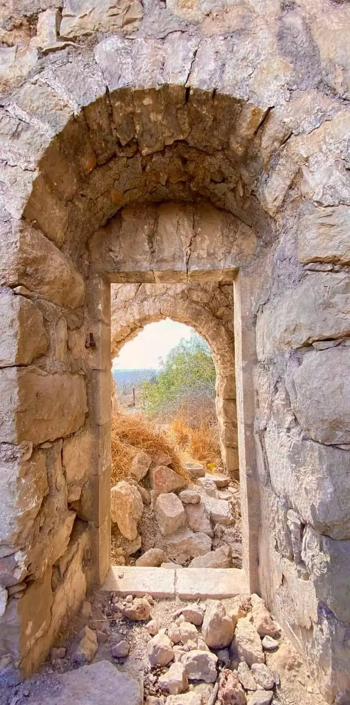
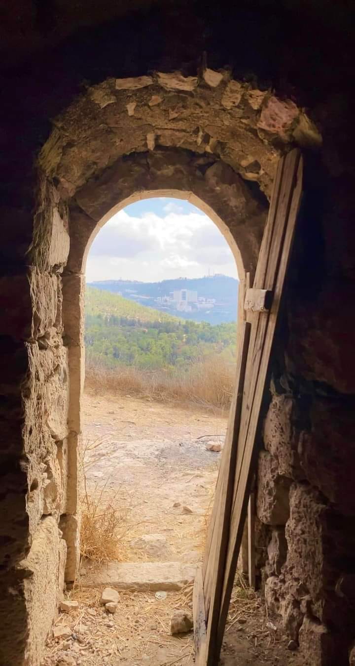
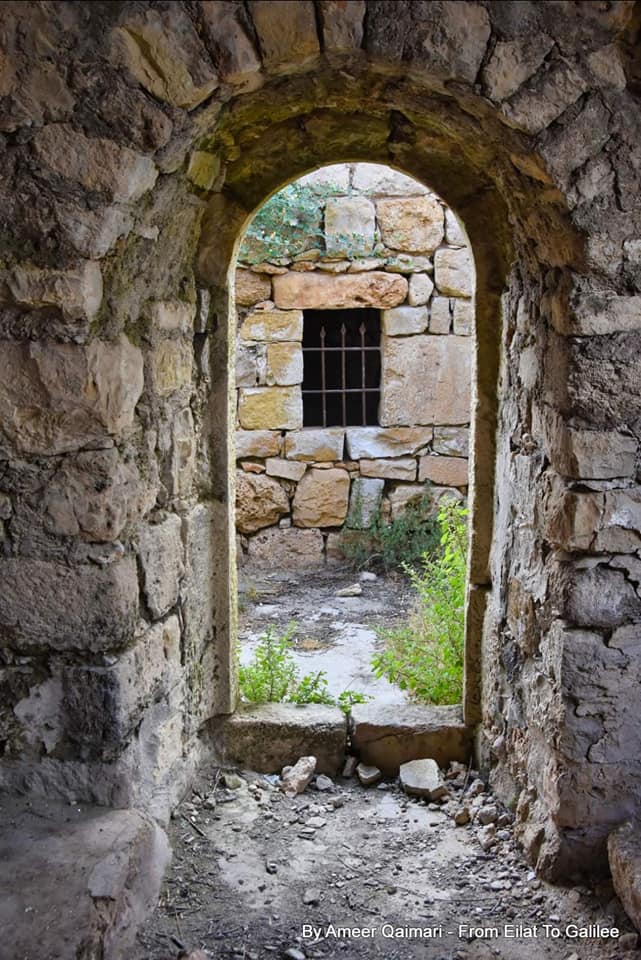
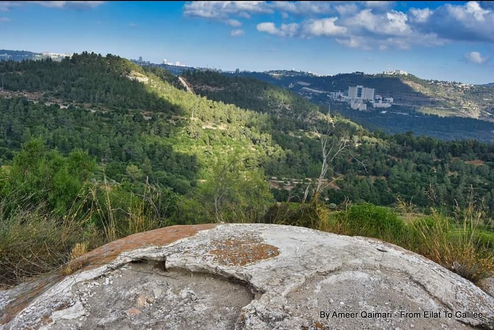
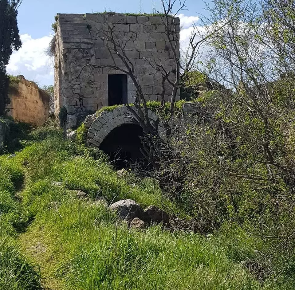
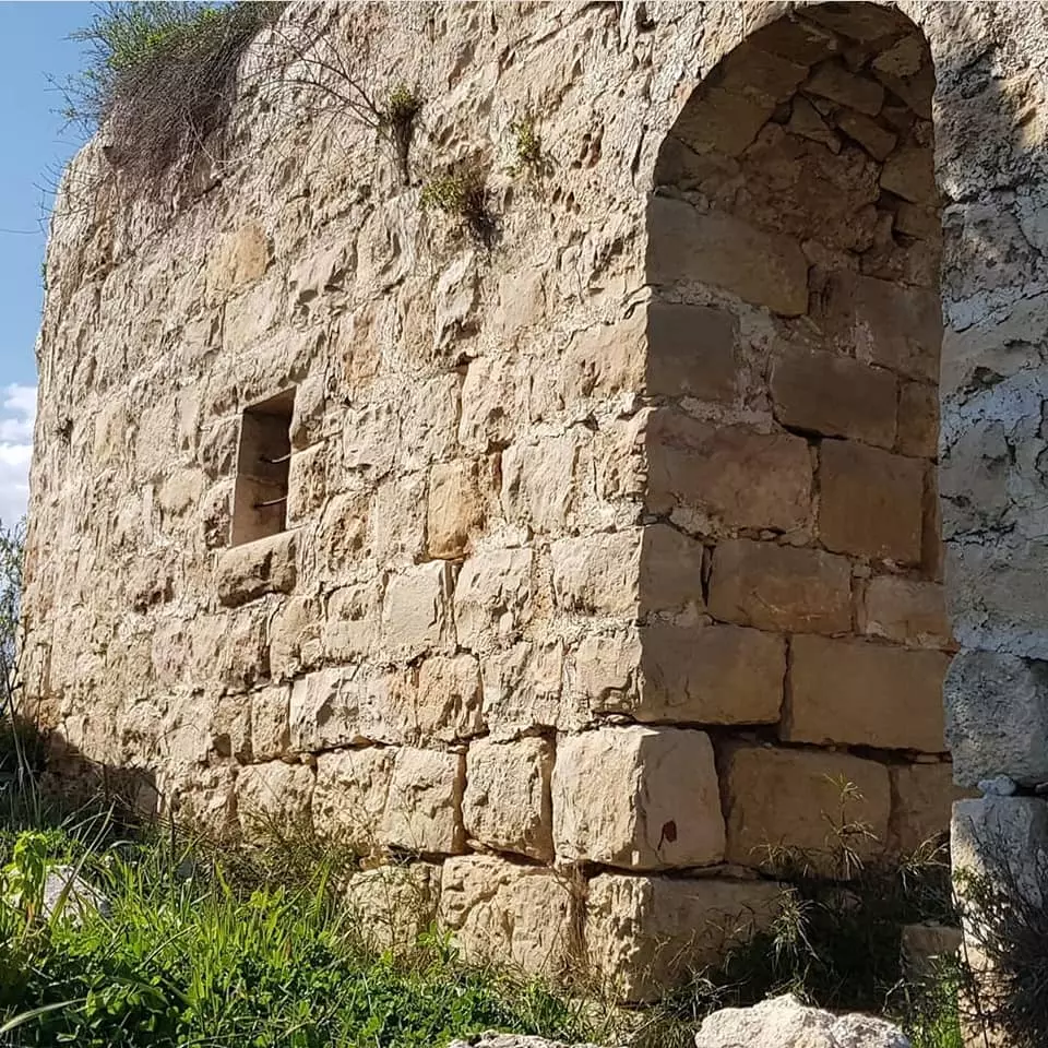
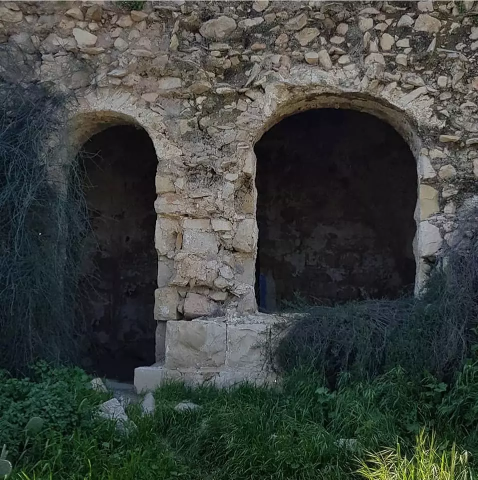
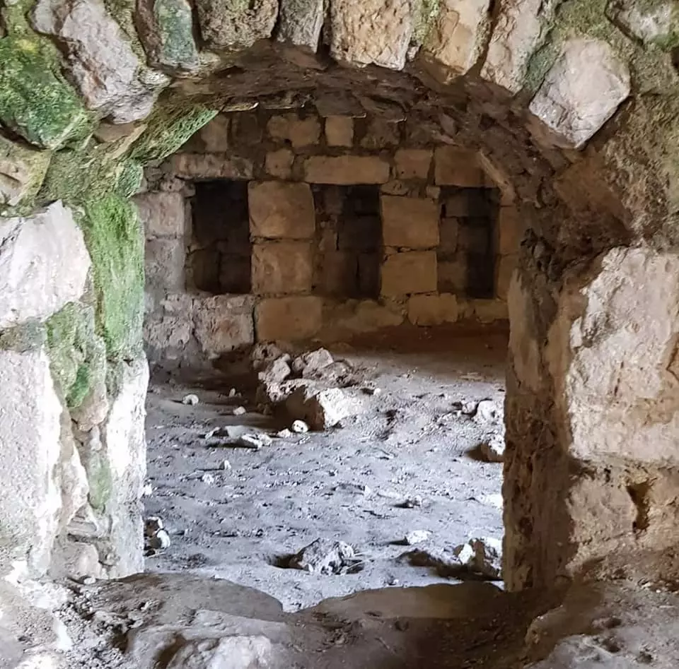
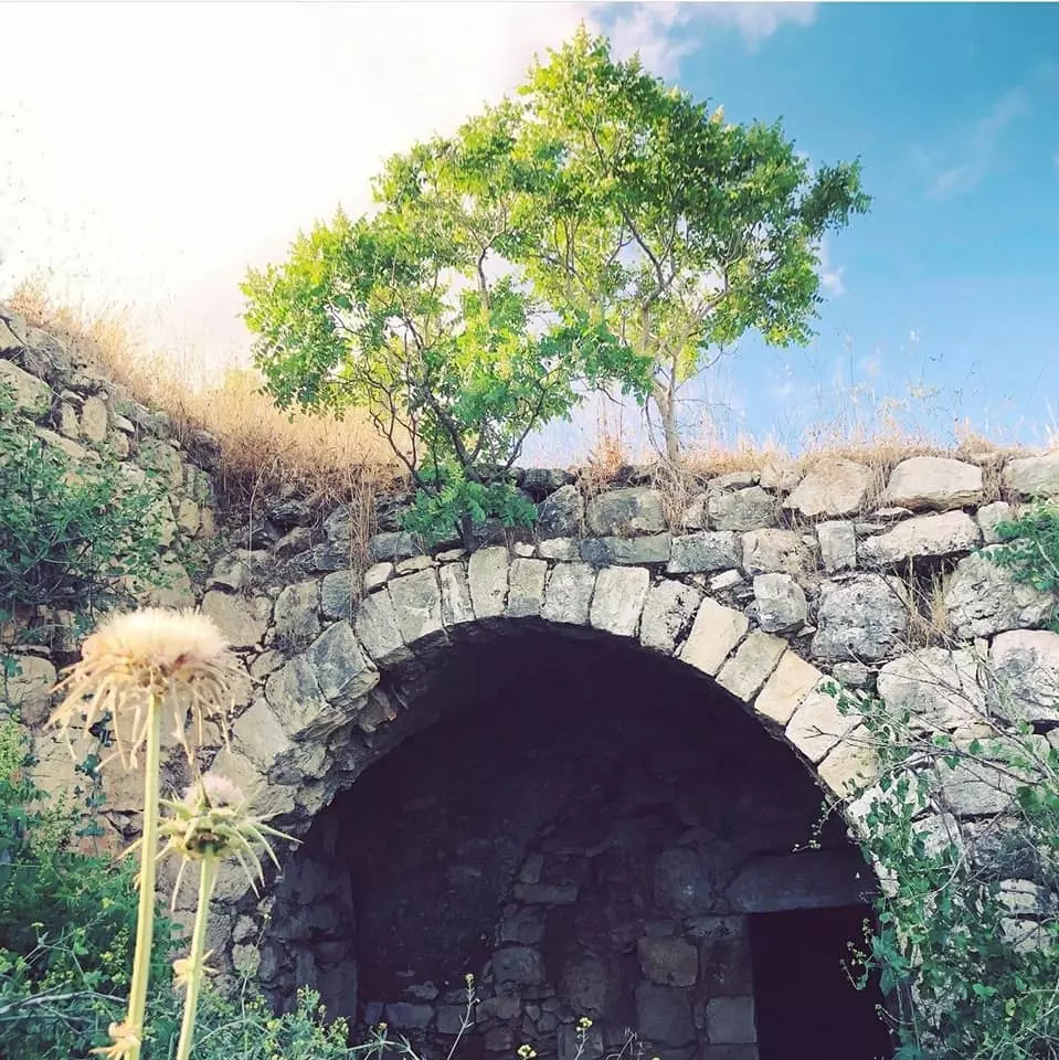
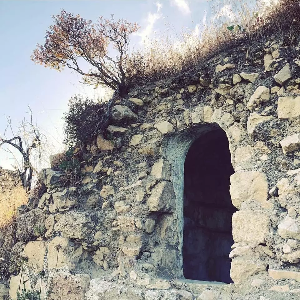
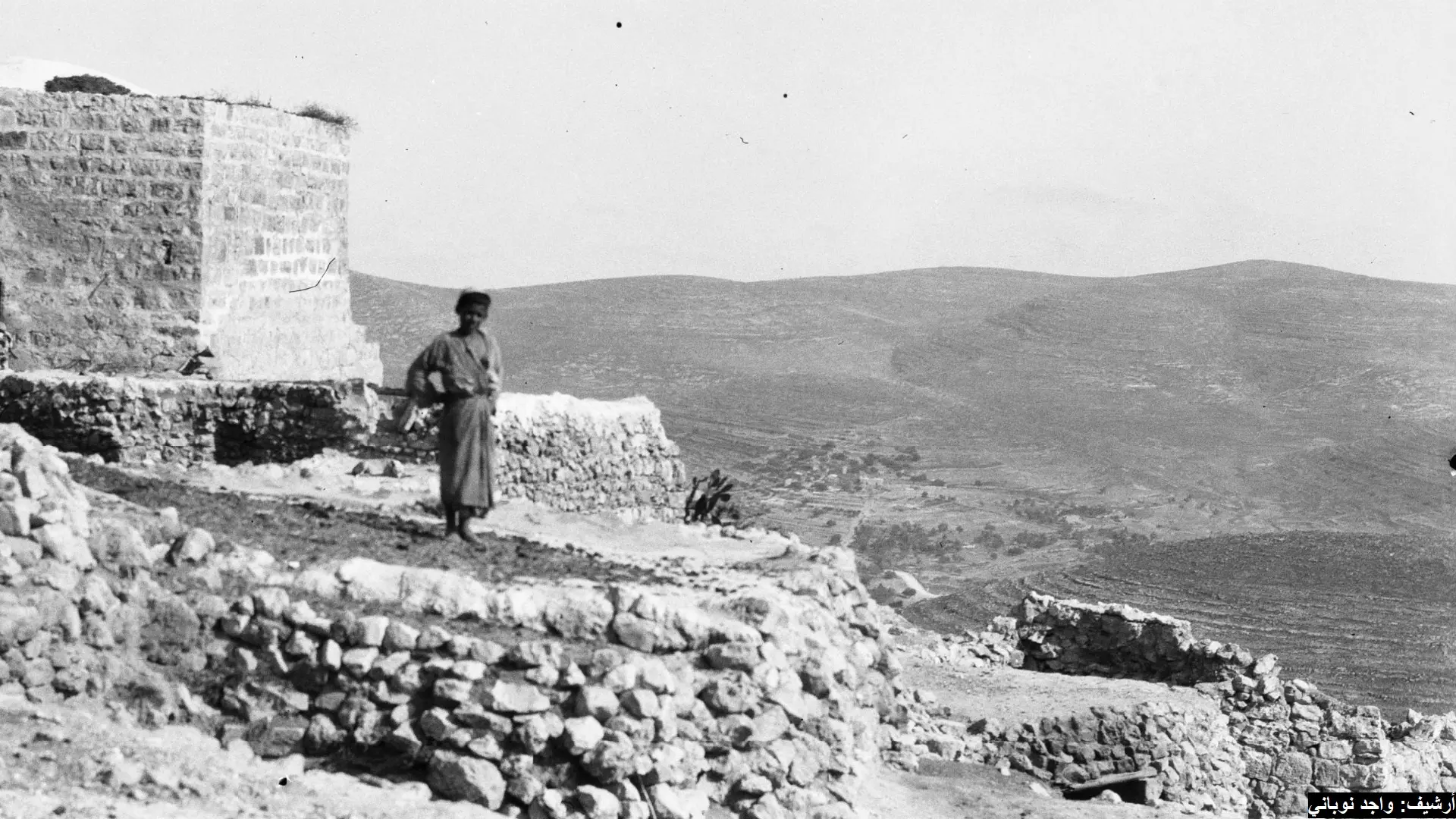
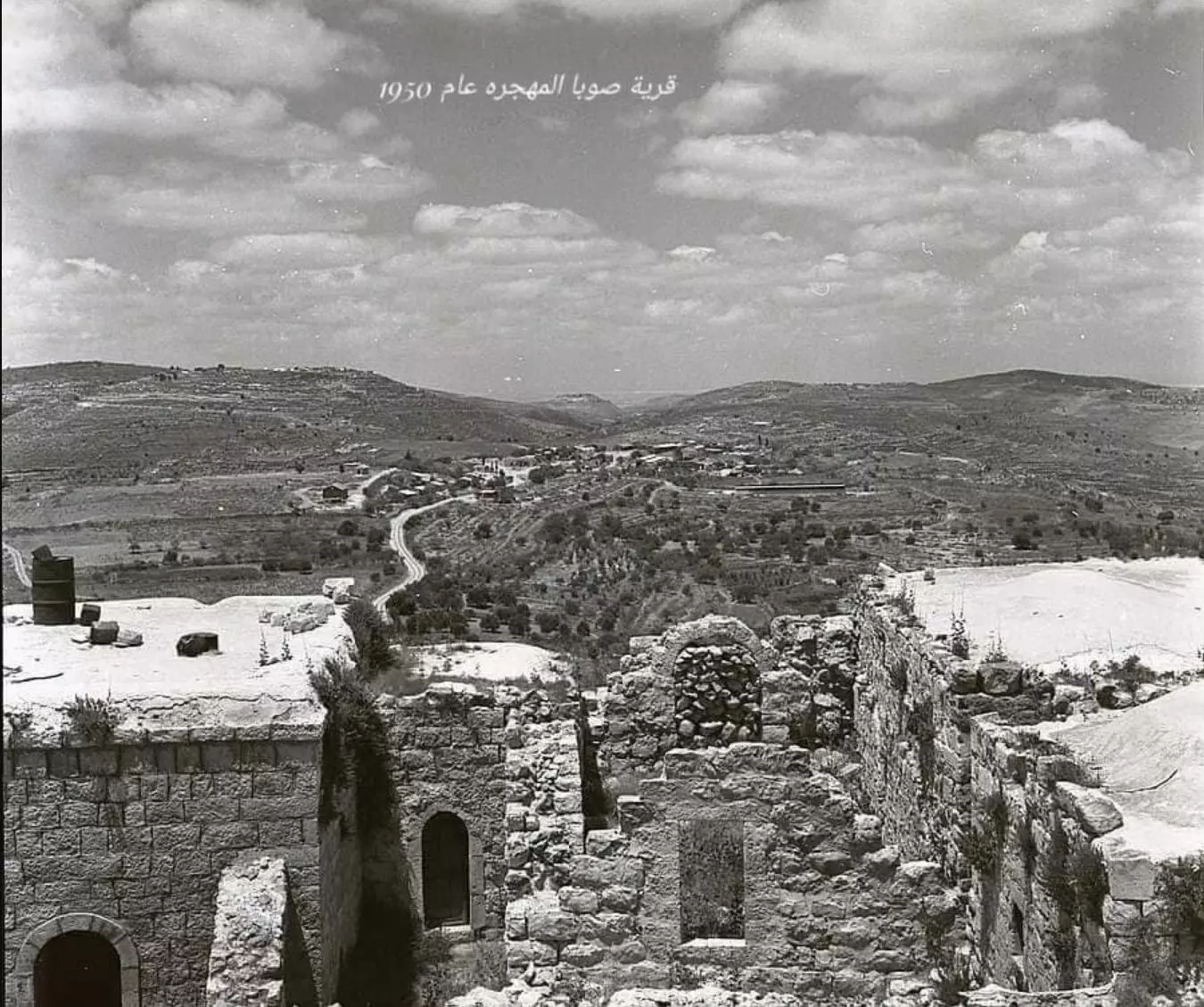
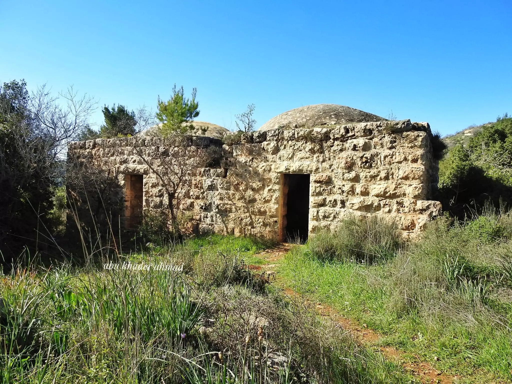
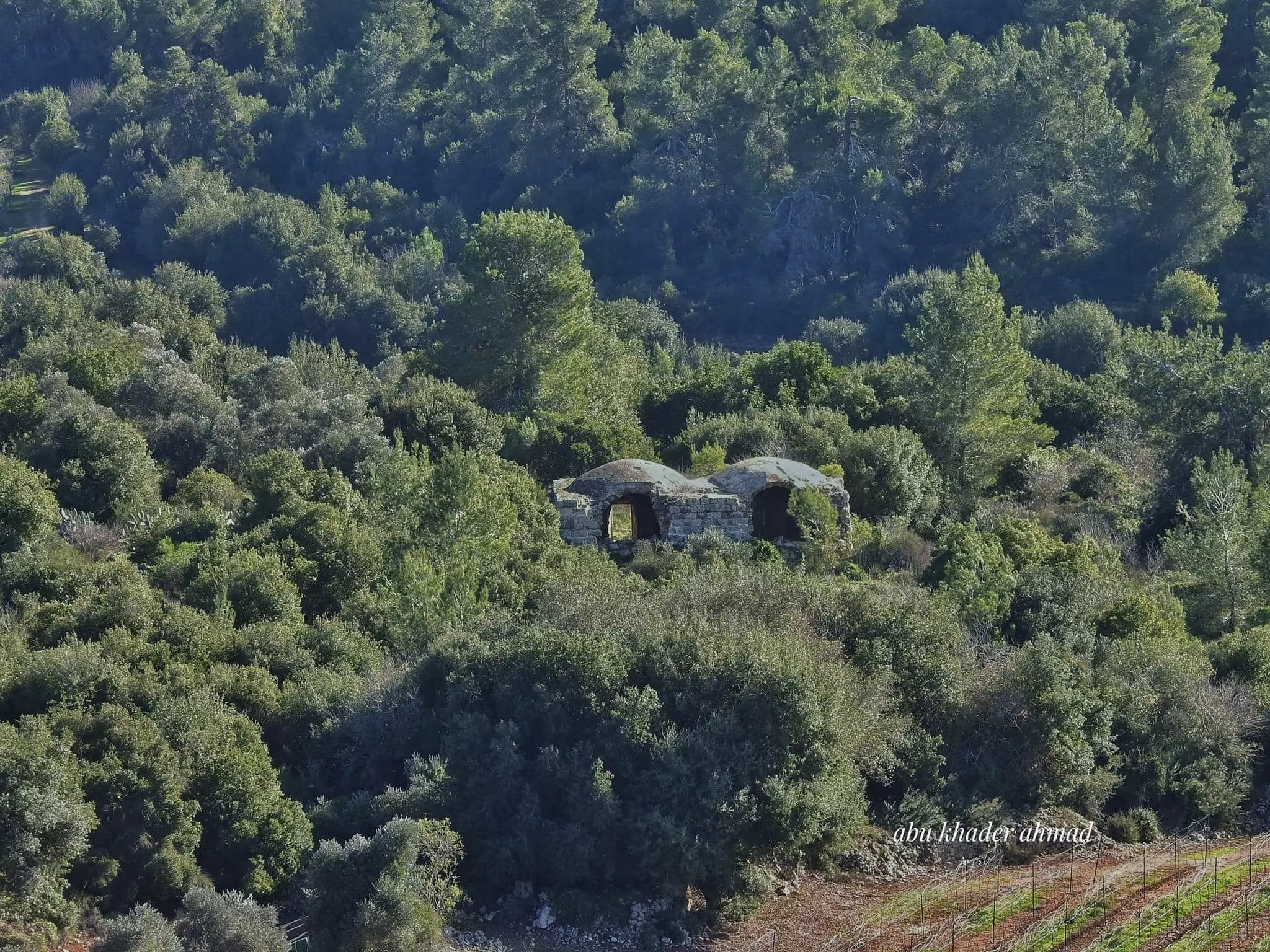
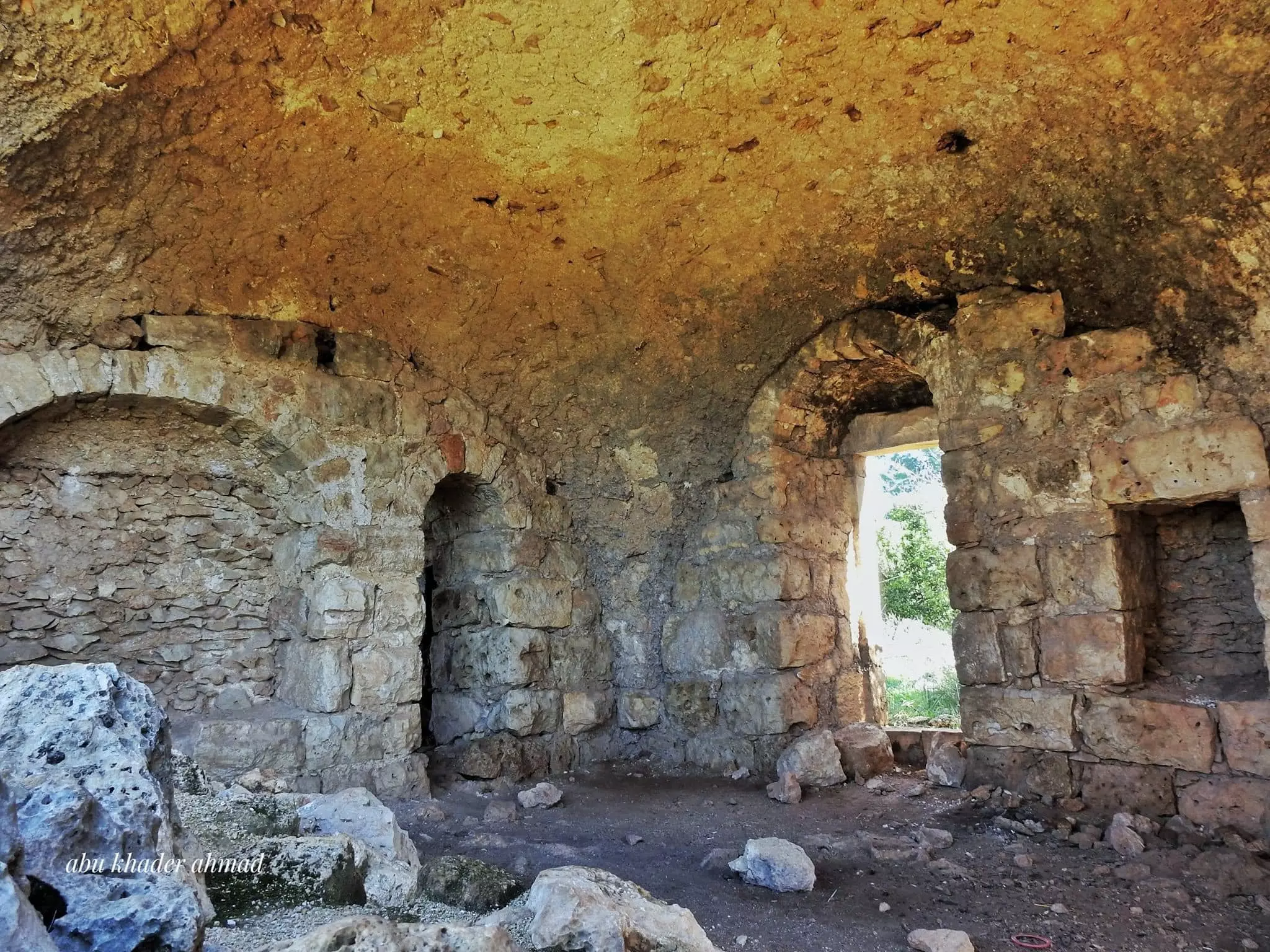
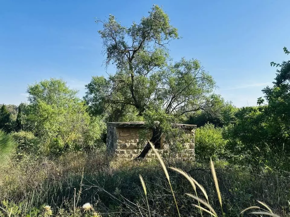
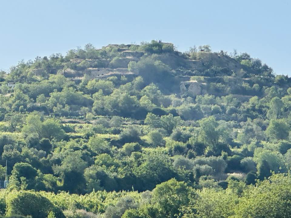
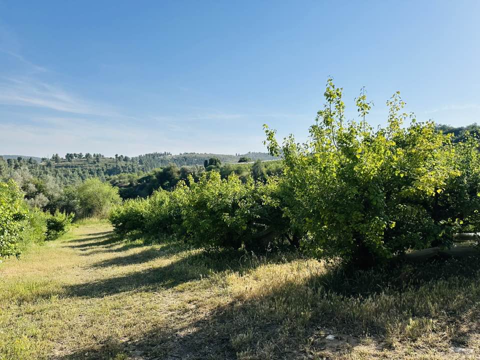
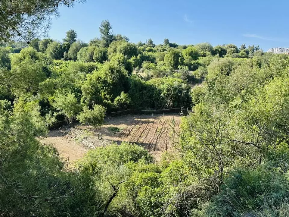
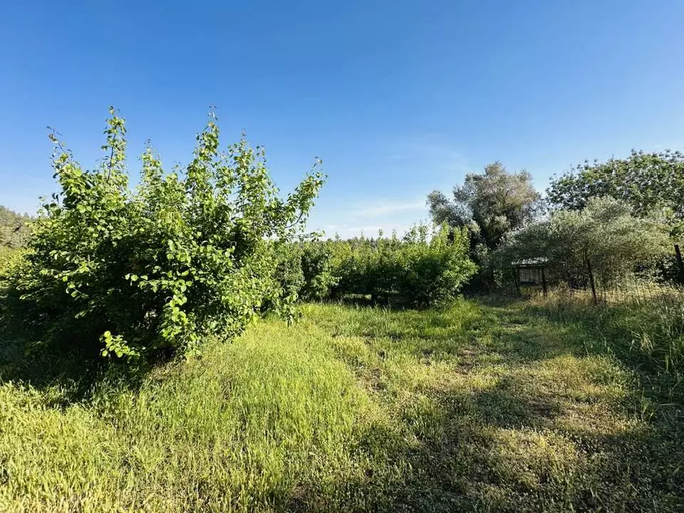
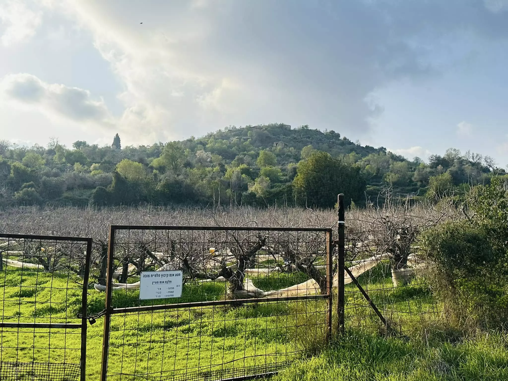
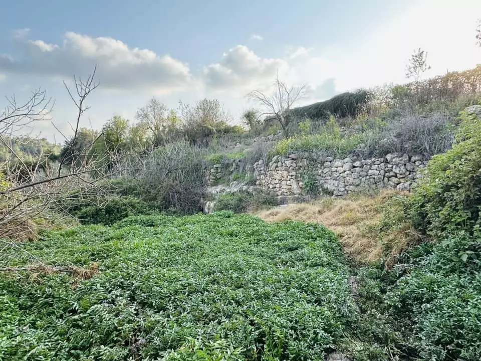
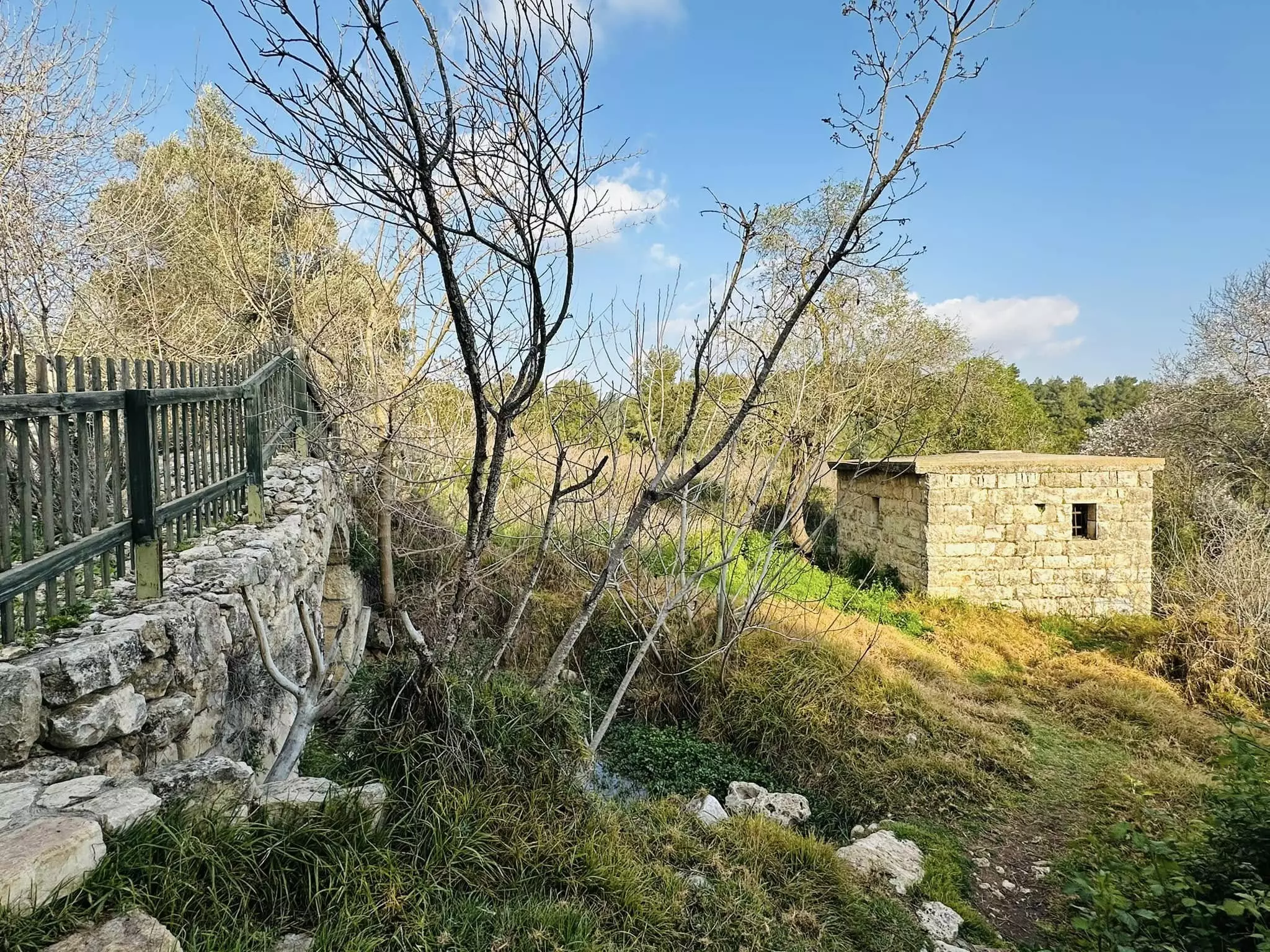
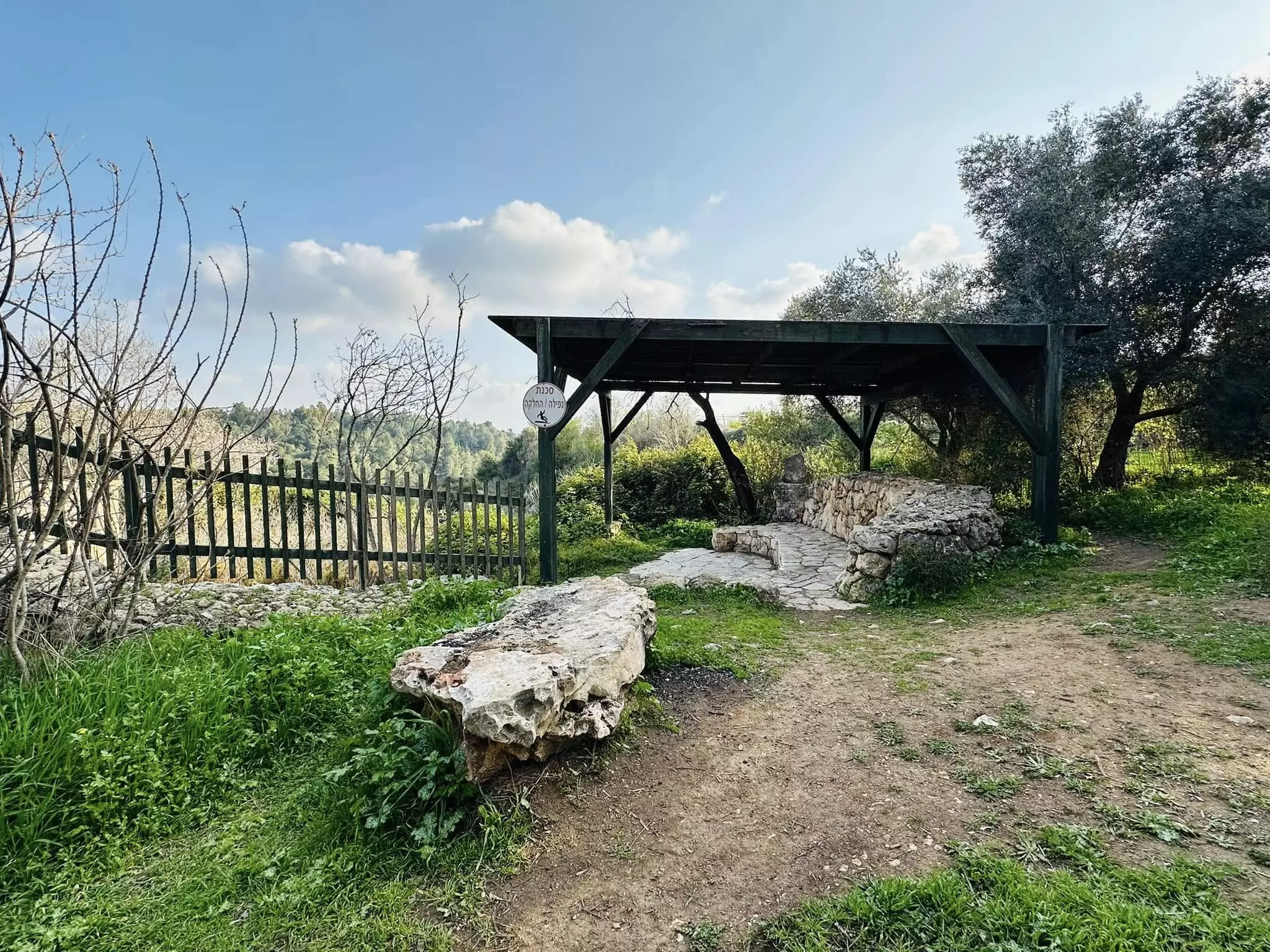
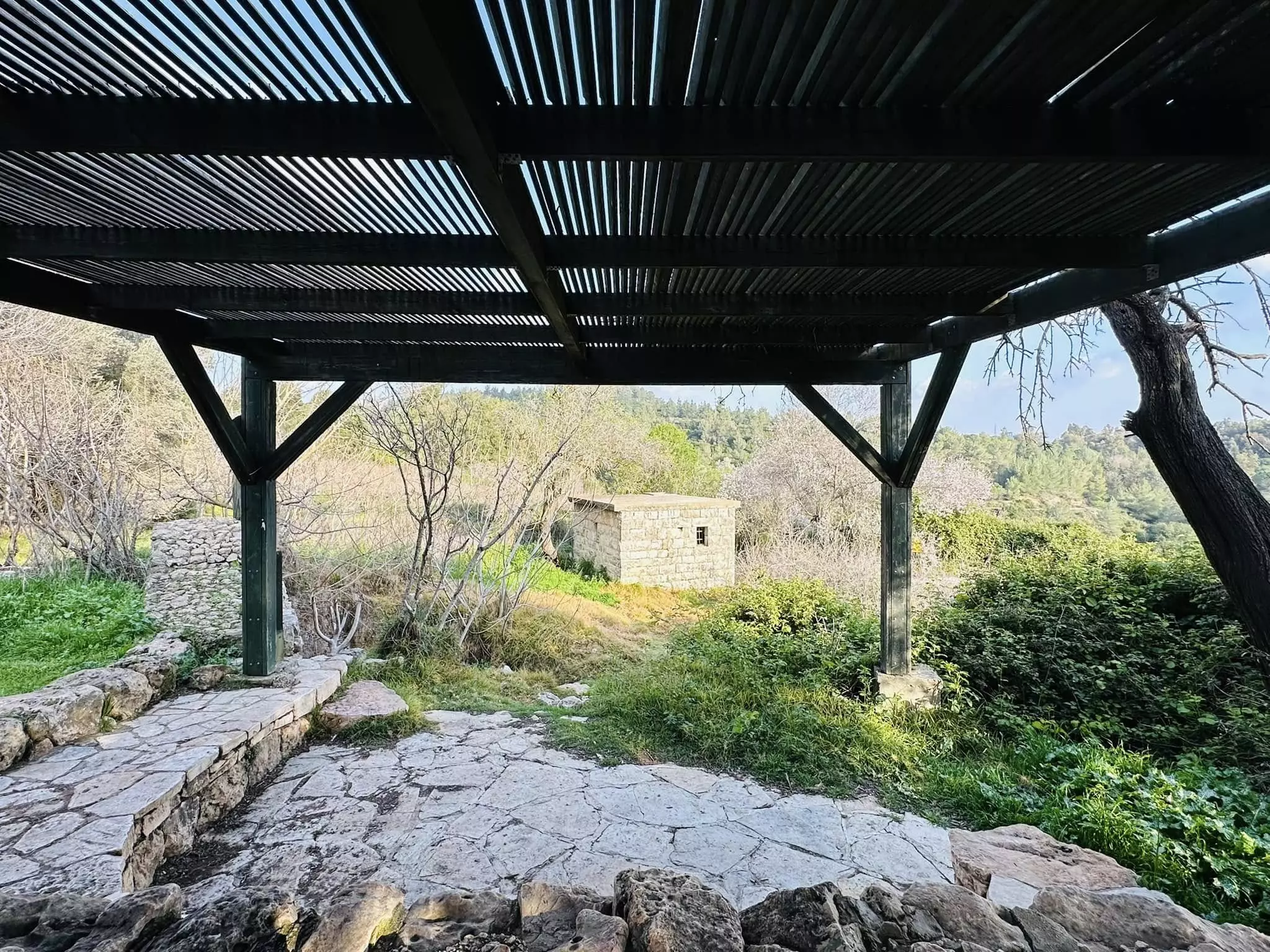
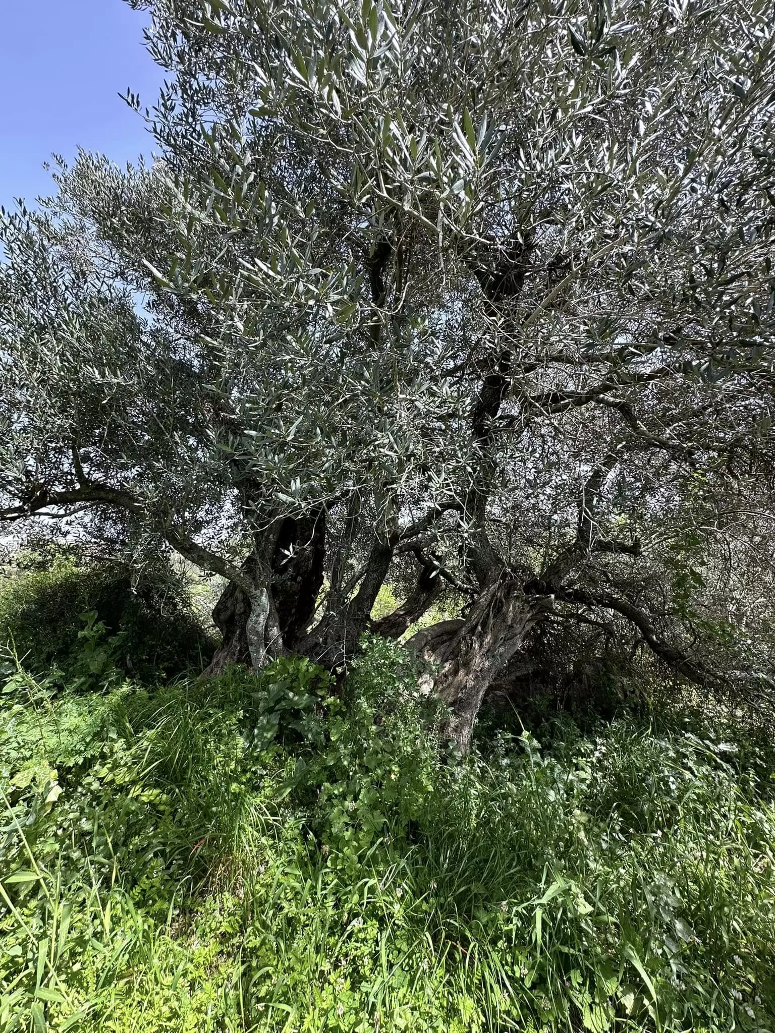
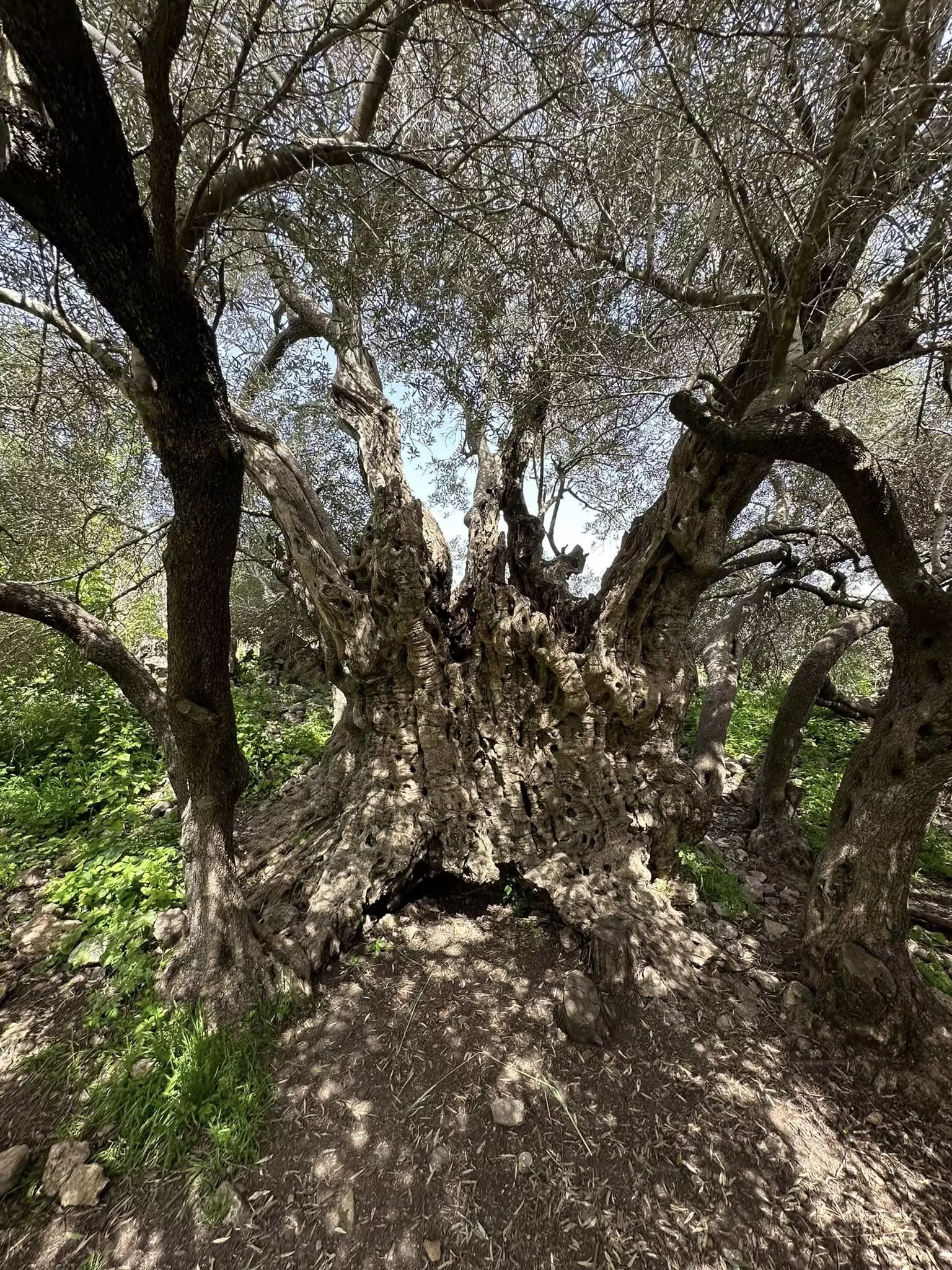
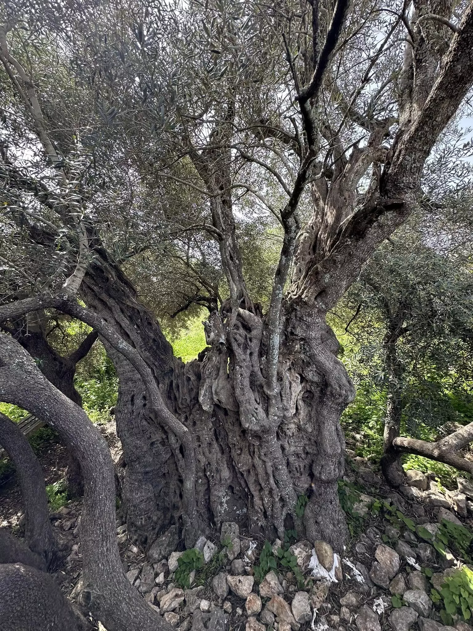
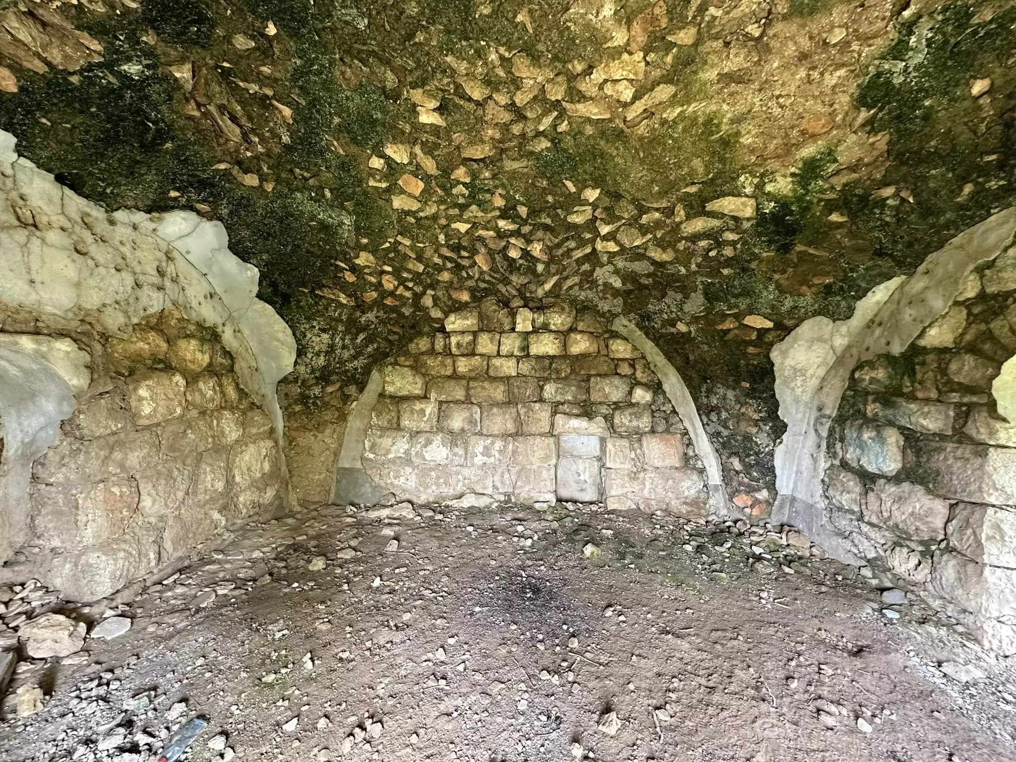
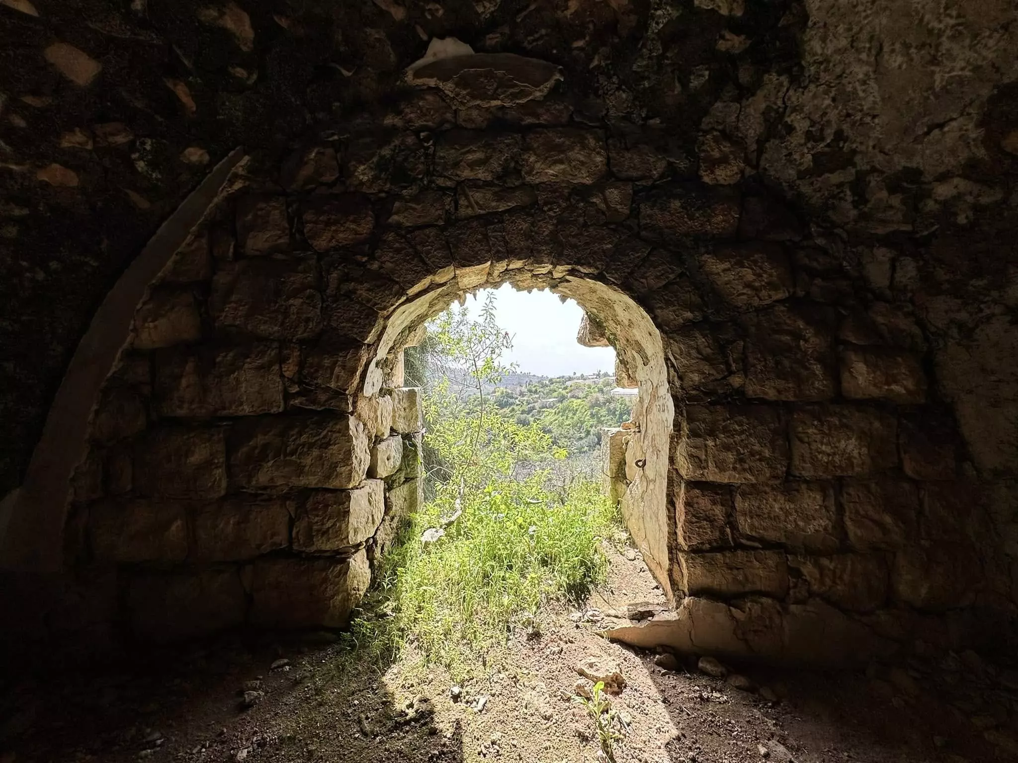
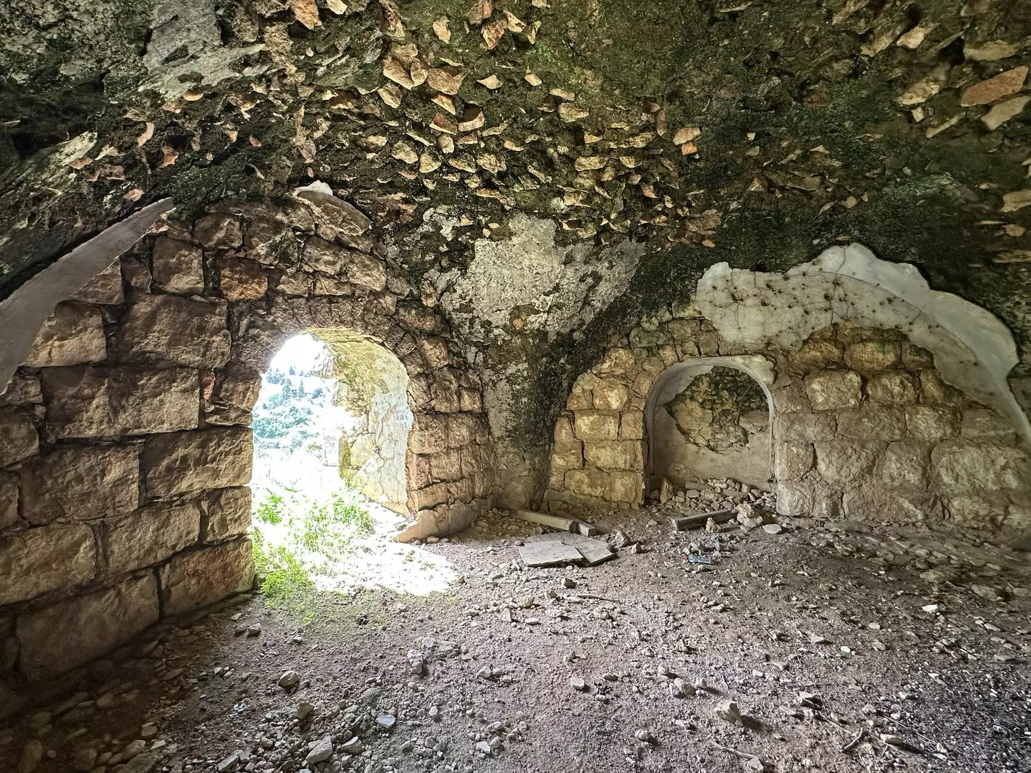
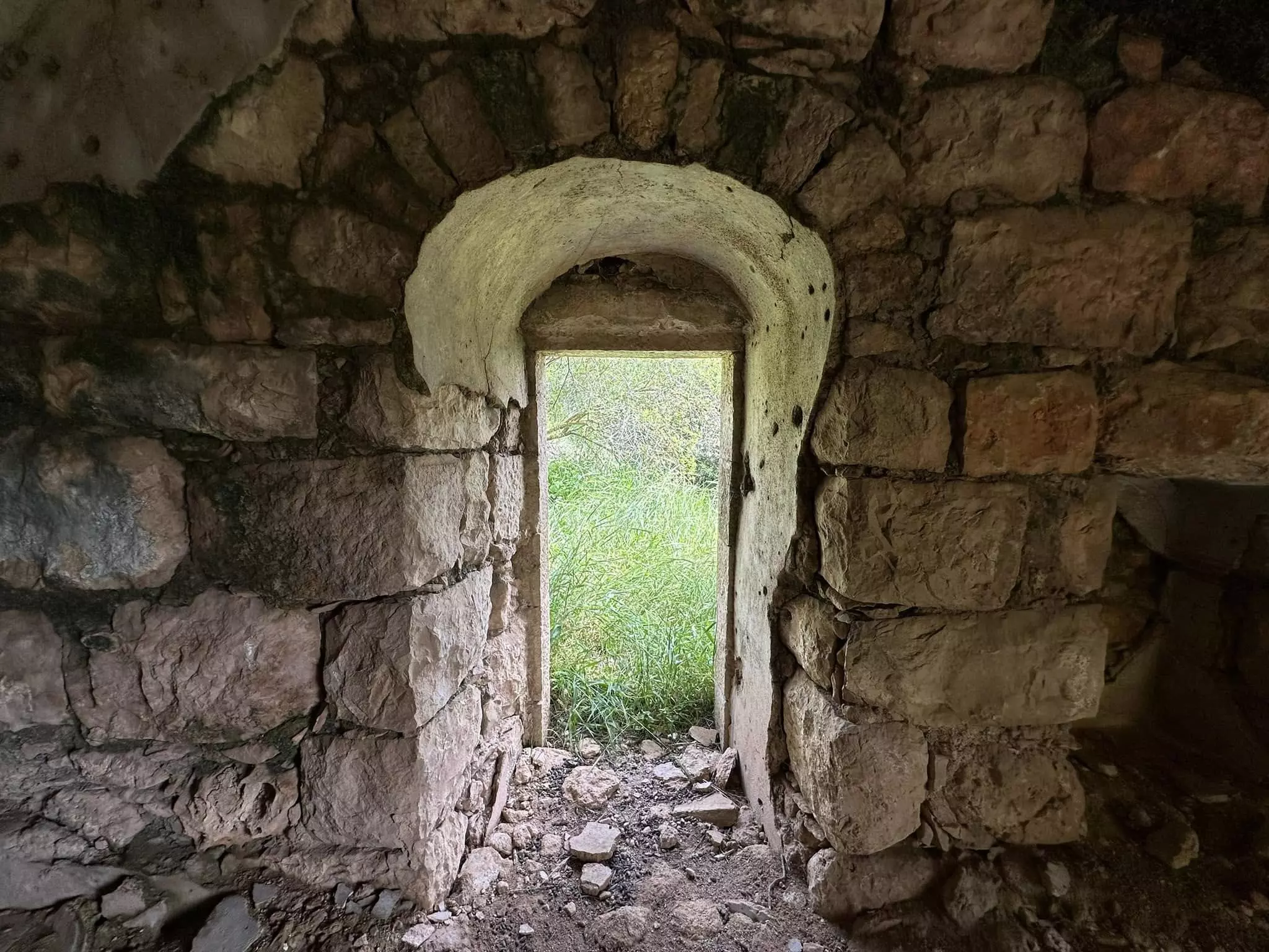
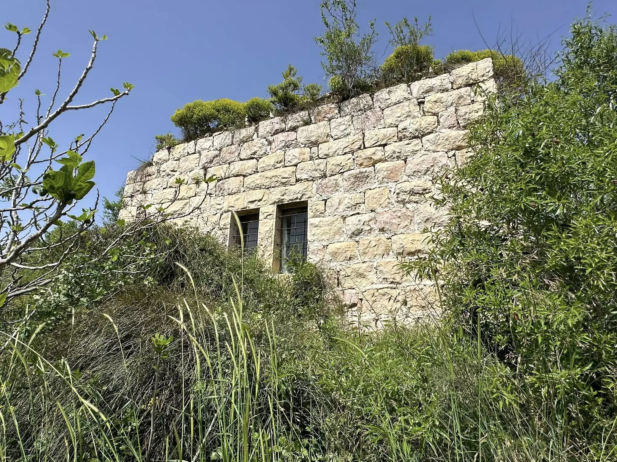
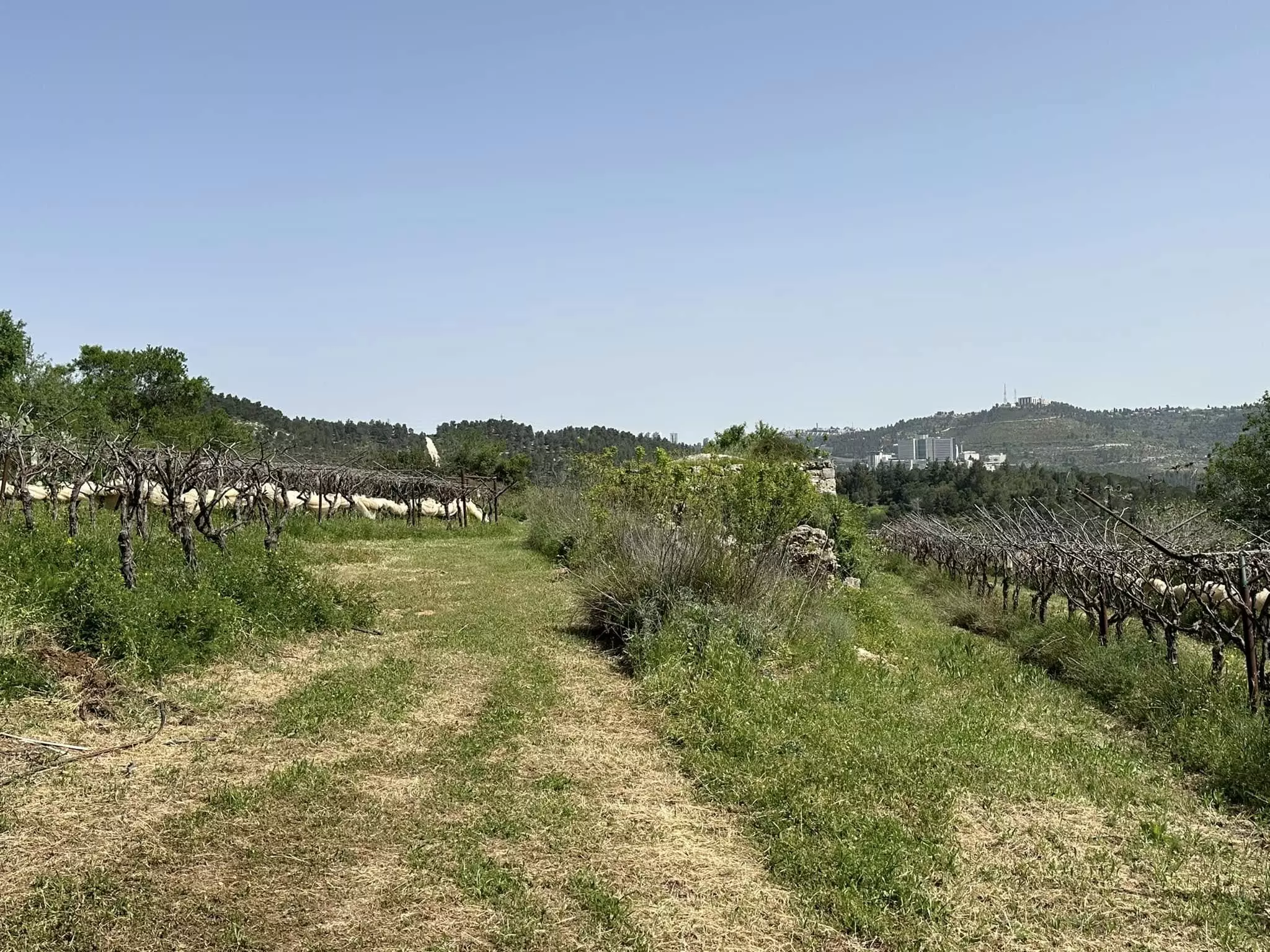
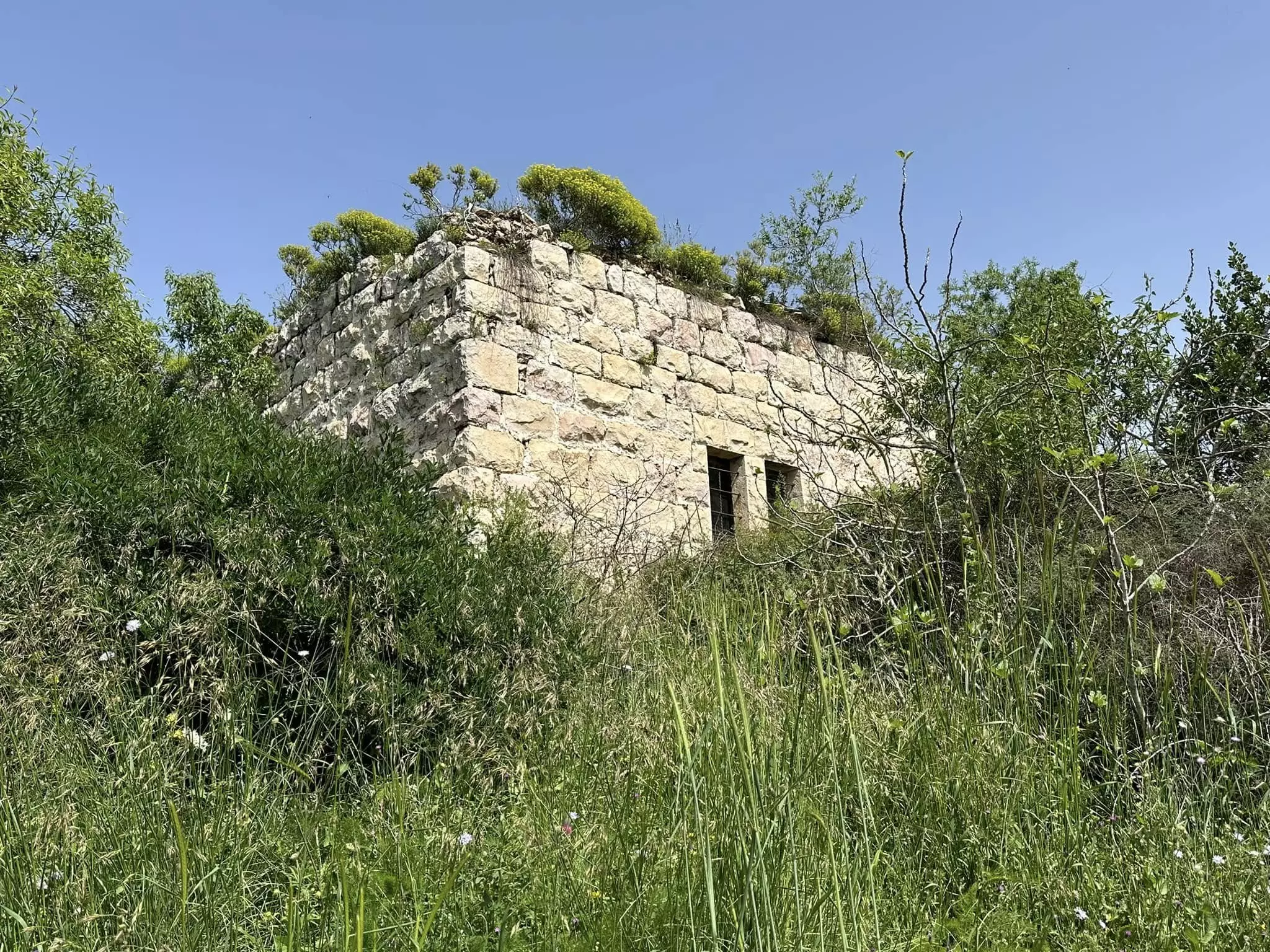
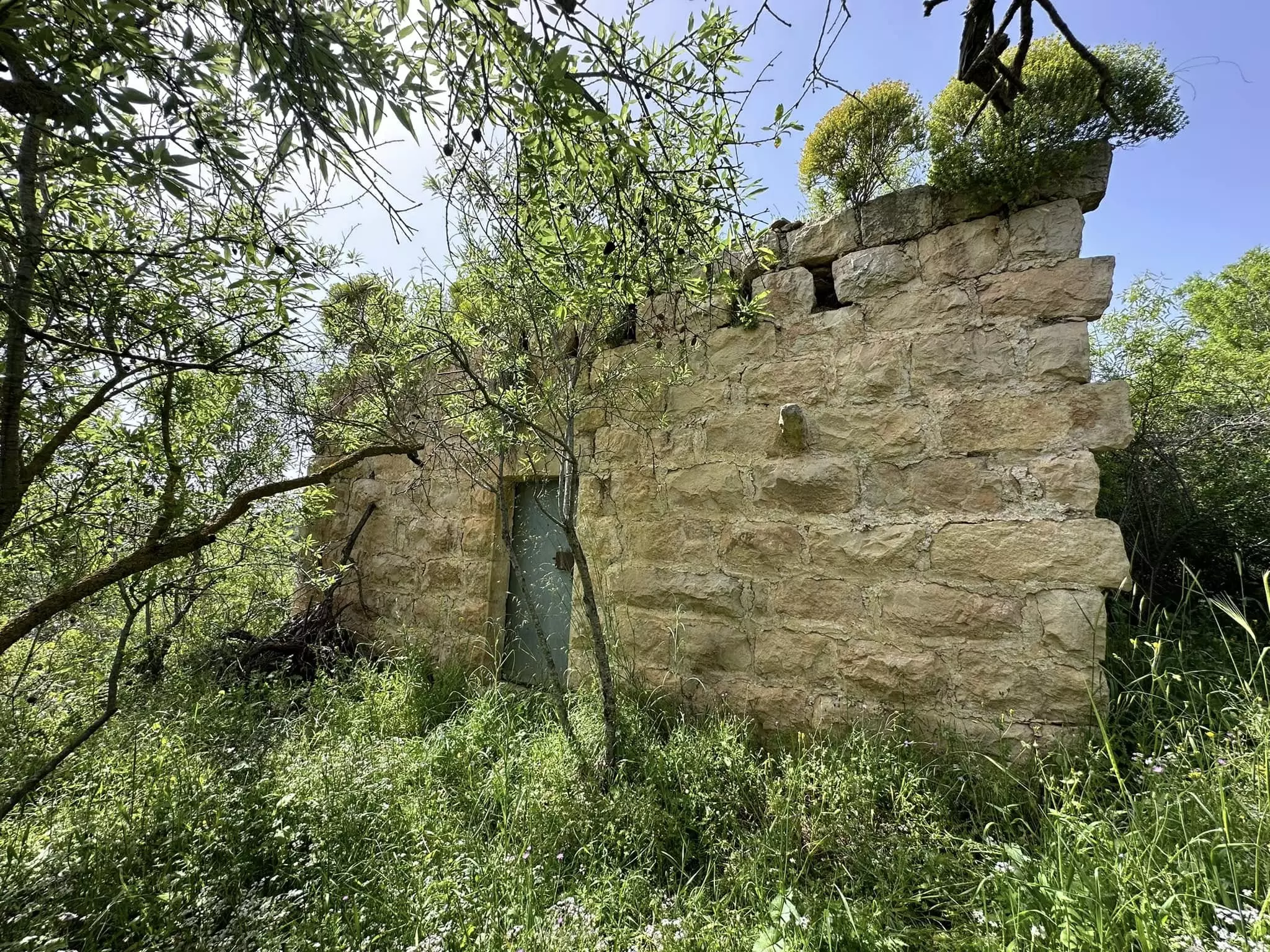
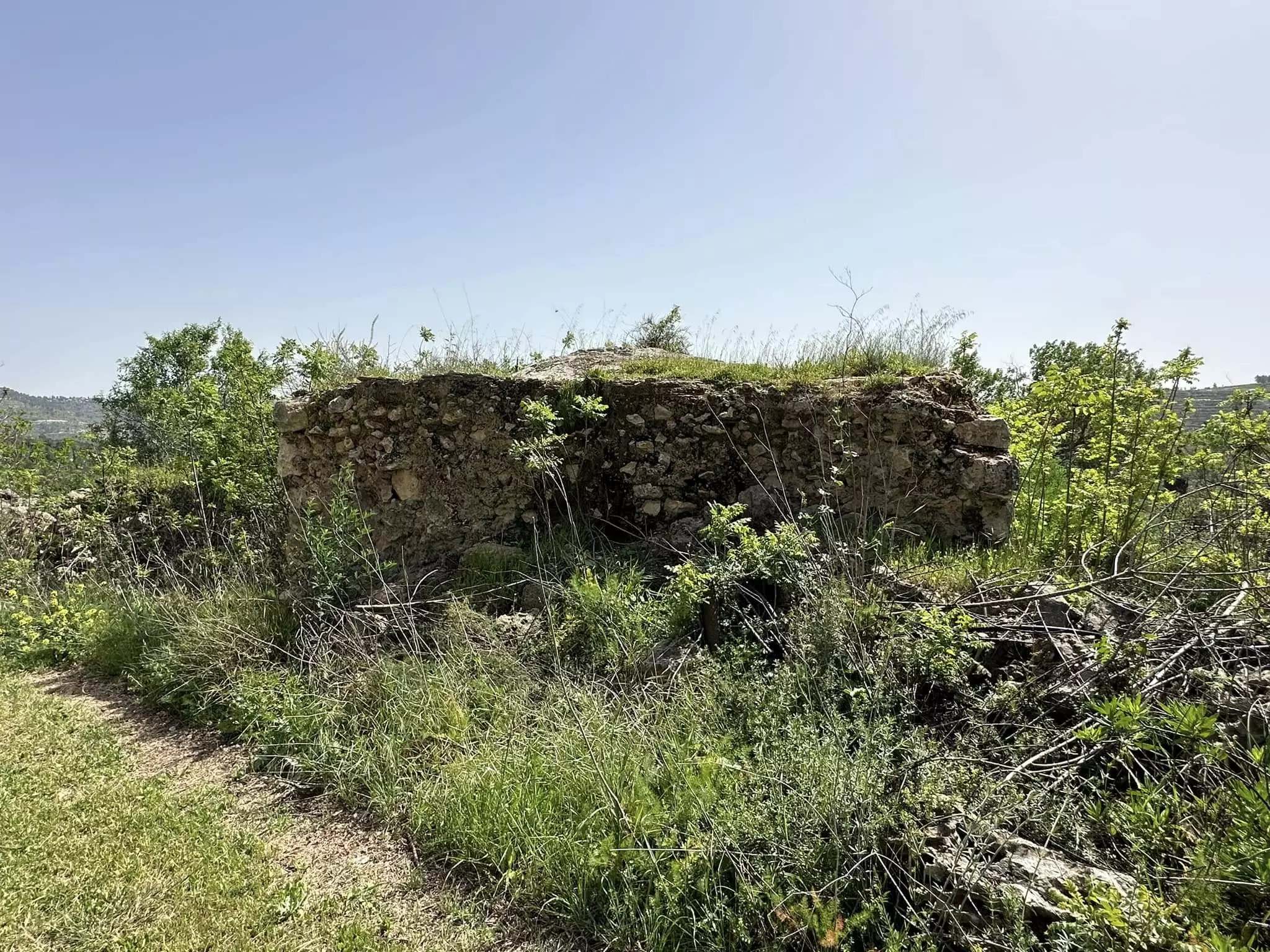
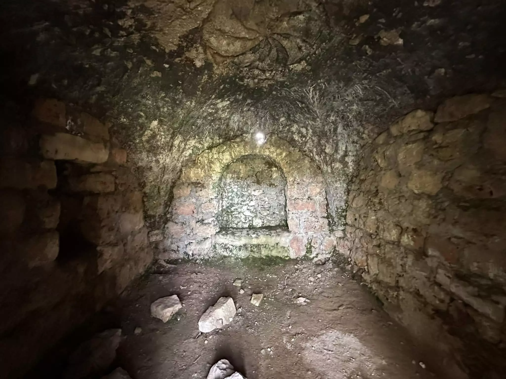
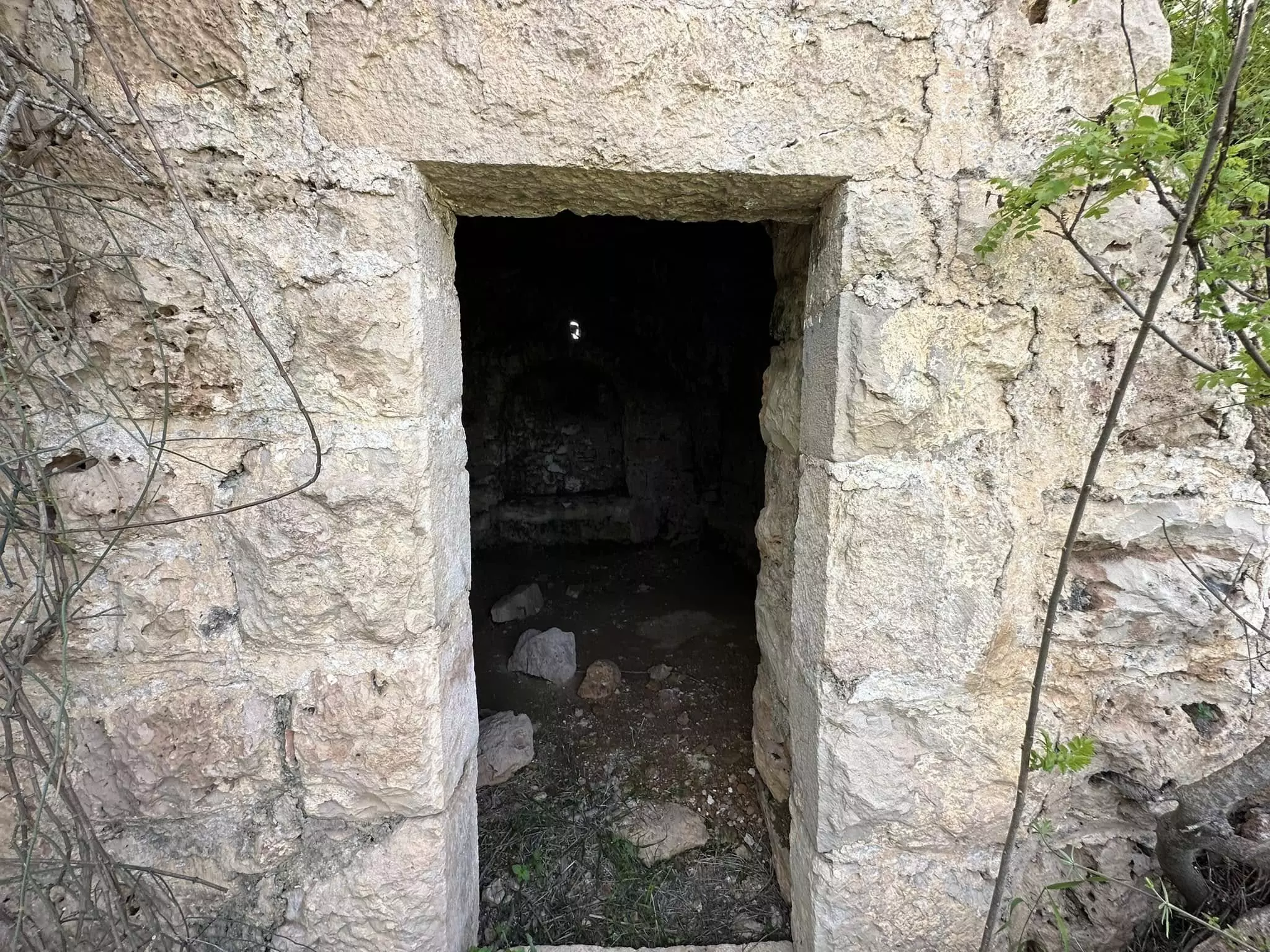
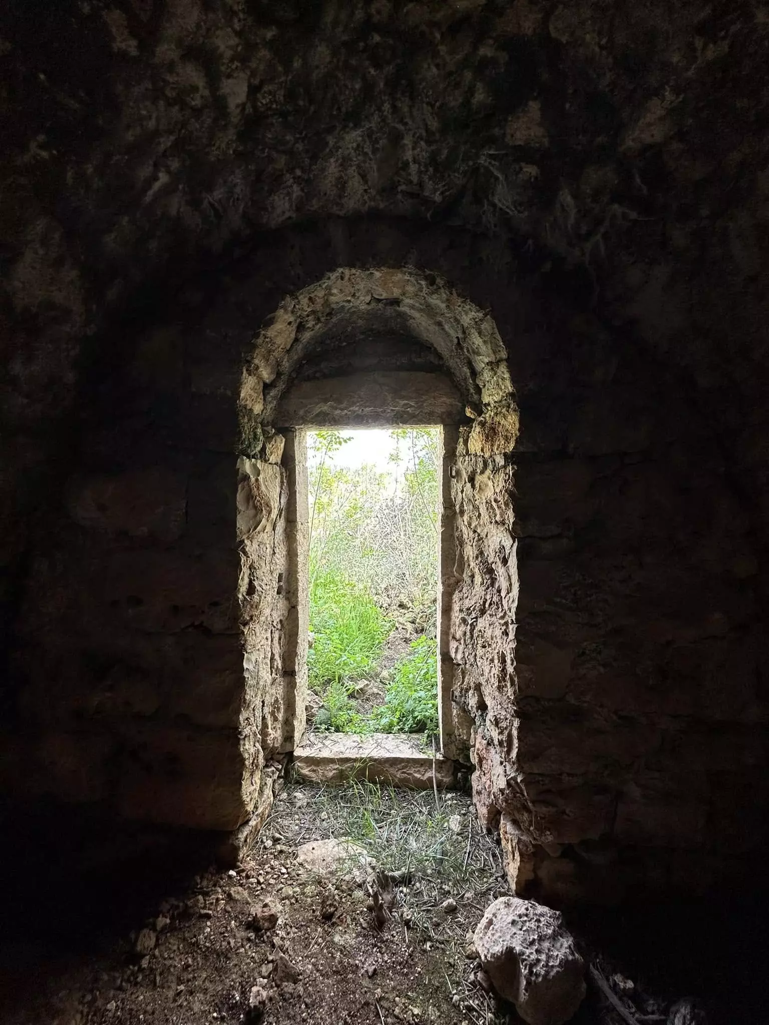
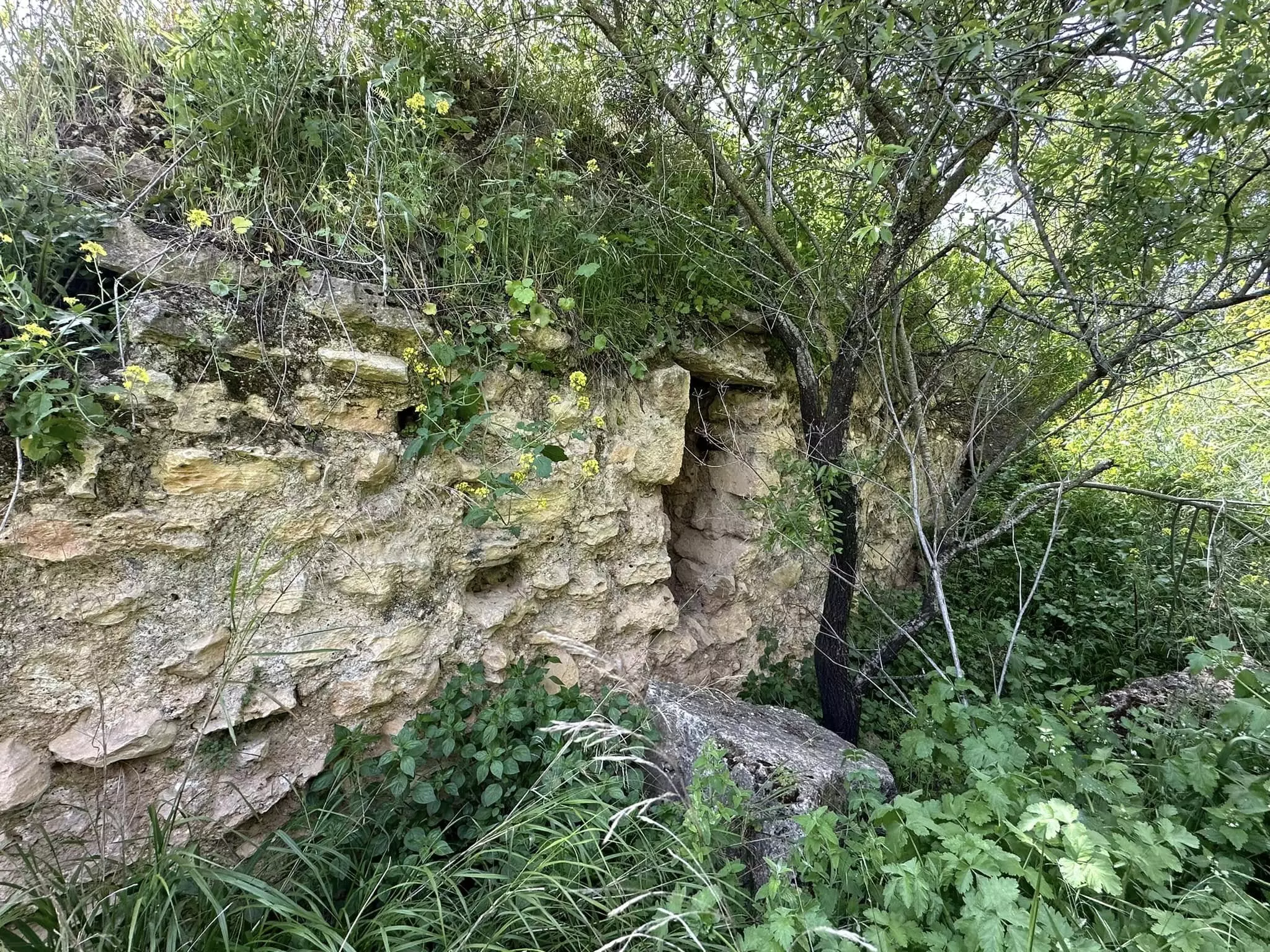
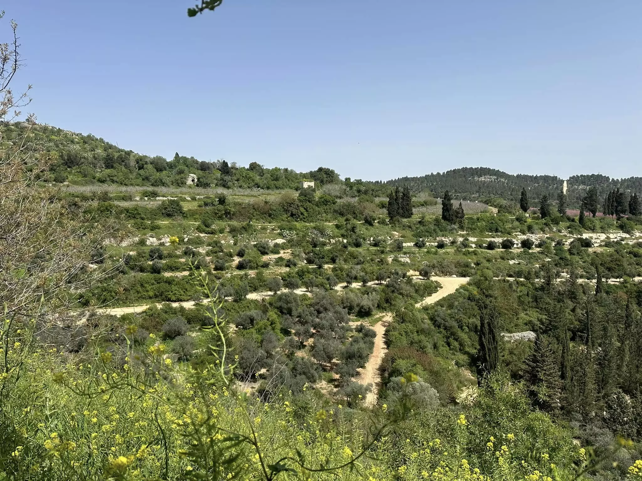
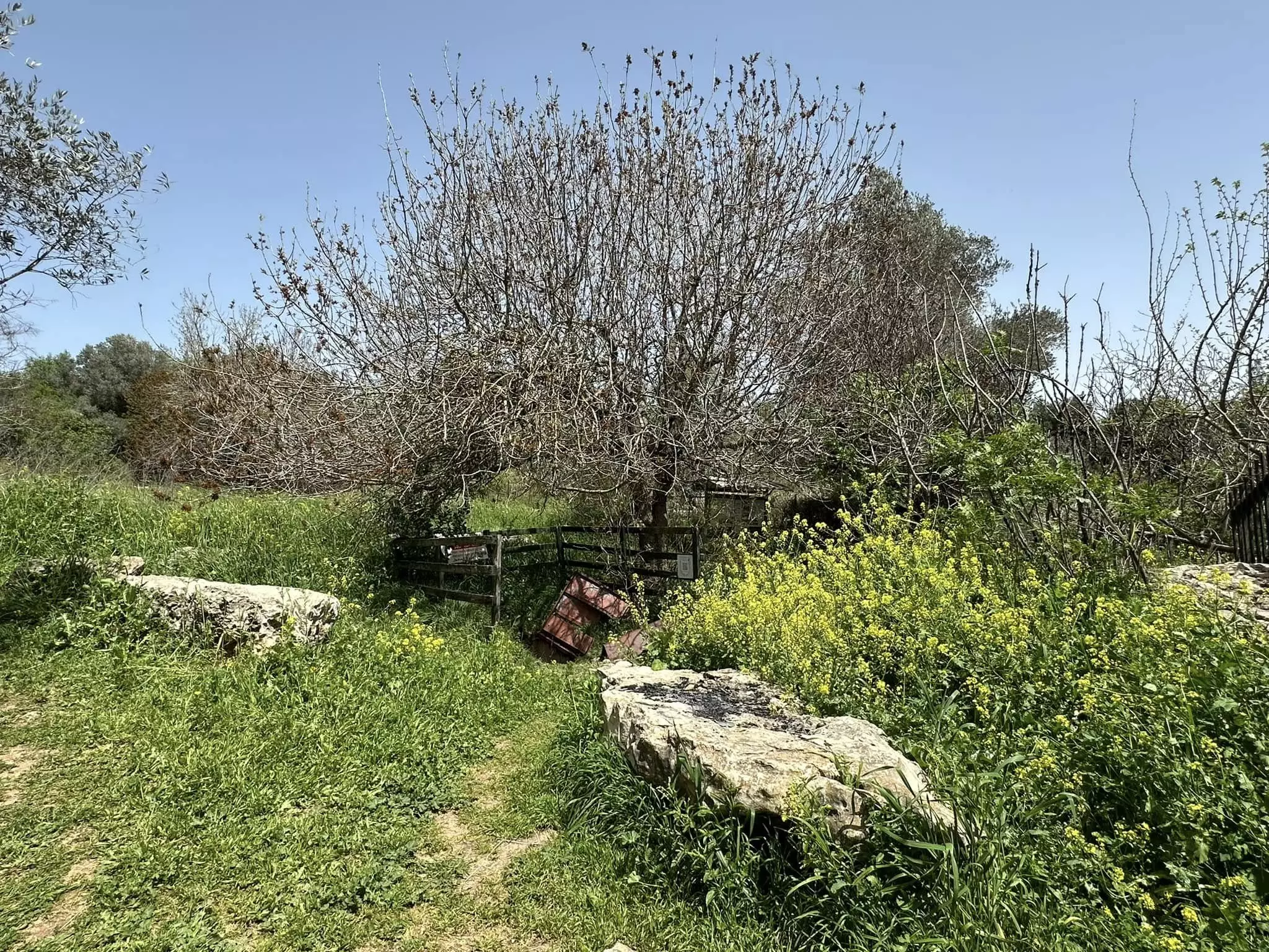
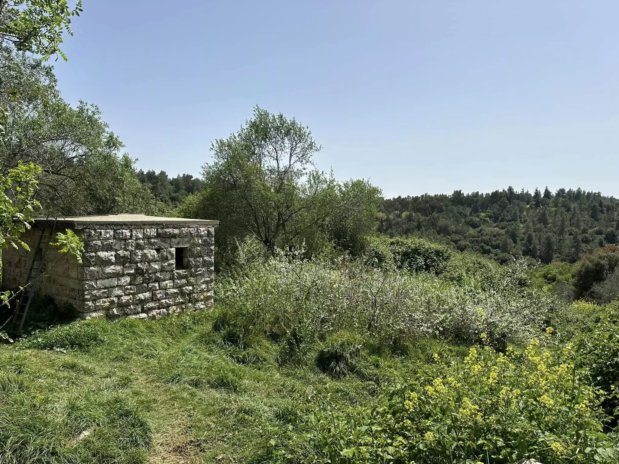
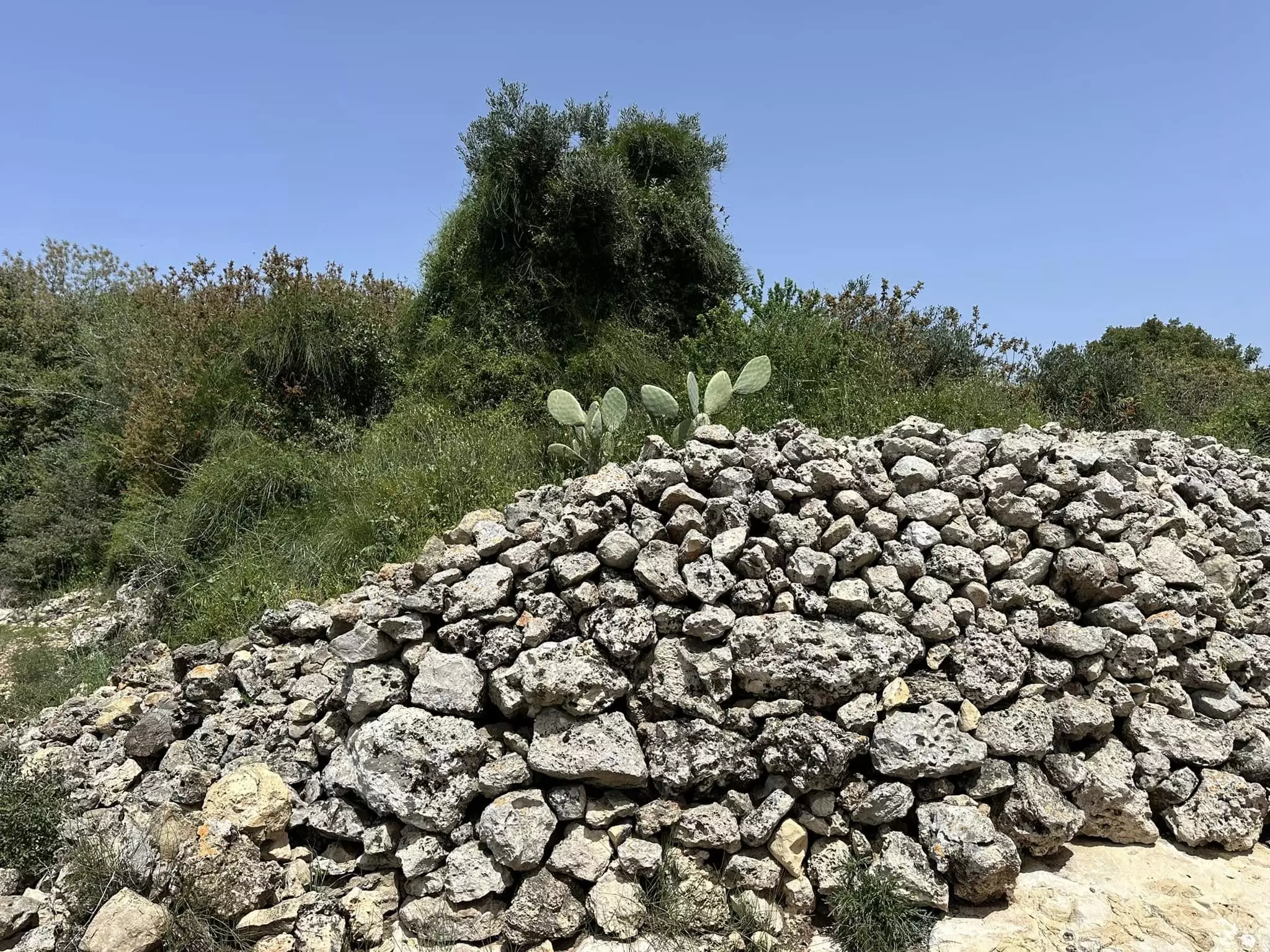
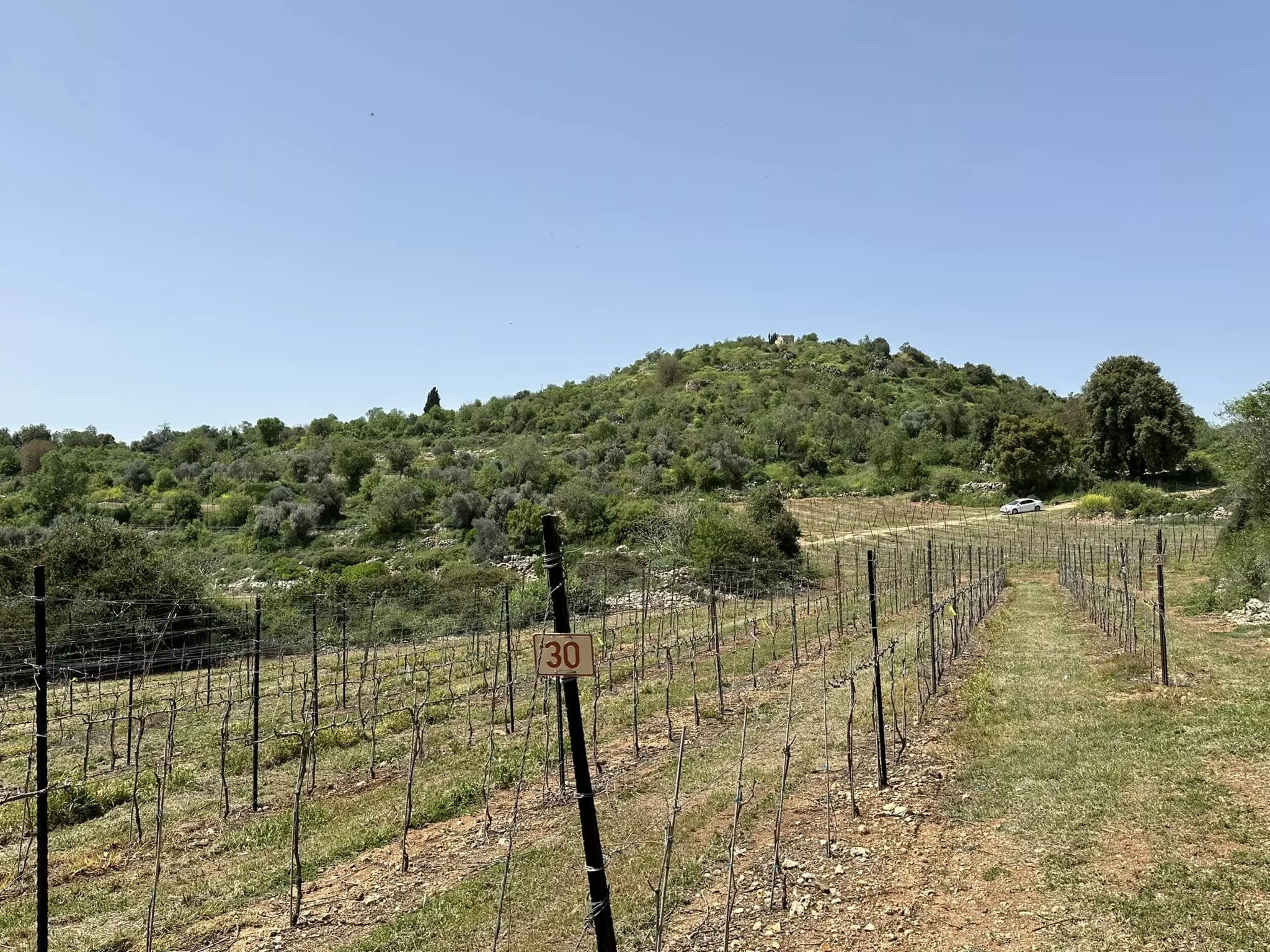
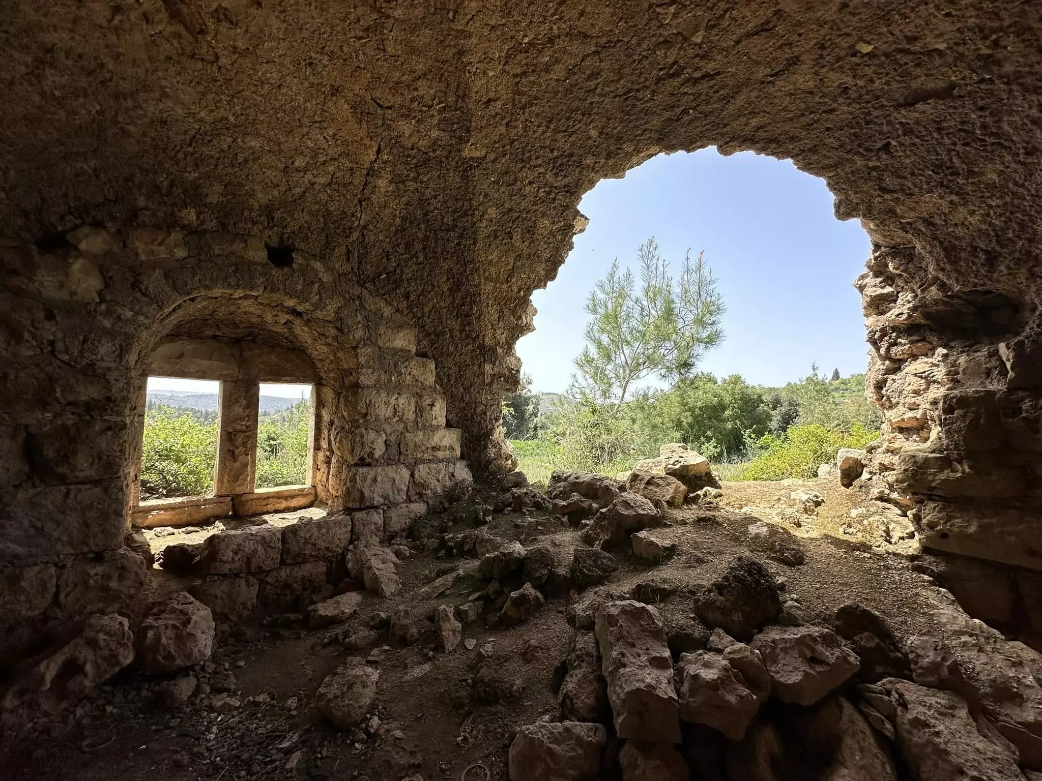
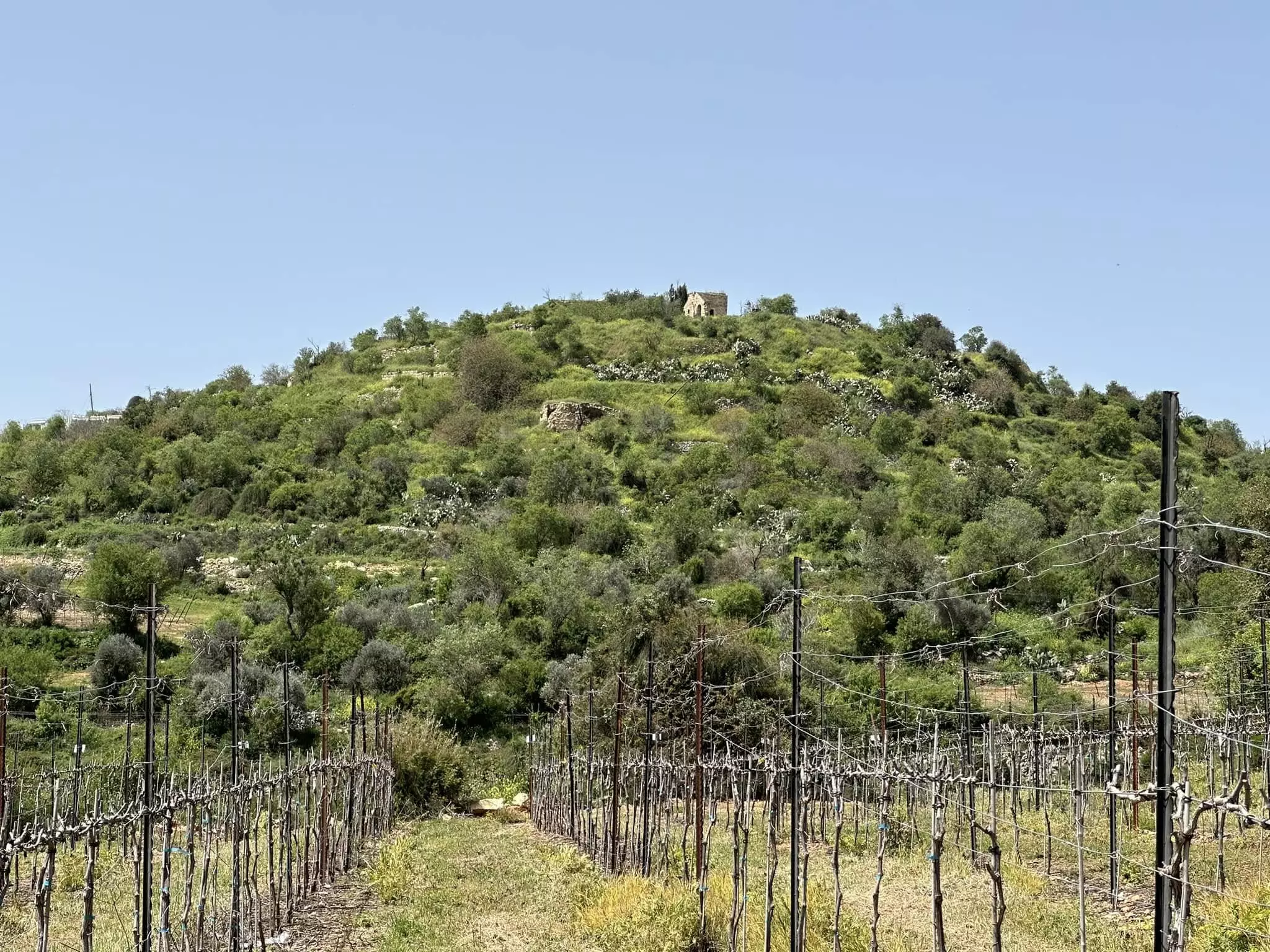
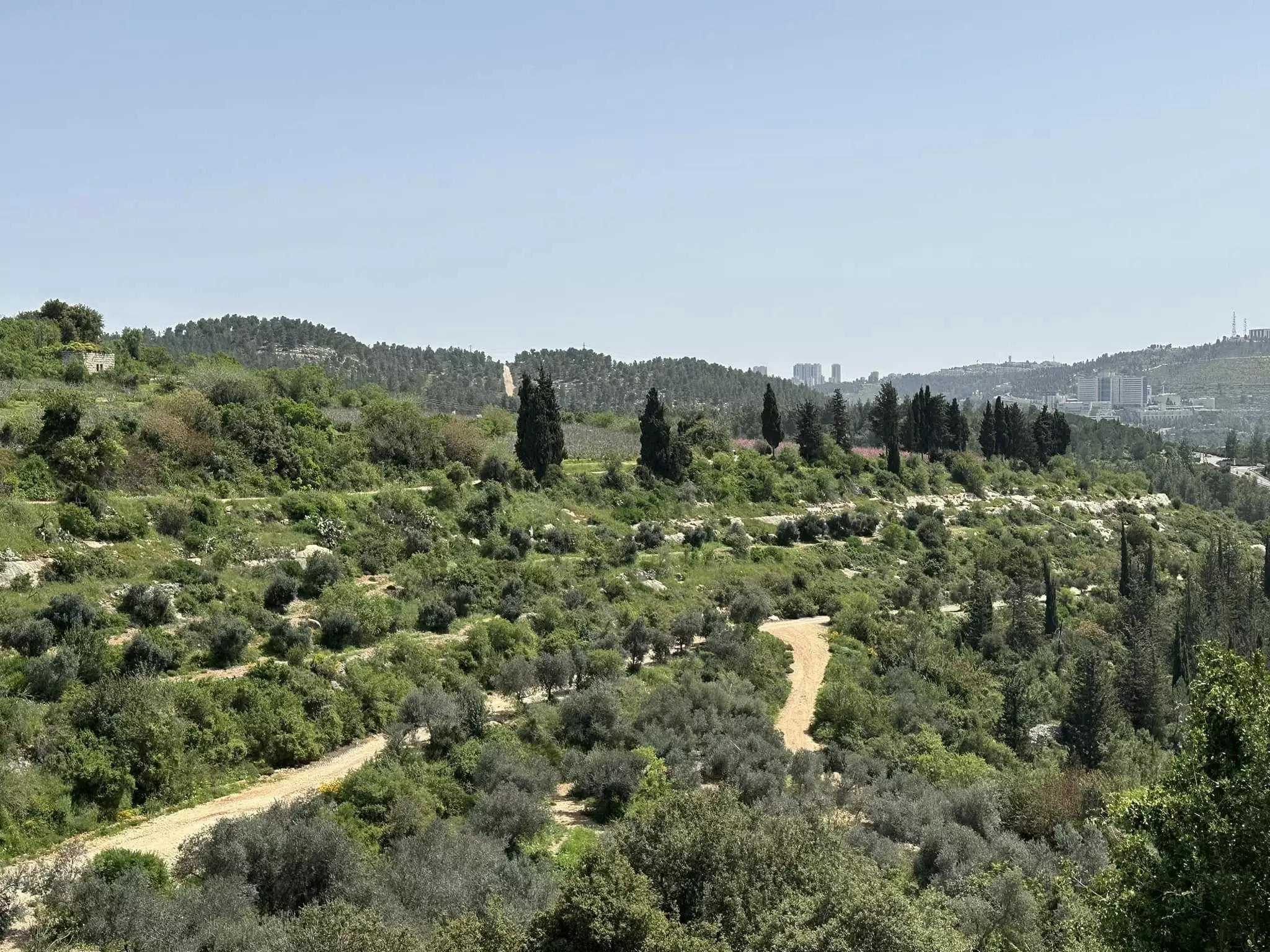
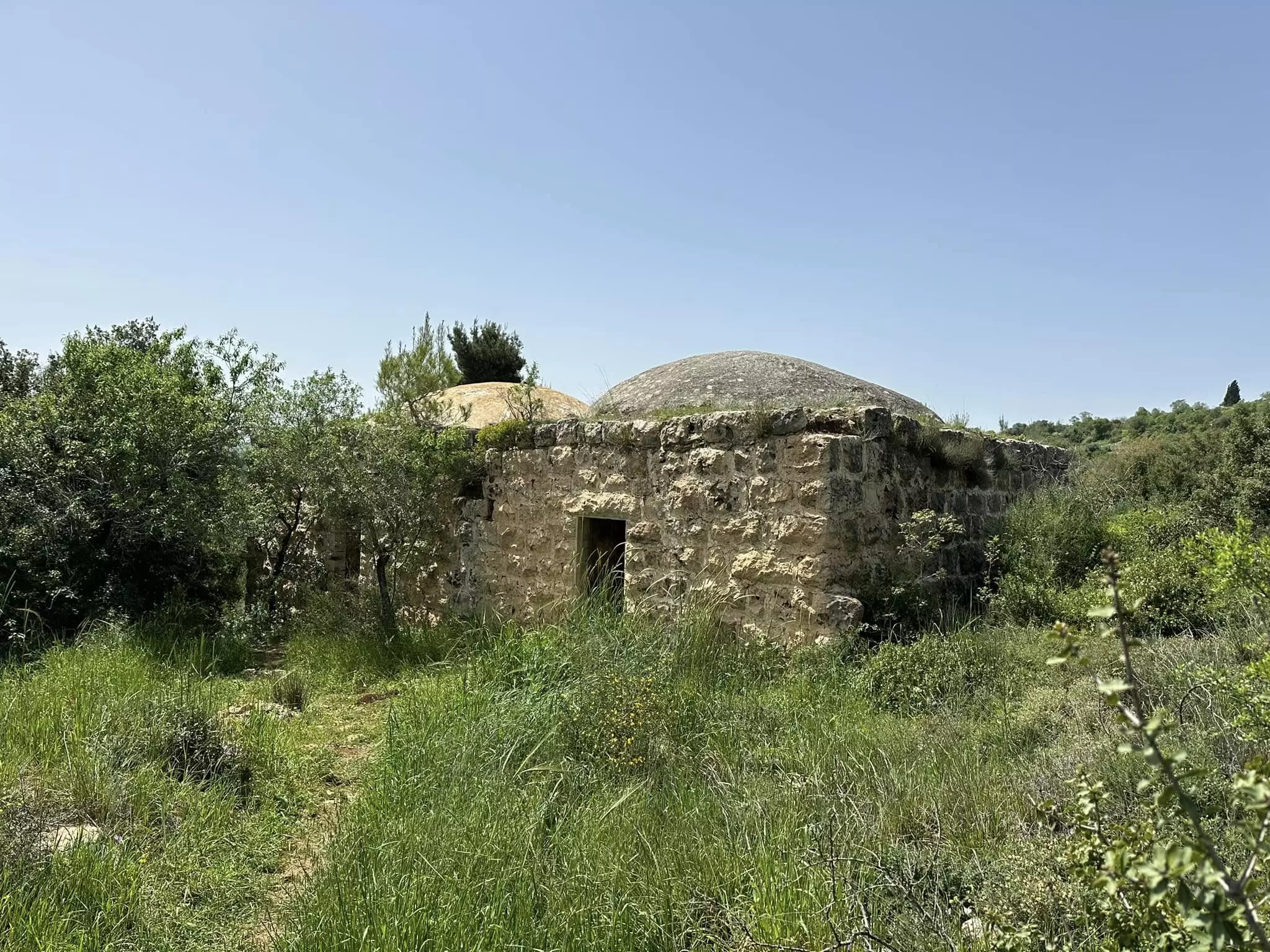
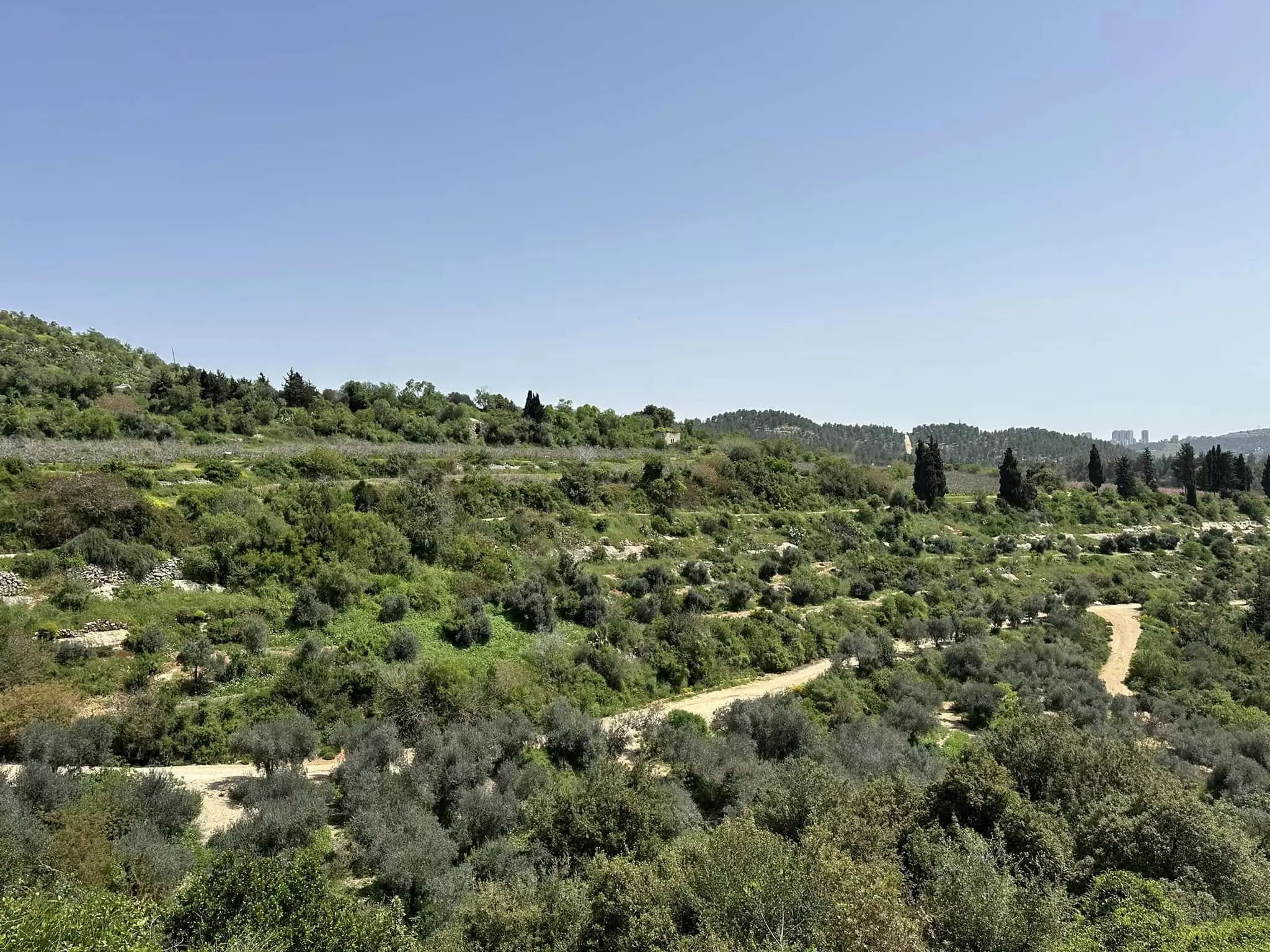
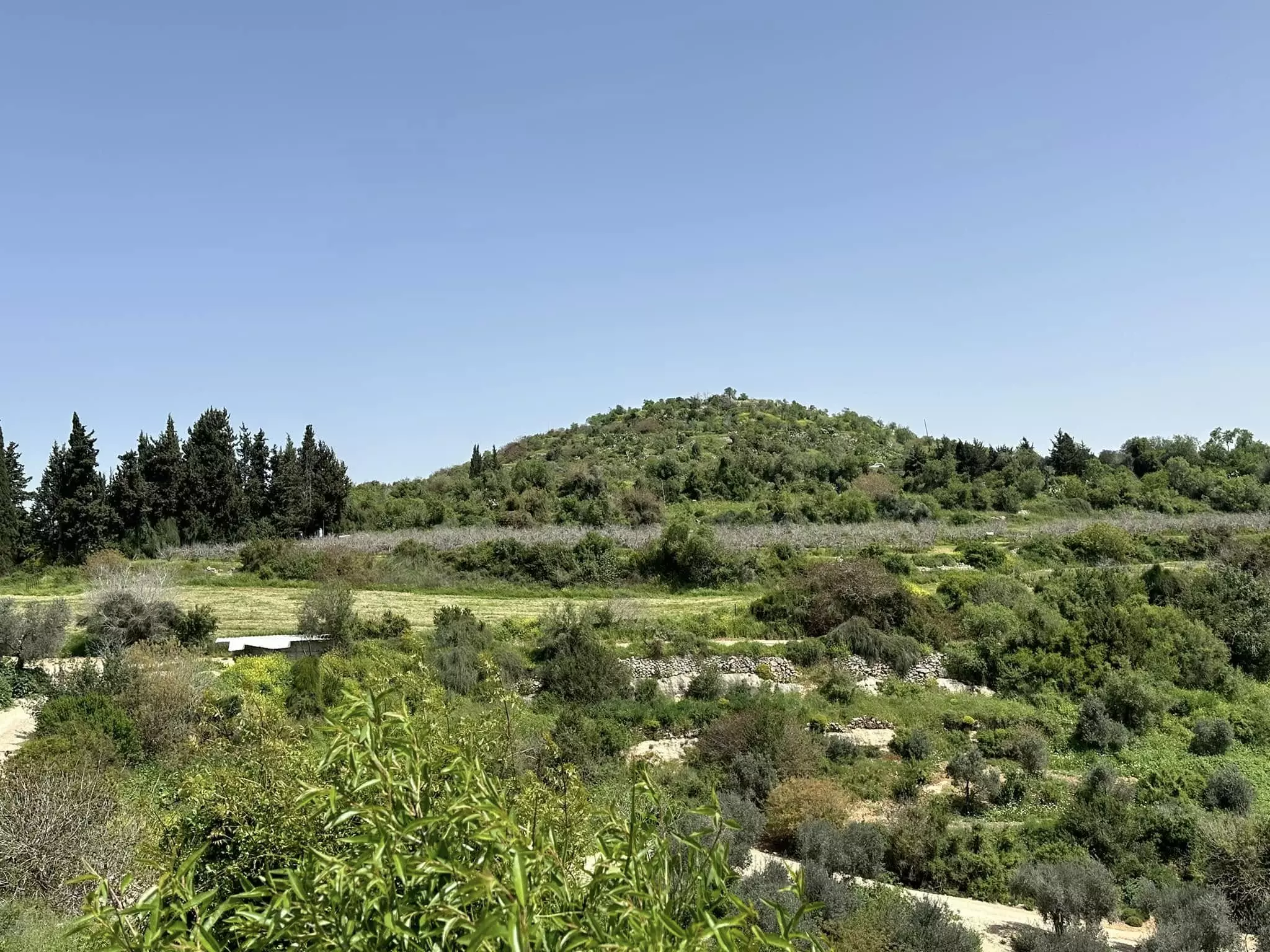
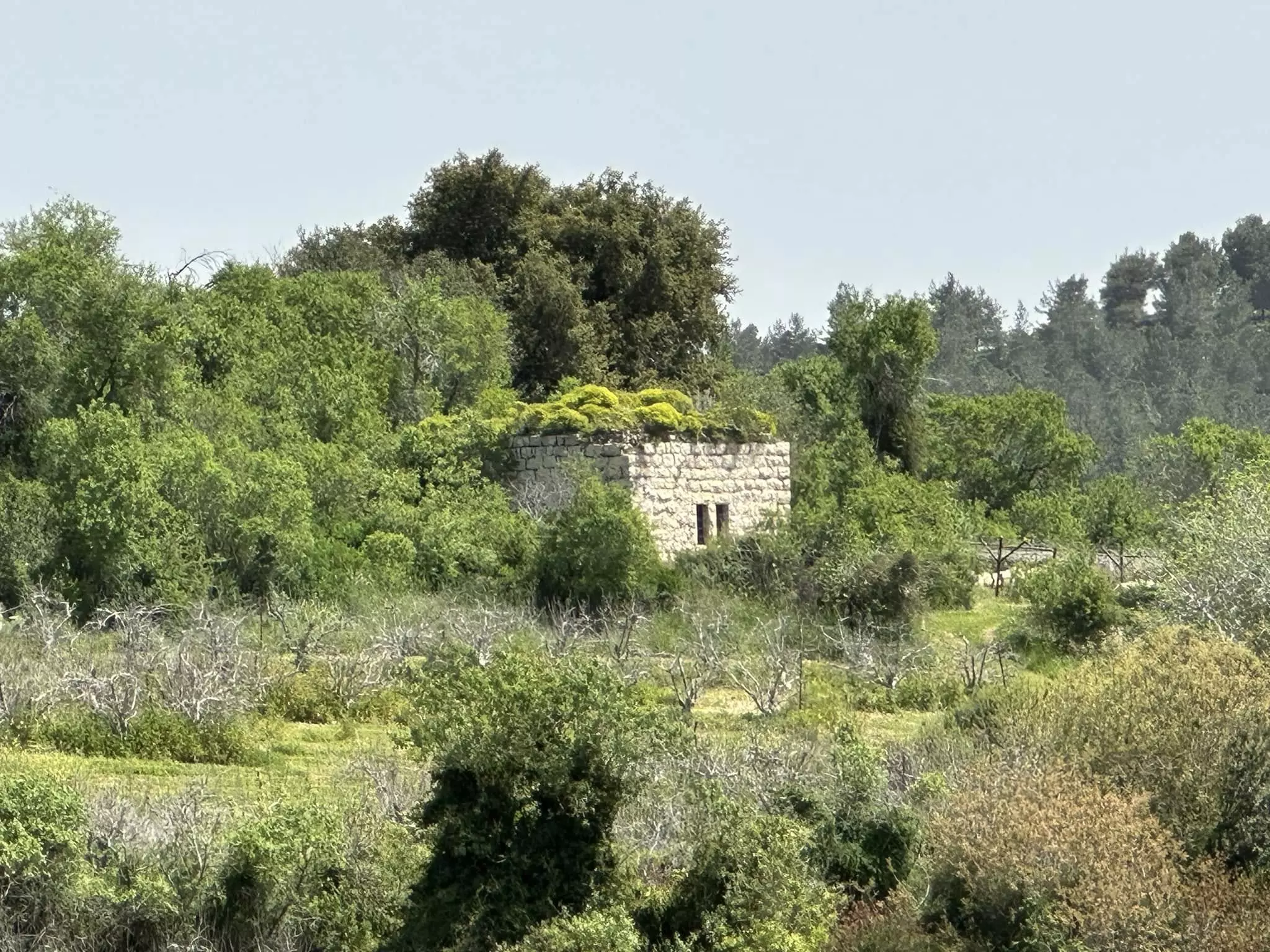
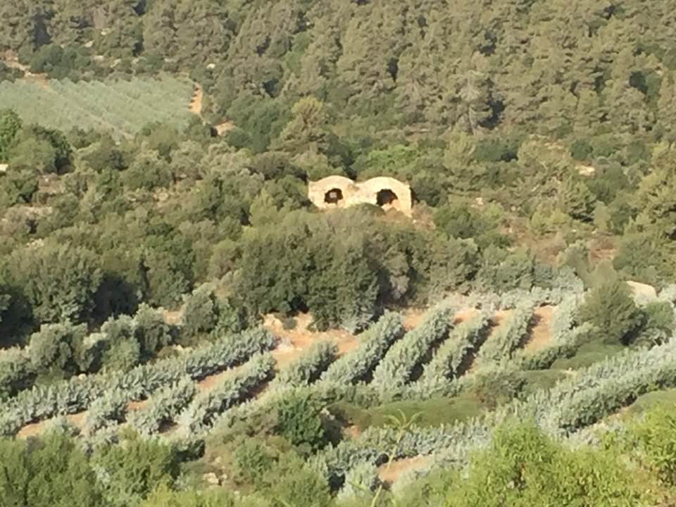
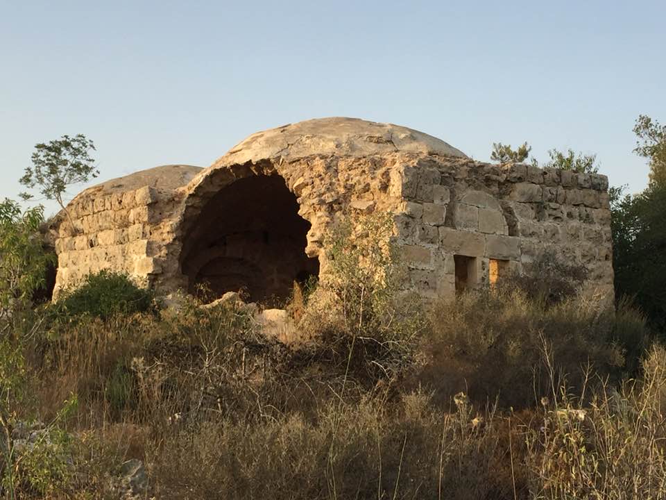
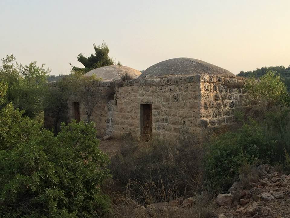
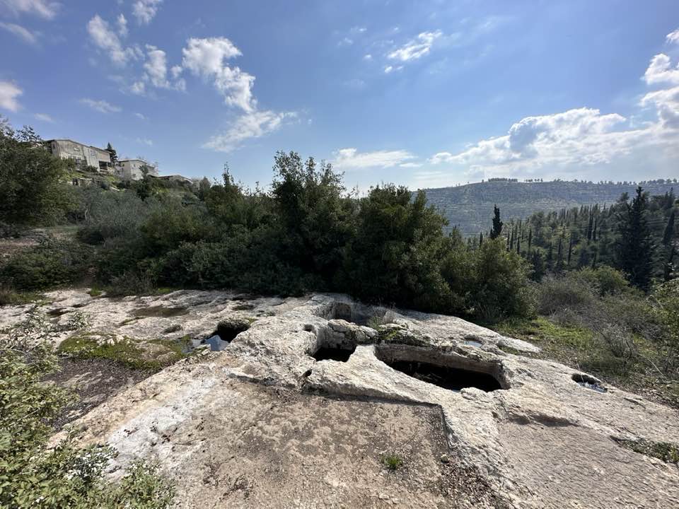
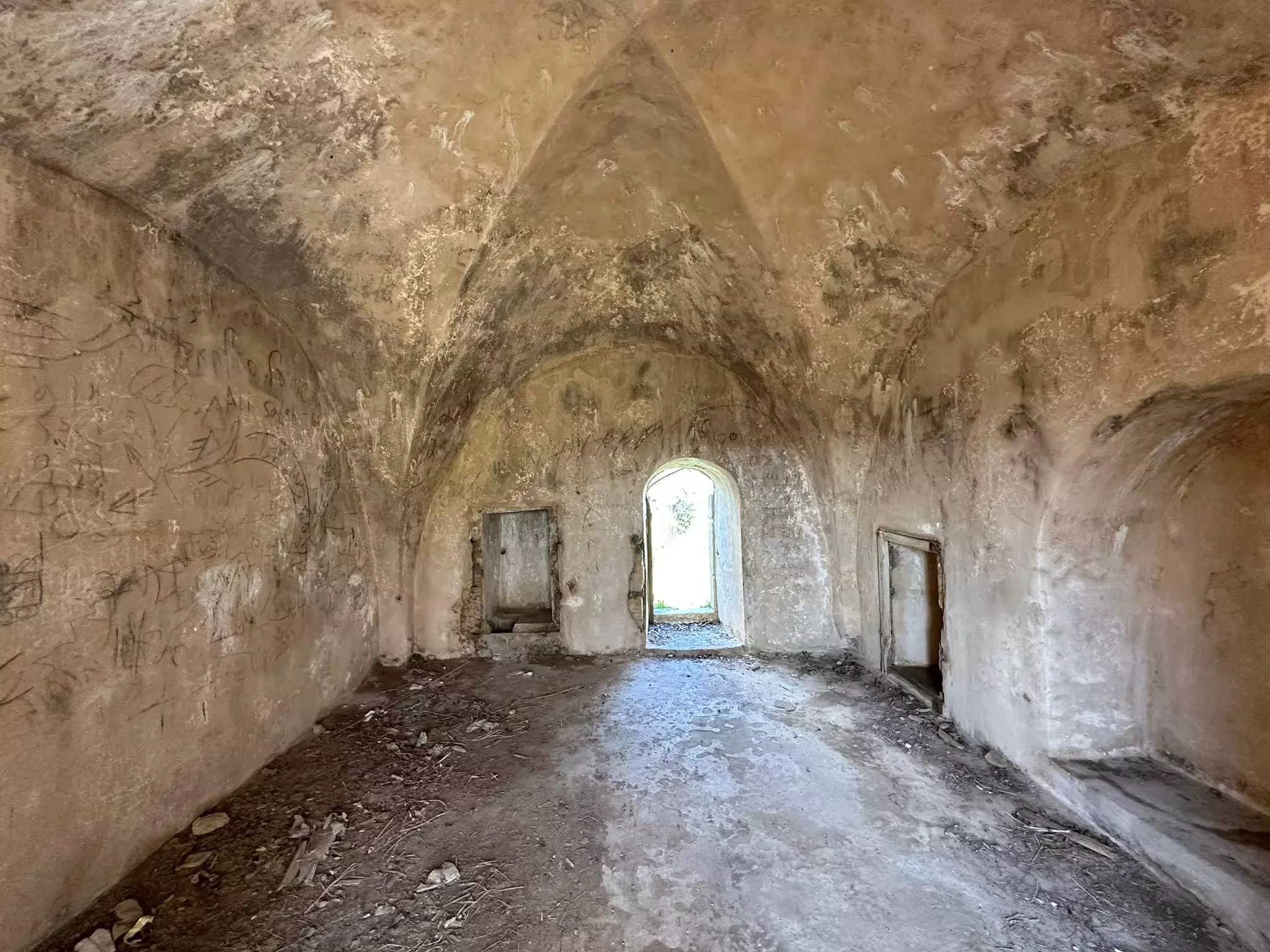
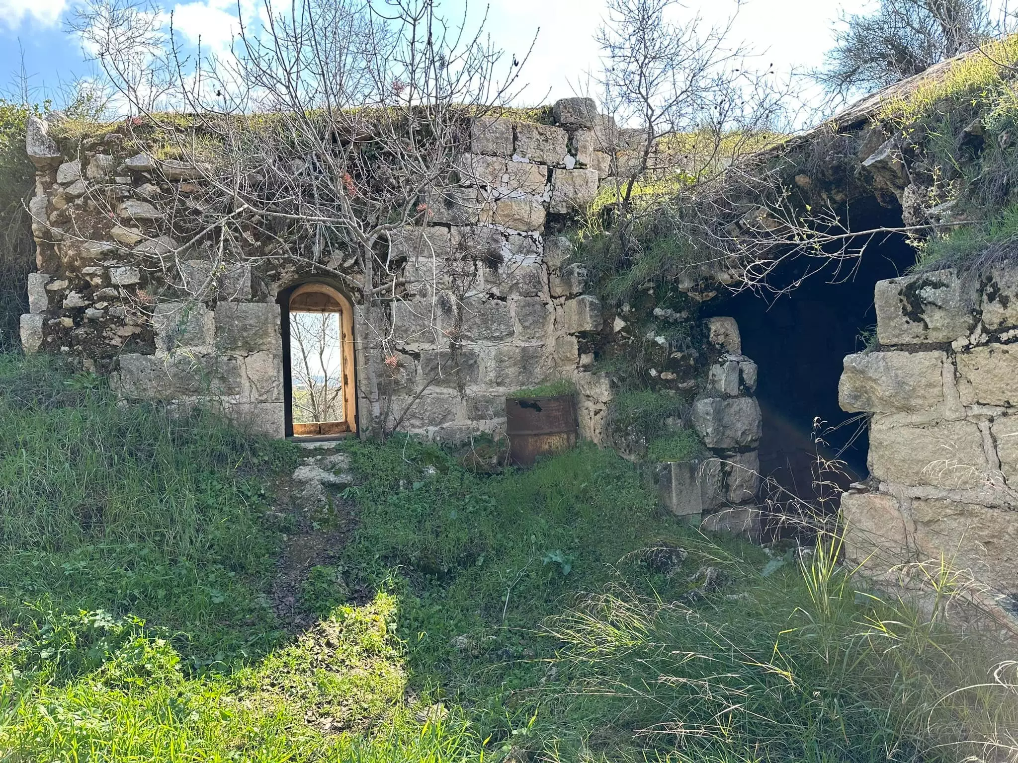
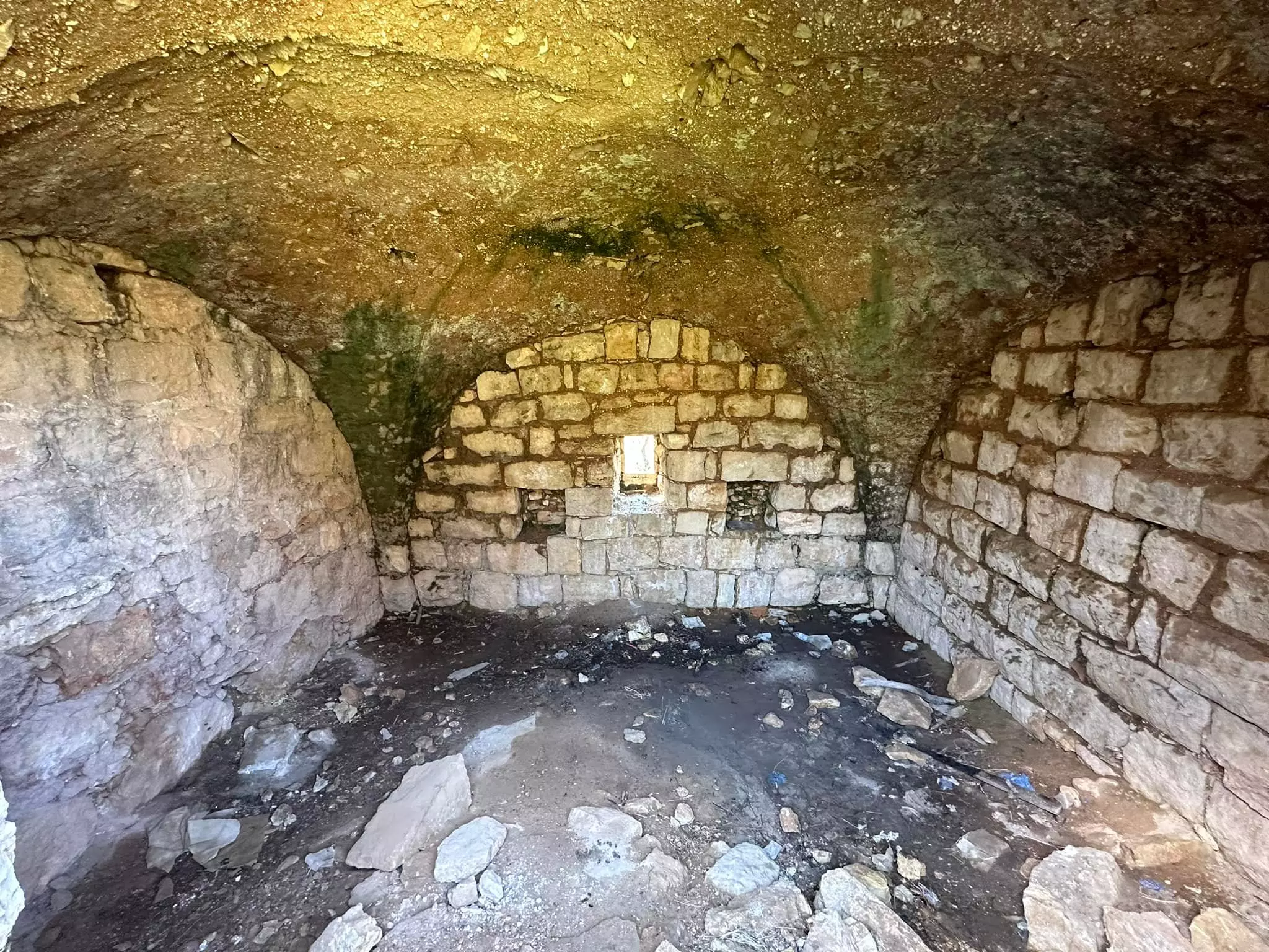
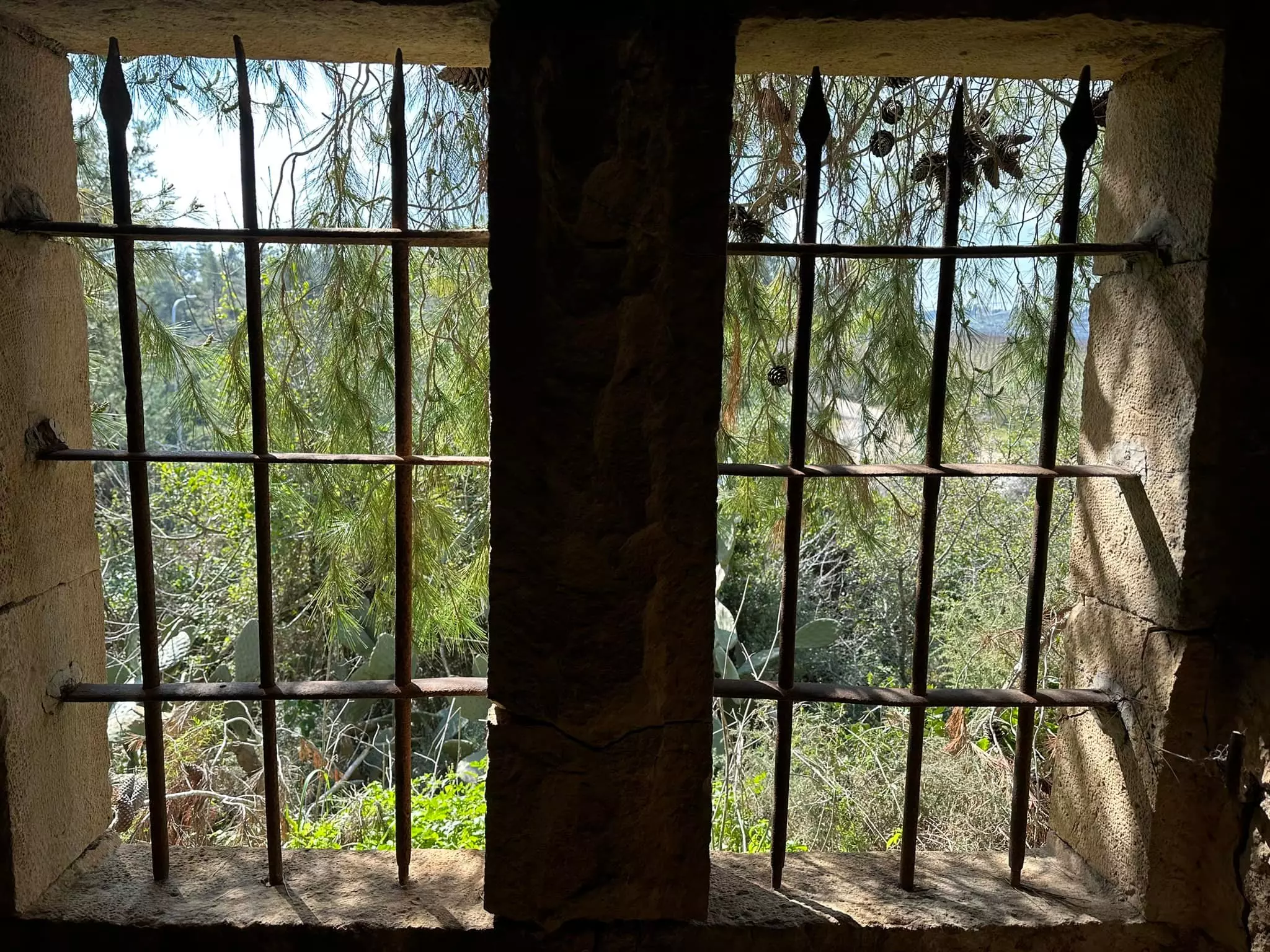
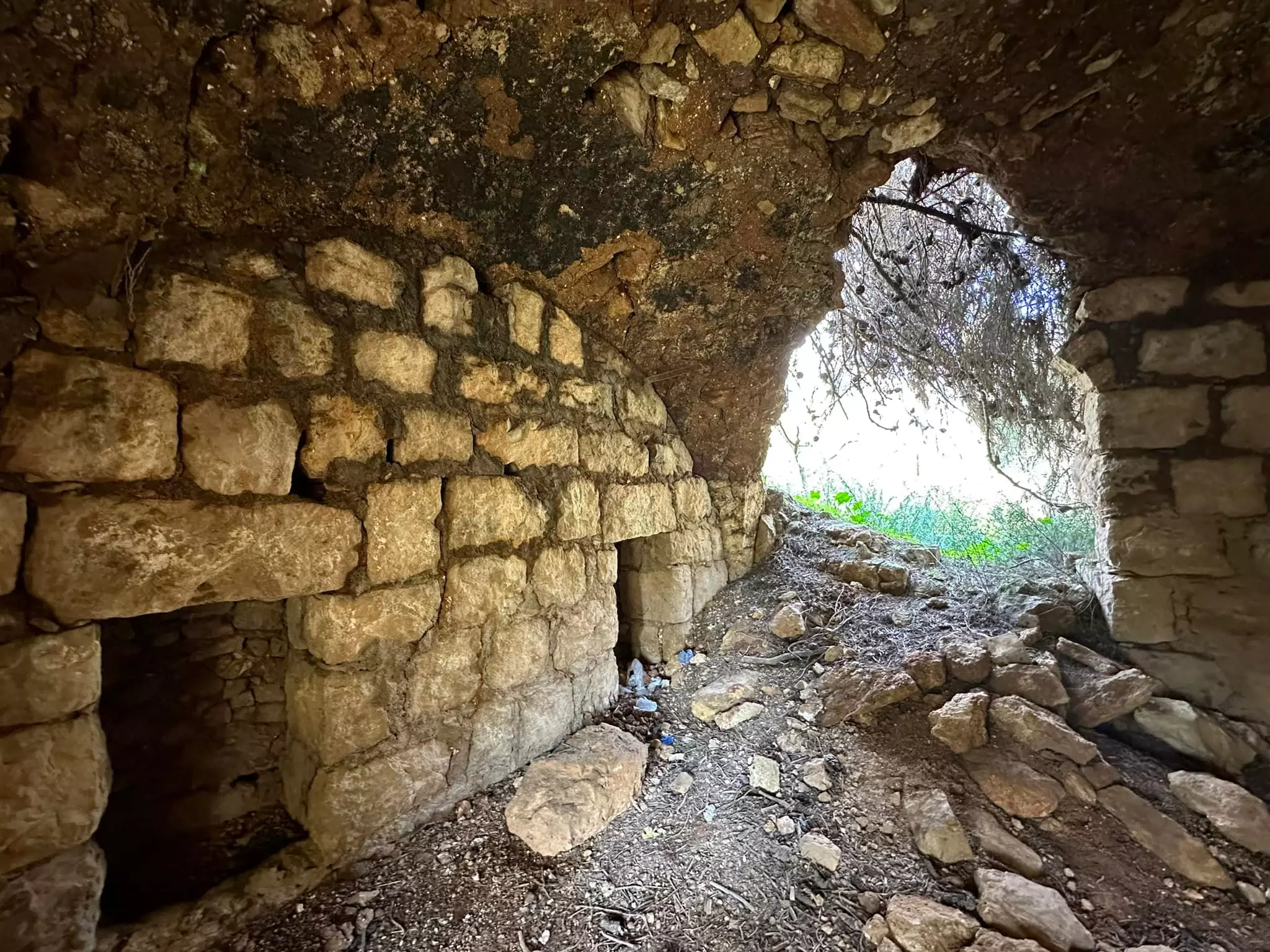
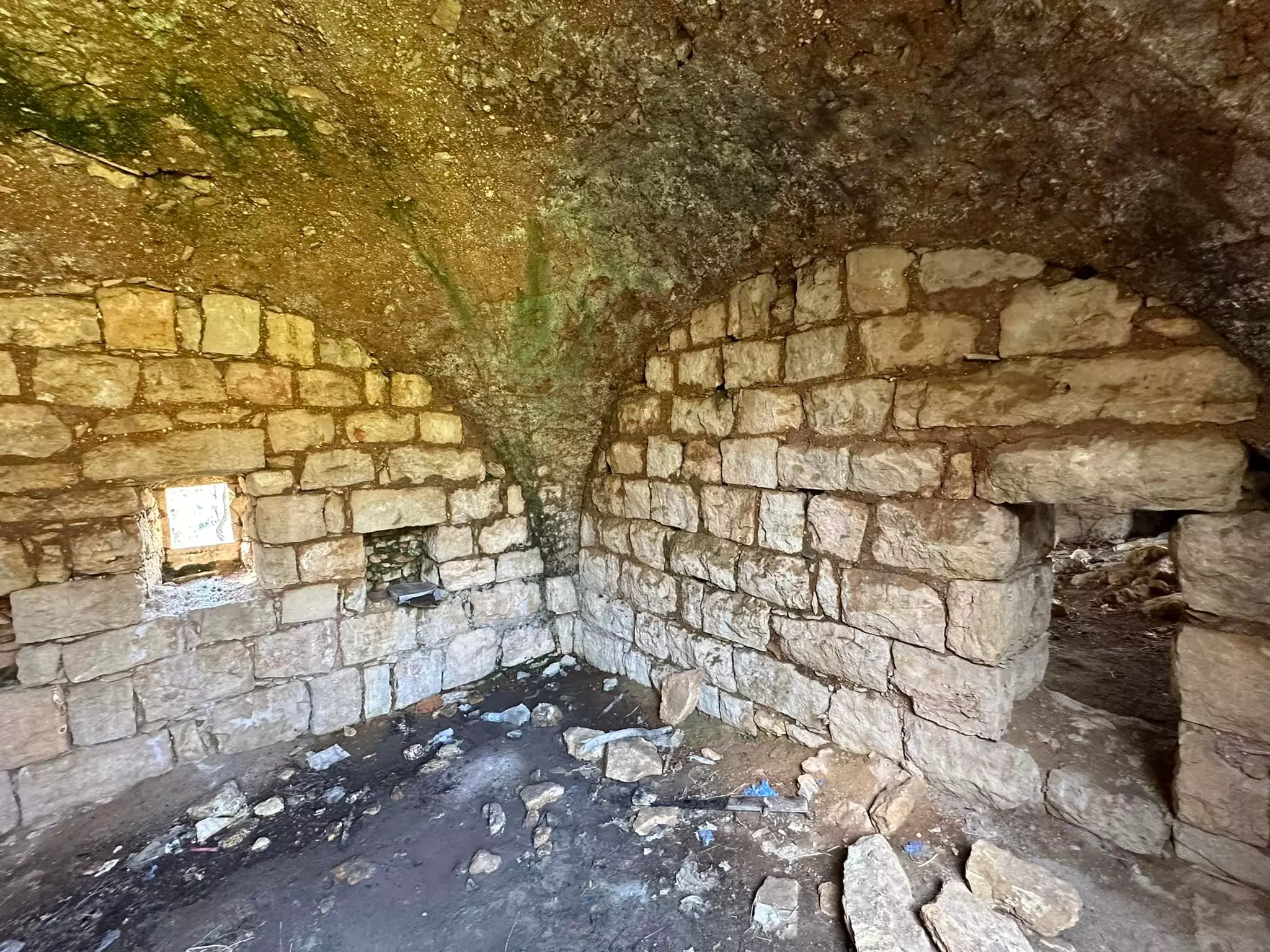
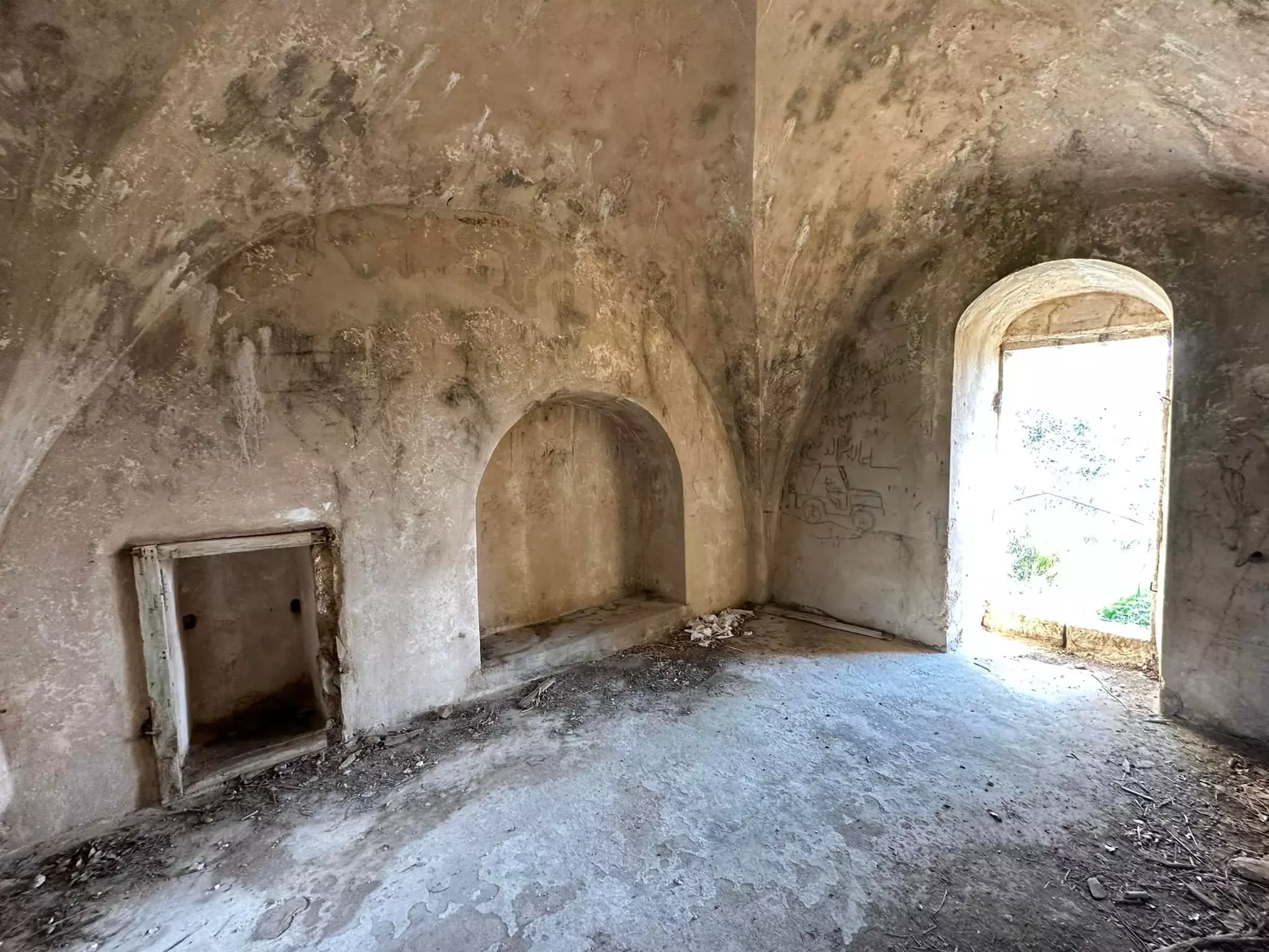
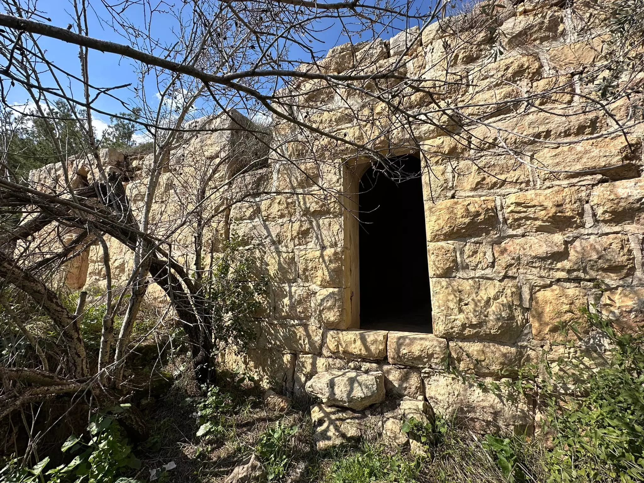
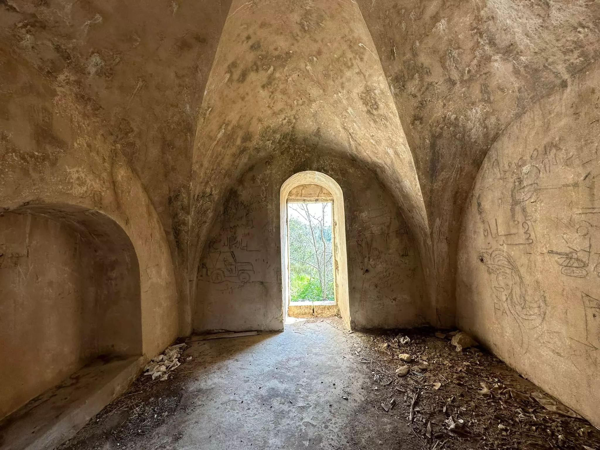
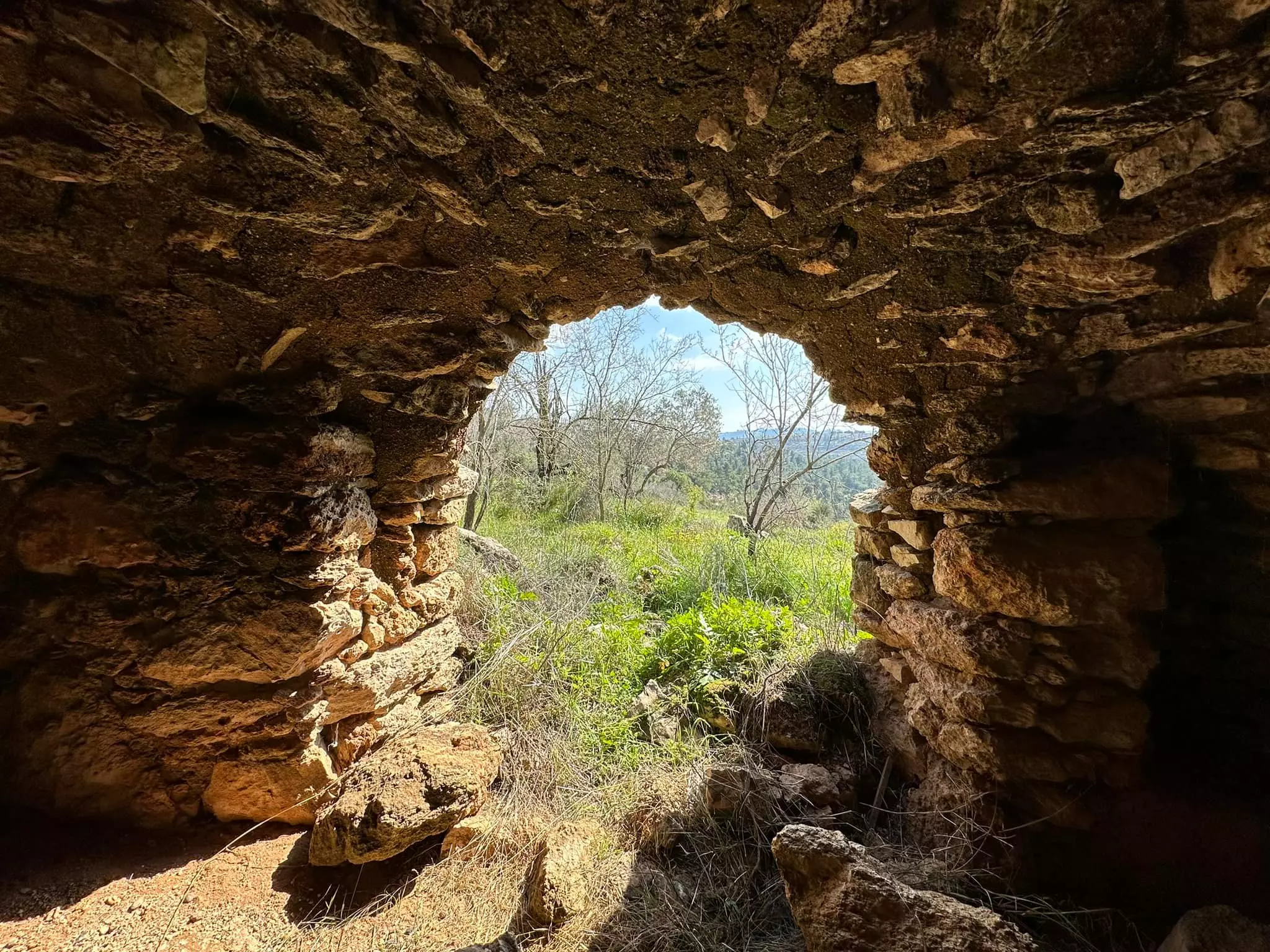
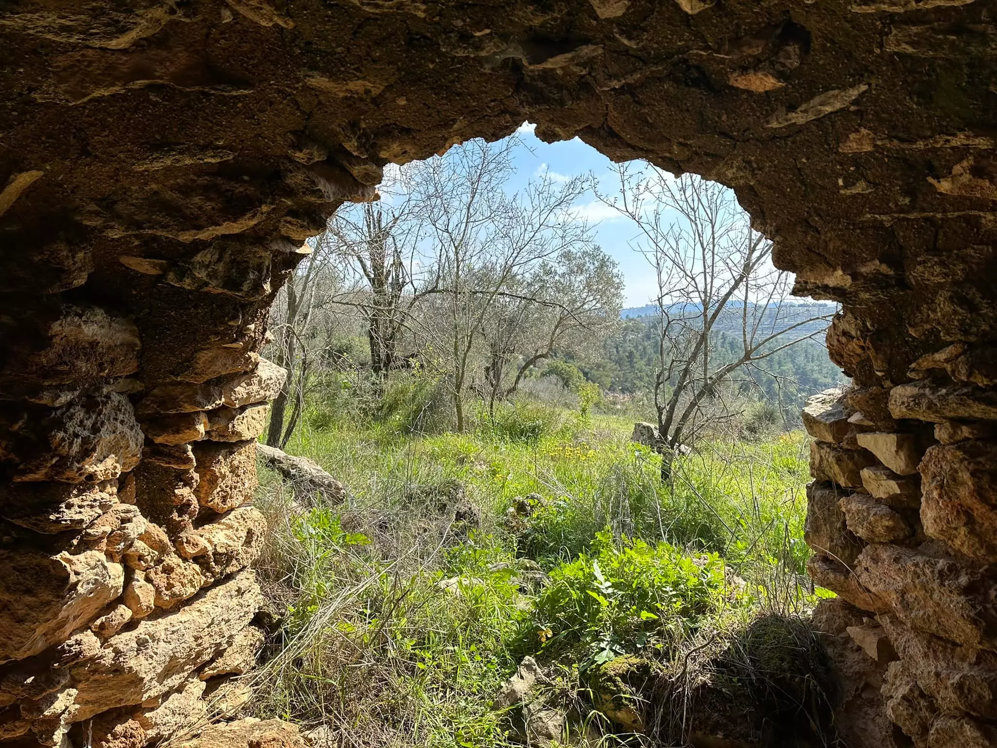
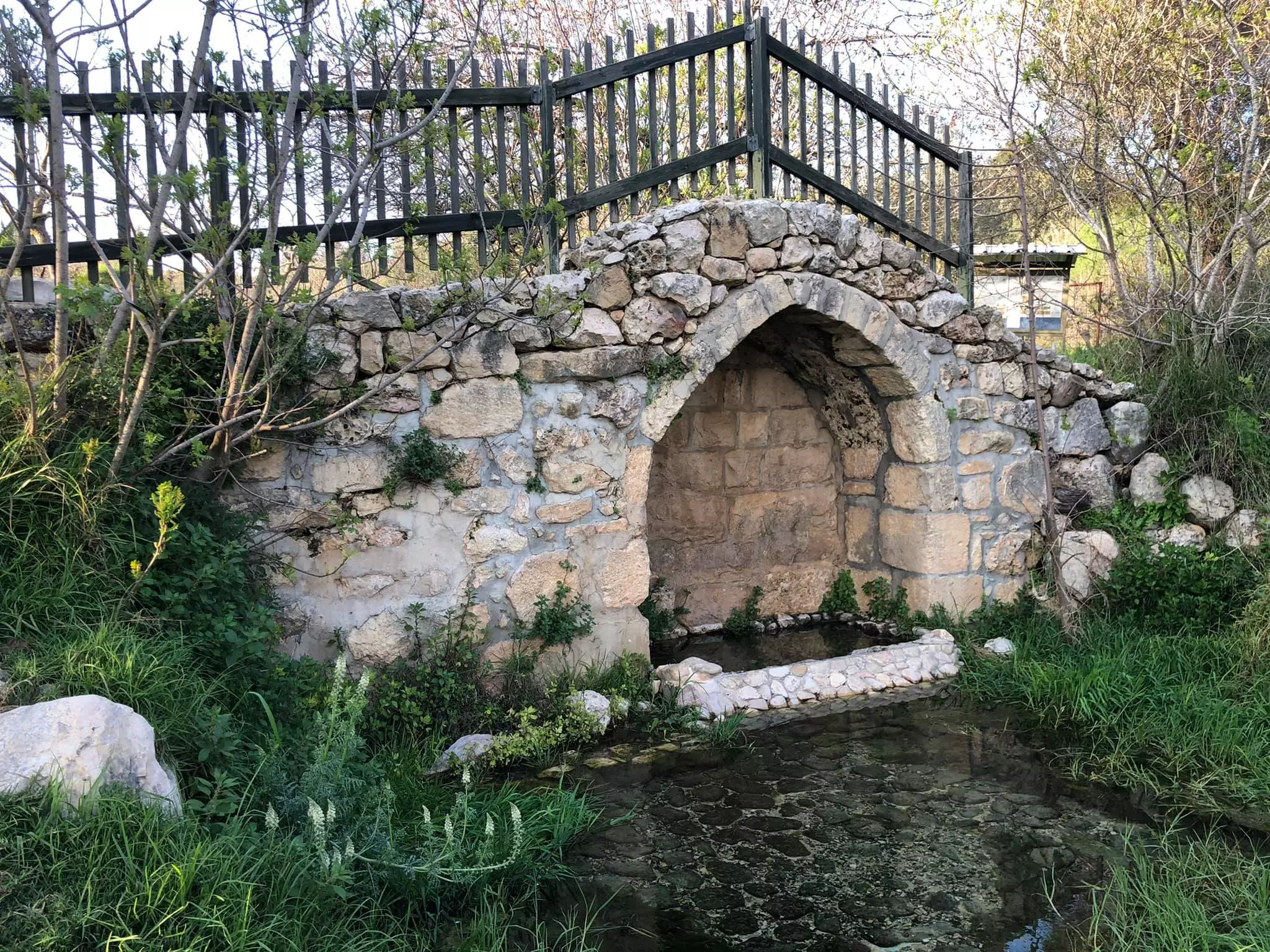
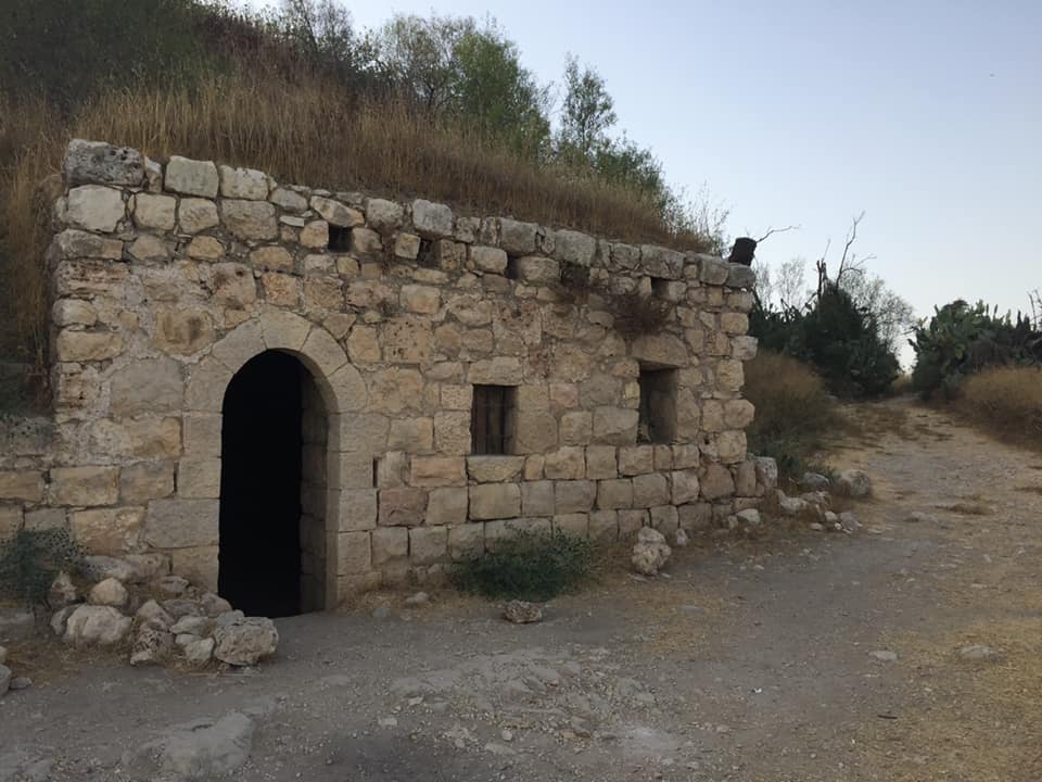
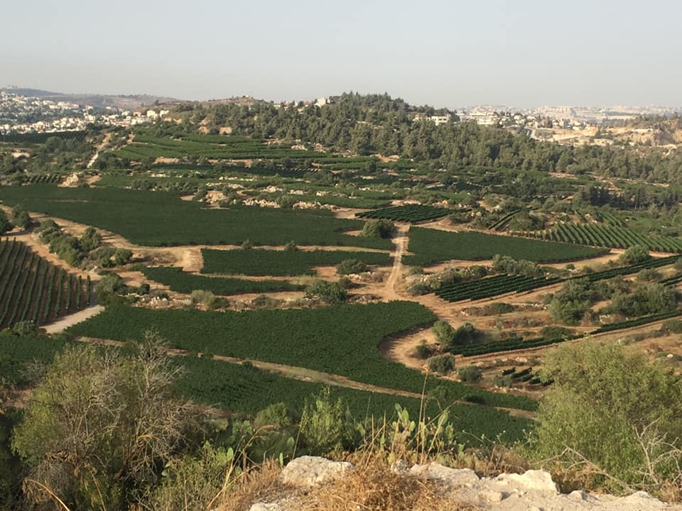
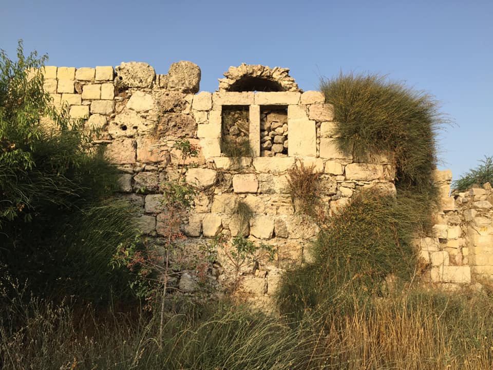
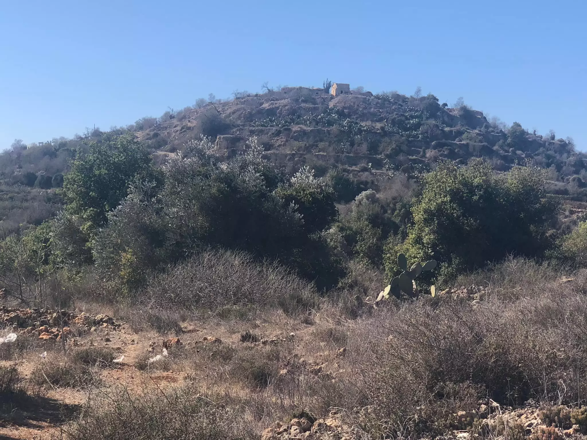
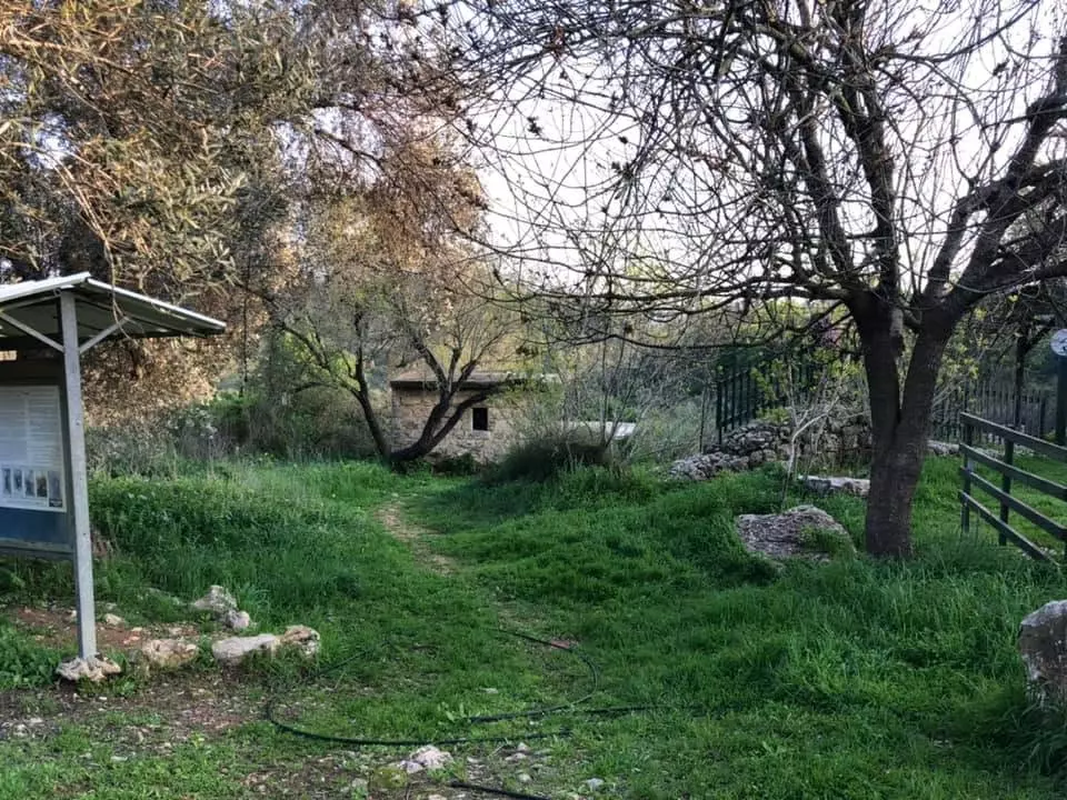
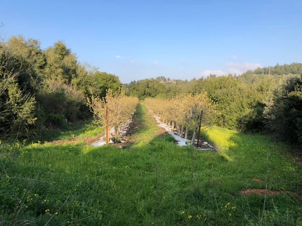
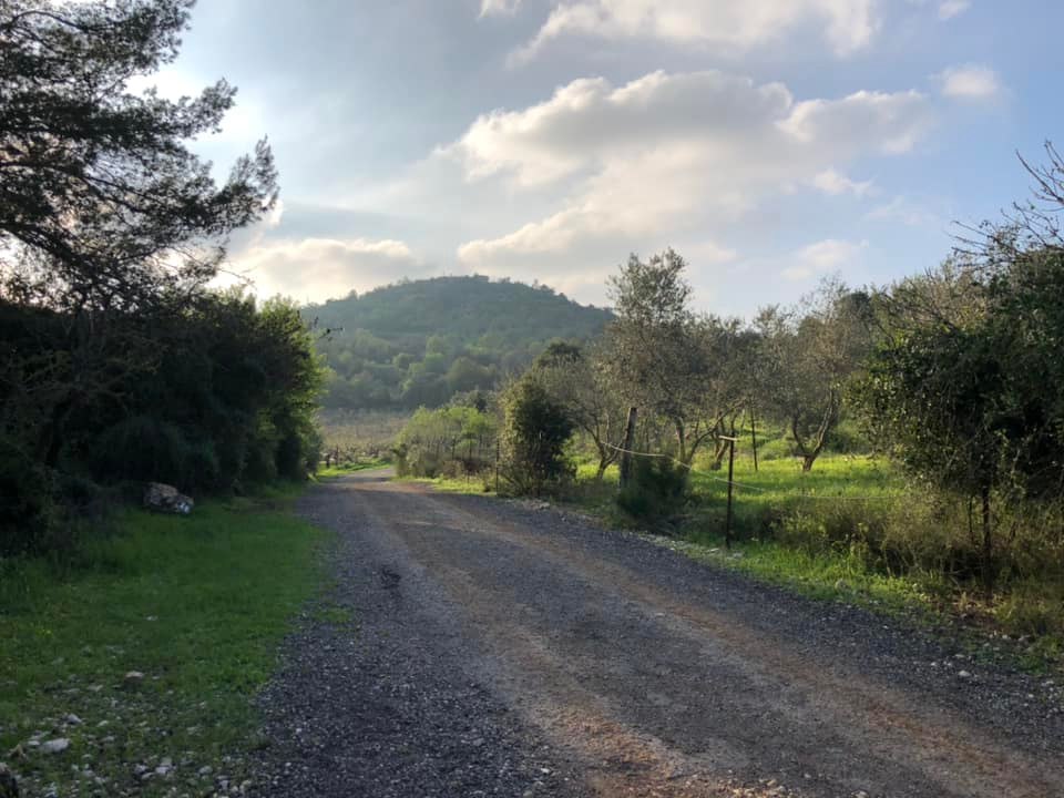
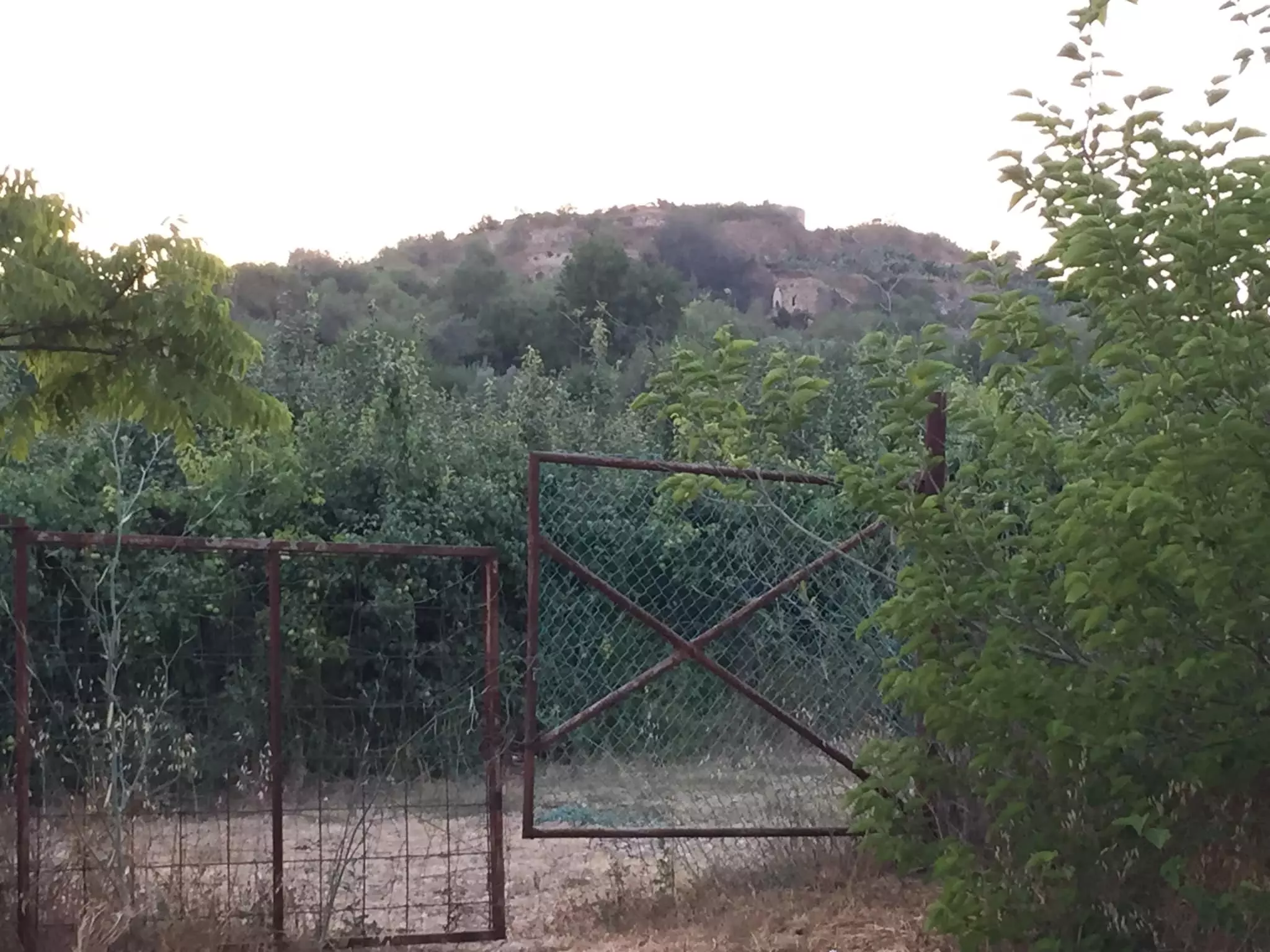
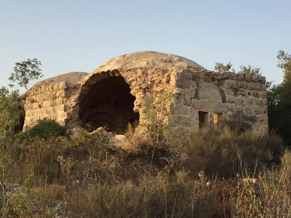
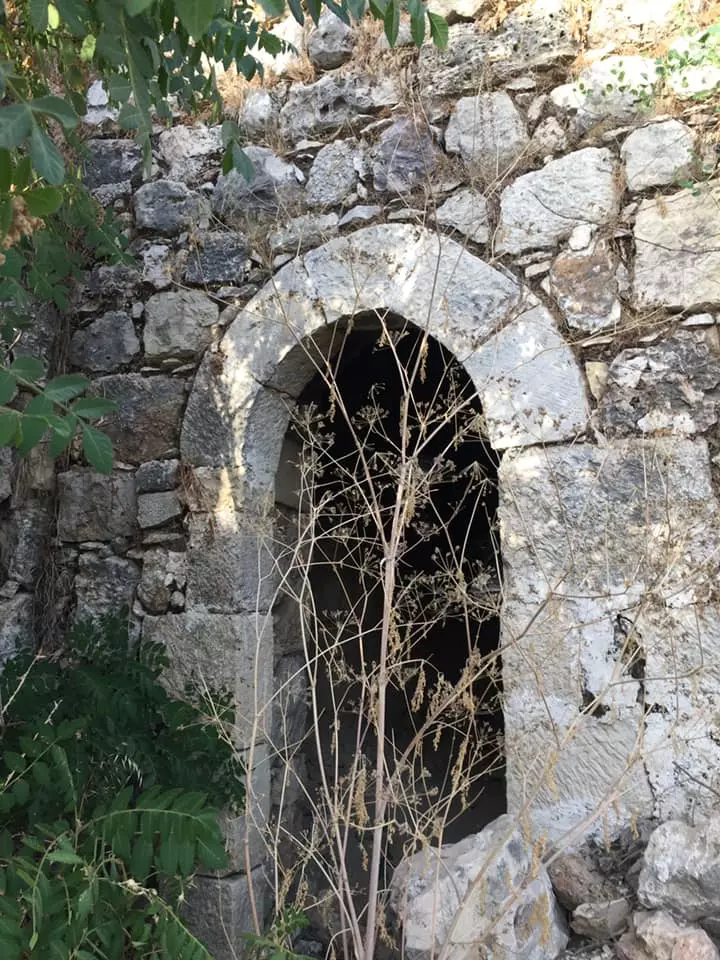
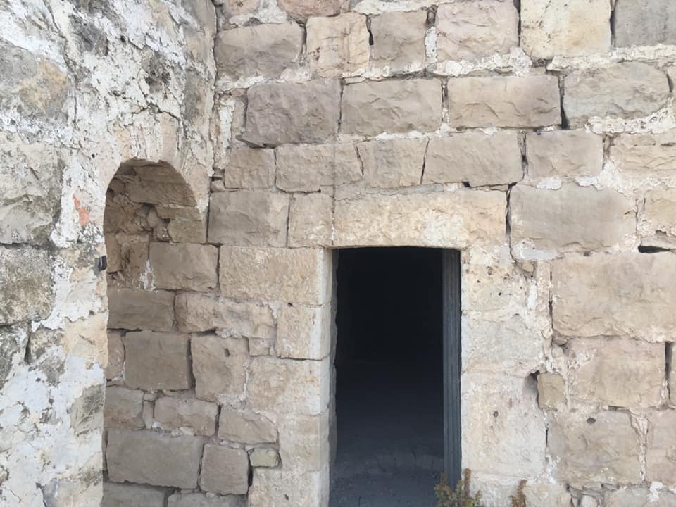
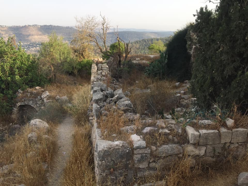
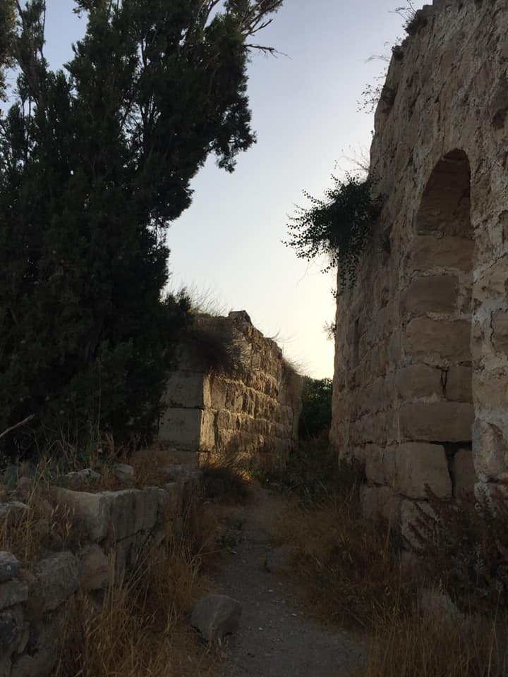
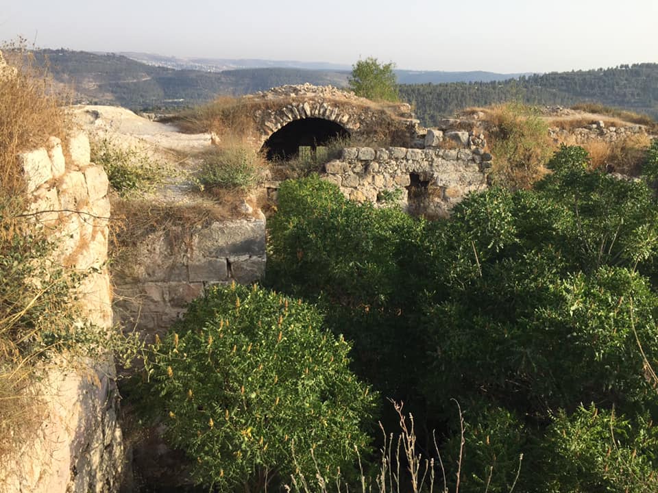
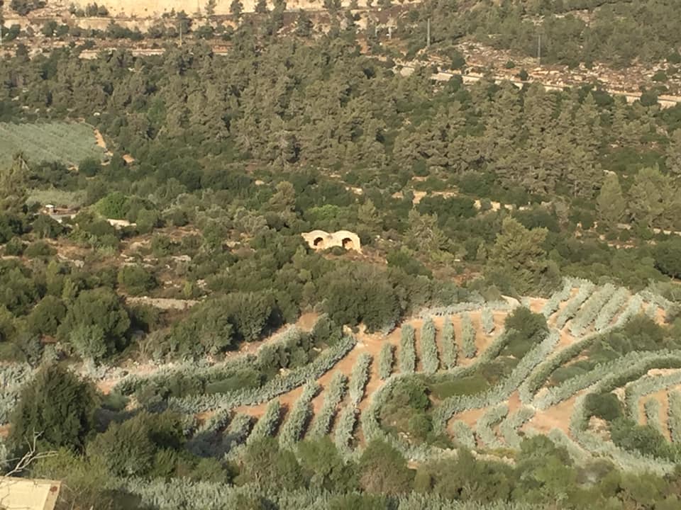
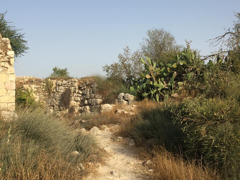
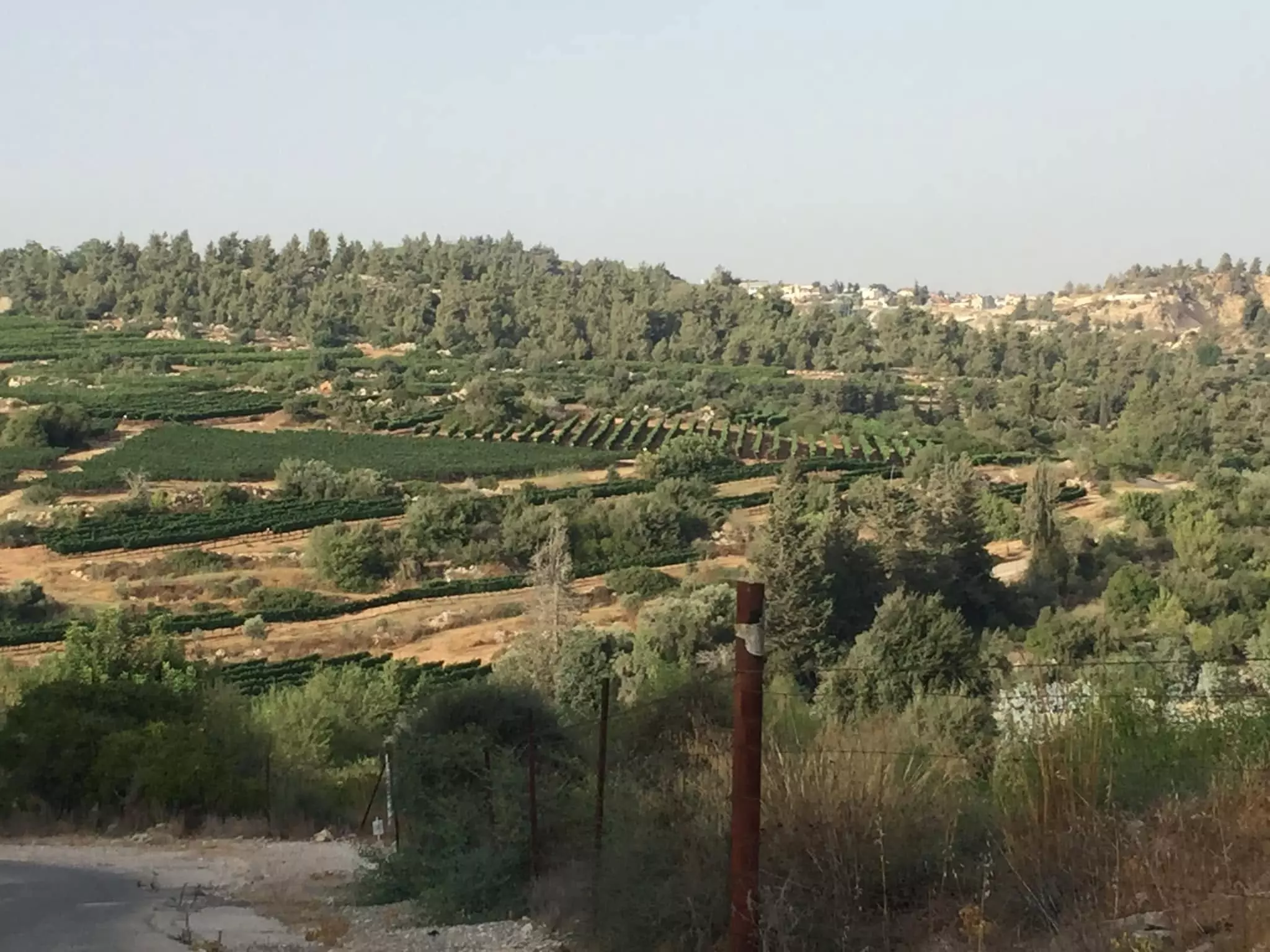
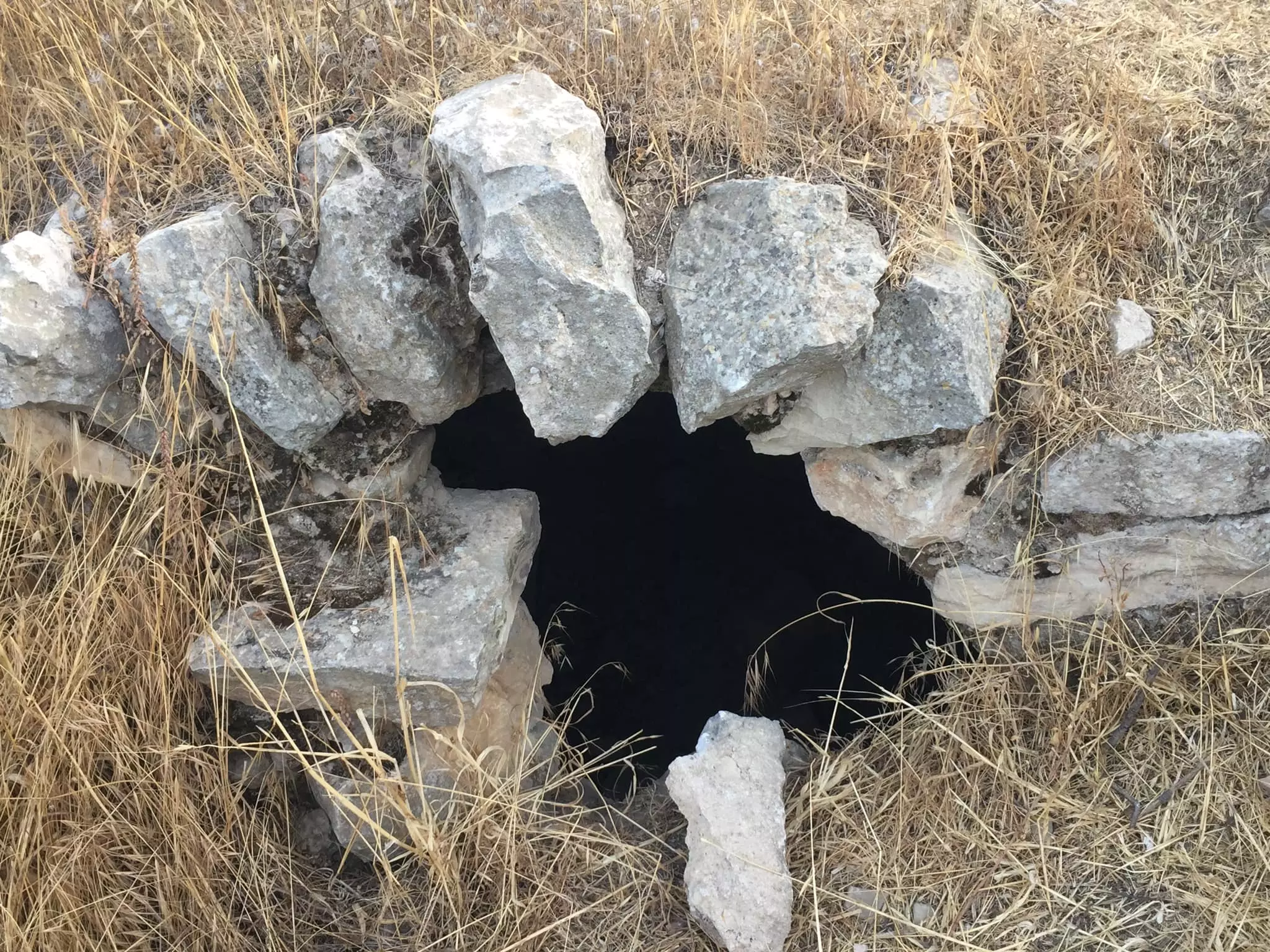
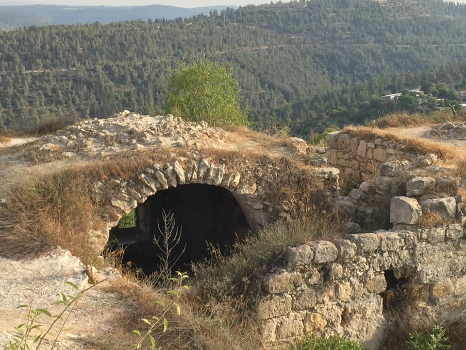
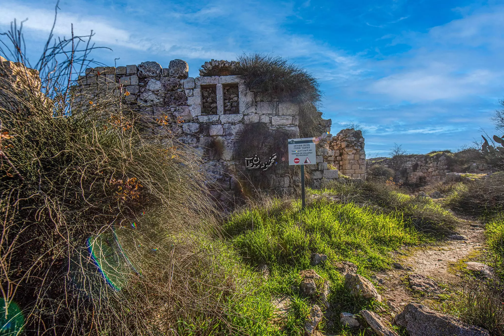
Village Before NakbaThe village stood on a mountain top and overlooked other mountains on all sides. A 3-km-Iong secondary road linked it to the Jerusalem−Jaffa highway to the north, and dirt paths connected it to a group of nearby villages. Suba has been identified with the ancient town Rabba; it was called Rubute in the Egyptian Amarna letters. Excavations at the site, however, indicate that it was first inhabited during the Persian and Hellenistic periods. During Roman times the Jews living in the area called it Seboim, while the Greco-Roman name for it was Soba (or Sobetha). The status of the site during the early Muslim period has yet to be established. The Crusaders established a fortress on the village site, which they named Belmont. In 1596, Suba was a village in the nahiya of Jerusalem (liwa' of Jerusalem) with a population of 369. It paid taxes on a number of crops, including wheat, barley, and olives, as well as on other types of property, such as goats, beehives, and molasses.In the mid-nineteenth century Suba was controlled by the powerful Abu Ghawsh family, who dominated the area from their nearby home village of Qaryat al-'Inab (160135). They constructed a fort in Suba within the walls of the Crusader fortress. Their fort, and the walls of the Crusader fortress as well, was destroyed by the Egyptian general, Ibrahim Pasha, during his foray into Palestine in 1832. In the late nineteenth century, Suba was a moderate-sized village built of stone and situated on the top of a steep, conical hill. Surrounded by olive groves and vineyards, the village contained one unusually high, centrally-located house, as well as the remains of the Crusader fortress. The village's stone houses were originally clustered together in a small area within the bailey of the Crusader fortress. Later, new houses were constructed to the south along the road that led to the Jerusalem−Jaffa highway, thus giving the village a rectangular layout. The people of Suba were Muslims, and they maintained a shrine for a Shaykh Ibrahim to the south of the site. The most important crops were grain, which was planted in the valley floors, and fruit and olives, which were planted on the mountain slopes. Olive trees covered 150 dunums. In 1944/45 a total of 712 dunums was planted in cereals; 1,435 dunums were irrigated or used for orchards, 150 dunums of which for olive trees. There were several springs in the vicinity of the village which supplied water for domestic use and irrigation. Village Occupation and Ethnic CleaningAccording to the Palestinian newspaper Filastin, Suba was attacked on 3 April 1948, after an attack on nearby al-Qastal. Despite aerial support, the Haganah were driven back and the village remained unoccupied for three months. Two unsuccessful attempts to conquer it were made in mid-April during the course of the battles around al-Latrun. It eventually was occupied by the Har'el Brigade during the night of 12−13 July 1948, in the course of Operation Dani (see Abu al-Fadl, Ramla sub-disctrict). According to the History of the War of Independence, Israeli forces used two companies backed by artillery and mortar support to take the village, which was built on an 'elevation with steep edges.' The account states that it was captured 'in order to eliminate the threat to the Jerusalem road from the south and to widen the [Jerusalem] corridor southwards.' The Associated Press reported that 'Suba was taken by Palmach storm troops without combat after a bombardment that drove the Arab defenders from a height above the vital road to Tel Aviv.' Israeli historian Benny Morris relates that much of the population of Suba had left earlier, and that the remaining residents either left as a result of bombardment or were expelled. An Israeli military spokesman was quoted in the New York Times as saying that the attack on the village was 'bloodless' and that its seizure had put an end to the Arab dream of cutting the road to Tel Aviv. The occupation of the village fell on the heels of the capture of Lydda and Ramla and the expulsion of their populations.Zionists Colonies on Village LandsA settlement called Ameilim was established in 1948, 1 km southwest of the site, on village lands; it later was renamed Kibbutz Tzova (161132). A school called Yedida (160135) was built close by to the northwest in 1964, on lands that traditionally belonged to the village of Abu Ghawsh.Village TodayMany of the village buildings still stand; some have walls missing or are without roofs. Arched doorways and gates define the facades of these houses (see photo). A number of houses, however, are almost completely destroyed, with only the bases of their walls still standing. At an archaeological site that was recently excavated, a large stone gate and walls were unearthed. The remnants of the Crusader fortress are present on the site. Fig, almond, and cypress trees, together with cactuses, grow on the terraces around the lower approaches to the mountain. The village cemetery is located on the southern base of the mountain. Networks of trenches dug by the Israeli army are visible on the northeastern side of the mountain top, and a water reservoir with a pipe leading down the northern slope of the mountain has been constructed.SourceDr. Walid al-Khalidi, 1992: All That Remains. |
||||||||||||||||||||||
| Related Maps | Town Lands' Demarcation Maps خرائط للقضاء توضح حدود القرى والاودية Town's map on MapQuest View from satellite Help us map this town at WikiMapia |
|||||||||||||||||||||
| Related Links | Wikipedia's Page Facebook Page Google Search Google For Images Google For Videos |
|||||||||||||||||||||
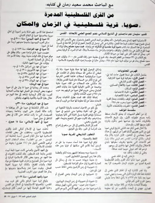
| More Information | في كتاب كي لا ننسى في كتاب بلادنا فلسطين المزيد من موقع هوية |
|||||||||||||||||||||
- صوبا الحلم والحقيقه المدمرة.........!!!!!????
- كتاب قرية صوبا -إبراهيم الفقيه
- SUBA AND AYN KAREM
- EIN AHMAD
- SAYINGS PART 1
- SUBA'S FAMILIES
- SUBA'S LAND
- SAYINGS PART 2
- The Last Days
- The House
- ZMIKNA FAMILY
- 'My First Visit To Suba'
- Memories of zionist invasion of suba
- CAVE OF SUBA
- OPINION
- صوبا في ذكرى النكبة
- حاضرة التاريخ ومقدسيات الذاكرة
- قطاع غزة
- Jordan/ Amman
- WAR CRIMINALS
- bani hassan ( arabic essay)
- صوبا جبلية المأوى
- JANUARY/17/09......AFTER GAZA MASSACRE
- تاريخ عشائر بني حسن
- abu ghosh tribe is bani malik
- freemasons,illuminati,skull and bones and mainly zionists and edmond rothschild
- the khazar jews
- SHARON'S
- destruction
- THE BILDERBERG GROUP
- EGYPT TRAITOR ROLE
- صوبا في اللغة - اللفظ والتسمية
- مكانة المرأة في قرية صوبا قبل عام 1948م
- التعليم والثقافة في قرية صوبا قبل عام 1948م
- سكان صوبا - عشائر صوبا وحمائلها
- الناحية العمرانية في قرية صوبا قبل عام 1948 أسماء قطع الأراضي- البيوت - المضافة
- العادات والتقاليد في قرية صوبا قبل عام 1948
- الأطفال في قرية صوبا قبل عام 1948
- الحياة الصحية والمعالجة الصحية في قرية صوبا قبل عام 1948م
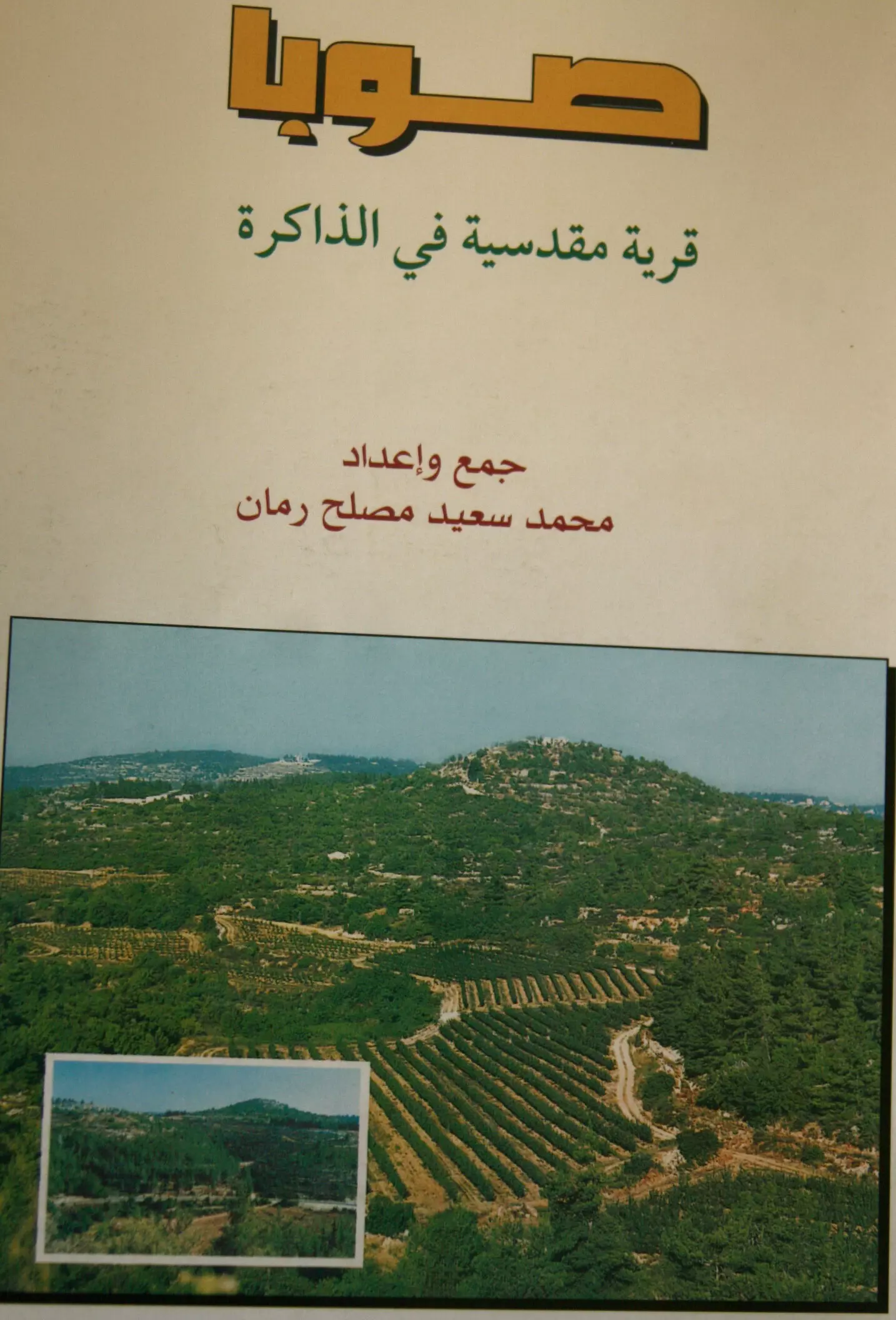
- نبذة تاريخية عن قرية صوبا (قضاء القدس) من كتاب (كي لا ننسى)
- مشروع تخرج : إعادة إحياء قرية صوبا المهجرة
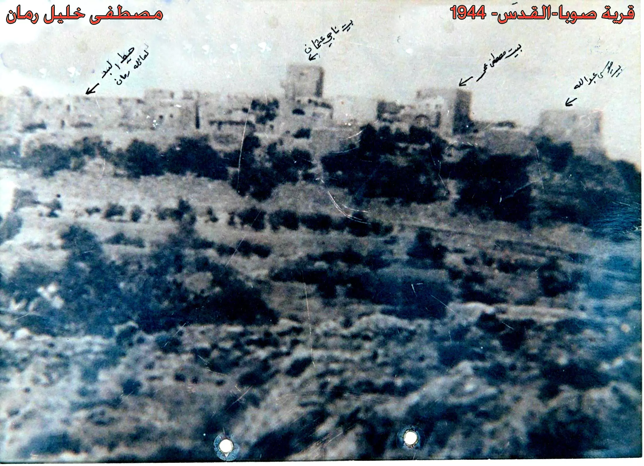
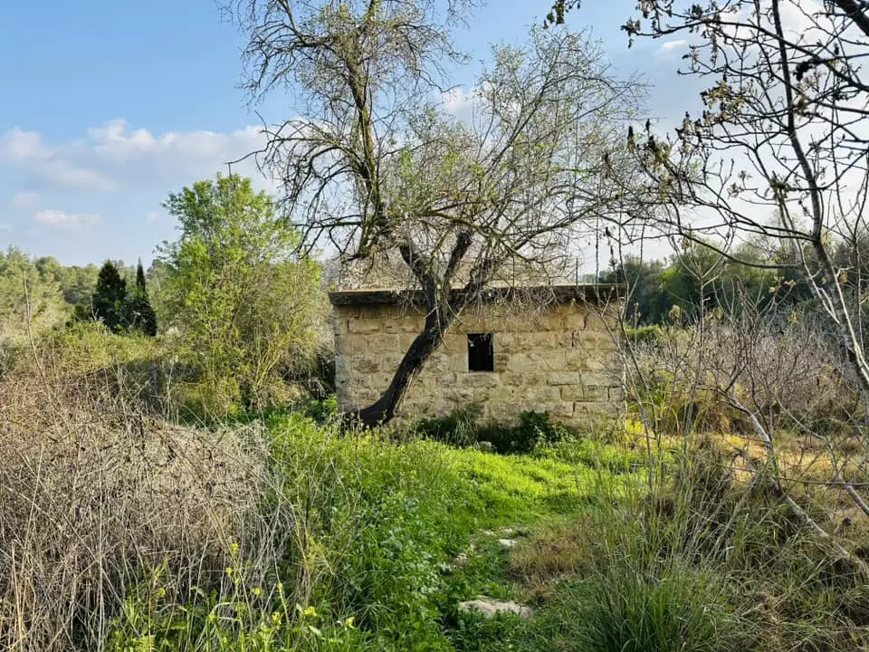
- The ruins of a deserted houses & rubble scattered over the village site, 1986
Scanned from "All That Remains" by Dr. Walid Khalidi 3 - General View Of Suba, 1949
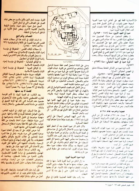
Posted by Prince, Peaceful Israeli 1 - خارطة لقرية صوبا
Posted by خالد عليان 5 - كتاب صوبا في الذاكرة
Posted by خالد عليان 2 - A pictures of Suba's destroyed houses
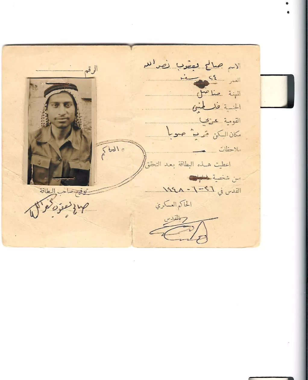
- COVER OF THE 1948 M. ID.
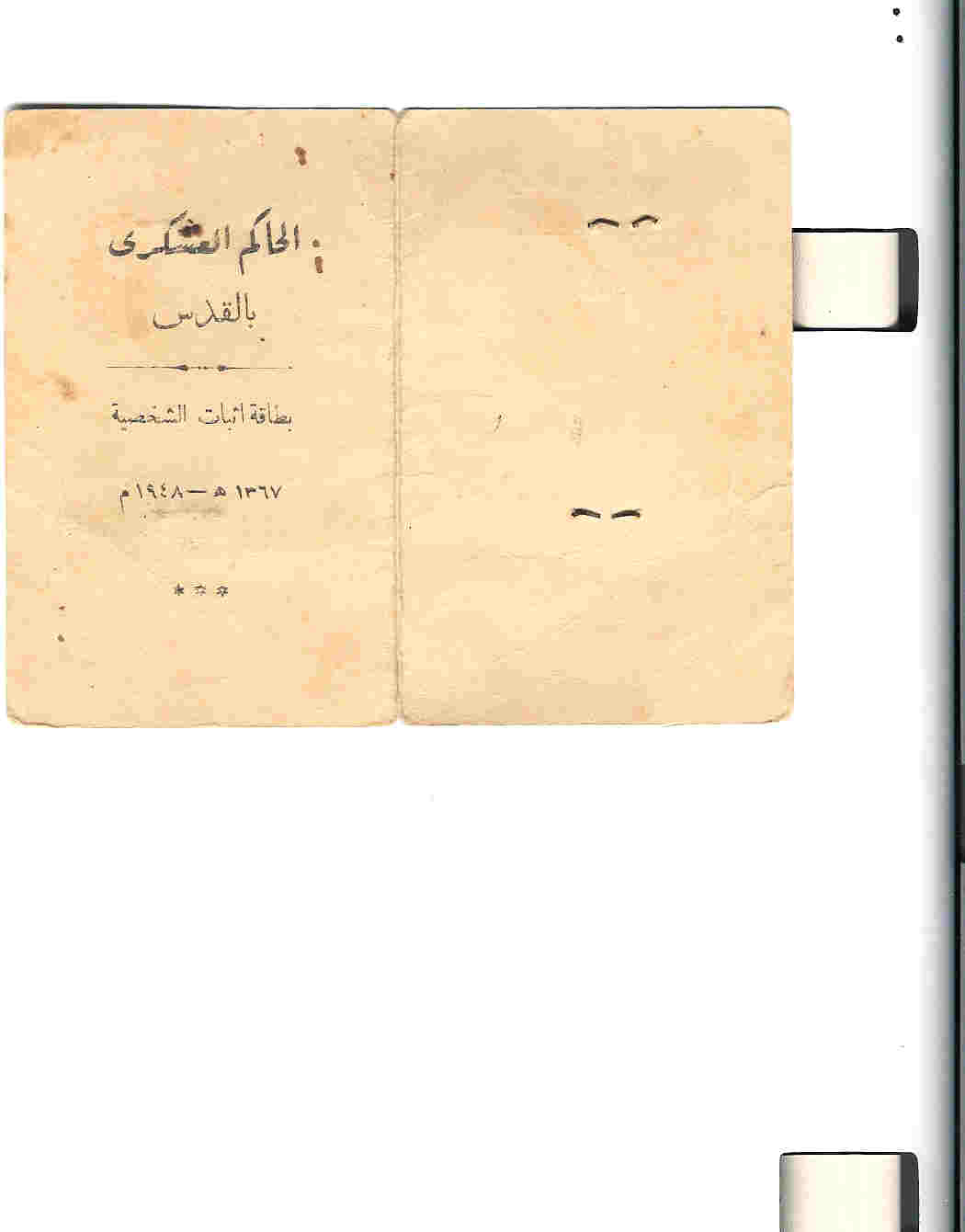
Posted by YACOUB S. NASRALLAH - 1948 MILITARY ID
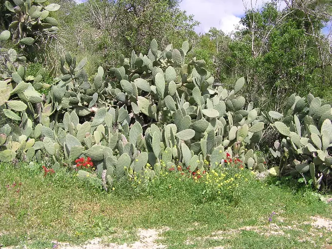
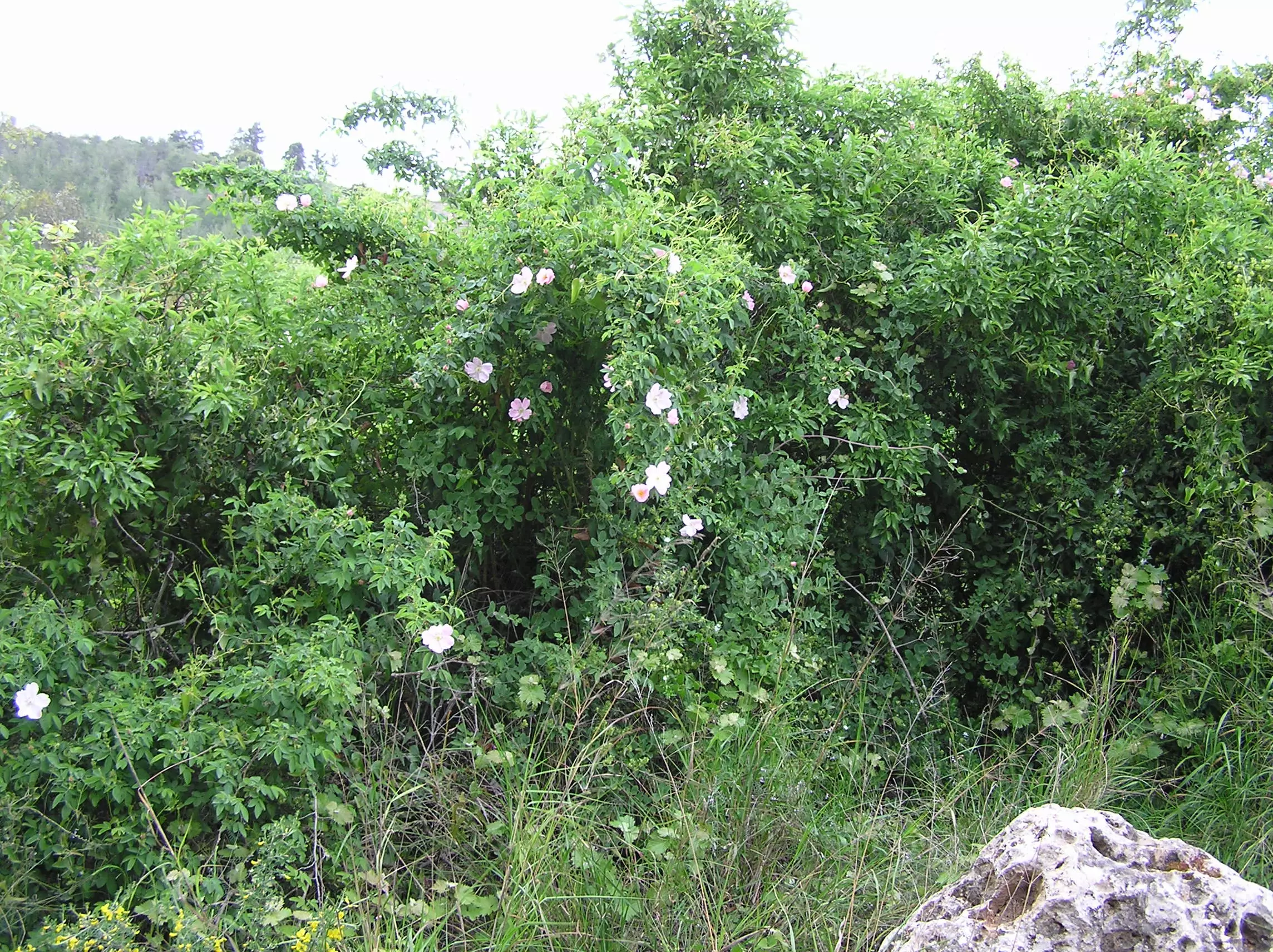
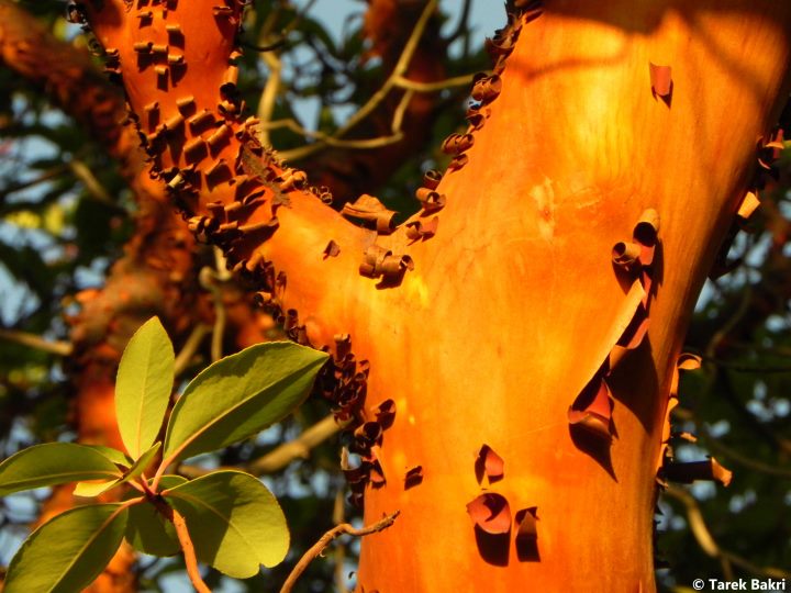
Posted by YACOUB S. NASRALLAH 1 - Cactus & wild colorful flowers at the of Suba's olive/almond terraces
Posted by Umar Ilayann 2 - Houses & Courtyard Of Suba's On Top Of Jabal
Posted by Umar Ilayann - Suba's Old Buildings / Dwellings - The Images Tell The Real Story.
Posted by Umar Abu El-Bararri 1 - One Of Suba's houses In The Olive/Almond Terraces located Near the
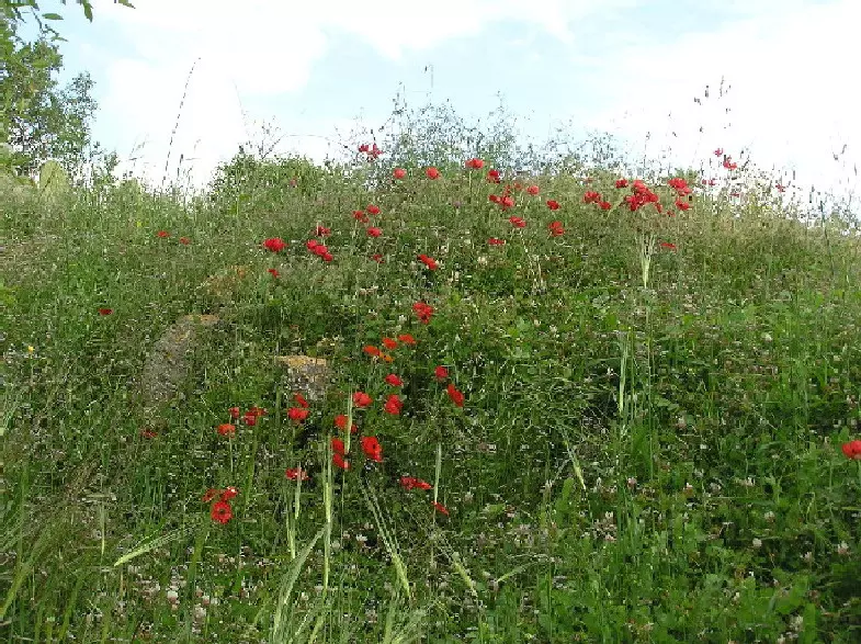
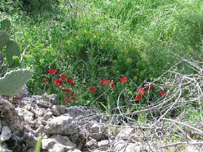
Posted by Umar Ilayann 3 - Suba's Natural Beauty Of Wild Red Flowers On Top Of A Pile Of What Used To Be A Home. (Spring 2004)
Posted by Umar Ilayann - Suba's Dwelling For Animals. Note The Feeding Manger & Closely Observe Where The Animal Was Tied To A Ring In One Of The Stones Of The Wall. (Spring 2004)
Posted by Umar Ilayann - A Close View Of One Of Suba's Terraces. Who Planted This Sabra? Who Placed These Stones In Their Current Places?
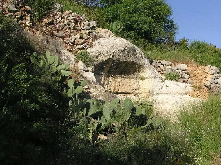
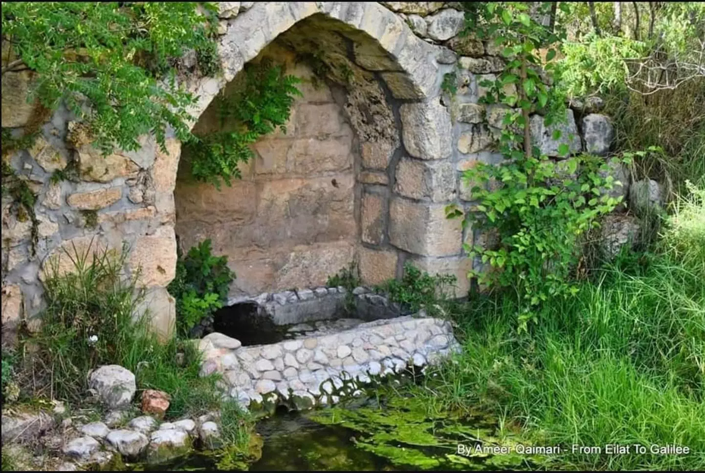
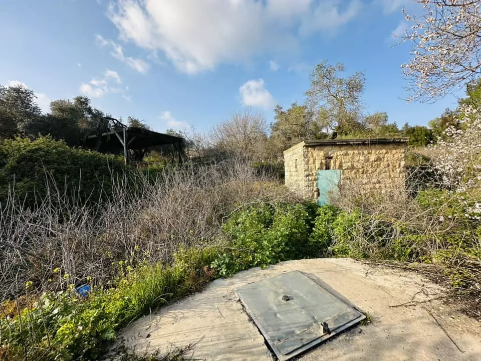
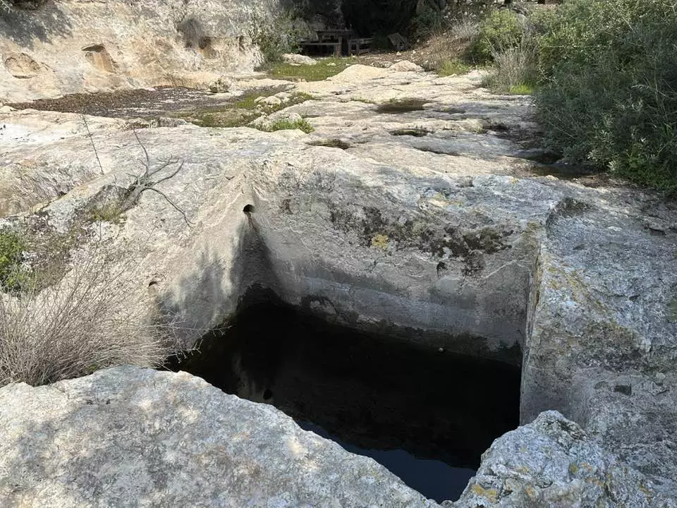
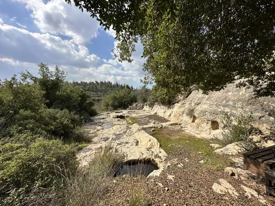
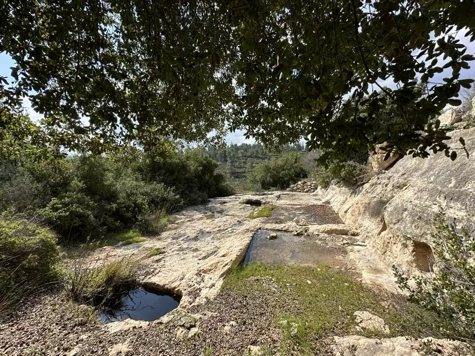
Posted by Umar Ilayann 3 - A Water Reservoir On The East Side Of Suba Close To The 'Ain'.Its Like A Cave Or Deep Well
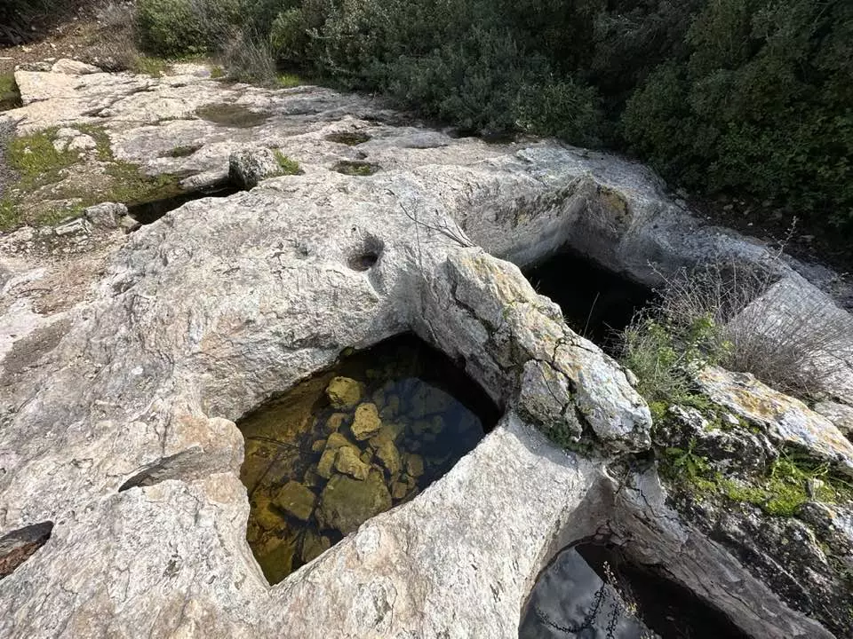
Posted by Umar Ilayann - A narrow canal hand chiseled in solid rock to irrigate nearby terraces.Suba's 'Ain' is to the
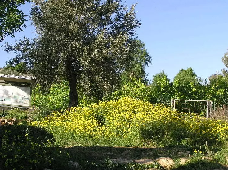
Posted by Umar Ilayann - A 1948 Olive tree & a carpet of yellow flowers at Suba's 'Ain' (Spring 2004)
Posted by Umar Ilayann - A Blooming Za'aroora & Almond trees In Suba's Terraces (Spring 2004)
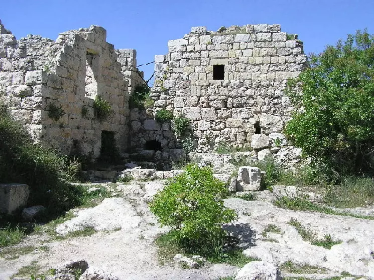
Posted by Umar Ilayann - Suba Ruins
- Remaining homes. Summer 2006. Photo: Annemarie Jacir
Posted by Annemarie Jacir - Wild Yasmeen (yellow blooms)/Rock Rose/Suba's Natural Beauty
Posted by Umar Abu El-Bararri - A Jouri Rose In Full Bloom & Growing On Almond Tree
Posted by Umar Abu El-Bararri - Red Hanoun In Suba's Terraces
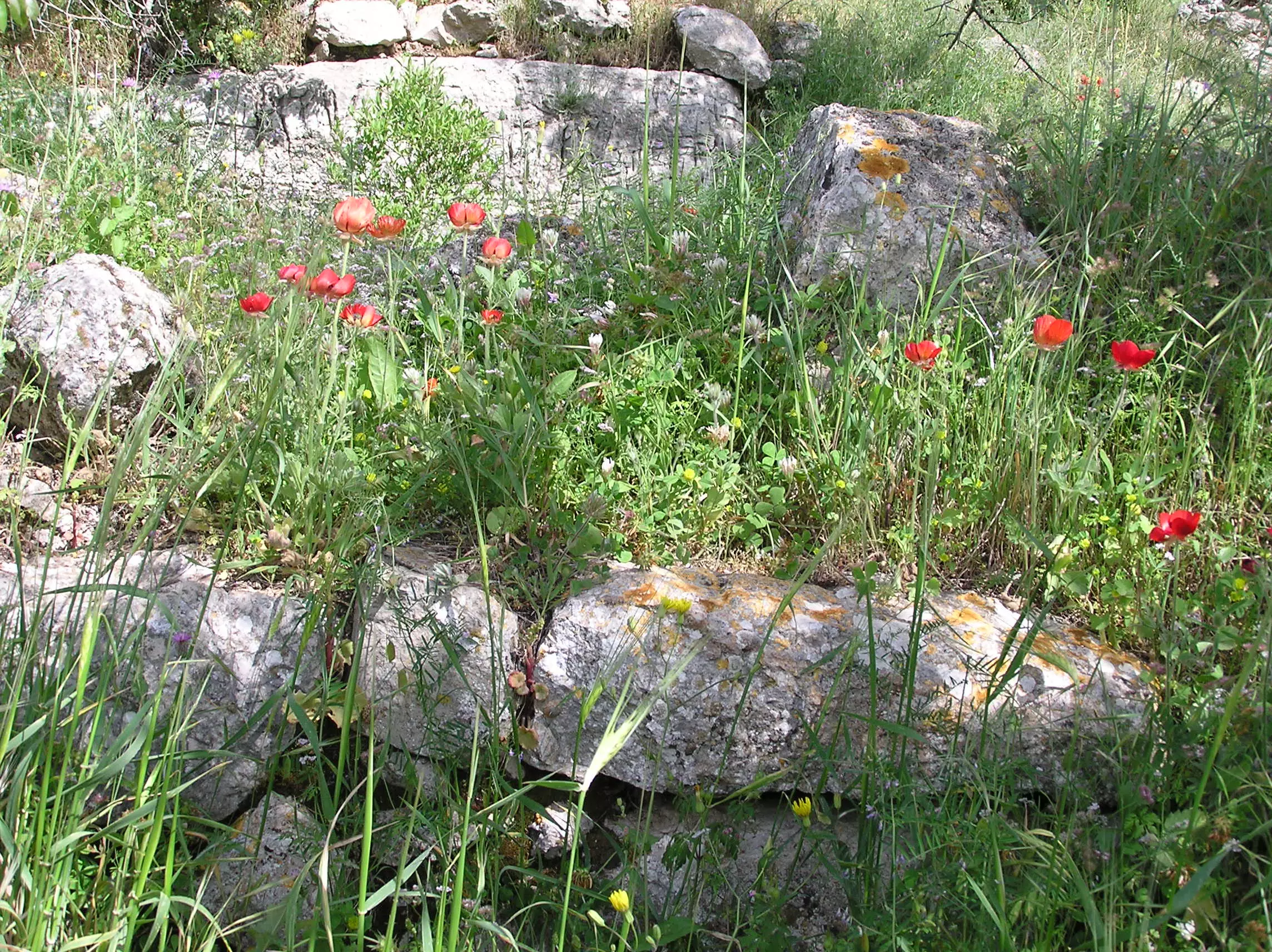
Posted by Umar Abu El-Bararri 1 - Red Hanoun In Suba's Terraces #2
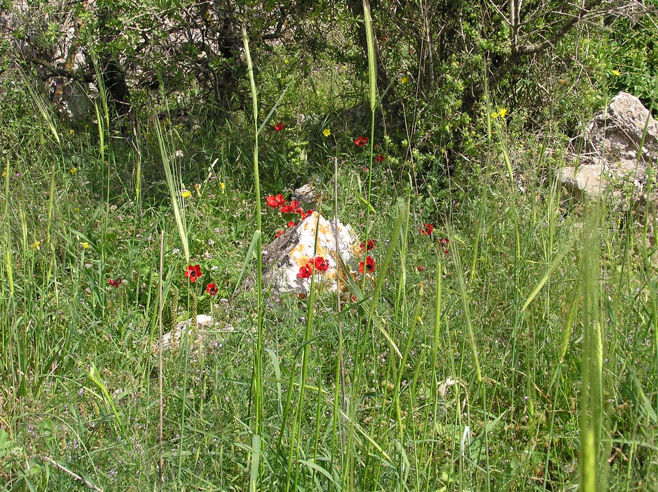
Posted by Umar Abu El-Bararri - Palestine's Hanoun Blooming On Top of the Rubble of One Of Suba's Homes. Look Closely there is a Real Story There.
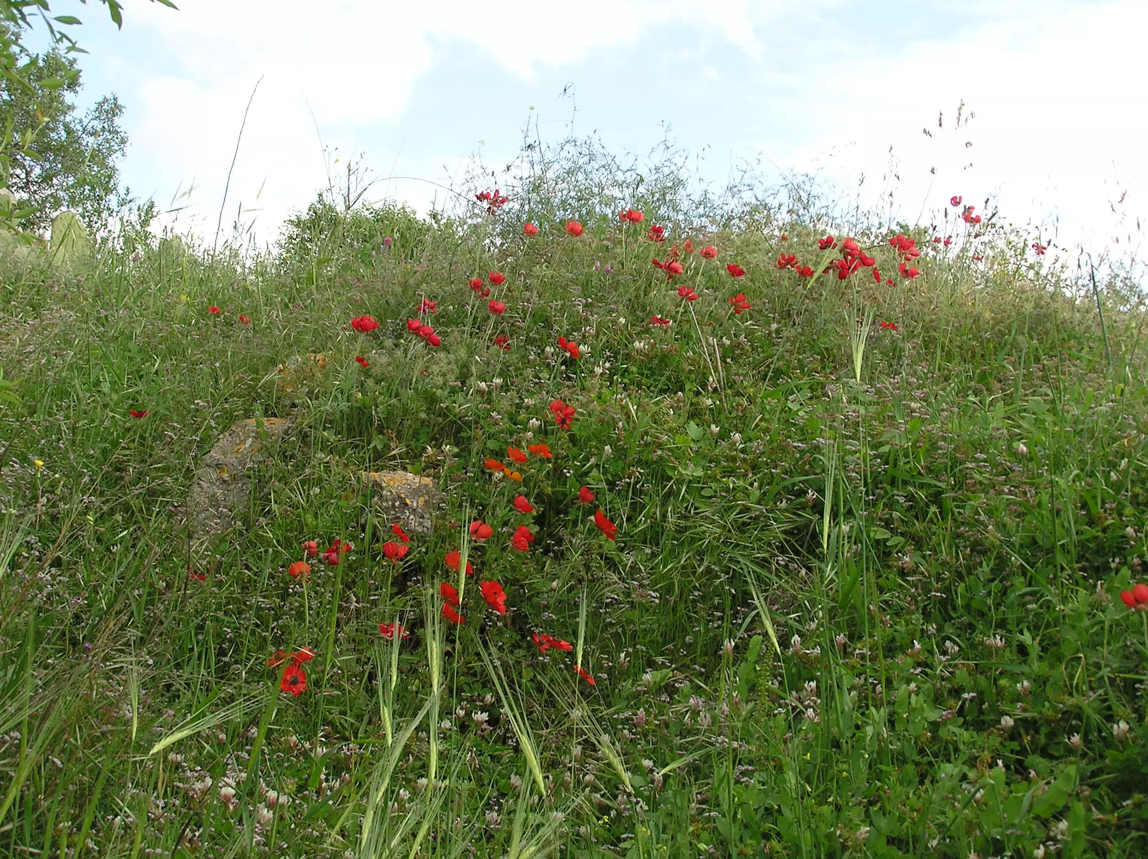
Posted by Umar Abu El-Bararri - Great panoramic view for Suba and its lands. Note the destroyed village at the top of the hill to the right.
- General view of the hill on which the village used to be before ethnic cleansing and destruction

- Suba's Houses & Courtyard Stands As A Witness Of Its Beautiful Past
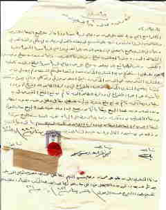
Posted by Umar Abu El-Bararri - سند أرض بإسم 'شاكر محمد أحمد نصر الله' بتاريخ 15/4/1945
Posted by omar naseralla 1 - صوبا في الذاكرة
Posted by خالد عليان - صورة جويية -من كتاب صوبا قرية مقدسية في الذاكره
Posted by خالد عليان 1 - Suba's Narrow Alley Leading To Center of Village.
Posted by Umar Abu El-Bararri - Suba's Architecture
Posted by Umar Abu El-Bararri 1 - Suba's Houses Still Standing.
Posted by Umar Abu El-Bararri 1 - One Of Suba's Main Alleys
Posted by Umar Abu El-Bararri 1 - Suba's House At The Edge Of Hill.
Posted by Umar Abu El-Bararri 2 - A Watering Trough In Center Of Village.
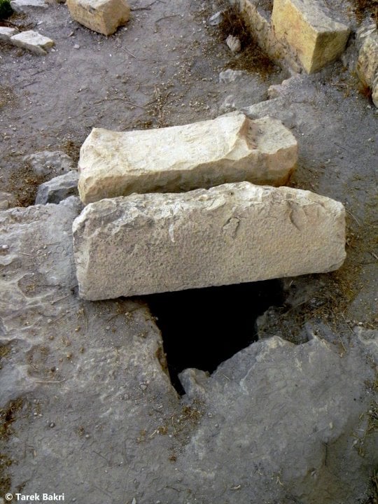
Posted by Umar Abu El-Bararri - A Deep Water Well In Solid Rock.
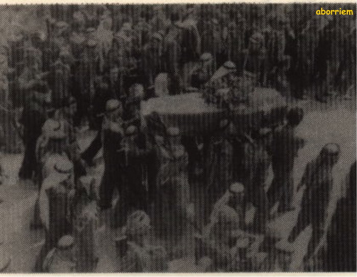
Posted by Umar Abu El-Bararri - الموكب الجنائزي للشهيد القائد عبد القادر الحسيني لحظة دخوله قرية صوب
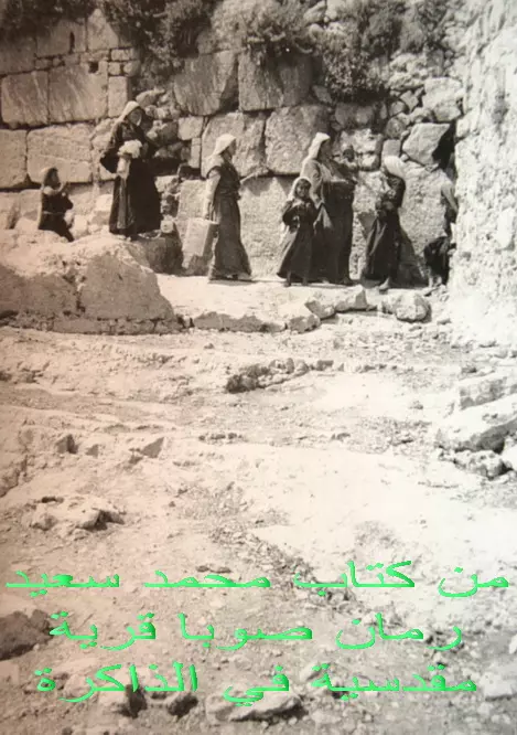
Posted by omar naseralla 1 - من كتاب محمد سعيد رمان صوبا في الذاكرة
Posted by خالد عليان - من كتاب محمد سعيد رمان صوبا في الذاكرة
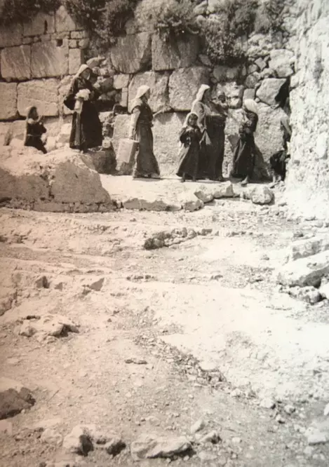
Posted by خالد عليان 2 - نساء من صوبا
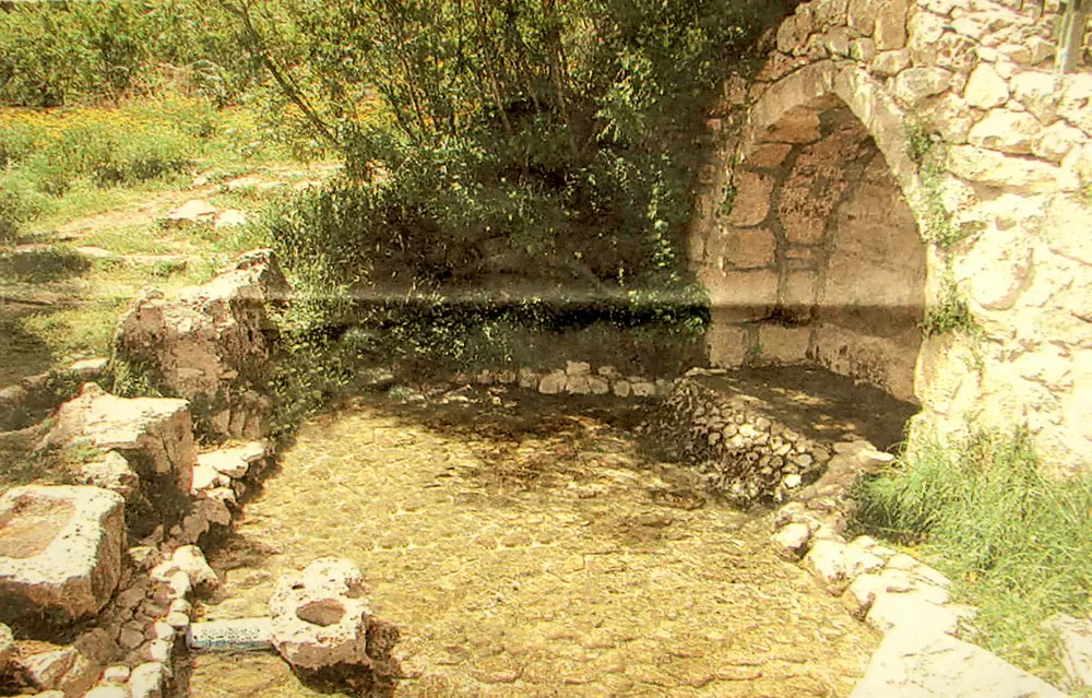
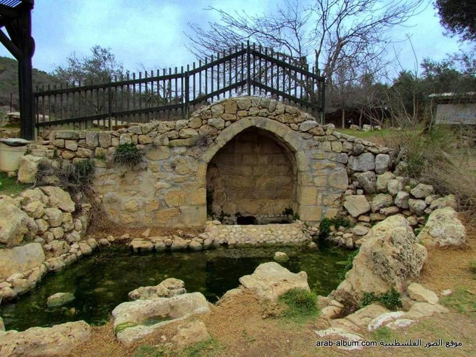
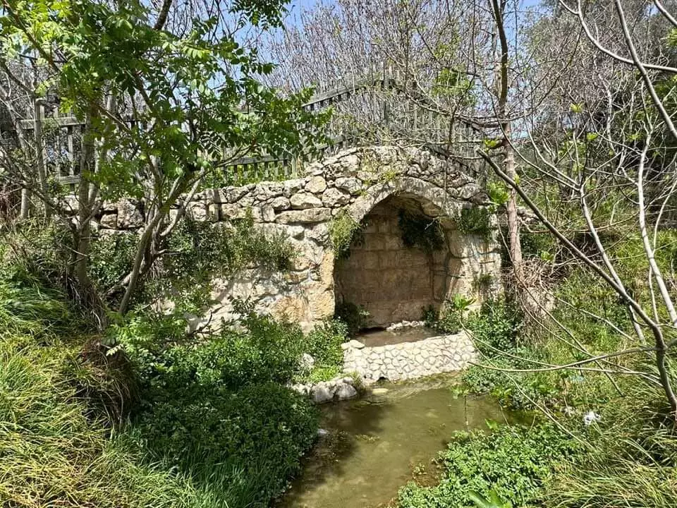
Posted by خالد عليان 1 - مصب العين
Posted by خالد عليان 1 - صوبا الزمان والمكان
Posted by خالد عليان - صوبا الزمان والمكان
Posted by خالد عليان - مصب عين صوبا
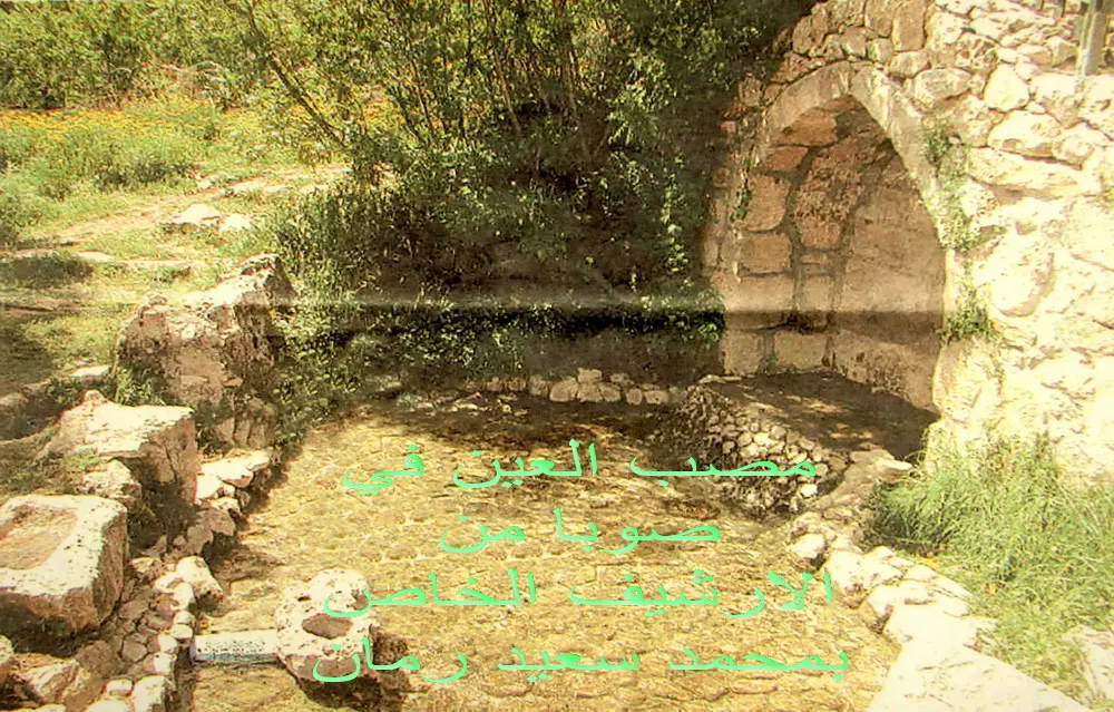
Posted by خالد عليان - مصب عين صوبا
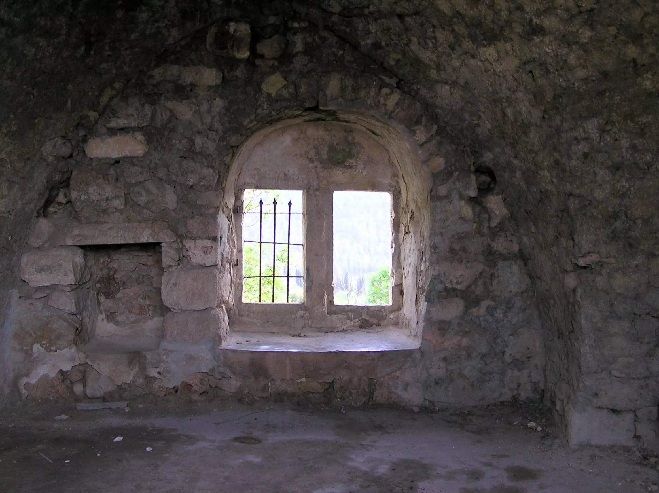
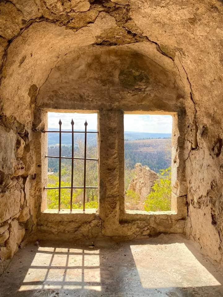
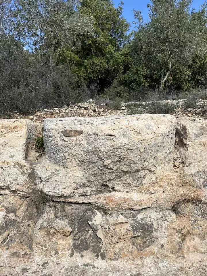
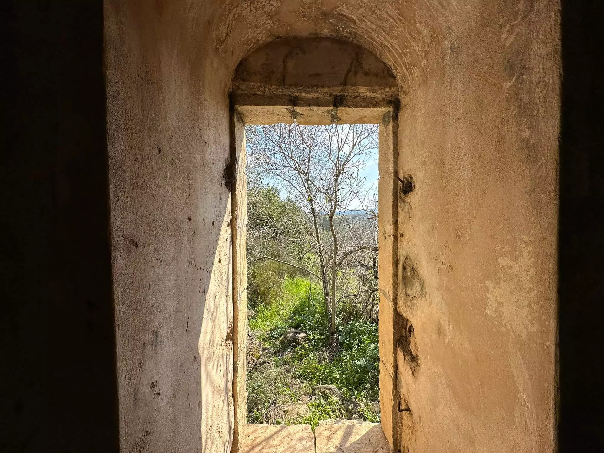
Posted by خالد عليان 3 - An Archeway Entrance To One Of The Remainings Houses Of Suba. Note The Arches Of The Double Window.
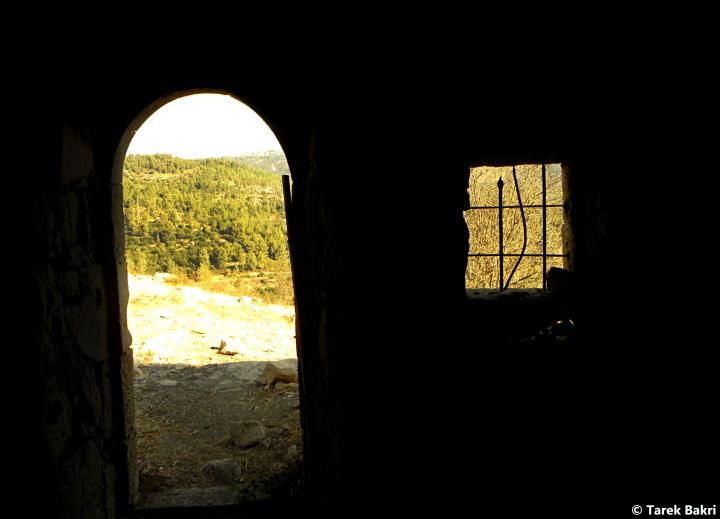
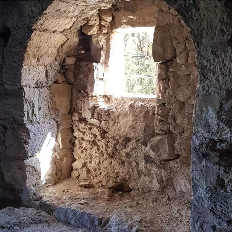
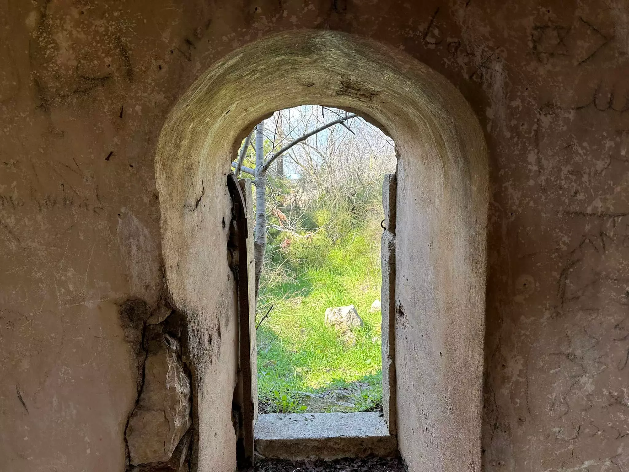
Posted by Umar Abu El-Bararri - A View From The Inside Of Suba's Houses Archway Looking Out.
Posted by Umar Abu El-Bararri 3 - Sabr At Suba's Hillside & Terraces.
Posted by Umar Abu El-Bararri - Suba's Fig Trees With Figs In early Ripening Stage of 'Dafour'
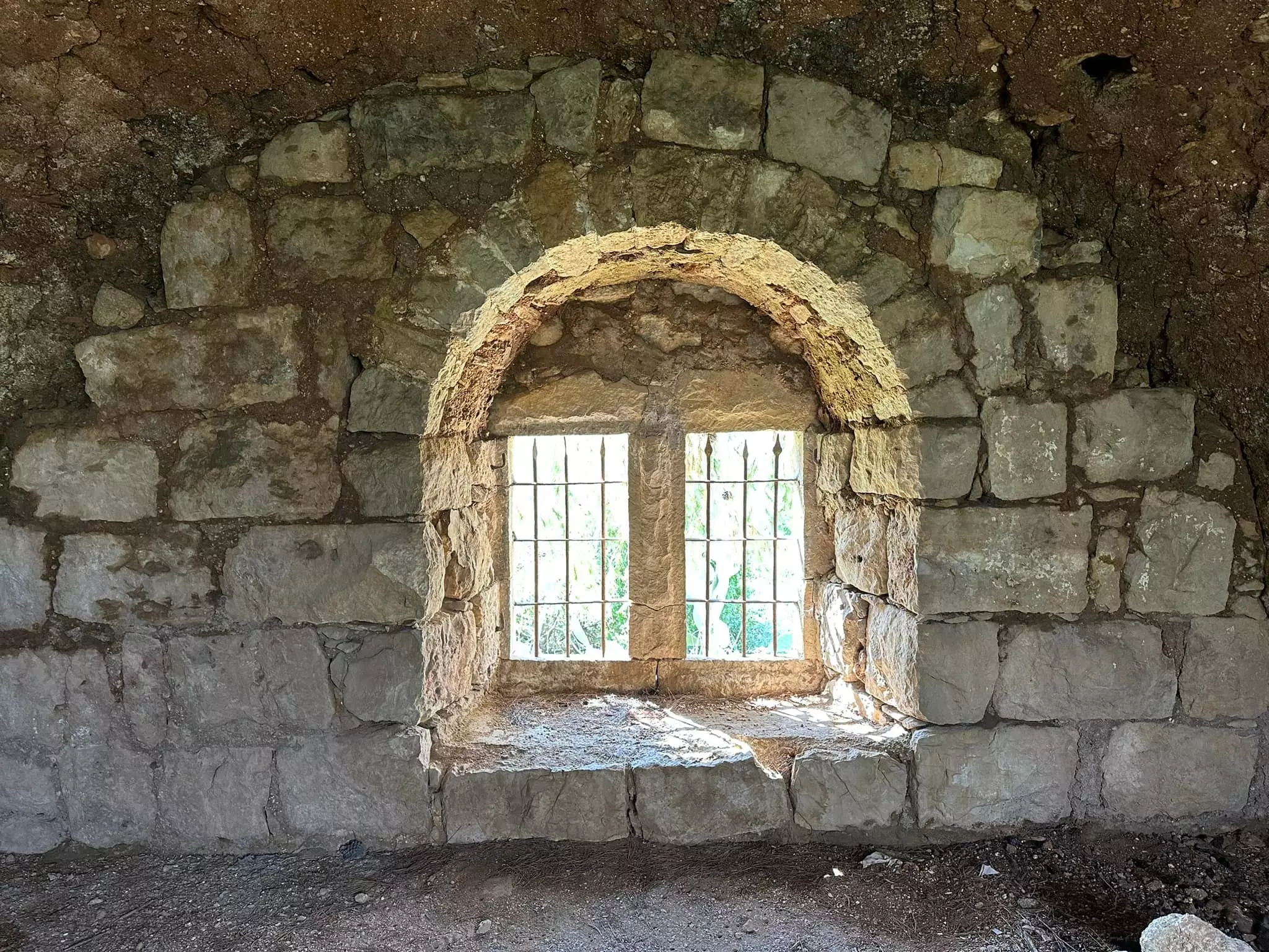
Posted by Umar Abu El-Bararri - Suba's Double Windows 'Mejwezz'. A View From Inside Out
Posted by Umar Abu El-Bararri - Suba's Houses In Ruins Remain Standing Over Decades Of Neglect (Village Center Area).
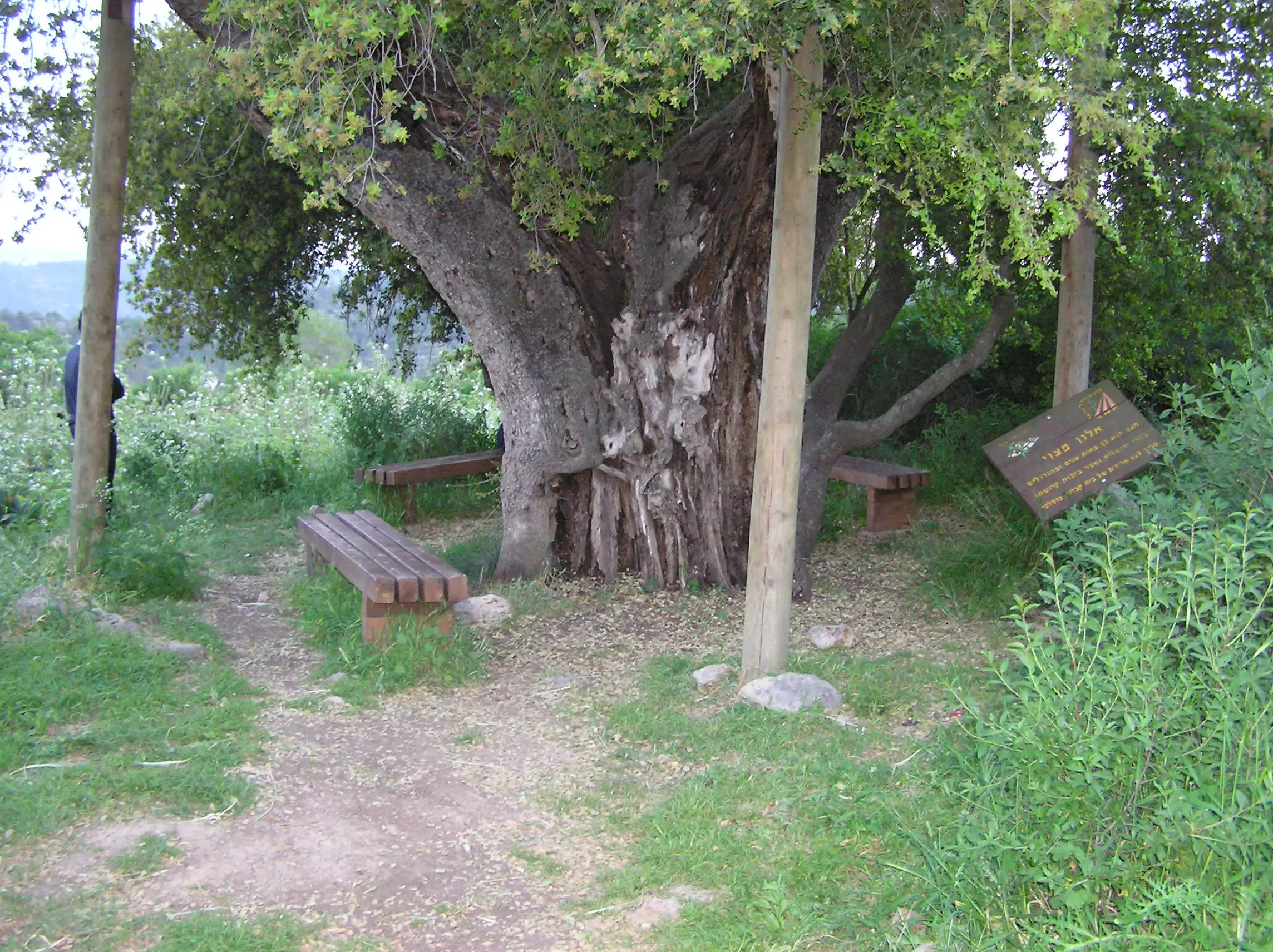
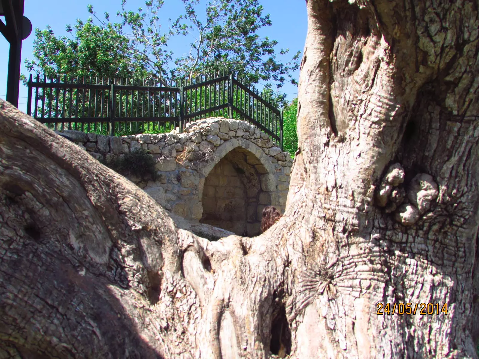
Posted by Umar Abu El-Bararri 1 - Suba's Ancient Oak Tree (3000 thousand year old) Its Still Standing Next To The Village Cemetery.
Posted by Umar Abu El-Bararri - Suba's Remains.
Posted by Umar Abu El-Bararri 1 - Suba's Remains - Note The Thickness Of the Walls.
Posted by Umar Abu El-Bararri - Suba's Stone Wall Terrace Corners.
Posted by Umar Abu El-Bararri - THE PICTURE TELLS SUBA'S STORY. THE PAINT IS STILL ON THE WALL. THE STONE WALL IS BEAUTIFUL.
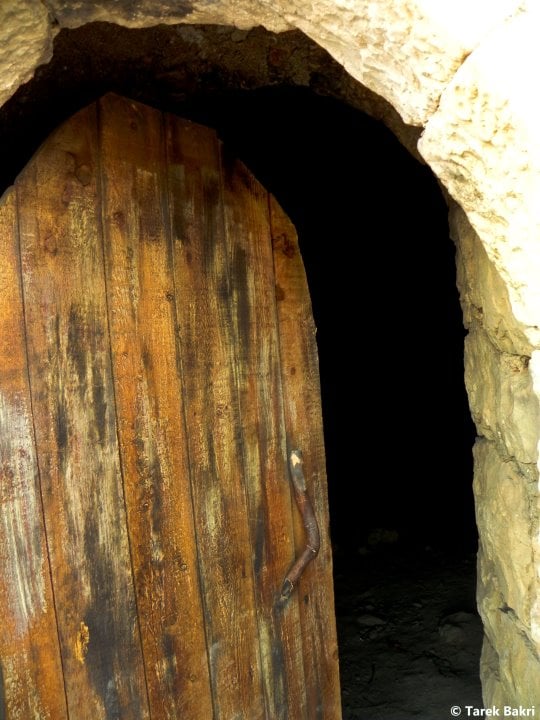
Posted by Umar Abu El-Bararri - One Of Suba's Doorways.
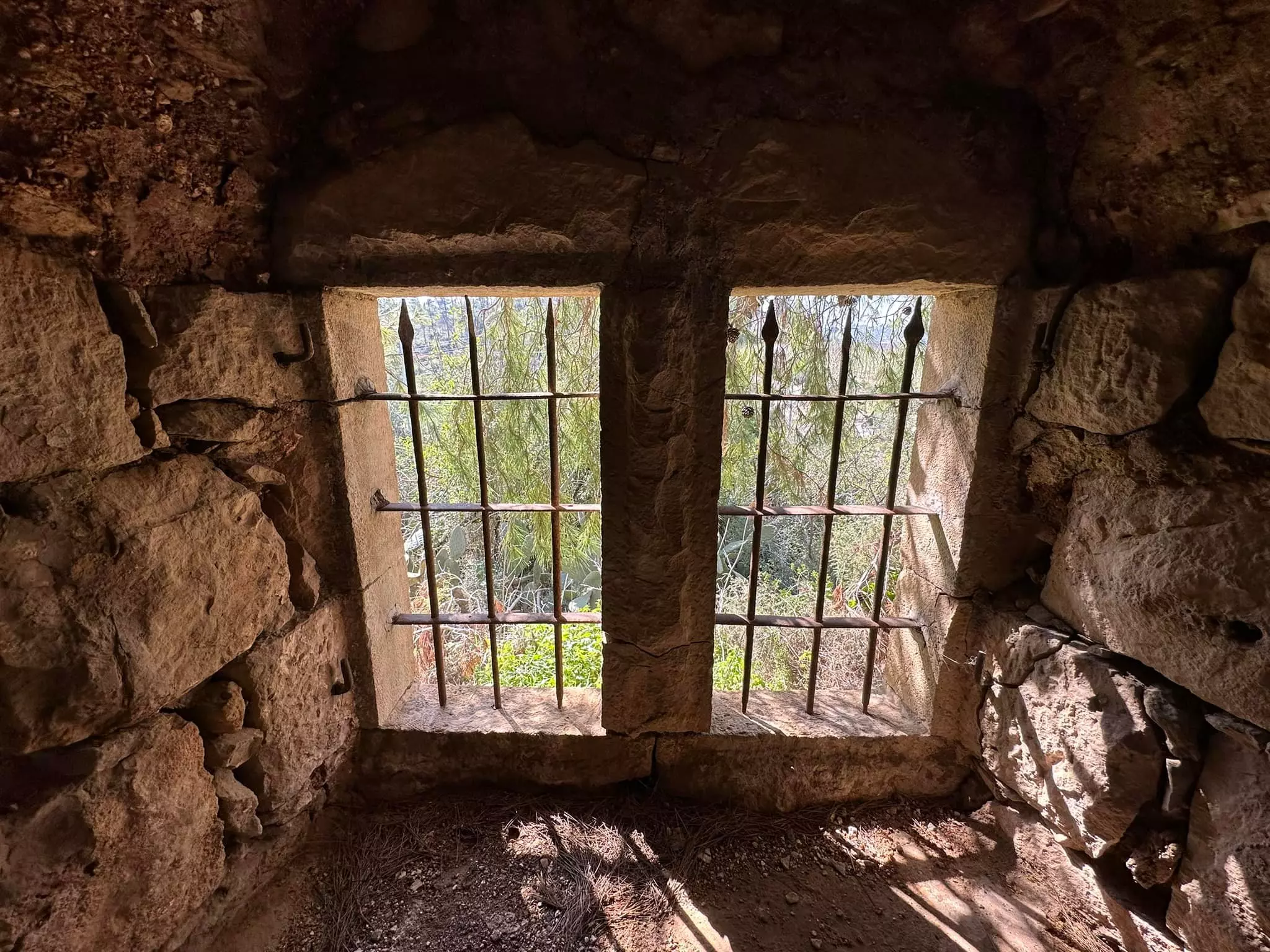
Posted by Umar Abu El-Bararri - Suba's Windows.
Posted by Umar Abu El-Bararri - Suba's Ruins / Remains -- Nature's Colors & Beauty.
Posted by Umar Abu El-Bararri - Suba's Alley Scene.
Posted by Umar Abu El-Bararri - One Of Suba's Houses Found At The Main Entrance & By The Side Of The Paved Road.
Posted by Umar Abu El-Bararri - A Spring Scene In Suba With The All Of Nature's Beauty, Especially The Red Hanoon.
Posted by Umar Abu El-Bararri - Suba's Narrow Alley-Way (Zeqaq).
Posted by Umar Abu El-Bararri - Suba's Architecture - Stone For Hanging Oil Lamp Perhaps & Much More.
Posted by Umar Abu El-Bararri - Suba's Old Fort Wall (Note Photo #42...same wall )
Posted by Umar Abu El-Bararri - Suba's Old Fort Wall #2 (Note photo #42...same wall/water spring area)
Posted by Umar Abu El-Bararri - land deed 1
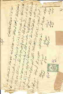
Posted by YACOUB S. NASRALLAH - land deed 2
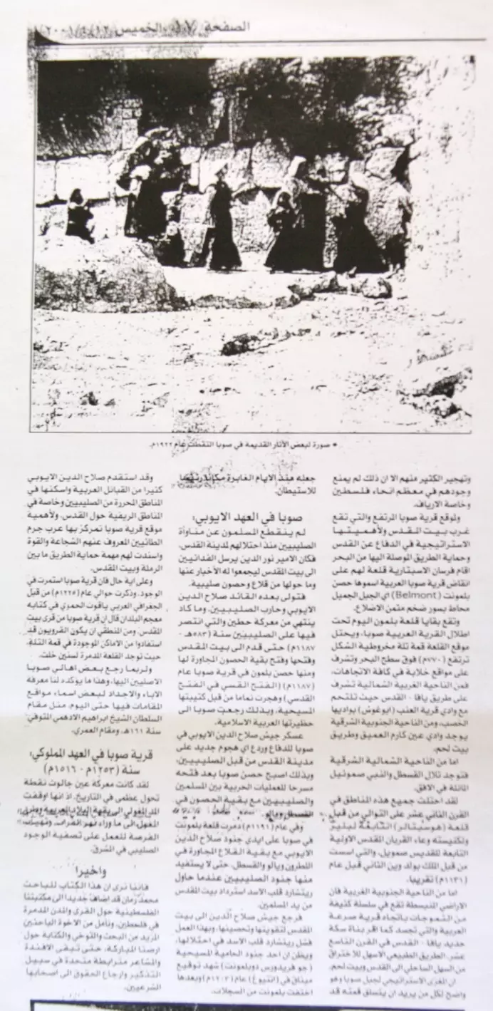
Posted by YACOUB S. NASRALLAH - مقال حول كتاب محمد سعيد رمان في الجروسالم بوست
Posted by خالد عليان - مقال حول كتاب محمد سعيد رمان في جريدة القدس
Posted by خالد عليان - البيادر السياسي تنشر عن كتاب باحثنا محمد سعيد رمان
Posted by خالد عليان - البيادر السياسي تنشر عن كتاب باحثنا محمد سعيد رمان
Posted by خالد عليان - جريدة القدس تغطي كتاب باحثنا محمد سعيد رمان
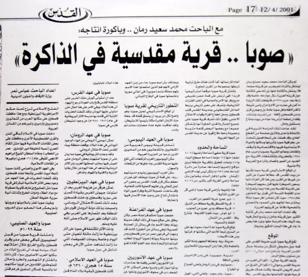
Posted by خالد عليان - تكملة مقال جريدة القدس
Posted by خالد عليان - صورة حصرية لصوبا
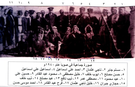
Posted by ابن صوبا - صورة جماعية في صوبا عام 1940
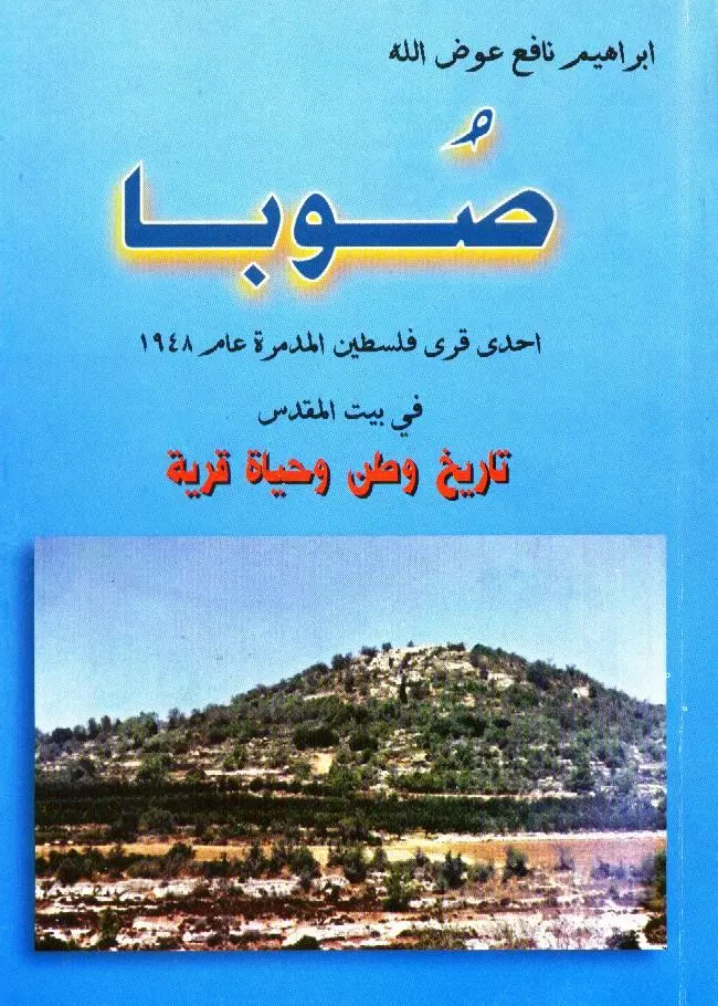
Posted by ابراهيم عوض الله الفقيه - غلاف كتاب (صوبا - إحدى قرى فلسطين المدمرة عام 1948
Posted by ابراهيم عوض الله الفقيه - مقر جمعية صوبا عام 1947
Posted by ابراهيم عوض الله الفقيه - Suba's Spring/Ain Site
Posted by Umar Abu El-Bararri - Suba's Chiseled Stone Steps
Posted by Umar Abu El-Bararri - One of Suba's Arched Doorways
Posted by Umar Abu El-Bararri - Suba's Spring Beauty
Posted by Umar Abu El-Bararri - Suba's Sunset
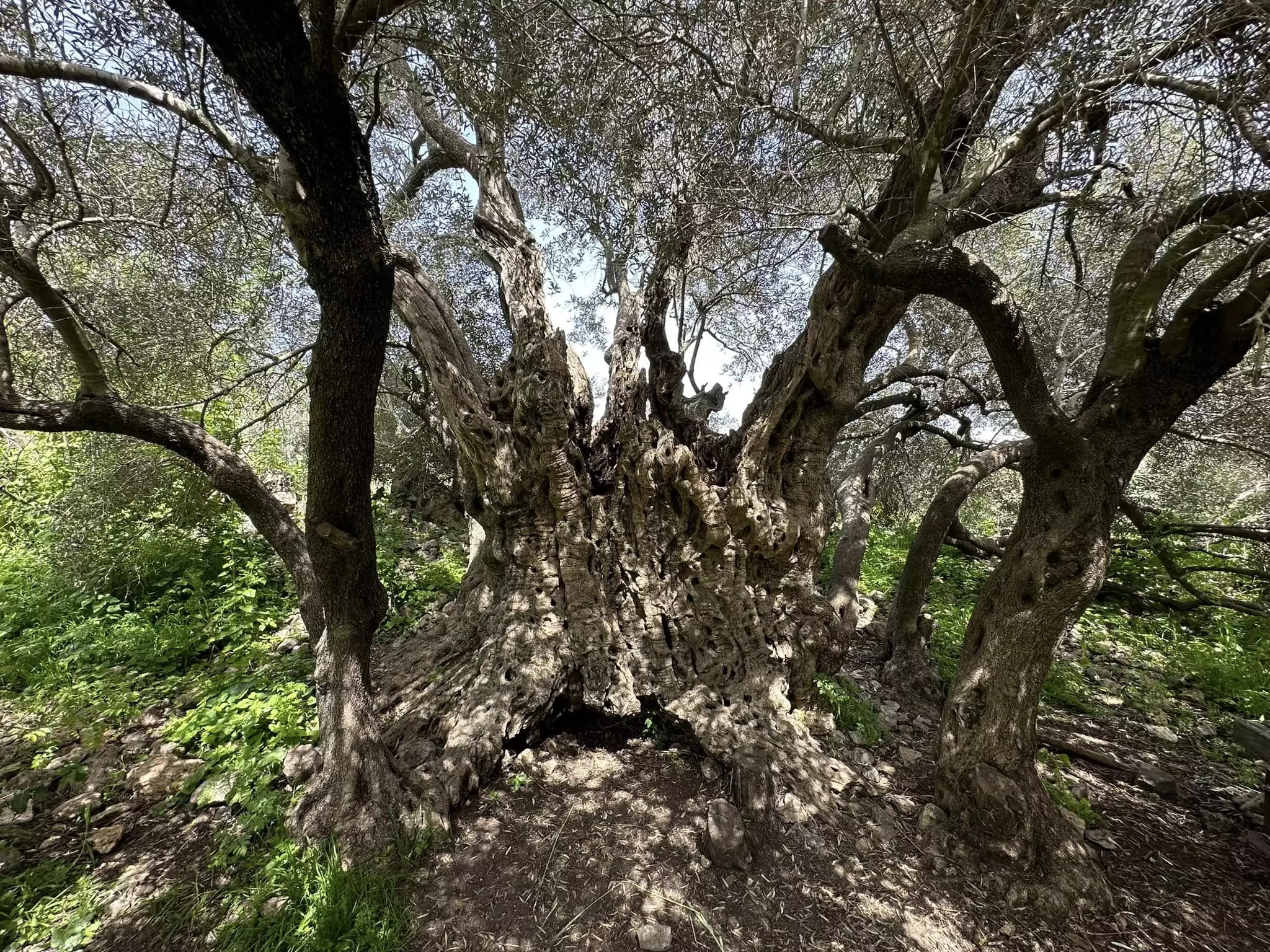
Posted by Umar Abu El-Bararri 3 - Suba's Ancient Olive Tree - Perhaps 2000-3000 years old.
Posted by Umar Abu El-Bararri 1 - The Ruins/Remains of Suba
Posted by Khalid Romman - The Ruins/Remains of Suba
Posted by Khalid Romman - The Ruins/Remains of Suba
Posted by Khalid Romman - The Ruins/Remains of Suba
Posted by Khalid Romman - The Ruins/Remains of Suba
Posted by Khalid Romman - عين قرية صوبا الصامدة
Posted by عبدالله يونس رمان 1 - من ابناء قرية صوبا في القدس وبيت لحم
Posted by عبدالله يونس رمان 2 - منظر رائع لسطوح البيوت المٌهجرة
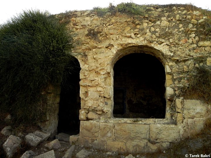
Posted by Tarek Bakri - منظر رائع من داخل أحد المنازل
Posted by Tarek Bakri - المنزل لا يزال ينتظر ...واليه راجعون
Posted by Tarek Bakri - أحد آبار القرية
Posted by Tarek Bakri - طراز معماري قديم رائع يتميو ببساطته
Posted by Tarek Bakri - يبدو مركز القرية....وكأن الوقت توقف
Posted by Tarek Bakri - مدخل لأحد البيوت المدمرة
Posted by Tarek Bakri - مركز القرية
Posted by Tarek Bakri - بيوت مدمرة
Posted by Tarek Bakri - من خير البلد..... ولا تزال تنتظر
Posted by Tarek Bakri - مبنى قديم كانه خصص للدواب
Posted by Tarek Bakri - منظر عام

Posted by Tarek Bakri - جدران البيوت المدمرة
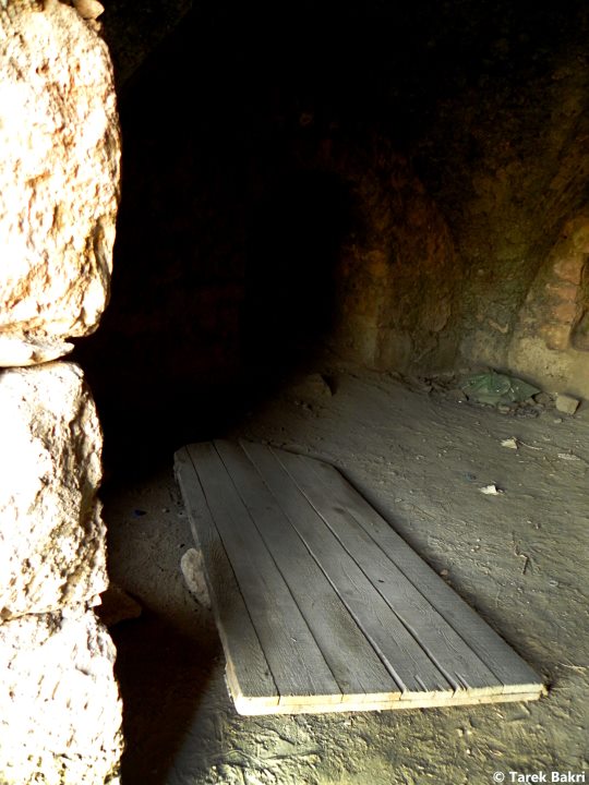
Posted by Tarek Bakri - داخل احد البيوت المُهجرة
Posted by Tarek Bakri - صبار صوبا
Posted by Tarek Bakri - احد البيوت المنهوبة
Posted by Tarek Bakri - منظر من داخل احد المنازل
Posted by Tarek Bakri - منظر عام
Posted by Tarek Bakri - الطراز المعماري الفلسطيني القديم
Posted by Tarek Bakri - بأي حق هُجرت
Posted by Tarek Bakri - منظر رائع للطبيعة المحيطة
Posted by Tarek Bakri - احد المنازل الصامدة
Posted by Tarek Bakri - لاحظ نصف الدرج الذي يميز الطراز المعماري القديم
Posted by Tarek Bakri - جدرات او سناسل لحماية انجراف التربة
Posted by Tarek Bakri - من داخل احد المنازل المنهوبة
Posted by Tarek Bakri - في احد طرق القرية
Posted by Tarek Bakri - وكأن الوقت توقف....والجريمة تتكلم
Posted by Tarek Bakri - مزيد من الأنقاض
Posted by Tarek Bakri - المزيد من الكام والأطلال
Posted by Tarek Bakri - غلال صوبا المنهوبة
Posted by Tarek Bakri - احد البيوت المنهوبة
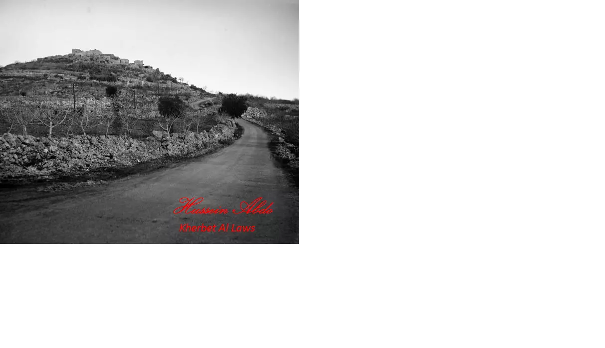
Posted by Tarek Bakri 1 - suba 1949
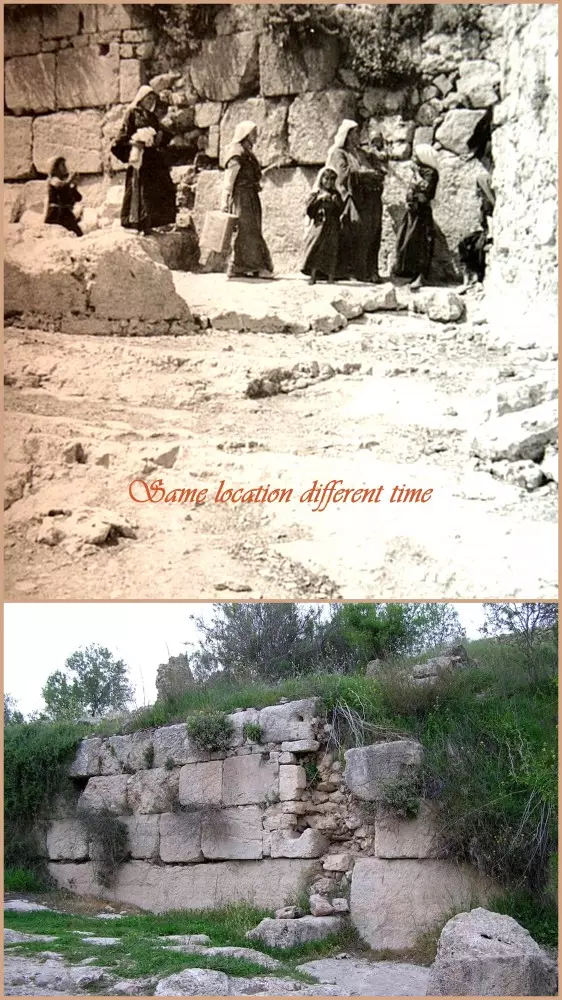
Posted by hussein abdo - Suba's Image Location & Comparison...Past & Present....!!!
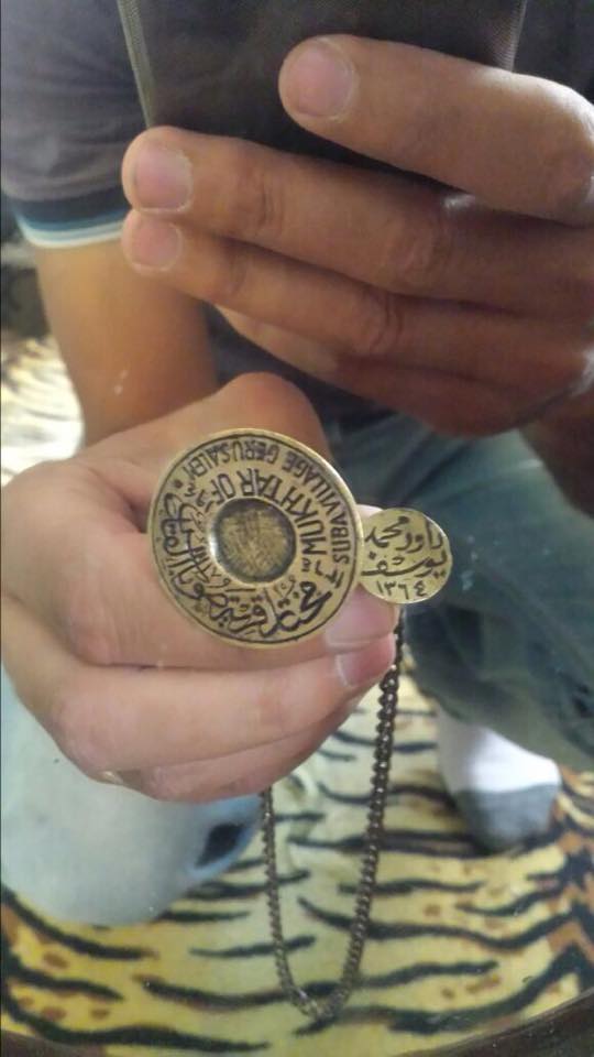
Posted by Umar Abu El-Bararri - ختم مختار قرية صوبا القدس دَاوُدَ محمد يوسف نصرالله سنة 1364هـ - عمره 72 سنة
Posted by omar naseralla - قريه صوبا
Posted by abu raya - قريه صوبا واثار بيوتها المهدمه
Posted by abu raya - قريه صوبا
Posted by abu raya - قريه صوبا على التله
Posted by abu raya - بيوت قريه صوبا
Posted by abu raya - بيوت قريه صوبا
Posted by abu raya - ربيع قريه صوبا
Posted by abu raya - قريه صوبا
Posted by abu raya - اثار دمار بيوت القريه
Posted by abu raya - ردم بيوت القريه
Posted by abu raya - منظر عام
- منظر عام #5
- منظر عام #4
- منظر عام #3
- منظر عام #2
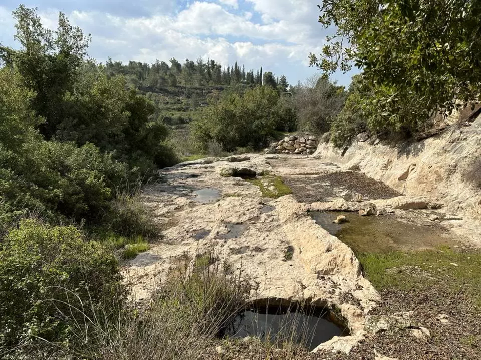
- عين البلد القبلية
- عين البلد القبلية #2
- عين البلد القبلية #3
- منظر عام
- Pre-Nakba Aerial view of the village / صورة من الجو للقرية اخذت قبل النكبة
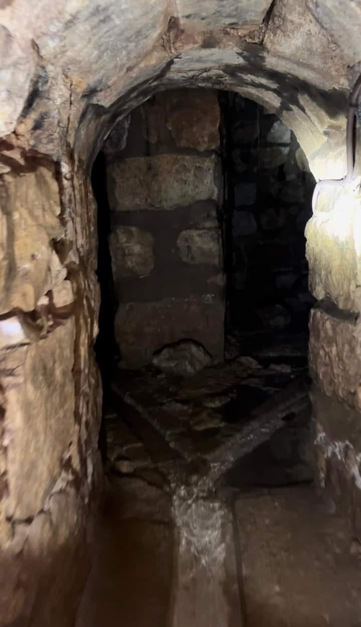
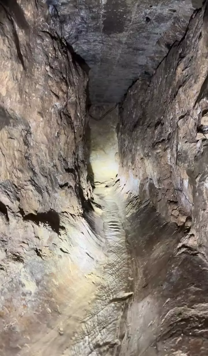
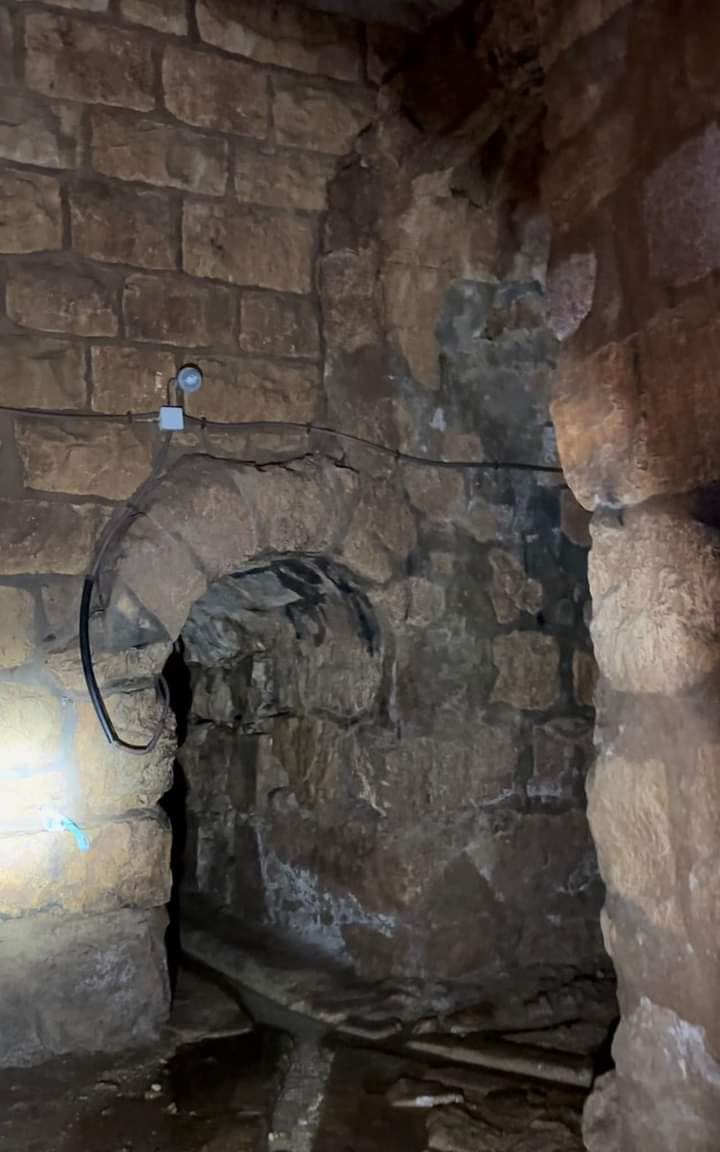
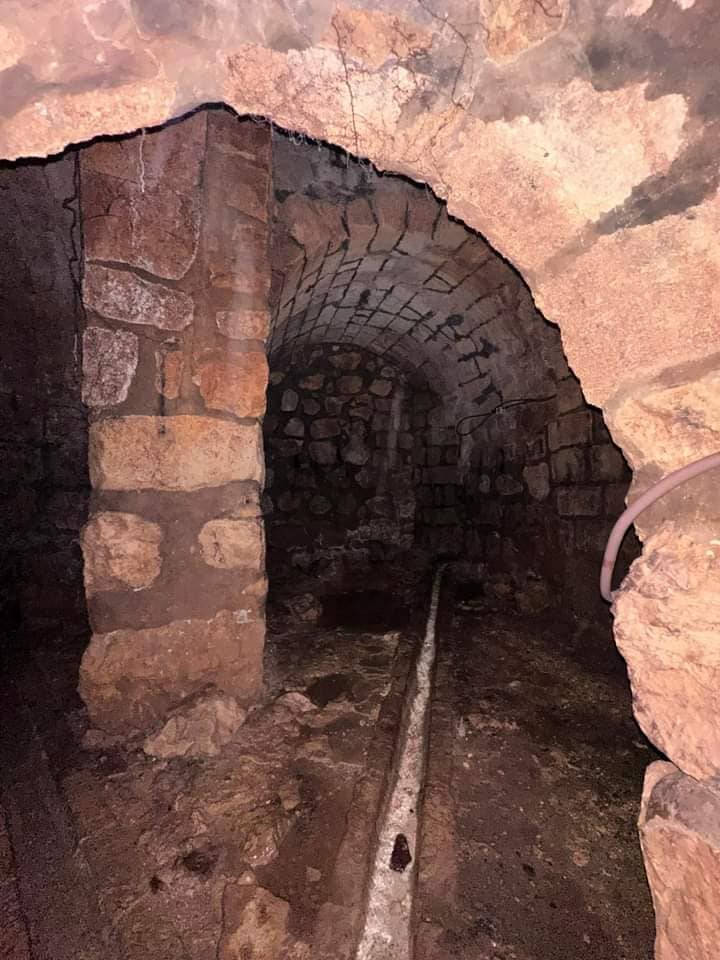
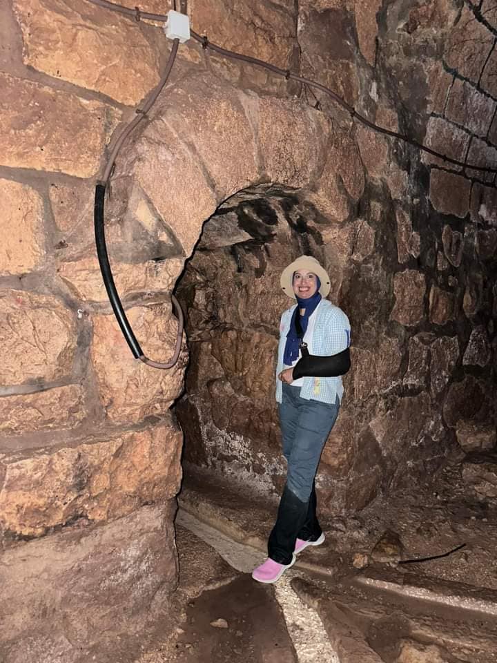
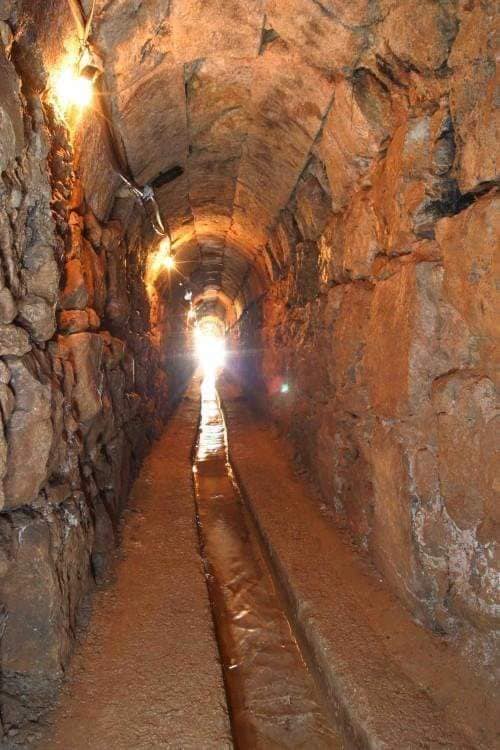
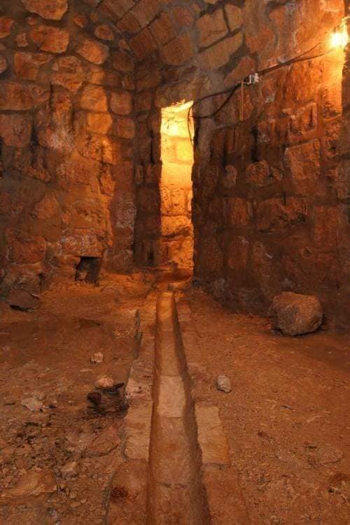
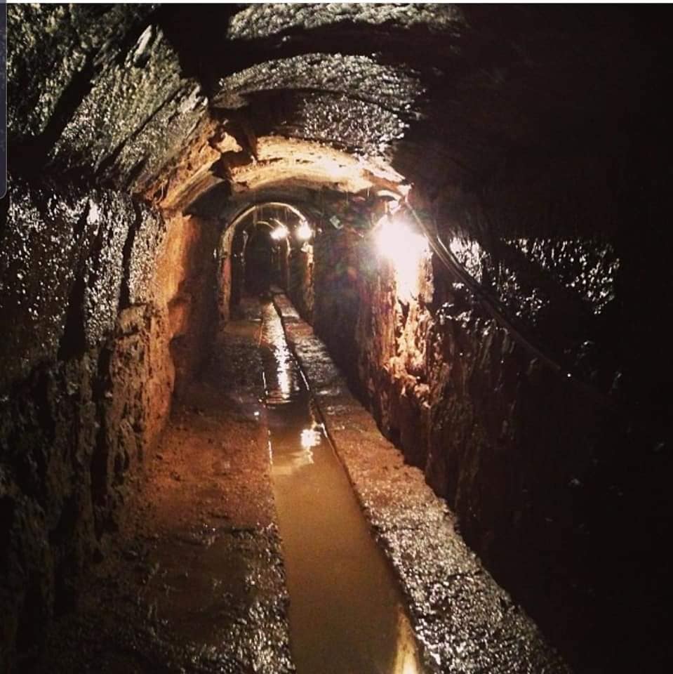
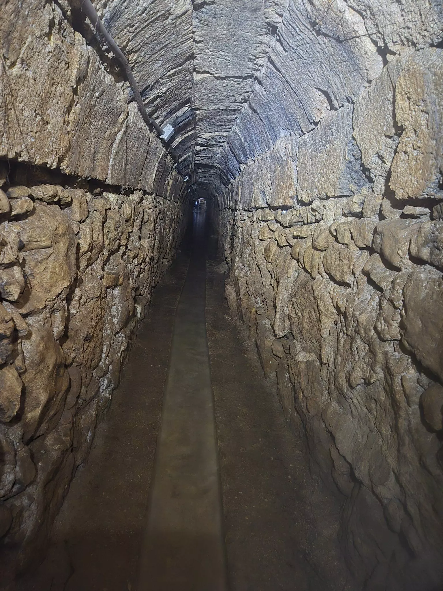
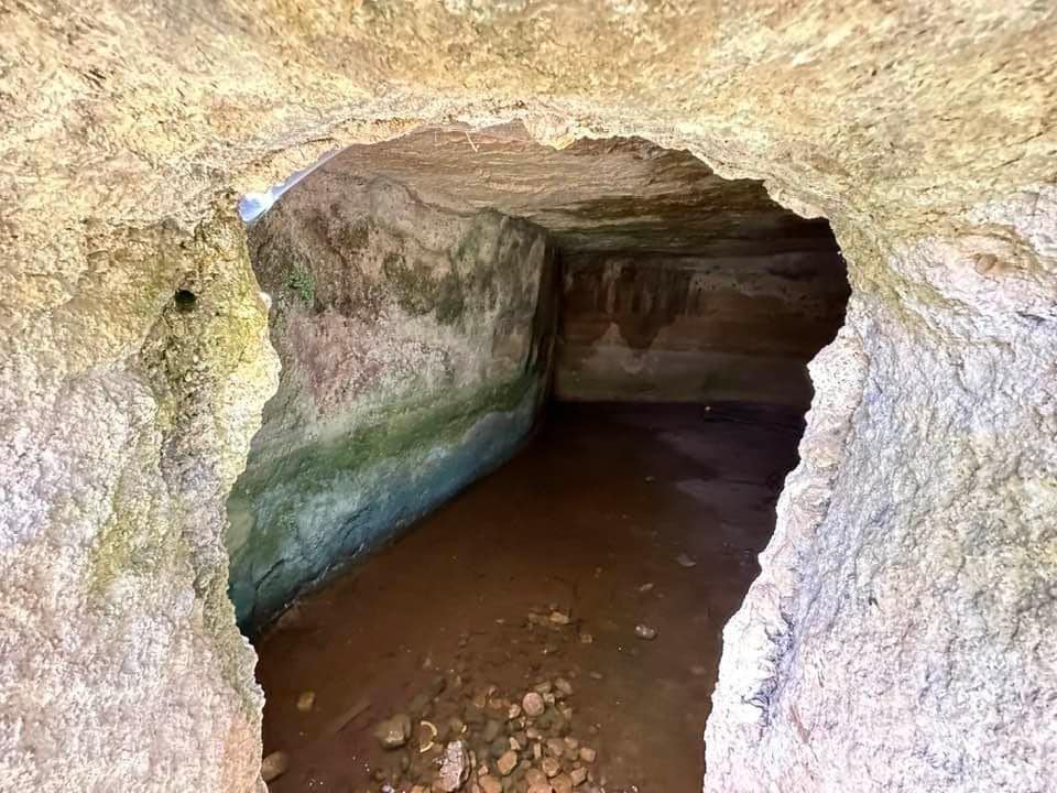
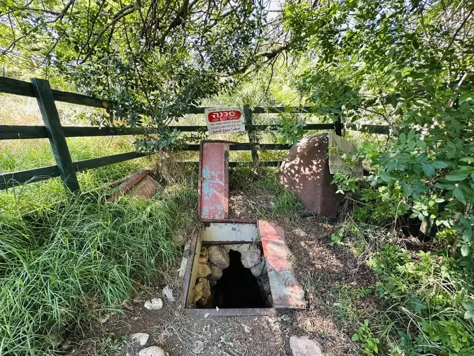
- انفاق قنوات المياه بقريه صوبا المهجره -- عين صوبا---Ein Suba's famous canals...carved by the same people who "don't exist", Zionist Jews say!
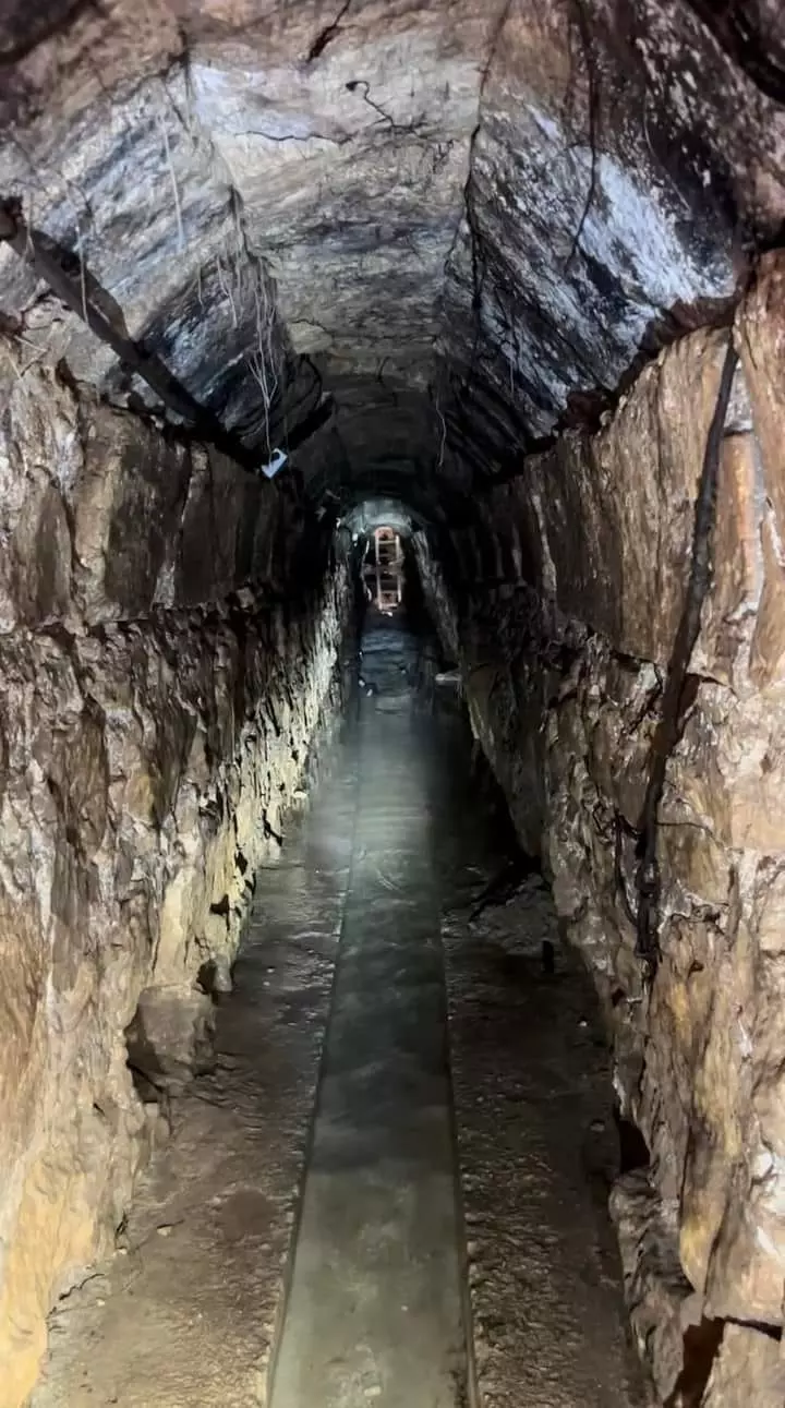
- انفاق قنوات المياه بقريه صوبا المهجره -- عين صوبا---Ein Suba's famous canals...carved by the same people who "don't exist", Zionist Jews say! #2
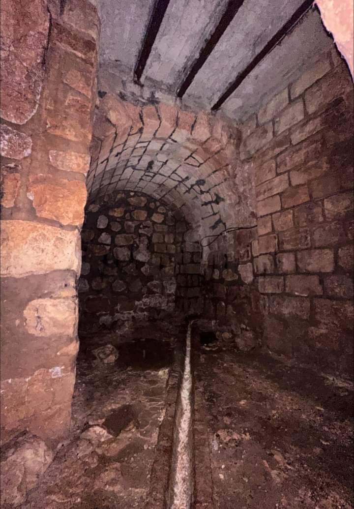
- انفاق قنوات المياه بقريه صوبا المهجره -- عين صوبا---Ein Suba's famous canals...carved by the same people who "don't exist", Zionist Jews say! #3
- انفاق قنوات المياه بقريه صوبا المهجره -- عين صوبا---Ein Suba's famous canals...carved by the same people who "don't exist", Zionist Jews say! #4
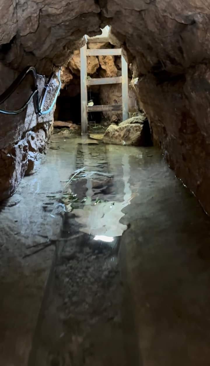
- انفاق قنوات المياه بقريه صوبا المهجره -- عين صوبا---Ein Suba's famous canals...carved by the same people who "don't exist", Zionist Jews say! #5
- انفاق قنوات المياه بقريه صوبا المهجره -- عين صوبا---Ein Suba's famous canals...carved by the same people who "don't exist", Zionist Jews say! #6
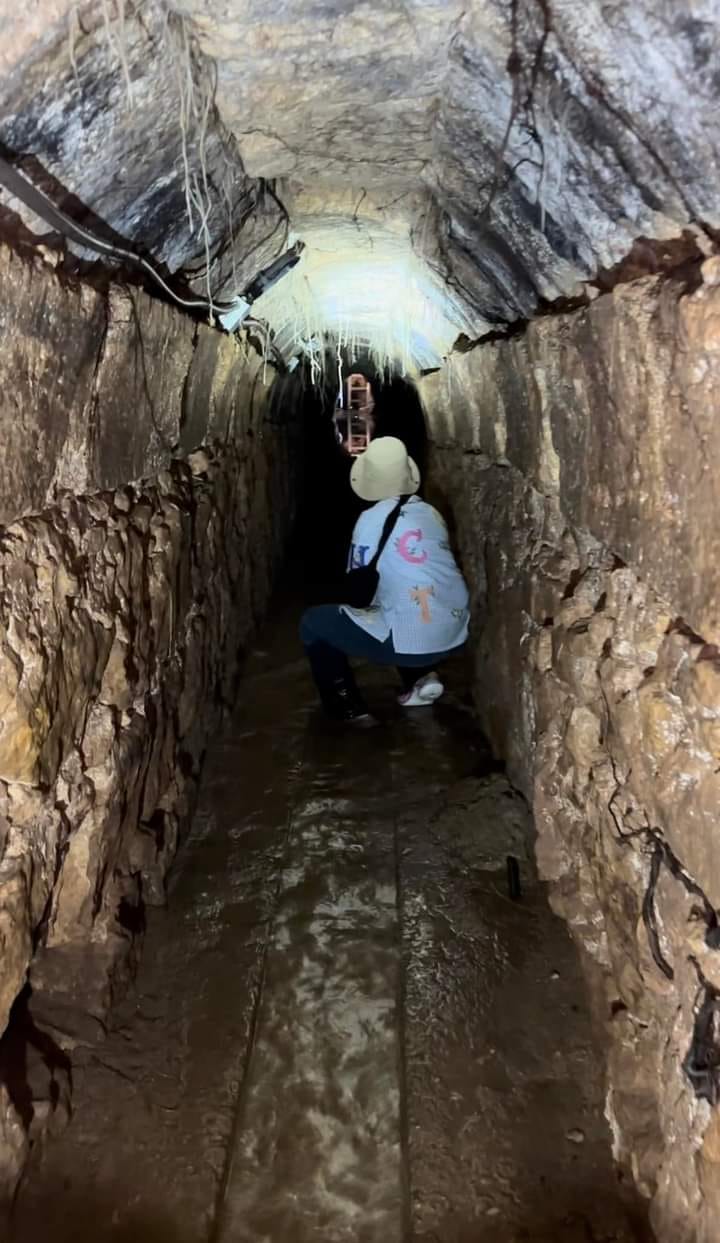
- انفاق قنوات المياه بقريه صوبا المهجره -- عين صوبا---Ein Suba's famous canals...carved by the same people who "don't exist", Zionist Jews say! #7
- انفاق قنوات المياه بقريه صوبا المهجره -- عين صوبا---Ein Suba's famous canals...carved by the same people who "don't exist", Zionist Jews say! #8
- انفاق قنوات المياه بقريه صوبا المهجره -- عين صوبا---Ein Suba's famous canals...carved by the same people who "don't exist", Zionist Jews say! #9
- جولة بين بيوت صوبا المدمرة
- جولة بين بيوت صوبا المدمرة #2
- جولة بين بيوت صوبا المدمرة #3
- جولة بين بيوت صوبا المدمرة #4
- جولة بين بيوت صوبا المدمرة #5
- جولة بين بيوت صوبا المدمرة #6
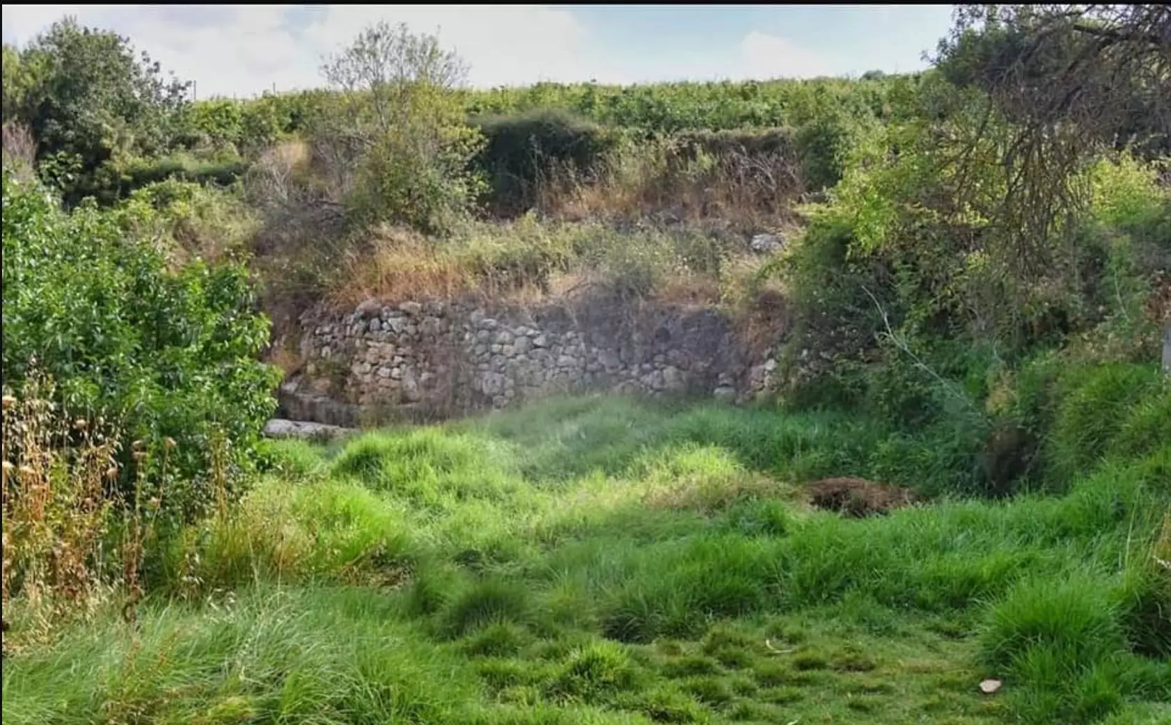
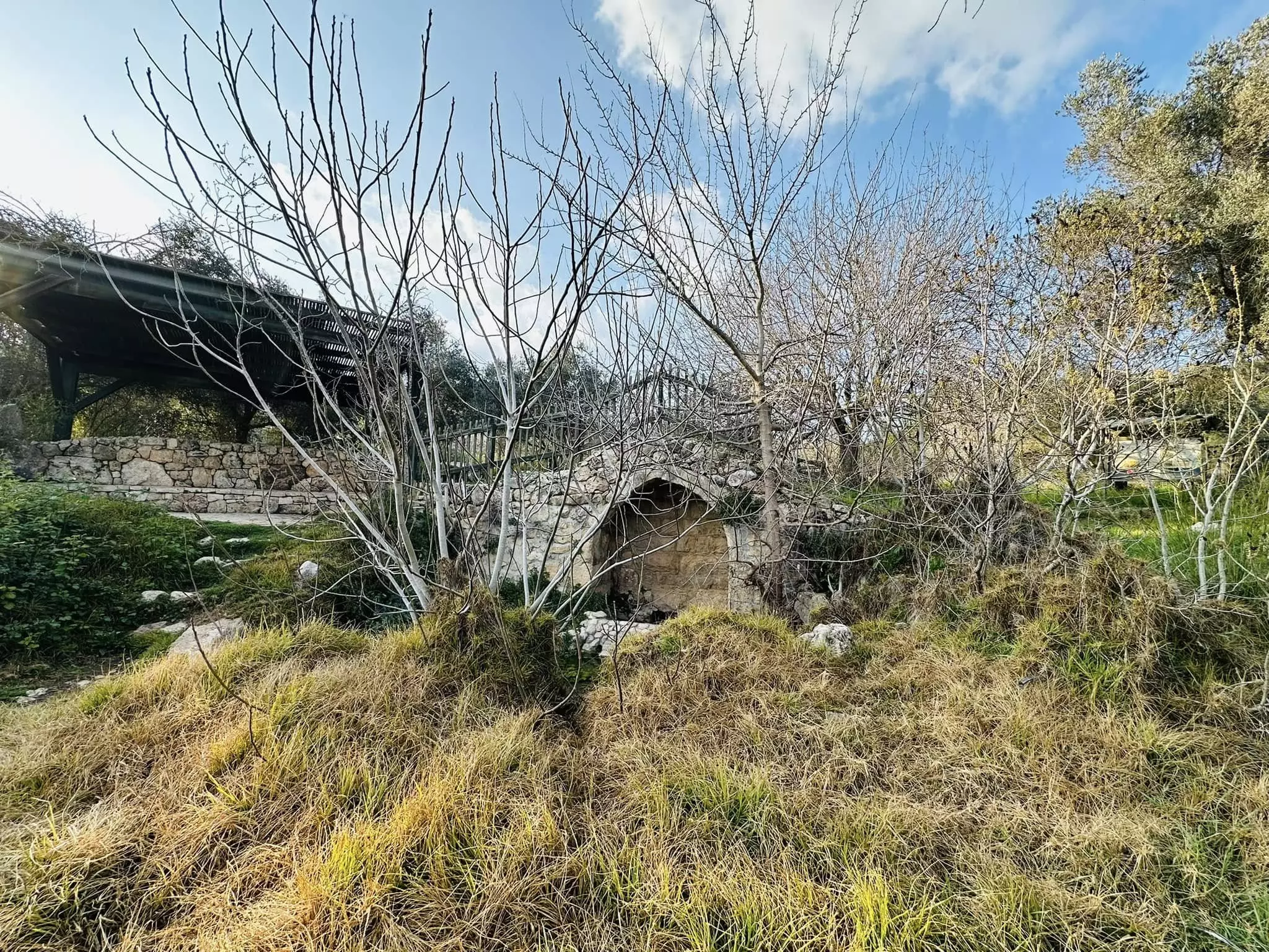
- عين صوبا .. ونفق العين
- عين صوبا .. ونفق العين #2
- عين صوبا .. ونفق العين #3
- عين صوبا .. ونفق العين #4
- عين صوبا .. ونفق العين #5
- جولة بين انقاض القرية في الذكرى ٧٥ للنكبة
- جولة بين انقاض القرية في الذكرى ٧٥ للنكبة #2
- جولة بين انقاض القرية في الذكرى ٧٥ للنكبة #3
- جولة بين انقاض القرية في الذكرى ٧٥ للنكبة #4
- قمة قرية صوبا
- جولة بين انقاض القرية
- جولة بين انقاض القرية #2
- جولة بين انقاض القرية #3
- جولة بين انقاض القرية #4
- جولة بين انقاض القرية #5
- جولة بين انقاض القرية #6
- جولة بين انقاض القرية #7
- جولة بين انقاض القرية #8
- جولة بين انقاض القرية #9
- جولة بين انقاض القرية #10
- جولة بين انقاض القرية #11
- جولة بين انقاض القرية #12
- جولة بين انقاض القرية #13

- الصورة قبل 100 عام للمصور فرانك شولتن.
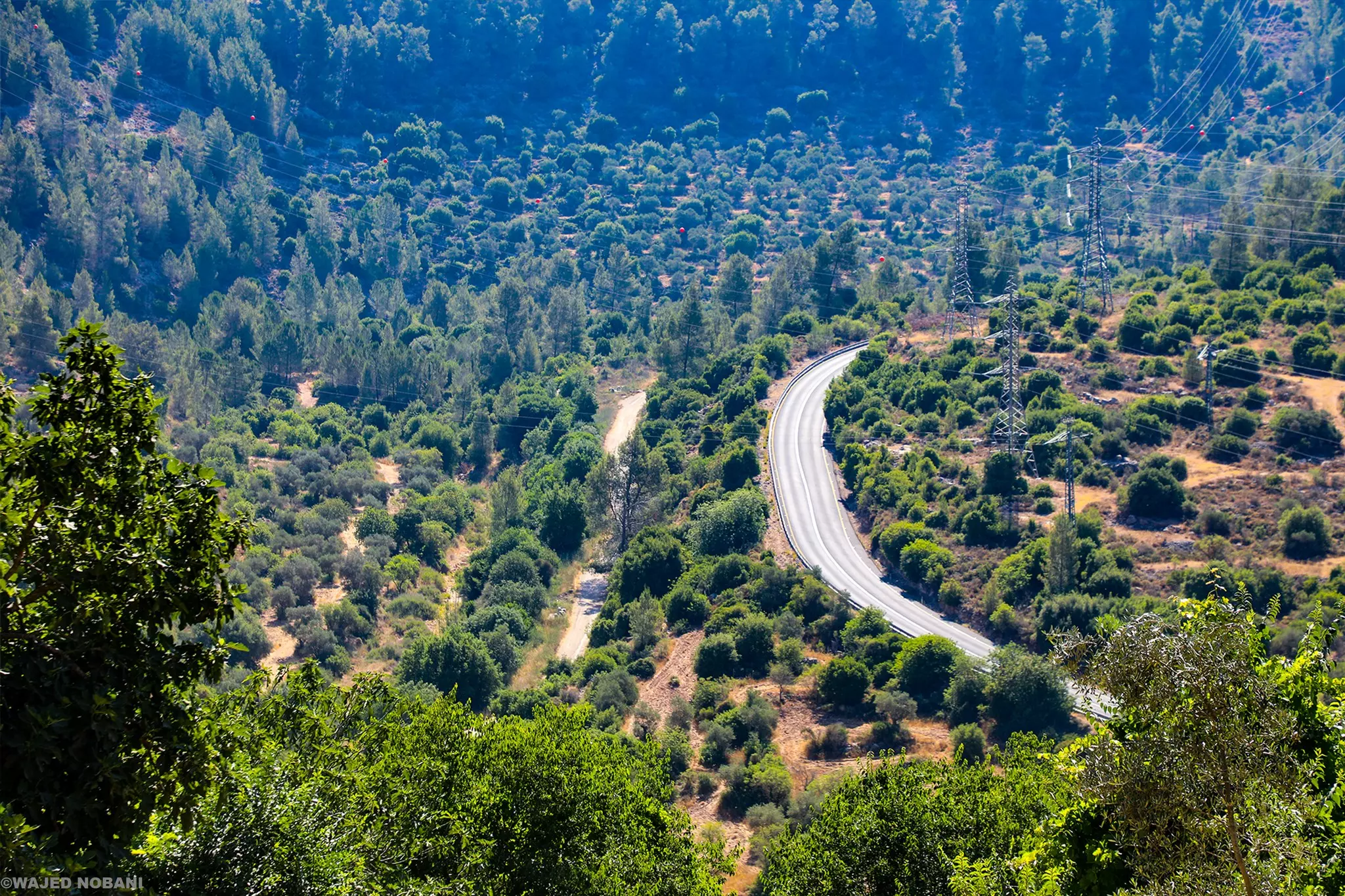
- الإطلالة من قرية صوبا باتجاه أراضي عين كارم -- واجد النوباني
- A rare picture of Suba, just two years after the so-called "civilized" replaced us. How else can the Jews be great again? Little Jim Crow, ethnic cleansing, and genocides will hurt no one.
- A rare picture in the village just before Nakba
- زيارة لعين صوبا ولمضختها
- زيارة لعين صوبا ولمضختها #2
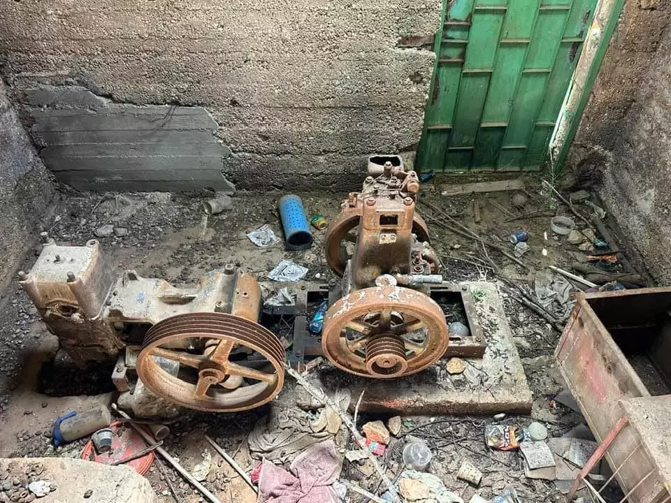
- زيارة لعين صوبا ولمضختها #3
- زيارة لعين صوبا ولمضختها #4
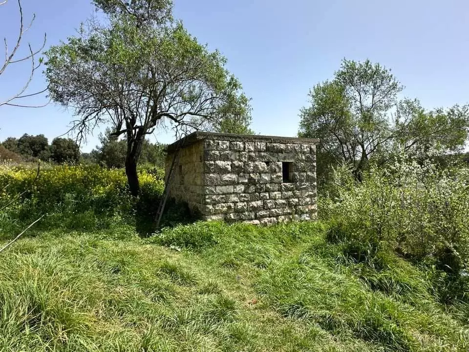
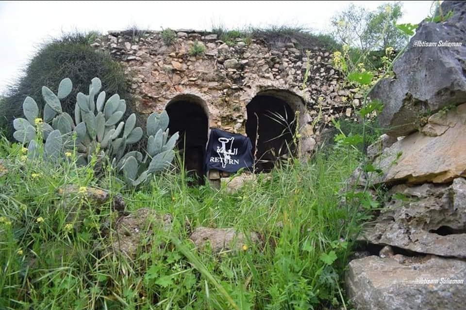
- مقام الشيخ ابراهيم الادهمي ...في قرية صوبا المهجره --- abu khader ahmad

- مقام الشيخ ابراهيم الادهمي ...في قرية صوبا المهجره --- abu khader ahmad #2
- مقام الشيخ ابراهيم الادهمي ...في قرية صوبا المهجره --- abu khader ahmad #3
- مقام الشيخ ابراهيم الادهمي ...في قرية صوبا المهجره --- abu khader ahmad #4
- That is how the "civilized" erased and replaced us: Suba was completely obliterated except for a few remaining structures, as you see -- صوبا باتت أثر بعد عين. من هنا مر الهمجّ
- That is how the "civilized" erased and replaced us: Suba was completely obliterated except for a few remaining structures, as you see -- صوبا باتت أثر بعد عين. من هنا مر الهمجّ #2
- That is how the "civilized" erased and replaced us: Suba was completely obliterated except for a few remaining structures, as you see -- صوبا باتت أثر بعد عين. من هنا مر الهمجّ #3
- That is how the "civilized" erased and replaced us: Suba was completely obliterated except for a few remaining structures, as you see -- صوبا باتت أثر بعد عين. من هنا مر الهمجّ #4
- That is how the "civilized" erased and replaced us: Suba was completely obliterated except for a few remaining structures, as you see -- صوبا باتت أثر بعد عين. من هنا مر الهمجّ #5
- That is how the "civilized" erased and replaced us: Suba was completely obliterated except for a few remaining structures, as you see -- صوبا باتت أثر بعد عين. من هنا مر الهمجّ #6
- That is how the "civilized" erased and replaced us: Suba was completely obliterated except for a few remaining structures, as you see -- صوبا باتت أثر بعد عين. من هنا مر الهمجّ #7
- That is how the "civilized" erased and replaced us: Suba was completely obliterated except for a few remaining structures, as you see -- صوبا باتت أثر بعد عين. من هنا مر الهمجّ #8
- That is how the "civilized" erased and replaced us: Suba was completely obliterated except for a few remaining structures, as you see -- صوبا باتت أثر بعد عين. من هنا مر الهمجّ #9
- That is how the "civilized" erased and replaced us: Suba was completely obliterated except for a few remaining structures, as you see -- صوبا باتت أثر بعد عين. من هنا مر الهمجّ #10
- That is how the "civilized" erased and replaced us: Suba was completely obliterated except for a few remaining structures, as you see -- صوبا باتت أثر بعد عين. من هنا مر الهمجّ #11
- This olive tree is called Rumi on purpose; thus, it is much, much older than the "civilization" that was dumped on us from Europe. For the love of God, if Jews are indigenous to Palestine, why are over 60% of them allergic to olive pollen? Look closely, the tree is trying to tell you something big. It is a witness! It knows who planted it and tended to it over 100s of years!
- This olive tree is called Rumi on purpose; thus, it is much, much older than the "civilization" that was dumped on us from Europe. For the love of God, if Jews are indigenous to Palestine, why are over 60% of them allergic to olive pollen? Look closely, the tree is trying to tell you something big. It is a witness! It knows who planted it and tended to it over 100s of years! #2
- This olive tree is called Rumi on purpose; thus, it is much, much older than the "civilization" that was dumped on us from Europe. For the love of God, if Jews are indigenous to Palestine, why are over 60% of them allergic to olive pollen? Look closely, the tree is trying to tell you something big. It is a witness! It knows who planted it and tended to it over 100s of years! #3
- This olive tree is called Rumi on purpose; thus, it is much, much older than the "civilization" that was dumped on us from Europe. For the love of God, if Jews are indigenous to Palestine, why are over 60% of them allergic to olive pollen? Look closely, the tree is trying to tell you something big. It is a witness! It knows who planted it and tended to it over 100s of years! #4
- That is how the "civilized" erased and replaced us: Suba was completely obliterated except for a few remaining structures, as you see -- صوبا باتت أثر بعد عين. من هنا مر الهمجّ
- That is how the "civilized" erased and replaced us: Suba was completely obliterated except for a few remaining structures, as you see -- صوبا باتت أثر بعد عين. من هنا مر الهمجّ
#2
- That is how the "civilized" erased and replaced us: Suba was completely obliterated except for a few remaining structures, as you see -- صوبا باتت أثر بعد عين. من هنا مر الهمجّ
#3
- That is how the "civilized" erased and replaced us: Suba was completely obliterated except for a few remaining structures, as you see -- صوبا باتت أثر بعد عين. من هنا مر الهمجّ
#4
- That is how the "civilized" erased and replaced us: Suba was completely obliterated except for a few remaining structures, as you see -- صوبا باتت أثر بعد عين. من هنا مر الهمجّ
#5
- That is how the "civilized" erased and replaced us: Suba was completely obliterated except for a few remaining structures, as you see -- صوبا باتت أثر بعد عين. من هنا مر الهمجّ
#6
- That is how the "civilized" erased and replaced us: Suba was completely obliterated except for a few remaining structures, as you see -- صوبا باتت أثر بعد عين. من هنا مر الهمجّ
#7
- That is how the "civilized" erased and replaced us: Suba was completely obliterated except for a few remaining structures, as you see -- صوبا باتت أثر بعد عين. من هنا مر الهمجّ
#8
- That is how the "civilized" erased and replaced us: Suba was completely obliterated except for a few remaining structures, as you see -- صوبا باتت أثر بعد عين. من هنا مر الهمجّ
#9
- That is how the "civilized" erased and replaced us: Suba was completely obliterated except for a few remaining structures, as you see -- صوبا باتت أثر بعد عين. من هنا مر الهمجّ
#10
- That is how the "civilized" erased and replaced us: Suba was completely obliterated except for a few remaining structures, as you see -- صوبا باتت أثر بعد عين. من هنا مر الهمجّ
#11
- That is how the "civilized" erased and replaced us: Suba was completely obliterated except for a few remaining structures, as you see -- صوبا باتت أثر بعد عين. من هنا مر الهمجّ
#12
- That is how the "civilized" erased and replaced us: Suba was completely obliterated except for a few remaining structures, as you see -- صوبا باتت أثر بعد عين. من هنا مر الهمجّ
#13
- That is how the "civilized" erased and replaced us: Suba was completely obliterated except for a few remaining structures, as you see -- صوبا باتت أثر بعد عين. من هنا مر الهمجّ
#14
- That is how the "civilized" erased and replaced us: Suba was completely obliterated except for a few remaining structures, as you see -- صوبا باتت أثر بعد عين. من هنا مر الهمجّ
#15
- That is how the "civilized" erased and replaced us: Suba was completely obliterated except for a few remaining structures, as you see -- صوبا باتت أثر بعد عين. من هنا مر الهمجّ
#16
- That is how the "civilized" erased and replaced us: Suba was completely obliterated except for a few remaining structures, as you see -- صوبا باتت أثر بعد عين. من هنا مر الهمجّ
#17
- That is how the "civilized" erased and replaced us: Suba was completely obliterated except for a few remaining structures, as you see -- صوبا باتت أثر بعد عين. من هنا مر الهمجّ
#18
- That is how the "civilized" erased and replaced us: Suba was completely obliterated except for a few remaining structures, as you see -- صوبا باتت أثر بعد عين. من هنا مر الهمجّ
#19

- That is how the "civilized" erased and replaced us: Suba was completely obliterated except for a few remaining structures, as you see -- صوبا باتت أثر بعد عين. من هنا مر الهمجّ
#20
- That is how the "civilized" erased and replaced us: Suba was completely obliterated except for a few remaining structures, as you see -- صوبا باتت أثر بعد عين. من هنا مر الهمجّ
#21
- That is how the "civilized" erased and replaced us: Suba was completely obliterated except for a few remaining structures, as you see -- صوبا باتت أثر بعد عين. من هنا مر الهمجّ
#22
- That is how the "civilized" erased and replaced us: Suba was completely obliterated except for a few remaining structures, as you see -- صوبا باتت أثر بعد عين. من هنا مر الهمجّ
#23
- That is how the "civilized" erased and replaced us: Suba was completely obliterated except for a few remaining structures, as you see -- صوبا باتت أثر بعد عين. من هنا مر الهمجّ
#24
- That is how the "civilized" erased and replaced us: Suba was completely obliterated except for a few remaining structures, as you see -- صوبا باتت أثر بعد عين. من هنا مر الهمجّ
#25
- That is how the "civilized" erased and replaced us: Suba was completely obliterated except for a few remaining structures, as you see -- صوبا باتت أثر بعد عين. من هنا مر الهمجّ
#26
- That is how the "civilized" erased and replaced us: Suba was completely obliterated except for a few remaining structures, as you see -- صوبا باتت أثر بعد عين. من هنا مر الهمجّ
#27
- That is how the "civilized" erased and replaced us: Suba was completely obliterated except for a few remaining structures, as you see -- صوبا باتت أثر بعد عين. من هنا مر الهمجّ
#28
- That is how the "civilized" erased and replaced us: Suba was completely obliterated except for a few remaining structures, as you see -- صوبا باتت أثر بعد عين. من هنا مر الهمجّ
#29
- That is how the "civilized" erased and replaced us: Suba was completely obliterated except for a few remaining structures, as you see -- صوبا باتت أثر بعد عين. من هنا مر الهمجّ
#30
- That is how the "civilized" erased and replaced us: Suba was completely obliterated except for a few remaining structures, as you see -- صوبا باتت أثر بعد عين. من هنا مر الهمجّ
#31
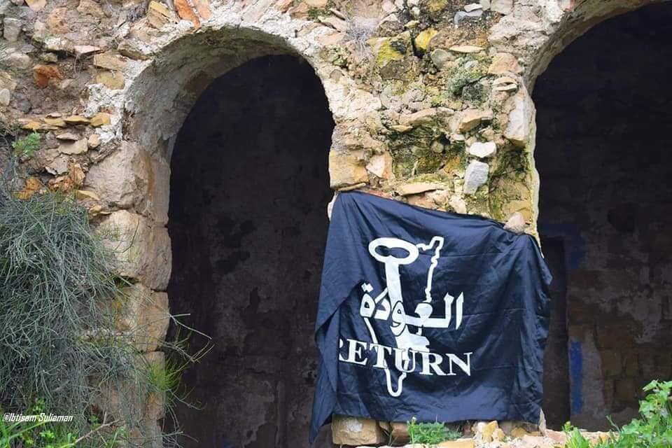
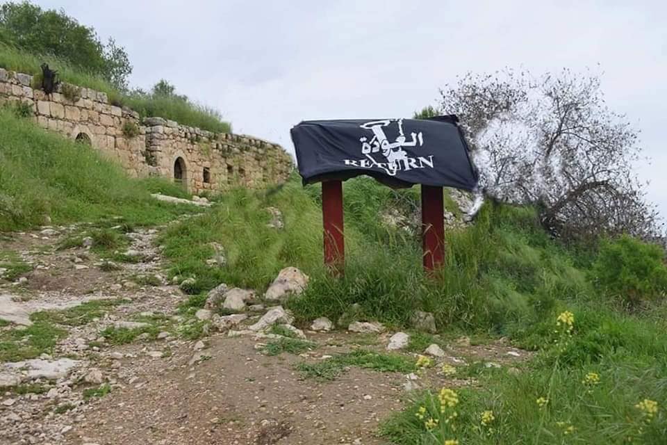
- Let us tour the shrine/maqam al-Sheikh Ibrahim. To hinder our return, the "civilized" destroyed everything way after the battle. Even the shrine didn't escape "their civilization!" When will Europe take its "civilization" back? We are tired of carrying your dead weight!

- Let us tour the shrine/maqam al-Sheikh Ibrahim. To hinder our return, the "civilized" destroyed everything way after the battle. Even the shrine didn't escape "their civilization!" When will Europe take its "civilization" back? We are tired of carrying your dead weight! #2
- Let us tour the shrine/maqam al-Sheikh Ibrahim. To hinder our return, the "civilized" destroyed everything way after the battle. Even the shrine didn't escape "their civilization!" When will Europe take its "civilization" back? We are tired of carrying your dead weight! #3
- Let us tour the shrine/maqam al-Sheikh Ibrahim. To hinder our return, the "civilized" destroyed everything way after the battle. Even the shrine didn't escape "their civilization!" When will Europe take its "civilization" back? We are tired of carrying your dead weight! #4
- Let us tour the shrine/maqam al-Sheikh Ibrahim. To hinder our return, the "civilized" destroyed everything way after the battle. Even the shrine didn't escape "their civilization!" When will Europe take its "civilization" back? We are tired of carrying your dead weight! #5
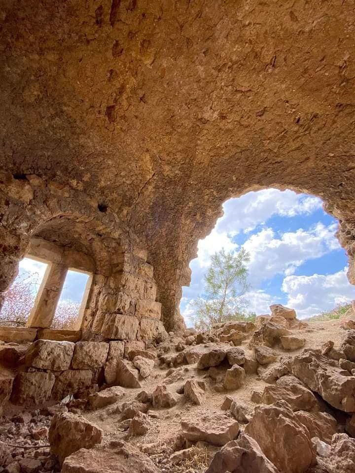
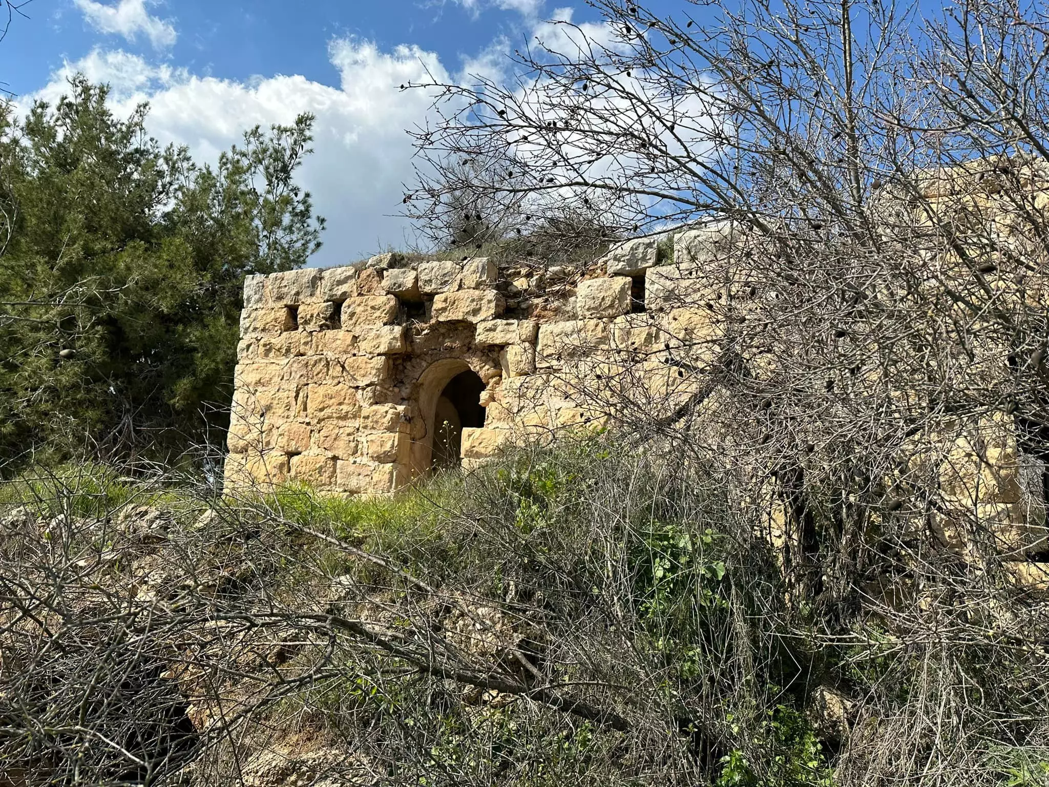
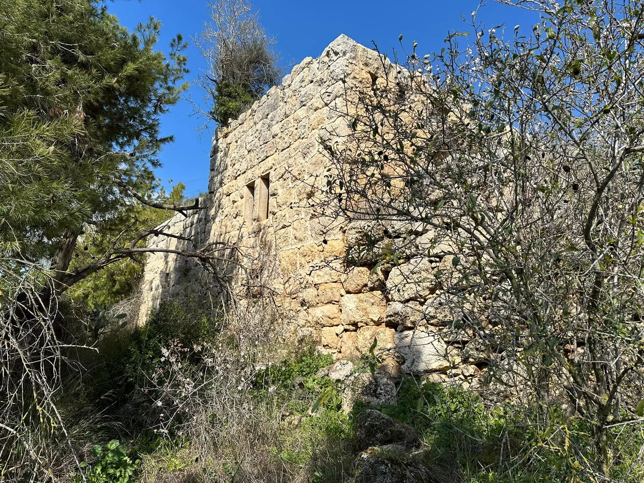
- Archeological remains on village lands -- آثار لخربة في القرية -- 2023 -- Iyad Jaber
- Archeological remains on village lands -- آثار لخربة في القرية -- 2023 -- Iyad Jaber #2
- Archeological remains on village lands -- آثار لخربة في القرية -- 2023 -- Iyad Jaber #3
- Archeological remains on village lands -- آثار لخربة في القرية -- 2023 -- Iyad Jaber #4
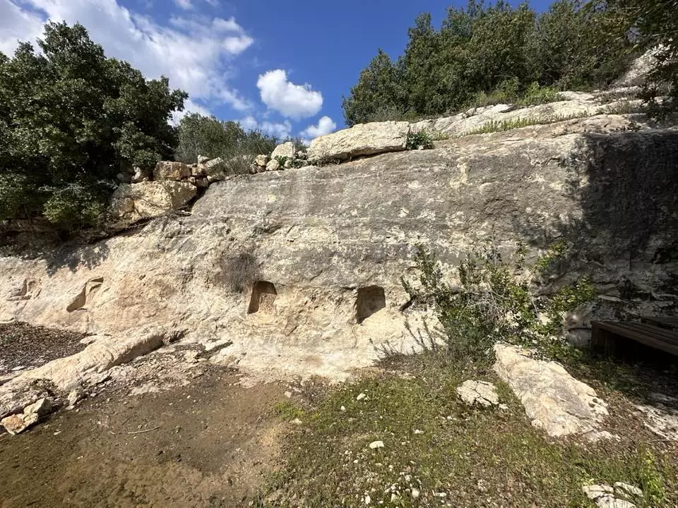
- Archeological remains on village lands -- آثار لخربة في القرية -- 2023 -- Iyad Jaber #5
- Archeological remains on village lands -- آثار لخربة في القرية -- 2023 -- Iyad Jaber #6
- Archeological remains on village lands -- آثار لخربة في القرية -- 2023 -- Iyad Jaber #7
- Archeological remains on village lands -- آثار لخربة في القرية -- 2023 -- Iyad Jaber #8
- Archeological remains on village lands -- آثار لخربة في القرية -- 2023 -- Iyad Jaber #9
- Archeological remains on village lands -- آثار لخربة في القرية -- 2023 -- Iyad Jaber #10
- Let us tour inside and outside the destroyed homes -- جولة داخل وخارج البيوت المدمرة
- Let us tour inside and outside the destroyed homes -- جولة داخل وخارج البيوت المدمرة #2
- Let us tour inside and outside the destroyed homes -- جولة داخل وخارج البيوت المدمرة #3
- Let us tour inside and outside the destroyed homes -- جولة داخل وخارج البيوت المدمرة #4
- Let us tour inside and outside the destroyed homes -- جولة داخل وخارج البيوت المدمرة #5
- Let us tour inside and outside the destroyed homes -- جولة داخل وخارج البيوت المدمرة #6
- Let us tour inside and outside the destroyed homes -- جولة داخل وخارج البيوت المدمرة #7
- Let us tour inside and outside the destroyed homes -- جولة داخل وخارج البيوت المدمرة #8
- Let us tour inside and outside the destroyed homes -- جولة داخل وخارج البيوت المدمرة #9
- Let us tour inside and outside the destroyed homes -- جولة داخل وخارج البيوت المدمرة #10
- Let us tour inside and outside the destroyed homes -- جولة داخل وخارج البيوت المدمرة #11
- Let us tour inside and outside the destroyed homes -- جولة داخل وخارج البيوت المدمرة #12
- Let us tour inside and outside the destroyed homes -- جولة داخل وخارج البيوت المدمرة #13
- Let us tour inside and outside the destroyed homes -- جولة داخل وخارج البيوت المدمرة #14
- Let us tour inside and outside the destroyed homes -- جولة داخل وخارج البيوت المدمرة #15
- Let us tour inside and outside the destroyed homes -- جولة داخل وخارج البيوت المدمرة #16
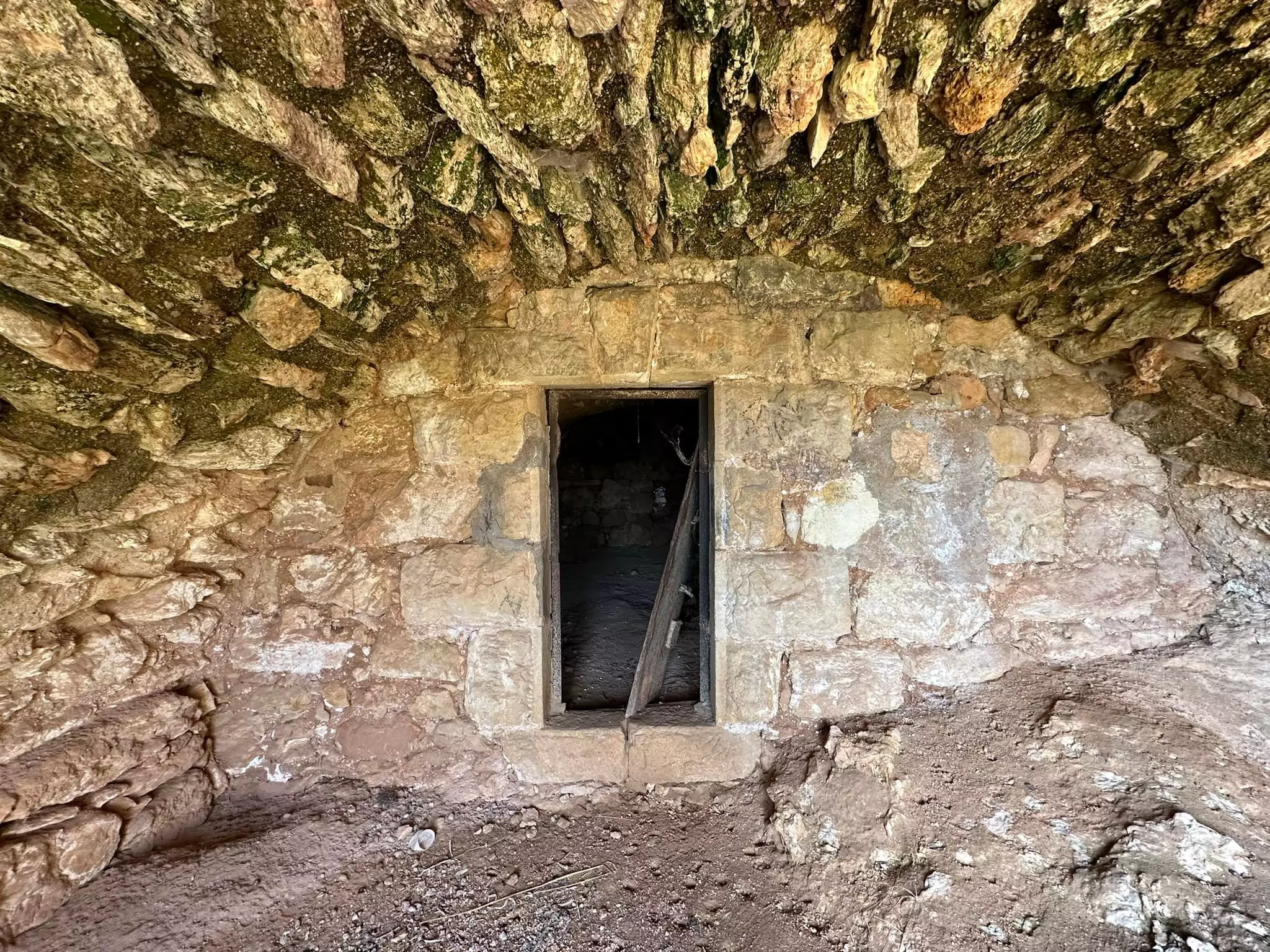
- Let us tour inside and outside the destroyed homes -- جولة داخل وخارج البيوت المدمرة #17
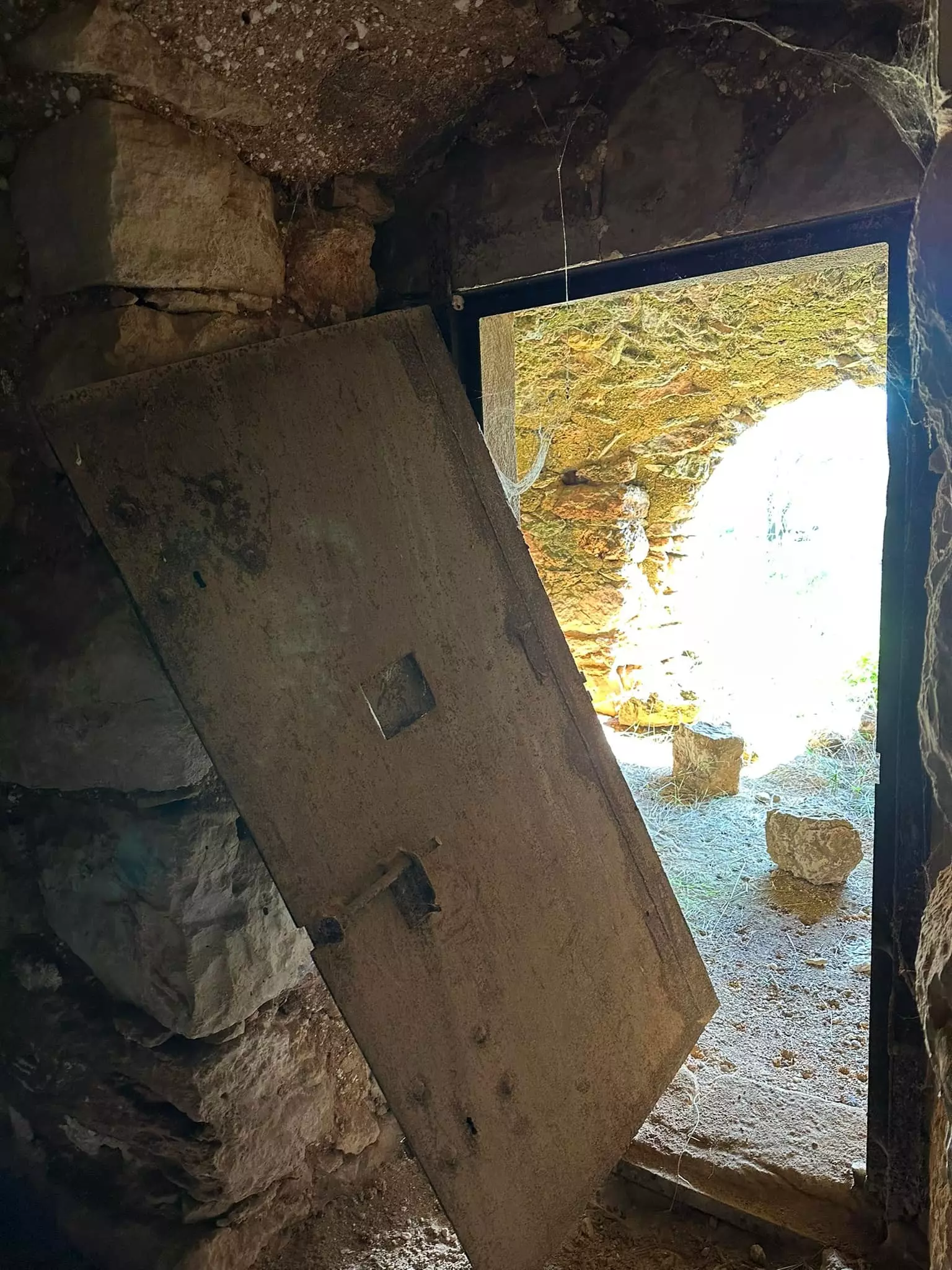
- Let us tour inside and outside the destroyed homes -- جولة داخل وخارج البيوت المدمرة #18
- Let us tour inside and outside the destroyed homes -- جولة داخل وخارج البيوت المدمرة #19
- Let us tour inside and outside the destroyed homes -- جولة داخل وخارج البيوت المدمرة #20
- Let us see how the "civilized" (who landed on us from Europe) ruined our lives in the name of making world Jewry safe. How else will the Jews be great again? Little plunder, ethnic cleansing, and genocide will do the Palestinians little harm! Mazeltov!
- Let us see how the "civilized" (who landed on us from Europe) ruined our lives in the name of making world Jewry safe. How else will the Jews be great again? Little plunder, ethnic cleansing, and genocide will do the Palestinians little harm! Mazeltov! #2
- Let us see how the "civilized" (who landed on us from Europe) ruined our lives in the name of making world Jewry safe. How else will the Jews be great again? Little plunder, ethnic cleansing, and genocide will do the Palestinians little harm! Mazeltov! #3
- Let us see how the "civilized" (who landed on us from Europe) ruined our lives in the name of making world Jewry safe. How else will the Jews be great again? Little plunder, ethnic cleansing, and genocide will do the Palestinians little harm! Mazeltov! #4
- Let us see how the "civilized" (who landed on us from Europe) ruined our lives in the name of making world Jewry safe. How else will the Jews be great again? Little plunder, ethnic cleansing, and genocide will do the Palestinians little harm! Mazeltov! #5
- Let us see how the "civilized" (who landed on us from Europe) ruined our lives in the name of making world Jewry safe. How else will the Jews be great again? Little plunder, ethnic cleansing, and genocide will do the Palestinians little harm! Mazeltov! #6
- Let us see how the "civilized" (who landed on us from Europe) ruined our lives in the name of making world Jewry safe. How else will the Jews be great again? Little plunder, ethnic cleansing, and genocide will do the Palestinians little harm! Mazeltov! #7
- Let us see how the "civilized" (who landed on us from Europe) ruined our lives in the name of making world Jewry safe. How else will the Jews be great again? Little plunder, ethnic cleansing, and genocide will do the Palestinians little harm! Mazeltov! #8

- Let us see how the "civilized" (who landed on us from Europe) ruined our lives in the name of making world Jewry safe. How else will the Jews be great again? Little plunder, ethnic cleansing, and genocide will do the Palestinians little harm! Mazeltov! #9
- Let us see how the "civilized" (who landed on us from Europe) ruined our lives in the name of making world Jewry safe. How else will the Jews be great again? Little plunder, ethnic cleansing, and genocide will do the Palestinians little harm! Mazeltov! #10
- Let us see how the "civilized" (who landed on us from Europe) ruined our lives in the name of making world Jewry safe. How else will the Jews be great again? Little plunder, ethnic cleansing, and genocide will do the Palestinians little harm! Mazeltov! #11
- Let us see how the "civilized" (who landed on us from Europe) ruined our lives in the name of making world Jewry safe. How else will the Jews be great again? Little plunder, ethnic cleansing, and genocide will do the Palestinians little harm! Mazeltov! #12
- Let us see how the "civilized" (who landed on us from Europe) ruined our lives in the name of making world Jewry safe. How else will the Jews be great again? Little plunder, ethnic cleansing, and genocide will do the Palestinians little harm! Mazeltov! #13
- Let us see how the "civilized" (who landed on us from Europe) ruined our lives in the name of making world Jewry safe. How else will the Jews be great again? Little plunder, ethnic cleansing, and genocide will do the Palestinians little harm! Mazeltov! #14
- Let us see how the "civilized" (who landed on us from Europe) ruined our lives in the name of making world Jewry safe. How else will the Jews be great again? Little plunder, ethnic cleansing, and genocide will do the Palestinians little harm! Mazeltov! #15
- Let us see how the "civilized" (who landed on us from Europe) ruined our lives in the name of making world Jewry safe. How else will the Jews be great again? Little plunder, ethnic cleansing, and genocide will do the Palestinians little harm! Mazeltov! #16
- Let us see how the "civilized" (who landed on us from Europe) ruined our lives in the name of making world Jewry safe. How else will the Jews be great again? Little plunder, ethnic cleansing, and genocide will do the Palestinians little harm! Mazeltov! #17
- Let us see how the "civilized" (who landed on us from Europe) ruined our lives in the name of making world Jewry safe. How else will the Jews be great again? Little plunder, ethnic cleansing, and genocide will do the Palestinians little harm! Mazeltov! #18
- Let us see how the "civilized" (who landed on us from Europe) ruined our lives in the name of making world Jewry safe. How else will the Jews be great again? Little plunder, ethnic cleansing, and genocide will do the Palestinians little harm! Mazeltov! #19
- Let us see how the "civilized" (who landed on us from Europe) ruined our lives in the name of making world Jewry safe. How else will the Jews be great again? Little plunder, ethnic cleansing, and genocide will do the Palestinians little harm! Mazeltov! #20
- Let us see how the "civilized" (who landed on us from Europe) ruined our lives in the name of making world Jewry safe. How else will the Jews be great again? Little plunder, ethnic cleansing, and genocide will do the Palestinians little harm! Mazeltov! #21
- Let us see how the "civilized" (who landed on us from Europe) ruined our lives in the name of making world Jewry safe. How else will the Jews be great again? Little plunder, ethnic cleansing, and genocide will do the Palestinians little harm! Mazeltov! #22
- Let us see how the "civilized" (who landed on us from Europe) ruined our lives in the name of making world Jewry safe. How else will the Jews be great again? Little plunder, ethnic cleansing, and genocide will do the Palestinians little harm! Mazeltov! #23
- Let us see how the "civilized" (who landed on us from Europe) ruined our lives in the name of making world Jewry safe. How else will the Jews be great again? Little plunder, ethnic cleansing, and genocide will do the Palestinians little harm! Mazeltov! #24
- Let us see how the "civilized" (who landed on us from Europe) ruined our lives in the name of making world Jewry safe. How else will the Jews be great again? Little plunder, ethnic cleansing, and genocide will do the Palestinians little harm! Mazeltov! #25
- Let us see how the "civilized" (who landed on us from Europe) ruined our lives in the name of making world Jewry safe. How else will the Jews be great again? Little plunder, ethnic cleansing, and genocide will do the Palestinians little harm! Mazeltov! #26
- Let us see how the "civilized" (who landed on us from Europe) ruined our lives in the name of making world Jewry safe. How else will the Jews be great again? Little plunder, ethnic cleansing, and genocide will do the Palestinians little harm! Mazeltov! #27
- Let us see how the "civilized" (who landed on us from Europe) ruined our lives in the name of making world Jewry safe. How else will the Jews be great again? Little plunder, ethnic cleansing, and genocide will do the Palestinians little harm! Mazeltov! #28
- Let us see how the "civilized" (who landed on us from Europe) ruined our lives in the name of making world Jewry safe. How else will the Jews be great again? Little plunder, ethnic cleansing, and genocide will do the Palestinians little harm! Mazeltov! #29
- Let us see how the "civilized" (who landed on us from Europe) ruined our lives in the name of making world Jewry safe. How else will the Jews be great again? Little plunder, ethnic cleansing, and genocide will do the Palestinians little harm! Mazeltov! #30
- Let us see how the "civilized" (who landed on us from Europe) ruined our lives in the name of making world Jewry safe. How else will the Jews be great again? Little plunder, ethnic cleansing, and genocide will do the Palestinians little harm! Mazeltov! #31
- Let us see how the "civilized" (who landed on us from Europe) ruined our lives in the name of making world Jewry safe. How else will the Jews be great again? Little plunder, ethnic cleansing, and genocide will do the Palestinians little harm! Mazeltov! #32
- Let us see how the "civilized" (who landed on us from Europe) ruined our lives in the name of making world Jewry safe. How else will the Jews be great again? Little plunder, ethnic cleansing, and genocide will do the Palestinians little harm! Mazeltov! #33
- Let us see how the "civilized" (who landed on us from Europe) ruined our lives in the name of making world Jewry safe. How else will the Jews be great again? Little plunder, ethnic cleansing, and genocide will do the Palestinians little harm! Mazeltov! #34
- Let us see how the "civilized" (who landed on us from Europe) ruined our lives in the name of making world Jewry safe. How else will the Jews be great again? Little plunder, ethnic cleansing, and genocide will do the Palestinians little harm! Mazeltov! #35
- Let us see how the "civilized" (who landed on us from Europe) ruined our lives in the name of making world Jewry safe. How else will the Jews be great again? Little plunder, ethnic cleansing, and genocide will do the Palestinians little harm! Mazeltov! #36
- Let us see how the "civilized" (who landed on us from Europe) ruined our lives in the name of making world Jewry safe. How else will the Jews be great again? Little plunder, ethnic cleansing, and genocide will do the Palestinians little harm! Mazeltov! #37
- Let us see how the "civilized" (who landed on us from Europe) ruined our lives in the name of making world Jewry safe. How else will the Jews be great again? Little plunder, ethnic cleansing, and genocide will do the Palestinians little harm! Mazeltov! #38
- Let us see how the "civilized" (who landed on us from Europe) ruined our lives in the name of making world Jewry safe. How else will the Jews be great again? Little plunder, ethnic cleansing, and genocide will do the Palestinians little harm! Mazeltov! #39
- Let us see how the "civilized" (who landed on us from Europe) ruined our lives in the name of making world Jewry safe. How else will the Jews be great again? Little plunder, ethnic cleansing, and genocide will do the Palestinians little harm! Mazeltov! #40
- Let us see how the "civilized" (who landed on us from Europe) ruined our lives in the name of making world Jewry safe. How else will the Jews be great again? Little plunder, ethnic cleansing, and genocide will do the Palestinians little harm! Mazeltov! #41
- Let us see how the "civilized" (who landed on us from Europe) ruined our lives in the name of making world Jewry safe. How else will the Jews be great again? Little plunder, ethnic cleansing, and genocide will do the Palestinians little harm! Mazeltov! #42
- Let us see how the "civilized" (who landed on us from Europe) ruined our lives in the name of making world Jewry safe. How else will the Jews be great again? Little plunder, ethnic cleansing, and genocide will do the Palestinians little harm! Mazeltov! #43
- Let us see how the "civilized" (who landed on us from Europe) ruined our lives in the name of making world Jewry safe. How else will the Jews be great again? Little plunder, ethnic cleansing, and genocide will do the Palestinians little harm! Mazeltov! #44
- Let us see how the "civilized" (who landed on us from Europe) ruined our lives in the name of making world Jewry safe. How else will the Jews be great again? Little plunder, ethnic cleansing, and genocide will do the Palestinians little harm! Mazeltov! #45
- Let us see how the "civilized" (who landed on us from Europe) ruined our lives in the name of making world Jewry safe. How else will the Jews be great again? Little plunder, ethnic cleansing, and genocide will do the Palestinians little harm! Mazeltov! #46
- Let us see how the "civilized" (who landed on us from Europe) ruined our lives in the name of making world Jewry safe. How else will the Jews be great again? Little plunder, ethnic cleansing, and genocide will do the Palestinians little harm! Mazeltov! #47
- The most "civilized & liberal" of world Jewry completely obliterated our village and turned it into a park. Just imagine what their fascists would have done? A genocide
- The most "civilized & liberal" of world Jewry completely obliterated our village and turned it into a park. Just imagine what their fascists would have done? A genocide #2
- The most "civilized & liberal" of world Jewry completely obliterated our village and turned it into a park. Just imagine what their fascists would have done? A genocide #3
- The most "civilized & liberal" of world Jewry completely obliterated our village and turned it into a park. Just imagine what their fascists would have done? A genocide #4
Want to browse more? 80,000 pictures were grouped in these gallaries:
| Display Name | Clan/Hamolah | Country of Residence |
| mazen_055 | - | - |
| مالك | RUMMAN | AMMAN, JORDAN |
| نعيم رمان | - | - |
| مقدسي مشتاق | رمان | عمان, الأردن |
| صامد | الفقيه | فلسطين |
| باسل نمر | جبران | عمان, الاردن |
| ابراهيم عوض الله الفقيه | الفقيه | عمان, الاردن |
| moh_d Elian | عليان _ الفقيه | - |
| ayhm007 | Jubran | - |
| ابو علأ | رمان | فلسطين, فلسطين |
| فراس سامي رمان | رمان | العاصمه, الاردن |
| ابن الصوباني فلسطين | - | - |
| محمود خليل رمان | رمان | عمان, الاردن |
| suba1976 | - | Jordan, Jordan |
| Ahmad Hammad | نصرالله | الشارقة |
| عمار | رمان | غزة, فلسطين |
| rouman | romman | amman, jordan |
| نزار رمان | رمان | عمان |
| Mohd Sadiq Nasrallah | NASRALLAH | AMMAN, JORDAN |
| Muwafak Nasrallah | Nasrallah | Amman, Jordan |
| Ahmad .M .Romman | Romman | Texas, U.S.A |
| محمد محمد رمان | - | القدس, فلسطين |
| موون لايت | rumman | كوانزو |
| رمانكو | رمان | عمان |
| سامي رمان | رمان | الاردن, الاردن |
| معتز عصفور | رمــــــان | - |
| ابو مصطفى | رمان | عين رافا |
| الحاج ابو رويد | رمان | عمان |
| rima nasrallah | - | united arab emirates, united arab emirates |
| هيا غازي طه | عميش | UAE, UAE |
| صهيب فارس حسين رمان | رمان | - |
| سليم رمان | رمان | - |
| Sinan Rumman | Rumman | Amman, Jordan |
| فراس | - | عمان, الردن |
| AhlamSuba | Rumman | Ein Rafa, Jerusalem |
| ابو العز | خواجا | رام الله , نعلين |
| ش. م. | زيدان | الشارقه, الامارات |
| atef naserallah | naserallah | Jordan |
| nadia Alsoubani | soubani/salem | - |
| Mysara Rumman ( Abu Ali ) | - | Jerusalem, Palestine |
| MAHDI RUMMAN | MAHDI | - |
| omar naseralla | - | Jordan |
| Kamal Jubran | Jubran | Amman,, Jordan |
| eman alsoubani | soubani | - |
| ماجد نصرالله | - | الدمام |
| khaled naseralla | naseralla | Riyadh, KSA |
| RAED RUMMAN | RUMMAN | QATAR -DOHA |
| alguds | suba | amman, jordan |
| Ala'a | Al-Faqeeh | Vancouver, Canada |
| Mai Nasrallah | Nasrallah | Ca, USA |
| Basel Nimer | Jobran | Amman - 11151, Jordan |
| Ali Jobran | Jobran | United Arab Emirates, United Arab Emirates |
| Mai | Nasrallah | Ca, USA |
| YACOUB S. NASRALLAH | NASRALLAH | SC, Palestine |
| IHSAN ABBOUDEH | ROMAN /ABBOUDEH | - |
| مجهولة الهوية | - | - |
- قرية صوبا المهجرة | جذور مقدسية ٢٠٢٠ Duration: 24 min 17 sec
- مقام إبراهيم الأدهمي في قرية صوبا المهجرة قضاء القدس Duration: 2 min 7 sec
- عين البلد في قرية صوبا المهجرة قضاء القدس Duration: 4 min 8 sec
- جولة كاملة في القرية - محمد كريم Duration: 7 min 45 sec
- قرية صوبا المقدسية المهجرة The village of Suba Duration: 4 min
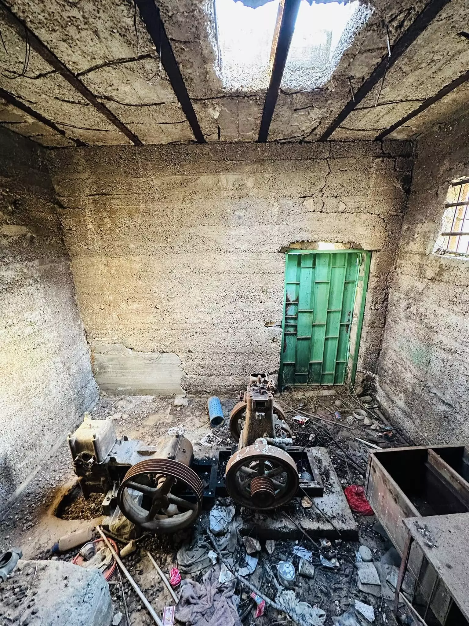
- حيث طحنت الجبال الى شيد: لاتون (كبارة) الجعيدي ومعمل الشيد في قرية صوبا المهجرة Duration: min 56 sec
- قرية صوبا المهجّرة قضاء القدس Duration: 11 min 38 sec
- جولة بين انقاض القرية Duration: 4 min 10 sec
 Fake Valor: Why Did Zionist Jews Hoist Nazis Flag on Their Ships in the 1930s?
What is new?
-
Facts About Oct. 7th Gaza Raid
-
Remined Us Please:: Who Did Rape Who? Palestinians Raped Israelis? Or, was the other way around?
-
When Prof. Edward Said was invited to debate Bibi Netanyahu in the 1980s, watch what happened!
-
Ezra Klein of the NY Times on the "Jewish Race".
-
Abusing Blood Libel!
-
Did Israeli Soldiers Activate The Hanniba Direective On Oct. 7th? You Be The Judge
-
Zionist FAQ: Isn't it true that Palestinians don't want peace? Palestinians never accepted the two-state solution
- Facts about Haavara (Transfer) Agreement between Ben-Gurion & Hitler
-
Haavara FAQs: Why Did Zionist Jews Hoist Nazis' Flags on Their Ships in the 1930s?
- Haavara FAQs: When Chaim Weizmann met FDR in mid-1943, why was he silent about rescuing European Jewry?
-
Dear ChatGPT: How did Palestinians resist Napoleon's invasion of their country in 1799?
-
Dear ChatGPT: Gaza had a vibrant Jewish community in the mid-17th century. What happened to them?
-
Dear ChatGPT: Why did the Jewish Agency suppress news of the Holocaust during WWII?
-
Video Playlist: Jews share their DNA tests to end the conflict for good.
-
A Tale of Two Conflicts: Examining the Definition of Genocide
-
Prof. Abraham Polak And The Suppressed History of the Khazars and European Jewry
-
How Ronald Reagan would have framed the genocide in Gaza if he were still alive?
-
Haavara FAQs: Let us do the math: how many German Jews did The Haavara Agreement save?
-
Zionist FAQs: The Hebron Massacre of 1929, "clearly proves" that Palestinians are antisemitic, how could you deny it?
-
Zionist FAQs: Why Anti-Zionist Is Not Antisemitism?
-
Zionist FAQs: Isn't it true that the KGB created Palestinian Nationalism in the early 1960s?
- Zionist FAQs: Muslims are killing Muslims all the time; why are Israeli Jews being singled out in the media?
- Zionist FAQs: How is Israel an apartheid state when 20% of its citizens are Arabs who enjoy full rights?
-
Haavara FAQs: Why Did Dorothy Thompson Flip From A Zionist Advocate to A Silenced Dissenter?
-
Haavara FAQs: Analysis of Herzl's Uganda Scheme and how it could have saved millions of Jews.
-
Haavara FAQs: Why did Hayim Greenberg describe American Jewry as "morally bankrupt" in early 1943?
-
Haavara FAQs: What if the Evian Conference was a resounding success? What would have been the impact of saving European Jewry on Zionism?
- Haavara FAQs: What if the six million were saved, how that would have impacted the Zionist project?
-
Haavara FAQs: How did Zionist leaders react when Europe's Jews lingered in the DP camps after WWII ended?
-
Why does the American Jewish community repeat lies that David Ben-Gurion had debunked before he died?
-
Who has the power to rename the Tatar/Khazar Gene Marker to Jewish IV?
-
Zionist FAQs: Why won't Egypt, Syria, and Jordan take their people back? Jews are indigenous to Palestine, and Arabs immigrated after Jews developed the country. Arabs should leave.
-
Haavara FAQs: Did Hitler and the Nazis conflate between Judaism and Zionist? If that wasn't case, then why?
-
Haavara FAQs: Winston Churchill and antisemitism, a collection of articles written Churchill.
-
Haavara FAQs: Broken by country, how many Jews survived vs. killed during the Holocaust?
-
Haavara FAQs: Why did European Jews vote with their feet and to immigrated to the Americas, not Palestine, after WWII?
-
Watch this American Jewish Girl describing Israeli Jews' cognitive dissonance like no other in under two minutes
-
Haavara FAQs: When the Nazis went out of their way to hide the Holocaust, Israeli Jews did the exact opposite by broadcasting their genocide of Gazans. But why?
-
Haavara FAQs: How Zionist Jews went out of their to show their appreciation to Nazism and Fascism?
- Haavara FAQs: Why Zionist leaders were against bombing the death camps & the Railroads leading to them?
-
Haavara FAQs: Hitler's message to the British and American people: If Jews are such noble citizens and you care about them, how come you're not letting them in? I will gladly ship them to you at my expense, even on luxury liners!
-
A shortlist of Zionist and Israeli false flag operations in the name Jews.
-
The Most Moral Army
- The Land of Kapos (Israel): Where the brave are boycotted and Kapos walk free.
- Why did early Zionists often named their communal enterprises "colonial"?
- Zionist Relations with Nazi Germany by Faris Glubb
-
Two NY Times advertisements by Zionists in the early 1943 that exposes Zionists' treason at the height of the calamity
- Facts Not Lies about the Palestinian-Israeli Conflict.
- Site's pictures have been categorized
- Campgain Against Lice
- A Survey of Palestine, the official source about Palestine before Nakba produced by the British Mandate; over 1200 pages.
- Satellite View & Google Earth: Over 6,000 placemarks identifying all destroyed towns, W. Bank & Gaza Strip Towns, & refugee camps.
- PalestineRemembered.com and its Nakba Oral History Project were featured on al-Jazeera Satellite TV.
- Nakba Oral History Video Podcast:
 Over 700 Oral History interviews (including 3,500+ hours of recording) can be viewed online.
 - Palestine Village Statistics Project
- Gaza Jail Break
- النسخة العربية للموقع الان متوفرة
- Videos: Documenting the destroyed villages in video: Tracing all that remains since Nakba.
- Videos: Responding to Zionist Propaganda
- Interview: The ethnic cleansing of Palestine: George Galloway interviews Israeli Historian Ilan Pappe.
- For Palestinians, memory matters. It provides a blueprint for their future By George Bisharat.
- Zionist FAQ now available in Hebrew שאלות שציונים שואלים, עכשיו בעברית
- Video: The Stephen Walt and John Mearsheimer report on the influence of the Israel Lobby on U.S. Foreign Policy
- The Palestinian-Israeli conflict for beginners
