| PalestineRemembered | About Us | Oral History | العربية | |
| Pictures | Zionist FAQs | Haavara | Maps | |
| Search |
| Camps |
| Districts |
| Acre |
| Baysan |
| Beersheba |
| Bethlehem |
| Gaza |
| Haifa |
| Hebron |
| Jaffa |
| Jericho |
| Jerusalem |
| Jinin |
| Nablus |
| Nazareth |
| Ramallah |
| al-Ramla |
| Safad |
| Tiberias |
| Tulkarm |
| Donate |
| Contact |
| Profile |
| Videos |
Welcome To Dayr al-Shaykh - دير الشيخ (דיר א-שיח')
|
District of Jerusalem
Ethnically cleansed days ago |
العربية Google Earth |
 |
Gallery (87) |
- Statistics & Facts
-
Before & After

- Satellite View
- Articles 2
- Pictures 87
- Oral History 1
- Members 30
- All That Remains
- Wikipedia
- Videos 5
- Guest Book 9
- Links 1
| Statistic & Fact | Value | ||||||||||||||||
| Occupation Date | October 21, 1948 | ||||||||||||||||
| Distance From District | 16 (km) West of Jerusalem | ||||||||||||||||
| Elevation | 475 (meters) | ||||||||||||||||
| Before & After Nakba, Click Map For Details |
|||||||||||||||||
|
|||||||||||||||||
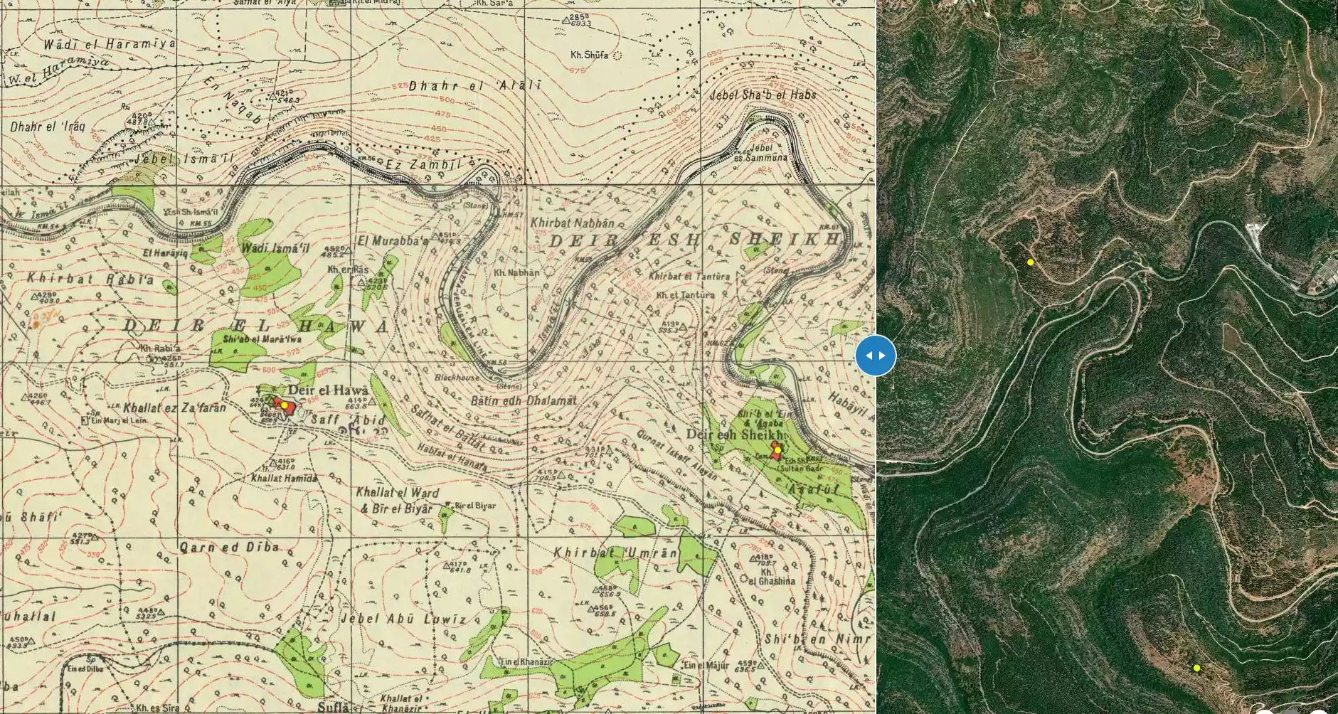
| Map Location | See location #28 on the map View from satellite |
||||||||||||||||
| Military Operation | Operation ha-Har | ||||||||||||||||
| Attacking Units | Har'el Brigade | ||||||||||||||||
| Defenders | Egyptian Muslim Brotherhoods, Jordanian Army, and some ALA and local Palestinian militia. | ||||||||||||||||
| Exodus Cause | Military assault by Zionist troops | ||||||||||||||||
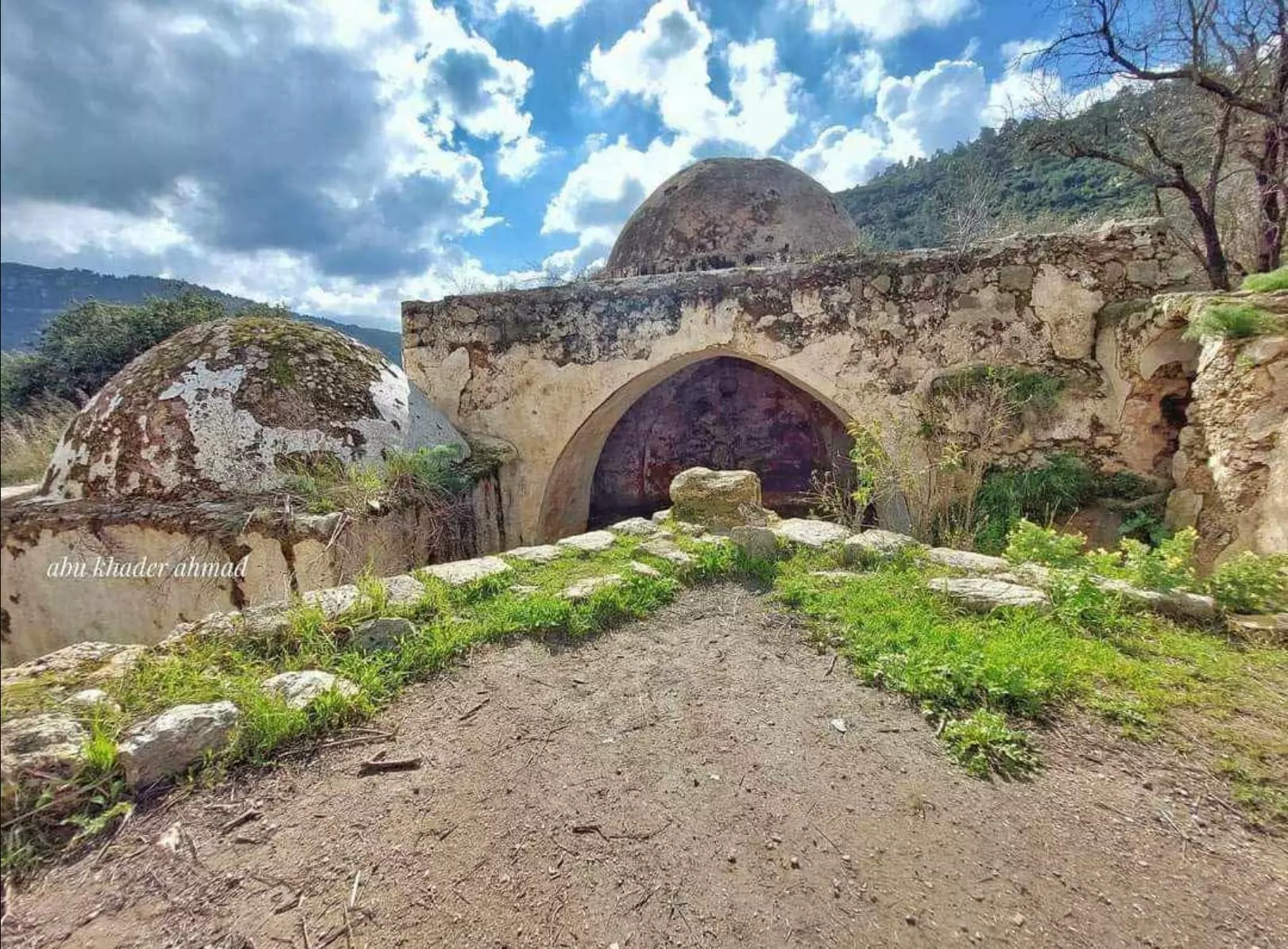
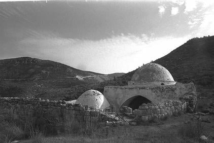
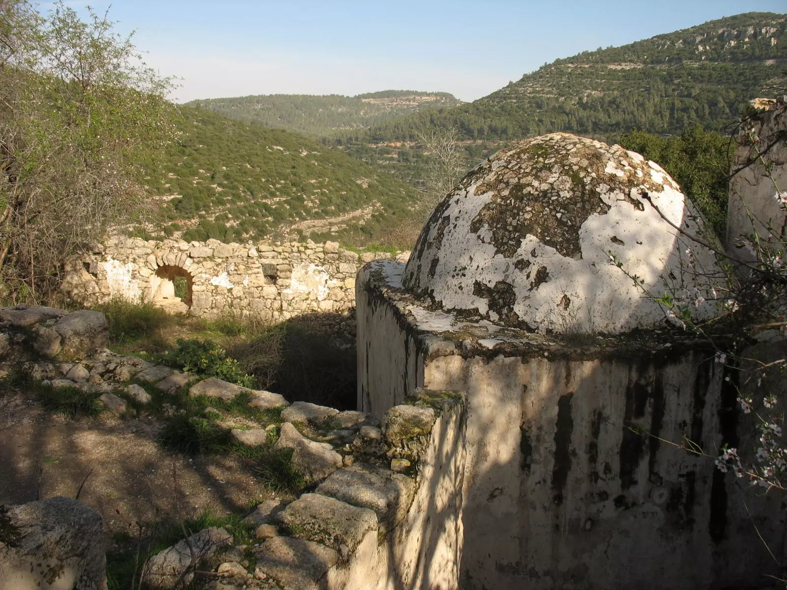
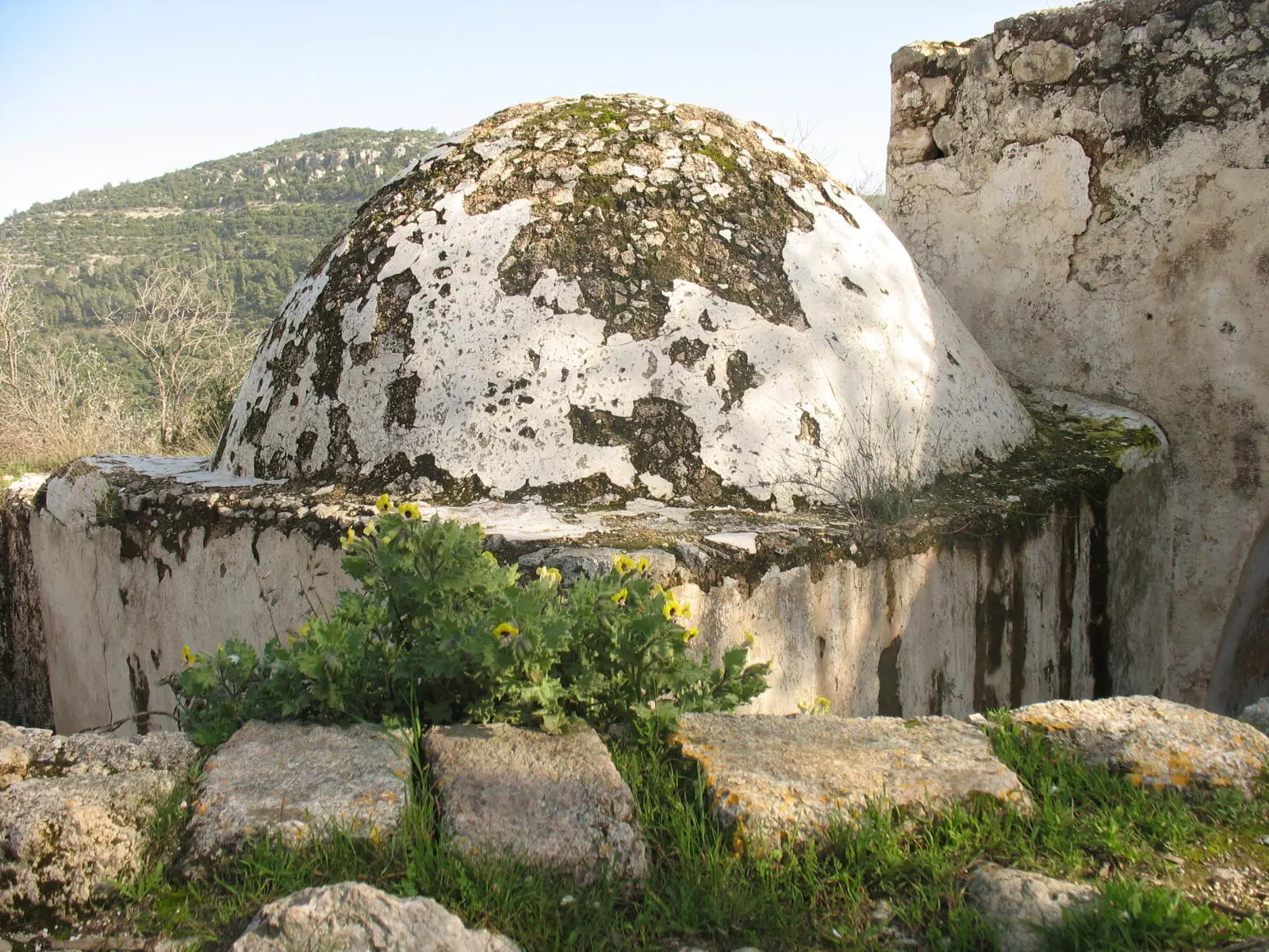
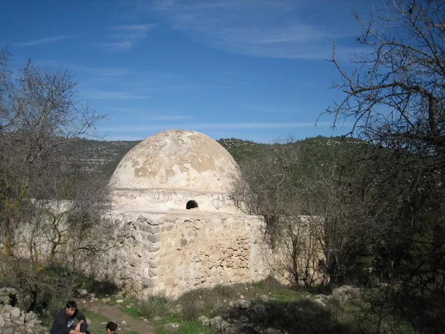
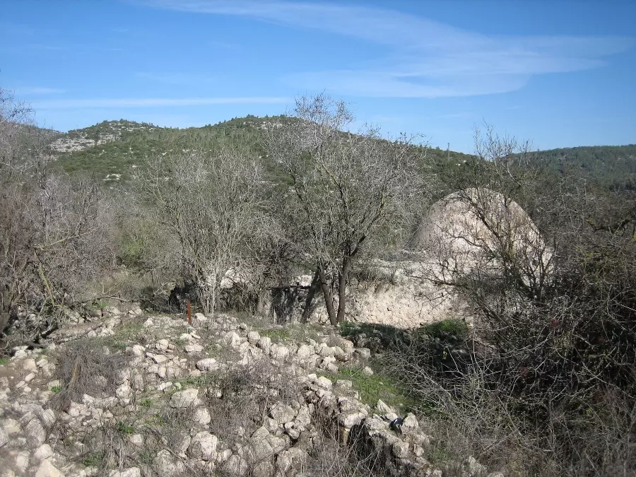
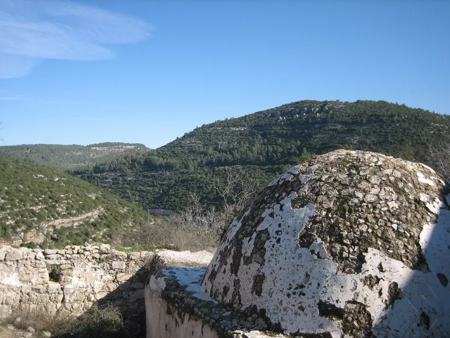
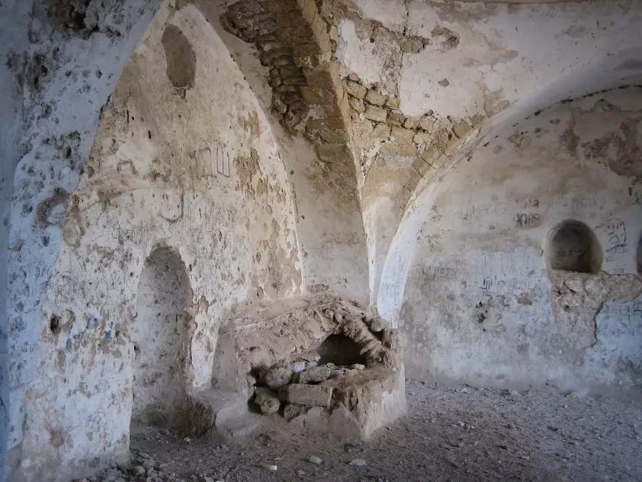
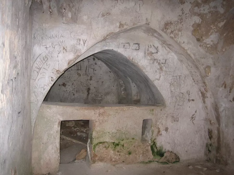
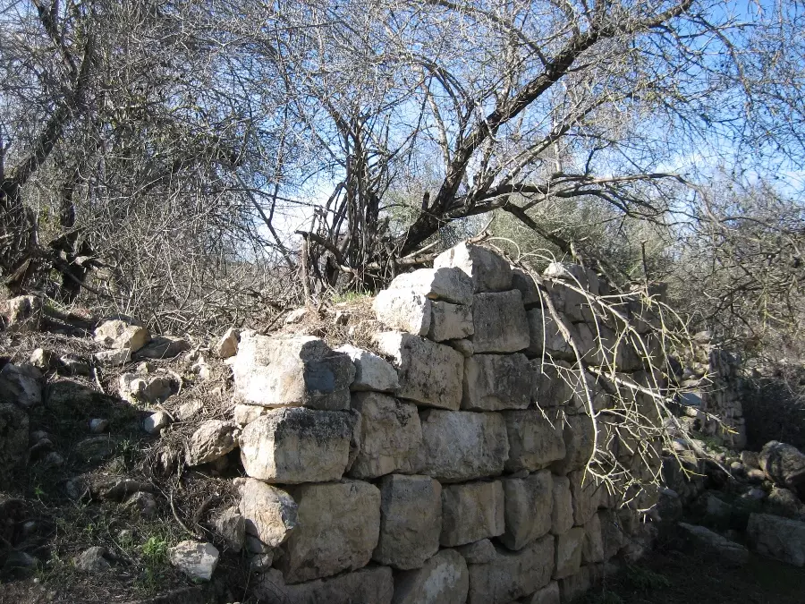
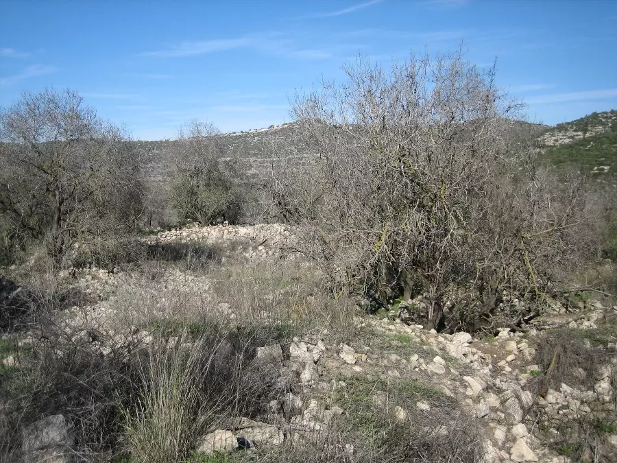
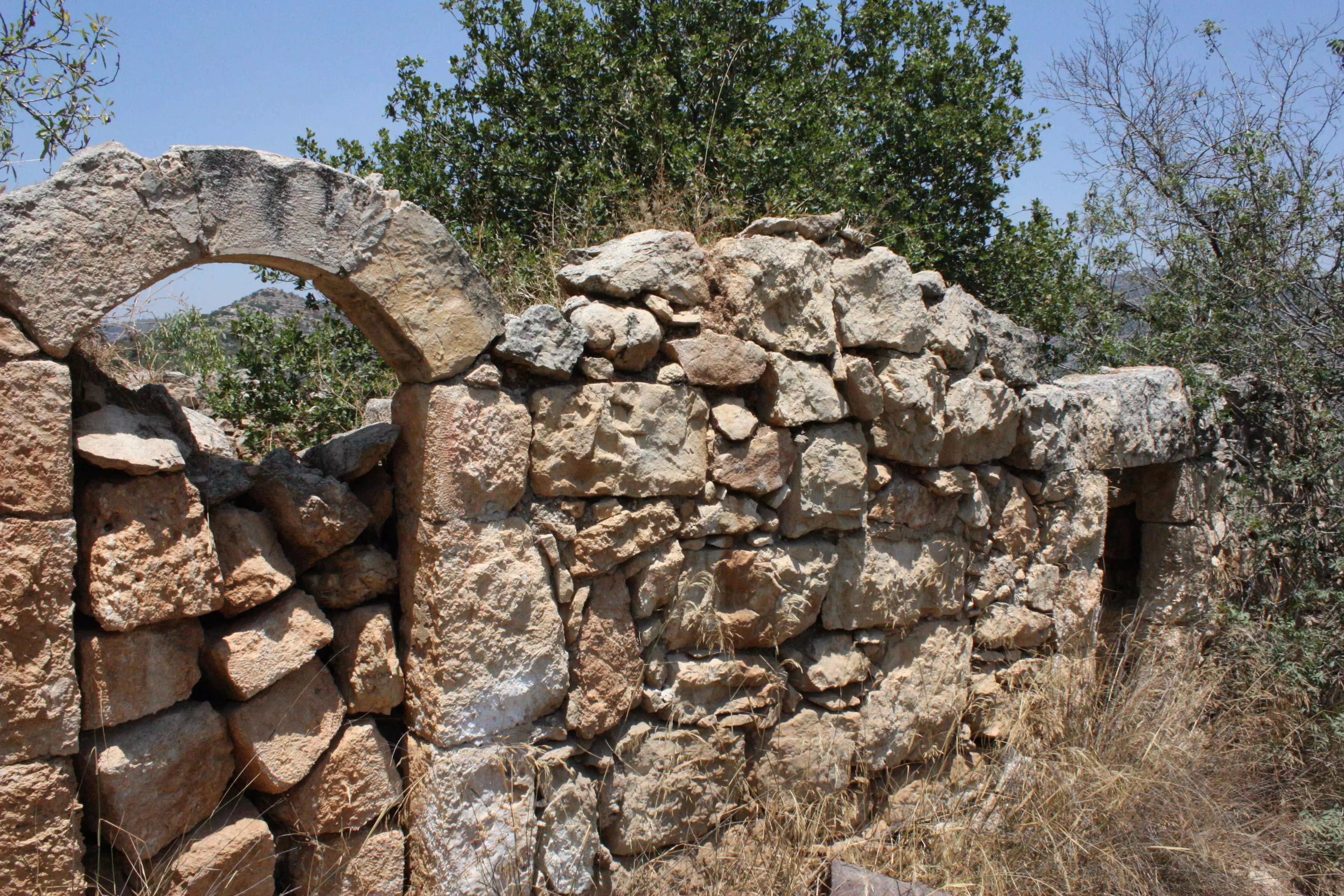
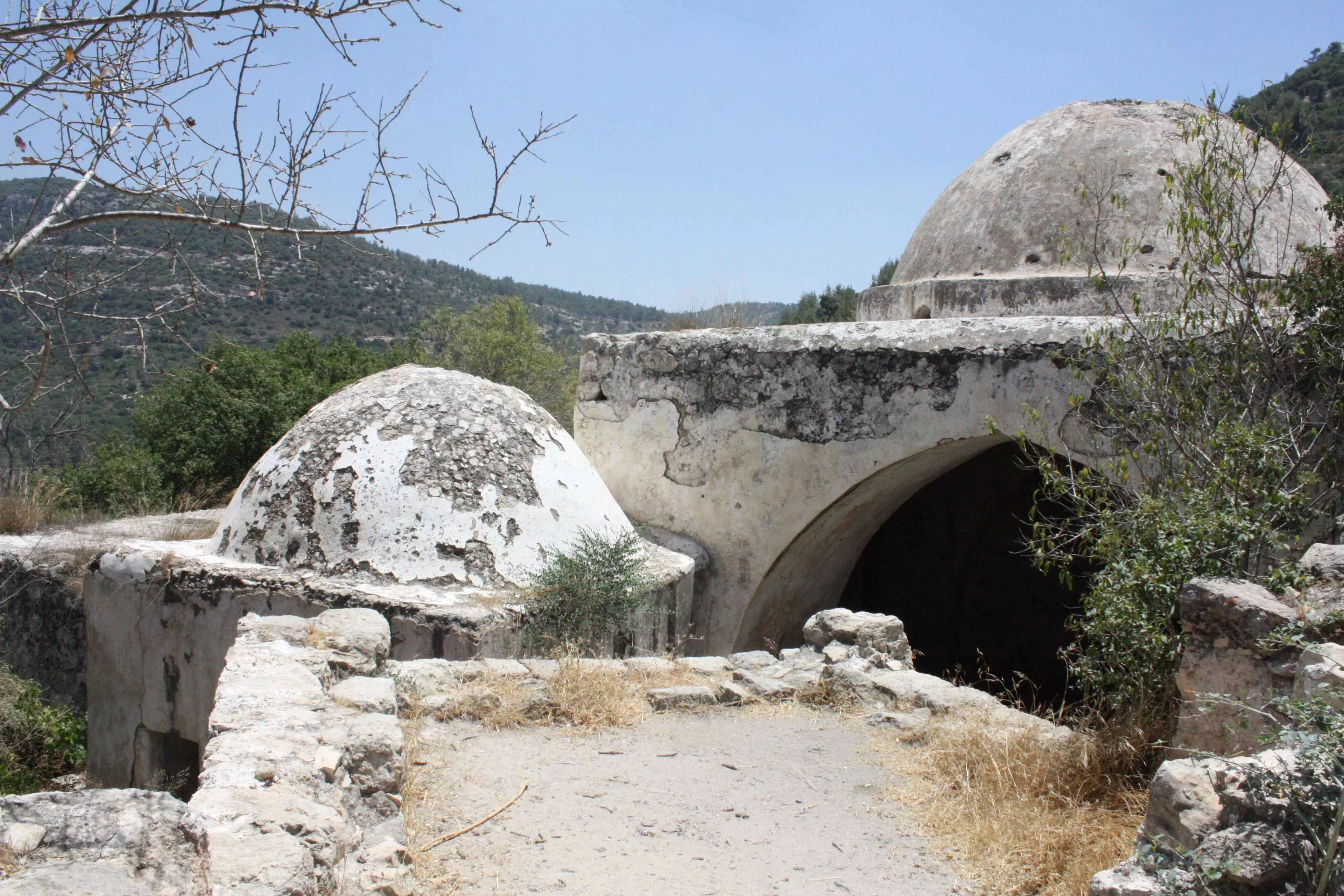
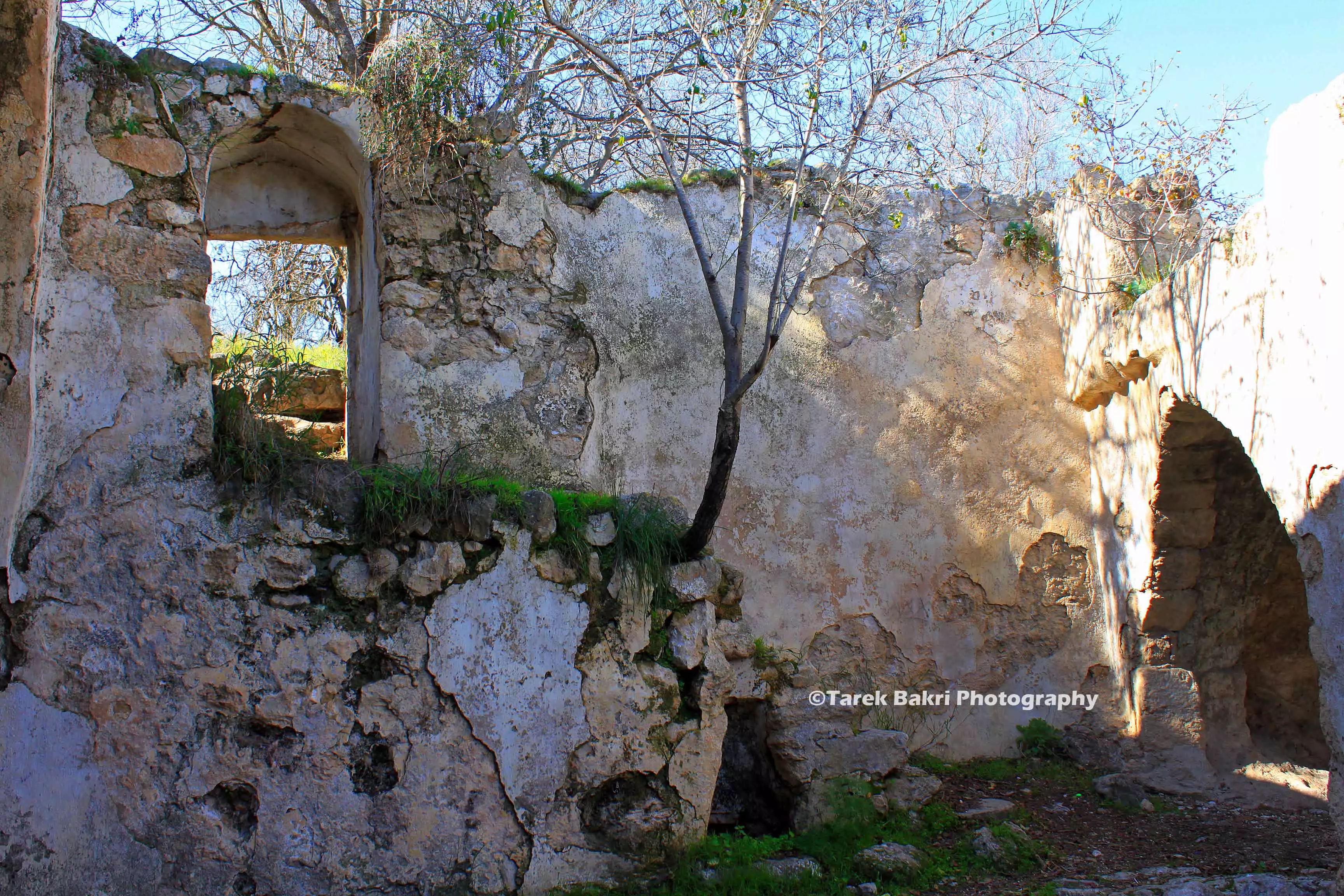
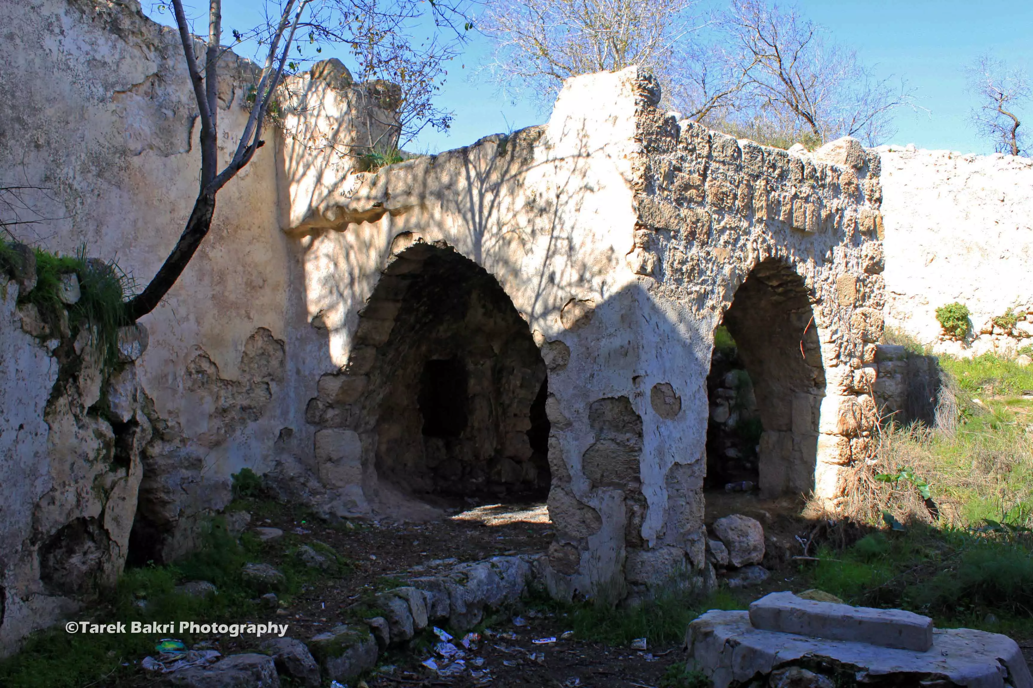
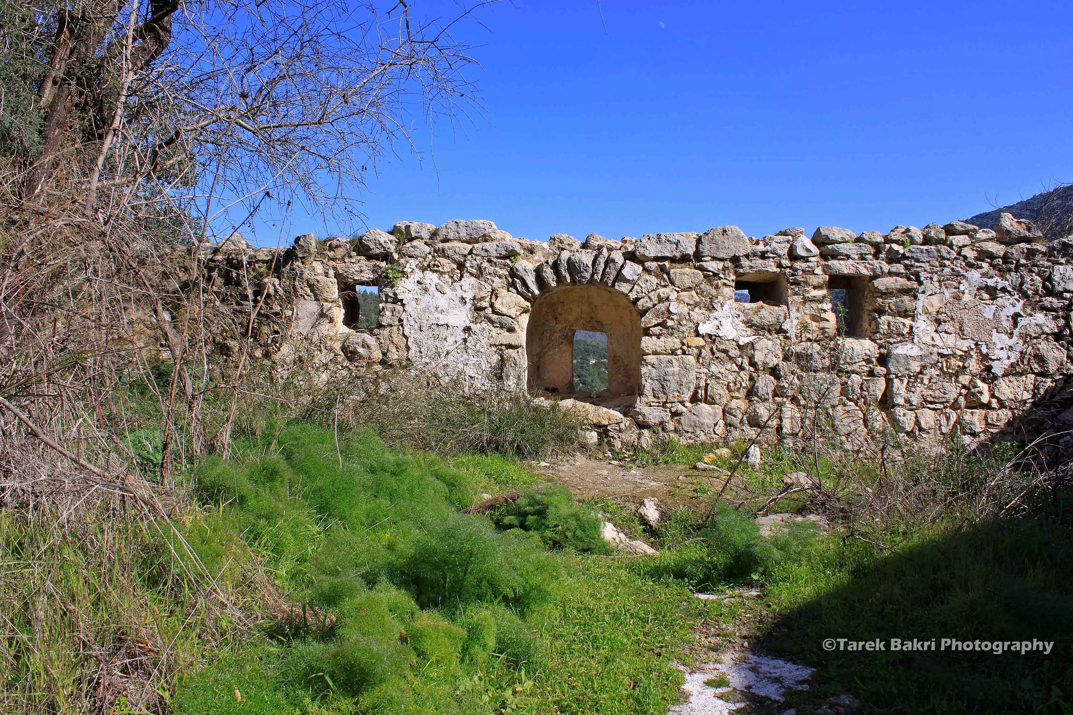
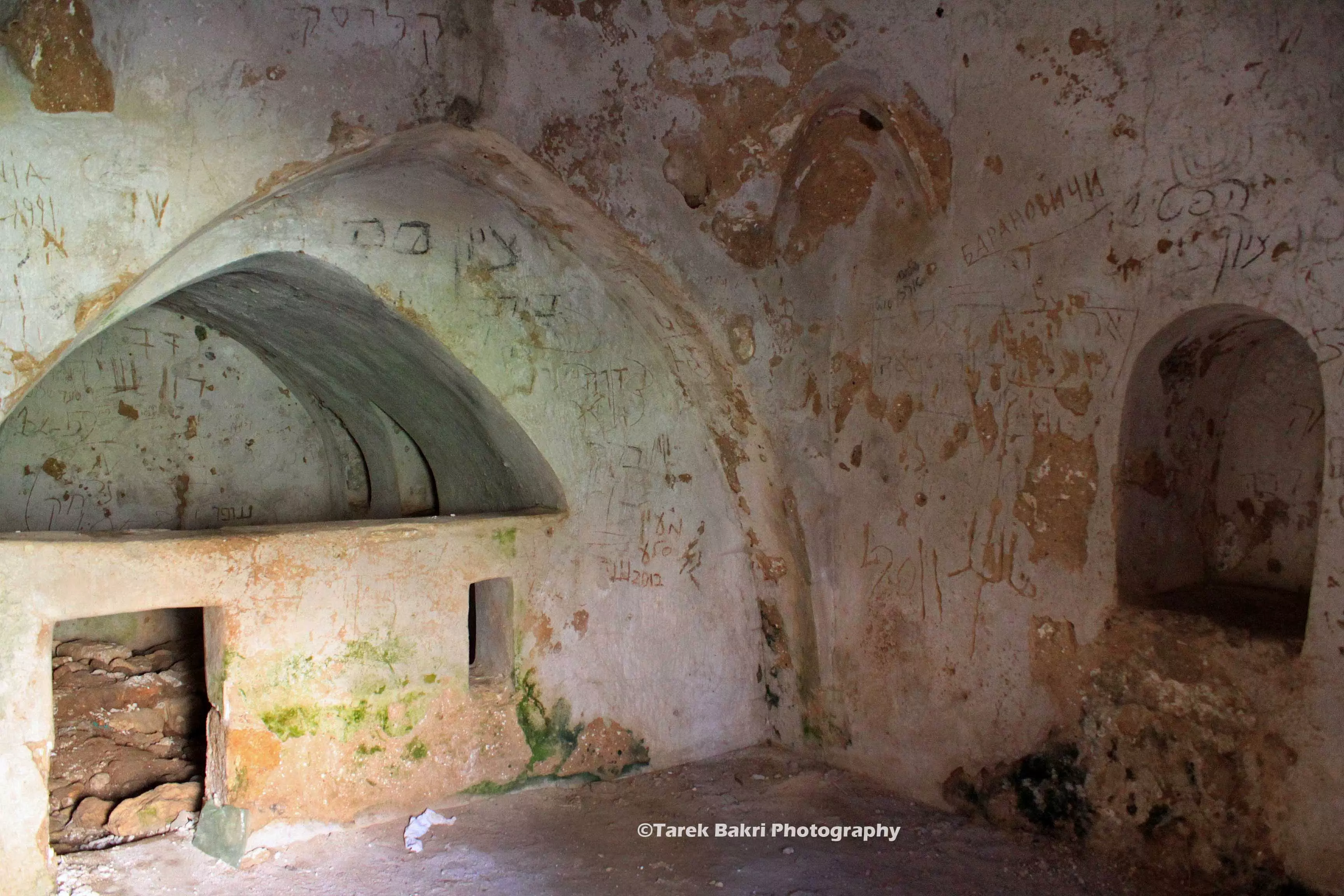
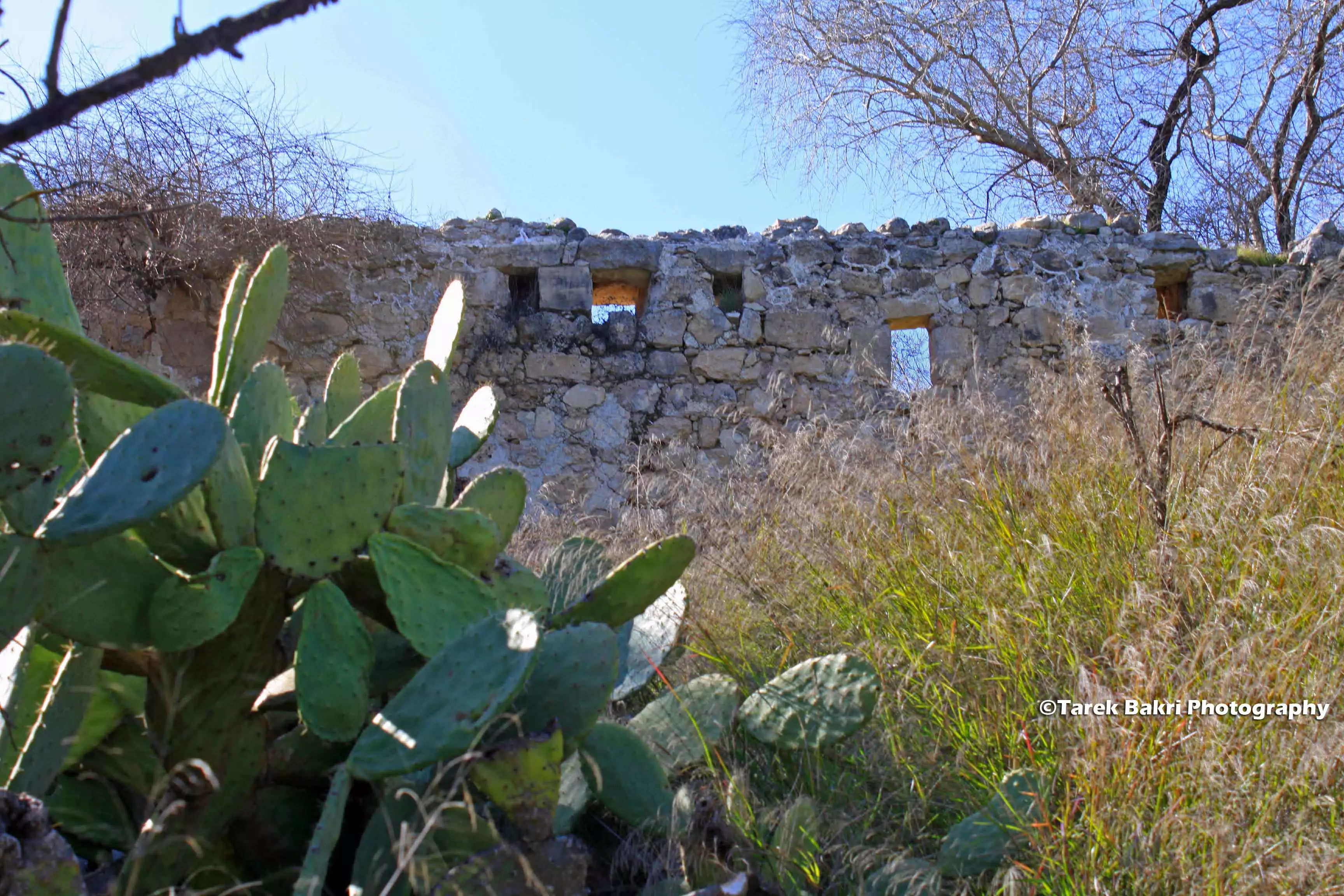
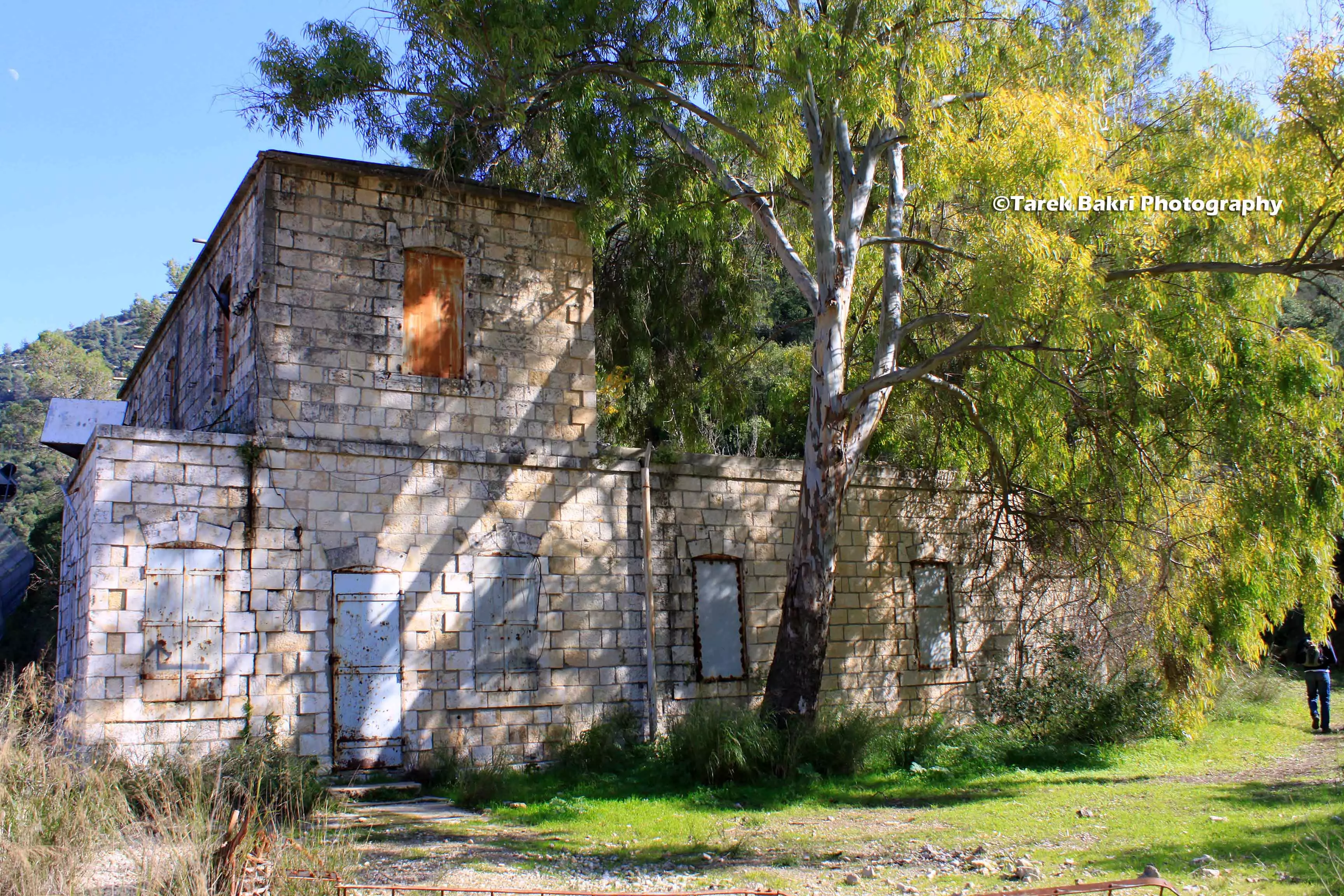
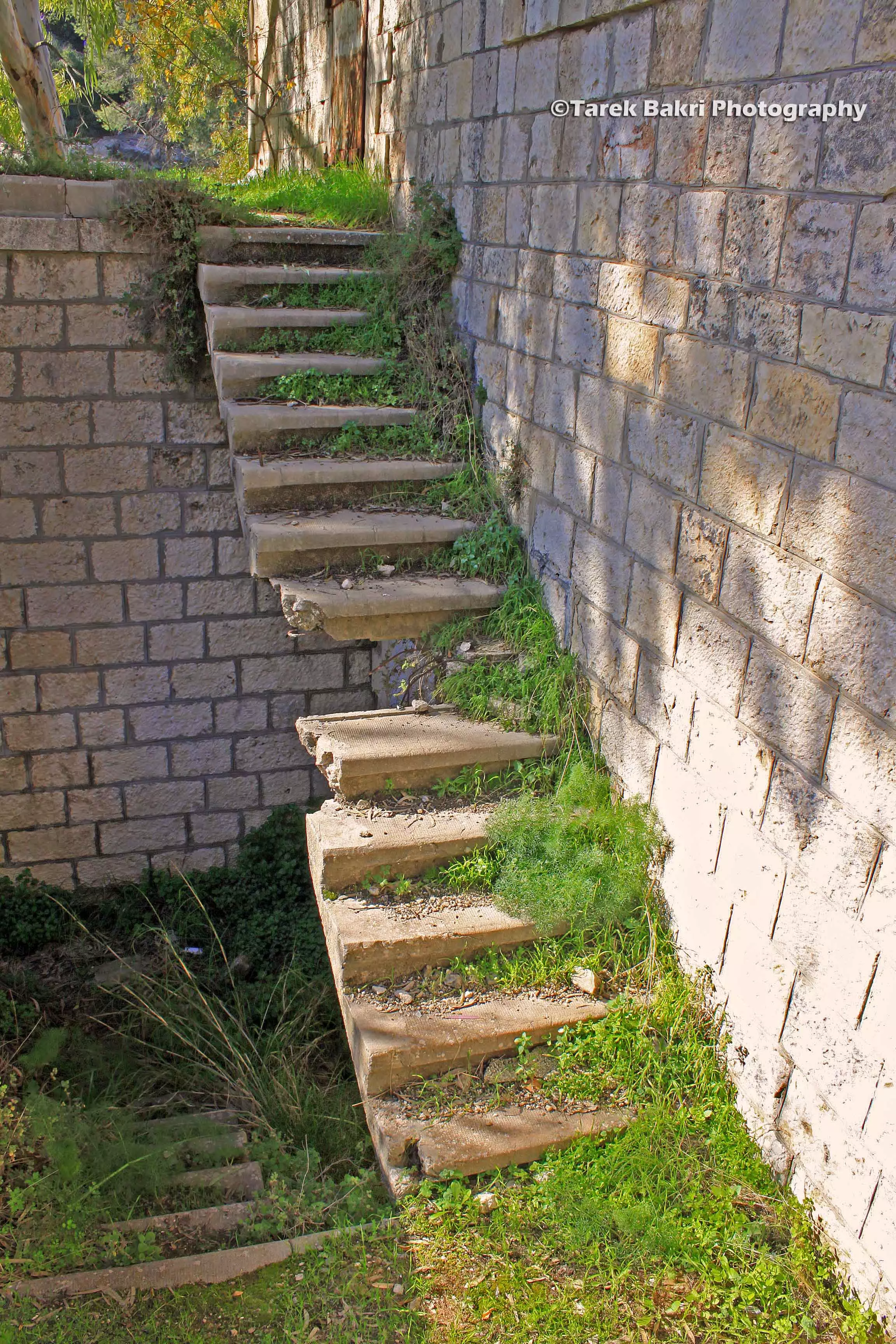
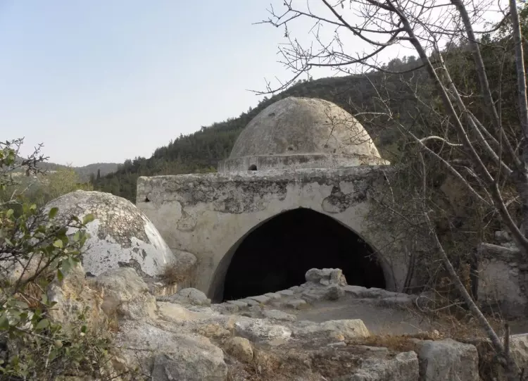
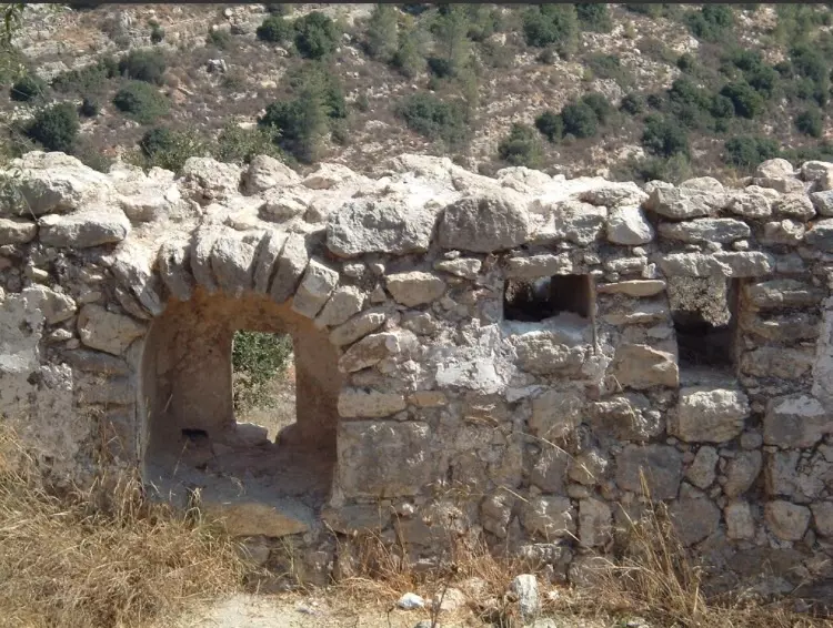
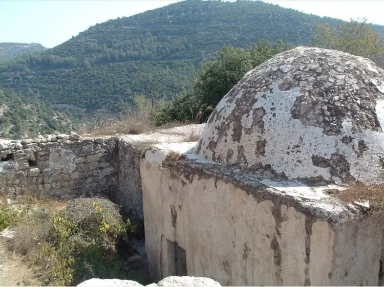
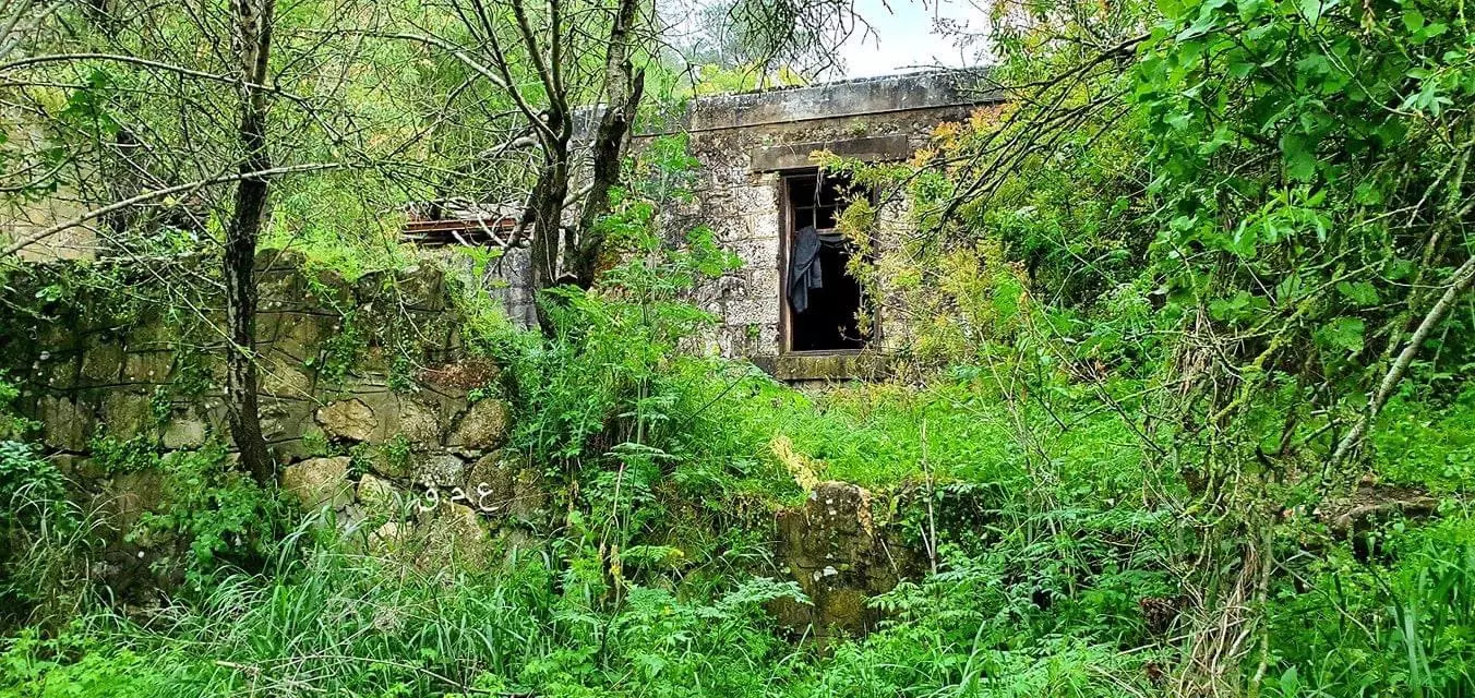
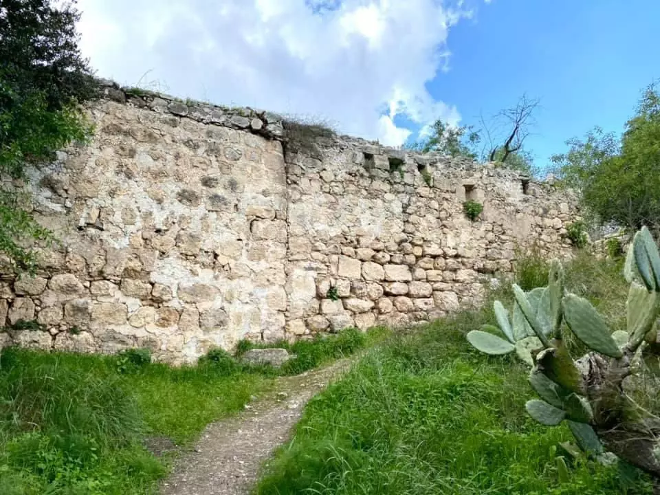
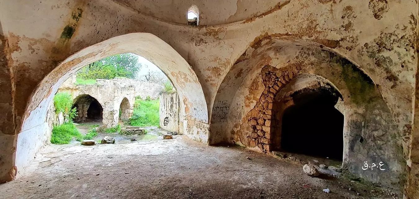
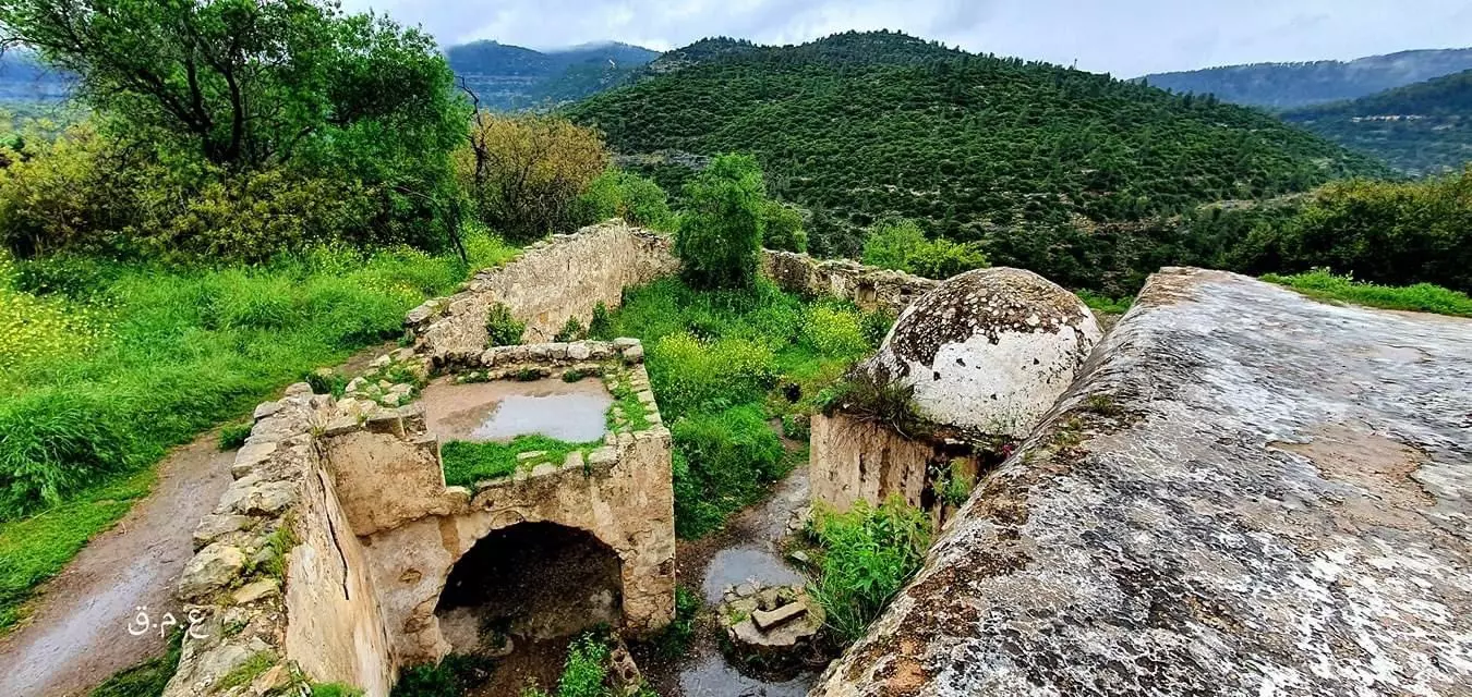
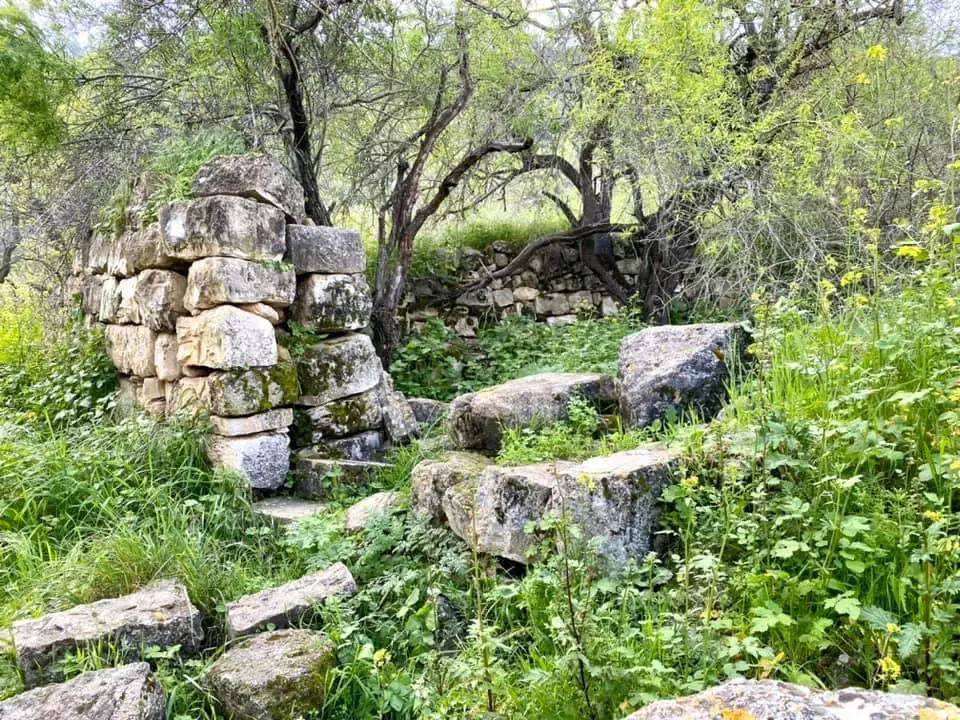
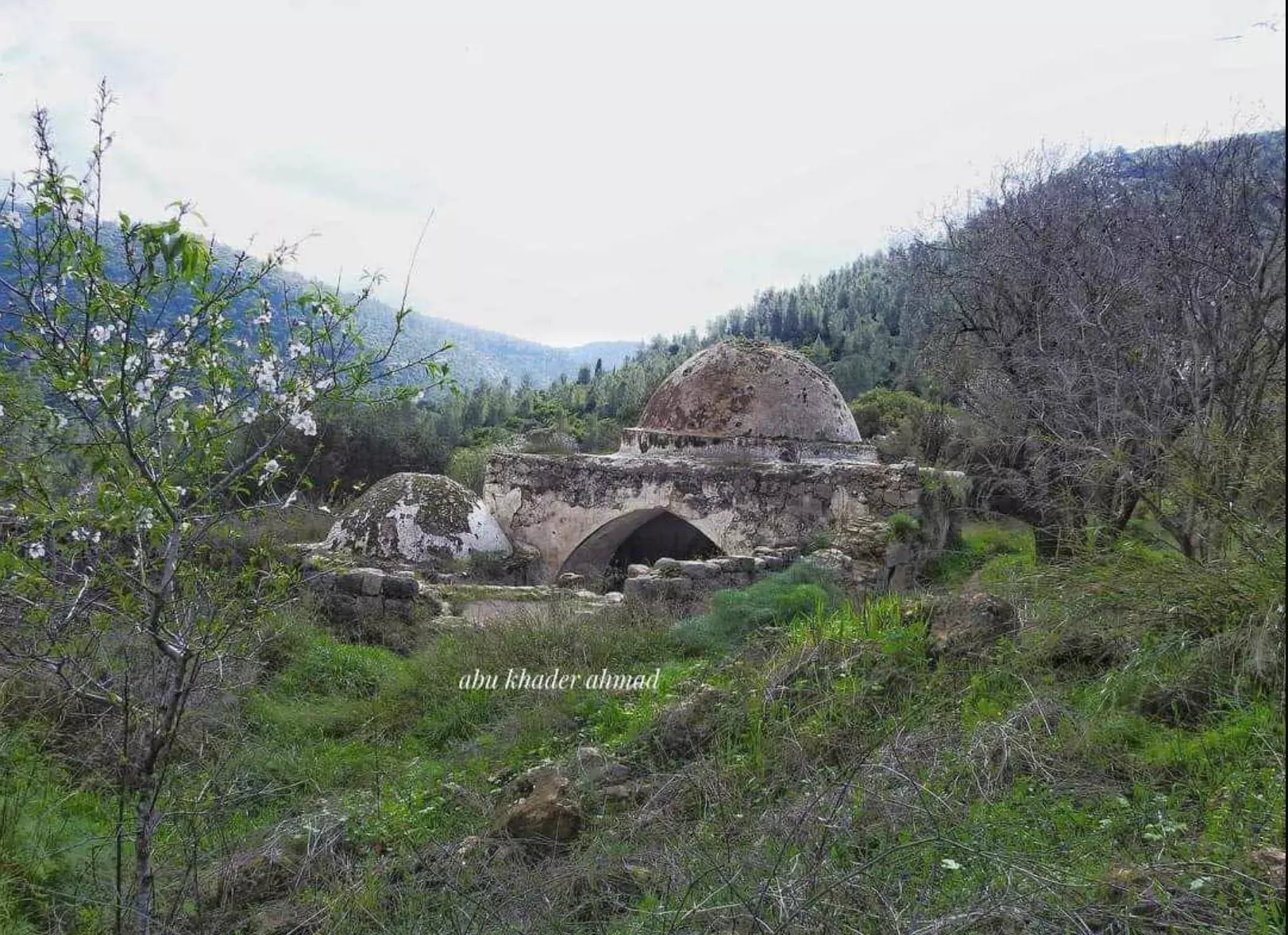
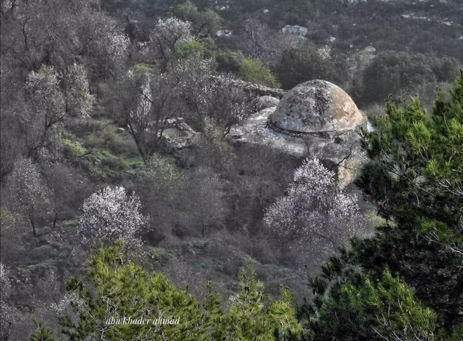
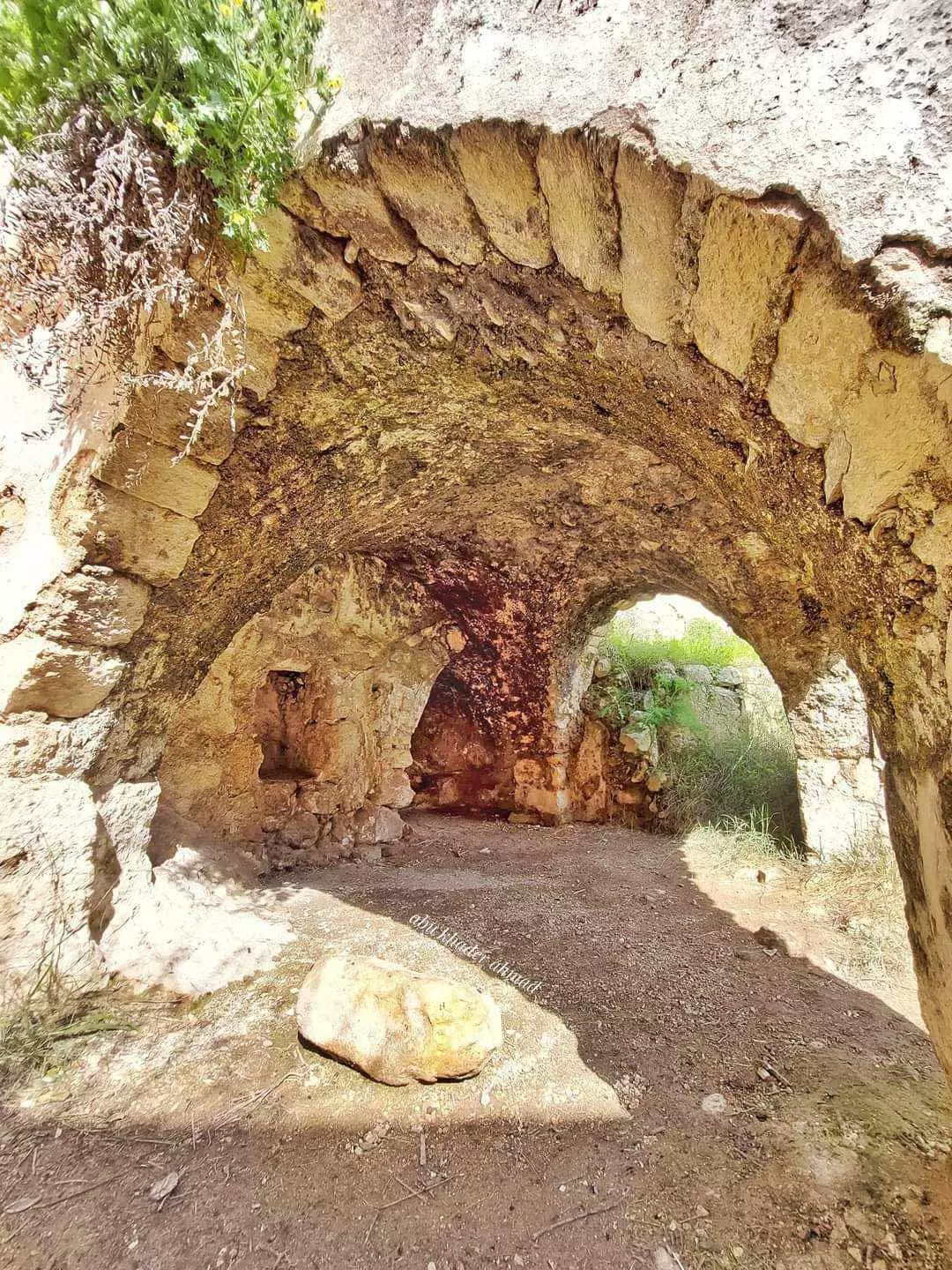
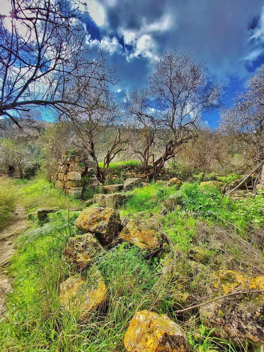
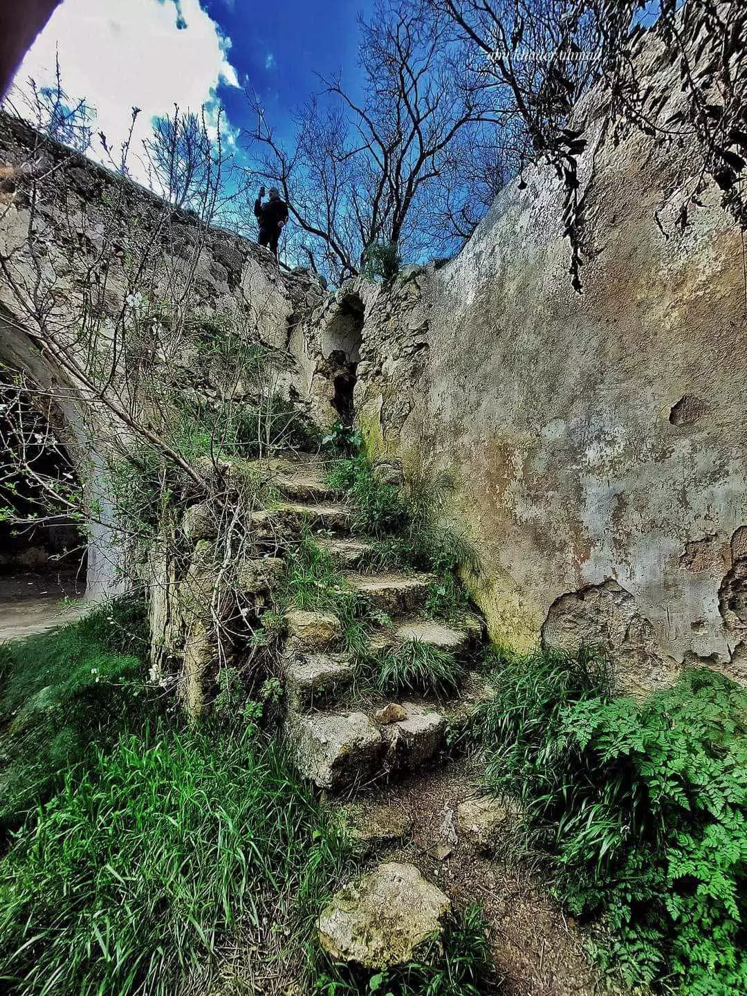
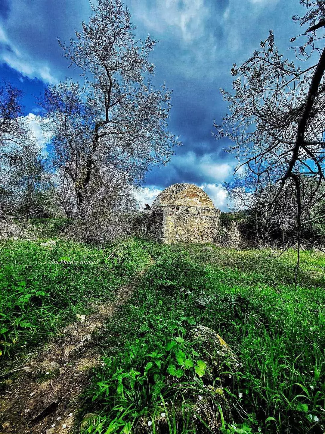
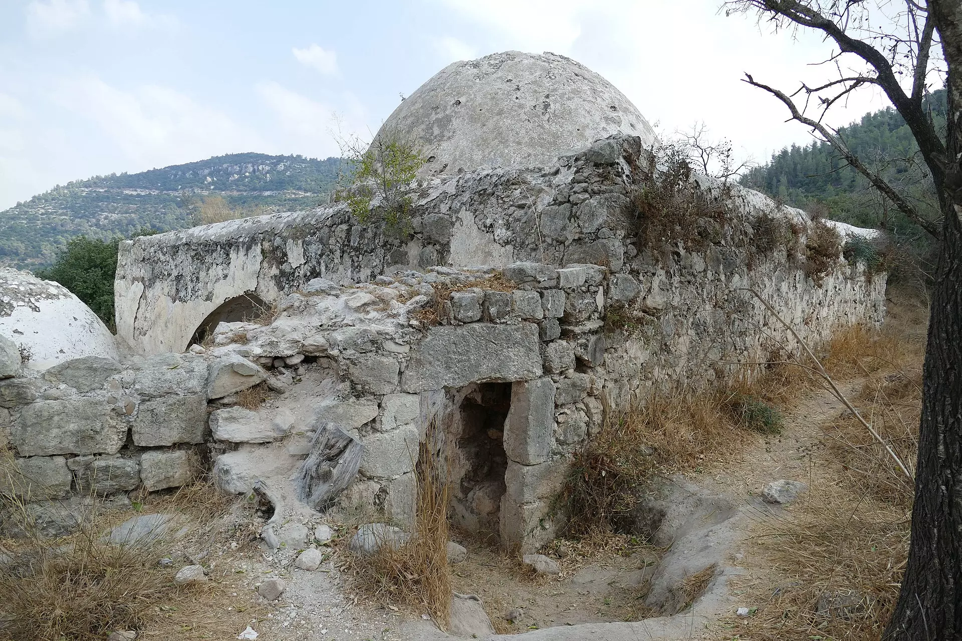
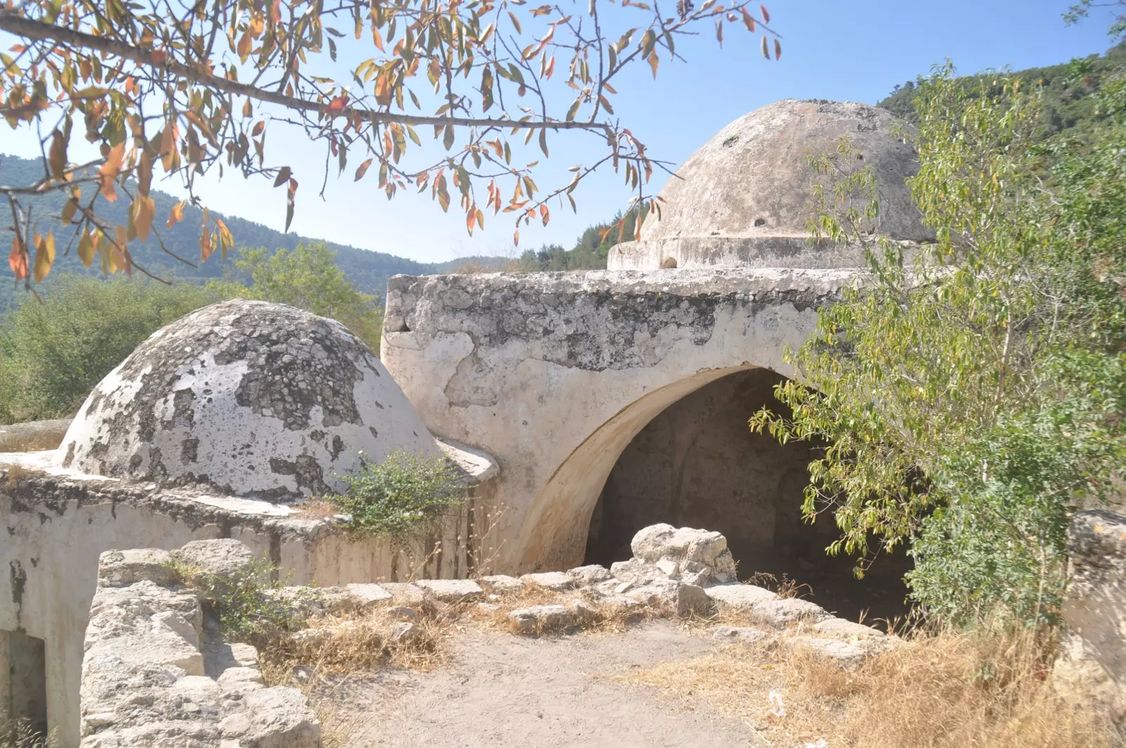
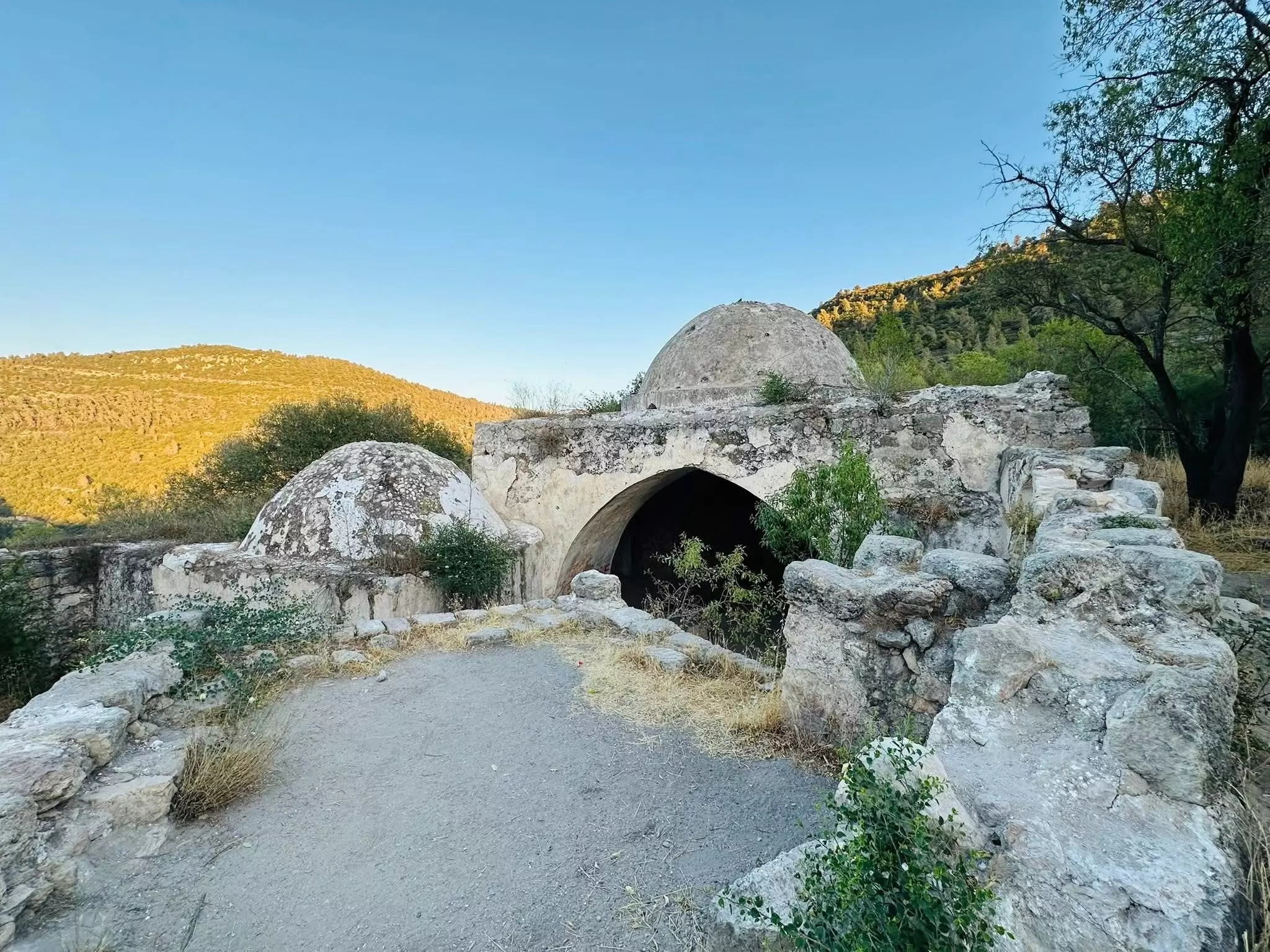
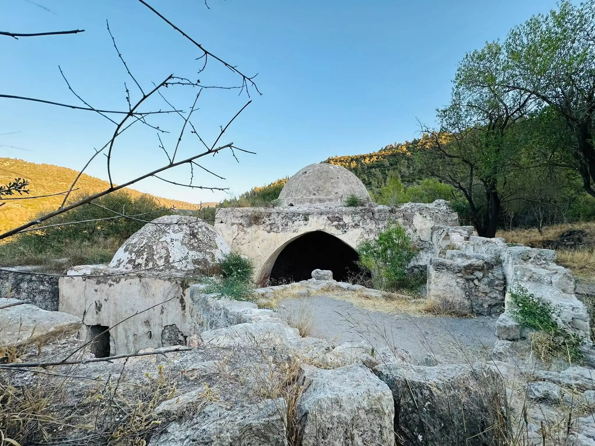
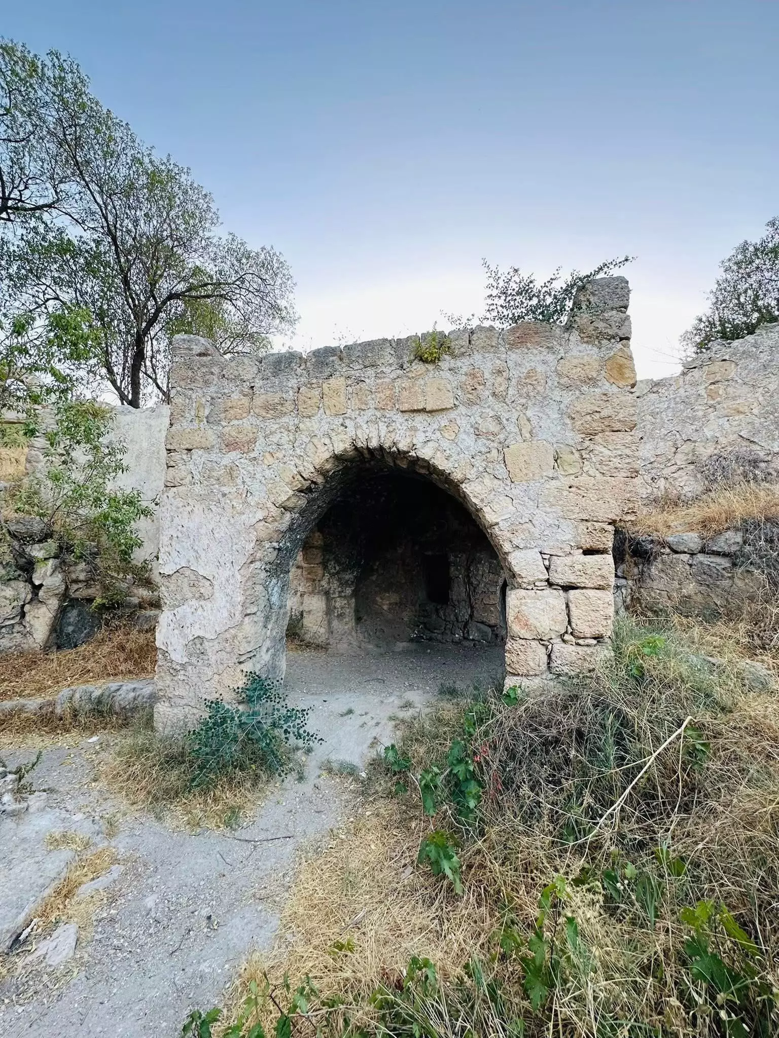
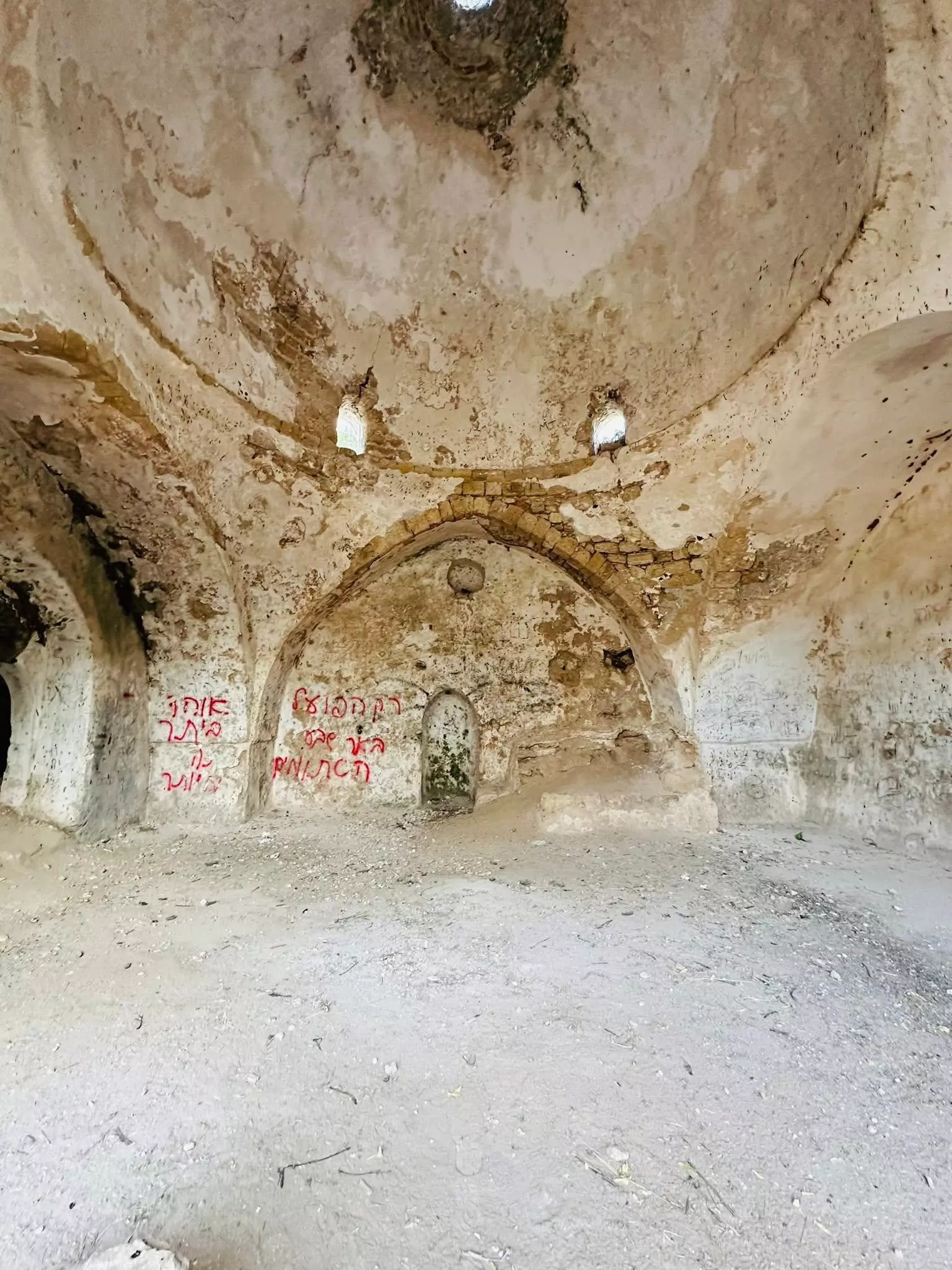
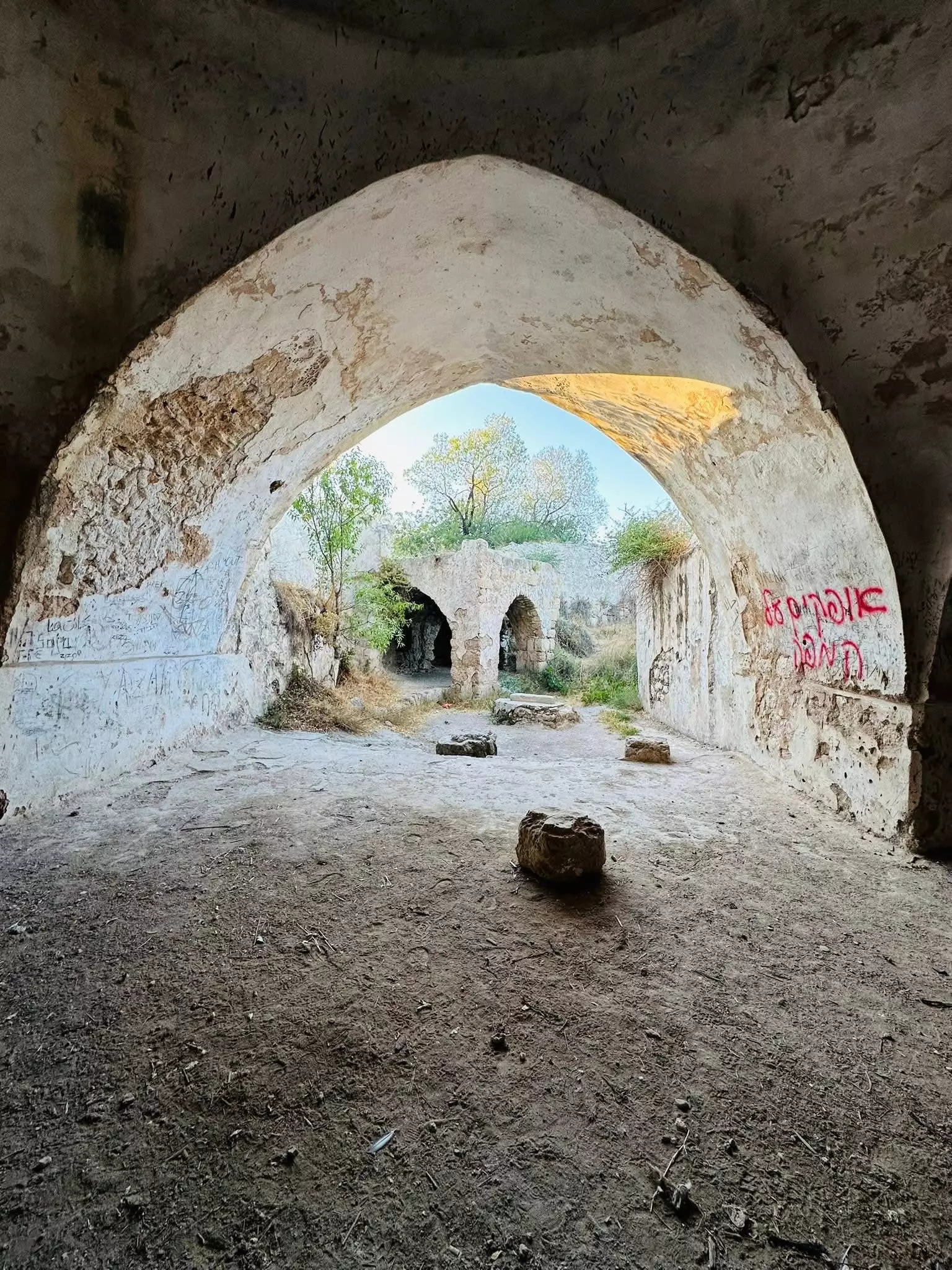
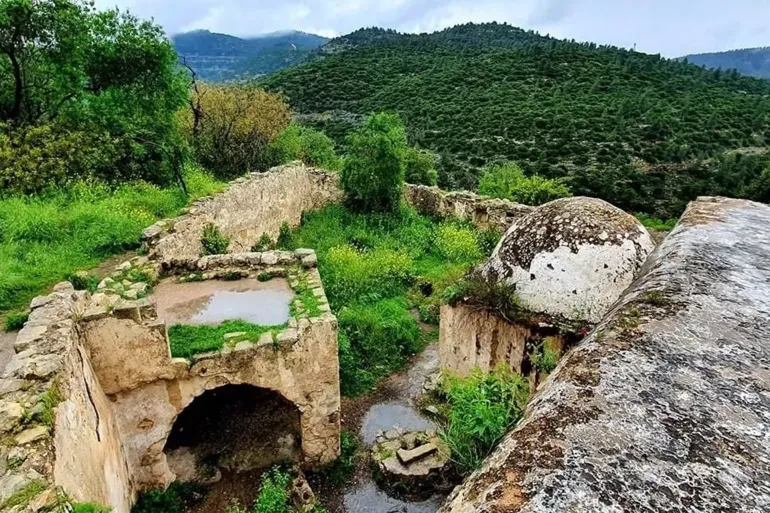
| Village Temains | Deir al-Sheikh was mostly destroyed and defaced with the exception of few houses including the village shrine which is being used as tourist attraction by Israelis. | ||||||||||||||||
| Ethnically Cleansing | Dayr al-Shaykh inhabitants were completely ethnically cleansed. | ||||||||||||||||
| Pre-Nakba Land Ownership |
**Town Lands' Demarcation Maps |
||||||||||||||||
| Land Usage As of 1945 |
|
||||||||||||||||
| Population |
|
||||||||||||||||
| Number of Houses |
|
||||||||||||||||
| Near By Towns |
|||||||||||||||||
|
|
|||||||||||||||||
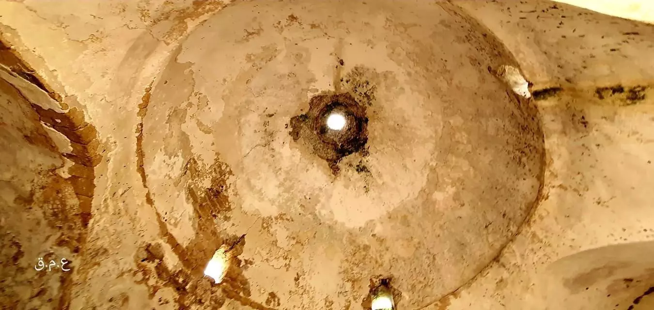
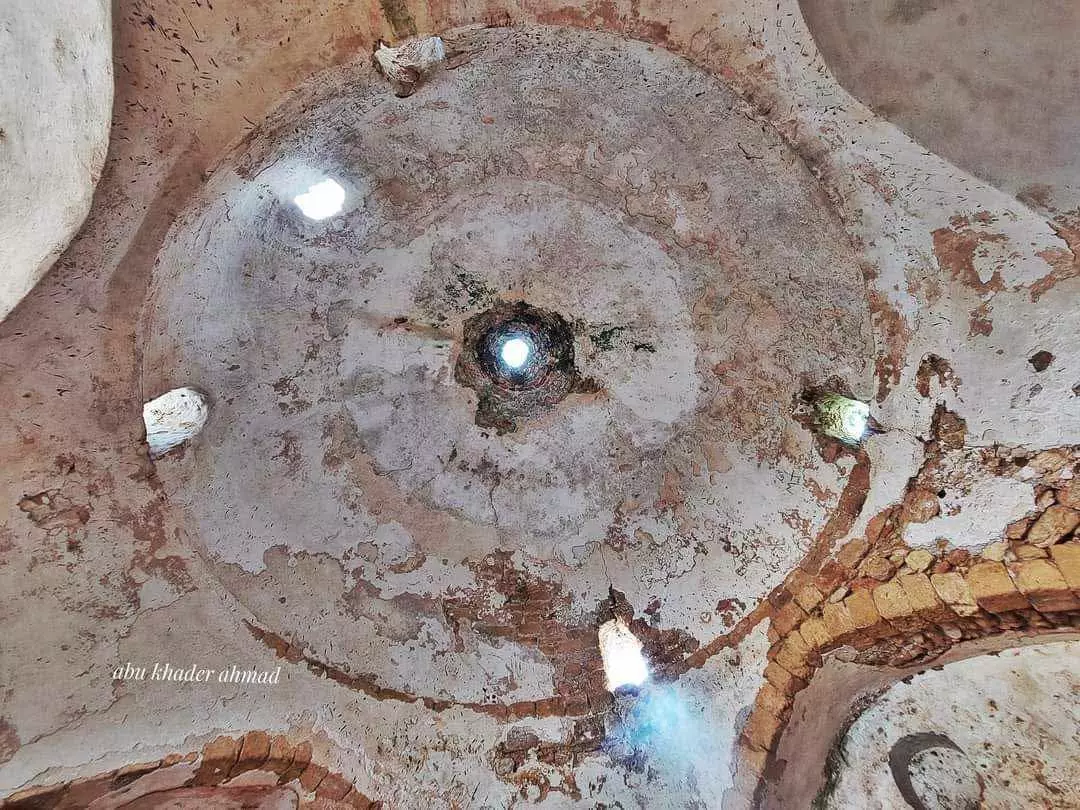
| Places of Warship | Deir al-Sheikh had two mosques, one with a large dome to the east, and a rock-cut tomb was to the southwest. | ||||||||||||||||
| Shrines / Maqams | A maqam and mosque for al-Shaykh Sultan Badr. | ||||||||||||||||
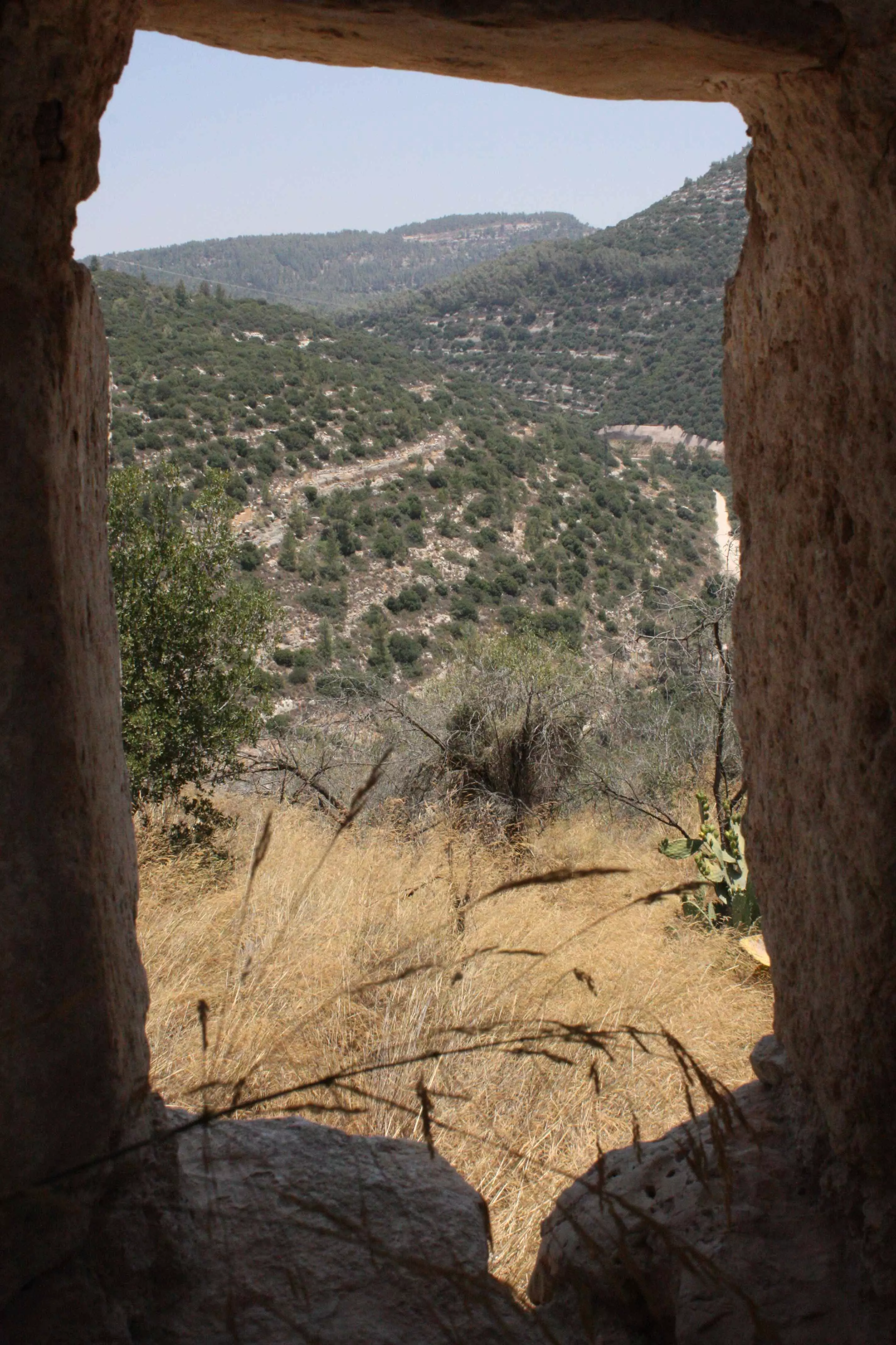
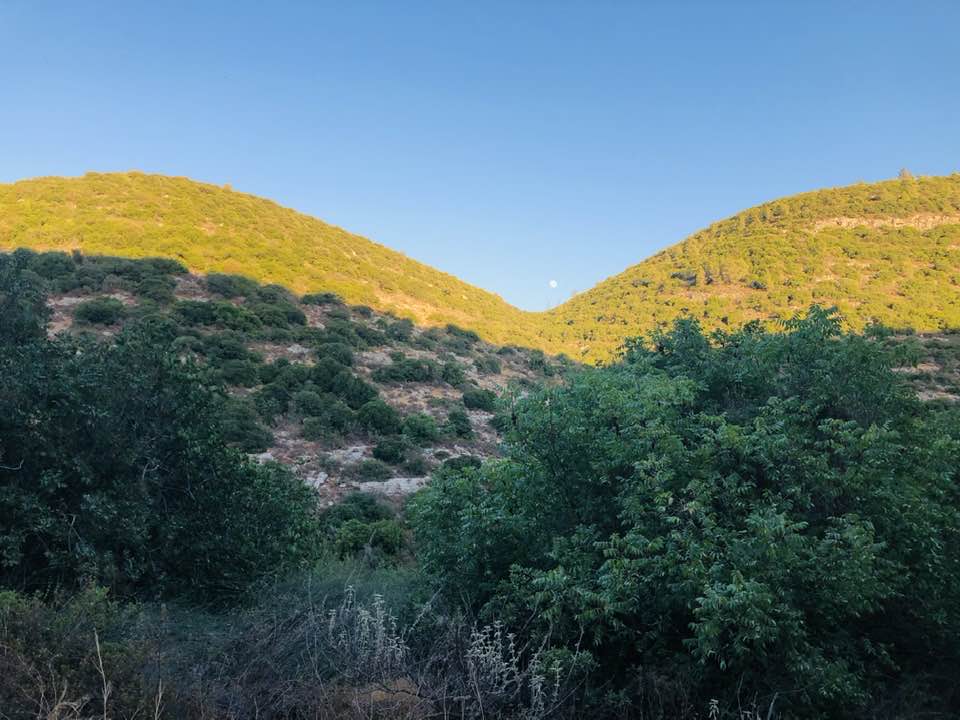
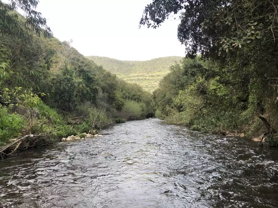
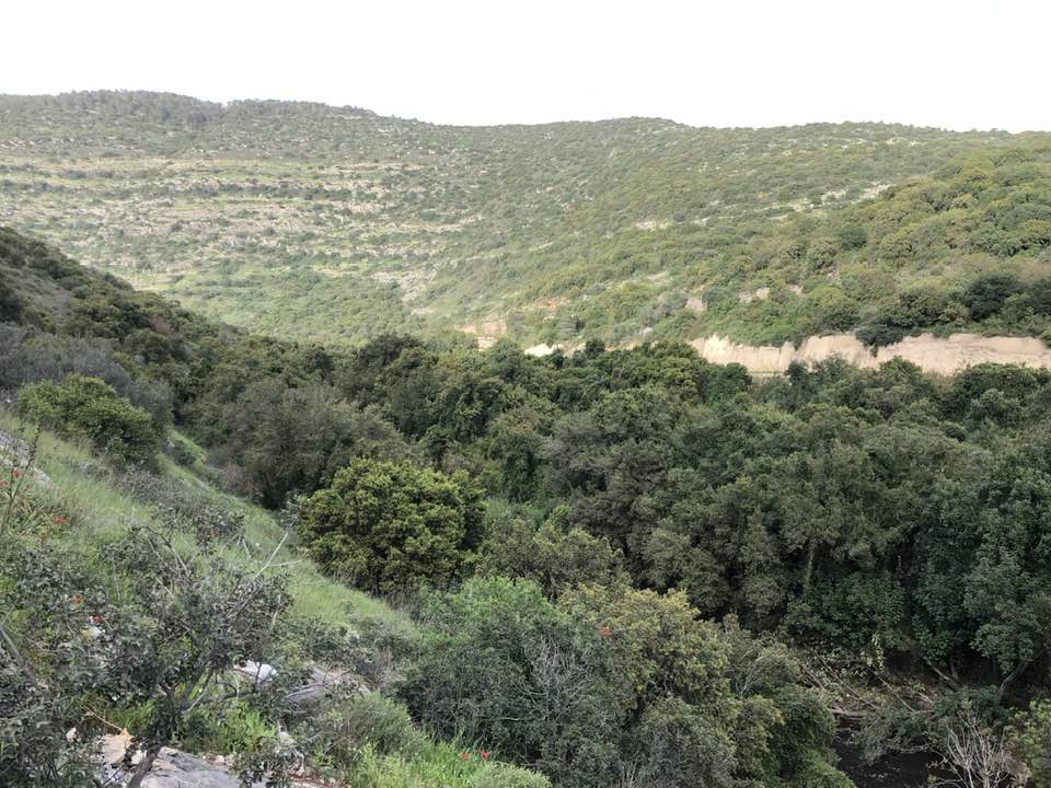
| Nearby Wadies & Rivers | Deir al-Sheikh overlooks Wadi al-Sarar to the northeast. | ||||||||||||||||
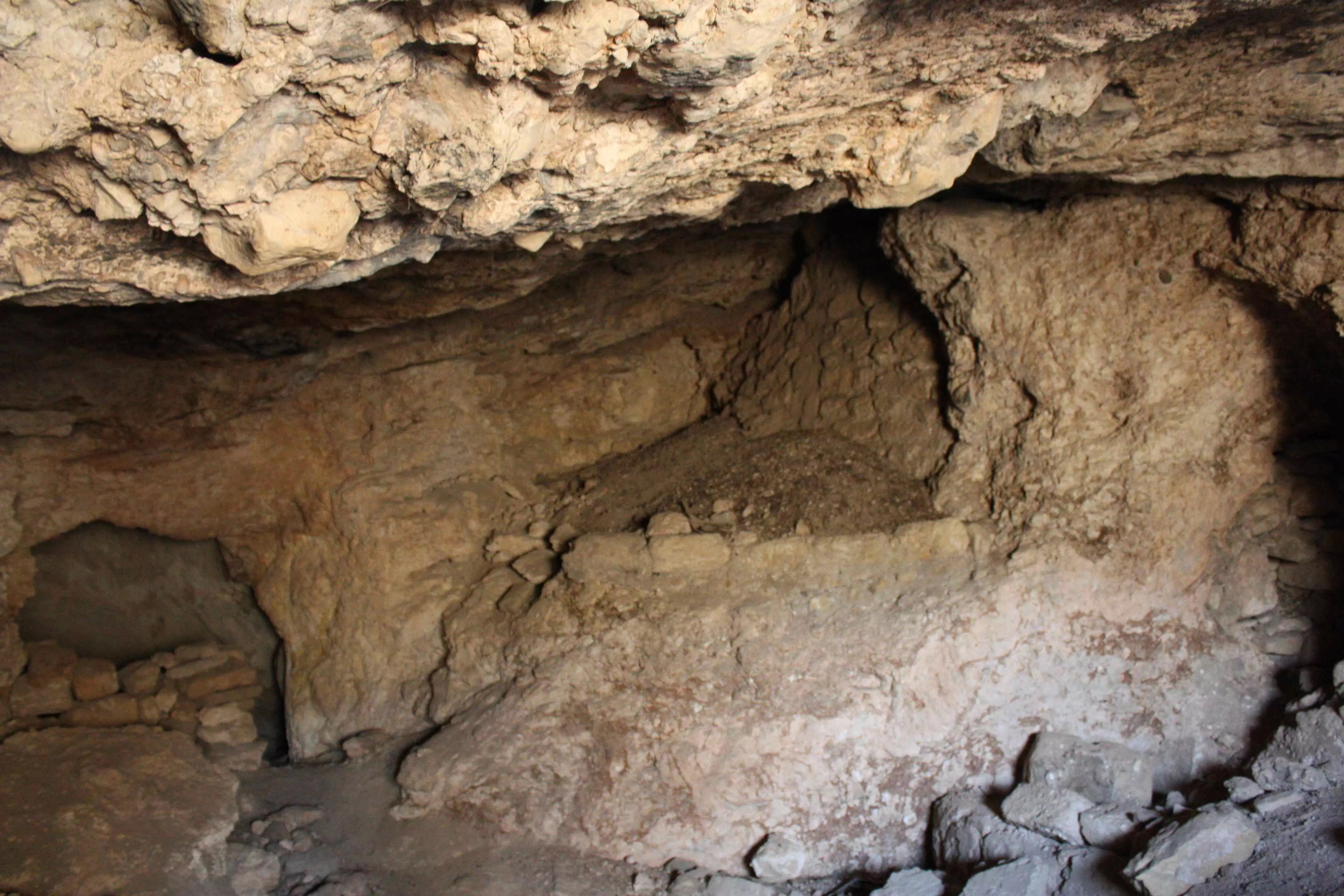
| Archeological Sites | The villages contains the remnants of walls and columns, foundations, cisterns, burial grounds, and presses. | ||||||||||||||||
| Exculsive Jewish Colonies Who Usurped Village Lands |
Nes Harim occupies some of the village lands. | ||||||||||||||||
| Featured Video | |||||||||||||||||
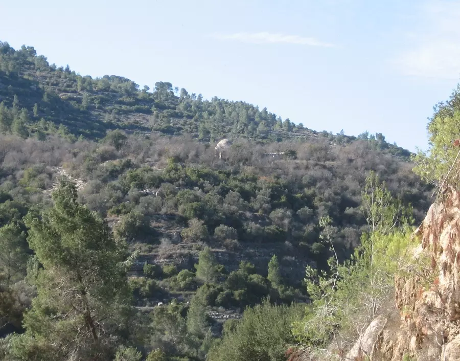
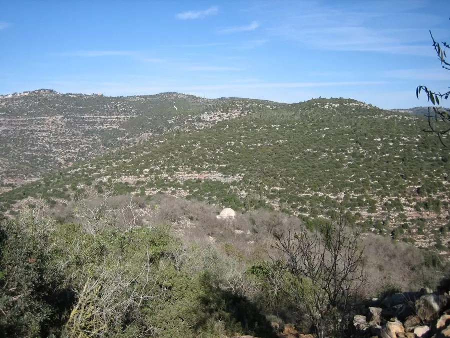
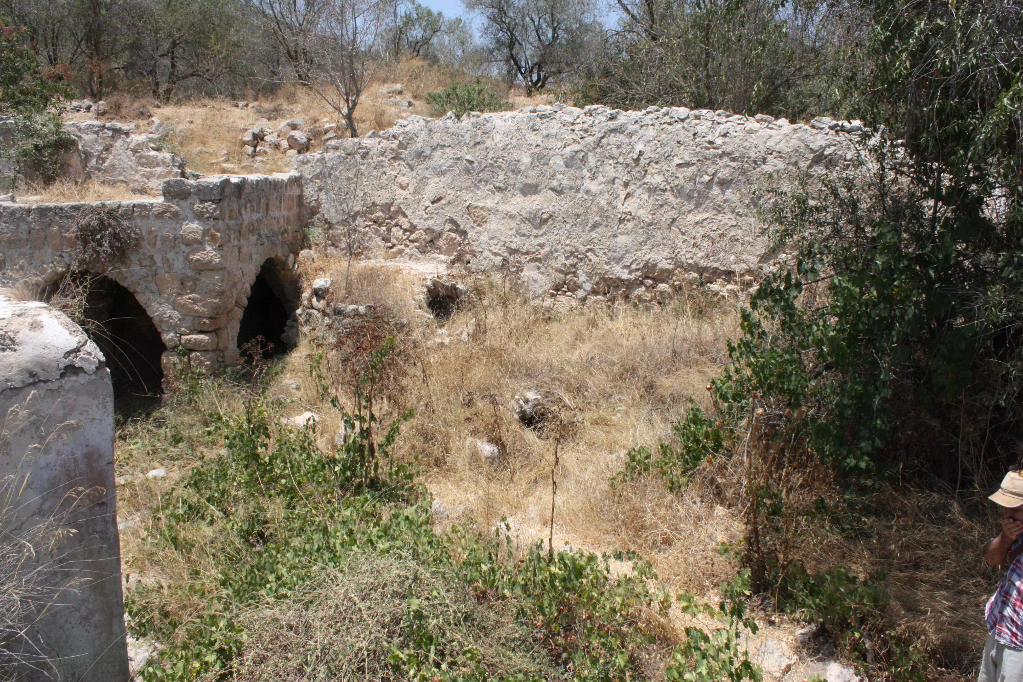
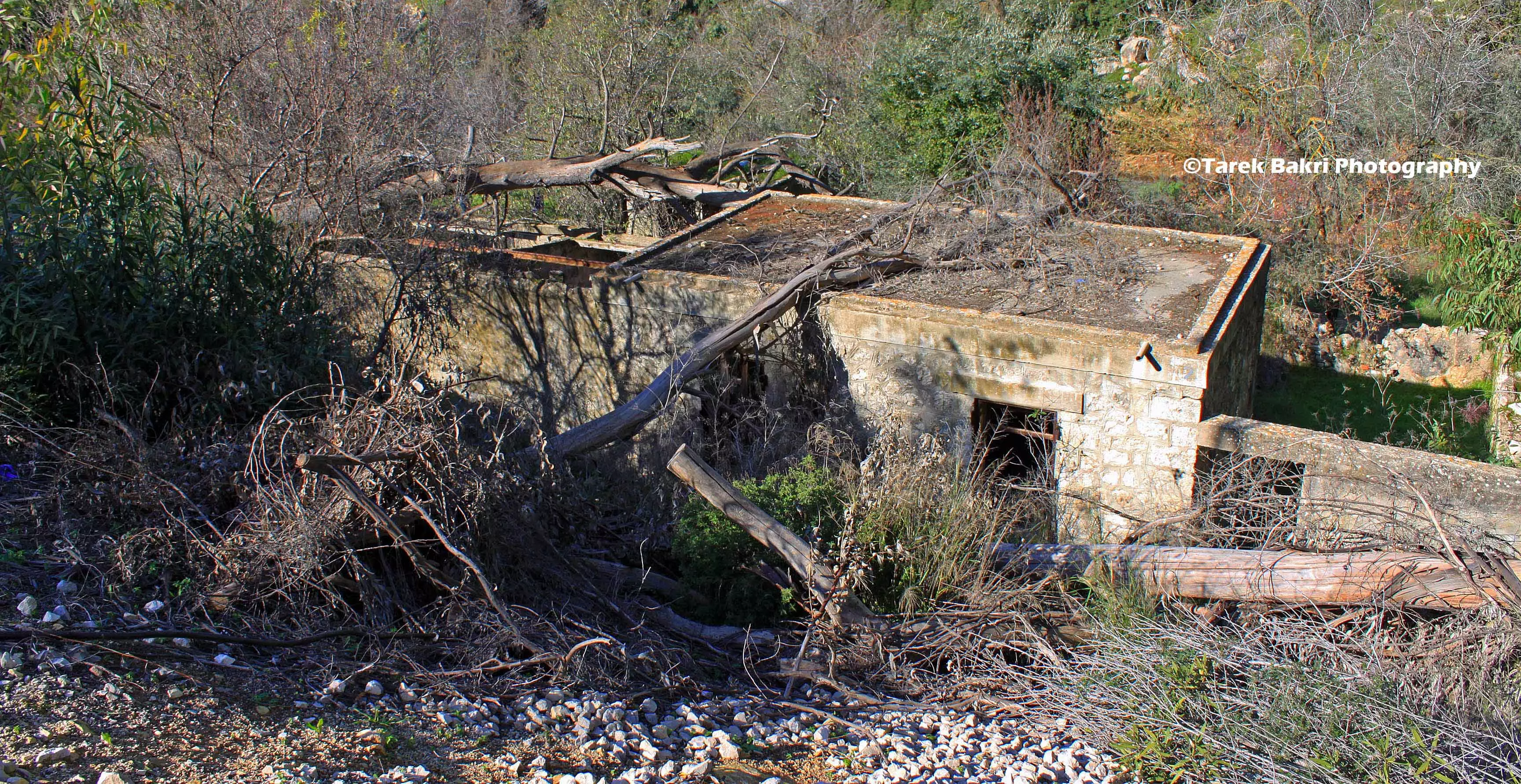
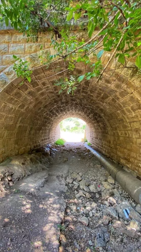
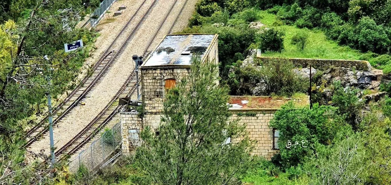
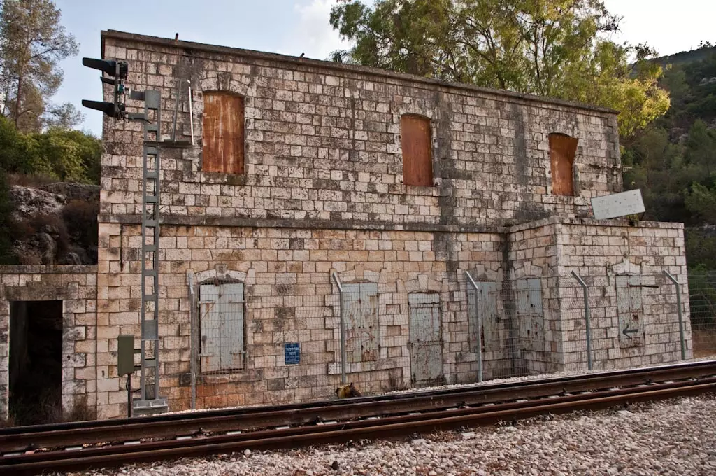
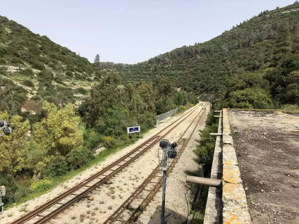
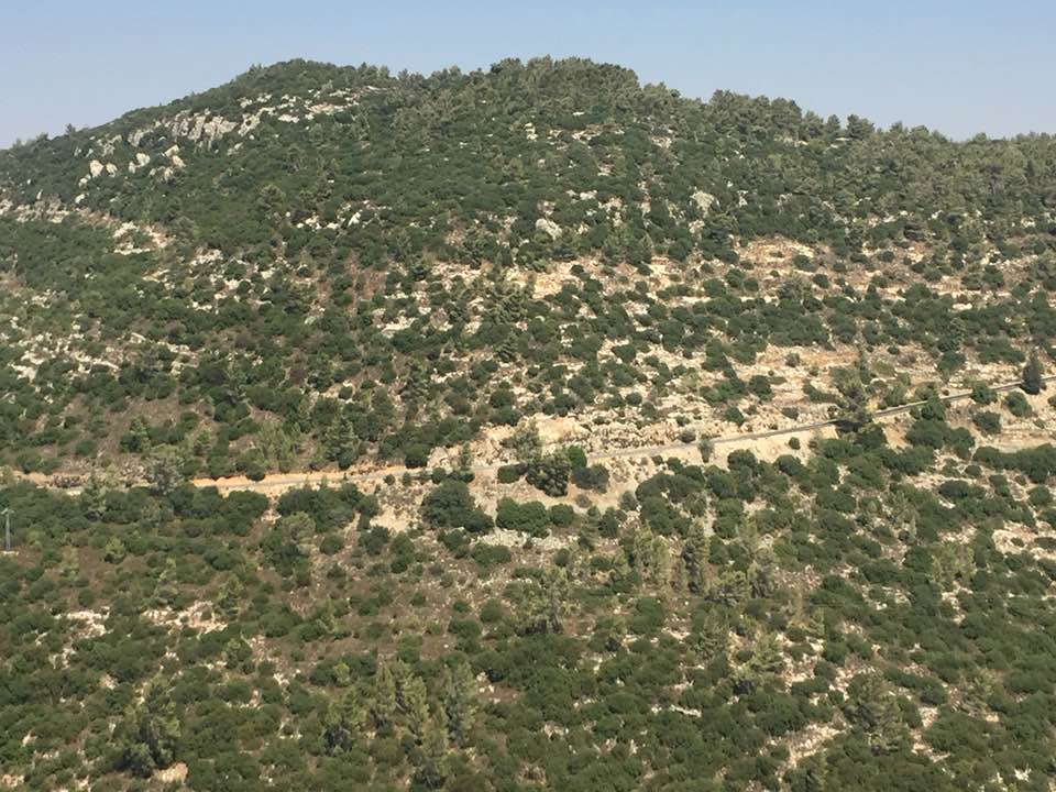
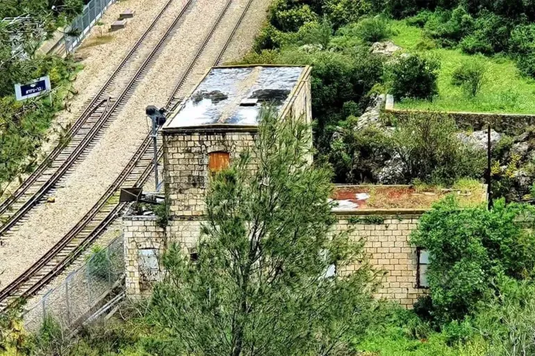
Village Before NakbaThe village stood on a small hill at the foot of the northern slope of Mt. Shaykh Badr, and overlooked Wadi al-Sarar to the northeast. The Jerusalem−Jaffa highway and railway line passed through the wadi. One of the railway stations was located 0.5 km east of the village. Secondary roads linked Dayr al-Shaykh to nearby villages. It had a rectangular configuration and extended in a north−south direction, with a few of its houses built along the spur that led to the highway. In 1596, Dayr al-Shaykh was a village in the nahiya of Jerusalem (liwa' of Jerusalem) with a population of 113. It paid taxes on a number of crops, including wheat, barley, olives, and fruits, as well as on other types of produce and property, such as goats, beehives, and vineyards. In the early 1870s Dayr al-Shaykh was reported to have a population of approximately 400, but by 1881 it was deserted. Its inhabitants may have moved away temporarily or perished during a typhus epidemic in 1874. Its two mosques, one with a large dome, stood to the east, and a rock-cut tomb was to the southwest. By the time of the Mandate the village had been repopulated. Most of its residents were Muslim, with 10 Christians among an estimated population of 220 in the mid-1940s. Most of their homes were built of stone. One village landmark was the maqam (shrine) and mosque of al-Shaykh Sultan Badr. The village had a few small shops. A well to the west supplied its drinking water. Its lands were planted in rainfed crops, such as grain, vegetables, and fruit trees. Olive and fruit trees occupied relatively large portions of the lands to the east, west, and north; other parts were used as grazing areas. In 1944/45 a total of 1,025 dunums was allocated to cereals; 291 dunums were irrigated or used for orchards. Archaeological features included the remnants of walls and columns, foundations, cisterns, burial grounds, and presses.Village Occupation and Ethnic CleaningWith the end of the second truce of the war on 15 October 1948, Israeli forces pushed into the Jerusalem corridor, just south of the road to the coast. Dayr al-Shaykh was occupied by the Har'el Brigade in the course of this operation, known as Operation ha-Har, probably on 21 October. Israeli historian Benny Morris gives a date of occupation but does not explain what ultimately happened to the villagers; he does mention, however, that some villagers in the area fled as Israeli forces approached, and that others were expelled.Zionists Colonies on Village LandsThere are no Israeli settlements on village land. Nes Harim, established in 1950, is 1 km southwest of the village site on land belonging to Bayt ItabVillage TodayOne of the few village buildings that remain is the maqam (shrine) of al-Shaykh Sultan Badr, a white structure with two domes, arched entrances, and a courtyard; it is now an Israeli tourist site. Stone rubble west of the shrine is covered with wild grass. Cactuses grow on the walls of the terraces to the west and east of the village, as do many olive trees. The rubble of houses and terraces can be seen on the site.SourceDr. Walid al-Khalidi, 1992: All That Remains. |
|||||||||||||||||
| Related Maps | Town Lands' Demarcation Maps خرائط للقضاء توضح حدود القرى والاودية Town's map on MapQuest View from satellite Help us map this town at WikiMapia |
||||||||||||||||
| Related Links | Wikipedia's Page Google Search Google For Images Google For Videos |
||||||||||||||||
| More Information | في كتاب كي لا ننسى في كتاب بلادنا فلسطين المزيد من موقع هوية |
||||||||||||||||
- Sultan Badr Muslim Shrin, 1949
Posted by Prince, Peaceful Israeli 4 - Welcome To Dayr al-Shayrkh Rail Station, All A Board Back Home Palestinians, 1949

Posted by Prince, Peaceful Israeli - Welcome To Dayr al-Shayrkh Rail Station, All A Board Back Home Palestinians #2, 1949

Posted by Prince, Peaceful Israeli 1 - Ruins of the destroyed village and Shrine of Shaykh Badir appears on the right hand side
Posted by Noga Kadman 7 - Shrine of Shaykh Badir
Posted by Noga Kadman 6 - Deir Al Sheikh, January 2009, from Wadi Al Sarar
Posted by Valdemar Petersen 2 - Deir Al Sheikh, January 2009, from above
Posted by Valdemar Petersen 1 - Deir Al Sheikh, January 2009, the mosque
Posted by Valdemar Petersen - Deir Al Sheikh, January 2009, the mosque 2
Posted by Valdemar Petersen 1 - Deir Al Sheikh, January 2009, the mosque 3
Posted by Valdemar Petersen - Deir Al Sheikh, January 2009, the mosque interior
Posted by Valdemar Petersen - Deir Al Sheikh, January 2009, the mosque interior 2
Posted by Valdemar Petersen 2 - Deir Al Sheikh, January 2009, the gravesite (?)
Posted by Valdemar Petersen - Deir Al Sheikh, January 2009, remains of the village
Posted by Valdemar Petersen - Deir Al Sheikh, January 2009, remains of the village 2
Posted by Valdemar Petersen 2 - بيوت دير الشيخ
Posted by dmasad - جدران بيوت
Posted by dmasad - نافذة احدى المنازل
Posted by dmasad - المسجد/ المقام
Posted by dmasad 1 - في احدى كهوف دير الشيخ
Posted by dmasad - في احد كهوف او ابار دير الشيخ
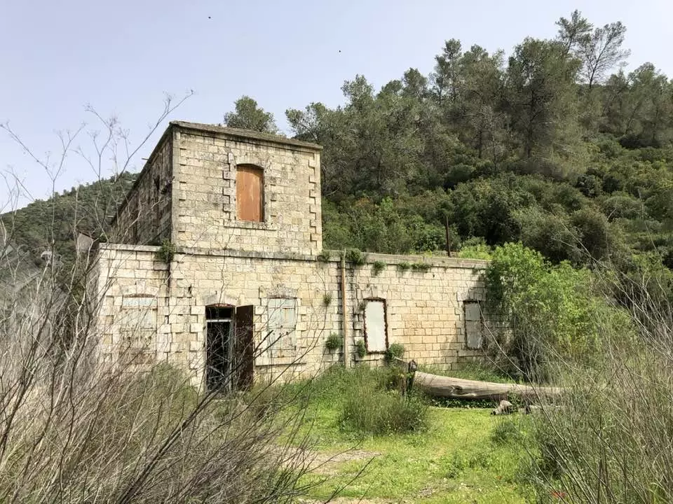
Posted by dmasad - محطة القطار في عهد الانتداب البريطاني بين الماضي والحاضر. طارق البكري
Posted by Tarek Bakri - مقام الشيخ سلطان بدر
Posted by Tarek Bakri - من معالم القرية مقام الشيخ سلطان بدر ومسجده
Posted by Tarek Bakri - قرية دير الشيخ المهجّرة - عدسة طارق البكري
Posted by Tarek Bakri 1 - قرية دير الشيخ المهجّرة - عدسة طارق البكري
Posted by Tarek Bakri 1 - قرية دير الشيخ المهجّرة - عدسة طارق البكري
Posted by Tarek Bakri - قرية دير الشيخ المهجّرة - عدسة طارق البكري
Posted by Tarek Bakri - قرية دير الشيخ المهجّرة - عدسة طارق البكري
Posted by Tarek Bakri - قرية دير الشيخ المهجّرة - عدسة طارق البكري
Posted by Tarek Bakri - قرية دير الشيخ المهجّرة - عدسة طارق البكري
Posted by Tarek Bakri - قرية دير الشيخ المهجّرة - عدسة طارق البكري
Posted by Tarek Bakri - قرية دير الشيخ المهجّرة - عدسة طارق البكري
Posted by Tarek Bakri - دير الشيخ
Posted by abu raya - دير الشيخ
Posted by abu raya - دير الشيخ
Posted by abu raya 1 - دير الشيخ
Posted by abu raya - محطة قطار قرية دير الشيخ المهجرة
- محطة قطار قرية دير الشيخ المهجرة #2
- انقاض واطلال بيوت قرية دير الشيخ المهجرة
- انقاض واطلال بيوت قرية دير الشيخ المهجرة #2
- انقاض واطلال بيوت قرية دير الشيخ المهجرة #3
- انقاض واطلال بيوت قرية دير الشيخ المهجرة #4
- انقاض واطلال بيوت قرية دير الشيخ المهجرة #5
- انقاض واطلال بيوت قرية دير الشيخ المهجرة #6
- جولة في بين انقاض بيوت القرية ومقامها -- Abu Khader Ahmad Jbaren
- جولة في بين انقاض بيوت القرية ومقامها -- Abu Khader Ahmad Jbaren #2
- جولة في بين انقاض بيوت القرية ومقامها -- Abu Khader Ahmad Jbaren #3
- جولة في بين انقاض بيوت القرية ومقامها -- Abu Khader Ahmad Jbaren #4
- جولة في بين انقاض بيوت القرية ومقامها -- Abu Khader Ahmad Jbaren #5
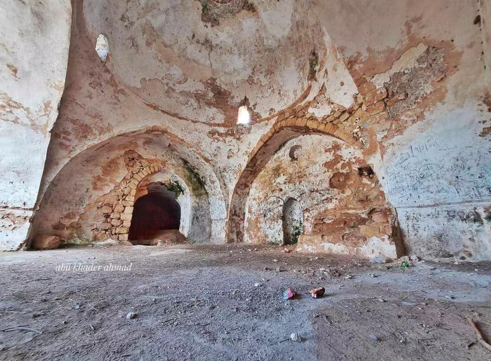
- جولة في بين انقاض بيوت القرية ومقامها -- Abu Khader Ahmad Jbaren #6
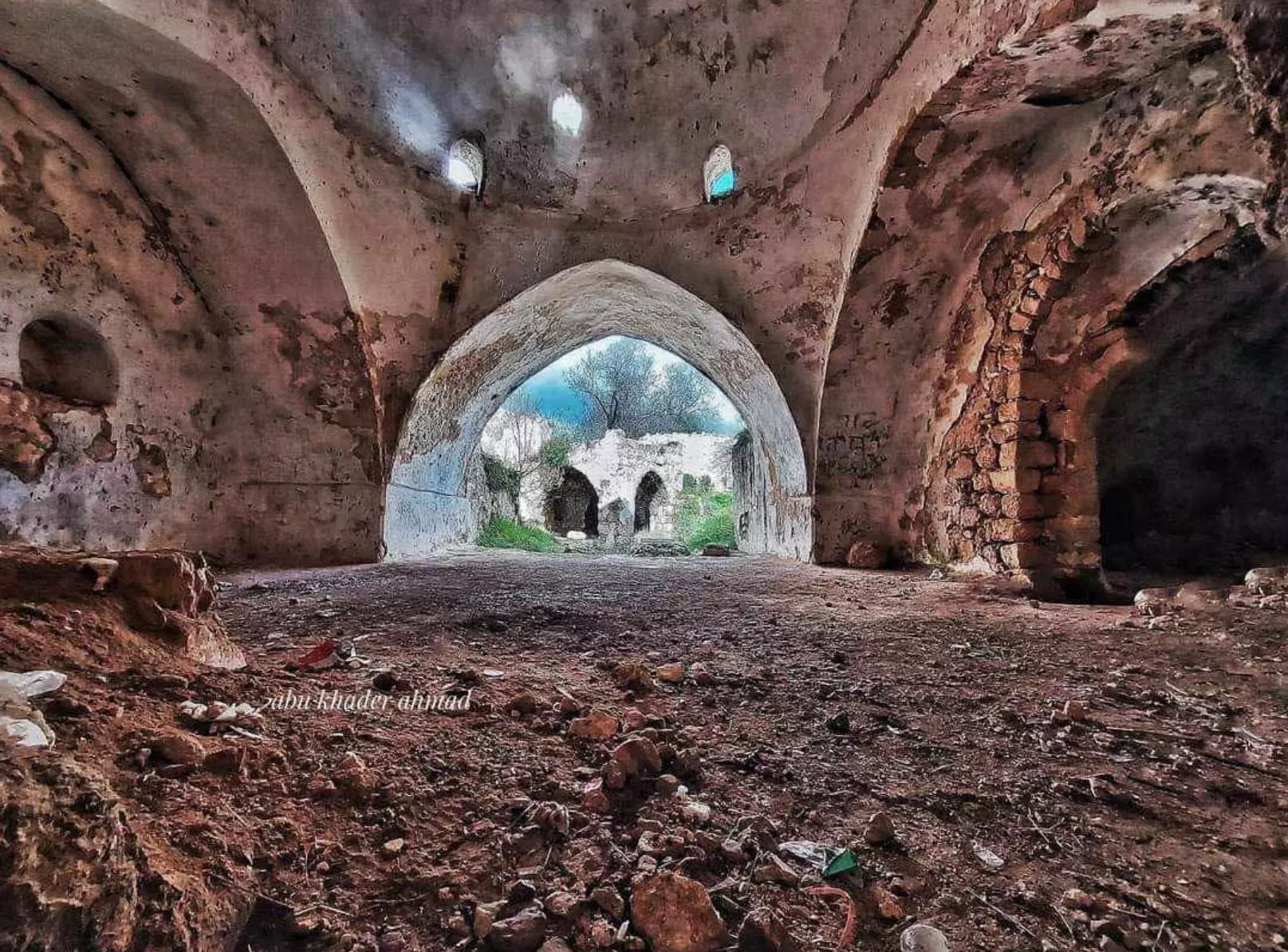
- جولة في بين انقاض بيوت القرية ومقامها -- Abu Khader Ahmad Jbaren #7
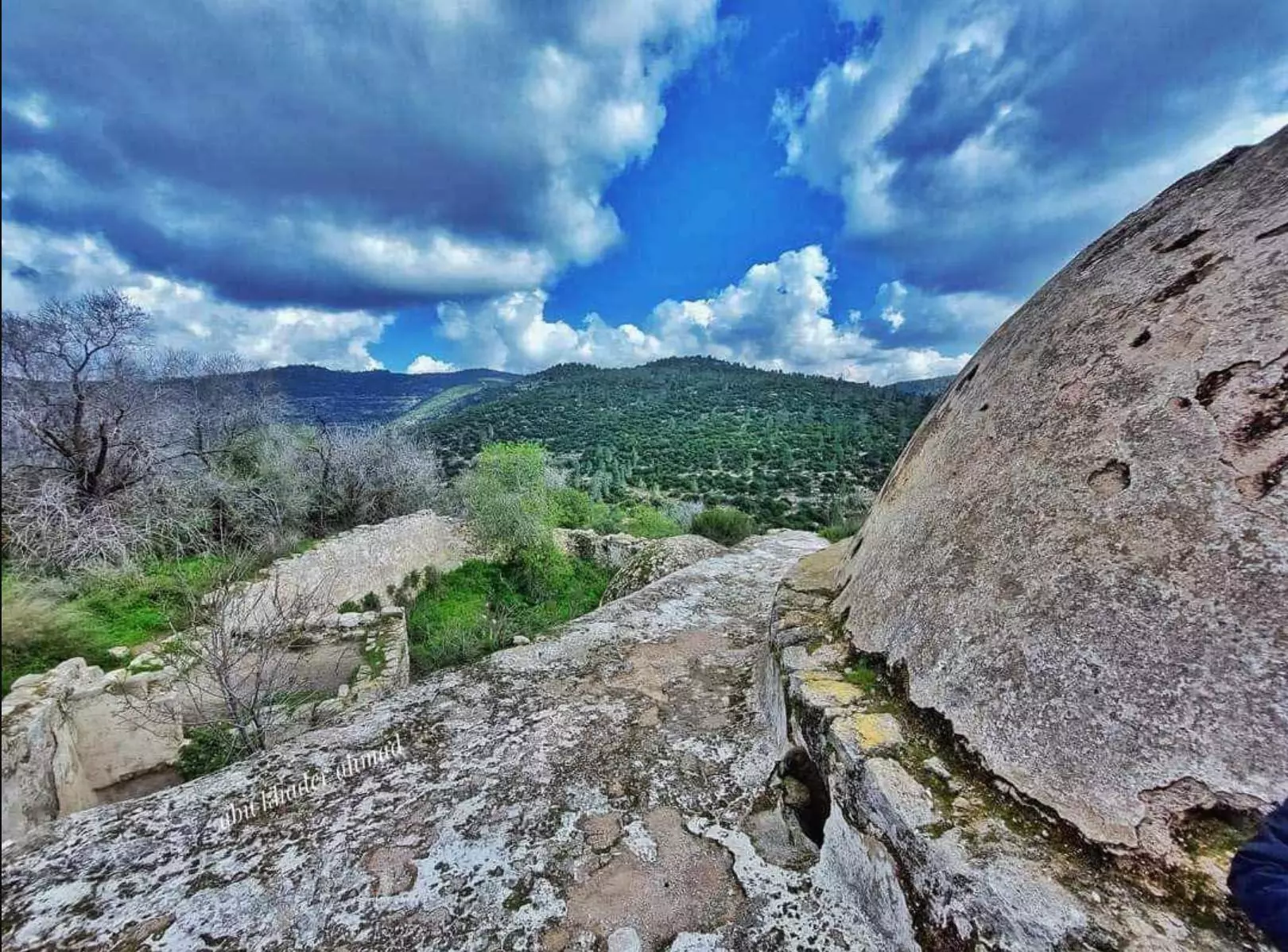
- جولة في بين انقاض بيوت القرية ومقامها -- Abu Khader Ahmad Jbaren #8
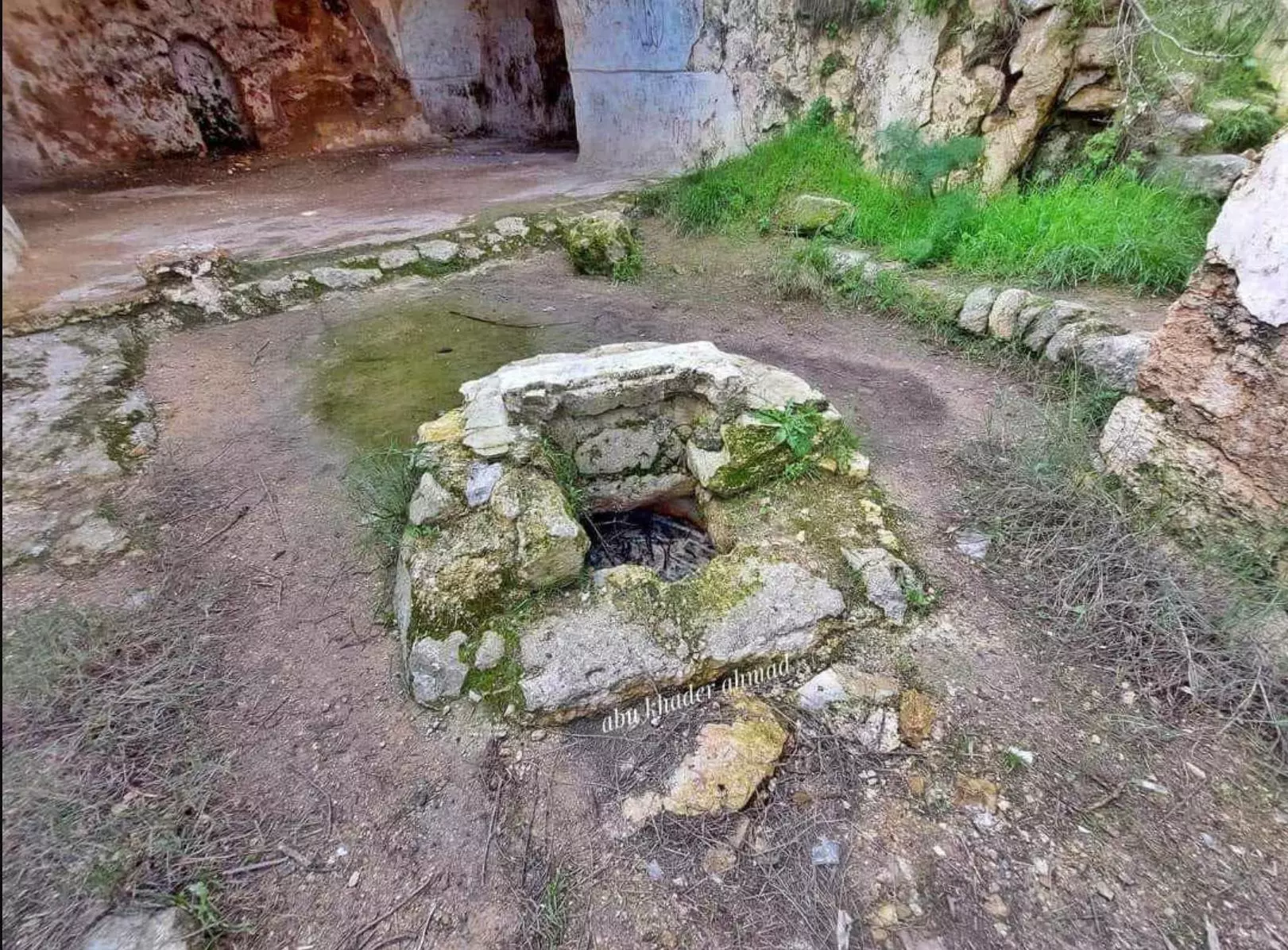
- جولة في بين انقاض بيوت القرية ومقامها -- Abu Khader Ahmad Jbaren #9
- جولة في بين انقاض بيوت القرية ومقامها -- Abu Khader Ahmad Jbaren #10
- جولة في بين انقاض بيوت القرية ومقامها -- Abu Khader Ahmad Jbaren #11
- جولة في بين انقاض بيوت القرية ومقامها -- Abu Khader Ahmad Jbaren #12
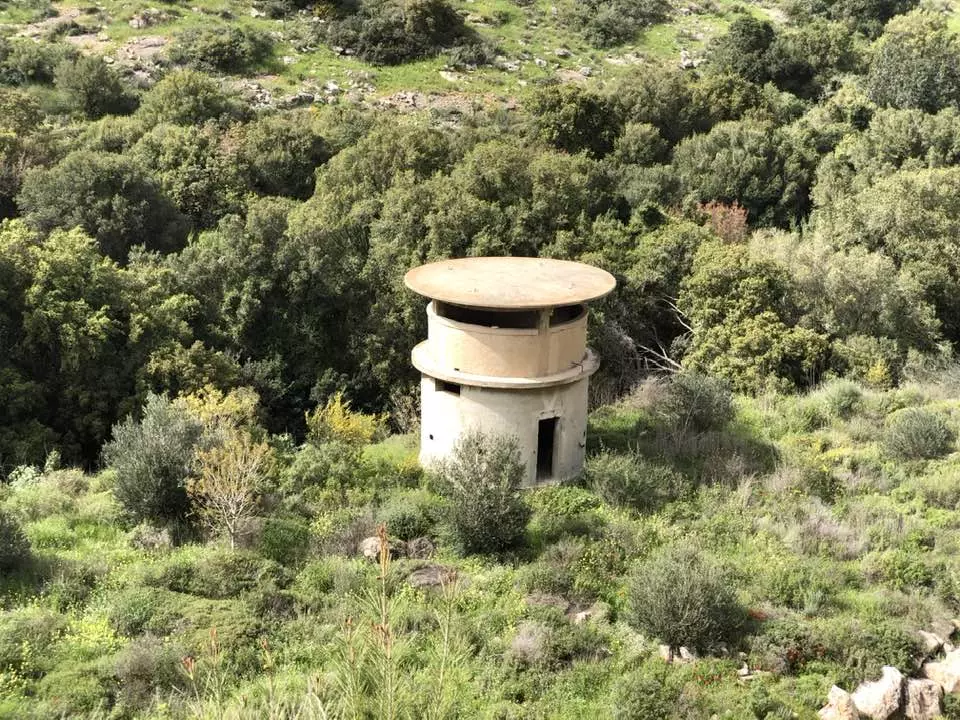
- The zawiya at Dayr al-Shaykh, 2011.
- The zawiya at Dayr al-Shaykh, 2011. #2
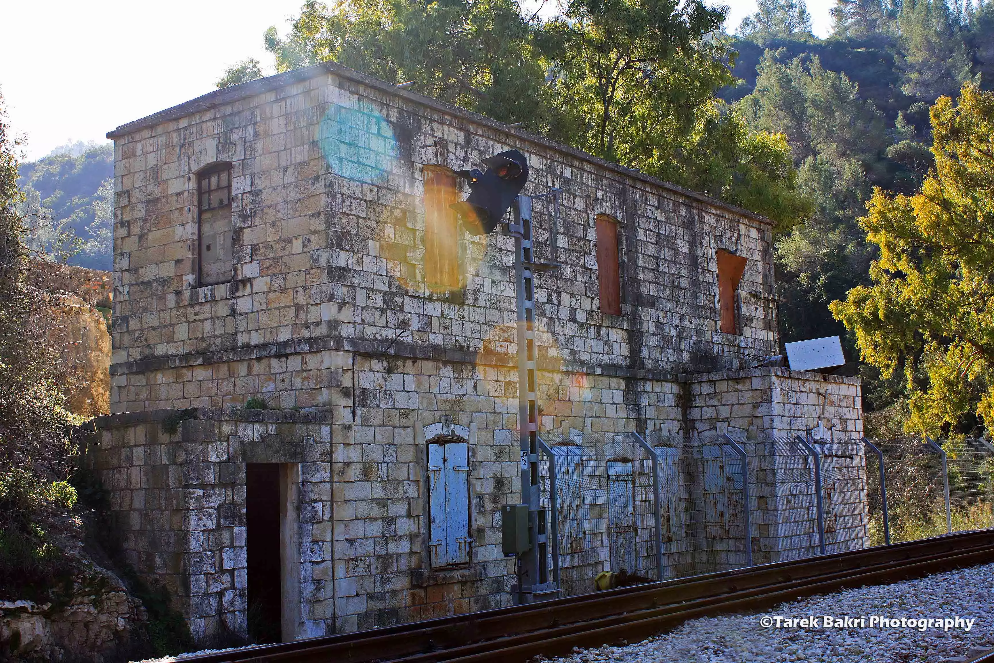
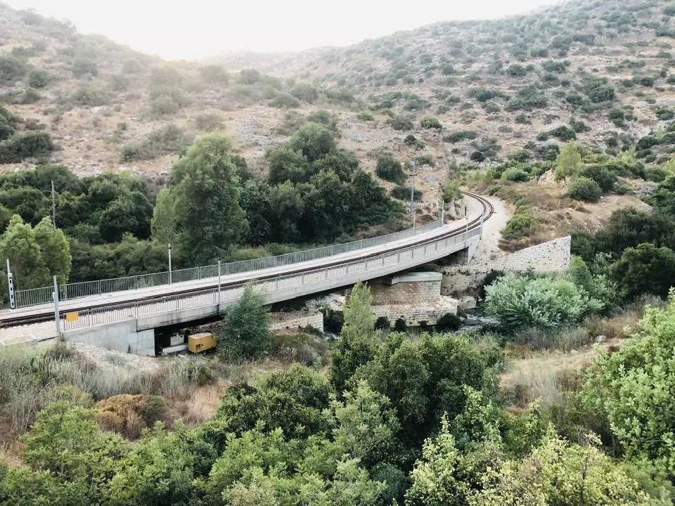
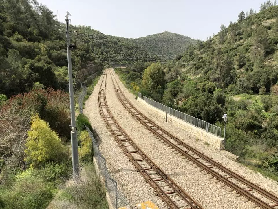
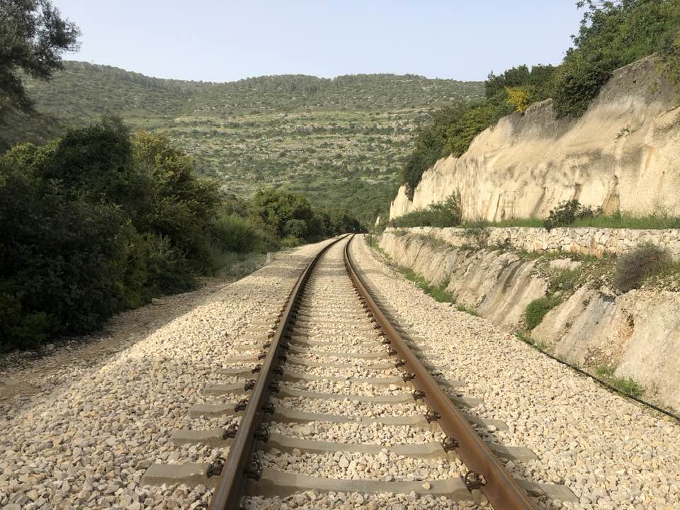
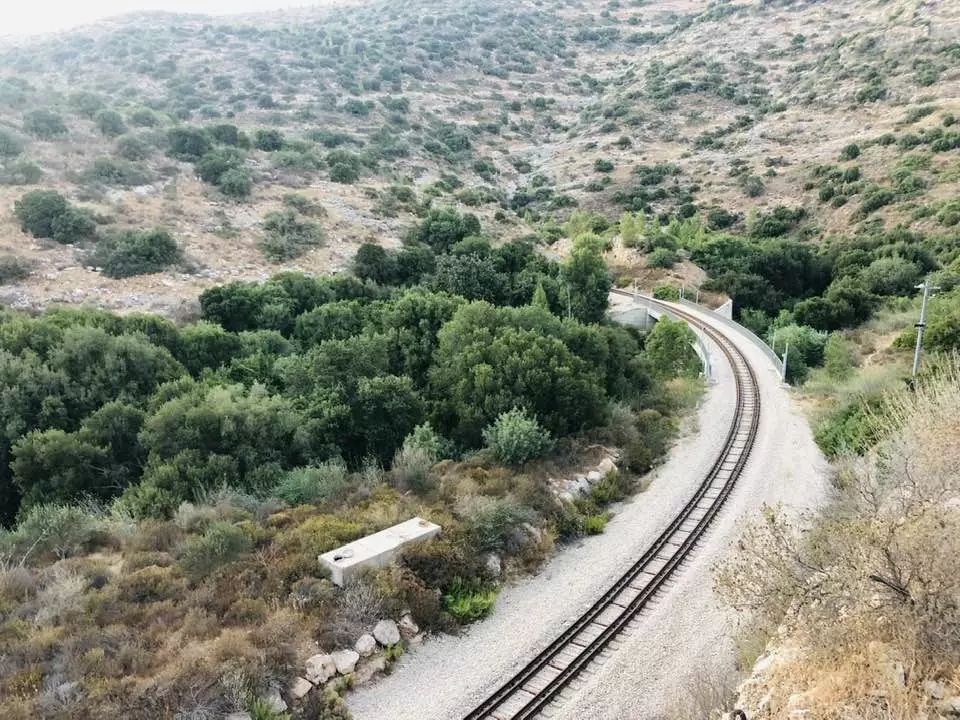
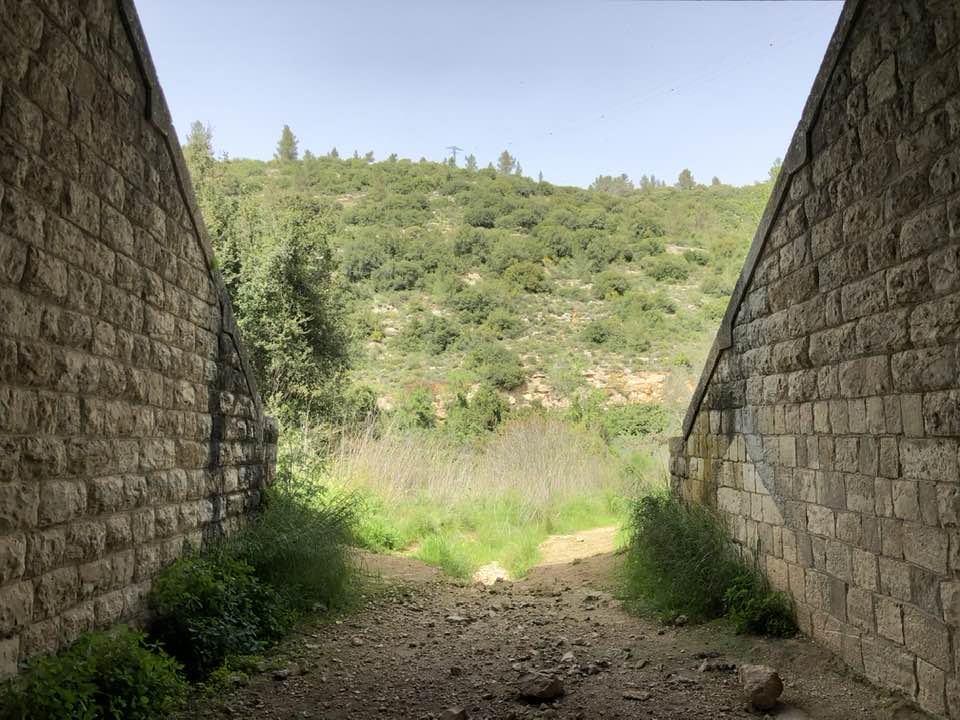
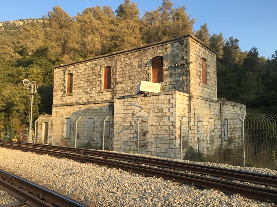
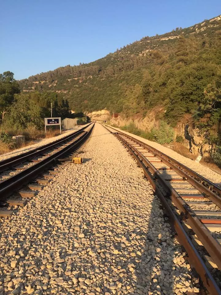
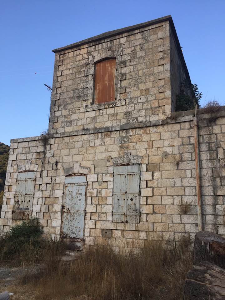
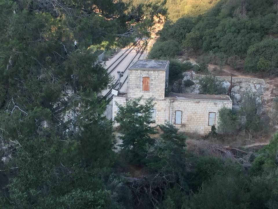
- The old railway station of Dayr al-Shaykh, on the Jaffa?Jerusalem railway line, situated 0.5 km east of the village site
- The "most civilized" who landed on us from Europe obliterated the village, except for the shrine/maqam. Think about it: how else will the Jews be great again? That is how they can feel safe: Jim Crow, plunder, ethnic cleansing, and genocide.
- The "most civilized" who landed on us from Europe obliterated the village, except for the shrine/maqam. Think about it: how else will the Jews be great again? That is how they can feel safe: Jim Crow, plunder, ethnic cleansing, and genocide. #2
- The "most civilized" who landed on us from Europe obliterated the village, except for the shrine/maqam. Think about it: how else will the Jews be great again? That is how they can feel safe: Jim Crow, plunder, ethnic cleansing, and genocide. #3
- The "most civilized" who landed on us from Europe obliterated the village, except for the shrine/maqam. Think about it: how else will the Jews be great again? That is how they can feel safe: Jim Crow, plunder, ethnic cleansing, and genocide. #4
- The "most civilized" who landed on us from Europe obliterated the village, except for the shrine/maqam. Think about it: how else will the Jews be great again? That is how they can feel safe: Jim Crow, plunder, ethnic cleansing, and genocide. #5
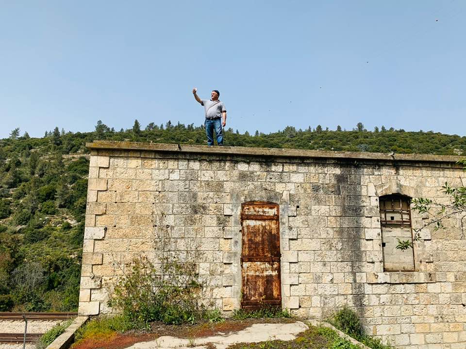
- Touring Deir al-Sheikh's railway and station
- Touring Deir al-Sheikh's railway and station #2
- Touring Deir al-Sheikh's railway and station #3
- Touring Deir al-Sheikh's railway and station #4
- Touring Deir al-Sheikh's railway and station #5
- Touring Deir al-Sheikh's railway and station #6
- Touring Deir al-Sheikh's railway and station #7
- Touring Deir al-Sheikh's railway and station #8
- Touring Deir al-Sheikh's railway and station #9
- Touring Deir al-Sheikh's railway and station #10
- Touring Deir al-Sheikh's railway and station #11
- Touring Deir al-Sheikh's railway and station #12
- Touring Deir al-Sheikh's railway and station #13
- Touring Deir al-Sheikh's railway and station #14
- Touring Deir al-Sheikh's railway and station #15
- محطة وسكة حديد القطار العثماني في أراضي دير الشيخ المهجرة -- Nov. 12th, 2022 -- Iyad Jaber
- محطة وسكة حديد القطار العثماني في أراضي دير الشيخ المهجرة -- Nov. 12th, 2022 -- Iyad Jaber #2
- محطة وسكة حديد القطار العثماني في أراضي دير الشيخ المهجرة -- Nov. 12th, 2022 -- Iyad Jaber #3
- محطة وسكة حديد القطار العثماني في أراضي دير الشيخ المهجرة -- Nov. 12th, 2022 -- Iyad Jaber #4
- محطة وسكة حديد القطار العثماني في أراضي دير الشيخ المهجرة -- Nov. 12th, 2022 -- Iyad Jaber #5
- بقايا أطلال قرية دير الشيخ المهجرة
- أراضي دير الشيخ يخترقها خط السكة الحديد "القدس يافا" الذي أقامه العثمانيون
Want to browse more? 80,000 pictures were grouped in these gallaries:
| Display Name | Clan/Hamolah | Country of Residence |
| د. محمد نوفل الشريف | - | عمان, الأردن |
| فتحي محمود ابومعاذ | ابوصالح | ناعور, الاردن |
| ناصر حاتم محمود ابراهيم عليان | عليان | - |
| غسان تيسير ذياب محمد | أل دير الشيخ (ابو صالح) | عمان, دير الشيخ فلسطين |
| انور تيسير ذياب | - | عمان, فلسطين |
| بلال الشريف | حماد | - |
| شاهر الشريف | حماد | الاردن , البقعة |
| أشرف الشريف | حماد | الاردن , البقعة |
| ابوادهم | ابوصالح | الاردن, الاردن |
| محمد ابراهيم الشريف | الشريف | - |
| الدرشخي | - | الرصيفه \ مخيم حطين, الاردن |
| محمد عادل ابوصالح | ابوصالح | الزرقاء |
| الشريف بلال الشريف | الشريف | الاردن, الاردن |
| معتصم الشريف | الشريف | فلسطين, فلسطين |
| صبري جميل عبد القادر محمد | ابو صالح | الضليل, دير الشيخ |
| حسن أحمد حسن الشريف | - | البقعه, الاردن |
| المحامي تيسر ذياب | - | الاردن, دير الشيخ |
| محمدمصطفى الشريف | الشريف | - |
| حسن الشريف | - | - |
| ابو حاتم | ابراهيم | - |
| عدنان ابو صالح | ابو صالح | - |
| ايمان ابداح | ابداح | الاردن |
| محمد الشريف | - | - |
| معاذ فتحي محمود أبو صالح الشرفا | - | - |
| وليد الشريف | الشريف | الزرقاء, الاردن |
| Ashraf Shaweesh | شاويش | - |
| نورالدين الشريف | - | عمان, الاردن |
| mhmd nofal | نوفل | عمان, الاردن |
| qzayyat | Zayyat | Jordan, Jordan |
| محمد نوفل( الشريف) | نوفل | عمان, الاردن |
- قرية دير الشيخ المهجرة | جذور مقدسية 2020 Duration: 20 min 40 sec
- سكة الحديد العثماني في اراضي قرية دير الشيخ المهجرة قضاء القدس . Duration: 14 sec
- مقام الشيخ سلطان بدر , في قرية دير الشيخ المهجرة قضاء القدس Duration: 12 sec
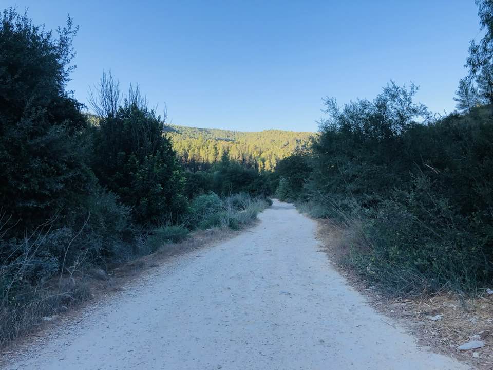
- وادي صرار في اراضي دير الشيخ المهجرة قضاء القدس Duration: 3 min 31 sec
- وادي صرار في اراضي دير الشيخ waze נחל שורק Duration: 33 sec
 Fake Valor: Why Did Zionist Jews Hoist Nazis Flag on Their Ships in the 1930s?
What is new?
-
Facts About Oct. 7th Gaza Raid
-
Remined Us Please:: Who Did Rape Who? Palestinians Raped Israelis? Or, was the other way around?
-
When Prof. Edward Said was invited to debate Bibi Netanyahu in the 1980s, watch what happened!
-
Ezra Klein of the NY Times on the "Jewish Race".
-
Abusing Blood Libel!
-
Zionist FAQ: Isn't it true that Palestinians don't want peace? Palestinians never accepted the two-state solution
- Facts about Haavara (Transfer) Agreement between Ben-Gurion & Hitler
-
Haavara FAQs: Why Did Zionist Jews Hoist Nazis' Flags on Their Ships in the 1930s?
-
Dear ChatGPT: How did Palestinians resist Napoleon's invasion of their country in 1799?
-
Dear ChatGPT: Gaza had a vibrant Jewish community in the mid-17th century. What happened to them?
-
Dear ChatGPT: Why did the Jewish Agency suppress news of the Holocaust during WWII?
-
Video Playlist: Jews share their DNA tests to end the conflict for good.
-
A Tale of Two Conflicts: Examining the Definition of Genocide
-
Prof. Abraham Polak And The Suppressed History of the Khazars and European Jewry
-
How Ronald Reagan would have framed the genocide in Gaza if he were still alive?
-
Haavara FAQs: Let us do the math: how many German Jews did The Haavara Agreement save?
-
Zionist FAQs: The Hebron Massacre of 1929, "clearly proves" that Palestinians are antisemitic, how could you deny it?
-
Zionist FAQs: Why Anti-Zionist Is Not Antisemitism?
-
Zionist FAQs: Isn't it true that the KGB create Palestinian Nationalism in the early 1960s?
- Zionist FAQs: Muslims are killing Muslims all the time; why are Israeli Jews being singled out in the media?
- Zionist FAQs: How is Israel an apartheid state when 20% of its citizens are Arabs who enjoy full rights?
-
Haavara FAQs: Analysis of Herzl's Uganda Scheme and how it could have saved millions of Jews.
-
Haavara FAQs: Why did Hayim Greenberg describe American Jewry as "morally bankrupt" in early 1943?
-
Haavara FAQs: What if the Evian Conference was a resounding success? What would have been the impact of saving European Jewry on Zionism?
- Haavara FAQs: What if the six million were saved, how that would have impacted the Zionist project?
-
Haavara FAQs: How did Zionist leaders react when Europe's Jews lingered in the DP camps after WWII ended?
-
Why does the American Jewish community repeat lies that David Ben-Gurion had debunked before he died?
-
Who has the power to rename the Tatar/Khazar Gene Marker to Jewish IV?
-
Zionist FAQs: Why won't Egypt, Syria, and Jordan take their people back? Jews are indigenous to Palestine, and Arabs immigrated after Jews developed the country. Arabs should leave.
-
Haavara FAQs: Did Hitler and the Nazis conflate between Judaism and Zionist? If that wasn't case, then why?
-
Haavara FAQs: Winston Churchill and antisemitism, a collection of articles written Churchill.
-
Haavara FAQs: Broken by country, how many Jews survived vs. killed during the Holocaust?
-
Haavara FAQs: Why did European Jews vote with their feet and to immigrated to the Americas, not Palestine, after WWII?
-
Watch this American Jewish Girl describing Israeli Jews' cognitive dissonance like no other in under two minutes
-
Haavara FAQs: When the Nazis went out of their way to hide the Holocaust, Israeli Jews did the exact opposite by broadcasting their genocide of Gazans. But why?
-
Haavara FAQs: How Zionist Jews went out of their to show their appreciation to Nazism and Fascism?
- Haavara FAQs: Why Zionist leaders were against bombing the death camps & the Railroads leading to them?
-
Haavara FAQs: Hitler's message to the British and American people: If Jews are such noble citizens and you care about them, how come you're not letting them in? I will gladly ship them to you at my expense, even on luxury liners!
-
A shortlist of Zionist and Israeli false flag operations in the name Jews.
-
The Most Moral Army
- The Land of Kapos (Israel): Where the brave are boycotted and Kapos walk free.
- Why did early Zionists often named their communal enterprises "colonial"?
- Zionist Relations with Nazi Germany by Faris Glubb
-
Two NY Times advertisements by Zionists in the early 1943 that exposes Zionists' treason at the height of the calamity
- Facts Not Lies about the Palestinian-Israeli Conflict.
- Site's pictures have been categorized
- Campgain Against Lice
- A Survey of Palestine, the official source about Palestine before Nakba produced by the British Mandate; over 1200 pages.
- Satellite View & Google Earth: Over 6,000 placemarks identifying all destroyed towns, W. Bank & Gaza Strip Towns, & refugee camps.
- PalestineRemembered.com and its Nakba Oral History Project were featured on al-Jazeera Satellite TV.
- Nakba Oral History Video Podcast:
 Over 700 Oral History interviews (including 3,500+ hours of recording) can be viewed online.
 - Palestine Village Statistics Project
- Gaza Jail Break
- النسخة العربية للموقع الان متوفرة
- Videos: Documenting the destroyed villages in video: Tracing all that remains since Nakba.
- Videos: Responding to Zionist Propaganda
- Interview: The ethnic cleansing of Palestine: George Galloway interviews Israeli Historian Ilan Pappe.
- For Palestinians, memory matters. It provides a blueprint for their future By George Bisharat.
- Zionist FAQ now available in Hebrew שאלות שציונים שואלים, עכשיו בעברית
- Video: The Stephen Walt and John Mearsheimer report on the influence of the Israel Lobby on U.S. Foreign Policy
- The Palestinian-Israeli conflict for beginners
