| PalestineRemembered | About Us | Oral History | العربية | |
| Pictures | Zionist FAQs | Haavara | Maps | |
| Search |
| Camps |
| Districts |
| Acre |
| Baysan |
| Beersheba |
| Bethlehem |
| Gaza |
| Haifa |
| Hebron |
| Jaffa |
| Jericho |
| Jerusalem |
| Jinin |
| Nablus |
| Nazareth |
| Ramallah |
| al-Ramla |
| Safad |
| Tiberias |
| Tulkarm |
| Donate |
| Contact |
| Profile |
| Videos |
Welcome To Kasla - كسلا (כסלא)
|
District of Jerusalem
Ethnically cleansed days ago |
العربية Google Earth |
 |
Gallery (99) |
- Statistics & Facts
-
Before & After

- Satellite View
- Articles 1
- Pictures 99
- Members
- All That Remains
- Wikipedia
- Videos 1
- Guest Book 2
- Links
| Statistic & Fact | Value | ||||||||||||||
| Occupation Date | July 17, 1948 | ||||||||||||||
| Distance From District | 17 (km) West of Jerusalem | ||||||||||||||
| Elevation | 625 (meters) | ||||||||||||||
| Before & After Nakba, Click Map For Details |
|||||||||||||||
|
|||||||||||||||
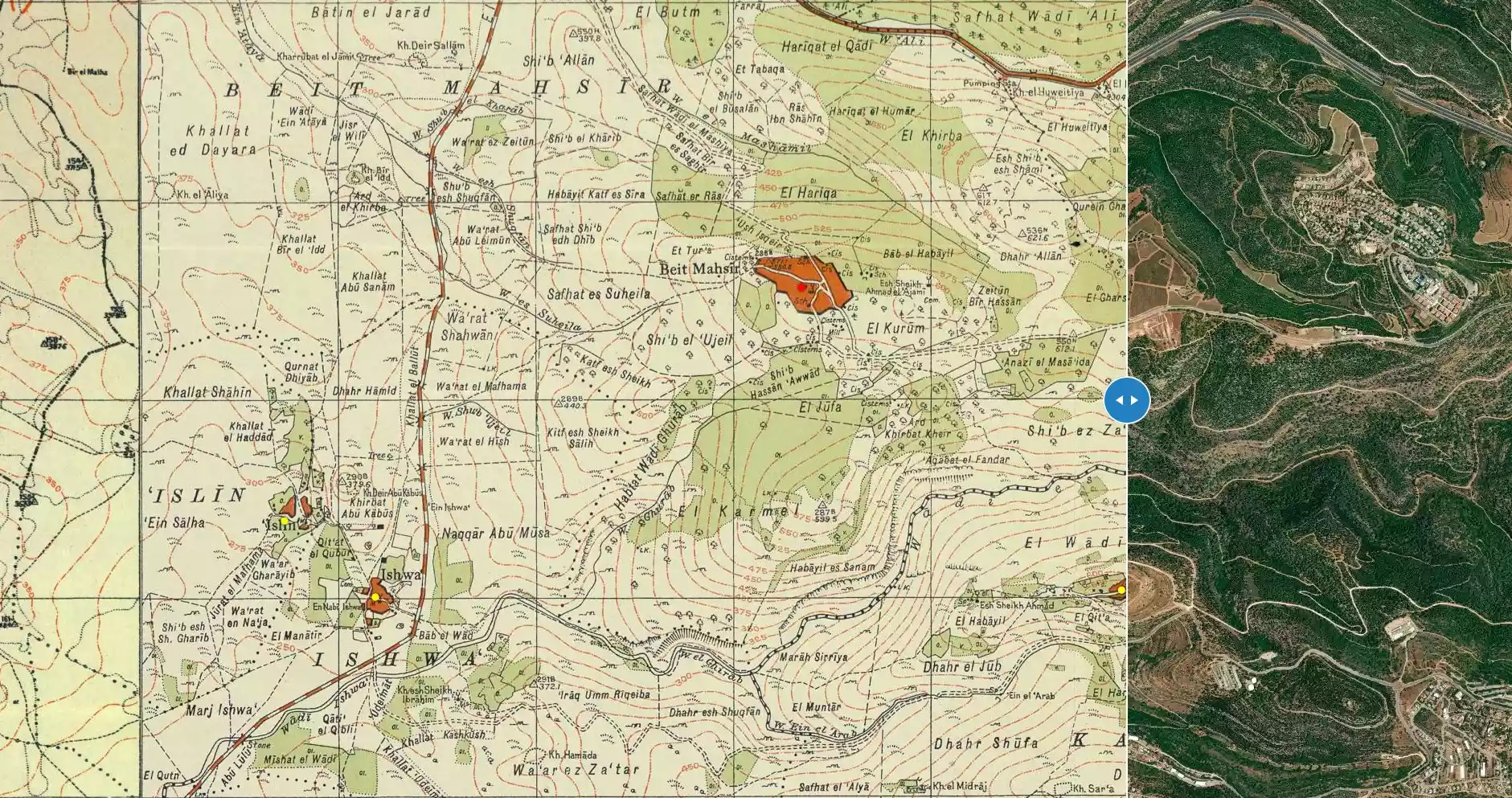
| Map Location | See location #17 on the map View from satellite |
||||||||||||||
| Military Operation | Operation Dani | ||||||||||||||
| Attacking Units | Har'el Brigade | ||||||||||||||
| Exodus Cause | Military assault by Zionist troops | ||||||||||||||
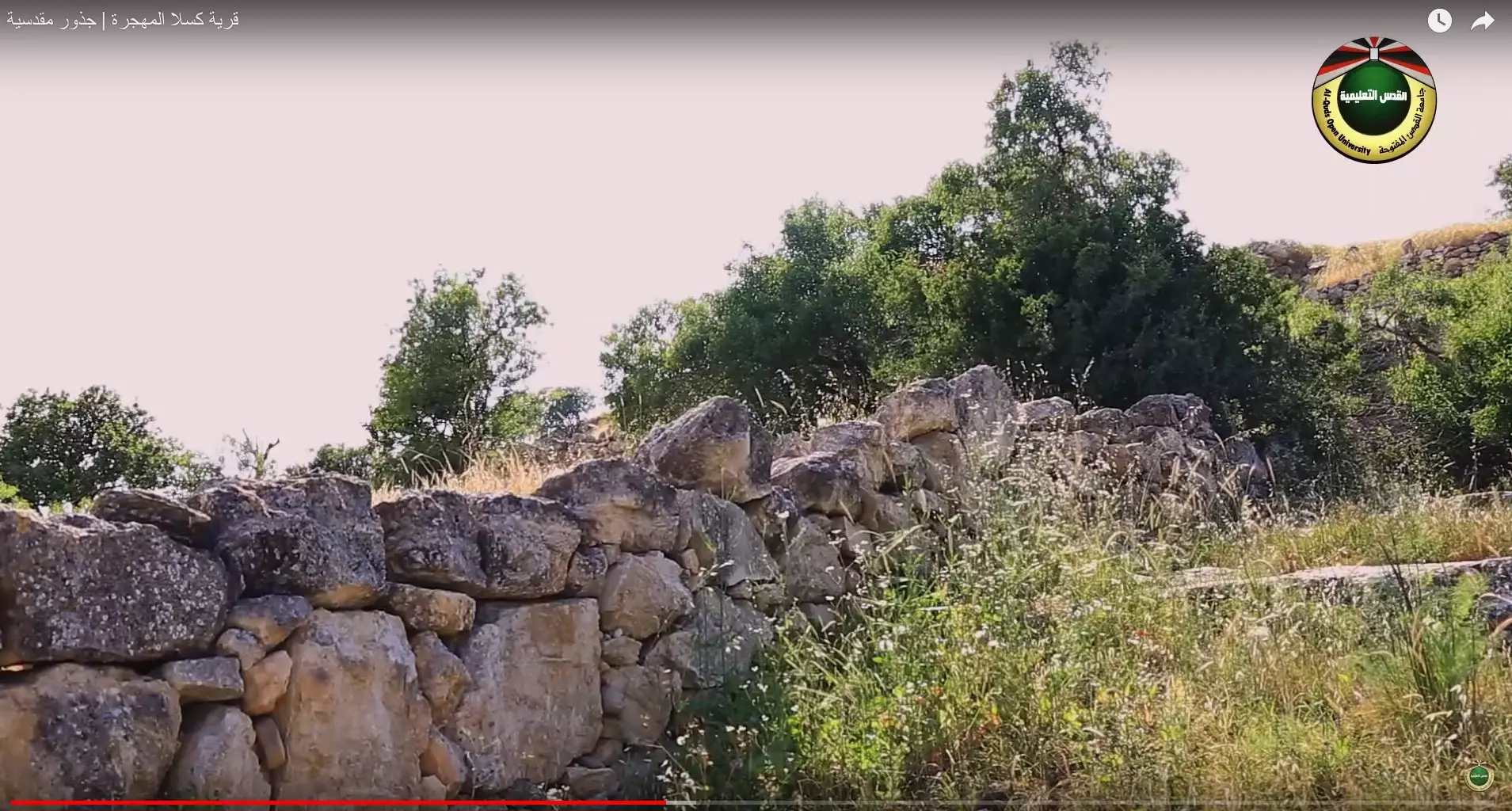
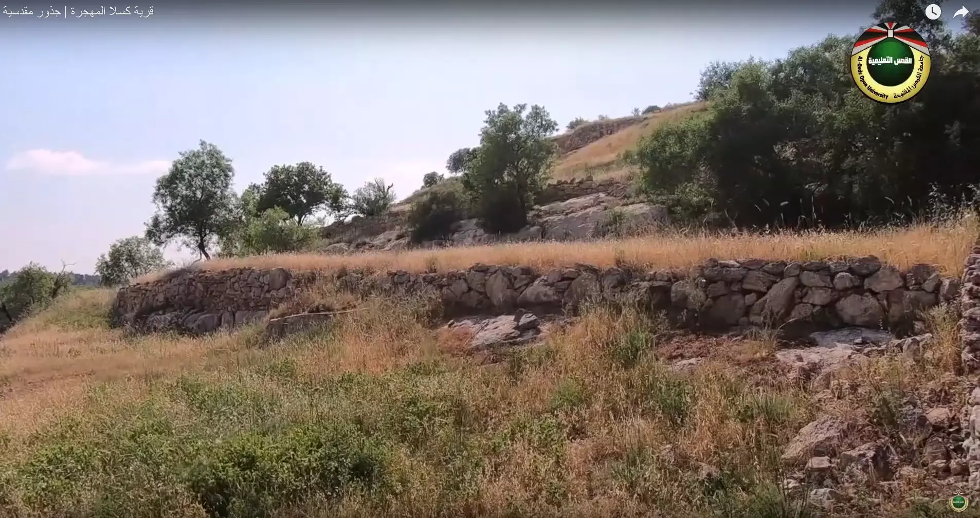
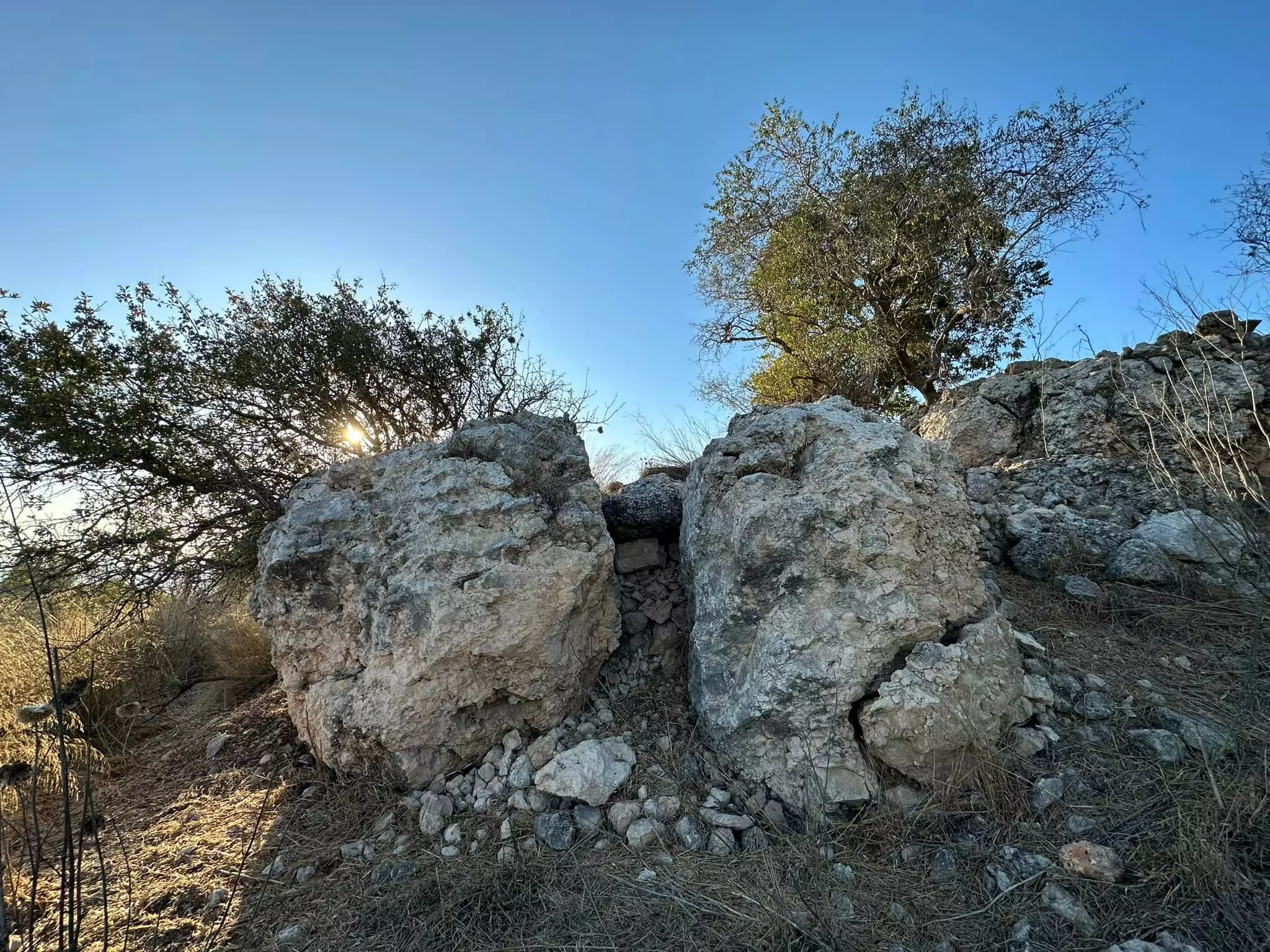
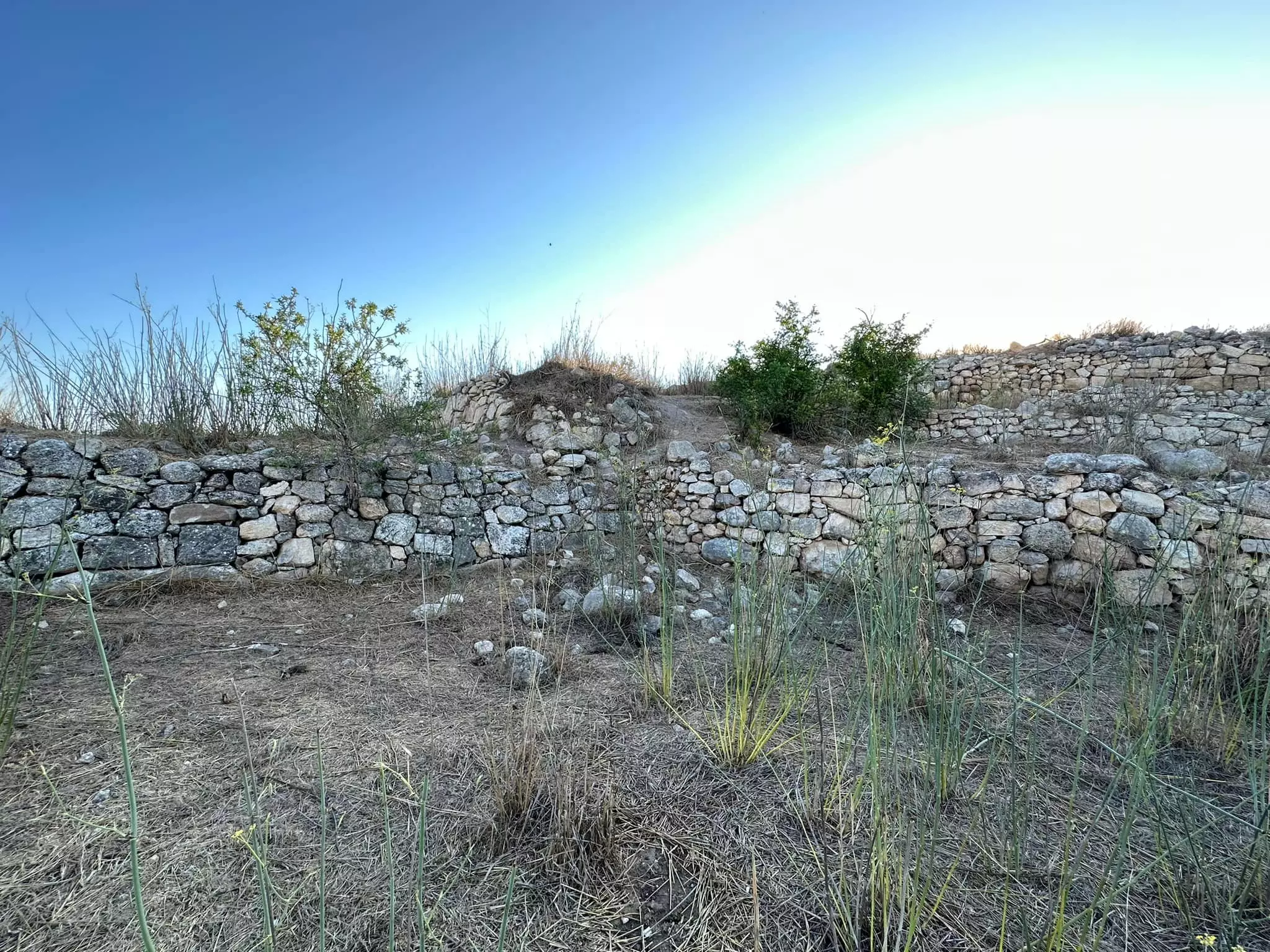
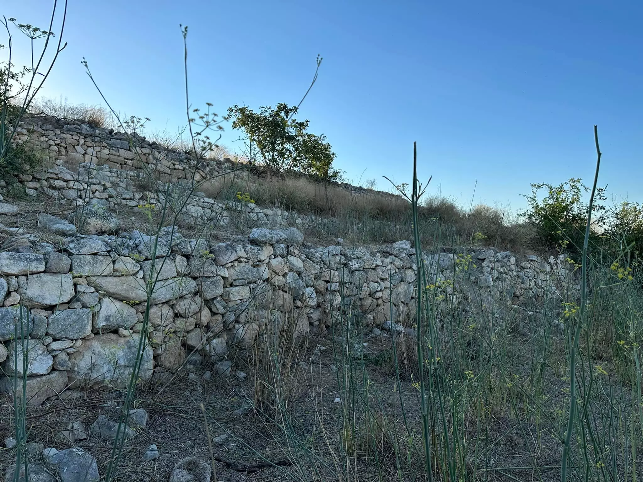
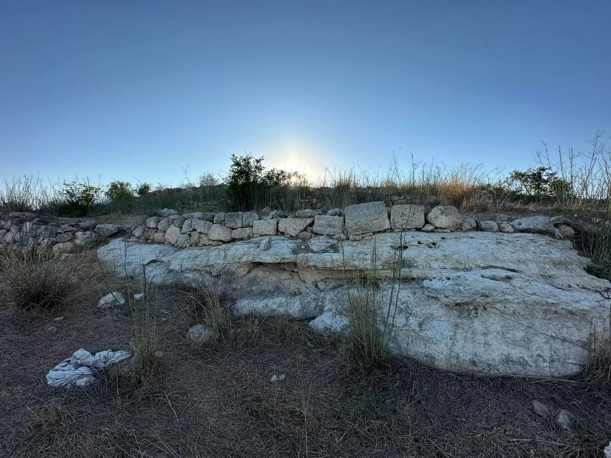
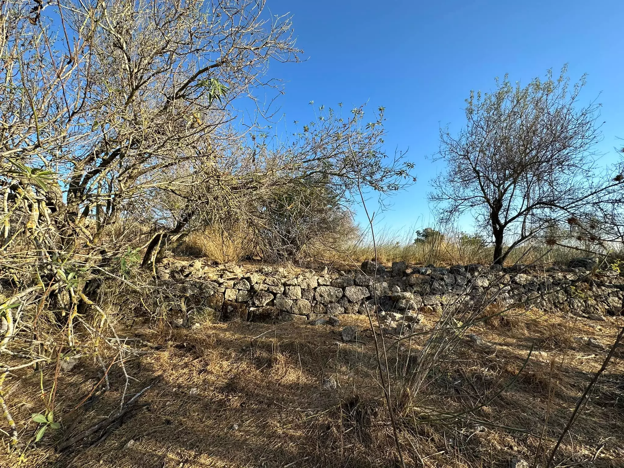
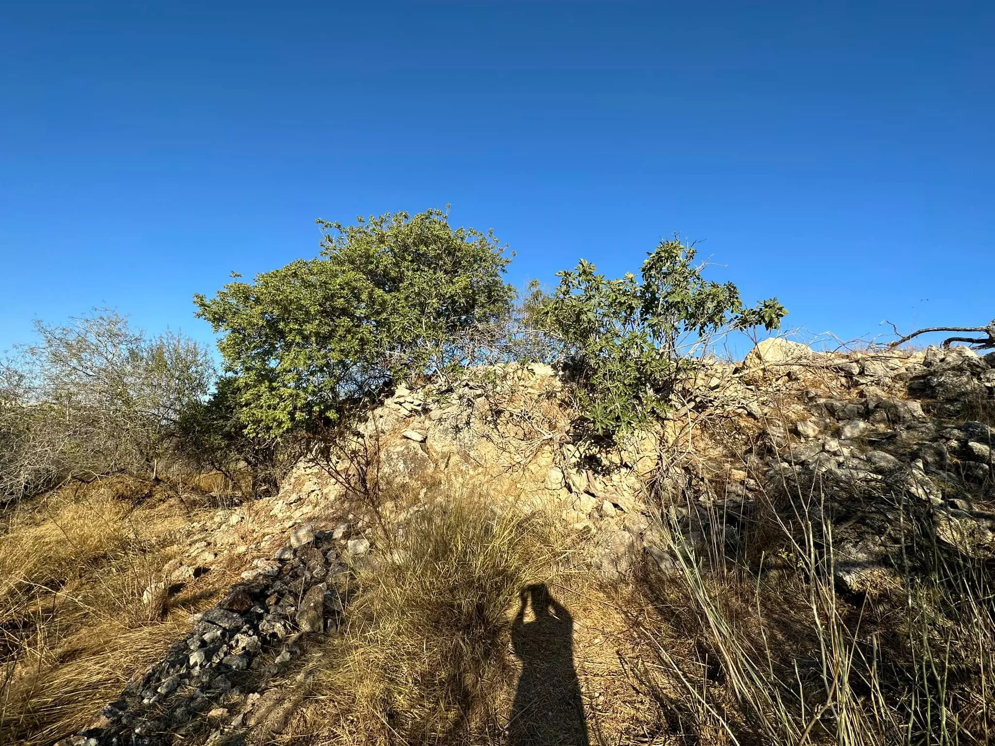
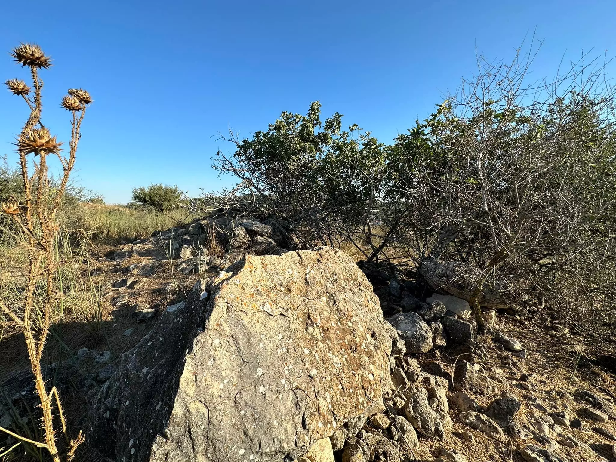
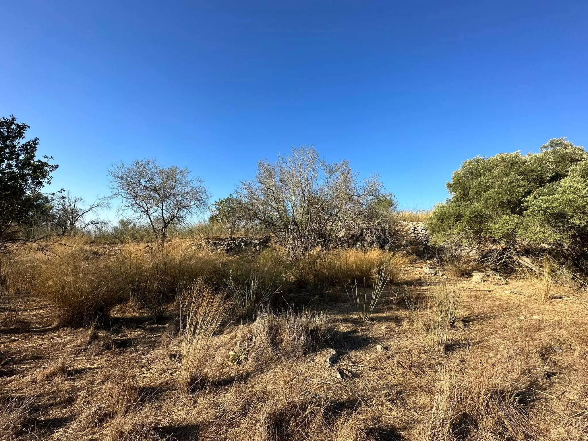
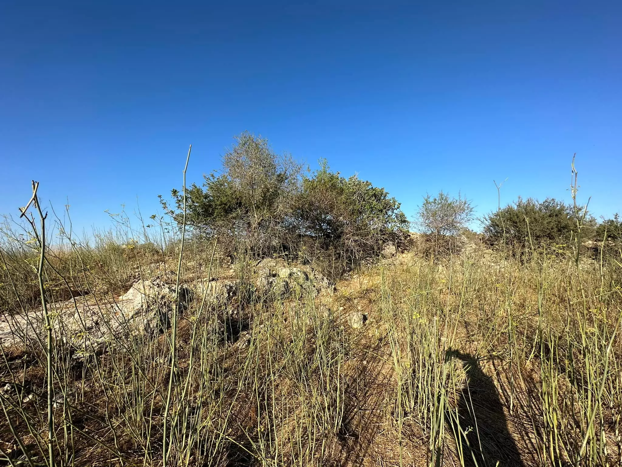
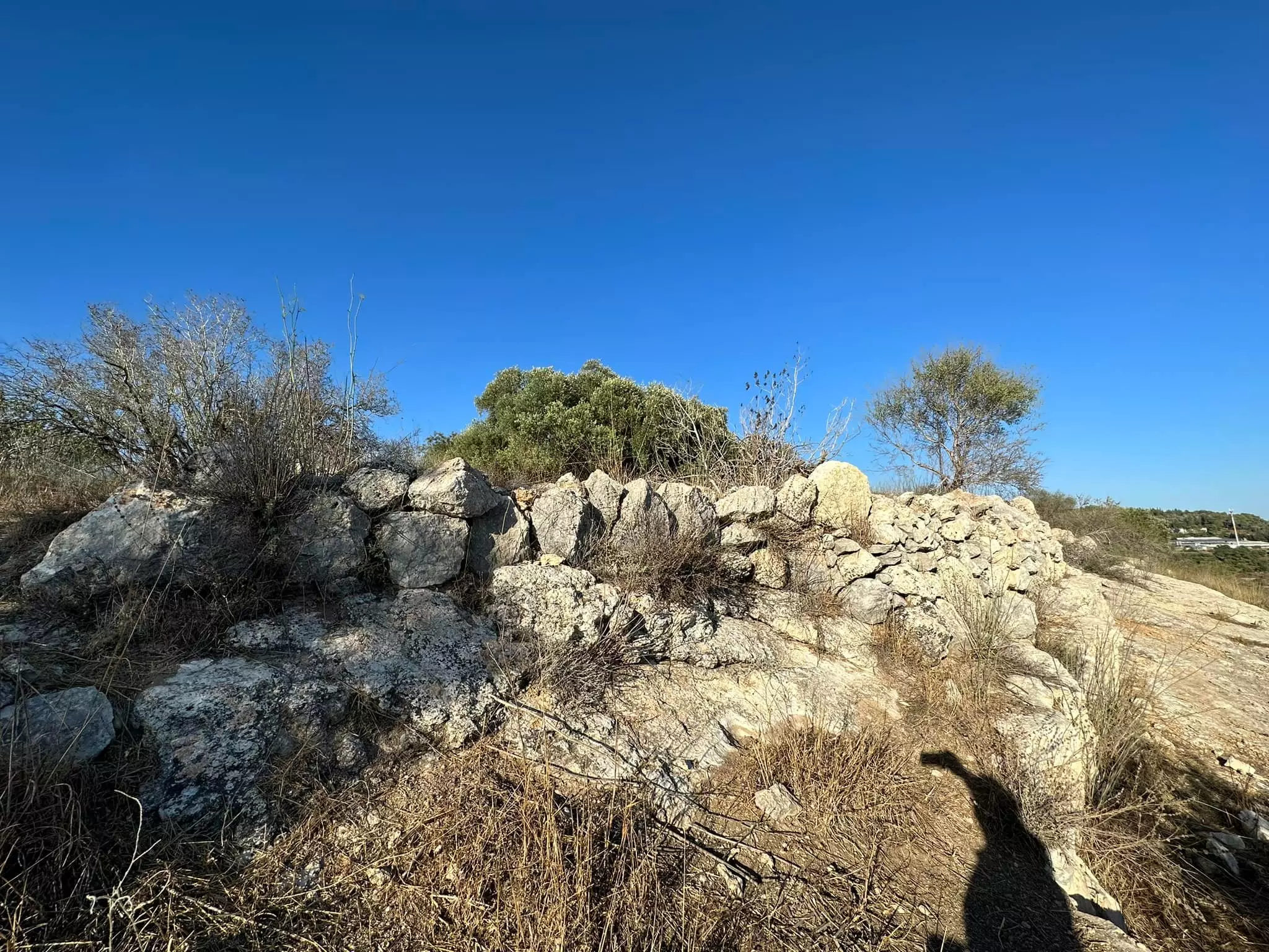
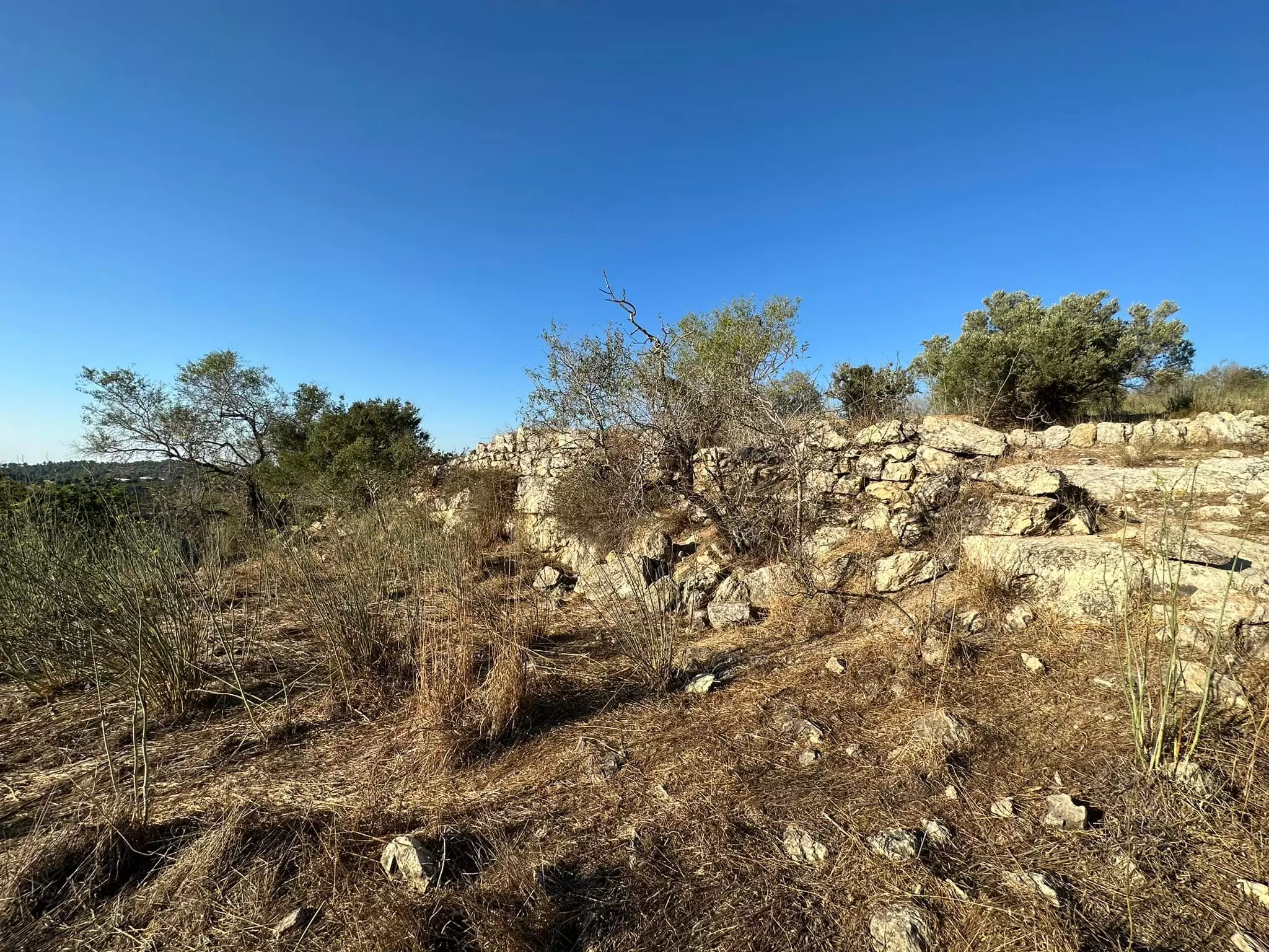
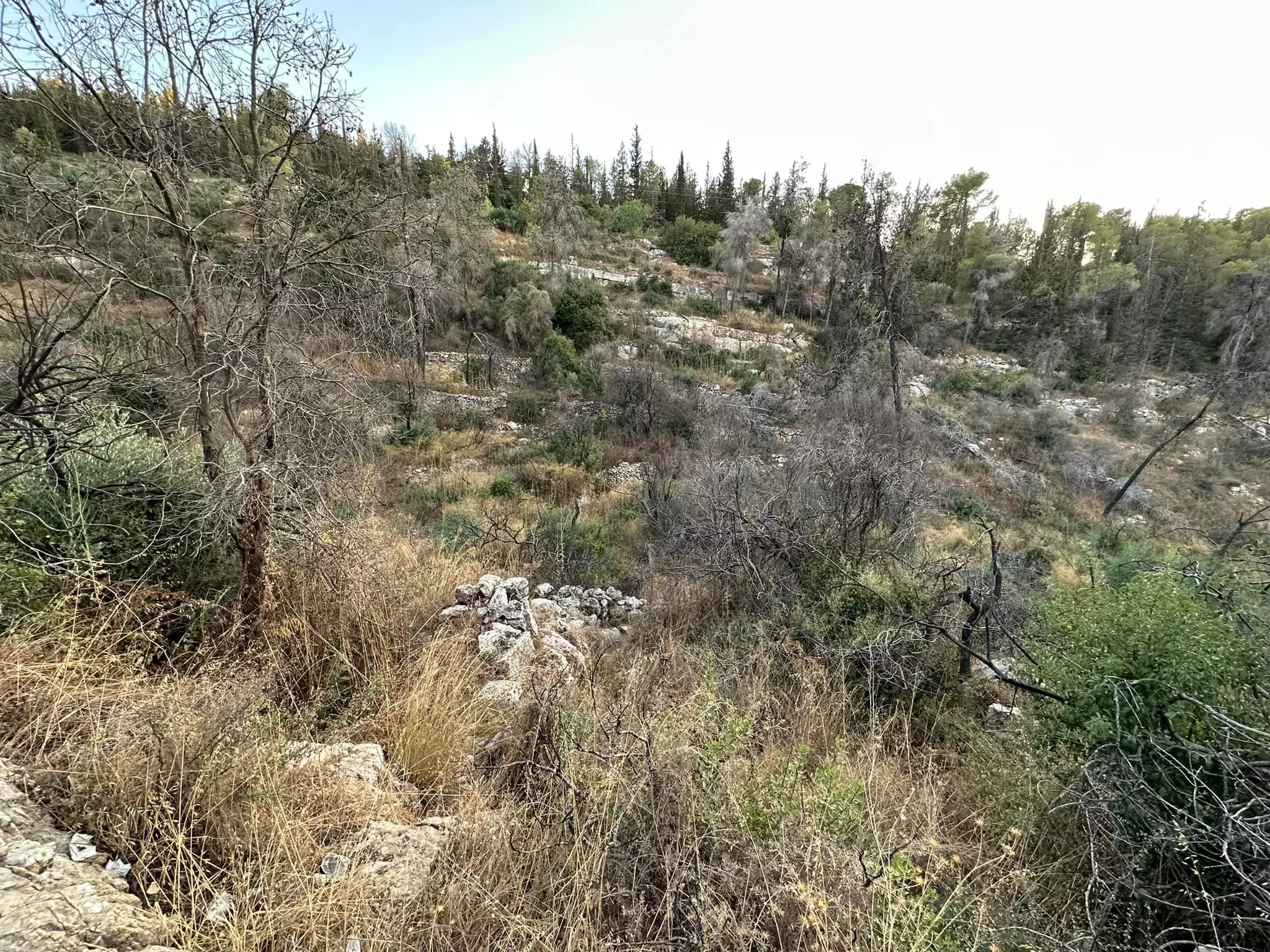
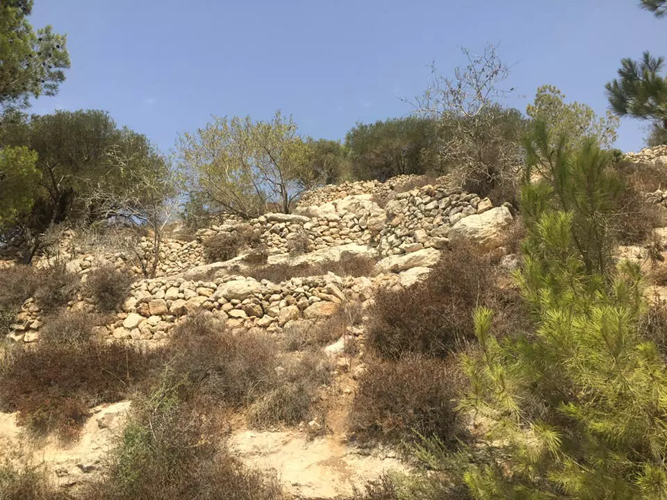
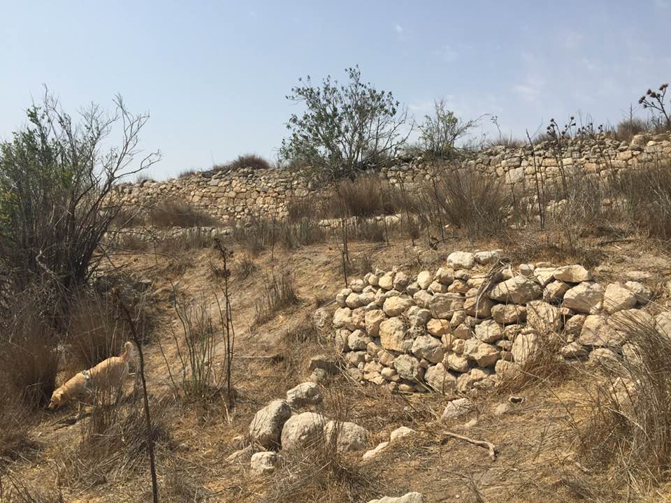
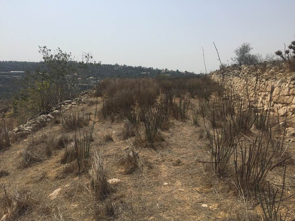
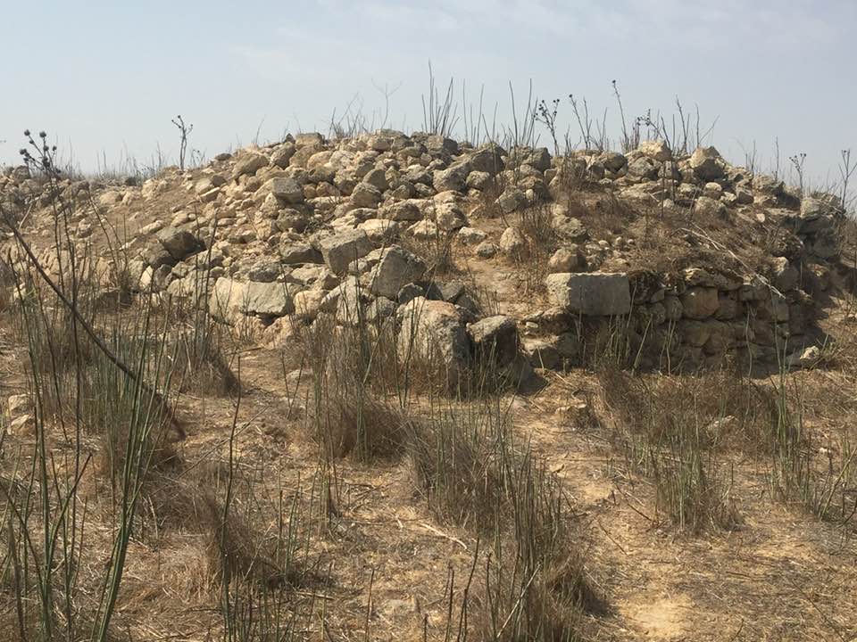
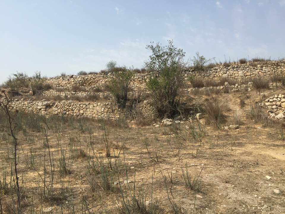
| Village Temains | Most likely the village was completely destroyed and defaced. | ||||||||||||||
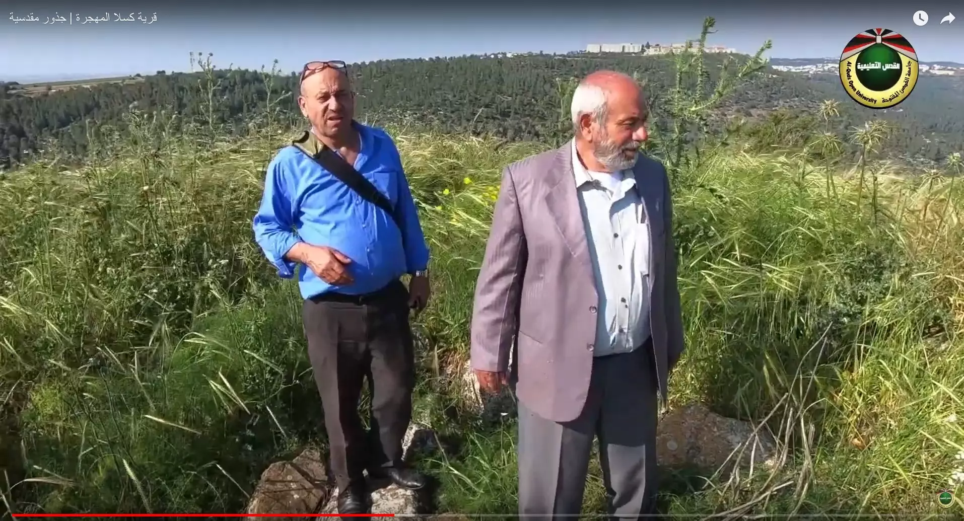
| Ethnically Cleansing | Kasla inhabitants were completely ethnically cleansed. | ||||||||||||||
| Pre-Nakba Land Ownership |
**Town Lands' Demarcation Maps |
||||||||||||||
| Land Usage As of 1945 |
|
||||||||||||||
| Population |
|
||||||||||||||
| Number of Houses |
|
||||||||||||||
| Near By Towns |
|||||||||||||||
|
|||||||||||||||
| Town's Name Through History | The Canaanites referred to Kasla by the city of Chesalon, and the Romans called it either Chesalon or Cheslon. | ||||||||||||||
| Shrines / Maqams | A shrine for a local sage known as al-Shaykh Ahmad. | ||||||||||||||
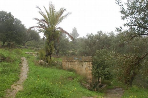
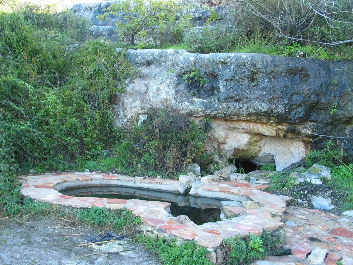
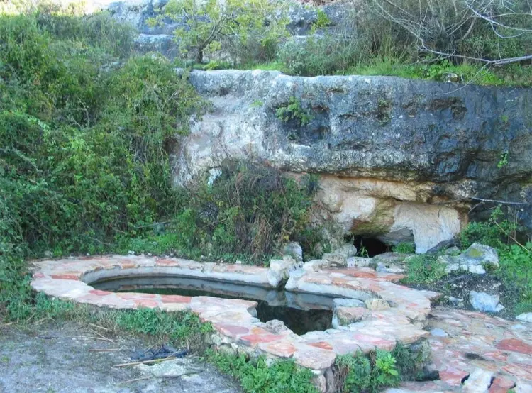
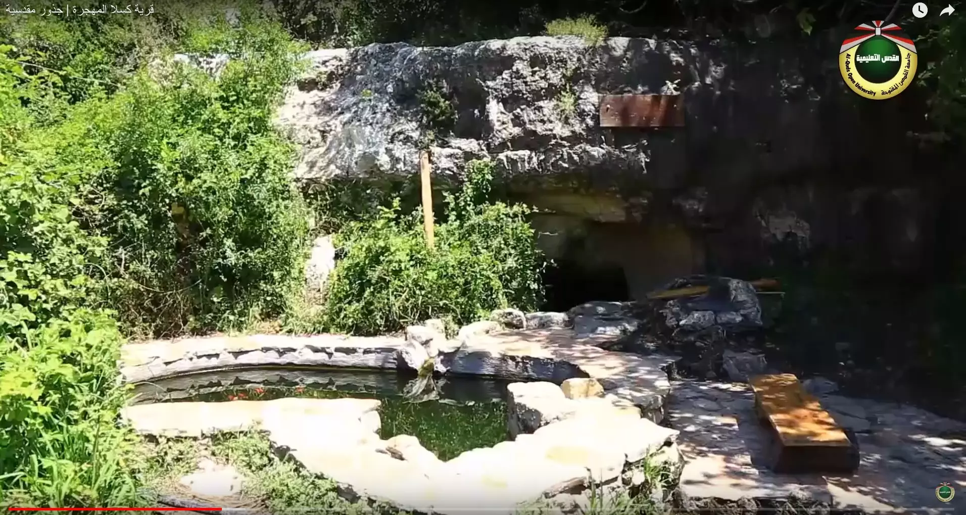
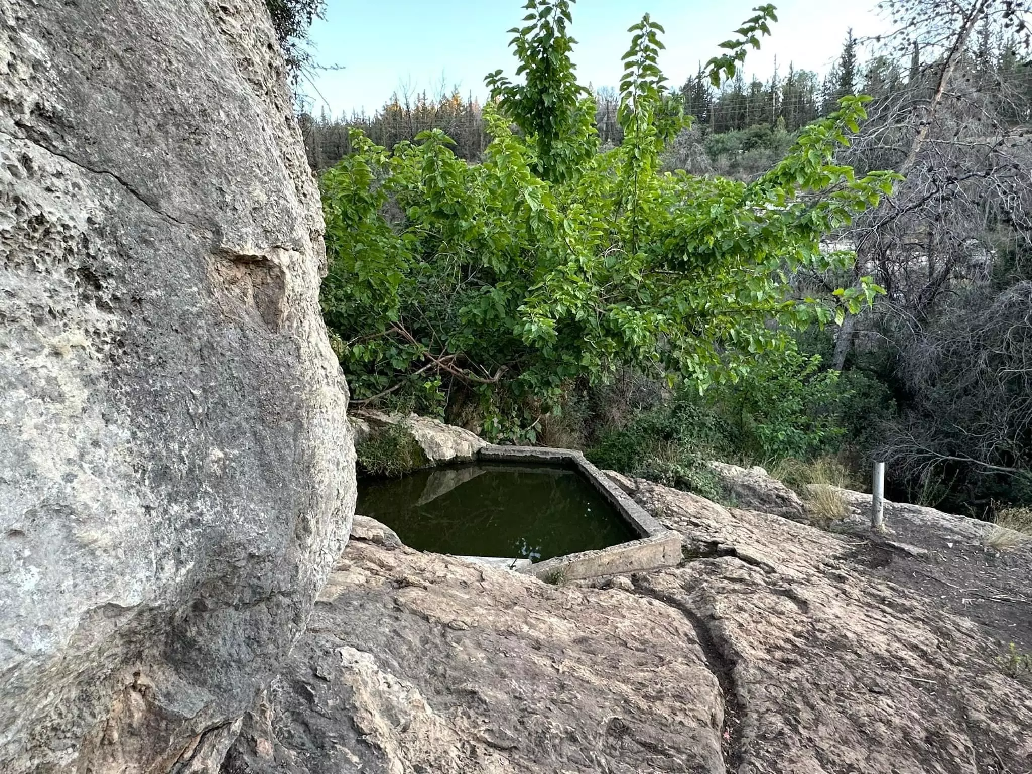
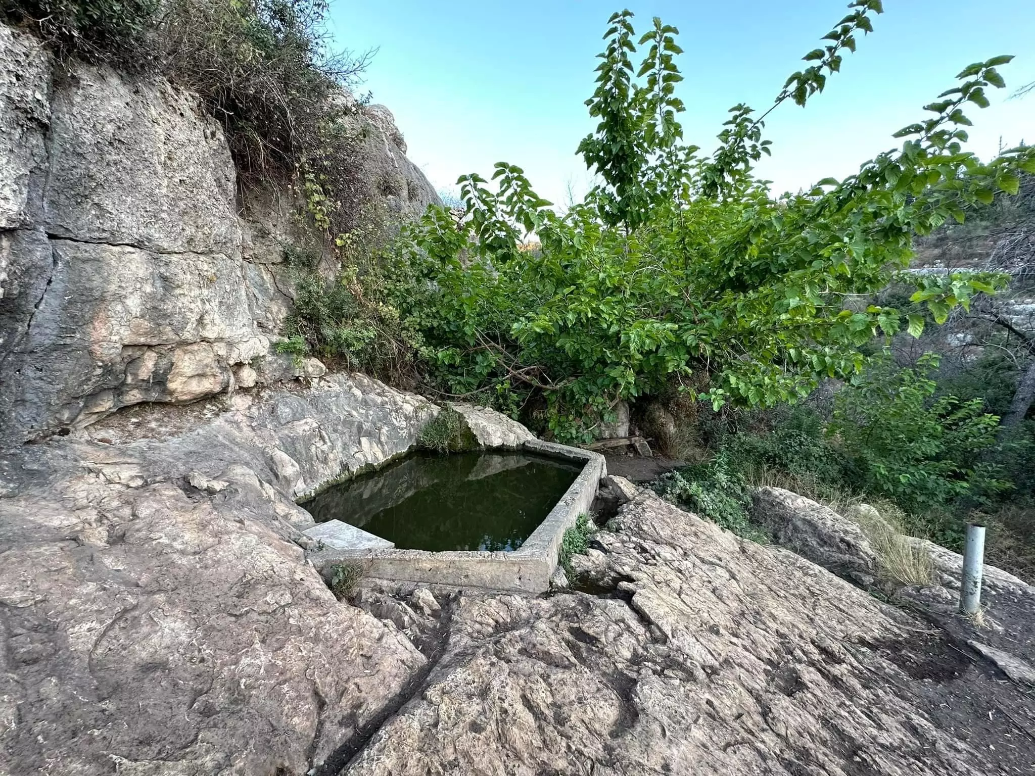
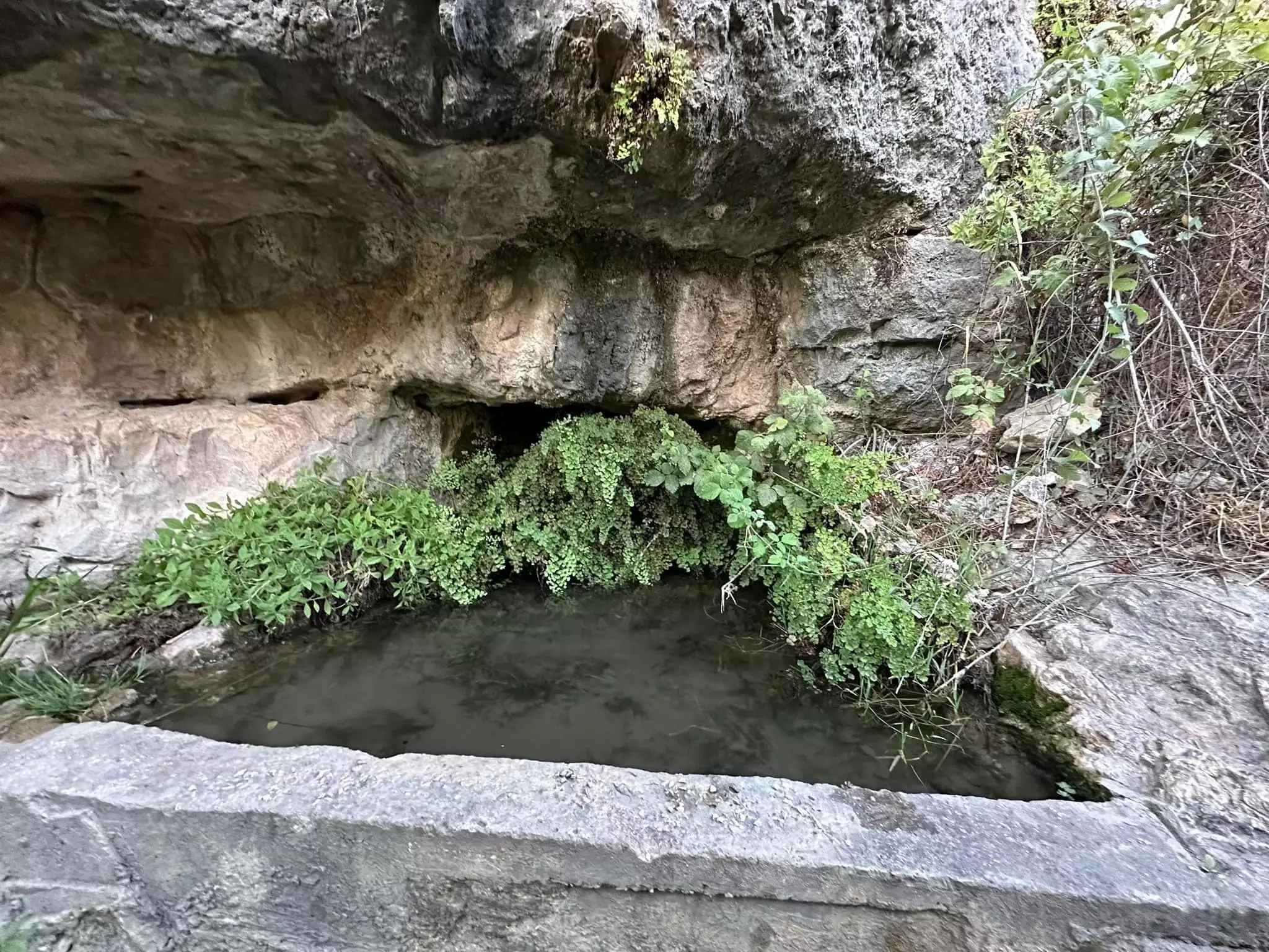
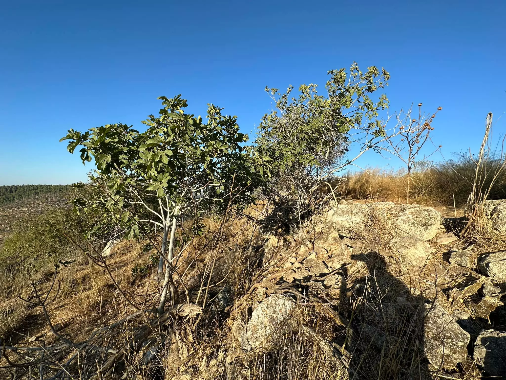
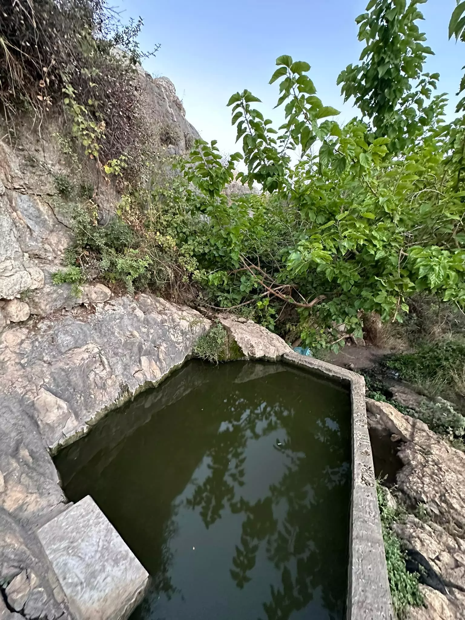
| Water Supply | Two springs in the nearby valley and another spring to the east provided the villagers with fresh water needs. | ||||||||||||||
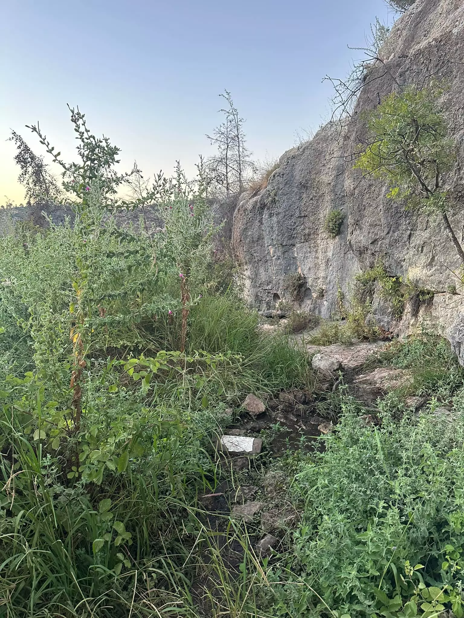
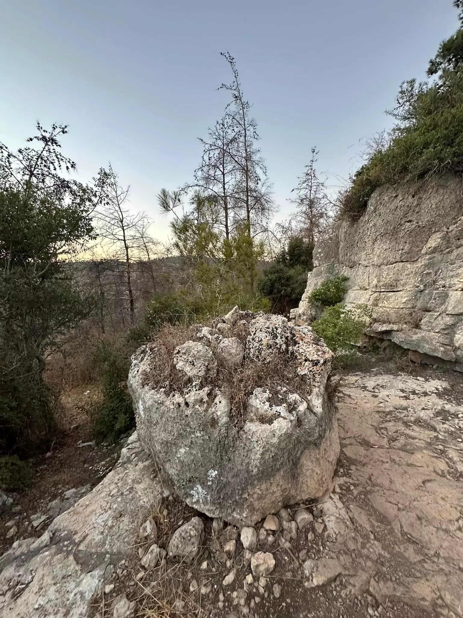
| Archeological Sites | Kasla was surrounded by several khirbas (including Khirbat Sar'a) which contained the ruins of walls, cisterns, and carved stones. | ||||||||||||||
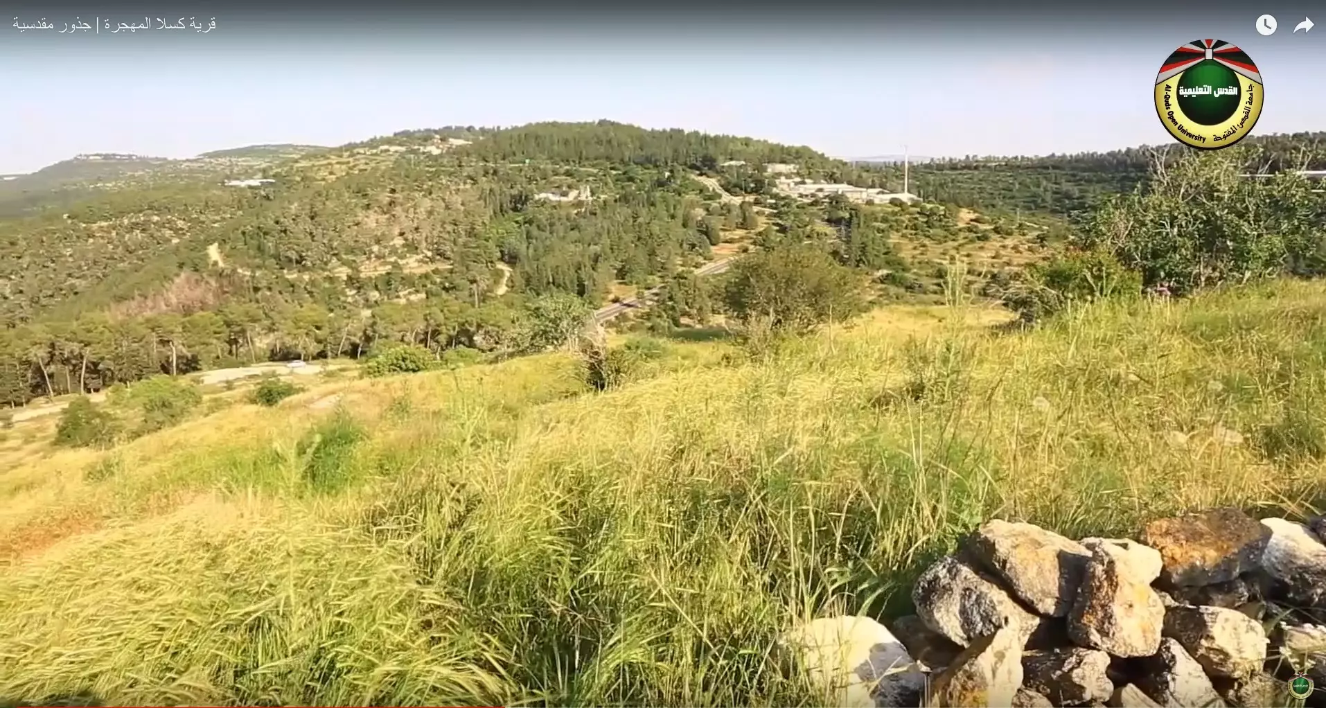
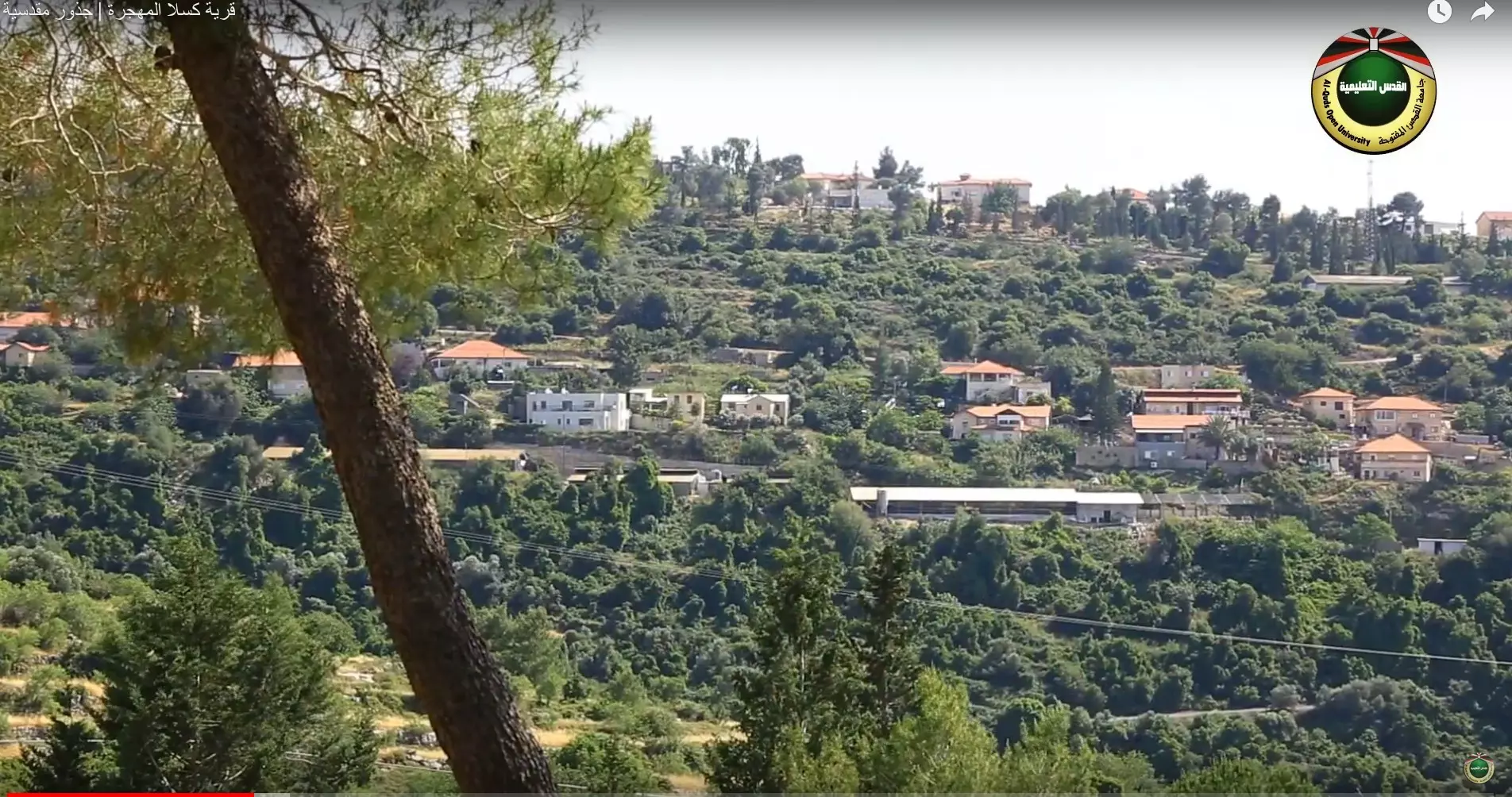
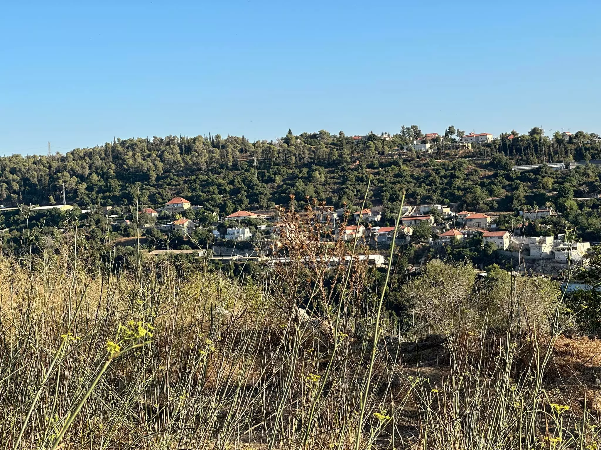
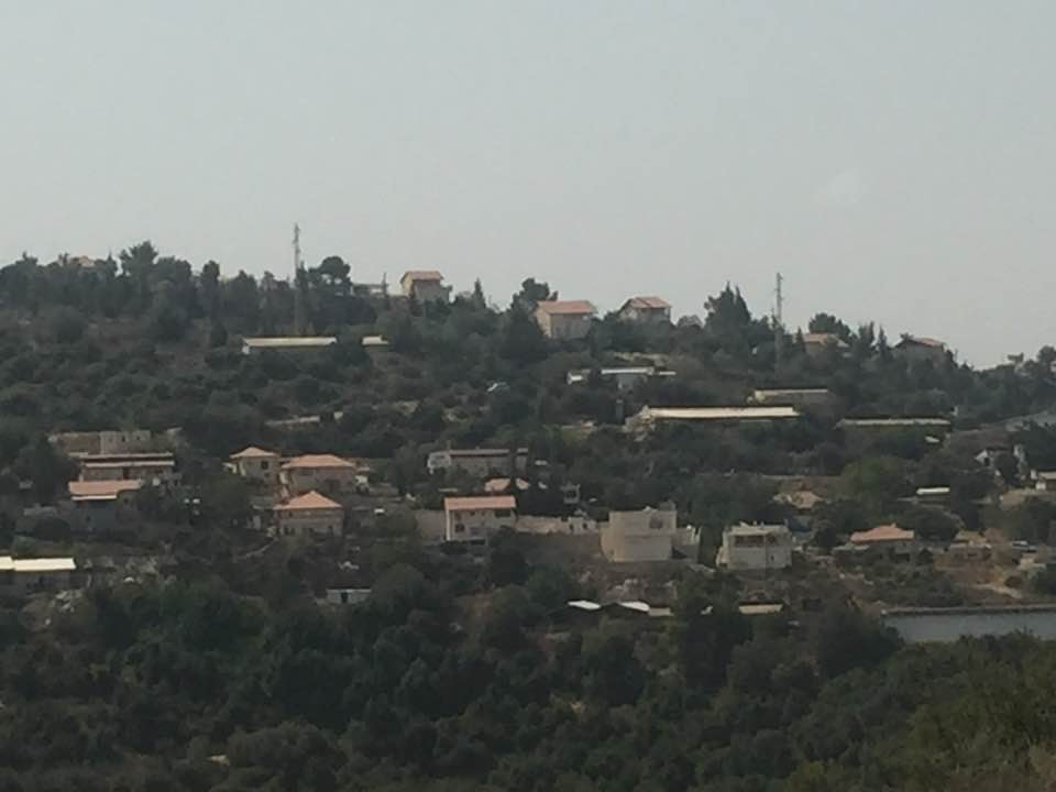
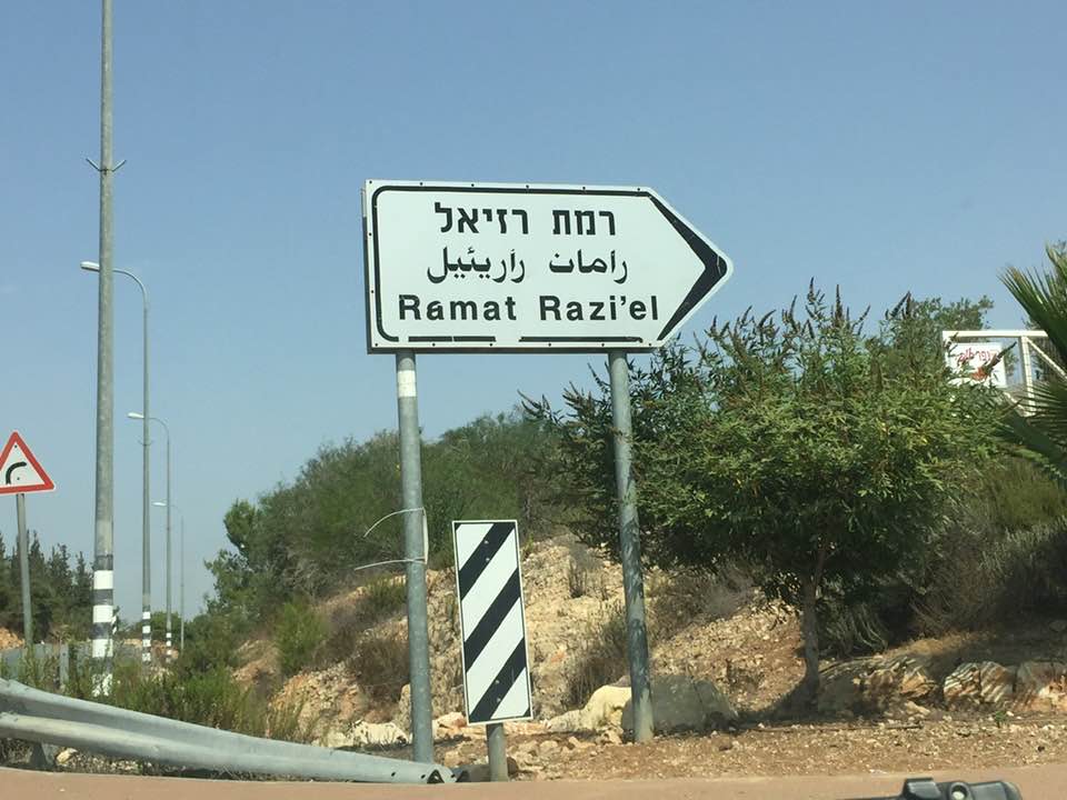
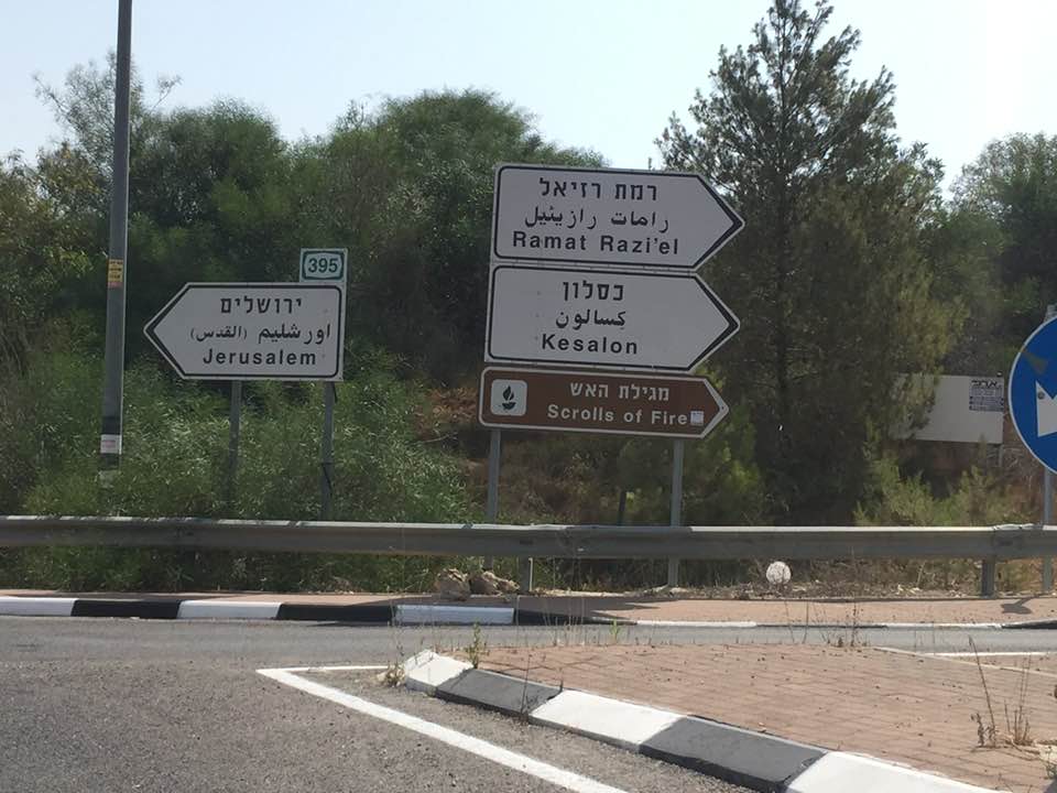
| Exculsive Jewish Colonies Who Usurped Village Lands |
Ramat Razi'el and Kesalon | ||||||||||||||
| Featured Video | |||||||||||||||
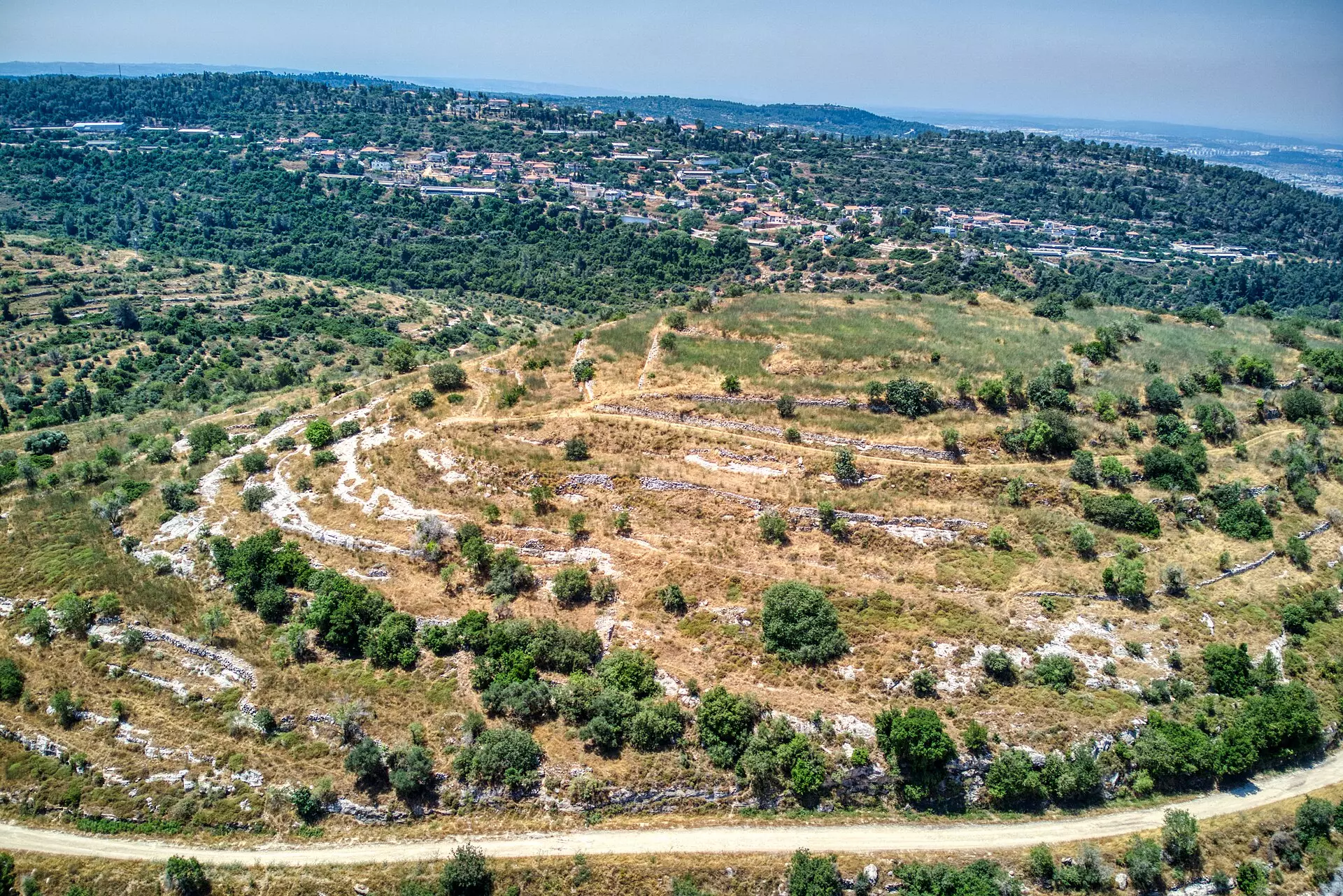
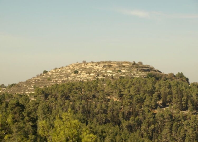
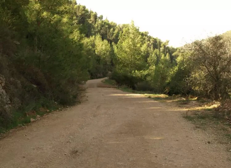
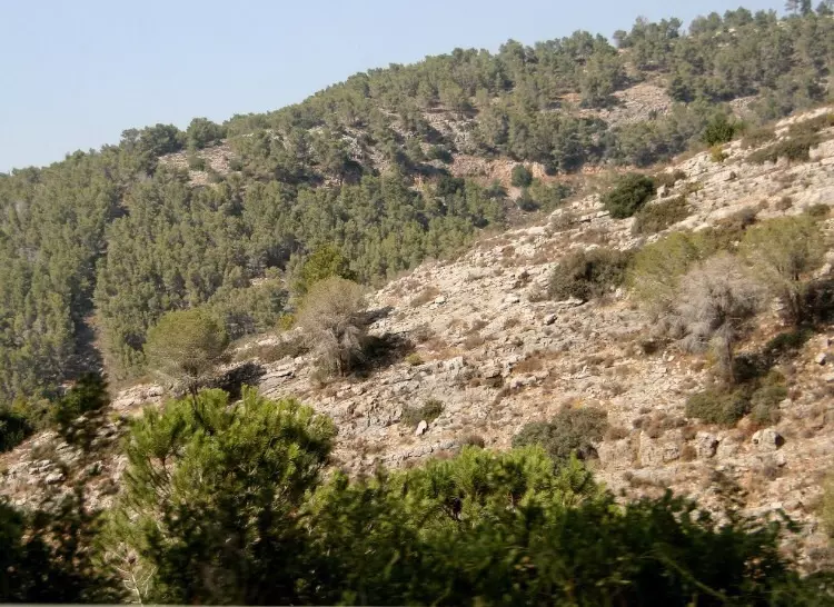
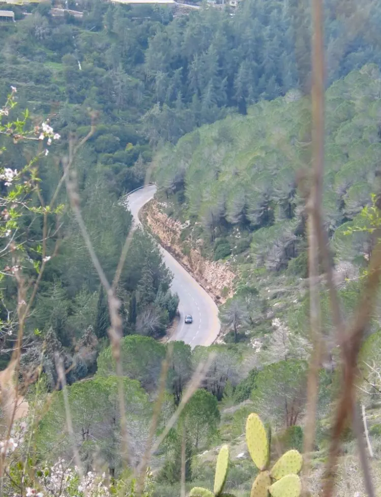
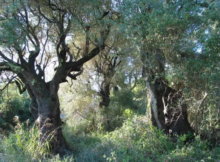
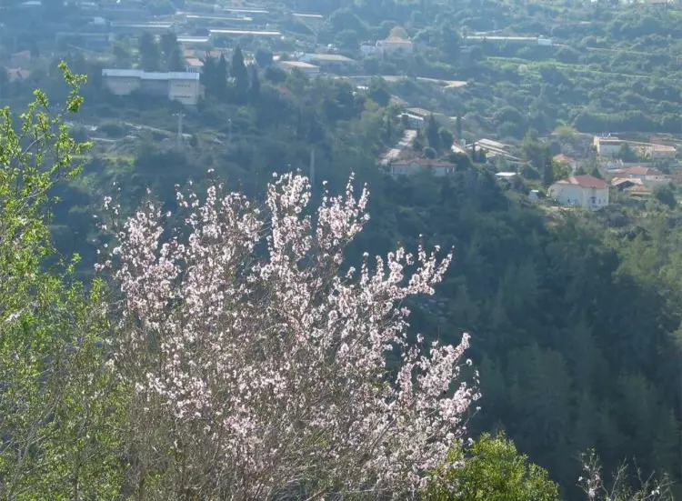
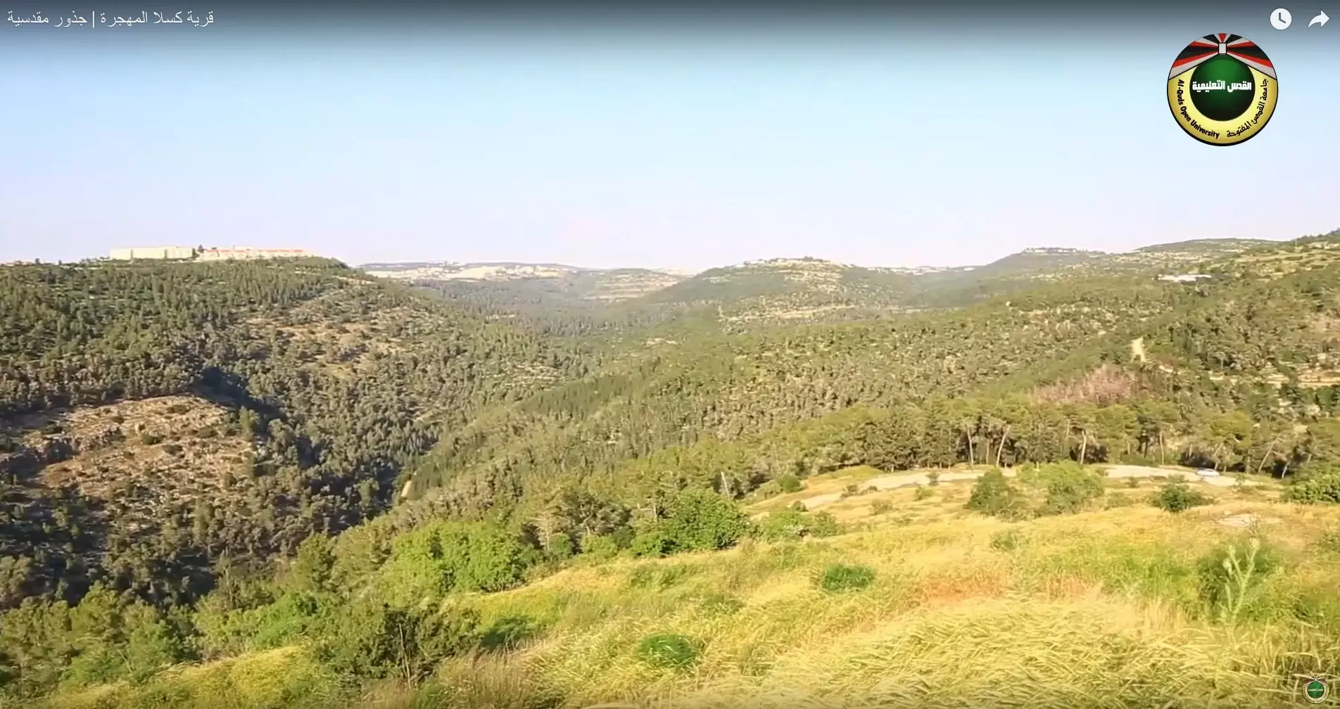
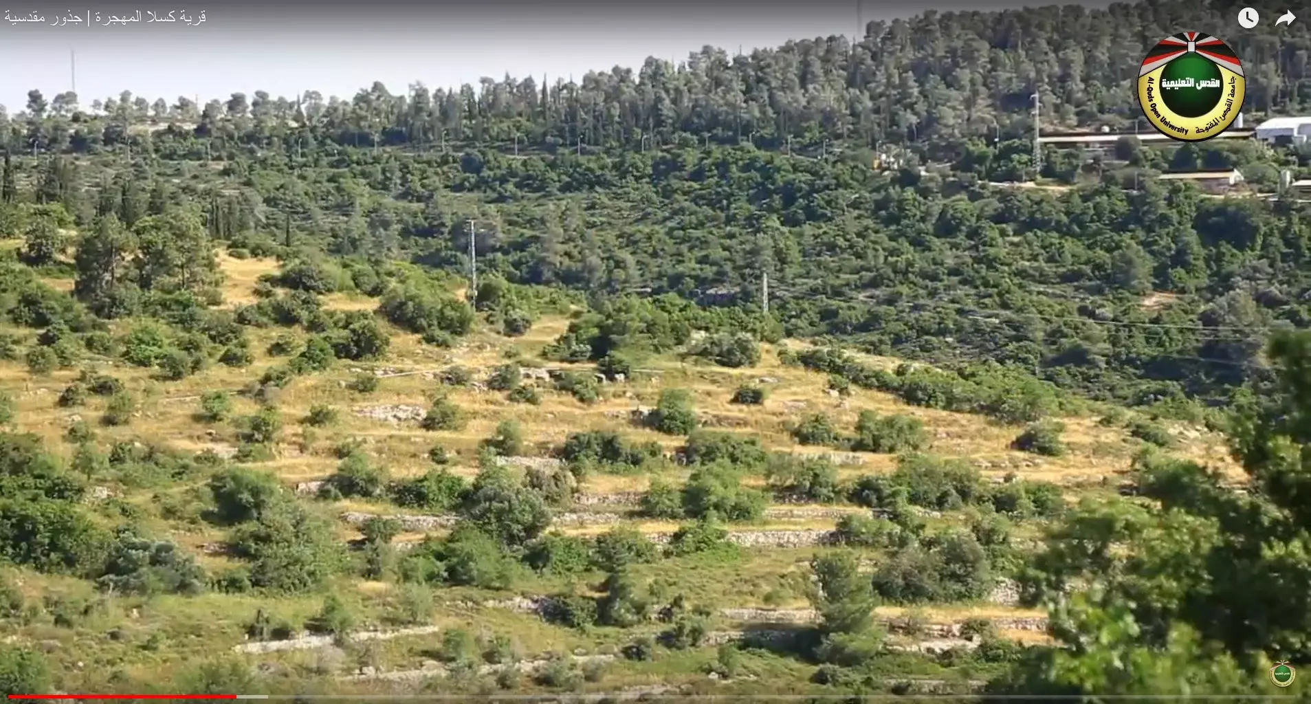
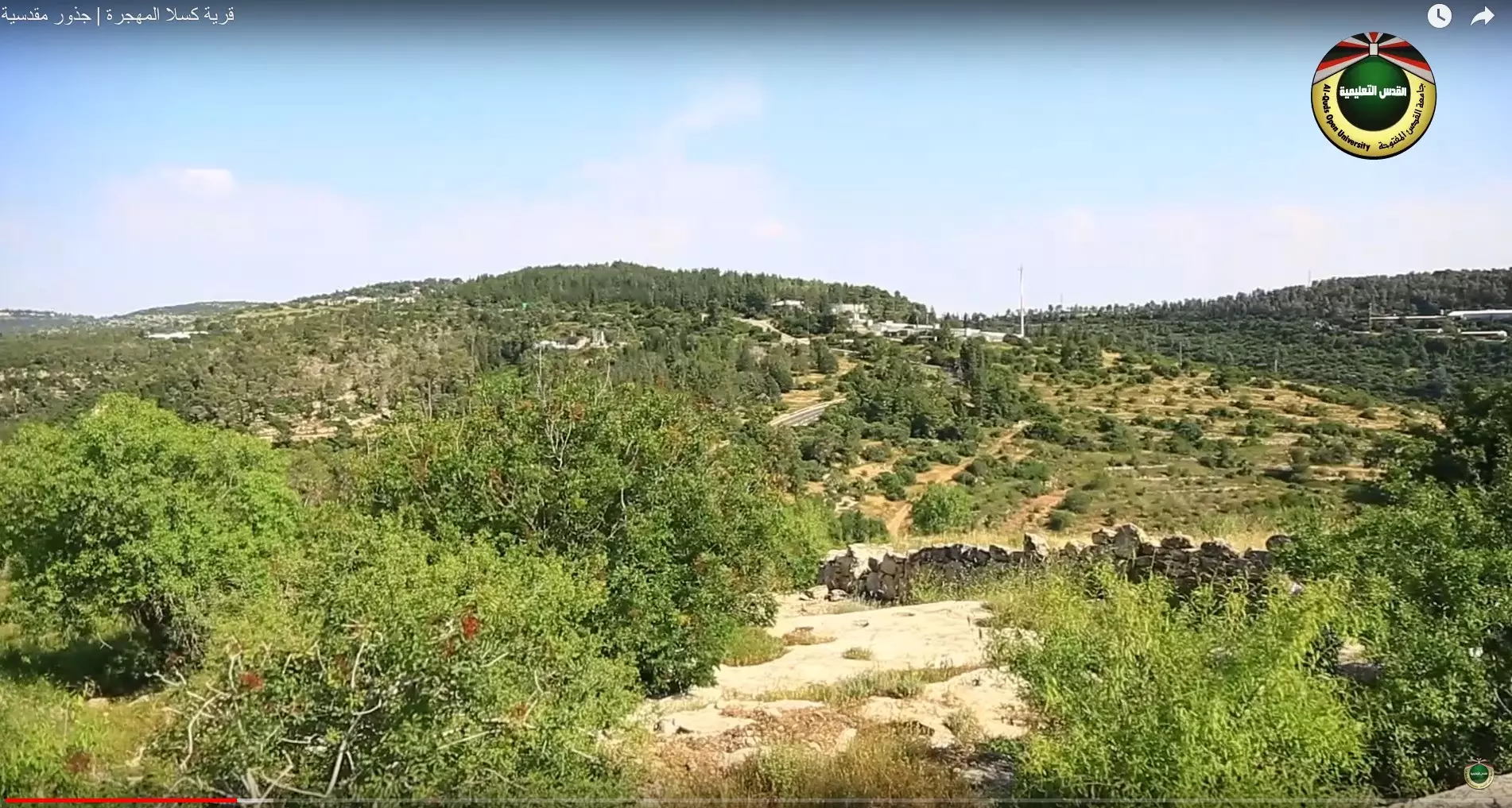
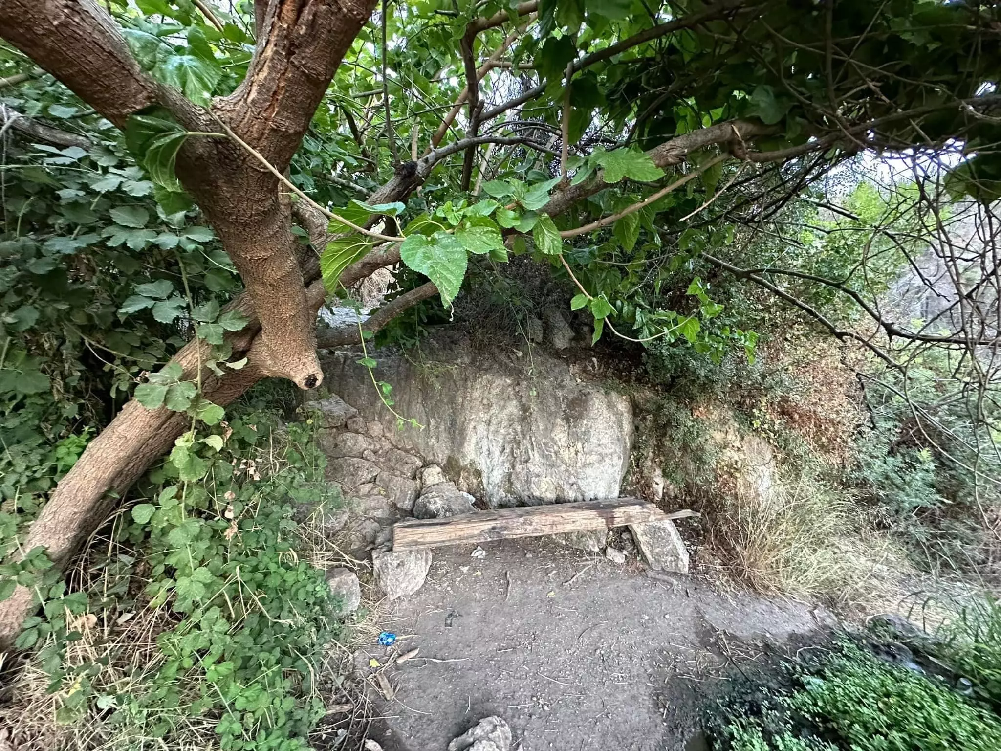
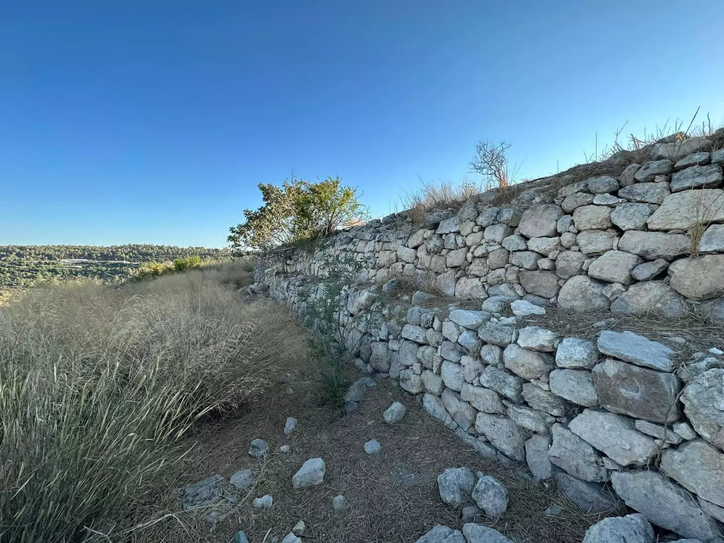
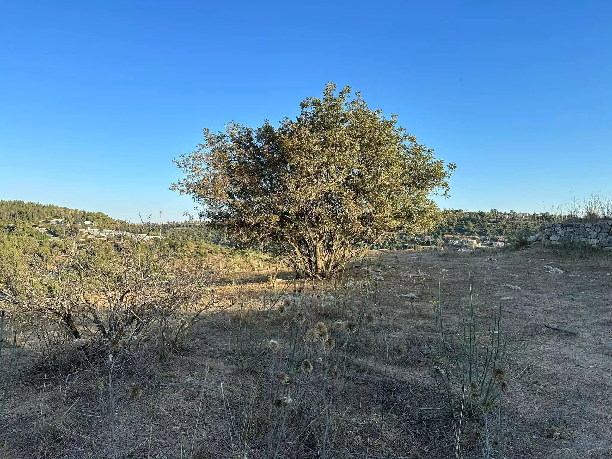
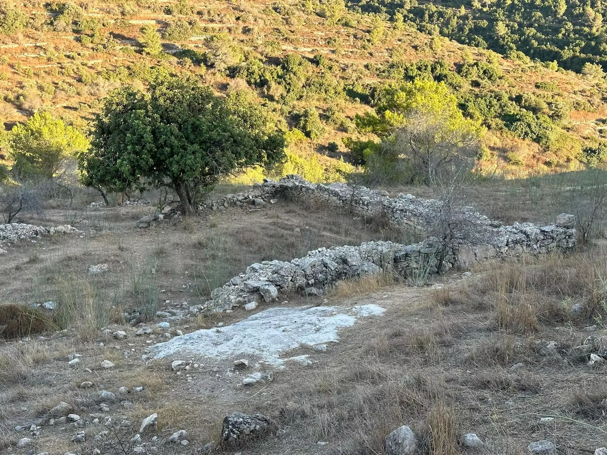
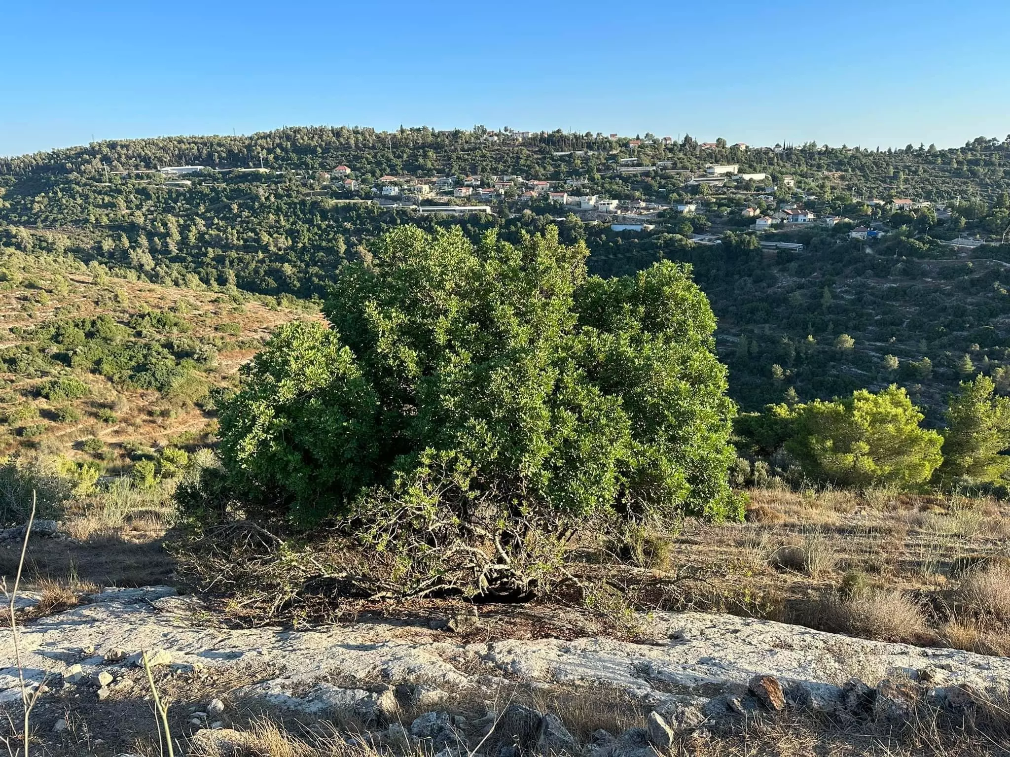
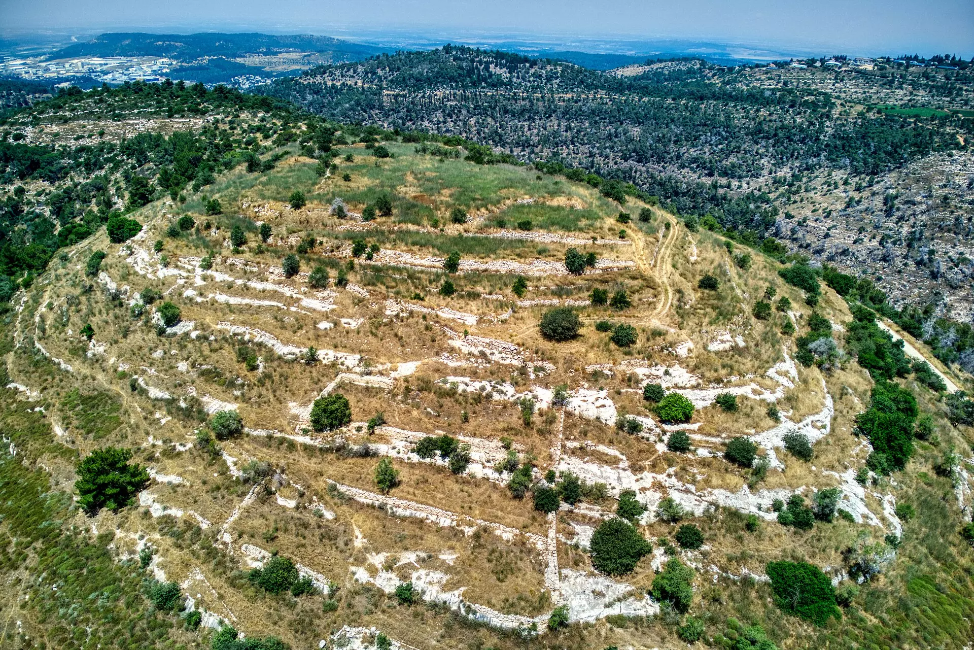
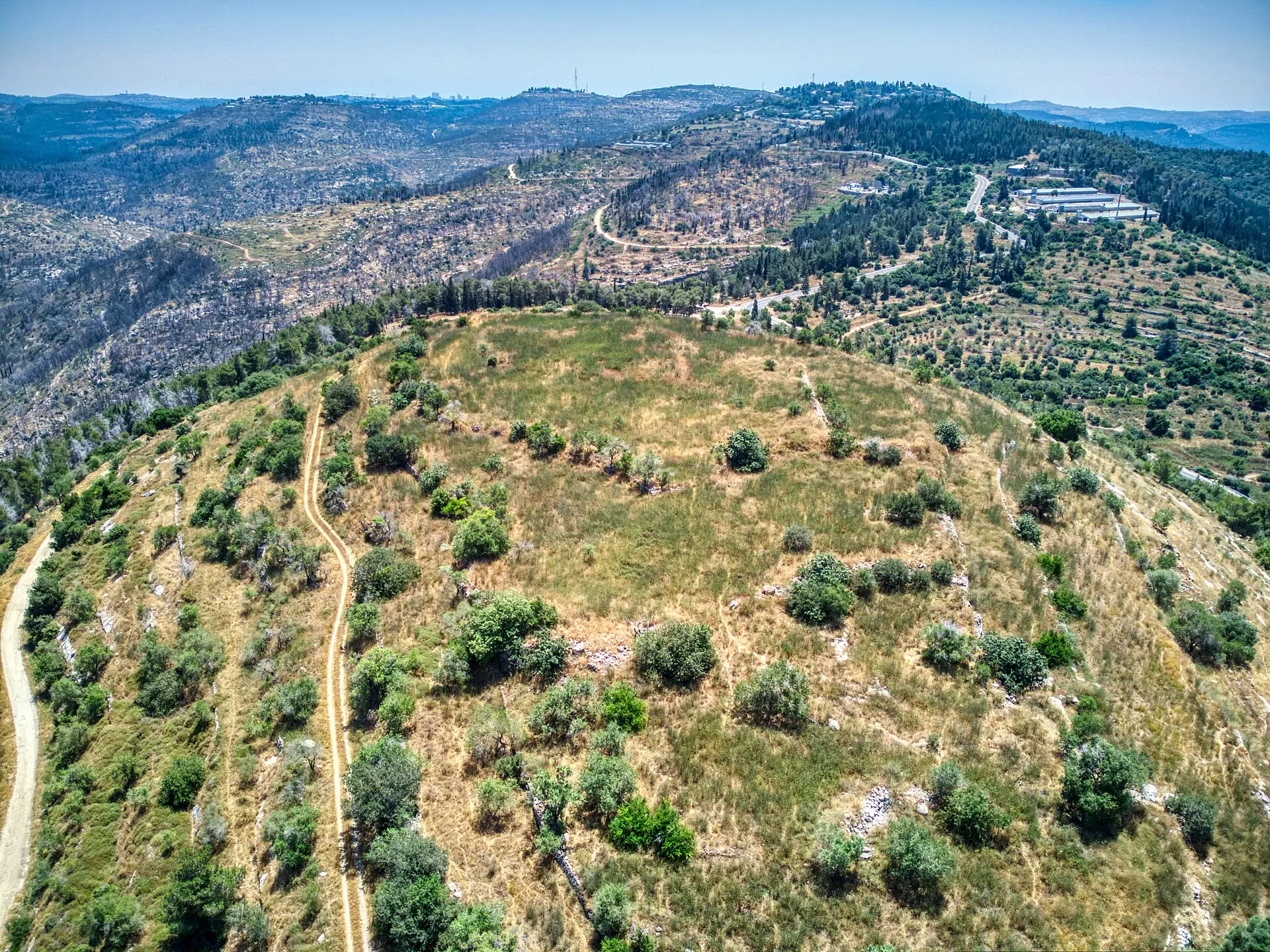
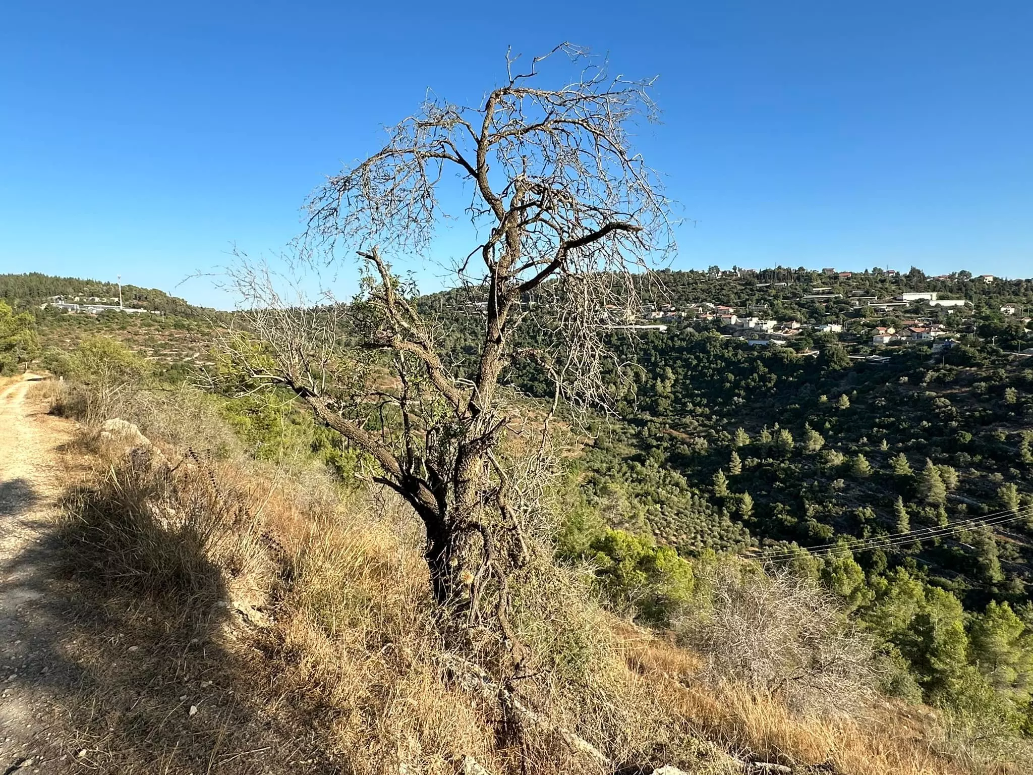
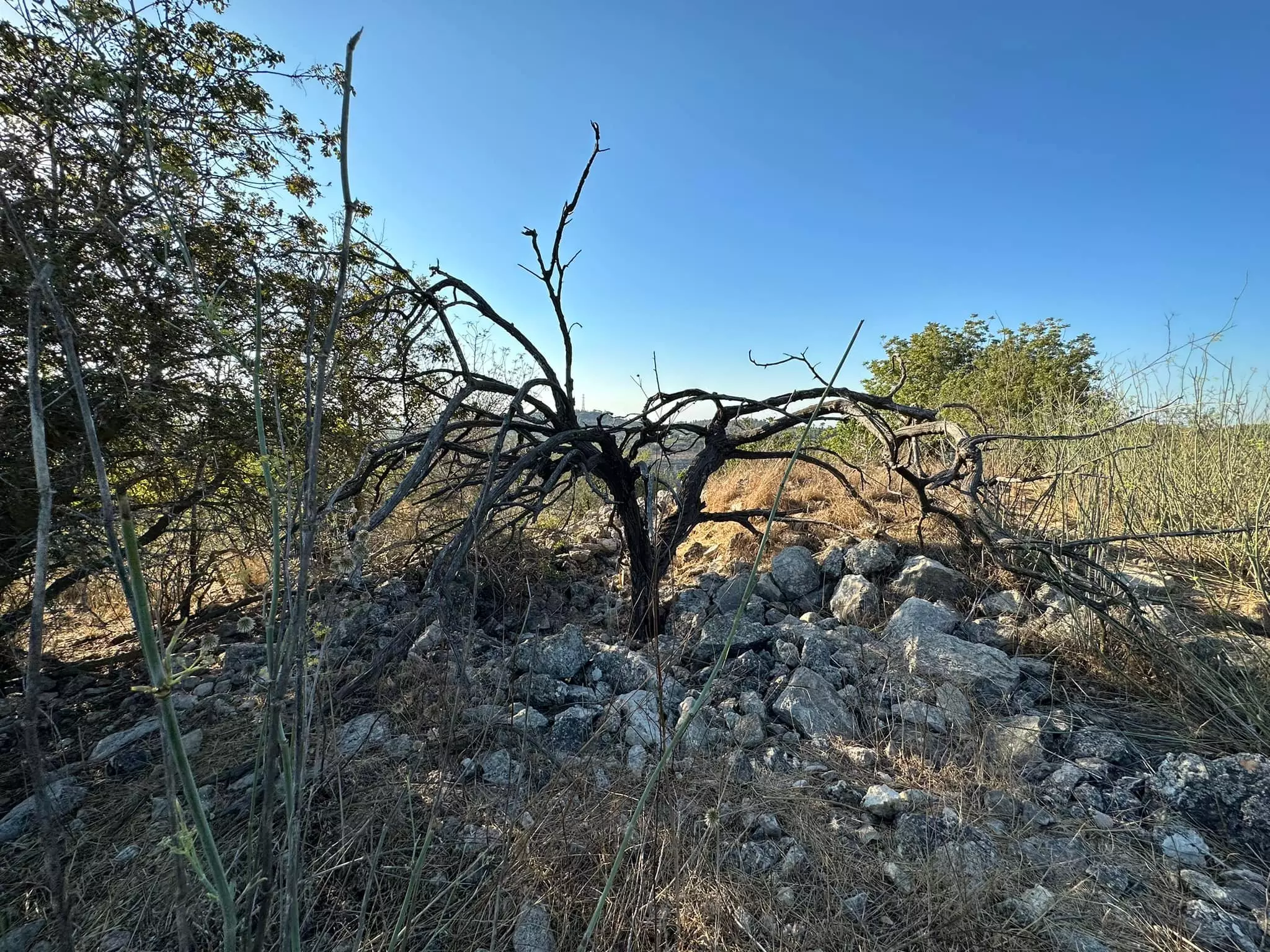
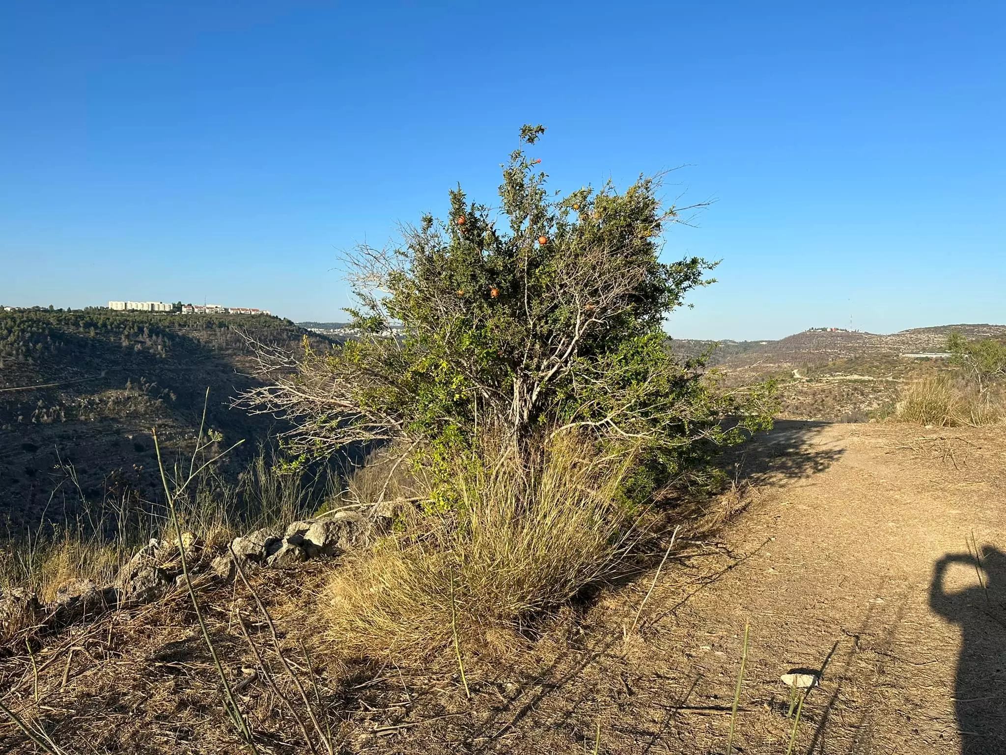
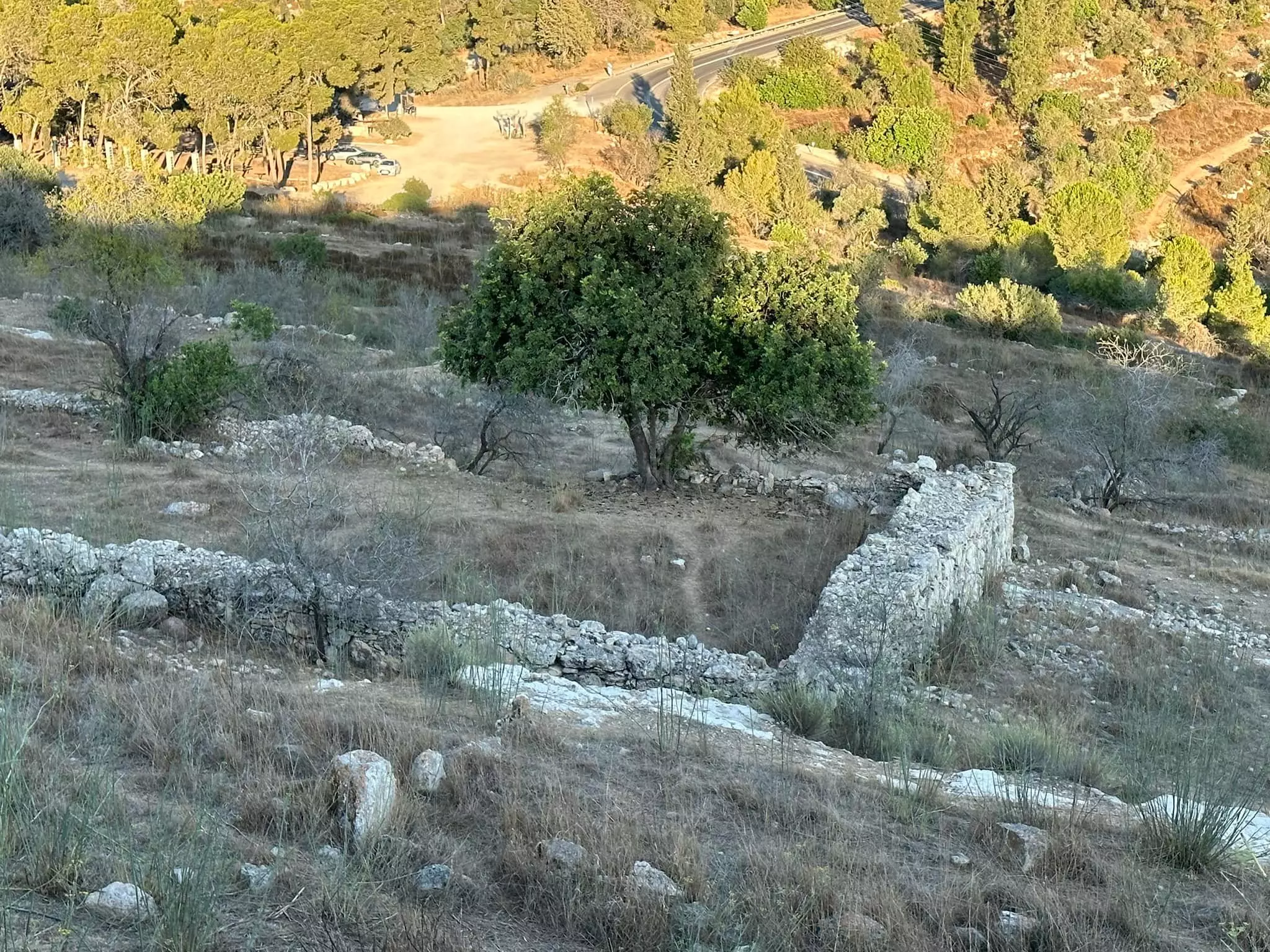
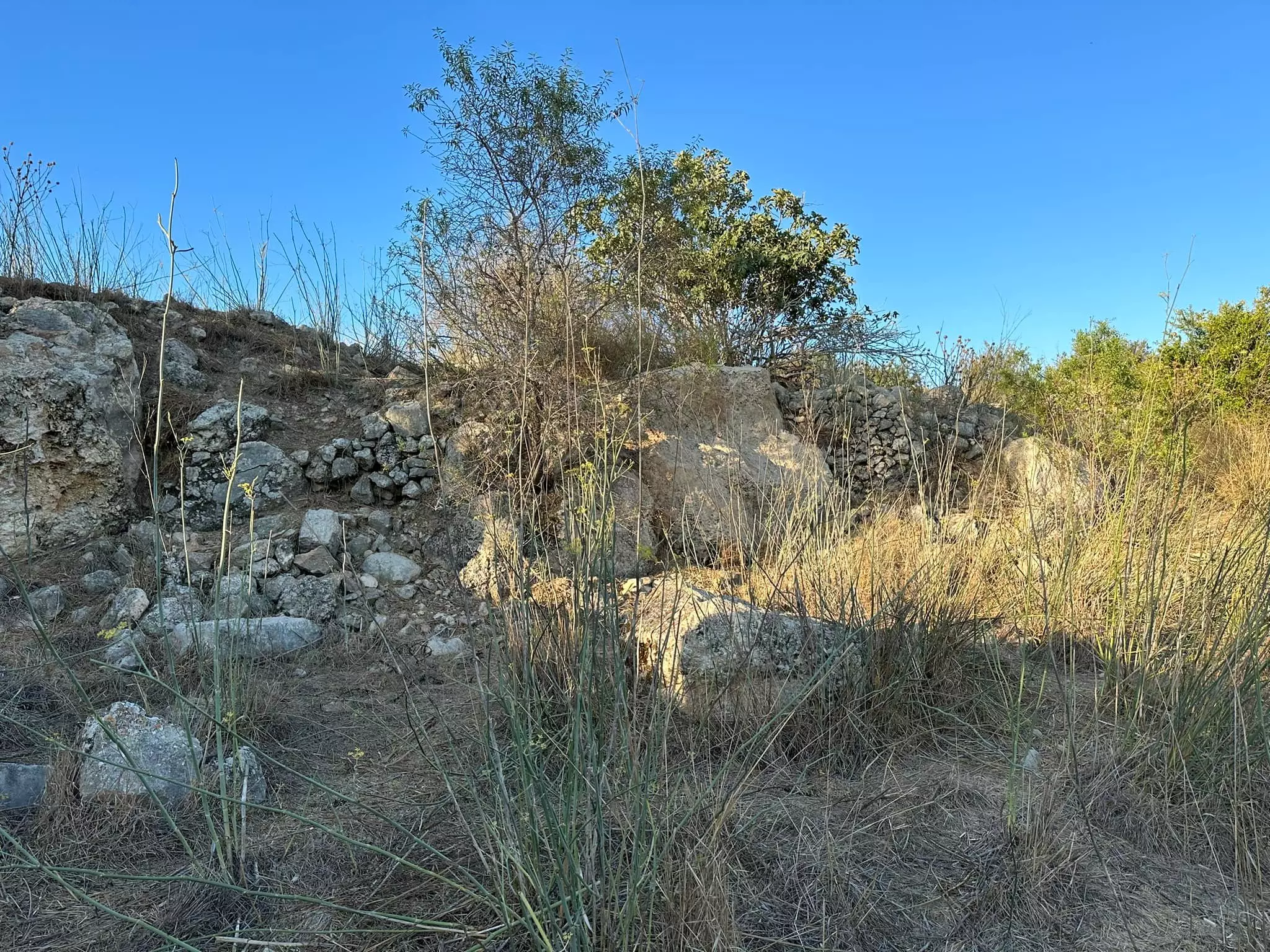
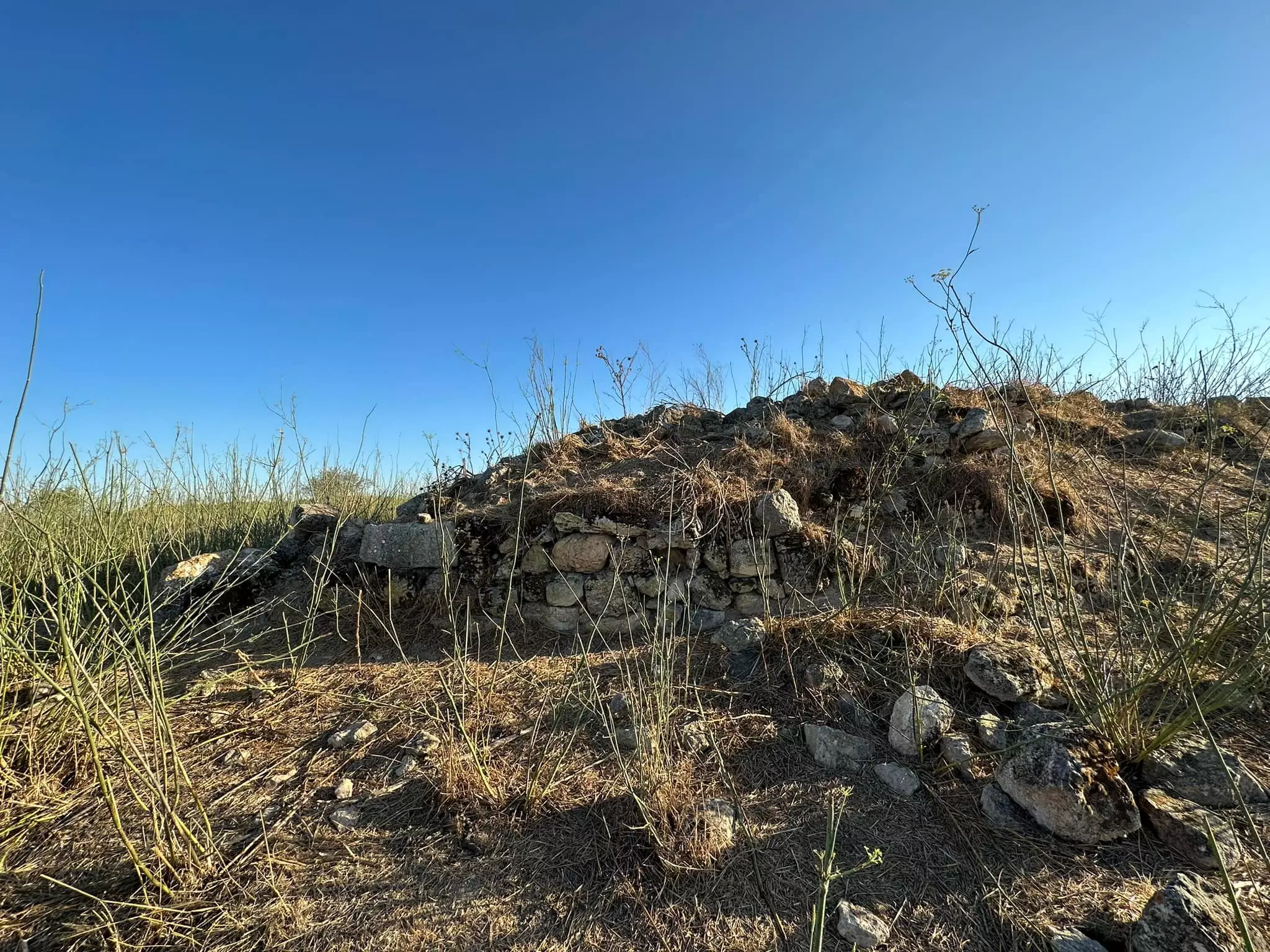
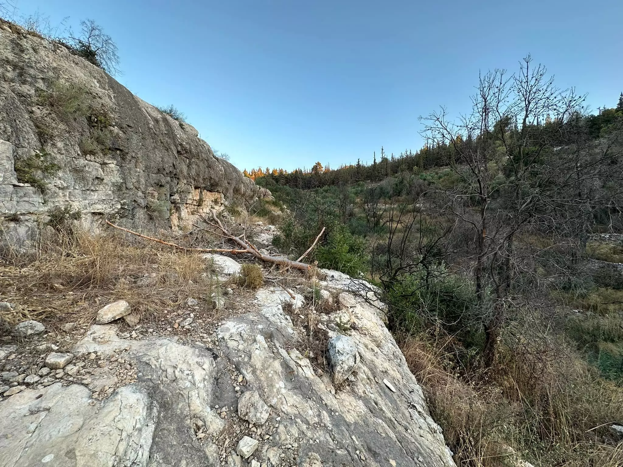
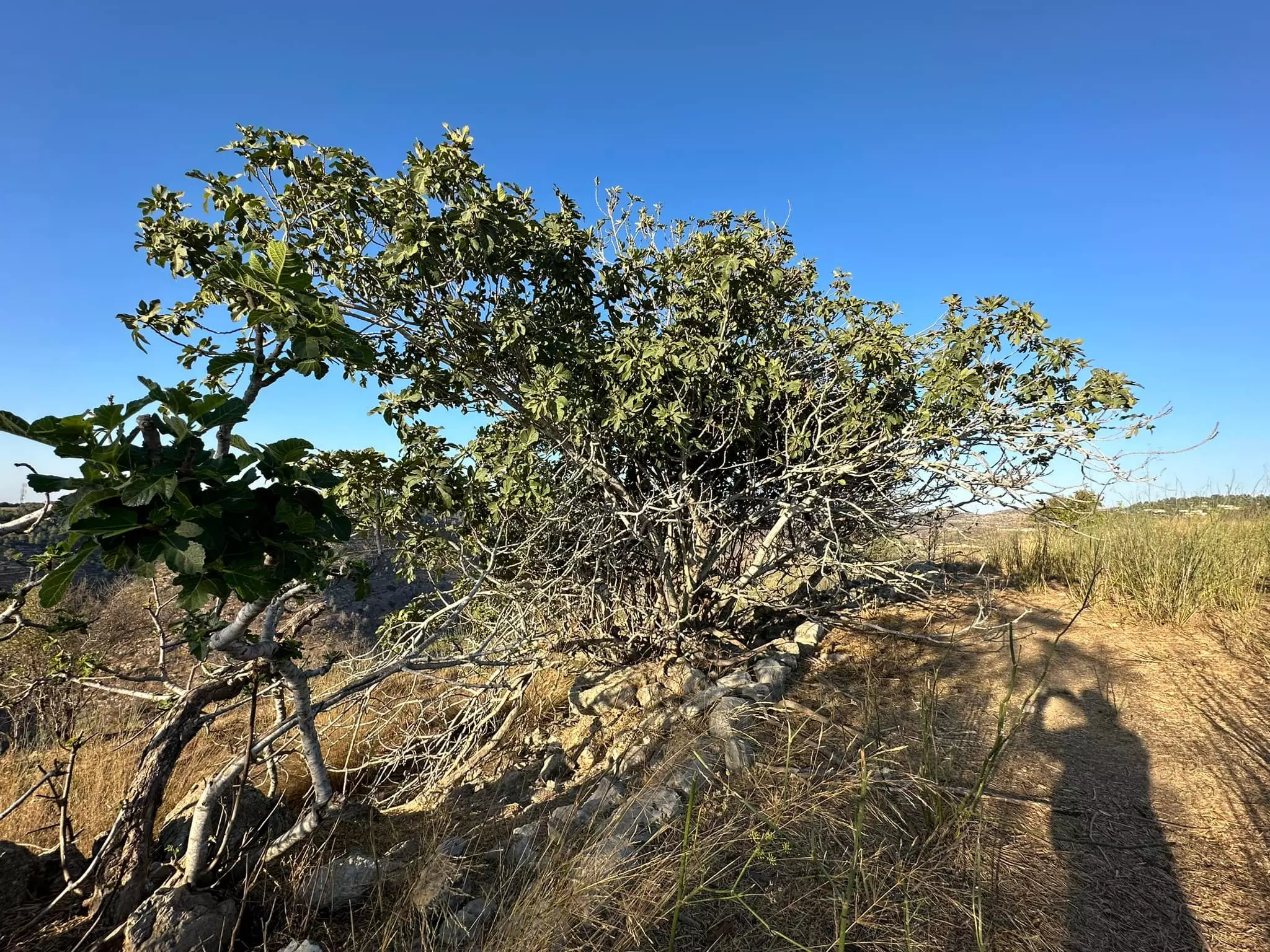
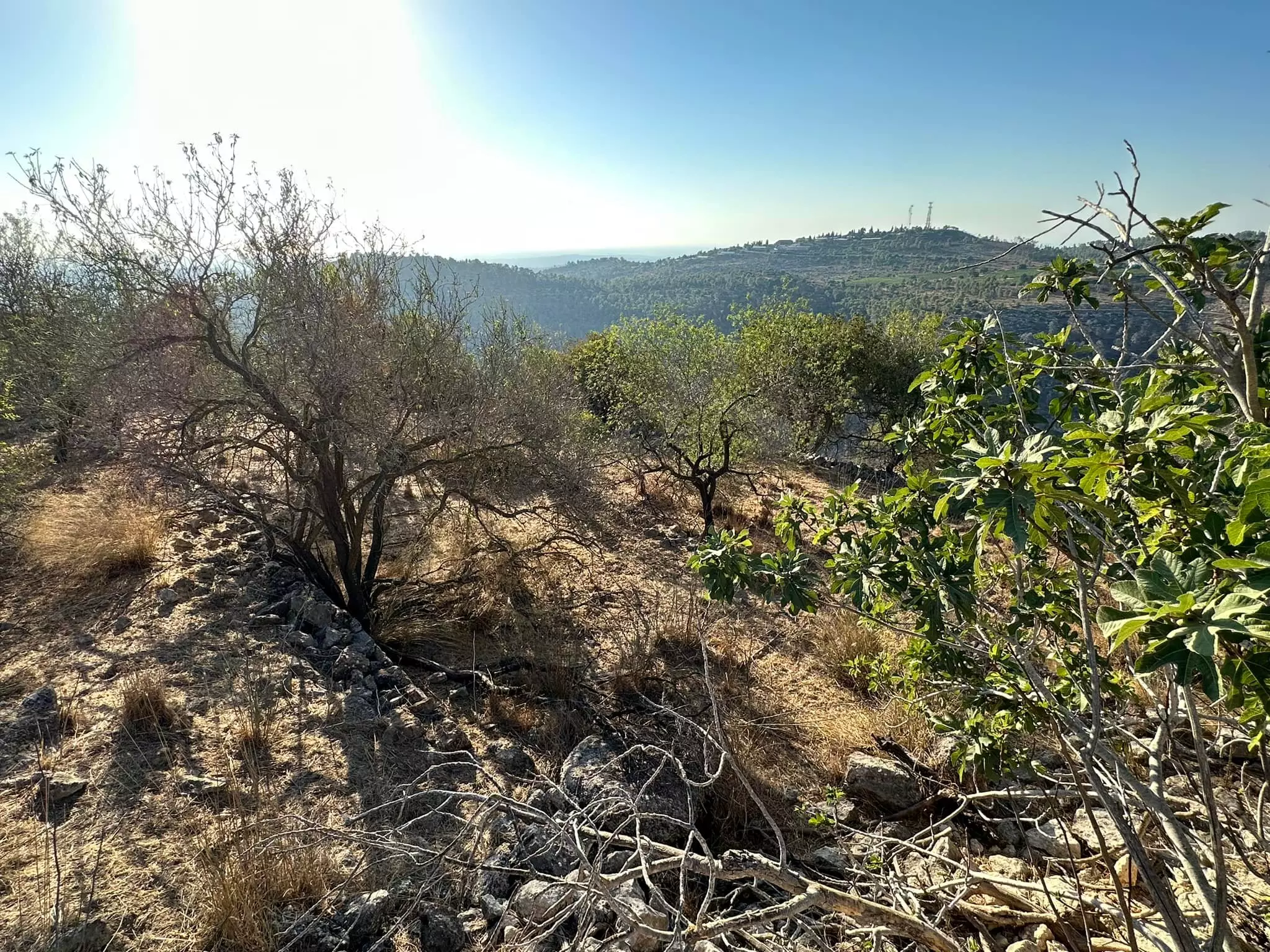
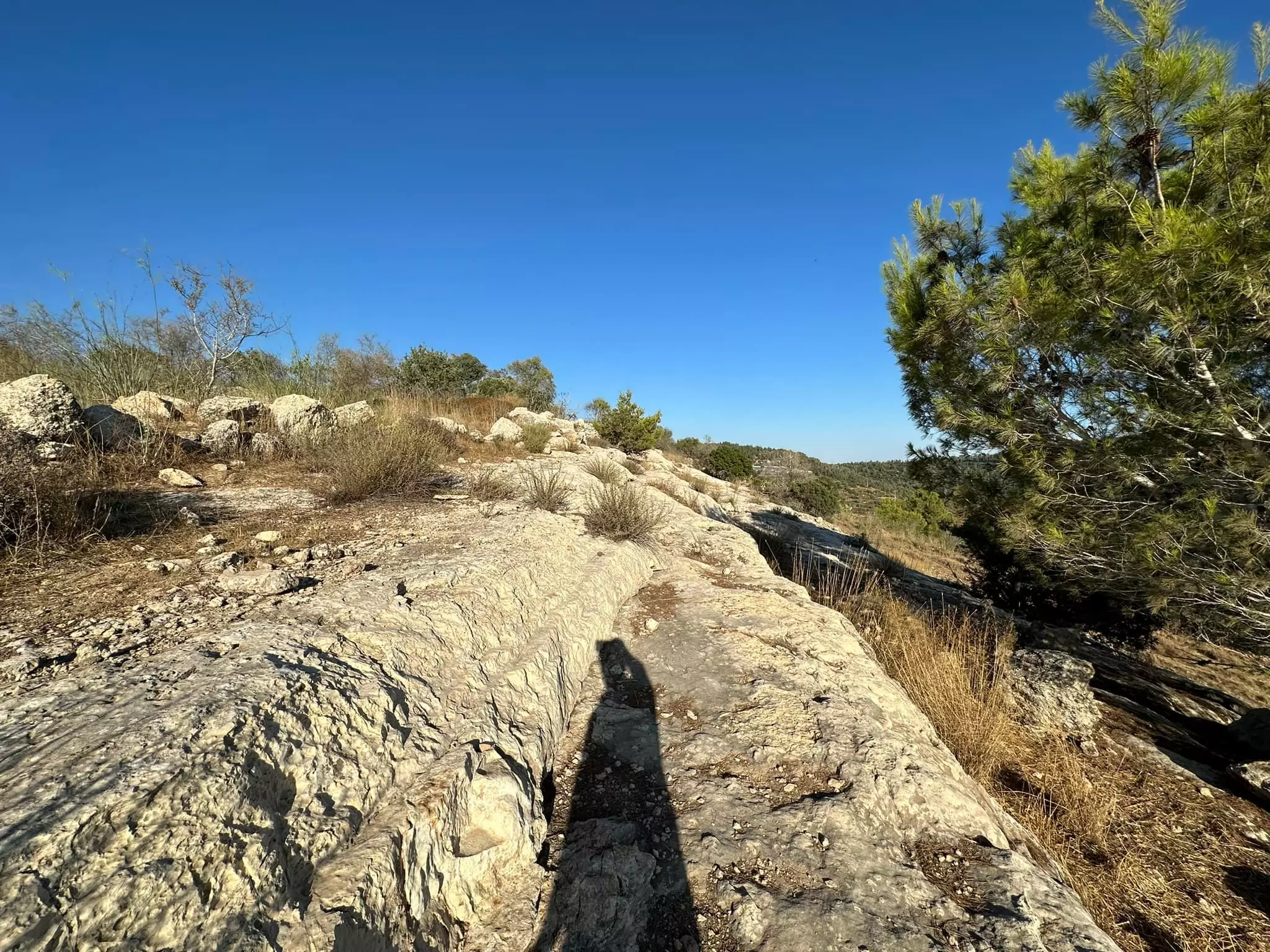
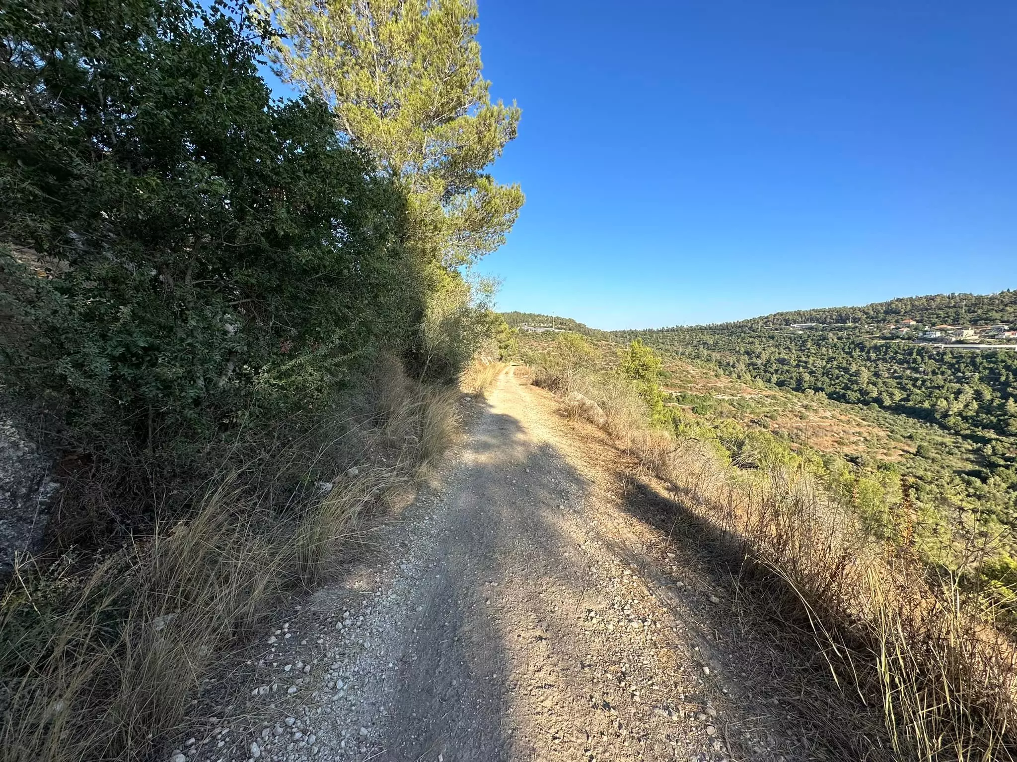
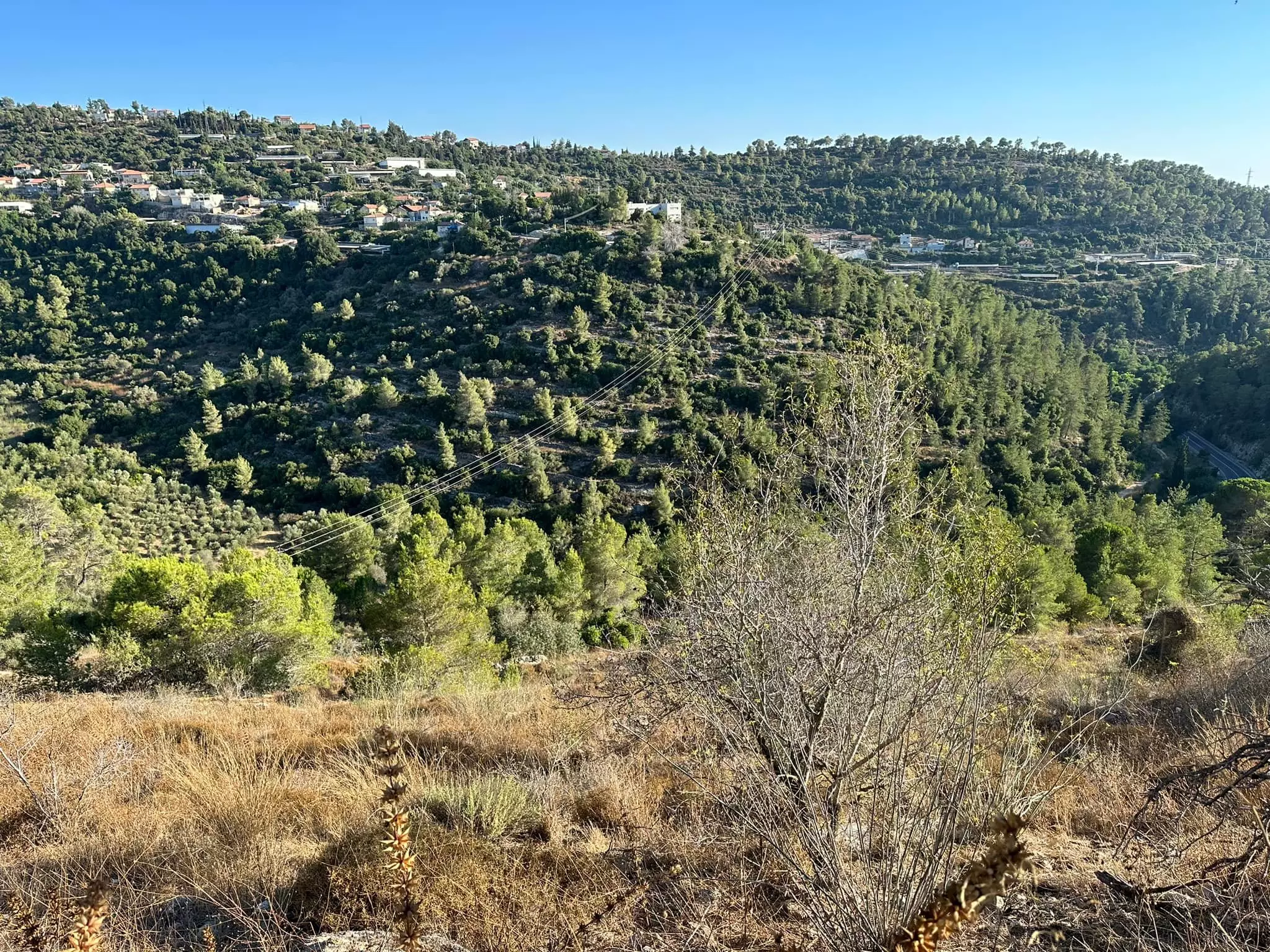
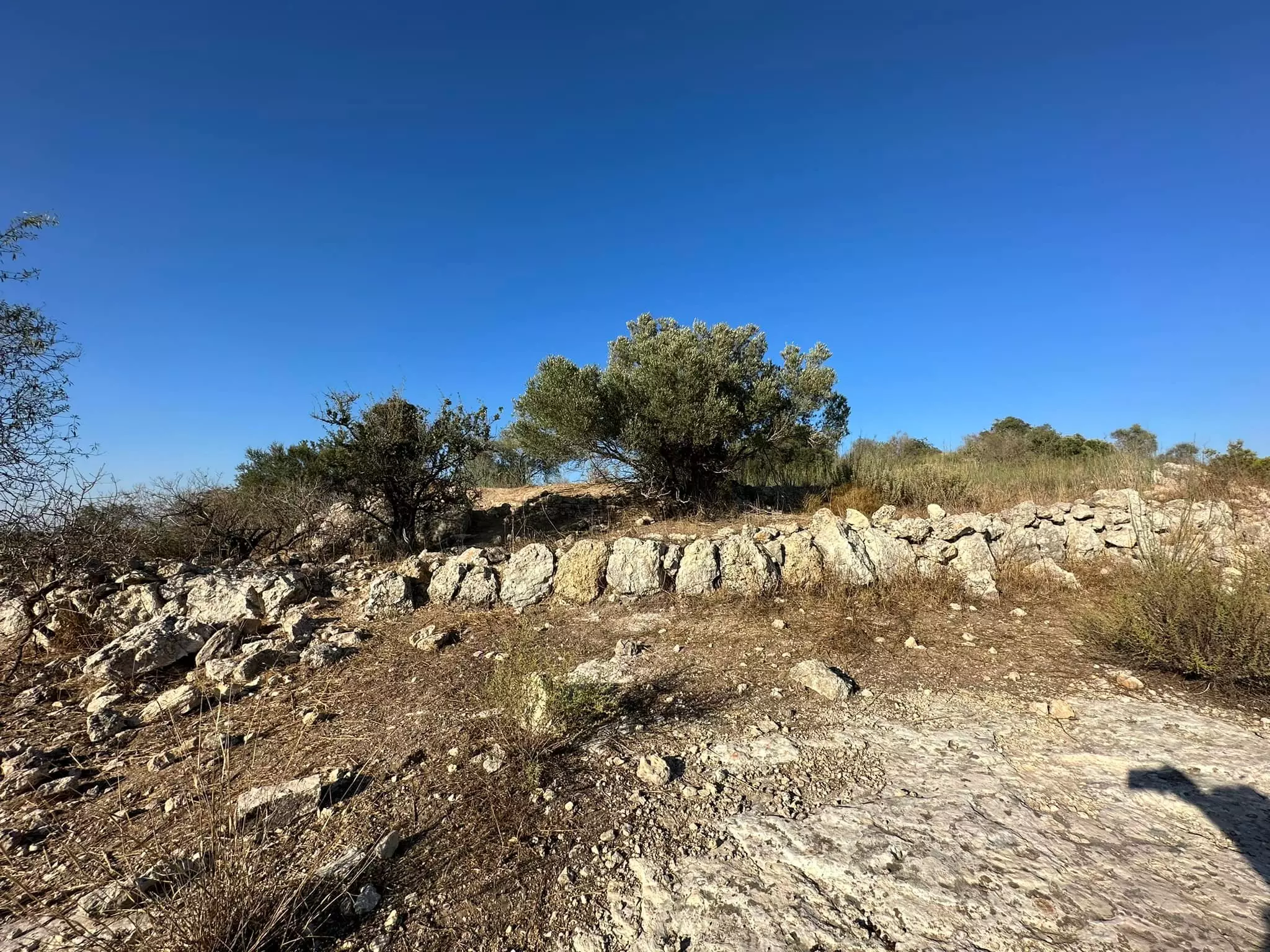
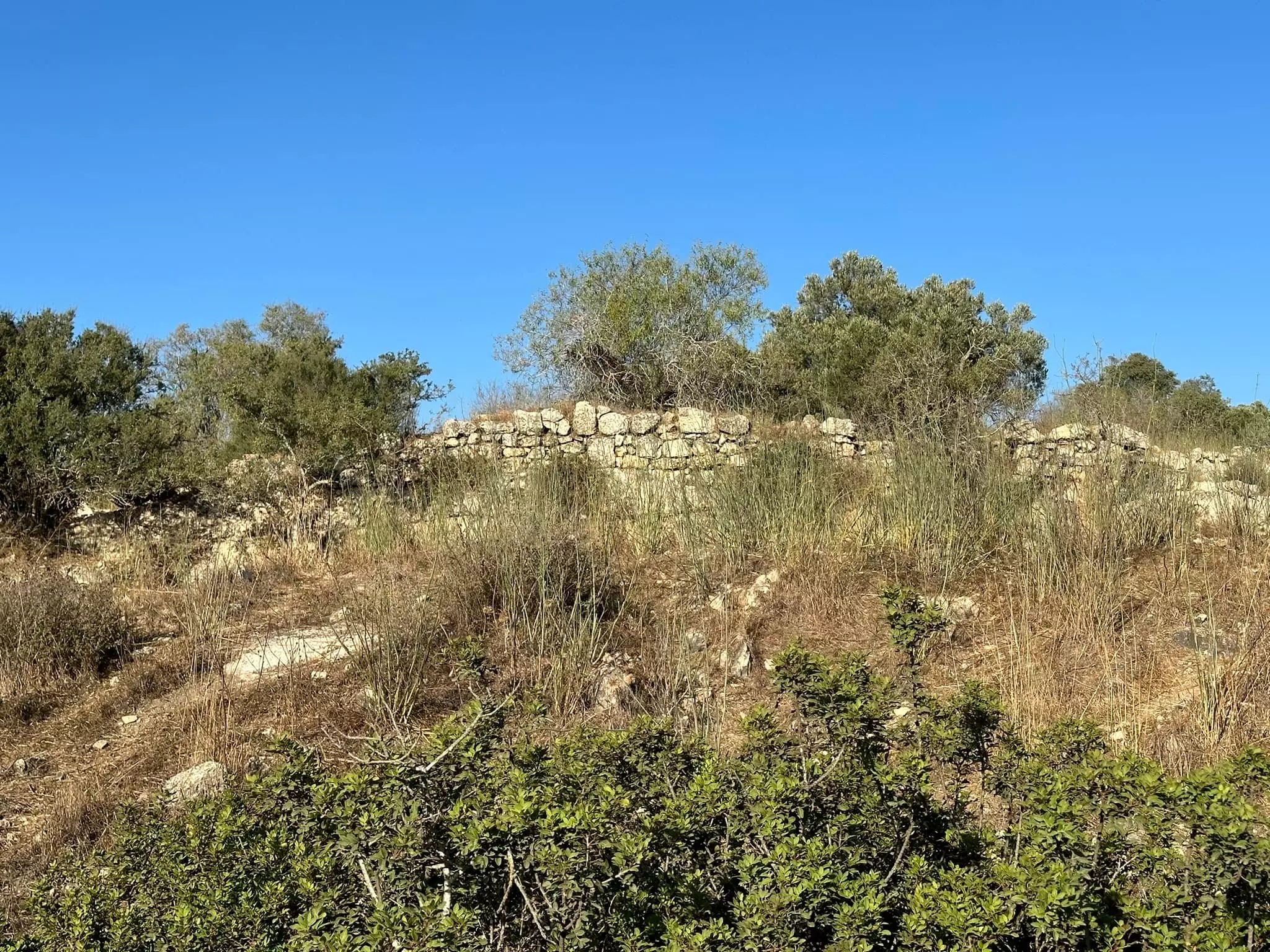
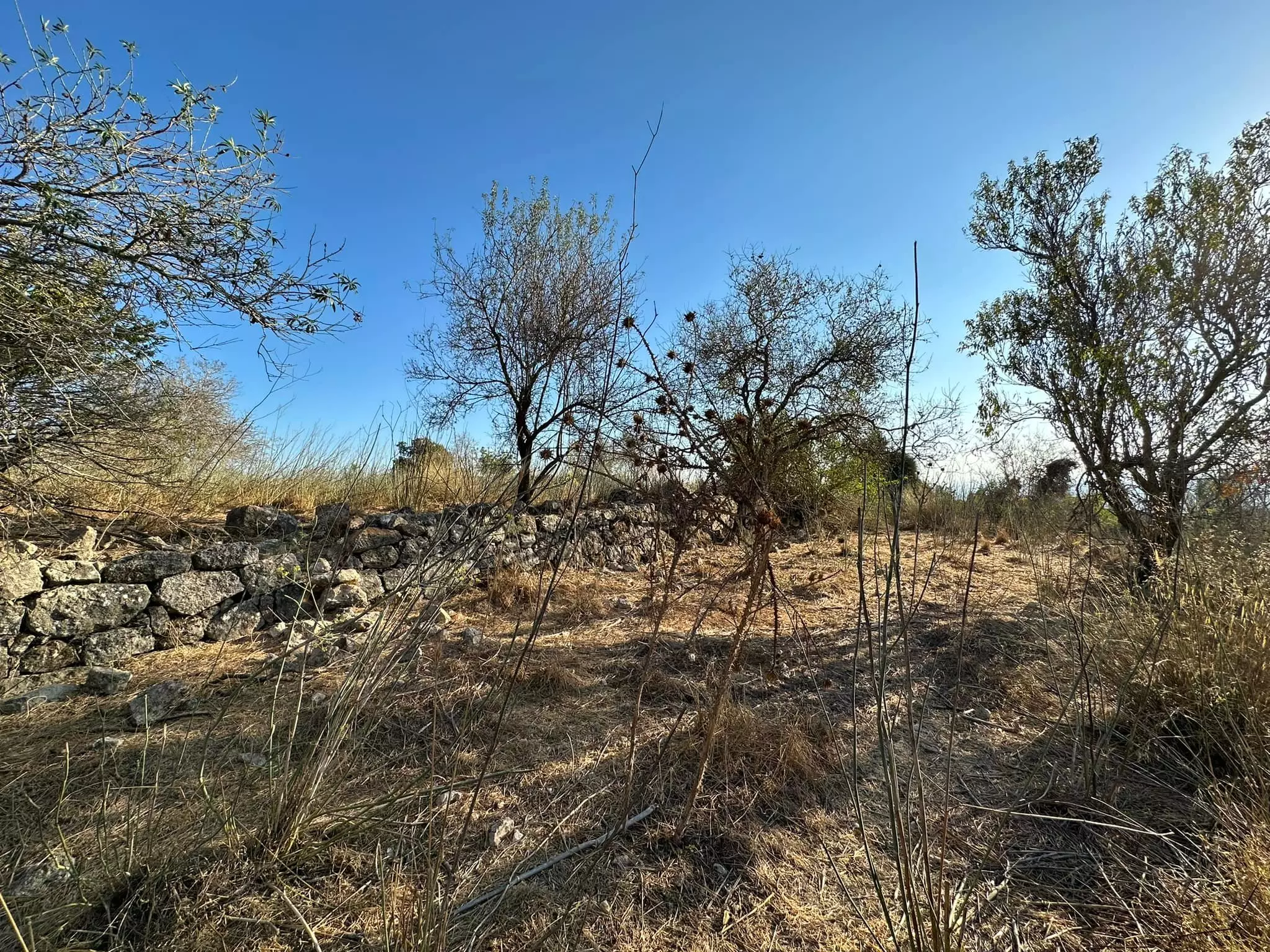
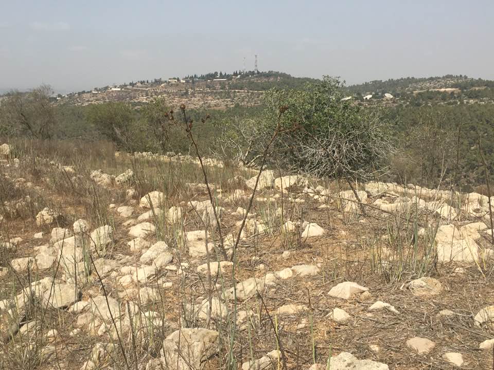
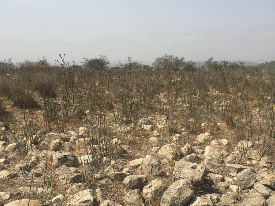
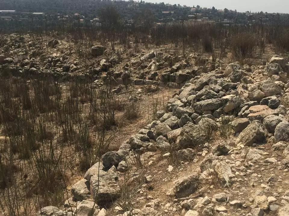
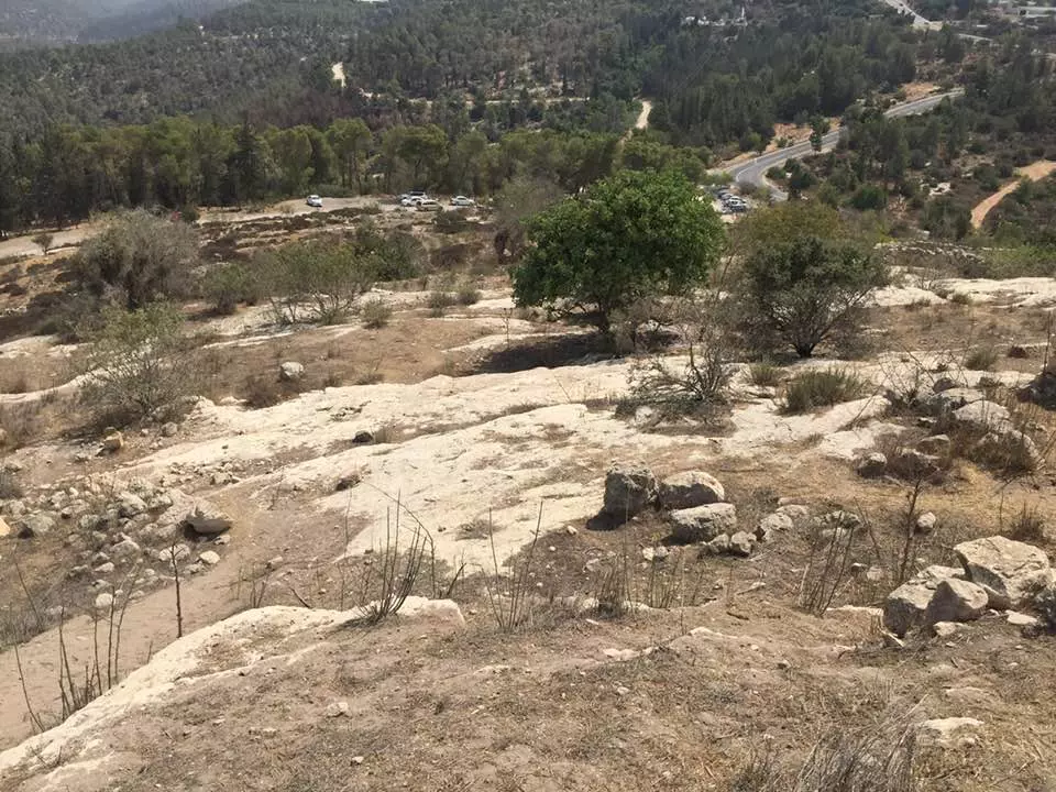
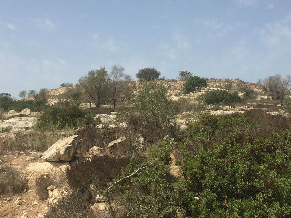
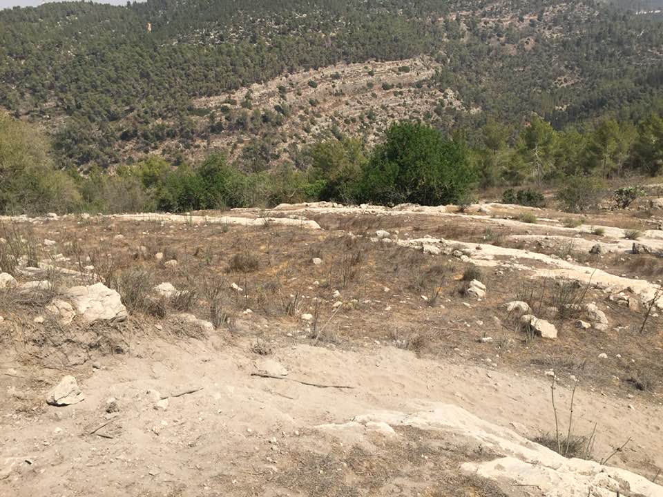
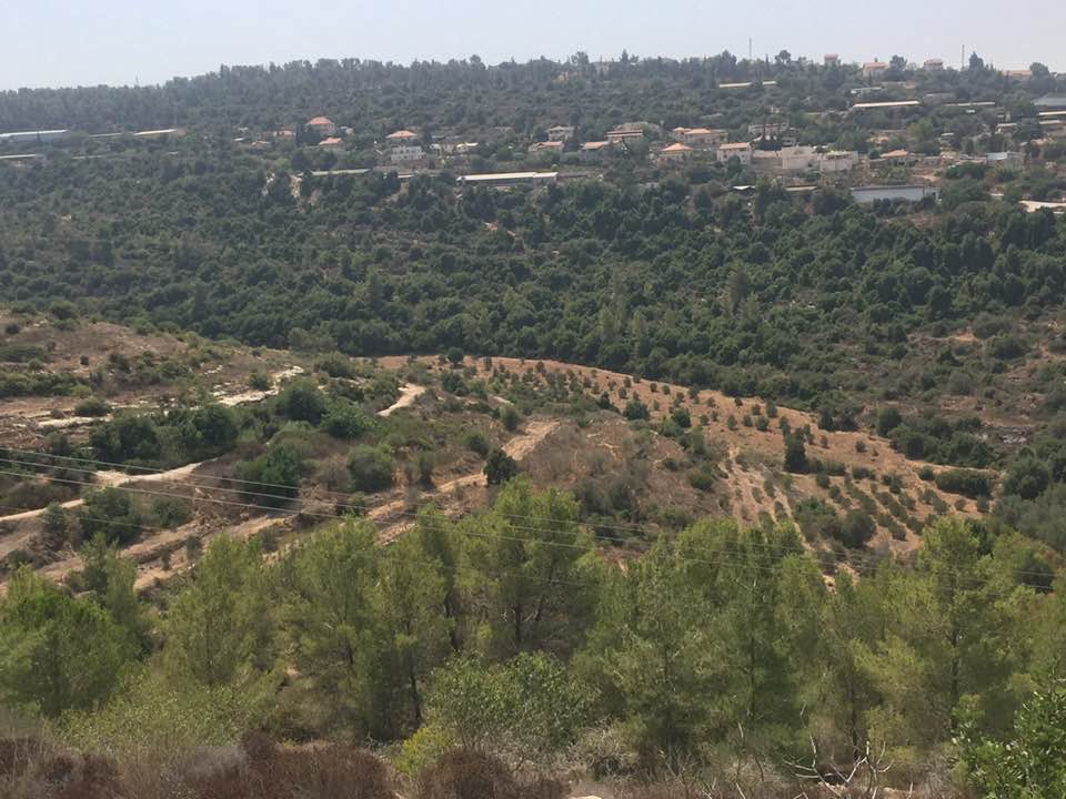
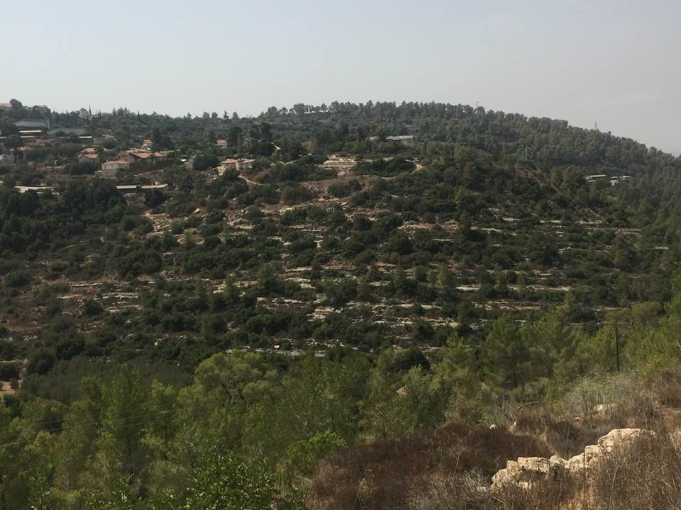
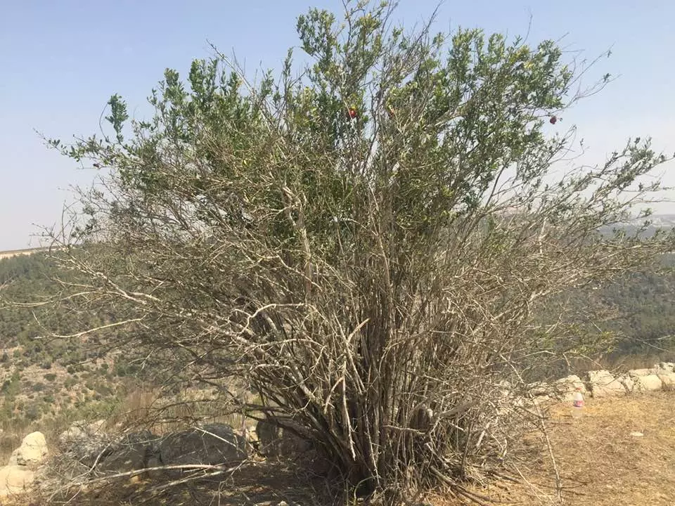
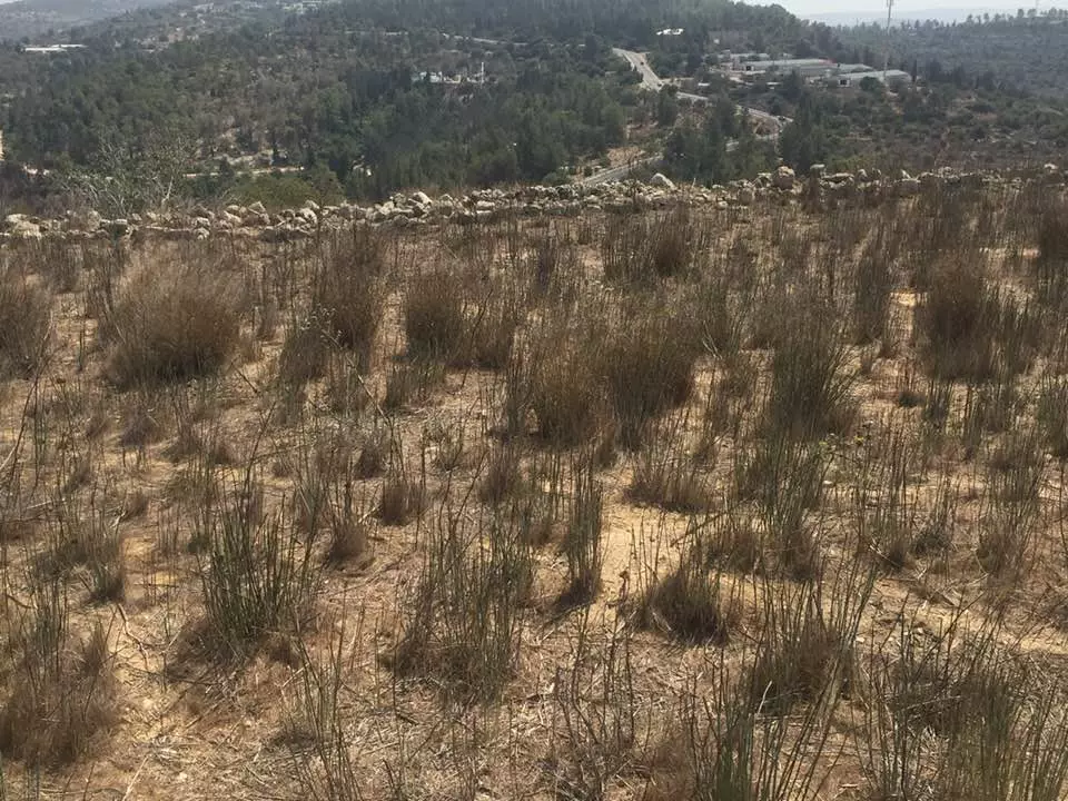
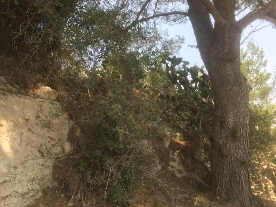
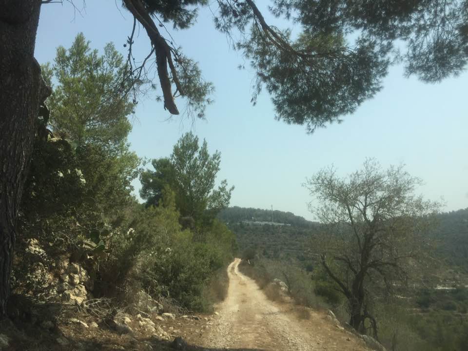
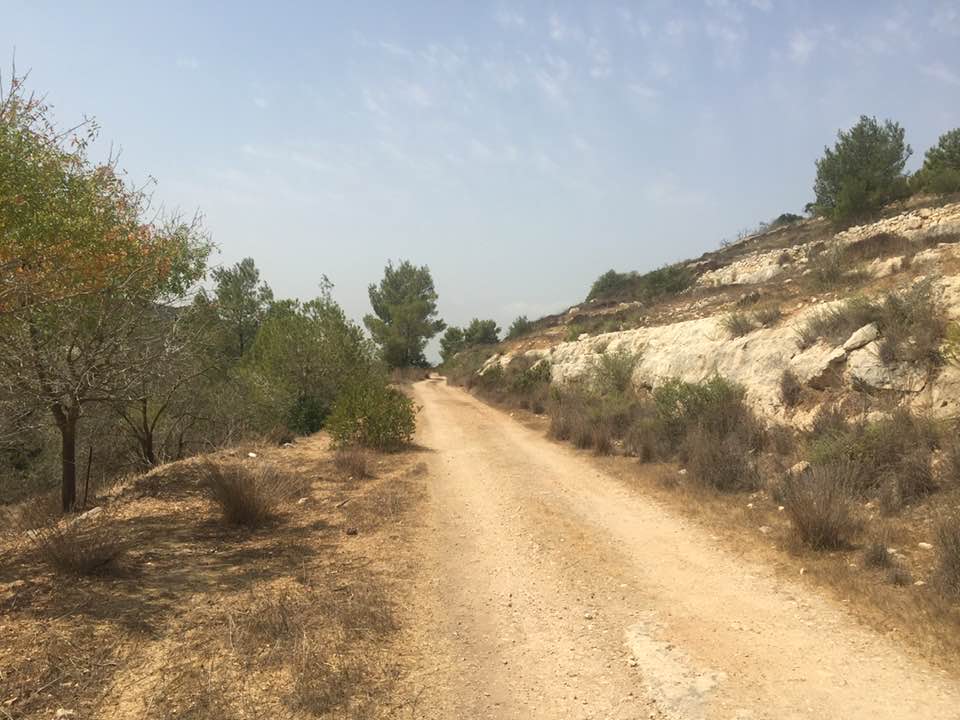
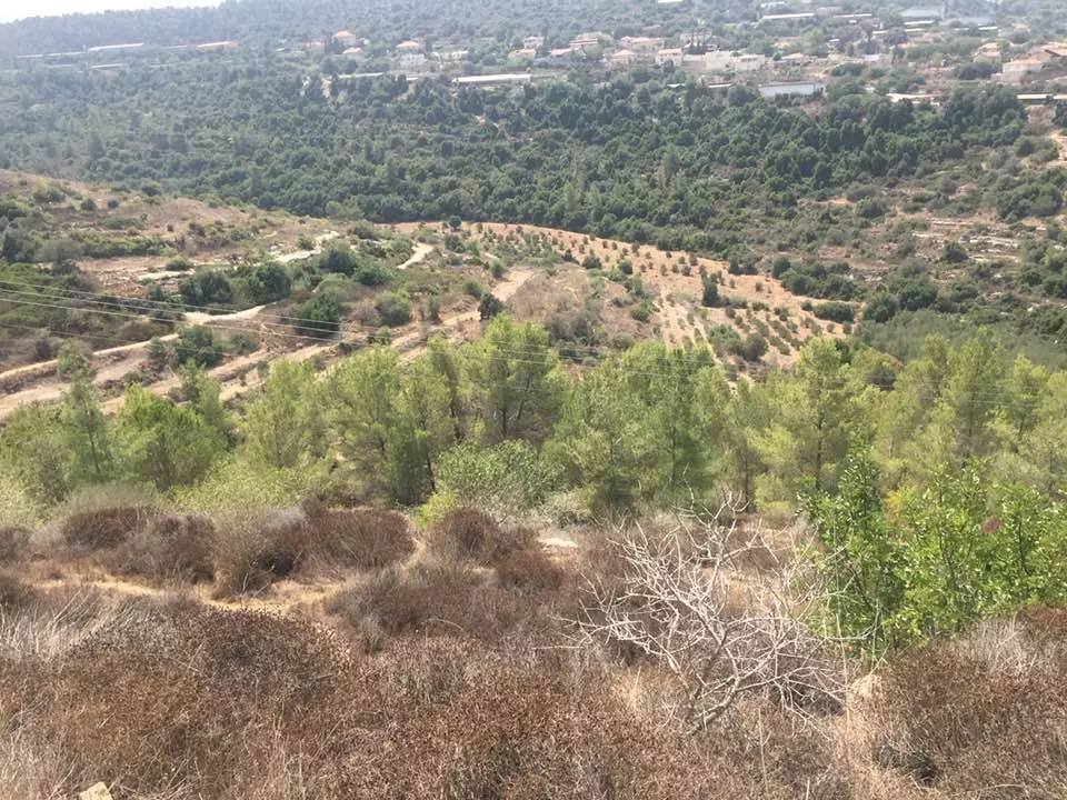
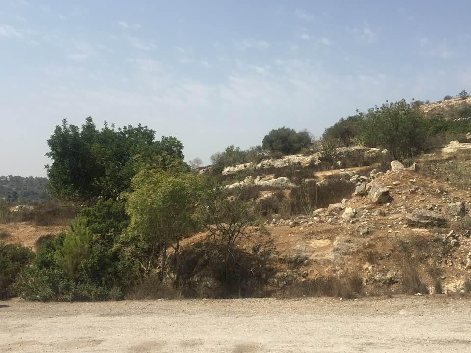
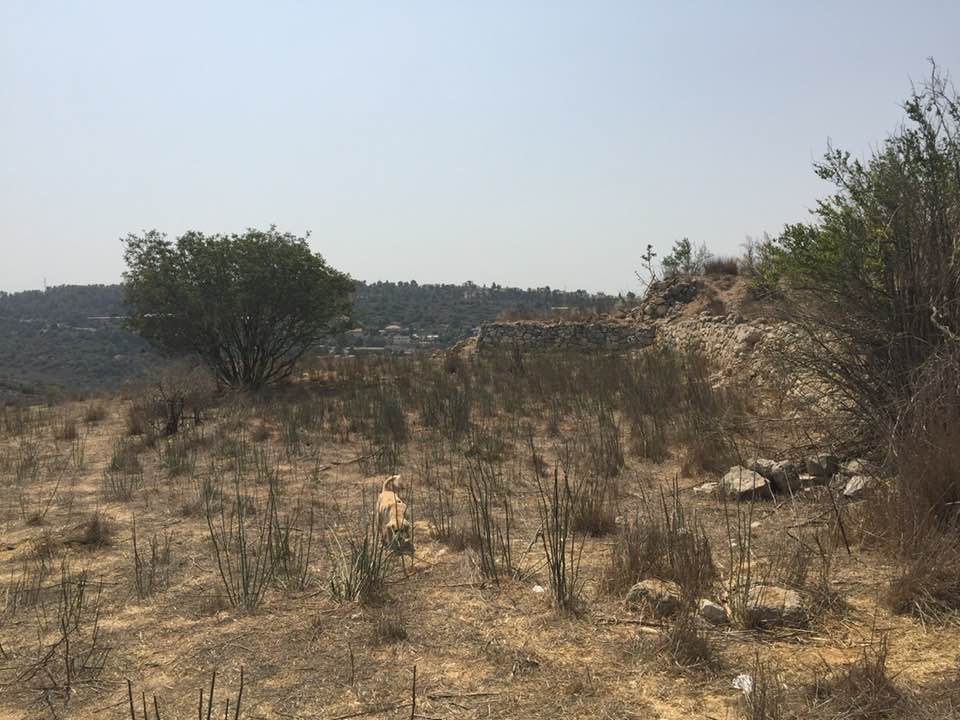
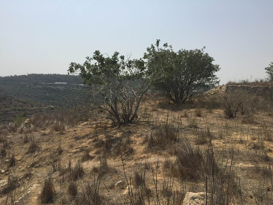
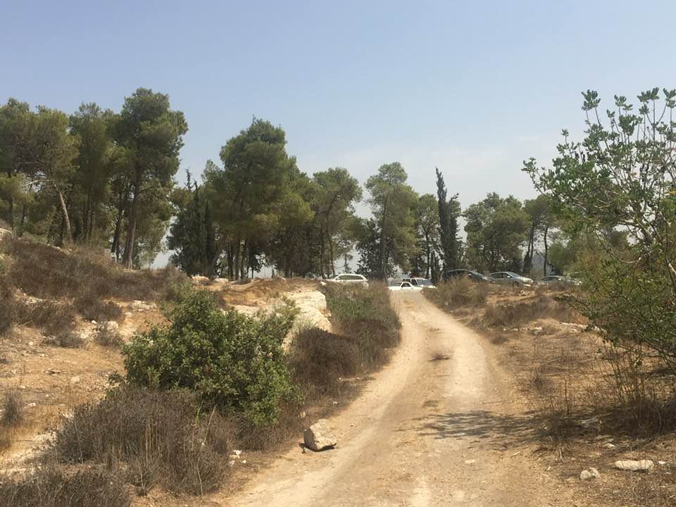
Village Before NakbaThe village stood on the top of an elongated mountain that stretched from east to west, overlooking two deep wadis on the northern and southern sides. The village itself was north of a secondary road that ran across the mountain in an east-west direction. The road intersected a highway to the east, on the outskirts of Jerusalem, and crossed another highway to the west that ran between Bayt Jibrin (in the Hebron sub-disctrict) and the Jerusalem−Jaffa highway. Kasla has been identified with the site of the Canaanite city of Chesalon (Joshua 15:10). It was a large village known as Chesalon or Cheslon in the Roman period. In 1596 Kasla (or Kisla) was a village in the nahiya of Ramla (liwa' of Gaza) with a population of sixty-one. It paid taxes on wheat, barley, sesame, and fruit trees as well as on goats and beehives.In the late nineteenth century, Kasla was described as a village on top of a rugged ridge with a deep valley to the north. Two springs in the valley and another to the east provided the villagers with water. The village plan was rectangular in shape. Most of its houses, which were built of stone, extended in an east-west direction along the secondary road; a few houses were built east of the village center along this road. The people of Kasla were Muslim; they maintained a shrine for a Shaykh Ahmad. Water for domestic use came from several springs around the village. Agriculture was based on olives, fruit, and grain, which were planted in the lowlands and valley floors; crops were rainfed and irrigated from springs. Some lands were used as grazing areas, especially in the steep rugged slopes. In 1944/45 a total of 2,265 dunums was allotted to cereals; 440 dunums were irrigated or used for orchards, of which 203 dunums were devoted to olive cultivation. The village was itself an archaeological site and was surrounded by several khirbas that contained the ruins of walls, cisterns, and carved stones. Village Occupation and Ethnic CleaningLike nearby Ishwa' and a few other villages on a side road leading to Jerusalem, Kasla was 'cleansed' on 16 July 1948, according to the History of the War of Independence. Israeli historian Benny Morris puts the date of occupation a day later, on 17−18 July. Morris writes that the villagers in this area either had left earlier, had fled under mortar barrages, or had been expelled by the occupying unit, the Har'el Brigade. The village was overrun as part of Operation Dani (see Abu al-Fadl, Ramla sub-district).Zionists Colonies on Village LandsIsrael established the settlement of Ramat Razi'el (156131) on village land in 1948. Kesalon (154131) was built on village land in 1952, 1 km south of the village site, on the archaeological site of Khirbat Sar'a.Village TodayWild grass covers the entire site and grows amid the rubble of the stone houses, which is difficult to distinguish from the rubble of ruined terraces. Almond trees grow on top of the mountain and cactuses grow along the site's southern slopes. Northeast of the village, two carob trees are surrounded by the remains of a vineyard. On the slopes, thick wild grass grows on several terraces, which are still intact.SourceDr. Walid al-Khalidi, 1992: All That Remains. |
|||||||||||||||
| Related Maps | Town Lands' Demarcation Maps خرائط للقضاء توضح حدود القرى والاودية Town's map on MapQuest View from satellite Help us map this town at WikiMapia |
||||||||||||||
| Related Links | Wikipedia's Page Google Search Google For Images Google For Videos |
||||||||||||||
| More Information | في كتاب كي لا ننسى في كتاب بلادنا فلسطين المزيد من موقع هوية |
||||||||||||||
- كسلا الاراضي المحيطة
Posted by مالك اللحام 1 - عين ماء كسلا
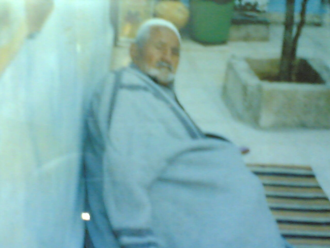
Posted by ابو حسام - صالح اسعد موسى عواد احد ابناء قرية كسلا واهم شحصيه في القريه
Posted by ابو حسام - كسلا
Posted by abu raya - عين كسلا جنوب القريه
Posted by abu raya - كسلا
Posted by abu raya - كسلا
Posted by abu raya - كسلا
Posted by abu raya - زيتون كسلا
Posted by abu raya - كسلا والمستعمره المقامه على اراضيها
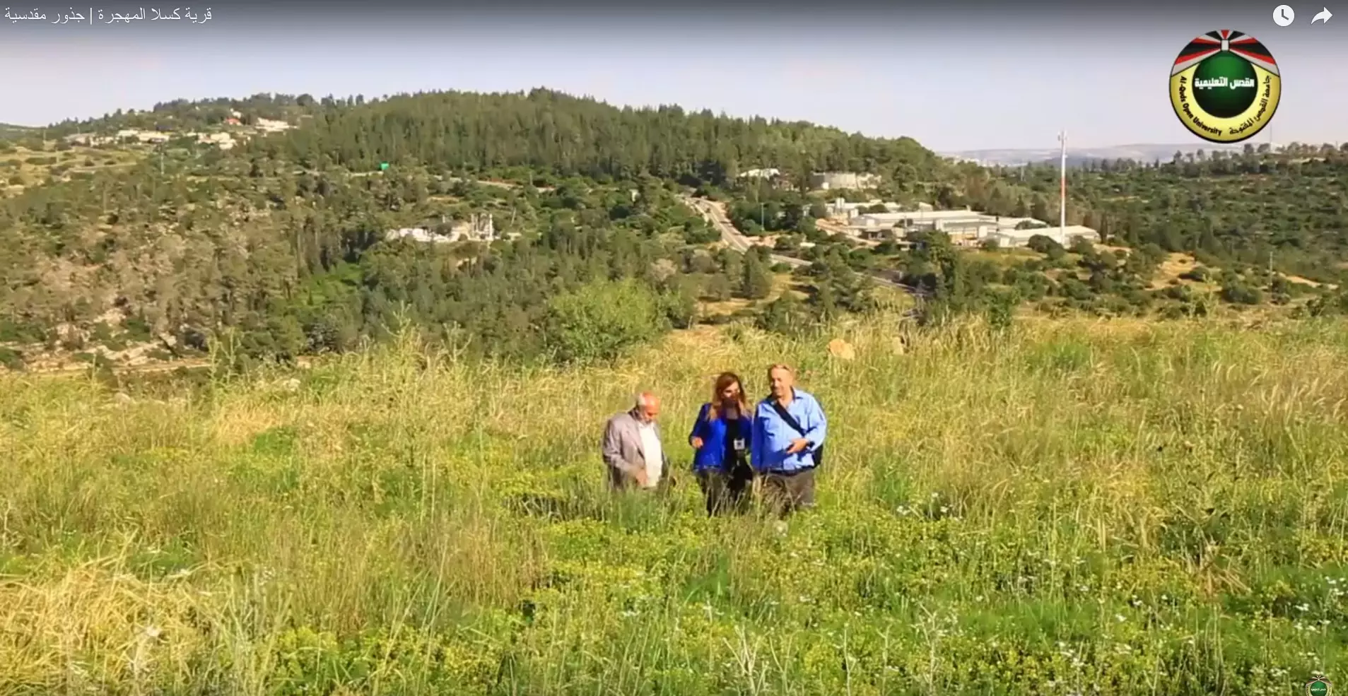
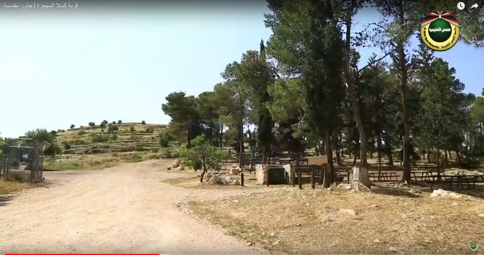
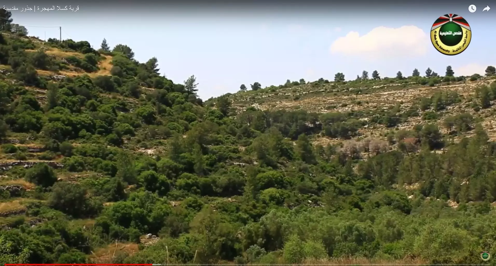
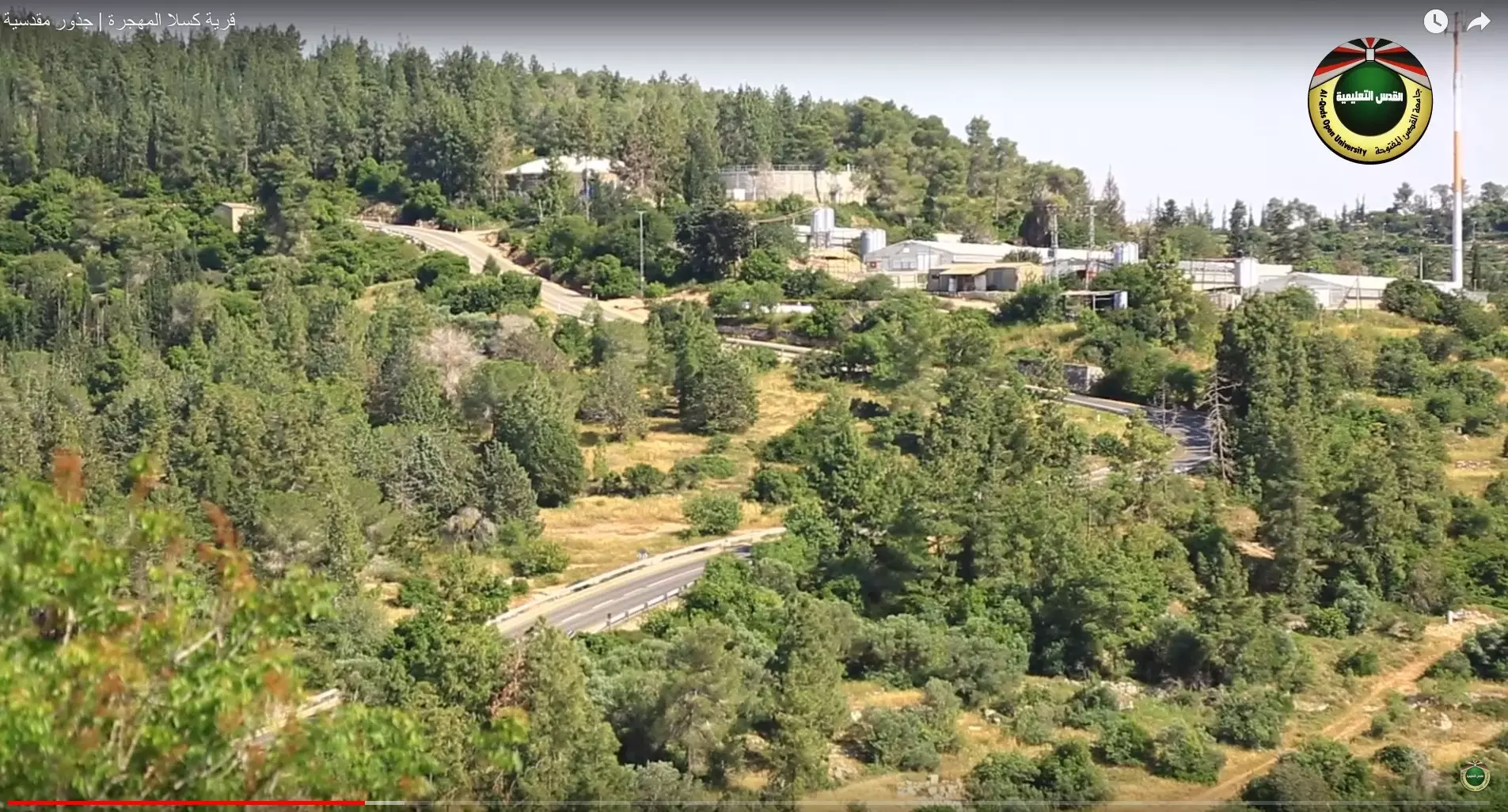
Posted by abu raya - جولة بين حقول وانقاض القرية المهجر- تصوير قناة القدس التعليمية - قرية كسلا المهجرة | جذور مقدسية
- جولة بين حقول وانقاض القرية المهجر- تصوير قناة القدس التعليمية - قرية كسلا المهجرة | جذور مقدسية #2
- جولة بين حقول وانقاض القرية المهجر- تصوير قناة القدس التعليمية - قرية كسلا المهجرة | جذور مقدسية #3
- جولة بين حقول وانقاض القرية المهجر- تصوير قناة القدس التعليمية - قرية كسلا المهجرة | جذور مقدسية #4
- جولة بين حقول وانقاض القرية المهجر- تصوير قناة القدس التعليمية - قرية كسلا المهجرة | جذور مقدسية #5
- جولة بين حقول وانقاض القرية المهجر- تصوير قناة القدس التعليمية - قرية كسلا المهجرة | جذور مقدسية #6
- جولة بين حقول وانقاض القرية المهجر- تصوير قناة القدس التعليمية - قرية كسلا المهجرة | جذور مقدسية #7
- جولة بين حقول وانقاض القرية المهجر- تصوير قناة القدس التعليمية - قرية كسلا المهجرة | جذور مقدسية #8
- جولة بين حقول وانقاض القرية المهجر- تصوير قناة القدس التعليمية - قرية كسلا المهجرة | جذور مقدسية #9
- جولة بين حقول وانقاض القرية المهجر- تصوير قناة القدس التعليمية - قرية كسلا المهجرة | جذور مقدسية #10
- جولة بين حقول وانقاض القرية المهجر- تصوير قناة القدس التعليمية - قرية كسلا المهجرة | جذور مقدسية #11
- جولة بين حقول وانقاض القرية المهجر- تصوير قناة القدس التعليمية - قرية كسلا المهجرة | جذور مقدسية #12
- جولة بين حقول وانقاض القرية المهجر- تصوير قناة القدس التعليمية - قرية كسلا المهجرة | جذور مقدسية #13
- عين القصب في جبال القدس اراضي قرية كسلا المهجرة قضاء القدس
- عين القصب في جبال القدس اراضي قرية كسلا المهجرة قضاء القدس #2
- عين القصب في جبال القدس اراضي قرية كسلا المهجرة قضاء القدس #3

- عين القصب في جبال القدس اراضي قرية كسلا المهجرة قضاء القدس #4
- عين القصب في جبال القدس اراضي قرية كسلا المهجرة قضاء القدس #5

- جولة بين حواكير قرية كسلا المغتصبه
- جولة بين حواكير قرية كسلا المغتصبه #2
- جولة بين حواكير قرية كسلا المغتصبه #3
- جولة بين حواكير قرية كسلا المغتصبه #4
- That is how the "civilized" erased and replaced us: Kasla was completely obliterated, as you see -- كسلا باتت أثر بعد عين. من هنا مر الهمجّ #4

- That is how the "civilized" erased and replaced us: Kasla was completely obliterated, as you see -- كسلا باتت أثر بعد عين. من هنا مر الهمجّ #6
- That is how the "civilized" erased and replaced us: Kasla was completely obliterated, as you see -- كسلا باتت أثر بعد عين. من هنا مر الهمجّ #7
- That is how the "civilized" erased and replaced us: Kasla was completely obliterated, as you see -- كسلا باتت أثر بعد عين. من هنا مر الهمجّ #8
- عين القصب في جبال القدس اراضي قرية كسلا المهجرة-- إياد جابر #2
- عين القصب في جبال القدس اراضي قرية كسلا المهجرة-- إياد جابر #4
- Let us bear witness how the "civilized" obliterated our village way after the battle was over to obstruct our return. Let us bear witness to the terraces, orchards, and spring that were built by those who "don't exist!"
- Let us bear witness how the "civilized" obliterated our village way after the battle was over to obstruct our return. Let us bear witness to the terraces, orchards, and spring that were built by those who "don't exist!" #2
- Let us bear witness how the "civilized" obliterated our village way after the battle was over to obstruct our return. Let us bear witness to the terraces, orchards, and spring that were built by those who "don't exist!" #3
- Let us bear witness how the "civilized" obliterated our village way after the battle was over to obstruct our return. Let us bear witness to the terraces, orchards, and spring that were built by those who "don't exist!" #4
- Let us bear witness how the "civilized" obliterated our village way after the battle was over to obstruct our return. Let us bear witness to the terraces, orchards, and spring that were built by those who "don't exist!" #5
- Let us bear witness how the "civilized" obliterated our village way after the battle was over to obstruct our return. Let us bear witness to the terraces, orchards, and spring that were built by those who "don't exist!" #6
- Let us bear witness how the "civilized" obliterated our village way after the battle was over to obstruct our return. Let us bear witness to the terraces, orchards, and spring that were built by those who "don't exist!" #7
- Let us bear witness how the "civilized" obliterated our village way after the battle was over to obstruct our return. Let us bear witness to the terraces, orchards, and spring that were built by those who "don't exist!" #8
- Let us bear witness how the "civilized" obliterated our village way after the battle was over to obstruct our return. Let us bear witness to the terraces, orchards, and spring that were built by those who "don't exist!" #9
- Let us bear witness how the "civilized" obliterated our village way after the battle was over to obstruct our return. Let us bear witness to the terraces, orchards, and spring that were built by those who "don't exist!" #10
- Let us bear witness how the "civilized" obliterated our village way after the battle was over to obstruct our return. Let us bear witness to the terraces, orchards, and spring that were built by those who "don't exist!" #11
- Let us bear witness how the "civilized" obliterated our village way after the battle was over to obstruct our return. Let us bear witness to the terraces, orchards, and spring that were built by those who "don't exist!" #12
- Let us bear witness how the "civilized" obliterated our village way after the battle was over to obstruct our return. Let us bear witness to the terraces, orchards, and spring that were built by those who "don't exist!" #13
- Let us bear witness how the "civilized" obliterated our village way after the battle was over to obstruct our return. Let us bear witness to the terraces, orchards, and spring that were built by those who "don't exist!" #14
- Let us bear witness how the "civilized" obliterated our village way after the battle was over to obstruct our return. Let us bear witness to the terraces, orchards, and spring that were built by those who "don't exist!" #15
- Let us bear witness how the "civilized" obliterated our village way after the battle was over to obstruct our return. Let us bear witness to the terraces, orchards, and spring that were built by those who "don't exist!" #16
- Let us bear witness how the "civilized" obliterated our village way after the battle was over to obstruct our return. Let us bear witness to the terraces, orchards, and spring that were built by those who "don't exist!" #17
- Let us bear witness how the "civilized" obliterated our village way after the battle was over to obstruct our return. Let us bear witness to the terraces, orchards, and spring that were built by those who "don't exist!" #18
- Let us bear witness how the "civilized" obliterated our village way after the battle was over to obstruct our return. Let us bear witness to the terraces, orchards, and spring that were built by those who "don't exist!" #19
- Let us bear witness how the "civilized" obliterated our village way after the battle was over to obstruct our return. Let us bear witness to the terraces, orchards, and spring that were built by those who "don't exist!" #20
- Let us bear witness how the "civilized" obliterated our village way after the battle was over to obstruct our return. Let us bear witness to the terraces, orchards, and spring that were built by those who "don't exist!" #21
- Let us bear witness how the "civilized" obliterated our village way after the battle was over to obstruct our return. Let us bear witness to the terraces, orchards, and spring that were built by those who "don't exist!" #22
- Let us bear witness how the "civilized" obliterated our village way after the battle was over to obstruct our return. Let us bear witness to the terraces, orchards, and spring that were built by those who "don't exist!" #23
- Let us bear witness how the "civilized" obliterated our village way after the battle was over to obstruct our return. Let us bear witness to the terraces, orchards, and spring that were built by those who "don't exist!" #24
- Let us bear witness how the "civilized" obliterated our village way after the battle was over to obstruct our return. Let us bear witness to the terraces, orchards, and spring that were built by those who "don't exist!" #25
- Let us bear witness how the "civilized" obliterated our village way after the battle was over to obstruct our return. Let us bear witness to the terraces, orchards, and spring that were built by those who "don't exist!" #26
- Let us bear witness how the "civilized" obliterated our village way after the battle was over to obstruct our return. Let us bear witness to the terraces, orchards, and spring that were built by those who "don't exist!" #27
- Let us bear witness how the "civilized" obliterated our village way after the battle was over to obstruct our return. Let us bear witness to the terraces, orchards, and spring that were built by those who "don't exist!" #28
- Let us bear witness how the "civilized" obliterated our village way after the battle was over to obstruct our return. Let us bear witness to the terraces, orchards, and spring that were built by those who "don't exist!" #29
- Let us bear witness how the "civilized" obliterated our village way after the battle was over to obstruct our return. Let us bear witness to the terraces, orchards, and spring that were built by those who "don't exist!" #30
- Let us bear witness how the "civilized" obliterated our village way after the battle was over to obstruct our return. Let us bear witness to the terraces, orchards, and spring that were built by those who "don't exist!" #31
- Let us bear witness how the "civilized" obliterated our village way after the battle was over to obstruct our return. Let us bear witness to the terraces, orchards, and spring that were built by those who "don't exist!" #32
- Let us bear witness how the "civilized" obliterated our village way after the battle was over to obstruct our return. Let us bear witness to the terraces, orchards, and spring that were built by those who "don't exist!" #33
- Let us bear witness how the "civilized" obliterated our village way after the battle was over to obstruct our return. Let us bear witness to the terraces, orchards, and spring that were built by those who "don't exist!" #34
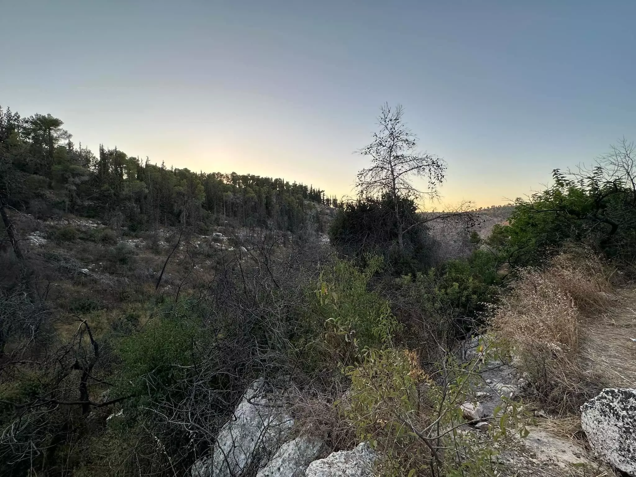
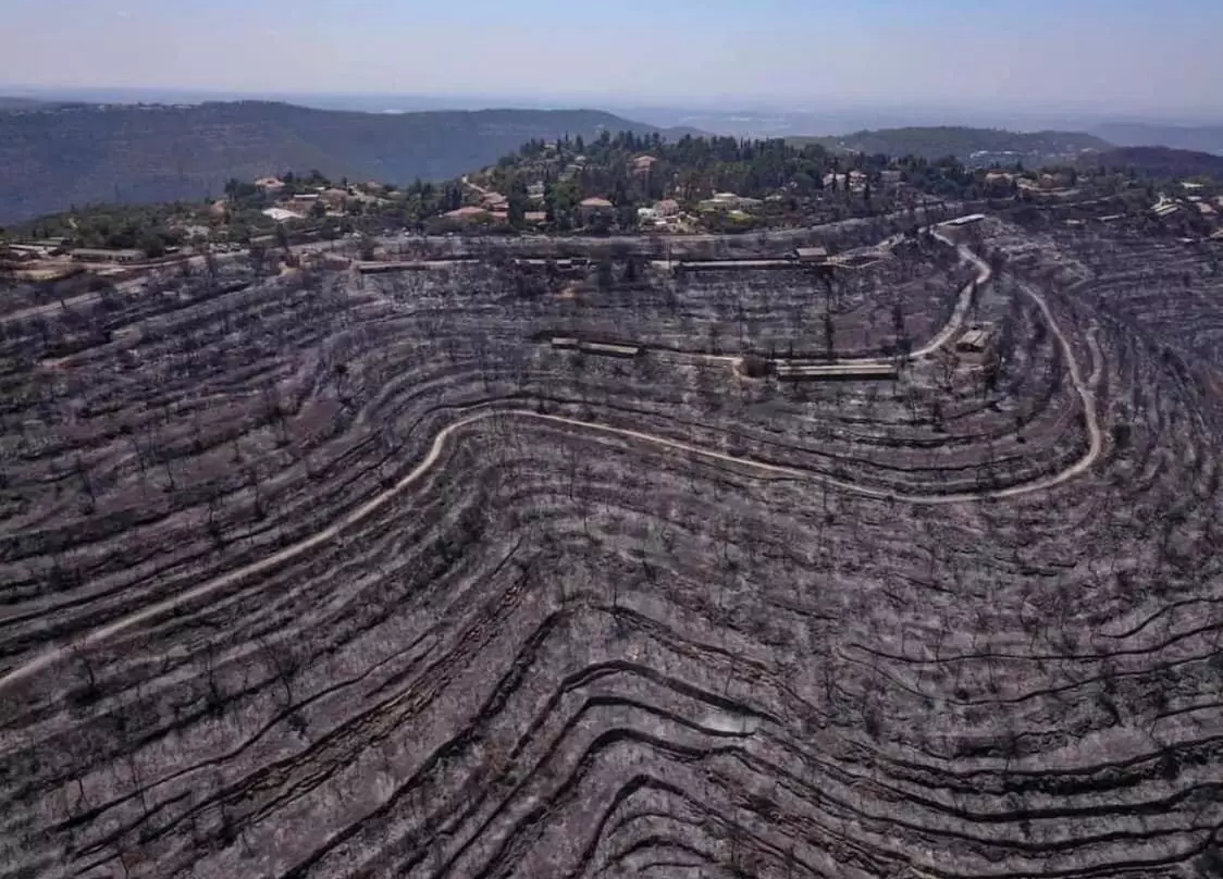
- When the fire reached our beloved Kasla in 2021, it burned the pine trees which were planted by the "civilized" colonizers after they uprooted our native plants, such as olive trees (ironically, many Jews are allergic to olive pollen). As you can see below, the fire exposed famous Palestinian terraces, which took hundreds of years to build. Despite that, we still hear so many Jews saying Palestine was empty and it only bloomed when the Jews colonized it!
1 - Let us see how the most "liberal and civilized" of world Jewry has obliterated our village. How else will the Jews be great and safe again? -- القرية دمرت بالكامل.. من هنا مر الهمج
- Let us see how the most "liberal and civilized" of world Jewry has obliterated our village. How else will the Jews be great and safe again? -- القرية دمرت بالكامل.. من هنا مر الهمج #2
- Let us see how the most "liberal and civilized" of world Jewry has obliterated our village. How else will the Jews be great and safe again? -- القرية دمرت بالكامل.. من هنا مر الهمج #3
- Let us see how the most "liberal and civilized" of world Jewry has obliterated our village. How else will the Jews be great and safe again? -- القرية دمرت بالكامل.. من هنا مر الهمج #4
- Let us see how the most "liberal and civilized" of world Jewry has obliterated our village. How else will the Jews be great and safe again? -- القرية دمرت بالكامل.. من هنا مر الهمج #5
- Let us see how the most "liberal and civilized" of world Jewry has obliterated our village. How else will the Jews be great and safe again? -- القرية دمرت بالكامل.. من هنا مر الهمج #6
- Let us see how the most "liberal and civilized" of world Jewry has obliterated our village. How else will the Jews be great and safe again? -- القرية دمرت بالكامل.. من هنا مر الهمج #7
- Let us see how the most "liberal and civilized" of world Jewry has obliterated our village. How else will the Jews be great and safe again? -- القرية دمرت بالكامل.. من هنا مر الهمج #8
- Let us see how the most "liberal and civilized" of world Jewry has obliterated our village. How else will the Jews be great and safe again? -- القرية دمرت بالكامل.. من هنا مر الهمج #9
- Let us see how the most "liberal and civilized" of world Jewry has obliterated our village. How else will the Jews be great and safe again? -- القرية دمرت بالكامل.. من هنا مر الهمج #10
- Let us see how the most "liberal and civilized" of world Jewry has obliterated our village. How else will the Jews be great and safe again? -- القرية دمرت بالكامل.. من هنا مر الهمج #11
- Let us see how the most "liberal and civilized" of world Jewry has obliterated our village. How else will the Jews be great and safe again? -- القرية دمرت بالكامل.. من هنا مر الهمج #12
- Let us see how the most "liberal and civilized" of world Jewry has obliterated our village. How else will the Jews be great and safe again? -- القرية دمرت بالكامل.. من هنا مر الهمج #13
- Let us see how the most "liberal and civilized" of world Jewry has obliterated our village. How else will the Jews be great and safe again? -- القرية دمرت بالكامل.. من هنا مر الهمج #14
- Let us see how the most "liberal and civilized" of world Jewry has obliterated our village. How else will the Jews be great and safe again? -- القرية دمرت بالكامل.. من هنا مر الهمج #15
- Let us see how the most "liberal and civilized" of world Jewry has obliterated our village. How else will the Jews be great and safe again? -- القرية دمرت بالكامل.. من هنا مر الهمج #16
- Let us see how the most "liberal and civilized" of world Jewry has obliterated our village. How else will the Jews be great and safe again? -- القرية دمرت بالكامل.. من هنا مر الهمج #17
- Let us see how the most "liberal and civilized" of world Jewry has obliterated our village. How else will the Jews be great and safe again? -- القرية دمرت بالكامل.. من هنا مر الهمج #18
- Let us see how the most "liberal and civilized" of world Jewry has obliterated our village. How else will the Jews be great and safe again? -- القرية دمرت بالكامل.. من هنا مر الهمج #19
- Let us see how the most "liberal and civilized" of world Jewry has obliterated our village. How else will the Jews be great and safe again? -- القرية دمرت بالكامل.. من هنا مر الهمج #20
- Let us see how the most "liberal and civilized" of world Jewry has obliterated our village. How else will the Jews be great and safe again? -- القرية دمرت بالكامل.. من هنا مر الهمج #21
- Let us see how the most "liberal and civilized" of world Jewry has obliterated our village. How else will the Jews be great and safe again? -- القرية دمرت بالكامل.. من هنا مر الهمج #22
- Let us see how the most "liberal and civilized" of world Jewry has obliterated our village. How else will the Jews be great and safe again? -- القرية دمرت بالكامل.. من هنا مر الهمج #23
- Let us see how the most "liberal and civilized" of world Jewry has obliterated our village. How else will the Jews be great and safe again? -- القرية دمرت بالكامل.. من هنا مر الهمج #24
- Let us see how the most "liberal and civilized" of world Jewry has obliterated our village. How else will the Jews be great and safe again? -- القرية دمرت بالكامل.. من هنا مر الهمج #25
- Let us see how the most "liberal and civilized" of world Jewry has obliterated our village. How else will the Jews be great and safe again? -- القرية دمرت بالكامل.. من هنا مر الهمج #26
Want to browse more? 80,000 pictures were grouped in these gallaries:
| Display Name | Clan/Hamolah | Country of Residence |
- قرية كسلا المهجرة | جذور مقدسية Duration: 21 min 50 sec
No links have been shared yet, be free to the first to share the first link.
 Fake Valor: Why Did Zionist Jews Hoist Nazis Flag on Their Ships in the 1930s?
What is new?
-
Facts About Oct. 7th Gaza Raid
-
Remined Us Please:: Who Did Rape Who? Palestinians Raped Israelis? Or, was the other way around?
-
When Prof. Edward Said was invited to debate Bibi Netanyahu in the 1980s, watch what happened!
-
Ezra Klein of the NY Times on the "Jewish Race".
-
Abusing Blood Libel!
-
Did Israeli Soldiers Activate The Hanniba Direective On Oct. 7th? You Be The Judge
-
Zionist FAQ: Isn't it true that Palestinians don't want peace? Palestinians never accepted the two-state solution
- Facts about Haavara (Transfer) Agreement between Ben-Gurion & Hitler
-
Haavara FAQs: Why Did Zionist Jews Hoist Nazis' Flags on Their Ships in the 1930s?
- Haavara FAQs: When Chaim Weizmann met FDR in mid-1943, why was he silent about rescuing European Jewry?
-
Dear ChatGPT: How did Palestinians resist Napoleon's invasion of their country in 1799?
-
Dear ChatGPT: Gaza had a vibrant Jewish community in the mid-17th century. What happened to them?
-
Dear ChatGPT: Why did the Jewish Agency suppress news of the Holocaust during WWII?
-
Video Playlist: Jews share their DNA tests to end the conflict for good.
-
A Tale of Two Conflicts: Examining the Definition of Genocide
-
Prof. Abraham Polak And The Suppressed History of the Khazars and European Jewry
-
How Ronald Reagan would have framed the genocide in Gaza if he were still alive?
-
Haavara FAQs: Let us do the math: how many German Jews did The Haavara Agreement save?
-
Zionist FAQs: The Hebron Massacre of 1929, "clearly proves" that Palestinians are antisemitic, how could you deny it?
-
Zionist FAQs: Why Anti-Zionist Is Not Antisemitism?
-
Zionist FAQs: Isn't it true that the KGB created Palestinian Nationalism in the early 1960s?
- Zionist FAQs: Muslims are killing Muslims all the time; why are Israeli Jews being singled out in the media?
- Zionist FAQs: How is Israel an apartheid state when 20% of its citizens are Arabs who enjoy full rights?
-
Haavara FAQs: Why Did Dorothy Thompson Flip From A Zionist Advocate to A Silenced Dissenter?
-
Haavara FAQs: Analysis of Herzl's Uganda Scheme and how it could have saved millions of Jews.
-
Haavara FAQs: Why did Hayim Greenberg describe American Jewry as "morally bankrupt" in early 1943?
-
Haavara FAQs: What if the Evian Conference was a resounding success? What would have been the impact of saving European Jewry on Zionism?
- Haavara FAQs: What if the six million were saved, how that would have impacted the Zionist project?
-
Haavara FAQs: How did Zionist leaders react when Europe's Jews lingered in the DP camps after WWII ended?
-
Why does the American Jewish community repeat lies that David Ben-Gurion had debunked before he died?
-
Who has the power to rename the Tatar/Khazar Gene Marker to Jewish IV?
-
Zionist FAQs: Why won't Egypt, Syria, and Jordan take their people back? Jews are indigenous to Palestine, and Arabs immigrated after Jews developed the country. Arabs should leave.
-
Haavara FAQs: Did Hitler and the Nazis conflate between Judaism and Zionist? If that wasn't case, then why?
-
Haavara FAQs: Winston Churchill and antisemitism, a collection of articles written Churchill.
-
Haavara FAQs: Broken by country, how many Jews survived vs. killed during the Holocaust?
-
Haavara FAQs: Why did European Jews vote with their feet and to immigrated to the Americas, not Palestine, after WWII?
-
Watch this American Jewish Girl describing Israeli Jews' cognitive dissonance like no other in under two minutes
-
Haavara FAQs: When the Nazis went out of their way to hide the Holocaust, Israeli Jews did the exact opposite by broadcasting their genocide of Gazans. But why?
-
Haavara FAQs: How Zionist Jews went out of their to show their appreciation to Nazism and Fascism?
- Haavara FAQs: Why Zionist leaders were against bombing the death camps & the Railroads leading to them?
-
Haavara FAQs: Hitler's message to the British and American people: If Jews are such noble citizens and you care about them, how come you're not letting them in? I will gladly ship them to you at my expense, even on luxury liners!
-
A shortlist of Zionist and Israeli false flag operations in the name Jews.
-
The Most Moral Army
- The Land of Kapos (Israel): Where the brave are boycotted and Kapos walk free.
- Why did early Zionists often named their communal enterprises "colonial"?
- Zionist Relations with Nazi Germany by Faris Glubb
-
Two NY Times advertisements by Zionists in the early 1943 that exposes Zionists' treason at the height of the calamity
- Facts Not Lies about the Palestinian-Israeli Conflict.
- Site's pictures have been categorized
- Campgain Against Lice
- A Survey of Palestine, the official source about Palestine before Nakba produced by the British Mandate; over 1200 pages.
- Satellite View & Google Earth: Over 6,000 placemarks identifying all destroyed towns, W. Bank & Gaza Strip Towns, & refugee camps.
- PalestineRemembered.com and its Nakba Oral History Project were featured on al-Jazeera Satellite TV.
- Nakba Oral History Video Podcast:
 Over 700 Oral History interviews (including 3,500+ hours of recording) can be viewed online.
 - Palestine Village Statistics Project
- Gaza Jail Break
- النسخة العربية للموقع الان متوفرة
- Videos: Documenting the destroyed villages in video: Tracing all that remains since Nakba.
- Videos: Responding to Zionist Propaganda
- Interview: The ethnic cleansing of Palestine: George Galloway interviews Israeli Historian Ilan Pappe.
- For Palestinians, memory matters. It provides a blueprint for their future By George Bisharat.
- Zionist FAQ now available in Hebrew שאלות שציונים שואלים, עכשיו בעברית
- Video: The Stephen Walt and John Mearsheimer report on the influence of the Israel Lobby on U.S. Foreign Policy
- The Palestinian-Israeli conflict for beginners
