| PalestineRemembered | About Us | Oral History | العربية | |
| Pictures | Zionist FAQs | Haavara | Maps | |
| Search |
| Camps |
| Districts |
| Acre |
| Baysan |
| Beersheba |
| Bethlehem |
| Gaza |
| Haifa |
| Hebron |
| Jaffa |
| Jericho |
| Jerusalem |
| Jinin |
| Nablus |
| Nazareth |
| Ramallah |
| al-Ramla |
| Safad |
| Tiberias |
| Tulkarm |
| Donate |
| Contact |
| Profile |
| Videos |
Welcome To al-Jura - الجورة (אל-ג'ורה)
|
District of Jerusalem
Ethnically cleansed days ago |
العربية Google Earth |
 |
Gallery (77) |
- Statistics & Facts
-
Before & After

- Satellite View
- Articles 2
- Pictures 77
- Members 7
- All That Remains
- Wikipedia
- Videos 1
- Guest Book 3
- Links
| Statistic & Fact | Value | |||||||||||||||||||||
| Occupation Date | July 11, 1948 | |||||||||||||||||||||
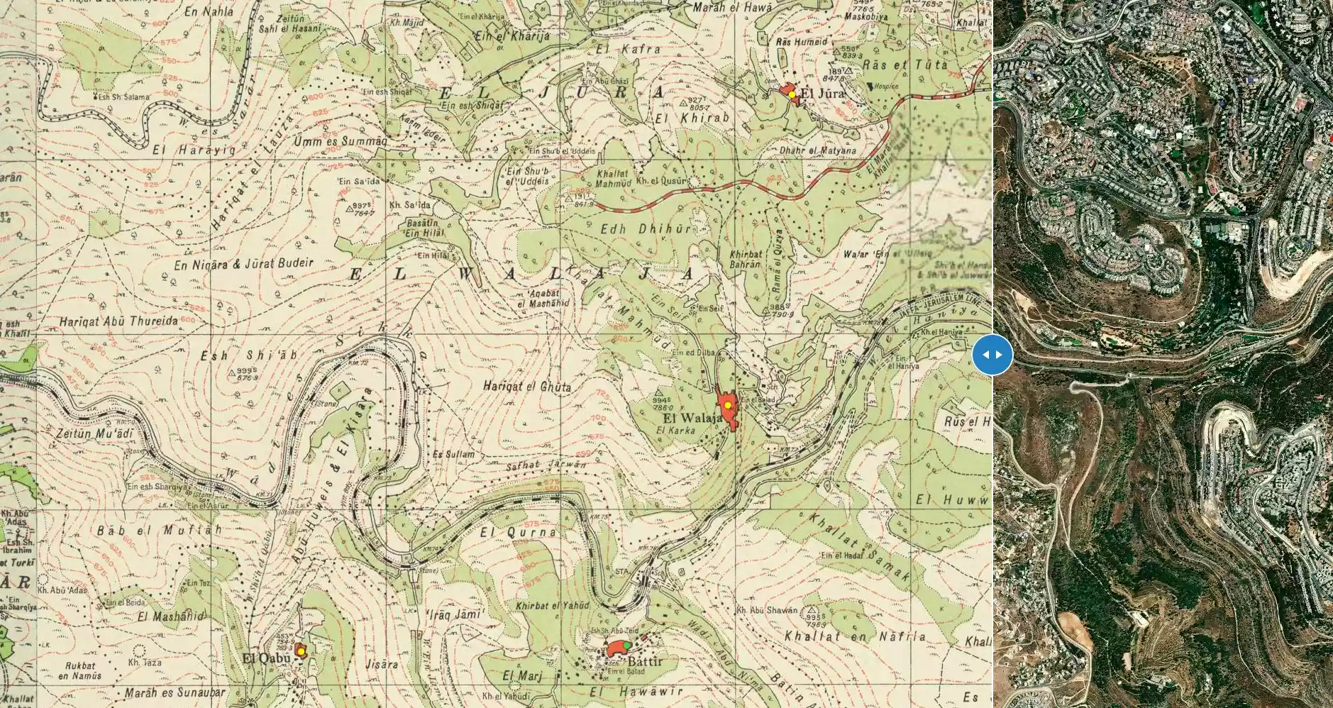
| Distance From District | 8.5 (km) West of Jerusalem | |||||||||||||||||||||
| Elevation | 800 (meters) | |||||||||||||||||||||
| Before & After Nakba, Click Map For Details |
||||||||||||||||||||||
|
||||||||||||||||||||||
| Map Location | See location #25 on the map View from satellite |
|||||||||||||||||||||
| Military Operation | Operation Dani | |||||||||||||||||||||
| Exodus Cause | Military assault by Zionist troops | |||||||||||||||||||||
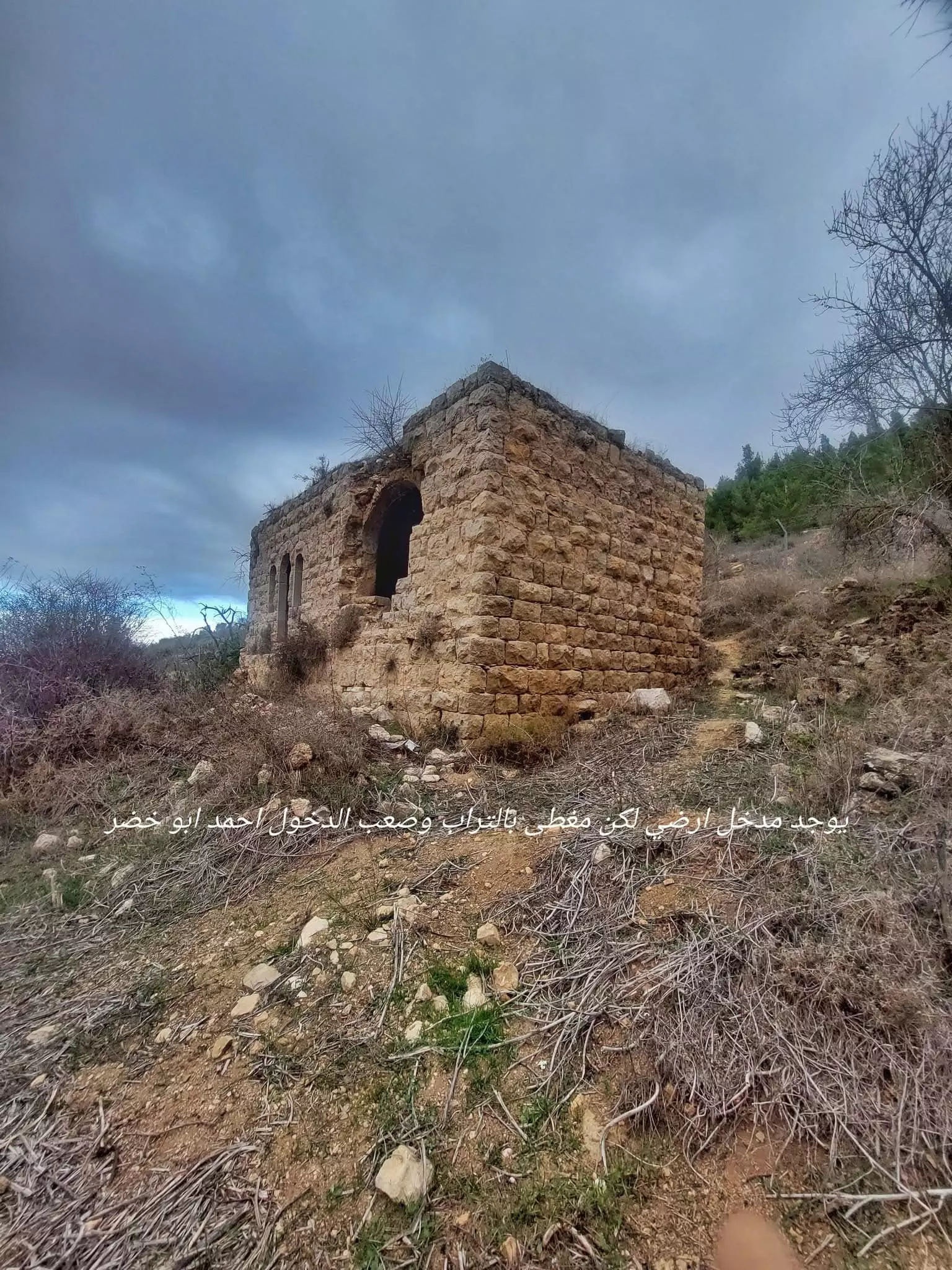
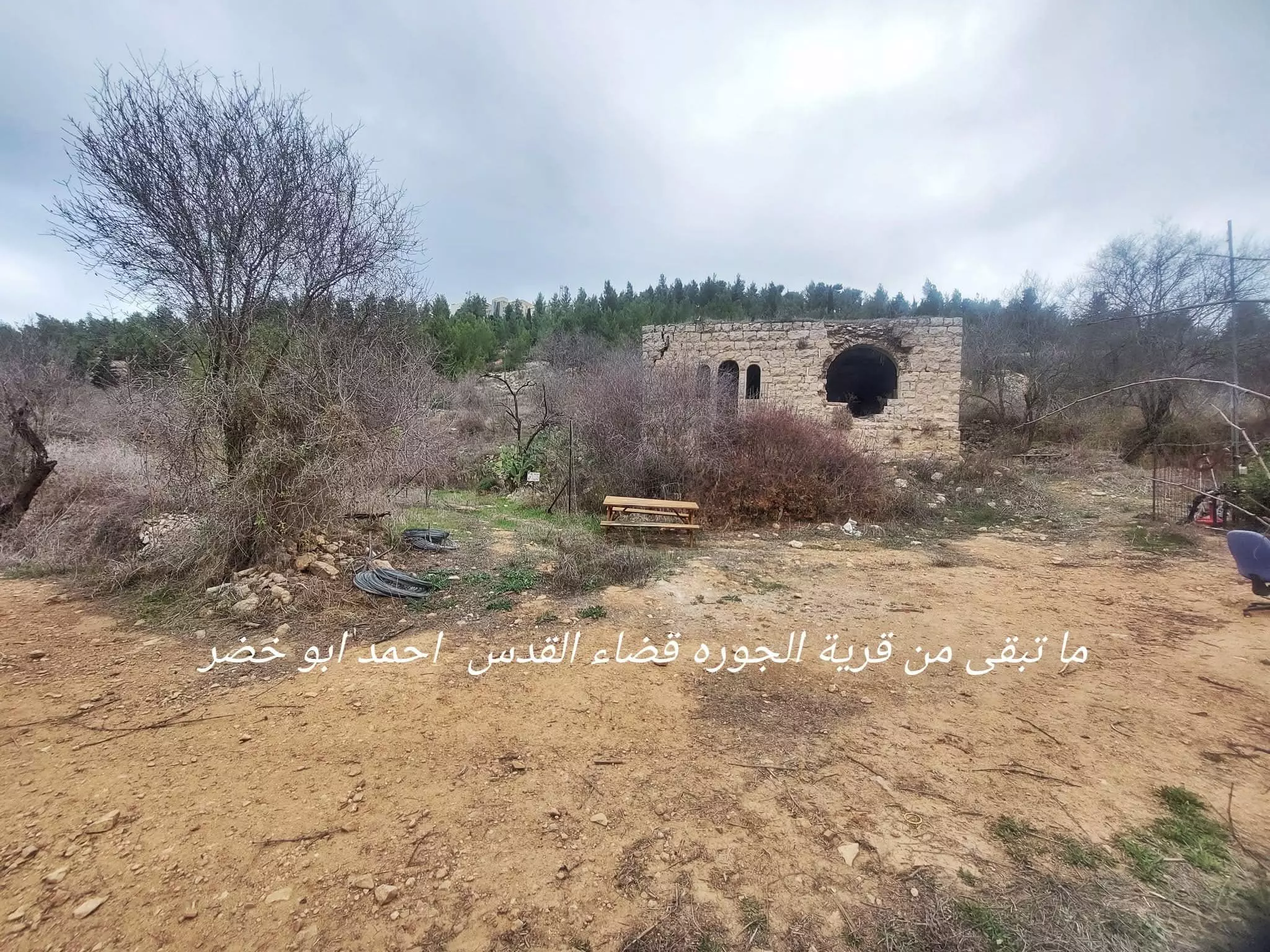
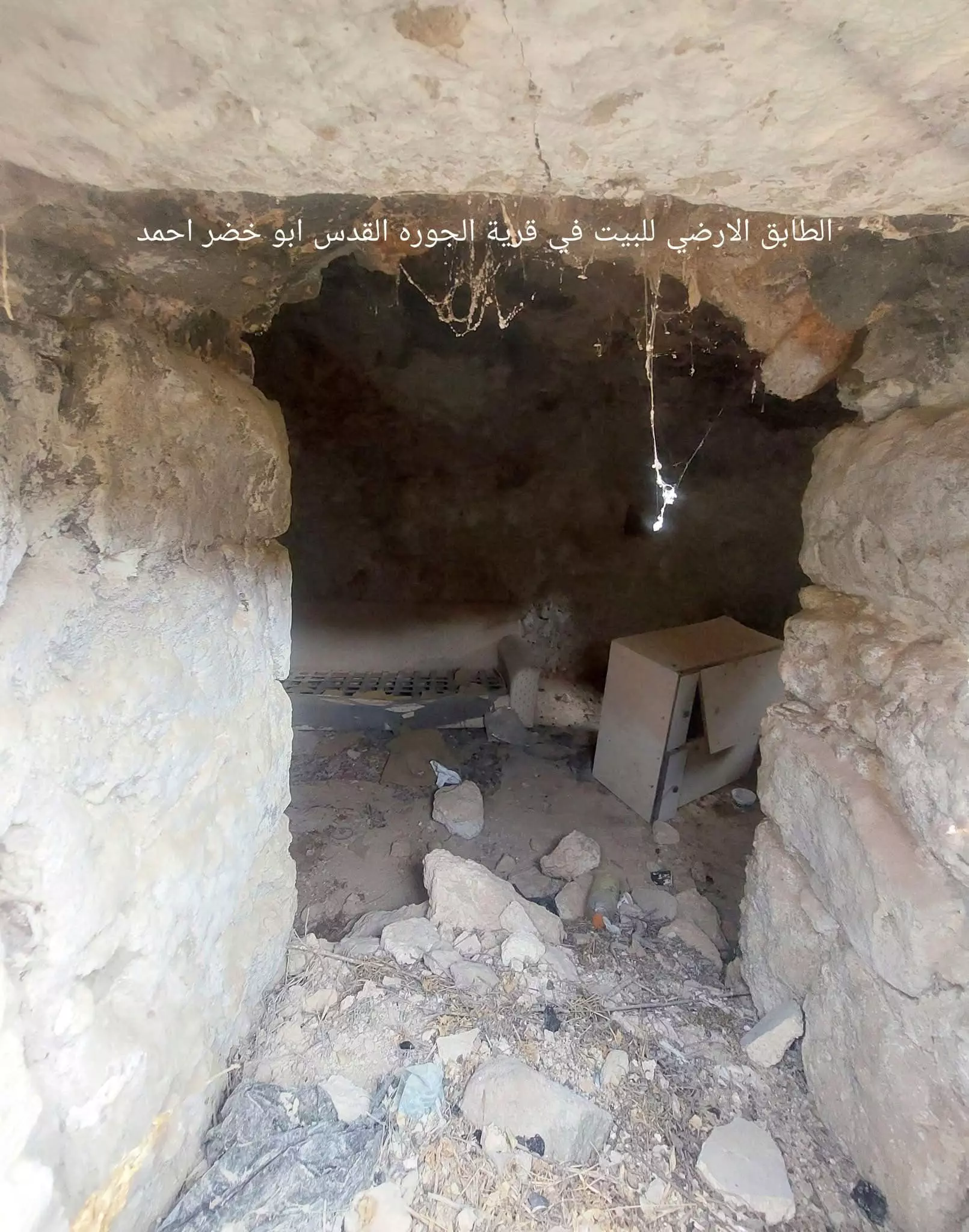
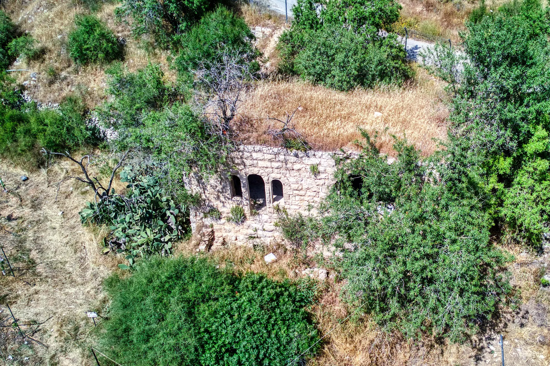
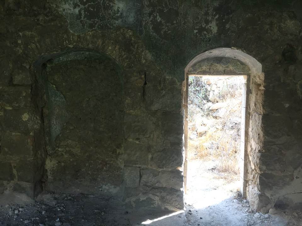
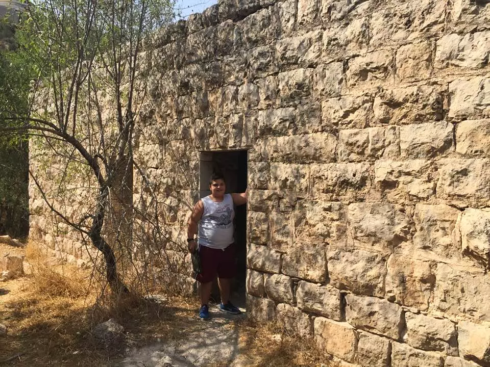
| Village Temains | al-Jura was mostly destroyed with the exception of few deserted houses (one of them is a two story house). | |||||||||||||||||||||
| Ethnically Cleansing | al-Jura inhabitants were completely ethnically cleansed. | |||||||||||||||||||||
| Pre-Nakba Land Ownership |
**Town Lands' Demarcation Maps |
|||||||||||||||||||||
| Land Usage As of 1945 |
|
|||||||||||||||||||||
| Population |
|
|||||||||||||||||||||
| Number of Houses |
|
|||||||||||||||||||||
| Near By Towns |
||||||||||||||||||||||
|
|
||||||||||||||||||||||
| Schools | One elementary school | |||||||||||||||||||||
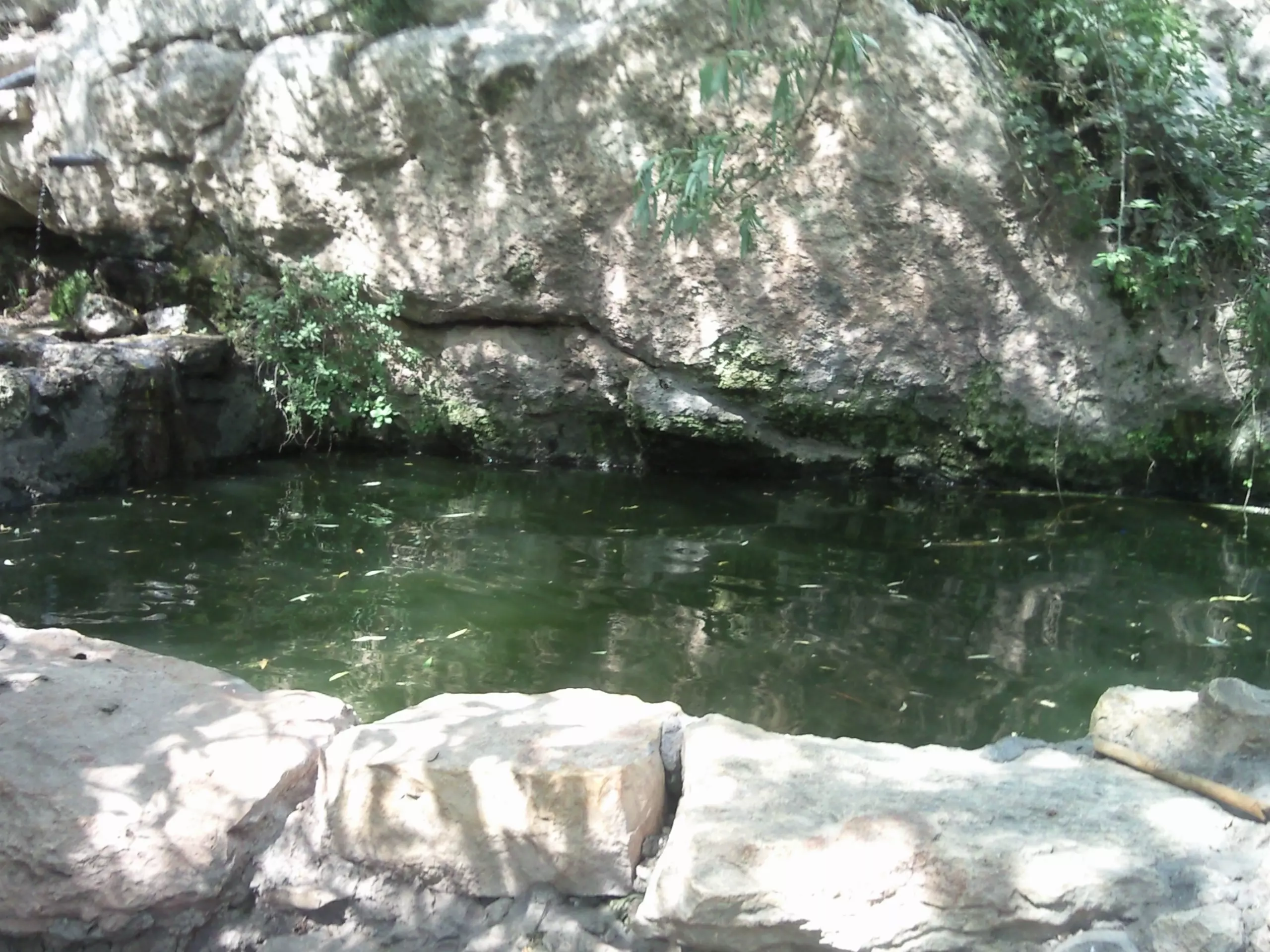
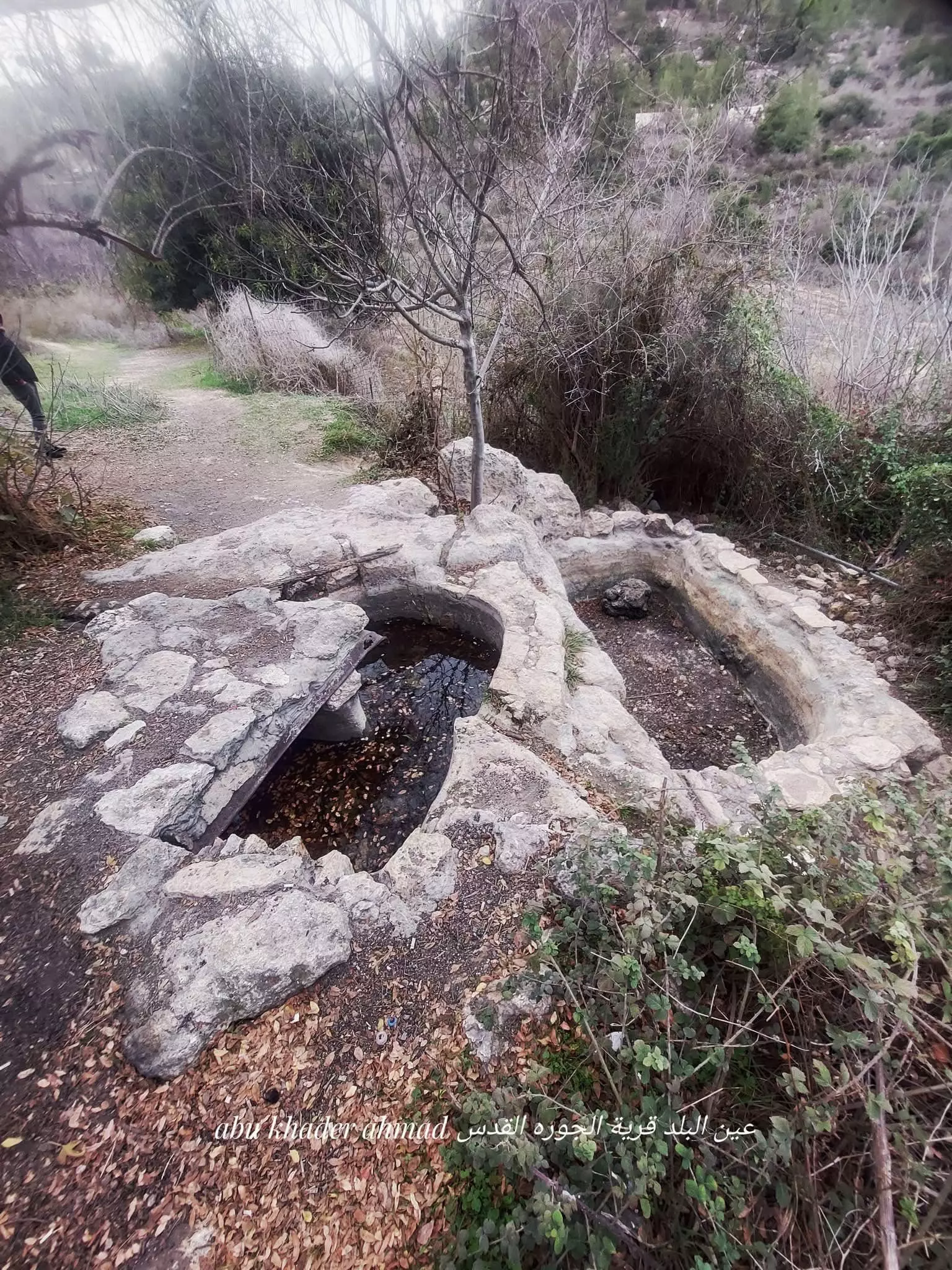
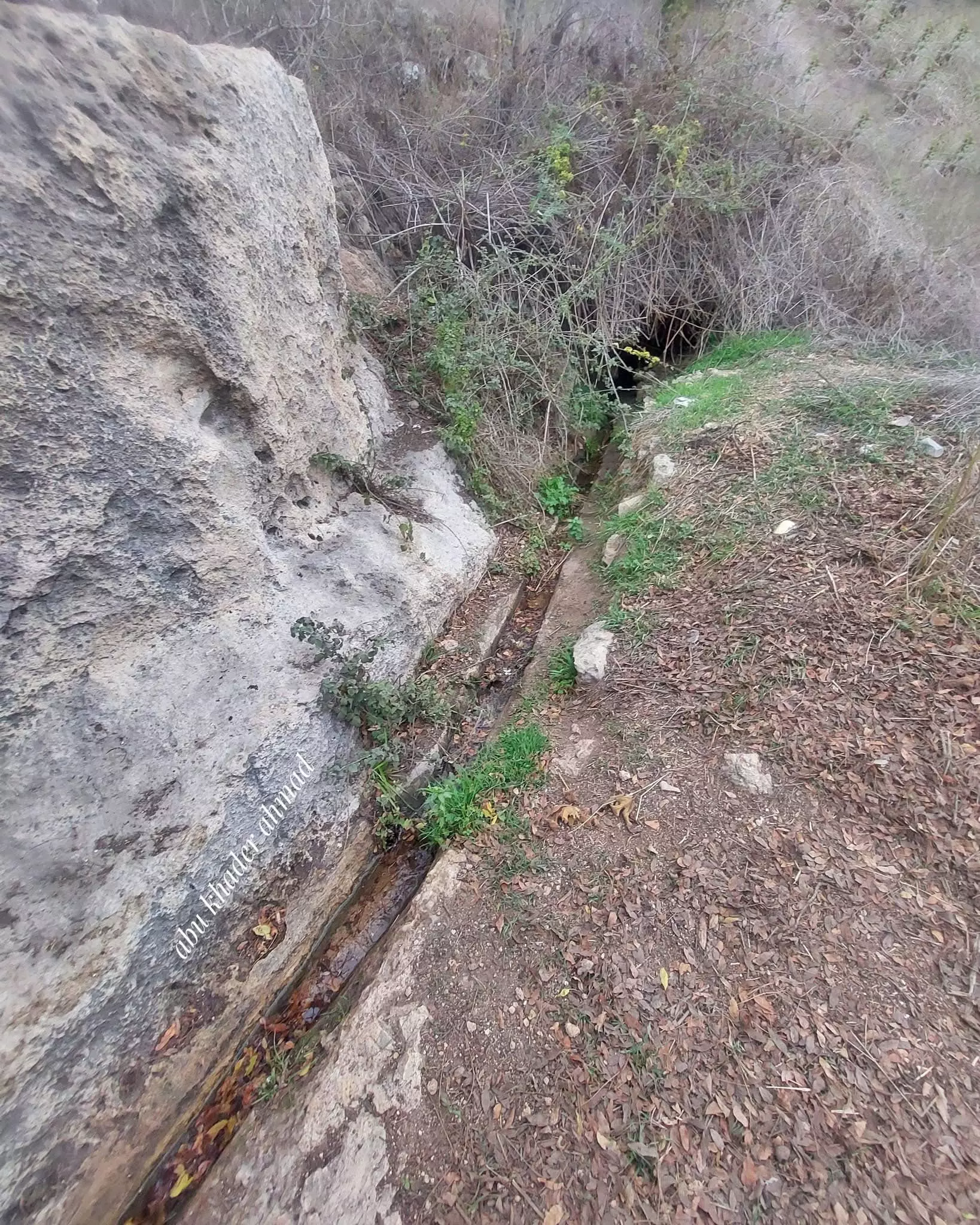
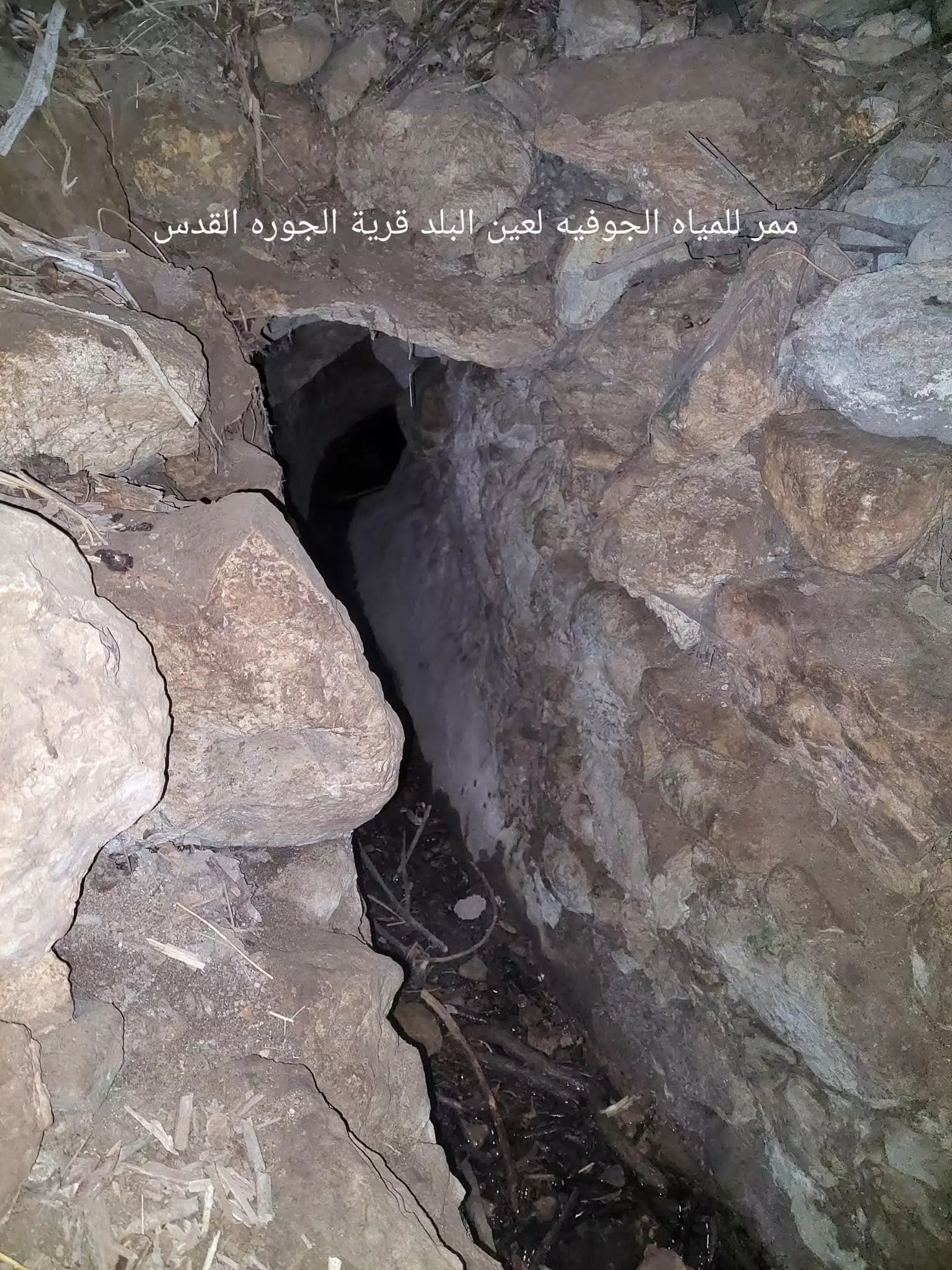
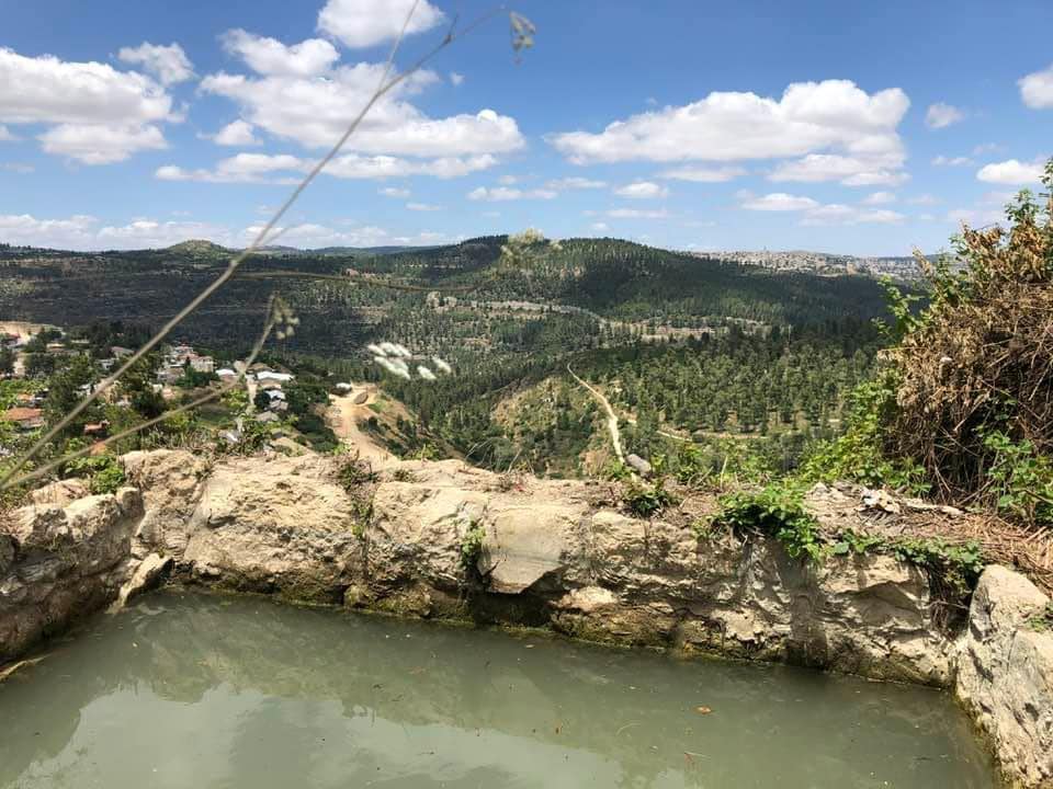
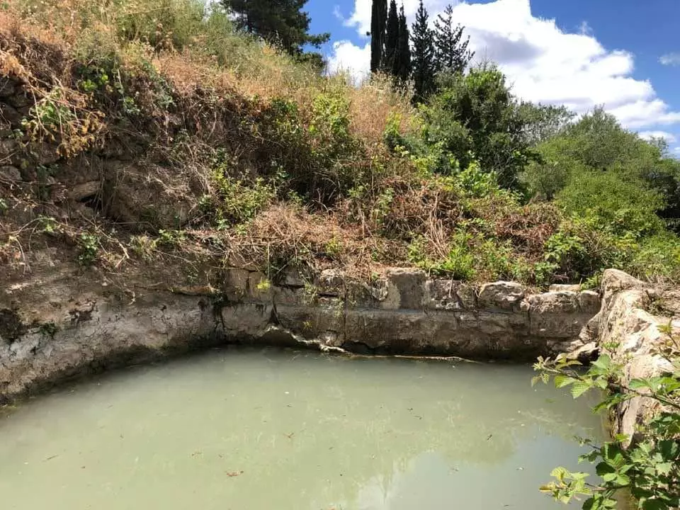
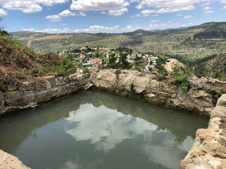
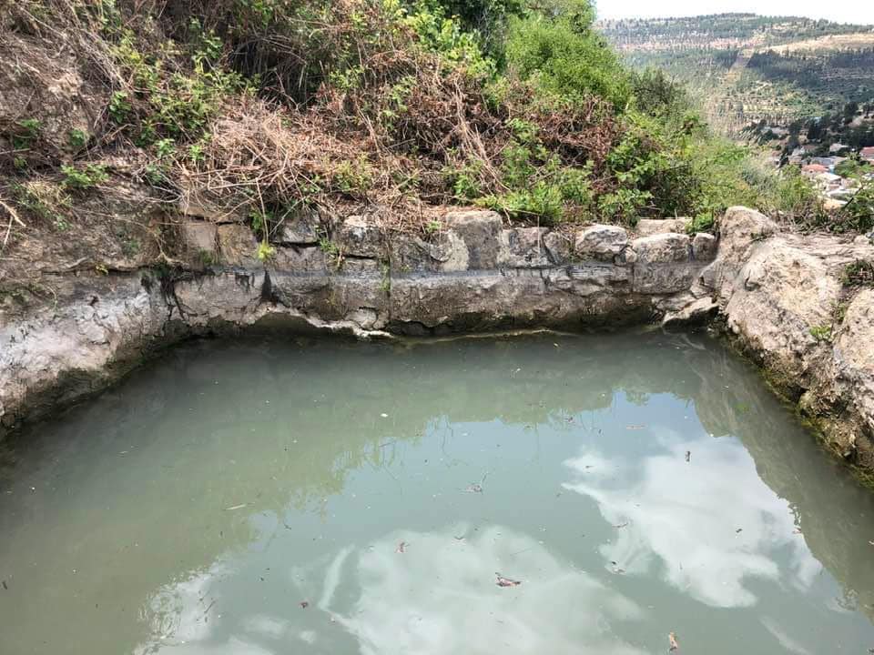
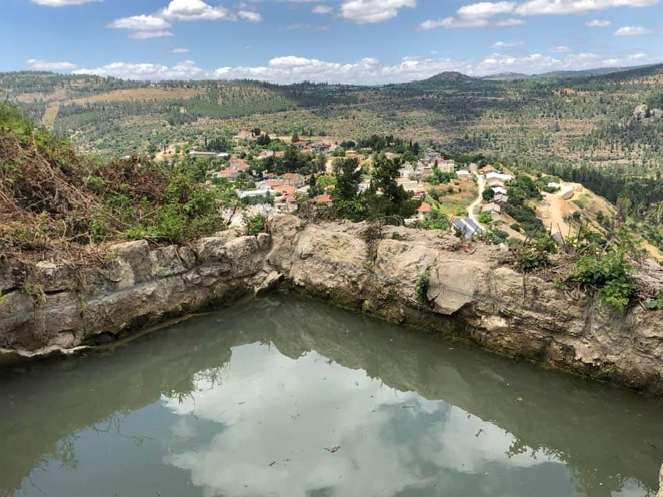
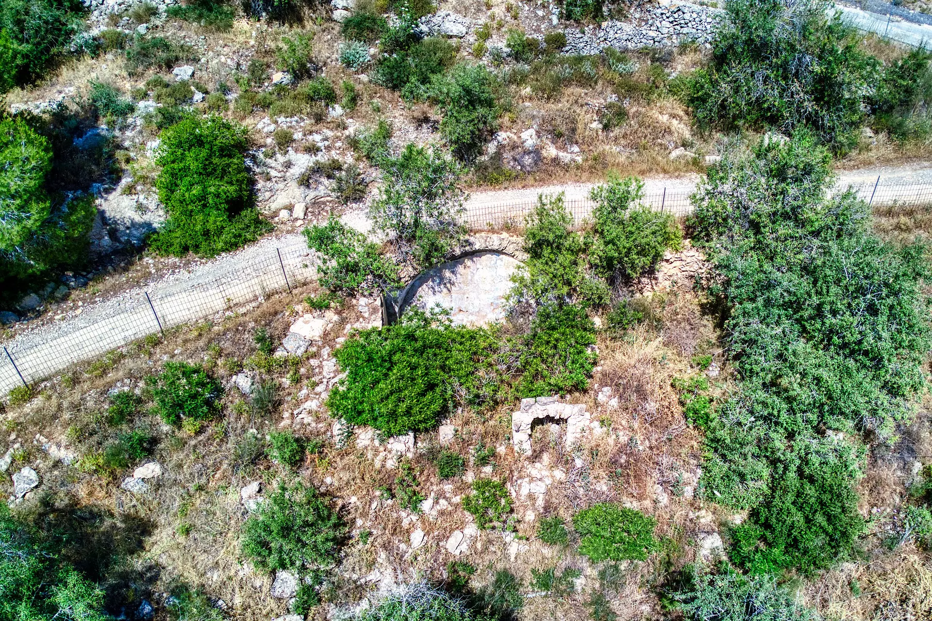
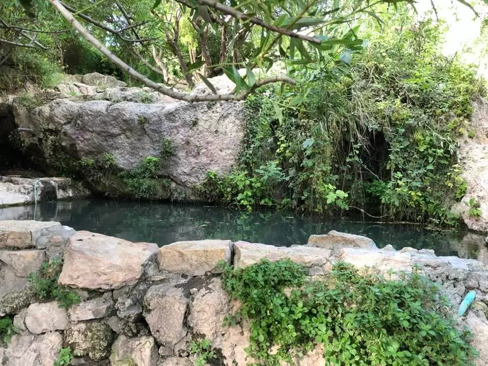
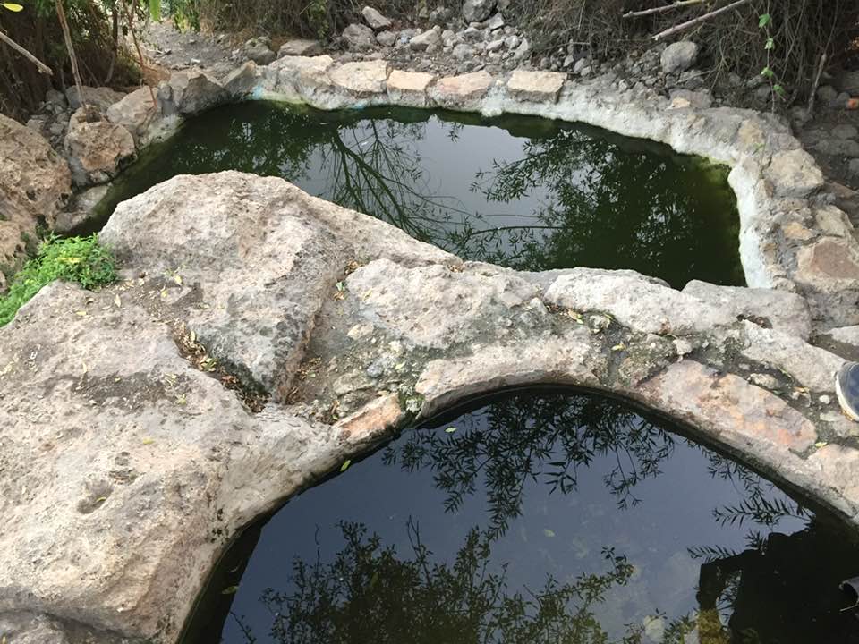
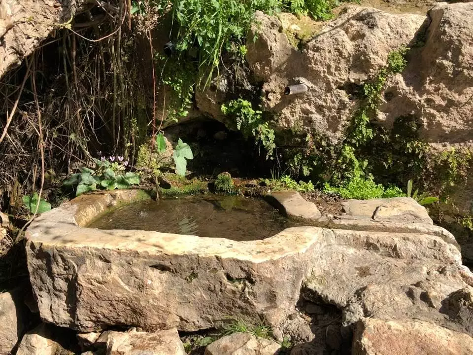
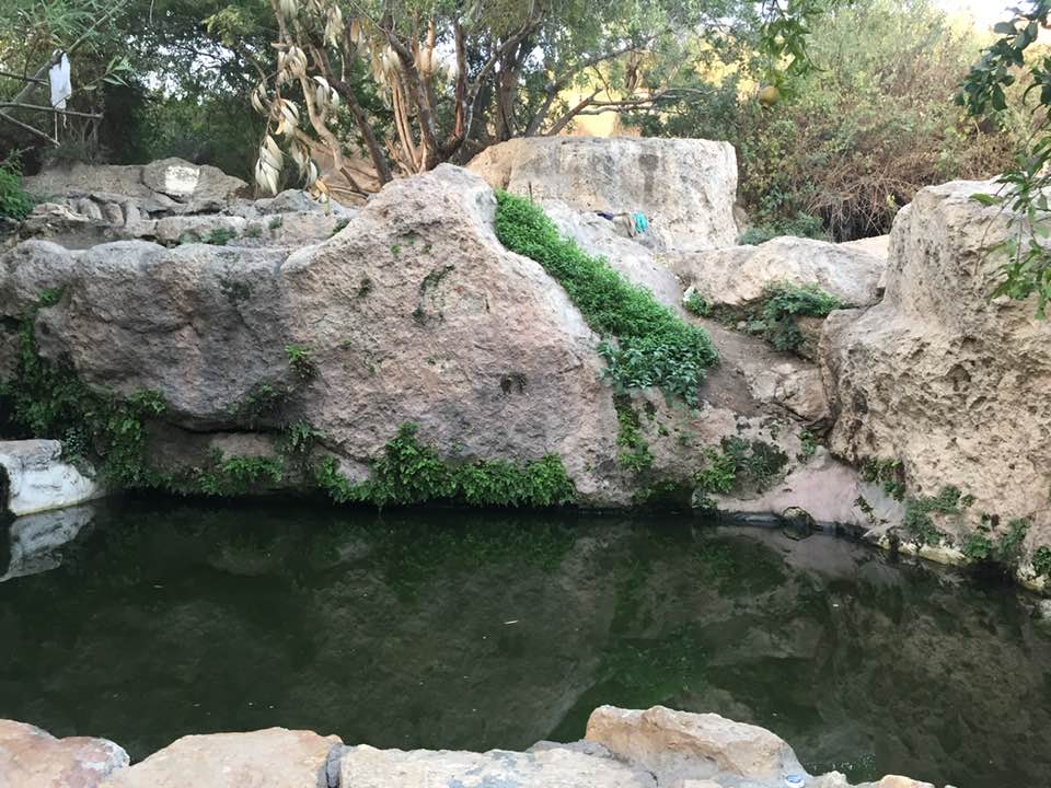
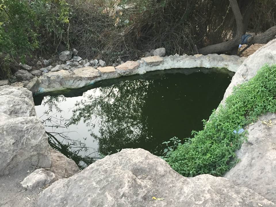
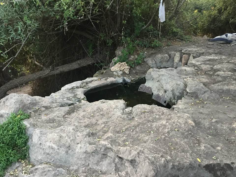
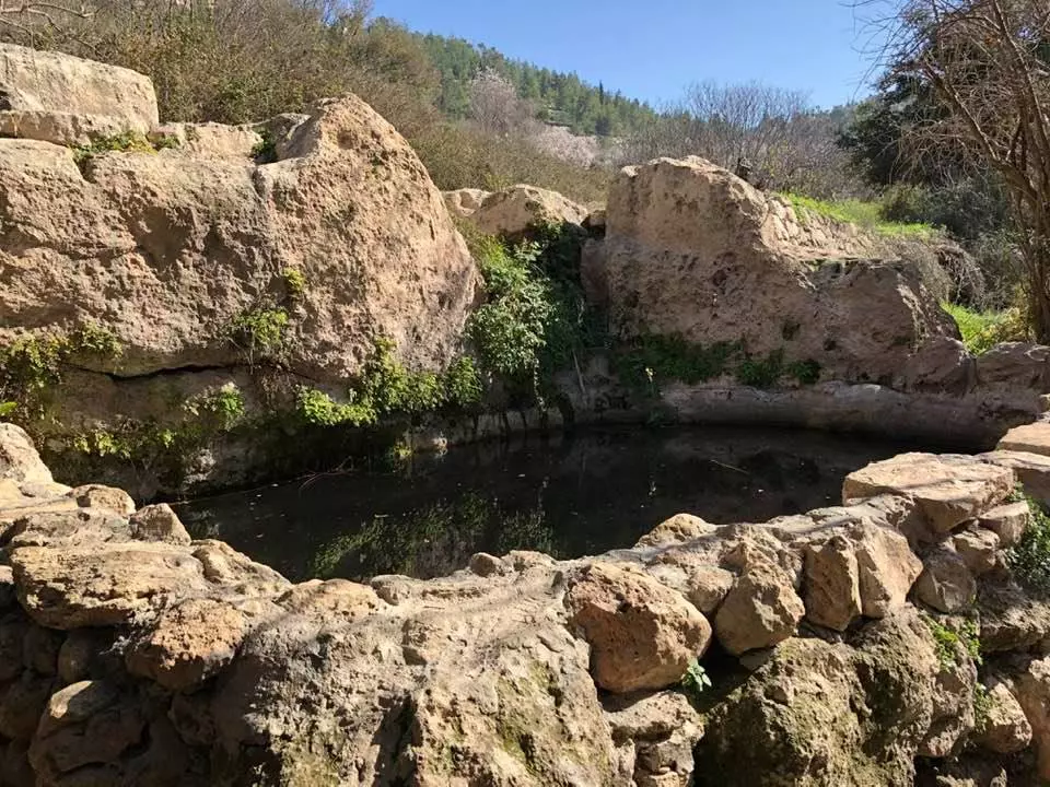
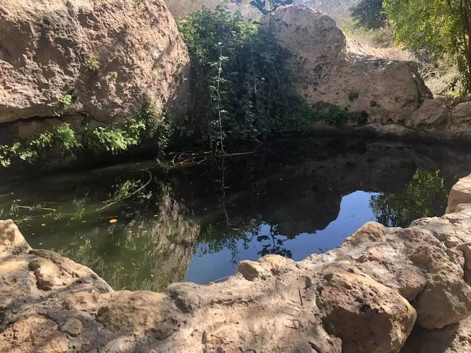
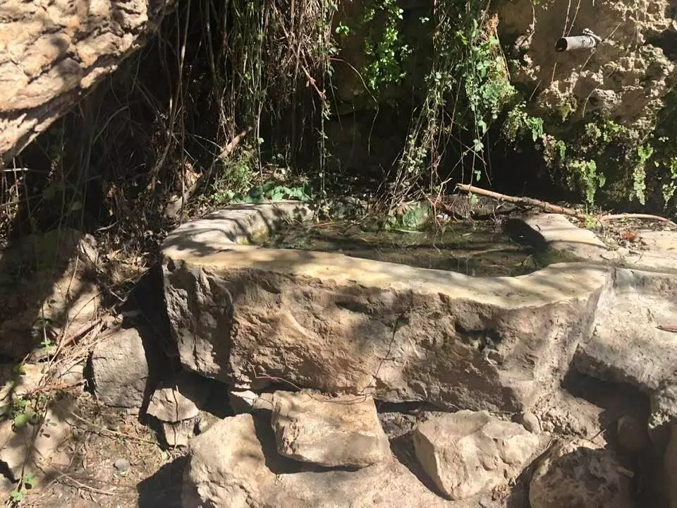
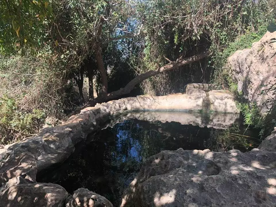
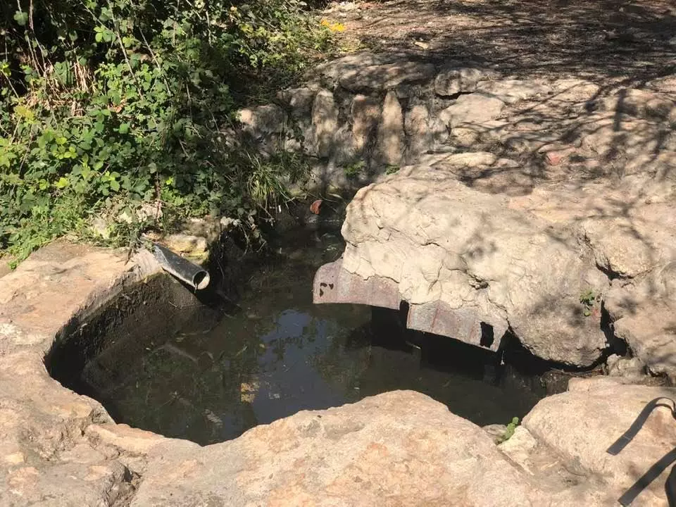
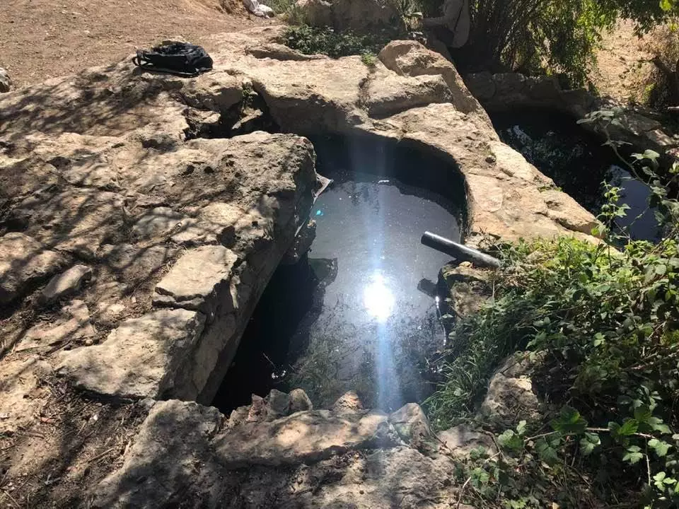
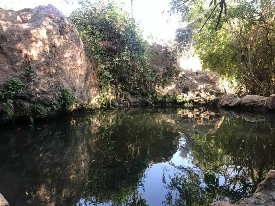
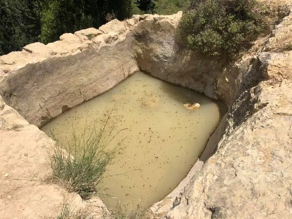
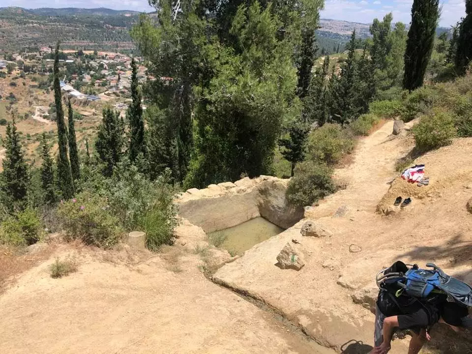
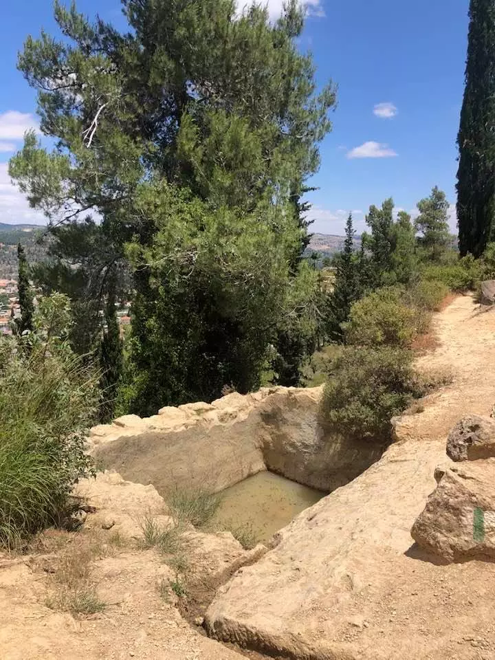
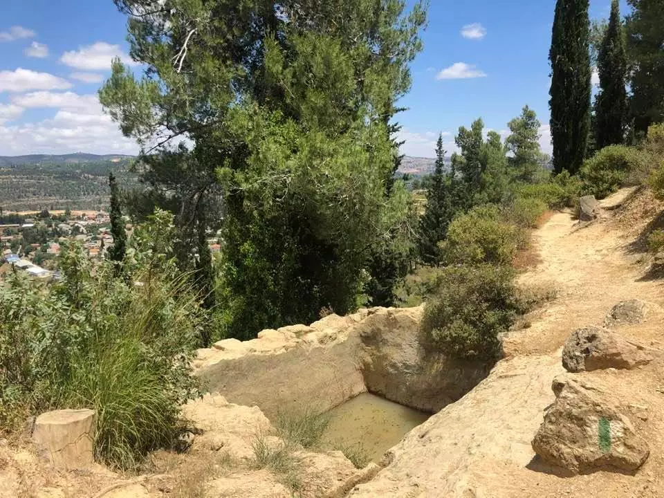
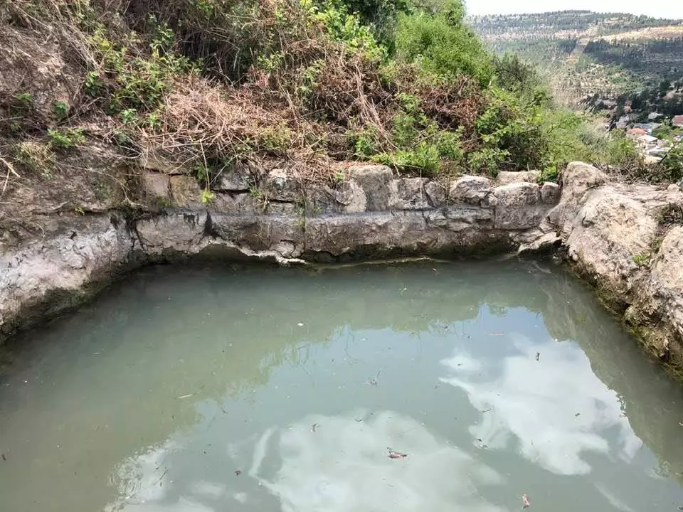
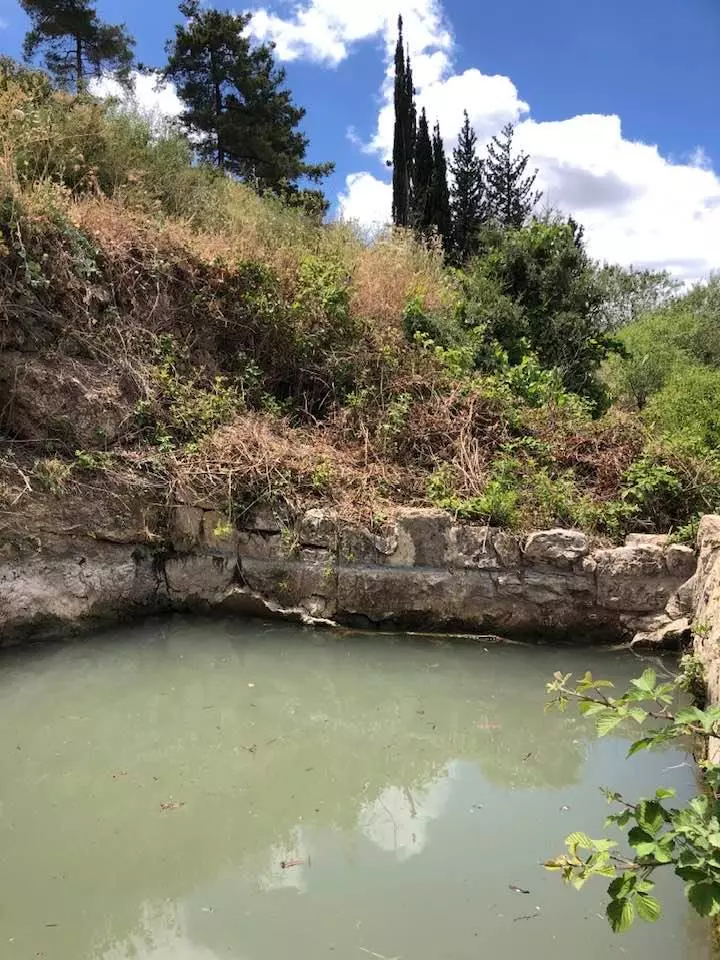
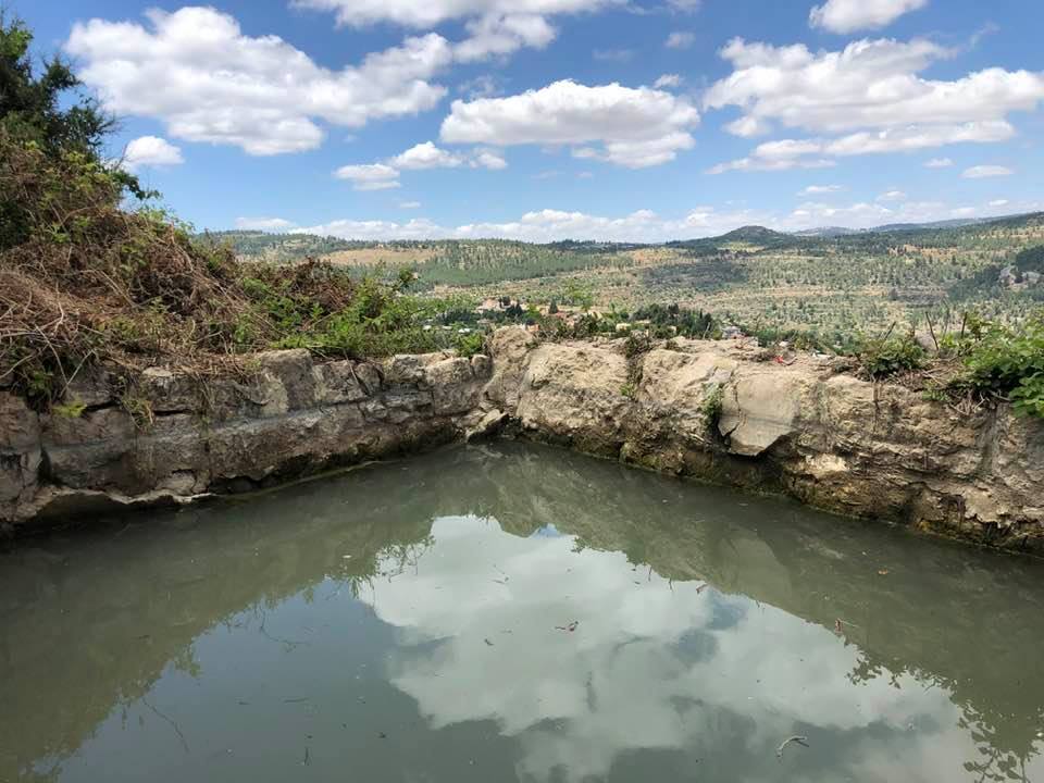
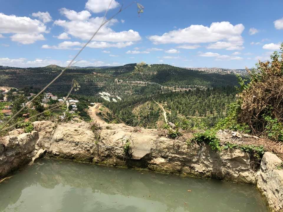
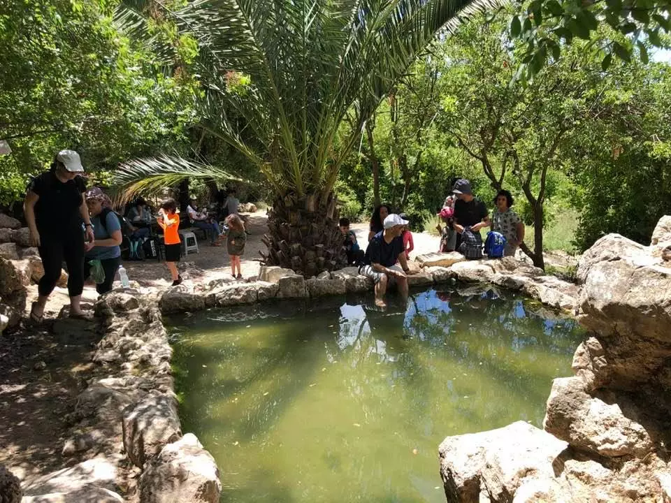
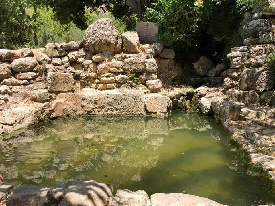
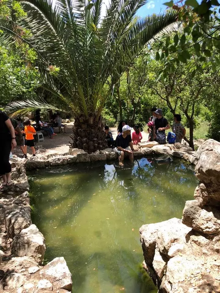
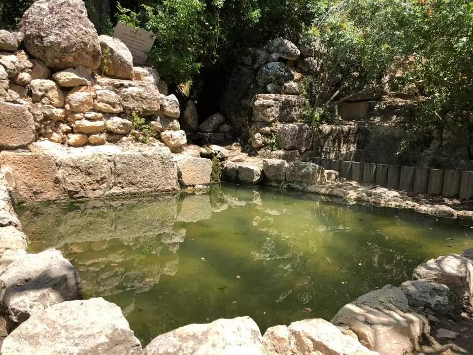
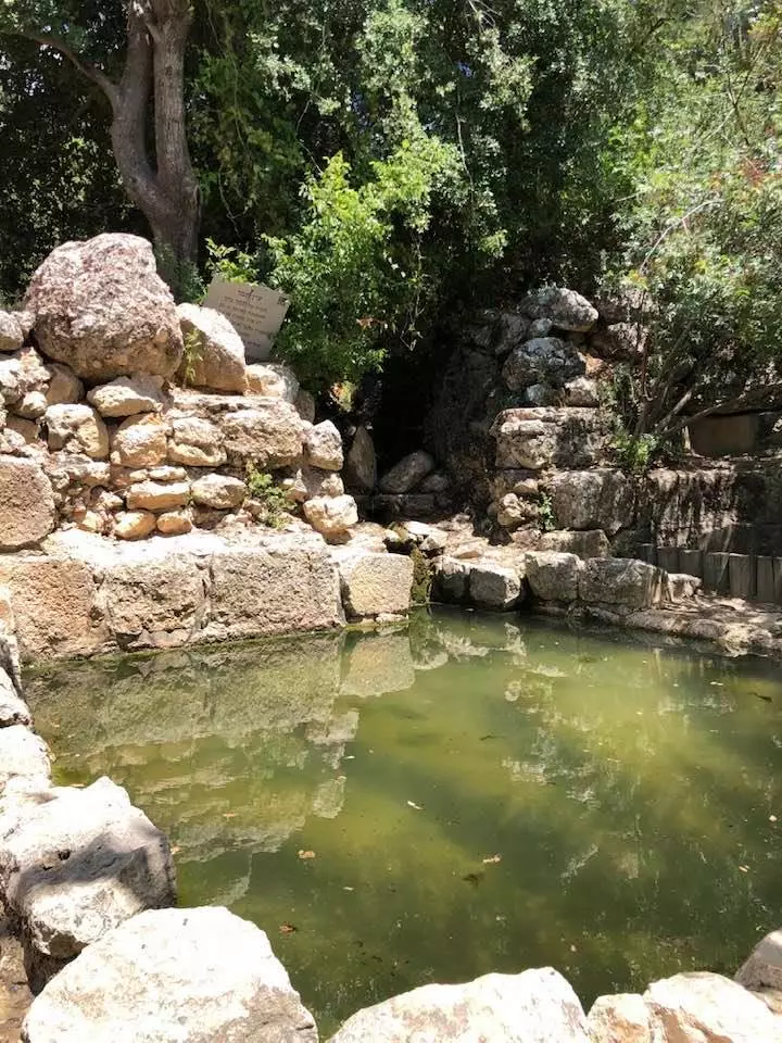
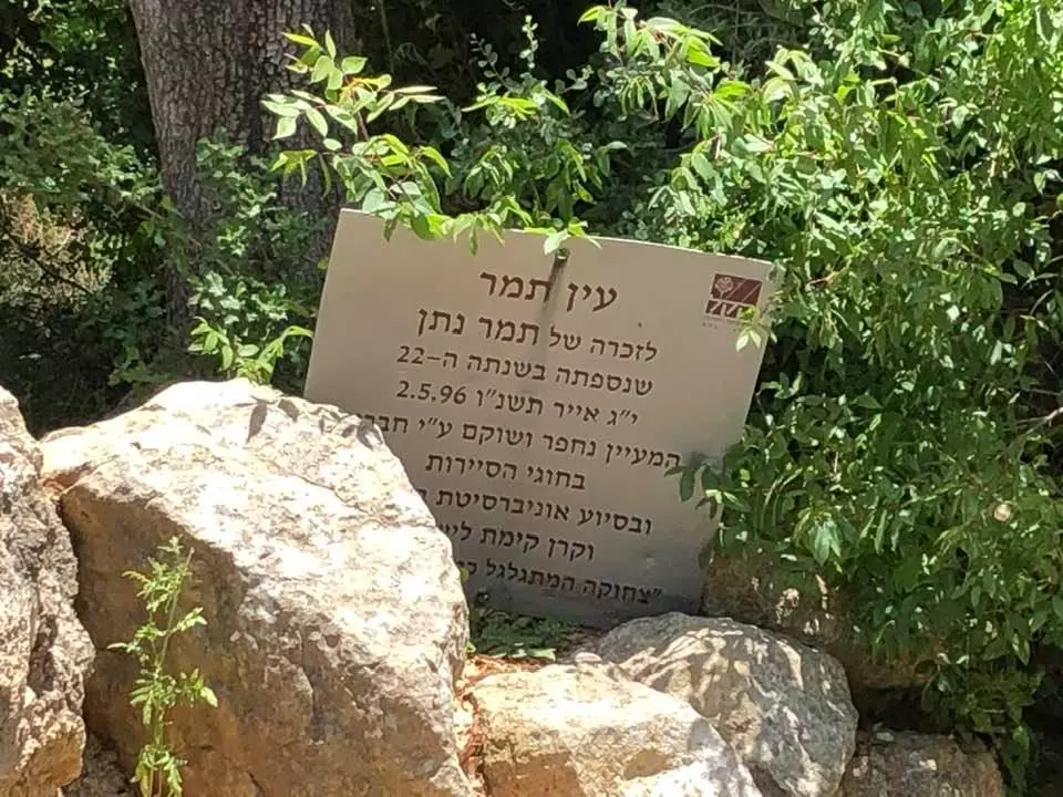
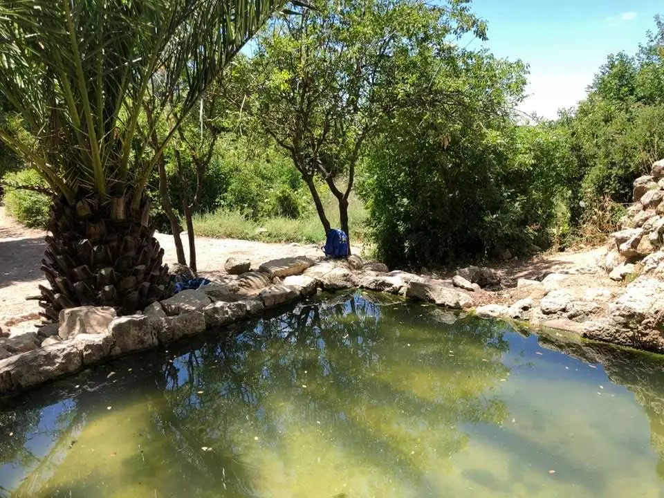
| Water Supply | Drinking water was supplied from a spring west of al-Jura, and other springs southwest which were used for irrigating. | |||||||||||||||||||||
| Archeological Sites | al-Jura contains artifact from Byzantine and the Crusades in three Khirbats: Khirbat Sa'ida, Ayn al-Jadida, and Khirbat al-Qusur. | |||||||||||||||||||||
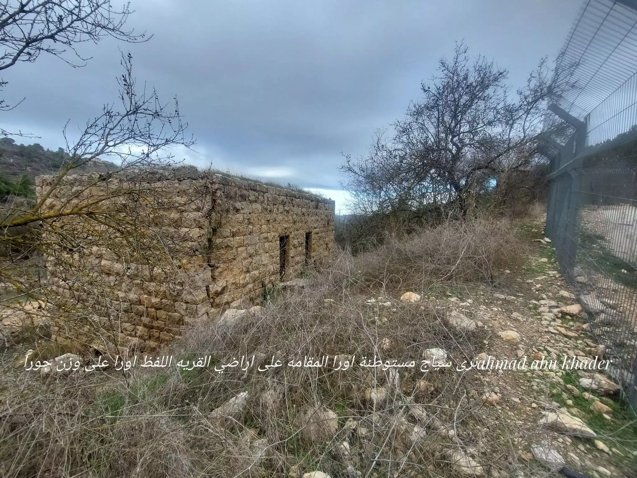
| Exculsive Jewish Colonies Who Usurped Village Lands |
Ora | |||||||||||||||||||||
| Featured Video | ||||||||||||||||||||||
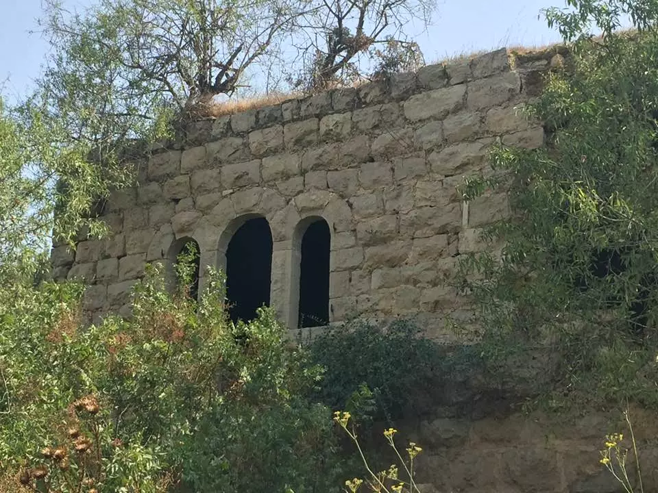
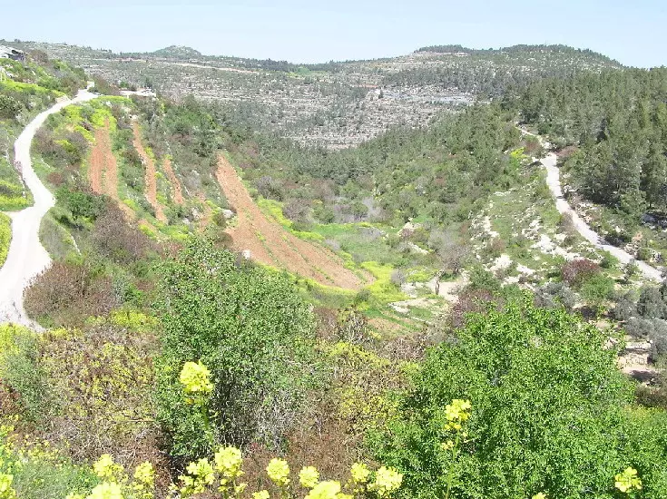
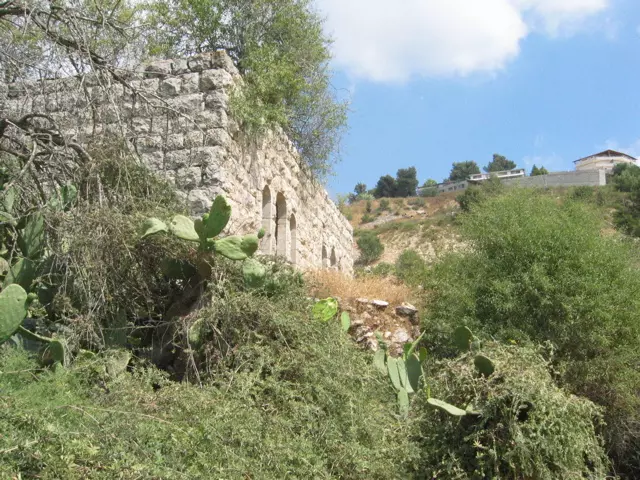
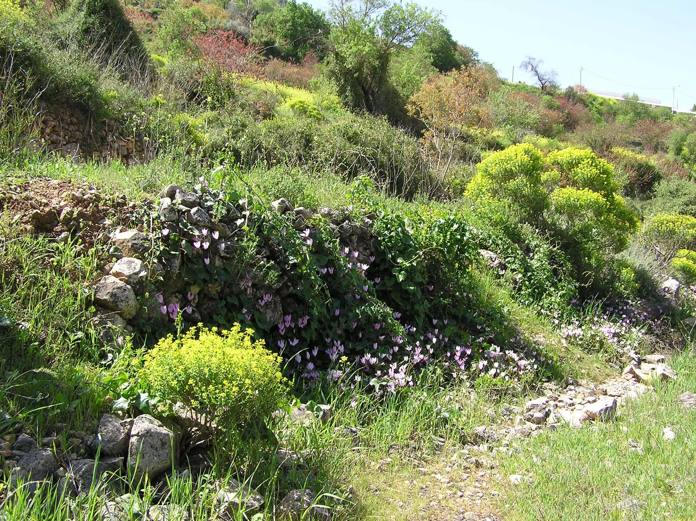
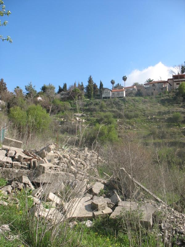
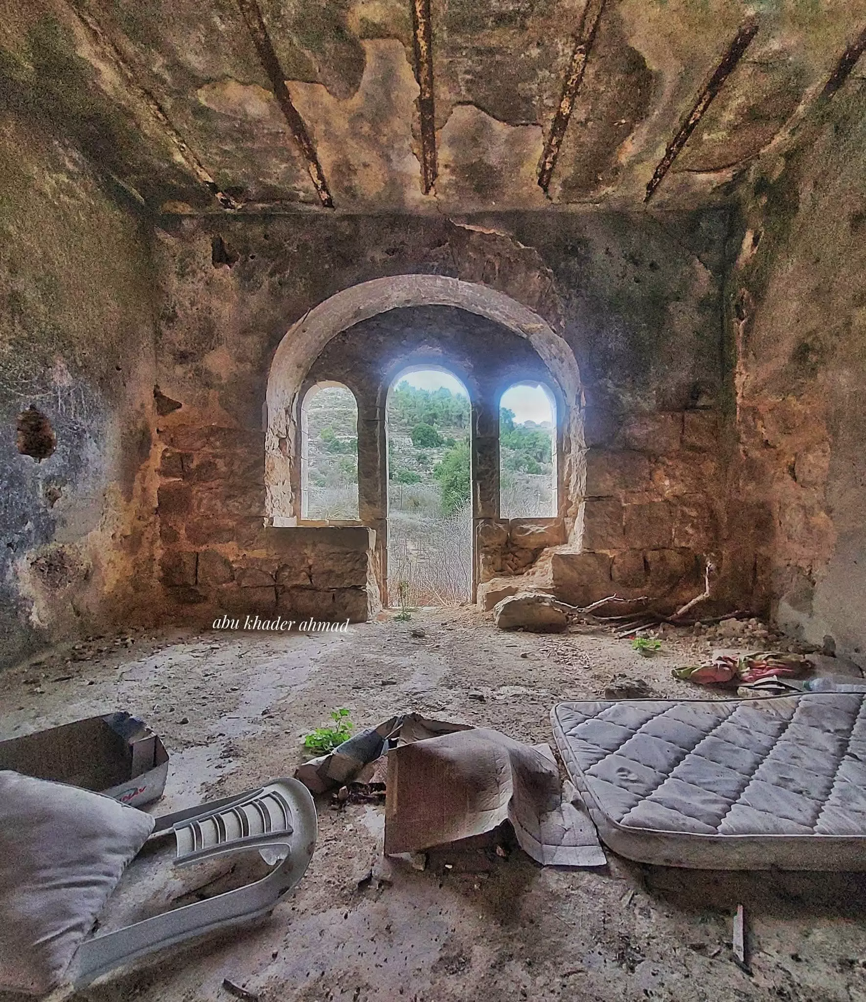
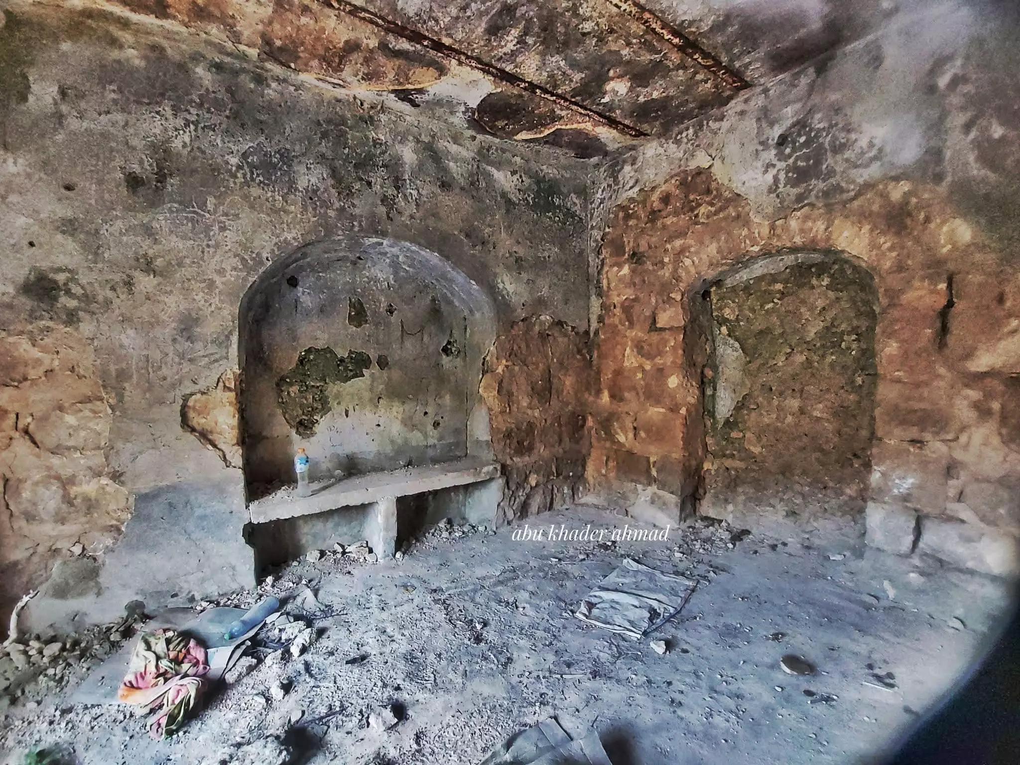
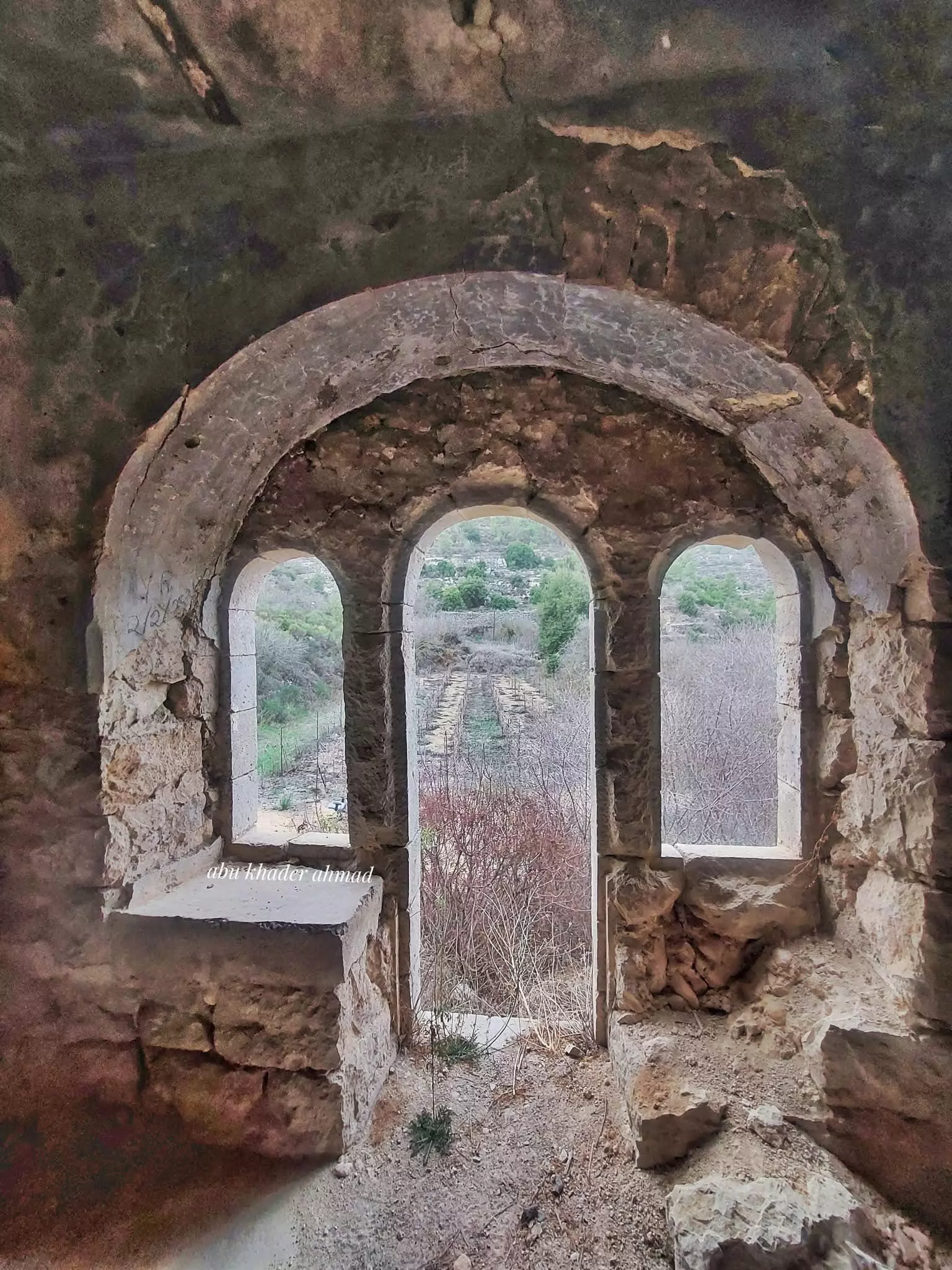
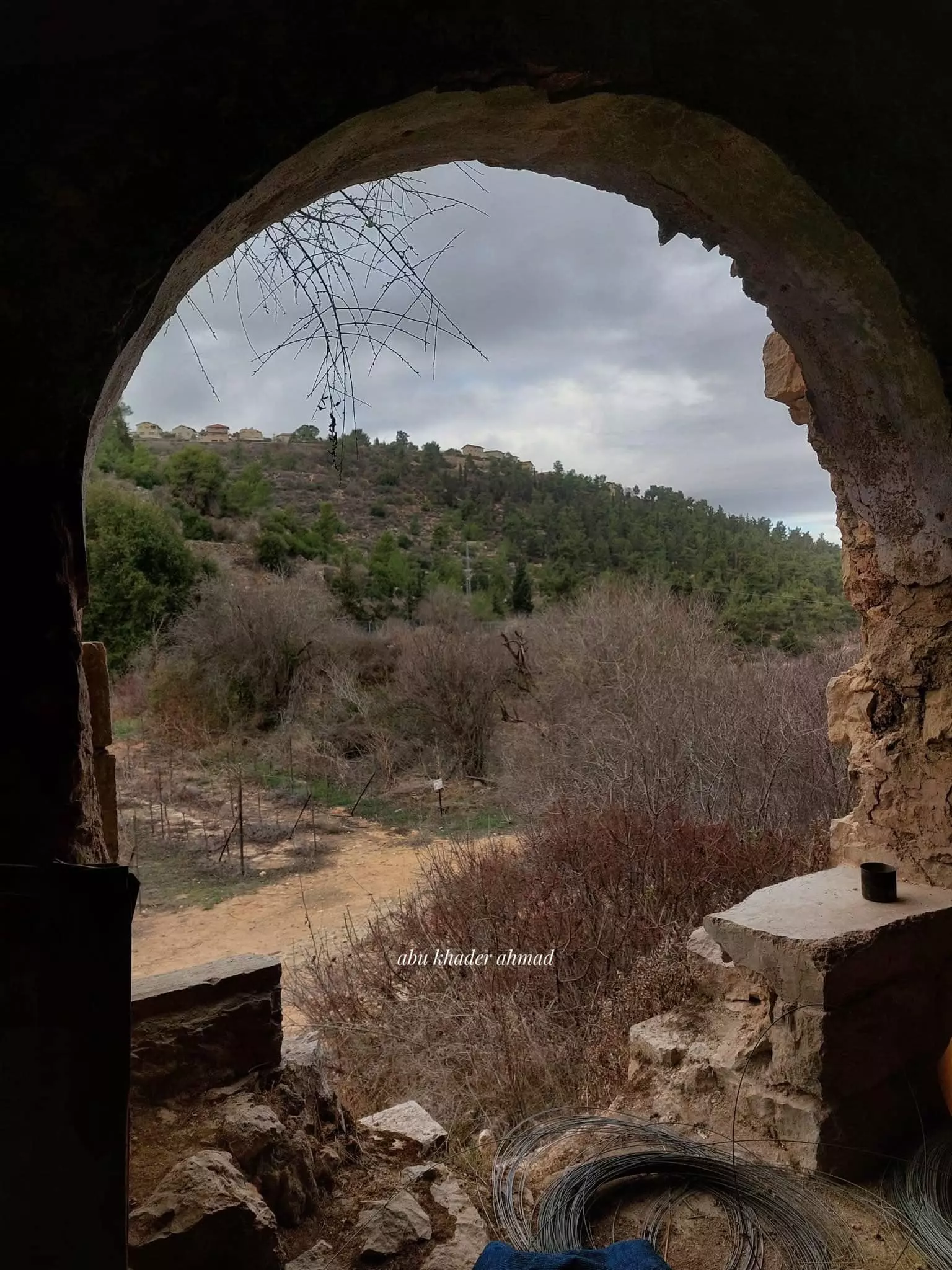
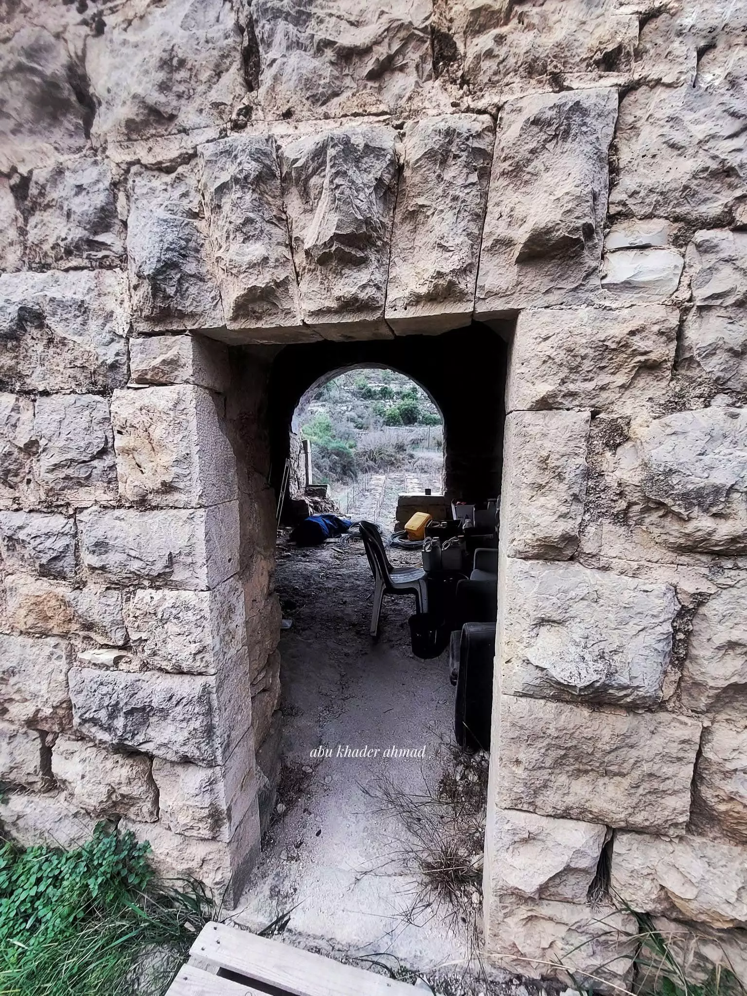
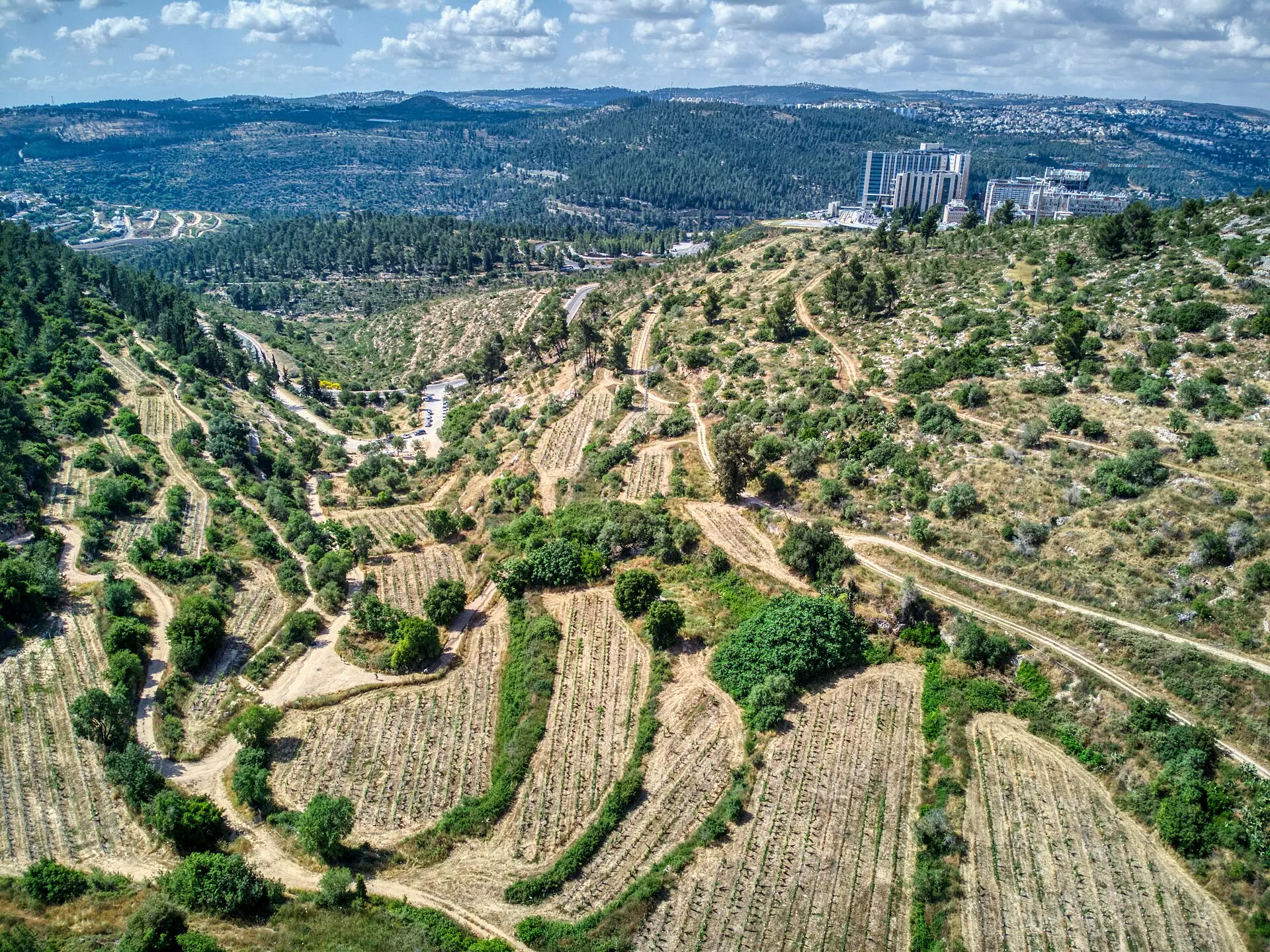
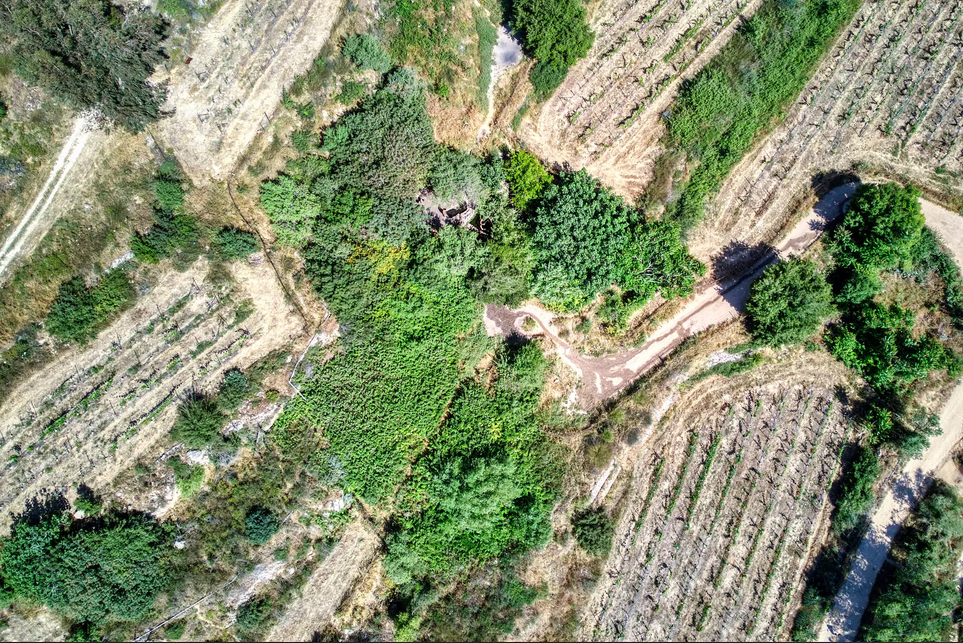
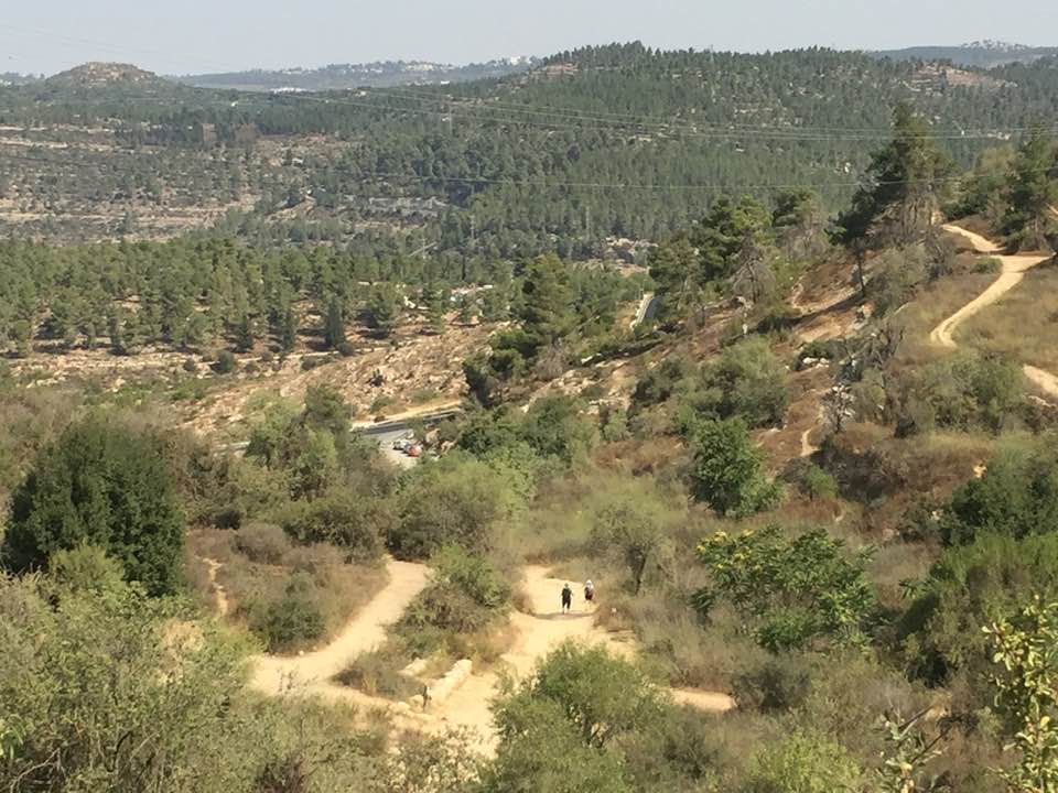
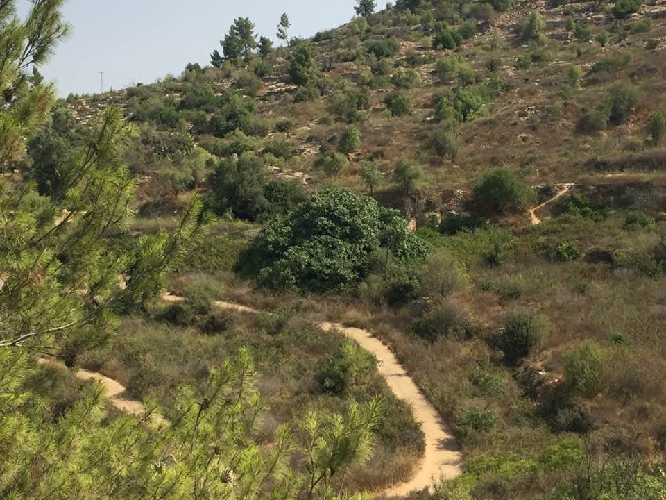
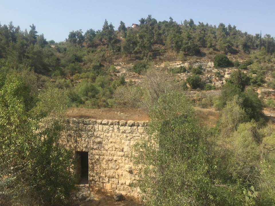
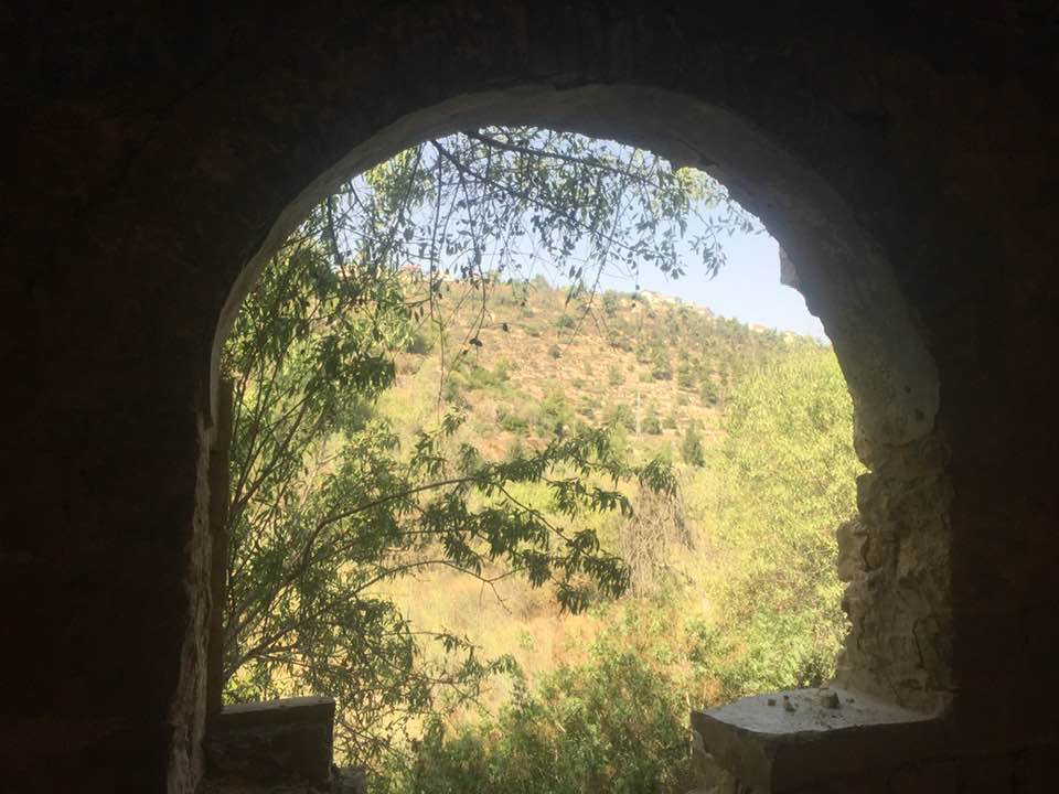
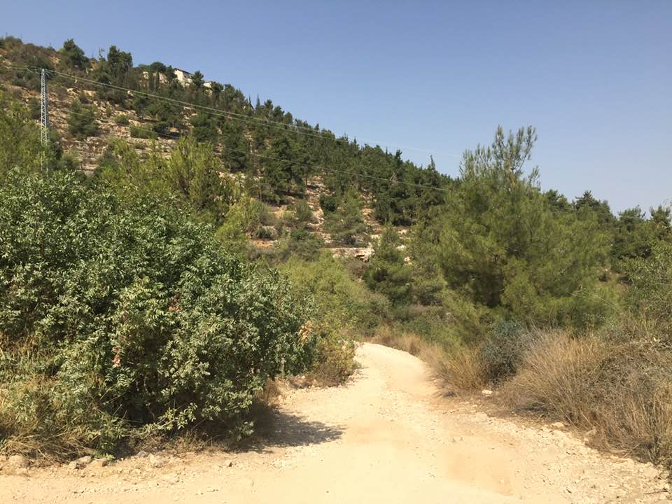
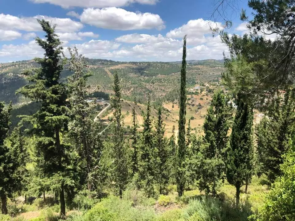
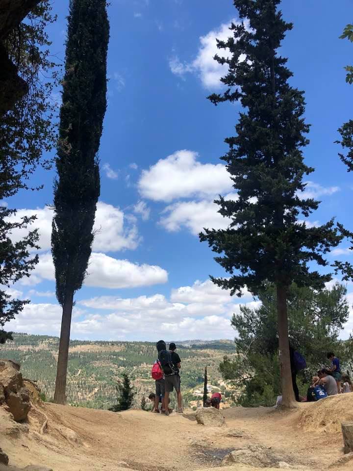
Village Before NakbaThe village stood on the steep slope of a mountain, facing west, and overlooked deep wadis. A ravine ran in an east-west direction along its southern perimeter. A small hill, on which a school and a convalescent hospital were located, separated al-Jura from the village of 'Ayn Karim. A secondary road linked it to a highway leading to Jerusalem, and dirt paths connected it to surrounding villages. In the late nineteenth century, al-Jura was described as a small hamlet built on the slope of a ridge with olive trees growing below it. The village plan was originally rectangular. New construction, however, developed in a way that changed the overall plan into an arc. Its houses were built of stone. The people of al-Jura, most of whom were Muslims, relied on the neighboring village of 'Ayn Karim and on Jerusalem for many of their services. They drew their drinking water from a spring that was west of the village and relied on other springs to the west and southwest for irrigating their fruit orchards and vegetable fields. The village was known for the high quality of its fruit, especially grapes. In 1944/45 a total of 846 dunums was allotted to cereals; 1,125 dunums were irrigated or used for orchards. East of the village lay Khirbat Sa'ida (162128) and 'Ayn al-Jadida (164129) which contained evidence of a Byzantine and, later, a Crusader presence on the site. Khirbat al-Qusur (163128), which is identified with the sixteenth-century village of Qusur , was also nearby.Village Occupation and Ethnic CleaningCircumstantial evidence indicates that al-Jura was first captured by Israeli troops in the course of Operation Dani (see Abu al-Fadl, Ramla sub-disctrict). The History of the War of Independence recounts that on 11 July, Israeli units operating in the southern part of the Jerusalem corridor captured two hilltops (one of which was later renamed Mount Herzl) overlooking 'Ayn Karim and began to bombard it before occupying it. Those hills were located in the immediate vicinity of al-Jura, which probably fell at the same time.Zionists Colonies on Village LandsIsrael established the settlement of Ora (164129) on village land, 0.5 km east of the site, in 1950.Village TodayThe only structures that still stand are two limestone houses on the valley floor at the southern edge of the village. The larger house is a rectangular, two-storey building; its second storey has two arched doors, each of which is flanked by two arched windows. Almond groves cover a terrace built on the valley floor. Fig, carob, and cypress trees and cactuses grow on the site. One can see the ruins of houses, staircases, and wells on the adjacent land. The site is surrounded by cypress forests.SourceDr. Walid al-Khalidi, 1992: All That Remains. |
||||||||||||||||||||||
| Related Maps | Town Lands' Demarcation Maps خرائط للقضاء توضح حدود القرى والاودية Town's map on MapQuest View from satellite Help us map this town at WikiMapia |
|||||||||||||||||||||
| Related Links | Wikipedia's Page Google Search Google For Images Google For Videos |
|||||||||||||||||||||
| More Information | في كتاب كي لا ننسى في كتاب بلادنا فلسطين المزيد من موقع هوية |
|||||||||||||||||||||
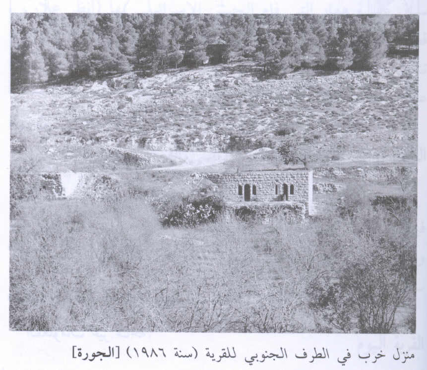
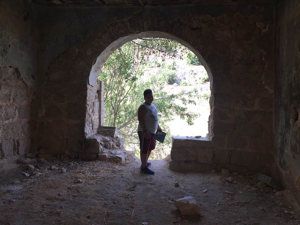
- al-Jura House In 1986
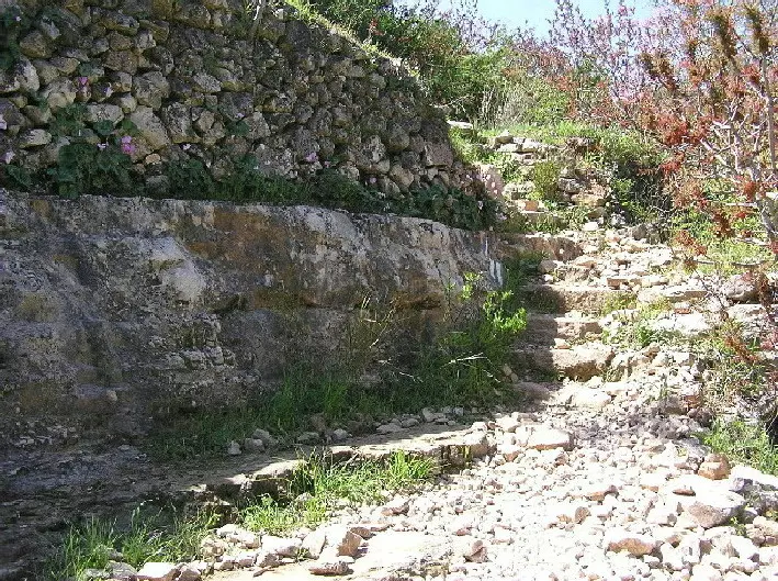
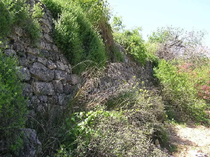
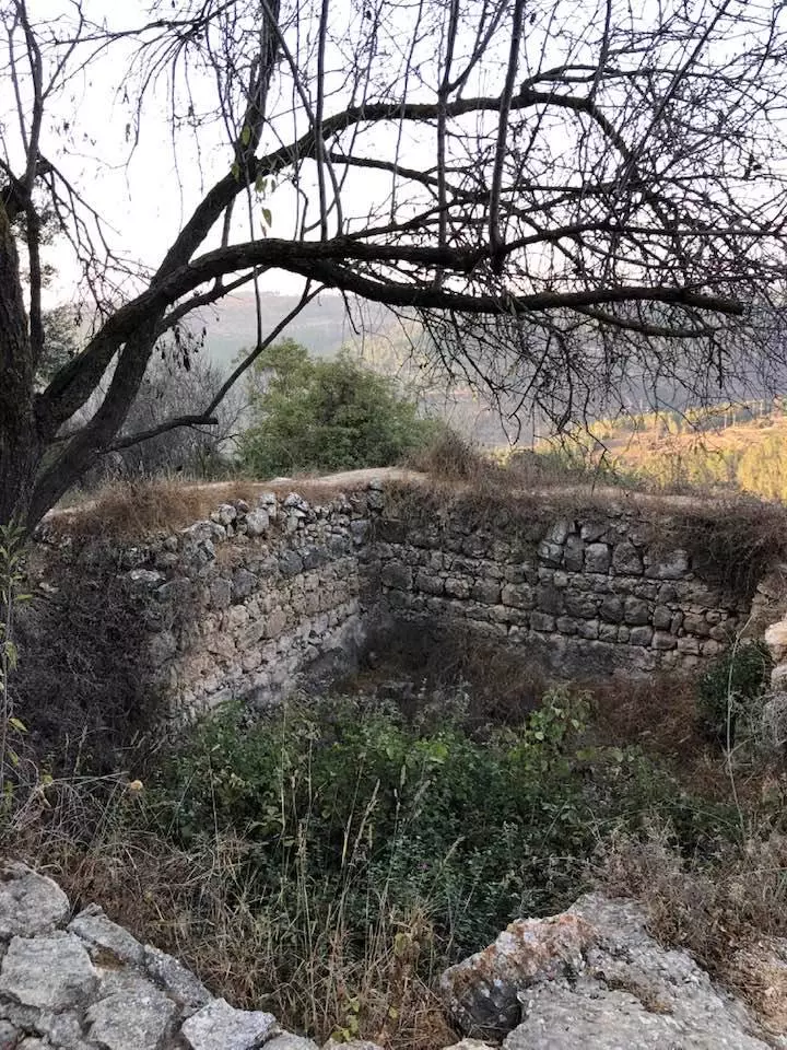
3 - This Stone Terrace Wall & The Stone Steps Are Located Very Close To The 'Ain' spring Of Al Jura.
Posted by Umar Ilayann 1 - A Beautiful Scene Of Al Jura's Terraces. The 'Ain' Spring Is Located At the Bottom Right Of The Valley. (269K)
Posted by Umar Ilayann 1 - One Of Al Jura's Terraces Stone Wall. The Details Of The Stone & Nature's Beauty Is Captivating. (Spring 2004)
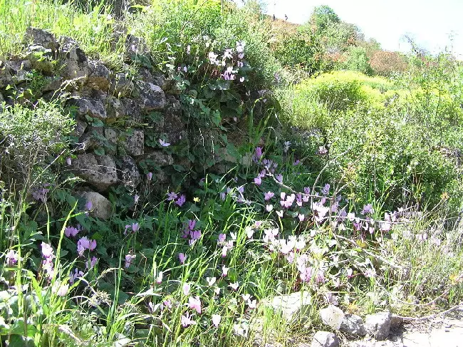
Posted by Umar Ilayann 1 - Qarn El Ghazal (Cyclamen) Beauty In El Jura's Stone Wall Terraces.(Spring 2004)
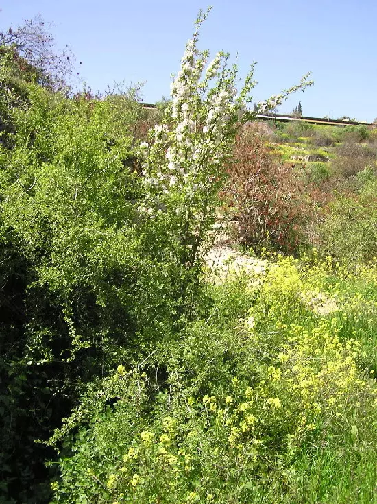
Posted by Umar Ilayann - Al Jura's Apple tree in full bloom (most probably from a 1948 tree).(Spring 2004)
Posted by Umar Ilayann 2 - Remaining home with Kibbutz above. Summer 2006. Photo: Annemarie Jacir
Posted by Annemarie Jacir 4 - Wild Cyclamen 'Qarn El-Ghazal' in full bloom in Al-Jura Terraces
Posted by Umar Abu El-Bararri - Rubble of the destroyed Palestinian houses
Posted by Noga Kadman 3 - عين في بلدة الجورة
Posted by روان - الجوره
Posted by abu raya - الجوره
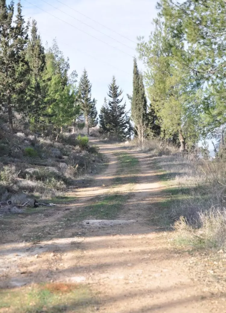
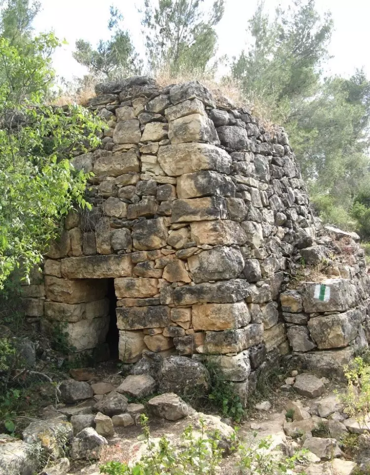
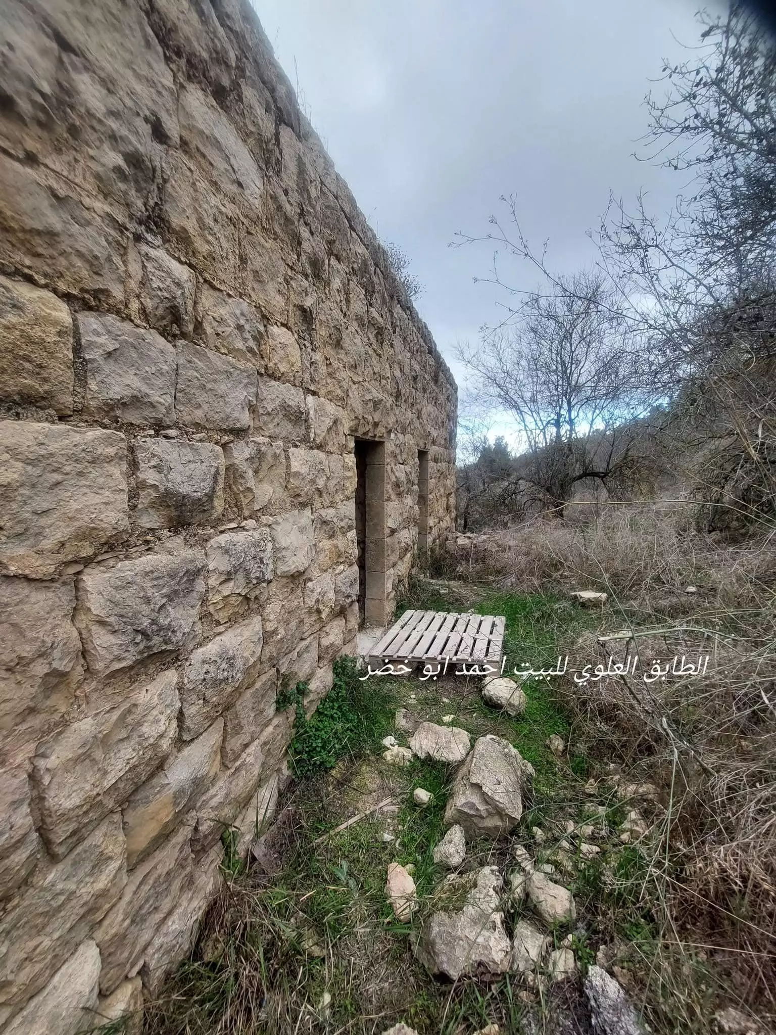
Posted by abu raya - جولة في فناء البيتين القائمين..تاريخ الجولة 28/12/24 -- ستجدون المزيد اسفل الصورة بقسم التعليقات --- أحمد أبو خضرة
1 - جولة في فناء البيتين القائمين..تاريخ الجولة 28/12/24 -- أحمد أبو خضرة #2
- جولة في فناء البيتين القائمين..تاريخ الجولة 28/12/24 -- أحمد أبو خضرة #3
- جولة في فناء البيتين القائمين..تاريخ الجولة 28/12/24 -- أحمد أبو خضرة #4
- جولة في فناء البيتين القائمين..تاريخ الجولة 28/12/24 -- أحمد أبو خضرة #5
- جولة في فناء البيتين القائمين..تاريخ الجولة 28/12/24 -- أحمد أبو خضرة #6
- جولة في فناء البيتين القائمين..تاريخ الجولة 28/12/24 -- أحمد أبو خضرة #7
- جولة في فناء البيتين القائمين..تاريخ الجولة 28/12/24 -- أحمد أبو خضرة #8
- جولة في فناء البيتين القائمين..تاريخ الجولة 28/12/24 -- أحمد أبو خضرة #9
- جولة في فناء البيتين القائمين..تاريخ الجولة 28/12/24 -- أحمد أبو خضرة #10
- جولة في فناء البيتين القائمين..تاريخ الجولة 28/12/24 -- أحمد أبو خضرة #11
- جولة في فناء البيتين القائمين..تاريخ الجولة 28/12/24 -- أحمد أبو خضرة #12
- جولة في فناء البيتين القائمين..تاريخ الجولة 28/12/24 -- أحمد أبو خضرة #13
- عين ماء في جبال القدس بين خربة سعيدة وقرية الجورة -- إياد جابر
- عين ماء في جبال القدس بين خربة سعيدة وقرية الجورة -- إياد جابر #2
- عين ماء في جبال القدس بين خربة سعيدة وقرية الجورة -- إياد جابر #3
- عين ماء في جبال القدس بين خربة سعيدة وقرية الجورة -- إياد جابر #4
- عين ماء في جبال القدس بين خربة سعيدة وقرية الجورة -- إياد جابر #5
- That is how the "civilized" erased and replaced us: al-Jura was completely obliterated, as you see -- الجورة باتت أثر بعد عين. من هنا مر الهمجّ
- That is how the "civilized" erased and replaced us: al-Jura was completely obliterated, as you see -- الجورة باتت أثر بعد عين. من هنا مر الهمجّ #2
- That is how the "civilized" erased and replaced us: al-Jura was completely obliterated, as you see -- الجورة باتت أثر بعد عين. من هنا مر الهمجّ #3
- That is how the "civilized" erased and replaced us: al-Jura was completely obliterated, as you see -- الجورة باتت أثر بعد عين. من هنا مر الهمجّ #4
- That is how the "civilized" erased and replaced us: al-Jura was completely obliterated except for a few remaining structures, as you see -- باتت الجورة أثر بعد عين بإستثناء بعض المباني. من هنا مر الهمجّ
- That is how the "civilized" erased and replaced us: al-Jura was completely obliterated except for a few remaining structures, as you see -- باتت الجورة أثر بعد عين بإستثناء بعض المباني. من هنا مر الهمجّ #2
- That is how the "civilized" erased and replaced us: al-Jura was completely obliterated except for a few remaining structures, as you see -- باتت الجورة أثر بعد عين بإستثناء بعض المباني. من هنا مر الهمجّ #3
- That is how the "civilized" erased and replaced us: al-Jura was completely obliterated except for a few remaining structures, as you see -- باتت الجورة أثر بعد عين بإستثناء بعض المباني. من هنا مر الهمجّ #4
- That is how the "civilized" erased and replaced us: al-Jura was completely obliterated except for a few remaining structures, as you see -- باتت الجورة أثر بعد عين بإستثناء بعض المباني. من هنا مر الهمجّ #5
- That is how the "civilized" erased and replaced us: al-Jura was completely obliterated except for a few remaining structures, as you see -- باتت الجورة أثر بعد عين بإستثناء بعض المباني. من هنا مر الهمجّ #6
- That is how the "civilized" erased and replaced us: al-Jura was completely obliterated except for a few remaining structures, as you see -- باتت الجورة أثر بعد عين بإستثناء بعض المباني. من هنا مر الهمجّ #7
- That is how the "civilized" erased and replaced us: al-Jura was completely obliterated except for a few remaining structures, as you see -- باتت الجورة أثر بعد عين بإستثناء بعض المباني. من هنا مر الهمجّ #8
- That is how the "civilized" erased and replaced us: al-Jura was completely obliterated except for a few remaining structures, as you see -- باتت الجورة أثر بعد عين بإستثناء بعض المباني. من هنا مر الهمجّ #9
- That is how the "civilized" erased and replaced us: al-Jura was completely obliterated except for a few remaining structures, as you see -- باتت الجورة أثر بعد عين بإستثناء بعض المباني. من هنا مر الهمجّ #10
- That is how the "civilized" erased and replaced us: al-Jura was completely obliterated except for a few remaining structures, as you see -- باتت الجورة أثر بعد عين بإستثناء بعض المباني. من هنا مر الهمجّ #11
- That is how the "civilized" erased and replaced us: al-Jura was completely obliterated except for a few remaining structures, as you see -- باتت الجورة أثر بعد عين بإستثناء بعض المباني. من هنا مر الهمجّ #12
- That is how the "civilized" erased and replaced us: al-Jura was completely obliterated except for a few remaining structures, as you see -- باتت الجورة أثر بعد عين بإستثناء بعض المباني. من هنا مر الهمجّ #13
- That is how the "civilized" erased and replaced us: al-Jura was completely obliterated except for a few remaining structures, as you see -- باتت الجورة أثر بعد عين بإستثناء بعض المباني. من هنا مر الهمجّ #14
- عين سعيدة في خربة قَرية سعيدة في اراضي قرية الجورة waze עין סעדימ -- Jan 1st, 2022 -- Iyad Jaber
- عين شريج في قرية الجورة المهجرة-- waze עין שריג -- Sept. 20th, 2021 --Iyad Jaber
- عين شريج في قرية الجورة المهجرة-- waze עין שריג -- Sept. 20th, 2021 --Iyad Jaber #2
- عين شريج في قرية الجورة المهجرة-- waze עין שריג -- Sept. 20th, 2021 --Iyad Jaber #3
- عين شريج في قرية الجورة المهجرة-- waze עין שריג -- Sept. 20th, 2021 --Iyad Jaber #4
- عين شريج في قرية الجورة المهجرة-- waze עין שריג -- Sept. 20th, 2021 --Iyad Jaber #5
- عين شريج في قرية الجورة المهجرة-- waze עין שריג -- Sept. 20th, 2021 --Iyad Jaber #6
- عين شريج في قرية الجورة المهجرة-- waze עין שריג -- Sept. 20th, 2021 --Iyad Jaber #7
- عين شريج في قرية الجورة المهجرة-- waze עין שריג -- Sept. 20th, 2021 --Iyad Jaber #8
- عين شريج في قرية الجورة المهجرة-- waze עין שריג -- Sept. 20th, 2021 --Iyad Jaber #9
- عين شريج في قرية الجورة المهجرة-- waze עין שריג -- Sept. 20th, 2021 --Iyad Jaber #10
- عين ماء في قرية الجورة المهجرة قضاء الفدس
- عين ماء في قرية الجورة المهجرة قضاء الفدس #2
- عين ماء في قرية الجورة المهجرة قضاء الفدس #3
- عين ماء في قرية الجورة المهجرة قضاء الفدس #4
- عين ماء في قرية الجورة المهجرة قضاء الفدس #5
- عين ماء في قرية الجورة المهجرة قضاء الفدس #6
- عين ماء في قرية الجورة المهجرة قضاء الفدس
- عين ماء في قرية الجورة المهجرة قضاء الفدس #2
- عين ماء في قرية الجورة المهجرة قضاء الفدس #3
- عين ماء في قرية الجورة المهجرة قضاء الفدس #4

- عين ماء في قرية الجورة المهجرة قضاء الفدس #5
- عين ماء في قرية الجورة المهجرة قضاء الفدس
- عين ماء في قرية الجورة المهجرة قضاء الفدس #2
- عين ماء في قرية الجورة المهجرة قضاء الفدس #3
- عين ماء في قرية الجورة المهجرة قضاء الفدس #4
- عين ماء في قرية الجورة المهجرة قضاء الفدس #5
- عين ماء في قرية الجورة المهجرة قضاء الفدس #6
- عين ماء في قرية الجورة المهجرة قضاء الفدس #7
Want to browse more? 80,000 pictures were grouped in these gallaries:
| Display Name | Clan/Hamolah | Country of Residence |
| علاء مفرح | مفرح | الزرقاء, الأردن |
| رنا حمدان | حمدان | القدس, قلنديا - البلد |
| ابراهيم الجوري | - | رام الله, بيتين |
| Mohammad F. Al-Sharif | Al-Sharif | Amman, Jordan |
| waseem Al Sharif | - | Abu Dhabi, UAE |
| المشتاقة للجنة | الجورة | Amman, Jordan |
| Mervat Suboh | Hasan | Hamilton, Canada |
- قرية الجورة المهجرة | جذور مقدسية 2020 Duration: 24 min 38 sec
No links have been shared yet, be free to the first to share the first link.
 Fake Valor: Why Did Zionist Jews Hoist Nazis Flag on Their Ships in the 1930s?
What is new?
-
Facts About Oct. 7th Gaza Raid
-
Remined Us Please:: Who Did Rape Who? Palestinians Raped Israelis? Or, was the other way around?
-
When Prof. Edward Said was invited to debate Bibi Netanyahu in the 1980s, watch what happened!
-
Ezra Klein of the NY Times on the "Jewish Race".
-
Abusing Blood Libel!
-
Did Israeli Soldiers Activate The Hanniba Direective On Oct. 7th? You Be The Judge
-
Zionist FAQ: Isn't it true that Palestinians don't want peace? Palestinians never accepted the two-state solution
- Facts about Haavara (Transfer) Agreement between Ben-Gurion & Hitler
-
Haavara FAQs: Why Did Zionist Jews Hoist Nazis' Flags on Their Ships in the 1930s?
- Haavara FAQs: When Chaim Weizmann met FDR in mid-1943, why was he silent about rescuing European Jewry?
-
Dear ChatGPT: How did Palestinians resist Napoleon's invasion of their country in 1799?
-
Dear ChatGPT: Gaza had a vibrant Jewish community in the mid-17th century. What happened to them?
-
Dear ChatGPT: Why did the Jewish Agency suppress news of the Holocaust during WWII?
-
Video Playlist: Jews share their DNA tests to end the conflict for good.
-
A Tale of Two Conflicts: Examining the Definition of Genocide
-
Prof. Abraham Polak And The Suppressed History of the Khazars and European Jewry
-
How Ronald Reagan would have framed the genocide in Gaza if he were still alive?
-
Haavara FAQs: Let us do the math: how many German Jews did The Haavara Agreement save?
-
Zionist FAQs: The Hebron Massacre of 1929, "clearly proves" that Palestinians are antisemitic, how could you deny it?
-
Zionist FAQs: Why Anti-Zionist Is Not Antisemitism?
-
Zionist FAQs: Isn't it true that the KGB created Palestinian Nationalism in the early 1960s?
- Zionist FAQs: Muslims are killing Muslims all the time; why are Israeli Jews being singled out in the media?
- Zionist FAQs: How is Israel an apartheid state when 20% of its citizens are Arabs who enjoy full rights?
-
Haavara FAQs: Why Did Dorothy Thompson Flip From A Zionist Advocate to A Silenced Dissenter?
-
Haavara FAQs: Analysis of Herzl's Uganda Scheme and how it could have saved millions of Jews.
-
Haavara FAQs: Why did Hayim Greenberg describe American Jewry as "morally bankrupt" in early 1943?
-
Haavara FAQs: What if the Evian Conference was a resounding success? What would have been the impact of saving European Jewry on Zionism?
- Haavara FAQs: What if the six million were saved, how that would have impacted the Zionist project?
-
Haavara FAQs: How did Zionist leaders react when Europe's Jews lingered in the DP camps after WWII ended?
-
Why does the American Jewish community repeat lies that David Ben-Gurion had debunked before he died?
-
Who has the power to rename the Tatar/Khazar Gene Marker to Jewish IV?
-
Zionist FAQs: Why won't Egypt, Syria, and Jordan take their people back? Jews are indigenous to Palestine, and Arabs immigrated after Jews developed the country. Arabs should leave.
-
Haavara FAQs: Did Hitler and the Nazis conflate between Judaism and Zionist? If that wasn't case, then why?
-
Haavara FAQs: Winston Churchill and antisemitism, a collection of articles written Churchill.
-
Haavara FAQs: Broken by country, how many Jews survived vs. killed during the Holocaust?
-
Haavara FAQs: Why did European Jews vote with their feet and to immigrated to the Americas, not Palestine, after WWII?
-
Watch this American Jewish Girl describing Israeli Jews' cognitive dissonance like no other in under two minutes
-
Haavara FAQs: When the Nazis went out of their way to hide the Holocaust, Israeli Jews did the exact opposite by broadcasting their genocide of Gazans. But why?
-
Haavara FAQs: How Zionist Jews went out of their to show their appreciation to Nazism and Fascism?
- Haavara FAQs: Why Zionist leaders were against bombing the death camps & the Railroads leading to them?
-
Haavara FAQs: Hitler's message to the British and American people: If Jews are such noble citizens and you care about them, how come you're not letting them in? I will gladly ship them to you at my expense, even on luxury liners!
-
A shortlist of Zionist and Israeli false flag operations in the name Jews.
-
The Most Moral Army
- The Land of Kapos (Israel): Where the brave are boycotted and Kapos walk free.
- Why did early Zionists often named their communal enterprises "colonial"?
- Zionist Relations with Nazi Germany by Faris Glubb
-
Two NY Times advertisements by Zionists in the early 1943 that exposes Zionists' treason at the height of the calamity
- Facts Not Lies about the Palestinian-Israeli Conflict.
- Site's pictures have been categorized
- Campgain Against Lice
- A Survey of Palestine, the official source about Palestine before Nakba produced by the British Mandate; over 1200 pages.
- Satellite View & Google Earth: Over 6,000 placemarks identifying all destroyed towns, W. Bank & Gaza Strip Towns, & refugee camps.
- PalestineRemembered.com and its Nakba Oral History Project were featured on al-Jazeera Satellite TV.
- Nakba Oral History Video Podcast:
 Over 700 Oral History interviews (including 3,500+ hours of recording) can be viewed online.
 - Palestine Village Statistics Project
- Gaza Jail Break
- النسخة العربية للموقع الان متوفرة
- Videos: Documenting the destroyed villages in video: Tracing all that remains since Nakba.
- Videos: Responding to Zionist Propaganda
- Interview: The ethnic cleansing of Palestine: George Galloway interviews Israeli Historian Ilan Pappe.
- For Palestinians, memory matters. It provides a blueprint for their future By George Bisharat.
- Zionist FAQ now available in Hebrew שאלות שציונים שואלים, עכשיו בעברית
- Video: The Stephen Walt and John Mearsheimer report on the influence of the Israel Lobby on U.S. Foreign Policy
- The Palestinian-Israeli conflict for beginners
