| PalestineRemembered | About Us | Oral History | العربية | |
| Pictures | Zionist FAQs | Haavara | Maps | |
| Search |
| Camps |
| Districts |
| Acre |
| Baysan |
| Beersheba |
| Bethlehem |
| Gaza |
| Haifa |
| Hebron |
| Jaffa |
| Jericho |
| Jerusalem |
| Jinin |
| Nablus |
| Nazareth |
| Ramallah |
| al-Ramla |
| Safad |
| Tiberias |
| Tulkarm |
| Donate |
| Contact |
| Profile |
| Videos |
Welcome To Ras Abu 'Ammar - رأس أبو عمار (ראס אבו עמאר)
|
District of Jerusalem
Ethnically cleansed days ago |
العربية Google Earth |
 |
Gallery (83) |
- Statistics & Facts
-
Before & After

- Satellite View
- Articles 3
- Pictures 83
- Land Deeds 6
- Oral History 2
- Members 76
- Families
- All That Remains
- Wikipedia
- Videos 1
- Guest Book 70
- Links 2
| Statistic & Fact | Value | ||||||||||||
| Occupation Date | October 21, 1948 | ||||||||||||
| Distance From District | 14 (km) West of Jerusalem | ||||||||||||
| Elevation | 625 (meters) West | ||||||||||||
| Before & After Nakba, Click Map For Details |
|||||||||||||
|
|||||||||||||
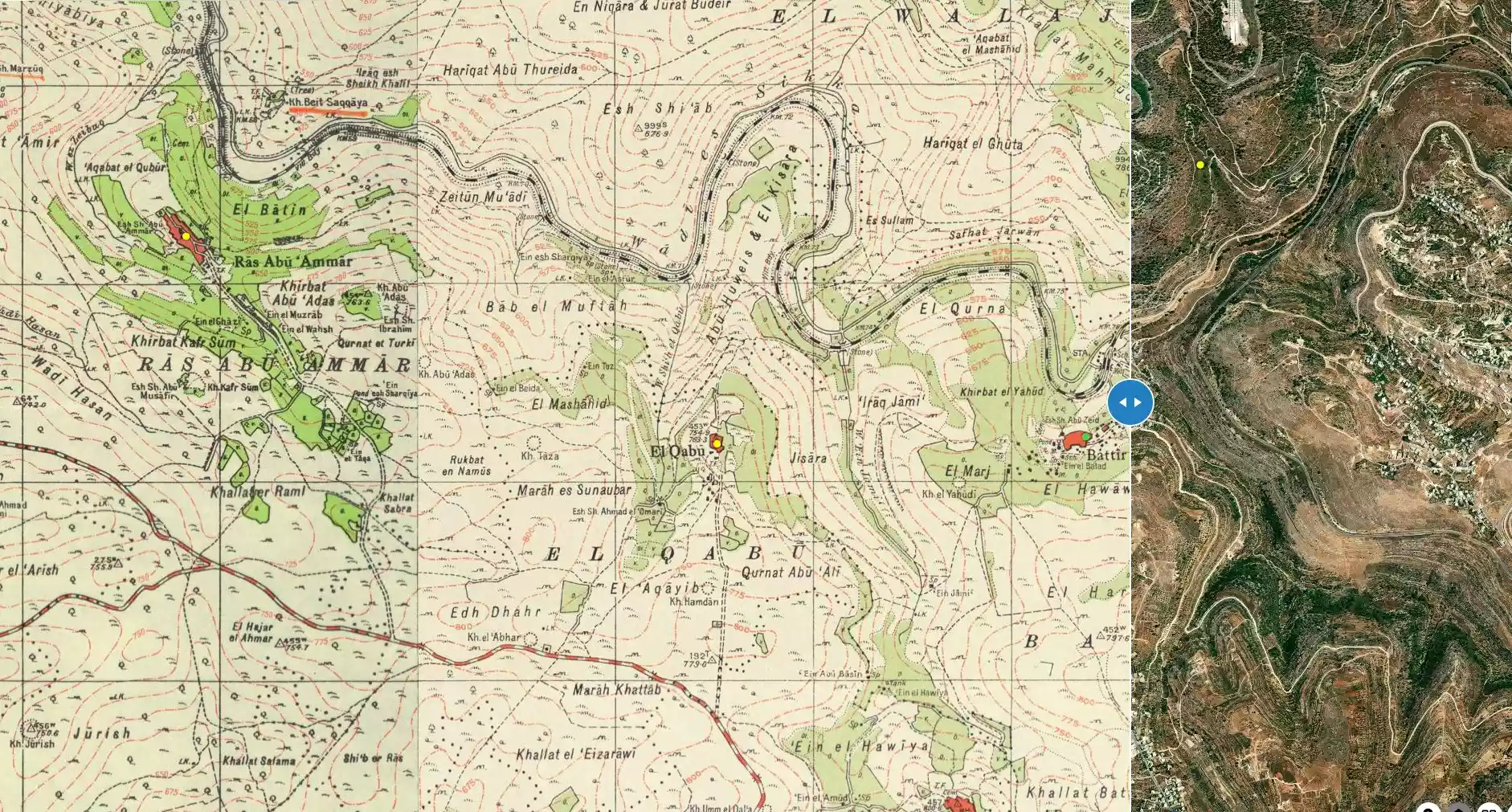
| Map Location | See location #29 on the map View from satellite |
||||||||||||
| Military Operation | Operation ha-Har | ||||||||||||
| Attacking Units | Har'el Brigade | ||||||||||||
| Exodus Cause | Military assault by Zionist troops | ||||||||||||
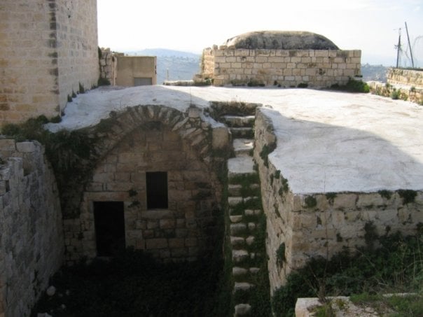
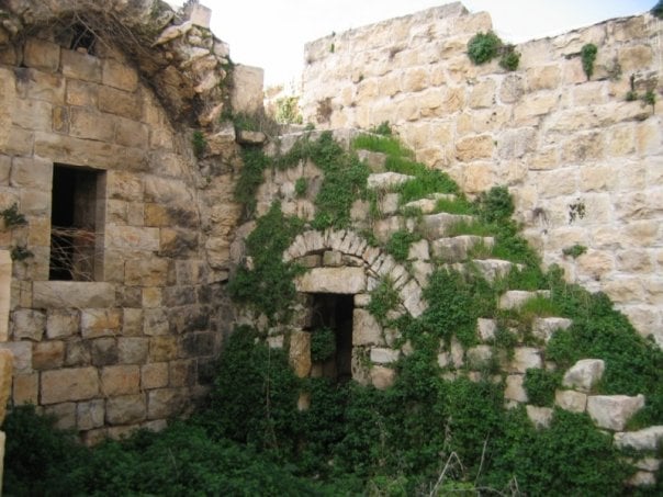
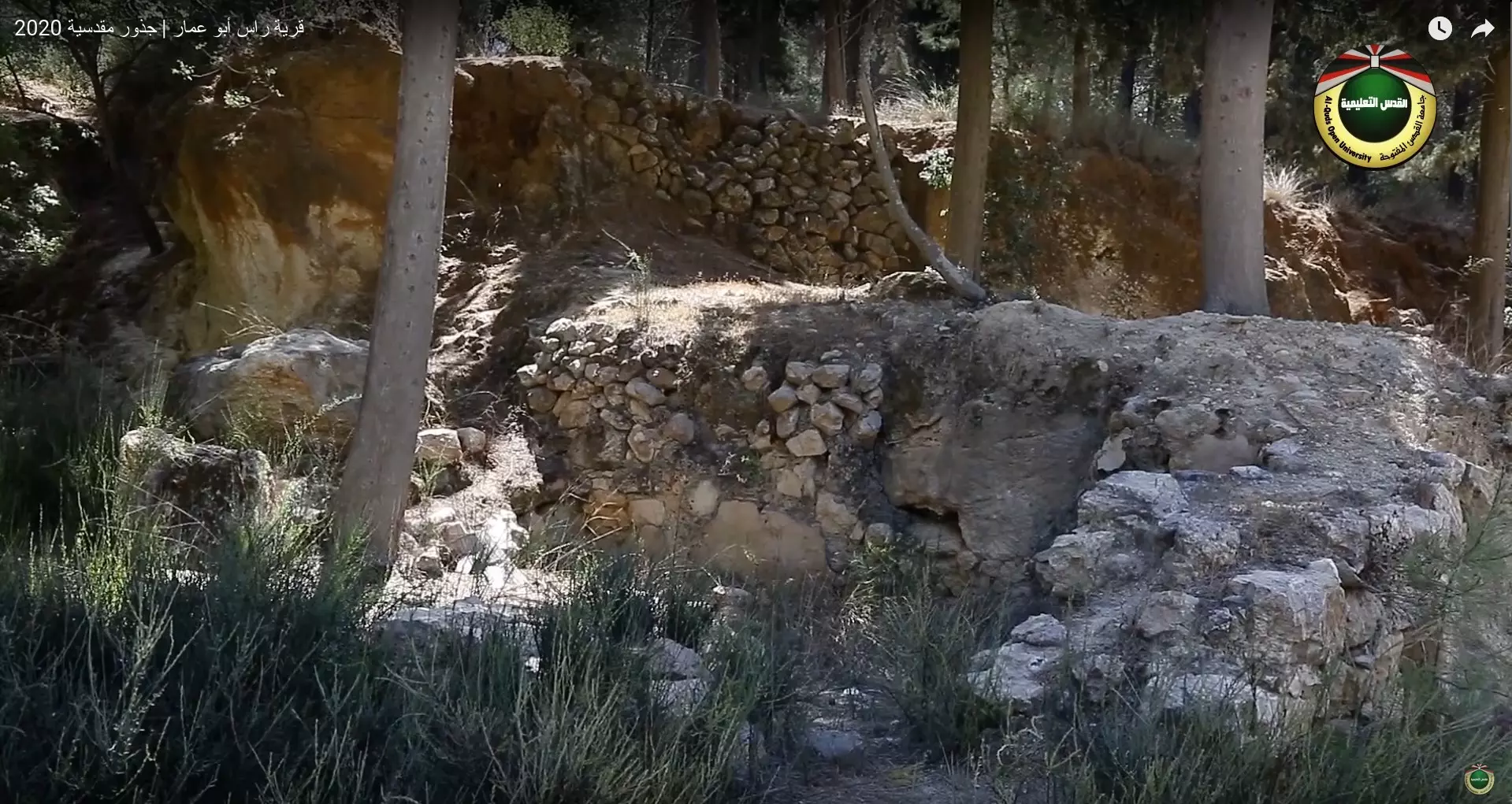
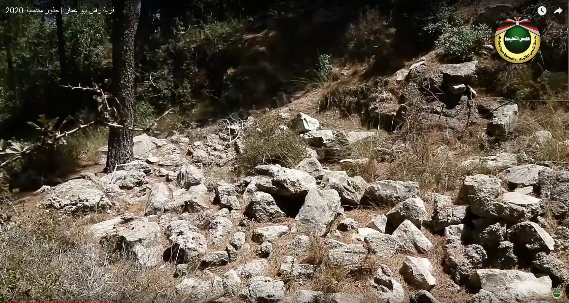
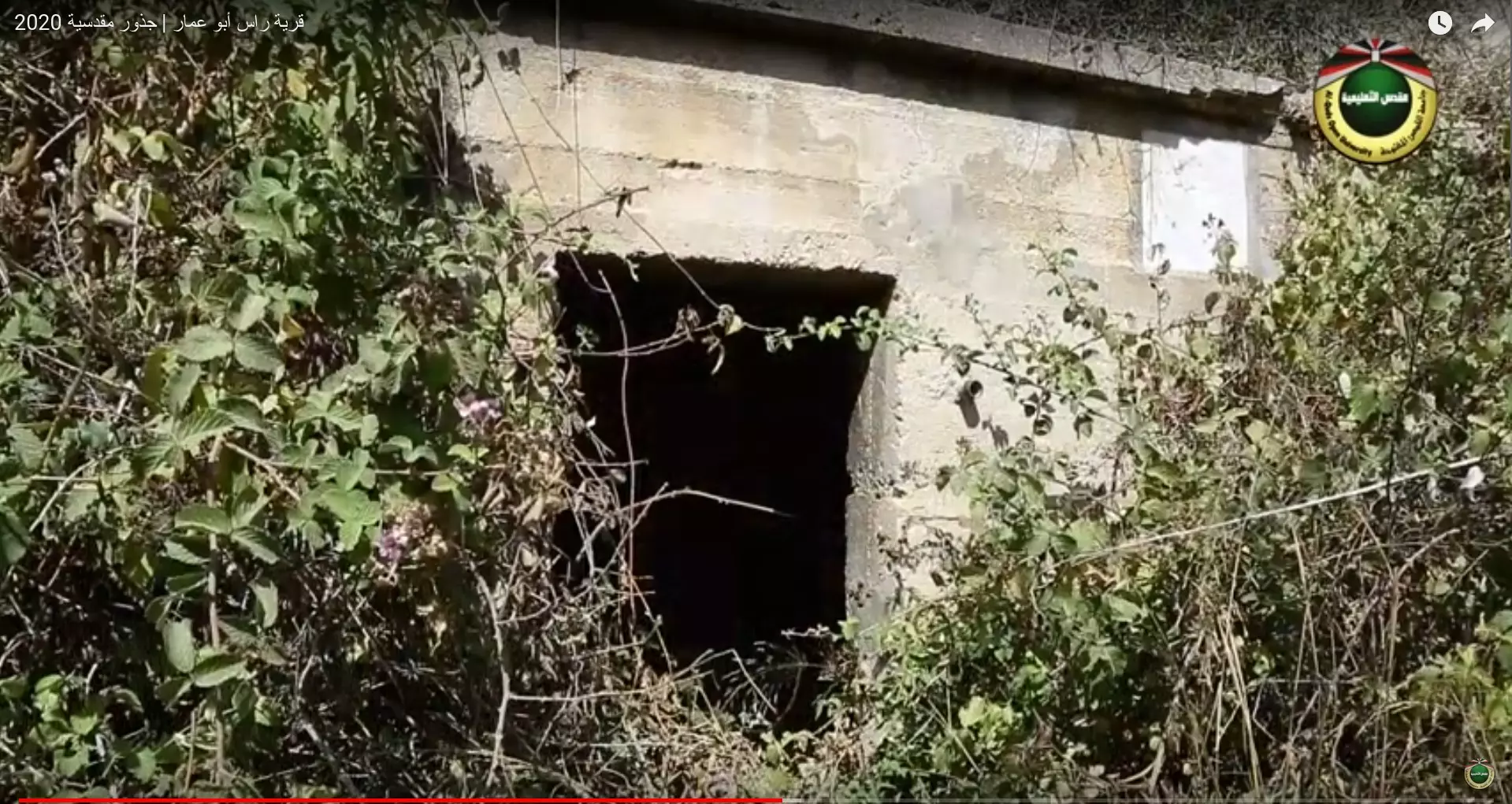
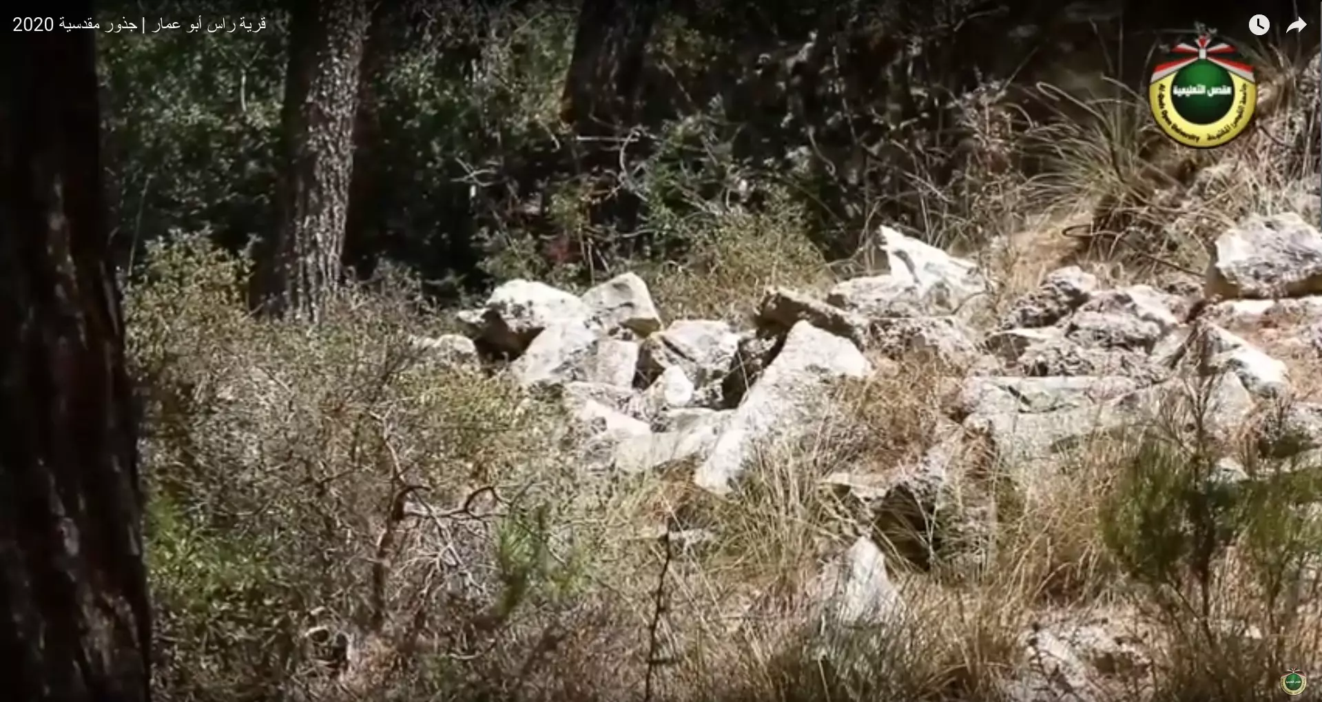
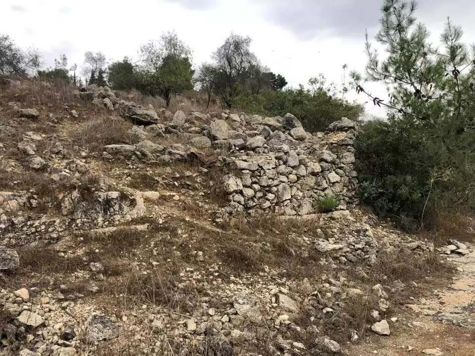
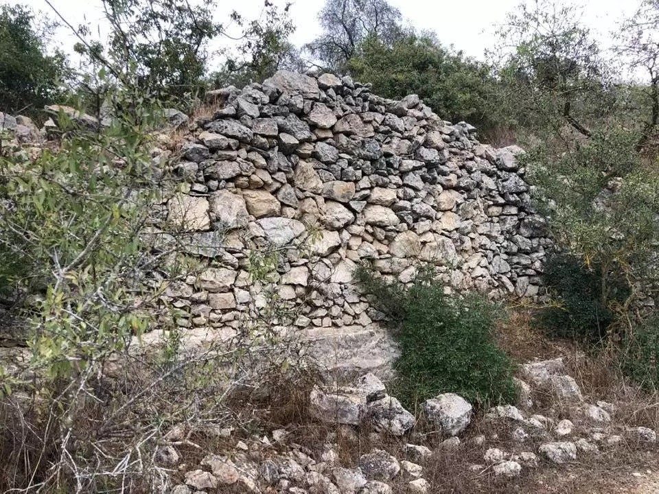
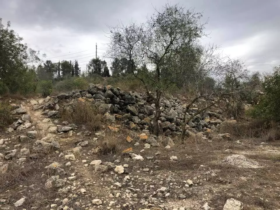
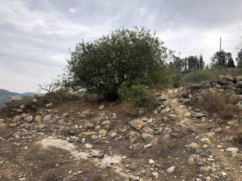
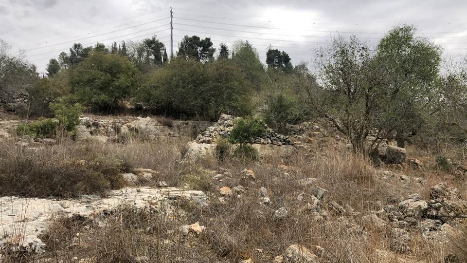
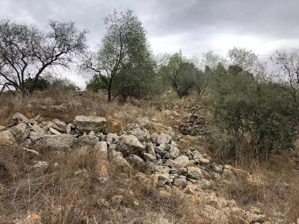
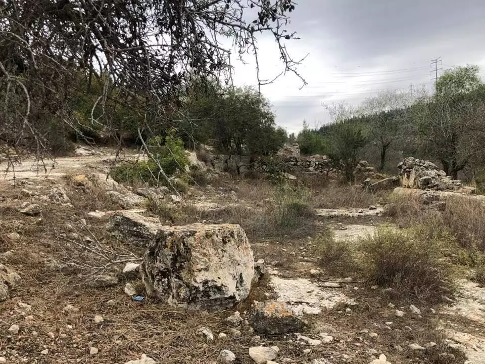
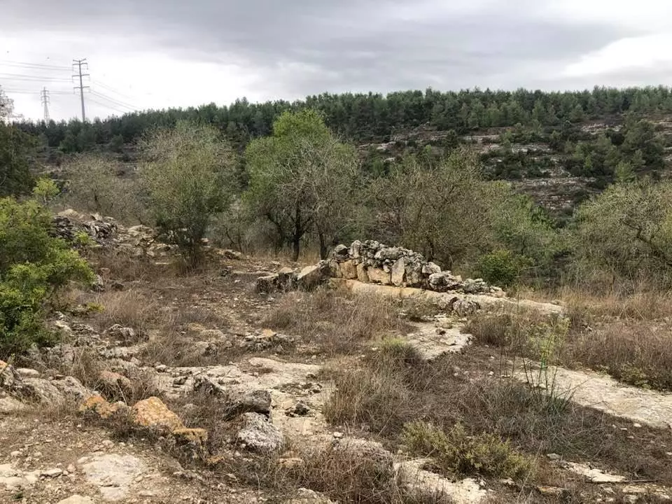
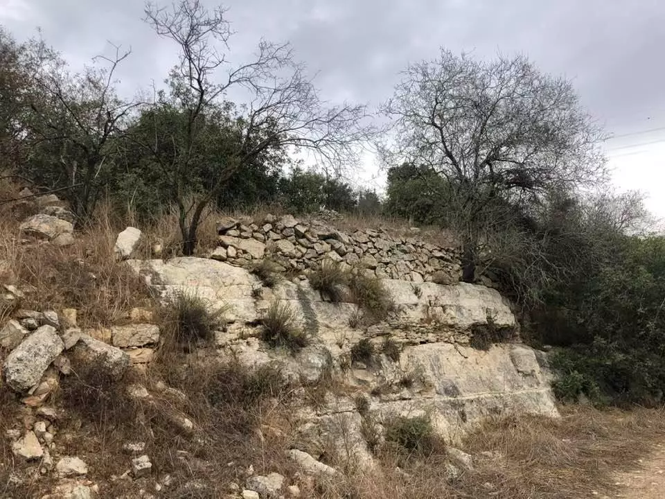
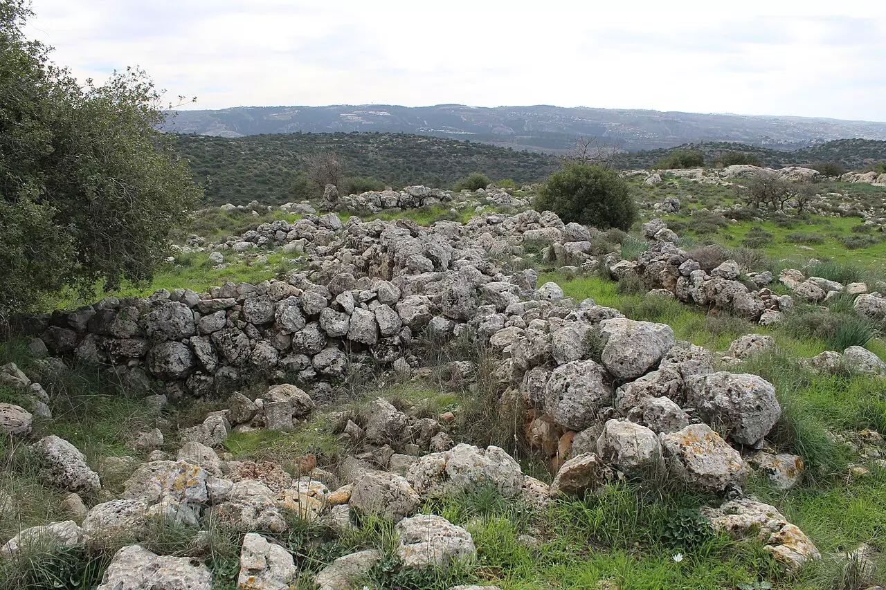
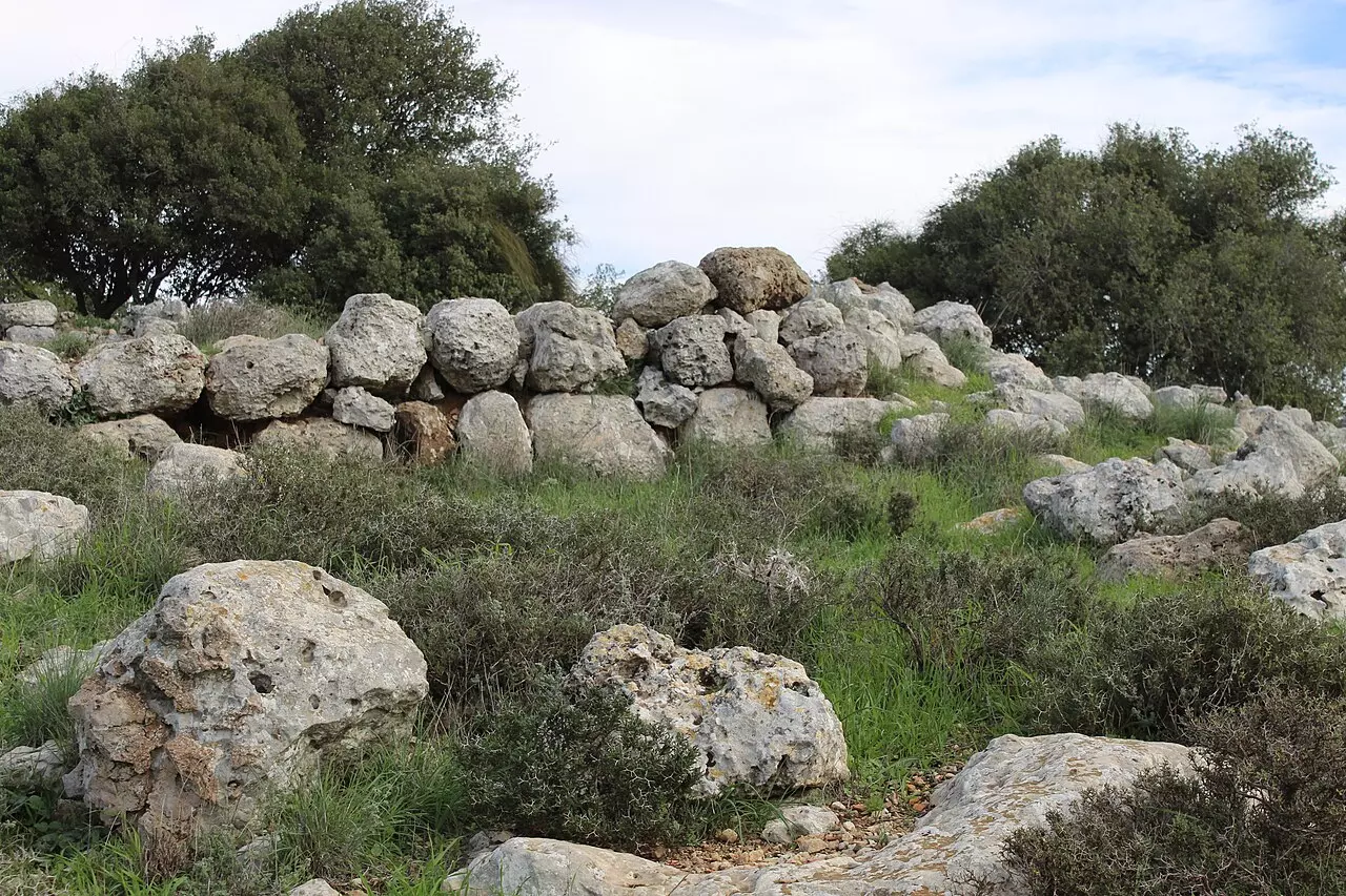
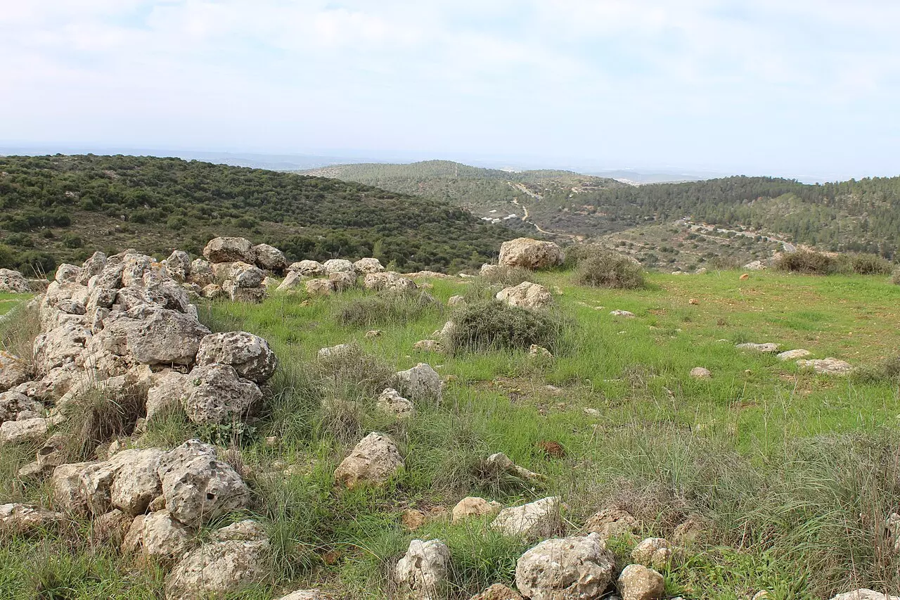
| Village Temains | Ras Abu 'Ammar was mostly destroyed and defaced. | ||||||||||||
| Ethnically Cleansing | Ras Abu 'Ammar inhabitants were completely ethnically cleansed. | ||||||||||||
| Pre-Nakba Land Ownership |
**Town Lands' Demarcation Maps |
||||||||||||
| Land Usage As of 1945 |
|
||||||||||||
| Population |
|
||||||||||||
| Number of Houses | In (1931): 106 (includes 'Ayn Hubin and'Aqqur) | ||||||||||||
| Near By Towns |
|||||||||||||
|
|
|||||||||||||
| Town's Name Through History | The village may have been named after a local sage known as Shaykh Abu' Ammar, for whom the villager maintained a shrine/maqam for. | ||||||||||||
| Schools | The village had one elementary school for boys. | ||||||||||||
| Shrines / Maqams | Ras Abu 'Ammar had several shrines including the one for al-Shaykh Abu' Ammar. | ||||||||||||
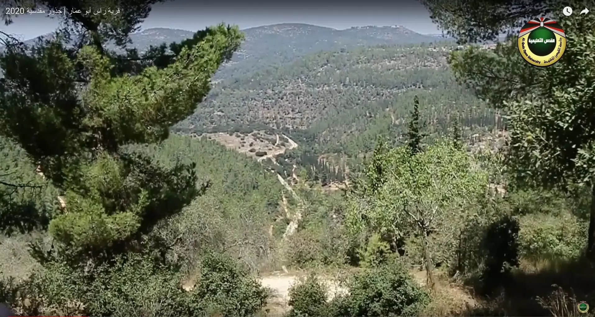
| Nearby Wadies & Rivers | And it is surrounded on three sides by the deep Wadi al-Sarar. | ||||||||||||
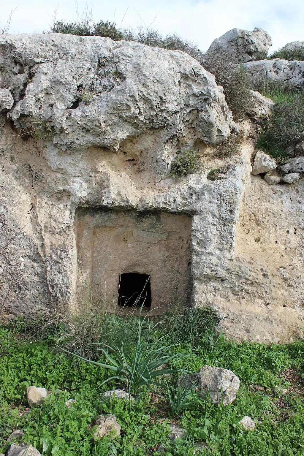
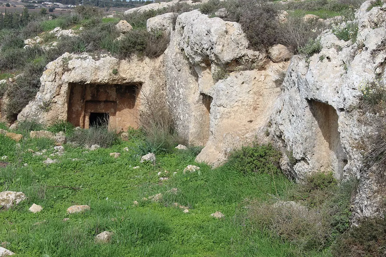
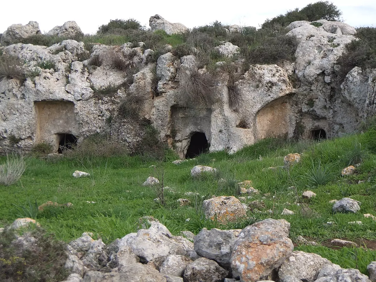
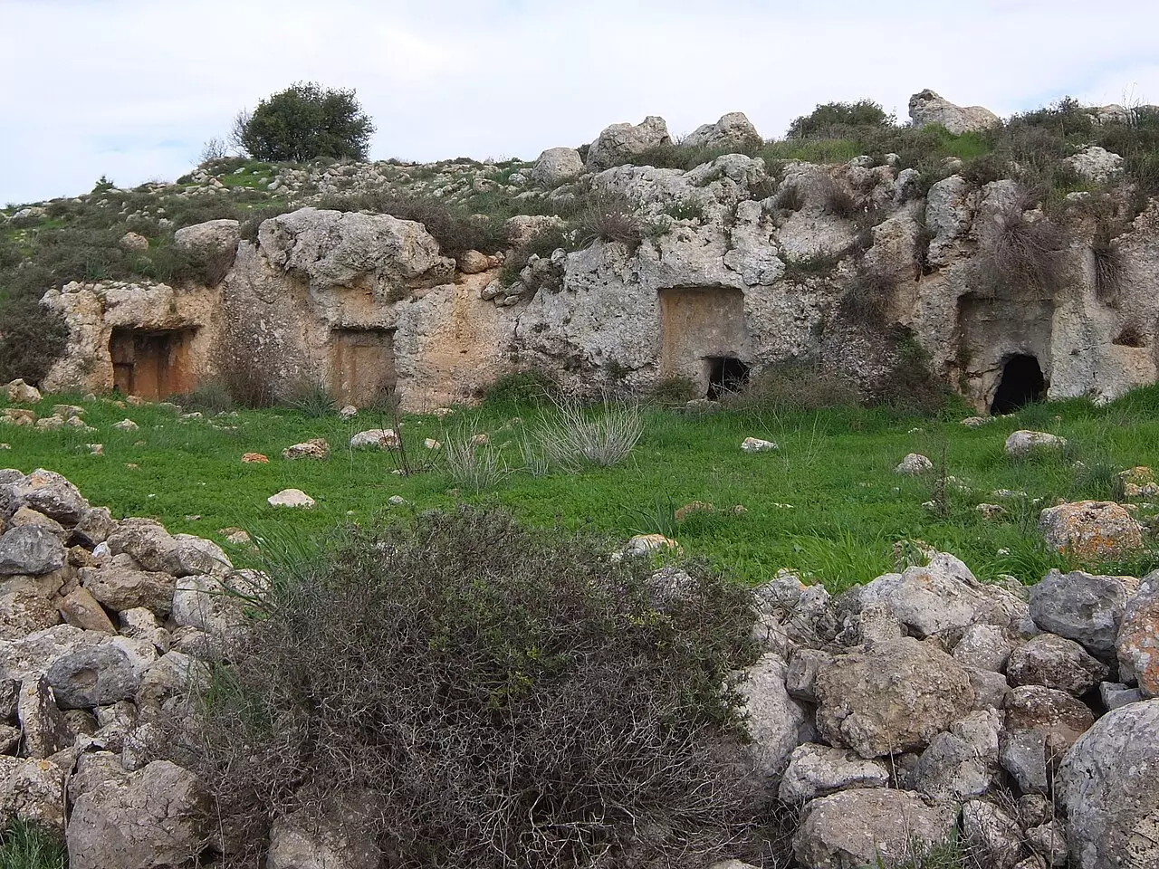
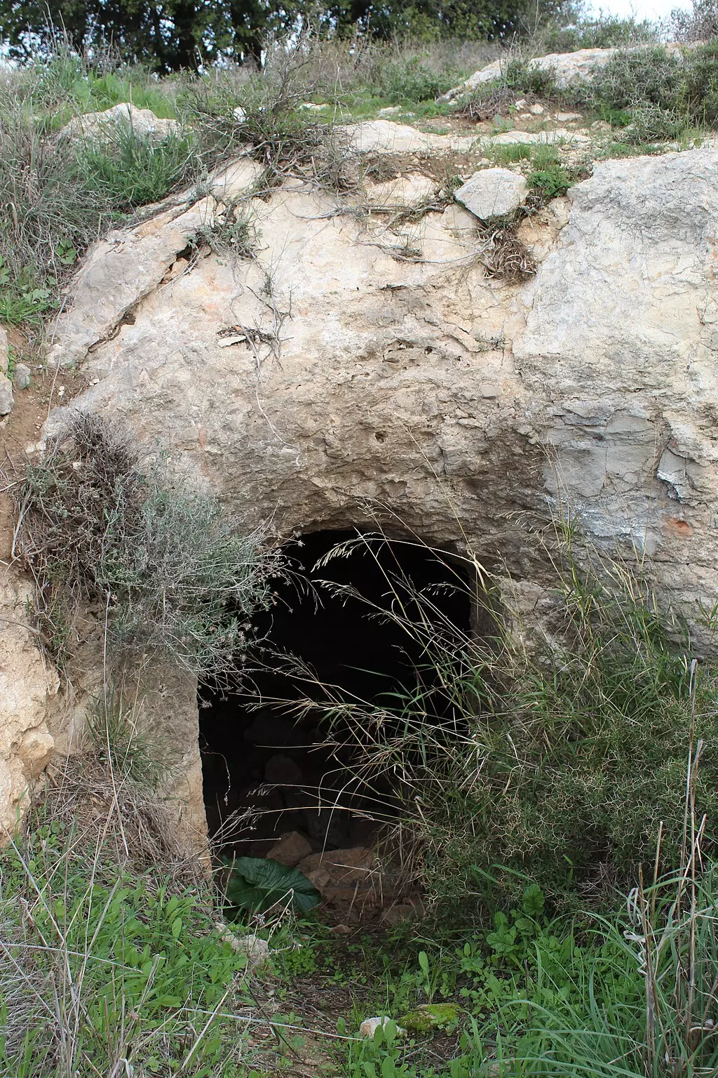
| Archeological Sites | Khirbat Kafr Sum was inhabited during the Crusade period and also for some time in the 16th century. | ||||||||||||
| Exculsive Jewish Colonies Who Usurped Village Lands |
Tzur Hadassa | ||||||||||||
| Featured Video | |||||||||||||
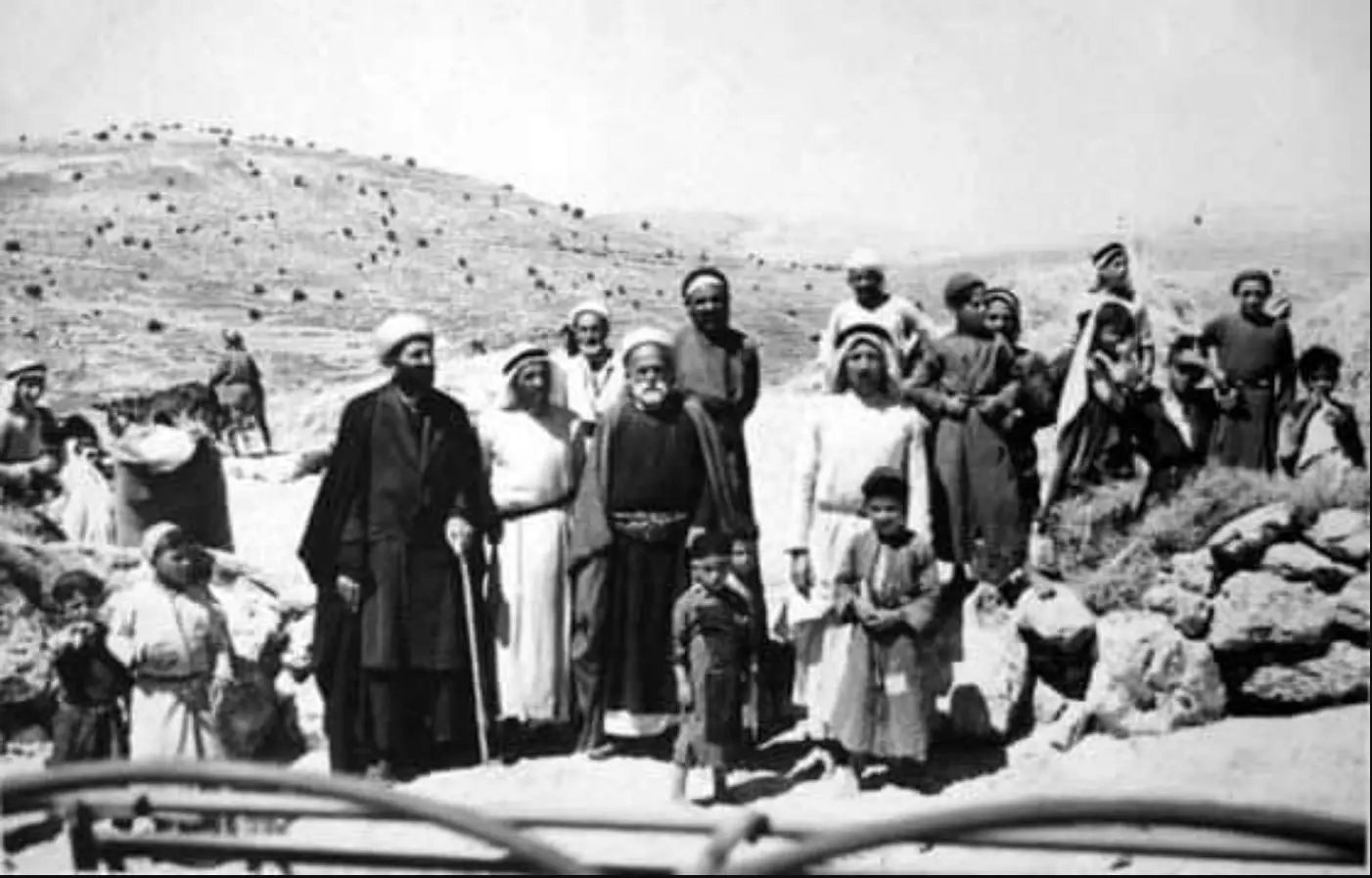
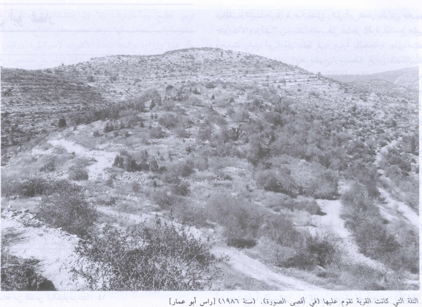
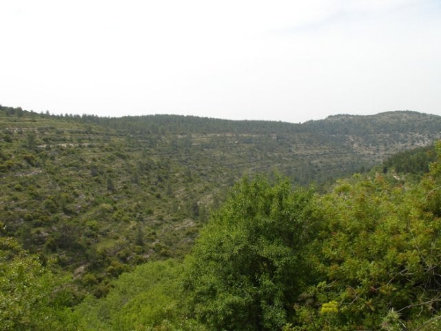
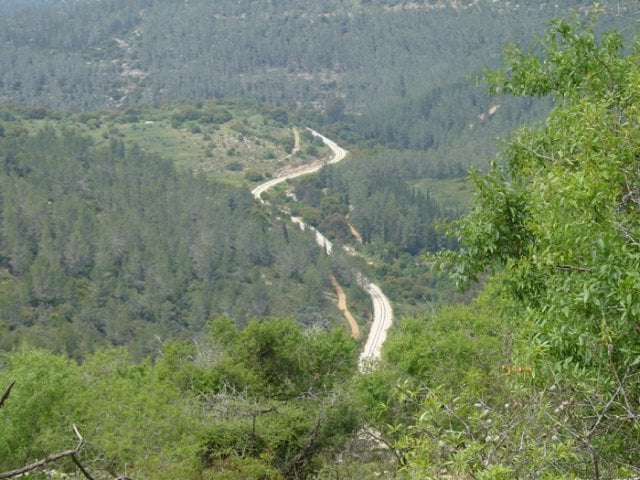
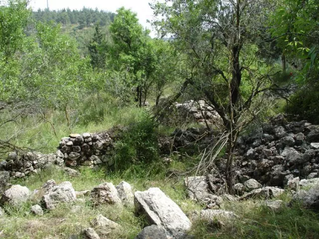
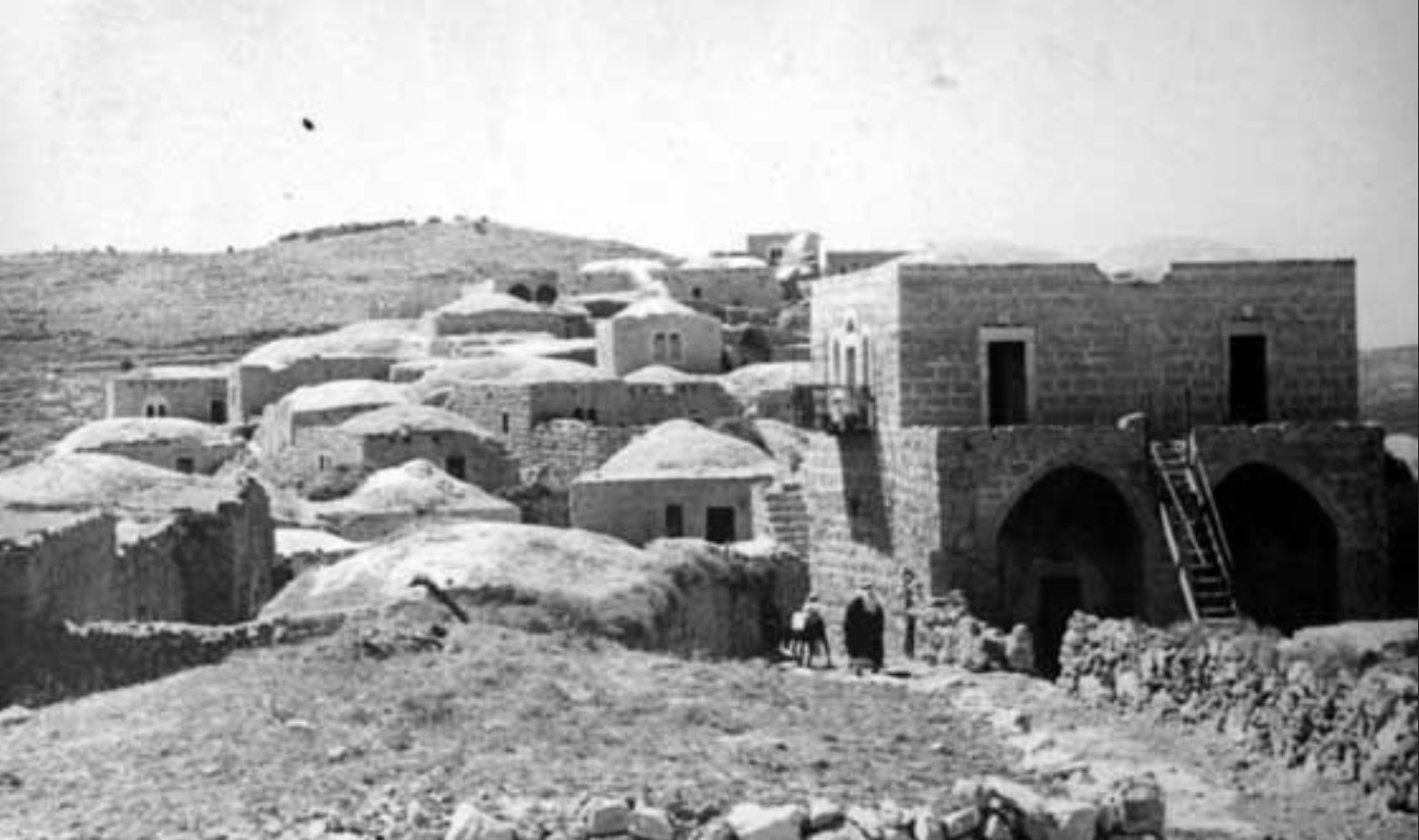
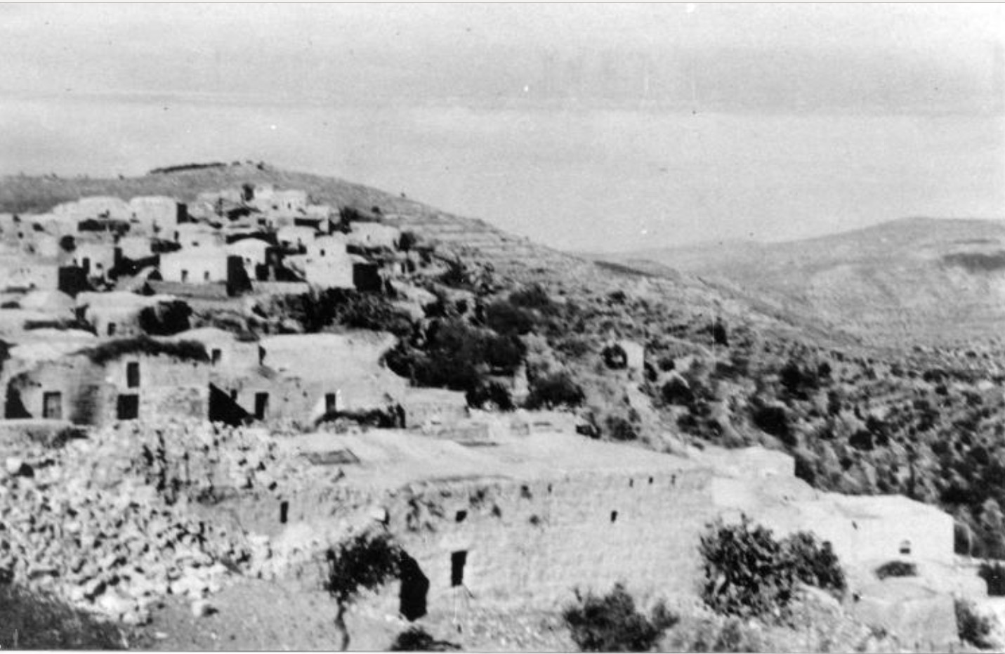
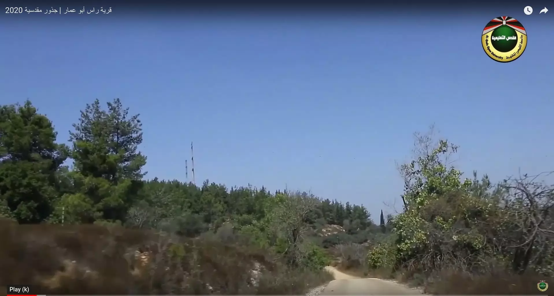
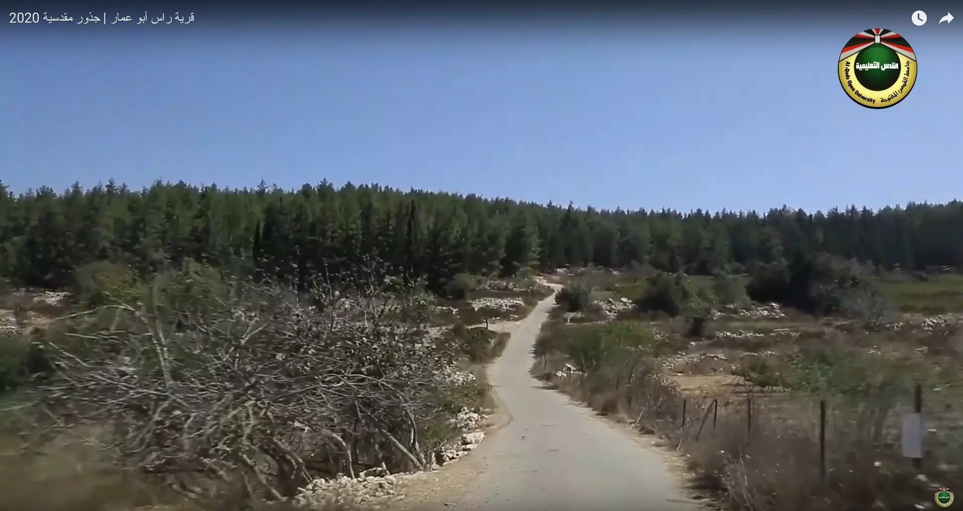
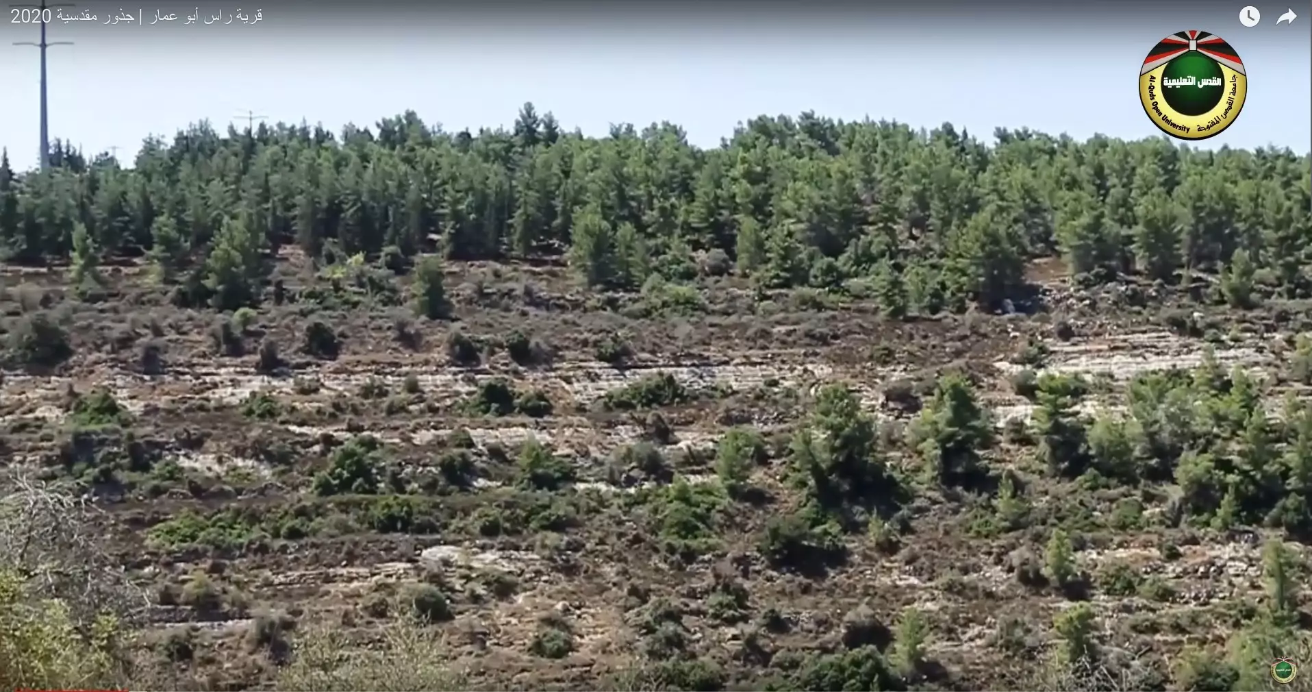
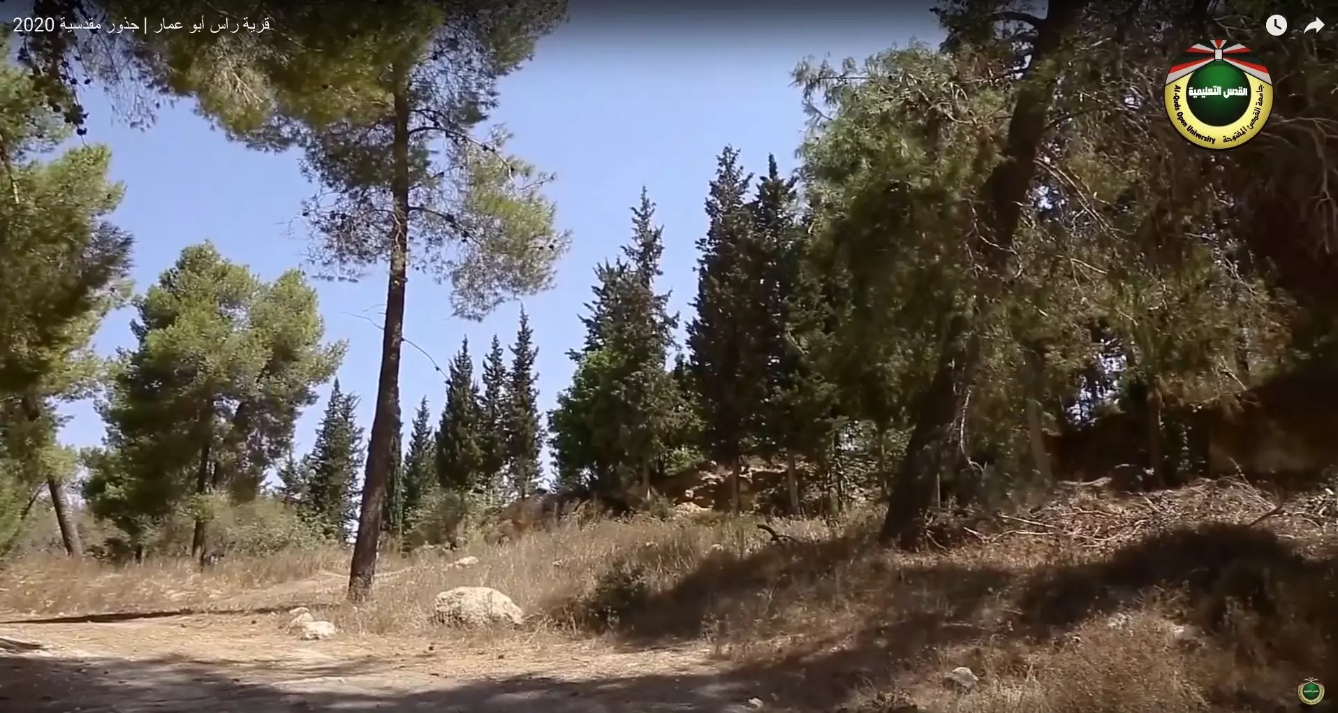
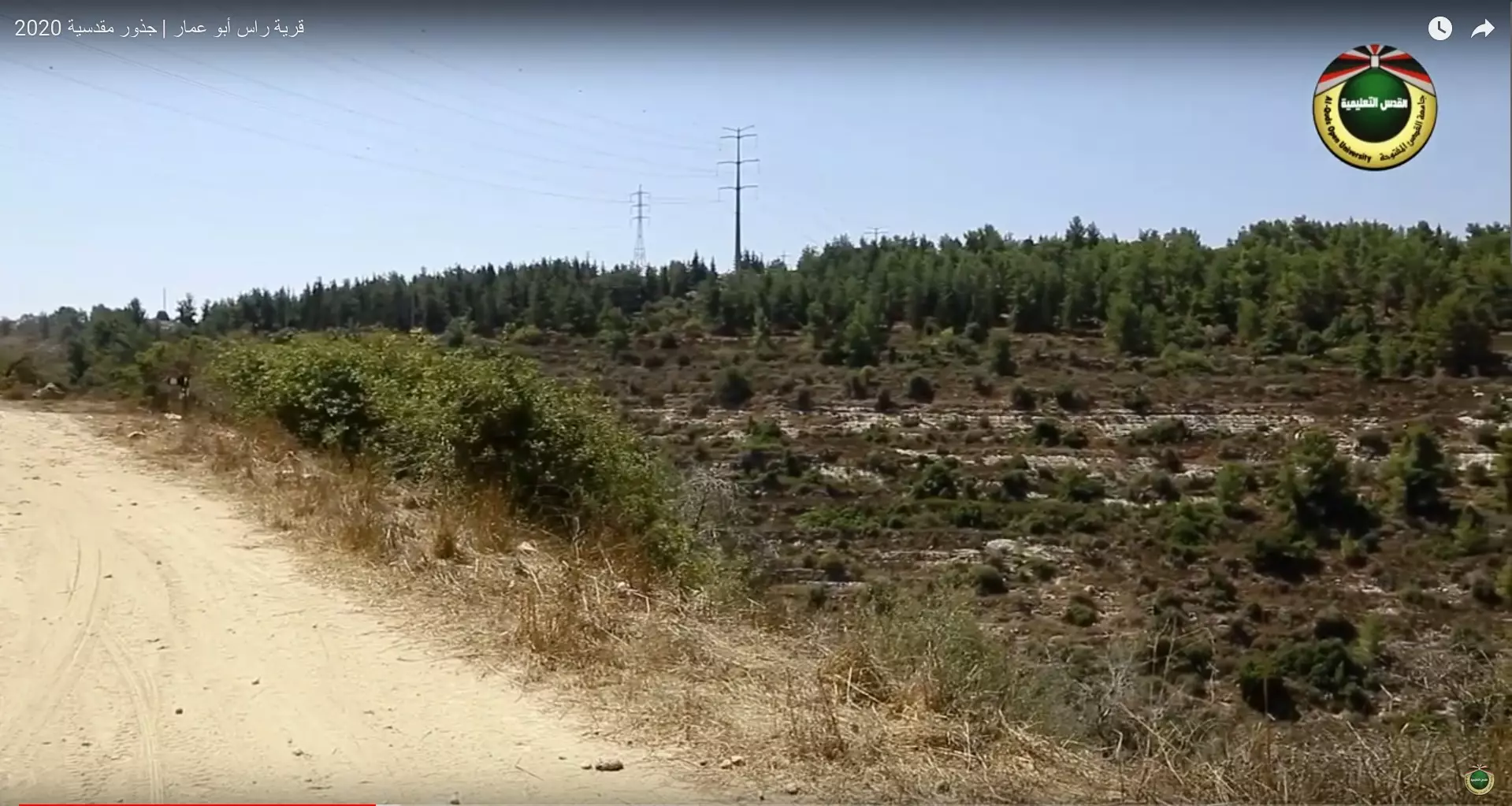
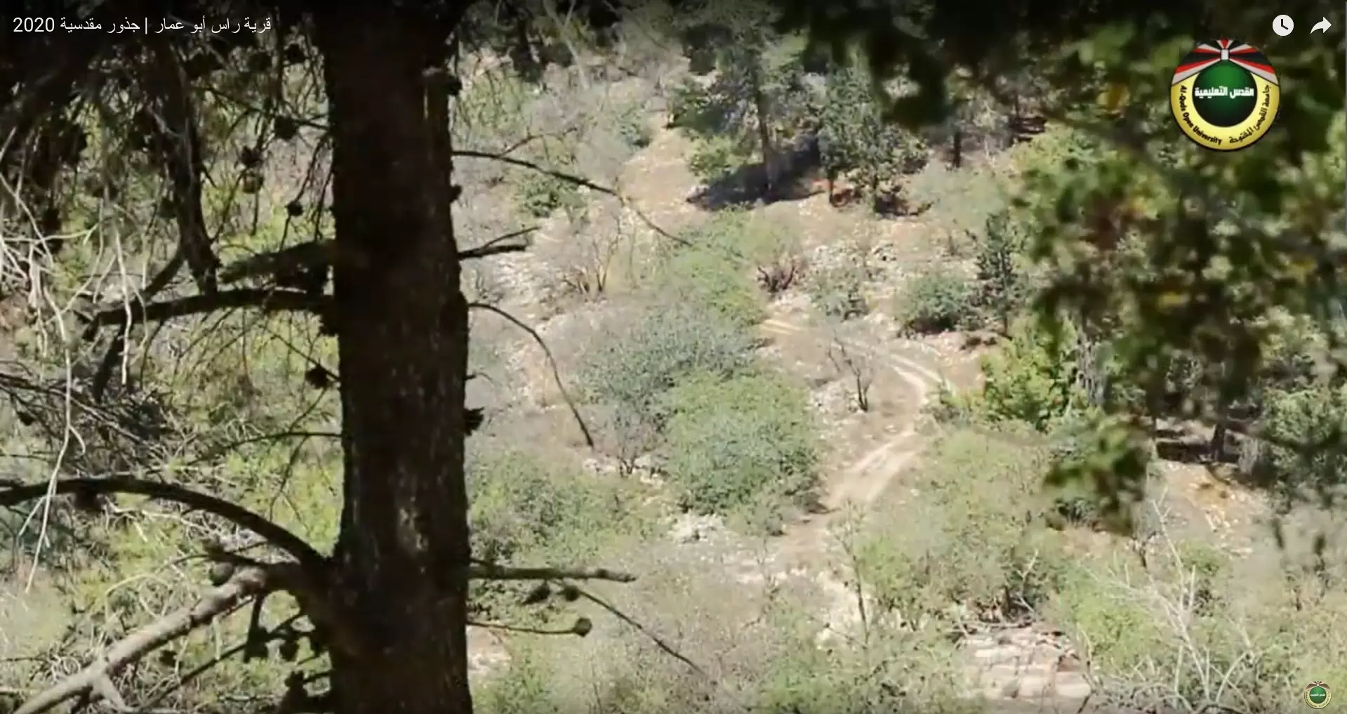
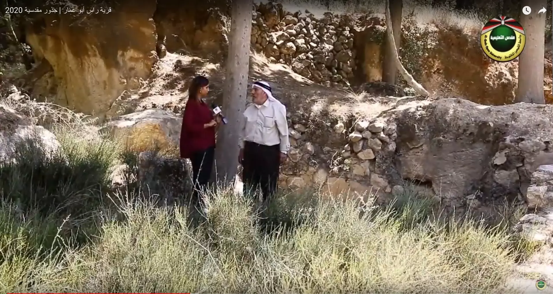
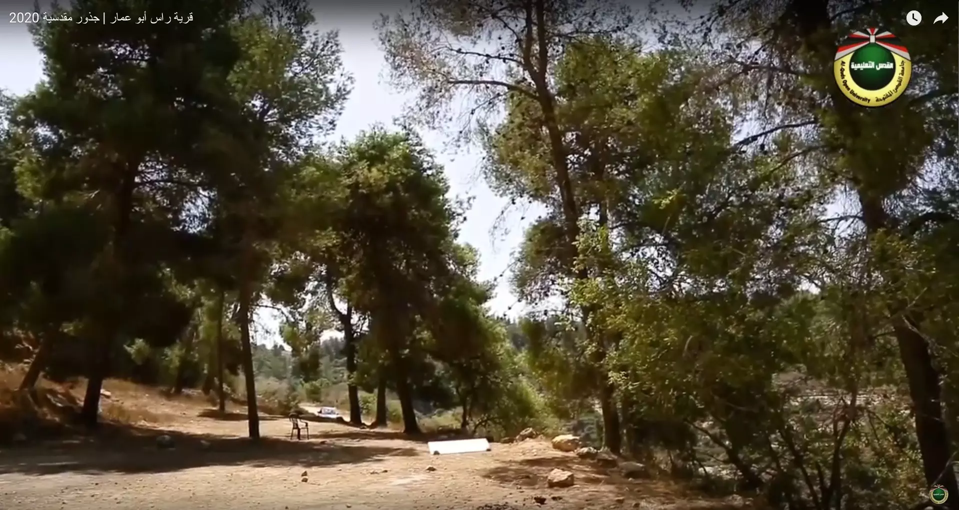
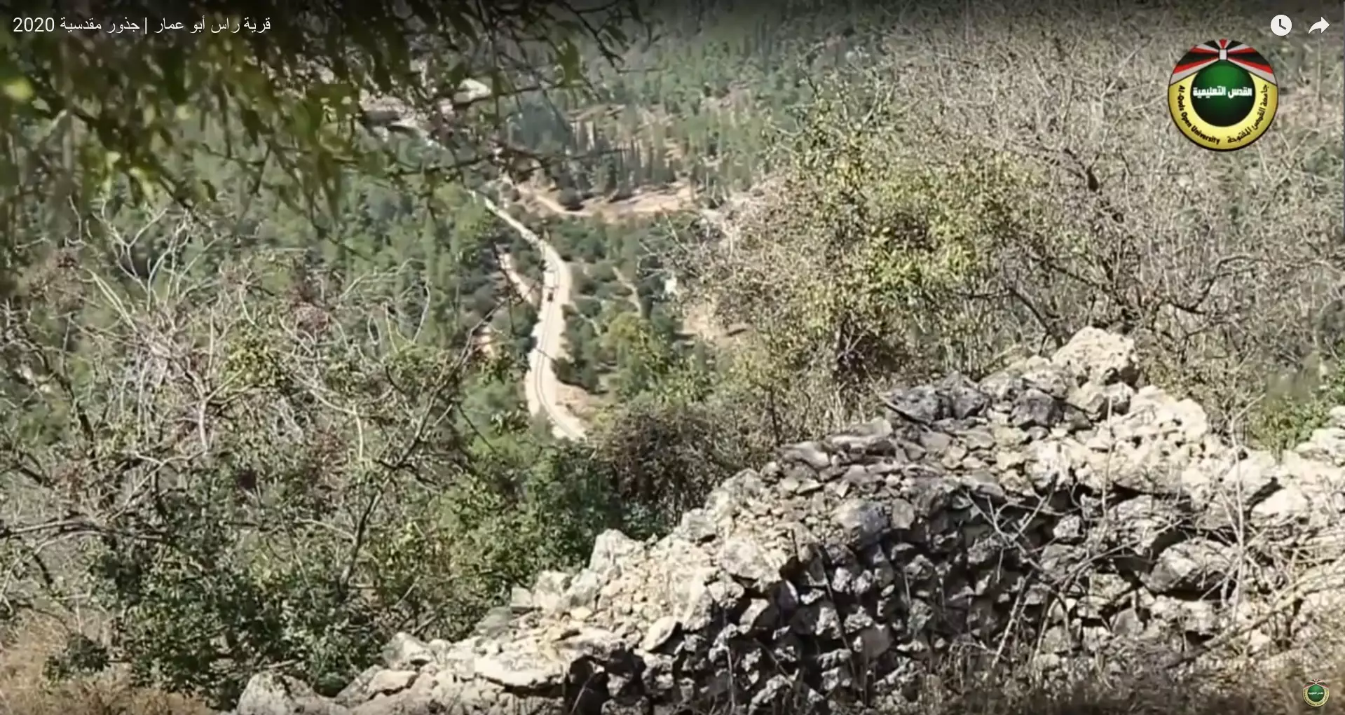
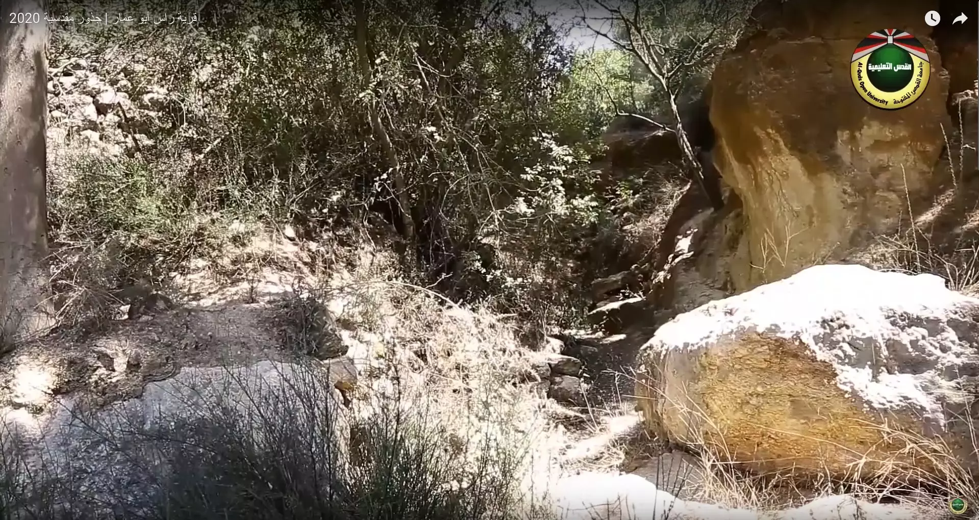
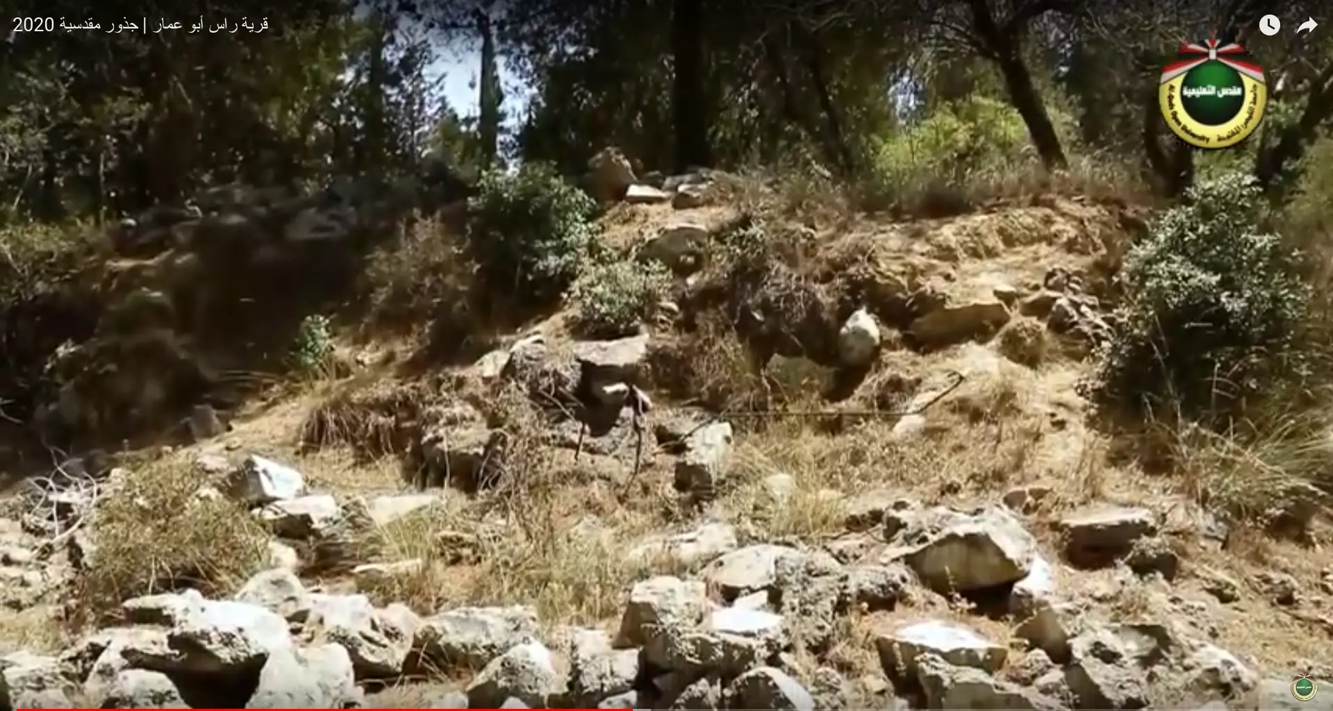
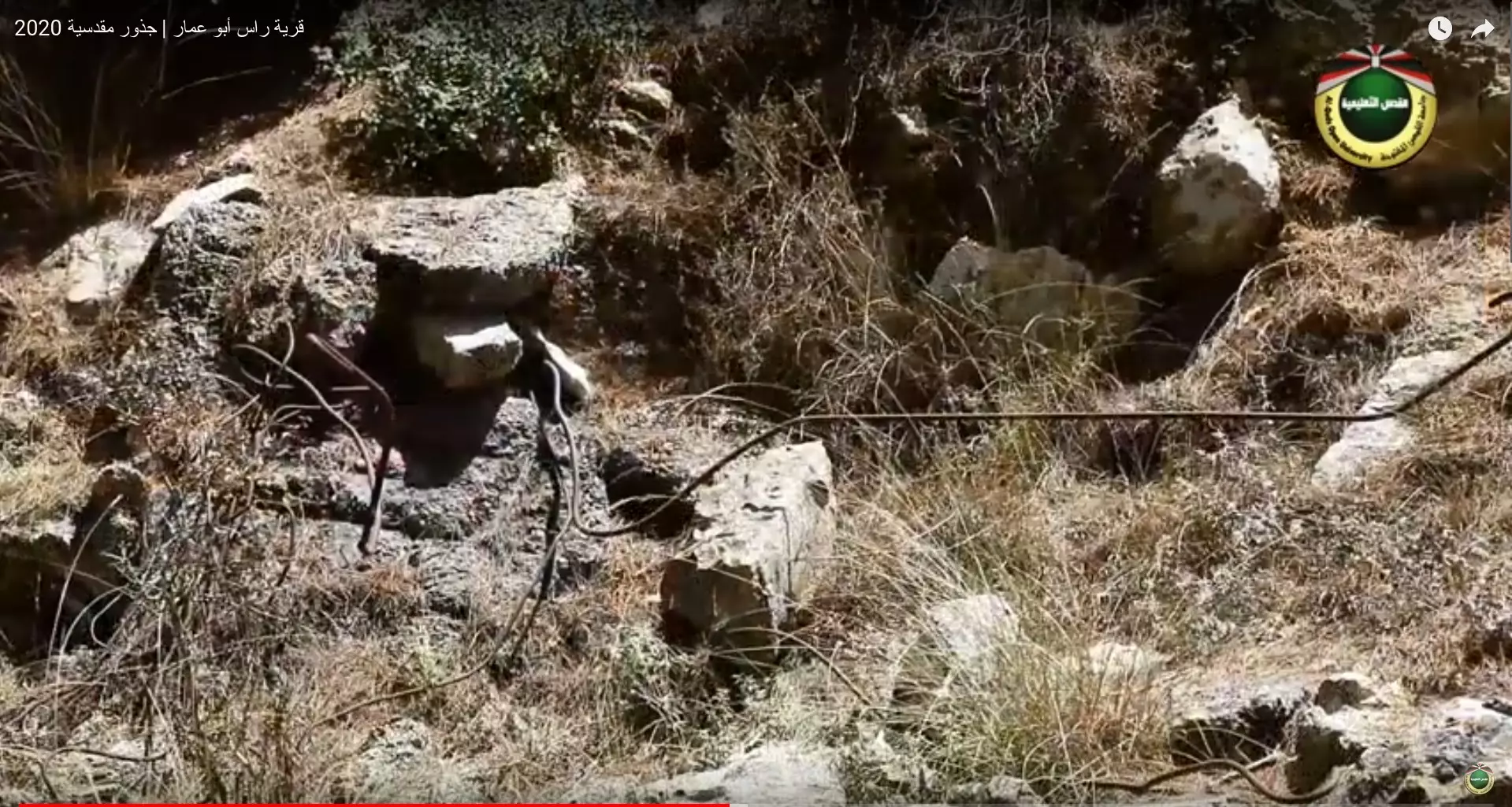
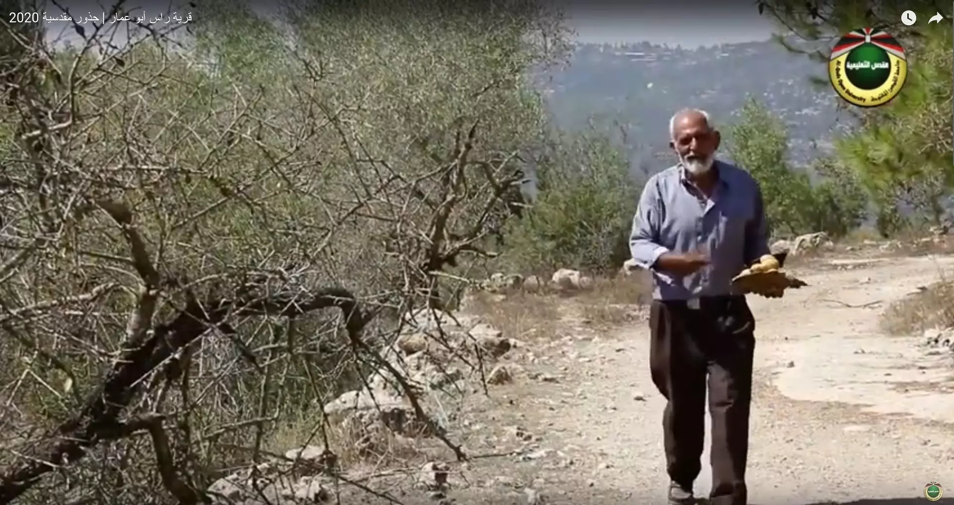
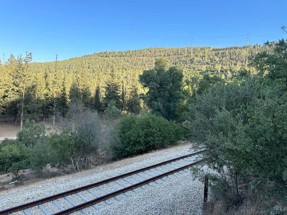
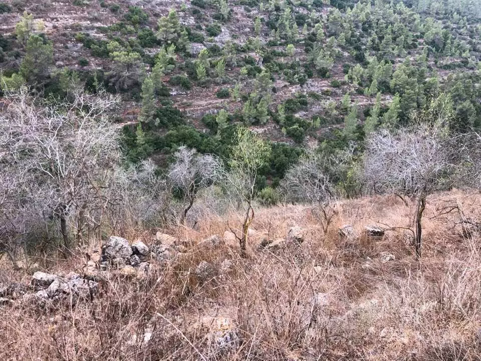
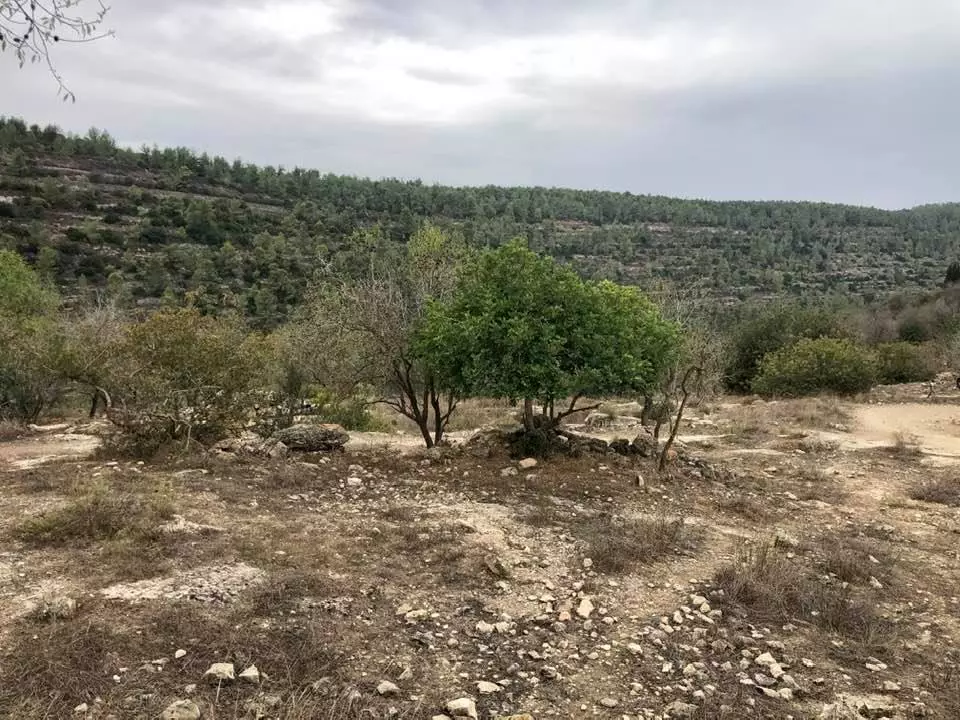
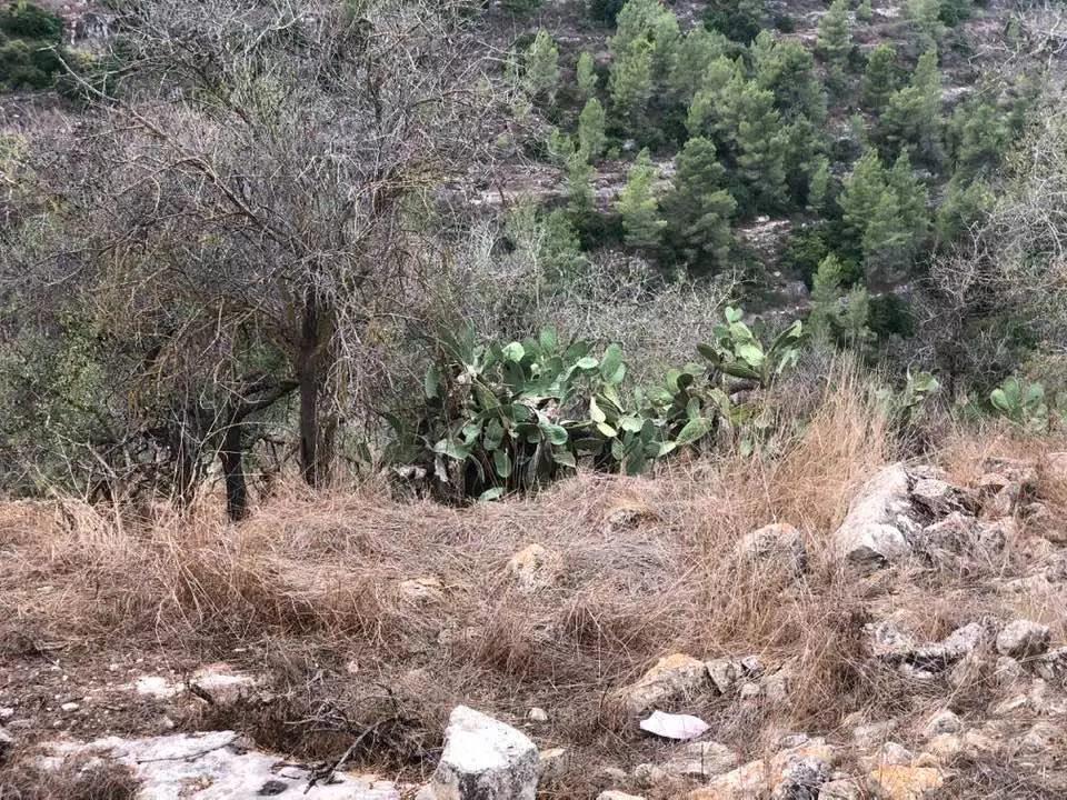
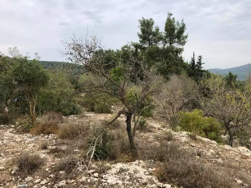
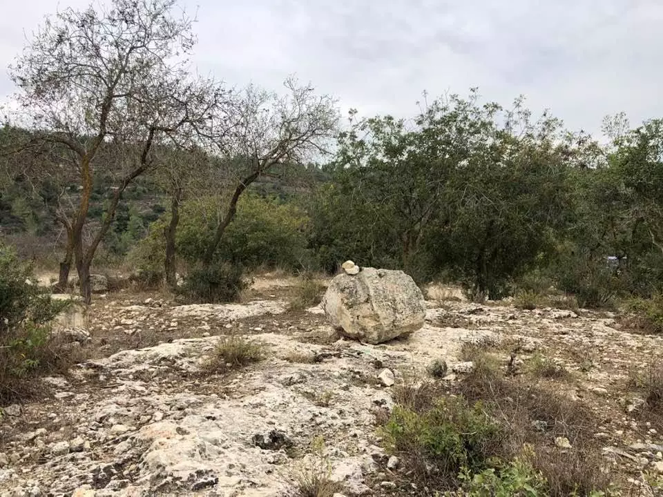
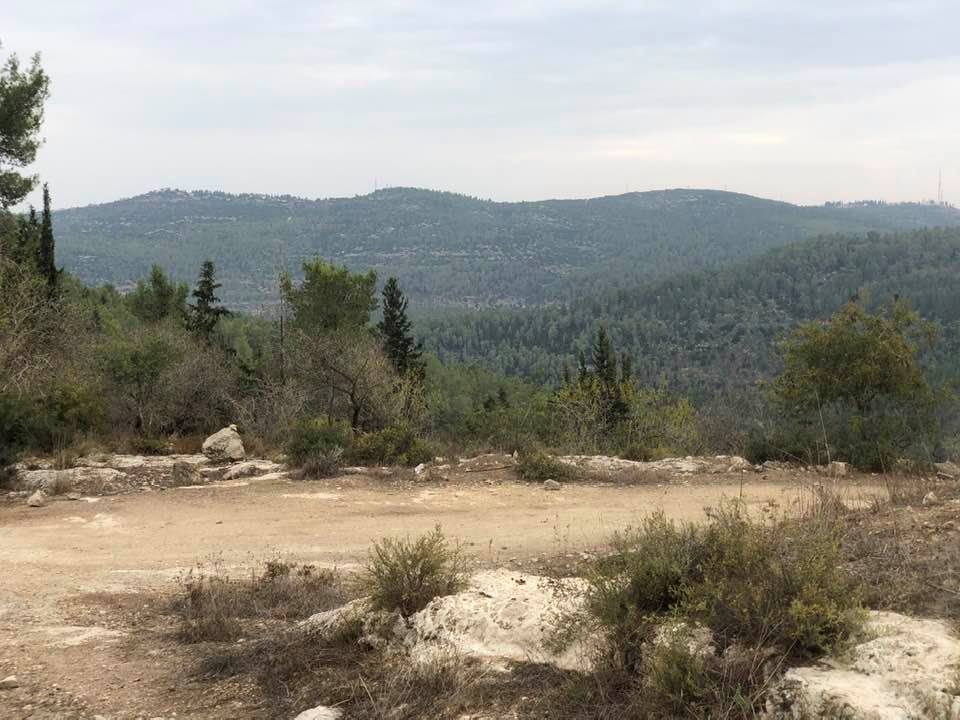
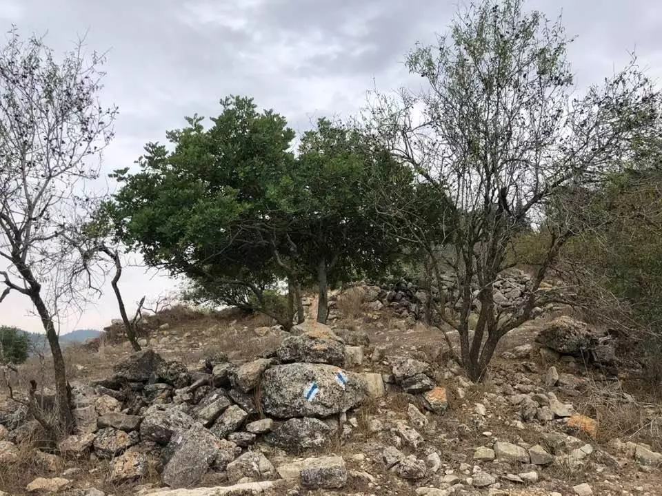
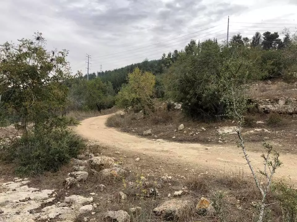
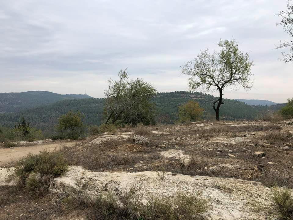
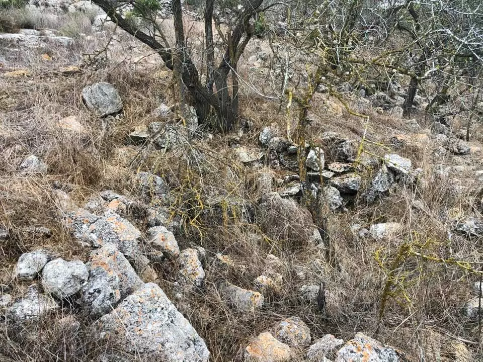
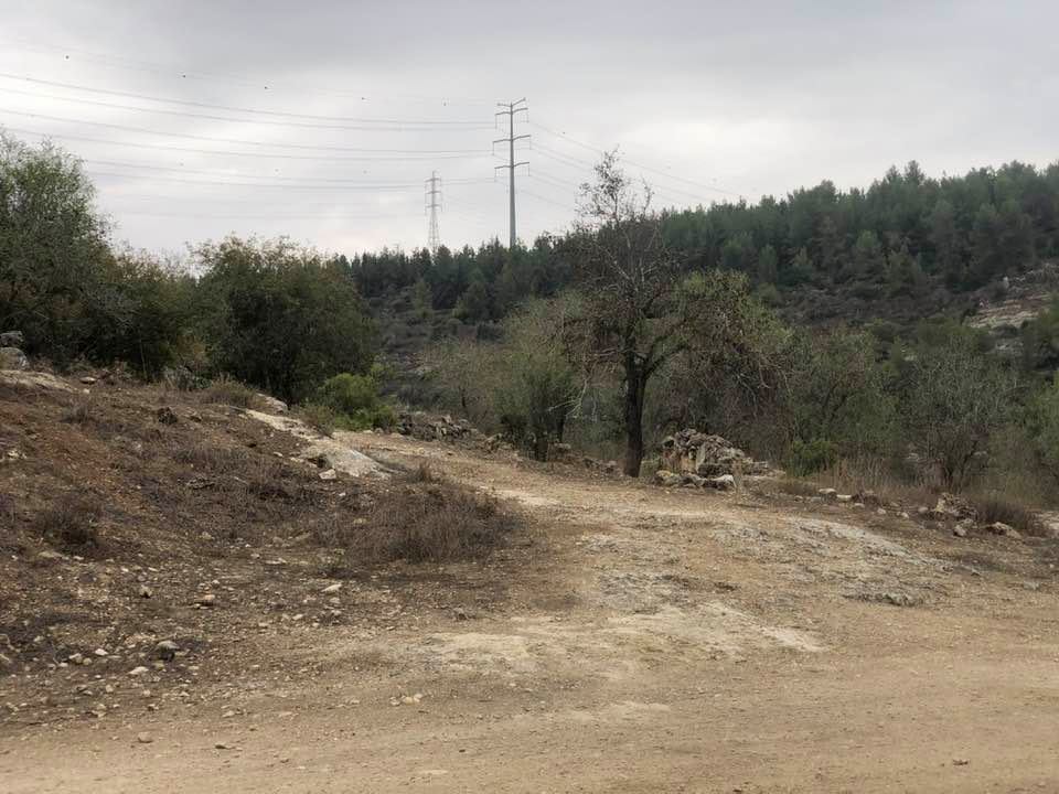
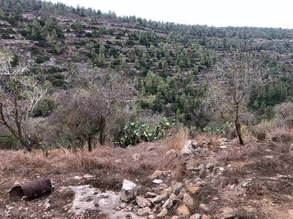
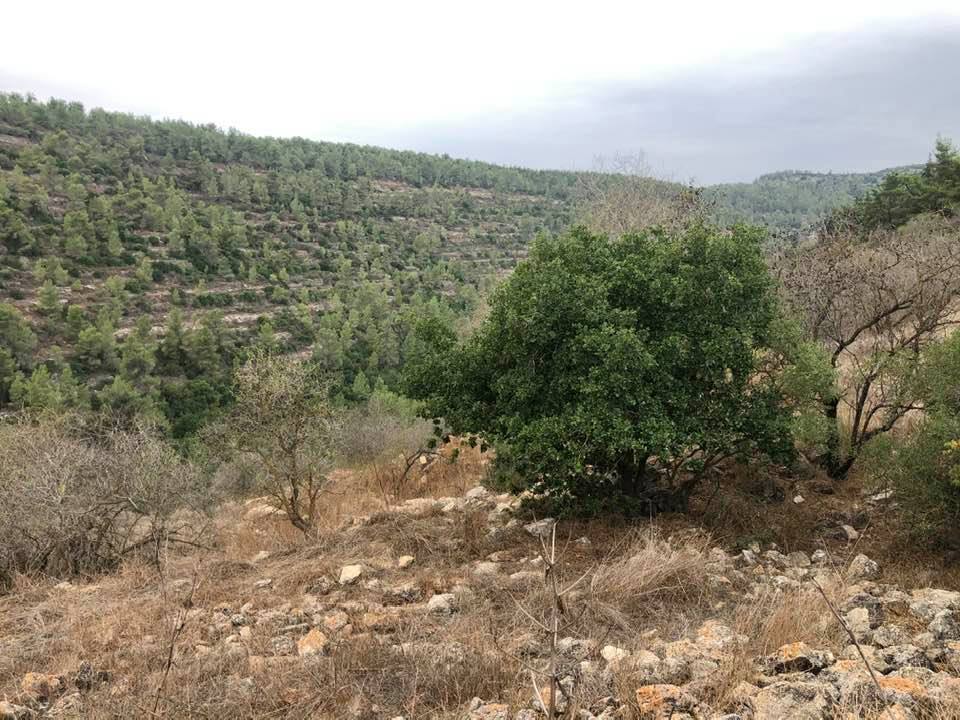
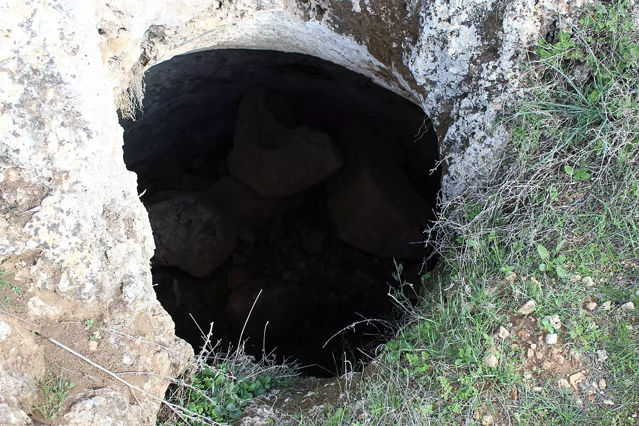
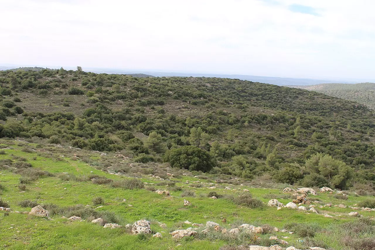
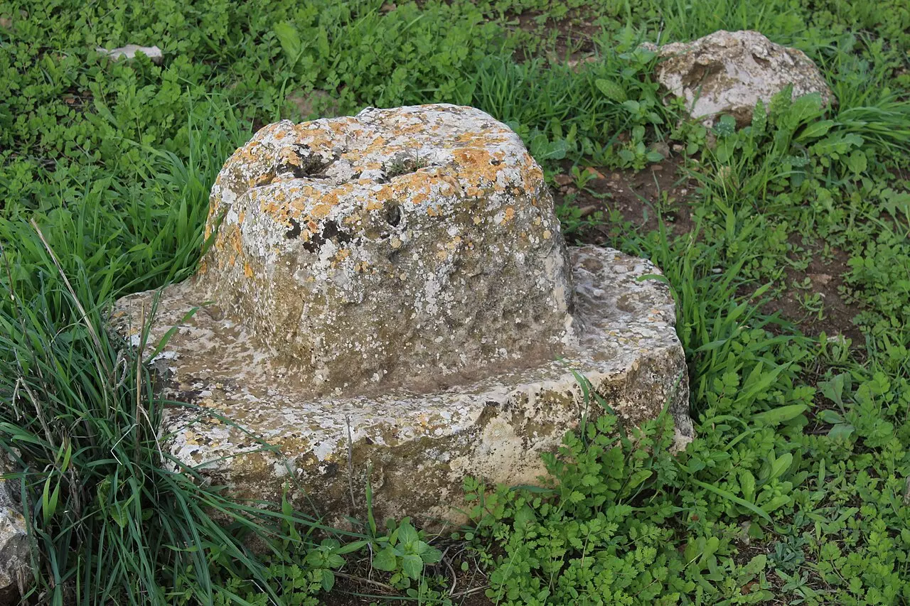
Village Before NakbaThe village stood on an elongated hill that stretched from southeast to northwest, surrounded on three sides by the deep Wadi al-Sarar that wound its way westward. It was also dominated by mountains on all sides, and was less than 1 km south of the Jerusalem−Jaffa railway line. A secondary road linked Ras Abu 'Ammar to a highway that ran south of it and led to Bethlehem. In the late nineteenth century, Ras Abu 'Ammar was described as a village built of stone on a small ridge, situated above an 'open and rather flat' valley in which the villagers planted olive trees. The village had a rectangular plan and most of its houses were built of stone. A main street, running in a northwest−southeast direction, divided the site into two sections. During the British Mandate, new construction extended along roads connecting it to the villages of al-Qabu and 'Aqqur in the east and north, and along the highway in the south. The village had an elementary school and a few small shops in its center. The villagers, who were Muslim, maintained more than one shrine for local sages, including one for a Shaykh Abu 'Ammar. They relied on springs for their drinking water and irrigation.The village lands were utilized both for agriculture and pasture. Agriculture was based on rainfed grain, vegetables, and fruit trees, including olive trees (which covered 100 dunums) and grape vines. Irrigation of the latter was made possible by spring water that flowed from the mountain top and accumulated in ponds. In 1944/45 a total of 2,791 dunums was allocated to cereals; 925 dunums were irrigated or used for orchards. The nearby Khirbat Kafr Sum (158126) was inhabited during the Crusader period and also during the sixteenth century. Village Occupation and Ethnic CleaningThe village probably fell to units of the Israeli army's Har'el Brigade in the course of Operation Ha-Har (see 'Allar, Jerusalem sub-disctrict). Israeli historian Benny Morris indicates that the village fell on 21 October 1948, as a result of a direct military assault.Zionists Colonies on Village LandsIsrael established the settlement of Tzur Hadassa (159125) on village lands in 1960, south of the village site.Village TodayThe stone rubble of the village houses is strewn across the site (see photos). Wild vegetation grows among the debris, in addition to almond, olive, and carob trees. Cactuses grow on the southeastern and southwestern sides of the site; a two-room stone building that used to be the schoolhouse still stands to the southeast.SourceDr. Walid al-Khalidi, 1992: All That Remains. |
|||||||||||||
| Related Maps | Town Lands' Demarcation Maps خرائط للقضاء توضح حدود القرى والاودية Town's map on MapQuest View from satellite Help us map this town at WikiMapia |
||||||||||||
| Related Links | Wikipedia's Page Facebook Page Google Search Google For Images Google For Videos |
||||||||||||
| More Information | في كتاب كي لا ننسى في كتاب بلادنا فلسطين المزيد من موقع هوية |
||||||||||||
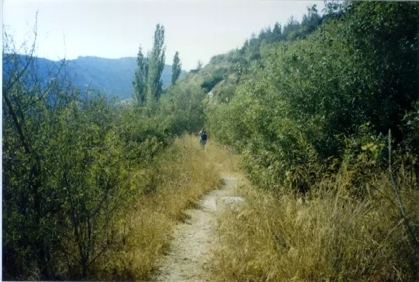
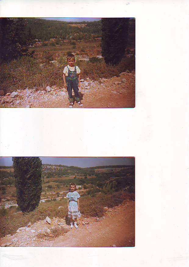
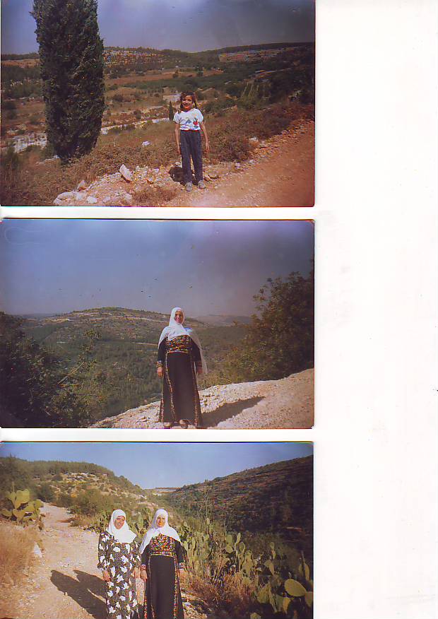
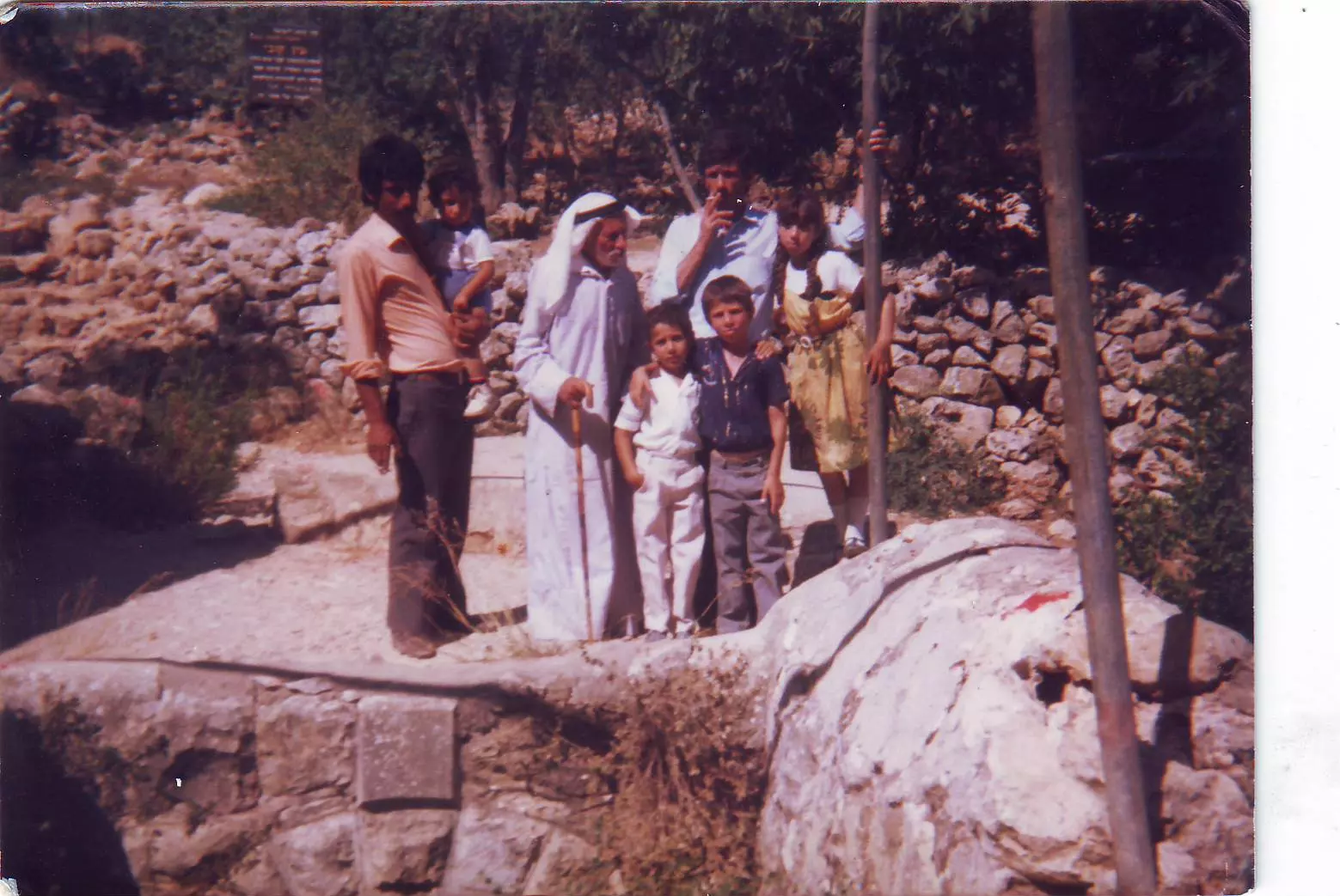
- During a visit , summer 2000
Posted by Rezeq Faraj 13 - The hill on which the village stood, 1986
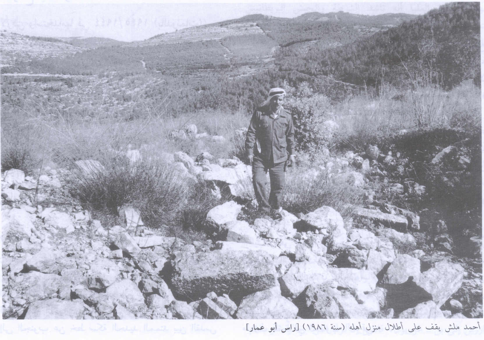
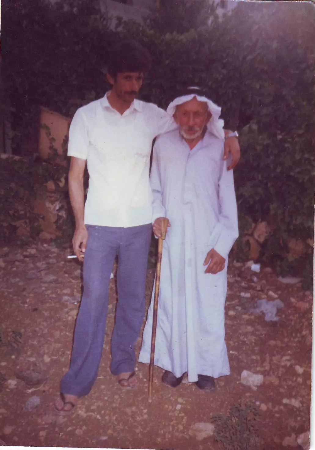
Scanned from "All That Remains" by Dr. Walid Khalidi 1 - Ahmad Malash on the ruins of his family home, 1986
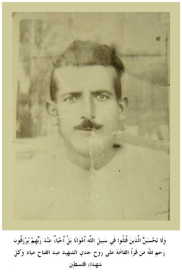
Scanned from "All That Remains" by Dr. Walid Khalidi 4 - الشهيد عبد الفتاح عياد
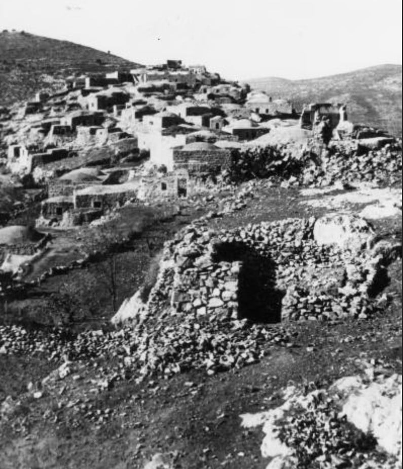
Posted by Muhammed Muadi 1 - حيث يمكن مشاهدة بيوت القريه . وتزامن تصير هذه الصوره في عام 1948 مباشره بعد احتلال القريه
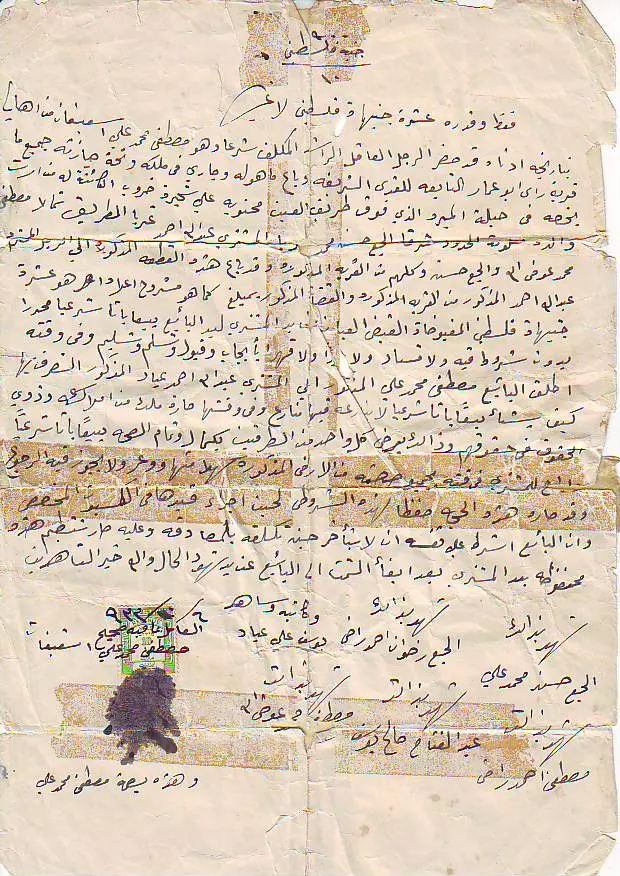
Posted by صفافي أصيل 17 - حجة تملك ارض ل جدي عبدالله احمد محمد عياد
Posted by Abu Qusai - حجة تمللك ارض جدي عبدالله احمد عياد
Posted by Abu Qusai 1 - حجة تمللك ارض جدي عبدالله احمد عياد
Posted by Abu Qusai - حجة تمللك ارض جدي عبدالله احمد عياد
Posted by Abu Qusai 2 - حجة تمللك ارض جدي عبدالله احمد عياد
Posted by Abu Qusai - حجة تمللك ارض جدي عبدالله احمد عياد
Posted by Abu Qusai - صور لموقع بيت جدي محمد عياد
Posted by Abu Qusai 1 - صور لموقع سكن جدي وفي الاطار الحاجة ام هاشم وابنتها
Posted by Abu Qusai 4 - جدي محمد علي عياد واولاده ابو امجد وابو لؤي واحفاده سنة 1984 في قرية راس ابو عمار
Posted by ابو قصي - الصورة لجدي محمد علي عياد واةلاده ابو امجد وابو لؤي واحفاده اثناء زيارة عين القبو البلدة المجاورة لراس ابو عمار
Posted by ابو قصي - RAS ABU AMMAR
Posted by mutaz A. - RAS ABU AMMAR 2
Posted by mutaz A. - RAS ABU AMMAR 3
Posted by mutaz A. - RAS ABU AMMAR 4
Posted by mutaz A. - RAS ABU AMMAR 5
Posted by mutaz A. 3 - منظر نادر للقرية قبل النكبة - 1939
- منظر نادر للقرية قبل النكبة
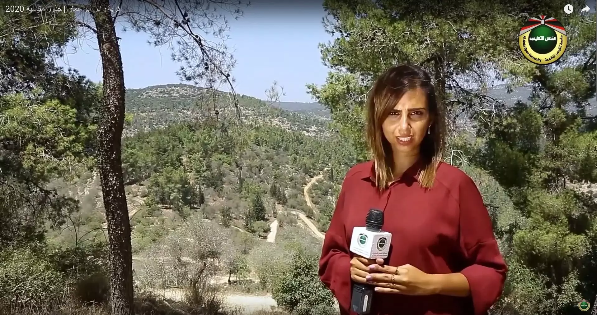
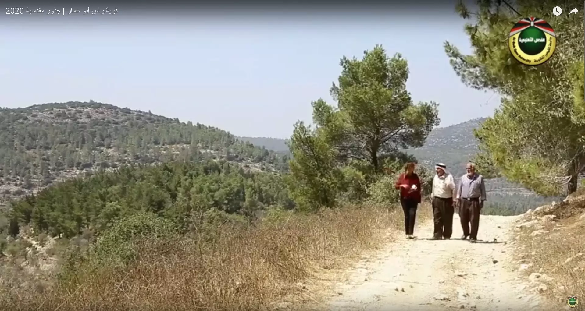
- جولة بين انقاض قرية راس أبو عمار 2020 - برنامج جذور مقدسية
- جولة بين انقاض قرية راس أبو عمار 2020 - برنامج جذور مقدسية #2
- جولة بين انقاض قرية راس أبو عمار 2020 - برنامج جذور مقدسية #3
- جولة بين انقاض قرية راس أبو عمار 2020 - برنامج جذور مقدسية #4
- جولة بين انقاض قرية راس أبو عمار 2020 - برنامج جذور مقدسية #5
- جولة بين انقاض قرية راس أبو عمار 2020 - برنامج جذور مقدسية #6
- جولة بين انقاض قرية راس أبو عمار 2020 - برنامج جذور مقدسية #7
- جولة بين انقاض قرية راس أبو عمار 2020 - برنامج جذور مقدسية #8
- جولة بين انقاض قرية راس أبو عمار 2020 - برنامج جذور مقدسية #9
- جولة بين انقاض قرية راس أبو عمار 2020 - برنامج جذور مقدسية #10
- جولة بين انقاض قرية راس أبو عمار 2020 - برنامج جذور مقدسية #11

- جولة بين انقاض قرية راس أبو عمار 2020 - برنامج جذور مقدسية #12
- جولة بين انقاض قرية راس أبو عمار 2020 - برنامج جذور مقدسية #13
- جولة بين انقاض قرية راس أبو عمار 2020 - برنامج جذور مقدسية #14
- جولة بين انقاض قرية راس أبو عمار 2020 - برنامج جذور مقدسية #15
- جولة بين انقاض قرية راس أبو عمار 2020 - برنامج جذور مقدسية #16
- جولة بين انقاض قرية راس أبو عمار 2020 - برنامج جذور مقدسية #17
- جولة بين انقاض قرية راس أبو عمار 2020 - برنامج جذور مقدسية #18
- جولة بين انقاض قرية راس أبو عمار 2020 - برنامج جذور مقدسية #19
- جولة بين انقاض قرية راس أبو عمار 2020 - برنامج جذور مقدسية #20
- جولة بين انقاض قرية راس أبو عمار 2020 - برنامج جذور مقدسية #21
- جولة بين انقاض قرية راس أبو عمار 2020 - برنامج جذور مقدسية #22
- قرية رأس ابو عمار في فلسطين ١٩٣٩.
- سكة الحديد العثماني في وادي صرار في اراضي قرية راس ابو عمار المهجرة
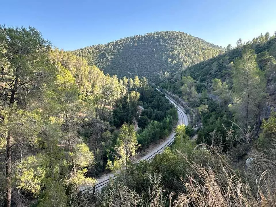
- سكة الحديد العثماني في وادي صرار في اراضي قرية راس ابو عمار المهجرة #2
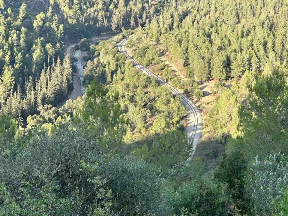
- سكة الحديد العثماني في وادي صرار في اراضي قرية راس ابو عمار المهجرة #3
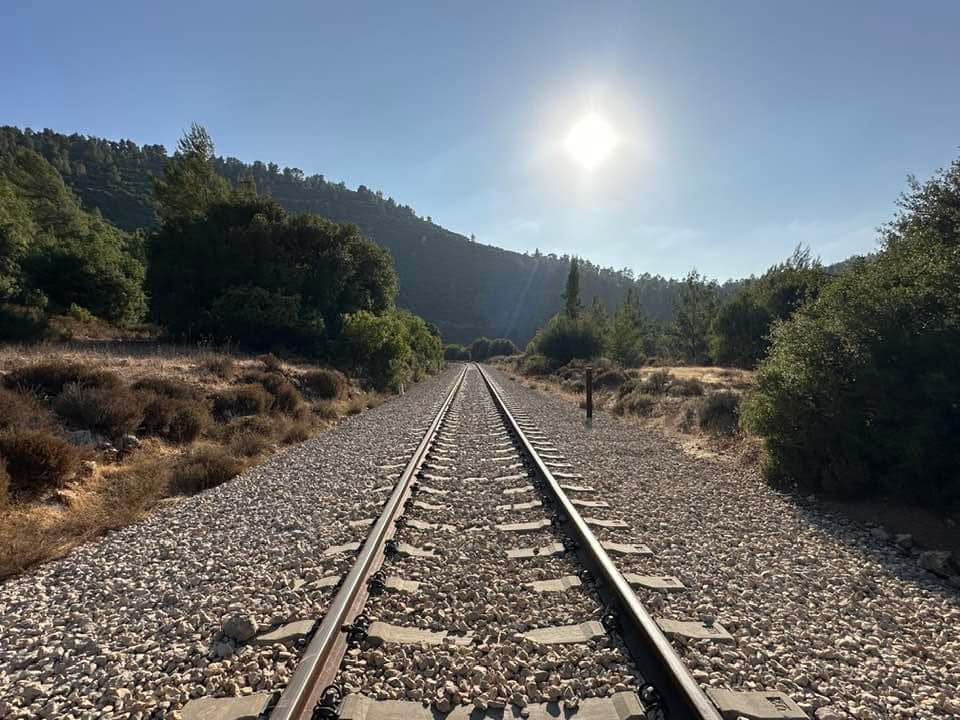
- سكة الحديد العثماني في وادي صرار في اراضي قرية راس ابو عمار المهجرة #4
- Let us see how the most "liberal and civilized" of world Jewry has obliterated our village. How else will the Jews be great and safe again?
- Let us see how the most "liberal and civilized" of world Jewry has obliterated our village. How else will the Jews be great and safe again? #2
- Let us see how the most "liberal and civilized" of world Jewry has obliterated our village. How else will the Jews be great and safe again? #3
- Let us see how the most "liberal and civilized" of world Jewry has obliterated our village. How else will the Jews be great and safe again? #4
- Let us see how the most "liberal and civilized" of world Jewry has obliterated our village. How else will the Jews be great and safe again? #5
- Let us see how the most "liberal and civilized" of world Jewry has obliterated our village. How else will the Jews be great and safe again? #6
- Let us see how the most "liberal and civilized" of world Jewry has obliterated our village. How else will the Jews be great and safe again? #7
- Let us see how the most "liberal and civilized" of world Jewry has obliterated our village. How else will the Jews be great and safe again? #8
- Let us see how the most "liberal and civilized" of world Jewry has obliterated our village. How else will the Jews be great and safe again? #9
- Let us see how the most "liberal and civilized" of world Jewry has obliterated our village. How else will the Jews be great and safe again? #10
- Let us see how the most "liberal and civilized" of world Jewry has obliterated our village. How else will the Jews be great and safe again? #11
- Let us see how the most "liberal and civilized" of world Jewry has obliterated our village. How else will the Jews be great and safe again? #12
- Let us see how the most "liberal and civilized" of world Jewry has obliterated our village. How else will the Jews be great and safe again? #13
- Let us see how the most "liberal and civilized" of world Jewry has obliterated our village. How else will the Jews be great and safe again? #14
- Let us see how the most "liberal and civilized" of world Jewry has obliterated our village. How else will the Jews be great and safe again? #15
- Let us see how the most "liberal and civilized" of world Jewry has obliterated our village. How else will the Jews be great and safe again? #16
- Let us see how the most "liberal and civilized" of world Jewry has obliterated our village. How else will the Jews be great and safe again? #17
- Let us see how the most "liberal and civilized" of world Jewry has obliterated our village. How else will the Jews be great and safe again? #18
- Let us see how the most "liberal and civilized" of world Jewry has obliterated our village. How else will the Jews be great and safe again? #19
- Let us see how the most "liberal and civilized" of world Jewry has obliterated our village. How else will the Jews be great and safe again? #20
- Let us see how the most "liberal and civilized" of world Jewry has obliterated our village. How else will the Jews be great and safe again? #21
- Let us see how the most "liberal and civilized" of world Jewry has obliterated our village. How else will the Jews be great and safe again? #22
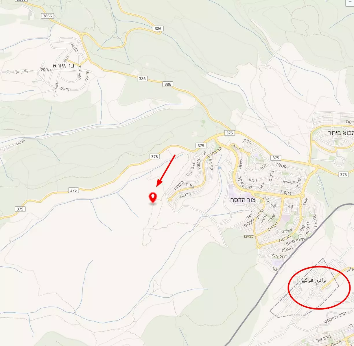
- Let us tour the ruins of Khirbat Jureich, which is located south of the village & NW of Wadi Fouqin
- Let us tour the ruins of Khirbat Jureich, which is located south of the village & NW of Wadi Fouqin #2
- Let us tour the ruins of Khirbat Jureich, which is located south of the village & NW of Wadi Fouqin #3
- Let us tour the ruins of Khirbat Jureich, which is located south of the village & NW of Wadi Fouqin #4
- Let us tour the ruins of Khirbat Jureich, which is located south of the village & NW of Wadi Fouqin #5
- Let us tour the ruins of Khirbat Jureich, which is located south of the village & NW of Wadi Fouqin #6
- Let us tour the ruins of Khirbat Jureich, which is located south of the village & NW of Wadi Fouqin #7
- Let us tour the ruins of Khirbat Jureich, which is located south of the village & NW of Wadi Fouqin #8
- Let us tour the ruins of Khirbat Jureich, which is located south of the village & NW of Wadi Fouqin #9
- Let us tour the ruins of Khirbat Jureich, which is located south of the village & NW of Wadi Fouqin #10
- Let us tour the ruins of Khirbat Jureich, which is located south of the village & NW of Wadi Fouqin #11
- Let us tour the ruins of Khirbat Jureich, which is located south of the village & NW of Wadi Fouqin #12
Want to browse more? 80,000 pictures were grouped in these gallaries:
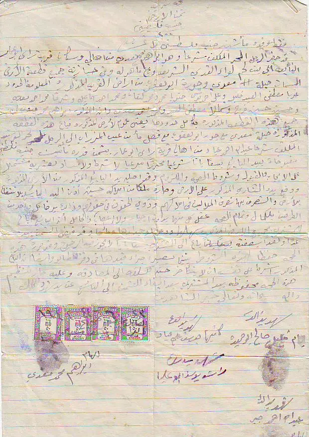
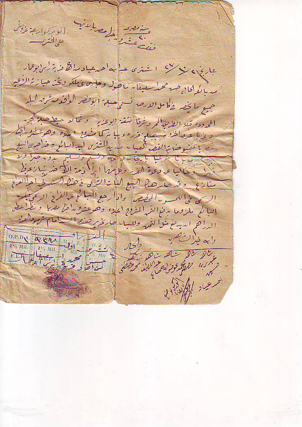
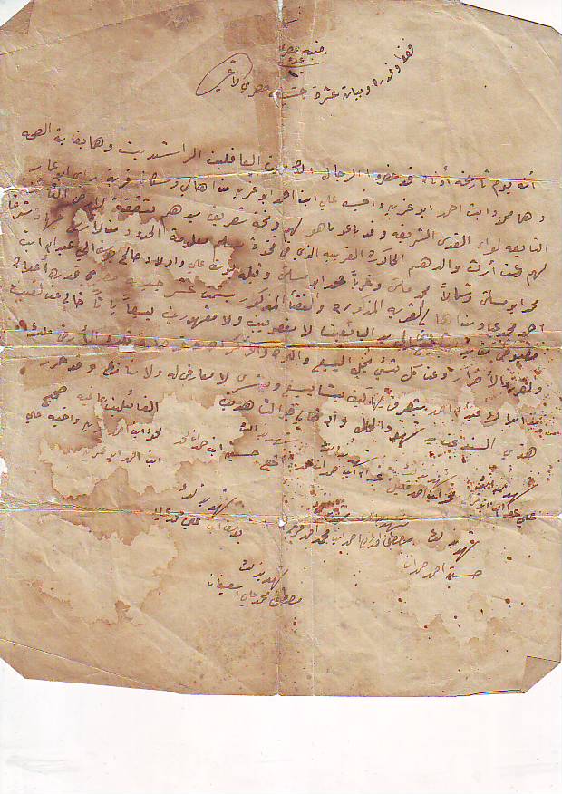
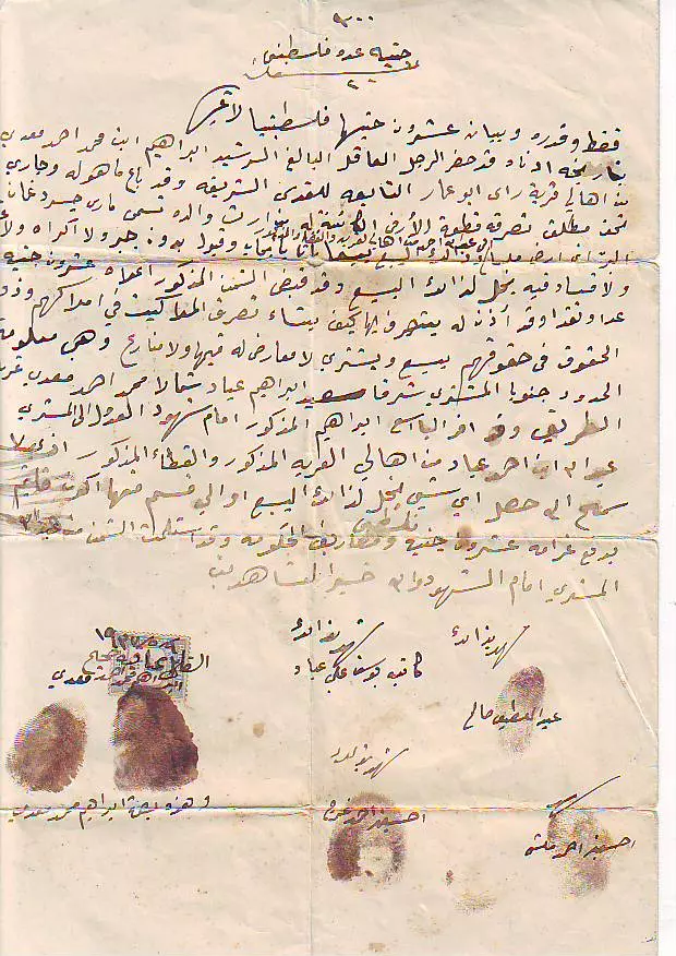
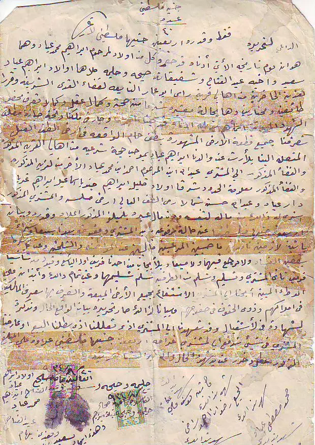
- حجة تملك ارض ل جدي عبدالله احمد محمد عياد
Posted by Abu Qusai - حجة تمللك ارض جدي عبدالله احمد عياد
Posted by Abu Qusai 1 - حجة تمللك ارض جدي عبدالله احمد عياد
Posted by Abu Qusai - حجة تمللك ارض جدي عبدالله احمد عياد
Posted by Abu Qusai 2 - حجة تمللك ارض جدي عبدالله احمد عياد
Posted by Abu Qusai - حجة تمللك ارض جدي عبدالله احمد عياد
Posted by Abu Qusai
| Display Name | Clan/Hamolah | Country of Residence |
| Radi Radi | Radi | Amman, Jordan |
| Lara Muadi | - | Gothenburg, Sweden |
| علاء الدين حسن حمدان | - | - |
| اسماعيل حسن راضي | - | jerusalem, Palestine |
| Mohammed Ali Hirzallah | Hirzallah | Amman, Jordan |
| Mohammed Ahmed Mahmoud Saleh | ابو حميدة | Dubai, UAE |
| محمود ابوسالم | - | amman, JO |
| mutaz A. | - | - |
| مرام ابوسالم | قرقور | عمان, الاردن |
| عبدالرحمن خضر البداونة | البداونة | الزرقاء, الاردن |
| محمود خضر البداونة | البداونة | الزرقاء, الاردن |
| مامون احمد ابو حميده | قرقور | عمان, الاردن |
| ابو سلطان | AL-AMARNEH | - |
| المهندس محمد أبوحميدة | قرقور | ِAmman - Jordan |
| ماهر عياد | عياد | amman, jordan |
| سيف الدين محمد عياد | عياد | مخيم عايدة, مخيم عايدة |
| الشاعر محمد شحاده البداونه | قرقور ( جاسر ) | بيت لحم |
| الشاعر محمد شحاده البداونه | - | - |
| دانية ربحي بداونة | بداونة | ا, الإمارات |
| rafat | malash | amman |
| رافت | - | صويلح - الحي الغربي, الاردن |
| حسن راضي | قرقور (جاسر)ء | bethlehem |
| محمد معدي | معدي | عمان, الاردن |
| عليان | العمارنة | - |
| عزالدين علان | - | - |
| Nabeel M. Ayyad | - | Amman, Jordan |
| اسماعيل حسن راضي | قرقور ( جاسر) | بيت لحم/عمان |
| محمود خليل | ammarneh | amman |
| ali mohammed ali khalil | khalil | - |
| abdulla ellyan | allan | amman, jordan |
| ربحي بداونة | بداونة | العين, الامارات |
| waleed faraj | faraj | amman, jordan |
| رشا ربحي بداونة | بداونه | العين, الإمارات |
| hamza shawish | shawish | - |
| A-ABUALIA | MROWA | DOHA |
| abeer abualia | - | - |
| hanan allan | amarneh | amman, jordan |
| abeer | ayyad | portland, portland |
| الدكتور خلدون ابو حميده | قرقور | عمان |
| ابو الحارث | - | Germany(المانيا) |
| علي زكريا معدي | معدي | عمان, الاردن |
| محمد | العمارنه | - |
| emad mustsfa mohammad ayyad | ayyad | amman, jordan |
| معدي عبد الكريم معدي | معدي | السويد |
| محمد طه حموده | - | jordan |
| محمد عبدالله معدي | - | عمان |
| ayyad | ayyad | amman |
| waleed | alamarneh | amman, jordan |
| Isam Ayyad | Ayyad | Qatar |
| Mohammed jamel | Abo Alia | Amman, jordan |
| البراق | الراضي | - |
| wasim seafun | seafun | reyiad, suadi |
| Dalal Faraj | Mrouwah | New Jersey, U.S.A |
| Abu Akar | Abu Akar | jordan, jordan |
| Muhammed Muadi | MUADI | GOTHENBURG, SWEDEN |
| hamzah abdallah ayyad | ayyad | Amman, Jordan |
| Abdel Karim Muadi | MUADI | AMMAN, JORDAN |
| Samah Muadi | MUADI | GOTHENBURG, SWEDEN |
| احسان معدي | muadi | amman, jordan |
| mustafa khalil | ayyad | ashrafeya, jordan |
| ibrahim radi | Al-Radi | Abu Dhabi, united arab emirates |
| rizeq shawish | shawish/hamdan | abudhabi, u.a.e |
| Ayah Ayyad | Ayyad | N.J., U.S.A |
| yousef saleh abu hamidah | abu hamiedeh | - |
| anas yousef | abu hamedh | jordan |
| Rezeq Faraj | Rezeq Faraj | QC, Canada |
| MOHAMMAD ABDULLAH KHALIL | amarneh | amman, jordan |
| Rami abdullah khalil | amarneh | amman, jordan |
| abdullah khalil | amarneh | - |
| Hasan M.A khalil | Hassan | Amman, Jordan |
| Khaled Ayyad | Ayyad | New Jersey, USA |
| Said Ayyad | Ayyad | New Jersey, USA |
| MOHAMMAD ALI KHALIL | Ammarneh | amman - sweeleh, jordan |
| maen allan | Allan | Amman, Jordan |
| Adam Ayyad | Ayyad | New Jersey-- USA |
| Hassan Hashim | - | Homs, Syria |
- قرية راس أبو عمار | جذور مقدسية 2020 Duration: 26 min 4 sec
 Fake Valor: Why Did Zionist Jews Hoist Nazis Flag on Their Ships in the 1930s?
What is new?
-
Facts About Oct. 7th Gaza Raid
-
Remined Us Please:: Who Did Rape Who? Palestinians Raped Israelis? Or, was the other way around?
-
When Prof. Edward Said was invited to debate Bibi Netanyahu in the 1980s, watch what happened!
-
Ezra Klein of the NY Times on the "Jewish Race".
-
Abusing Blood Libel!
-
Did Israeli Soldiers Activate The Hanniba Direective On Oct. 7th? You Be The Judge
-
Zionist FAQ: Isn't it true that Palestinians don't want peace? Palestinians never accepted the two-state solution
- Facts about Haavara (Transfer) Agreement between Ben-Gurion & Hitler
-
Haavara FAQs: Why Did Zionist Jews Hoist Nazis' Flags on Their Ships in the 1930s?
- Haavara FAQs: When Chaim Weizmann met FDR in mid-1943, why was he silent about rescuing European Jewry?
-
Dear ChatGPT: How did Palestinians resist Napoleon's invasion of their country in 1799?
-
Dear ChatGPT: Gaza had a vibrant Jewish community in the mid-17th century. What happened to them?
-
Dear ChatGPT: Why did the Jewish Agency suppress news of the Holocaust during WWII?
-
Video Playlist: Jews share their DNA tests to end the conflict for good.
-
A Tale of Two Conflicts: Examining the Definition of Genocide
-
Prof. Abraham Polak And The Suppressed History of the Khazars and European Jewry
-
How Ronald Reagan would have framed the genocide in Gaza if he were still alive?
-
Haavara FAQs: Let us do the math: how many German Jews did The Haavara Agreement save?
-
Zionist FAQs: The Hebron Massacre of 1929, "clearly proves" that Palestinians are antisemitic, how could you deny it?
-
Zionist FAQs: Why Anti-Zionist Is Not Antisemitism?
-
Zionist FAQs: Isn't it true that the KGB created Palestinian Nationalism in the early 1960s?
- Zionist FAQs: Muslims are killing Muslims all the time; why are Israeli Jews being singled out in the media?
- Zionist FAQs: How is Israel an apartheid state when 20% of its citizens are Arabs who enjoy full rights?
-
Haavara FAQs: Why Did Dorothy Thompson Flip From A Zionist Advocate to A Silenced Dissenter?
-
Haavara FAQs: Analysis of Herzl's Uganda Scheme and how it could have saved millions of Jews.
-
Haavara FAQs: Why did Hayim Greenberg describe American Jewry as "morally bankrupt" in early 1943?
-
Haavara FAQs: What if the Evian Conference was a resounding success? What would have been the impact of saving European Jewry on Zionism?
- Haavara FAQs: What if the six million were saved, how that would have impacted the Zionist project?
-
Haavara FAQs: How did Zionist leaders react when Europe's Jews lingered in the DP camps after WWII ended?
-
Why does the American Jewish community repeat lies that David Ben-Gurion had debunked before he died?
-
Who has the power to rename the Tatar/Khazar Gene Marker to Jewish IV?
-
Zionist FAQs: Why won't Egypt, Syria, and Jordan take their people back? Jews are indigenous to Palestine, and Arabs immigrated after Jews developed the country. Arabs should leave.
-
Haavara FAQs: Did Hitler and the Nazis conflate between Judaism and Zionist? If that wasn't case, then why?
-
Haavara FAQs: Winston Churchill and antisemitism, a collection of articles written Churchill.
-
Haavara FAQs: Broken by country, how many Jews survived vs. killed during the Holocaust?
-
Haavara FAQs: Why did European Jews vote with their feet and to immigrated to the Americas, not Palestine, after WWII?
-
Watch this American Jewish Girl describing Israeli Jews' cognitive dissonance like no other in under two minutes
-
Haavara FAQs: When the Nazis went out of their way to hide the Holocaust, Israeli Jews did the exact opposite by broadcasting their genocide of Gazans. But why?
-
Haavara FAQs: How Zionist Jews went out of their to show their appreciation to Nazism and Fascism?
- Haavara FAQs: Why Zionist leaders were against bombing the death camps & the Railroads leading to them?
-
Haavara FAQs: Hitler's message to the British and American people: If Jews are such noble citizens and you care about them, how come you're not letting them in? I will gladly ship them to you at my expense, even on luxury liners!
-
A shortlist of Zionist and Israeli false flag operations in the name Jews.
-
The Most Moral Army
- The Land of Kapos (Israel): Where the brave are boycotted and Kapos walk free.
- Why did early Zionists often named their communal enterprises "colonial"?
- Zionist Relations with Nazi Germany by Faris Glubb
-
Two NY Times advertisements by Zionists in the early 1943 that exposes Zionists' treason at the height of the calamity
- Facts Not Lies about the Palestinian-Israeli Conflict.
- Site's pictures have been categorized
- Campgain Against Lice
- A Survey of Palestine, the official source about Palestine before Nakba produced by the British Mandate; over 1200 pages.
- Satellite View & Google Earth: Over 6,000 placemarks identifying all destroyed towns, W. Bank & Gaza Strip Towns, & refugee camps.
- PalestineRemembered.com and its Nakba Oral History Project were featured on al-Jazeera Satellite TV.
- Nakba Oral History Video Podcast:
 Over 700 Oral History interviews (including 3,500+ hours of recording) can be viewed online.
 - Palestine Village Statistics Project
- Gaza Jail Break
- النسخة العربية للموقع الان متوفرة
- Videos: Documenting the destroyed villages in video: Tracing all that remains since Nakba.
- Videos: Responding to Zionist Propaganda
- Interview: The ethnic cleansing of Palestine: George Galloway interviews Israeli Historian Ilan Pappe.
- For Palestinians, memory matters. It provides a blueprint for their future By George Bisharat.
- Zionist FAQ now available in Hebrew שאלות שציונים שואלים, עכשיו בעברית
- Video: The Stephen Walt and John Mearsheimer report on the influence of the Israel Lobby on U.S. Foreign Policy
- The Palestinian-Israeli conflict for beginners
