| PalestineRemembered | About Us | Oral History | العربية | |
| Pictures | Zionist FAQs | Haavara | Maps | |
| Search |
| Camps |
| Districts |
| Acre |
| Baysan |
| Beersheba |
| Bethlehem |
| Gaza |
| Haifa |
| Hebron |
| Jaffa |
| Jericho |
| Jerusalem |
| Jinin |
| Nablus |
| Nazareth |
| Ramallah |
| al-Ramla |
| Safad |
| Tiberias |
| Tulkarm |
| Donate |
| Contact |
| Profile |
| Videos |
Welcome To Sataf - صطاف (צטאף)
|
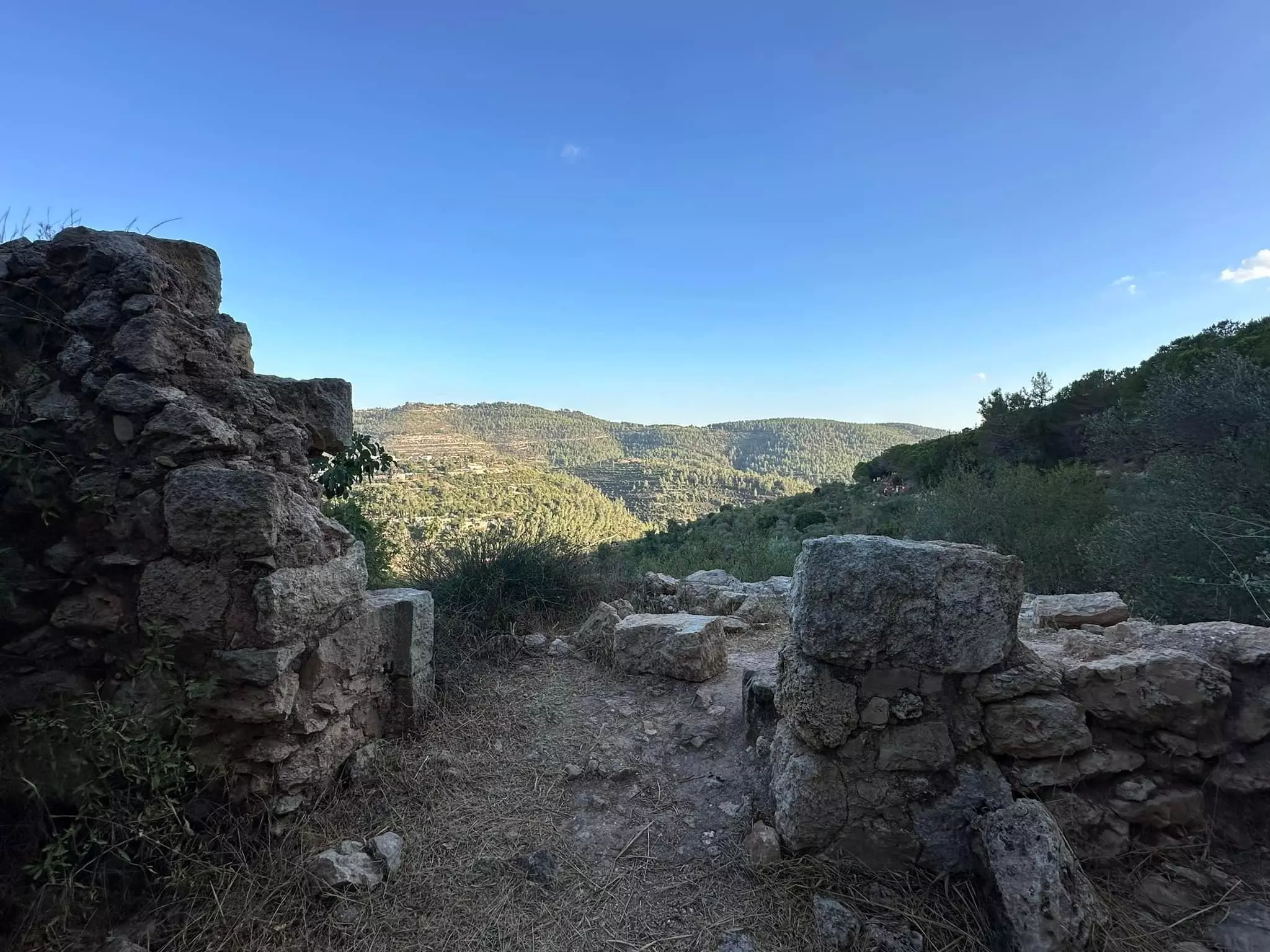
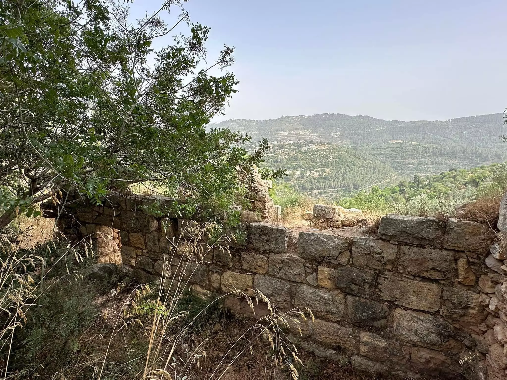
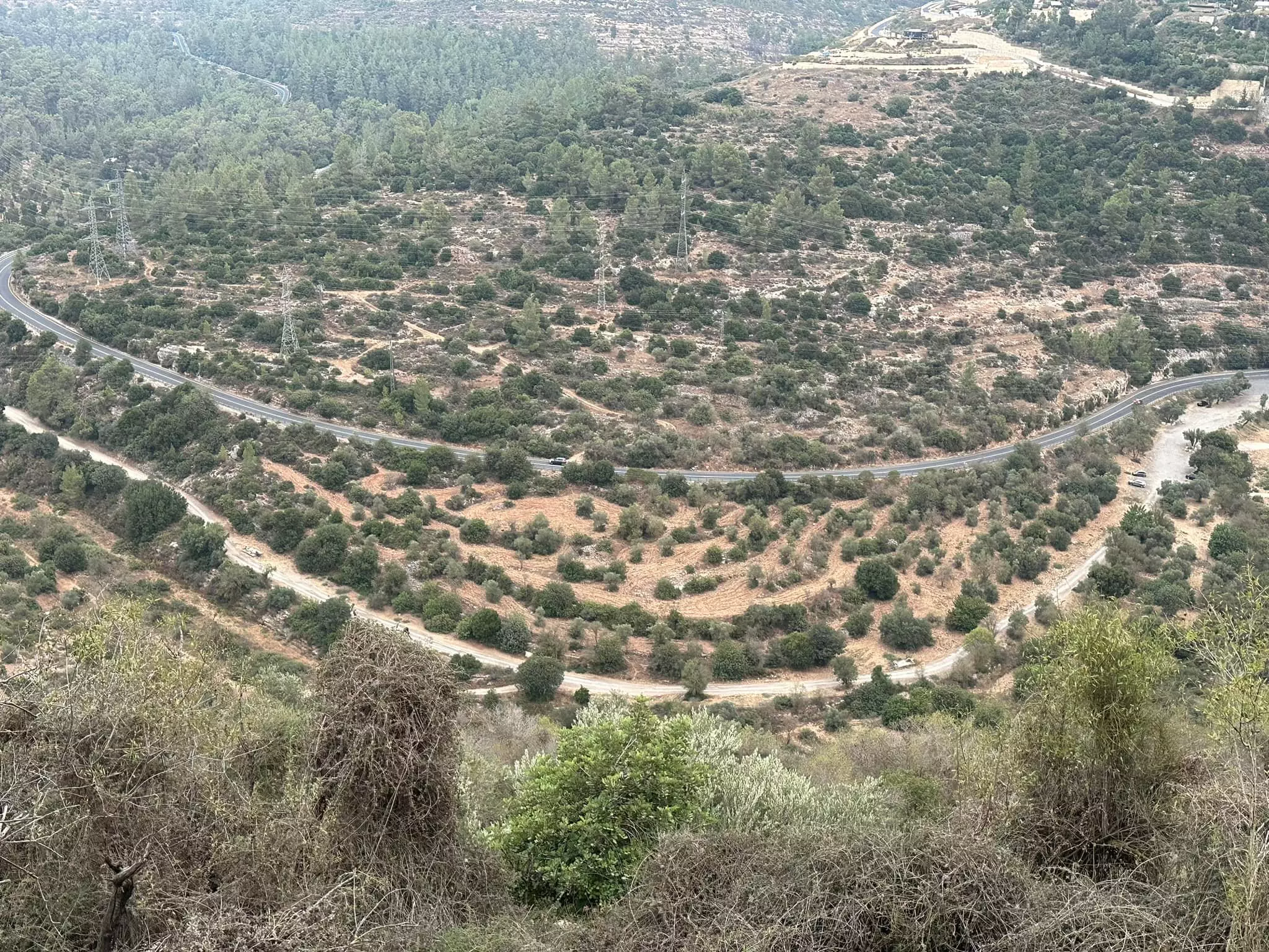
District of Jerusalem
Ethnically cleansed days ago |
العربية Google Earth |
 |
Gallery (269) |
- Statistics & Facts
-
Before & After

- Satellite View
- Articles 5
- Pictures 269
- Oral History 2
- Members 33
- Families
- All That Remains
- Wikipedia
- Videos 5
- Guest Book 21
- Links 1
| Statistic & Fact | Value | ||||||||||||
| Occupation Date | July 13, 1948 | ||||||||||||
| Distance From District | 10 (km) West of Jerusalem | ||||||||||||
| Elevation | 600 (meters) | ||||||||||||
| Before & After Nakba, Click Map For Details |
|||||||||||||
|
|||||||||||||
| Map Location | See location #21 on the map View from satellite |
||||||||||||
| Military Operation | Operation Dani | ||||||||||||
| Attacking Units | Har'el Brigade | ||||||||||||
| Exodus Cause | Military assault by Zionist troops | ||||||||||||
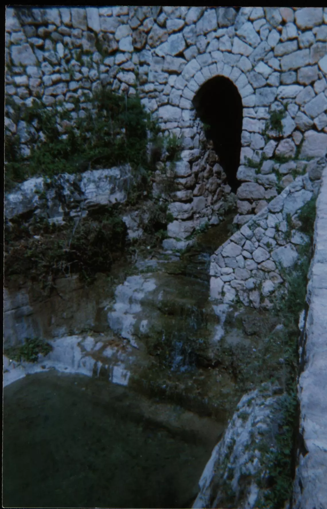
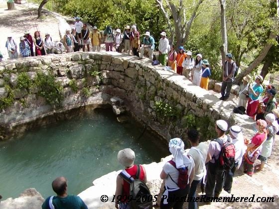
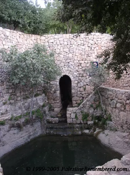
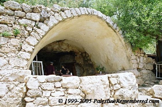
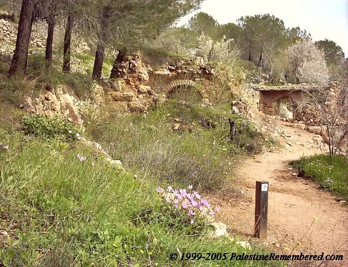
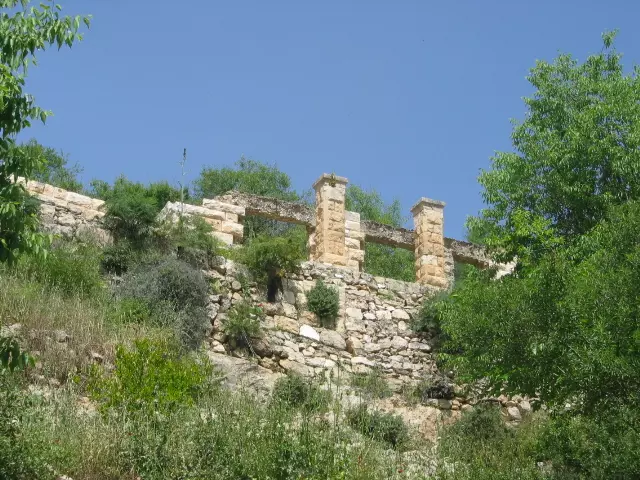
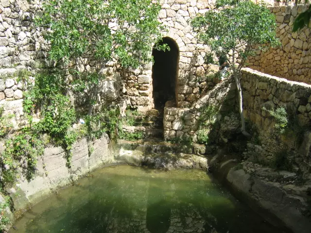
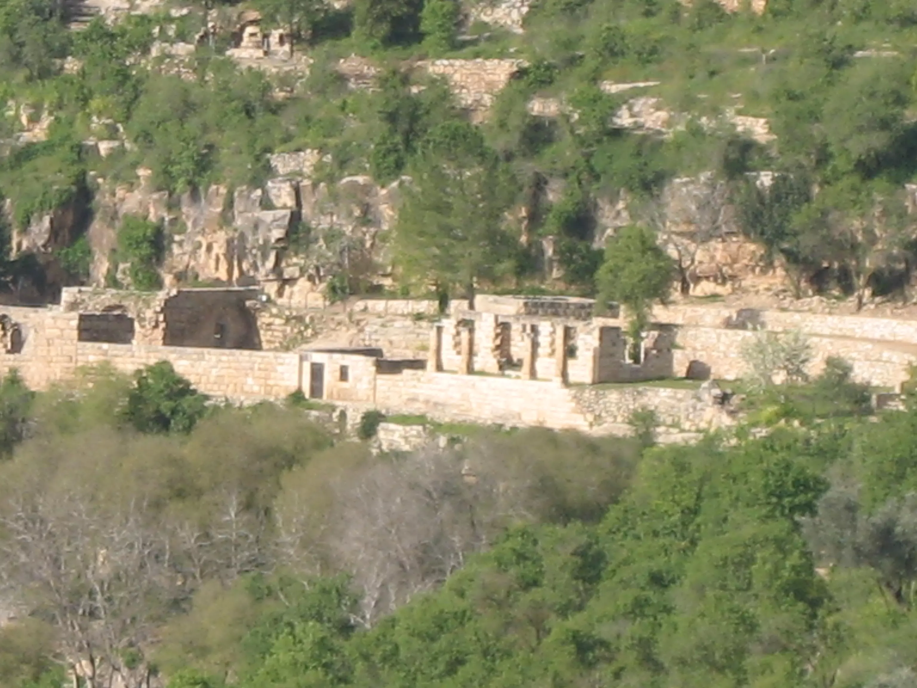
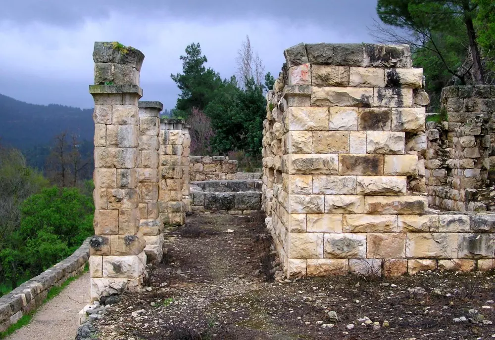
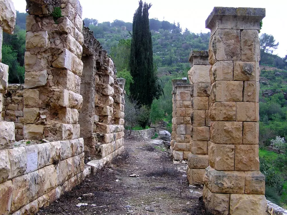
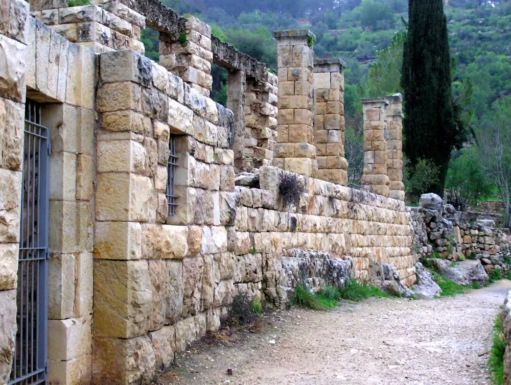
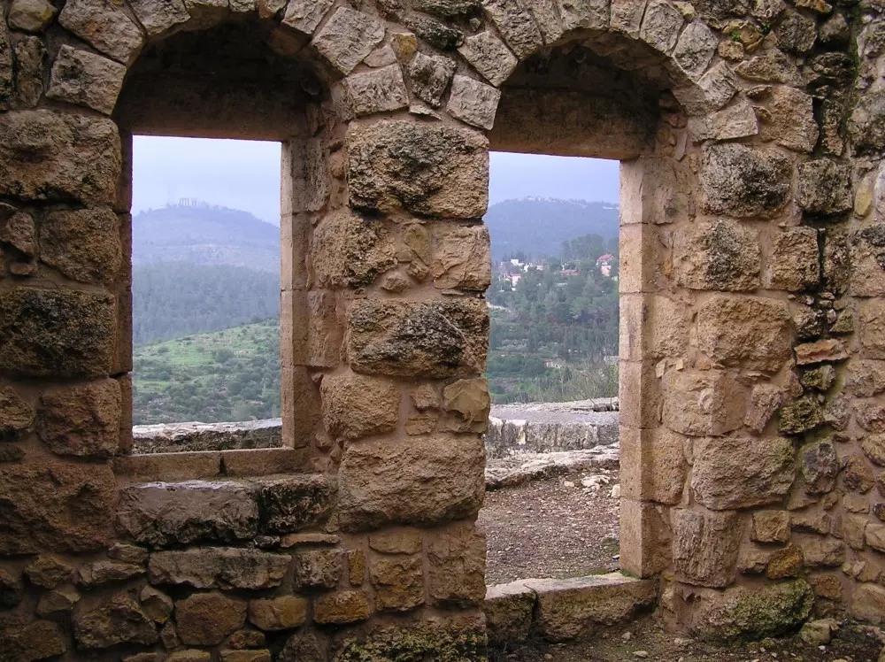
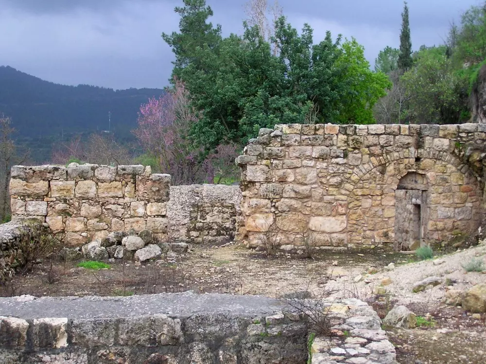
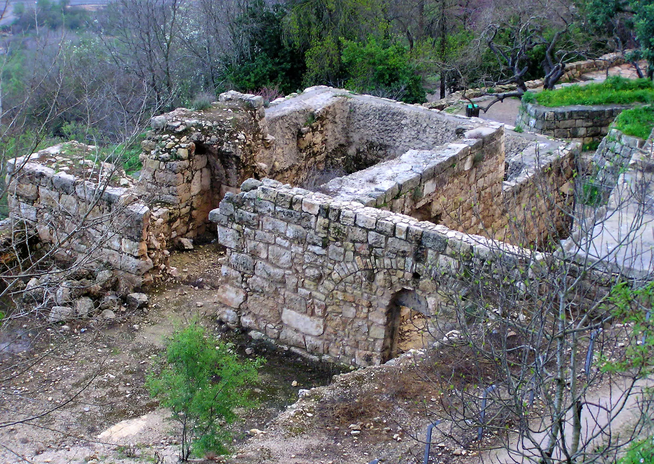
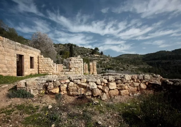
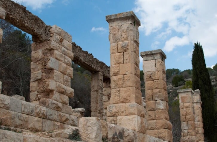
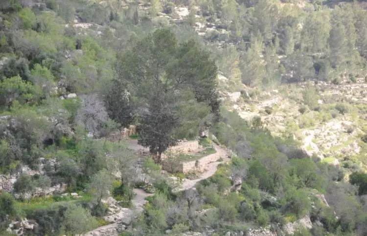
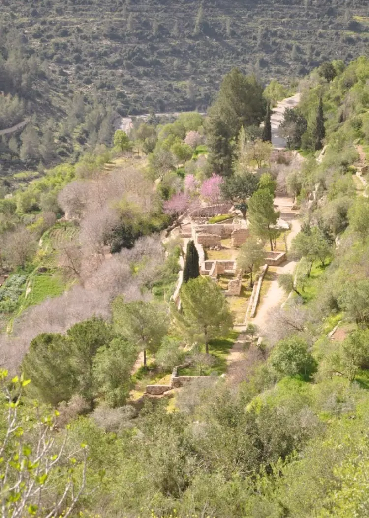
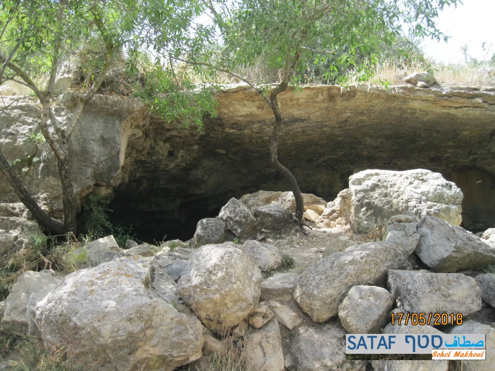
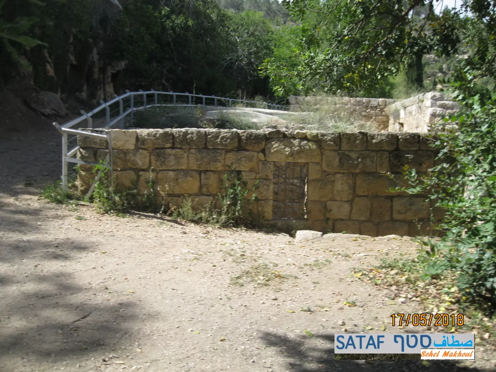
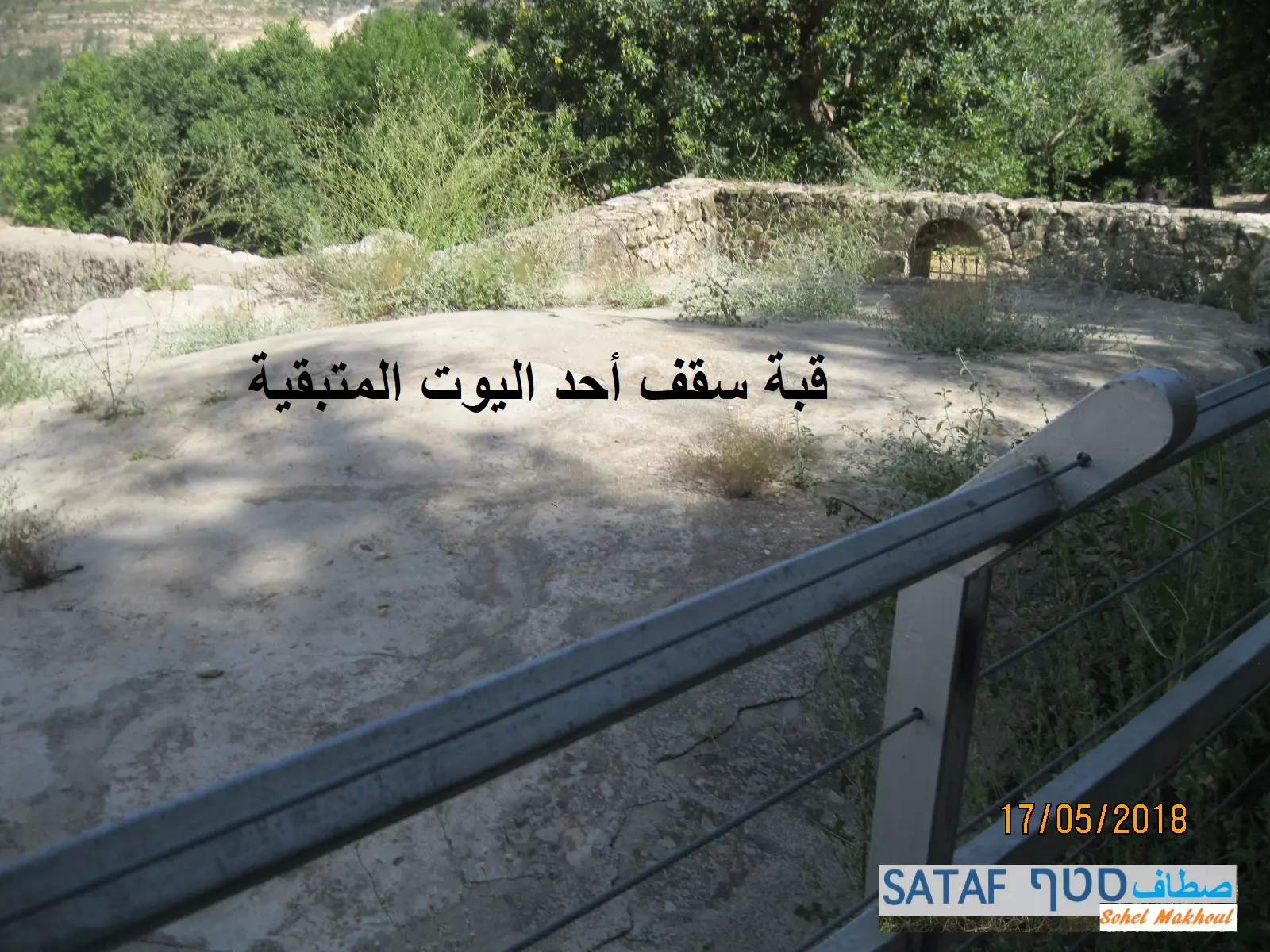
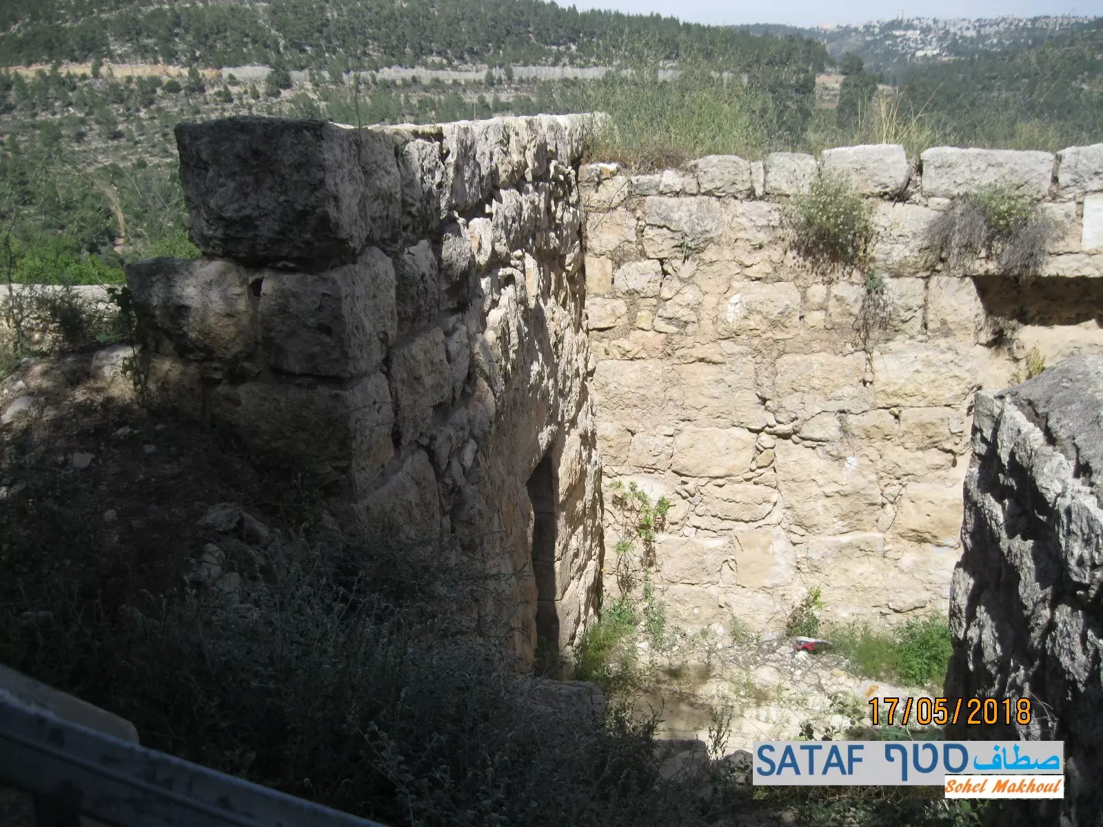
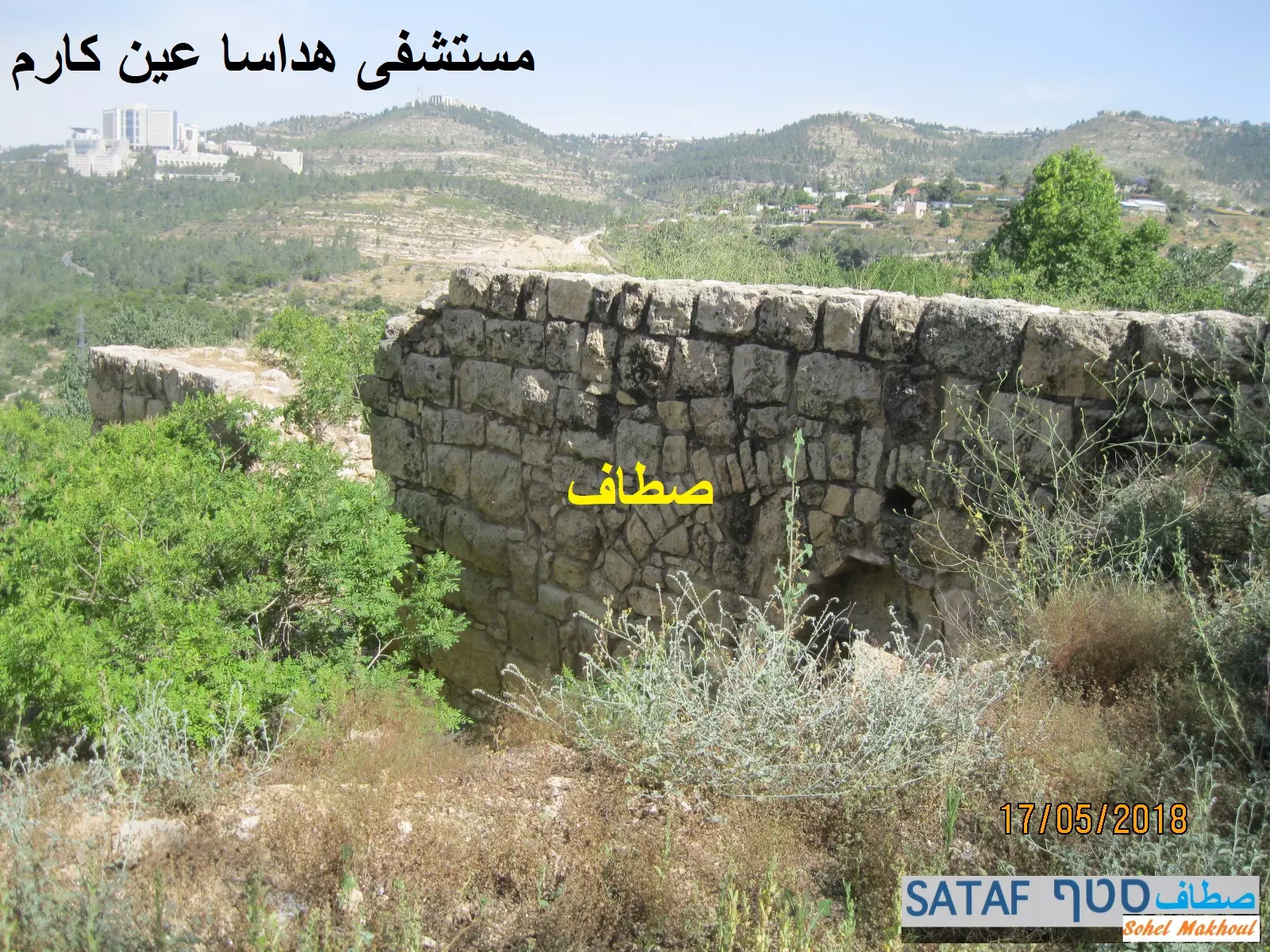
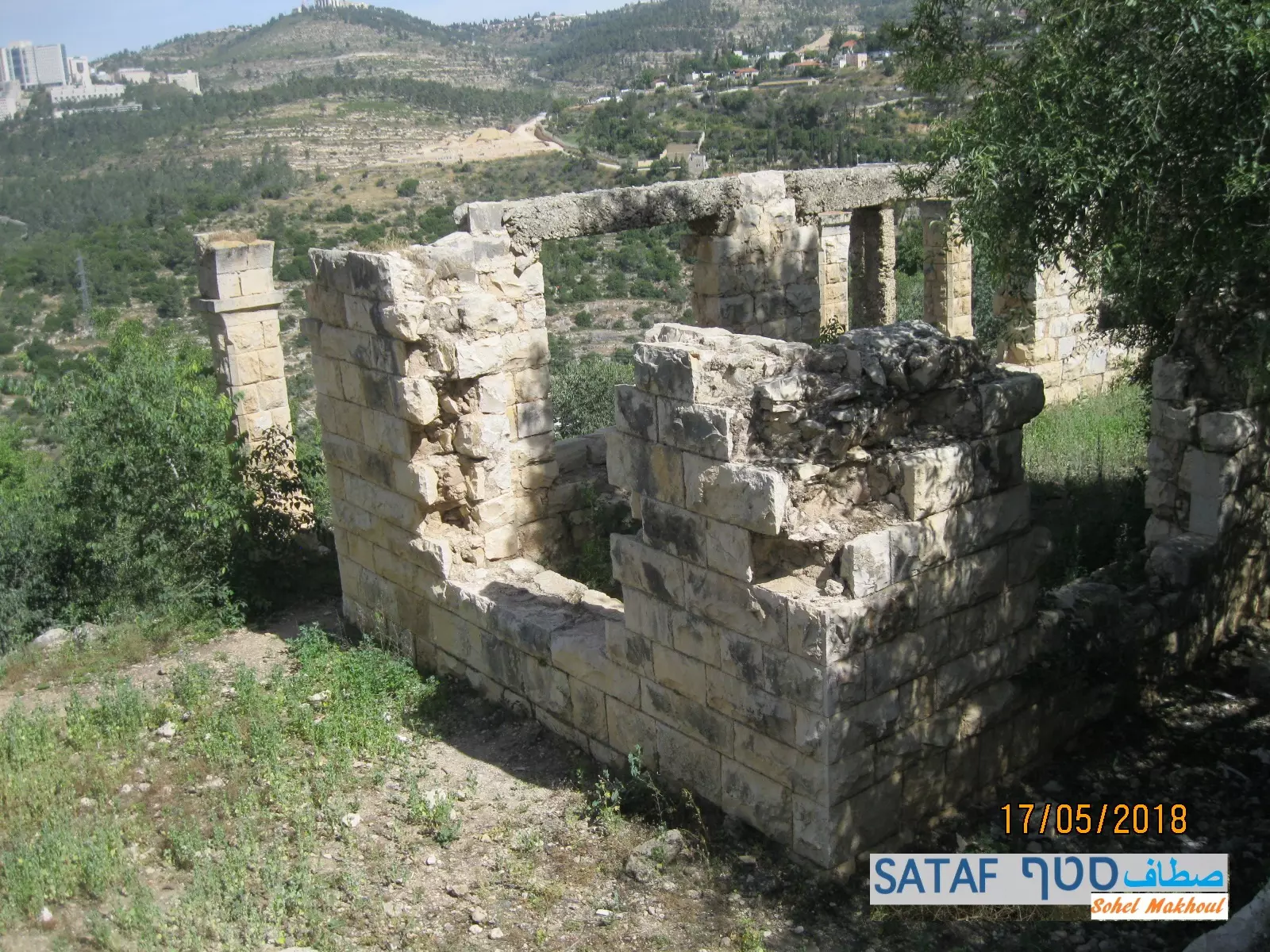
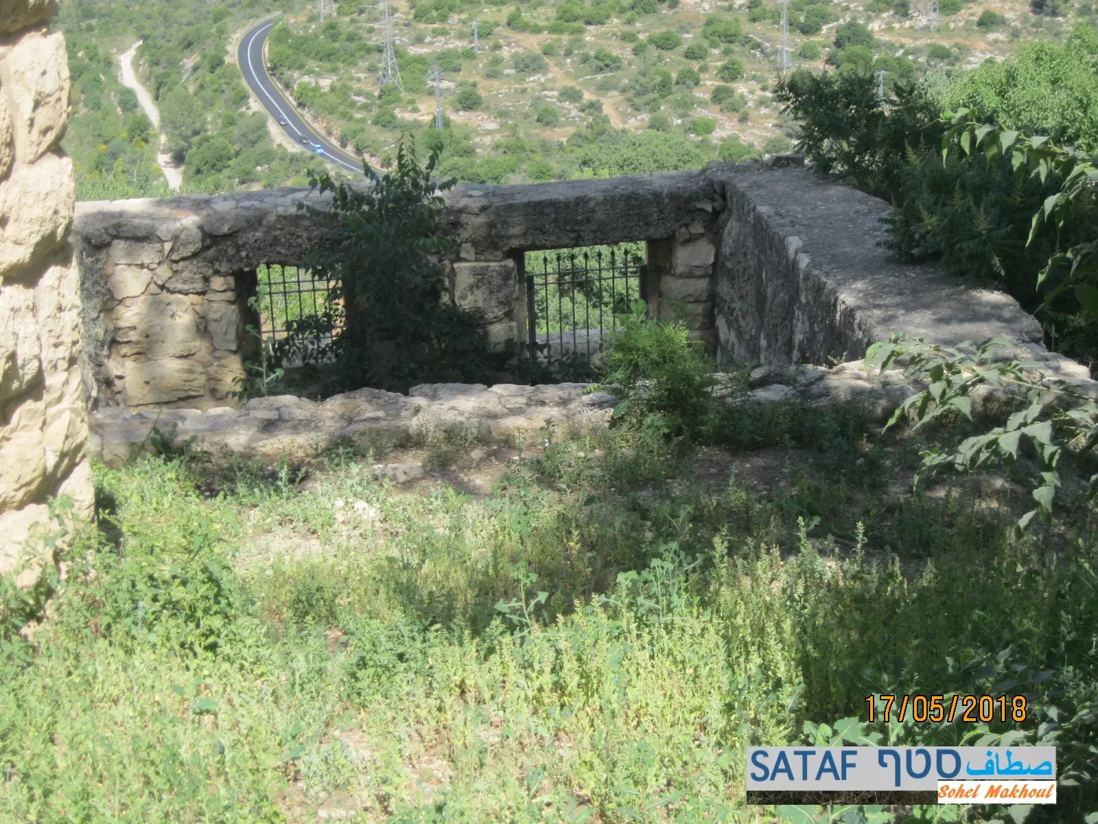
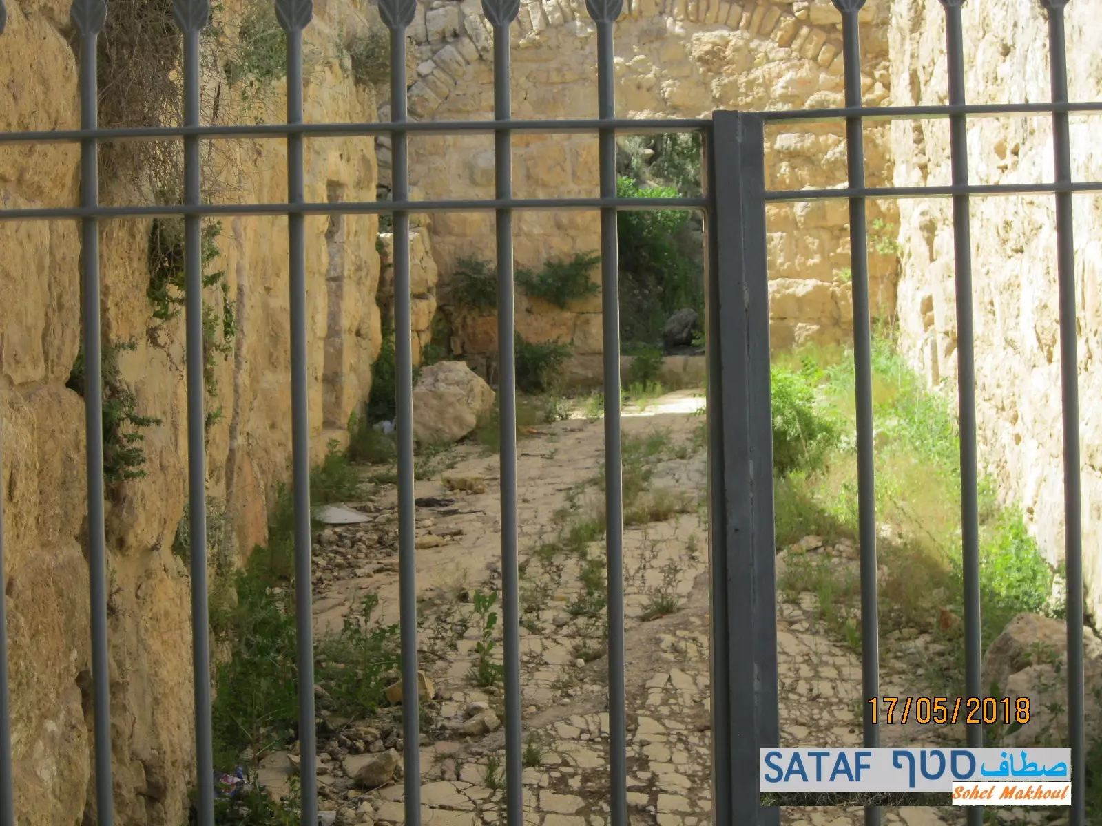
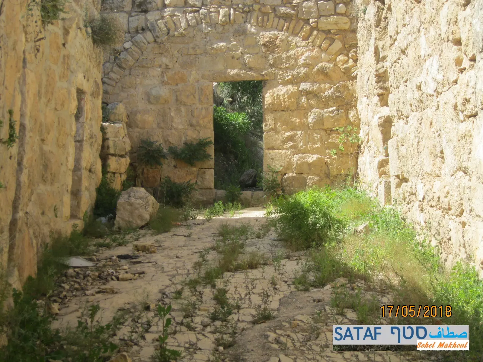
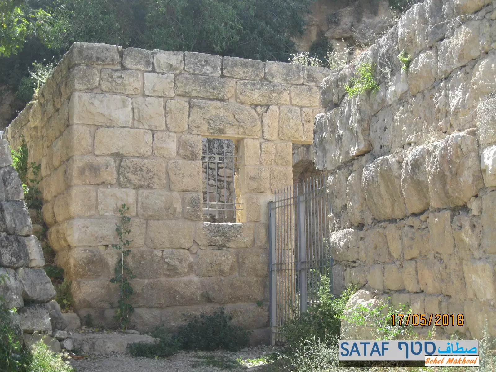
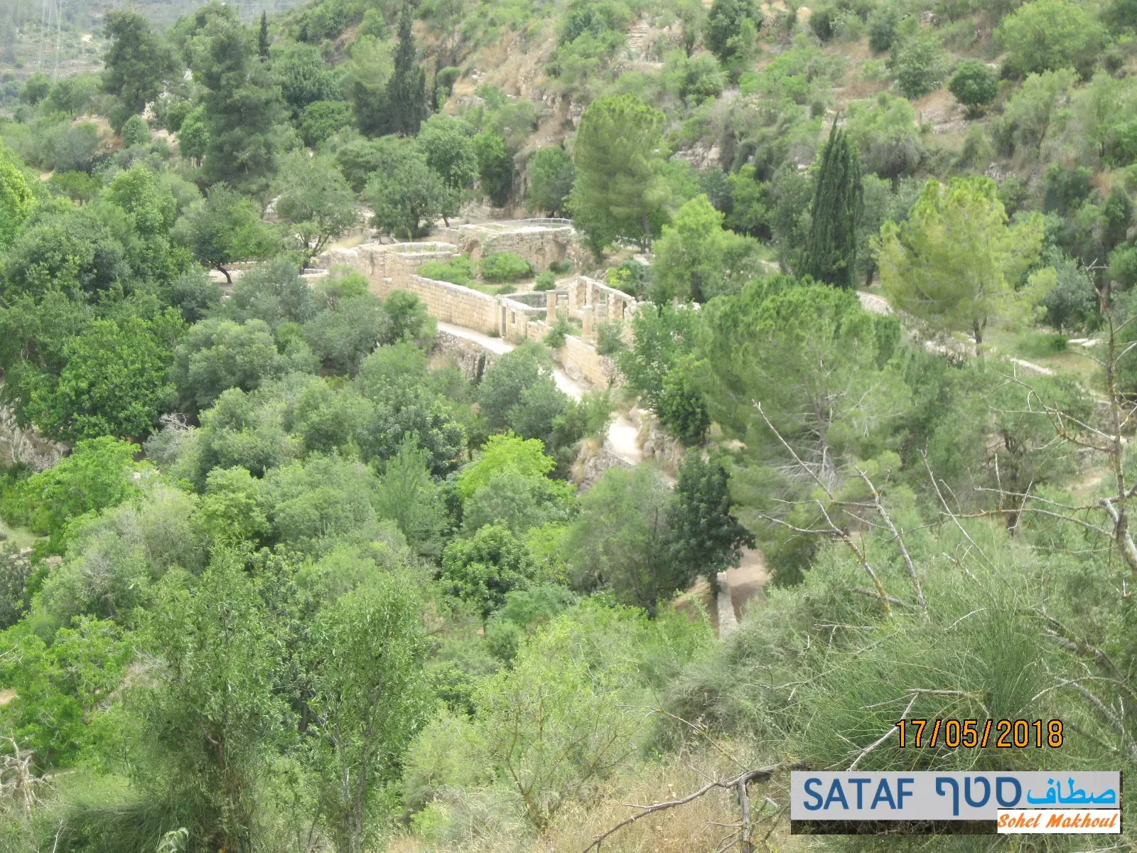
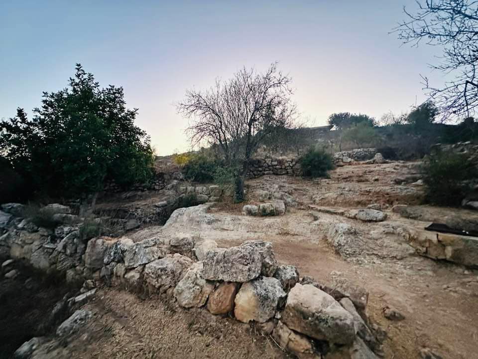
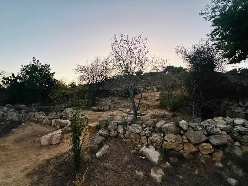
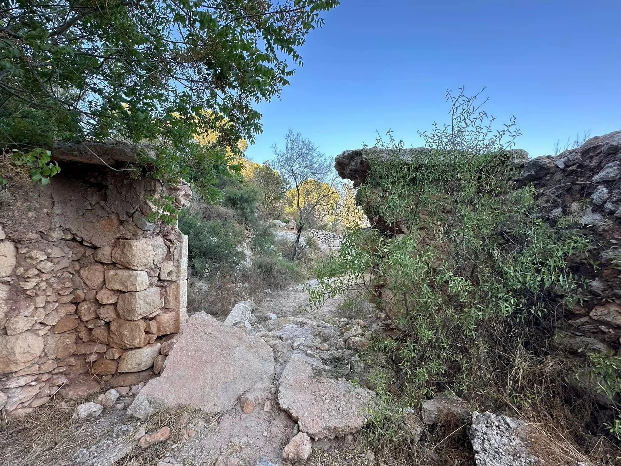
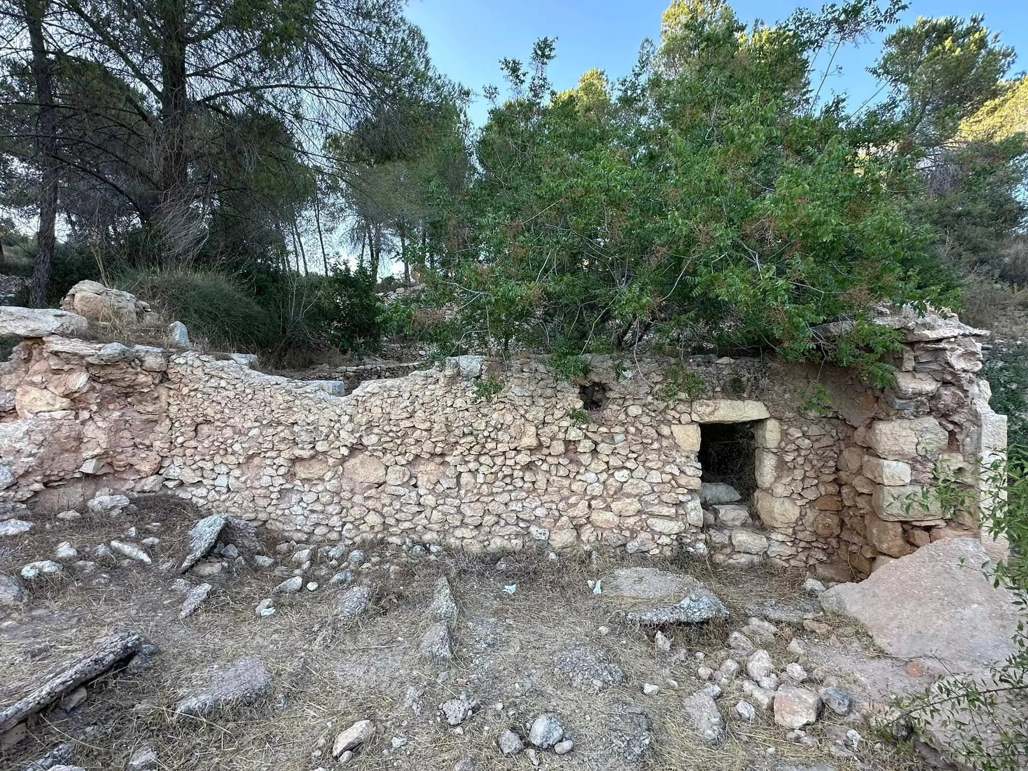
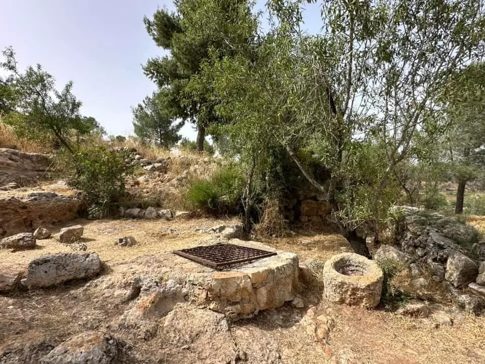
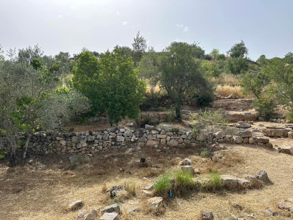
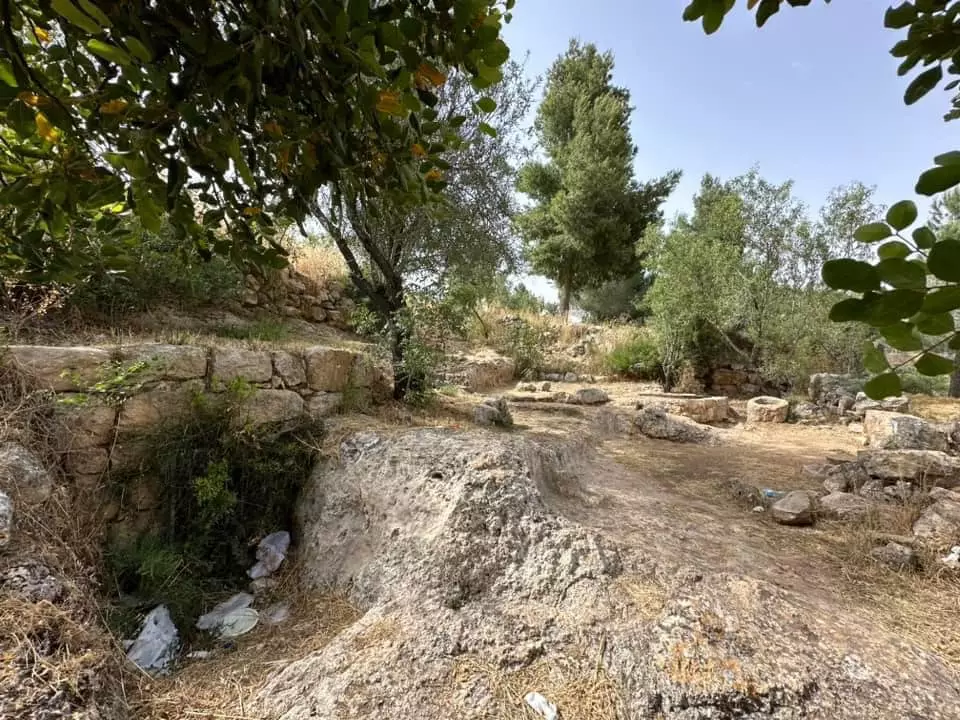
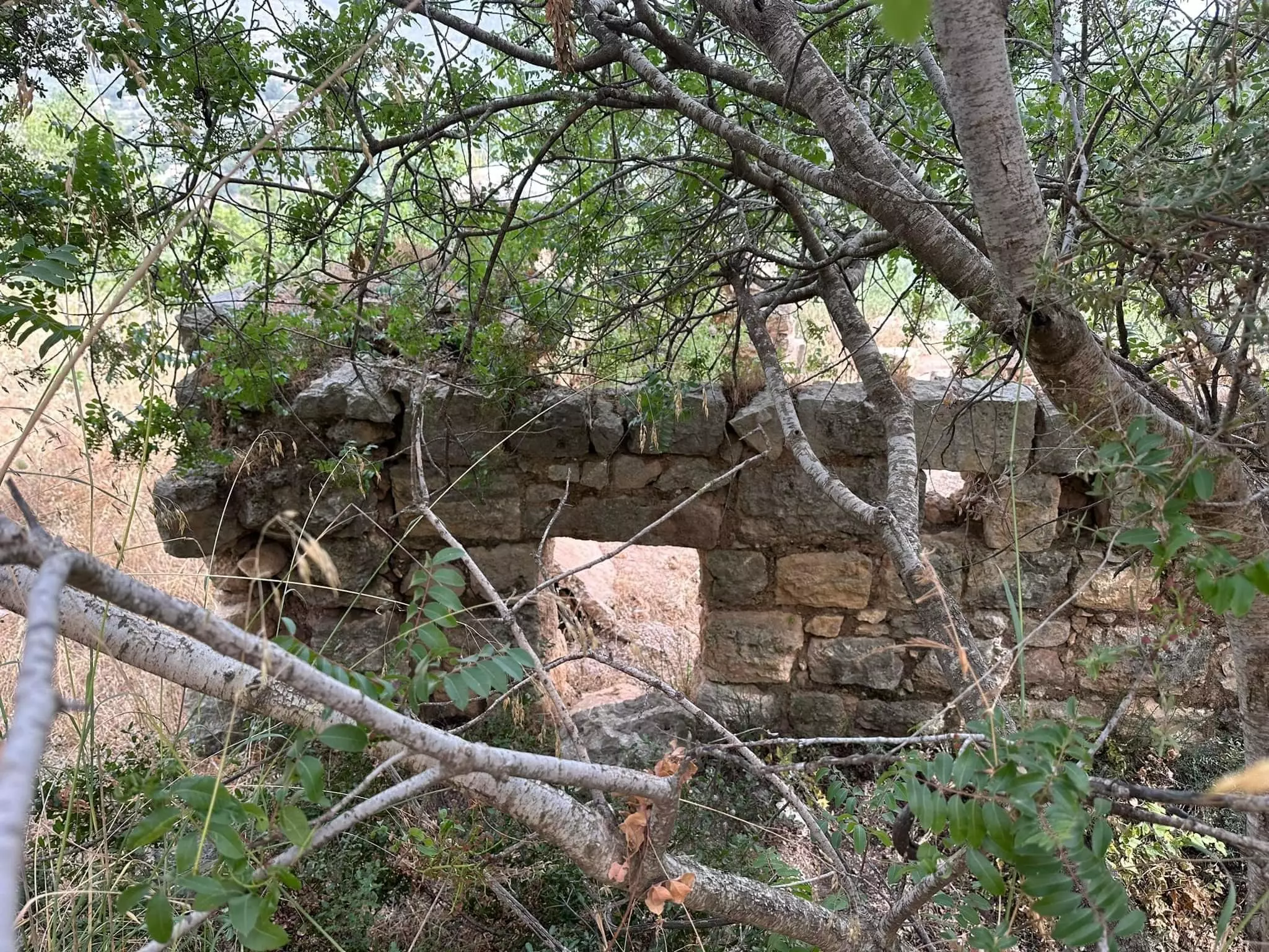
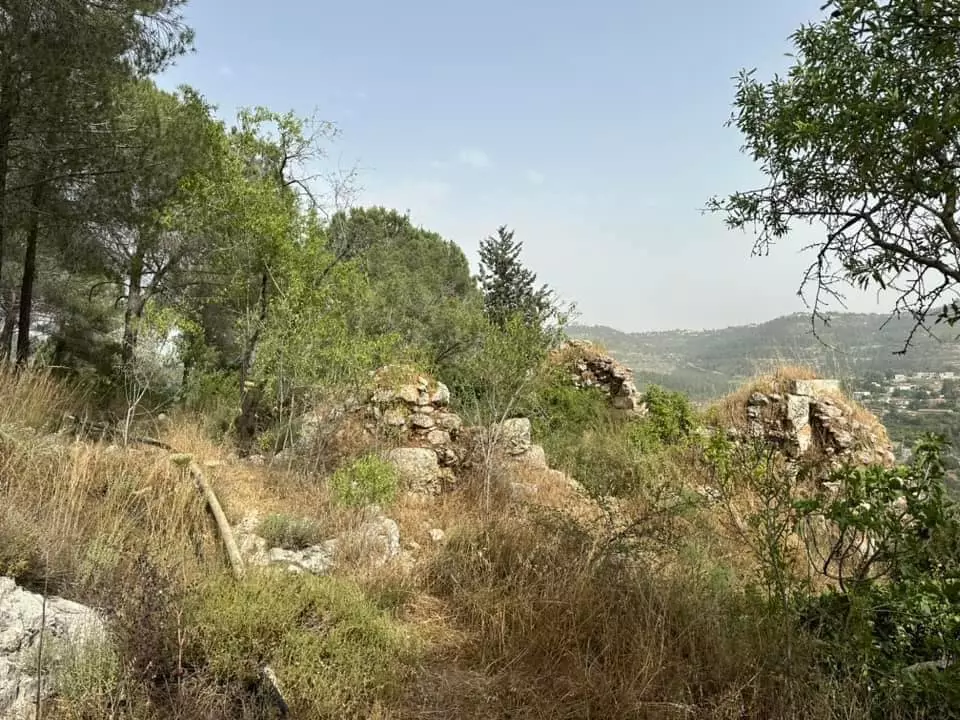
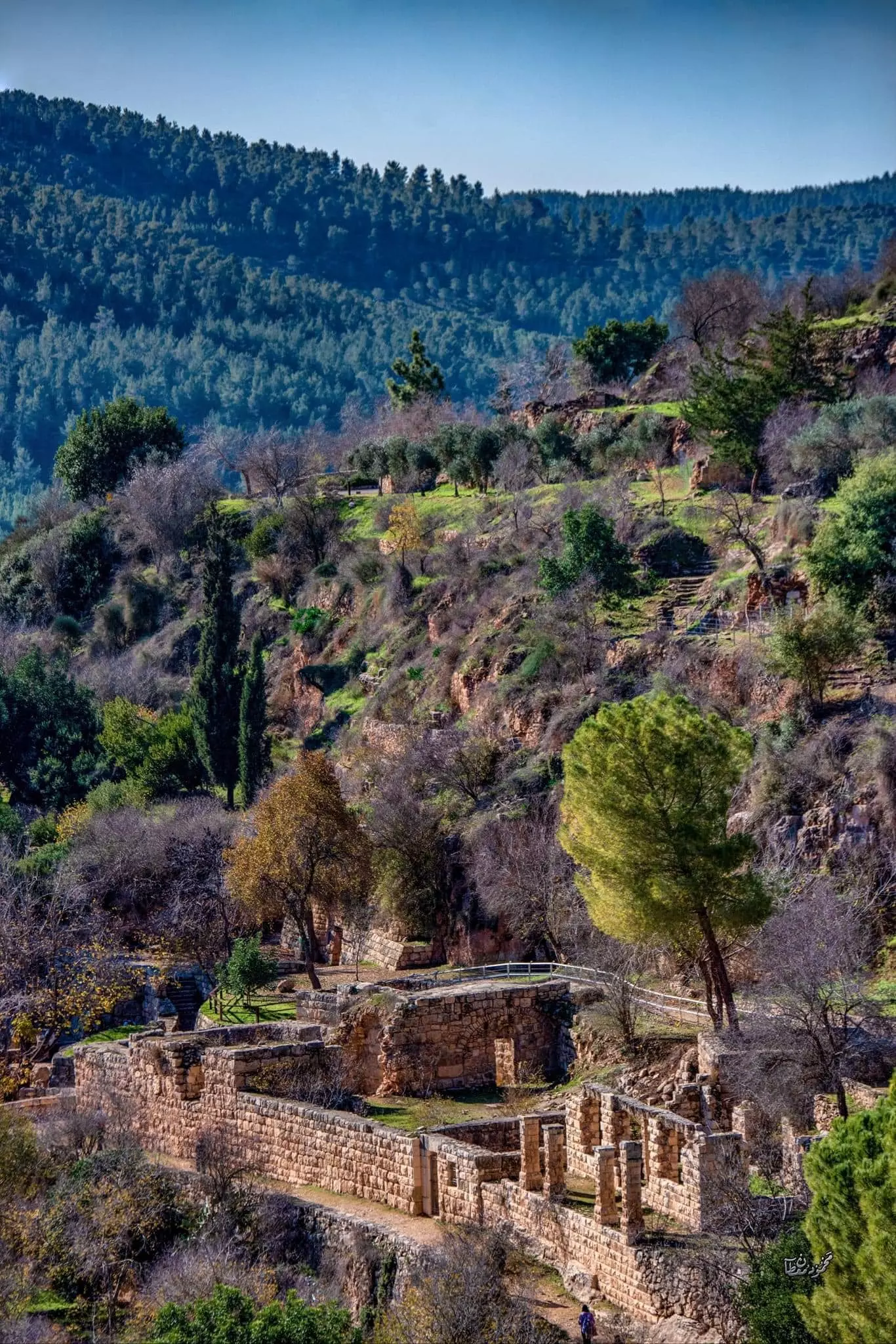
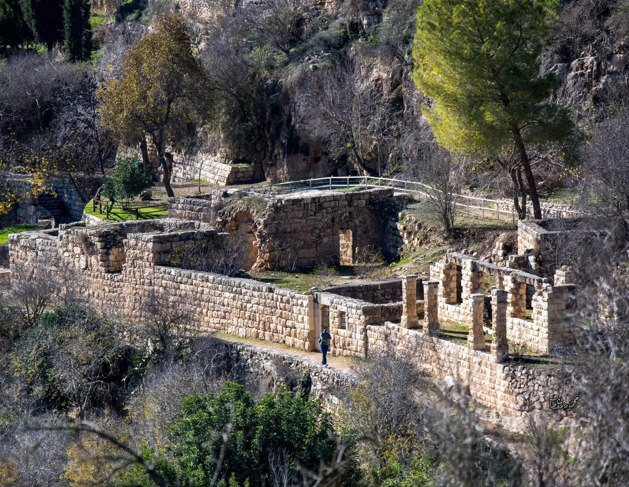
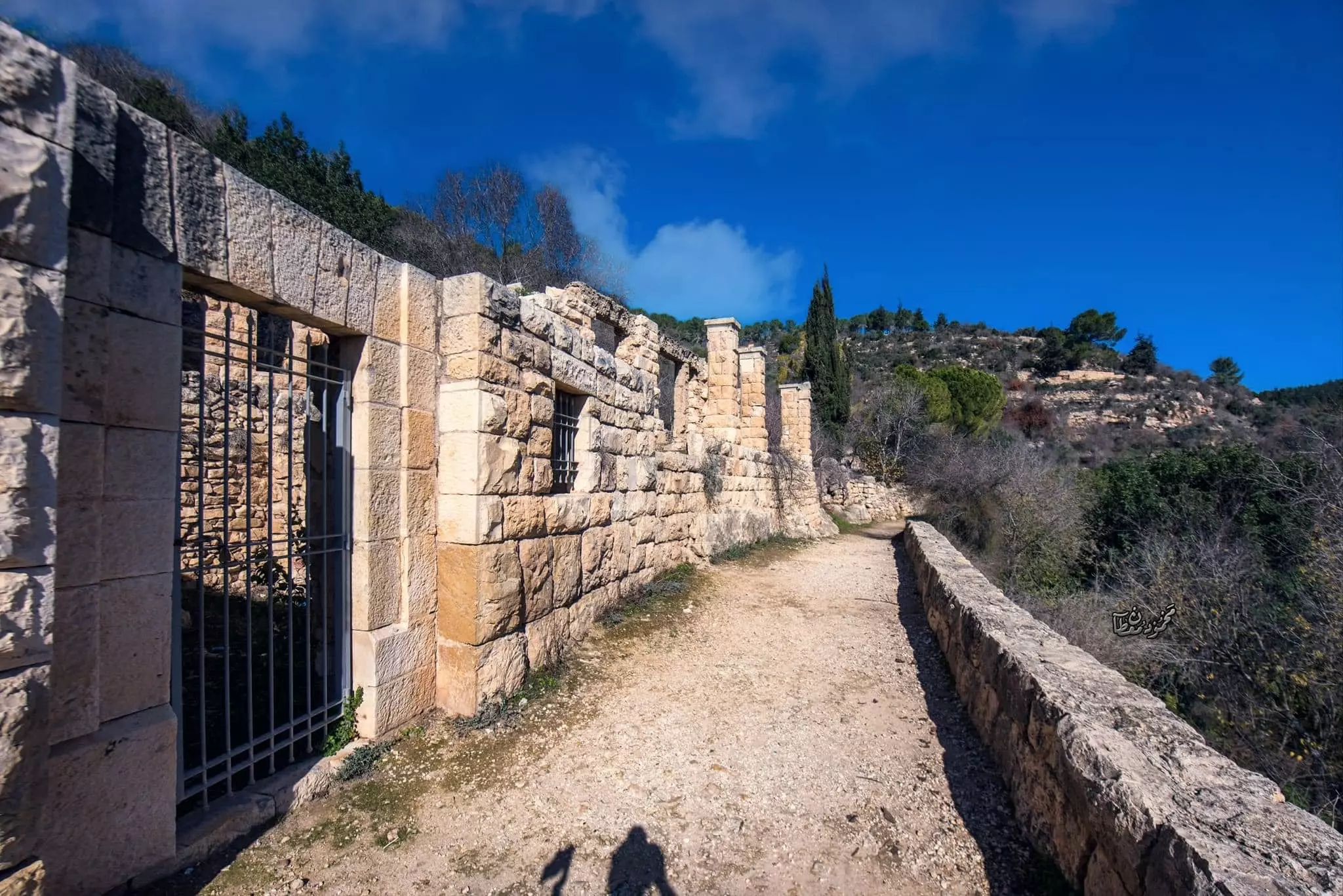
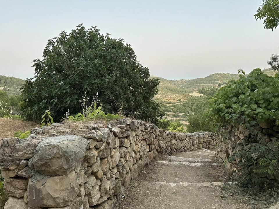
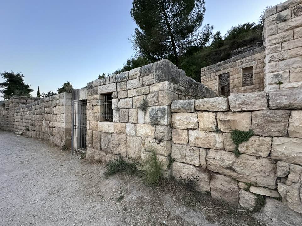
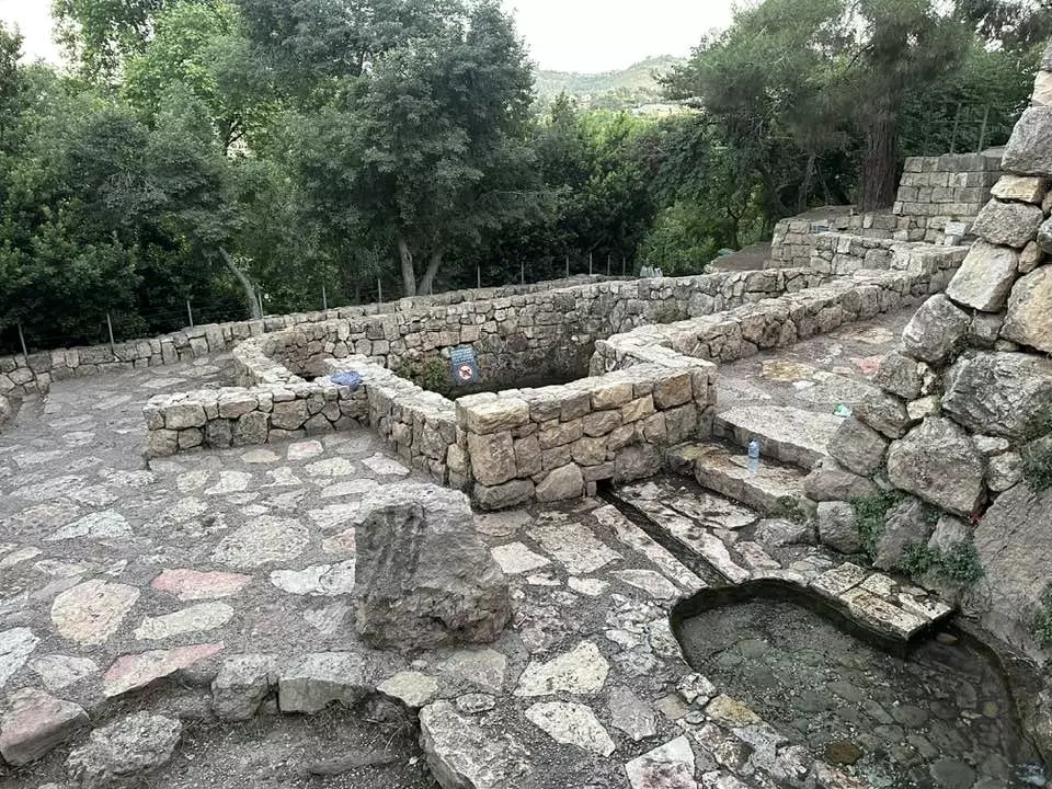
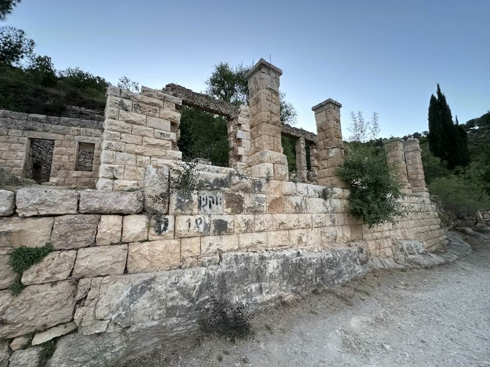
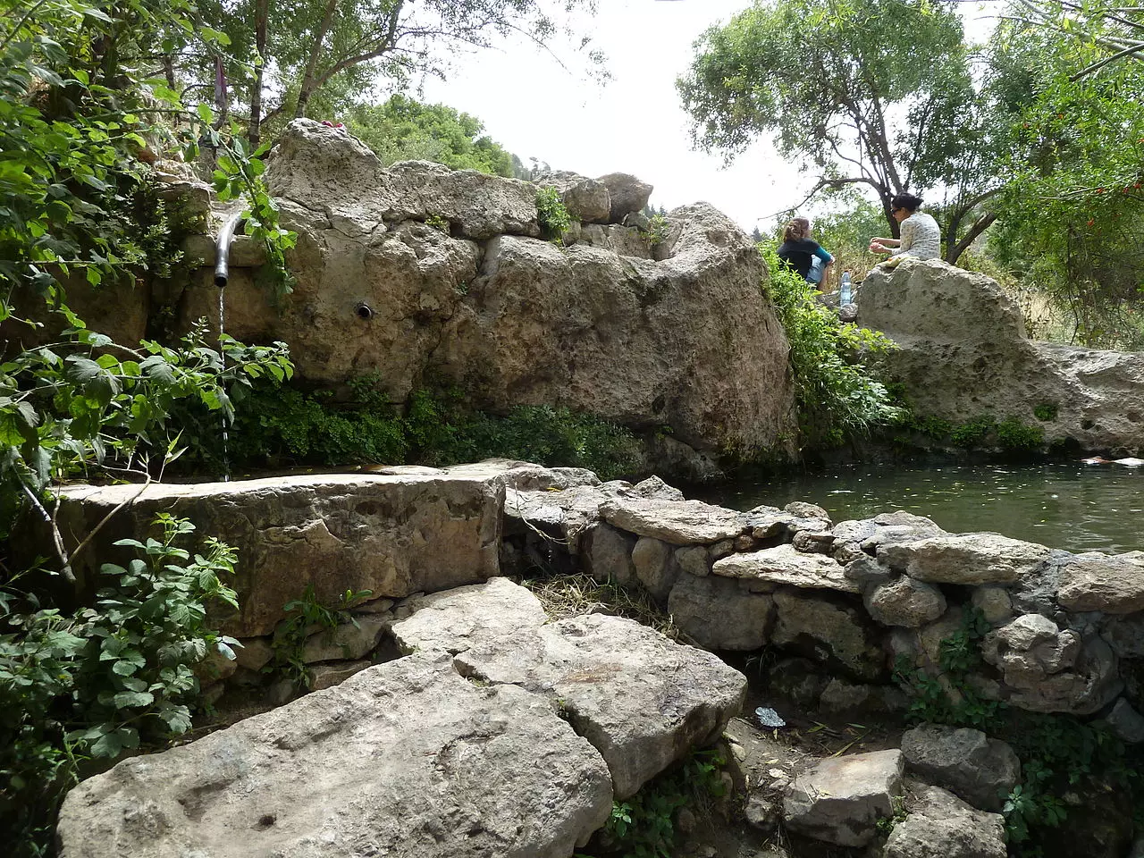
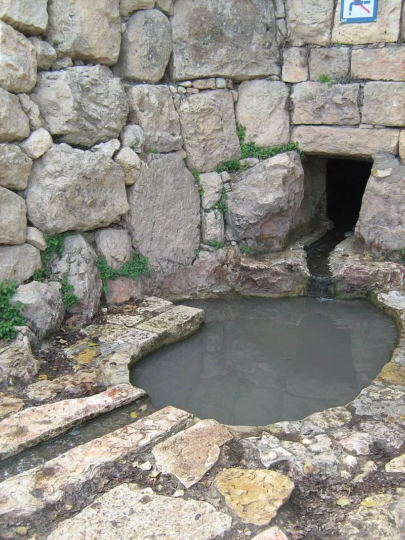
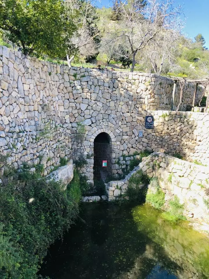
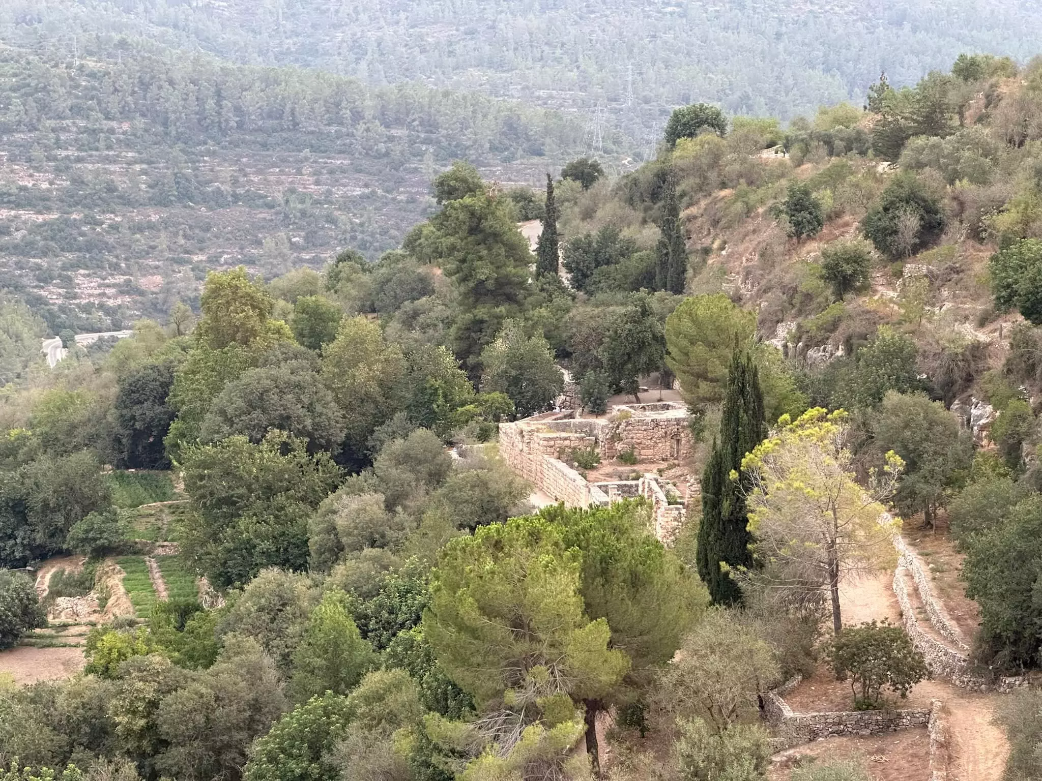
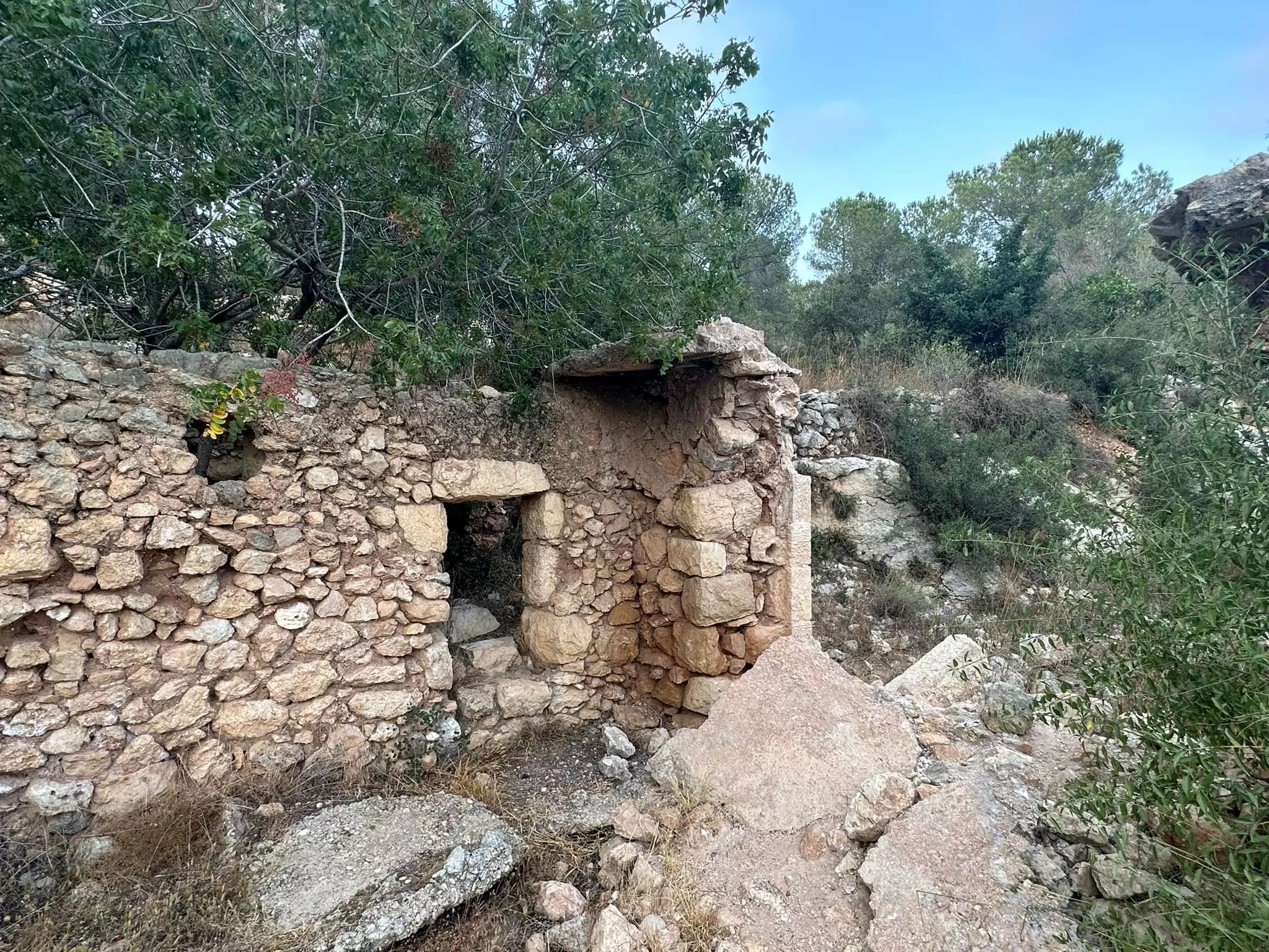
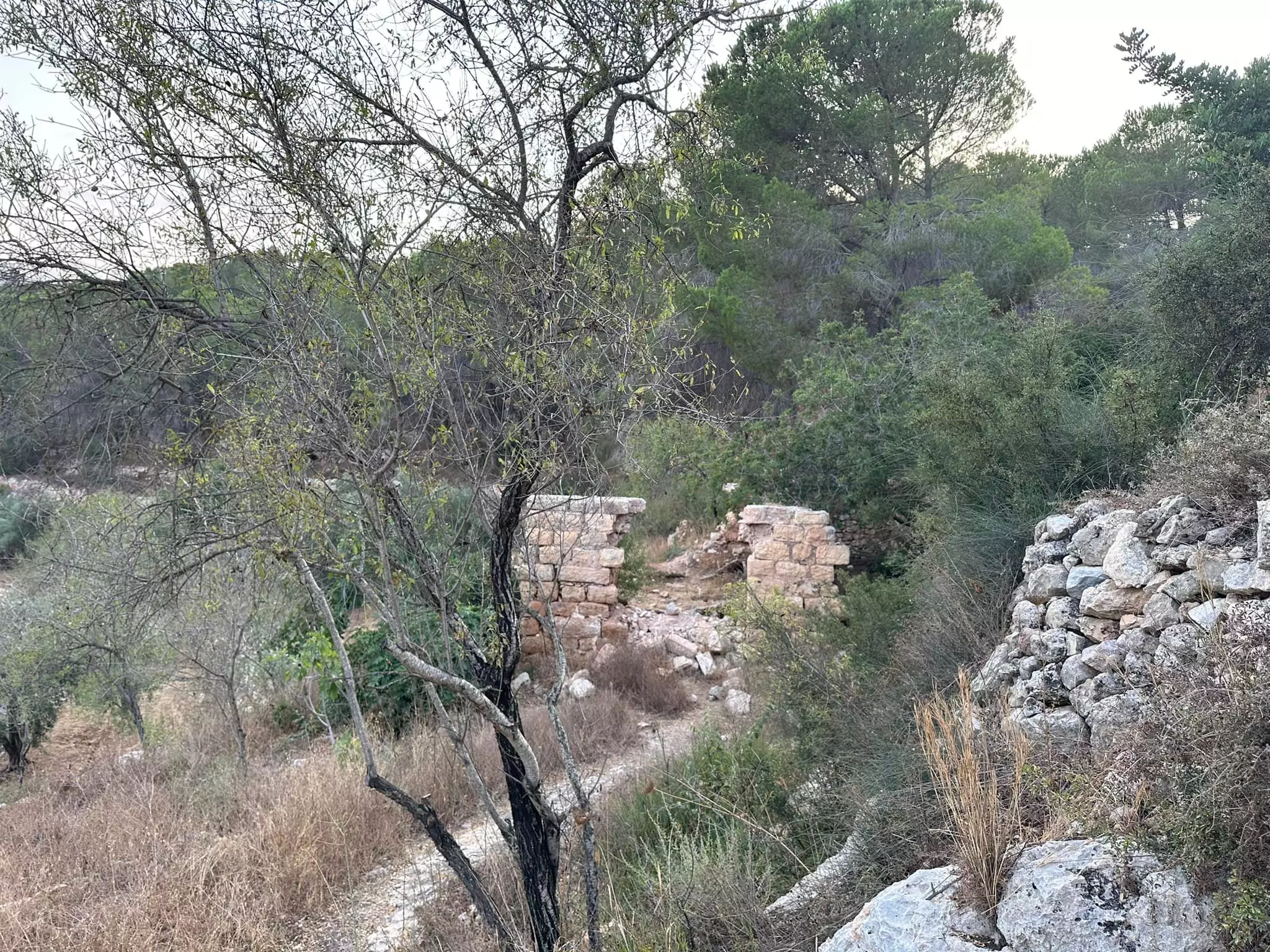
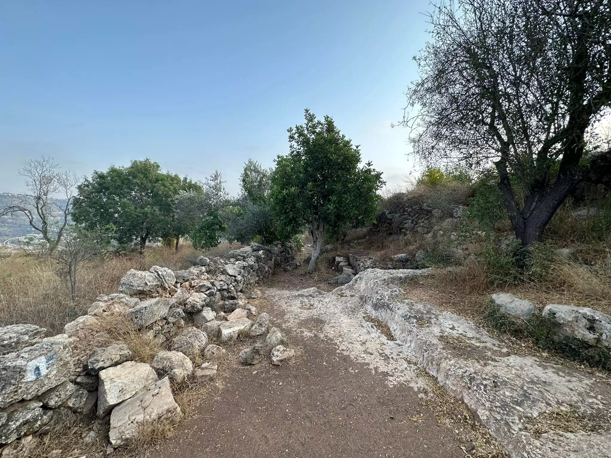
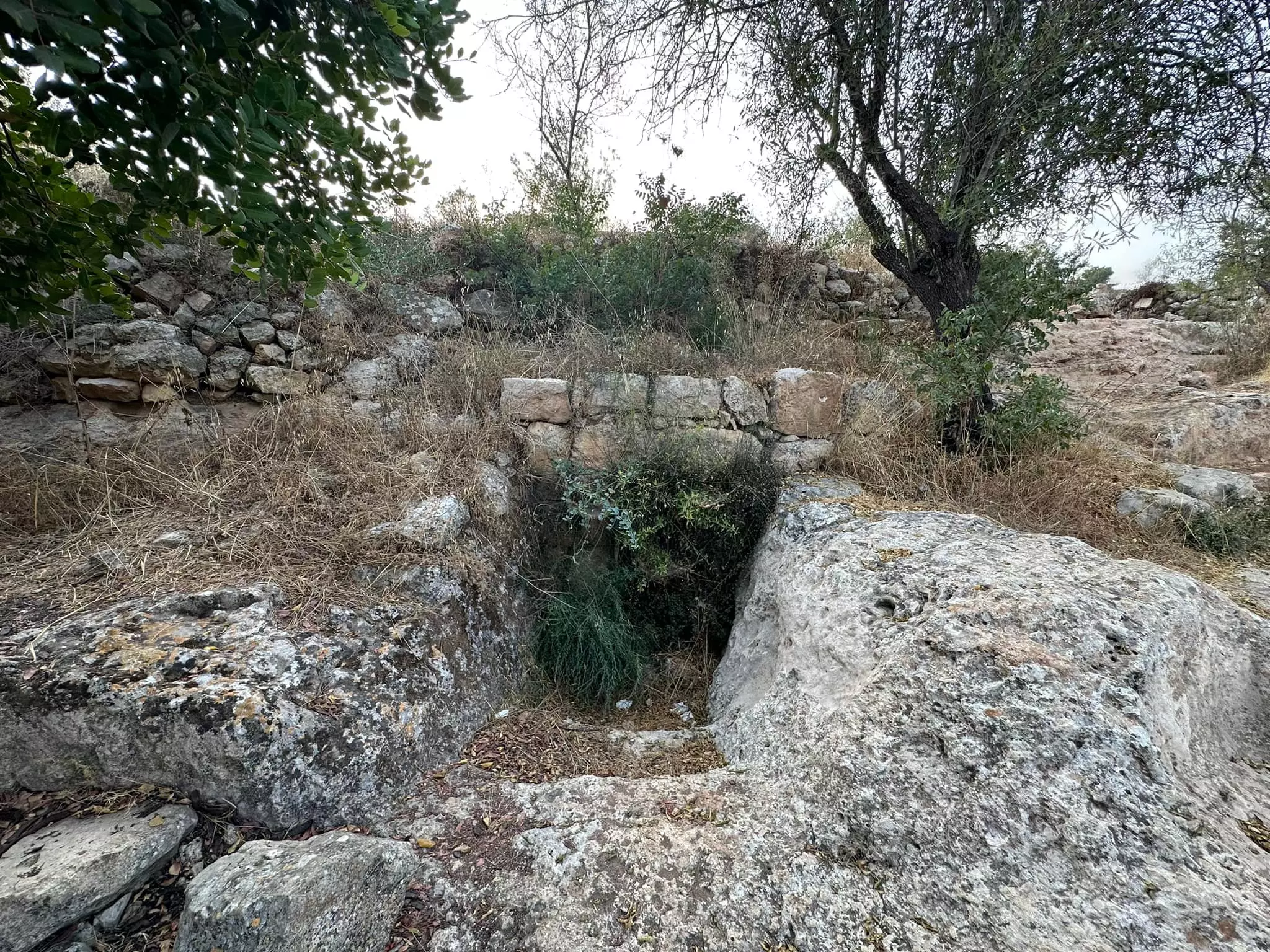
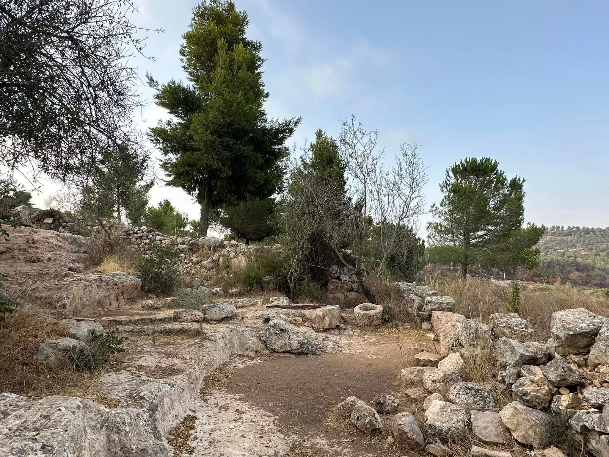
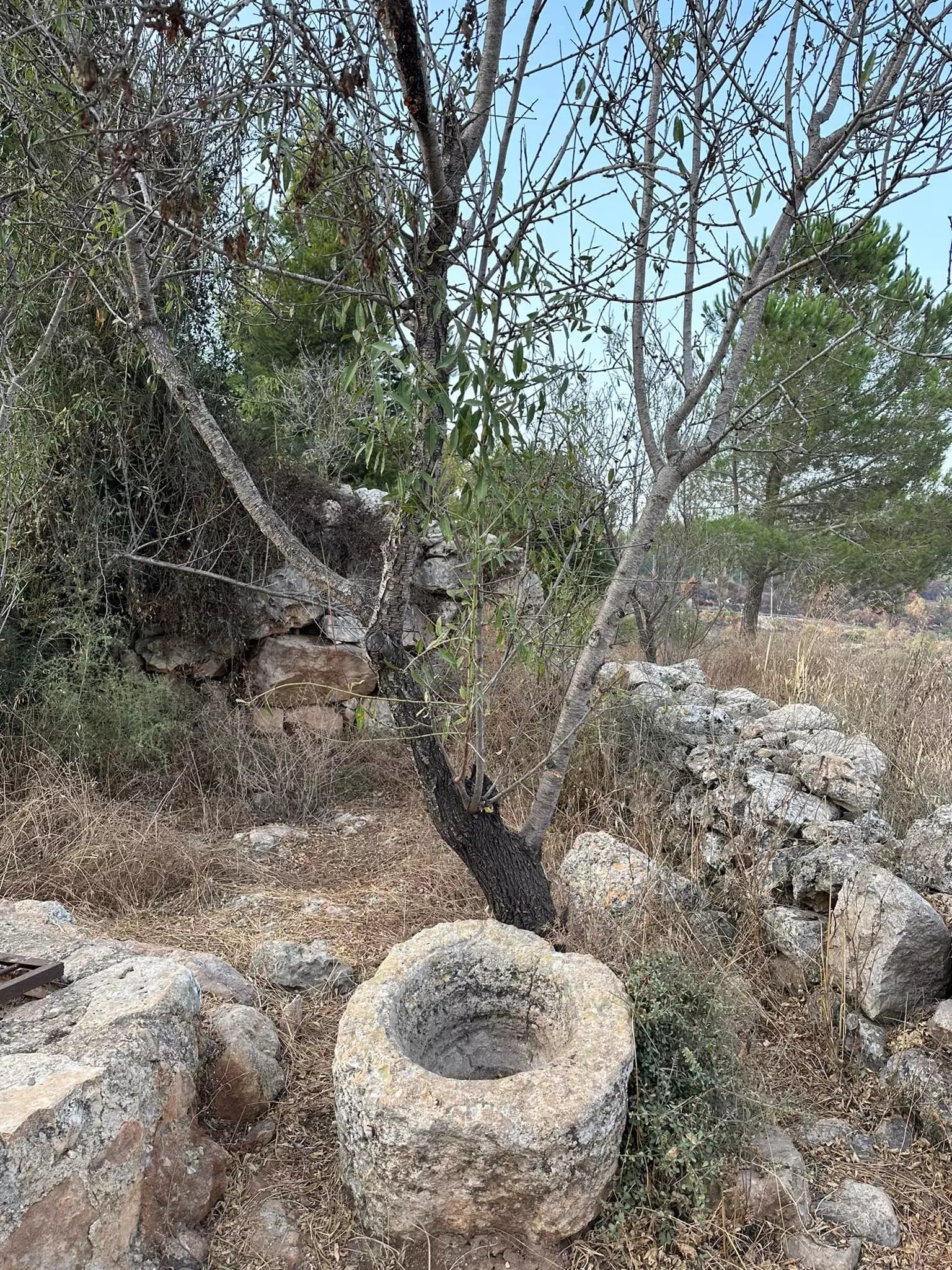
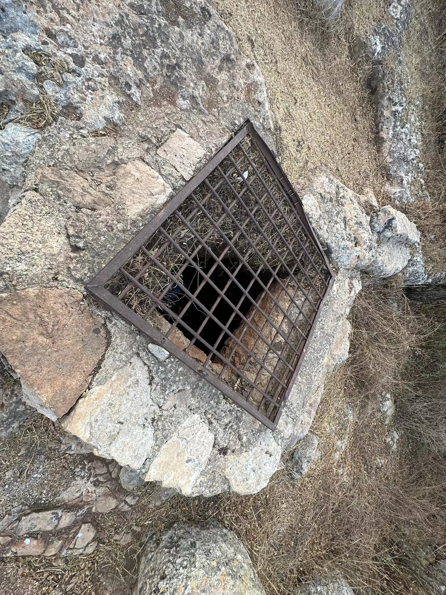
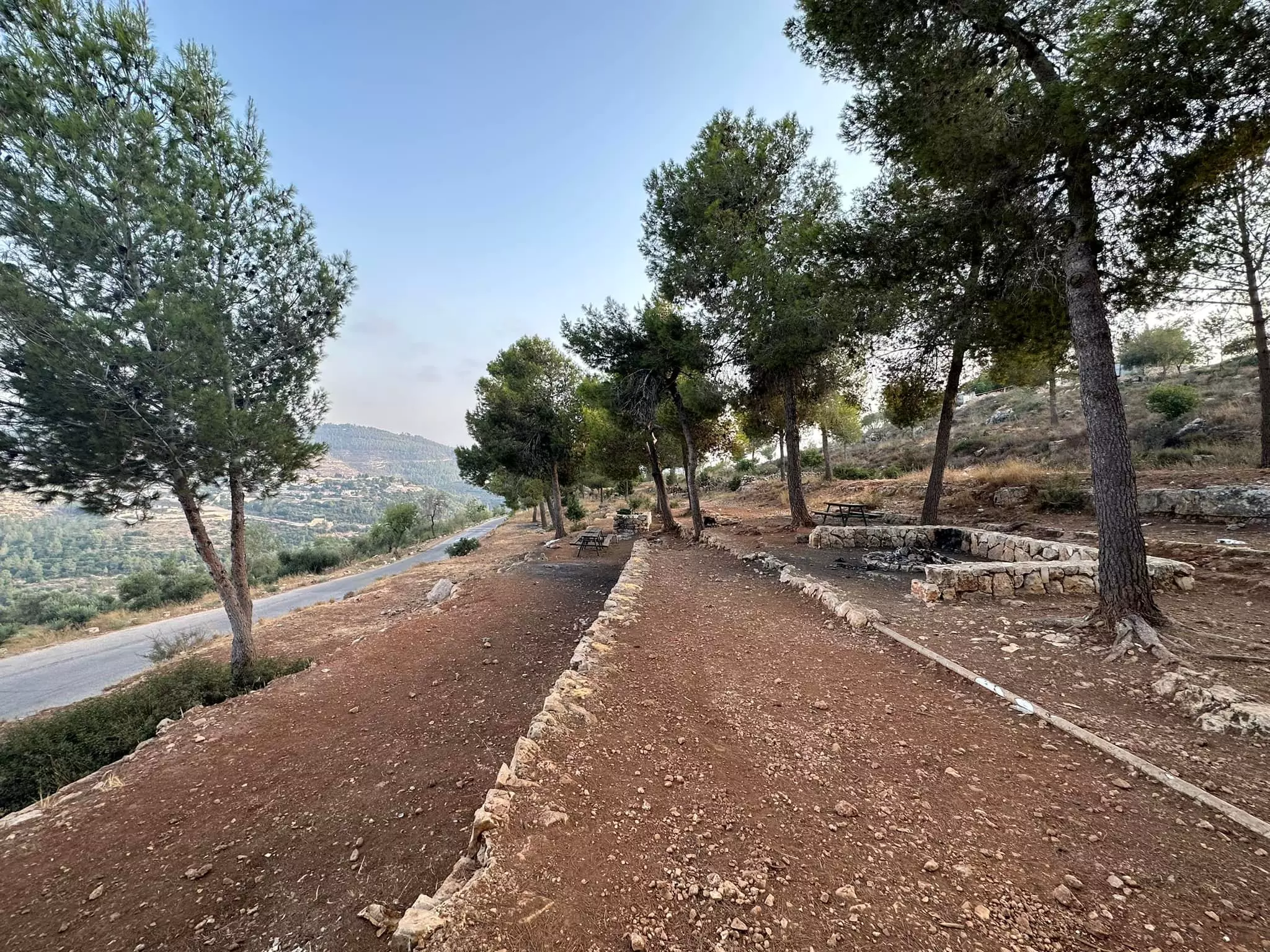
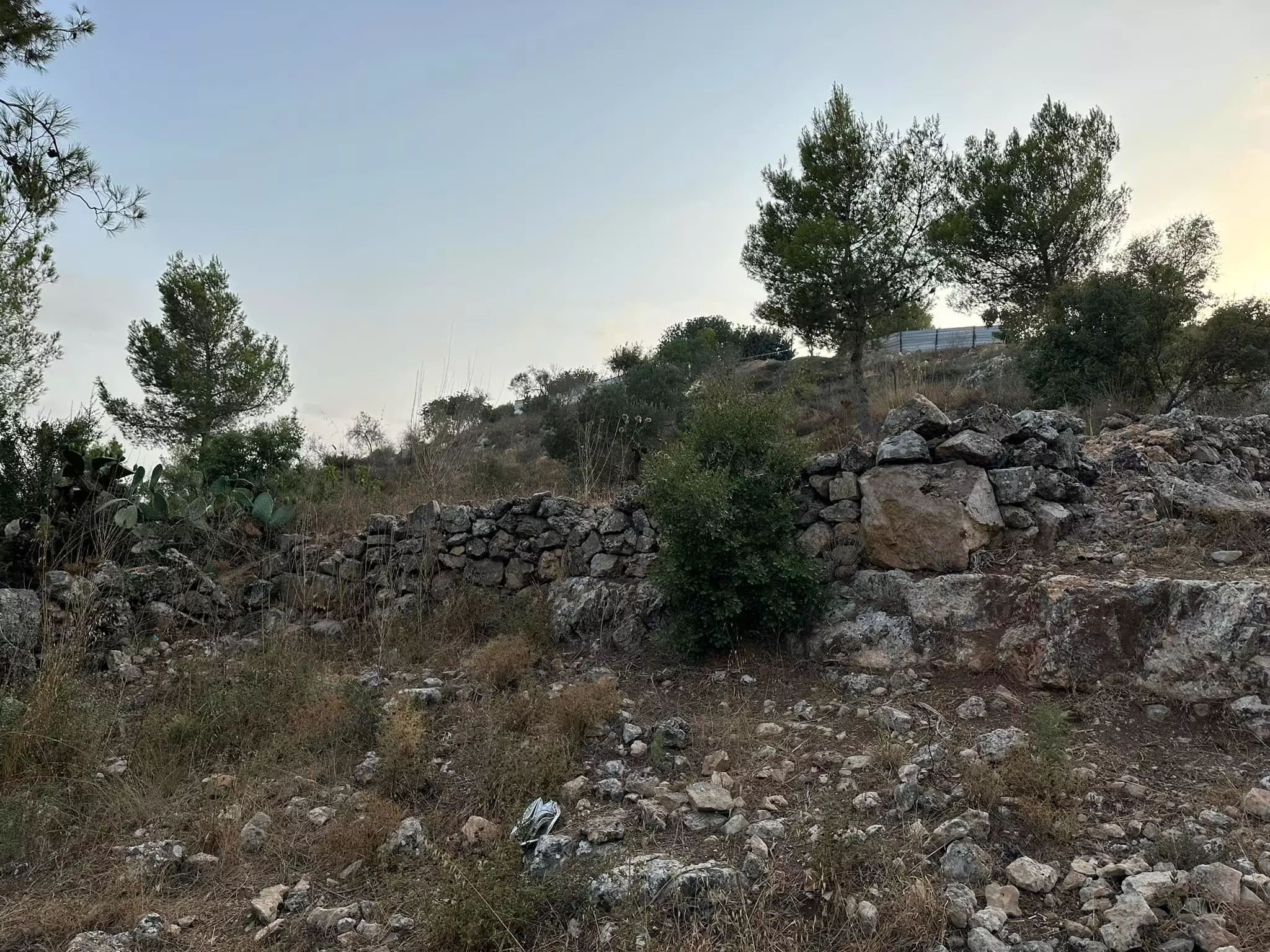
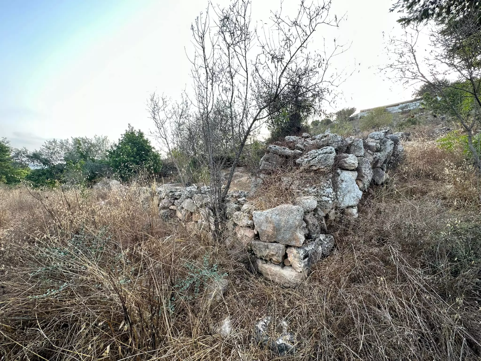
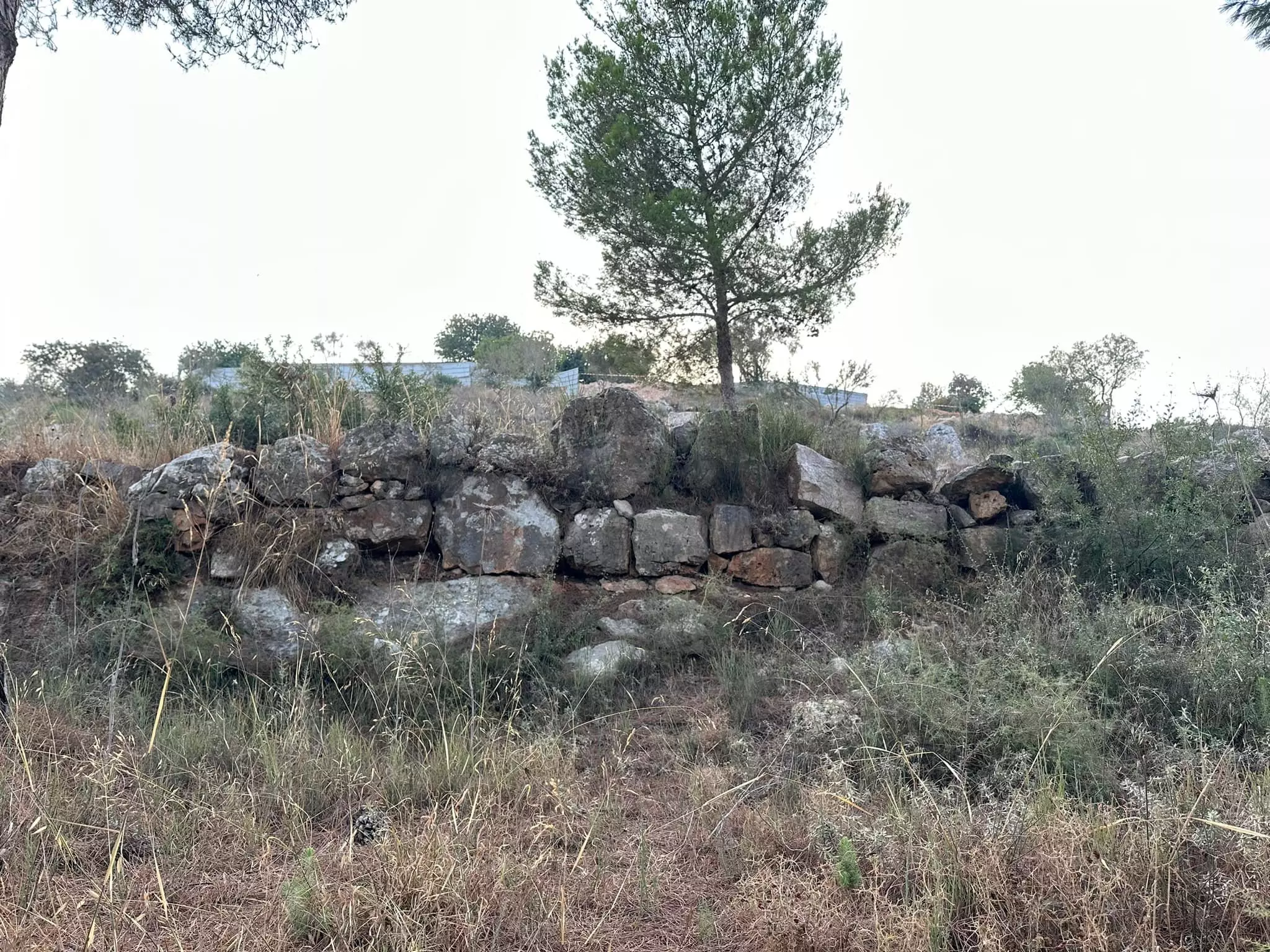
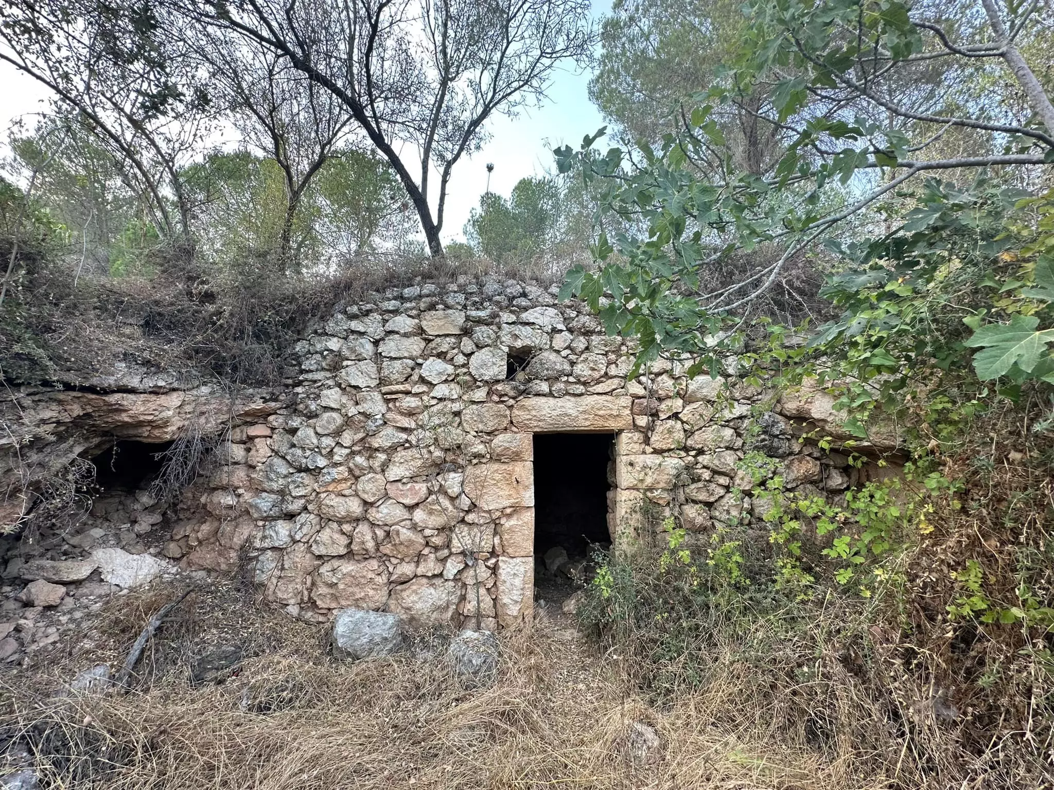
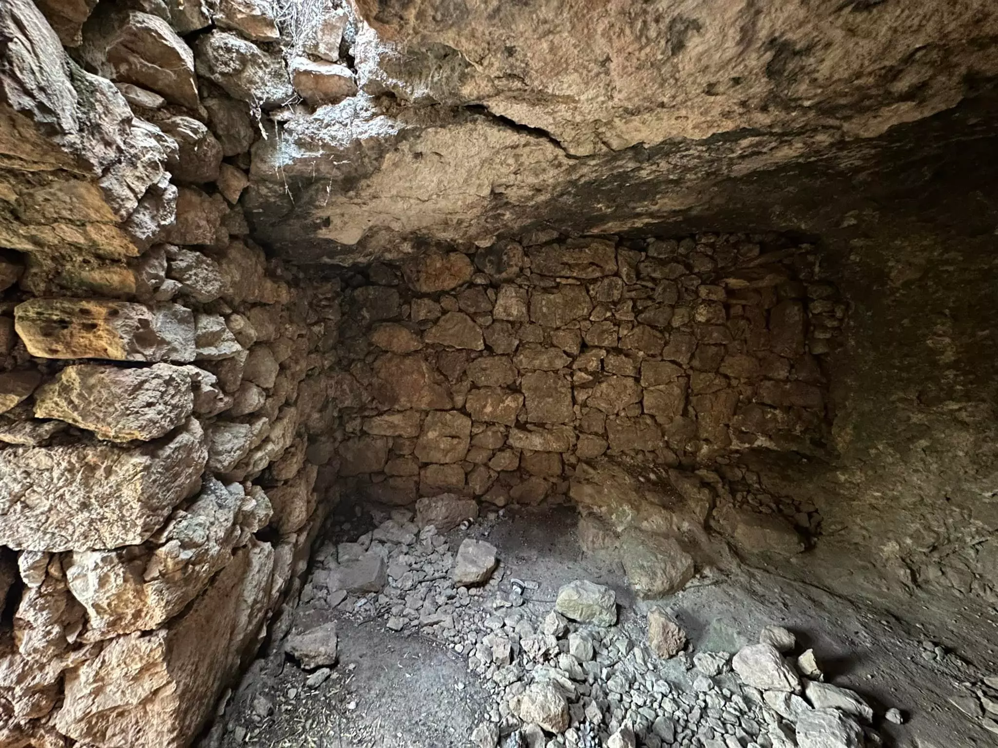
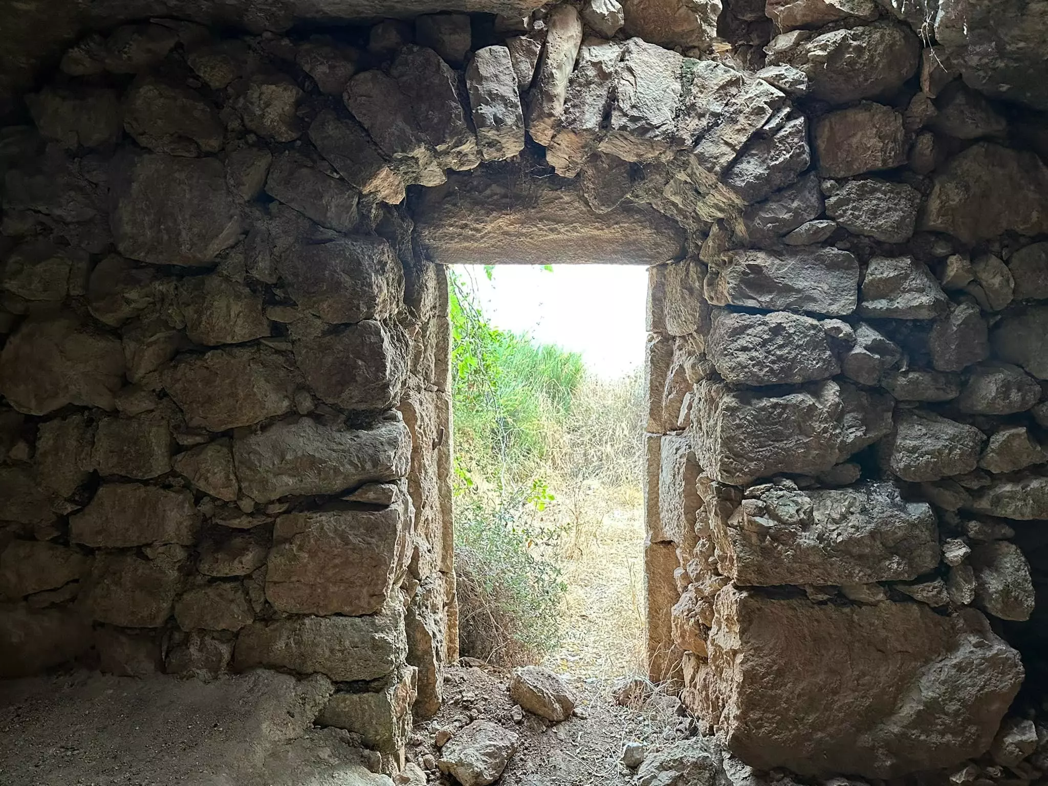
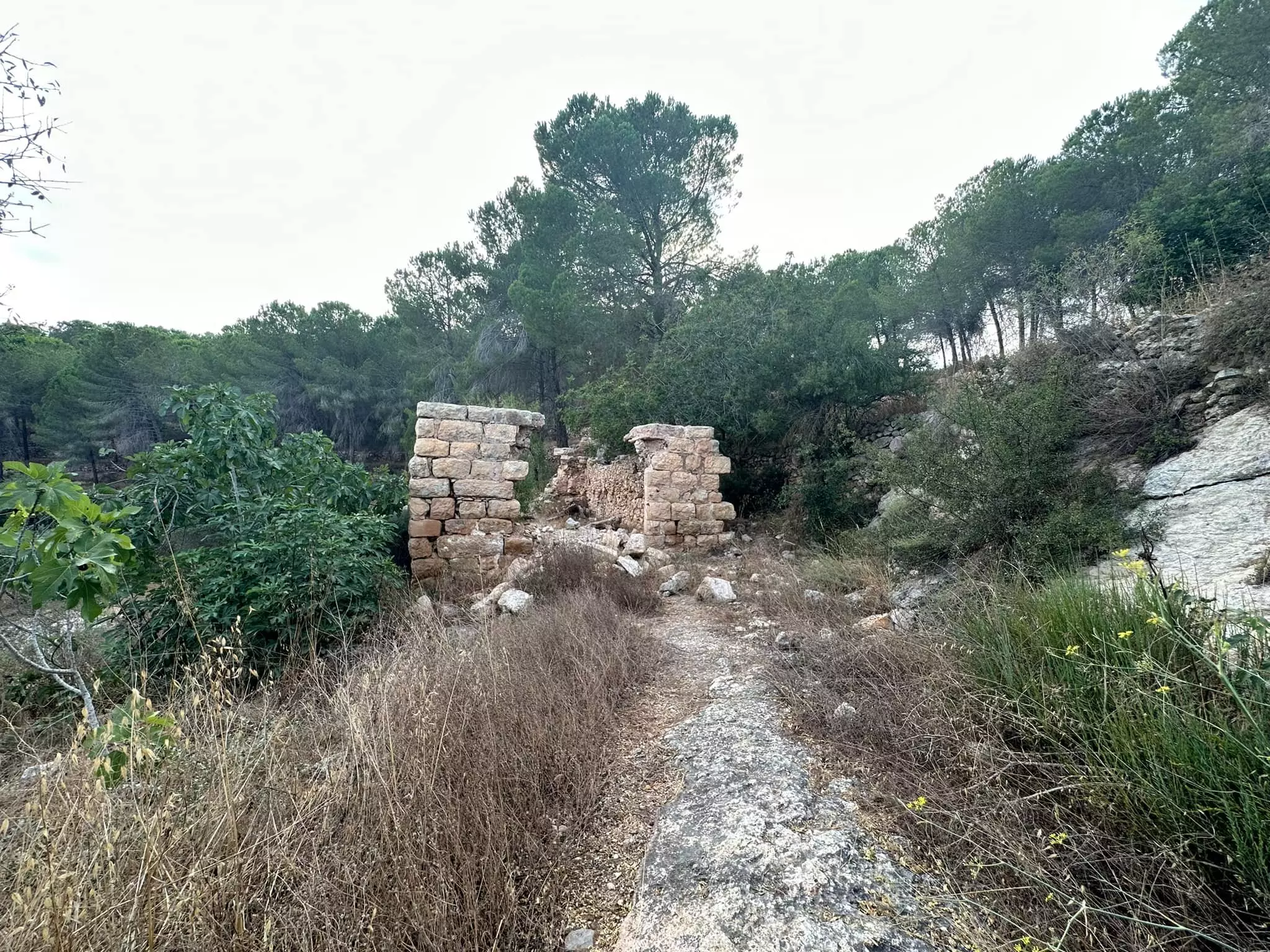
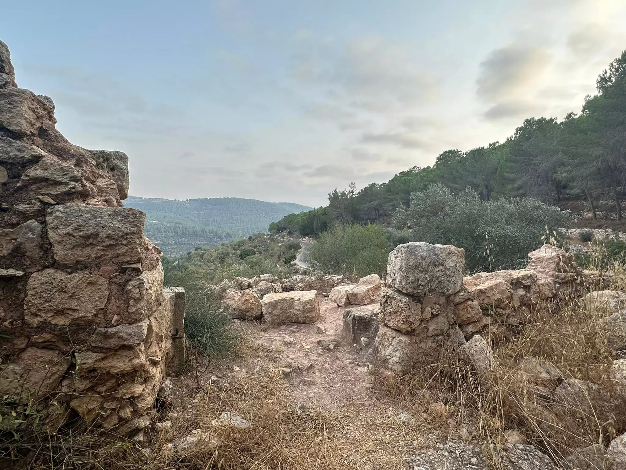
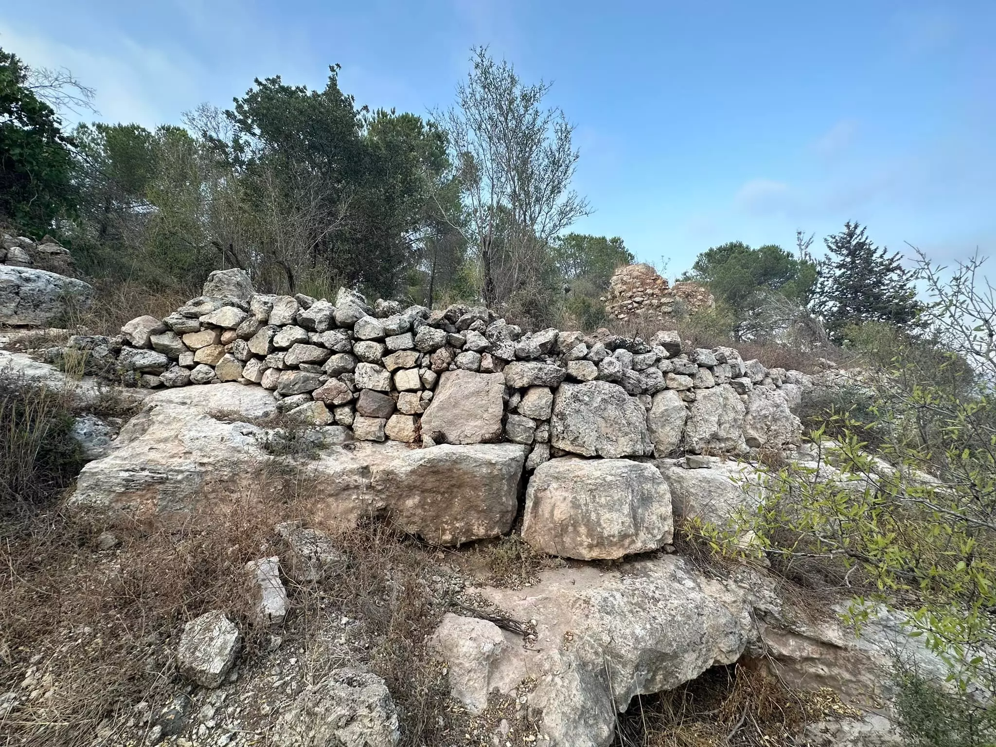
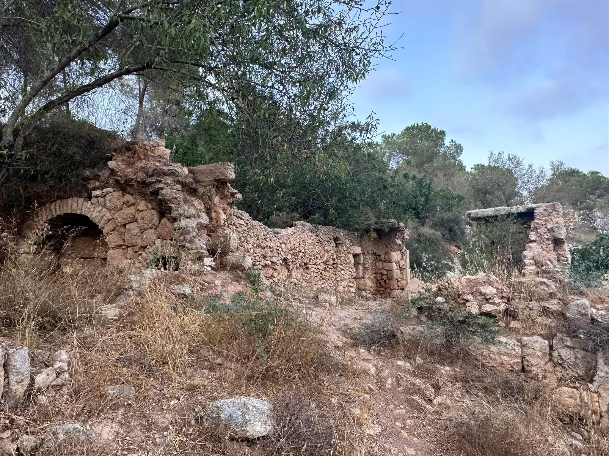
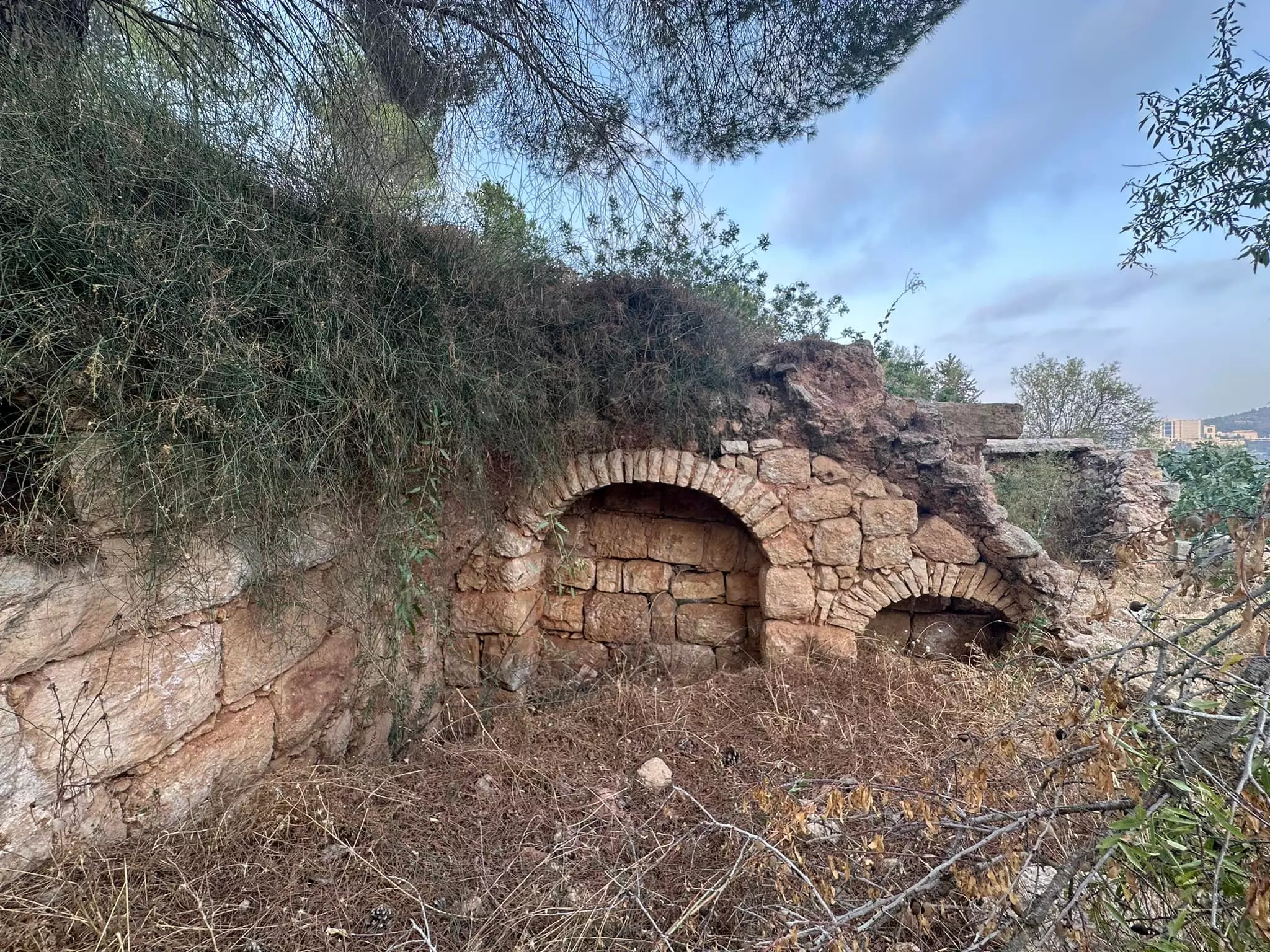
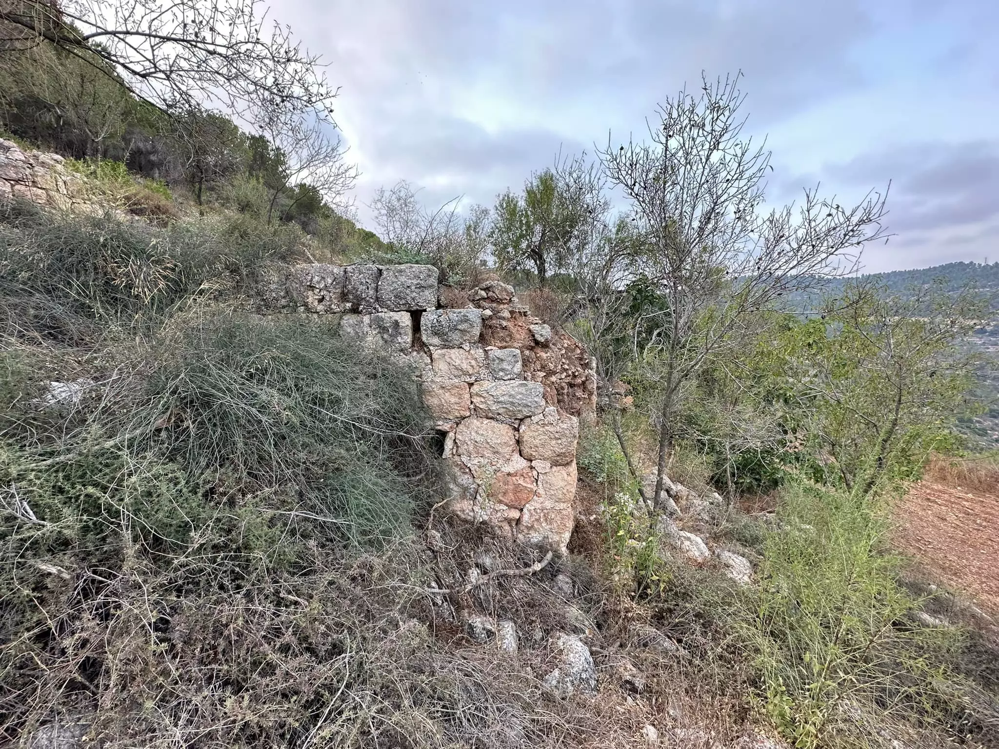
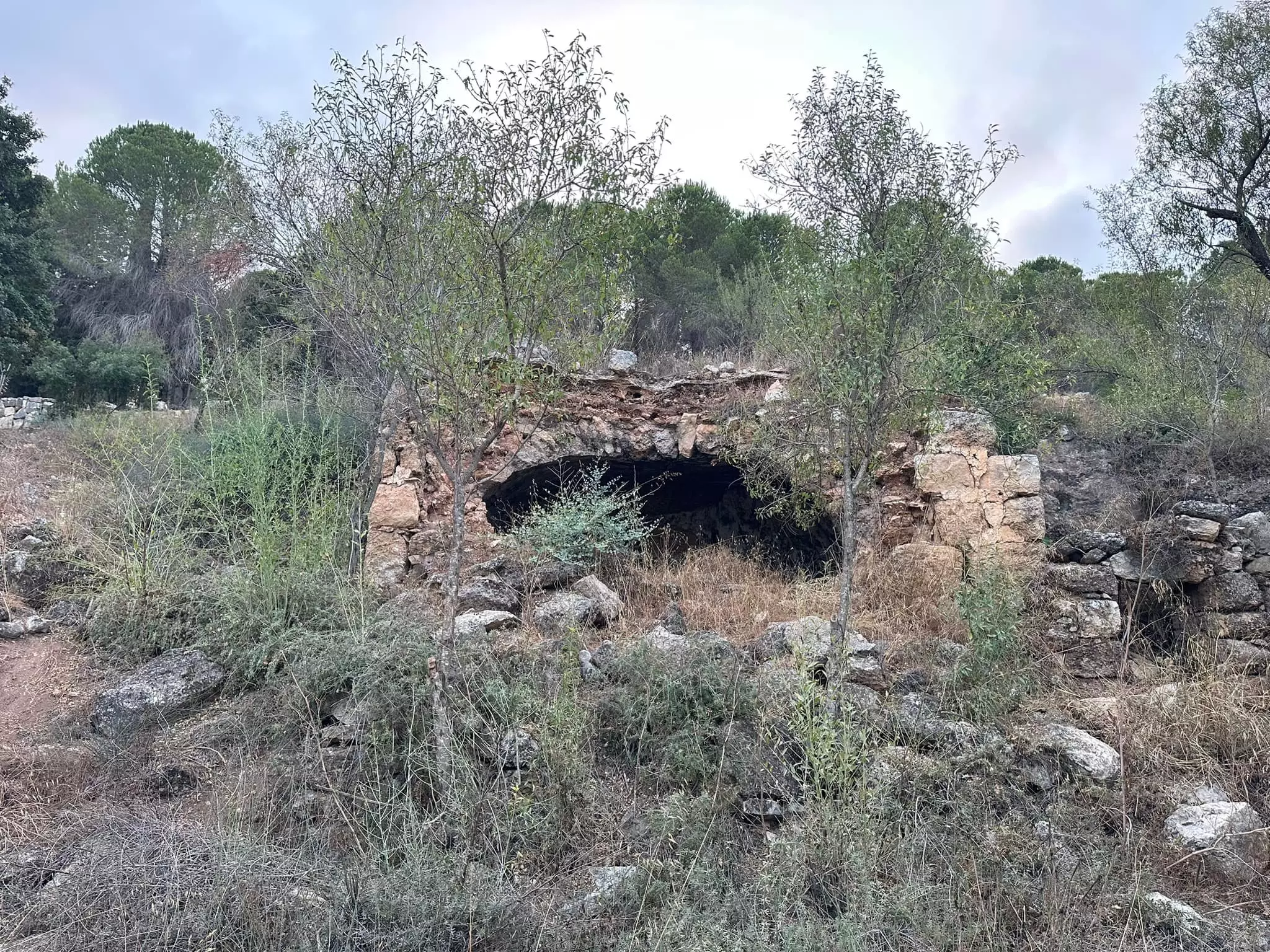
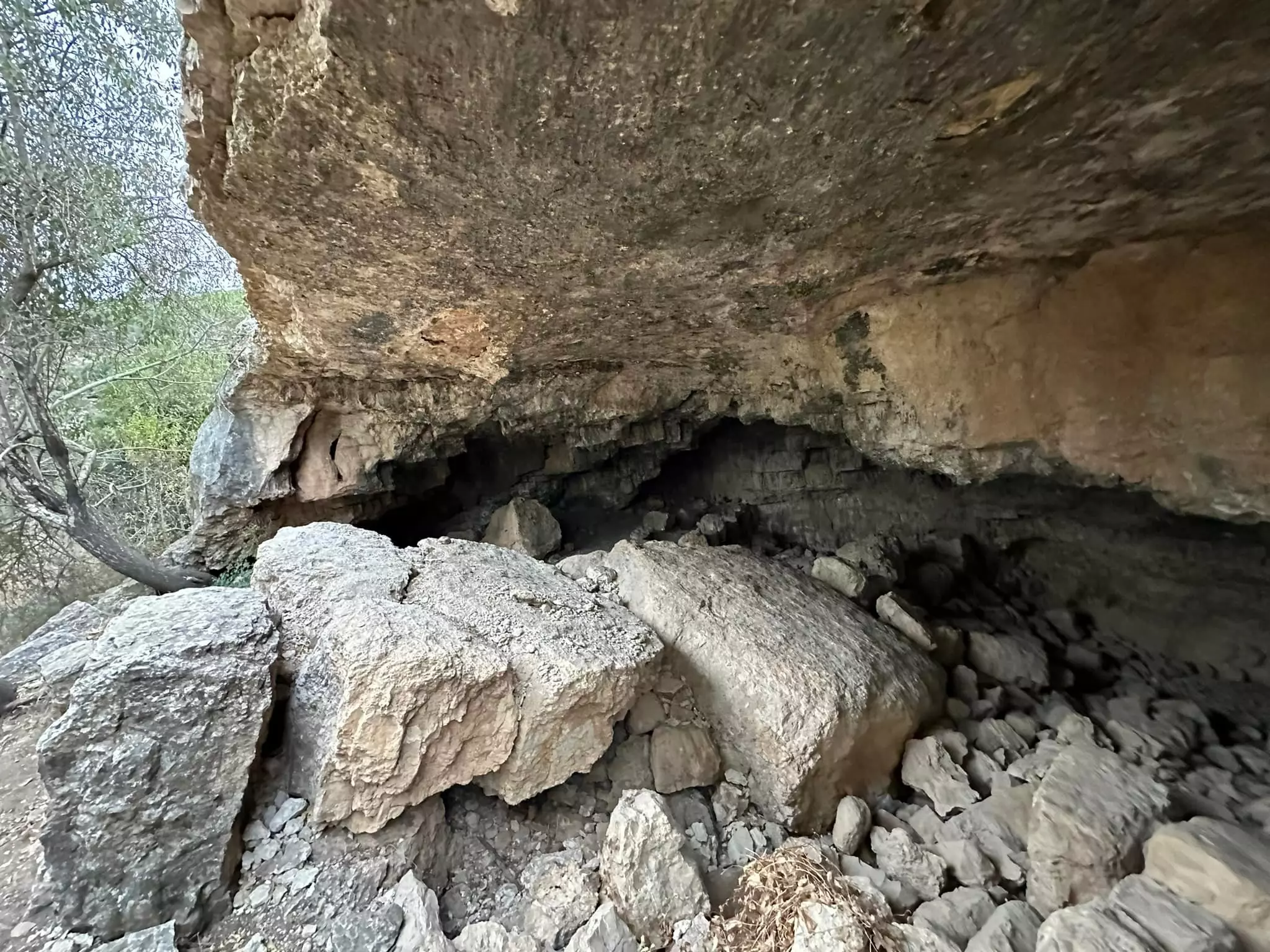
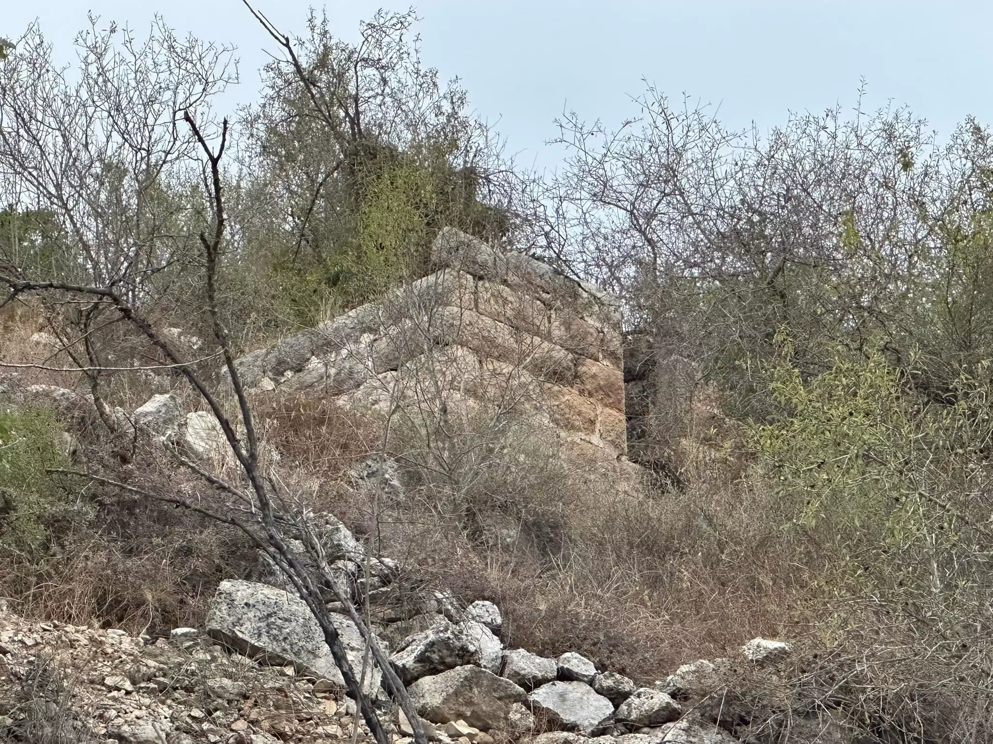
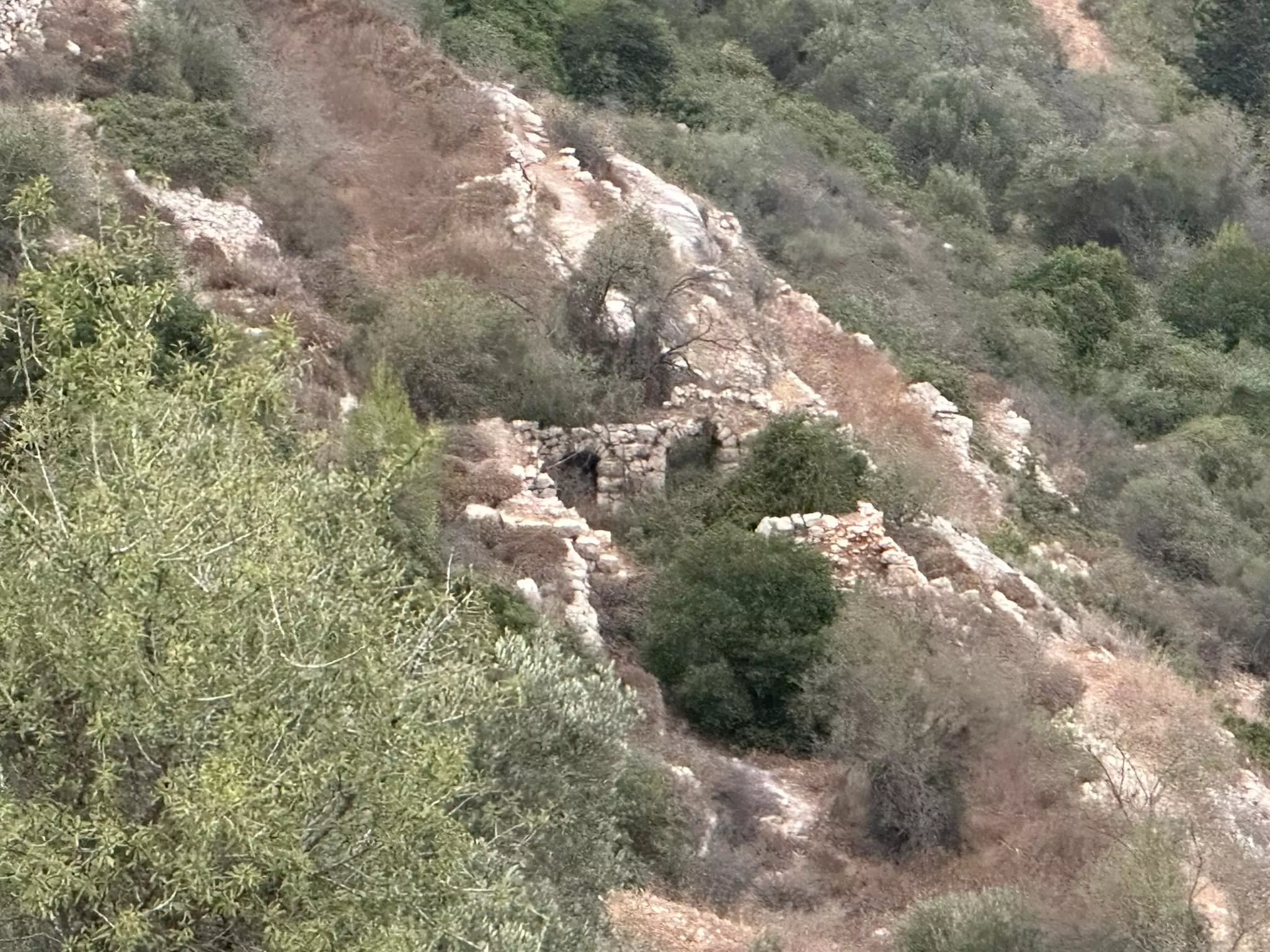
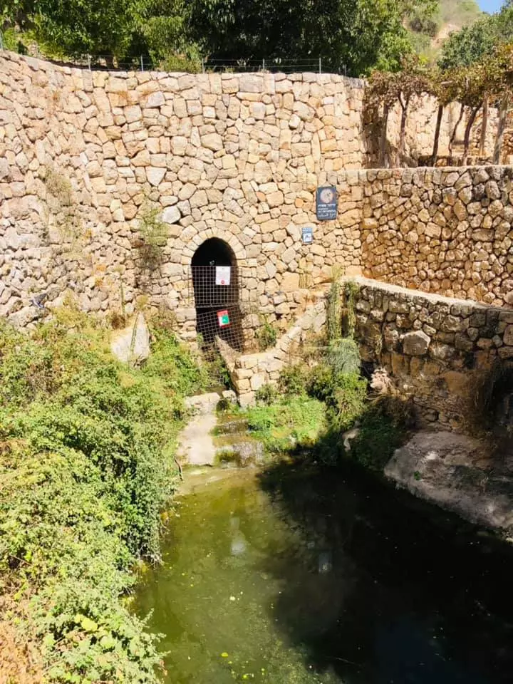
| Village Temains | The village was mostly destroyed with the exception of one house next to the village spring (if it is yours, go back now and claim it). | ||||||||||||
| Ethnically Cleansing | Sataf inhabitants were completely ethnically cleansed. | ||||||||||||
| Pre-Nakba Land Ownership |
**Town Lands' Demarcation Maps |
||||||||||||
| Land Usage As of 1945 |
|
||||||||||||
| Population |
|
||||||||||||
| Number of Houses |
|
||||||||||||
| Near By Towns |
|||||||||||||
|
|
|||||||||||||
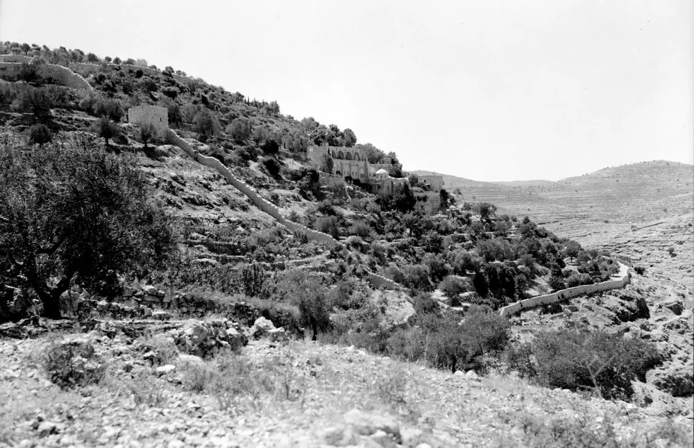
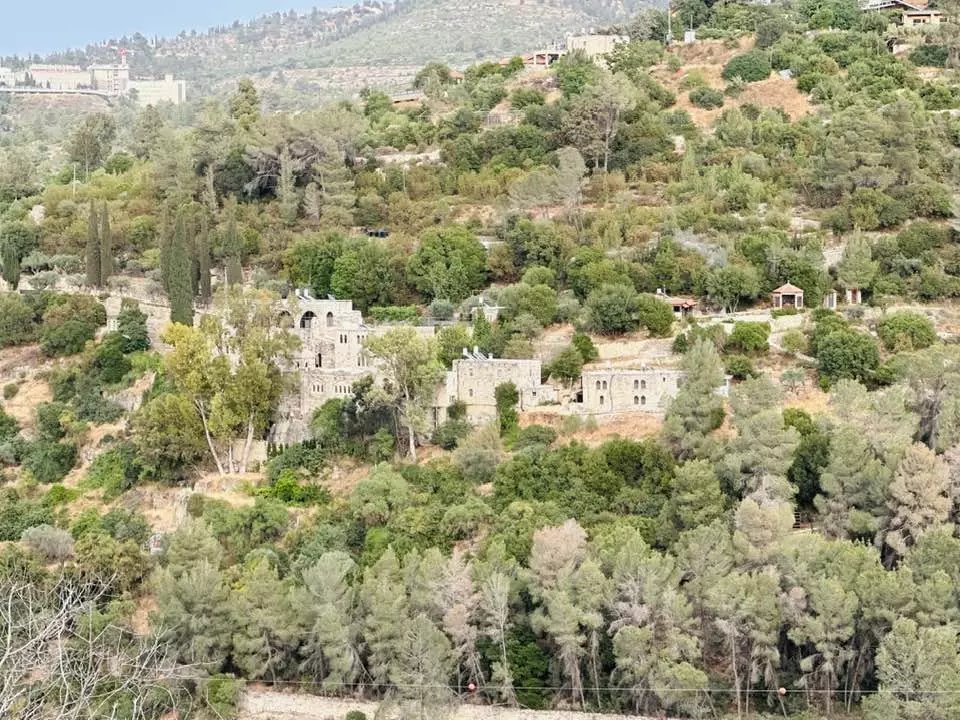
| Places of Warship | A monastery located south of Wadi al-Sarar called Habis Monastery. | ||||||||||||
| Nearby Wadies & Rivers | Sataf overlooked Wadi al-Sarar which is less than 1 kilometer to the east. | ||||||||||||
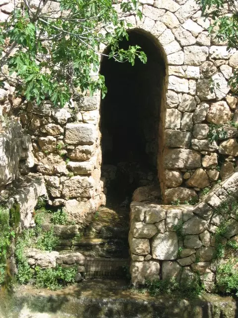
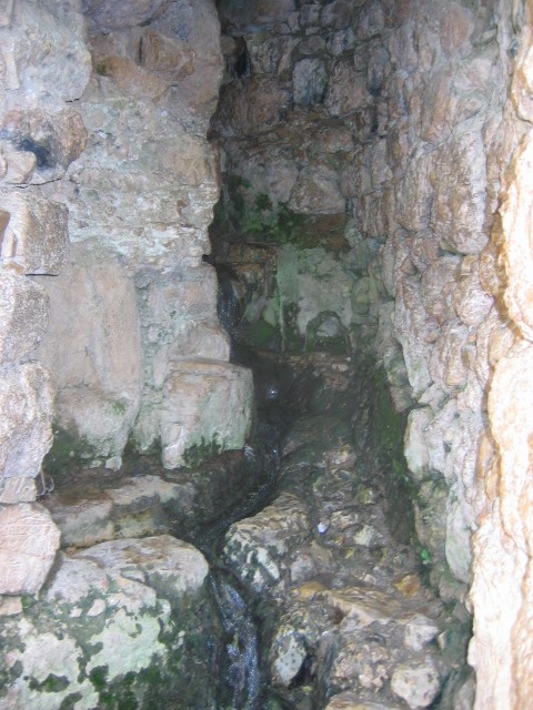
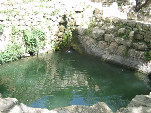
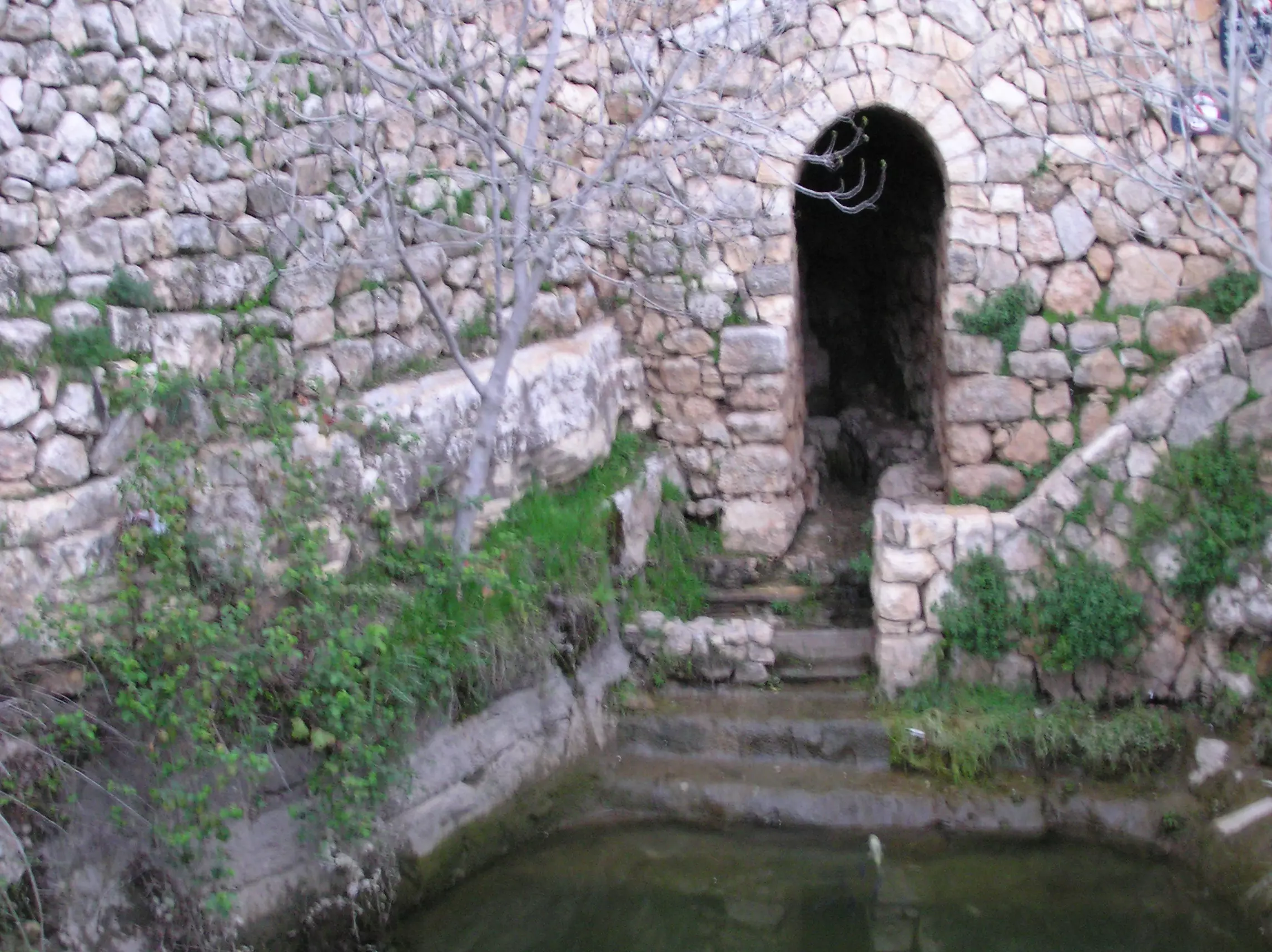
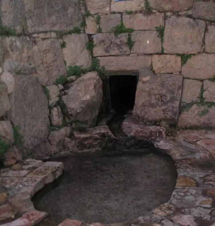
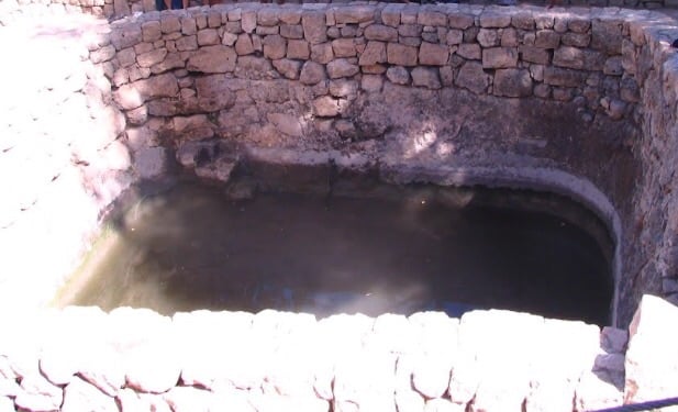
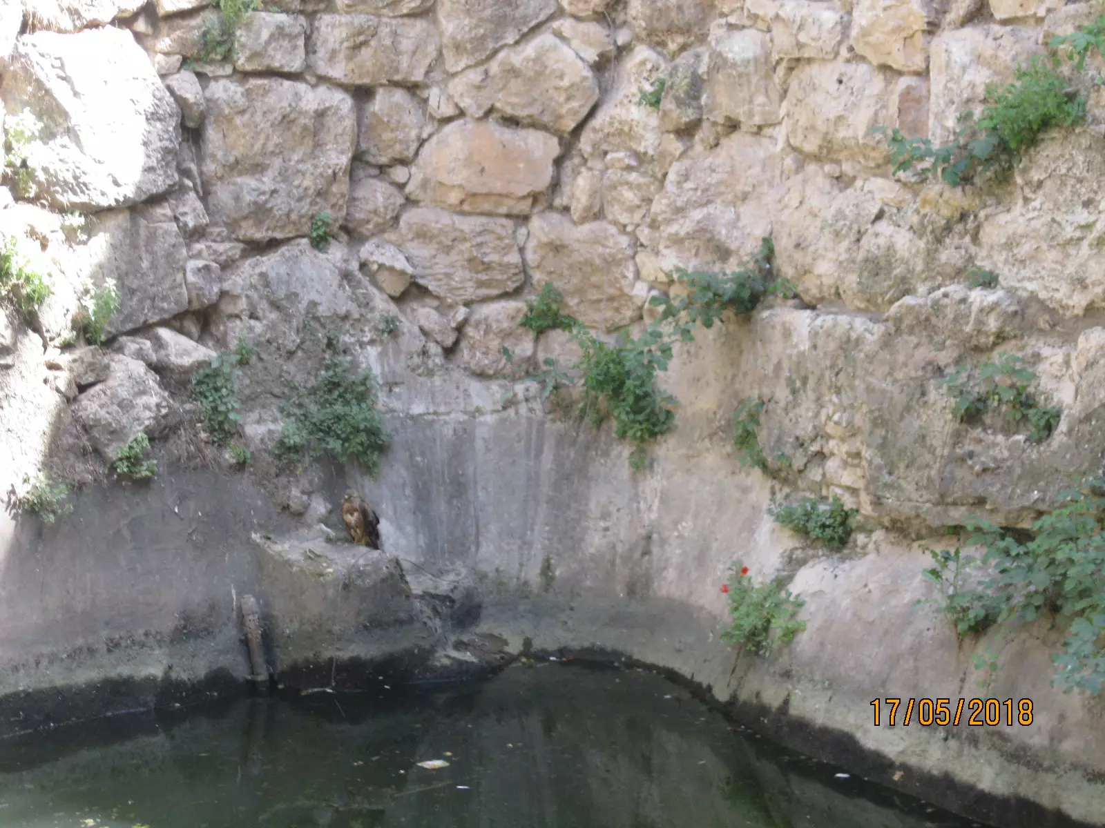
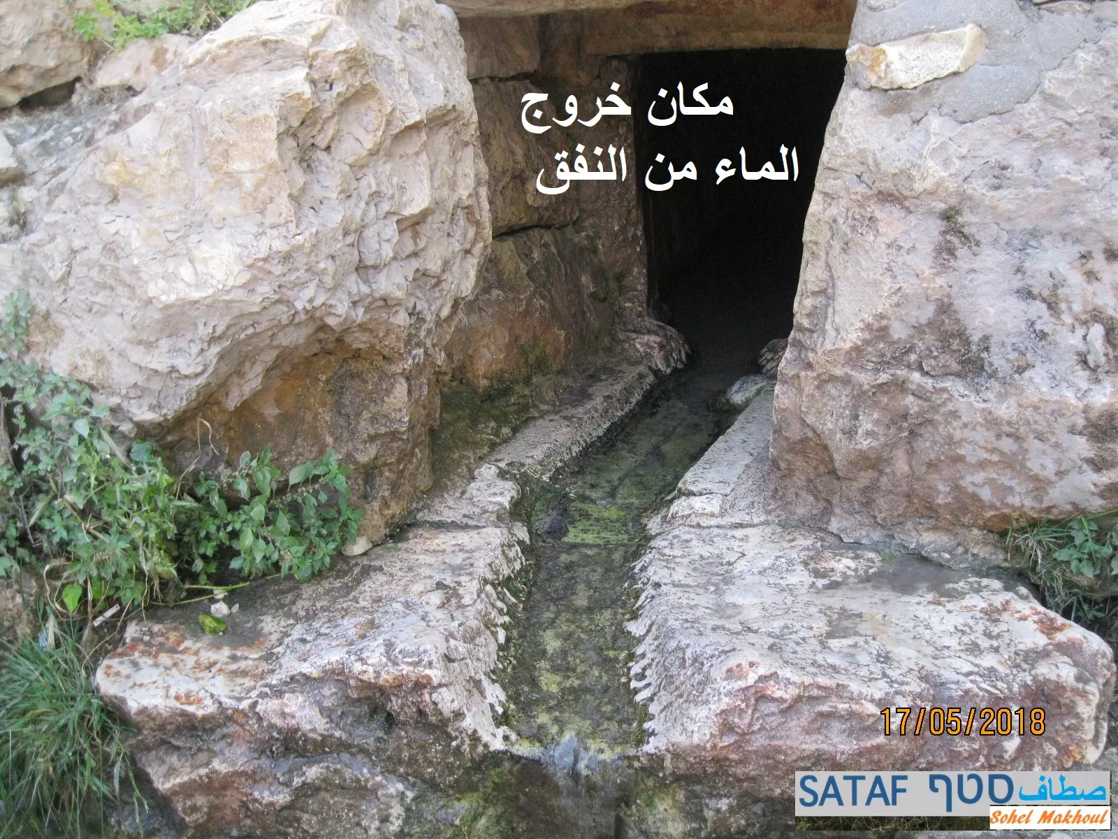
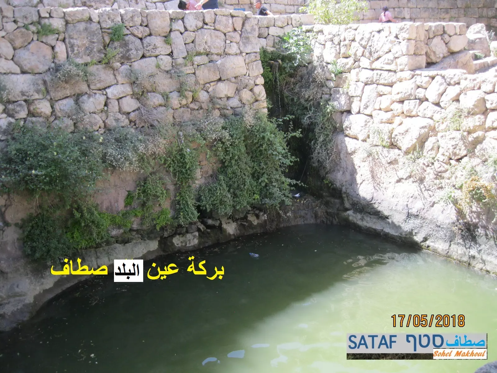
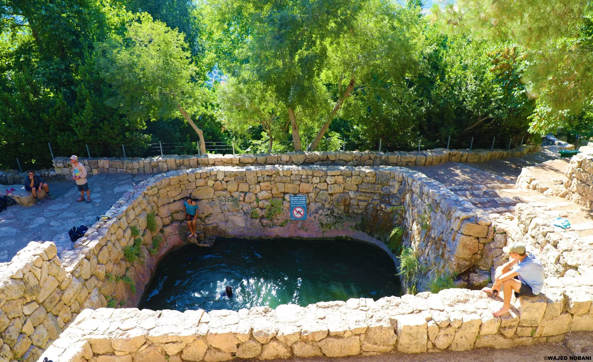
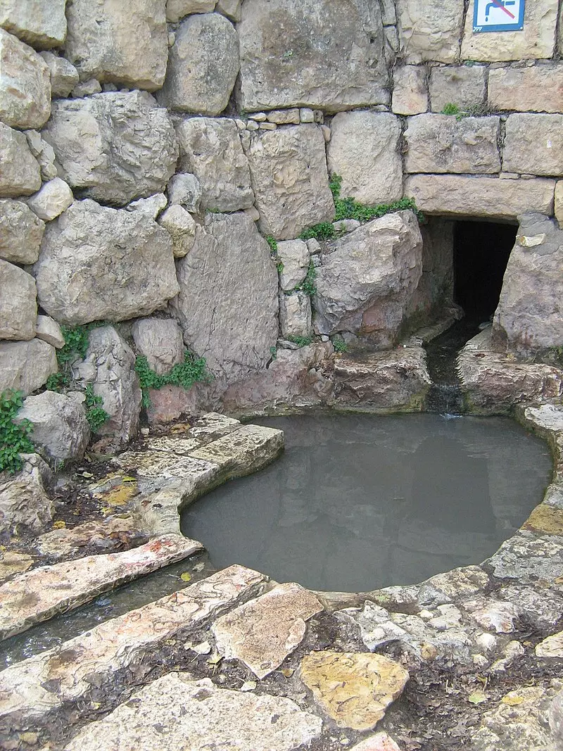
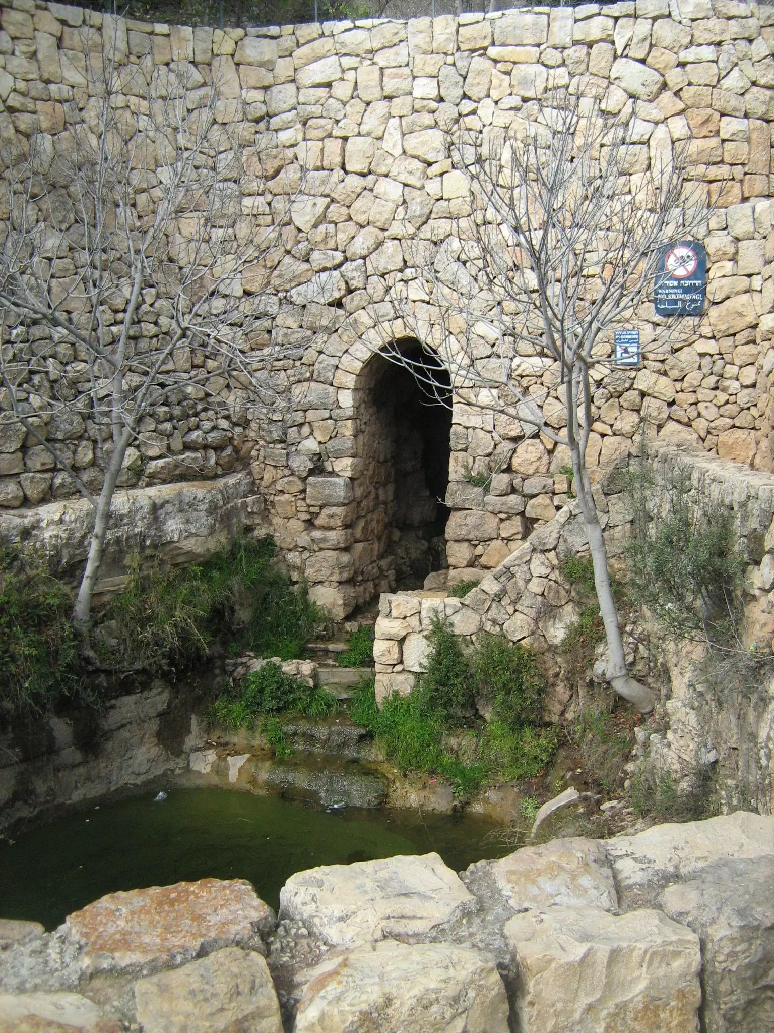
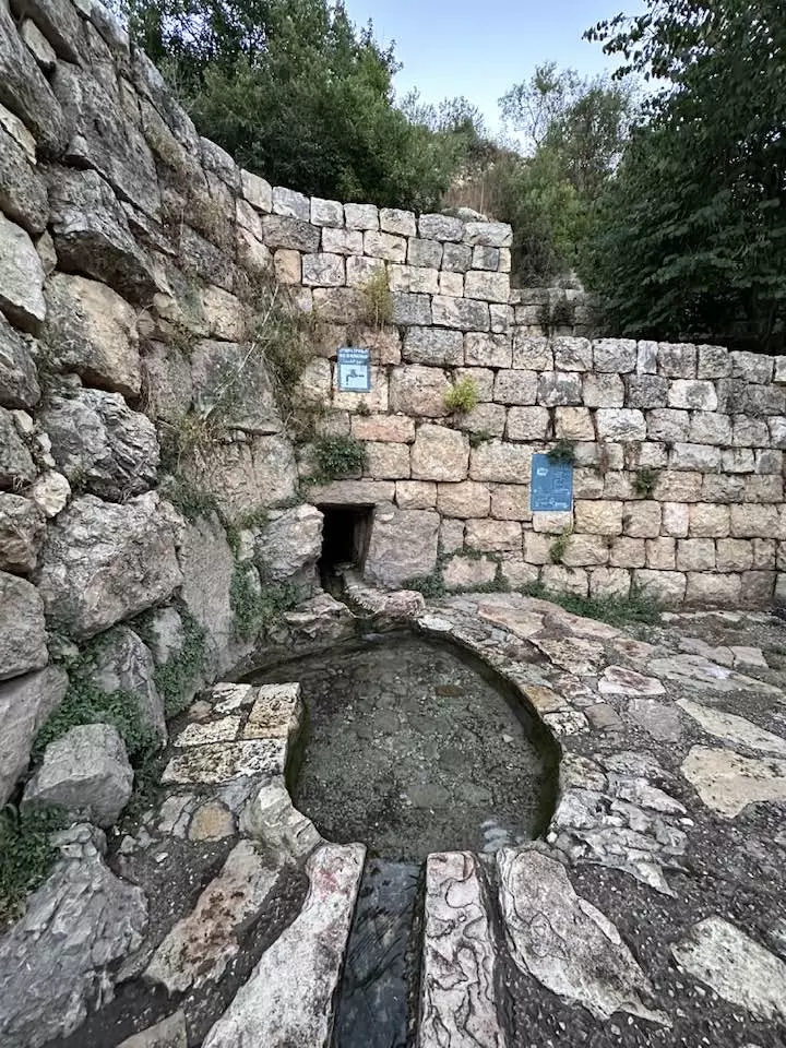
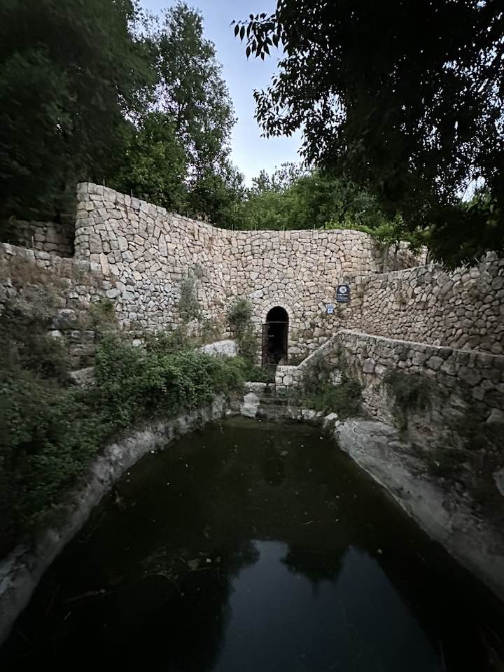
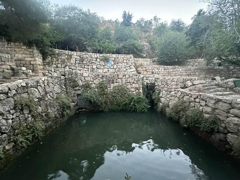
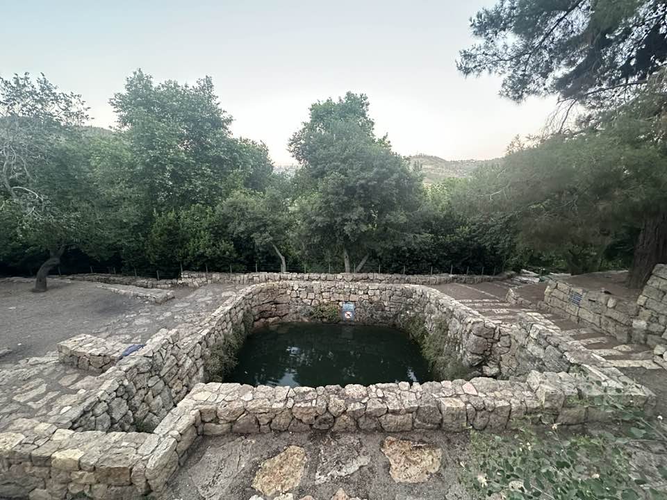
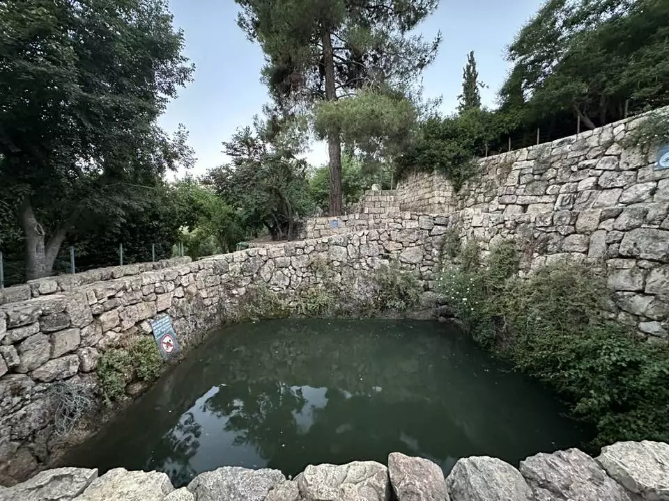
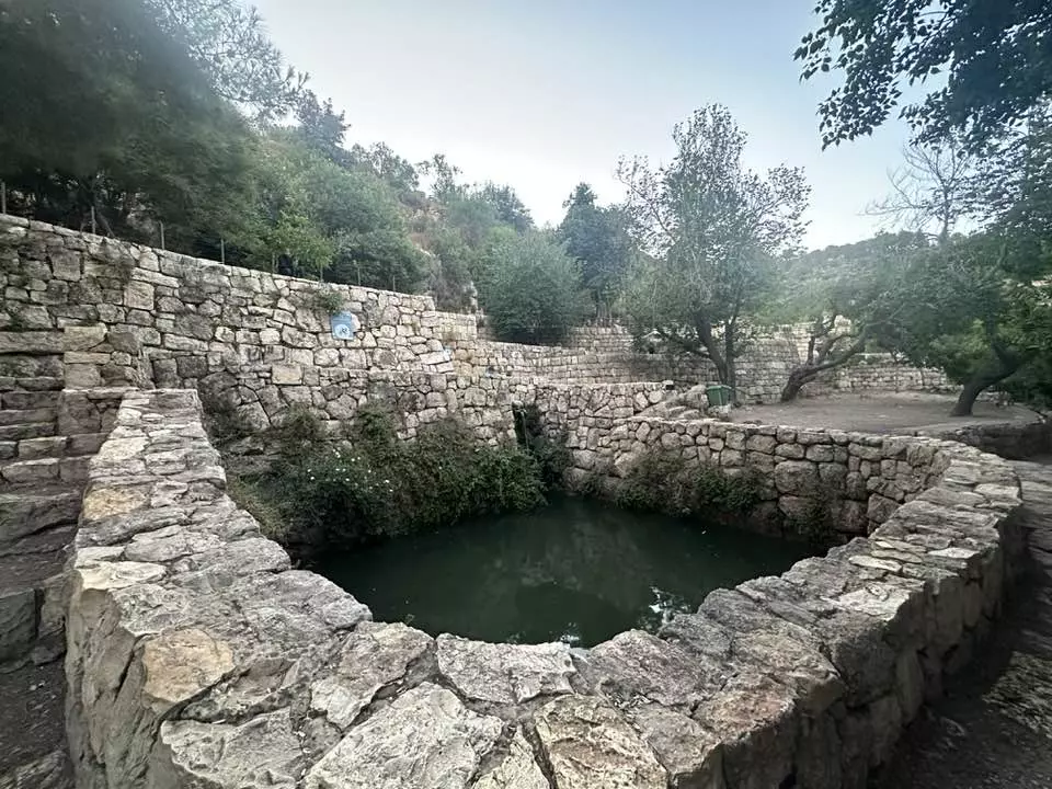
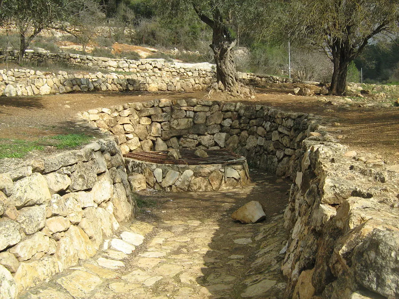
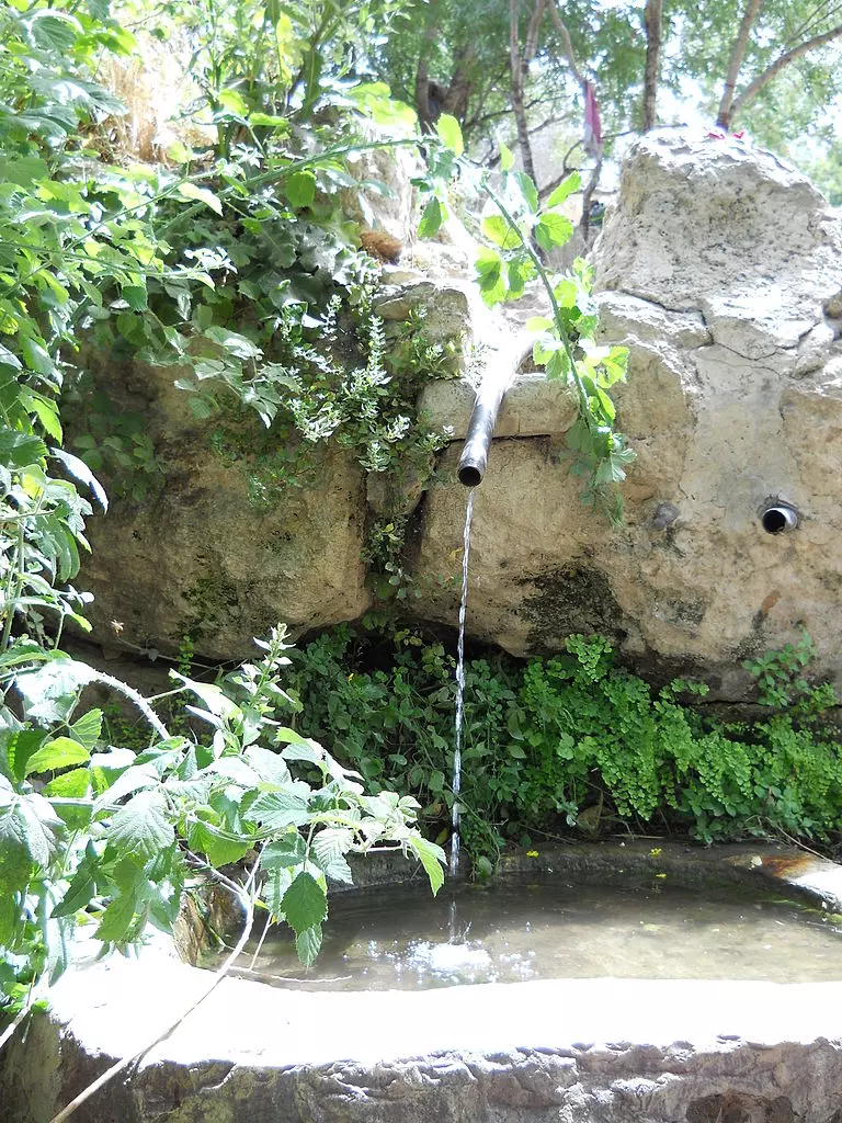
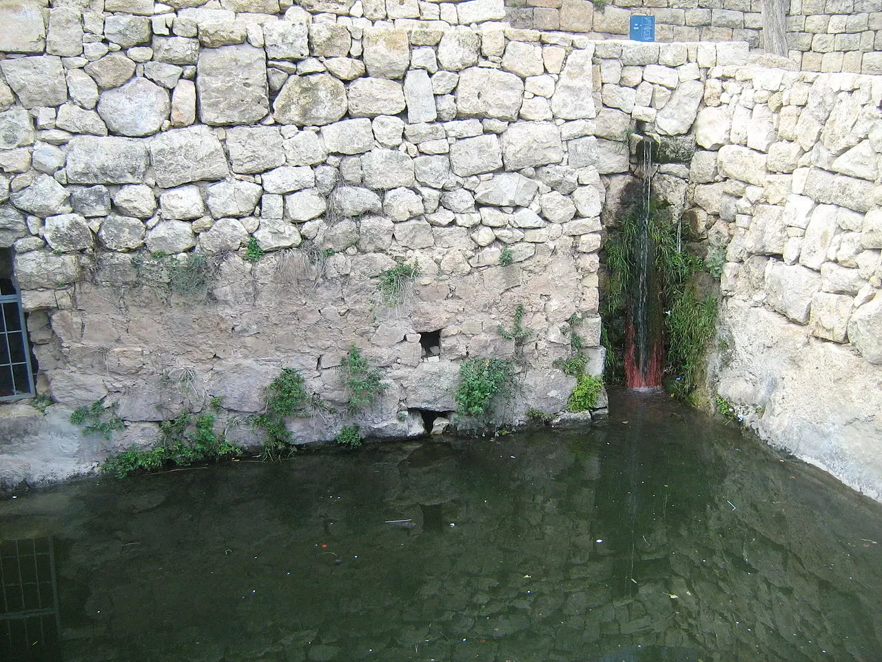
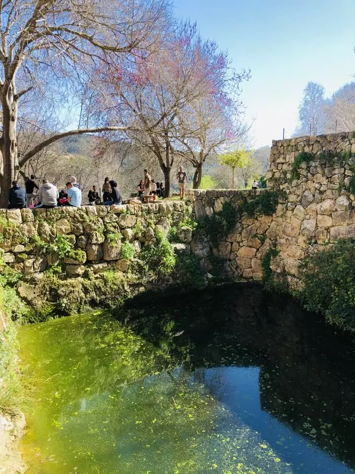
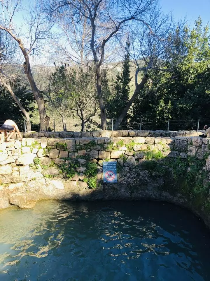
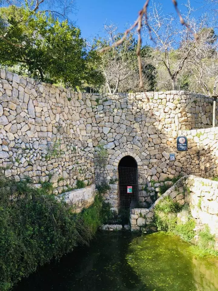
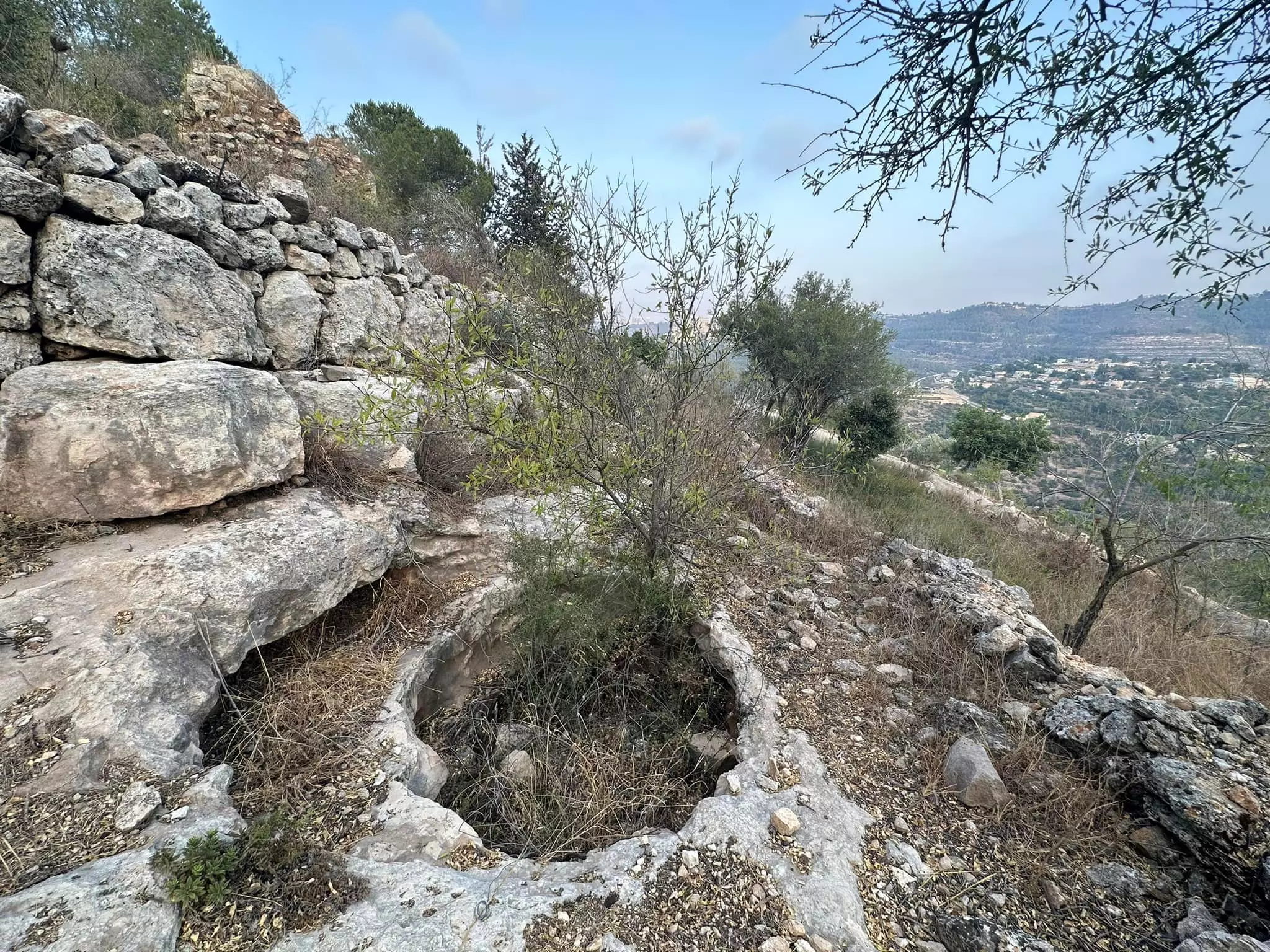
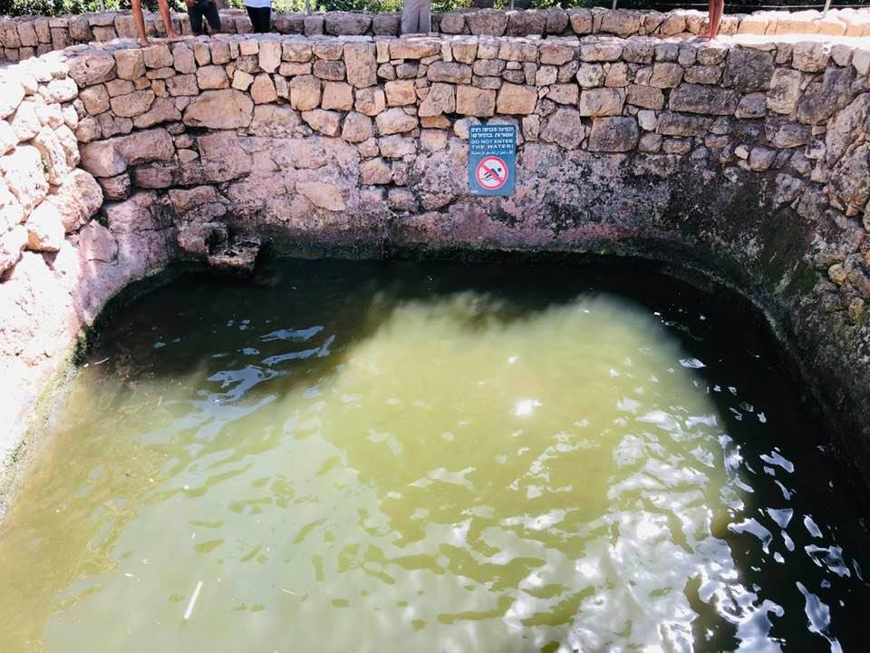
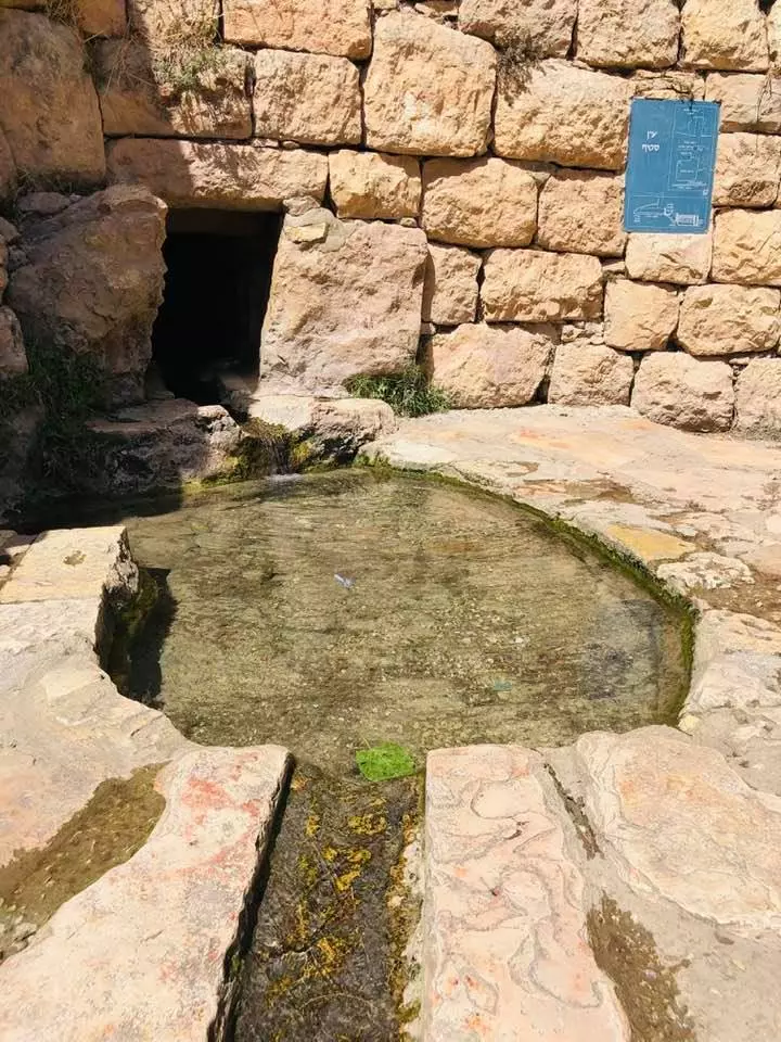
| Water Supply | The village contained two unknown springs | ||||||||||||
| Exculsive Jewish Colonies Who Usurped Village Lands |
No settlements on village lands | ||||||||||||
| Featured Video | |||||||||||||
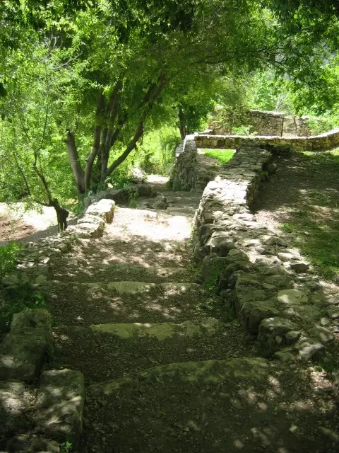
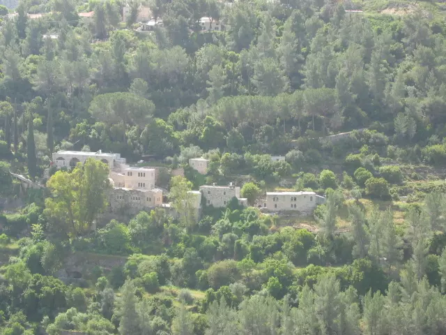
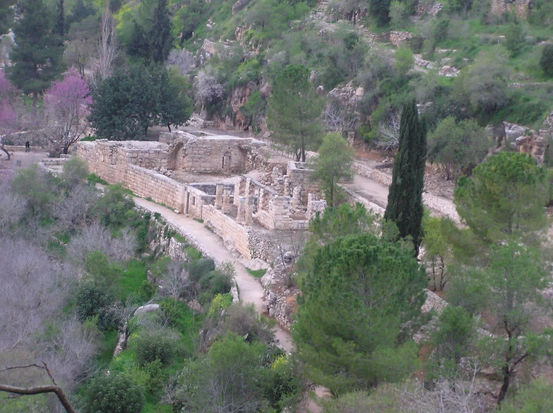
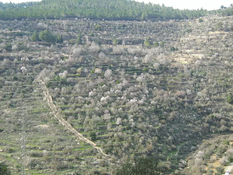
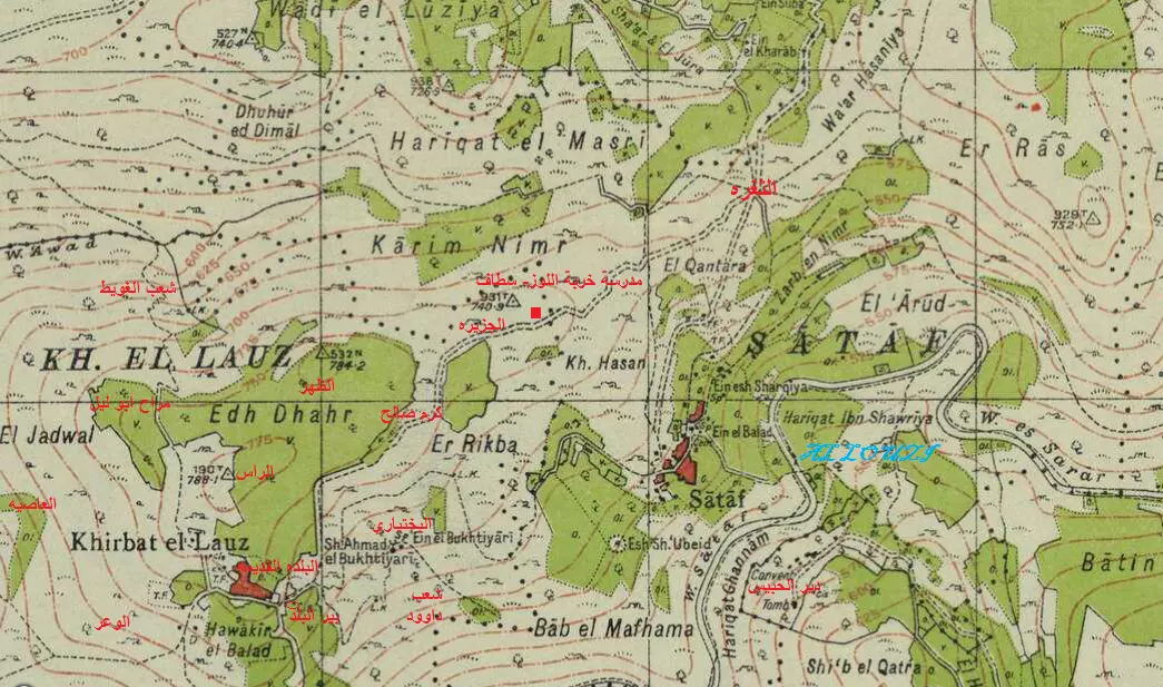
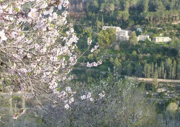
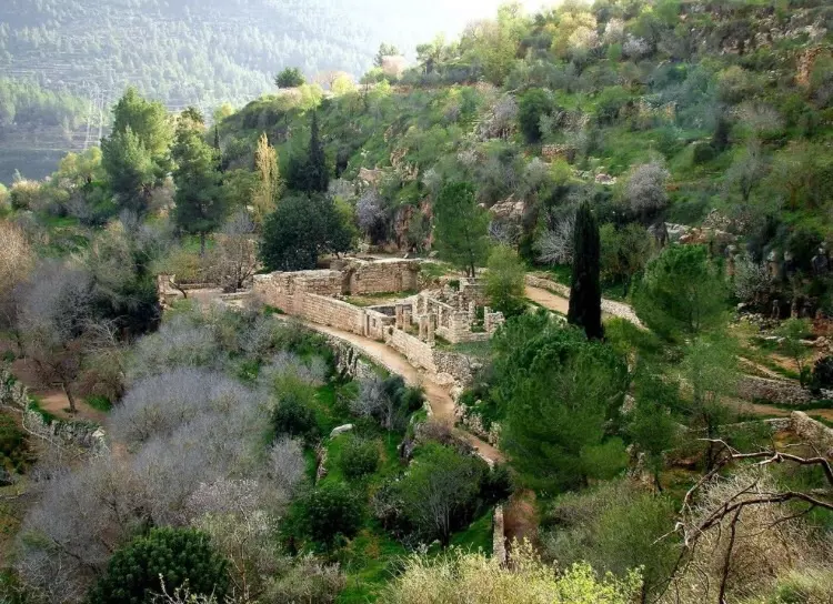
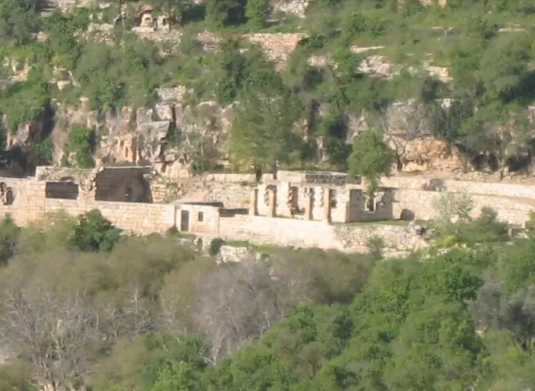
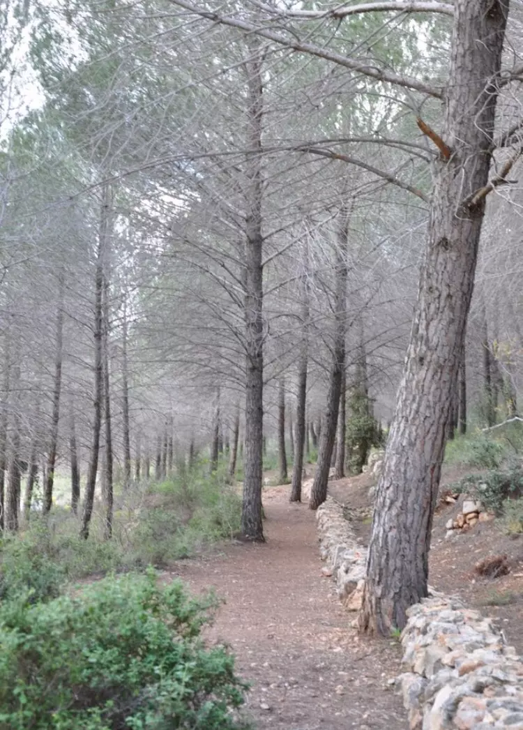
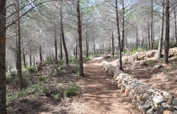
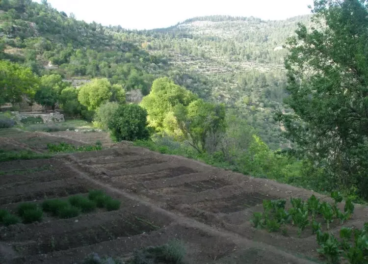
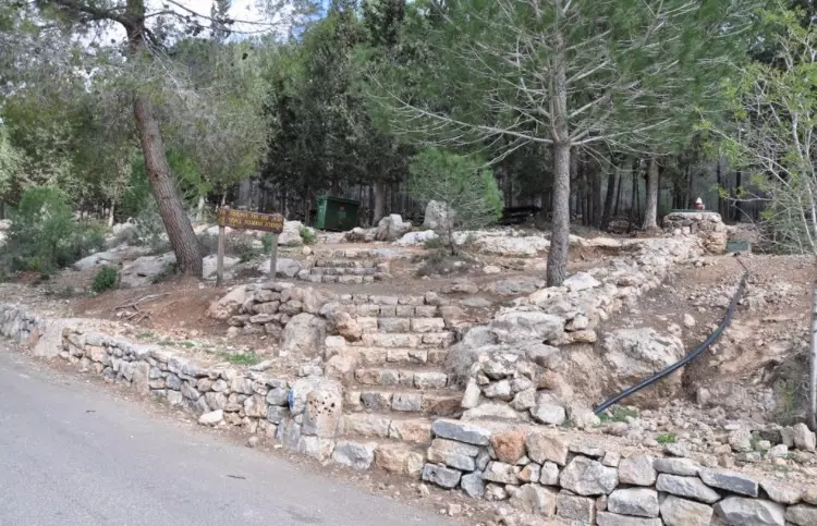
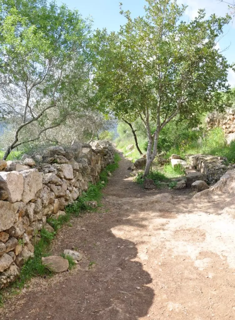
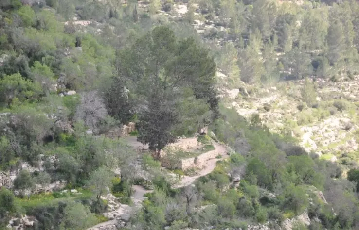
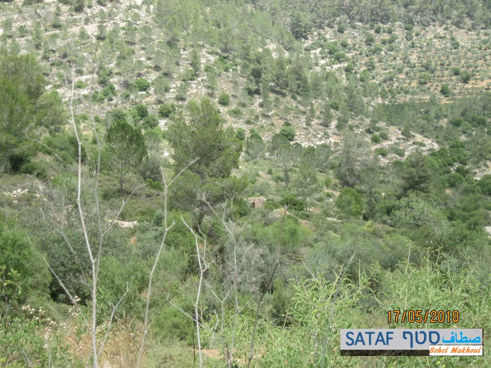
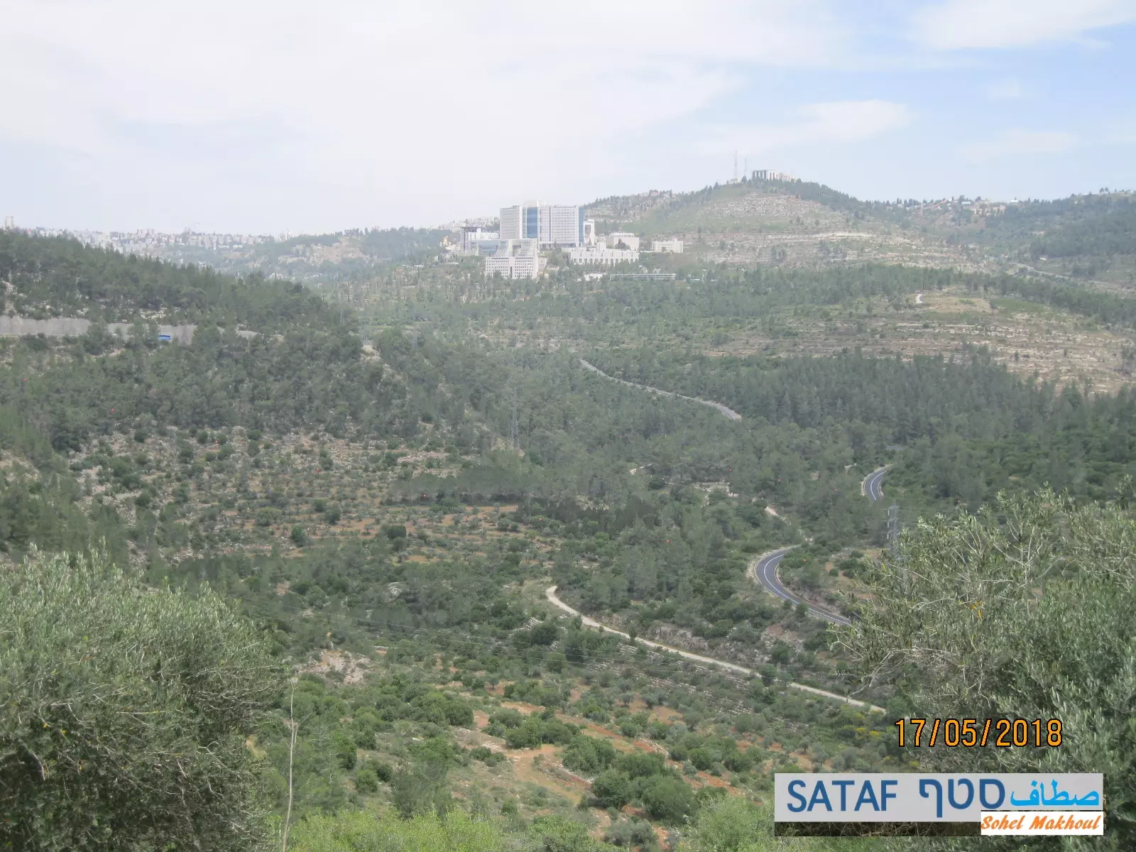
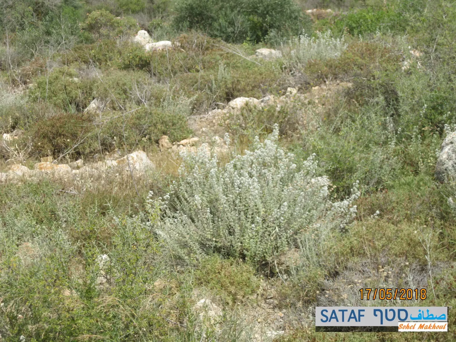
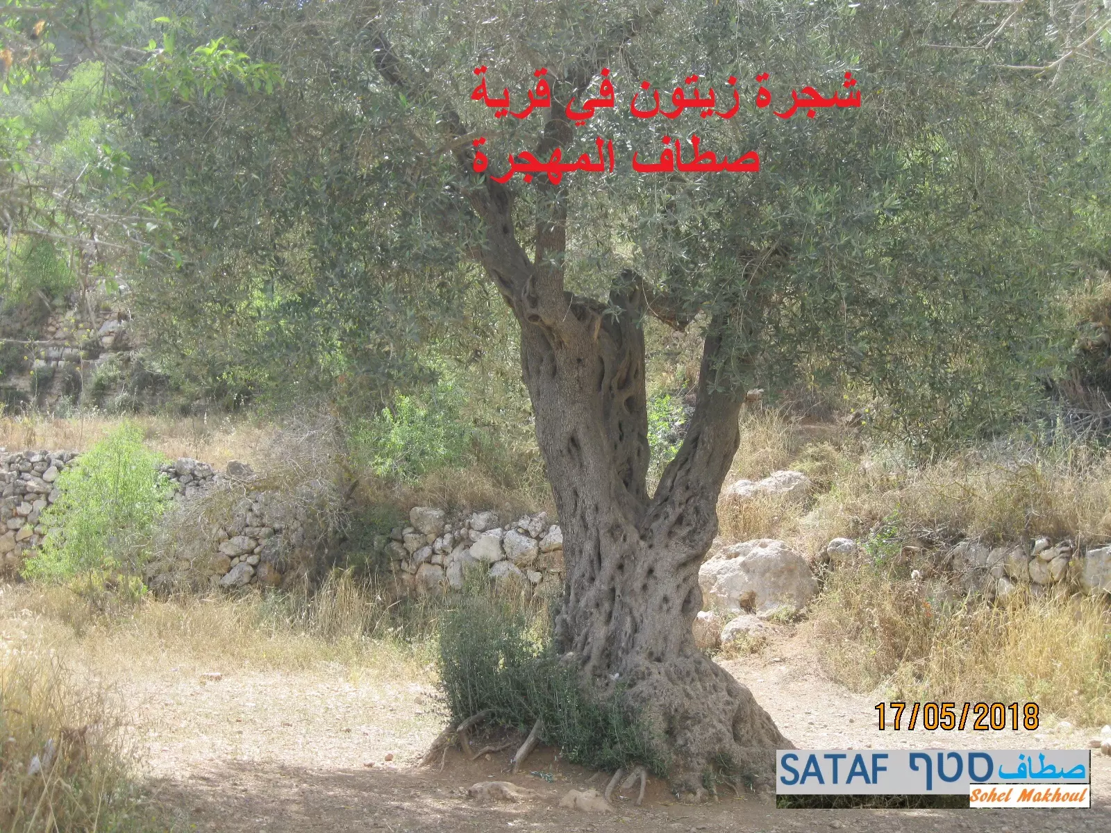
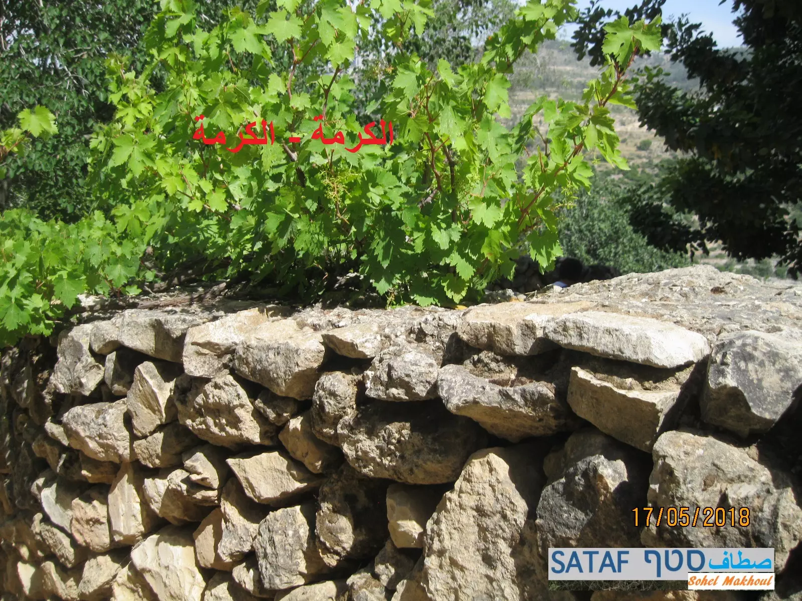
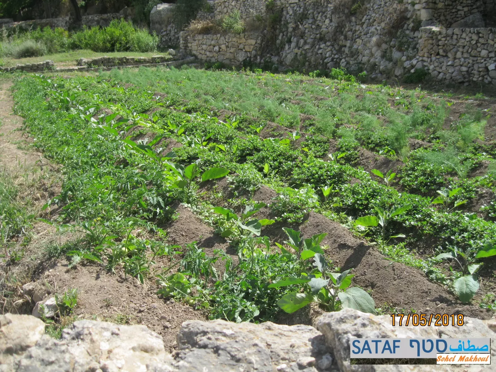
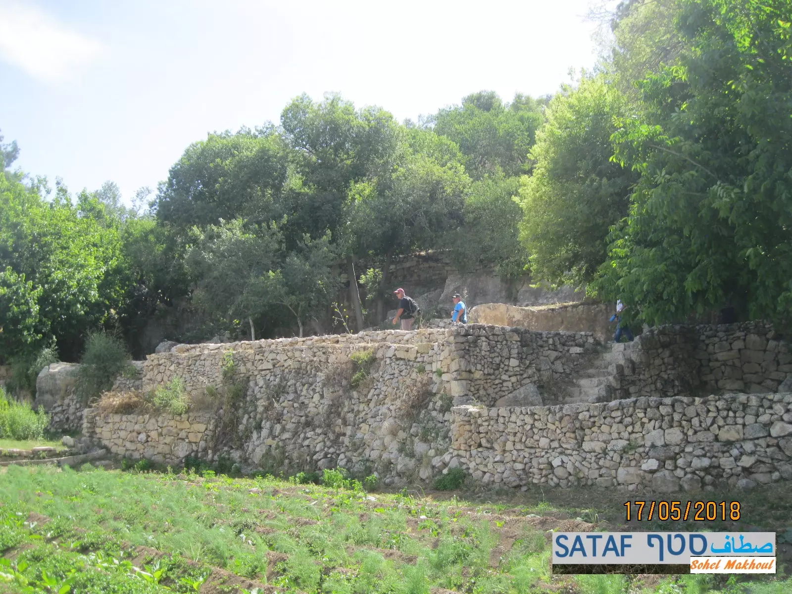
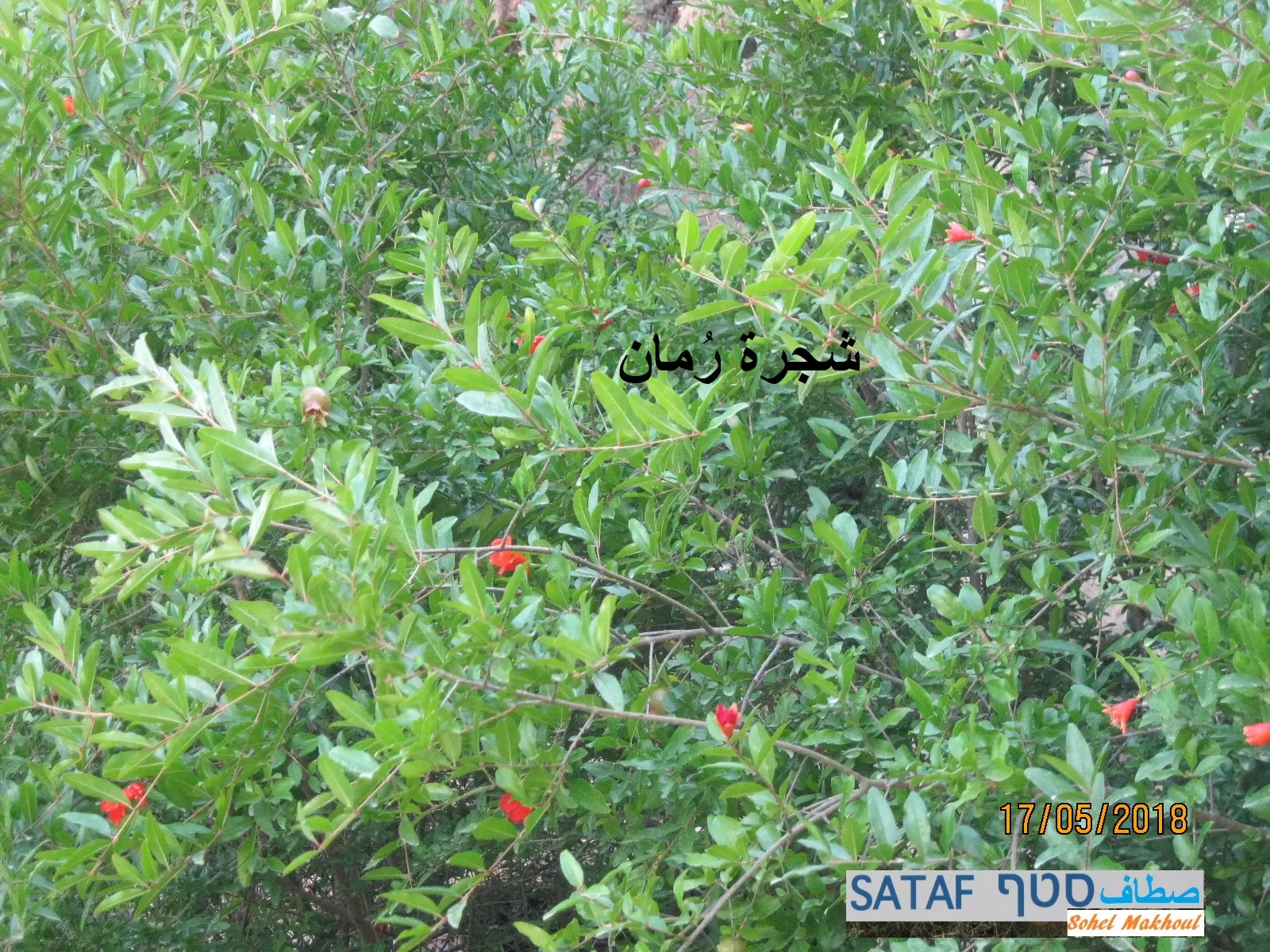
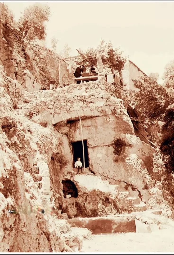
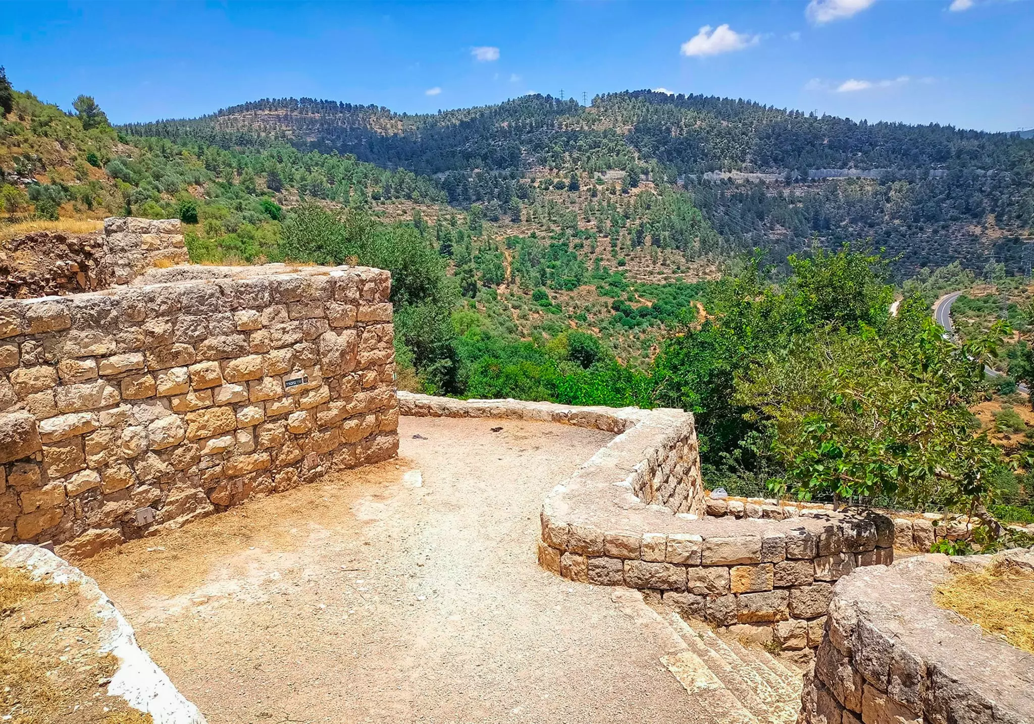
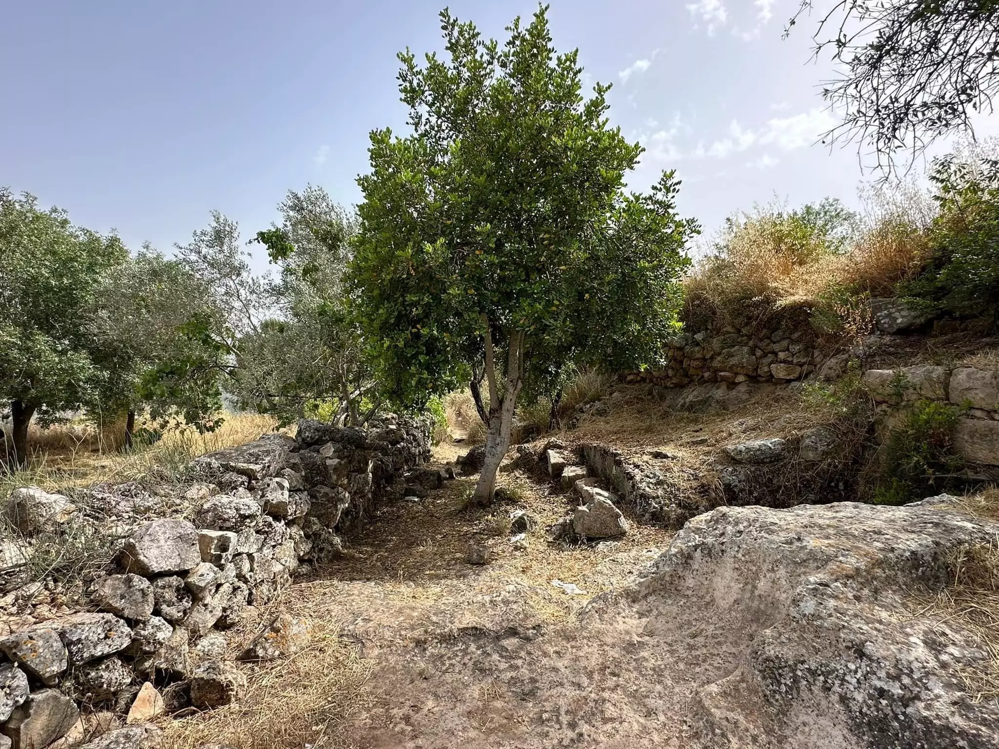
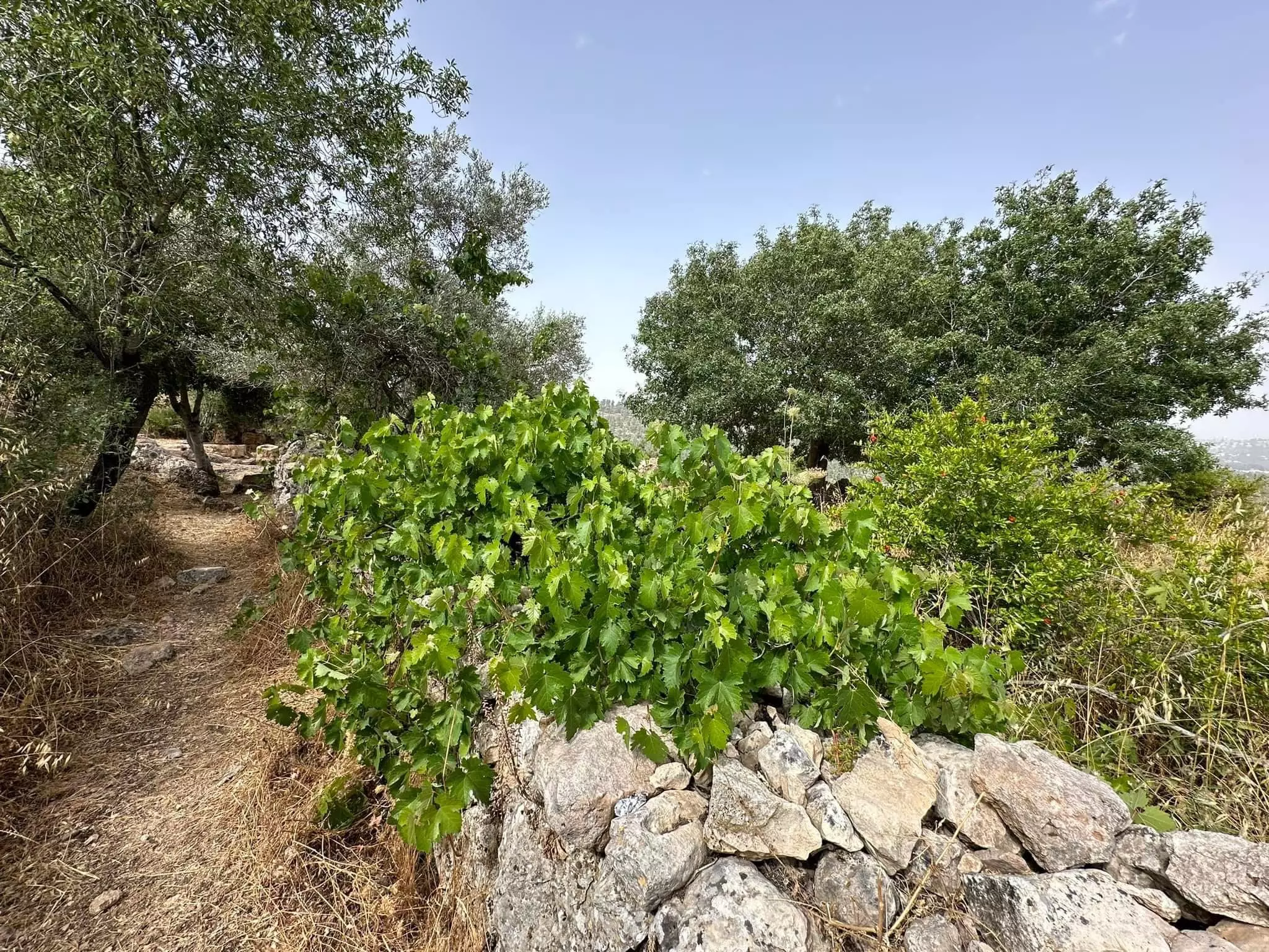
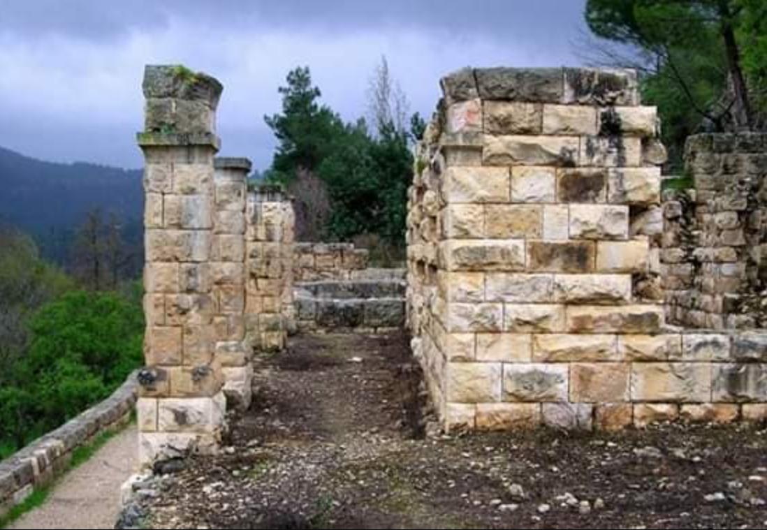
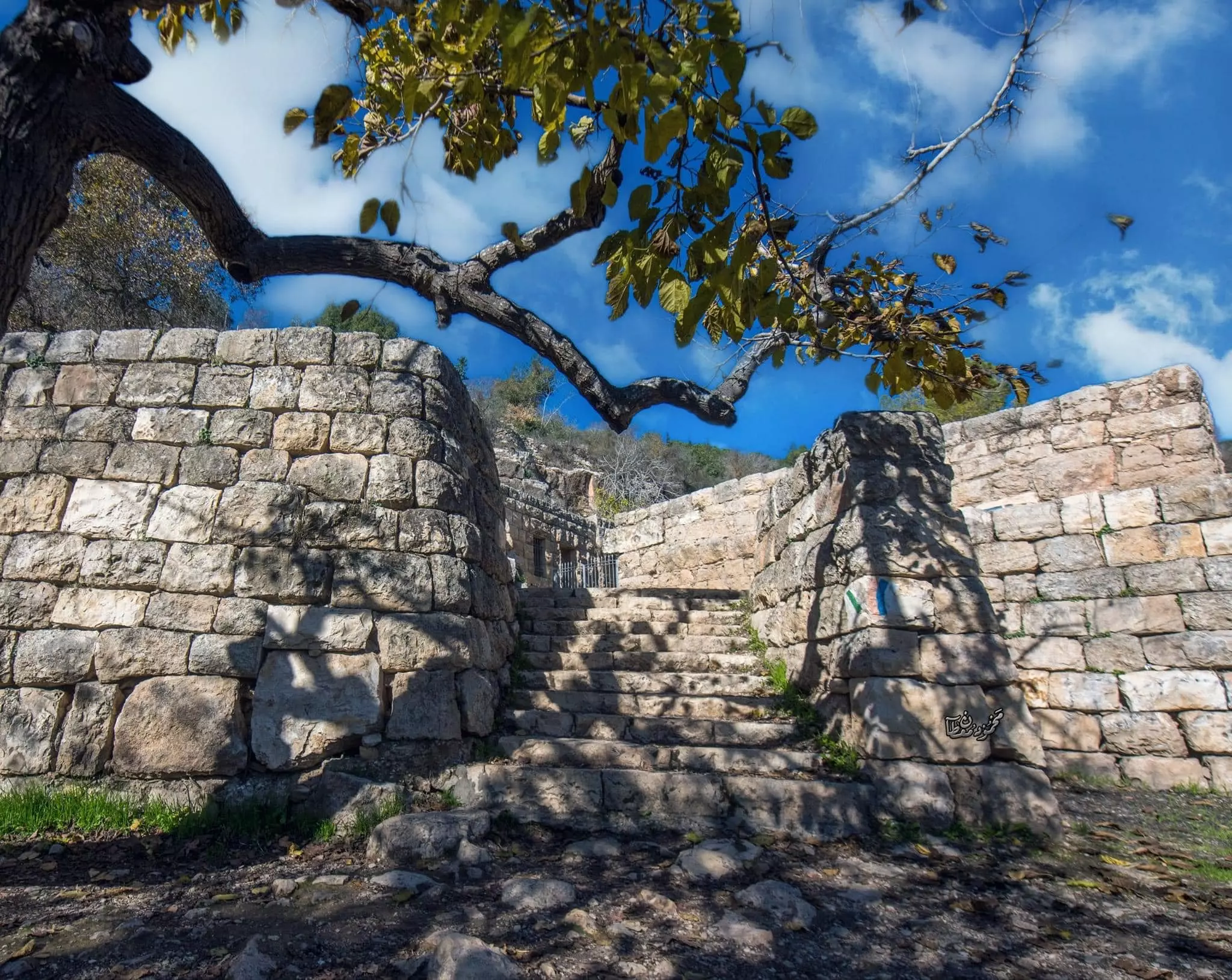
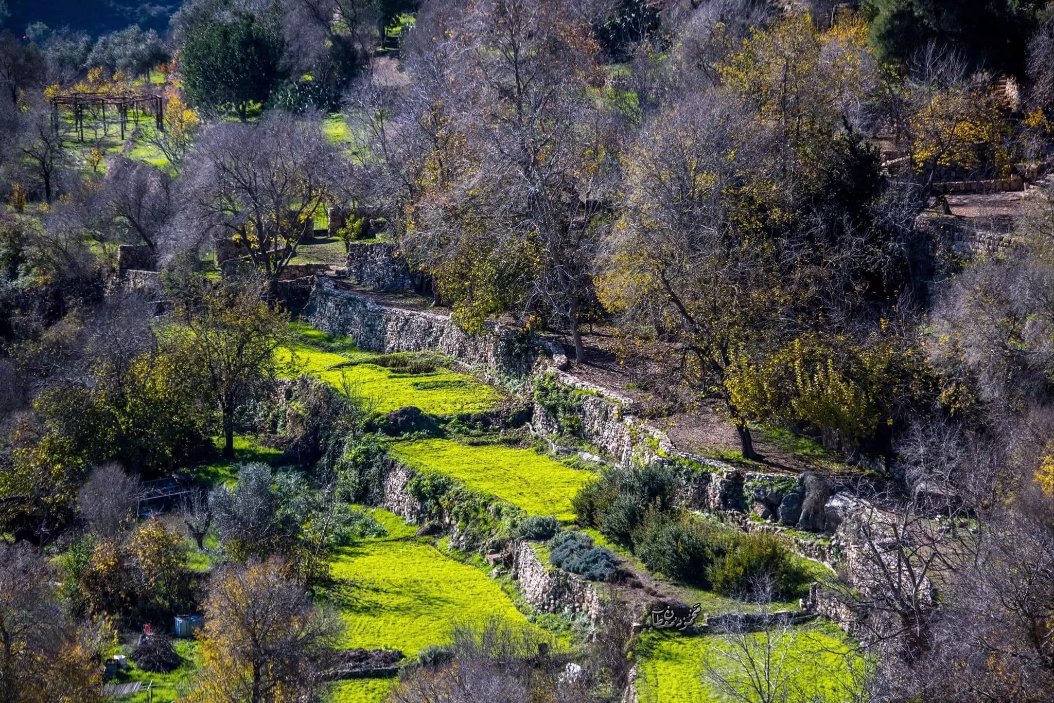
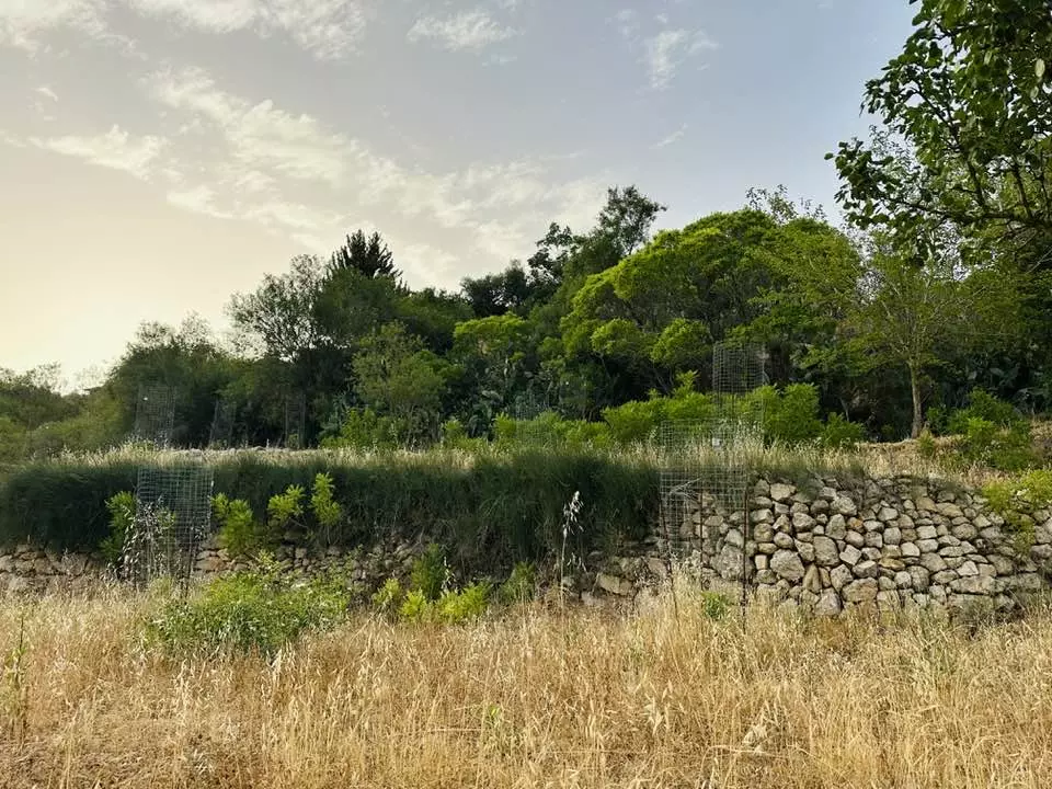
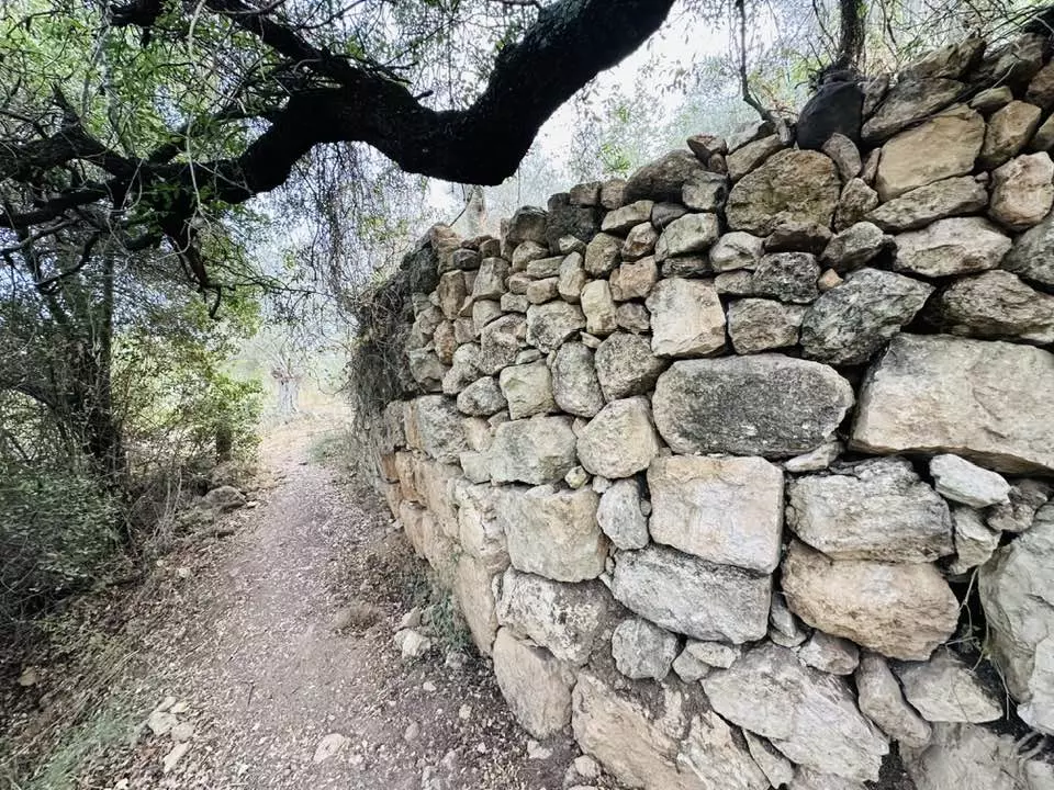
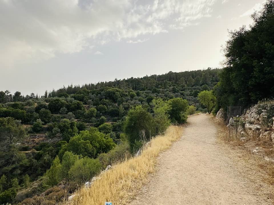
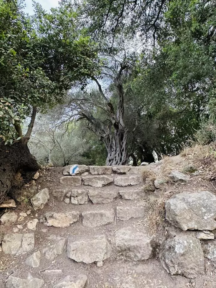
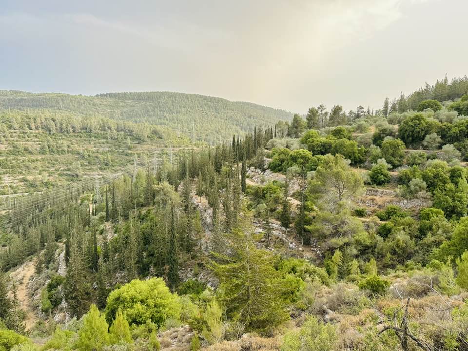
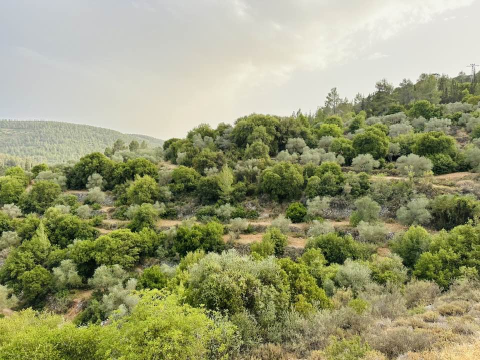
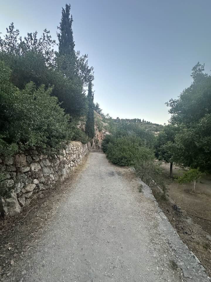
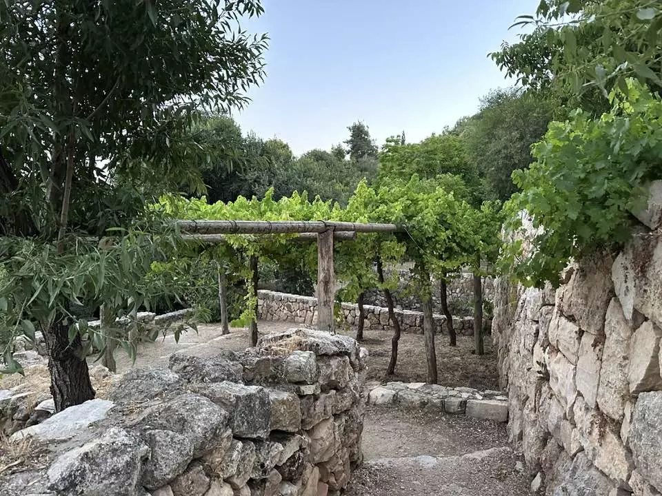
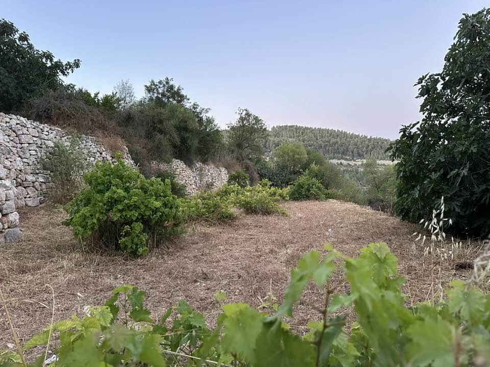
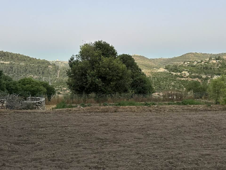
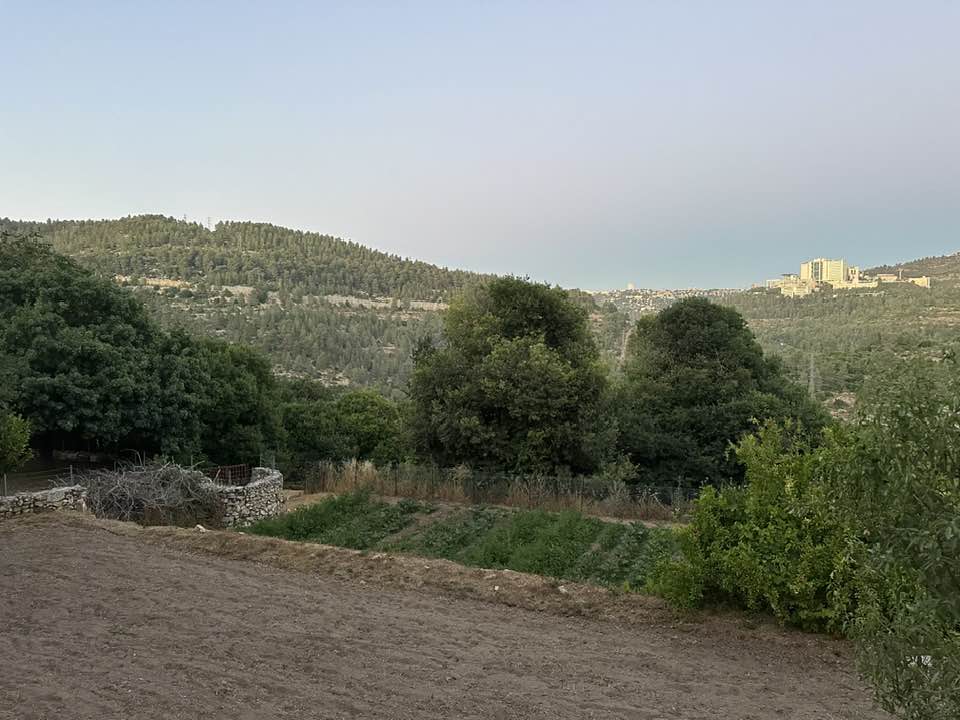
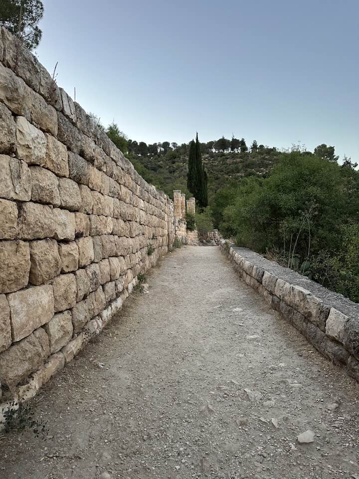
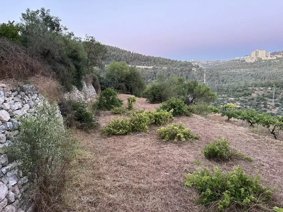
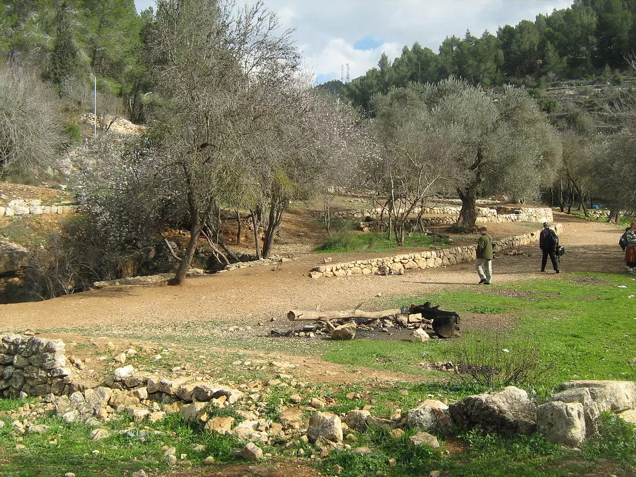
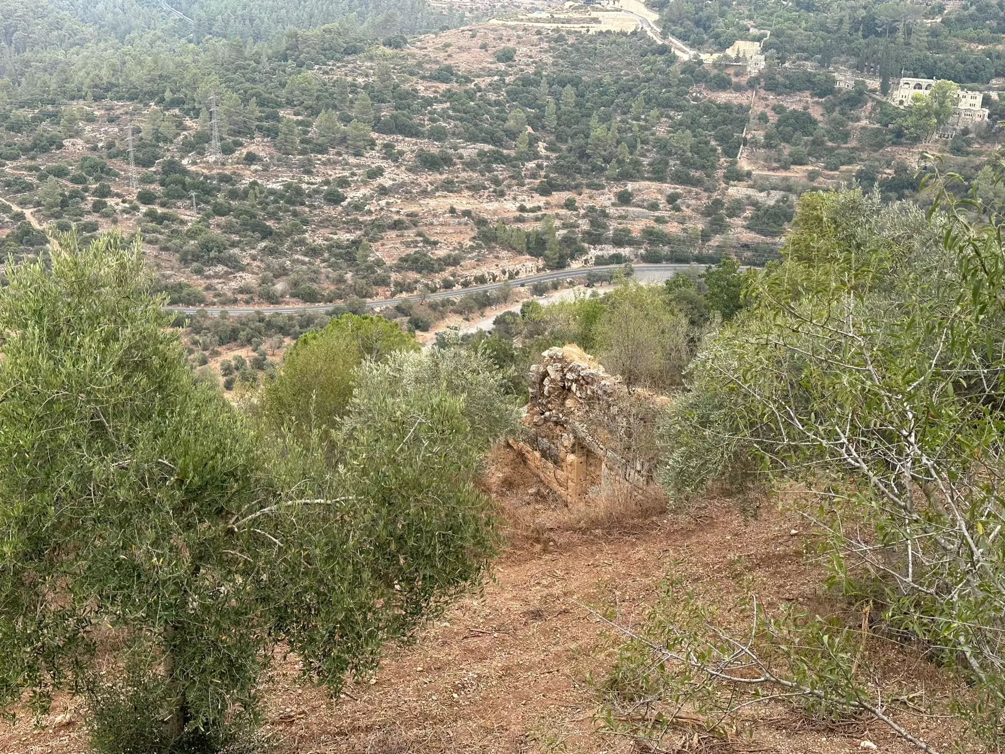
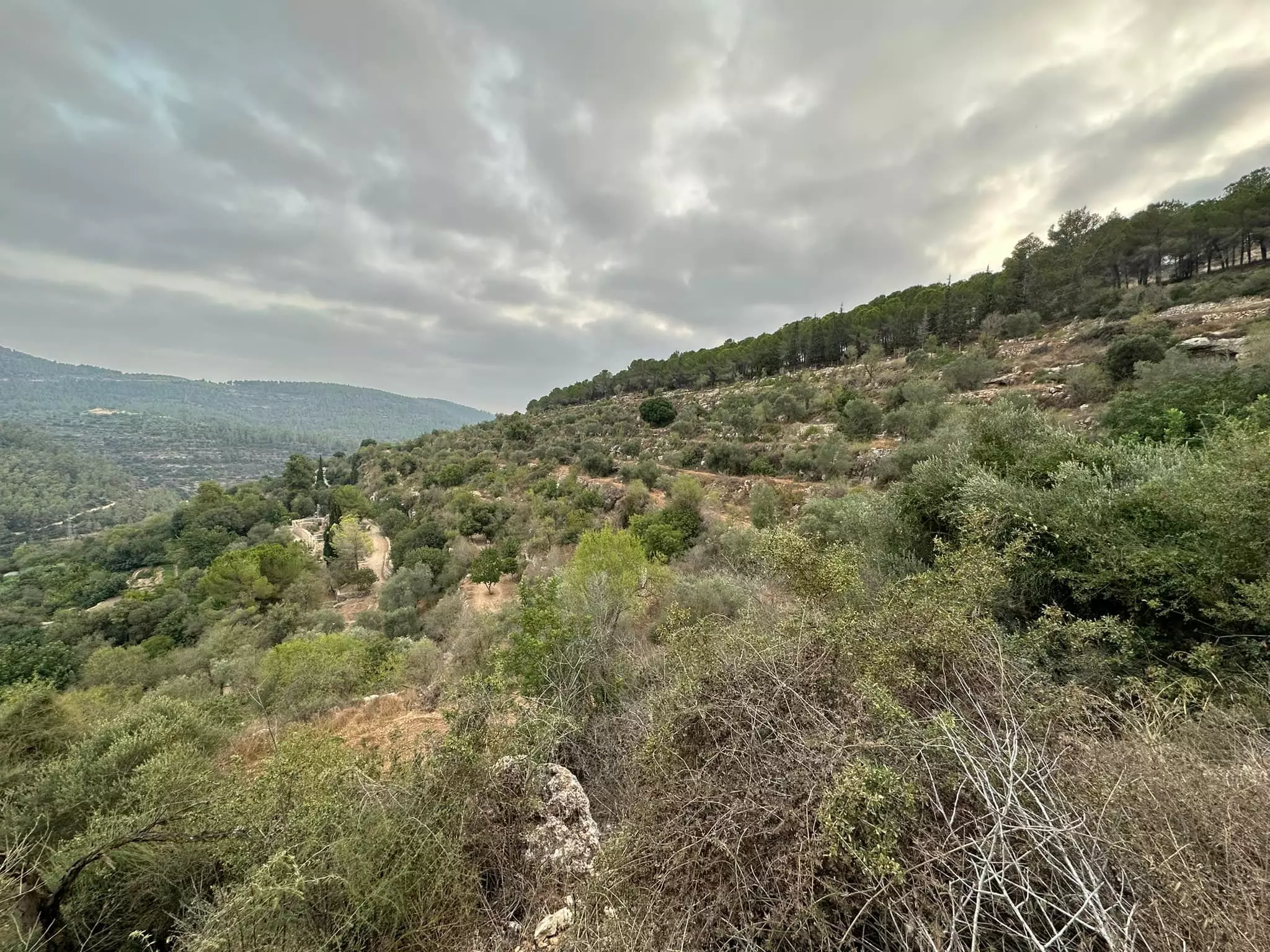
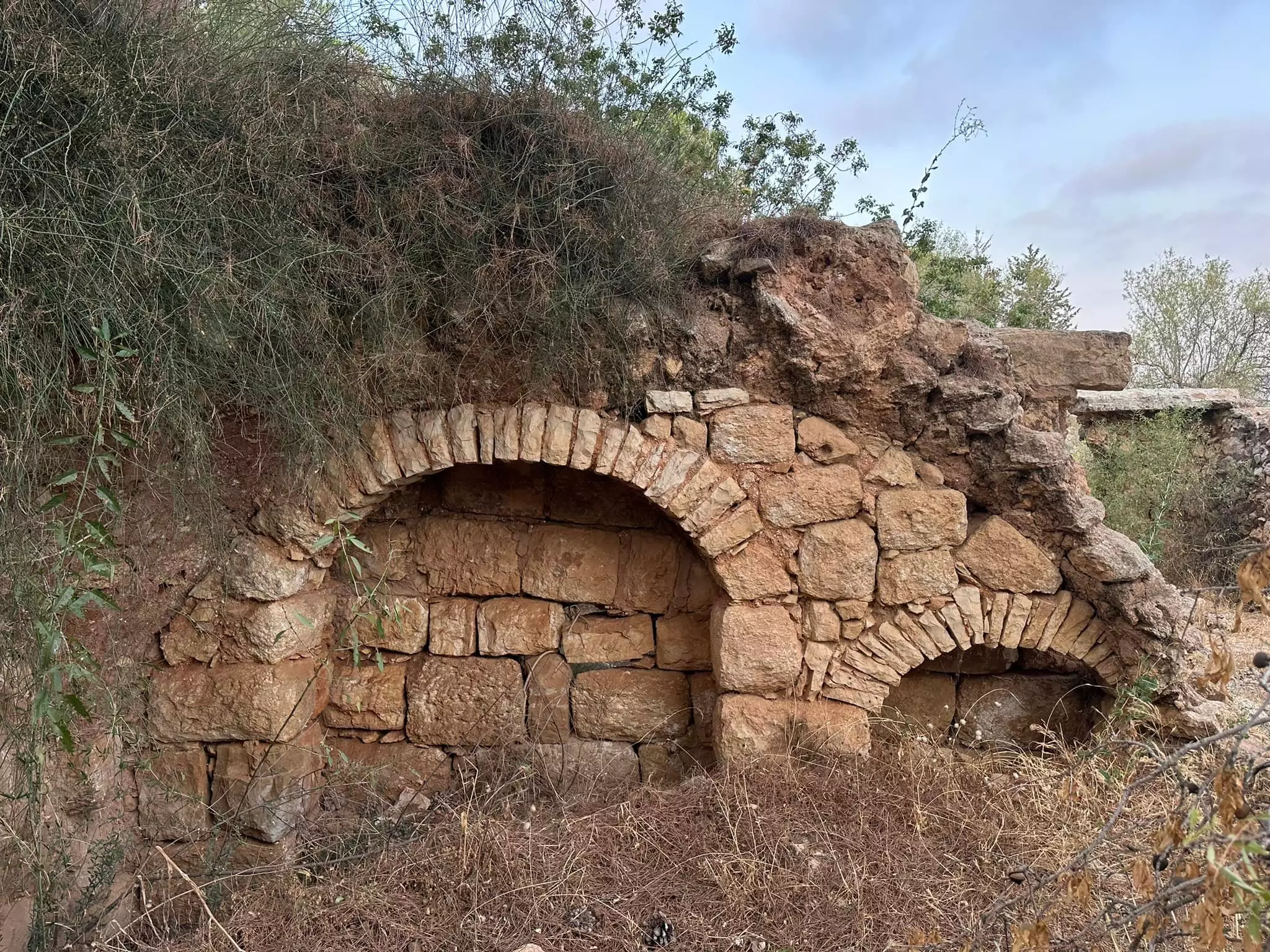
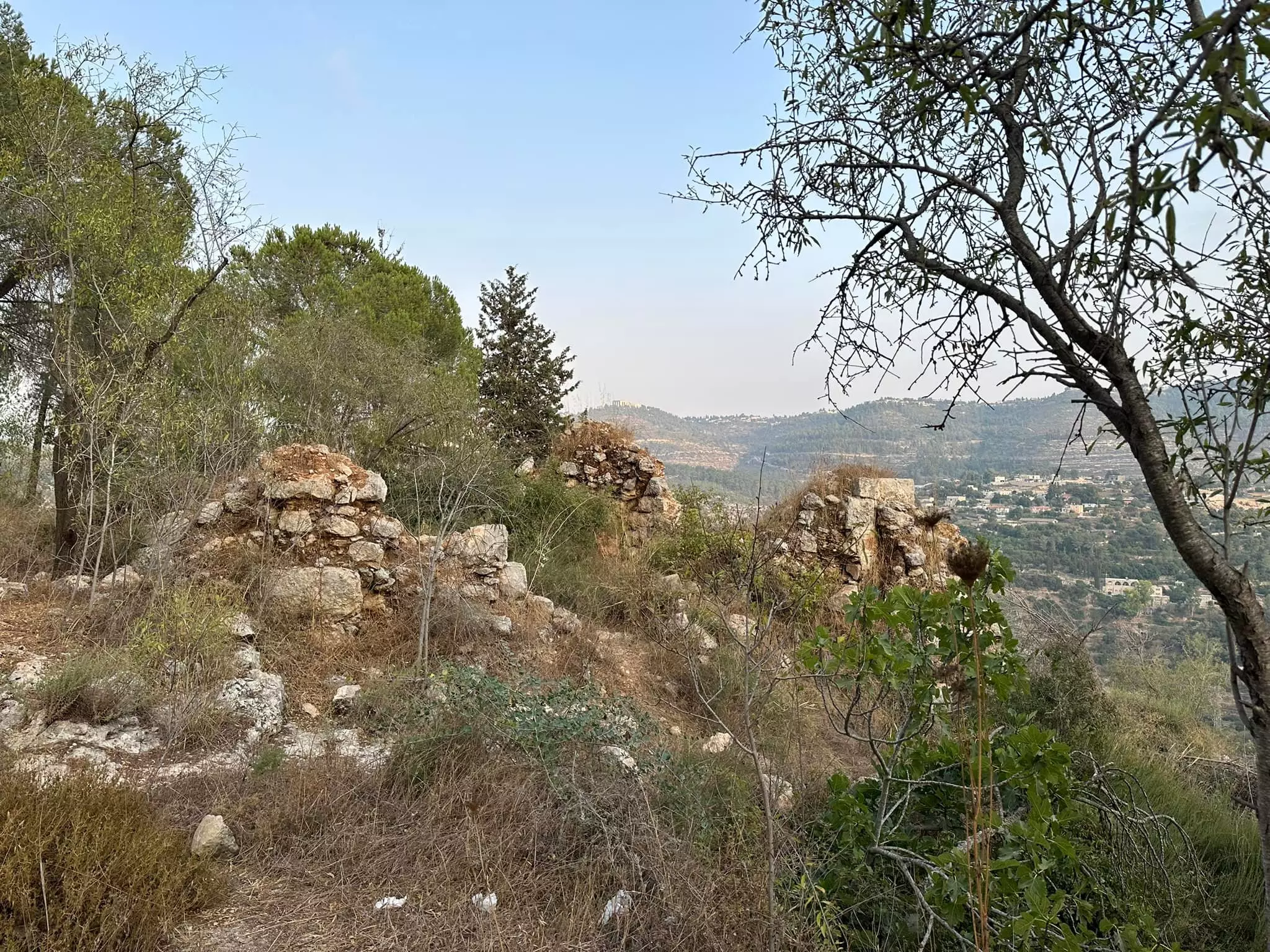
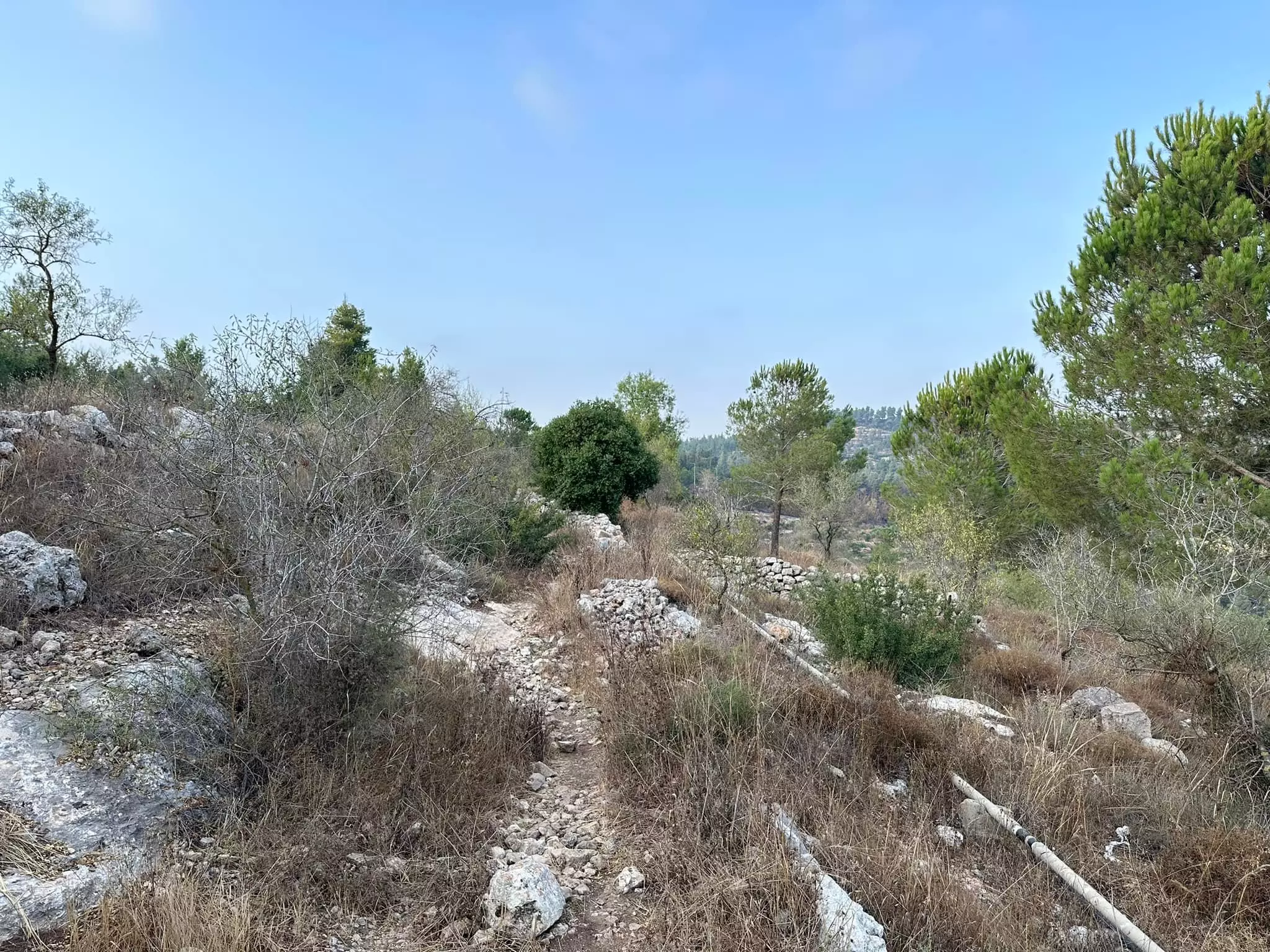
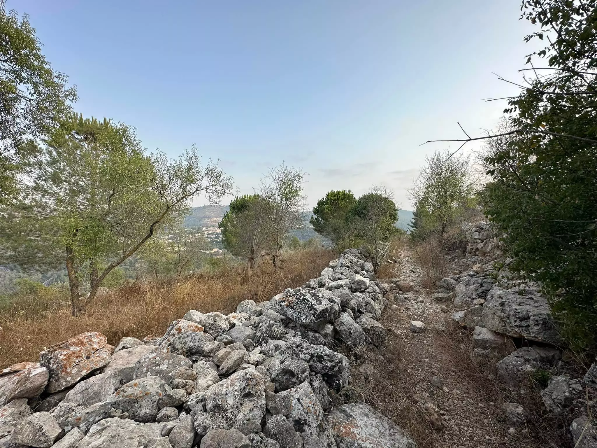
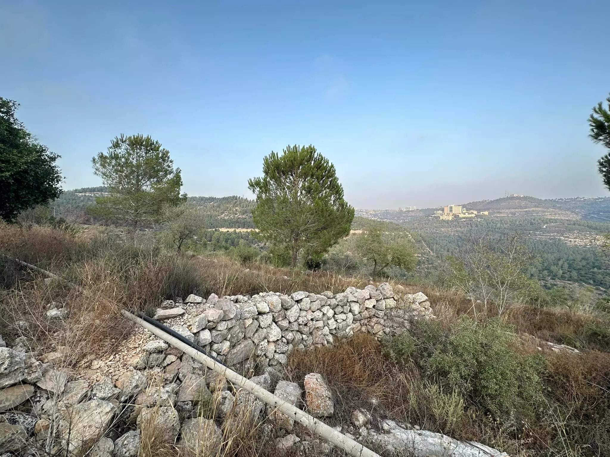
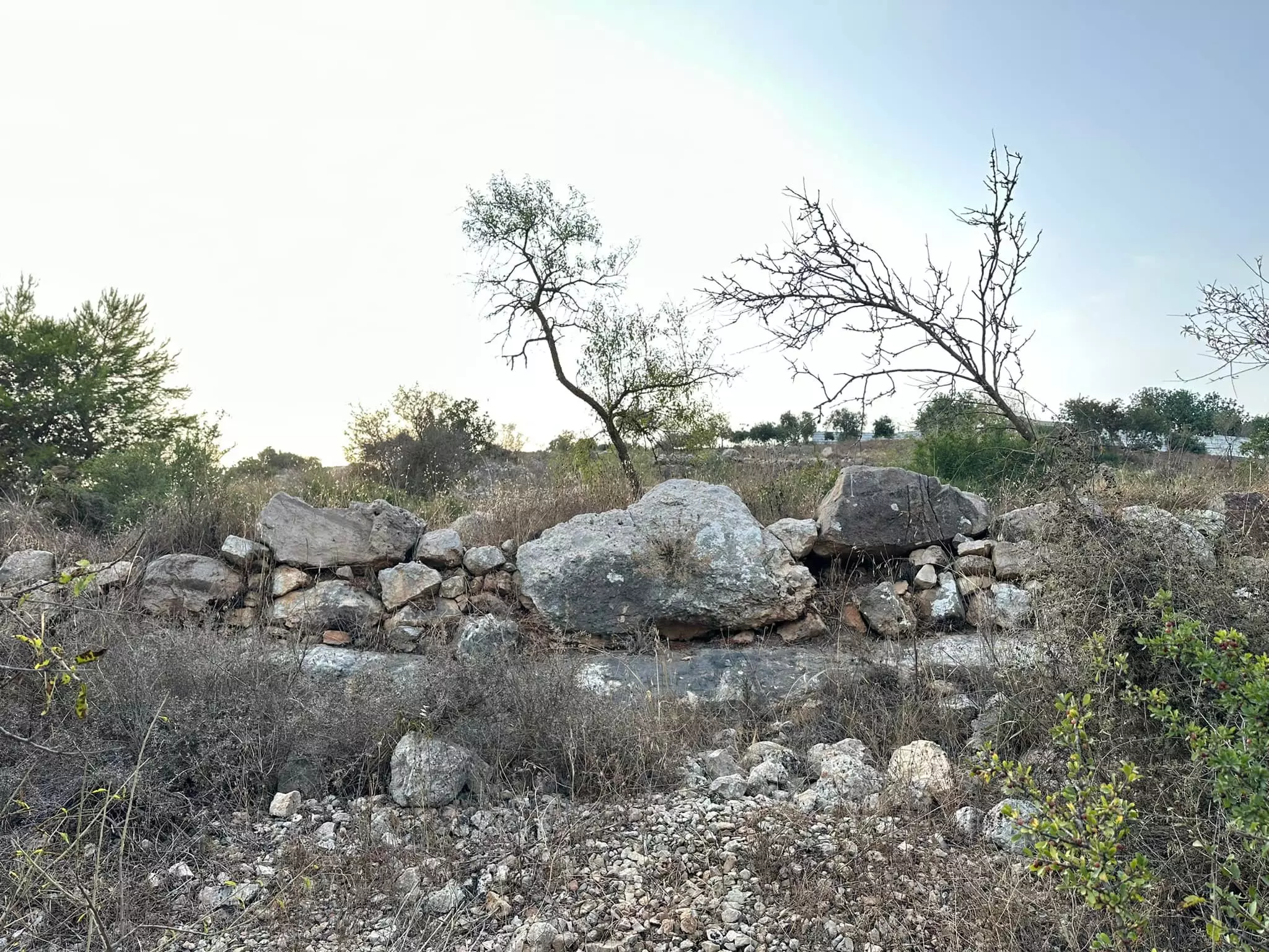
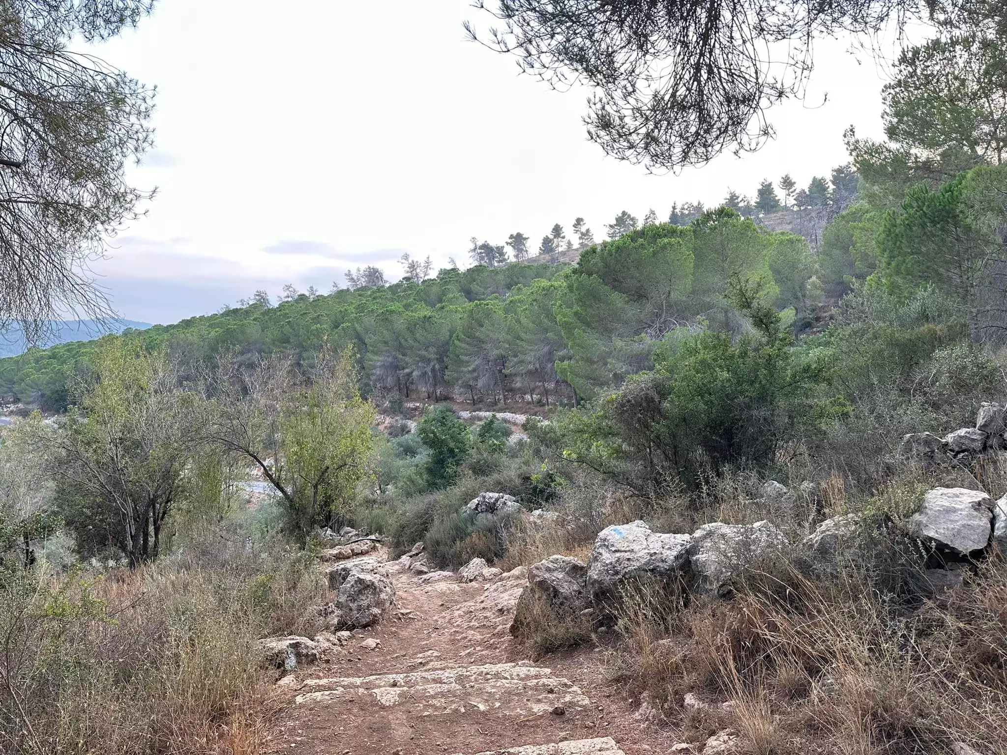
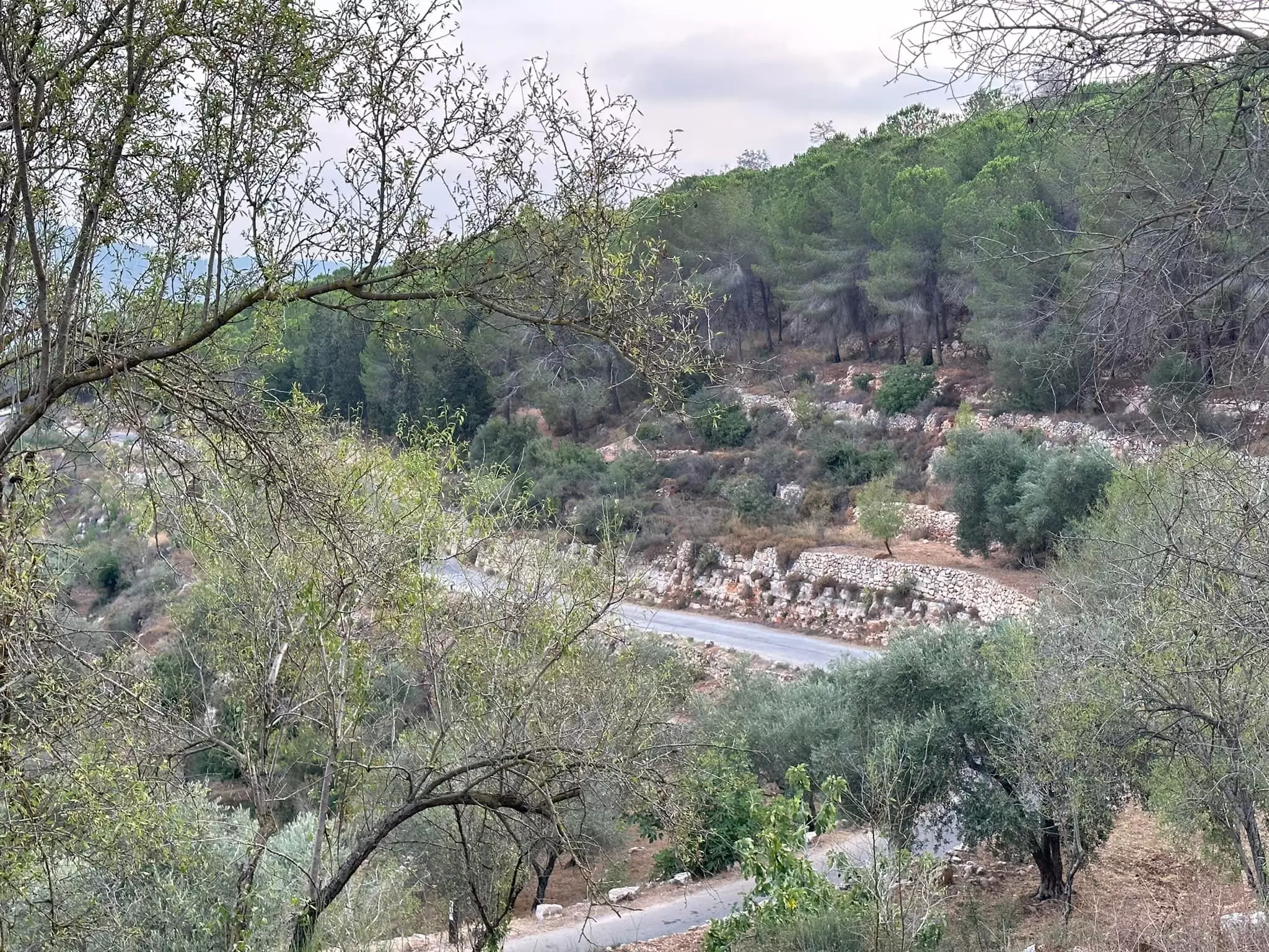
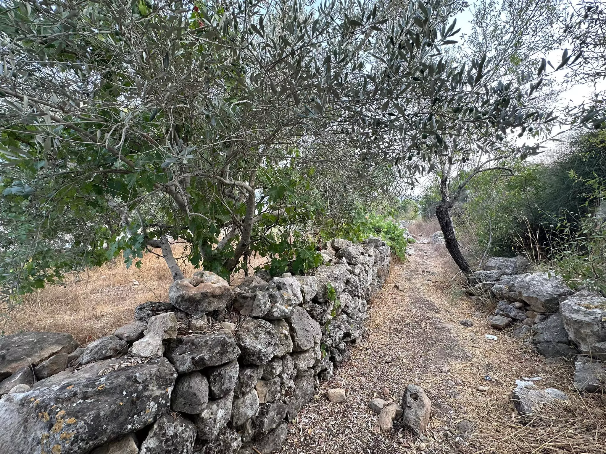
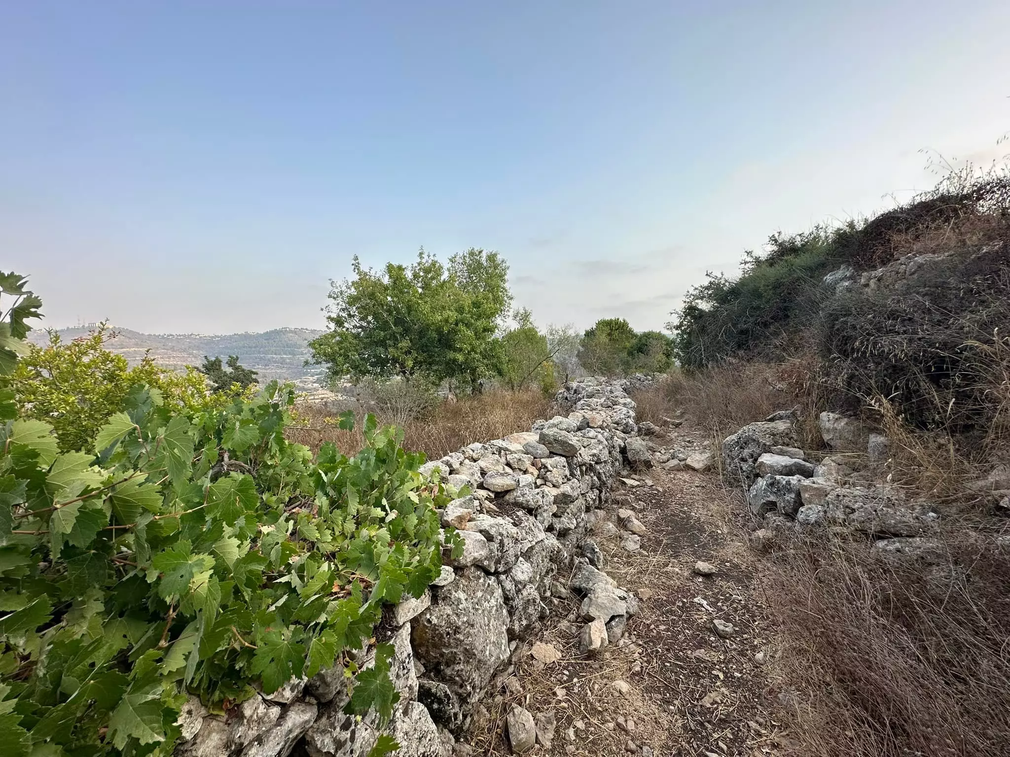
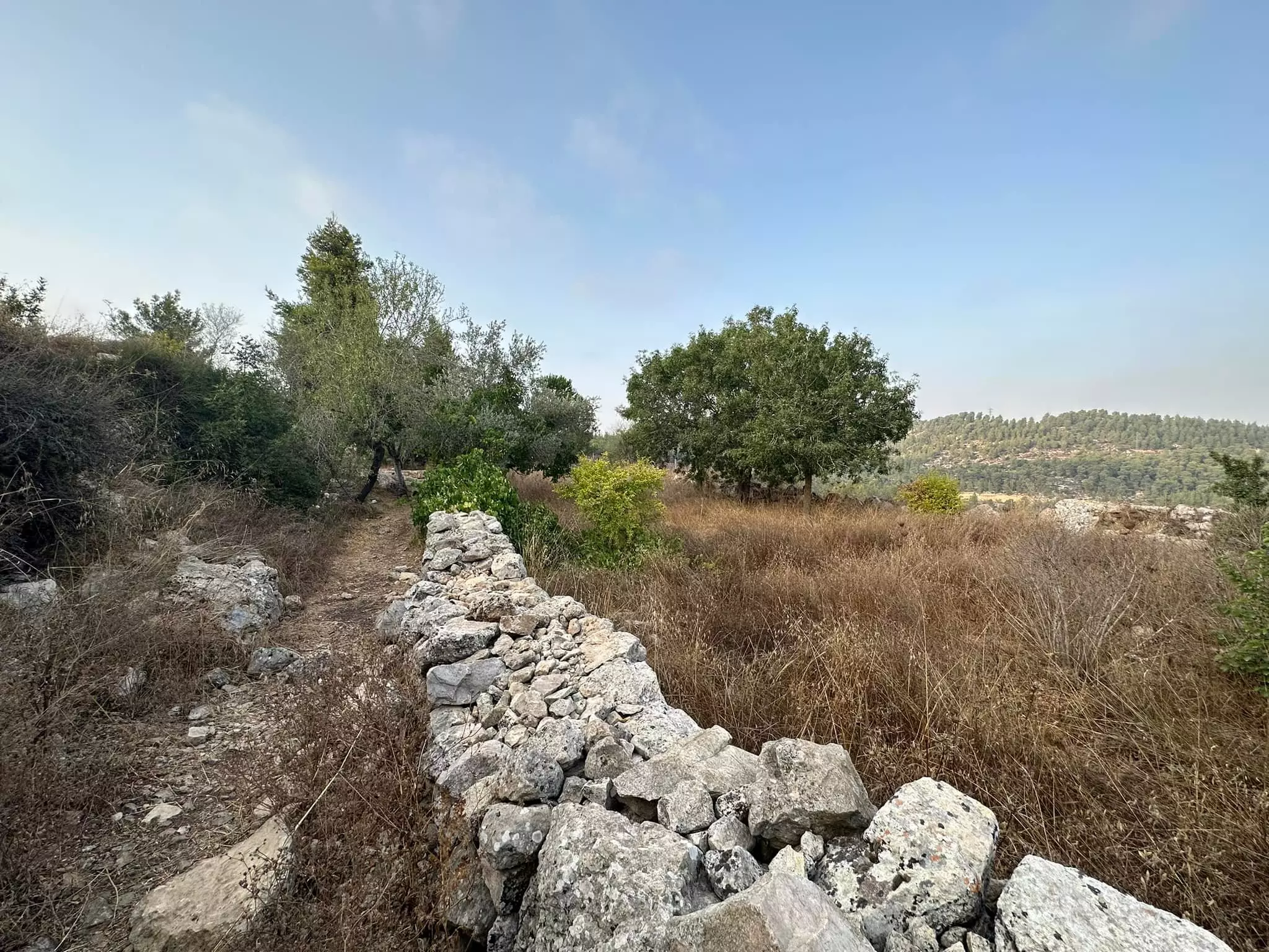
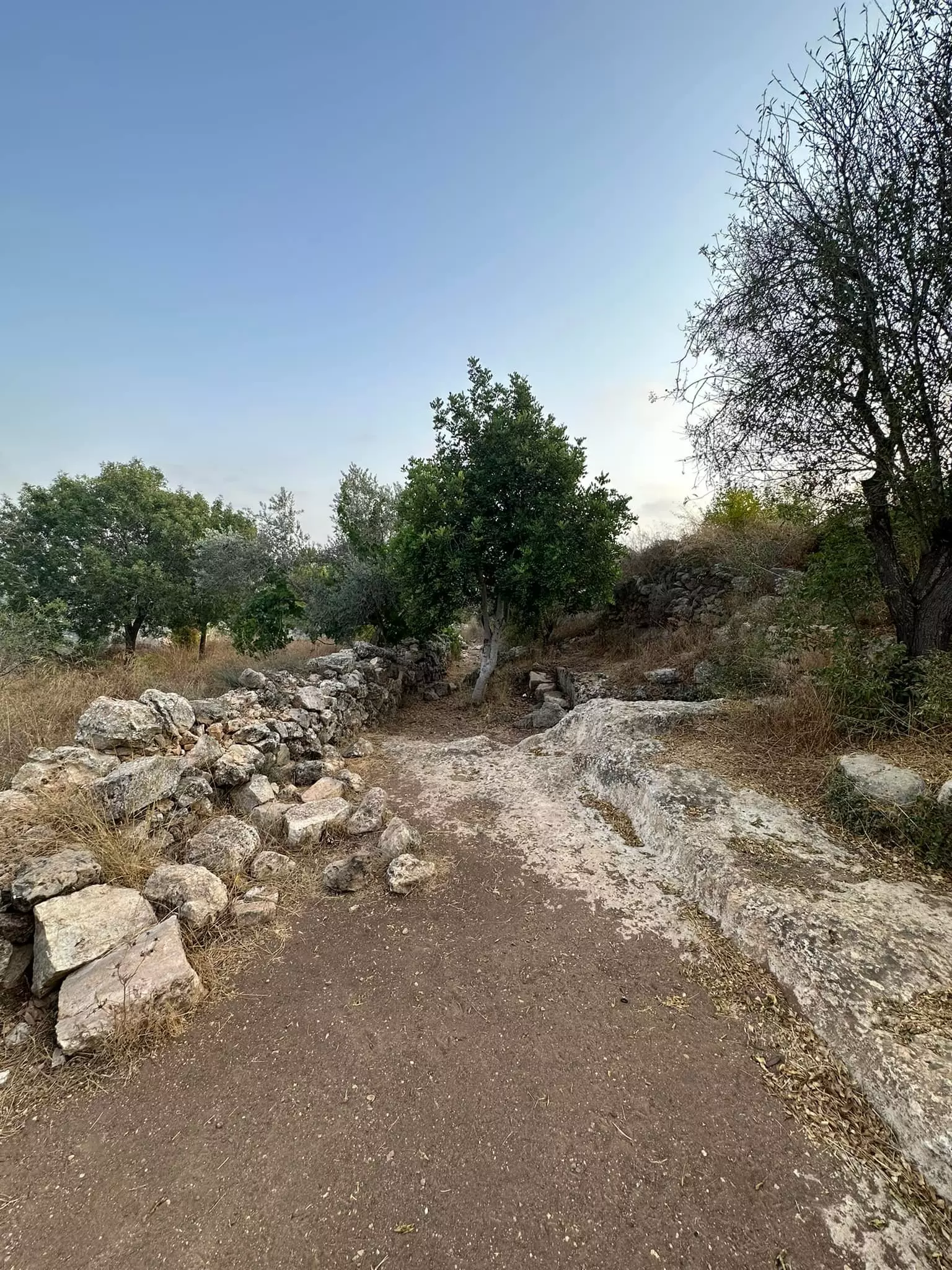
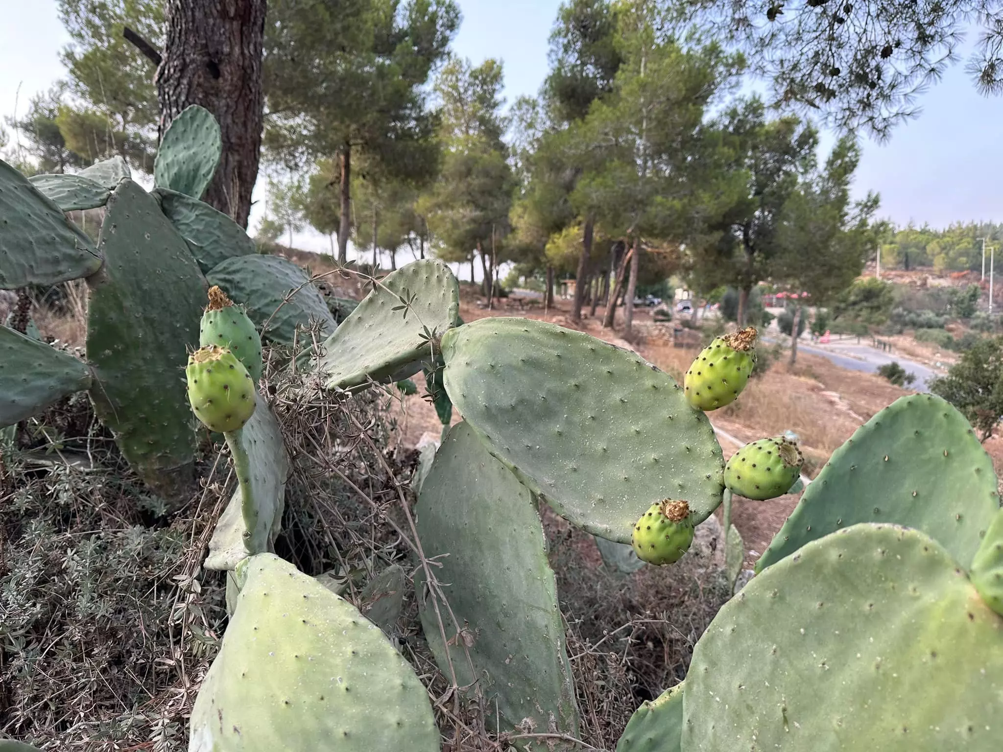
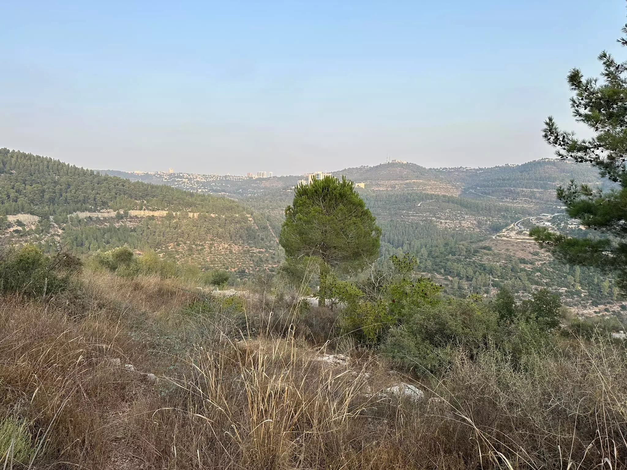
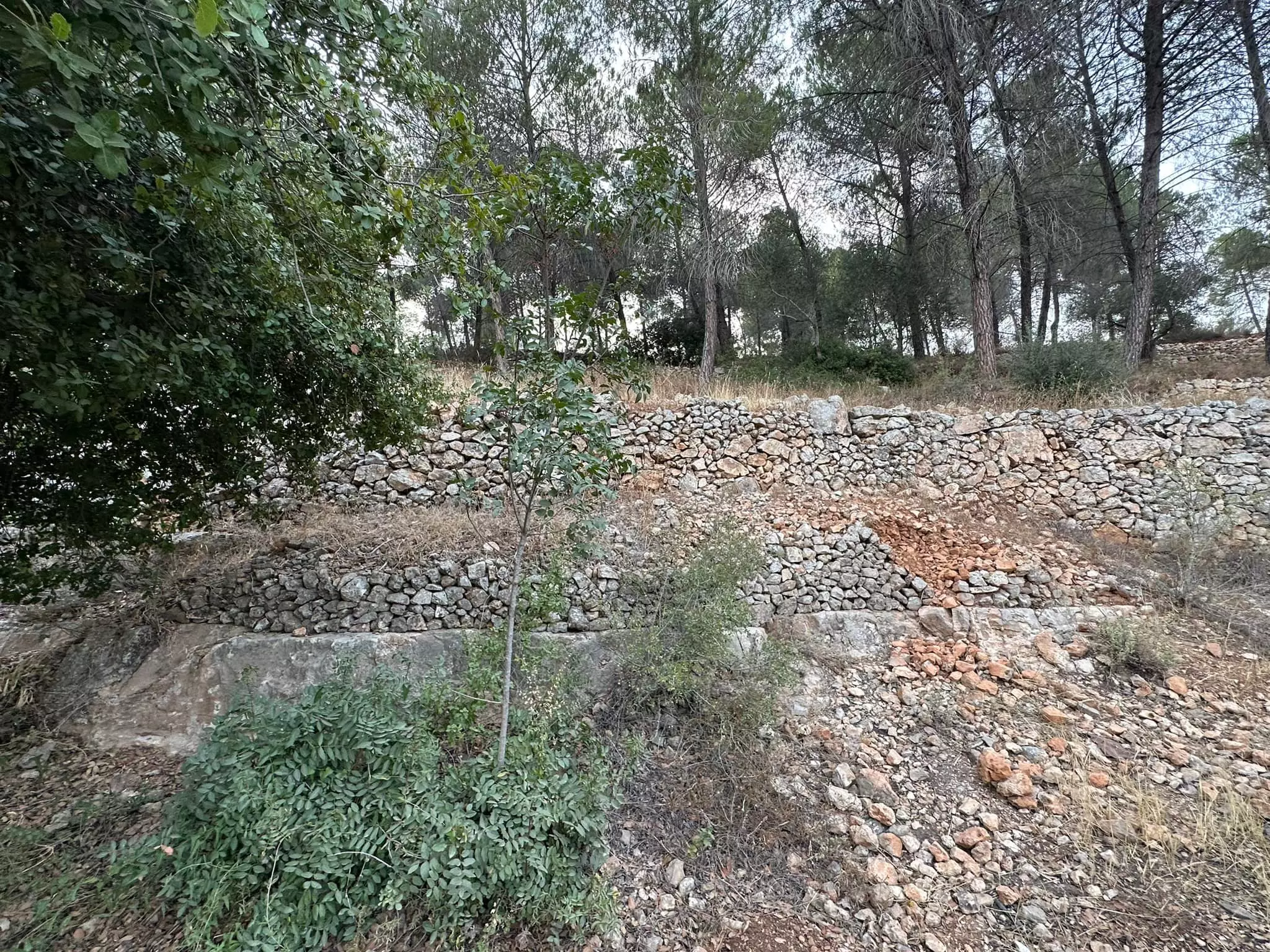
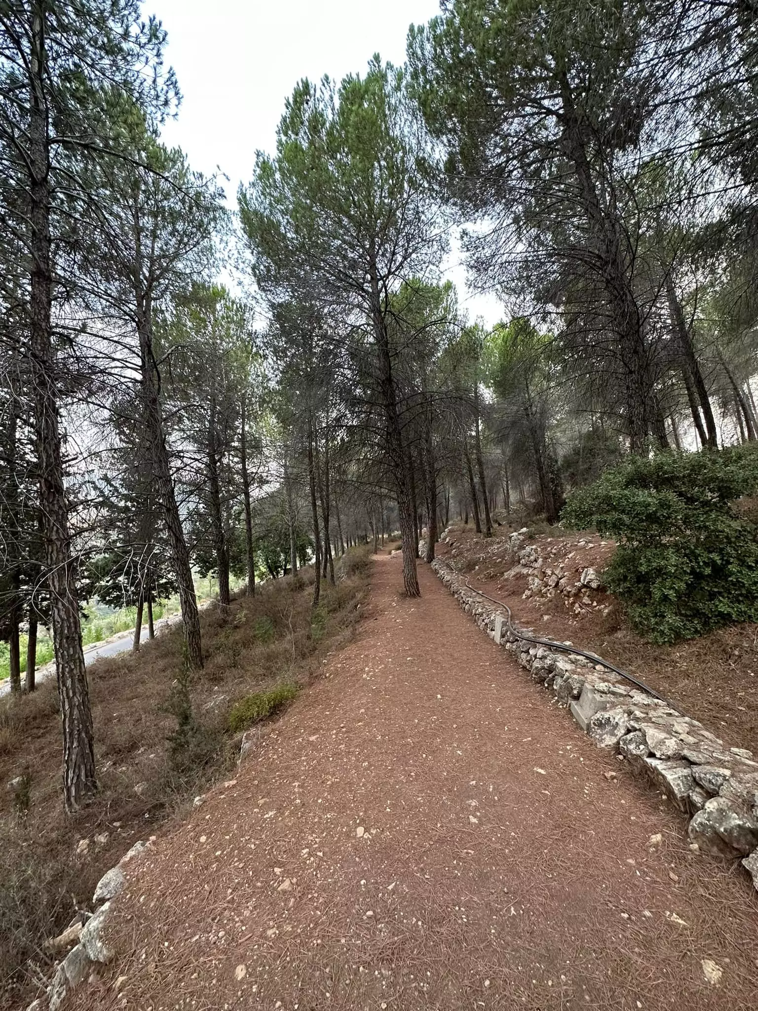
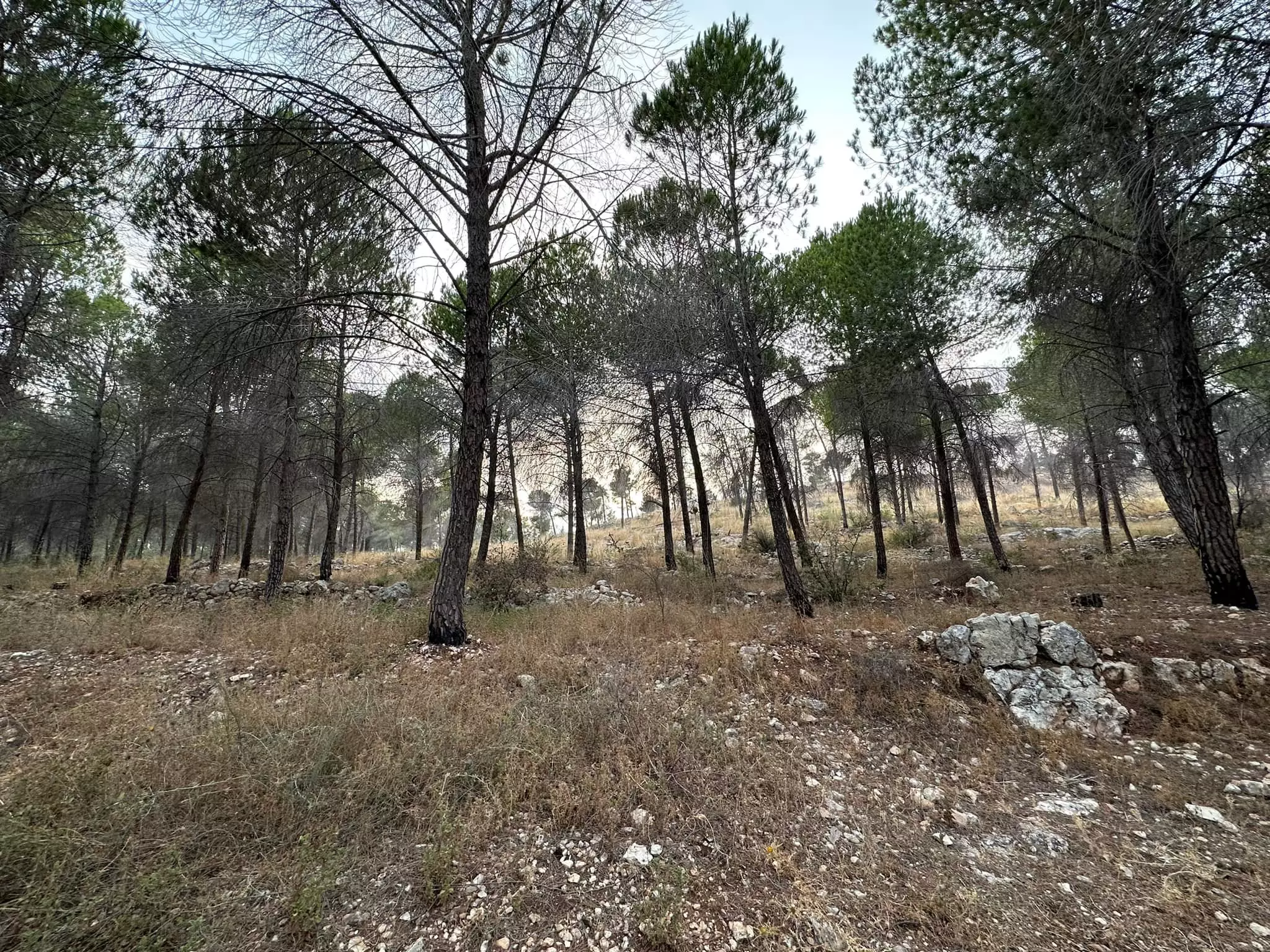
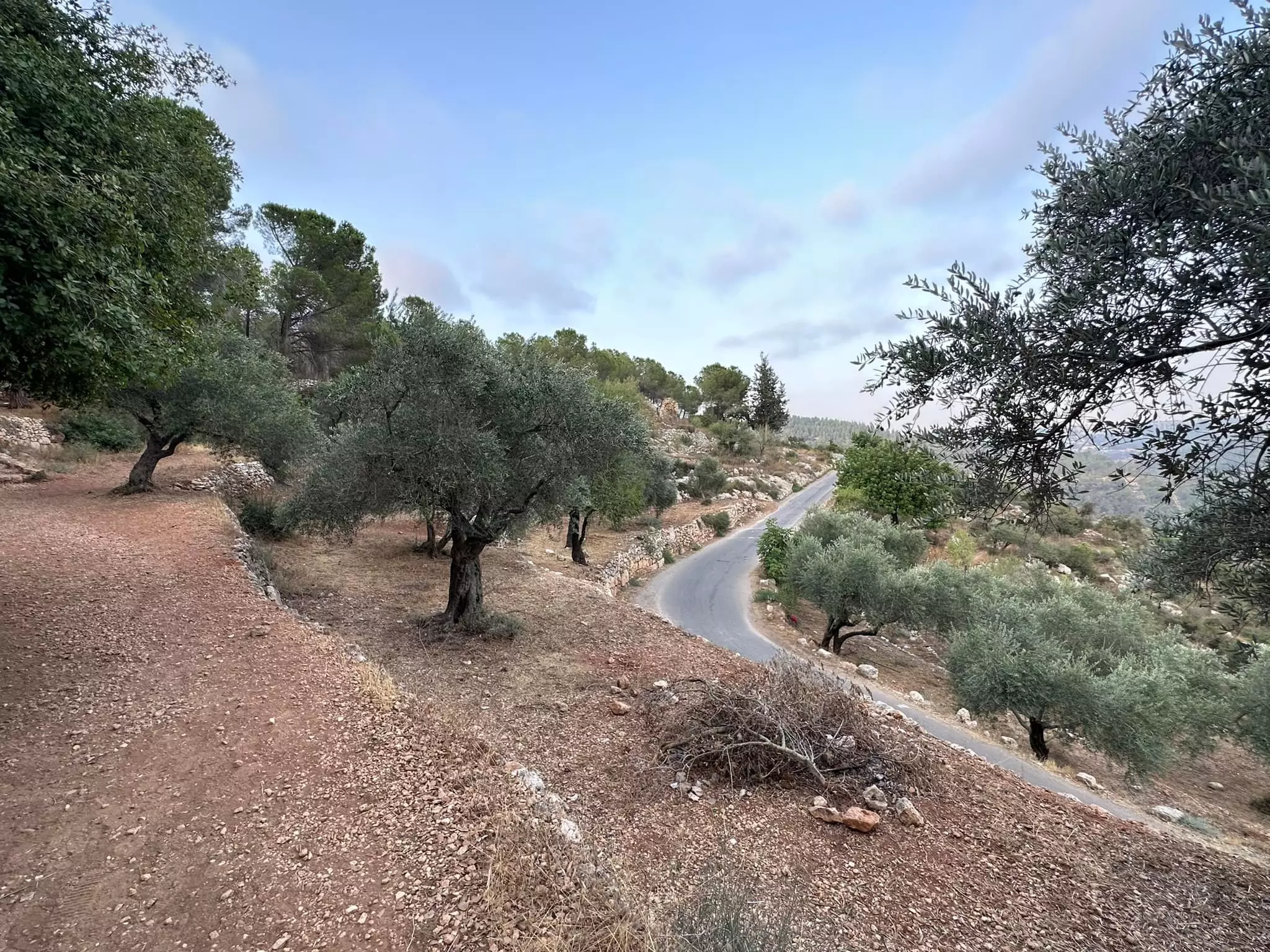
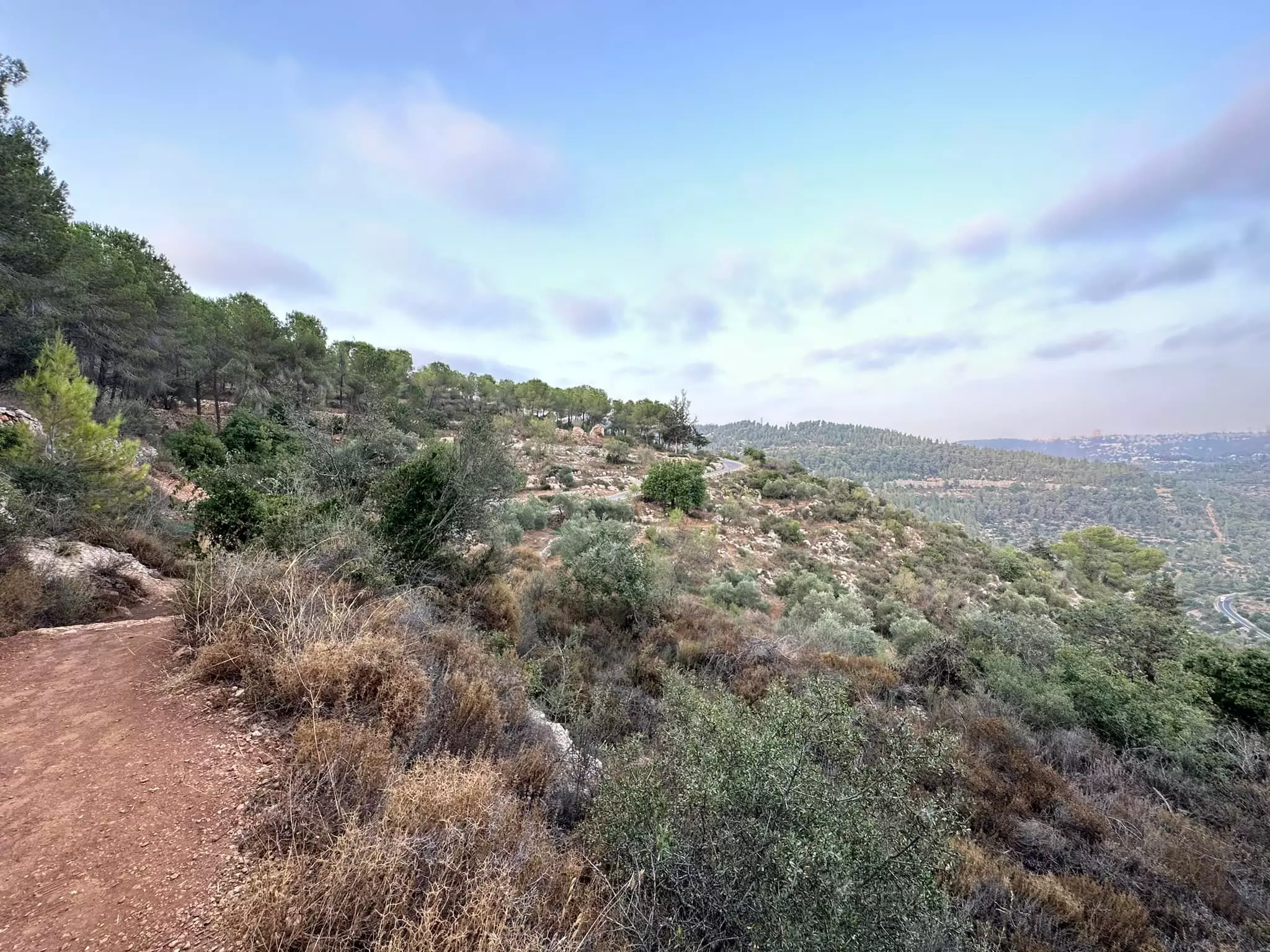
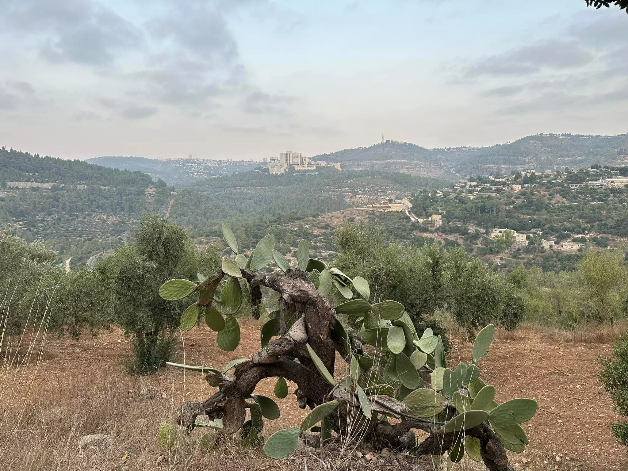
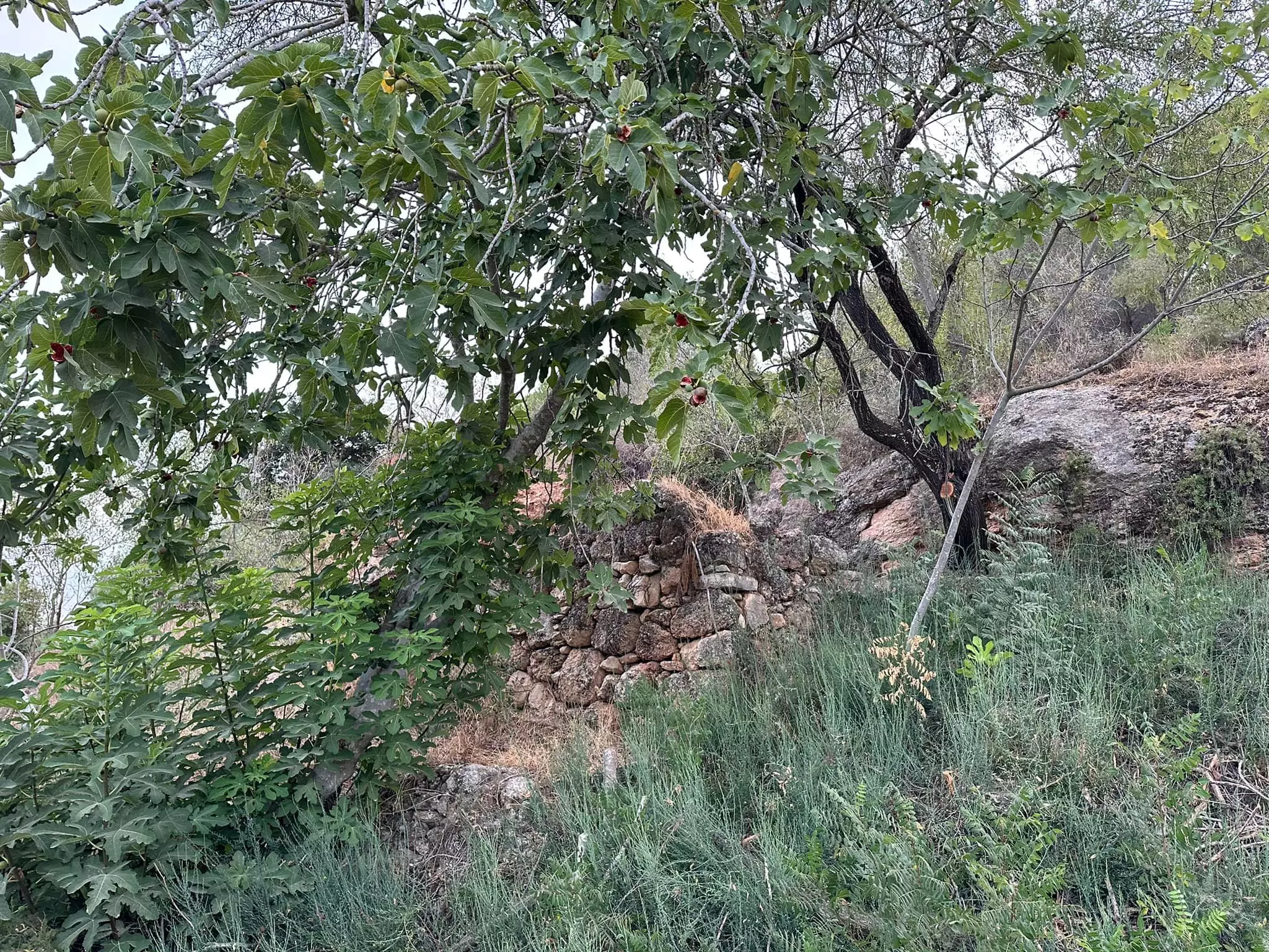
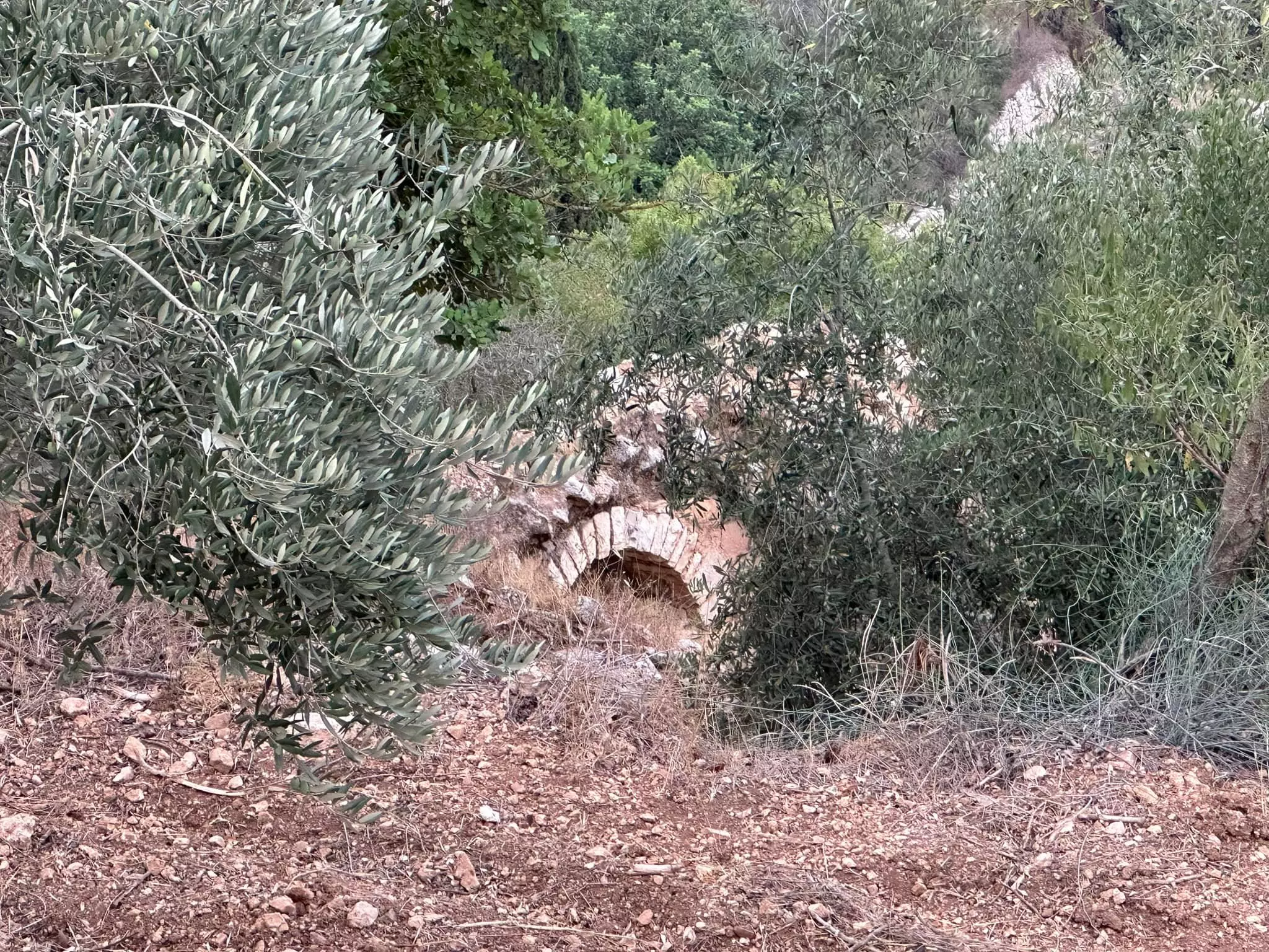
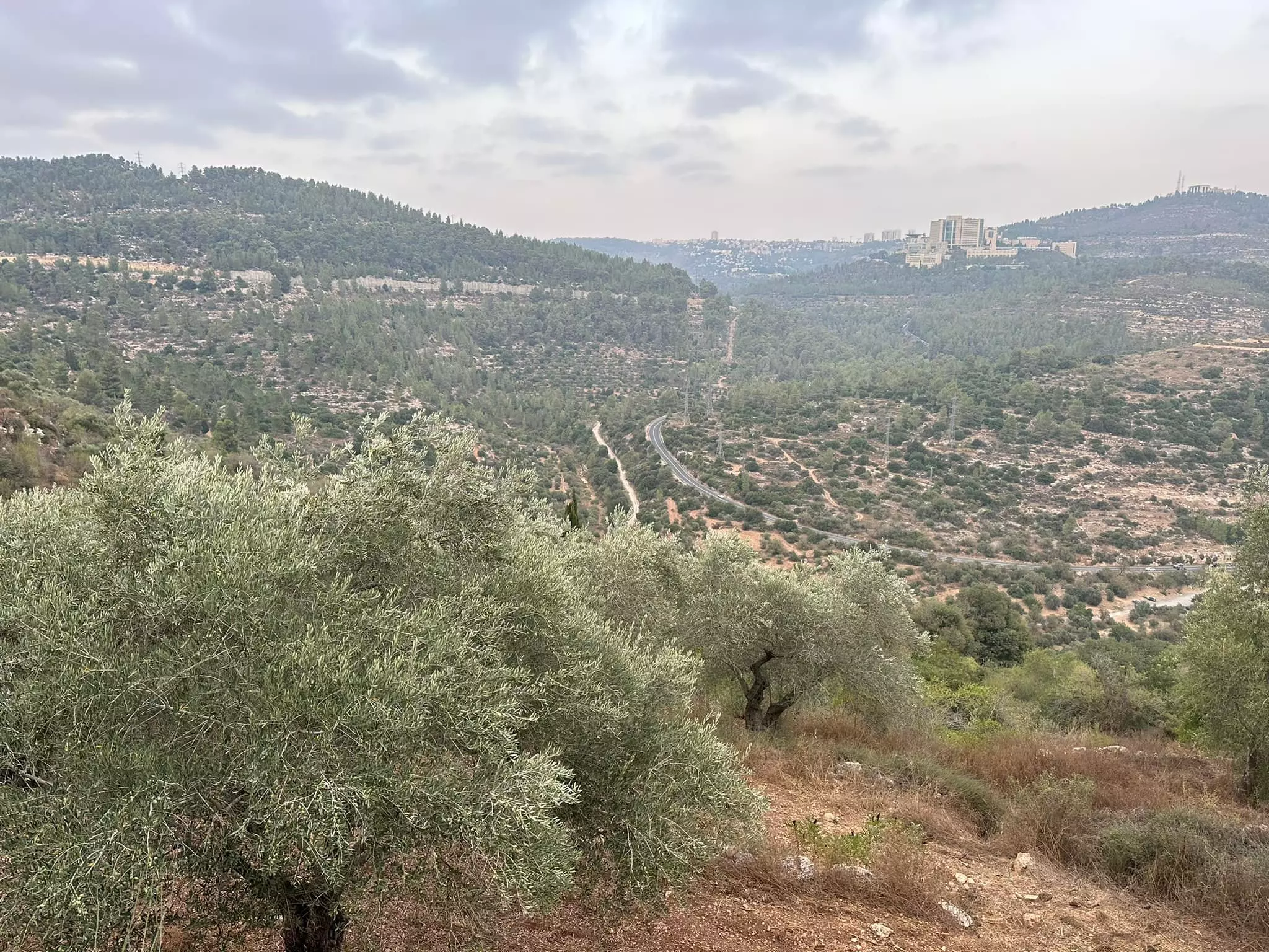
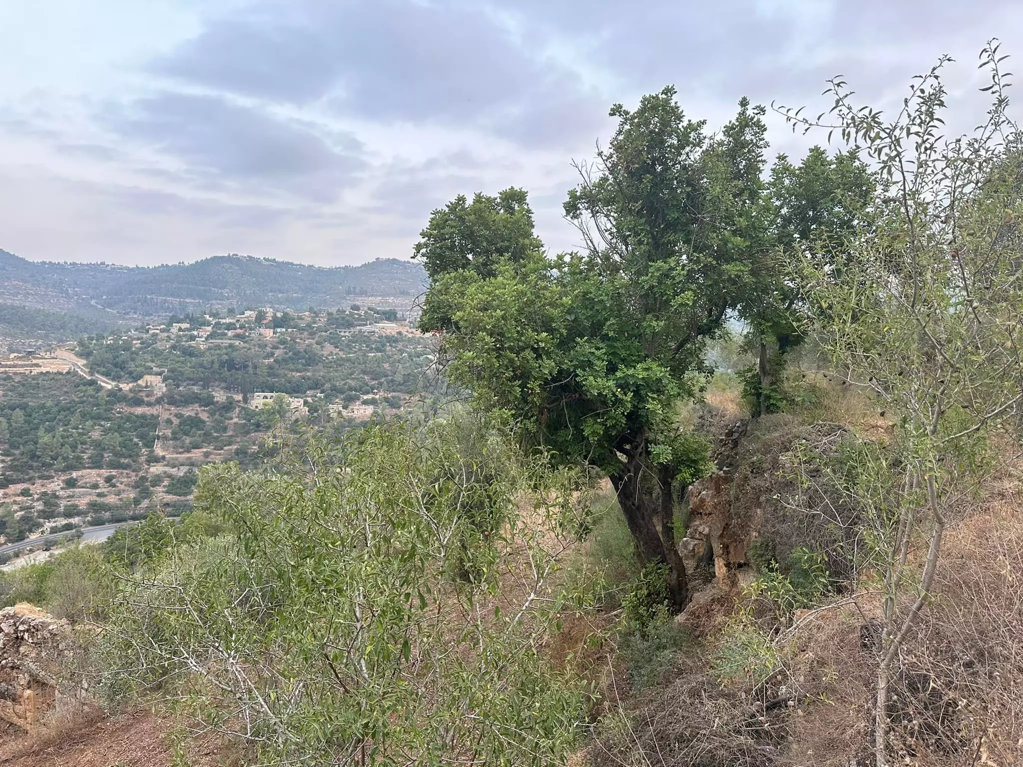
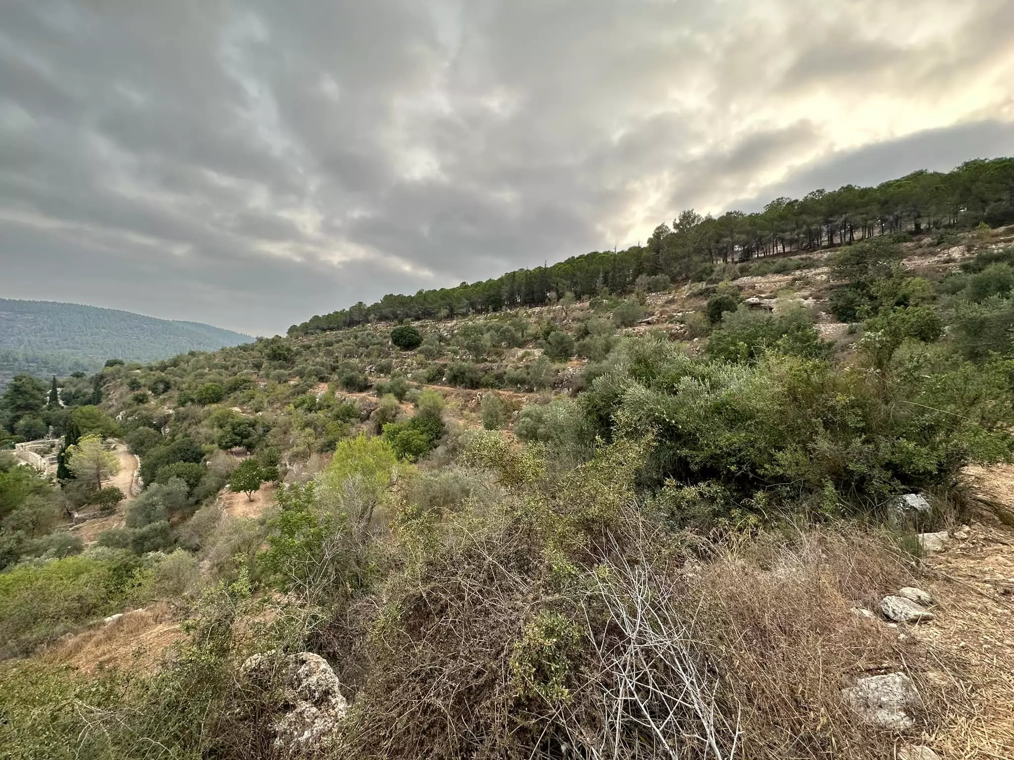
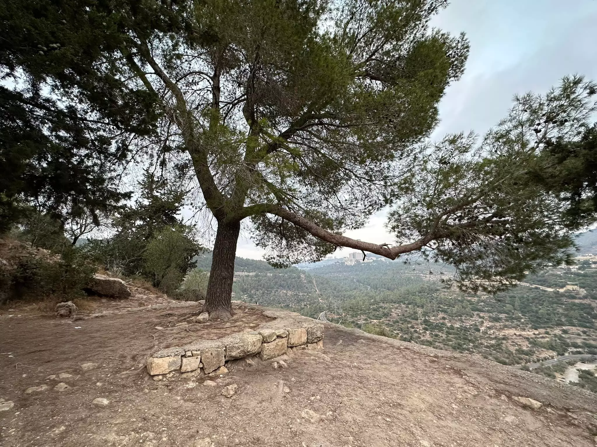
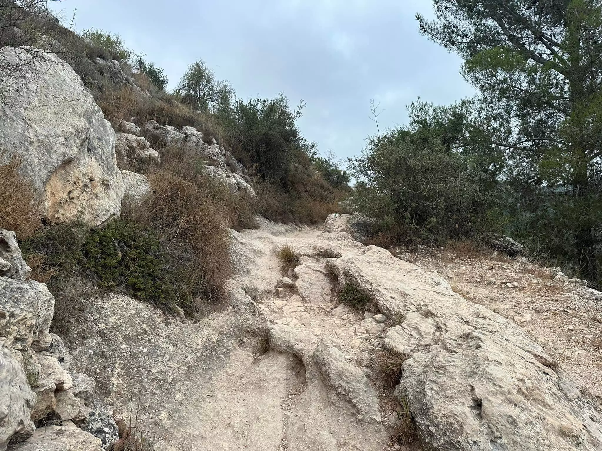
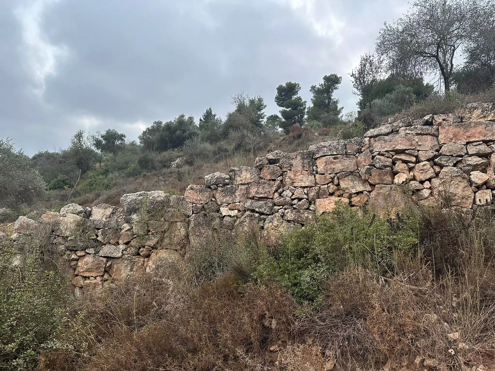
Village Before NakbaThe village stood in the middle of the southeastern slope of a mountain and overlooked Wadi al-Sarar, which ran 0.5 km to the east. A secondary road linked Sataf to the Jerusalem−Jaffa highway, to the northeast, and dirt paths linked it to neighboring villages. In the late nineteenth century, Sataf was a moderate-sized village built of stone and situated on the steep side of a valley. The village was divided into four quarters. New construction extended along the road to the village of 'Ayn Karim and on the eastern side of the mountain slope, in the direction of Wadi al-Sarar. A monastery, called the Habis Monastery, was located opposite the village, south of Wadi al-Sarar, on the slope of another mountain. The population of Sataf was Muslim. The village had a few shops, and two springs provided water for domestic use. The village lands were planted in grain, vegetables, olives, and fruit; agriculture was rainfed and irrigated from springs. In 1944 a total of 465 dunums was planted in cereals; 928 dunums were irrigated or used for orchards. Trees and herbs grew on the heights and were used as fodder for grazing animals. The villagers sold their agricultural produce in the markets of Jerusalem.Village Occupation and Ethnic CleaningWhile Operation Dani (see Abu al-Fadl, Ramla sub-disctrict) was in progress, Israeli forces occupied a cluster of villages to the east of the operational zone around Lydda and Ramla, along the western approaches to Jerusalem. Sataf, one of the villages occupied during this push, was attacked on 13−14 July 1948, according to Israeli historian Benny Morris. The attack was carried out by the Har'el Brigade, which was part of the force assembled to implement Operation Dani.Zionists Colonies on Village Landshere are no Israeli settlements on village lands.Village TodayMany half-destroyed walls still stand, and some still have arched doorways. The walls of a few houses with collapsed roofs are almost intact. A broken-down military jeep lies among the stone rubble that covers the site. The area around the village spring, which is located to the east next to the ruins of a rectangular stone house, has been turned into an Israeli tourist site. A Jewish family has settled on the west side of the village, and has fenced in some of the village area. Numerous terraces around the village are covered with almond, olive, and fig trees, as well as cactuses. A forest around the site was planted by the Jewish National Fund (the body of the World Zionist Organization responsible for land acquisition and development); it is an extension of the Moshe Dayan forest that was planted on the lands of the former village of Khirbat al-Lawz.SourceDr. Walid al-Khalidi, 1992: All That Remains. |
|||||||||||||
| Related Maps | Town Lands' Demarcation Maps خرائط للقضاء توضح حدود القرى والاودية Town's map on MapQuest View from satellite Help us map this town at WikiMapia |
||||||||||||
| Related Links | Wikipedia's Page Google Search Google For Images Google For Videos |
||||||||||||
| More Information | في كتاب كي لا ننسى في كتاب بلادنا فلسطين المزيد من موقع هوية |
||||||||||||
- The picture show the anceint Deir al-Hubeis (Catholic Church) built on lands belonging to Sataf and Ein Karim, picture contributed by Dr. Ahmad Rajab Salameh
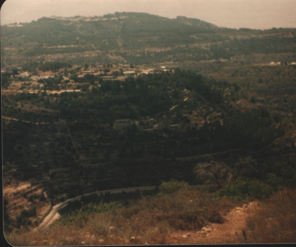
1 - The picture taken from the high lands for Sataf, at the opposite road appears the villages of al-Jura and Maski, picture contributed by Dr. Amad Rajab Salameh
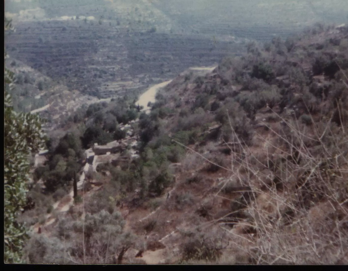
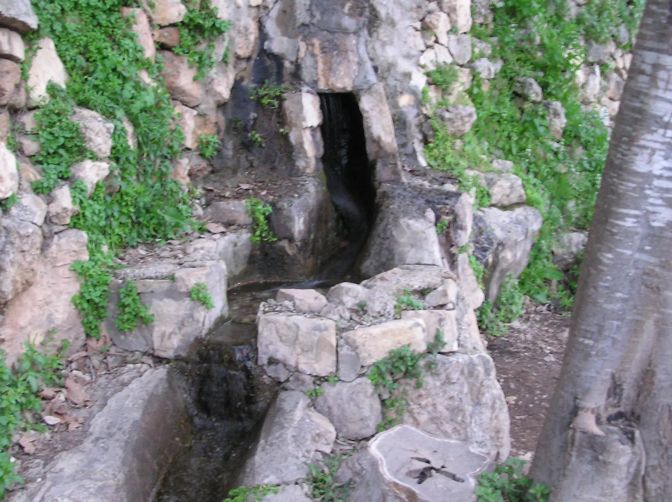
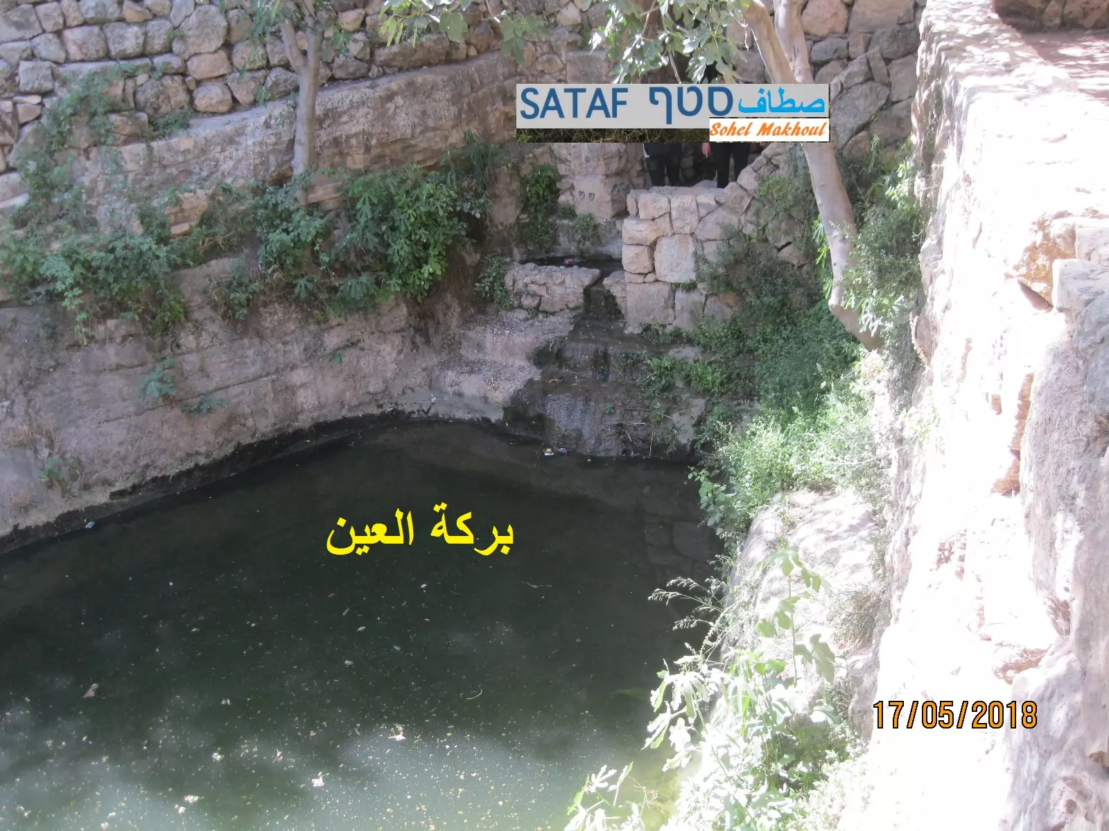
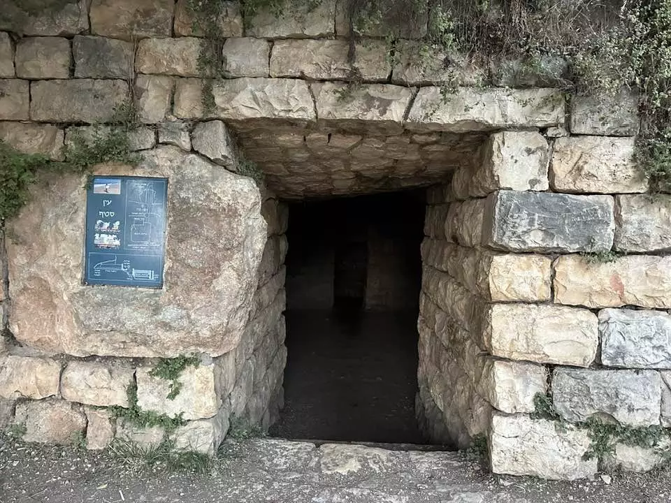
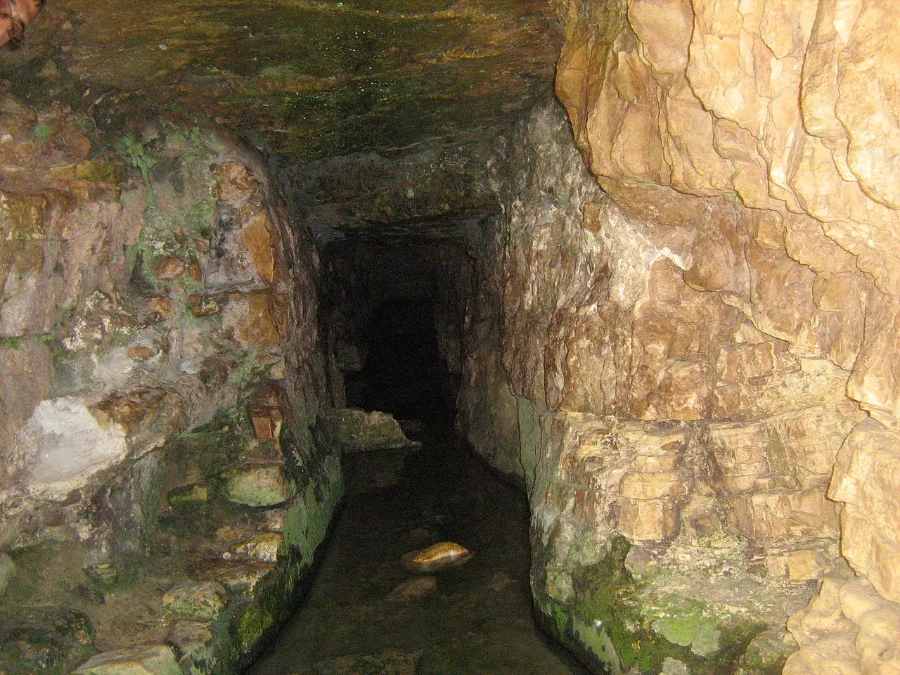
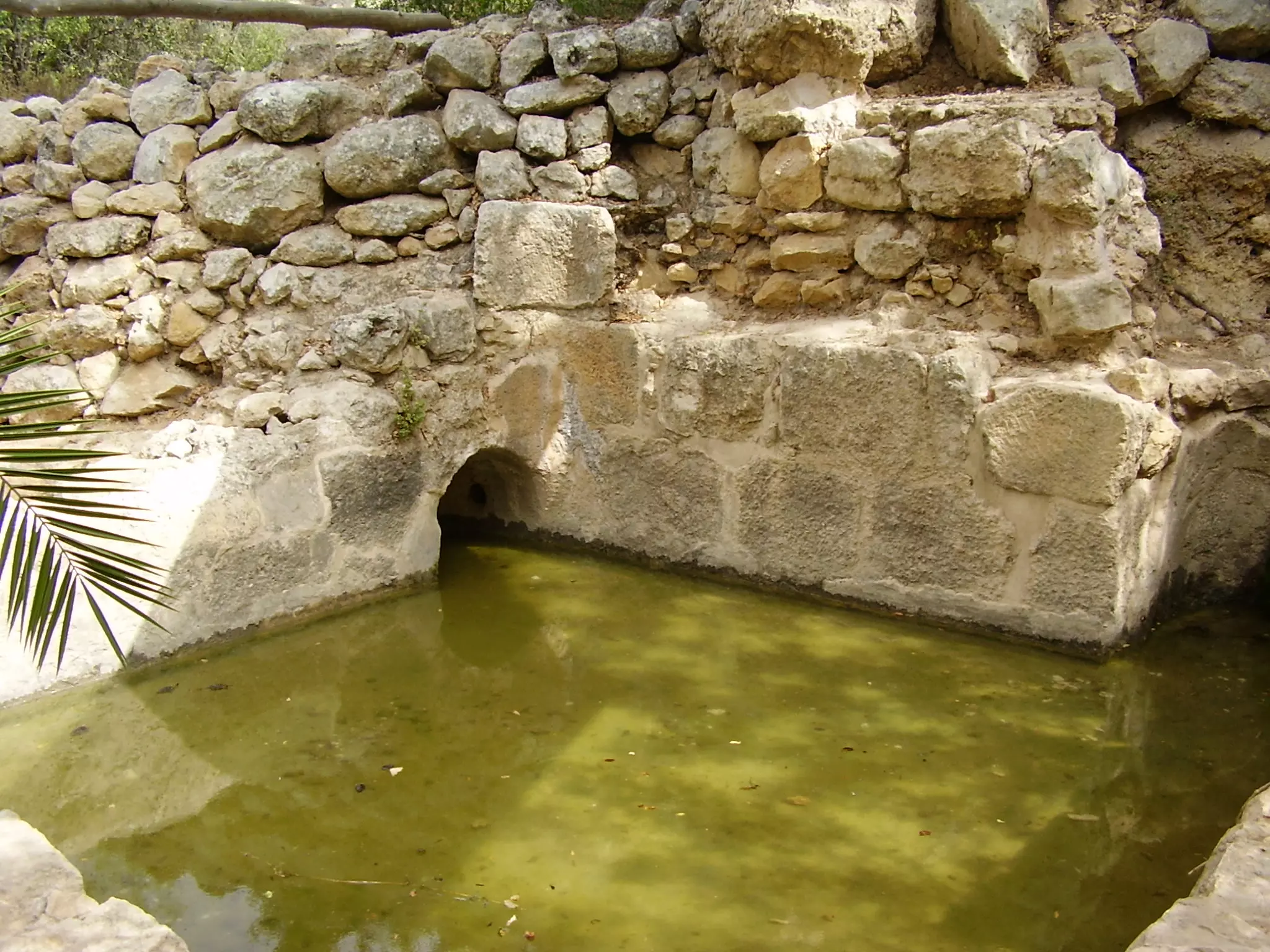
1 - Sataf's major spring which is made up of several other springs. Israelis seek this spring for medical purposes, picture contributed by Dr. Amad Rajab Salameh
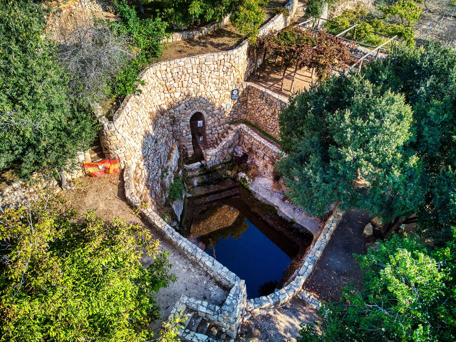
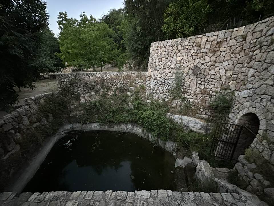
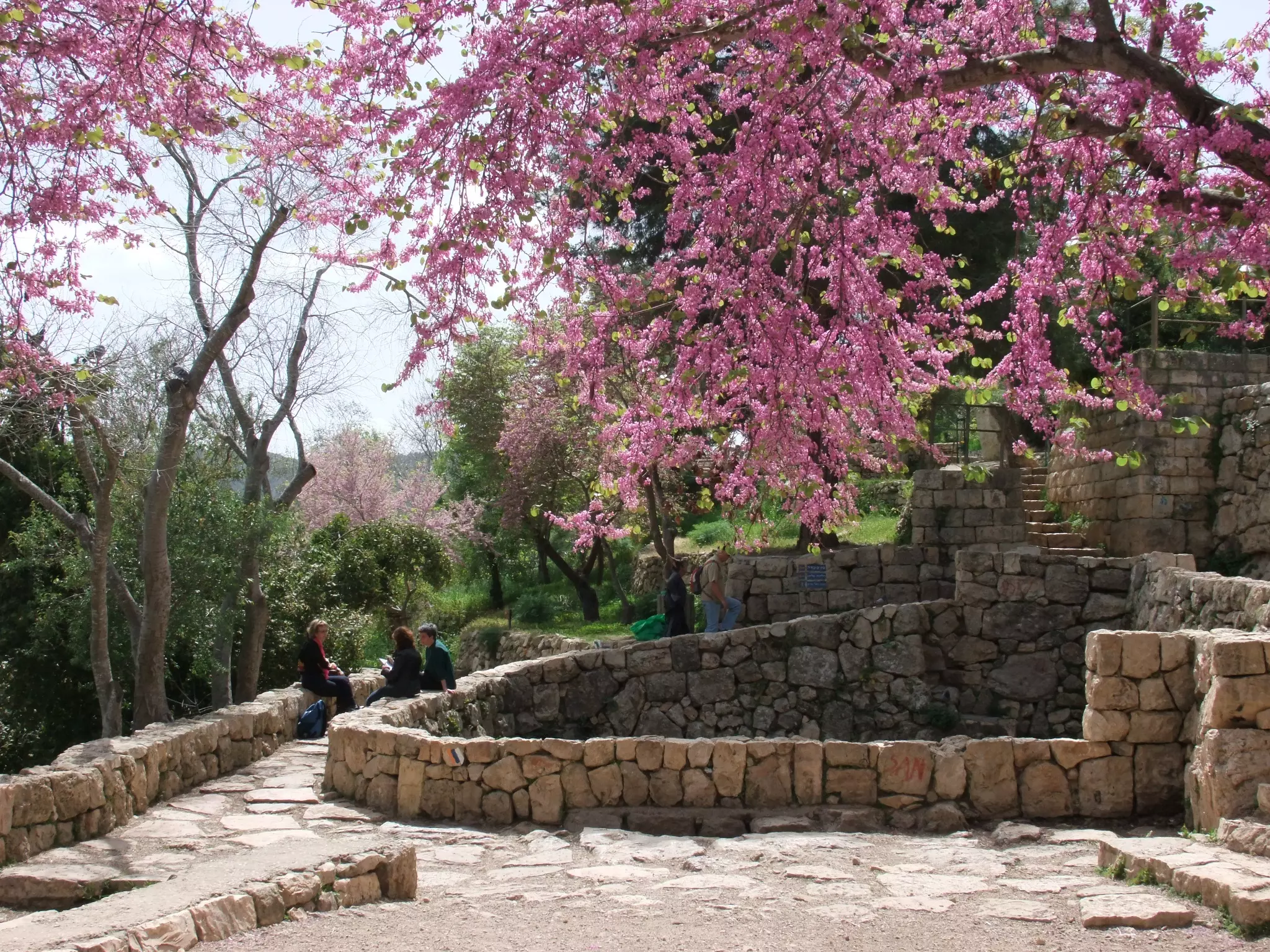
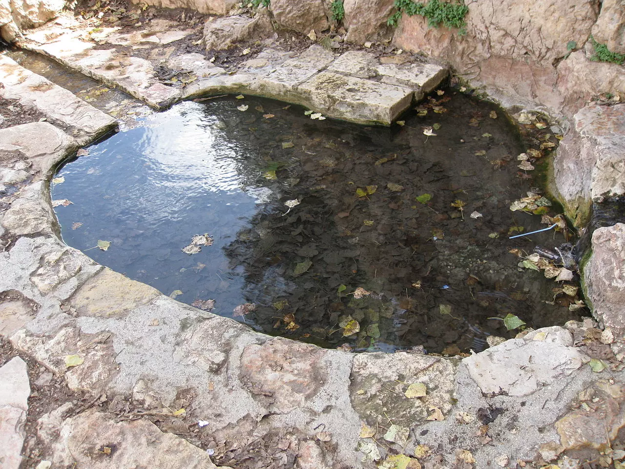
1 - Peace circle around Sataf's pool, copy right Middleway.org
2 - The Famous Sataf's pool, wish you were there!!!
3 - sataf
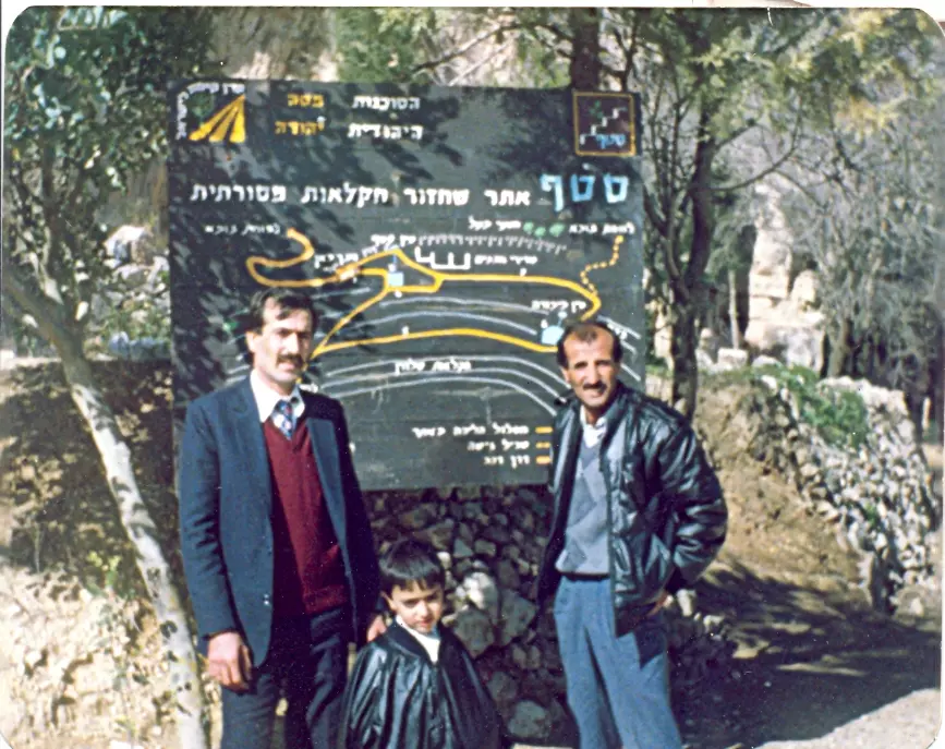
Posted by d.mohamad ftiani 2 - مدخل القرية المطهرة عرقياً. لاحظ اطلال البيت المدمر.
Posted by d.mohamad ftiani 1 - House walls remain standing in Sataf
Posted by Halla Bitar 1 - Sataf's Spring
Posted by Halla Bitar - Sataf's Spring #3
Posted by Halla Bitar - Sataf's Spring #4
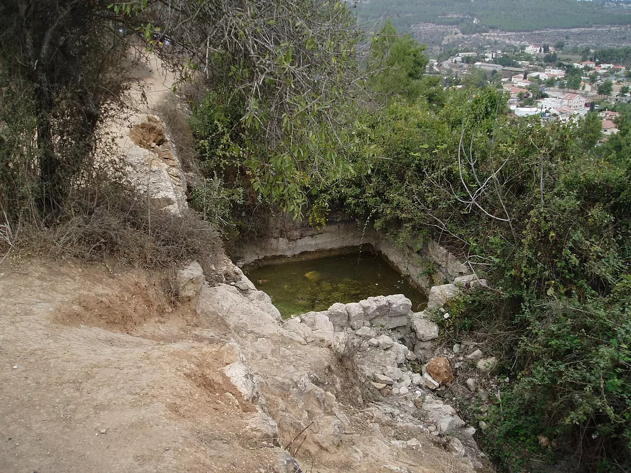
Posted by Halla Bitar 2 - Pool in Sataf
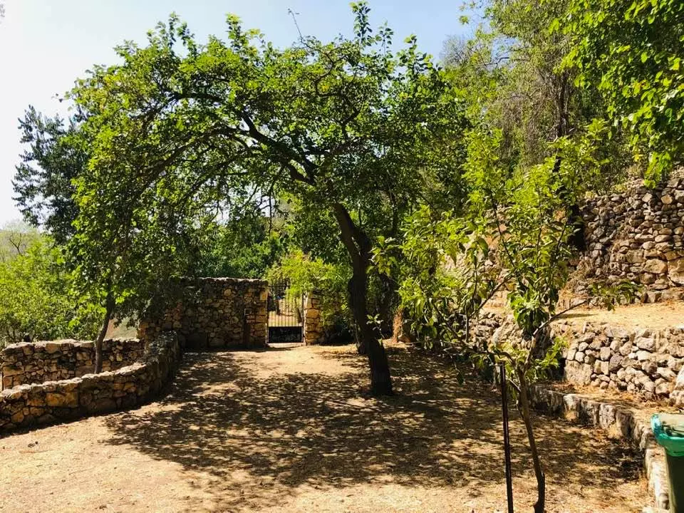
Posted by Halla Bitar 1 - Sataf park
Posted by Halla Bitar 1 - 'Ayn Karim's Monastery can be seen from Sataf's hills
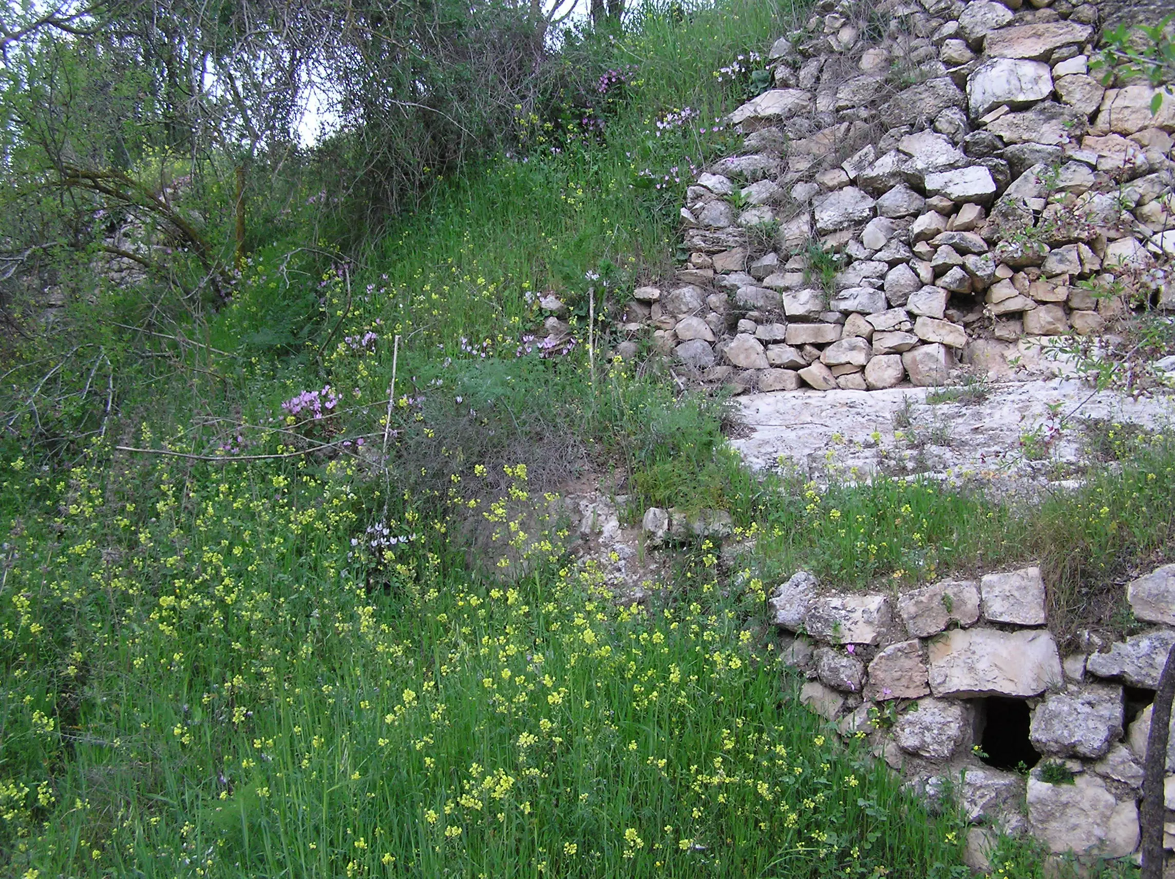
Posted by Halla Bitar - Ruins of the destroyed Palestinian houses.
3 - Oldest Satafiya

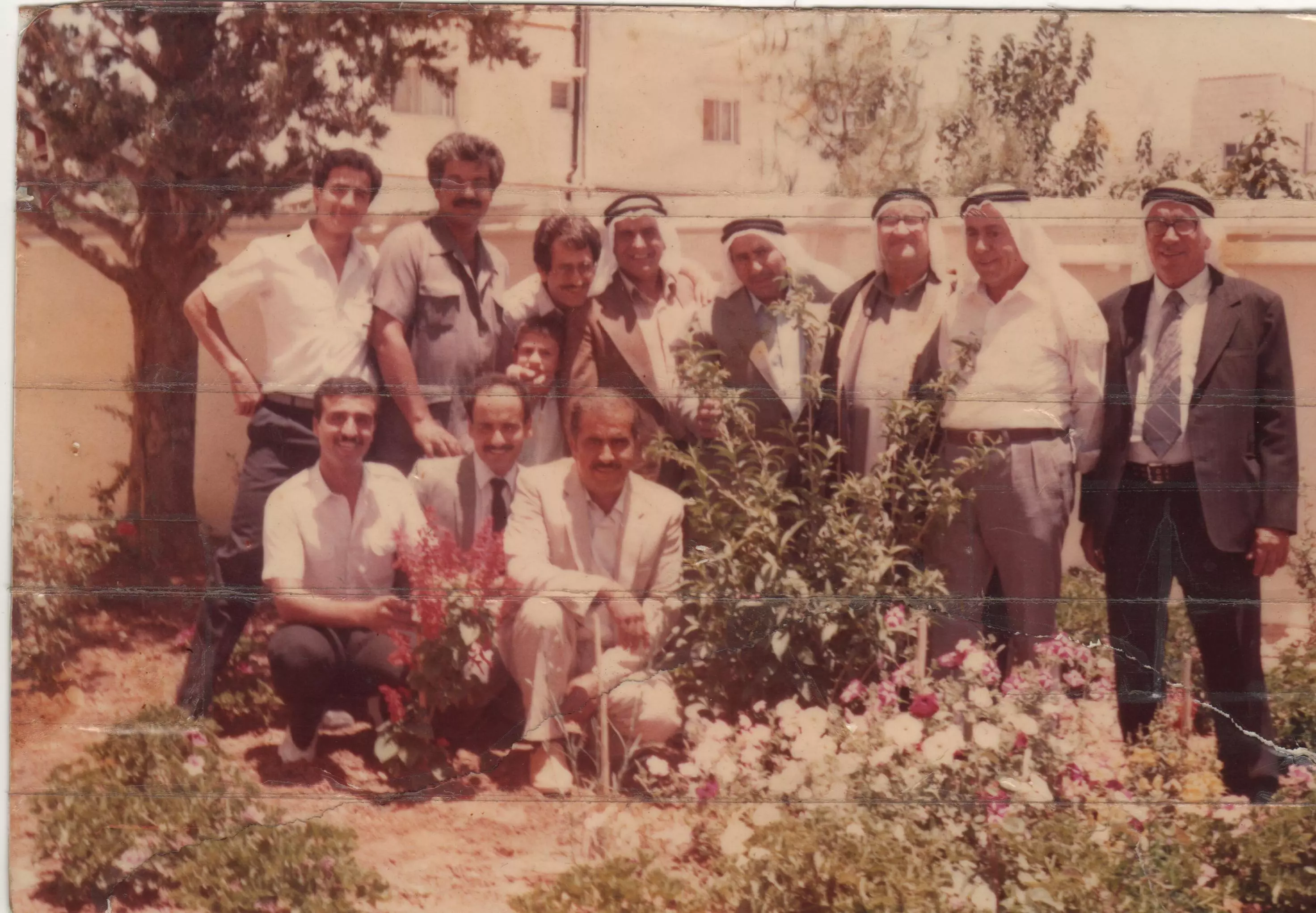
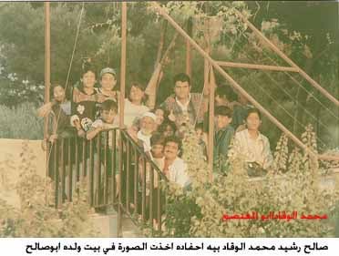
Posted by Ayman Hassan 7 - هذه الصورة لمحمود اسماعيل وقاد والد اسماعيل (ابو محمود .فايز (ابو مهنا).علي (ابو ياسين )محمد (ابو سامي )عبد اللطيف (ابو صلاح )بدر (ابو عامر) عبد الرؤف (
Posted by om dawood-hadya waqqad - فيصل الجمل من بيت سوريك في صطاف ومنظر مقابل لدير الحبيس
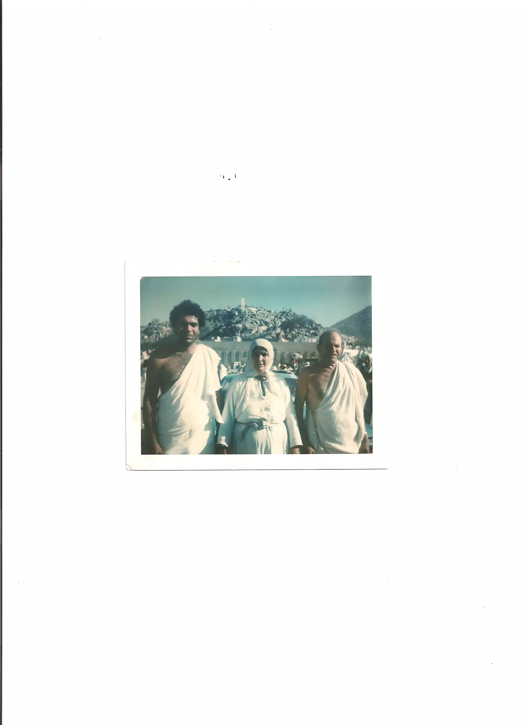
Posted by om dawood-hadya waqqad - fayez waqqad -in the middle -(died in 2001-september-14th jordan)with his son -in the left -dr. mhanna waqqad -this photo in egypt between 1964-1972-dr .mhanna waqqad was graduate from al-azhar university in egypt
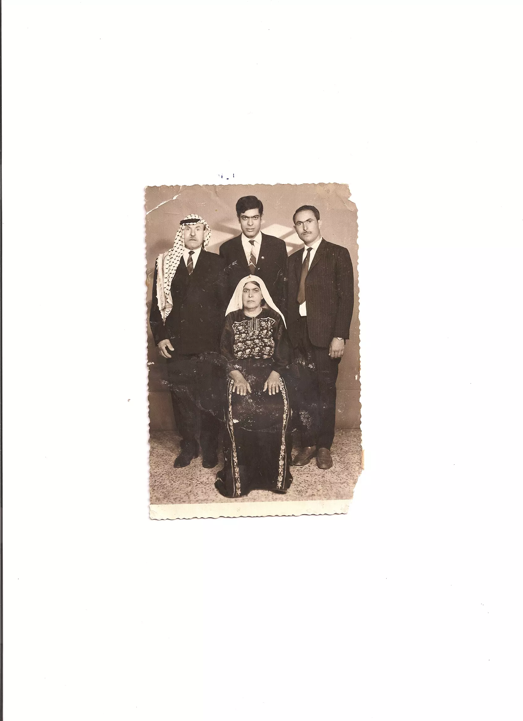
Posted by om dawood-hadya waqqad - mumbers from dar mahmod waqqad from right to left -ali abo yaseen -bader abo 3amer -fayez abo mhana -mohamad abo sami - 3abed el-lateef abo salla7 -dr. mhanna waqqad abo fayez
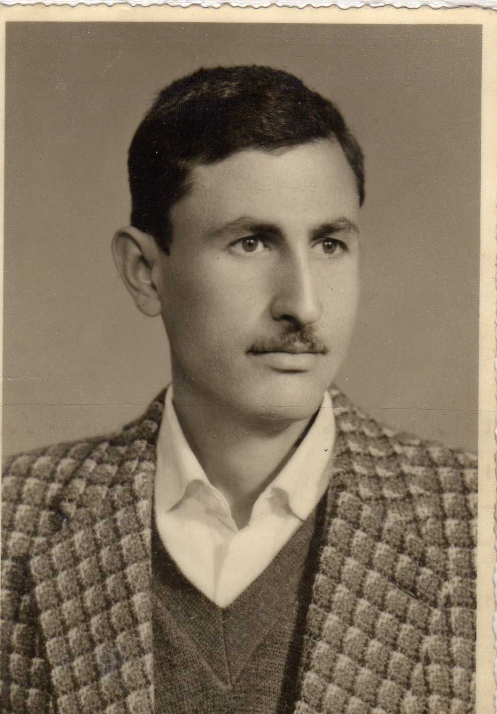
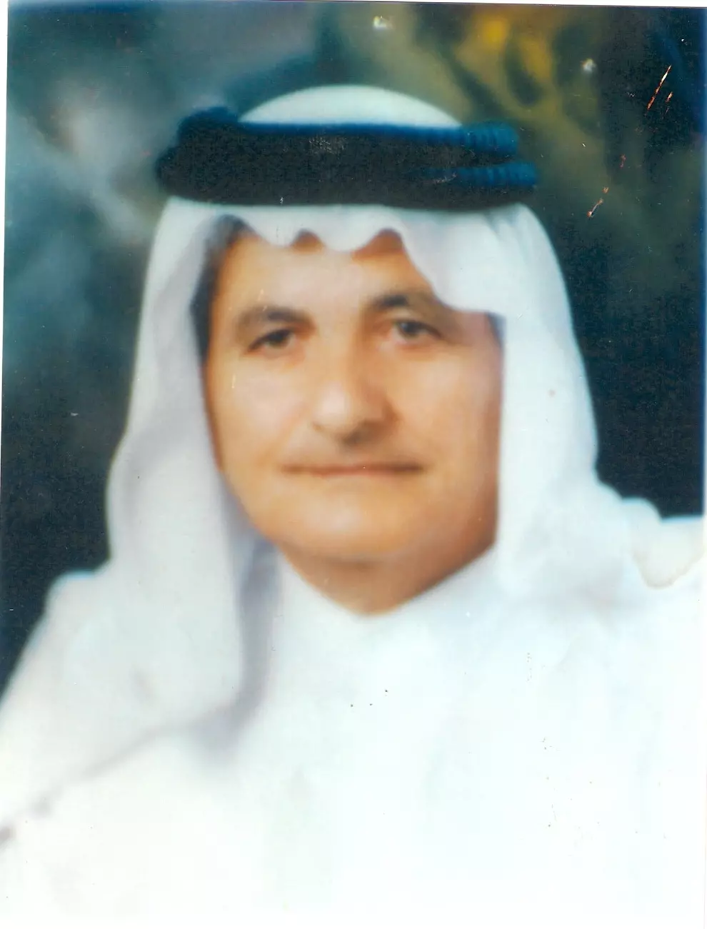
Posted by om dawood-hadya waqqad 1 - عبد الرؤوف محمود وقاد (توفي عام 1966 في عمان عن عمريناهز 28 عام )
Posted by om dawood-hadya waqqad - Sataf Remembered
Posted by Umar Abu El-Bararri 2 - Ein Sataff
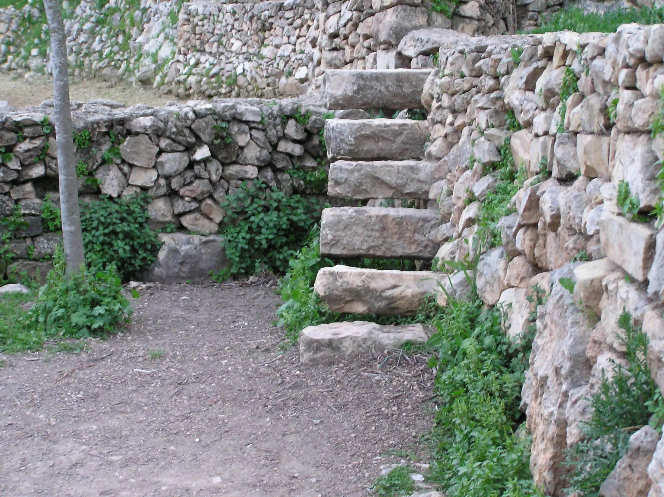
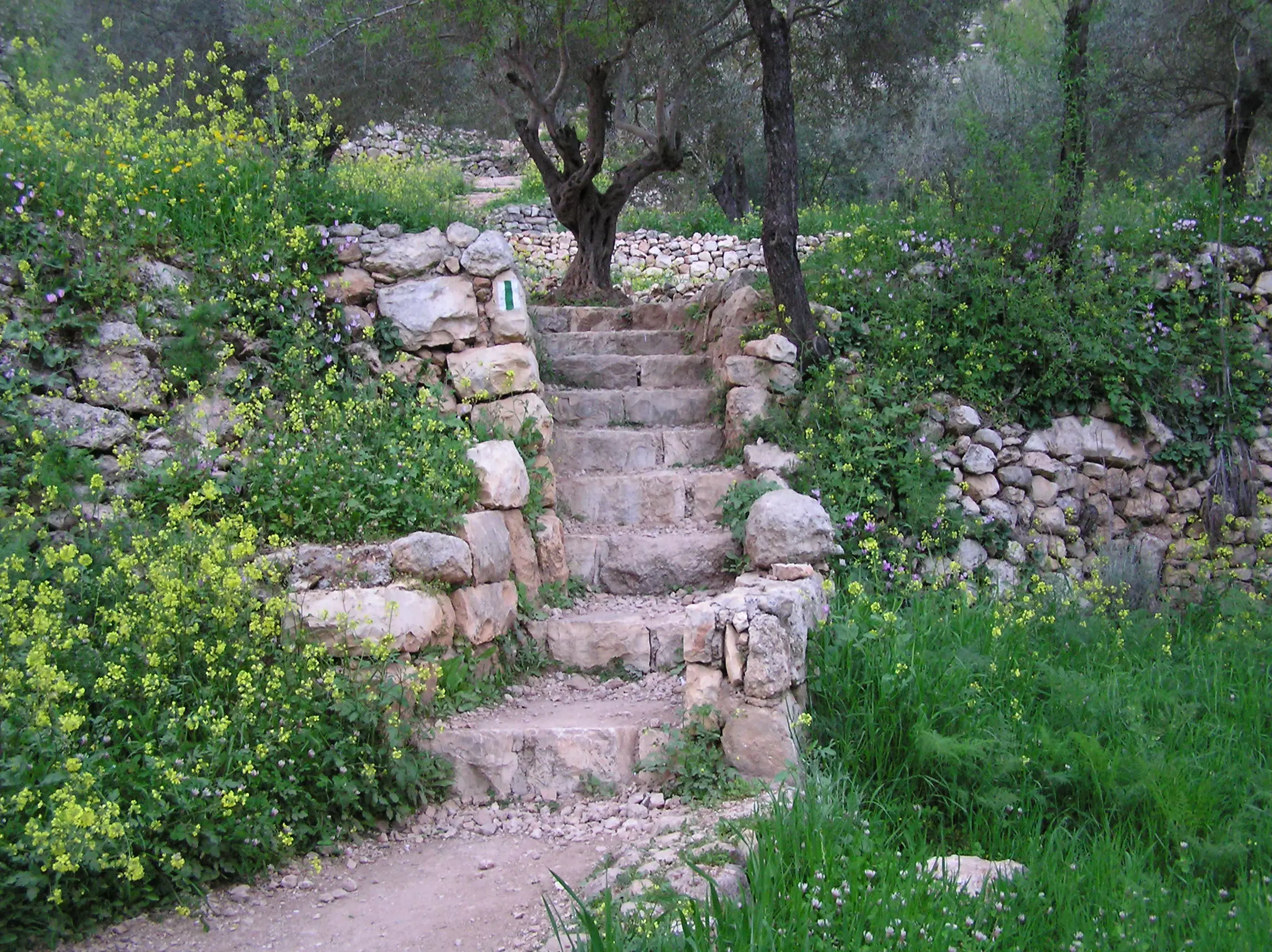
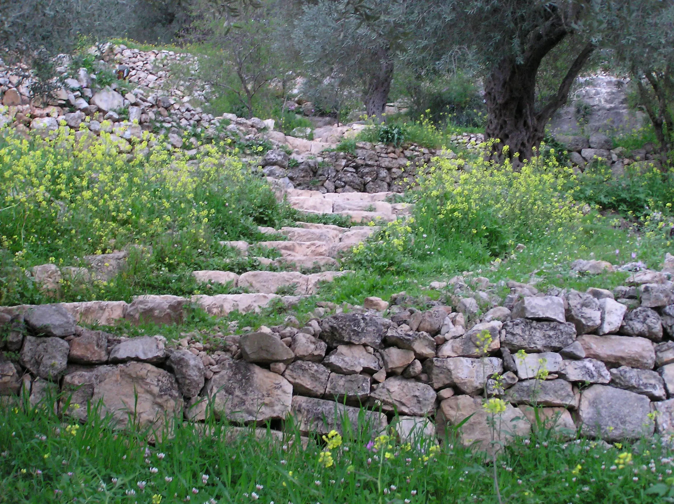
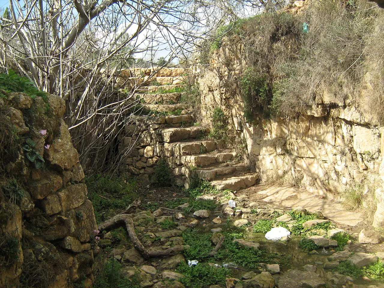
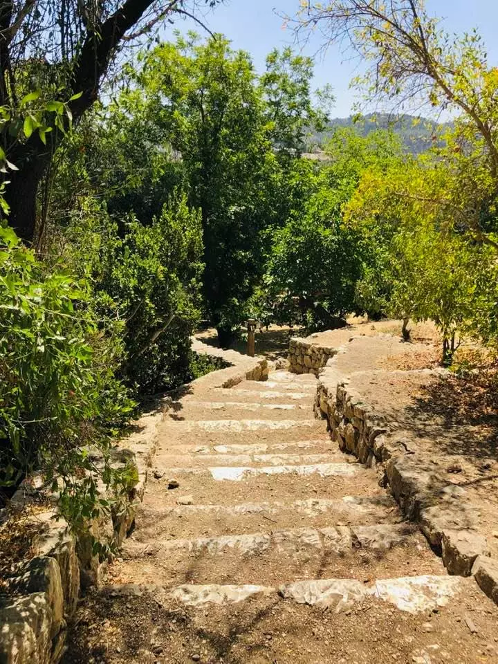
Posted by Umar Abu El-Bararri 2 - Sataff's Stone Steps
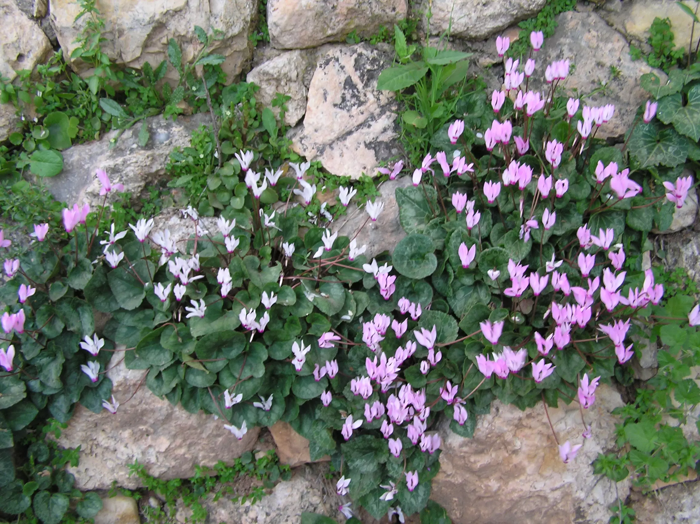
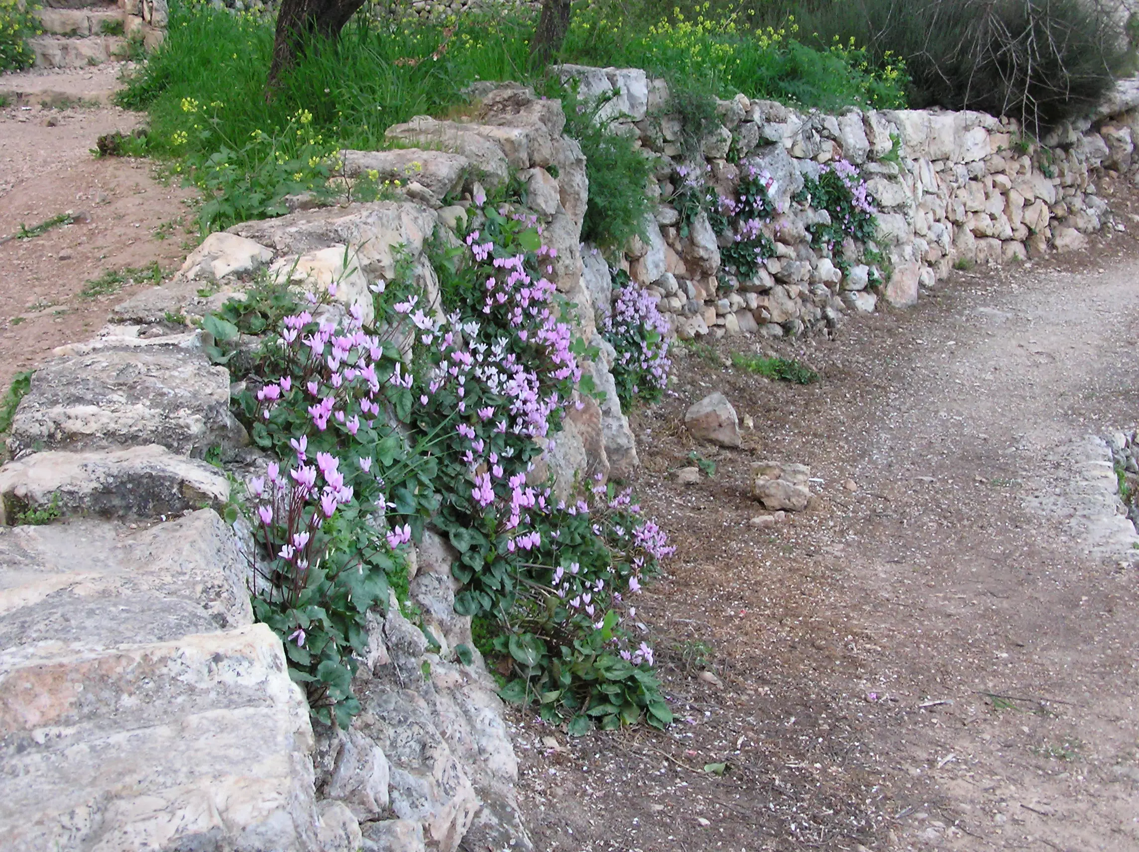
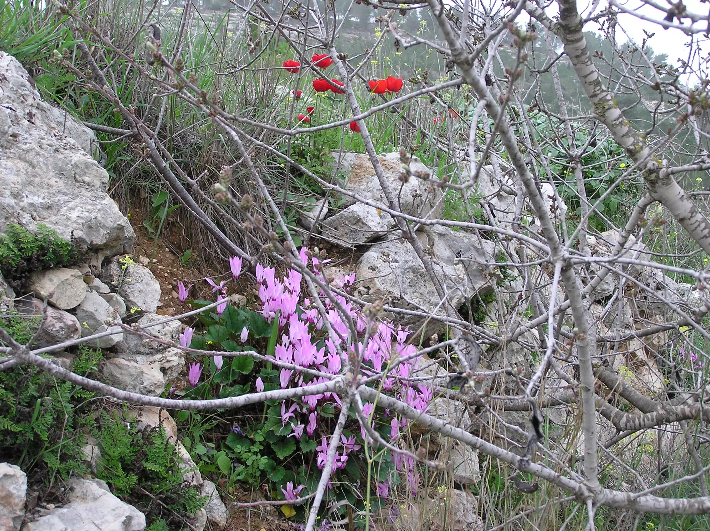
Posted by Umar Abu El-Bararri 2 - Wild Cyclamens at Sataff
Posted by Umar Abu El-Bararri - Ein Sataff
Posted by Umar Abu El-Bararri - Sataff's Spring
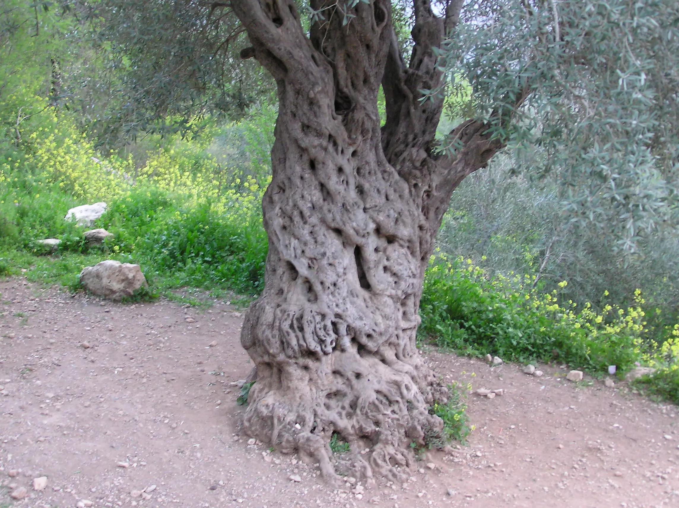
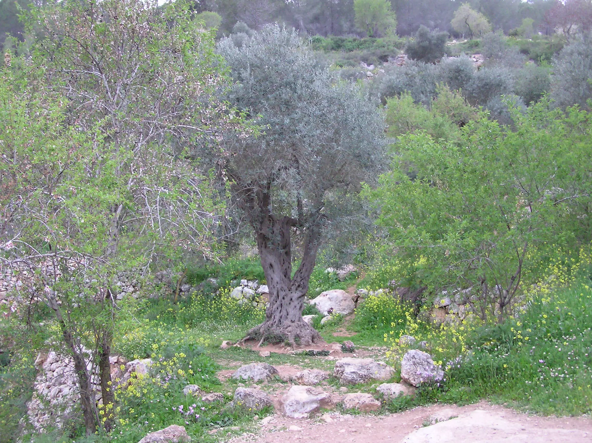
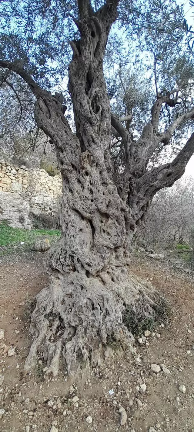
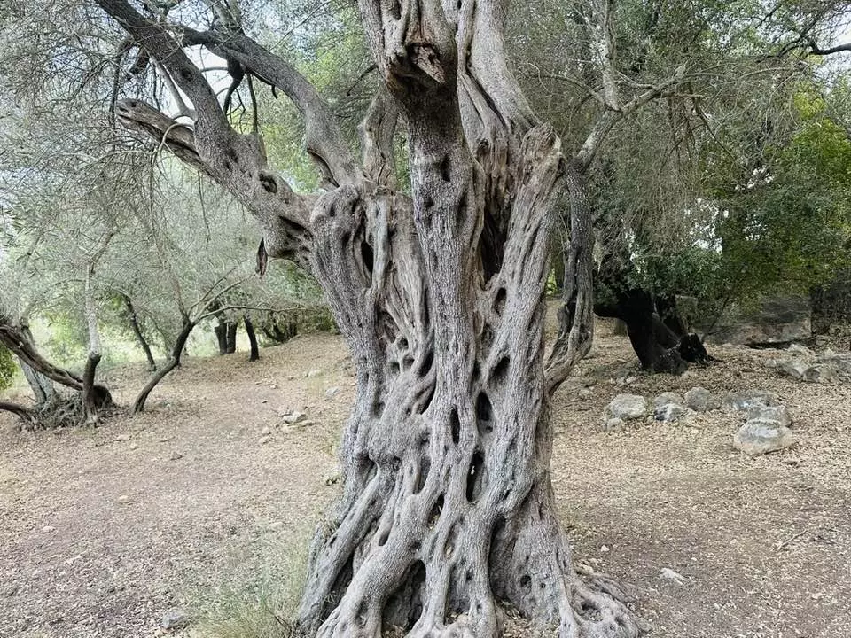
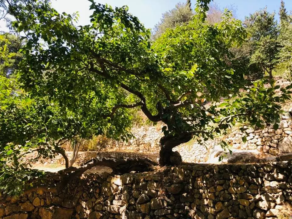
Posted by Umar Abu El-Bararri - Sataff's Olive Tree Stands As 'A Witness To Its Past'
Posted by Umar Abu El-Bararri - One of Sataff's Houses is still standing on its beautiful stone wall terraces.

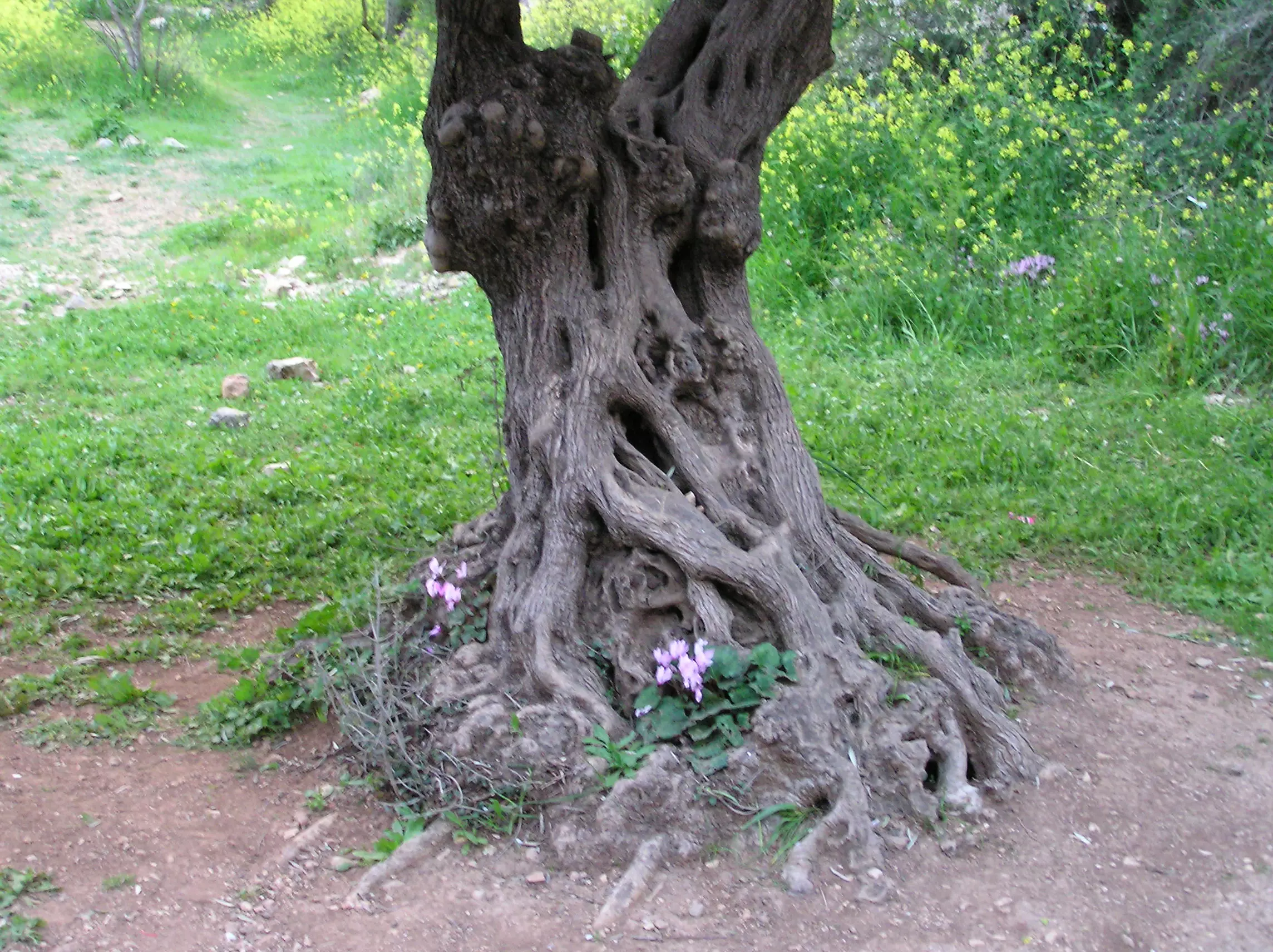
Posted by Umar Abu El-Bararri 1 - Sataff's Old Olive Tree with Wild Cyclamen
Posted by Umar Abu El-Bararri - Sataff's Wild Cyclamen in full bloom
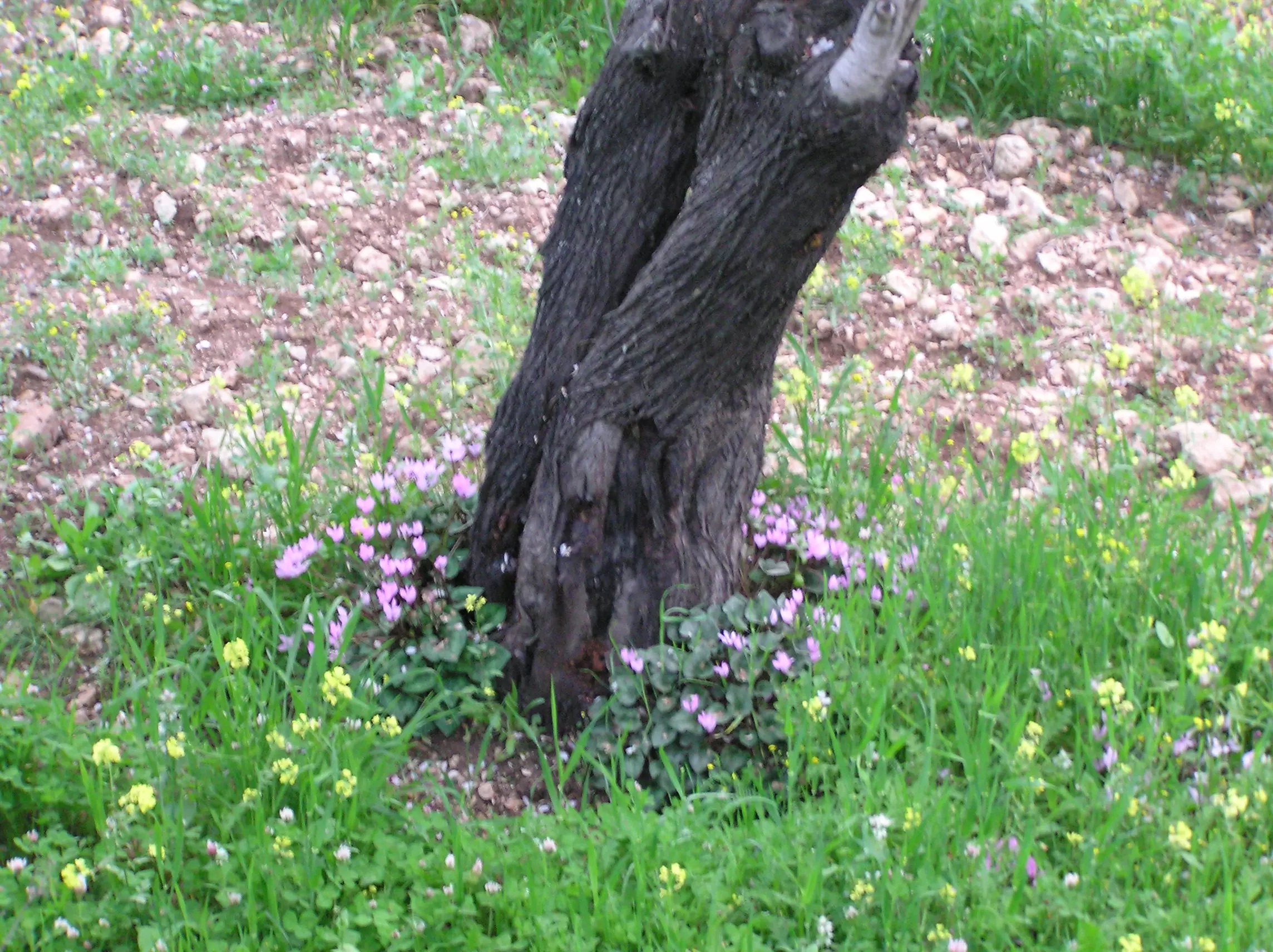
Posted by Umar Abu El-Bararri - Wild Cyclamen Around An Almond Tree In Sataff's Terrace.
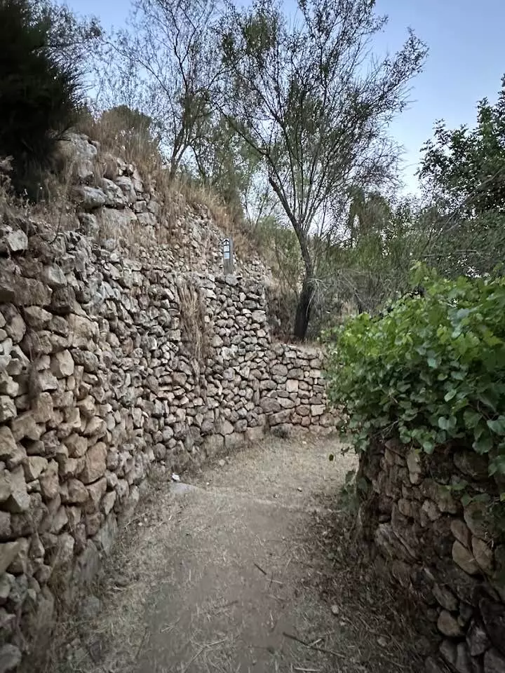
Posted by Umar Abu El-Bararri - Sataf's Terraces Stone Steps.
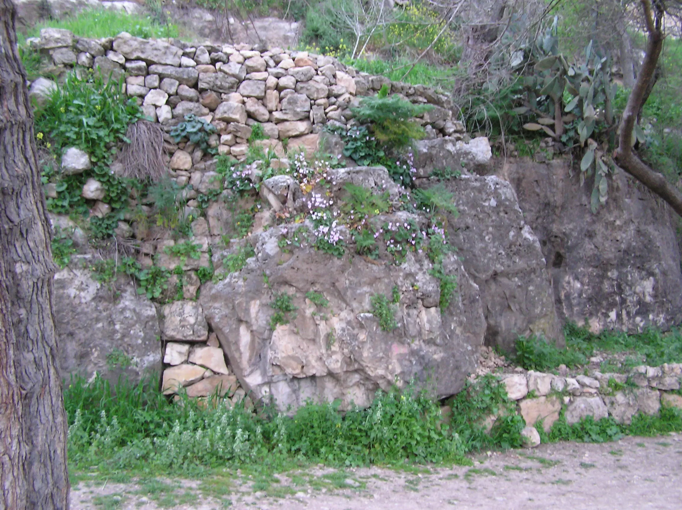
Posted by Umar Abu El-Bararri - Sataf's Rock & Stone Walls With Nature's Beauty.
Posted by Umar Abu El-Bararri - Sataf's Olive Tree Stands In Silence In Terraces Nearby The Ain.
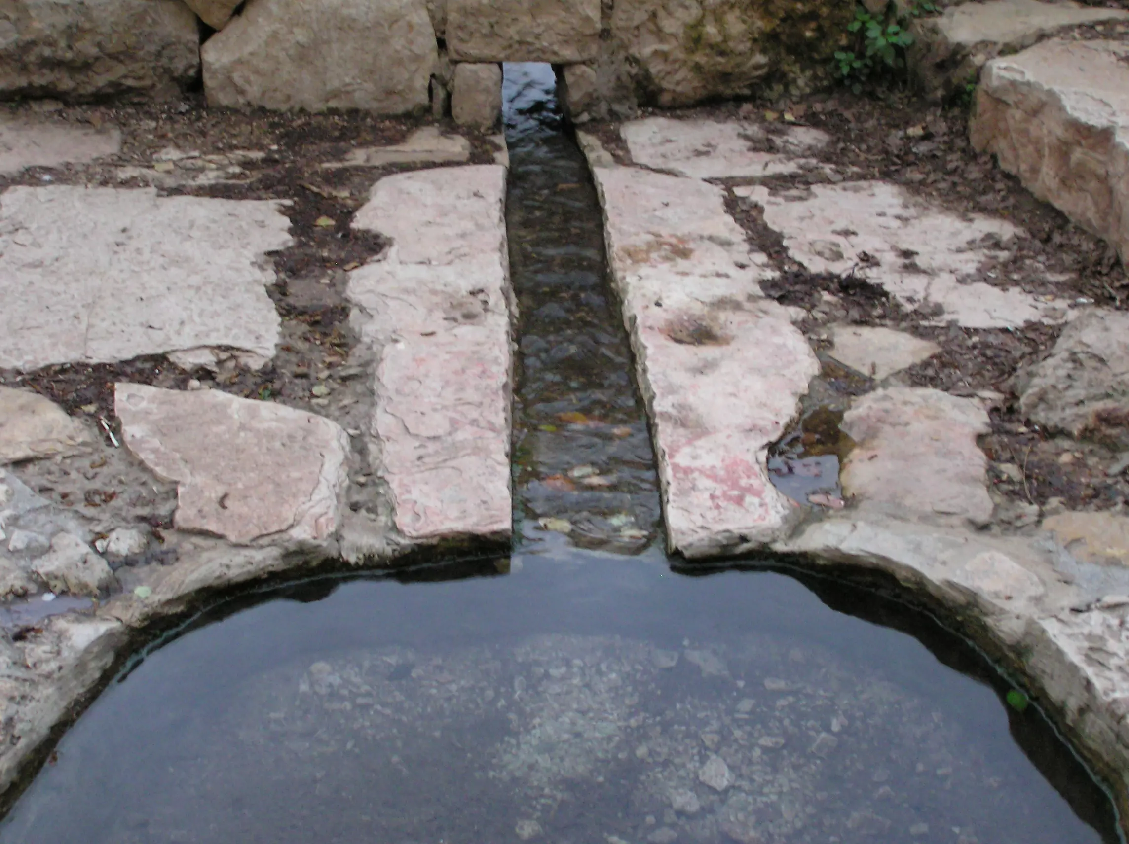
Posted by Umar Abu El-Bararri - Sataf's Ain - Water Flow Artery.
Posted by Umar Abu El-Bararri - Sataff's Nature Beauty. One My Favorite Pics.
Posted by Umar Abu El-Bararri - A View Of A Spring Scene In Sataff's Olive Terraces.
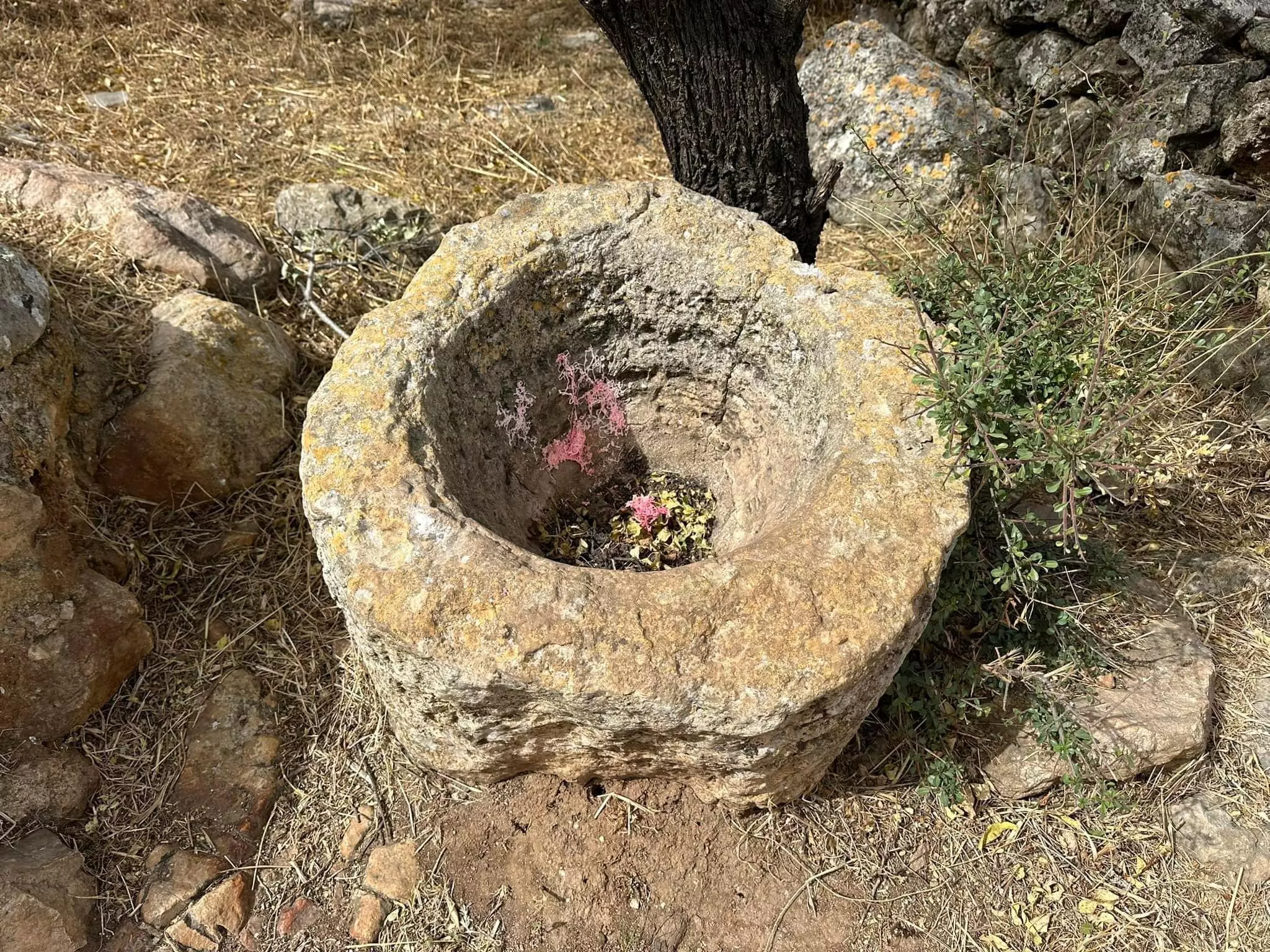
Posted by Umar Abu El-Bararri - A Hand Made & Shaped Watering Trough In Sataff. It Is Still There Next To A Well.
Posted by Umar Abu El-Bararri - غالب رشيد مرشد ابو حسين من اهل صطاف / في مغارة عين صطاف
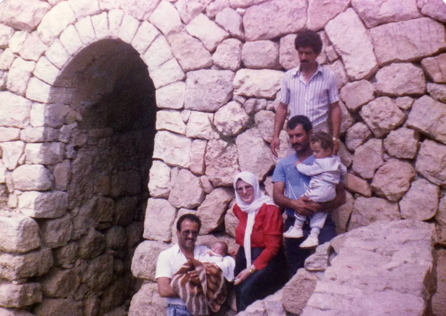
Posted by Rasha Abu-Hussein 1 - ابناء رشيد مرشد أبو حسين (غالب / راتب ) عند مدخل قرية صطاف امام خريطه قرية صطاف
Posted by Rasha Abu-Hussein 1 - جادالله محمود احمد ابو حسين / من أهل صطاف ومن الذين عاشوا بها
Posted by Rasha Abu-Hussein - مرشد رشيد أبو حسين من اهل صطاف ومن الذين عاشوا بها فترة طويلة
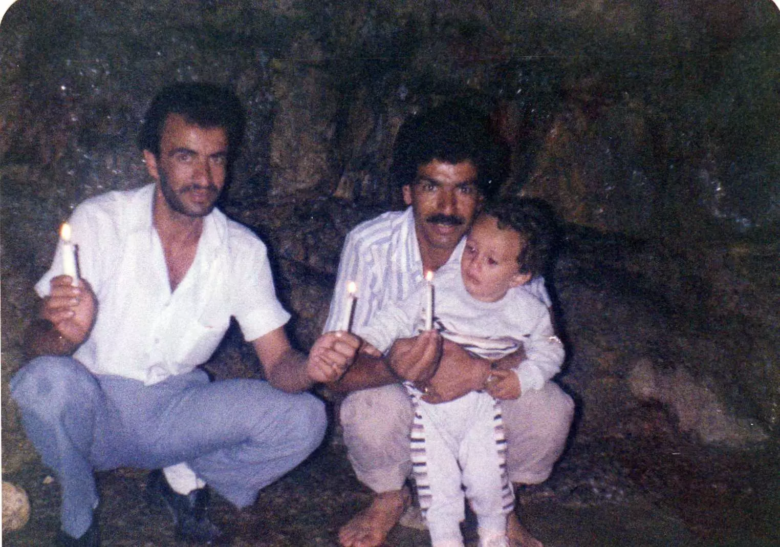
Posted by Rasha Abu-Hussein - صورة داخل الكهف الذي تنبع منه مياه البركة الكبيرة (يظهر في الصورة محمد عوده الجمل -موسى محمد الجمل -داوود فيصل الجمل (طفل) 1987)
Posted by om dawood-hadya waqqad - صوره يظهر فيها وقوفا من يمين الصوره(موسى محمد الجمل -فطين عويدات الجمل -يحمل داوود فيصل الجمل طفلا-هاديه فايز وقاد -زوجة فيصل عوده الجمل -من بيت سوريك -فيصل عوده الجمل -اخذت الصوره 1987 امام باب العين الكبيره المؤديه للكهف الذي تنبع منه مياه العين
Posted by om dawood-hadya waqqad 1 - abo abd alla
Posted by fadi 5 - منظر عام لصطاف من جهة دير الحبيس
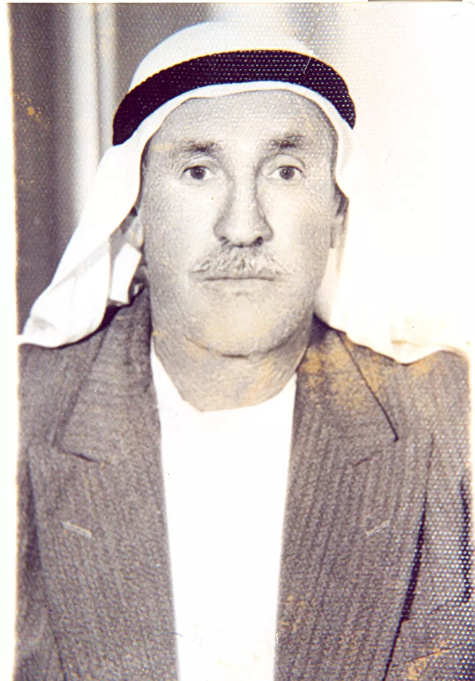
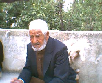
Posted by hussein abdo - صورة الحاج صالح رشيد وقاد ( رحمة الله عليه ) ولد في صطاف وتوفي في عمان عام 1998
Posted by نيفين 16 - المرحوم نمر رشيد وقاد والمرحومه فاطمه نمر وقاد -اخذت الصوره في عمان
Posted by majed jawdat waggad 5 - keeping touch with our palestine history
Posted by true - المرحوم الحاج نمر رشيد وقاد و الحاجه فاطمه وقاد و المرحوم الحاج جودت نمر وقاد / 1978/عرفات (جبل الرحمه)
Posted by majed jawdat waggad - عمي/ راغب نمر وقاد أطال الله عمره . بين أهله . المرحوم نمر رشيد وقاد و المرحومه فاطمه وقاد وأخوه المرحوم جودت وقاد /
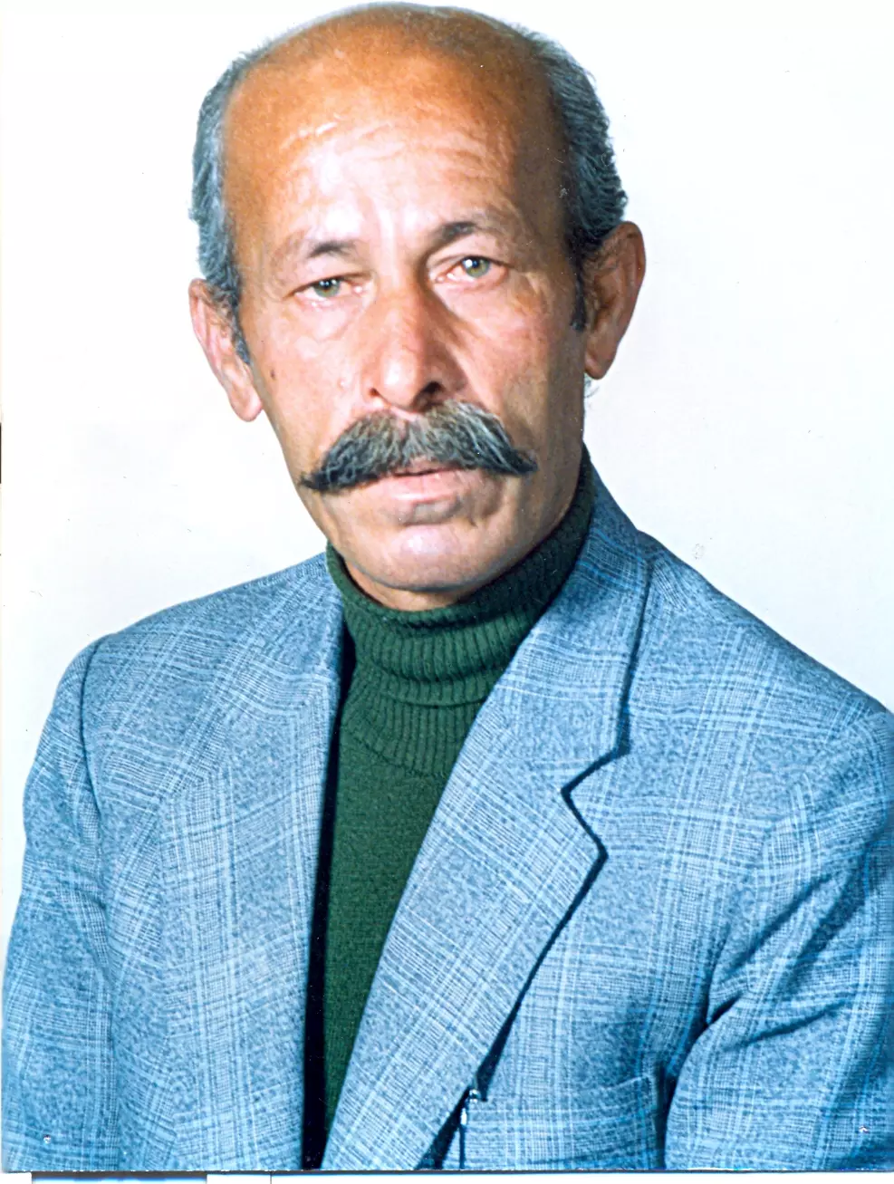
Posted by mohammed jawdat nemer waggad 2 - الحاج نعيم يوسف وقاد ( ابو محمد )
Posted by abeerotaibi 2 - صورة المرحوم بإذنه تعاليى عزام صالح وقاد (أبو صالح) المولود في صطاف 15/11/1944 والمتوفى في عمان 24/4/2011 إنا لله وإنا إليه راجعون
Posted by maha 3 - Sataf's Original Houses...Remembered...
Posted by Umar Abu El-Bararri - Sataf's Original Houses...Remembered...#2
Posted by Umar Abu El-Bararri - Sataf's Original Houses...Remembered...#3
Posted by Umar Abu El-Bararri - Images From Sataf...
Posted by Umar Abu El-Bararri - Images From Sataf...
Posted by Umar Abu El-Bararri - Sataf....The Photo Tells the Story...
Posted by Umar Abu El-Bararri - Ain Habis...The Jabal Across from Sataf. Photo taken on September 1st, 1945.
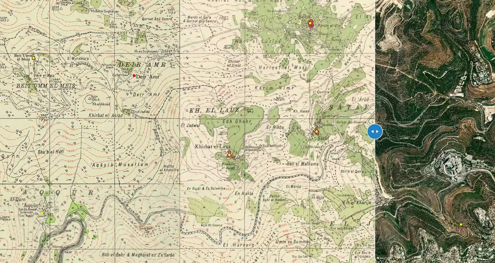
Posted by Umar Abu El-Bararri - خارطة سطاف وخربة اللوز عام 1933 مع اضافة بعض المعالم منطقة الوعر كانت خاليه من البيوت في تلك الفتره
Posted by hussein abdo - الربيع في قريه صطاف
Posted by abu raya - قريه صطاف
Posted by abu raya - بيوت صطاف
Posted by abu raya - عين قريه صطاف
Posted by abu raya - صطاف
Posted by abu raya - بيوت صطاف
Posted by abu raya - بيوت صطاف
Posted by abu raya - صطاف
Posted by abu raya - قريه صطاف
Posted by abu raya - قريه صطاف
Posted by abu raya - قريه صطاف
Posted by abu raya - اراضي قريه صطاف
Posted by abu raya - قريه صطاف
Posted by abu raya - قريه صطاف
Posted by abu raya - قريه صطاف
Posted by abu raya - عين صطاف
Posted by abu raya - قرية صَطاف ( سطاف) المهجرة قضاء القدس مقابل عين كارم . بعدسة سهيل مخول - البقيعة
Posted by سهيل مخول - قرية صَطاف ( سطاف) المهجرة قضاء القدس مقابل عين كارم . بعدسة سهيل مخول - البقيعة
Posted by سهيل مخول - قرية صَطاف ( سطاف) المهجرة قضاء القدس مقابل عين كارم . بعدسة سهيل مخول - البقيعة
Posted by سهيل مخول - قرية صَطاف ( سطاف) المهجرة قضاء القدس مقابل عين كارم . بعدسة سهيل مخول - البقيعة
Posted by سهيل مخول - قرية صَطاف ( سطاف) المهجرة قضاء القدس مقابل عين كارم . بعدسة سهيل مخول - البقيعة
Posted by سهيل مخول - قرية صَطاف ( سطاف) المهجرة قضاء القدس مقابل عين كارم . بعدسة سهيل مخول - البقيعة
Posted by سهيل مخول - قرية صَطاف ( سطاف) المهجرة قضاء القدس مقابل عين كارم . بعدسة سهيل مخول - البقيعة
Posted by سهيل مخول - قرية صَطاف ( سطاف) المهجرة قضاء القدس مقابل عين كارم . بعدسة سهيل مخول - البقيعة
Posted by سهيل مخول - قرية صَطاف ( سطاف) المهجرة قضاء القدس مقابل عين كارم . بعدسة سهيل مخول - البقيعة
Posted by سهيل مخول - قرية صَطاف ( سطاف) المهجرة قضاء القدس مقابل عين كارم . بعدسة سهيل مخول - البقيعة
Posted by سهيل مخول - قرية صَطاف ( سطاف) المهجرة قضاء القدس مقابل عين كارم . بعدسة سهيل مخول - البقيعة

Posted by سهيل مخول - قرية صَطاف ( سطاف) المهجرة قضاء القدس مقابل عين كارم . بعدسة سهيل مخول - البقيعة
Posted by سهيل مخول - قرية صَطاف ( سطاف) المهجرة قضاء القدس مقابل عين كارم . بعدسة سهيل مخول - البقيعة
Posted by سهيل مخول - قرية صَطاف ( سطاف) المهجرة قضاء القدس مقابل عين كارم . بعدسة سهيل مخول - البقيعة

Posted by سهيل مخول - قرية صَطاف ( سطاف) المهجرة قضاء القدس مقابل عين كارم . بعدسة سهيل مخول - البقيعة
Posted by سهيل مخول - قرية صَطاف ( سطاف) المهجرة قضاء القدس مقابل عين كارم . بعدسة سهيل مخول - البقيعة
Posted by سهيل مخول - قرية صَطاف ( سطاف) المهجرة قضاء القدس مقابل عين كارم . بعدسة سهيل مخول - البقيعة

Posted by سهيل مخول - قرية صَطاف ( سطاف) المهجرة قضاء القدس مقابل عين كارم . بعدسة سهيل مخول - البقيعة
Posted by سهيل مخول - قرية صَطاف ( سطاف) المهجرة قضاء القدس مقابل عين كارم . بعدسة سهيل مخول - البقيعة
Posted by سهيل مخول - قرية صَطاف ( سطاف) المهجرة قضاء القدس مقابل عين كارم . بعدسة سهيل مخول - البقيعة
Posted by سهيل مخول - قرية صَطاف ( سطاف) المهجرة قضاء القدس مقابل عين كارم . بعدسة سهيل مخول - البقيعة
Posted by سهيل مخول - قرية صَطاف ( سطاف) المهجرة قضاء القدس مقابل عين كارم . بعدسة سهيل مخول - البقيعة
Posted by سهيل مخول - قرية صَطاف ( سطاف) المهجرة قضاء القدس مقابل عين كارم . بعدسة سهيل مخول - البقيعة
Posted by سهيل مخول - قرية صَطاف ( سطاف) المهجرة قضاء القدس مقابل عين كارم . بعدسة سهيل مخول - البقيعة
Posted by سهيل مخول - قرية صَطاف ( سطاف) المهجرة قضاء القدس مقابل عين كارم . بعدسة سهيل مخول - البقيعة
Posted by سهيل مخول - قرية صَطاف ( سطاف) المهجرة قضاء القدس مقابل عين كارم . بعدسة سهيل مخول - البقيعة
Posted by سهيل مخول - قرية صَطاف ( سطاف) المهجرة قضاء القدس مقابل عين كارم . بعدسة سهيل مخول - البقيعة
Posted by سهيل مخول - قرية صَطاف ( سطاف) المهجرة قضاء القدس مقابل عين كارم . بعدسة سهيل مخول - البقيعة

Posted by سهيل مخول - قرية صَطاف ( سطاف) المهجرة قضاء القدس مقابل عين كارم . بعدسة سهيل مخول - البقيعة
Posted by سهيل مخول - قرية صَطاف ( سطاف) المهجرة قضاء القدس مقابل عين كارم . بعدسة سهيل مخول - البقيعة
Posted by سهيل مخول - قرية صَطاف ( سطاف) المهجرة قضاء القدس مقابل عين كارم . بعدسة سهيل مخول - البقيعة
Posted by سهيل مخول - قرية صَطاف ( سطاف) المهجرة قضاء القدس مقابل عين كارم . بعدسة سهيل مخول - البقيعة
Posted by سهيل مخول - قرية صَطاف ( سطاف) المهجرة قضاء القدس مقابل عين كارم . بعدسة سهيل مخول - البقيعة
Posted by سهيل مخول - قرية صَطاف ( سطاف) المهجرة قضاء القدس مقابل عين كارم . بعدسة سهيل مخول - البقيعة
Posted by سهيل مخول - قرية صَطاف ( سطاف) المهجرة قضاء القدس مقابل عين كارم . بعدسة سهيل مخول - البقيعة
Posted by سهيل مخول - منظر عام لقرية صَطاف ( سطاف) المهجرة قضاء القدس مقابل عين كارم . بعدسة سهيل مخول - البقيعة
Posted by سهيل مخول - عين البلد - عين صطاف بعدسة سهيل مخول
Posted by سهيل مخول - المرحوم الحاج راغب نمر رشيد وقاد ولد في سطاف عام 1934 وتوفي في عمان عام 2020

Posted by Nael AL Waqqad - بيت في دير الحبيس بين عين كارم وصطاف قضاء القدس عشرينيات القرن العشرين..
- منظر عام
- عين صطاف -- واجد النوباني -- 2022
- A Rumi olive tree in the lands of Sataf
- A tour of Palestinian homes that were destroyed by the "most civilized". How else will the Jews be great again? Mazletov
- A tour of Palestinian homes that were destroyed by the "most civilized". How else will the Jews be great again? Mazletov #2
- A tour of Palestinian homes that were destroyed by the "most civilized". How else will the Jews be great again? Mazletov #3
- A tour of Palestinian homes that were destroyed by the "most civilized". How else will the Jews be great again? Mazletov #4
- The hill (jabal) across from Sataf. September 1, 1945.

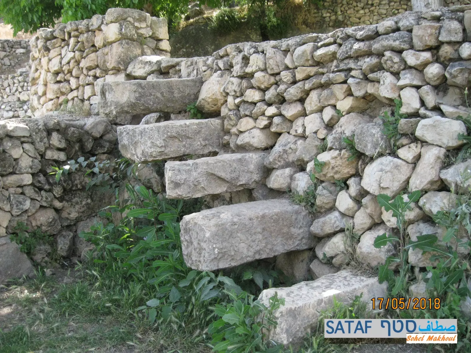
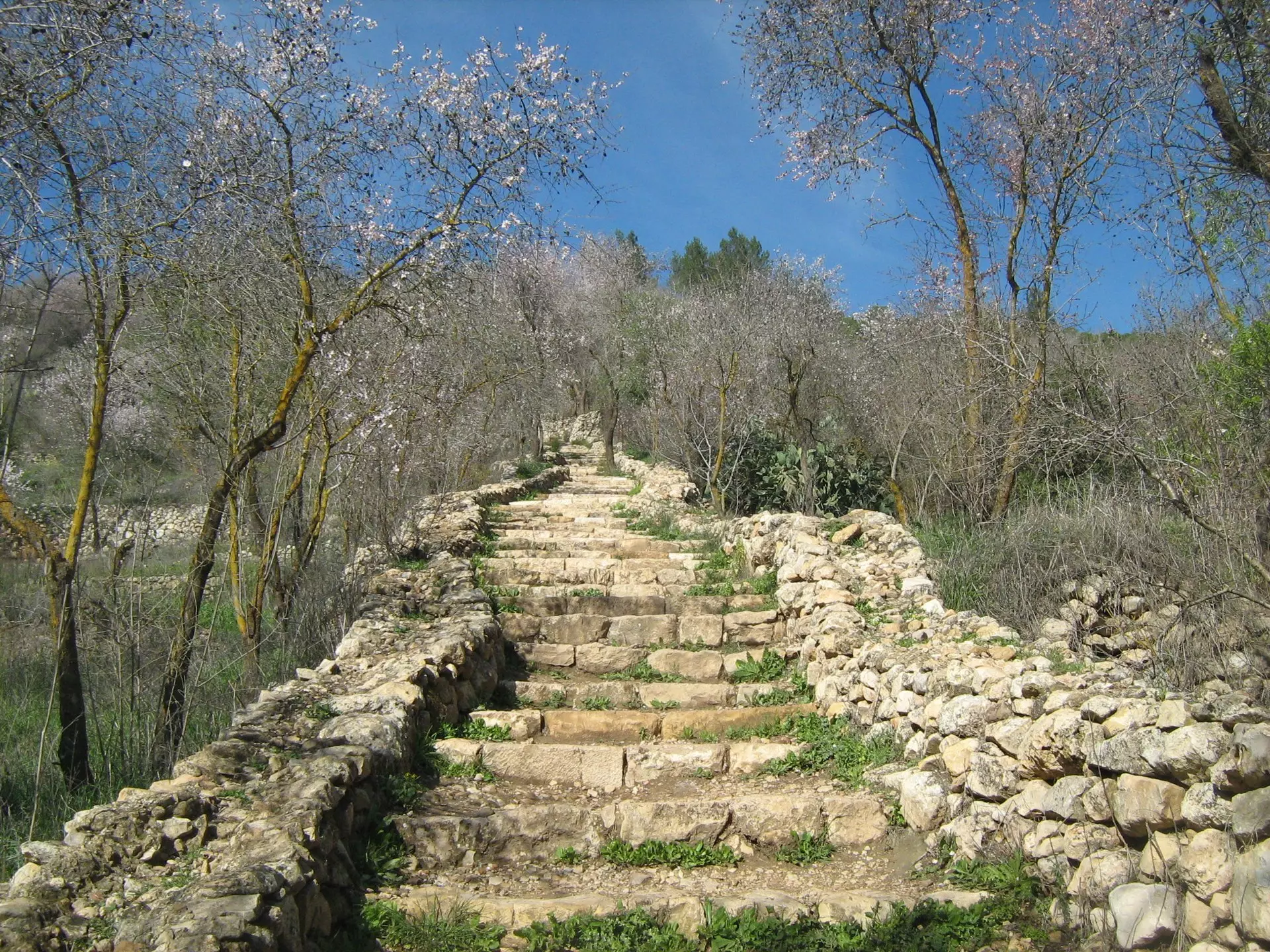
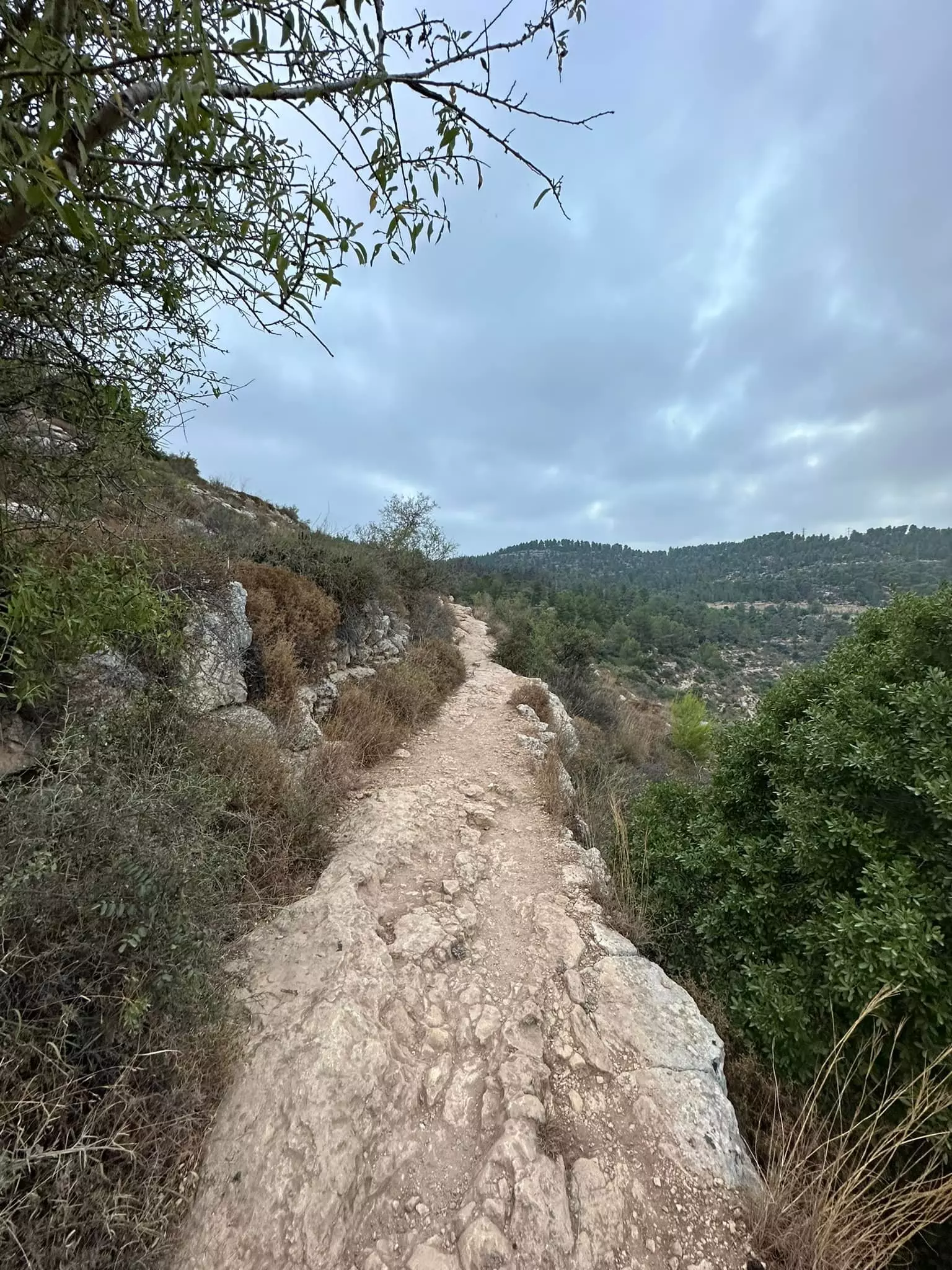
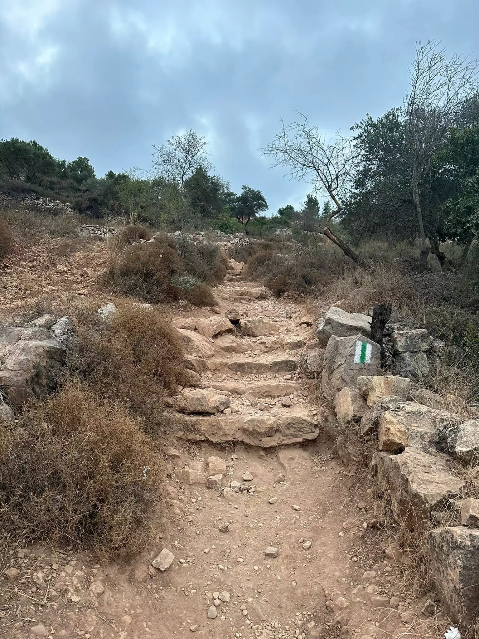
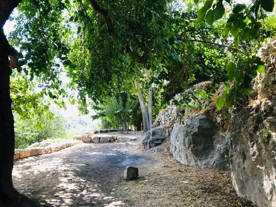
- Sataf's famous stairs -- الدرج
- Ein Sataf (Ein El-Balad), 2022
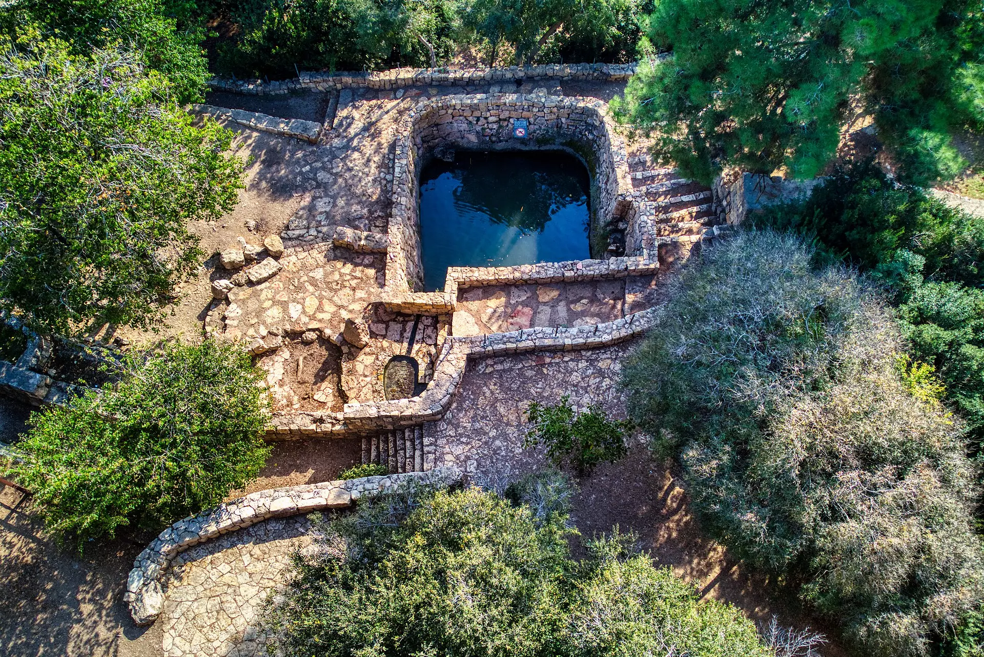
- Ein Sataf, 2009
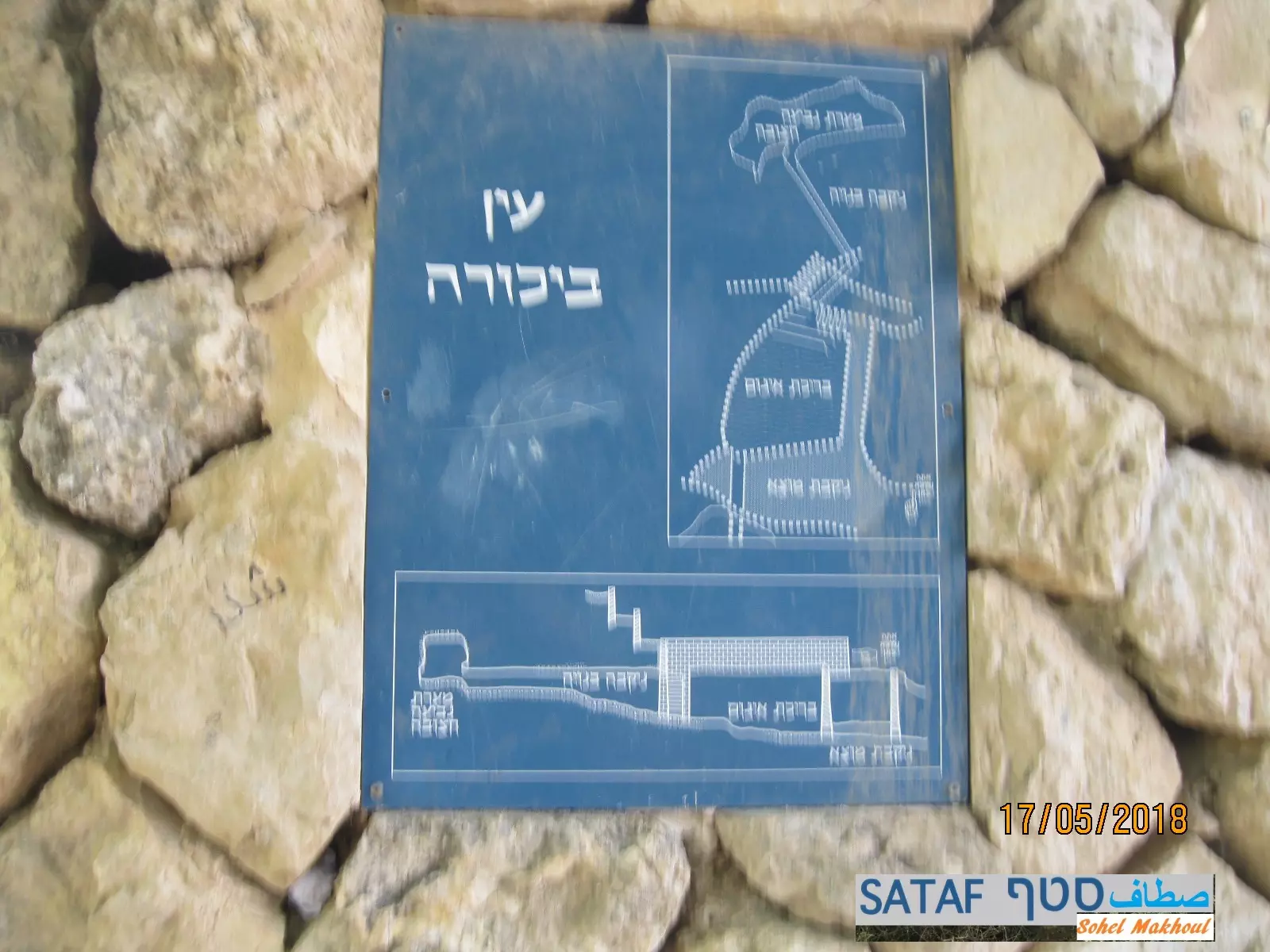
- Sataf's famous Spring Ein Bikura (Ein E-Sharkia), 2022 -- العين الشرقية
- العين الشرقية -- 2009
- We lived in peace until the "civilized" replaced us. How else shall Jews know "peace"? Don't make it a big deal. All Western civilizations were based on genocides, plunder, Jim Crow and land theft. Don't single out the Jews, please!
- That is how the "civilized" erased and replaced us: Sataf was completely obliterated, as you see -- صطاف باتت أثر بعد عين. من هنا مر الهمجّ
- That is how the "civilized" erased and replaced us: Sataf was completely obliterated, as you see -- صطاف باتت أثر بعد عين. من هنا مر الهمجّ #2
- That is how the "civilized" erased and replaced us: Sataf was completely obliterated, as you see -- صطاف باتت أثر بعد عين. من هنا مر الهمجّ #3
- That is how the "civilized" erased and replaced us: Sataf was completely obliterated, as you see -- صطاف باتت أثر بعد عين. من هنا مر الهمجّ
- That is how the "civilized" erased and replaced us: Sataf was completely obliterated, as you see -- صطاف باتت أثر بعد عين. من هنا مر الهمجّ
#2
- That is how the "civilized" erased and replaced us: Sataf was completely obliterated, as you see -- صطاف باتت أثر بعد عين. من هنا مر الهمجّ
#3
- That is how the "civilized" erased and replaced us: Sataf was completely obliterated, as you see -- صطاف باتت أثر بعد عين. من هنا مر الهمجّ
#4
- That is how the "civilized" erased and replaced us: Sataf was completely obliterated, as you see -- صطاف باتت أثر بعد عين. من هنا مر الهمجّ
#5
- That is how the "civilized" erased and replaced us: Sataf was completely obliterated, as you see -- صطاف باتت أثر بعد عين. من هنا مر الهمجّ
#6
- That is how the "civilized" erased and replaced us: Sataf was completely obliterated, as you see -- صطاف باتت أثر بعد عين. من هنا مر الهمجّ
#7
- That is how the "civilized" erased and replaced us: Sataf was completely obliterated, as you see -- صطاف باتت أثر بعد عين. من هنا مر الهمجّ
#8
- That is how the "civilized" erased and replaced us: Sataf was completely obliterated, as you see -- صطاف باتت أثر بعد عين. من هنا مر الهمجّ
#9
- That is how the "civilized" erased and replaced us: Sataf was completely obliterated, as you see -- صطاف باتت أثر بعد عين. من هنا مر الهمجّ
- That is how the "civilized" erased and replaced us: Sataf was completely obliterated, as you see -- صطاف باتت أثر بعد عين. من هنا مر الهمجّ #2

- That is how the "civilized" erased and replaced us: Sataf was completely obliterated, as you see -- صطاف باتت أثر بعد عين. من هنا مر الهمجّ #3
- That is how the "civilized" erased and replaced us: Sataf was completely obliterated, as you see -- صطاف باتت أثر بعد عين. من هنا مر الهمجّ #4
- That is how the "civilized" erased and replaced us: Sataf was completely obliterated, as you see -- صطاف باتت أثر بعد عين. من هنا مر الهمجّ #5
- That is how the "civilized" erased and replaced us: Sataf was completely obliterated, as you see -- صطاف باتت أثر بعد عين. من هنا مر الهمجّ #6
- That is how the "civilized" erased and replaced us: Sataf was completely obliterated, as you see -- صطاف باتت أثر بعد عين. من هنا مر الهمجّ #7
- That is how the "civilized" erased and replaced us: Sataf was completely obliterated, as you see -- صطاف باتت أثر بعد عين. من هنا مر الهمجّ #8
- That is how the "civilized" erased and replaced us: Sataf was completely obliterated, as you see -- صطاف باتت أثر بعد عين. من هنا مر الهمجّ #9
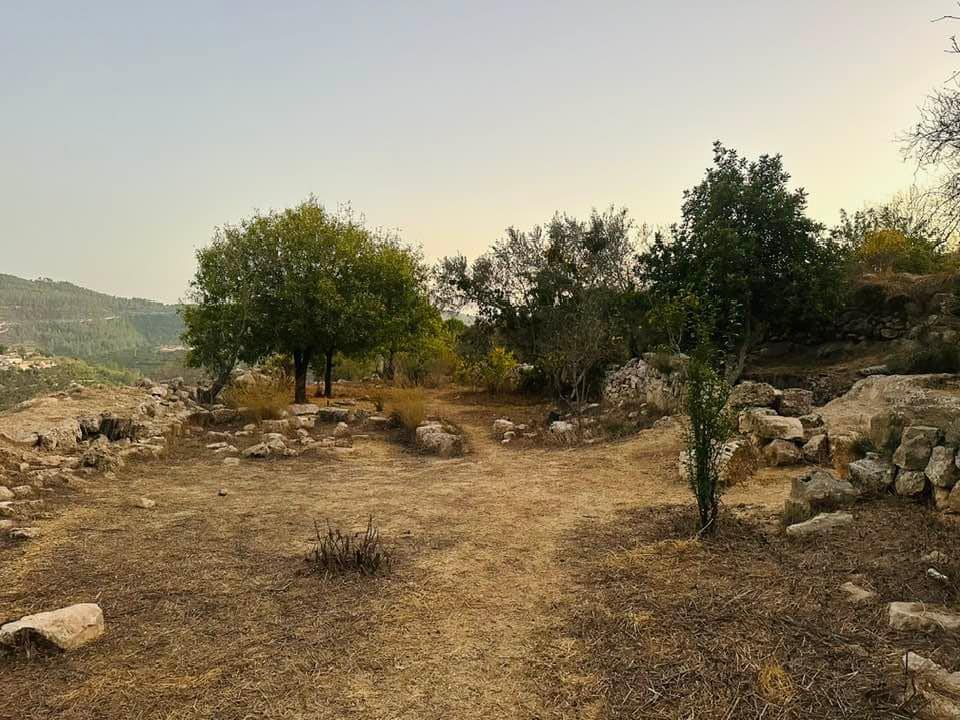
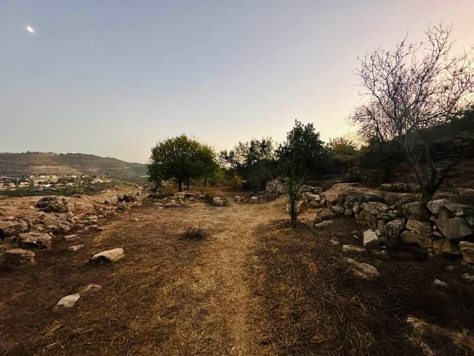
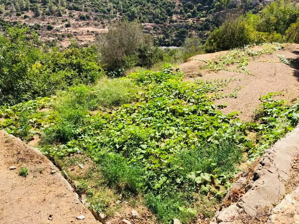
- Let's tour Sataf's old terraces, which were built by those who "never existed". Let us tour their grapevines. Let us tour their Olive, Almond, and Fig groves. Let's see how the most "civilized" erased and replaced the indigenous people
- Let's tour Sataf's old terraces, which were built by those who "never existed". Let us tour their grapevines. Let us tour their Olive, Almond, and Fig groves. Let's see how the most "civilized" erased and replaced the indigenous people #2
- Let's tour Sataf's old terraces, which were built by those who "never existed". Let us tour their grapevines. Let us tour their Olive, Almond, and Fig groves. Let's see how the most "civilized" erased and replaced the indigenous people #3
- Let's tour Sataf's old terraces, which were built by those who "never existed". Let us tour their grapevines. Let us tour their Olive, Almond, and Fig groves. Let's see how the most "civilized" erased and replaced the indigenous people #4
- Let's tour Sataf's old terraces, which were built by those who "never existed". Let us tour their grapevines. Let us tour their Olive, Almond, and Fig groves. Let's see how the most "civilized" erased and replaced the indigenous people #5
- Let's tour Sataf's old terraces, which were built by those who "never existed". Let us tour their grapevines. Let us tour their Olive, Almond, and Fig groves. Let's see how the most "civilized" erased and replaced the indigenous people #6
- Let's tour Sataf's old terraces, which were built by those who "never existed". Let us tour their grapevines. Let us tour their Olive, Almond, and Fig groves. Let's see how the most "civilized" erased and replaced the indigenous people #7
- Let's tour Sataf's old terraces, which were built by those who "never existed". Let us tour their grapevines. Let us tour their Olive, Almond, and Fig groves. Let's see how the most "civilized" erased and replaced the indigenous people #8
- Let's tour Sataf's old terraces, which were built by those who "never existed". Let us tour their grapevines. Let us tour their Olive, Almond, and Fig groves. Let's see how the most "civilized" erased and replaced the indigenous people #9
- Let's tour Sataf's old terraces, which were built by those who "never existed". Let us tour their grapevines. Let us tour their Olive, Almond, and Fig groves. Let's see how the most "civilized" erased and replaced the indigenous people #10
- Let's tour Sataf's old terraces, which were built by those who "never existed". Let us tour their grapevines. Let us tour their Olive, Almond, and Fig groves. Let's see how the most "civilized" erased and replaced the indigenous people #11
- Let's tour Sataf's old terraces, which were built by those who "never existed". Let us tour their grapevines. Let us tour their Olive, Almond, and Fig groves. Let's see how the most "civilized" erased and replaced the indigenous people #12
- Let's tour Sataf's old terraces, which were built by those who "never existed". Let us tour their grapevines. Let us tour their Olive, Almond, and Fig groves. Let's see how the most "civilized" erased and replaced the indigenous people #13
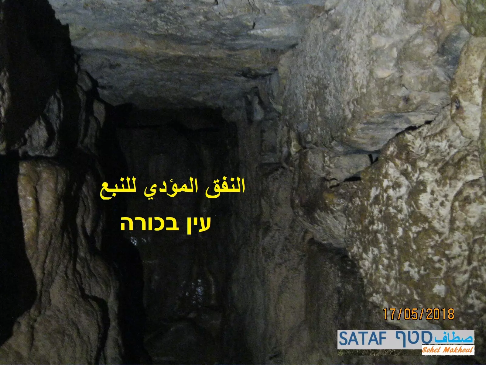
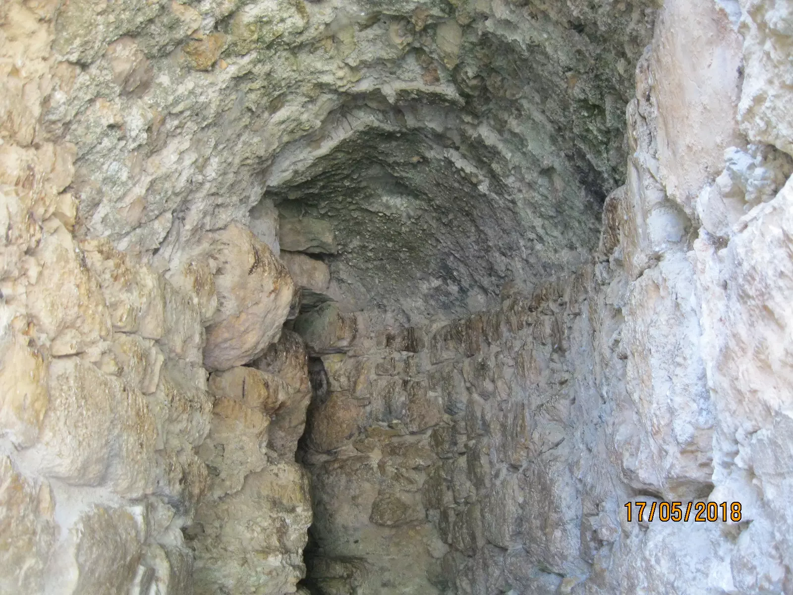
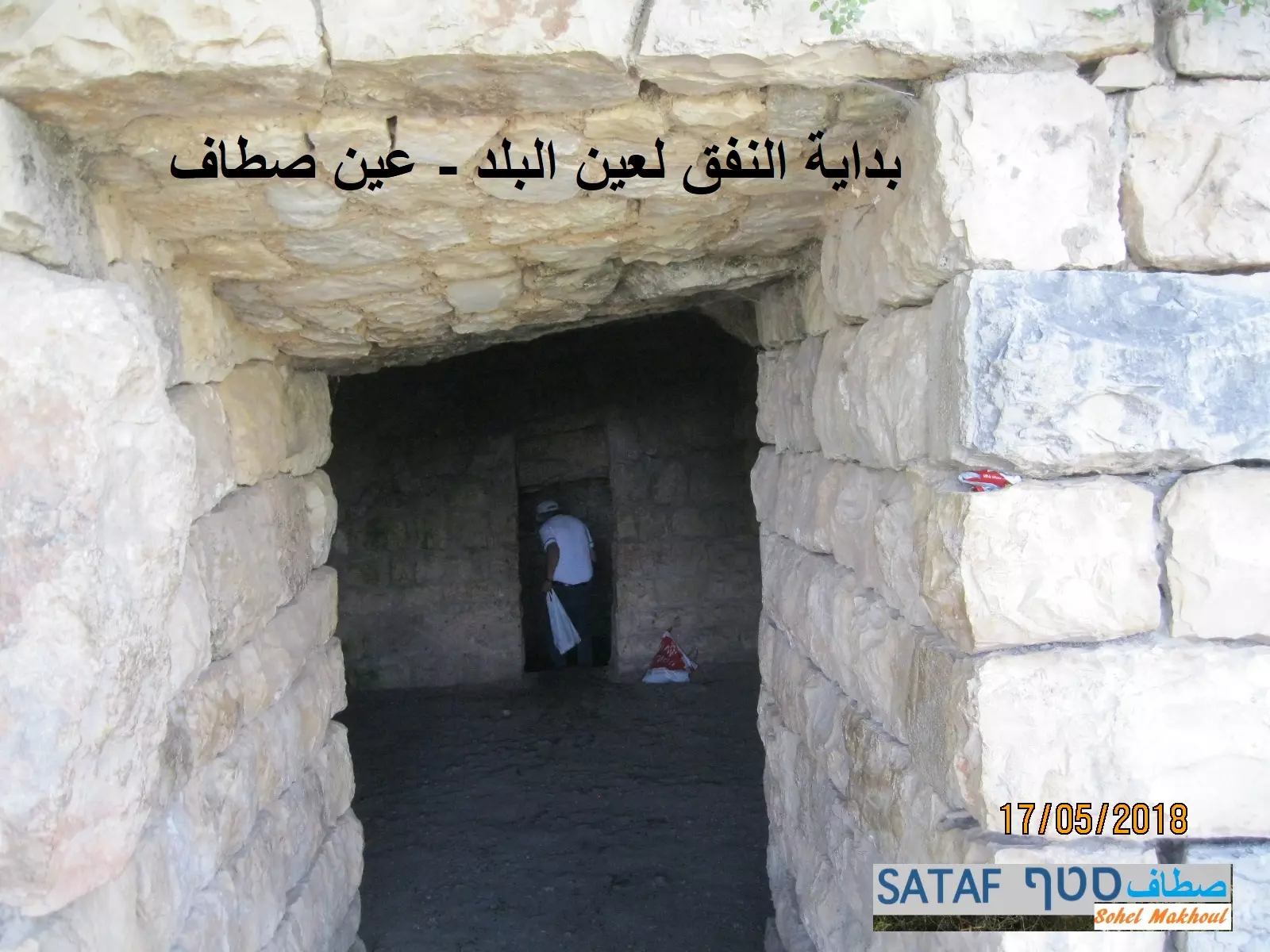
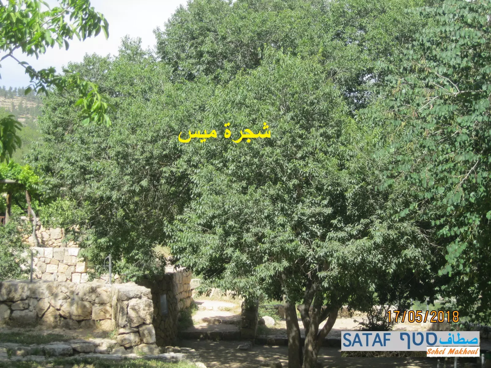
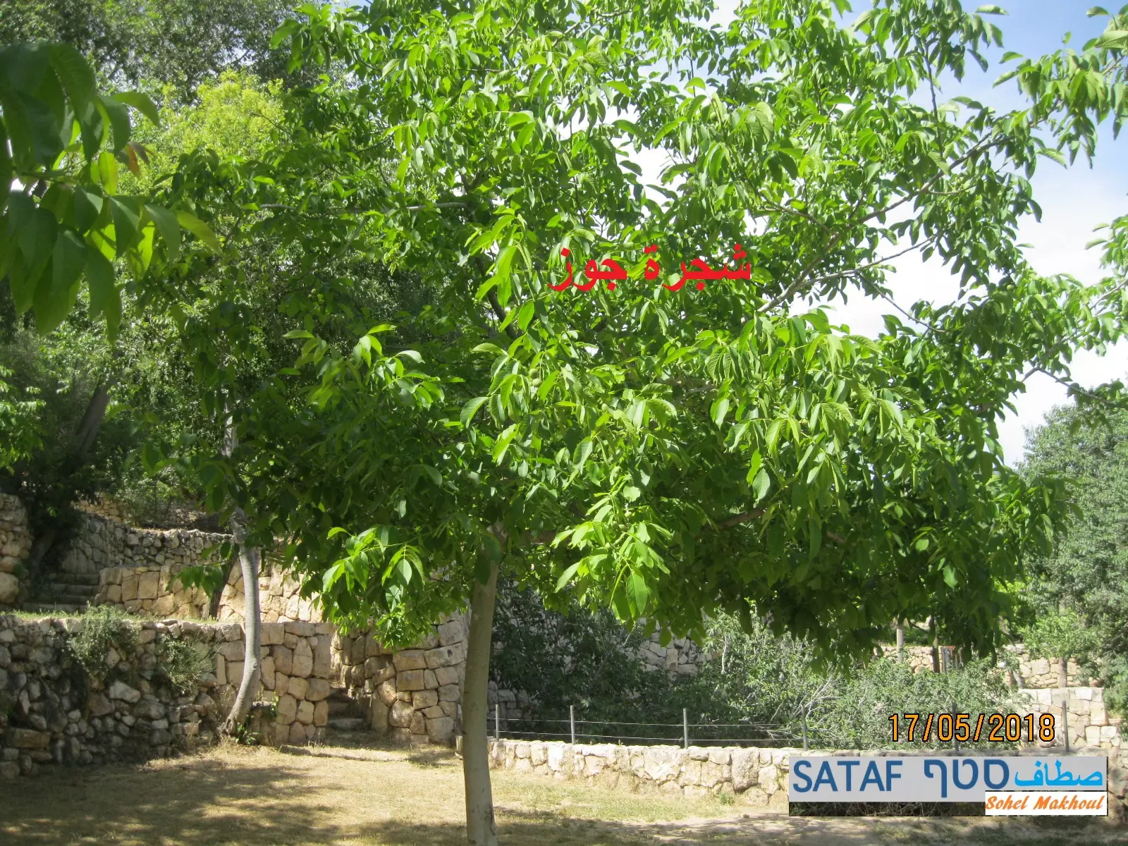
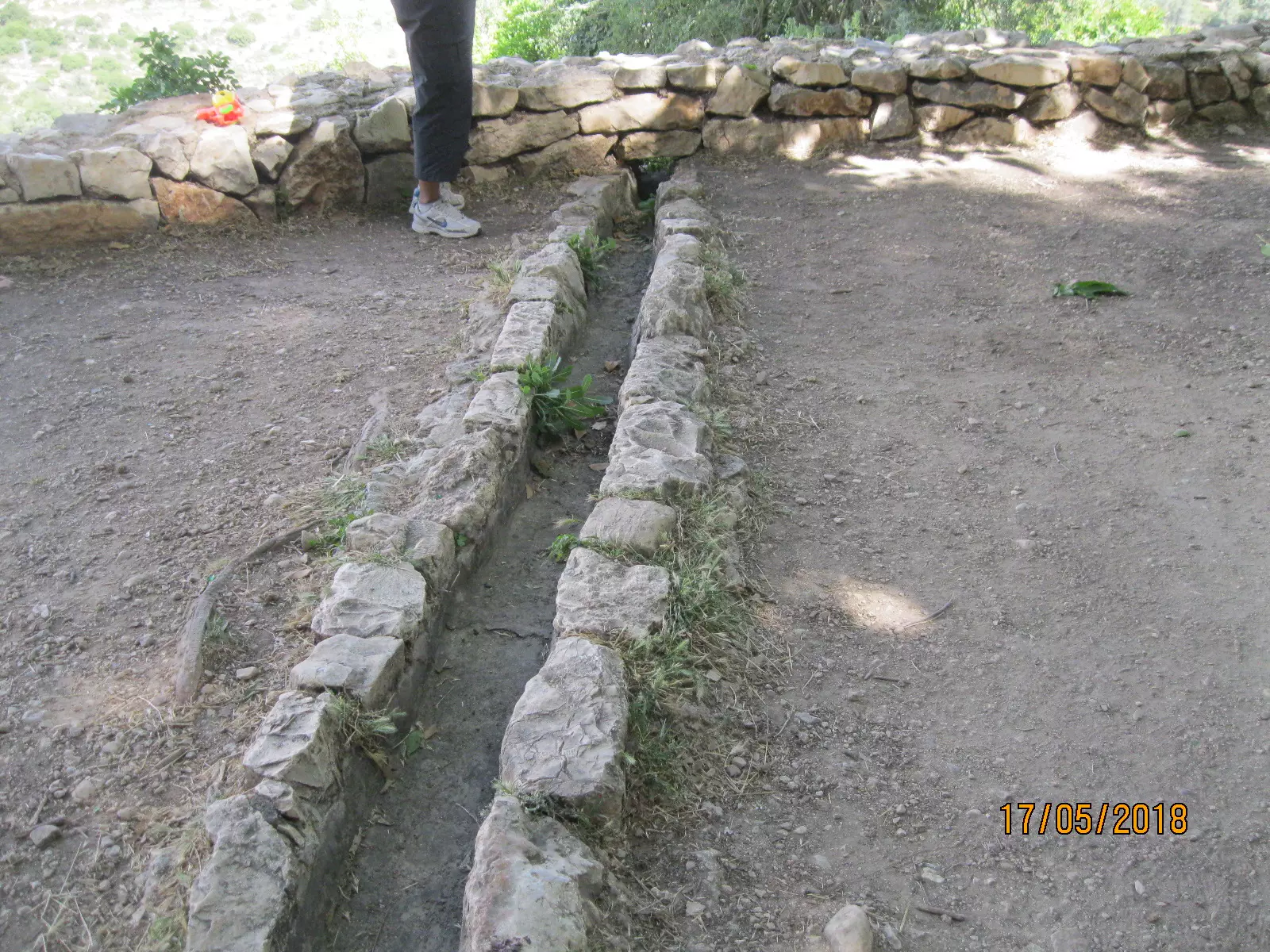
- Let us tour Sataf's famous terraces, water tunnels, springs, and olive groves. Of course, the ones that were built and maintained for 100s of years by those who "never" existed.
- Let us tour Sataf's famous terraces, water tunnels, springs, and olive groves. Of course, the ones that were built and maintained for 100s of years by those who "never" existed. #2
- Let us tour Sataf's famous terraces, water tunnels, springs, and olive groves. Of course, the ones that were built and maintained for 100s of years by those who "never" existed. #3
- Let us tour Sataf's famous terraces, water tunnels, springs, and olive groves. Of course, the ones that were built and maintained for 100s of years by those who "never" existed. #4
- Let us tour Sataf's famous terraces, water tunnels, springs, and olive groves. Of course, the ones that were built and maintained for 100s of years by those who "never" existed. #5
- Let us tour Sataf's famous terraces, water tunnels, springs, and olive groves. Of course, the ones that were built and maintained for 100s of years by those who "never" existed. #6
- Let us tour Sataf's famous terraces, water tunnels, springs, and olive groves. Of course, the ones that were built and maintained for 100s of years by those who "never" existed. #7
- Let us tour Sataf's famous terraces, water tunnels, springs, and olive groves. Of course, the ones that were built and maintained for 100s of years by those who "never" existed. #8
- Let us tour Sataf's famous terraces, water tunnels, springs, and olive groves. Of course, the ones that were built and maintained for 100s of years by those who "never" existed. #9
- Let us tour Sataf's famous terraces, water tunnels, springs, and olive groves. Of course, the ones that were built and maintained for 100s of years by those who "never" existed. #10
- Let us tour Sataf's famous terraces, water tunnels, springs, and olive groves. Of course, the ones that were built and maintained for 100s of years by those who "never" existed. #11
- Let us tour Sataf's famous terraces, water tunnels, springs, and olive groves. Of course, the ones that were built and maintained for 100s of years by those who "never" existed. #12
- Let us tour Sataf's famous terraces, water tunnels, springs, and olive groves. Of course, the ones that were built and maintained for 100s of years by those who "never" existed. #13
- Let us tour Sataf's famous terraces, water tunnels, springs, and olive groves. Of course, the ones that were built and maintained for 100s of years by those who "never" existed. #14
- Let us tour Sataf's famous terraces, water tunnels, springs, and olive groves. Of course, the ones that were built and maintained for 100s of years by those who "never" existed. #15
- Let us tour Sataf's famous terraces, water tunnels, springs, and olive groves. Of course, the ones that were built and maintained for 100s of years by those who "never" existed. #16
- Let us tour Sataf's famous terraces, water tunnels, springs, and olive groves. Of course, the ones that were built and maintained for 100s of years by those who "never" existed. #17
- Let us tour Sataf's famous terraces, water tunnels, springs, and olive groves. Of course, the ones that were built and maintained for 100s of years by those who "never" existed. #18
- Let us tour Sataf's famous terraces, water tunnels, springs, and olive groves. Of course, the ones that were built and maintained for 100s of years by those who "never" existed. #19
- Let us tour Sataf's famous terraces, water tunnels, springs, and olive groves. Of course, the ones that were built and maintained for 100s of years by those who "never" existed. #20
- Sataf's lands are famous for their springs, like Ein Sataf Ein al-Khandaq. Let us tour Sataf's springs and pools in the area that, of course, were built by those evil Palestinians who "don't exist".
- Sataf's lands are famous for their springs, like Ein Sataf Ein al-Khandaq. Let us tour Sataf's springs and pools in the area that, of course, were built by those evil Palestinians who "don't exist". #2
- Sataf's lands are famous for their springs, like Ein Sataf Ein al-Khandaq. Let us tour Sataf's springs and pools in the area that, of course, were built by those evil Palestinians who "don't exist". #3
- Sataf's lands are famous for their springs, like Ein Sataf Ein al-Khandaq. Let us tour Sataf's springs and pools in the area that, of course, were built by those evil Palestinians who "don't exist". #4
- Sataf's lands are famous for their springs, like Ein Sataf Ein al-Khandaq. Let us tour Sataf's springs and pools in the area that, of course, were built by those evil Palestinians who "don't exist". #5
- Sataf's lands are famous for their springs, like Ein Sataf Ein al-Khandaq. Let us tour Sataf's springs and pools in the area that, of course, were built by those evil Palestinians who "don't exist". #6
- Sataf's lands are famous for their springs, like Ein Sataf Ein al-Khandaq. Let us tour Sataf's springs and pools in the area that, of course, were built by those evil Palestinians who "don't exist". #7
- Sataf's lands are famous for their springs, like Ein Sataf Ein al-Khandaq. Let us tour Sataf's springs and pools in the area that, of course, were built by those evil Palestinians who "don't exist". #8
- Sataf's lands are famous for their springs, like Ein Sataf Ein al-Khandaq. Let us tour Sataf's springs and pools in the area that, of course, were built by those evil Palestinians who "don't exist". #9

- Sataf's lands are famous for their springs, like Ein Sataf Ein al-Khandaq. Let us tour Sataf's springs and pools in the area that, of course, were built by those evil Palestinians who "don't exist". #10
- Sataf's lands are famous for their springs, like Ein Sataf Ein al-Khandaq. Let us tour Sataf's springs and pools in the area that, of course, were built by those evil Palestinians who "don't exist". #11
- Sataf's lands are famous for their springs, like Ein Sataf Ein al-Khandaq. Let us tour Sataf's springs and pools in the area that, of course, were built by those evil Palestinians who "don't exist". #12
- Sataf's lands are famous for their springs, like Ein Sataf Ein al-Khandaq. Let us tour Sataf's springs and pools in the area that, of course, were built by those evil Palestinians who "don't exist". #13
- عين باكورة -- Ein Bakourah -- 2023 -- Iyad Jaber
- عين باكورة -- Ein Bakourah -- 2023 -- Iyad Jaber #2
- عين باكورة -- Ein Bakourah -- 2023 -- Iyad Jaber #3
- عين باكورة -- Ein Bakourah -- 2023 -- Iyad Jaber #4
- Let us tour Sataf's famous terraces, retaining walls (Sanasil), wells, springs, and olive groves which were built and maintained by those who "don't exist.". Let us see how the "civilized" destroyed our village, way after the battle was over, to hinder our return. How else will the Jews be great again?
- Let us tour Sataf's famous terraces, retaining walls (Sanasil), wells, springs, and olive groves which were built and maintained by those who "don't exist.". Let us see how the "civilized" destroyed our village, way after the battle was over, to hinder our return. How else will the Jews be great again? #2
- Let us tour Sataf's famous terraces, retaining walls (Sanasil), wells, springs, and olive groves which were built and maintained by those who "don't exist.". Let us see how the "civilized" destroyed our village, way after the battle was over, to hinder our return. How else will the Jews be great again? #3
- Let us tour Sataf's famous terraces, retaining walls (Sanasil), wells, springs, and olive groves which were built and maintained by those who "don't exist.". Let us see how the "civilized" destroyed our village, way after the battle was over, to hinder our return. How else will the Jews be great again? #4
- Let us tour Sataf's famous terraces, retaining walls (Sanasil), wells, springs, and olive groves which were built and maintained by those who "don't exist.". Let us see how the "civilized" destroyed our village, way after the battle was over, to hinder our return. How else will the Jews be great again? #5
- Let us tour Sataf's famous terraces, retaining walls (Sanasil), wells, springs, and olive groves which were built and maintained by those who "don't exist.". Let us see how the "civilized" destroyed our village, way after the battle was over, to hinder our return. How else will the Jews be great again? #6
- Let us tour Sataf's famous terraces, retaining walls (Sanasil), wells, springs, and olive groves which were built and maintained by those who "don't exist.". Let us see how the "civilized" destroyed our village, way after the battle was over, to hinder our return. How else will the Jews be great again? #7
- Let us tour Sataf's famous terraces, retaining walls (Sanasil), wells, springs, and olive groves which were built and maintained by those who "don't exist.". Let us see how the "civilized" destroyed our village, way after the battle was over, to hinder our return. How else will the Jews be great again? #8
- Let us tour Sataf's famous terraces, retaining walls (Sanasil), wells, springs, and olive groves which were built and maintained by those who "don't exist.". Let us see how the "civilized" destroyed our village, way after the battle was over, to hinder our return. How else will the Jews be great again? #9
- Let us tour Sataf's famous terraces, retaining walls (Sanasil), wells, springs, and olive groves which were built and maintained by those who "don't exist.". Let us see how the "civilized" destroyed our village, way after the battle was over, to hinder our return. How else will the Jews be great again? #10
- Let us tour Sataf's famous terraces, retaining walls (Sanasil), wells, springs, and olive groves which were built and maintained by those who "don't exist.". Let us see how the "civilized" destroyed our village, way after the battle was over, to hinder our return. How else will the Jews be great again? #11
- Let us tour Sataf's famous terraces, retaining walls (Sanasil), wells, springs, and olive groves which were built and maintained by those who "don't exist.". Let us see how the "civilized" destroyed our village, way after the battle was over, to hinder our return. How else will the Jews be great again? #12
- Let us tour Sataf's famous terraces, retaining walls (Sanasil), wells, springs, and olive groves which were built and maintained by those who "don't exist.". Let us see how the "civilized" destroyed our village, way after the battle was over, to hinder our return. How else will the Jews be great again? #13
- Let us tour Sataf's famous terraces, retaining walls (Sanasil), wells, springs, and olive groves which were built and maintained by those who "don't exist.". Let us see how the "civilized" destroyed our village, way after the battle was over, to hinder our return. How else will the Jews be great again? #14
- Let us tour Sataf's famous terraces, retaining walls (Sanasil), wells, springs, and olive groves which were built and maintained by those who "don't exist.". Let us see how the "civilized" destroyed our village, way after the battle was over, to hinder our return. How else will the Jews be great again? #15
- Let us tour Sataf's famous terraces, retaining walls (Sanasil), wells, springs, and olive groves which were built and maintained by those who "don't exist.". Let us see how the "civilized" destroyed our village, way after the battle was over, to hinder our return. How else will the Jews be great again? #16
- Let us tour Sataf's famous terraces, retaining walls (Sanasil), wells, springs, and olive groves which were built and maintained by those who "don't exist.". Let us see how the "civilized" destroyed our village, way after the battle was over, to hinder our return. How else will the Jews be great again? #17
- Let us tour Sataf's famous terraces, retaining walls (Sanasil), wells, springs, and olive groves which were built and maintained by those who "don't exist.". Let us see how the "civilized" destroyed our village, way after the battle was over, to hinder our return. How else will the Jews be great again? #18
- Let us tour Sataf's famous terraces, retaining walls (Sanasil), wells, springs, and olive groves which were built and maintained by those who "don't exist.". Let us see how the "civilized" destroyed our village, way after the battle was over, to hinder our return. How else will the Jews be great again? #19
- Let us tour Sataf's famous terraces, retaining walls (Sanasil), wells, springs, and olive groves which were built and maintained by those who "don't exist.". Let us see how the "civilized" destroyed our village, way after the battle was over, to hinder our return. How else will the Jews be great again? #20
- Let us tour Sataf's famous terraces, retaining walls (Sanasil), wells, springs, and olive groves which were built and maintained by those who "don't exist.". Let us see how the "civilized" destroyed our village, way after the battle was over, to hinder our return. How else will the Jews be great again? #21
- Let us tour Sataf's famous terraces, retaining walls (Sanasil), wells, springs, and olive groves which were built and maintained by those who "don't exist.". Let us see how the "civilized" destroyed our village, way after the battle was over, to hinder our return. How else will the Jews be great again? #22
- Let us tour Sataf's famous terraces, retaining walls (Sanasil), wells, springs, and olive groves which were built and maintained by those who "don't exist.". Let us see how the "civilized" destroyed our village, way after the battle was over, to hinder our return. How else will the Jews be great again? #23
- Let us tour Sataf's famous terraces, retaining walls (Sanasil), wells, springs, and olive groves which were built and maintained by those who "don't exist.". Let us see how the "civilized" destroyed our village, way after the battle was over, to hinder our return. How else will the Jews be great again? #24
- Let us tour Sataf's famous terraces, retaining walls (Sanasil), wells, springs, and olive groves which were built and maintained by those who "don't exist.". Let us see how the "civilized" destroyed our village, way after the battle was over, to hinder our return. How else will the Jews be great again? #25
- Let us tour Sataf's famous terraces, retaining walls (Sanasil), wells, springs, and olive groves which were built and maintained by those who "don't exist.". Let us see how the "civilized" destroyed our village, way after the battle was over, to hinder our return. How else will the Jews be great again? #26
- Let us tour Sataf's famous terraces, retaining walls (Sanasil), wells, springs, and olive groves which were built and maintained by those who "don't exist.". Let us see how the "civilized" destroyed our village, way after the battle was over, to hinder our return. How else will the Jews be great again? #27
- Let us tour Sataf's famous terraces, retaining walls (Sanasil), wells, springs, and olive groves which were built and maintained by those who "don't exist.". Let us see how the "civilized" destroyed our village, way after the battle was over, to hinder our return. How else will the Jews be great again? #28
- Let us tour Sataf's famous terraces, retaining walls (Sanasil), wells, springs, and olive groves which were built and maintained by those who "don't exist.". Let us see how the "civilized" destroyed our village, way after the battle was over, to hinder our return. How else will the Jews be great again? #29
- Let us tour Sataf's famous terraces, retaining walls (Sanasil), wells, springs, and olive groves which were built and maintained by those who "don't exist.". Let us see how the "civilized" destroyed our village, way after the battle was over, to hinder our return. How else will the Jews be great again? #30
- Let us tour Sataf's famous terraces, retaining walls (Sanasil), wells, springs, and olive groves which were built and maintained by those who "don't exist.". Let us see how the "civilized" destroyed our village, way after the battle was over, to hinder our return. How else will the Jews be great again? #31
- Let us tour Sataf's famous terraces, retaining walls (Sanasil), wells, springs, and olive groves which were built and maintained by those who "don't exist.". Let us see how the "civilized" destroyed our village, way after the battle was over, to hinder our return. How else will the Jews be great again? #32
- Let us tour Sataf's famous terraces, retaining walls (Sanasil), wells, springs, and olive groves which were built and maintained by those who "don't exist.". Let us see how the "civilized" destroyed our village, way after the battle was over, to hinder our return. How else will the Jews be great again? #33
- Let us tour Sataf's famous terraces, retaining walls (Sanasil), wells, springs, and olive groves which were built and maintained by those who "don't exist.". Let us see how the "civilized" destroyed our village, way after the battle was over, to hinder our return. How else will the Jews be great again? #34
- Let us tour Sataf's famous terraces, retaining walls (Sanasil), wells, springs, and olive groves which were built and maintained by those who "don't exist.". Let us see how the "civilized" destroyed our village, way after the battle was over, to hinder our return. How else will the Jews be great again? #35
- Let us tour Sataf's famous terraces, retaining walls (Sanasil), wells, springs, and olive groves which were built and maintained by those who "don't exist.". Let us see how the "civilized" destroyed our village, way after the battle was over, to hinder our return. How else will the Jews be great again? #36
- Let us tour Sataf's famous terraces, retaining walls (Sanasil), wells, springs, and olive groves which were built and maintained by those who "don't exist.". Let us see how the "civilized" destroyed our village, way after the battle was over, to hinder our return. How else will the Jews be great again? #37
- Let us tour Sataf's famous terraces, retaining walls (Sanasil), wells, springs, and olive groves which were built and maintained by those who "don't exist.". Let us see how the "civilized" destroyed our village, way after the battle was over, to hinder our return. How else will the Jews be great again? #38
- Let us tour Sataf's famous terraces, retaining walls (Sanasil), wells, springs, and olive groves which were built and maintained by those who "don't exist.". Let us see how the "civilized" destroyed our village, way after the battle was over, to hinder our return. How else will the Jews be great again? #39
- Let us tour Sataf's famous terraces, retaining walls (Sanasil), wells, springs, and olive groves which were built and maintained by those who "don't exist.". Let us see how the "civilized" destroyed our village, way after the battle was over, to hinder our return. How else will the Jews be great again? #40
- Let us tour Sataf's famous terraces, retaining walls (Sanasil), wells, springs, and olive groves which were built and maintained by those who "don't exist.". Let us see how the "civilized" destroyed our village, way after the battle was over, to hinder our return. How else will the Jews be great again? #41
- Let us tour Sataf's famous terraces, retaining walls (Sanasil), wells, springs, and olive groves which were built and maintained by those who "don't exist.". Let us see how the "civilized" destroyed our village, way after the battle was over, to hinder our return. How else will the Jews be great again? #42
- Let us tour Sataf's famous terraces, retaining walls (Sanasil), wells, springs, and olive groves which were built and maintained by those who "don't exist.". Let us see how the "civilized" destroyed our village, way after the battle was over, to hinder our return. How else will the Jews be great again? #43
- Let us tour Sataf's famous terraces, retaining walls (Sanasil), wells, springs, and olive groves which were built and maintained by those who "don't exist.". Let us see how the "civilized" destroyed our village, way after the battle was over, to hinder our return. How else will the Jews be great again? #44
- Let us tour Sataf's famous terraces, retaining walls (Sanasil), wells, springs, and olive groves which were built and maintained by those who "don't exist.". Let us see how the "civilized" destroyed our village, way after the battle was over, to hinder our return. How else will the Jews be great again? #45
- Let us tour Sataf's famous terraces, retaining walls (Sanasil), wells, springs, and olive groves which were built and maintained by those who "don't exist.". Let us see how the "civilized" destroyed our village, way after the battle was over, to hinder our return. How else will the Jews be great again? #46
- Let us tour Sataf's famous terraces, retaining walls (Sanasil), wells, springs, and olive groves which were built and maintained by those who "don't exist.". Let us see how the "civilized" destroyed our village, way after the battle was over, to hinder our return. How else will the Jews be great again? #47
- Let us tour Sataf's famous terraces, retaining walls (Sanasil), wells, springs, and olive groves which were built and maintained by those who "don't exist.". Let us see how the "civilized" destroyed our village, way after the battle was over, to hinder our return. How else will the Jews be great again? #48
- Let us tour Sataf's famous terraces, retaining walls (Sanasil), wells, springs, and olive groves which were built and maintained by those who "don't exist.". Let us see how the "civilized" destroyed our village, way after the battle was over, to hinder our return. How else will the Jews be great again? #49
- Let us tour Sataf's famous terraces, retaining walls (Sanasil), wells, springs, and olive groves which were built and maintained by those who "don't exist.". Let us see how the "civilized" destroyed our village, way after the battle was over, to hinder our return. How else will the Jews be great again? #50
- Let us tour Sataf's famous terraces, retaining walls (Sanasil), wells, springs, and olive groves which were built and maintained by those who "don't exist.". Let us see how the "civilized" destroyed our village, way after the battle was over, to hinder our return. How else will the Jews be great again? #51
- Let us tour Sataf's famous terraces, retaining walls (Sanasil), wells, springs, and olive groves which were built and maintained by those who "don't exist.". Let us see how the "civilized" destroyed our village, way after the battle was over, to hinder our return. How else will the Jews be great again? #52
- Let us tour Sataf's famous terraces, retaining walls (Sanasil), wells, springs, and olive groves which were built and maintained by those who "don't exist.". Let us see how the "civilized" destroyed our village, way after the battle was over, to hinder our return. How else will the Jews be great again? #53
- Let us tour Sataf's famous terraces, retaining walls (Sanasil), wells, springs, and olive groves which were built and maintained by those who "don't exist.". Let us see how the "civilized" destroyed our village, way after the battle was over, to hinder our return. How else will the Jews be great again? #54
- Let us tour Sataf's famous terraces, retaining walls (Sanasil), wells, springs, and olive groves which were built and maintained by those who "don't exist.". Let us see how the "civilized" destroyed our village, way after the battle was over, to hinder our return. How else will the Jews be great again? #55
- Let us tour Sataf's famous terraces, retaining walls (Sanasil), wells, springs, and olive groves which were built and maintained by those who "don't exist.". Let us see how the "civilized" destroyed our village, way after the battle was over, to hinder our return. How else will the Jews be great again? #56
- Let us tour Sataf's famous terraces, retaining walls (Sanasil), wells, springs, and olive groves which were built and maintained by those who "don't exist.". Let us see how the "civilized" destroyed our village, way after the battle was over, to hinder our return. How else will the Jews be great again? #57
- Let us tour Sataf's famous terraces, retaining walls (Sanasil), wells, springs, and olive groves which were built and maintained by those who "don't exist.". Let us see how the "civilized" destroyed our village, way after the battle was over, to hinder our return. How else will the Jews be great again? #58
- Let us tour Sataf's famous terraces, retaining walls (Sanasil), wells, springs, and olive groves which were built and maintained by those who "don't exist.". Let us see how the "civilized" destroyed our village, way after the battle was over, to hinder our return. How else will the Jews be great again? #59
- عين باكورة في قرية صطاف المهجرة -- Sept. 14th, 2021 -- Iyad Jaber
- صطاف المهجرة قضاء القدس -- Sept. 13th, 2021 -- Iyad Jaber
- صطاف المهجرة قضاء القدس -- Sept. 13th, 2021 -- Iyad Jaber #2
- صطاف المهجرة قضاء القدس -- Sept. 13th, 2021 -- Iyad Jaber #3
- صطاف المهجرة قضاء القدس -- Sept. 13th, 2021 -- Iyad Jaber #4
- صطاف المهجرة قضاء القدس -- Sept. 13th, 2021 -- Iyad Jaber #5
- صطاف المهجرة قضاء القدس -- Sept. 13th, 2021 -- Iyad Jaber #6
- صطاف المهجرة قضاء القدس -- Sept. 13th, 2021 -- Iyad Jaber #7
Want to browse more? 80,000 pictures were grouped in these gallaries:
| Display Name | Clan/Hamolah | Country of Residence |
| Ibrahim Salem | - | NJ, United States |
| نادر عدنان المشني | المشني | - |
| ranoosh | - | Dubai, UAE |
| yahya obaid alla | obaid alla | West Bank, Palestine |
| ام عبدالله معالي | معالي | عمان, الاردن |
| Dr.lamis mohammed abu_hussein | abu_hussein | amman, jordan |
| nemer ragheb waqqad | - | amman-jordan, amman-jordan |
| راغب محمد راغب الوقاد | الوقاد | AMMAN, JORDAN |
| المهندس مهند سليم صالح وقاد | الوقاد | AMMAN, JORDAN |
| mouhamd salim al waqqad | AL WAQQAD | AMMAN, AMMAN JORDAN |
| محمد بدر وقاد | - | عمان |
| Rashid Nael Ragheb ALWAQQAD | ِAL WAQQAD | AMMAN, JORDAN |
| nader waggad | وقاد | عمان, الاردن |
| نيفين | الوقاد | - |
| ابو مهنا | وقاد | الاردن, الاردن |
| ayman zahra | - | - |
| Majdi Maali | maali | Amman, Jordan |
| NAEL | ALWAQQAD | DUBAI, UAE |
| Rasha Abu-Hussein | Abu_Hussein | Amman, Jordan |
| Mutaz Omar Waqqad | Waqqad | Amman, JORDAN |
| Mohammad alWaggad | - | - |
| mohammed jawdat nemer waggad | Waggad | Dubai, UAE |
| Maher Ibrahim Yousef Waqqad | Waqqad | NJ, USA |
| om dawood-hadya waqqad | waqqad | - |
| Abu Ayman | Kanaan | Amman, Jordan |
| omar | waggad | - |
| majed jawdat waggad | waggad | DUBAI U-A-E |
| salem zahrah | kana,an | constanta |
| Mahmoud Kana'an | Abu yassin | Ukraine |
| Ayman Hassan | Obeidallah | - |
| d.mohamad ftiani | al-ftiani | sayria |
| HANI ABU HUSSEIN | abu hussein | - |
| YOUSEF ABU HUSSEIN | ABU HUSSEIN | AMMAN |
- Tracing All That Remains of Sataf Since Nakba Duration: 6 min 21 sec
- مقطع رائع عن صطاف Duration: 4 min 40 sec
- ين ماء قرية صطاف المهجرة قضاء القدس Duration: 16 sec
- عين ماء قرية صطاف المهجرة قضاء القدس Duration: 10 sec
- جولة رائعة في القرية المهجرة -- 2025 Duration: 53 sec
 Fake Valor: Why Did Zionist Jews Hoist Nazis Flag on Their Ships in the 1930s?
What is new?
-
Facts About Oct. 7th Gaza Raid
-
Remined Us Please:: Who Did Rape Who? Palestinians Raped Israelis? Or, was the other way around?
-
When Prof. Edward Said was invited to debate Bibi Netanyahu in the 1980s, watch what happened!
-
Ezra Klein of the NY Times on the "Jewish Race".
-
Abusing Blood Libel!
-
Did Israeli Soldiers Activate The Hanniba Direective On Oct. 7th? You Be The Judge
-
Zionist FAQ: Isn't it true that Palestinians don't want peace? Palestinians never accepted the two-state solution
- Facts about Haavara (Transfer) Agreement between Ben-Gurion & Hitler
-
Haavara FAQs: Why Did Zionist Jews Hoist Nazis' Flags on Their Ships in the 1930s?
- Haavara FAQs: When Chaim Weizmann met FDR in mid-1943, why was he silent about rescuing European Jewry?
-
Dear ChatGPT: How did Palestinians resist Napoleon's invasion of their country in 1799?
-
Dear ChatGPT: Gaza had a vibrant Jewish community in the mid-17th century. What happened to them?
-
Dear ChatGPT: Why did the Jewish Agency suppress news of the Holocaust during WWII?
-
Video Playlist: Jews share their DNA tests to end the conflict for good.
-
A Tale of Two Conflicts: Examining the Definition of Genocide
-
Prof. Abraham Polak And The Suppressed History of the Khazars and European Jewry
-
How Ronald Reagan would have framed the genocide in Gaza if he were still alive?
-
Haavara FAQs: Let us do the math: how many German Jews did The Haavara Agreement save?
-
Zionist FAQs: The Hebron Massacre of 1929, "clearly proves" that Palestinians are antisemitic, how could you deny it?
-
Zionist FAQs: Why Anti-Zionist Is Not Antisemitism?
-
Zionist FAQs: Isn't it true that the KGB created Palestinian Nationalism in the early 1960s?
- Zionist FAQs: Muslims are killing Muslims all the time; why are Israeli Jews being singled out in the media?
- Zionist FAQs: How is Israel an apartheid state when 20% of its citizens are Arabs who enjoy full rights?
-
Haavara FAQs: Why Did Dorothy Thompson Flip From A Zionist Advocate to A Silenced Dissenter?
-
Haavara FAQs: Analysis of Herzl's Uganda Scheme and how it could have saved millions of Jews.
-
Haavara FAQs: Why did Hayim Greenberg describe American Jewry as "morally bankrupt" in early 1943?
-
Haavara FAQs: What if the Evian Conference was a resounding success? What would have been the impact of saving European Jewry on Zionism?
- Haavara FAQs: What if the six million were saved, how that would have impacted the Zionist project?
-
Haavara FAQs: How did Zionist leaders react when Europe's Jews lingered in the DP camps after WWII ended?
-
Why does the American Jewish community repeat lies that David Ben-Gurion had debunked before he died?
-
Who has the power to rename the Tatar/Khazar Gene Marker to Jewish IV?
-
Zionist FAQs: Why won't Egypt, Syria, and Jordan take their people back? Jews are indigenous to Palestine, and Arabs immigrated after Jews developed the country. Arabs should leave.
-
Haavara FAQs: Did Hitler and the Nazis conflate between Judaism and Zionist? If that wasn't case, then why?
-
Haavara FAQs: Winston Churchill and antisemitism, a collection of articles written Churchill.
-
Haavara FAQs: Broken by country, how many Jews survived vs. killed during the Holocaust?
-
Haavara FAQs: Why did European Jews vote with their feet and to immigrated to the Americas, not Palestine, after WWII?
-
Watch this American Jewish Girl describing Israeli Jews' cognitive dissonance like no other in under two minutes
-
Haavara FAQs: When the Nazis went out of their way to hide the Holocaust, Israeli Jews did the exact opposite by broadcasting their genocide of Gazans. But why?
-
Haavara FAQs: How Zionist Jews went out of their to show their appreciation to Nazism and Fascism?
- Haavara FAQs: Why Zionist leaders were against bombing the death camps & the Railroads leading to them?
-
Haavara FAQs: Hitler's message to the British and American people: If Jews are such noble citizens and you care about them, how come you're not letting them in? I will gladly ship them to you at my expense, even on luxury liners!
-
A shortlist of Zionist and Israeli false flag operations in the name Jews.
-
The Most Moral Army
- The Land of Kapos (Israel): Where the brave are boycotted and Kapos walk free.
- Why did early Zionists often named their communal enterprises "colonial"?
- Zionist Relations with Nazi Germany by Faris Glubb
-
Two NY Times advertisements by Zionists in the early 1943 that exposes Zionists' treason at the height of the calamity
- Facts Not Lies about the Palestinian-Israeli Conflict.
- Site's pictures have been categorized
- Campgain Against Lice
- A Survey of Palestine, the official source about Palestine before Nakba produced by the British Mandate; over 1200 pages.
- Satellite View & Google Earth: Over 6,000 placemarks identifying all destroyed towns, W. Bank & Gaza Strip Towns, & refugee camps.
- PalestineRemembered.com and its Nakba Oral History Project were featured on al-Jazeera Satellite TV.
- Nakba Oral History Video Podcast:
 Over 700 Oral History interviews (including 3,500+ hours of recording) can be viewed online.
 - Palestine Village Statistics Project
- Gaza Jail Break
- النسخة العربية للموقع الان متوفرة
- Videos: Documenting the destroyed villages in video: Tracing all that remains since Nakba.
- Videos: Responding to Zionist Propaganda
- Interview: The ethnic cleansing of Palestine: George Galloway interviews Israeli Historian Ilan Pappe.
- For Palestinians, memory matters. It provides a blueprint for their future By George Bisharat.
- Zionist FAQ now available in Hebrew שאלות שציונים שואלים, עכשיו בעברית
- Video: The Stephen Walt and John Mearsheimer report on the influence of the Israel Lobby on U.S. Foreign Policy
- The Palestinian-Israeli conflict for beginners
