| PalestineRemembered | About Us | Oral History | العربية | |
| Pictures | Zionist FAQs | Haavara | Maps | |
| Search |
| Camps |
| Districts |
| Acre |
| Baysan |
| Beersheba |
| Bethlehem |
| Gaza |
| Haifa |
| Hebron |
| Jaffa |
| Jericho |
| Jerusalem |
| Jinin |
| Nablus |
| Nazareth |
| Ramallah |
| al-Ramla |
| Safad |
| Tiberias |
| Tulkarm |
| Donate |
| Contact |
| Profile |
| Videos |
Welcome To al-Qabu - القبو (אל-קבו)
|
District of Jerusalem
Ethnically cleansed days ago |
العربية Google Earth |
 |
Gallery (87) |
- Statistics & Facts
-
Before & After

- Satellite View
- Articles 1
- Pictures 87
- Oral History 3
- Members 39
- All That Remains
- Wikipedia
- Videos 2
- Guest Book 1
- Links 1
| Statistic & Fact | Value | ||||||||||||||
| Occupation Date | October 22, 1948 | ||||||||||||||
| Distance From District | 12 (km) West of Jerusalem | ||||||||||||||
| Elevation | 775 (meters) | ||||||||||||||
| Before & After Nakba, Click Map For Details |
|||||||||||||||
|
|||||||||||||||
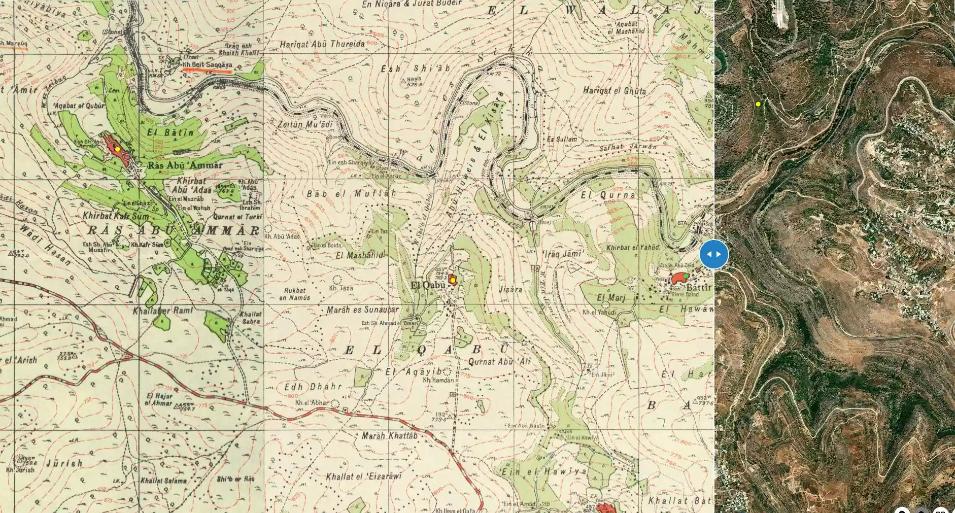
| Map Location | See location #36 on the map View from satellite |
||||||||||||||
| Military Operation | Operation ha-Har | ||||||||||||||
| Attacking Units | Sixth Battalion of Har'el Brigade | ||||||||||||||
| Defenders | Egyptian Muslim Brotherhoods, Jordanian Army, and some ALA and local Palestinian militia. | ||||||||||||||
| Refugees' Migration Routes | al-Qabu's inhabitants were either ethnically cleansed or fled towards Bethlehem and the Hebron hills. | ||||||||||||||
| Exodus Cause | Military assault by Zionist troops | ||||||||||||||
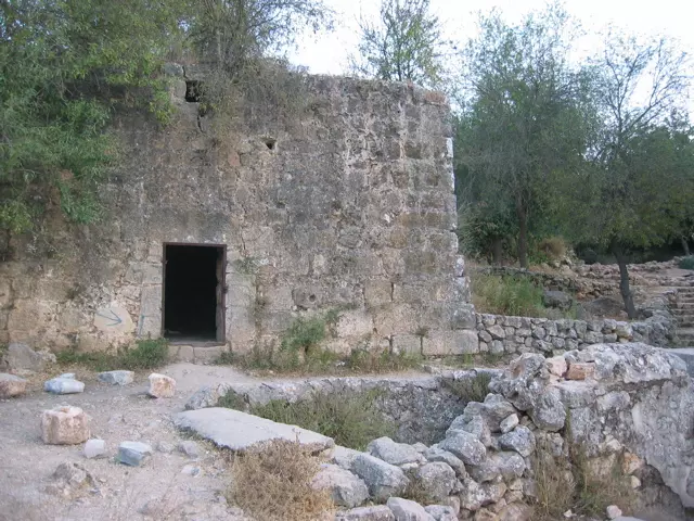
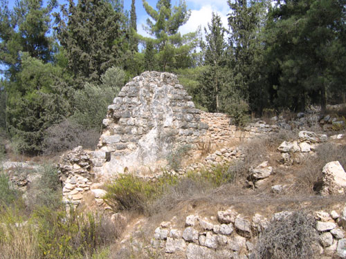
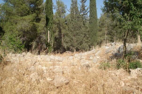
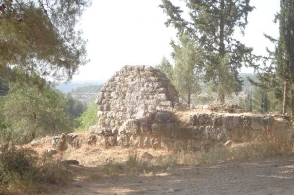
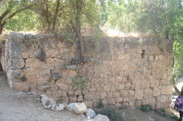
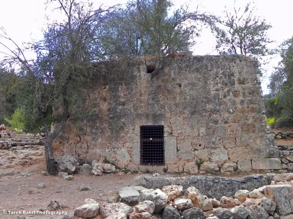
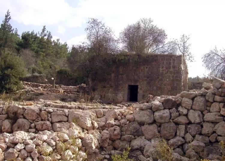
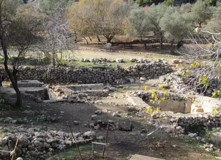
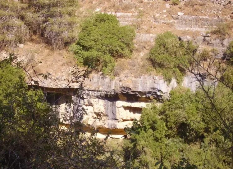
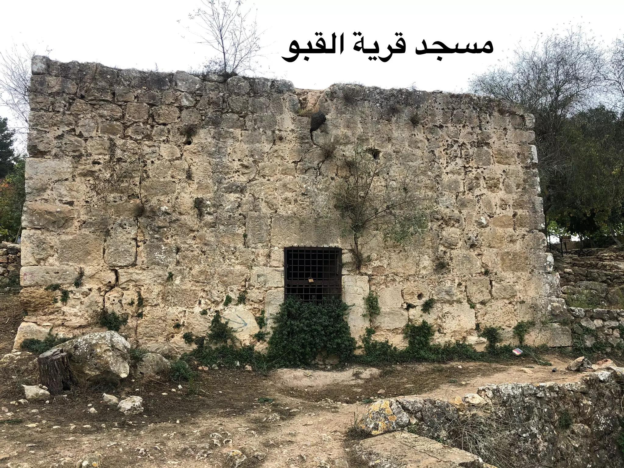
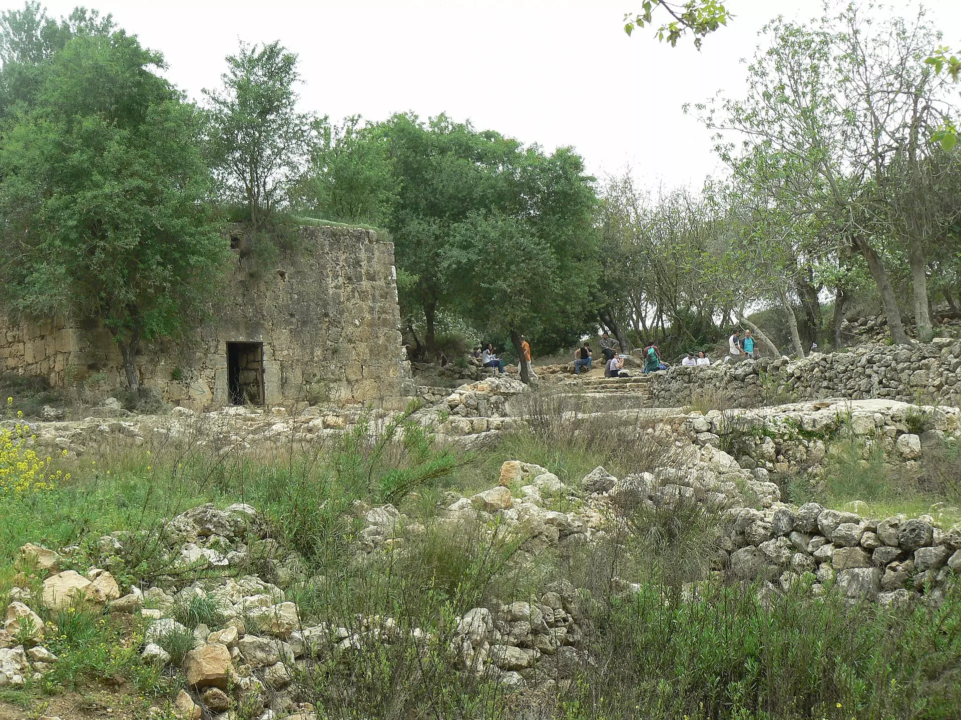
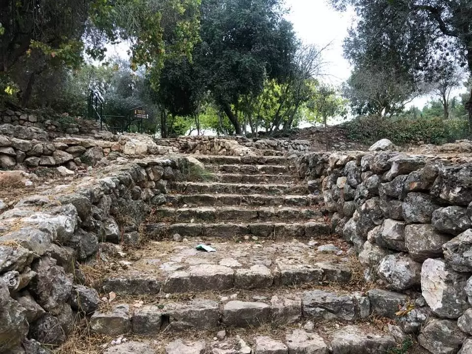
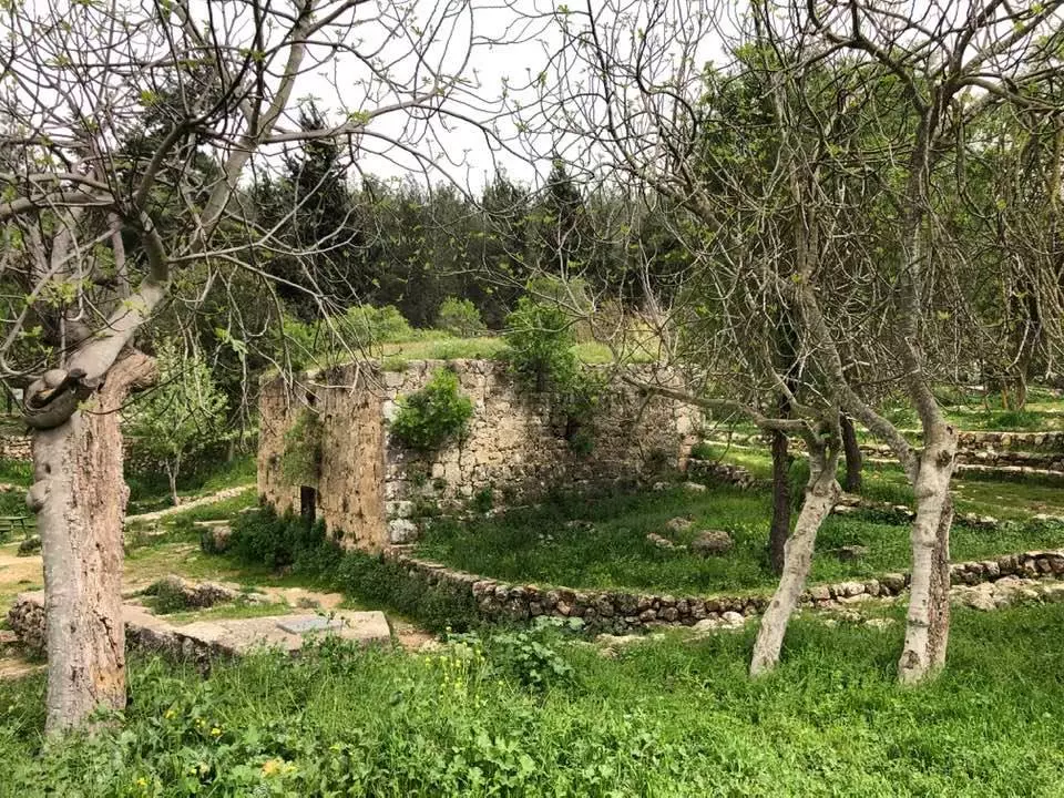
| Village Temains | al-Qabu was mostly destroyed (in the second half of 1949) with the exception of the mosque and the cemetery. | ||||||||||||||
| Ethnically Cleansing | al-Qabu inhabitants were completely ethnically cleansed. | ||||||||||||||
| Pre-Nakba Land Ownership |
**Town Lands' Demarcation Maps |
||||||||||||||
| Land Usage As of 1945 |
|
||||||||||||||
| Population |
|
||||||||||||||
| Number of Houses |
|
||||||||||||||
| Near By Towns |
|||||||||||||||
|
|||||||||||||||
| Town's Name Through History | During the Roman period al-Qabu was referred to by Qobi. | ||||||||||||||
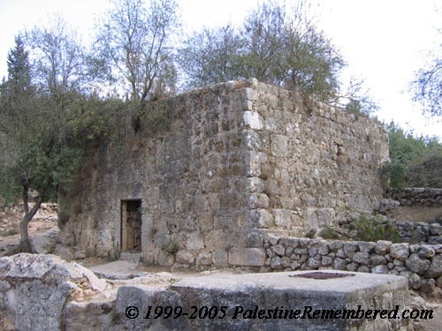
| Places of Warship | One Mosque (remain standing) | ||||||||||||||
| Shrines / Maqams | A shrine of al-Shaykh Ahmad al-'Umari (still standing) | ||||||||||||||
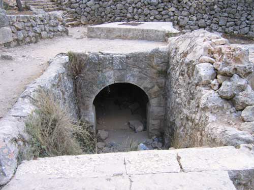
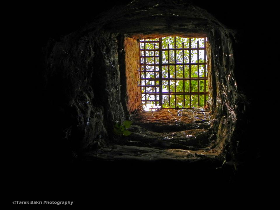
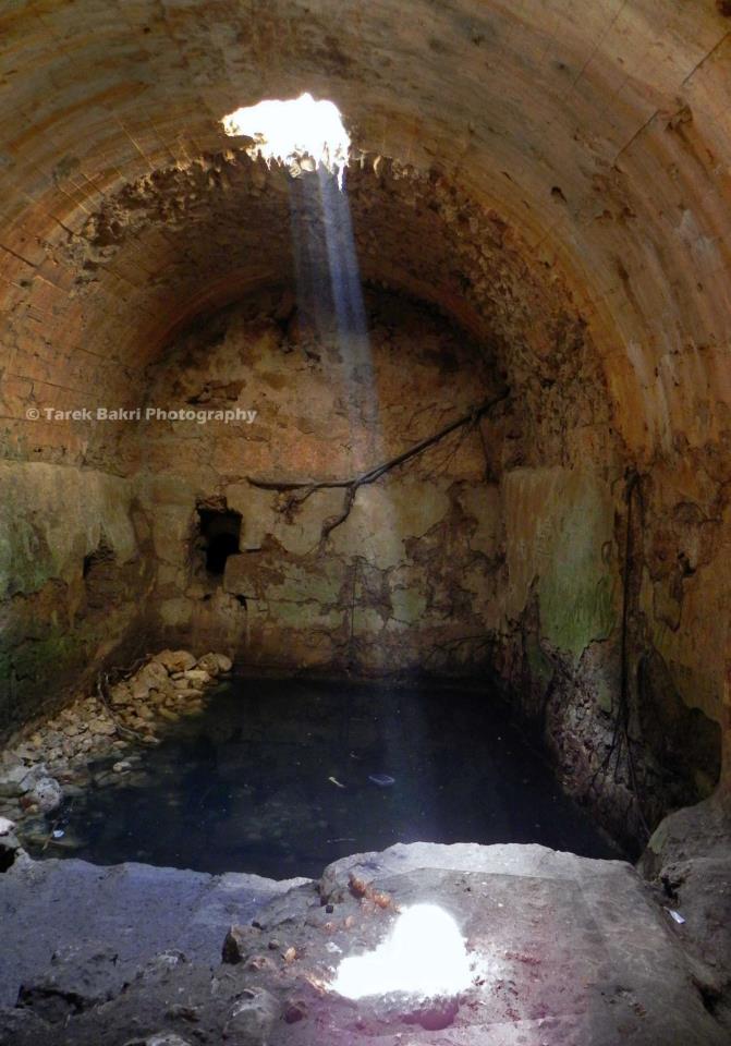
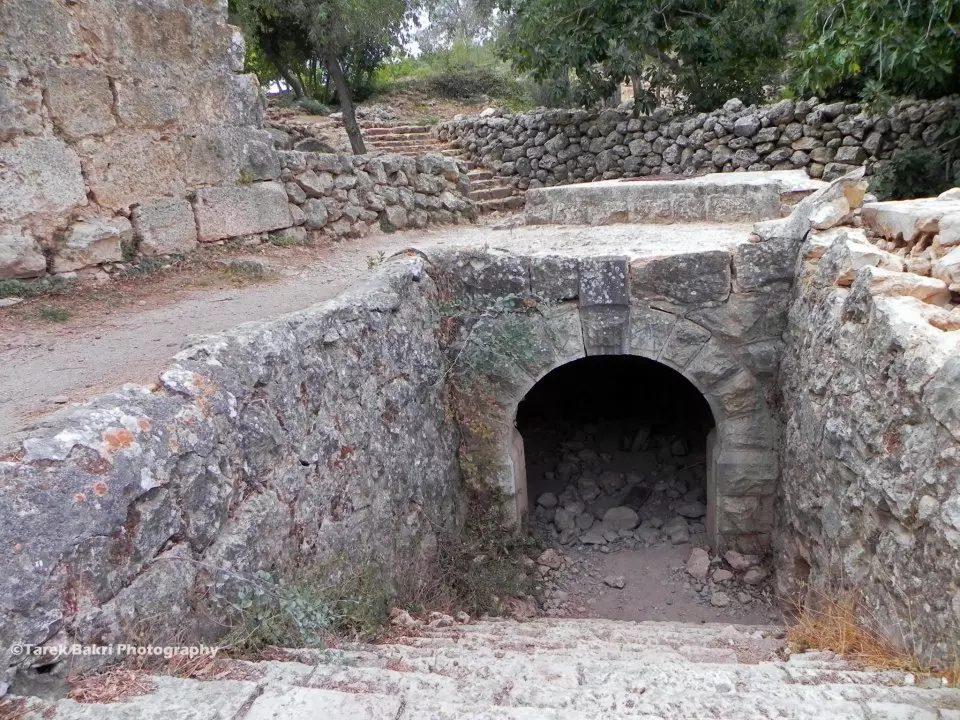
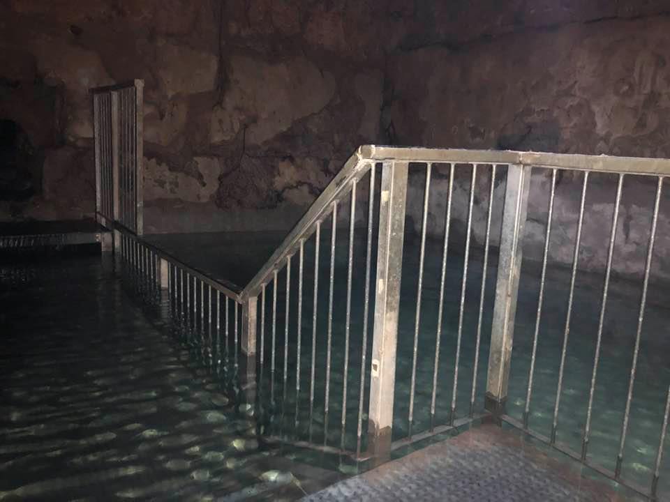
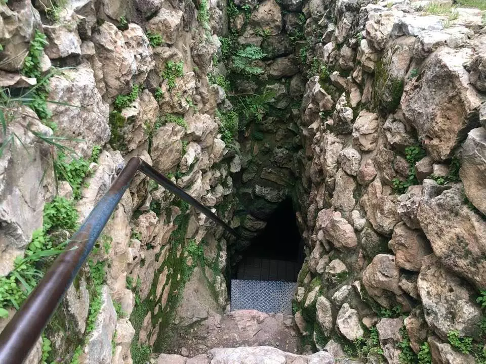
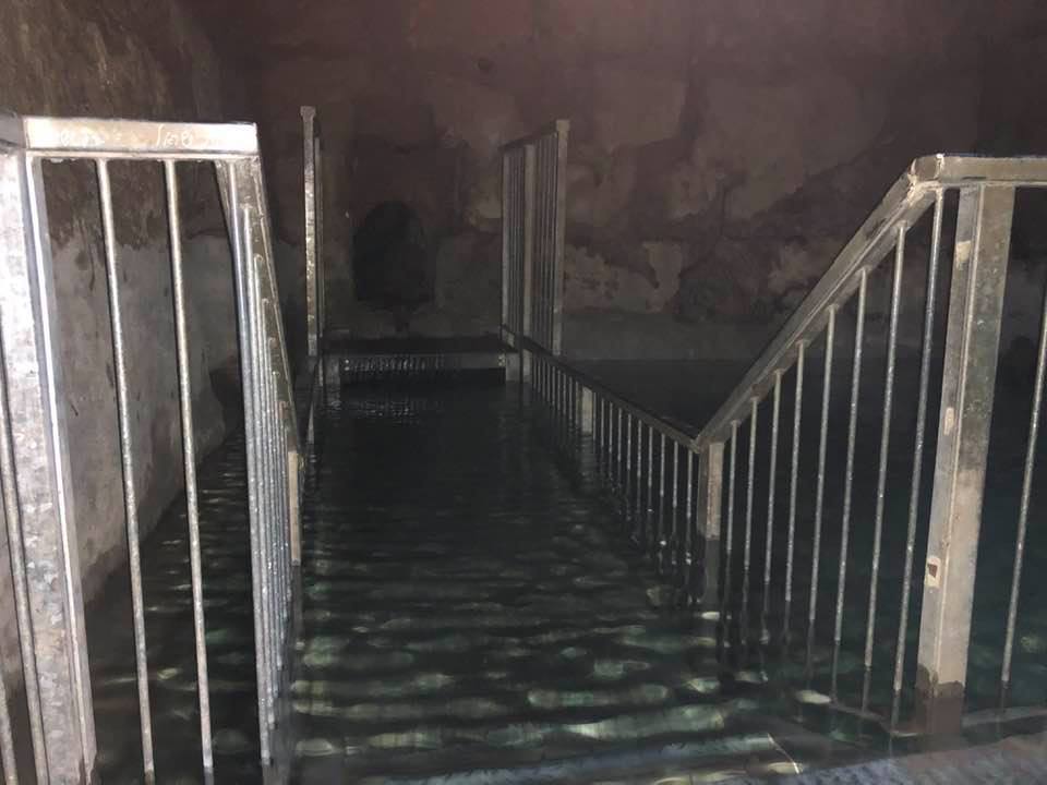
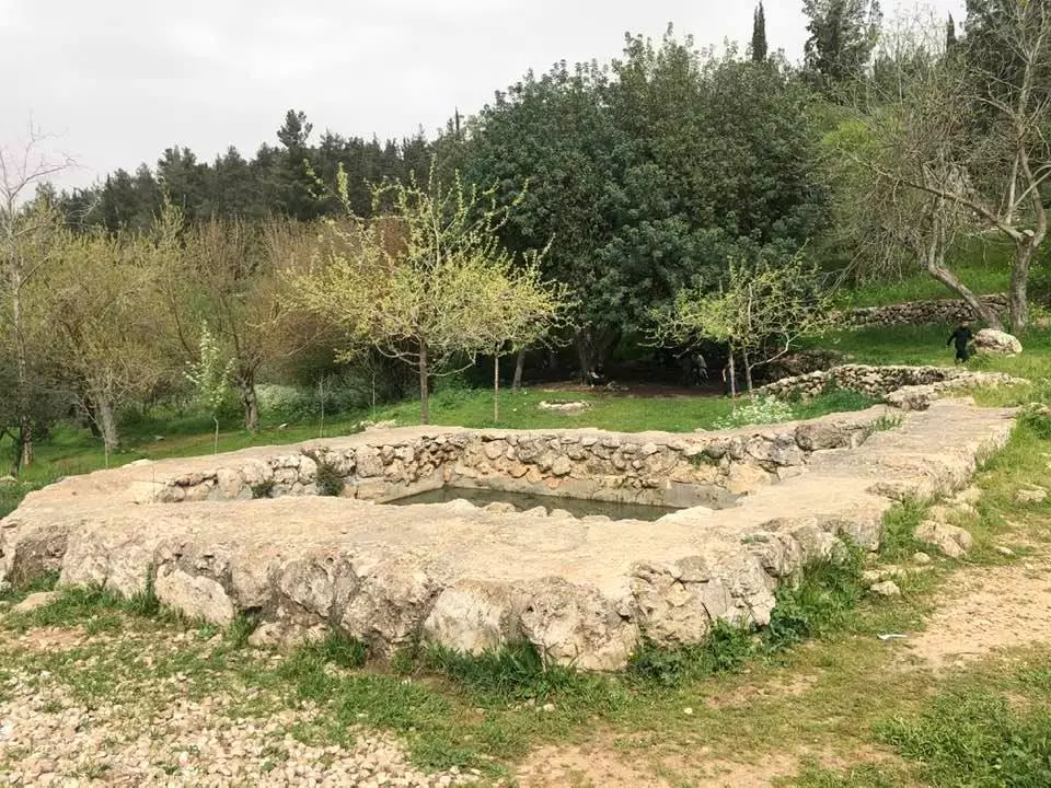
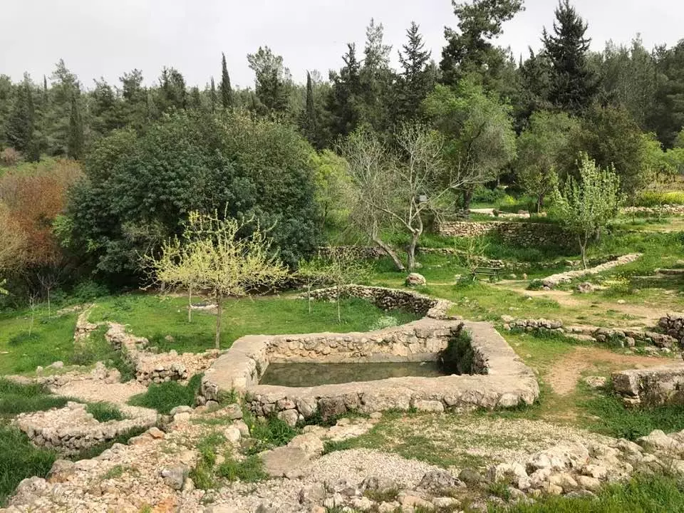
| Water Supply | Several springs including 'Ayn Tuz and 'Ayn al-Bayda, plus three wells behind the mosque (still functioning and you are welcome to drink if you wish!). | ||||||||||||||
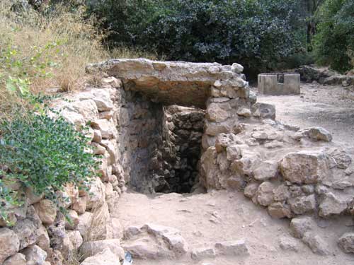
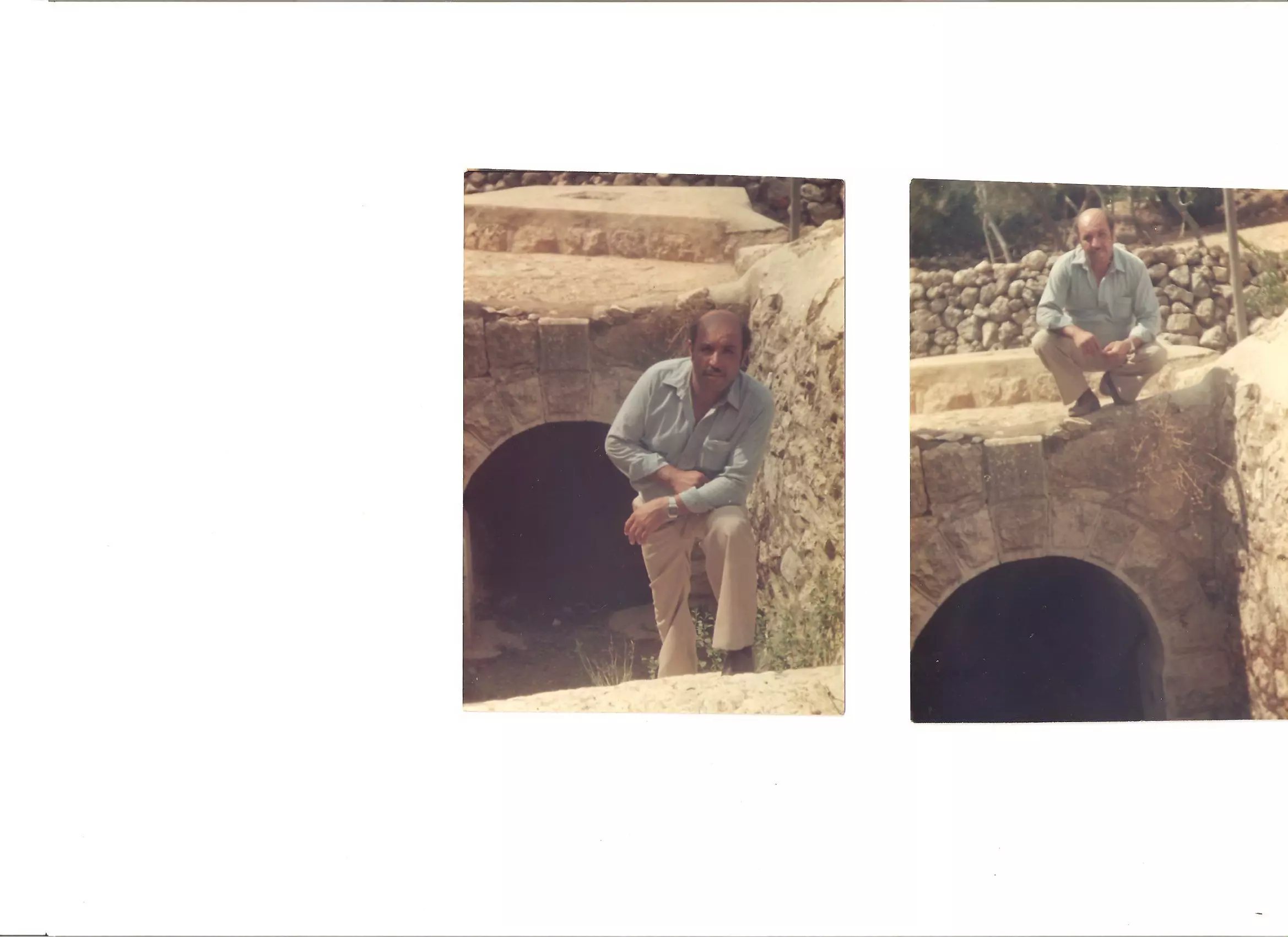
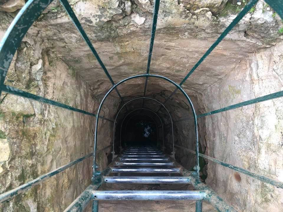
| Archeological Sites | al-Qabu contained artifacts including the ruins of a Crusade church, an old water canal, and a couple of khirbas. | ||||||||||||||
| Exculsive Jewish Colonies Who Usurped Village Lands |
Mevo Betar | ||||||||||||||
| Featured Video | |||||||||||||||
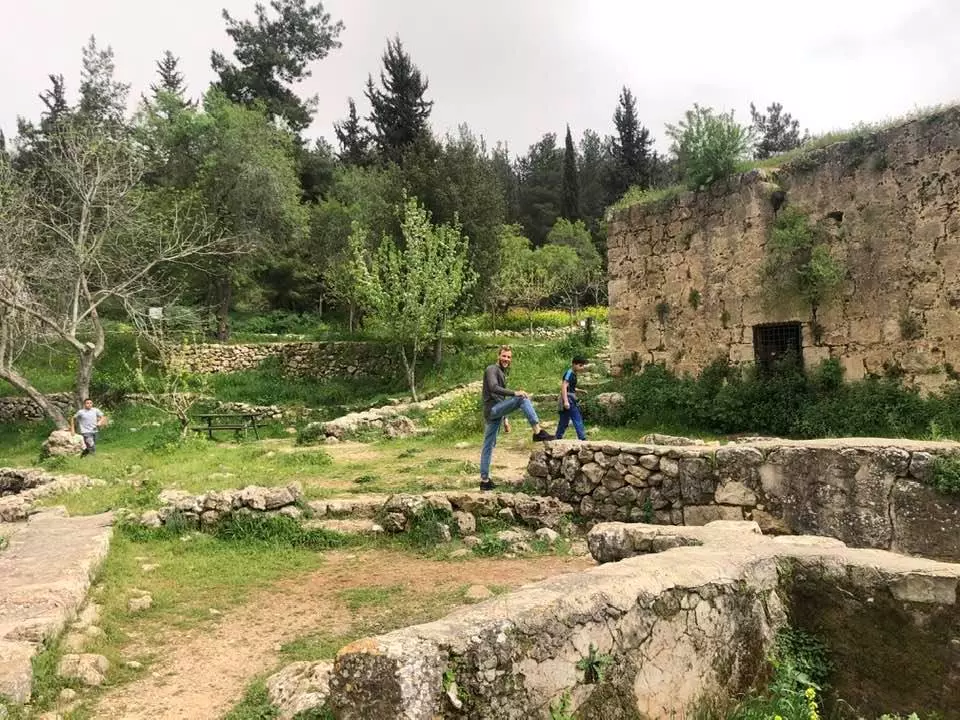
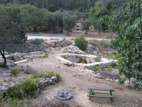
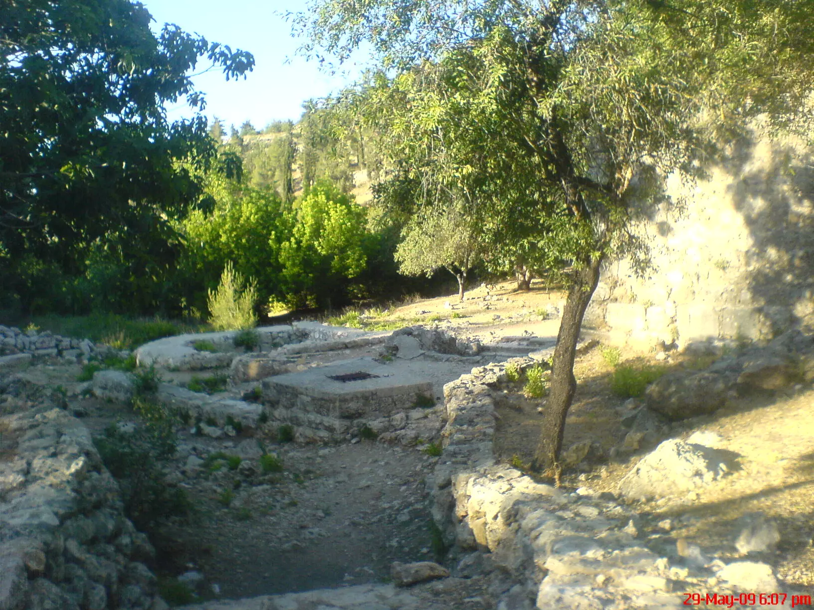
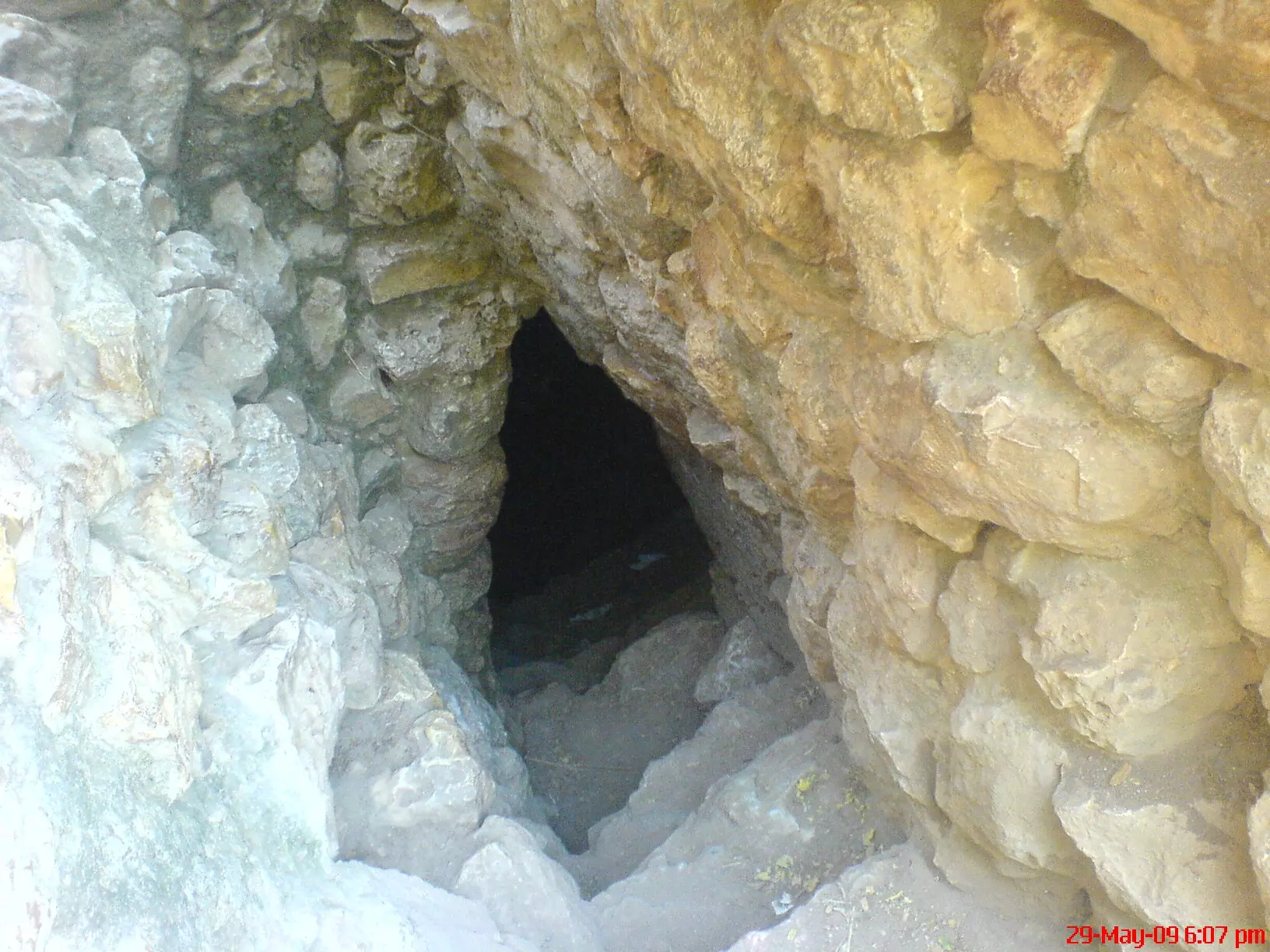
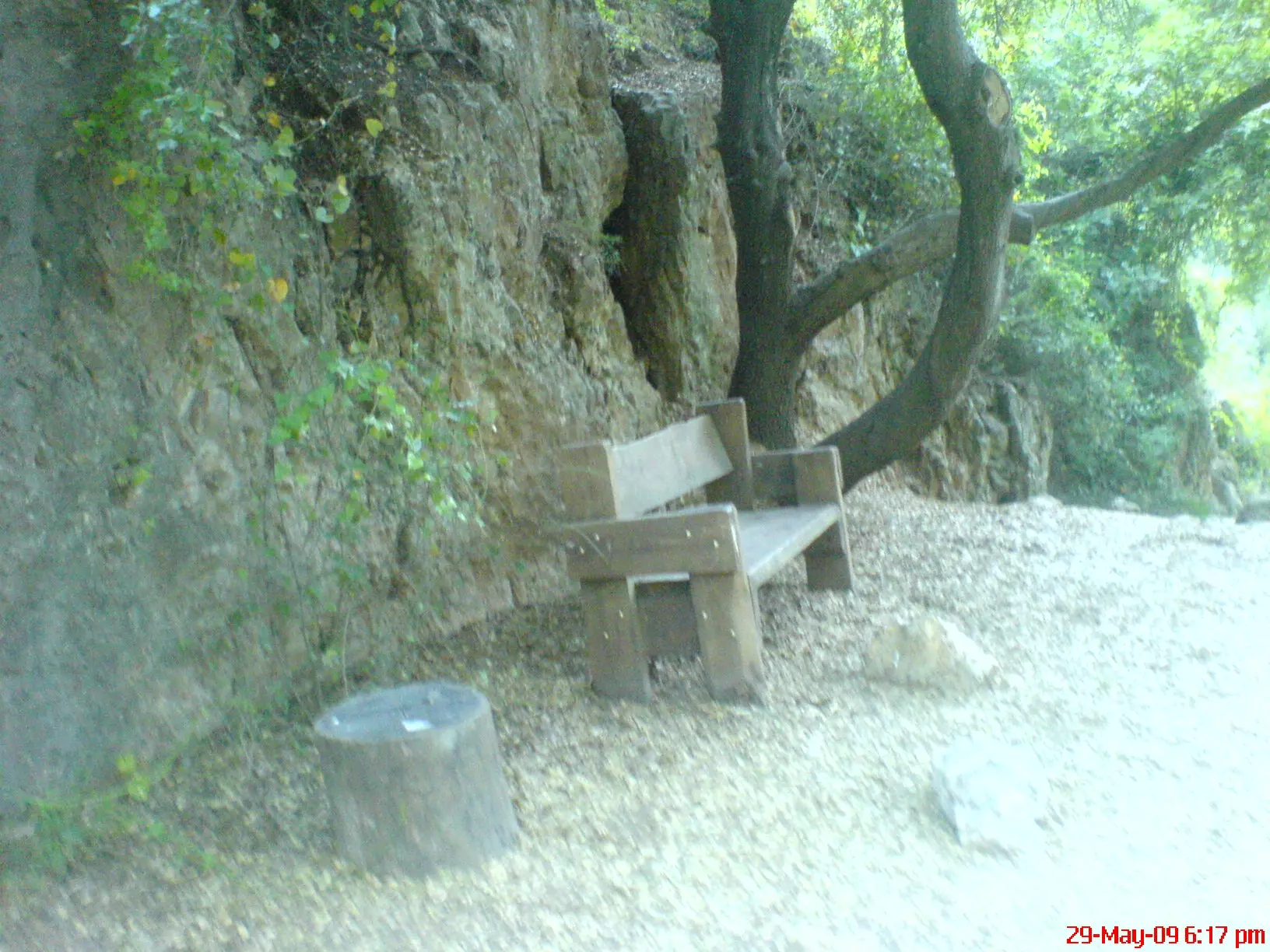
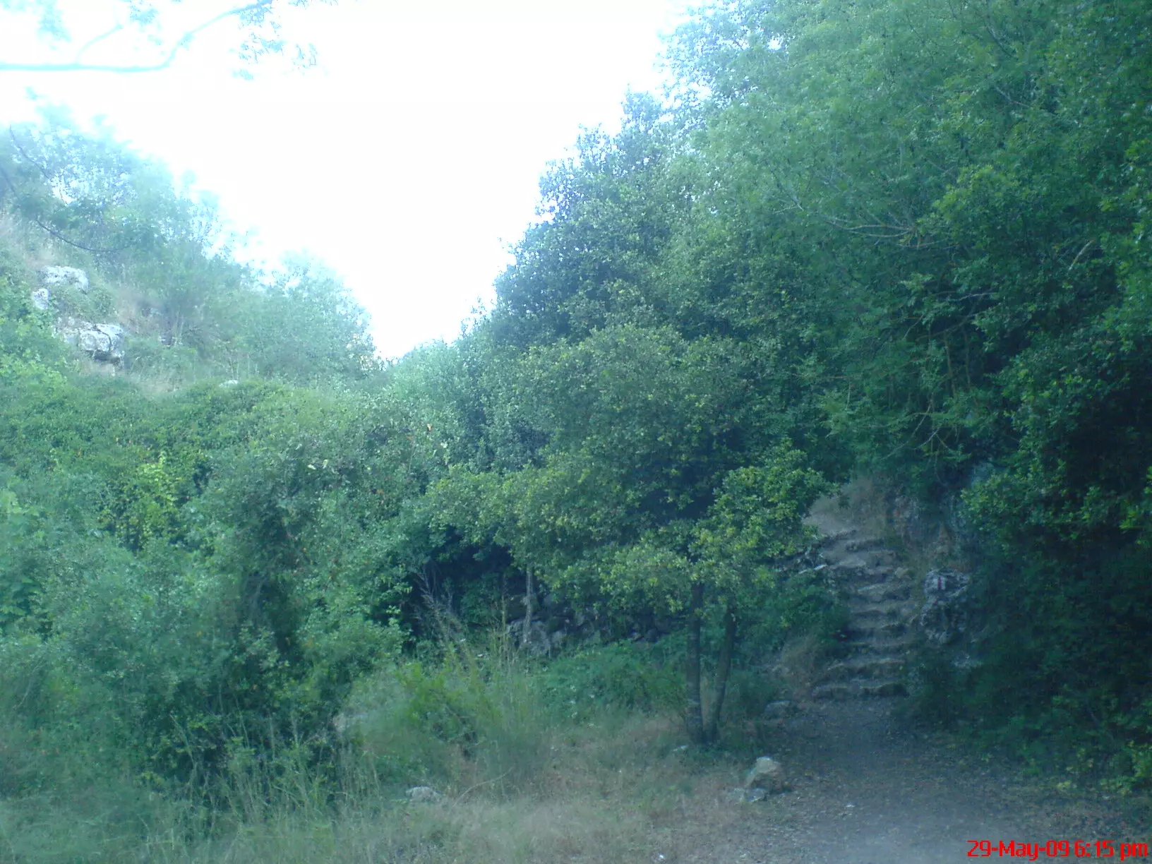
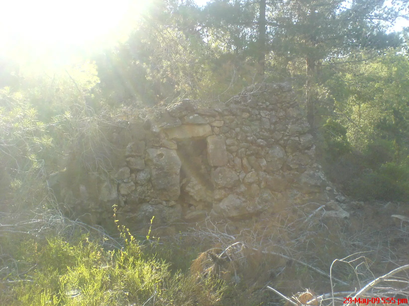
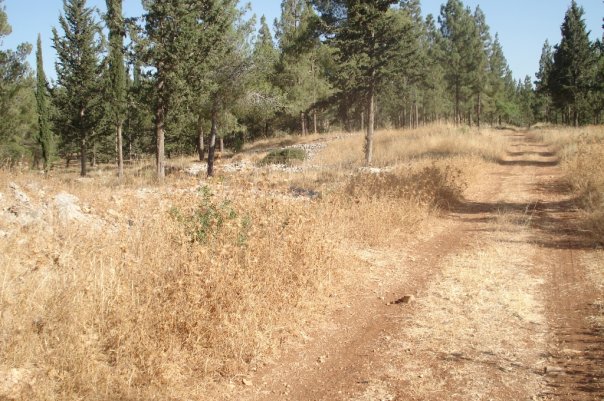
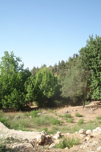
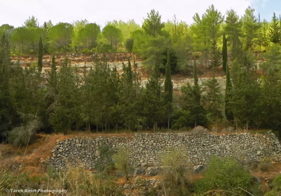
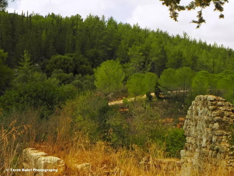
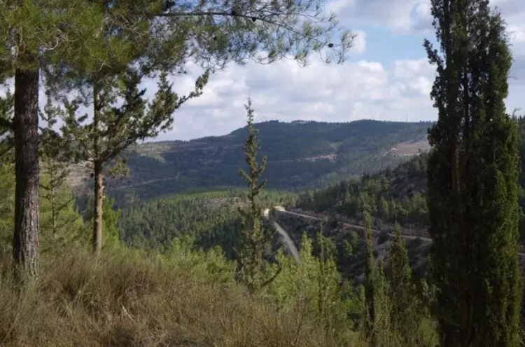
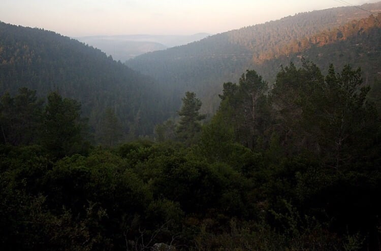
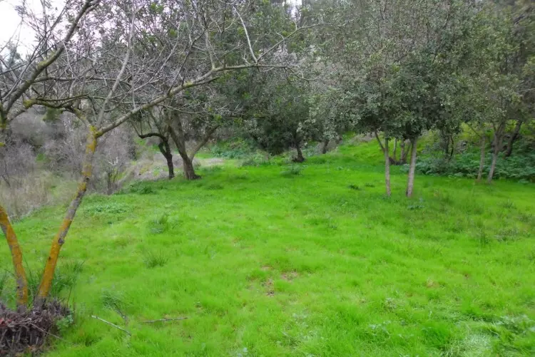
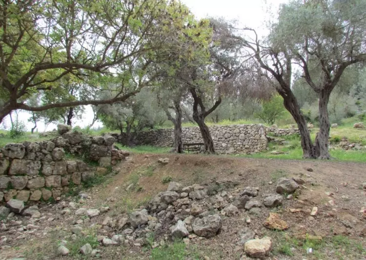
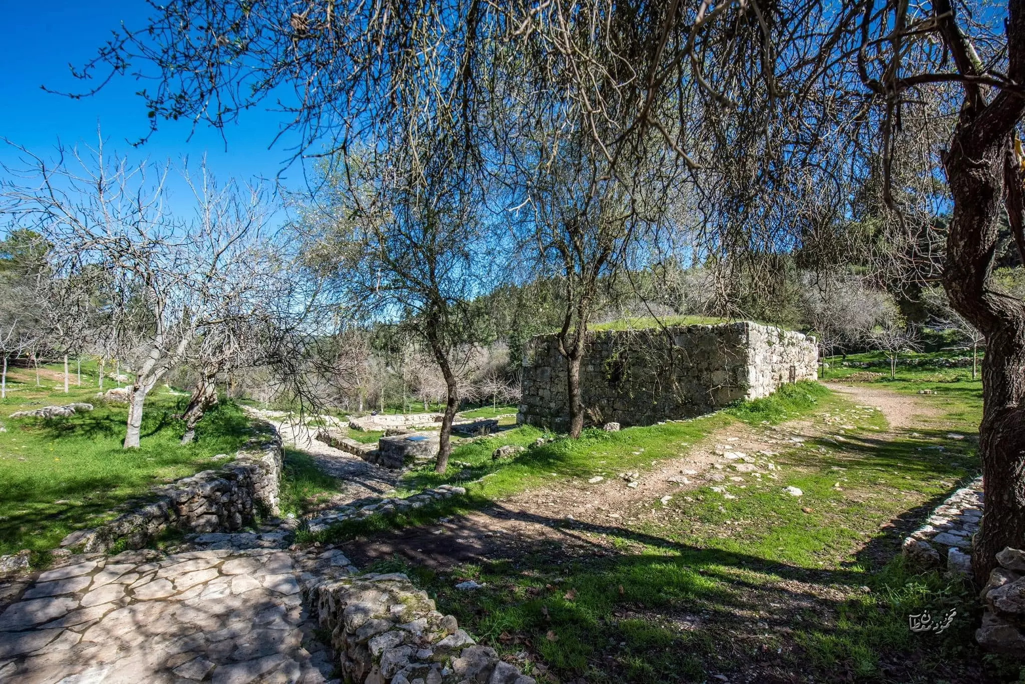
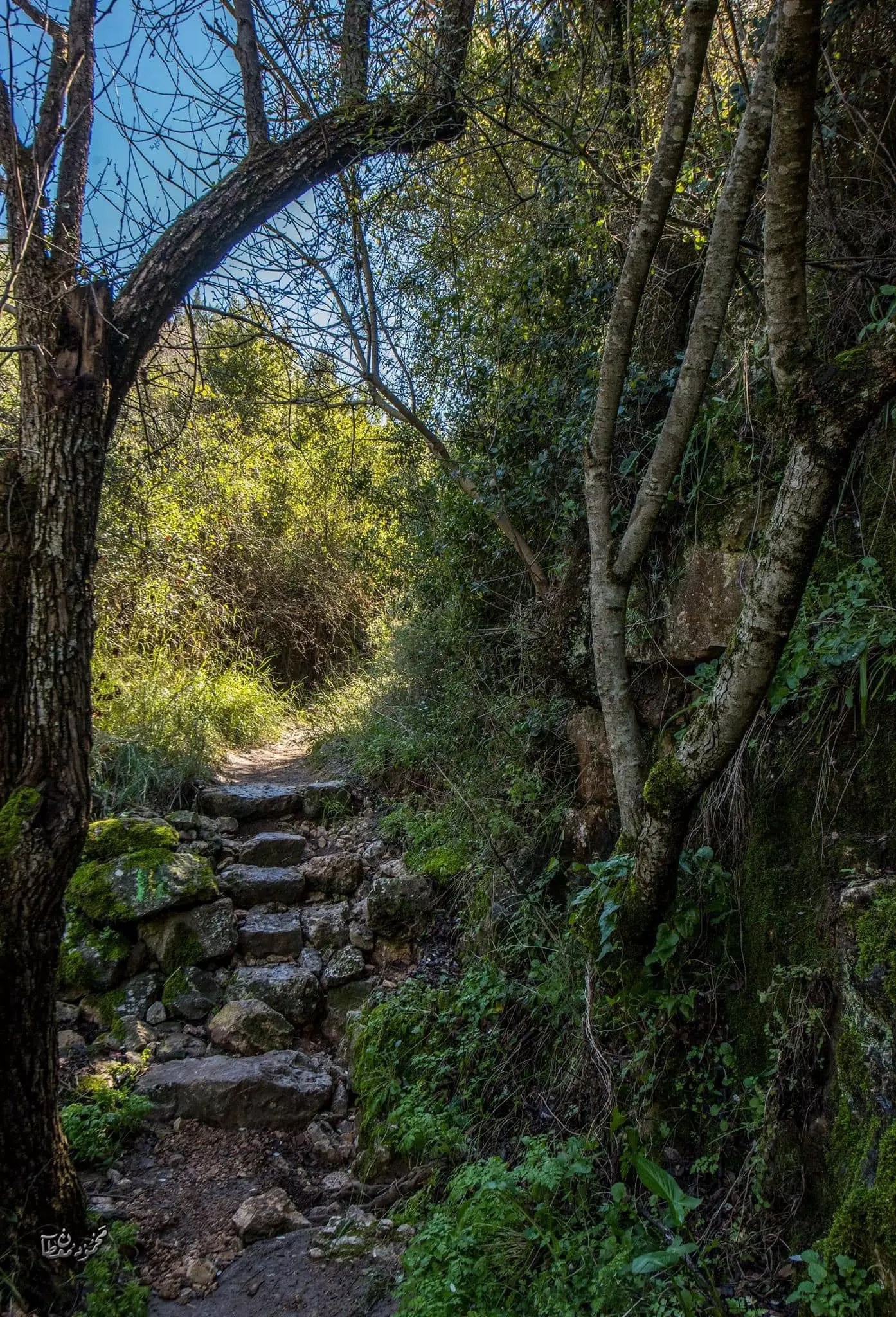
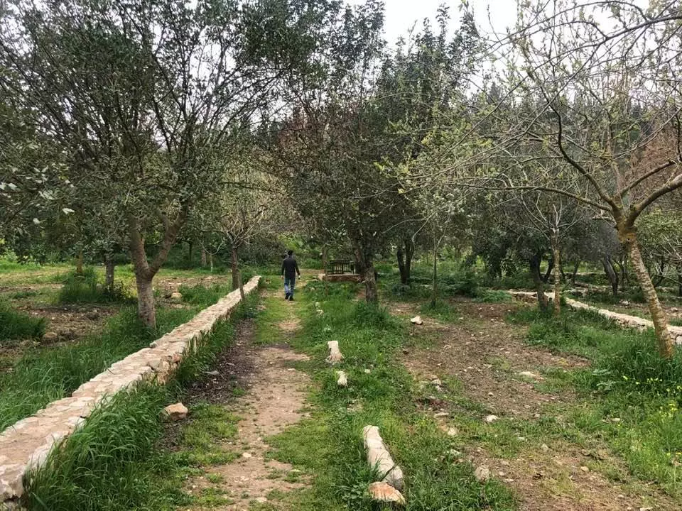
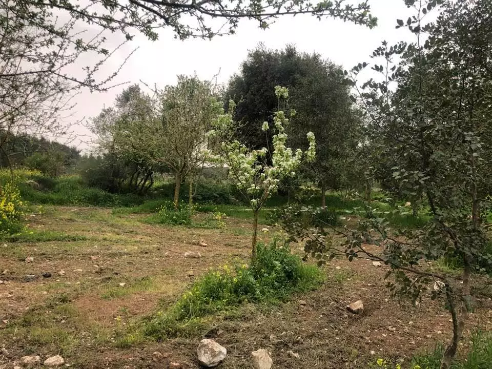
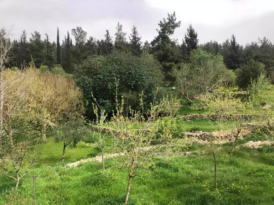
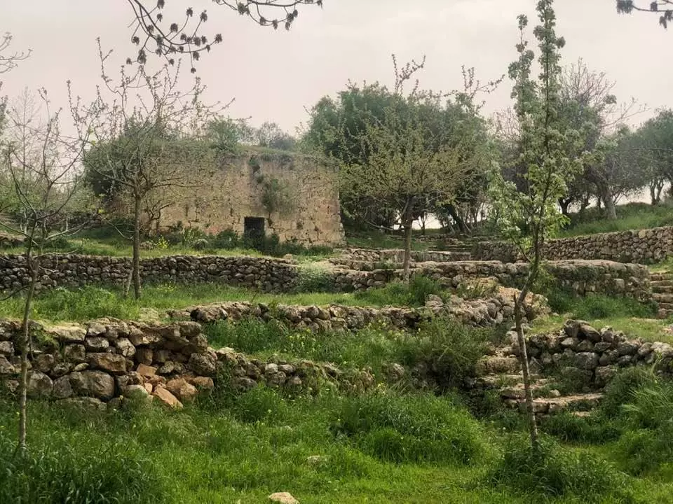
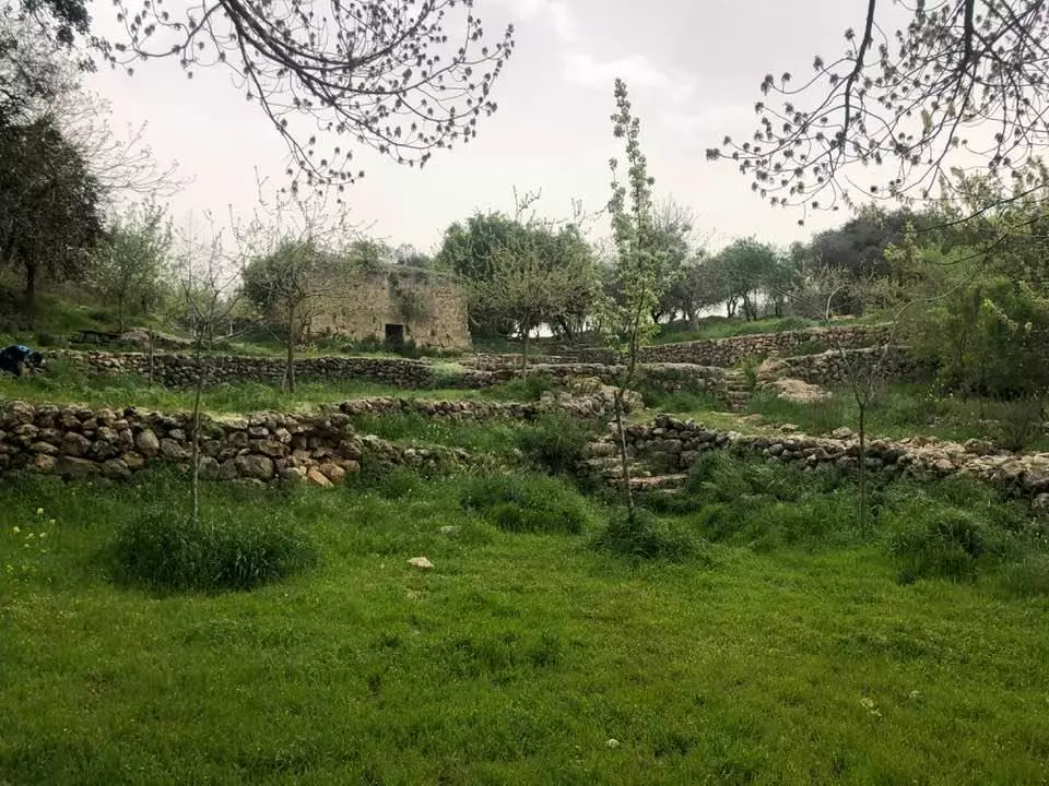
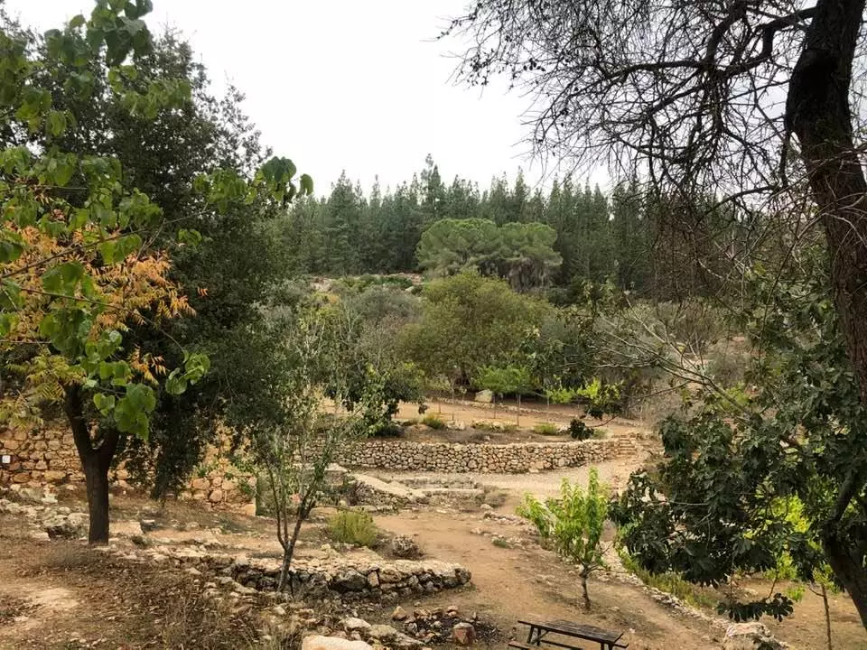
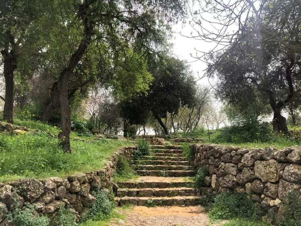
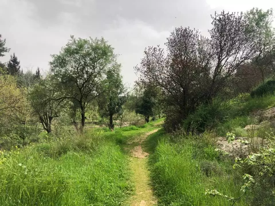
Village Before NakbaThe village stood on top of a high mountain that sloped steeply on the northern, eastern, and western sides of the village. A secondary road linked it to the highway between Bayt Jibrin (an important village in the Hebron sub-disctrict) and Jerusalem; this highway ran about 1.5 km south of al-Qabu. The village's name was a modification of Qobi, the site's name during the Roman period. In the late nineteenth century, al-Qabu was described as a moderately sized village built of stone that was situated on a high hill. A ruined Crusader church stood southwest of the village on a hillside.The village had a rectangular plan that extended in a north−south direction along the aforementioned road. Its houses were built primarily of stone. There were a few small shops in the village's main square; the shrine of one Shaykh Ahmad al-'Umari stood southeast of the village site. The residents, who were Muslims, obtained their water from several springs around the site, including 'Ayn Tuz and 'Ayn al-Bayda. Agriculture was both rainfed and irrigated; irrigation water was taken from springs. The villagers planted their lands in grain and fruit trees, especially olive trees (which covered 30 dunums of land), and grape vines. In 1944/45 a total of 1,233 dunums was allocated to cereals; 436 dunums were irrigated or used for orchards. Historical relics around it included the ruins of the Crusader church and an old canal. Two khirbas to the east of the village also contained ruins and fragments of stone arches. Village Occupation and Ethnic CleaningThe village stood on top of a high mountain that sloped steeply on the northern, eastern, and western sides of the village. A secondary road linked it to the highway between Bayt Jibrin (an important village in the Hebron sub-disctrict) and Jerusalem; this highway ran about 1.5 km south of al-Qabu. The village's name was a modification of Qobi, the site's name during the Roman period. In the late nineteenth century, al-Qabu was described as a moderately sized village built of stone that was situated on a high hill. A ruined Crusader church stood southwest of the village on a hillside.The village had a rectangular plan that extended in a north−south direction along the aforementioned road. Its houses were built primarily of stone. There were a few small shops in the village's main square; the shrine of one Shaykh Ahmad al-'Umari stood southeast of the village site. The residents, who were Muslims, obtained their water from several springs around the site, including 'Ayn Tuz and 'Ayn al-Bayda. Agriculture was both rainfed and irrigated; irrigation water was taken from springs. The villagers planted their lands in grain and fruit trees, especially olive trees (which covered 30 dunums of land), and grape vines. In 1944/45 a total of 1,233 dunums was allocated to cereals; 436 dunums were irrigated or used for orchards. Historical relics around it included the ruins of the Crusader church and an old canal. Two khirbas to the east of the village also contained ruins and fragments of stone arches. Zionists Colonies on Village LandsThe settlement of Mevo Betar (160125) was established on village lands in 1950.Village TodayThe site abounds in the ruins and remains of the houses, and contains olive, almond, and pine trees (see photos). The village cemetery is visible on the southeastern edge of the site. Seven graves can be seen; bones are visible in some of the open ones. The village mosque still stands, abandoned and neglected; in the courtyard of the mosque, there is an artificial pool equipped with steps, and behind the mosque there are three wells. The shrine of Shaykh al-'Umari stands next to an old network of irrigation canals. A set of stone stairs leads down to the arched entrance of the ancient spring of 'Ayn al-Qabu. Much of the surrounding land has been covered by a forest planted by Israel.SourceDr. Walid al-Khalidi, 1992: All That Remains. |
|||||||||||||||
| Related Maps | Town Lands' Demarcation Maps خرائط للقضاء توضح حدود القرى والاودية Town's map on MapQuest View from satellite Help us map this town at WikiMapia |
||||||||||||||
| Related Links | Wikipedia's Page Google Search Google For Images Google For Videos |
||||||||||||||
| More Information | في كتاب كي لا ننسى في كتاب بلادنا فلسطين المزيد من موقع هوية |
||||||||||||||
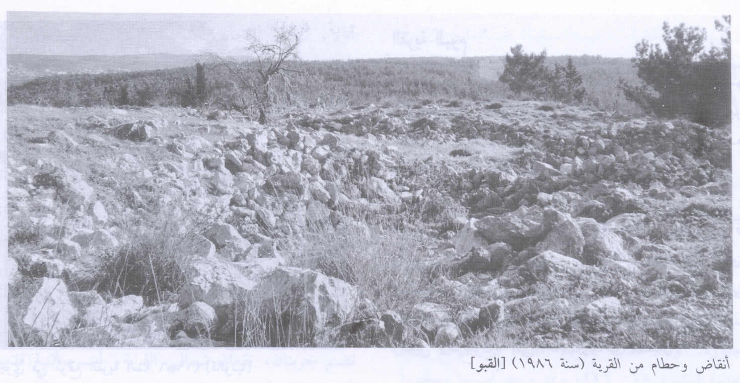
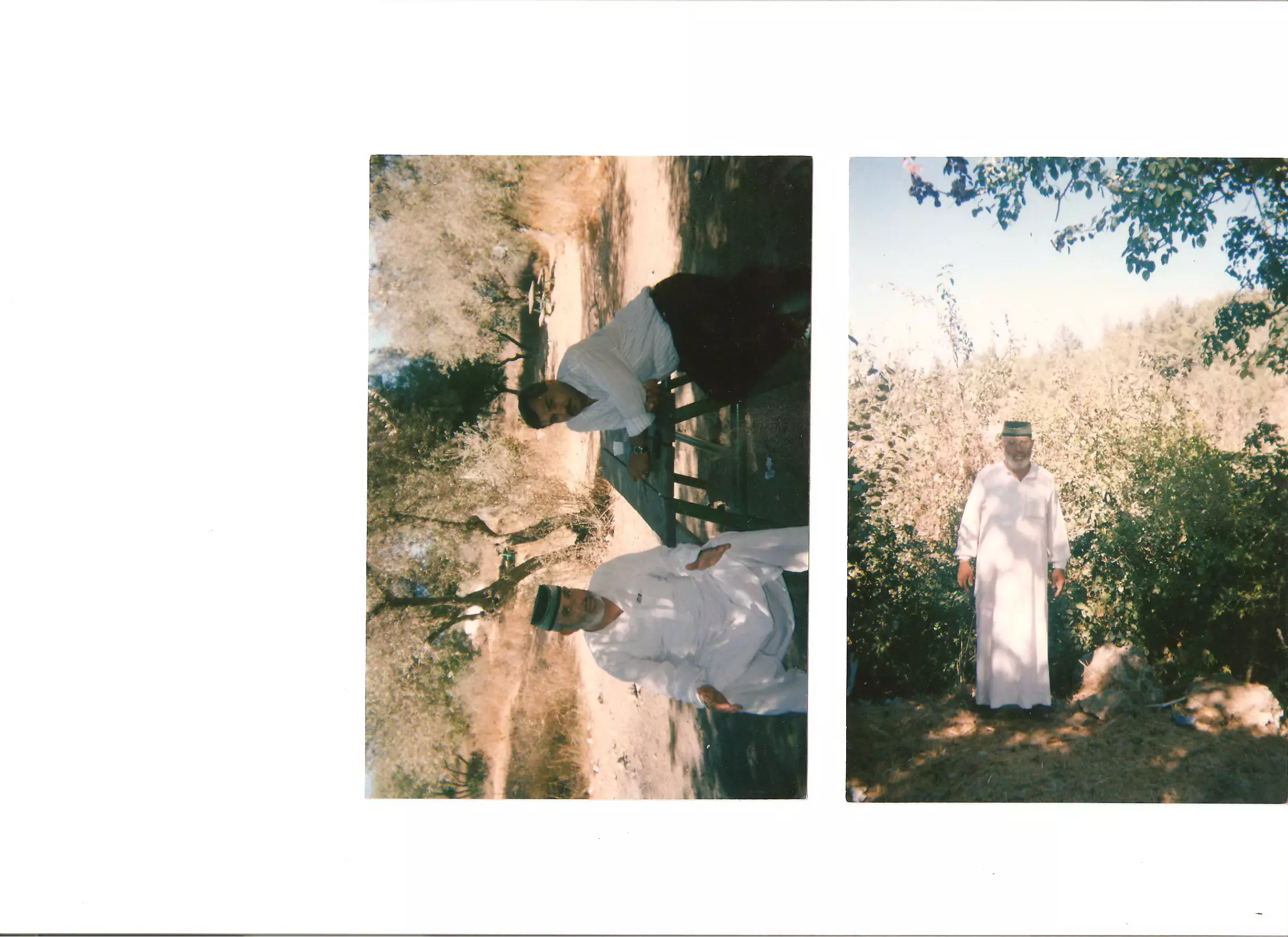
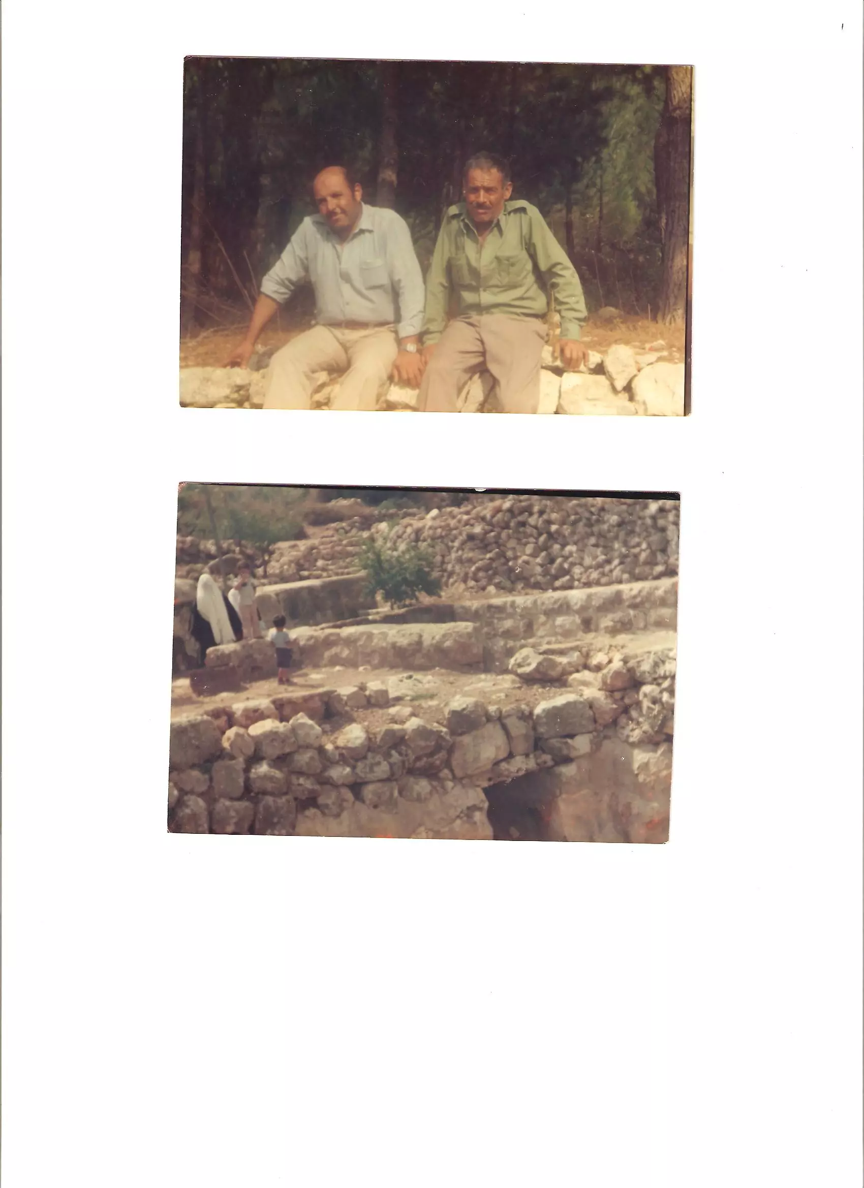
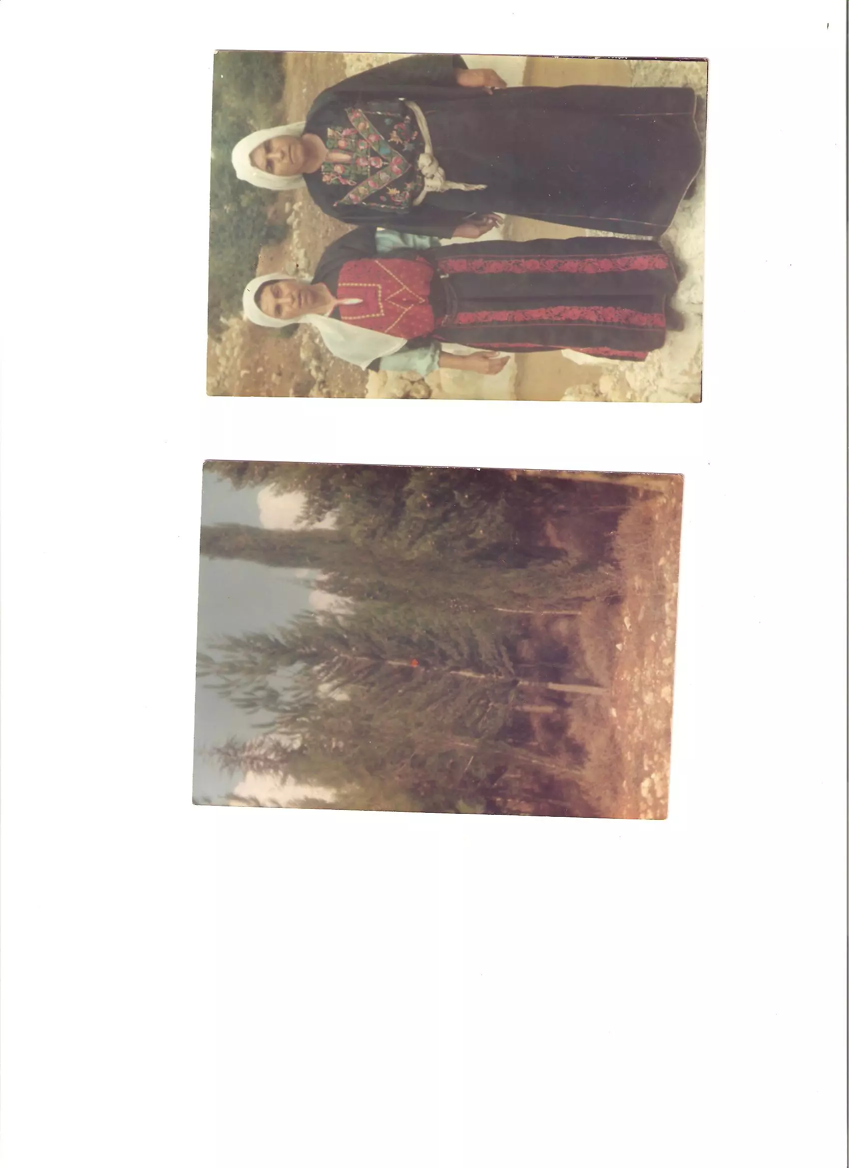
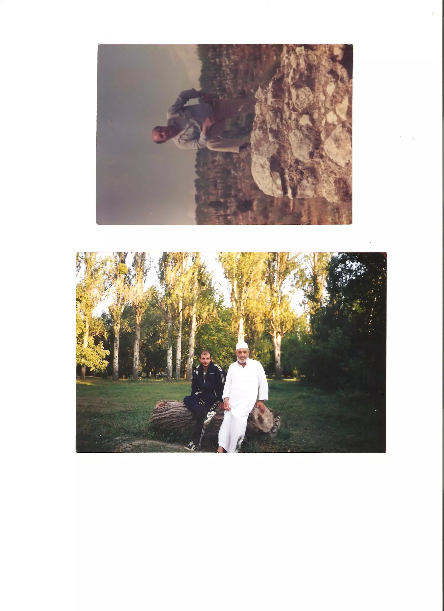
- The house rubble of the destroyed village, 1986
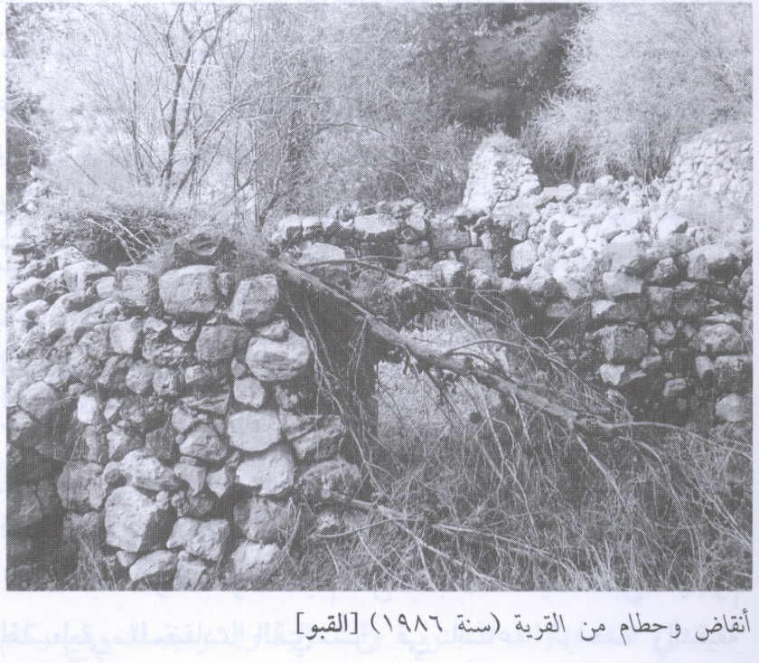
Scanned from "All That Remains" by Dr. Walid Khalidi 5 - The house rubble of the destroyed village #2, 1986
Scanned from "All That Remains" by Dr. Walid Khalidi - One of the few remaing house, its seems the whole town has been converted to a park.
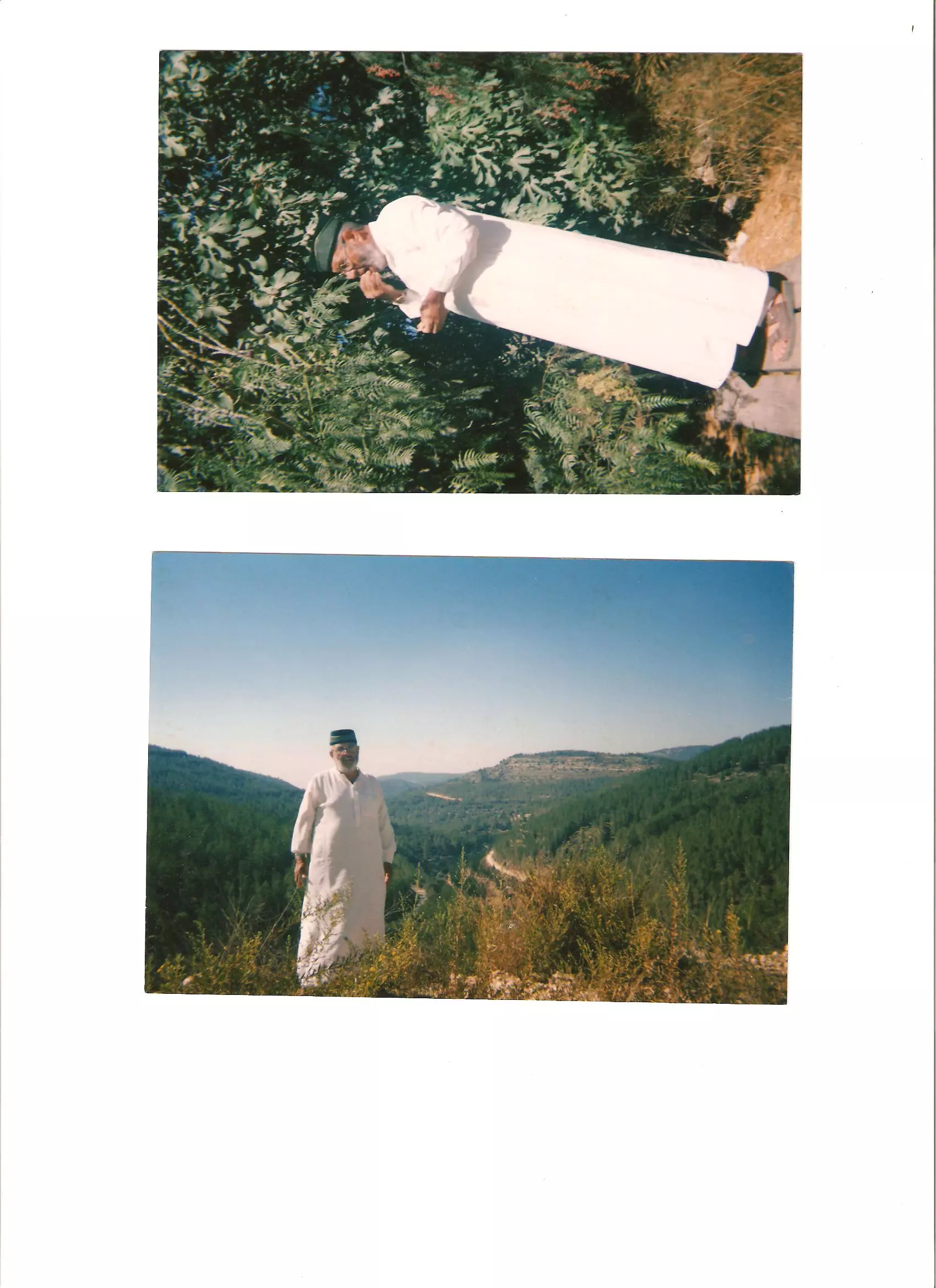
6 - Remaining House in Qabu Spring 2006
Posted by Annemarie Jacir 2 - منطقة اثرية
Posted by عماد جميل احمد أبويابس 6 - وسط البلد - القبو
Posted by عماد جميل احمد أبويابس 2 - أطلال القرية
Posted by عماد جميل احمد أبويابس 4 - أطلال القرية
Posted by عماد جميل احمد أبويابس 2 - وقفة على أطلال القرية
Posted by abuaya 2 - وقفة على أطلال القرية
Posted by abuaya 1 - وقفة على أطلال القرية
Posted by abuaya 2 - وقفة على أطلال القرية
Posted by abuaya 1 - وقفة على أطلال القرية
Posted by abuaya 1 - وقفة على أطلال القرية
Posted by abuaya 2 - وقفة على أطلال القرية
Posted by abuaya 2 - وسط البلد 2009
Posted by abu rashed 1 - الطبيعة الخلابة
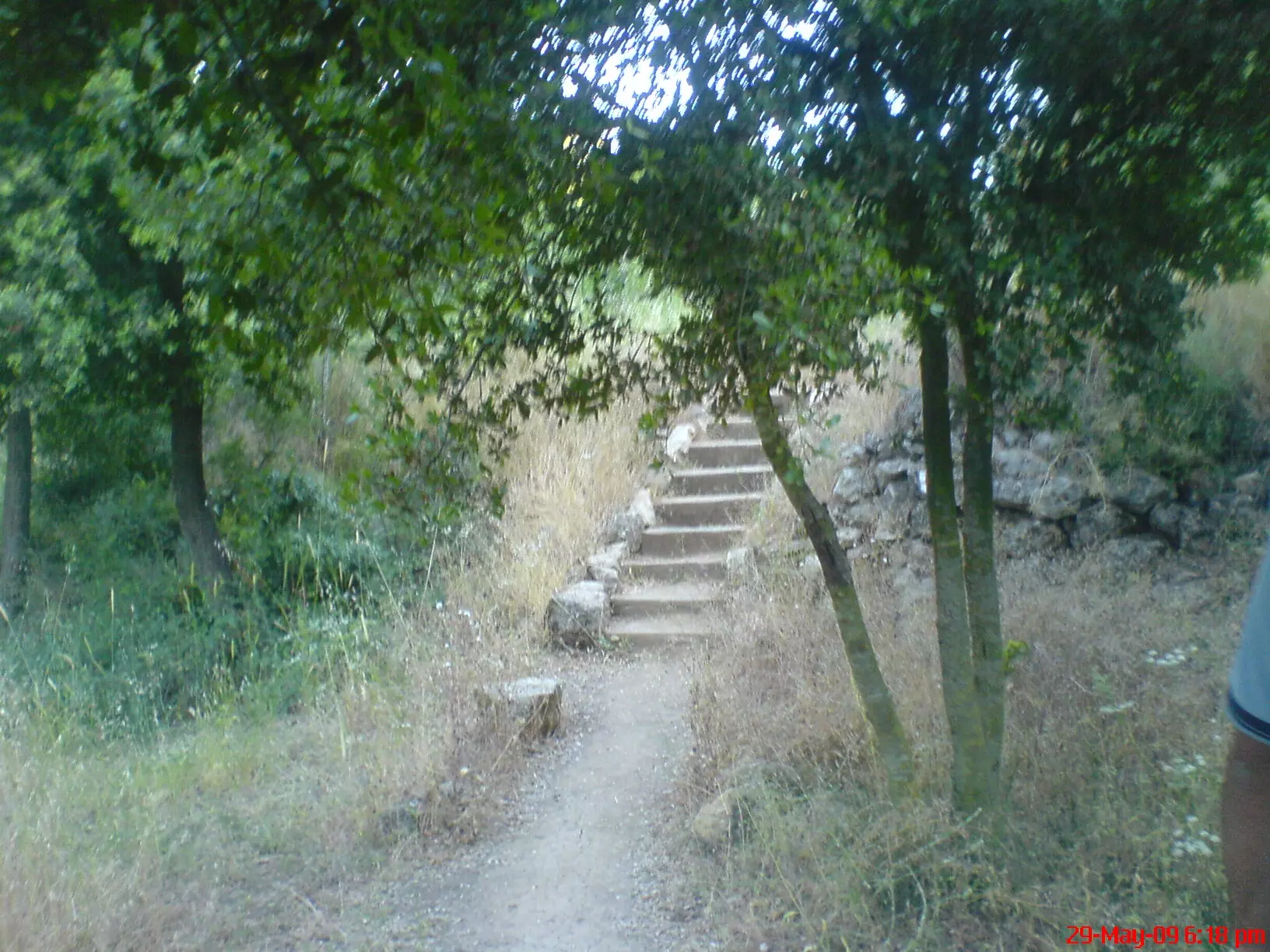
Posted by abu rashed 2 - ممرات
Posted by abu rashed 1 - مدخل البئر
Posted by abu rashed - الطبيعة الخلابة32
Posted by abu rashed - الطبيعة الخلابة322
Posted by abu rashed - بقايا منزل
Posted by abu rashed - مدخل القبو الشرقي

Posted by Nasser Abu Nassar - المدخل الشرقي 2
Posted by Nasser Abu Nassar 1 - المدخل الشرقي 2
Posted by Nasser Abu Nassar - بيوت قريتنا الصامدة
Posted by Nasser Abu Nassar 1 - بيوت قريتنا الصامدة 2
Posted by Nasser Abu Nassar - بيوت قريتنا الصامدة 3
Posted by Nasser Abu Nassar - شهيد فلسطيني
Posted by nasser 1 - HEROO

Posted by موسى أبونصار - القبو

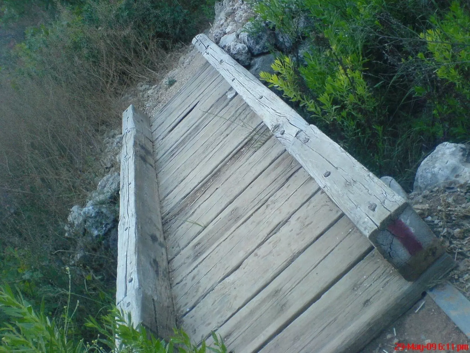
Posted by اكرم - Looking up from one of the water channels, Tariq Bakri
Posted by Tarek Bakri - A vuew from inside one of the destroyed houses, Tari Bakri
Posted by Tarek Bakri - Qabu's Mosque, Tariq Bakri
Posted by Tarek Bakri - الطبيعة والأراضي المحيطة، طارق البكري
Posted by Tarek Bakri - الطبيعة والأراضي المحيطة، طارق البكري
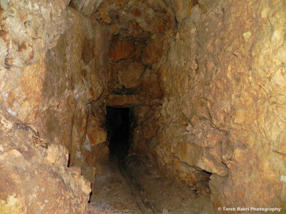
Posted by Tarek Bakri - Underground structure, Tariq Bakri
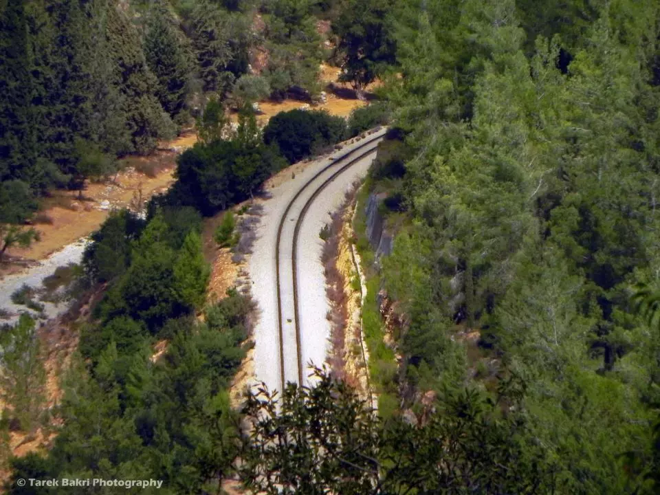
Posted by Tarek Bakri - The nearby Railway, Tariq Bakri
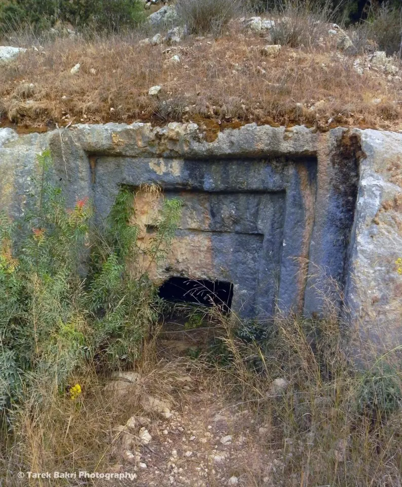
Posted by Tarek Bakri - An old tomb dates to the Roman period, Tariq Bakri
Posted by Tarek Bakri - A view from inside the water channels, Tariq Bakri
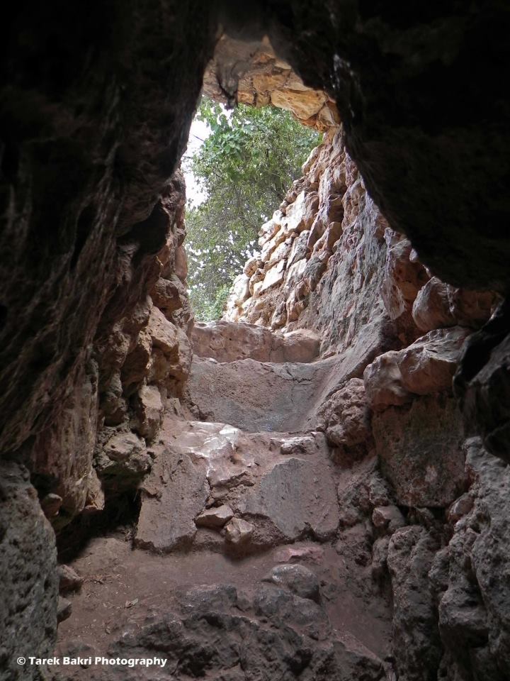
Posted by Tarek Bakri - A view from inside the water channels, Tariq Bakri
Posted by Tarek Bakri - من غرب القريه

Posted by abu raya - بيوت القبو
Posted by abu raya - القبو
Posted by abu raya - جبال القبو
Posted by abu raya - اثار ردم بيوت القبو
Posted by abu raya - القبو
Posted by abu raya - القبو
Posted by abu raya - القبو
Posted by abu raya - اثار بيوت القريه
Posted by abu raya - القبو
Posted by abu raya - القبو
Posted by abu raya - The most "civilized" obliterated the village except for its Mosque and other few structures. That is how the Jews will "feel" safe and great again
- The most "civilized" obliterated the village except for its Mosque and other few structures. That is how the Jews will "feel" safe and great again #2
- That is how the "civilized" erased and replaced us: al-Qabu was completely obliterated except for a few remaining structures, as you see -- القبو باتت أثر بعد عين. من هنا مر الهمجّ
- That is how the "civilized" erased and replaced us: al-Qabu was completely obliterated except for a few remaining structures, as you see -- القبو باتت أثر بعد عين. من هنا مر الهمجّ #2

- That is how the "civilized" erased and replaced us: al-Qabu was completely obliterated except for a few remaining structures, as you see -- القبو باتت أثر بعد عين. من هنا مر الهمجّ #3

- That is how the "civilized" erased and replaced us: al-Qabu was completely obliterated except for a few remaining structures, as you see -- القبو باتت أثر بعد عين. من هنا مر الهمجّ #4
- That is how the "civilized" erased and replaced us: al-Qabu was completely obliterated except for a few remaining structures, as you see -- القبو باتت أثر بعد عين. من هنا مر الهمجّ #5

- That is how the "civilized" erased and replaced us: al-Qabu was completely obliterated except for a few remaining structures, as you see -- القبو باتت أثر بعد عين. من هنا مر الهمجّ #6

- That is how the "civilized" erased and replaced us: al-Qabu was completely obliterated except for a few remaining structures, as you see -- القبو باتت أثر بعد عين. من هنا مر الهمجّ #7

- That is how the "civilized" erased and replaced us: al-Qabu was completely obliterated except for a few remaining structures, as you see -- القبو باتت أثر بعد عين. من هنا مر الهمجّ #8

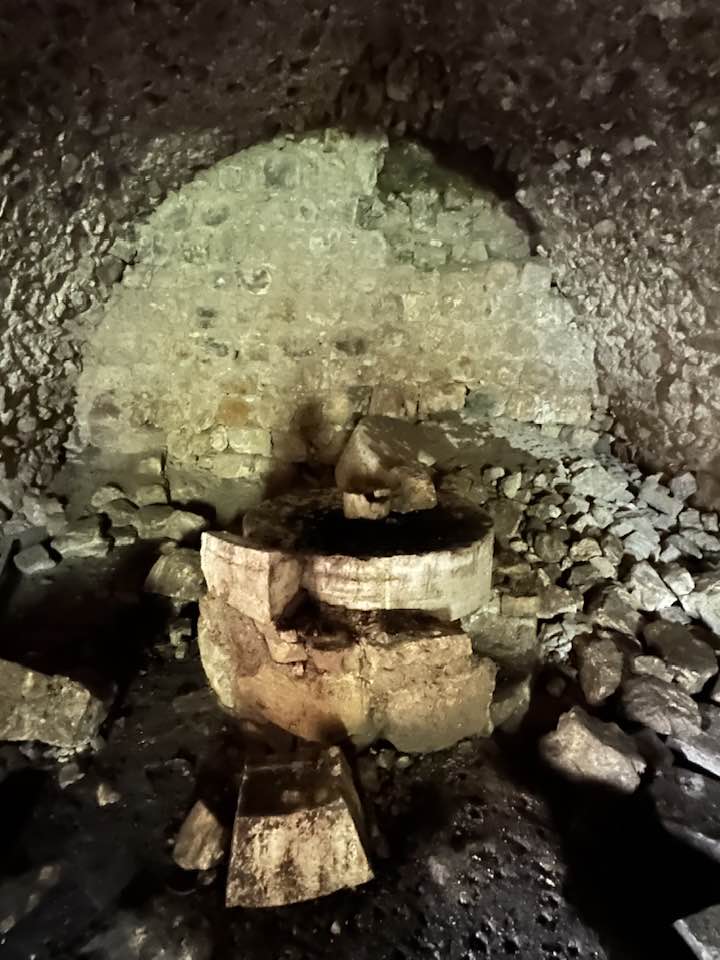
- The olive oil press, as we left after Nakba, 2024 -- Iyad Jaber #2

- The olive oil press, as we left after Nakba, 2024 -- Iyad Jaber #3
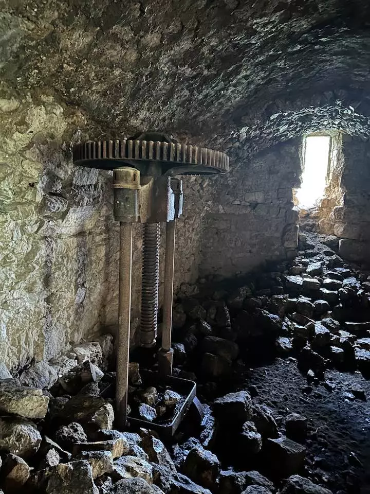
- The olive oil press, as we left after Nakba, 2024 -- Iyad Jaber #4
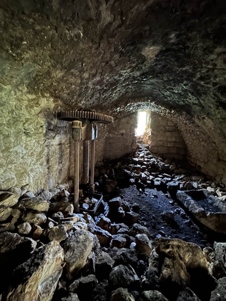
- The olive oil press, as we left after Nakba, 2024 -- Iyad Jaber #5
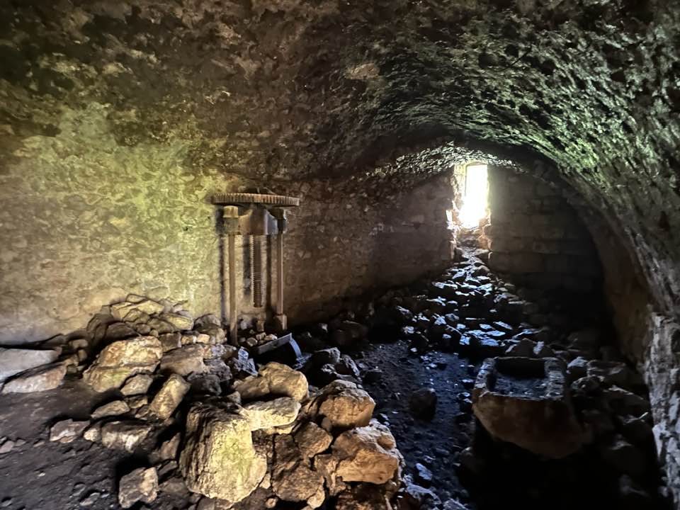
- The olive oil press, as we left after Nakba, 2024 -- Iyad Jaber #6
- Let us see how the most "liberal and civilized" of world Jewry has obliterated our village except for a single structure. How else will the Jews be great and safe again? -- القرية دمرت بالكامل.. من هنا مر الهمج
- Let us see how the most "liberal and civilized" of world Jewry has obliterated our village except for a single structure. How else will the Jews be great and safe again? -- القرية دمرت بالكامل.. من هنا مر الهمج #2
- Let us see how the most "liberal and civilized" of world Jewry has obliterated our village except for a single structure. How else will the Jews be great and safe again? -- القرية دمرت بالكامل.. من هنا مر الهمج #3
- Let us see how the most "liberal and civilized" of world Jewry has obliterated our village except for a single structure. How else will the Jews be great and safe again? -- القرية دمرت بالكامل.. من هنا مر الهمج #4
- Let us see how the most "liberal and civilized" of world Jewry has obliterated our village except for a single structure. How else will the Jews be great and safe again? -- القرية دمرت بالكامل.. من هنا مر الهمج #5
- Let us see how the most "liberal and civilized" of world Jewry has obliterated our village except for a single structure. How else will the Jews be great and safe again? -- القرية دمرت بالكامل.. من هنا مر الهمج #6
- Let us see how the most "liberal and civilized" of world Jewry has obliterated our village except for a single structure. How else will the Jews be great and safe again? -- القرية دمرت بالكامل.. من هنا مر الهمج #7
- Let us see how the most "liberal and civilized" of world Jewry has obliterated our village except for a single structure. How else will the Jews be great and safe again? -- القرية دمرت بالكامل.. من هنا مر الهمج #8

- Let us see how the most "liberal and civilized" of world Jewry has obliterated our village except for a single structure. How else will the Jews be great and safe again? -- القرية دمرت بالكامل.. من هنا مر الهمج #9

- Let us see how the most "liberal and civilized" of world Jewry has obliterated our village except for a single structure. How else will the Jews be great and safe again? -- القرية دمرت بالكامل.. من هنا مر الهمج #10
- Let us see how the most "liberal and civilized" of world Jewry has obliterated our village except for a single structure. How else will the Jews be great and safe again? -- القرية دمرت بالكامل.. من هنا مر الهمج #11

- Let us see how the most "liberal and civilized" of world Jewry has obliterated our village except for a single structure. How else will the Jews be great and safe again? -- القرية دمرت بالكامل.. من هنا مر الهمج #12
- Let us see how the most "liberal and civilized" of world Jewry has obliterated our village except for a single structure. How else will the Jews be great and safe again? -- القرية دمرت بالكامل.. من هنا مر الهمج #13
- Let us see how the most "liberal and civilized" of world Jewry has obliterated our village except for a single structure. How else will the Jews be great and safe again? -- القرية دمرت بالكامل.. من هنا مر الهمج #14
- Let us see how the most "liberal and civilized" of world Jewry has obliterated our village except for a single structure. How else will the Jews be great and safe again? -- القرية دمرت بالكامل.. من هنا مر الهمج #15
- Let us see how the most "liberal and civilized" of world Jewry has obliterated our village except for a single structure. How else will the Jews be great and safe again? -- القرية دمرت بالكامل.. من هنا مر الهمج #16
- Let us see how the most "liberal and civilized" of world Jewry has obliterated our village except for a single structure. How else will the Jews be great and safe again? -- القرية دمرت بالكامل.. من هنا مر الهمج #17
- Let us see how the most "liberal and civilized" of world Jewry has obliterated our village except for a single structure. How else will the Jews be great and safe again? -- القرية دمرت بالكامل.. من هنا مر الهمج #18
- Let us see how the most "liberal and civilized" of world Jewry has obliterated our village except for a single structure. How else will the Jews be great and safe again? -- القرية دمرت بالكامل.. من هنا مر الهمج #19
- Let us see how the most "liberal and civilized" of world Jewry has obliterated our village except for a single structure. How else will the Jews be great and safe again? -- القرية دمرت بالكامل.. من هنا مر الهمج #20
Want to browse more? 80,000 pictures were grouped in these gallaries:
| Display Name | Clan/Hamolah | Country of Residence |
| ghazi AbouYabis | AbouYabis | Bethlehem, Palestine |
| رجا عبيد الله | عبيد الله | - |
| علي المشني | - | عمان |
| صهيب المشني | المشني | عمان |
| asem abu yabes | abu yabes | بيت لحم |
| نظام أبويابس | أبو يابس | بيروت, لبنان |
| فتحي ابونصار | - | عمان |
| موسى أبونصار | أبونصار | الكرك - الاردن, Palestine |
| AseR AL-7oRiA | Abu Yabes - ابو يابس | bethlehem, Palestine` |
| wajdi2k | ابو عالية | - |
| سهاد أبو يابس | - | - |
| محمد موسى أبو نصار | أبو نصار | - |
| نائل ابوغلوس | ابوغلوس | عمان, الاردن |
| الحوت | - | - |
| محمد | ابو عالية | المقابلين, الاردن |
| احمد ابوعالية | ابوعالية | عمان, الاردن |
| abuothman | ابونصار | jordan, jordan |
| صالح ابو عالية | - | فلسطين, مخيم الدهيشة |
| محمود محمد محمود ابوغلوس | - | - |
| محمد الأزرق | الأزرق | - |
| عثمان ابوغلَوس | - | - |
| منذر ابوغلوس | ابوغلوس | عمان |
| ayman | abughalous | amman, jordan |
| الشيخ احمد | عبيد الله | الاردن |
| abuaya | almashni | amman |
| المختار الجديد 2008 | أبونصار | - |
| احمد ابوعوض | ابوعوض | - |
| Adam abeidallah | عبيدالله | - |
| محمد عادل جميل أبو يابس | أبو يابس | عمان, الأردن |
| محمود ابو نصار | ابو نصار | بيت جالا, فلسطين |
| عماد جميل احمد أبويابس | أبويابس | Abu Dhabi, U.A.E |
| Mohammed abu yabes | - | - |
| hussam abu yabes | ابو يابس | - |
| rami abu yabes | abu yabes | amman, jordan |
| موسى أبو يابس | أبو يابس | - |
| حامد | ابوعوض | عمان |
| belal abunassar | abunassar | amman, jordan |
| 'Abeer AbouYabis | AbouYabis | Beirut, Lebanon |
| Rami Abughalous | Abughalous | IL, United States |
 Fake Valor: Why Did Zionist Jews Hoist Nazis Flag on Their Ships in the 1930s?
What is new?
-
Facts About Oct. 7th Gaza Raid
-
Remined Us Please:: Who Did Rape Who? Palestinians Raped Israelis? Or, was the other way around?
-
When Prof. Edward Said was invited to debate Bibi Netanyahu in the 1980s, watch what happened!
-
Ezra Klein of the NY Times on the "Jewish Race".
-
Abusing Blood Libel!
-
Did Israeli Soldiers Activate The Hanniba Direective On Oct. 7th? You Be The Judge
-
Zionist FAQ: Isn't it true that Palestinians don't want peace? Palestinians never accepted the two-state solution
- Facts about Haavara (Transfer) Agreement between Ben-Gurion & Hitler
-
Haavara FAQs: Why Did Zionist Jews Hoist Nazis' Flags on Their Ships in the 1930s?
- Haavara FAQs: When Chaim Weizmann met FDR in mid-1943, why was he silent about rescuing European Jewry?
-
Dear ChatGPT: How did Palestinians resist Napoleon's invasion of their country in 1799?
-
Dear ChatGPT: Gaza had a vibrant Jewish community in the mid-17th century. What happened to them?
-
Dear ChatGPT: Why did the Jewish Agency suppress news of the Holocaust during WWII?
-
Video Playlist: Jews share their DNA tests to end the conflict for good.
-
A Tale of Two Conflicts: Examining the Definition of Genocide
-
Prof. Abraham Polak And The Suppressed History of the Khazars and European Jewry
-
How Ronald Reagan would have framed the genocide in Gaza if he were still alive?
-
Haavara FAQs: Let us do the math: how many German Jews did The Haavara Agreement save?
-
Zionist FAQs: The Hebron Massacre of 1929, "clearly proves" that Palestinians are antisemitic, how could you deny it?
-
Zionist FAQs: Why Anti-Zionist Is Not Antisemitism?
-
Zionist FAQs: Isn't it true that the KGB created Palestinian Nationalism in the early 1960s?
- Zionist FAQs: Muslims are killing Muslims all the time; why are Israeli Jews being singled out in the media?
- Zionist FAQs: How is Israel an apartheid state when 20% of its citizens are Arabs who enjoy full rights?
-
Haavara FAQs: Why Did Dorothy Thompson Flip From A Zionist Advocate to A Silenced Dissenter?
-
Haavara FAQs: Analysis of Herzl's Uganda Scheme and how it could have saved millions of Jews.
-
Haavara FAQs: Why did Hayim Greenberg describe American Jewry as "morally bankrupt" in early 1943?
-
Haavara FAQs: What if the Evian Conference was a resounding success? What would have been the impact of saving European Jewry on Zionism?
- Haavara FAQs: What if the six million were saved, how that would have impacted the Zionist project?
-
Haavara FAQs: How did Zionist leaders react when Europe's Jews lingered in the DP camps after WWII ended?
-
Why does the American Jewish community repeat lies that David Ben-Gurion had debunked before he died?
-
Who has the power to rename the Tatar/Khazar Gene Marker to Jewish IV?
-
Zionist FAQs: Why won't Egypt, Syria, and Jordan take their people back? Jews are indigenous to Palestine, and Arabs immigrated after Jews developed the country. Arabs should leave.
-
Haavara FAQs: Did Hitler and the Nazis conflate between Judaism and Zionist? If that wasn't case, then why?
-
Haavara FAQs: Winston Churchill and antisemitism, a collection of articles written Churchill.
-
Haavara FAQs: Broken by country, how many Jews survived vs. killed during the Holocaust?
-
Haavara FAQs: Why did European Jews vote with their feet and to immigrated to the Americas, not Palestine, after WWII?
-
Watch this American Jewish Girl describing Israeli Jews' cognitive dissonance like no other in under two minutes
-
Haavara FAQs: When the Nazis went out of their way to hide the Holocaust, Israeli Jews did the exact opposite by broadcasting their genocide of Gazans. But why?
-
Haavara FAQs: How Zionist Jews went out of their to show their appreciation to Nazism and Fascism?
- Haavara FAQs: Why Zionist leaders were against bombing the death camps & the Railroads leading to them?
-
Haavara FAQs: Hitler's message to the British and American people: If Jews are such noble citizens and you care about them, how come you're not letting them in? I will gladly ship them to you at my expense, even on luxury liners!
-
A shortlist of Zionist and Israeli false flag operations in the name Jews.
-
The Most Moral Army
- The Land of Kapos (Israel): Where the brave are boycotted and Kapos walk free.
- Why did early Zionists often named their communal enterprises "colonial"?
- Zionist Relations with Nazi Germany by Faris Glubb
-
Two NY Times advertisements by Zionists in the early 1943 that exposes Zionists' treason at the height of the calamity
- Facts Not Lies about the Palestinian-Israeli Conflict.
- Site's pictures have been categorized
- Campgain Against Lice
- A Survey of Palestine, the official source about Palestine before Nakba produced by the British Mandate; over 1200 pages.
- Satellite View & Google Earth: Over 6,000 placemarks identifying all destroyed towns, W. Bank & Gaza Strip Towns, & refugee camps.
- PalestineRemembered.com and its Nakba Oral History Project were featured on al-Jazeera Satellite TV.
- Nakba Oral History Video Podcast:
 Over 700 Oral History interviews (including 3,500+ hours of recording) can be viewed online.
 - Palestine Village Statistics Project
- Gaza Jail Break
- النسخة العربية للموقع الان متوفرة
- Videos: Documenting the destroyed villages in video: Tracing all that remains since Nakba.
- Videos: Responding to Zionist Propaganda
- Interview: The ethnic cleansing of Palestine: George Galloway interviews Israeli Historian Ilan Pappe.
- For Palestinians, memory matters. It provides a blueprint for their future By George Bisharat.
- Zionist FAQ now available in Hebrew שאלות שציונים שואלים, עכשיו בעברית
- Video: The Stephen Walt and John Mearsheimer report on the influence of the Israel Lobby on U.S. Foreign Policy
- The Palestinian-Israeli conflict for beginners
