| PalestineRemembered | About Us | Oral History | العربية | |
| Pictures | Zionist FAQs | Haavara | Maps | |
| Search |
| Camps |
| Districts |
| Acre |
| Baysan |
| Beersheba |
| Bethlehem |
| Gaza |
| Haifa |
| Hebron |
| Jaffa |
| Jericho |
| Jerusalem |
| Jinin |
| Nablus |
| Nazareth |
| Ramallah |
| al-Ramla |
| Safad |
| Tiberias |
| Tulkarm |
| Donate |
| Contact |
| Profile |
| Videos |
Welcome To al-Qastal - القسطل (אל-קסטל)
|
District of Jerusalem
Ethnically cleansed days ago |
العربية Google Earth |
 |
Gallery (59) |
- Statistics & Facts
-
Before & After

- Satellite View
- Articles 5
- Pictures 59
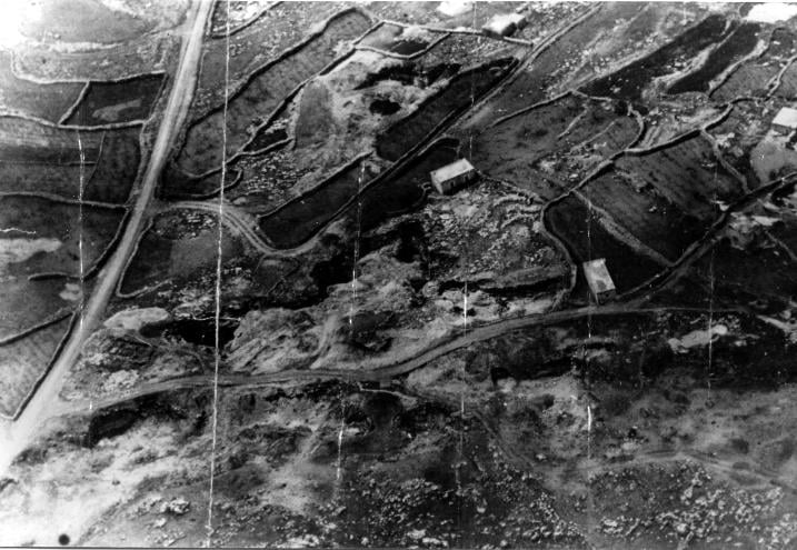
- Aerial Views 1
- Oral History 5
- Members 7
- All That Remains
- Wikipedia
- Videos 4
- Guest Book 1
- Links
| Statistic & Fact | Value | ||||||||||||||||||
| Occupation Date | April 3, 1948 | ||||||||||||||||||
| Distance From District | 8 (km) West of Jerusalem | ||||||||||||||||||
| Elevation | 790 (meters) | ||||||||||||||||||
| Before & After Nakba, Click Map For Details |
|||||||||||||||||||
|
|||||||||||||||||||
| Pre-Nakba Aerial View |
|||||||||||||||||||
|
|||||||||||||||||||
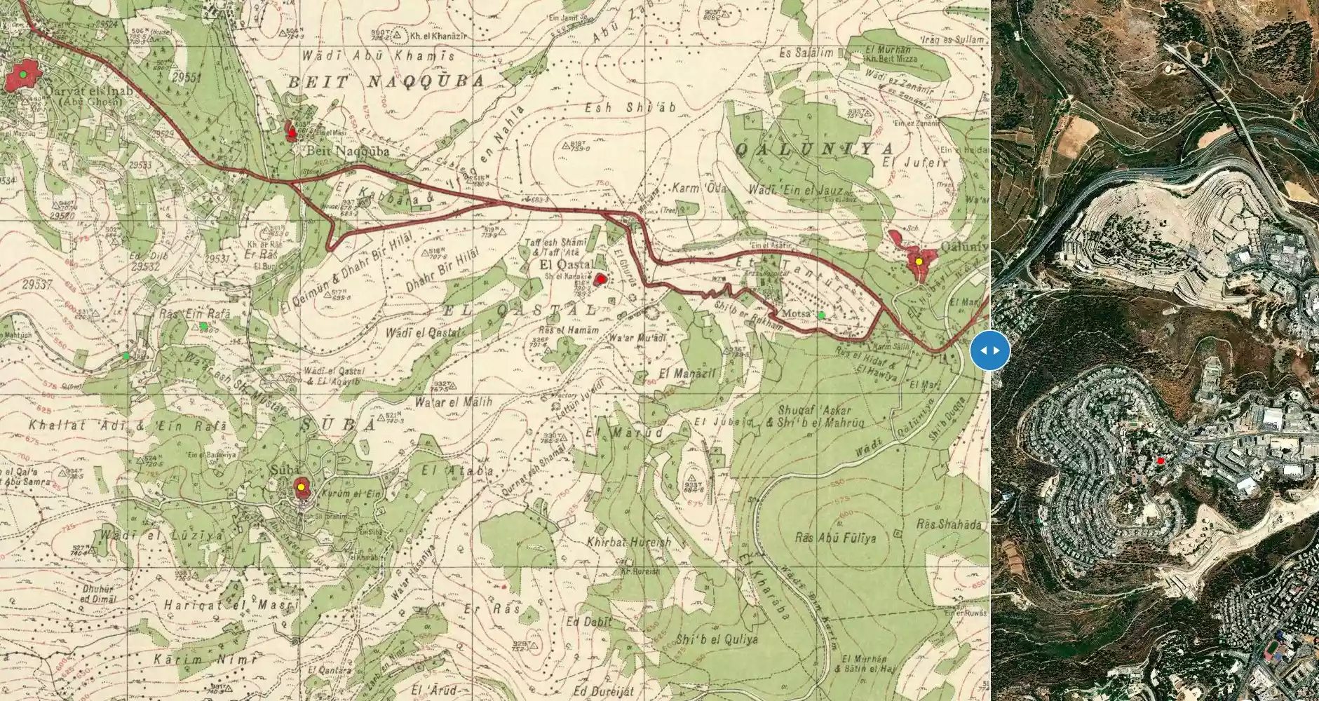
| Map Location | See location #6 on the map View from satellite |
||||||||||||||||||
| Military Operation | Operation Nachshon | ||||||||||||||||||
| Attacking Units | The Palmach's Fourth Battalion | ||||||||||||||||||
| Defenders |
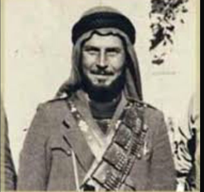
Arab Liberation Army (ALA) headed by 'Abd al-Qadir
al-Husseini. Visit the Stories and Memories section for the letter that
Abdel Qader sent to the Arab League ,on April 6th 1948, complaining for lack
of weapons to defend Palestine and its people. |
||||||||||||||||||
| Exodus Cause | Military assault by Zionist troops | ||||||||||||||||||
| Village Temains | al-Qastal was completely destroyed, only house rubble left behind | ||||||||||||||||||
| Ethnically Cleansing | al-Qastal inhabitants were completely ethnically cleansed. | ||||||||||||||||||
| Pre-Nakba Land Ownership |
**Town Lands' Demarcation Maps |
||||||||||||||||||
| Land Usage As of 1945 |
|
||||||||||||||||||
| Population |
|
||||||||||||||||||
| Number of Houses |
|
||||||||||||||||||
| Near By Towns |
|||||||||||||||||||
|
|||||||||||||||||||
| Town's Name Through History | al-Qastal's name was derived from the Latin casteum, similarly the nearby Roman castle was also know by. The old Roman castle was renovated and named Belveer des Croises during the Crusade period. | ||||||||||||||||||
| Shrines / Maqams | A shrine for a local sage known by al-Shaykh Karaki. | ||||||||||||||||||
| Water Supply | al-Qastal has several springs outside its borders to the east. | ||||||||||||||||||
| Exculsive Jewish Colonies Who Usurped Village Lands |
The Jerusalem neighborhood of Mevasseret Tziyyon. | ||||||||||||||||||
| Featured Video | |||||||||||||||||||
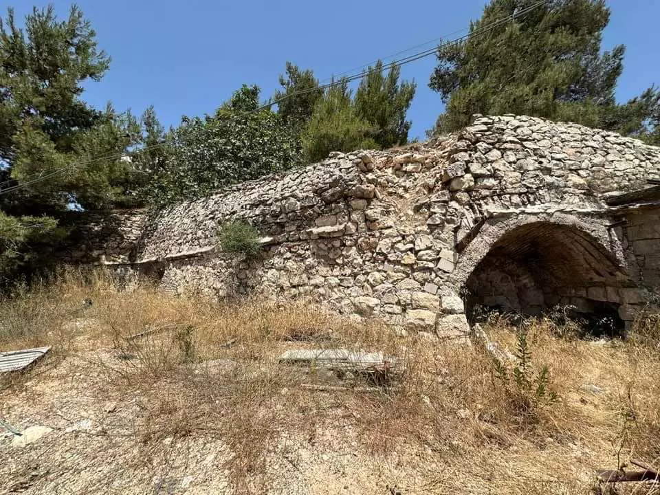
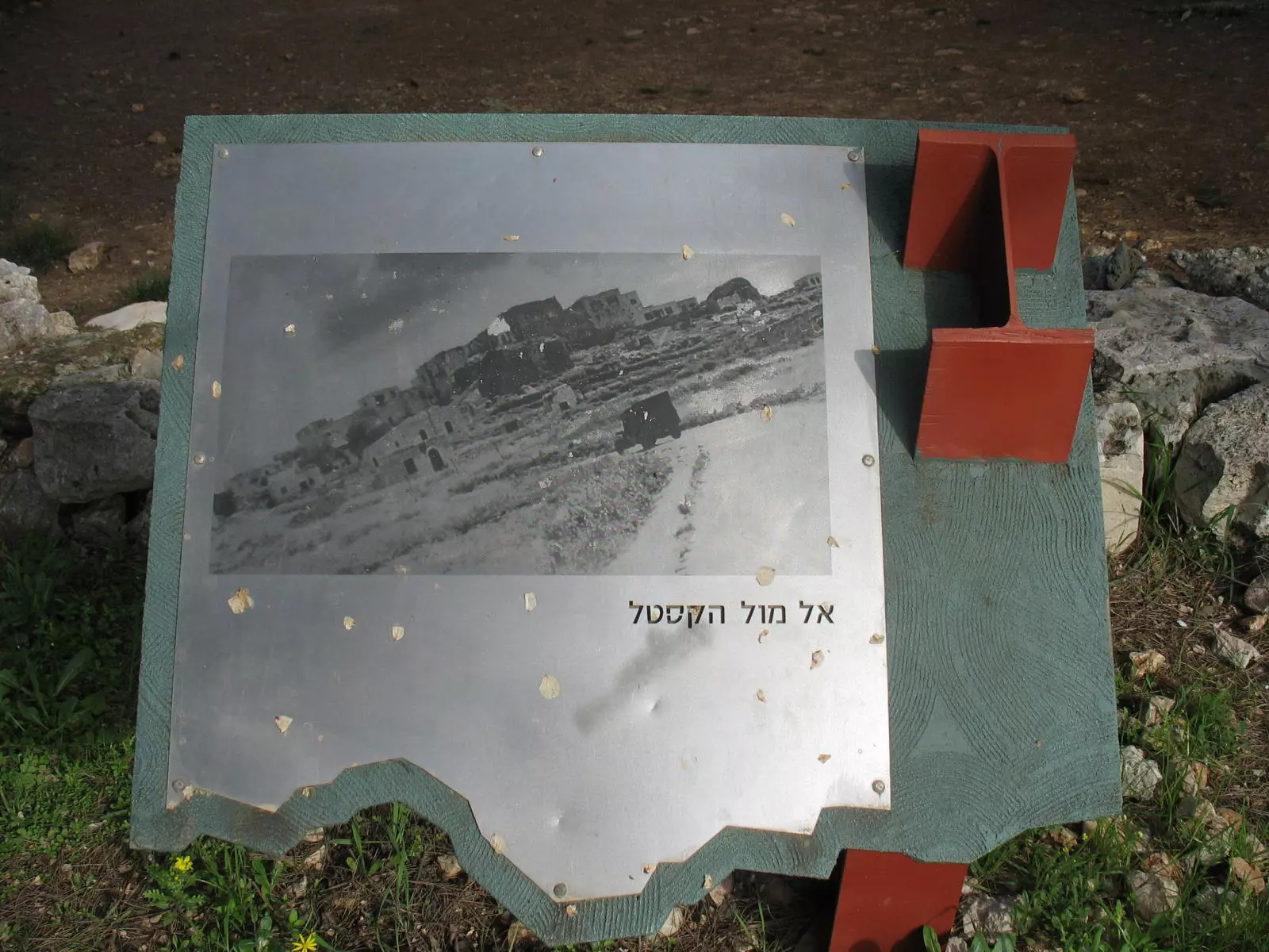
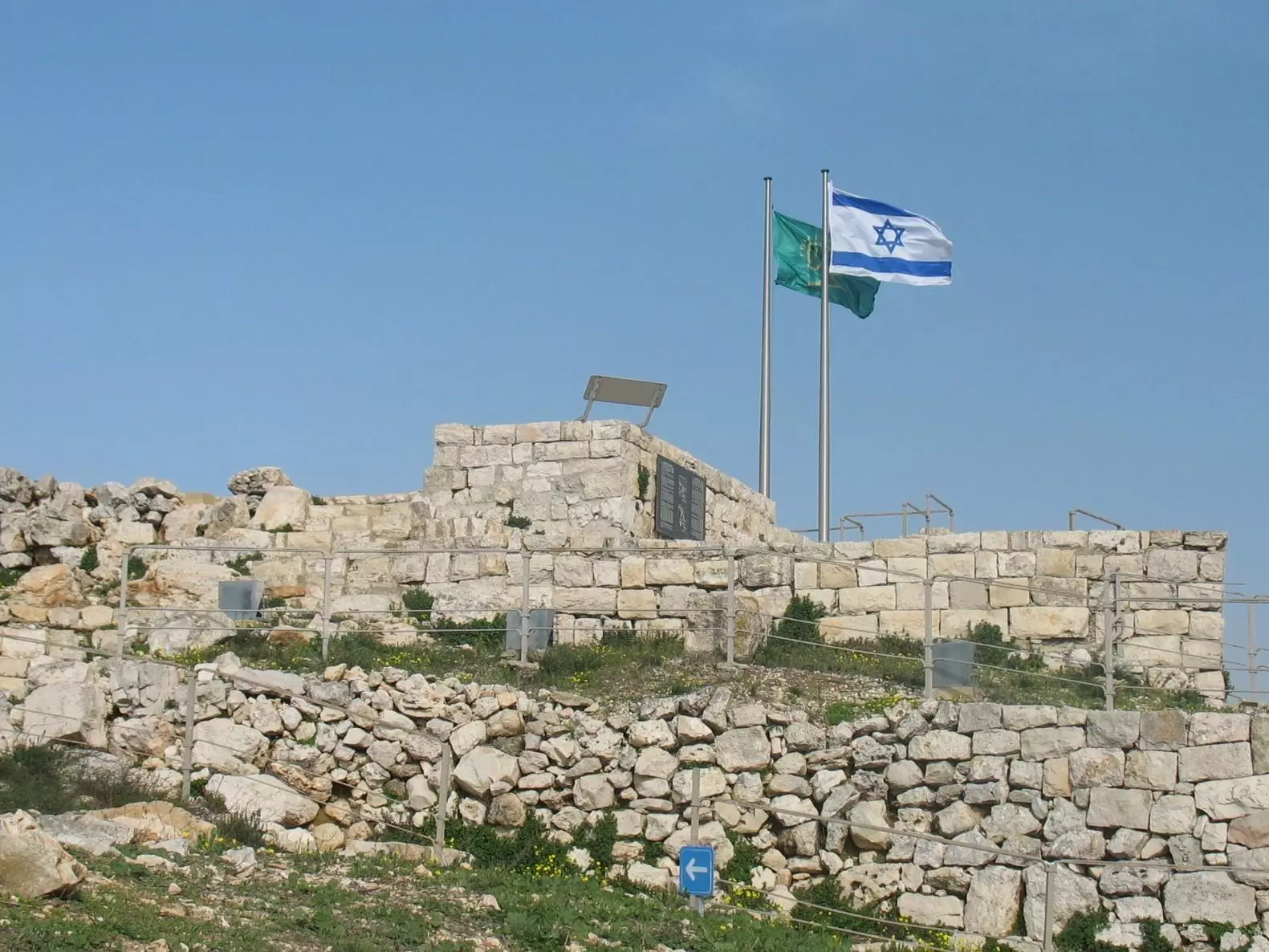
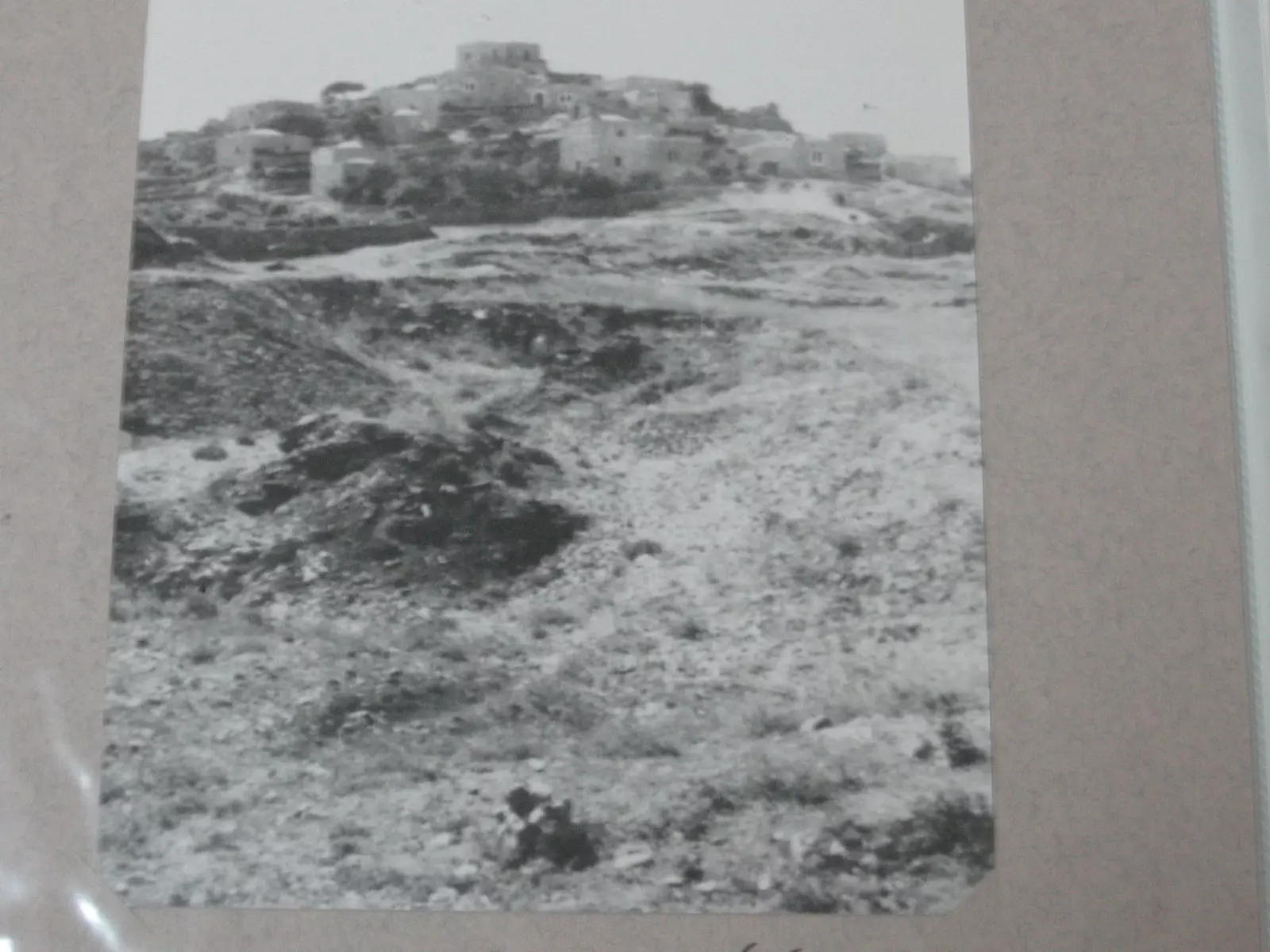
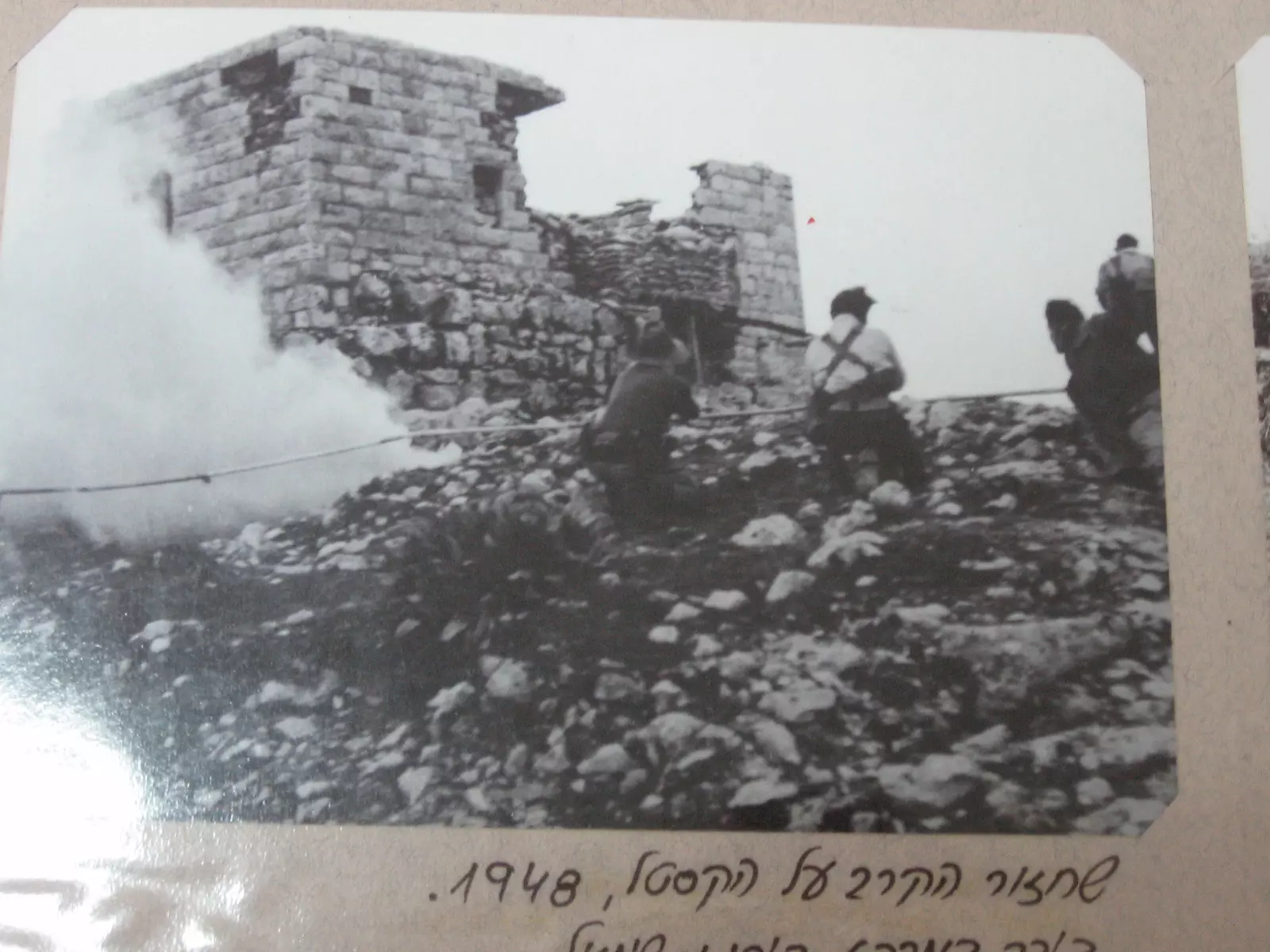
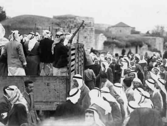
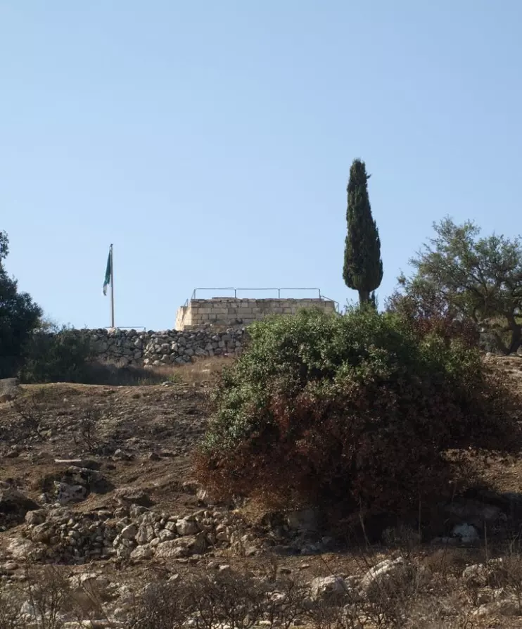
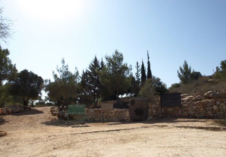
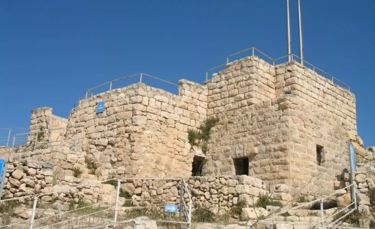
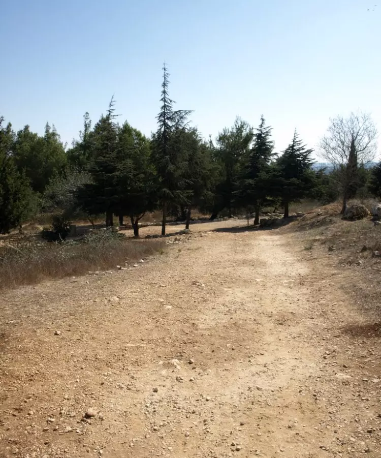
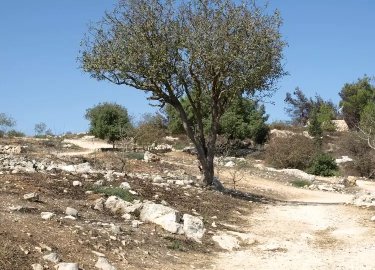
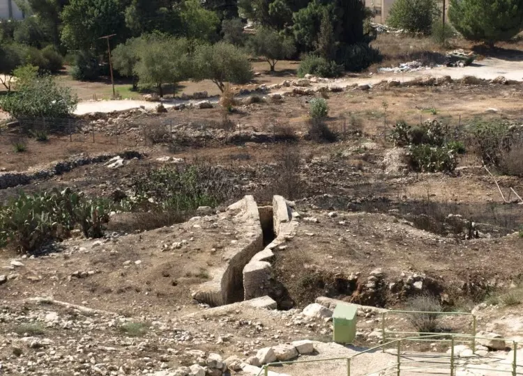
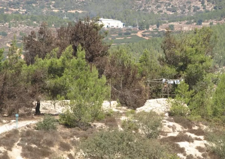
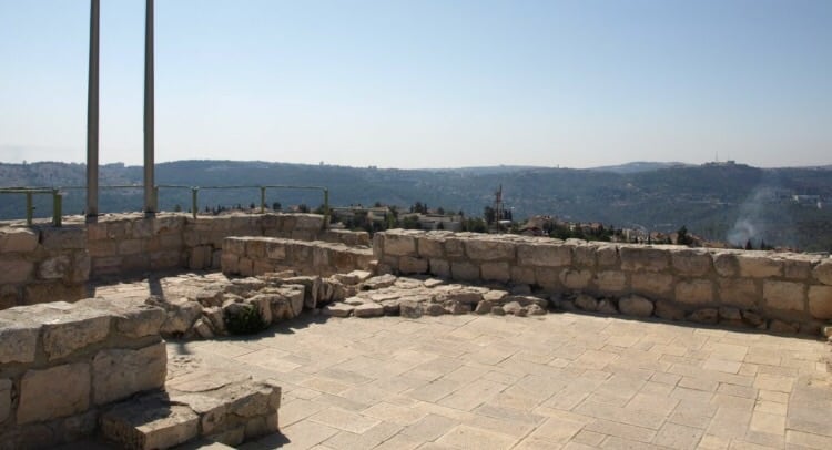
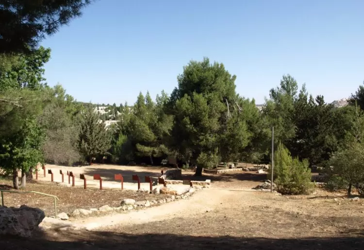
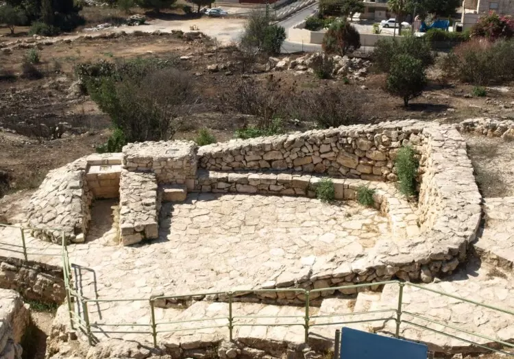
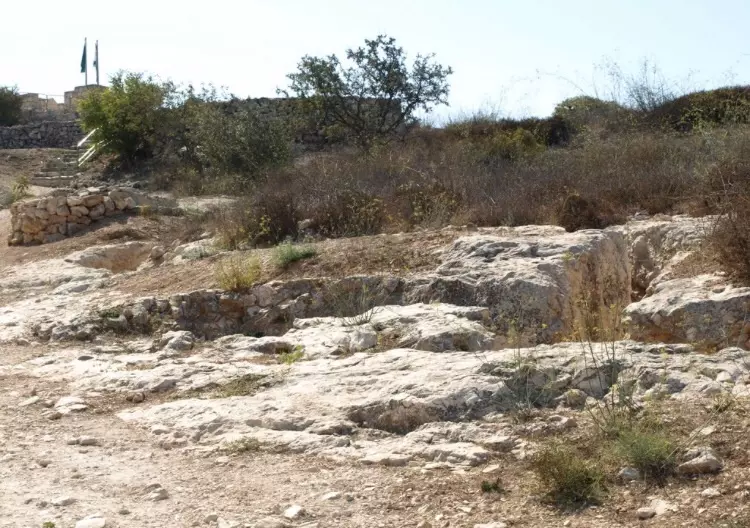
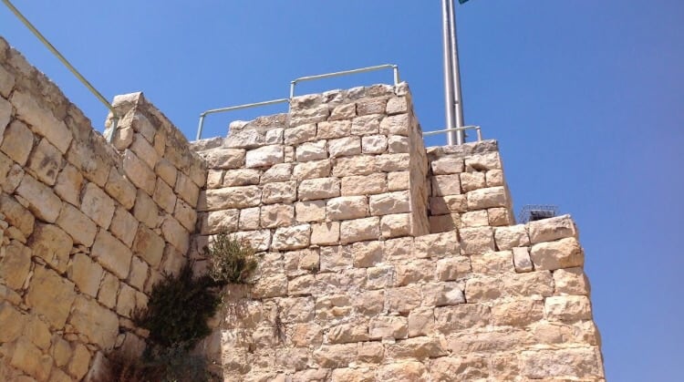
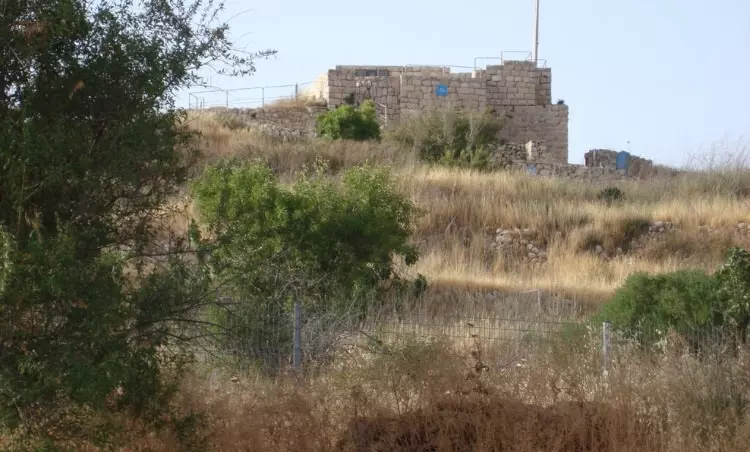
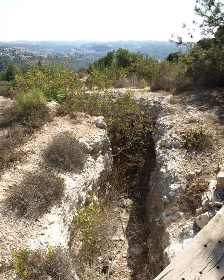
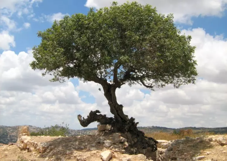
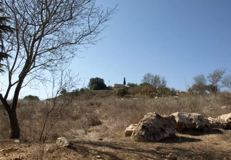
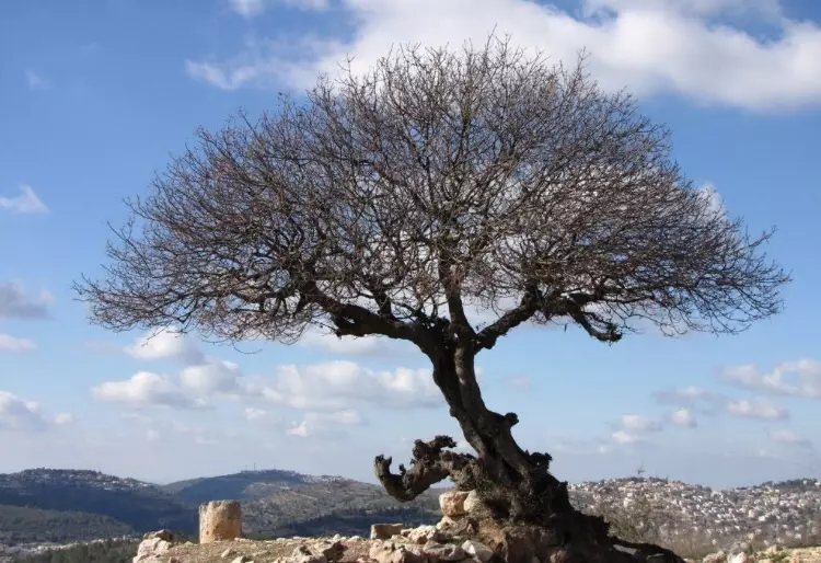
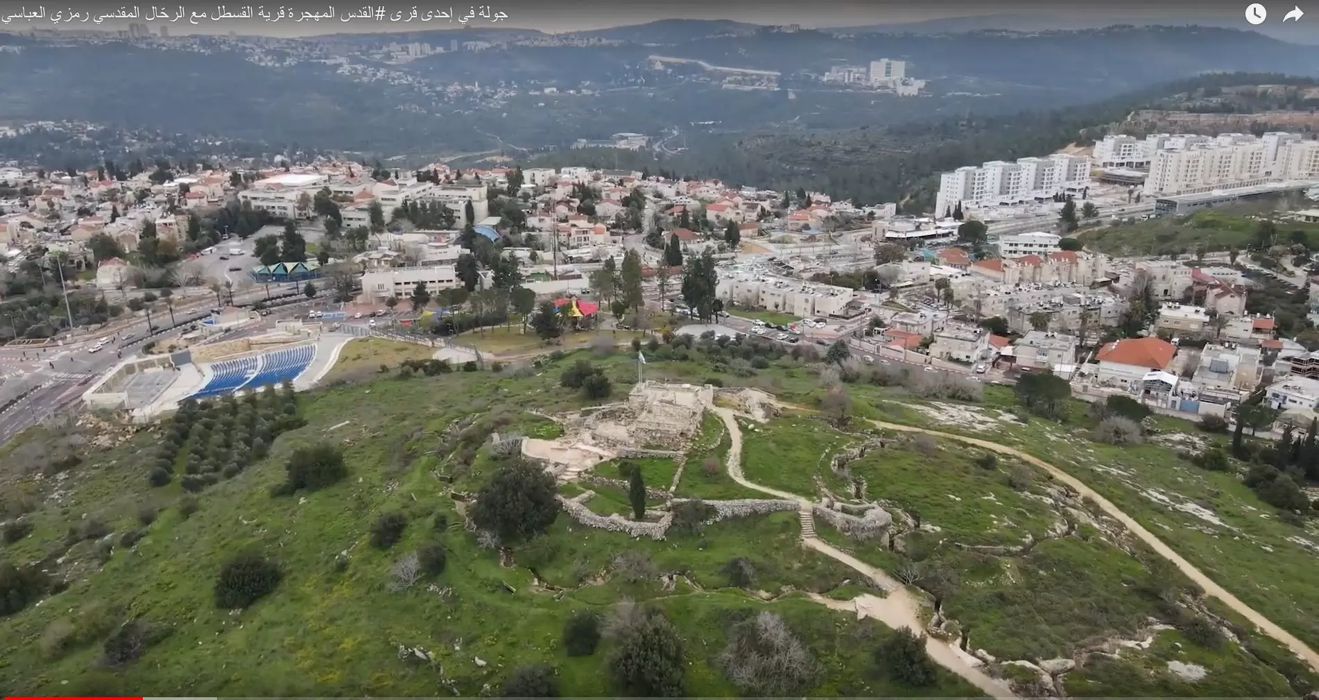
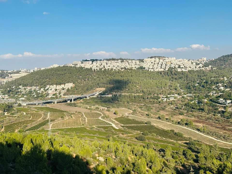
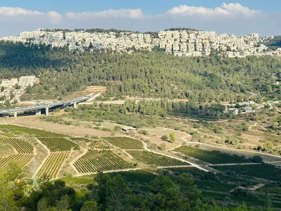
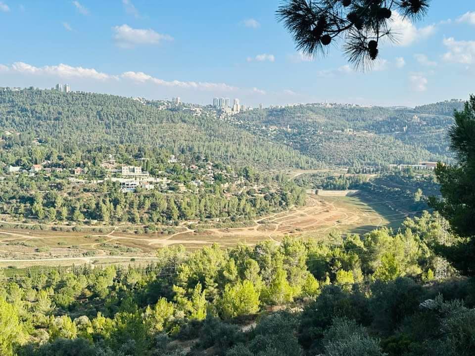
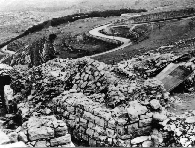
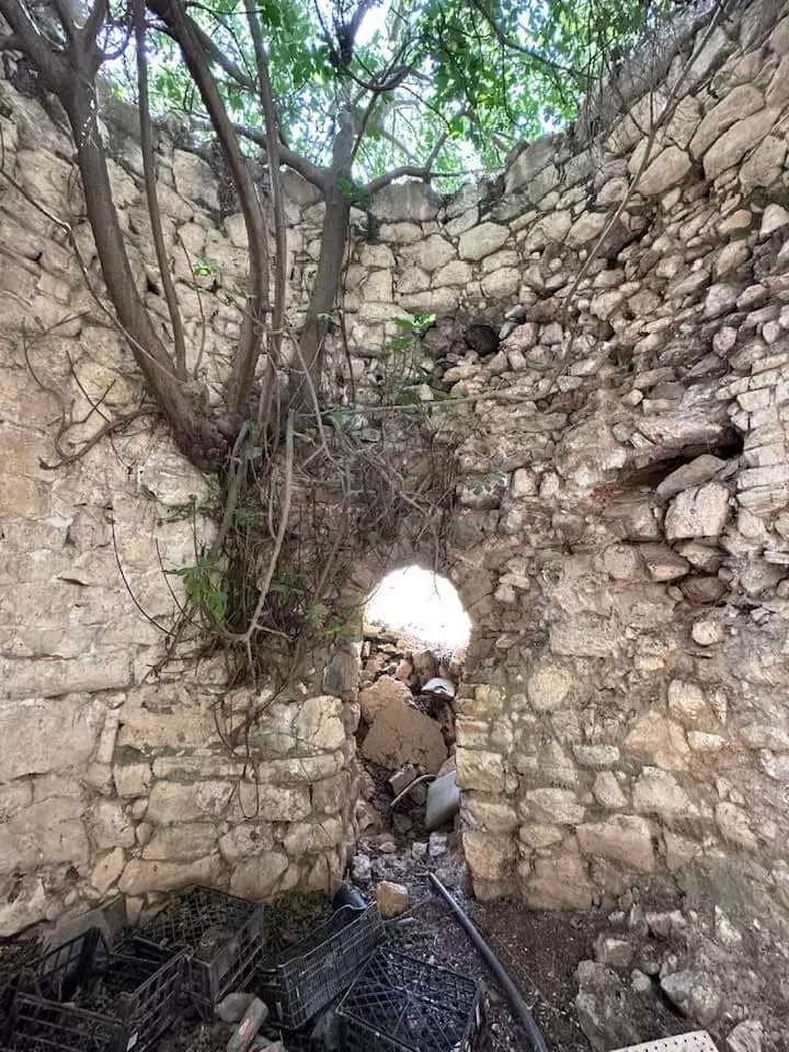
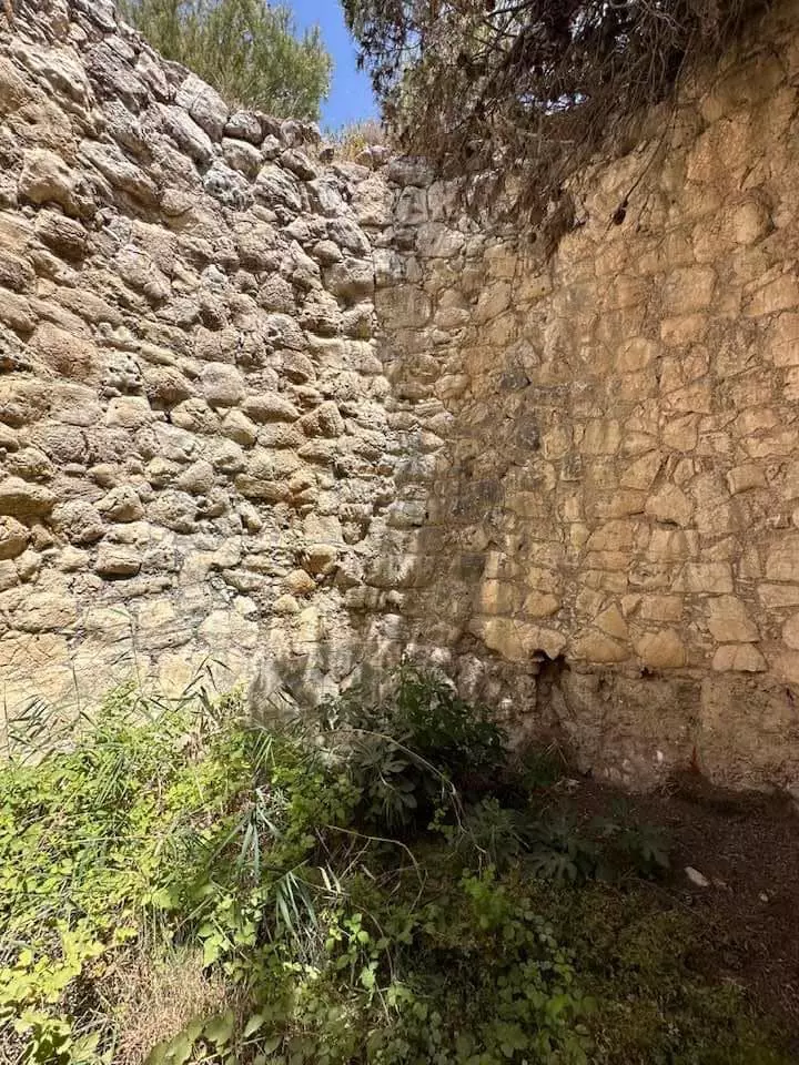
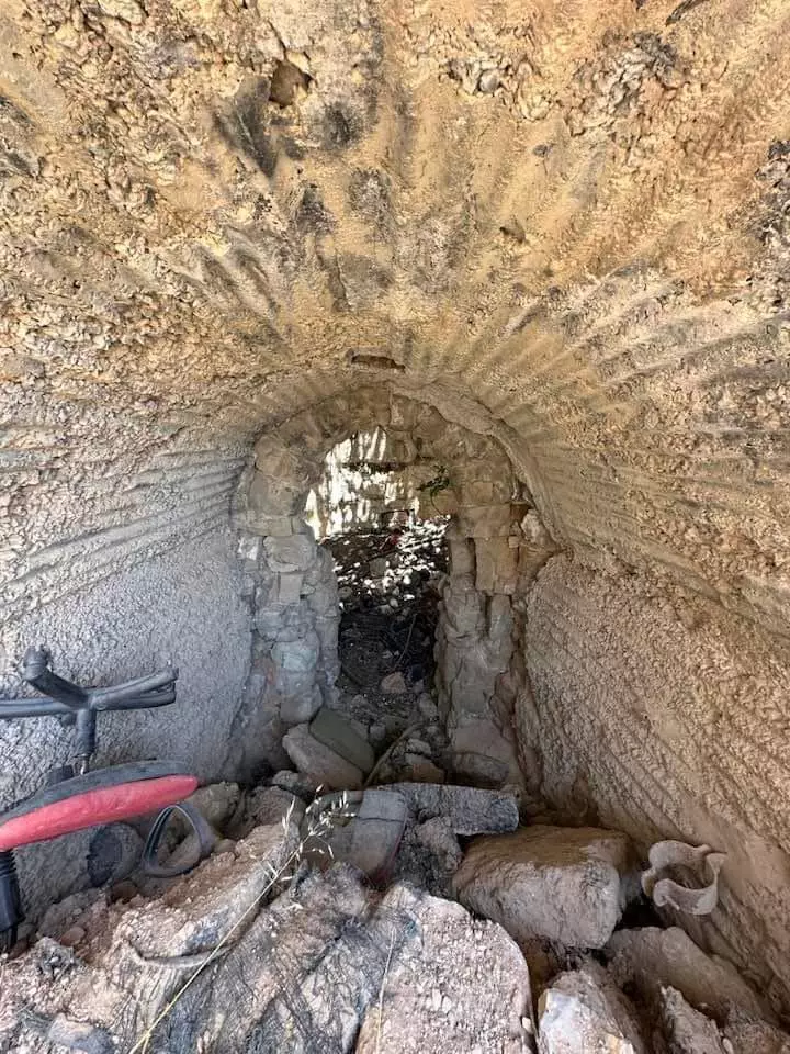
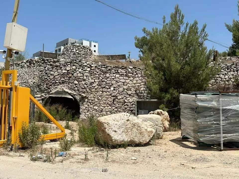
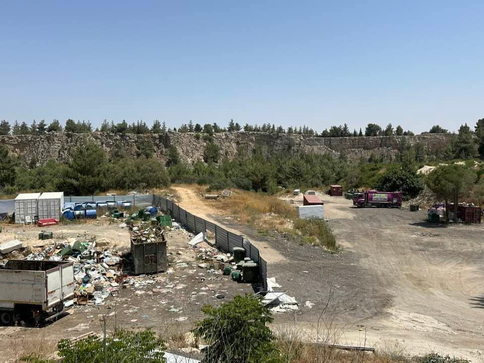
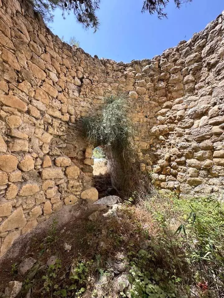
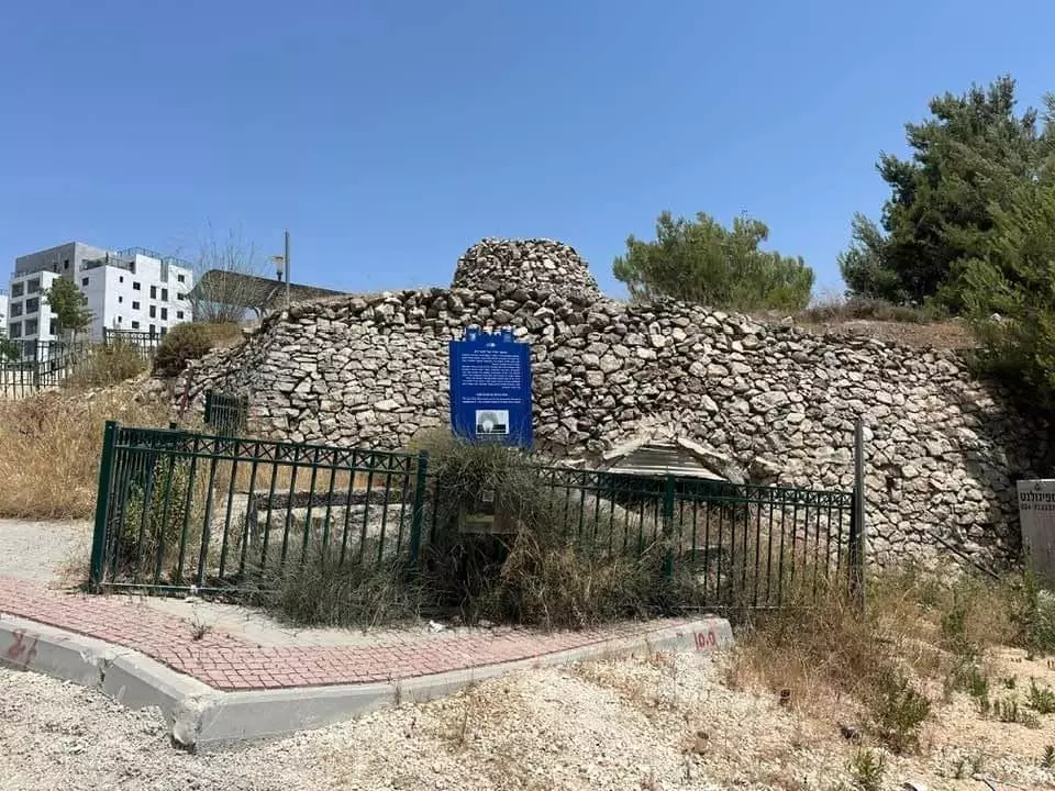
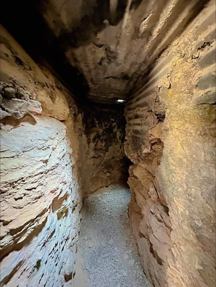
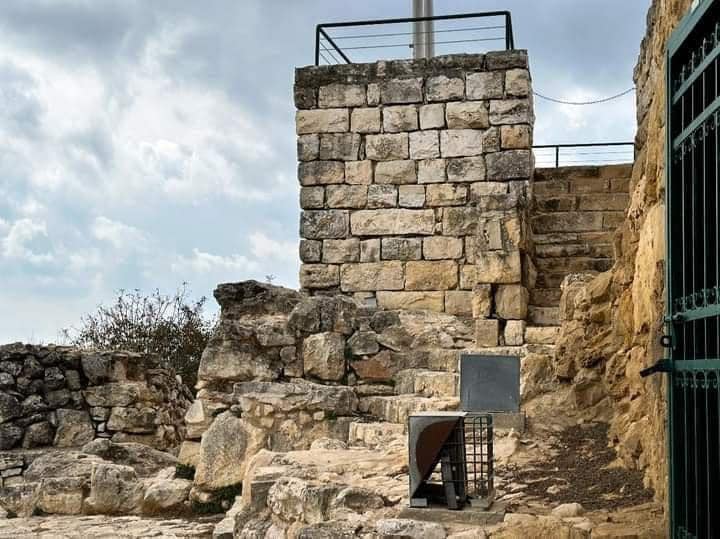
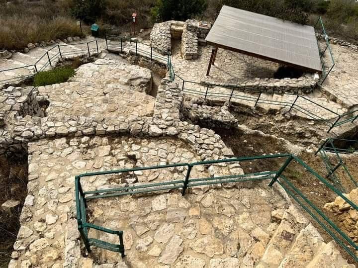
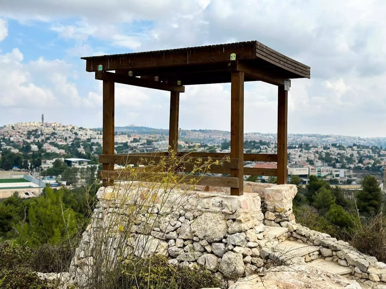
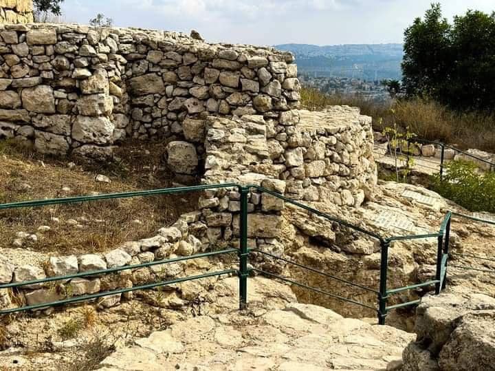
Village Before NakbaThe village stood on top of a high, rounded hill, overlooking wide expanses in all four directions. It overlooked the Jerusalem−Jaffa highway to the north and northeast, to which it was linked by a secondary road. Its position over the highway accorded al-Qastal a strategic significance. The village name was derived from the Latin castellum, the term for the Roman castle that was built on the site. The old Roman castle was renovated or rebuilt and named Belveer des Croises during the Crusader period. In the late nineteenth century, al-Qastal was located on a rocky hilltop. There were several springs outside the village to the east. Classified as a hamlet by the British Mandate government's Palestine Index Gazetteer, the village had a semicircular plan, and its houses were built of stone. More recent construction extended along the eastern slopes of the region around the al-Qastal hill. The village residents, who were predominantly Muslim, maintained a shrine for a local sage, one Shaykh Karaki, on the western edge of the village. The villagers relied on the neighboring city of Jerusalem for many of their needs. They cultivated rainfed grain, vegetables, and fruit and olive trees. Their agricultural lands were concentrated in a rectangular strip southwest of the village. In 1944/45 a total of 42 dunums was planted in cereals; 169 dunums were irrigated or used for orchards, of which 50 were planted with olive trees.Village Occupation and Ethnic CleaningThe occupation of al-Qastal took place with the official start of Operation Nachshon. Israeli historian Benny Morris claims, improbably, that it was 'the first Arab village during the 1948 war to be taken by the Haganah with the aim of permanent conquest and occupation.'The Palmach's Fourth Battalion attacked and occupied the village on 3 April. A spearhead unit of commandos stormed the village before dawn; it was soon followed by the main force, which fought off counterattacks into the night. The New York Times correspondent reported that there were battles around the village over the following few days. According to Palmach documents, the initial attack was unopposed and the village's defenders and the inhabitants had left beforehand. But Palestinian historian Aref al-Aref states that it was defended by fifty of the village militiamen, who only withdrew when their ammunition ran out. A report in the Palestinian newspaper Filastin confirms that the villagers had evacuated after an attack in mid-March but says that a number of the village's men remained to defend it. The paper said that the defenders broke through the siege laid by the Haganah forces and retreated to a nearby village. On 5 April, the Haganah occupiers built a barbed-wire fence around their positions and two days later used training planes to drop bombs on Palestinian forces surrounding al-Qastal, according to the New York Times. The village was retaken by Palestinian guerrillas in a battle on 8 April during which their leader, Jerusalem commander Abd al-Qadir al-Husseini, was killed. The Haganah account states that a number of Jewish commanders also were killed while retreating. Several days of heavy fighting had preceded the final Palestinian counterattack, which was launched at 1:30 p.m. under cover of mortar and machinegun fire. The New York Times correspondent wrote, 'They swarmed up the steep boulder-covered slopes shouting their battle cries.' By 3:00 p.m., a force drawn from a number of Palestinian guerrilla groups had broken into the village. However, Palmach forces reoccupied it in an assault which began on the night of 8−9 April. When they approached the village this time, the brigade was surprised to find it deserted; on 9 April, most of the men who had recaptured it were participating in the funeral of their slain commander, which was being held at the mosque of the Dome of the Rock in Jerusalem. The Palmach forces surrounded the village with a number of armored vehicles to prevent reinforcements from arriving and proceeded to overrun it. The attack occurred at the same time as the massacre at Deir Yasin, less than 5 km away. The History of the Haganah states that 'el Qastal returned once again and forever into Jewish hands.' As soon as they had reoccupied it, the Palmach units started to destroy its houses, thus setting a precedent for all the villages taken during Operation Nachshon. The reason given for the levelling of the village was that it would make the site easier to defend and prevent it from falling back into Arab hands. Palestinian historian al-Aref states that all buildings in the village, including the shrine/mosque, were destroyed by Zionist forces. A New York Times story confirms that the village mosque was destroyed, but states that this had occurred in the previous month, during the night of 16 March. The newspaper article quoted Abd al-Qadir al-Husseini, who was later to lose his life fighting for the village, as saying that the demolition was a 'shameful act' and that the mosque 'has never been used for anything but worship.' Zionists Colonies on Village LandsThe settlement of Ma'oz Tziyyon was established in 1951 on village lands. It was later joined with Mevasseret Yerushalayim, founded in 1956 on the lands of Qalunya, to form the Jerusalem neighborhood known as Mevasseret Tziyyon.Village TodayThe southern, northern, and eastern slopes of the site are covered with stone rubble and the ruins of stone terraces, half-concealed by wild grass. The ruins of the old castle lie on the mountain top. An underground shelter has been built on the site, southwest of the fortress. Military trenches can be seen north and east of the fortress. Olive, carob, and fig trees grow on the north and west sides of the site, and cactuses grow on the southern side. The entire site, including parts of the fortress, serves as an Israeli tourist attraction (see photos section).SourceDr. Walid al-Khalidi, 1992: All That Remains. |
|||||||||||||||||||
| Related Maps | Town Lands' Demarcation Maps خرائط للقضاء توضح حدود القرى والاودية Town's map on MapQuest View from satellite Help us map this town at WikiMapia |
||||||||||||||||||
| Related Links | Wikipedia's Page Google Search Google For Images Google For Videos |
||||||||||||||||||
| More Information | في كتاب كي لا ننسى في كتاب بلادنا فلسطين في كتاب النكبة والفردوس المفقود المزيد من موقع هوية |
||||||||||||||||||
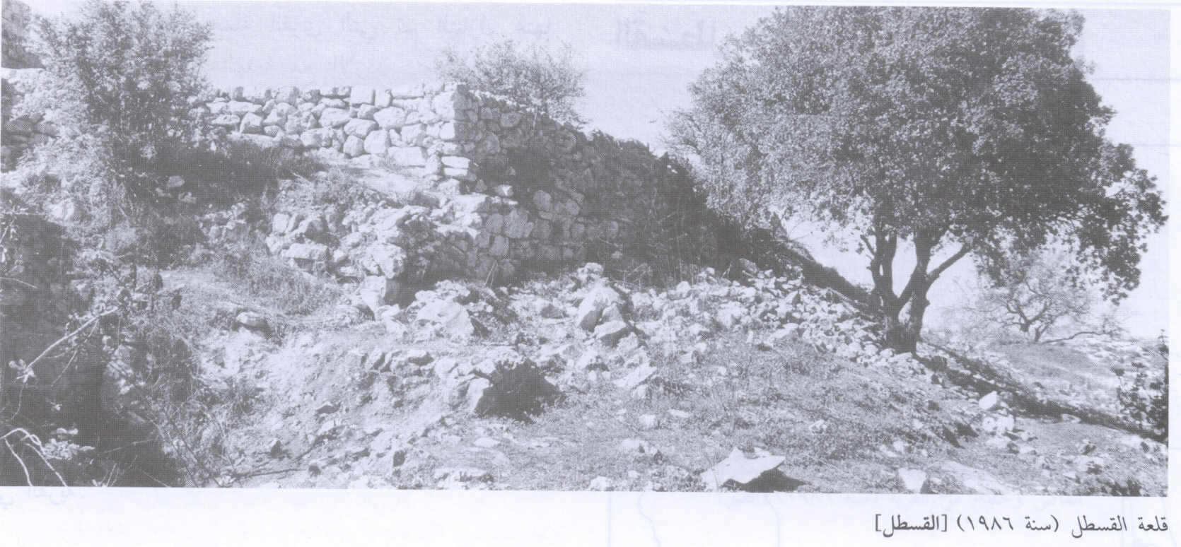
- The Crusades Castle of al-Qasta, 1986
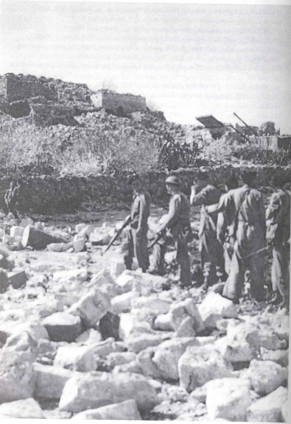
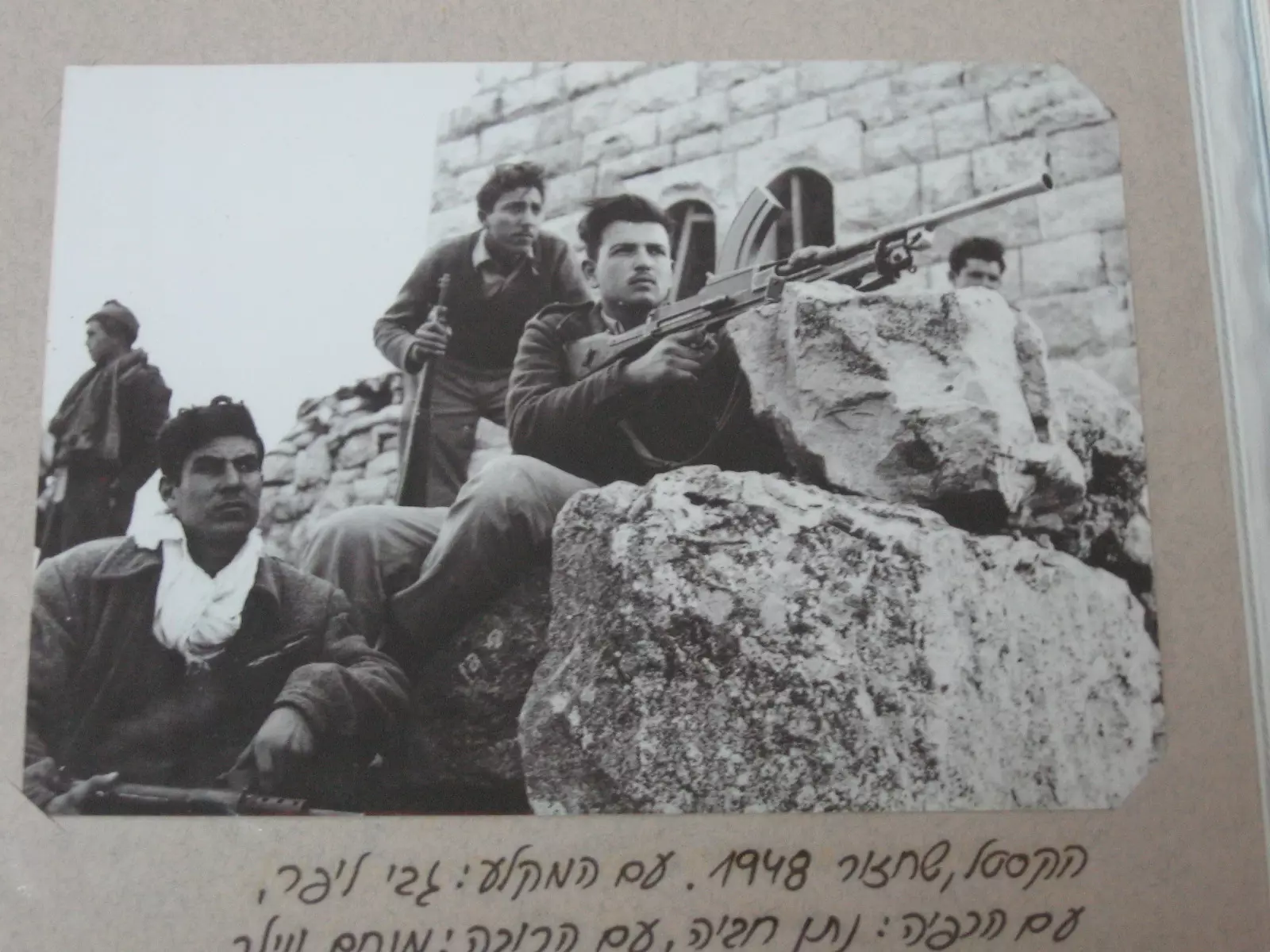
Scanned from "All That Remains" by Dr. Walid Khalidi - The counter attack by ALA (Arab Liberation Army) volunteers at al-Qastal, April 1948
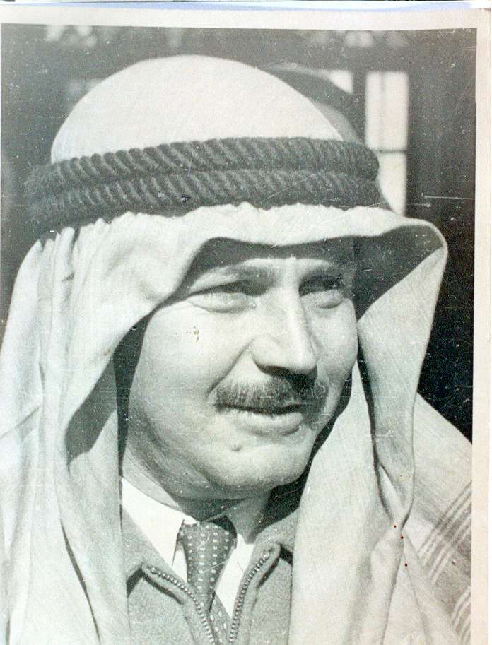
- A Close Up Picture of Abdel Qader al-Husseini Who Was Martyred While Liberating al-Qastal On April 7th 1948
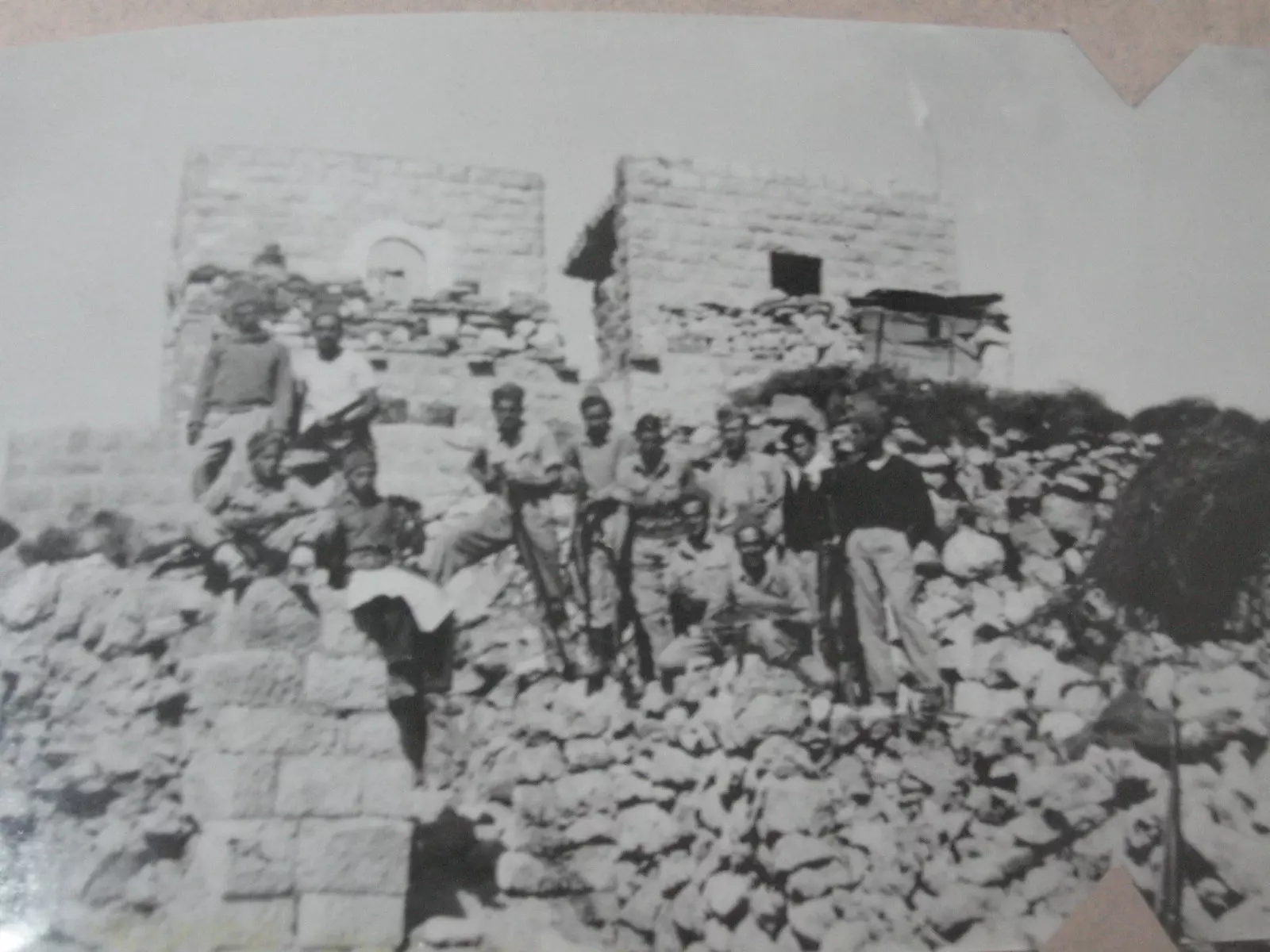
Posted by Abed Salam Husseini 4 - A rare picture of the village after occupation and before destruction
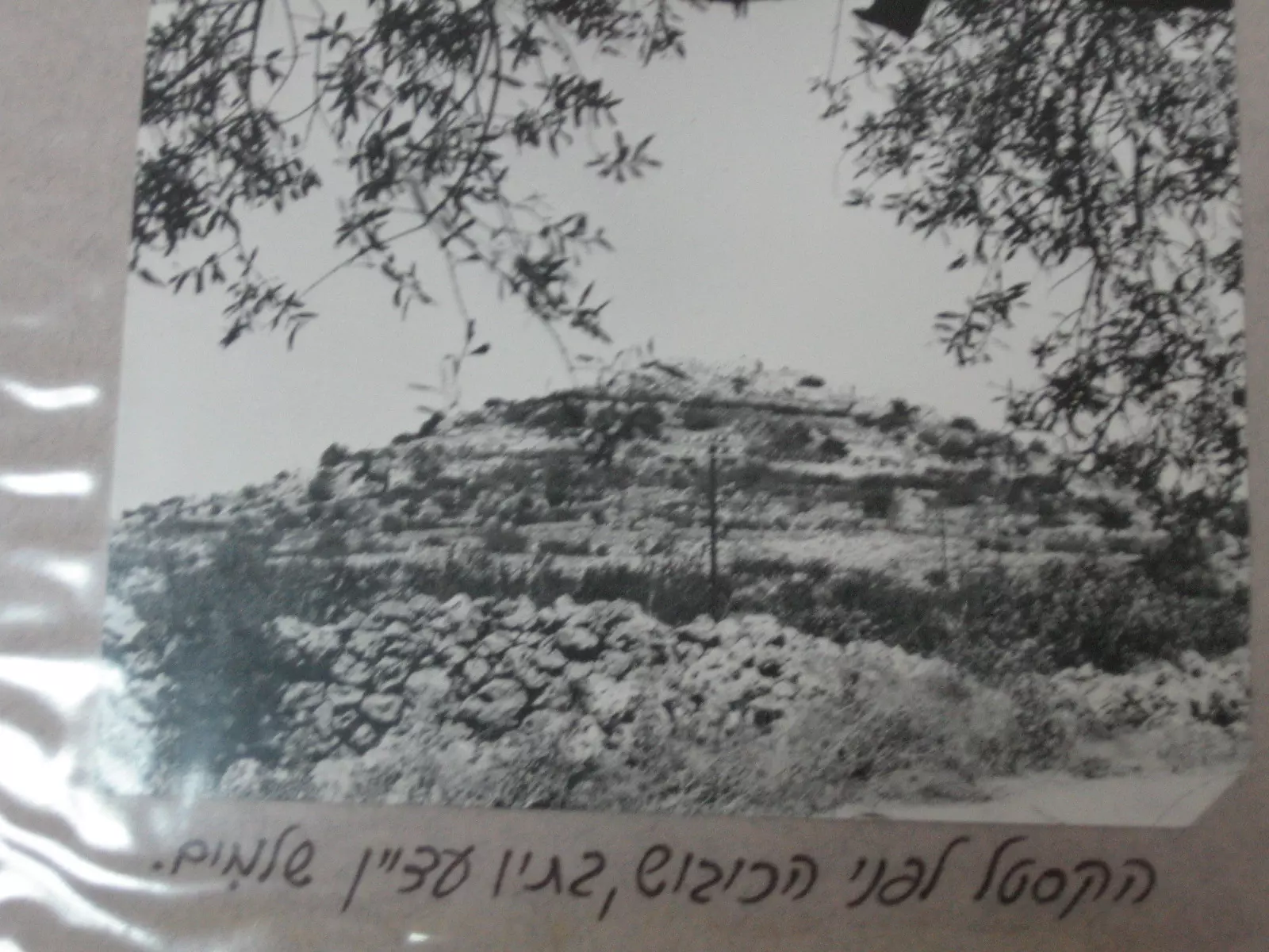
Posted by Noga Kadman 3 - The remains of the crusader castle. For its namesake the town is name Qastal or castle.
Posted by Noga Kadman - A rare picture for the village soon after its occupation, April 1948
- قريةالقسطل قبل الاحتلال وبيوت القرية قبل أن تهدم--1948 - مشاركة صفافي
Posted by صفافي أصيل - قرية القسطل قبل نسفها --1948 . مشاركة صفافي
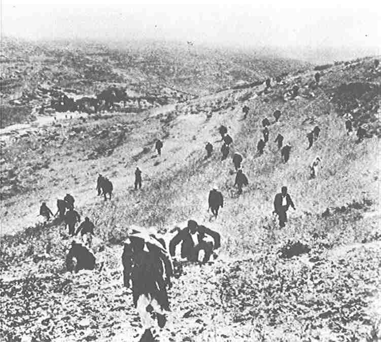
Posted by صفافي أصيل - الصعود لمساندة أهل القسطل--1948 . مشاركة صفافي

Posted by صفافي أصيل - متتطوعين من منطقة بيسان هبو للدفاع عن القسطل 1948 - مشاركة صفافي
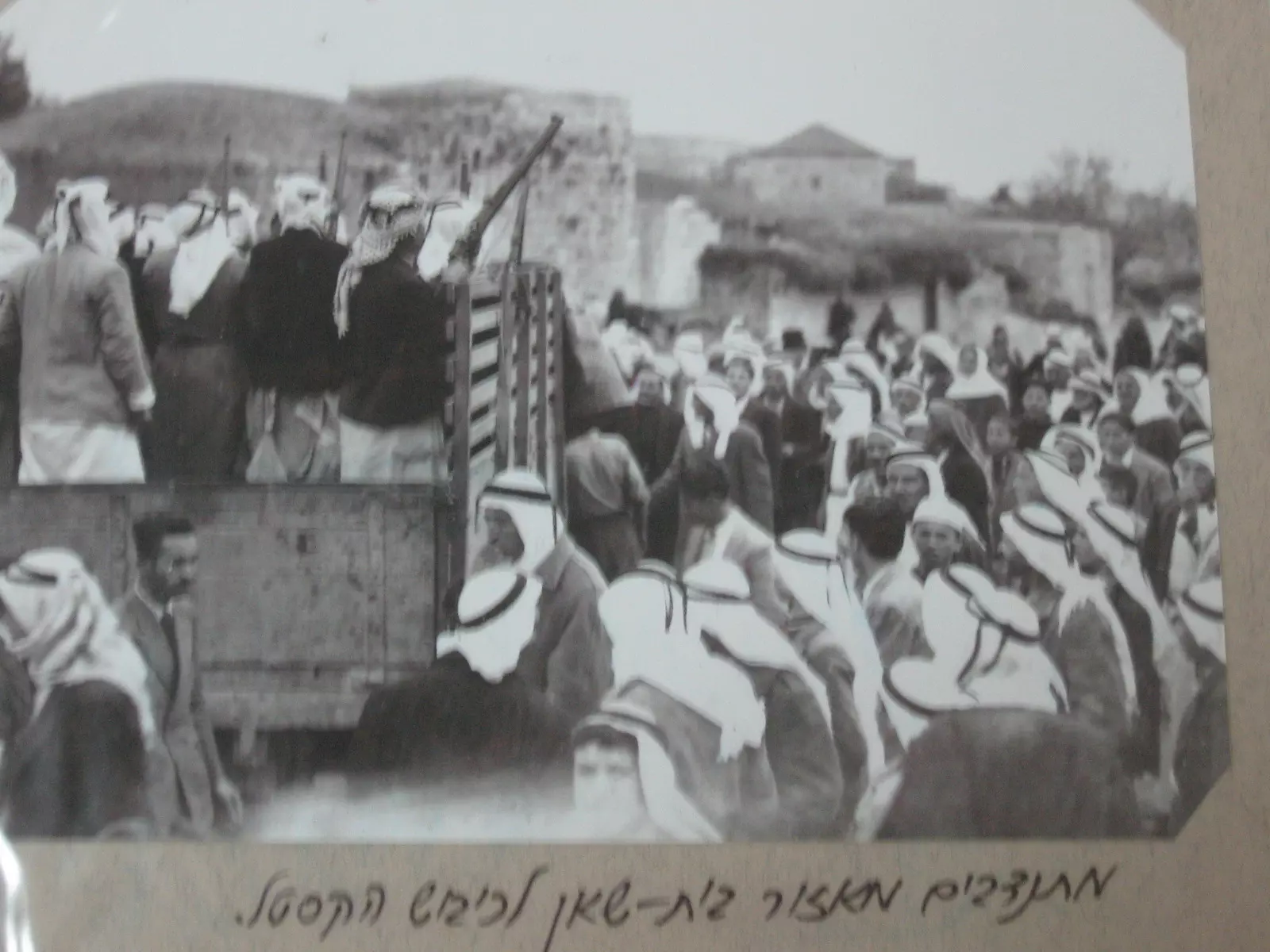
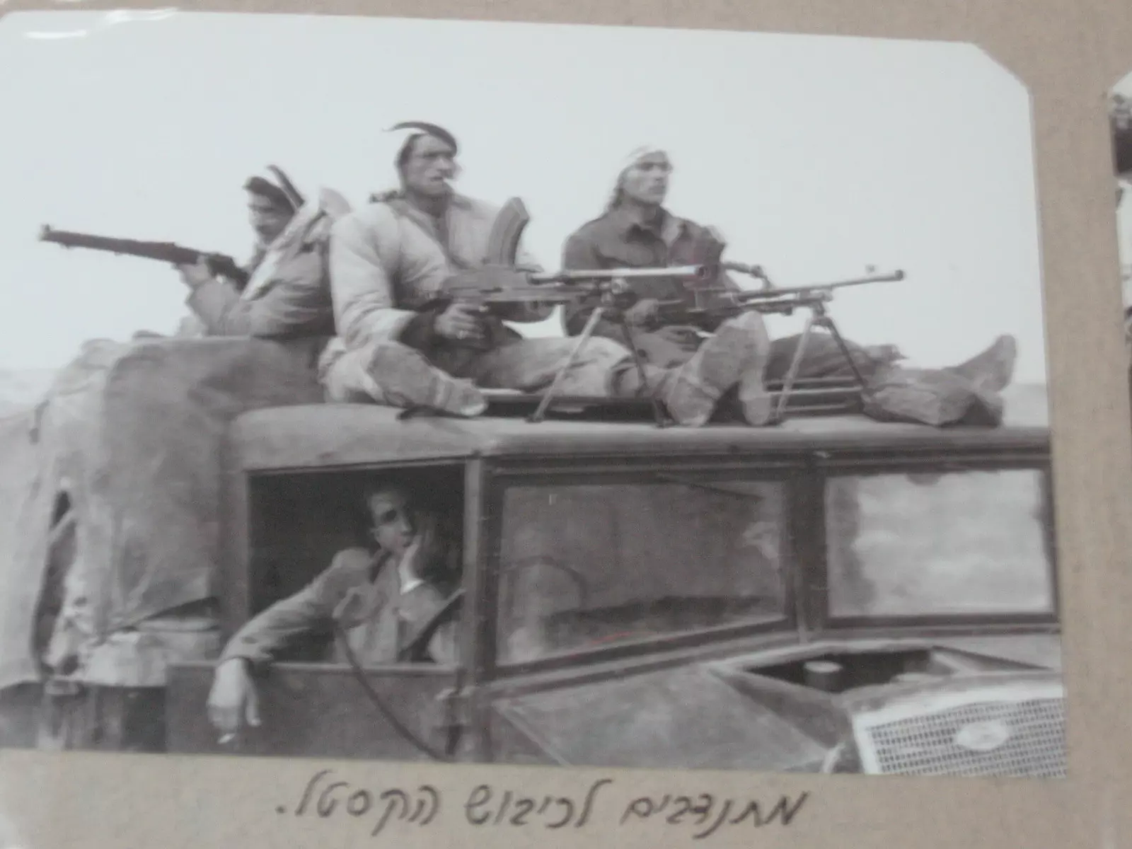
Posted by صفافي أصيل - متتطوعين للدفاع عن القسطل --1948 - مشاركة صفافي
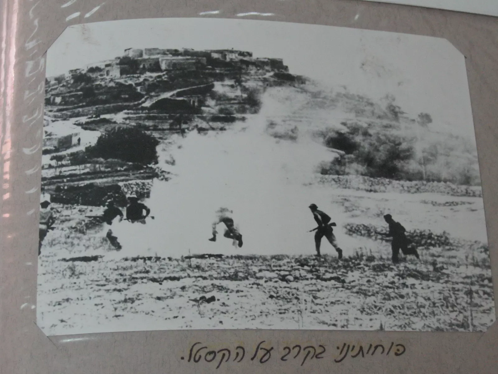
Posted by صفافي أصيل - معركة القسطل في ذروة الهجوم على القرية --1948 مشاركة صفافي
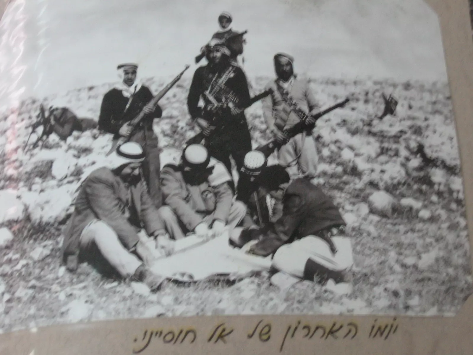
Posted by صفافي أصيل - في اليوم الاخير قبل استشهاد القائد عبد القادر الحسيني على أرض القسطل 1948 - مشاركة صفافي
Posted by صفافي أصيل - معركة القسطل في ذروة الهجوم على القرية --1948 . مشاركة صفافي
Posted by صفافي أصيل 1 - قوات البلماح بعد احتلالها للقسطل 1948 .مشاركة صفافي
Posted by صفافي أصيل - دخول البلماح لقرية القسطل 1948 .مشاركة صفافي
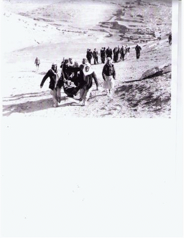
Posted by صفافي أصيل - القسطل : أحضار جثمان القائد عبد القادر الحسيني - 1948
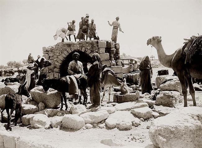
Posted by صفافي أصيل 1 - منظر عام1932
- في القسطل قبل سقوطها - ابريل 1948
- موقع قريه القسطل
Posted by abu raya - القسطل
Posted by abu raya - القسطل
Posted by abu raya - القسطل
Posted by abu raya - اثار بيوت القسطل
Posted by abu raya - القسطل
Posted by abu raya - القسطل
Posted by abu raya - القسطل
Posted by abu raya - القسطل
Posted by abu raya - القسطل
Posted by abu raya - القسطل
Posted by abu raya - القسطل
Posted by abu raya - القسطل واثار بيوتها
Posted by abu raya - القسطل
Posted by abu raya - القسطل
Posted by abu raya - القسطل
Posted by abu raya - القسطل
Posted by abu raya - الشهيد المجاهد عبد القادر الحسيني
Posted by abu raya - معرجات القسطل سنه 1930
- منظر من الدرون لموقع القرية
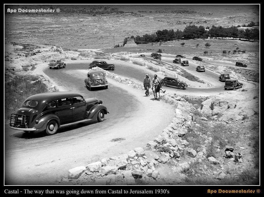
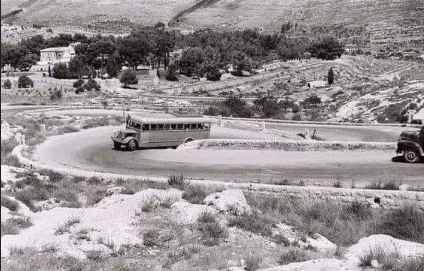
- فلسطين باصات الشركة الوطنية بين القدس ويافا معرجات القسطل سنة 1934م .
- إطلالة رائعة وخلابة من اراضي قرية القسطل --- إياد جابر
- إطلالة رائعة وخلابة من اراضي قرية القسطل --- إياد جابر #2
- إطلالة رائعة وخلابة من اراضي قرية القسطل --- إياد جابر #3
- Approach to Qastal from the air, 1948
- A view of Jerusalem - Jaffa road from Qastal
- مصنع لتون العثماني في القدس القسطل
مصنع اتون او لتون لصناعة الشيد او الجير من الصخور بعد حرقها لعدة ايام بنبات النتش.
نقلاً عن : الأستاذ إياد جابر
- مصنع لتون العثماني في القدس القسطل
مصنع اتون او لتون لصناعة الشيد او الجير من الصخور بعد حرقها لعدة ايام بنبات النتش.
نقلاً عن : الأستاذ إياد جابر #2
- مصنع لتون العثماني في القدس القسطل
مصنع اتون او لتون لصناعة الشيد او الجير من الصخور بعد حرقها لعدة ايام بنبات النتش.
نقلاً عن : الأستاذ إياد جابر #3
- مصنع لتون العثماني في القدس القسطل
مصنع اتون او لتون لصناعة الشيد او الجير من الصخور بعد حرقها لعدة ايام بنبات النتش.
نقلاً عن : الأستاذ إياد جابر #4
- مصنع لتون العثماني في القدس القسطل
مصنع اتون او لتون لصناعة الشيد او الجير من الصخور بعد حرقها لعدة ايام بنبات النتش.
نقلاً عن : الأستاذ إياد جابر #5
- مصنع لتون العثماني في القدس القسطل
مصنع اتون او لتون لصناعة الشيد او الجير من الصخور بعد حرقها لعدة ايام بنبات النتش.
نقلاً عن : الأستاذ إياد جابر #6
- مصنع لتون العثماني في القدس القسطل
مصنع اتون او لتون لصناعة الشيد او الجير من الصخور بعد حرقها لعدة ايام بنبات النتش.
نقلاً عن : الأستاذ إياد جابر #7
- مصنع لتون العثماني في القدس القسطل
مصنع اتون او لتون لصناعة الشيد او الجير من الصخور بعد حرقها لعدة ايام بنبات النتش.
نقلاً عن : الأستاذ إياد جابر #8
- جولة في الاستحكامات العسكرية في القلعة -- محمد ابو نوح
- جولة في الاستحكامات العسكرية في القلعة -- محمد ابو نوح #2
- جولة في الاستحكامات العسكرية في القلعة -- محمد ابو نوح #3
- جولة في الاستحكامات العسكرية في القلعة -- محمد ابو نوح #4
- جولة في الاستحكامات العسكرية في القلعة -- محمد ابو نوح #5
- جولة في الاستحكامات العسكرية في القلعة -- محمد ابو نوح #6
Want to browse more? 80,000 pictures were grouped in these gallaries:
| Display Name | Clan/Hamolah | Country of Residence |
| ريما مطير | - | - |
| husam | adwan | pal, jerusalem / bethane |
| احمد حمدان | حمدان | - |
| reem deeb | abdelrahman | dubai, united arab emarites |
| laila alhusseini | alhusseini | U S A |
| mohammad alhusseini | alhusseini | - |
| Amin | / | Amman, Jordan |
- الجزيرة: سقوط القسطل.. مفتاح الاحتلال لأبواب القدس Duration: 2 min 48 sec
- القسطل قرية القسطل المهجرة Duration: 4 min 53 sec
- الذاكرة مفتاح العودة-- الحلقة 67- قرية قسطل Duration: 23 min 22 sec
- الأتون - اللّتون - الكبارة - نبات النتش- وصناع الشيد في فلسطين . القسطل Duration: 11 sec
No links have been shared yet, be free to the first to share the first link.
 Fake Valor: Why Did Zionist Jews Hoist Nazis Flag on Their Ships in the 1930s?
What is new?
-
Facts About Oct. 7th Gaza Raid
-
Remined Us Please: Who Did Rape Whom? Was it Palestinians who raped Israelis? Or, was the other way around? You'll be the judge
-
When Prof. Edward Said was invited to debate Bibi Netanyahu in the 1980s, watch what happened!
-
Ezra Klein of the NY Times on the "Jewish Race".
-
Abusing Blood Libel!
-
How and why Israeli Jewry has become the most hated cult?
-
Did Israeli Soldiers Activate The Hannibal Direective On Oct. 7th? You Be The Judge
-
Zionist FAQ: Isn't it true that Palestinians don't want peace? Palestinians never accepted the two-state solution
- Facts about Haavara (Transfer) Agreement between Ben-Gurion & Hitler
-
Haavara FAQs: Why Did Zionist Jews Hoist Nazis' Flags on Their Ships in the 1930s?
- Haavara FAQs: When Chaim Weizmann met FDR in mid-1943, why was he silent about rescuing European Jewry?
-
Dear ChatGPT: How did Palestinians resist Napoleon's invasion of their country in 1799?
-
Dear ChatGPT: Gaza had a vibrant Jewish community in the mid-17th century. What happened to them?
-
Dear ChatGPT: Why did the Jewish Agency suppress news of the Holocaust during WWII?
-
Video Playlist: Jews share their DNA tests to end the conflict for good.
-
A Tale of Two Conflicts: Examining the Definition of Genocide
-
Prof. Abraham Polak And The Suppressed History of the Khazars and European Jewry
-
How Ronald Reagan would have framed the genocide in Gaza if he were still alive?
-
Haavara FAQs: Let us do the math: how many German Jews did The Haavara Agreement save?
-
Zionist FAQs: The Hebron Massacre of 1929, "clearly proves" that Palestinians are antisemitic, how could you deny it?
-
Zionist FAQs: Why Anti-Zionist Is Not Antisemitism?
-
Zionist FAQs: Isn't it true that the KGB created Palestinian Nationalism in the early 1960s?
- Zionist FAQs: Muslims are killing Muslims all the time; why are Israeli Jews being singled out in the media?
- Zionist FAQs: How is Israel an apartheid state when 20% of its citizens are Arabs who enjoy full rights?
-
Haavara FAQs: Why Did Dorothy Thompson Flip From A Zionist Advocate to A Silenced Dissenter?
-
Haavara FAQs: Analysis of Herzl's Uganda Scheme and how it could have saved millions of Jews.
-
Haavara FAQs: Why did Hayim Greenberg describe American Jewry as "morally bankrupt" in early 1943?
-
Haavara FAQs: What if the Evian Conference was a resounding success? What would have been the impact of saving European Jewry on Zionism?
- Haavara FAQs: What if the six million were saved, how that would have impacted the Zionist project?
-
Haavara FAQs: How did Zionist leaders react when Europe's Jews lingered in the DP camps after WWII ended?
-
Why does the American Jewish community repeat lies that David Ben-Gurion had debunked before he died?
-
Who has the power to rename the Tatar/Khazar Gene Marker to Jewish IV?
-
Zionist FAQs: Why won't Egypt, Syria, and Jordan take their people back? Jews are indigenous to Palestine, and Arabs immigrated after Jews developed the country. Arabs should leave.
-
Haavara FAQs: Did Hitler and the Nazis conflate between Judaism and Zionist? If that wasn't case, then why?
-
Haavara FAQs: Winston Churchill and antisemitism, a collection of articles written Churchill.
-
Haavara FAQs: Broken by country, how many Jews survived vs. killed during the Holocaust?
-
Haavara FAQs: Why did European Jews vote with their feet and to immigrated to the Americas, not Palestine, after WWII?
-
Watch this American Jewish Girl describing Israeli Jews' cognitive dissonance like no other in under two minutes
-
Haavara FAQs: When the Nazis went out of their way to hide the Holocaust, Israeli Jews did the exact opposite by broadcasting their genocide of Gazans. But why?
-
Haavara FAQs: How Zionist Jews went out of their to show their appreciation to Nazism and Fascism?
- Haavara FAQs: Why Zionist leaders were against bombing the death camps & the Railroads leading to them?
-
Haavara FAQs: Hitler's message to the British and American people: If Jews are such noble citizens and you care about them, how come you're not letting them in? I will gladly ship them to you at my expense, even on luxury liners!
-
A shortlist of Zionist and Israeli false flag operations in the name Jews.
-
The Most Moral Army
- The Land of Kapos (Israel): Where the brave are boycotted and Kapos walk free.
- Why did early Zionists often named their communal enterprises "colonial"?
- Zionist Relations with Nazi Germany by Faris Glubb
-
Two NY Times advertisements by Zionists in the early 1943 that exposes Zionists' treason at the height of the calamity
- Facts Not Lies about the Palestinian-Israeli Conflict.
- Site's pictures have been categorized
- Campgain Against Lice
- A Survey of Palestine, the official source about Palestine before Nakba produced by the British Mandate; over 1200 pages.
- Satellite View & Google Earth: Over 6,000 placemarks identifying all destroyed towns, W. Bank & Gaza Strip Towns, & refugee camps.
- PalestineRemembered.com and its Nakba Oral History Project were featured on al-Jazeera Satellite TV.
- Nakba Oral History Video Podcast:
 Over 700 Oral History interviews (including 3,500+ hours of recording) can be viewed online.
 - Palestine Village Statistics Project
- Gaza Jail Break
- النسخة العربية للموقع الان متوفرة
- Videos: Documenting the destroyed villages in video: Tracing all that remains since Nakba.
- Videos: Responding to Zionist Propaganda
- Interview: The ethnic cleansing of Palestine: George Galloway interviews Israeli Historian Ilan Pappe.
- For Palestinians, memory matters. It provides a blueprint for their future By George Bisharat.
- Zionist FAQ now available in Hebrew שאלות שציונים שואלים, עכשיו בעברית
- Video: The Stephen Walt and John Mearsheimer report on the influence of the Israel Lobby on U.S. Foreign Policy
- The Palestinian-Israeli conflict for beginners
