| PalestineRemembered | About Us | Oral History | العربية | |
| Pictures | Zionist FAQs | Haavara | Maps | |
| Search |
| Camps |
| Districts |
| Acre |
| Baysan |
| Beersheba |
| Bethlehem |
| Gaza |
| Haifa |
| Hebron |
| Jaffa |
| Jericho |
| Jerusalem |
| Jinin |
| Nablus |
| Nazareth |
| Ramallah |
| al-Ramla |
| Safad |
| Tiberias |
| Tulkarm |
| Donate |
| Contact |
| Profile |
| Videos |
Welcome To Qalunya - قالونيا (קאלוניא)
|
District of Jerusalem
Ethnically cleansed days ago |
العربية Google Earth |
 |
Gallery (342) |
- Statistics & Facts
-
Before & After

- Satellite View
- Articles 40
- Pictures 342
- Aerial Views 5
- Mayrters & Prisoners 1
- Land Deeds 2
- Oral History 2
- Members 56
- Families
- All That Remains
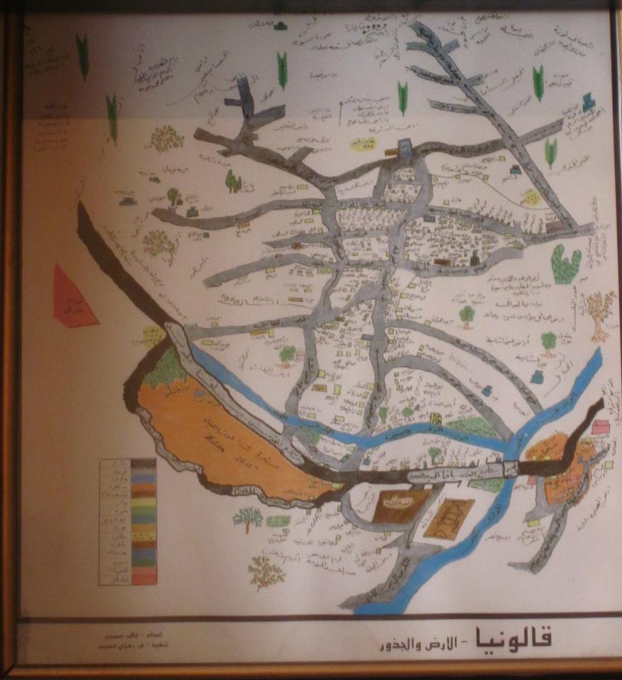
- Town's Map
- Wikipedia
- Videos 40
- Guest Book 38
- Links 5
| Statistic & Fact | Value | |||||||||||||||||||||
| Occupation Date | April 3, 1948 | |||||||||||||||||||||
| Distance From District | 6 (km) West of Jerusalem | |||||||||||||||||||||
| Elevation | 650 (meters) | |||||||||||||||||||||
| Before & After Nakba, Click Map For Details |
||||||||||||||||||||||
|
||||||||||||||||||||||
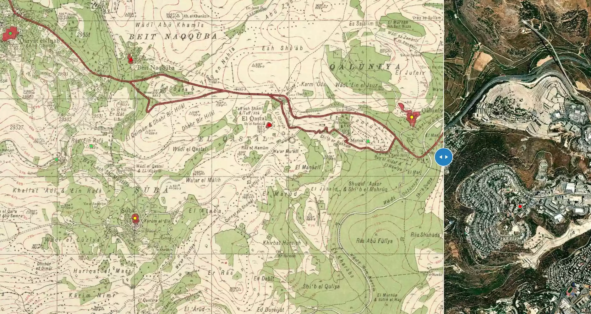
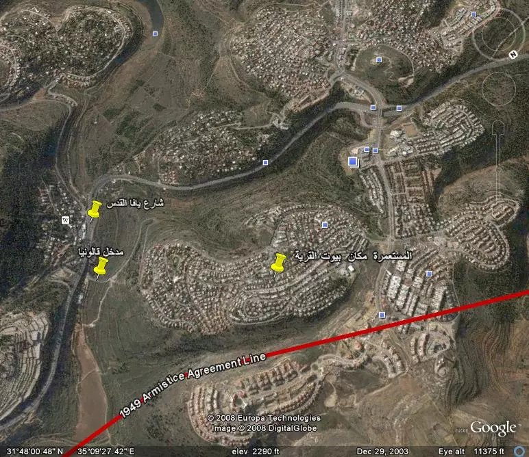
| Map Location | See location #5 on the map View from satellite |
|||||||||||||||||||||
| Military Operation | Possibly Operation Nahchon | |||||||||||||||||||||
| Attacking Units | Possibly by IZL (Irgun Zvai Leumi or ITZEL) terror gangs and some Haganah troops. | |||||||||||||||||||||
| Exodus Cause | Military assault by Zionist troops | |||||||||||||||||||||
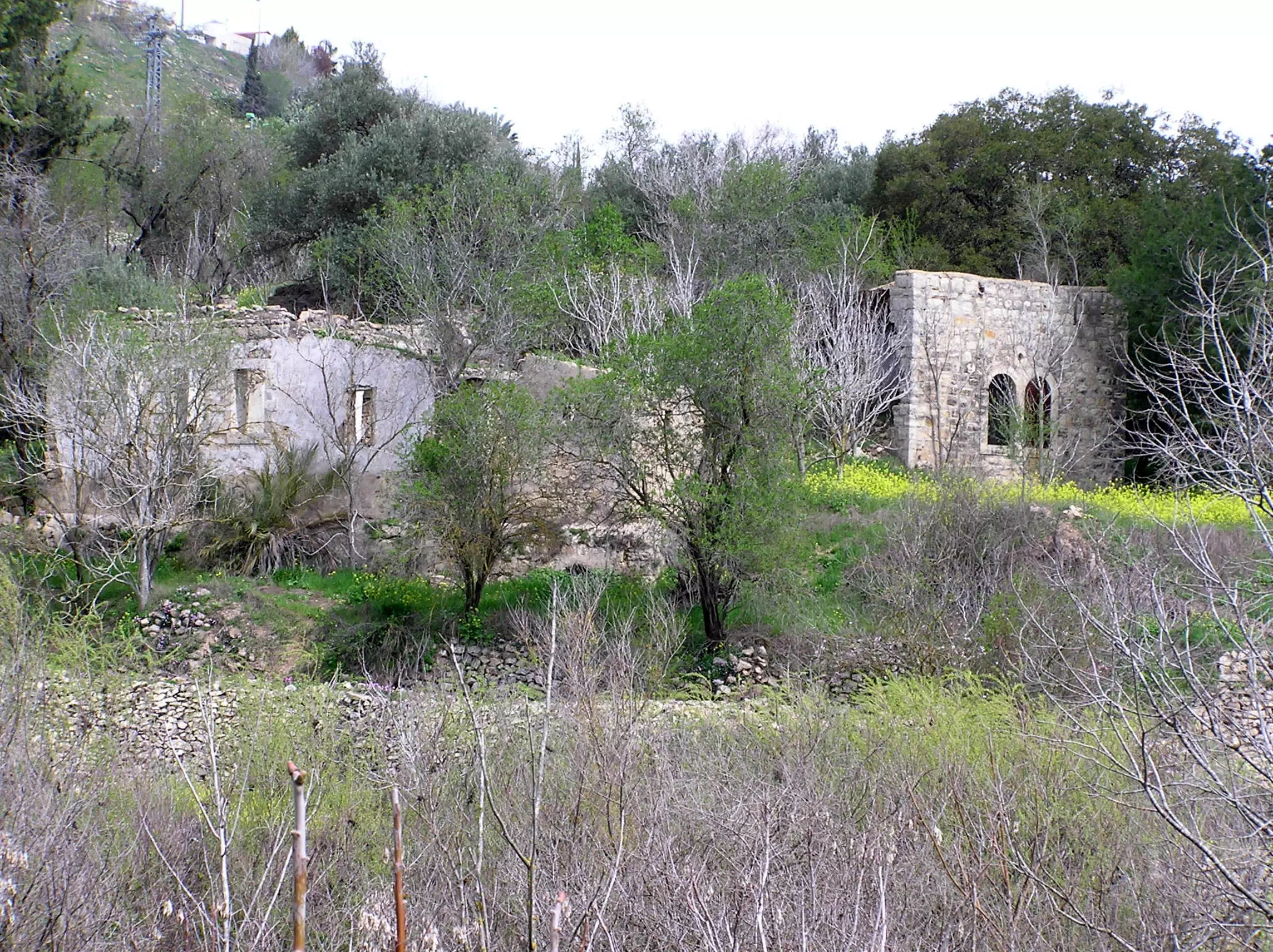
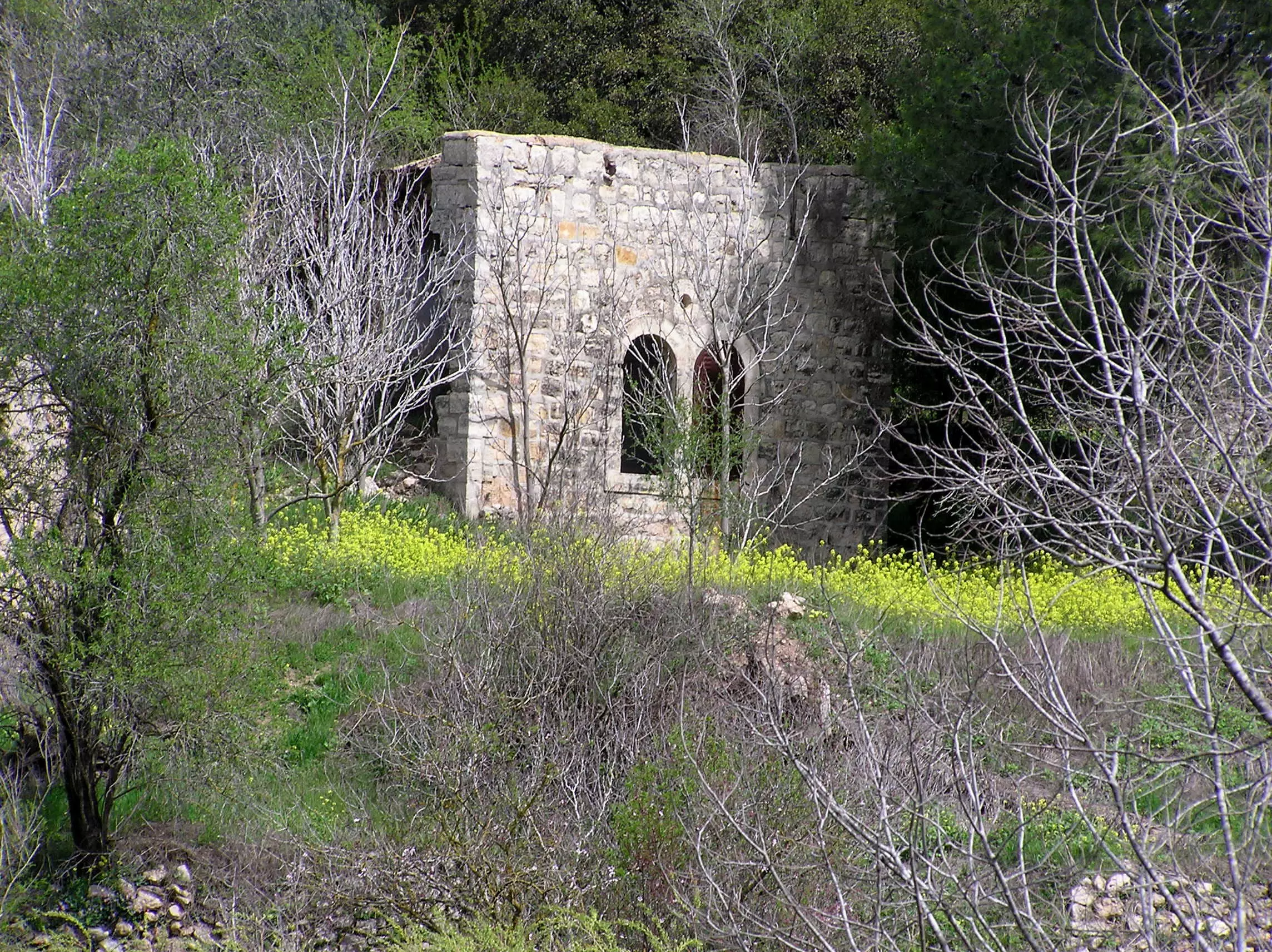
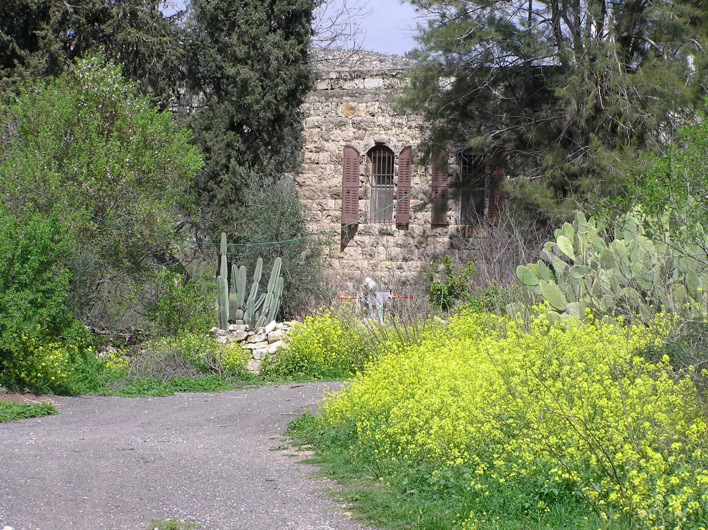
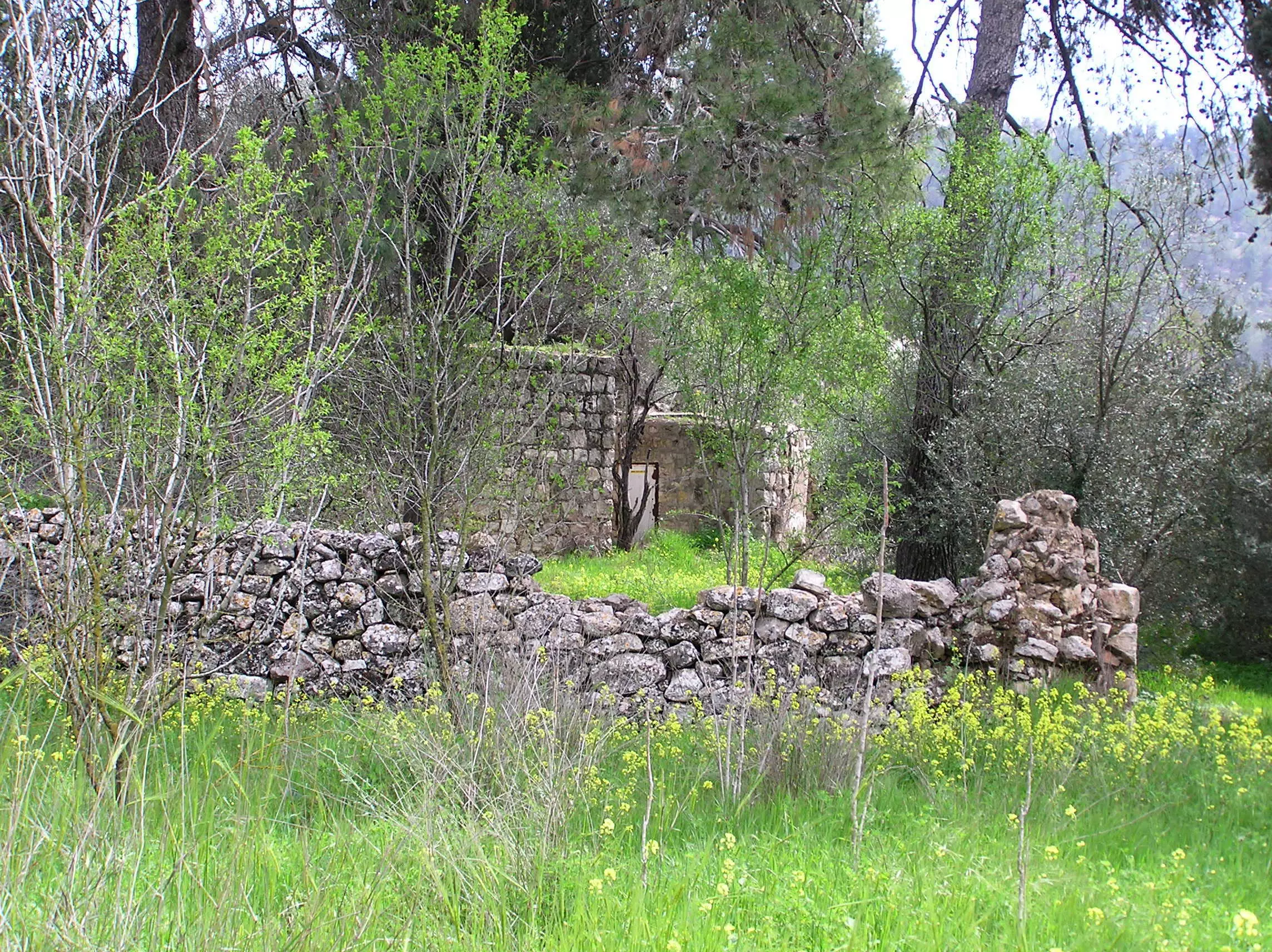
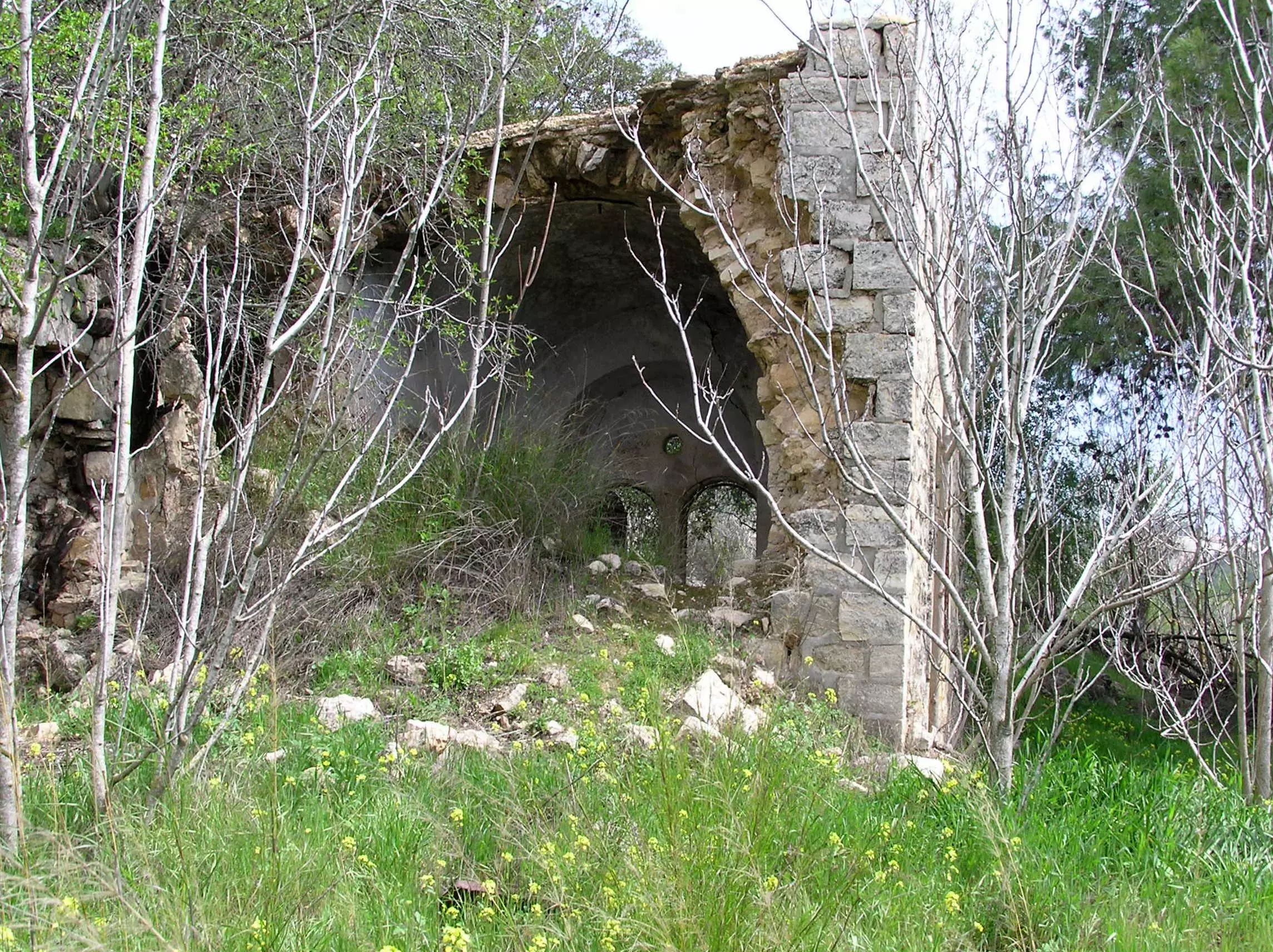
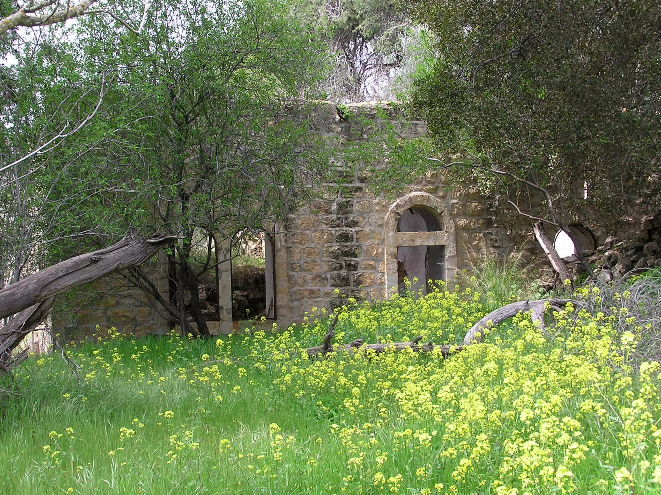
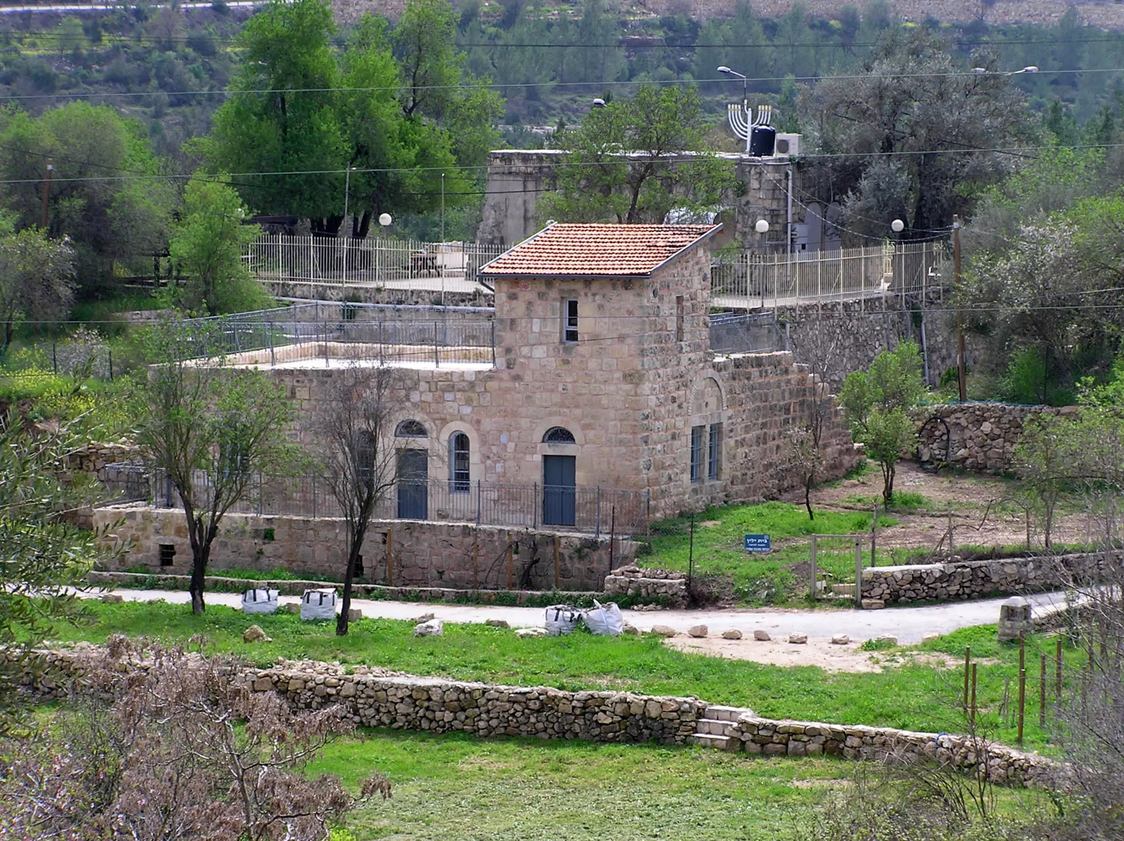
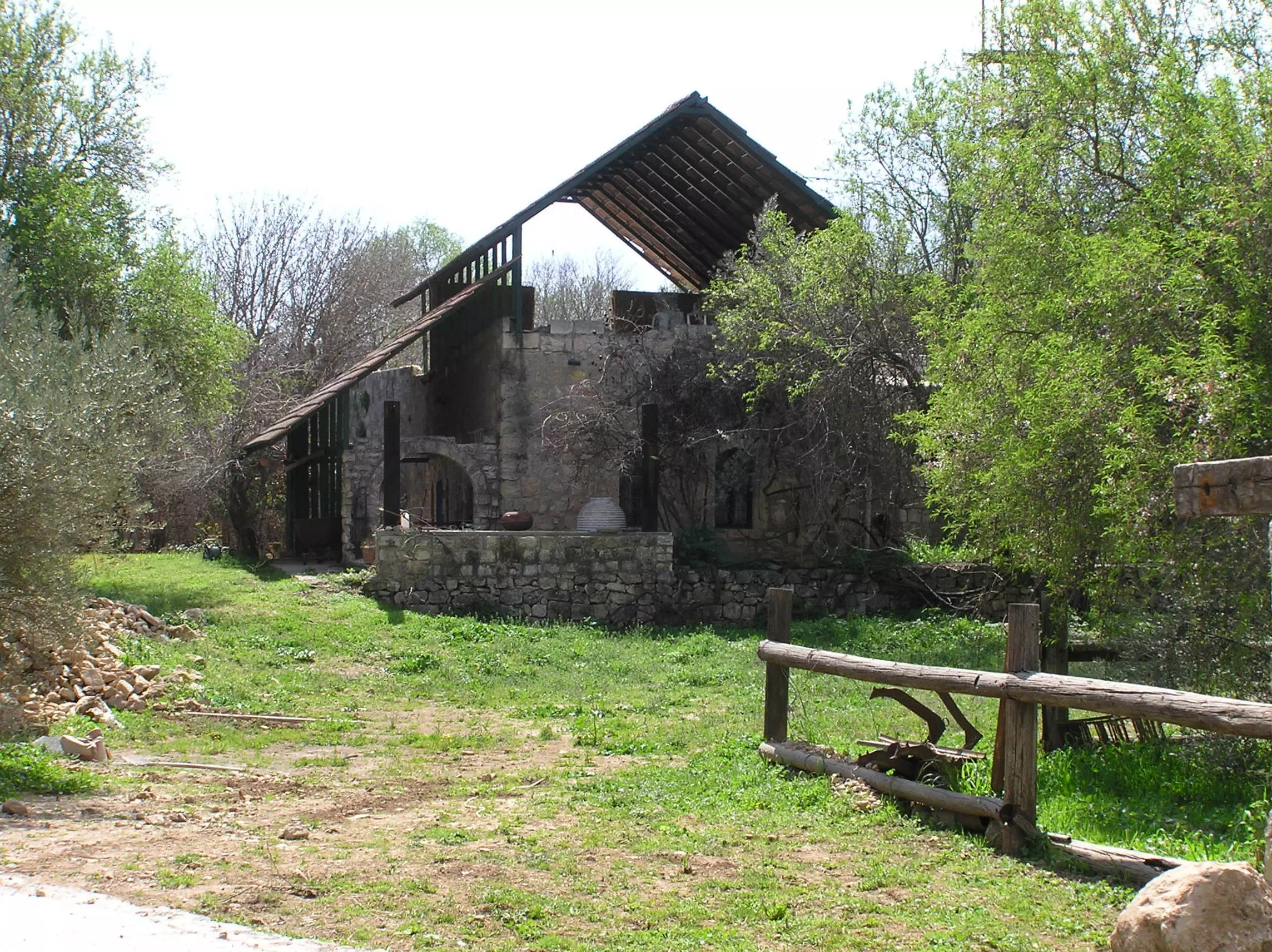
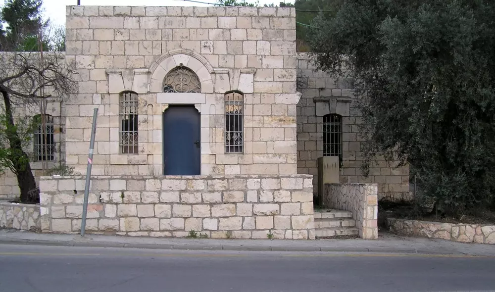
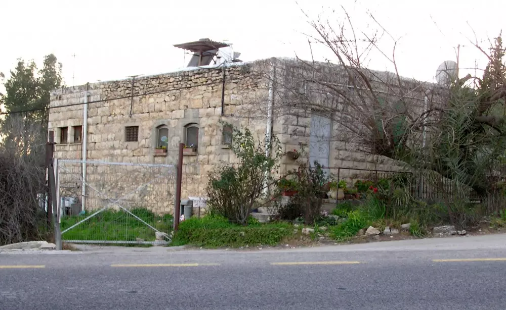
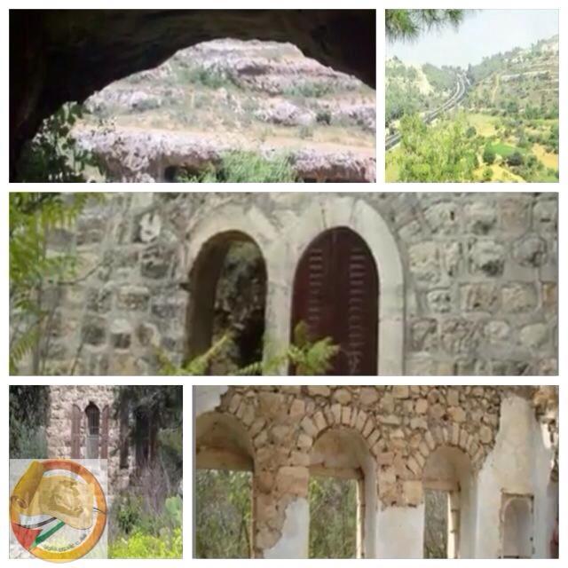
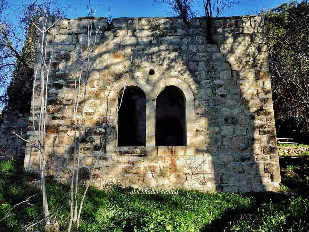
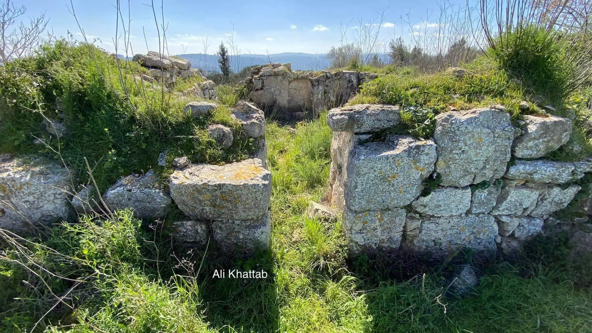
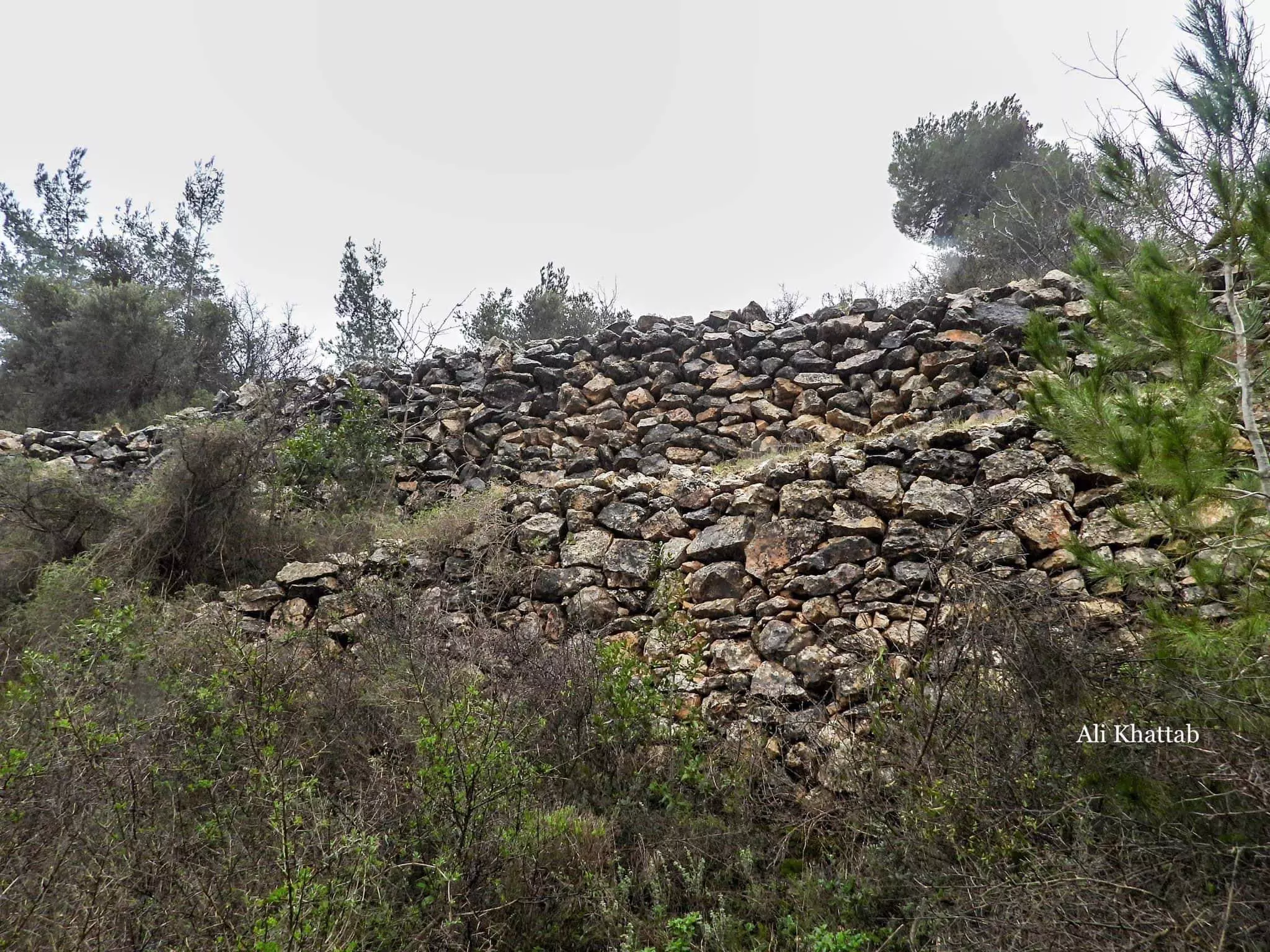
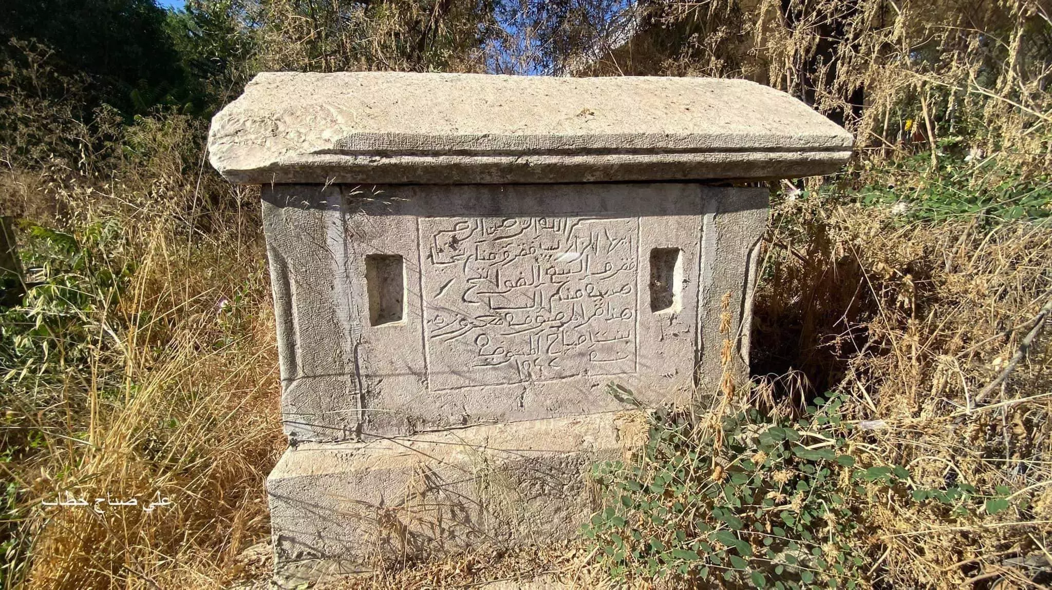
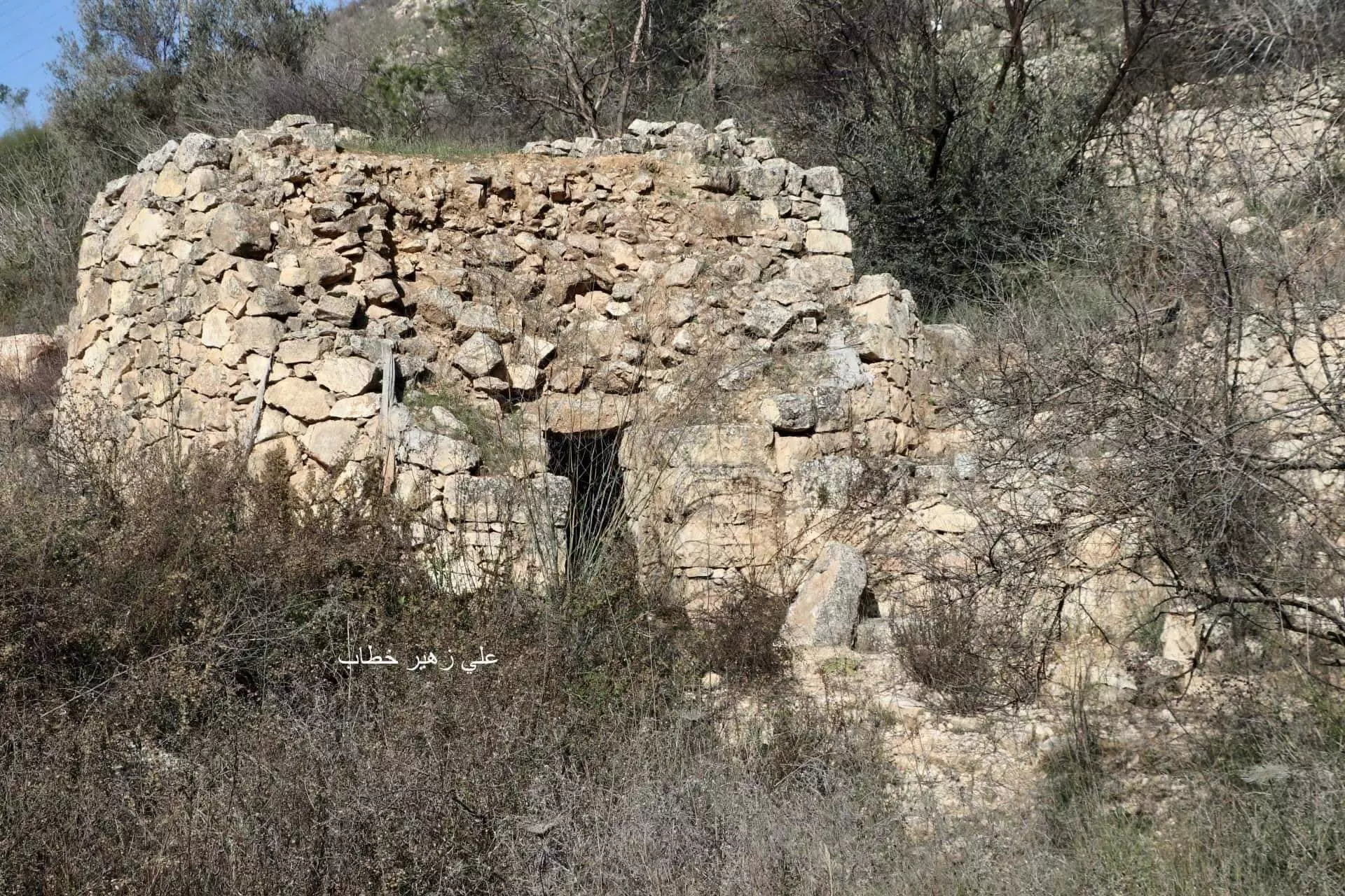
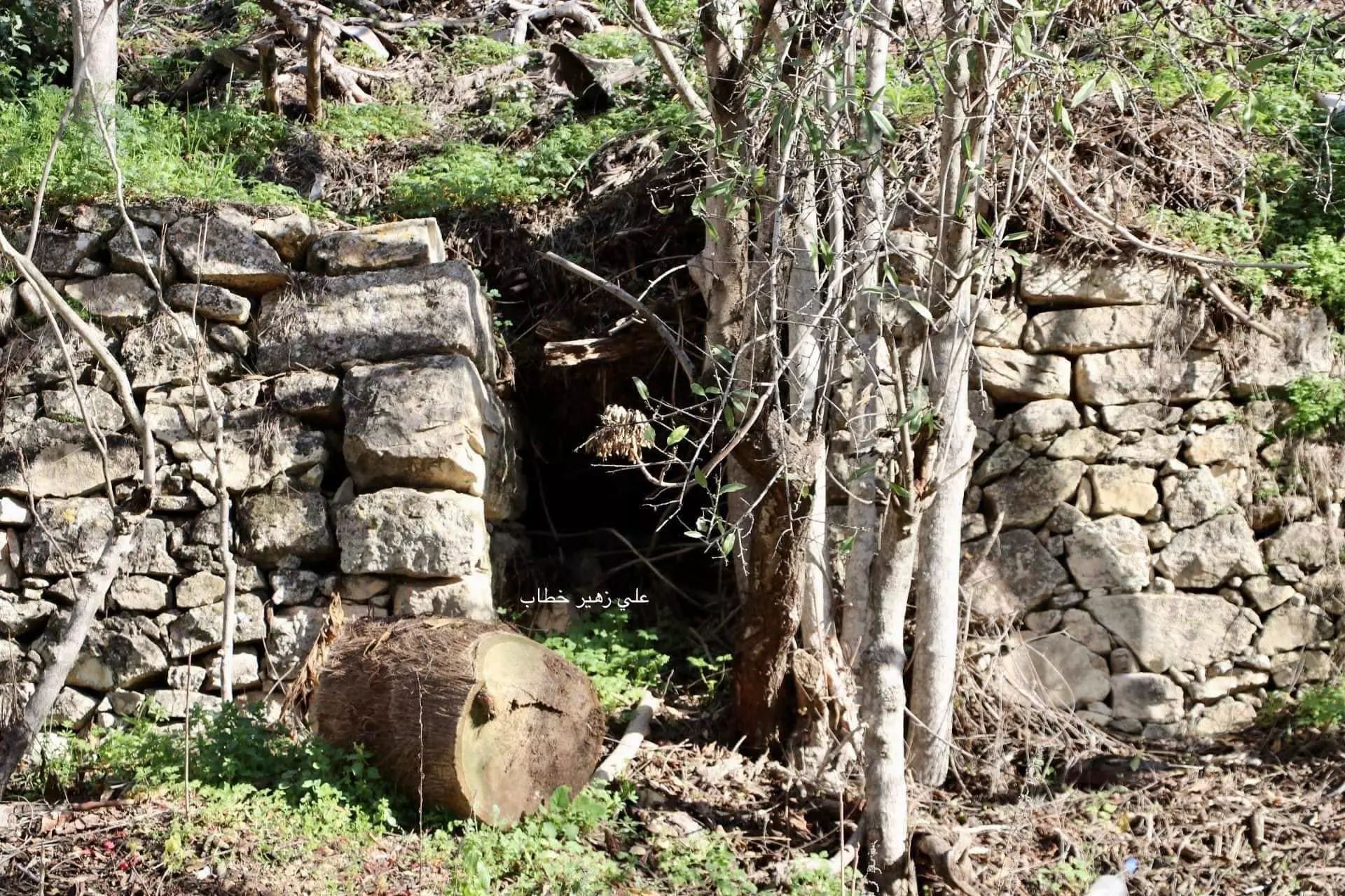
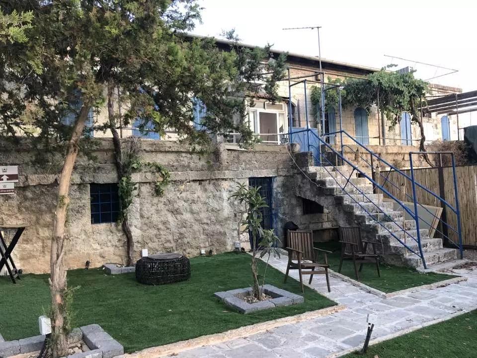
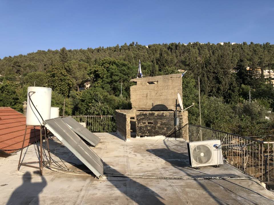
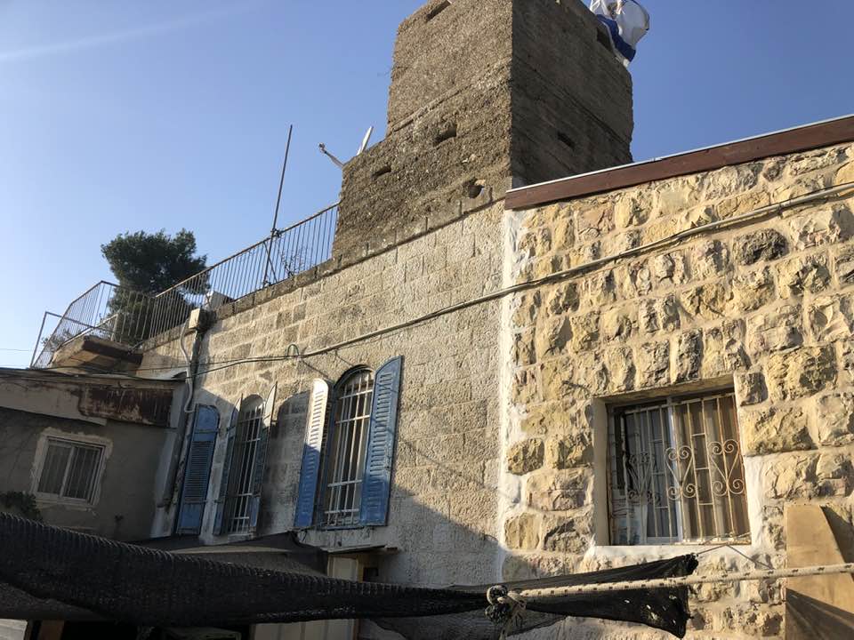
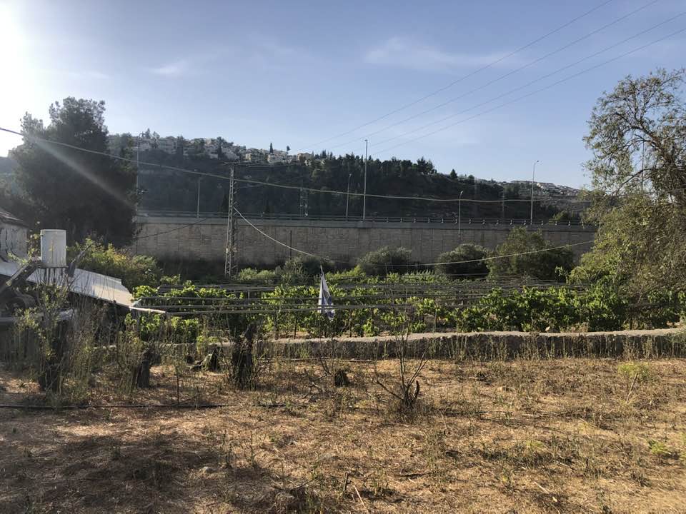
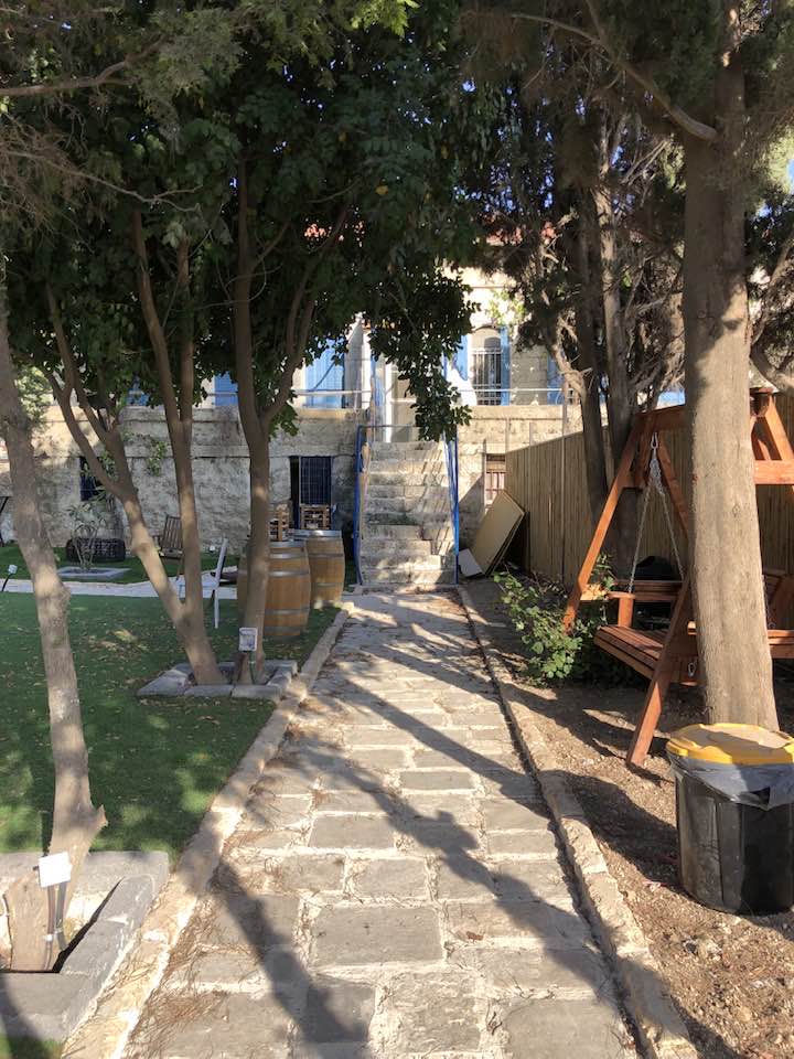
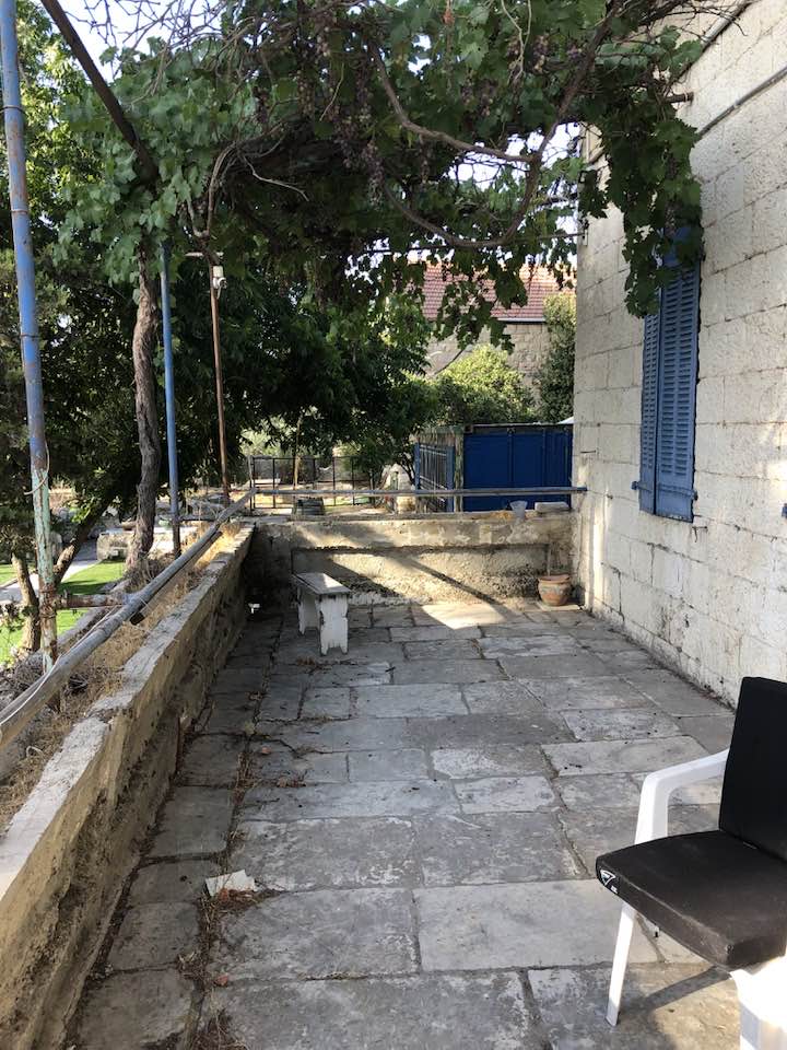
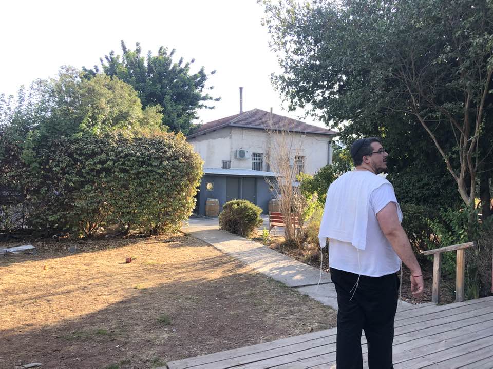
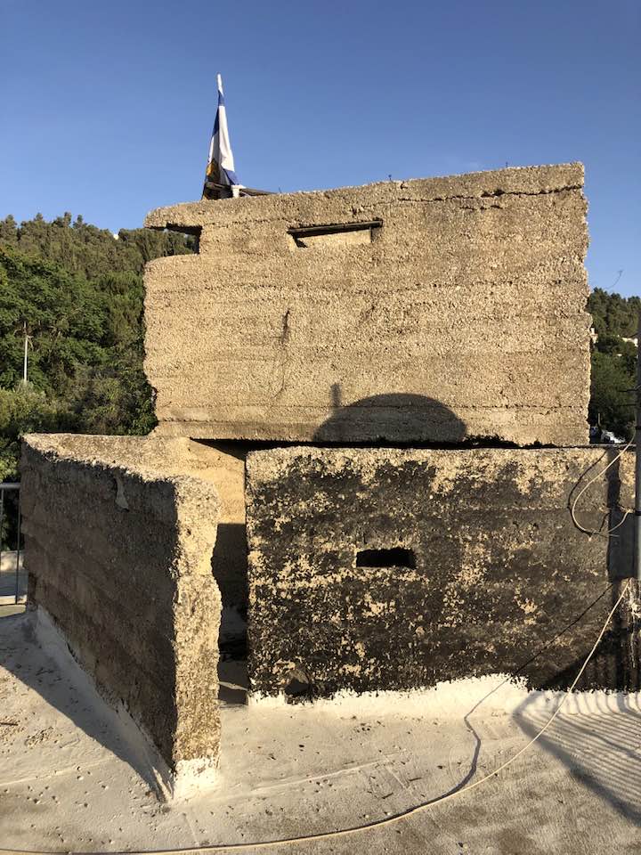
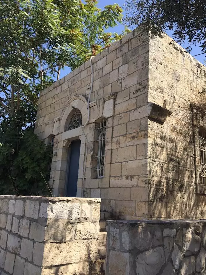
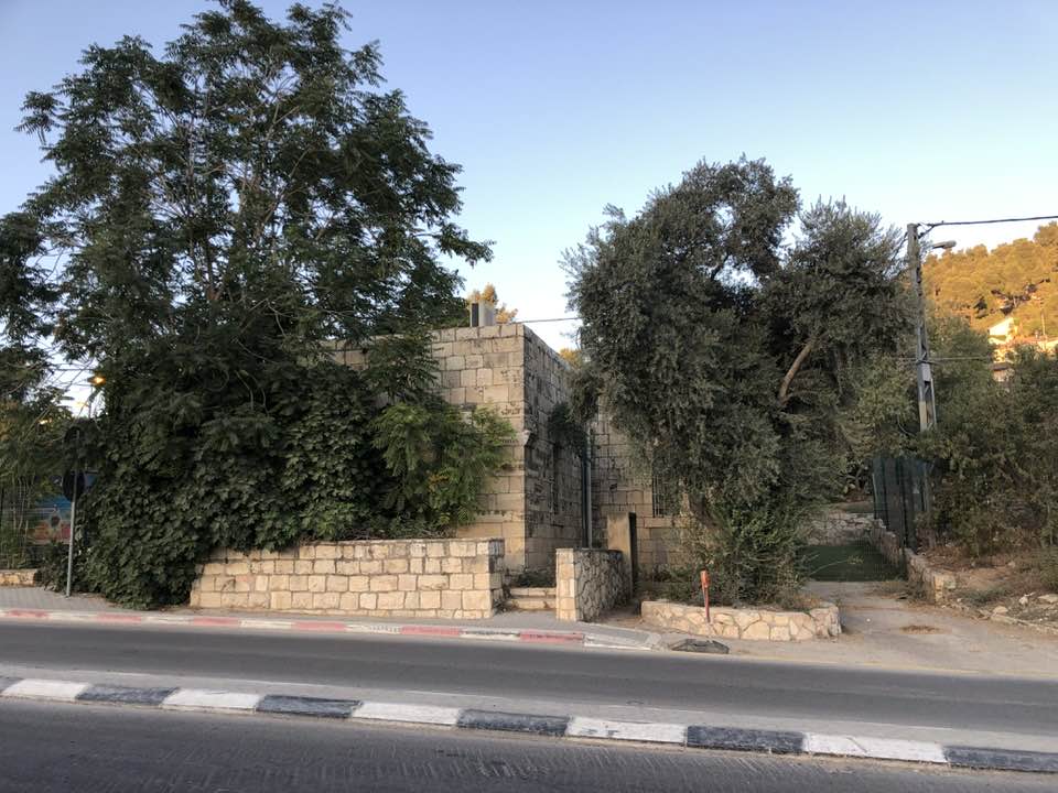
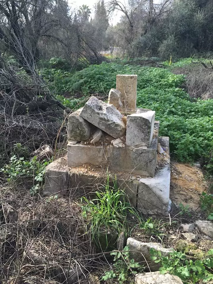
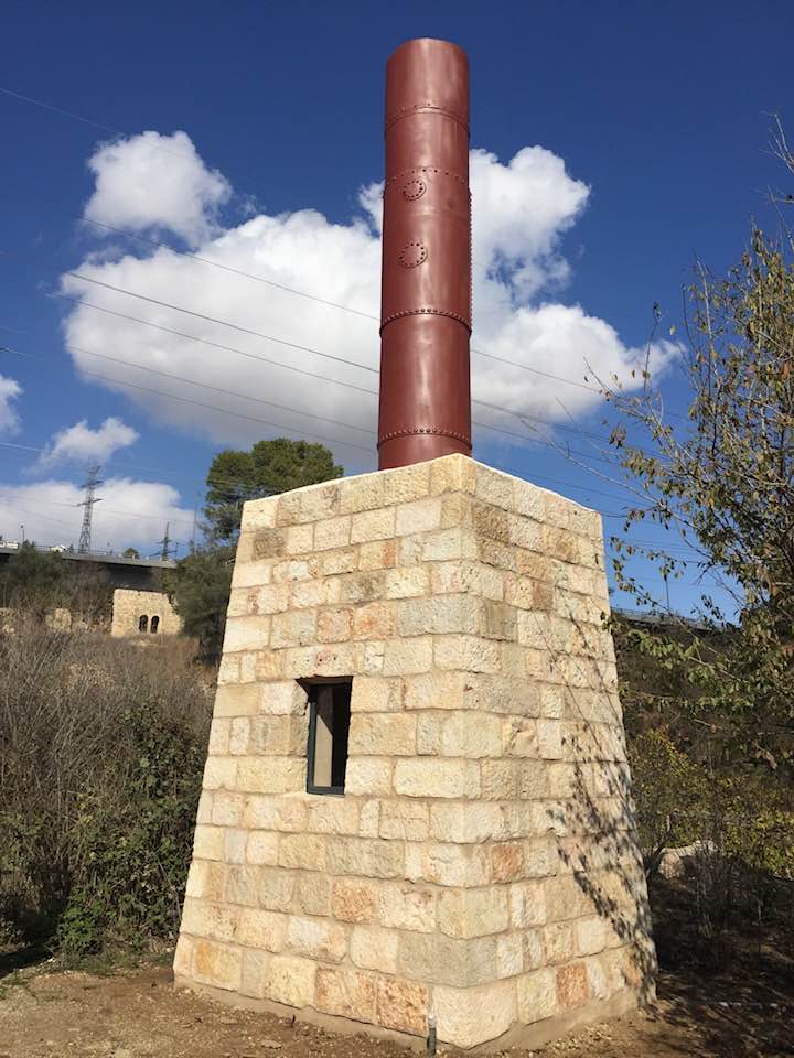
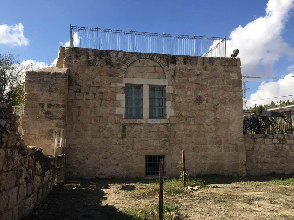
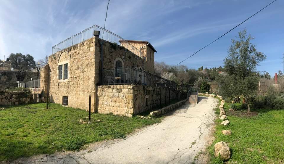
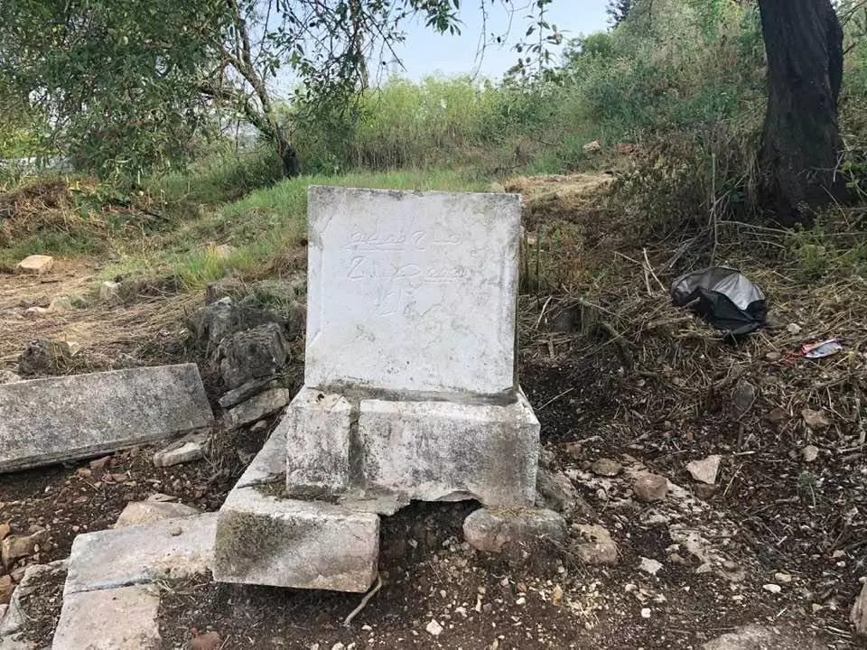
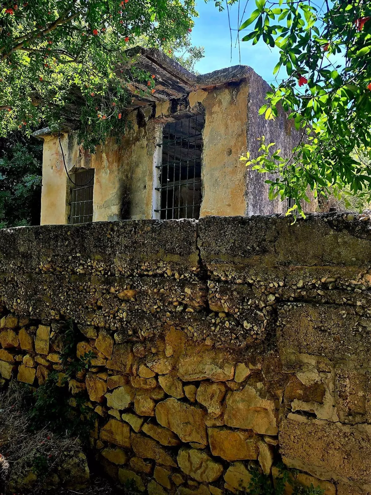
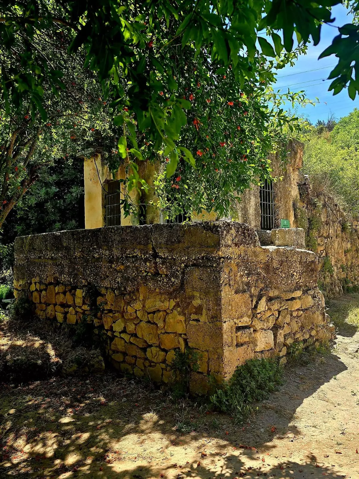
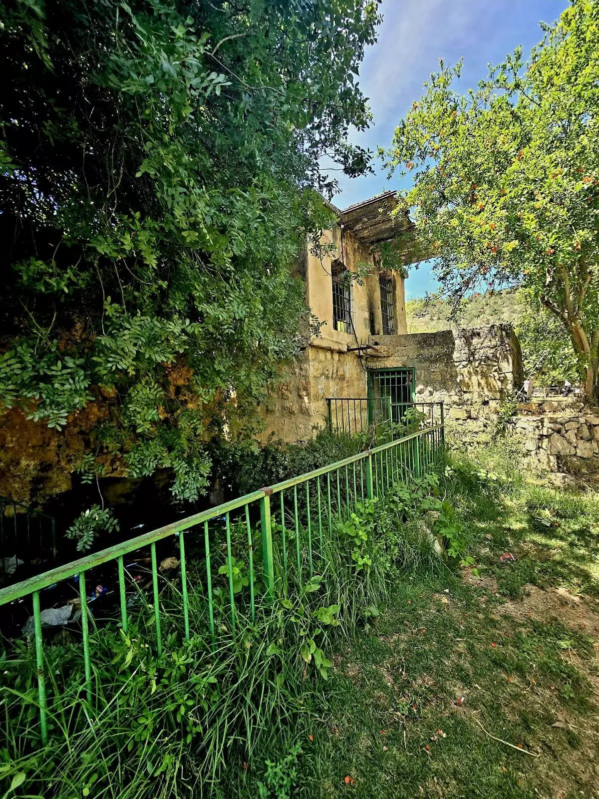
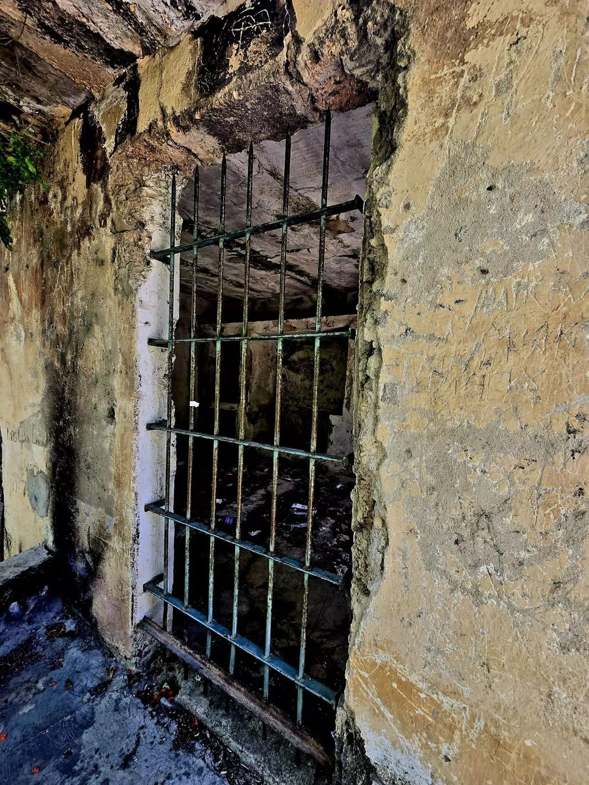
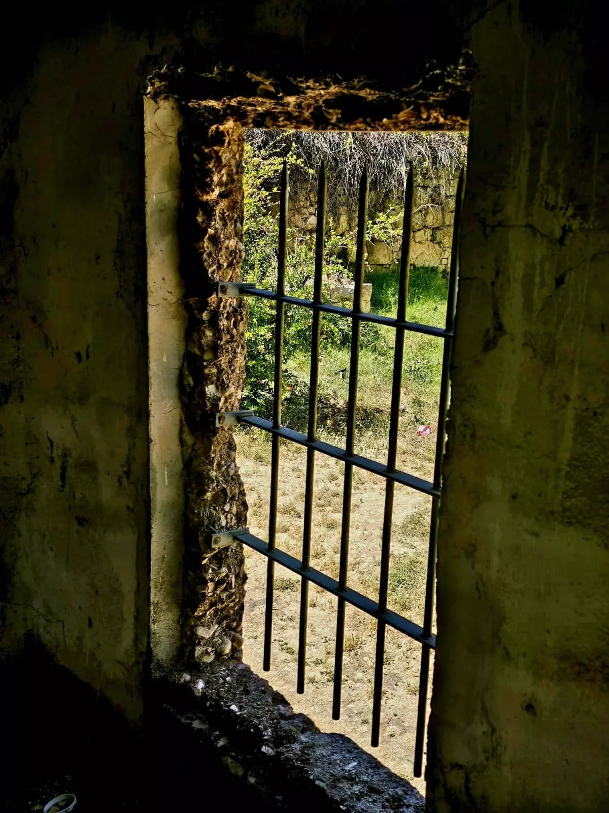
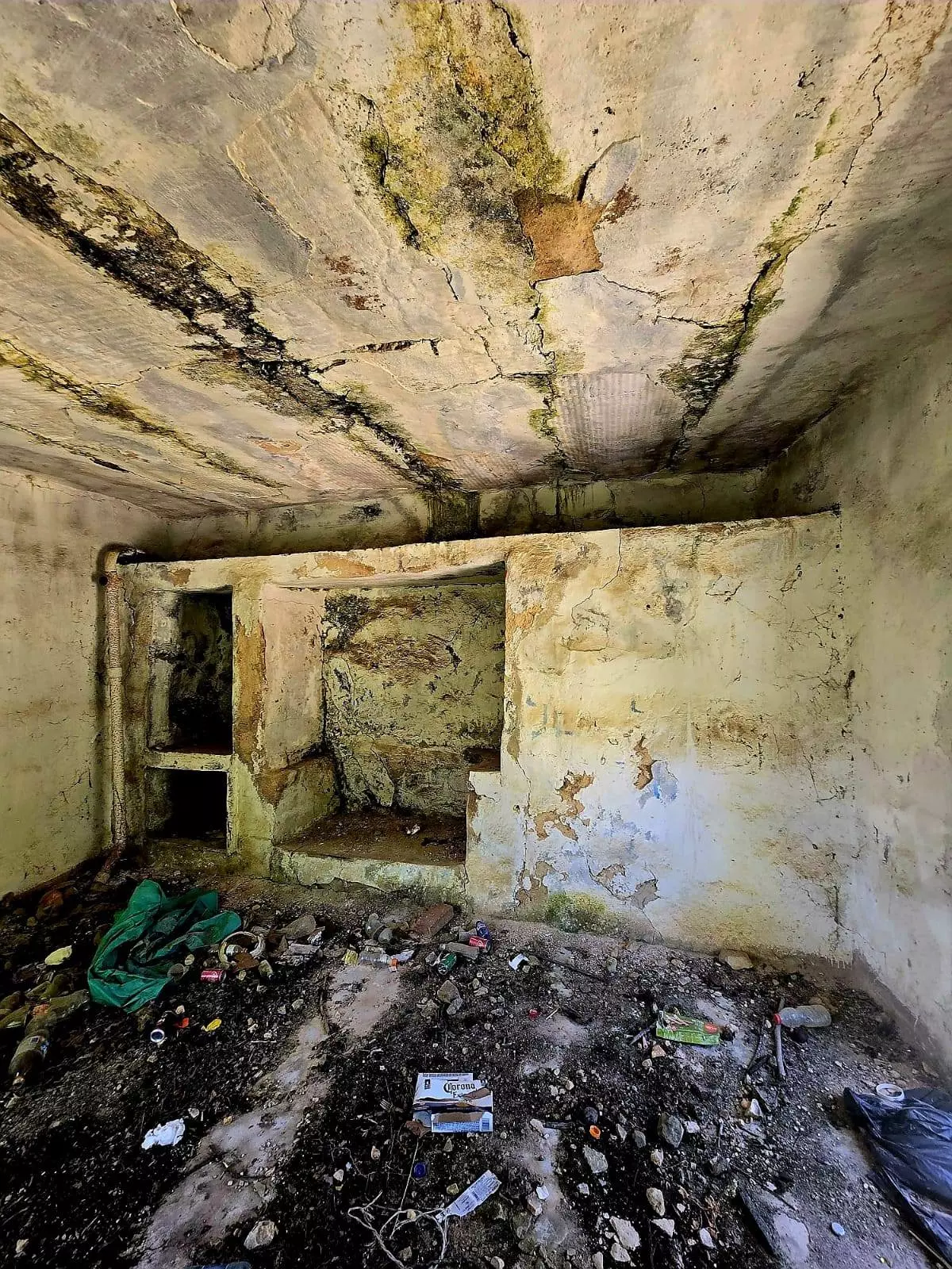
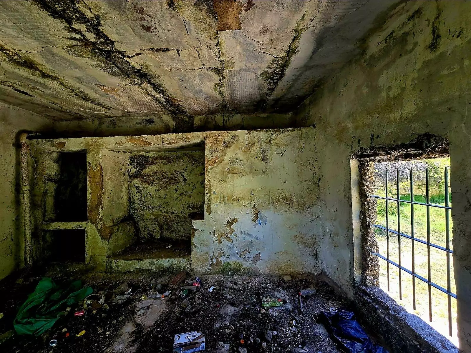
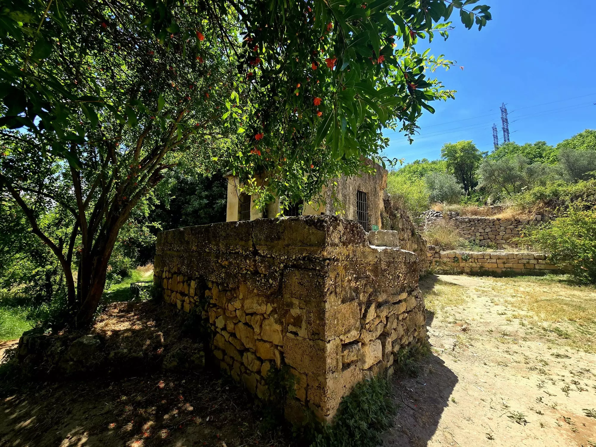
| Village Temains | The village was mostly destroyed with the exception of few deserted houses and the cemetery. One of the houses has been renovated and used by an Israeli Jewish settler. | |||||||||||||||||||||
| Ethnically Cleansing | Qalunya was mostly emptied of its inhabitants because of nearby fighting on April 2nd, 1948, and upon occupatio it was completely cleansed. | |||||||||||||||||||||
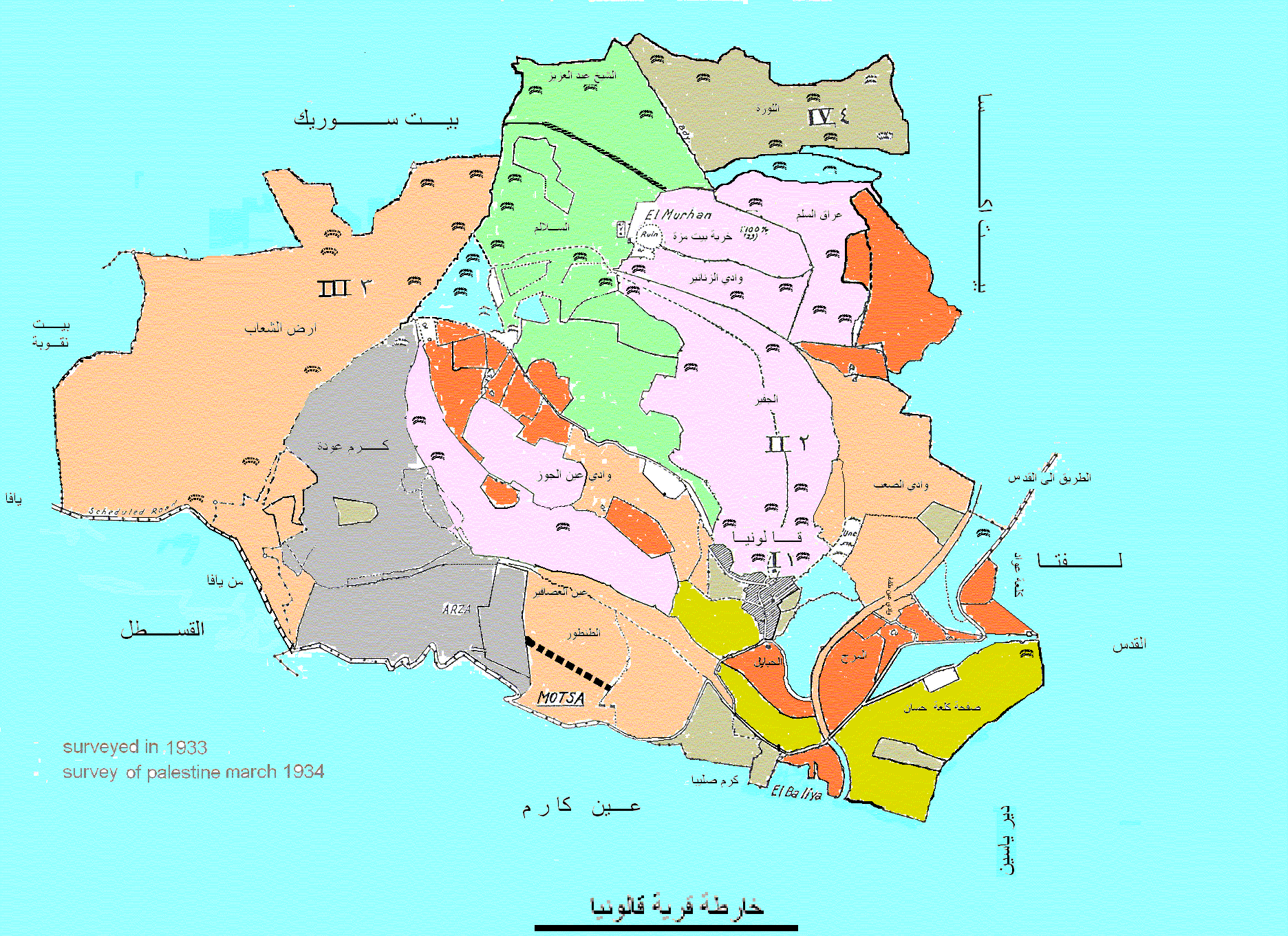
| Pre-Nakba Land Ownership |
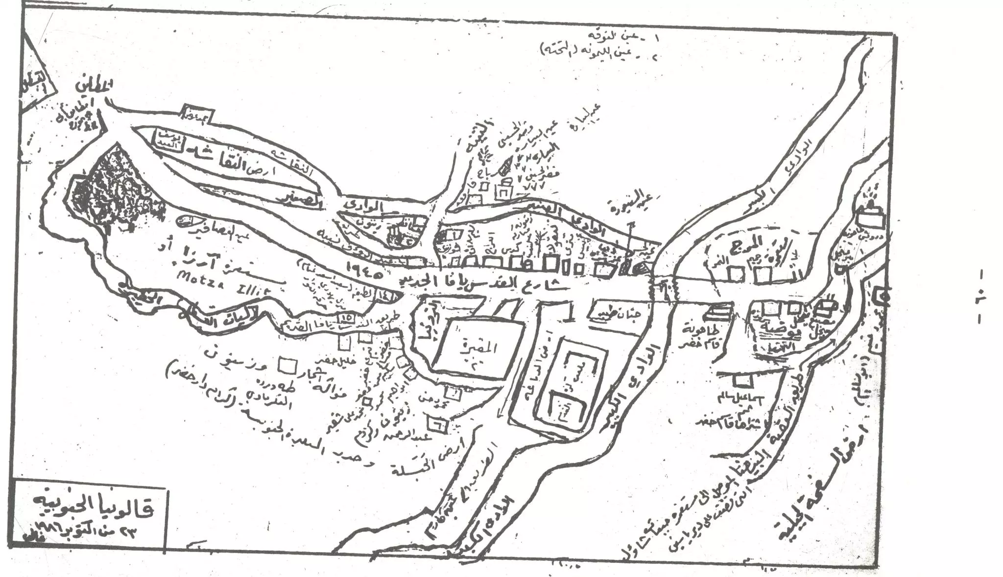
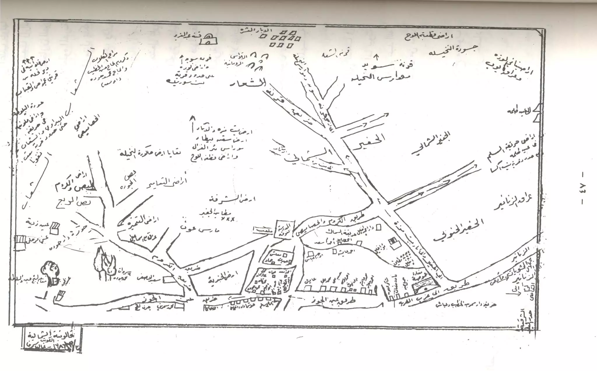
**Town Lands' Demarcation Maps |
|||||||||||||||||||||
| Land Usage As of 1945 |
|
|||||||||||||||||||||
| Population |
|
|||||||||||||||||||||
| Number of Houses |
|
|||||||||||||||||||||
| Near By Towns |
||||||||||||||||||||||
|
||||||||||||||||||||||
| Town's Name Through History | The Canaanites known Qalunya by Mozah, the Romans called it Colonia Amosa or Colonia Emmaus (see 'Imwas in al-Ramla district for details), and the Crusades referred to it by as Qalonie. | |||||||||||||||||||||
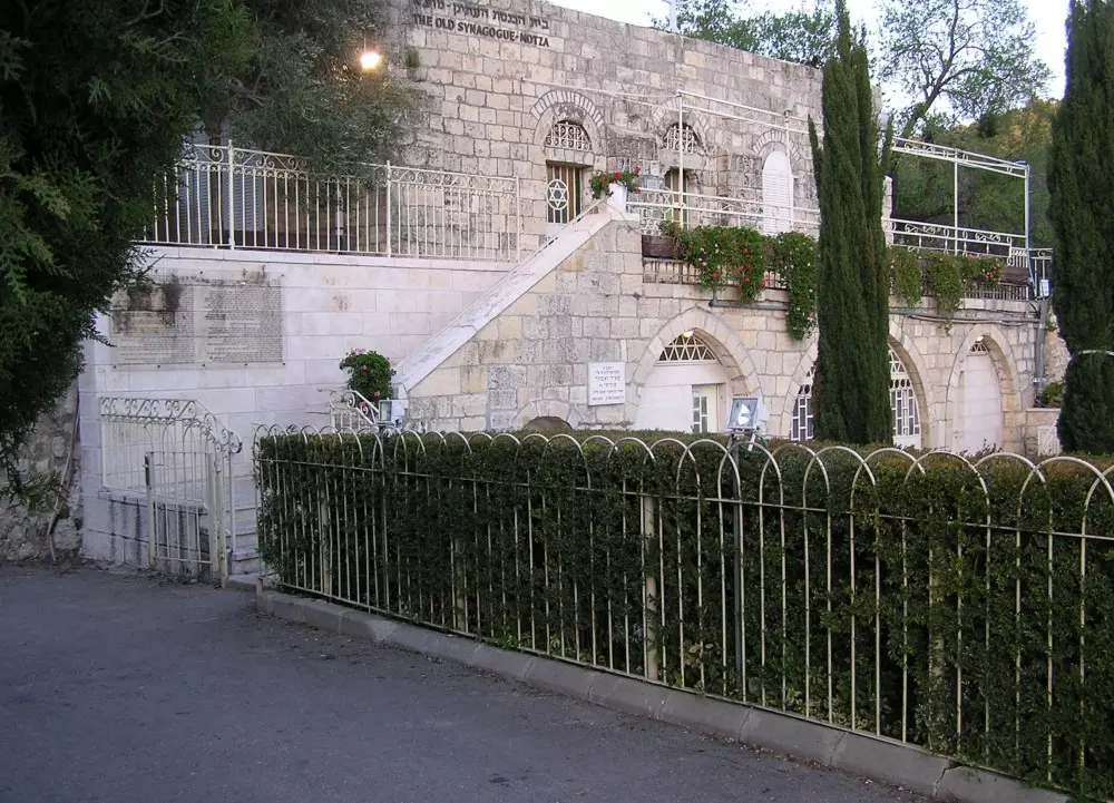
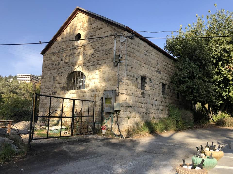
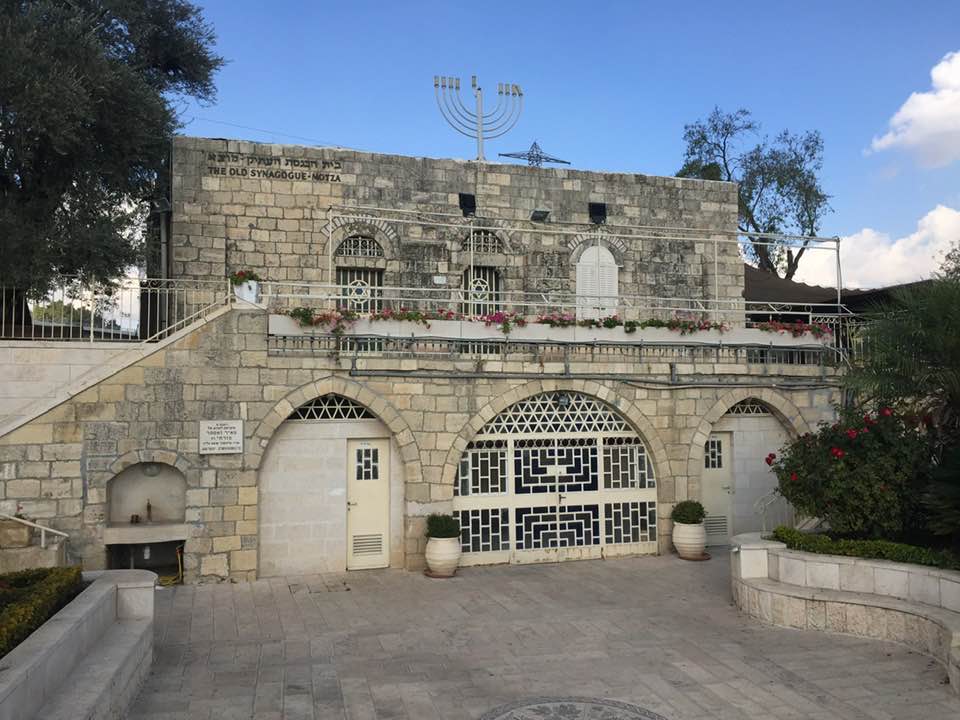
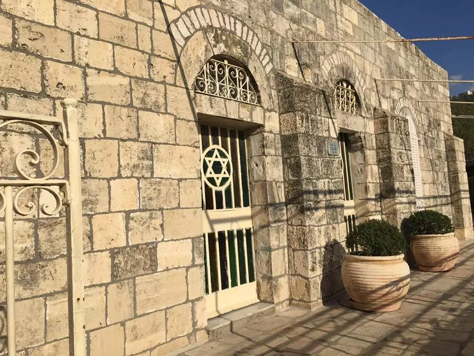
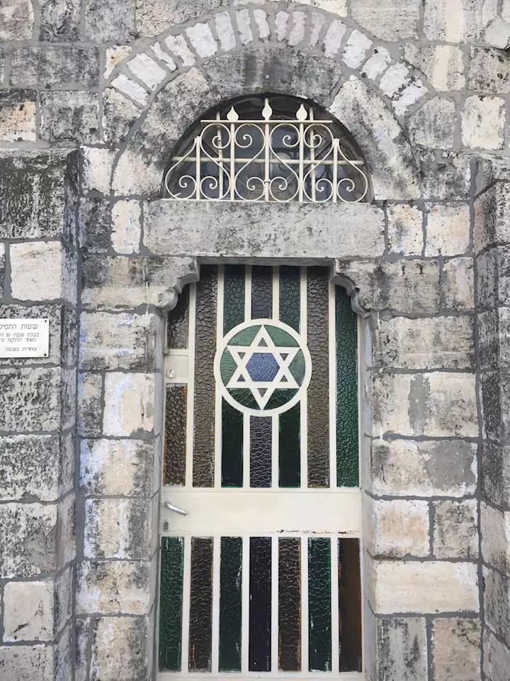
| Places of Warship | Qalunya had a mosque named after al-Shaykh Hamad, and believe it or not, it also contained an old synagogue built in 1871. | |||||||||||||||||||||
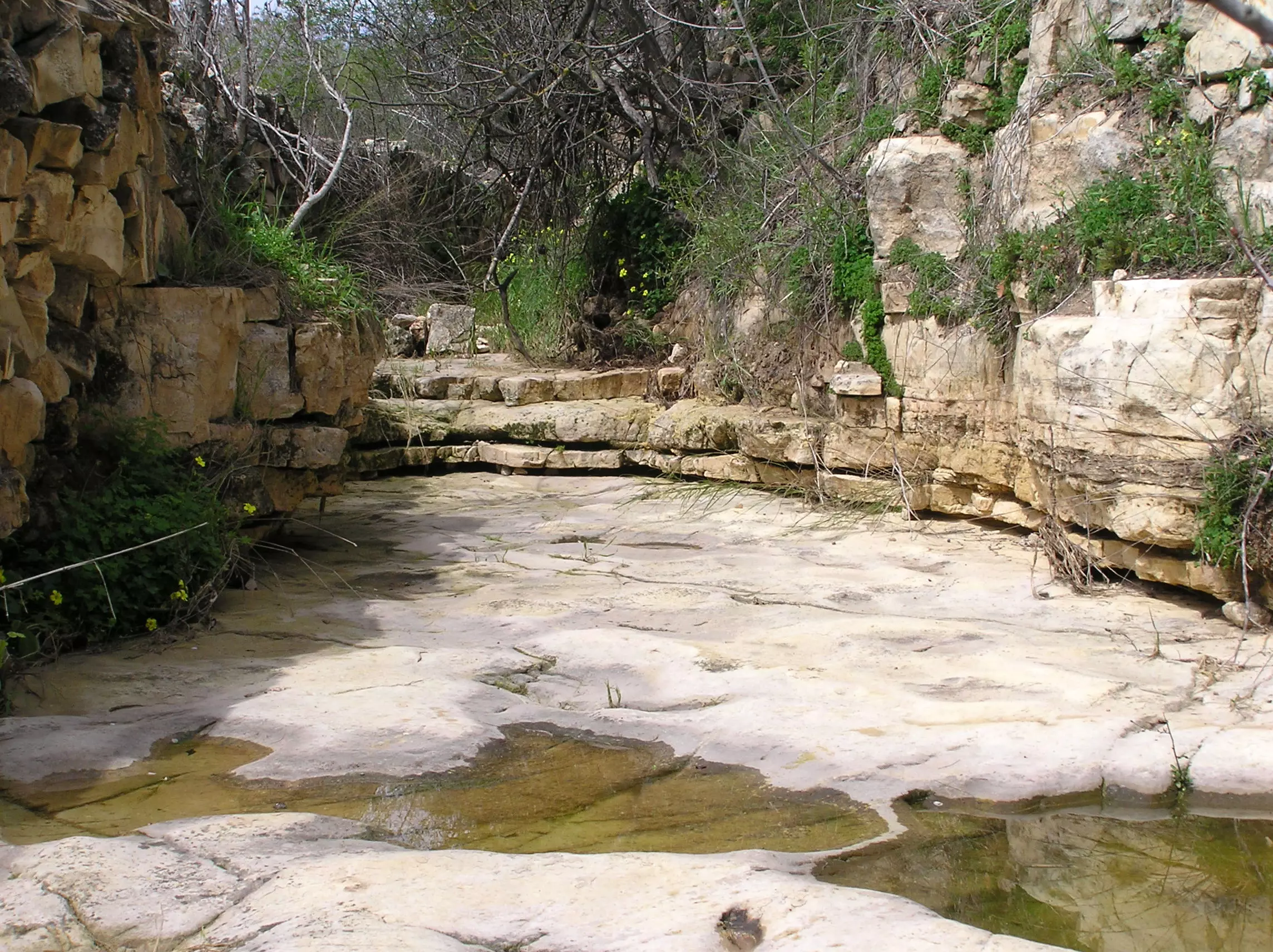
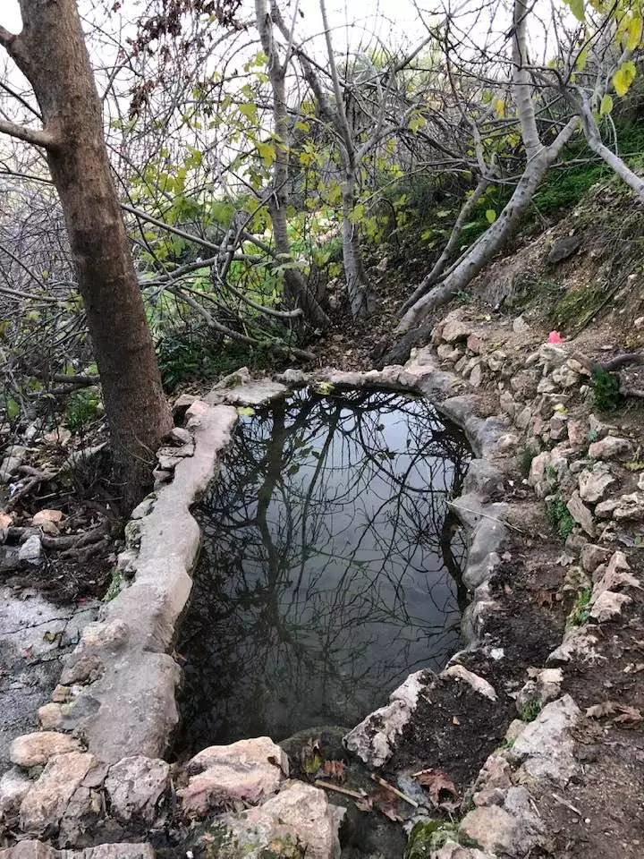
| Nearby Wadies & Rivers | Wadi Qalunya passed through the eastern edges of the village. | |||||||||||||||||||||
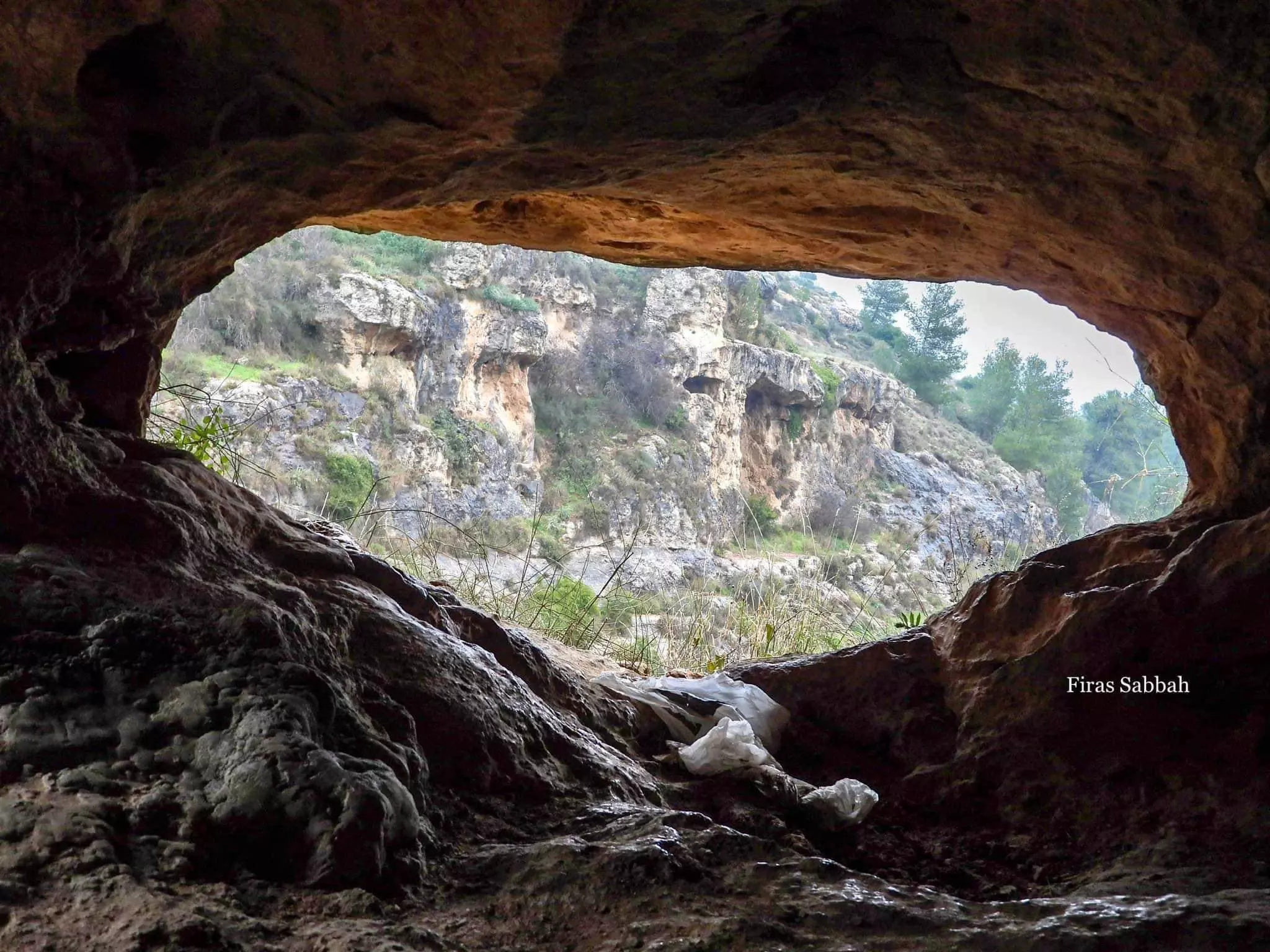
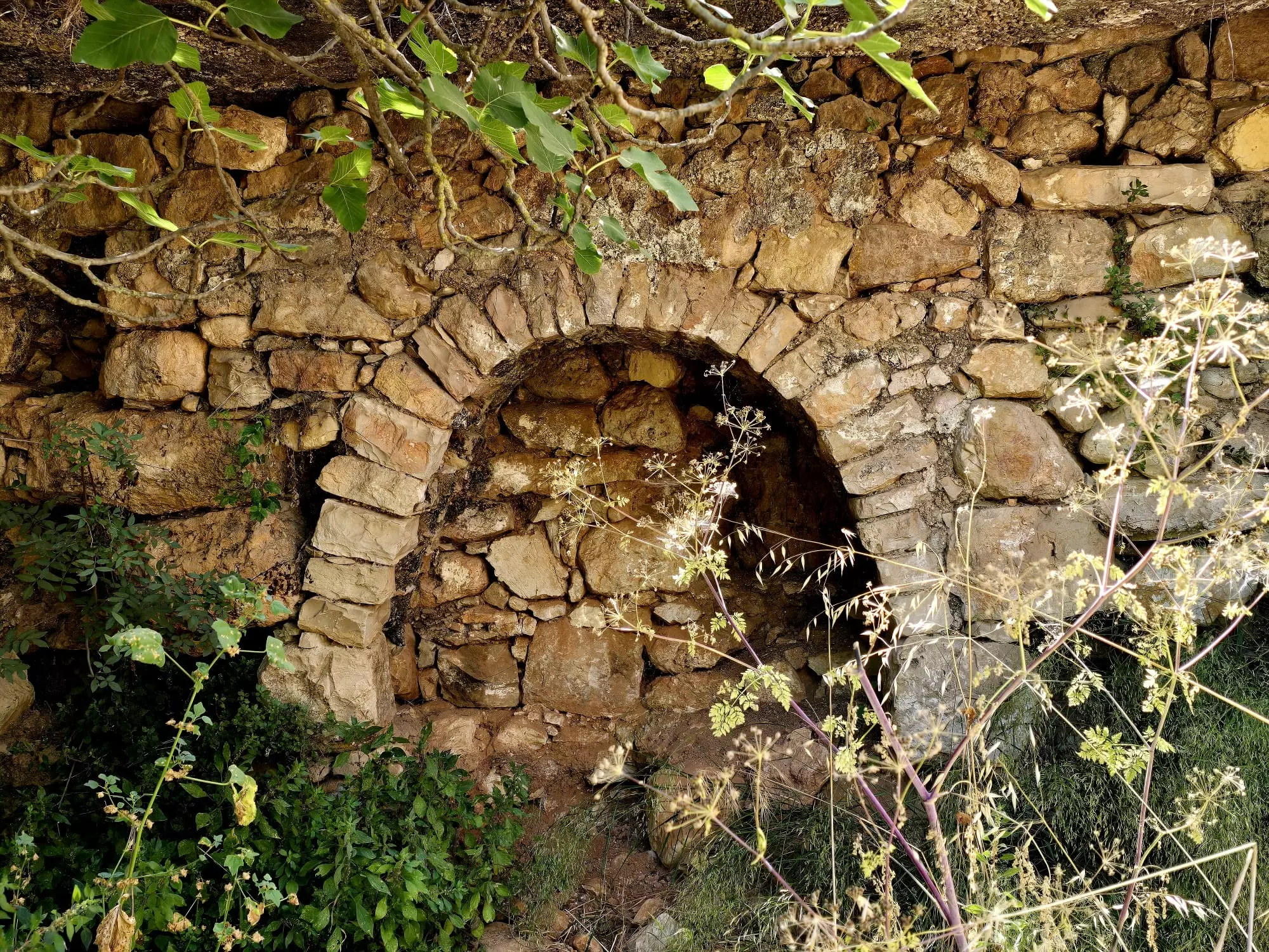
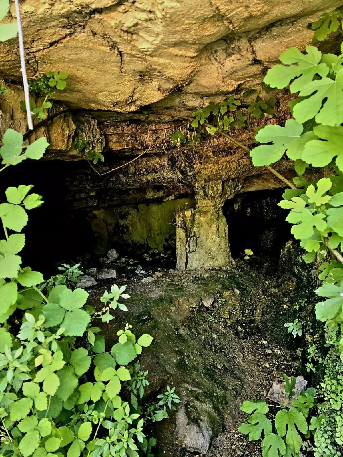
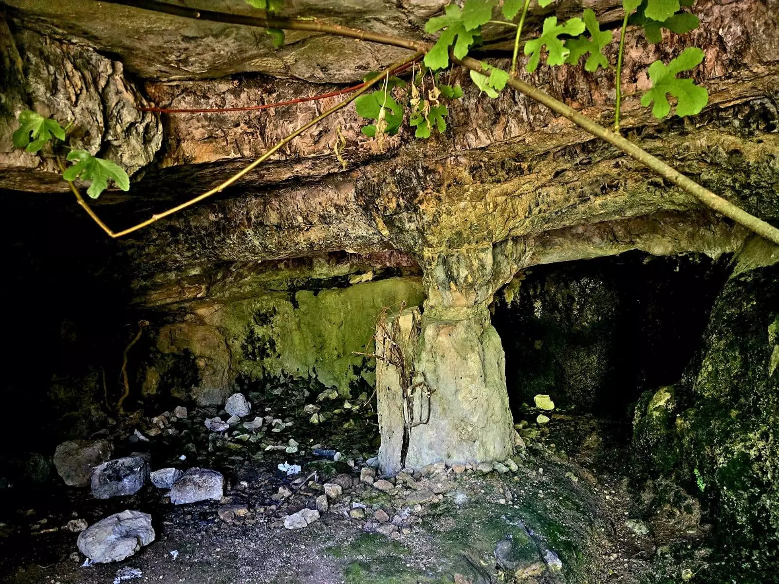
| Archeological Sites | Qaluna also has two unnamed khirbas to the north that contains the foundations of buildings and artificial caves carved into the rock. | |||||||||||||||||||||
| Exculsive Jewish Colonies Who Usurped Village Lands |
The west Jerusalem suburb of Mevasseret Tziyyon. | |||||||||||||||||||||
| Featured Video | ||||||||||||||||||||||
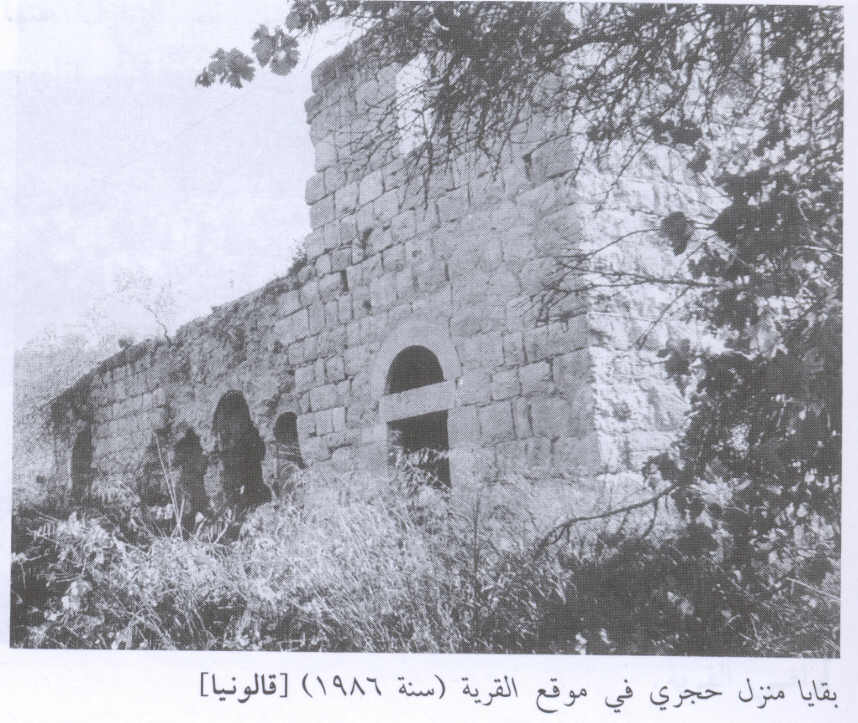
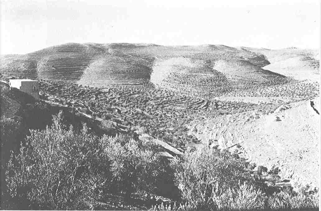
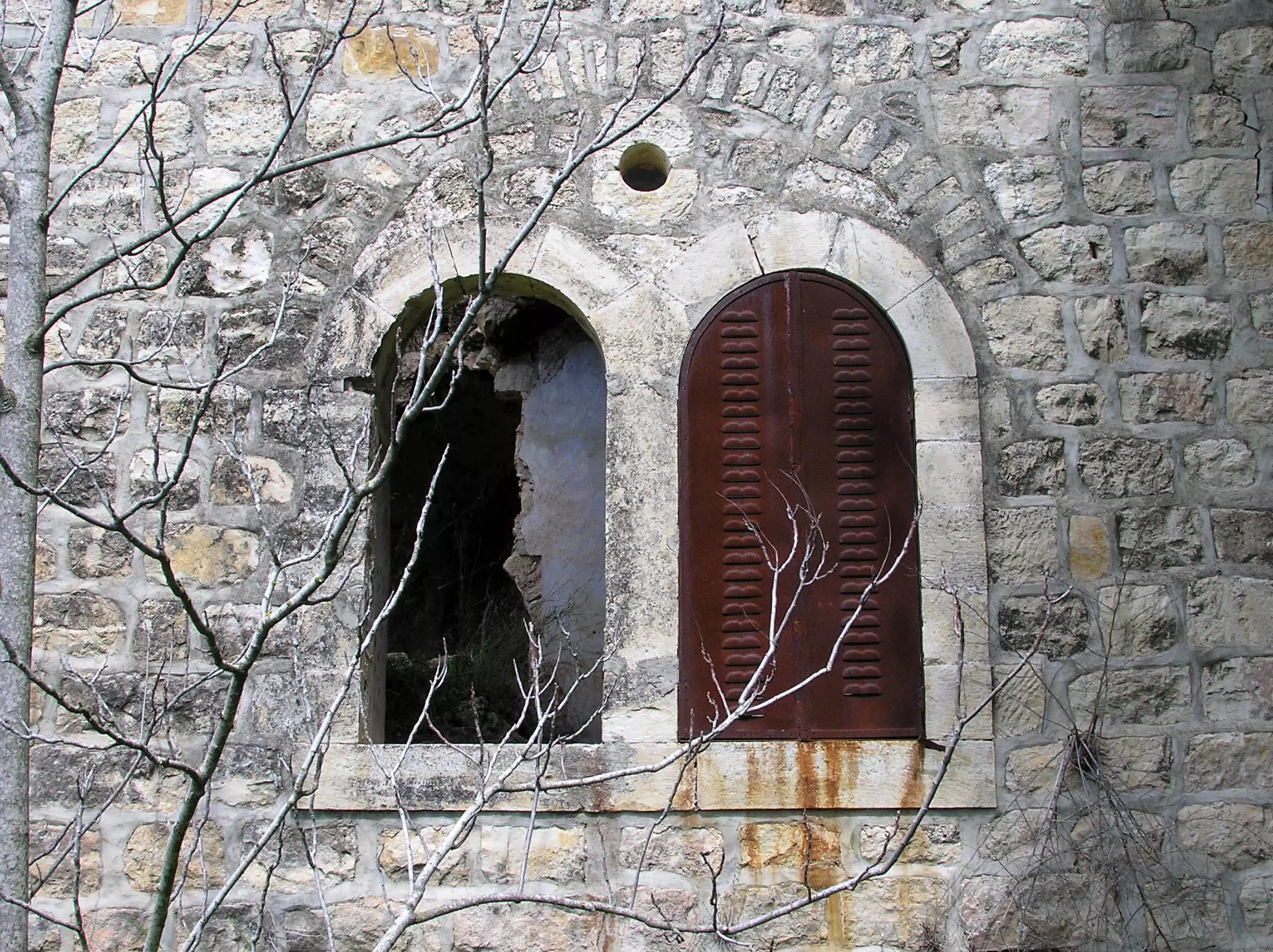
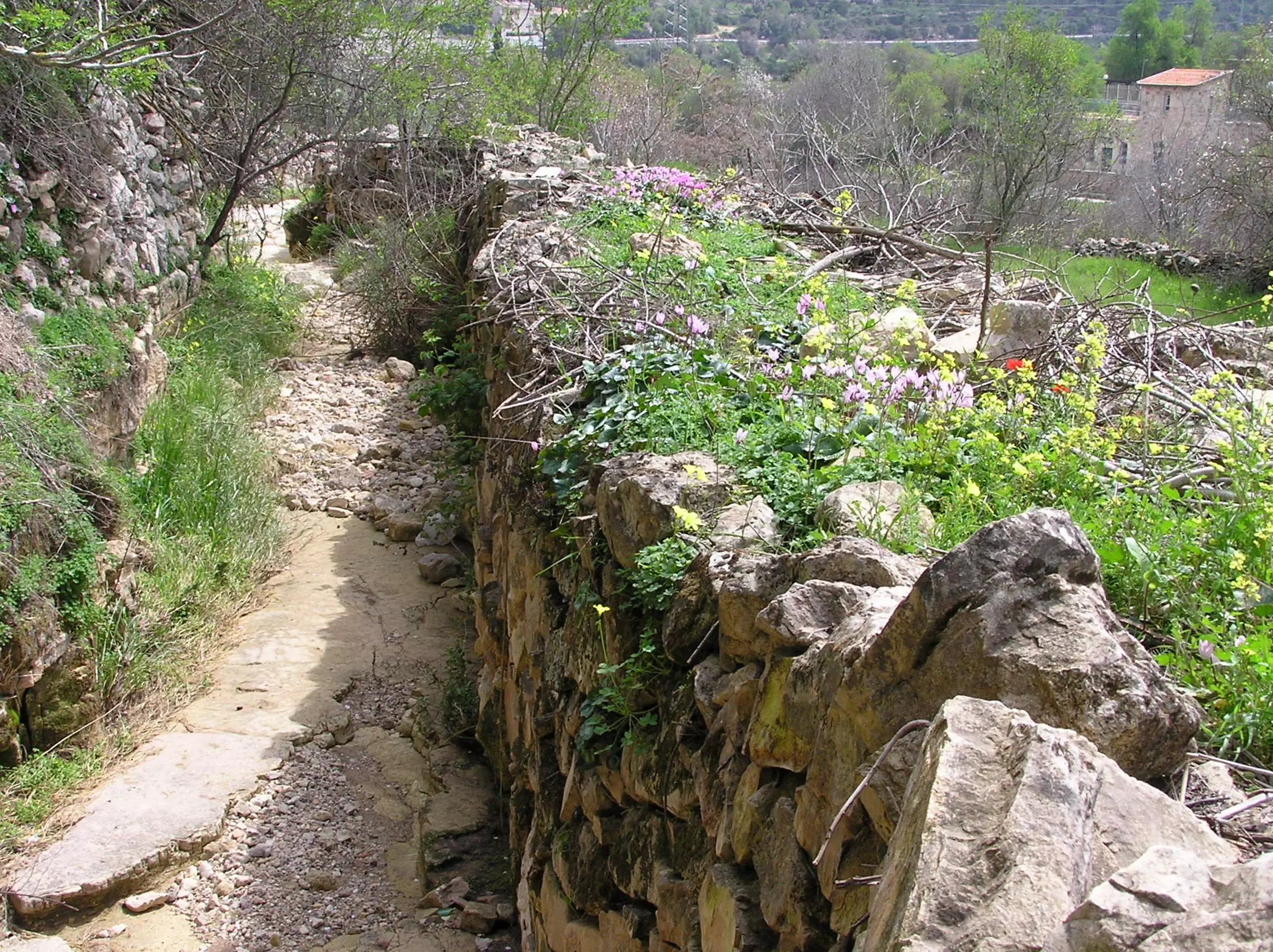
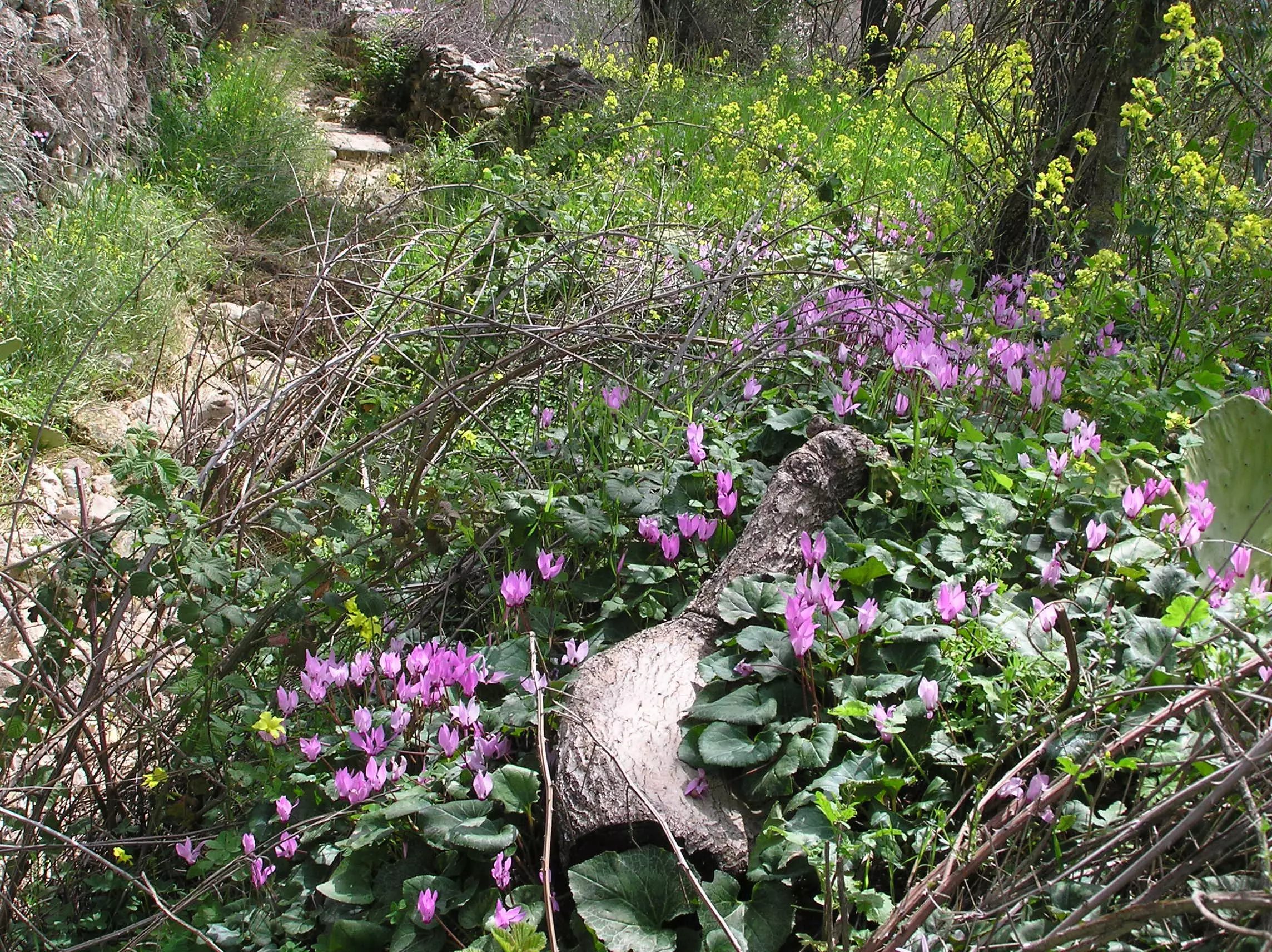
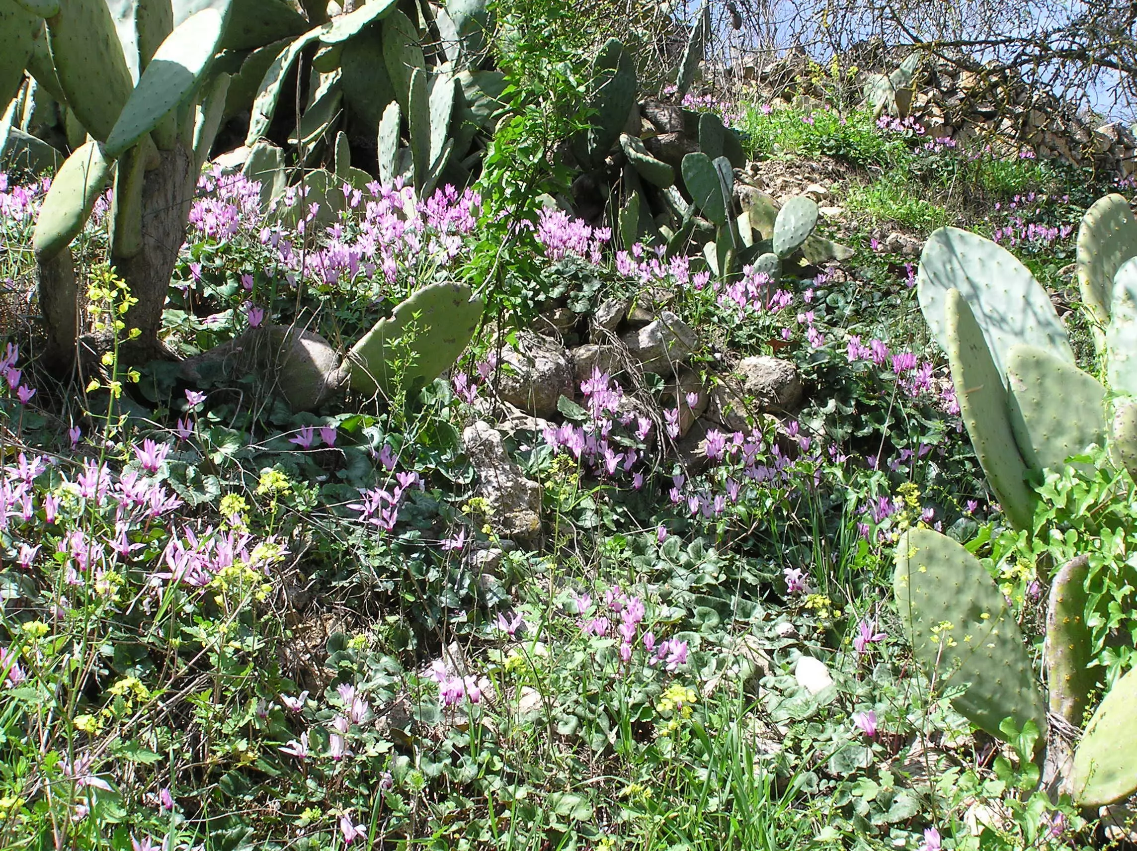
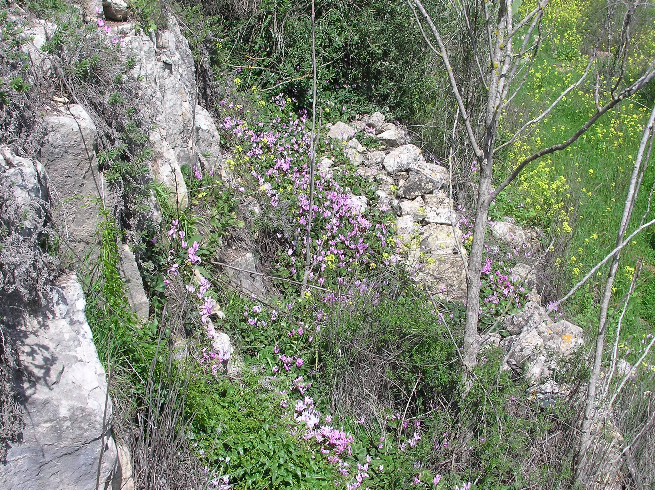
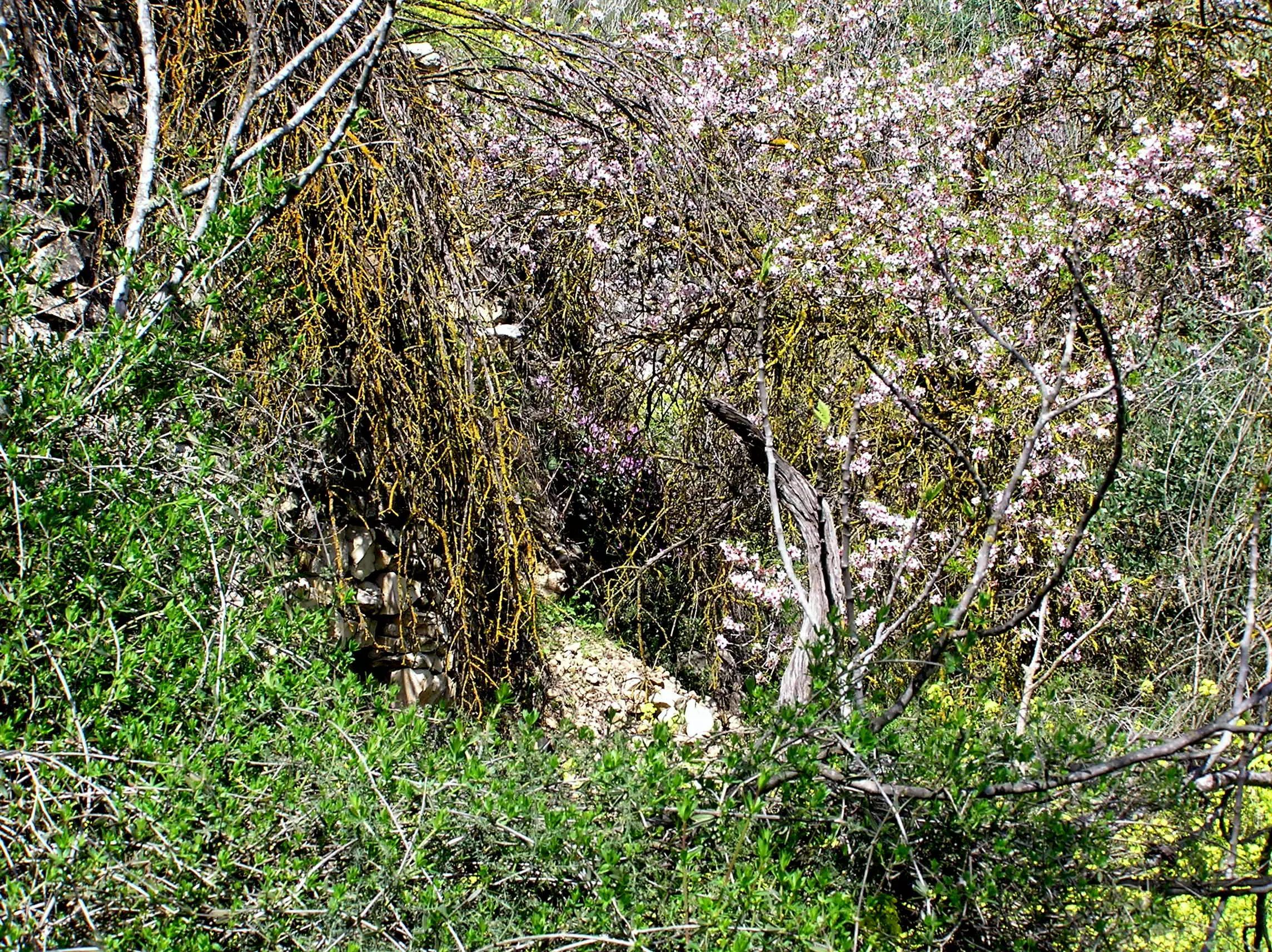
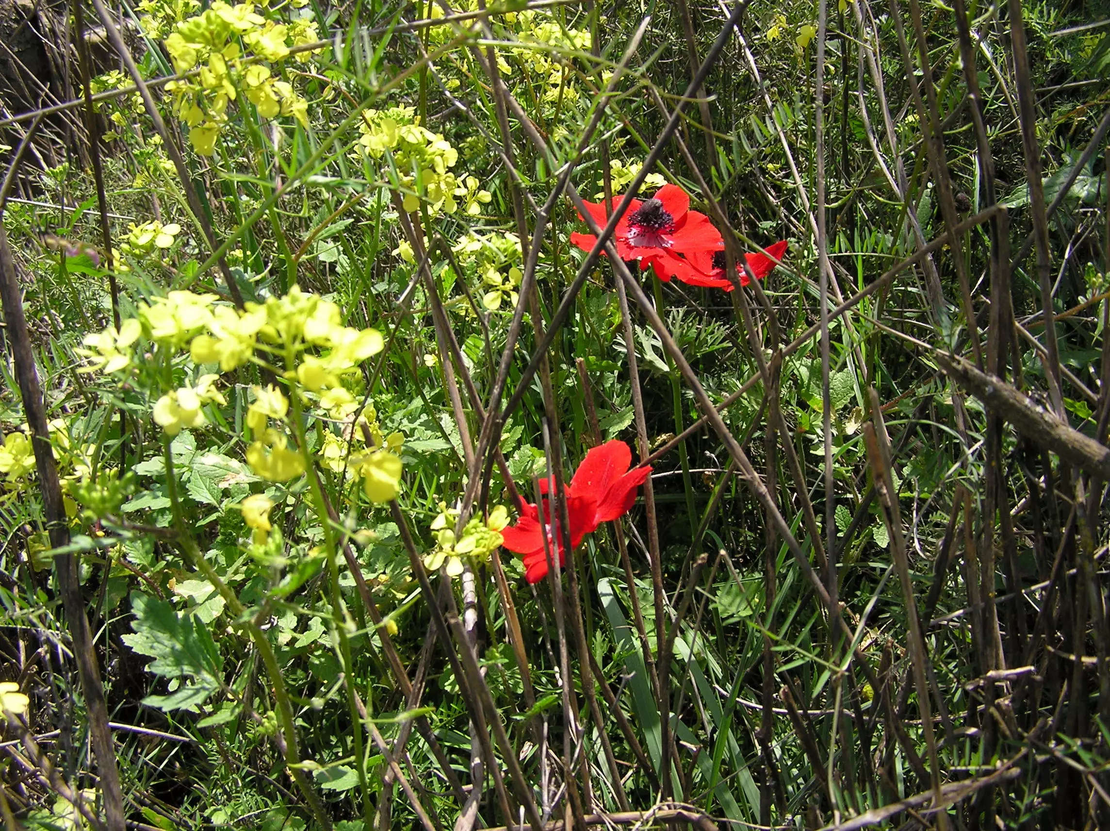
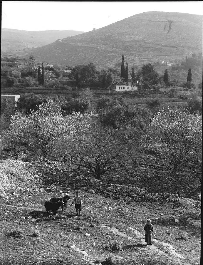
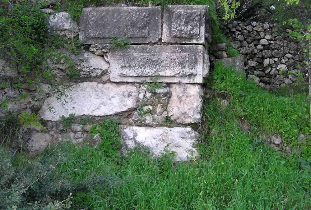
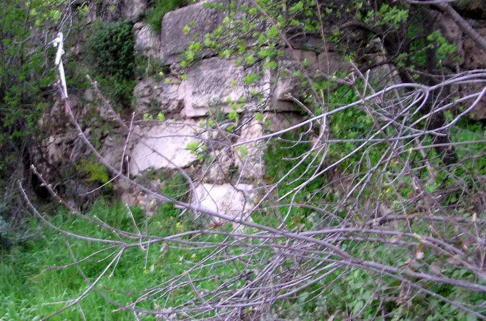
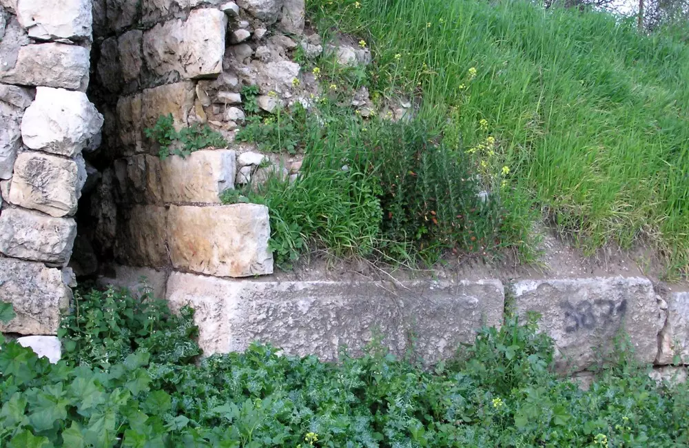
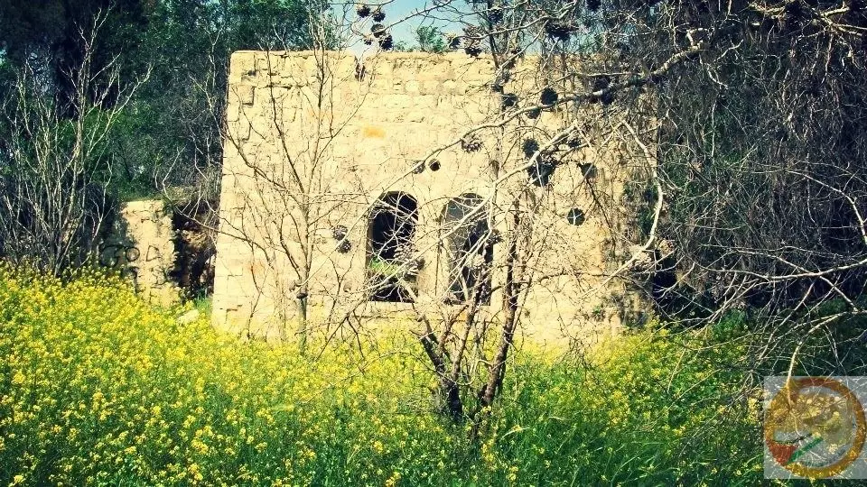
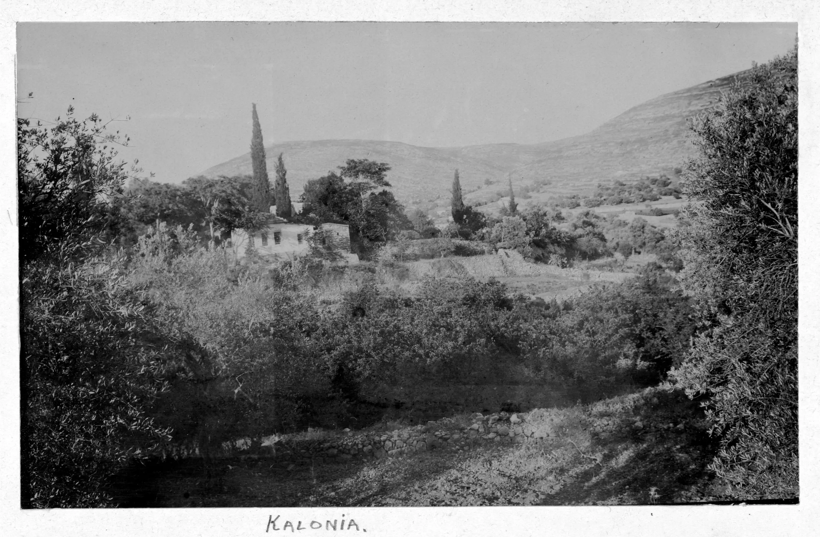
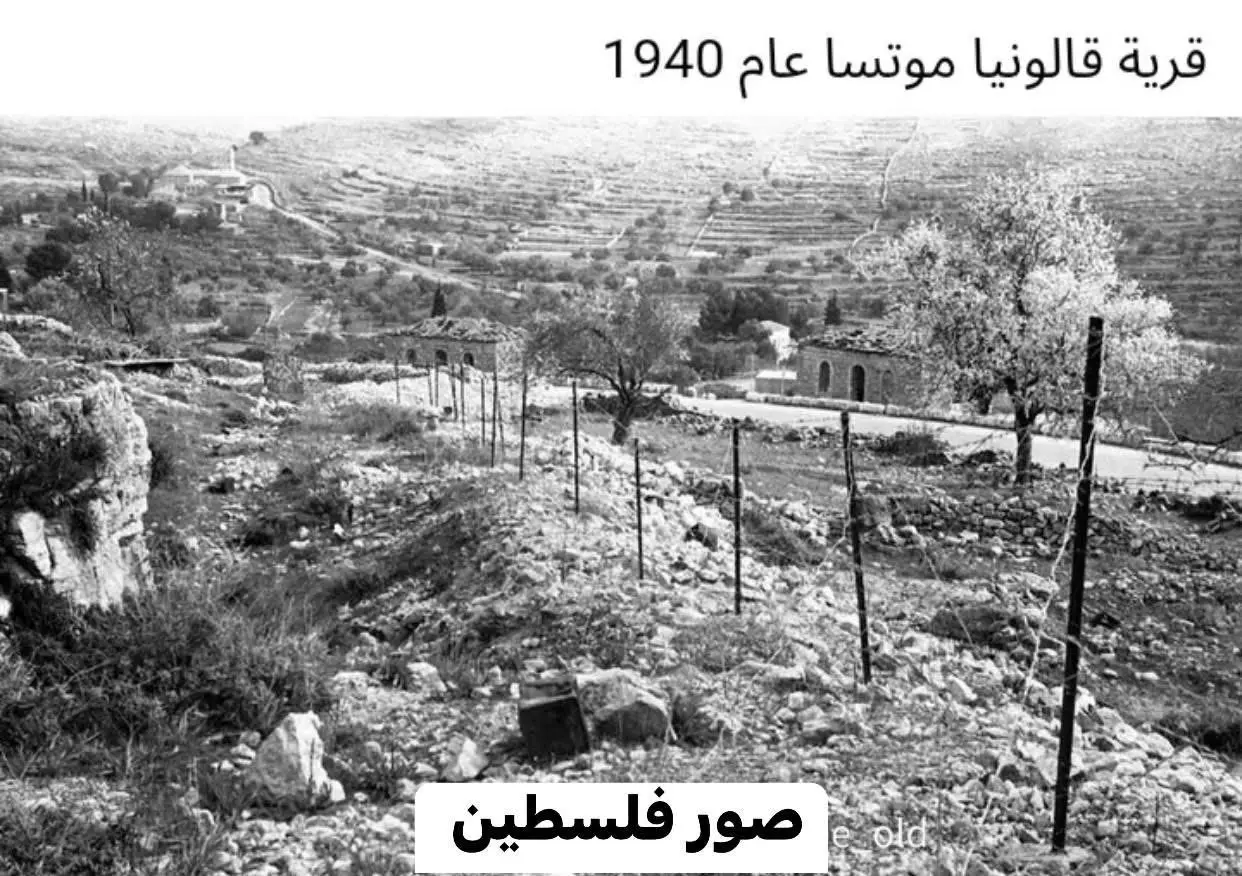
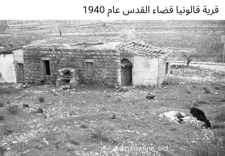
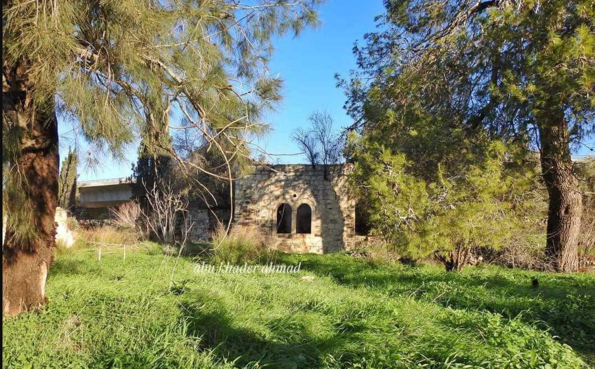
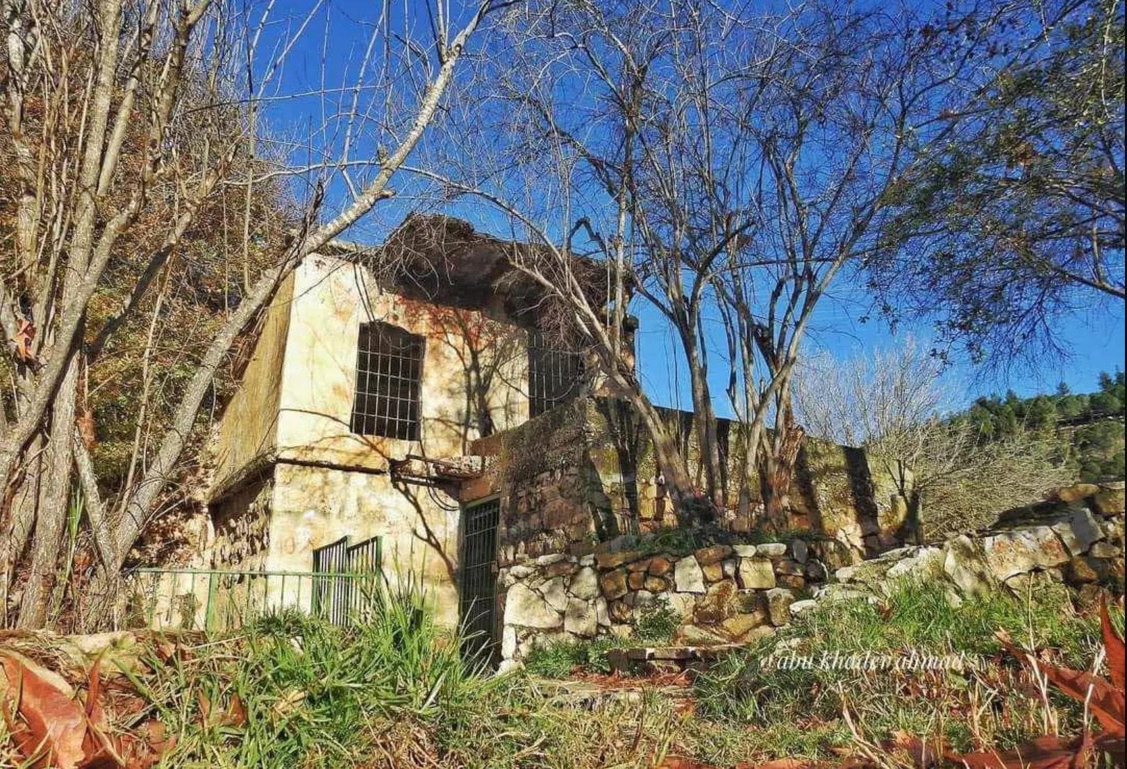
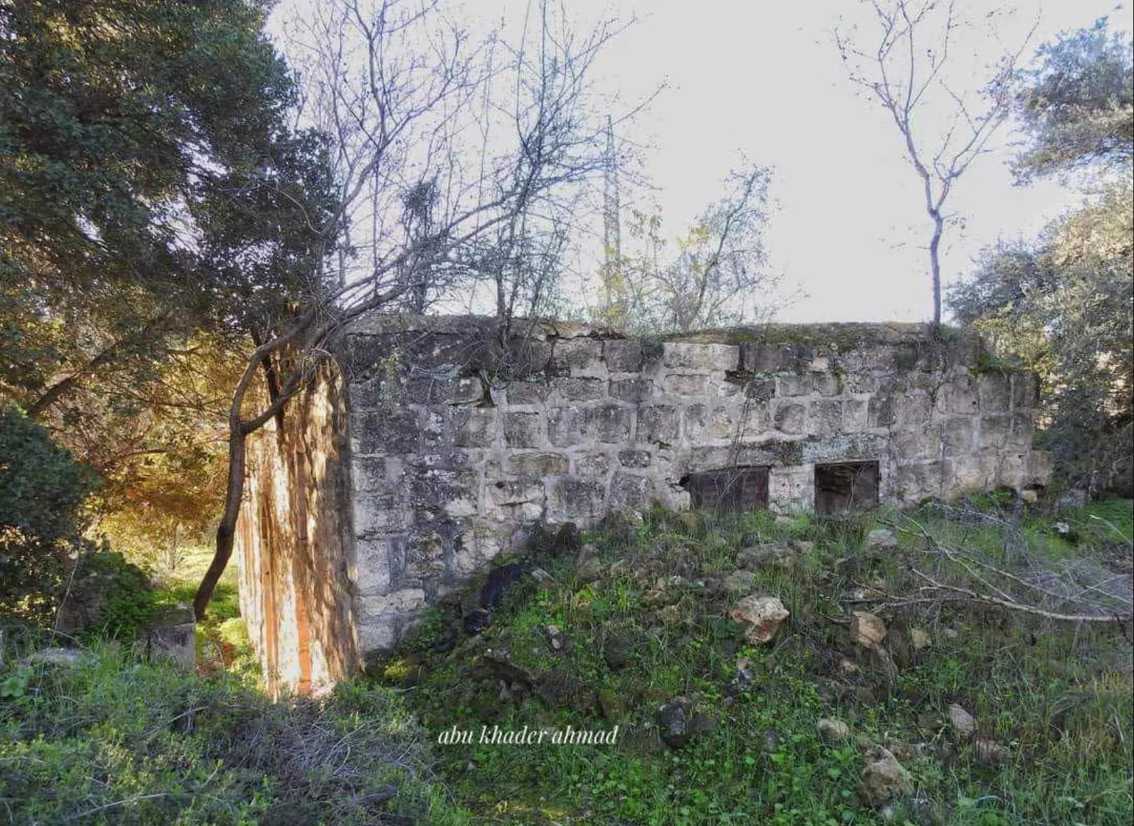
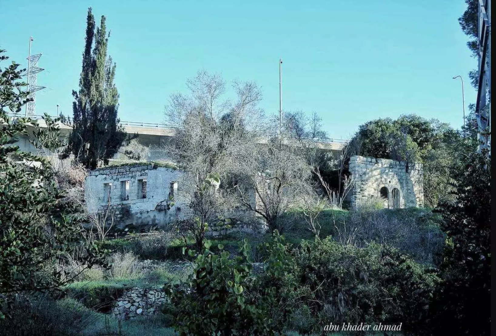
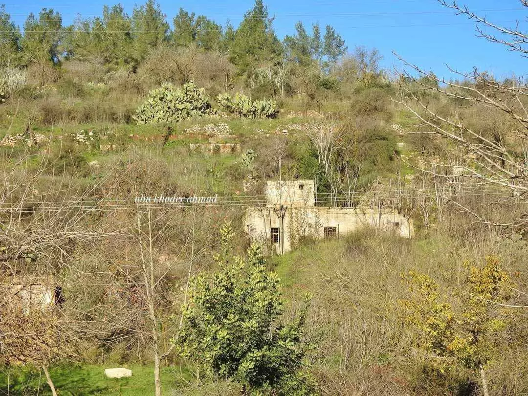
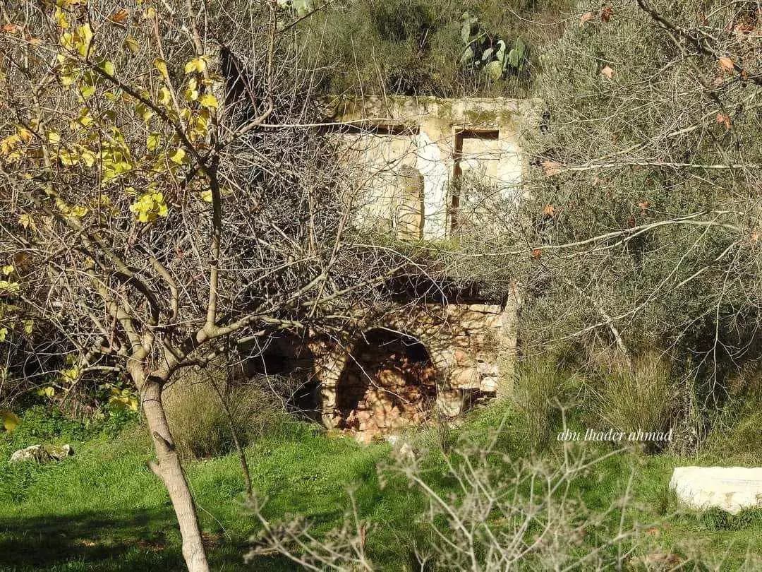
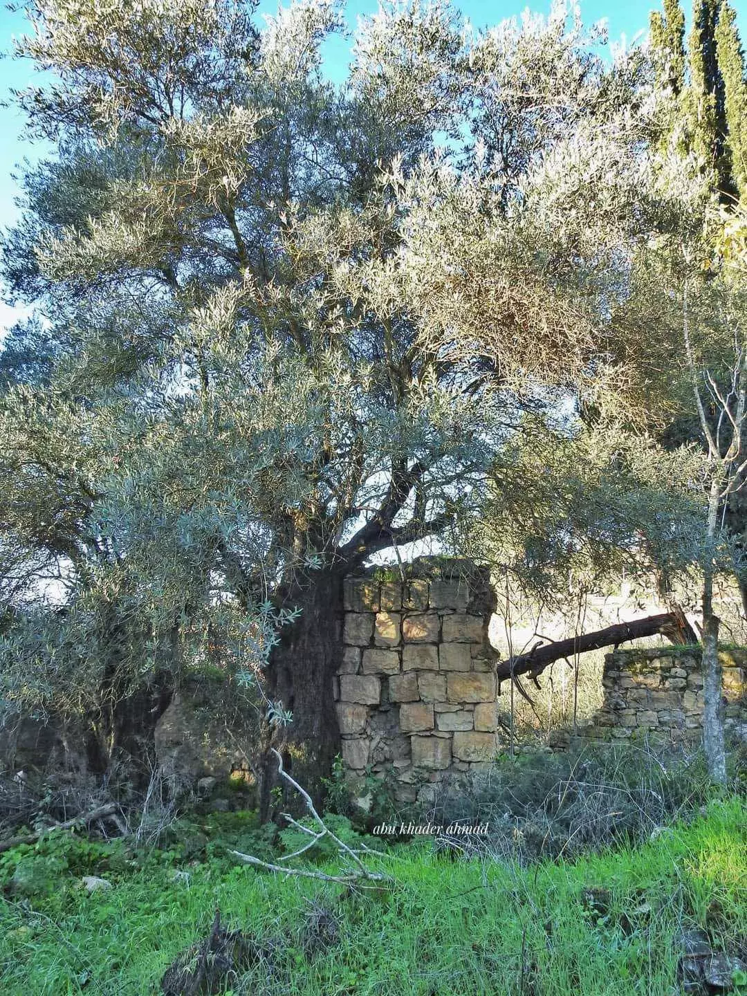
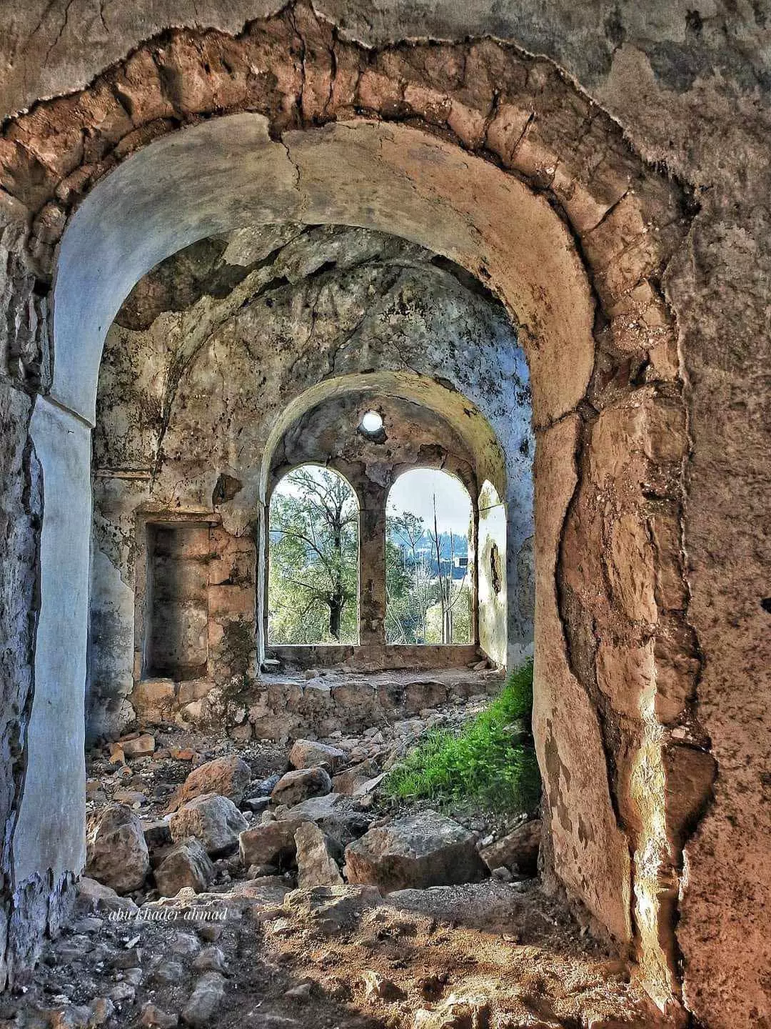
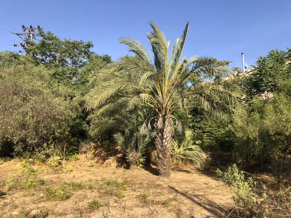
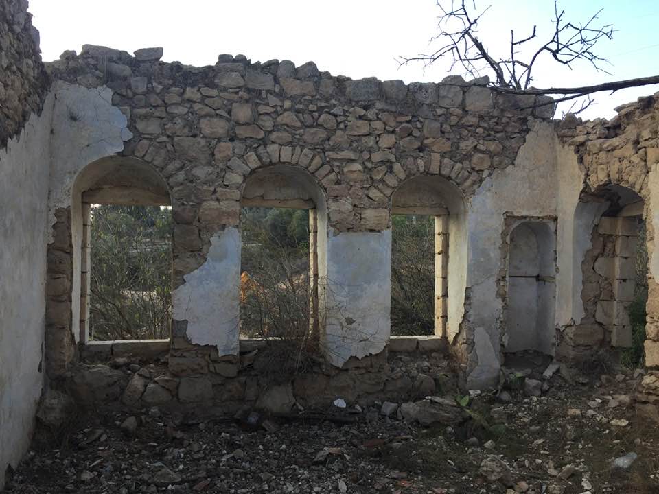
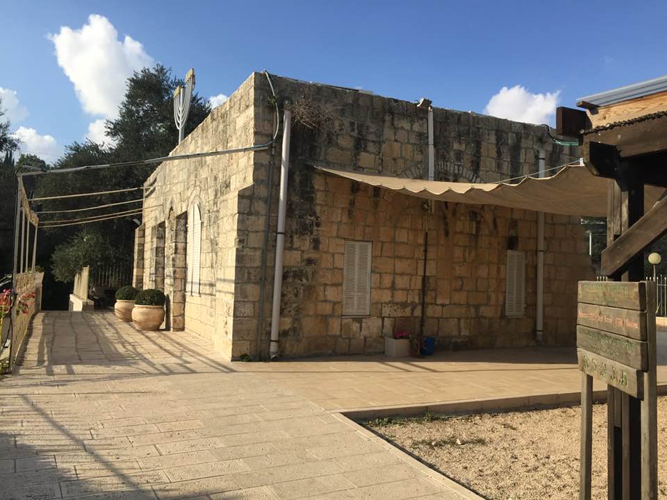
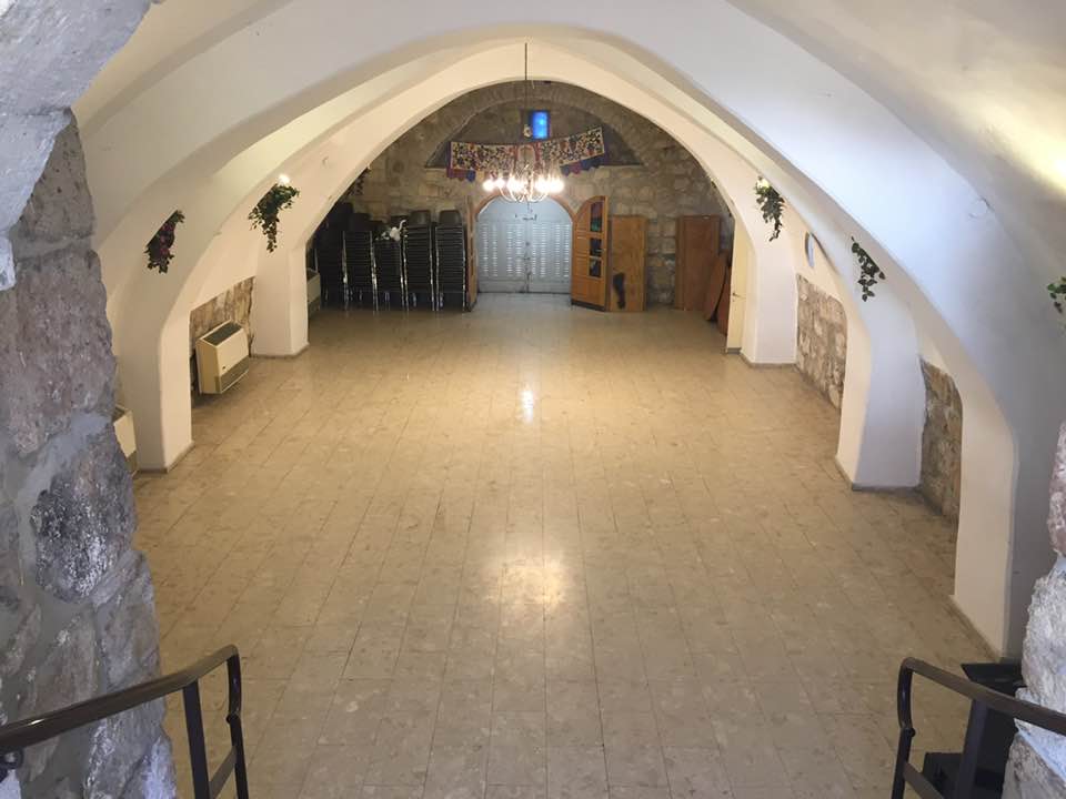
Village Before NakbaThe village stood on a mountain slope, facing southwest; Wadi Qalunya passed through its eastern edge. The village lay on the Jerusalem−Jaffa highway, and a dirt path linked it to neighboring villages. Qalunya is identified with the Canaanite town of Mozah (Joshua 18:26); its name was found stamped on pottery handles in Tall al-Nasba (171143). After A.D. 71 Vespasian settled 800 Roman soldiers in the town, which became a Roman settlement known as Colonia Amosa or Colonia Emmaus. The word colonia produced the Byzantine name, Koloneia, for the site. The status of the site in the early Islamic period has not been established, but the name was preserved in Crusader times as Qalonie or Qalunia and in Arabic as Qalunya. Mujir aI-Din al-Hanbali (d. 1522) reported that in 1192 it was a village near Jerusalem. In 1596, Qalunya was a village in the nahiya of Jerusalem (liwa' of Jerusalem) with a population of 110. It paid taxes on a number of crops, including wheat, barley, and olives, as well as on other types of produce, such as goats, beehives, and molasses. In the late nineteenth century, Qalunya was a moderate-sized village perched on the slope of a hill, 300 feet above a valley. Travelers reported that it had a 'modern' restaurant. The villagers tended orange trees and lemon trees that were planted around a spring in the valley.In 1859, Qalunya became the first location in the Palestinian countryside where Jewish immigrants acquired land for cultivation. Although a few settlers worked this land they did not live there on a regular basis until the early twentieth century, when a small settlement, Motza, was established. Qalunya was circular in shape and the majority of its houses were built of stone. It was divided into several quarters that were separated by winding streets. More recent construction expanded first to the northwest and then to the south, with houses scattered along the Jerusalem−Jaffa highway. In the mid-1940s, the Arab population consisted of 900 Muslims and 10 Christians. The village mosque, named after a Shaykh Hamad, lay on the eastern side of the site. Qalunya had a few shops and an elementary school. The villagers drew their water from the springs around the site. Agriculture was both rainfed and irrigated; the lands were planted in grain, vegetables, and fruit trees, including olive trees, and vineyards. In 1944/45 a total of 846 dunums was allotted to cereals; 1,022 dunums were irrigated or used for orchards, of which 200 dunums were planted with olive trees. Archaeological remains in the village included the ruins of an arched building. Two khirbas north of the village contained the foundations of buildings and artificial caves carved into the rock. Village Occupation and Ethnic CleaningQalunya was one of the main targets of Operation Nachshon (see Bayt Naqquba, Jerusalem sub-disctrict). Palmach units attacked Qalunya on 11 April, according to the History of the Haganah. Israeli historian Benny Morris writes, and the Haganah account confirms, that the occupying units spent two days systematically razing its houses to the ground. The New York Times also reported that Haganah units occupied Qalunya on 11 April and that they 'blew up a score of houses and left the entire village ablaze.'Israeli sources give differing accounts of how the village was depopulated. Morris claims that the villagers had already fled on 2 or 3 April as a result of an attack, but an Irgun Zvai Leumi broadcast stated at the time that the inhabitants of Qalunya had fled as a result of the Deir Yasin massacre on 9 April. The Times correspondent wrote that most villagers had been evacuated and the others were ordered out before the village was destroyed. An eyewitness account by an Anglo-Jewish resident of Jerusalem, Harry Levin, who accompanied the Palmach force during the assault on 11 April is an interesting commentary on all of these claims. As he described the event, 'Suddenly the village seemed to erupt. Our mortars started it, and at once became a bedlam of answering fire ... They fired wildly to all points of the compass ... Suddenly an explosion that seemed to rip open the hillside; shrieks of terror. Our shock troops and sappers had reached the houses ... More explosions ... In half an hour it was over.' Levin counted fourteen dead 'but there were more.' When Levin left, 'sappers were blowing up houses. One after another the solid stone buildings, some built in elaborate city style, exploded and crashed…' Zionists Colonies on Village LandsMevasseret Yerushalayirn (165134) was established in 1956 on village land. It was later joined with the settlement of Ma'oz Tziyyon (164133), built in 1951 on the lands of al-Qastal , to form a Jerusalem suburb called Mevasseret Tziyyon (164134). This suburb is northwest of the village site, largely on village land.The settlement of Motza was built close to the village on land purchased by Jewish colonists in the 1850s. It was destroyed during fighting between Palestinians and Zionist settlers in July 1929 and was rebuilt as Motza Tachtit (166133) in 1930. Three years later, the settlement of Motza 'Illit (165133) was established nearby. Both were abandoned during the war of 1948 but were later repopulated; they are now suburbs of Jerusalem and are close to, but not on, the village lands. The Village Today Village TodayOnly a few houses still stand, in the southwestern part of the site, by the cemetery. They have arched doors and windows. One of the houses is now occupied by a Jewish family. Stone rubble, parts of collapsed cement roofs, and iron window frames are scattered throughout the site. An old synagogue, built in 1871, still stands; it has arched gates and windows. The wild grass that grows on the site is burned off every year to clear the approaches to the nearby settlement. The village terraces have been preserved. Almond, fig, and olive trees, along with cactuses, grow on the terraces and along the bottom of the slope.SourceDr. Walid al-Khalidi, 1992: All That Remains. |
||||||||||||||||||||||
| Related Maps | Town Lands' Demarcation Maps خرائط للقضاء توضح حدود القرى والاودية Town's map on MapQuest View from satellite Help us map this town at WikiMapia |
|||||||||||||||||||||
| Related Links | Wikipedia's Page Facebook Page Google Search Google For Images Google For Videos |
|||||||||||||||||||||
| More Information | مخطط البلد في كتاب كي لا ننسى في كتاب بلادنا فلسطين المزيد من موقع هوية |
|||||||||||||||||||||
- كتاب قرية قالونيا المهجرة - إعداد: فخري أحمد الخطيب
- لماذا يجب ان نعود
- لماذا نرفض التعويض بديلا للعودة
- اغنية اهداء الى المرحومتين ستي زريفة سلامة وستي معزوزة عثمان
- من مقدمة كتاب قريتي قالونيا - للأستاذ غالب محمد سمرين
- عيون بلدتنا قالونيا
- مذكرات ابن البلد المناضل حمدي مطر
- مشاركة ابناء القرية في بدايات النضال الفلسطيني بدءا من حركة القوميين العرب
- صفحات مضيئة من نضال ابناء القرية / بقلم حمدي مطر
- في الذكرى الستين لطردنا من قالونيا
- شهداء قرية قالونيا
- على قالونيا ابكي
- المفتاح وموسم اللوز
- صورة وحكاية موعد على عين الليمونة ( الصورة بنفس العنوان )
- كاتيوشا كاتيوشا
- أخر قصيدة لمظفر النواب
- قصيدة ثوار بلادي لراني اسماعيل منشورة على موقع حركة أبناء البلد
- أيار .... يعني حق العودة
- من فتيات قالونيا
- تقرير عن قالونيا نزل في صفحة فلسطين تراث وامجاد في الفيس بوك
- حريق في قالونيا بتاريخ 26-6-2012
- قالونيا في سطور: الموقع الجغرافي, العائلات , الشهداء , الخرب والاثار ..الخ
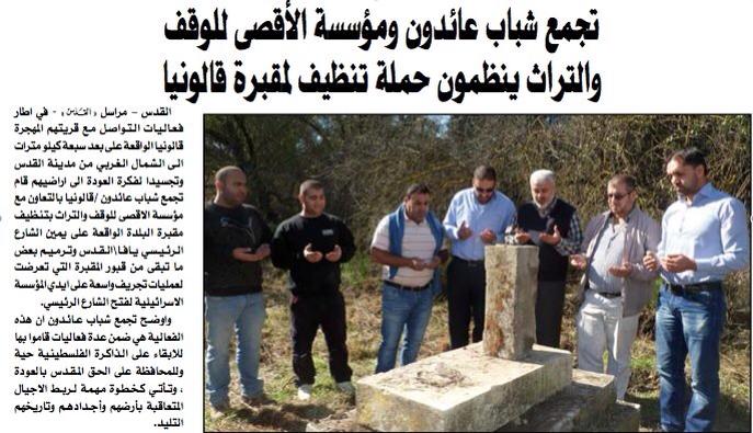
- تنظيف مقبرة " قالونيا"
- اكتشاف اثار في قالونيا
- شخصيات من قالونيا
- مجموعة قصص عن قالونيا وابناء قالونيا قبل النكبه
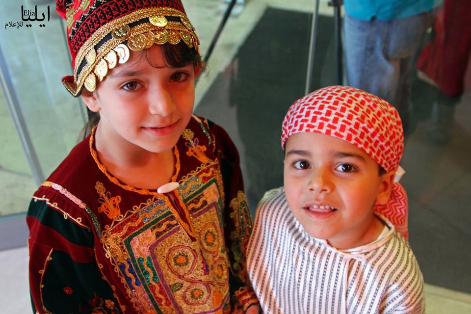
- عاداتنا وتقاليدنا في قالونيا قبل النكبة
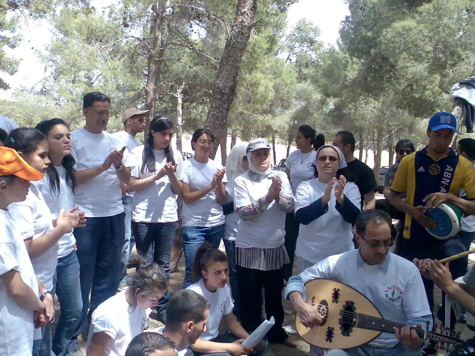
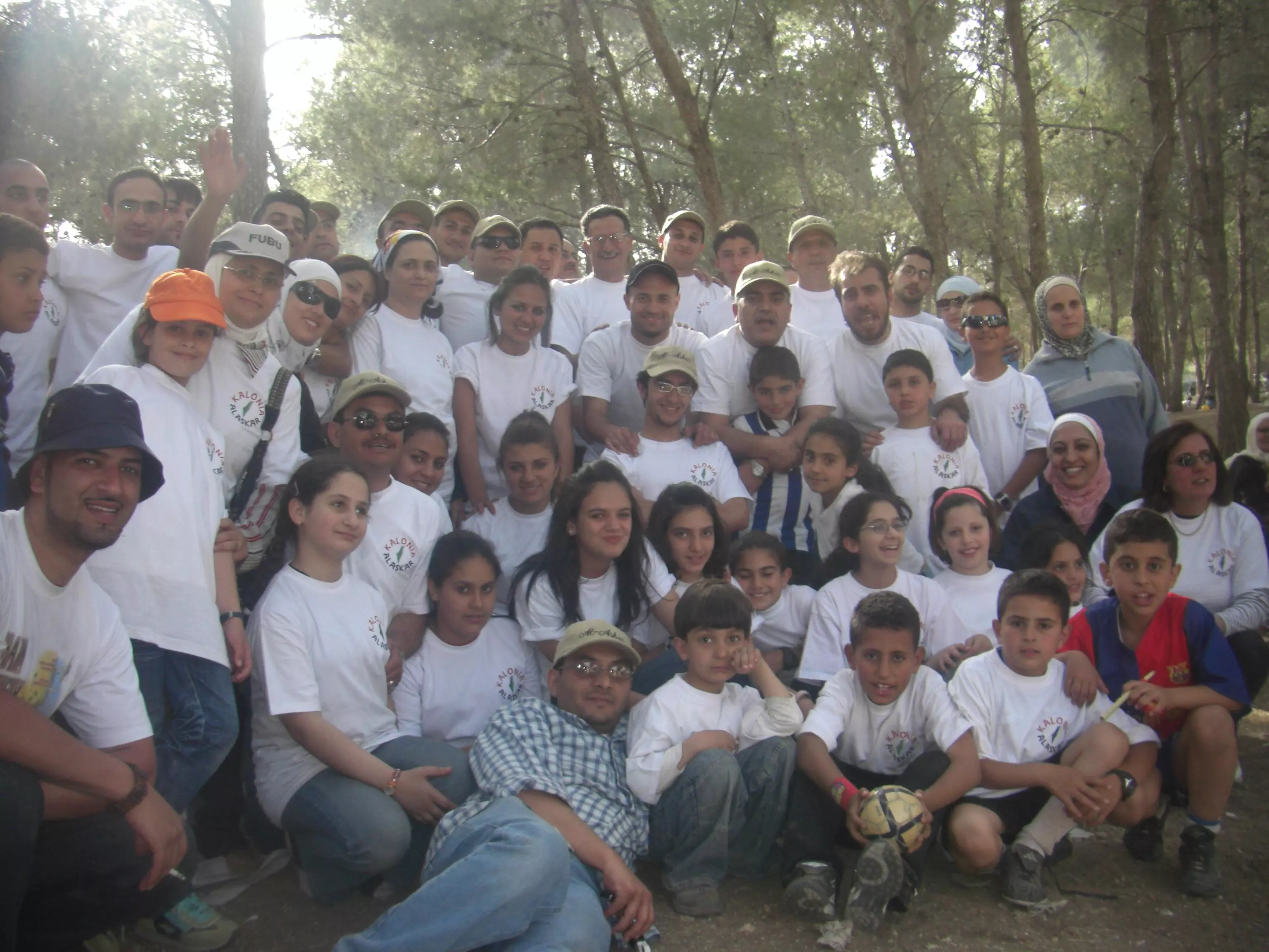
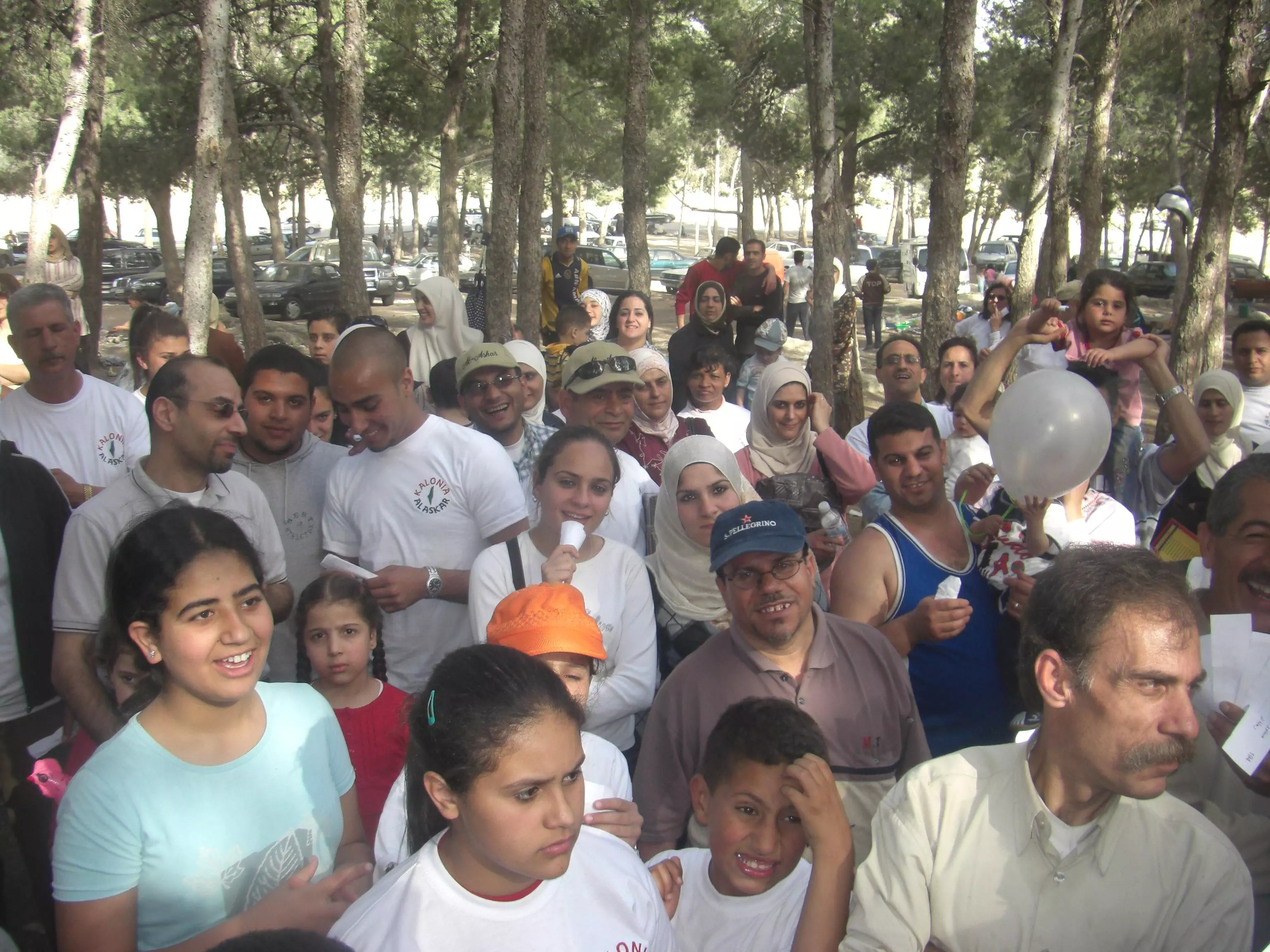
- فعاليات شباب عائدون – قالونيا في الذكرى الخامسه والستون ل احتلال قريتهم قالونيا
- Qalunya Village – Jerusalem
- شباب عائدون قالونيا
- نبذة تاريخية عن قرية قالونيا (قضاء القدس) من كتاب (كي لا ننسى)
- ندوة بعنوان النكبة ... التاريخ والمستقبل من فعاليات قالونيا على درب العودة
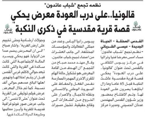
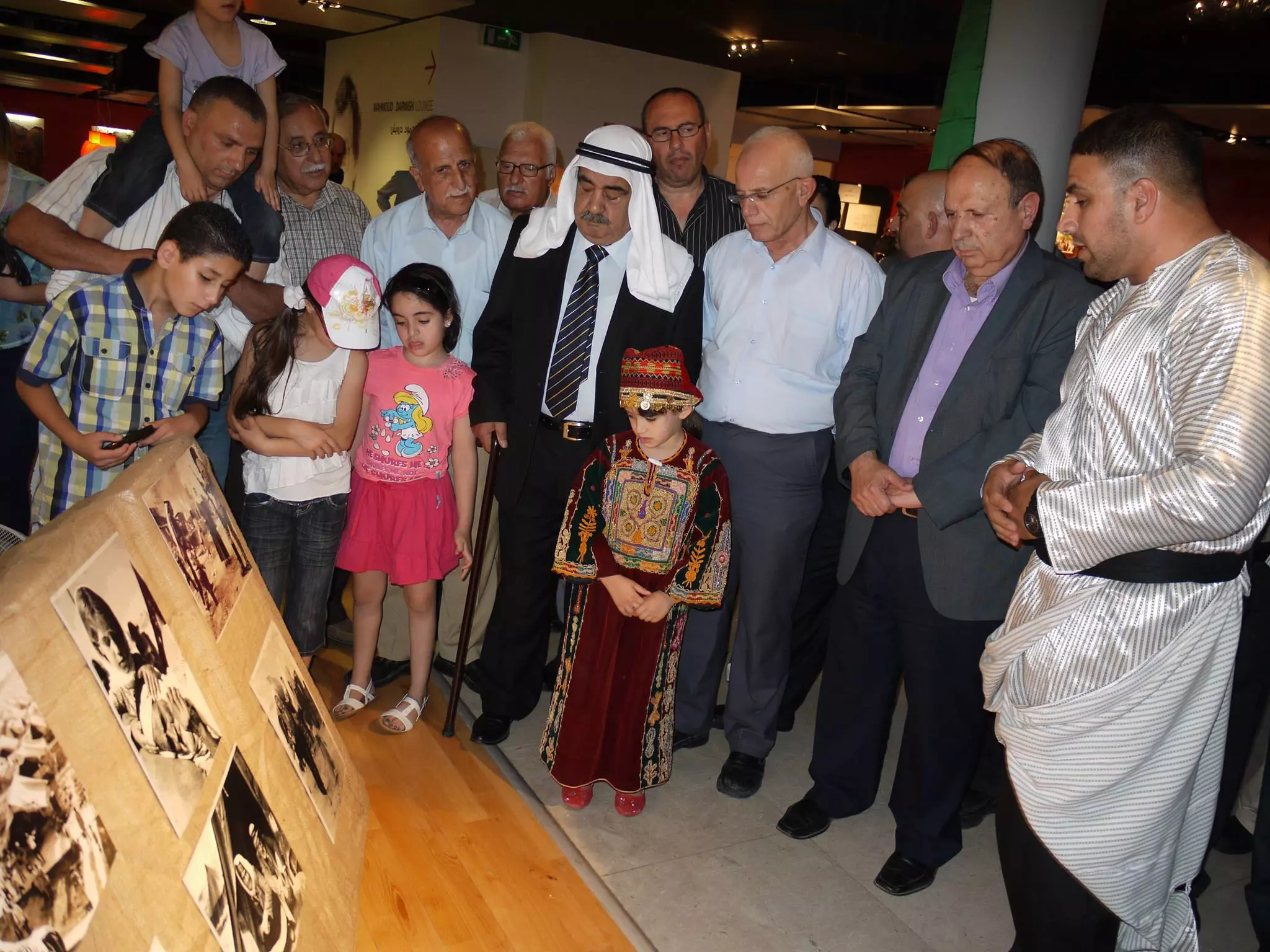
- شباب عائدون يختتم معرض قالونيا بالقدس
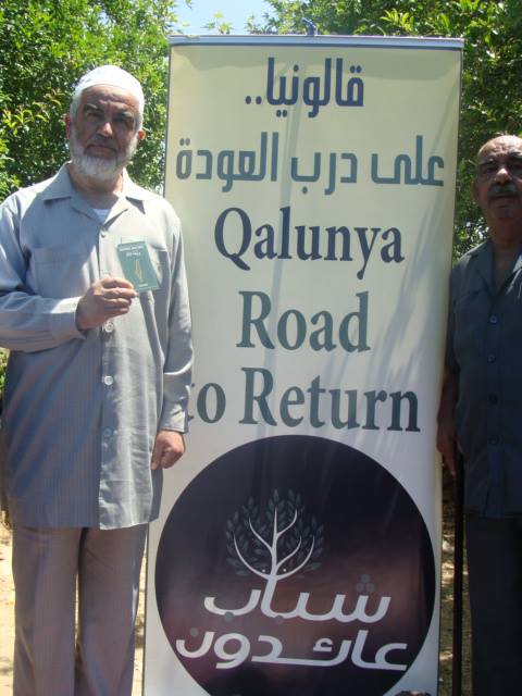
- قالونيا على درب العودة
- اليوم الأول من فعاليات قالونيا ... على درب العودة
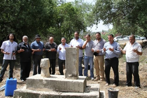
- المرحلة الثانية من تنظيف وترميم مقبرة قرية قالونيا - مقبرة الشهدا
- "الاقصى" وأهالي قالونيا يتطوعون لترميم مقبرة القرية
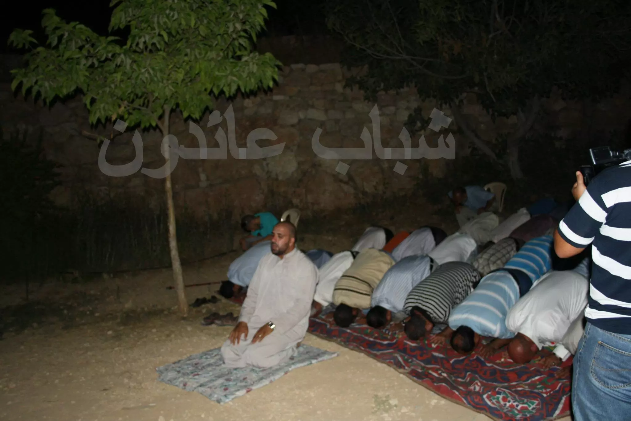
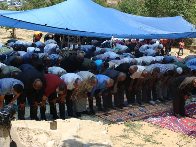
- أهالي قالونيا يقيمون صلاة الجمعة بأراضي القرية برعاية شباب عائدون قالونيا
- كتاب قريتي قالونيا للاستاذ غالب سمرين (مجموعة قرية قالونيا – شباب عائدون قالونيا)
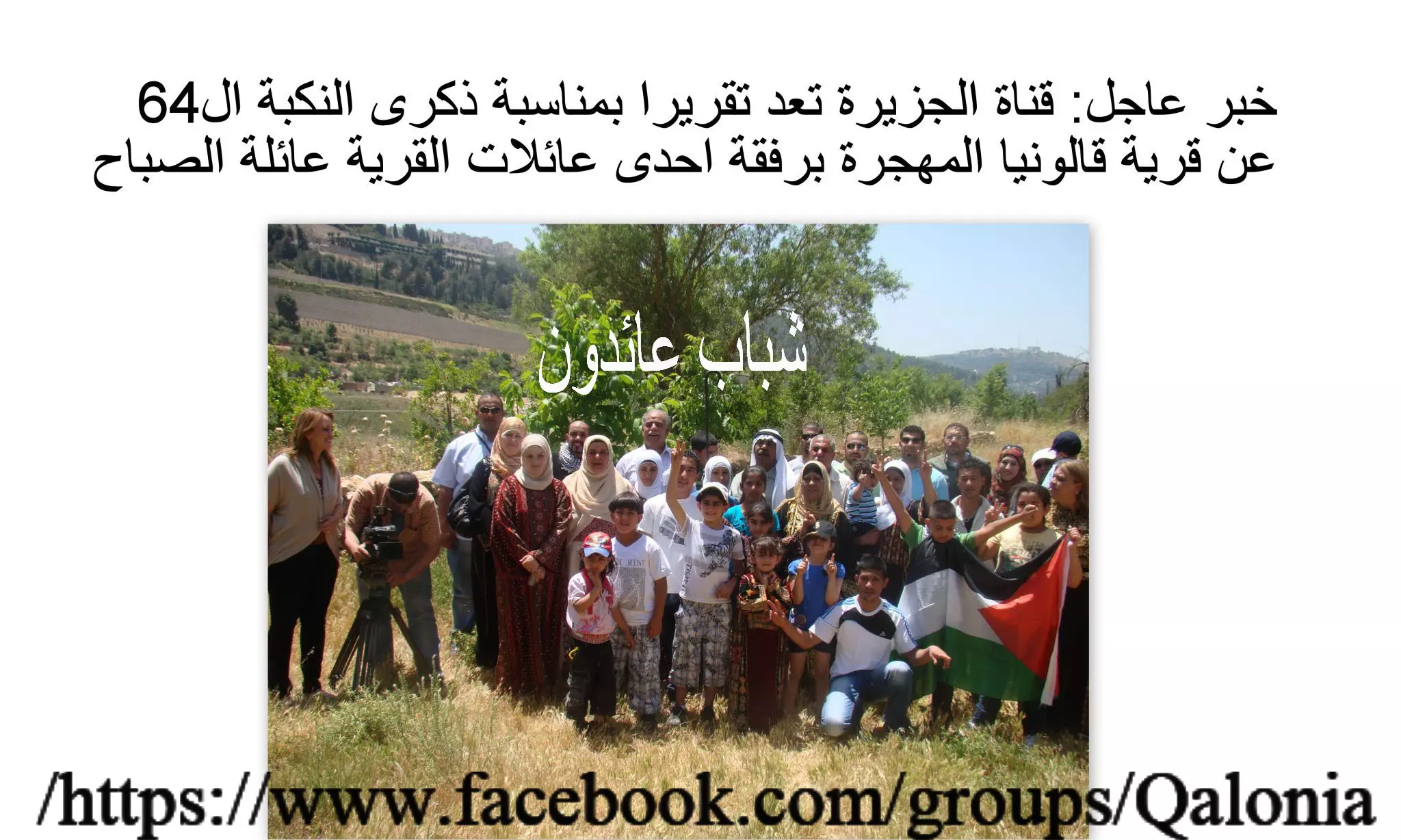
- الجزيرة: قرية قالونيا.. عندما يستأنس المهجرون بالعودة
- Village House In 1986
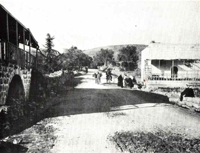
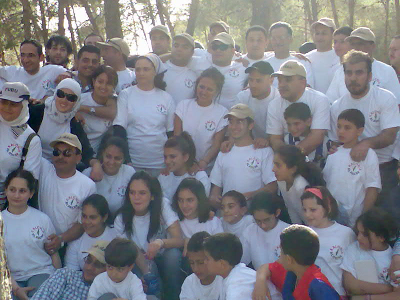
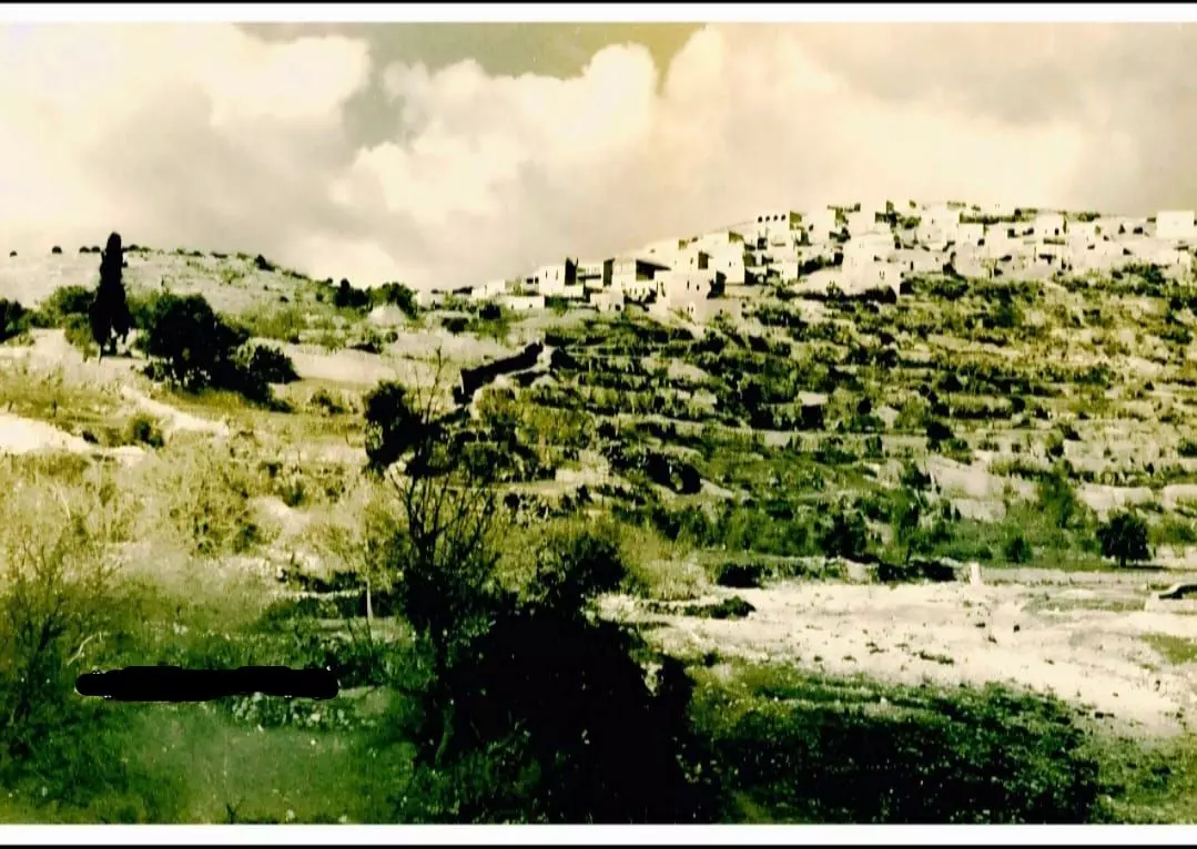
Scanned from "All That Remains" by Dr. Walid Khalidi 1 - A rare panoramic picture of Qalunya soon after occupation & before destruction, April 10th 1948
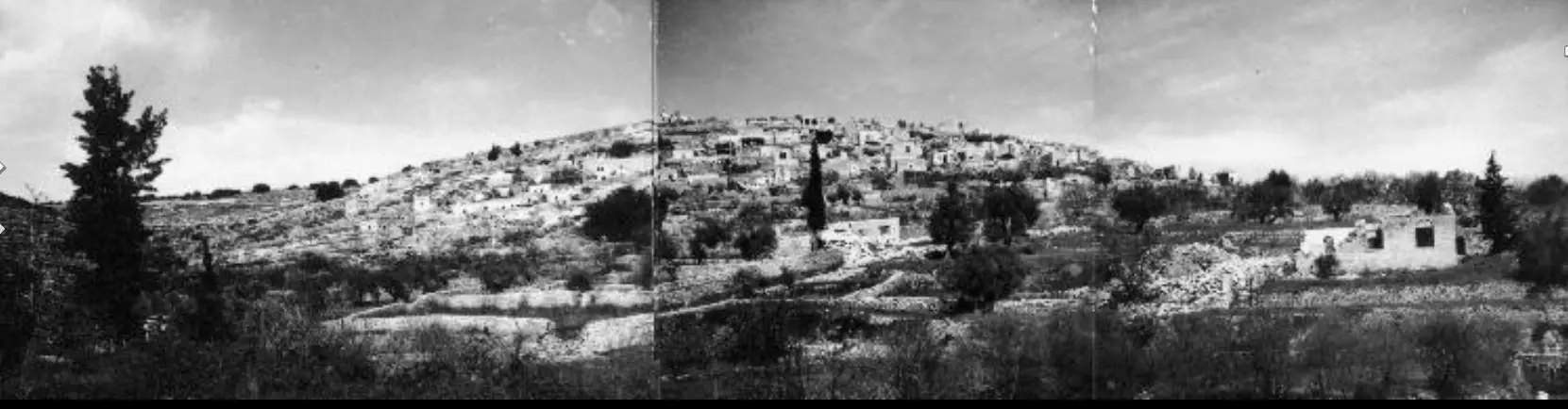
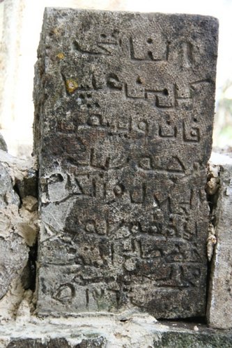
- قرية قالونيا : منظر عام للقريه حيث يمكن رؤية معظم بيوت القريه وقد تم تصوير هذه الصوره بتاريخ 10-4-1948

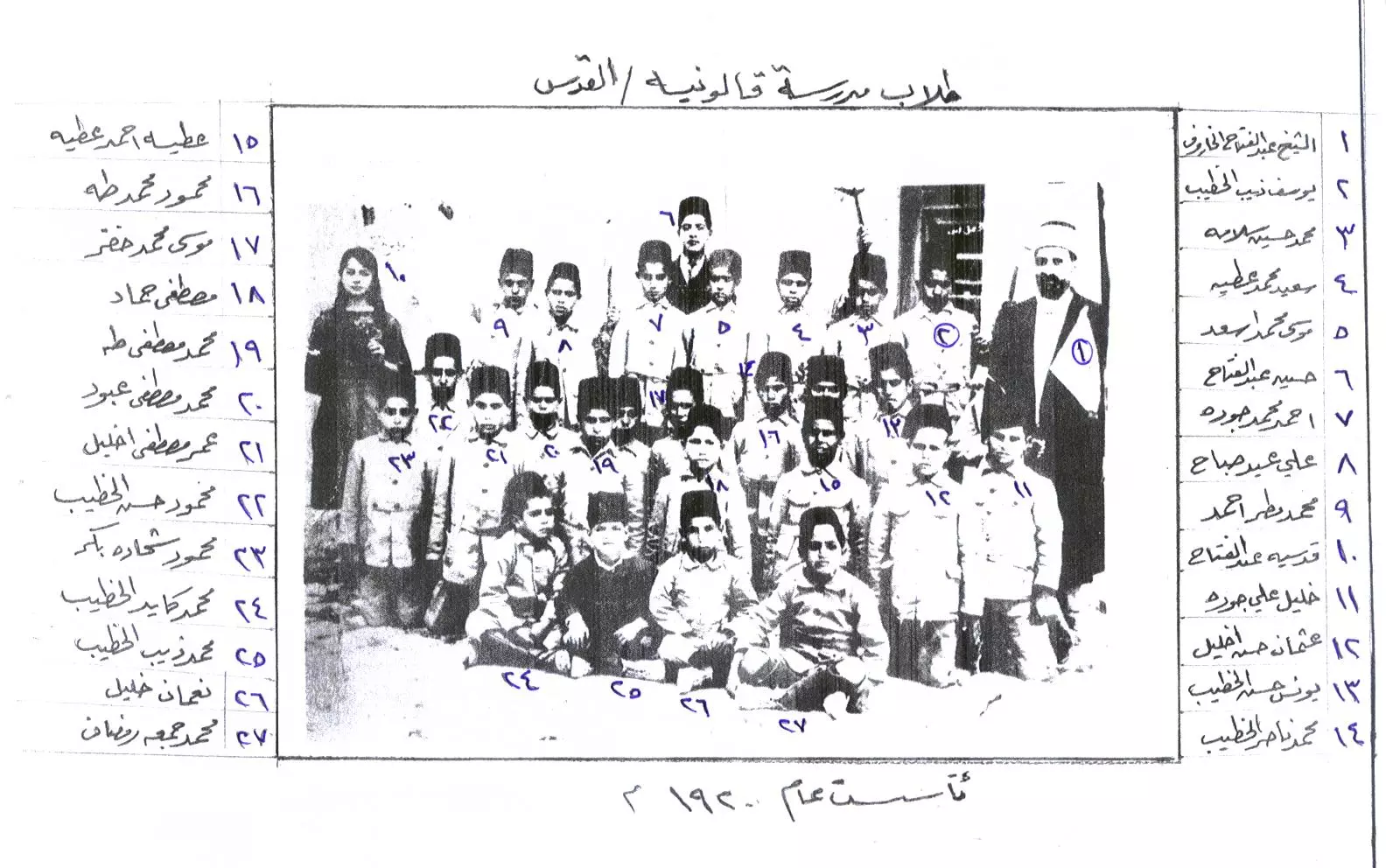
Posted by صفافي أصيل 7 - طلاب مدرسة قالونية قبل النكبة، اُنقر الصورة لتكبيرها.
Posted by kayed 16 - Qalunya's Hill Side In The 1930s
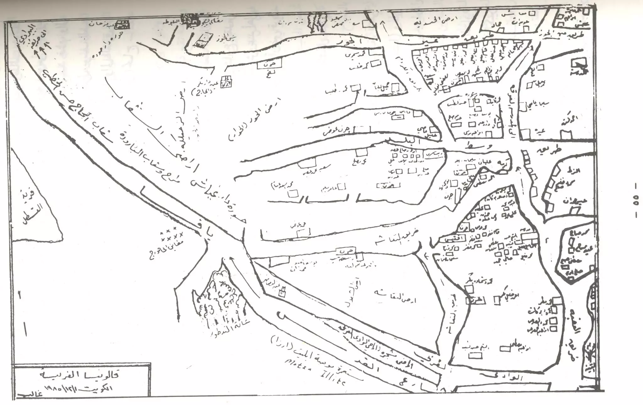
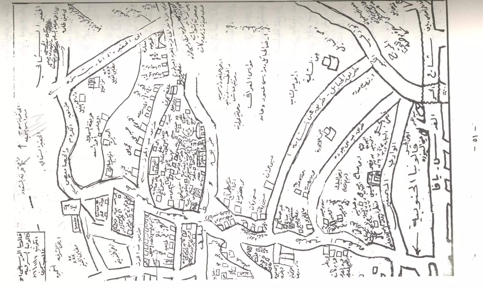
3 - خارطة اراضي قالونيا حسب سجلات مسح الاراضي عام 1933. اُنقر الخارطة لتكبيرها.
Posted by خالد رمضان 1 - رحلة شباب من قرية قالونيا في الاردن
Posted by خالد رمضان 1 - رحلة شباب من قرية قالونيا في الاردن
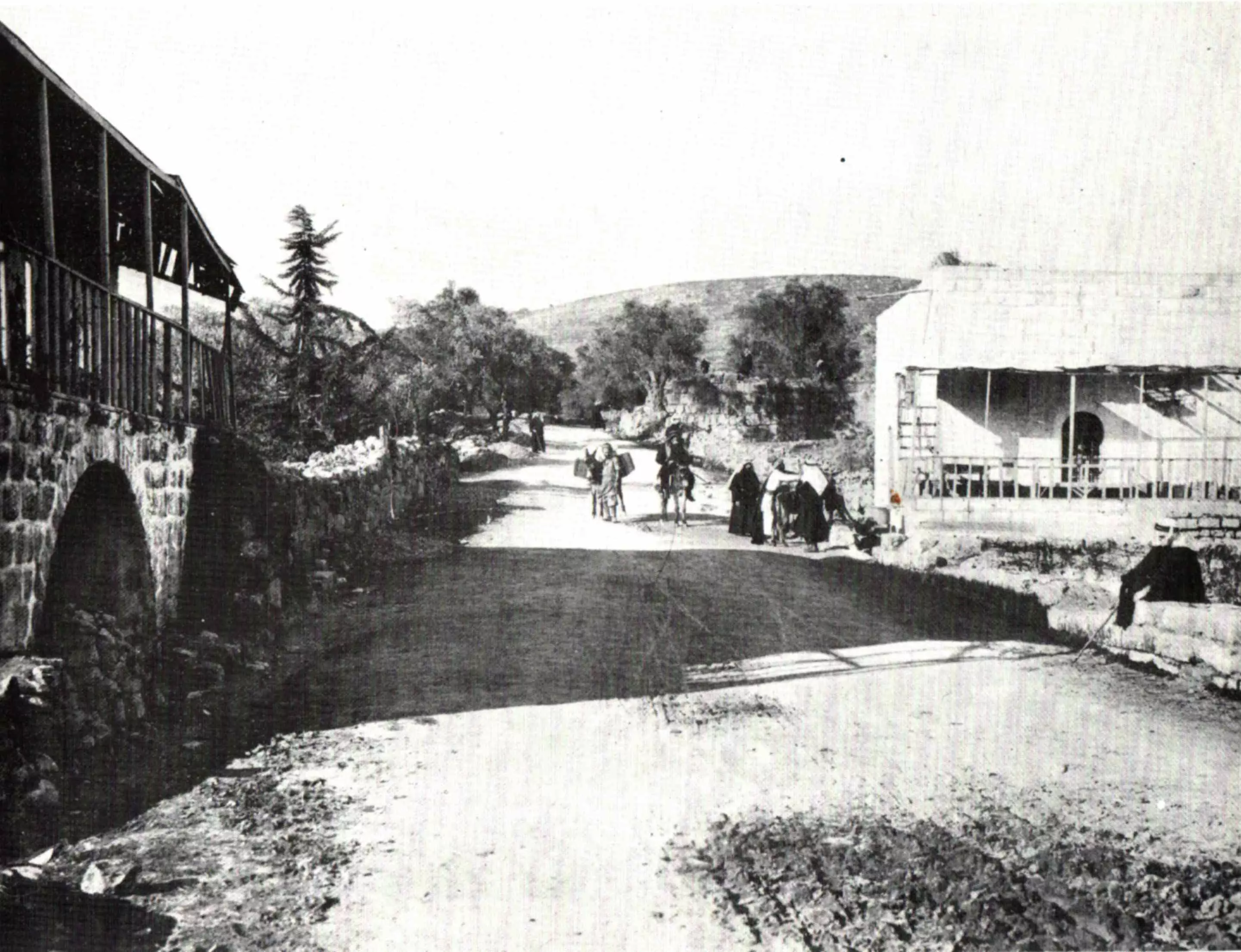
Posted by خالد رمضان 7 - صورة في قالونيا عام 1893 منقولة
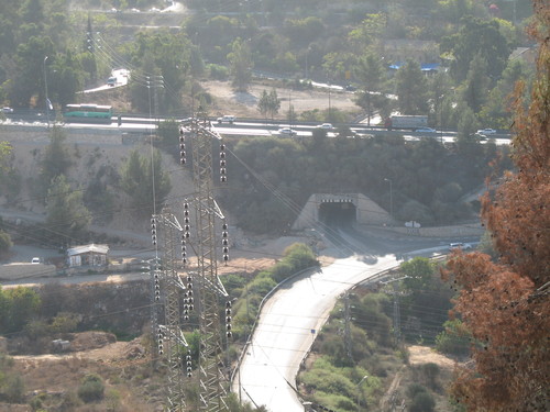
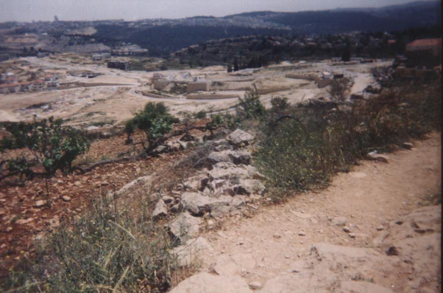
Posted by خالد رمضان - Ruins of the destroyed Palestinian village, and the exclusive Jewish colony appears in the background.
Posted by Noga Kadman 1 - Ruins of the destroyed Palestinian village, and the exclusive Jewish colony appears in the background.
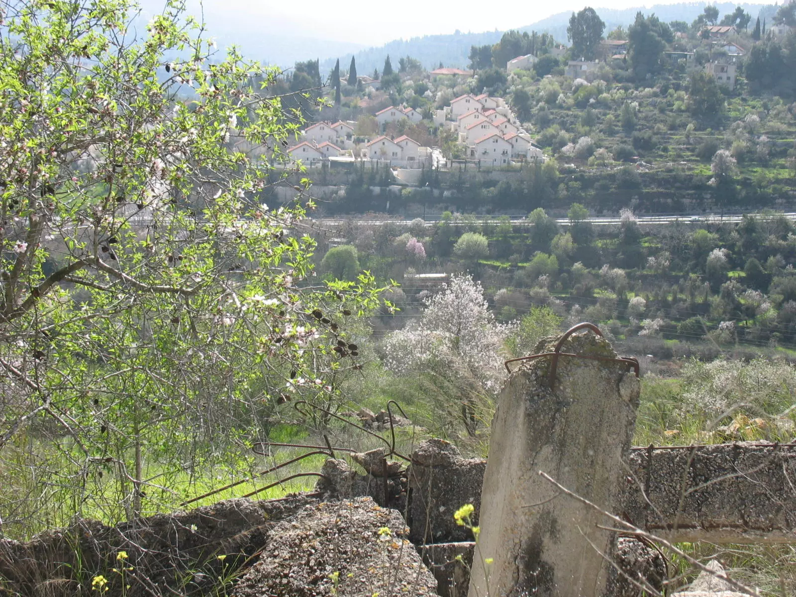
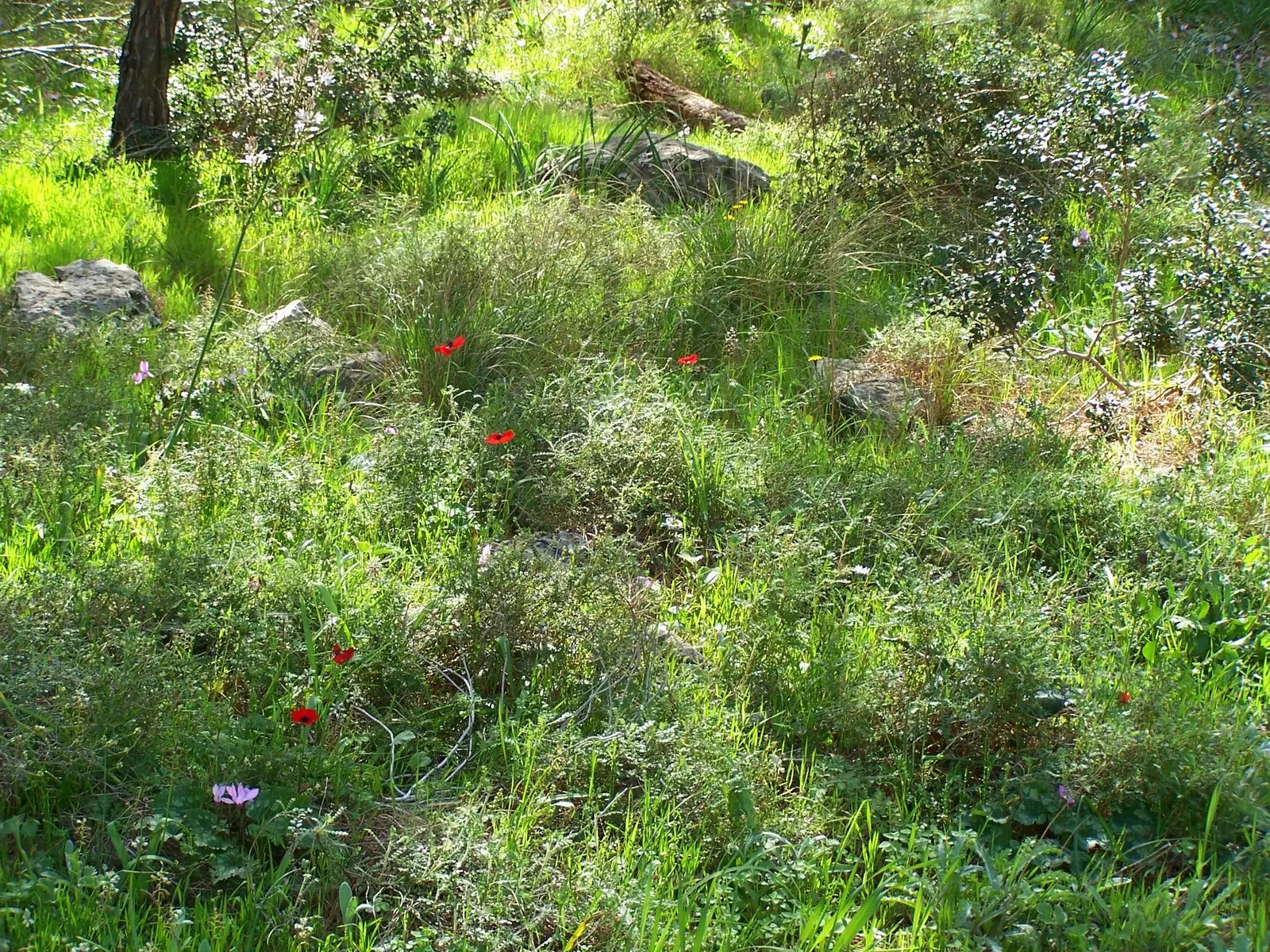
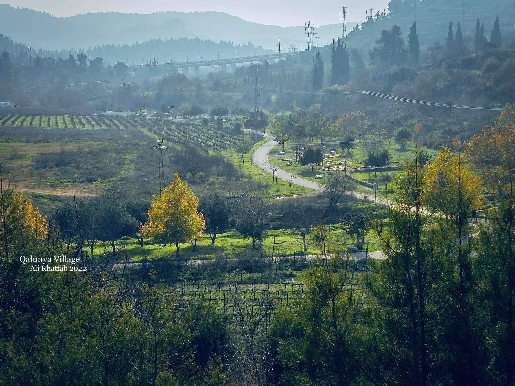
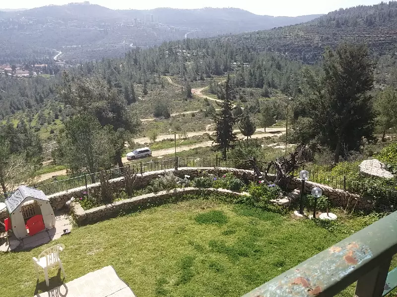
Posted by Noga Kadman - Village lands during the spring season

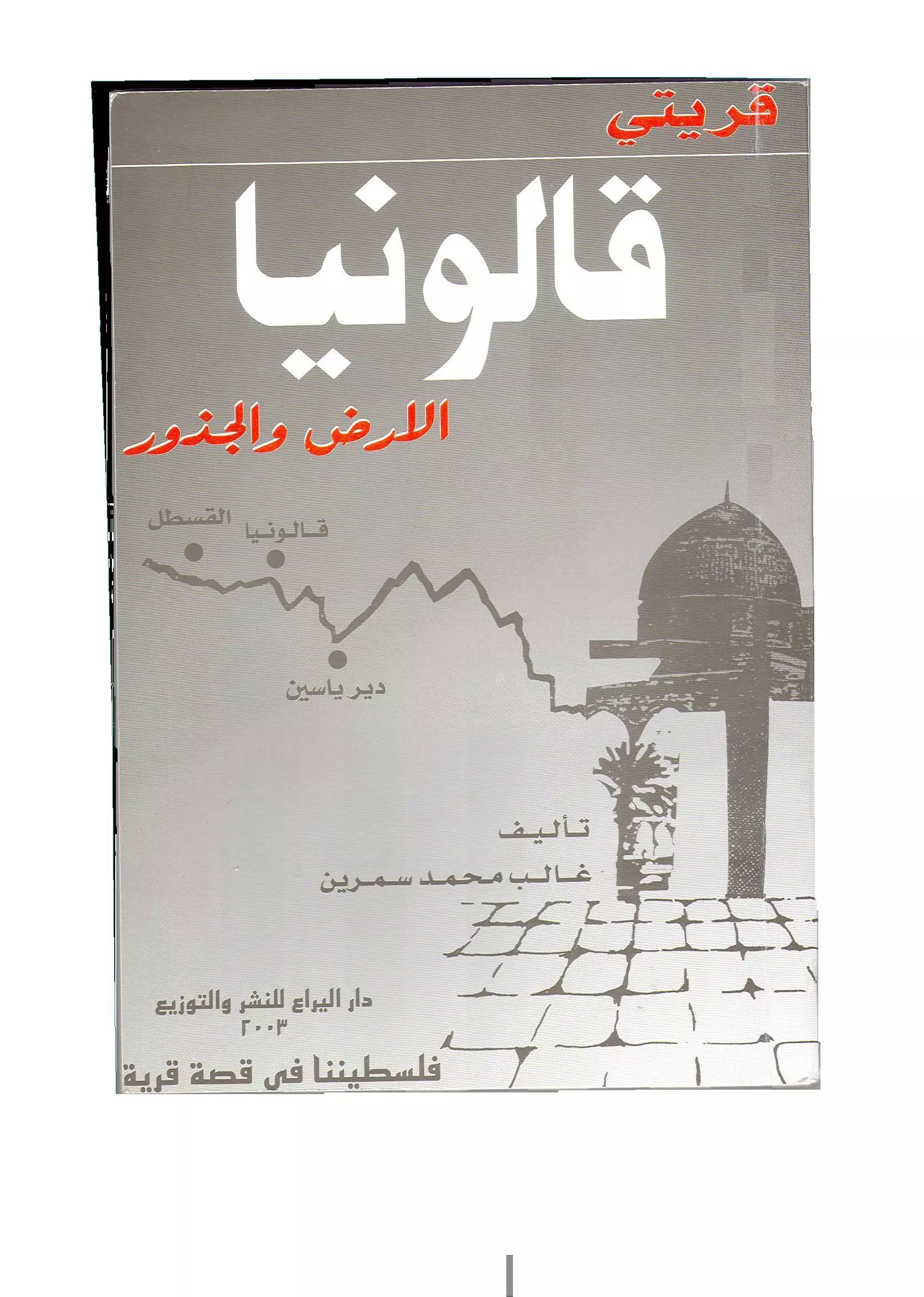
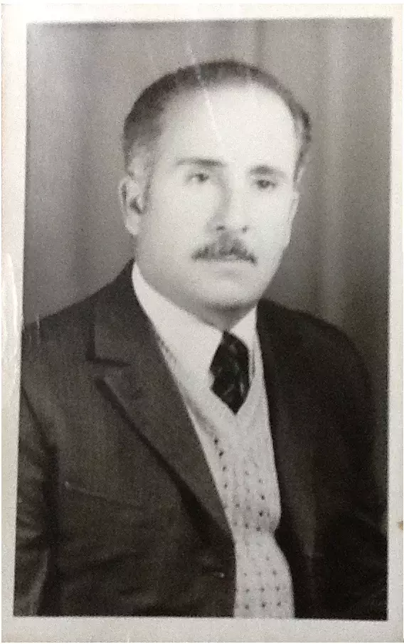
Posted by Noga Kadman 1 - الأستاذ غالب محمد سمرين/ مؤلف كتاب - قريتي قالونيا - الأرض والجذور- فلسطيننا في قصة قرية

Posted by خالد رمضان 3 - صورة الغلاف من كتاب قريتي قالونيا - تأليف الأستاذ غالب محمد سمرين
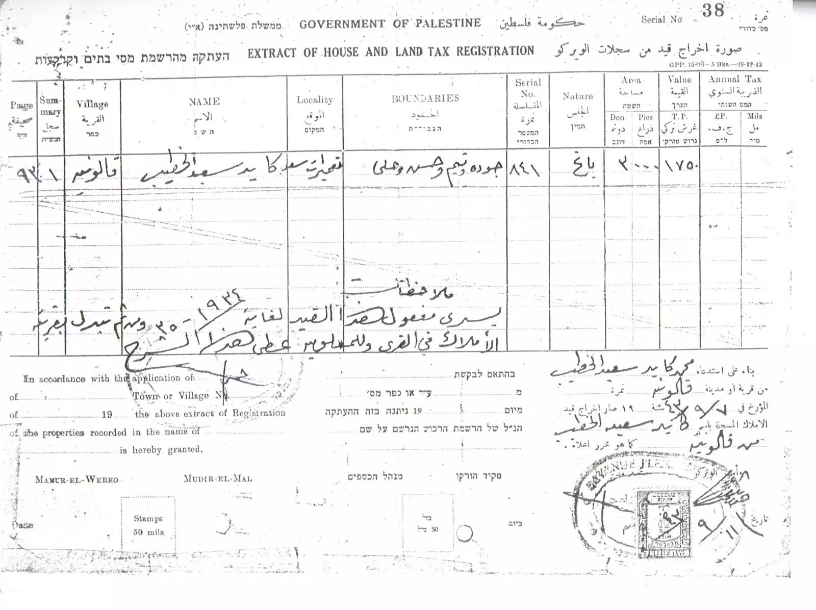
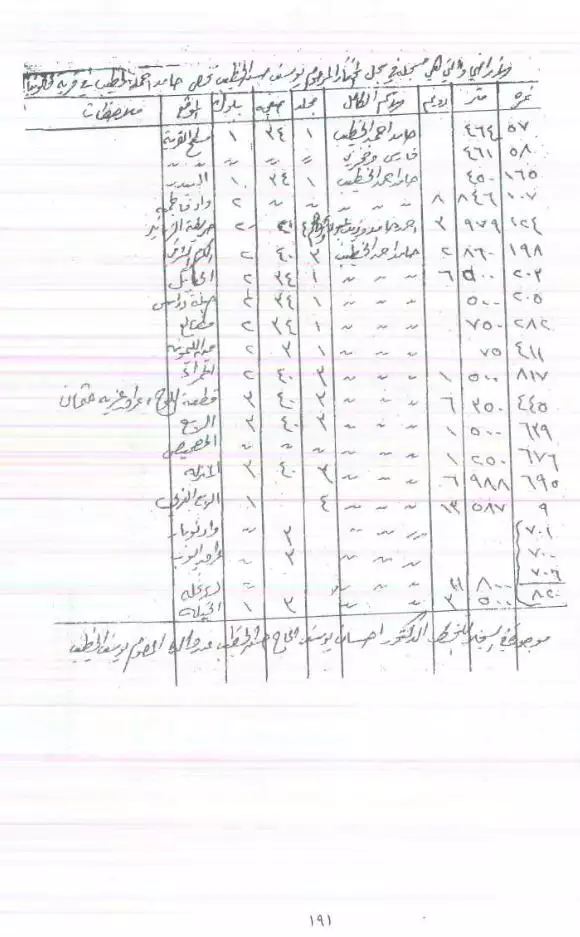
Posted by خالد رمضان - land registration
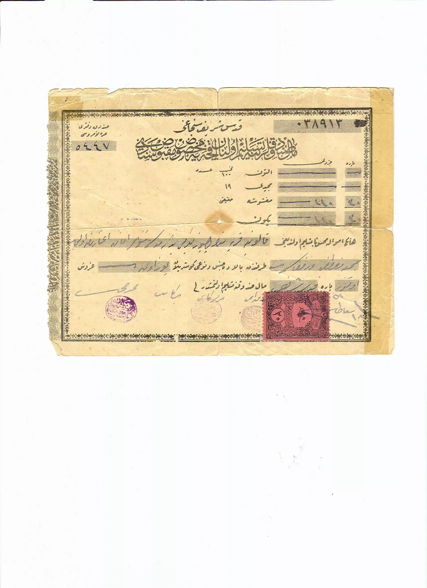
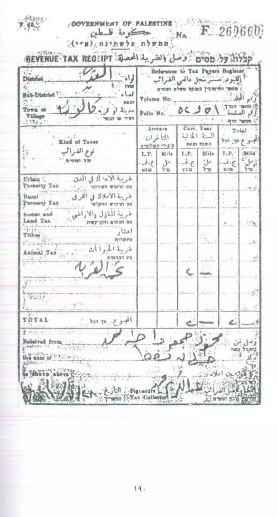
Posted by kayed - وصل مقبوضات مسددة للسلطة العثمانية في فلسطين / عن اراضي المرحوم جمعه مصطفى رمضان عسكر - عام 1328 هجري قبل ماية عام وعام
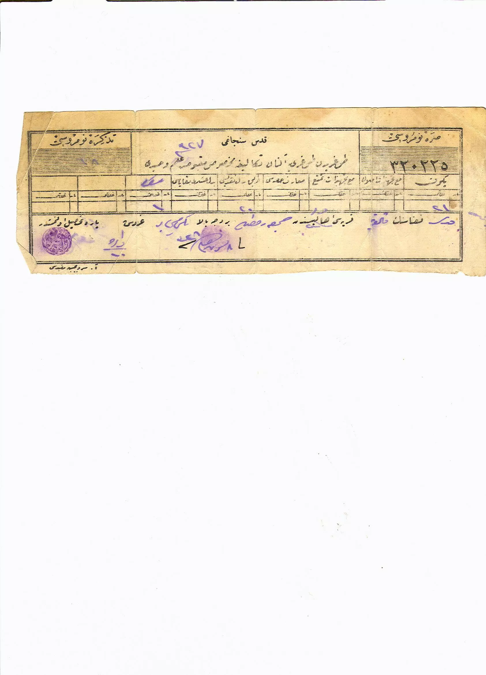
Posted by خالد رمضان - وصل مقبوضات قبل 101 سنة / عن اراضي المرحوم جمعه مصطفى رمضان عسكر -
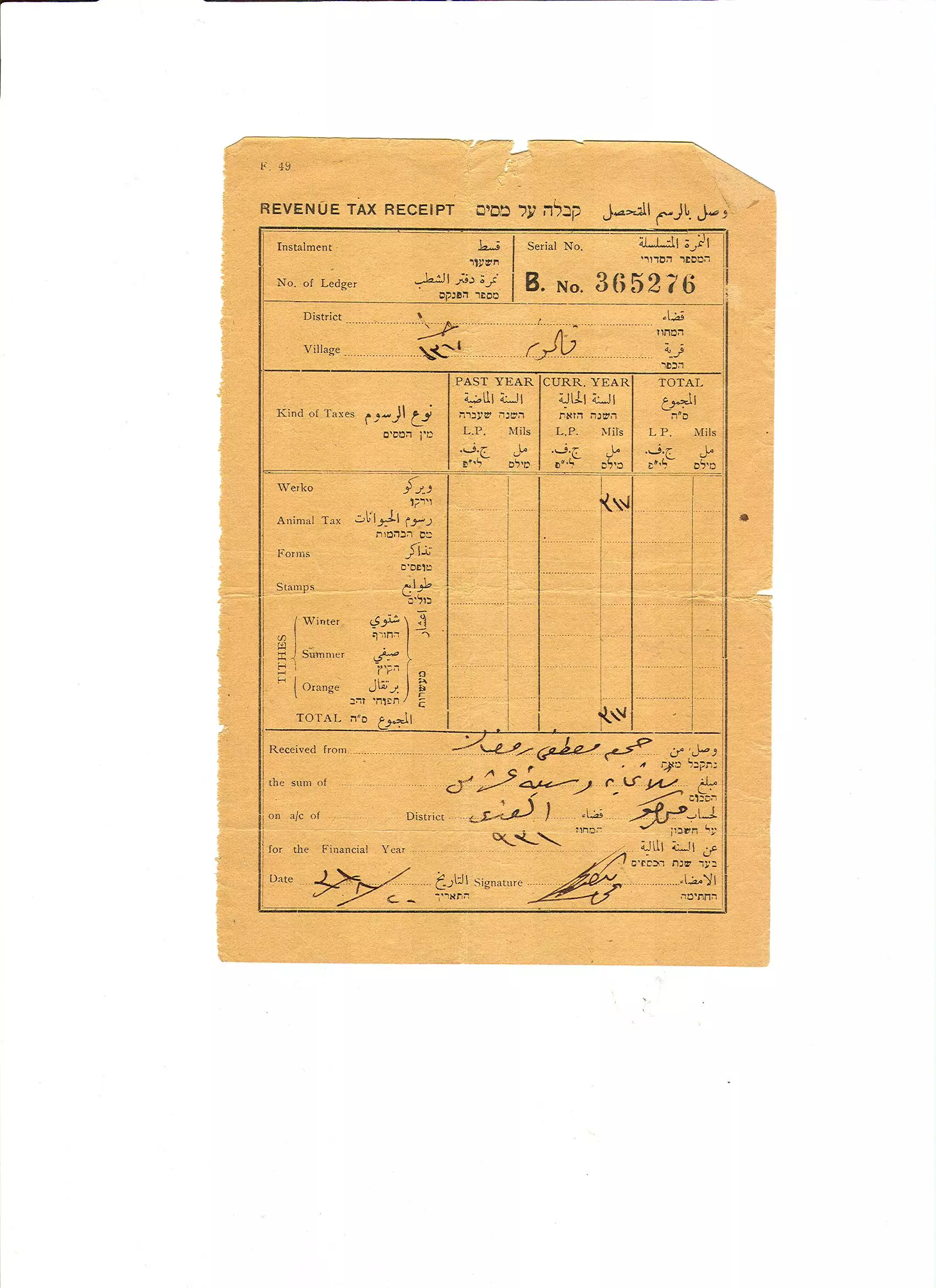
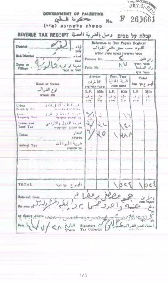
Posted by خالد رمضان - وصل دفع ضريبة اراضي لسلطة الانتداب عام 1931 /اراضي المرحوم جمعه مصطفى رمضان عسكر
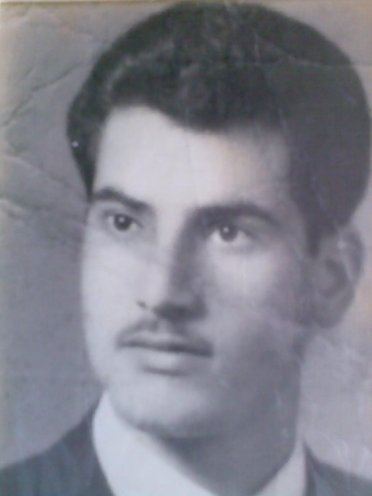
Posted by خالد رمضان - صورة ابن البلد المناضل حمدي مطر
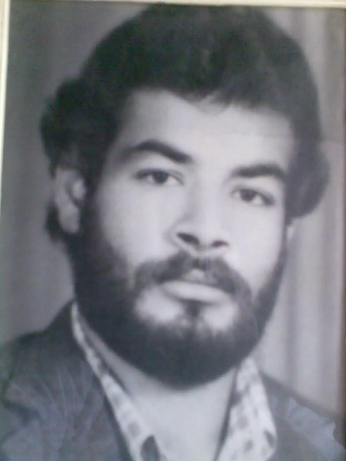
Posted by خالد رمضان - الشهيد مجدي محمد مطر
Posted by خالد رمضان - الشهيد محمد رجا سمرين
Posted by خالد رمضان 1 - شباب من قرية قالونيا يغنون شوقا لقريتهم في الذكرى الستون لاحتلالها /نيسان 2008
Posted by خالد رمضان - شباب من قرية قالونيا في الذكرى الستون لاحتلال القرية يؤكدون تمسكهم بحق العودة اليها مهما طال الزمان /نيسان 2008
Posted by خالد رمضان 1 - رحلة ابناء حمولة عسكر -نيسان 2008
Posted by خالد رمضان - رحلة ابناء حمولة عسكر -نيسان 2008
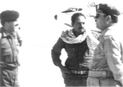
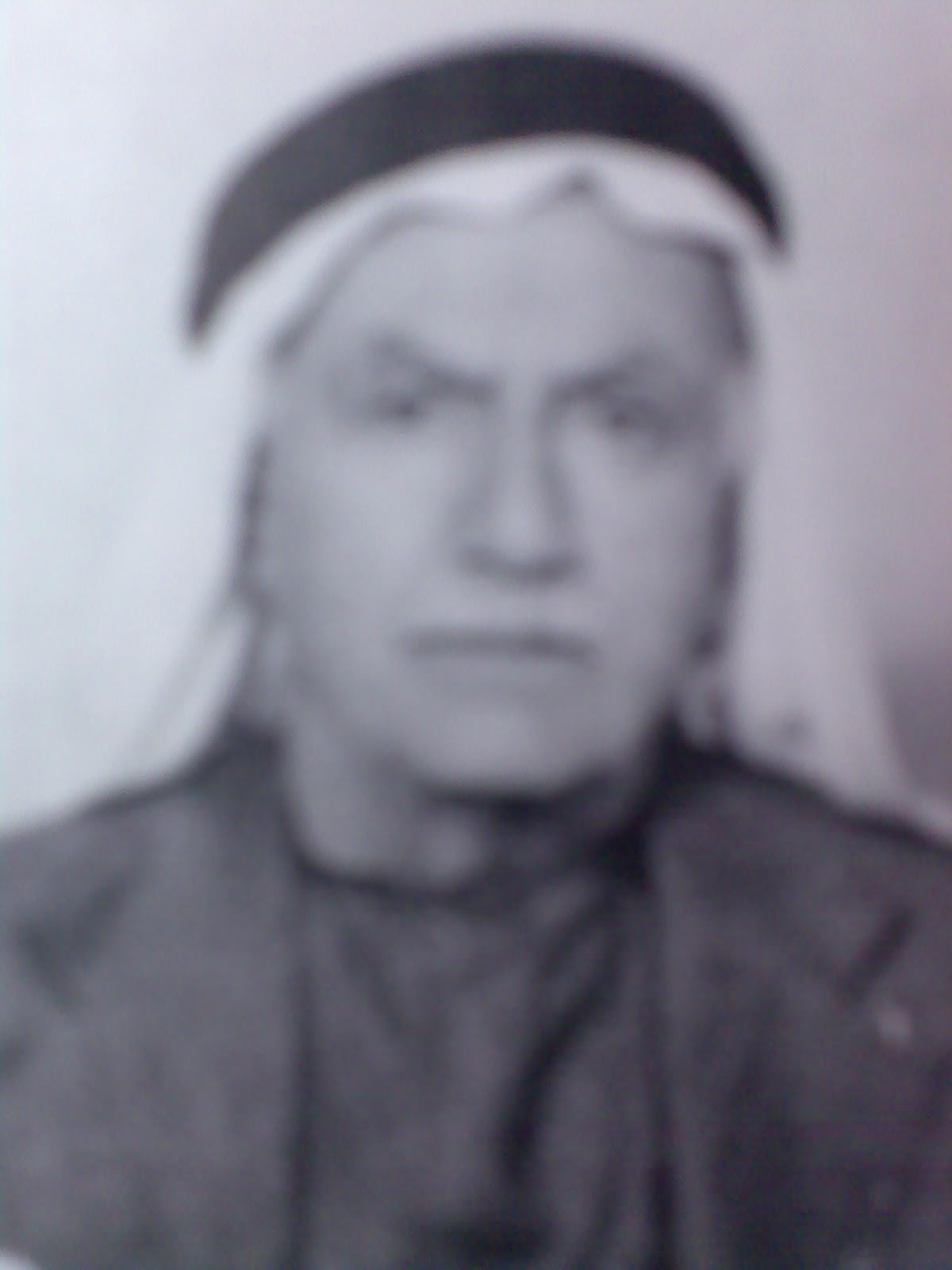
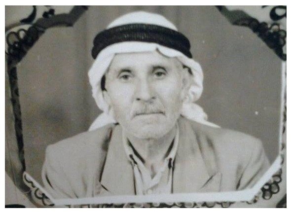
Posted by خالد رمضان - شيخ المجاهدين من رجالات قالونيا القائد محمد سمرين
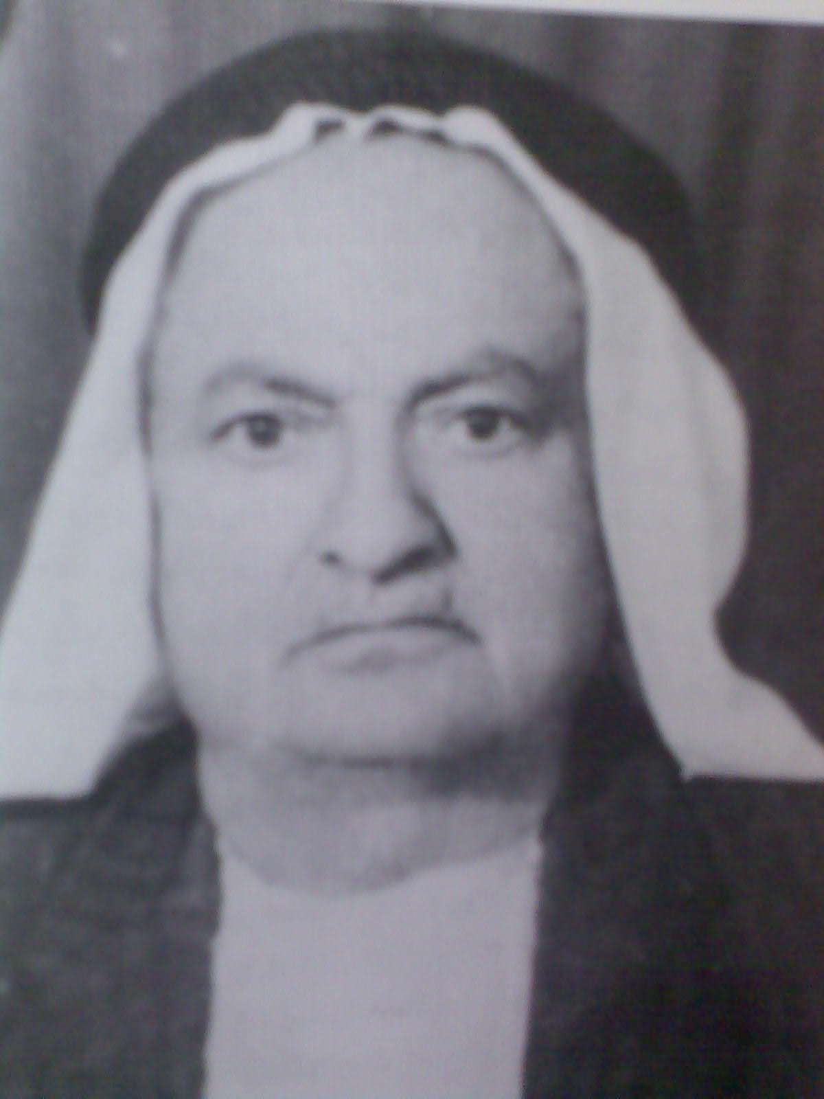
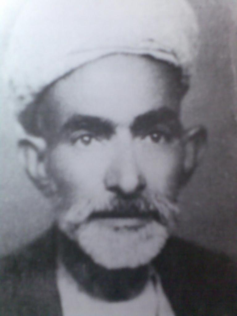
Posted by خالد رمضان 4 - المجاهد الحاج محمد مطر الخطيب
Posted by خالد رمضان 1 - المجاهد الحاج سلامة حسين سلامة
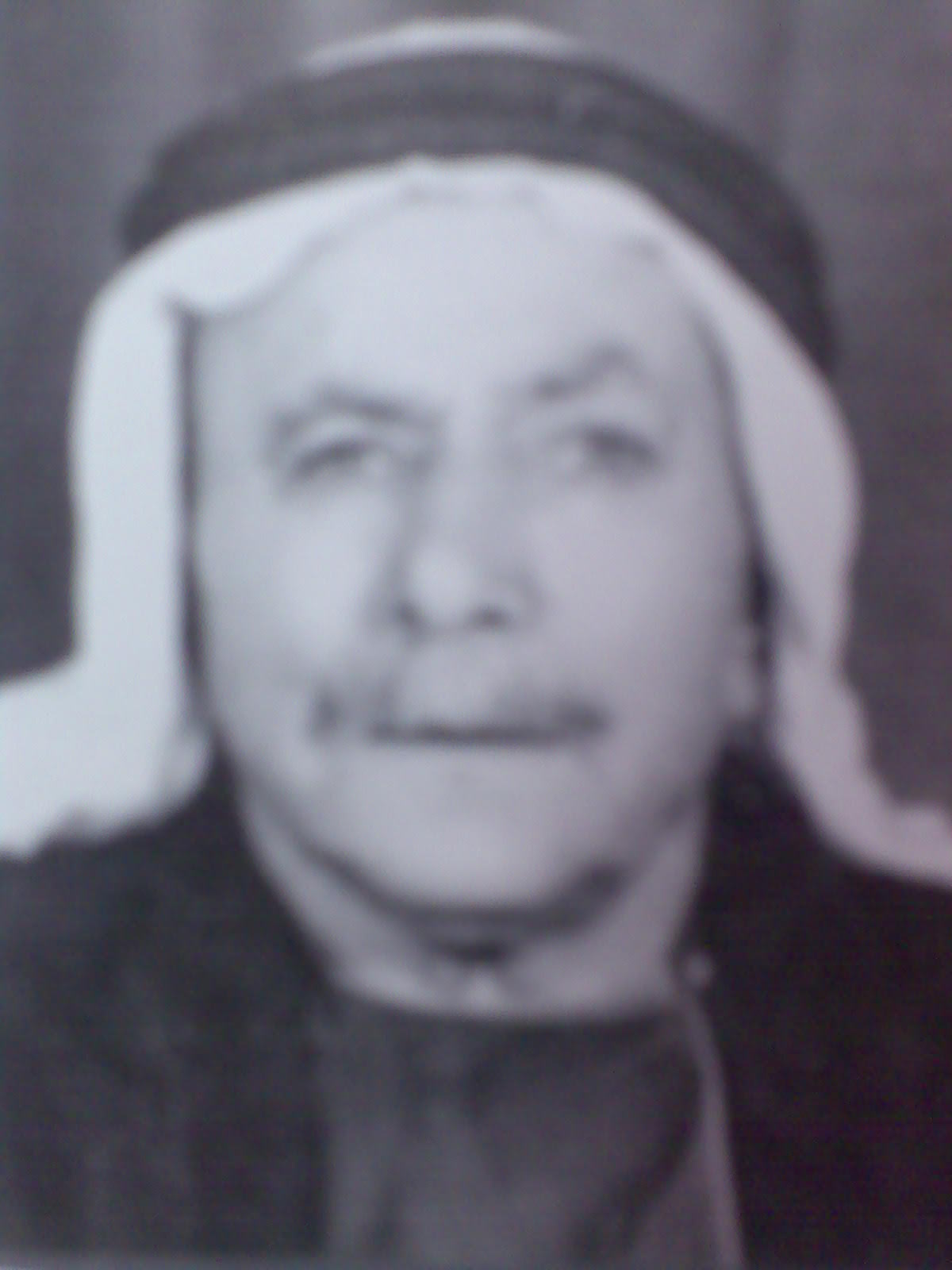
Posted by خالد رمضان 1 - من وجهاء القرية الشيخ مصطفى رمضان عسكر
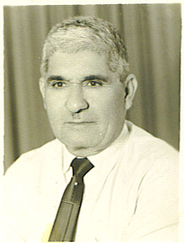
Posted by خالد رمضان 1 - المرحوم محمد كايد الخطيب \
Posted by kayed 1 - المرحوم يونس حسن الخطيب
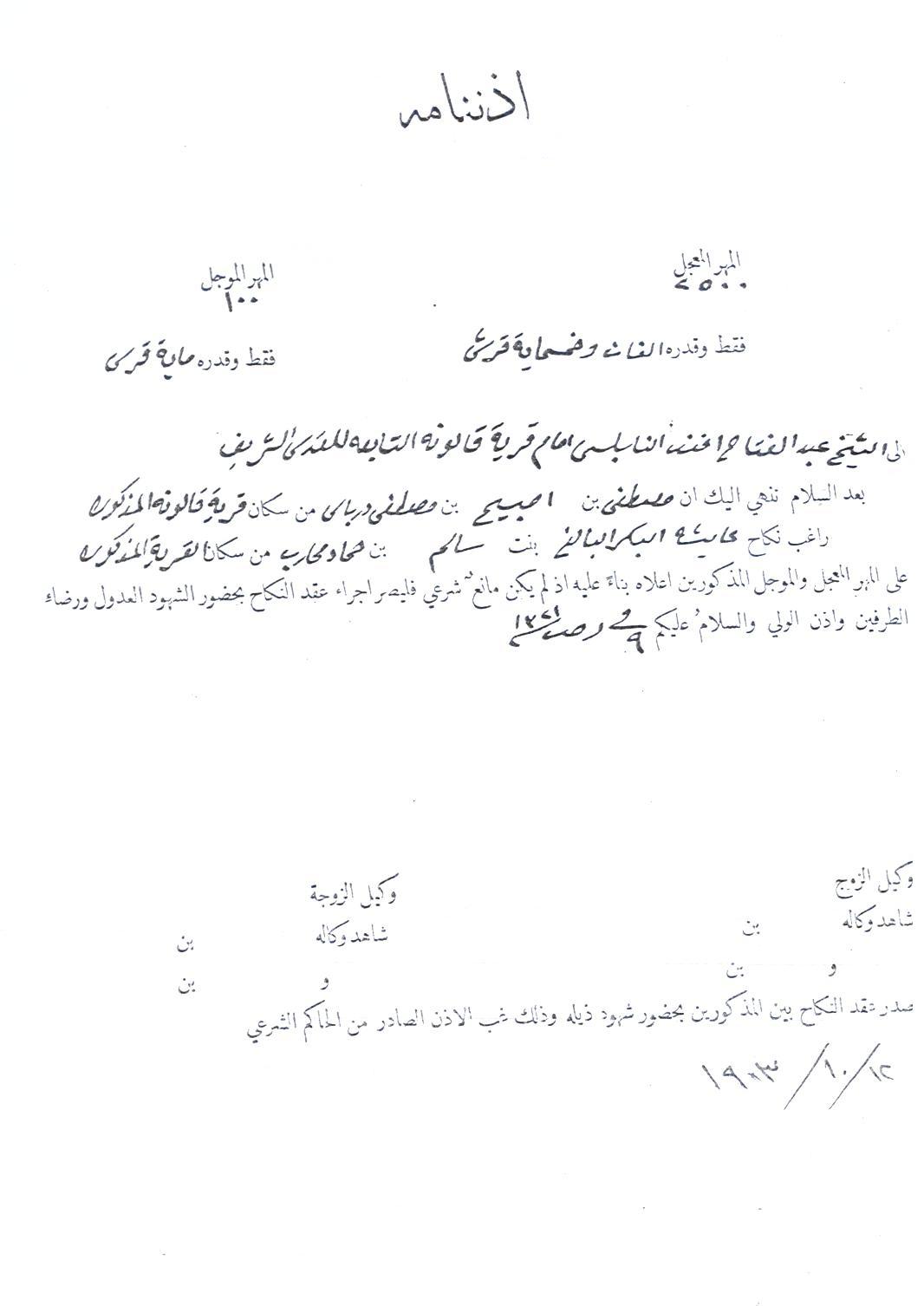
Posted by kayed 1 - عقد زواج
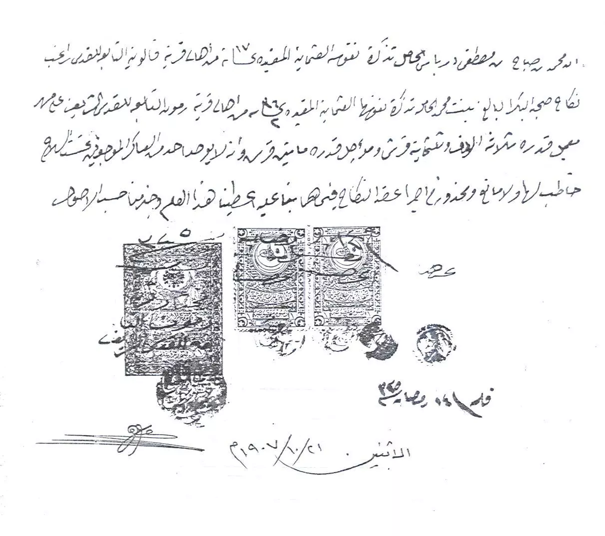
Posted by kayed - عقد زواج (2)
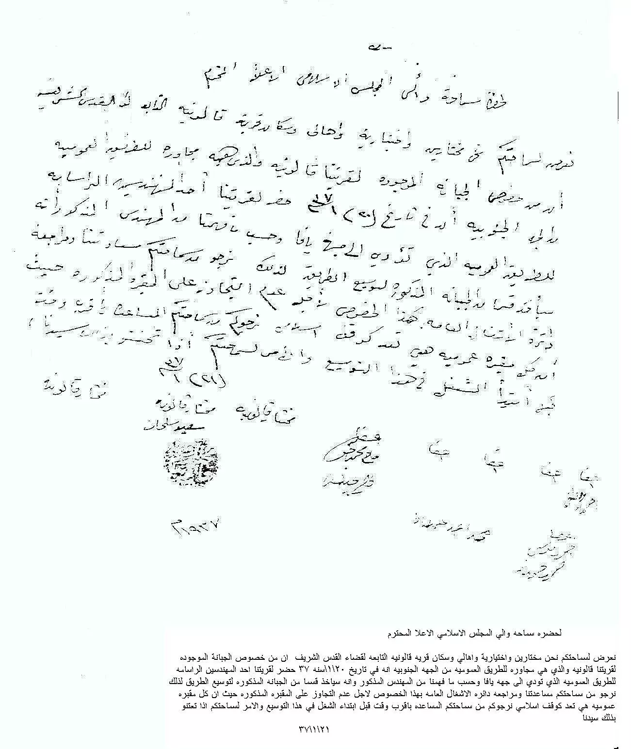
Posted by kayed - رساله من مختار قالونيا الي المجلس الاسلامي الاعلى
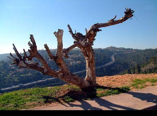
Posted by kayed 2 - إنتظار / صورة بقايا وجذوع شجرة قالونية تقف على اطراف القرية نتظر اهلها وموعد العودة - وامامها الشارع المؤدي الى ابوغوش طريق يافا
Posted by خالد رمضان - مدخل قرية قالونيا عن طريق القدس يافا
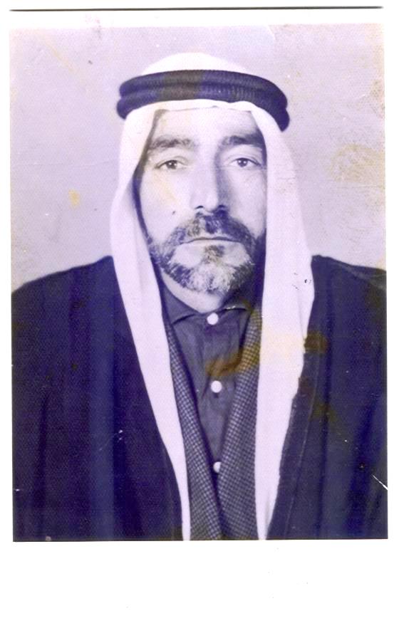
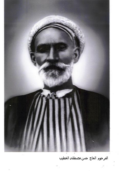
Posted by خالد رمضان - المرحوم الحاج حسن مصطفي الخطيب ( مختار قريه قالونيا )
Posted by kayed 3 - حكاية صورة - موعد على عين الليمونة
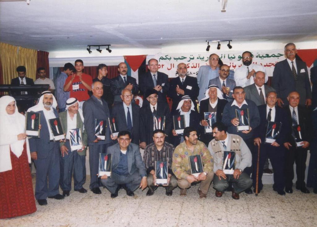
Posted by خالد رمضان 2 - جمعية قالونيا تكرم ابنائها الشهداء في الذكرى 52 للاحتلال القرية

Posted by خالد رمضان 2 - مصنع القرميد في القرية وكان يملكه ميخيل اليهودي وعمل في المصنع العديد من ابناء القرية قبل الاحتلال
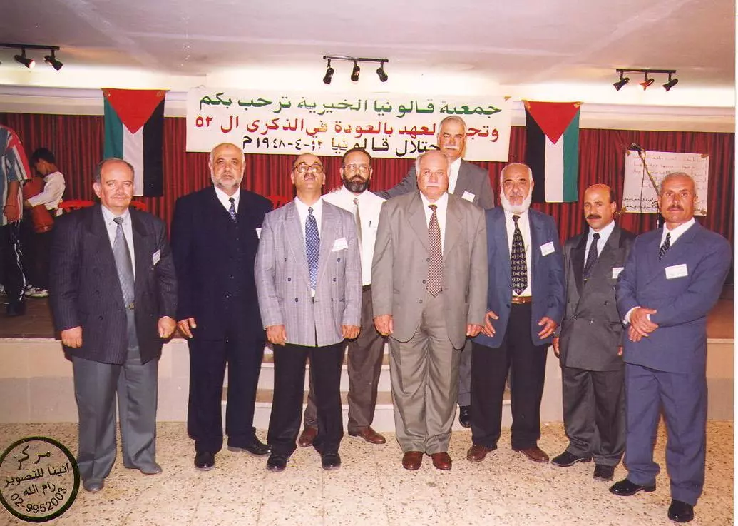
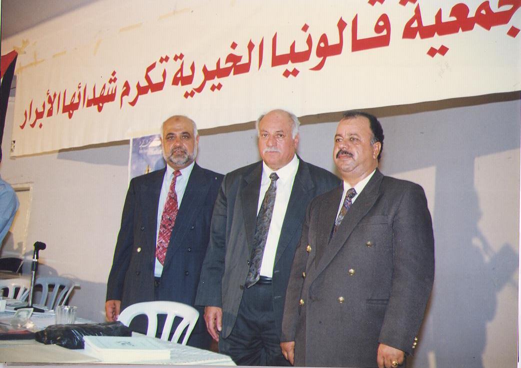
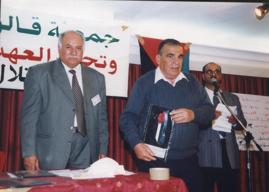
Posted by خالد رمضان - اعضاء الهيئة الادارية لجمعية قالونيا - رام الله عام 2000
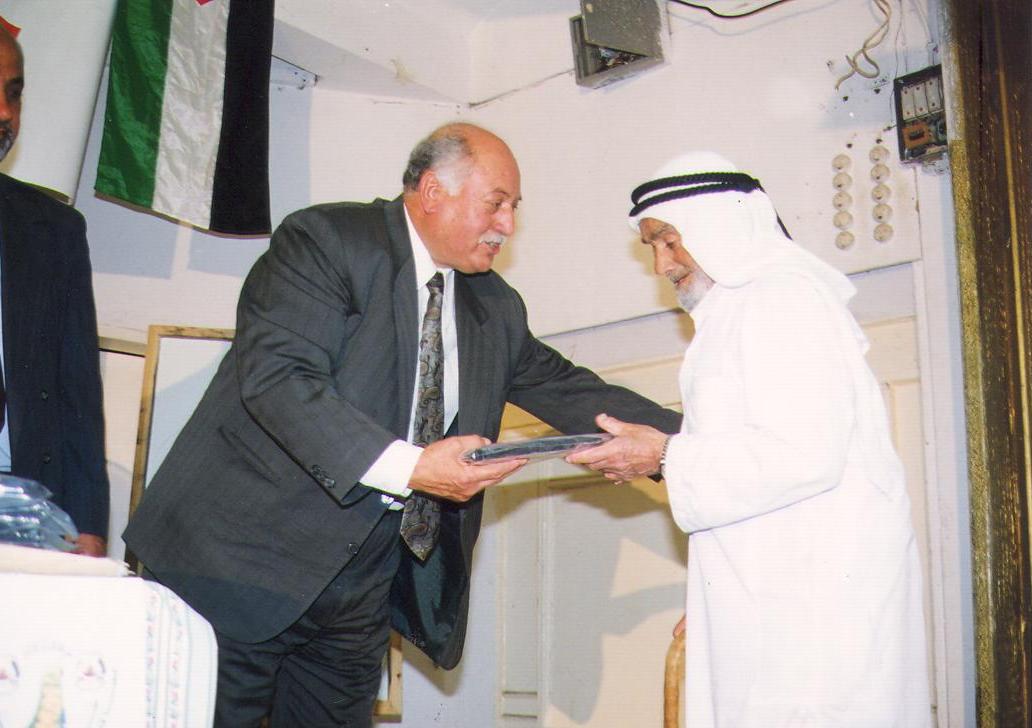
Posted by خالد رمضان 1 - رئيس الجمعية يسلم الشيخ محمد حسين سلامة درع الشهيد والده الشيخ حسين سلامة الذي استشهد في القرية قبل العام 1948
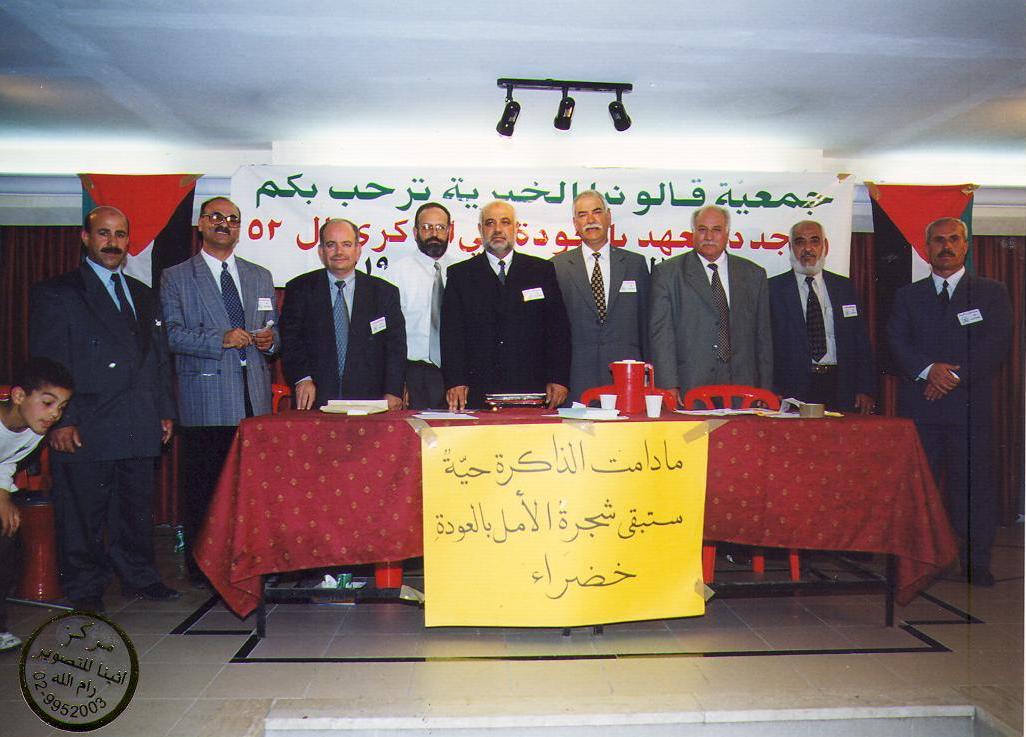
Posted by خالد رمضان 1 - مادامت الذاكرة حية ستبقى شجرة الامل بالعودة خضراء - ادارة الجمعية
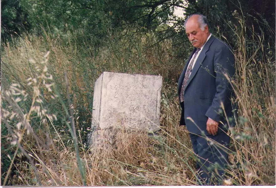
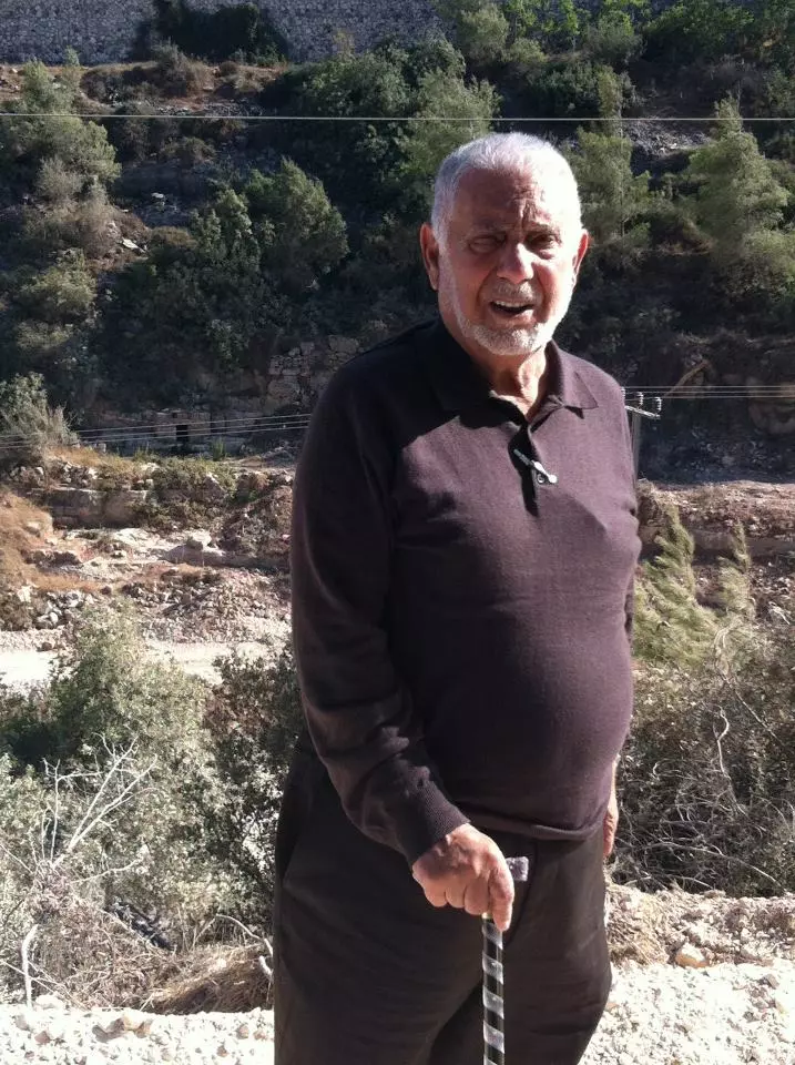
Posted by خالد رمضان 1 - ابن البلد حمدي مطر يقرأ الفاتحة امام قبر المرحوم مصطفى صباح - مقبرة قالونيا الجنوبية
Posted by خالد رمضان - من حفل تكريم الشهداء عام 2000
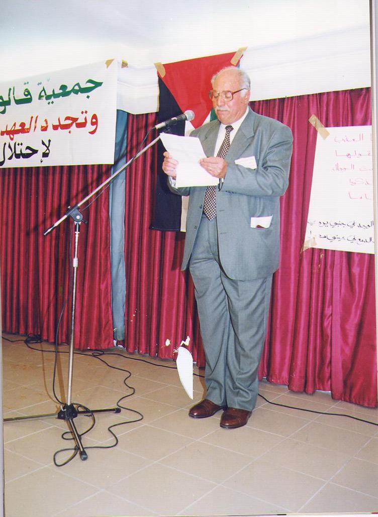
Posted by خالد رمضان 3 - حمدي مطر مؤسس ورئيس الجمعية السابق يلقي كلمة ترحيبية بابناء القرية
Posted by خالد رمضان 1 - صورة من جوجل للقرية
Posted by خالد رمضان - المرحوم الحاج احمد محمد كايد الخطيب - مؤرخ من رجالات القريه المعروفين
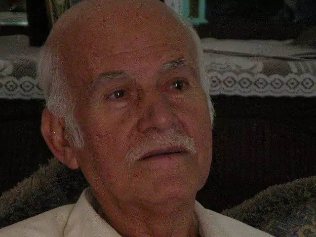
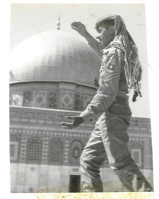
Posted by Bassam Al khtaib 3 - الحاج احمد محمد كايد الخطيب -رحمه الله-رمز لشرف الجندية المخلصة و قبة الصخرة بين الاحضان.
Posted by Bassam Al khtaib 3 - منظر عام
Posted by خالد رمضان - أعضاء الجمعية مع من تم تكريمهم بحفل التكريم
Posted by Safia F Barakat 1 - مؤسس الجمعية حمدي مطر يكرم الأخ فايز بركات (رحمه الله)
Posted by Safia F Barakat 2 - صورة للبلدة من بعيد، حيث التقطت الصورة عام 1999
Posted by Safia F Barakat - القرية في فصل الربيع
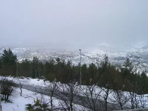
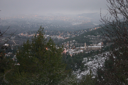
Posted by علي - سقوط الثلوج على القرية 2008
Posted by علي - Qalunya Remembered
Posted by Umar Abu El-Bararri - Qalunya Remembered
Posted by Umar Abu El-Bararri - Qalunya Remembered
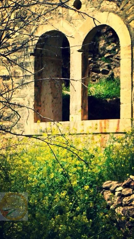
Posted by Umar Abu El-Bararri - Qalunya's Windows
Posted by Umar Abu El-Bararri - Qalunya Remembered
Posted by Umar Abu El-Bararri - Qalunya Remembered
Posted by Umar Abu El-Bararri - Qalunya Remembered
Posted by Umar Abu El-Bararri - Qalunya's Homes Converted to Jewish Synagogue Complex
Posted by Umar Abu El-Bararri - Qalunya's Homes Converted to Jewish Synagogue Complex #2
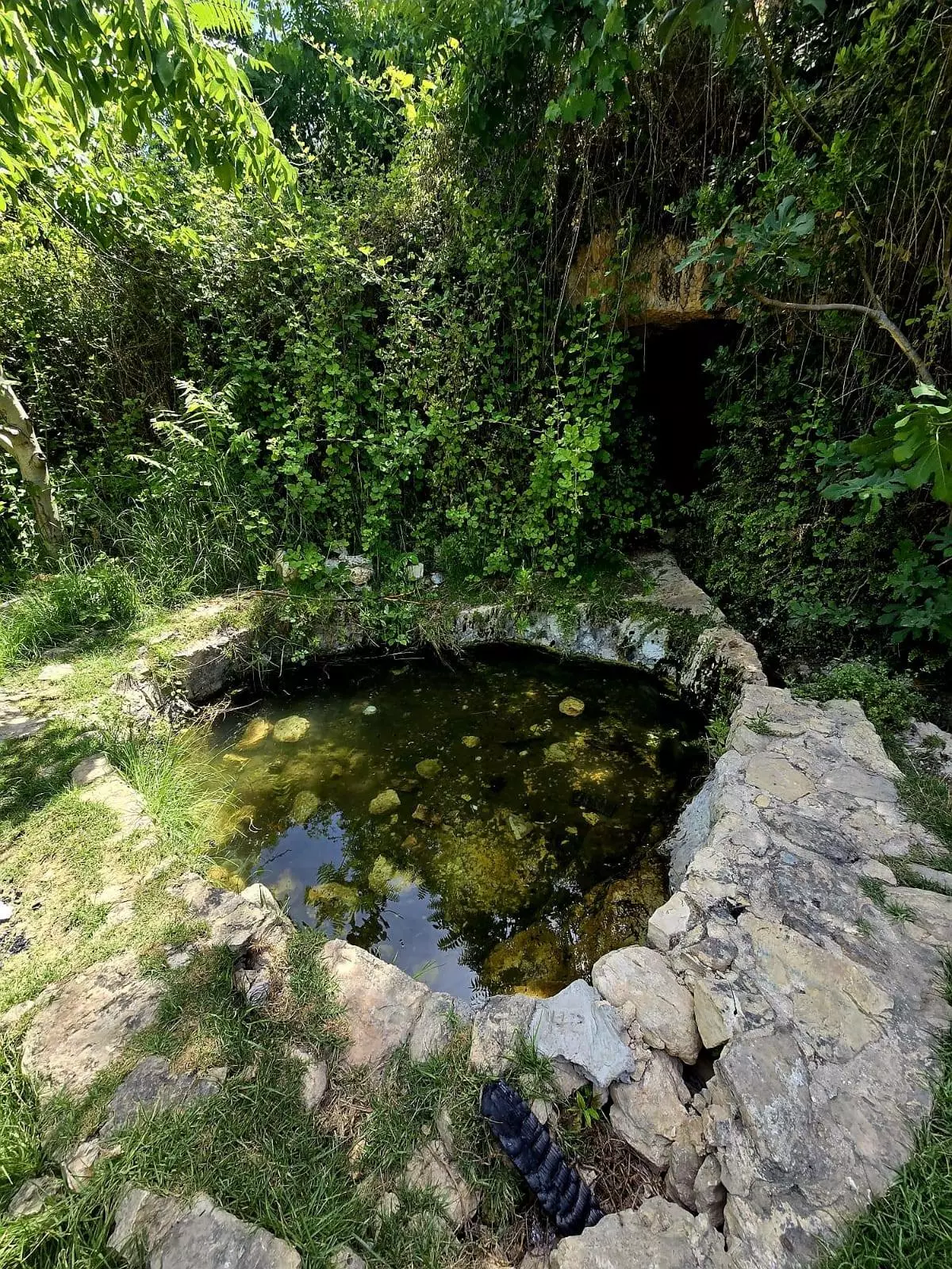
Posted by Umar Abu El-Bararri - Qalunya's Rain Water Tunnel with its stone walls & its flat rock bed which leads to a large water collection pool/reservoir.
Posted by Umar Abu El-Bararri - Qalunya's Rain Water Tunnel with its stone walls & its flat rock bed with the homes (Synagogue Complex) to right of pic.
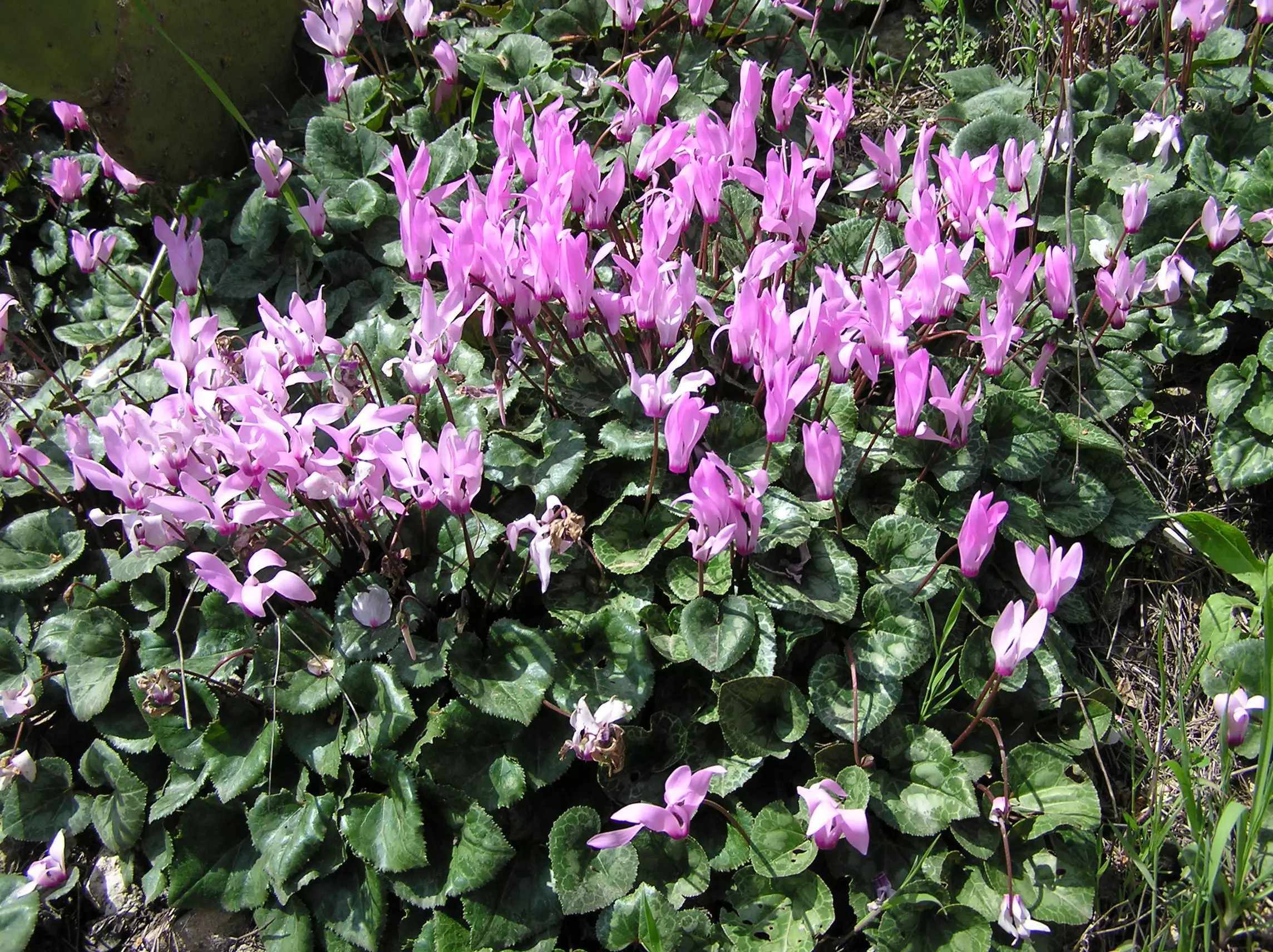
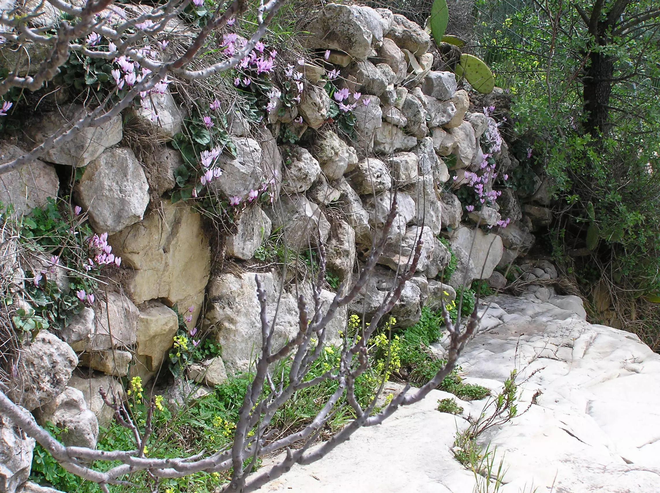
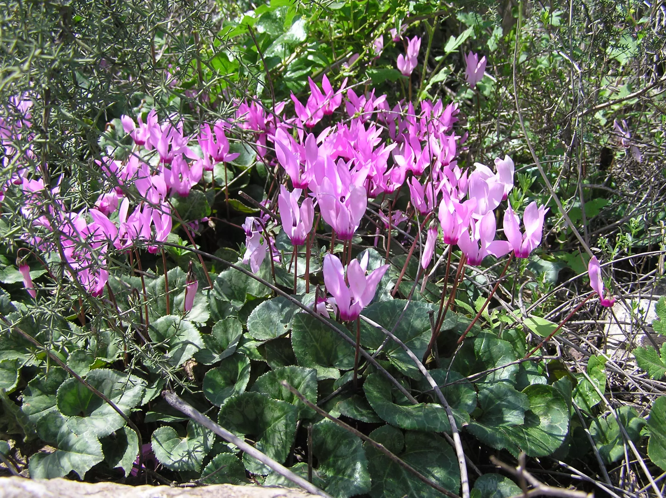
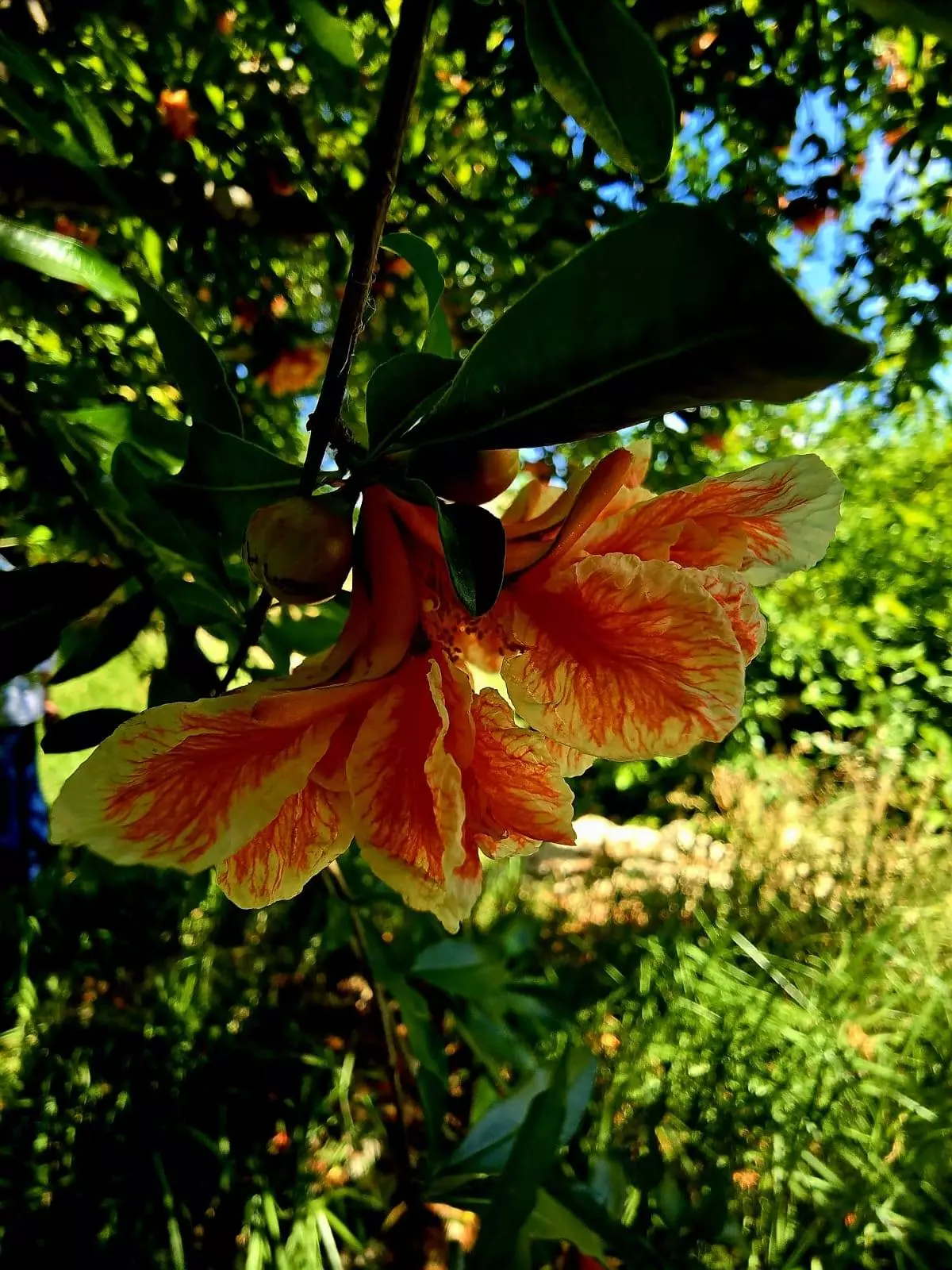
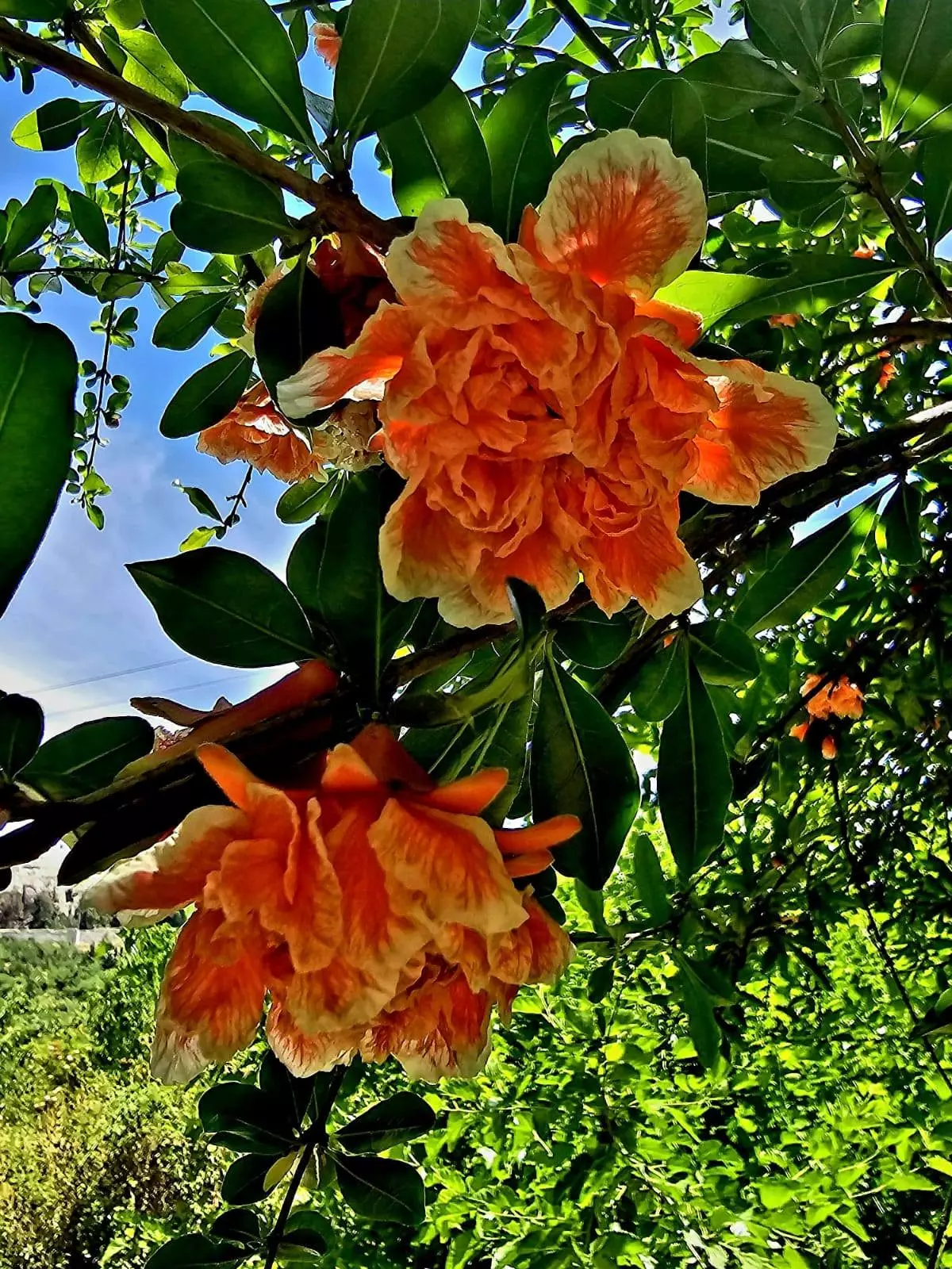
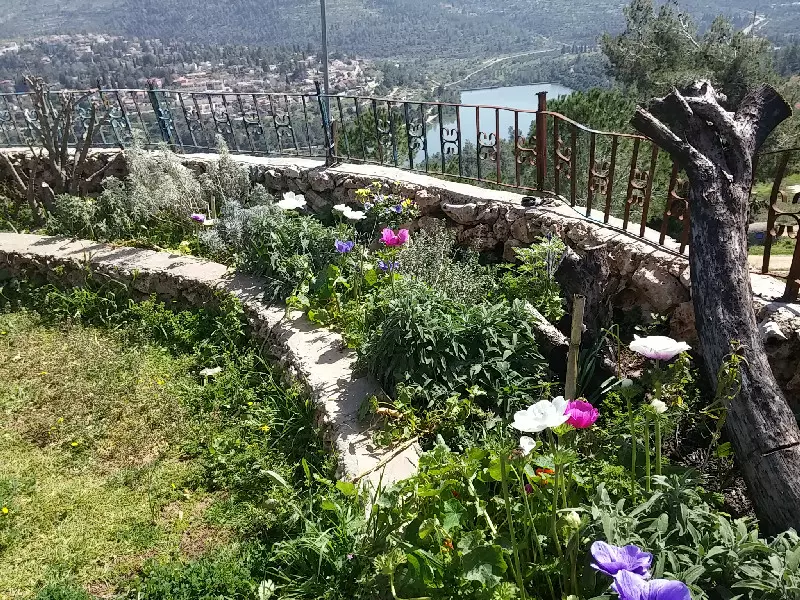
Posted by Umar Abu El-Bararri - Qalunya's Wild Flowers
Posted by Umar Abu El-Bararri - Qalunya's Wild Flowers #2
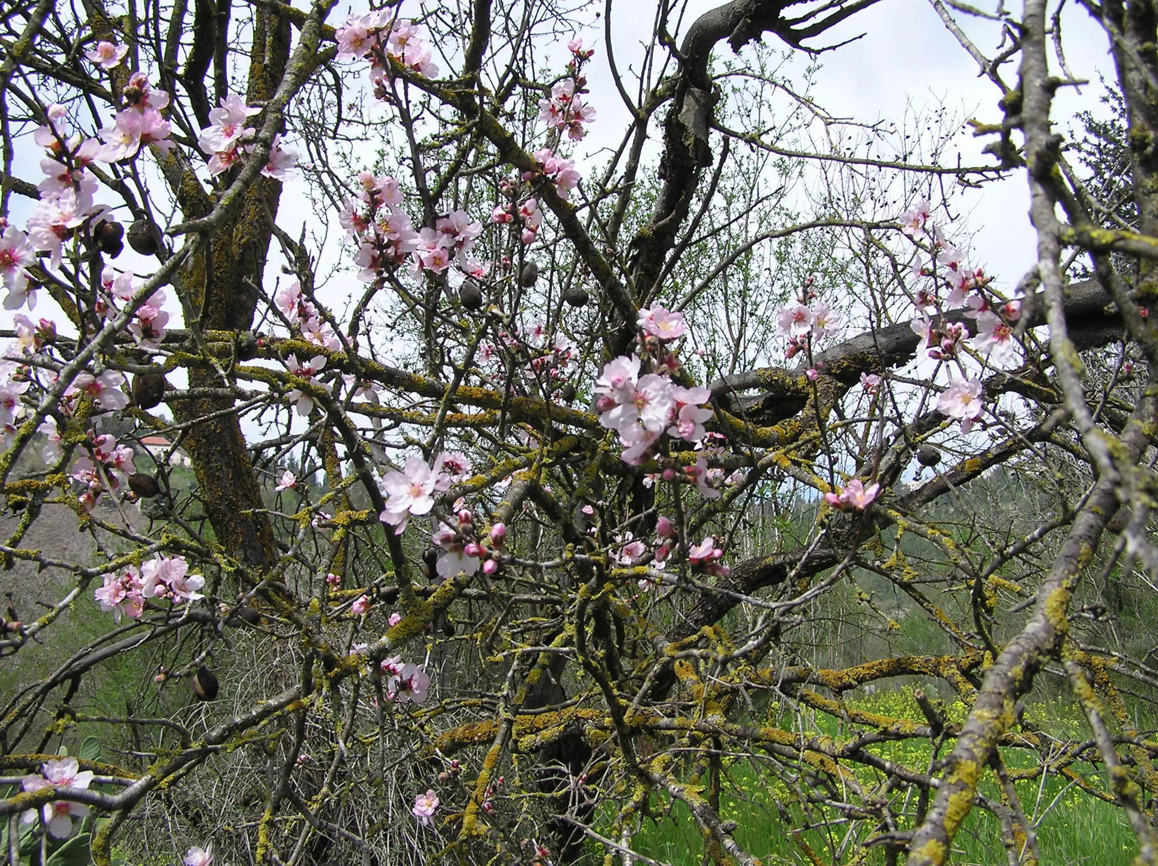
Posted by Umar Abu El-Bararri - Qalunya's Old Almond Trees Still Blooming To This Day.
Posted by Umar Abu El-Bararri 2 - A Close-Up of Qalunya's Rain Water Tunnel (Spring 2009)
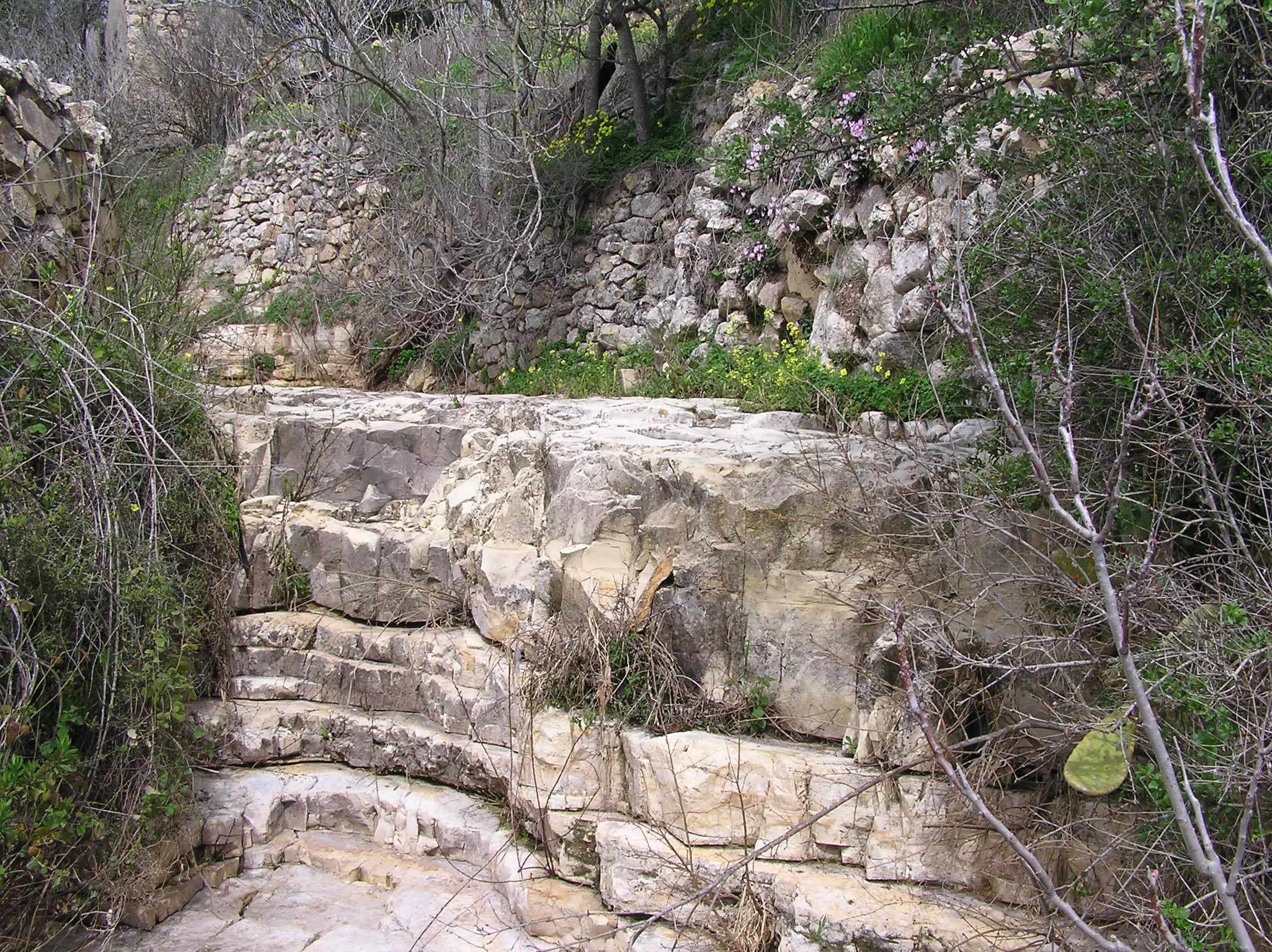
Posted by Umar Abu El-Bararri - Qalunya's Hand Built Stone Walls (Spring 2009).
Posted by Umar Abu El-Bararri - Qarn El-Ghazal
Posted by Umar Abu El-Bararri - A Rock Ridge With Spring Flowers (Spring 2009)
Posted by Umar Abu El-Bararri 1 - Almond Tree Blooms & Other Trees/Shrubs From Decades Past (Spring 2009)
Posted by Umar Abu El-Bararri - Hanoon In Qalunya's Terraces (Spring 2009)
Posted by Umar Abu El-Bararri - Qalunya's Qarn El-Ghazal (Spring 2009)
Posted by Umar Abu El-Bararri - لوحة عائدون بمناسبة الذكرة 61 للنكبة - تصميم احد ابناء القرية
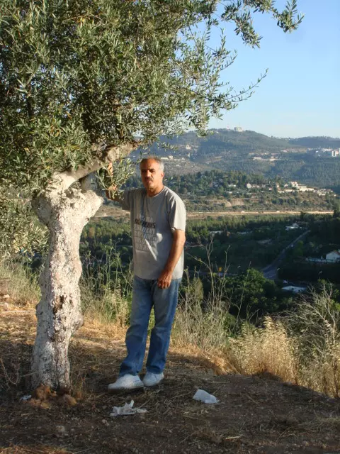
Posted by خالد رمضان 1 - Ziad Farhan Olive Tree in Qalunya on my visit in july 2009
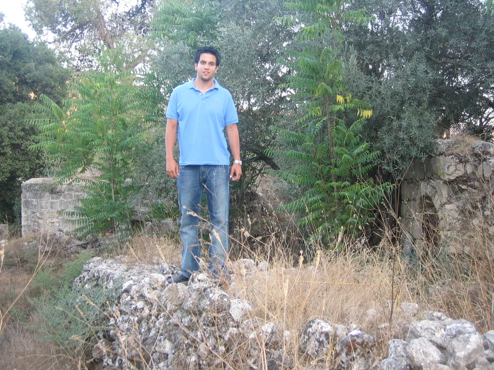
Posted by ziad farhan - Ziad Farhan in between a destroyed house in Qalunya july 2009
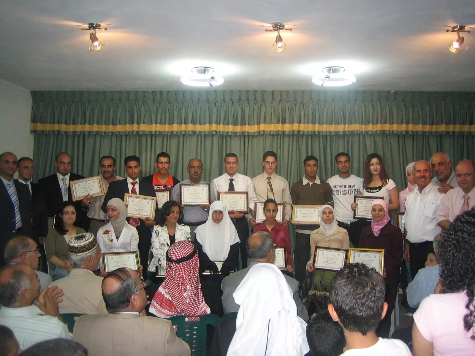
Posted by ziad farhan - Graduation of Qalunya students in 2006
Posted by ziad farhan - Maher Ziad Farhan next to a destroyed house in Qalunya in 2006
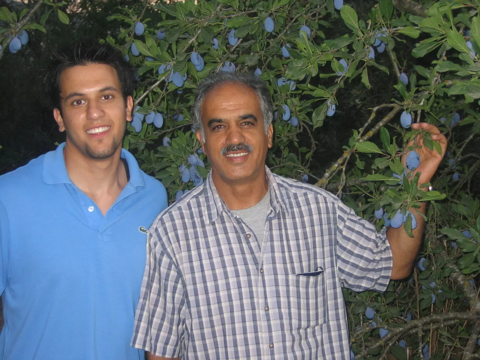
Posted by ziad farhan - Ziad and son Maher Farhan in Qalunya 2006
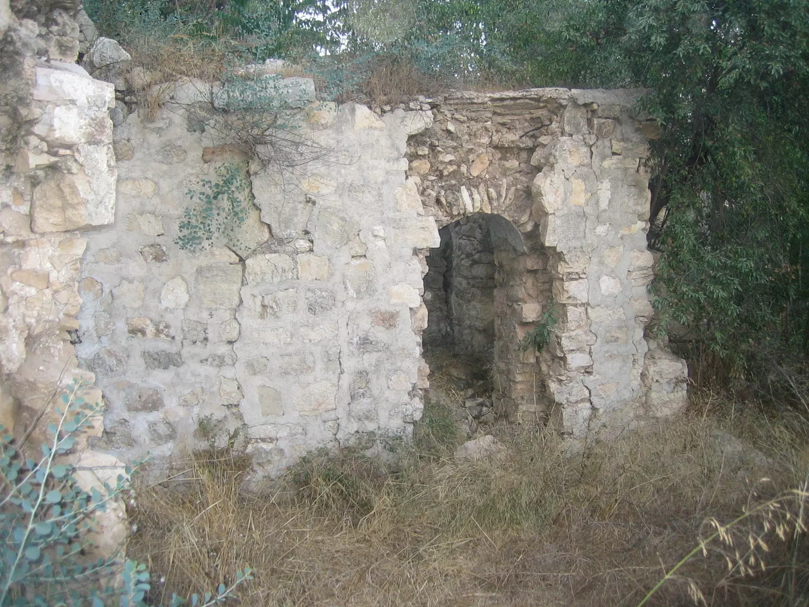
Posted by ziad farhan 1 - destroyed home in qalunya
Posted by ziad farhan - Early Springtime in Qaloniya between 1934 - 1939
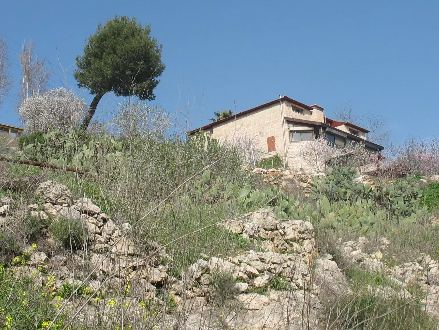
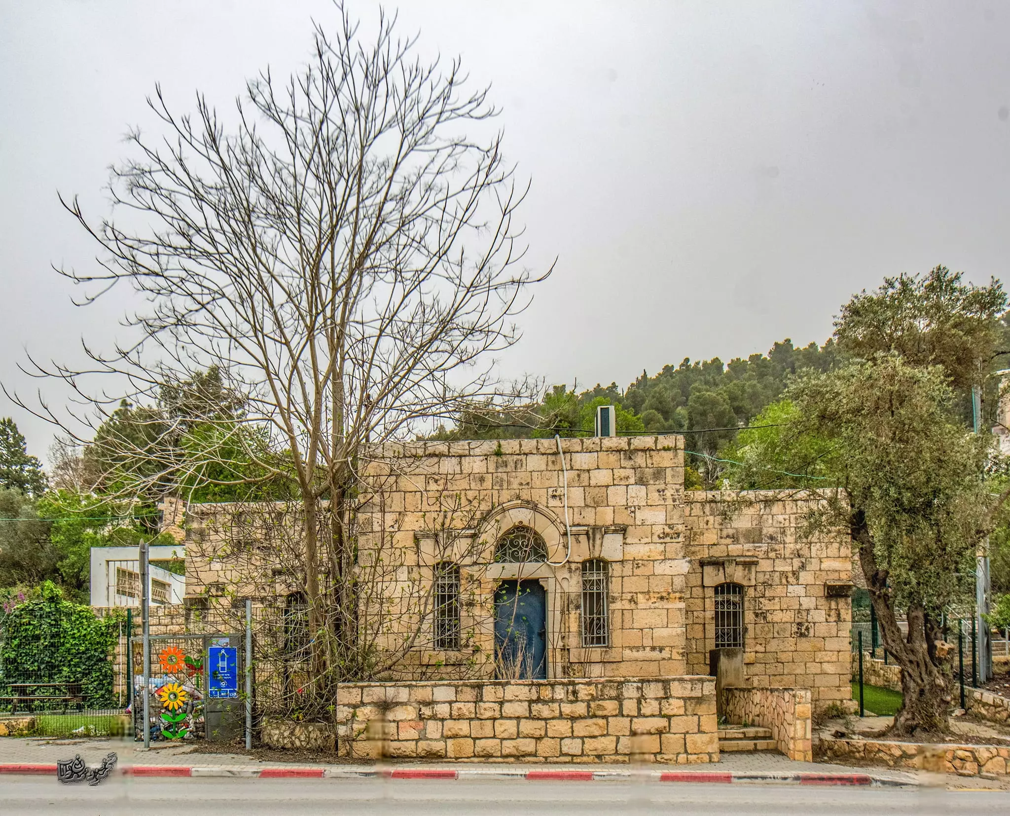
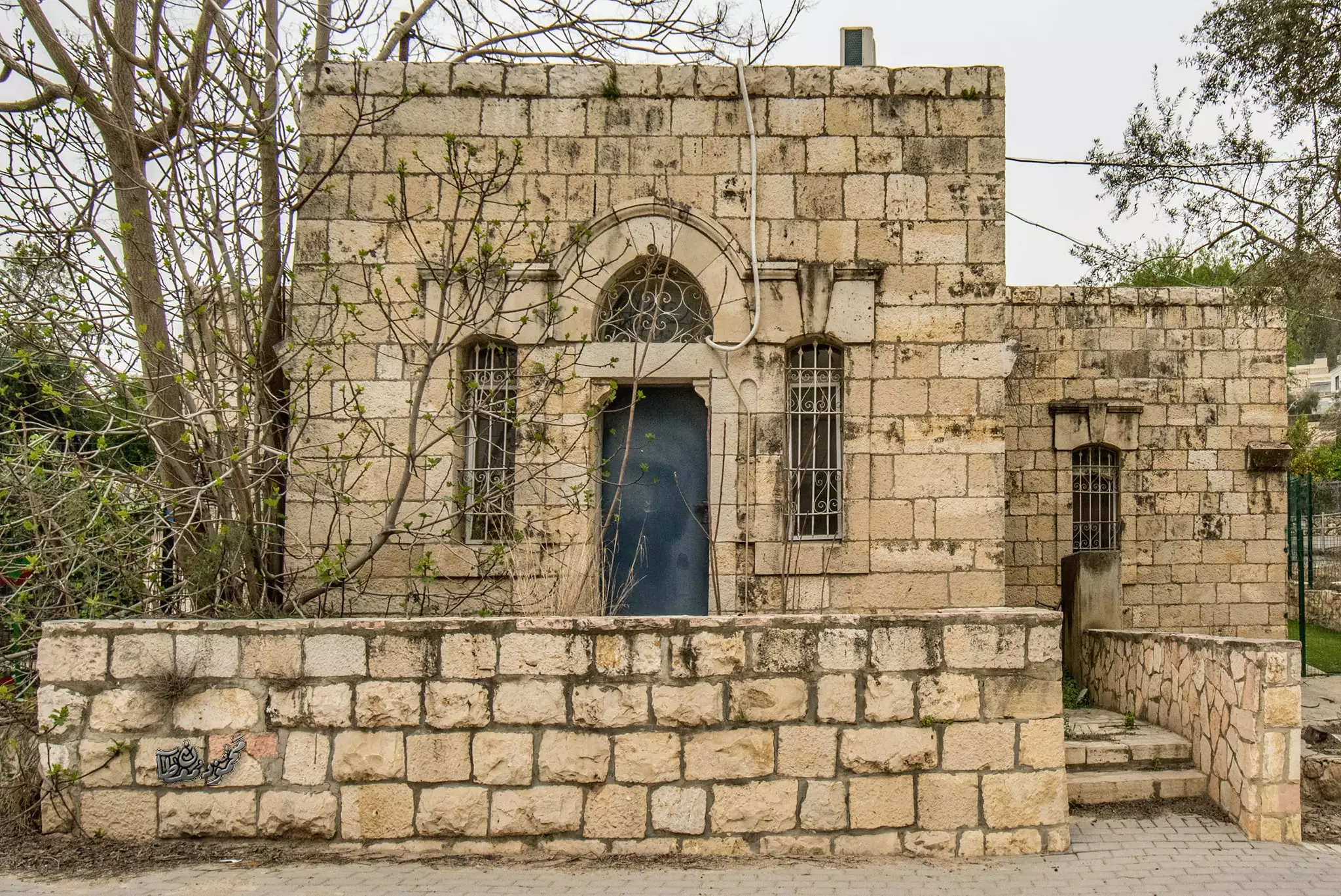
Posted by Umar Abu El-Bararri 2 - One of Qalunya's Original Houses
Posted by Umar Abu El-Bararri - One of Qalunya's Original Houses #2 which is presently inhabited with non-Arab occupants.
Posted by Umar Abu El-Bararri - One of Qalunya's Original Houses which has been converted & used as a Jewish Synagogue.
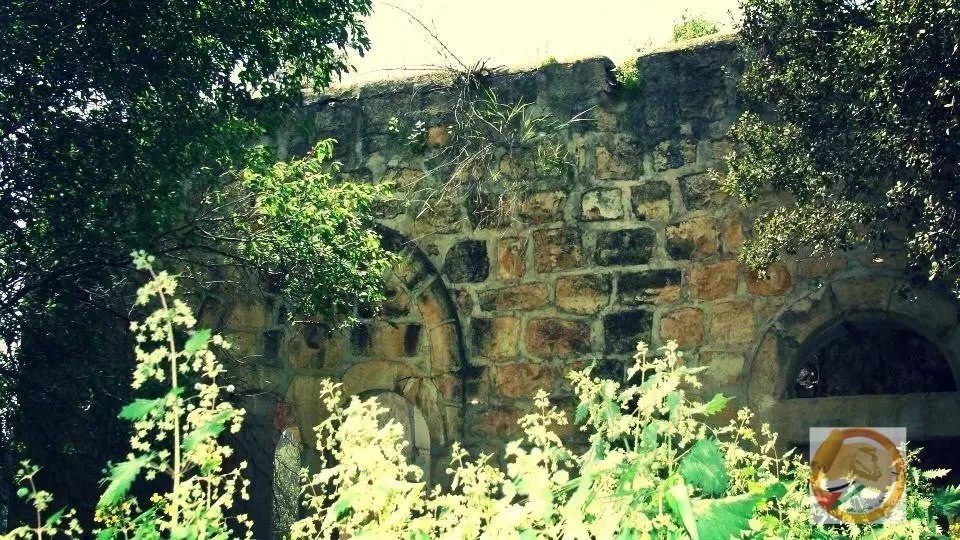
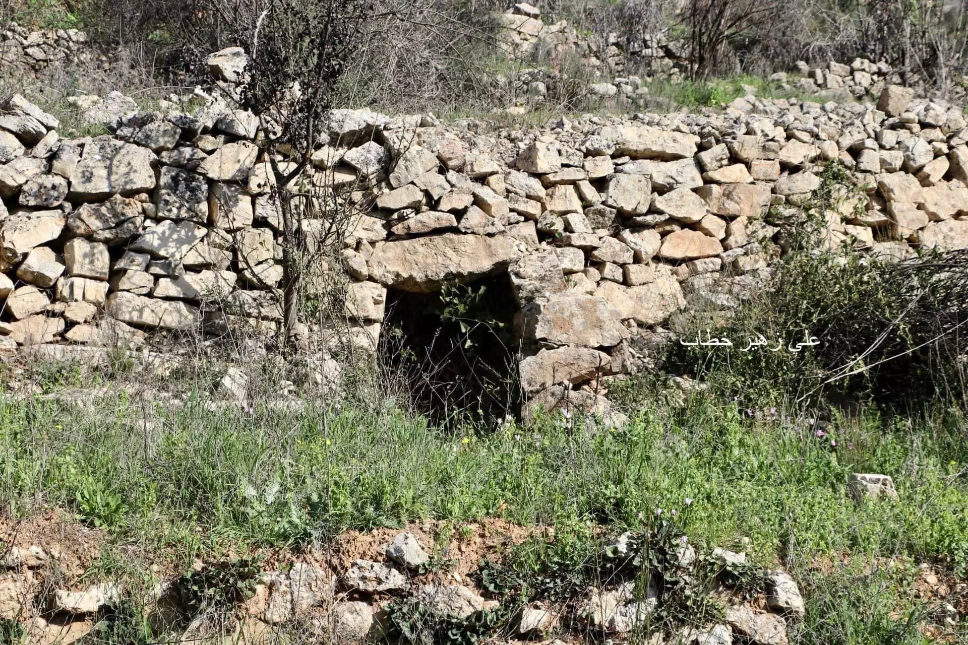
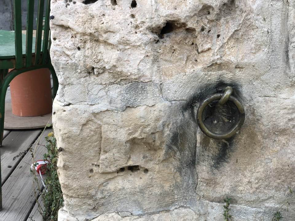
Posted by Umar Abu El-Bararri - An Ancient Wall #1
Posted by Umar Abu El-Bararri - An Ancient Wall #2 with very large stones.
Posted by Umar Abu El-Bararri - The Remains of an Old Wall Foundation & Pre - 1948 Building/Wall on top it.
Posted by Umar Abu El-Bararri - مهند صباح ............. عريس قرية قالونيا الرايه لن تنسقط يا مهند مدام امثال شباب عائدون متمسكون بحق العوده
Posted by Nahid - زفة حازم خطاب في ربوع فالونيا بتاريخ 17-6-2011
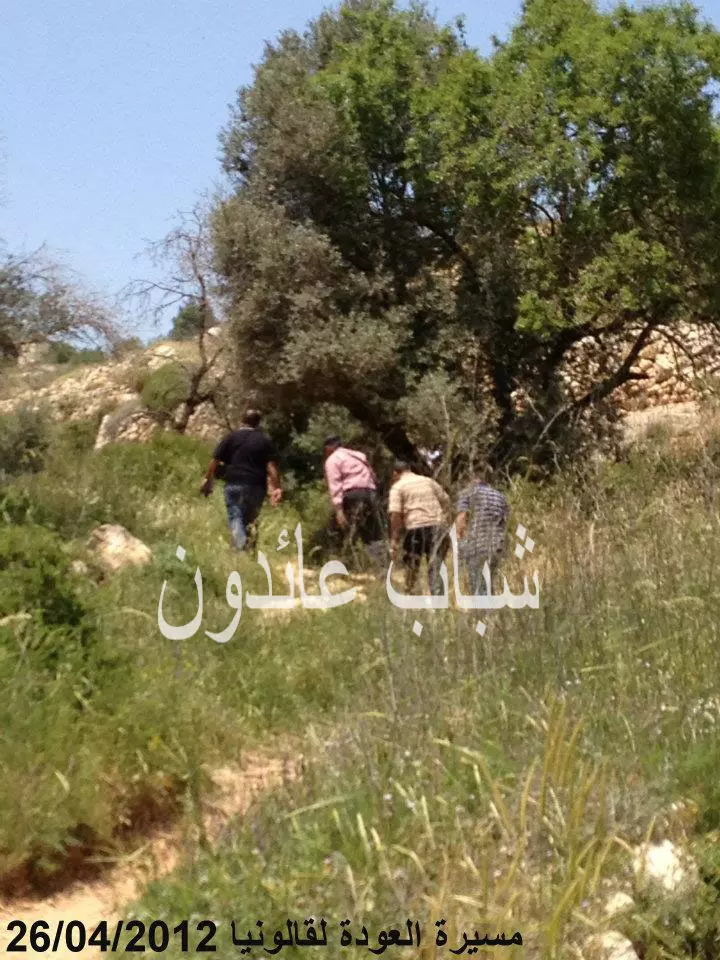
Posted by Nahid - مسيرة العودة الي قالونيا في 26-4-2012
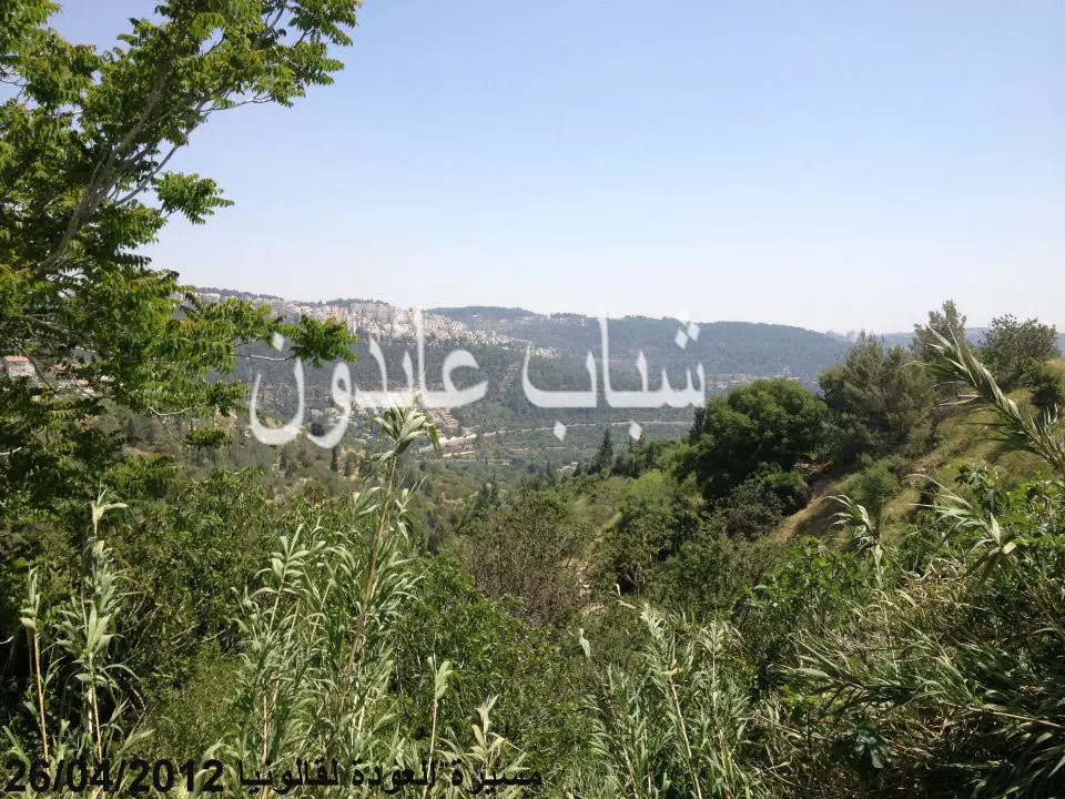
Posted by Nahid - قالونيا يوم 26-4-2012
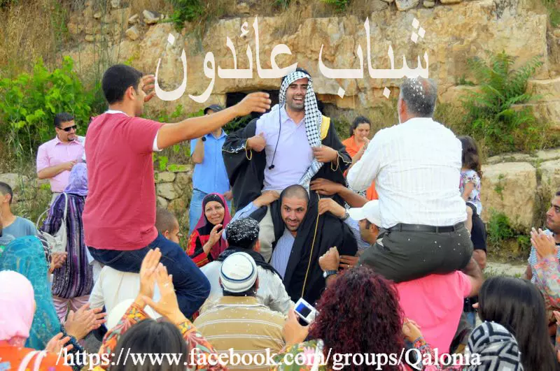
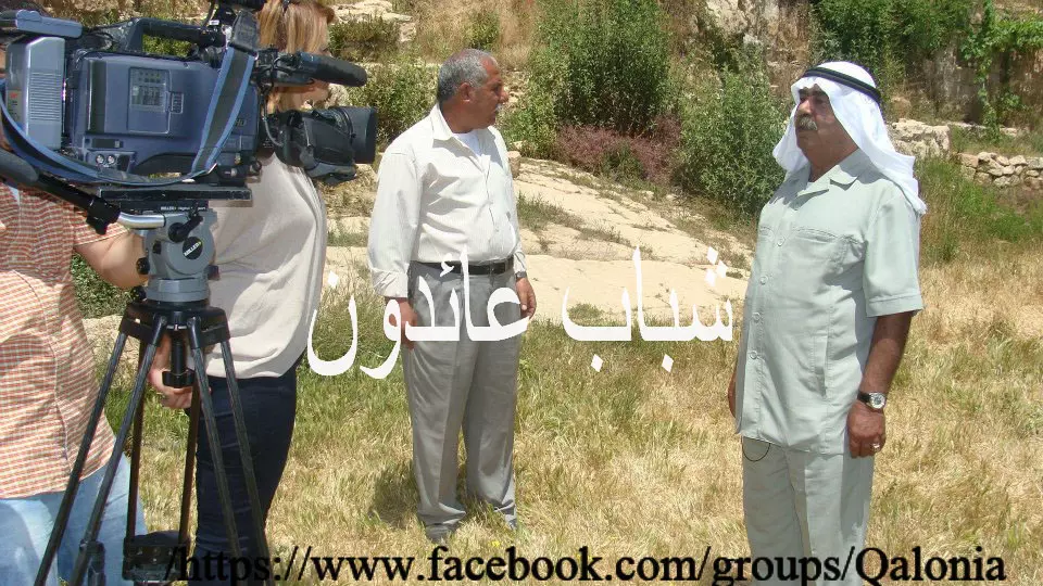
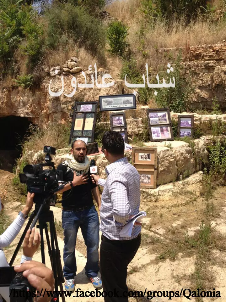
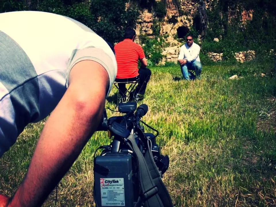
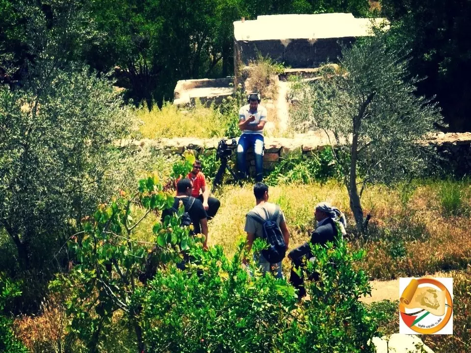
Posted by Nahid - صورة اثناء التحضيرات لتقرير الجزيرة في قالونيا
Posted by Nahid - لقاء الجزيرة مع ابن قالونيا في قالونيا
Posted by Nahid - معرض لصور شهداء قالونيا في قالونيا في ذكرى النكبة ال 64
Posted by Nahid - لقاء في قالونيا عبر قناة مكس معا في ذكرى النكبة 64
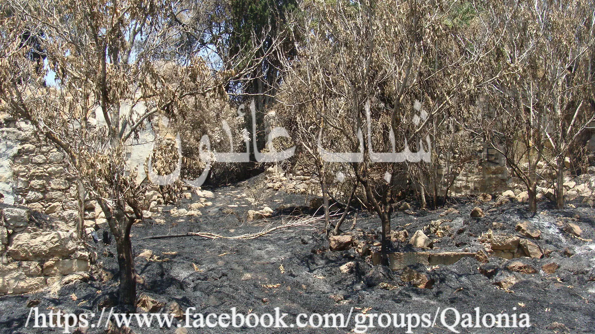
Posted by Nahid - قالونيا بعد الحريق بتاريخ 26-6-2012
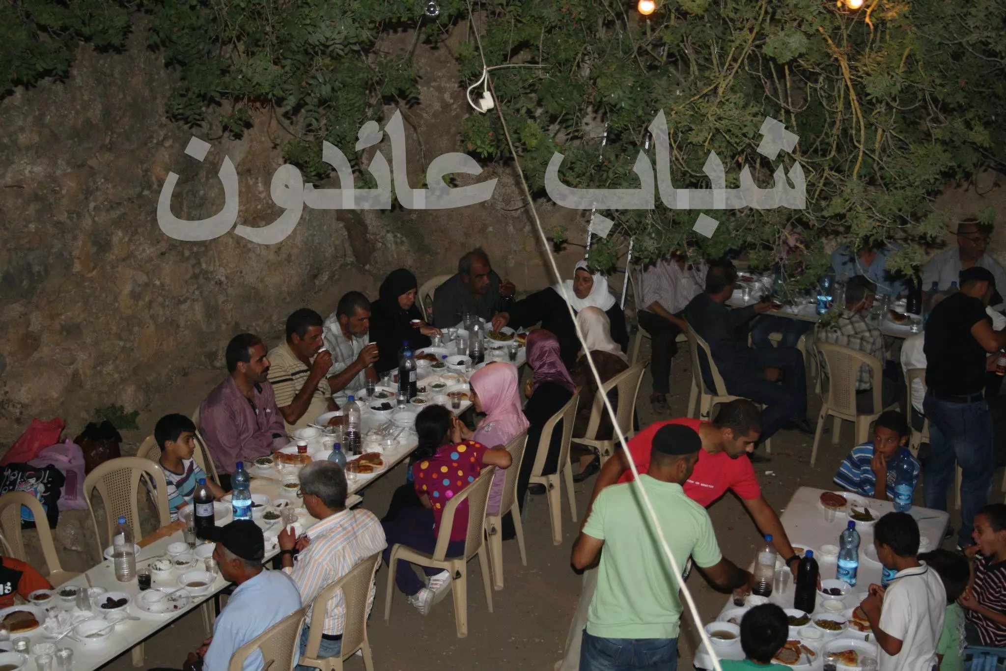
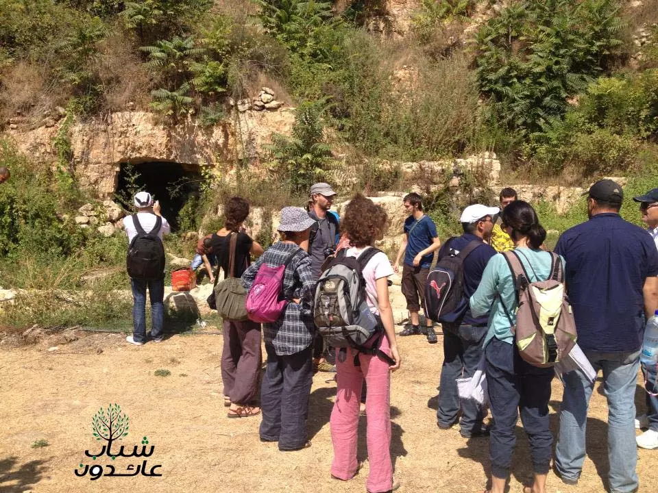
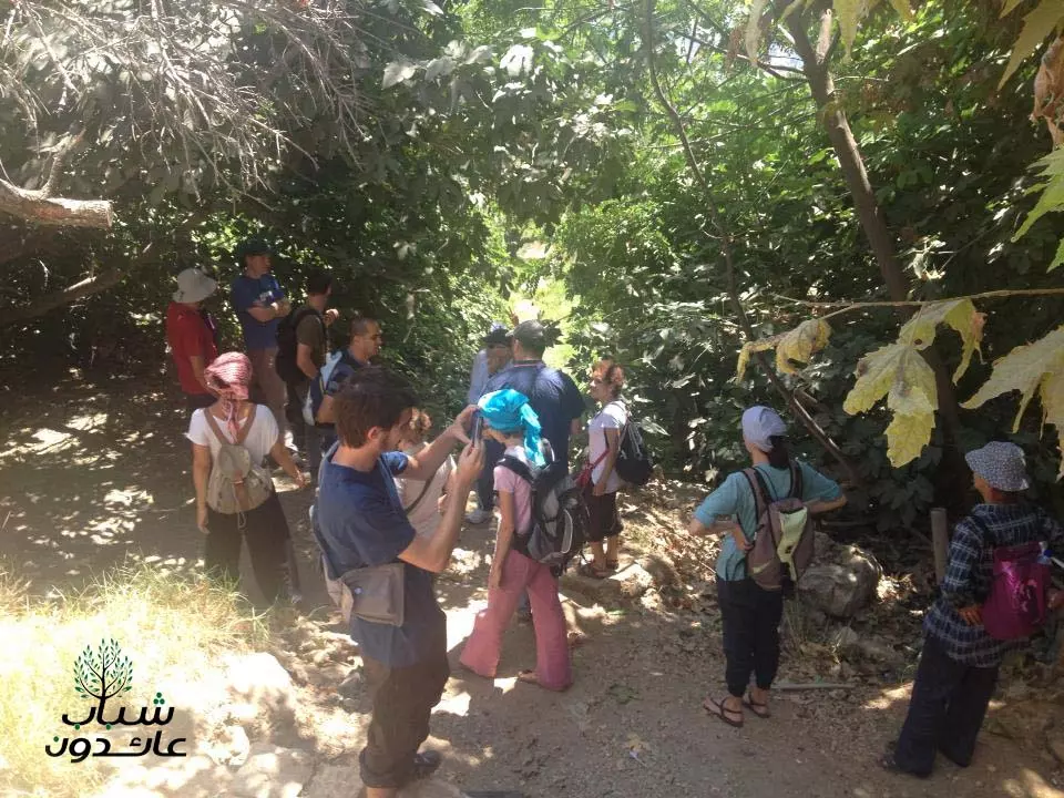
Posted by Nahid - الافطار الأول منذ النكبة على أراضي قالونيا برعاية شباب عائدون الجمعة (15 رمضان لعام 1433 هجري) الموافق 3 أغسطس 2012 ميلادي
Posted by Nahid - صورة ل الافطار الأول منذ النكبة على أراضي قالونيا برعاية شباب عائدون
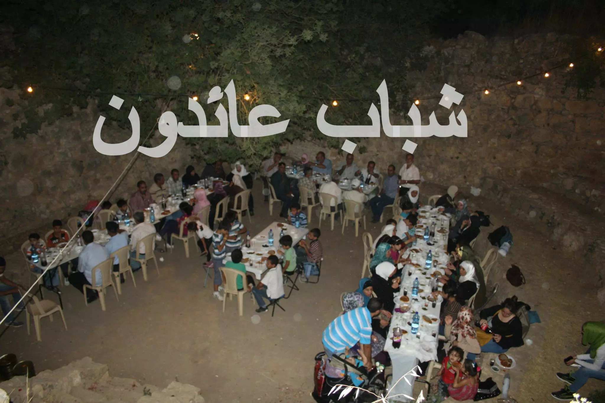
Posted by Nahid - قالونيا - الجمعة (15 رمضان لعام 1433 هجري) الموافق 3 أغسطس 2012 ميلادي
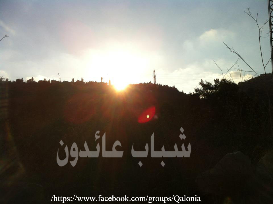
Posted by Nahid - غروب قالونيا - الجمعة (15 رمضان لعام 1433 هجري) الموافق 3 أغسطس 2012 ميلادي
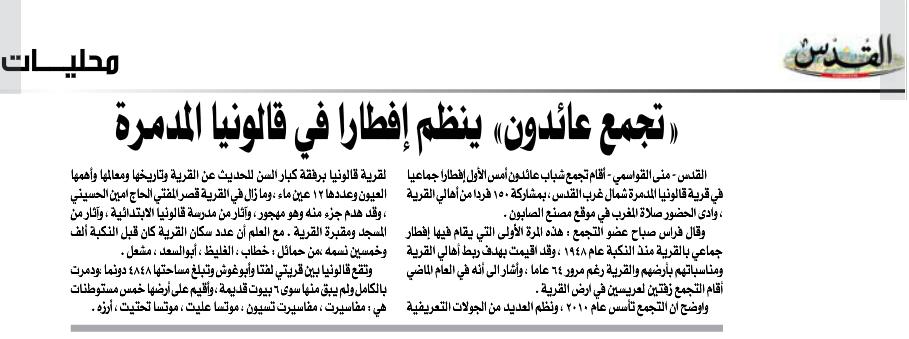
Posted by Nahid - عن الافطار في قالونيا ب جريدة القدس ٧/٨/٢٠١٢
Posted by Nahid - صورة لاحد البيوت الصامدة

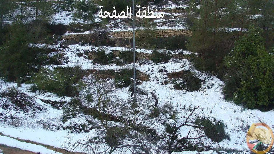
Posted by خالد دويات 2 - منطقة الصفحة - قالونيا
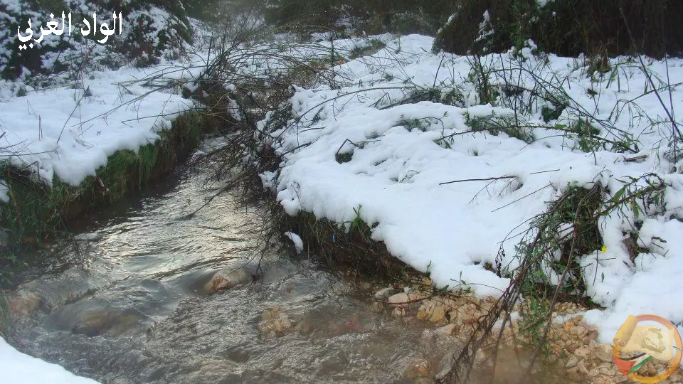
Posted by Nahid - الواد الغربي - قالونيا
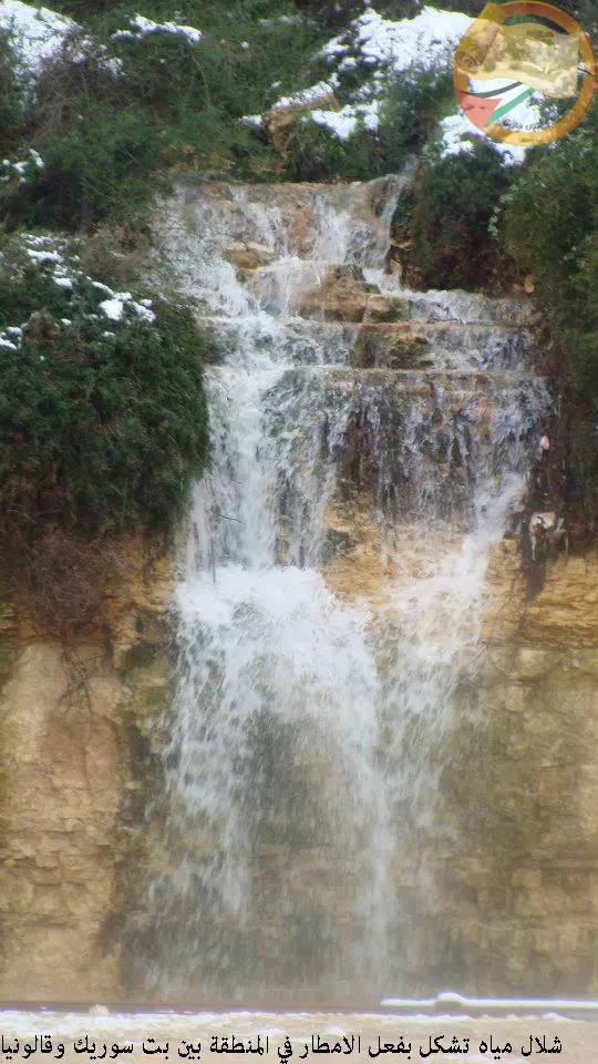
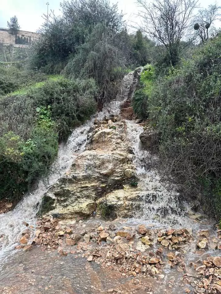
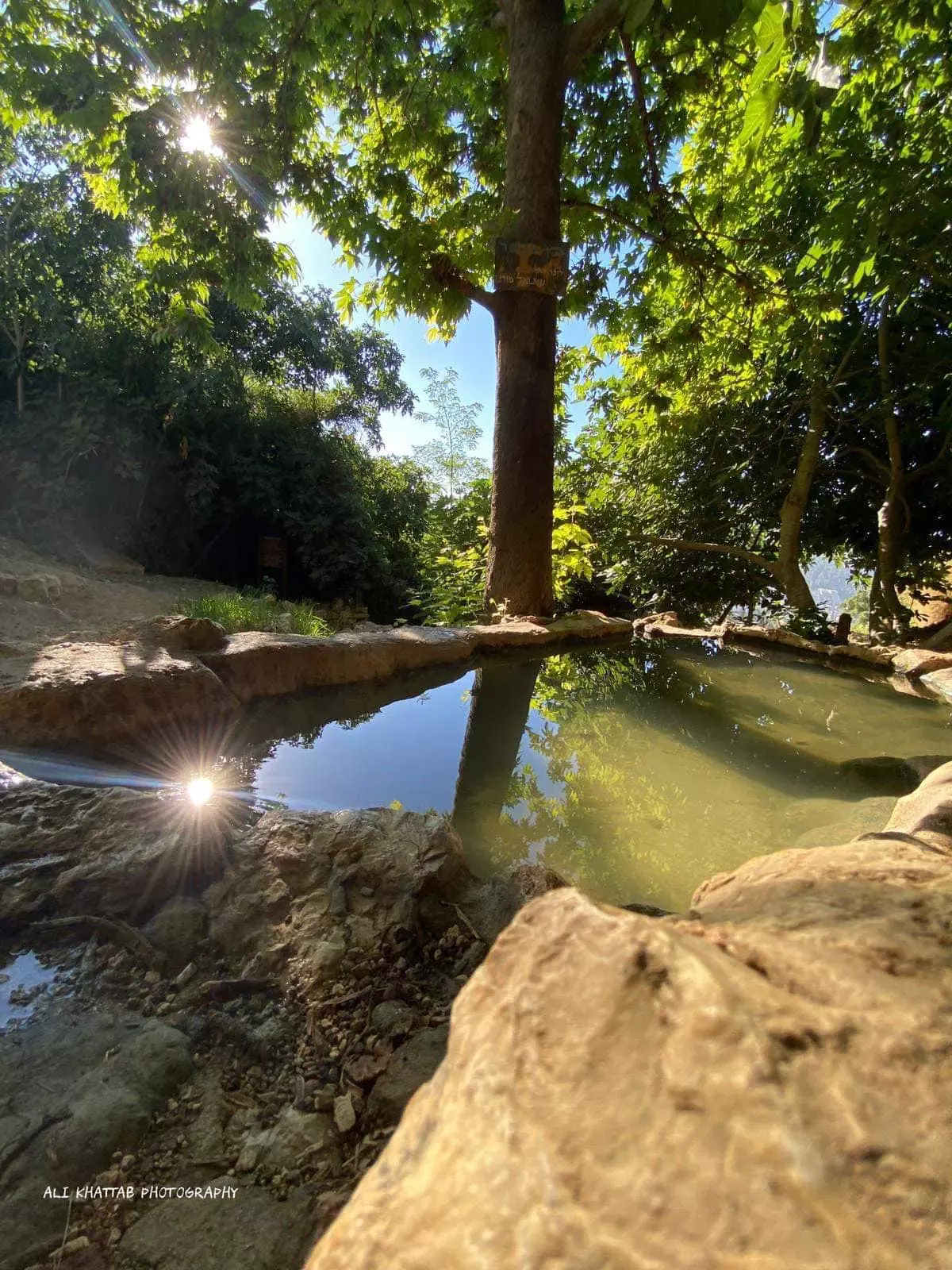
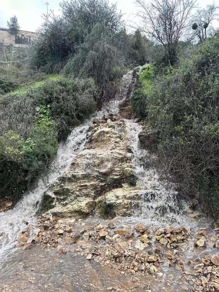
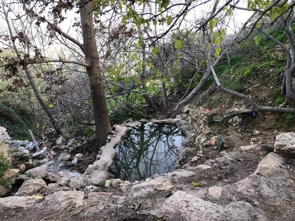
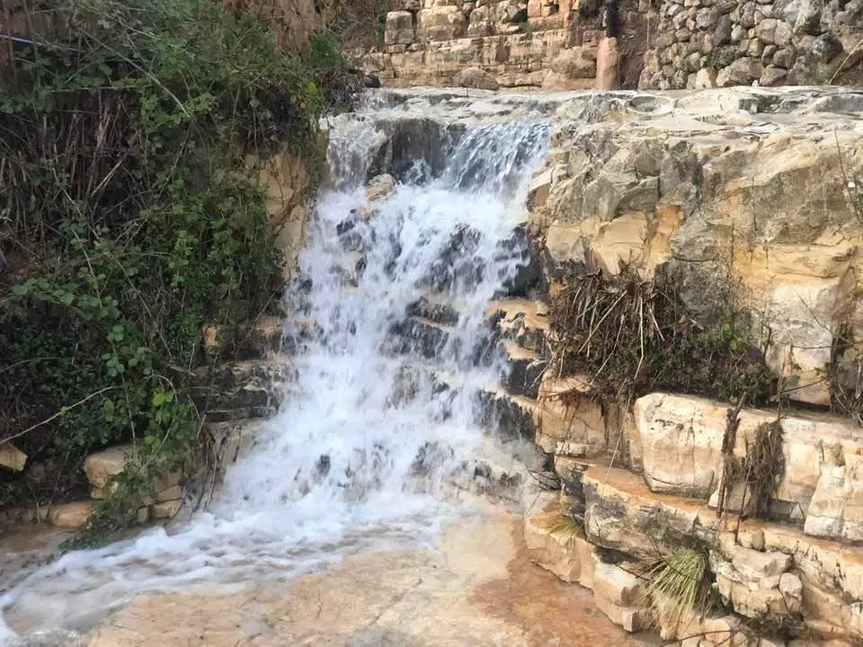
Posted by Nahid - شلال مياه في قالونيا
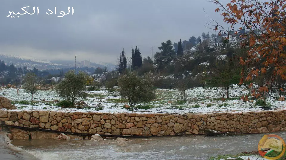
Posted by Nahid - الواد الكبير - قالونيا
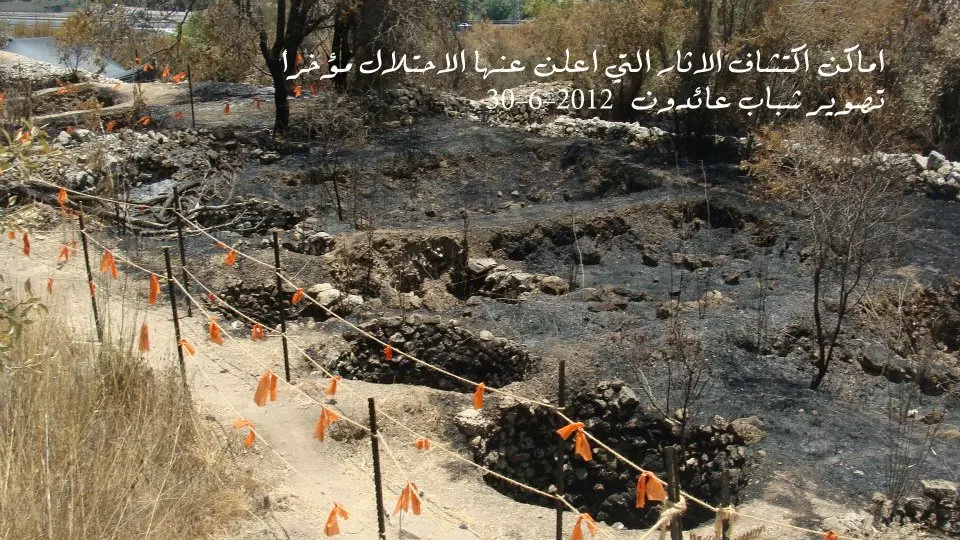
Posted by Nahid - اماكن اكتشاف الاثار التي اعلن عنها الاحتلال مؤخراً في قالونيا 30-6-.2012
Posted by Nahid - تنظيف مقبره قالونيا
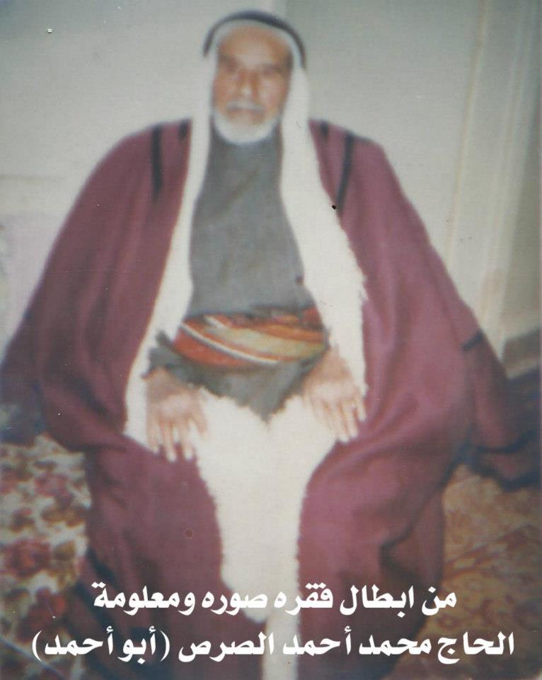
Posted by Nahid - محمد احمد الصرص - ابواحمد
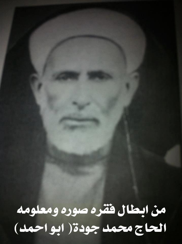
Posted by Nahid - الحاج محمد جودة - ابو احمد
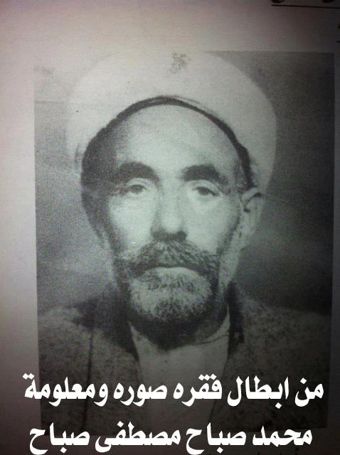
Posted by Nahid - محمد صباح مصطفي صباح
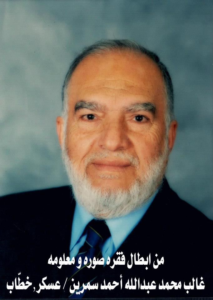
Posted by Nahid - غالد محمد عبدالله احمد سمرين - عسكر - خطاب
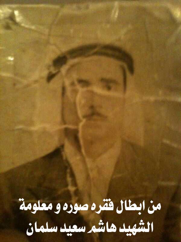
Posted by Nahid - الشهيد هاشم اسماعيل سلمان
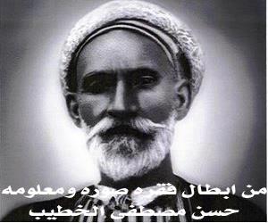
Posted by Nahid - حسن مصطفى الخطيب
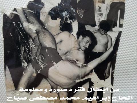
Posted by Nahid - ابراهيم محمد مصطفى صباح
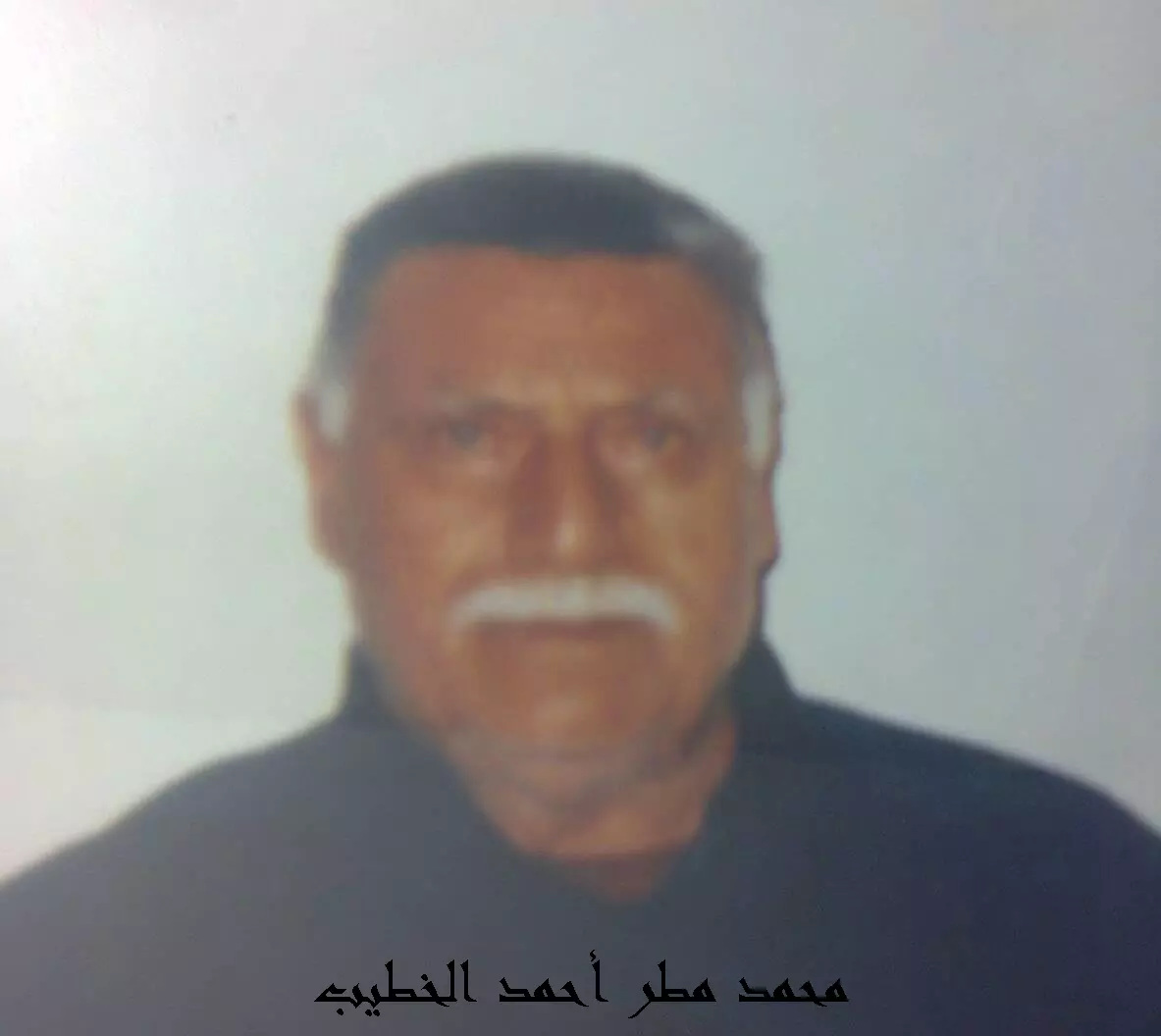
Posted by Nahid - محمد مطر احمد الخطيب
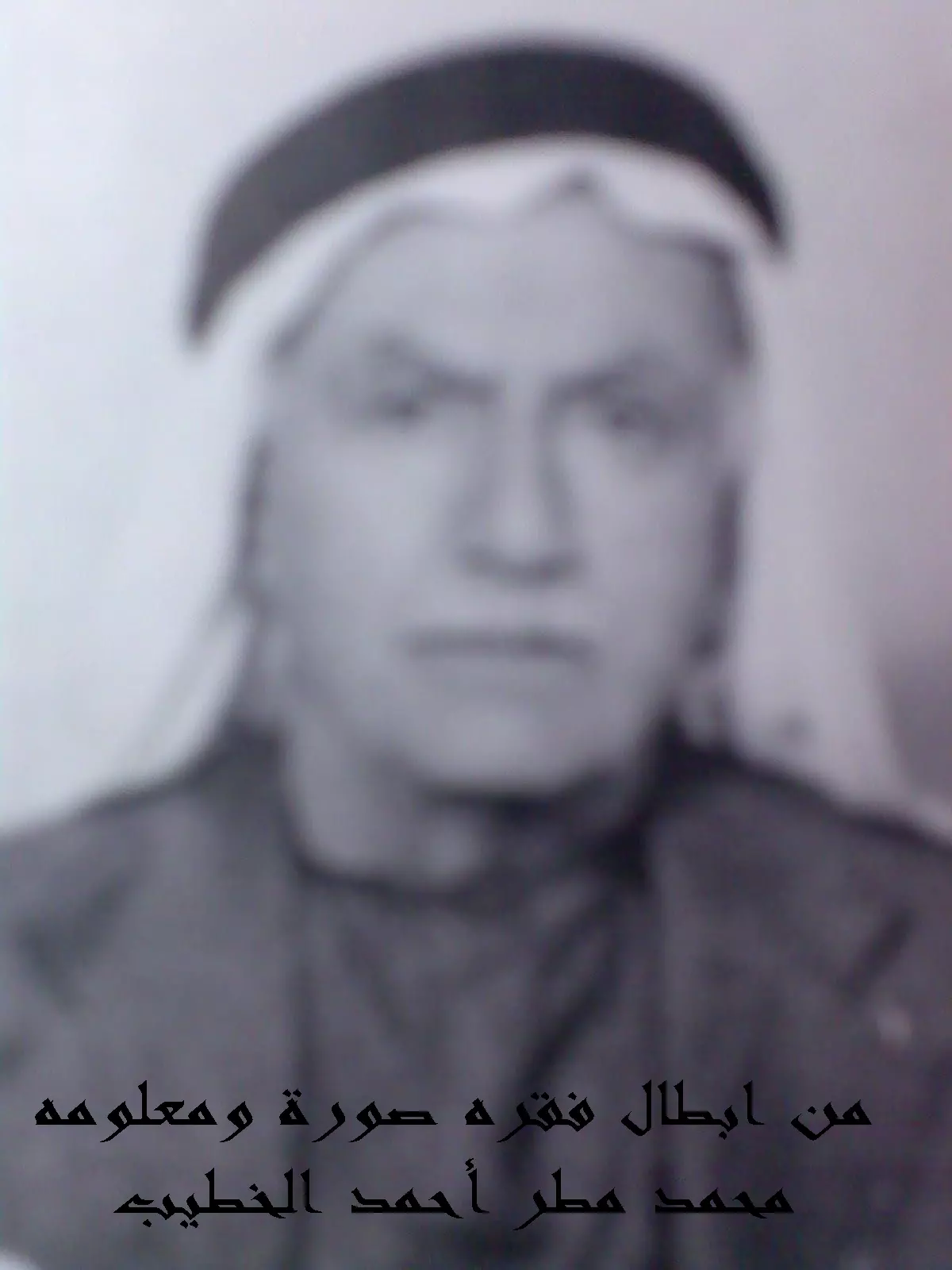
Posted by Nahid - محمد مطر احمد الخطيب
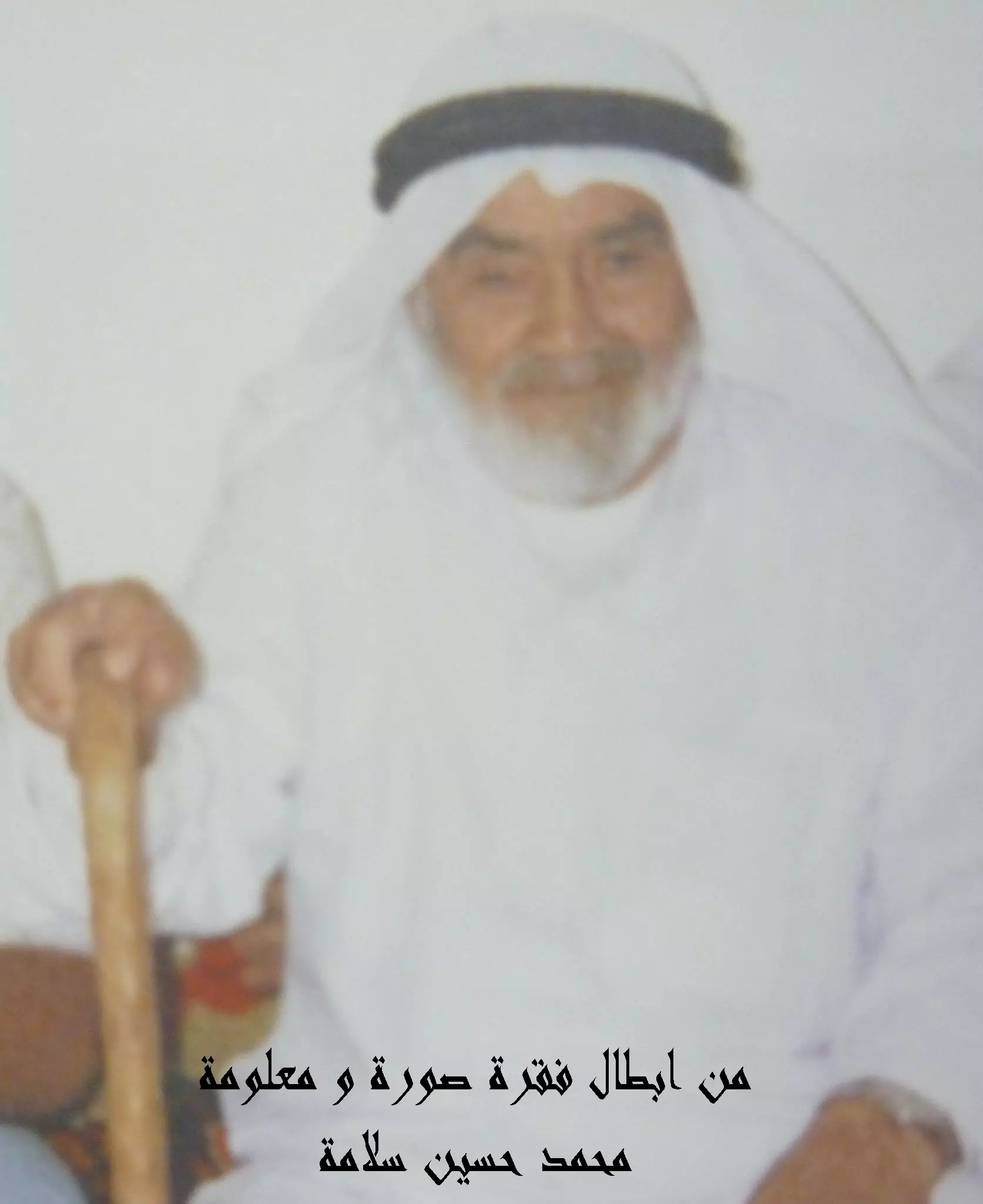
Posted by Nahid - محمد حسين سلامة
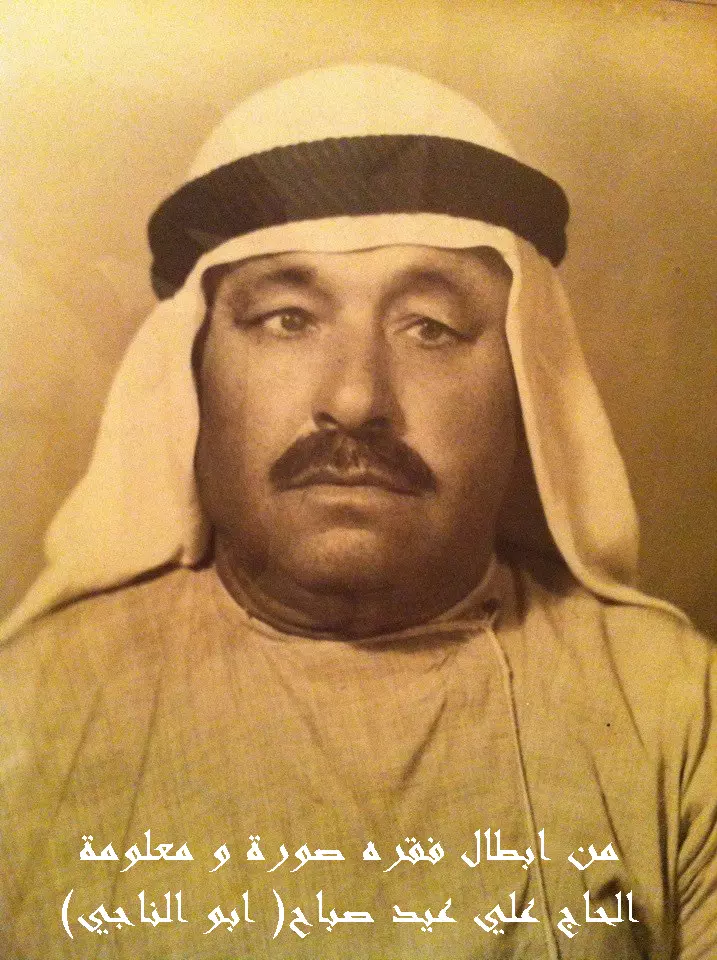
Posted by Nahid - علي عيد صباح - ابو الناجي
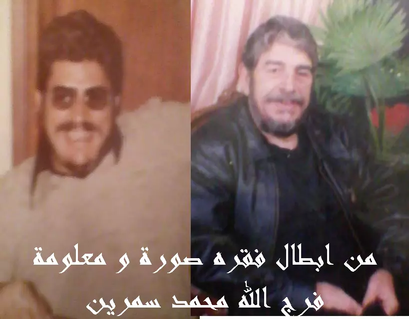
Posted by Nahid - فرج الله محمد سمرين
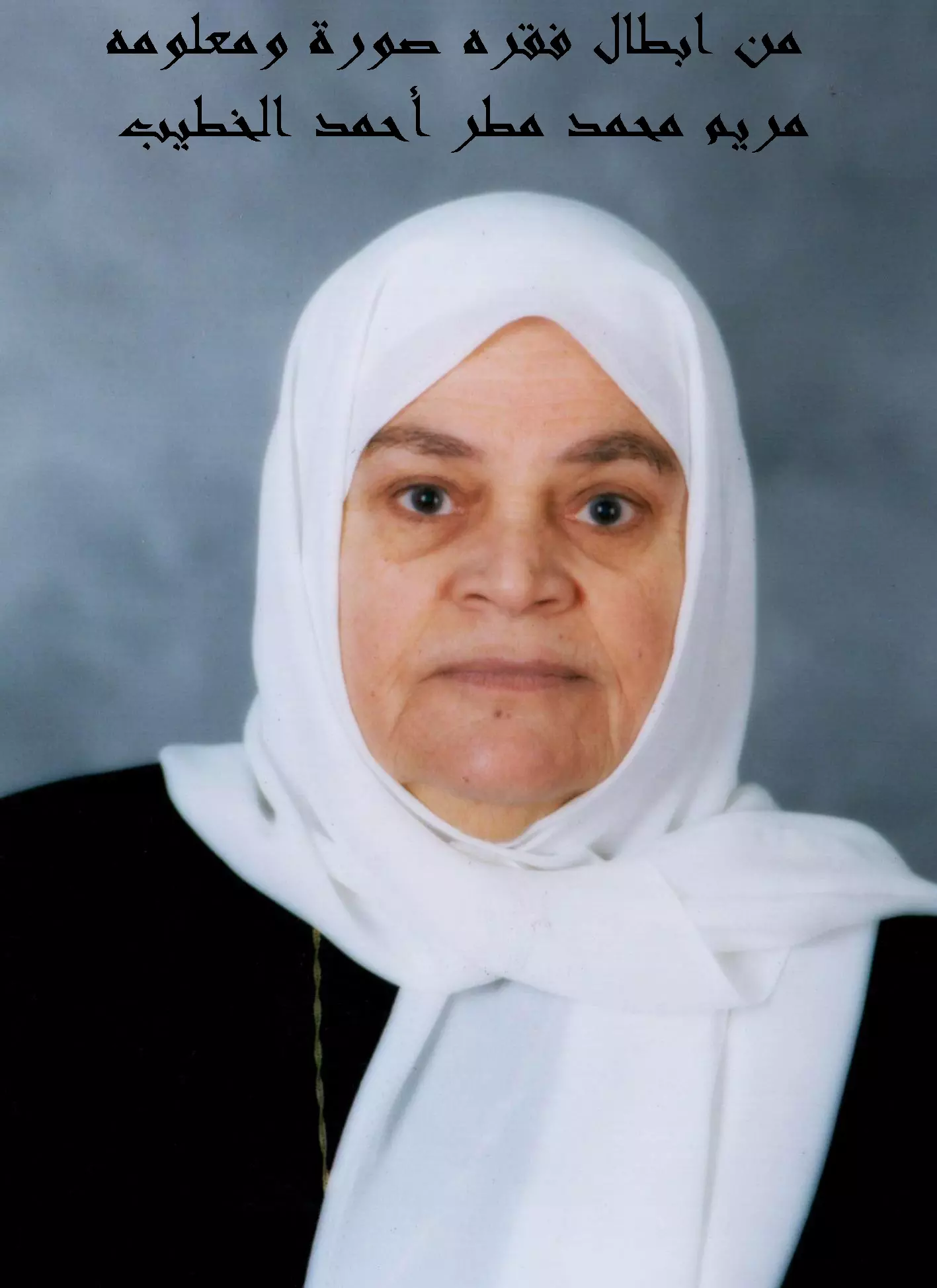
Posted by Nahid - مريم محمد مطر احمد الخطيب
Posted by Nahid - صور ملتقطة من قبل شباب عائدون
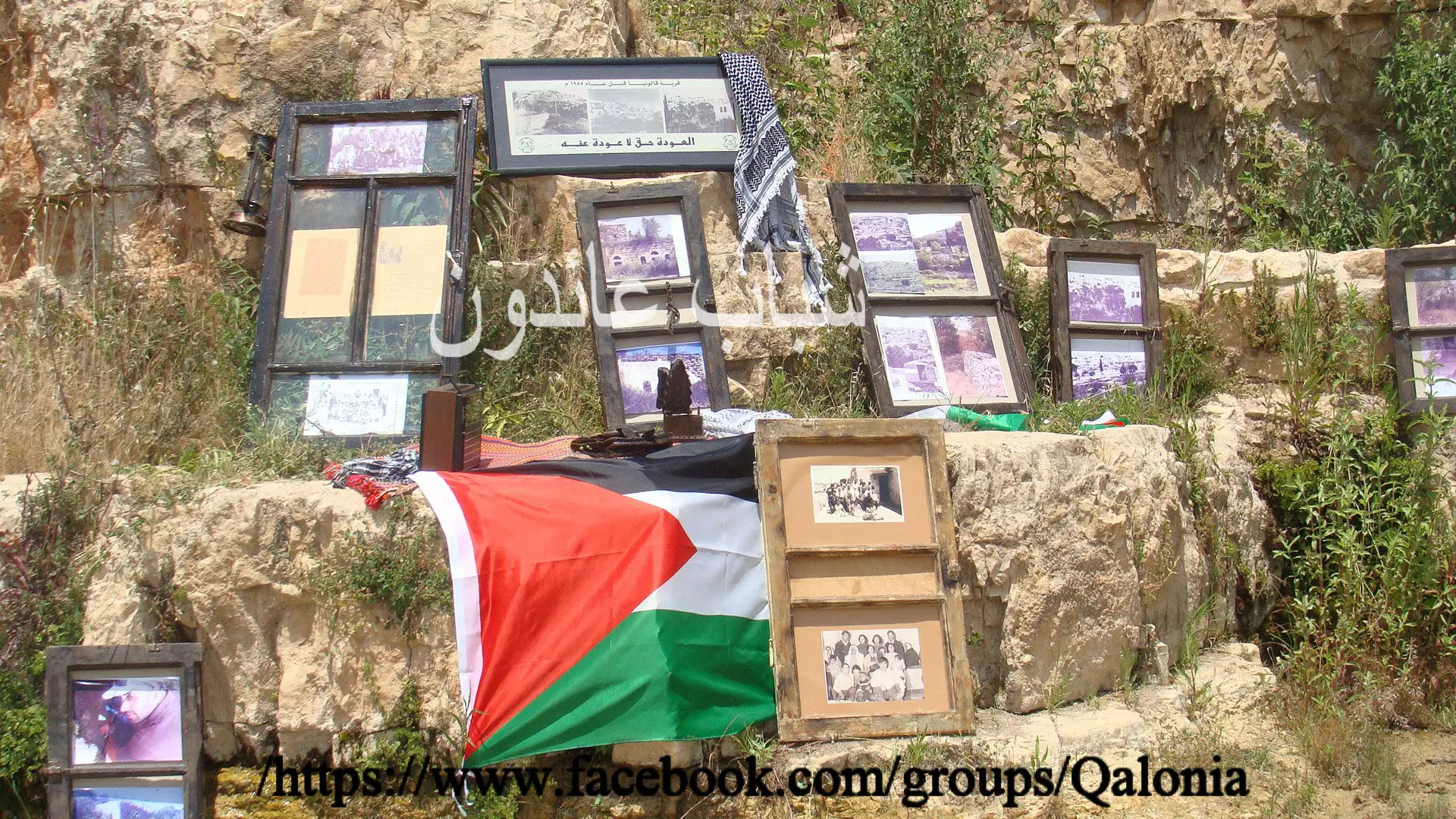
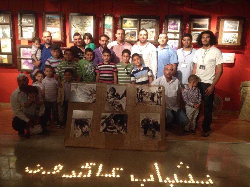
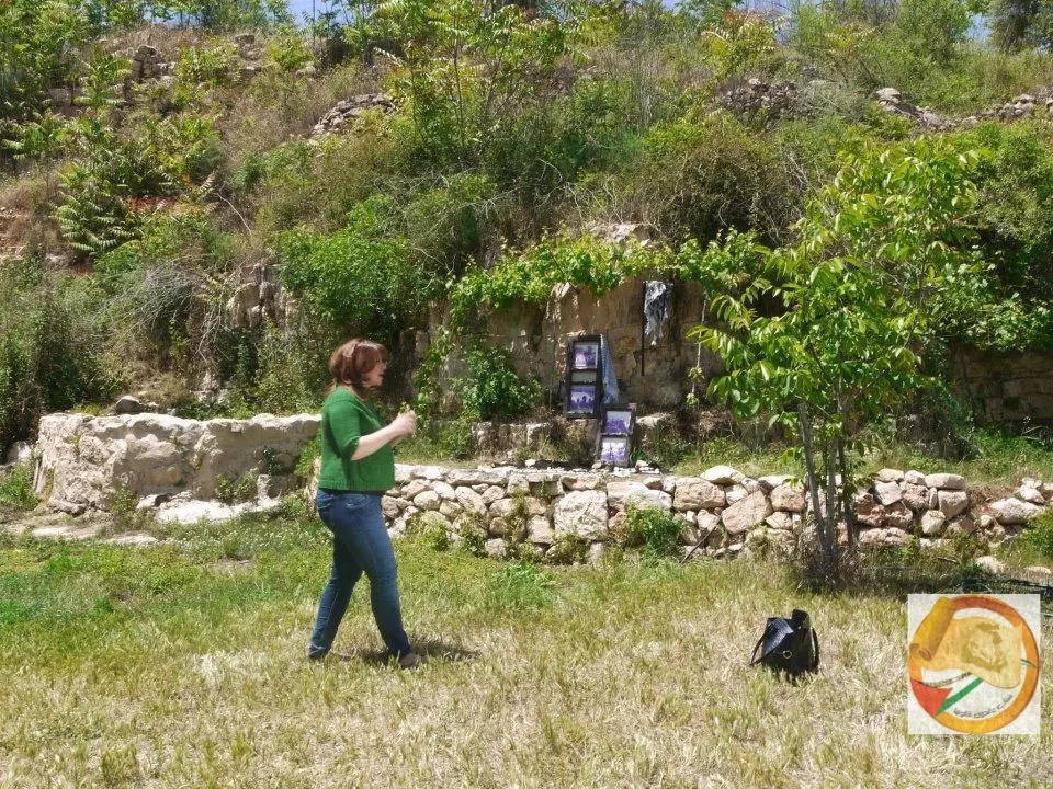
Posted by Nahid - براعم عائدون في معرض قالونيا على درب العودة
Posted by Nahid 1 - قالونيا على درب العودة
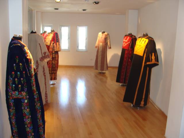
Posted by Nahid - ازياء قالونيا في معرض قالونيا على درب العودة
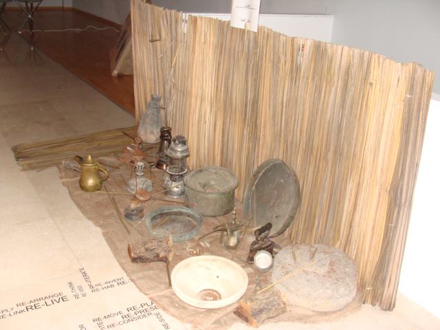
Posted by Nahid - ادوات من ايام قالونيا معروضه في معرض قالونيا على درب العودة
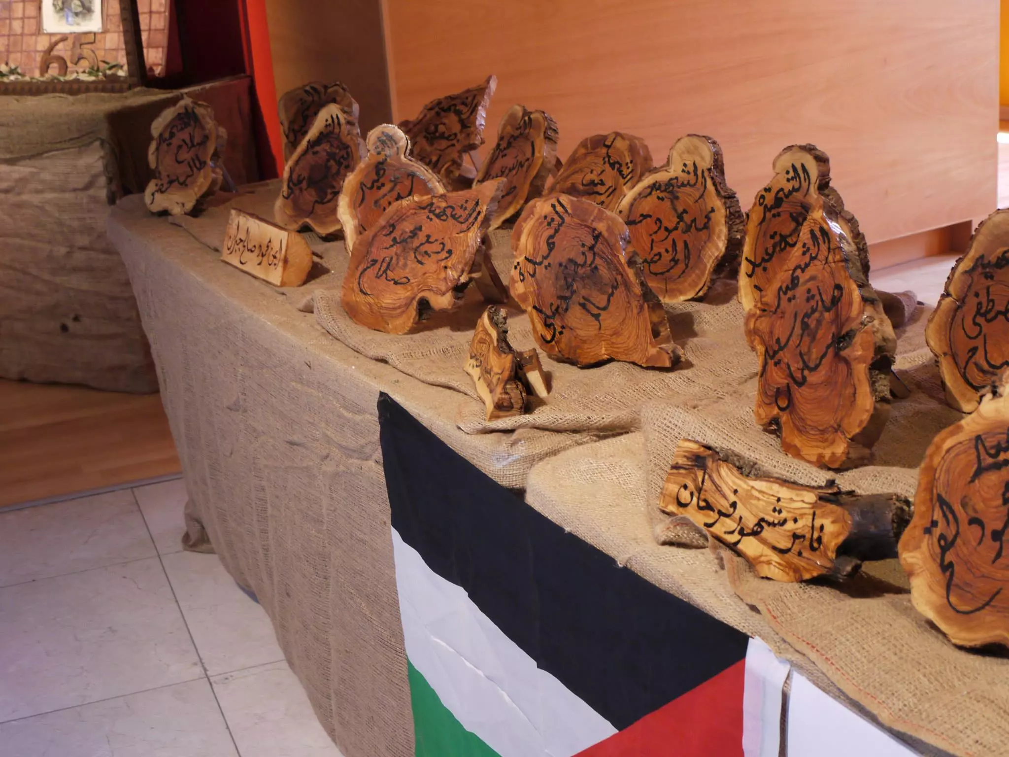
Posted by Nahid - زاويه شهداء قالونيا في معرض قالونيا على درب العودة
Posted by Nahid - شباب عائدون قالونيا
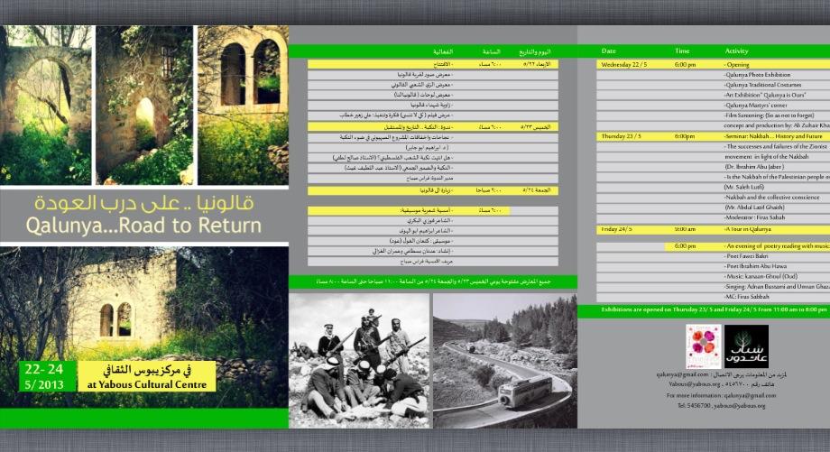
Posted by Nahid - بروشور قالونيا على درب العودة
Posted by Nahid - معالي وزير القدس في معرض قالونيا على درب العودة
Posted by Nahid - احمد حماد مؤلف كتاب قالونيا في ذاكرة الاجيال امام عين العصافير في قالونيا
Posted by Nahid - الاستاذ احمد حماد والمحامي فراس صباح عائدون الي قالونيا
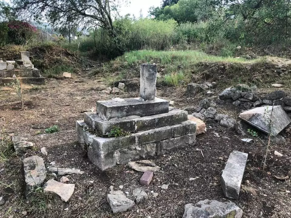
Posted by Nahid - المرحلة الثانية من تنظيف مقبرة قرية قالونيا
Posted by Nahid - احد القبور التي رممت في قالونيا
Posted by Nahid - قبر بعد الترميم
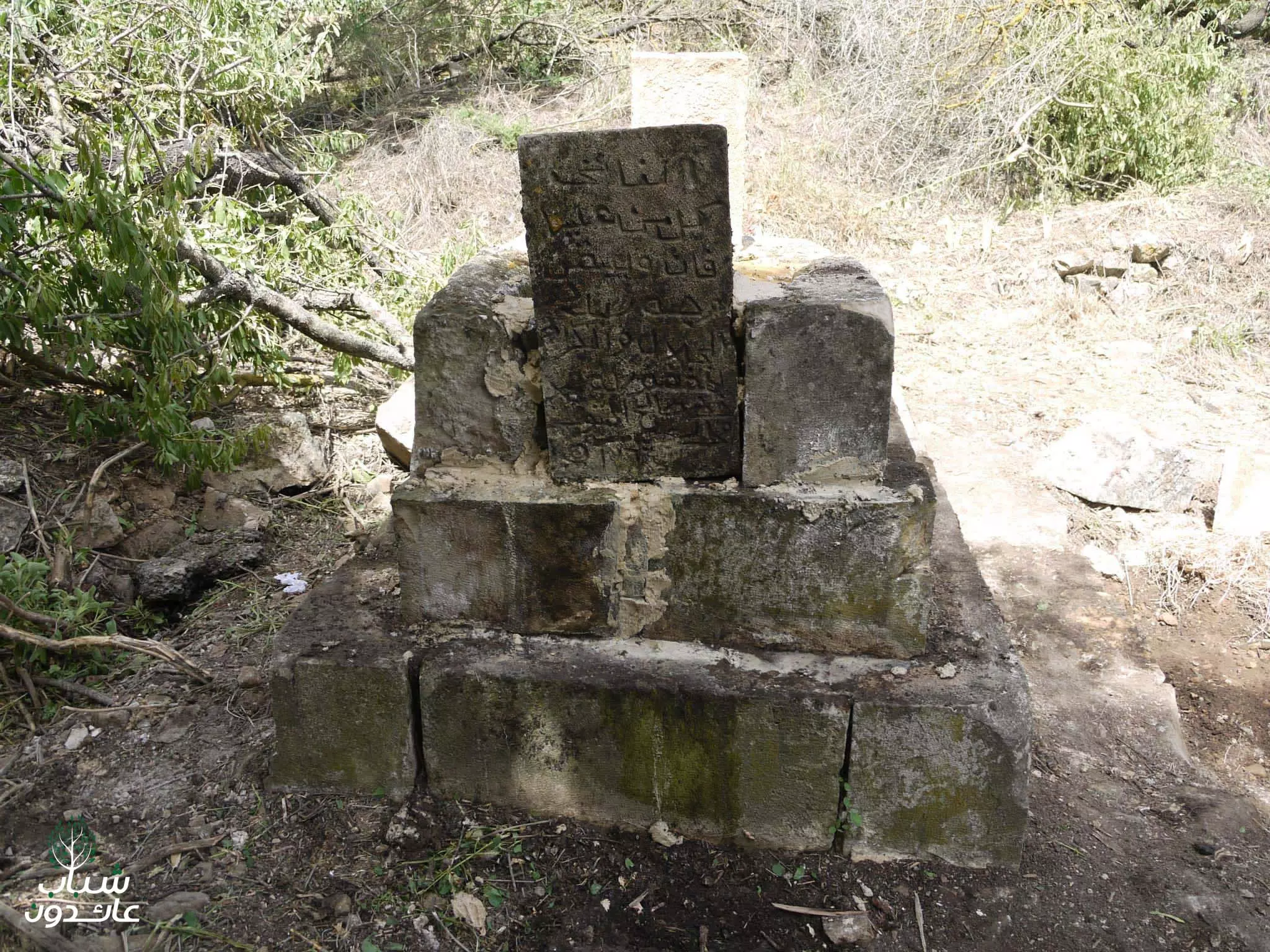
Posted by Nahid - قبور قالونيا قبل الترميم
Posted by Nahid - خطبة وصلاة الجمعة للشيخ رائد صلاح يوم الجمعة القادم 14/6/13 في قرية قالونيا المهجرة. برعاية شباب عائدون
Posted by Nahid - خطبة وصلاة الجمعة للشيخ رائد صلاح يوم الجمعة القادم 14/6/13 في قرية قالونيا المهجرة. برعاية شباب عائدون
Posted by Nahid - خطبة وصلاة الجمعة للشيخ رائد صلاح يوم الجمعة القادم 14/6/13 في قرية قالونيا المهجرة. برعاية شباب عائدون
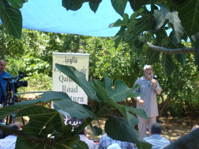
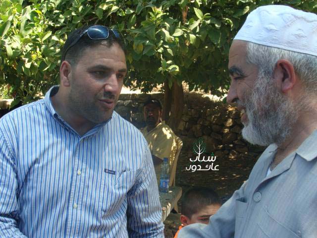
Posted by Nahid - الشيخ رائد صلاح وفراس صباح يوم الجمعة القادم 14/6/13 في قرية قالونيا المهجرة. برعاية شباب عائدون
Posted by Nahid - قناة الجزيره في ربوع قالونيا برعاية شباب عائدون
Posted by Nahid - تصوير حلقة برنامج قلب القدس في ربوع قالونيا مع شباب عائدون
Posted by Nahid - تصوير حلقة برنامج قلب القدس في ربوع قالونيا مع شباب عائدون
Posted by Nahid - ربيع قالونيا في 2013
Posted by Nahid - ربيع قالونيا في 2013
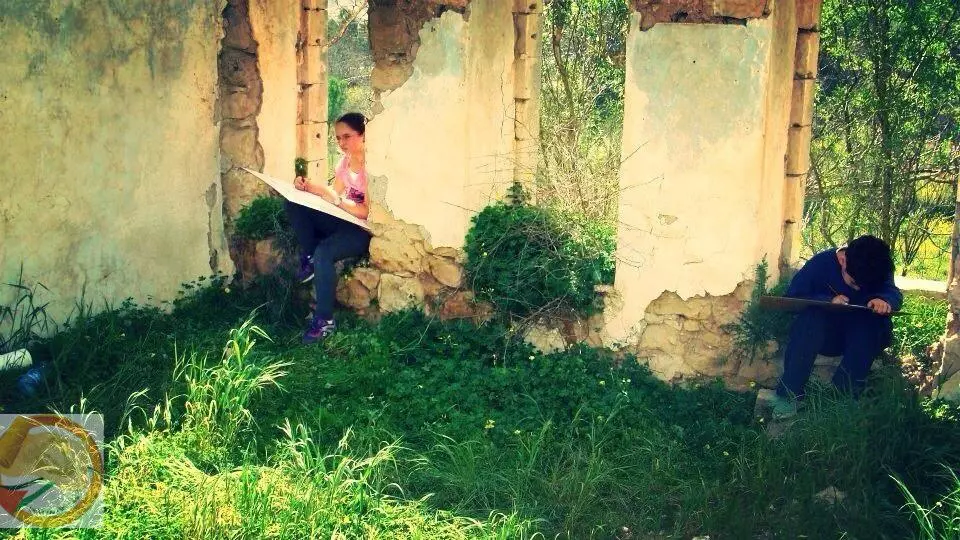
Posted by Nahid - اطفال يرسمون قالونيا من ضمن فعاليات " قالونيا لنا "
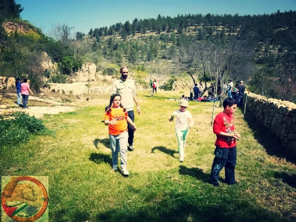
Posted by Nahid - اطفال يرسمون قالونيا من ضمن فعاليات " قالونيا لنا "
Posted by Nahid - صورة لقصر المفتي في ربوع قالونيا في ربيع 2013
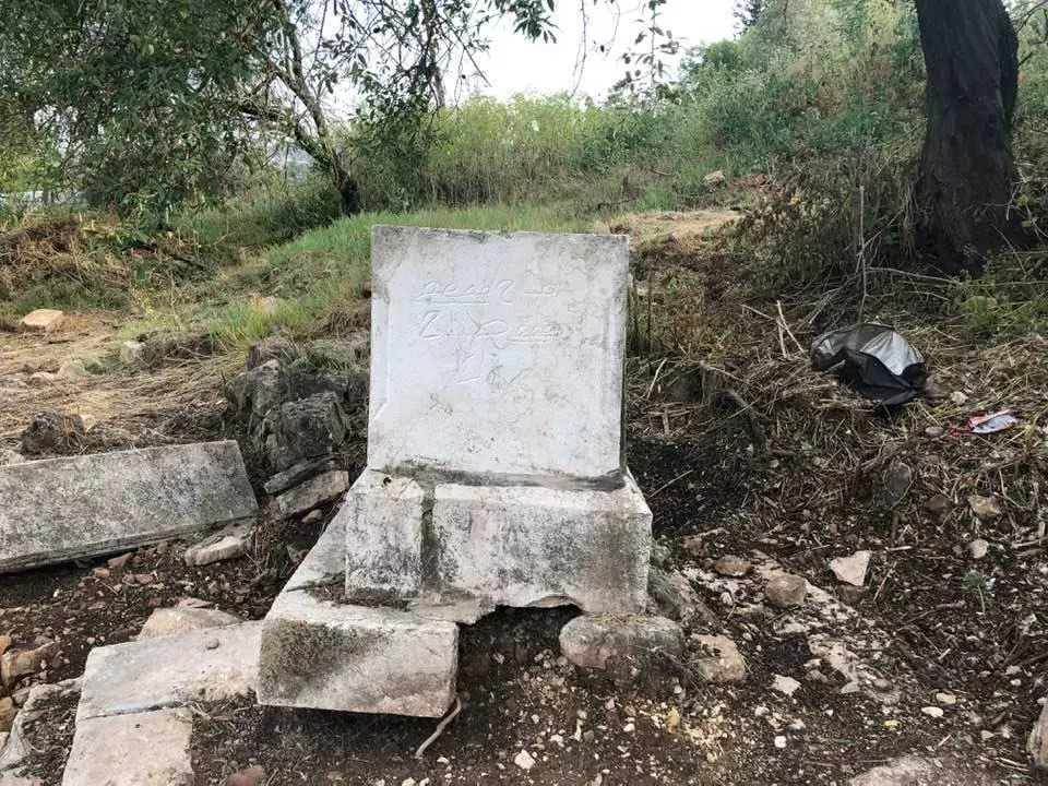
Posted by Nahid - اثار الاعتداء الغاشم على مقبرة قالونيا July 27, 2013
Posted by Nahid - وفد ايطالي يزور قالونيا مع شباب عائدون ضمن برنامج "السياحة البديلة " سياسي وطني
Posted by Nahid - وفد ايطالي يزور قالونيا مع شباب عائدون ضمن برنامج "السياحة البديلة " سياسي وطني
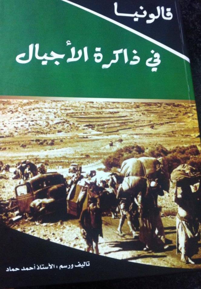
Posted by Nahid - غلاف كتاب قالونيا في ذاكرة الاجيال ل الاستاذ احمد حماد
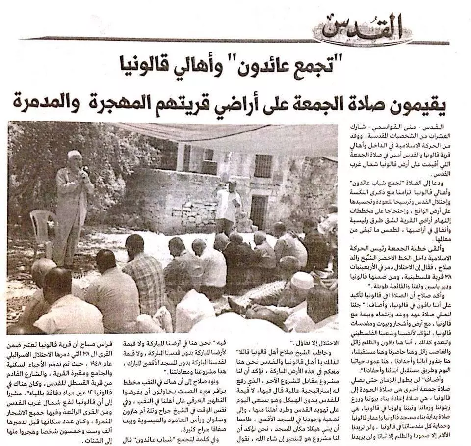
Posted by Nahid - خبر اقامة صلاة الجمعة في ربوع قالونيا في جريدة القدس
Posted by Nahid - المرحوم يوسف حسن الخطيب-مختار قالونيا
Posted by اسامه الخطيب - شخصية من قالونيا يحيى يوسف حسن الخطيب
Posted by اسامه الخطيب - قالونيا الغربيه - كتاب قريتي قالونيا - غالب سمرين - رفع شباب عائدون - https://www.facebook.com/groups/Qalonia/
Posted by Nahid - قالونيا الشرقيه - كتاب غالب سمرين - رفع شباب عائدون - https://www.facebook.com/groups/Qalonia/
Posted by Nahid - قالونيا الغربيه من كتاب قريتي قالونيا - ل غالب سمرين - رفع شباب عائدون - https://www.facebook.com/groups/Qalonia/
Posted by Nahid - قالونيا الشمالية من كتاب قريتي قالونيا لاستاذ غالب سمرين - رفع شباب عائدون - https://www.facebook.com/groups/Qalonia/
Posted by Nahid - خارطه قالونيا رسم رمزي سمرين ب اشراف غالب سمرين - فع شباب عائدون - https://www.facebook.com/groups/Qalonia/
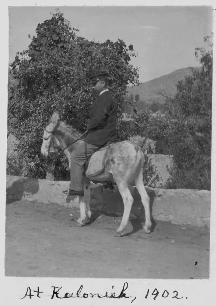
Posted by Nahid - Qalunya in 1902
Posted by Umar Abu El-Bararri - Qalunya in 1902
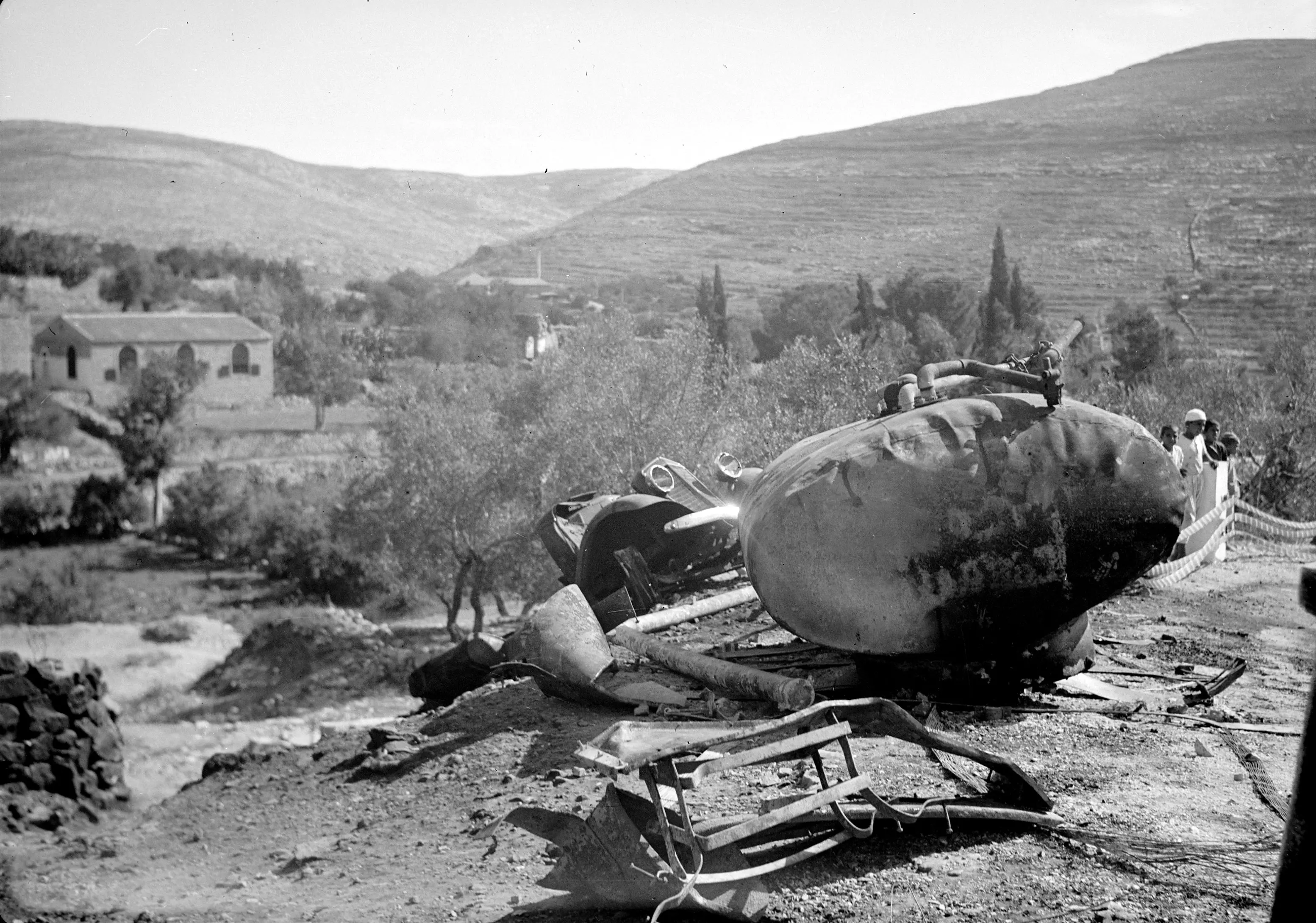
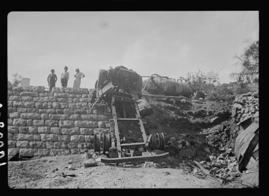
Posted by Umar Abu El-Bararri - A Shell Truck with gasoline burns in Qalunya October 29, 1938
Posted by Umar Abu El-Bararri - قالونيا عام 1918 اثناء الحرب العالميه الاولى ويظهر جندي استرالي
Posted by hussein abdo - عين ماء في اراضي قالونيا
Posted by abu raya - اراضي قالونيا
Posted by abu raya - قالونيا
Posted by abu raya - قالونيا
Posted by abu raya - قالونيا
Posted by abu raya - قالونيا القرن 19-ابو عمر الصفافي
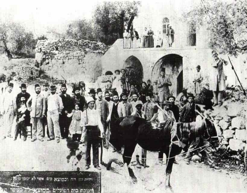
Posted by ابو عمر - مغتصبون يهود في قالونيا مطلع القرن العشرين
Posted by ابو عمر - قولونيا سنه 1938
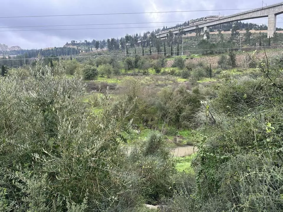
Posted by abu raya - منظر حديث من الجو يظهر اراضي قاونيا؛ دقق بطريقة اسطصلاح الاراضي وبناء السناسل لمنع الانجرافات التربية
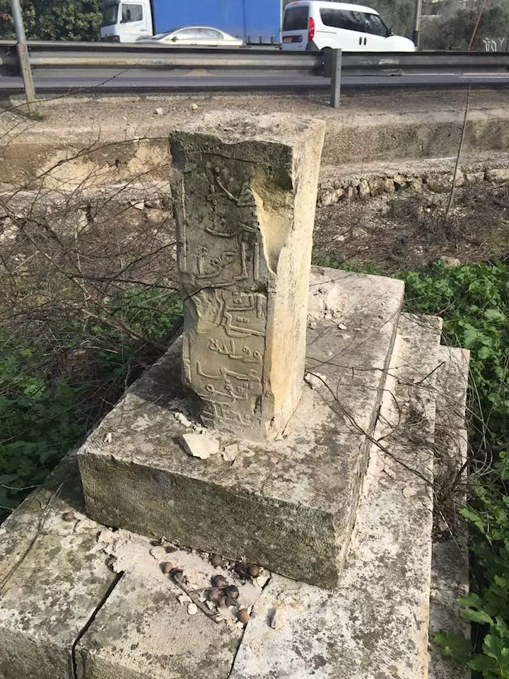
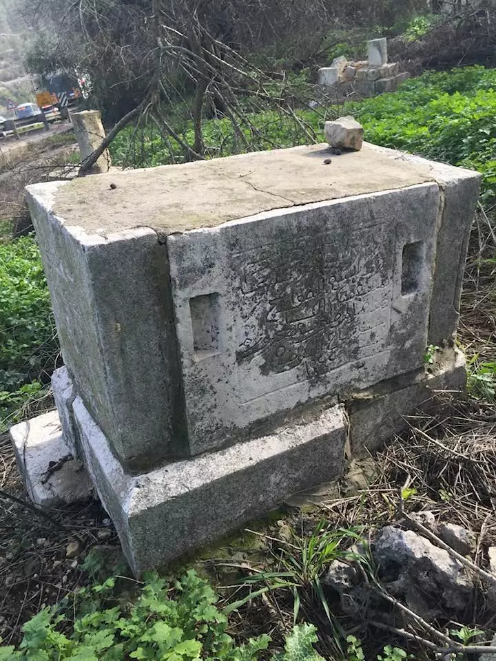
- ما بقي من أطلال مقام الشيخ عبد العزيز في قرية قالونيا المهجرة (قضاء القدس ). بعدسة علي خطاب
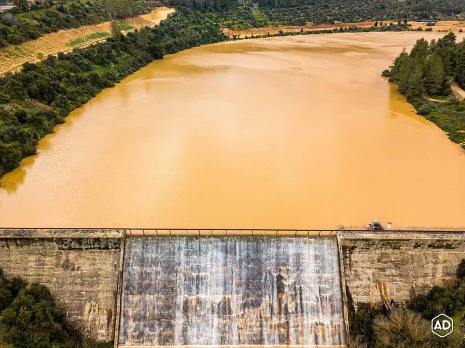
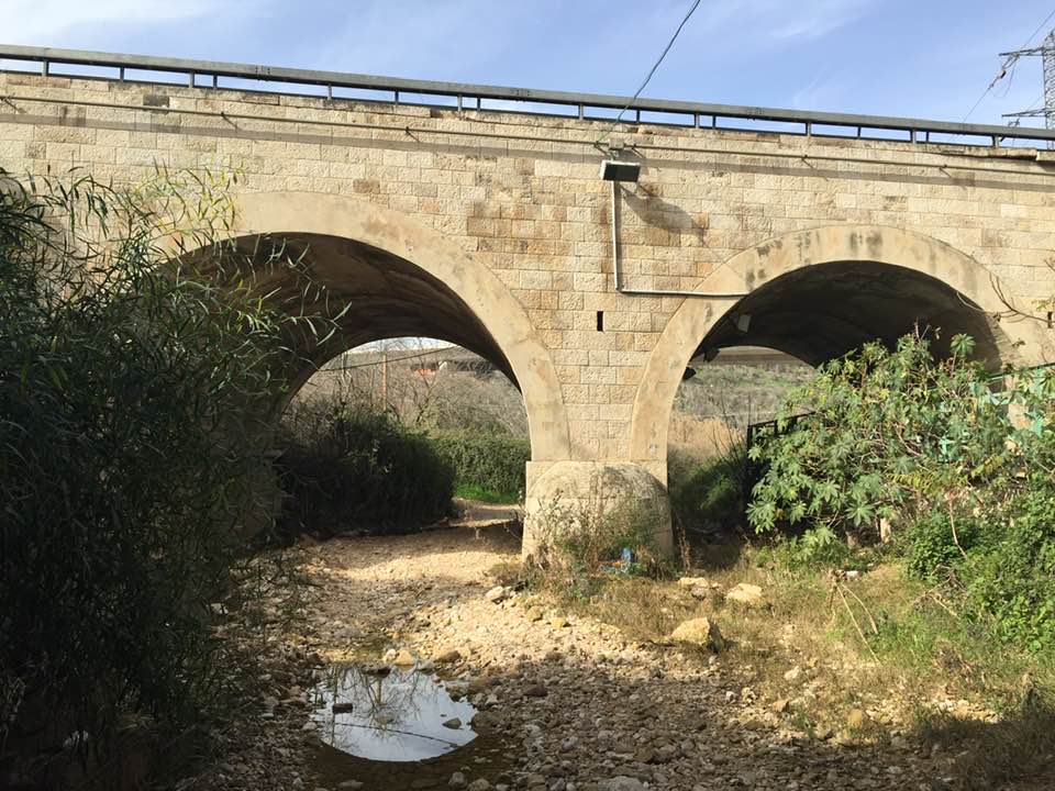
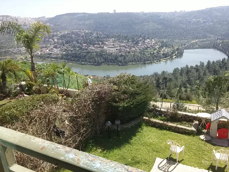
- صور السد في بلدة قالونيا المهجرة قضاء #القدس المحتلة. تصوير: Bassam Galed
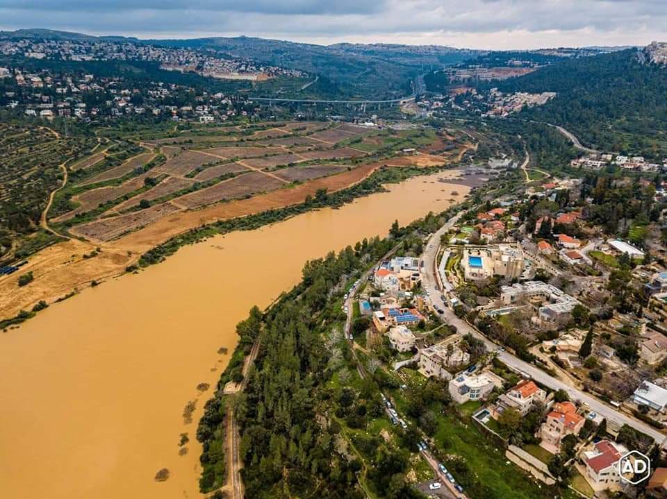
- صور السد في بلدة قالونيا المهجرة قضاء #القدس المحتلة. تصوير: Bassam Galed #2
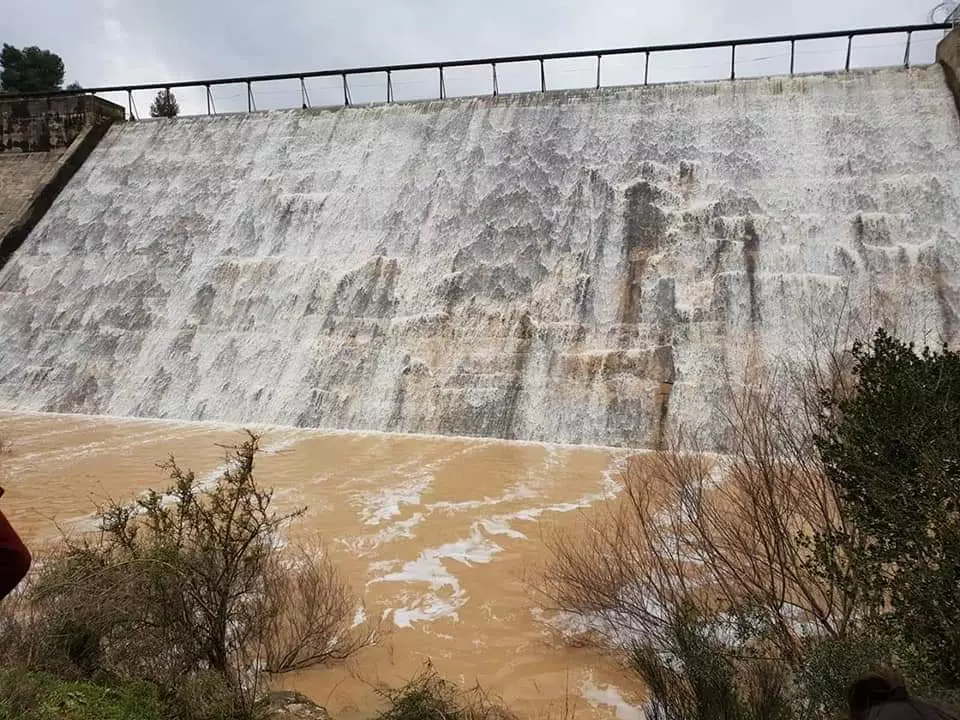
- صور السد في بلدة قالونيا المهجرة قضاء #القدس المحتلة. تصوير: Bassam Galed #3
- صورة نادرة وساحرة لقرية قالونيا قضاء القدس عام 1935..
- من بيوت قرية قالونيا المُهجرة قضاء مدينة القدس

- من بيوت قرية قالونيا المُهجرة قضاء مدينة القدس #2
- من بيوت قرية قالونيا المُهجرة قضاء مدينة القدس #3
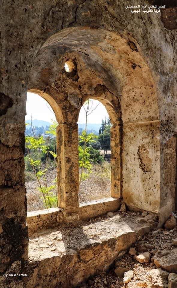
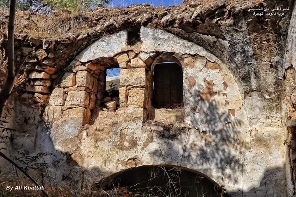
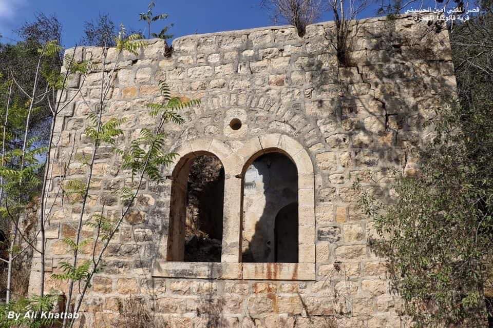
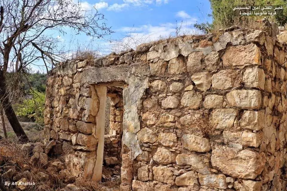
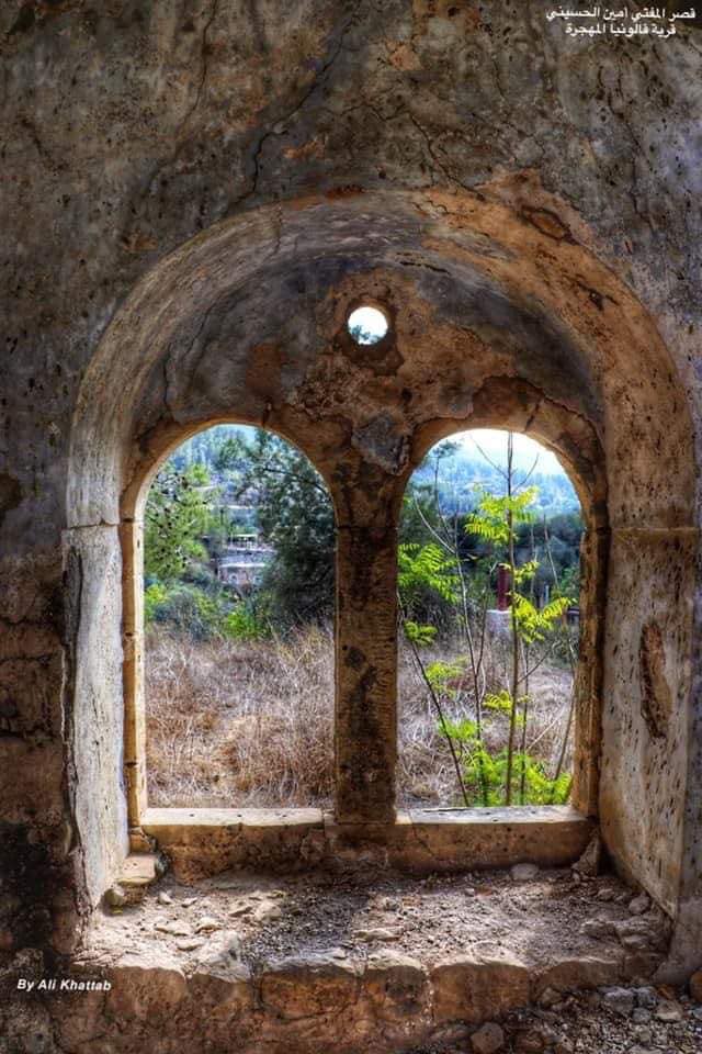
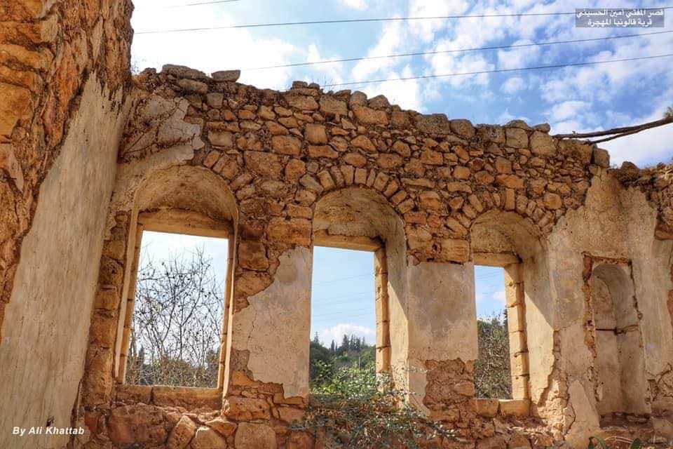
- مجموعة من الصور تعود لقرية قالونيا قضاء القدس والبيت يعود لمفتي القدس الشيخ أمين الحسيني..
- مجموعة من الصور تعود لقرية قالونيا قضاء القدس والبيت يعود لمفتي القدس الشيخ أمين الحسيني.. #2

- مجموعة من الصور تعود لقرية قالونيا قضاء القدس والبيت يعود لمفتي القدس الشيخ أمين الحسيني.. #3

- مجموعة من الصور تعود لقرية قالونيا قضاء القدس والبيت يعود لمفتي القدس الشيخ أمين الحسيني.. #4
- مجموعة من الصور تعود لقرية قالونيا قضاء القدس والبيت يعود لمفتي القدس الشيخ أمين الحسيني.. #5
- مجموعة من الصور تعود لقرية قالونيا قضاء القدس والبيت يعود لمفتي القدس الشيخ أمين الحسيني.. #6

- مجموعة من الصور تعود لقرية قالونيا قضاء القدس والبيت يعود لمفتي القدس الشيخ أمين الحسيني.. #7
- مجموعة من الصور تعود لقرية قالونيا قضاء القدس والبيت يعود لمفتي القدس الشيخ أمين الحسيني.. #8

- مجموعة من الصور تعود لقرية قالونيا قضاء القدس والبيت يعود لمفتي القدس الشيخ أمين الحسيني.. #9
- More looted homes by the so-called "civilized"
- More looted homes by the so-called "civilized" #2
- The village 8 years before the "civilized" replaced us
- The village 8 years before the "civilized" replaced us #2
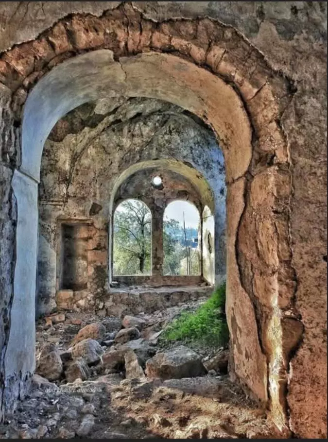
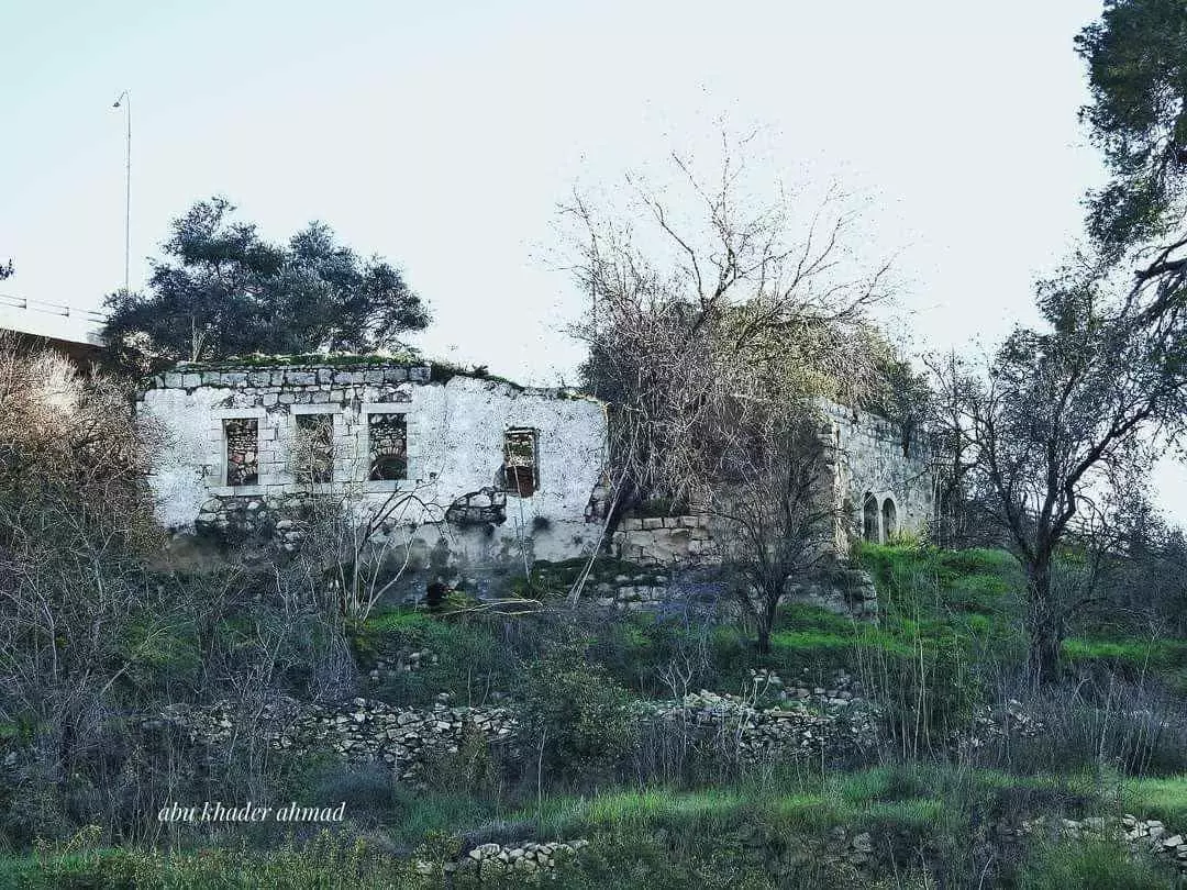
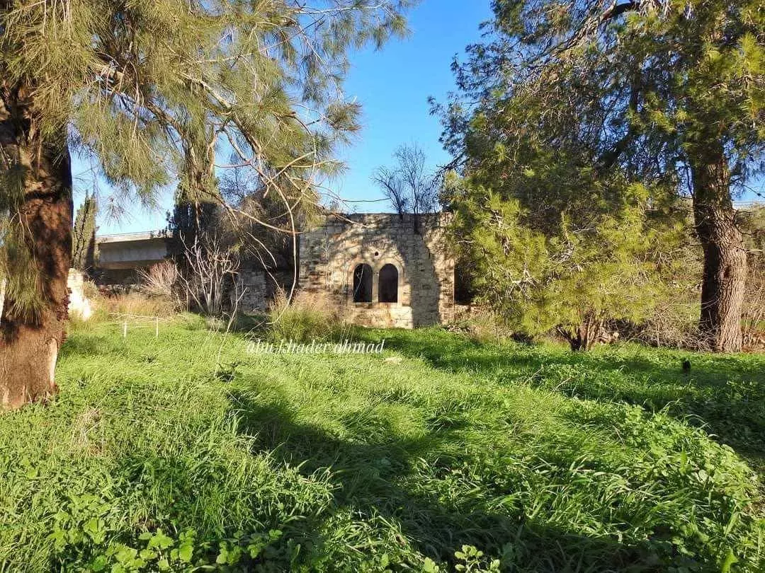
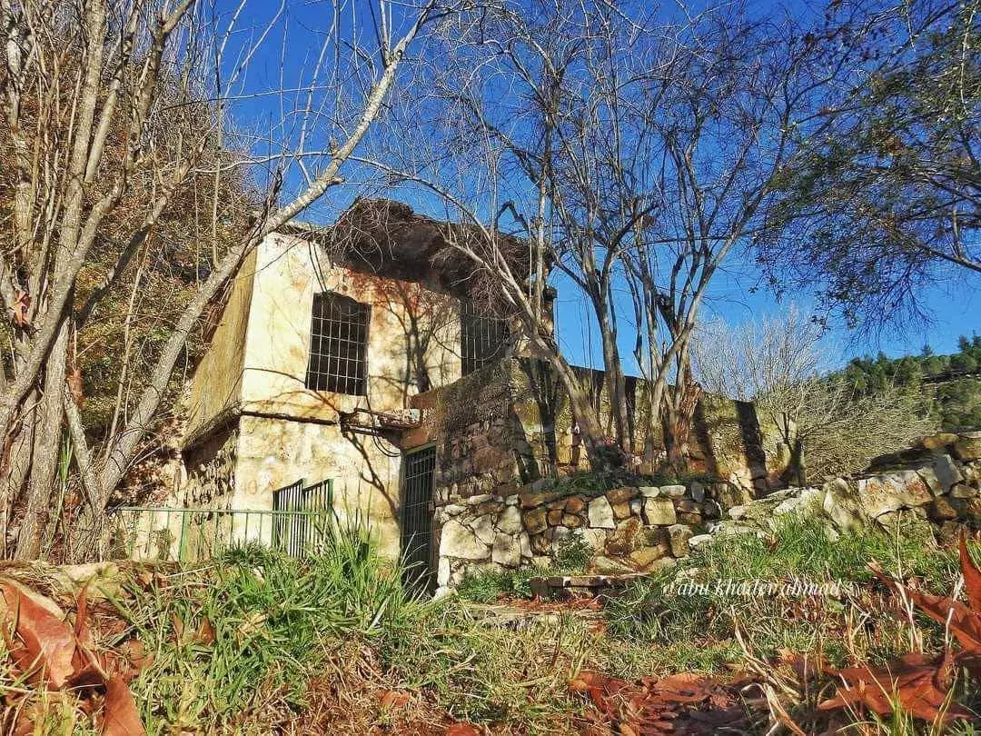
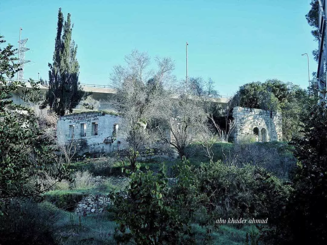
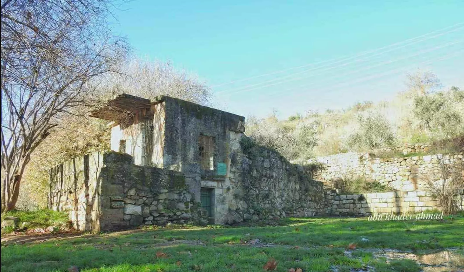
- جولة بين بيوت القرية الهجرة -- Abu Khader Ahmad Jbaren
- جولة بين بيوت القرية الهجرة -- Abu Khader Ahmad Jbaren #2
- جولة بين بيوت القرية الهجرة -- Abu Khader Ahmad Jbaren #3
- جولة بين بيوت القرية الهجرة -- Abu Khader Ahmad Jbaren #4
- جولة بين بيوت القرية الهجرة -- Abu Khader Ahmad Jbaren #5
- جولة بين بيوت القرية الهجرة -- Abu Khader Ahmad Jbaren #6
- جولة بين بيوت القرية الهجرة -- Abu Khader Ahmad Jbaren #7
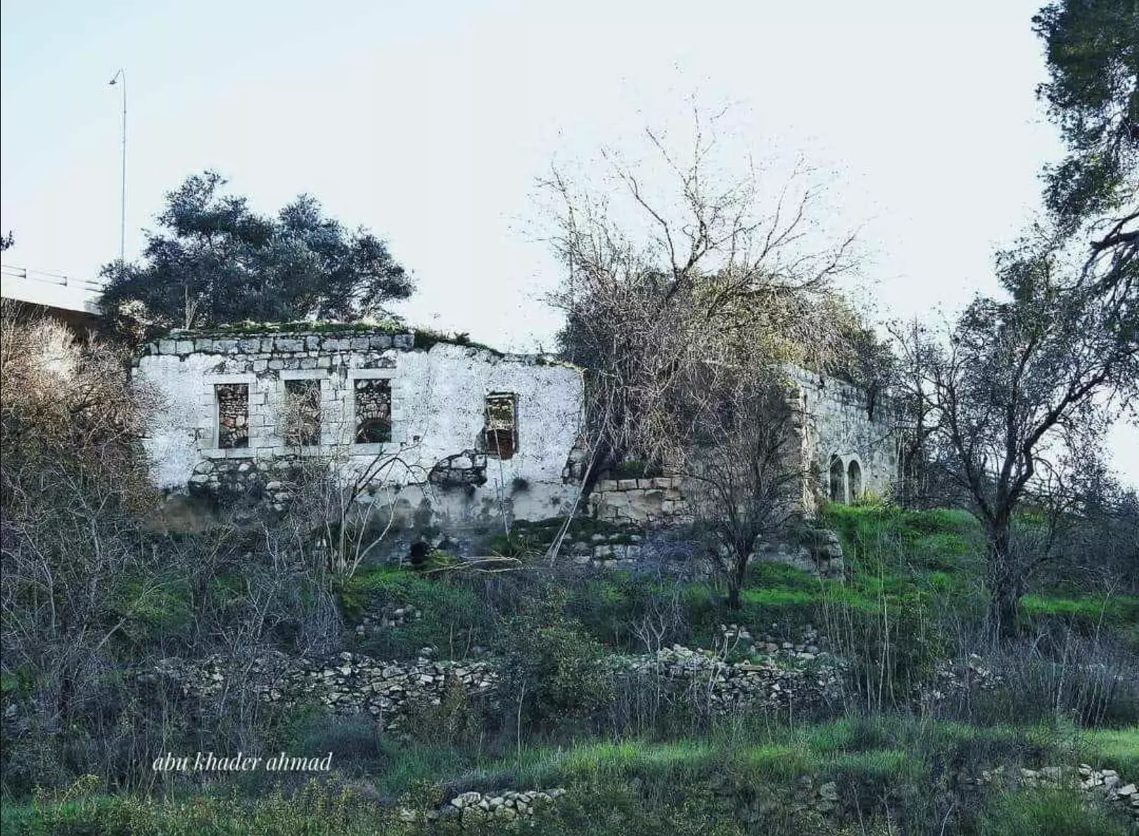
- جولة بين بيوت القرية الهجرة -- Abu Khader Ahmad Jbaren #8
- جولة بين بيوت القرية الهجرة -- Abu Khader Ahmad Jbaren #9
- جولة بين بيوت القرية الهجرة -- Abu Khader Ahmad Jbaren #10
- جولة بين بيوت القرية الهجرة -- Abu Khader Ahmad Jbaren #11
- جولة بين بيوت القرية الهجرة -- Abu Khader Ahmad Jbaren #12
- جولة بين بيوت القرية الهجرة -- Abu Khader Ahmad Jbaren #13
- جولة بين بيوت القرية الهجرة -- Abu Khader Ahmad Jbaren #14
- جولة بين بيوت القرية الهجرة -- Abu Khader Ahmad Jbaren #15
- جولة بين بيوت القرية الهجرة -- Abu Khader Ahmad Jbaren #16
- جولة بين بيوت القرية الهجرة -- Abu Khader Ahmad Jbaren #17
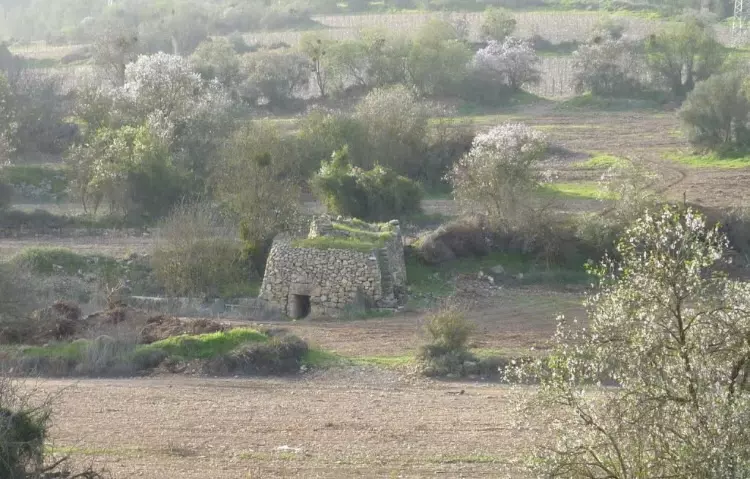
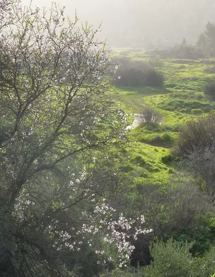
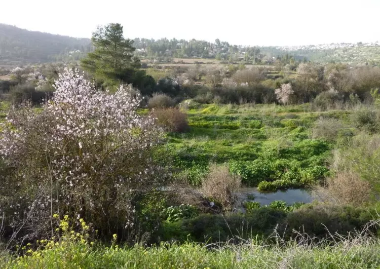
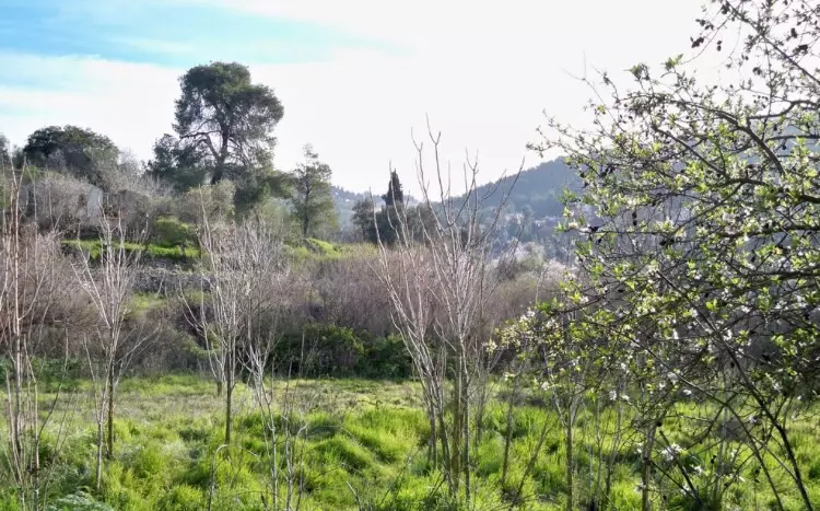
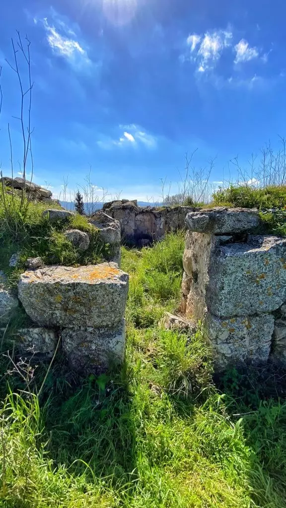
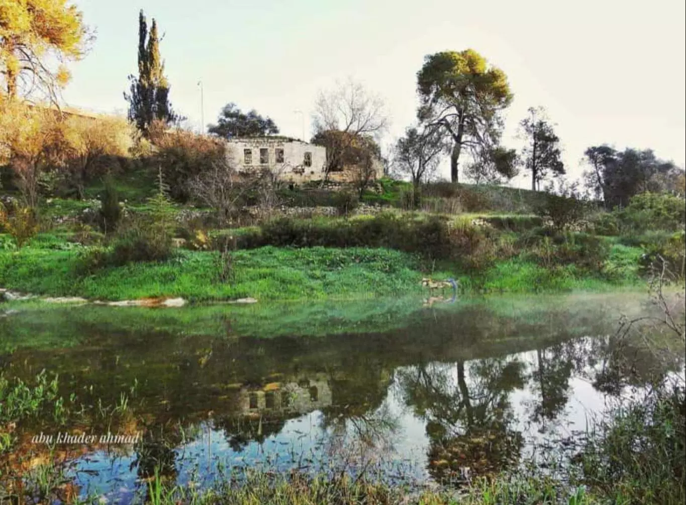
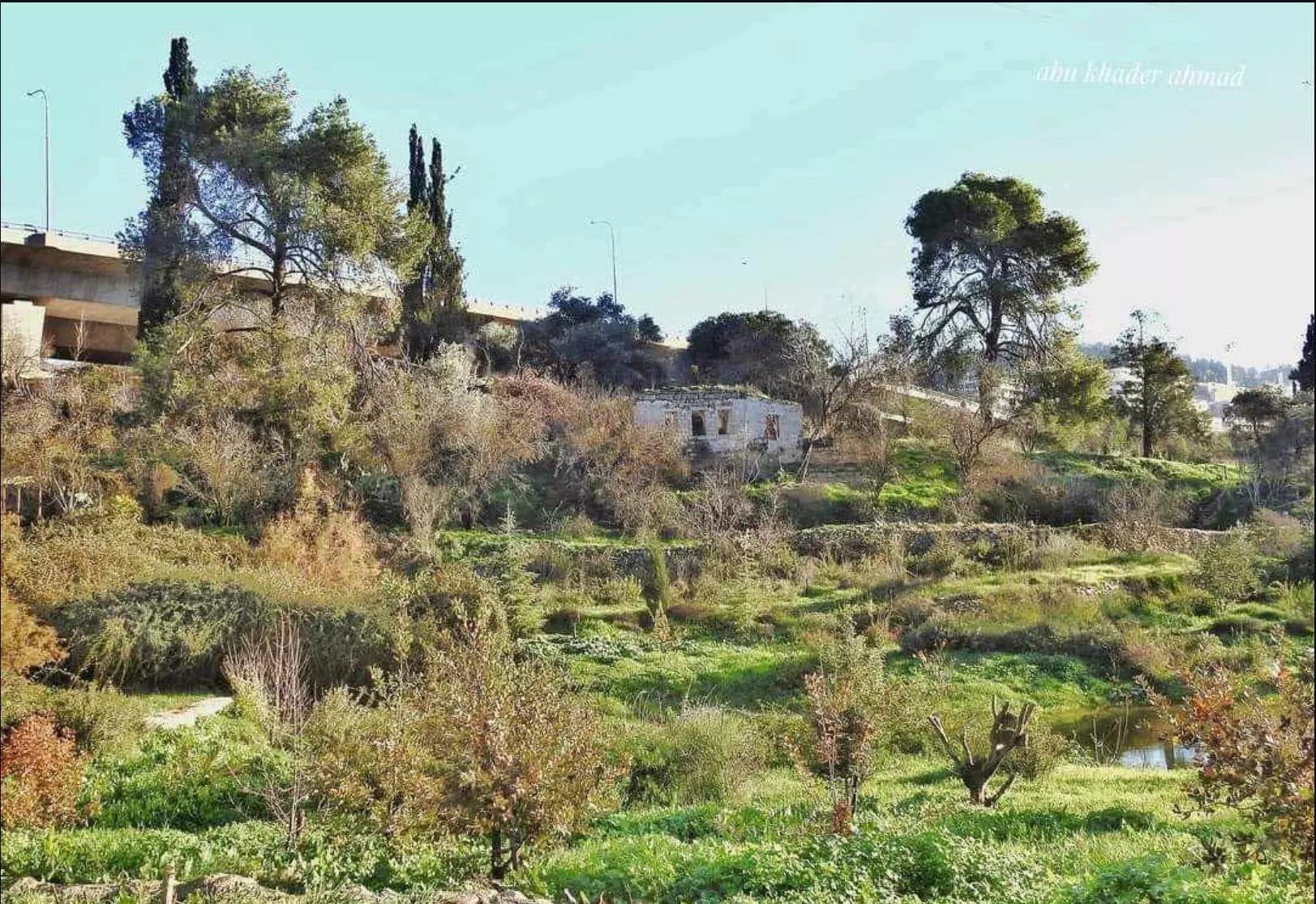
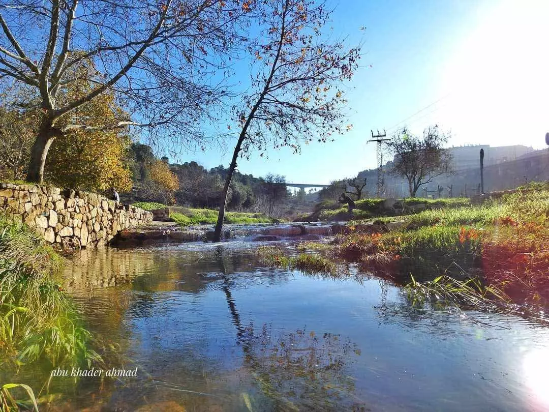
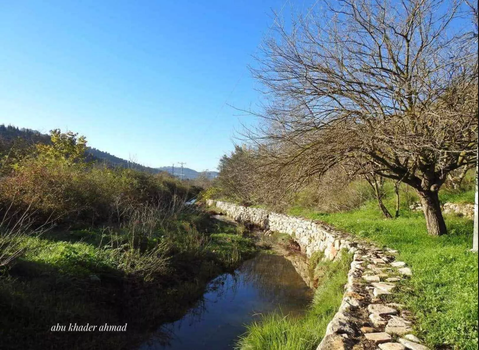
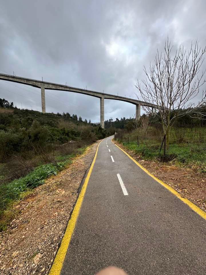
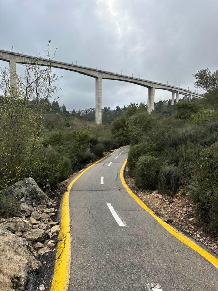
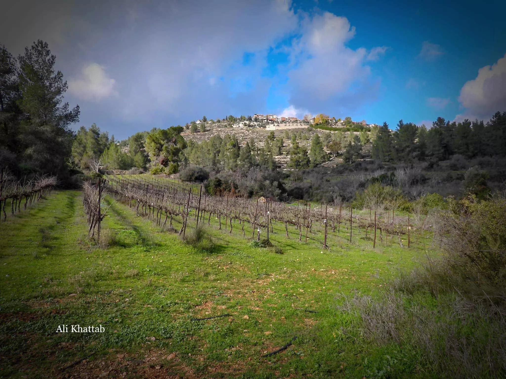
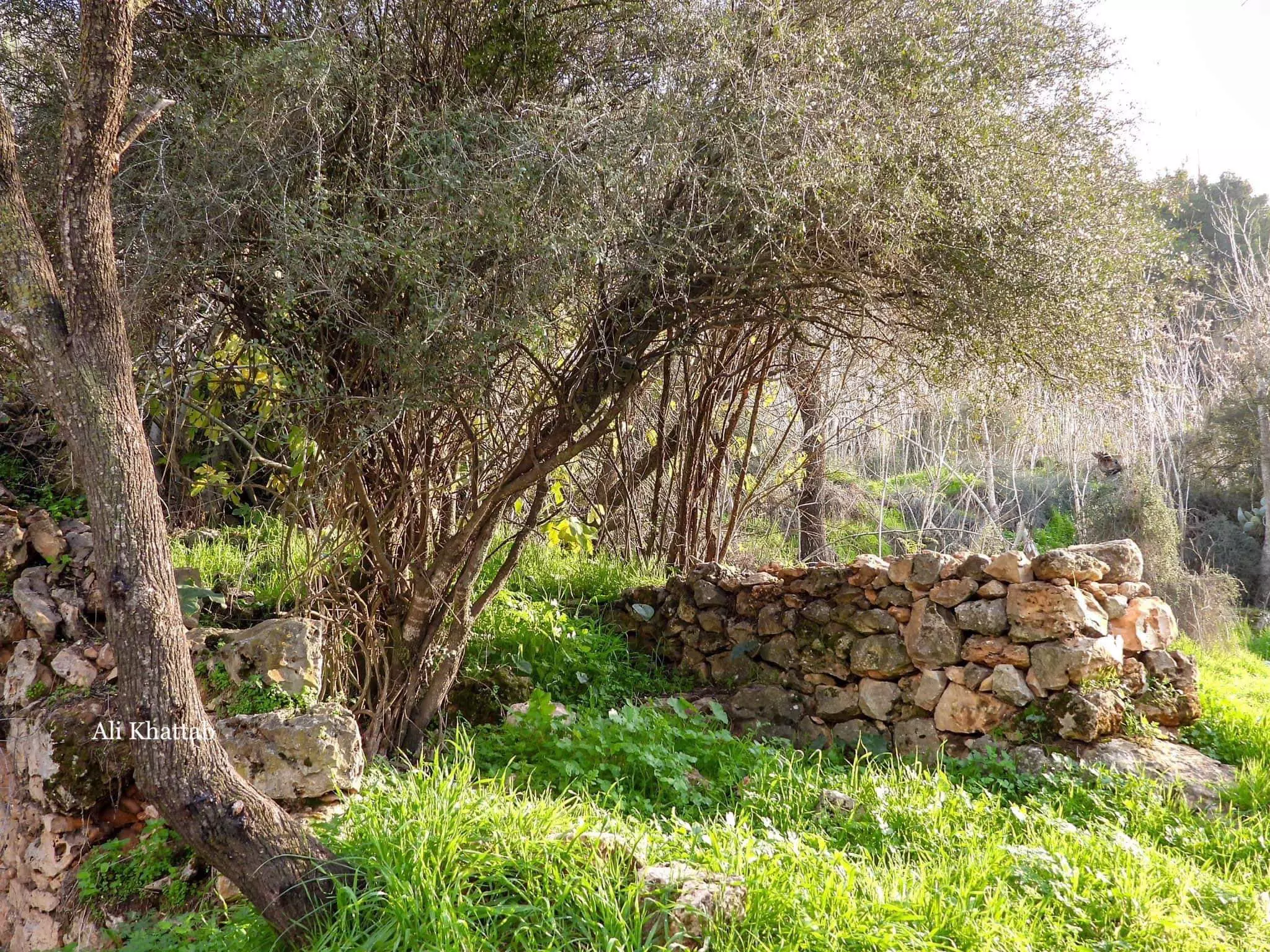
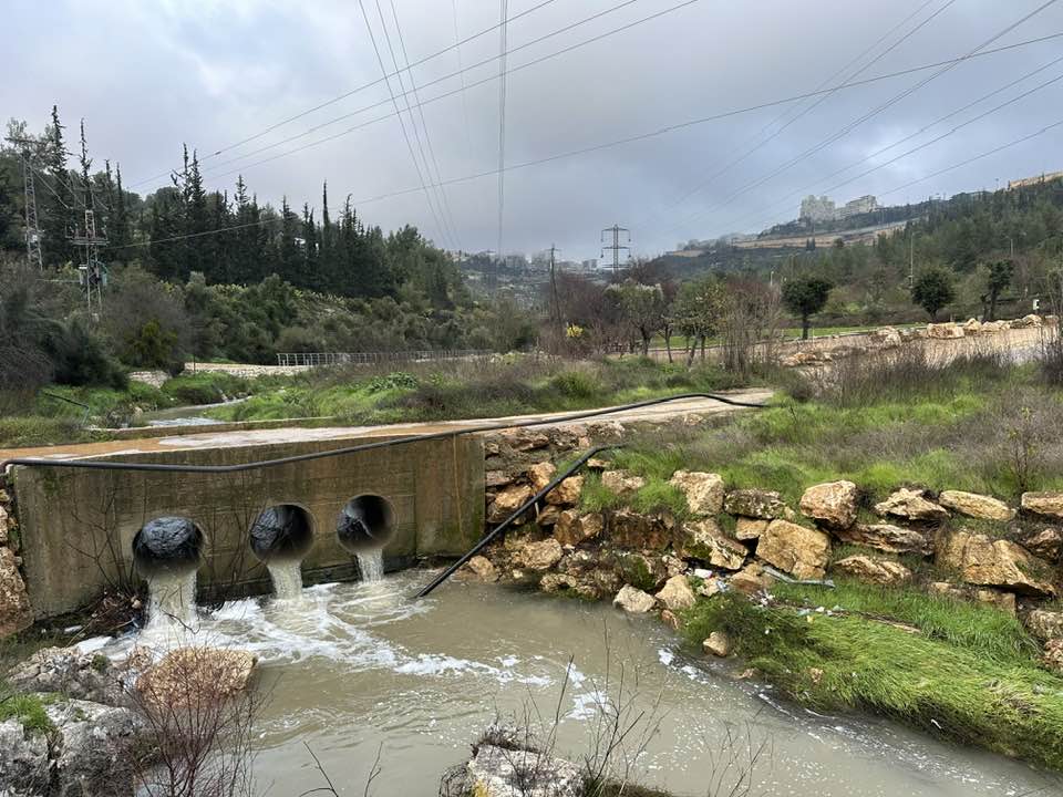
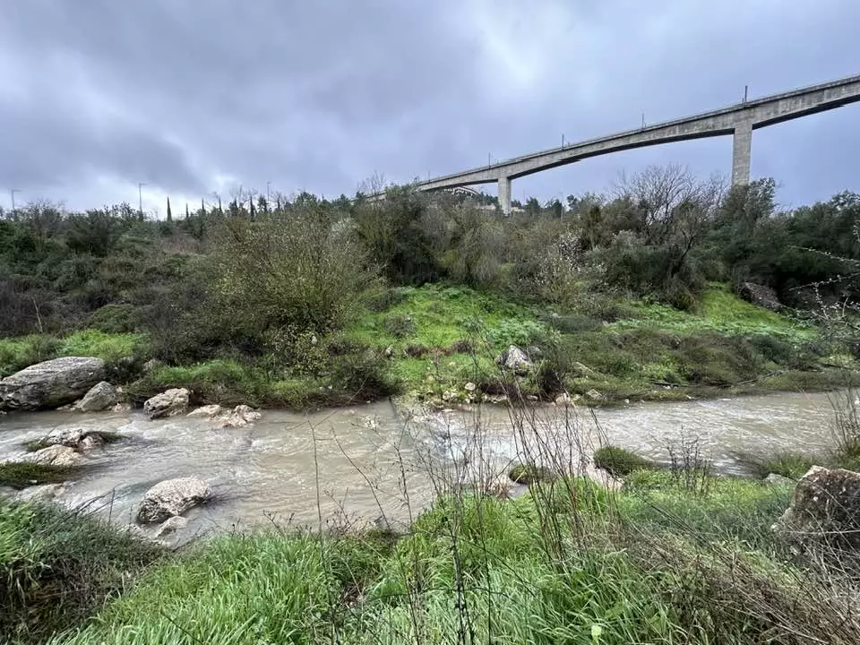
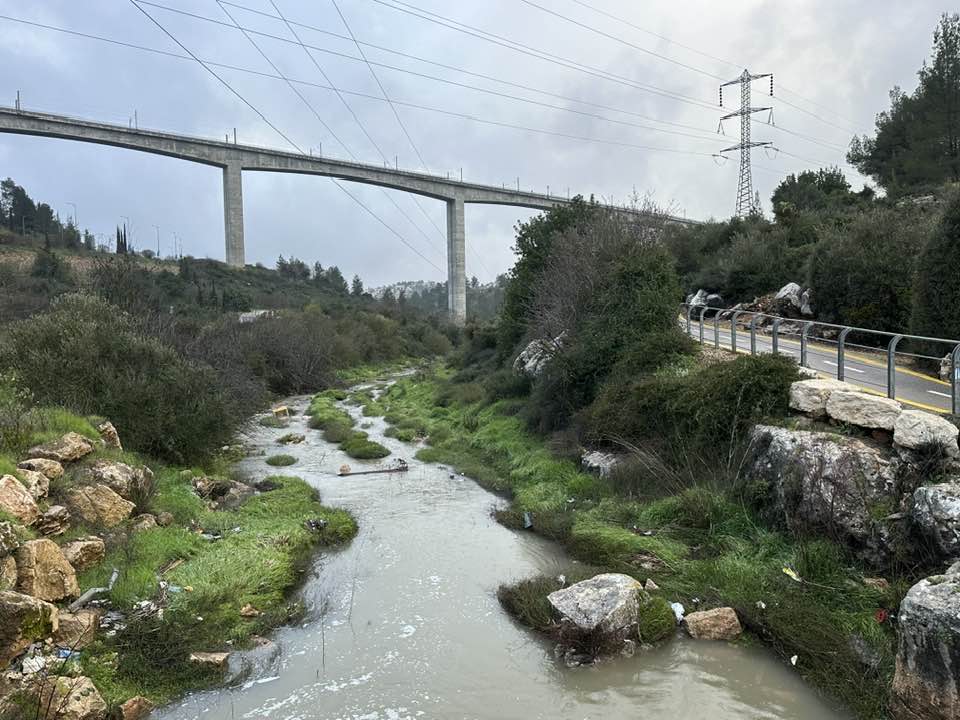
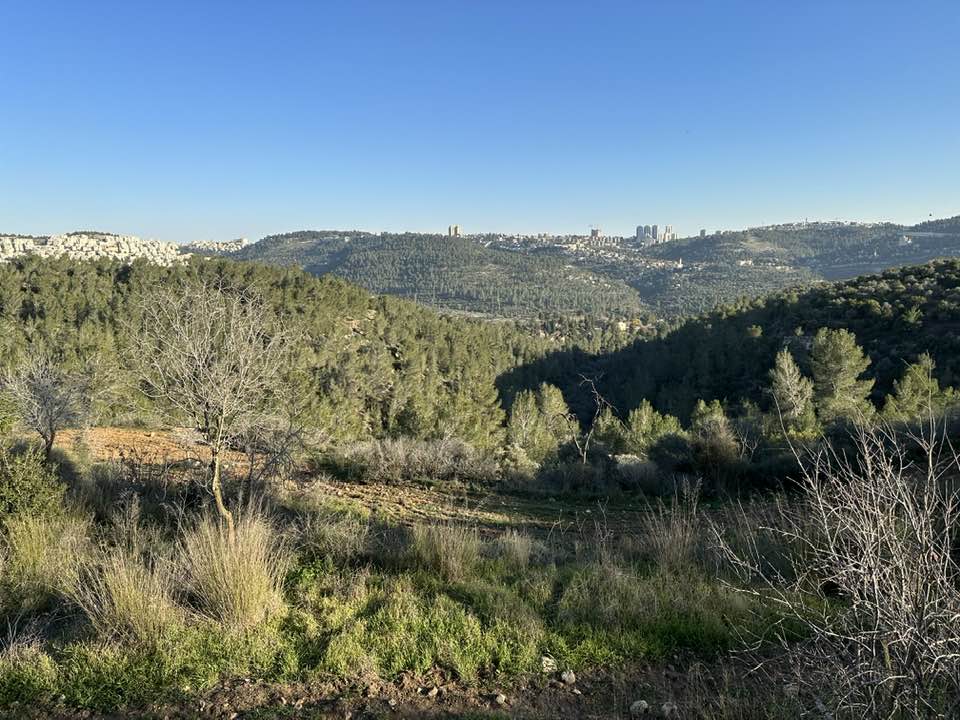
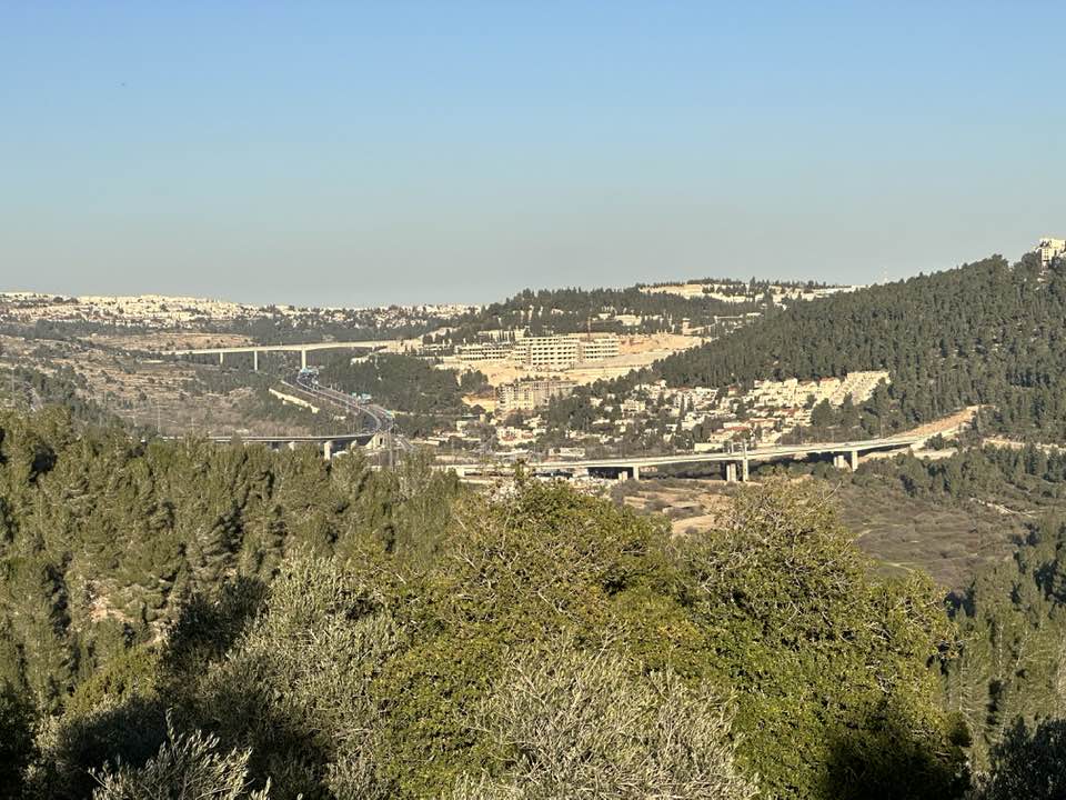
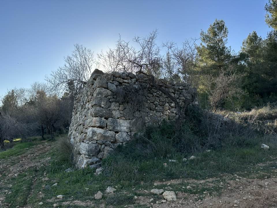
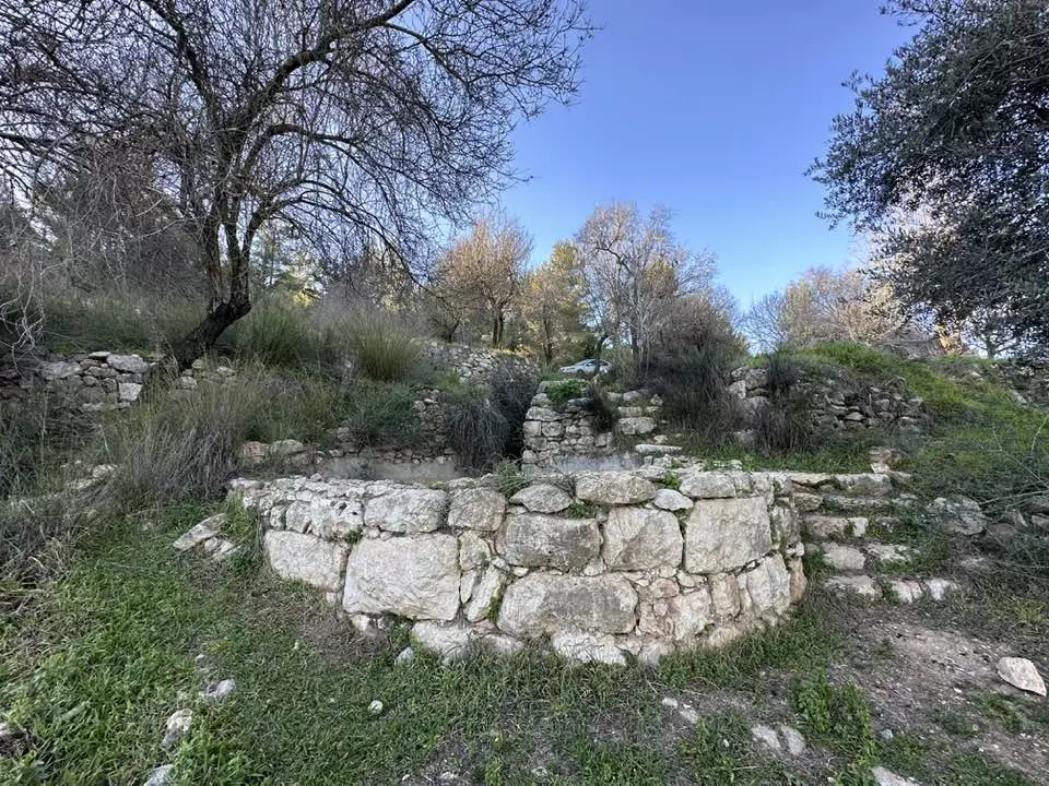
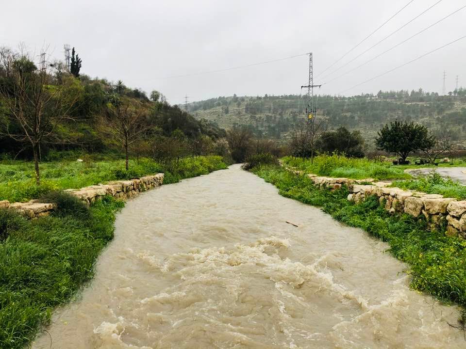
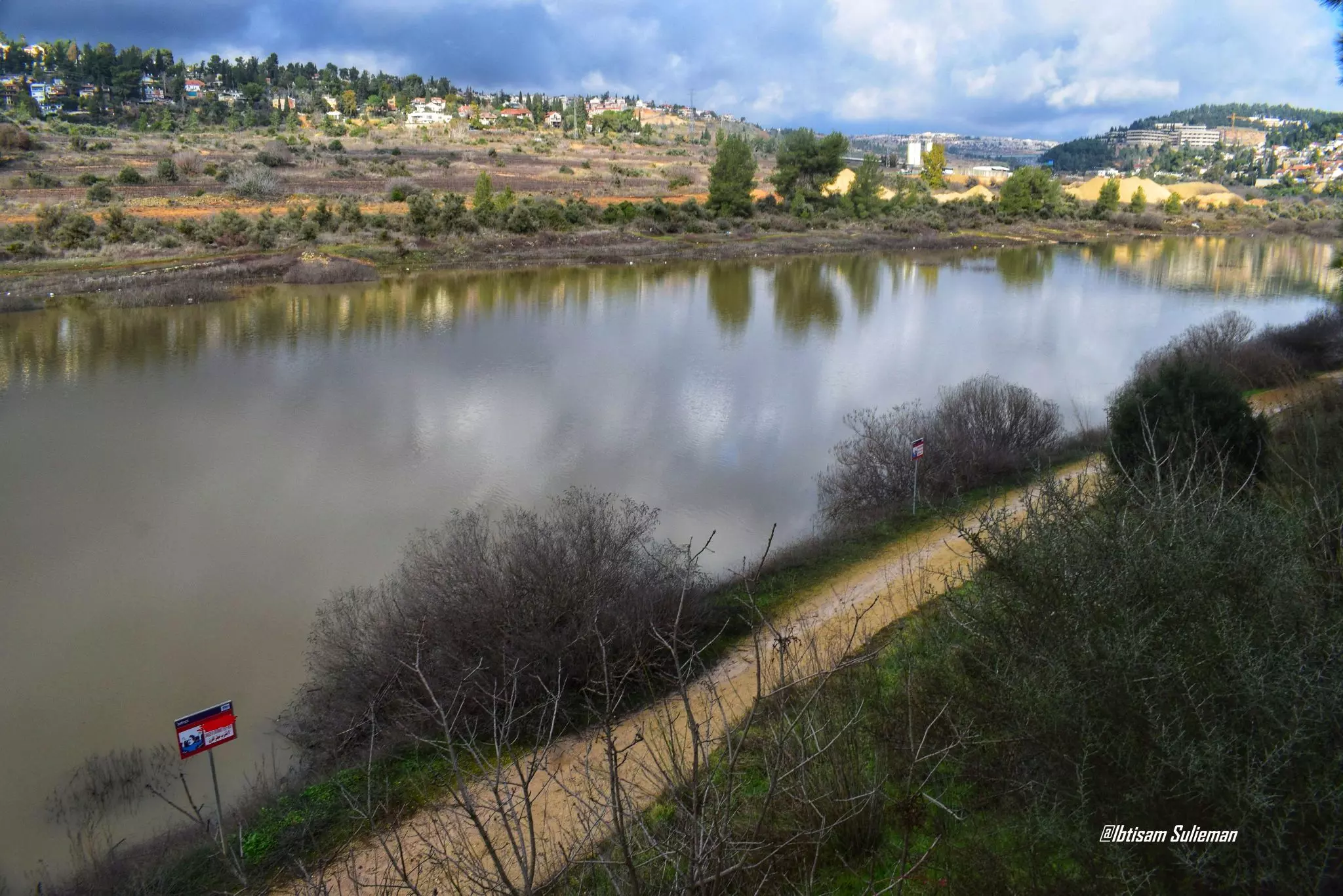
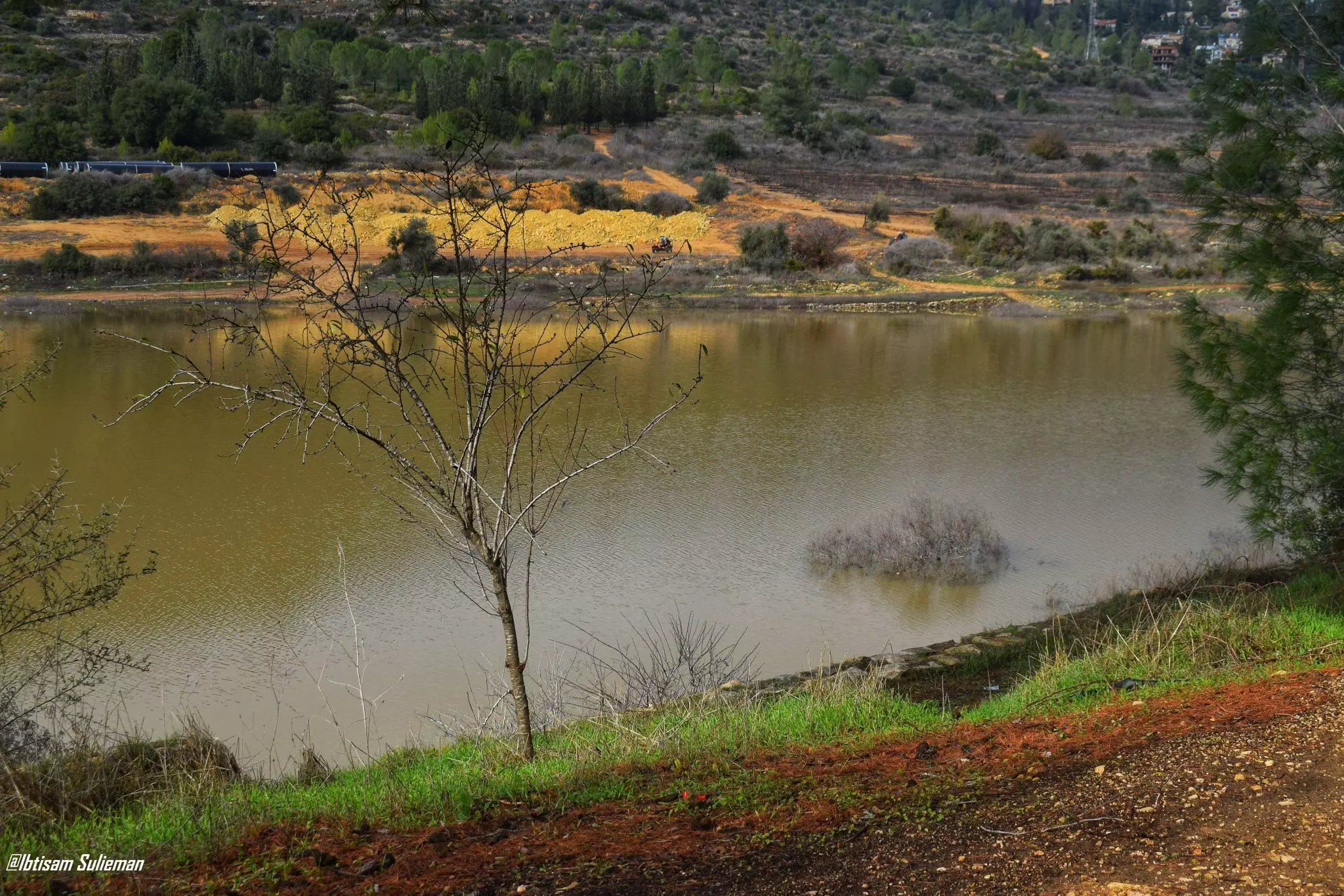
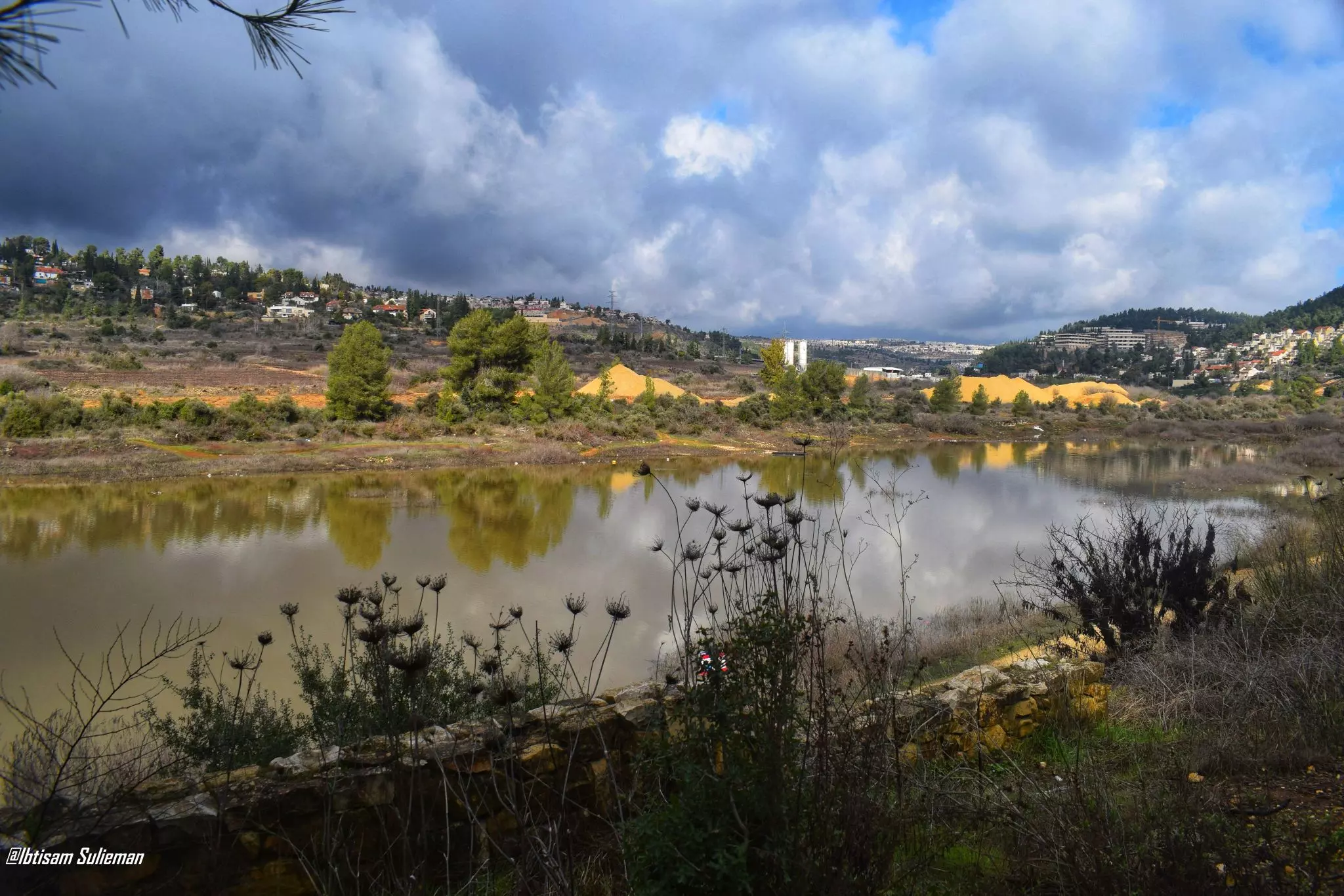
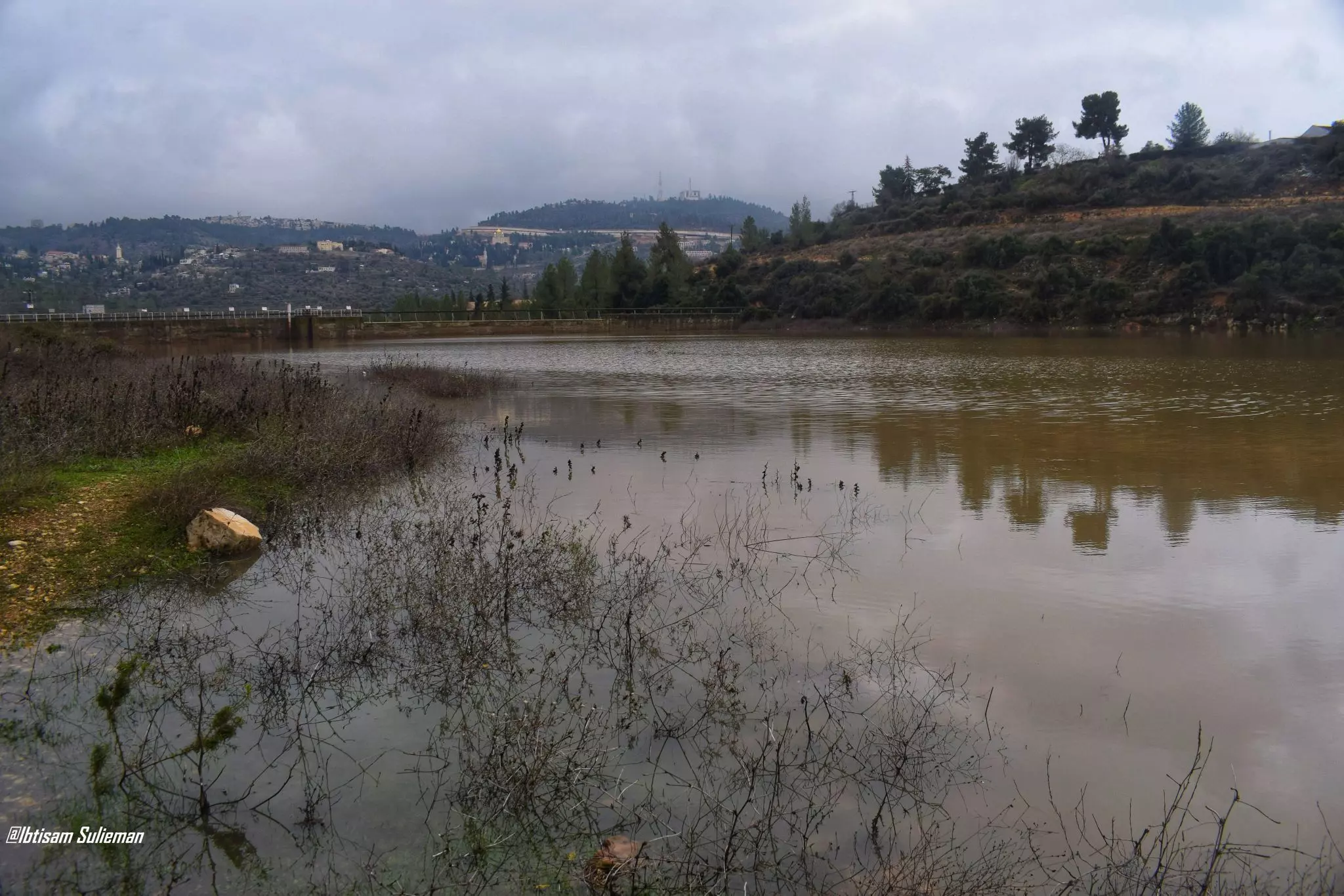
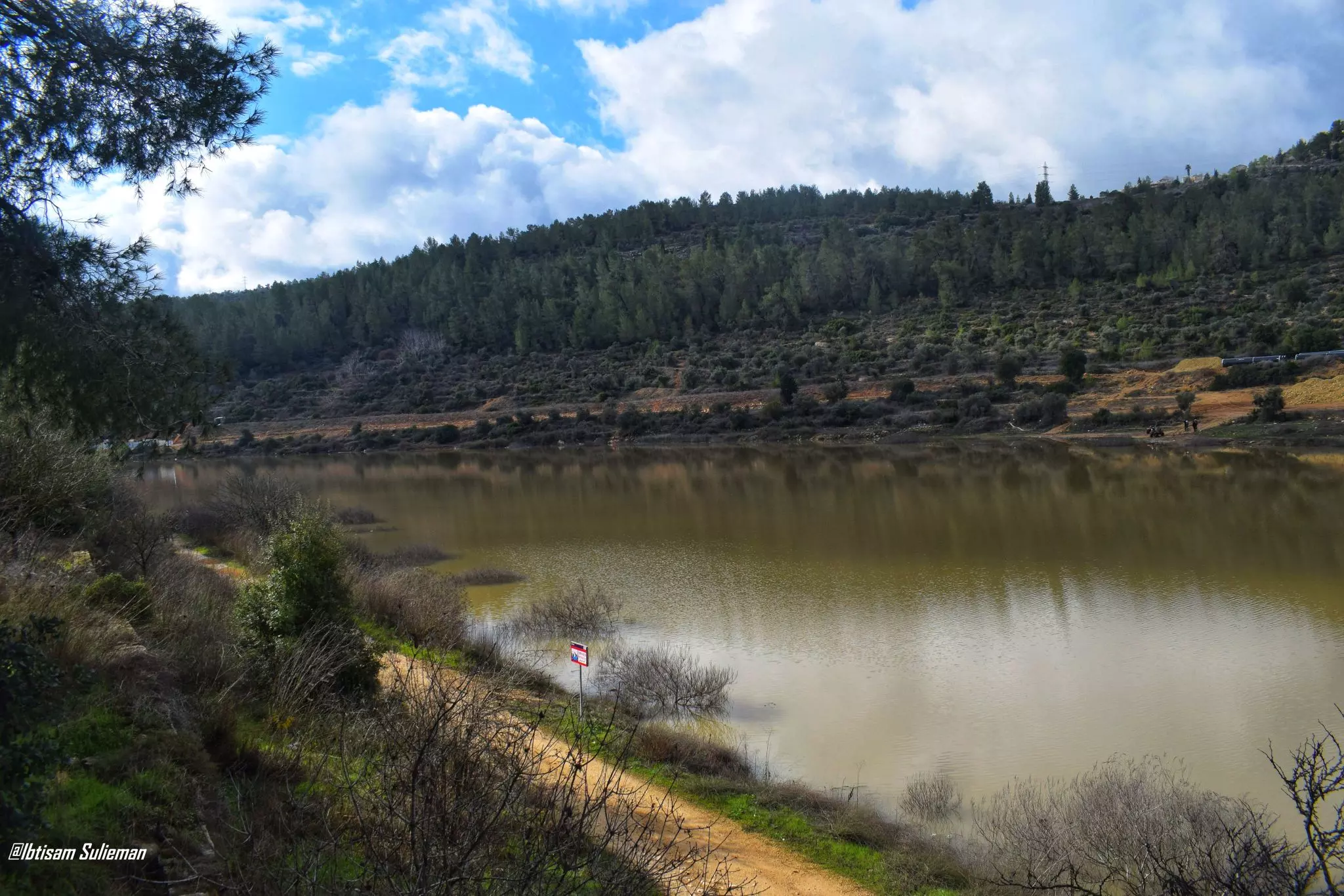
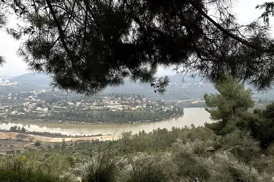
- Let us tour Qalunya's fields during the winter, 2024
- Let us tour Qalunya's fields during the winter, 2024 #2
- Let us tour Qalunya's fields during the winter, 2024 #3
- Let us tour Qalunya's fields during the winter, 2024 #4
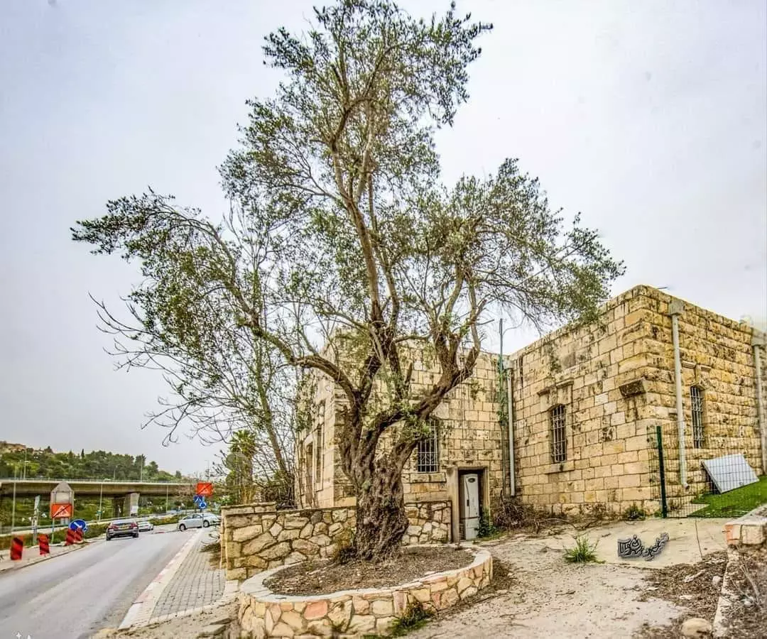
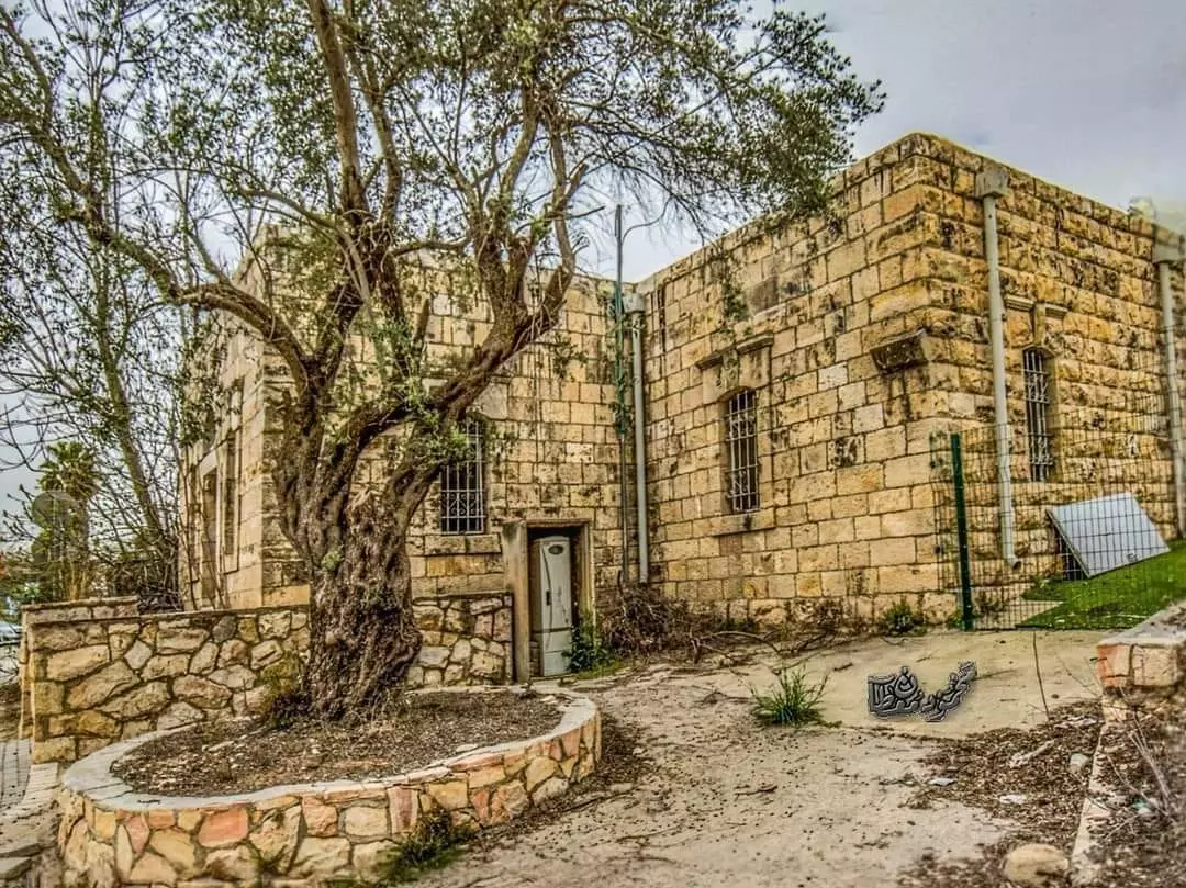
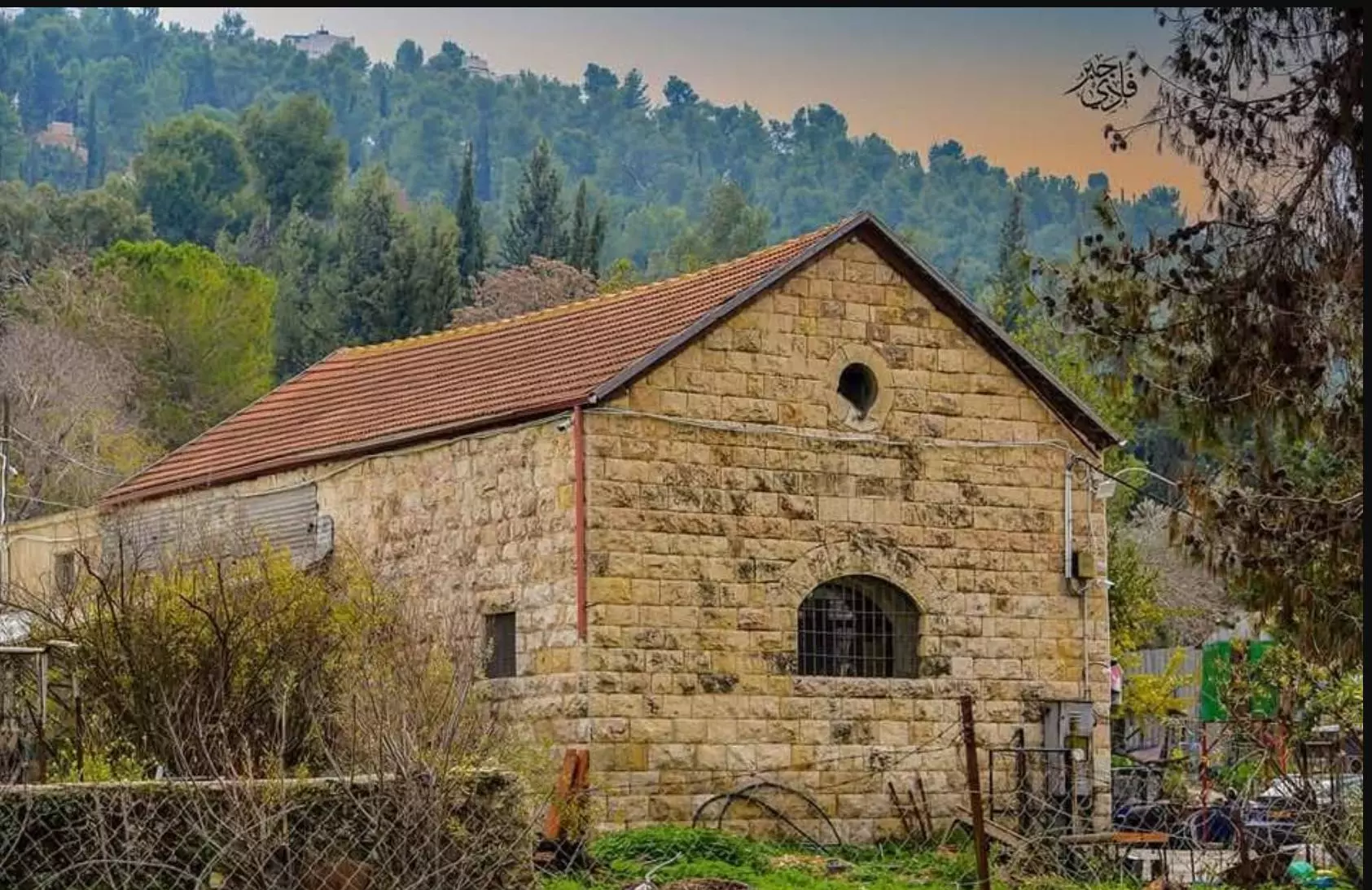
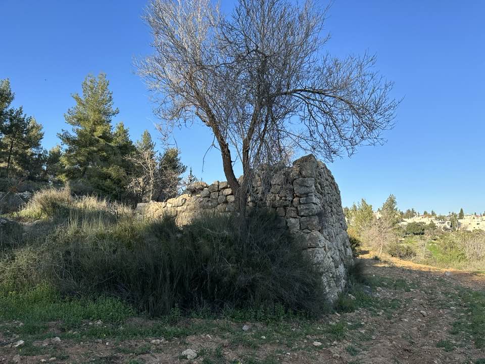
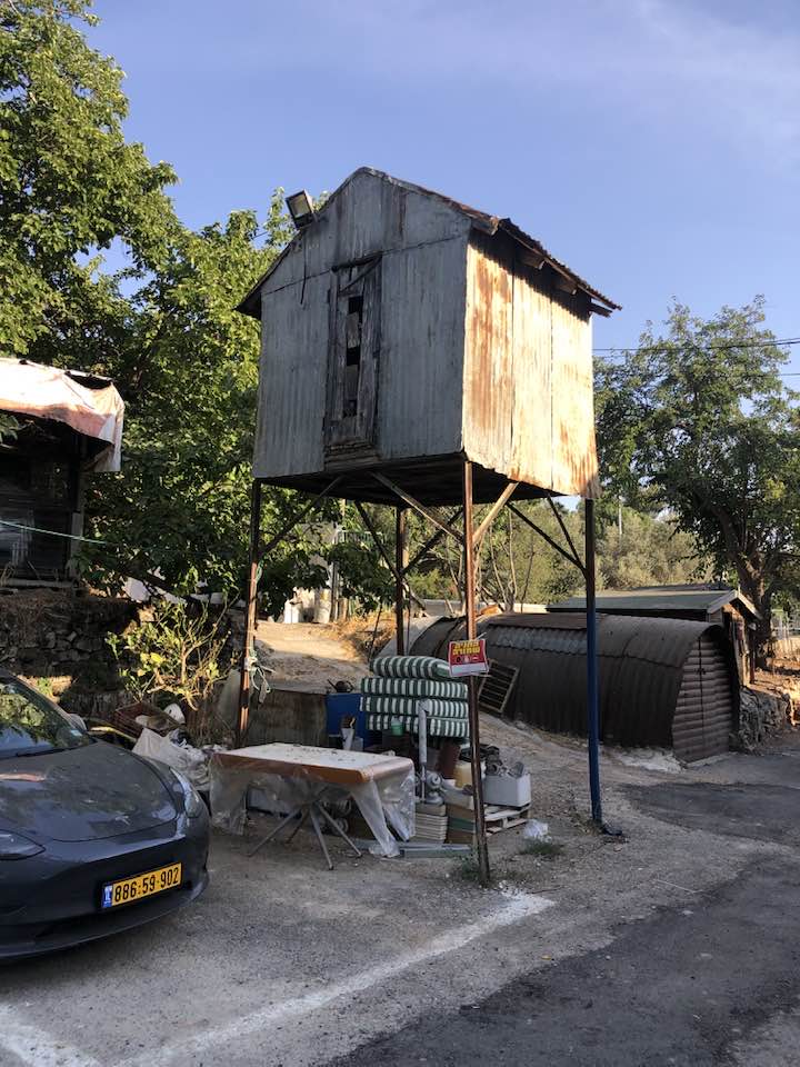
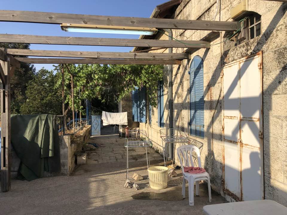
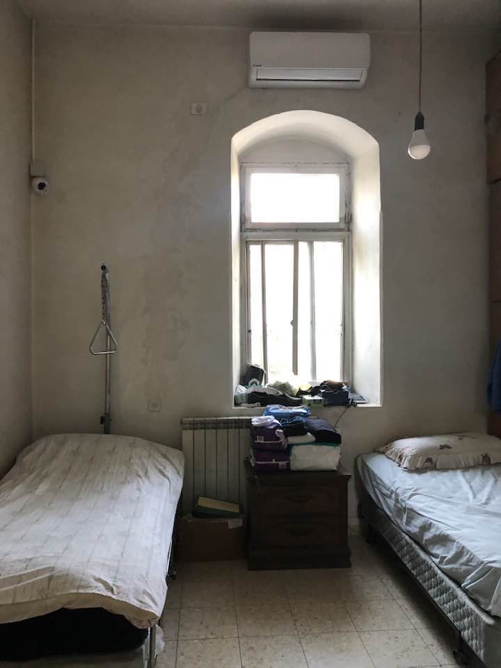
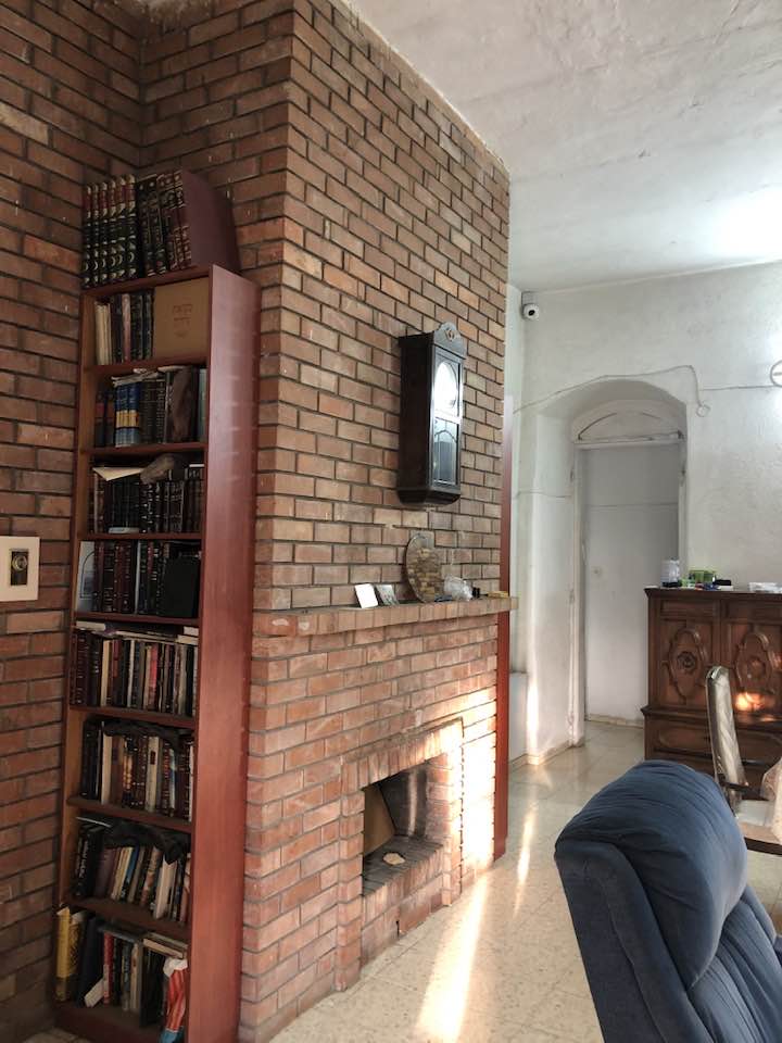
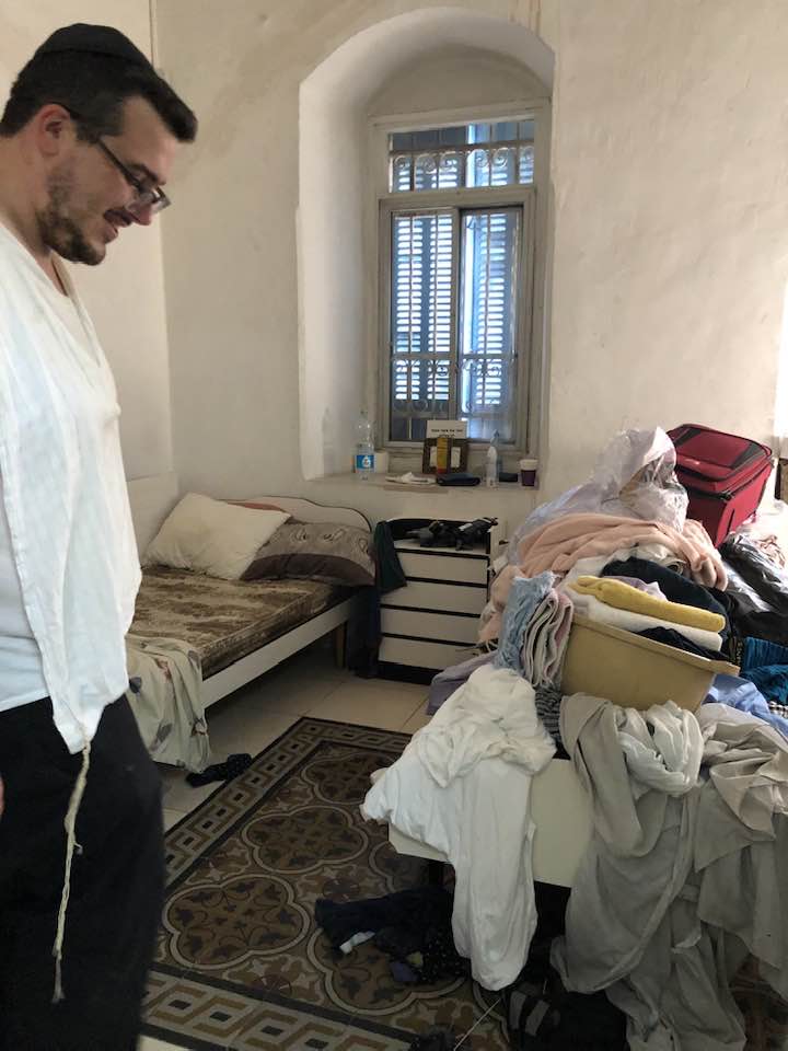
- The "most civilized" who landed on us from Europe obliterated the village, except for a few remaining structures like this one. This is how the Jews will be great again. That is how they can feel safe: Jim Crow, plunder, ethnic cleansing, and genocide.
- The "most civilized" who landed on us from Europe obliterated the village, except for a few remaining structures like this one. This is how the Jews will be great again. That is how they can feel safe: Jim Crow, plunder, ethnic cleansing, and genocide. #2
- The "most civilized" who landed on us from Europe obliterated the village, except for a few remaining structures like this one. This is how the Jews will be great again. That is how they can feel safe: Jim Crow, plunder, ethnic cleansing, and genocide. #3

- The "most civilized" who landed on us from Europe obliterated the village, except for a few remaining structures like this one. This is how the Jews will be great again. That is how they can feel safe: Jim Crow, plunder, ethnic cleansing, and genocide. #4
- The "most civilized" who landed on us from Europe obliterated the village, except for a few remaining structures like this one. This is how the Jews will be great again. That is how they can feel safe: Jim Crow, plunder, ethnic cleansing, and genocide. #5
- The "most civilized" who landed on us from Europe obliterated the village, except for a few remaining structures like this one. This is how the Jews will be great again. That is how they can feel safe: Jim Crow, plunder, ethnic cleansing, and genocide. #6
- The "most civilized" who landed on us from Europe obliterated the village, except for a few remaining structures like this one. This is how the Jews will be great again. That is how they can feel safe: Jim Crow, plunder, ethnic cleansing, and genocide. #7
- The "most civilized" who landed on us from Europe obliterated the village, except for a few remaining structures like this one. This is how the Jews will be great again. That is how they can feel safe: Jim Crow, plunder, ethnic cleansing, and genocide. #8
- The "most civilized" who landed on us from Europe obliterated the village, except for a few remaining structures like this one. This is how the Jews will be great again. That is how they can feel safe: Jim Crow, plunder, ethnic cleansing, and genocide. #9
- The "most civilized" who landed on us from Europe obliterated the village, except for a few remaining structures like this one. This is how the Jews will be great again. That is how they can feel safe: Jim Crow, plunder, ethnic cleansing, and genocide. #10
- The "most civilized" who landed on us from Europe obliterated the village, except for a few remaining structures like this one. This is how the Jews will be great again. That is how they can feel safe: Jim Crow, plunder, ethnic cleansing, and genocide. #11
- The "most civilized" who landed on us from Europe obliterated the village, except for a few remaining structures like this one. This is how the Jews will be great again. That is how they can feel safe: Jim Crow, plunder, ethnic cleansing, and genocide. #12
- The "most civilized" who landed on us from Europe obliterated the village, except for a few remaining structures like this one. This is how the Jews will be great again. That is how they can feel safe: Jim Crow, plunder, ethnic cleansing, and genocide. #13
- The "most civilized" who landed on us from Europe obliterated the village, except for a few remaining structures like this one. This is how the Jews will be great again. That is how they can feel safe: Jim Crow, plunder, ethnic cleansing, and genocide. #14
- The "most civilized" who landed on us from Europe obliterated the village, except for a few remaining structures like this one. This is how the Jews will be great again. That is how they can feel safe: Jim Crow, plunder, ethnic cleansing, and genocide. #15
- The "most civilized" who landed on us from Europe obliterated the village, except for a few remaining structures like this one. This is how the Jews will be great again. That is how they can feel safe: Jim Crow, plunder, ethnic cleansing, and genocide. #16
- The "most civilized" who landed on us from Europe obliterated the village, except for a few remaining structures like this one. This is how the Jews will be great again. That is how they can feel safe: Jim Crow, plunder, ethnic cleansing, and genocide. #17
- The "most civilized" who landed on us from Europe obliterated the village, except for a few remaining structures like this one. This is how the Jews will be great again. That is how they can feel safe: Jim Crow, plunder, ethnic cleansing, and genocide. #18
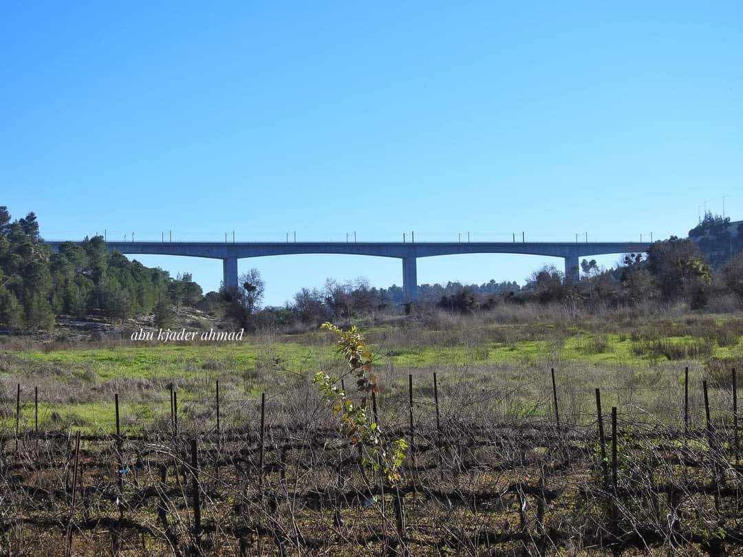
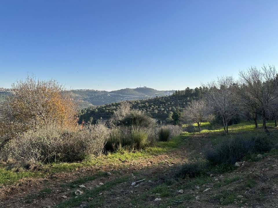
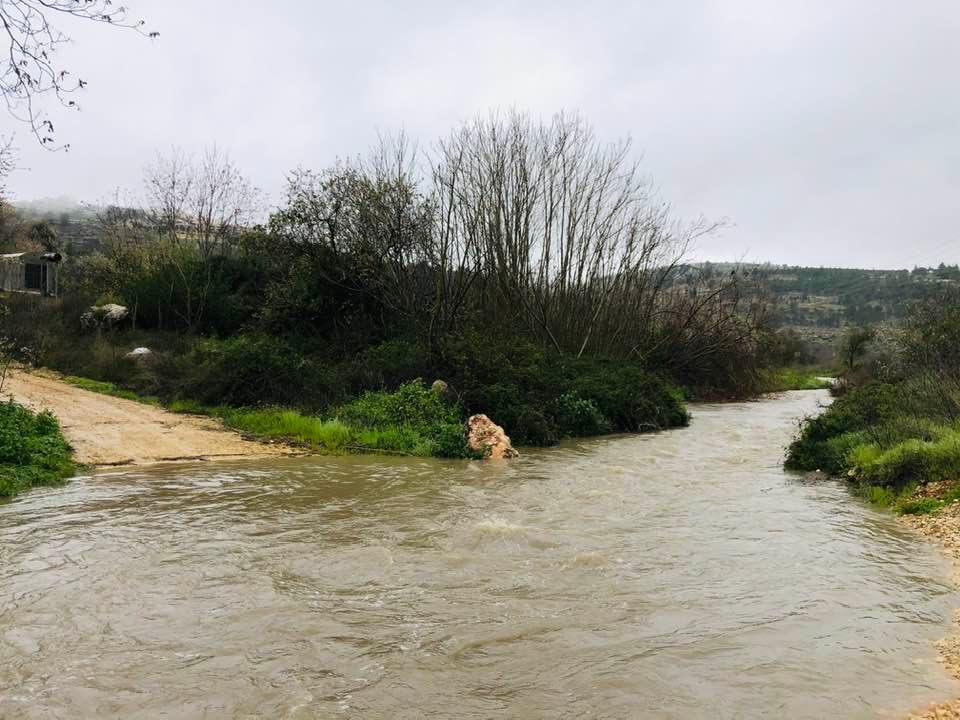
- The nearby fields during the winter of 2024, Iyad Jaber
- The nearby fields during the winter of 2024, Iyad Jaber #2

- The nearby fields during the winter of 2024, Iyad Jaber #3
- The nearby fields during the winter of 2024, Iyad Jaber #4
- The nearby fields during the winter of 2024, Iyad Jaber #5
- The nearby fields during the winter of 2024, Iyad Jaber #6
- جولة نحو ين ماء في جبال القدس قُرب اراضي قالونيا القدس waze עין חרת -- 2023- Iyad Jaber
- جولة نحو ين ماء في جبال القدس قُرب اراضي قالونيا القدس waze עין חרת -- 2023- Iyad Jaber #2
- جولة نحو ين ماء في جبال القدس قُرب اراضي قالونيا القدس waze עין חרת -- 2023- Iyad Jaber #3
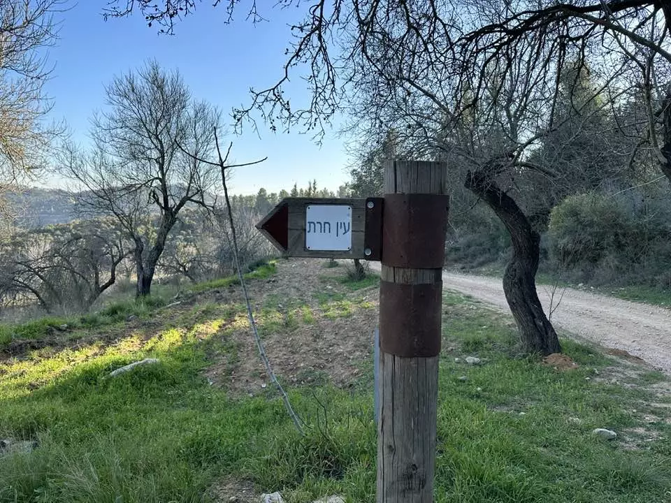
- جولة نحو ين ماء في جبال القدس قُرب اراضي قالونيا القدس waze עין חרת -- 2023- Iyad Jaber #4
- جولة نحو ين ماء في جبال القدس قُرب اراضي قالونيا القدس waze עין חרת -- 2023- Iyad Jaber #5
- جولة نحو ين ماء في جبال القدس قُرب اراضي قالونيا القدس waze עין חרת -- 2023- Iyad Jaber #6
- جولة نحو ين ماء في جبال القدس قُرب اراضي قالونيا القدس waze עין חרת -- 2023- Iyad Jaber #7
- جولة نحو ين ماء في جبال القدس قُرب اراضي قالونيا القدس waze עין חרת -- 2023- Iyad Jaber #8
- جولة نحو ين ماء في جبال القدس قُرب اراضي قالونيا القدس waze עין חרת -- 2023- Iyad Jaber #9
- تم بناء المنزل عام ١٨٩٧ على اراضي قرية قالونيا والبيت مكون من ثلاثة طوابق وبئر وقبو ، على ارض من اراضي القرية مساحتها ( ١٦ ) دونماً وتضرر البيت في اشتباكات بين العرب واليهود عام ١٩٢٩ و ١٩٣٩ . -- July 30th, 2022 -- Iyad Jaber
- تم بناء المنزل عام ١٨٩٧ على اراضي قرية قالونيا والبيت مكون من ثلاثة طوابق وبئر وقبو ، على ارض من اراضي القرية مساحتها ( ١٦ ) دونماً وتضرر البيت في اشتباكات بين العرب واليهود عام ١٩٢٩ و ١٩٣٩ . -- July 30th, 2022 -- Iyad Jaber #2
- تم بناء المنزل عام ١٨٩٧ على اراضي قرية قالونيا والبيت مكون من ثلاثة طوابق وبئر وقبو ، على ارض من اراضي القرية مساحتها ( ١٦ ) دونماً وتضرر البيت في اشتباكات بين العرب واليهود عام ١٩٢٩ و ١٩٣٩ . -- July 30th, 2022 -- Iyad Jaber #3
- تم بناء المنزل عام ١٨٩٧ على اراضي قرية قالونيا والبيت مكون من ثلاثة طوابق وبئر وقبو ، على ارض من اراضي القرية مساحتها ( ١٦ ) دونماً وتضرر البيت في اشتباكات بين العرب واليهود عام ١٩٢٩ و ١٩٣٩ . -- July 30th, 2022 -- Iyad Jaber #4
- تم بناء المنزل عام ١٨٩٧ على اراضي قرية قالونيا والبيت مكون من ثلاثة طوابق وبئر وقبو ، على ارض من اراضي القرية مساحتها ( ١٦ ) دونماً وتضرر البيت في اشتباكات بين العرب واليهود عام ١٩٢٩ و ١٩٣٩ . -- July 30th, 2022 -- Iyad Jaber #5
- تم بناء المنزل عام ١٨٩٧ على اراضي قرية قالونيا والبيت مكون من ثلاثة طوابق وبئر وقبو ، على ارض من اراضي القرية مساحتها ( ١٦ ) دونماً وتضرر البيت في اشتباكات بين العرب واليهود عام ١٩٢٩ و ١٩٣٩ . -- July 30th, 2022 -- Iyad Jaber #6
- تم بناء المنزل عام ١٨٩٧ على اراضي قرية قالونيا والبيت مكون من ثلاثة طوابق وبئر وقبو ، على ارض من اراضي القرية مساحتها ( ١٦ ) دونماً وتضرر البيت في اشتباكات بين العرب واليهود عام ١٩٢٩ و ١٩٣٩ . -- July 30th, 2022 -- Iyad Jaber #7
- تم بناء المنزل عام ١٨٩٧ على اراضي قرية قالونيا والبيت مكون من ثلاثة طوابق وبئر وقبو ، على ارض من اراضي القرية مساحتها ( ١٦ ) دونماً وتضرر البيت في اشتباكات بين العرب واليهود عام ١٩٢٩ و ١٩٣٩ . -- July 30th, 2022 -- Iyad Jaber #8
- تم بناء المنزل عام ١٨٩٧ على اراضي قرية قالونيا والبيت مكون من ثلاثة طوابق وبئر وقبو ، على ارض من اراضي القرية مساحتها ( ١٦ ) دونماً وتضرر البيت في اشتباكات بين العرب واليهود عام ١٩٢٩ و ١٩٣٩ . -- July 30th, 2022 -- Iyad Jaber #9
- تم بناء المنزل عام ١٨٩٧ على اراضي قرية قالونيا والبيت مكون من ثلاثة طوابق وبئر وقبو ، على ارض من اراضي القرية مساحتها ( ١٦ ) دونماً وتضرر البيت في اشتباكات بين العرب واليهود عام ١٩٢٩ و ١٩٣٩ . -- July 30th, 2022 -- Iyad Jaber #10
- تم بناء المنزل عام ١٨٩٧ على اراضي قرية قالونيا والبيت مكون من ثلاثة طوابق وبئر وقبو ، على ارض من اراضي القرية مساحتها ( ١٦ ) دونماً وتضرر البيت في اشتباكات بين العرب واليهود عام ١٩٢٩ و ١٩٣٩ . -- July 30th, 2022 -- Iyad Jaber #11
- تم بناء المنزل عام ١٨٩٧ على اراضي قرية قالونيا والبيت مكون من ثلاثة طوابق وبئر وقبو ، على ارض من اراضي القرية مساحتها ( ١٦ ) دونماً وتضرر البيت في اشتباكات بين العرب واليهود عام ١٩٢٩ و ١٩٣٩ . -- July 30th, 2022 -- Iyad Jaber #12
- تم بناء المنزل عام ١٨٩٧ على اراضي قرية قالونيا والبيت مكون من ثلاثة طوابق وبئر وقبو ، على ارض من اراضي القرية مساحتها ( ١٦ ) دونماً وتضرر البيت في اشتباكات بين العرب واليهود عام ١٩٢٩ و ١٩٣٩ . -- July 30th, 2022 -- Iyad Jaber #13
- تم بناء المنزل عام ١٨٩٧ على اراضي قرية قالونيا والبيت مكون من ثلاثة طوابق وبئر وقبو ، على ارض من اراضي القرية مساحتها ( ١٦ ) دونماً وتضرر البيت في اشتباكات بين العرب واليهود عام ١٩٢٩ و ١٩٣٩ . -- July 30th, 2022 -- Iyad Jaber #14
- تم بناء المنزل عام ١٨٩٧ على اراضي قرية قالونيا والبيت مكون من ثلاثة طوابق وبئر وقبو ، على ارض من اراضي القرية مساحتها ( ١٦ ) دونماً وتضرر البيت في اشتباكات بين العرب واليهود عام ١٩٢٩ و ١٩٣٩ . -- July 30th, 2022 -- Iyad Jaber #15
- تم بناء المنزل عام ١٨٩٧ على اراضي قرية قالونيا والبيت مكون من ثلاثة طوابق وبئر وقبو ، على ارض من اراضي القرية مساحتها ( ١٦ ) دونماً وتضرر البيت في اشتباكات بين العرب واليهود عام ١٩٢٩ و ١٩٣٩ . -- July 30th, 2022 -- Iyad Jaber #16
- تم بناء المنزل عام ١٨٩٧ على اراضي قرية قالونيا والبيت مكون من ثلاثة طوابق وبئر وقبو ، على ارض من اراضي القرية مساحتها ( ١٦ ) دونماً وتضرر البيت في اشتباكات بين العرب واليهود عام ١٩٢٩ و ١٩٣٩ . -- July 30th, 2022 -- Iyad Jaber #17
- تم بناء المنزل عام ١٨٩٧ على اراضي قرية قالونيا والبيت مكون من ثلاثة طوابق وبئر وقبو ، على ارض من اراضي القرية مساحتها ( ١٦ ) دونماً وتضرر البيت في اشتباكات بين العرب واليهود عام ١٩٢٩ و ١٩٣٩ . -- July 30th, 2022 -- Iyad Jaber #18
- تم بناء المنزل عام ١٨٩٧ على اراضي قرية قالونيا والبيت مكون من ثلاثة طوابق وبئر وقبو ، على ارض من اراضي القرية مساحتها ( ١٦ ) دونماً وتضرر البيت في اشتباكات بين العرب واليهود عام ١٩٢٩ و ١٩٣٩ . -- July 30th, 2022 -- Iyad Jaber #19
- تم بناء المنزل عام ١٨٩٧ على اراضي قرية قالونيا والبيت مكون من ثلاثة طوابق وبئر وقبو ، على ارض من اراضي القرية مساحتها ( ١٦ ) دونماً وتضرر البيت في اشتباكات بين العرب واليهود عام ١٩٢٩ و ١٩٣٩ . -- July 30th, 2022 -- Iyad Jaber #20
- تم بناء المنزل عام ١٨٩٧ على اراضي قرية قالونيا والبيت مكون من ثلاثة طوابق وبئر وقبو ، على ارض من اراضي القرية مساحتها ( ١٦ ) دونماً وتضرر البيت في اشتباكات بين العرب واليهود عام ١٩٢٩ و ١٩٣٩ . -- July 30th, 2022 -- Iyad Jaber #21
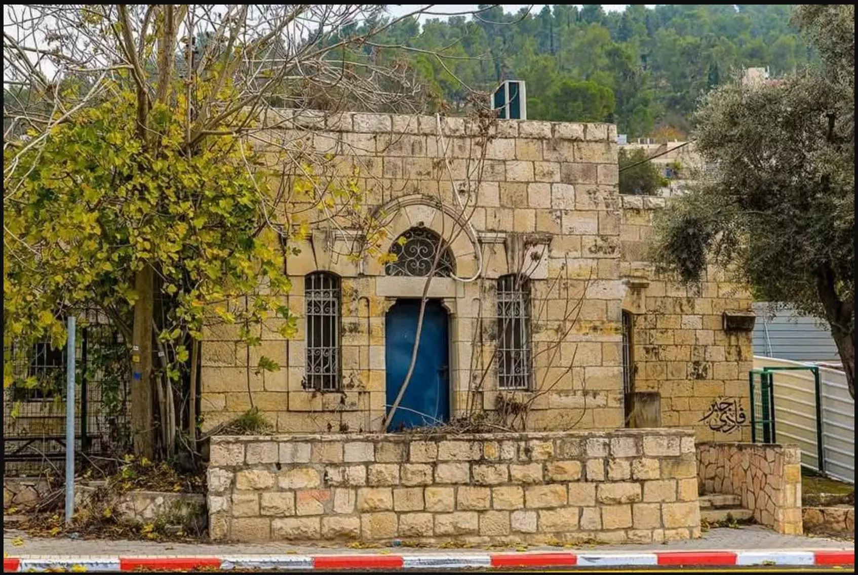
- البيت المتبقي في قرية قالونيا الفلسطينية قضاء القدس ، كان يستعمل زمن الانتداب البريطاني نادي للظباط الانجليز .
تتميز العمارة بخصائص البناء العثماني . -- July 30th, 2022 -- Iyad Jaber
- البيت المتبقي في قرية قالونيا الفلسطينية قضاء القدس ، كان يستعمل زمن الانتداب البريطاني نادي للظباط الانجليز .
تتميز العمارة بخصائص البناء العثماني . -- July 30th, 2022 -- Iyad Jaber #2
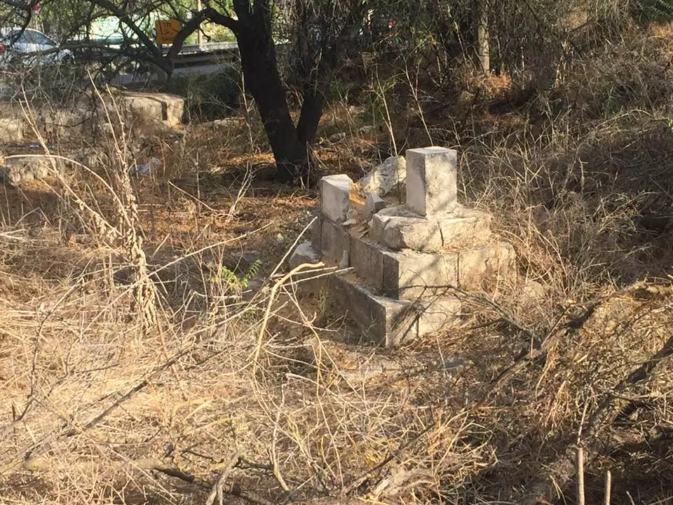
- ما تبقى من مقبرة قرية قالونيا المهجرة قضاء القدس . Jan. 19th, 2022 -- Iyad Jaber
- ما تبقى من مقبرة قرية قالونيا المهجرة قضاء القدس . Jan. 19th, 2022 -- Iyad Jaber #2

- ما تبقى من مقبرة قرية قالونيا المهجرة قضاء القدس . Jan. 19th, 2022 -- Iyad Jaber #3
- ما تبقى من مقبرة قرية قالونيا المهجرة قضاء القدس . Jan. 19th, 2022 -- Iyad Jaber #4
- ما تبقى من مقبرة قرية قالونيا المهجرة قضاء القدس . Jan. 19th, 2022 -- Iyad Jaber #5
- ما تبقى من مقبرة قرية قالونيا المهجرة قضاء القدس . Jan. 19th, 2022 -- Iyad Jaber #6
- ما تبقى من مقبرة قرية قالونيا المهجرة قضاء القدس . Jan. 19th, 2022 -- Iyad Jaber #7
- ما تبقى من مقبرة قرية قالونيا المهجرة قضاء القدس . Jan. 19th, 2022 -- Iyad Jaber #8
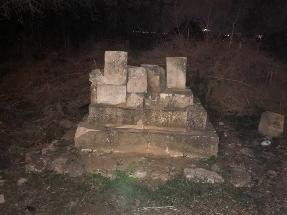
- ما تبقى من مقبرة قرية قالونيا المهجرة قضاء القدس . Jan. 19th, 2022 -- Iyad Jaber #9
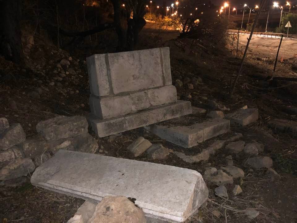
- ما تبقى من مقبرة قرية قالونيا المهجرة قضاء القدس . Jan. 19th, 2022 -- Iyad Jaber #10
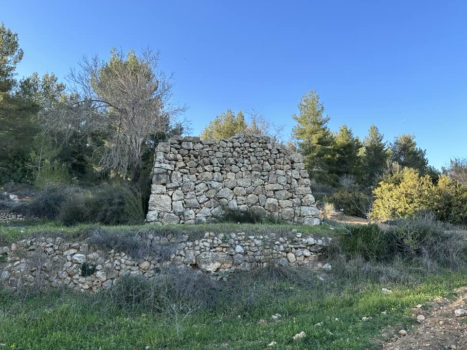
- Let us tour Qalanya's fields, cemetery, and a few looted Palestinian homes -- Dec. 8th, 2021
- Let us tour Qalanya's fields, cemetery, and a few looted Palestinian homes -- Dec. 8th, 2021 #2
- Let us tour Qalanya's fields, cemetery, and a few looted Palestinian homes -- Dec. 8th, 2021 #3
- Let us tour Qalanya's fields, cemetery, and a few looted Palestinian homes -- Dec. 8th, 2021 #4

- Let us tour Qalanya's fields, cemetery, and a few looted Palestinian homes -- Dec. 8th, 2021 #5
- Let us tour Qalanya's fields, cemetery, and a few looted Palestinian homes -- Dec. 8th, 2021 #6
- Let us tour Qalanya's fields, cemetery, and a few looted Palestinian homes -- Dec. 8th, 2021 #7
- Let us tour Qalanya's fields, cemetery, and a few looted Palestinian homes -- Dec. 8th, 2021 #8
- Let us tour Qalanya's fields, cemetery, and a few looted Palestinian homes -- Dec. 8th, 2021 #9
- Let us tour Qalanya's fields, cemetery, and a few looted Palestinian homes -- Dec. 8th, 2021 #10
- Let us tour Qalanya's fields, cemetery, and a few looted Palestinian homes -- Dec. 8th, 2021 #11
- Let us tour Qalanya's fields, cemetery, and a few looted Palestinian homes -- Dec. 8th, 2021 #12
- Let us tour Qalanya's fields, cemetery, and a few looted Palestinian homes -- Dec. 8th, 2021 #13
- Let us tour Qalanya's fields, cemetery, and a few looted Palestinian homes -- Dec. 8th, 2021 #14
- Let us tour Qalanya's fields, cemetery, and a few looted Palestinian homes -- Dec. 8th, 2021 #15
- Let us tour Qalanya's fields, cemetery, and a few looted Palestinian homes -- Dec. 8th, 2021 #16

- Let us tour Qalanya's fields, cemetery, and a few looted Palestinian homes -- Dec. 8th, 2021 #17
- Let us tour Qalanya's fields, cemetery, and a few looted Palestinian homes -- Dec. 8th, 2021 #18
- Let us tour Qalanya's fields, cemetery, and a few looted Palestinian homes -- Dec. 8th, 2021 #19
- Let us tour Qalanya's fields, cemetery, and a few looted Palestinian homes -- Dec. 8th, 2021 #20
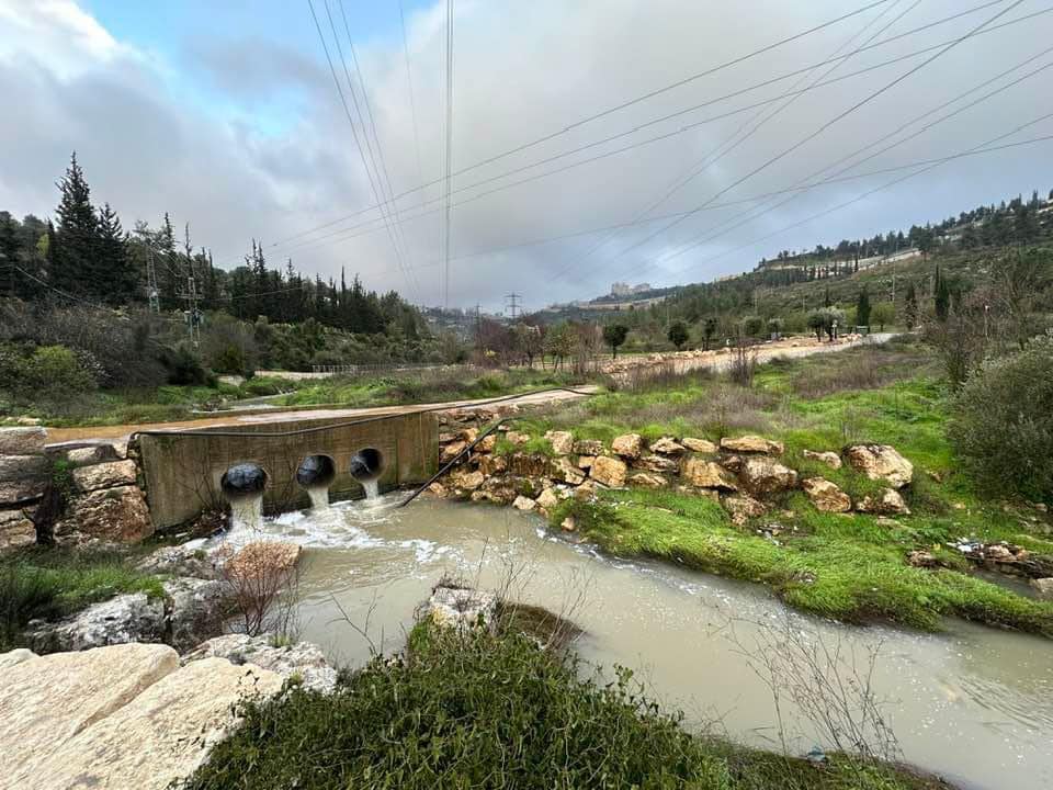
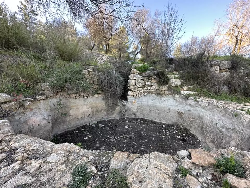
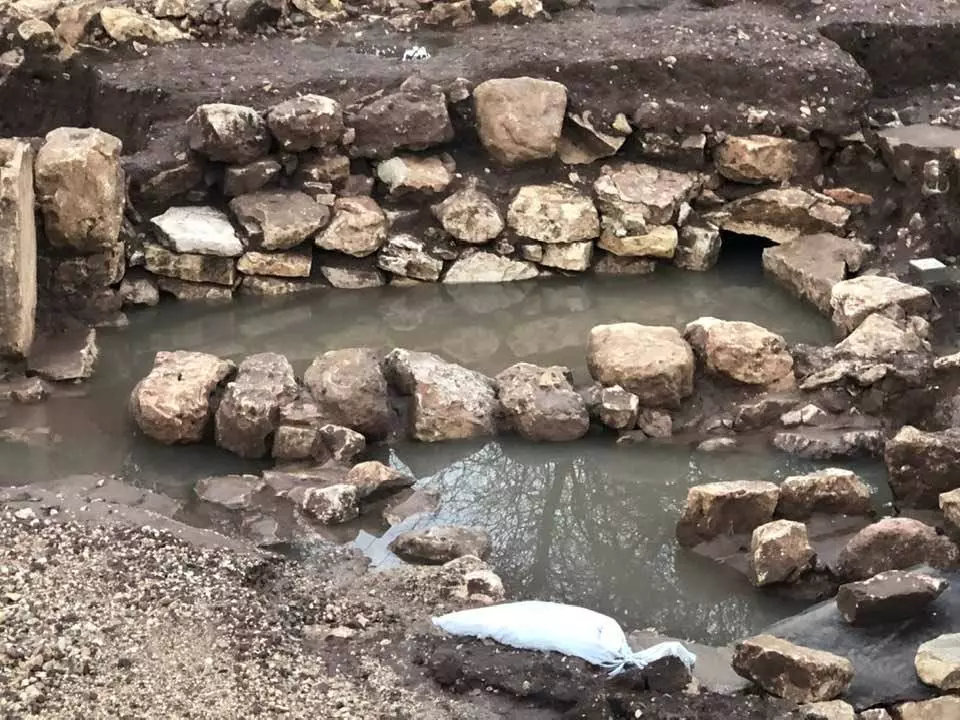
- سد اسماعيل في قرية قالونيا المهجرة
- سد اسماعيل في قرية قالونيا المهجرة #2
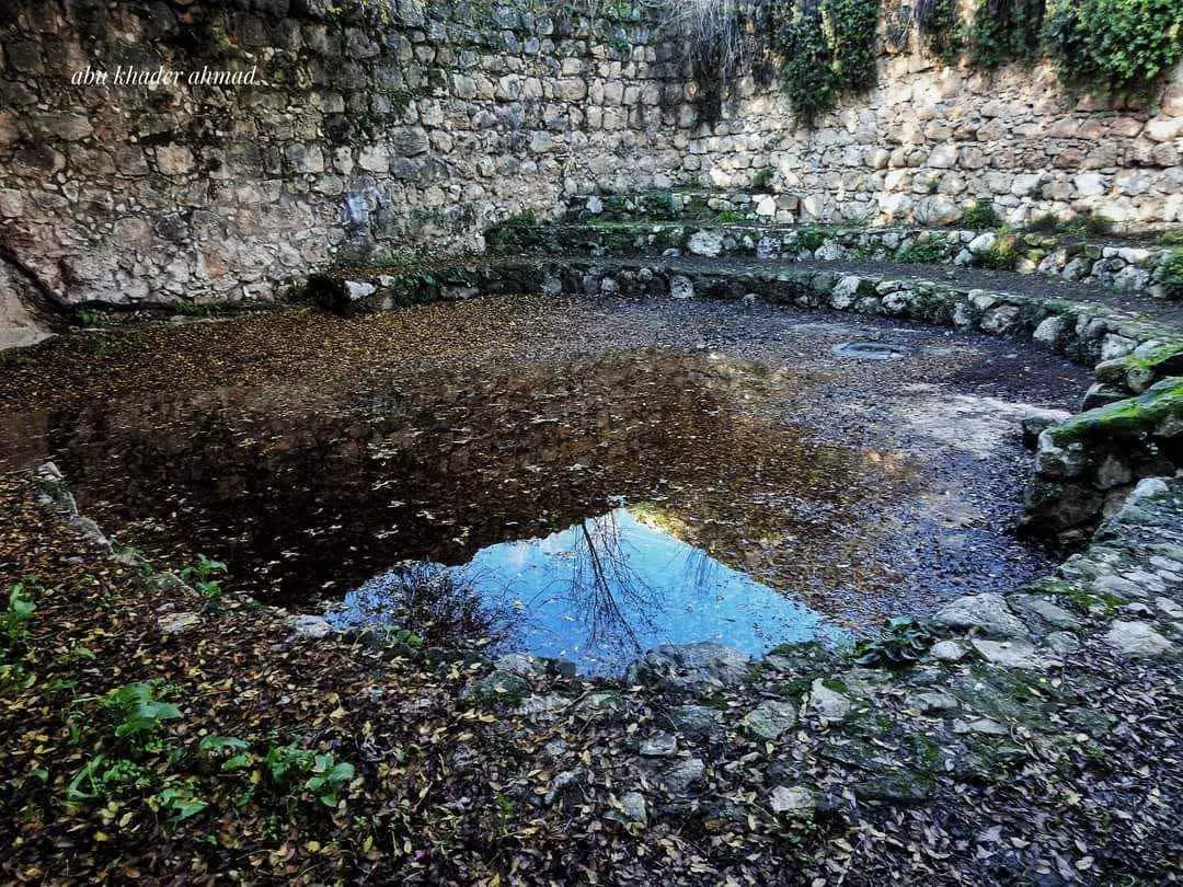
- جولة في خربة عين بيت طلمة --وادي سوريك بين قرية بيت اكسا وقرية قالونيا المهجرة
بيت المختار زايد -- Nabela Salem
- جولة في خربة عين بيت طلمة --وادي سوريك بين قرية بيت اكسا وقرية قالونيا المهجرة
بيت المختار زايد -- Nabela Salem #2
- جولة في خربة عين بيت طلمة --وادي سوريك بين قرية بيت اكسا وقرية قالونيا المهجرة
بيت المختار زايد -- Nabela Salem #3
- جولة في خربة عين بيت طلمة --وادي سوريك بين قرية بيت اكسا وقرية قالونيا المهجرة
بيت المختار زايد -- Nabela Salem #4
- جولة في خربة عين بيت طلمة --وادي سوريك بين قرية بيت اكسا وقرية قالونيا المهجرة
بيت المختار زايد -- Nabela Salem #5
- جولة في خربة عين بيت طلمة --وادي سوريك بين قرية بيت اكسا وقرية قالونيا المهجرة
بيت المختار زايد -- Nabela Salem #6
- جولة في خربة عين بيت طلمة --وادي سوريك بين قرية بيت اكسا وقرية قالونيا المهجرة
بيت المختار زايد -- Nabela Salem #7
- جولة في خربة عين بيت طلمة --وادي سوريك بين قرية بيت اكسا وقرية قالونيا المهجرة
بيت المختار زايد -- Nabela Salem #8
- جولة في خربة عين بيت طلمة --وادي سوريك بين قرية بيت اكسا وقرية قالونيا المهجرة
بيت المختار زايد -- Nabela Salem #9
- جولة في خربة عين بيت طلمة --وادي سوريك بين قرية بيت اكسا وقرية قالونيا المهجرة
بيت المختار زايد -- Nabela Salem #10
- جولة في خربة عين بيت طلمة --وادي سوريك بين قرية بيت اكسا وقرية قالونيا المهجرة
بيت المختار زايد -- Nabela Salem #11
- جولة في خربة عين بيت طلمة --وادي سوريك بين قرية بيت اكسا وقرية قالونيا المهجرة
بيت المختار زايد -- Nabela Salem #12
- جولة في خربة عين بيت طلمة --وادي سوريك بين قرية بيت اكسا وقرية قالونيا المهجرة
بيت المختار زايد -- Nabela Salem #13
- جولة في خربة عين بيت طلمة --وادي سوريك بين قرية بيت اكسا وقرية قالونيا المهجرة
بيت المختار زايد -- Nabela Salem #14
- جولة في خربة عين بيت طلمة --وادي سوريك بين قرية بيت اكسا وقرية قالونيا المهجرة
بيت المختار زايد -- Nabela Salem #15
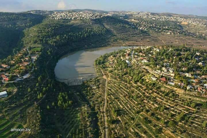
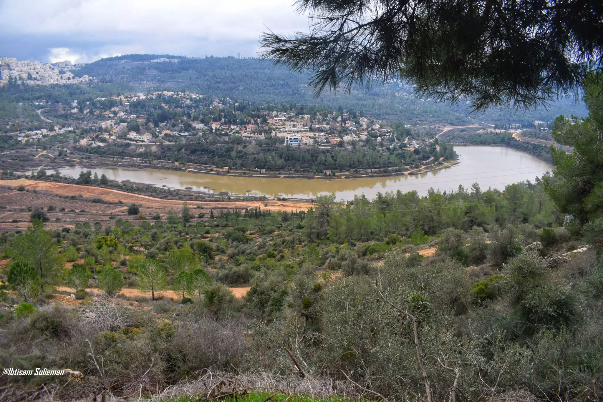
- A view of Beit Zayit Reservoir Observation
- A view of Beit Zayit Reservoir Observation #2
- A view of Beit Zayit Reservoir Observation #3
- A view of Beit Zayit Reservoir Observation #4
- A view of Beit Zayit Reservoir Observation #5
- A view of Beit Zayit Reservoir Observation #6
- A view of Beit Zayit Reservoir Observation #7
- A view of Beit Zayit Reservoir Observation #8
- A view of Beit Zayit Reservoir Observation #9
- A view of Beit Zayit Reservoir Observation #10
- Our stolen home; we shall return -- Mahmoud Moutah

- Our stolen home; we shall return -- Mahmoud Moutah #2
- Our stolen home; we shall return -- Mahmoud Moutah #3
- Our stolen home; we shall return -- Mahmoud Moutah #4
- وصل دفع ضريبة قبل النكبة -- 1941
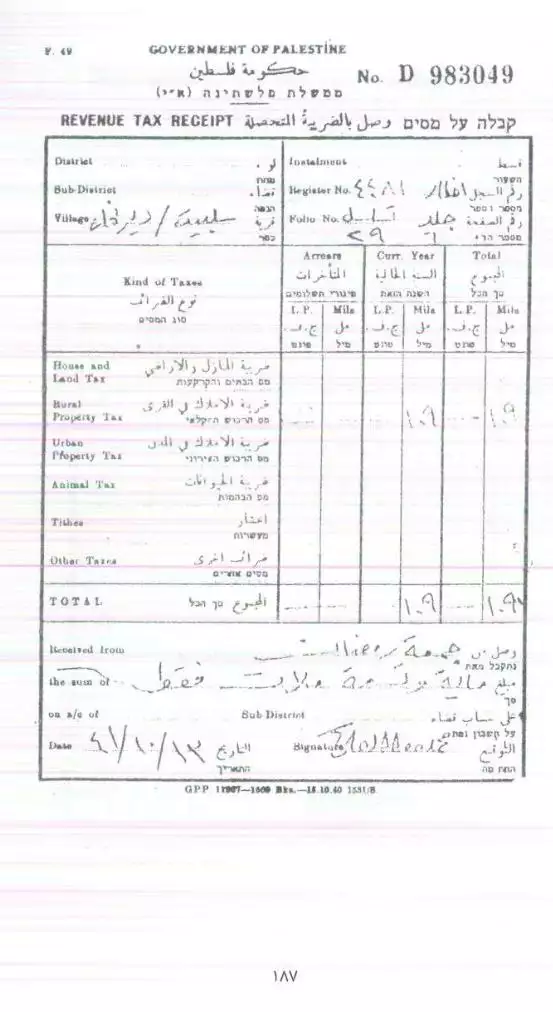
- وصل دفع ضريبة قبل النكبة يعود لجمعة رمضان -- 1944
- وصل دفع ضريبة قبل النكبة يعود لمحمود جمعة
- الاراضي المسجلة في سجل المختار قبل النكبة
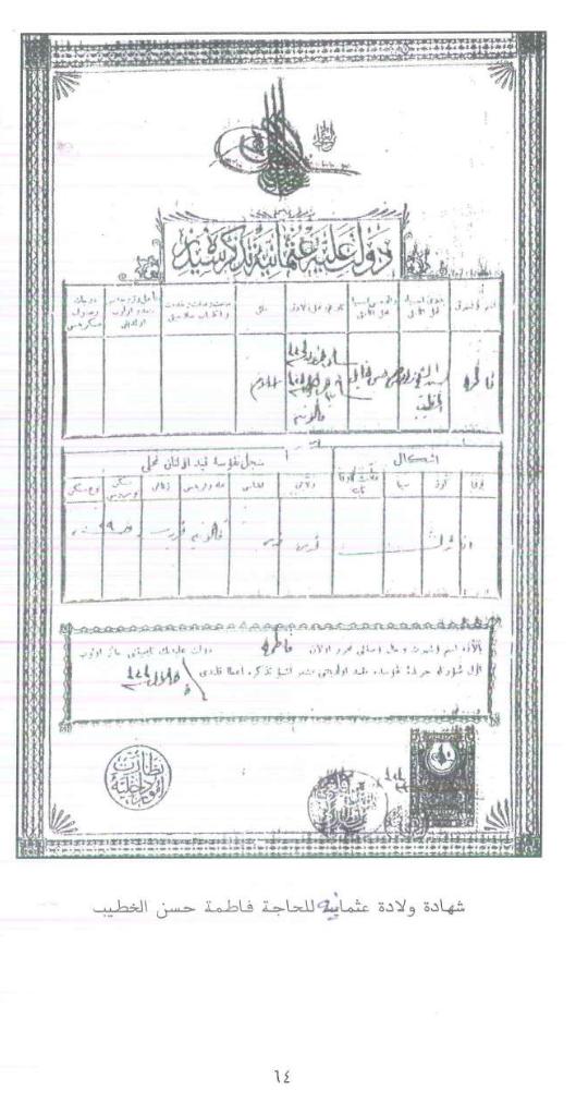
- شهادة ولادة عثمانية للحاجة فاطمة حسن الخطيب
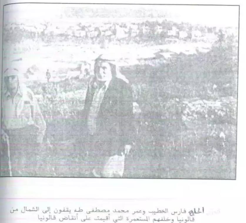
- فارس الخطيب وعمر محمد مصطفى طه يقفون إلى الشمال من قالونيا وخلفهم المستعمرة التي أقيمت على أنقاض قالونيا
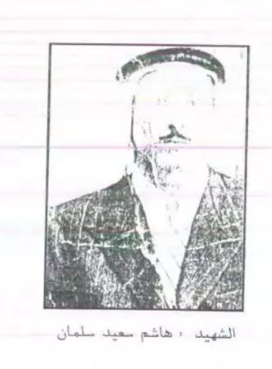
- الشهيد هاشم سعيد سلمان
Want to browse more? 80,000 pictures were grouped in these gallaries:
- قالونيا الغربيه - كتاب قريتي قالونيا - غالب سمرين - رفع شباب عائدون - https://www.facebook.com/groups/Qalonia/
Posted by Nahid - قالونيا الشرقيه - كتاب غالب سمرين - رفع شباب عائدون - https://www.facebook.com/groups/Qalonia/
Posted by Nahid - قالونيا الغربيه من كتاب قريتي قالونيا - ل غالب سمرين - رفع شباب عائدون - https://www.facebook.com/groups/Qalonia/
Posted by Nahid - قالونيا الشمالية من كتاب قريتي قالونيا لاستاذ غالب سمرين - رفع شباب عائدون - https://www.facebook.com/groups/Qalonia/
Posted by Nahid - خارطه قالونيا رسم رمزي سمرين ب اشراف غالب سمرين - فع شباب عائدون - https://www.facebook.com/groups/Qalonia/
Posted by Nahid
| Display Name | Clan/Hamolah | Country of Residence |
| Mahdi Khatib | - | الاردن, 108 |
| Sarah Farhan | Abu Saad | - |
| Faith Farhan | Ayyash and Farhan | - |
| Dr ALI ABED RABBO | Khattab | Ramallah, Palestine |
| Dr.Mohammad Abed Saleh Abed Rabbo | - | Barcelona, Palestine |
| mohammed kayed alkhatib | alkhatib | amman, jordan |
| samer salameh | سلامه عسكر خطاب | رام الله |
| malik ahmad mustafa hammad | ABU SA'AD | illinois, USA |
| nader salah | salah | il, usa |
| Nahid | أبوغنيم | صنعاء - الاقامة الحالية, الاردن |
| سوزان حمدان | حمدان | - |
| ياسمين حمدان | حمدان | - |
| أنس الصرص | الصرص | الأردن |
| رائد خضر | خضر | - |
| حازم جبران | جبران | ابو ظبي |
| fatma | - | - |
| ناصر | askar | dubai |
| ناصر غالب سمرين | عسكر | دبي , الإمارات |
| ABU_HUSSAIN | عسكر | amman, jordan |
| علي | خطاب | القدس |
| arwa salah | SALAH | palestine\Al-RAM |
| mohammad alkhatib | alkhatib | athens - greece , greece |
| محمد خضر | خضر | عمان |
| Bassam Al khtaib | - | - |
| ashraf | - | amman, jordan |
| nisreen derbas | - | - |
| Hussam Ahmad Mohammad Alkhatib | Alkhatib | - |
| هارون رمضان | عسكر | - |
| أبو جاسم | عسكر | عمان, الأردن |
| Dana Khalil | - | Sharjah, United Arab Emirates |
| Safia F Barakat | Barakat | Ramallah |
| محمد عبدالرزاق خليل | - | الكويت |
| سامر محمد سليمان مشعل | مشعل | دبي |
| زكي خضر | مشعل | الامارات |
| فردوس | سلامة | ramalah |
| yasmeen salameh | askar | Amman, Jordan |
| أنس جابر | - | عمان, الاردن |
| الخطيب | عسكر | Amman |
| نضال مشاعلة | - | عمان, الاردن |
| dr.mai nayef | حمدان | غزة, 8 |
| kaaes | - | - |
| saleh derbas | derbas | NY, NY |
| kayed | khatib | jordan |
| محمد فضل | - | عمان, عمان |
| فؤاد طه | خطاب | - |
| Wael Khalil | - | - |
| ليلى خالد | عسكر | الأردن |
| فلسطين | عسكر | - |
| خالد رمضان | عسكر | - |
| abu maher | Abu said | - |
| Mohammed Hamdan | Hamdan | IL, USA |
| Bassel Joudeh | - | USA |
| MOEYYED ATIEH | MAKHLOUF | IL, USA |
| kassem khalil,M.D | - | California, usa |
| Aziz Khalil | - | - |
| Osama Hamdan | Hamdan | MI, USA |
- بيوت وبساتين قرية قالونيا المهجرة قضاء القدس Duration: 3 min 36 sec
- حلوه يا بلدي ... حلوة يا قالونيا
- قرية قالونيا الجزء الأول
- قرية قالونيا - الجزء الثاني
- قرية قالونيا - الجزء الثالث
- قرية قالونيا - الجزء الرابع
- قرية قالونيا - الجزء الخامس
- قرية قالونيا - الجزء السادس والأخير
- مجموعة للذاكرة_قالونيا
- صور لقالونيا
- تقرير عن قالونيا على قناة مكس معا
- تقرير عن قالونيا على قناة الجزيرة
- زفة شباب عائدون في ربوع قالونيا
- الافطارالاول بعد الهجرة في قرية قالونيا
- فيلم وثائقي عن مغاره عموصة - قالونيا
- تخييم شباب عائدون بقرية قالونيا
- من داخل المنطار قالونيا
- احد الكهوف في قالونيا-وادي الزنانير
- مقابلة ابن قالونيا فراس صباح في برنامج صباح لخير يا قدس
- حملة واسعة لتنظيف مقبرة (( قالونيا)) المهجرة في القدس
- براعم عائدون قالونيا
- قالونيا بحلتها البيضاء تتهادى على ايقاع خرير مياهها
- كلمة للعم محمد سليمان عثمان سمور عسكر في الذكرى الخامسه والستون ل احتلال قريتنا قالونيا اطال الله في عمره
- كلمة الحاجه زريفة سعيد خضر درباس اطال الله في عمرها في الذكرى الخامسة والستون لاحتلال قريتنا قالونيا
- كلمة المناضل حمدي مطر في ذكرى أحتلال قالونيا الخامس والستون
- كلمة الدكتور رجا سمرين ذكرى احتلال قالونيا الخامس والستون
- كلمة الحاج سعيد رمضان ذكرى احتلال قالونيا الخامس و الستون
- كلمة الأستاذ غالب سمرين في ذكرى احتلال قالونيا الخامس و الستون
- عائدون - شباب عائدون قالونيا
- كلمة الحاج عثمان محمد عثمان في ذكرى النكبه الخامسه والستون لاحتلال قالونيا
- كي لا ننسى قالونيا مع العم عثمان محمد عثمان
- الحلقة التاسعة من سلسلة حلقات التاريخ الشفوي كي لا ننسى قالونيا مع السيد عثمان حسن سمور
- شباب عائدون ينظمون اسبوع قالونيا على درب العودة في مؤسسة يبوس في القدس
- الحلقة الحادي عشرة من سلسلة حلقات التاريخ الشفوي كي لا ننسى قالونيا مع السيد عثمان حسن سمور
- سلسلة حكاية قرية من فلسطين| قرية قَالوْنْيَا (17) موسوعة القرى الفلسطينية Duration: 6 min 24 sec
- عين الشامية عين ماء في فلسطين في القرى المهجرة ما شاء الله على هذا الجمال والروعة .. Duration: 50 sec
- شرق قالونيا بين خربة لوزة وخربة طُلما
- عين اآل فرحان في قرية قالونيا المهجرة قضاء القدس waze עין מבשר Duration: 20 sec
- سد المياه في قرية قالونياالمهجرة قضاء القدس Duration: min 11 sec
- سد اسماعيل في قرية قالونيا المهجرة Duration: 25 sec
 Fake Valor: Why Did Zionist Jews Hoist Nazis Flag on Their Ships in the 1930s?
What is new?
-
Facts About Oct. 7th Gaza Raid
-
Remined Us Please:: Who Did Rape Who? Palestinians Raped Israelis? Or, was the other way around?
-
When Prof. Edward Said was invited to debate Bibi Netanyahu in the 1980s, watch what happened!
-
Ezra Klein of the NY Times on the "Jewish Race".
-
Abusing Blood Libel!
-
Did Israeli Soldiers Activate The Hanniba Direective On Oct. 7th? You Be The Judge
-
Zionist FAQ: Isn't it true that Palestinians don't want peace? Palestinians never accepted the two-state solution
- Facts about Haavara (Transfer) Agreement between Ben-Gurion & Hitler
-
Haavara FAQs: Why Did Zionist Jews Hoist Nazis' Flags on Their Ships in the 1930s?
- Haavara FAQs: When Chaim Weizmann met FDR in mid-1943, why was he silent about rescuing European Jewry?
-
Dear ChatGPT: How did Palestinians resist Napoleon's invasion of their country in 1799?
-
Dear ChatGPT: Gaza had a vibrant Jewish community in the mid-17th century. What happened to them?
-
Dear ChatGPT: Why did the Jewish Agency suppress news of the Holocaust during WWII?
-
Video Playlist: Jews share their DNA tests to end the conflict for good.
-
A Tale of Two Conflicts: Examining the Definition of Genocide
-
Prof. Abraham Polak And The Suppressed History of the Khazars and European Jewry
-
How Ronald Reagan would have framed the genocide in Gaza if he were still alive?
-
Haavara FAQs: Let us do the math: how many German Jews did The Haavara Agreement save?
-
Zionist FAQs: The Hebron Massacre of 1929, "clearly proves" that Palestinians are antisemitic, how could you deny it?
-
Zionist FAQs: Why Anti-Zionist Is Not Antisemitism?
-
Zionist FAQs: Isn't it true that the KGB created Palestinian Nationalism in the early 1960s?
- Zionist FAQs: Muslims are killing Muslims all the time; why are Israeli Jews being singled out in the media?
- Zionist FAQs: How is Israel an apartheid state when 20% of its citizens are Arabs who enjoy full rights?
-
Haavara FAQs: Why Did Dorothy Thompson Flip From A Zionist Advocate to A Silenced Dissenter?
-
Haavara FAQs: Analysis of Herzl's Uganda Scheme and how it could have saved millions of Jews.
-
Haavara FAQs: Why did Hayim Greenberg describe American Jewry as "morally bankrupt" in early 1943?
-
Haavara FAQs: What if the Evian Conference was a resounding success? What would have been the impact of saving European Jewry on Zionism?
- Haavara FAQs: What if the six million were saved, how that would have impacted the Zionist project?
-
Haavara FAQs: How did Zionist leaders react when Europe's Jews lingered in the DP camps after WWII ended?
-
Why does the American Jewish community repeat lies that David Ben-Gurion had debunked before he died?
-
Who has the power to rename the Tatar/Khazar Gene Marker to Jewish IV?
-
Zionist FAQs: Why won't Egypt, Syria, and Jordan take their people back? Jews are indigenous to Palestine, and Arabs immigrated after Jews developed the country. Arabs should leave.
-
Haavara FAQs: Did Hitler and the Nazis conflate between Judaism and Zionist? If that wasn't case, then why?
-
Haavara FAQs: Winston Churchill and antisemitism, a collection of articles written Churchill.
-
Haavara FAQs: Broken by country, how many Jews survived vs. killed during the Holocaust?
-
Haavara FAQs: Why did European Jews vote with their feet and to immigrated to the Americas, not Palestine, after WWII?
-
Watch this American Jewish Girl describing Israeli Jews' cognitive dissonance like no other in under two minutes
-
Haavara FAQs: When the Nazis went out of their way to hide the Holocaust, Israeli Jews did the exact opposite by broadcasting their genocide of Gazans. But why?
-
Haavara FAQs: How Zionist Jews went out of their to show their appreciation to Nazism and Fascism?
- Haavara FAQs: Why Zionist leaders were against bombing the death camps & the Railroads leading to them?
-
Haavara FAQs: Hitler's message to the British and American people: If Jews are such noble citizens and you care about them, how come you're not letting them in? I will gladly ship them to you at my expense, even on luxury liners!
-
A shortlist of Zionist and Israeli false flag operations in the name Jews.
-
The Most Moral Army
- The Land of Kapos (Israel): Where the brave are boycotted and Kapos walk free.
- Why did early Zionists often named their communal enterprises "colonial"?
- Zionist Relations with Nazi Germany by Faris Glubb
-
Two NY Times advertisements by Zionists in the early 1943 that exposes Zionists' treason at the height of the calamity
- Facts Not Lies about the Palestinian-Israeli Conflict.
- Site's pictures have been categorized
- Campgain Against Lice
- A Survey of Palestine, the official source about Palestine before Nakba produced by the British Mandate; over 1200 pages.
- Satellite View & Google Earth: Over 6,000 placemarks identifying all destroyed towns, W. Bank & Gaza Strip Towns, & refugee camps.
- PalestineRemembered.com and its Nakba Oral History Project were featured on al-Jazeera Satellite TV.
- Nakba Oral History Video Podcast:
 Over 700 Oral History interviews (including 3,500+ hours of recording) can be viewed online.
 - Palestine Village Statistics Project
- Gaza Jail Break
- النسخة العربية للموقع الان متوفرة
- Videos: Documenting the destroyed villages in video: Tracing all that remains since Nakba.
- Videos: Responding to Zionist Propaganda
- Interview: The ethnic cleansing of Palestine: George Galloway interviews Israeli Historian Ilan Pappe.
- For Palestinians, memory matters. It provides a blueprint for their future By George Bisharat.
- Zionist FAQ now available in Hebrew שאלות שציונים שואלים, עכשיו בעברית
- Video: The Stephen Walt and John Mearsheimer report on the influence of the Israel Lobby on U.S. Foreign Policy
- The Palestinian-Israeli conflict for beginners
