| PalestineRemembered | About Us | Oral History | العربية | |
| Pictures | Zionist FAQs | Haavara | Maps | |
| Search |
| Camps |
| Districts |
| Acre |
| Baysan |
| Beersheba |
| Bethlehem |
| Gaza |
| Haifa |
| Hebron |
| Jaffa |
| Jericho |
| Jerusalem |
| Jinin |
| Nablus |
| Nazareth |
| Ramallah |
| al-Ramla |
| Safad |
| Tiberias |
| Tulkarm |
| Donate |
| Contact |
| Profile |
| Videos |
Welcome To Nuris - نورس (נוריס)
|
District of Jinin
Ethnically cleansed days ago |
العربية Google Earth |
 |
Gallery (27) |
- Statistics & Facts
-
Before & After

- Satellite View
- Articles 7
- Pictures 27
- Oral History 2
- Members 17
- All That Remains
- Wikipedia
- Videos
- Guest Book 22
- Links
| Statistic & Fact | Value | ||||||||||||||||
| Occupation Date | May 29, 1948 | ||||||||||||||||
| Distance From District | 9 (km) Northeast of Jinin | ||||||||||||||||
| Elevation | 150 (meters) | ||||||||||||||||
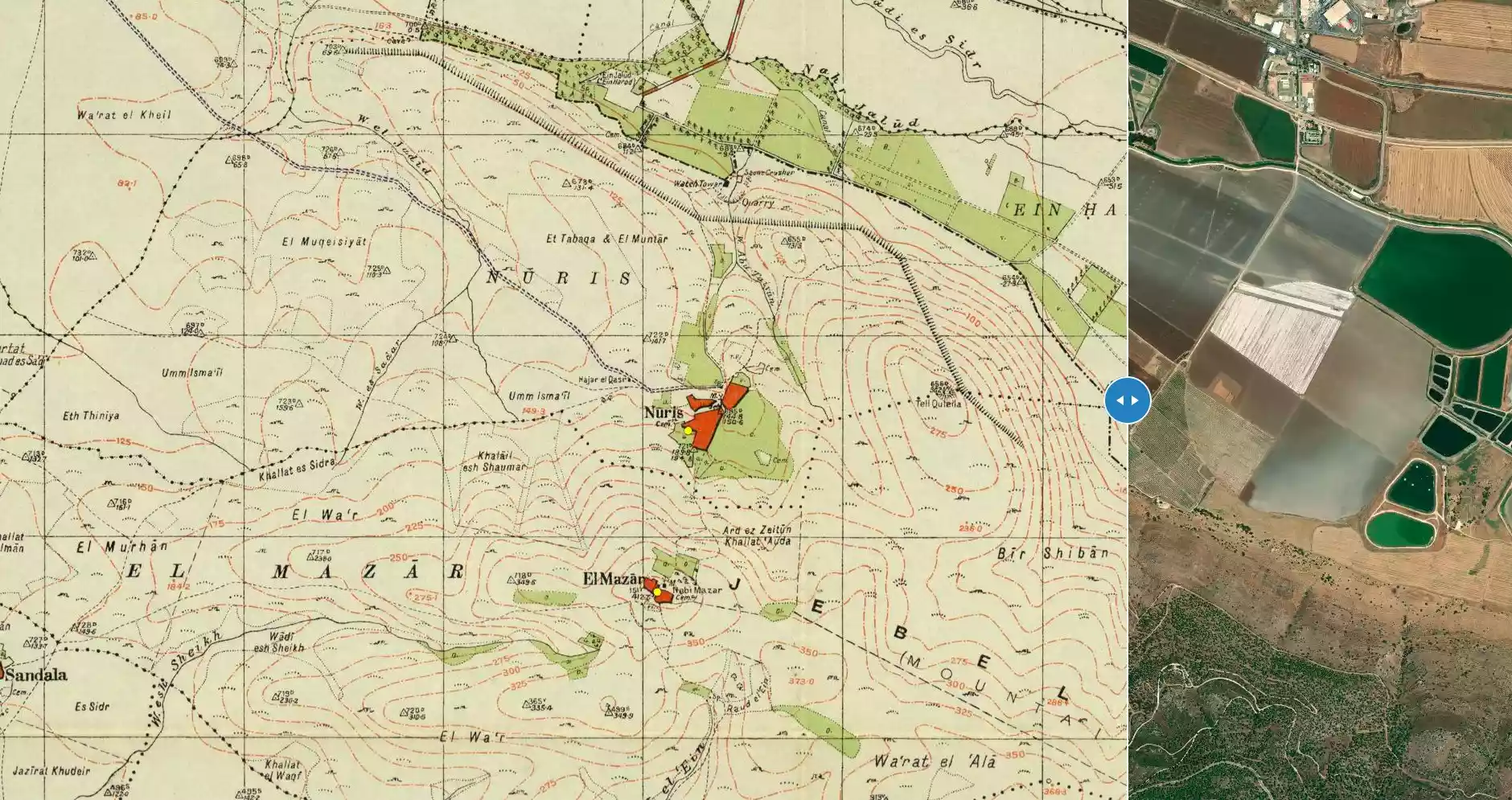
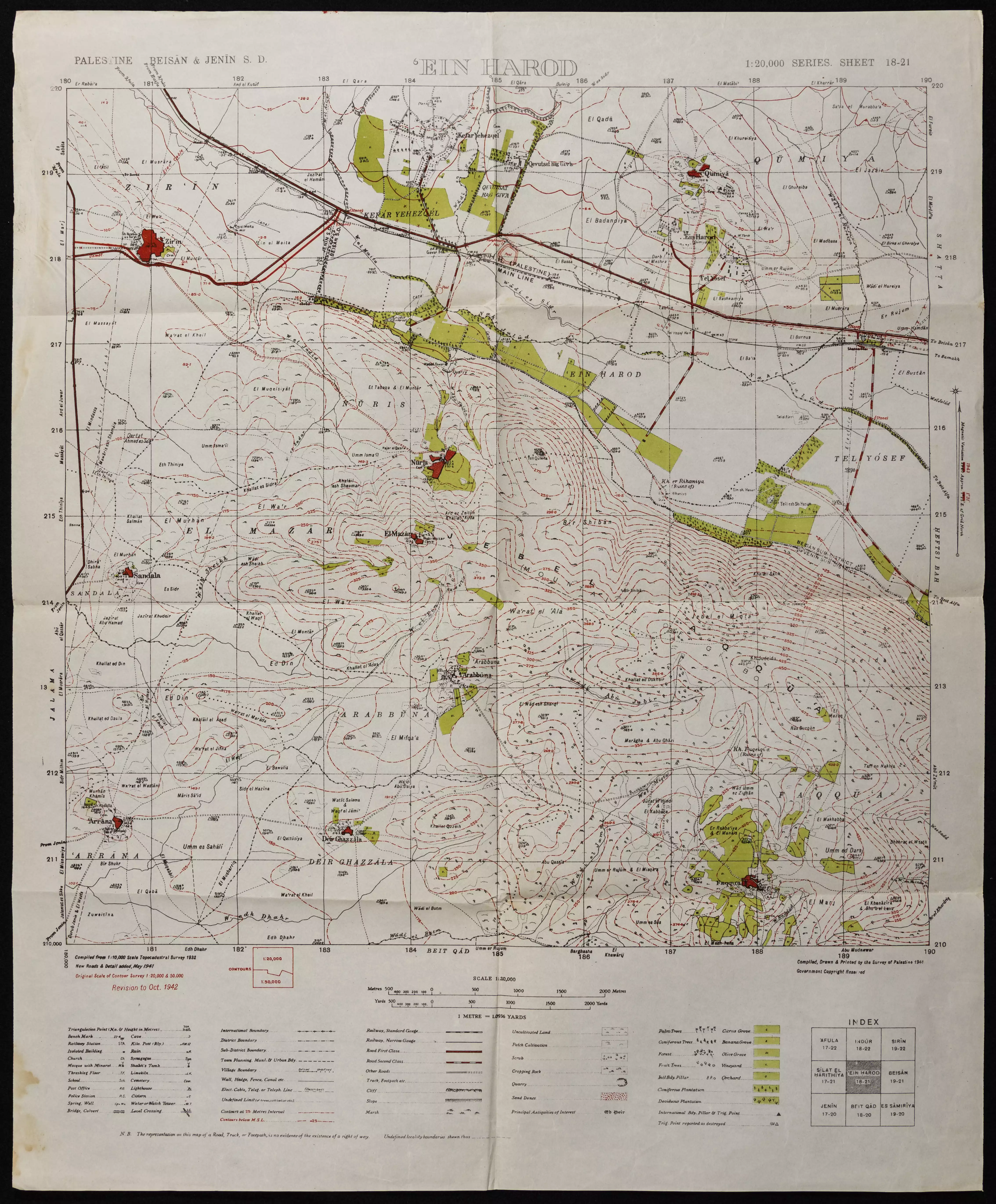
| Before & After Nakba, Click Map For Details |
|||||||||||||||||
|
|||||||||||||||||
| Map Location | See location #4 on the map View from satellite |
||||||||||||||||
| Military Operation | Operation Gideon | ||||||||||||||||
| Attacking Units | Fourth Battalion of the Golani Brigade | ||||||||||||||||
| Defenders | Local militia & Arab Liberation Army | ||||||||||||||||
| Exodus Cause | Expulsion by Zionist troops | ||||||||||||||||
| Village Temains | Nuris was completely destroyed and defaced. | ||||||||||||||||
| Ethnically Cleansing | Nuris inhabitants were completely ethnically cleansed. | ||||||||||||||||
| Pre-Nakba Land Ownership |
**Town Lands' Demarcation Maps |
||||||||||||||||
| Land Usage As of 1945 |
|
||||||||||||||||
| Population |
|
||||||||||||||||
| Number of Houses |
|
||||||||||||||||
| Near By Towns |
|||||||||||||||||
|
|||||||||||||||||
| Town's Name Through History | Crusades referred to Nuris by Nurith. | ||||||||||||||||
| Schools | Nuris had an elementary school for boys which was founded by Ottomans in 1888. | ||||||||||||||||
| Places of Warship | One mosque | ||||||||||||||||
| Water Supply | There are several springs north of Nuris, and 'Ayn Jalut (or Jalud) is one of the largest and most famous in Palestine. | ||||||||||||||||
| Archeological Sites | Nearby the village, the Mamluks triumphed over the Mongols in the decisive battle of 'Ayn Jalut. | ||||||||||||||||
| Exculsive Jewish Colonies Who Usurped Village Lands |
Nurit | ||||||||||||||||
| Featured Video | |||||||||||||||||
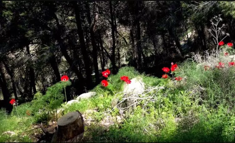
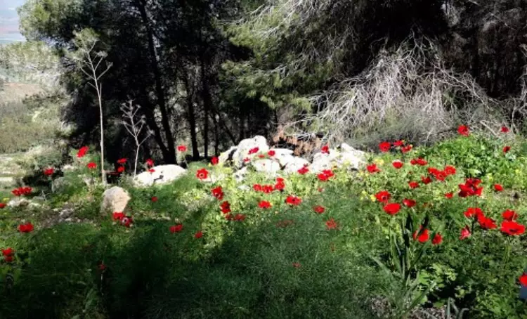
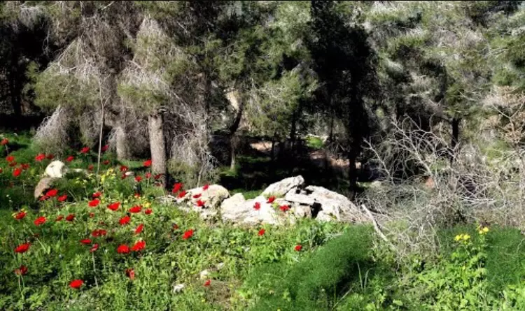
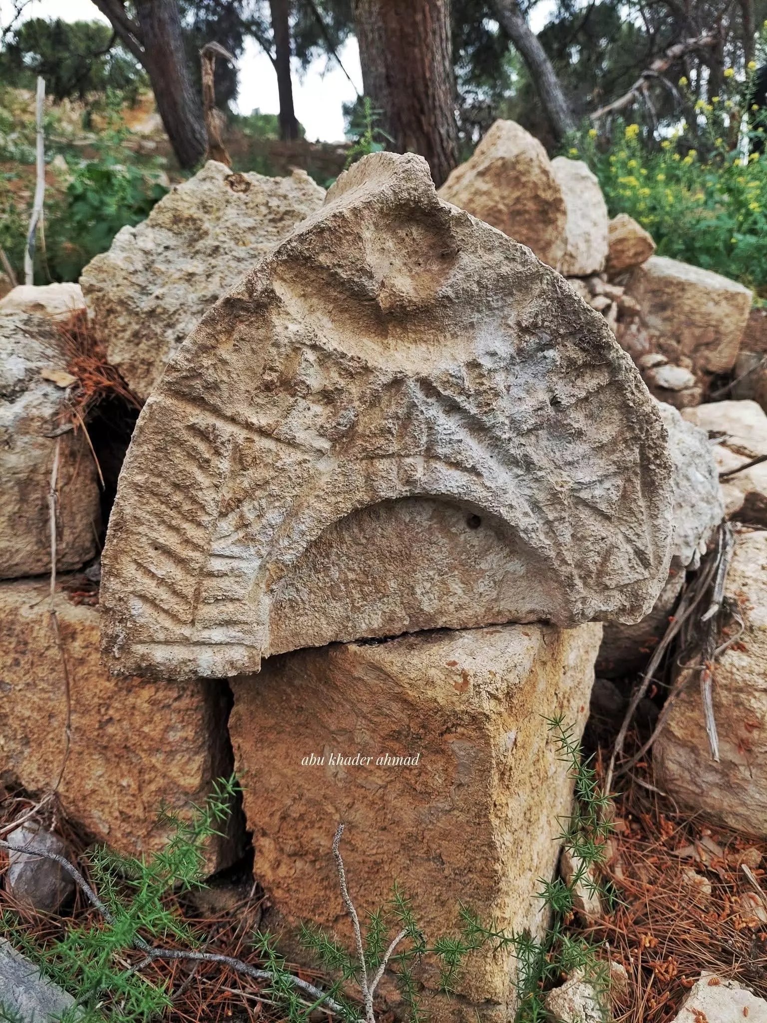
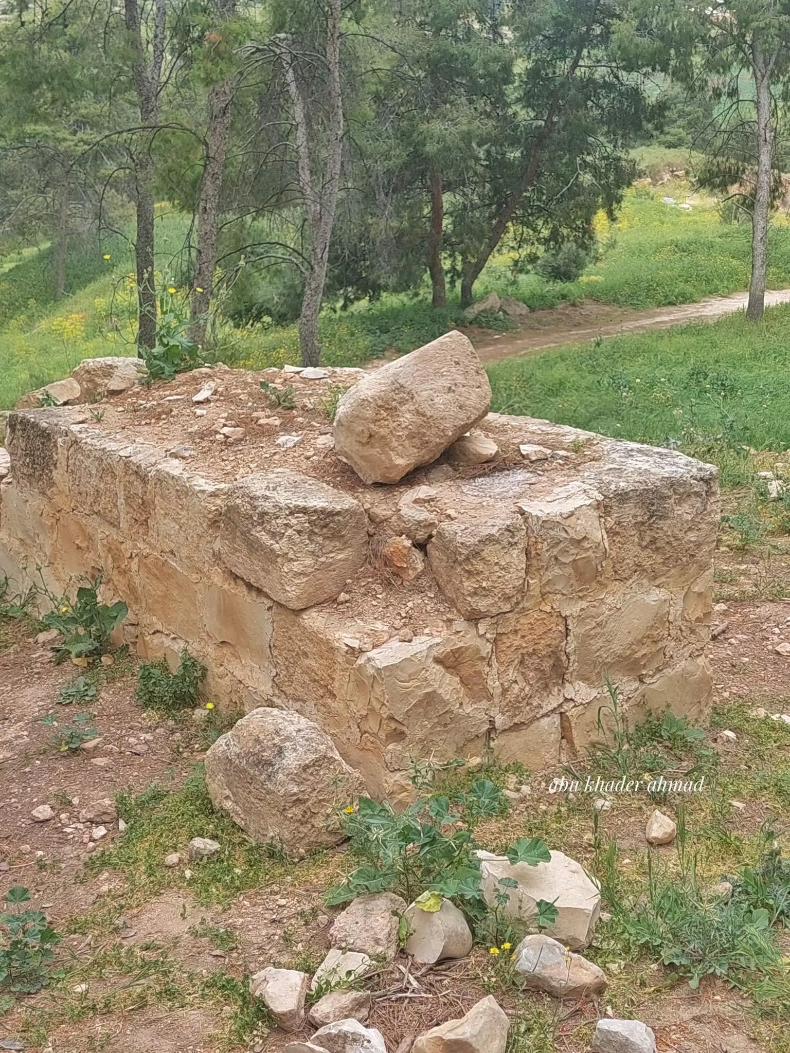
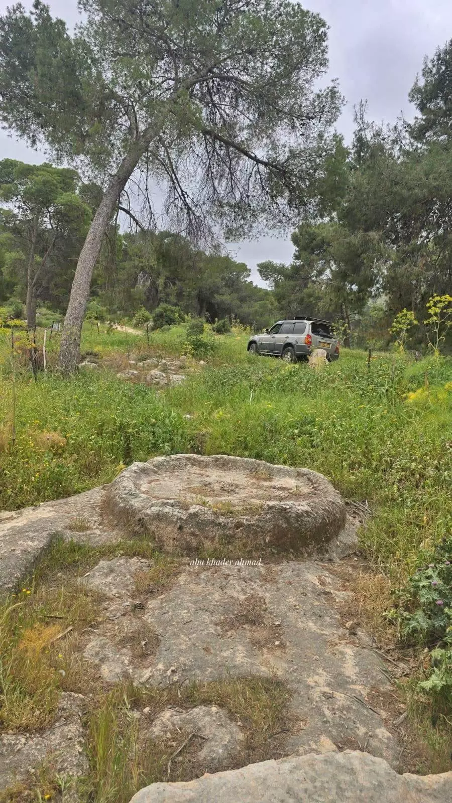
Village Before NakbaThe village was built on both sides of a shallow wadi, below the peak of the steep slope of Mount al-Mazar (see al-Mazar, Jenin sub-disctrict). The Haifa-Samakh railway, which ultimately joined with the Hijaz railway line, passed northeast of the village. Nuris was linked by a dirt path to the village of al-Mazar, atop the mountain, and by another road to the village of Zir'in. Crusader sources mention it as Nurith. In the area around Nuris, the Mamluk armies of Egypt triumphed over the Mongols in the decisive battle of 'Ayn Jalut (A.D. 1260). In 1596, Nuris was a village in the nahiya of Jenin (liwa' of Lajjun), with a population of eighty-eight. It paid taxes on a number of crops, including wheat, barley, and olives, as well as on goats and beehives. In the early nineteenth century the British traveler Buckingham noted that it was surrounded by olive trees. In the late nineteenth century, Nuris was described as a small village built on rocky terrain that concealed much of the village; it stood about 185 m above a valley. The plan of the modern village was rectangular, extending in a northeastern-southwestern direction. Most of its houses were built of mud and cement. House construction extended westward along the road that linked Nuris to Zir'in.The population of Nuris was Muslim. The village had a mosque and a small marketplace at its center. It also had an elementary school, founded in 1888 under the Ottomans. There were several springs north of the village, the most important of which was 'Ayn Jalut (or Jalud), one of the largest springs in Palestine. Water from the spring was utilized for domestic use as well as for irrigating the village orchards. In 1944/45 a total of 4 dunums was devoted to citrus and bananas and 2,935 dunums were allotted to cereals; 243 dunums were irrigated or used for orchards, of which 40 dunums were planted with olive trees. No study has yet been made of the ancient remains that appeared in the village, including a sarcophagus. Village Occupation and Ethnic CleaningWell before Nuris was occupied, on 18 March, an Arab Liberation Army (ALA) commander cabled headquarters that 'the battle of Nuris ended today with the intervention of the British army.' ALA forces were reported to be in control of the area surrounding the village and the hills to the north. Attacks by Haganah forces continued on the following day on both Nuris and Zir'in in an attempt to 'eliminate these villages,' which controlled the Baysan-Haifa road. Many Haganah soldiers were reported killed during the attacks. The New York Times confirms that a Haganah raiding party approached the village on 19 March, and was wiped out by its Arab defenders. A larger Haganah force approached later in the day and lost another five men. British troops rushed to the scene, fired mortars at the Arab forces and 'encouraged the Jews to return to their colony,' according to a British police statement.The village was attacked again on 29-30 May 1948, and its residents are reported by Israeli historian Benny Morris to have been expelled. The History of the War of Independence states that the unit responsible for the attack was the Fourth Battalion of the Golani Brigade, which had earlier participated in the occupation of the Baysan Valley to the northeast, and was preparing to assist in the occupation of Jenin. Morris notes that over a month earlier, on 19 April, Palmach headquarters issued orders 'to destroy enemy bases' in this and two other villages. It is not clear whether those orders were carried out at the time. The New York Times correspondent said that two Israeli columns moved toward the Triangle area 'against strong opposition,' capturing Nuris and nearby al-Mazar. Around six weeks later, the Associated Press (AP) reported that Iraqi army units and Palestinian irregulars managed to drive Israeli forces out of Nuris, as well as six nearby villages. 'Arab foot soldiers, supported by armored cars, artillery and mortars, stormed across an open plain north of Jenin to drive Israeli troops' from the villages, according to the AP report. Some of these villages eventually remained in Arab hands, but it is not clear how Nuris was later reoccupied. Zionists Colonies on Village LandsIn 1950, the settlement of Nurit (183216) was established on village land, northwest of the village site.Village TodayThe site, overgrown with pine and oak trees, is strewn with piles of stones. Part of the surrounding land is fenced in and is used as a grazing area, while another part is cultivated. Cactuses and olive and fig trees grow near the site.SourceDr. Walid al-Khalidi, 1992: All That Remains. |
|||||||||||||||||
| Related Maps | Town Lands' Demarcation Maps خرائط للقضاء توضح حدود القرى والاودية Town's map on MapQuest View from satellite Help us map this town at WikiMapia |
||||||||||||||||
| Related Links | Wikipedia's Page Google Search Google For Images Google For Videos |
||||||||||||||||
| More Information | في كتاب كي لا ننسى في كتاب بلادنا فلسطين المزيد من موقع هوية |
||||||||||||||||
- My family's brief story as refugees & how they were FORCED OUT of Nuris, Palestine
- Breifly, the History of Nuris, in Arabic
- Diwan Nuris in Amman, in Arabic
- From the crimes of the Khazar Jewish Nazis against the Palestinian nation
- Exact location of destroyed village Nuris and surrounding villages/towns
- نبذة تاريخية عن قرية نورس (قضاء جنين) من كتاب (كي لا ننسى)
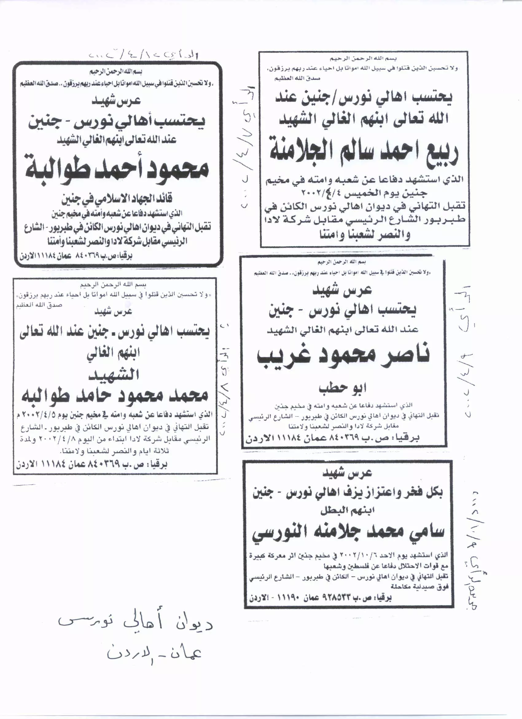
- الشهيد محمود طوالبة ( النورسي)
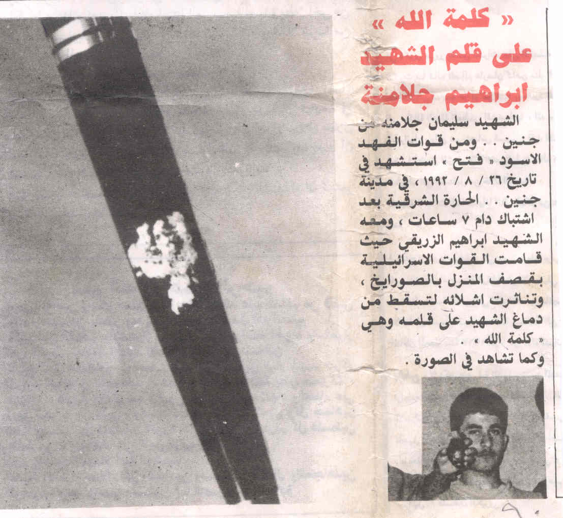
- al-Shaheed Ibrahim suleiman jalamne, in Arabic
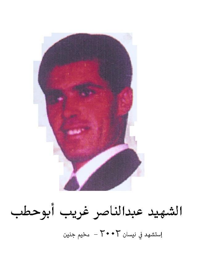
Posted by tawfiq Abu Irshaid 11 - al-Shaheed Abdel Nasir Gharib Abu Hatab
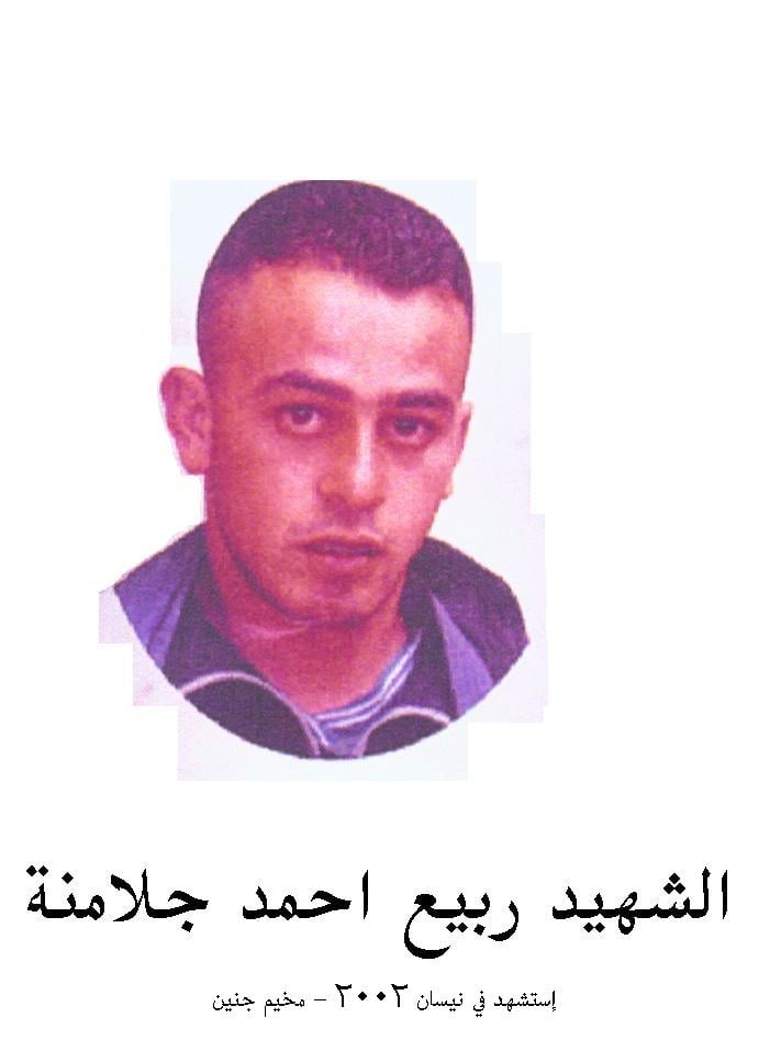
Posted by tawfiq Abu Irshaid - al-Shahieed Rabee3 Ahmad Jalamne
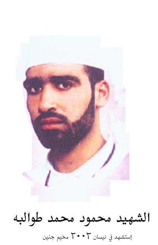
Posted by tawfiq Abu Irshaid 1 - al-Shaheed Mahmoud Muhammad Tawalbeh
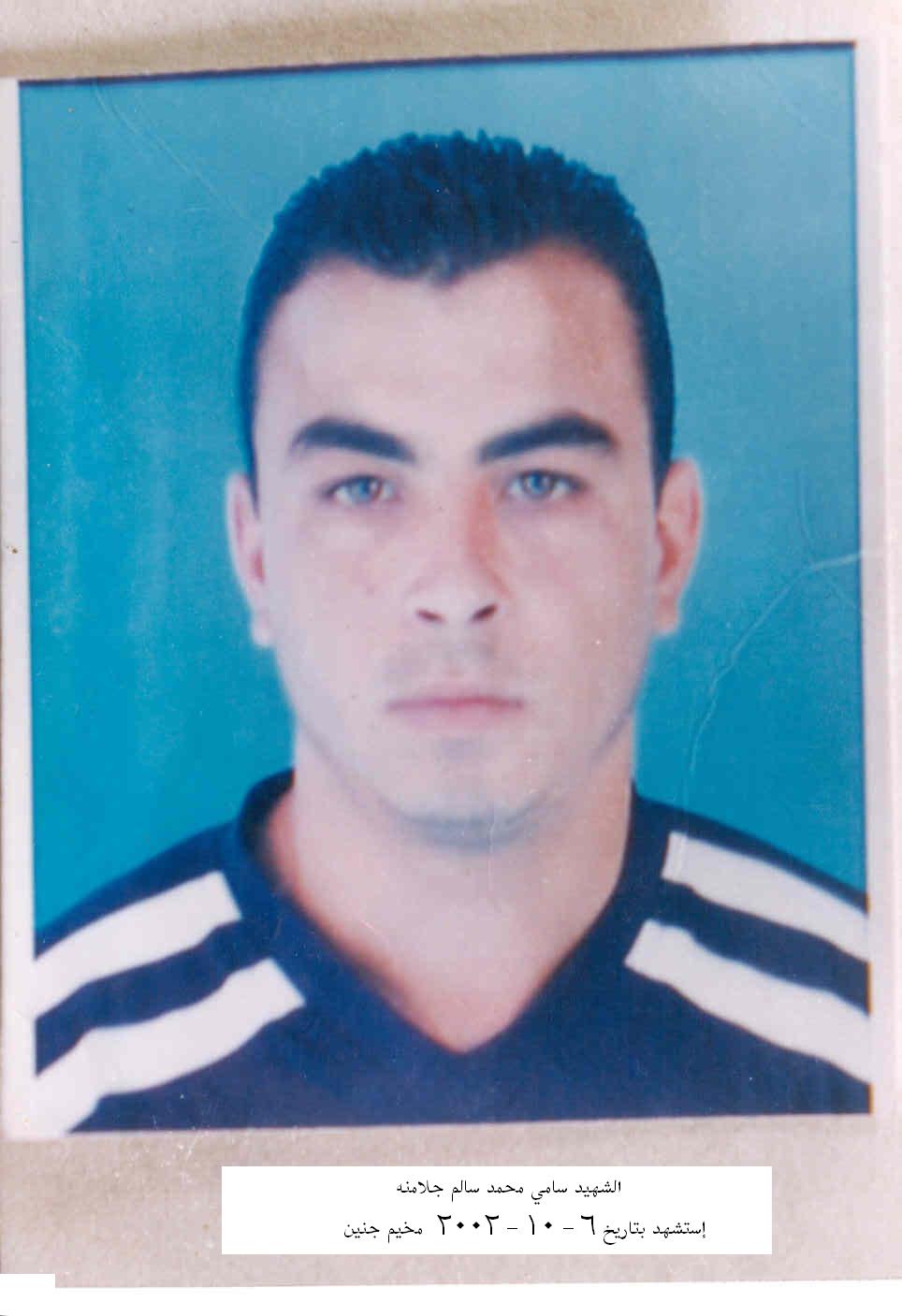
Posted by tawfiq Abu Irshaid 3 - al-Shaheed Sami Mahmoud Salem Jalamne
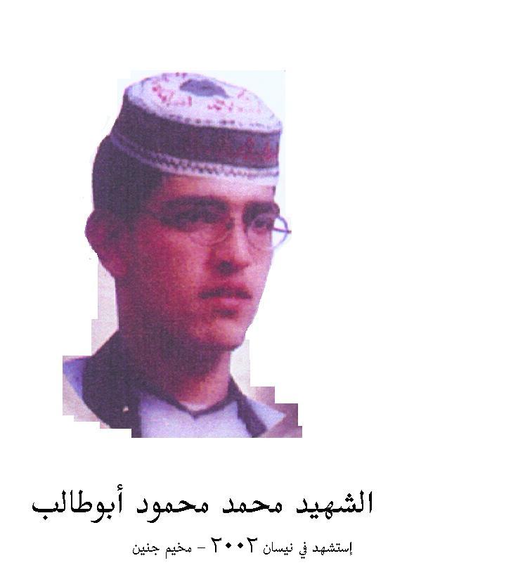
Posted by tawfiq Abu Irshaid 1 - al-Shaheed Muhammad Mahmoud Abu Talib
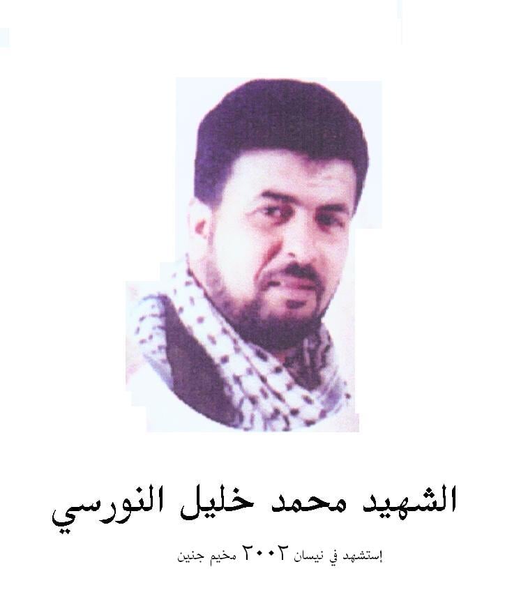
Posted by tawfiq Abu Irshaid - al-Shaheed Muhammad Khalil al-Nurisi
Posted by tawfiq Abu Irshaid 2 - Condolences for Nuris' Shuhada in the press, God bless all them
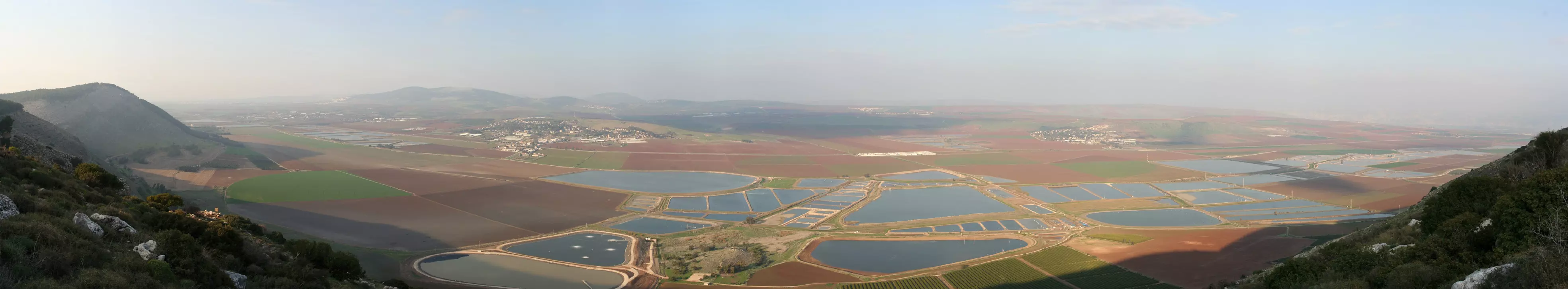
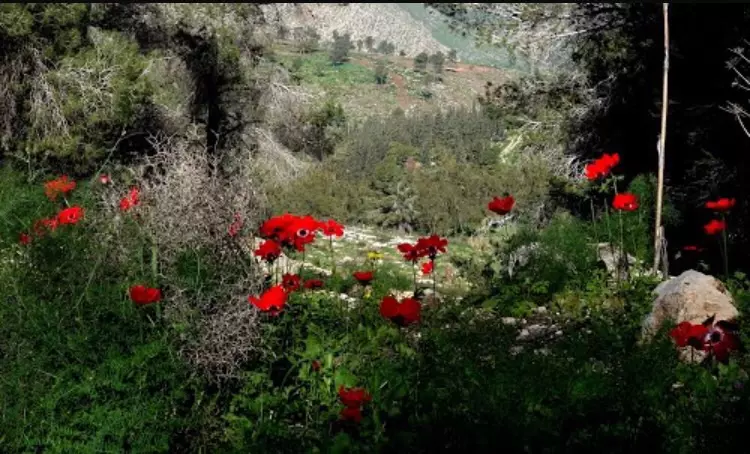
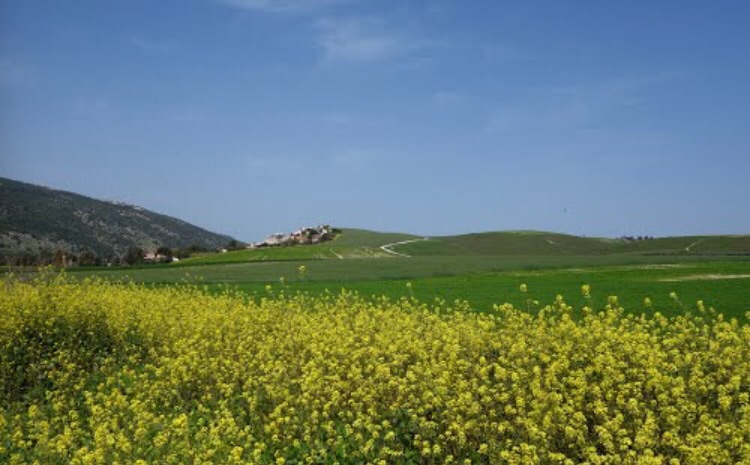
Posted by tawfiq Abu Irshaid - منظر عريض بإتجاه الشمال الشرقي، اُنقر الصورة لتكبيرها
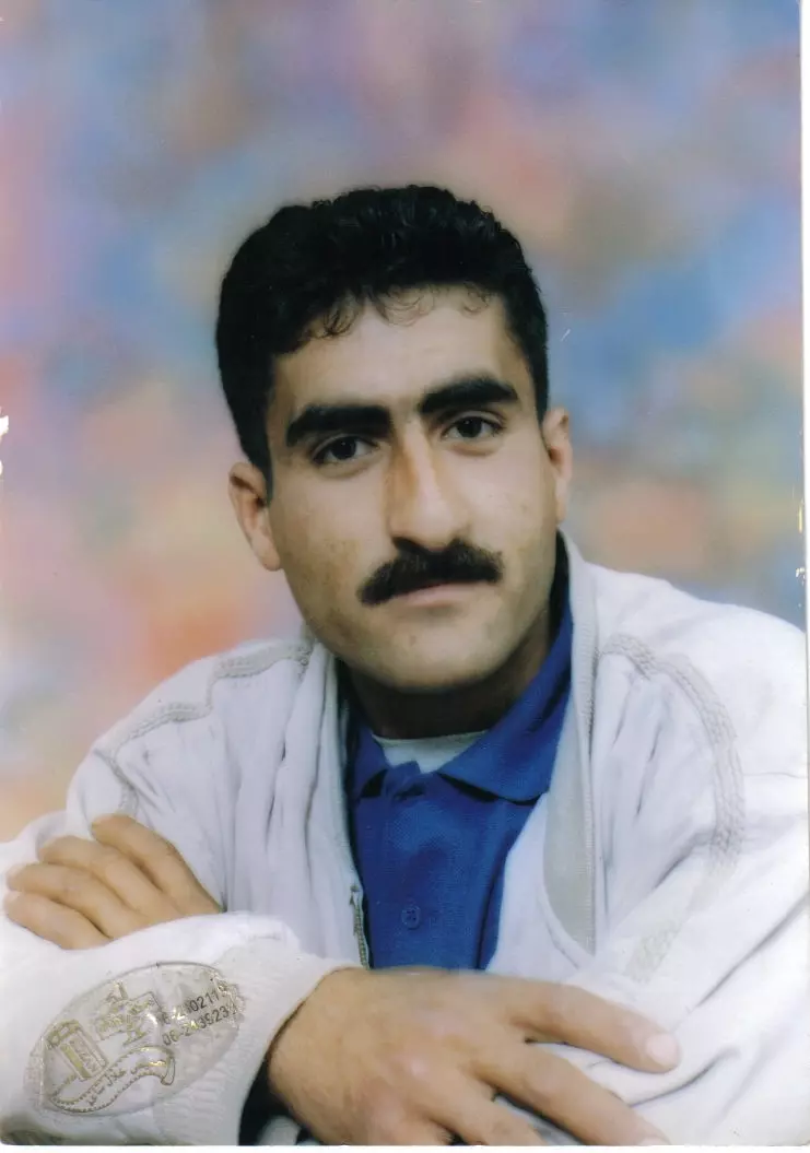
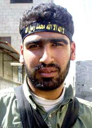
1 - الشهيد البطل فراس ذياب ابو حطب الذي اغتيل بتاريخ 24\11\2000
Posted by contumacious 1 - الشهيد محمود طوالبة
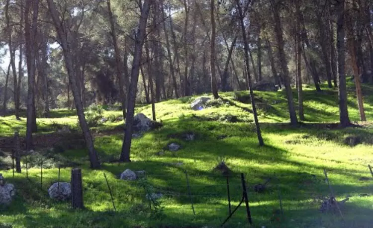
Posted by ayman tawalbeh - موقع القريه ويظهر ردم المنازل
Posted by abu raya - من موقع القريه
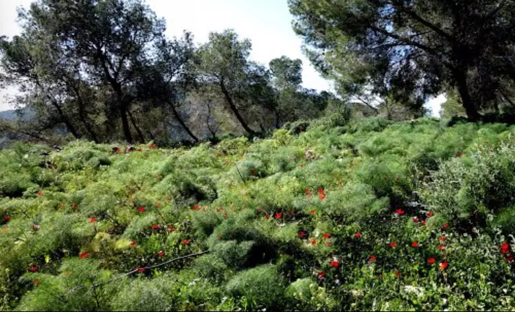
Posted by abu raya - منظر من القريه
Posted by abu raya - منظر من القريه
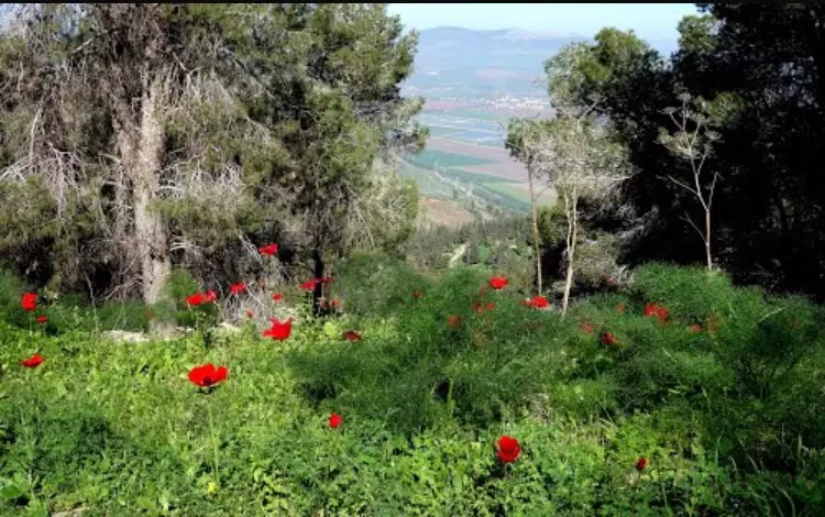
Posted by abu raya - موقع القريه مغطى بالاشجار
Posted by abu raya - من موقع القريه
Posted by abu raya - من موقع القريه
Posted by abu raya - اراضي القريه
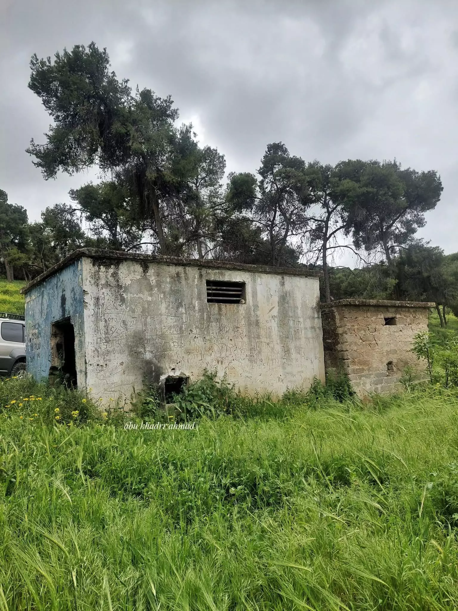
Posted by abu raya - جولة بين بيوت القرية المدمرة -- Abu Khader Ahmad Jbaren
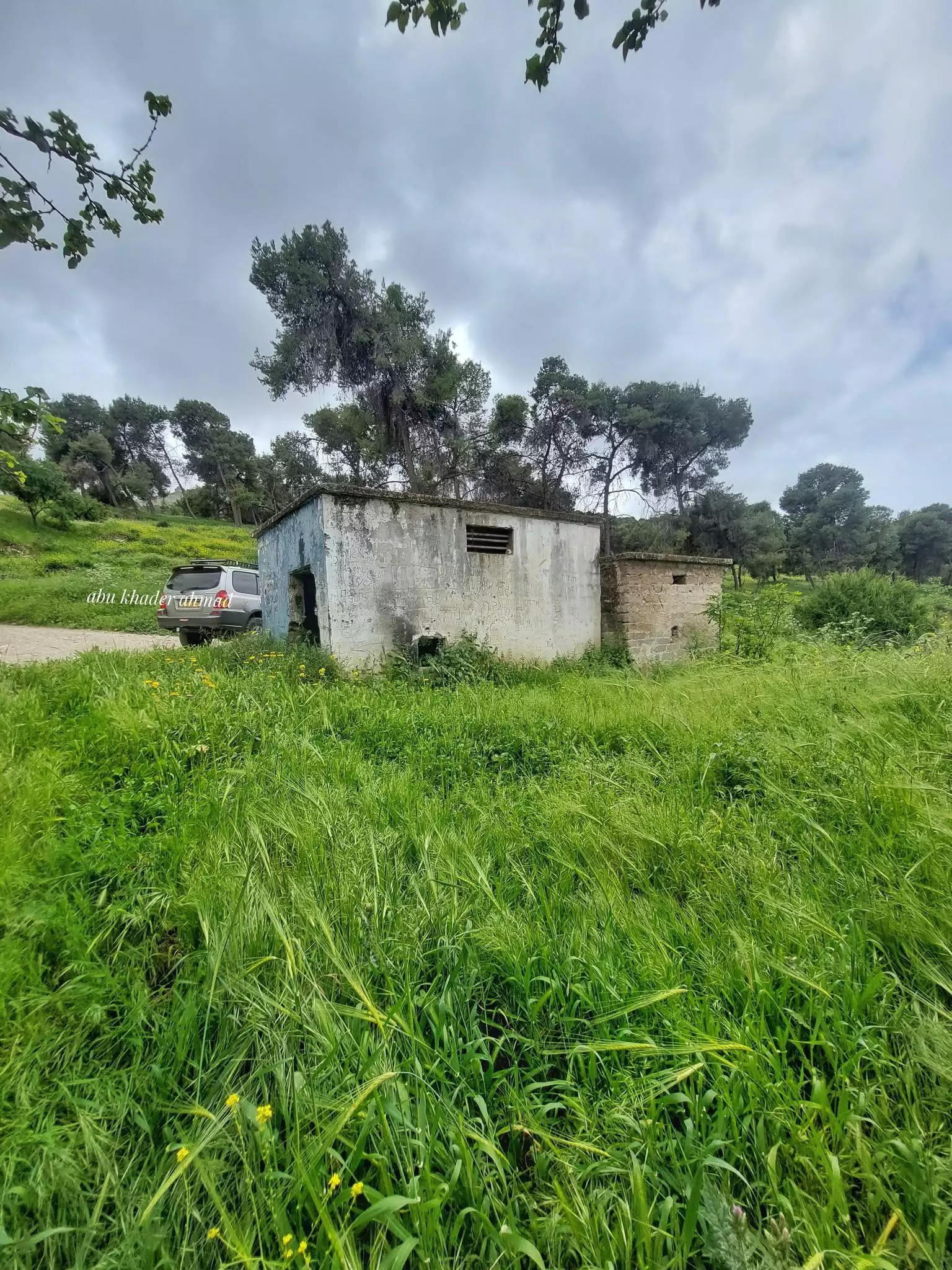
1 - جولة بين بيوت القرية المدمرة -- Abu Khader Ahmad Jbaren
#2
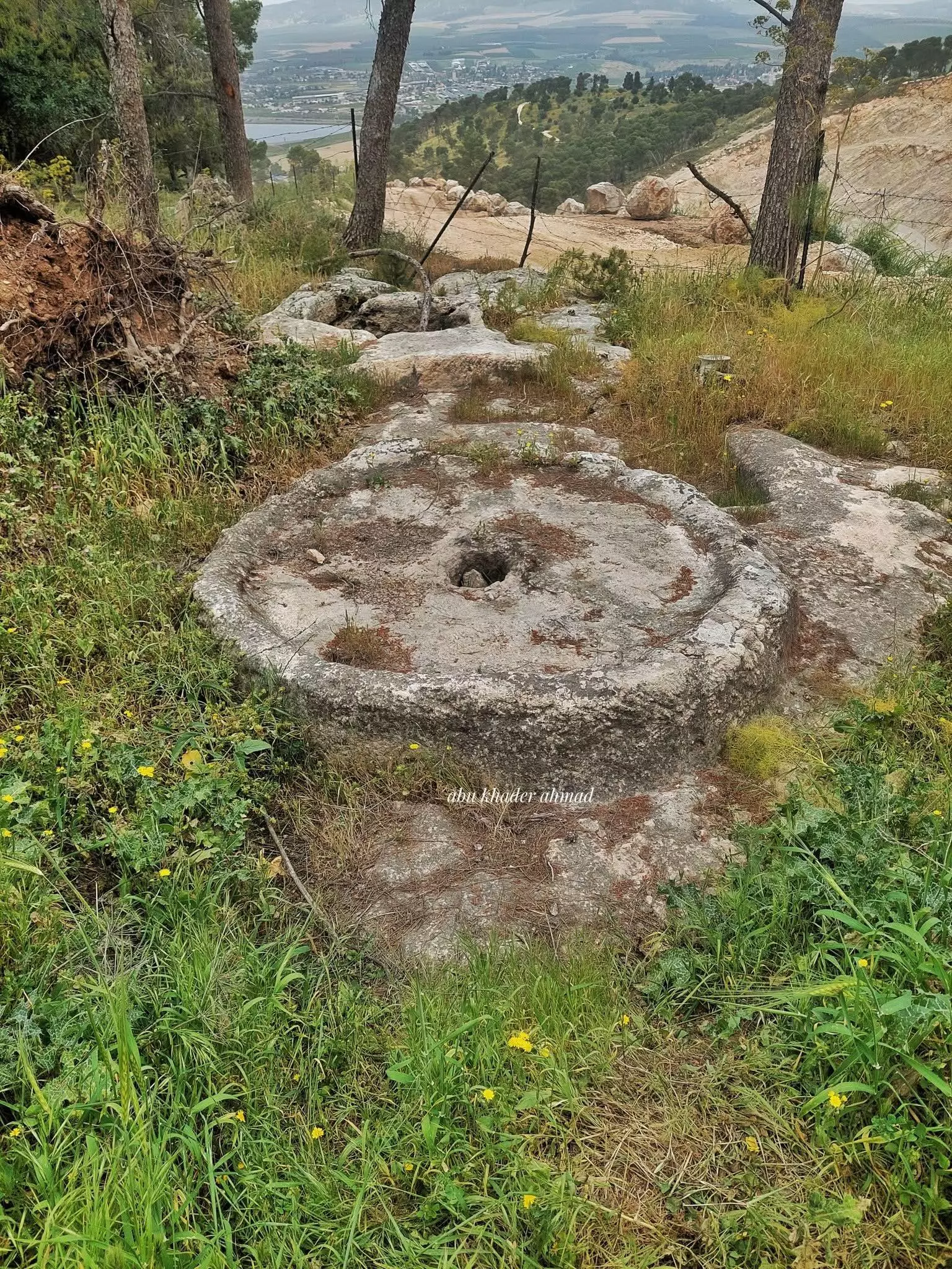
- جولة بين بيوت القرية المدمرة -- Abu Khader Ahmad Jbaren
#3
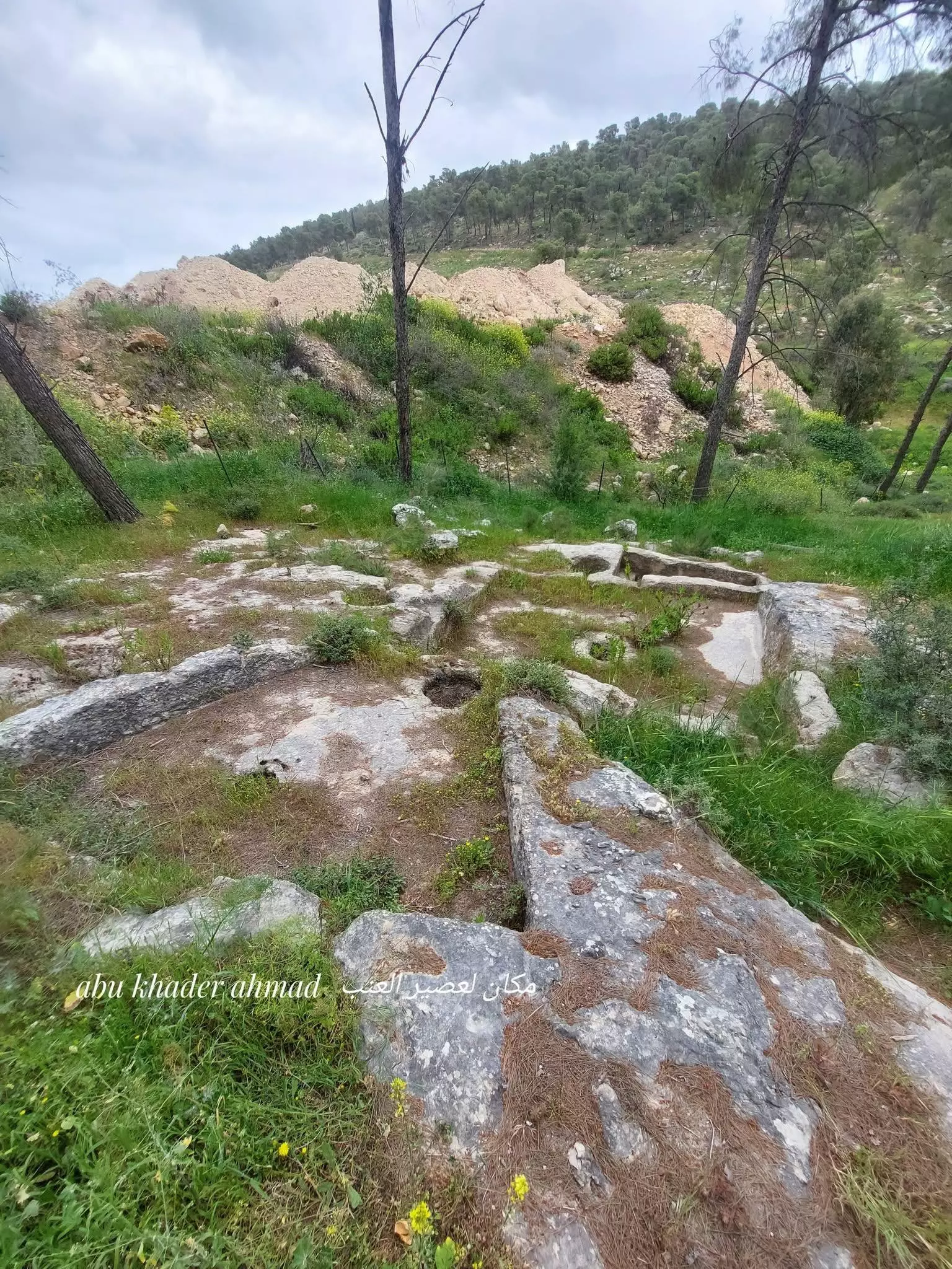
- جولة بين بيوت القرية المدمرة -- Abu Khader Ahmad Jbaren
#4
- جولة بين بيوت القرية المدمرة -- Abu Khader Ahmad Jbaren
#5
- جولة بين بيوت القرية المدمرة -- Abu Khader Ahmad Jbaren
#6
- جولة بين بيوت القرية المدمرة -- Abu Khader Ahmad Jbaren
#7
- خارطة تُظهِر الحدود والطرق بأنواعها والأماكن المقدسة والطبيعة الطوبغرافية من تلال وسهول ومنحدرات والتشكيلة الطبيعية للأرض وأنواع المزروعات. نُشرت الخريطة فترة الانتداب البريطاني، تم إضافة تعديلات عليها من قِبَل خدمة الخرائط والصور التابعة للقوات العسكرية الاسرائيلية فترة الأربعينيات.
Want to browse more? 80,000 pictures were grouped in these gallaries:
| Display Name | Clan/Hamolah | Country of Residence |
| محمد جلامنة | جلامنة | مخيم جنين, مخيم جنين |
| ahmad atef farahteh | - | AMMAN, JORDAN |
| لؤي الجلامنة | الجلامنة | media city, uae |
| عمر جلامنة | جلامنة | amman |
| basel farahteh | - | - |
| جنين 92 | ابو حماد | عمان |
| سائد | فراحته | الخبر |
| ابوحماد | ابوحماد | - |
| موفق عباس فراحته | - | - |
| alihassan3 | الضوار | عمان |
| contumacious | abu hatab | jenin |
| sam75j | jalamneh | - |
| ayman tawalbeh | - | - |
| Mohammad Tawalbeh | Tawalbeh | - |
| Abdulraheem Al-Jalamneh | Al-Jalamneh | - |
| tawfiq Abu Irshaid | jajamneh | amman, jordan |
| Zakaria Al-Jalamneh | Al-Jalamneh (aka Abu-Haleemah) | - |
 Fake Valor: Why Did Zionist Jews Hoist Nazis Flag on Their Ships in the 1930s?
What is new?
-
Facts About Oct. 7th Gaza Raid
-
Remined Us Please: Who Did Rape Whom? Was it Palestinians who raped Israelis? Or, was the other way around? You'll be the judge
-
When Prof. Edward Said was invited to debate Bibi Netanyahu in the 1980s, watch what happened!
-
Ezra Klein of the NY Times on the "Jewish Race".
-
Abusing Blood Libel!
-
How and why Israeli Jewry has become the most hated cult?
-
Did Israeli Soldiers Activate The Hannibal Direective On Oct. 7th? You Be The Judge
-
Zionist FAQ: Isn't it true that Palestinians don't want peace? Palestinians never accepted the two-state solution
- Facts about Haavara (Transfer) Agreement between Ben-Gurion & Hitler
-
Haavara FAQs: Why Did Zionist Jews Hoist Nazis' Flags on Their Ships in the 1930s?
- Haavara FAQs: When Chaim Weizmann met FDR in mid-1943, why was he silent about rescuing European Jewry?
-
Dear ChatGPT: How did Palestinians resist Napoleon's invasion of their country in 1799?
-
Dear ChatGPT: Gaza had a vibrant Jewish community in the mid-17th century. What happened to them?
-
Dear ChatGPT: Why did the Jewish Agency suppress news of the Holocaust during WWII?
-
Video Playlist: Jews share their DNA tests to end the conflict for good.
-
A Tale of Two Conflicts: Examining the Definition of Genocide
-
Prof. Abraham Polak And The Suppressed History of the Khazars and European Jewry
-
How Ronald Reagan would have framed the genocide in Gaza if he were still alive?
-
Haavara FAQs: Let us do the math: how many German Jews did The Haavara Agreement save?
-
Zionist FAQs: The Hebron Massacre of 1929, "clearly proves" that Palestinians are antisemitic, how could you deny it?
-
Zionist FAQs: Why Anti-Zionist Is Not Antisemitism?
-
Zionist FAQs: Isn't it true that the KGB created Palestinian Nationalism in the early 1960s?
- Zionist FAQs: Muslims are killing Muslims all the time; why are Israeli Jews being singled out in the media?
- Zionist FAQs: How is Israel an apartheid state when 20% of its citizens are Arabs who enjoy full rights?
-
Haavara FAQs: Why Did Dorothy Thompson Flip From A Zionist Advocate to A Silenced Dissenter?
-
Haavara FAQs: Analysis of Herzl's Uganda Scheme and how it could have saved millions of Jews.
-
Haavara FAQs: Why did Hayim Greenberg describe American Jewry as "morally bankrupt" in early 1943?
-
Haavara FAQs: What if the Evian Conference was a resounding success? What would have been the impact of saving European Jewry on Zionism?
- Haavara FAQs: What if the six million were saved, how that would have impacted the Zionist project?
-
Haavara FAQs: How did Zionist leaders react when Europe's Jews lingered in the DP camps after WWII ended?
-
Why does the American Jewish community repeat lies that David Ben-Gurion had debunked before he died?
-
Who has the power to rename the Tatar/Khazar Gene Marker to Jewish IV?
-
Zionist FAQs: Why won't Egypt, Syria, and Jordan take their people back? Jews are indigenous to Palestine, and Arabs immigrated after Jews developed the country. Arabs should leave.
-
Haavara FAQs: Did Hitler and the Nazis conflate between Judaism and Zionist? If that wasn't case, then why?
-
Haavara FAQs: Winston Churchill and antisemitism, a collection of articles written Churchill.
-
Haavara FAQs: Broken by country, how many Jews survived vs. killed during the Holocaust?
-
Haavara FAQs: Why did European Jews vote with their feet and to immigrated to the Americas, not Palestine, after WWII?
-
Watch this American Jewish Girl describing Israeli Jews' cognitive dissonance like no other in under two minutes
-
Haavara FAQs: When the Nazis went out of their way to hide the Holocaust, Israeli Jews did the exact opposite by broadcasting their genocide of Gazans. But why?
-
Haavara FAQs: How Zionist Jews went out of their to show their appreciation to Nazism and Fascism?
- Haavara FAQs: Why Zionist leaders were against bombing the death camps & the Railroads leading to them?
-
Haavara FAQs: Hitler's message to the British and American people: If Jews are such noble citizens and you care about them, how come you're not letting them in? I will gladly ship them to you at my expense, even on luxury liners!
-
A shortlist of Zionist and Israeli false flag operations in the name Jews.
-
The Most Moral Army
- The Land of Kapos (Israel): Where the brave are boycotted and Kapos walk free.
- Why did early Zionists often named their communal enterprises "colonial"?
- Zionist Relations with Nazi Germany by Faris Glubb
-
Two NY Times advertisements by Zionists in the early 1943 that exposes Zionists' treason at the height of the calamity
- Facts Not Lies about the Palestinian-Israeli Conflict.
- Site's pictures have been categorized
- Campgain Against Lice
- A Survey of Palestine, the official source about Palestine before Nakba produced by the British Mandate; over 1200 pages.
- Satellite View & Google Earth: Over 6,000 placemarks identifying all destroyed towns, W. Bank & Gaza Strip Towns, & refugee camps.
- PalestineRemembered.com and its Nakba Oral History Project were featured on al-Jazeera Satellite TV.
- Nakba Oral History Video Podcast:
 Over 700 Oral History interviews (including 3,500+ hours of recording) can be viewed online.
 - Palestine Village Statistics Project
- Gaza Jail Break
- النسخة العربية للموقع الان متوفرة
- Videos: Documenting the destroyed villages in video: Tracing all that remains since Nakba.
- Videos: Responding to Zionist Propaganda
- Interview: The ethnic cleansing of Palestine: George Galloway interviews Israeli Historian Ilan Pappe.
- For Palestinians, memory matters. It provides a blueprint for their future By George Bisharat.
- Zionist FAQ now available in Hebrew שאלות שציונים שואלים, עכשיו בעברית
- Video: The Stephen Walt and John Mearsheimer report on the influence of the Israel Lobby on U.S. Foreign Policy
- The Palestinian-Israeli conflict for beginners
