| PalestineRemembered | About Us | Oral History | العربية | |
| Pictures | Zionist FAQs | Haavara | Maps | |
| Search |
| Camps |
| Districts |
| Acre |
| Baysan |
| Beersheba |
| Bethlehem |
| Gaza |
| Haifa |
| Hebron |
| Jaffa |
| Jericho |
| Jerusalem |
| Jinin |
| Nablus |
| Nazareth |
| Ramallah |
| al-Ramla |
| Safad |
| Tiberias |
| Tulkarm |
| Donate |
| Contact |
| Profile |
| Videos |
Welcome To al-Husayniyya - الحسينية (אל-חוסיניה)
|
District of Safad
Ethnically cleansed days ago |
العربية Google Earth |
 |
Gallery (49) |
- Statistics & Facts
-
Before & After

- Satellite View
- Articles 3
- Pictures 49
- Oral History 7
- Members 4
- All That Remains
- Wikipedia
- Videos
- Guest Book 3
- Links
| Statistic & Fact | Value | ||||||||||
| Occupation Date | April 21, 1948 | ||||||||||
| Distance From District | 11 (km) North East of Safad | ||||||||||
| Elevation | 125 (meters) | ||||||||||
| Before & After Nakba, Click Map For Details |
|||||||||||

|
|||||||||||
| Map Location | See location #43 on the map View from satellite |
||||||||||
| Military Operation | Operation Yiftach (commanded by the ethnic cleansing champion Yigal Allon) | ||||||||||
| Attacking Units | The Palmach's First Battalion | ||||||||||
| Acts of Terror | The massacre of 30 men on the 16th-17th of March 1948 by an unknown Palmach battalion | ||||||||||
| Exodus Cause | Influence of fall of, or exoduce from, neighboring town | ||||||||||
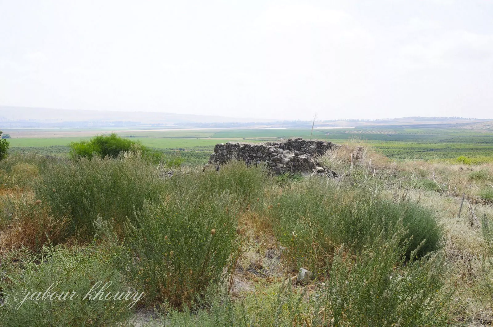
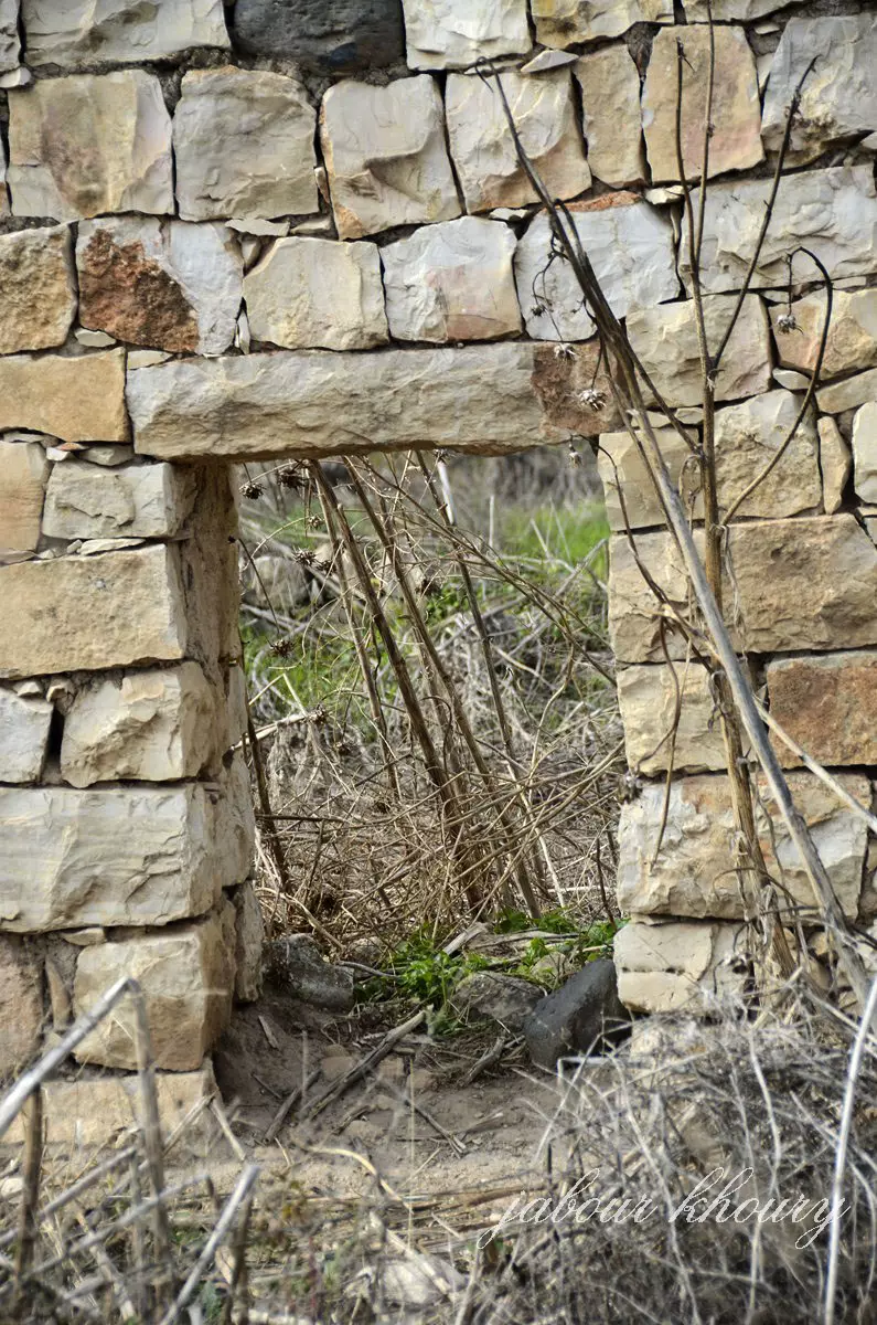
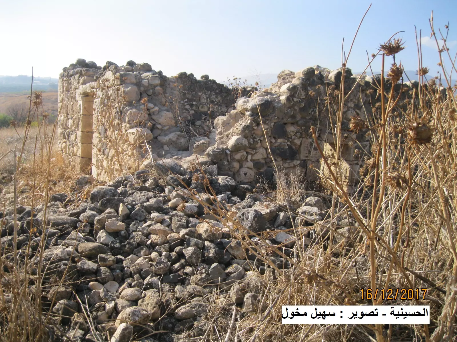
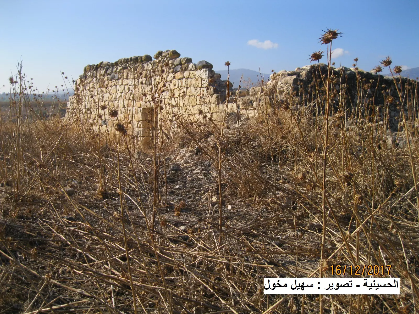
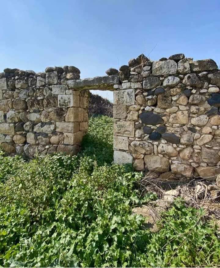
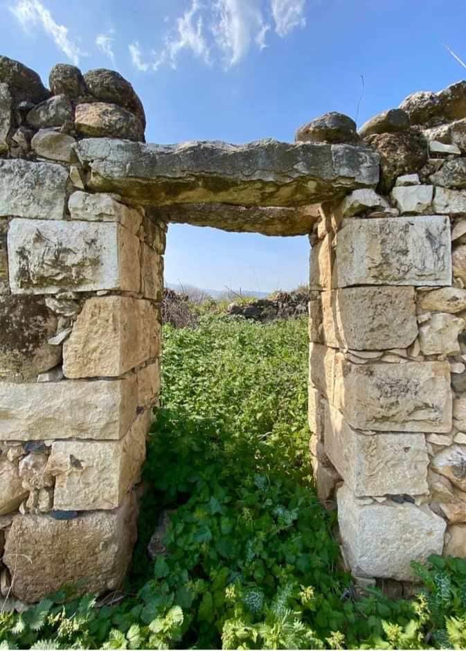
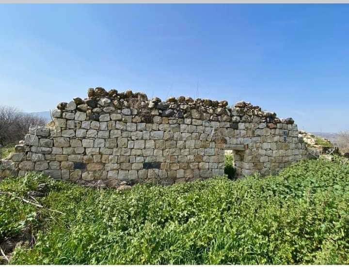
| Village Temains | The village has been completely obliterated, and only house rubble left behind. | ||||||||||
| Ethnically Cleansing | al-Husayniyya was mostly ethnically cleansed and terrorized after the massacre committed in March. | ||||||||||
| Pre-Nakba Land Ownership |
|
||||||||||
| Population |
|
||||||||||
| Number of Houses | In (1931): 64 (includes Tulayl) | ||||||||||
| Near By Towns |
|||||||||||
|
|||||||||||
| Schools | The village had an elementary school for boys, which was shared with the neighboring village of Tulayl. | ||||||||||
| Water Supply | The village had plenty of underground and surface water from springs, a creek, and artesian wells. | ||||||||||
| Exculsive Jewish Colonies Who Usurped Village Lands |
Chulata and Sde Eli'ezer | ||||||||||
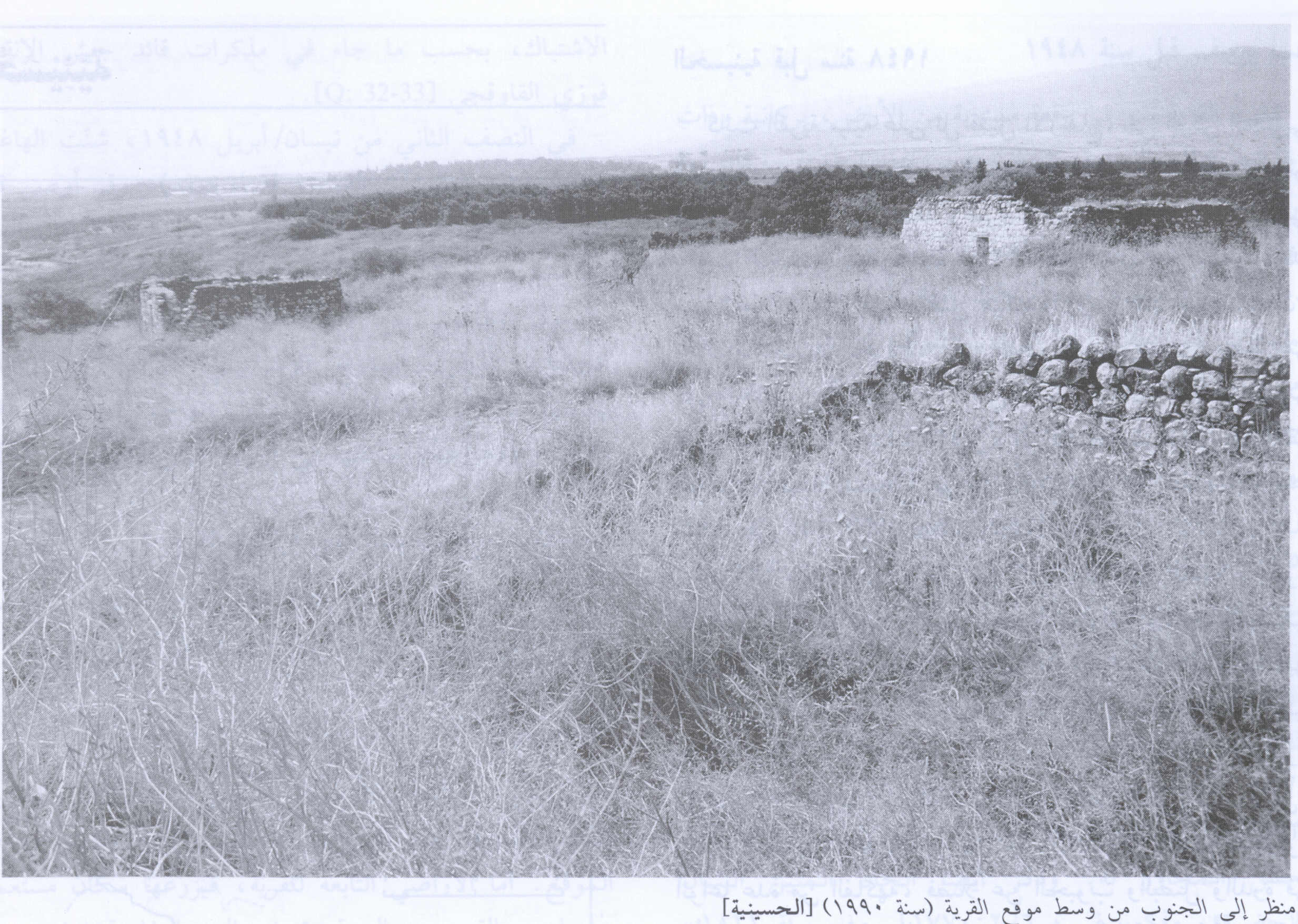
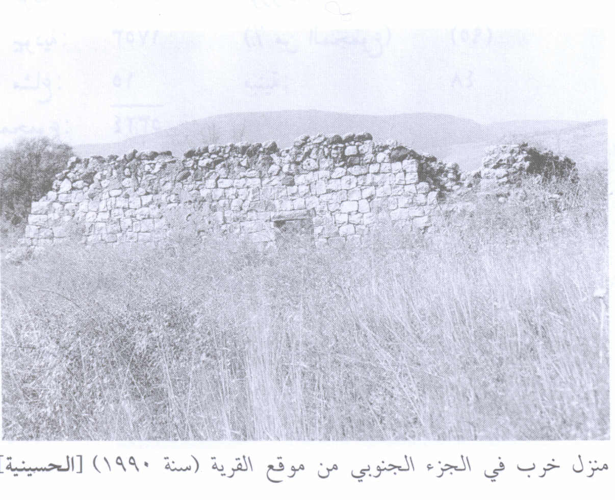
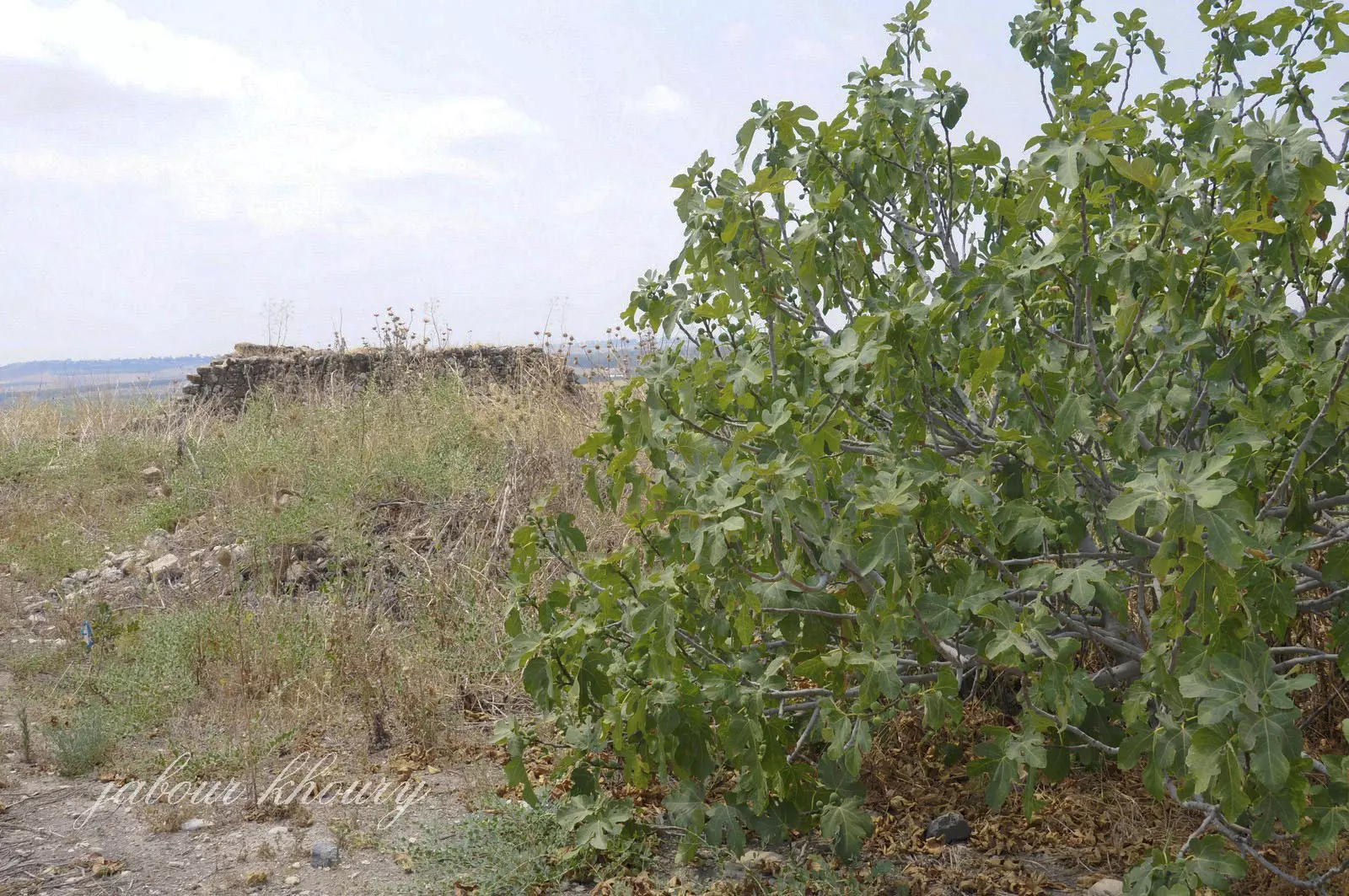
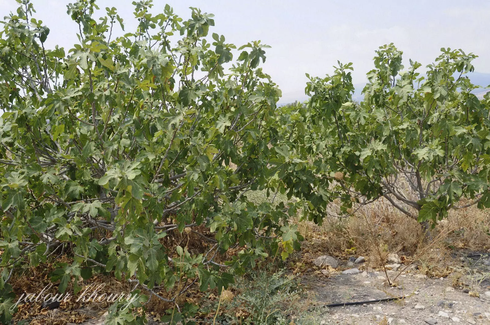
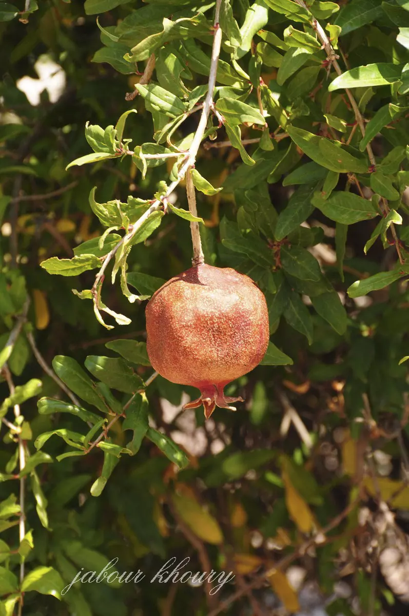
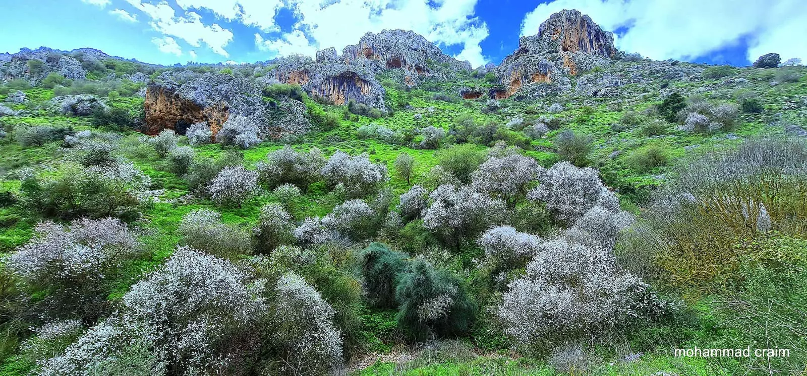
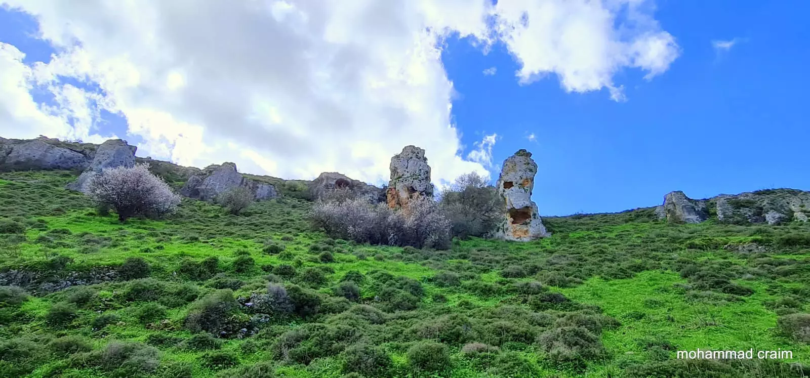
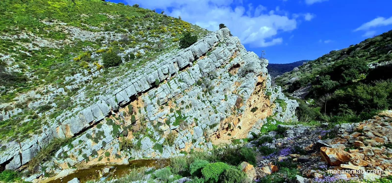
Village Before NakbaThe village was located on a slightly elevated hill in the southwestern corner of the al-Hula Plain. It stood along the eastern side of a highway that led to Safad and Tiberias. The Arab geographer Yaqut al-Hamawi (d. 1228) noted its ancient buildings and praised one of them, which he claimed had originally been a temple and perhaps was built by Solomon. From each of the twelve openings in the structure, extremely hot but perfectly clear and sweet water poured out, and each jet of water was said to cure a particular disease. AI-Hamawi thought that this place was one of the real wonders of the world. [[Mu’jam, cited in Le Strange 1965:340]] In modern times, the land between the village and Lake al-Hula was cultivated by the al-Zubaydat Bedouin.In modern times, the land between the village and Lake al-Hula was cultivated by the al-Zubaydat Bedouin. AI-Husayniyya had stone-built houses and an elementary school, which it shared with the neighboring village of Tulayl. The village land was fertile and amply supplied with underground and surface water from springs, a creek, and artesian wells. All of the villagers were Muslims who depended on agriculture for their livelihood. They grew various kinds of fruit, as well as grain, onions, and com, on the lands north of the village. In 1944/45 a total of 3,388 dunums was allocated to cereals and 22 dunums were irrigated or used for orchards. The villagers also kept livestock, especially water buffalo, for ploughing, dairy production, and meat. Village Occupation and Ethnic CleaningAl-Husayniyya fell after facing two fierce attacks by the Palmach's Third Battalion in March 1948. In the first raid, on 12 March, the PaImach blew up five houses, according to Israeli historian Benny Morris. A New York Times story said that a party of approximately fifty raiders moved in on the village at 1:40 a.m. on 13 March, and '[u]nder heavy covering fire... blew up twelve houses before withdrawing.' Fifteen Arabs were killed and twenty wounded in the onslaught. The Times added that British police and troops later moved into the neighborhood, imposed a curfew, and evacuated the village. A few days later, on 16-17 March, 'more than 30 Arab adults (excluding women and children) were killed' in another attack on al-Husayniyya, according to a report filed by a Palmach battalion. The total death toll was put at dozens by Israeli sources, and the village was said to have been abandoned by all its residents, who 'fled across the border.'The massacre was claimed to be in retaliation for a land mine that had been planted to stop Jewish traffic in the area. After the attacks, the British imposed a week-long curfew on roads in the al-Hula region and the inhabitants of al-'Ulmaniyya (3.5 km to the north) and Kirad al-Ghannama (2 km to the southeast) fled, some temporarily. [[M:53, 157; NYT:14/3/48]] Some of the villagers who escaped the massacres may have remained or returned in subsequent days; according to Israeli military intelligence, the residents of al-Husayniyya did not leave until 21 April. Morris writes that their flight was due to either Haganah mortar and ground attacks (which were mounted as part of Operation Yiftach), or fear of such attacks (see Abil al-Qamh, Safad sub-disctrict). Zionists Colonies on Village LandsThe settlement of Chulata (207273), established in 1937, is 3 km east of the site, near Tulayl. Sde Eli'ezer (203272), which was founded in 1952, is about 1 km west of the village site.Village TodayOnly piles of stone and sections of walls from demolished houses remain (see photos). The site itself is overgrown with thorns, grasses, and scattered Christ's-thorn trees, and is used as pasture. The land in the vicinity is cultivated.SourceDr. Walid al-Khalidi, 1992: All That Remains. |
|||||||||||
| Related Maps | Town Lands' Demarcation Maps خرائط للقضاء توضح حدود القرى والاودية Town's map on MapQuest View from satellite Help us map this town at WikiMapia |
||||||||||
| Related Links | Wikipedia's Page Google Search Google For Images Google For Videos |
||||||||||
| More Information | في كتاب كي لا ننسى في كتاب بلادنا فلسطين المزيد من موقع هوية |
||||||||||
- A view south from the village center, 1990
Scanned from "All That Remains" by Dr. Walid Khalidi - Ruined house in the southern parts of the village, 1990
Scanned from "All That Remains" by Dr. Walid Khalidi - منظر عام لموقع القريه من الجهه الجنوبيه
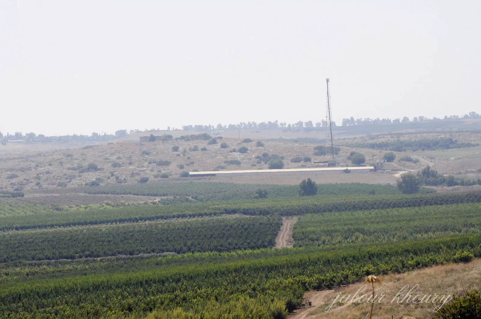
Posted by Jabour Khoury - اطلاله على القريه من الجهه الشماليه- نظره من الشمال الى الجنوب
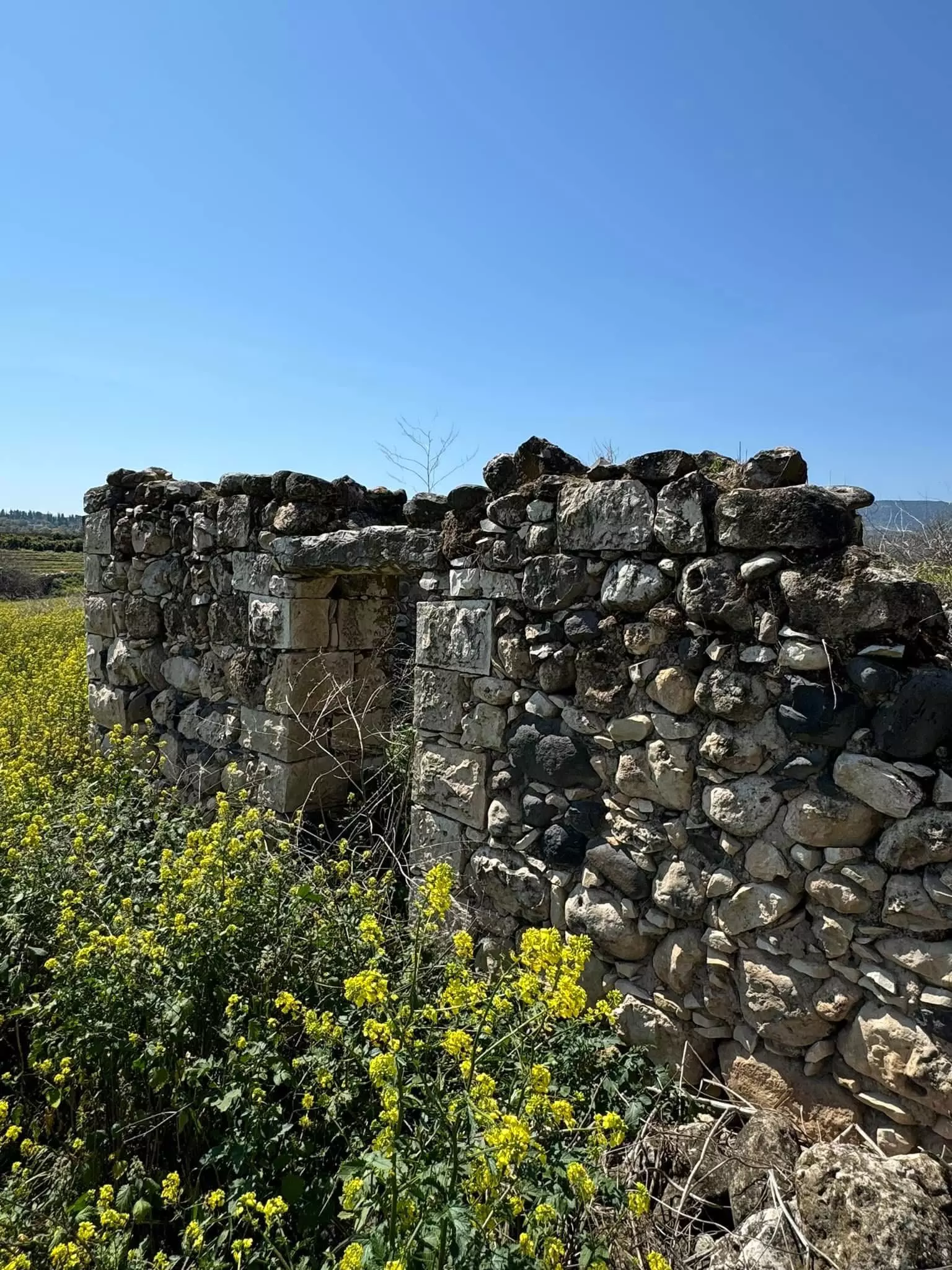
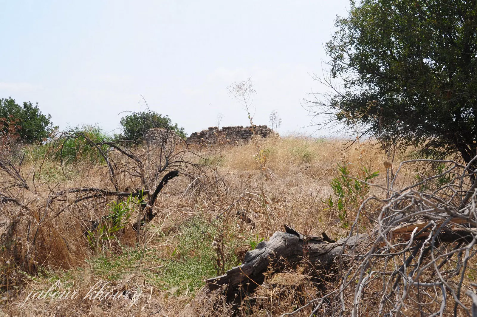
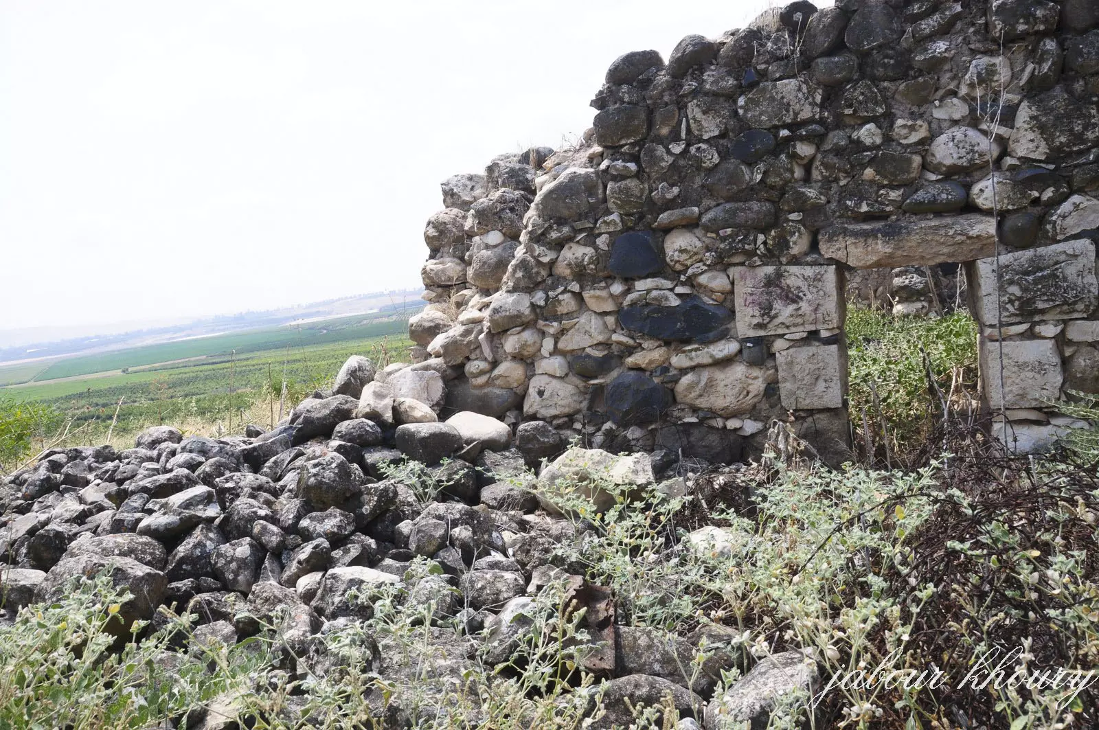
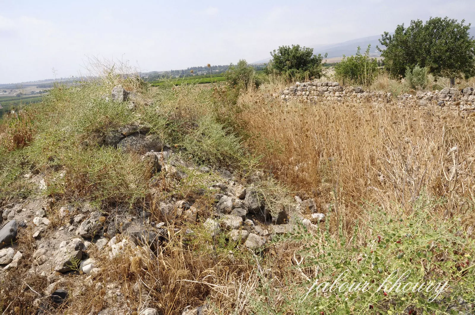
Posted by Jabour Khoury - مركز القريه وبقايا احد المنازل
Posted by Jabour Khoury - بقابا احد المنزلين المتبقيين
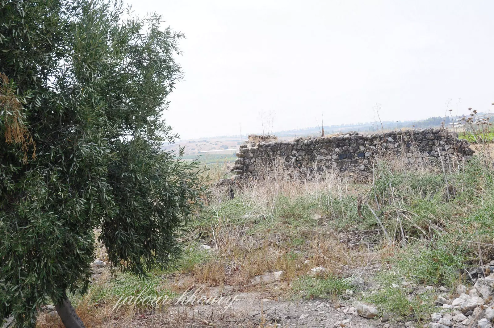
Posted by Jabour Khoury - بقايا منزل وفي الخلفيه سهل الحوله
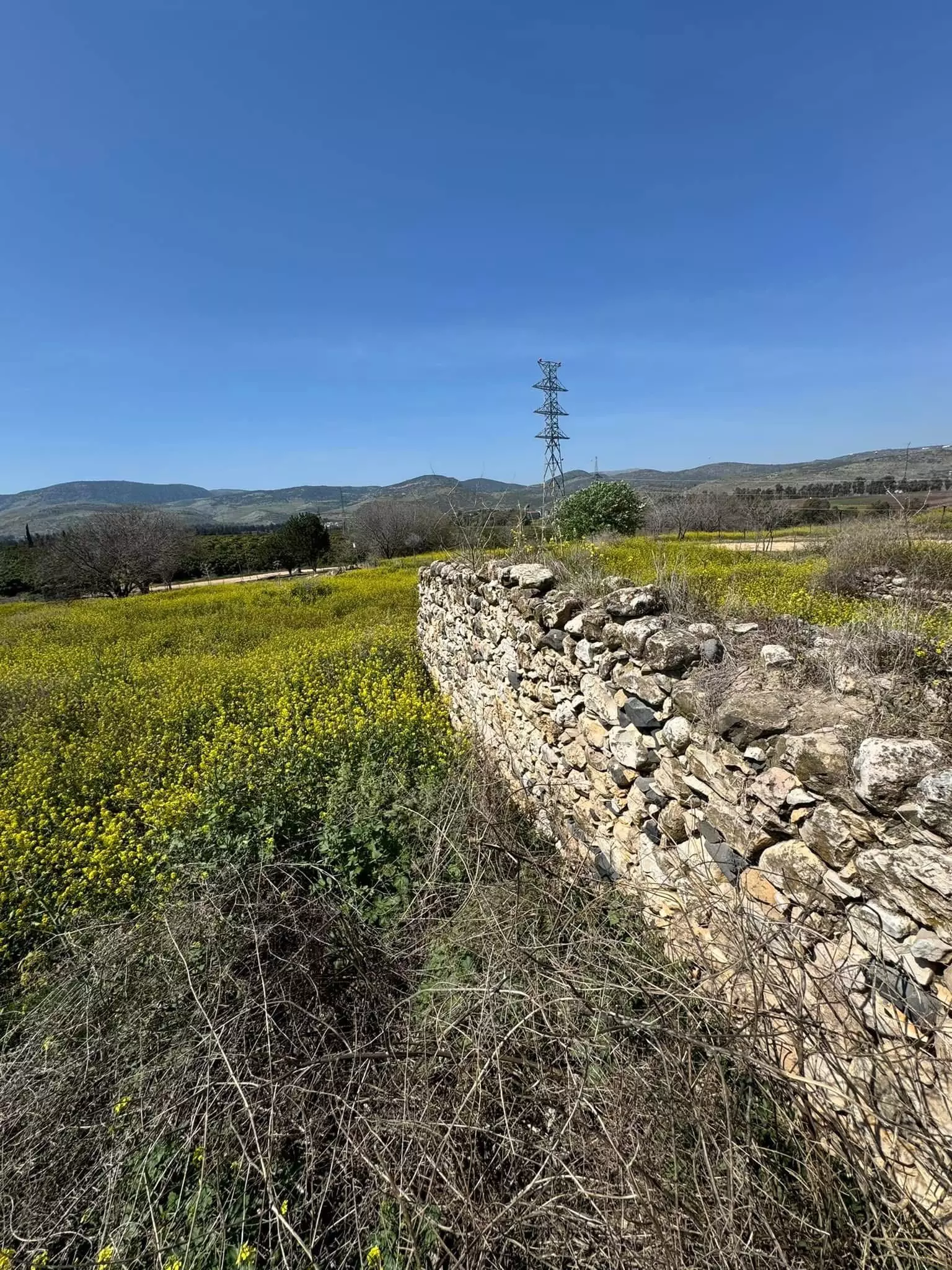
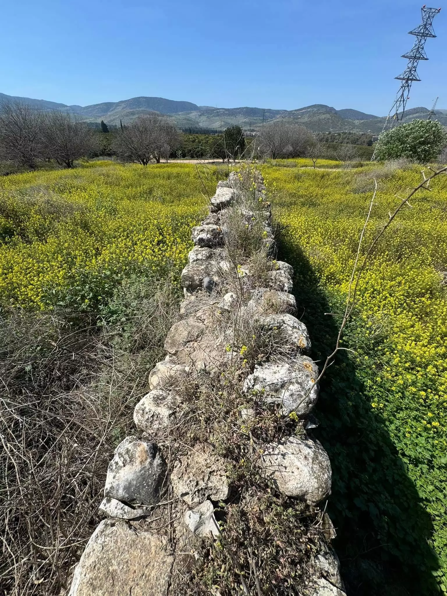
Posted by Jabour Khoury - ردم وبقايا احد المنازل
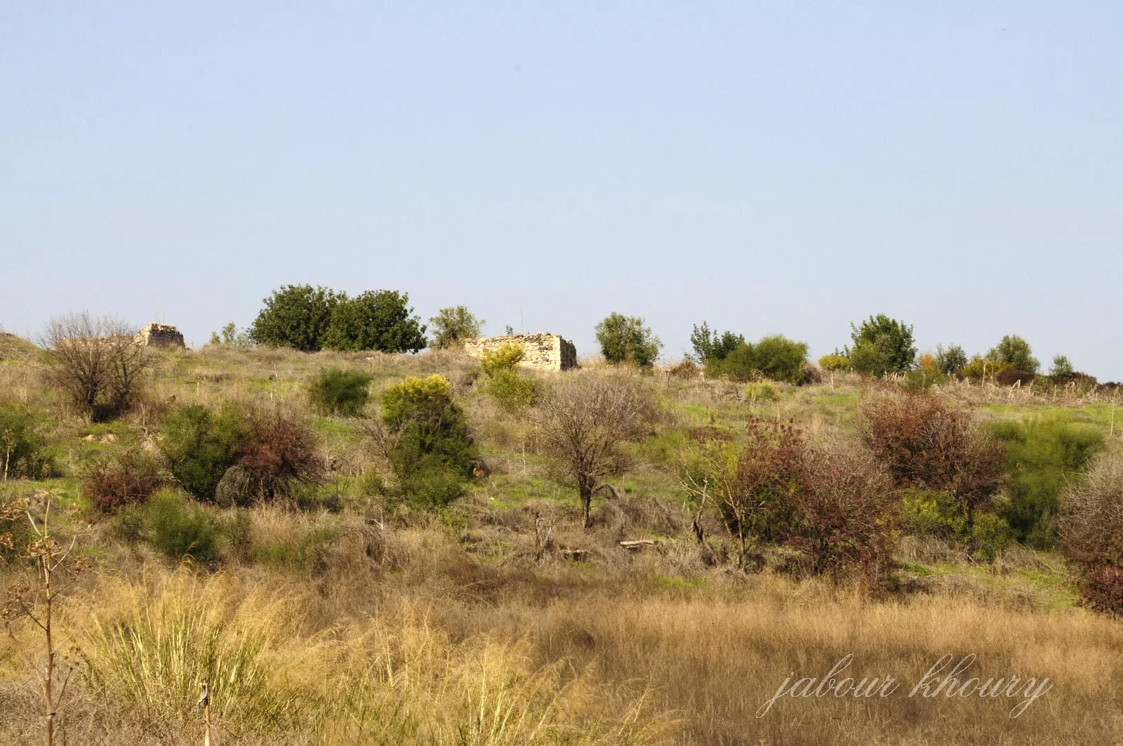
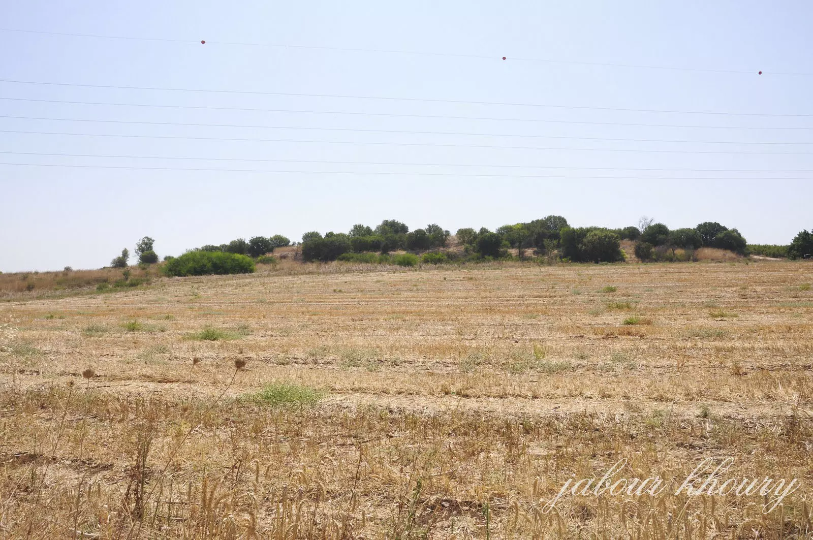
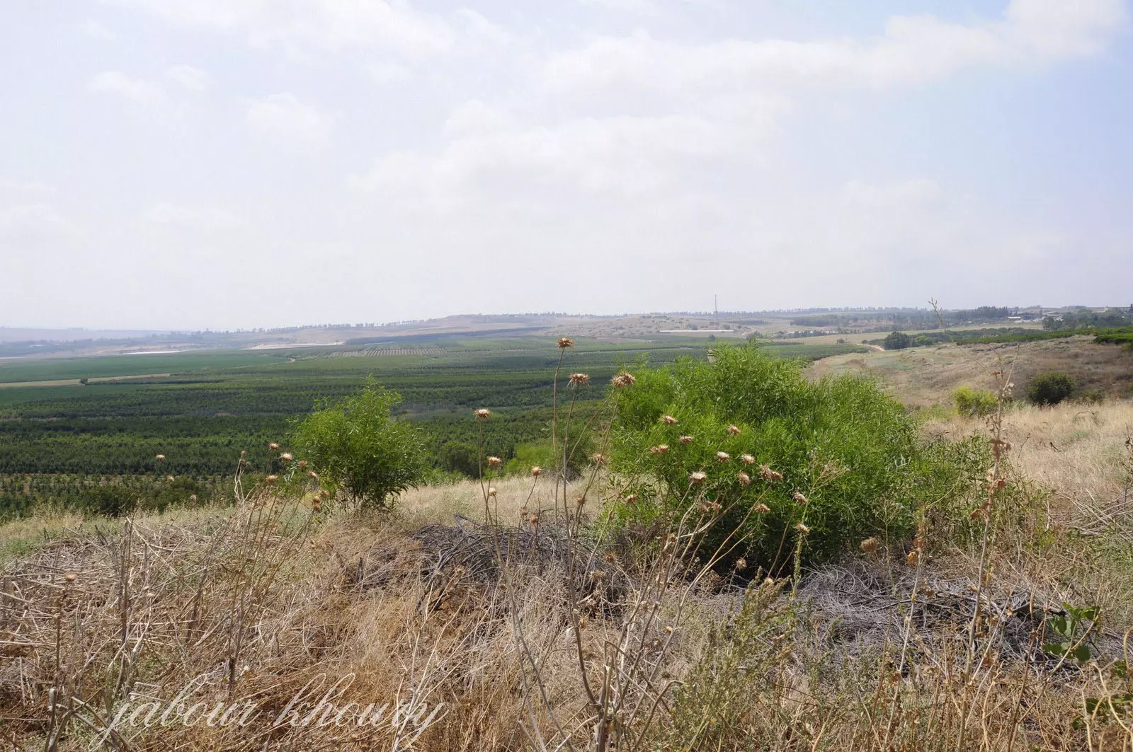
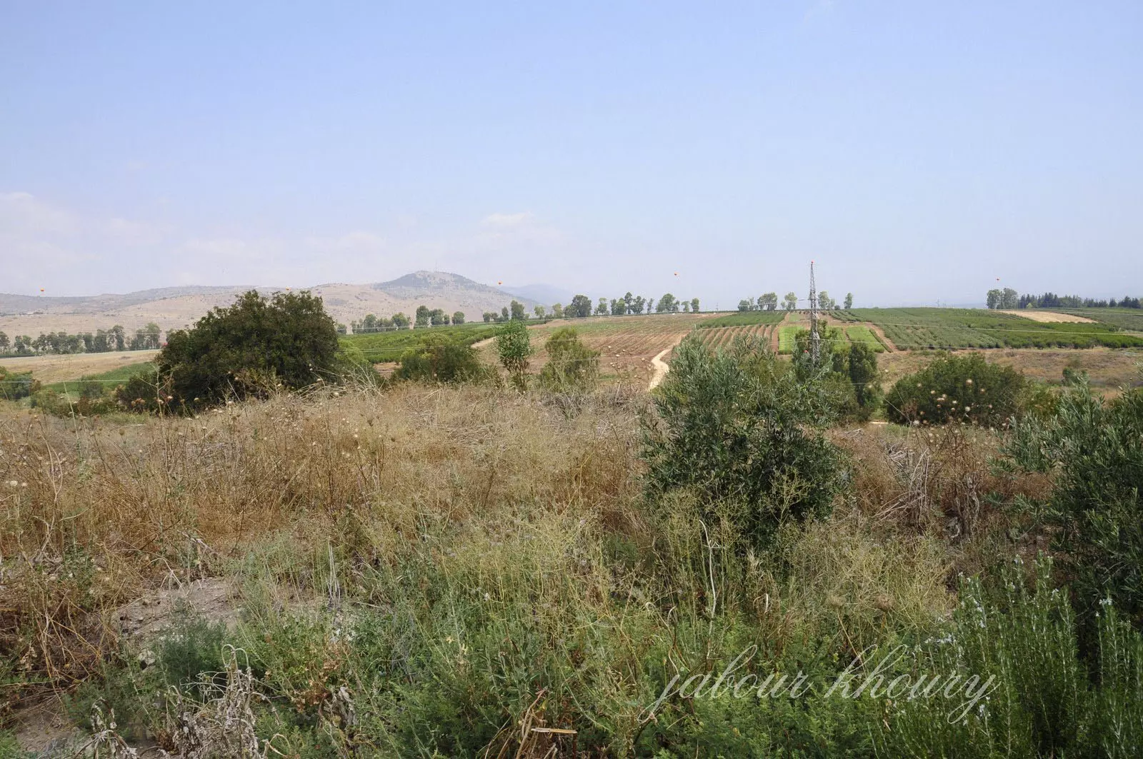
Posted by Jabour Khoury - اراضي القريه وسهل الحوله وتظهر في البعيد التله التي تقع عليها قريه كراد الغنامه
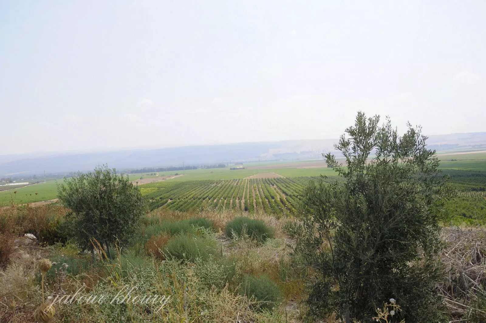
Posted by Jabour Khoury - نظره من موقع القريه الى الشرق وتظر في البعيد قريه تليل حيث اشجار الكينا
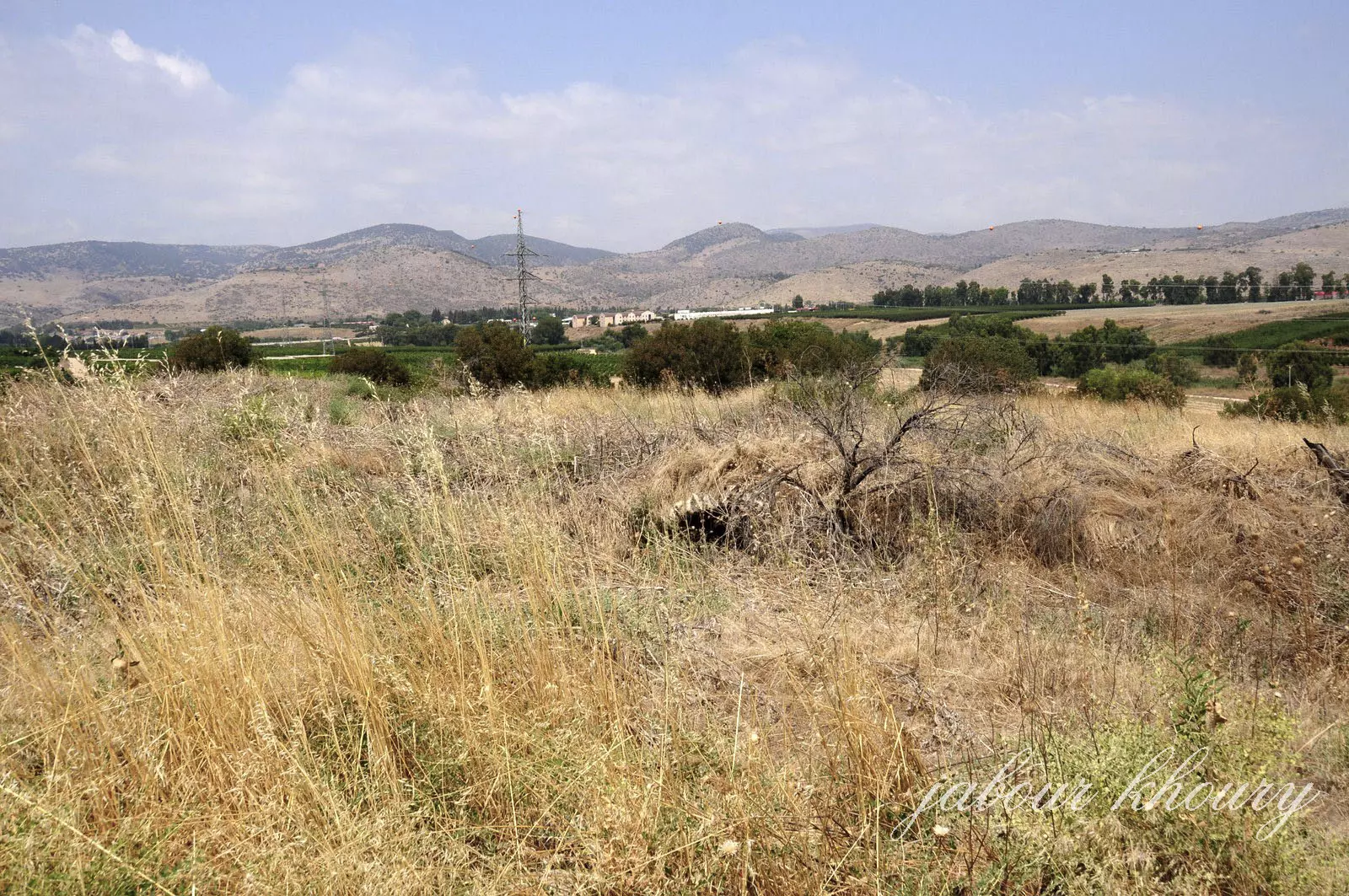
Posted by Jabour Khoury - مركز القريه وردم المنازل المغطى بالتراب والاعشاب
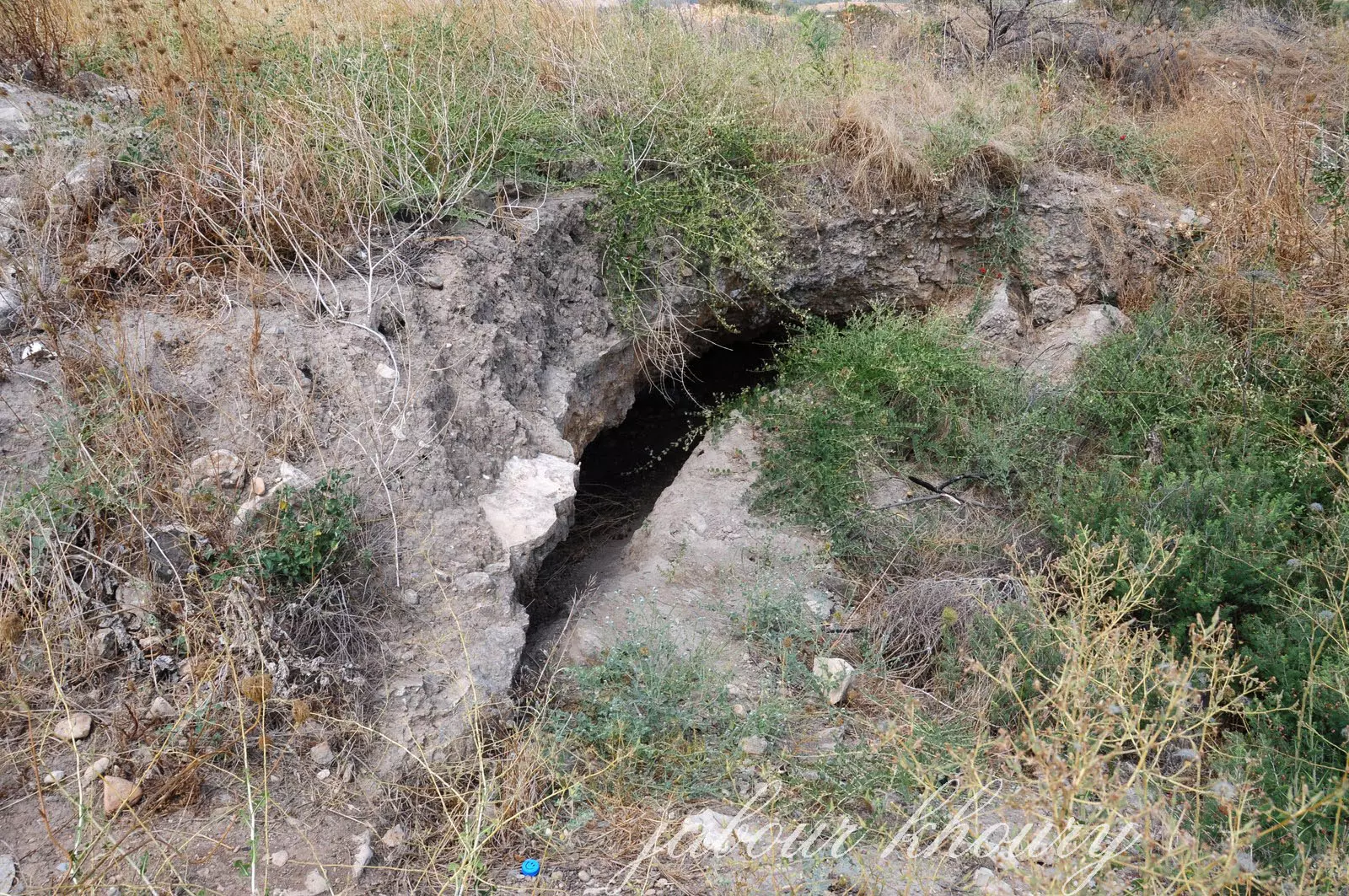
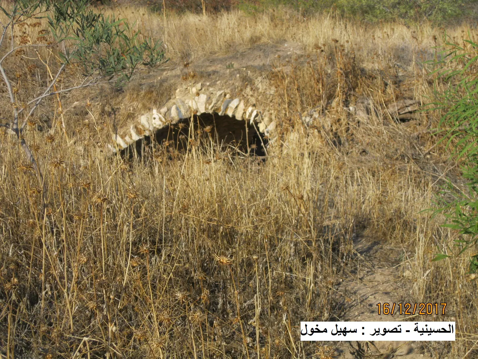
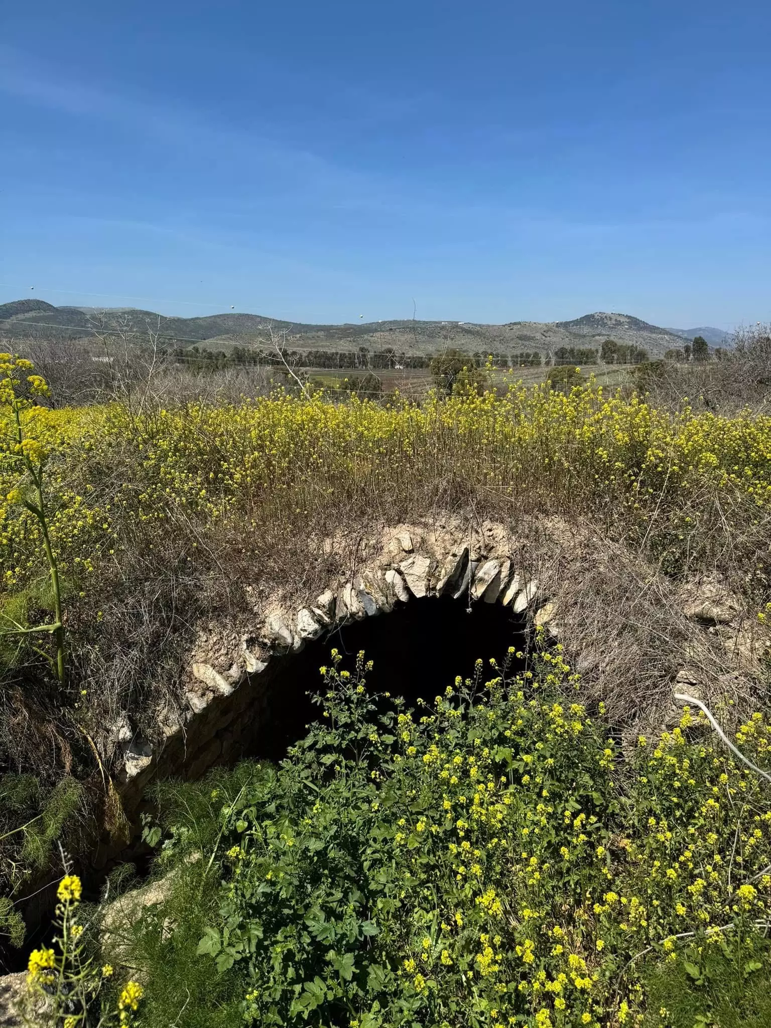
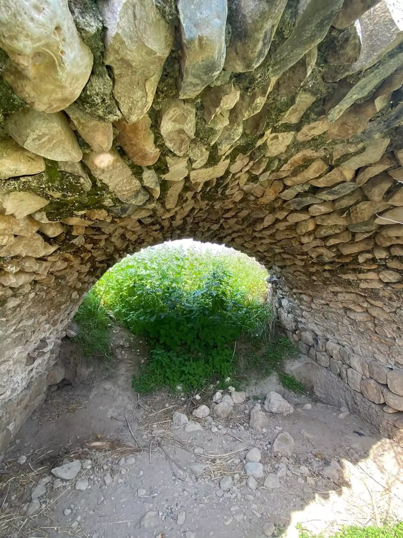
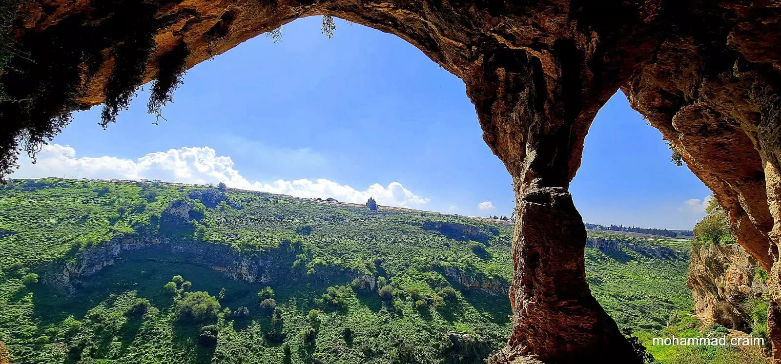
Posted by Jabour Khoury - احد المباني المقنطره المدفون تحت التراب
Posted by Jabour Khoury - نظره الى الشمال وفي البعيد يظر جبل هراوي
Posted by Jabour Khoury - بقايا المنازل
Posted by Jabour Khoury - احد المباني المقنطره المدفون تحت التراب
Posted by Jabour Khoury - اشجار التين في الموقع
Posted by Jabour Khoury - اشجار التين الكثيره
Posted by Jabour Khoury - اشجار الرمان وثماره
Posted by Jabour Khoury - باب احد البيوت المتبقيه
Posted by Jabour Khoury 1 - نظره الى الجنوب وموقع قريه كراد الغنامه على التل المقابل
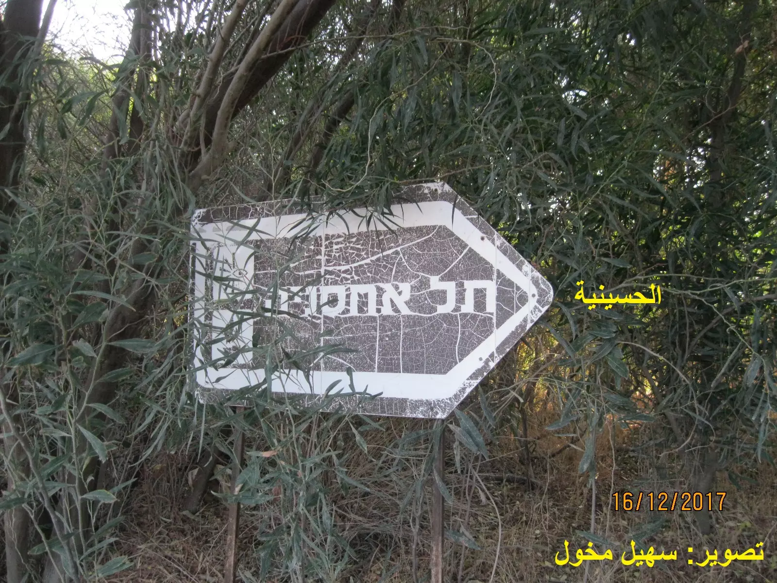
Posted by Jabour Khoury - الاشارة لموقع قرية الحسينية المُهجرة
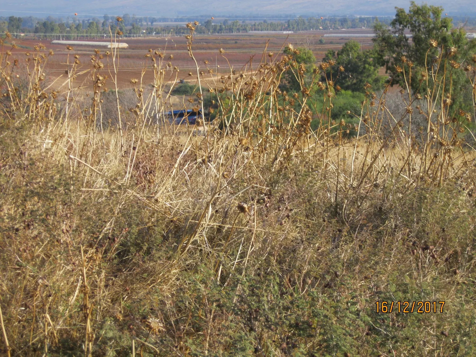
Posted by سهيل مخول - موقع قرية الحسينية المهجرة - منظر عام

Posted by سهيل مخول - موقع قرية الحسينية المهجرة - منظر عام

Posted by سهيل مخول - موقع قرية الحسينية المهجرة - بقايا أحد البيوت

Posted by سهيل مخول - موقع قرية الحسينية المهجرة - بقايا أحد البيوت
Posted by سهيل مخول - موقع قرية الحسينية المهجرة - بقايا أحد البيوت
Posted by سهيل مخول - موقع قرية الحسينية المهجرة - منظر عام
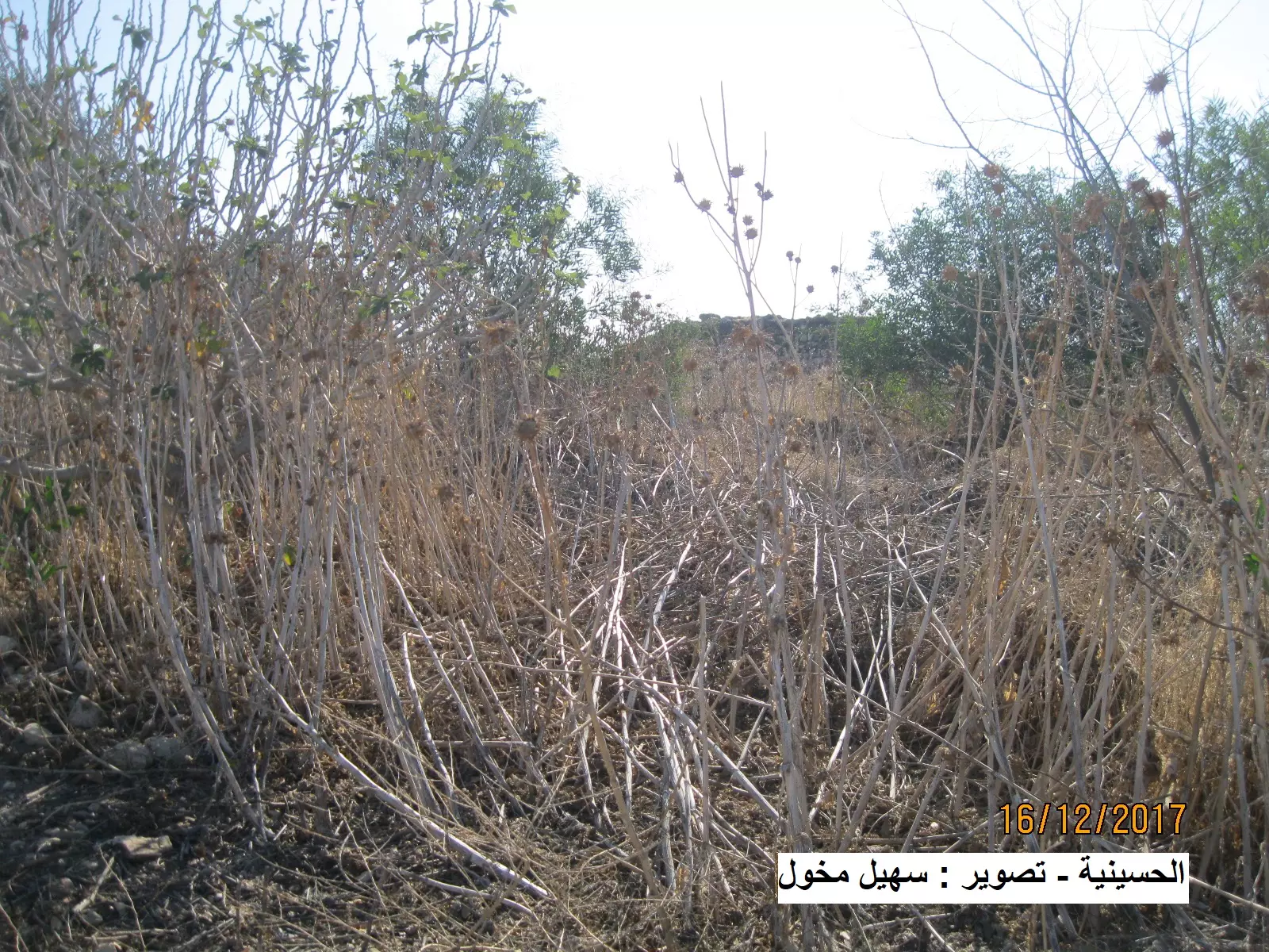
Posted by سهيل مخول - موقع قرية الحسينية المهجرة - منظر عام
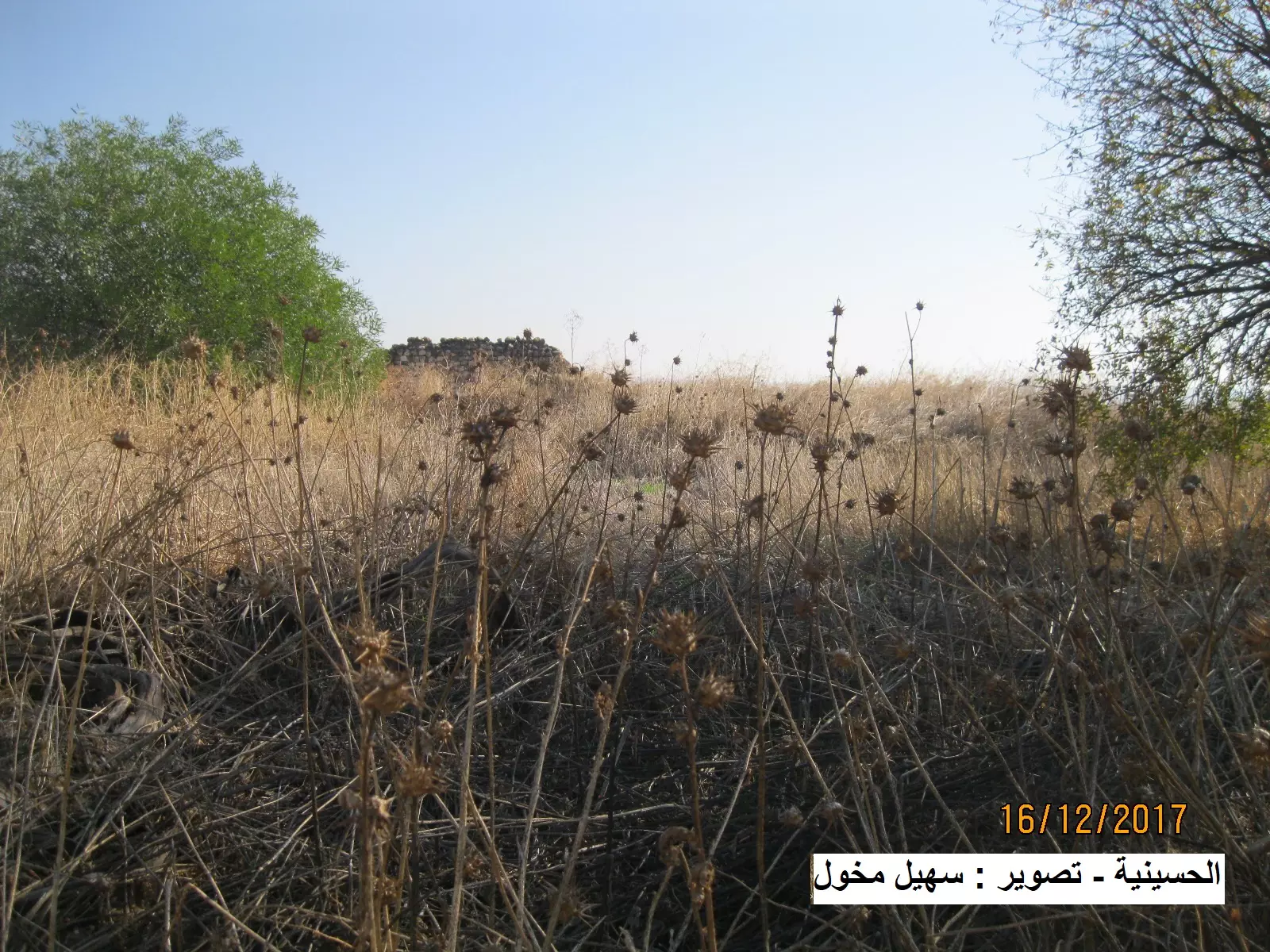
Posted by سهيل مخول - موقع القرية المدمرة
Posted by سهيل مخول - بقايا جدران بعض المنازل
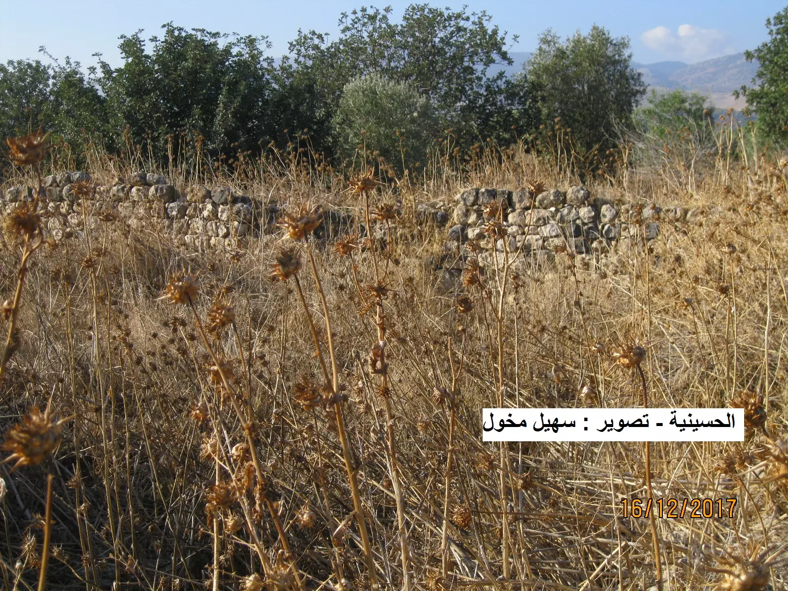
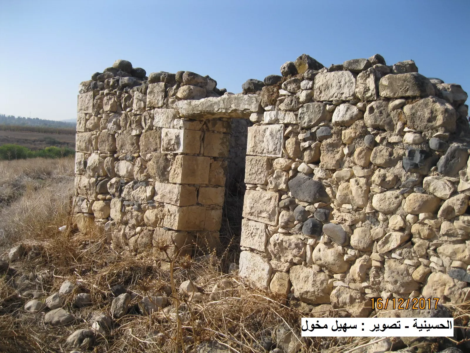
Posted by سهيل مخول - بيت مدمر- بقايا من المنزل
Posted by سهيل مخول - بيت مدمر- بقايا من المنزل في قرية الحسينية - بعدسة: سهيل مخول
Posted by سهيل مخول - بيت آخر مدمر- بقايا من المنزل في قرية الحسينية - بعدسة: سهيل مخول

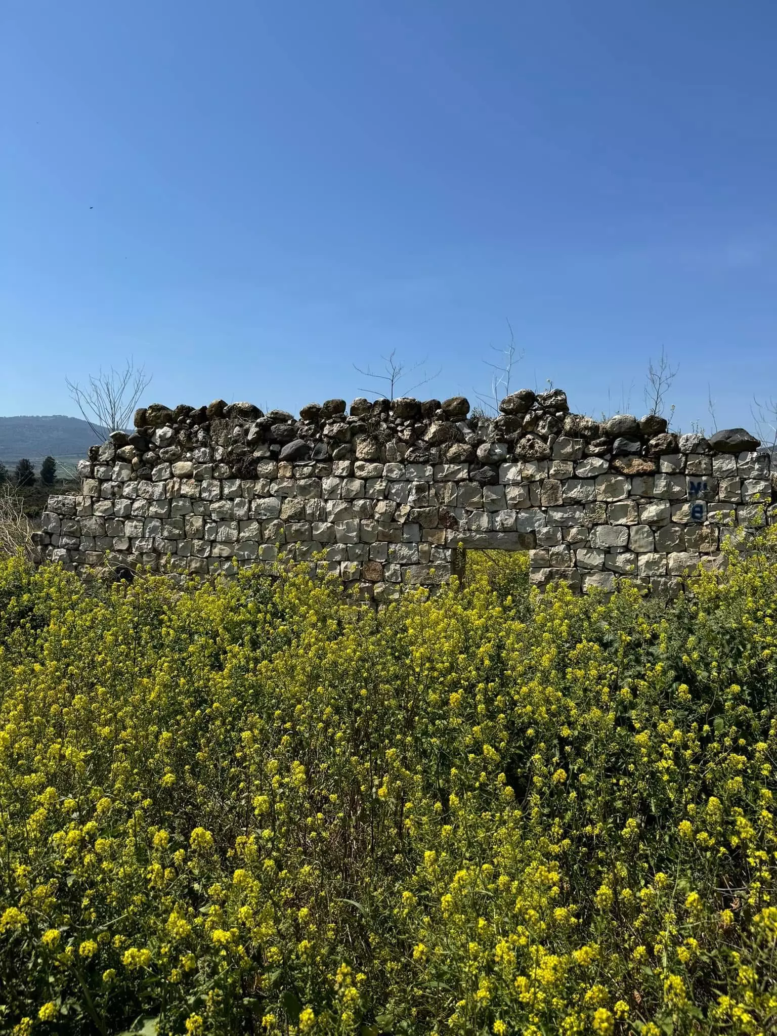
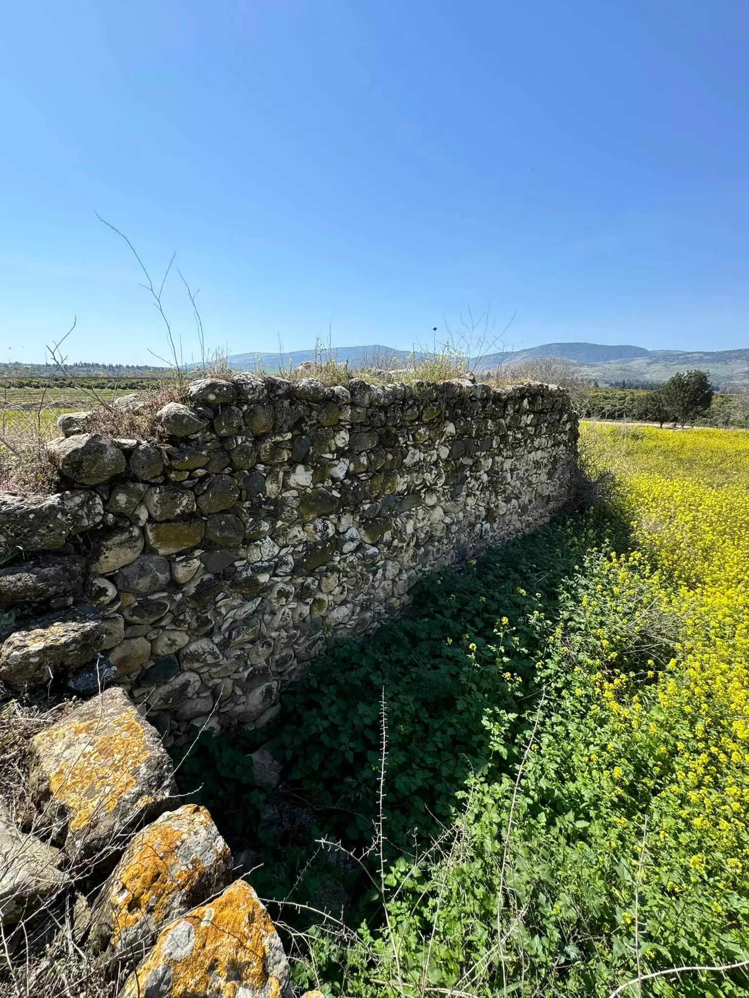
Posted by سهيل مخول - أطلال قرية الحسينية

Posted by سهيل مخول - أطلال اضافية من قرية الحسينية قضاء صفد - بعدسة سهيل مخول

Posted by سهيل مخول - A tour between Palestinian houses that were destroyed by the most "civilized" -- جولة بين بيوت القرية المهجرة -- سليمان بويرات
- A tour between Palestinian houses that were destroyed by the most "civilized" -- جولة بين بيوت القرية المهجرة -- سليمان بويرات #2
- A tour between Palestinian houses that were destroyed by the most "civilized" -- جولة بين بيوت القرية المهجرة -- سليمان بويرات #3
- A tour between Palestinian houses that were destroyed by the most "civilized" -- جولة بين بيوت القرية المهجرة -- سليمان بويرات #4
- A tour between Palestinian houses that were destroyed by the most "civilized" -- جولة بين بيوت القرية المهجرة -- سليمان بويرات #5
- A tour between Palestinian houses that were destroyed by the most "civilized" -- جولة بين بيوت القرية المهجرة -- سليمان بويرات #6
- A tour between Palestinian houses that were destroyed by the most "civilized" -- جولة بين بيوت القرية المهجرة -- سليمان بويرات #7
- The "most civilized" who landed on us from Europe obliterated the village, except for a few remaining structures like this one. This is how the Jews will be great again. That is how they can feel safe: Jim Crow, plunder, ethnic cleansing, and genocide.
- The "most civilized" who landed on us from Europe obliterated the village, except for a few remaining structures like this one. This is how the Jews will be great again. That is how they can feel safe: Jim Crow, plunder, ethnic cleansing, and genocide. #2
- The "most civilized" who landed on us from Europe obliterated the village, except for a few remaining structures like this one. This is how the Jews will be great again. That is how they can feel safe: Jim Crow, plunder, ethnic cleansing, and genocide. #3
- وادي الحنداج: سكنه عرب الهيب الرصاطمة وهو واد يقع الى الشمال من مدينة صفد على جبيل الجرمق في الجليل الأعلى بجوار القرى علما وفارة وسبلان والحسينية وديشوم
- وادي الحنداج: سكنه عرب الهيب الرصاطمة وهو واد يقع الى الشمال من مدينة صفد على جبيل الجرمق في الجليل الأعلى بجوار القرى علما وفارة وسبلان والحسينية وديشوم #2
- وادي الحنداج: سكنه عرب الهيب الرصاطمة وهو واد يقع الى الشمال من مدينة صفد على جبيل الجرمق في الجليل الأعلى بجوار القرى علما وفارة وسبلان والحسينية وديشوم #3
- وادي الحنداج: سكنه عرب الهيب الرصاطمة وهو واد يقع الى الشمال من مدينة صفد على جبيل الجرمق في الجليل الأعلى بجوار القرى علما وفارة وسبلان والحسينية وديشوم #4
Want to browse more? 80,000 pictures were grouped in these gallaries:
| Display Name | Clan/Hamolah | Country of Residence |
| rami jaafar | - | DUBIA, UAE |
| Mostafa | Rabeh | - |
| jaafer | jaafer | nahr el bared camb, lebanon |
| yousef lutfi | alsaeed | abu dahbi, UAE |
No links have been shared yet, be free to the first to share the first link.
 Fake Valor: Why Did Zionist Jews Hoist Nazis Flag on Their Ships in the 1930s?
What is new?
-
Facts About Oct. 7th Gaza Raid
-
Remined Us Please: Who Did Rape Whom? Was it Palestinians who raped Israelis? Or, was the other way around? You'll be the judge
-
When Prof. Edward Said was invited to debate Bibi Netanyahu in the 1980s, watch what happened!
-
Ezra Klein of the NY Times on the "Jewish Race".
-
Abusing Blood Libel!
-
How and why Israeli Jewry has become the most hated cult?
-
Did Israeli Soldiers Activate The Hannibal Direective On Oct. 7th? You Be The Judge
-
Zionist FAQ: Isn't it true that Palestinians don't want peace? Palestinians never accepted the two-state solution
- Facts about Haavara (Transfer) Agreement between Ben-Gurion & Hitler
-
Haavara FAQs: Why Did Zionist Jews Hoist Nazis' Flags on Their Ships in the 1930s?
- Haavara FAQs: When Chaim Weizmann met FDR in mid-1943, why was he silent about rescuing European Jewry?
-
Dear ChatGPT: How did Palestinians resist Napoleon's invasion of their country in 1799?
-
Dear ChatGPT: Gaza had a vibrant Jewish community in the mid-17th century. What happened to them?
-
Dear ChatGPT: Why did the Jewish Agency suppress news of the Holocaust during WWII?
-
Video Playlist: Jews share their DNA tests to end the conflict for good.
-
A Tale of Two Conflicts: Examining the Definition of Genocide
-
Prof. Abraham Polak And The Suppressed History of the Khazars and European Jewry
-
How Ronald Reagan would have framed the genocide in Gaza if he were still alive?
-
Haavara FAQs: Let us do the math: how many German Jews did The Haavara Agreement save?
-
Zionist FAQs: The Hebron Massacre of 1929, "clearly proves" that Palestinians are antisemitic, how could you deny it?
-
Zionist FAQs: Why Anti-Zionist Is Not Antisemitism?
-
Zionist FAQs: Isn't it true that the KGB created Palestinian Nationalism in the early 1960s?
- Zionist FAQs: Muslims are killing Muslims all the time; why are Israeli Jews being singled out in the media?
- Zionist FAQs: How is Israel an apartheid state when 20% of its citizens are Arabs who enjoy full rights?
-
Haavara FAQs: Why Did Dorothy Thompson Flip From A Zionist Advocate to A Silenced Dissenter?
-
Haavara FAQs: Analysis of Herzl's Uganda Scheme and how it could have saved millions of Jews.
-
Haavara FAQs: Why did Hayim Greenberg describe American Jewry as "morally bankrupt" in early 1943?
-
Haavara FAQs: What if the Evian Conference was a resounding success? What would have been the impact of saving European Jewry on Zionism?
- Haavara FAQs: What if the six million were saved, how that would have impacted the Zionist project?
-
Haavara FAQs: How did Zionist leaders react when Europe's Jews lingered in the DP camps after WWII ended?
-
Why does the American Jewish community repeat lies that David Ben-Gurion had debunked before he died?
-
Who has the power to rename the Tatar/Khazar Gene Marker to Jewish IV?
-
Zionist FAQs: Why won't Egypt, Syria, and Jordan take their people back? Jews are indigenous to Palestine, and Arabs immigrated after Jews developed the country. Arabs should leave.
-
Haavara FAQs: Did Hitler and the Nazis conflate between Judaism and Zionist? If that wasn't case, then why?
-
Haavara FAQs: Winston Churchill and antisemitism, a collection of articles written Churchill.
-
Haavara FAQs: Broken by country, how many Jews survived vs. killed during the Holocaust?
-
Haavara FAQs: Why did European Jews vote with their feet and to immigrated to the Americas, not Palestine, after WWII?
-
Watch this American Jewish Girl describing Israeli Jews' cognitive dissonance like no other in under two minutes
-
Haavara FAQs: When the Nazis went out of their way to hide the Holocaust, Israeli Jews did the exact opposite by broadcasting their genocide of Gazans. But why?
-
Haavara FAQs: How Zionist Jews went out of their to show their appreciation to Nazism and Fascism?
- Haavara FAQs: Why Zionist leaders were against bombing the death camps & the Railroads leading to them?
-
Haavara FAQs: Hitler's message to the British and American people: If Jews are such noble citizens and you care about them, how come you're not letting them in? I will gladly ship them to you at my expense, even on luxury liners!
-
A shortlist of Zionist and Israeli false flag operations in the name Jews.
-
The Most Moral Army
- The Land of Kapos (Israel): Where the brave are boycotted and Kapos walk free.
- Why did early Zionists often named their communal enterprises "colonial"?
- Zionist Relations with Nazi Germany by Faris Glubb
-
Two NY Times advertisements by Zionists in the early 1943 that exposes Zionists' treason at the height of the calamity
- Facts Not Lies about the Palestinian-Israeli Conflict.
- Site's pictures have been categorized
- Campgain Against Lice
- A Survey of Palestine, the official source about Palestine before Nakba produced by the British Mandate; over 1200 pages.
- Satellite View & Google Earth: Over 6,000 placemarks identifying all destroyed towns, W. Bank & Gaza Strip Towns, & refugee camps.
- PalestineRemembered.com and its Nakba Oral History Project were featured on al-Jazeera Satellite TV.
- Nakba Oral History Video Podcast:
 Over 700 Oral History interviews (including 3,500+ hours of recording) can be viewed online.
 - Palestine Village Statistics Project
- Gaza Jail Break
- النسخة العربية للموقع الان متوفرة
- Videos: Documenting the destroyed villages in video: Tracing all that remains since Nakba.
- Videos: Responding to Zionist Propaganda
- Interview: The ethnic cleansing of Palestine: George Galloway interviews Israeli Historian Ilan Pappe.
- For Palestinians, memory matters. It provides a blueprint for their future By George Bisharat.
- Zionist FAQ now available in Hebrew שאלות שציונים שואלים, עכשיו בעברית
- Video: The Stephen Walt and John Mearsheimer report on the influence of the Israel Lobby on U.S. Foreign Policy
- The Palestinian-Israeli conflict for beginners
