| PalestineRemembered | About Us | Oral History | العربية | |
| Pictures | Zionist FAQs | Haavara | Maps | |
| Search |
| Camps |
| Districts |
| Acre |
| Baysan |
| Beersheba |
| Bethlehem |
| Gaza |
| Haifa |
| Hebron |
| Jaffa |
| Jericho |
| Jerusalem |
| Jinin |
| Nablus |
| Nazareth |
| Ramallah |
| al-Ramla |
| Safad |
| Tiberias |
| Tulkarm |
| Donate |
| Contact |
| Profile |
| Videos |
Welcome To Sabalan - سبلان (סבלאן)
|
District of Safad
Ethnically cleansed days ago |
العربية Google Earth |
 |
Gallery (31) |
- Statistics & Facts
-
Before & After

- Satellite View
- Articles 5
- Pictures 31
- Oral History 2
- Members 4
- All That Remains
- Wikipedia
- Videos
- Guest Book 2
- Links
| Statistic & Fact | Value | ||||||||||||||
| Occupation Date | October 30, 1948 | ||||||||||||||
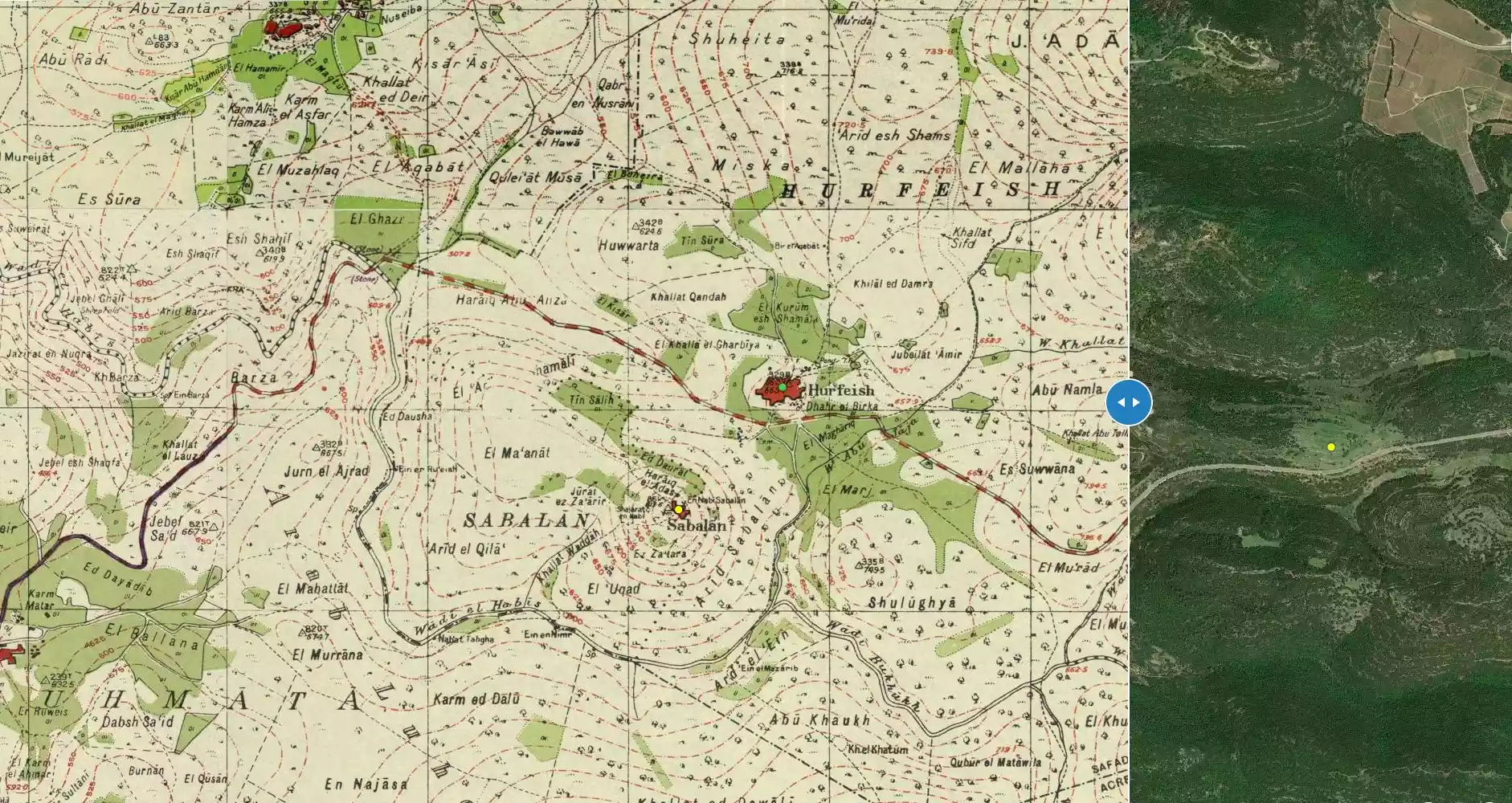
| Distance From District | 15.5 (km) West of Safad | ||||||||||||||
| Elevation | 800 (meters) | ||||||||||||||
| Before & After Nakba, Click Map For Details |
|||||||||||||||
|
|||||||||||||||
| Map Location | See location #48 on the map View from satellite |
||||||||||||||
| Military Operation | Operation Hiram | ||||||||||||||
| Attacking Units | Golani's First Battalion and Sheva' (Seventh) Brigade | ||||||||||||||
| Exodus Cause | Military assault by Zionist troops | ||||||||||||||
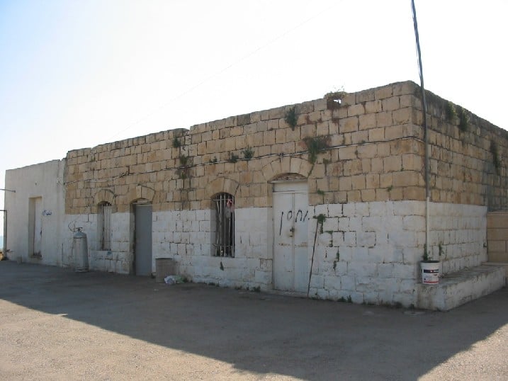
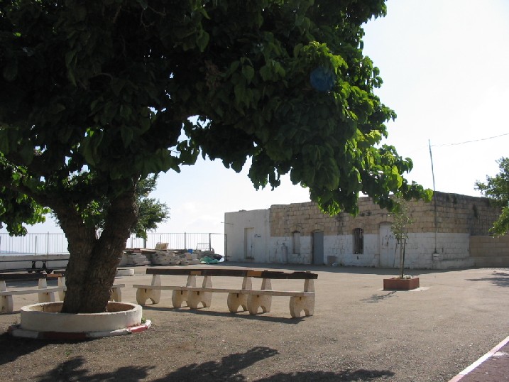
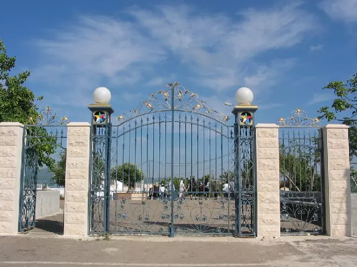
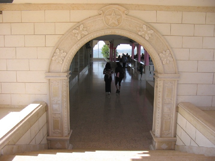
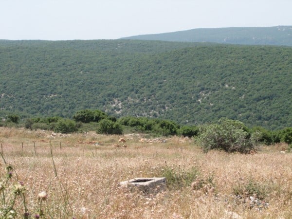
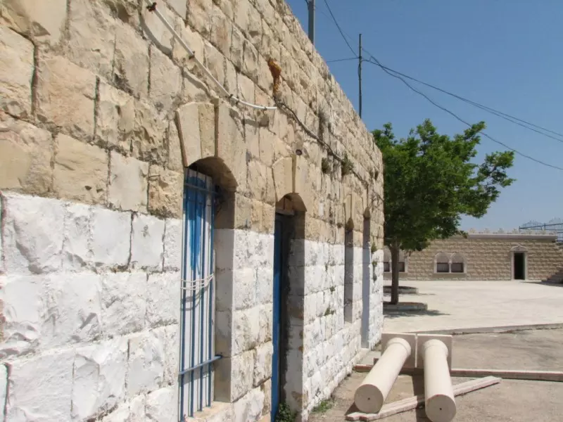
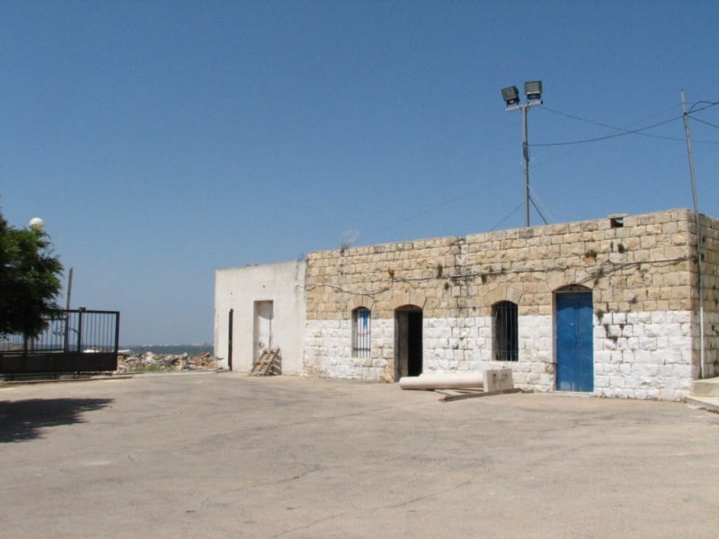
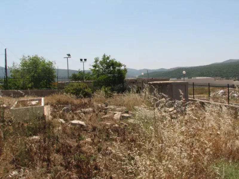
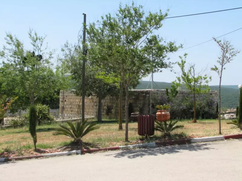
| Village Temains | The village has been mostly destroyed with the exception of one house, a village well, and the shrine for al-Nabi Sabalan. | ||||||||||||||
| Ethnically Cleansing | Sabalan inhabitants were completely ethnically cleansed. | ||||||||||||||
| Pre-Nakba Land Ownership |
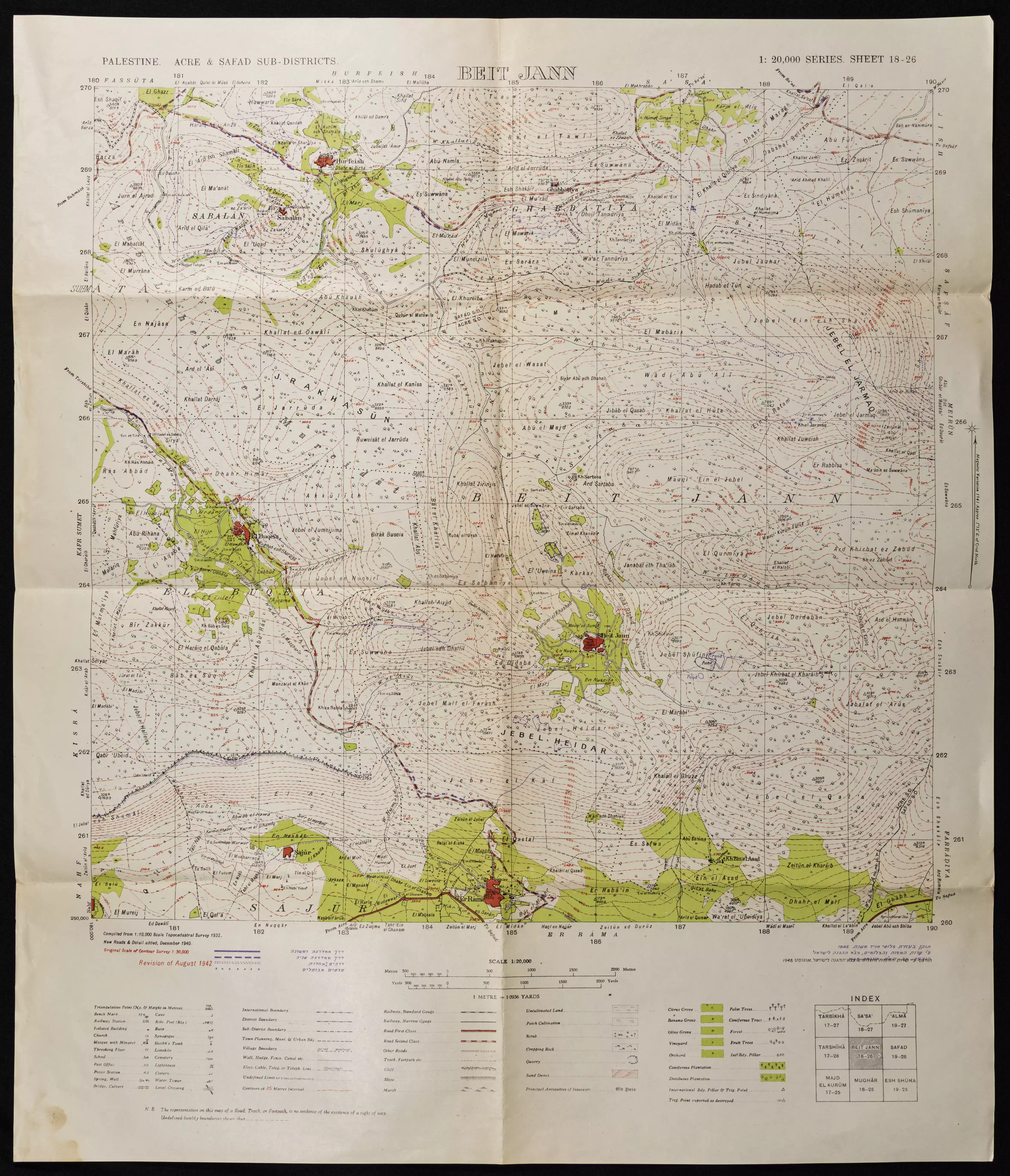
**Town Lands' Demarcation Maps |
||||||||||||||
| Land Usage As of 1945 |
|
||||||||||||||
| Population |
|
||||||||||||||
| Number of Houses |
|
||||||||||||||
| Places of Warship | One mosque | ||||||||||||||
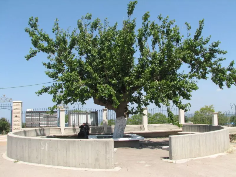
| Shrines / Maqams | The village contained a shrine or a tomb for one al-Nabi Sabalan | ||||||||||||||
| Exculsive Jewish Colonies Who Usurped Village Lands |
No settlements on village lands | ||||||||||||||
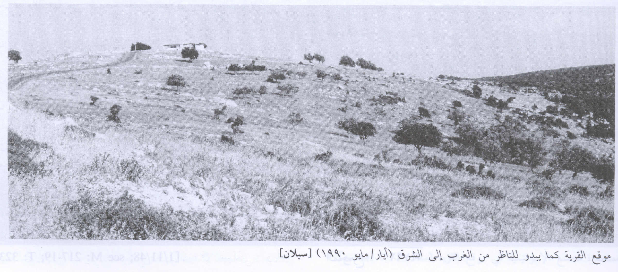
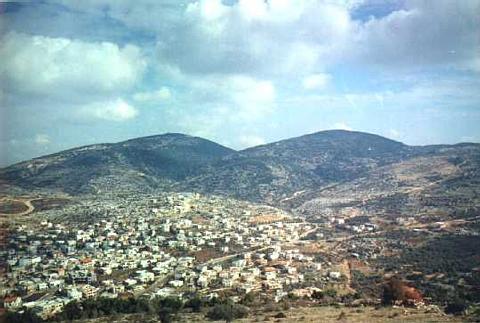
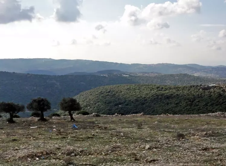
Village Before NakbaThe village stood on a high mountain top and overlooked the predominantly Druze village of Hurfaysh, less than 1 km to the northeast. It was linked by dirt roads to the Safad-Tarshiha highway, about 3 km to the south, and by other roads to neighboring villages such as Sa'sa' and Hurfaysh. Travelers who visited the village in the late nineteenth century described Sabalan as a stone-built village situated on top of a high hill. The village, which surrounded the tomb of one Nabi (prophet) Sabalan, had a population of 100. The residents cultivated figs and olives. [SWP (1881) I:199]Sabalan had a circular outline; the steep slopes that bordered it permitted expansion only on its northwestern side. Its houses were clustered closely together. Its entire population was Muslim; a mosque was located at the center of the village. In 1944/45 a total of 421 dunums was allotted to cereals; 144 dunums were irrigated or used for orchards. Archaeological artifacts such as rock-cut tombs were found in the center of the village near the tomb of al-Nabi Sabalan. Village Occupation and Ethnic CleaningSabalan was occupied on 30 October 1948, during Operation Hiram (see 'Arab al-Samniyya, Acre sub-district), when Israeli forces captured Upper Galilee. The village was probably overrun as units of the Golani Brigade advanced northwestwards along the Suhmata‒Sa'sa' road. According to the History of the War of Independence, when the Golani's First Battalion reached Sa'sa', it met with units of the Sheva' (Seventh) Brigade, which had constituted the eastern flank of the same operation.Zionists Colonies on Village LandsThere are no Israeli settlements on village lands.Village TodayOnly one village house and a well remain. The house is now occupied by the guard and caretakers of the shrine of al-Nabi Sabalan, which stands opposite the house (see photos). New buildings have been constructed for visitors to the shrine, which is sacred to the Druze.SourceDr. Walid al-Khalidi, 1992: All That Remains. |
|||||||||||||||
| Related Maps | Town Lands' Demarcation Maps خرائط للقضاء توضح حدود القرى والاودية Town's map on MapQuest View from satellite Help us map this town at WikiMapia |
||||||||||||||
| Related Links | Wikipedia's Page Google Search Google For Images Google For Videos |
||||||||||||||
| More Information | في كتاب كي لا ننسى في كتاب بلادنا فلسطين المزيد من موقع هوية |
||||||||||||||
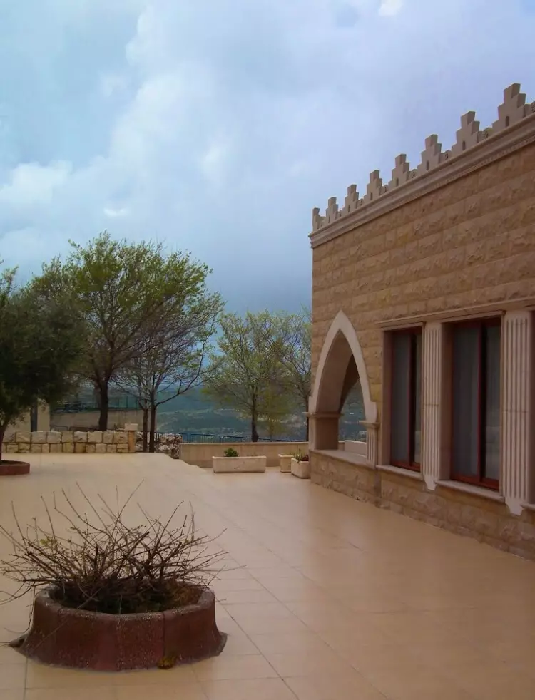
- The Shrine Of al-Nabi Sablan In 1990
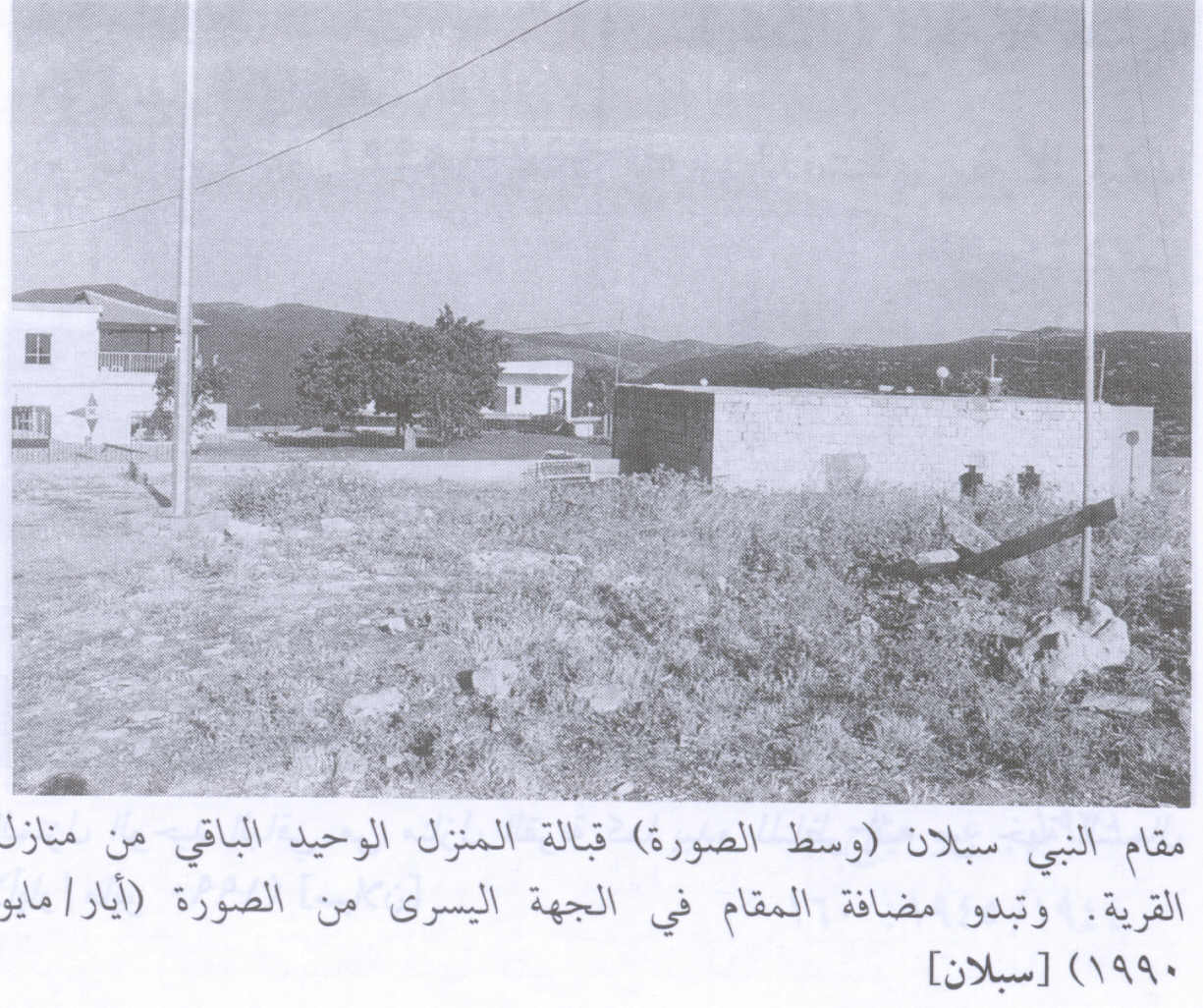
Scanned from "All That Remains" by Dr. Walid Khalidi - Village House In 1990
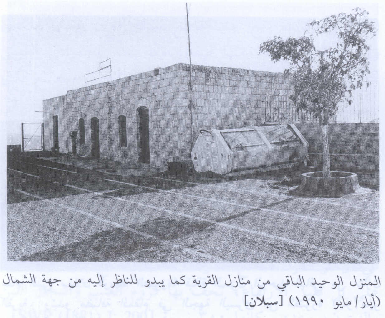
Scanned from "All That Remains" by Dr. Walid Khalidi - Village Site In 1990
Scanned from "All That Remains" by Dr. Walid Khalidi - بيت متبقي من قرية سبلان , موقع مقام النبي سبلان قرب قرية حرفيش اليوم - 1/6/2003
Posted by Makbula Nassar - بيت متبقي من قرية سبلان , موقع مقام النبي سبلان قرب قرية حرفيش اليوم - 1/6/2003
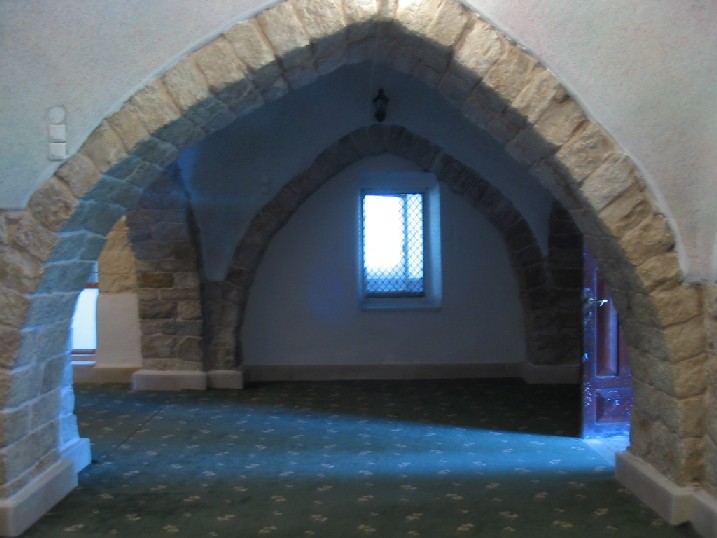
Posted by Makbula Nassar - مدخل مقام النبي سبلان قرب قرية حرفيش , المقام مقدس بالذات من قبل الطائفة الدرزية - 1/6/2003
Posted by Makbula Nassar - المدخل الداخلي لمقام النبي سبلان - 1/6/2003
Posted by Makbula Nassar - المقام من الداخل - 1/6/2003
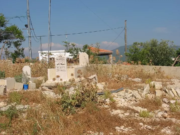
Posted by Makbula Nassar - مقبرة القرية بالقرب من المقام , مهجري القرية لا يزالون يدفنون موتاهم بها - 1/6/2003
Posted by Makbula Nassar - احد الابار الباقية في اراضي القرية من الجهة الغربية - 1/6/2003
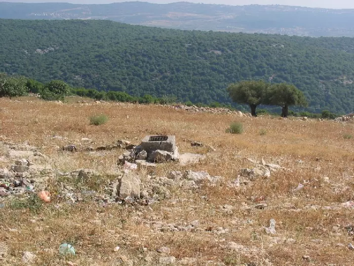
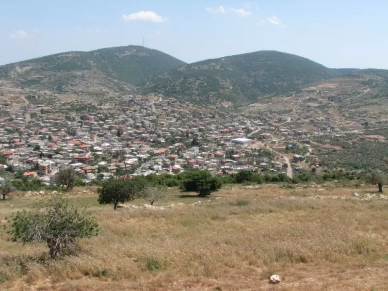
Posted by Makbula Nassar 1 - منظر لقرية حرفيش من جبل سبلان
Posted by Turki Amer - البير الفوقاني بجانب مقبرة القرية- ايار 2009
Posted by Raneen G. - بيت الحاجة ضيا فاعور - مهجره من سبلان وتسكن اليوم في قرية ترشيحا- ايار 2009
Posted by Raneen G. - بيت الحاجة ضيا فاعور - مهجره من سبلان وتسكن اليوم في قرية ترشيحا- ايار 2009
Posted by Raneen G. - مقبرة القرية- من اليمين قبر رضا فاعور الذي قتل على يد الانجليز عام 1939 - ايار 2009
Posted by Raneen G. - شجرة توت قديمة زرعها محمود فاعور مهجّر من سبلان ويسكن اليوم في مدينة شفاعمر.- ايار 2009
Posted by Raneen G. - بيت مختار سبلان محمد حسين عمر بجانب مدخل المغارة- ايار 2009
Posted by Raneen G. 1 - بيت مختار سبلان محمد حسين عمر بجانب مدخل المغارة- ايار 2009
Posted by Raneen G. - بيت الحاجة ضيا فاعور - مهجره من سبلان وتسكن اليوم في قرية ترشيحا- ايار 2009
Posted by Raneen G. - منظر لقرية حرفيش من جبل سبلان.- ايار 2009
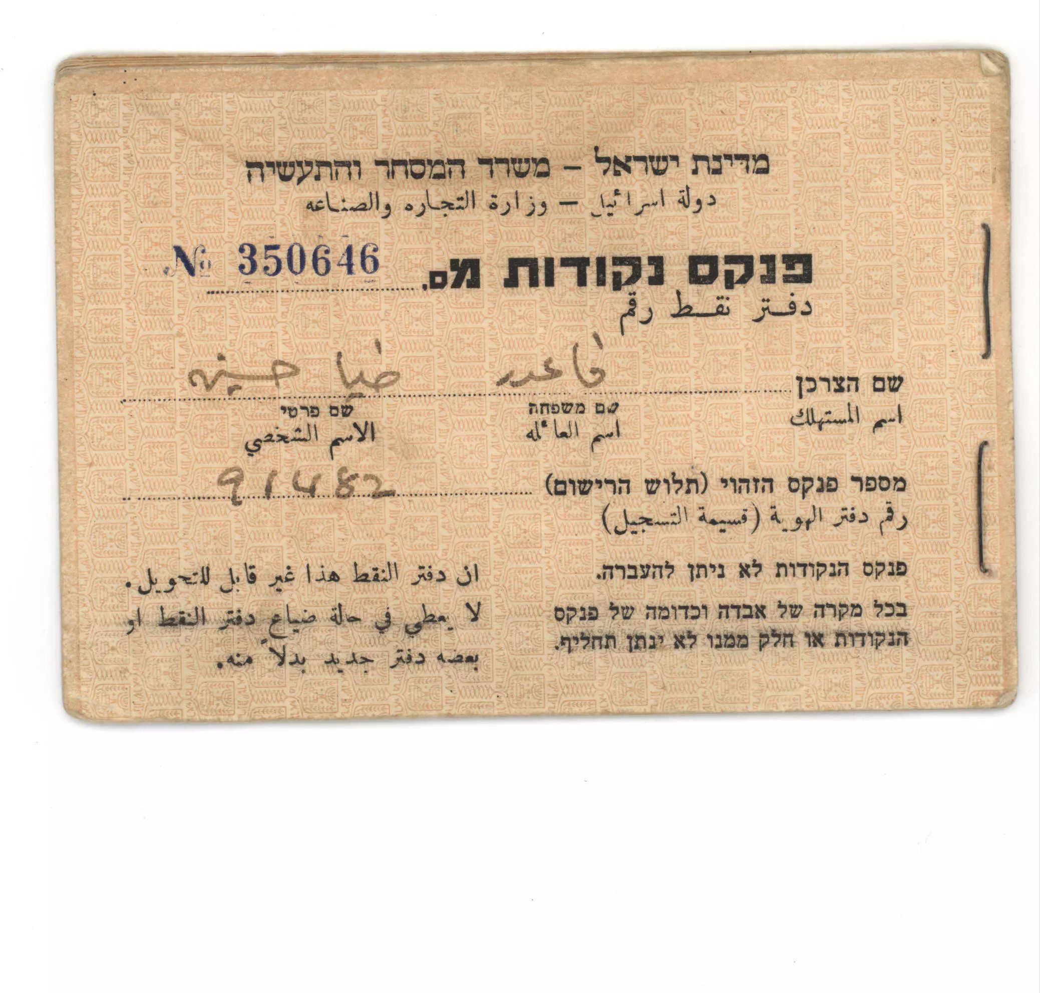
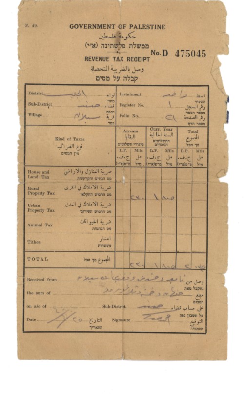
Posted by Raneen G. - دفتر اعاشة
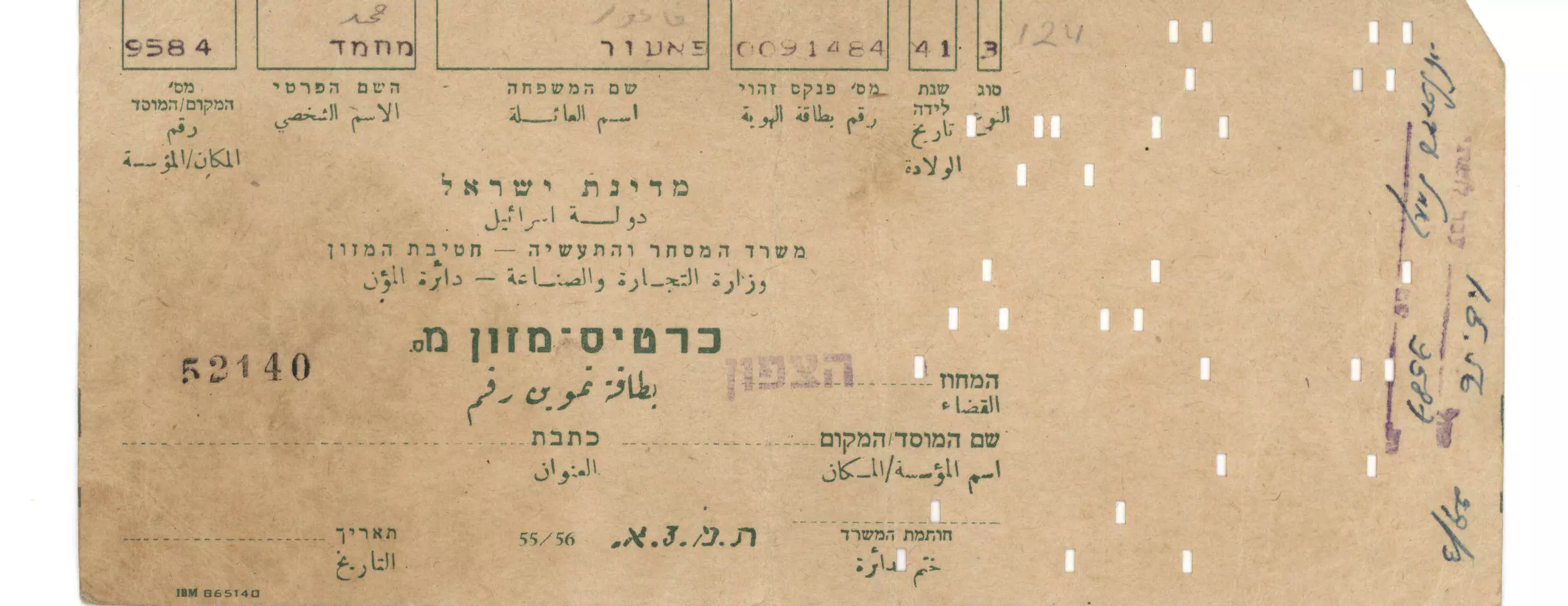
Posted by Raneen G. - بطاقة تموين
Posted by Raneen G. - وثيقة
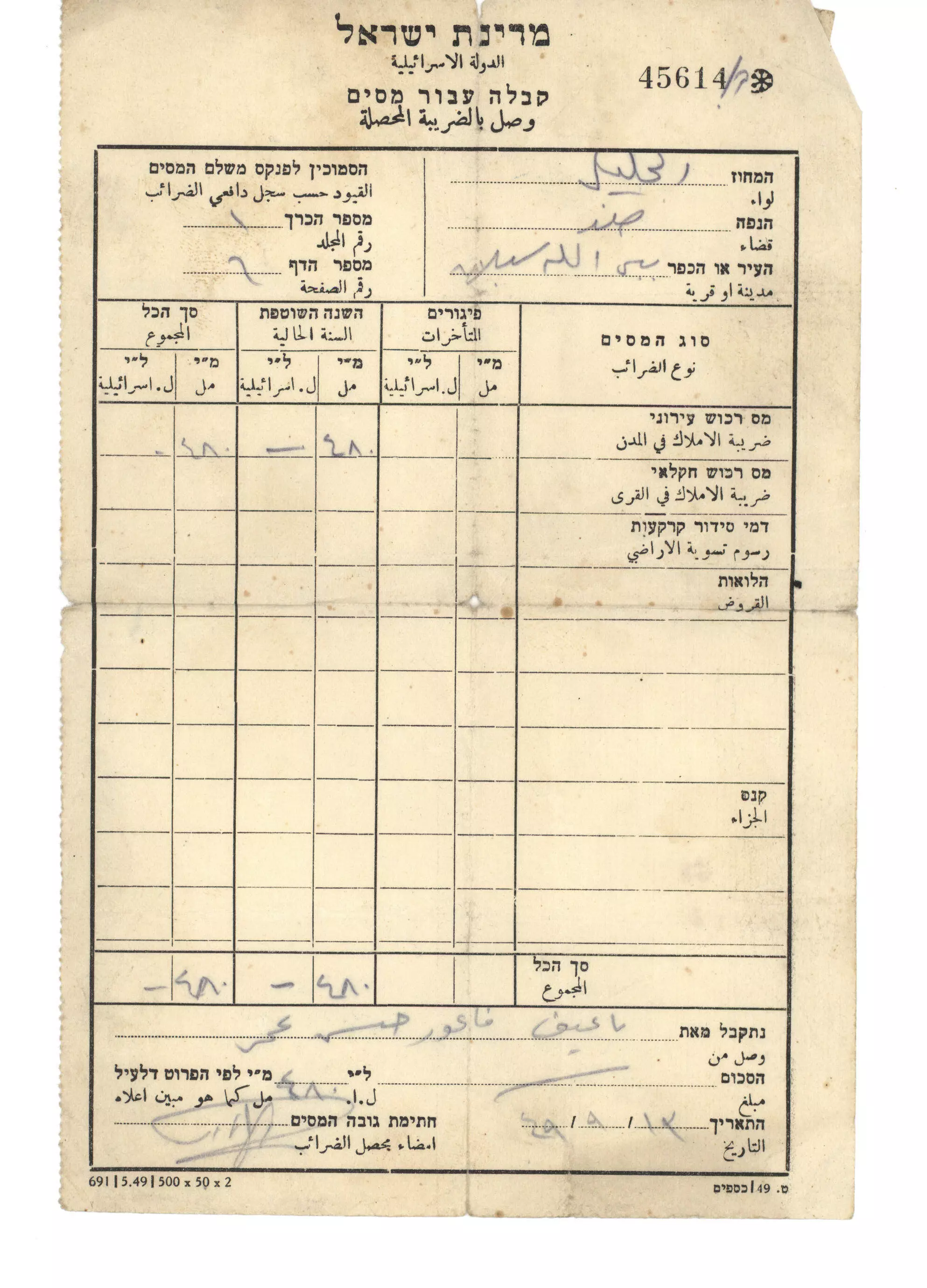
Posted by Raneen G. - وثيقة
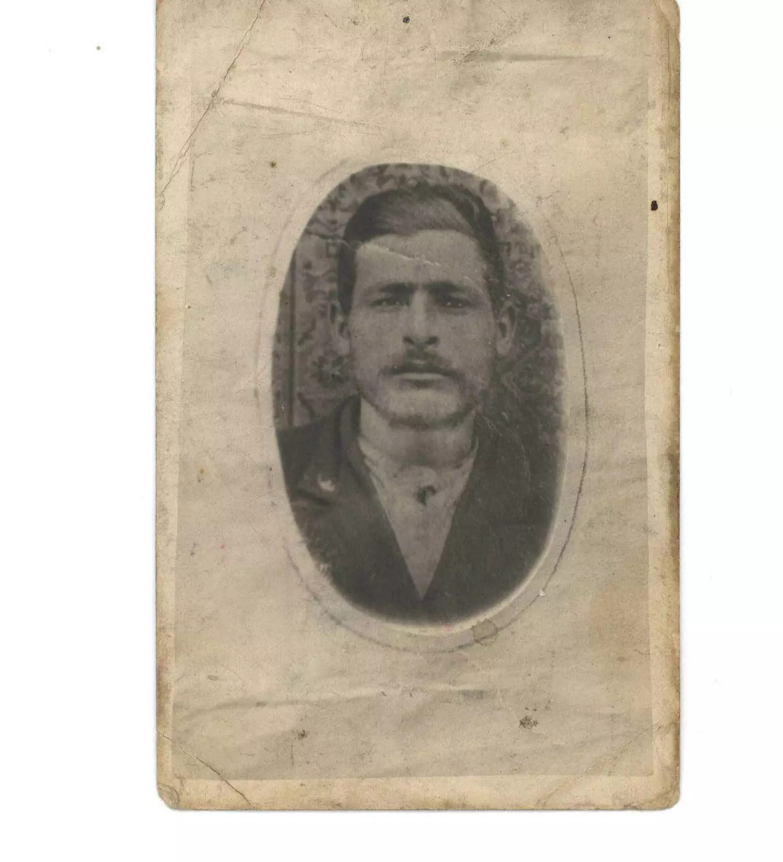
Posted by Raneen G. - احمد نايف فاعور زوج الحاجة ضيا
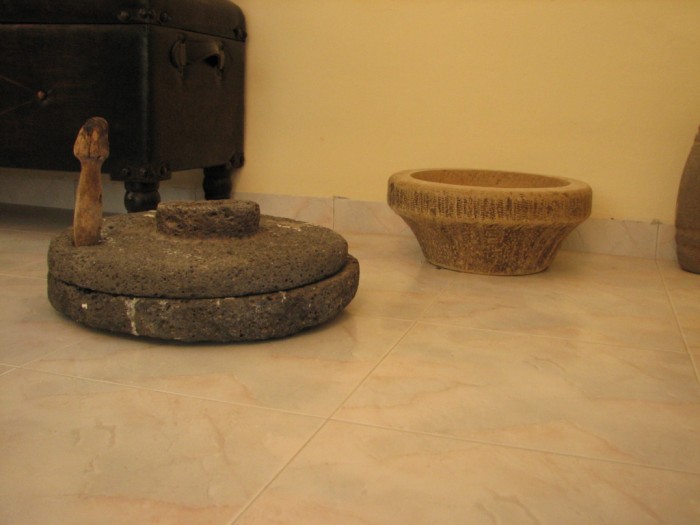
Posted by Raneen G. - ما اخرجته ضيا فاعور من القرية عند رحيلها1
Posted by Raneen G. - ريطة القرية بقلم محمود فاعور ايار 2009

Posted by Raneen G. - مقام النبي سبلان
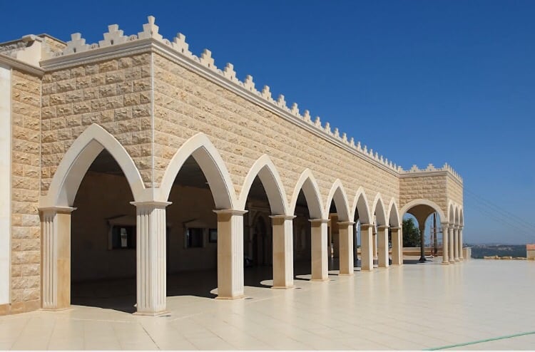
Posted by abu raya - مقام النبي سبلان
Posted by abu raya - موقع القريه
Posted by abu raya - خارطة تُظهِر الحدود والطرق بأنواعها والأماكن المقدسة والطبيعة الطوبغرافية من تلال وسهول ومنحدرات والتشكيلة الطبيعية للأرض وأنواع المزروعات. نُشرت الخريطة فترة الانتداب البريطاني، تم إضافة تعديلات عليها من قِبَل خدمة الخرائط والصور التابعة للقوات العسكرية الاسرائيلية فترة الأربعينيات.
Want to browse more? 80,000 pictures were grouped in these gallaries:
| Display Name | Clan/Hamolah | Country of Residence |
| nader othman | othman | south lebanon, lebanon |
| ramzi | faour | el mina, lebanon |
| aseel | - | palastine, palastine |
| waleed abdallah | - | tripoli, lebanon |
No links have been shared yet, be free to the first to share the first link.
 Fake Valor: Why Did Zionist Jews Hoist Nazis Flag on Their Ships in the 1930s?
What is new?
-
Facts About Oct. 7th Gaza Raid
-
Remined Us Please:: Who Did Rape Who? Palestinians Raped Israelis? Or, was the other way around?
-
When Prof. Edward Said was invited to debate Bibi Netanyahu in the 1980s, watch what happened!
-
Ezra Klein of the NY Times on the "Jewish Race".
-
Abusing Blood Libel!
-
Did Israeli Soldiers Activate The Hanniba Direective On Oct. 7th? You Be The Judge
-
Zionist FAQ: Isn't it true that Palestinians don't want peace? Palestinians never accepted the two-state solution
- Facts about Haavara (Transfer) Agreement between Ben-Gurion & Hitler
-
Haavara FAQs: Why Did Zionist Jews Hoist Nazis' Flags on Their Ships in the 1930s?
- Haavara FAQs: When Chaim Weizmann met FDR in mid-1943, why was he silent about rescuing European Jewry?
-
Dear ChatGPT: How did Palestinians resist Napoleon's invasion of their country in 1799?
-
Dear ChatGPT: Gaza had a vibrant Jewish community in the mid-17th century. What happened to them?
-
Dear ChatGPT: Why did the Jewish Agency suppress news of the Holocaust during WWII?
-
Video Playlist: Jews share their DNA tests to end the conflict for good.
-
A Tale of Two Conflicts: Examining the Definition of Genocide
-
Prof. Abraham Polak And The Suppressed History of the Khazars and European Jewry
-
How Ronald Reagan would have framed the genocide in Gaza if he were still alive?
-
Haavara FAQs: Let us do the math: how many German Jews did The Haavara Agreement save?
-
Zionist FAQs: The Hebron Massacre of 1929, "clearly proves" that Palestinians are antisemitic, how could you deny it?
-
Zionist FAQs: Why Anti-Zionist Is Not Antisemitism?
-
Zionist FAQs: Isn't it true that the KGB created Palestinian Nationalism in the early 1960s?
- Zionist FAQs: Muslims are killing Muslims all the time; why are Israeli Jews being singled out in the media?
- Zionist FAQs: How is Israel an apartheid state when 20% of its citizens are Arabs who enjoy full rights?
-
Haavara FAQs: Why Did Dorothy Thompson Flip From A Zionist Advocate to A Silenced Dissenter?
-
Haavara FAQs: Analysis of Herzl's Uganda Scheme and how it could have saved millions of Jews.
-
Haavara FAQs: Why did Hayim Greenberg describe American Jewry as "morally bankrupt" in early 1943?
-
Haavara FAQs: What if the Evian Conference was a resounding success? What would have been the impact of saving European Jewry on Zionism?
- Haavara FAQs: What if the six million were saved, how that would have impacted the Zionist project?
-
Haavara FAQs: How did Zionist leaders react when Europe's Jews lingered in the DP camps after WWII ended?
-
Why does the American Jewish community repeat lies that David Ben-Gurion had debunked before he died?
-
Who has the power to rename the Tatar/Khazar Gene Marker to Jewish IV?
-
Zionist FAQs: Why won't Egypt, Syria, and Jordan take their people back? Jews are indigenous to Palestine, and Arabs immigrated after Jews developed the country. Arabs should leave.
-
Haavara FAQs: Did Hitler and the Nazis conflate between Judaism and Zionist? If that wasn't case, then why?
-
Haavara FAQs: Winston Churchill and antisemitism, a collection of articles written Churchill.
-
Haavara FAQs: Broken by country, how many Jews survived vs. killed during the Holocaust?
-
Haavara FAQs: Why did European Jews vote with their feet and to immigrated to the Americas, not Palestine, after WWII?
-
Watch this American Jewish Girl describing Israeli Jews' cognitive dissonance like no other in under two minutes
-
Haavara FAQs: When the Nazis went out of their way to hide the Holocaust, Israeli Jews did the exact opposite by broadcasting their genocide of Gazans. But why?
-
Haavara FAQs: How Zionist Jews went out of their to show their appreciation to Nazism and Fascism?
- Haavara FAQs: Why Zionist leaders were against bombing the death camps & the Railroads leading to them?
-
Haavara FAQs: Hitler's message to the British and American people: If Jews are such noble citizens and you care about them, how come you're not letting them in? I will gladly ship them to you at my expense, even on luxury liners!
-
A shortlist of Zionist and Israeli false flag operations in the name Jews.
-
The Most Moral Army
- The Land of Kapos (Israel): Where the brave are boycotted and Kapos walk free.
- Why did early Zionists often named their communal enterprises "colonial"?
- Zionist Relations with Nazi Germany by Faris Glubb
-
Two NY Times advertisements by Zionists in the early 1943 that exposes Zionists' treason at the height of the calamity
- Facts Not Lies about the Palestinian-Israeli Conflict.
- Site's pictures have been categorized
- Campgain Against Lice
- A Survey of Palestine, the official source about Palestine before Nakba produced by the British Mandate; over 1200 pages.
- Satellite View & Google Earth: Over 6,000 placemarks identifying all destroyed towns, W. Bank & Gaza Strip Towns, & refugee camps.
- PalestineRemembered.com and its Nakba Oral History Project were featured on al-Jazeera Satellite TV.
- Nakba Oral History Video Podcast:
 Over 700 Oral History interviews (including 3,500+ hours of recording) can be viewed online.
 - Palestine Village Statistics Project
- Gaza Jail Break
- النسخة العربية للموقع الان متوفرة
- Videos: Documenting the destroyed villages in video: Tracing all that remains since Nakba.
- Videos: Responding to Zionist Propaganda
- Interview: The ethnic cleansing of Palestine: George Galloway interviews Israeli Historian Ilan Pappe.
- For Palestinians, memory matters. It provides a blueprint for their future By George Bisharat.
- Zionist FAQ now available in Hebrew שאלות שציונים שואלים, עכשיו בעברית
- Video: The Stephen Walt and John Mearsheimer report on the influence of the Israel Lobby on U.S. Foreign Policy
- The Palestinian-Israeli conflict for beginners
