| PalestineRemembered | About Us | Oral History | العربية | |
| Pictures | Zionist FAQs | Haavara | Maps | |
| Search |
| Camps |
| Districts |
| Acre |
| Baysan |
| Beersheba |
| Bethlehem |
| Gaza |
| Haifa |
| Hebron |
| Jaffa |
| Jericho |
| Jerusalem |
| Jinin |
| Nablus |
| Nazareth |
| Ramallah |
| al-Ramla |
| Safad |
| Tiberias |
| Tulkarm |
| Donate |
| Contact |
| Profile |
| Videos |
Welcome To Miska - مسكة (מיסכה)
|
District of Tulkarm
Ethnically cleansed days ago |
العربية Google Earth |
 |
Gallery (54) |
- Statistics & Facts
-
Before & After

- Satellite View
- Articles 10
- Pictures 54
- Aerial Views 6
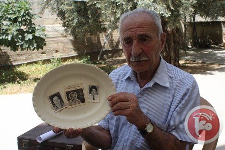
- Mayrters & Prisoners 1
- Land Deeds 3
- Oral History 2
- Members 32
- Families
- All That Remains
- Town's Map
- Wikipedia
- Videos 10
- Guest Book 16
- Links 4
| Statistic & Fact | Value | |||||||||||||||||||||
| Occupation Date | April 20, 1948 | |||||||||||||||||||||
| Distance From District | 15 (km) Southwest of Tulkarm | |||||||||||||||||||||
| Elevation | 50 (meters) | |||||||||||||||||||||
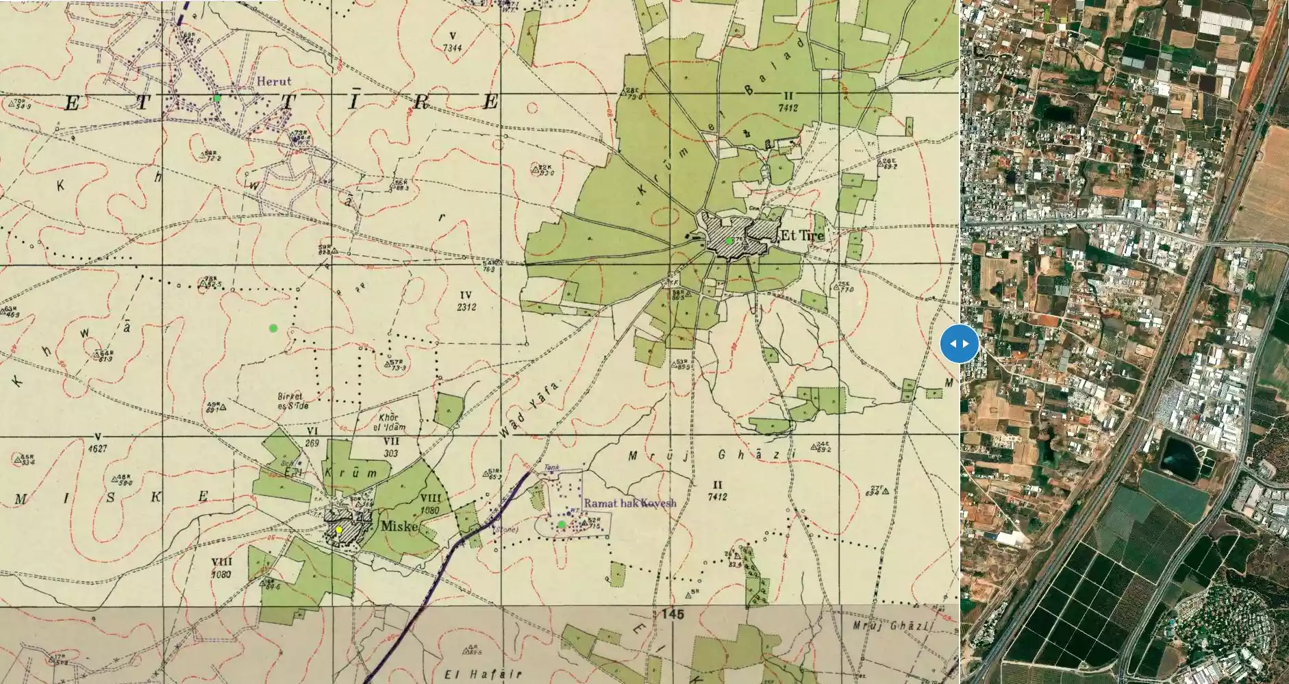
| Before & After Nakba, Click Map For Details |
||||||||||||||||||||||
|
||||||||||||||||||||||
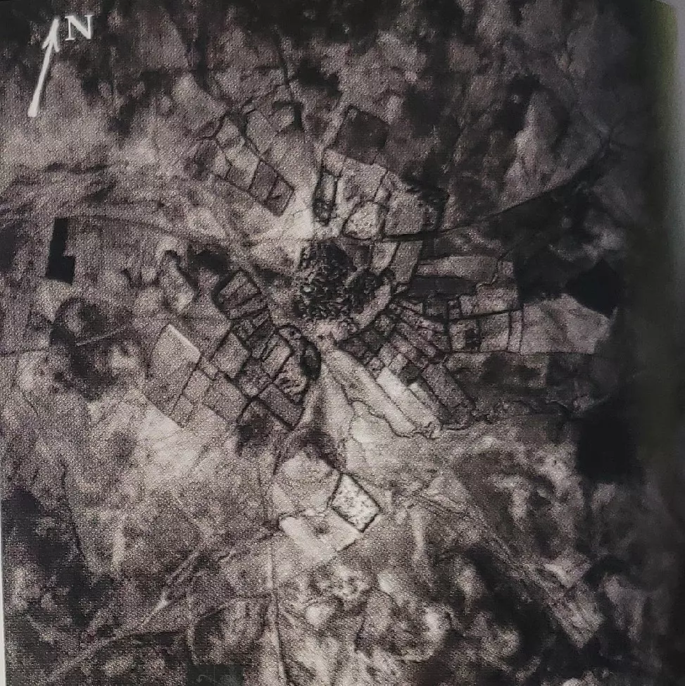
| Pre-Nakba Aerial View |
||||||||||||||||||||||
|
||||||||||||||||||||||
| Map Location | See location #15 on the map View from satellite |
|||||||||||||||||||||
| Military Operation | Coastal Clearing | |||||||||||||||||||||
| Exodus Cause | Expulsion by Zionist troops | |||||||||||||||||||||
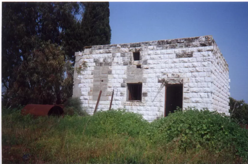
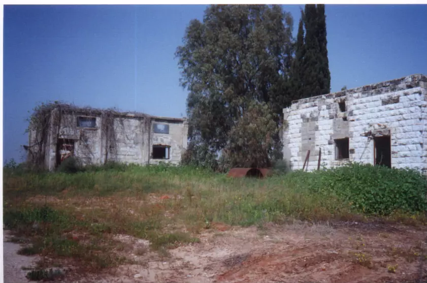
| Village Temains | Miska was completely destroyed with the exception of boys' elementary school and its mosque. It should be noted that Miska was destroyed based on the orders of a Jewish National Fund official, Yosef Weitz. | |||||||||||||||||||||
| Ethnically Cleansing | Miska inhabitants were completely ethnically cleansed. | |||||||||||||||||||||
| Pre-Nakba Land Ownership |
**Town Lands' Demarcation Maps |
|||||||||||||||||||||
| Land Usage As of 1945 |
|
|||||||||||||||||||||
| Population |
|
|||||||||||||||||||||
| Number of Houses |
|
|||||||||||||||||||||
| Near By Towns |
||||||||||||||||||||||
|
||||||||||||||||||||||
| Town's Name Through History | Miska was founded by descendants of the Arabian tribe of Miskain in the early days of the Islamic conquest in the 7th century. | |||||||||||||||||||||
| Schools | Miska had an elementary school for boys which is still standing. | |||||||||||||||||||||
| Places of Warship | One mosque which remain standing. | |||||||||||||||||||||
| Exculsive Jewish Colonies Who Usurped Village Lands |
'En ha-Choresh, Giv'at Chayyirn, and Achituv. | |||||||||||||||||||||
| Featured Video | ||||||||||||||||||||||
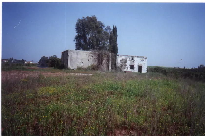
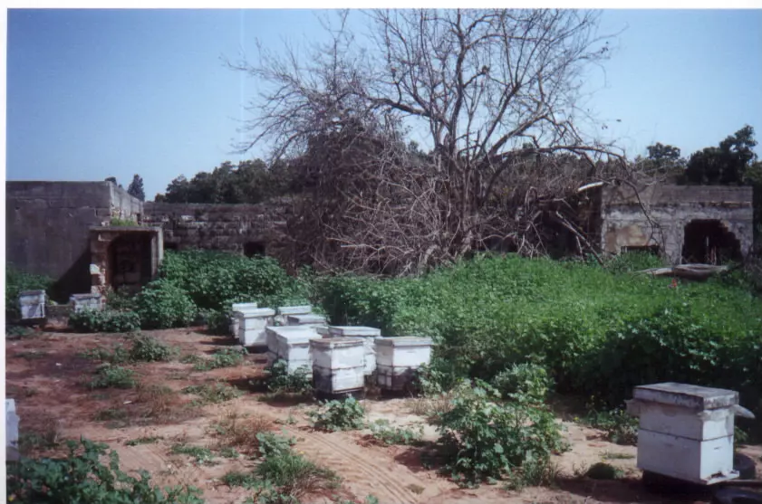
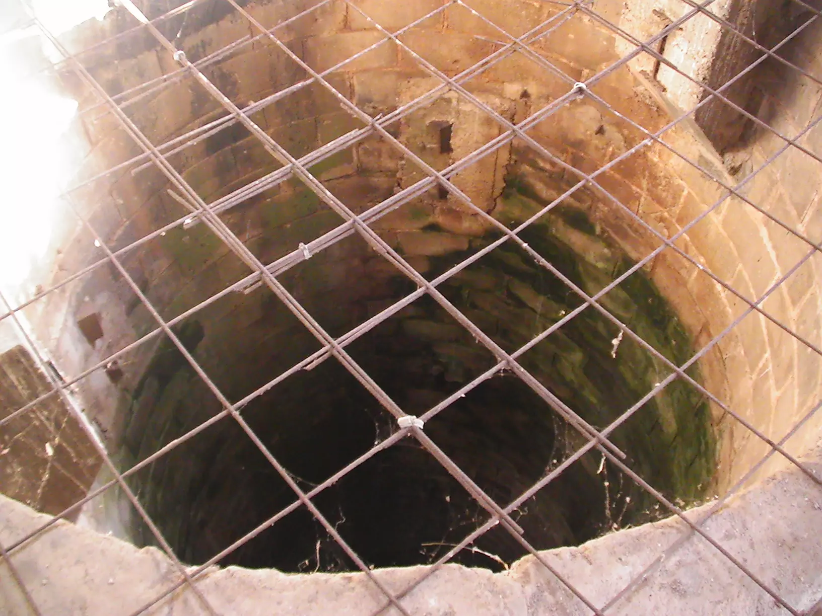
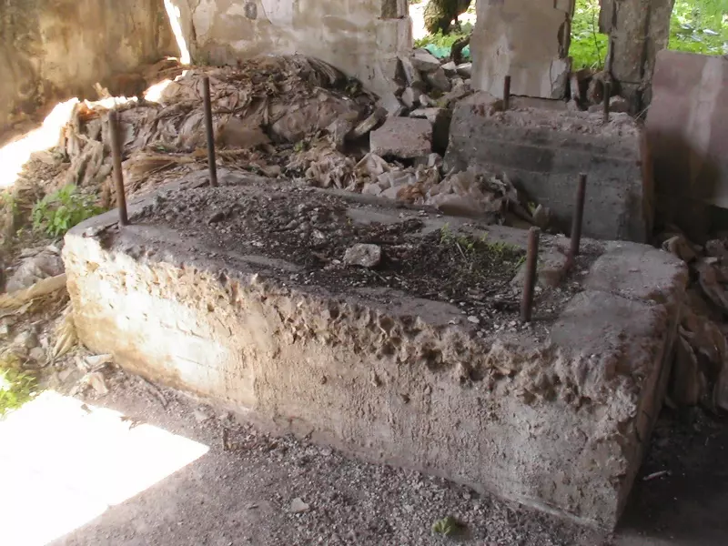
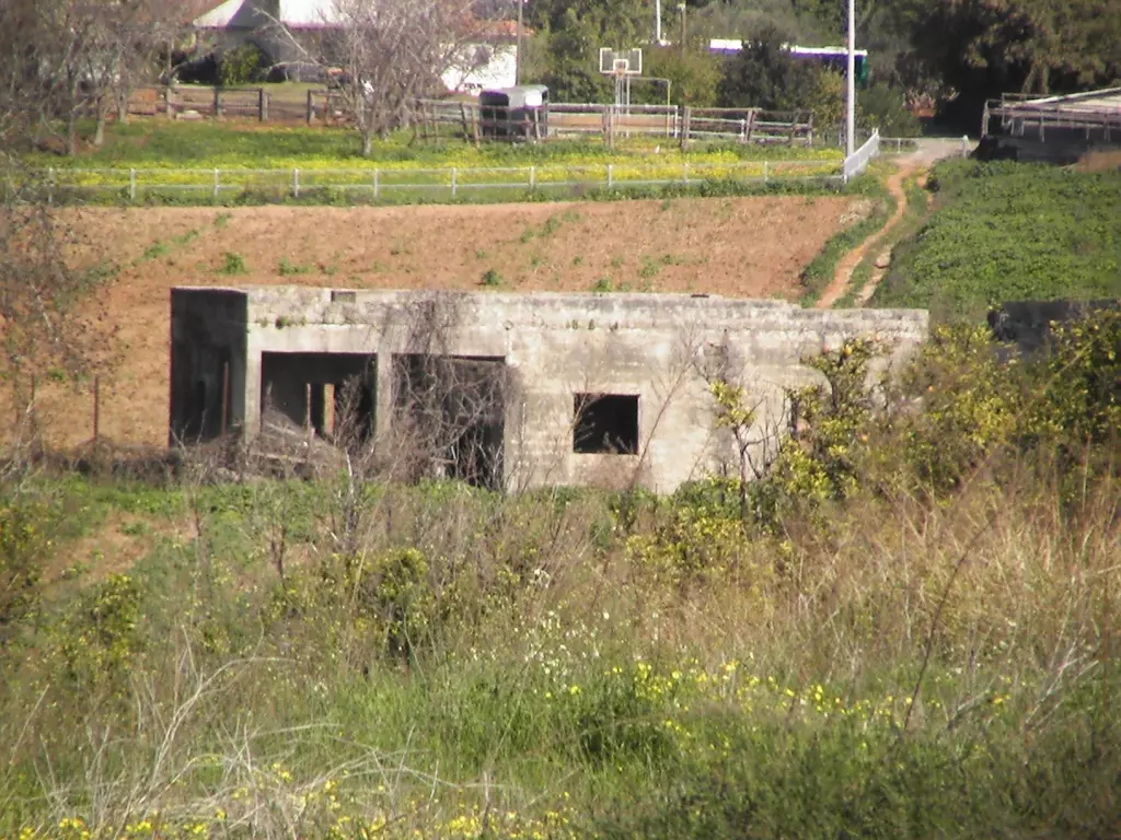
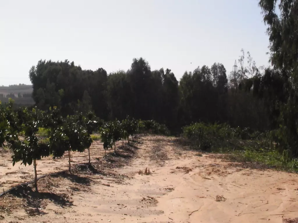
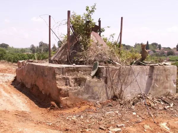
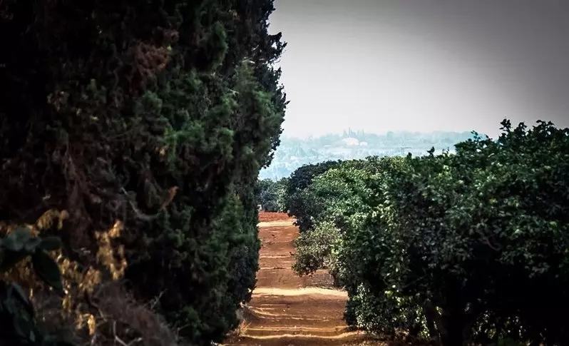
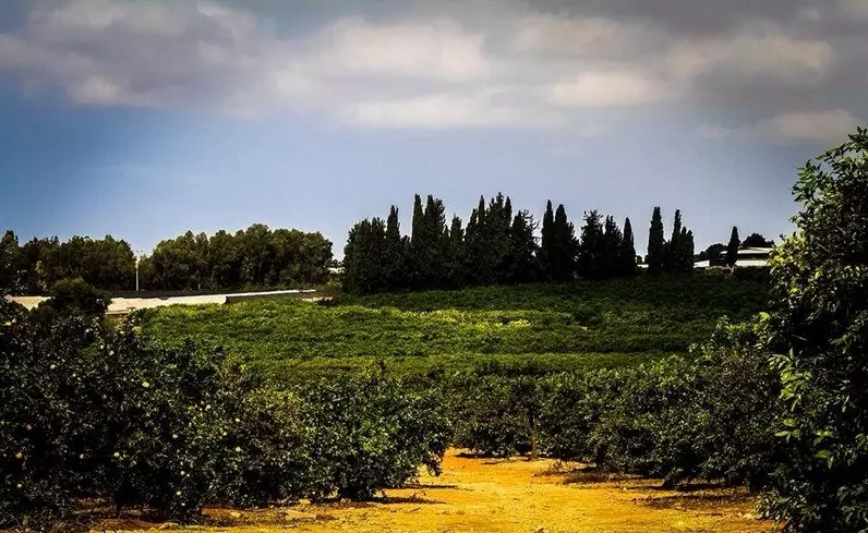
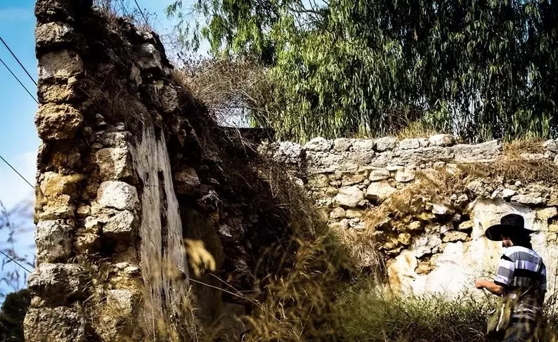
Village Before NakbaThe village stood on a slightly elevated, sandy hill on the coastal plain, along the north bank of a wadi. It was linked by secondary roads to the highway leading to Tulkarm and to the coastal highway. The village may have been founded by descendants of the Arabian tribe of Miska whose members immigrated to the area prior to, and in the early days of, the Islamic conquest. The identification of the village with this tribe is uncertain, however. Moreover, another village with the same name but at a different location (182187) existed in 1596, in the nahiya of Jabal Shami, liwa' of Nablus. [Hut. and Abd.:127] According to the Arab chronicler al-Safadi (d. 1362), a number of Islamic scholars have attributed their origins to Miska, including the grammarian and prosodist 'Abd al-Mun'im al-Miski (al-Iskandarani), who died in Cairo in 1235. [AI-Khalidi 1968:201] According to the Arab geographer Yaqut al-Hamawi (d. 1228), Miska was also known for its fruit, especially the misk (musk) apple variety which was said to have been transferred to Egypt by the Fatimid vizier al-Hasan al-Yazuri, who died in 1058 (see Yazur, Jaffa sub-disctrict). [Mu’jam, cited in D 3/2:385-86 and al-Khalidi 1968:200-201] The French commander Kléber and his troops passed by the village on their way to Acre during the Napoleonic invasion in 1799. [Nelson, Napoleon in Egypt, cited in D 3/2:386]In the late nineteenth century, Miska was a small village whose population was estimated at 300. Olive trees were planted to the north and south, and fig and palm trees were scattered throughout the village. [SWP (1881) II:135] The plan of the village was roughly square and was divided into four unequal sections by two streets that intersected at the village center. New houses, built in the last years of the British Mandate, were located to the north, away from the wadi. The population was Muslim, and maintained a mosque and an elementary school. Some parts of the surrounding lands had been forests but had been cleared and planted with fruit trees. Water resources, especially wells, were relatively abundant around the village. The water supported citrus cultivation over large portions of the village lands. In 1944 a total of 1,115 dunums was devoted to citrus and bananas and 3,245 dunums were allotted to cereals; 304 additional dunums were also irrigated or used for the growing of other fruit trees. Grain, greens, cucumbers, and watermelons were also grown. To the southwest lay a tell, Dhahrat al-Sawwana (142178), which produced evidence of a prehistoric settlement. Village Occupation and Ethnic CleaningHaganah officers reportedly ordered the villagers to leave on 15 April 1948, but the order was not heeded. A few days later, on 20-21 April, units of the Alexandroni Brigade attacked Miska and forcibly expelled its inhabitants. This was done within the framework of an earlier decision by the Haganah command to ensure the evacuation of all Arab communities from the coastal area between Tel Aviv and Zikhron Ya'aqov south of Haifa in the weeks before 15 May. [M:118-19]In early June, the Jewish National Fund (JNF) set about destroying this village, along with a number of others. This was done despite some opposition from the left-wing Israeli party Mapam. By 16 June, Israeli Prime Minister Ben-Gurion was able to write in his diary that the destruction of Miska was proceeding. However, Ben-Gurion carefully avoided giving the JNF written permission for the destruction of Miska and other villages, presumably to avoid implication in the action. [M:137, 162] Zionists Colonies on Village LandsSde Warburg (141179) was established in 1938 on lands that had traditionally belonged to the village. Mishmeret (142181), established in 1946, is also close to the site, to the northwest, on village lands. Ramat ha-Kovesh (144180), founded in 1932, is about 1 km due west of the site, though not on village lands.Village TodayThe site is covered with citrus groves; cactuses grow along the perimeter of these groves. The two-room school still stands and is used as housing for the watchmen who guard the orchards. The mosque serves as a storehouse for bales of hay and agricultural tools. The large cement fragments of a demolished enclosure built around the village well are visible. Most of the surrounding land has been planted by Israelis with citrus trees.SourceDr. Walid al-Khalidi, 1992: All That Remains. |
||||||||||||||||||||||
| Related Maps | Town Lands' Demarcation Maps خرائط للقضاء توضح حدود القرى والاودية Town's map on MapQuest View from satellite Help us map this town at WikiMapia |
|||||||||||||||||||||
| Related Links | Wikipedia's Page Facebook Page Google Search Google For Images Google For Videos |
|||||||||||||||||||||
| More Information | مخطط البلد في كتاب كي لا ننسى في كتاب بلادنا فلسطين المزيد من موقع هوية |
|||||||||||||||||||||
- مسكة المهجرة: لذاكرة في موقع الذاكرة..
- مديرية أراضي اسرائيل تداهم مدرسة قرية مسكة المهجرة، وتغلق الطرق المؤدية اليها!!
- How to get to Miska
- قرية مسكة..وطن وجذور../د.محمد عقل
- نبذة تاريخية عن قرية مسكة (قضاء طولكرم) من كتاب (كي لا ننسى)
- قرية مسكة المدمرة - قضاء بني صعب
- تعريف عن قرية مسكة
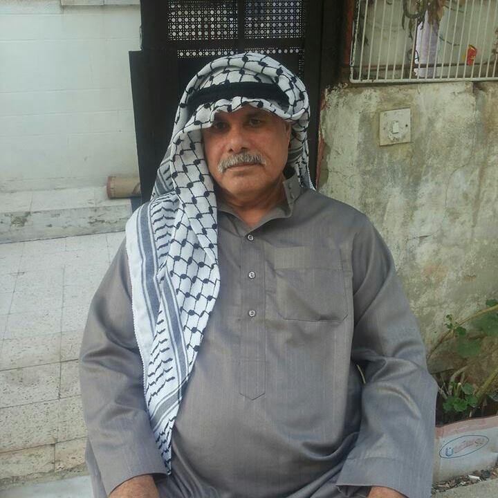
- مسكة... وحلم العودة للحاج محمود حرب
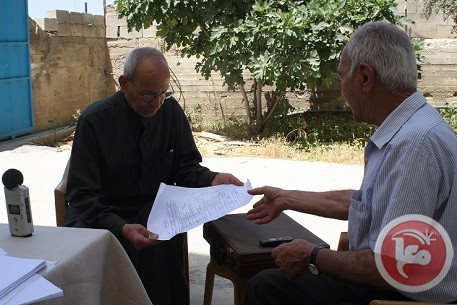
- صفية شبيطة من قرية مسكة المهجرة تتحدث عن ذكريات مسكة
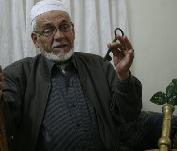
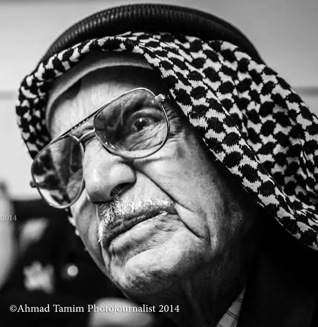
- الحاج حسين و زكريا عبدالرحيم زريقي يرويان ذكرياتهم في مسكة من قبل النكبة
- Miska's school and what remains of it #1, March 2002
Posted by Uri Zackhem - Miska's school and what remains of it #2, March 2002
Posted by Uri Zackhem - Miska's school and what remains of it #3, March 2002
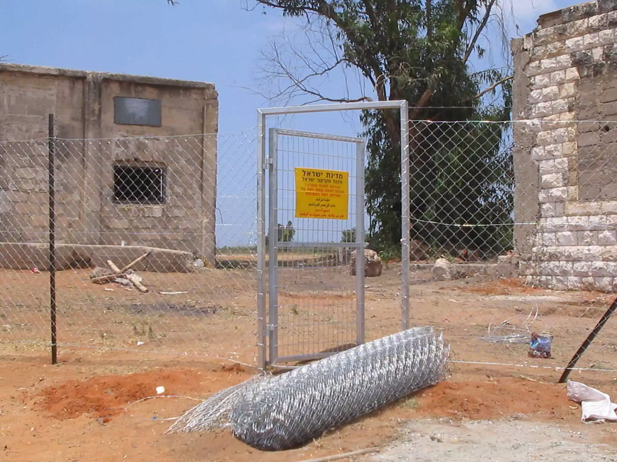
Posted by Uri Zackhem 1 - بعدما قام اهل القرية بترميم المدرسة تم تسيج المدرسة كما ترى قبل هدمها لمنعنا من دخواها.
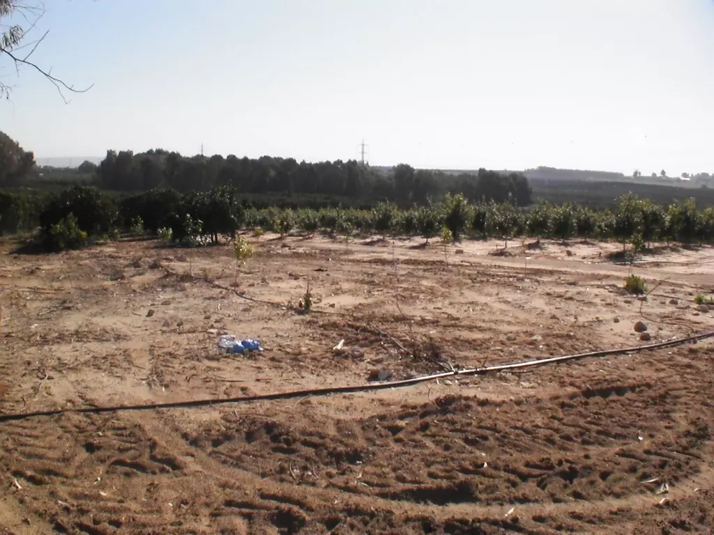
- Here used to be the school. Israel Land Administration razed it.
Posted by Uri Zackhem - Miska's village structures, to the right in the Orange Grove the village's Mosque #1, March 2002
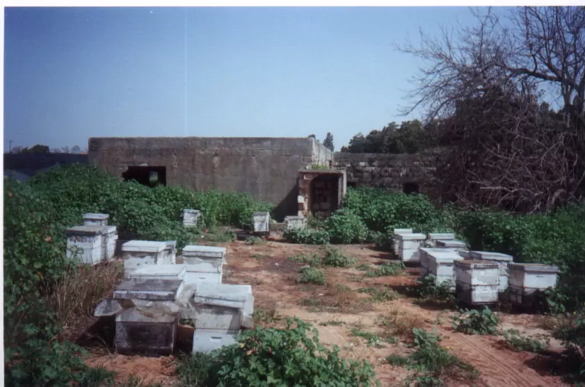
Posted by Uri Zackhem - Miska's village structures, to the right in the Orange Grove the village's Mosque #1, March 2002
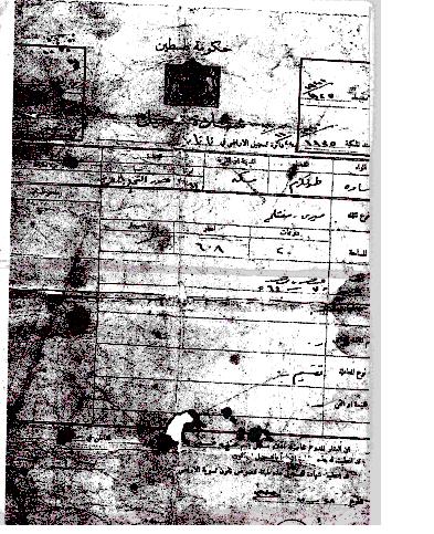
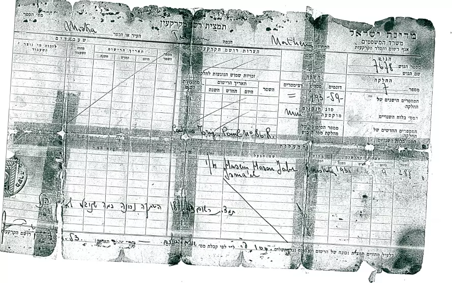
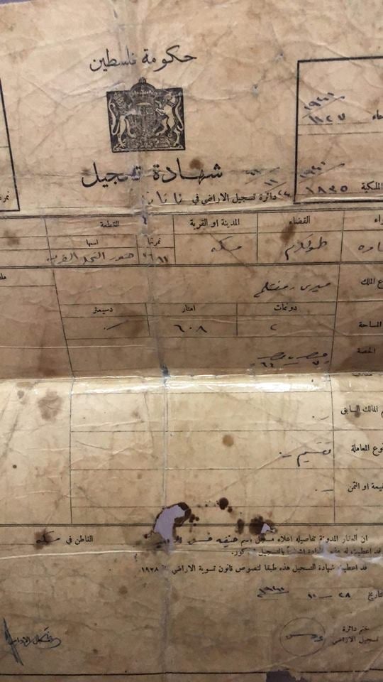
Posted by Uri Zackhem 1 - طابو > كوشان < فلسطيني صادر عن حكومة فلسطين
Posted by meskawi 3 - The well of ElBanna, on the Kfar Saba - Tira road, before Ramat HaKovesh
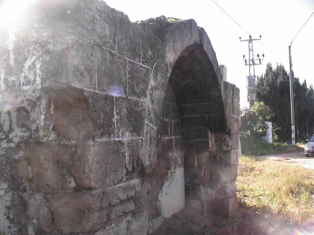
Posted by Uri Zackhem - The deep well at Abu Ibrahim's.
Posted by Uri Zackhem - Here used to be the motor at the well at Abu Ibrahim's.
Posted by Uri Zackhem - The house of Abu Othman.
Posted by Uri Zackhem 1 - The centre of the village is camouflaged by this eucalyptus grove.
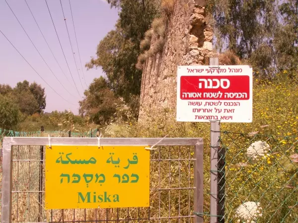
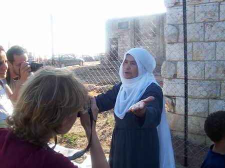
Posted by Uri Zackhem - 24/04/07 - the mosque of Miska was fenced by the Israel Land Admin.The sign forbids entry. The yellow sign posted by Zochrot.
Posted by Uri Zackhem 2 - A well on Miska's lands, not far from the entry to Kibbutz Ramat HaKovesh
Posted by Uri Zackhem 3 - Official Israeli copy of a land deed of Husein Hasan Ismail Jabr (Shbeta). Given by Adv. Wiam Shbeta
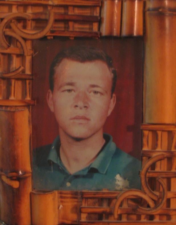
Posted by Uri Zackhem - صورة الشهيد مالك الزهد
Posted by meskawi - map I made that describes the location of each house by owner
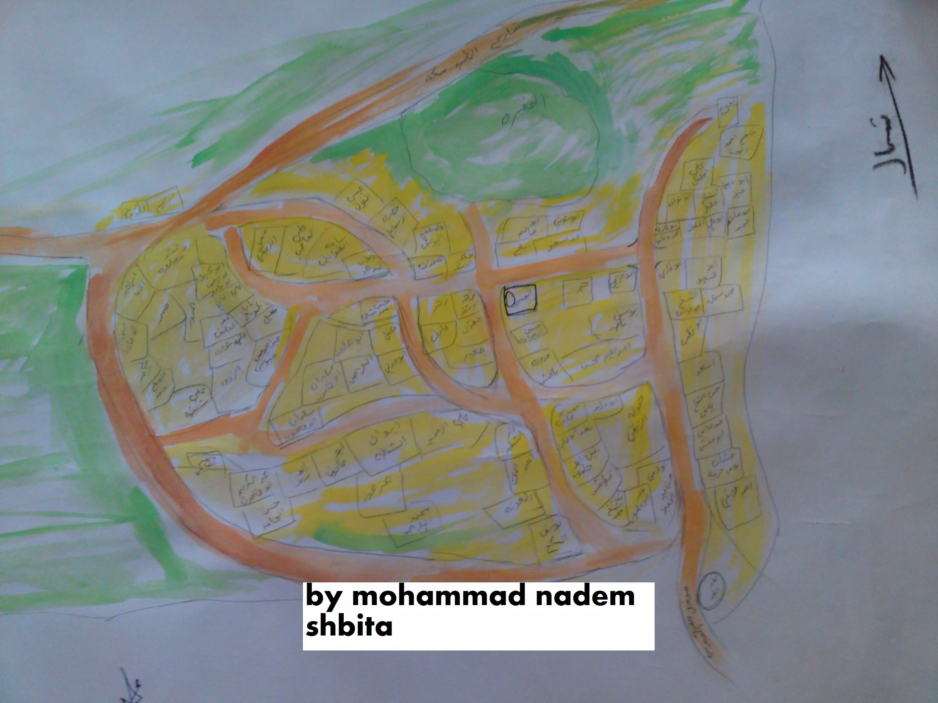
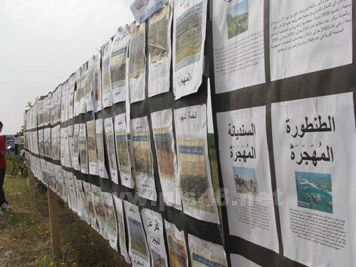
Posted by mohammad nadim mohammad mustfa shbeita dehmes 2 - معرض صور واسماء القرى المهجرة في مسيرة العودة 2010 لقرية مسطة المهجرة
Posted by خالد كساب محاميد - صوره كيف حاول المحتل الصهيوني طمص معالم القريه وتظهرالمقبره بالمثلث الاسود والمدرسه بالداءره البرتقاليه والجامع بلدائره البنيه والبئر بمدخل القريه الشرقي
Posted by mohammad nadim mohammad mustfa shbeita dehmes - المرحوم الشيخ حسين حسن محمد الزهد
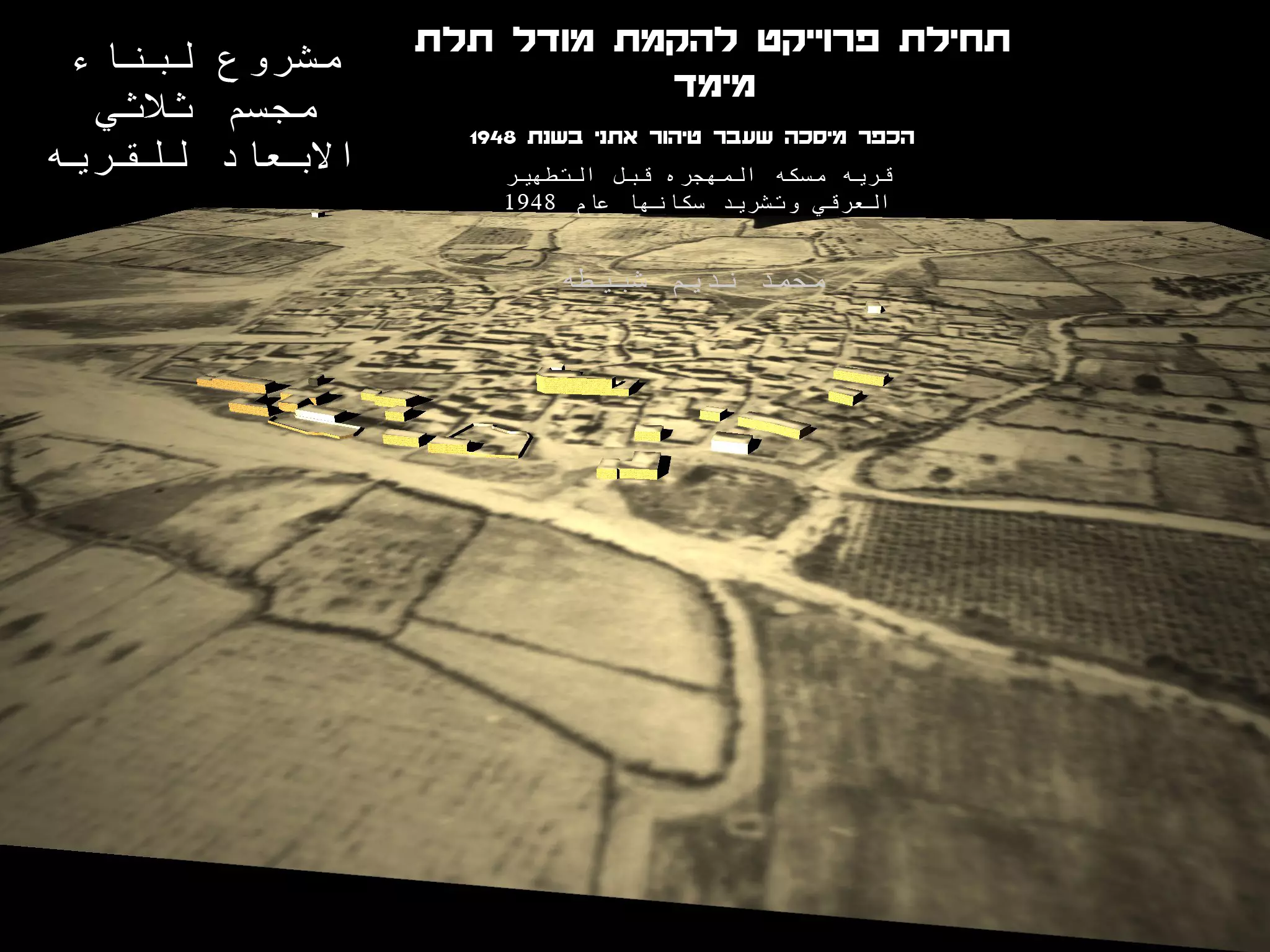
Posted by Eng.Hisham Tahir Hussien Hassan Mohammad Al Faqeeh Al Zuhd - قريتنا قبل 1948 صوره حصريا وترقبوا مجسم 3D
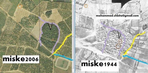
Posted by mohammad nadim mohammad mustfa shbeita dehmes - 3D map miske
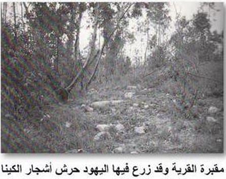
Posted by mohammad nadim mohammad mustfa shbeita dehmes - مقبرة القرية وقد زرع فيها اليهود حرش اشجار الكينا
Posted by Karmawi - مسجد مسكة قبل ان يهدمه الصهاينة وكان يستخدم مخزن للاعلاف
Posted by Karmawi - الحاج محمود محمد حرب - مخيم بلاطة مواليد مسكة
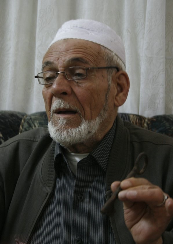
Posted by Karmawi - الحاج محمود محمد حرب - من مسكة - سكان مخيم بلاطة
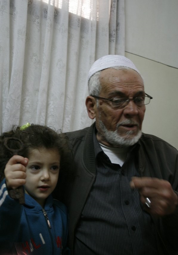
Posted by Karmawi - حق العودة حلم يتوارثه الاجيال .. الحاج محمود محمد حرب وحفيدته - مخيم بلاطة
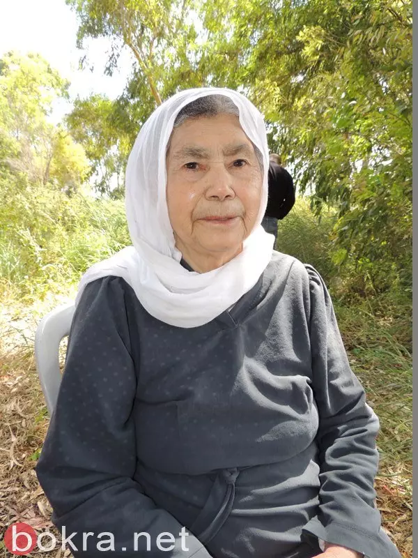
Posted by Karmawi - الحاجة صفية شبيطة من مواليد مسكة
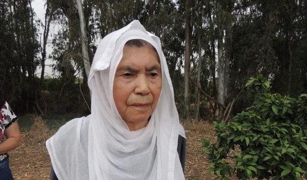
Posted by Karmawi - الحاجة صفية شبيطة من مشكة المهجرة
Posted by Karmawi - الحاج عبد المنان شبيطة من مسكة المهجرة
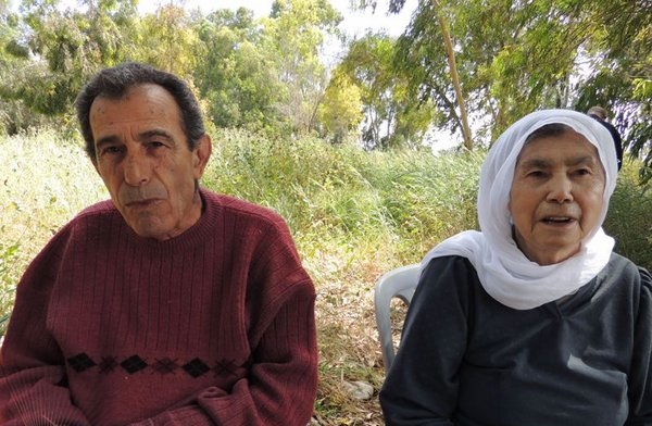
Posted by Karmawi - الاخوين عبد المنان و صفية شبيطة من مسكة المهجرة
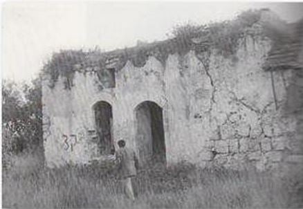
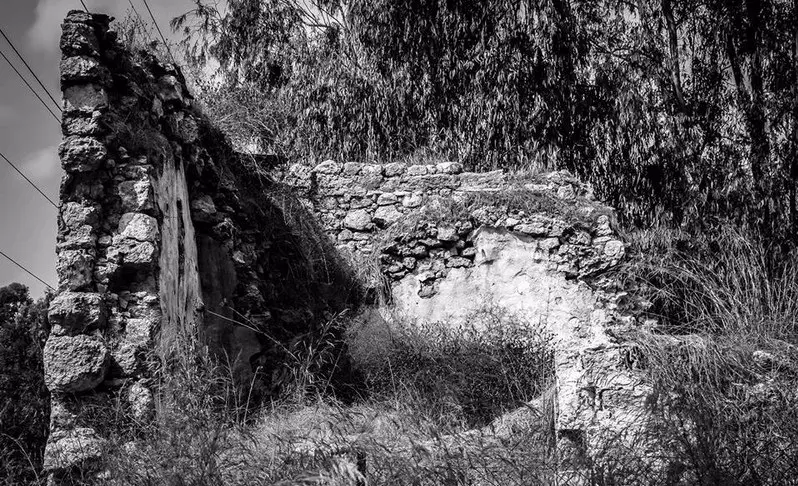
Posted by Karmawi - من الانقاض في مسكة
Posted by Karmawi - الحاجة صفية شبيطة تروي ذكريات مسكة
Posted by Karmawi - مسكة المهجرة - قضاء طولكرم سبيل البنا
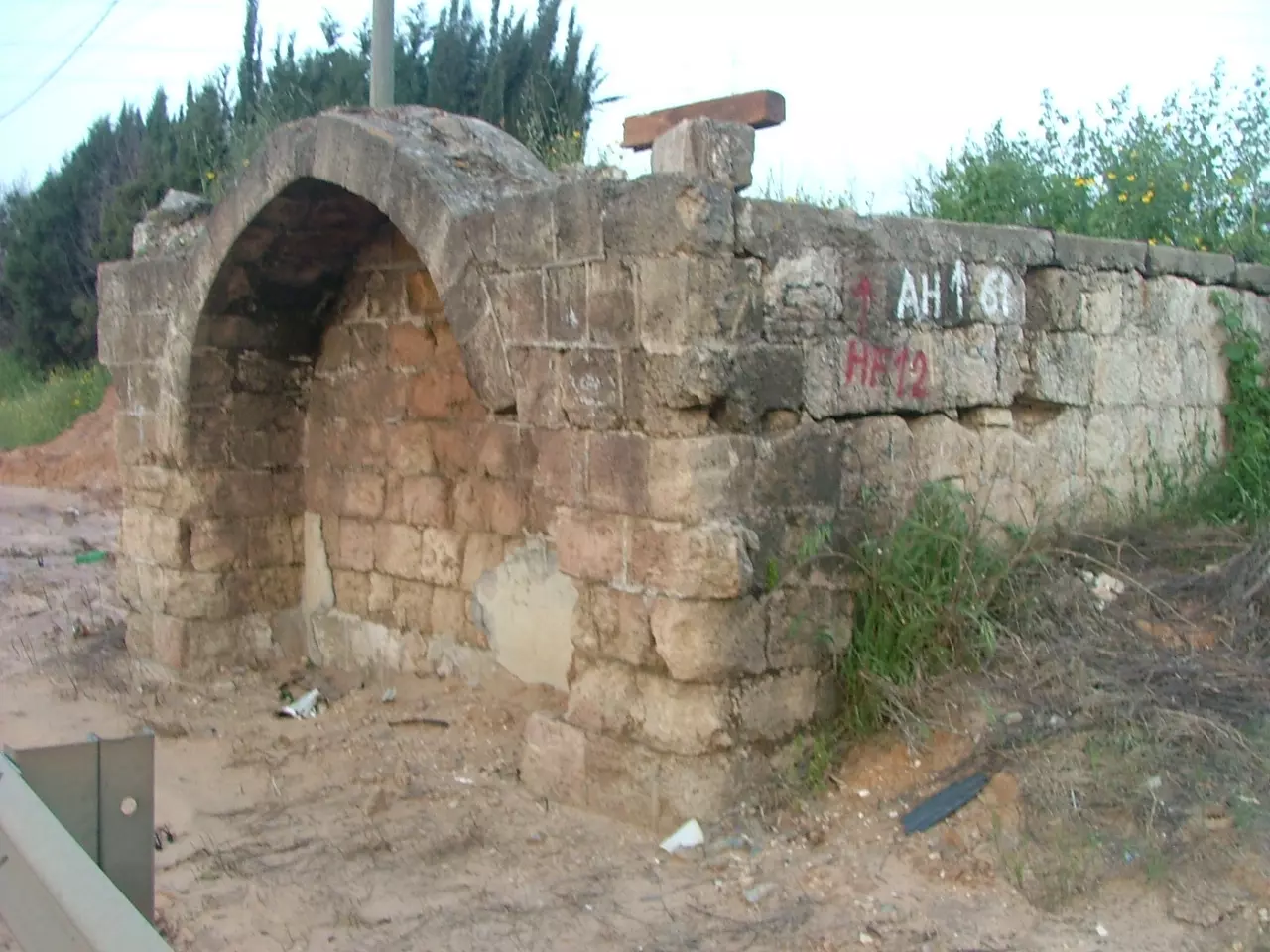
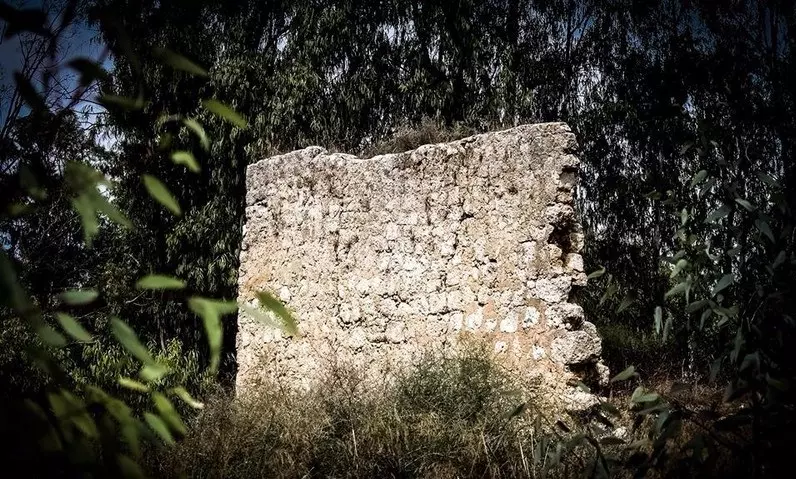
Posted by Karmawi - من الاثار الباقية في مسكة
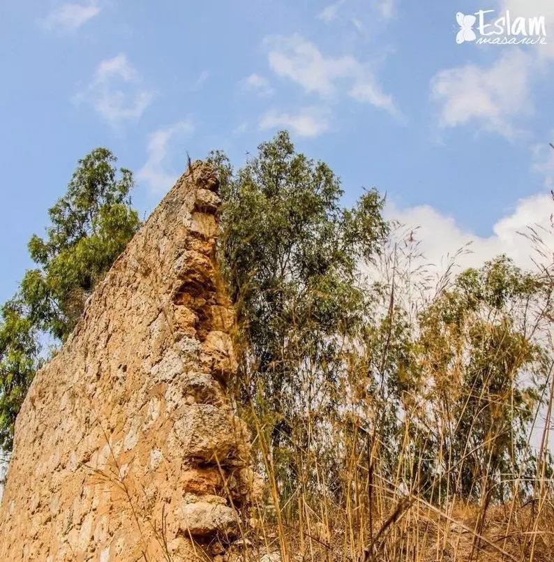
Posted by Karmawi - الانقاض على ارض مسكة
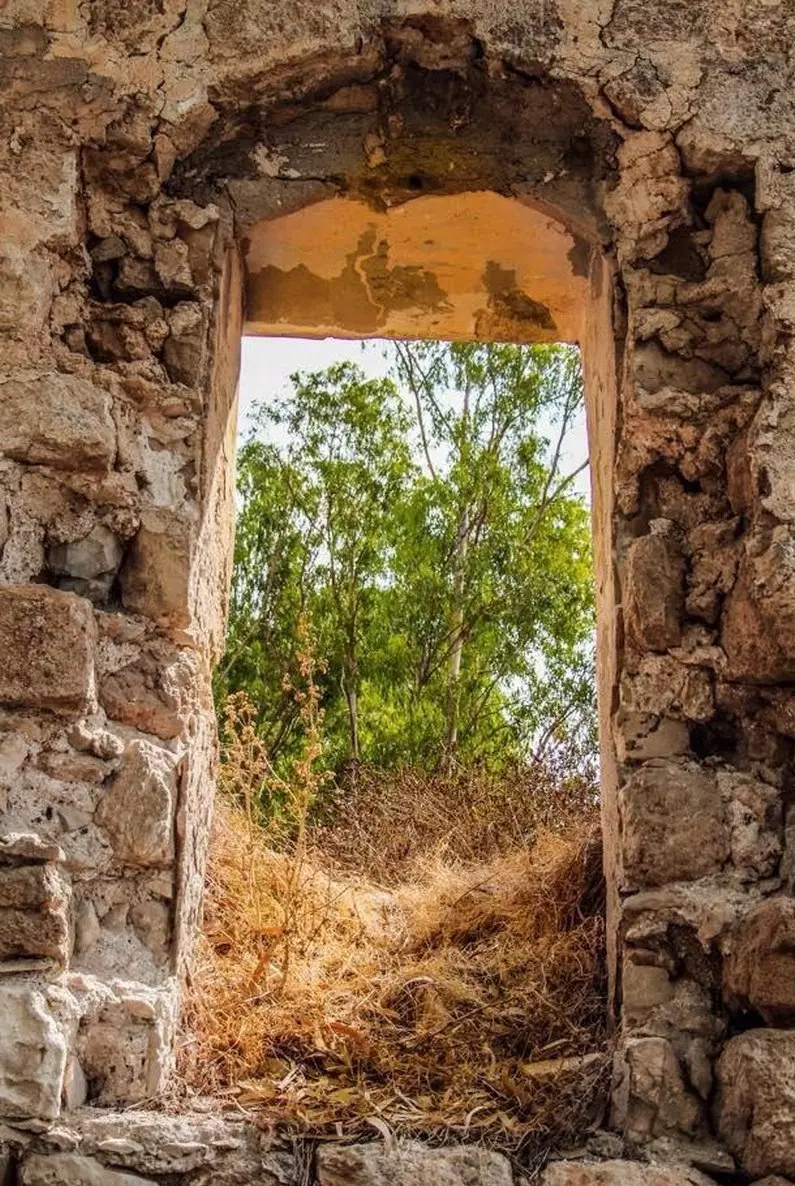
Posted by Karmawi - نافذة في احد المباني الصامدة في مسكة
Posted by Karmawi - الاشجار في مسكة
Posted by Karmawi - الاشجار الشامخة في مسكة
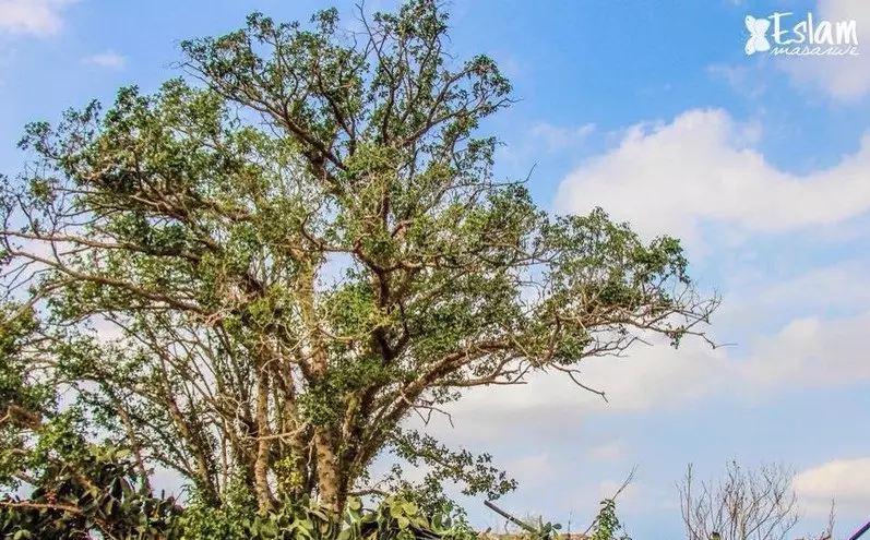
Posted by Karmawi - جمال الطبيعة في مسكة
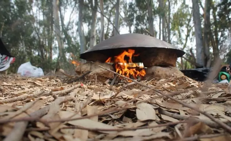
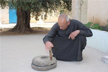
Posted by Karmawi - الخبز على الصاج .. عودة للتاريخ في مسكة
Posted by Karmawi - من الانقاض في مسكة
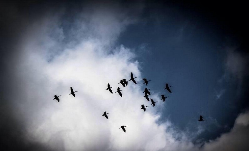
Posted by Karmawi - لا بد للطيور المهاجرة ان تعود .. سرب ديور في سماء مسكة
Posted by Karmawi - الجاج زكريا عبد الرحيم زريقي سكان مسحة من مهجري مسكة
Posted by Karmawi 1 - الحاج حسين عبد الرحيم زريقي سكان مسحة من مهجري مسكة
Posted by Karmawi - الحاج زكريا عبد الرحيم زريقي سكان مسحة من مهجري مسكة

Posted by Karmawi - الاخوين الحاج حسين و زكريا عبد الرحيم زريقي سكان مسحة من مهجري مسكة
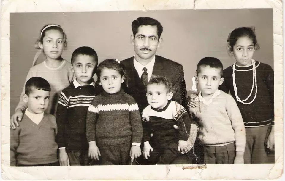
Posted by Karmawi - الحاج عمر محمد عمارة مقيم في مخيم طولكرم من مهجري مسكة
Posted by Karmawi - الحاج عمر محمد عمارة من مهجري مسكة مع ابناءه في العام 1968
Posted by Karmawi - الحاج ابو اسامة حرب من مسكة
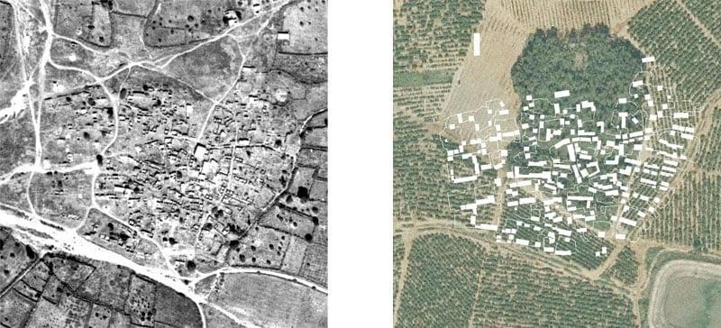
Posted by Karmawi - صورة جوية لمسكة قبل النكبة لعام 1944
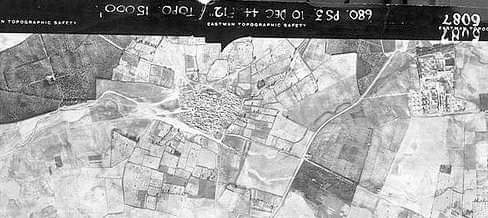
- Pre-Nakba Aerial view of the village / صورة من الجو للقرية اخذت قبل النكبة
- كوشان لارض في قرية مسكة المجرة يعود لقبل النكبة
Want to browse more? 80,000 pictures were grouped in these gallaries:
- map I made that describes the location of each house by owner
Posted by mohammad nadim mohammad mustfa shbeita dehmes 2 - صوره كيف حاول المحتل الصهيوني طمص معالم القريه وتظهرالمقبره بالمثلث الاسود والمدرسه بالداءره البرتقاليه والجامع بلدائره البنيه والبئر بمدخل القريه الشرقي
Posted by mohammad nadim mohammad mustfa shbeita dehmes - قريتنا قبل 1948 صوره حصريا وترقبوا مجسم 3D
Posted by mohammad nadim mohammad mustfa shbeita dehmes - 3D map miske
Posted by mohammad nadim mohammad mustfa shbeita dehmes - صورة جوية لمسكة قبل النكبة لعام 1944
- Pre-Nakba Aerial view of the village / صورة من الجو للقرية اخذت قبل النكبة
| Display Name | Clan/Hamolah | Country of Residence |
| يعقوب يوسف رفيق احمد جاموس | ابو جاموس | - |
| يوسف عمر هاشم جبر | جبر | Bitonya, Bitonya |
| منتصر مسكاوي | حرب | قلقيلية |
| مأمون نواس | نواس | السعودية, السعودية |
| Miskawy | - | Copenhagen, Denmark |
| BASEL | AL-BALLAS | DANMARK, DANMARK |
| ثائر | الفول | الاردن, الاردن |
| نهى ابراهيم عبدالعزيز ابوطاحون | ابوطاحون | عمان, الاردن |
| Mohammad Yousef | AL-Yousef | - |
| نور المسكاوي | سعيد | dubai, united arab emirates |
| ابو يوسف | جبر | صلالة, عمان |
| Eng.Hisham Tahir Hussien Hassan Mohammad Al Faqeeh Al Zuhd | Al Zuhd | Amman, Jordan |
| عمر | - | - |
| زكريا | ابوطاحون | - |
| osama alzuhd | alzuhd | - |
| Eyad Yousef | اليوسف | KSA, KSA |
| Mohammed Alsaleh | الصالح | Jeddah, Saudi Arabia |
| Khader Al-Khattari | Al-Khattari | Texas, U.S.A |
| wael tahoun | abu tahoun | west bank, palestine |
| mazen_ballas | meskh | Riyadh, Riyadh |
| Amjad Shbita | - | - |
| ابوسعد | harb | - |
| Tayeb Alzuhd | Alzuhd | michigan, USA |
| wafi shbeita | - | tira |
| mohammad nadim mohammad mustfa shbeita dehmes | shbieta | tira, Istrael |
| haytham hamad | hamad | palestine , palestine |
| Serhan Shbieta | - | - |
| meskawi | hamad | nablus / balata camp, palestian |
| Nasser Hamad | hamad | Japan |
| shbetaK | shbeta | Poland, Poland |
| abu jamil | shbeta | germany, germany |
| shbeta-akfa | حموله شبيطه | austria, austria |
- زيارة ميدانية للقرية والاطلاع على اثار وجودها وحياة سكانها واعادة سرد تاريخها Duration: 10 min 2 sec
- Tracing All That Remains of Miska Since Nakba Duration: 9 min 47 sec
- March from Tira to Miske - مسيرة حق العودة التي خرجت من طيرة بني صعب مشيا الي مسكة - 2010 Duration: 7 min 15 sec
- الآلاف من عرب ال 48 في مسيرة العودة الى قرية مِسْكة 2010 Duration: 7 min 18 sec
- نكبتي فيلم قصير يحكي قصة اهل مسكة ونكبتهم
- الحاجة صفية شبيطة من الطيرة مهجرة من مسكة
- أهازيج العودة الى مسكة من عائلة شبيطة في الطيرة
- بيارة ناصر الناصر في محيط بلدة مسكة المهجرة. البايكة وغرف السكن والساحة ومصاطب النوم. واذا هذا ما كانت عليه الببارة فكيف كانت البلدة؟ Duration: 2 min 42 sec
- في محيط قرية مسكة المهجرة - قضاء طولكرم Duration: min 2 sec
- العودة إلى مسكة: مشوار خاص بمناسبة يوم النكبة 2022. الطريق الى القرية واللقاء مع أبنائها من الجيل القديم والجديد من أبناء ال شبيطة. ذكريات من أيام البلاد وتاريخ وعبرة خالدة: الكبار حقًَا سيموتون ولكن الصغار لن ينسوا ابدًا Duration: 15 min 2 sec
 Fake Valor: Why Did Zionist Jews Hoist Nazis Flag on Their Ships in the 1930s?
What is new?
-
Facts About Oct. 7th Gaza Raid
-
Remined Us Please:: Who Did Rape Who? Palestinians Raped Israelis? Or, was the other way around?
-
When Prof. Edward Said was invited to debate Bibi Netanyahu in the 1980s, watch what happened!
-
Ezra Klein of the NY Times on the "Jewish Race".
-
Abusing Blood Libel!
-
Zionist FAQ: Isn't it true that Palestinians don't want peace? Palestinians never accepted the two-state solution
- Facts about Haavara (Transfer) Agreement between Ben-Gurion & Hitler
-
Haavara FAQs: Why Did Zionist Jews Hoist Nazis' Flags on Their Ships in the 1930s?
-
Dear ChatGPT: Why did the Jewish Agency suppress news of the Holocaust during WWII?
-
Video Playlist: Jews share their DNA tests to end the conflict for good.
-
A Tale of Two Conflicts: Examining the Definition of Genocide
-
Prof. Abraham Polak And The Suppressed History of the Khazars and European Jewry
-
How Ronald Reagan would have framed the genocide in Gaza if he were still alive?
-
Haavara FAQs: Let us do the math: how many German Jews did The Haavara Agreement save?
-
Zionist FAQs: The Hebron Massacre of 1929, "clearly proves" that Palestinians are antisemitic, how could you deny it?
-
Zionist FAQs: Why Anti-Zionist Is Not Antisemitism?
-
Zionist FAQs: Isn't it true that the KGB create Palestinian Nationalism in the early 1960s?
- Zionist FAQs: Muslims are killing Muslims all the time; why are Israeli Jews being singled out in the media?
- Zionist FAQs: How is Israel an apartheid state when 20% of its citizens are Arabs who enjoy full rights?
-
Haavara FAQs: Analysis of Herzl's Uganda Scheme and how it could have saved millions of Jews.
-
Haavara FAQs: Why did Hayim Greenberg describe American Jewry as "morally bankrupt" in early 1943?
-
Haavara FAQs: What if the Evian Conference was a resounding success? What would have been the impact of saving European Jewry on Zionism?
- Haavara FAQs: What if the six million were saved, how that would have impacted the Zionist project?
-
Haavara FAQs: How did Zionist leaders react when Europe's Jews lingered in the DP camps after WWII ended?
-
Why does the American Jewish community repeat lies that David Ben-Gurion had debunked before he died?
-
Who has the power to rename the Tatar/Khazar Gene Marker to Jewish IV?
-
Zionist FAQs: Why won't Egypt, Syria, and Jordan take their people back? Jews are indigenous to Palestine, and Arabs immigrated after Jews developed the country. Arabs should leave.
-
Haavara FAQs: Did Hitler and the Nazis conflate between Judaism and Zionist? If that wasn't case, then why?
-
Haavara FAQs: Winston Churchill and antisemitism, a collection of articles written Churchill.
-
Haavara FAQs: Broken by country, how many Jews survived vs. killed during the Holocaust?
-
Haavara FAQs: Why did European Jews vote with their feet and to immigrated to the Americas, not Palestine, after WWII?
-
Watch this American Jewish Girl describing Israeli Jews' cognitive dissonance like no other in under two minutes
-
Haavara FAQs: When the Nazis went out of their way to hide the Holocaust, Israeli Jews did the exact opposite by broadcasting their genocide of Gazans. But why?
-
Haavara FAQs: How Zionist Jews went out of their to show their appreciation to Nazism and Fascism?
- Haavara FAQs: Why Zionist leaders were against bombing the death camps & the Railroads leading to them?
-
Haavara FAQs: Hitler's message to the British and American people: If Jews are such noble citizens and you care about them, how come you're not letting them in? I will gladly ship them to you at my expense, even on luxury liners!
-
A shortlist of Zionist and Israeli false flag operations in the name Jews.
-
The Most Moral Army
- The Land of Kapos (Israel): Where the brave are boycotted and Kapos walk free.
- Why did early Zionists often named their communal enterprises "colonial"?
- Zionist Relations with Nazi Germany by Faris Glubb
-
Two NY Times advertisements by Zionists in the early 1943 that exposes Zionists' treason at the height of the calamity
- Facts Not Lies about the Palestinian-Israeli Conflict.
- Site's pictures have been categorized
- Campgain Against Lice
- A Survey of Palestine, the official source about Palestine before Nakba produced by the British Mandate; over 1200 pages.
- Satellite View & Google Earth: Over 6,000 placemarks identifying all destroyed towns, W. Bank & Gaza Strip Towns, & refugee camps.
- PalestineRemembered.com and its Nakba Oral History Project were featured on al-Jazeera Satellite TV.
- Nakba Oral History Video Podcast:
 Over 700 Oral History interviews (including 3,500+ hours of recording) can be viewed online.
 - Palestine Village Statistics Project
- Gaza Jail Break
- النسخة العربية للموقع الان متوفرة
- Videos: Documenting the destroyed villages in video: Tracing all that remains since Nakba.
- Videos: Responding to Zionist Propaganda
- Interview: The ethnic cleansing of Palestine: George Galloway interviews Israeli Historian Ilan Pappe.
- For Palestinians, memory matters. It provides a blueprint for their future By George Bisharat.
- Zionist FAQ now available in Hebrew שאלות שציונים שואלים, עכשיו בעברית
- Video: The Stephen Walt and John Mearsheimer report on the influence of the Israel Lobby on U.S. Foreign Policy
- The Palestinian-Israeli conflict for beginners
