| PalestineRemembered | About Us | Oral History | العربية | |
| Pictures | Zionist FAQs | Haavara | Maps | |
| Search |
| Camps |
| Districts |
| Acre |
| Baysan |
| Beersheba |
| Bethlehem |
| Gaza |
| Haifa |
| Hebron |
| Jaffa |
| Jericho |
| Jerusalem |
| Jinin |
| Nablus |
| Nazareth |
| Ramallah |
| al-Ramla |
| Safad |
| Tiberias |
| Tulkarm |
| Donate |
| Contact |
| Profile |
| Videos |
Welcome To al-Qubayba - القبيبة (אל-קביבה)
|
District of Hebron
Ethnically cleansed days ago |
العربية Google Earth |
 |
Gallery (61) |
- Statistics & Facts
-
Before & After

- Satellite View
- Articles 6
- Pictures 61
- Aerial Views 2
- Oral History 2
- Members 41
- All That Remains
- Wikipedia
- Videos 2
- Guest Book 13
- Links
| Statistic & Fact | Value | ||||||||||||||
| Occupation Date | October 28, 1948 | ||||||||||||||
| Distance From District | 24 (km) Northwest of Hebron | ||||||||||||||
| Elevation | 250 (meters) | ||||||||||||||
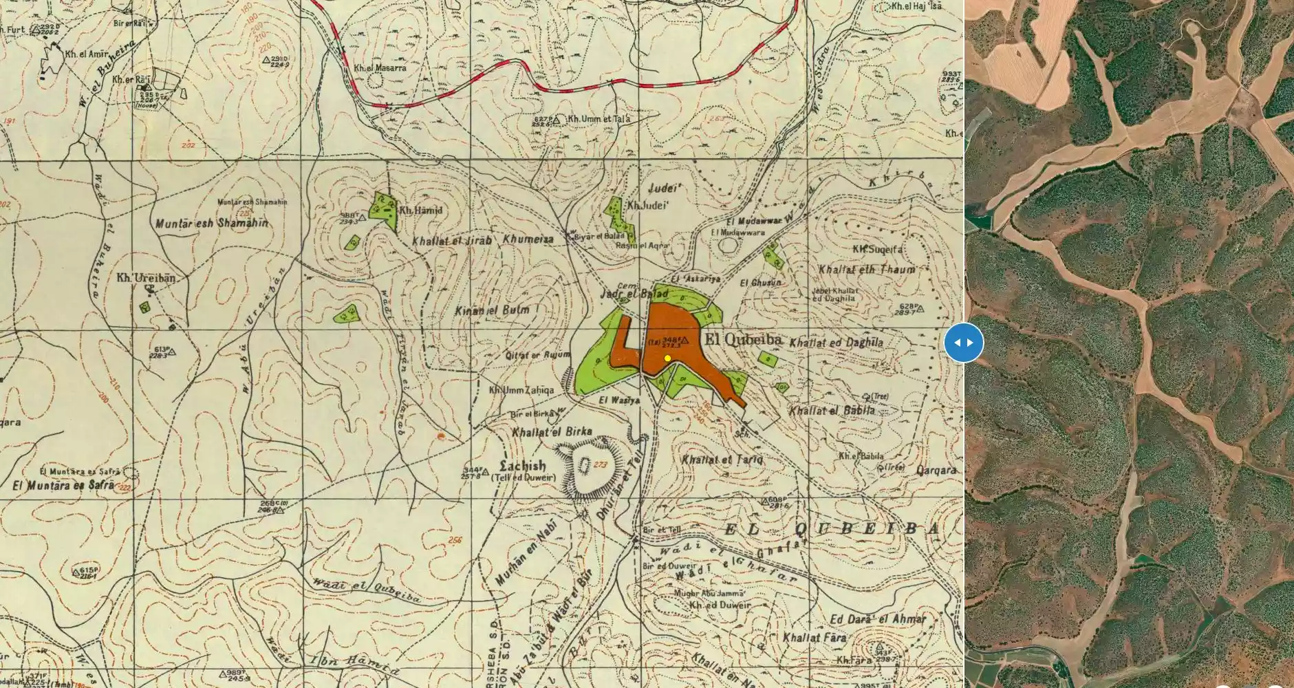
| Before & After Nakba, Click Map For Details |
|||||||||||||||
|
|||||||||||||||
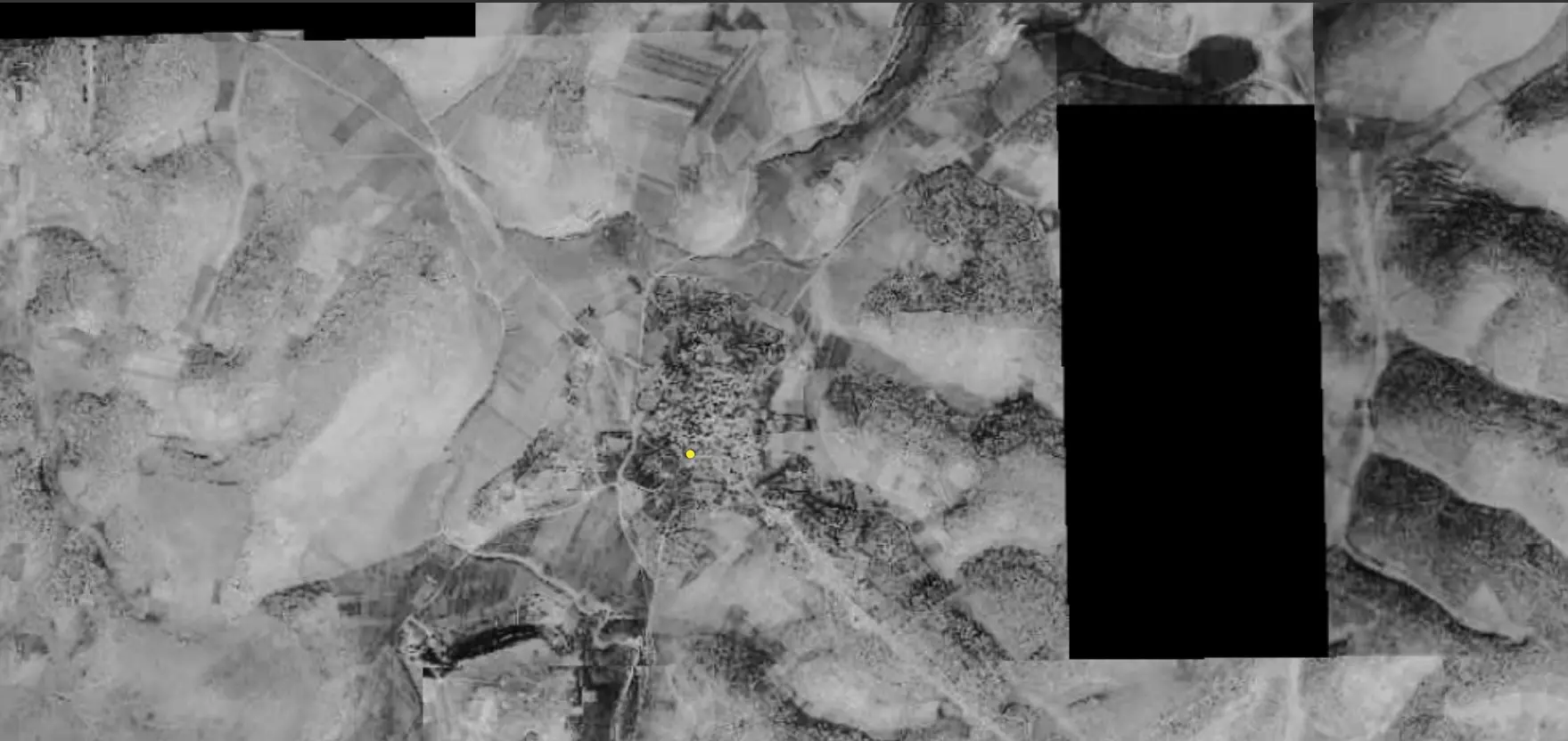
| Pre-Nakba Aerial View |
|||||||||||||||
|
|||||||||||||||
| Map Location | See location #15 on the map View from satellite |
||||||||||||||
| Military Operation | Third stage of Operation Yo'av | ||||||||||||||
| Defenders | Egyptian Army | ||||||||||||||
| Acts of Terror | Thirty five people, including women and children, were massacred in the al-Dawayima caves few days after village occupation. | ||||||||||||||
| Exodus Cause | Military assault by Zionist troops | ||||||||||||||
| Village Temains | The village was completely defaced | ||||||||||||||
| Ethnically Cleansing | Some refugees were sheltered in al-Dawayima's caves, and some of them were killed during the al-Dawayima's massacre. | ||||||||||||||
| Pre-Nakba Land Ownership |
**Town Lands' Demarcation Maps |
||||||||||||||
| Land Usage As of 1945 |
|
||||||||||||||
| Population |
|
||||||||||||||
| Number of Houses |
|
||||||||||||||
| Near By Towns |
|||||||||||||||
|
|||||||||||||||
| Town's Name Through History | The Crusader referred to al-Qubayba by Deirelcobebe. | ||||||||||||||
| Schools | One elementary school | ||||||||||||||
| Places of Warship | One Mosque | ||||||||||||||
| Nearby Wadies & Rivers | Wadi Ghufr overlooked the village. | ||||||||||||||
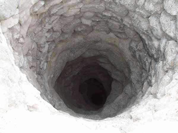
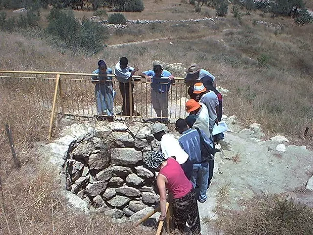
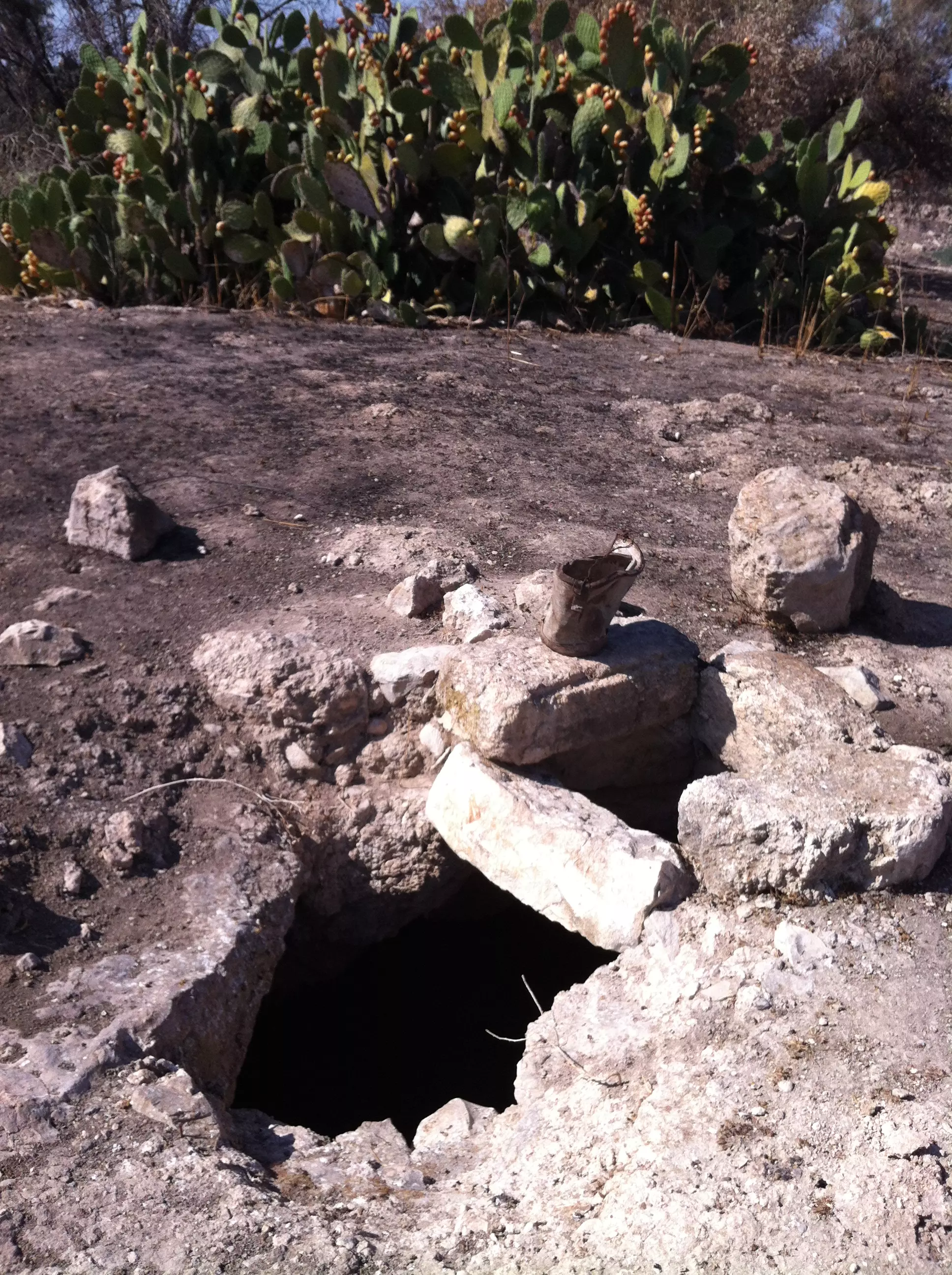
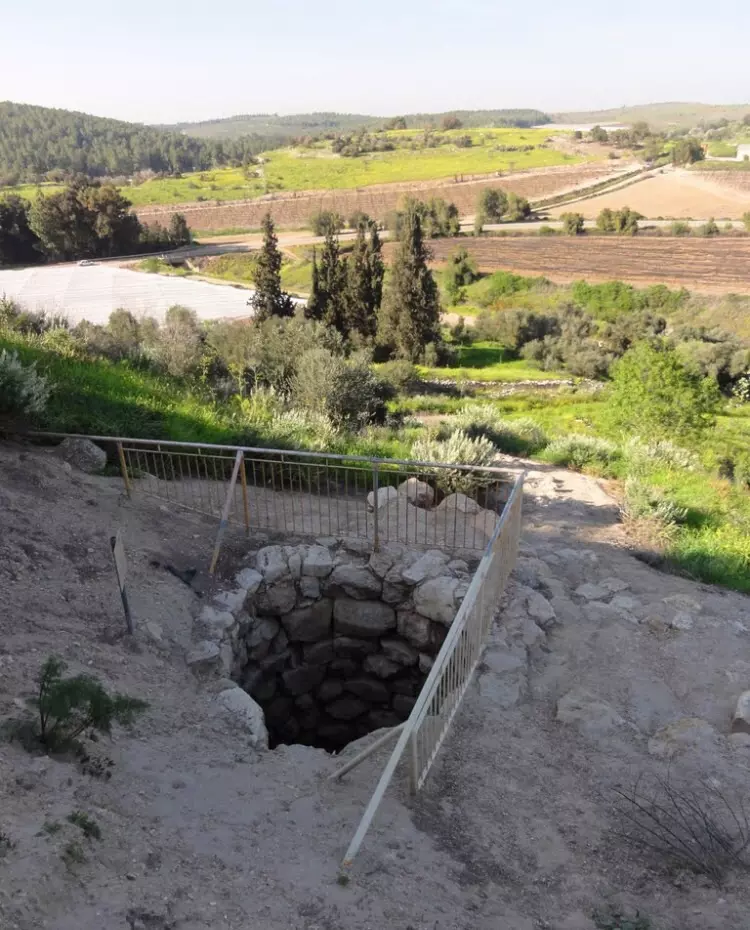
| Water Supply | The village had two wells located to the northwest and the southwest, which used to provide al-Qubayba with its drinking water nneds. | ||||||||||||||
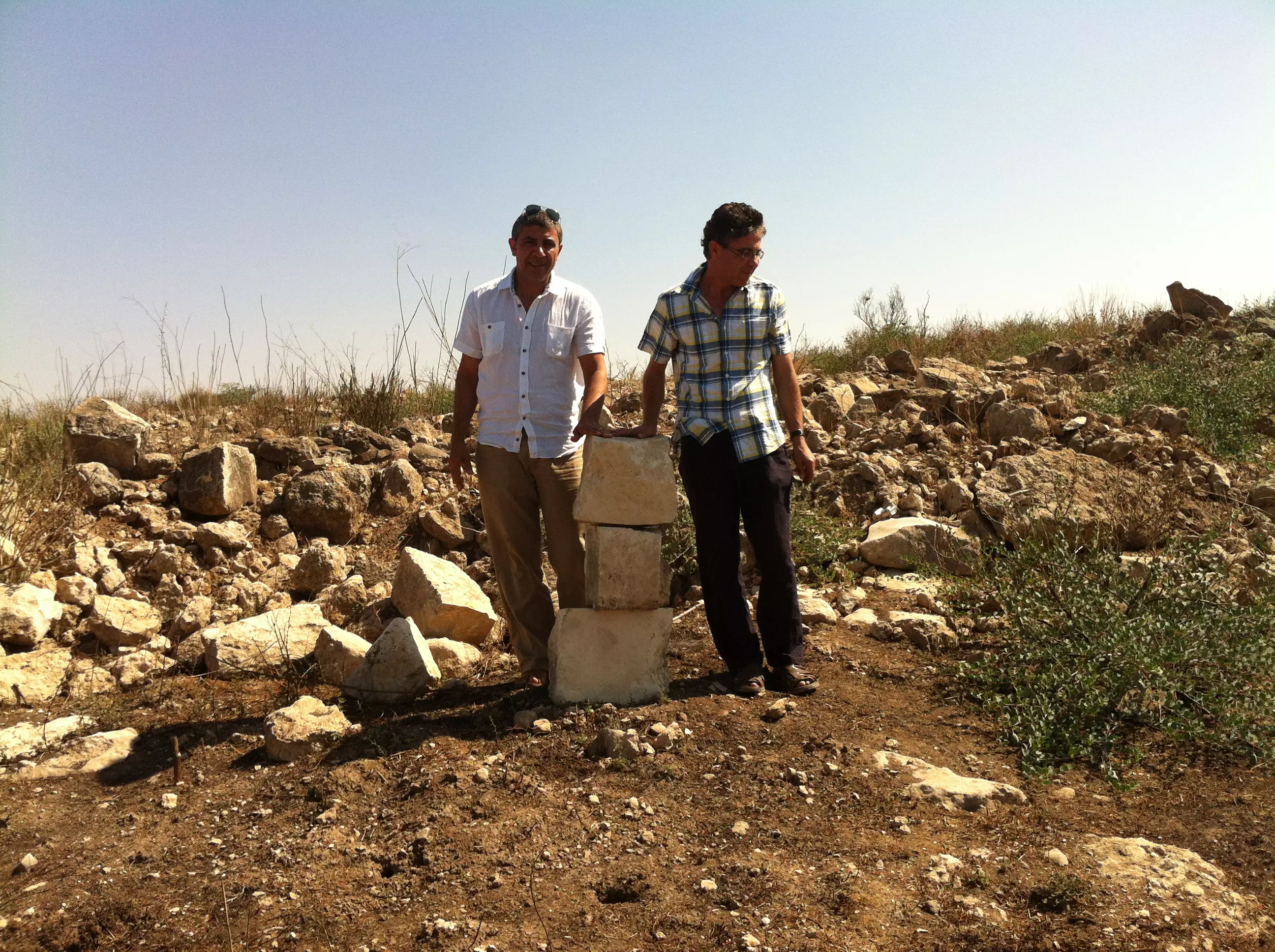
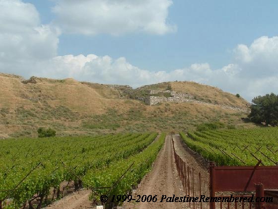
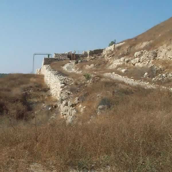
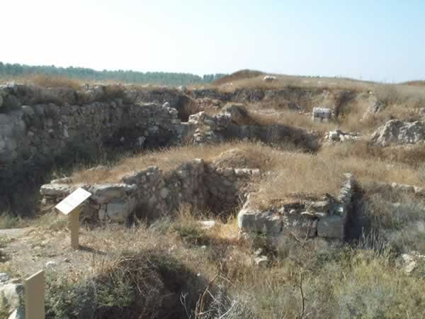
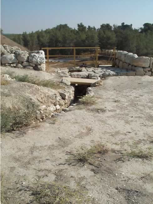
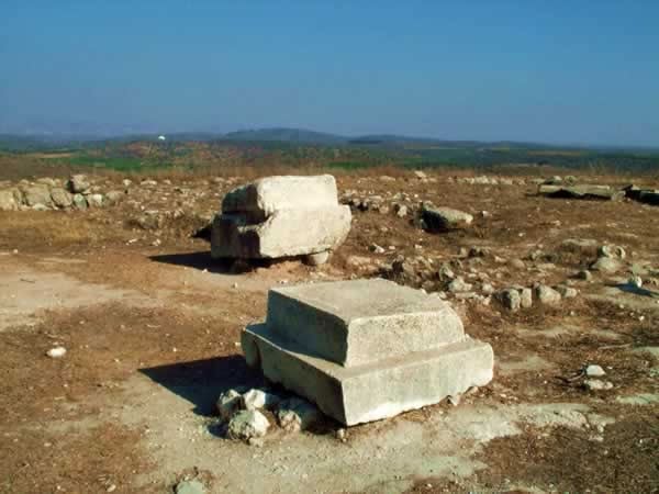
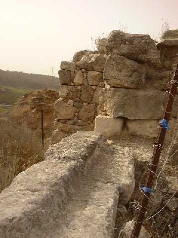
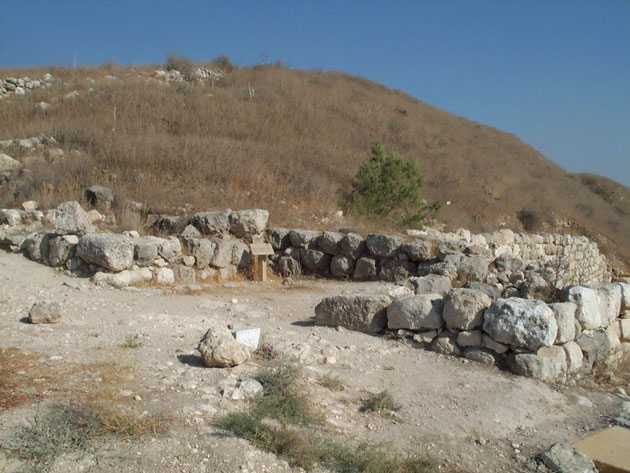
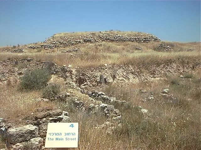
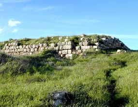
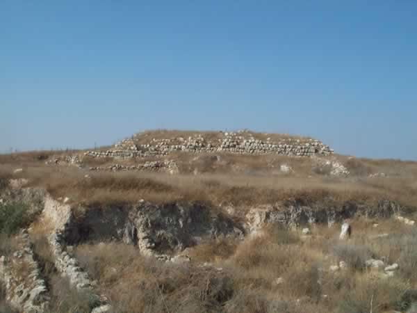
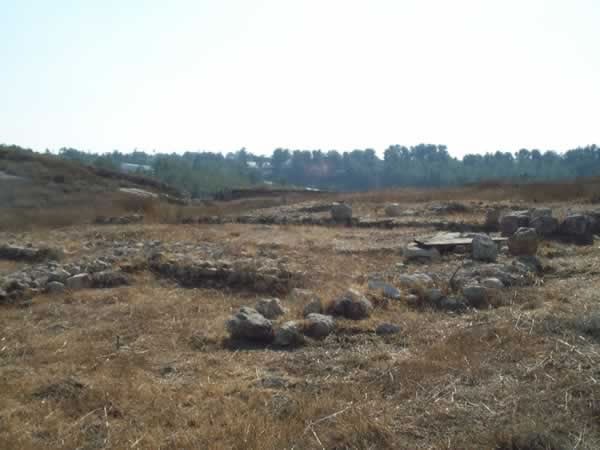
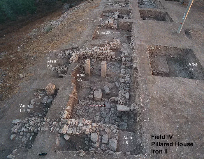
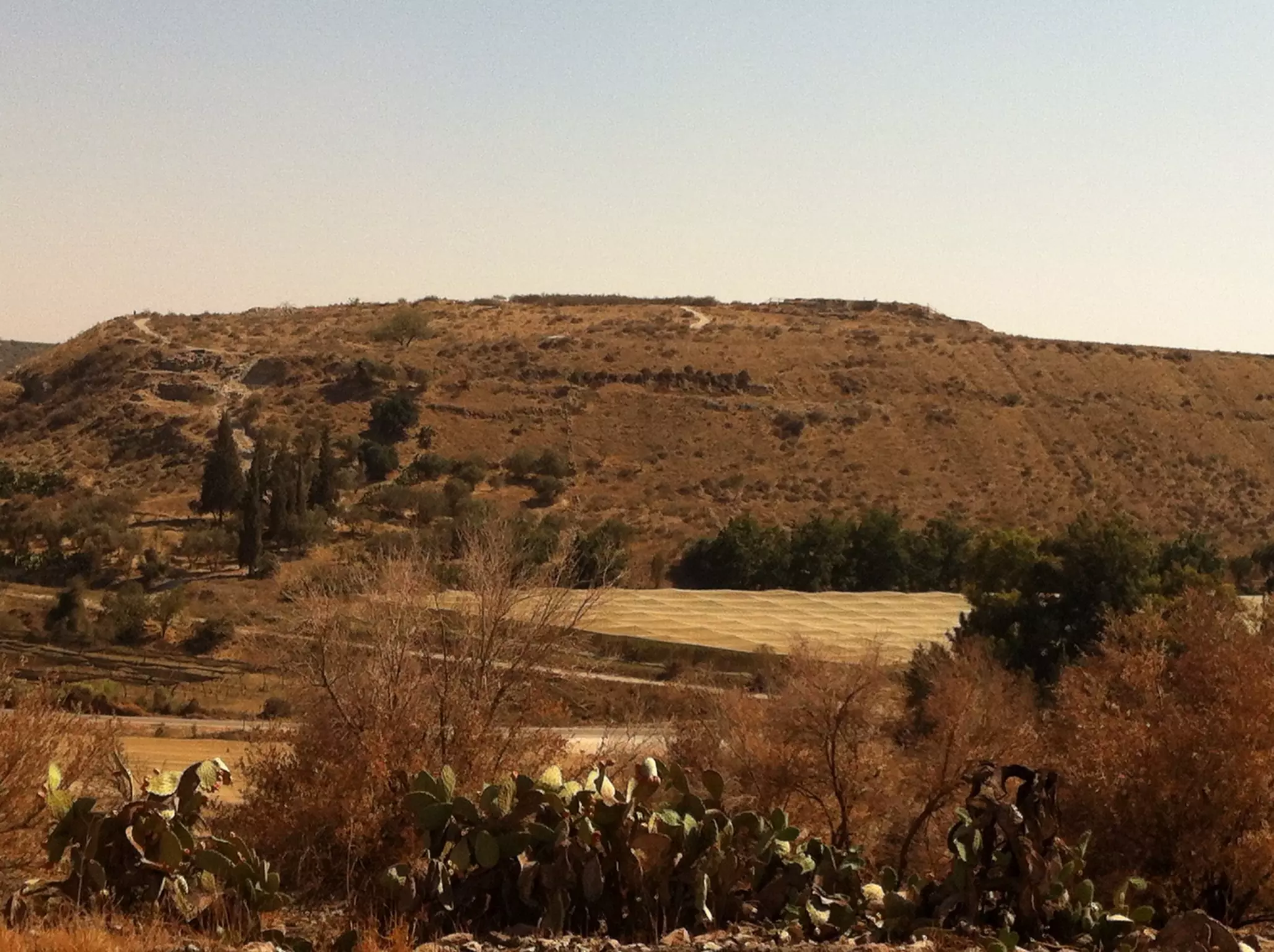
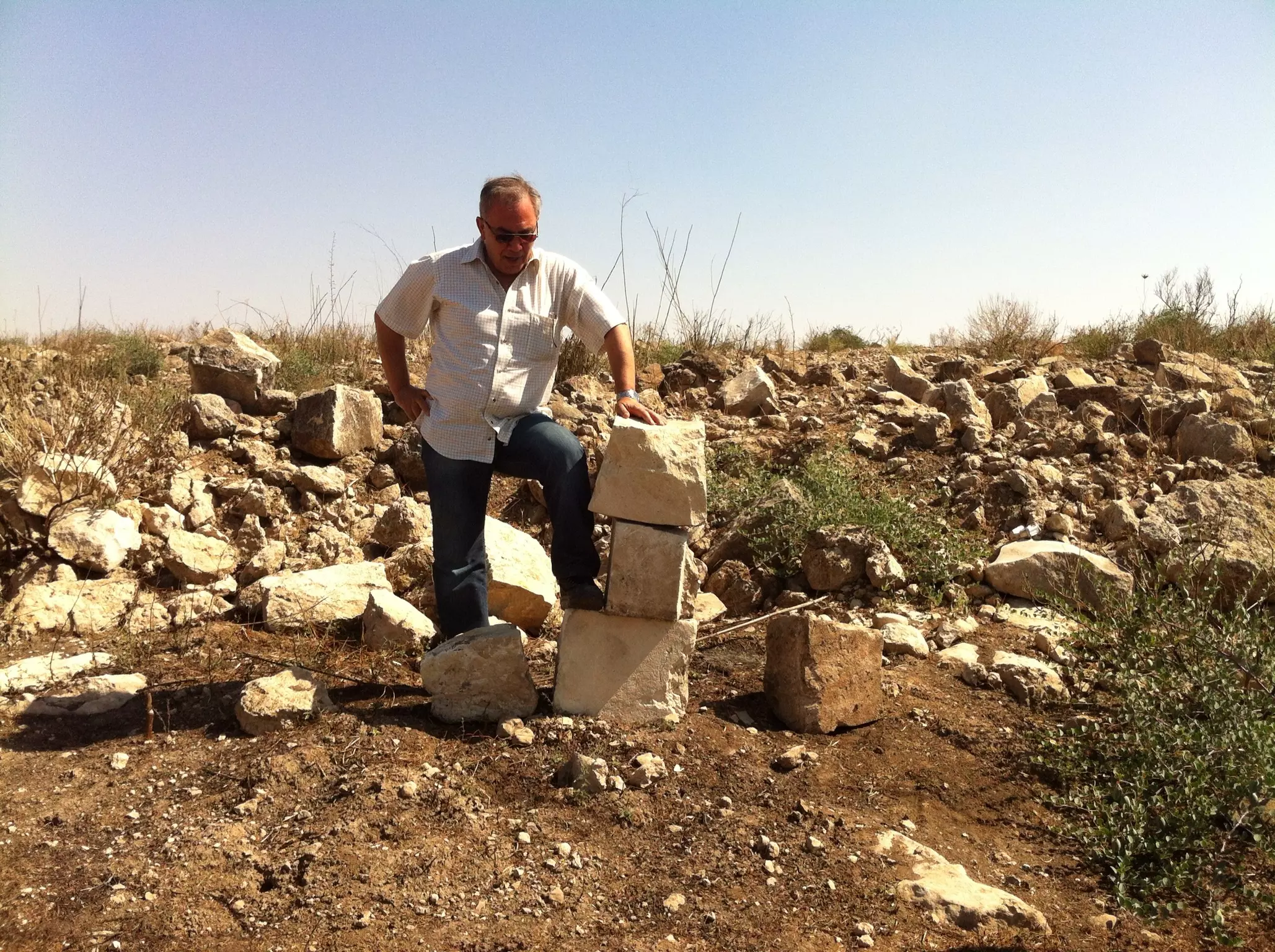
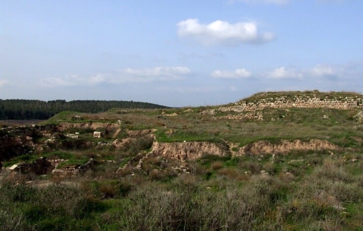
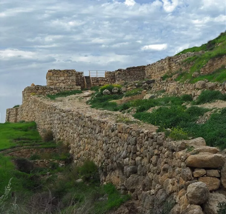
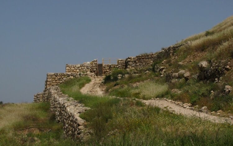
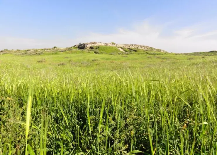
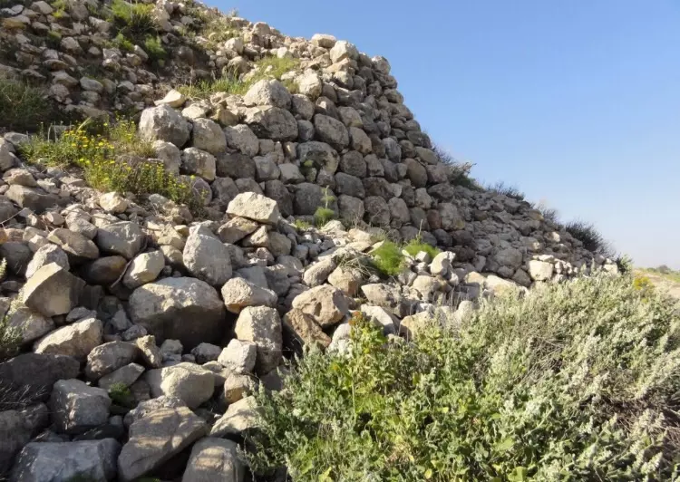
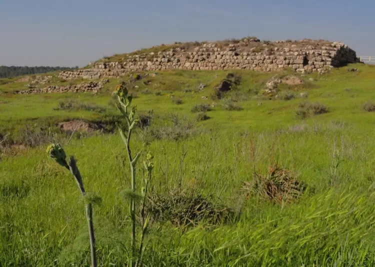
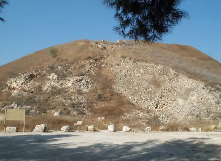
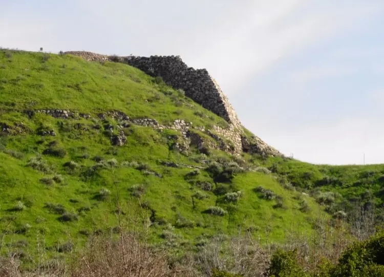
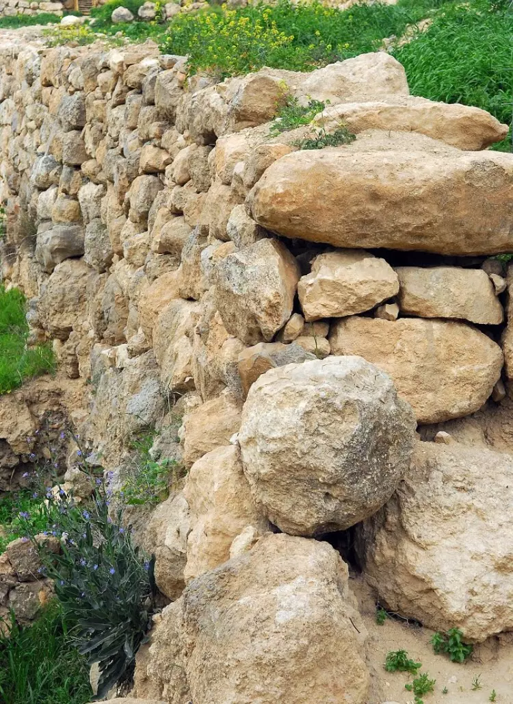
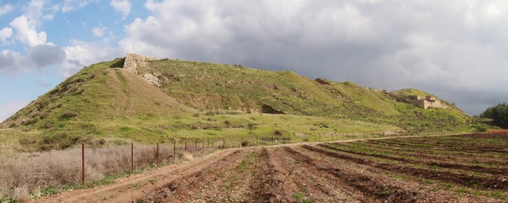
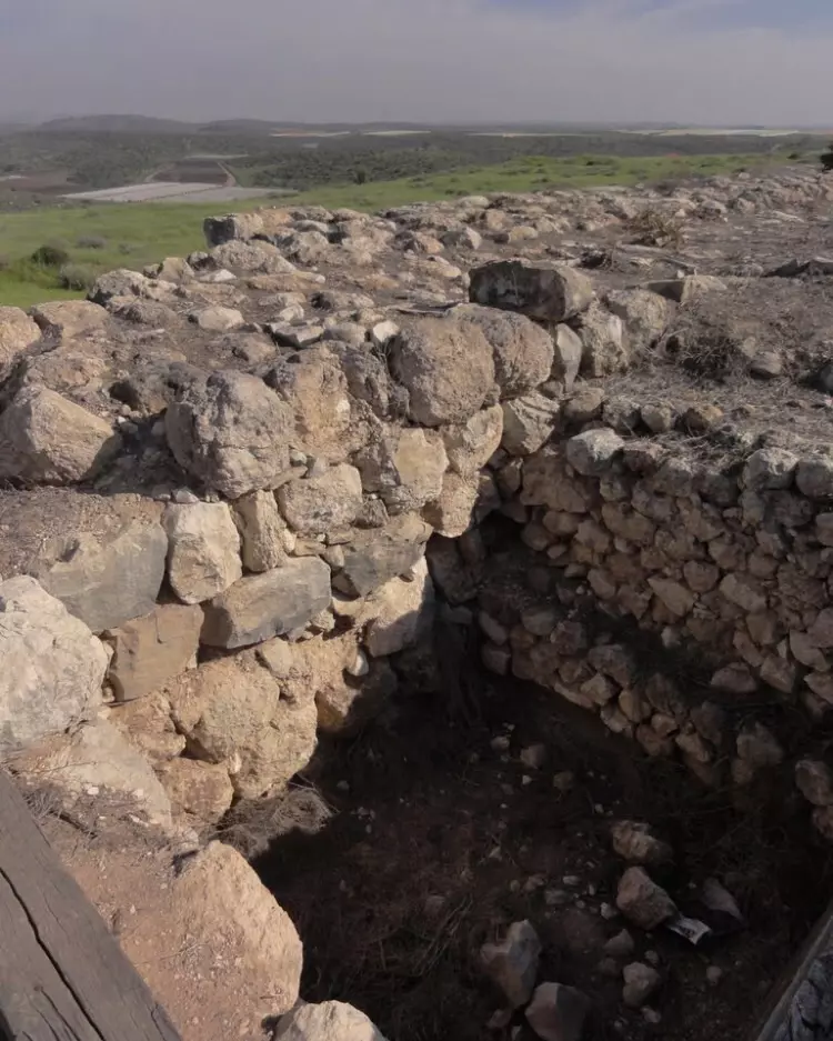
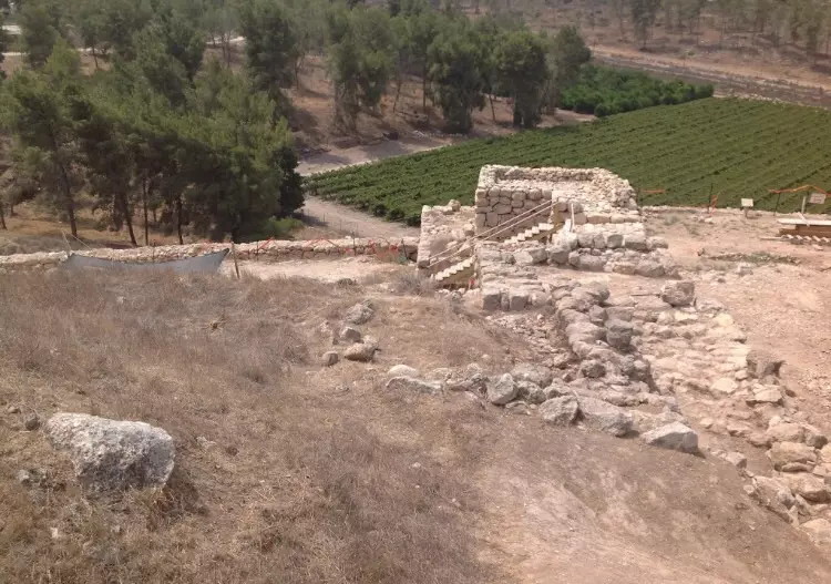
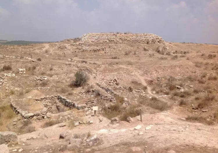
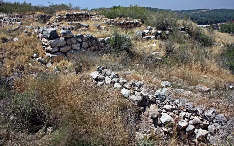
| Archeological Sites | al-Qubayba has an important archeological site known by Tall al-Duwayr (anceint Lachish) which was excavated several times by the British Mandate and Israeli authorities. | ||||||||||||||
| Exculsive Jewish Colonies Who Usurped Village Lands |
Lakhish | ||||||||||||||
| Featured Video | |||||||||||||||
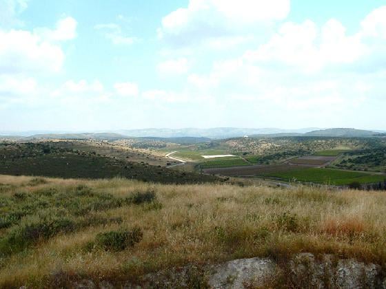
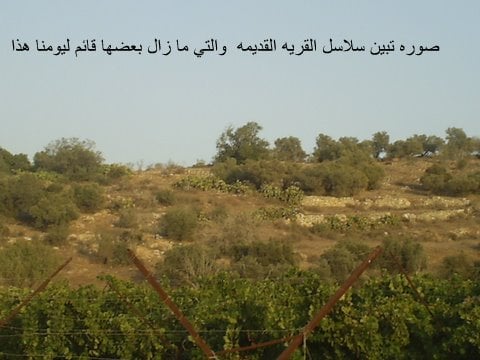
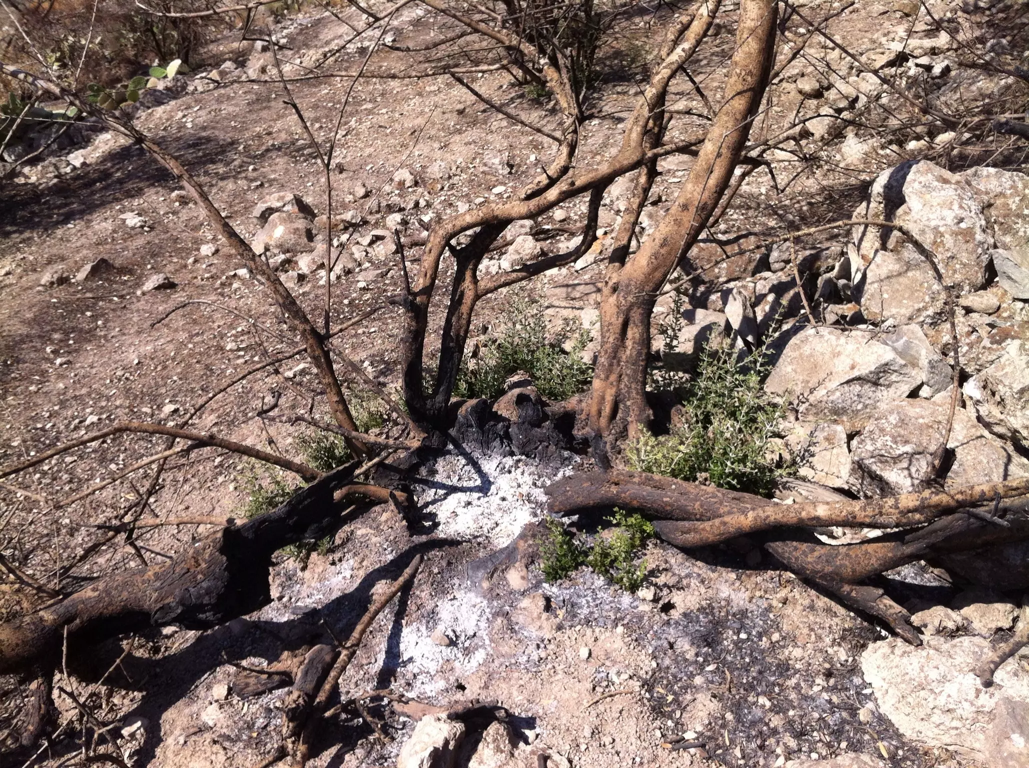
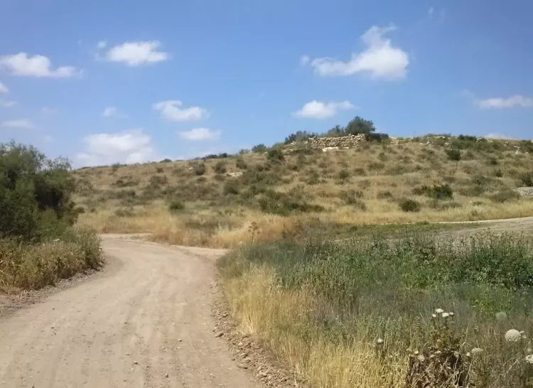
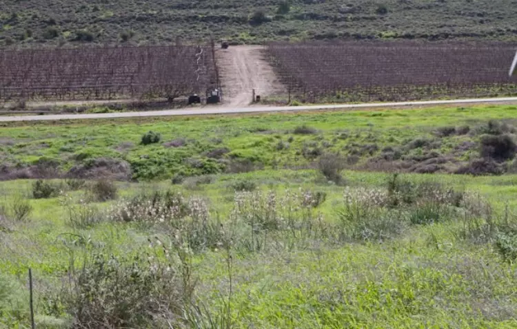
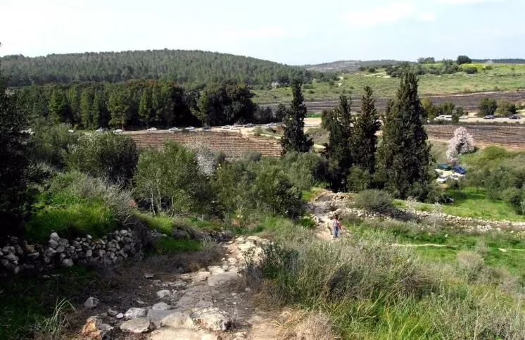
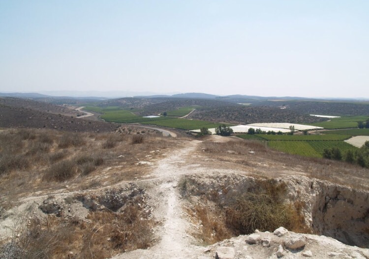
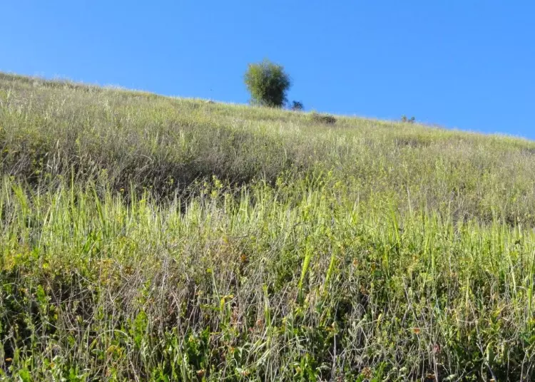
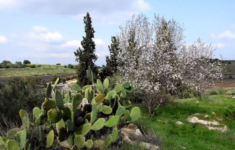
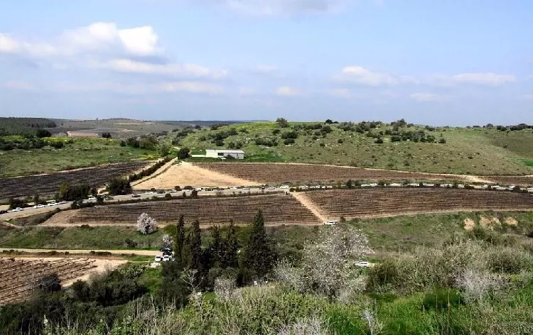
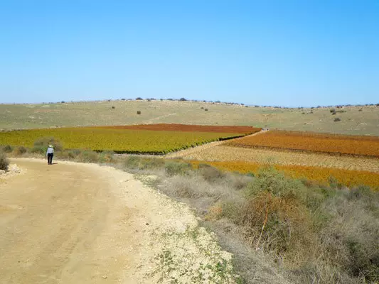
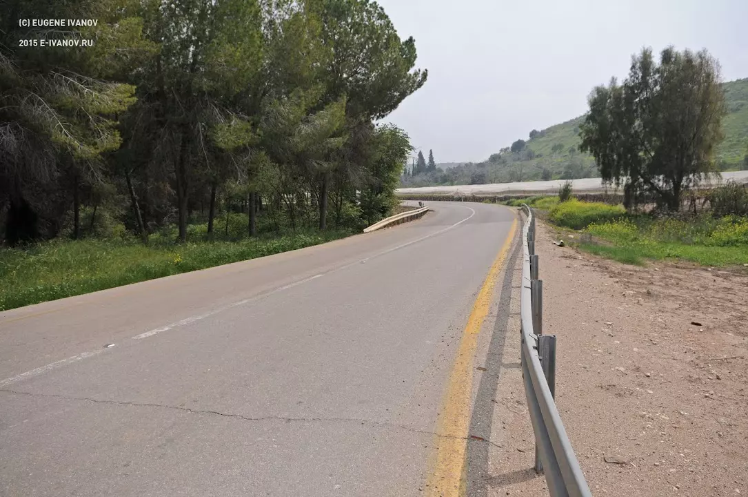
Village Before NakbaThe village stood on a hilltop in the western foothills of the Hebron Mountains Wadi Ghufr ran along the western foot of the hill. It was linked by a secondary road to the Hebron-Bayt Jibrin-al-Majdal highway that passed to the northwest, and by other roads to adjacent villages. AI-Qubayba is identified with Deirelcobebe, a village during the Crusader period. In 1596 al-Qubayba was a village in the nahiya of Gaza (liwa' of Gaza), with a population of 182. It paid taxes on wheat, barley, sesame, fruit trees, goats, and beehives. In the late nineteenth century, al-Qubayba, a large village built of adobe bricks, was situated on rolling hills near a plain, surrounded by a barren and stony area. Its population consisted of Muslims. AI-Qubayba's houses were constructed of stone and mud and were set along narrow streets radiating from the center. The village had a school, a mosque, and a number of small shops. Two wells located northwest and southwest of it provided drinking water. In 1944/45 a total of 8,109 dunums was allotted to cereals.Tall al-Duwayr , the site of the ancient town of Lachish, was next to the village, to the southwest. This town was sacked and rebuilt a number of times throughout its long history. Tall al-Duwayr was excavated by the British from 1932 to 1938 and by Israeli archaeologists in 1966 to 1968 and from 1973 to 1985. It is a large site occupied intermittently from the Chalcolithic period (fifth millenium B.C.) to the Persian period (end of the fourth century B.C.). The Canaanite city of Lachish was mentioned in the al-Amarna letters (dating from the fourteenth century B.C.). The area surrounding al-Qubayba was rich in evidence of earlier settlement; in addition to Tall al-Duwayr and the village site itself, there were at least fifteen archaeological sites on the 12,000 dunums of land that belonged to the village. Village Occupation and Ethnic CleaningIn the third stage of Operation Yoav , the successes of the previous stages were used to occupy more territory. AI-Qubayba was captured around the same time as the massacre in nearby al-Dawayima, on 28 October 1948, probably by units of the Giv'ati or Har'el Brigades. No details are given about the fate of the villagers, but Israeli historian Benny Morris speaks of a 'panic flight' from al-Qubayba around the time of its occupation. No reason is given for the 'panic,' but it is unlikely that news of the al-Dawayima massacre would have reached al-Qubayba the same day. Morris also attributes the village's depopulation to the military assault on it.Zionists Colonies on Village LandsThe settlement of Lakhish was established to the southwest of the site on village lands in 1955.Village TodayThe site is marked only by cactuses and a handful of olive trees. A neglected olive grove with its stone terraces still intact has been surrounded by fences.SourceDr. Walid al-Khalidi, 1992: All That Remains. |
|||||||||||||||
| Related Maps | Town Lands' Demarcation Maps خرائط للقضاء توضح حدود القرى والاودية Town's map on MapQuest View from satellite Help us map this town at WikiMapia |
||||||||||||||
| Related Links | Wikipedia's Page Google Search Google For Images Google For Videos |
||||||||||||||
| More Information | في كتاب كي لا ننسى في كتاب بلادنا فلسطين المزيد من موقع هوية |
||||||||||||||
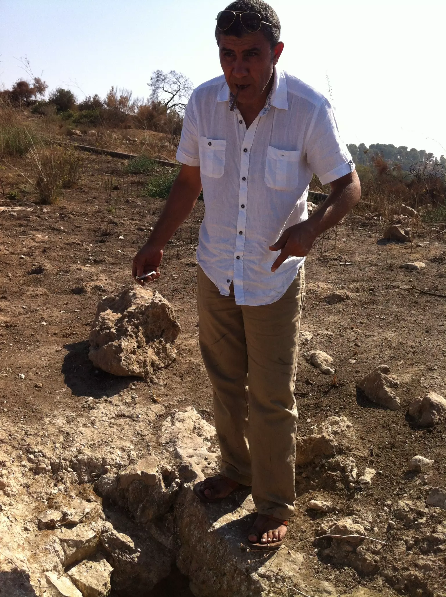
- بقايا القريه والاثار
Posted by Ahmad Abu-Awwad 15 - القريه وآثارها
Posted by Ahmad Abu-Awwad 1 - الآثار#1
Posted by Ahmad Abu-Awwad - الآثار#2
Posted by Ahmad Abu-Awwad 1 - الآثار#3
Posted by Ahmad Abu-Awwad 1 - الآثار#4
Posted by Ahmad Abu-Awwad 1 - الآثار#5
Posted by Ahmad Abu-Awwad 1 - الآثار#6

Posted by Ahmad Abu-Awwad 1 - بير القبيبة
Posted by Khaldoun Khaled Abu Awwad 3 - اثار القبيبة
Posted by Khaldoun Khaled Abu Awwad 7 - اثار القبيبة
Posted by Khaldoun Khaled Abu Awwad 2 - اثار البلدة
Posted by Khaldoun Khaled Abu Awwad 1 - اثار البلدة
Posted by Khaldoun Khaled Abu Awwad 1 - اثار البلدة
Posted by Khaldoun Khaled Abu Awwad 1 - أنقاض القرية
Posted by Khaldoun Khaled Abu Awwad 2 - انقاض القرية المتبقية
Posted by Khaldoun Khaled Abu Awwad 2 - صور سلاسل البلده القديمه
Posted by tareqkhader - من القريه
Posted by وائل فياض 2 - زيارة القبية august 2013
Posted by Khaled Nabhan 2 - زيارة القبيبة 2013 august
Posted by Khaled Nabhan 1 - زيارة القبيبة ، الشجر يرفض ان يموت
Posted by Khaled Nabhan - زيارة القبيبة ، بير البلد
Posted by Khaled Nabhan - زيارة القبيبة التل من العصر الكنعاني
Posted by Khaled Nabhan - زيارة القبيبة -محمد نبهان من مواليد القبيبة
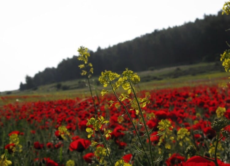
Posted by Khaled Nabhan - الربيع في القبيبه
Posted by abu raya - القبيبه
Posted by abu raya - اراضي القبيبه
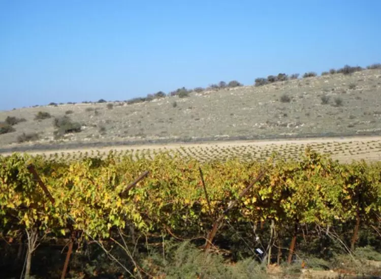
Posted by abu raya - اراضي القبيبه يستغلها المستعمرون
Posted by abu raya - اراضي القبيبه يستغلها المستعمرون

Posted by abu raya - اراضي القبيبه
Posted by abu raya - اراضي القريه

Posted by abu raya - اراضي القريه
Posted by abu raya - اراضي القريه
Posted by abu raya - الاثار القديمه جنوب القريه في تل الدوير
Posted by abu raya - الاثار القديمه في تل الدوير
Posted by abu raya - اثار القريه القديمه
Posted by abu raya - اراضي القريه وتل الدوير
Posted by abu raya - اثار القريه
Posted by abu raya - اراضي القبيبه
Posted by abu raya - تل الدوير
Posted by abu raya - تل الدوير
Posted by abu raya - القبيبه
Posted by abu raya - منظر من القبيبه
Posted by abu raya - تل الدوير
Posted by abu raya - تل الدوير
Posted by abu raya - القبيبه
Posted by abu raya - القبيبه
Posted by abu raya - القبيبه

Posted by abu raya - تل الدوير واراضي القريه
Posted by abu raya - اثار القريه القديمه
Posted by abu raya - القبيبه
Posted by abu raya - القبيبه
Posted by abu raya - اثار القبيبه القديمه
Posted by abu raya - القبيبه
Posted by abu raya - الربيع في القبيبه
Posted by abu raya - القبيبه
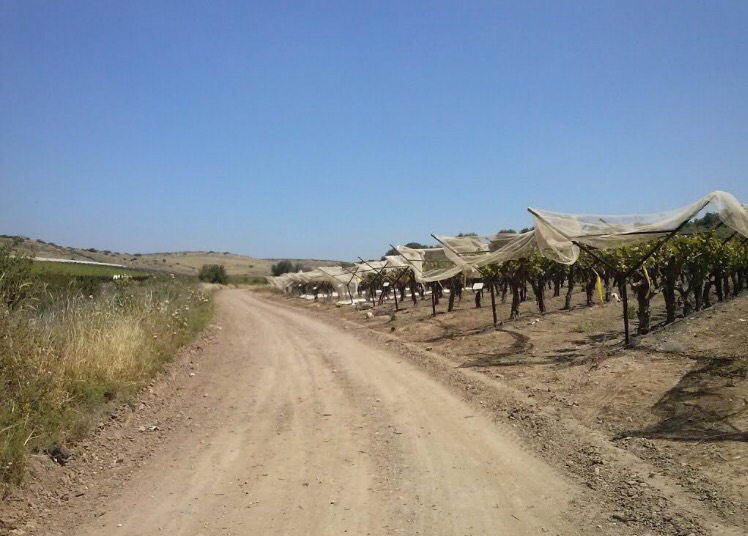
Posted by abu raya - مدخل القرية من الجنوب الغربي
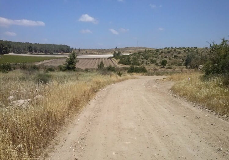
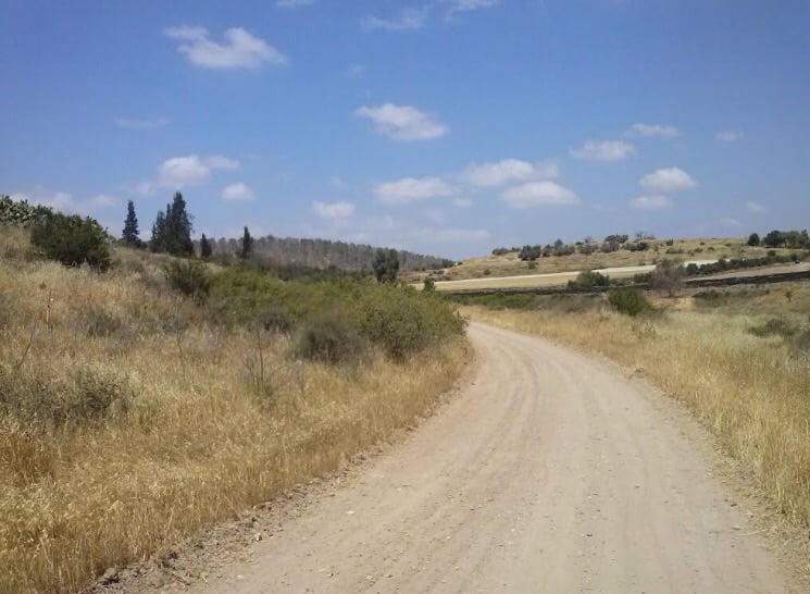
Posted by صلاح غانم - الطريق العام من الجنوب الغربي
Posted by صلاح غانم - Pre-Nakba Aerial view/ صوة جوية اخذت قبل النكبة
- Pre-Nakba Aerial view of the village / صورة من الجو للقرية اخذت قبل النكبة
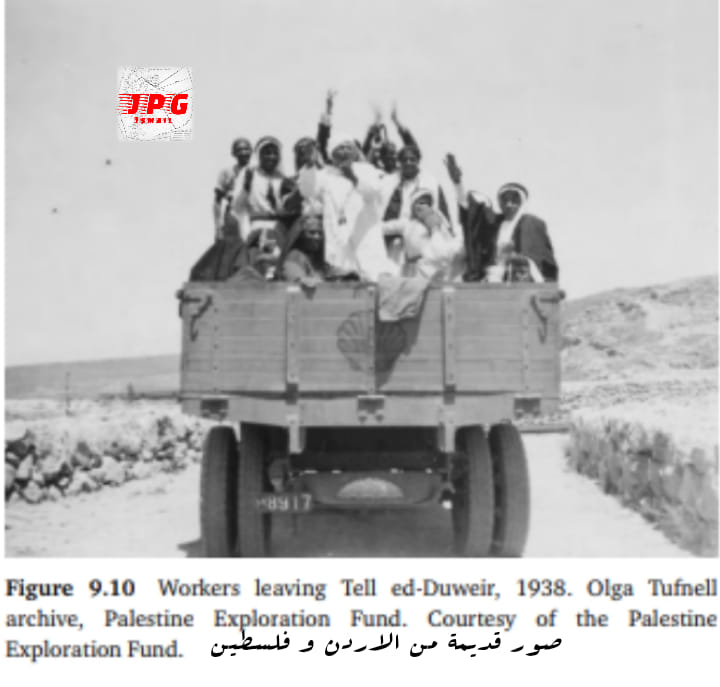
- عمال أثناء عودتهم من العمل في موقع تل دوير الاثري.
Want to browse more? 80,000 pictures were grouped in these gallaries:
| Display Name | Clan/Hamolah | Country of Residence |
| Omar | Abu Awwad (hussein branch) | Massachusetts, United States |
| يعقوب محمد ابرهيم ابو عواد | - | عمان |
| وليد علي شحادة ابو عواد | شحادة | Amman, Palestine |
| Khaled Nabhan | Nabhan | Blekinge, Blekinge |
| وليد الدغيلي | الدغيلي | عمان, الاردن |
| walid0038 | - | عمان, الاردن |
| ابو محمد | ابو عواد | الاردن |
| خالد | ابوعواد | المنامه, البحرين |
| أنس الصبايحة | الصبايحة | إربد |
| محمد سليمان | حسين | - |
| ابو ثائر | نبهان | - |
| عبد الحافظ ابو عواد | خضر | عمان, الاردن |
| المهندس محمد احمد سلمان | سلمان | الاردن, الاردن |
| khaled alawwadi | ابو عواد | عمان, الأردن |
| mohannad | abuawwad | - |
| بسمه | علي | الاردن, الاردن |
| خضر ابو عواد | - | رومانيا |
| Bilal Al haj Ahmad | Al haj Ahmad | Amman, Jordan |
| rawan abu awwad | ابو عواد | irbid |
| Bilal Nassar | Nassar | Saudia Arabia |
| طلب اسماعيل | abu awad | jordan, jordan |
| hanan abuawwad | - | الاردن |
| doaa11_m8 | العواوده | عمان |
| Lina Abu-Awwad | Al-7aj Ahmad | Amman, Jordan |
| ibrahim awwad | - | - |
| محمد ابوعواد | الصبايحه | عمان, الاردن |
| yousef | - | - |
| Abo ahmad | Abo awwad | عمان, الاردن |
| ahmad khalil | الحاج احمد | عمان, الاردن |
| Barhoom | Ahmad | Dubai, United Arab Emirates |
| wajeeh | - | - |
| Emad Esmail | Saleh | - |
| Khaldoun Khaled Abu Awwad | Abu Awwad | Irbed, Alramtha |
| AHMAD ABUAWWAD | ali | amman |
| Khalid Abu Awad | Shehadeh | Riyadh, KSA |
| Ned AbuAwwad | - | amman, Jordan |
| Fawwaz | Abu-awwad | Kansas , USA |
| Hani Abu Awwad | - | - |
| Khader Abu-Awwad | Ali | - |
| Ahmad Abu-Awwad | Shihadeh | Holland |
| Emad Esmail | Abu Awwad | Jordan, Jordan |
- Tracing all that remains of al-Qubayba since Nakba Duration: 2 min 15 sec
- الذاكرة مفتاح العودة--الحلقة 62- قرية قبيبة أبو عواد Duration: 23 min 22 sec
 Fake Valor: Why Did Zionist Jews Hoist Nazis Flag on Their Ships in the 1930s?
What is new?
-
Facts About Oct. 7th Gaza Raid
-
Remined Us Please:: Who Did Rape Who? Palestinians Raped Israelis? Or, was the other way around?
-
When Prof. Edward Said was invited to debate Bibi Netanyahu in the 1980s, watch what happened!
-
Ezra Klein of the NY Times on the "Jewish Race".
-
Abusing Blood Libel!
-
Did Israeli Soldiers Activate The Hanniba Direective On Oct. 7th? You Be The Judge
-
Zionist FAQ: Isn't it true that Palestinians don't want peace? Palestinians never accepted the two-state solution
- Facts about Haavara (Transfer) Agreement between Ben-Gurion & Hitler
-
Haavara FAQs: Why Did Zionist Jews Hoist Nazis' Flags on Their Ships in the 1930s?
- Haavara FAQs: When Chaim Weizmann met FDR in mid-1943, why was he silent about rescuing European Jewry?
-
Dear ChatGPT: How did Palestinians resist Napoleon's invasion of their country in 1799?
-
Dear ChatGPT: Gaza had a vibrant Jewish community in the mid-17th century. What happened to them?
-
Dear ChatGPT: Why did the Jewish Agency suppress news of the Holocaust during WWII?
-
Video Playlist: Jews share their DNA tests to end the conflict for good.
-
A Tale of Two Conflicts: Examining the Definition of Genocide
-
Prof. Abraham Polak And The Suppressed History of the Khazars and European Jewry
-
How Ronald Reagan would have framed the genocide in Gaza if he were still alive?
-
Haavara FAQs: Let us do the math: how many German Jews did The Haavara Agreement save?
-
Zionist FAQs: The Hebron Massacre of 1929, "clearly proves" that Palestinians are antisemitic, how could you deny it?
-
Zionist FAQs: Why Anti-Zionist Is Not Antisemitism?
-
Zionist FAQs: Isn't it true that the KGB created Palestinian Nationalism in the early 1960s?
- Zionist FAQs: Muslims are killing Muslims all the time; why are Israeli Jews being singled out in the media?
- Zionist FAQs: How is Israel an apartheid state when 20% of its citizens are Arabs who enjoy full rights?
-
Haavara FAQs: Why Did Dorothy Thompson Flip From A Zionist Advocate to A Silenced Dissenter?
-
Haavara FAQs: Analysis of Herzl's Uganda Scheme and how it could have saved millions of Jews.
-
Haavara FAQs: Why did Hayim Greenberg describe American Jewry as "morally bankrupt" in early 1943?
-
Haavara FAQs: What if the Evian Conference was a resounding success? What would have been the impact of saving European Jewry on Zionism?
- Haavara FAQs: What if the six million were saved, how that would have impacted the Zionist project?
-
Haavara FAQs: How did Zionist leaders react when Europe's Jews lingered in the DP camps after WWII ended?
-
Why does the American Jewish community repeat lies that David Ben-Gurion had debunked before he died?
-
Who has the power to rename the Tatar/Khazar Gene Marker to Jewish IV?
-
Zionist FAQs: Why won't Egypt, Syria, and Jordan take their people back? Jews are indigenous to Palestine, and Arabs immigrated after Jews developed the country. Arabs should leave.
-
Haavara FAQs: Did Hitler and the Nazis conflate between Judaism and Zionist? If that wasn't case, then why?
-
Haavara FAQs: Winston Churchill and antisemitism, a collection of articles written Churchill.
-
Haavara FAQs: Broken by country, how many Jews survived vs. killed during the Holocaust?
-
Haavara FAQs: Why did European Jews vote with their feet and to immigrated to the Americas, not Palestine, after WWII?
-
Watch this American Jewish Girl describing Israeli Jews' cognitive dissonance like no other in under two minutes
-
Haavara FAQs: When the Nazis went out of their way to hide the Holocaust, Israeli Jews did the exact opposite by broadcasting their genocide of Gazans. But why?
-
Haavara FAQs: How Zionist Jews went out of their to show their appreciation to Nazism and Fascism?
- Haavara FAQs: Why Zionist leaders were against bombing the death camps & the Railroads leading to them?
-
Haavara FAQs: Hitler's message to the British and American people: If Jews are such noble citizens and you care about them, how come you're not letting them in? I will gladly ship them to you at my expense, even on luxury liners!
-
A shortlist of Zionist and Israeli false flag operations in the name Jews.
-
The Most Moral Army
- The Land of Kapos (Israel): Where the brave are boycotted and Kapos walk free.
- Why did early Zionists often named their communal enterprises "colonial"?
- Zionist Relations with Nazi Germany by Faris Glubb
-
Two NY Times advertisements by Zionists in the early 1943 that exposes Zionists' treason at the height of the calamity
- Facts Not Lies about the Palestinian-Israeli Conflict.
- Site's pictures have been categorized
- Campgain Against Lice
- A Survey of Palestine, the official source about Palestine before Nakba produced by the British Mandate; over 1200 pages.
- Satellite View & Google Earth: Over 6,000 placemarks identifying all destroyed towns, W. Bank & Gaza Strip Towns, & refugee camps.
- PalestineRemembered.com and its Nakba Oral History Project were featured on al-Jazeera Satellite TV.
- Nakba Oral History Video Podcast:
 Over 700 Oral History interviews (including 3,500+ hours of recording) can be viewed online.
 - Palestine Village Statistics Project
- Gaza Jail Break
- النسخة العربية للموقع الان متوفرة
- Videos: Documenting the destroyed villages in video: Tracing all that remains since Nakba.
- Videos: Responding to Zionist Propaganda
- Interview: The ethnic cleansing of Palestine: George Galloway interviews Israeli Historian Ilan Pappe.
- For Palestinians, memory matters. It provides a blueprint for their future By George Bisharat.
- Zionist FAQ now available in Hebrew שאלות שציונים שואלים, עכשיו בעברית
- Video: The Stephen Walt and John Mearsheimer report on the influence of the Israel Lobby on U.S. Foreign Policy
- The Palestinian-Israeli conflict for beginners
